What if something very different has been going on here on Earth from what we have always been taught to believe , and that what has been happening is only for the benefit of a very few, and not for the benefit of all, but ?
I have come to the conclusion after years of research that there is much to question in the official history and science that has come down to us as unquestionable truths, and I have pulled many of those research findings together for this post.

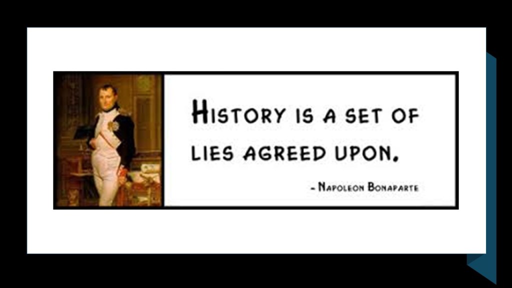
Napoleon is famously attributed as saying, “History is a set of lies agreed upon.”
I wholeheartedly agree with that statement, and in this post I will be sharing information and evidence I have found over the years that shed light on what the “set of lies” are in our historical narrative, and who “agreed upon” them.
The original civilization of the Earth was nothing at all like what we have been taught, and though the clues and evidence for the original ancient advanced civilization are everywhere, we just don’t recognize them as such because we have no points of reference for them.

I think it is important to begin this post with some information about how concepts of space and time are viewed in the present-day versus how they were viewed in the past.
The study of geodesy is the science of accurately measuring and understanding the Earth’s shape, orientation in space, and gravitational field.
A geographic coordinate system enables every location on Earth to be specified by a set of numbers, letters and symbols, where one of the numbers represents a vertical position from the North-South lines of longitude, and the horizontal position, from the East-West lines of latitude.
What we are told is that in cartography, the science of map-making, a map projection is the way of flattening the globe’s surface into a plane in order to make it into a map, which requires a systematic transformation of the latitudes and longitudes of locations from the surface of the globe into locations on a plane.
But what if the same process is actually happening in reverse for the tools we have available to us in our world, and that the Earth’s surface has been projected from a plane in order to make it into a globe shape by the use of the very same geographic coordinate system, and that it’s exactly the same information in a different projection?
After all, one definition of the word “coordinate” is “to bring different elements into a relationship that will ensure efficiency or harmony;” and another definition of the same word is “a group of numbers used to indicate the position of a point, line, or plane.”
This is a 1482 engraving by Johannes Schnitzer of the “Ecumene,” an ancient Greek word for the inhabited world, and used in cartography to describe a type of world map used in late antiquity and the Middle Ages.
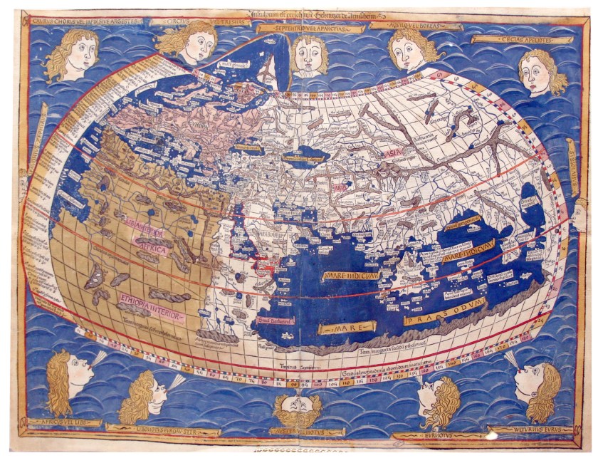
Schnitzer was said to have constructed it from the coordinates in Claudius Ptolemy’s “Geography,” an atlas, and treatise of geography, from 150 AD said to compile the geographical knowledge of the 2nd-century Roman Empire, and a revision of the now-lost atlas of Marinus of Tyre, a Phoenician cartographer and mathematician who was said to have founded mathematical geography, and who introduced improvements to the construction of maps as well as developing a system of nautical charts.
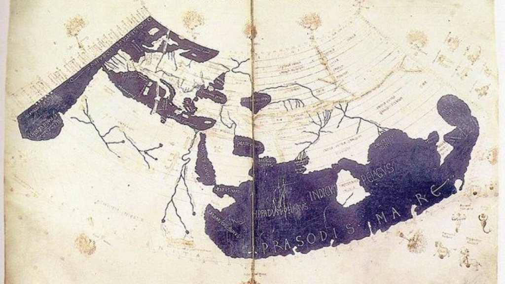
Ptolemy was a second-century mathematician, astronomer and geographer from Alexandria in Egypt who was credited with the only mathematically-sound geocentric model of the solar system, in which everything in the Cosmos orbits around the Earth and not the Sun.
Longitude fixes the location of a place on Earth east or west of a North-South line of longitude called the Prime Meridian, given as an angular measurement that ranges from 0-degrees at the Prime Meridian to +180-degrees westward and -180-degrees eastward.
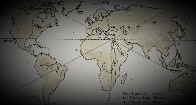
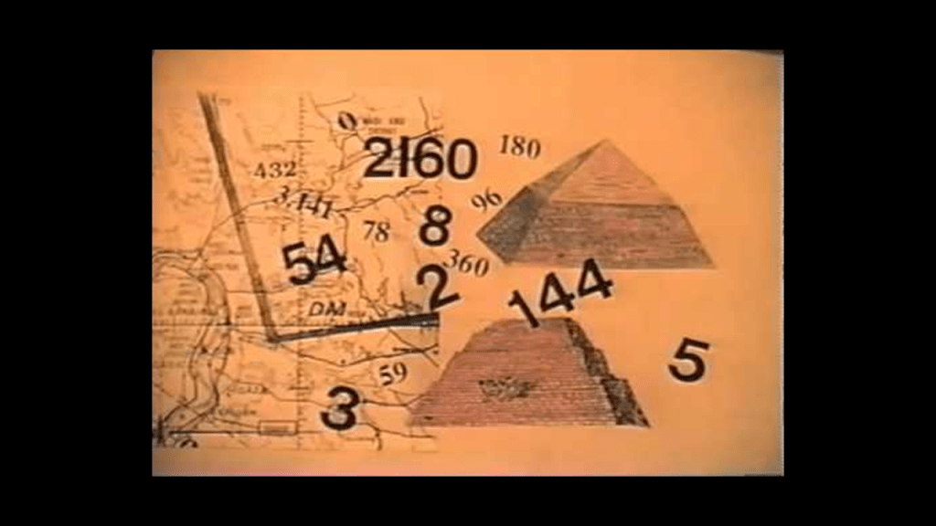
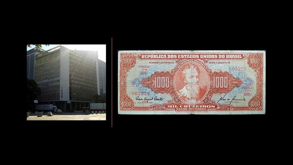
The Great Pyramid of Giza, which is located at the center of the Earth’s landmass, was the Prime Meridian, until the Prime Meridian was moved in 1851 to the Royal Observatory of Greenwich in London by the British Astronomer Royal at the time, Sir George Biddell Airy.
Carl Munck deciphers a shared mathematical code in his book and YouTube video series called “The Code,” related to the Great Pyramid, in the dimensions of the architecture of sacred sites all over the Earth, one which encodes longitude & latitude of each that cross-reference other sites.
He shows that this pyramid code is clearly sophisticated and intentional, and perfectly aligned over long-distances.
In October of 1884, the United States hosted the International Meridian Conference, attended by twenty-five countries, in order to determine the Prime Meridian for international use.
Twenty-two of the twenty-five countries in attendance voted to adopt the longitude of the Royal Observatory in Greenwich as the zero-reference line.
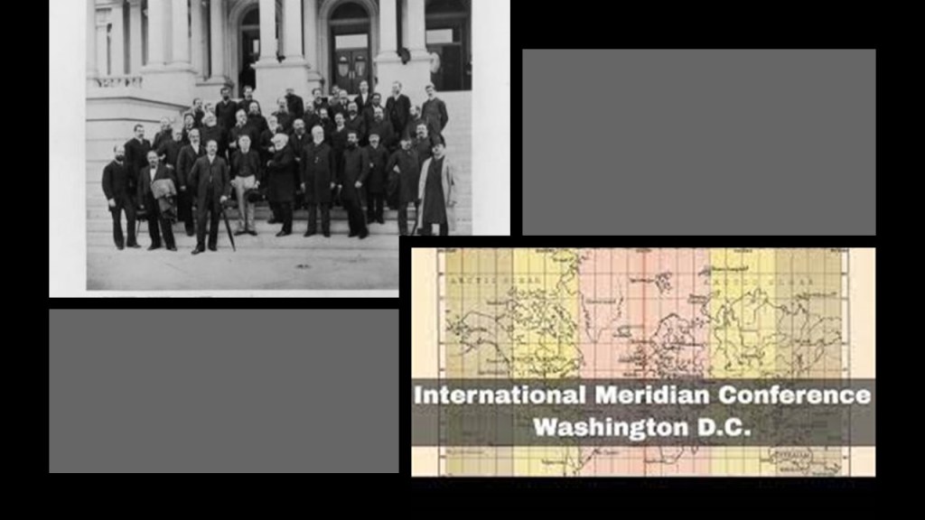
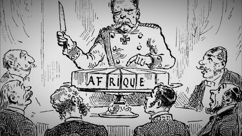
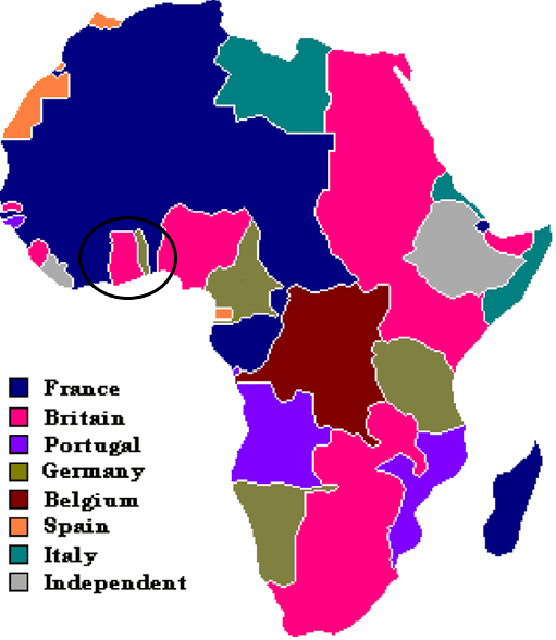
The International Meridian Conference was held right before the Otto von Bismarck-organized Berlin Conference, which was convened in November of 1884 and lasted until February of 1885, during which time the entire continent of Africa was carved up between the European powers.
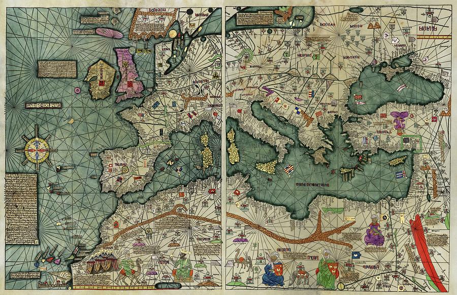
Interestingly, ley-lines were depicted in earlier maps.
The Catalan Atlas of the Majorcan Cartographic School is considered the most important map of the Medieval period in the Catalan language, dated to 1375.
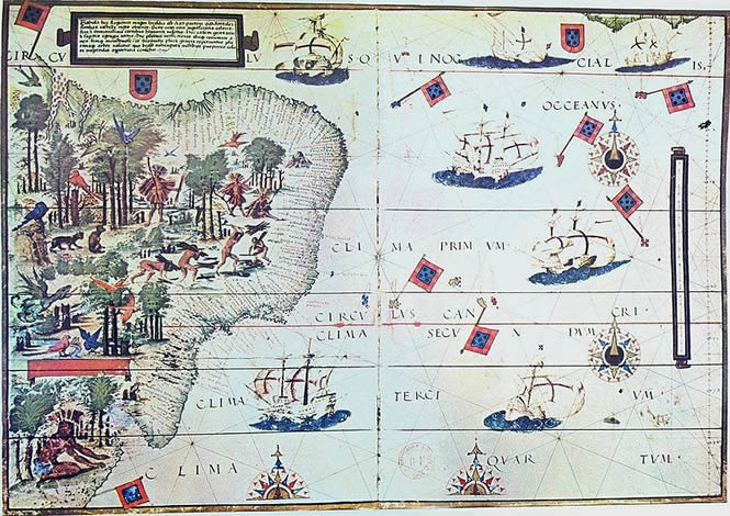
I encountered another old map depicting ley-lines when I was researching for information on Fernando de Noronha, an island group just off the coast of Brazil.
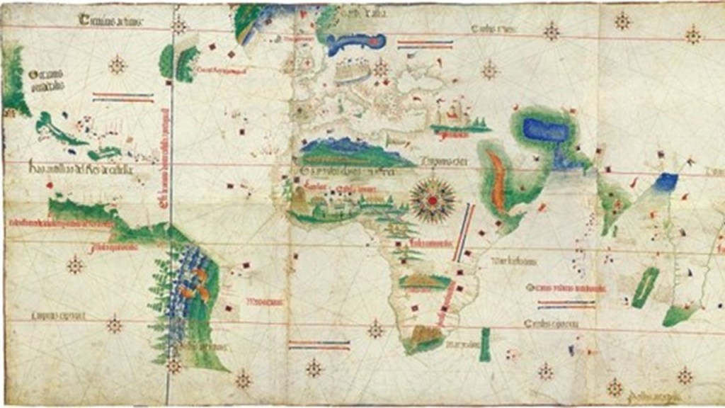
The Cantino Planisphere was said to have been completed by an anonymous Portuguese cartographer some time before 1502.
A planisphere is defined as a map formed by the projection of a sphere, or part of a sphere, on a plane.
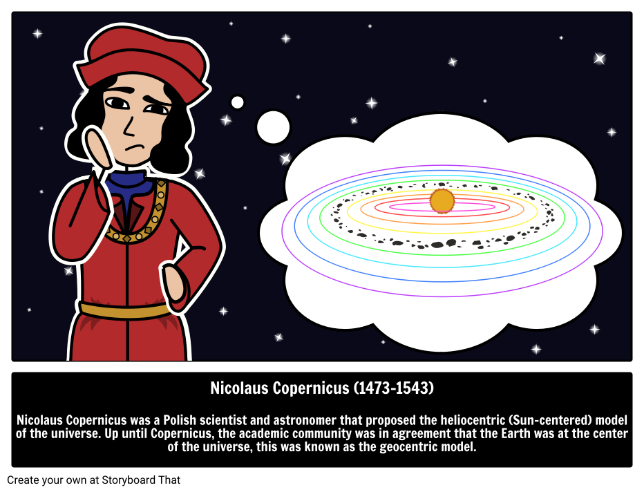
In May of 1543, the work “On the Revolutions of the Heavenly Spheres,” of Nicolaus Copernicus was published, offering mathematical arguments for the heliocentric, or sun-centered universe, with the planets of our solar system orbiting around the sun, and denying the geocentric model of the Earth-centered universe of Ptolemy, which the heliocentric model superseded, meaning that while once widely-accepted, current science considered the geocentric model inadequate.
History has it recorded that Copernicus had been seized with “apoplexy and paralysis” at the end of 1542, and that he died on the day he saw the final printed pages of his work, allowing him to say farewell to his life’s work.
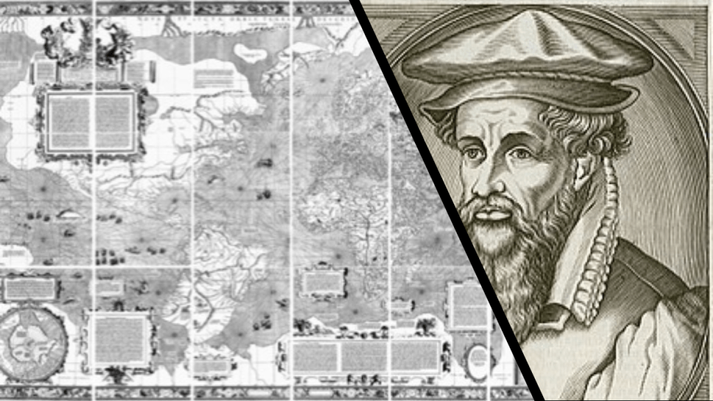
It would also seem that the Earth’s ley-lines started to disappear from maps in the 1500s, as Gerardus Mercator, a Flemish geographer, cartographer and cosmographer, published a world map in 1569 that is considered to be the first where sailing courses on the sphere were mapped to the plane map, allowing for a “correction of the chart to be more useful for sailors.”
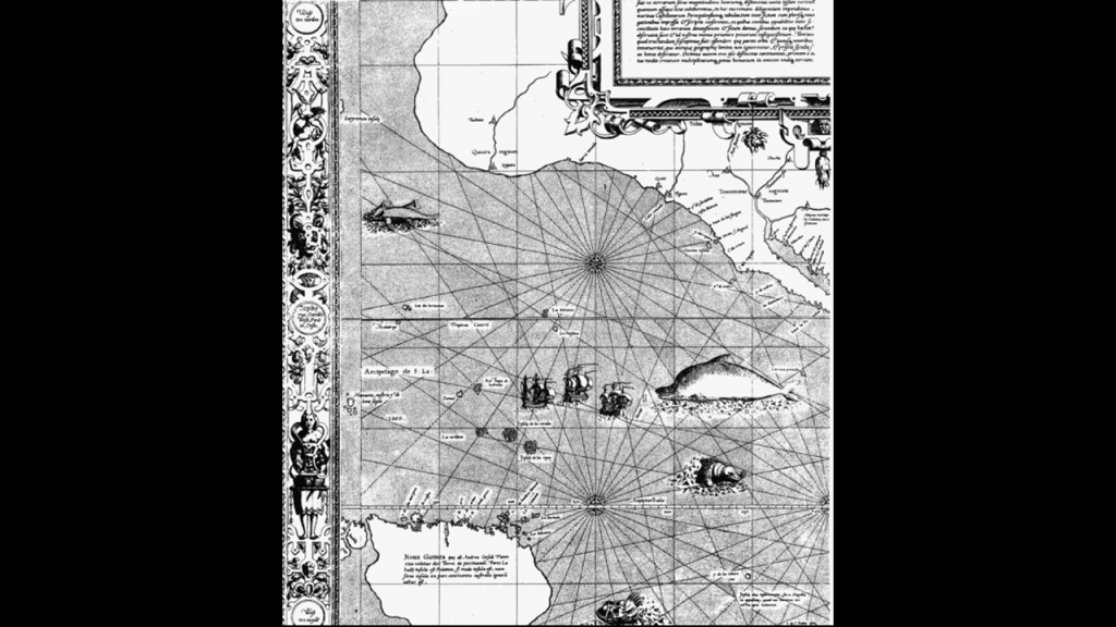
Here is a close-up section of the 1569 map showing the depiction of straight ley-lines in the seas, but not on land and sea as were present on the flat projections of the Cantino Planisphere and the Catalan Atlas.
Not only that, Gerardus Mercator was also a globe-maker, like this one from 1541, just two-years before Nicolas Copernicus published “On the Revolutions of the Heavenly Spheres” in 1543, with his arguments for the heliocentric universe.
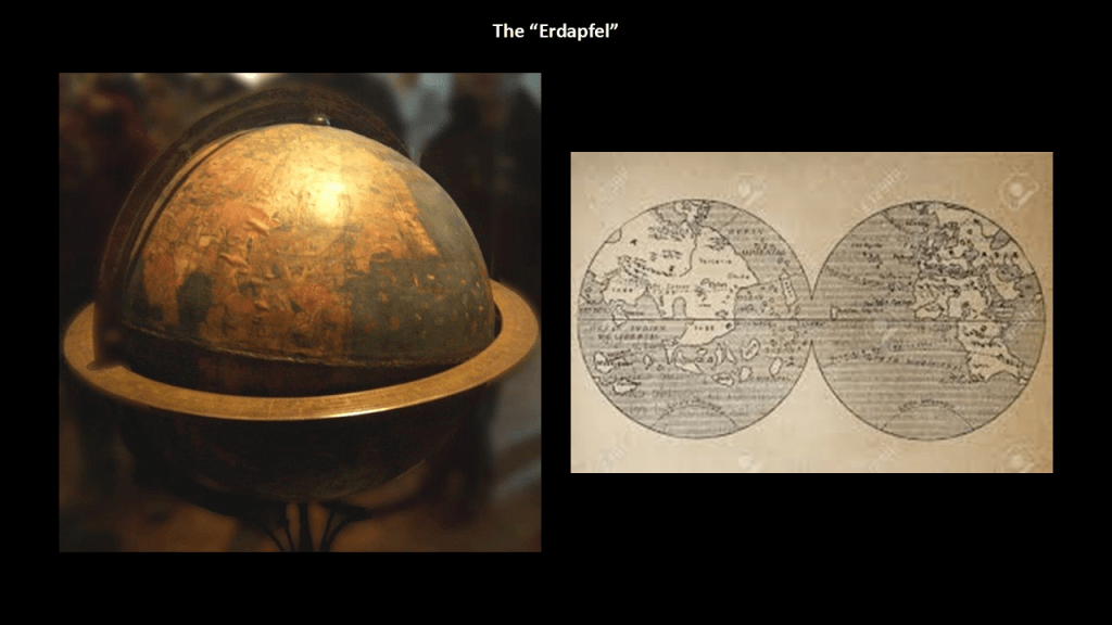
The Erdapfel, which translates from the German as “potato,” was said to be a terrestrial globe produced by Martin Behaim, a German textile merchant and cartographer, between 1490 and 1492, around the time of the Fall of Grenada in Spain, and the first voyage of Christopher Columbus to the New World.
This engraving of him was said to have been done in 1886.
We are told the Erdapfel is the oldest surviving terrestrial globe.
It is a laminated linen ball, constructed in two-halves, reinforced with wood and overlaid by a map painted by Georg Glockendon, pasted on a layer of parchment around the globe.
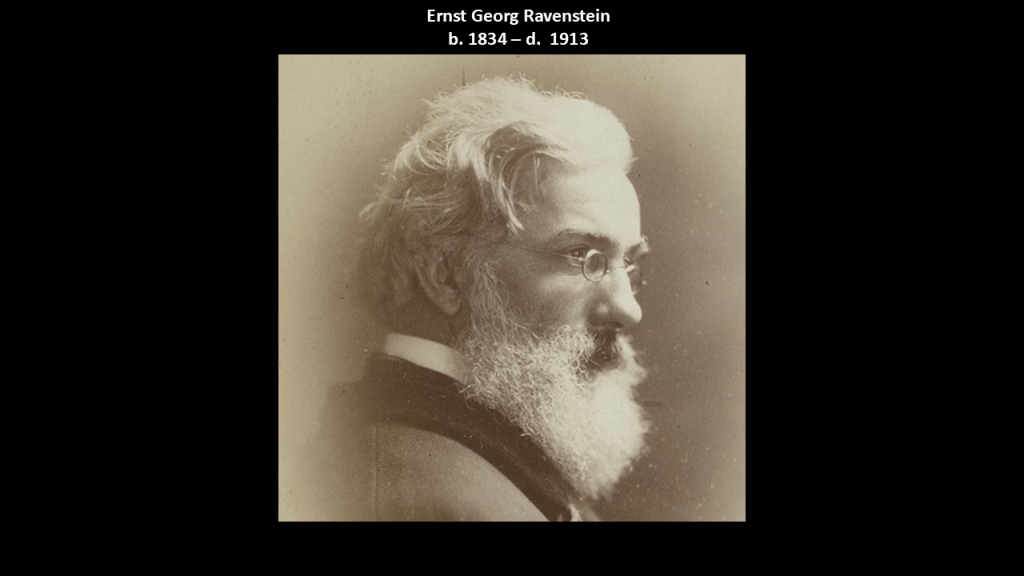
The German-English geographer and cartographer, Ernst Georg Ravenstein, who was born in Germany in 1834, but spent most of his adult life in England, wrote a book about Martin Behaim and his Erdapfel in 1908, and, as we shall see, Mr. Ravenstein’s name will come up again in more than one reference in this post.
This is Australia showing as “New Holland” on what is known to history as the Coronelli Globe, which was commissioned in 1681.
We are told in our historical narrative that mainland Australia first received the name “New Holland” because the first European who sighted it was a Dutch navigator for the Dutch East India Company in 1606 named Willem Janszoon, who was also a colonial Governor in the Dutch East Indies during the years between 1603 and 1616.
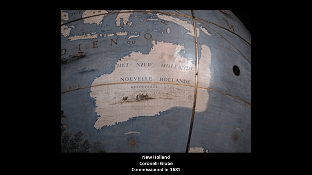
Interestingly, the name “Southern Land” or “Terra Australis” was also used on early European maps of the region.
We are told that “Terra Australis” was a legendary hypothetical continent mentioned since antiquity and appearing on maps between the 15th and 18th centuries.
This information was downplayed and obfuscated in our narrative, but I find this very interesting because I believe we are looking at a substantial amount of sunken landmasses not only here, but all around the world.
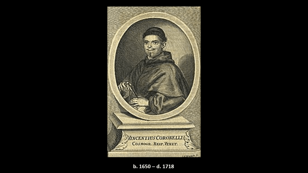
We are told that Vincenzo Coronelli became a Franciscan novice in 1665, around the same time as the red-letter year of 1666 in our historical narrative that I talked about previously, and he went on to become an esteemed cosmographer, cartographer and publisher, known in particular for his atlases and globes, and that in 1678 he was commissioned to make a set of terrestrial and celestial globes for the Duke of Parma.
In 1699, he was made Father General of the Franciscan Order. He lived most of his life in Venice and died there in 1718.
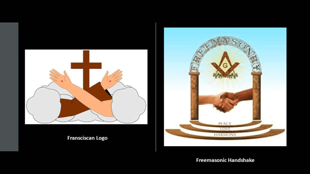
We are told in our historical narrative that the Franciscans were members of related-religious orders that were founded by St. Francis of Assisi in 1209, and that Franciscans were at the vanguard of missionary activity in the New World, aimed primarily at bringing the indigenous people of the Americas to Catholicism.
At this point, I think the Franciscans were, like the Jesuits, actually playing a role in advancing the agenda of those behind the New World Order, and probably all Catholic religious orders were for that matter, and that they were actually doing something very different from the pious and holy lifestyle in dedication to God and in service to Humanity that we are taught about them.
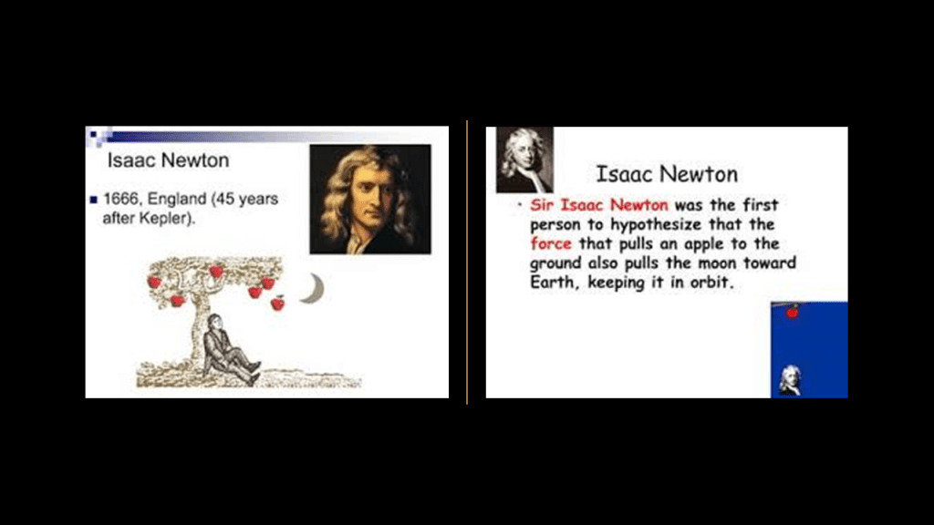
The same year that Vincenzo Coronelli became a Franciscan novice in 1665 was also the year given to us in which Sir Isaac Newton had been developing his theory of gravity, and that in 1666, Newton famously observed the falling apple upon which he developed his foundational law that gravity is universal, incorporating the idea that Kepler’s Laws must also apply to the orbit of the moon around the Earth and then to all objects on Earth.
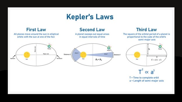
Kepler’s work was said to have improved the 1543 model of Copernicus by introducing more defined terminology for the orbits of the planets around the sun instead of just saying that’s what they do.
Next, I will begin a more in-depth overview of what our narrative tells about our history with the early explorers of the Age of Discovery, which we are told emerged as a powerful factor in European culture and was the beginning of globalization.
It was when I was researching this topic in “Creating the New World from the Old World – Part 3 The Centuries of Exploration” in June of 2020 that I first came to believe that the history about early explorers in school and in our culture is back-filled information and did not really happen as we have been taught.
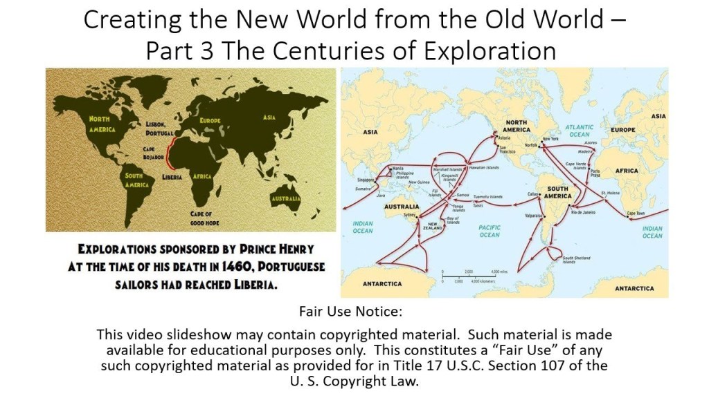
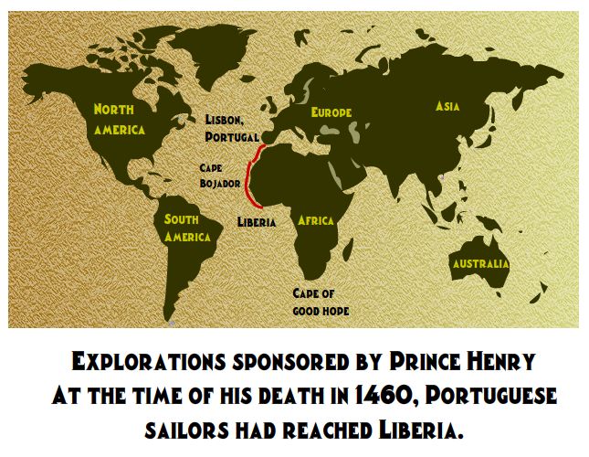
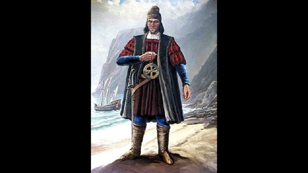
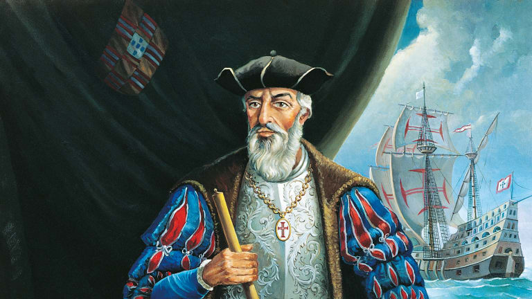
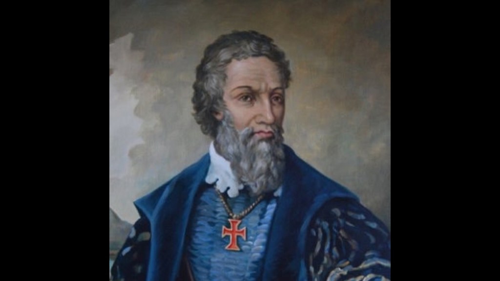
The primary initiator of the earliest time period of maritime exploration in our historical narrative, known as “The Age of Discovery, was Prince Henry the Navigator, who was said to have been born in 1394.
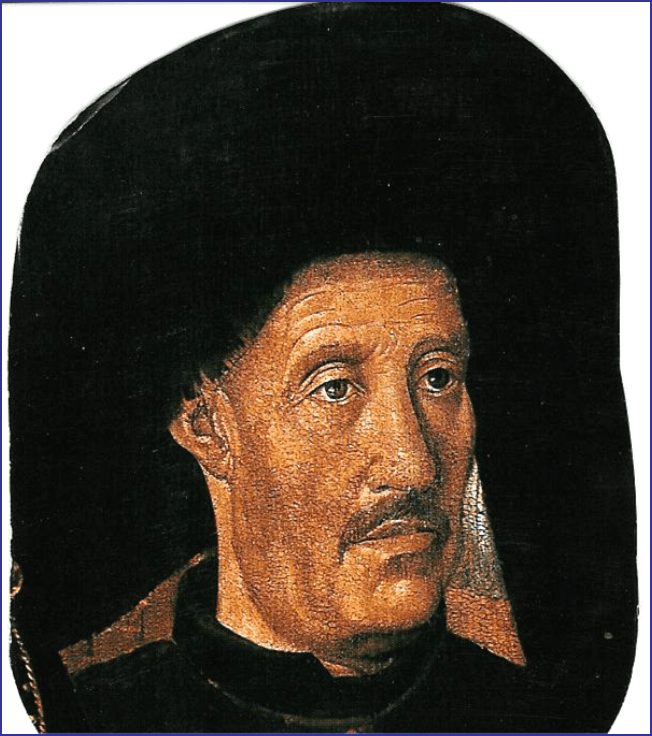
The fourth child of the Portuguese King John I, he was a central figure in the early days of the Portuguese Empire, and in the 15th-century European maritime discoveries and maritime expansion.
The Portuguese Empire was composed of the overseas colonies and territories governed by Portugal, existing from 1415 with the capture of the port of Ceuta, on the Moroccan-side of the Strait of Gibraltar…
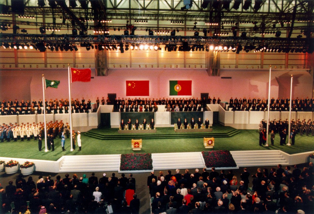
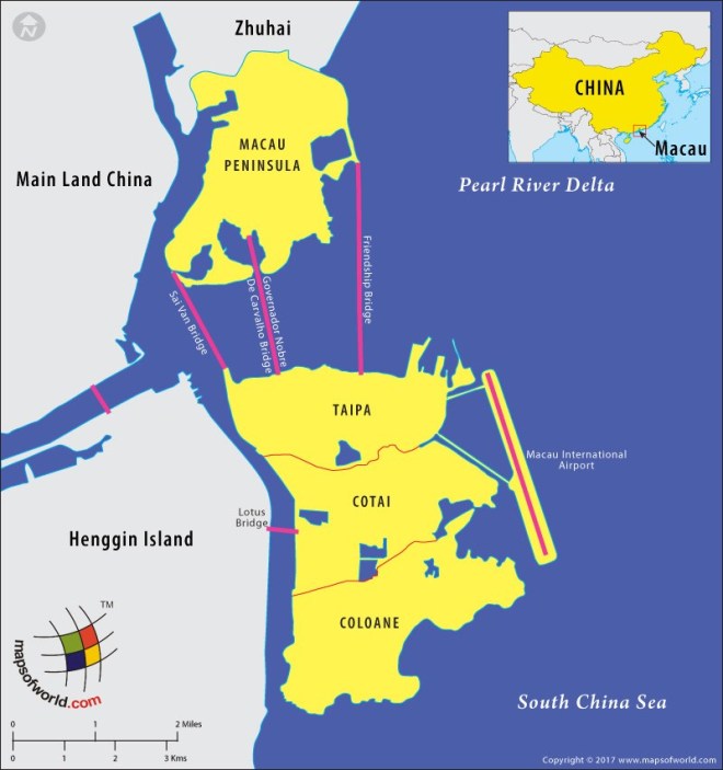
…to the handover of Portuguese Macau to China in 1999, the last remaining dependent state in China and the final vestige of European colonialism in the region, we are told, after 442-years of Portuguese rule.
Macau is designated as an autonomous region on the south coast of China, across the Pearl River Delta from Hong Kong…
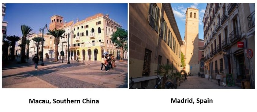
…where there is Moorish-looking architecture in Macau on the left that looks like what is found in Madrid, Spain, on the right…
…as well as Venice, Italy, in Macau.
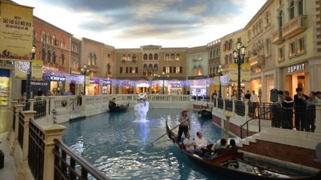
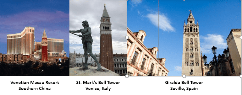
The Venetian Resort in Macau on the left is owned by the American Las Vegas Sands Company, which was said to have opened in 2007 after the main hotel tower was completed.
For comparison, the Bell Tower of St. Mark’s Basilica in Venice, said to have been built starting in the early 10th-century, is in the middle, and the Giralda Bell Tower, acknowledged Moorish architecture said to have been first completed in 1198 AD, is on the right.
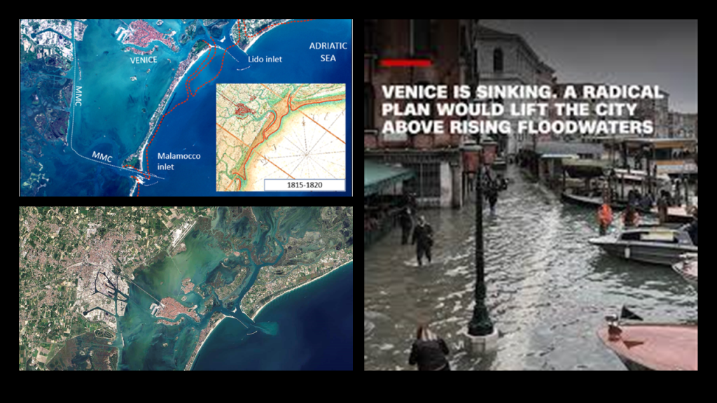
Interesting to note, the location of Venice in Italy is in coastal wetlands that include salt marshes, mud flats, reed beds and seagrass meadows.
The famous city is situated on 100 small islands in the Venetian lagoon on the Adriatic Sea, with no roads – just canals, and it is well-known that Venice is sinking.
At any rate, Prince Henry the Navigator, who was involved in the capture of Ceuta, took the lead role in promoting and financing Portuguese maritime exploration until his death in 1460.
One last thing about Prince Henry.
Apparently no one used the nickname “the Navigator” during his lifetime, or in the following three centuries.
We are told the term was coined by two 19th-century German historians – Heinrich Schaefer and Gustave de Veer – and that the nickname was popularized by two British authors in the titles of their biographies of Prince Henry.
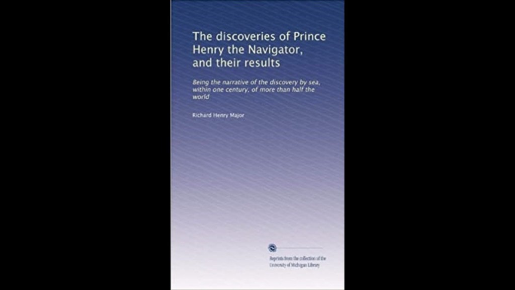
One was by Richard Henry Major in 1868…
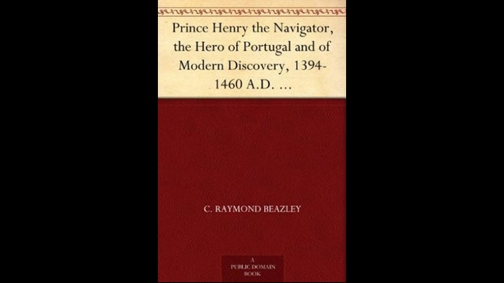
…and the other was by Raymond Beazley in 1895.
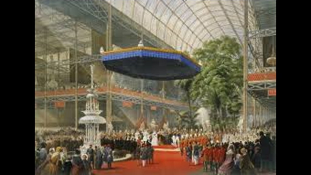
I found the nationalities of the authors of Prince Henry’s biographies to be noteworthy, as well as the time-frame within which they were published, in the period of time after which, I have come believe from my research, the New World Order timeline was officially kicked off by Queen Victoria at the Crystal Palace Exposition, which opened on May 1st of 1851.
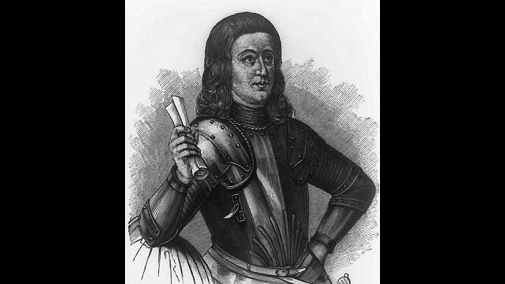
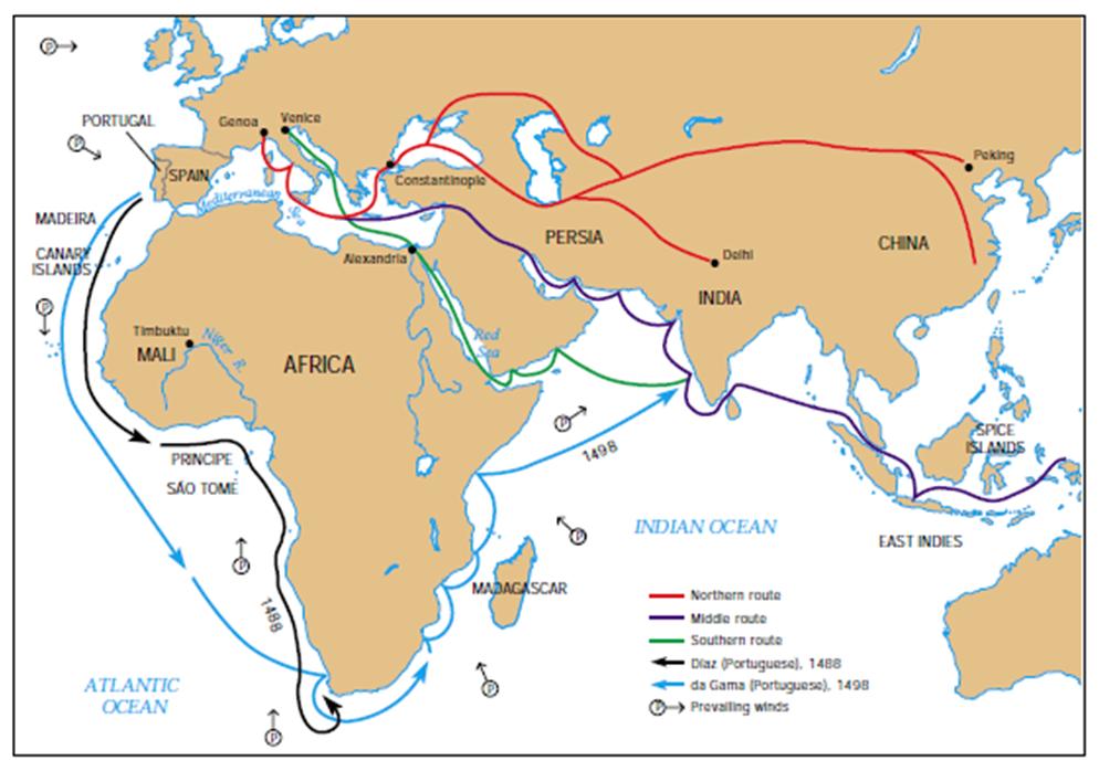
The next Portuguese explorer to come on the scene was Bartolomeu Dias, a nobleman of the Portuguese royal household.
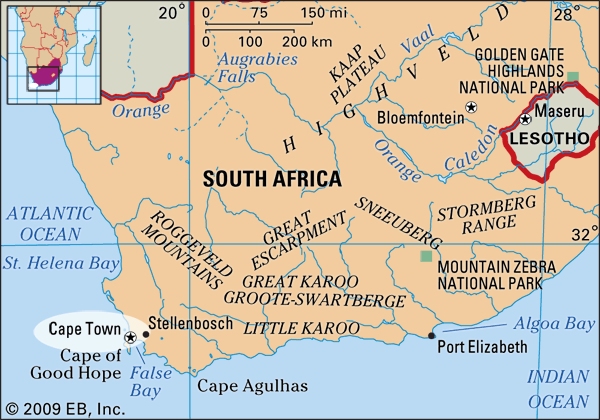
We are told he sailed around the southernmost tip of Africa, the Cape of Good Hope, in 1488, setting up the route from Europe to Asia later on.
He was also said to be the first European during the “Age of Discovery” to anchor at what is present-day South Africa.
Bartolomeu Dias was the sailing master of the caravel “Sao Cristovao” or “Saint Christopher.”
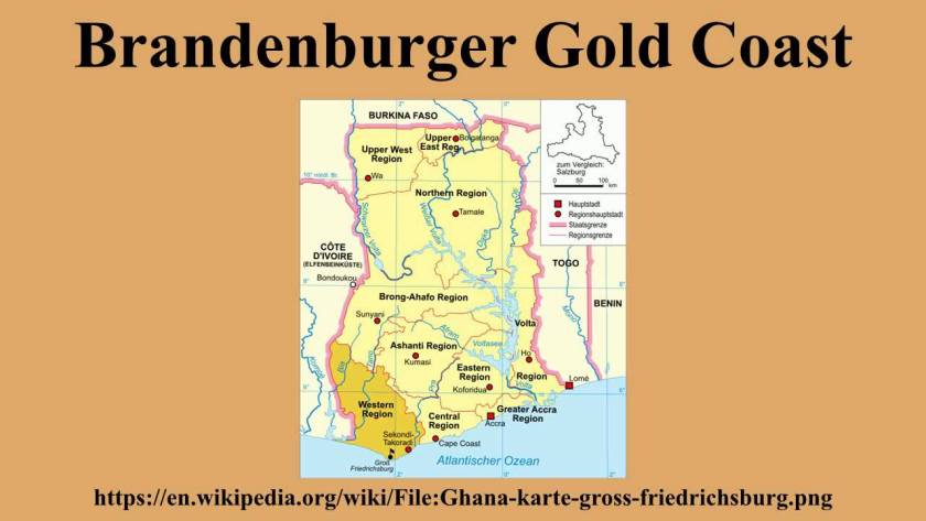
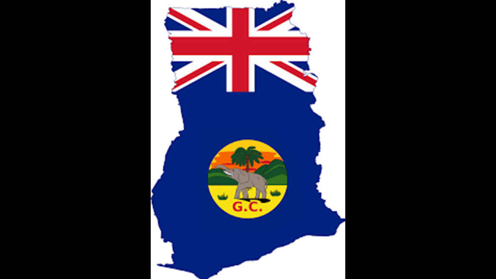
In 1487, he led a Portuguese exploration expedition down the west coast of Africa of present-day Ghana, known for its gold, petroleum, sweet crude oil, and natural gas.
The Portuguese Gold Coast was the first claim.
The Dutch arrived in 1598 and in 1642, incorporated the Portuguese Territory into the Dutch Gold Coast.
The Dutch East India Company was chartered on March 20th of 1602, when the Dutch government granted it a 21-year monopoly for the Dutch spice trade.

It was a megacorporation, which is defined as a massive conglomerate (usually private) holding near-monopolistic, if not monopolistic, control over multiple markets.
It has often been labelled a trading or shipping company, but was in fact a proto-conglomerate, diversifying into multiple commercial and industrial activities.
The first formally listed public company by widely issuing shares of stock and bonds to the general public in the early 1600s, it was the world’s most valuable company of all-time, with a worth of $7.9-trillion, and considered by many to be to have been the forerunner of modern corporations.

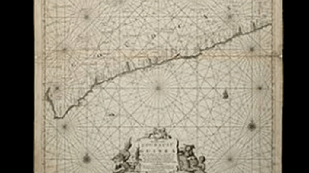
This was said to be a 1675 map of the Dutch Gold Coast, depicting ley-lines.
Then the Prussians established the Brandenburger Gold Coast in the area in 1682, for less than 50-years, when they sold it to the Dutch in 1742.
The Swedes established settlements on the Swedish Gold Coast starting in 1650, but this state-of-affairs, was said to have only lasted 13-years…
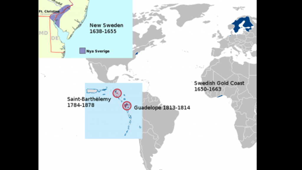
…because in 1663, Denmark seized the Swedish territory, and incorporated it into the Danish Gold Coast.
Then in 1850, all of the settlements became part of the British Gold Coast…
…which remained in British hands in 1885 after the Berlin Conference.
Now back to Bartolomeu Dias.
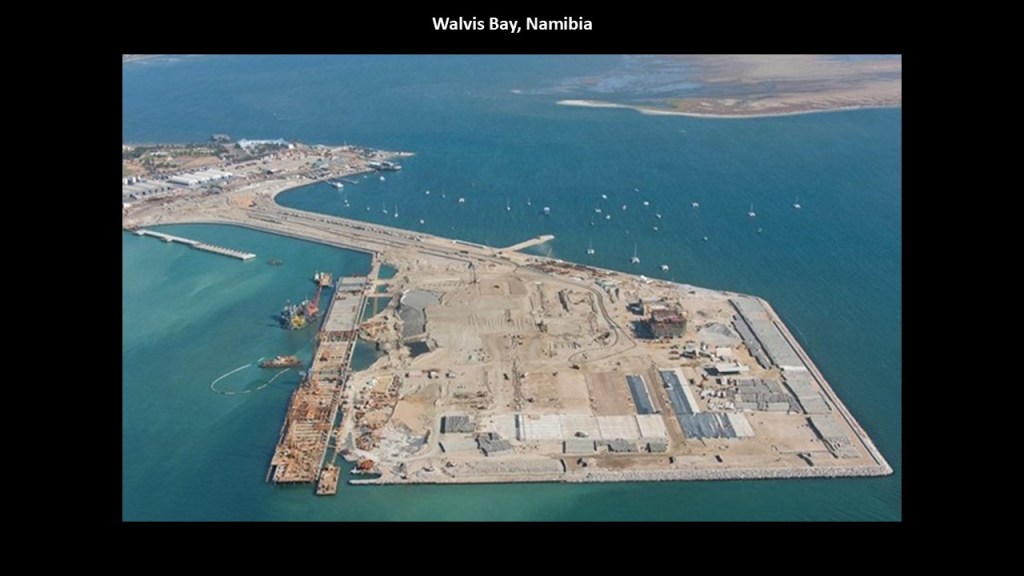
In the 1487 expedition of Bartolomeu Dias, after the caravel left the Portuguese Gold Coast, the crew sailed to Walvis Bay, the name of the location in modern Namibia, the name of the location in modern Namibia with its decidedly geometric- and man-made-looking shape.
After encountering violent storms along the way, the ship eventually rounded the Cape of Good Hope, the name it received from King John II of Portugal because it represented an opening of a route to the East.
The expedition ended up not going any further, and set sail back for Portugal, returning to Lisbon, the capital of Portugal, in 1488.
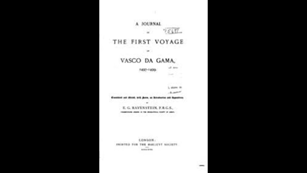
Not only did I find the German-English geographer and cartographer, Ernst Georg Ravenstein, come up in association with a biography of Bartolomeu Dias…

… he also published “A Journal of the First Voyage of Vasco Da Gama” in 1898, the next Portuguese explorer of note, who made it to India in a journey between 1497 and 1499.
Ravenstein was said to have translated what was called the only known copy of a journal believed to have been written on-board ship during Vasco da Gama’s voyage to India.
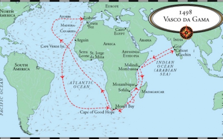
We are told that Vasco da Gama’s first voyage to India was the first link to Europe and Asia by an ocean route.
He was said to have landed in Calicut on May 20th of 1498.
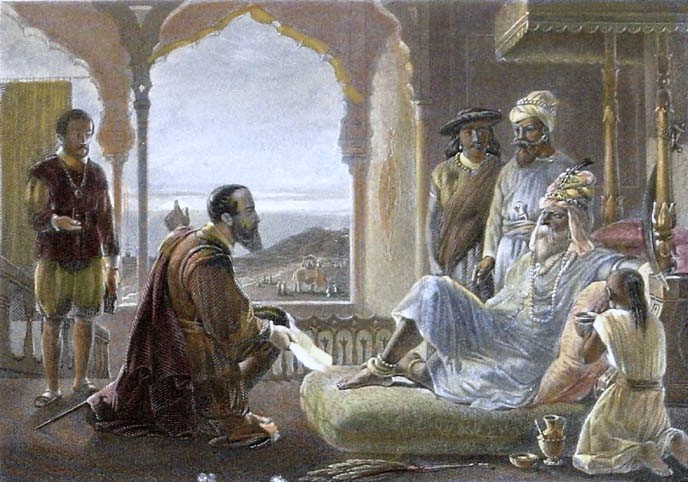
This was said to be a steel engraving from the 1850s of the meeting between the King of Calicut and Vasco da Gama, which apparently didn’t yield the favorable results the Portuguese explorer desired, as it failed to yield the commercial treaty with Calicut that was da Gama’s principal mission.
Regardless of the failure to secure a commercial treaty with the King of Calicut, we are taught that Vasco da Gama’s voyage to and from India led to the yearly Portuguese India Armadas, fleets of ships organized by the King of Portugal dispatched on an annual basis from Portugal to India…
…and 6-years after da Gama’s initial arrival in 1498, the Portuguese State of India was founded.
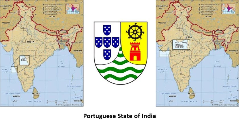
Portugal’s unopposed access to the Indian spice trade routes boosted the economy of its empire, and maintained a commercial monopoly on spice commodities for several decades.

We are taught that Vasco da Gama’s discovery of the sea route to India was what enabled the Portuguese to establish a long-lasting colonial empire in Asia.
It was considered a milestone in world history and the beginning of a sea-based phase of global multiculturalism.
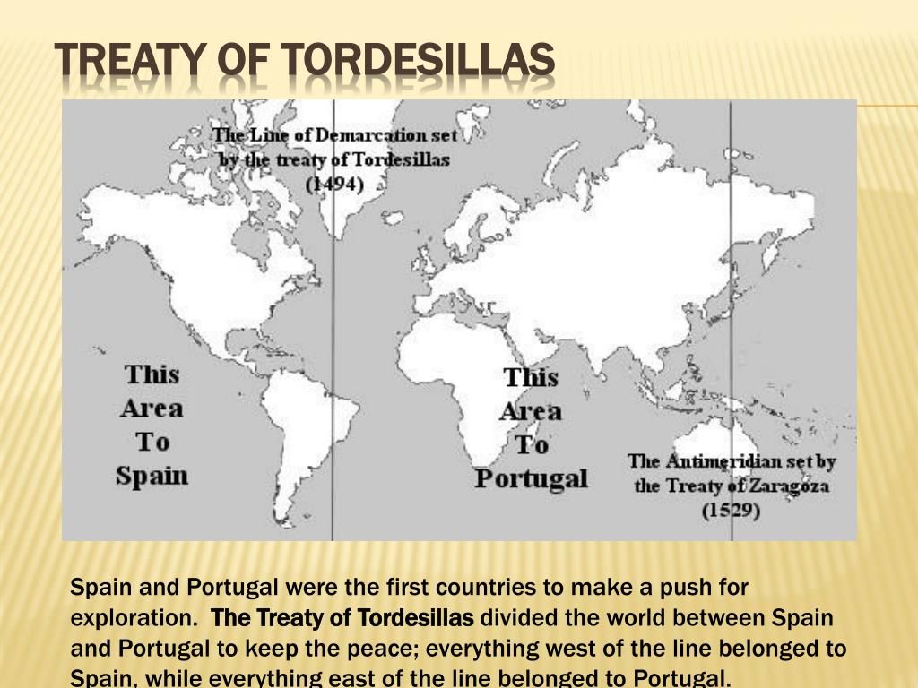
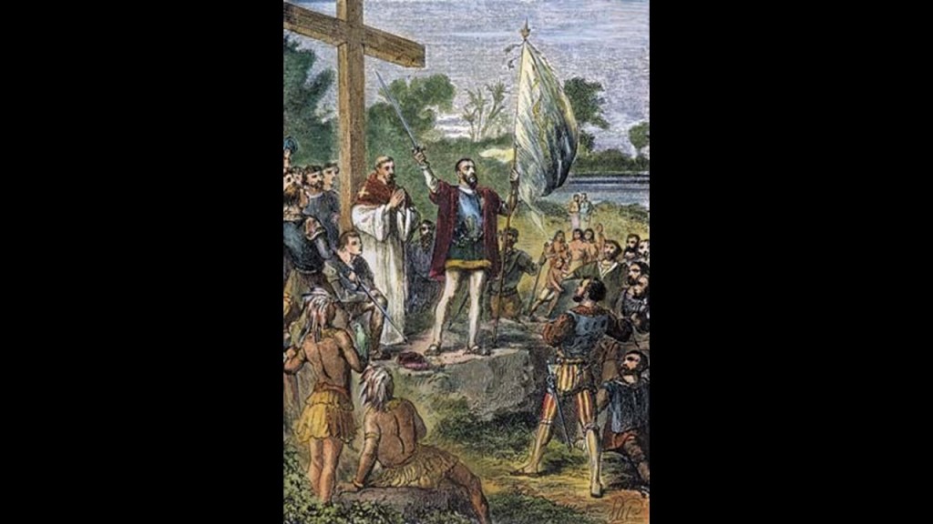
In our historical narrative, the Treaty of Tordesillas of 1494 divided the newly discovered lands outside Europe between the Portuguese Empire and the Spanish Empire (Crown of Castile), along a meridian 370 leagues west of the Cape Verde Islands, with Spain claiming lands to the west of it and Portugal lands to the east of it.
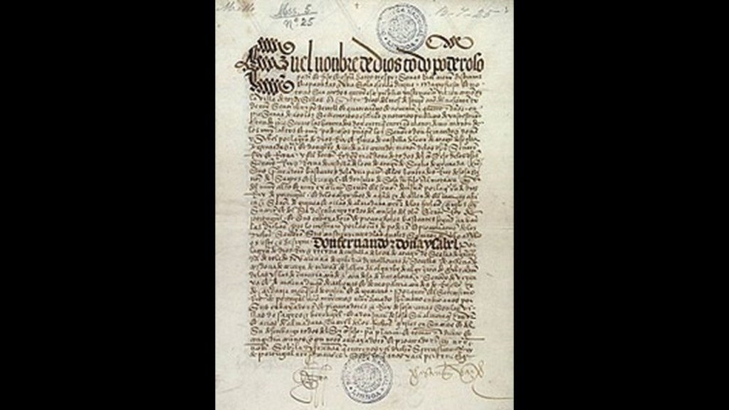
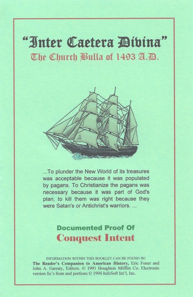
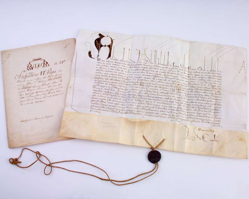
This was a year after Pope Alexander VI issued the Inter Cetera Papal Bull, which authorized the land grab of the Americas.
This papal bull became a major document in the development of subsequent legal doctrines regarding claims of empire in the “New World” and assigned to Castile in Spain the exclusive right to acquire territory, to trade in, or even approach the lands laying west of the meridian situated one-hundred leagues west of the Azores and Cape Verde Islands, except for any lands actually possessed by any other Christian prince beyond this meridian prior to Christmas, 1492.
The year of 1492 was the year Christopher Columbus first set-sail and also the same year as the Fall of Grenada, which took place on January 2nd of 1492, and which effectively ended Moorish rule in Spain when Muhammad XII surrendered the Emirate of Grenada to King Ferdinand of Aragon and Queen Isabella of Castile.
A papal bull is an official papal letter or document, named after the leaden seal, or bulla, used to authenticate it.
They figure prominently in the effort to authenticate what has taken place on earth in the historical narrative we have been taught.
Then, 35-years later, the Treaty of Zaragoza was signed, which specified the Antimeridian to the line of demarcation specified by the Treaty of Tordesillas, defining the areas of Spanish and Portuguese influence in Asia.
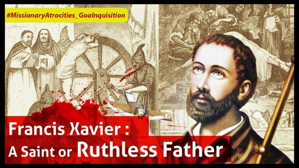
St. Francis Xavier, a co-founder of the Jesuits, along with St. Ignatius of Loyola, was a representative of the Portuguese Empire in Asia, and noteworthy for his so-called “evangelization” work in Portuguese India.
In our historical narrative, it was St. Francis Xavier who called for the establishment of the “Goan Inquisition” in India to enforce Catholic Orthodoxy and allegiance to the Pope.
It was particularly known for imprisonment, torture, death penalties, and intimidating people into exile.
We are taught that Pope Paul III issued a papal bull forming the Jesuit Order in 1540, under the leadership of Ignatius of Loyola, a Basque nobleman from the Pyrenees in Northern Spain, about the same time that Nicolas Copernicus was publishing “On the Revolutions of the Heavenly Spheres” in 1543, with his arguments for the heliocentric universe, Gerardus Mercator was making a globe in 1541.
The Jesuit Order included a special vow of obedience to the Pope in matters of mission direction and assignment.
Whoever the Jesuits and the Freemasons were are at the top of my list of suspects for who was primarily responsible for giving us our new, fabricated historical narrative.
We shall see more examples in support of this belief throughout this post.
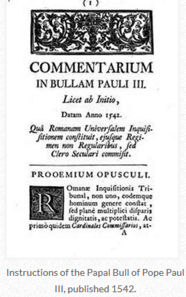
Two years after the Jesuits were established, in the year of 1542, we are told Pope Paul III established the Holy Office, also known as the Inquisition and the Congregation for the Doctrine of the Faith.
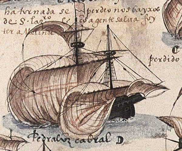
Pedro Alvares Cabral, a Portuguese nobleman, military commander, navigator and explorer, was a contemporary of Vasco da Gama in our historical narrative.
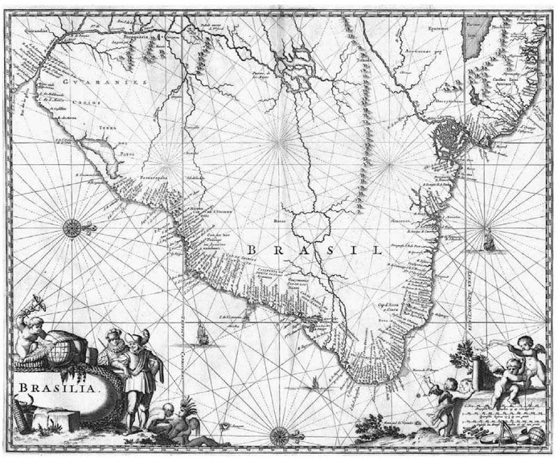
Cabral was said to have led a fleet of thirteen ships into the western Atlantic Ocean, and made landfall in what we know as Brazil in 1500.
As the new land was in the Portuguese sphere according to the 1494 Treaty of Tordesillas, Cabral claimed it for the Portuguese Crown.
He explored the coast, and realized, we are told, that the large land-mass was most likely a continent, and dispatched a ship to notify the Portuguese King, Manuel I of the new territory.
The land Cabral had claimed for Portugal later became known as Brazil on the continent of South America.
Then from Brazil, Cabral turned his fleet eastward to sail to India.
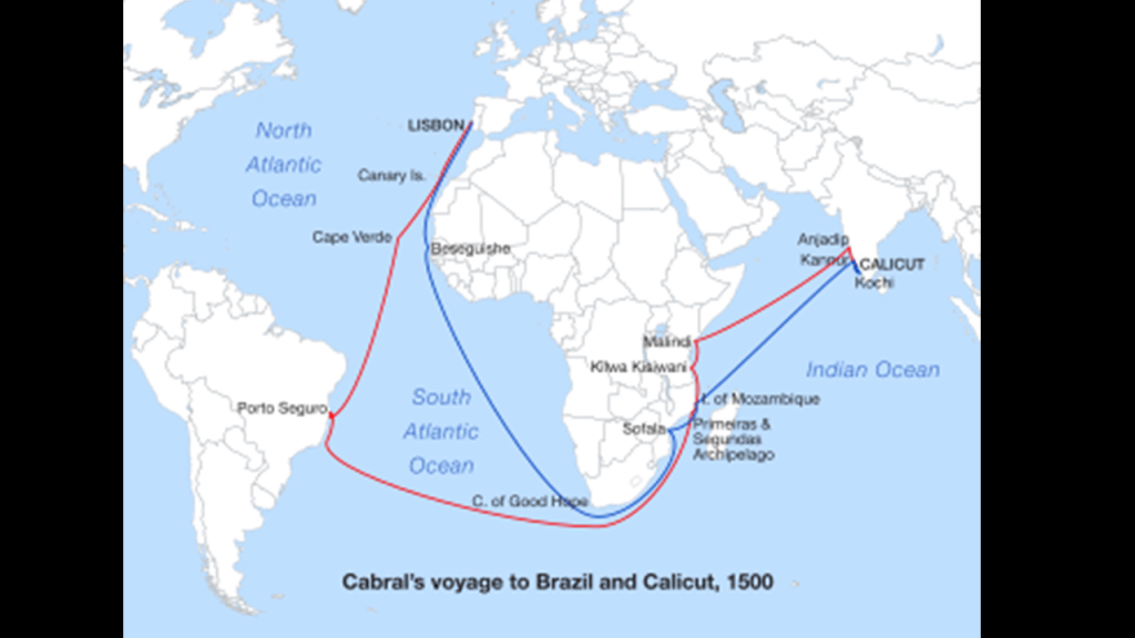
He was said to have lost seven of his thirteen ships in a storm in the southern Atlantic Ocean.
The remains of Cabral’s fleet regrouped in the Mozambique Channel, located between the East African country of Mozambique and the island of Madagascar.
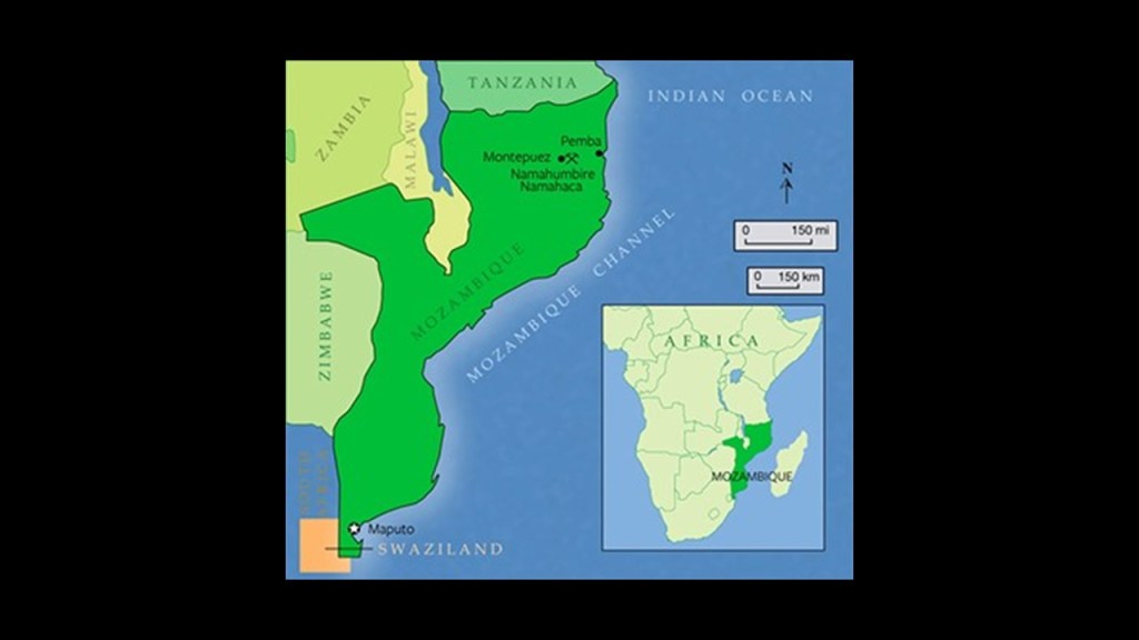
Mozambique had become a Portuguese colony in 1498 as a result of Vasco da Gama’s first voyage, and is known for what is described as its Portuguese colonial architecture.
Here are some examples from Maputo, the capital of Mozambique.
We accept the idea that the colonial Portuguese built infrastructure like this because it is what we have been taught.
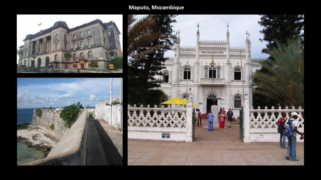
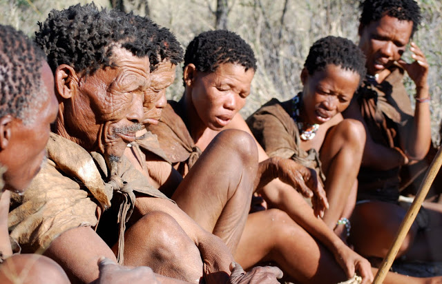
At the same time we are taught that the indigenous people of Mozambique were the San, who were hunter-gatherers, and we can’t even imagine that they were the builders of this magnificent architecture because of the vastness of the deception that has been perpetrated on Humanity.
The San, also known as bushmen, are considered the oldest inhabitants of southern Africa, with a history there said to date back 20,000-years, and are among the oldest peoples in the world.
From the Mozambique Channel, Cabral’s fleet sailed to Calicut in India, at which time Cabral was said to have been attacked by Muslims stirred up by Arab traders who saw the Portuguese venture as a threat to their monopoly.
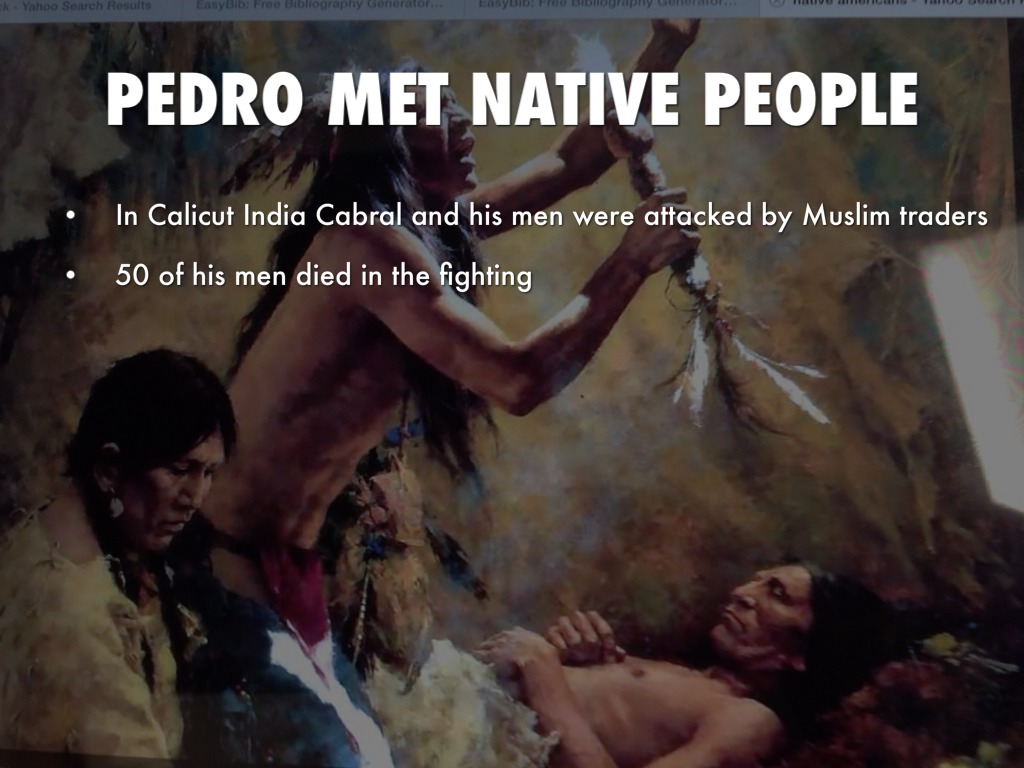
Cabral was said to have retaliated, with his men looting and burning the Arab fleet at Calicut, and he sailed onto the Kingdom of Cochin, befriended its ruler, founded the first European settlement in India at Kochi, and loaded his ships with coveted spices before returning to Portugal.
After his return, Cabral’s voyage was deemed a success, in spite of the loss of ships and lives, and we are told the extraordinary profits resulting from the sale of the spices he brought back with him helped lay the foundation of the Portuguese Empire.
Interestingly, apparently after that, Cabral slipped into obscurity for 300 years, until the 1840s that is, when the Brazilian Emperor Dom Pedro II sponsored research and publications dealing with Cabral’s life and expeditions.
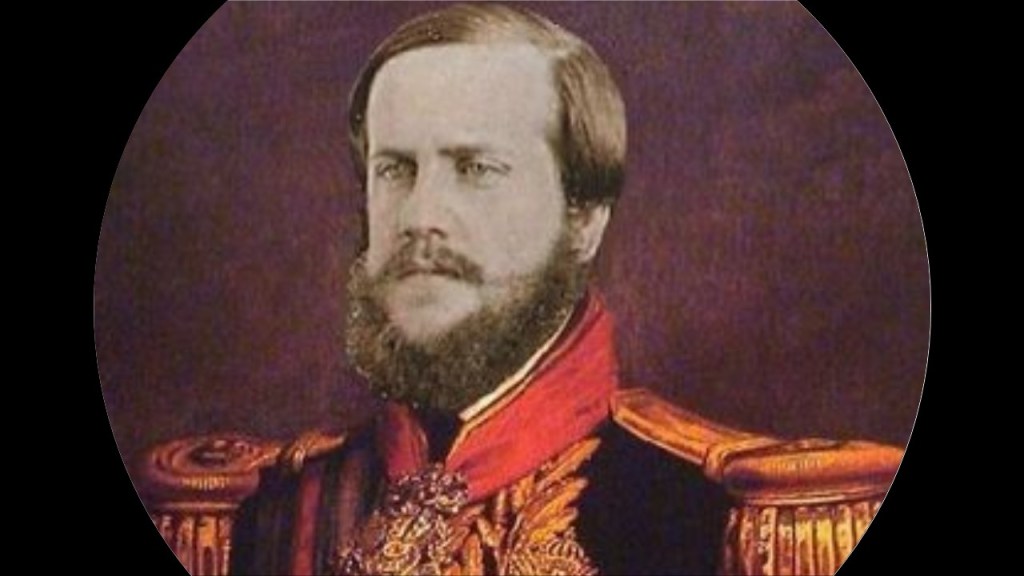
Dom Pedro II did this through the Brazilian Historical and Geographic Institute, which was founded in 1838, and part of the emperor’s plan to foster and strengthen a sense of nationalism among Brazil’s diverse citizenry.
Petropolis is the name of a German-colonized mountain town 42-miles, or 68-kilometers, north of Rio de Janeiro.
Called the “Imperial City,” the Emperor Pedro II was said to issue an imperial decree ordering the construction of a settlement to be formed, with the arrival of German immigrants, as well as for the construction of his summer palace there, with the cornerstone said to have been laid in 1845, and that it was built by 1847.
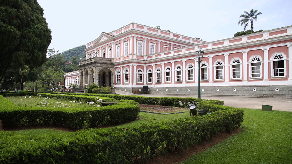
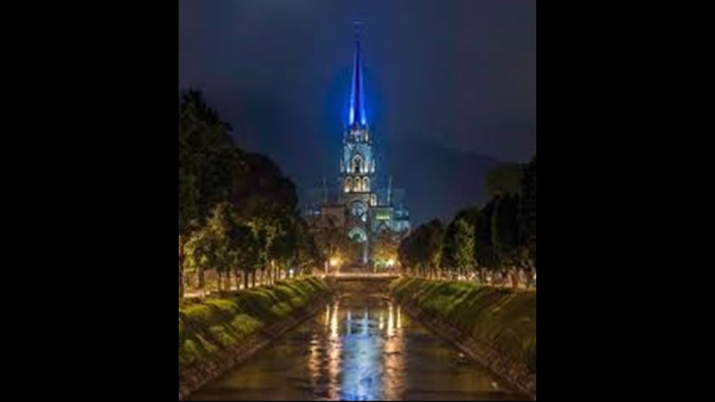
Interesting edifice, and intriguing blue glow of its steeple, in Petropolis.
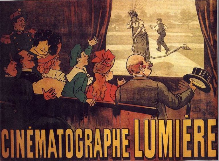
The first cinema was said to have opened in Petropolis in 1897, showing the Lumiere Brothers first films.
The Lumiere Brothers premiered ten short films in Paris on December 28th of 1895, considered the breakthrough of projected cinematography, meaning pertaining to the art or technique of motion picture photography.
Marcus Loew was a pioneer of the motion picture industry.
He founded Loew’s Theaters in 1904, the oldest theater chain operating in the United States until it merged with AMC Theaters in 2006, and he was a founder Metro-Goldwyn-Mayer Studios in 1924.
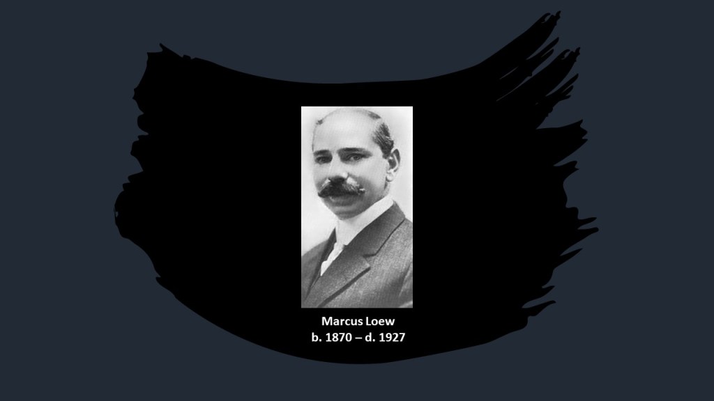
A poor young man made good, he was born into a poor Jewish family in New York City. His parents were immigrants from Austria and Germany.
He had to work from a young age and had little formal education.
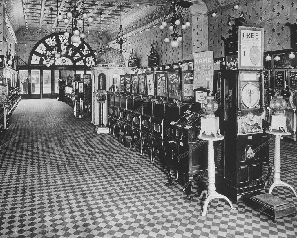
We are told he was able to save enough money from menial jobs to buy into the penny arcade business as his first business investment.
Important to note that the birth of the viable interactive entertainment industry in 1972 resulted from the coin-operated entertainment business, which had well-developed manufacturing and distribution channels around the world, and computer technology that had become cheap enough to incorporate into mass market entertainment products.
The year of 1972 was the year that Magnavox released the world’s first home video game console, the Magnavox Odyssey.

While there were other less well-known video arcade games released around 1972, the first block-buster video arcade game was “Space Invaders,” responsible in 1978 for starting what is called the “Golden Age of Video Arcade Games.”
So there is a direct connection through time between penny arcade games and video arcade games.

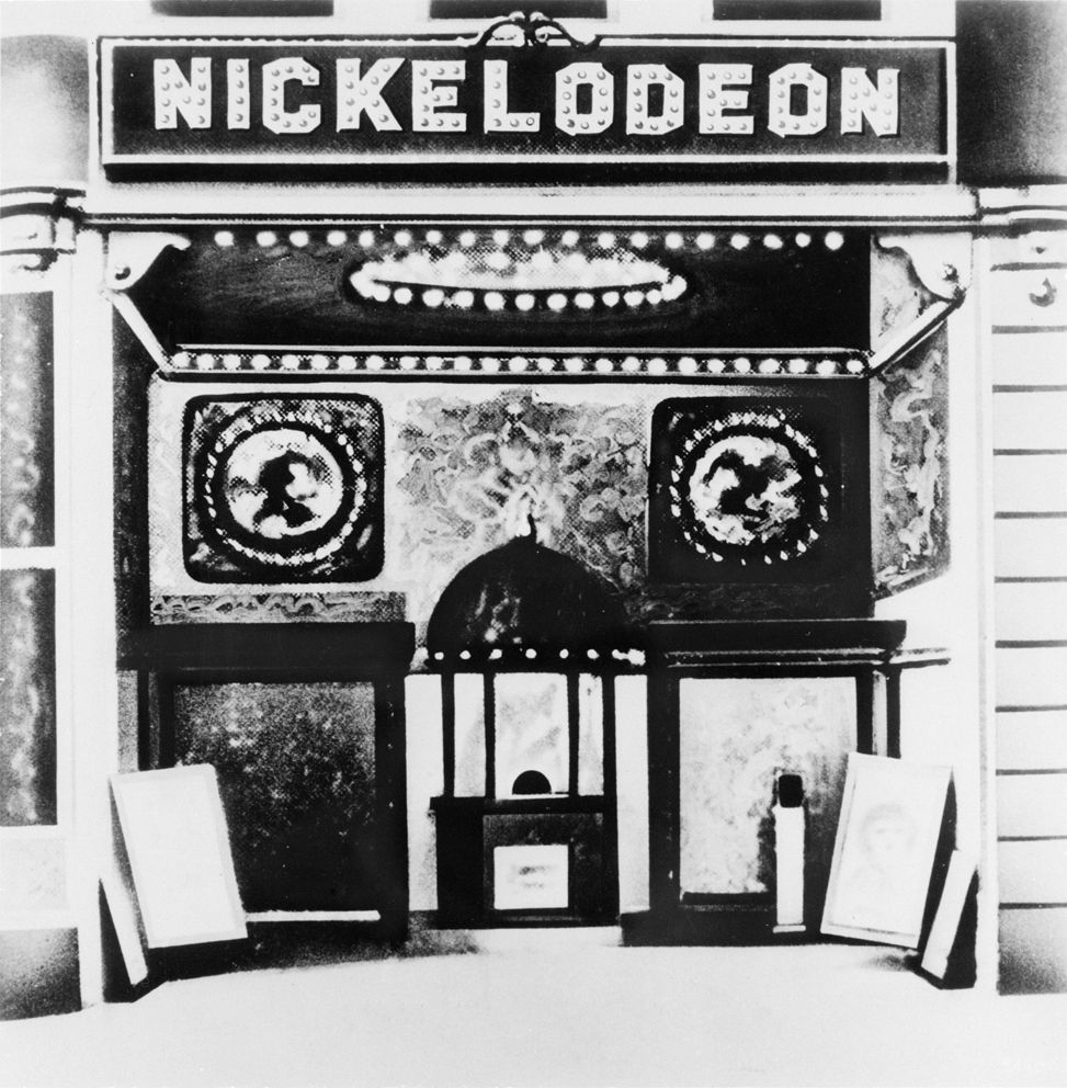
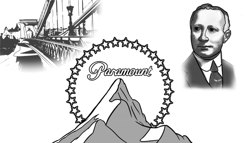
Not long after buying into the penny arcade business, Loew purchased a nickelodeon in partnership with Adolph Zukor.
A Nickelodeon was a type of indoor exhibition space dedicated to showing projected motion pictures.
His first nickelodeon partner, Adolph Zukor, who along with Marcus Loew, was one of the founders of Paramount Pictures, which was formed in 1912.
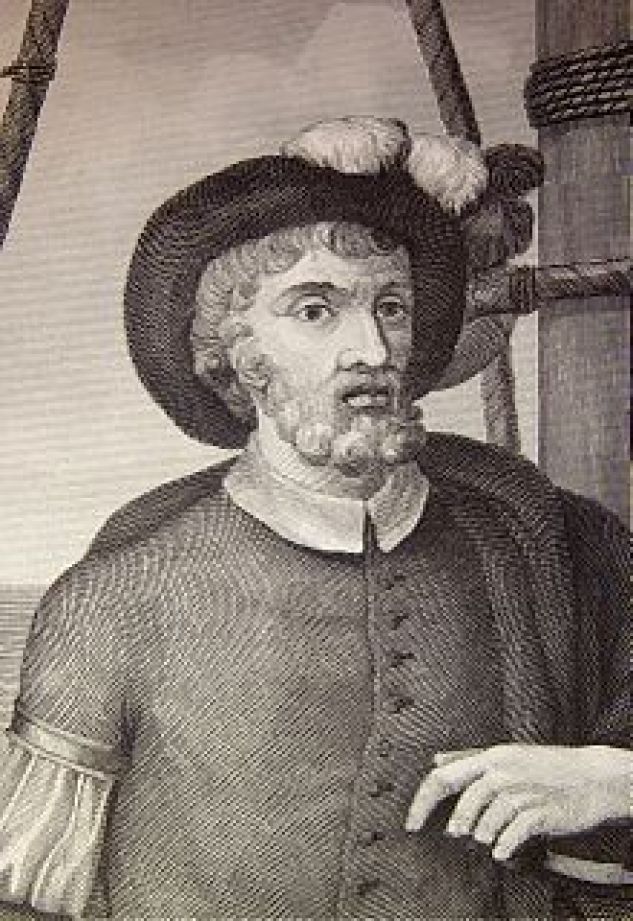
Next of the early explorers, Ferdinand Magellen was a Portuguese explorer who organized the Spanish expedition, which started in 1519 and ended in 1522, to the Spanish East Indies, a fleet known as the “Armada de Molucca” to reach the Spice Islands, and said to have resulted in the first circumnavigation of the earth.
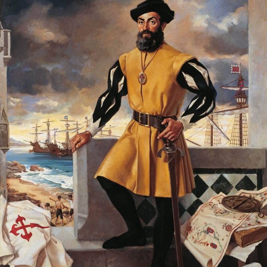
Magellan was said to have been killed in the Philippines in the Battle of Mactan on April 27th of 1521, and a Basque-Spanish explorer by the name of Juan Sebastian de Elcano was said to have completed the expedition after Magellan’s death, from the Moluccas and back to Spain.
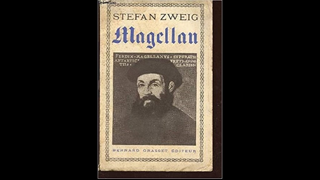
I found a biography about Magellan written by an Austrian novelist, playwright, journalist and biographer named Stefan Zweig, who was born in Vienna in 1881, and died, along with his wife, of all places in Petropolis, Brazil in 1942, we are told from barbituate overdoses.
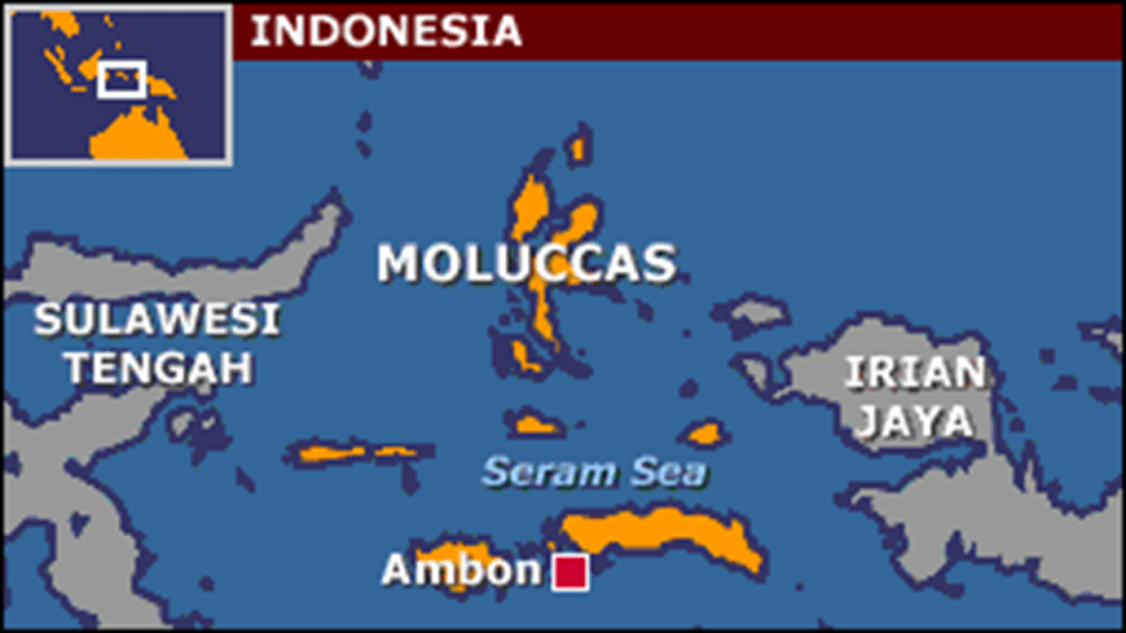
Back to the Moluccas.
The Moluccas that Juan Sebastian de Elcano reached and sailed back to Spain from are also known as the Spice Islands, because of the nutmeg, spice, and cloves that were exclusively found there, the presence of which sparked extreme colonial interest from Europe in the 16th-century.
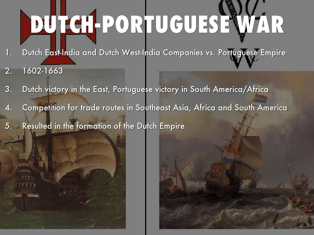
So much so, that the Dutch-Portuguese War between 1601 and 1663 was also known as the Spice War, the commodity at the center of the conflict.
Beginning in 1602, the conflict was said to have primarily involved the Dutch companies invading Portuguese colonies in the Americas, Africa, India, and the Far East.
The Dutch-Portuguese War was said to have served as a way for the Dutch to gain an overseas empire and control trade at the cost of the Portuguese.
Other notable explorers from the first “Age of Discovery” included:
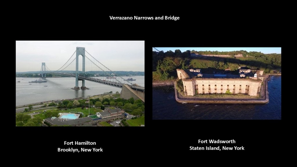
Giovanni da Verrazzano was said to be a Florentine explorer, in the service of the French King Francis I, and credited with being the first European to explore the Atlantic Coast of North America between Florida and New Brunswick between 1523 and 1524.
This included New York Bay, where the Verrazzano Narrows and Bridge forever enshrine his memory, with Fort Hamilton on the Brooklyn-side and Fort Wadsworth on the Staten Island-side.
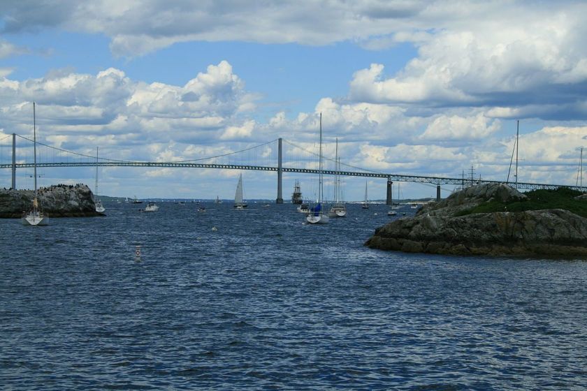
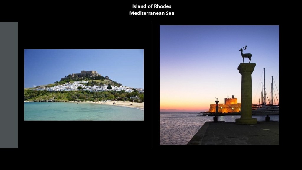
Verrazano also explored Rhode Island’s Narragansett Bay in 1524, and he even gave Rhode Island its name, we are told, when he was said to have likened an island near the mouth of Narragansett Bay to the Island of Rhodes.
The island of Rhodes is the largest of the Dodecanese Islands in the Mediterranean Sea pictured here.
The City Gate of the Island of Rhodes is on the right.
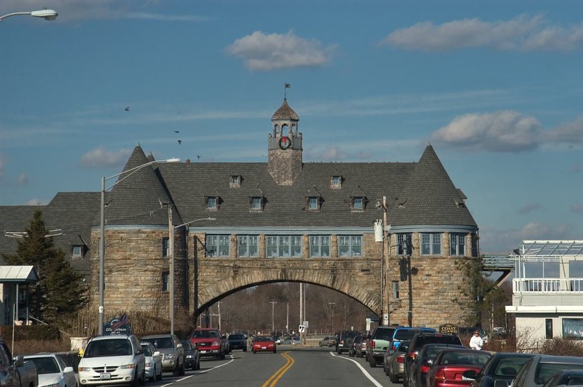
What kinds of things do we find in Rhode Island in the United States.
Well, for one, the Narragansett Twin Towers, what is said to be the remnant of the Narraganset Pier Casino said to have been built in the 1880’s.
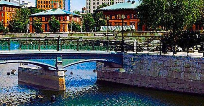
…and for another at Waterplace Park in downtown Providence, where there is the presence of megalithic masonry.
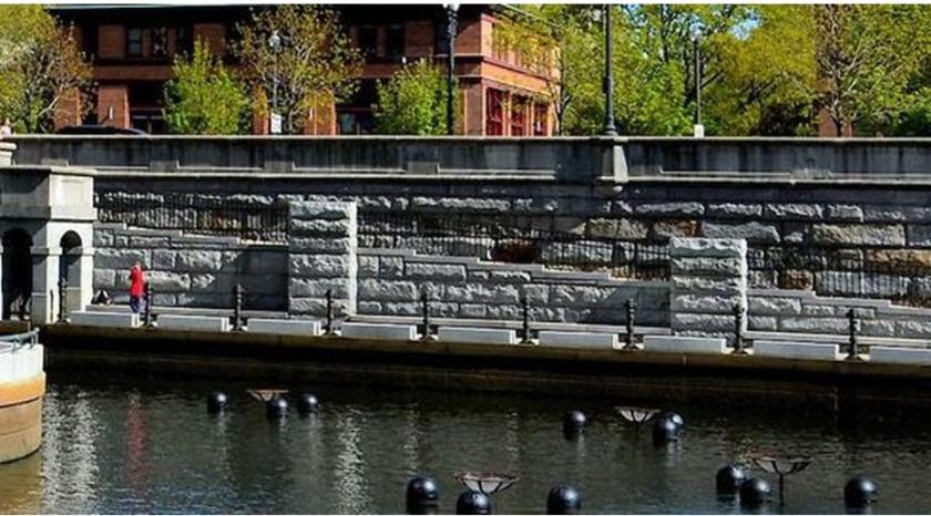
The park was said to have been finished in 1994.
The meaning of megalith is a large stone used in construction, typically associated with Peru and Egypt, but actually found everywhere around the world. Here is another megalithic wall at Waterplace Park.
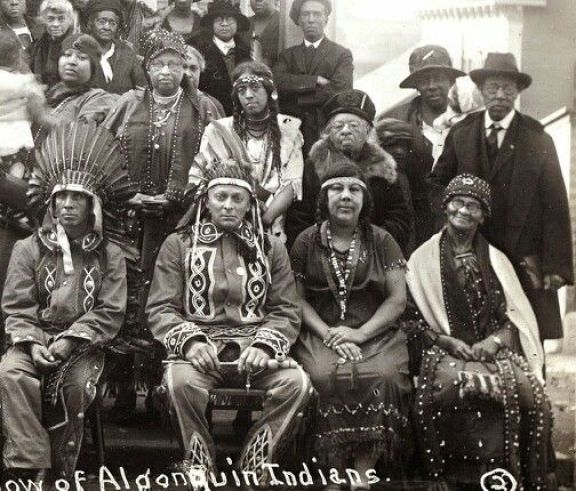
The Narragansetts are an Algonquin people whose land is now Rhode Island. Here is an historic photo of the Narragansett.
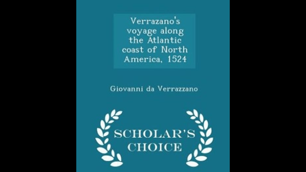
We are told that the book “Verrazano’s Voyage Along the Atlantic Coast of North America, 1524,” was reproduced from an original artifact that was written by Giovanni da Verrazzano himself.
It was published in 1916, with an introduction by Edward Hagaman Hall, a New York State historian who was born in 1858 and died in 1936.
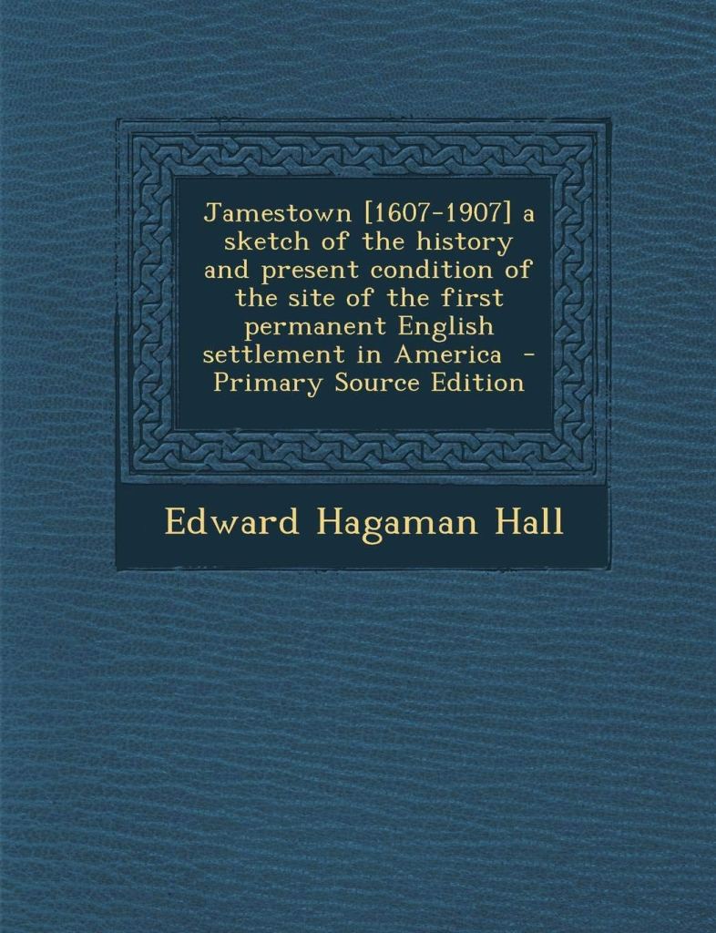
Edward Hagaman Hall also published a book about Jamestown, Virginia in 1902.
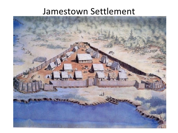
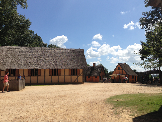
What I remember about Jamestown, which I visited with my parents when I was 6-years-old on a trip to Williamsburg in 1969, is that it was supposed to have looked something like this, and that when the colonial capital was moved to Williamsburg in 1699, Jamestown was said to have ceased to exist as a settlement.
These brick masonry ruins are in Jamestown…
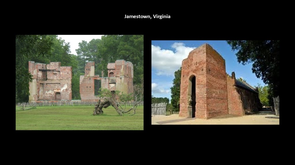
…even though the attention of tourists is drawn to the living history museum there.
It is interesting to note that when I was doing research on Expositions and World Fairs awhile back, I came across the 1907 Jamestown Exposition, said to have commemorated the 300th-anniversary of the founding of Jamestown in the Virginia Colony.
It was held on Sewell’s Point at Hampton Roads in Norfolk, Virginia.
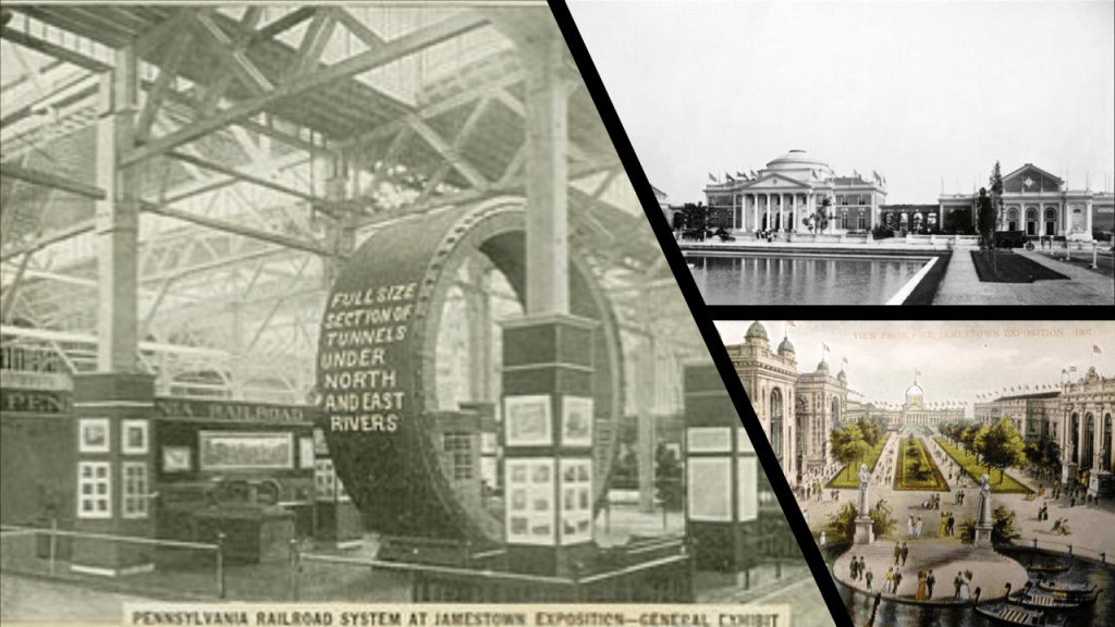
Sewell’s Point is the location of Norfolk Naval Base in today’s world.
Next, Henry Hudson was said to have been an English navigator and explorer during the early 17th-century, best known for his explorations of parts of the northeastern United States and Canada.
Between 1607 and 1611, he was engaged by various trading companies to sail to the Far North to find another way to Asia, via either the Northeast Passage or Northwest Passage.
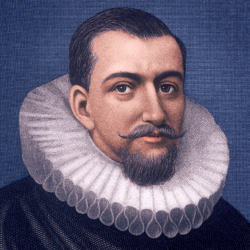
We are told that in 1609, Henry Hudson was chosen by Dutch East India Company merchants to find an easterly passage to Asia.
His attempts to go in an eastward direction were said to have been blocked by ice in northern Norway, so he decided to go west and find a northerly passage through North America.
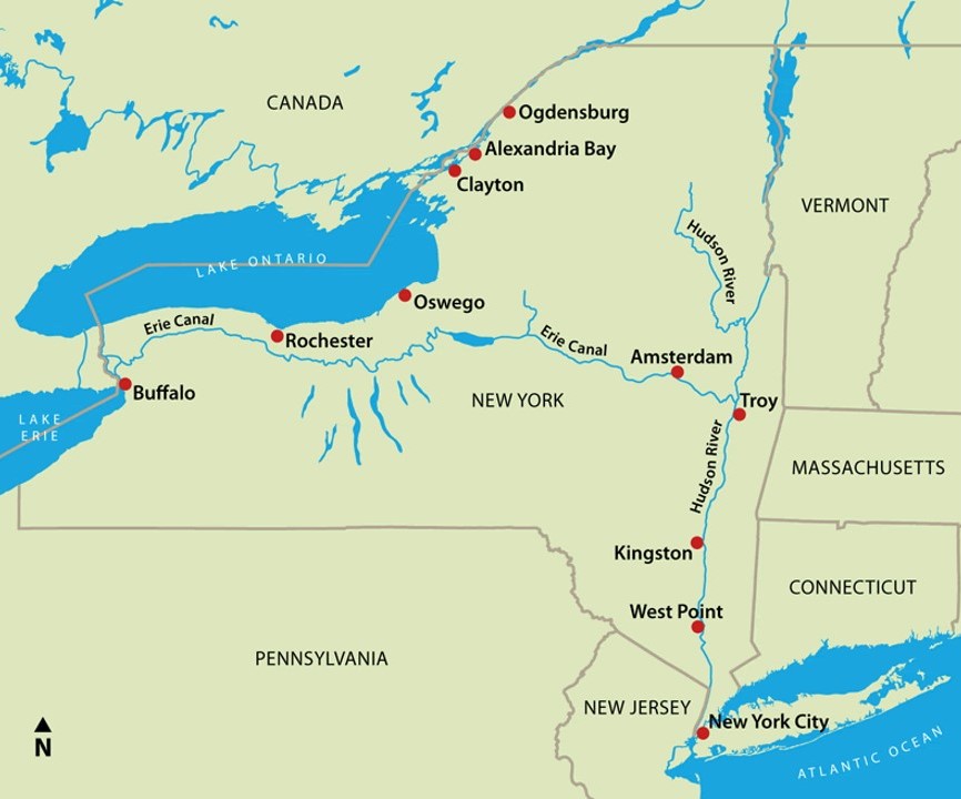
His ship, the Half Moon, travelled down the coast, from LaHave in Nova Scotia; to Cape Cod; to the Chesapeake Bay; to Delaware Bay; then New York Bay…
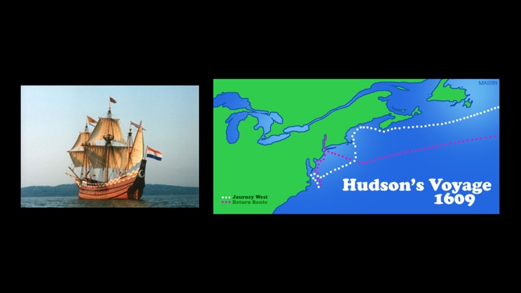
…and the river which bears his name, New York’s Hudson River.
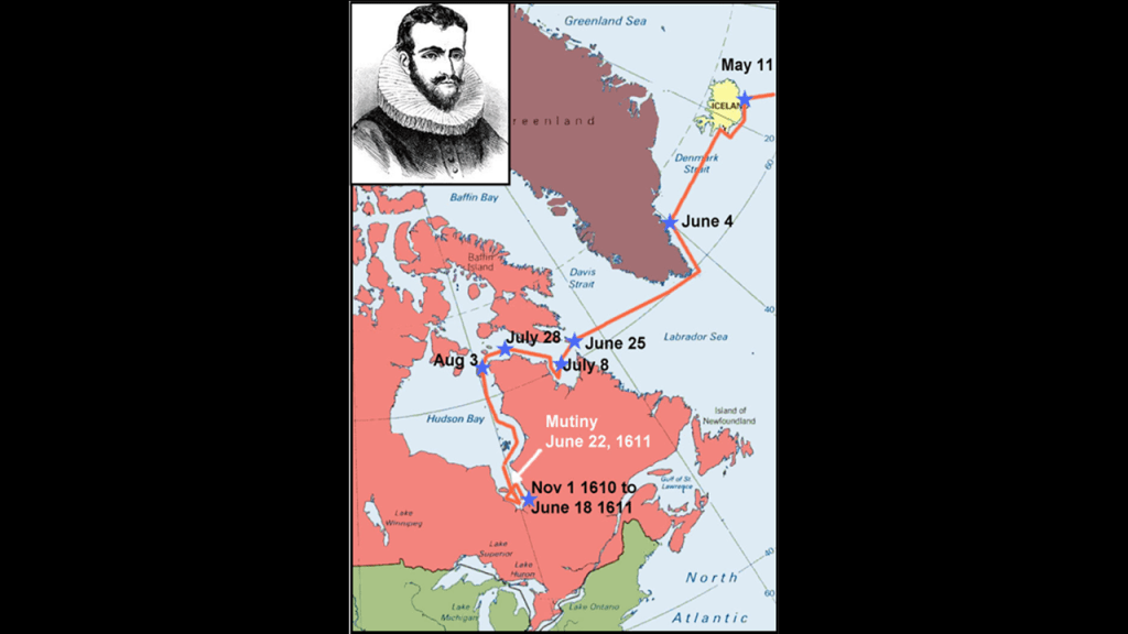
Then Henry Hudson received backing from the Virginia Company and British East India Company in 1610, and sailed north to Iceland and Greenland in his new ship, the “Discovery,” and then across the Labrador Sea to what is now the Hudson Strait at the northern tip of Labrador, and through when he entered the Hudson Bay.
Hudson met his death in the James Bay region of the Hudson Bay, when his crew mutinied, and sent him, his son, and 7 crew members adrift in a small boat with limited supplies.
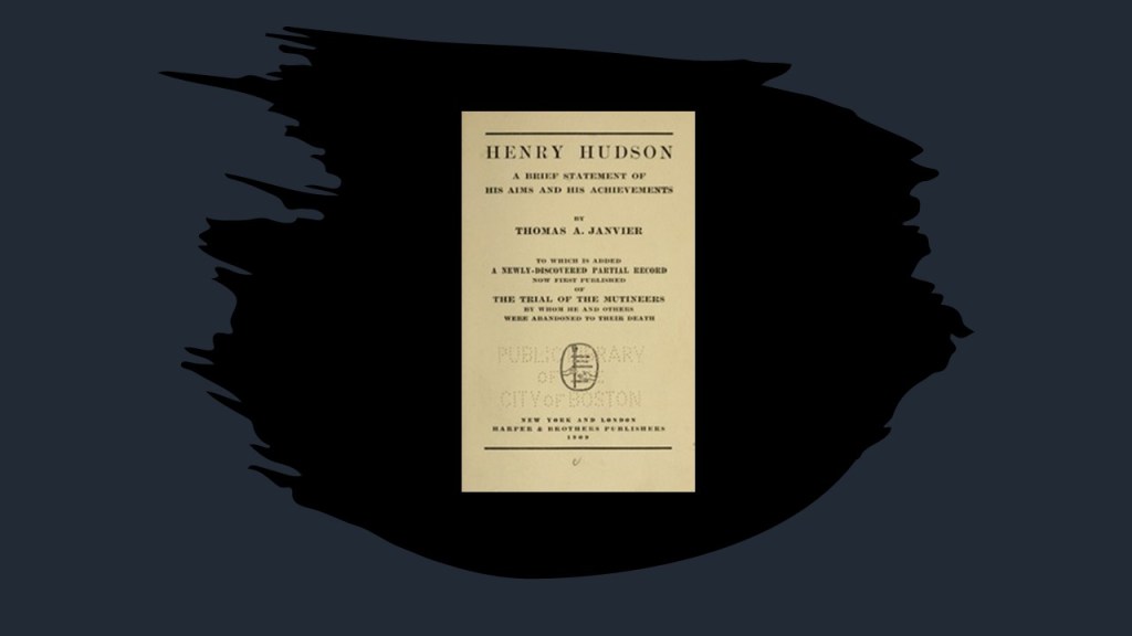
Did Henry Hudson happen to have anything thing published about him in the late 19th-century, early 20th-century?
I found this 1909 publication about Henry Hudson by Thomas Allibone Janvier, described as an American story-writer and historian, who was born in 1849 and died in 1913.
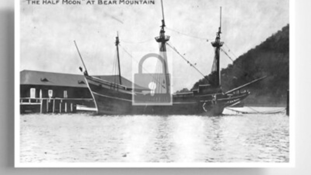
What was called a replica of Henry Hudson’s ship the “Half Moon” was said to have been built in 1912 and moored at the dock of the Bear Mountain State Park on the Hudson River.
With regards to the history of this park, this is what we are told.
In January of 1909, the State of New York purchased a 740-acre tract of land at Bear Mountain, with plans to build Sing-Sing Prison there, but conservationists stopped the prison from being built.

Later that year, the newly-widowed Mary Averell Harriman, wife of Union Pacific Railroad President and American Financier Edward Henry Harriman who died in September of 1909, offered the state another 10,000 acres – and $1,000,000 – towards the creation of a state park.
American Progressive politician and businessman George W. Perkins, a partner in the J. P. Morgan Company and President of the Palisades Interstate Commission since 1900, with whom Mary Harriman had been working, managed to raise another $1.5-million from a dozen wealthy contributors, including John D. Rockefeller and J. P. Morgan.
The state matched the contributions with a $2.5-million appropriation, and Bear Mountain-Harriman State Park came into being in 1910, and managed by the Palisades Interstate Commission, which was formed in 1900 by New York Governor Theodore Roosevelt and New Jersey Governor Foster Vorhees, for the stated reason of stopping the quarrying activities along the Palisades Cliffs of New Jersey.

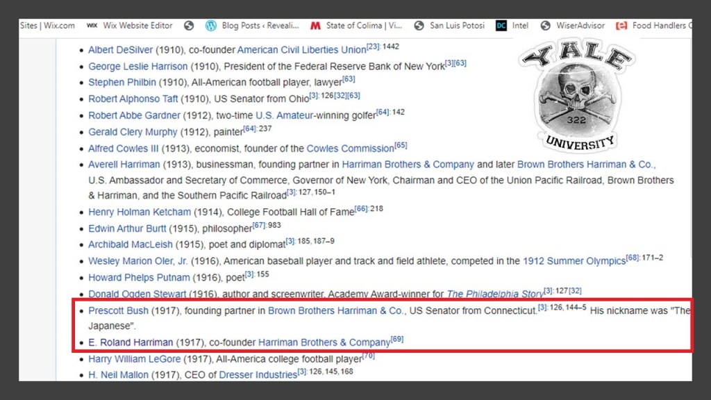
In 1931, the Brown Brothers, originating from the first investment banking firm in the United States in 1800, merged with the Harriman Brothers & Company, a private bank started with railway money, to become known as the “Brown Brothers Harriman & Company,” one of the oldest and largest private investment banks in the United States.
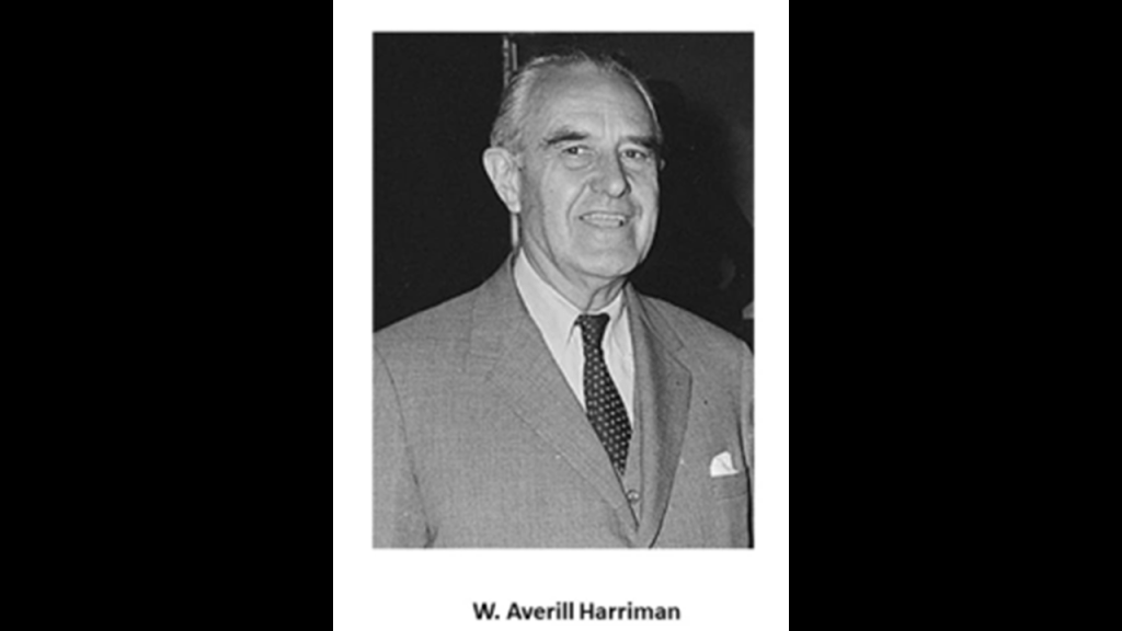
Founding partners of the “Brown Brothers Harriman & Company” included W. Averill Harriman, the son of railroad baron E. H. Harriman and Mary Harriman, and Secretary of Commerce under President Harry S. Truman…
…and Prescott Bush, American banker and politician, and the father of President George H. W. Bush.

Another Harriman, E. Roland Harriman AKA “Bunny,” was the Chairperson of the Board of Governors of the American Red Cross from 1950 to 1973.
Prescott Bush and Roland Harriman attended Yale University at the same time, where they were both members of the “Skull and Bones” Society.
Also, thus far in the series I have been recently doing on the Great Lakes Region of North America, I have found that there was a pervasive Jesuit and Franciscan presence all over Lake Superior, Lake Michigan, and Lake Huron in our historical narrative.
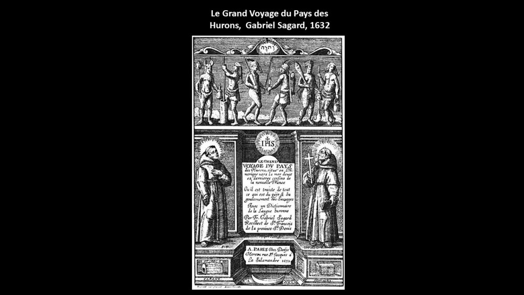
When I was looking for information on the Huron people, I found out that they were mentioned in the chronicles of Jesuit Missions in New France from 1632 to 1673 called “The Jesuit Relations,” which were said to be reports from missionaries in the field to update their superiors on their progress in converting them.
This report was said to be from Gabriel Sagard in 1632 with regards to the country of the Hurons.
Sagard was a French Franciscan lay brother known for being one of the earliest missionaries to New France.
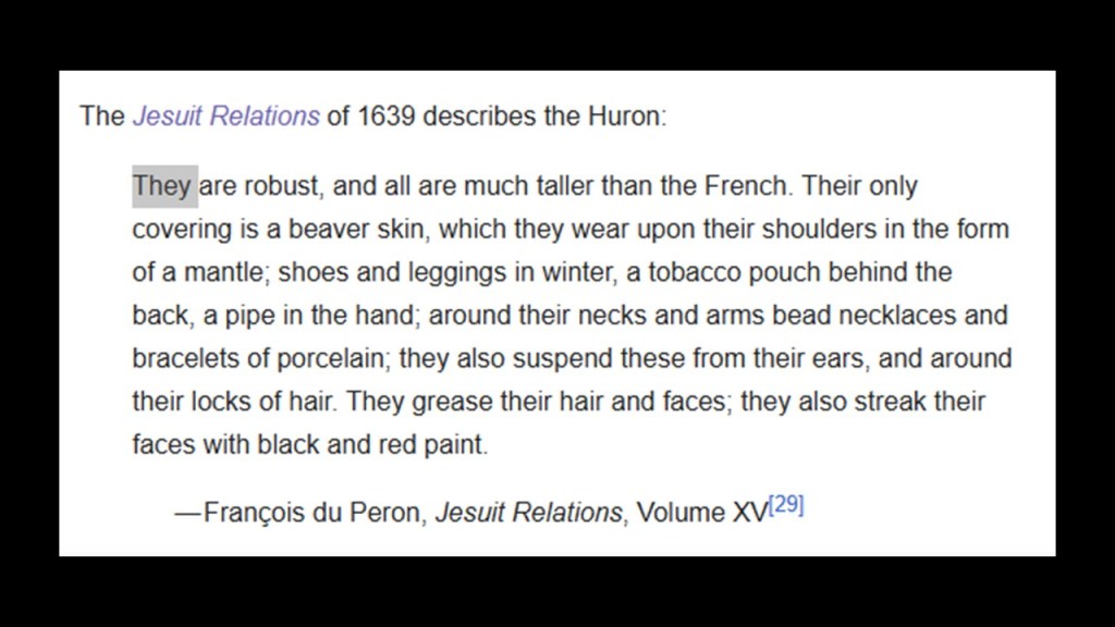
This passage from 1639 in the “Jesuit Relations” describes the Hurons as robust and tall, and wearing beaver skins, necklaces and bracelets of porcelain, and grease their hair and paint their faces.
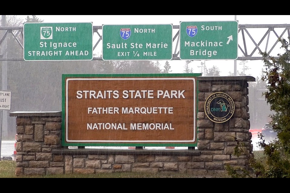
We are told the European history of St. Ignace in Michigan on the Straits of Mackinac on the southern end of the Upper Peninula across from Mackinaw City on the Upper end of the Lower Peninsula began when the French Jesuit explorer Father Jacques Marquette founded the St. Ignace Mission here in 1671, and named it after St. Ignatius of Loyola, a founder of the Jesuit Order like the previously-mentioned St. Francis Xavier, infamous for the Goan Inquisition in India.
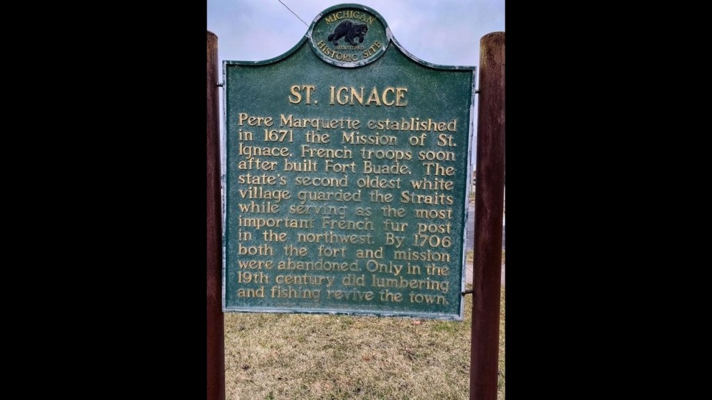
Father Jacques Marquette was said to have been buried in St. Ignace after his death in 1675.
This is the marker for his gravesite.
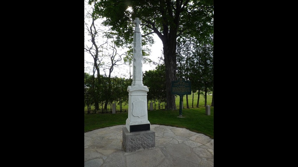
It is also the location of the Father Marquette National Memorial, which was established in December of 1975 to pay tribute to his life and work.
Father Marquette’s presence can be found in many places throughout the Great Lakes Region, particularly on Lake Michigan, Lake Superior, and where the St. Mary’s River and the Straits of Mackinac connect to Lake Huron.
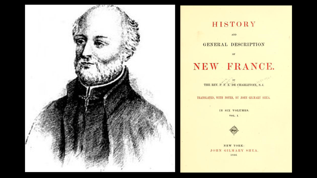
We are told the city of Charlevoix in Michigan was named for the Jesuit explorer Pierre Francois Xavier de Charlevoix, who stayed the night during a storm near his namesake city some time in the 1720s.
The Ottawa and Ojibwe peoples lived throughout northern Michigan prior to the arrival of the Jesuits and the European colonizers.
The Jesuit explorer Charlevoix was known for the journal record he kept of his exploration of New France in present-day Canada and the United States first published in 1744 as the “History and General Description of New France.”
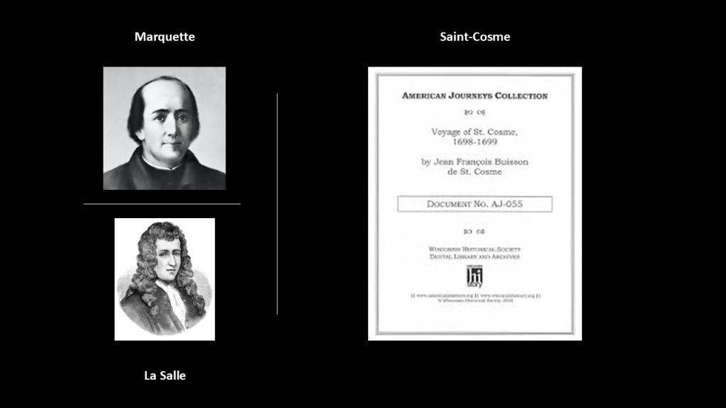
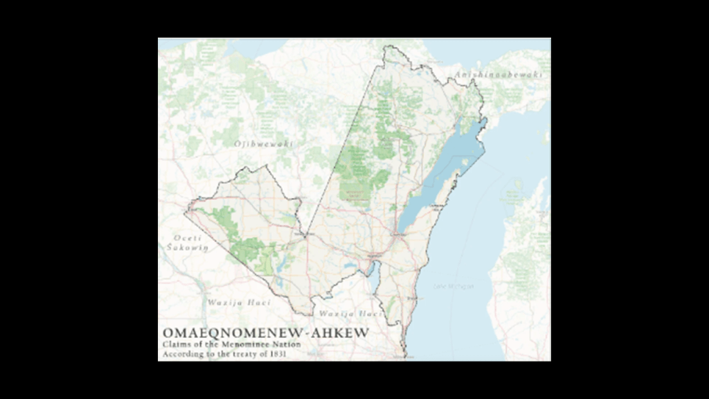
Also for another example in our historical narrative, the Kewaunee area of Wisconsin was visited by the French Jesuit explorer Father Jacques Marquette in 1674, where he was said to have celebrated “All Saints Day” at the Potawatomi village there at the time, though this is in the traditional lands of the Menimonee people.
Later in 1679, the French explorer LaSalle visited there, and in 1698, the Canadian Jesuit Jean-Francois Buisson de Saint-Cosme stopped by.
We are told the United States acquired this land from the Menominee Nation in the 1831 Treaty of Washington, in which the Menominee ceded 2,500,000-acres, or 1,011,714-hectares, of their land in Wisconsin primarily adjacent to Lake Michigan.
We are taught from cradle-to-grave that the indigenous people of this land were uncivilized tribes of hunter-gatherers.
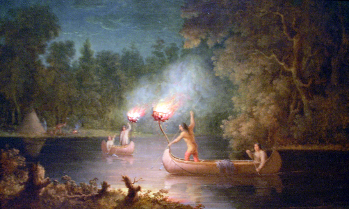
This is a painting by an artist named Paul Kane, who died in 1871, called “Fishing by Torchlight,” of the Menominee spearfishing at night by torchlight and canoe on the Fox River.
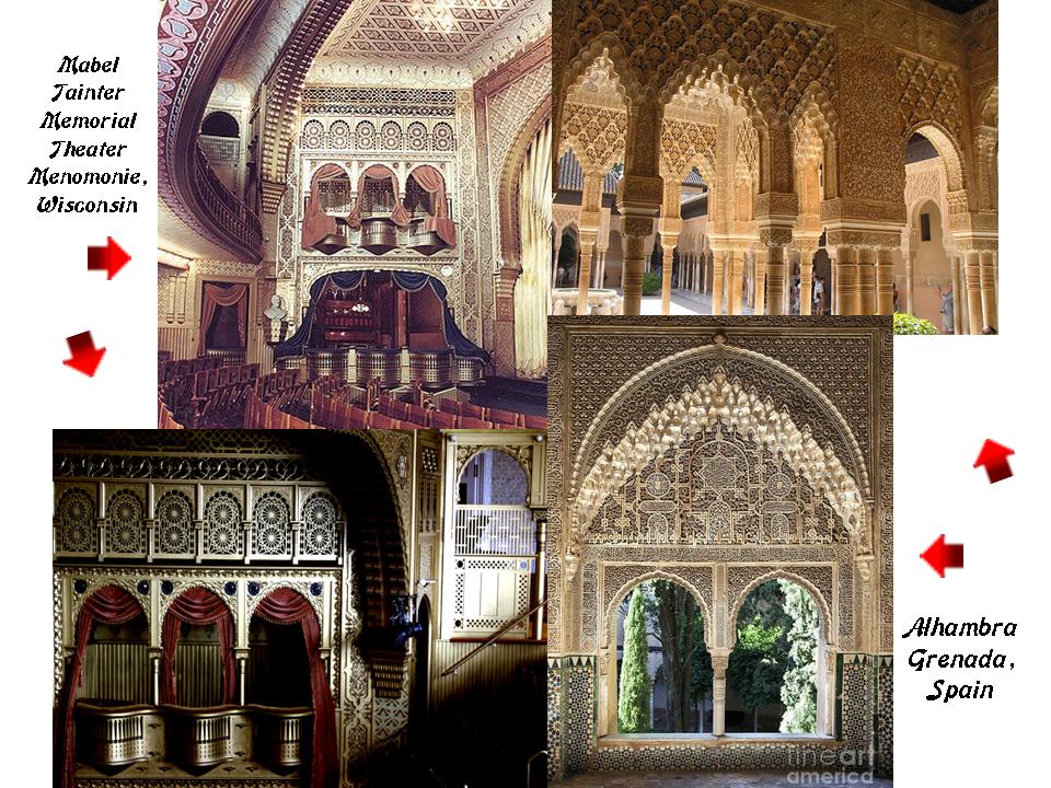
Yet we find architecture of heavy masonry like the Mabel Tainter Memorial Theater here in the city of Menomonie, Wisconsin, 237-miles, or 381-kilometers, to the northwest of Milwaukee, said to have been built in 1889…

…that looks like the acknowledged Moorish architecture of the Alhambra in Grenada, Spain, on the inside.
It is my conclusion that publications like these and many others I have come across in my research were setting the stage in seeding the new historical narrative into our collective consciousness by those responsible for the hijack of the original positive civilization that built all of Earth’s infrastructure, and that it is fabricated and backfilled history.
They want us to believe that they built everything and that the indigenous people around the world were primitive hunter-gatherers instead of being the actual builders of a highly advanced, ancient worldwide civilization that was wiped off the face of the Earth by the deliberately-caused destruction of the original free-energy grid system of this civilization.
Since this is not in our historical narrative, we don’t even question what we are told about it being built by other cultures or civilizations, and believe that the indigenous people were in fact primitive hunter-gatherers without hesitation.

At some point, possibly the mid-to-late 1700s, I believe history became real with the world’s new controllers written into it, and along these lines, I think the explorers of the Age of Exploration in the 1800s actually existed, when we are told a new era of scientific maritime exploration commenced in the 1800s, but not for the reasons we have been given.
I believe these explorations and others that took place primarily from the beginning of the 1800s to around 1850 or so were of a post-cataclysmic world, in which different European countries were engaged in exploring and claiming landmasses for their respective countries, and also remote islands and island groups all over the Earth that were actually the remnants of giant trees and sunken landmasses, and annexing them as “Overseas Countries, Territories and Outermost Regions.”
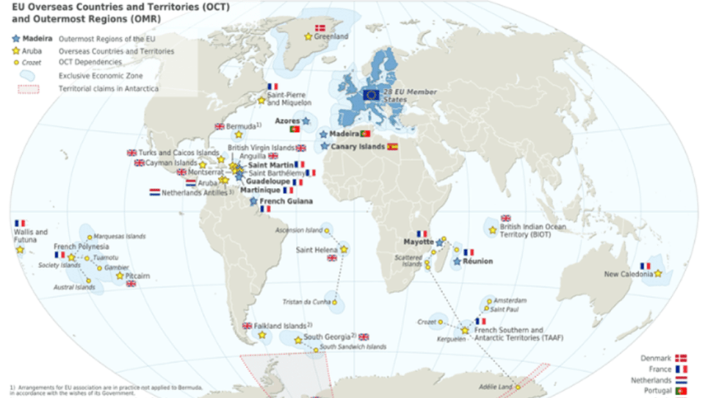
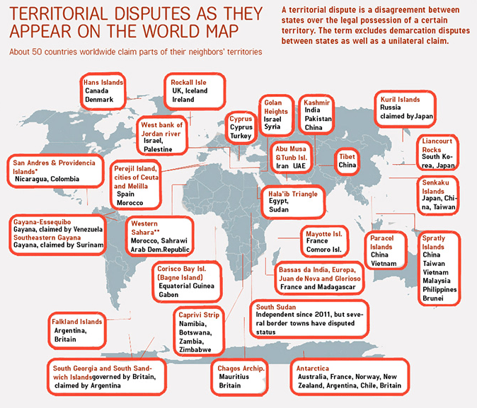
As a result of this process of colonization of the entire surface of the Earth, seemingly insignificant islands and island groups were the subjects of territorial disputes between countries, most of which are still on-going in the present day.
All of these places and islands are viewed as highly-coveted prizes, and as a critical part to nation-building plans.
Why?
I definitely think there is much more to the story that we are not being told, especially with regards to the once-existence of giant trees on Earth that were integral to the Earth’s original energy grid system, and the reason has been deliberately hidden from our view.
I have come to believe as a result of my research that the giant trees were generating the Earth’s magnetic field.

Our current scientific paradigm tells us that the Earth’s magnetic field is generated through a process known as “geodynamo” by electric currents due to the motion of convection currents of a mixture of Earth’s molten iron and nickel in Earth’s outer core and connected to the Earth’s rotational axis, and for which we are given no other explanation and that we have seen enshrined in the work of Copernicus, Kepler and Newton.

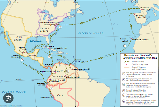
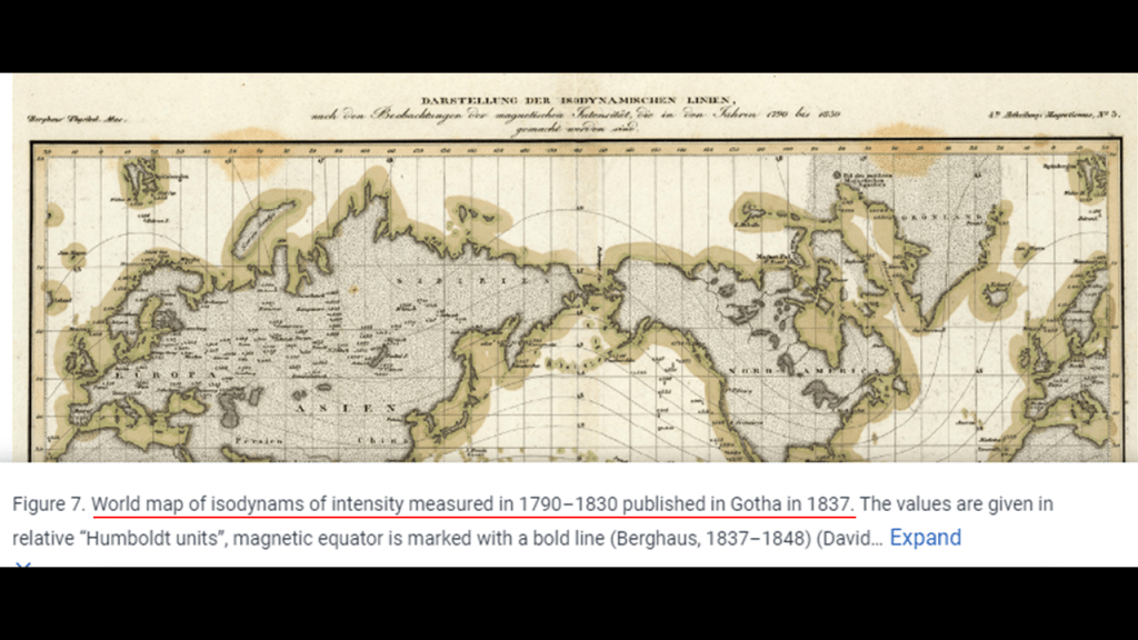
Explorers like Alexander von Humboldt, a Prussian naturalist, who was a pioneer of the fields of biogeography and geomagnetism, and an explorer of the Americas between 1799 and 1804, starting with an exploration of Mount Teide on Tenerife in the Canary Islands.
Alexander von Humboldt was considered one of the founders of the science of geomagnetism, having studied in great detail the systematic change of magnetic field strength with distance from the equator and initiated synchronized magnetic field observations across the Earth, and he made significant contributions to the charting of the Earth’s geomagnetic field.
In this world map of his, von Humboldt measured “isodynams” between 1790 and 1830.”
The prefix “iso-” means “equal, like, or similar” and the definition of isodynam, or isodynamic, is connecting points on the Earth’s surface that connects points of equal horizontal magnetic intensity
Was Humboldt measuring and mapping ancient giant tree locations?
I think so.
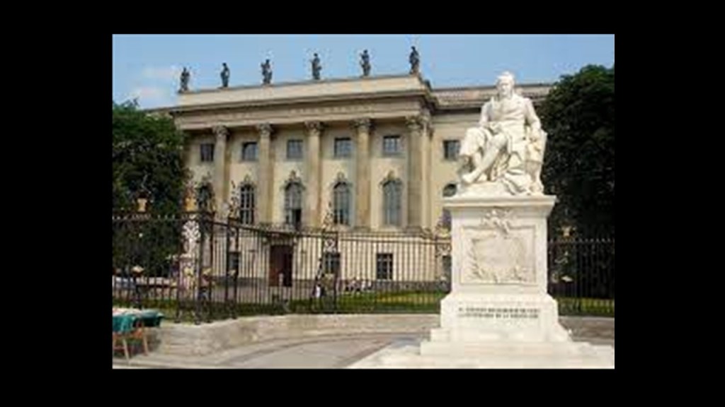
Humboldt University in Berlin was named after Alexander von Humboldt and his brother Wilhelm.
It was first opened in 1810, and was regarded as one of the world’s pre-eminent universities in the study of Natural Sciences in the 1800s and 1900s.
Famous faculty and alumni included such famous names in our current historical narrative as: the theoretical physicist Albert Einstein; Karl Marx and Friedrich Engels, c0-collaborators on “The Communist Manifesto;” Otto von Bismarck, first Chancellor of the German Empire; Georg Hegel, whose philosophy gave us the “Hegelian Dialectic” of Problem-Reaction-Solution; and the Brothers Grimm, best-known for their dark fairy tales.
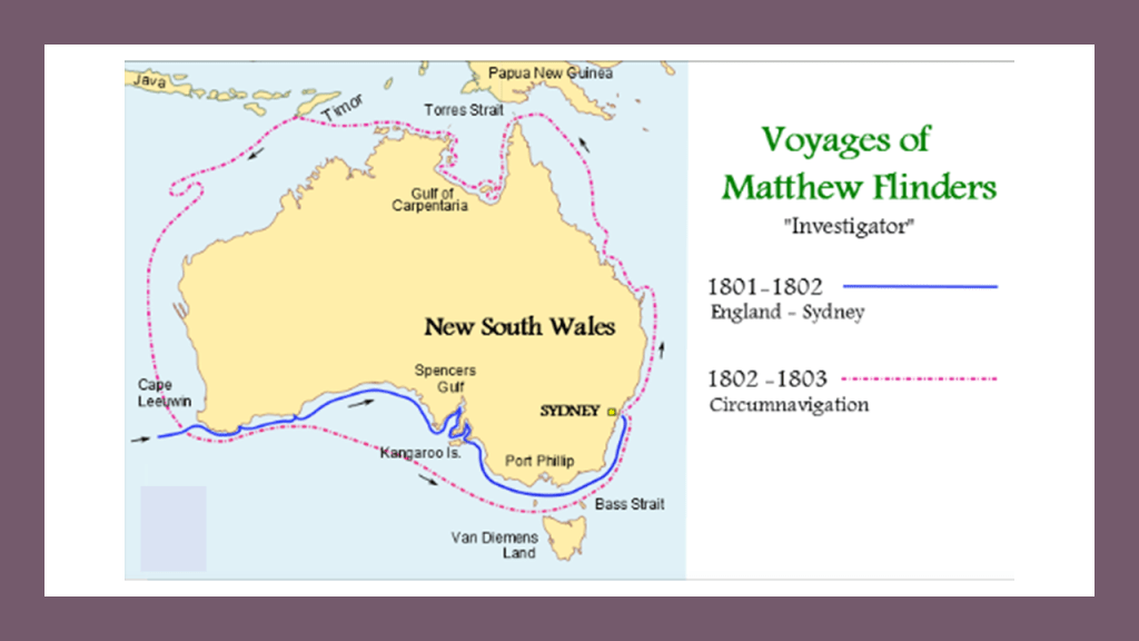
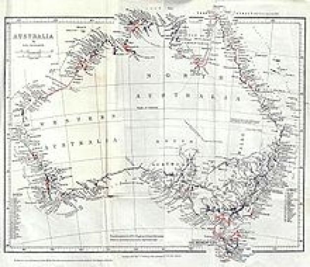
Then between 1801 and 1803, Capt. Matthew Flinders led the first in-shore complete navigations around mainland Australia.
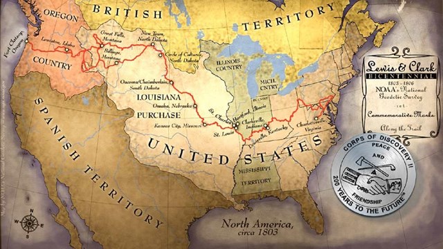
We are told the Louisiana Purchase was the acquisition of the Territory of Louisiana by the United States from France with the signing of the Louisiana Purchase Treaty on April 30th of 1803, which was officially announced on July 4th of 1803.
It was said to have doubled the size of the United States and paved the way for the nation’s westward expansion, and paved the way for the Lewis and Clark Expedition, also known as the Corps of Discovery, which took place between 1803 and 1806.
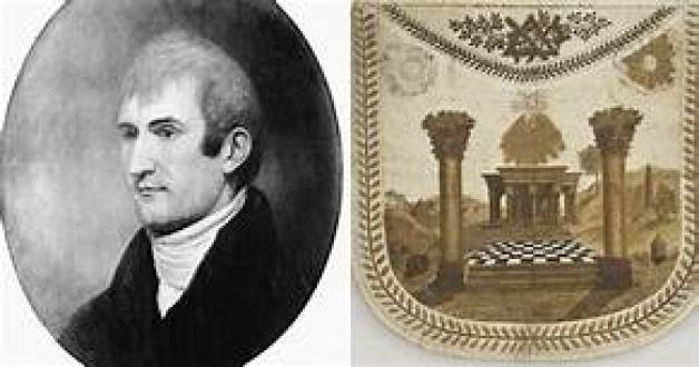
Meriwether Lewis had returned from the Lewis & Clark Expedition in 1806; was made Governor of Louisiana Territory in 1807 by Thomas Jefferson; and had made arrangements to publish his Corps of Discovery Journals.
For a point of information, he was initiated into freemasonry between 1796 and 1797, from where he was born and raised in Ablemarle County, Virginia Colony, shortly after he joined the United States Army in 1795.
Being Governor of the Louisiana Territory didn’t work too well for Lewis for a variety of reasons, and on September 3rd of 1809, he set out for Washington, DC, to address financial issues that had arisen as a result of denied payments of drafts he had drawn against the War Department when he was governor…and he carried with him his journals for delivery to his publisher.
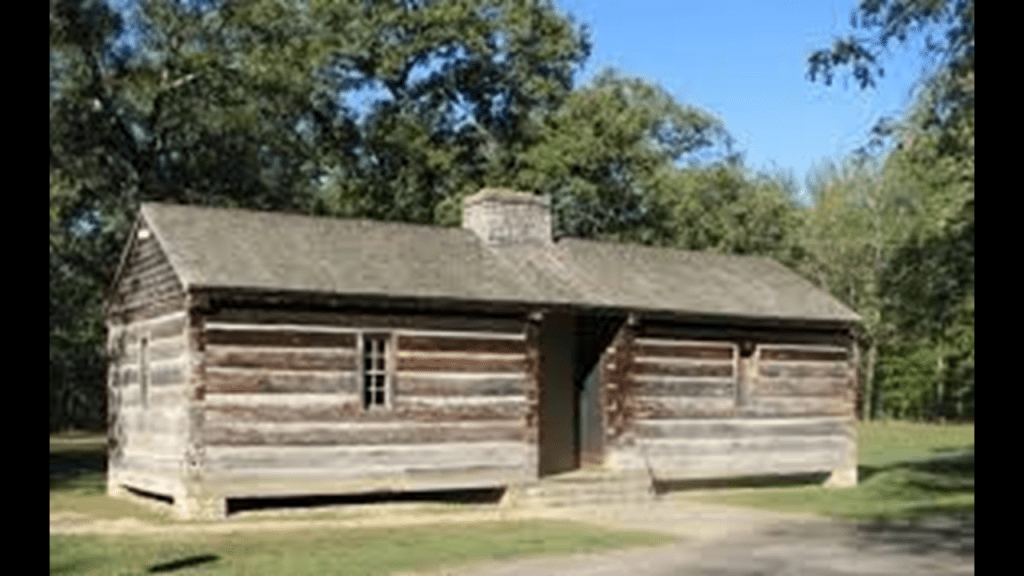
He decided to go overland to Washington instead of via ship by way of New Orleans, and stayed for the night at a place called Grinder’s Stand, an inn on the historic Natchez Trace, southwest of Nashville, Tennessee.
Gunshots were heard in the early morning hours, and he was said to have been found with multiple gunshot wounds to the head and gut.
His remains were interred here at Grinder’s Stand.
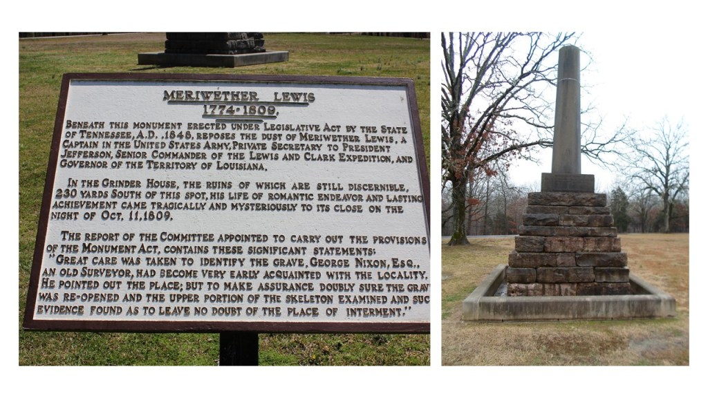
We are told that Thomas Jefferson and some historians generally accepted Lewis’ death as a suicide.
What did he know?
Who would have wanted him silenced?
What happened to his journals?
Did someone nicely get them along to his publisher for him as written?

In August of 1822, Jules Dumont d’Urville set out from France on an expedition to collect scientific and strategic information, on a ship named originally La Coquille, and sailed to the Falkland Islands; the coasts of Peru and Chile in South America; New Guinea; New Zealand and Australia.
The expedition carried out research in the fields of botany and insects, bringing back thousands of specimens to the Natural History Museum in Paris.
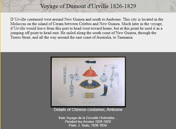
Then, 1826, Dumont d’Urville departed on La Coquille, now called L’Astrolabe, or the Astrolabe, named for a navigational device. for a three-year voyage to New Zealand; Fiji; the Loyalty Islands; New Guinea; the Solomon Islands, Caroline Islands, and the Moluccas in eastern Indonesia.
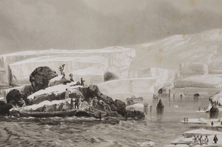
In 1837, Dumont d’Urville set out yet again on the Astrolabe for the South Orkney Islands in the Southern Ocean; the Marquesas Islands; Tasmania; along the coast of Antarctica, at which time he claimed land on January 21st of 1840 for France, and considered it his most significant achievement.
He named it Adelie Land after his wife Adele.
He then sailed onto New Zealand; the Torres Strait; Reunion Island; and St. Helena island, and returning to France later in 1840.
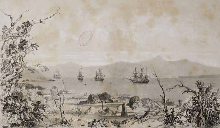
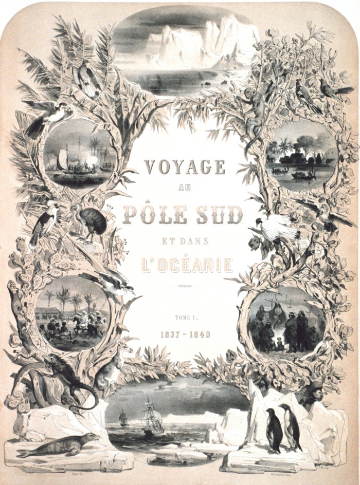
He was promoted to Rear Admiral upon his return, and he wrote a report of the expedition, which was published between 1841 and 1854 in 24 volumes.
Like with Meriwether Lewis, an interesting side-note about Dumont d’Urville’s life was his death – he and his entire family were killed in the first ever rail disaster in France in May of 1842, called the Versailles Rail Accident, in which the train’s locomotive derailed, the wagons rolled, and the coal tender ended up at the front of the train and caught fire.
This was said to be a painting of the incident.
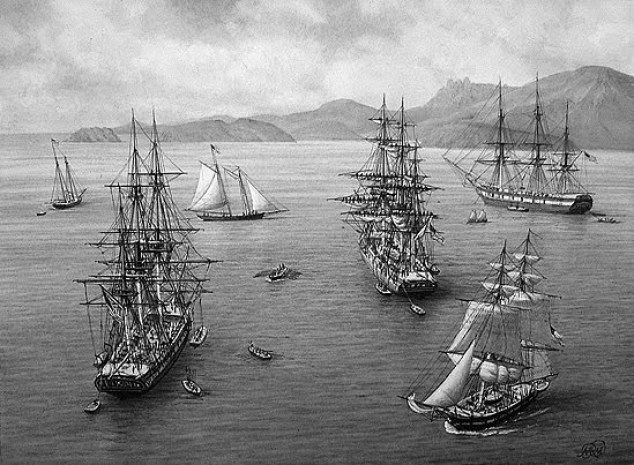
The U. S. Exploring Expedition was another exploring and surveying expedition of the Pacific Ocean and the surrounding lands, conducted by the United States between 1838 and 1842.
The expedition was described as of major importance to the growth of science in the United States, and that during the events of its occurrence, armed conflict between Pacific Islanders and the expedition was common, and dozens of natives were killed, as well as a few Americans.
It involved a squadron of four ships, with specialists on each including naturalists, botanists, a mineralogist, a taxidermist, and a philologist, which is someone who studies written and oral histories.
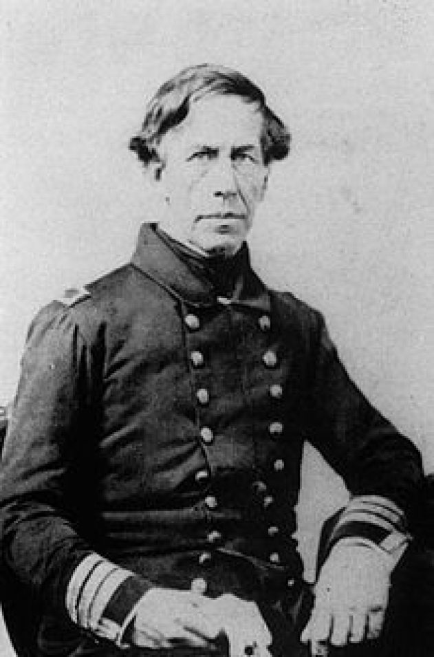
It is sometimes referred to as the “U. S. Ex. Ex.” or “Wilkes Expedition,” after the commanding officer, Navy Lt. Charles Wilkes.
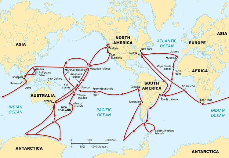
The ships of the Wilkes Expedition was said to have departed from Hampton Roads in Virginia for the first stop in the Madeira Islands off the coast of Africa on August 18th, 1838.
The routes of the expedition went something like this – all over the place.
The squadron of ships pretty much sailed together, at different rates of speed, from their first stop at Madeira, to Rio de Janeiro in Brazil; Tierra del Fuego at the southern tip of South America; Valparaiso in Chile; Callao in Peru; the islands of Tahiti, and Samoa, in the South Pacific; Sydney in Australia; Antarctica, which they arrived at and “discovered” on January 16th of 1840, just mere days before the completely different expedition of Dumont d’Urville’s claimed land on Antarctica on January 21st of 1840; and then, by way of Fiji, to the Sandwich Islands (otherwise known as the Hawaiian Islands), before returning to the United States. The ships did break-off into pairs on occasion to explore different places in the same general location.
Then there were the voyages of the HMS Beagle, originally a Cherokee class 10-gun boat of the British Royal Navy, said to have set off from the Royal Dockland of Woolwich at the River Thames on May 11th of 1820.

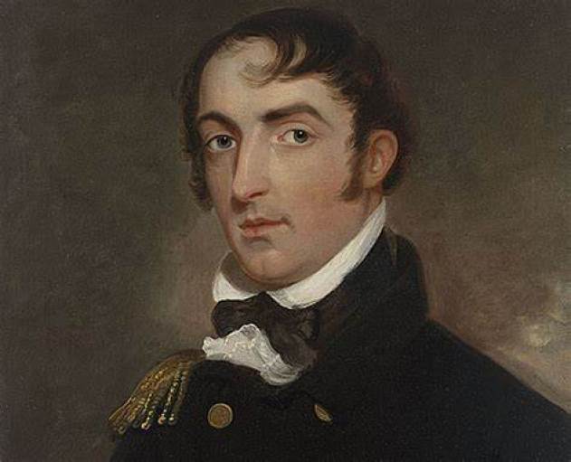
The HMS Beagle’s first voyage was between 1826 and 1830, accompanying the larger ship, HMS Adventure, on a hydrologic survey of Patagonia and Tierra del Fuego, under the overall command of the Australian Navy Captain, Phillip Parker King.
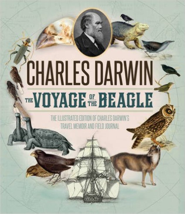
The second voyage of the HMS Beagle, between 1831 and 1832, was joined by naturalist Charles Darwin, on a second trip to South America, and then around the world.
Charles Darwin kept a diary of his experiences, and rewrote this as a book titled “Journal and Remarks,” becoming published in 1839 as “The Voyage of the Beagle.”
It was in “The Voyage of the Beagle” that Darwin developed his theories of evolution through common descent and natural selection.
The third voyage of the HMS Beagle took place between 1837 and 1843, and was a third surveying voyage to Australia, stopping on the way at Tenerife in the Canary Islands; Salvador on the coast of Brazil in Bahia State; and Cape Town in South Africa. I have found all three of these places on the Earth’s ley-lines.
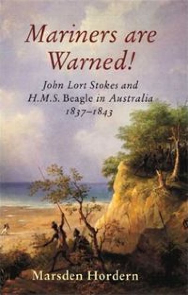
In Australia, the crew surveyed Western Australia, starting in what is now Perth, to the Fitzroy River; then both shores of the Bass Strait in Australia’s southeast corner; then north to the shores of the Arafura Sea, across from Timor.
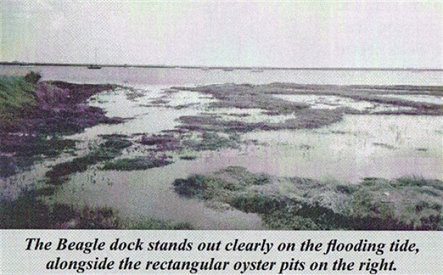
In 1845, the HMS Beagle was refitted as a Coast Guard watch vessel in Essex, in the navigable waters beyond the Thames Estuary, moored in the middle of the River Roach, until oyster companies and traders petitioned to have it removed in 1851, citing the vessel was obstructing the river and its oyster beds.
The Navy List shows that on May 25th of 1851, the Beagle was renamed “Southend ‘W.V. No. 7′” at Paglesham, and sold in 1870 to be broken-up.
Next the role of famous authors of classic literature.
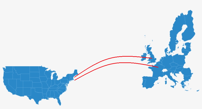
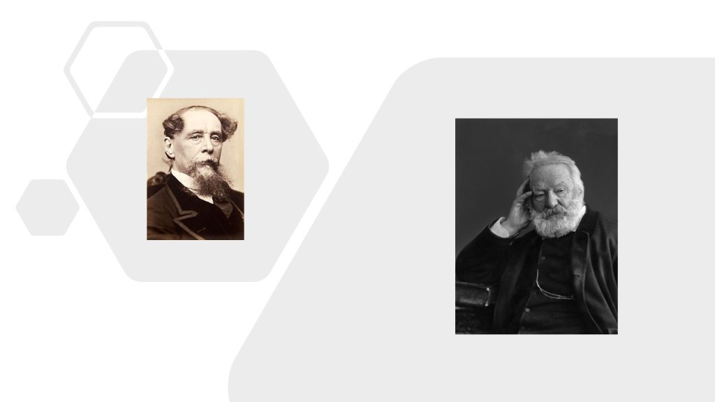
Here, I am going to “cross-the-pond” to take a look at some examples from the literature of Charles Dickens in Great Britain and Victor Hugo in France to look for the same human and social conditions there that existed in the United States during the same time period through the lenses of these two literary giants and their classics.
First, Charles Dickens.
We are toldCharles Dickens was born in February of 1812, and died in June of 1870, at the relatively young age of 58.
He created some of the world’s best known fictional characters, and is regarded by many is the greatest novelist of the Victorian-era.
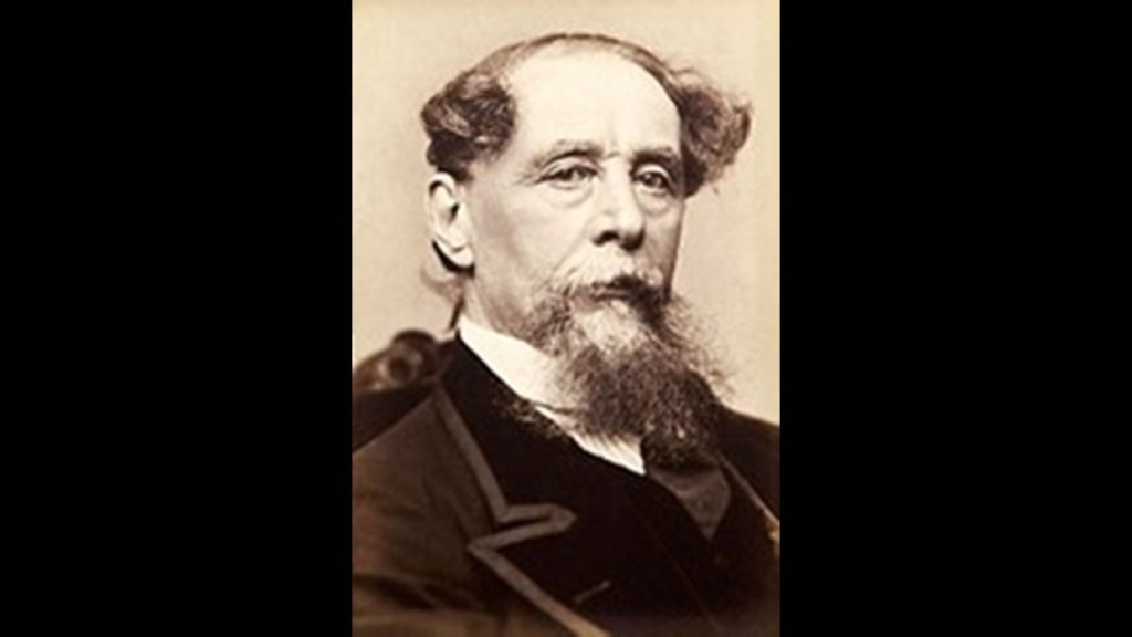
In spite of having no formal education after having left school to work in a factory because his father was in Debtors’ Prison, he edited a weekly journal for 20-years; wrote 15 novels; 5 novellas; and hundreds of short stories and articles.
He’s one of many famous and incredibly accomplished people I have come across in my research said to have little or no training in their respective fields, including art and architecture.
Amongst his earliest efforts, “Sketches by Boz ~ Illustrative of Every Day Life and Every Day People” became a collection of short pieces Dickens published between 1833 and 1836 in different newspapers and periodicals.
The work is divided into four sections: “Our Parish,” “Scenes,” “Characters,” and “Tales.”
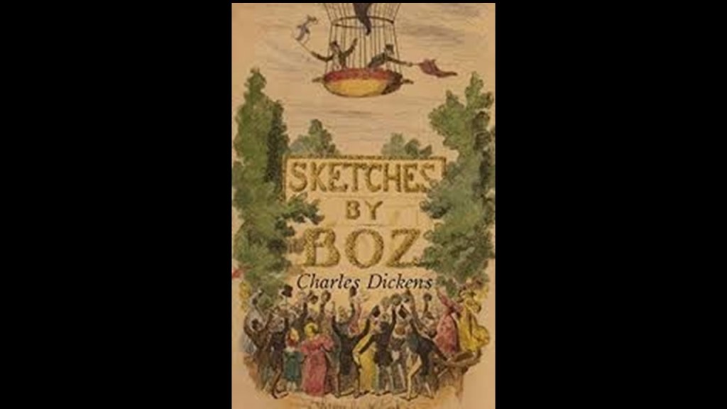
So…Charles Dickens’ first published work involved illustrations, of visual imagery forming our perceptions of what life was like at that time.
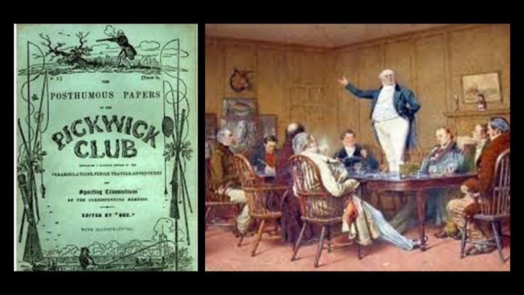
This concept was further evolved when he agreed to a commission in 1836 to supply the description necessary for the “Cockney sporting plates” of illustrator Robert Seymour for a graphic novel, a book made up of comics content, for serial publication.
This was how the “Pickwick Papers” came about, first published in serial form, and called his first literary success.
And who exactly was the target audience for the highly visual and cartoon-like nature of this early work?
Like maybe a younger audience, perhaps?

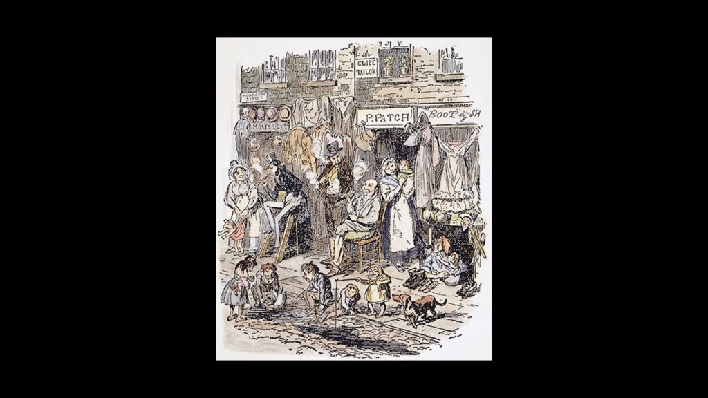
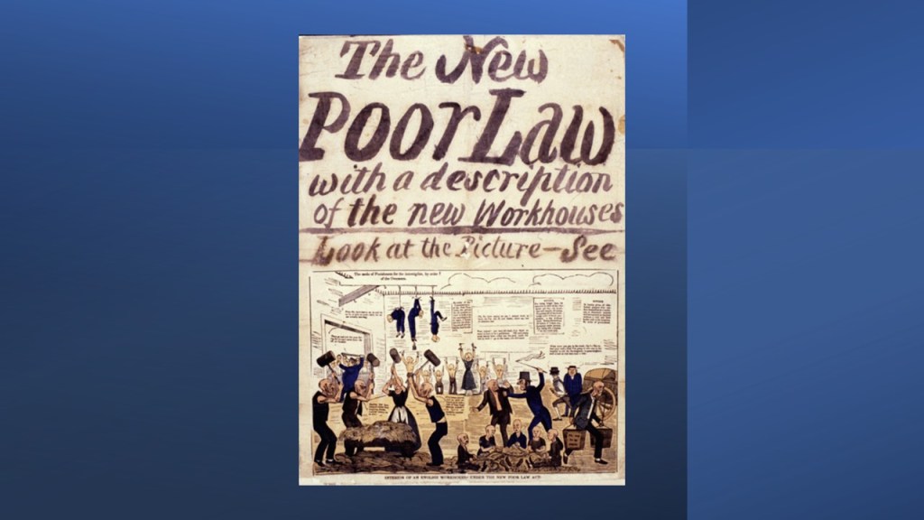
Dickens certainly wrote a lot of books featuring orphans, like “Oliver Twist,” first published in installments between 1837 and 1839 about a boy who was born and raised in the punitive and abusive workhouse system…
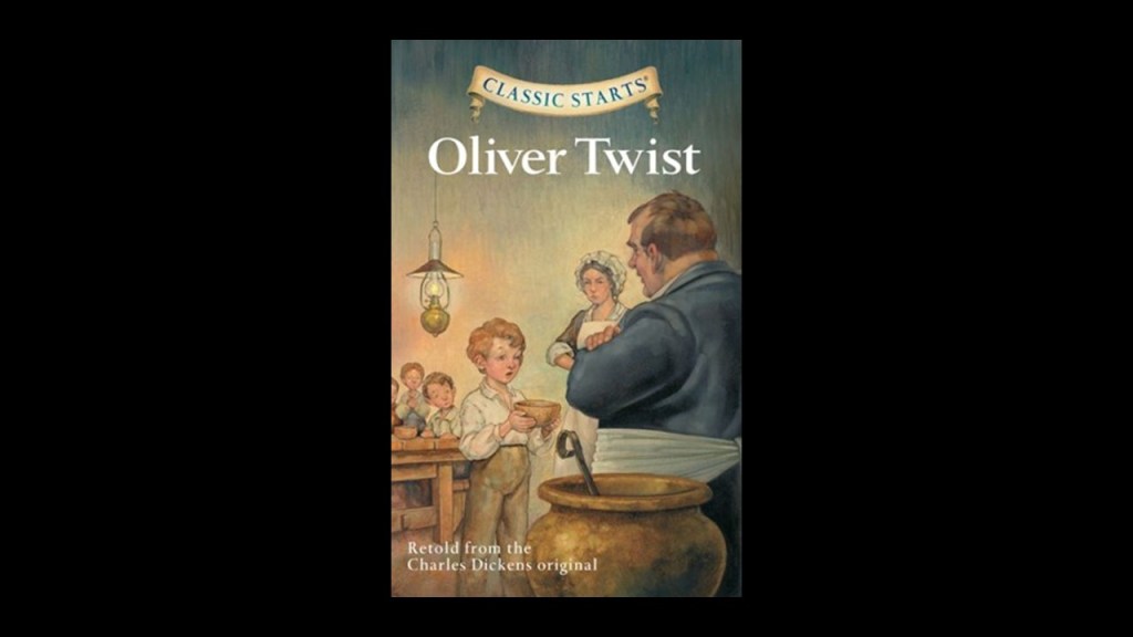
…which was established with the British Parliament’s Poor Law Act of 1834, where there was no cash or material support given, and the only option for those who lived there was hard work and forced labor inside the workhouse in exchange for meager sustenance.
Homes were broken up, belongings sold, and families separated.
Within a few years, Charles Dickens had become an international celebrity, and pioneer of the serial publication of narrative fiction, which became the dominant Victorian mode for novel publication, featuring cliffhanger endings.
Maybe geared for an older, literate and mature, audience?
Dickens travelled a lot as a prominent man of his day in the Victorian Era.
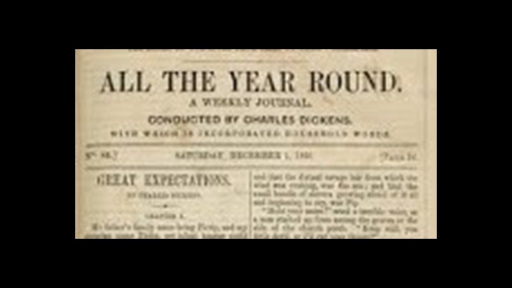
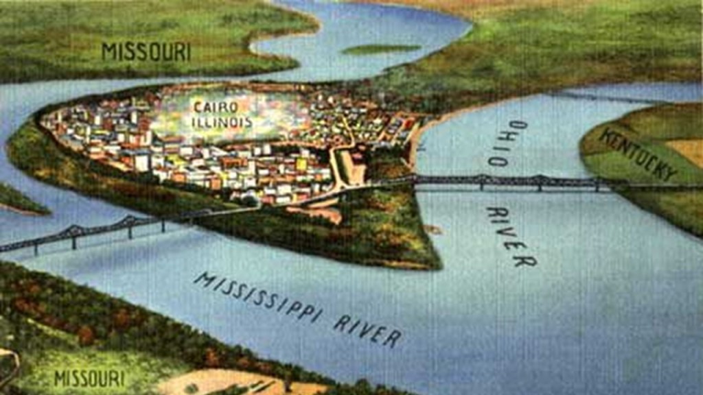
Dickens visited Cairo, Illinois in 1842.
The city of Cairo was located at the southernmost point in Illinois, at the confluence of the Mississippi and Ohio Rivers.
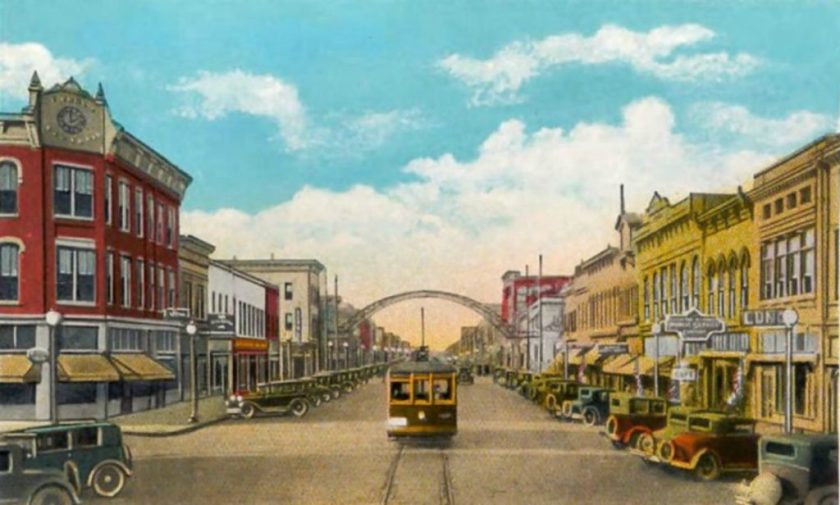
Today, Cairo is empty and deserted, and considered a ghost town.
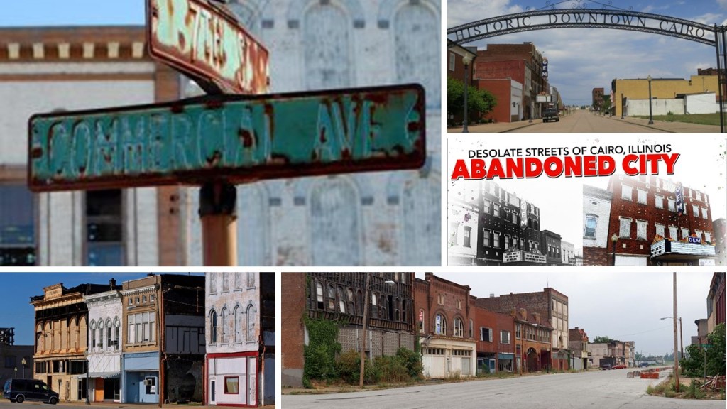
In its heyday, Cairo was an important city along the steamboat routes and railway lines.
Southern Illinois where Cairo is located is referred to as “Little Egypt.”

Dickens was said not to have been impressed with Cairo, and that the nightmare city of Eden was based on Cairo in his novel “Martin Chuzzlewit,” which was published in serial form between 1842 and 1844.

Martin Chuzzlewit is the story of the trials and adventures of a young architect of the same name, who ends up in America from England with travelling companion Mark Tapley to seek their fortunes.
In New York, Martin purchased land “sight unseen” on a “major American river,” having been told that the place would need an architect for new building projects.
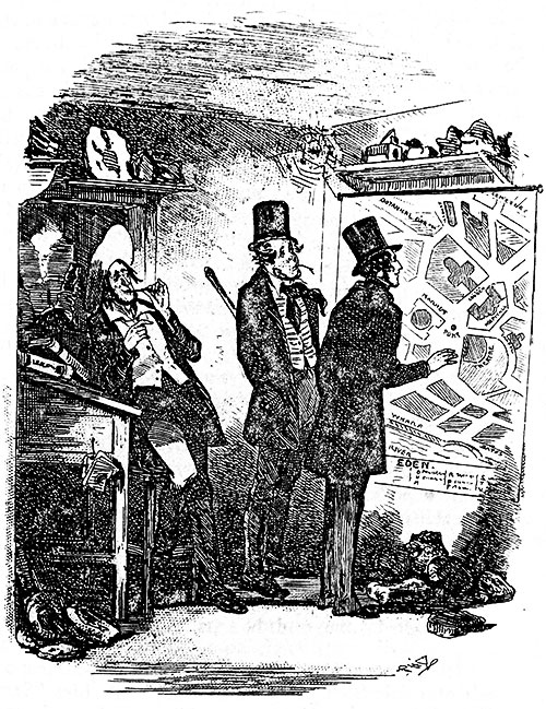
When they arrived at Eden/Cairo, what they found instead was a swampy, disease-filled settlement, virtually empty of people and buildings as previous settlers had died, and both Martin and Mark got ill from malaria while they were there.
They recover from their illnesses and return to England, where Martin ultimately reconciles with his family.
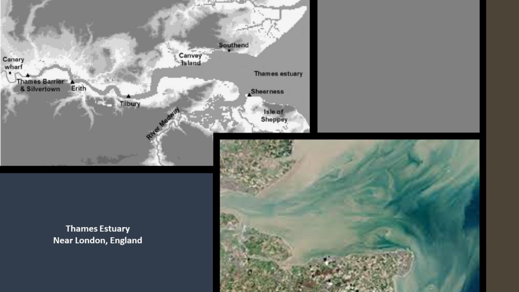
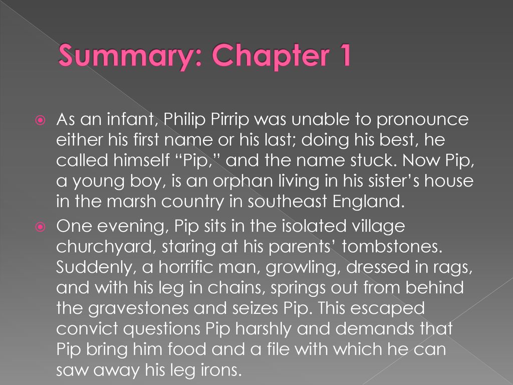
In the first chapter of Charles Dickens’ novel “Great Expectations,” the marshlands of the Thames Estuary, where the River Thames meets the North Sea, were the setting where a young orphan named Pip was living with his sister, and was grabbed in a graveyard by a convict in leg-irons.
This was a book that was required reading in 9th-Grade English class where I went to high school.
So we had to read it, and then we analyzed it in class for meanings.
Yet perhaps there were hidden meanings being conveyed in this book about marshlands, orphans and convicts that we have not been consciously aware of about the prevalent conditions of the day.
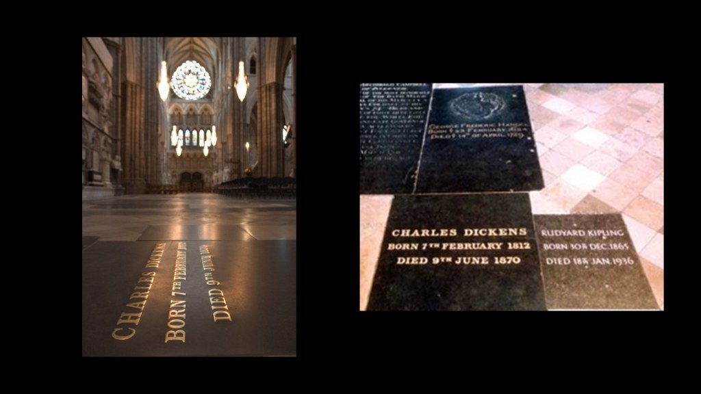
Charles Dickens was buried in Westminster Abbey.
Not bad for a poor kid made good!
Not only that, Dickens and Rudyard Kipling, George Frederic Handel, and Archibald Campbell are hanging out together for eternity!
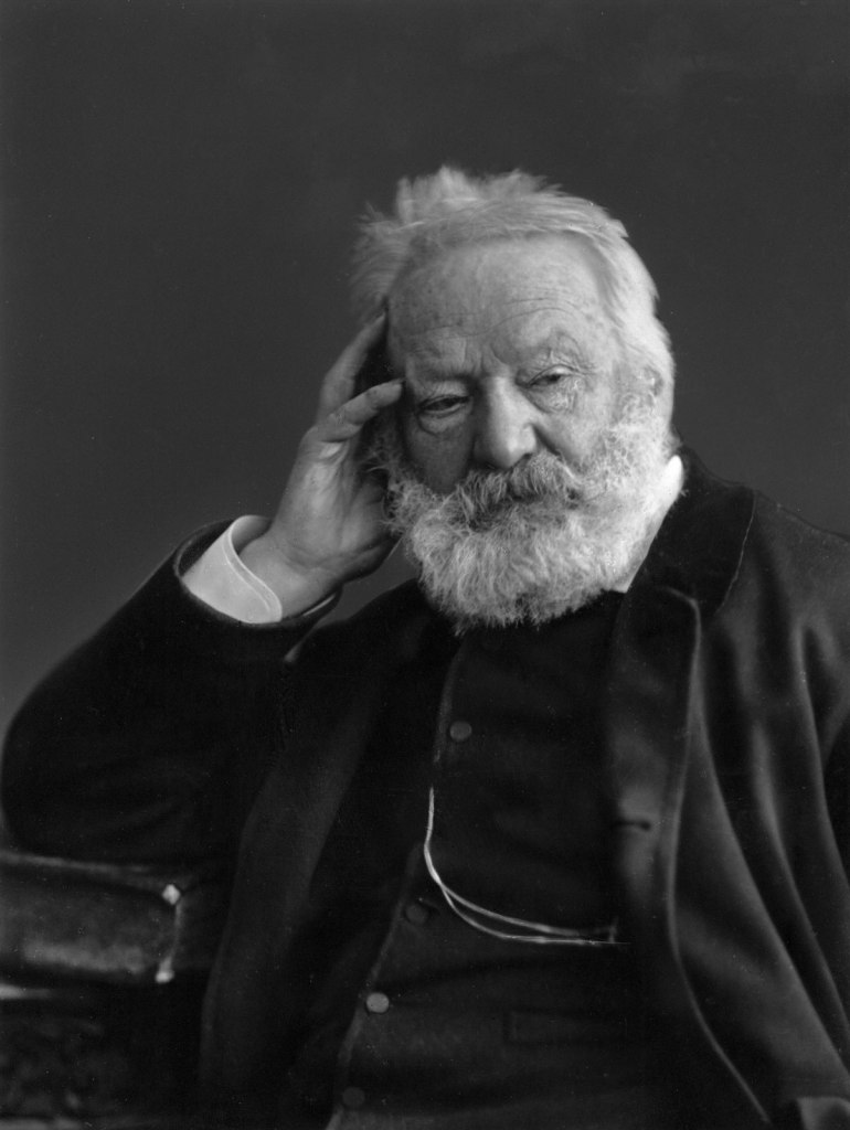
Next up, Victor Hugo.
He was considered to be one of the greatest and best-known French writers, and was born in 1802 and died in 1885.
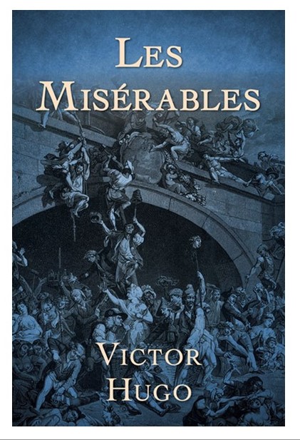
“Les Miserables” is one of his most famous works and considered one of the greatest novels of the 19th-century, was first published in 1862.
Translations into English of “Les Miserables” include: “The Miserable Ones;” “The Wretched;” “The Poor Ones;” ” The Wretched Poor;” “The Victims;” and “The Dispossessed.”
I won’t go through the whole novel, which unabridged was one of the longest ever written, but I do want to bring forward relevant information to my findings about it.
The book contains a number of sub-plots, but the main plot of the story is about ex-convict Jean Valjean, who was arrested as a boy for five-years for stealing a loaf of bread for his starving sister and her family, then gets 14 more years as punishment for numerous escape attempts.
After release from prison, he makes some poor choices, but because of kindness shown to him as a result of one of them, he becomes a force for good.
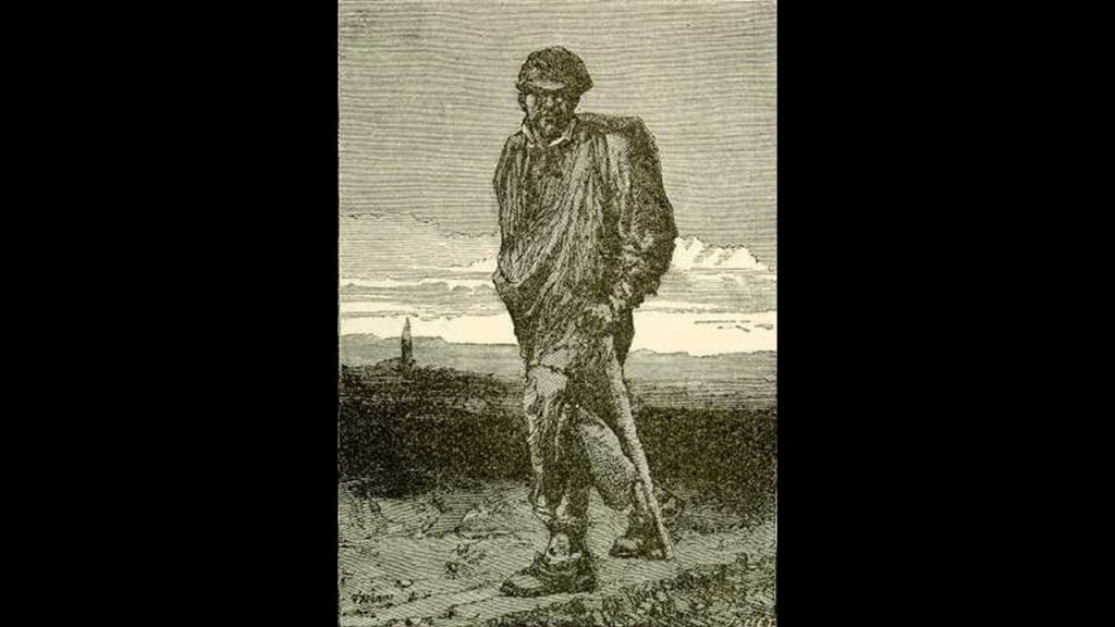
But he is tracked relentlessly throughout the novel by a police inspector who knew him in prison who wants to penalize him for mistakes he made before he changed his life for the better.
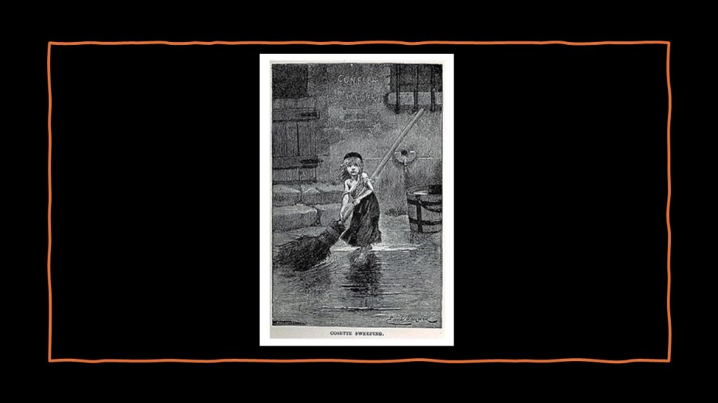
Other characters in the novel in include Cosette, a young girl whom Jean Valjean rescued from servitude from a family who were mean and abusive to her.
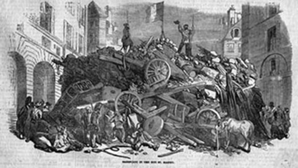
As the various sub-plots interweave, the backdrop of the story becomes the Paris Uprising of 1832.
“Les Miserables” gave the relatively-unknown 1832 rebellion widespread renown.
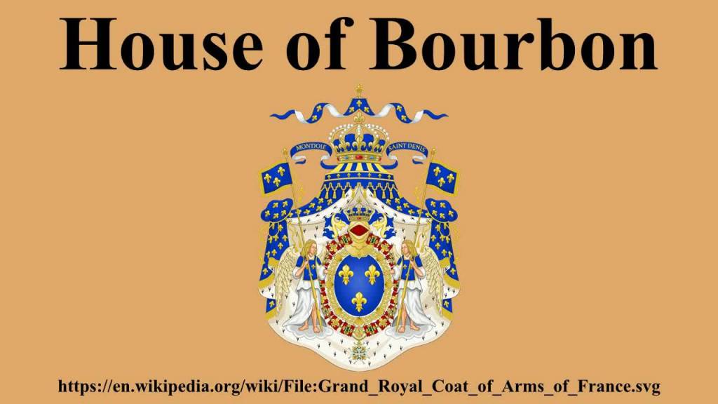
We are told the rebellion originated as an anti-monarchist insurrection on June 5th and 6th of 1832 attempt by Parisian Republicans to reverse the establishment in 1830 of the July Monarchy of Louis-Phillipe of the House of Bourbon, who was the last King of France.
The economic and social conditions leading up to the 1832 Paris Uprising were as follows: harvest failures; food shortages; increases in the cost-of-living; and a cholera outbreak which devastated the poor neighborhoods of Paris.
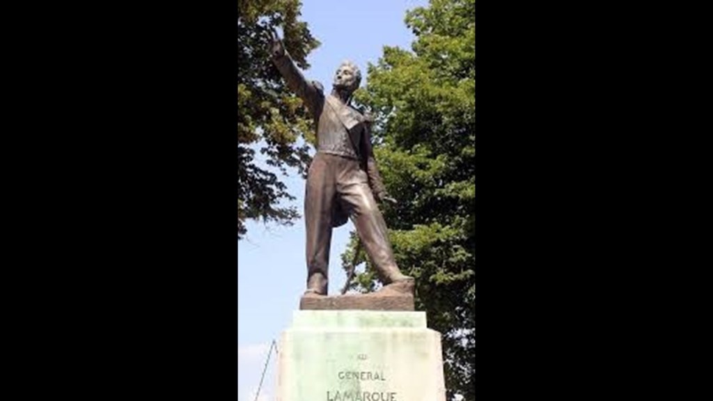
The 1832 Paris Uprising started on June 5th, the day of the funeral of Jean Maximilien Lamarque, a French commander during the Napoleonic War who later became a member of the French Parliament.
Lamarque opposed the restoration of the House of Bourbon and the Ancien Regime of France.
Ancien?
Ancient?
There are many references in our historical narrative to “ancient” that go back only centuries as opposed to millenia, which better fits the definition of ancient as pertaining to the far distant past.
An example of this is St. Augustine, Florida, which has a nickname of the “Ancient City,” which is interesting because the year of its founding was said to be 1565, which is not a year considered to be ancient history studies.
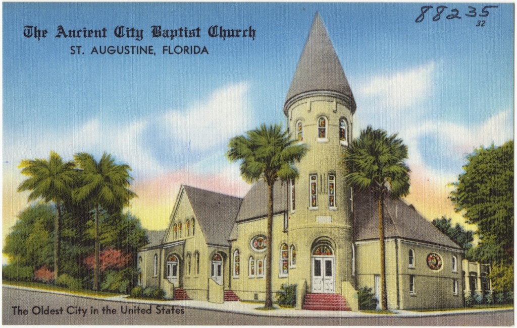
By the way, St. Augustine was the first Catholic parish in what became the United States.
The Jesuits arrived there in 1566, and the Franciscans arrived there in 1573 to establish missions.
Back in Paris, the course of the 1832 Paris Uprising was that after Lamarque’s funeral, the Republican conspirators provoked riots with an army they had organized of Parisian workers and local youth, and refugees from Poland, Germany, and Italy, and they took control of the eastern and central districts of Paris for a short period of time.
They made the Porte Saint-Martin their stronghold, a 60-foot, or 18-meter, high triumphal arch made of limestone and marble, said to have been built in 1674.
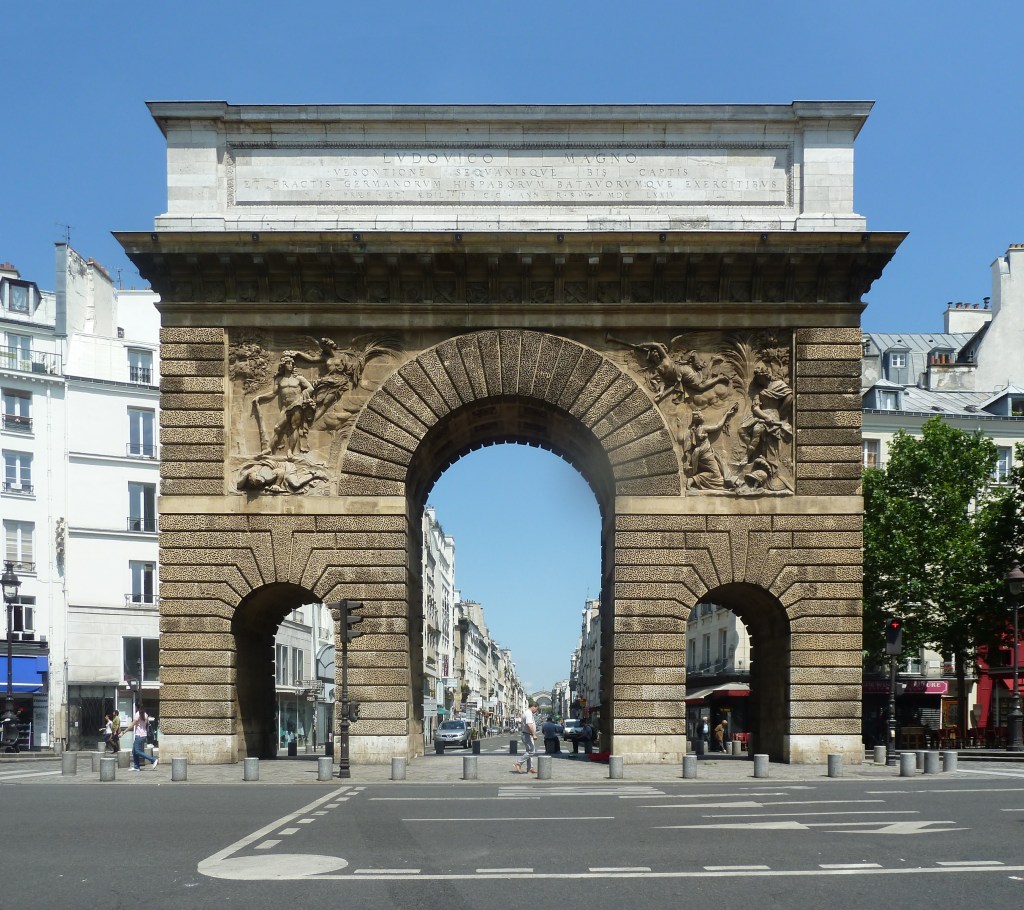
They built barricades around the narrow streets in the surrounding area.
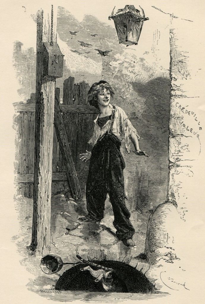
In the novel “Les Miserables,” the character of Gavroche was a young street urchin who takes part in the barricades… and was killed while collecting bullets from dead National Guardsmen.
The French Army and National Guard ultimately put down the uprising on June 6th, the day after it started.
I believe the literature of Charles Dickens and Victor Hugo, and other famous authors, were being used both as programming devices with which to shape our collective minds with the new historical narrative, and at the same time telling us what was going on with regards to replacing the Old World Order with the New World Order, and documenting, among other things, the conditions of poverty and the negative societal impacts on children that was rampant across continents during the 19th-century.
Another significant but obscure historical event to note in Paris was the Paris Commune.
The short-lived Paris Commune was formally established on March 28th of 1871, and was a radical socialist, anti-religious and revolutionary government that ruled Paris until it was suppressed by the French army in May of 1871.
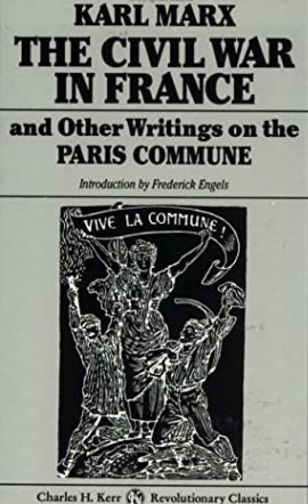
What happened in the Paris Commune was closely followed by London resident Karl Marx, who published a pamphlet in June of 1871, called “The Civil War in France,” about the significance of the struggle of the Communards in the Paris Commune.
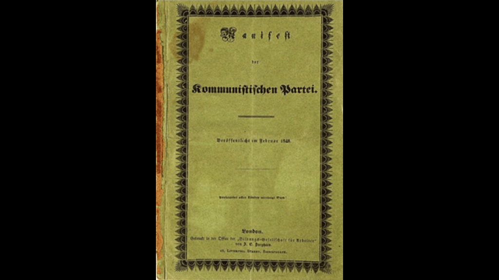
By the time the Paris Commune was established in 1871, Karl Marx and Friedrich Engels had already published their pamphlet “The Communist Manifesto” in 1848.
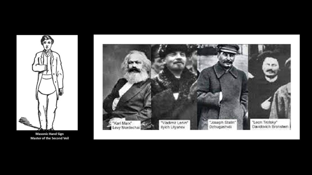
The Communinism espoused by Karl Marx and Friedrich Engels took root in Europe in the violent Russian Revolution of 1917 that marked the end of the Romanov Dynasty and Russian Imperial rule.

Led by leftist revolutionary Vladimir Lenin, the Bolsheviks seized power and would become the Communist Party of the Soviet Union.
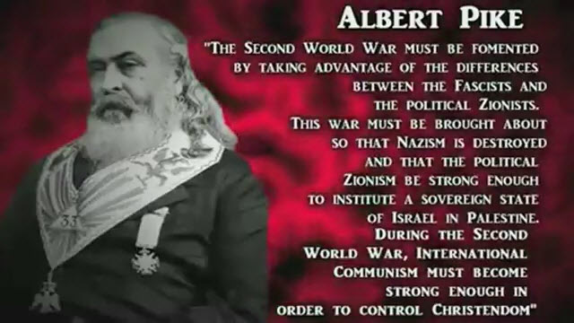
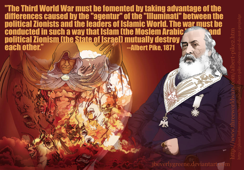
I have encountered the following three graphics displaying quotes of powerful Freemason Albert Pike about World Wars I, II, and III that were said to have been contained a letter written in 1871 by Albert Pike to Giuseppe Mazzini, the second leader of the Bavarian Order of the Illuminati after Adam Weishaupt’s death in 1830.
This letter was written in the same year that Karl Marx published his pamphlet about the Communards in France.
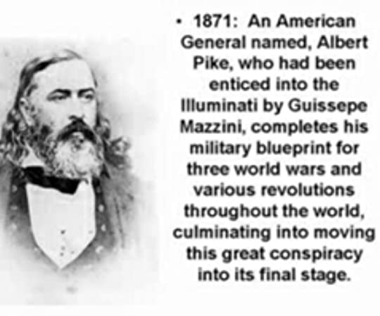
The following three quotes appear to be the military blueprint for three world wars.
For the First World War, Pike was talking about the Illuminati overthrowing the Czars and making Russia a fortress of atheistic communism.

For the Second World War, Pike talked about taking advantage of the differences between Fascists and Zionists; destroying Nazism; Zionism creating Israel, and Communism being strong enough to control Christendom.
And for the Third World War, Pike talked about the Illuminati taking advantage of the differences between Zionist and Islamic leaders so they mutually destroy each other.
All of this sounds very familiar to what we know in the present-day!
Could all of these conflicts, at least since the American Civil War, and other wars of the 19th-century, been planned, even scripted out and staged, for the Controller’s desired outcome, which was world control and domination?
The time-frame of the American Civil War is a good lead-in to bring in the many hats of Frederick Law Olmsted wore in the shaping of our new historical narrative.
He is called the “Father of Landscape Architecture.”
His biography says he created the profession of landscape architecture by working in a dry goods store; taking a year-long voyage in the China trade; and by studying surveying, engineering, chemistry, and scientific farming.
Though I found references saying he did attend Yale College, we are also told he was about to enter Yale College in 1837, but weakened eyes from sumac poisoning prevented him the usual course of study.
At any rate, he apparently did not graduate from college in any course of study.

We are told he started out with a career in journalism, travelling to England in 1850 to visit public gardens there, including Birkenhead Park, a park said to have been designed by Joseph Paxton which opened in April of 1847 and said to be the first publicly funded civic park in the world.

Joseph Paxton, a gardener and greenhouse builder by trade…

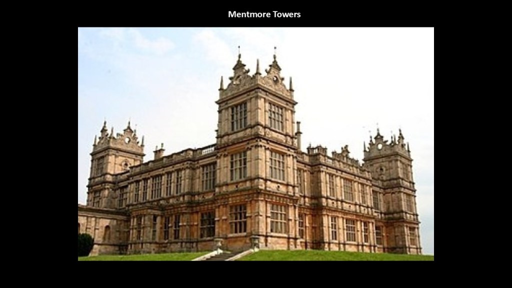
…was also said to have been commissioned by Baron Mayer de Rothschild in 1850 to design the Mentmore Towers in Buckinghamshire…
…and Joseph Paxton was also given credit in our historical narrative for designing the Crystal Palace to house the 1851 Great Exhibition in London in Hyde Park.
The Crystal Palace was described as a massive glass house that was 1,848-feet, or 563-meters, long, by 454-feet, or 138-meters, wide, and constructed from cast-iron frame components and glass.

After his trip, Olmsted published “Walks and Talks of an American Farmer” in England in 1852, where he recorded the sights, sounds and mental impressions of rural England from his visit.

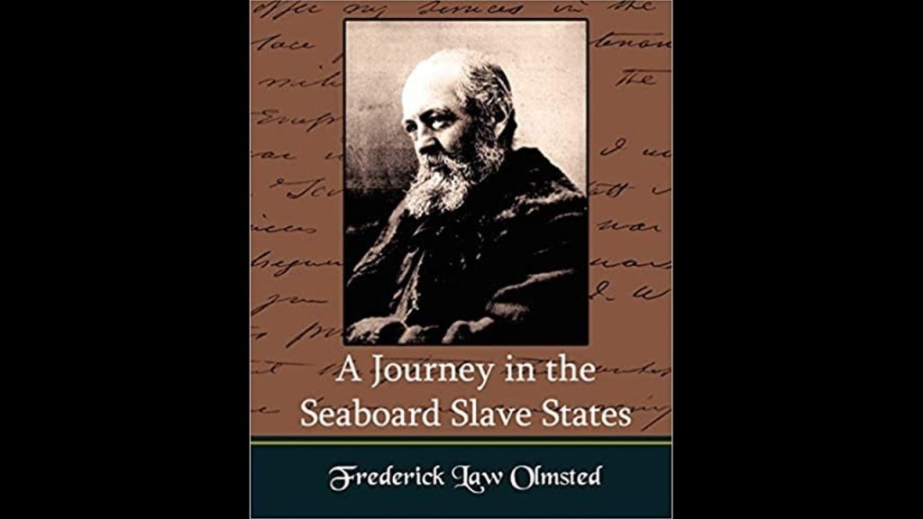
Frederick Law Olmsted apparently was also commissioned by the New York Daily Times to start on an extensive research journey in the American South and Texas between 1852 and 1857.
The dispatches he sent to the Times were collected into three books, and considered vivid, first-person accounts of the antebellum South: “A Journey in the Seaboard Slave States,” first published in 1856…
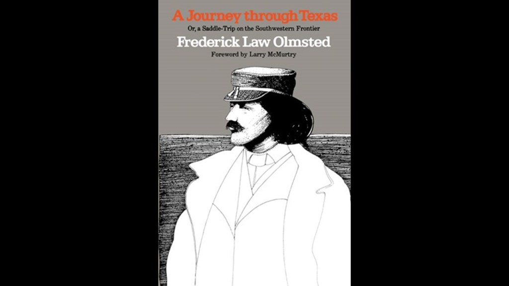
…”A Journey through Texas,” published in 1857…
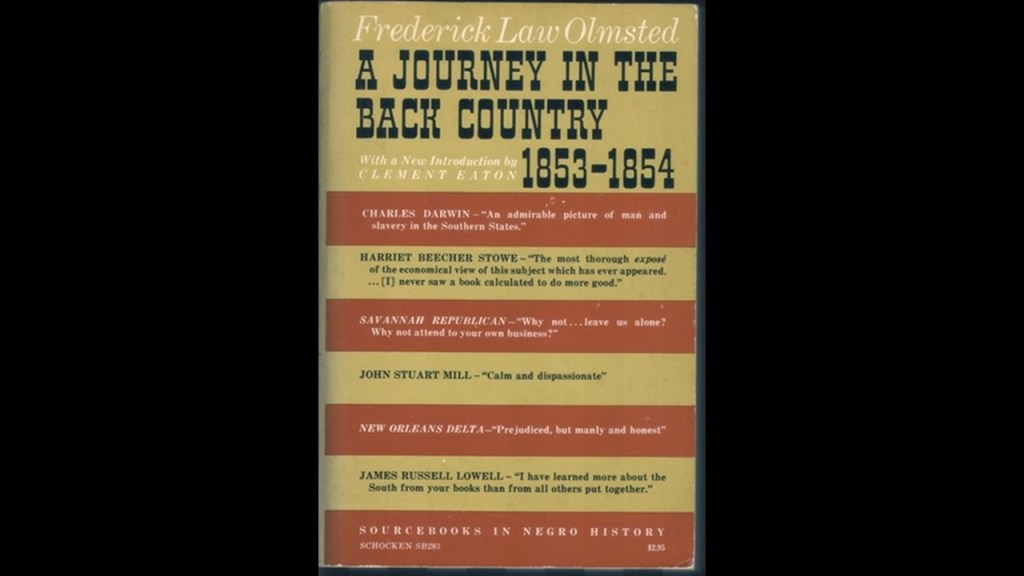
…and “A Journey in the Back Country in the Winter of 1853 – 1854,” published in 1860.
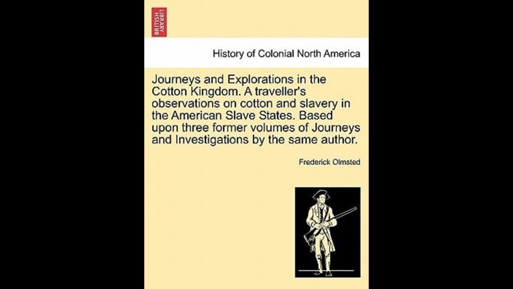
All three of these books were published in one book, called “Journeys and Explorations in the Cotton Kingdom,” in 1861 during the first six months of the American Civil War at the suggestion of his English publisher.
One more thing, before I move on to some other things Frederick Law Olmsted was known for, is that he provided financial support for, and sometimes wrote for, “The Nation,” a progressive magazine that is the oldest continuously published weekly magazine in the United States, having been founded on July 6th of 1865, three-months after the end of the American Civil War.

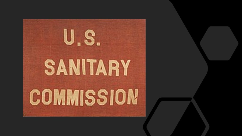
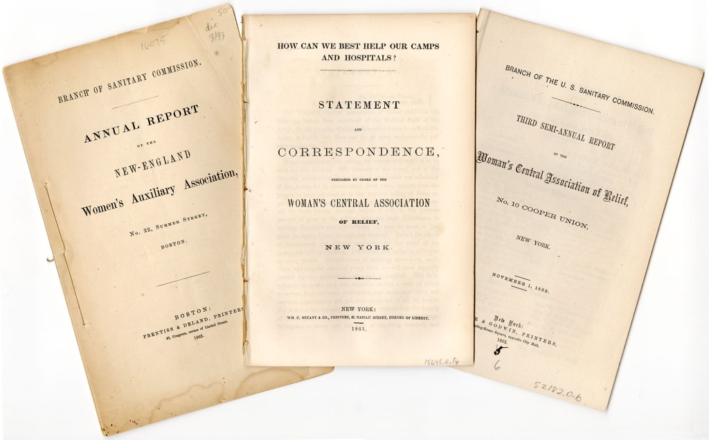
The next thing I want to bring up about Frederick Law Olmsted is that he was the first executive secretary of the United States Sanitary Commission.
We are told the United States Sanitary Commission was a private relief agency with the mission of supporting the sick and wounded soldiers of the Union Army, and was created by federal legislation on June 18th of 1861.
We are told the United States Sanitary Commission held what were called “Sanitary Fairs” as fundraising events to support their mission of providing support to sick and wounded Union soldiers.
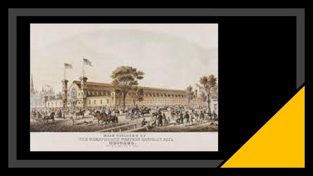
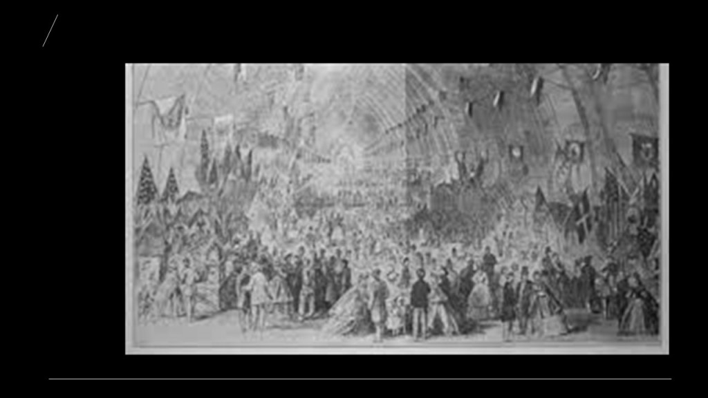
“Sanitary Fairs” had everything, including majestic “temporary” buildings said to have been built for the fairs, to be torn down after, and while not as elaborate as the big expositions such as in Chicago, they were still something in and of themselves.

The fairs were expositions and bazaars organized and run by civilians to raise funds for the United States Sanitary Commission for food, clothing, bandages, and other supplies for both military hospitals and soldiers in the field.
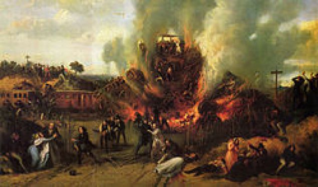
Sanitary Fairs typically held large-scale exhibitions, and the 1863 Northwestern Soldiers Fair in Chicago featured a “Curiosity Shop” of war souvenirs, with weapons and other artifacts said to have been designed to contrast the barbaric southern enemy with the civilized North.
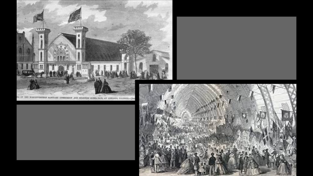
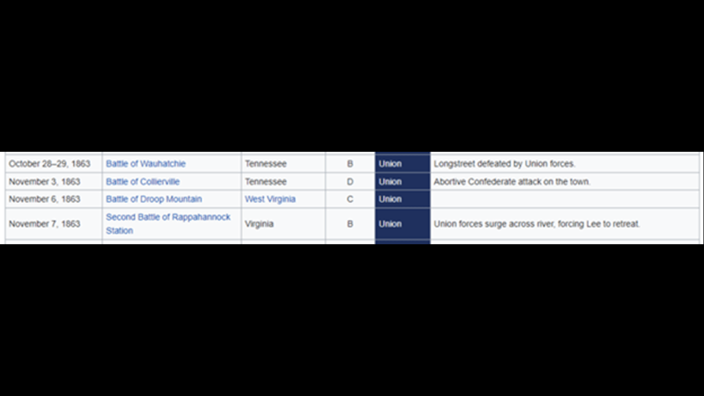
These were the Civil War Battles said to have taken place during the same period of time as the Northwestern Soldiers Fair:
The Great Central Fair in June of 1864 took place in the entirety of Philadelphia’s Logan Square.
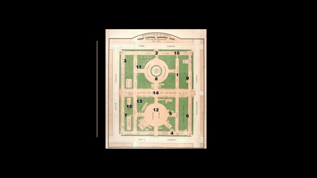
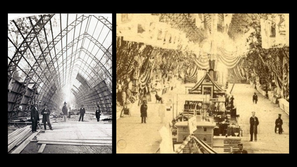
The structures for the Great Central Fair were said to have been built in 40-working days by volunteer craftsmen…all 6 of them?…in this could-be-staged photograph…
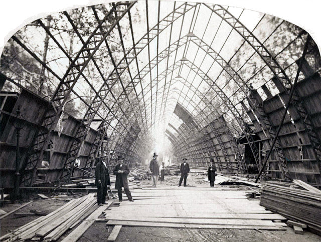
…because when it was completed, the 200,000-square-foot, or 18,581-square-meter complex looked like this, featuring Union Avenue, a 540-foot-, or 165-meter-, long Central Hall…
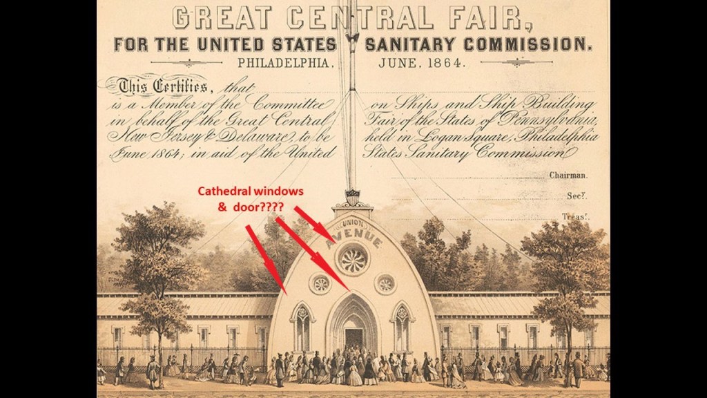
…over flag-festooned, soaring gothic arches.
Come to think of it, both of these photographs look staged, with the few people shown in both photos facing the photographer.
And are the dimensions of the interior the same?
And even if they are photos of the same structure, with the one photo on the right looking wider and higher to me than the photo on the left, could the photo on the left be a “de-construction” photo instead of a “construction” photo as it was said to be?
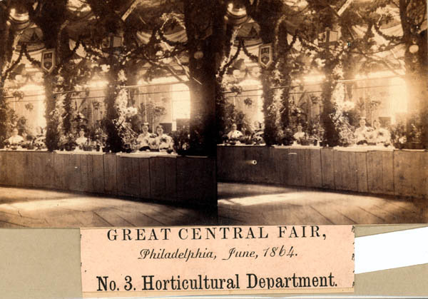
Said to have raised more than $1,000,000 for the United States Sanitary Commission in its 3-week run from June 7th to June 28th of 1864, in its final form, the fair was said to have around 100 departments, including Arms and Trophies; children’s clothing; homemade fancy articles; Fine Arts; brewers; wax fruit; trimmings and lingerie; umbrellas and canes; curiosities and relics; a steam glass blower; an Art Gallery; and a horticulture exhibit.
These were the Civil War Battles said to have taken place during the same period of time as the Great Central Fair:
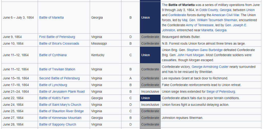
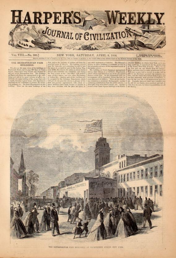
The first Metropolitan Fair, planned for March but ended up being held in New York between April 4th and April 23rd of 1864, also raised over $1,000,000 for the cause, and was the largest Sanitary Fair ever.
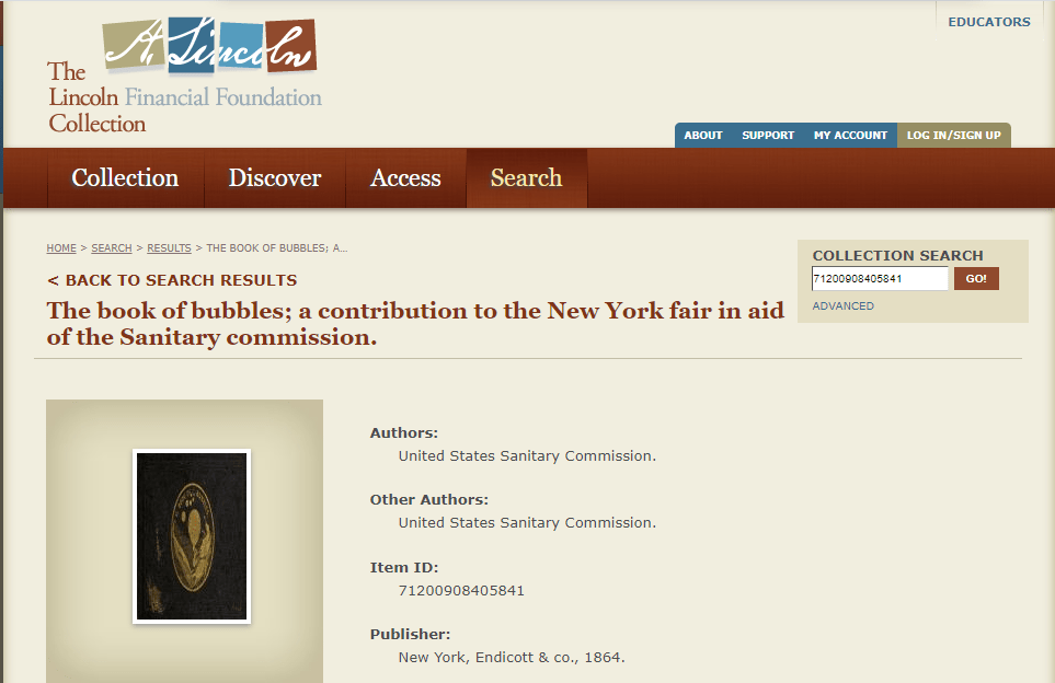
Metropolitan Fair-goers could purchase souvenirs like “The Book of Bubbles…”
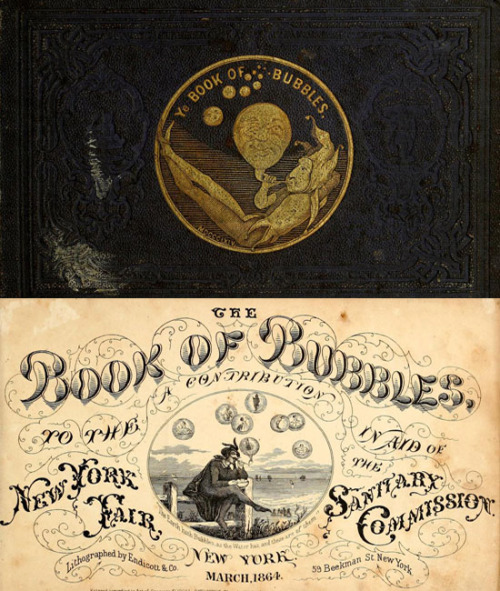
…a book of nonsense verses with illustrations authored by members of the United States Sanitary Commission.
There was a second Sanitary Fair held in Chicago, this one called the Great Northwestern Sanitary Fair, from October 27th to November 7th of 1865.
It was the last Sanitary Fair of the Civil War, and was said to have raised $270,000 for sick and wounded soldiers.
Speakers at this last Sanitary Fair included Generals Ulysses S. Grant, William T. Sherman, and Joseph Hooker.
Exhibits at the fair were said to include: the bell from Jefferson Davis’ plantation (he was the President of the Confederacy); the clothing both men were wearing at the 1858 Abraham Lincoln – Stephen Douglas debates about slavery and the extension of slavery into new territories; and General Grant’s horse was raffled off as a fundraiser.
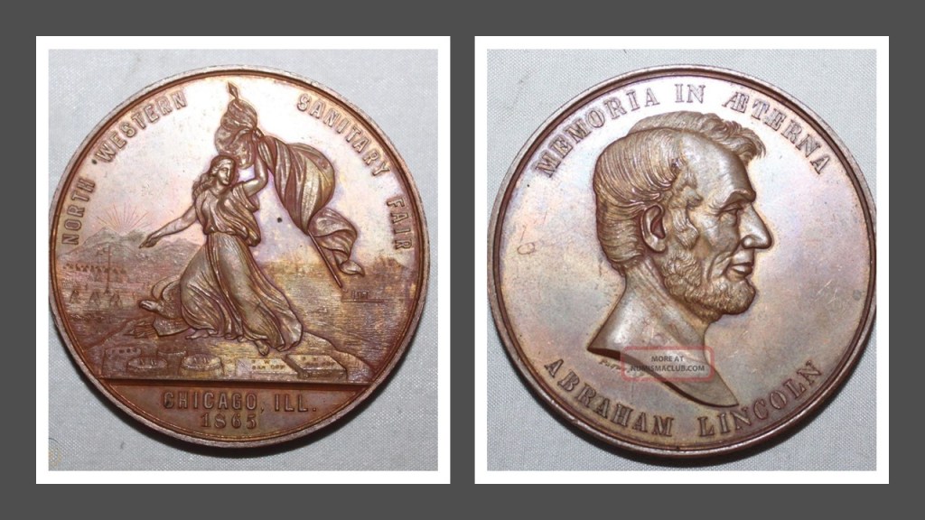
This Great Northwestern Fair in Chicago took place after the assassination of President Abraham Lincoln, which happened on April 15th of 1865.
This medallion commemorating Lincoln and the Great Northwestern Sanitary Fair was minted for the 1865 fair.
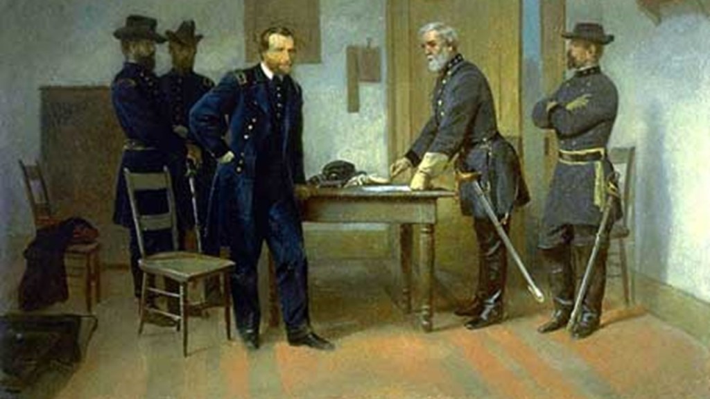
By the time of the Great Northwestern Sanitary Fair in late 1865, the American Civil War had already officially ended on April 9th of 1865 with the meeting of of the Union General Ulysses S. Grant and the Confederate General Robert E. Lee at the Appomattox Courthouse in Virginia, which took place a week before President Lincoln’s assassination.
The template for the Sanitary Fairs was the same as that for the World Fairs, Expositions and Exhibitions – infrastructure said to have been built specifically for these events out of “temporary” materials, and then, for the most part, demolished at some point afterwards, like the Trans-Mississippi International Exposition, held in 1898 in Omaha, Nebraska, from June to November of that year, one of countless examples of this story.
The planner of the United States Sanitary Commission, and its only president from 1861 to 1878, was Henry Whitney Bellows, an American Unitarian Clergyman.
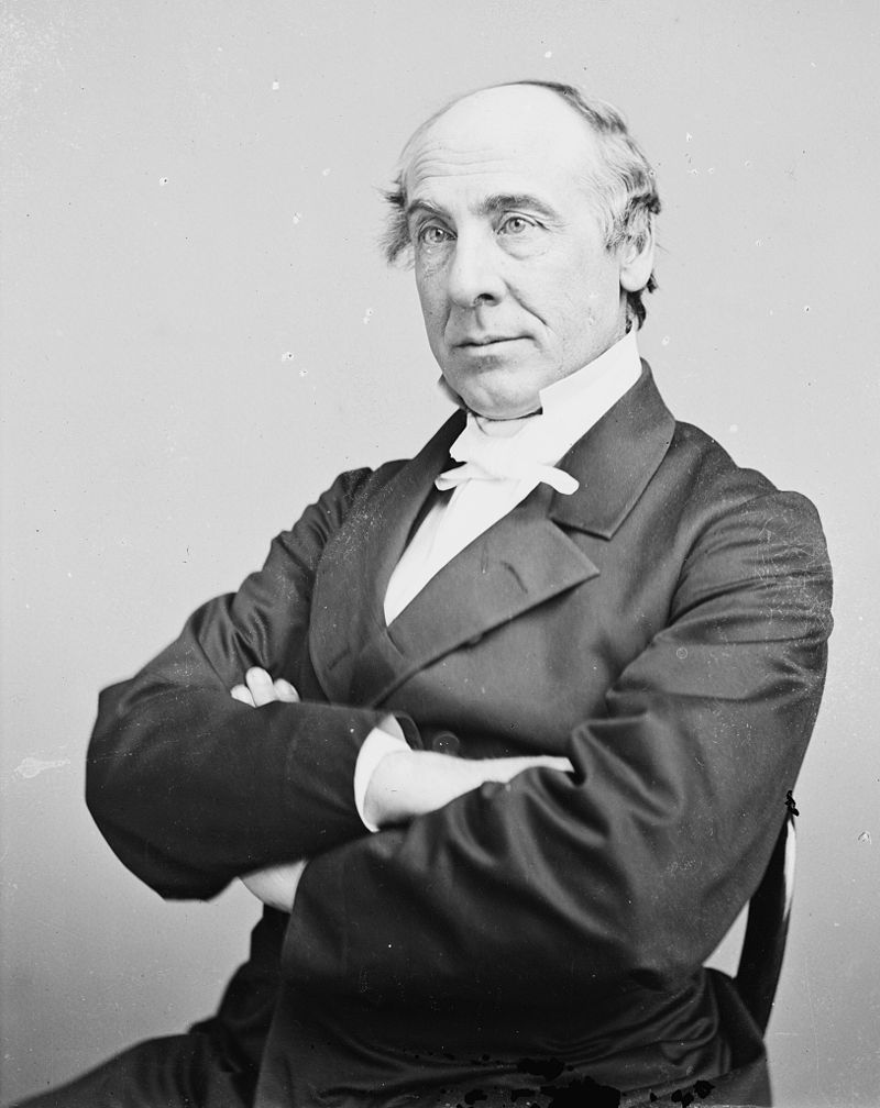
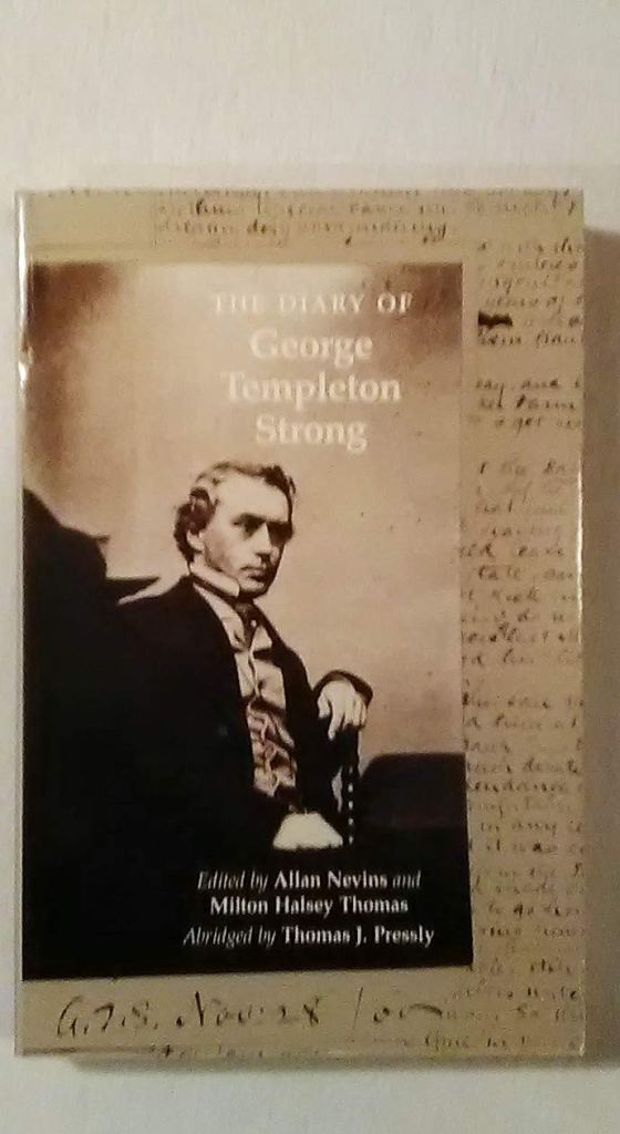
Another founder of the United States Sanitary Commission was George Templeton Strong, a New York lawyer and diarist.
His 2,250-page diary was said to have been found in the 1930s, and contained his striking personal account of life in the 19th-century, between 1835 and 1875, including the events of the American Civil War between 1861 and 1865.
Other members for the standing committee of the United States Sanitary Commission, with its main members throughout the Civil War, also consisted of surgeons Dr. William H. Van Buren, Dr. Cornelius R. Agnew, and Dr. Wolcott Gibbs.

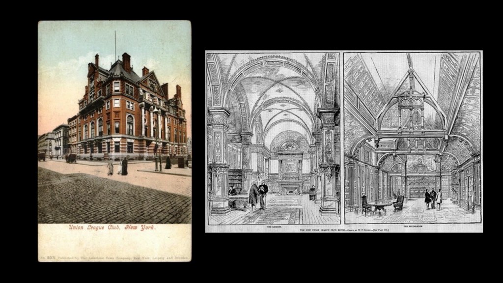
Of the men on the standing committee for the United States Sanitary Commission, most were founding members of the Union League Club as well- Henry Whitney Bellows, Frederick Law Olmsted, George Templeton Strong, and Dr. Wolcott Gibbs.
It was a private social club for wealthy men that opened in New York City in 1863 for pro-Union men could come together “to cultivate a profound national devotion” and “strengthen a love and respect for the Union.”
It became the most exclusive mens’ club in Manhattan, and perhaps in the nation.
This location for the Union League Club was said to have been built on the northeast corner of 5th Avenue and 39th Street between 1879 and 1881, and this building burned down in January of 1932.
Henry Whitney Bellows was also involved in the organizing of the Century Association in New York City, founded in 1847 and incorporated in 1857.
The Century Association was a private social, arts and dining club, and named after the first 100 people proposed as members that were important influencers of the day across many fields of endeavor, including but not limited to architecture, art, politics, and members from wealthy elite families.

The Century Association Building at 42 E.15th Street was in-use by the association starting in 1857, and which served as one of the headquarters of the United States Sanitary Commission.

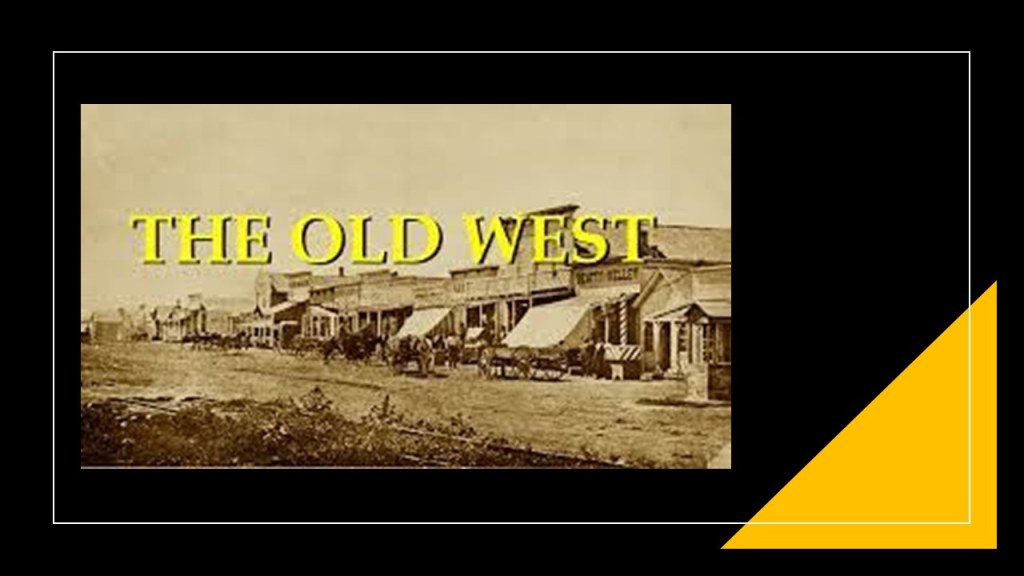
Also from around the same time-frame of the American Civil War, I am seeing the strong presence of Freemasons giving us the “new” history of the “Old West” in our new historical narrative.
I am going to take a quick look first at what I call the John Wayne version of history, that false historical narrative that we have been indoctrinated in from cradle-to-grave, and I am going to start by looking at the history of how we came to know about the “Wild West.”
The first thing that came along were western-themed dime novels that became available starting in 1860, which would have been right before the beginning of the American Civil War in our historical narrative.
The dime novels were written on pulp paper – from which the term “Pulp Fiction was derived – and contained pictures, and were introduced by the publishing house of Beadle and Company, operated primarily by brothers Irwin & Erastus Beadle, which provided a cheaper form of reading material than what existed previously, and were targeted towards young boys with stories about wild west adventures, and which were the largest demographic of dime novel western readers.
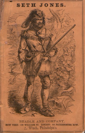
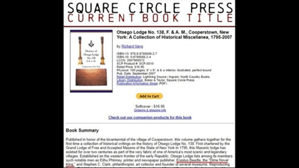
Erastus Beadle was listed as a member in this book about the Otsego Lodge No. 138 in Cooperstown, New York.
Next in our new timeline came the Old Wild West Shows, which were described as travelling vaudeville shows in the United States and Europe that took place between 1870 and 1920.
Vaudeville originated in France in the 19th-century, we are told, as a theatrical genre of variety entertainment, and became one of the most popular forms of entertainment in North America for several decades.
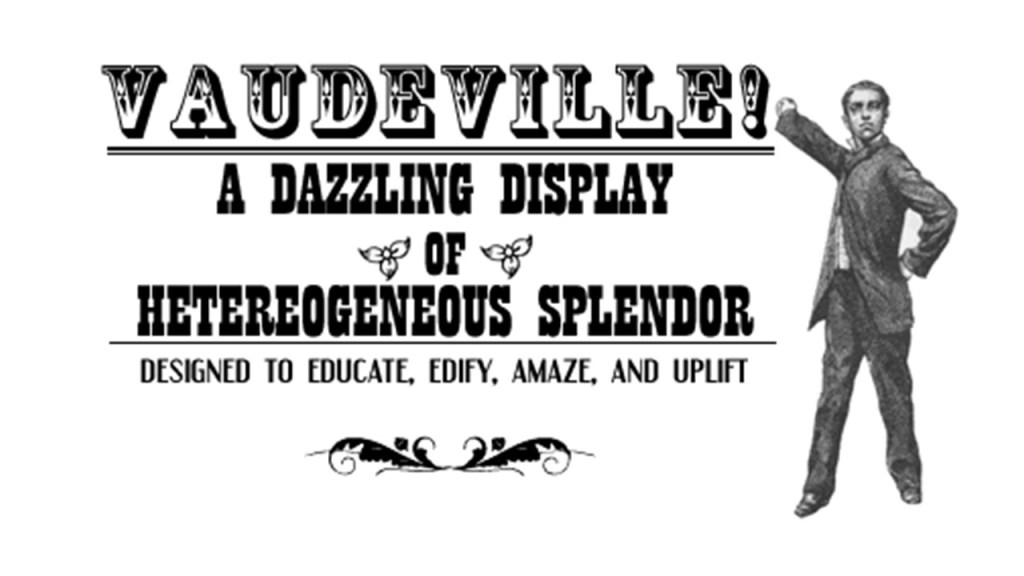
While not in every case, it was typically characterized by travelling companies touring through cities and towns.
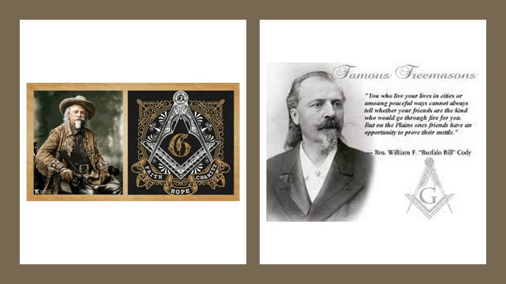
Enter U. S. Army scout and guide William F. “Buffalo Bill” Cody.
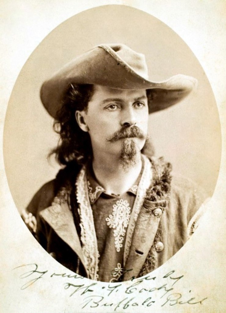
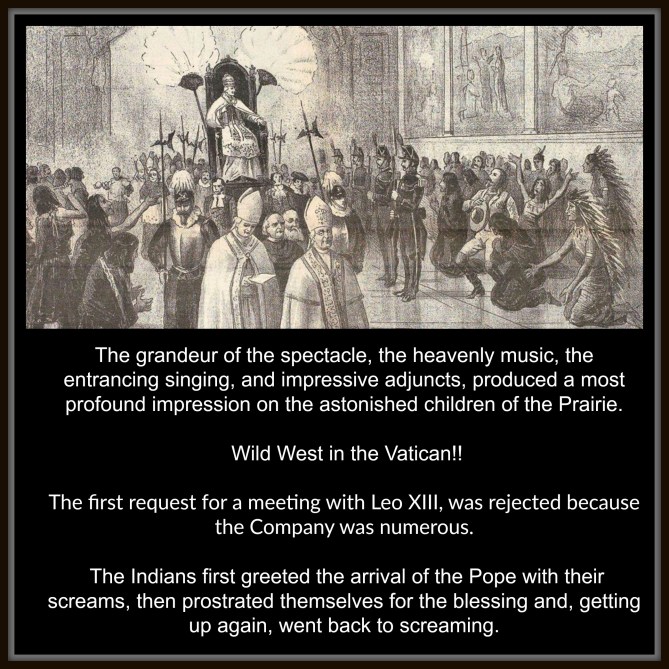
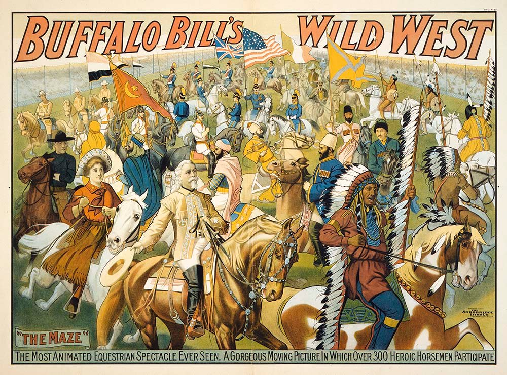
He became internationally known for his touring show, called “Buffalo Bill’s Wild West,” which travelled across the United States, Great Britain, and Continental Europe, which he founded in 1883.
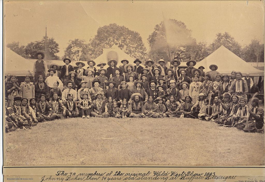
All together, Buffalo Bill’s Wild West Show toured Europe eight times between 1887 and 1906.
In 1893, the name was changed to “Buffalo Bill’s Wild West and Congress of Rough Riders of the World” from horse-cultures the world over.
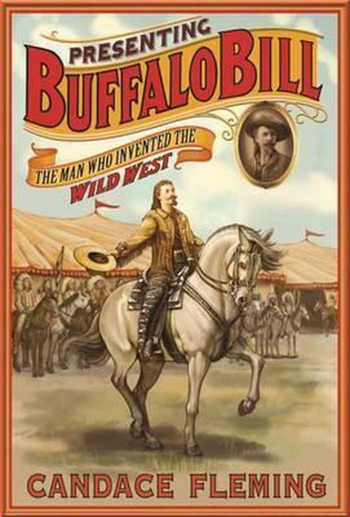
I even saw a book about him called “Presenting Buffalo Bill – the Man who Invented the Wild West.”
And was William F. “Buffalo Bill” Cody a freemason?
I didn’t have to look far at all to find Buffalo Bill’s connection to freemasonry – it was right out there in the open!
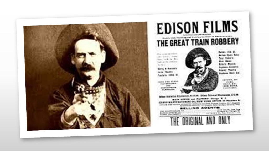
The first commercially-successful western film is considered to be Edwin S. Porter’s silent western “The Great Train Robbery” which was filmed in New York and New Jersey for the “Edison Manufacturing Company, and first released Vaudeville houses in 1903, and it set the pattern for many more westerns to come.
The first silent western film was an unprecedented commercial success, and the close-up of the actor Justus Barnes emptying his gun directly into the camera became iconic in American Culture.
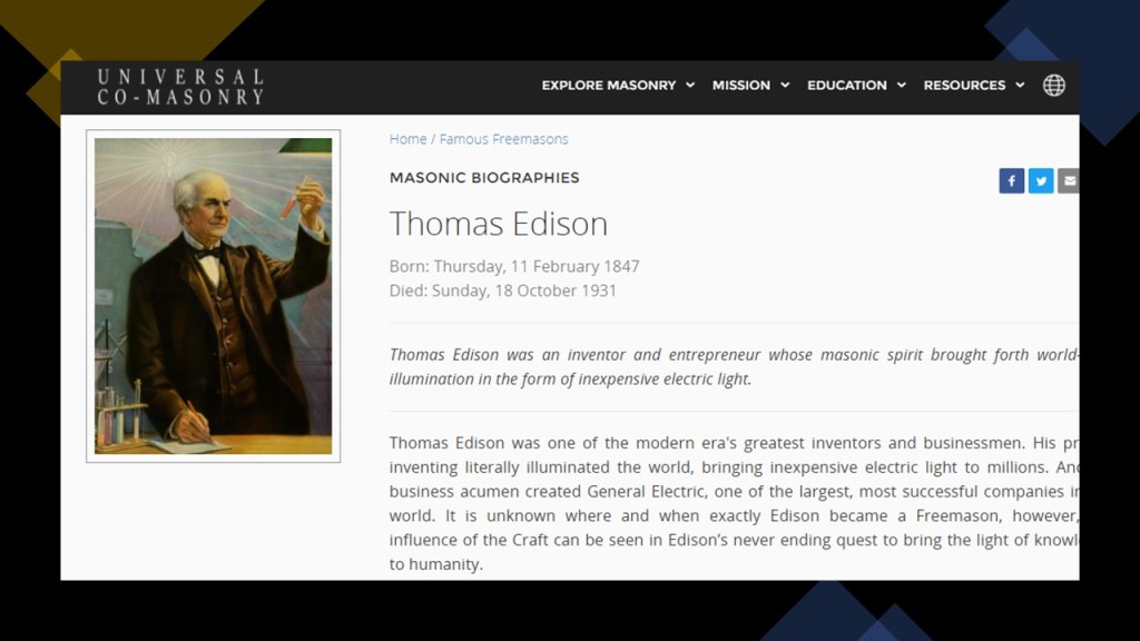
I was able to find out that famous inventor Thomas Edison was also a Freemason.
The first feature-length motion picture to be entirely filmed in Hollywood was Cecil B. DeMille’s 1914 directorial debut, a silent western film called “The Squaw Man.”

Movie director Cecil B. DeMille was a Freemason too…
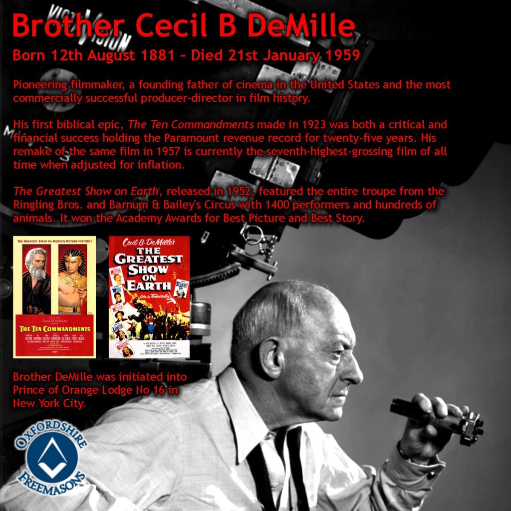
…as were famous movie actors best- known for their western movies, John Wayne and Roy Rogers, and they were Shriners, an organization comprised of 32nd- and 33rd-degree freemasons, the highest degrees of western Scottish Rite freemasonry.

As a result of all this, and much more, generations of children and adults have long-been programmed to believe that Hollywood westerns represent real history.
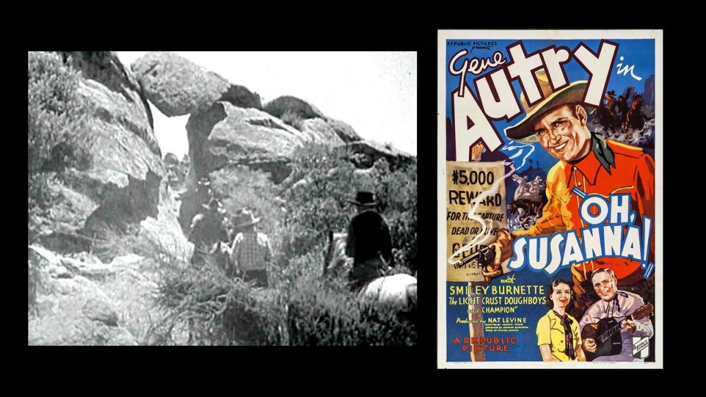
I would like to bring forward the following points of information for my ending thoughts on this post.
The bedrock foundations of our modern scientific paradigm, referring to the solid rock foundations that our scientific worldview is founded upon and the only one that has been taught to generations of students in our educational systems and not to be questioned, can be summarized follows.
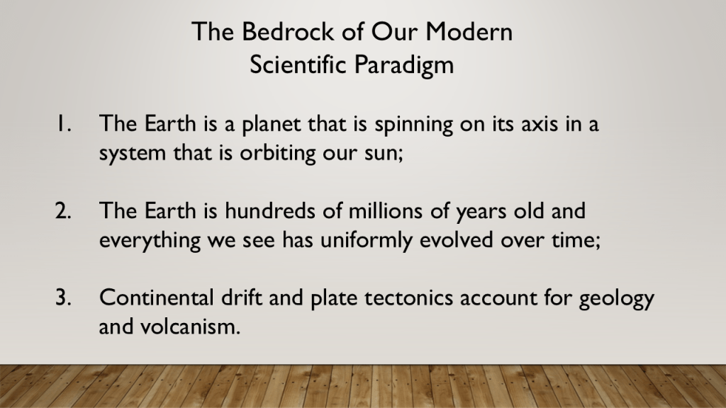
This academically-approved and-enshrined paradigm is opposite to the growing belief among many people, myself included, that the Earth realm exists on a “plane,” and interestingly only one-letter different from “planet” in English, which is a flat horizontal surface that extends indefinitely.
But mainstream thinking is quick to debunk this belief, citing “science” as proof for why the Earth is a globe, which sounds very much like “circular reasoning.”

Circular reasoning occurs when the evidence offered to support a claim is just a repetition of the claim itself.

We have not been allowed to question the narrative or the science and the application of critical thinking has been severely discouraged throughout our world.
Among many other things, both the Rockefeller and Carnegie Foundations have been highly involved in the American Educational System.
Even as early as 1914, the National Education Association expressed alarm at the activity of the Carnegie and Rockefeller Foundations, and their efforts to control the policies of State educational institutions, and everything related to the educational system.

The Rockefellers and Carnegies of the world sought to create a system that would provide practical training and education for workers in the industrial sector, and did not want to promote critical thinking.

Anyone who questions the narrative gets labelled a conspiracy theorist…

…when those behind the New World Order Agenda are the actual conspirators!
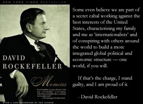
In our historical narrative, the “Royal Society of London” was established by a Royal Charter issued by King Charles II in 1660, and is the oldest continuously existing scientific academy in the world.
The meaning of the Royal Society’s motto “Nullius in Verba” means “Take nobody’s word for it.”
While on one-hand, “take nobody’s word for it” could certainly mean testing through scientific experimentation, on the other hand another meaning would be not to blindly accept what we are told, and to encourage people to do their own research and think for themselves.
With regards to the giants of science like Sir Isaac Newton, while it is not known with absolute certainty if Sir Isaac Newton was an initiated Freemason, Newton was President of the Royal Society when the Premier Grand Lodge of London was established in 1717, when he was 74.
It is known that Elias Ashmole was a Freemason, and he was one of the founding fellows of the Royal Society in November of 1660.
Elias Ashmole, an English antiquary and student of Alchemy, was the first English Speculative Freemason initiated in 1646.
And it is no secret within Modern Freemasonry that it is “speculative,” meaning based on conjecture rather than knowledge, as opposed to “operative,” meaning those who actually worked with stone.
In conclusion, there is no doubt in my mind that these Speculative Freemasons stole the identity and legacy of the original Operative Moorish Masons, and instead used whatever of the original knowledge they possessed for occulting the New World, and, like the Jesuits, the highest degrees of Freemasonry have also been major players behind the creation of the new narrative and paradigm.