In this post, I am going to pull together research I have done in the past to show you the evidence I have found for what I believe has taken place here, and who was responsible for the world we live in today.
The corrupted world we live in today which was nothing like the incredibly advanced Moorish-Atlantean civilization that existed on Earth from ancient times to modern times when Humanity was functioning collectively at a much higher level of consciousness before it was destroyed, and not that long ago.
As I have said before, my working hypothesis is that the circuit board of the Earth’s original energy grid system was deliberately destroyed relatively recently by one or more forms of directed frequency or energy of some kind into different places on the Earth’s grid, causing the surface of the Earth to undulate and buckle.
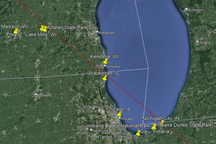
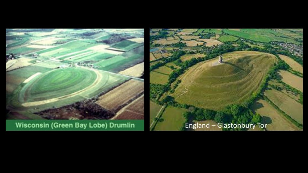
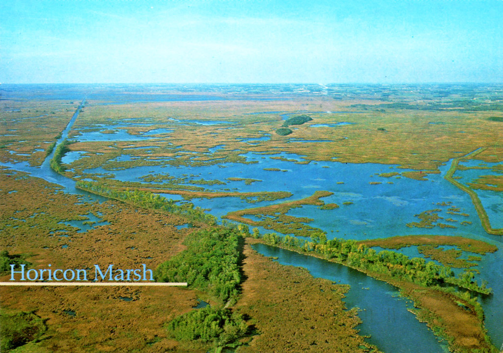
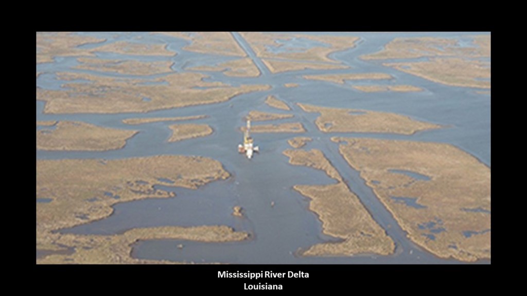
What I am seeing from tracking leylines all over the Earth, looking from place-to-place at cities in alignment over long-distances, are the consistent presence of swamps, marshes, bogs, deserts, dunes, and places where it appears land masses sheared-off and submerged under the bodies of water we see today.
I believe the malevolent, parasitic beings behind the cataclysm were shovel-ready to dig enough of the original infrastructure out of the ruined Earth so they could be used and civilization restarted as the New World Order, which I think started in earnest in the mid-to-late 1700s and early 1800s.
There’s extensive underground infrastructure where those living on Earth at that time could have survived until the surface of the Earth was habitable.
Then they only used the pre-existing infrastructure until they found replacement fuel sources that could be monetized and controlled by them for what had originally been a free-energy power grid and transportation system worldwide, and when what remained of the original infrastructure was no longer useful to them, or inconvenient to their agenda, they had it destroyed, discontinued, or abandoned, typically in a very short time after it was said to have been constructed.
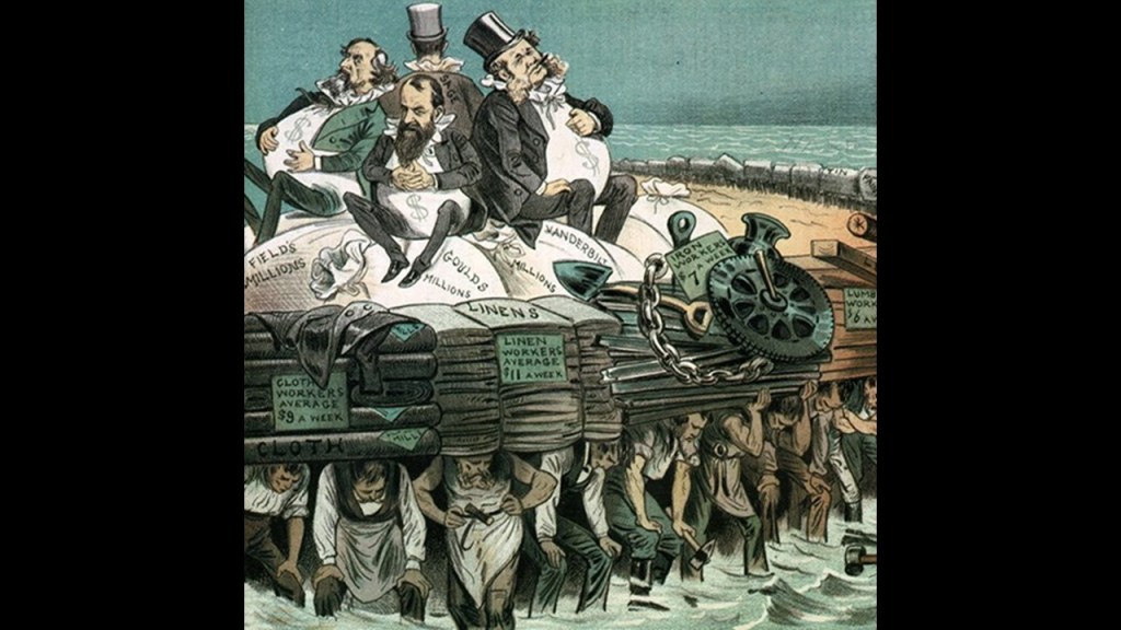
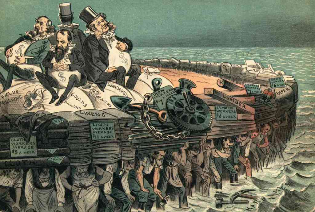
While this new parasitic self-styled elite class lived in the lap of luxury, and helped themselves to the best of everything, they had little care for anyone or anything else.
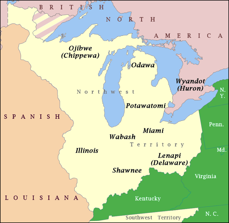
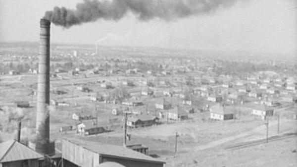
The same story repeats all over the country with the Robber Barons coming in and setting up shop and taking control of everything, starting first in Pennsylvania and then expanding their activities outward from there through Appalachia, the present-day Great Lakes Region and all the way across the continent.
We learned in history class that this westward expansion was referred to as “Manifest Destiny,” a 19th-century belief that the United States was destined by God to expand its dominion across the entire continent.
But what if what we learn in school about our history is a complete and total fabrication, and something very different was going on here from what we have been taught to believe – not for the benefit of all, but only for the benefit of a very few?
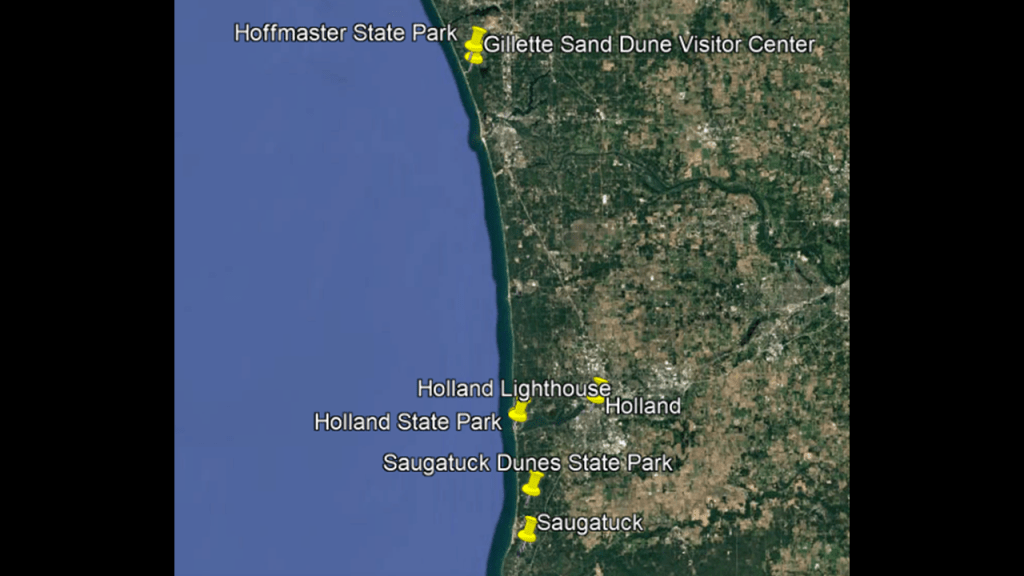
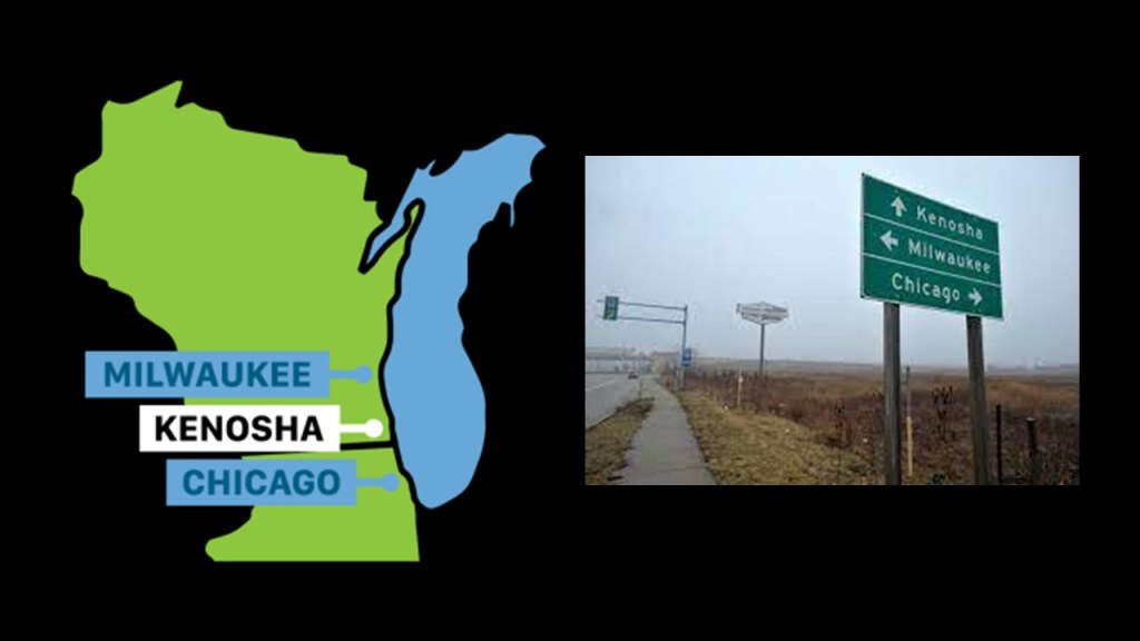
As I just mentioned, the story of what happened here to create the New World Order starts first in Pennsylvania, so that is where I will begin.
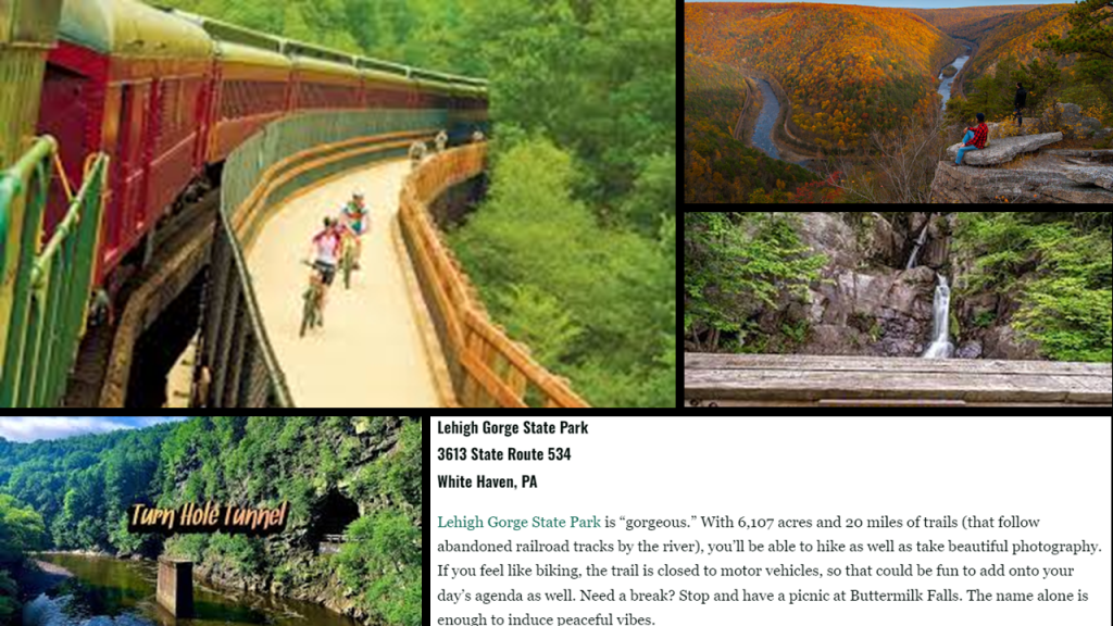
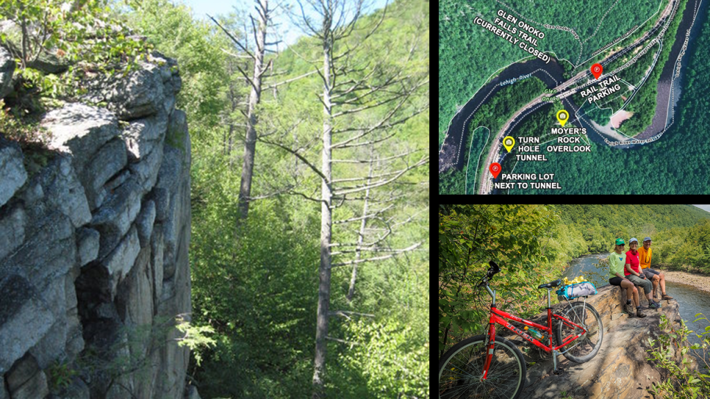
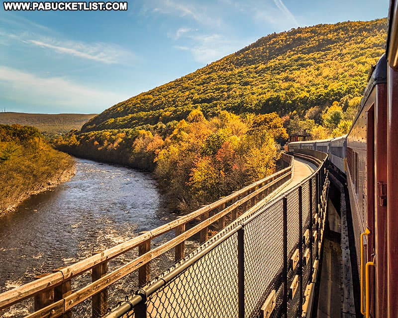
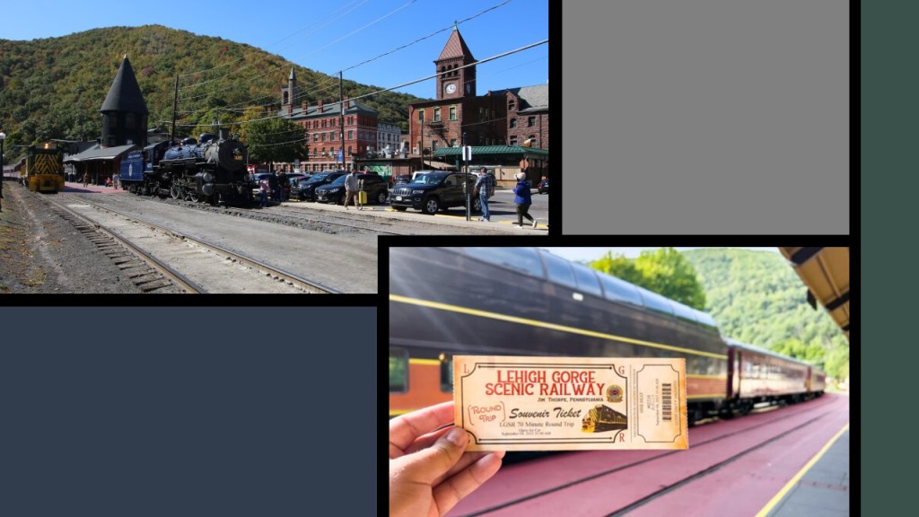
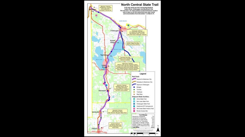
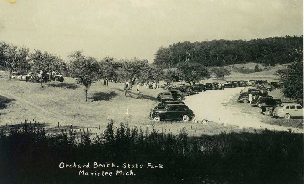
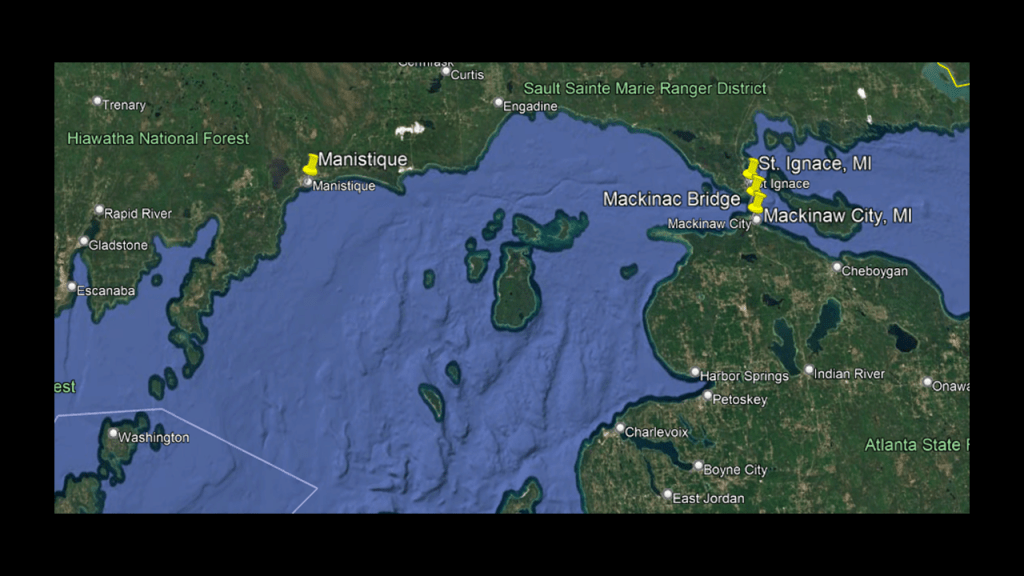
When I was doing research in 2024 for “On the Trail of Giants in Appalachia and Beyond,” I came across the Lehigh Gorge, its abandoned railroad tracks that are now a recreational rail-trail, and its Scenic Railway, and yet another place I can add to my list of places I know of off the top of my head featuring the co-location of S-shaped river bends, railroads, canals, gorges, and waterfalls that I have come to believe were part of the Earth’s original worldwide energy grid system.
The Lehigh Gorge is described as a “steep-walled gorge carved by a river, thick vegetation, rock-outcroppings, and waterfalls.”
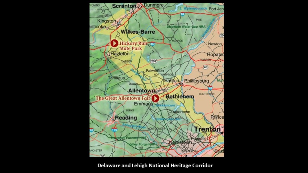
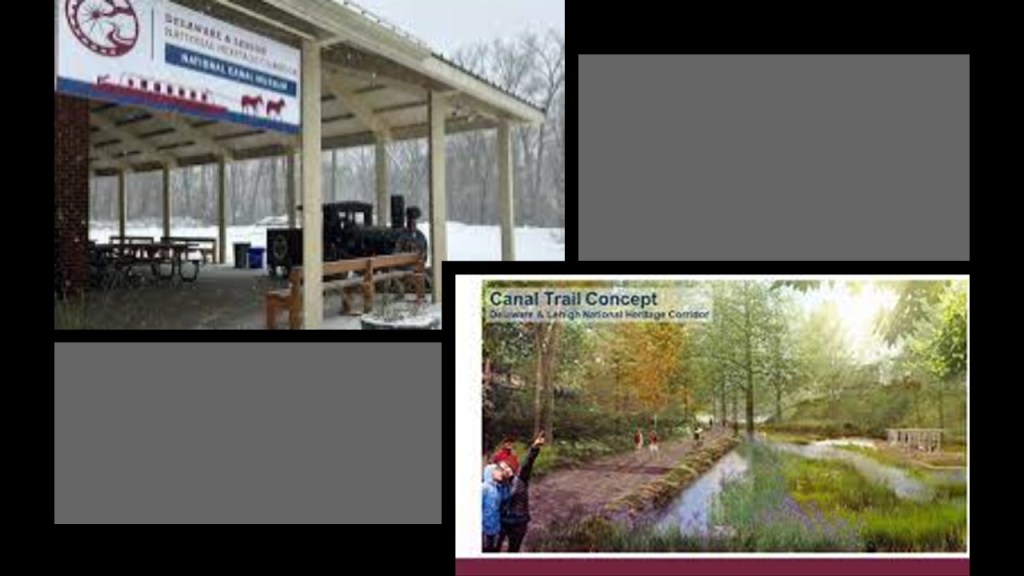
The Lehigh Gorge Trail follows more than 20-miles, or 32-kilometers of the Delaware and Lehigh Trail, part of the larger Delaware and Lehigh National Heritage Corridor, which is 165-miles, or 266-kilometers, -long.
The Lehigh Gorge Trail is on abandoned railroad grade beside the river.
This is what we are told about the Delaware and Lehigh National Heritage Corridor by the National Park Service.
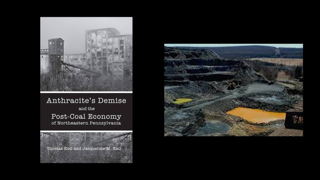
The Delaware and Lehigh National Heritage Corridor preserves the historic pathway that carried coal and iron from Wilkes-Barre to Philadelphia as a vital connection to nature, recreation and our nation’s industrial heritage, as well as having a more than $250-million per year economic impact for the region.
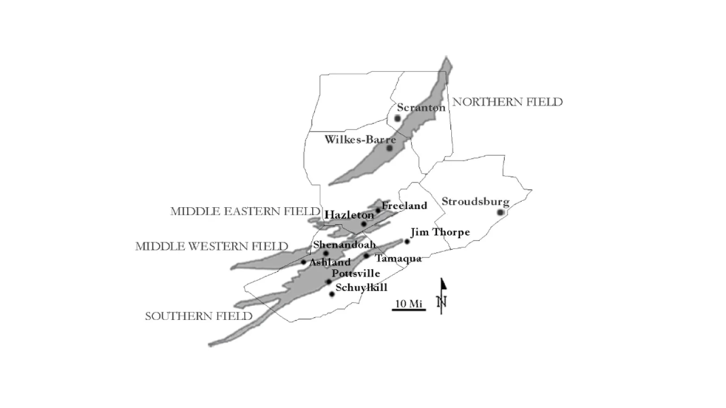
The Delaware and Lehigh National Heritage Corridor was also known as the “Anthracite Region” where the story of “where America was built” began.
What we are told about the Anthracite Region is this.
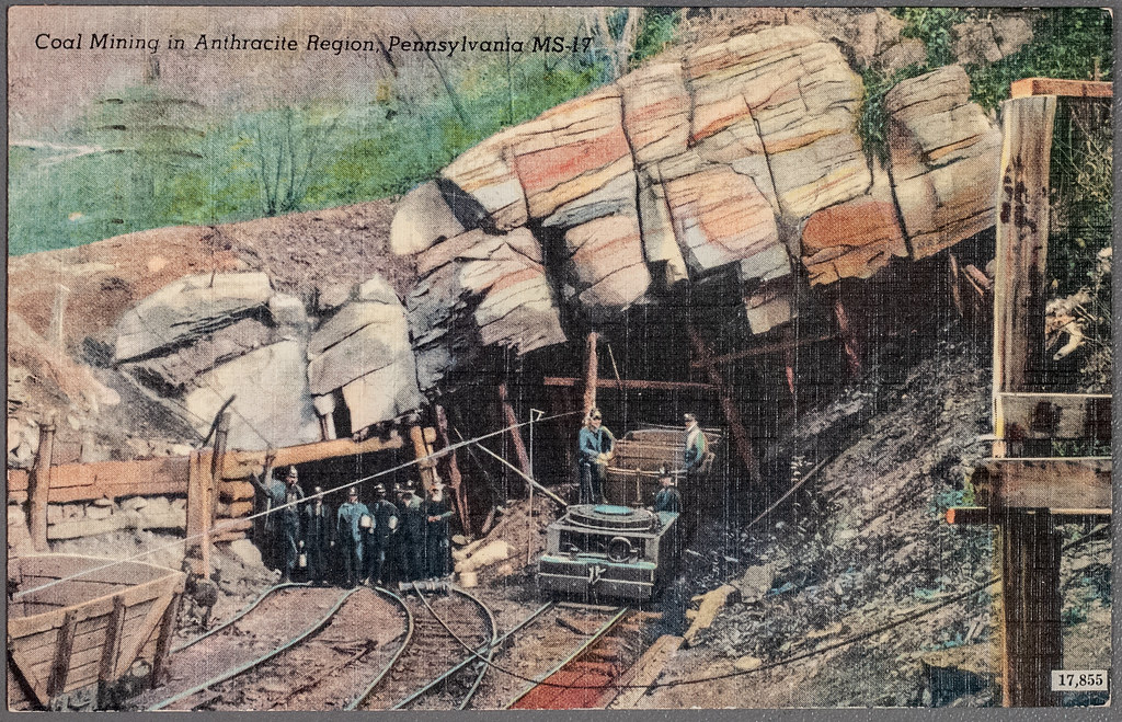
It was home at one time to major anthracite coal supplies and the mine-to-market process, with a legacy of intense mining, industrial development and rich mixture of ethnic cultures.
Anthracite coal was first mined in Wilkes-Barre in 1775, and we are told that it fueled urban development in the region, resulting in a string of towns, industries, mines, roads and rail-lines to the south.
It is interesting to note here that the Freiburg University of Mining and Technology, the oldest school of mining and metallurgy in the world, was established just 10-years prior to the beginning of anthracite coal-mining in Wilkes-Barre, having been established in 1765 by Francis Xavier of Saxony of the House of Wettin.
Its main purpose was the education of highly skilled miners and scientists in fields connected to mining and metallurgy.
Primarily through Queen Victoria and Prince Albert, first-cousins and members of the House of Saxe-Coburg and Gotha of the Ernestine branch of the House of Wettin, the original royal houses of Europe were completely replaced by this obscure German Ducal lineage.
Alexander von Humboldt was a graduate of the Freiburg University of Mining and Technology.
He was a Prussian naturalist who in our narrative was a pioneer of the fields of biogeography and geomagnetism, and an explorer of the Americas between 1799 and 1804, starting with an exploration of Mount Teide on Tenerife in the Canary Islands.
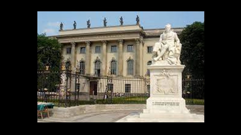
Humboldt University in Berlin was named after Alexander von Humboldt and his brother Wilhelm.
It was first opened in 1810, and was regarded as one of the world’s pre-eminent universities in the study of Natural Sciences in the 1800s and 1900s.
Famous faculty and alumni included such famous names in our current historical narrative, besides the previously mentioned Alfred Wegener of Continental Drift fame, include: the theoretical physicist Albert Einstein; Karl Marx and Friedrich Engels, c0-collaborators on “The Communist Manifesto;” Otto von Bismarck, first Chancellor of the German Empire; Georg Hegel, whose philosophy gave us the “Hegelian Dialectic” of Problem-Reaction-Solution; and the Brothers Grimm, best-known for their fairy tales which has such story-lines as eating people, as in “Little Red Riding Hood and “Hansel and Gretel.”
During the same time period as Alexander von Humboldt’s explorations were taking place between 1799 and 1804, the following historical events occurred as well.
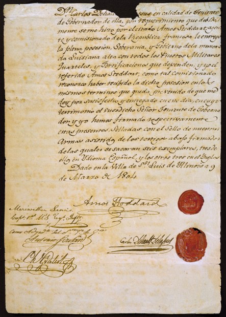
We are told the Louisiana Purchase was the acquisition of the Territory of Louisiana by the United States from France with the signing of the Louisiana Purchase Treaty on April 30th of 1803, which was officially announced on July 4th of 1803.
It was said to have doubled the size of the United States and paved the way for the nation’s westward expansion.
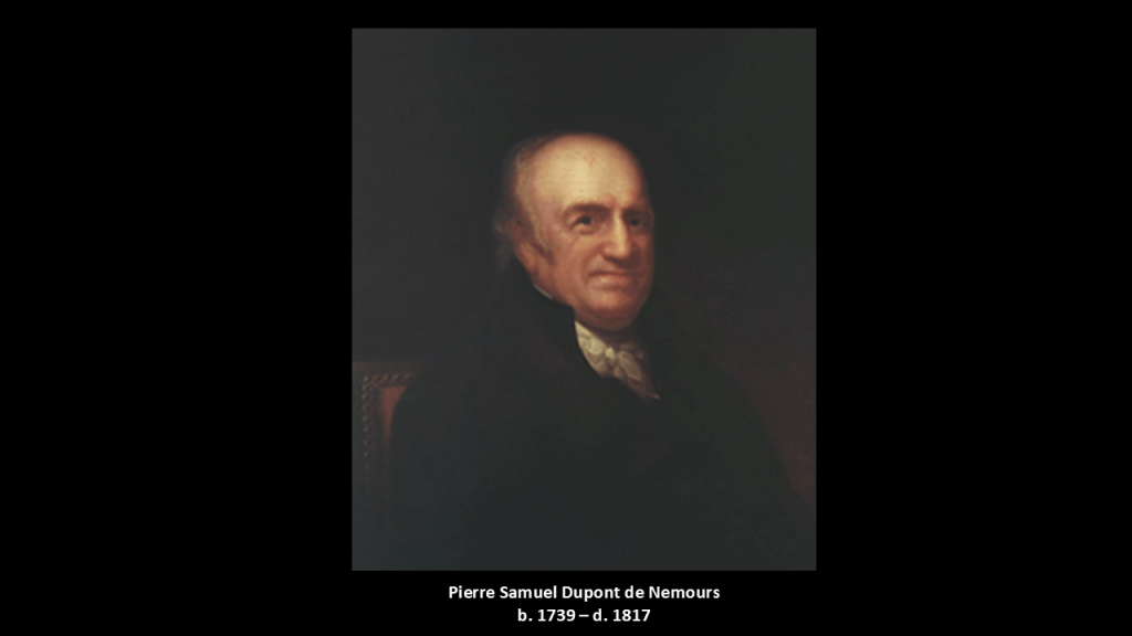
One of the negotiators with France for the terms of the Louisiana Purchase in 1803 on behalf of President Jefferson was the minor French nobleman Pierre Samuel Dupont de Nemours, who was living in the United States at the time.
His son Éleuthère Irénée du Pont, a chemist and industrialist, founded the E. I. du Pont de Nemours and Company to manufacture gunpowder and explosives in 1802, with the du Ponts becoming one of America’s richest families, with generations of influential businessmen, politicians and philanthropists.
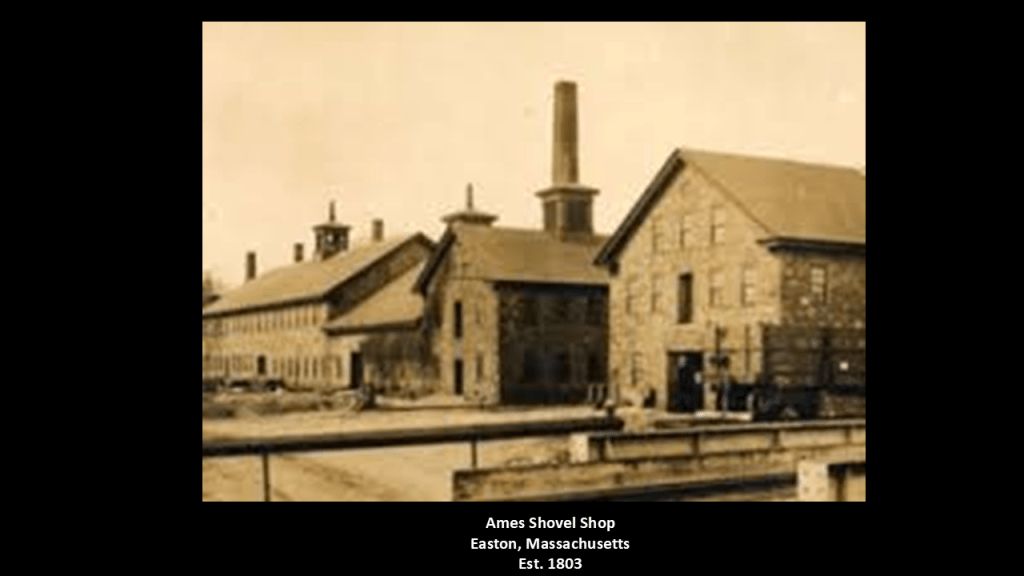
The following year, in 1803, the Ames Shovel Shop was established in Easton, Massachusetts.
The Ames Shovel Shop became nationally known for providing the shovels for the Union Pacific Railroad, which opened the west. It was said to have been the world’s largest supplier of shovels in the 19th-century.
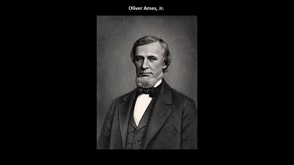
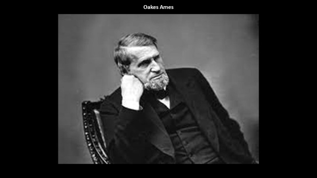
The Ames Brothers, Oakes and Oliver, Jr, co-owners of the shovel shop that was established by their father Oliver, were major players in the completion of the Union Pacific Railroad.
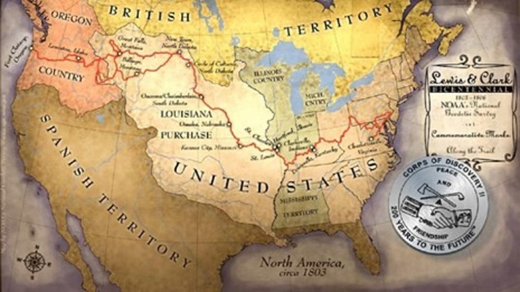
Also in 1803, the Lewis & Clark Expedition, also known as the Corps of Discovery, started on August 31, 1803 and lasted until September 25, 1806, with a mission to explore and map the newly acquired western portion of the country after the Louisiana Purchase.
When I tracked the history of the entire Lewis and Clark Expedition in Lewis and Clark & the Corps of Discovery – True History or Real Mystery?…
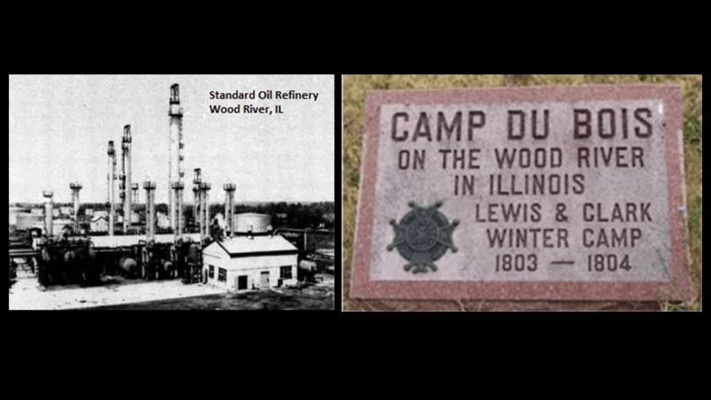
…not only did I find the Rockefellers and the Standard Oil Refinery in Wood River at the location of Camp Dubois on the Illinois side of the Mississippi River, near Cahokia Mounds, which was the official starting point of the Lewis and Clark expedition in 1804…
…and John Jacob Astor’s presence with the American Fur Company’s fur-trading fort at Fort Pierre, a stopping point of the Lewis and Clark Expedition in Sioux country in present-day South Dakota…
…I found the presence of other big names in the beginnings of the corporatocracy in which we have been living under, like the “General Mills” multinational manufacturer and marketer of ultraprocessed foods sold through retail stores.
Like I said earlier in this post, it is my belief that as soon as they were able to after this cataclysmic event took place, these bloodline families and their related-minions came into the ruined lands of the Earth to explore, claim, harvest the resources of, and provide us with a new history and their new systems for power and control of the Earth and its people after the worldwide energy grid of the Old World was destroyed in a deliberately-caused cataclysmic event.
They would have had an immediate need for explosives and shovels in a post-cataclysmic world of recent occurrence to begin their recovery work in order to bring their new civilization back on-line from the remnants of the old civilization.
Now back to the Anthracite Region in Pennsylvania.
We are told that the demand for anthracite coal increased in the 1820s and 1830s as coal-power replaced water power, and with the growth of the iron industry in Pennsylvania.
Anthracite coal is the purest form of coal, and this region contains most of the world’s supply of anthracite coal.
Today, this part of northeastern Pennsylvania is considered one of the largest concentrations of disturbed terrain in the world, with billions of tons of debris found in the landscape of abandoned strip mines and this region has among the highest poverty and unemployment rates in the United States with job loss from the decrease in coal mining and the outmigration of people because of it.
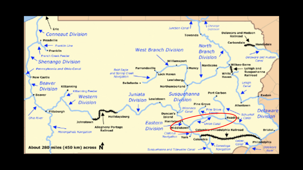
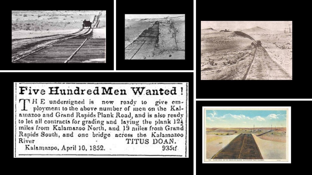
We are told the American Canal Age was between 1790 and 1855, and started in Pennsylvania, where the first legislation surveying canals was passed in 1762.
The construction of the Union Canal between Middletown and Reading in Pennsylvania was said to have started under the administration of President George Washington in 1792, and completed in 1828, and was touted as the “Golden Link” in providing an early transportation route for shipping anthracite coal and lumber to Philadelphia.
The “Main Line of Public Works,” of which the Union Canal was a part of, was passed by the Pennsylvania Legislature in 1826, and funded various transportation systems, including canal, road, and railroad.
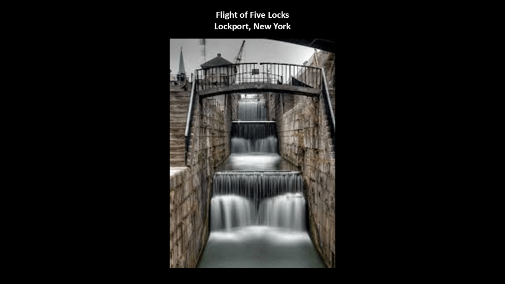
This is Lock #5 of the old Union Canal.
This section of the Union Canal was said to have been closed after the dam holding the reservoir was washed away by a devastating flood in 1862, and the rest of the Union Canal was said to have been closed to use in 1885 because it could not compete with the “efficiency of the railroad.”
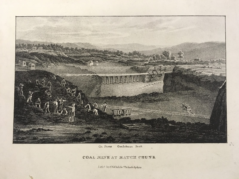
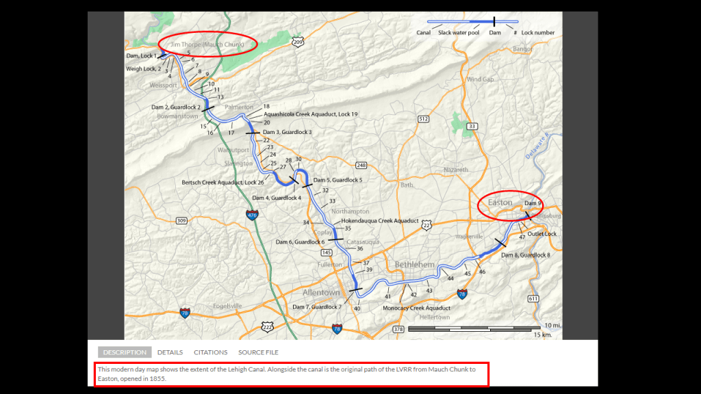
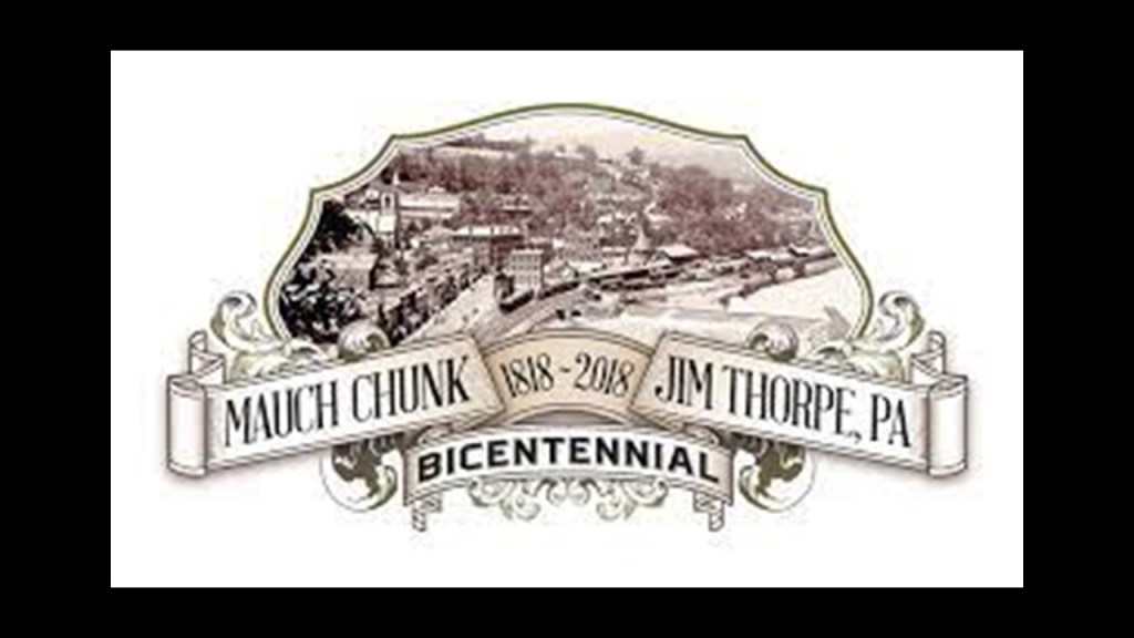
We are told the lower section of the Lehigh Canal was built between Easton, Pennsylvania and Mauch Chunk, now known as Jim Thorpe, Pennsylvania, with construction said to have been started in 1818, and completed in 1838.
This map also has a caption at the bottom that says this was the original Lehigh Valley Railroad line as well, which was said to have opened in 1855.
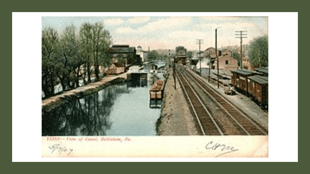
This is a view of the Lehigh Canal as it appeared at one time in our history in Bethlehem, Pennsylvania – located along this section in-between today’s Jim Thorpe and Easton.
The National Canal Museum in Easton is dedicated to telling the story of America’s historic towpath canals.
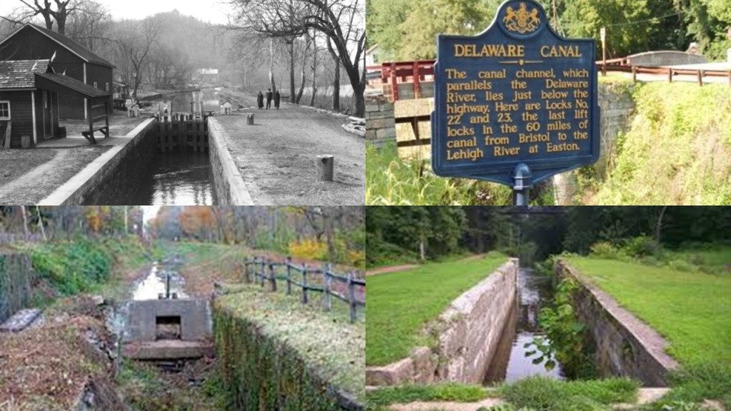
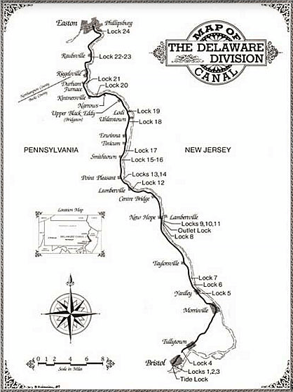
In Easton, the Lehigh Canal connected with the Pennsylvania Canal’s Delaware Division and the Morris Canal.
Also known as the Delaware Canal, the Pennsylvania Canal was said to have built the Delaware Canal to feed anthracite coal to Philadelphia in the years between 1828 and 1834.
It ran along the right bank of the Delaware River for 60-miles, or 97-kilometers, to Bristol, just north of Philadelphia.
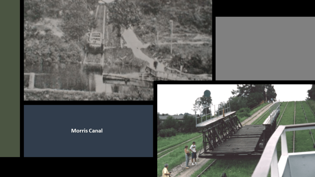
The Morris Canal was 107-miles, or 172-kilometers, -long and said to have been completed in 1832 to carry anthracite coal across northern New Jersey between where it connected to the Delaware Canal in Easton, to what is today Jersey City on the Hudson River.
It was closed in 1924.
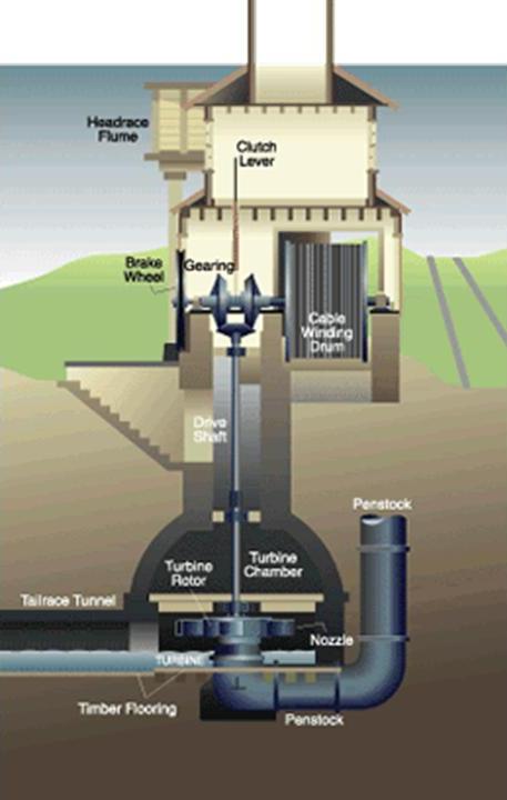
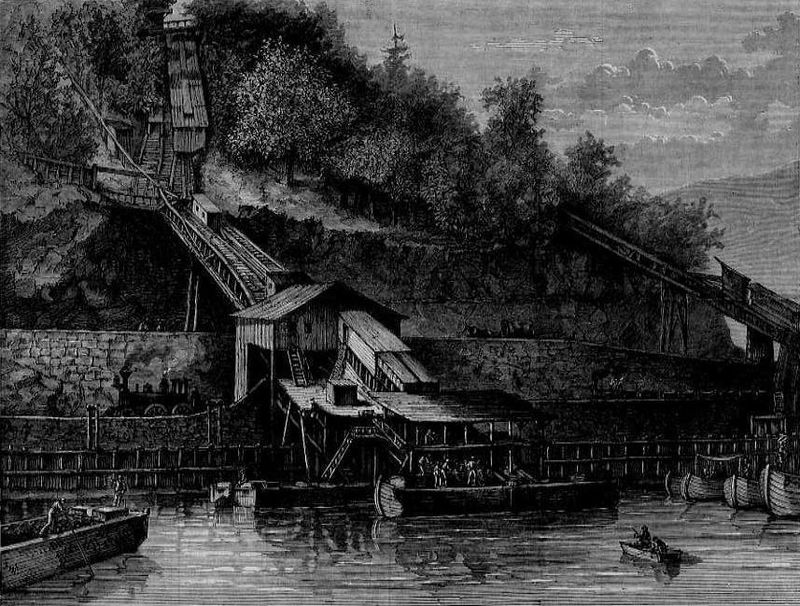
It was hailed as an ingenious, technological marvel for its use of water-driven, inclined planes.
The builders of the Morris Canal used a sophisticated power house technology, pictured here, to power the water turbine that was set in motion to raise or lower cradled boats on the inclined planes by means of a cable.
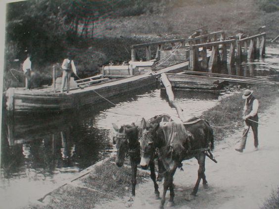
Yet they still needed mules to pull the canal boats in places on the Morris Canal in spite of all that sophisticated technology?
So in my opinion, the first of the original infrastructure we see coming back on-line in the post-cataclysmic “New World” were the canals.
In the “Old World,” the power supply for the canals would have been the same free-energy generated by the Earth’s worldwide grid system, and in the “New World,” they had to use mule-power to be able to utilize the original canal system because that was all they had available for power.
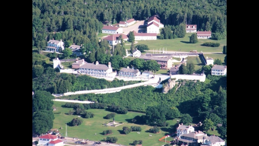
Back to the Lehigh Gorge State Park.
What remains of the original Lehigh Valley Railroad operations run today as the Lehigh Gorge Scenic Railway.
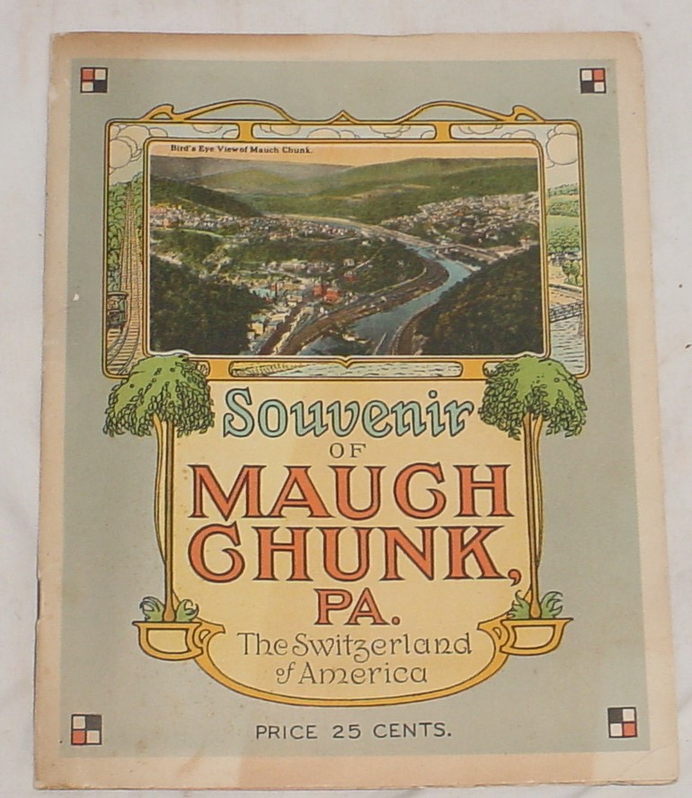
The excursion through the Lehigh Gorge begins in Jim Thorpe, Pennsylvania, formerly known as Mauch Chunk, at the southern end of the state park.
Mauch Chunk was nicknamed “The Switzerland of America” for its steep hillsides, narrow streets, and terraced gardens.
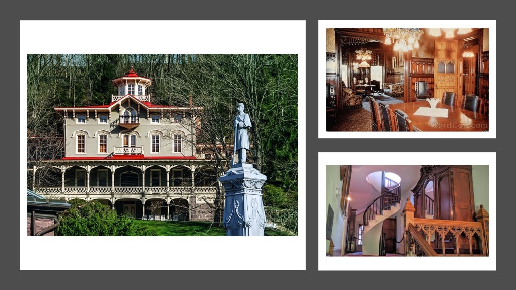
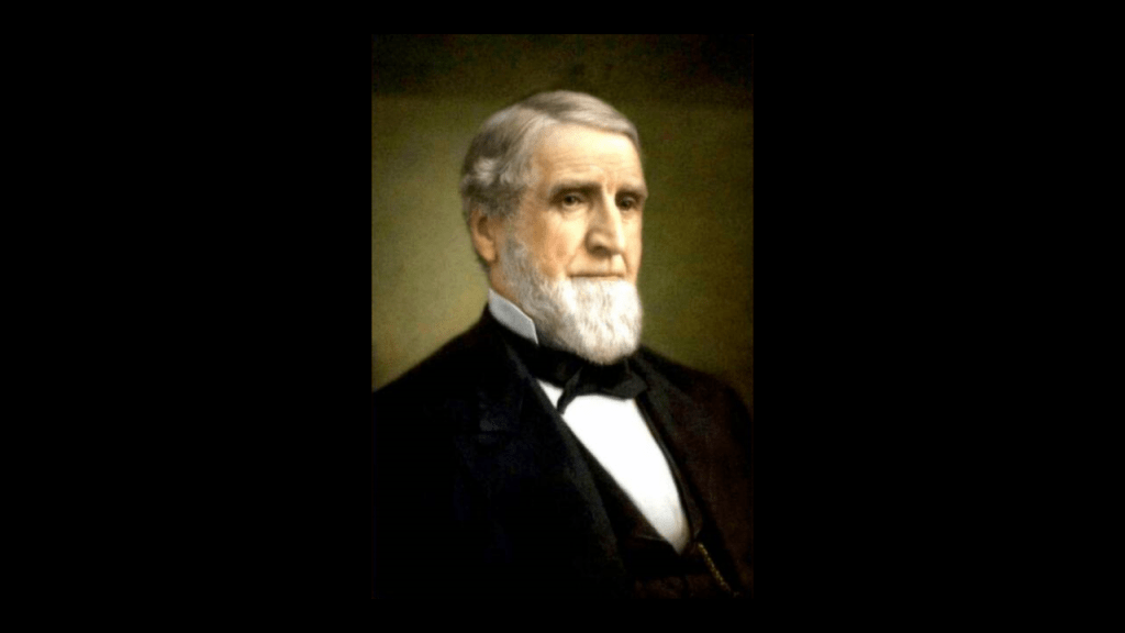
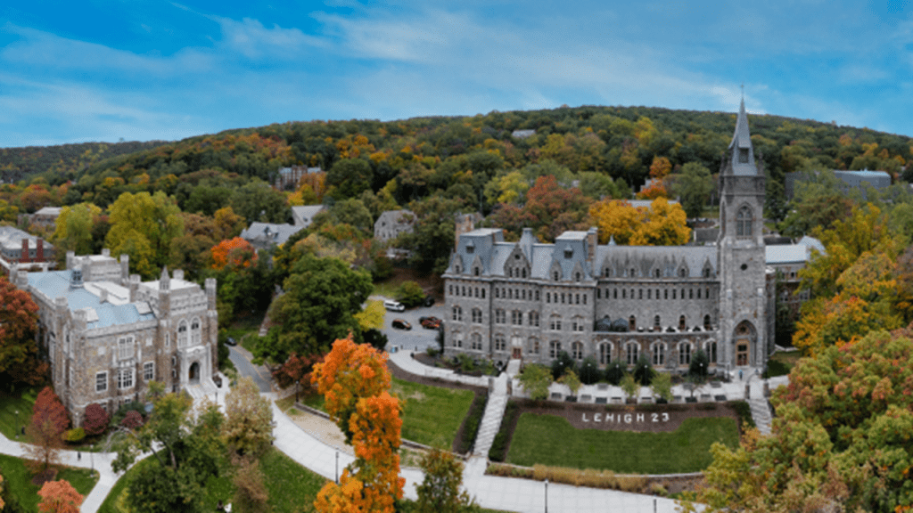
The Asa Packer Mansion here was said to have been completed in 1861, which would have been the first year of the American Civil War.
We are told that Asa Packer was, among other things, a coal and railroad magnate, philanthropist…
…and founder of Lehigh University in nearby Bethlehem, Pennsylvania, which was founded in 1865, the last year of the American Civil War.
At the time of his death, the value of Asa Packer’s estate was $54.5-million, and he was considered to be the richest man in the Commonwealth of Pennsylvania at that time.
And Asa Packer was a Freemason too.
Renamed Jim Thorpe in 1954 for the Native American sports’ legend who was buried here, Mauch Chunk was founded as a company town in 1818 by Josiah White and his partners who were also founders of the Lehigh Coal and Navigation Company.
The Lehigh Coal and Navigation Company was a mining and transportation company that was headquartered in Mauch Chunk.
It operated from 1818 until it was dissolved in 1964 and was known for having an early and influential role in the American Industrial Revolution.
The Lehigh Coal and Navigation Company was considered to be the first vertically-integrated company in the United States.
Vertical integration is where the supply chain of a company is owned by the company.
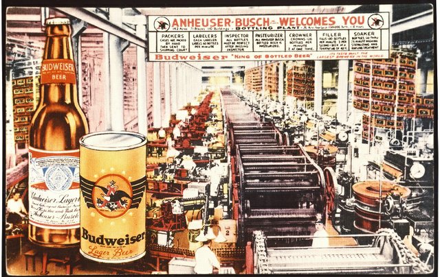
Other examples of the adoption of the business practice of “vertical integration” off the top of my head was by Adolphus Busch as head of Anheuser-Busch Brewing Association.
Busch adopted vertical integration as a business practice, in which he bought all the components of his business, from bottling factories to ice-manufacturing plants to buying the rights from Rudolf Diesel to manufacture all diesel engines in America.
This illustration was of the Bevo Bottling Facility in St. Louis.
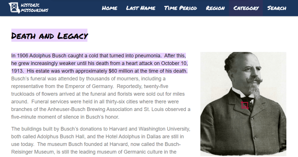
Adolphus Busch died in 1913, with a net worth $60 million at the time of his death.
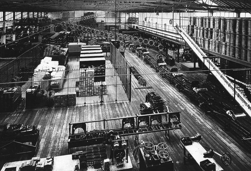
Henry Ford also utilized the practice of “vertical integration” in the Ford Motor Company.
The introduction and refinement of the assembly line facilitated the mass production of new cars, which in turn made the purchase of a new car affordable for most people.
As we go through all the information that will be presented in this post, we will see why this was yet another replacement technology for the original transportation system, which was powered by free energy.
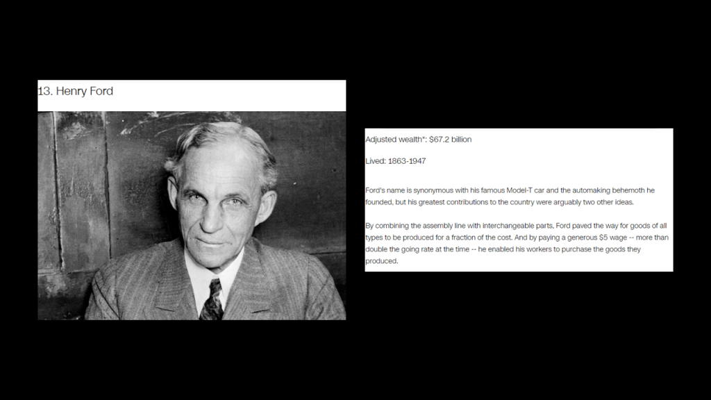
Henry Ford was also the 13th-wealthiest American of all-time according to CNN Business, with an adjusted wealth of $67.2-billion.
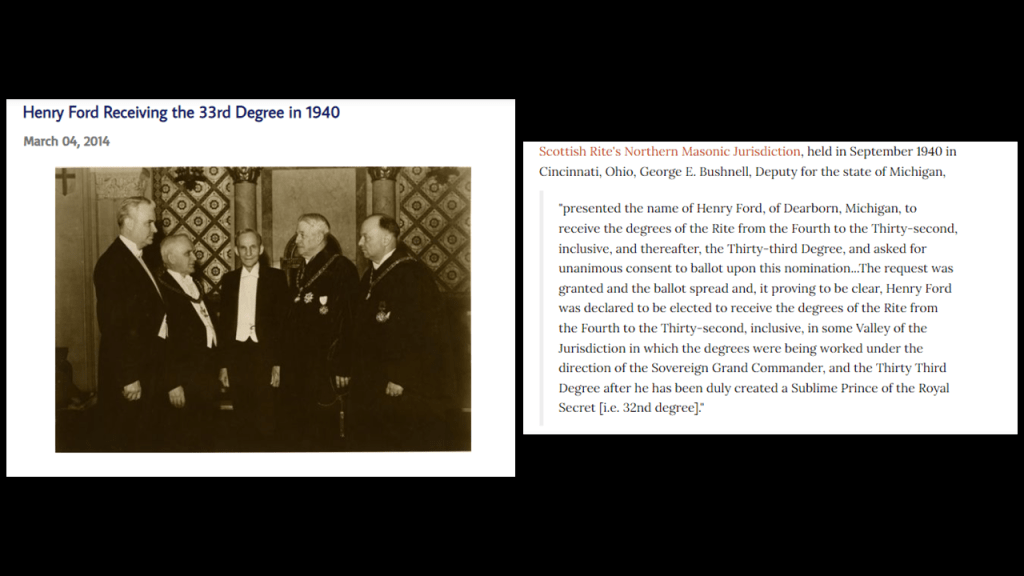
Henry Ford was also an acknowledged 33rd-degree Freemason.
Back to the Lehigh Coal and Navigation Company and Mauch Chunk.
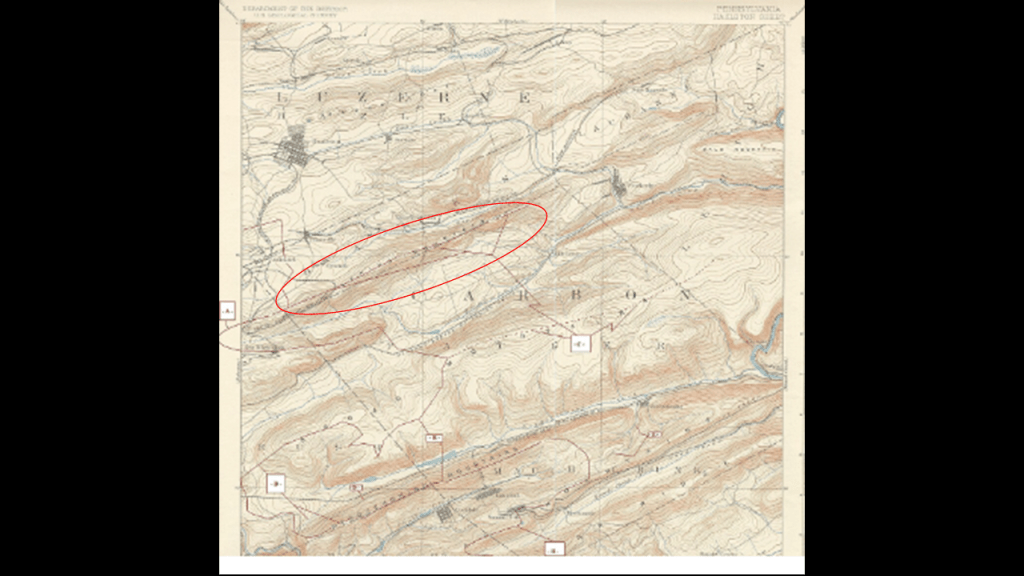
It had its beginnings as the Lehigh Coal Mine Company in 1792, after, we are told, a hunter named Philip Ginter discovered anthracite coal on Pisgah Mountain near Summit Hill, near the border between Luzern and Carbon Counties.
The Lehigh Coal Mine Company was incorporated in 1793 and acquired 10,000- acres, or 4,000-hectares, in and around the Panther Creek Valley and Pisgah Mountain, in order to bring anthracite coal from the large deposits on Pisgah Mountain to Philadelphia via mule-trains and coal arks, or one-time single use boats, on the Lehigh and Delaware Rivers.
We are told that while the original Lehigh Coal Mine Company was able to sell all the coal it could to the available market, it lost a lot of coal to the rough waters of the unimproved Lehigh River, so they sold the original company to Josiah White and his partners in 1818.
In a nutshell, this is what we are told.
In the same year, in 1818, the new owners of the Lehigh Coal Mine Company, began the construction of the Lehigh Canal, and that it became usable in 1820.
The Lehigh Canal enabled the transport of anthracite coal, a primary energy source at the time, to the primary markets in the northeastern United States, and, we are told, inspired the development and connection of other regional canals.
The new owners of the Lehigh Coal Mine Company were said to have been behind of the construction of the Lehigh and Susquehanna Railroad between 1839 and 1841…
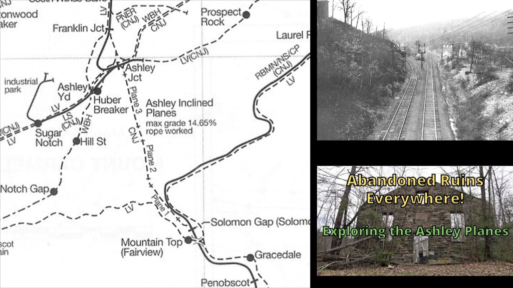
…the Ashley Planes, an historic freight-cable railroad between Ashley and Mountain Top said to have been built between 1837 and 1838 to transport millions of tons of anthracite coal over the Wilkes-Barre Mountain…
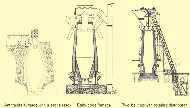
…. and brought in blast furnace technology to the Lehigh Valley, a type of metallurgical furnace used for smelting to produce industrial metals.
Smelting is defined as a process by which metal is obtained, either as a single element or compound.
In 1822, the company became the Lehigh Coal and Navigation Company, after which time we are told they built the Mauch Chunk and Summit Hill Railroad.
The Mauch Chunk and Summit Hill Railroad, also known as the Mauch Chunk Switchback Railway, was said to have been built in 1827 and operated until 1932.
It was said to be the second permanent railway constructed in the United States, and used to transport coal down Summit Hill to the Lehigh Canal.
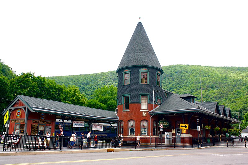
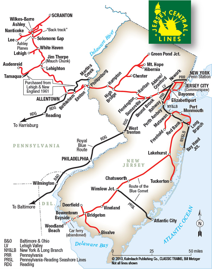
Mauch Chunk/Jim Thorpe was also a key location on the Central Railroad of New Jersey in the shipping of anthracite coal.
The Central Railroad of New Jersey was said to have built the Mauch Chunk Station in 1888 in the Queen Anne Victorian Architectural-style.
Today it is owned and operated by the Lehigh Gorge Scenic Railroad.
This is what we are told about the Central Railroad of New Jersey.
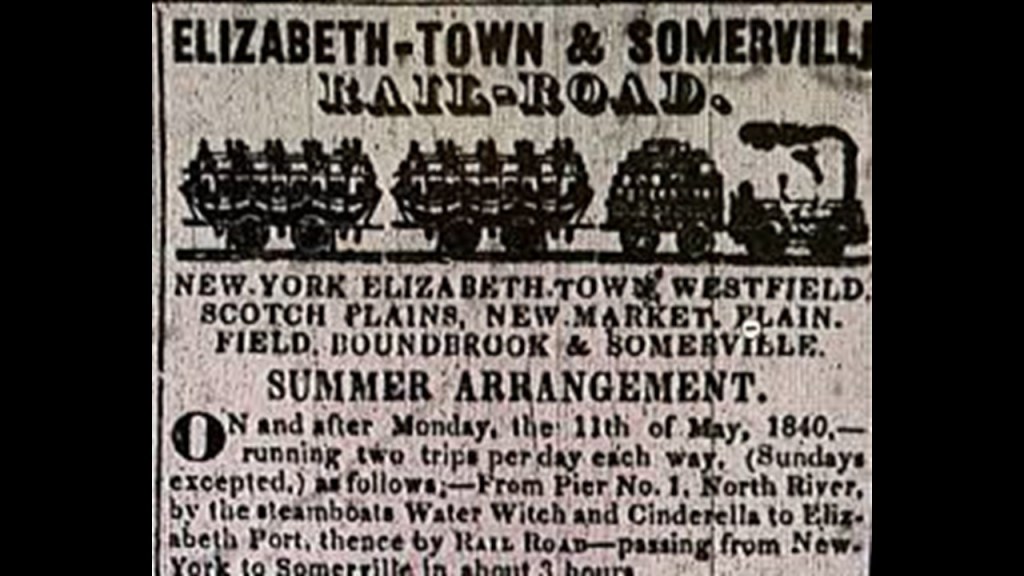
The origins of the Central Railroad of New Jersey began in 1831 with the incorporation of the Elizabeth and Somerville Railroad, and which was operational by 1842.
In 1847, the Somerville and Easton Railroad was incorporated, purchased the Elizabeth and Somerville, and the name was changed to the Central Railroad Company of New Jersey.
By 1852, the line reached Phillipsburg, New Jersey, on the Delaware River and was extended across Newark Bay to Jersey City in 1864 (one-year before the end of the American Civil War in 1865).
From Jersey City, the railroad kept extending out to major cities like Newark, Flemington, Perth Amboy, Chester and Wharton.
We are told that the Lehigh Coal and Navigation Company built the CNJ’s lines in Pennsylvania, which was used primarily for the shipment of anthracite coal.
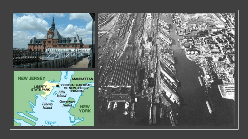
The Central Railroad of New Jersey Terminal in Jersey City was said to have been built in 1889 to replace an earlier one, and is located next to the Big Basin of the Morris Canal on the Hudson Waterfront in today’s Liberty State Park, as it is in close proximity to Ellis Island and the Statue of Liberty in Upper New York Bay.
It was operational as a terminal until April 30th of 1967.
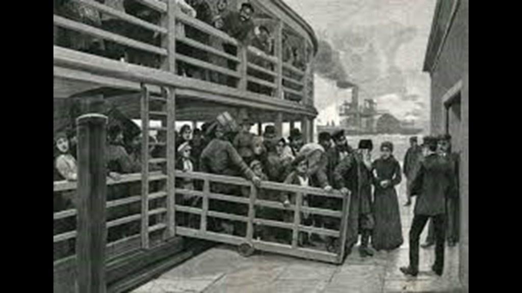
An estimated 10.5 million immigrants processed through here at one time in America’s history when Ellis Island was operational as an immigrant processing station between 1892 and 1954.
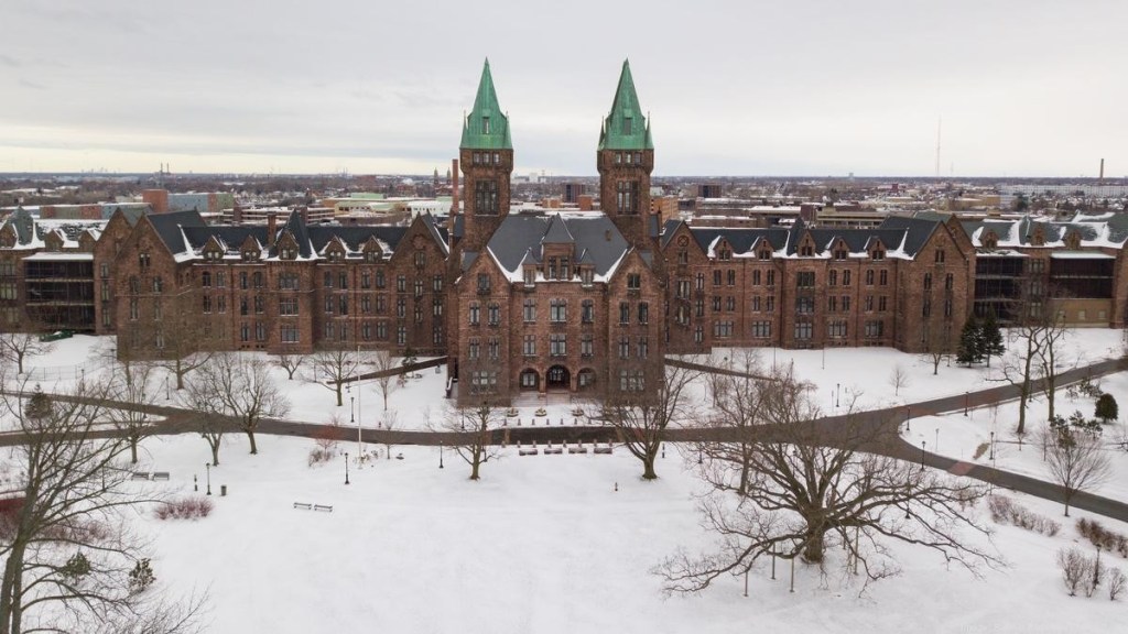
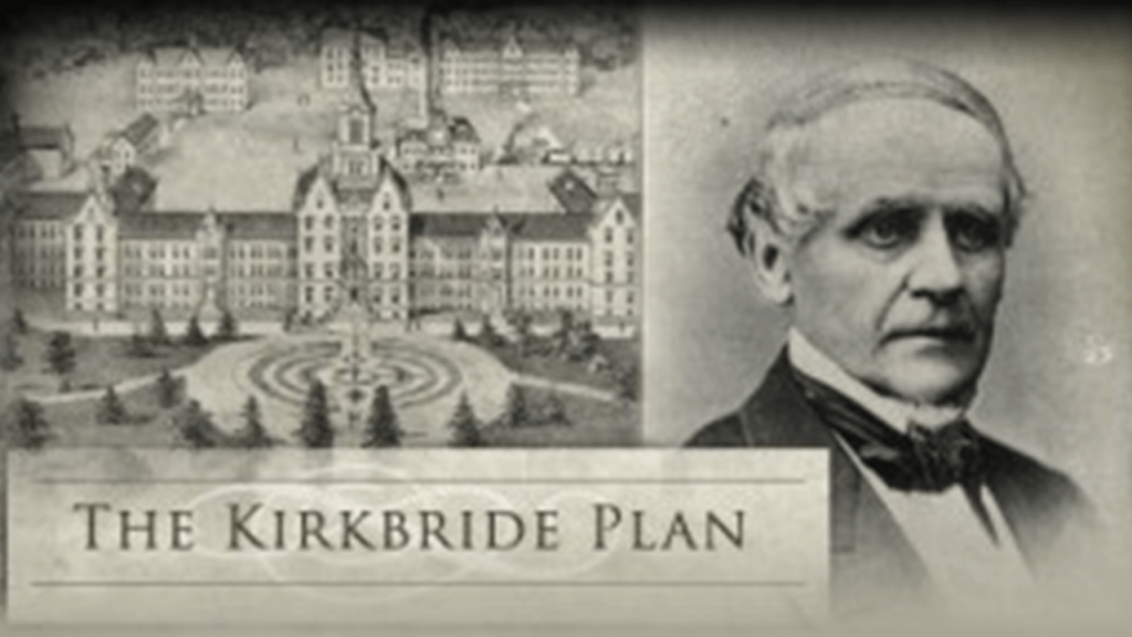
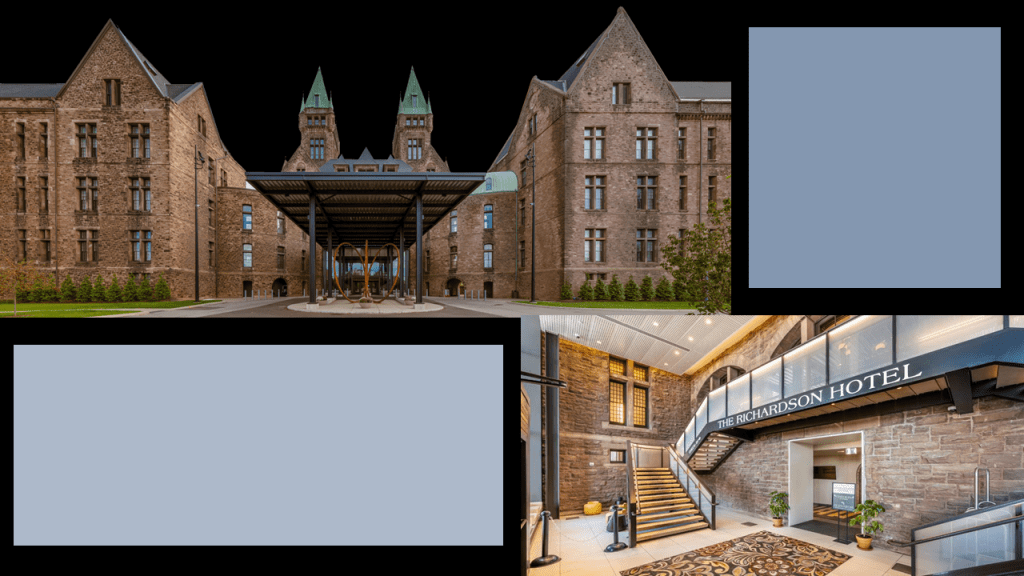
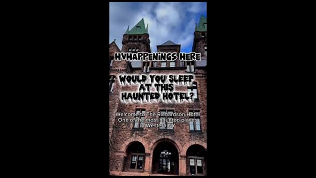
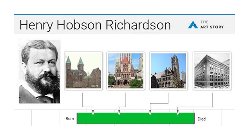
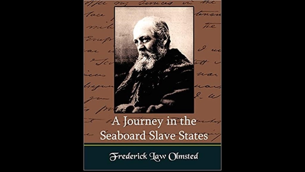
The architectural style of the Central Railroad of New Jersey Terminal building is called Richardsonian Romanesque, after architect Henry Hobson Richardson, who was said to have first used elements of this style in the Buffalo State Asylum for the Insane in Buffalo, New York, which he is said to have designed in 1870, and Frederick Law Olmsted was the landscape architect, and the Kirkbride Plan was implemented here.
The Buffalo State Asylum for the Insane was closed for that purpose in the 1970s.
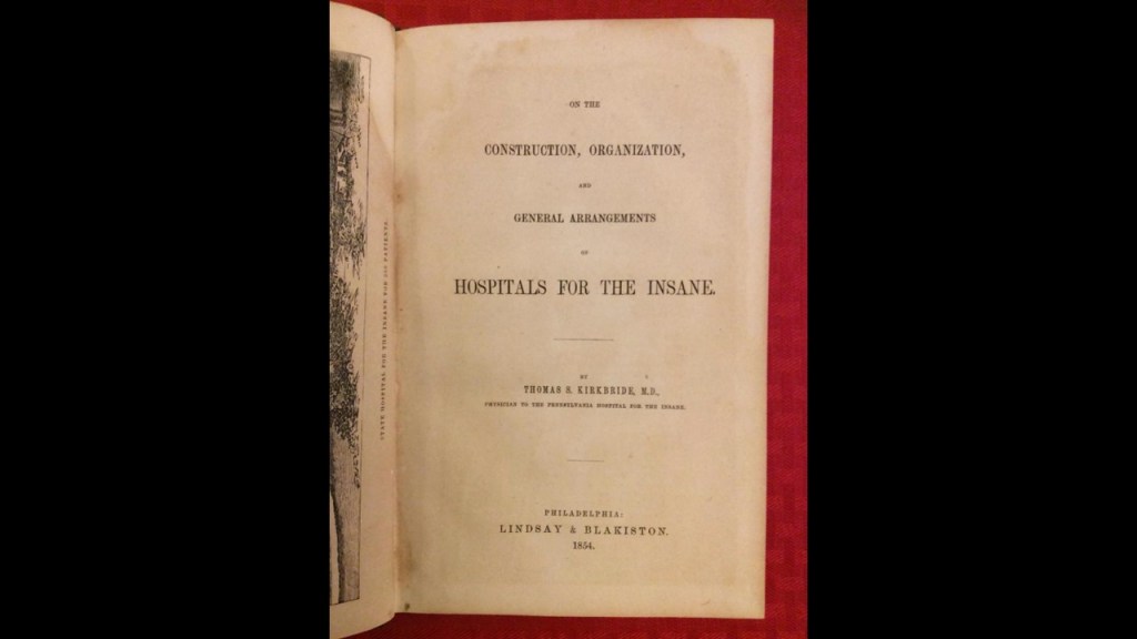
In 1854, Dr. Thomas S. Kirkbride first published what was considered the source book in the 19th-century for Psychiatric Directives entitled “On the Construction, Organization, and General Arrangements of Hospitals for the Insane, ” with some remarks on insanity and its treatment.
We are told that throughout the 19th-century, numerous insane asylums were designed and constructed according to the Kirkbride Plan across the U. S. and while numerous Kirkbride structures still exist, many have been demolished, partially-demolished, or repurposed.
Today the former Buffalo State Asylum for the Insane is known as the Richardson Olmsted Complex, and was repurposed as a hotel which opened in 2023…
…and is considered one of the most haunted places in Buffalo, if not western New York.
Richardsonian Romanesque is described as a free revival style, incorporating 11th and 12th century southern French, Spanish, Italian Romanesque characteristics.
Henry Hobson Richardson had a relatively short career,and didn’t even complete his architecture school training in Paris because he lost family backing because of the American Civil War, yet somehow by the time he died at a relatively young age of 47 in our historical narrative, he left behind a legacy of mind-blowingly ornate architecture!
One more thing about the Central Railroad of New Jersey here.
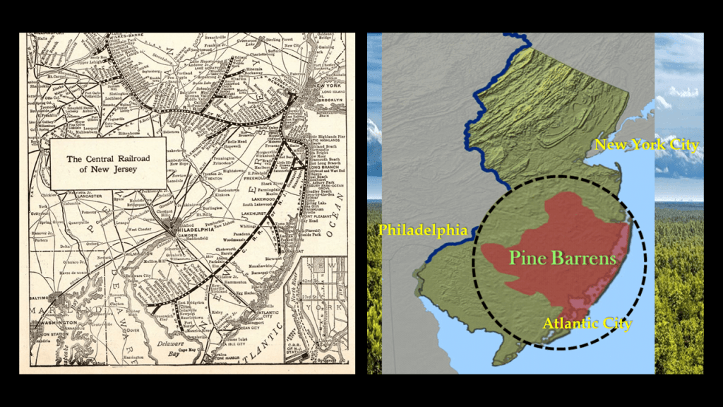
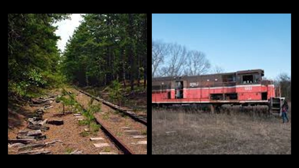
All of the new railroad lines that were popping up betwixt and between these large population centers and the Jersey Shore were, like Atlantic City, were going right through the desolate, swampy and forbidding Pine Barrens.
Today there are abandoned trains and railroad lines found throughout the New Jersey Pine Barrens.
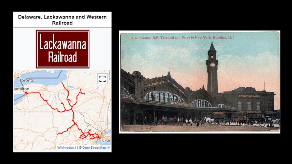
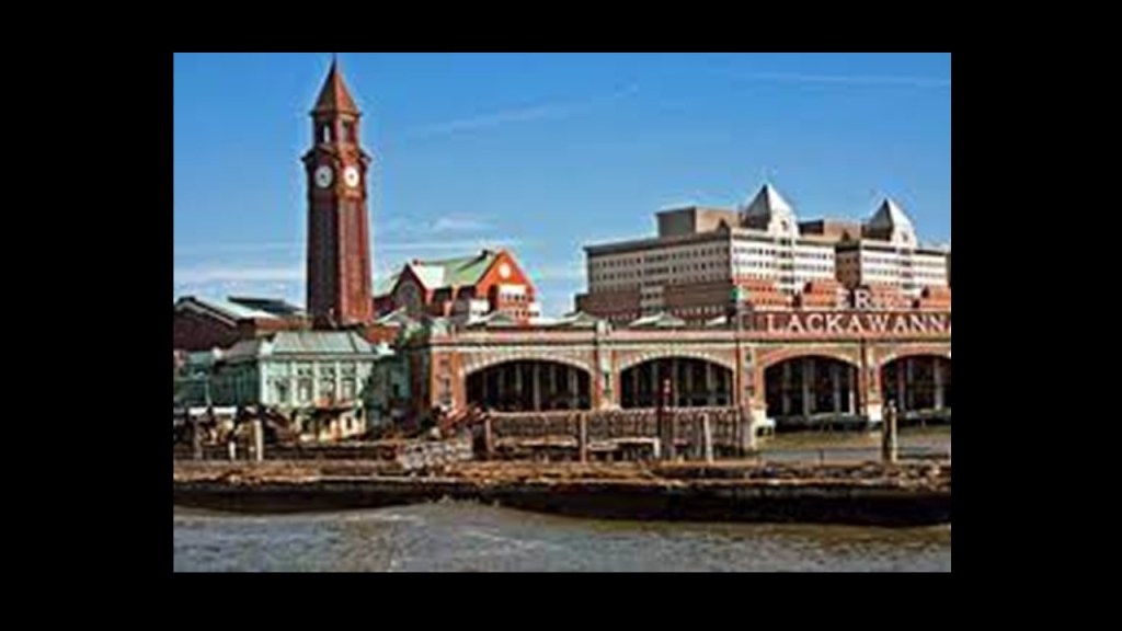
The Delaware, Lackawanna and Western Railroad main line passed through the southern end of the Mount Pocono Borough, which provided access to the borough from New York City via the terminal at Hoboken, New Jersey.
One of the New York area’s major transportation hubs, the terminal at Hoboken was said to have been constructed by the Delaware, Lackawanna and Western Railroad in 1907, and combined railroad, ferry, subway, streetcar and pedestrian services.
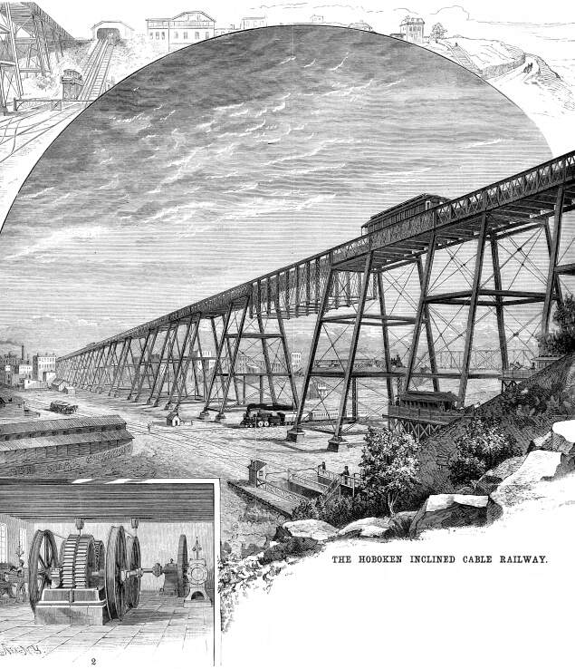
We are told that numerous electric streetcar lines originated and ended at the station until the completion of “Bustitution” in August of 1949, at which time they were replaced by buses.
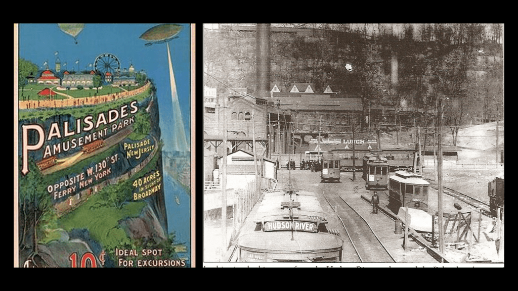
This included the Hoboken Inclined Railway…
…which consisted of several lines including the Palisade Line that travelled from Edgewater to Palisades Amusement Park, which operated from 1898 to 1971…
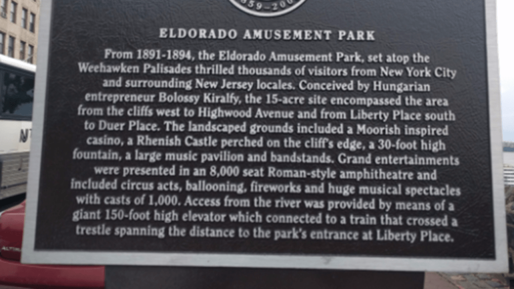
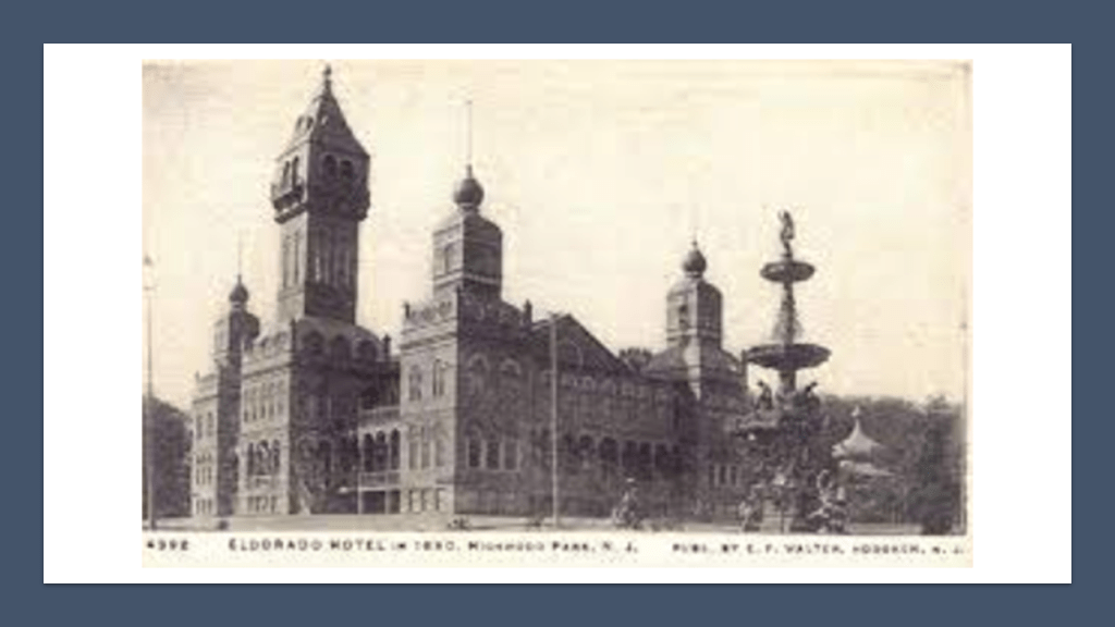
…and the Eldorado Elevator, which met a streetcar line that travelled along a trestle to a cut in the Palisades which ran parallel to the Eldorado, an amusement park that opened in 1891 and closed as an amusement park in 1894, except for the hotel casino, which was described as “Moorish Inspired.”
The Eldorado’s main building was used to host boxing matches and Vaudeville performances until it burned down in a massive fire in 1898.
There is still a Hoboken Terminal in use today as an intermodal transportation hub.
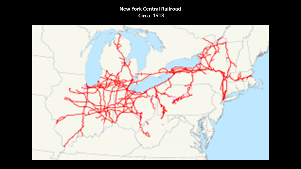
The New York Central Railroad was said to have begun operating in 1853 with the consolidation of earlier independent companies running between Albany and Buffalo.
This graphic depicts the New York Central rail system as of 1918.
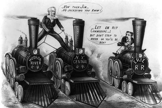
Staten Island-born Cornelius Vanderbilt got his start in regional steamboat lines and ocean-going steamships, and from there got into the railroad business.
He bought control of the Hudson River Railroad in 1864; the New York Central Railroad in 1867; the Lake Shore and Michigan Southern Railroad in 1869; and the Canada Southern Railway in 1876.
He consolidated his two key lines into the New York Central and Hudson River Railroad in 1870, becoming one of the first giant corporations in the history of the United States
According to CNN Business, Cornelius Vanderbilt was the second-richest American in history, with an adjusted wealth of $205-billion.
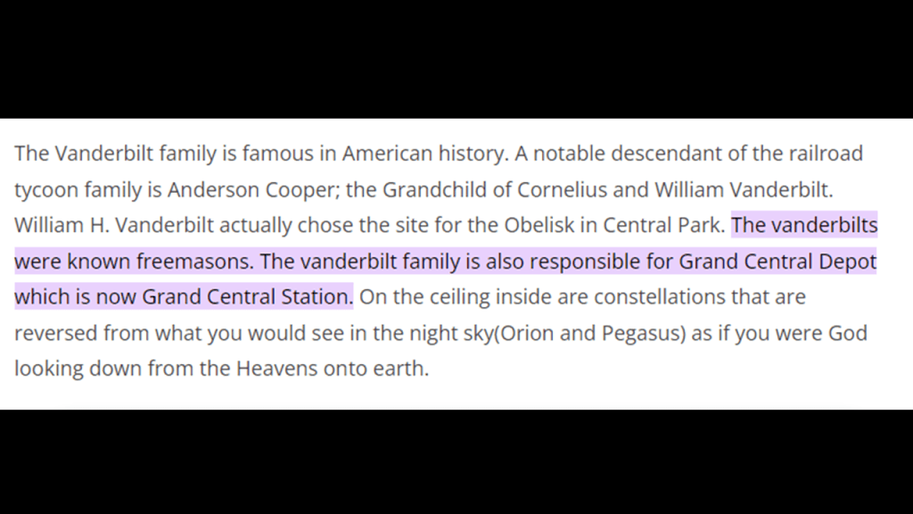
I was also able to find a reference saying that the Vanderbilts were known Freemasons.
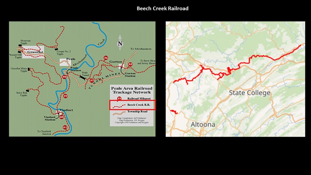
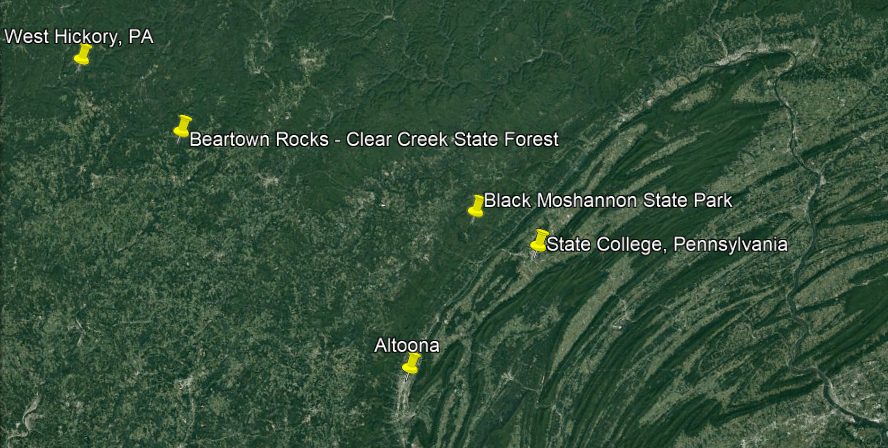
I have taken a very close look at the region of Pennsylvania around the Moshannon State Forest in Philipsburg Borough and its official history, which among other things, was important to the settlement and industrialization of America, and also the wealthy and influential men behind it all.
We are told Philipsburg Borough was founded in 1797 by one Henry Phillips, who purchased 350,000 acres on the western side of the Allegheny Mountains for $173,000, and then proceeded to auction the land off on the streets of Philadelphia for two-cents per acre.
The region developed around the coal-mining and lumber industries.
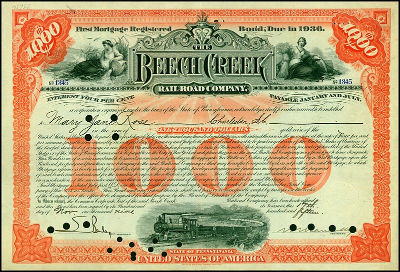
The Beech Creek Railroad between the South Jersey Shore and Mahaffey Borough, Pennsylvania, and part of the Susquehanna and South Western Railroad, was used for coal mining services in the region starting in 1884.
This railroad ran near State College, home of Penn State University, and not far from Altoona, Pennsylvania.
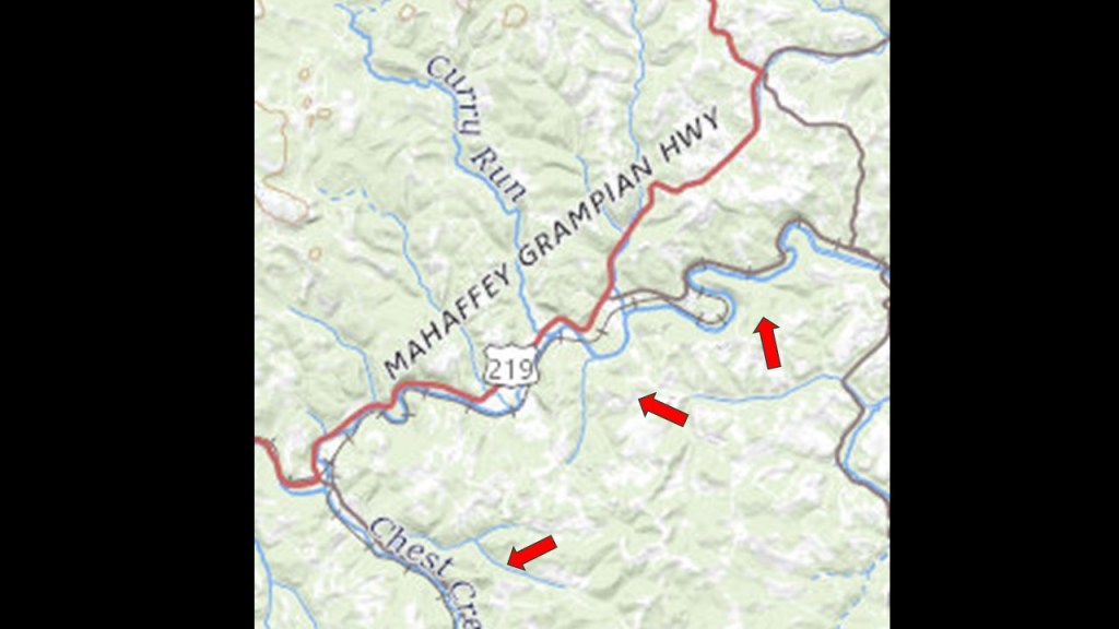
Mahaffey Borough, first incorporated in 1841, was located on U. S. Route 219, at the junction of the New York Central Railroad and the Hudson River Railroad.
The arrows point to where railroad tracks ran along s-shaped river-bends. on this section of Route 219 going through Mahaffey Borough.
This railroad project in Pennsylvania was said to have been backed and financed by William H. Vanderbilt, the oldest son of Cornelius Vanderbilt, and who was President of the New York Central Railroad.
William H. Vanderbilt had developed a plan to facilitate railroad access to enter the “Clearfield Coalfield,” a large, juicy coal-mining area in Clearfield County, which would have been otherwise exclusively accessed by the Pennsylvania Railroad.
It was said to have been constructed starting at the end of 1882 to high-standards, including extensive curvature, bridges, and a tunnel, and became operational in November of 1884.
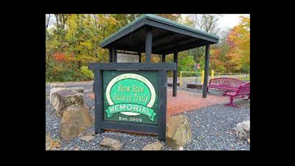
Eventually, this railroad line provided passenger service and used as such until 1990.
In 1994, the right-of-way was acquired by the Headwaters Charitable Trust for the “Snowshoe Rail-to-Trail Project” and the rail went away.
Along with the coal-mining going on in Pennsylvania, there were extensive logging activities.
For example, the Moshannon State Forest near Phillipsburg was formed as a direct result of the depletion of the forests of Pennsylvania that happened in the mid-to-late 19th-century, when lumber and iron companies clear-cut the forests.
Then we are told that sparks from passing steam-locomotives caused wildfires from the remnants of the forest-lands, preventing the growth of new forests.
The land that became Moshannon State Forest was purchased by the State in 1898.
The old-growth forest was gone by 1921, with a second-growth forest replacing it since then.
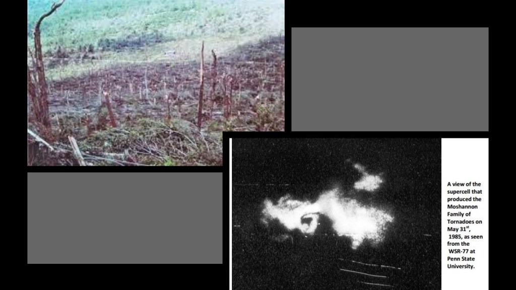
Interesting to note that a tornado in 1985 tore through the forest and destroyed an estimated 88,000 trees.
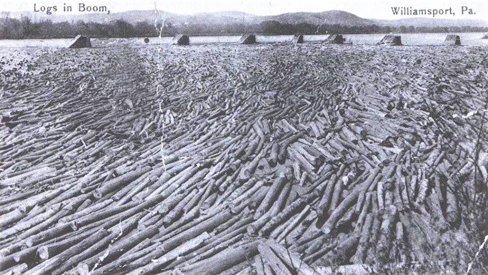
There was much logging going on from this region, so the “Susquehanna Boom” was said to have been built in the 1850s across the West Susquehanna River at Williamsport, a system of cribs and chained logs designed to catch and hold floating timber until it could be processed, and logging railroads built to transport the lumber, to the tune of 45-cars per day until logging ended here when all the trees were gone.
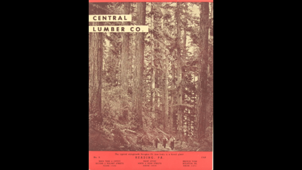
The lumbermen left a barren landscape that was devastated by fires, flooding and erosion formany years, until the CCC came in the 1930s and started replanting trees after the State of Pennsylvania bought the deforested land from the Central Pennsylvania Lumber Company in 1930.
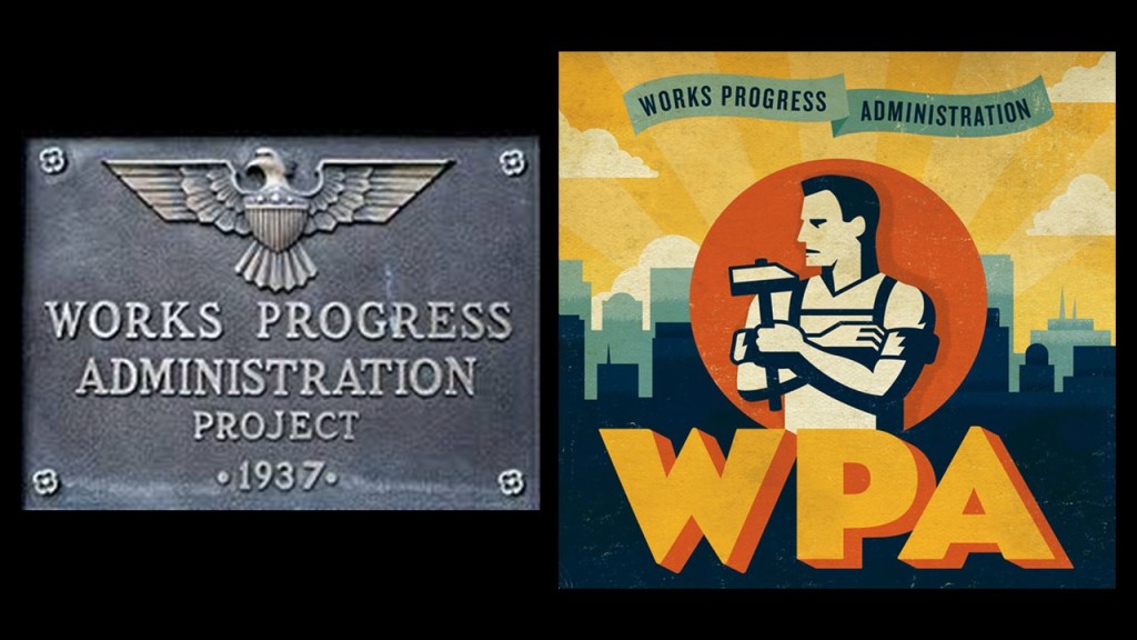
The Civilian Conservation Corps CCC operated from 1933 to 1942 in the U.S. for unemployed, unmarried men to do manual labor related to the conservation and development of natural resources in rural lands owned by federal, state, and local governments.
Originally for young men ages 18–25, it was eventually expanded to ages 17–28.
In the nine-years of its operation, the CCC employed 3,000,000 young men, providing them with food, shelter and clothing, and a wage of $30/month, $25 of which had to be sent home to their families.
There is no doubt in my mind that the CCC, and the other alphabet programs of FDR’s New Deal during the Great Depression, like the WPA and TVA, were being used to cover-up the ancient advanced civilization.
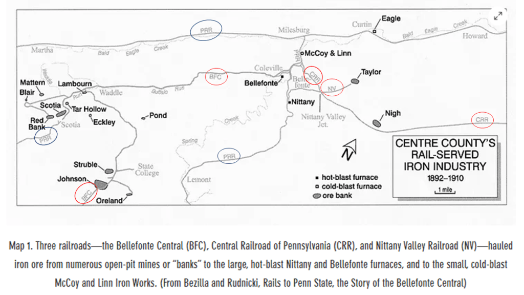
In the nearby city of State College, the location of the University of Pennsylvania, Andrew Carnegie had begun mining iron ore in Scotia in 1881 for his steel mills in Pittsburgh, and by 1887, we are told that a new era of iron-making in the Nittany Valley began, with the opening of the Nittany and Bellefonte Furnaces along Buffalo Run near its junction with Spring Creek, and three railroads that were said to have been constructed to haul the iron ore to them – the Bellefonte Central (BFC), Central Railroad (CRR) and Nittany Valley Railroad (NV).
By 1911 both of these furnaces had been shut-down.
By 1950, all the railroads that had once served the area, either for the iron-related industry or passenger service, including the Pennsylvania Railroad lines, circled in blue, were no longer in service.
The only historic rail here that became operational again was a portion of the Bellefonte Central after the Bellefonte Historical Railroad was organized as an excursion line in 1985, and occasionally offers runs as a tourist attraction.
Altoona in Pennsylvania is only 43-miles, or 70-kilometers southwest of State College.
Altoona was said to have been established by the Pennsylvania Railroad in 1849.
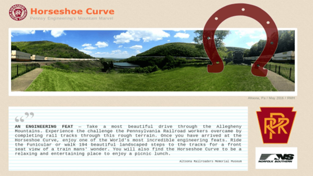
The “Horseshoe Curve” in Altoona is a three-track railroad curve that is described as one of the world’s most incredible engineering feats, and was said to be accomplished by the Pennsylvania Railroad in 1854.
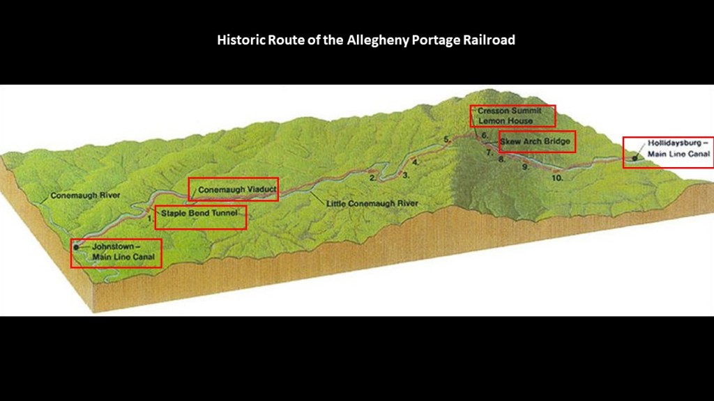
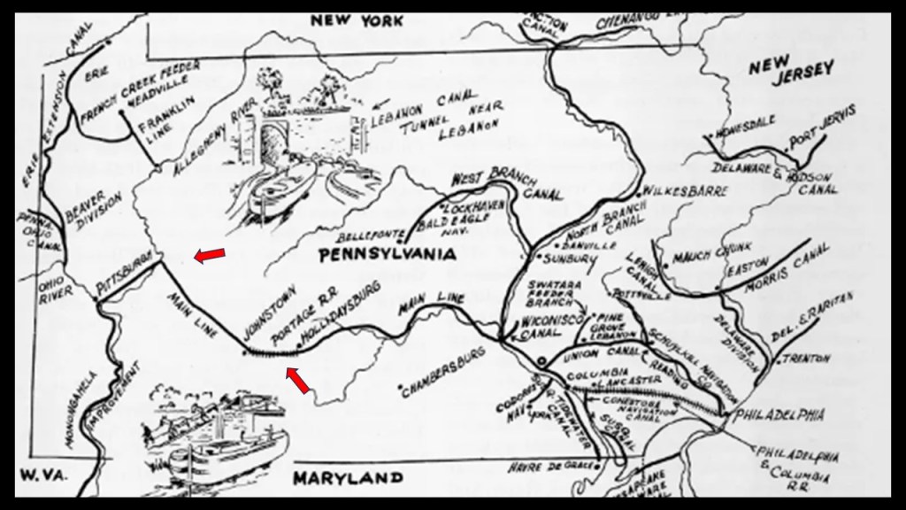
It was said to have replaced the original Allegheny Portage Railroad, which was said to be the first railroad constructed through the Allegheny Mountains in 1834, and connected to the Pennsylvania Canal, all of which was said to have been built as part of the transportation system by the “Main Line of Public Works” that was mentioned at the beginning of this post after it was passed by the Pennsylvania Legislature in 1826.
Considered a technological marvel in its day and critical to opening the way for commerce and settlement past the Appalachian Mountains, the original Allegheny Portage Railroad consisted of a series of five inclines on either side of the ridge-line to Cresson Summit alongside what is called the Little Conemaugh River to where it meets the Conemaugh River at Johnstown.
Interesting things to note along the historic route of the Allegheny Portage Railroad are as follows:
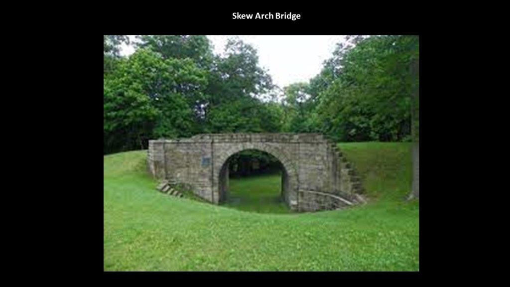
After leaving the main canal location of Hollidaysburg and going up towards Cresson Summit, we first come to the lopsided-looking “Skew Arch Bridge,” called the “only purposefully built bridge on the Portage” and crossed over the railway.
It was said to have been built in the 1830s as part of the early road system.
Today, the “Skew Arch Bridge” is preserved in the middle of “Old U. S. Route 22” and the new “U. S. Route 22.”
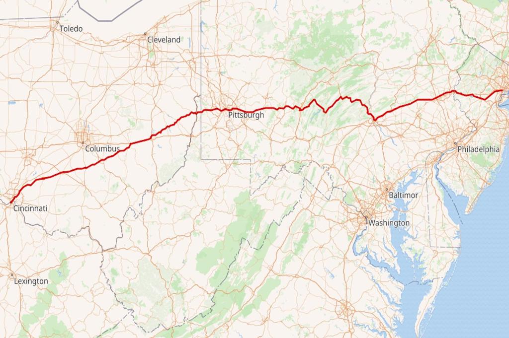
U. S. Route 22 is an East-West Numbered Highway from 1926 that runs from Cincinnati in Ohio to Newark in New Jersey, and passes through West Virginia and Pennsylvania on the way.
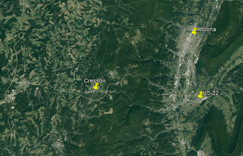
The next landmark on the Allegheny Portage Railroad’s journey through the Allegheny Mountains is the summit at Cresson, a borough (which in Pennsylvania is a municipal entity like a town or small city) on top of the Eastern Continental Divide.
US Route 22 is one of the highways that accesses Cresson.
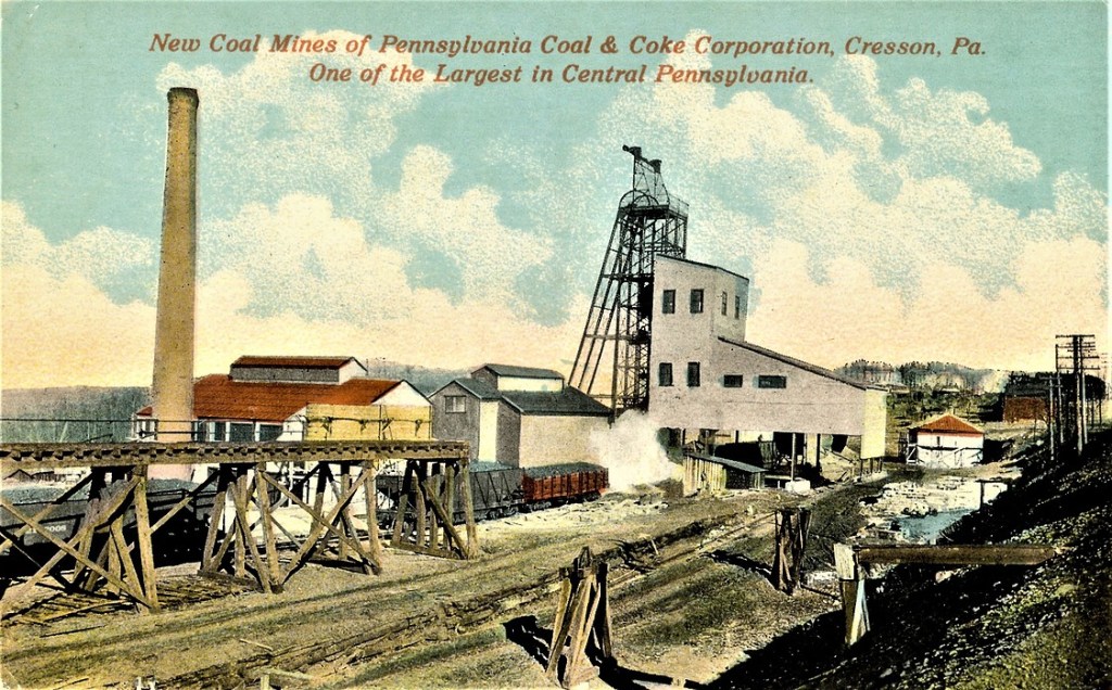
Back in the industrial heyday of the late 19th-century and early 20th-century, there were lumber, coal and coke-yard industries located here.
Wealthy Pittsburgh businessmen like Andrew Carnegie, Henry Clay Frick and Charles Schwab, all connected to each other through the steel industry, had summer residences here, like Carnegie’s Braemar Cottage in Cresson.
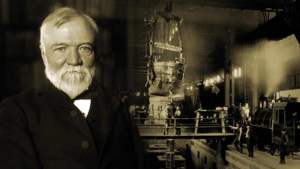
Andrew Carnegie was a Scottish immigrant to America, who came to Pittsburgh in 1848 with his parents at the age of 12, got his start as a telegrapher, and who by the 1860s, had investments in such things as railroads, bridges and oil derricks, and ultimately worked his way into being a major player in Pittsburgh’s steel industry.
I couldn’t find a picture of Andrew Carnegie as a freemason, but I could find a reference to him being a “famous freemason” on a masonic website.
His first steel mill was operational by 1874, the Edgar Thomson Steel Works, named after the President of the Pennsylvania Railroad, with his partners, one of whom was Henry Clay Frick, the owner of a coke manufacturing company, a product used in making steel.
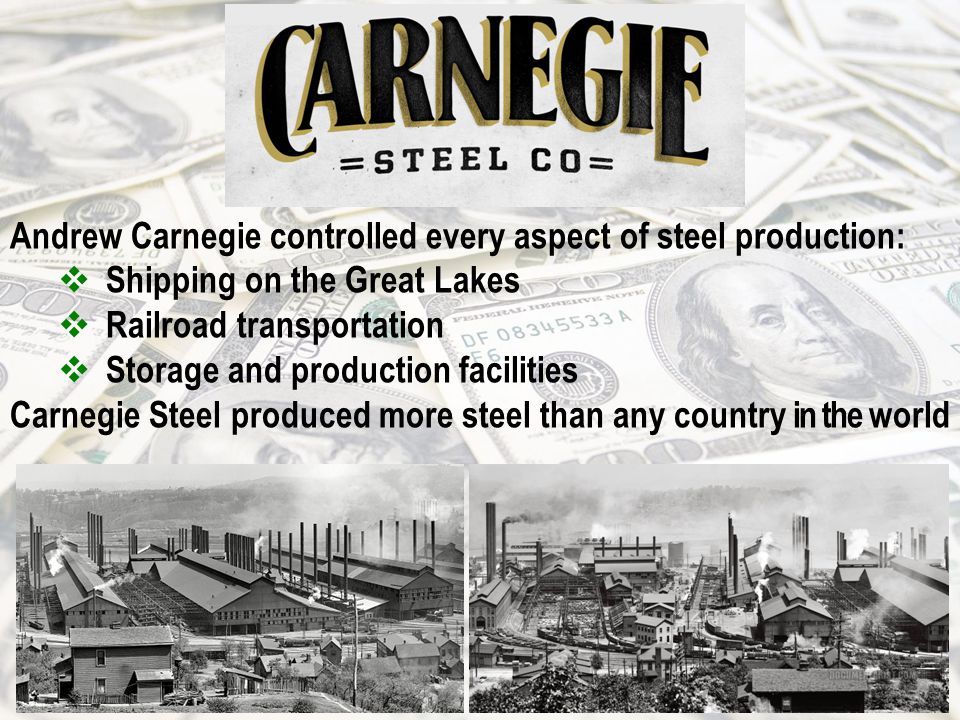
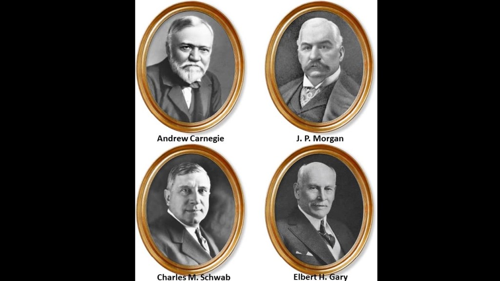
They subsequently acquired other steel mills, and in 1892, the Carnegie Steel Company was formed, of which Henry Clay Frick became chairman. and in 1897, Charles M. Schwab, who had gotten his start as an engineer at the Edgar Thomson Steel Works, became President of the Carnegie Steel Company in 1897.
In 1901, Charles M. Schwab helped negotiate the sale of Carnegie Steel with a merger involving it with Elbert Gary’s Federal Steel Company, and William Henry Moore’s National Steel Company to a group of New York City Financiers led by J. P. Morgan.
After the sale of Carnegie Steel, Andrew Carnegie surpassed John D. Rockefeller as the richest American at the time, and Charles M. Schwab became the first President of the newly minted U. S. Steel Company.
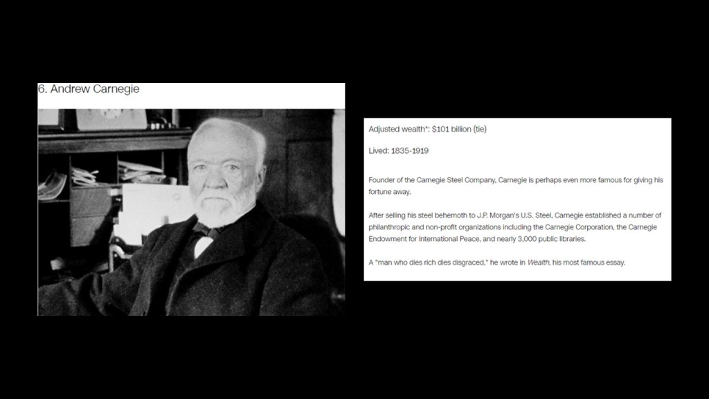
Andrew Carnegie was ranked as the 6th-richest American of all-time by CNN Business, with an adjusted wealth of $101-billion.
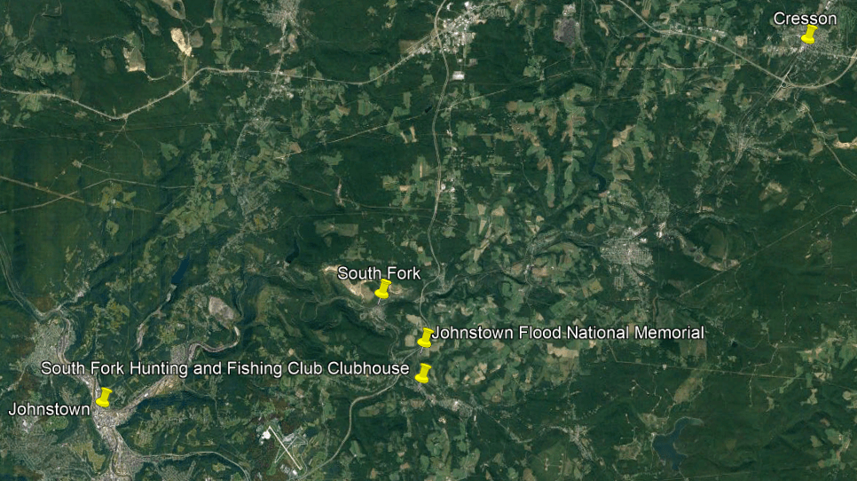
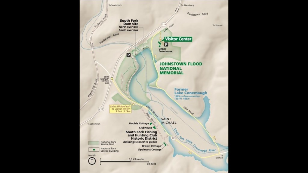
After the former Allegheny Portage Railroad left the summit at Cresson, on its downward descent in elevation into Johnstown, along the Little Conemaugh River, we come to the South Fork of the Little Conemaugh River and what was the former location of the South Fork Dam.
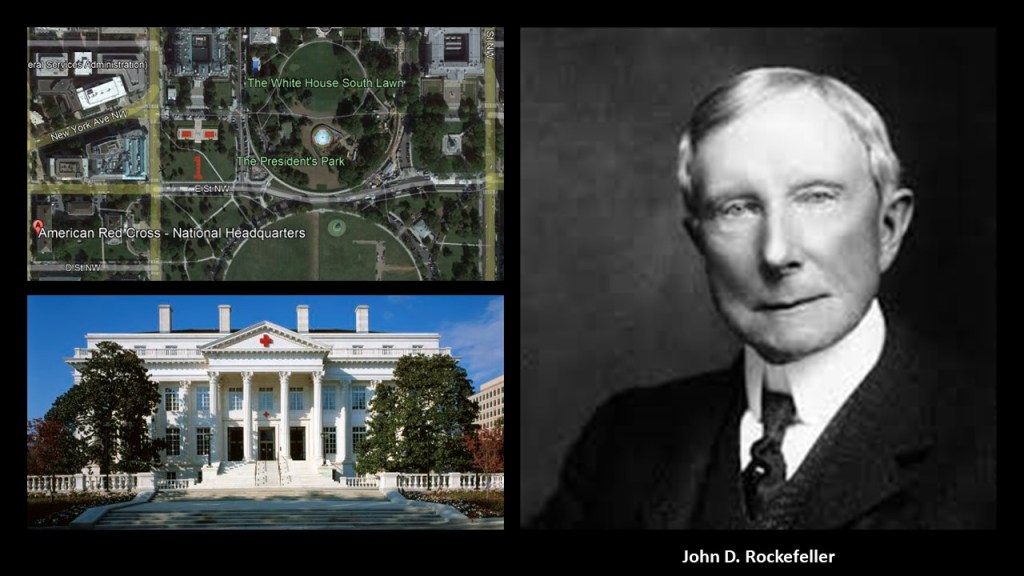
The famous Johnstown Flood on May 31st of 1889, the worst flood in the United States in the 19th-century, was caused by the catastrophic failure of the South Fork Dam, and was the second major disaster the American Red Cross responded to, after the Michigan Thumb Fire, which started on September 5th of 1881, with hurricane-force winds and hot and dry conditions this was less than four months after the establishment of the American Red Cross in May of 1881.
John D. Rockefeller was amongst several that donated to create a national headquarters for the American Red Cross near the White House in Washington, DC, said to have been built between 1915 and 1917.
More on John D. Rockefeller shortly.
The South Fork Dam was said to have been an earthwork built between 1838 and 1853 as part of a canal system as a reservoir for a canal basin in Johnstown by the Commonwealth of Pennsylvania.
But then, after spending 15-years building the dam, it was abandoned by the Commonwealth, and sold to the Pennsylvania Railroad, who turned around and sold it to private interests.
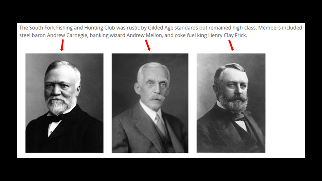
In 1881, speculators had bought the abandoned reservoir and built a clubhouse called the South Fork Fishing and Hunting Club and cottages, turning it into an exclusive retreat for 61 steel and coal financiers from Pittsburgh, including Andrew Carnegie, Henry Clay Frick, Andrew Mellon, Philander Knox, John Leishman, and Daniel Johnson Morrell.
The South Fork Fishing and Hunting Club was a Pennsylvania Corporation and owned the South Fork Dam.
Henry Clay Frick was a founding member of the South Fork Fishing and Hunting Club, and was actually said to have been largely responsible for the alterations to the South Fork Dam that led to its failure.
Interesting to note that I did find this reference on the website of the Pleasant Valley Masonic Center in Connellsville, Pennsylvania, that Henry Clay Frick was a freemason in its King Solomon’s Lodge #346 from 1872 to 1877 , at which time he resigned as an active mason, but from what this entry says, his masonic lodge continued to enjoy the benefits of his generosity long afterwards, as well as that of his daughter.
What we are told is that the South Fork Dam failed after days of unusually heavy rain, and 14.3-million-tons of water from the reservoir of Lake Conemaugh devastated the South Fork Valley, including Johnstown 12-miles, or 19-kilometers, downstream from the dam, killing an estimated 2,209 people and causing $17-million in damages in 1889, which would be $490-million in 2020.
Though there were years of claims and litigation, the elite and wealthy members of the South Fork Fishing and Hunting Club were never found liable for damages.
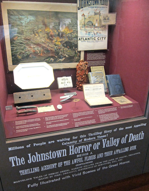
In 1904, the South Fork Fishing and Hunting Club corporation was disbanded and assets sold at a public auction by the sheriff, and there were permanent exhibits in many places, like Atlantic City, depicting the horrors of the Johnstown Flood experience for public consumption, billed as a “Thrilling Account of the awful floods and their appalling ruin.”
The South Fork Fishing and Hunting Club building and the nine-remaining of sixteen club member cottages still stand today, and are under the auspices of the National Park Service as part of the Johnstown Flood National Memorial.
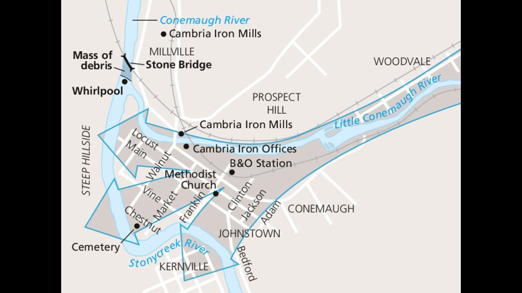
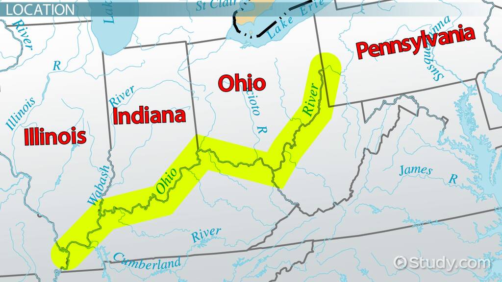
So now we come to Johnstown, which is located 57-miles, or 92-kilometers, east of Pittsburgh.
It is at the confluence of the Conemaugh and the Stonycreek Rivers.
The is a map of the 1889 Johnstown Flood direction from the National Park Service map.
“Mass of debris” is marked at the Stone Bridge location.
The Stone Bridge is a 7-arch railroad bridge that was said to have been constructed by the Pennsylvania Railroad between 1887 and 1888.
The Stone Bridge itself survived the flood, but it trapped all kinds of debris, including miles of barbed wire, that had been swept away by the raging floodwaters.
The debris at the bridge caught on fire and burned for three days, killing many people that were trapped in the debris.
If the failure of the South Fork Dam, and the subsequent catastrophic Johnstown Flood was deliberately caused by prestigious members of the South Fork Fishing and Hunting Club, which evidence in the narrative suggests was the case, then apparently these men had had no care or concern for the death, destruction and suffering for which they were never held accountable that they caused downriver.
From 1834 to 1854, Johnstown was a key transfer point on the Pennsylvania Main Line Canal.
At the head of the canal’s western branch, canal boats were transported over the mountains by the Allegheny Portage Railroad to continue the trip by water to Pittsburgh at the “Forks of the Ohio” and on to the Ohio River Valley.
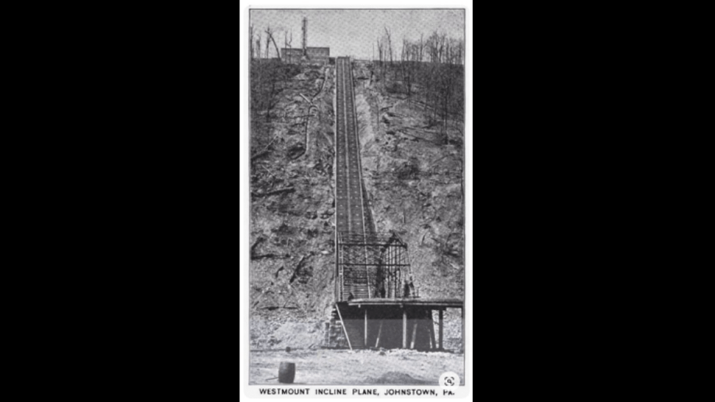
Both Johnstown on the one side of the Allegheny Portage Railroad and the Horseshoe Curve near Altoona on the other side, might have operational remnants of the original incline railway system, though that’s not what we are told about them.
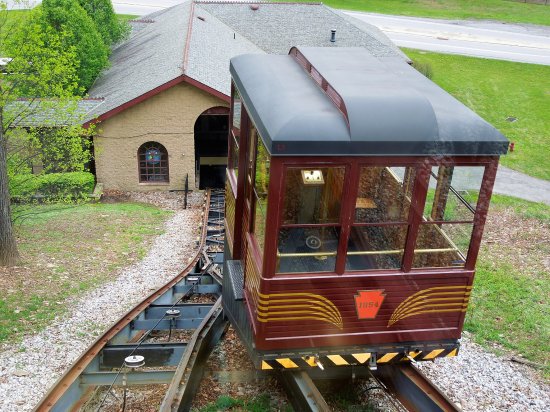
The Johnstown Inclined Plane was said to have been designed by Hungarian-American engineer Samuel Diescher, and completed in 1891 to serve as an escape route from floods in the valley at the confluence of the Conemaugh and Stonycreek Rivers, and to connect Johnstown with the Borough of Westmont on Yoder Hill.
Billed as the “World’s steepest vehicular inclined plane,” it’s slope has a grade of 71.9%, and it takes 90 seconds for it to travel in-between the two stations.
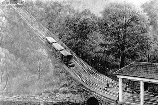
The Inclined Plane Railway back at Horseshoe Curve near Altoona was said to have been built in the 1990s to take tourists up to the park above to get a scenic view of the incredible engineering feat by the Pennsylvania Railroad circa 1854 of the Horseshoe Curve and its three-tracks that eliminated the need for the Allegheny Portage Railroad’s 10-incline planes.
Incline railways work like an obliquely-angled elevator, in which cables attached to a pulley-system raise- and-lower the cars along the grade.
Two cars are paired at opposite-ends and act as each other’s counterweight. As such, there is not a need for traction between the wheels and rails, and thereby allowing them to scale steep slopes, unlike traditional rail-cars.
Thing is, there used to be way more of them than there are now, and inclined-railways were a worldwide thing.
Now they are mostly either tourist attractions, or kept in-service as an important part of a communities’ transportation infrastructure from low-ground to high-ground.
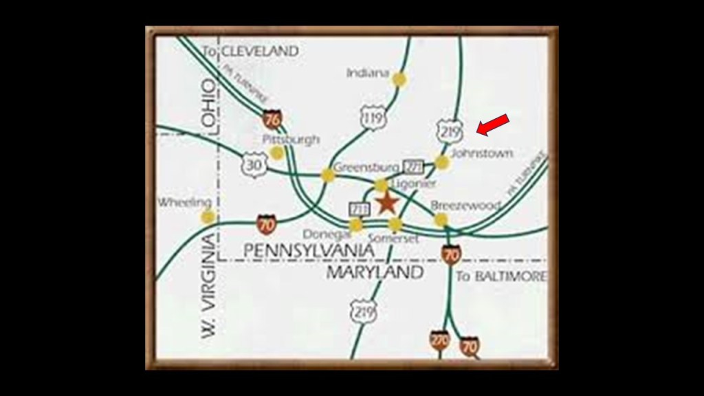
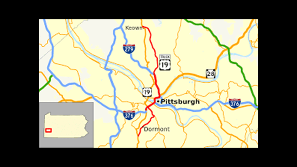
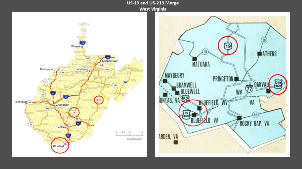
Back in Johnstown, come to find out that the main highway connecting Johnstown to the Pennsylvania Turnpike is US Route 219, which makes a lot of appearances here, as does US-19, and more on both to come in this post.
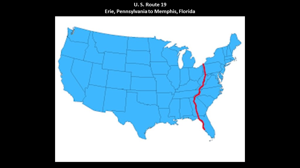
The North-South U. S. Route 19 runs from its northern terminus at U. S Route 20 at Lake Erie in Erie, Pennsylvania to its southern terminus at an interchange with U. S. 41 in Memphis, Florida, just south of St. Petersburg.
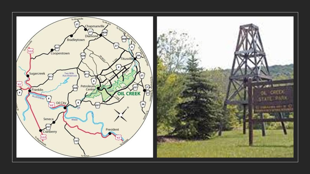
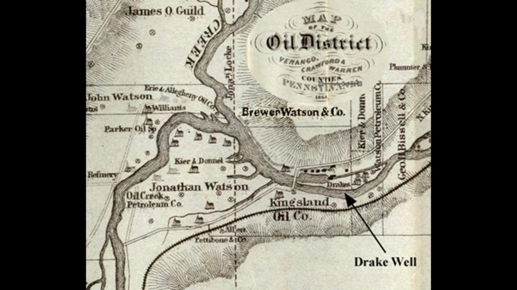
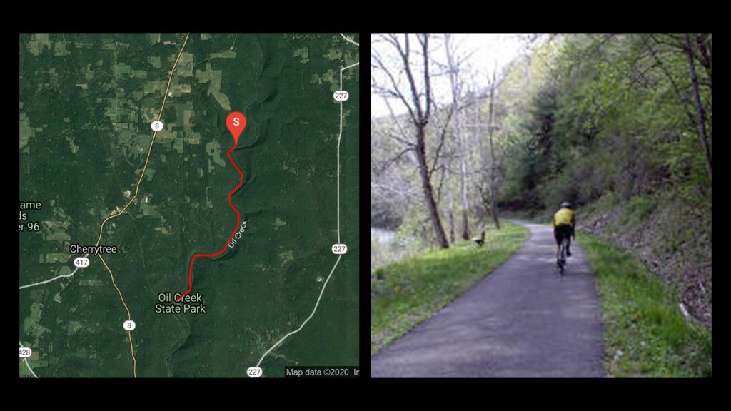
The petroleum industry in the United States began in earnest in 1859 when Edwin Drake found oil on a piece of leased-land near Titusville, Pennsylvania, in what is now called Oil Creek State Park.
For this reason, Titusville is called the Birthplace of the Oil Industry, and for a number of years this part of Pennsylvania was the leading oil-producing region in the world.
Today, not surprisingly, the Oil Creek State Park Trail runs on the bed of the first railroad line to reach Titusville, the Oil Creek Railroad.
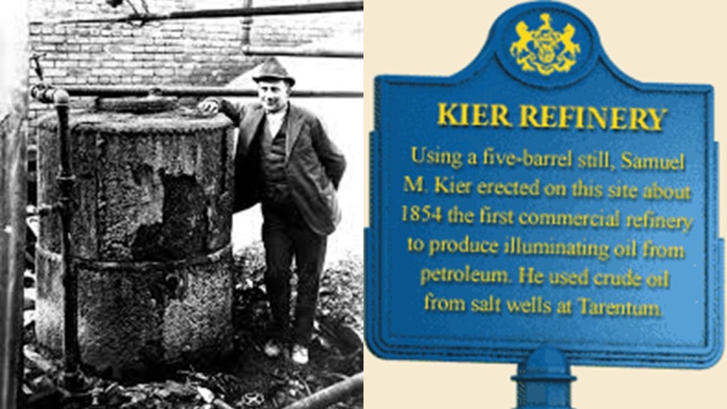
Samuel Kier had established America’s first oil refinery in Pittsburgh in 1854 for making lamp oil, just five-years before oil was “found” in Titusville.
So it certainly appears like the petroleum industry was developed in the 1850s in order to provide a replacement energy technology for the free energy technology of the original civilization.
Roughly a decade after the birth of the oil Industry at Titusville in 1870, John D. Rockefeller, along with Henry Flagler, an American Industrialist and major developer in the state of Florida, founded the Standard Oil Company, an American oil producing, transporting, refining, and marketing company.
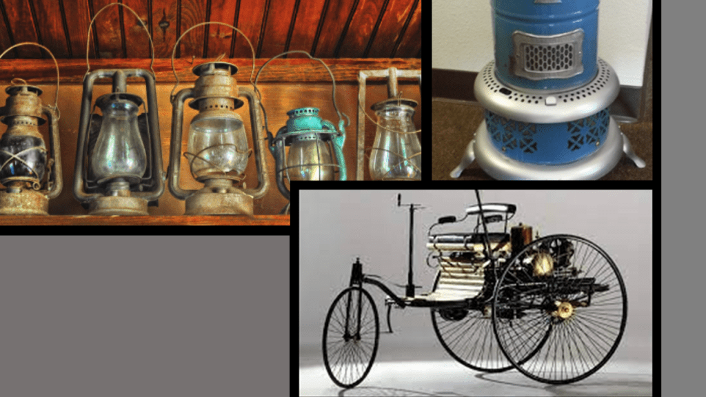
Oil was used in the form of kerosene throughout the country as a light source and heat source until the introduction of electricity, and as a fuel source for the automobile, with the first gas-powered automobile having been patented by Karl Benz in 1886.
John D. Rockefeller, who was born in the United States in 1839, was the progenitor of the wealthy Rockefeller family.
He was considered to be the wealthiest American of all time, as seen in this ranking by CNN Business, with an adjusted wealth of $253-billion.
Rockefeller’s wealth soared as kerosene and gasoline grew in importance.
At his peak, he controlled 90% of all oil.
As quickly as possible, a way was found to replace what remained of the free-energy system with their own coal- and oil-based system, and in the process make money hand over fist from the total control of the new system.
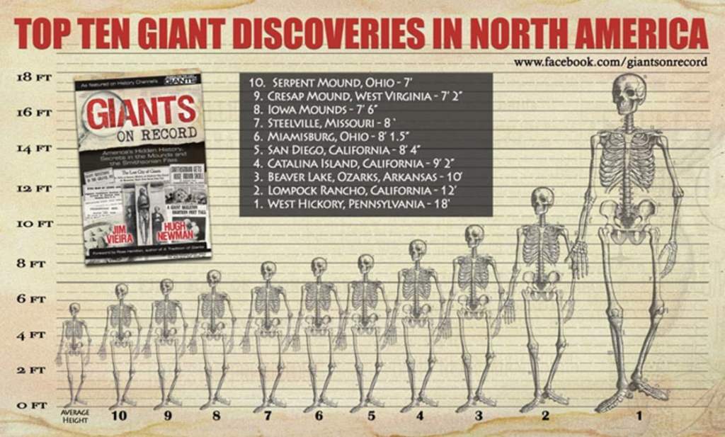
Interesting to note that West Hickory is the short distance ofjust 14-miles or 22-kilometers, south of Titusville, where the tallest recorded skeleton in North America was found at 18-feet, or 5.5-meters.
The previously-mentioned US Highway Route 19 goes through Pittsburgh.
Pittsburgh is the largest city in Appalachia and the Ohio Valley.
It developed as the vital link between theAtlantic Coast and the Midwest, with examples like the Allegheny Portage Railroad connecting the Pennsylvania Main Canal to Pittsburgh and the Ohio River and points west of the Allegheny Mountains.
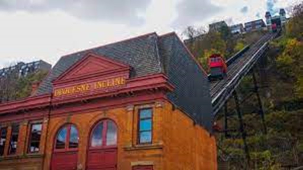
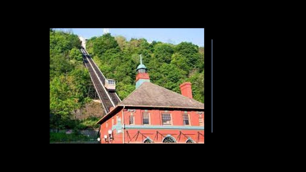
Samuel Diescher, who was credited with the design of the Johnstown Incline was also credited with the design of one of Pittsburgh’s two remaining inclines of the 17 that were originally on Mt. Washington – the Duquesne Incline, which opened in 1877.
It was closed in need of repairs in 1962, but reopened the next year after local residents raised funds to restore it, and it has been completely refurbished since then and is one of Pittsburgh’s most popular tourist attractions.
The Monongahela Incline on Mount Washington was said to have been designed by Prussian-born engineer John Endres of Cincinnati, Ohio, and started operating in 1870.
It is the oldest continuously operating funicular in the United States.
Interesting to note that 1870, the same year the Monongahela Incline became operational in Pittsburgh, was also the same year John D. Rockefeller and Henry Flagler, founded the Standard Oil Company.
Pittsburgh played a dominant role in the development of the U. S. Steel Industry.
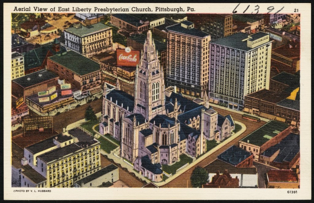
Many leading industrialists of the 19th-century were based in Pittsburgh, and resided in the East Liberty neighborhood in Pittsburgh’s East End, at one time the richest suburb in America, with names including Mellon, Carnegie, Heinz, and Westinghouse living there.
We are told that East Liberty started developing as a commercial area in 1842, when Thomas Mellon, prominent businessman and patriarch of the Mellon family in Pittsburgh, married Sarah Jane Negley, daughter of one of the earliest land-owners in the area, and made East Liberty their home..
We are told that Thomas Mellon made his fortune selling or rented land inherited by his wife, and used the proceeds to finance early industries in Pittsburgh.
Once again in 1870, he and his sons Andrew and Richard established the “T. Mellon & Sons Bank,” and it became the Mellon National Bank In 1902.
It became a force in the mass production revolution in the United States, particularly in the Midwest.
A National Bank is a private bank operating as a commercial bank within the Federal Government’s Regulatory Structure, and under the supervision of the “Office of the Comptroller of the Currency,” rather than a state banking agency.
At one time in our history, National Banks had the authority to print money.
At its height, Mellon Financial Services was one of the world’s largest money management firms.
It merged with the Bank of New York in 2007 to become BNY Mellon.
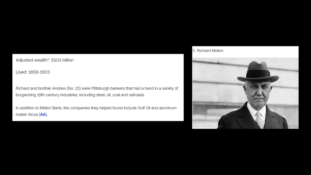
Richard Mellon, with an adjusted wealth of $103-billion, is listed as the 5th wealthiest American of all-time by CNN Business, and a founder of Gulf Oil and Alcoa Aluminum, as well as a number of other big corporations, along with his brother…
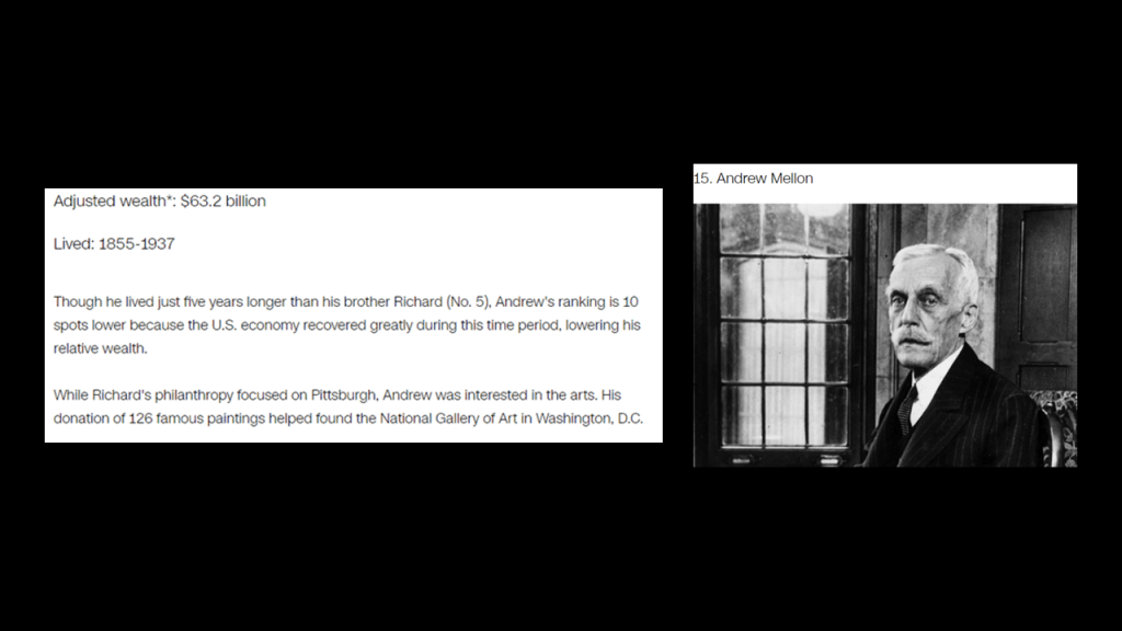
…Andrew Mellon, who is listed as the 15th-wealthiest American of all-time by CNN Business, with an adjusted wealth of $63.2-billion.
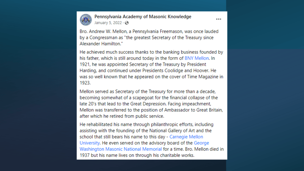
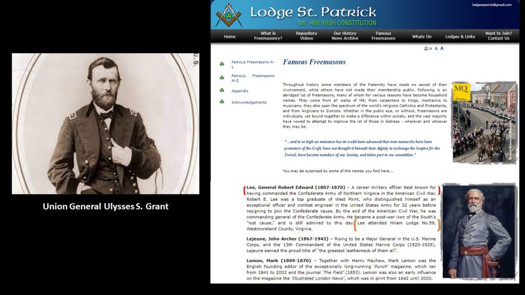
It is important to note that Andrew Mellon was an acknowledged Freemason, and also the U. S. Secretary of the Treasury from March 9th of 1921 to February 12th of 1932, presiding over the Boom years of the 1920s as well as the Wall Street Crash of October 1929, which led directly to the Great Depression.
Andrew Mellon was also a close friend of Henry Clay Frick, and a member of the South Fork Fishing and Hunting Club, along with Andrew Carnegie, on the property where the dam failed that caused the Johnstown Flood, as previously discussed.
Along with Andrew Mellon, as we saw earlier in the section on Johnstown, Andrew Carnegie and Henry Clay Frick were initiated into Freemasonry, with Henry Clay Frick active for only five-years, but supported Freemasonry his entire life.
It’s important to note that with the philanthropic activities spoken of these extremely wealthy men, which are made to sound extremely benevolent and meant to benefit Humanity, it seems like their intent was highly questionable as to their actual motives.
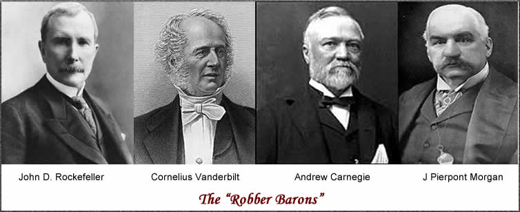
We have seen or referenced all four of these men who receive the top billing as “Robber Barons,” and more on Morgan to come.
Among many other things, both the Rockefeller and Carnegie Foundations have been highly involved in the American Educational System.
Even as early as 1914, the National Education Association expressed alarm at the activity of the Carnegie and Rockefeller Foundations, and their efforts to control the policies of State educational institutions, and everything related to the educational system.
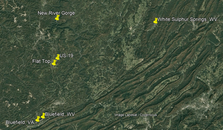
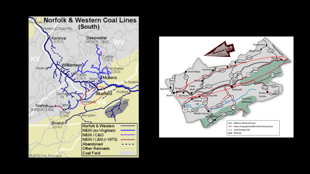
Now I’m going to go back to US-219 that we saw in Johnstown and take it on down to where it ends at Bluefield, Virginia, right across the state border from Bluefield, West Virginia, where it meets up with US-19.
The land beneath the two Bluefields contains the richest deposit of bituminous coal in the world, known as the “Pocahontas Coalfield,” or the “Flat-Top Pocahontas Coalfield,” named after the Flat Top Mountain on US-19 in West Virginia, and Pocahontas, Virginia, where the first coal-seam here was discovered.
The Pocahontas Coalfield started to be mined in 1882.
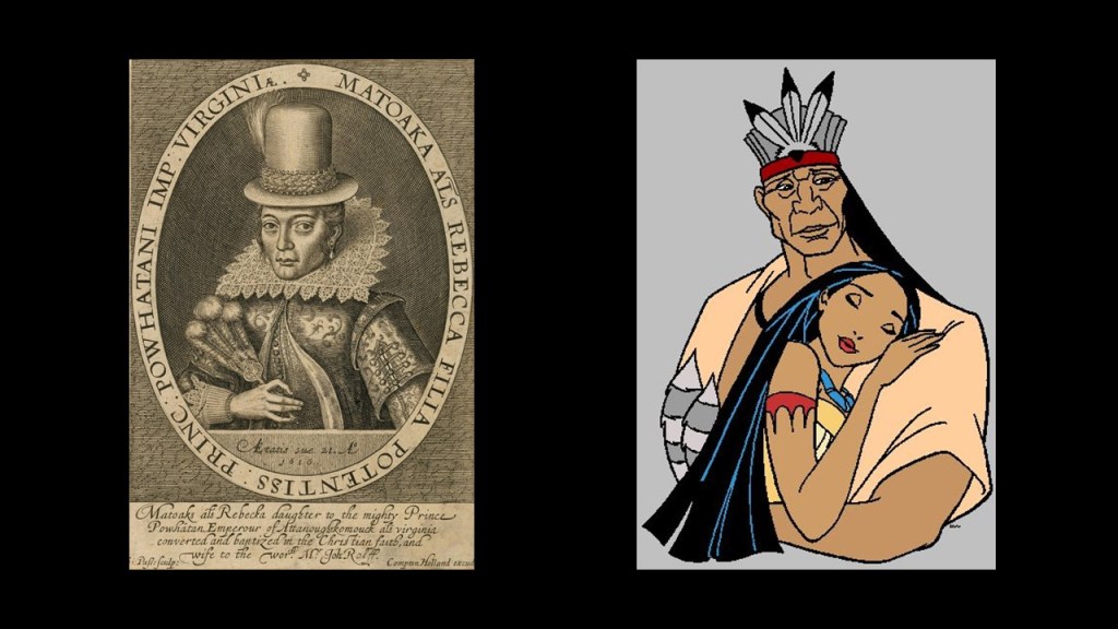
Pocahontas in Virginia was named after the famous daughter of Chief Powhatan in connection with the 17th-century Jamestown Colony, the first permanent English settlement in the Americas.
This is the most famous depiction of Pocahontas from her time on the left, but this how we have been taught to see Pocahontas and Powhatan on the right.
We are told that Bluefield in West Virginia, with its great location with respect to the developing Pocahontas Coalfield, was selected as the location of a major Division point on the Norfolk and Western Railway in the late 19th-century, and that the railroad greatly stimulated the town’s growth, so much so that in its hey-day, Bluefield was considered a “Little New York.”
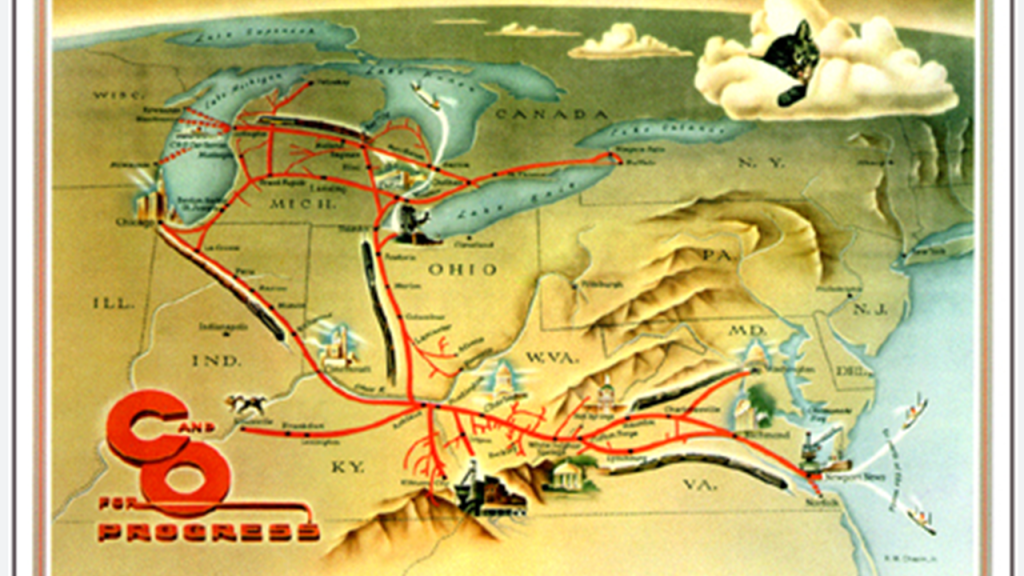
The Chesapeake and Ohio Railway was formed in 1869 from several smaller Virginia Railroads under the guidance of Collis P. Huntington also around the same time that the Standard Oil Company was founded, in order to connect the coal reserves of West Virginia with the new coal piers that were built in Hampton Roads and Newport News, Virginia, and first opened in 1873, forging a rail link to places like Chicago in the Midwest.
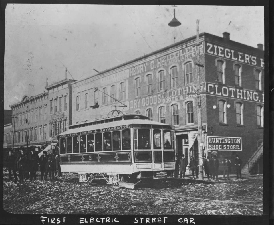
The city of Huntington in West Virginia was named for him.
Huntington was said to be one of the first American cities to have electric streetcars, with service believed to have started around the end of 1888, and ran until the 1920s, during which time the Ohio Valley Electric Railway had organized a gas-powered bus service, which by November 1937 had completely replaced all of Huntington’s former electric streetcar lines.
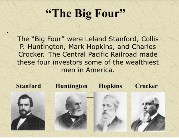
Collis P. Huntington was one of the Big Four of western railroading, along with Leland Stanford, Mark Hopkins and Charles Crocker.
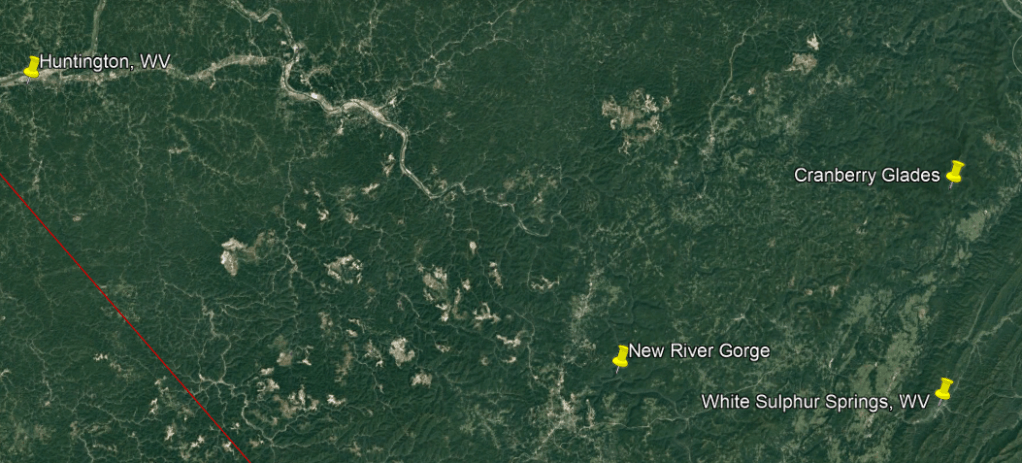
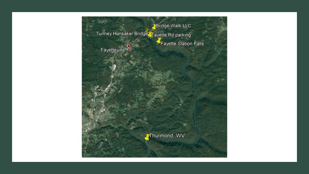
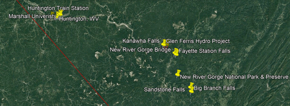
We are told that after the Chesapeake and Ohio Railway opened up the New River Gorge region in 1873, coal was carried out of the New River Gorge to the ports in Virginia and to cities in the Midwest.
As a result, by 1905, thirteen cities sprang up between Fayette and Thurmond, which was 15-miles, or 24-kilometers, upstream, and provided the West Virginia coal that contributed greatly to the industrialization of the United States until the 1950s.
After the coal seams were exhausted and mines closed, these company towns were for the most part completely abandoned, with the possible exception of Thurmond which had a very small population of 5 in 2010.
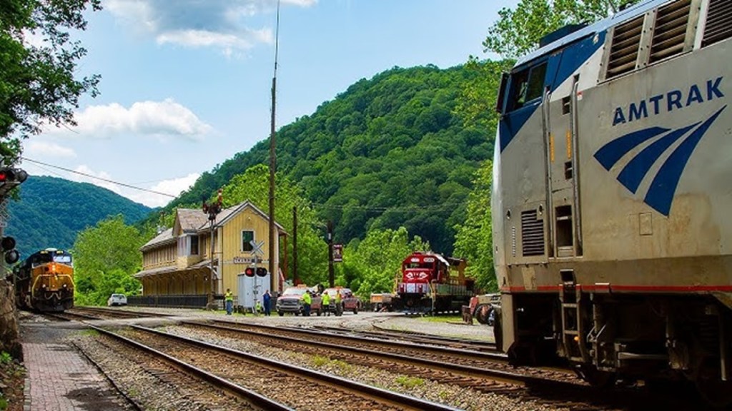
It is interesting to note that at one time in its history, Thurmond was a prosperous railroad town that was the largest, revenue-generating stop on the C & O Railroad, where passenger and coal trains rolled through here throughout the day.
Today, a visitor center for the National Park Service operates here in the old railroad depot.
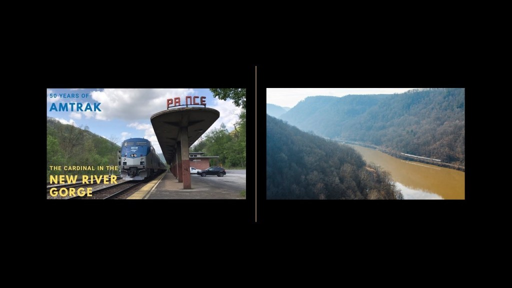
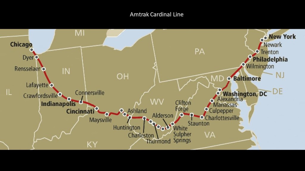
CSX Transportation, formerly the C & O Railroad, has freight transportation operations in and through historic Thurmond, and the Amtrak Cardinal passenger route goes through here, the second-least-used Amtrak station in the nation.
As a matter of fact, the New River Gorge is one of the places that I know of that still has a railroad operating right along beside the S-shaped New River.
The Amtrak Cardinal still runs through the New River Gorge 3 days/week – on Sundays, Wednesdays and Fridays.
So like we saw back at the Lehigh Gorge in Pennsylvania with its railroad running alongside the river; the waterfalls; and the coal-mining in the region, we find the same things here at the New River Gorge in West Virginia.
Besides the railroad line that runs along the New River through the New River Gorge in West Virginia, there are things found in the gorge like historic coal mines, waterfalls, and hydro projects.
In 1888, Collis P. Huntington lost control of the railroad to J. P. Morgan, an American financier and investment banker who dominated corporate finance on Wall Street during the Gilded Age between 1877 and 1900, and William K. Vanderbilt, who managed the Vanderbilt family’s railroad investments.
William K. Vanderbilt was was the grandson of Cornelius Vanderbilt.
The process continued on for the C & O Railroad to consolidate and merge railroads, and, for example, to gain access to productive coal fields throughout the region, through the 1920s.
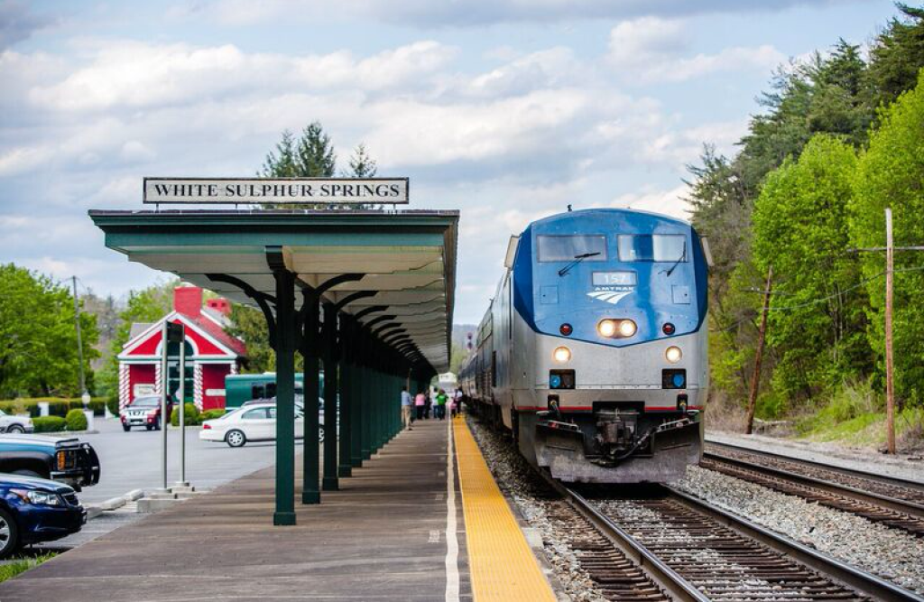
Next I am going to take a look at White Sulphur Springs, West Virginia, which is to the southeast of the New River Gorge and to the northeast of the Pocahontas Coalfield region.
White Sulphur Springs was said to have been settled in 1750, and developed as a health spa in the 1770s, as the story goes after a woman was healed of rheumatism after bathing in the springs, and calls itself “America’s Resort since 1778.”
The springs are on the grounds of the Greenbrier Hotel and resort, which was said to have been built by the Chesapeake & Ohio Railroad Company in 1913.
Even today, the same Amtrak Cardinal Line that runs through the New River Gorge has a station at White Sulphur Springs.
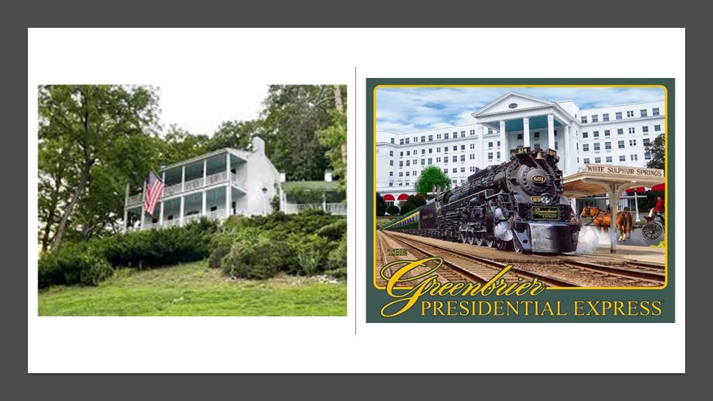
The Greenbrier Resort was at one time a Presidential getaway, with President Eisenhower the last President in office to have stayed there, with 27 presidents having stayed at the hotel before him.
The Presidents’ Cottage is a museum today.
A top-secret, super-sized underground bunker was said to have been constructed there in the 1950s during the Eisenhower Administration to serve as a relocation point for the U. S. Congress in the event of a nuclear war, but when the secret came out in 1992 in a newspaper article, it was decommissioned.
It had features like:
–A 25-ton blast door that opened with only 50-lbs of pressure
–It’s own power plant with purification equipment, and the capacity for 75,000-gallons of water storage, and 42,000-gallons of diesel fuel
–Every kind of medical care one would ever need
–Sleeping, meeting, and eating facilities for over 1,000 people.
It was kept stocked with supplies for thirty-years but never used as an emergency location.
In 1995, the government ended the lease agreement with the Greenbrier, and it was opened to the public for tours, which it offers to this day.
Today’s Amtrak Cardinal Line runs between New York and Chicago, by way of Washington, DC; through White Sulphur Springs, Cincinnati, and Indianapolis, on its meandering route, and was once part of the Chesapeake and Ohio Railroad.
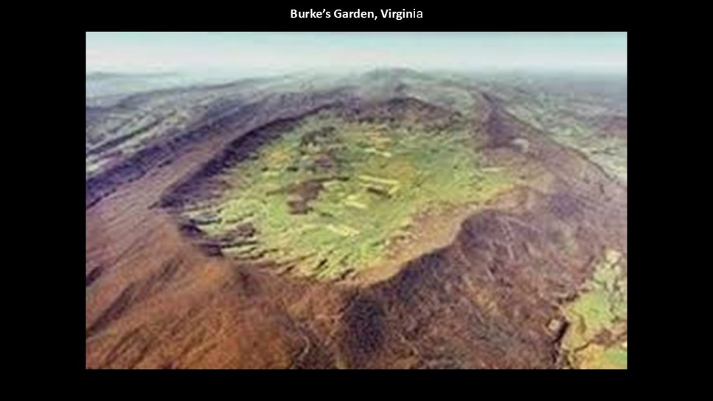
Burke’s Garden in Virginia is just to the south of the Bluefield area, is accessed from US-19, and the next place I want to bring to your attention.
Burke’s Garden has a population of about 300 people, in a place considered to have the most fertile soil in Virginia, but no post office; no cell phone or cable service; cool-to-cold weather; and one paved road to Tazewell, the nearest town about 15-miles, or 23-kilometers away.
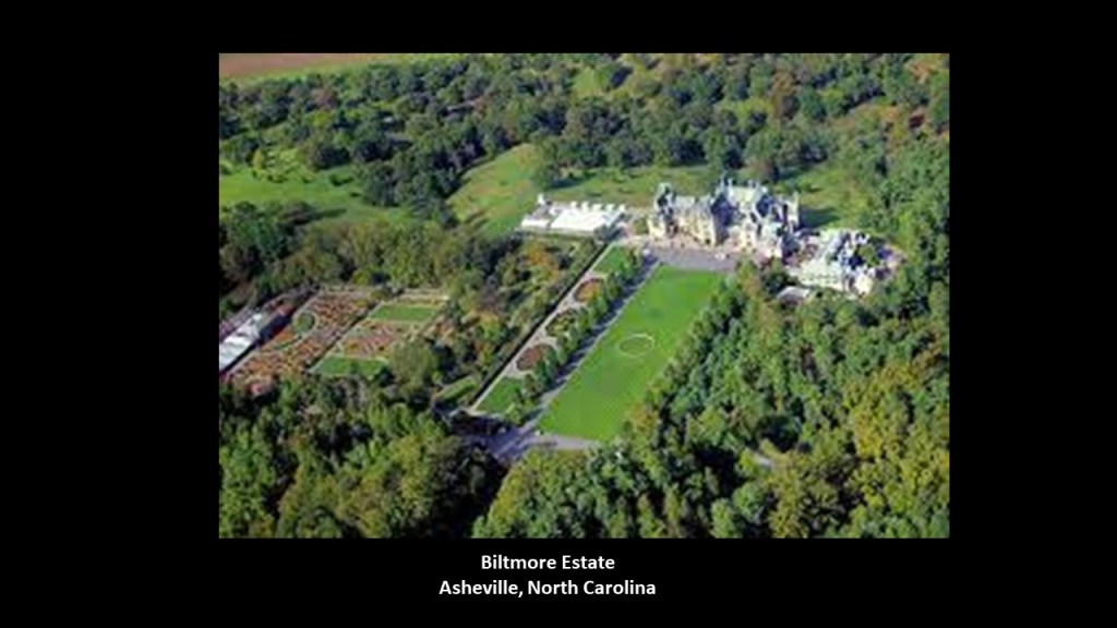
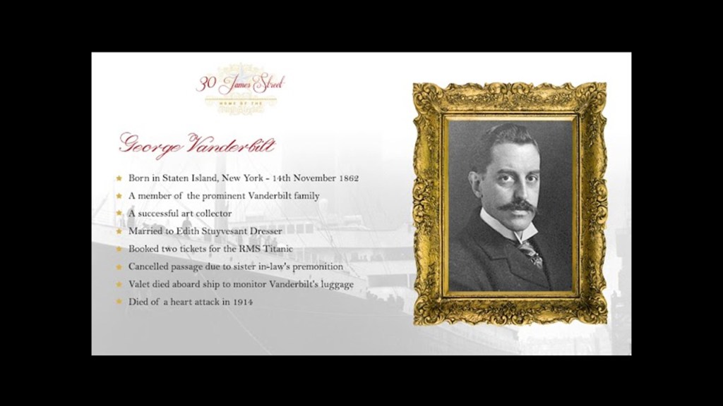
Burke’s Garden was known as “Vanderbilt’s First Choice” for the Grand Biltmore Estate.
We are told that the land-owners there wouldn’t sell to George Vanderbilt II, so he went to Asheville in North Carolina instead.
More on Asheville shortly.
There are a number of historic railroads in the vicinity of Burke’s Garden, like the Norfolk & Western Railroad’s Clinch Valley Line between the coalfields of Bluefield running through Tazewell County beside US-19 to the high-quality coalfields of the Clinch River Valley south of Richlands.
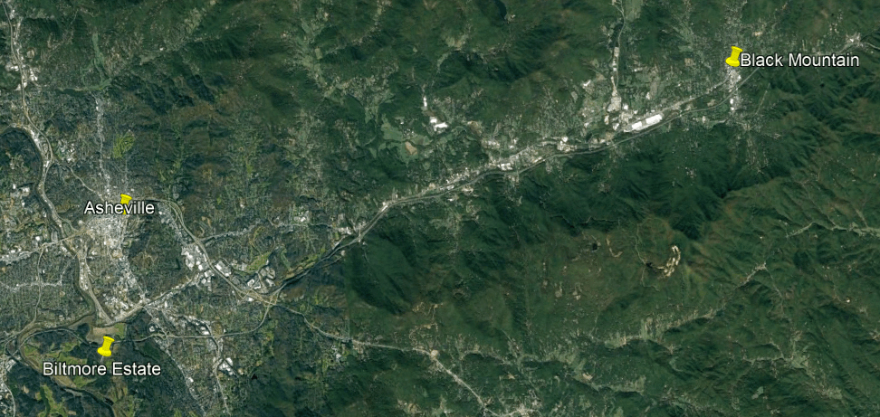
The last place I want mention on US-19 is Asheville in North Carolina.
Asheville is at the confluence of the French Broad and Swannanoa Rivers.
George Vanderbilt II’s Biltmore Estate is divided by the French Broad River, and its confluence with the Swannanoa River is on the Biltmore Estate.
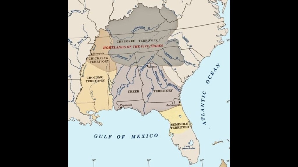
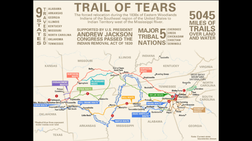
This whole region was part of the traditional lands of the Cherokee people.
They were said to have ceded their land here around Asheville 1819.
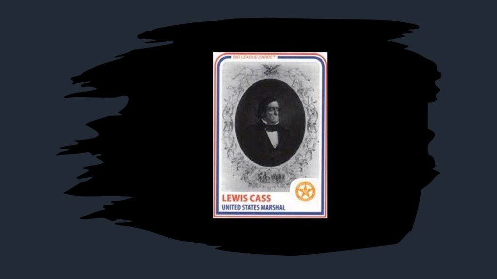
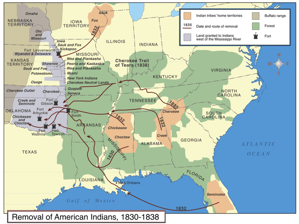
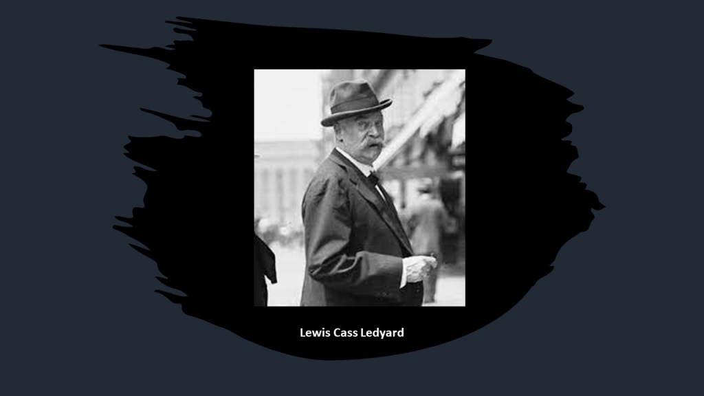
The Cherokee were one of the five civilized tribes to be forcibly removed from their land after the Indian Removal Act of 1830 was passed by Congress, and enforced by Lewis Cass, Andrew Jackson’s Secretary of War, and the Cherokee were marched west to Indian Territory in one of several Trails of Tears.
So Asheville on US-19 ended up being the location chosen by George Vanderbilt II for the Biltmore Estate instead of his “first choice” Burkes Garden, also on US-19.
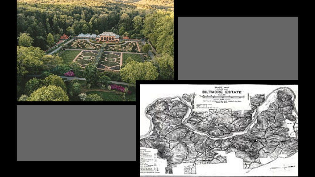
The Biltmore Estate is on 8,000-acres, or 3,237-hectares of land.
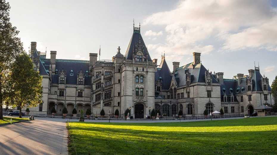
This is what we are told about the Biltmore.
It was said to have been a Chateauesque-style mansion, meaning in the revivalist Renaissance architectural-style of French chateaux of the Loire Valley, built for George Washington Vanderbilt II between 1885 and 1895.
It is the largest privately-owned residence in the United States, and is considered one of the most prominent of the Gilded Age mansions.
The Gilded Age is the name given to the period of time in American history between 1877 and 1900, a time of rapid industrialization and rapid economic expansion.
This would have roughly corresponded in our historical narrative to the Reconstruction Era after the American Civil War, which we are told ended in 1865, and the Progressive Era, which is what we are told was a period of widespread political activism and reform, that started in 1896.
It was also a time when the contrast of the ostentatiousness of the wealthy versus the abject poverty of the working class became more visible.
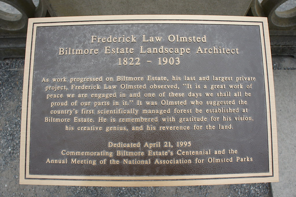
We are told that the famous landscape architect Frederick Law Olmsted was employed by George Washington Vanderbilt II to design the landscape for the Biltmore Estate.
It was said to be Frederick Law Olmsted’s last project, and he was memorialized in a plaque there.
George Washington Vanderbilt II was William Kissam Vanderbilt’s brother, who was mentioned earlier in this post as having gained control of the Chesapeake & Ohio Railroad, along with financier J. P. Morgan, from Collis Huntington in 1888.
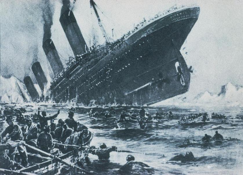
What we are told in our historical narrative is that George W. Vanderbilt II was supposed to sail on the RMS Titanic with his wife but they changed plans at the last minute.
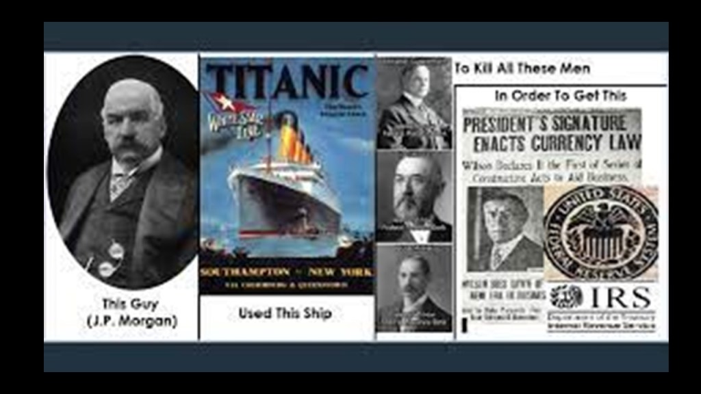
J. P. Morgan has long been suspected of having been behind what has come down to us as the sinking of the Titanic.
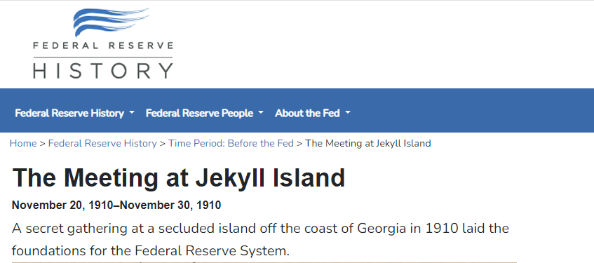
This is what we are told on the Federal Reserve History website.
A secret meeting took place on Jekyll Island off the coast of the State of Georgia to lay the foundations of the Federal Reserve between November 20th and November 30th of 1910.
The purpose of the meeting was so secret that what the six men talked about was a closely guarded secret for many years, and they did not admit to it until the 1930s.
They were laying the foundation for what would become the Federal Reserve System.
Again, this information is from the Federal Reserve History website.
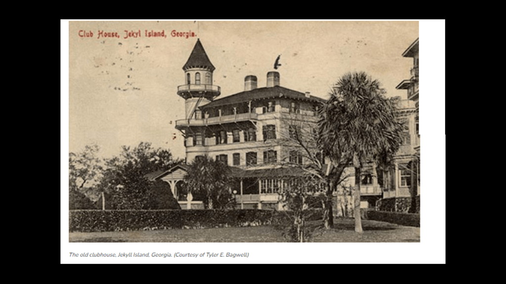
J. P. Morgan was a member of the exclusive Jekyll Island Club, was likely the one who arranged for the group to use the club’s facilities.
George’s brother, William K. Vanderbilt was also member of what Munsey’s Magazine described in 1904 as the “richest, most exclusive, and the most inaccessible” club in the world.
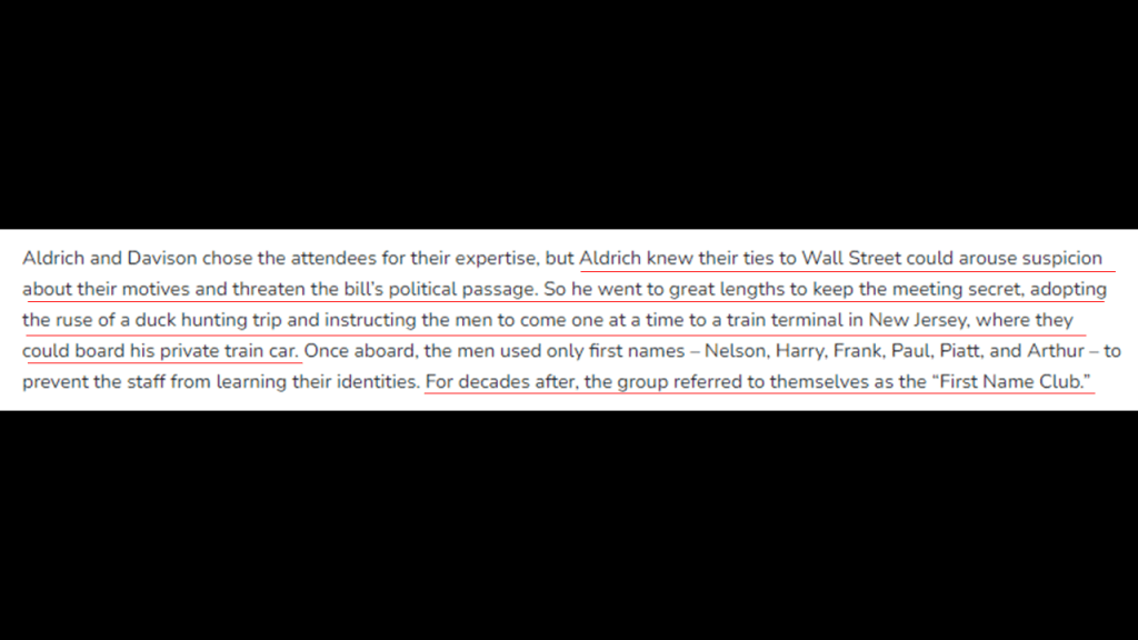
Arriving on a private train car, the group of men who attended the 10-day secret meeting on Jekyll Island in November of 1910 adopted the cover story of a “duck hunt” to explain their activities and hide the true purpose of their meeting, and addressed each other by their first names only – hence they adopted the name of the “First Name Club.”
This was the train station in Brunswick that serviced Jekyll Island on the Southern and Atlantic Coast Railroad.
The Oglethorpe Hotel pictured here was said to have opened in January of 1888, after having been built on top of the previous Oglethorpe House which was said to have burned down during the Civil War.
It remained in operation until 1958, at which time it was torn down and replaced by a Holiday Inn.
The Holiday Inn was eventually torn down too, leaving an empty lot in downtown Brunswick called the “Oglethorpe Block.”
Then, on April 15th of 1912, we are told the Titanic sank. with all the bankers opposed to the creation of the Federal Reserve on board, including John Jacob Astor IV, one of the richest people in the world at the time.
The following year, on December 23rd, 1913, the Federal Reserve Act Passed Congress, signed into law by Woodrow Wilson. It created and established the Federal Reserve System, and created the authority to issue Federal Reserve Notes (commonly known as the US dollar) as legal tender.
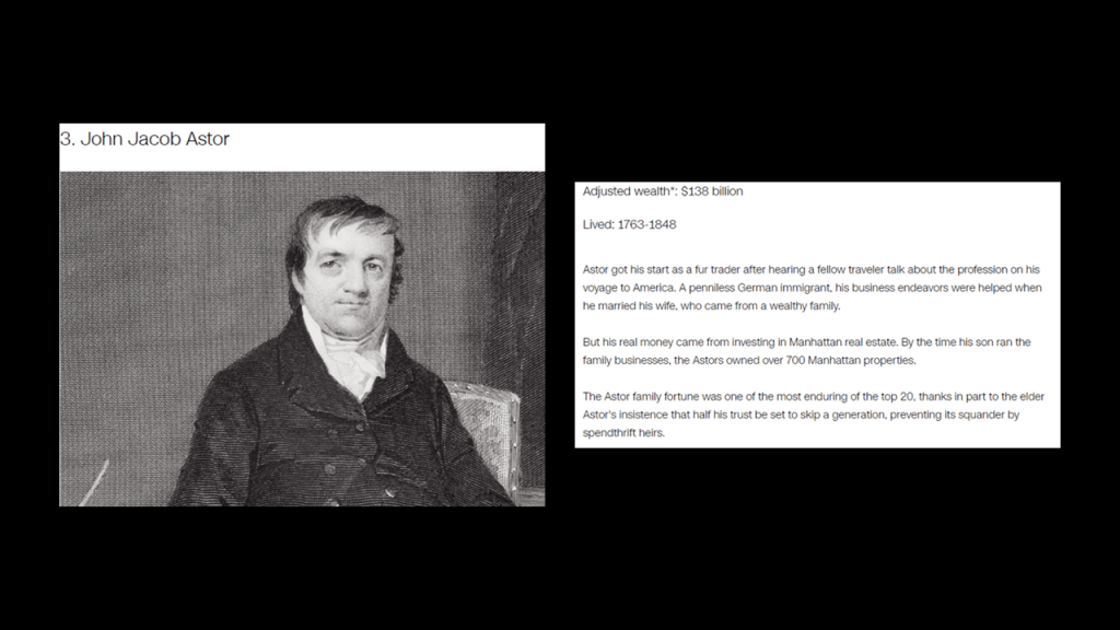
John Jacob Astor IV was the great grandson of the previously-mentioned John Jacob Astor, who made a fortune in real estate development, the fur trade, and opium smuggling.
John Jacob Astor was considered to be the world’s first multi-millionaire, and the third-richest American of all time according to CNN Business, with an adjusted wealth of $138-billion.
J. P. Morgan himself didn’t make the CNN Business List of the 20 wealthiest Americans of all time, but he dominated corporate finance on Wall Street throughout the “Gilded Age,” and was a major driving force behind the wave of industrial consolidation in the United States in the late 19th- and early 20th-centuries, like the previously mentioned U. S. Steel in 1901.
J. P. Morgan’s father, Junius Spencer Morgan, was the founder of the company that would become J. S. Morgan & Company in 1864, that was the successor company to George Peabody & Company, of which he became the Junior Partner in October of 1854.
In 1854, Morgan was put in charge of the firm’s iron portfolio, which included the marketing of railroad bonds in London and New York.
By the time J. S. Morgan died in 1890, the Morgan banks were the dominant forces in government and railroad finance, and his son John Pierpont Morgan had taken the helm of the company, becoming known as. J. P. Morgan & Company in 1895, now known as JP Morgan Chase & Company.
George Peabody’s bank became the premier American banking house in London after he took up residence from Baltimore to London permanently in 1837, and went from being a wholesale dry-goods and cotton merchant, to a merchant-banker offering securities in American railroad and canal enterprises to British and European investors.
He started a banking business trading on his own account a year after he moved to London, and by 1851, he established the banking firm of “George Peabody & Company” to meet the increasing demand for securities issued by American railroads, and his company specialized in financing governments and large companies.
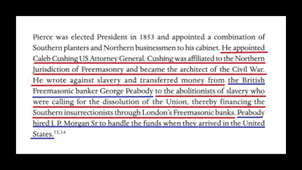
According to “The Secret Founding of America” book by Nicholas Hagger…
…George Peabody was the Freemasonic banker from whom money was transferred to the “southern insurrectionists,” and he hired the father of J. P. Morgan to handle the funds when they arrived in the United States.
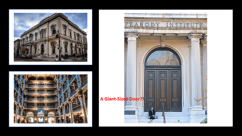
Banker George Peabody established the Peabody Institute in Baltimore in 1857 with a bequest of at least $800,000, and it is the oldest conservatory in the United States.
By the time it was completed and opened in 1866, one year after the official end of American Civil War, it was dedicated by George Peabody himself,and included a music academy, library and art gallery.
George Peabody was also called the “Father of Modern Philanthropy.”
That entrance at the east wing of the George Peabody Library sure looks proportionally like its made for much bigger people than we are today!
So, exactly how do you go about hiding giants and their advanced civilization?
I think the American Civil War was one of many ways to do this, and that it was not what we are told it was about.
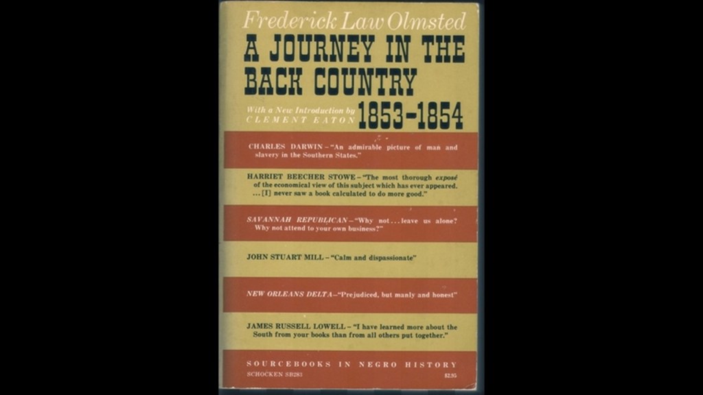
The revered and seemingly prolific Frederick Law Olmsted started out his career as a journalist.
Among other things, during the pre-Civil War time period, Olmsted was commissioned by the New York Daily Times to start on an extensive research journey in the American South and Texas between 1852 and 1857.
He published three books from this time into one book, called “Journeys and Explorations in the Cotton Kingdom,” in 1861 during the first six months of the American Civil War at the suggestion of his English publisher.
All of these books by Frederick Law Olmsted raise red flags for me, as I have come to believe from my research that publications like these are indicative of some kind of setting the stage in seeding the new historical narrative into our consciousness by those responsible for the hijack of the original positive civilization that built all of Earth’s infrastructure.
Frederick Law Olmsted was also the first executive secretary of the United States Sanitary Commission as well as an organizer of the Union League.
First, the United States Sanitary Commission.
What we are told about the United States Sanitary Commission is that it organized “Sanitary Fairs” during the American Civil War as a fundraiser for the many needs of Union Soldiers, including health.
“Sanitary Fairs” had everything, including majestic “temporary” buildings said to have been built for the fairs, to be torn down after, and while not as elaborate as the big expositions such as in Chicago, they were still something in and of themselves.
Frederick Law Olmsted was on the standing committee for the United States Sanitary Commission that was formed in New York, with its main members throughout the Civil War also consisting of: Henry Whitney Bellows; George Templeton Strong; and surgeons Dr. William H. Van Buren, Dr. Cornelius R. Agnew, and Dr. Wolcott Gibbs.
Did the U. S. Sanitary Commission and its volunteers really have the wherewithal to both construct the buildings for and pull off these extraordinarily lavish and festive undertakings against the backdrop of national war and suffering?
Or was it a private front comprised of the very same people who organized and were prominent members of the private membership clubs of the day, like the Union League and the Century Association.
We are told the Union League was a private social club for wealthy men that opened in New York City in 1863 for pro-Union men could come together “to cultivate a profound national devotion” and “strengthen a love and respect for the Union.”
It became the most exclusive mens’ club in Manhattan, and perhaps in the nation.
This location for the Union League Club was said to have been built on the northeast corner of 5th Avenue and 39th Street between 1879 and 1881.
Along with Frederick Law Olmsted, organizers of the Union League Club were Henry Whitney Bellows, George Templeton Strong, and Wolcott Gibbs, same names as the United States Sanitary Commission.
Henry Whitney Bellows was also involved in the organizing of the Century Association in New York City, founded in 1847 and incorporated in 1857.
The Century Association was a private social, arts and dining club, and named after the first 100 people proposed as members.
The Century Association Building at 42 E. 15th Street was in-use by the association starting in 1857, and which served as one of the headquarters of the United States Sanitary Commission.
Members of the Century Association have included artists and writers like: poet and journalist William Cullen Bryant; landscape painter Frederick Edwin Church; landscape painter Winslow Homer; and best-known for stained-glass-work, Louis Comfort Tiffany.
Architect members have included: landscape-architects Calvert Vaux and Frederick Law Olmsted; Beaux-Arts architects Carrere and Hastings, as well as York and Sawyer; and architects McKim, Meade and White, who were said to have defined the ideals of the American Renaissance in end-of-the-century New York.
Other members were said to have included: Eight U. S. Presidents; ten U. S. Supreme Court Justices; forty-three Members of the Presidential Cabinet; twenty-nine Nobel Prize Laureates; members of the Rockefeller, Vanderbilt, Roosevelt, and Astor families; as well as financier J. P. Morgan and morse code inventor Samuel P. Morse.
Ever hear the George Carlin quote “It’s one big club, and you ain’t in it?” and wonder where that idea might have come from?
Seems like all of these private clubs we are seeing in this post were private and exclusive for a reason, and that was to secretly plan their activities and next moves that no one is supposed to know about!
The so-called elites have continued doing the same thing to this day in their secretive meetings to plan their agendas for what they want the future to look like for Humanity and the World, and what they want doesn’t look good for us!
The United States Sanitary Commission and the Sanitary Fairs and the exclusive private clubs associated with the very same people leads to the larger question, of what was really going on during the American Civil War, historically described as a civil war between northern states, or “Union,” and the southern states, or “Confederacy,” over the status of slavery and its expansion into newly acquired land after the Mexican-American War.
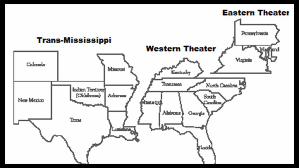
We are told there were three theaters of war during years of American Civil War, between 1861 and 1865: Eastern, Western, and Trans-Mississippi.
I have often thought that theater, defined as a collaborative form of performing art that uses live performers, usually actors or actresses, to present the experience of a real or imagined event before a live audience in a specific place, like a stage, is a thought-provoking word choice for an area or place in which important military events occur or are progressing.
I have come to view the American Civil War as Freemasonic Theater, which I think applies to all the wars and armed conflicts of our modern era.
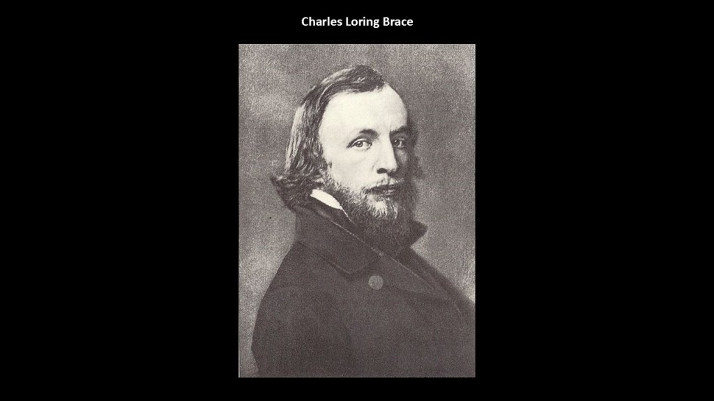
Orphan trains started in 1854, under the auspices of Frederick Law Olmsted’s good friend, Charles Loring Brace, and the Children’s Aid Society, which Brace established in 1853.
A new experimental program of his called “placing-out” became known to us as “Orphan Trains,” and for the next 75-years, over 200,000 children were sent across the continent, to uncertain destinations and uncertain futures with strangers.
A movement going in this direction was widely supported by wealthy New York families, like Charlotte Augusta Gibbes, the wife of John Jacob Astor III, grandson of John Jacob Astor, and who was the wealthiest Astor family member of his generation.
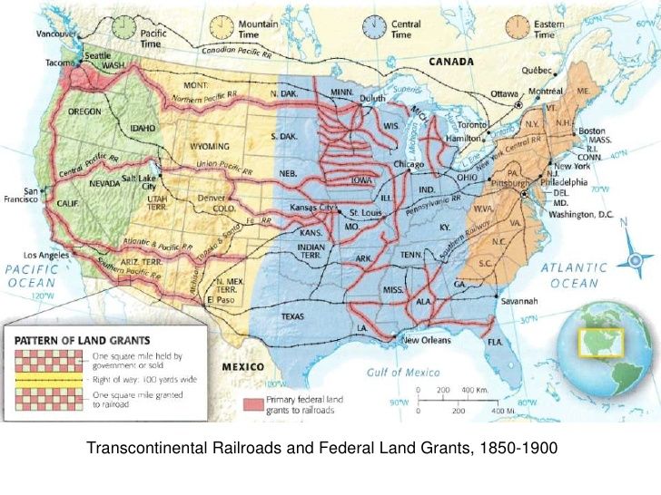
Right around the same time as the beginning of the Orphan Train Movement, and the alleged completion of the Horseshoe Curve by the Pennsylvania Railroad near Altoona, both taking place in 1854, we are told that the federal government operated a land-grant system between 1855 and 1871, where new railway companies in what we are told was the uninhabited west were given millions of acres they could sell or pledge to bondholders.
The establishment of a land-grant system at this time is a good place to insert once again the story of the Ames Brothers of Easton, Massachusetts, co-owners of the Ames Shovel Shop, nationally known for providing the shovels for the Union Pacific Railroad, which we are told opened the West.
It was said to have been the world’s largest supplier of shovels in the 19th-century.
Why were shovels so important to the opening of the West and the expansion of infrastructure?
What if…the tracks were already there and just needed to be dug out?
Not only that, one brother, Oliver Ames, Jr, was the President of the Union Pacific Railroad from when it met the Central Pacific Railroad in Utah for the completion of the first Transcontinental Railroad in North America.
The other brother, Oakes Ames, was a member of the U. S. Congress House of Representatives from Massachusetts 2nd District from 1863-1873.
He was credited by many as being the most important influence in building the Union Pacific portion of the first Transcontinental Railroad.
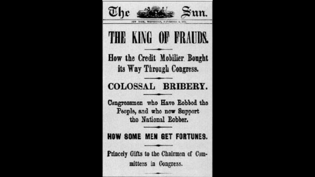
Oakes Ames was also noteworthy for his involvement in the Credit-Mobilier Scandal of 1867, regarding the improper sale of stock of the railroad’s construction company.
He was formally censured by Congress in 1873 for this involvement, and he died in the same year.
Ten-years later, he was posthumously exonerated by the Massachusetts State Legislature on May 10th, 1883.
The cities of Ames, Iowa, and Ames, Nebraska, are both said to be named for Oakes Ames, and were stops on the Union Pacific Railroad.
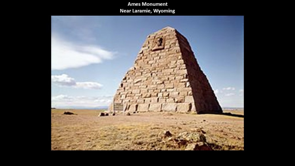
This is the Ames Monument near Laramie in Wyoming.
This large pyramid was said to have been also designed by Henry Hobson Richardson, and built between 1880 and 1882.
It was dedicated to the Ames brothers for their role in financing the Union Pacific Railroad.
The new history of “The Robber Barons and the Reset” seems to have gotten its start in Pennsylvania, where there were a lot of firsts happening in our historical narrative.
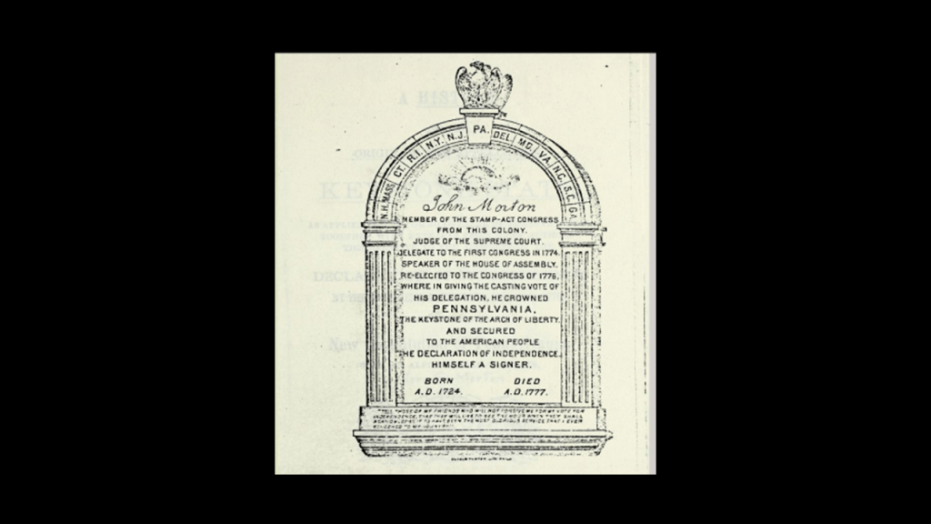
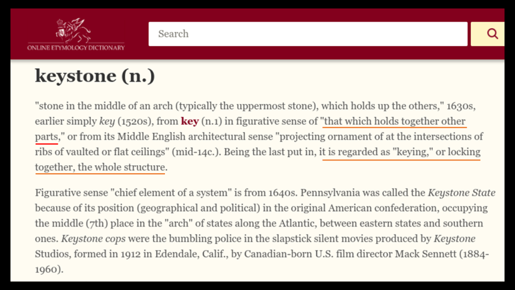
The nickname of Pennsylvania is “The Keystone State,” and in its anecdotal history, was said to have come from its location in the keystone of the arch, depicted here, in the center of the original thirteen colonies.
But another reason comes to mind in the definition of “keystone,” in its figurative sense as opposed to its literal meaning as the stone in the middle of the arch which holds up the others.”
The idea of “that which holds together other parts…locking together the whole structure.”
Pennsylvania certainly seems to have played an instrumental role in doing just that in our historical narrative.
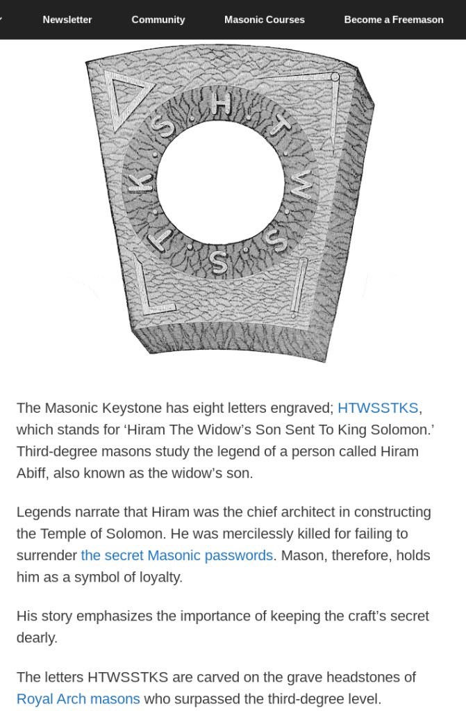
Additionally, the story of the Masonic Keystone is well-worth looking at. which has the letters “HTWSSTKS” engraved on it, said to mean “Hiram The Widows Son Sent To King Solomon,” referring to Hiram Abiff.
Hiram Abiff is the main character in an allegory presented to all 3rd-degree Freemasonry candidates as the main architect of Solomon’s Temple.
Hiram Abiff was murdered inside the temple with a mason’s tool by three fellow-craft masons from the workforce, or “ruffians,” after he wouldn’t give them his Master Mason secrets, which were lost with his death.
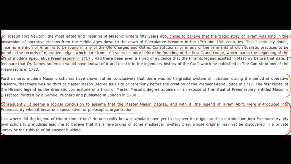
I found an article on the masonicworld.com website awhile back when I was looking for information on Hiram Abiff.
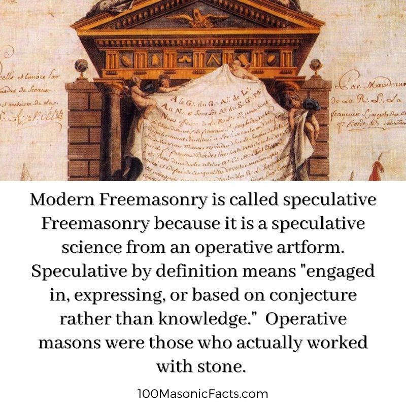
In it, the writer talks about “Operative Masonry” and the beginning of “Speculative Masonry” in 1717, with the founding of the Premier Grand Lodge of England.”
The writer indicates in the article that while some believed that operative masons were also in position of the tragic story of Hiram Abiff, there was no mention of Hiram Abiff in the existing records of Operative Masonry from before that time; that there was no third, or Master Mason Degree as a rite until the Premier Grand Lodge was established in 1717; and that it was likely that the legend of Hiram Abiff was introduced at the time of Freemasonry became a speculative organization.
To me this provides supporting evidence that the ritual of the recital of the death of Hiram Abiff is actually an allegory for what happened to the Moors themselves and their advanced civilization by the unworthy craftsman that has been enshrined in one of their main initiation rites.
It is my understanding that only those initiated into the highest degree of western Freemasonry know directly about the Moors.
And it is no secret within Modern Freemasonry that it is “speculative,” meaning based on conjecture rather than knowledge, as opposed to “operative,” meaning those who actually worked with stone.
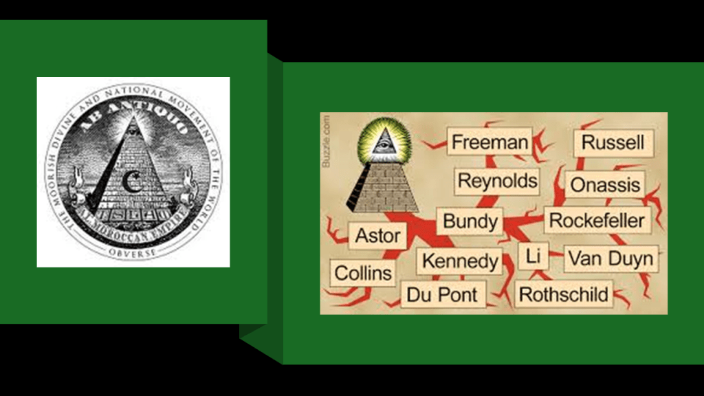
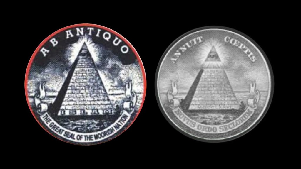
The New World’s Controllers stole the identity and legacy of the operative masons, and took us from the “Moorish Divine Movement of the World,” from Antiquity, with the eye on top of the pyramid signifying our pineal gland and our connection to the Creator, to it symbolizing “Big Brother,” and the control of the 13 Bloodline families.
There’s a lot more I could add to our lost history, but this gives you some idea of what has taken place here, and not for our benefit.
In this newest series, I am going to be bringing forward research I have done in the past, as well as new research, on the Great Lakes region of North America.
In the first part of the series, I looked at cities and places all around the shore of Lake Superior, starting and ending in the Thunder Bay District of Ontario, with particular attention to lighthouses; railroad and streetcar history; waterfalls, wetlands and dunes; interstates and highways; major corporate players; mines and mining; labor relations; and many other things.
In the second-part of this series, I am going to be taking a close look at Lake Michigan, where I expect to see more of exactly the same kinds of things seen in the trip around Lake Superior.
Lake Michigan is the only one of the five Great Lakes that lies entirely within the United States.
Those states are Michigan, Indiana, Illinois and Wisconsin.
By area, it is the world’s largest lake in one country.
My working hypothesis is that the circuit board of the Earth’s original energy grid system was deliberately blown out by one or more forms of directed frequency or energy of some kind into different places on the Earth’s grid, causing the surface of the Earth to undulate and buckle.
Firstly, what I am seeing from tracking leylines all over the Earth, looking from place-to-place at cities in alignment over long-distances, are the consistent presence of swamps, marshes, bogs, deserts, dunes, and places where it appears land masses sheared-off and submerged under the bodies of water we see today.
Secondly, I believe the beings behind the cataclysm were shovel-ready to dig enough of the original infrastructure out of the ruined Earth so they could be used and civilization restarted, which I think started in earnest in the mid-to-late 1700s and early 1800s.
There’s extensive underground infrastructure where people could have survived until the surface of the Earth was habitable.
Then they only used the pre-existing infrastructure until they found replacement fuel sources that could be monetized and controlled by them for what had originally been a free-energy power grid and transportation system worldwide, and when what remained of the original infrastructure was no longer useful to them, or inconvenient to their agenda, they had it destroyed, discontinued, or abandoned, typically in a very short time after it was said to have been constructed.
While the new elite class lived in the lap of luxury, and helped themselves to the best of everything, they had little care for anyone or anything else.
The same story repeats all over the country with the Robber Barons coming in and setting up shop and taking control of everything, and the Great Lakes region is no exception to this pattern, and if anything, actually exemplifies it.
Like everything else we have been told to explain what is in existence in our world, I don’t believe lighthouses were built to guide ships by whom they were said to have built them when they were said to have been built.
What I am seeing is that they ended up next to the edge of water when the land around them sank, and were repurposed into navigational aids in the New World to guide ships through the now broken landmasses in the surrounding waters.
So two of the many points of comparison between Lake Michigan and Lake Superior in this post will include lighthouses, and the bathymetry of the lakes, which is the measurement of the depth of water in the lakes.
First, a comparison of the number of lighthouses between the two.
There are approximately 88 lighthouses along the shore of Lake Michigan, which has more lighthouses than any of the Great Lakes.
There are approximately 78 lighthouses around Lake Superior, with 42 of them being in Michigan.
Next, bathymetry, or the measurement of the depth of water in the lakes
First, the bathymetry of the waters of Lake Michigan.
The bathymetry of Lake Michigan shows shallows around the edges ranging from 0 to around 100-meters, or 0- to around 328-feet, with an uneven lake-floor towards the middle ranging in depth from 100-meters, to its deepest point at 282-meters, or 925-feet, which is marked by the “x” circled in red.
The average depth of Lake Michigan is 85-meters, or 279-feet.
Here’s a breakdown of the five regions of this lake’s bathymetry: Islands and Straits; Green Bay; the Chippewa Basin; the Mid-Lake Plateau; and the South Chippewa Basin.
The Islands and Straits region of Lake Michigan includes the Mackinac Channel; the Strait of Mackinac between Lake Michigan and Lake Huron; Sturgeon Bay; St. Martin Bay; Grand Traverse Bay; and several islands of varying sizes including Beaver Island, the largest island in Lake Michigan
Most of the northern section of this region in the Mackinac Channel and Strait, Sturgeon Bay and St. Martin Bay, is quite shallow, ranging in depth from 0- to 50-meters, or 0- to -164-feet, with deeper depths of up to 200-meters, or 656-feet, seen closer to shore mixed in the with shallows, on the northeastern section which includes Grand Traverse Bay and the Manitou Passage.
Likewise, the Green Bay region on the Wisconsin-side of Lake Michigan, which includes some other bays, channels and islands, as well as the Door Peninsula separating it from the main part of the lake, are also quite shallow, ranging in depth from 0- to around -50-meters, or 0- to -164-feet.
The Chippewa Basin roughly in the north-middle of Lake Michigan, is the deepest, with depths primarily ranging from 100-meters, or 328-feet, to its deepest point at 282-meters, or 925-feet, as previously-mentioned.
The Mid-Lake Plateau region is located in the center of Lake Michigan between the Chippewa Basin and South Chippewa Basin.
The Mid-Lake Plateau is showing as 50- to 100-meters, or 164- to 328-feet, in-depth.
Directly to the west of the Mid-Lake Plateau is the Milwaukee Basin, and directly to the east the Muskegon Basin, with both of these basins somewhere around 150-meters, or 492-feet, in-depth at its deepest.
Lastly, the South Chippewa Basin is also approximately 150-meters, or 492-feet, in-depth, at its deepest.
The bathymetry of Lake Superior also shows its shallows around the edges, which range from 0 to around 100-meters, or 0- to around 328-feet, with an uneven lake-floor ranging in depth from 100-meters, to its deepest point at 406-meters, or 1,333-feet.
Lake Superior’s average depth is 147-meters, or 483-feet
The Great Lakes Region is infamous for its shipwrecks, with an estimated somewhere between 6,000 to 10,000 ships and somewhere around 30,000 lives lost.
The reasons given for the high number of shipwrecks are severe weather, heavy cargo and navigational challenges.
It is estimated that there are around 780 shipwrecks in Lake Michigan, with about 250 identified, and it has been nicknamed “Graveyard of the Great Lakes.”
It is estimated that there are between 350 and 550 shipwrecks in Lake Superior, many of which are still undiscovered.
I find it noteworthy that the Great Lakes region is very similar to other places that I have looked into that are known for the same kind of severe weather, shipwrecks, and have the same kind bathymetry that I shared previously ranging unevenly in-depth from shallow to quite deep.
Places like Cape Cod in Massachusetts, which is known as a “Graveyard of the Atlantic” due to the large number of shipwrecks that have occurred here because of its dangerous shallows.
Here is the map showing fourteen lighthouses on Cape Cod alone, as well as other lighthouses of this part of New England, on the left, as well as the historic Old Colony Railroad that traversed the length of the narrow Cape Cod.
Like Cape Cod in Massachusetts, the treacherous waters of the Outer Banks have also given it the nickname of “Graveyard of the Atlantic” because of the numerous shipwrecks that have occurred here because of its treacherous waters consisting of things like shallows, shifting sands, and strong currents.
The reason we are given for the extreme weather in our official narrative is climate change, which is linked to the United Nations 2016 Paris Climate Agreement, and to all of the goals of the United Nations 2030 Agenda for Sustainable Development.
But I have come to believe the explanation for the extreme weather could very well be found in things like the presence of ruined and sunken land just underneath the surface of the water from the deliberate destruction of the energy grid, and possibly creating instability where weather is concerned, and/or perhaps generating their own weather systems in their respective regions.
Or perhaps the creation of extreme weather may have some external help.
Like the wreck of the SS Edmund Fitzgerald mentioned in the last post as the most famous shipwreck of Lake Superior, the sinking of the Lady Elgin was the most famous shipwreck on Lake Michigan.
The Lady Elgin, a side-wheel steamship, was said to have been built in Buffalo, New York, in 1851.
For almost a decade, the elegant steamship took passengers between Chicago and other cities on Lake Michigan and Lake Superior.
Apparently during the years she was in operation, the steamship was involved in a number of accidents, including, but not limited to, things like striking a rock in 1854 and being damaged by fire in 1857.
Then On September 6th of 1860, the Lady Elgin was rammed below the water-line by the wooden Schooner Augusta, and her sinking has been called the “one of the greatest marine horrors on record.”
The Lady Elgin was on its return trip to Milwaukee, sailing against gale force winds, when she was rammed by the Augusta.
The Lady Elgin’s captain ordered that cattle and cargo be thrown over-board to lighten the load in order to bring the hold above-water.
All of the efforts to try to keep the ship from sinking came to nothing, as within twenty-minutes, the ship broke apart and sank quickly.
The Lady Elgin passenger manifest was lost, so the exact number on-board was unknown.
Of those 300 people, most were from the Irish community of Milwaukee, including nearly all of Milwaukee’s Irish Union Guard.
The Irish Union Guard was an Irish militia based in Milwaukee’s Third Ward, and who were at odds with the Wisconsin governor’s position.
The members of the Irish Union Guard had chartered the Lady Elgin for a quick-trip to Chicago.
It was said that so many Irish-American political operatives died that day that it shifted the balance-of-political-power in Milwaukee from the Irish to the Germans.
On the November day the SS Edmund Fitzgerald sank on Lake Superior in 1975, it and one other ship that didn’t sink, the SS Arthur M. Anderson, were heading to Detroit with a load of Taconite, a type iron ore, when they encountered a severe storm with hurricane-force winds and waves up to 35-feet, or 11-meters, high…
…when the SS Edmund Fitzgerald suddenly sank near Whitefish Bay in Lake Superior, and the entire ship’s crew perished.
Before I go into this journey looking at what’s found around Lake Michigan, I would like to mention an obscure historical figure named Lewis Cass, whom I learned about researching the State of Michigan in my series on who is represented in the National Statuary Hall at the U. S. Capitol in Washington, DC.
I learned a lot about obscured history and what the official historical narrative tells us about what has taken place here from the research I have done so far on who is represented there. After having gone through approximately half of the states, I have found that regardless of fame or obscurity, the National Statuary Hall functions more-or-less as a “Who’s Who” for the New World Order and its Agenda..
The State of Michigan is represented by Lewis Cass, as well as Gerald Ford.
Lewis Cass, an American military officer, politician and statesman, was a U. S. Senator for Michigan and served in the cabinets of two Presidents, Andrew Jackson and James Buchanan.
Lewis Cass attended the Phillips-Exeter Academy, established in 1781 by Elizabeth and John Phillips, a wealthy merchant and banker of the time, and whose nephew, Samuel Phillips Jr, had established the Phillips Academy in Andover, Massachusetts in 1778, making it the oldest incorporated school in the United States.
These two schools have educated several generations of the Establishment and prominent American politicians.
The Cass family moved to Marietta, Ohio, in 1800.
Marietta was the first permanent U. S. settlement in the newly established Northwest Territory, which was created in 1787, and the nation’s first post-colonial organized incorporated territory.
We are told the Northwest Indian War took place in this region between 1786 and 1795 between the United States and the Northwestern Confederacy, consisting of the indigenous people of the Great Lakes area.
The Territory had been granted to the United States by Great Britain as part of the Treaty of Paris at the end of the Revolutionary War.
The area had previously been prohibited to new settlements, and was inhabited by numerous indigenous peoples, even though the British maintained a military presence in the region.
While the Northwestern Confederacy had some early victories, they were ultimately defeated, with the final battle being the “Battle of Fallen Timbers” in August of 1794 in Maumee, Ohio, which took place after General Anthony Wayne’s Army had destroyed every indigenous community on its way to the battle.
Outcomes were the 1794 Jay Treaty, named for Supreme Court Chief Justice John Jay, the main negotiator with Great Britain.
As a result, the British withdrew from the Northwest Territory, but it laid the groundwork for later conflicts, not only with Great Britain, but also angering France and bitterly dividing Americans into pro-Treaty Federalists and anti-Treaty Jeffersonian Republicans.
The 1795 Greenville Treaty that followed forced the displacement of the indigenous people from most of Ohio, in return for cash and promises of fair treatment, and the land was opened for white American settlement.
Lewis Cass was elected to the Ohio House of Representatives in 1806, and the following year, President Thomas Jefferson appointed him as the U. S. Marshal for Ohio, the oldest U. S. Federal Law Enforcement Agency having been established by the Judiciary Act of 1789 during President George Washington’s administration to assist federal courts in their law enforcement functions.
Cass joined the Freemasons as an Entered Apprentice, the first degree of Freemasonry, at a lodge in Marietta in 1803 , and by May of 1804, he achieved the Master Mason degree, the third-degree of Freemasonry.
Lewis Cass was a charter member of the Lodge of Amity No. 5 in Zanesville, admitted in June of 1805, and was one of the founders of the Grand Lodge of Ohio in January of 1808, serving as its Grand Master multiple years.
We are told that during the War of 1812, Lewis Cass rose through the officer ranks to become a Brigadier General in the U. S. Army in March of 1813.
He took part in the Battle of the Thames, also known as the Battle of Moraviantown near Chatham, Ontario, and today’s Moravian on the Thames First Nation reserve, a branch of the Lenape who were converted to Christianity by Moravian missionaries from Pennsylvania, one of the oldest Protestant denominations.
At the time of the battle, the community of this First Nation, known as the Christian Munsee, was burned to the ground and rebuilt at its current location.
The Battle of the Thames in Ontario was an American victory in the War of 1812 against Tecumseh’s Confederacy, a confederation of Native people’s from the Great Lakes region, and their British allies.
As a result of the battle, Tecumseh was killed, his confederacy fell apart, and the British lost control of southwestern Ontario.
Cass was appointed as the Governor of the Michigan Territory by President James Madison in October of 1813, a position in which he served until 1831.
During this time, he travelled frequently to negotiate treaties with the indigenous peoples in Michigan, in which they ceded substantial amounts of land.
Cass was one of two commissioners who negotiated the Treaty of Fort Meigs, also called the Treaty of the Maumee Rapids, resulting the ceding of nearly all the remaining lands in northwestern Ohio, and parts of Indiana and Michigan, of the Wyandot, Seneca, Delaware, Shawnee, Potawatomi, Ottawa, and Chippewa, helping to open up Michigan to settlement by white Americans.
In return, land was allocated for reservations and financial compensation via annuities of various amounts for different lengths of time.
Other examples of the involvement of Lewis Cass with these land-acquiring treaties included, the 1819 Treaty of Saginaw with the chiefs and members of the Chippewa, Ottawa, and Potawatomi Tribes, in which they ceded 6-million acres of land, for which they were promised up to $1,000/year forever, and hunting and fishing rights on the land.
Cass was also involved with the 1821 Treaty of Chicago, in which he travelled to Chicago to try and get more land from tribal nations in Michigan.
As a result of this treaty, more Potawatomi, Chippewa and Ottawa tribes ceded land – this time nearly 5-million acres of the Lower Peninsula .
In return, they were promised about $10,000 in trade goods, $6,500 in coins, and a 20-year payment valued at about $150,000.
And where did all these treaties land them, like the Potawatomi?
A very long way from home!!!
Cass resigned as the Governor of Michigan in 1831 to become President Andrew Jackson’s Secretary of War, a position he would hold for the next 5-years.
As President Jackson’s Secretary of War, Cass was central in implementing the Indian Removal policy of the Jackson administration after Congress passed the Indian Removal Act in 1830.
The Indian Removal Act was directed specifically at the Five Civilized Tribes of the Southeastern United States – the Cherokee, Creeks, Seminole, Chickasaw and Choctaw – though it also affected tribes in Ohio, Illinois and other areas east of the Mississippi River.
Most were forced to Indian Territory in present-day Oklahoma, Kansas, and Nebraska.
Cass was elected by the Michigan State Legislature in 1845 to serve as its United States Senator, a position he held until 1848 when he resigned in order to pursue an unsuccessful run for President that year.
After his loss to Zachary Taylor in the 1848 election, Cass was returned to the U. S. Senate by the Michigan State Legislature, serving from 1849 to 1857.
He ran and lost for President again in 1852, losing the Democratic nomination that year to Franklin Pierce, who became the 14th U. S. President.
A few years later, in March of 1857, President James Buchanan appointed an elderly Lewis Cass to serve as the Secretary of State in his administration around the same time he was retiring from the Senate.
During his term of service as Secretary of State, Cass delegated most of his responsibilities either to an Assistant Secretary of State or to the President, though he was involved in negotiating a final settlement to the 1850 Clayton-Bulwer Treaty, which limited U. S. and British control of Latin American Countries.
Cass died in June of 1866 in Detroit, and was buried in the Elmwood Cemetery in Detroit, Michigan’s oldest continuously operating non-denominational cemetery, having been dedicated in October of 1846.
Descendents of Lewis Cass included great-grandson Augustus Cass Canfield, long-time President and Chairman of the Harper & Brothers Publishing Company (later known as Harper & Row)…
…and grandson Lewis Cass Ledyard, a New York City lawyer, personal counsel to financier J. P. Morgan, and a President of the New York Bar Association.
I am going to start this journey around Lake Michigan by looking at Mackinaw City and the area surrounding it at the top of what is called the “Lower Peninsula of Michigan,” also known as the “Mitten,” and I am going to end it at St. Ignace, across the Straits of Mackinac from Mackinaw City on the Upper Peninsula.
For the purposes of this post, I am only going to be looking at the Lake Michigan-side of the State of Michigan here.
Lake Michigan is hydrologically-connected to Lake Huron thorugh the Straits of Mackinac.
The Straits of Mackinac are the short waterways between the Upper and Lower Peninsulas of Michigan, and are crossed by the Mackinac Bridge, which was said to have first opened in 1957.
The Mackinac Bridge carries Interstate 75 across the longest suspension bridge between anchorages in the western hemisphere between Mackinaw City at its southern end, and St. Ignace at the northern end.
We are told the indigenous Ottawa people of this region, called the region around the straits “Michilimackinac.”
The Straits of Mackinac were an important fur-trading route and one of the four main fur-trading centers in the Great Lakes region established by the British North West Company, a fur-trading business based out of Montreal in Quebec from 1779 before it was forcibly merged with the Hudson’s Bay Company in 1821, along with Grand Portage, Fort Niagara, and Fort Detroit.
This is what we are told in our official historical narrative, Fort Michilimackinac was built by the French as a trading post in 1715 in the location of today’s Mackinaw City.
Then in 1761, the French relinquished it along with their territory in Canada to the British following their defeat in the French and Indian War.
This “reconstruction” of it is found at Colonial Michilimackinac Historic State Park near the Mackinac Bridge.
The Old Mackinac Point Lighthouse is also in the Colonial Michilimackinac Historic State Park.
It was said to have been constructed in 1892 and deactivated in 1957, the same year the Mackinac Bridge was said to have first opened.
Here it is a photo on the right of this lighthouse with a Milky Way alignment, as was seen in part one of this series at five of the lighthouses on the Apostle Islands of Wisconsin on Lake Superior, as well as for comparison, two of the Lighthouses on the Great Ocean Road near the Twelve Apostles on the southeastern coast of Australia.
This lighthouse is a museum today.
The historic photo of this lighthouse on the top left reminds me of the creepy, staged-looking photos I have encountered in the seven-years I have been doing this research, all taken within 15-years of each other, like the photo on the top right, whichwas labelled as an 1895 photo of convicts working on the railroad in East Siberia near Khabarovsk; the 1870 photo on the bottom left taken in Trenton, New Jersey; and on the right, a photo taken in front of the Machinery Hall for the 1888 Centennial Exposition of the Ohio Valley and Central States in Cincinnati.
Some other lighthouses on this side of the Straits of Mackinac in the vicinity of the Old Mackinac Point Lighthouse that I would like to mention here are:
The McGulpin Point Lighthouse, which is 3-miles, or 4.8-kilometers, west of the Old Mackinac Point Lighthouse.
It was in operation as a lighthouse from 1869 to 1906.
Owned by Emmett County today, it was privately-owned and used as a residence at some point after it was deactivated in 1906, and then ownership passed to Emmett County in 2008.
The Waugoshance Lighhoust, said to have been built here in 1851, is described as a ruined lighthouse in a shoal area that is 15-miles, or 24-kilometers, due west of Mackinaw City.
We are told that due to erosion and deterioration, that lighthouse is critically-endangered, and likely to fall into the lake in the near future.
The Waugoshance Lighthouse is in the Wilderness State Park, called one of the most hazardous areas near the Straits of Mackinac.
The Wilderness State Park is described as a diverse forested, dune, and wetlands with swale complexes, with swale as a landform being defined as a sunken or marshy place.
The Wilderness State Park has also been designated as a “Dark Sky Preserve” since 2012, where light is restricted for astronomical observation and enjoyment, as seen here with a view of the Milky Way in the night sky.
Besides the ruined Waugoshance lighthouse, there are three other lighthouses near the western end of the Wilderness State Park – the Grays Reef Light Station; the White Shoal Light; and the Aux Galets Lighthouse.
The White Shoal Lighthouse is located 20-miles, or 32-kilometers, west of the Mackinac Bridge.
It is still an active lighthouse, and the tallest lighthouse on Lake Michigan.
The construction of the current lighthouse here was said to have started in 1908, and first lit in 1910.
Here is the White Shoal Lighthouse in a solar alignment.
The Grays Reef Light Station is 3.8-miles, or 6.1-kilometers, west of the Waugoshance Lighthouse, said to have been built starting in 1934 on top of submerged stone and a concrete pier, and first lit in 1936, which all would have been during the Great Depression.
It is also an active lighthouse.
And the Aux Galets Lighthouse, also known as the Skillagee Island Lighthouse, is on a gravelly, low-lying island near the mainland and Sturgeon Bay.
The current lighthouse here was said to have been built in 1888 to warn shipping away from the reefs and shoals of Waugoshance Point, along with the other three lighthouses, which pose an imminent hazard to navigation.
As I said earlier in this post, I don’t believe at all that lighthouses were built to guide ships by whom they were said to have built them when they were said to have been built.
What I am seeing is that they ended up next to the edge of water when the land around them sank, and were repurposed into navigational aids in the New World to guide ships through the now broken landmasses in the surrounding waters.
I have come to believe “lighthouses” were literally “houses for light” for the purpose of precisely distributing light energy generated by this gigantic integrated system that existed all over the Earth that was in perfect alignment with everything on Earth and in heaven.
What I am seeing is that these were places that were in perfect resonance within a perfectly-resonant system, and that when the energy grid system was directly attacked, it caused the entire system around it to go haywire, and the surrounding land sank, or turned into like swamps, bogs, barrens, or deserts and dunes, as we are already seeing here at the Straits of Mackinac in Lake Michigan.
I am not drawing these conclusions from a few examples, but from many that I have found in years of doing research, including a lot of work tracking cities and places in alignment all over the Earth.
So now I’m going to back to Fort Michilimackinac for a moment in the location of the present-day Mackinaw City.
We are told the British continued to use Fort Michilimackinac built by the French as a major trading post until they decided the wooden fort was too vulnerable to attack from the indigenous people of the region in the 1760s, with Pontiac’s War going on, and so the British built a limestone fort on a high bluff on Mackinac Island in 1781.
I will look into this more in-depth when I look into Mackinac Island in the Lake Huron part of this series.
We are told in our historical narrative that Pontiac’s War was launched by the indigenous people in 1763 who were not happy with British rule in the Great Lakes Region, and lasted until 1766, and named after Pontiac, the Ottawa leader who was the most prominent of the many indigenous leaders in the conflict with the British.
I find it very interesting to note that there was a book by Francis Parkman published in 1851 titled “The Conspiracy of Pontiac.”
This book is still in-print today, and is considered the definitive account of the war.
Besides “The Conspiracy of Pontiac,” Francis Parkman was best-known for “The Oregon Trail: Sketches of Prairie and Rocky Mountain Life,” and “France and England in North America.”
He was born into a prominent Boston family, and as a child was said to be in poor health.
He entered Harvard at the age of 16, and graduated in 1844.
In 1843, when he was 20, he went on a Grand Tour in Europe, making his way through Italy.
I find this very interesting because this is not the first time I have found one man’s historical account that forms the basis for our history of events at a given time.
One of many examples of this is that Francis Parkman’s story and activities are very similar to those of Frederick Law Olmsted, who later in his life became the most celebrated landscape architect of the mid-to-late 19th- and early 20th-centuries, and called the “Father of Landscape Architecture.”
Olmsted’s biography says he created the profession of landscape architecture by working in a dry goods store; taking a year-long voyage in the China trade; and by studying surveying, engineering, chemistry, and scientific farming.
Though I found references saying he did attend Yale College, we are also told he was about to enter Yale College in 1837, but weakened eyes from sumac poisoning prevented him the usual course of study.
We are told he started out with a career in journalism, travelling to England in 1850 to visit public gardens there, including Birkenhead Park, a park said to have been designed by Joseph Paxton which opened in April of 1847 and said to be the first publicly funded civic park in the world.
Joseph Paxton, a greenhouse builder by training, was also given the historical credit for the designing of the Crystal Palace for the famous 1851 Exhibition in London, which was the same year Francis Parkman’s “The Conspiracy of Pontiac” was published as I just mentioned.
After his trip, Olmsted published “Walks and Talks of an American Farmer” in England in 1852, where he recorded the sights, sounds and mental impressions of rural England from his visit.
Frederick Law Olmsted apparently was also commissioned by the New York Daily Times to start on an extensive research journey in the American South and Texas between 1852 and 1857.
The dispatches he sent to the Times were collected into three books, and considered vivid, first-person accounts of the antebellum South: “A Journey in the Seaboard Slave States,” first published in 1856…
…”A Journey through Texas,” published in 1857…
…and “A Journey in the Back Country in the Winter of 1853 – 1854,” published in 1860.
All three of these books were published in one book, called “Journeys and Explorations in the Cotton Kingdom,” in 1861 during the first six months of the American Civil War at the suggestion of his English publisher.
One more thing is that he provided financial support for, and sometimes wrote for, “The Nation,” a progressive magazine that is the oldest continuously published weekly magazine in the United States, having been founded on July 6th of 1865, three-months after the end of the American Civil War.
With regards to railroad lines to Mackinaw City, we are told that the Michigan Central Railroad came to Mackinaw City from Detroit in 1881, and the Grand Rapids and Indiana Railroad in 1882 connecting Mackinaw City to Traverse City; Grand Rapids; and Fort Wayne in Indiana.
These railroad lines facilitated passenger and freight transportation, which included railroad car ferries across the Straits of Mackinac.
The former rail-lines have been repurposed into Rail-trails, like the North West State Trail from Petoskey…
…the North Central State Trail from Gaylord…
…and the North Eastern State Trail from Alpena.
There were two historic roundhouses in Mackinaw City, one for each of the railroads serving the area.
They were both demolished after the rail-lines leading to Mackinaw City were scrapped sometime in the 1980s.
The location of the former Michigan Central Roundhouse is now a Burger King, and the Grand Rapids and Indiana Railroad is a parking lot west of the Mackinac Bridge; and the former railyards a shopping mall.
Like the lighthouses, I believe that all the rail infrastructure was part of the original energy grid, and I believe the energy grid was deliberately destroyed, and that it’s destruction created everything we see in the world today that we are told is natural, including, but not limited to, the Great Lakes
I think the Controllers’ removed the rail-lines that were original part of the energy grid when they were no longer needed for mining and/or their agenda, and they only kept what was needed for freight, with keeping some for public transportation where it was critical infrastructure and scaled passenger service way-back from what it once was.
They were instead turned into interstates, highways, roadways, and recreational rail-trails. used for harvesting our energy for the benefit of a few from what was the original free-energy grid system for the benefit of all.
Before I move on down the western coast of Michigan on the eastern shore of Lake Michigan, I want to take a look at Beaver Island.
Beaver Island is the largest island in Lake Michigan.
The main access point for Beaver Island is Charlevois.
Charlevoix was named for the Jesuit explorer Pierre Francois Xavier de Charlevoix, who stayed the night on Fisherman’s Island during a harsh stomr sometime in the 1720s, which is located near his namesake city.
The Ottawa and Ojibwe peoples lived throughout northern Michigan prior to the arrival of the Jesuits and the European colonizers.
The Jesuit explorer Charlevois is known for the journal record he kept of his exploration of New France in present-day Canada and the United States first published in 1744 as the “History and General Description of New France.”
The city of Charlevois is located on isthmus, or narrow piece of land connecting two larger areas across water.
This is not the only time we will see a city located on an isthmus in this post.
We are told that fishermen first settled what was known became known as Charlevoix around 1852.
We are told among other new arrivals as time went on, the Homestead Act of 1862 brought Civil War veterans and speculators up this way, with 160-acre tracts of land land selling for $1.25/acre.
It is important to note that logging quickly became a thing, and lumber companies like the “Charlevoix Lumber Company” beginning in 1876, shipped out 40-million board feet of lumber before much of peninsula was stripped of its original forests.
There was actually a lot of activity of all kinds going on in and around Charlevois in its illustrious past, but today its population is less than 2,500 people as of the 2020 census.
Regular passenger train service to Charlevoix ended in September of 1962 when the Traverse City – Charlevois – Petoskey service was ended by the Chesapeake and Ohio (C & O) Railway.
Freight service ended between Charlevois and Williamsburg, Michigan, in 1982, when the C & O abandoned the track, and the tracks were removed in 1983.
The State of Michigan purchased the section of track between Charlevois and Petoskey, and it was run by the Michigan Northern Railway until a series of wash-outs in the 1990s, and this section of track was removed.
As we have already seen, sections of this rail-line serve as recreational rail-trails today and the old train depot is a museum of the Charlevois Historical Society.
Michigan Beach Park at Charlevoix is one of many beaches around this area, and is still very much a popular recreational spot in the present-day with its white sands and recreational facilities.
It is located right next to South Pierhead lighthouse at the end of what is called the “Pine River Channel.”
I have found things like piers and breakwaters, with lighthouses on the end, not only in the last part of this series on Lake Superior at Grand Marais in Minnesota…
…and Marquette in Michigan…
…but the same kind of configurations all over the world, like Dover in England in the English Channel…
…in Malta at the entrance to the Grand Harbor in the capital city of Valletta…
…and Sousse in northeastern Tunisia on the Gulf of Hammamet, to name a few of countless examples of harbor entrances with lighthouses.
We have always been told they were built as navigational aids for ships, but as I have already indicated, I think they were serving another purpose entirely in the energy grid system that we haven’t been told about.
Lake Michigan has many beaches, and is frequently referred to as the “Third Coast” of the U. S. after the Atlantic coast and the Pacific coast.
Called “singing sands,” the sand is often soft and white, or off-white, and squeaks when walked upon, believed to be caused by the high quartz content of the sand.
I am going to be looking at some of the sand dune systems as I go along the coast line of Lake Michigan in ths post.
The sand dunes located on the east shore of Lake Michigan are considered the largest freshwater dune system in the world.
Large dune formations can be seen in many state parks, national forests and national parks along the Michigan and Indiana shoreline.
Well, I thought I was out of Charlevoix, but something came up on my social media feed about castles in Michigan, and one of them was in Charlevoix, so I had to look into it.
What I found in Charlevoix was “Castle Farms.”
It was said to have been originally built in 1918 by the acting President of Sears, Roebuck, and Company, Chicago attorney Albert Loeb, as a dairy farm that was modelled after the stone barns and castles he had seen in Normandy, France.
At one time, it had 200-head of prize-winning Holstein-Friesien dairy cows and 13-pairs of Belgian draft horses.
Since then it has passed through different ownership but it has been serving as primarily as an event venue throughout the years.
So now back to Beaver Island.
There are several thing that stand out about this location.
The first is that we are told there are at least one stone circle found here.
It is called the “Beaver Island Sun Circle,” also known as the Beaver Island Stonehenge, complete with astronomical alignments.
The next is that Beaver Island was the location of a relatively-short-lived Mormon theocratic kingdom from 1848 until his assassination in 1856, where the Mormon leader James Strang appointed himself king and took over the island there with his followers, who were known as Strangite Mormons.
The last thing I want to mention is that Beaver Island has two lighthouses – the Beaver Island Harbor Lighthouse and the Beaver Head Lighthouse, along with several others on the western end of the Straits of Mackinac.
The Beaver Island Harbor Lighthouse is located in St. James, an unincorporated community apparently named for himself by the self-proclaimed King, James Strang.
We are told the original lighthouse here was constructed in 1856, and the one currently there in 1870, and is still an active lighthouse today.
Here it is seen with a solar alignment behind the top of the lighthouse.
The Beaver Head Lighthouse is located on a bluff on the southern end of Beaver Island.
We are told boats have to navigate very carefully between Gray’s Reef and Beaver Island.
We are told the Beaver Head lighthouse was operational between 1858 and 1962, and that in 1975, the Charlevoix Public Schools purchased the location for $1.
Since 1978, there has been an Environmental and Vocational Educational Center in the Keepers building and the lighthouse is open to the public in the summer months from 8 am to 9 pm.
Now the next places I am going to take a look at on the eastern coast of Lake Michigan are the city of Petoskey and Grand Traverse Bay on either side of Charlevoix.
First, the city of Petoskey, which is located on Little Traverse Bay.
What we are told about Petoskey is this.
This area was long-inhabited by the Ottawa people.
Then, in the 1836 Treaty of Washington, we are told representatives of the Ottawa and Chippewa Nations ceded an area of approximately 13, 837,207-acres, or 55,997-kilometers-squared in Michigan in the northwest portion of the Lower Peninsula and the eastern portion of the Upper Peninsula, or approximately 37% of the current land area of the State of Michigan, and that this treaty was concluded on March 28th of 1836 by the Indian Commissioner of the United States, Henry Schoolcraft, and representatives of the Ottawa and Chippewa Nations.
I first encountered the historical figure of Henry Schoolcraft when I was “Trekking the Serpent Ley” from the Bermuda Triangle to Lake Itasca in Minnesota back in August of 2023.
Lake Itasca is not far from Lake Superior and in the Great Lakes Region of North America.
The Itasca State Park was established in 1891, we are told, to preserve remnant stands of virgin pine and to protect the basin around the Mississippi’s source.
In 1832, Henry Schoolcraft, a geographer, geologist, and ethnologist, was part of an expedition that determined the source of the Mississippi River was Lake Itasca
He also appears to have been a Freemason as well.
Then in 1847, Congress commissioned Schoolcraft to do a comprehensive reference work on the history, culture, and social mores of Indian tribes throughout North America, and which was published in six-volumes between 1851 and 1857.
So not only did Henry Schoolcraft find the source of the Mississippi River in our historical narrative, he himself was likely one of the sources of the new narrative about the indigenous people as well.
We are told Petoskey was named after the Ottawa chief Ignatius Petosegay, whose father was a French explorer and fur-trader, and whose mother was the daughter of an Ottawa chief, who purchased lands near the Bear River at some point after the Treaty of Washington was signed.
With the arrival of Jesuit missionaries to the area in the 19th-century, the man who became known as Ignatius Petosegay was befriended by the Jesuits, who renamed him after St. Ignatius of Loyola, the founder of the Jesuit order.
The Bear River is described as a “small, clear tributary of the Little Traverse Bay.”
This photo of the right-angled waterfall and masonry banks of the Bear River going through the city of Petoskey…
…is very reminiscent of examples I have seen on the River Derwent in Derbyshire, England, like at the Cromford Mill near Matlock Bath, the home of the world’s first water-powered cotton spinning mill…
…and the Vantaa River flowing through Helsinki in Finland also has such sights as right-angled waterfalls.
What are known as Petoskey stones, the official Michigan state stone, can only be found on northern Michigan beaches and inland lakes.
Today beachcombing for Petoskey stones with their honeycomb-like pattern is one of the favorite summer activities in Michigan.
We are told that Petoskey stones are a petrified genus of colonial rugose coral that turned into limestone, and is found in limestone rock formations dating back to the Devonian period 350-million years ago, and can be found in most of the rock formations of the Traverse Group in Michigan.
The Traverse Group outcrops are in Emmet and Charlevoix Counties where we have been looking so far, and can be viewed by travelling the Michigan portion of US Highway 31 along the Lake Michigan shoreline.
We are told that the Traverse Group formed as a shallow carbonate shelf during the Devonian period when the most recent supercontinent, Pangaea, was beginning to take shape.
There are several points I would like to bring forward from what I am seeing here.
First, I don’t believe what the historical narrative tells us about geological processes over long periods of time being responsible for what we see in the world today.
Like I said earlier in this post, I believe all along the Earth’s coastlines there are submerged landmasses and ruined land from this recent cataclysmic event which destroyed the Earth’s original energy grid, along with creating land features like estuaries. wetlands, deserts and dunes.
This belief is at odds with the official explanation, which is that of a worldwide Great sea level rise as a result of melting glaciers from the last Ice Age and the expansion of seawater as it warms, and both are due to global warming.
The basis of the belief in Ice Ages in our modern scientific paradigms come from Sir Charles Lyell, who published “The Principles of Geology” in three volumes between 1830 and 1833.
In these books, Lyell presented the idea that the Earth was shaped by the same natural processes that are still operating today at similar intensities, and as such a proponent of “Uniformitarianism,” a gradualistic view of natural laws and processes occurring at the same rate now as they have always done.
As a result of Lyell’s work, the glacial theory gained acceptance between 1839 and 1846, and we are told during that time, scientists started to recognize the existence of ice ages, and do to this day.
Sir Charles Lyell’s books on “Uniformitarianism” and “Ice Ages” in geology became the only accepted model taught by Academia.
The issue is contrast to the view of Catastrophism, the belief that changes in the Earth’s crust have resulted primarily from sudden violent and unusual events.
The Academic world supports Uniformitarianism without question as the only explanation for what we see in today’s world.
So let’s take a look at several data points to consider in trying to unravel a different perspective from what is found in Michigan on what might have taken place because I really don’t believe it is what we have always been told.
First, we are told that Petoskey stones are leftover fragments of the many coral reefs that existed in warm-water seas from Charlevoix to Alpena some 300 million years ago, where we see “barrier reefs” and “pinnacle reefs” across the Lower Peninsula of Michigan.
Barrier Reefs are said to occur in the shallowest of water, and are a continuous near shore feature.
Pinnacle Reefs are said to form in deeper water, as isolated “pinnacles” of coral.
A coral reef is defined as an underwater ecosystem built by reef-building corals, typically in shallow waters, though on smaller scales in other areas, like deeper waters.
Coral reefs are frequently found on things like sunken ships, like the tugboat John Evenson, which sank in 1884, and was found at a depth of 42-feet, or 13-meters, near Algoma, Wisconsin.
Wouldn’t it stand to reason that coral reefs would form on sunken buildings and other sunken infrastructure as well?
I also want to point out that limestone was a common building material in the ancient world, and used in constructions like the Pyramids of Giza…
…and the Western Wall, also known as the “Wailing Wall,” an ancient limestone wall in the old city of Jerusalem.
In other places in the early history of the United States, we are told that a rock ledge became the landing place for riverboats and wagon trains starting in 1833, on the southside of the Missouri River at what became Kansas City, Missouri.
And all of these strata of limestone underneath the surface were identified where this particular rock ledge was located.
Other historic pictures that I would like to include of Kansas City, Missouri, that are very interesting, and tell a completely different story than what our historical narrative tells us about this time period in our history include this one of when it was called “Gulley Town” in the 1860s and 1870s, where it looks like it was buried and needed to be dug out.
I also found these views of Wyandotte Street in Kansas City, Missouri, as it looked in 1868…
…in 1870…
…in 1871…
…and here are historic photos of some of the buildings on Wyandotte Street circa 1928.
We are going to see this same scenario again of digging-out infrastructure when we come to Gary in Indiana on the southern shore of Lake Michigan.
Next, Grand Traverse Bay is on the other side of Charlevoix from Petoskey, and a short-distance south of Beaver Island.
The Grand Traverse Bay is separated from Lake Michigan by the Leelanau Peninsula, also known as the “Little Finger” of the mitten-shaped Lower Peninsula.
The Grand Traverse Lighthouse is located at the tip of the Leelanau Peninsula, where the Manitou Passage separates Lake Michigan and Grand Traverse Bay.
The current lighthouse was said to have been built in 1858, and is located today in Leelanau State Park.
The Sleeping Bear Dunes National Lakeshore is located on the western-side of the Leelanau Peninsula, and North and South Manitou Islands, and is also notable for its shipwrecks, so much so the bottomlands have been designated the “Manitou Passage Underwater Preserve.”
There is also a lighthouse on South Manitou Island, with the current one said to have been built in 1872, and decommissioned in 1958.
It is a museum these days.
The North Manitou Shoal Light is located southeast of North Manitou Island, and it was said to have been constructed in 1935 to mark a dangerous shoal, and it is still in operation today.
A shoal is defined as a place where a body of water is shallow, and where a ridge, bank or bar is close to the surface of the water, and poses a danger to navigation.
In the Sleeping Bear Dunes National Lakeshore on the Leelanau Peninsula, there are such places to visit and hike as Pyramid Point, known for its stunning views of Lake Michigan and the Manitou Islands…
…the Empire Bluff Trail…
…and the Pierce Stocking Scenic Drive, a 7.4-mile, or 11.9-kilometer, drive through forest and dune areas and great views of Lake Michigan.
It was said to have been built in the 1960s and finished in 1967 by a lumberman named Pierce Stocking who wanted to share the beauty of the area with others.
The Grand Traverse Bay is further divided into an “East Arm” and a “West Arm,” which are separated by what is called the “Old Mission Peninsula.”
The Old Mission Peninsula has the Mission Point Lighthouse at its northern tip, which lies just a few yards south of the 45th Parallel North, which is halfway between the North Pole and the Equator.
The Mission Point Lighthouse was said to have been built in 1870, and it was deactivated in 1933.
It is in Lighthouse Park, and accessible to the public.
Traverse City is located at the base of the Old Mission Peninsula, and is the largest city in northern Michigan.
Traverse City is nicknamed “The Cherry Capital of the World,” and the whole Grand Traverse Bay region is known for its cherry production and its wine-grape-growing and Michigan wine.
There are several things I would like to mention about this area.
First is that prior to European settlement, we are told the Ottawa people were prevalent here, though it was said to be part of the territory of the Council of Three Fires, an alliance of the Anishinaabe peoples of Ottawa, Ojibway, and Potawatomi.
Before the arrival of western Europeans, this land was inhabited collectively by the Anishinaabe, meaning something along the lines of “original people” in their Algonquin language.
When I searched for a map of where the Algonquin-speaking peoples lived in North America, and this is what comes up, with their lands covering a vast section of it.
While the Algonquin language has not died out completely in North America, it is already extinct in many places, and highly-endangered in general.
For one example of many, Pequot – Mohegan was an Algonquin-language spoken by the Mohegan, Pequot, and Niantic people of southern New England, and the Montaukett and Shinnecock of Long Island, and what we are told is that it did not have a writing system, and that the only significant writings came from European colonizers who interacted with speakers of the language.
The last living speaker of this language died sometime around 1900.
There is something interesting to note about the Algonquin language.
It is extremely hard to find this kind of information because of the hunter-gatherer theme going on with indigenous peoples of North America in the narrative, but I found an example in the written language script of the Algonquin Mikmaq people of Nova Scotia, and it is that of an apparent connection to the Egyptian language script.
We are told that what became Traverse City was first settled in June of 1847 by Captain Horace Boardman, who built a sawmill near the mouth of the Boardman River.
Traverse City was incorporated as a village in 1881, and as a city in 1895.
According to our historical narrative, the railroad arrived in Traverse City in December of 1872 with the Traverse City Railroad Company Spur from the Grand Rapids and Indiana Railroad Line from Walton Junction, and by 1890, there were at least three more railroad lines serving the Traverse City region.
Today the historic Traverse City railroad station is the Filling Station Microbrewery, with the Cherry Capital Airport nearby.
In 1881, the Northern Michigan Asylum, later known as the Traverse City State Hospital, was established here as a Kirkbride facility, and first opened in 1885 with 43 residents, and we are told that between 1885 and 1924 under its superintendent James Decker Munson, it expanded and became the city’s largest employer at one time.
It closed its doors as a State Hospital in 1989.
In 1854, Dr. Thomas S. Kirkbride first published what was considered the source book in the 19th-century for Psychiatric Directives entitled “On the Construction, Organization, and General Arrangements of Hospitals for the Insane, ” with some remarks on insanity and its treatment.
We are told that throughout the 19th-century, numerous psychiatric hospitals were designed and constructed according to the Kirkbride Plan across the U. S. and while numerous Kirkbride structures still exist, many have been demolished, partially-demolished, or repurposed.
So, today the former Northern Michigan Asylum Kirkbride facility is being redeveloped as a multi-use facility after years of sitting abandoned…
…though it also has a reputation of being haunted, which is more typical than not of these places.
Before I take leave of the Grand Traverse Bay region, I would like to mention that there was a stonehenge-type structure identified in the Grand Traverse Bay.
Dr. Mark Holley, Professor of Underwater Archeology at Northwestern Michigan University, discovered an arrangement of large granite stones resting on the lake bed about 40-feet, or 12-meters, below the surface of the water, in 2007.
The stones are believed to date back 9,000-years, which is 4,000-years older than the date given to England’s famous Stonehenge.
One more thing I would like to mention here is US Highway Route 31, which runs along the western portion of the Lower Peninsula of Michigan from Bertrand Township in Berrien County at the state line with Indiana to its terminus on I-75 south of Mackinaw City.
I will be looking primarily at this part of the state of Michigan along US-31 as I go down the eastern coast of Lake Michigan.
US Highway Route 31 is a major North-South Highway that runs from Spanish Fort in Alabama at the Junction of US-90 & US-98.
I find all the major long-distance highways or interstates noteworthy that I have come across so far in the Great Lakes region.
The first was Minnesota State Highway 61, formerly known as the “North Shore Highway” and which is now known as the “North Shore Scenic Drive.”
Until 1991 Minnesota State Highway 61 was part of United States Highway 61 from 1926 to 1991.
The full-length of US-61 runs from its southern terminus in New Orleans, Louisiana, to its northern terminus at Wyoming, Minnesota.
It is considered the “Great River Road,” a collection of state and local roads that follow the course of the Mississippi River in ten states.
Then US Highway Route 2, which consists of two segments, and is the northernmost East-West highway in the United States.
The western segment begins at an interchange with Interstate-5 in Everett, Washington, and ends at Interstate-75 in St. Ignace, Michigan.
The eastern segment of US-2 begins at US-11 at Rouses Point, New York, and ends in Houlton, Maine, at Interstate-95.
The western segment of US-2 goes west from the Upper Peninsula of Michigan, and roughly parallels the historical Great Northern Railway.
Then there’s US Highway Route 41 between Miami, Florida, and the tip of Michigan’s Keweenaw Peninsula at Copper Harbor…
…U. S. Highway 23, a major North – South U. S. Highway between Jacksonville, Florida, and Mackinaw City, Michigan at I-75…
…and the northern terminus of Interstate 75 is Sault Ste. Marie in Michigan, which also goes all the way to Miami, Florida, at its southern terminus.
The next place I am to take a look at moving down the coast of the eastern shore of Lake Michigan is Manistee.
Like Charlevoix, the city of Manistee is located on an isthmus, in this case between Manistee Lake and Lake Michigan, with the Manistee River going through the city.
It is located on US-31.
We are told that a Jesuit mission was first established in Manistee in 1751, and that Jesuit missionaries came to the area in the early 19th-century, with a Jesuit Mission house located on the northwest shore of Manistee Lake in 1826.
According to available information, Manistee was one of fifteen Ottawa villages on Lake Michigan’s shore in 1830, and it is the location of the federally-recognized Little River Band of Ottawa, who historically lived in this region.
Federal recognition signifies the United States Government’s acknowledgment of a tribe’s status as a sovereign entity with a government-to-government relationship.
The first European settlement here happened in Manistee in April of 1841, when settlers John and Adam Stronach arrived with men and equipment and established a sawmill, and Manistee became a significant location for lumber mills, with large numbers of white pine logs being floated down the river to the port at Manistee.
I will be talking about the Great Fires of October 8th and 9th of 1871 in this series.
The Manistee Fire was one of the fires that constitute what is known as the “Great Michigan Fire” of October 8th of 1871, along with the Holland Fire and the Port Huron Fire.
I will be looking at the city of Holland in this post, and Port Huron in the next post on Lake Huron.
These fires took place on the exact same day as the Great Chicago Fire and Peshtigo Fire, and Urbana in Illinois burned on the following day, all of which I will be talking about here.
We are told the Manistee Fire destroyed much of the city of Manistee.
The city of Manistee wasn’t incorporated until 1882, 11-years after the Great Fire, and then this is the Manistee Fire Department, said to be the oldest continuously manned fire station in the world.
Interesting to note that this fire station was said to have been built in 1888, seventeen years after the Manistee fire of 1871.
Manistee Harbor still has two active lighthouses, one on its North Pier and one on its South Pier, which are also called “breakwaters.”
We are told that the first lighthouse was on the South Pier in 1870, but it burned in the Great Fire in 1871.
Then we are told two lighthouses were built here in 1875, but over the years they have been moved, and even torn down and rebuilt.
Here is a photo of the North Pier Lighthouse in Manistee in alignment with the setting sun.
There are two other places I would like to look at in the Manistee area before I move south from here on the coast to Ludington.
Those places are the Orchard Beach State Park and the Lake Bluff Bird Sanctuary.
Firstly, Orchard Beach State Park.
Today, it is a public recreation area situated on a bluff just a short-distance north of Manistee.
Apparently there was an apple orchard here that was planted by George Hart some time around 1887, and that by 1892, Hart had built a boardwalk and theater here to attract more tourists.
The same year of 1892, trolley service began with the Manistee, Filer, and Eastlake Railway Company and Orchard Beach became a popular beach destination, and that when trolley service was stopped here, the site was purchased by the Manistee Board of Commerce and deeded to the state to become a park in 1921.
Interestingly, in past research I encountered an historical orchard and trolley located together in Vancouver, Washington.
I definitely think there was a connection between the original energy grid and every kind of agriculture.
Then, we are told the Civilian Conservation Corps (CCC) was here in the 1930s, and built several limestone structures, including a shelter building.
The 850-ton shelter building pictured here…
…was moved 1,200-feet, or 366-meters, in December of 2020 because the bluff it sat on top of was eroding and unstable.
As I mentioned in this last post about Lake Superior, this is a common finding with lighthouses as well– sitting next to sheared-off, unstable land, and often have to be moved in order to not fall over the side.
An example that comes to mind of this is the Gay Head Lighthouse on Martha’s Vineyard, a small island that is an elite enclave of the very wealthy just off the southern coast of Massachusetts’ Cape Cod.
In 2015, the Gay Head Lighthouse was moved because it was perilously close to the eroding cliff edge.
I consistently find the infrastructure of railroads, lighthouses, star forts, and all manner of the original infrastructure, all being in locations with the same characteristics all over the Earth.
Another example is the “Pacific Surfliner,” an active Amtrak passenger railroad line, that runs along the Pacific Coast of Southern California for 351-miles, or 565-kilometers, from San Diego to San Luis Obispo…
…that is also endangered by crumbling cliffs from coastal erosion, and we are told is under consideration for being moved in-land.
This exact same manifestation of cliffs or bluffs next to bodies of water is found worldwide, looking like land just violently broke off from the landmass.
Here are a few more of countless examples.
The sheer cliffs along the coastline of Hengam Island in the Persian Gulf’s Strait of Hormuz on the top left, compared for similarity of appearance with the sheer white cliffs of Dover on the coast of southern England on the top right, and the cliffs along the southern coast of Australia in Victoria State where the Great Ocean Road runs for a long distance next to a sheer cliff, and showing the location of the 12 Apostles, the name given to what are called “limestone stacks” in the water off Port Campbell.
When the word “sheer” is used to refer to a cliff, it means a high area of land with a very steep side.
One of the meanings of the word “shear” spelled with an “a” is to break off, or be cut off, sharply.
A synonym of the word for “sheer cliff” is “bluff.”
Another meaning of the word “bluff” is a deception, or an attempt to deceive.
Secondly before I leave the Manistee area, I want to look into the Lake Bluff Bird Sanctuary, Located on top of a 100-foot, or 30-meter, -high bluff.
The Michigan Audubon Society received the M. E. and Gertrude Gray home and property as a gift in 1988, which later became the Lake Bluff Bird Sanctuary.
In addition to its status as a bird sanctuary…
…it is notable for the trees preserved on its grounds, which include a Michigan Giant Sequoia…
…and a Michigan Sycamore Maple.
Now I am going to head on down the eastern coast of Lake Michigan to the Ludington area and see what’s there.
The City of Ludington is situated at the mouth of the Pere Marquette River, which quickly turns into the Pere Marquette Lake in Ludington.
We are told that the Jesuit explorer Father Jacques Marquette died near Ludington in 1675, and that in 1955, a memorial and 40-foot, or 12-meter, cross were built to mark the location.
The settlement here was originally named “Pere Marquette,” but was later renamed “Ludington” after the industrialist James Ludington, who established logging operations here.
By 1892, Ludington sawmills had produced 162-million board feet of lumber and 52-million wood shingles and Ludington became a major Great Lakes shipping port.
Ludington was incorporated as a city in 1873, and the county seat of Mason County was moved here.
We are told the Flint and Pere Marquette Railroad was chartered in January of 1857 to construct an east-west railway line from Flint in Michigan to Ludington, formerly Pere Marquette, with the railroad completed to that location in 1874.
The Flint and Pere Marquette Railroad began cross-lake shipping operations in 1875 with the sidewheel steamer SS John Sherman to handle freight and then expanded to the larger Goodrich line of steamers.
Then in 1896, this railroad constructed the world’s first steel train ferry, the Pere Marquette, to transport rail cargo across Lake Michigan to Manitowoc in Wisconsin.
Today, Ludington is the home port of the SS Badger, a vehicle and passenger ferry with daily service in the summer months across Lake Michigan to Manitowoc in Wisconsin, a distance is 62-miles, or 100-kilometers, and the ferry connects US Highway Route 10 as well between these two cities.
The coal-fired SS Badger started out life as a steel train ferry, with a construction date given of 1952, and was retired from that service in November of 1990 as the last railway car ferry service out of not only Ludington, but ending the service on Lake Michigan.
Also interesting to note that the location of the mysterious Lake Michigan Triangle stretches from the three port cities of both Ludington and Manitowoc, and Michigan’s Benton Harbor.
As suggested by the name as a comparison to the Bermuda Triangle, the Michigan Triangle is also a place with a reputation for ships, planes and people disappearing under mysterious circumstances.
The Ludington Lighthouse is located at the end of the North Breakwater where the Pere Marquette River meets Lake Michigan in the Pere Marquette Harbor.
It was said to have been established in 1871 originally, and the structure there today was said to have been built in 1924.
Here is the Ludington Lighthouse in alignment with the setting sun.
The Big Sable Point Lighthouse is located on the other side of Ludington State Park from the Ludington Lighthouse, in the vicinity of the Nordhouse Dunes Wilderness Area.
The Big Sable Point Lighthouse was said to have been built in 1867, and is just a short-distance north of the Ludington State Park entrance.
We are told that construction materials were brought in by ship since there wasn’t a road to it until 1933, and even today the road to get there is sandy and you have to walk because motor vehicles are prohibited.
Also, this was the last Great Lakes lighthouse to get electricity and plumbing, which came in the late 1940s.
Here it is at sunset as well.
I’ve seen enough lighthouses over the years in perfect alignment with the heavens to more than convince me that in no way are these astronomical alignments occurring randomly but were very much intentional by the original builders and were not built by the people in the historical reset narrative that claimed credit for building them.
The Ludington State Park, of which the Big Sable Point Lighthouse is a part, is altogether 4,800-acres, or 1,900-hectares in size, with many different kinds of ecosystems, which include sand dunes, wetlands, marshlands and forests.
The Nordhouse Dunes Wilderness Area which is directly adjacent to the Ludington State Park is part of the Manistee National Forest lands, and managed by the U. S. Forest Service.
The federal government declared the Nordhouse Dunes area of the Manistee National Forest a wilderness in the Michigan Wilderness Act of 1987.
On 3,450-acres, or 1,396-hectares of land, it is the world’s most extensive set of freshwater dunes.
Continuing on down the coast a little ways, the next area I am going to look at includes the Silver Lake State Park and the Little Sable Point Lighthouse.
First, Silver Lake State Park.
The Silver Lake State Park is 4-miles, or 6.4-kilometers, west of Mears in Oceana County, and on its almost 3,000-acres, or 1,200-hectares, of land, has along with mature forest land, has over 2,000-acres, or 810-hectares of sand dunes.
We are told that the park originated in 1920, when 25-acres, or 10-hectares, of land for park purposes were donated by Carrie Mears, the daughter of Lumber Baron Charles Mears.
Then in 1926, 900-acres, or 364-hectares, were transferred to the state from the federal government, which became Sand Dunes State Park in 1949.
In 1951, the two parcels of land were merged together to become Silver Lake State Park.
From the limited information available to find on this man, Charles Mears owned huge forests in Michigan, and owned fifteen sawmills.
He was also said to have built cargo boats to move the lumber from the sawmills as well as building several important harbors in western Michigan.
The Little Sable Point Lighthouse is located just south of Silver Lake State Park.
It was said to have been designed by Col. Orlando Poe, and finally constructed in 1874, after funding was approved by Congress in 1871.
Apparently construction was delayed because there weren’t any roads here either according to the official narrative.
Mears State Park is located north of Silver Lake at Pentwater, which is roughly half-way between the Ludington area and the Silver Lake area.
Mears State Park is comprised of 50-acres, or 20-hectares, of land on the north side of the Channel that connects Pentwater Lake to Lake Michigan, not far from the previously-mentioned Highway 31.
Like Silver Lake State Park, Mears State Park was also said to have come about on land donated to the State in 1920 that was owned by Carrie Mears, and the 16-acres she donated was described as “strictly lake sand,” which was quickly eroded when the vegetation that held it in place was disturbed when the land was graded.
We are told this problem was solved with five-tons of marsh hay that were laid on top of it.
Mears State Park is a swimming, camping, hiking and fishing destination.
Mears State Park is known for its stunning sunsets, like this one behind the Pentwater North Pierhead Light.
Charles Mears was said to have constructed the Pentwater Channel in 1855 to accommodate his lumber interests, and he was said to have constructed a pier here as well, though we are told the U. S. Army Corps of Engineers built the concrete piers we see today in 1937, which would have been during the Great Depression, which lasted from 1929 to 1939.
Interesting to note the presence of megalithic stone blocks in the waters off of Pentwater.
Next, I am going to head down the coast to the Muskegon area, where we also find Hoffmaster State Park and the Gillette Sand Dune Visitor Center and sand dune ecosystem.
First, a little bit about Muskegon, the largest city on Lake Michigan’s eastern shore.
The city of Muskegon is located on the south-side of Muskegon Lake, which is a harbor of Lake Michigan, which like we just saw in Pentwater, is connected to it by a navigational channel.
There are two lighthouses at this location – the Muskegon South Pierhead Lighthouse and the Muskegon South Breakwater Lighthouse.
The South Pierhead Lighthouse is located on the Harbor Channel, where there has been said to have been one since 1851, though we are told the current lighthouse was constructed in 1903.
We are told the Muskegon South Breakwater Lighthouse was constructed in 1929 and first lit in 1930.
We are told that the earliest Europeans who visited the area were French explorers like the Jesuit Father Marquette and French soldiers under the explorer LaSalle in the late 1670s.
As a matter of fact, Pere Marquette Park is a beach-area that is located just to the south of the south breakwater and pier.
The Pere Marquette quartz-sand beach is bordered by large sand-dunes.
When I was looking for information about Pere Marquette Park, I came across the information that Lake Michigan Park occupied the north end of today’s Pere Marquette Park.
Lake Michigan Park was a trolley park that had a large roller coaster, dance hall, and pavilions where rail service said to have been developed in the late 18th- and early-19th-centuries to encourage local and regional demand.
We are told the trolley park’s closure was linked to the decline of the trolley service, and the amusement park was torn down in 1930, and at some point became Pere Marquette Park.
While the earliest European settlers to the area that became Muskegon were in the fur trade, ultimately the population and economic growth of Muskegon was due to the lumber industry, which began there in 1837, and the city became known as the “Lumber Queen of the World.”
Muskegon also became a manufacturing hub, including but not limited to bowling pins, Raggedy Ann dolls, boats, beer, engines, pianos, and paper to name a few.
This is an historic photograph of Muskegon, circa 1900.
The P. J. Hoffmaster State Park is located south of Norton Shores and the Muskegon County Airport, and just to the west of Highway 31.
It was established in 1963, and named after Percy James Hoffmaster, who was considered the founder of the Michigan State Parks system, and is a public recreation area with hiking trails, camping areas, and a beach.
The Gillette Sand Dune Visitor Center was named after Genevieve Gillette, a conservationist who scouted for new state park locations for P. J. Hoffmaster.
The Gillette Sand Dune Visitor Center is described as being nestled among one of the nation’s most impressive dune systems, and is itself perched on top of a large wooded dune.
Now I am going to head down the eastern coast of Lake Michigan to the Holland area.
Holland is located near the eastern shore of Lake Macatawa, known historically as Black Lake, which is fed by the Macatawa River, known as the Black River.
Historically the landof the Ottawa people, we are told that in 1839, the Reverend George Smith established the Old Wing Mission here as a Christian mission to the Ottawa people, and the building described as a Greek Revival structure is said to be the oldest house in Holland.
Then we are told in 1847, Holland was settled by Dutch Calvinist Separatists who emigrated from the Netherlands under the leadership of Dr. Albertus van Raalte because of drastic economic conditions there settled in the Old Wing Mission area along with the Ottawa, and there was conflict between the two, resulting in the Ottawa moving north from their land.
Dr. van Raalte then established a congregation of the Reformed Church in America, later called the First Reformed Church of Holland.
Then in 1867, Holland was incorporated as a city.
As I mentioned previously in this post, Holland was one of the locations of the Great Michigan Fire on October 8th of 1871, the same day as the Great Chicago Fire.
The vast majority of downtown Holland burned in the fire, and the cause of the fire remains unknown, though suggested causes have included burning embers from the Chicago fire crossing Lake Michigan, to burning methane gas from a passing comet.
The Holland Harbor Lighthouse is nicknamed “Big Red.”
It is located at the entrance of the channel that connects Lake Macatawa to Lake Michigan, and the current structure was said to have been built in 1907, though we are told a lighthousewas first constructed here in 1872.
The light was automated in 1932 and is maintained by the Coast Guard.
Public access to “Big Red” is limited, so the best viewing location is from across the Harbor at Holland State Park, one of Michigan’s popular beach locations, receiving 1.5-million to 2-million visitors each year.
Another notable place in Holland is Windmill Island Gardens.
This is what we are told about this location.
This is a city park that is home to the 251-year-old De Zwaan Windmill, the only authentic and working Dutch windmill in the United States.
We are told the windmill was purchased from a retired miller in The Netherlands in 1964, and that it was brought over by ship and reconstructed in the park location on artificial island formed by a canal and the Macatawa River and the park opened in 1965.
The park includes 35-acres, or 15-hectares, of land along the Macatawa River and the swamp leading into Lake Macatawa.
Every year, 100,000 tulips bloom in gardens on the island and enjoyed in the summer months, and the Tulip Time Festival every May draws the most crowds.
Here’s the thing.
We’re not being told the truth about traditional wind mills already being here either.
Traditional wind mills were prevalent at one time, and found all over the world.
While some still are in existence, like the lighthouses, their true purpose has been deliberately obscured.
Next, the Saugatuck Dunes state park is located between Holland and Saugatuck.
The Saugatuck Dunes State Park is a largely undeveloped, 1,000-acre, or 400-hectare, public recreation area with a beach, and 14-miles of hiking trails and 200-foot, or 61-meter, -high sand dunes covered with trees and grass.
It is interesting to note that the estate of Dorr E. Felt is just to the north of the Saugatuck Dunes State Park.
Dorr E. Felt was known to history as the inventor of the Comptometer, an adding machine and calculator used by businesses.
Apparently, his invention made him a very wealthy man.
So much so, he could afford to build between 1925 and 1928, a 12,000-square-foot, or 1,115-square-meter, mansion, carriage house, farm house, and petting zoo, to be a summer home called “Shore Acres Farm” for he and his wife and children,
Sadly his wife Agnes passed away a couple of months after the family moved into the home, and he only outlived her by a couple of years, and the Felt family finally sold the property in 1949.
The property has also been used as a Catholic Seminary, and also as a prison by the State of Michigan.
The State of Michigan owned the grounds until the early 1990s, at which time it sold the property to the Laketown Township for $1, with the stipulation the Mansion would be used by the public, and not by private enterprise, and among other things, it is a popular wedding venue.
And, like the former Traverse City State Hospital, also known for being haunted.
The next area I am going to take a look at on the eastern shore of Lake Michigan in western Michigan is the area in Berrien County around Benton Harbor; St. Joseph; Grand Mere State Park; Bridgman; and the Warren Dunes State Park.
Berrien County is on the border with Indiana.
First, Benton Harbor and St. Joseph.
Benton Harbor and St. Joseph are known locally as the “Twin Cities,” and are separated by the St. Joseph River.
We are told before a village was laid out in 1860 at what became Benton Harbor, the location was said to be wetlands bordered by the Paw Paw River through which a ship canal was built to drain the wetlands and create a harbor.
The canal has not been navigable at all since 1963.
Benton Harbor was named after Thomas Hart Benton, a Senator from Missouri who helped Michigan become a state.
Like Lewis Cass for Michigan, I came across Thomas Hart Benton in the National Statuary Hall representing Missouri at the U. S. Capitol building in Washington, and these two men were contemporaries of each other.
Thomas Hart Benton was a United States Senator from Missouri, and he was a champion of westward expansion, a cause that became known as “Manifest Destiny.”
He served in the U. S. Senate between 1821 and 1851, becoming the first Senator to serve five-terms.
As Senator, Benton’s main concern was westward expansion, or what became known as “Manifest Destiny,” a 19th-century belief that the United States was destined by God to expand its dominion and spread democracy and capitalism across the entire continent.
And like Lewis Cass, Thomas Hart Benton was a Freemason.
Freemasons and Jesuits are at the top of my “Whodunnit” list of who was responsible for the reset of history and new historical narrative.
The Yore Opera House Fire of September 5th and 6th of 1896 was considered a significant tragedy for Benton Harbor.
The fire resulted in the deaths of 12 firefighters and considerable property damage, including the opera house and in the Yore block of businesses as well.
The cause of the fire was never determined.
Next, I am going to head across the St. Joseph River from Benton Harbor to St. Joseph, the county seat of Berrien County.
St. Joseph was incorporated as a village in 1834 and as a city in 1891.
French explorers led by La Salle were said to have arrived here in 1679 and established Fort Miami on a bluff overlooking Lake Michigan.
This part of Michigan is the traditional land of the Potawatomi people.
What is called the Pokagon Band of Potawatomi has deep ties to the St. Joseph area and we are told were the only Potawatomi band that was allowed to remain in Michigan after the forced removals of the 1830s
In the 1830s, most were removed from their lands and forced to relocate west to Indian Territory.
The St. Joseph North Pier Inner and Outer Lights are lighthouses at the entrance to the St. Joseph River on Lake Michigan, said to have been built in 1906 and 1907, and were decommissioned in 2005.
The lighthouses can be accessed by the public at Tiscornia Park, which is a Lake Michigan beach, dune and wildlife area on the north side of the channel that is called the St. Joseph River.
Silver Beach County Park is located on the other side of the channel.
At one time, Silver Beach was a trolley park and developed as a vacation resort, which first opened in 1891.
The amusement park had a roller coaster, roller skating rink, pipe organ, boxing ring, dance hall and carousel.
The carousel was restored to its former glory and can be found in the building to the right-side of this photo of the park facing Lake Michigan.
There is a fountain on the left called the Whirlpool Compass Fountain.
The Whirlpool Compass Fountain is described as a large splash pad with water jets that can be enjoyed in the spring and summer months.
I have no doubt there is more to this story as well.
We are told that in January of 1870, the Chicago and Michigan Lake Shore Railroad extended a rail-line from New Buffalo to St. Joseph, connecting it to Grand Rapids, Muskegon, Detroit, and Chicago.
It was reorganized as the Chicago and West Michigan Railway and then incorporated into the Pere Marquette Railroad.
Today it is part of the CSX Grand Rapids Subdivision which runs from Chicago to Grand Rapids, which includes Amtrak’s “Pere Marquette” passenger rail service once per day between the two cities, mostly along the southern shore of Lake Michigan.
Next, Grand Mere State Park is located between St. Joseph and Bridgman.
Grand Mere State Park is described as having “magnificent sand dunes and deep blow-outs,” and has several lakes and wetlands as well.
The park has almost two-miles, or 3.2-kilometers, of sandy beach that you have to climb over steep sand dunes on foot to get to because off-road vehicles have been banned.
Next comes the city of Bridgman, which we are told was founded by lumbermen in 1856.
Then it was platted by George Bridgman in 1870, and centered on a railroad station that opened that year.
Bridgman is infamous for hosting the Bridgman Convention in 1922.
The Bridgman Convention was a secret meeting of the underground Communist Party of America, and this was their annual meeting for the election of officers and so forth.
This particular year, it was attended by an undercover FBI agent, who informed his superiors of the meeting details and federal and local agents showed up and made arrests.
The Warren Dunes State Park is in the southwest corner of the Lower Peninsula in Berrien County heading towards the state line with Indiana, just to the south of Bridgman.
We are told the Warren Dunes State Park’s large sand dunes and lake shore beaches make it one of the most popular state parks of Michigan.
The Tower Hill Dune is one of the many large dunes found at the park, which is the highest point in the park standing at about 240-feet, or 73-meters, -high.
This park is a popular place for sandboarding because of easy access to the dunes.
Now I am going to cross the Indiana state line and next take a look at Michigan City; the Indiana Dunes; and Gary.
I first researched these three places in-depth when I was “Trekking the Serpent Ley” from the Bermuda Triangle to Lake Itasca back in August of 2023.
First, Michigan City.
Michigan City is the northern terminus of what was originally the Michigan Road.
It is on the eastern side of the Indiana Dunes on the southern shore of Lake Michigan.
The Michigan Road was Indiana’s first “super-highway,” and said to have been constructed in the 1830s and 1840s between Madison, Indiana, and Michigan City, Indiana, by way of Indianapolis.
We are told that one of the things that made what became the Michigan Road possible was the concession of land by the Potawatomi in the 1826 Treaty, allowing for a ribbon of land that was 100-feet, or 30-meters, wide, stretching between Madison at the Ohio River and Michigan City on Lake Michigan.
The original Michigan Road pre-dated the “Plank Road Boom” by about 10 years or so.
We are told the “Plank Road Boom” lasted in the United States from 1844 to the mid-1850s, with more than 10,000-miles, or 16,000-kilometers, of plank roads built across the country.
Newspapers and Magazines of the time, including the New York Tribune and Scientific American, extolled plank roads as being easy to construct and a way to transform the rural transit trade of the country.
As we see in these photos, plank roads are crossing over landscapes covered in sand and dunes.
Were the so-called “plank roads” actually re-purposed railroad tracks that were dug out of the sand?
What are we really looking at here?
I could find references to the original Michigan Road being unpaved, and hard to build because of “swampy land” in places…
…but this is what I was able to find with regards to the Michigan Road in Indiana possibly being a “plank road” in the 1830s.
I also found this paper note guaranty from 1862, which would have been during the American Civil War, for a “plank road” here.
Interesting to see the masonry archway with the herded livestock underneath it in the lower-right-hand corner of the note.
The Michigan City Power Plant is west of the city’s downtown on the lake-shore next to the dunes, and while it is not a nuclear power plant, it is a coal-burning plant that looks like one.
We are told that the origins of Michigan City go back to 1830, when real estate speculator Isaac Elston purchased land for the city, paying $200 for 160-acres, or 65-hectares, of land, and that by the time the city was incorporated in 1836, it had 1,500 residents; a post office; a newspaper; a church; a commercial district and ten hotels, having grown to a size of 15-square-miles, or 39-kilometers-squared in six-years.
The Old Michigan City Light in the harbor was said to have been built in 1858 and deactivated in 1904.
It’s a museum these days.
We are told the Michigan City East Pierhead Light was constructed on a newly extended pier in the harbor in 1904 and replaced the Old Michigan City Light, and then in 2007, the U. S. Coast Guard deemed this lighthouse excess, and offered it for no cost to eligible entities under the terms of the National Historic Lighthouse Preservation Act of 2000 to facilitate transfer of ownership from federal to private hands, and Michigan City filed a letter of interest for it.
The next place we come to after Michigan City are the Indiana Dunes.
Designated as the nation’s newest National Park in February of 2019, the Indiana Dunes National Park runs 20-miles, or 32-kilometers, along the southern shore of Lake Michigan.
It had been designated as a National Lakeshore by Congress in 1966.
The Indiana Dunes State Park is within the boundaries of the National Park, and was first established in 1925 by Richard Lieber, a German-American businessman/conservationist who was the founder of the Indiana State Park System.
While we are told there is little evidence of permanent Native American communities here except for evidence instead of seasonal hunting camps, there have been five groups of mounds documented in the dunes area.
The Indiana Dunes are to the northwest between Fort Wayne and Lake Michigan, and the Great Black Swamp is to the northeast between Fort Wayne and Lake Erie.
I absolutely believe there is much to be discovered from the original civilization underneath all that sand and all that land!
I found an unexpected connection to the Indiana Dunes when I was doing the research for “On the Trail of Giants in Appalachia and Beyond” back in January of 2024.
When I was looking into the “North Bend Rail Trail” in West Virginia between Cairo and Ellenboro, I found out that it was part of the “American Discovery Trail” that runs from coast-to-coast through 15-states and the District of Columbia, and is the only non-motorized trail that crosses the country.
Interestingly, the “American Discovery Trail” includes the the Indiana Dunes Discovery Trail, which is called one of the most biodiverse areas in the United States, and includes sand dunes and wetlands, including bogs, existing right next to each other in the same location, and both are beside railroad tracks, circled on the bottom right.
The South Shore Line runs in this part of Indiana starting in South Bend, and goes between Michigan City just to the east of the Indiana Dunes, to Gary, Indiana, located just to the west of the Indiana Dunes, on its way to Chicago, Illinois.
The Cleveland-Cliffs Steel Plant is located on the west side of the Indiana Dunes National Park.
Operated by Cleveland-Cliffs Inc, it is the world’s largest producer of flat-rolled steel in North America.
The company’s predecessor was the Cleveland Iron Mining Company, which was first founded in 1847 and chartered as a company in Michigan in 1850.
Industrialist Samuel Mather, co-founder of a shipping and mining company, and several of his associates had learned of rich iron-ore deposits in Michigan’s Upper Peninsula and soon afterwards the Soo Locks opened in 1855, allowing for the shipping of iron ore from Lake Superior to Lake Michigan.
There was a mine strike by miners in the Upper Peninsula Iron Ore Mines in July of 1865, after the company announced a wage cut since the American Civil War had just ended.
The miners ended up storming the mines and the town of Marquette, Michigan, looting and burning along the way.
The Cleveland Iron Mining Company requested military intervention to end the strike, and a U. S. Navy gunboat, the Michigan, and troops responded.
They were given 24-hours to go back to work, or the camp was going to be shelled.
They acquiesed, but after the Michigan left, they went back on strike. The Michigan returned and more troops, and the miners’ strike was put down for good.
This story is repeated over and over again in our historical narrative, with workers having no recourse from low wages and hazardous working conditions.
More on this subject in a moment.
Next, we come to Gary, Indiana, which is also adjacent to the Indiana Dunes, and which I first looked in to when I was “Trekking the Serpent Ley.”
This is what we are told about Gary.
Gary was named after Elbert Henry Gary, a founder of U. S. Steel in 1901, along with J. P. Morgan, Andrew Carnegie, and Charles M. Schwab, and he was the second President of U. S. Steel, from 1903 to 1911.
In June of 1906, the location of what became the city of Gary, about 26-miles, or 42-kilometers, east of Chicago, Illinois, was a wasteland of drifting sand and patches of scrub oak.
No one lived there, and there was no agricultural value to the land.
Three or four railroads passed through the area and the Grand Calumet River wound its way around sand dunes to get to Lake Michigan.
It was in June of 1906 that the first shovelful of sand was turned for the creation of the new steel town of Gary.
Laborers were housed in tents and shacks, and were digging trenches as very little work was being done above-ground.
And that by 1908, the city of Gary had taken on its shape and form!
Gary was heralded as a “Magic City,” having been transformed from sand dunes in record time!
Gary was established to be the “company town” for U. S. Steel, and became home to the largest steel mill complex in the world, with its operation starting in June of 1908, only two-years after the first shovelful of sand was turned at this location.
Gary was the site of one of the steel strikes in 1919.
The American Federation of Labor was attempting to organize a labor union in the leading company in the American steel industry, leading to strikes at U. S. Steel locations across the country.
In Gary, a riot broke out on October 4th of 1919 between steel-workers and strike-breakers brought in from the outside.
Several days later, the Indiana Governor declared martial law and brought in 4,000 federal troops commanded by Major-General Leonard Wood to restore order.
By January of 1920, the strike had collapsed completely, and U. S. Steel having successfully opposed unionization efforts at that time, and it would be many years before unionization efforts in the steel industry resumed.
U. S. Steel is still the largest employer in Gary, and is still a major steel producer, but with a significantly reduced workforce due to the increase in overseas competitiveness in the steel industry over the years.
As a matter of fact, Gary has been in decline for years, with population loss leading to abandonment of much of the city, unemployment and decaying infrastructure.
So a pattern emerges of available resources being harvested and processed by workers in their local communities who have no choice and/or forced to work as wage slaves in order to have some kind of income just to be able to survive in places owned by the same companies.
This is a good place to bring up the subject of mill and factory, and other kinds of company, towns.
Mill towns emerged primarily in Europe and the east coast of the United States starting in the early- to -mid 1800s.
They were typically “company” towns, where one company is 1) the main employer, and 2) owns practically everything in the town – stores, houses, churches, schools, and recreational facilities.
The people of these towns were pretty-much dependent on the company for everything.
They had a job for life working for the company but they weren’t paid much, and the company got it all back from them anyway because they owned everything.
Pretty much the definition of wage slavery.
Then to add insult to injury, the companies outsourced their menial, low-paying job model in other countries, leaving American company towns high-and-dry.
Ever wonder how all the wealth in the world got sucked up by the few?
Now I am going to move up the western shoreline of Lake Michigan to where Chicago is located.
There’s just a couple of things I want to mention here about Chicago – the 1871 Great Fire and the 1893 Chicago World’s Fair.
As I have already mentioned, there was more than one fire on Lake Michigan on October 8th of 1871, though the Great Chicago Fire is the best-known.
It started on October 8th, and burned 3.3-square-miles, or 9-kilometers-squared, over a 3-day period.
Here is an infographic that nicely summarizes all of the data points surrounding the Great Chicago Fire, right down to who is given the credit for re-building after the fire.
The most enduring reason in popular culture for how the Great Chicago Fire started was that around 9 pm on October 8th, a cow kicked over a lantern when it was being milked in a small barn belonging to the O’Leary family, and that the shed next to the barn was the first building consumed before it spread to consume a large percentage of the city.
The predominance of wood buildings was one of the explanations given for creating the flammable conditions that fueled the fire.
Yet, here are some photographs taken after the Chicago fire showing what remained.
This first one shows a ruined, yet still beautiful stone aqueduct, on the left, compared with the famous aqueduct in Segovia, Spain, on the right, said to have been built by the Romans in the 1st-Century AD.
Here’s another one, with shells of stone masonry, and piles of various types of masonry.
There was another fire the very next day, in Urbana, Illinois on October 9th of 1871.
Urbana is 126-miles, or 202-kilometers, to the southwest of Chicago.
The fire in Urbana destroyed a large part of its downtown area.
Next, the Chicago World’s Fair, also known as the“World’s Columbian Exhibition,” was held in 1893 to celebrate the 400th-anniversary of Christopher Columbus’ arrival in the New World in 1492, and said to have been designed by many prominent architects of the day.
We are told the Fair also served to show the world that Chicago had risen from the ashes of the Great Chicago Fire of 1871, only 22-years earlier.
After his journalism career, the previously-mentioned Frederick Law Olmsted’s career as a prolific and celebrated landscape architect was said to have gotten its start teaming up with Calvert Vaux in the design and creation of Central Park in New York City.
For the 1893 World’s Fair in Chicago, we are told Frederick Law Olmsted collaborated with yet another prolific architect, Chicagoan Daniel Burnham, to adapt Olmsted’s design of a Venetian-inspired pleasure ground, complete with waterways and places for quiet reflection in nature that complemented the grand architecture of the World’s Fair…
…for the South Park Commission Site for the World’s Columbian Exposition of Jackson Park, Washington Park, and the Midway Plaisance.
This area was described as a sandy area along Chicago’s lakeshore that looked like a deserted marsh before construction began, but Olmsted saw, we are told, the area’s potential, and that his design included lagoons and what became known as Wood Island since they had not been developed yet.
As the person responsible for planning the basic land- and water-shape of the exposition grounds, we are told that Olmsted concluded the marshy areas of Jackson Park could be converted into waterways, and that workers dredged sand out of the marshes to make lagoons of different shapes and sizes.
Of course, since the buildings of the World’s Fair were only intended to be temporary structures, they were torn down afterwards, but Olmsted’s Jackson Park was left as a legacy for Chicagoans to enjoy…
…which hosts one of two World’s Fair buildings that were left standing – the former Palace of Fine Arts, which houses the Museum of Science and Industry today.
We are told the other still-standing building from the 1893 World’s Fair is the Art Institute of Chicago…
…which was said to have been utilized as an auxiliary building during the World’s Fair for international assemblies and conferences.
The Statue of the Republic in Jackson Park today is described as a gilded, and smaller, replica of the statue of the 1893 Exhibition.
The original statue of the Exhibition was said to have been destroyed by fire in 1896 on the order of the park commissioners, and the new statue sculpted by the same artist.
We are told it was erected in 1918 to commemorate both the 25th-anniversary of the World’s Columbian Exhibition and the centennial-anniversary of the statehood of Illinois.
Now I am going to go up the western coast of Lake Michigan from Chicago to Waukegan in Illinois, and then on to Kenosha in Wisconsin.
First, Waukegan was first known as “Little Fort,” and we are told was started as a French trading settlement some time in the 1700s with the Potawatomie Tribe, who had taken it from the Miami tribe, and the Mascouten tribe, an Algonquin-speaking tribe historically from this region.
Then, in 1829, the United Nations of the Potawatomi, Chippewa, and Ottawa ceded their claim to their land in northwestern Illinois and southwestern Wisconsin to the United States in the Second Treaty of Prairie du Chien.
When the Erie Canal first opened in the 1820s, a direct passage was opened between New York and the Great Lakes, what became Waukegan quickly became a destination for immigrants for settlement and investment for business interests.
The town was incorporated as Waukegan in 1849.
Waukegan quickly became an important industrial hub in the mid-19th-century, including ship- and wagon-building; flour-milling; dairying; and beer-brewing.
The Chicago and Milwaukee Railroad had arrived in 1855, stimulating the growth of the economy even more.
This is a plat-map of Waukegan from 1861, showing an already well-developed cityscape in a very short period of time.
The block highlighted in red on the lower, left-hand-side was the original “Little Fort” the city was named for.
It is important to note that Waukegan has three Superfund sites on the “National Priorities List” for removal of hazardous substances.
PCBs were first found in Waukegan Harbor sediments in 1975 from the manufacturing at the Outboard Marine Corporation (OMC), and in the clean-up process soil contaminants were found at the Waukegan Manufactured Gas & Coke Plant co-located with OMC.
The Johns-Manville Site just to the north was found to have asbestos contamination, and the Yeoman Landfill to the west of the Johns-Manville Site was found to have groundwater contaminated with volatile chemicals and PCBs.
Illinois Beach State Park is located on Lake Michigan in-between Waukegan and Kenosha.
The Adeline Jay Geo-Karis Illinois Beach State Park, so-named for a long-term Illinois Senator from the area, forms most of the Chiwaukee Prairie Illinois Beach Lake Plain, an internationally-recognized wetland of importance under the Ramsar Convention.
I first became aware of the Ramsar Convention when I was tracking a long-distance alignment through the Strait of Hormuz between the Gulf of Oman and the Persian Gulf.
The Ramsar Convention is an international treaty that was first signed in February of 1971 in Ramsar, Iran, and is reviewed every three-years by the contracting international parties.
It designated sites, known as “Ramsar Sites,” to be considered of international importance when it comes to the conservation and sustainable use of wetlands.
As one example, the United Arab Emirates as a whole has eight Ramsar wetlands sites.
The Ramsar Convention defines wetlands as “areas of marsh, fen, peat, or water, whether natural or artificial, permanent or temporary, with water that is static or flowing, fresh, brackish or salt, including areas of marine water the depth of which at low tide, does not exceed 20-feet, or 6-meters.
The Chiwaukee Prairie to the north of Illinois Beach at the state line with Wisconsin includes grassy wetlands, wooded areas, and the Kenosha Sand Dunes, one of the few remaining dune systems in southeastern Wisconsin.
You can also find megalithic stone blocks lining the beach at the Kenosha Sand Dunes location.
The Kenosha Lighthouses are also visible from the Kenosha Sand Dunes.
Next, I am going to go across the Illinois state line into Wisconsin, and take a look at Kenosha.
Kenosha is located half-way between Chicago and Milwaukee on Interstate 94 which connects all three cities, and Kenosha is the fourth-largest city in Wisconsin.
Like Waukegan, Kenosha has also been a center of industrial activity, and for many years was home to a large automotive industry, which went away in the 1980s.
The Snap-On tool company was founded in Milwaukee in 1920, and the company’s headquarters moved to Kenosha in 1930, where it still is headquartered today.
What became known as Kenosha was settled in 1835 as “Pike Creek” by a group of European settlers from the Western Emigrating Company by way of Hannibal and Troy, New York, led by a man named John Bullen, Jr, who was considered the founder of Kenosha.
Kenosha was incorporated in 1850, a year after Waukegan, as seen on the city seal of Kenosha, as well as some other interesting imagery.
Originally, electric streetcars operated in Kenosha between February 3rd of 1903 through February 14th of 1932, when the streetcars were replaced with trolley buses.
Kenosha was once part of a larger interurban system, The Milwaukee Electric Railway and Light Company (TMER & L), that operated as such in and around Milwaukee between 1896 and 1938, and eventually went away completely for public use in 1958 with the closure of the last line on Wells Street in Milwaukee.
Why go through the time, energy and effort to construct a sophisticated interurban electric streetcar system, for example, only to use it for such a short period of time.
What if it was actually already there, and just restarted long enough until it could be replaced by something else, like gas-powered vehicles.
Then, electric streetcar transportation simply wasn’t needed anymore for the general public.
Unlike most places, Kenosha still has an operational electric streetcar line that was revived, and has been in operation since June of 2000.
Before I head up the western coast of Lake Michigan to points north of Kenosha, I am going to take a side-trip to Aztalan State Park, the area around Lake Mills and Rock Lake; the State Capital of Madison; and Horicon Marsh.
Aztalan State Park is a National Historic Landmark of what is called by historians part of the Mississippian culture of moundbuilders, and was part of a widespread culture throughout the Mississippi and its tributaries, with a vast trading network extending from the Great Lakes Region, to the Gulf Coast, to the Southeast.
The largest mound at Aztalan State Park on the left is very similar in appearance to Monk’s Mound on the right at Cahokia State Historic Site in Collinsville, Illinois, which was considered to be a chief center of the Middle Mississippian culture.
I was able to find a graphic showing astronomical alignments of Monk’s Mound…
…but the closest thing I could find for the Aztalan Mounds are the results of this remote sensing project using a gradiometer of Aztalan from December of 2018.
Next, Lake Mills is slightly to the northwest of Aztalan.
Lake Mills is the location of Rock Lake, described as a fishing hole east of Madison.
It can loosely be described as having the shape of a figure-8.
There is a persistent legend there are ancient pyramids at the bottom of Rock Lake, on land that was flooded in the 19th-century, and researchers have investigated for evidence, but critics claim the legend is nothing more than fable.
Pyramids have long-been talked about at the bottom of Rock Lake.
One more thing that I would like to mention that is found at Rock Lake.
The “Glacial Drumlin State Trail” runs across an old railroad bridge at the southern end of the lake, separating it from the marshy-area of Bean Lake.
As a matter of fact, the “Glacial Drumlin State Trail” is another rail-trail.
The story goes that this was a challenging landscape for the builders of the Chicago and North Western Railway between Madison and Milwaukee in the 1880s, and that the wooden pilings supporting the trains sank in the wetlands muck.
It was no longer used as an active train-line by 1983 and was turned into a rail-trail in 1986.
Madison, the state capital of Wisconsin, is the short-distance of 24-miles, or 38-kilometers, west of Lake Mills and Rock Lake.
Madison is just to the east of the boundary of the “Driftless Area” in Wisconsin.
The “Driftless Area” is a region in the midwestern United States that was said to have never been covered by ice in the last Ice Age.
So the area to the east of the “Driftless Area” where Madison is, we are told this landscape was formed when glaciers bore-down on southeastern Wisconsin during the last Ice Age, creating the wetlands, ponds, rivers, and drumlins, hundreds of low-cigar-shaped hills.
Madison is situated on an isthmus, which as I mentioned previously,is defined as a narrow strip of land that connects two larger areas across an expanse of water that would otherwise separate them, and is surrounded by five lakes.
Madison’s current State Capitol building was said to have been completed in 1917 (which would have been during World War I), and is located on the southeastern end of the Madison Isthmus.
This building was said to have been the third capitol building at the same location.
The State Capitol Building sits at the center of a geometric street grid on the Madison Isthmus…
…surrounded by such places as the University of Wisconsin-Madison, which was first established in 1848.
The seal of the University of Wisconsin-Madison has the same single eye that we saw back on the city seal of Kenosha.
Horicon Marsh is to the northeast of Madison, Lake Mills, and Aztalan.
Horicon Marsh is described as a silted-up glacial lake that is a national and state wildlife refuge, with silt, clay, and peat that accumulated with the retreating glaciers of the Green Bay Lobe of the Wisconsin Glaciation during the Pleistocene Era, which was said to have ended roughly 11,700-years ago.
On the left is a picture of what is classified as a drumlin from the Green Bay Lobe, and on the right is a picture of Glastonbury Tor in England.
A “tor” is defined as a landform created by the erosion and weathering of rock.
Yet Glastonbury is well-known for its perfect astronomical alignments at times like the summer solstice each year.
Back at the Horicon Marsh in Wisconsin, you can see straight channels in this aerial photo of it…
…just like the straight channels you see in the Mississippi River Delta south of New Orleans.
Europeans moving into the area called it the “Great Marsh of the Winnebagos,” indigenous people who historically lived in this region.
The Winnebago, also called the “Ho-Chunk,” were removed from their ancestral land eleven times between 1836 and 1874.
After each removal, they found a way home until finally, between 1873 and 1874, the government used military force to remove 900 Winnebago to the Nebraska Reservation, even though many still legally owned land in Wisconsin.
The city of Horicon is situated at the southern tip of Horicon Marsh, at what are called the headwaters of the Rock River, which travels 320-miles, or 515-kilometers, to the Mississippi at the Quad-Cities of Illinois & Iowa.
Here is an aerial view of the city of Horicon on the top left showing what is called the Rock River, the shape of which immediately brought to mind the Connecticut River between Connecticut and Vermont on the top right, and the Cetina River at Omis Beach in Croatia on the bottom right.
And in a close-up shot in Horicon from the outdoor deck the Rock River Tap Bar and Grill, the masonry banks of a canal can be seen.
Here’s another view of the canal called the Rock River in Janesville, Wisconsin.
Now onto Milwaukee, the largest city in Wisconsin.
Incorporated as a city in 1846, Milwaukee quickly became a hub for Germans immigrating to the United States, especially after the Revolutions of 1848.
In the decade from 1845 to 1855, more than a million Germans fled to the United States to escape economic hardship.
We are told that unlike the Irish who were immigrating to America around the same time because of the Great Potato Famine of 1845 – 1849, many of the German immigrants had enough money to journey to the midwest in search of farmland and work.
The Germans sought to escape the political unrest caused by riots, rebellion, and the Revolutions of 1848.
The Revolutions of 1848 were a series of political upheavals throughout Europe that year.
The Revolutions had the aim of removing the old monarchical structures and creating independent nation-states, and was the most widespread revolutionary wave in Europe’s history, with 50 countries being affected.
I have come to the conclusion from my research that the actual goal was to remove the original ancient ruling families, and ultimately replace them with a new form of government, which was ultimately controllable.
So in our historical narrative, the “Forty-Eighters” were Europeans who left their countries to immigrate to other countries after the “Revolutions of 1848,” for given reasons such as disappointment with their failure to permanently change the government in places like Germany or the Austrian Empire, or because they were ordered by the governments to leave because of their revolutionary activities.
The “Forty-Eighters” tended to be respected, wealthy, well-educated and politically active, and successful in their new countries.
Many of the German “Forty-Eighters” who came to America landed in places like Wisconsin, Missouri, Ohio and Texas, where they developed beer and wine industries and agricultural enterprises, with Milwaukee being a good example of this.
Milwaukee has long been associated with the beer industry.
Between 1840 and 1860, thirty-five breweries were established in the Milwaukee area, and throughout the course of its history, home to 70 breweries and over 100 brewing companies.
We are told that after the 1871 Great Chicago Fire, which destroyed Chicago’s brewing industry, Milwaukee was well-placed to become the “Brewing Capital of the World.”
Now I want to bring forward a few places in Milwaukee.
First, Milwaukee’s lighthouses – the Pierhead lighthouse, the Breakwater Lighthouse, and the North Point Lighthouse.
The Milwaukee Pierhead Lighthouse is located just south of downtown in the Milwaukee Harbor, and called a “sister” of the Kenosha Lighthouse.
It was said to have been constructed in 1872.
The Breakwater Lighthouse was said to have been built in 1926 to mark the entrance to the harbor.
The North Point Lighthouse was said to have been built in 1888 to mark the entrance to the Milwaukee River, and it is in Lake Park.
We are told the first lighthouse was built on this bluff in 1855, but that in the late 1880s, it was jeopardized by the erosion of the bluff and plans were made to replace it.
So by 1888, this lighthouse was built 100-feet, or 30-meters, in from the edge of the bluff.
This photo of the North Point lighthouse next to the bluff was dated 1890.
More on Lake Park in a moment.
The North Point Lighthouse was deactivated in 1994, and today is a maritime museum.
It is interesting to note that the North Point Water Tower is in the vicinity of the North Point Lighthouse.
The massive North Point Water Tower was said to have been constructed between 1873 and 1874 as part of Milwaukee’s first public waterworks in the Victorian Gothic-style.
We are told that the elaborate limestone masonry of the water tower was built to house the wrought-iron standpipe and to keep it from freezing.
There are points of similarity between historical water towers and lighthouses, like the massive Sulphur Springs Water Tower in Tampa, Florida, which looks like a lighthouse.
When it was operational, it was said to have stored 136,000 gallons of water pumped from an artesian well, with the water tank occupying the upper quarter of the tower, while 7-floors occupy its lower three-quarters, and somewhere in there was said to have an electric elevator as well going up to the top.
Said to have been constructed in 1927, the Sulphur Springs Water Tower provided artesian well-water to both businesses and residences in the immediate vicinity, and the City of Tampa was said to have forced the end of its water-piping operations in 1971.
The long-abandoned water tower in Tampa stands as a mute testimony to a history and technology that has been deliberately hidden from us.
Two Milwaukee parks were said to have been designed by the previously-mentioned celebrated landscape architect Frederick Law Olmsted.
Starting in 1892, Olmsted was credited with the design of Lake Park, the terrain of which included bluffs and ravines…
…and the grounds of which, besides the North Point Lighthouse, contain what is called the “Grand Stairway,” said to have been designed by Albert Clas and completed in 1908…
…and the “Lion Bridge,” so-named for Eight Stone Lions said to have been placed to guard each end of two bridges that cross the south ravine on either side of the North Point lighthouse.
Back in 1897, when the lion sculptures on the bridges were said to have been dedicated, a popular Sunday activity was for families to take the streetcar to the park for picnics and band concerts.
Milwaukee’s Juneau Park is the other park that Frederick Law Olmsted was credited with the design of.
Juneau Park is situated on a bluff overlooking Lake Michigan and is a short walking distance to downtown Milwaukee, and named after the city’s first mayor, Solomon Juneau.
The Lake Front Depot and the railroad tracks can be seen in historic postcards of Juneau Park.
The Lake Front Depot was said to have been constructed between 1889 and 1890 by the Chicago and Northwestern Railway.
The Lake Front Depot was in use until 1966, and it was torn down two-years later, in April of 1968.
One thing I would like to mention is that the town of Menomonee Falls, a suburb of Milwaukee, has the same style of angular, man-made looking falls, that we saw back in the Ottawa lands of Petoskey on the other side of Lake Michigan.
We are told the Menominee Nation of Wisconsin, an Algonquin-speaking people, is the only one in Wisconsin whose origin-story says they have always lived in Wisconsin, and their ancestral lands also include the Upper Peninsula of Michigan.
The Menominee Nation lost federal recognition in the 1960s, we are told due to a policy of assimilation, but they had federal recognition restored by an Act of Congress in 1972.
We are taught that the indigenous people of this land were uncivilized tribes of hunter-gatherers.
This is a painting by an artist named Paul Kane, who died in 1871, called “Fishing by Torchlight,” of the Menominee spearfishing at night by torchlight and canoe on the Fox River.
Yet we find architecture of heavy masonry like the Mabel Tainter Memorial Theater here in the city of Menomonie, Wisconsin, 237-miles, or 381-kilometers, to the northwest of Milwaukee, said to have been built in 1889…
…that looks like the acknowledged Moorish architecture of the Alhambra in Grenada, Spain, on the inside.
Not only that, this 8-pointed star symbol is found in the Mabel Tainter Memorial Theater.
I have found the same 8-pointed-star in diverse places all over the Earth.
On the top left, the 8-pointed star is found in a detail at the Mabel Tainter Memorial Theater; at the Gumti Memorial in Faisalabad, Pakistan in the top middle; and on a book cover about the First Anglo-Afghan War on the top right; and on the bottom left, at the Moorish Kiosk in Mexico City; and on the bottom right, above the chandelier at an abandoned Loew’s Theater on Canal Street in New York City.
The Great Exhibition of the Works of All Nations that was held in the Crystal Palace in London in 1851 was also known as “The Great Shalimar” a reference to the Mughal Garden complex in Lahore, Pakistan, where you see the same eight-pointed star and similar design-patterns in the Mughal Gardens on the left and on the Great Exhibition brochure on the right, also known as the “Crystal Palace Exhibition.”
There is an 8-pointed star visible in this graphic of the twelve Tribes of Israel as they correspond to the twelve constellations of the Zodiac.
I think the original ancient civilization of the Earth was worldwide, and existed up until relatively recently, at which time it was wiped off the face of the Earth through the deliberate destruction of the original energy grid by those seeking to establish a New World Order on the ruins of the Old World.
Everything we see was part of the same civilization with different empires within empires that were working together in peace, balance, and harmony and co-creating a beautiful and geometrically-precisely planned world, creating what is found on Earth in perfect alignment with the Heavens, and was not the war-like history we have always been taught to believe, and that those behind the New World Order agenda used the Moorish Science symbolism of the original civilization for its own agenda of creating discord, division and disharmony amongst the peoples of the Earth.
Since this is not in our historical narrative, we don’t even question what we are told about it being built by other cultures or civilizations.
Islam in its original form is about applied Sacred Geometry and Universal Laws, and was nothing like the weaponized form of radical Islam we see today that is playing a divisive and destructive role in the world that is not in accordance with Humanity’s best interests.
Moorish Masons of the Ancient Ones were the Master Builders of Civilization, and their handiwork is all over the Earth, from ancient to modern.
All of their Moorish Science symbolism was taken over by other groups claiming to be them, falsely claiming their works, or piggy-backing on their legacy.
Or given a darker meaning by association with certain things that were not the original meaning.
For example, this is the Great Seal of the Moors on the left and the symbol on the back of the U. S. one dollar bill on the right, showing how Moorish symbols were co-opted from the original meaning, and have come to have negative associations, like associating the pyramid with the eye on top of it with Big Brother, the New World Order, and the Illuminati.
What I call the “John Wayne” version of history was given to us from sources like Freemasonic Hollywood, including movie director Cecil B. DeMille, whose directorial debut in 1914 was a silent western film called “The Squaw Man…”
…and actors John Wayne, and Roy Rogers, to name a few of many.
As a result of all this, and much more, generations of children and adults have long-been programmed to believe that Hollywood westerns represent real history.
The Moors were the custodians of the Ancient Egyptian mysteries, according to George G. M. James in his book “Stolen Legacy…”
…and they are still here with us today.
Now I am going to leave Milwaukee and head up the western shore of Lake Michigan to Kohler-Andrae State Park and and the Sheboygan area.
First, Kohler-Andrae State Park are two adjacent Wisconsin State Parks, the Terry Andrae State Park, which was established in 1927; and the John Michael Kohler State Park, which was established in 1966.
The parks contain over 2-miles, or 3-kilometers, of sand dunes along Lake Michigan’s shoreline, with woods and wetlands away from the water.
The Black River flows through the parks.
The city of Sheboygan is near the parks, at the mouth of the Sheboygan River, which we are told is a natural river even though it looks like a canal.
Like we saw back in Waukegan on Lake Michigan in Illinois, there are Superfund sites here on the Sheboygan River as well.
The lower 14-miles, or 23-kilometers, have been designated an Area-of-Concern due to contamination from industrial waste.
Like other cities we have looked at so far on the shores of Lake Michigan, what became Sheboygan got its start as a lumbering community as its first major industry, of many industries to come at this location.
The Sheboygan Breakwater Lighthouse was said to have been constructed in 1915, and is still used as an active aid to navigation.
It’s not open for visitation inside, but you can walk out to where the lighthouse is located on the breakwater.
The three-masted, wooden schooner Lottie Cooper sank in the Sheboygan Harbor in April of 1894.
We are told that the Lottie Cooper was built in 1876 for the Truman Cooper Lumber – Flour Mill in Manitowoc.
We are told that on April 8th of 1894, the Lottie Cooper was carrying a cargo of elm wood from Pine Lake in Michigan to Sheboygan when she was caught in a howling northwest gale.
The ship eventually capsized and sank in Sheboygan Harbor, and the cargo was lost, though all but one of the 6-man crew were rescued.
A large portion of the shipwreck was recovered and put on display in the DeLand Waterfront Park in 1992.
The next places I want to take a look at as we go up the western coast of Lake Michigan from the Sheboygan-area are Manitowoc and Point Beach State Forest.
First, Manitowoc.
We’ve already seen Manitowoc in this post as the terminal of the SS Badger vehicle and ferry passenger service which goes back and forth across Lake Michigan in the summer months from Ludington on the other side, as well as one of the points of the Lake Michigan Triangle, along with Ludington and Benton Harbor in Michigan, a place with a reputation for ships, planes and people disappearing under mysterious circumstances.
The City of Manitowoc is located at the mouth of the Manitowoc River.
We are told the first Europeans in the area were fur traders from the North West Fur Company that we first saw back in Michilimackinac at the Straits of Mackinac.
They established a fur trading post in Manitowoc in 1795.
I
In our historical narrative, Manitowoc was chartered as a village in 1851, and became the Manitowoc County seat in 1853.
We are told the current Manitowoc Court house was built in 1906.
A significant ship-building industry took root in Manitowoc starting in 1847, starting with schooners and clippers for the Great Lakes and beyond the St. Lawrence River, and developing into landing craft, tankers and submarines during World War II.
There is a lighthouse on Manitowoc’s North Pier, referred to as the Manitowoc Breakwater Light, and was said to have been constructed in 1918.
Point Beach State Forest is just to the north of Manitowoc.
It is located along 6-miles or 9.7-kilometers, of the Lake Michigan shore, and has a beach and camping areas.
The state forest grounds contain what the National Natural Landmark called the “Point Beach Ridges,” a series of alternating dune ridges and swales.
Just to share an example of another National Natural Landmark that comes to mind with you is what are called “Monument Rocks,” also known as the “Chalk Pyramids,” in Kansas.
The amazing thing for a so-called National Natural Landmark are the solar and lunar alignments found at “Monument Rocks.”
The Point Beach State Forest grounds also contain the Rawley Point Lighthouse, said to have been constructed there in 1873, and is the tallest lighthouse on the Wisconsin shore of Lake Michigan.
The next place we come to going up the Wisconsin shore-line of Lake Michigan is Kewaunee.
In our historical narrative, the Kewaunee area was visited by the French Jesuit explorer Father Jacques Marquette in 1674, where he was said to have celebrated “All Saints Day” at the Potawatomi village there at the time, though this is in the traditional lands of the Menimonee people.
Later in 1679, the French explorer LaSalle visited there, and in 1698, the Canadian Jesuit Jean-Francois Buisson de Saint-Cosme stopped by.
We are told the United States acquired this land from the Menominee Nation in the 1831 Treaty of Washington, in which the Menominee ceded 2,500,000-acres, or 1,011,714-hectares, of their land in Wisconsin primarily adjacent to Lake Michigan.
Kewaunee became the seat of Kewaunee County at the time of its formation in 1852.
The present-day Kewaunee County Courthouse was said to have been built in 1873.
The current Kewaunee Pierhead Lighthouse was said to have been built in 1912.
An automated lighthouse since 1981, the light and foghorn are maintained by the U. S. Coast Guard, and the City of Kewaunee has owned the lighthouse since September of 2011 as part of the National Historic Lighthouse Preservation Act.
We are heading into the landform known as the “Door Peninsula.”
Northern Kewaunee County is part of the Door Peninsula, as is northeastern Brown County, and the mainland portion of Door County.
The Door Peninsula separates Lake Michigan from the southern part of the Green Bay.
The Door Peninsula is on the western-side of the Niagara Escarpment.
The Niagara Escarpment runs predominantly east-to-west, from New York, through Ontario, Michigan, Illinois, and Wisconsin, with a nice, half-circle shape, attached to a straight-line, when drawn on a map.
It gets its name and its fame from being the cliff where the Niagara River takes its plunge at the Niagara Falls in New York and Ontario.
Limestone outcroppings are visible on both sides of the Door Peninsula, but are larger and more prominent on the Green Bay-side, as seen at the Bayshore Blufflands State Natural Area, which contains more than 7-miles, or 11-kilometers, of the Niagara Escarpment.
Progressions of dunes are seen on much of the rest of the shoreline, as seen at the Whitefish Dunes State Park.
Whitefish Dunes State Park and Natural Area preserves the largest and most significant dune landscape in Wisconsin, and offers trails and picnic areas for visitors.
It is also heavily forested, with such trees as birch, fir, cedar, yew, maple, aspen, hemlock and beech.
Whitefish Dunes State Park also has a stone-masonry-looking shoreline.
Like Michigan’s Leelanau Peninsula and Grand Traverse Bay area right across Lake Michigan, which not only have dunes like the Door Peninsula…
…the Door Peninsula is also well-known for its orchards, particularly cherry and apple, like we saw earlier on the Leelanau Peninsula.
It’s interesting to note that not only are these two places known for its orchards on the 45th Parallel North, there are other places known for orchards on it as well, like Barrie, Ontario, near Toronto, also known for apple and cherry orchards…
…and Maryhill brand peaches from Goldendale in Washington.
It is intersting to note that there is also a stonehenge in Maryhill, Washington, on the Columbia River across from Oregon, and both Goldendale and the Maryhill Stonehenge are near Mt. Hood.
The Maryhill Stonehenge was said to have been built as a memorial for World War I veterans by entrepreneur Sam Hill, and dedicated on July 4th of 1918.
I am going to take a look at Sturgeon Bay on the east side of the Door Peninsula before I head over to the Green Bay side of it.
Sturgeon Bay is the largest city of the Door Peninsula and a popular tourist destination.
In our historical narrative, this land was ceded to the United States in the previously-mentioned 1831 Treaty of Washington by the indigenous Menominee people, and was opened for new settlement, with the first community here starting around 1850, and by 1862, there were said to be three sawmills here.
In 1874, Sturgeon Bay was incorporated as a village, and as a city in 1883.
In the 19th-century, Sturgeon Bay became a center of stone quarrying, with five quarries shipping limestone throughout the region.
I strongly suspect that the stone quarries, here and elsewhere in the world, were harvesting megalithic stone blocks from existing infrastructure.
The Sturgeon Bay Ship Canal was said to have been built in the 1880s linking Sturgeon Bay to Lake Michigan, and that the new passage quickly attracted thousands of ships, making Sturgeon Bay a center for maritime traffic and ship-building.
Two lighthouses mark the entrance to the Sturgeon Bay Ship Canal – the Sturgeon Bay Pierhead Light and the Sturgeon Bay Ship Canal Light.
There is also an active U. S. Coast Guard station here next to the Ship Canal Light.
The current Sturgeon Bay Pierhead Light was said to have been constructed here in 1903, though we are told there was one previously from 1882.
The Sturgeon Bay Ship Canal Light was said to have been constructed in 1899.
The Sturgeon Bay Bascule Bridge connects upper and lower Door County, and was said to have been built in 1929 and first opened on July 4th of 1931, at which time the bridge was dedicated as a Door County Veterans’ Memorial, a similar story to the Maryhill Stonehenge, and this would all have taken place during the Great Depression.
Now I am going over to the city of Green Bay at the southern end of the Green Bay, an arm of Lake Michigan.
Green Bay is the largest bay in Lake Michigan.
The city of Green Bay is located at the mouth of the Fox River, another river that is called natural with stone masonry banks.
In our historical narrative, we are told that Jean Nicolet settled what is now Green Bay for New France in 1634 with the establishment of a fur trading post here.
Jean Nicolet had been commissioned by Samuel Champlain, the explorer and cartographer who founded New France starting in 1608 with founding Quebec City, to establish peaceful relations with the indigenous Menominee and Winnebago peoples of the region.
The Francis Xavier Jesuit Mission was established in the Green Bay area in De Pere in 1669 under the auspices of the Jesuit missionary and explorer of North America, Father Claude-Jean Allouez, who was behind setting up a number of Jesuit missions in the lands of the indigenous people of the Great Lakes region.
In our historical narrative, Great Britain took control of this area in 1761 during the Seven Years War, also known as the “French and Indian War.”
We are told after the British defeated the French in this war, France ceded its lands east of the Mississippi River to Great Britain.
The first permanent European settlers in the Green Bay area were said to be Charles de Langlade and his family, who moved there from Quebec in 1765.
Charles de Langlade, the son of a French-Canadian father and Ottawa mother, had set up a trading post here in 1745, and has been given the moniker of the “Founder and Father of Wisconsin.”
He was typically described as a fur trader and war chief.
The area was under British control until the 1783 Treaty of Paris, which formally ended the American Revolutionary War, and we are told that during the War of 1812, the United States built Fort Howard on the Fox River, along with Fort Crawford in Prairie du Chien, to protect the Fox-Wisconsin Waterway.
It is interesting to note that the Fox-Wisconsin Waterway is a lock, dam and canal system that was said to have been built in the mid-19th-century, and used for transportation until the coming of the railroad made it obsolete.
We are told use of the waterway was never substantial, and it slowly died out, and the lock system on the Lower Fox River between Lake Winnebago and Green Bay was closed in 1983 to prevent the upstream spread of invasive species like lamprey.
In our historical narrative, the Erie Canal was completed in 1825, linking New England with the Great Lakes, leading to Green Bay becoming a trading center, especially with the influx of settlers from New England coming into Wisconsin.
We are told that the construction of the canal started on July 4th of 1817, after the end of the War of 1812, and that it was built by engineers who had no experience in canal-building, and Irish laborers using picks and shovels because steam machinery was not yet available.
Interesting that the caption of this illustration reads “Process of Excavation, Lockport.”
The word excavation refers to the “act or process of digging, especially when something specific is being removed from the ground.”
Lockport is famous for the “Flight of Five Locks,” called one of the most iconic features and engineering feats of the Erie Canal.
Before Wisconsin became a state in 1848, its commerce was based on the fur trade, which was dominated by John Jacob Astor’s American Fur Company.
The German-born John Jacob Astor was the first prominent member of the Astor family and the first multi-millionaire in the United States.
He made his fortune after establishing a monopoly in the fur trade out West, and real estate investment in and around New York City.
After statehood, there was a shift away from fur trading and into lumbering, and the first paper mill was built here in 1865, was the same year the American Civil War ended.
Green Bay remains a major center for paper production, and the state of Wisconsin as a whole has more paper mills than any state in the United States.
Three railroads arrived in Green Bay in the 1860s – the Chicago and Northwestern; the Soo Line; and the Milwaukee Road, leading to further growth as a paper-manufacturing hub, with the paper industry becoming the city’s major employer.
The National Railroad Museum is in Ashwaubenon, a suburb of Green Bay.
It started out as a volunteer community effort in 1956 to preserve and interpret the nation’s railroad history, and in 1958, the U. S. Congress recognized it as the “National Railroad Museum.”
It has a collection of locomotives and rolling stock that spans over one-hundred-years of railroad history.
Next, here’s what I could find out about the historic lighthouses of Green Bay.
First, the remants of what is called the first Long Tail Lighthouse that was said to have been built in 1848, and was in use for only ten years, from 1849 to 1859, are still-standing.
Long Tail Point is a sandbar next to the channel near the city of Green Bay.
This 1867 survey map of the harbor around Green Bay shows the sand bars and mud there.
This is what we are told.
The Grassy Island Range Lights were said to have been constructed in 1872 to guide ships through the channel into the harbor.
This is a 1914 photo from the U. S. Coast Guard of them.
They were deactivated in 1966, and eventually moved to a breakwater at the edge of the Green Bay Yacht Club property where they can be found today.
The Green Bay Harbor Entrance Lighthouse is an off-shore lighthouse.
We are told it was erected in 1935 to signal the entrance to Green Bay, and was manned by the U. S. Coast Guard until it was automated in 1979.
We are getting closer to the end of our long trip to find out what is available to find along the shores of Lake Michigan.
I am going to finish this journey out by looking at the area around Peshtigo in Wisconsin; and then Manistique and St. Ignace in the Upper Peninsula of Michigan at the other end of the Mackinac Bridge from Mackinac City at the top of the Lower Peninsula where we started our journey.
As we move northeast from the city of Green Bay up the northeastern shore-line of the Green Bay towards Peshtigo, we are clearly in Menominee country according to this historic map of the area on the left.
Interestingly, this Bird’s Eye View map of Peshtigo is dated September 1871.
This is noteworthy because as mentioned previously, the Peshtigo Fire was one of the Great Fires that took place on October 8th of 1871, along with the Chicago, Holland, and Manistee fires on Lake Michigan, and the Port Huron Fire in Michigan on Lake Huron.
Surprisingly or not, there is not a whole lot of specific information to find on-line about this fire, with this exception.
It was massive.
It burned somewhere around 1,500,000-acres, or 6,000-kilometers-squared, of land on both sides of Green Bay in northeastern Wisconsin and on up into Michigan, and was the deadliest wildfire in American History.
Though we are given the number of estimated deaths ranging between 600 to 2,500 people, there is no way of knowing the actual number, and we are told things like the unidentifiable remains of hundreds were buried in a mass grave at the Peshtigo Fire Cemetery but not much more than that.
The 1871 Peshtigo Fire consumed the lands of the Menominee people, and we haven’t been told the truth about their identity, or that of any of the indigenous people for that matter.
They weren’t hunter-gatherers.
They were Master Builders.
But we don’t know anything about that because we have all been indoctrinated in the John Wayne version of history and taught egregious lies instead of our true history.
The Peshtigo Reef Light is approximately 3.3-miles, or 5-kilometers, southeast of Peshtigo Point in Green Bay.
The lighthouse was said to have been constructed in 1936, and is still in service.
The Peshtigo Reef is known for being a significant hazard to navigation, with numerous strandings and shipwrecks.
Like the “City of Glasgow,” a wooden freighter for bulk cargo with a storied history in Green Bay that was stranded on Peshtigo Reef in November of 1907.
It was freed from the reef but ran aground a second time in the vicinity a few days later.
A fire broke-out on board the vessel, and it sank and blocked navigation in and out of the port of Green Bay.
With much effort, a towing and wrecking company managed to get it out of there, and it had further service until it sank for good in Sturgeon Bay in 1917.
On the way up to Manistique in Michigan, I want to mention the Au Train Whitefish channel, pointed at by the black arrow, and the Whitefish Fan, where the purple arrow is pointing.
I found a reference that indicated navigation charts since the 1920s have shown the existence of a large, submerged channel beginning in Little Bay de Noc and extends across the floor of Green Bay and around Washington Island.
What we are told is that the Au Train Whitefish Channel was a major drainageway for glacial lakes in the Superior Basin when the ice sheet was blocking the St. Mary’s River at Sault Ste. Marie, and today it remains a deep channel through Michigan’s Upper Peninsula, dividing it in two.
But I was able to find a map and reference on-line about there being a proposed ship canal on land in Michigan historically between at Au Train Bay near Munising, and Escanaba at Little Bay de Noc, and even as recently as the 1980s looked into as a possible project for excavation but was rejected because of projected costs.
I found an explanation given for the continuation of the underwater channel that when Lake Michigan was in a low stage, the Au Train Whitefish River cut a deep channel in the basin of Lake Michigan, and built a delta known as the Whitefish Fan.
But what if it is actually submerged canal?
This is something we are not even given the option to consider in our current world narrative and scientific paradigm.
When I was looking at the bathymetry of this part of Lake Michigan, the Whitefish Fan is what caught my attention and why I wanted to look further into this.
The Whitefish Fan is a large fan that was discovered sometime around 1968 by Northern Michigan University Professor John Hughes that lies at the downslope end of the Whitefish Channel, and has a top depth range of 164- to 180-feet, or 50- to 55-meters.
Professor Hughes attributed the channel and fan to drainage, possibly catastrophic at times, of Lake Superior into Lake Michigan when western Lake Superior was open water and eastern Lake Superior filled with ice.
I was interested in the Whitefish Fan because of what I found when I was looking into the Arabian Basin when I was doing research for “History Reads Like a Book on the Earth’s Grid System – Part 2 The North Atlantic Ocean & the New England Seamounts to the Maldives in the Indian Ocean.”
It was when I was doing the research for this post in September of 2024 that I started looking under the water of places I was tracking on ley-lines and not just on land.
The Arabian Basin is to the North of the Maldives, an island Republic, and is located in the southern end of the Arabian Sea between the Arabian Peninsula and India.
It is an oceanic basin, which is defined as anywhere on Earth that is covered by seawater.
We are told that the floor of the Arabian Basin is covered by sediments from the Indus Submarine Fan.
Submarine Fans are described as accumulations of sediment deposits at the terminals of land-to-deep-sea sediment-routing systems.
In the case of the Indus Submarine Fan, we are told that sediments were deposited in an unconfined setting on the continental shelf, rise and basin floor covering much of the Arabian Sea, extending over an area 42,471-square-miles, or 110,000-kilometers-squared, and 5.5-miles, or 9-kilometers, from toe-of-slope.
It is interesting to note that the term of “Toe-of-Slope” is used to refer to the outermost margin of displaced material that marks the end of a landslide’s movement.
So the Indus Submarine Fan was being described in the same way that a landslide would be described.
Yet, the explanation we are given for its existence is that it was created by the erosion of the Karakoram and Western Himalayan mountain ranges that was estimated to have begun at the end of the Oligocene or beginning of the Miocene geologic epochs of geologic time, roughly 23-million-years-ago.
As I said earlier in this post, my working hypothesis is that the Earth’s original energy grid system was deliberately blown out by one or more forms of directed frequency or energy of some kind, causing the surface of the Earth to undulate and buckle, and creating the swamps, marshes, bogs, deserts, dunes, and places where the land sank and submerged under the bodies of water we see today, with sunken, broken land masses laying just beneath the surface of the water, and that I think those behind the cataclysm were shovel-ready to dig enough of the original infrastructure out of the ruined Earth so they could be used and civilization restarted, which I think started in earnest in the mid-to-late 1700s and early 1800s, and that the New World was built on top of the ruins of the Old World.
As mentioned earlier, the only allowable explanations we are given for what we see in today’s world are the modern scientific explanations of Ice Ages, plate tectonics and continental drifts occurring over millions of years of geologic time at the same rate as they have always occurred, and that’s it.
Any other possible explanation for what we see in our world is not even considered by the Academic Establishment.
I know there is a lot more to find here but I am going to finish up by looking first at Manistique then end this at St. Ignace.
First, Manistique.
Manistique is the county seat of Schoolcraft County, and its only incorporated city, which took place in 1901, after it had been incorporated as a village in 1883.
The 2020 census recorded the population as just under 3,000 people.
Manistique is situated at the mouth of the Manistique River on the Upper Peninsula on the North Shore of Lake Michigan.
We are told that the natural harbor here has been improved by breakwaters, dredging, and the East Breakwater Lighthouse.
The East Breakwater Lighthouse was said to have been constructed in 1916, and automated in 1969.
While it is still an active lighthouse, it was auctioned off in 2013 in a U. S. General Services Administration auction, and purchased by a private individual.
We are told the auction took place after efforts were made in 2012 under the National Historic Lighthouse Preservation Act of 2000 to transfer ownership of the lighthouse to an eligible entity at no cost, but no such entity assumed ownership of the lighthouse.
The Manistique Boardwalk and Riverwalk leads to the lighthouse, and is almost 2-miles, or a little over 3-miles, long, starting from the eastern city limits, passing underneath the US Highway Route 2 bridge, and going through the downtown district, and along which there are jumbled up megalithic stone blocks to be found.
US Highway Route 2 is the northernmost East-West highway in the United States.
The western segment begins at an interchange with Interstate-5 in Everett, Washington, and ends at Interstate-75 in St. Ignace, Michigan.
The eastern segment of US-2 begins at US-11 at Rouses Point, New York, and ends in Houlton, Maine, at Interstate-95.
The western segment of US-2 goes west from the Upper Peninsula of Michigan, and roughly parallels the historical Great Northern Railway, which merged with three other railroads in 1970 to form the Burlington Northern Railroad, and in April of 1971, officially ended its independent passenger service, when Amtrak took over responsibility for most intercity passenger rail service.
Manistique has an historic water tower too.
The Manistique Water Tower Water tower and Pumping Station was said to have been built in a year, from June of 1921 to September of 1922 to replace the existing water pumping system which was no longer adequate, particularly for firefighting.
This pumping station was then only in use for 32-years, until 1954, when it was replaced by a new pumping station.
The elegant and massive masonry former pumping station now serves as the Schoolcraft County Museum.
The Manistique-area is home to the Indian Lake State Park and the Palms Book State Park.
The Indian Lake State Park is a recreational area for the public on 567-acres or 229-hectares of land.
There are two units of the park – one on the south shore of Indian Lake and the other on the west shore.
We are told that the land was acquired for the south shore of the park in 1932, and that President Franklin Roosevelt’s New Deal-era Civilian Conservation Corps and Works Progress Administration developed the South Shore site in the 1930’s during the Great Depression, which included a 40-foot by 80-foot, or 12-meter by 24-meter, limestone picnic shelter, a similar story to what we saw back at Orchard Beach State Park earlier in this post near Manistee on Lake Michigan.
I have long-believed that President Franklin Roosevelt’s New Deal work programs played a significant role in the historical reset and the cover-up of the ancient civilization.
New Deal Agencies like the CCC and WPA in particular were responsible for creating access and infrastructure for the park and recreation system around the country.
So when people go to these places, they think what they see was created by the CCC & WPA workers.
The Civilian Conservation Corps CCC operated from 1933 to 1942 in the U.S. for unemployed, unmarried men to do manual labor related to the conservation and development of natural resources in rural lands owned by federal, state, and local governments.
Originally for young men ages 18–25, it was eventually expanded to ages 17–28.
In the nine-years of its operation, the CCC employed 3,000,000 young men, providing them with food, shelter and clothing, and a wage of $30/month, $25 of which had to be sent home to their families.
The Works Progress Administration, later renamed the Work Projects Administration, or WPA, was set up by Presidential order in May of 1935, and headed by Harry Hopkins, a trusted deputy to President Roosevelt who directed the New Deal Programs until he became Roosevelt’s Secretary of Commerce in 1938.
The WPA employed millions of jobseekers, said to have been mostly uneducated men, to carry-out public works projects, like constructing public buildings, parks and roads.
The Tennessee Valley Authority (TVA) was the largest single project of the WPA, and was created by an Act of Congress in 1933. The TVA remains the largest regional planning agency of the U. S. Government.
The TVA Act of 1933 authorized the company to use eminent domain, the power of the state or federal government to take private property for public use while requiring just compensation to be given to the original owner, resulting in the displacement of an estimated 125,000 Tennessee Valley residents.
The TVA’s stated purpose was to provide navigation, flood control, electricity-generation, fertilizer manufacturing, regional planning, and economic development to the Tennessee Valley, a region that suffered from poverty and lack of infrastructure during the Great Depression.
The Public Works Administration was part of the New Deal, and was a large-scale public works construction agency headed by the Secretary of the Interior, Harold Ickes.
It was created by the 1933 National Industrial Recovery Act in response to the Great Depression, and built large-scale public works such as dams, bridges, airports, hospitals, and schools.
The PWA was described as spending billions of dollars contracting with private construction firms providing skilled labor and experience, in contrast with the WPA, which relied on unemployed, unskilled workers.
The Palms Book State Park in the Manistique-area is notable for having the “Kitch-iti-kipi” or “Big Spring” of the Upper Peninsula.
We are told the “Palm and Book Land Company” sold the land to the State of Michigan in 1926 for $10, with the arrangement calling for the land to be named after the company and a ban on camping.
Then in the 1930s, the CCC made park improvements that included the observation raft, dock and ranger’s quarters.
The state operates a manually-propelled observation raft that carries visitors onto the spring pond, where they can look down into the depths of the spring and see the spring-water continually welling upward through the limestone and sand at the bottom of the spring.
The spring is a pool of clear water that is 400-feet, or 120-meters, across and up to 40-feet, or 12-meters, deep.
Every minute, 10,000-gallons, or 40,000-liters, of water pass from the spring into the nearby Indian Lake.
Now heading we are heading into our final destination of St. Ignace.
The European history of St. Ignace began when Father Jacques Marquette founded the St. Ignace Mission here in 1671, and named it after the founder of the Jesuits, St. Ignatius of Loyola.
Father Jacques Marquette was said to have been buried in St. Ignace after his death in 1675.
This is the marker for his gravesite.
His gravesite is next to the former Jesuit Mission, which today houses the Museum of Ojibwe Culture in St. Ignace.
This was formerly land of Ojibwe, Ottawa, and Wyandotte, also known as Huron, peoples, and the Mackinac Band of the Chippewa and Ottawa Indians is headquartered in St. Ignace, which is state-recognized, meaning they are formally-recognized by the state, but do not have federal recognition, where they have a government-to-government relationship with the federal government.
One of the popular places to visit in St. Ignace is Castle Rock.
It is described as a limestone stack that rises 196-feet, or 59-meters, above Lake Huron, and we are told was created by the erosion of surrounding land from the melting of Ice Age glaciers after the Wisconsinan Glaciation, called the most recent glacial period of the North American ice-sheet complex that peaked more than 20,000-years ago.
It is three-miles north of St. Ignace on I-75.
Just a short-distance further up the road from Castle Rock is another limestone stack called “Rabbit’s Back.”
St. Anthony’s Rock is found in the town of St. Ignace, next to the Fort de Buade Museum.
St. Anthony’s Rock is yet another one of what is called a limestone seastack and tourist attraction in St. Ignace.
Fort de Buade was said to have been built by the French within a few years after the Jesuit Mission was established in St. Ignace, but several different years are given for when it would have been built, but according to the historical narrative, sometime between 1683 and 1690, and that this was a very active place not only as a staging area for French and Indian attacks against the Seneca, who were allies with the English, but also as a fur-trading center.
Fort De Buade was said to be in use only until about 1701.
The Straits State Park on the northern shores of the Straits of Mackinac is a popular camping spot.
It is also the location of the Father Marquette National Memorial, which was established in December of 1975 to pay tribute to his life and work.
The Father Marquette Museum building at the Memorial was destroyed by fire in March of 2000.
The main building today houses exhibits, and there is a fifteen-station interpretative trail.
St. Helena Island Lighthouse is an active lighthouse on St. Helena Island in the Straits of Mackinac to the west of St. Ignace.
It was said to have been constructed between 1872 and 1873 because of a dangerous shoal that extends from the island, and one of the many lighthouses on the reefs, shoals and hazardous points that we’ve already seen in the Straits of Mackinac and in places in the journey around Lake Michigan since we started this journey in Mackinaw City.
The Mystery Spot in St. Ignace is a place where gravity seems different.
The story about the mystery spot goes like this.
Three surveyors from California came to explore the Upper Peninsula in the 1950s and they stumbled across an area where their surveying equipment didn’t work properly.
For example, when they tried to use their plum-bob, it would be drawn to the east even though the level was reading level.
They also experienced different sensations, like feeling light-headed and queasy.
This was only in an area about 300-feet, or 91-meters, in diameter.
Today it is a popular tourist attraction with different activities to choose from.
The Duluth, South Shore, and Atlantic Railway was American railroad that served the Upper Peninsula of Michigan, and the Lake Superior shoreline of Wisconsin, providing service from Sault Ste. Marie, Michigan, and St. Ignace, Michigan, westward through Marquette to Superior, Wisconsin, and Duluth, Minnesota.
The first of this railway line started operating in 1855; then came under the control of the Canadian Pacific Railway in 1888; and was in operation all together from 1855 to 1960 as an independently-named subsiderary of the Canadian Pacific Railway.
What’s left of it was merged to the Soo Line in 1961.
Parts of the Duluth, South Shore, and Atlantic Railway were converted to rail-trails, like the St. Ignace – Trout Lake Trail, which is 26-miles, or 42-kilometers, of multi-use recreational trail in its former railbed.
As we will continue to see in this series about all five of the Great Lakes in North America, I consistently find the infrastructure of lighthouses, as well as railroads, star forts, and all manner of the original infrastructure, like bridges, all being in locations with the same characteristics of wetlands, shallow water, and sunken lands, as well as deserts and dunes, all over the Earth.
Everything on Earth was in perfect alignment with the heavens and each other.
A good example of this is called “Manhattenhenge.”
This is an annual event during which the setting sun or the rising sun is aligned with the East-West street grid of Manhattan on dates evenly spaced around the summer solstice and winter solstice.
There are similar alignments with the sun and street plan that occur in other major cities, like Toronto, Baltimore, Chicago, and Montreal.
So, how could this have happened randomly like we are taught in our history classes?
Along these lines, I believe this solar alignment with the Mackinac Bridge was intentional, like with all the lighthouses we have seen in this post along Lake Michigan’s shores.
The White Shoal Lighthouse we saw earlier in this post is 20-miles, or 32-kilometers, to the west of the Mackinac Bridge, and interestingly, the placement of the lighthouse looks slightly offset with the alignment of the sunset behind it.
When you look at the relationship between the White Shoal Lighthouse and the Mackinac Bridge on Google Earth, it appears as though the slightly offset positioning of the lighthouse is oriented to the middle of the Mackinac Bridge.
I have a lot more from my research that I could add in support of what I am saying here, but I think this is a good place to end this deep dive on Lake Michigan.
In the third part of this series on North America’s Great Lakes, I am going to be taking an in-depth look at Lake Huron.