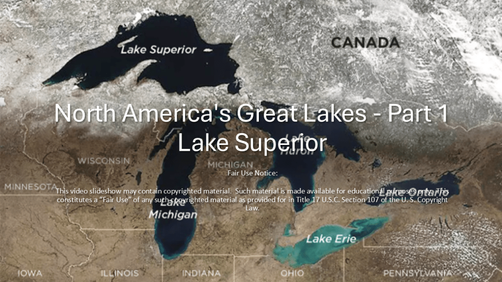
In this new series, I am going to be bringing forward research I have done in the past on the Great Lakes of North America, starting with Lake Superior, along with providing new research throughout the region as well.
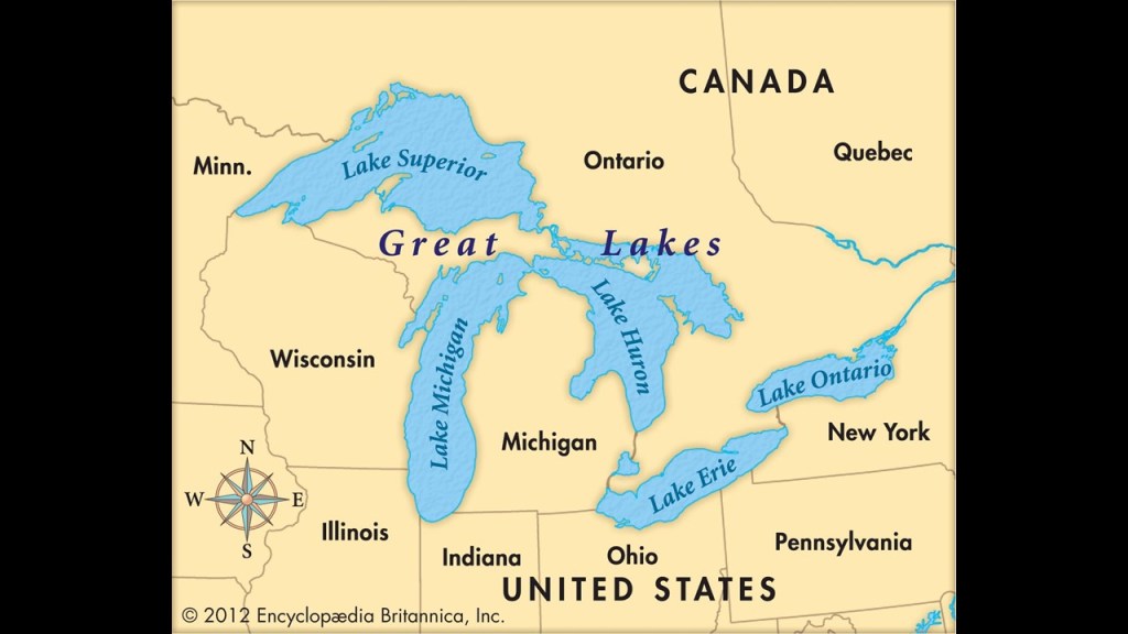
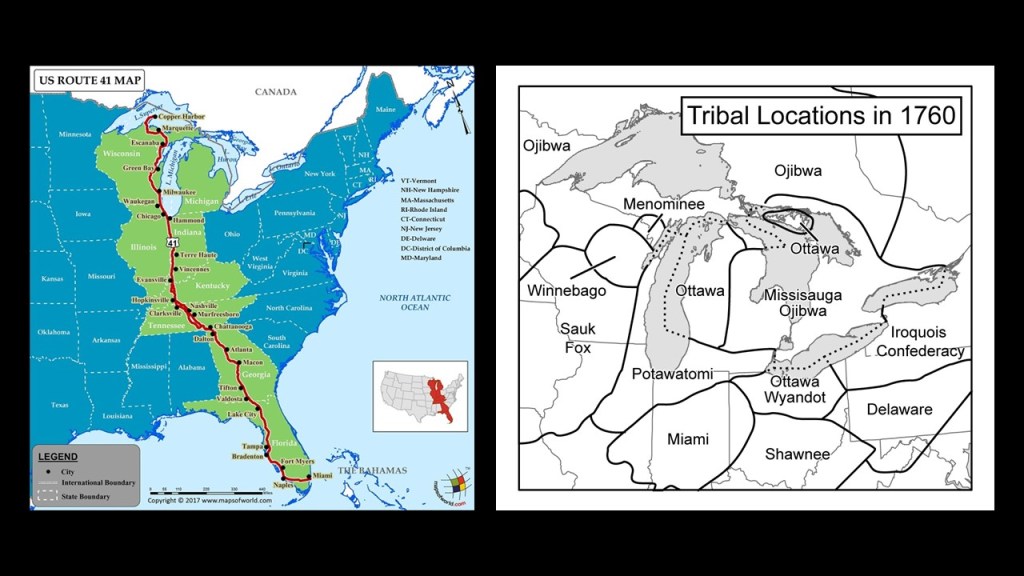
The Great Lakes Region is a Canadian-American Region centered on the five Great Lakes of Superior, Huron, Michigan, Erie, and Ontario.
In Canada, the region is comprised of Ontario, and in the United States, this region includes Minnesota, Wisconsin, Michigan Illinois, Indiana, Ohio, Pennsylvania, and New York.
Before the arrival of western Europeans, this land was inhabited collectively by the Anishinabeg, or Anishinaabe, meaning something along the lines of “original people” in their Algonquin language.
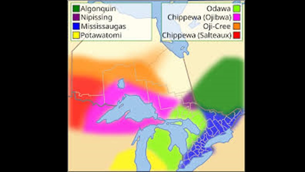
When I searched for a map of where the Algonquin-speaking peoples lived in North America, and this is what comes up, with their lands covering a vast section of it.
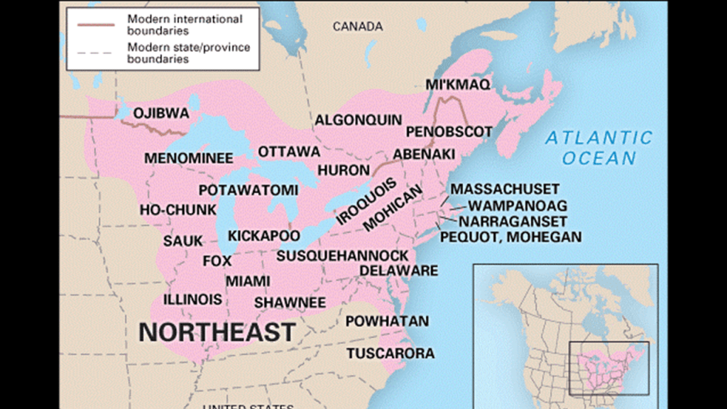
While the Algonquin language has not died out completely in North America, it is already extinct in many places, and highly-endangered in general.
For one example of many, Mohegan-Pequot was an Algonquin-language spoken by the Mohegan, Pequot, and Niantic people of southern New England, and the Montaukett and Shinnecock of Long Island.
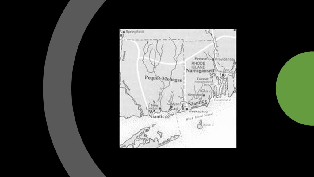
The last living speaker of Mohegan-Pequot died sometime around 1900.
We are told that historically Mohegan-Pequot did not have a writing system, and that the only significant writings came from European colonizers who interacted with speakers of the language.
There is something interesting to note about the Algonquin language.
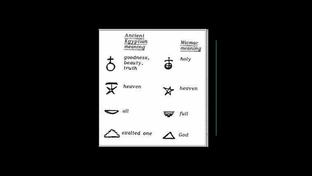
It is extremely hard to find this kind of information because of the hunter-gatherer theme going on with indigenous peoples of North America in the narrative, but I found an example in the written language script of the Algonquin Mikmaq people of Nova Scotia, and it is that of an apparent connection to the Egyptian language script.
I believe Moorish Master Masons of the Advanced Ancient Civilization built all of the infrastructure that European colonizers subsequently took credit for, and that everything was part of a worldwide, integrated free energy grid system that was deliberately-destroyed to usher in the “New World Order” for total power and control over our world, and the highly-advanced, ancient Moorish-Atlantean civilization was erased from our collective memory, and replaced with a resource- and energy-harvesting system filled with pain and suffering.

The Moors were the custodians of the Ancient Egyptian mysteries, according to George G. M. James in his book “Stolen Legacy,” and they are still here with us today.

From what I am seeing, Freemasons gave us the history of the “Old West” in our new historical narrative.
So, I am going to take a quick look first at what I call the John Wayne version of history, that false historical narrative that we have been indoctrinated in from cradle-to-grave, and then move into providing what evidence is available to find in the Great Lakes region for the True History.
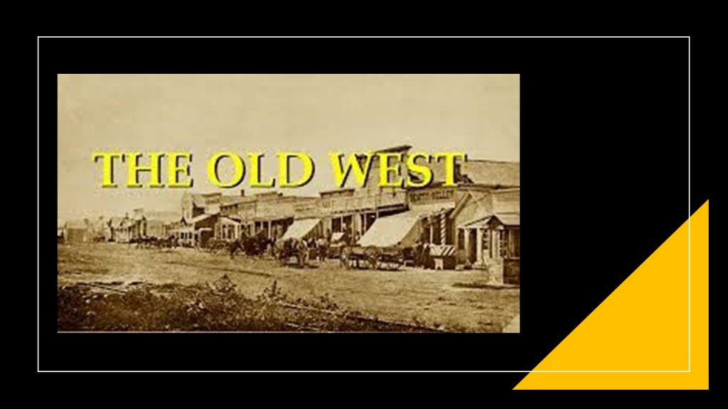
I am going to start by looking at the history of how we came to know about the “Wild West.”
The first thing that came along were western-themed dime novels that became available starting in 1860, which would have been right before the beginning of the American Civil War in our historical narrative.
The dime novels were written on pulp paper – from which the term “Pulp Fiction was derived – and contained pictures, and were introduced by the publishing house of Beadle and Company, operated primarily by brothers Irwin & Erastus Beadle, which provided a cheaper form of reading material than what existed previously, and were targeted towards young boys with stories about wild west adventures, and which were the largest demographic of dime novel western readers.
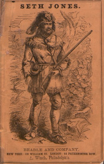
Erastus Beadle was listed as a member in this book about the Otsego Lodge No. 138 in Cooperstown, New York.
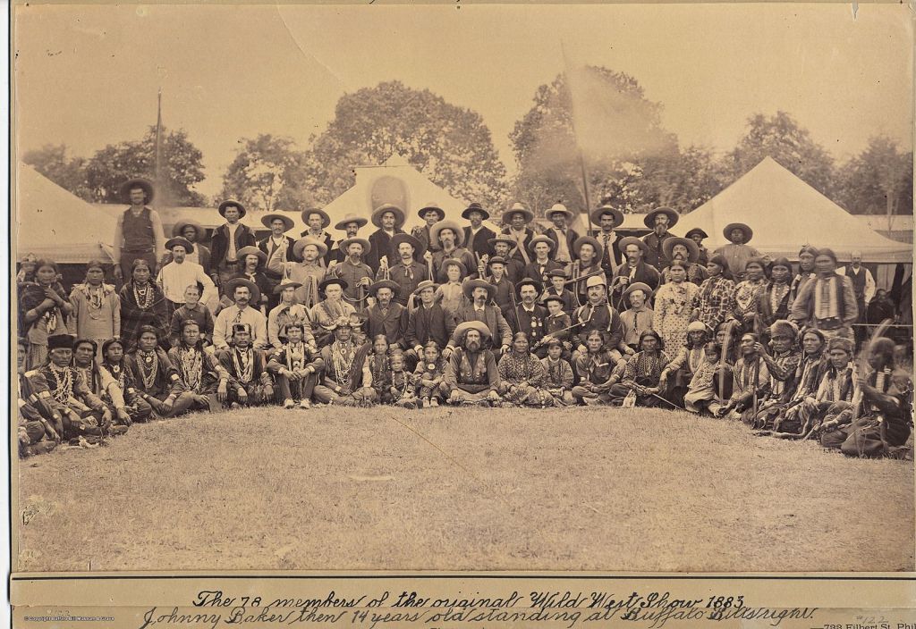
Next in our new timeline came the Old Wild West Shows, which were described as travelling vaudeville shows in the United States and Europe that took place between 1870 and 1920.
Vaudeville originated in France in the 19th-century, we are told, as a theatrical genre of variety entertainment, and became one of the most popular forms of entertainment in North America for several decades.

While not in every case, it was typically characterized by travelling companies touring through cities and towns.
Enter U. S. Army scout and guide William F. “Buffalo Bill” Cody.
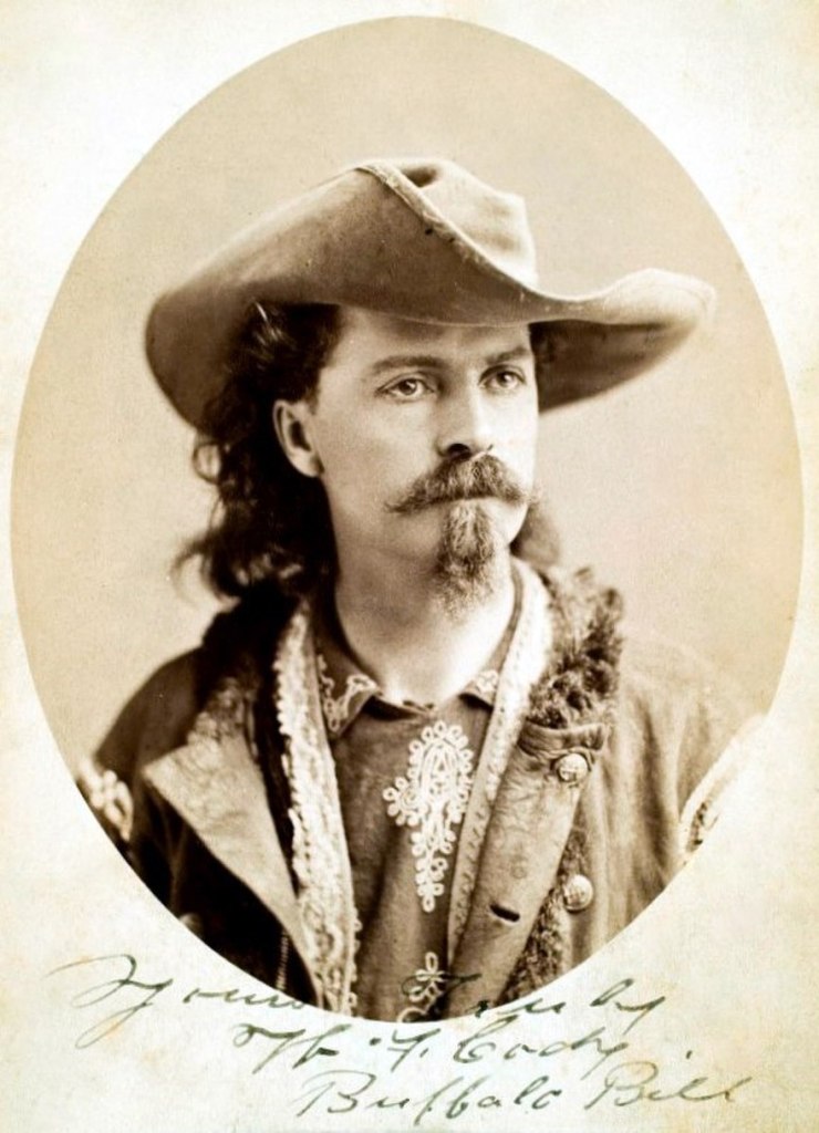
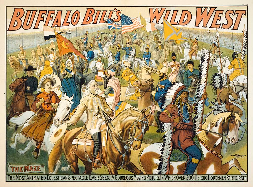
He became internationally known for his touring show, called “Buffalo Bill’s Wild West,” which travelled across the United States, Great Britain, and Continental Europe, which he founded in 1883.
All together, Buffalo Bill’s Wild West Show toured Europe eight times between 1887 and 1906.
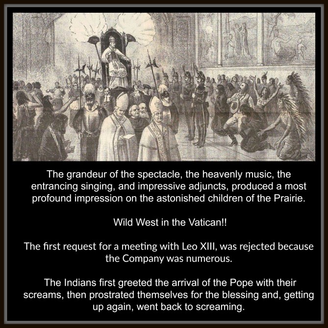
In 1893, the name was changed to “Buffalo Bill’s Wild West and Congress of Rough Riders of the World” from horse-cultures the world over.
I even saw a book about him called “Presenting Buffalo Bill – the Man who Invented the Wild West.”

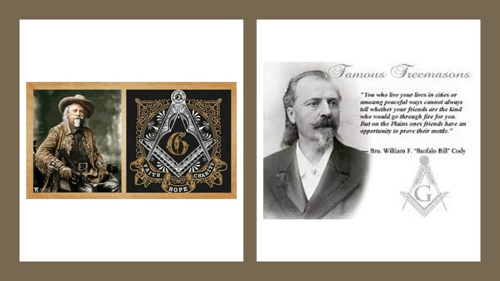
And was William F. “Buffalo Bill” Cody a freemason?
I didn’t have to look far at all to find Buffalo Bill’s connection to freemasonry – it was right out there in the open!
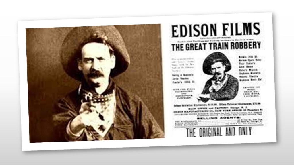
The first commercially-successful western film is considered to be Edwin S. Porter’s silent western “The Great Train Robbery” which was filmed in New York and New Jersey for the “Edison Manufacturing Company, and first released Vaudeville houses in 1903, and it set the pattern for many more westerns to come.
The first silent western film was an unprecedented commercial success, and the close-up of the actor Justus Barnes emptying his gun directly into the camera became iconic in American Culture.
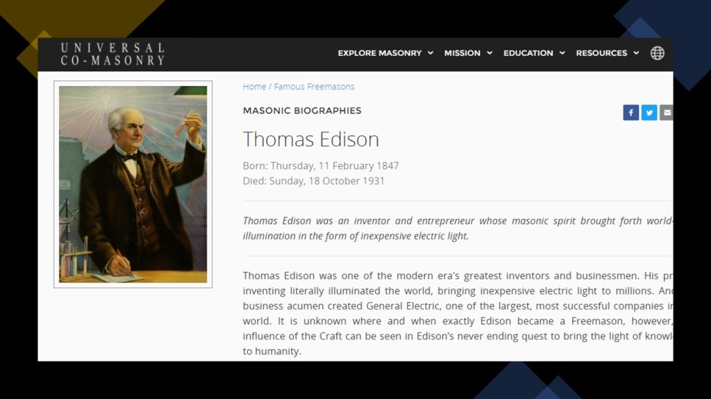
I was able to find out that famous inventor Thomas Edison was also a Freemason.
The first feature-length motion picture to be entirely filmed in Hollywood was Cecil B. DeMille’s 1914 directorial debut, a silent western film called “The Squaw Man.”

Movie director Cecil B. DeMille was a Freemason too…

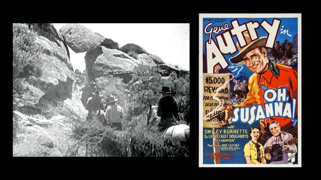
…as were famous movie actors best- known for their western movies, John Wayne and Roy Rogers, and they were Shriners, an organization comprised of 32nd- and 33rd-degree freemasons, the highest degrees of western Scottish Rite freemasonry.

As a result of all this, and much more, generations of children and adults have long-been programmed to believe that Hollywood westerns represent real history.
So let’s see what is available to find out about all of this in the Great Lakes region of North America.
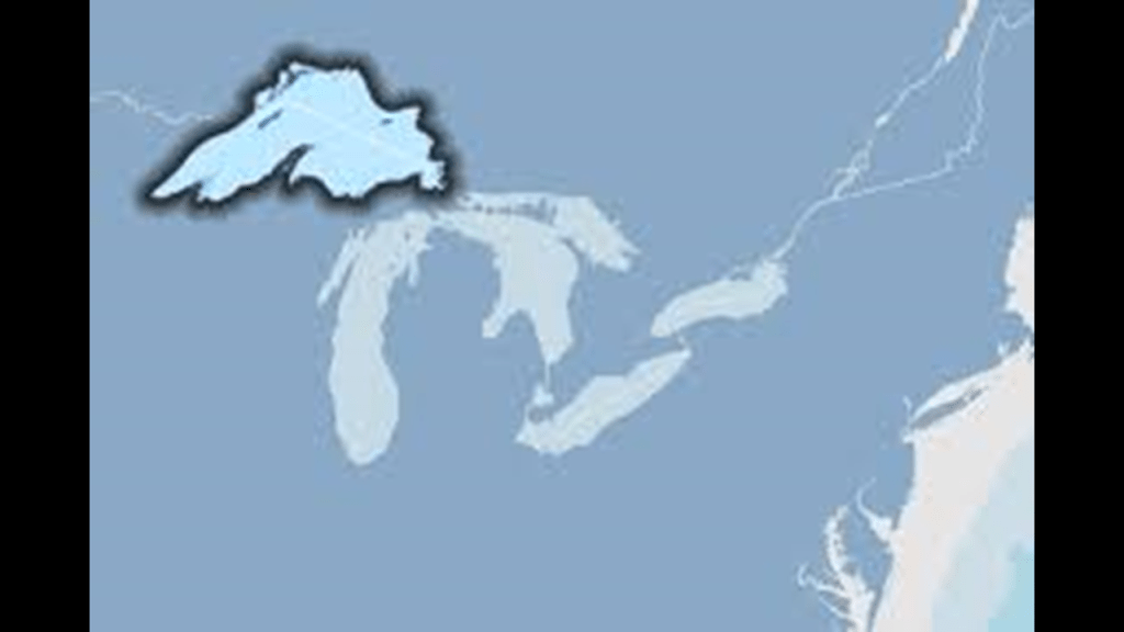
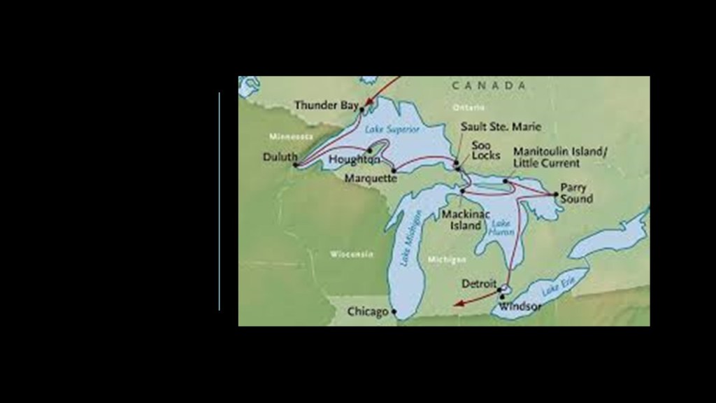
My starting point for this series is Lake Superior, the northernmost, westernmost, and the largest of the Great Lakes, and the largest freshwater lake in the world by surface area and the third-largest by volume, behind Lake Baikal in Siberia, and Lake Tanganyika in East Africa.
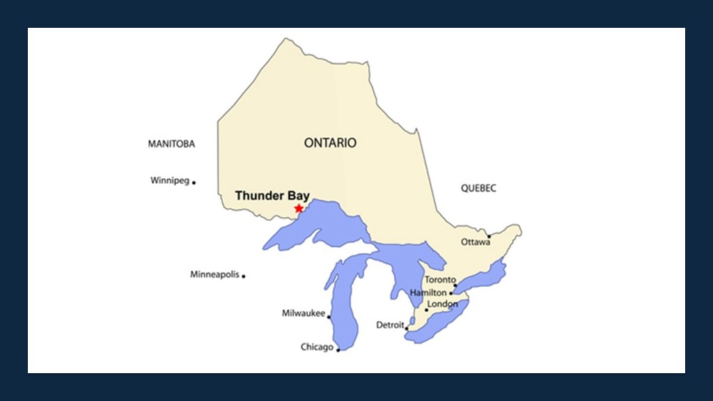
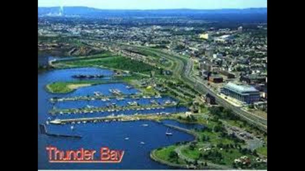
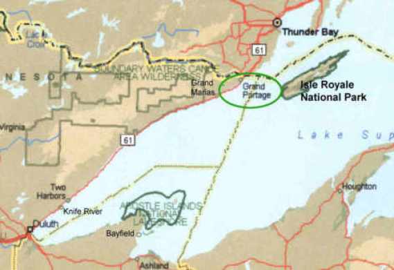
I am going to start my tour of this Great Lake at Thunder Bay on the northwestern shore of Lake Superior.
Thunder Bay is the seat of the Thunder Bay District in Ontario and is located at what is considered the head of Lake Superior.
It was previously known by the names of Fort William and Port Arthur.
Fort William at the Kaministiquia River, and Grand Portage, which I will be talking about shortly, were the starting points for the canoe route from the Great Lakes to western Canada between 1671 and 1884.
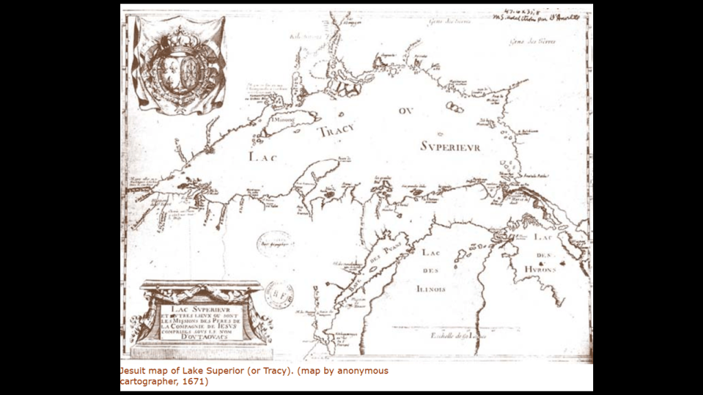
This location had been marked on a 1671 Jesuit map as they were active in the Great Lakes region in what we are told about our history.
Approximately ten-years later, the French established their first fur trading post here, and were actively involved until they abandoned the area sometime around 1760 when the British conquered New France in our historical narrative.
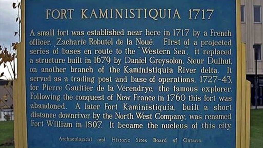
Then between 1803 and 1821, the fur trade was re-established here as Fort William by the North West Company.
The North West Company was a fur-trading business headquartered in Montreal, from 1779 to 1821, at which time it was forced to merge under pressure from the British government with the Hudson’s Bay Company after new regulations governing the fur trade in British North America were passed.
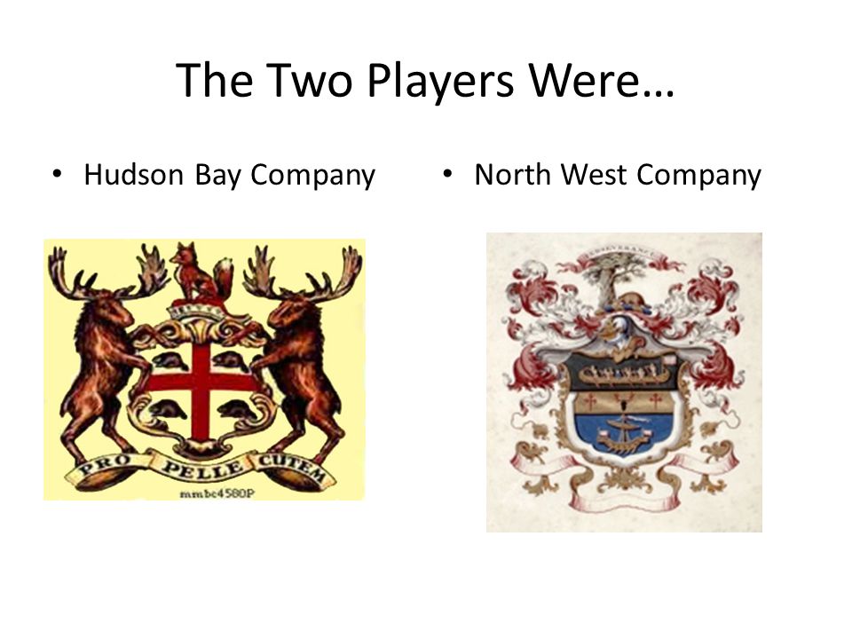
The Hudson’s Bay Company is the oldest, incorporated, joint-stock merchandising company in the English-speaking world, having been chartered on May 2nd of 1670 by King Charles II on behalf of French traders who wanted to reach the interior of the North American continent via Hudson’s Bay, and British merchants and noblemen who wanted to back the venture.
The Hudson’s Bay Company was granted wide powers, including exclusive trading rights in the lands crossed by rivers flowing into Hudson Bay.
It is still in operation today as a Canadian retail business group operating department stores in several countries.
Then Hudson’s Bay Company merged with the original trading post located at Fort William, where it operated until 1884.
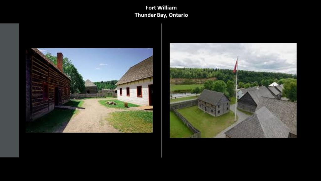
Today, Fort William Historical Park is an historical site located in Thunder Bay with what we are told was a reconstruction of the Fort William fur trade post as it existed in 1815.
It officially opened on July 3, 1973.
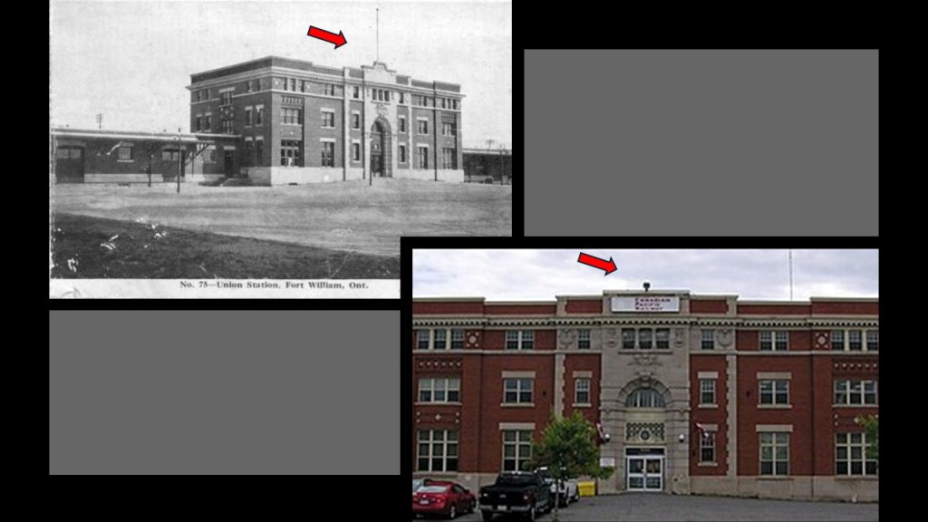
Historically there were solid masonry buildings here, like the Union Station in Fort William, which was said to have been built in the Beaux-Arts-style some time around 1910 or 1911 by the Canadian Pacific Railway and the Grand Trunk Pacific Railway as a passenger terminal and headquarters for the grain-handling facilities located here.
The building still stands today, though minus a couple of features that were present on the building in the earlier photo in the top center of it, as if the resetters wanted to remove antiquitech or something.
This practice was actually quite common with respect to old world buildings that are still here and not demolished as so many have been.
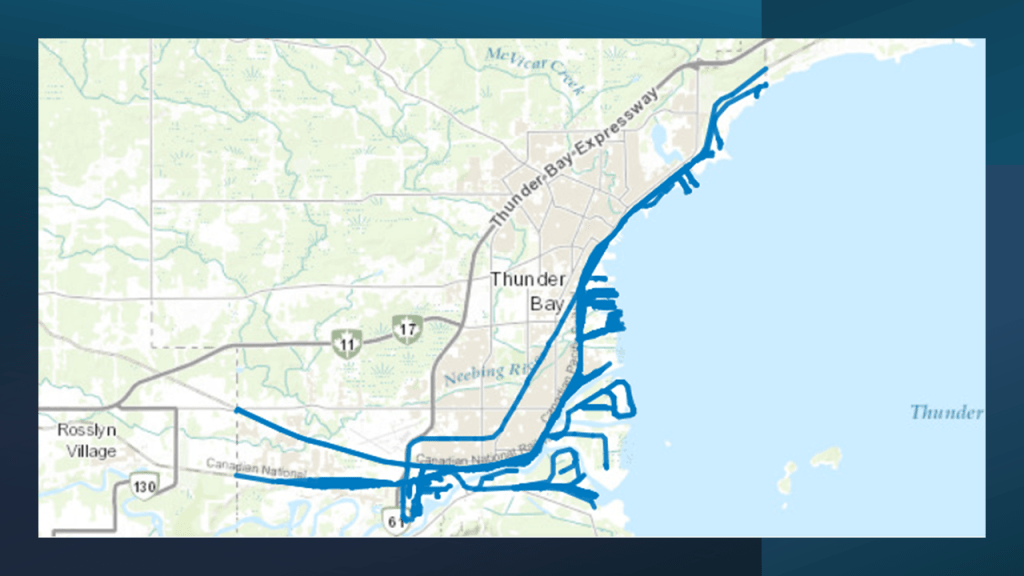
Thunder Bay is still an important railway hub for the Canadian National and Canadian Pacific Railways.
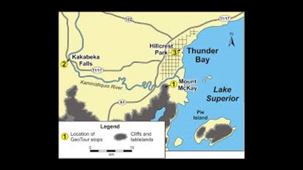
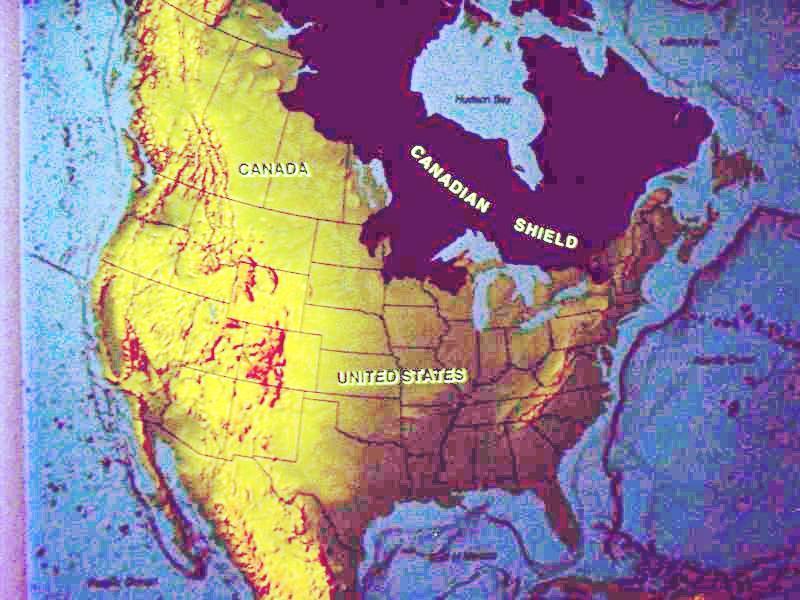
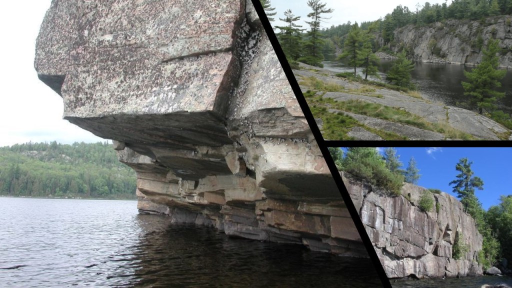
Thunder Bay is located on the southern edge of the Canadian Shield, also known as the Laurentian Plateau.
It is called one of the world’s largest geologic continental shelves, of exposed precambrian igneous and high-grade metamorphic rock that forms the ancient geological core of North America.
Here are some photos of what the Laurentian Shield looks like, with the presence of straight edges, angles, and flat and smooth stone surfaces.
In a southwesterly direction from Thunder Bay, we next come to Isle Royale in Lake Superior.
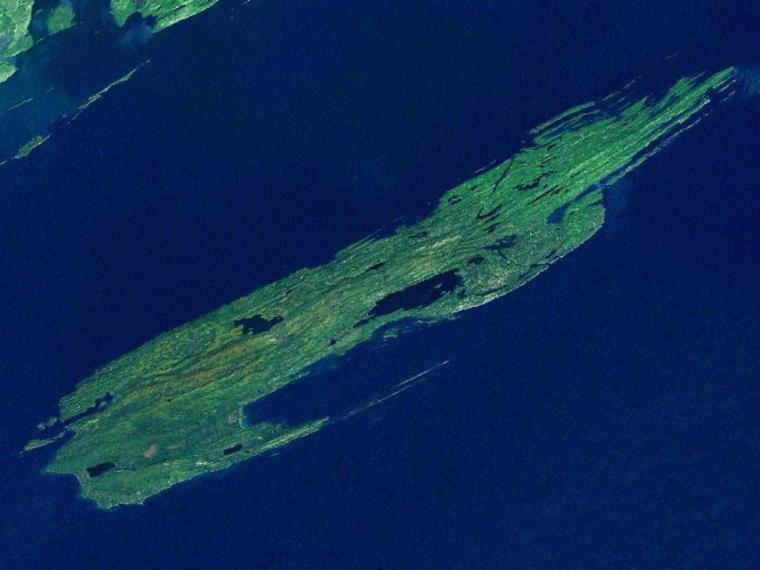
While geographically it is very close to Grand Portage in Minnesota, it is part of the State of Michigan.
It is the only national park in Michigan, and the only island national park in the United States.
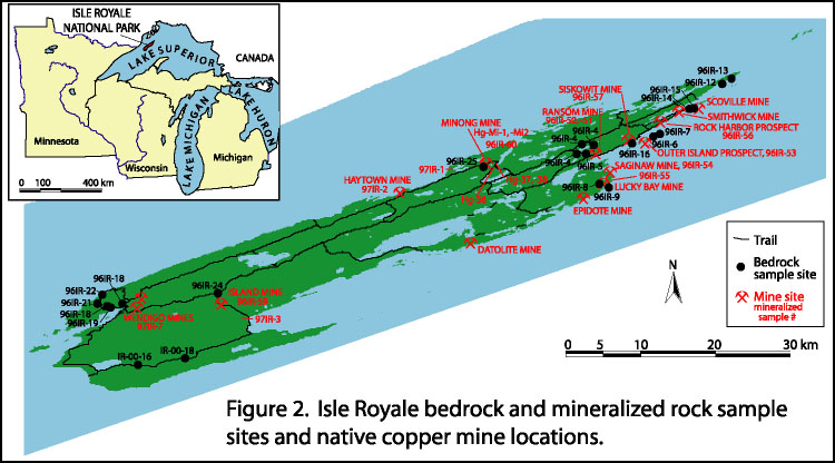
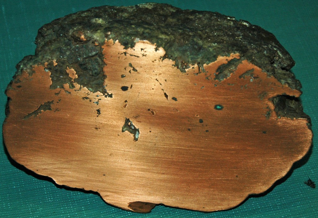
Isle Royale was known for its ancient copper mines dating at least back to the Bronze Age, and is considered the purest copper in the world.
And our narrative can’t explain who was responsible for the mining, and how it got to Europe.
The best western Archeologists can come up with is that somehow Indians in loincloths figured out how to mine copper 5,000 years ago, and that somehow, we really don’t know how, it got to Bronze-Age Europe before there was transoceanic trade.
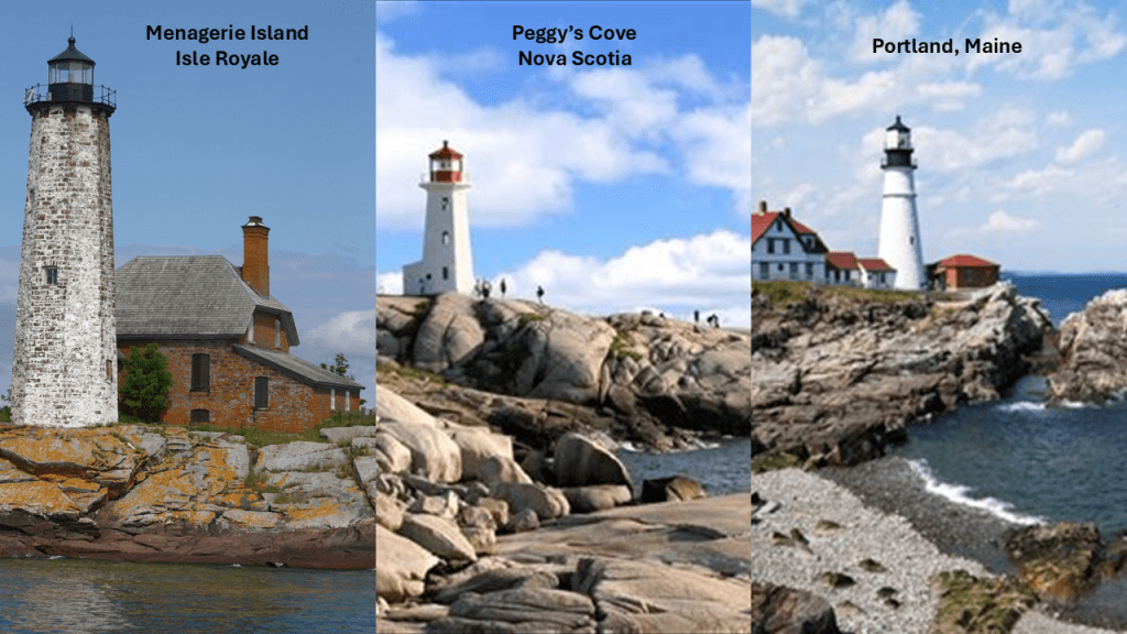
The Isle Royale has a lighthouse on the rocky shore of Menagerie Island, just offshore on the left; compared with the lighthouse on the rocky shore of Peggy’s Cove in Halifax, Nova Scotia, in the middle; and the the lighthouse on the rocky shore of Portland, Maine, on the right.
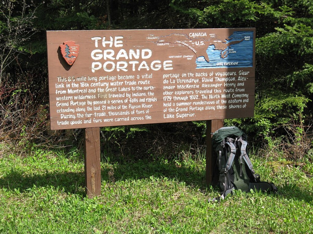
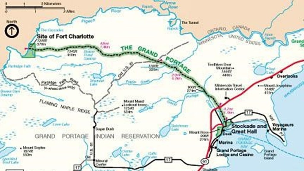
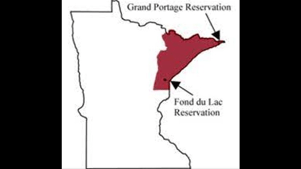
Next I am going to look at the location of Grand Portage in Minnesota on the northwest shore of Lake Superior.
Grand Portage is classified as an unorganized territory of Cook County, which includes both the unincorporated community of Grand Portage, and the Grand Portage Indian Reservation.
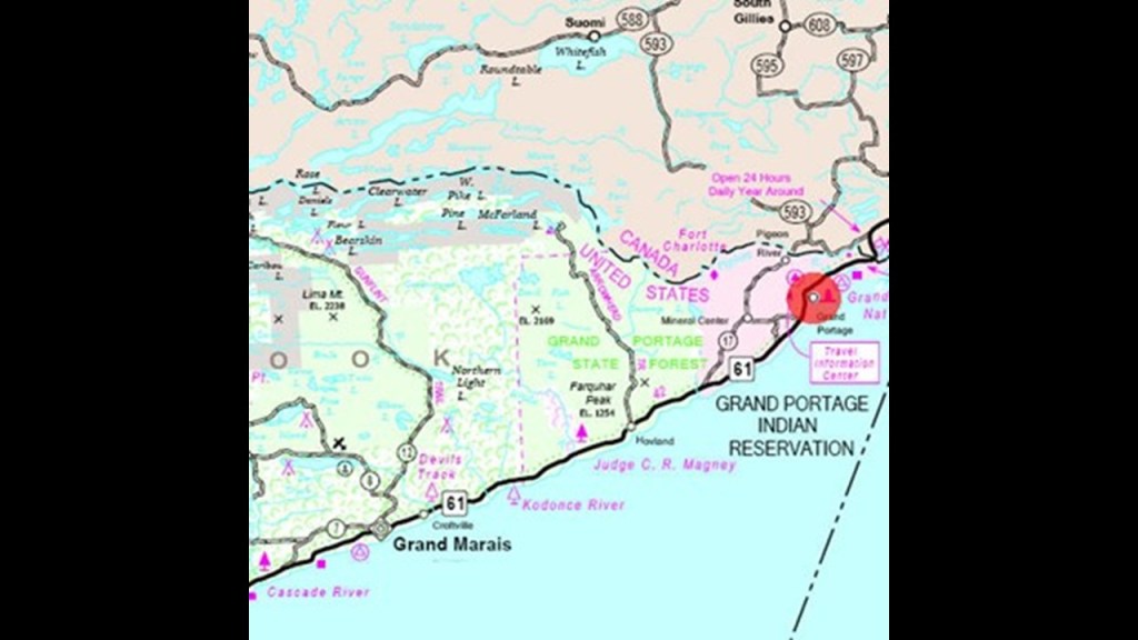
The previously-mentioned fur-trading business Northwest Company based out of Montreal was really interested in this location, as they built its inland headquarters at Grand Portage in 1785, and was active there until 1802 when they moved their base of operations to Fort William in Ontario some time after the area became part of the United States as a result of the signing of the 1794 Jay Treaty between Great Britain and the United States, which acknowledged American control of the area.
Grand Portage, along with Fort Niagara, Fort Detroit, and Mackinac Island in the Straits of Mackinac in Michigan, were the four main fur-trading centers of the British Empire in North America.
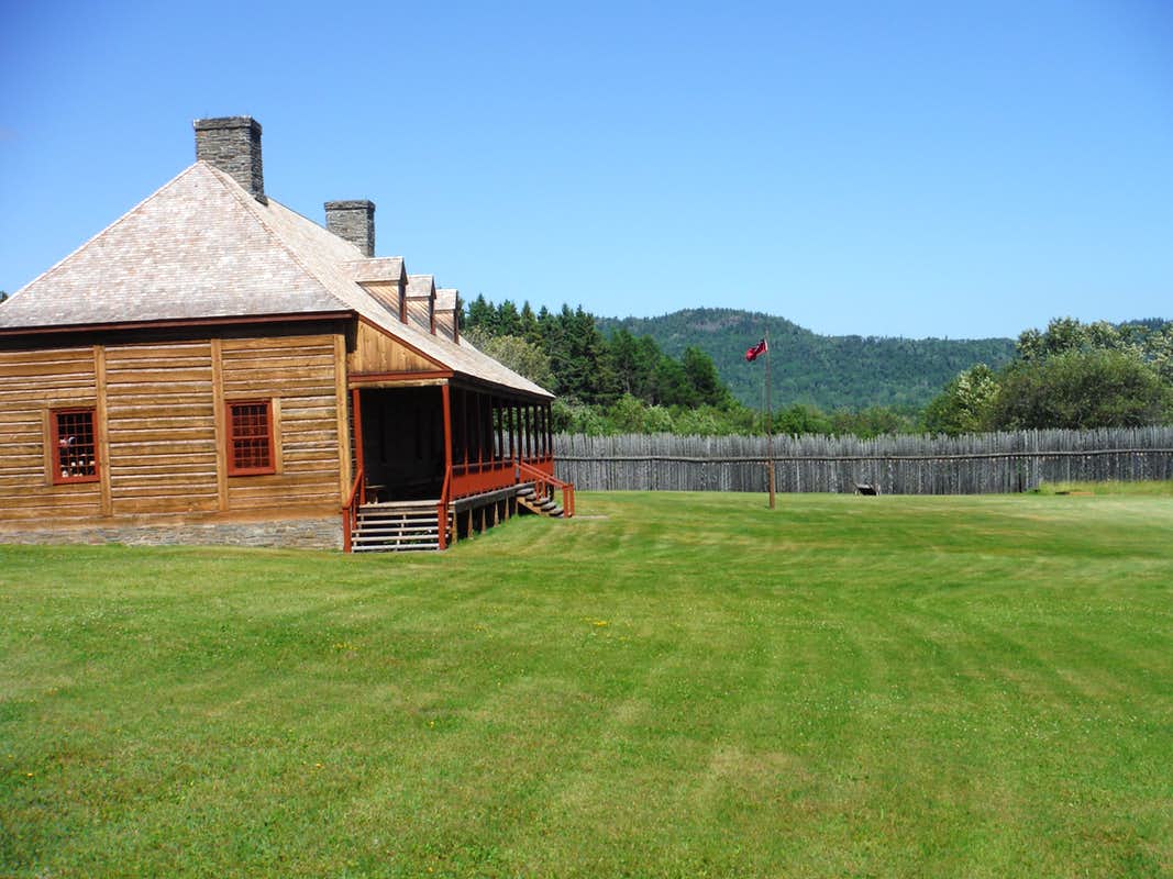
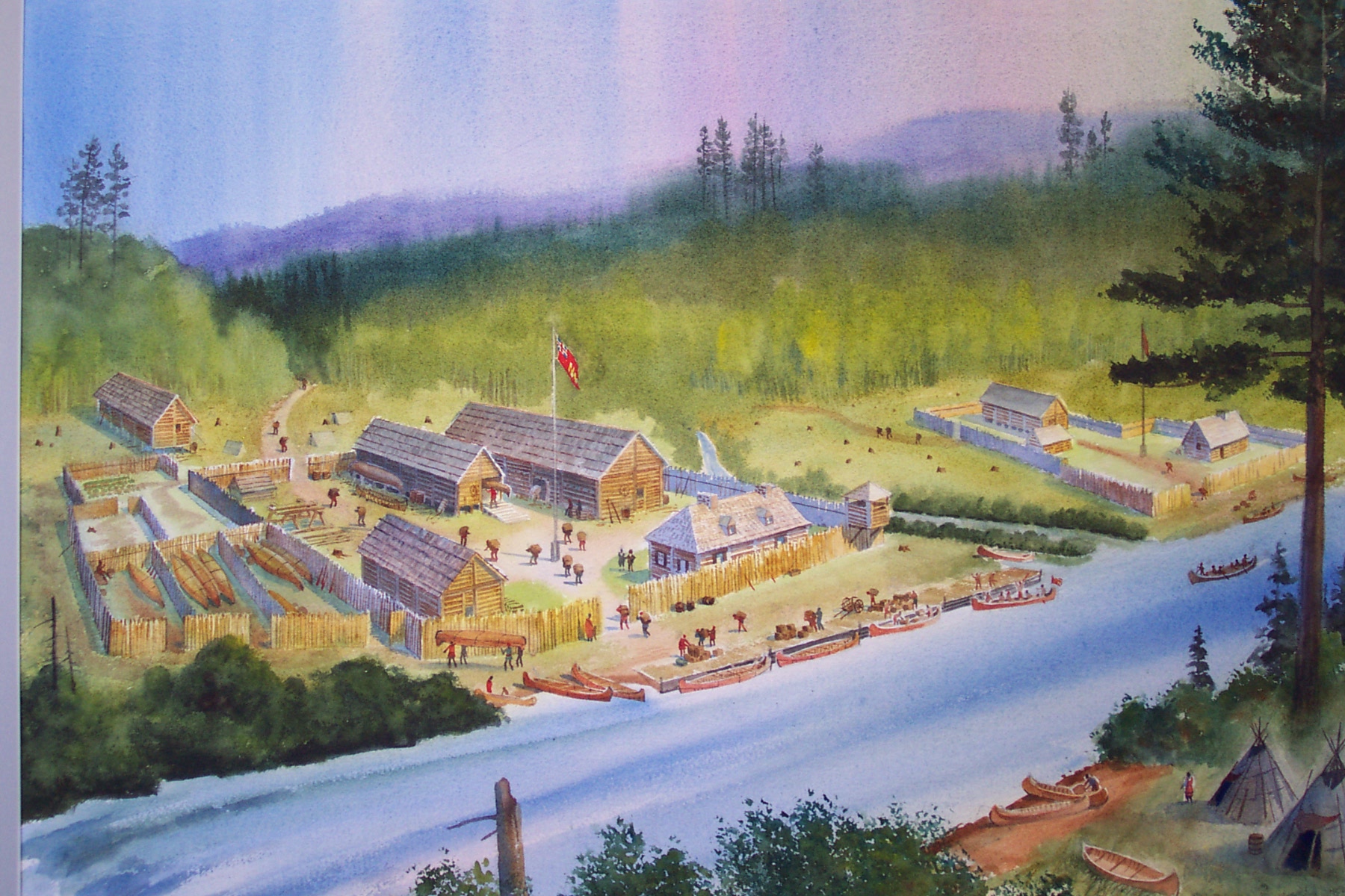
Like what we saw with the reconstructed Fort William back in Ontario, this is the reconstructed Great Hall of the British Northwest Company on the grounds of the Grand Portage National Monument.
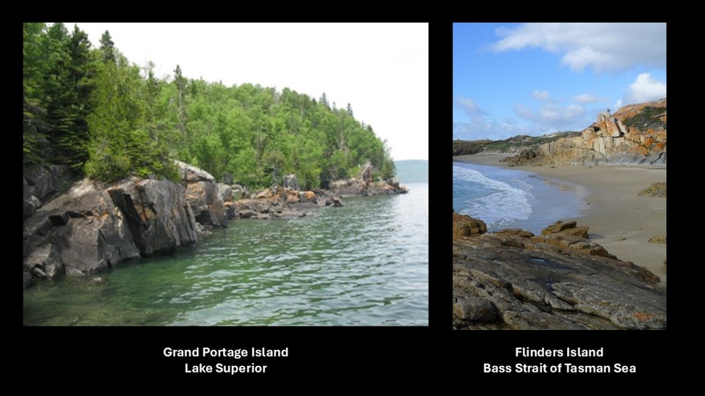
Grand Portage Island is just a short distance off-shore from Grand Portage.
This is what its shoreline looks like on the left, compared on the right with the shoreline of Flinders Island, the largest island in the Furneaux Group, located in the Bass Strait of the Tasman Sea which separates Tasmania and Australia.
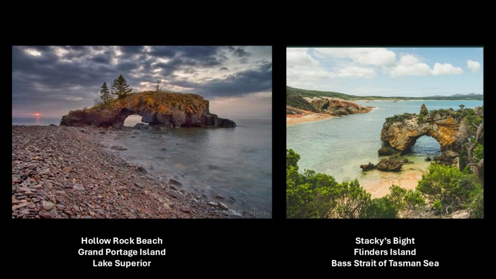
This is a picture of Hollow Rock Beach on Grand Portage Island in Lake Superior on the left, and Stacky’s Bight, also on Flinders Island in the Bass Strait of the Tasman Sea, on the right.
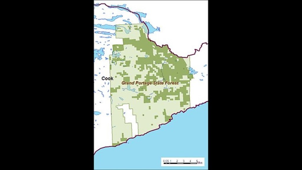
The Grand Portage State Forest is just a short distance southwest of Grand Portage.
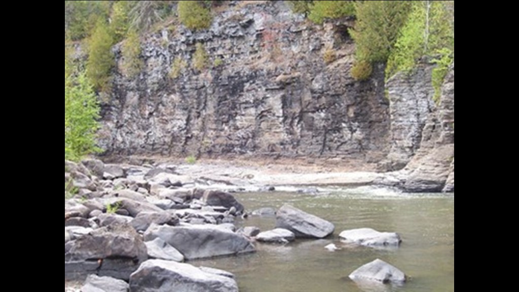
Visitor attractions include the High Falls of the Pigeon River, the highest falls in Minnesota…
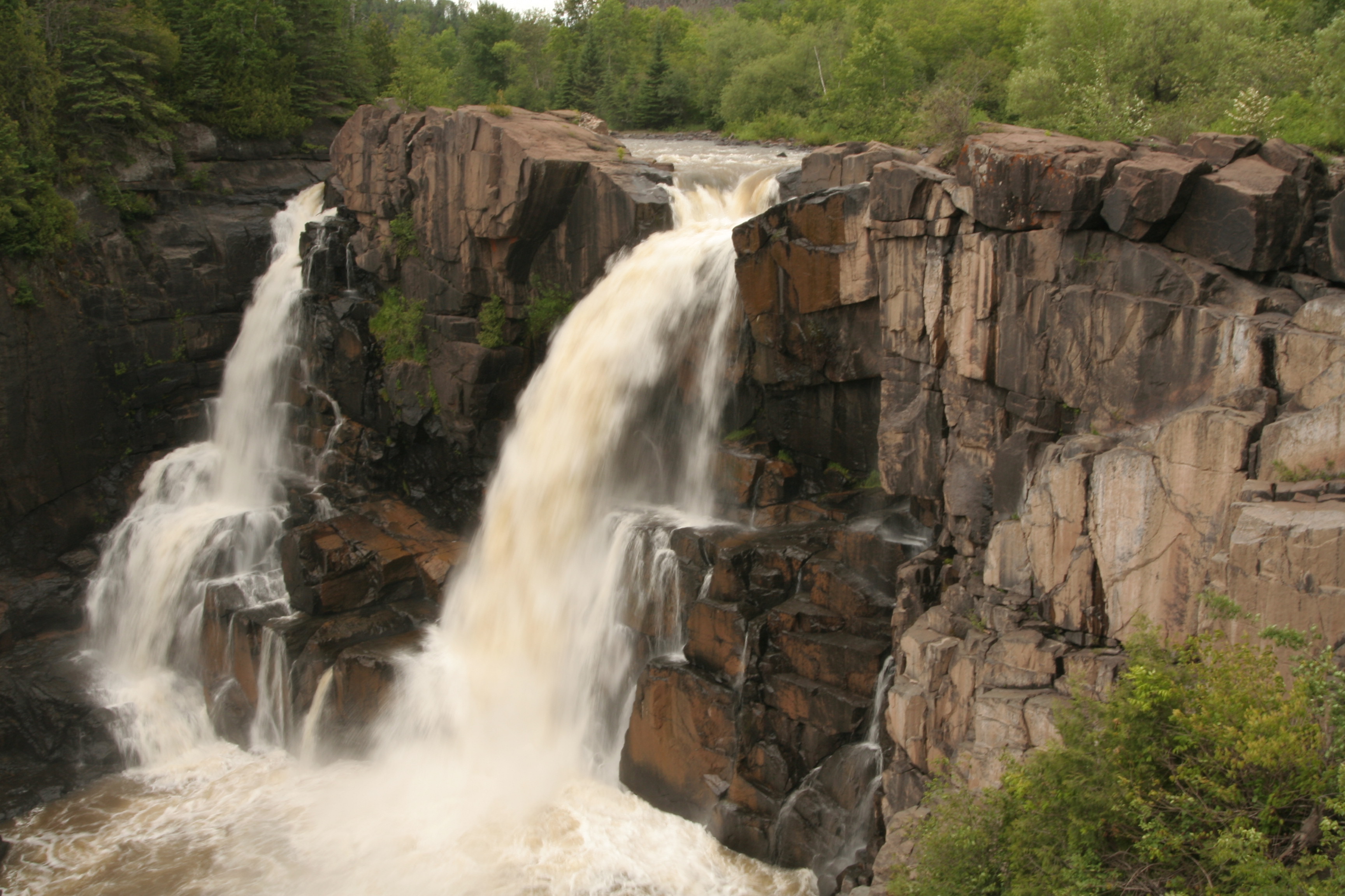
…which are said to be the reason for the Grand Portage, a nine-mile ancient trail to Lake Superior that circumvents this unnavigable stretch of the Pigeon River.
The historical site of Fort Charlotte is on the other end of the Grand Portage, and is also in the Grand Portage State Forest.
It was said to have been established by the British Northwest Company as an outpost of the Grand Portage for the fur trade.
The Pigeon River flows between Minnesota and Ontario.
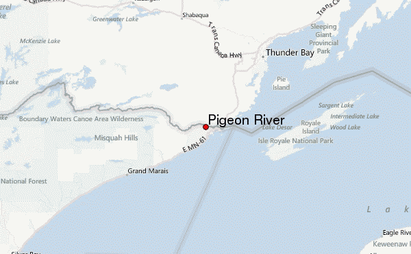
This photo was taken of the Pigeon River in the International Border region between the United States and Canada.
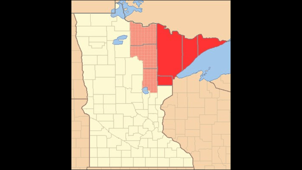
Where we are looking at Grand Portage is in what is called the “Arrowhead Region of Minnesota.”
The region is often defined as the counties of northeastern Minnesota – Carlton, Cook, Lake and Saint Louis.
Resource extraction like logging and mining have been primary economic drivers of the Arrowhead Region throughout its history.
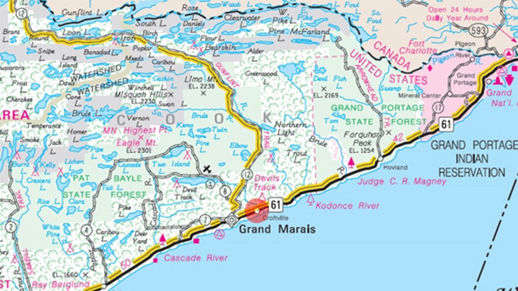
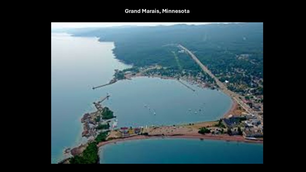
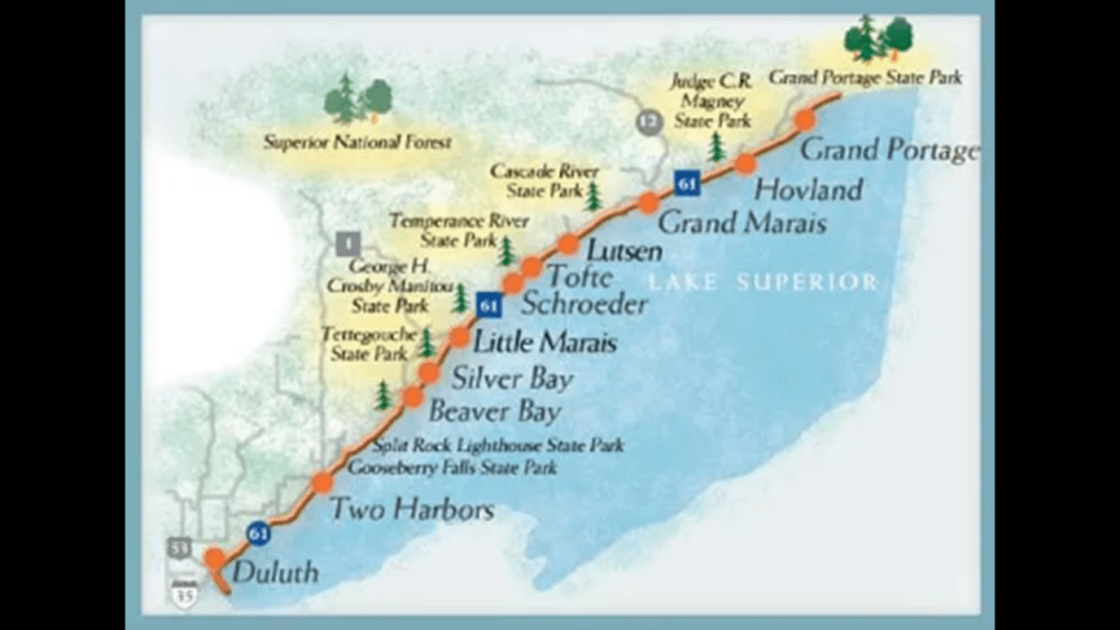
Moving further on down the northwestern shore of Lake Superior is Grand Marais, the county seat of Cook County, and its only city.
We are told that French Canadian Voyageurs, who transported furs by canoe in the 1700s, named the settled village “Grand Marais,” or “Great Marsh,” referring to a marsh back in those days that was 20-acres, or 8.1-hectares, in size, at the head of the bay and harbor that led to the settlement.
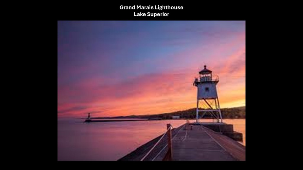
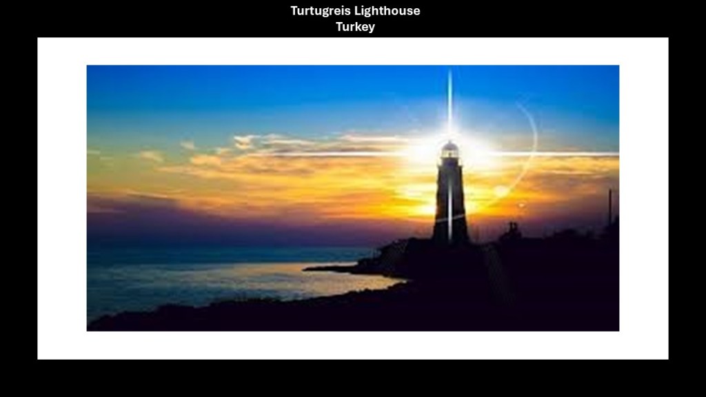
The Grand Marais Lighthouse is on the end of a breakwater on the shore of Lake Superior, and was said to have been first lit in 1922 and still operational.
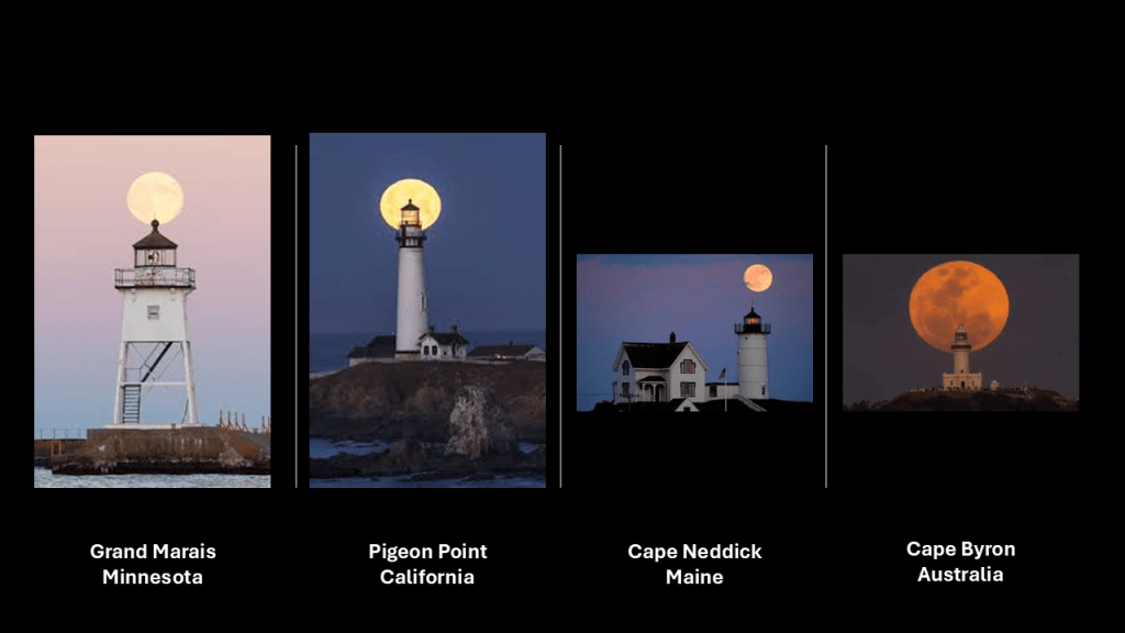
The Grand Marais Lighthouse on the left was no exception to finding lunar alignments, as well as other types of astronomical alignments, at lighthouses in different places around the world, like the Pigeon Point Lighthouse in California’s Half Moon Bay; the Cape Neddick Lighthouse in York, Maine; and the Cape Byron Lighthouse in Australia’s Byron Bay.
More thoughts on this and other findings shortly.
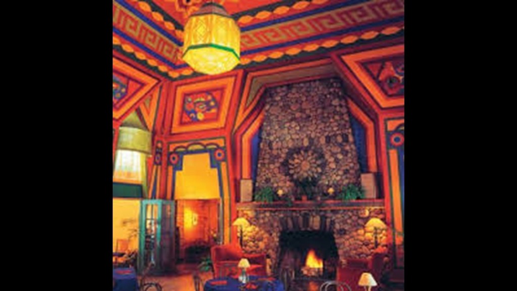
The Naniboujou Lodge and Restaurant is 15-miles, or 24-kilometers, east of Grand Marais on the North Shore of Lake Superior.
It was said to have been designed by the Duluth architectural firm of Holstead and Sullivan with Art Deco and Cree design elements, and built as a private club for a group of Duluth businessmen of the “Nanijoubou Holding Company,” and that the club first opened for business in 1929, but that because of the Great Depression only the clubhouse was built and not the grandiose plans of many more amenities envisioned by the Duluth businessmen, as we are told the October 29th of 1929 stock market crash, also known to history as “Black Tuesday,” spelled disaster for the “Nanijoubou Holding Company.”
The private club aspect could not be saved and over the years was owned or operated by corporations, or private individuals and families.
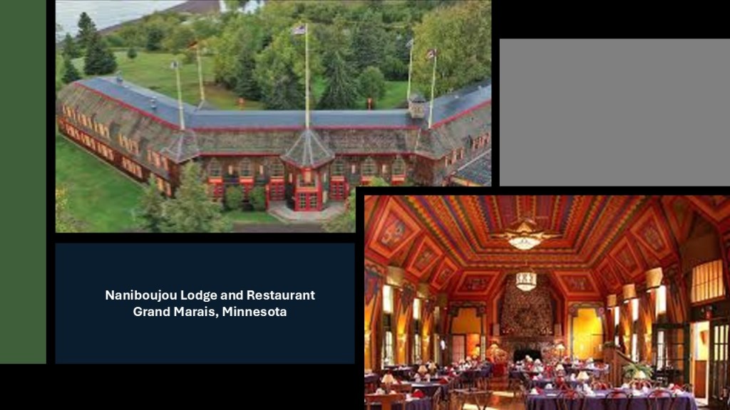
The dining room of the Naniboujou Lodge includes a 200-ton fireplace made of native stone.
At 20-feet, or 6-meters, -high, it is the largest in the State of Minnesota.
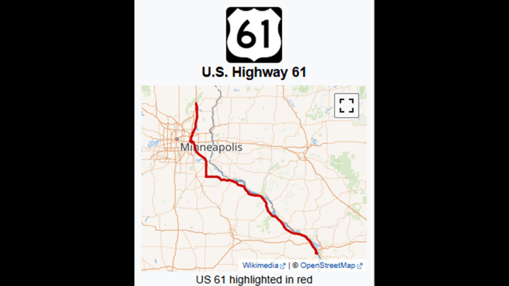
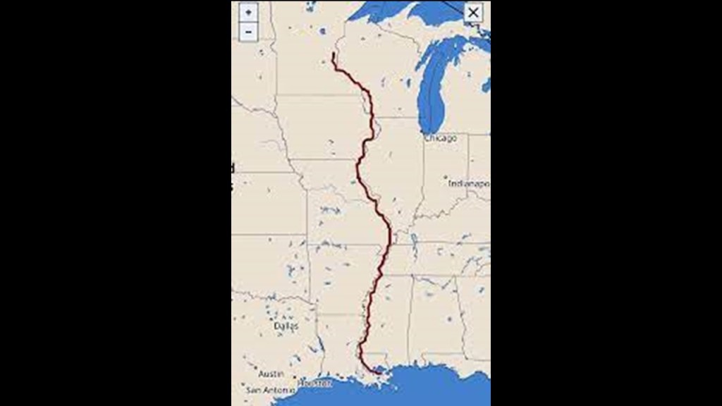
The Naniboujou Lodge and Restaurant is located on the Minnesota State Highway 61, formerly known as the “North Shore Highway” and which is now known as the “North Shore Scenic Drive,” that runs northeast for 150-miles, or 242-kilometers, from its junction with I-35 in Duluth to its northeast terminus near Grand Portage at Ontario Highway 61 at the Pigeon River Bridge.
Until 1991 Minnesota State Highway 61 was part of United States Highway 61 from 1926 to 1991.
US-61 in southeastern and southcentral Minnesota basically runs alongside the Mississippi River from the Mississippi River Bridge where it enters Minnesota at La Crescent from La Crosse Wisconsin to I-35 at Wyoming, Minnesota.
It is considered the “Great River Road,” a collection of state and local roads that follow the course of the Mississippi River in ten states.
The full-length of US-61 runs for 1,400-miles, or 2,300-kilometers, from its southern terminus in New Orleans, Louisiana, to its northern terminus at Wyoming, Minnesota.
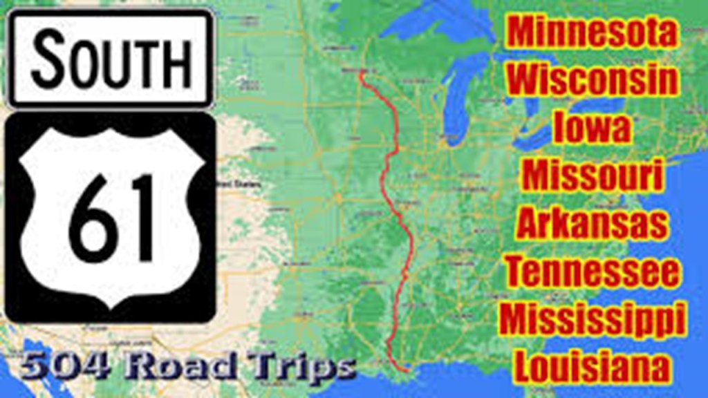
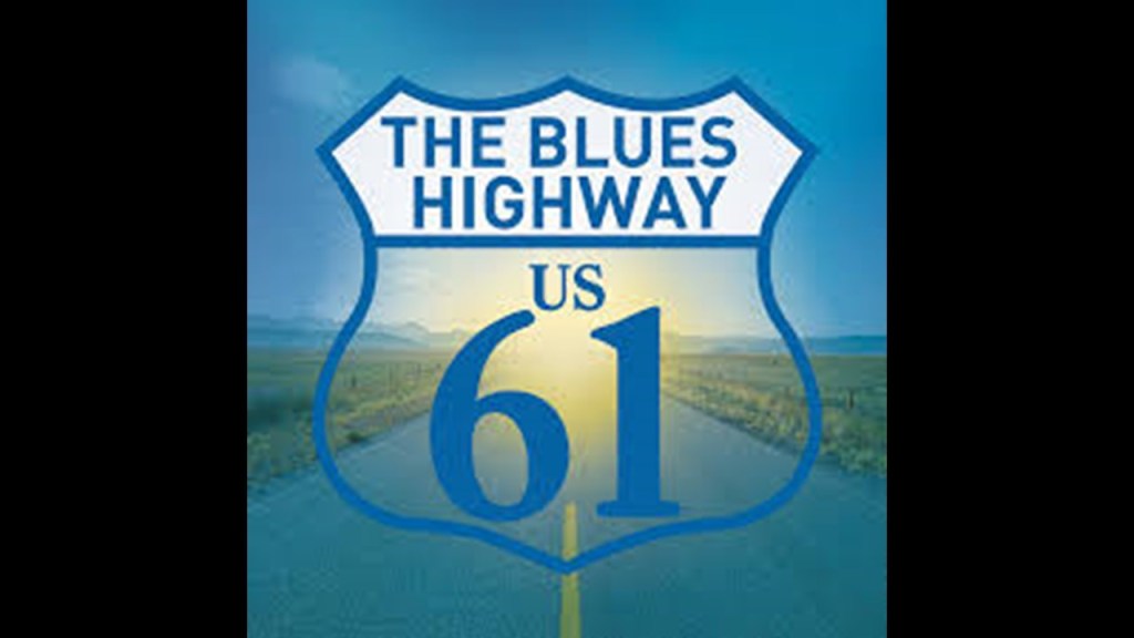
US-61 is also known as the “Blues Highway” because of its long history in Blues Music.
Like in Minnesota, the full US-61 also largely follows the course of the Mississippi River, and for much of its route is designated “the Great River Road.”
More thoughts to come shortly on our highways and road systems as well.
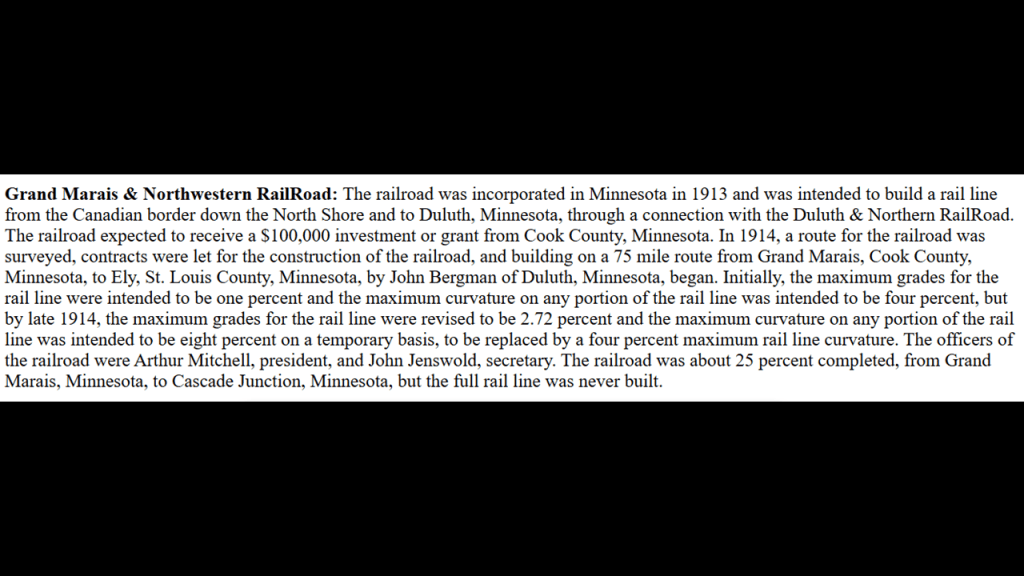
When I was doing some digging about the railroad history of Grand Marais on the North Shore of Lake Superior, this is what I was able to find out about it.
We are told that the Grand Marais and Northwestern Railroad between the Canadian border down the North Shore to Duluth was incorporated in 1913, and surveyed in 1914, but that the full rail-line was never built.
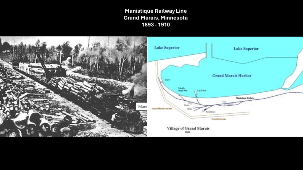
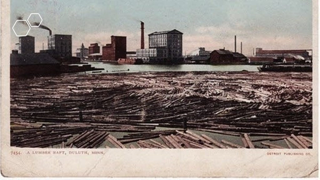
Grand Marais was the center of logging operations for the harvesting of forests in the area surrounding it.
The Manistique Railway line ran one round-trip/day for lumbering from 1893 to 1910, at which time all lumbering operations ended and the railroad was shut down.
This was an isolated town that could only be reached by lake or rail until 1910, and then only by lake until 1920 when the first road was established between Grand Marais and Seney.
I was able to find the most information about the “North Shore Scenic Railroad,” which is a heritage railroad that operates along a 28-mile, or 45-kilometer, stretch between Duluth and Two Harbors along the Lakefront Line, and from the information available to find on it, used to be part of the Duluth, Missabe, and Iron Range Railroad.
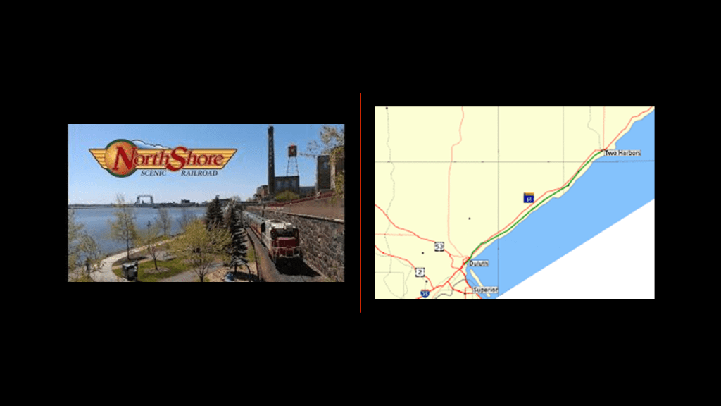
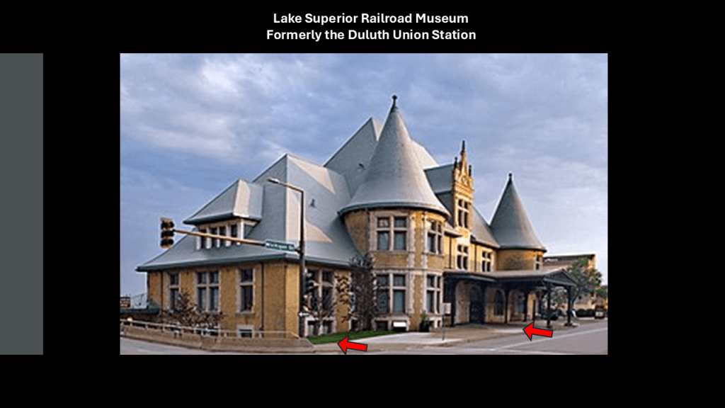
The “North Shore Scenic Railroad” operates out of what was formerly the Duluth Union Station, and now the “Lake Superior Railroad Museum.”
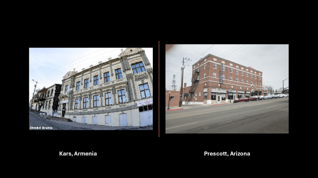
Interesting to note the slant of the road and sidewalk in front of this building; ground-level windows; and below-ground floors, which are all classic indicators for what is best-known as the mud-flood, and found all over the world.
…like these examples of Kars in Armenia on the left and Prescott in Arizona on the right, for just two of countless examples of what I am talking about.
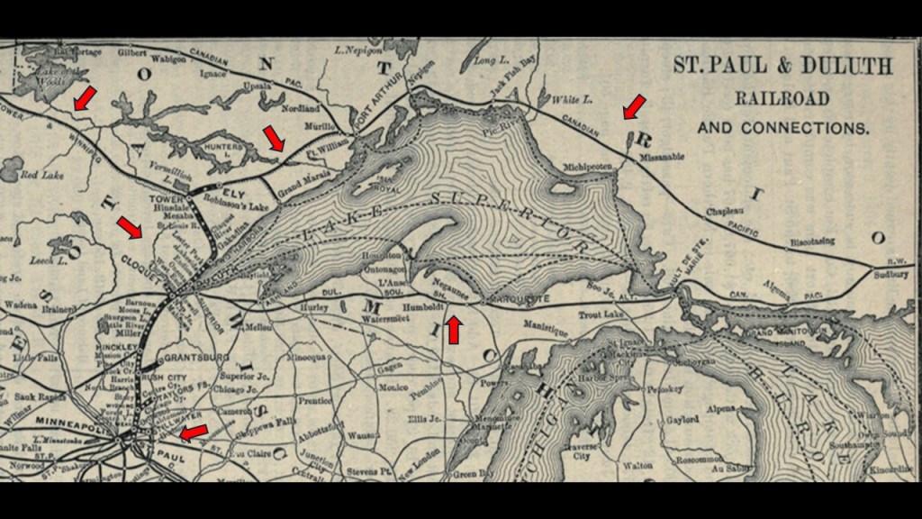
The North Shore Scenic Railroad corridor travelled by the excursion train once was a vital link in the transportation system known as the Lakefront Line for over 100-years, and connected Duluth and the Iron Range Railway with America’s expanding rail network.
It was connected by a one-mile, or 1.6-kilometer, extension of the St. Paul and Duluth Railway in 1886, when the Lakefront Line was said to have first been built.
I think the information about the railroads, and the highways, is significant, and I will go into this more throughout this post as I believe that all the rail infrastructure was part of the original energy grid, and I believe the energy grid was deliberately destroyed, and that it’s destruction created everything we see in the world today that we are told is natural, including the Great Lakes.
I have red arrows pointing at some, but not all, of the historical railroad-lines going through here.
Next, I am going to take a look at the history of Duluth, which is considered a part of the Arrowhead Region, first from the perspective of the Merritt family and then a more general overview of some things found in Duluth’s history.
First, the Merritt family.
We are told the Merritt family came to the Minnesota Territory in 1855 and 1856 from Pennsylvania after the 1854 Treaty of LaPointe was signed in Wisconsin between the U. S. Government and representatives of the Ojibwe of Lake Superior and the Mississippi River.
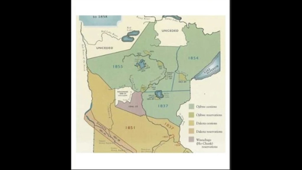
As a result of this treaty, the Ojibwe ceded all of the Lake Superior Ojibwe lands in the Arrowhead Region of Northeastern Minnesota to the United States in exchange for reservations for the Lake Superior Ojibwe in Wisconsin, Michigan, and Minnesota.
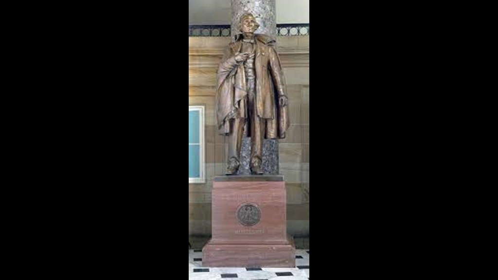
Henry Mower Rice, who represents the State of Minnesota in the National Statuary Hall at the U. S. Capitol Building in Washington, DC, was involved in the 1854 Treaty of LaPointe, as well as the 1847 Treaty of Fond du Lac with the Ojibwe and the 1846 Winnebago Treaty, although there were many Land Cession Treaties that were recorded with the indigenous people of taking their land in return for reservations.

We are told that Rice was a fur trader with the Ojibwe and Winnebago who had gained a position of trust with them, and he later became a prominent Minnesota politician who was involved in Minnesota becoming a state.
At any rate, the Merritt family settled in Oneota, which is now West Duluth, where they ran a hotel, and the father, Lewis, worked as a lumberman and millwright.
Lewis also prospected for gold in what was called the Vermilion Lake Gold Rush of 1865 to 1866 in the Mesabi Mountain Ranges because gold specks were found in quartz stone there in 1865.
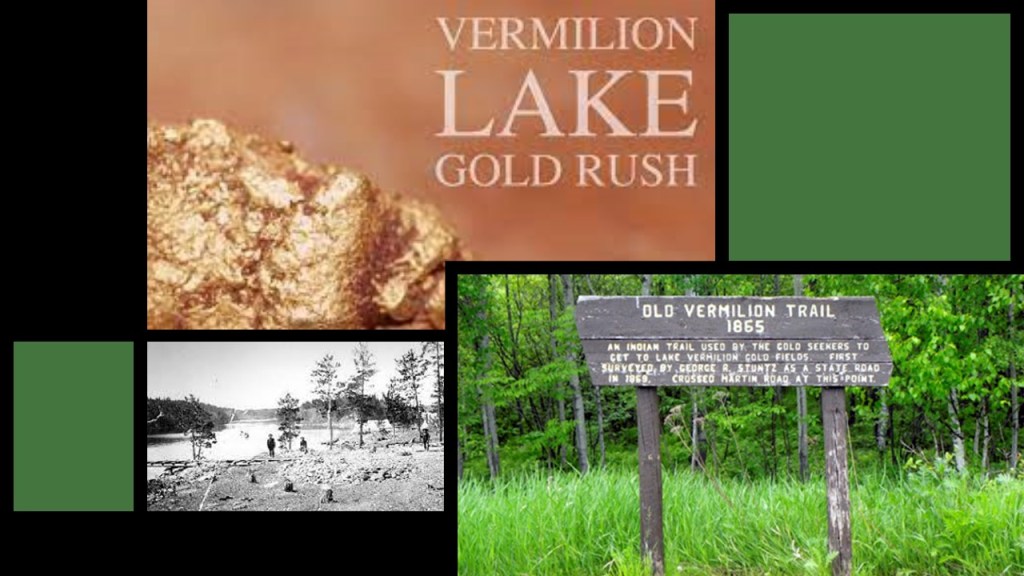
Like the other prospectors, he couldn’t find any gold, but someone gave him a piece of iron ore that caused him to speculate there was more of that to be found in northern Minnesota.

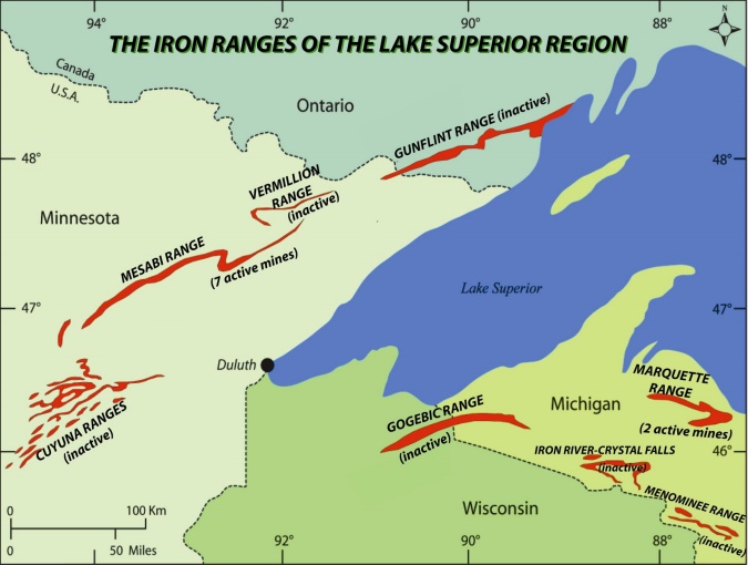
There are four iron ranges around Lake Superior in Minnesota and Ontario: the Vermilion; the Mesabi; the Gunflint; and the Cuyuna.
They are not classified as mountains, but as outcrops of sedimentary formations containing high-percentages of iron from the Precambrian-geologic era, which was four-to-six-billion-years ago to 541-million-years ago.
Lewis Merritt and his wife Hepziabeth had eight sons.
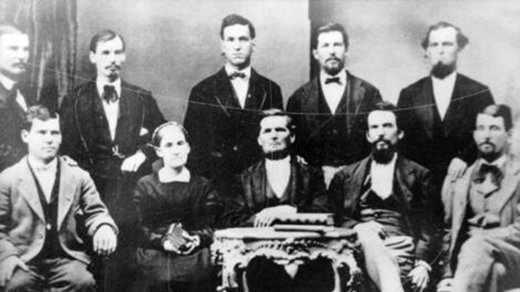
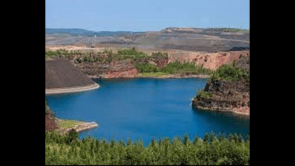
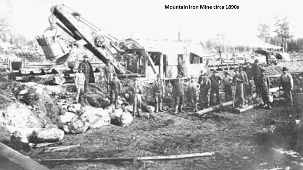
One of their sons, Leonidas, purchased land in the Mesabi Range in northern Minnesota after he surveyed and mapped the surrounding area for iron ore, and opened the Mountain Iron Mine in the early 1890s, which became the largest iron ore deposit ever discovered.
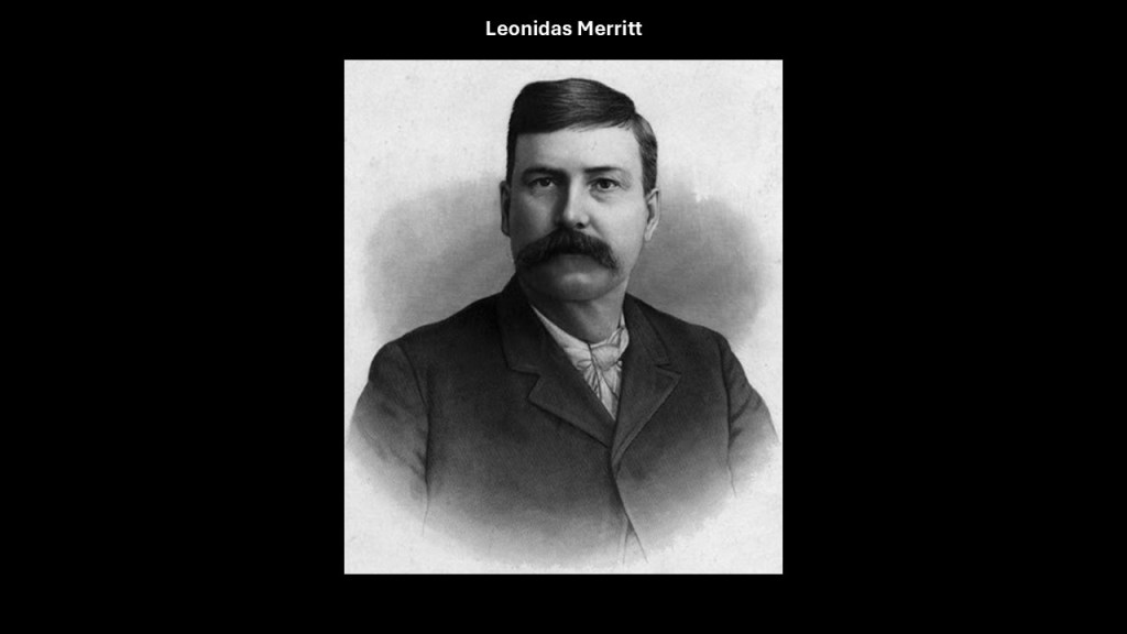
Leonidas was joined by 6 of his brothers, and what became known as the “Seven Iron Brothers” owned the largest iron mine in the world in the 1890s.
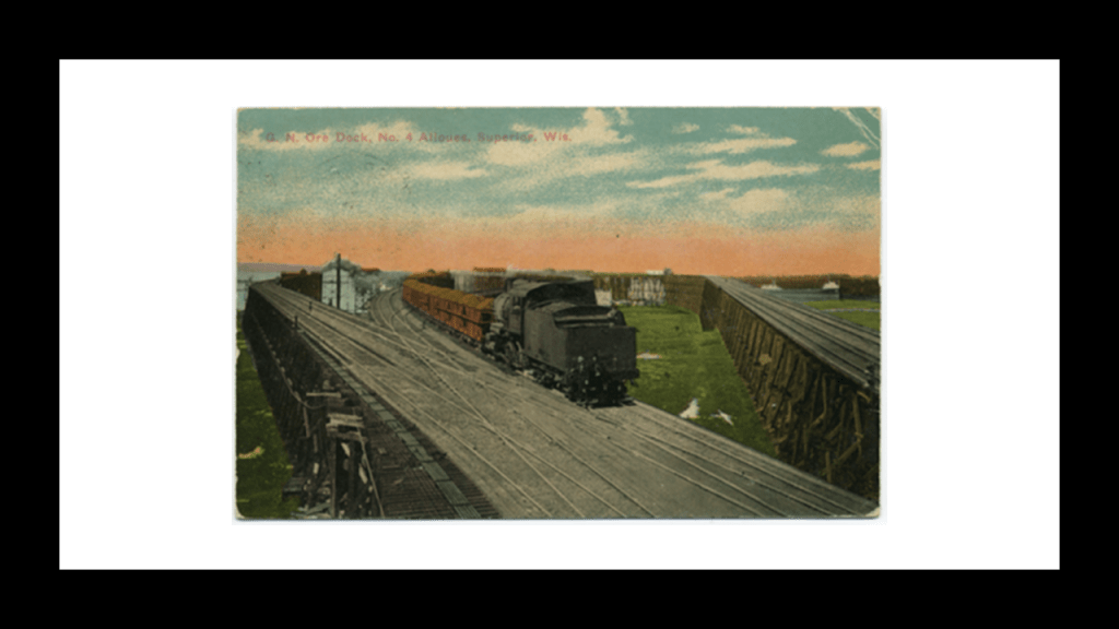
We are told that in 1891, the Merritt family incorporated the Duluth, Missabe, and Northern Railway Company to build a 70-mile, or 113-kilometer-long, railroad from the mine to the port at Superior, Wisconsin, which was just to the south of Duluth, raising the money needed in exchange for bonds from the railroad company.
Their success attracted the attention of John D. Rockefeller, who wanted to expand into the iron ore business, and the Merritts put their company stock up as collateral to borrow money from Rockefeller in order to fund the railroad.
Long story short, the Merritts ended up being financially ruined, and Rockefeller came to own both the mine and the railroad.
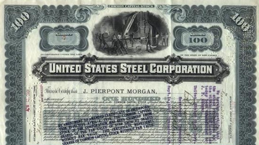
After Rockefeller assumed ownership in 1894, he leased his iron ore properties and the railroad to the Carnegie Steel Company in 1896.
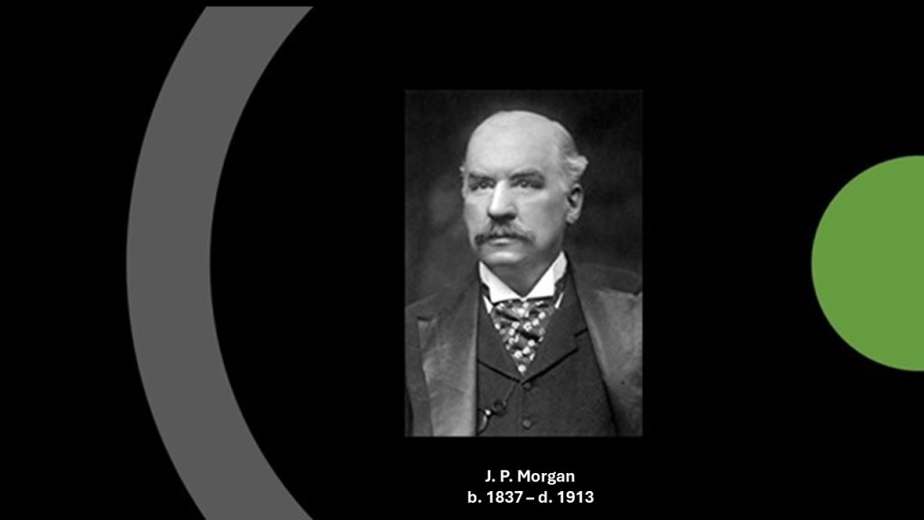
John D. Rockefeller sold the railway to United States Steel in 1901, after it had been formed by the merger of the merger of Andrew Carnegie’s Carnegie Steel Company, Elbert Gary’s Federal Steel Company, and William Henry Moore’s National Steel Company in 1901, which was financed by J. P. Morgan.
J. P. Morgan was an American financier and banker who dominated corporate finance on Wall Street throughout the period of time called the “Gilded Age,” between the years of 1870 and 1900.
He was a driving force behind the wave of industrial consolidation in the United States in the late 19th- and early 20th-centuries.
Besides his involvement in the formation of the U. S. Steel Corporation, he was also behind the formation of General Electric and International Harvester, among many other mergers.
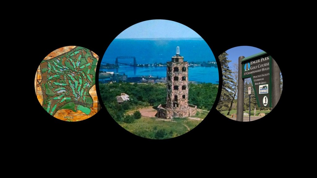
Other places around Duluth that I am going to mention here are the Enger Tower, which is an 80-foot, or 24-meter stone observation tower that has 5-stories, and was built on Enger Hill.
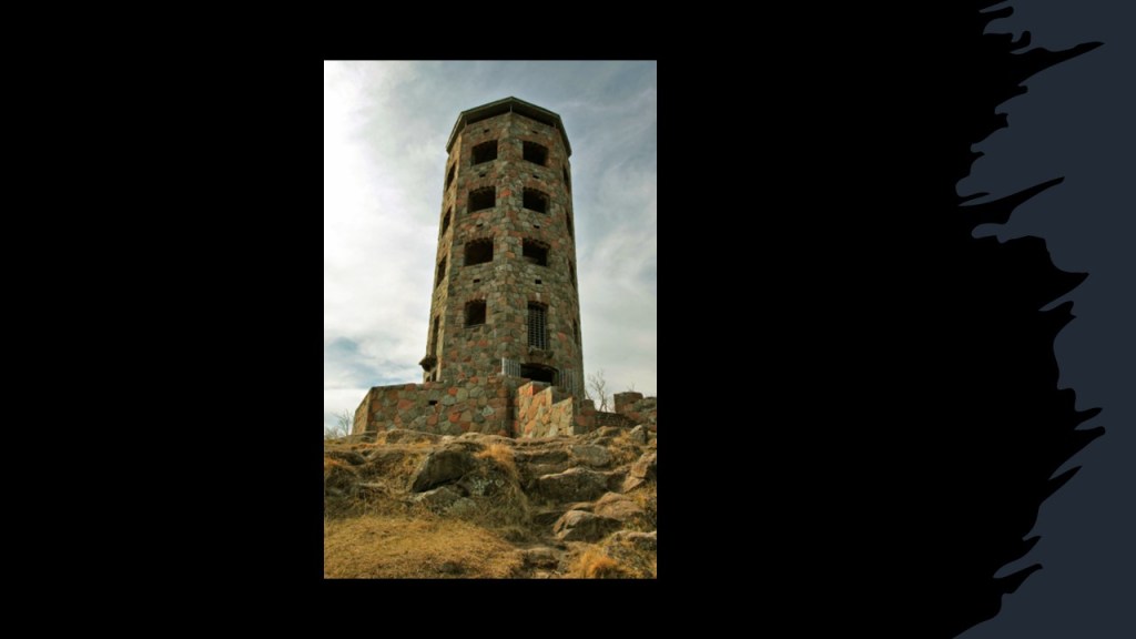
The tower was said to have been constructed as a tribute to businessman and philanthropist Bert Enger, a Norwegian-immigrant who came to Duluth in 1903 and set-up a furniture store with his business partner Emil Olson, which turned into a prosperous business over the years.
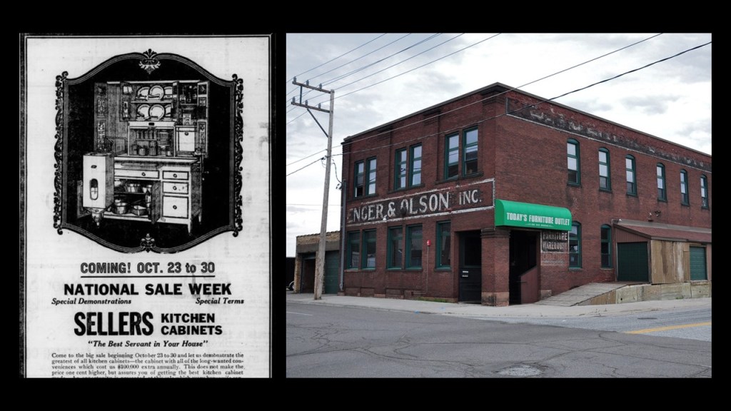
Enger donated a sizeable amount of his estate to the city of Duluth, which included Enger Hill, Enger Park, and Enger Golf Course.
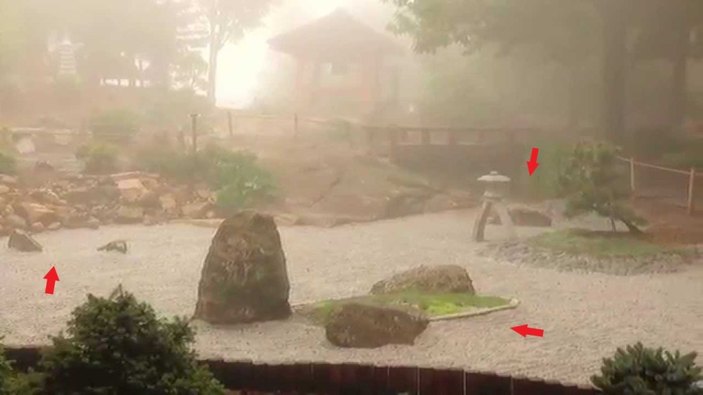
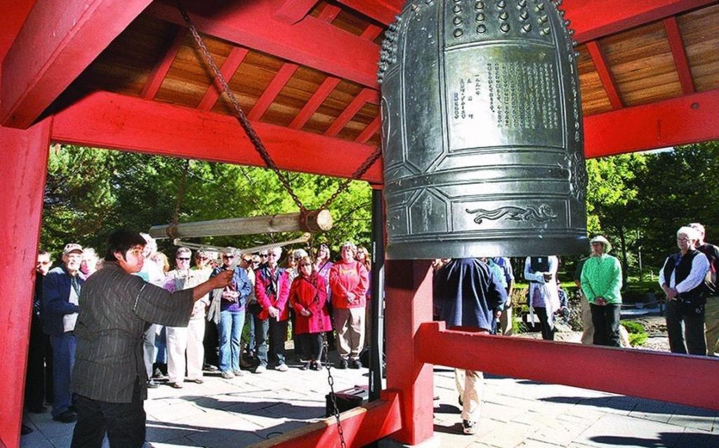
The Ohara Peace Bell is found at Duluth’s Enger Park.

It is located in a Japanese Zen Garden in the park, and is a replica of a temple bell in Duluth’s Sister City of Ohara, Japan.
The story is that the city of Ohara donated the temple bell, which is now the oldest remaining bell in Ohara, to a wartime scrap drive during World War II, but the bell was never destroyed.
After the war, sailors on the USS Duluth found it, and gave it to the city of Duluth, where it was displayed in the City Hall.
A visiting academic from Ohara learned of the bell’s existence, and met with the Mayor of Duluth to ask for the bell’s return, which it was in 1954, and re-named the “Japan-U.S. Friendship Peace Bell.”
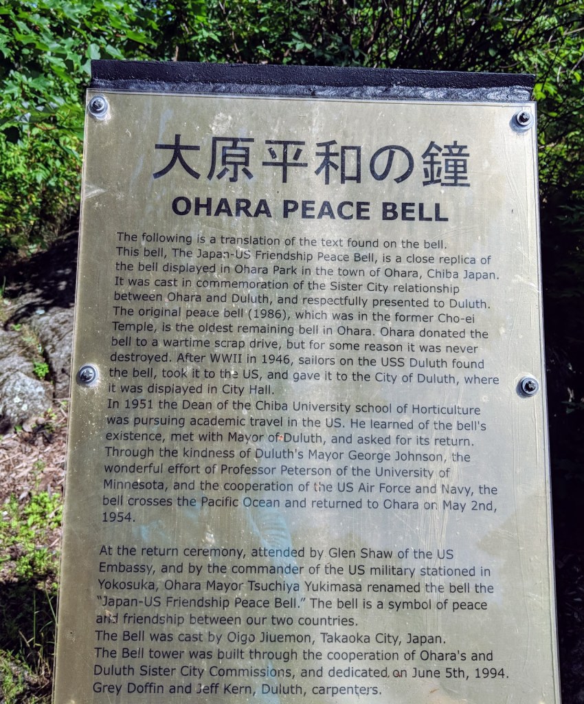
The current bell was dedicated in Duluth’s Enger Park in 1994, in the Japanese Peace Bell Garden.
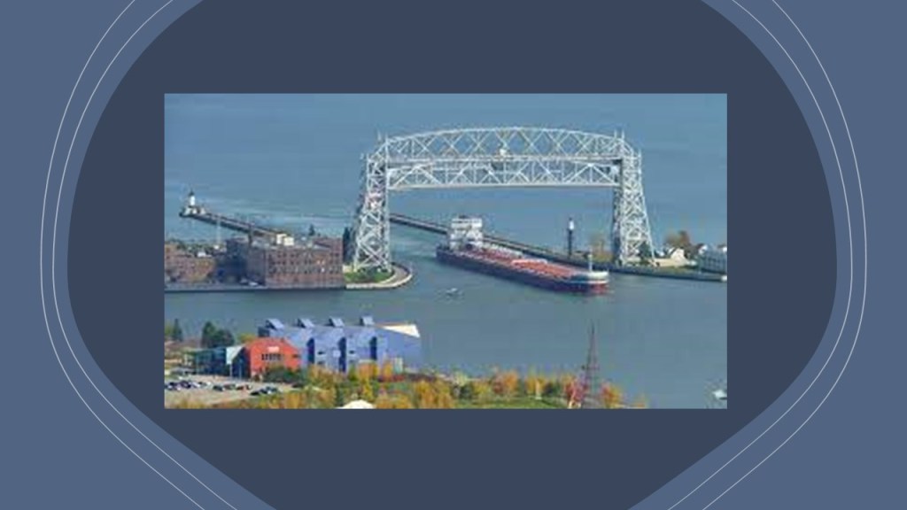
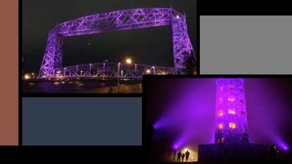
There is a panoramic view from Enger Tower and Enger Hill of the Twin Ports of Duluth and Superior, including a great view of the Duluth Aerial Lift Bridge.
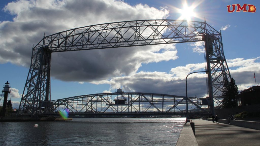
A movable, lift-bridge, it spans the Duluth Ship Canal and Minnesota Point, and said to have been constructed between 1901 and 1905, and modified in 1929.
Both the Aerial Lift Bridge and Enger Tower are lit up at night, with different colors for different occasions and causes.
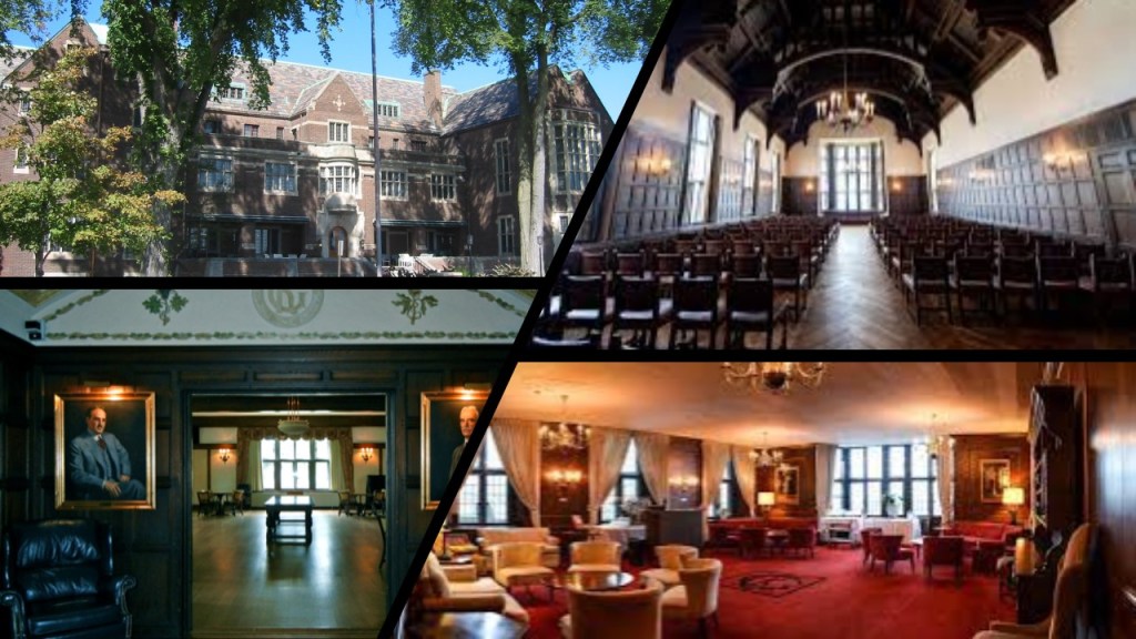
The Kitchee Gammi Club is located in Duluth, considered to be Duluth’s Premier Social Club.

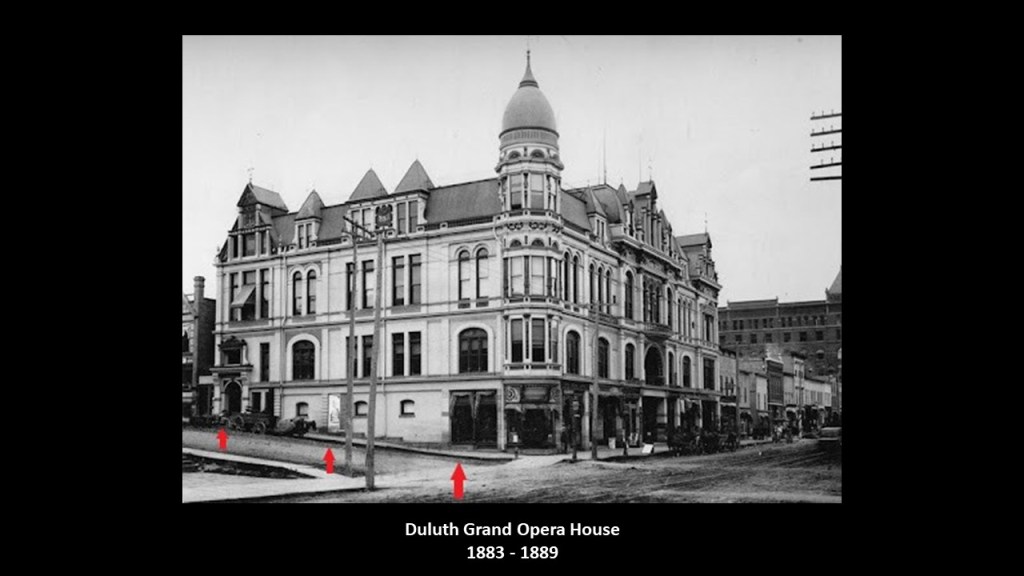
It is the oldest incorporated club in Minnesota, having been founded in 1883, and originally met at Duluth’s Grand Opera House, which was said to have only stood for six years, from 1883 to 1889 – at which time a mysterious fire that began at Grasser’s Grocery store, got out of control and by the time it was put out, the Grand Opera House was in ruins.
The current Kitchee Gammi Club building was said to have been designed by prominent New York architect Bertram Goodhue, and built between 1911 and 1913, with a 1914 opening.
The architecture is said to be “Jacobean Revival Style,” for features like bay windows, rectangular windows, triangular gables, and high ceilings, with Jacobean architecture being named after King James I of England and James VI of Scotland whose reign it is associated with.
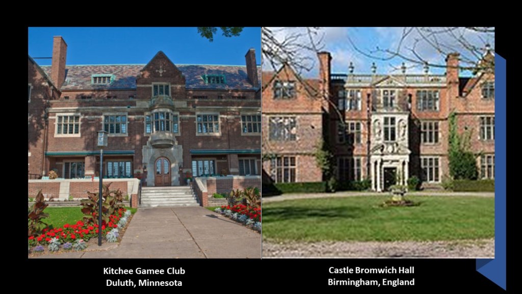
As a matter of fact, here is a comparison between the Kitchee Gammi Club in Duluth on the left, and the Castle Bromwich Hall in Birmingham, England, on the right, said to have been built between 1557 and 1585.
There are two possibilities here – the Kitchee Gammi Club House truly represents a revival of Jacobean Architecture, and was built when it was by who was said to have built it…or its not, and was already built, and I am inclined to believe it was already built by the original people of this land, as was everything else.
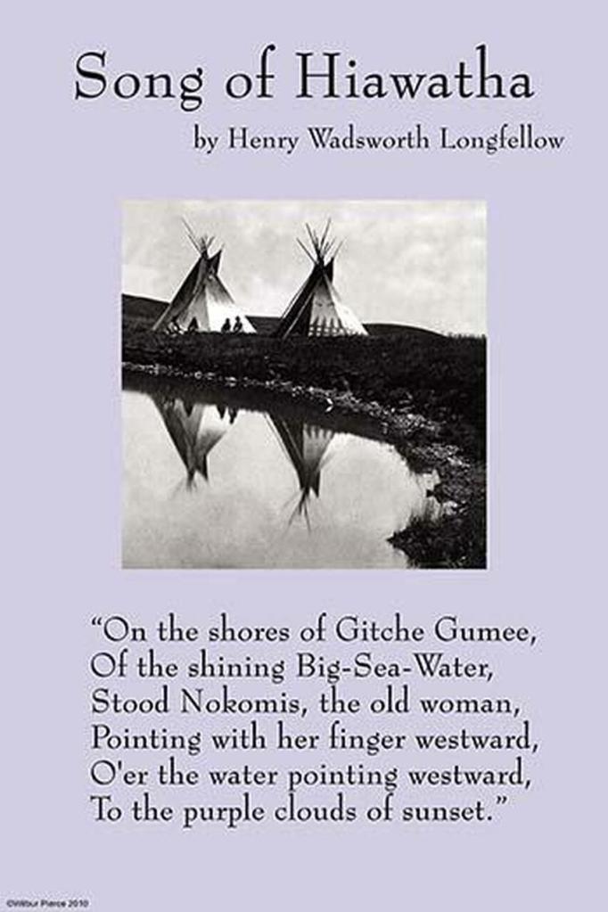
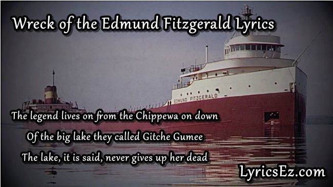
The name of the Kitchee Gammi Club is based on “Gitche Gumee,” the Ojibwe name for Lake Superior, and best known to the general public for being mentioned in the opening verse of in Henry Wadsworth Longfellow’s poem, “The Song of Hiawatha…”
…and it was mentioned in the opening verse of Gordon Lightfoot’s song “The Wreck of the Edmund Fitzgerald.”
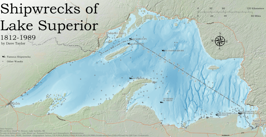
The Great Lakes Region is infamous for its shipwrecks, with an estimated somewhere between 6,000 to 10,000 ships and somewhere around 30,000 lives lost.
The reasons given for the high number of shipwrecks are severe weather, heavy cargo and navigational challenges.
It is estimated that there are between 350 and 550 shipwrecks in Lake Superior, many of which are still undiscovered.
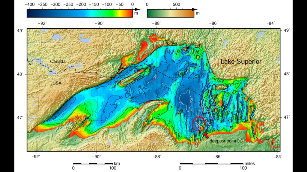
The bathymetry of Lake Superior, or the measurement of the depth of its water, shows its shallows around the edges ranging from 0 to around 100-meters, or 0- to around 328-feet, with an uneven lake-floor ranging in depth from 100-meters, to its deepest point at 406-meters, or 1,333-feet.
It’s average depth is 147-meters, or 483-feet, which is equivalent to 80.5 fathoms.
A fathom is defined as a unit of length in the imperial and U. S. Customary systems used in the measurement of the depth of water, and one fathom is equal to 1.8288-meters, or 6-feet.
I found this map, circa 1911, of the Duluth Street Railway Company.
I have circled the place where the Aerial Lift Bridge is marked on the map.
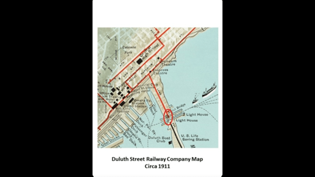
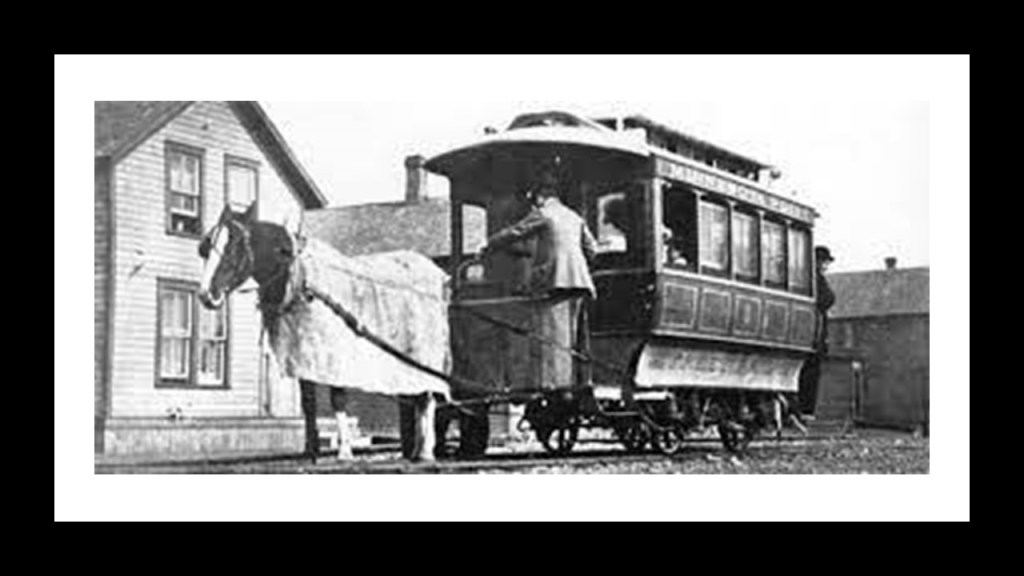
The Duluth Street Railway Company was said to have been incorporated in 1881, and that the first mule-pulled trolley cars were available for service in 1883…
…and that by 1892, the entire line was electrified.
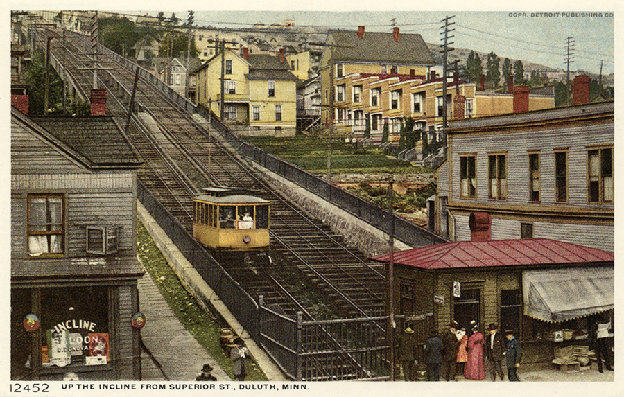
The Highland Park Tramway Line served Duluth Heights via an Incline-Railway from 1892 to 1939, which was the last piece of the electric streetcar system to be dismantled, as the rest started going away in the early 1930s.
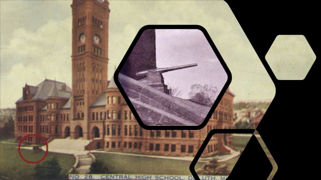
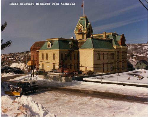
I also want to take a look at the Old Duluth Central High School.
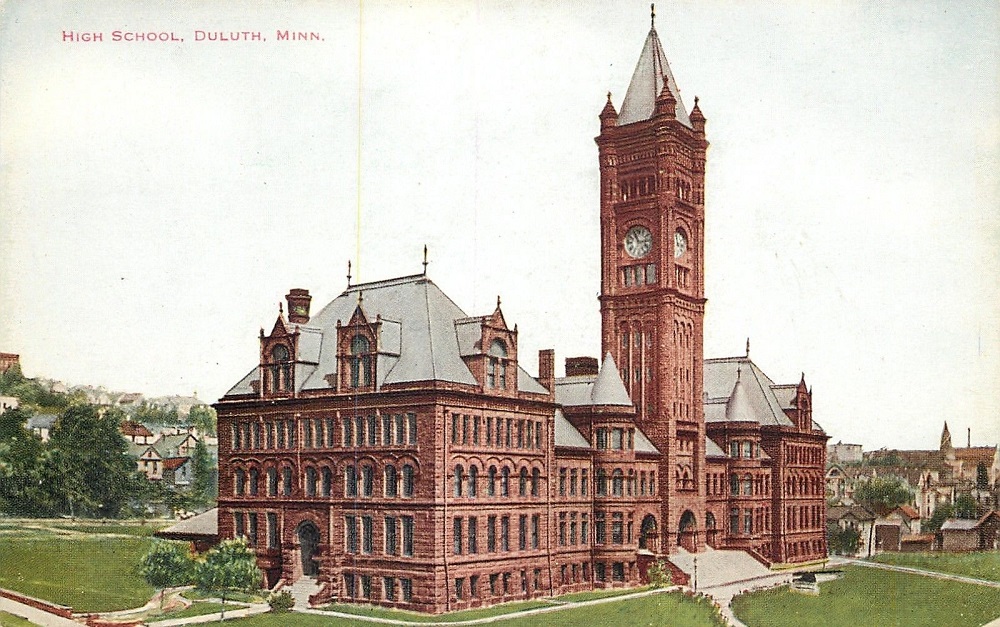
Said to have been built starting in 1891 and opening for classes in 1892, the Old Central High School, nowadays used as school district office space, occupies a city block…
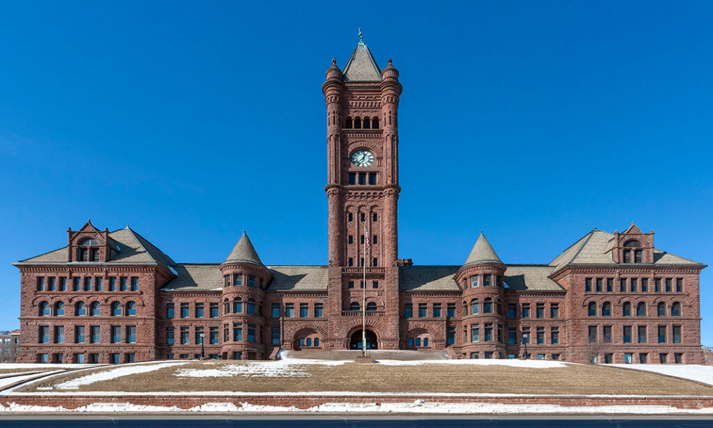
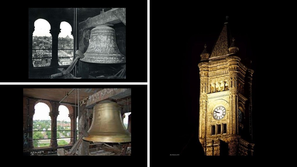
…and has a clock tower that is 210-feet, or 64-meters, high, that had five-bells added to the clock in 1895.
There was even a 17-foot, 6-ton cannon on the steps of the Old Central High School from 1898 to 1942, said to have been captured from a Spanish warship during the Spanish-American War, and requested by the Duluth City Council for Duluth, who had to pay for the transportation costs to get it to Duluth.
We are told the cannon was either sold or donated as scrap-iron, and was melted down and used during World War II.
Said to have been created in 1889 from several predecessor rail-lines in Minnesota, the Great Northern Railway’s route made it the northernmost transcontinental railroad in the United States, with lines to Duluth, and Superior in Wisconsin, on Lake Superior.
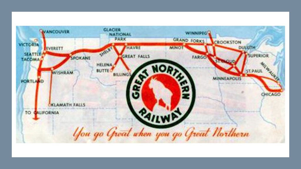
The Great Northern Railway was said to the be the creation of the 19th-Century Canadian-American railroad entrepreneur, James J Hill.
We are told James J. Hill was a railroad executive who came from an impoverished childhood.
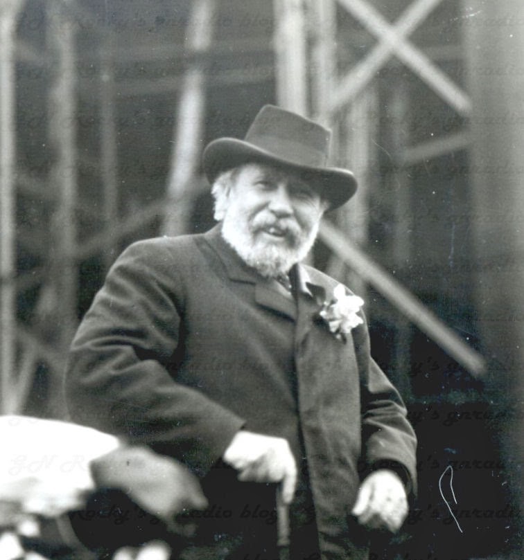
In 1898, Hill purchased control of large parts of the Mesabi Iron Range in Minnesota and its rail lines.
The Great Northern Railway began large-scale shipment of iron ore to the Midwest’s steel mills.
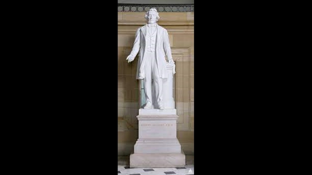
I want to mention here some information I found out about when I was researching Jefferson Davis, who is one of the two historical figures representing the State of Mississippi in the National Statuary Hall at the U. S. Capitol Building in Washington, D. C.
Interesting to find him in there since he was the only President of the Confederate States during the American Civil War between 1861 and 1865.
Jefferson Davis became Secretary of War in President Franklin Pierce’s Administration in March of 1853.

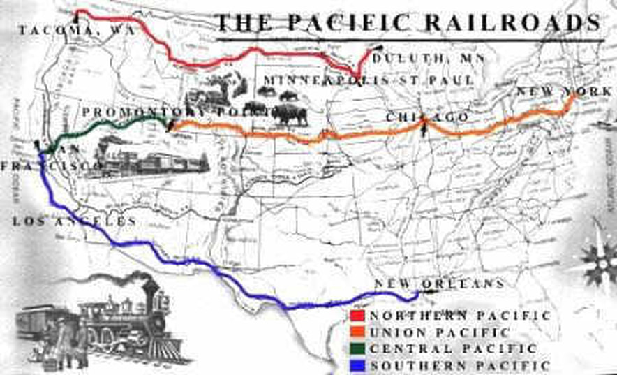
We are told that as Secretary of War, Davis advocated for a transcontinental railroad was needed for national defense, and he was given the task of overseeing the Pacific Railroad Surveys to determine the best of four possible routes after the U. S. Congress appropriated $150,000 on March 3rd of 1853, and authorized Davis to find the most practical and economical route for a railroad from the Mississippi River to the Pacific Ocean.
The Pacific Railroad Surveys, a series of explorations of the American West between 1853 and 1857 with the stated purpose of finding and documenting possible routes for a transcontinental railroad across North America.
There were five surveys conducted: the Northern Pacific Survey between the 47th-parallel north and the 49th-parallel north from St. Paul, Minnesota, to Puget Sound; the Central Pacific Survey between the 37th-parallel North and the 39th-parallel North from St. Louis, Missouri, to San Francisco, California; the Southern Pacific Survey along the 35th parallel north from Oklahoma to Los Angeles, California; the Southern Pacific Survey across Texas to San Diego, California; and along the Pacific Coast from San Diego, California, to Seattle, Washington.
All were carried out under the direction of Secretary of War Jefferson Davis, the future President of the Confederacy.
We are told the volumes of information that were produced from these surveys were considered to constitute the singlemost important contemporary source of knowledge on western geography and history, and that there value was greatly enhanced by beautifully-illustrated color plates showing the scenery, native inhabitants & fauna and flora of the West.

Let’s take a look at some of the definitions of survey.
Perhaps the most commonly used in our modern culture is the definition of survey which involves a brief interview with someone, for example, with a specific set of questions related to a particular topic to get their feedback.

Then there is the perspective of the definition of survey regarding civil engineering and the activities involved in the planning and execution of surveys gathering information related to all aspects of engineering projects, which is the definition implied in the driving force behind the Pacific Railroad Surveys.

But what about other definitions of survey that might be in play here?
Perhaps, more like some of the definitions shown here – a short descriptive summary; the act of looking or seeing or observing; considering in a comprehensive way; holding a review; and a detailed critical inspection, and not the kind of surveying for civil engineering projects seen in the previous slide as we have been led to believe through historical omission.

What if the Pacific Railroad Surveys were undertaken to explore a ruined landscape surveying, as in “looking at and observing,” everything, including pre-existing rail infrastructure in order to restore it to use once again?
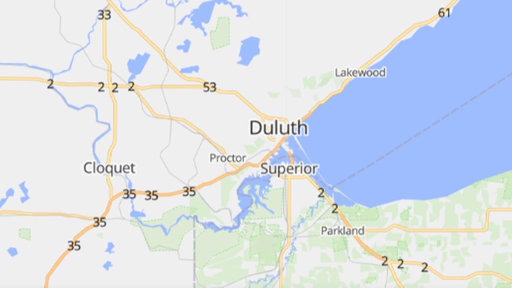
Next, I am going to take a look at the city of Superior in Wisconsin.
Superior and Duluth are separated by St. Louis Bay, and together form the “Twin Ports” metropolitan area, and together are considered one of the larger ports in the United States.
Superior is located at the junction of US Highway Route 2 and US Highway Route 53.
Now a word about the United States Numbered Highway System, also known as the Federal Highway System, that we have already seen examples of come up in this post.
It was actually called an “integrated network of roads and highways numbered within a nationwide grid across the contiguous United States.”
It was first approved in 1926.

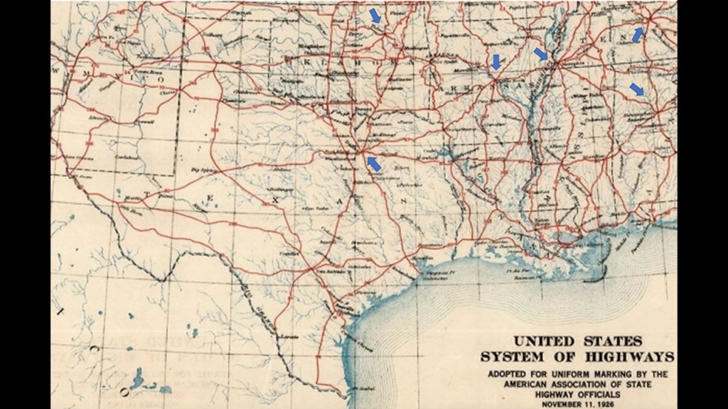
Drawn up in 1913, by the National Highway Association, the map was said to be the first proposed U. S. Highway Network map.
The red roads were delineated “Main” National Highways; the blue roads “Trunk” National Highways; and the yellow roads were “Link” National Highways to connect all the “Mains” and “Trunks.”
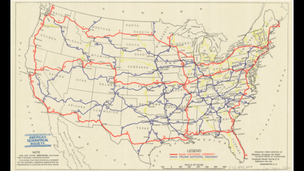
The Nation’s first Federal Highways would not be adopted until 1926, when the American Association of State Highway officials approved the first plans for the numbered highway system, with this section showing Texas, Oklahoma, Tennessee, Arkansas, Louisiana and Mississippi.
I have blue arrows pointing to major cities that are the central point of at least five highways – Dallas, Texas; Tulsa, Oklahoma; Little Rock, Arkansas; Memphis, Tennessee; Nashville, Tennessee; and Birmingham, Alabama.
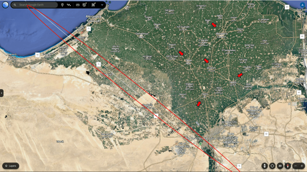
You find the same kind of radial patterns around major cities in diverse places all over the earth, like in southern France…
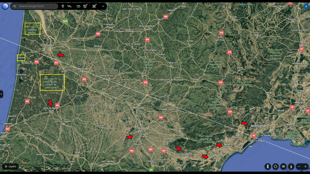
…and Egypt’s Nile Delta, and all of these cities have rail infrastructure and are transportation hubs.
I think this finding is by design and not by chance, and all part of the original energy grid, like all of the original infrastructure, before the energy grid was intentionally destroyed and replaced by everything we see today, like the Highway and Interstate Systems.
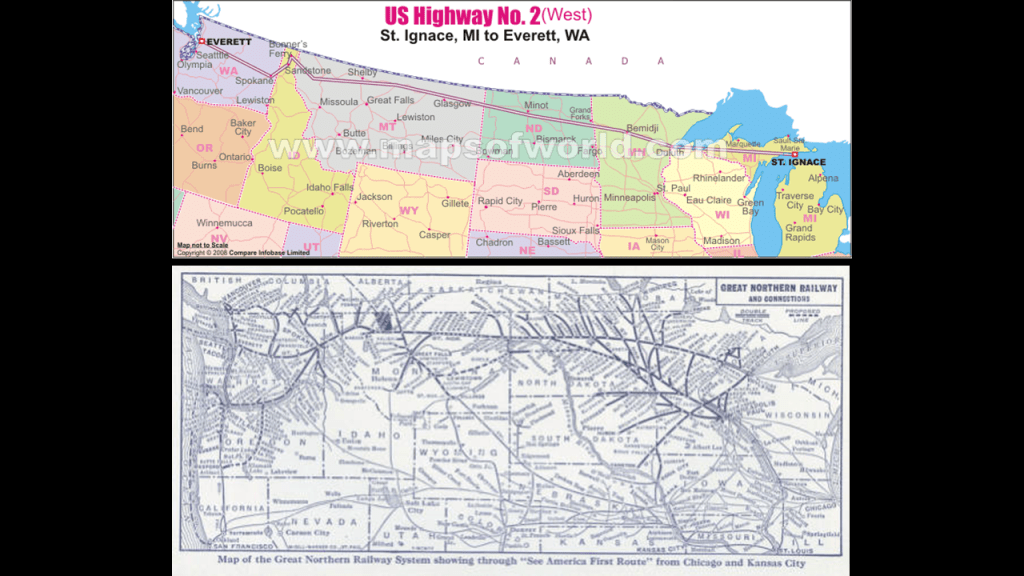
So with the example of finding US Highway Route 2 in Superior, it consists of two segments.
The western segment begins at an interchange with Interstate-5 in Everett, Washington, and ends at Interstate-75 in St. Ignace, Michigan.
The eastern segment of US-2 begins at US-11 at Rouses Point, New York, and ends in Houlton, Maine, at Interstate-95.
US-2 is the northernmost East-West highway in the United States.
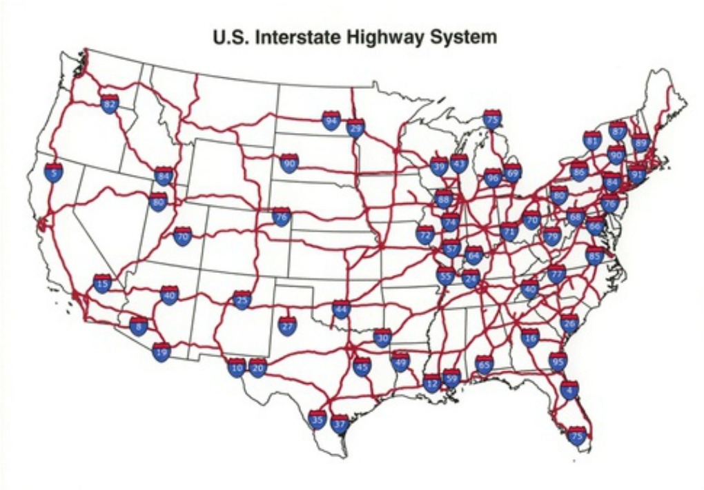
The United States Interstate Highway System is a network of controlled-access freeways with nationally-unified standards for construction and signage.
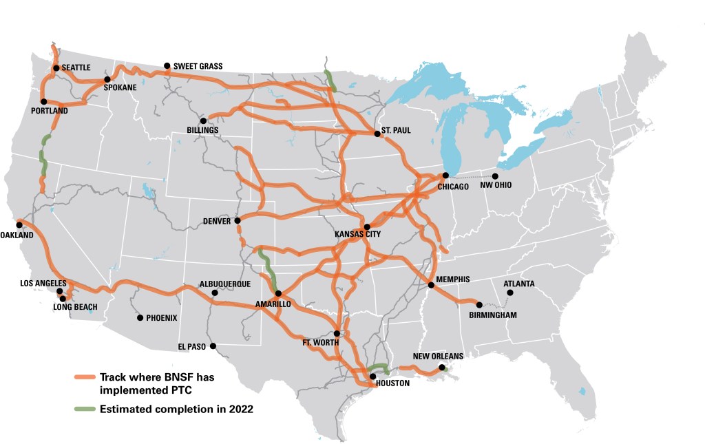
The western segment of US-2 goes west from the Upper Peninsula of Michigan, and roughly parallels the historical Great Northern Railway, which merged with three other railroads in 1970 to form the Burlington Northern Railroad, and in April of 1971, officially ended its independent passenger service, when Amtrak took over responsibility for most intercity passenger rail service.
In 1996, it became the Burlington Northern and Santa Fe Railroad, or BNSF, after it merged with the Atchison, Topeka and Santa Fe Railroad.
The BNSF is primarily freight railroad, and among the top transporters of intermodal freight and bulk cargo including coal.
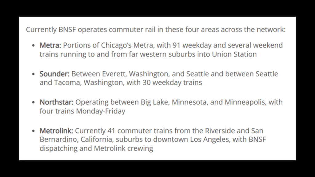
It does operate some commuter railroad service by hosting Amtrak inter-city passenger rail in four areas – portions of Chicago’s Metra; the Sounder between Everett and Seattle in Washington; the Northstar between Big Lake and Minneapolis, Minnesota; and the Metrolink between Riverside and San Bernadino, California.
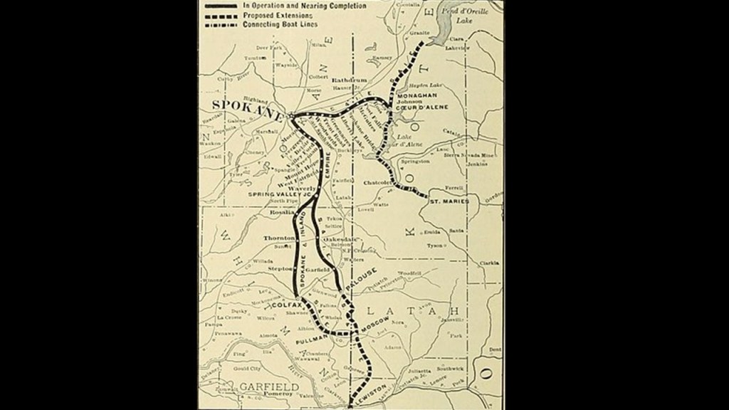
Today’s commuter rail lines pale in comparison to the interurban lines of the past, with electric streetcars going from city-to-city, like the Spokane and Inland Empire Railroad , which extended from Spokane and Colfax in western Washington, into cities in northern and central Idaho, like Moscow at the junction of the north-south US Highway Route 95 and the east-west Idaho State Highway 8, and Moscow is the location of the University of Idaho.
The Spokane and Inland Empire Railroad Interurban line was folded into the Great Northern Railway in 1929, and as time went on, there was a conversion to bus service ending this interurban, electric rail service for all intents-and-purposes in 1936.
And this fate of the interurban electrified streetcar systems was repeated everywhere.
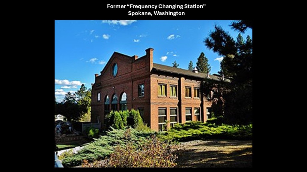
I even found what was called a “Frequency Changing Station” when I was looking into the Spokane and Inland Empire Railroad. It was said to have been built for this railroad in 1908 to house electrical equipment used by the electric railway, and its power was generated at the Nine Mile Falls Dam and transmitted to the “Frequency Changing Station.” There were four motor-generator sets at this location, and all together ten transformers – three that were 75-Kilowatt; three 375-kilowatt; and four 1,250-kilowatt – as well as a 550-volt, 275-cell storage battery.
Within the city of Spokane itself, the station provided direct current to the streetcar network.
In the network outside of Spokane, the station provided alternating current to the streetcar network through a series of electrical substations spaced about 15-miles, or 24-kilometers, on the operating line.
The substations converted power back to direct current for the streetcars, and sold power to the communites at 110 AC.
All of this electrical equipment was removed in 1939 when the railroad property was sold by its owner, and since then, the main building was repurposed storage for a boat dealership in the 1970s, and then the building was renovated starting in 1978, and was turned into condominium units, and the meaning and application of its former advanced technology has been forever lost to time.
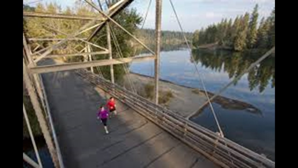
Today several rails-to trails incorporate the Spokane and Inland Empire’s right-of-way, like the Spokane River Centennial Trail, which runs between Spokane and Coeur d’Alene in Idaho…
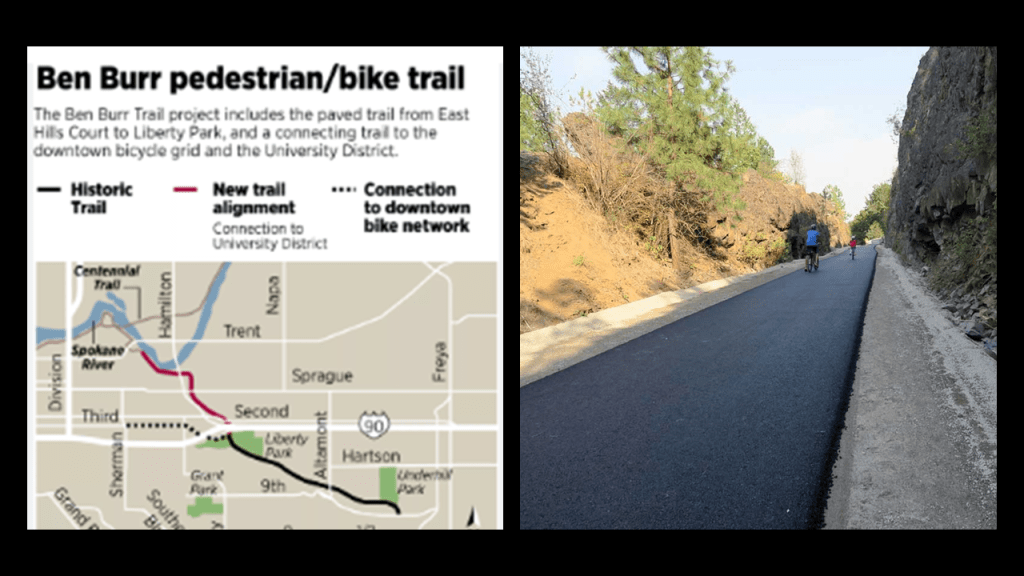
…and the Ben Burr Trail in Spokane.
Like what is typically-found with former rail-lines throughout the world, other parts of the original Great Northern Railway main-line have been turned into Rails-to-Trails recreational pedestrian and bicycle trails, which has been a common occurrence worldwide with former railroad tracks.
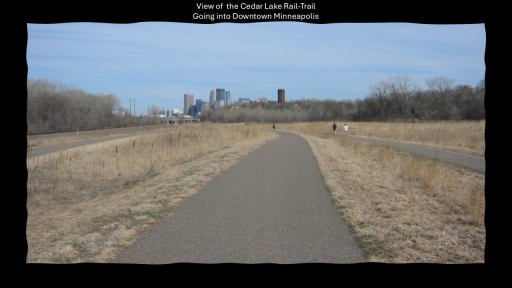
In Minnesota, the 4.3-mile, or 6.98-kilometer, Cedar Lake Trail for one example of many was built in the former railyards for the Great Northern Railway and the Minneapolis and St. Louis Railway.
It was the first federally-funded, bicycle commuter trail in the United States.
Also in Minnesota, the 28.5-mile, or 42.9-kilometer, Dakota Rail-Trail was built on the former track-bed of the Hutchison Spur of the Great Northern Railway between Wayzala and Lester Prairie.
My question is why did they take out all of the former railroad infrastructure and replace it with recreational trails and highways to begin with?
I don’t think there was a good reason.

I think the reason has to do with the Controllers’ removal of the rail-lines that were original part of the energy grid when they were no longer needed for mining and/or their agenda.
They were instead turned into highway routes and recreational trails used for harvesting our energy for the benefit of a few from what was the original free-energy grid system for the benefit of all.
They also have been harvesting the original energy grid of its components, as well as all available natural resources, as we will continue to see throughout this Great Lakes Region.
The free-energy grid was destroyed, and the robber barons behind the creation of the New World Order, like John D. Rockefeller, J. P. Morgan, and the other big players we have seen so far, actively sought to bring on-line replacement sources for energy-generation and industry as quickly as possible.
I explored this subject in depth in my blog post “On the Trail of Giants, in Appalachia and Beyond – Theme 1: Robber Barons and Resetters.”
As mentioned previously, Superior in Wisconsin is located at the junction of US Highway Route 2 and US Highway Route 53.
US Highway Route 53 runs for 404-miles, or 650-kilometers, from LaCrosse in Wisconsin, to International Falls in Minnesota.
La Crosse is also where the previously-mentioned US Highway Route 61, which runs mostly along the Mississippi River from where it starts in New Orleans, enters the State of Minnesota across the Mississippi River Bridge at La Crescent, Minnesota.
It is the primary North-South route in northwestern Wisconsin, and serves as an important link between I-94 in Eau Claire, Wisconsin, and the Twin Ports of Superior and Duluth.
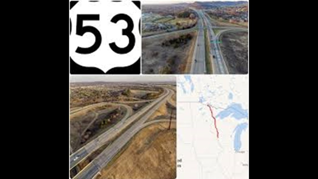
The northern terminus of US-53 is the Fort Frances-International Falls Bridge between Fort Frances, Ontario, and International Falls in Minnesota, and said to have been built in 1912 for the local paper company, Resolute Forest Products.
This same bridge is also the northern terminus of US-71, a major north-south highway route that is 1,500-miles, or 2,500-kilometers, -long that runs through the central United States starting at US-190 in Krotz Springs, Louisiana.
It was later owned by Boise Forest Products, and today is owned by a private partnership.
It is a toll bridge, in which people are “charged” to cross it.
In electrical terminology, the word “charged” is defined as a physical property of matter that causes it to experience a force when placed in an electromagnetic field.
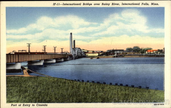
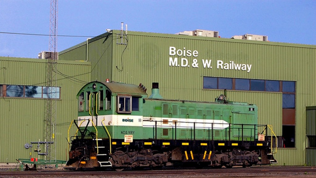
In addition to carrying road traffic, the bridge carries rail traffic of the Minnesota, Dakota and Western Railway.
Today, the Minnesota, Dakota and Western Railway is a short-line railway that runs along 4-miles, or 6-kilometers, of track between International Falls and Ranier, Minnesota, where it interchanges with the Canadian National Railroad, and currently serves the paper mills in International Falls.
It served the Fort Frances paper mill until its closure in 2014.
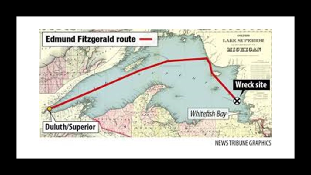
Superior in Wisconsin was the last port-of-call for the SS Edmund Fitzgerald.
It sank in a storm in Lake Superior on November 10th of 1975, and its 29-man crew perished.
It was the largest ship on the Great Lakes, and the largest to have sunk there.
It carried a variety of iron ore known as taconite from the mines near Duluth, to iron works in Great Lakes ports including Detroit and Toledo.
On the day the SS Edmund Fitzgerald sank, it and one other ship that didn’t sink, the SS Arthur M. Anderson, were heading to Detroit when they encountered a severe storm on Lake Superior with hurricane-force winds and waves up to 35-feet, or 11-meters, high…
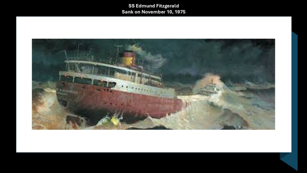
…when the SS Edmund Fitzgerald suddenly sank near Whitefish Bay.
As I already mentioned, the Great Lakes region is infamous for its extreme weather and shipwrecks.
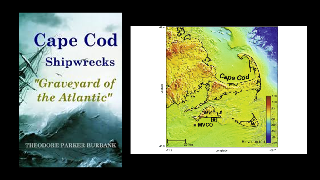
I find it noteworthy that the Great Lakes region is very similar to other places that I have looked into that are known for the same kind of violent weather, shipwrecks, and have the same kind bathymetry that I shared previously ranging unevenly in-depth from shallow to quite deep.
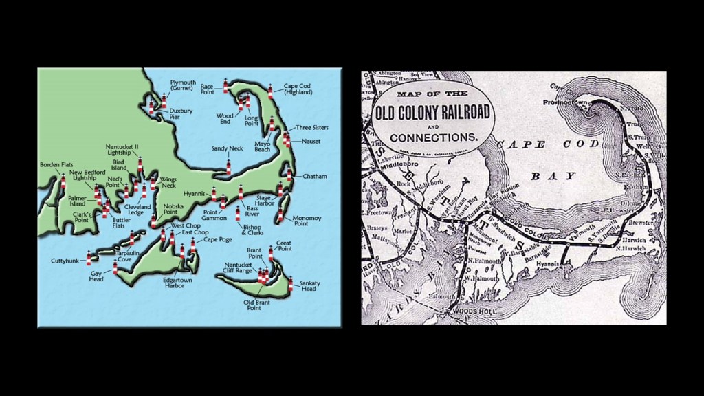
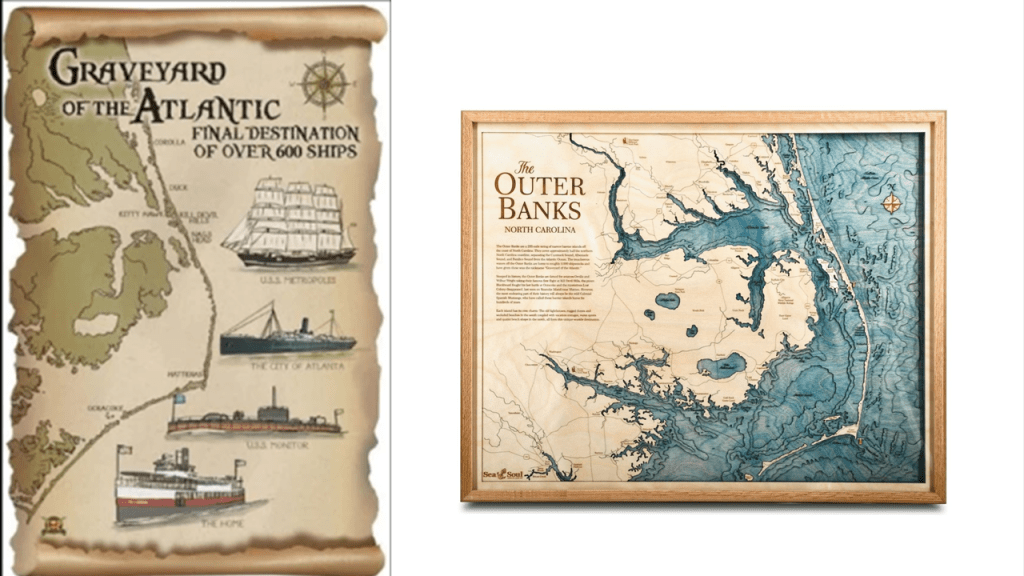
Places like Cape Cod in Massachusetts, which is known as a “Graveyard of the Atlantic” due to the large number of shipwrecks that have occurred here because of its dangerous shallows.
Here is the map showing fourteen lighthouses on Cape Cod alone, as well as other lighthouses of this part of New England, on the left, as well as the historic Old Colony Railroad that traversed the length of the narrow Cape Cod.
Like Cape Cod in Massachusetts, the treacherous waters of the Outer Banks have also given it the nickname of “Graveyard of the Atlantic” because of the numerous shipwrecks that have occurred here because of its treacherous waters consisting of things like shallows, shifting sands, and strong currents.
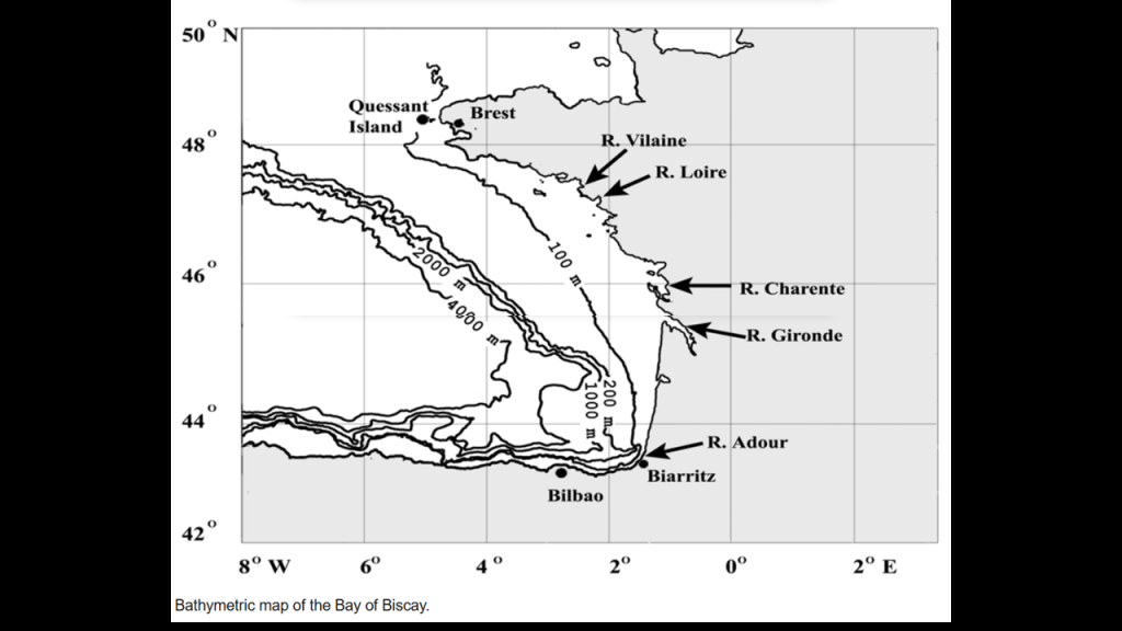
The Bay of Biscay, a gulf of the northeast Atlantic Ocean along the western coast of France and northern coast of Spain, is notable for heavy storms with abnormally high waves, especially in the winter months.
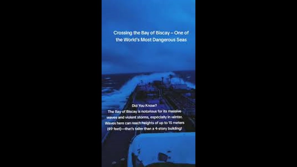
The Bay of Biscay is notable for having a long history of shipwrecks, and is counted among the most dangerous waters on Earth.

The shelf running along the European continent at the Bay of Biscay is only 100-meters, or 328-feet, in depth, at its shallowest, which extends out quite a distance from the coast of France and well into the entrance of the English Channel.
And the Gulf of Lion in the Mediterranean Sea off the coast of southern France, like these other places I’ve mentioned, has the Continental Shelf extending out for quite a distance, with the depths close to the shoreline being quite shallow, and the offshore underwater canyons slope rapidly to great depths to the floor of the Mediterranean Sea.
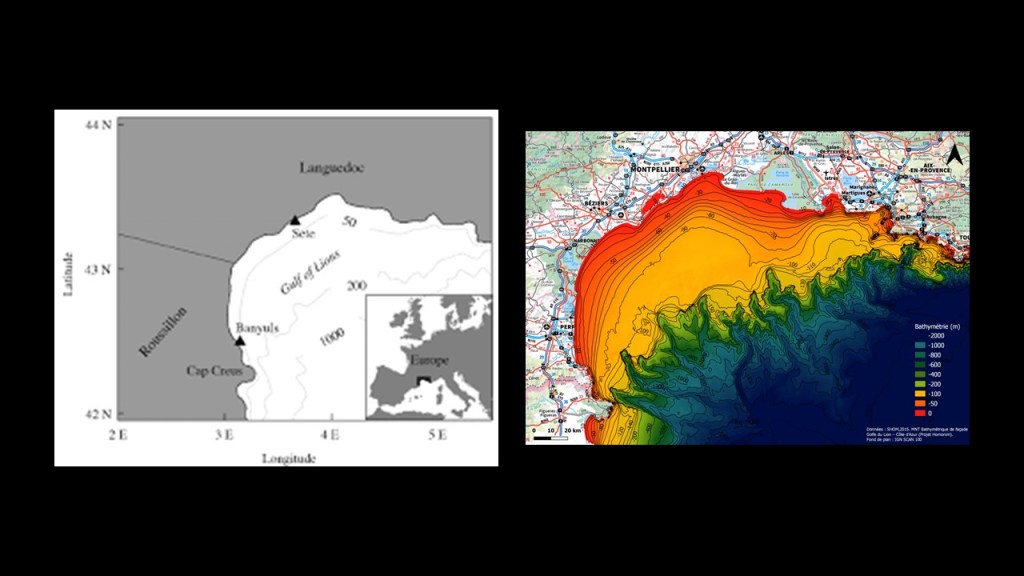
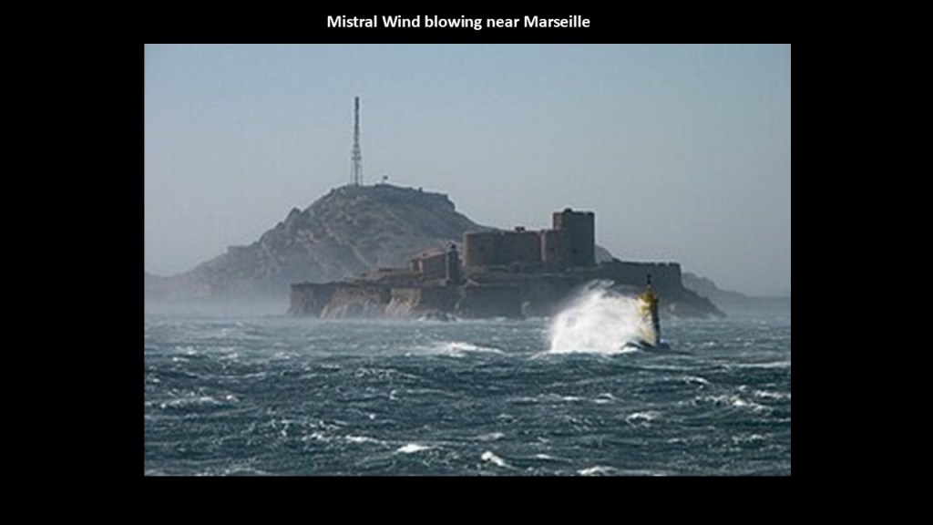
The Gulf of Lion is also known for its extreme weather, with sudden violent cold and blustery winds known as the Mistral and the Tramontane that threaten boats and ships, as seen here off the coast near the port city of Marseille.
The reason we are given for the extreme weather in our official narrative is climate change, which is linked to the United Nations 2016 Paris Climate Agreement, and to all of the goals of the United Nations 2030 Agenda for Sustainable Development.
But I have come to believe the explanation for the extreme weather could very well be found in things like the presence of ruined and sunken land just underneath the surface of the water from the deliberate destruction of the energy grid.
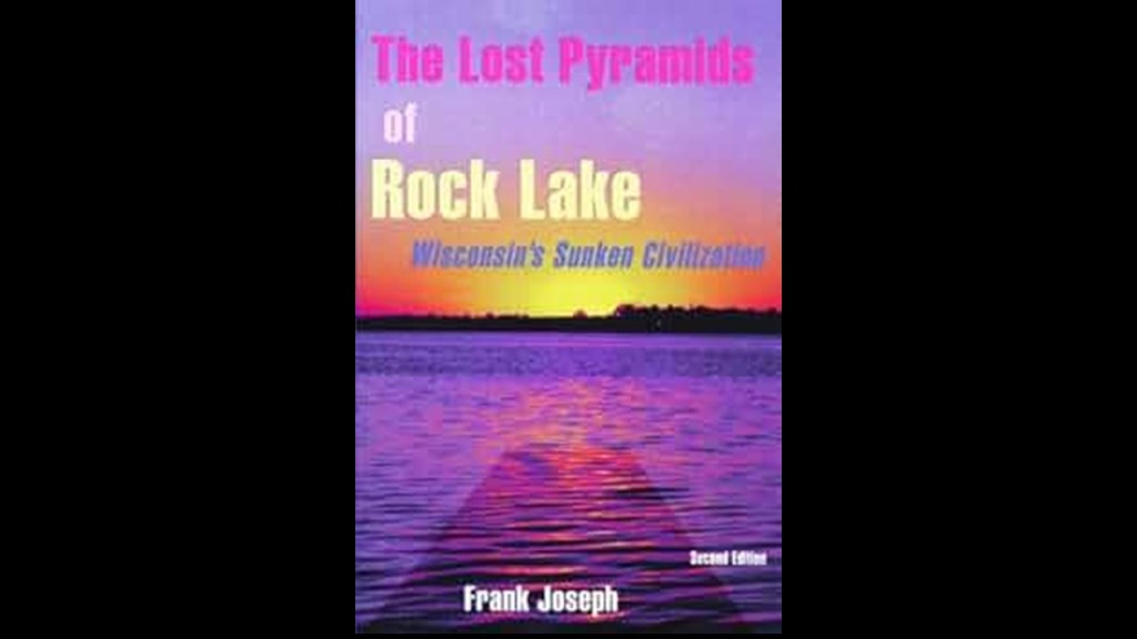
Pyramids have long-been talked about at the bottom of Rock Lake, which is at Lake Mills in Wisconsin, about 28-miles, or 45-kilometers, east of the Madison, the State’s capital city.
…creating instability where weather is concerned, and/or perhaps generating their own weather systems in their respective regions.
Or perhaps the creation of extreme weather may have some external help.
I believe that the circuit board of the Earth’s original energy grid system was deliberately blown out by one or more forms of directed frequency or energy of some kind into different places on the Earth’s grid because there’s just so much devastation on the entire surface of the Earth, either at the same time, or different times within a finite period, causing the surface of the Earth to undulate and buckle.
What I am seeing from tracking leylines all over the Earth, looking from place-to-place at cities in alignment over long-distances, are the consistent presence of swamps, marshes, bogs, deserts, dunes, and places where it appears land masses to shear-off and submerge under the bodies of water we see today.
What I have found in the Great Lakes region is no exception to what I have found the world over.

I also believe that those behind the destruction of the energy grid ushered in the creation of a New World Order built on top of the ruins of the Old World, and that what we think of as modern infrastructure because that was what we have been told in the official narrative, was actually pre-existing infrastructure, including railways, canals, and lighthouses among the many examples available to choose from.
Not only that, but then these malevolent Controllers reverse-engineered the original energy grid system for the benefit of all life everywhere into what is commonly called the Matrix for power and control, as well as the harvesting of energy, or “inner chi” of all living beings, for the benefit of the very few.

I first found Menomonie in Wisconsin in February of 2019 tracking a long-distance Circle Alignment from and back to Algiers in Algeria.
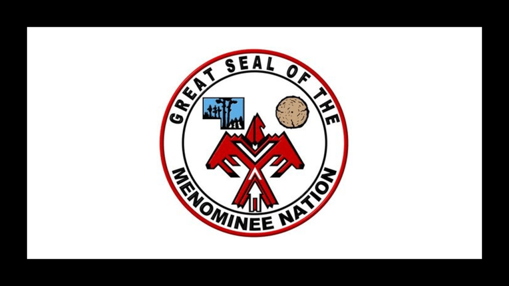
We are told the Menominee Nation of Wisconsin, an Algonquin-speaking people, is the only one in Wisconsin whose origin-story says they have always lived in Wisconsin, and their ancestral lands also include the Upper Peninsula of Michigan.
The Menominee Nation lost federal recognition in the 1960s, we are told due to a policy of assimilation, but they had federal recognition restored by an Act of Congress in 1972.
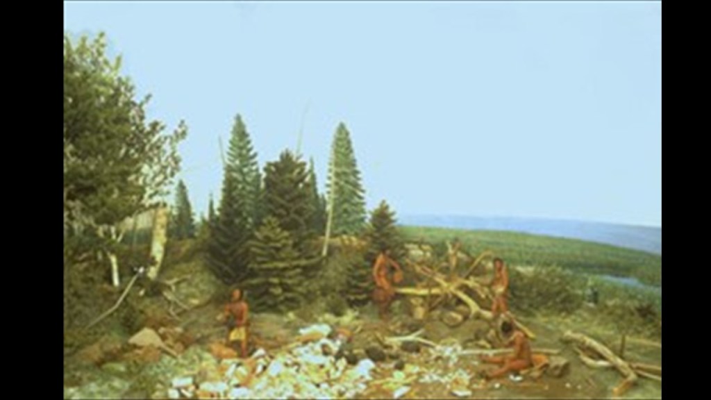
We are taught that the indigenous people of this land were uncivilized tribes of hunter-gatherers.
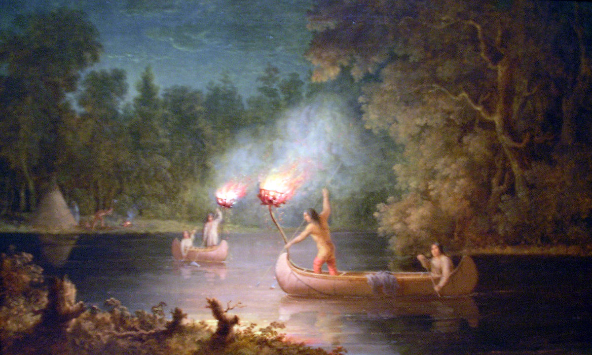
This is painting by an artist named Paul Kane, who died in 1871, called “Fishing by Torchlight,” of the Menominee spearfishing at night by torchlight and canoe on the Fox River.
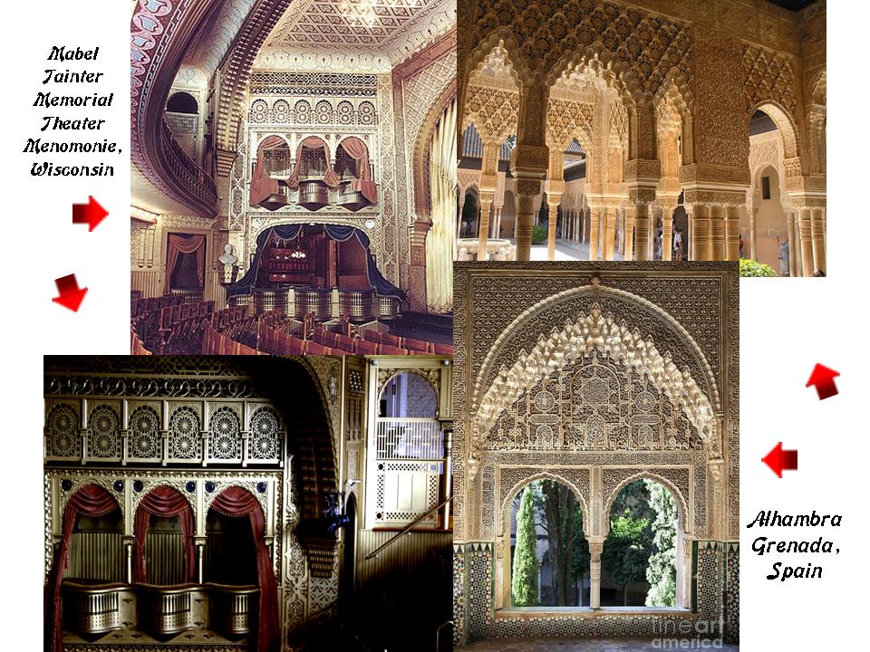
Yet we find architecture of heavy masonry like the Mabel Tainter Memorial Theater here in Menomonie, Wisconsin, said to have been built in 1889…

…that looks like the acknowledged Moorish architecture of the Alhambra in Grenada, Spain, on the inside.
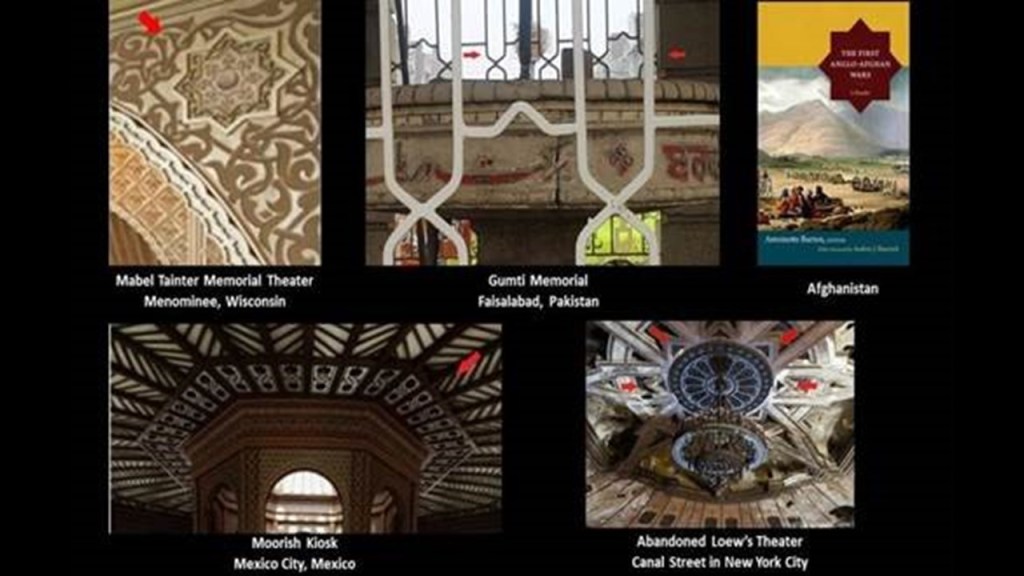
Not only that, this 8-pointed star symbol is found in the Mabel Tainter Memorial Theater.
I have found the same 8-pointed-star in diverse places all over the Earth.
On the top left, the 8-pointed star is found in a detail at the Mabel Tainter Memorial Theater in Menominee, Wisconsin; at the Gumti Memorial in Faisalabad, Pakistan in the top middle; and on a book cover about the First Anglo-Afghan War on the top right; and on the bottom left, at the Moorish Kiosk in Mexico City; and on the bottom right, above the chandelier at an abandoned Loew’s Theater on Canal Street in New York City.
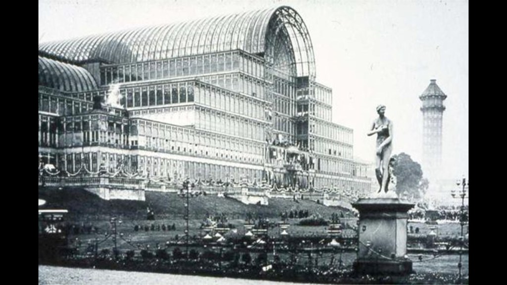
The Great Exhibition of the Works of All Nations, held in the Crystal Palace in London in 1851 was also known as “The Great Shalimar” a reference to the Mughal Garden complex in Lahore, Pakistan, where you see the same eight-pointed star and similar design-patterns in the Mughal Gardens on the left and on the Great Exhibition brochure on the right, also known as the “Crystal Palace Exhibition.”

The Crystal Palace Exhibition was the first in a series of major World’s Fairs, Exhibitions and Expositions of “Culture and Industry” that took place primarily through the mid-19th-century to the mid-20th-century.
There is no doubt in my mind these mega-events of their day were actually showcasing the advanced technology and architectural wonders of the original civilization before being hidden away or forever destroyed, and not built when and by whom we are told in our historical narrative.
There is an 8-pointed star visible in this graphic of the twelve Tribes of Israel as they correspond to the twelve constellations of the Zodiac.

I think original ancient civilization of the Earth was worldwide, and everything was part of the same civilization with different empires within empires that were working together in peace, balance, and harmony and co-creating a beautiful and geometrically-precisely planned world, and was not the warlike history we have always been taught to believe, and that those behind the New World Order agenda used the Moorish Science symbolism of the original civilization for its own agenda of creating discord, division and disharmony amongst the peoples of the Earth.
Since this is not in our historical narrative, we don’t even question what we are told about it being built by other cultures or civilizations.

Islam in its original form is about applied Sacred Geometry and Universal Laws, and was nothing like the weaponized form of radical Islam we see today that is playing a divisive and destructive role in the world today that is not in accordance with Humanity’s best interests.

Moorish Masons of the Ancient Ones were the Master Builders of Civilization, and their handiwork is all over the Earth, from ancient to modern….All of their Moorish Science symbolism was taken over by other groups claiming to be them, falsely claiming their works, or piggy-backing on their legacy. …Or given a darker meaning by association with certain things that were not the original meaning.
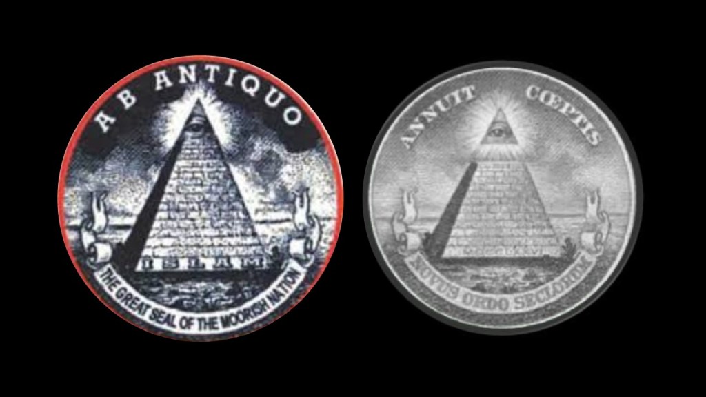
For example, this is the Great Seal of the Moors on the left and the symbol on the back of the U. S. one dollar bill on the right, showing how Moorish symbols were co-opted from the original meaning, and have come to have negative associations, like associating the pyramid with the eye on top of it with Big Brother, the New World Order, and the Illuminati.
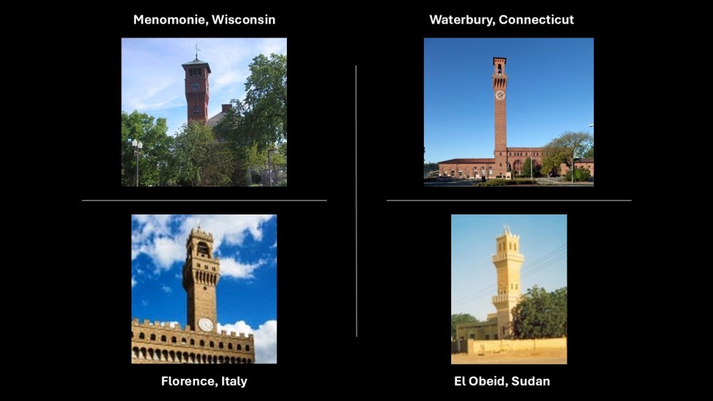
So back in Menomonie, there is the example of the clock-tower of Bowman Hall at the University of Wisconsin-Stout on the top left; the Union Station Clock Tower in Waterbury, Connecticut on the top right; the clock tower of the Palazzo Vecchio in the Piazza della Signoria in Florence, Italy, on the bottom left; and the tower of the Great Mosque of El Obeid in Sudan for comparison of similarity of appearance of many examples to choose from.
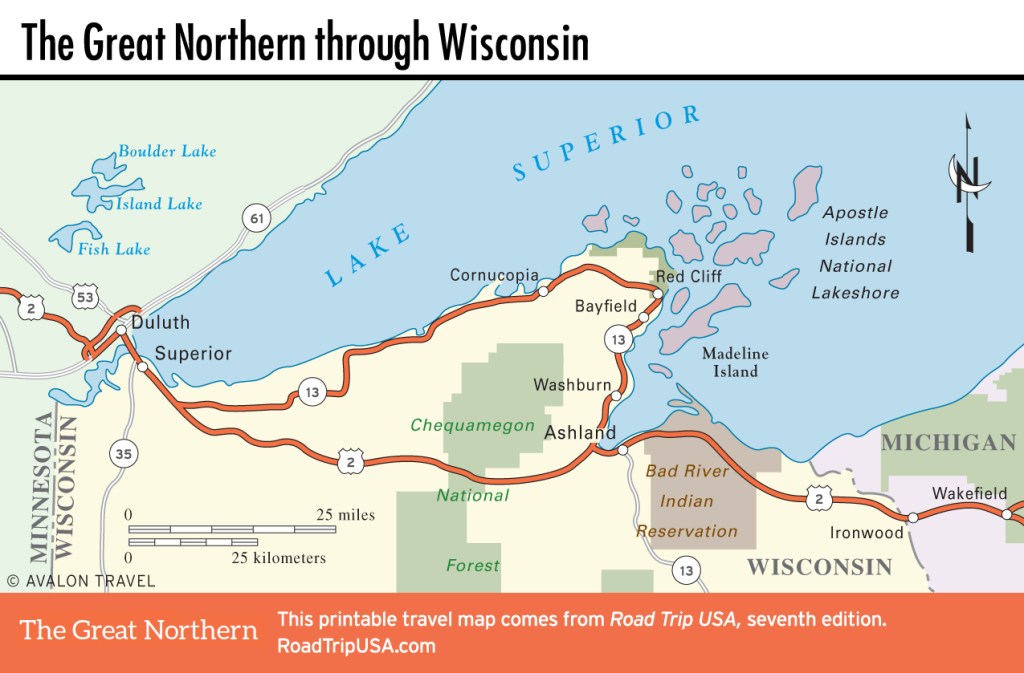
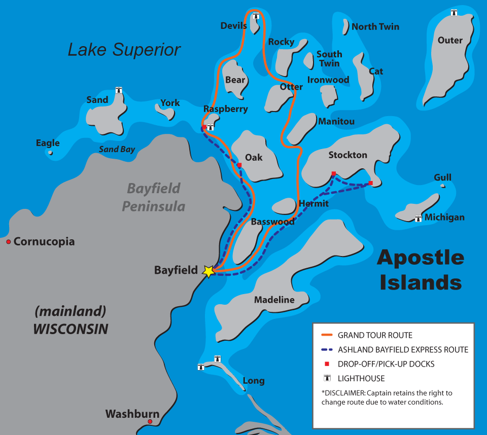
I also first found the Apostle Islands on the Bayfield Peninsula of Lake Superior in Wisconsin when I was tracking the same segment of the alignment from Algiers in 2019 on which found Menomonie.
The Bayfield Peninsula and Apostle Islands are to the east of Superior, Wisconsin, and accessible by Wisconsin Highway 13, which is a loop off of the previously mentioned US Highway Route 2.
Wisconsin-13 is part of the Lake Superior Circle Tour that runs along the southern coastline of Lake Superior from its two junctions with US-2 just to the southeast of Superior and at Ashland.
The city of Bayfield is billed as the “Gateway to the Apostle Islands,” and with a population of 584 in the 2020 Census, is the smallest city in Wisconsin.
Along with becoming a tourist destination, the economy of Bayfield is lumber and fishing.
We are told that in 1856, the same year a post office was established here, Bayfield was named after Henry Bayfield, a British Royal Topographic Engineer who explored the region between 1822 and 1823.

The Indian Residential School at Bayfield known as the “Holy Family Mission School” was established in 1879 by the Sisters of St. Mary Immaculate at the request of the Franciscan pastor of the Catholic Church there, including students from the Fond de Lac Chippewa and the Salteaux Ojibway.
The primary purpose of this and other so-called indian residential boarding schools was to remove indigenous children from their families, language, and culture.
The school operated until 1999.

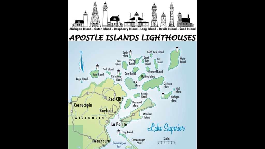
The Apostle Islands National Lakeshore on Lake Superior is comprised of twelve-miles, or 19-kilometers, of mainland shore and twenty-one islands.
It is described as having spectacular nature-carved rock formations, which just happen to have the appearance of stone masonry blocks…
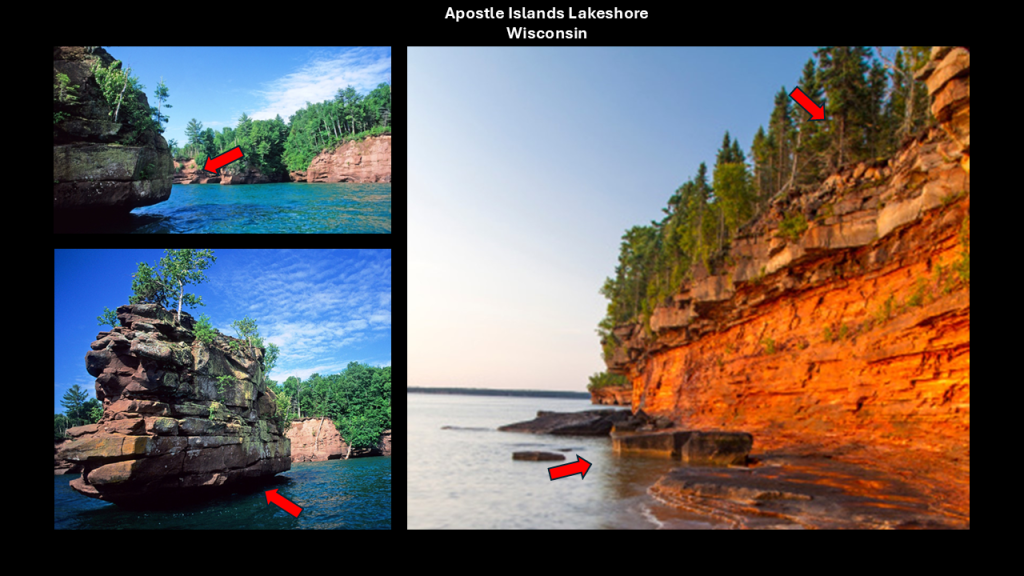
…and eight lighthouses.
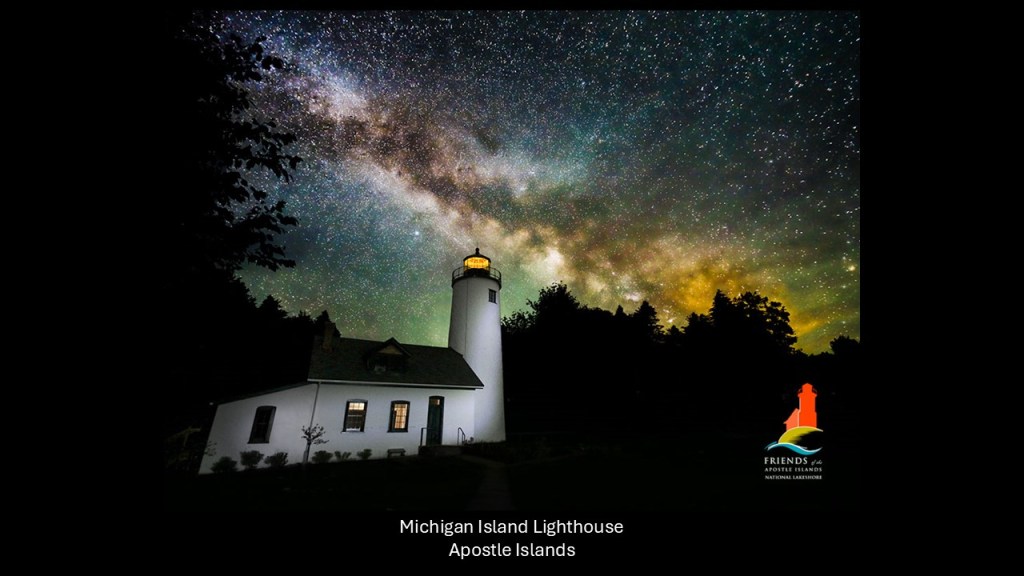
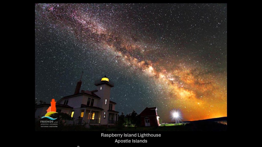
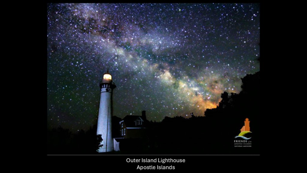
Like the astronomical lunar alignment I previously shared with the Grand Marais Lighthouse on the north shore of Lake Superior, along with lunar alignments with lighthouses in California, Maine, and Australia, I found astronomical alignments of the Milky Way with lighthouses of the Apostle Islands, like the Michigan Island Lighthouse…
…the Raspberry Island Lighthouse…
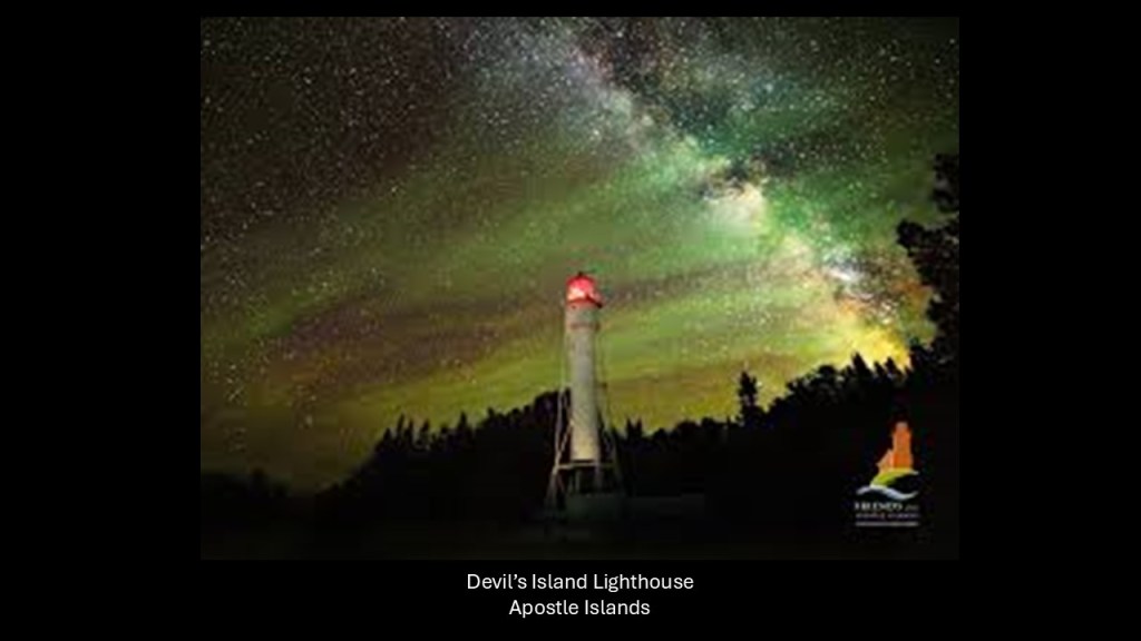
…the Devil’s Island Lighthouse…
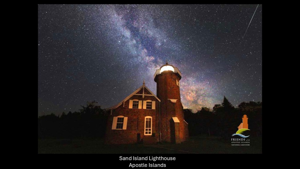
…the Sand Island Lighthouse…
…and the Outer Island Lighthouse.
And here is a circa 1910 photo of the Outer Island Lighthouse right beside what looks like sheared-off land.
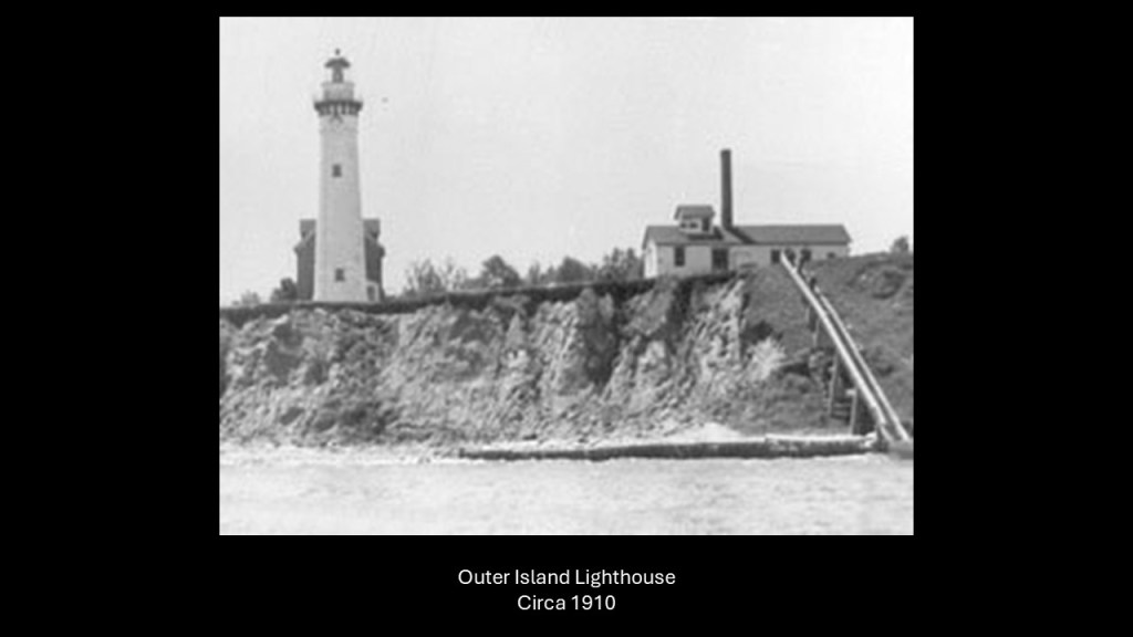
This is a common finding with lighthouses – sitting next to sheared-off, unstable land, and often have to be moved in order to not fall over the side.
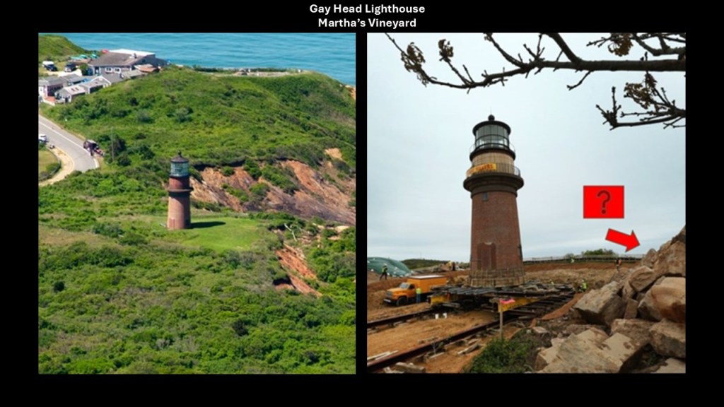
An example that comes to mind of this is the Gay Head Lighthouse on Martha’s Vineyard, a small island that is an elite enclave of the very wealthy just off the southern coast of Massachusetts’ Cape Cod.
In 2015, the Gay Head Lighthouse was moved because it was perilously close to the eroding cliff edge.
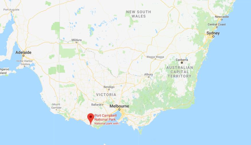
With respect to finding the “Apostle Islands” on Lake Superior, it Immediately brought to mind a place off the shore of Port Campbell in the Victoria State of Australia called the “Twelve Apostles.”
Port Campbell is only 142-miles, or 229-kilometers from Melbourne.
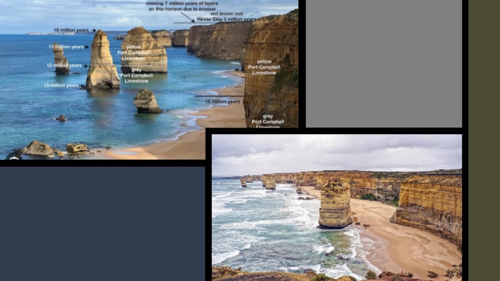
The “Twelve Apostles” are described as a collection of limestone stacks referred to as “Port Campbell Limestone,” deposited there in the Miocene Age 15- to- 5-million years ago, and that the stacks were formed by erosion from waves and harsh weather conditions over time.
So clearly that is what they want to us to believe about their origins – all the result of natural geologic processes over time.
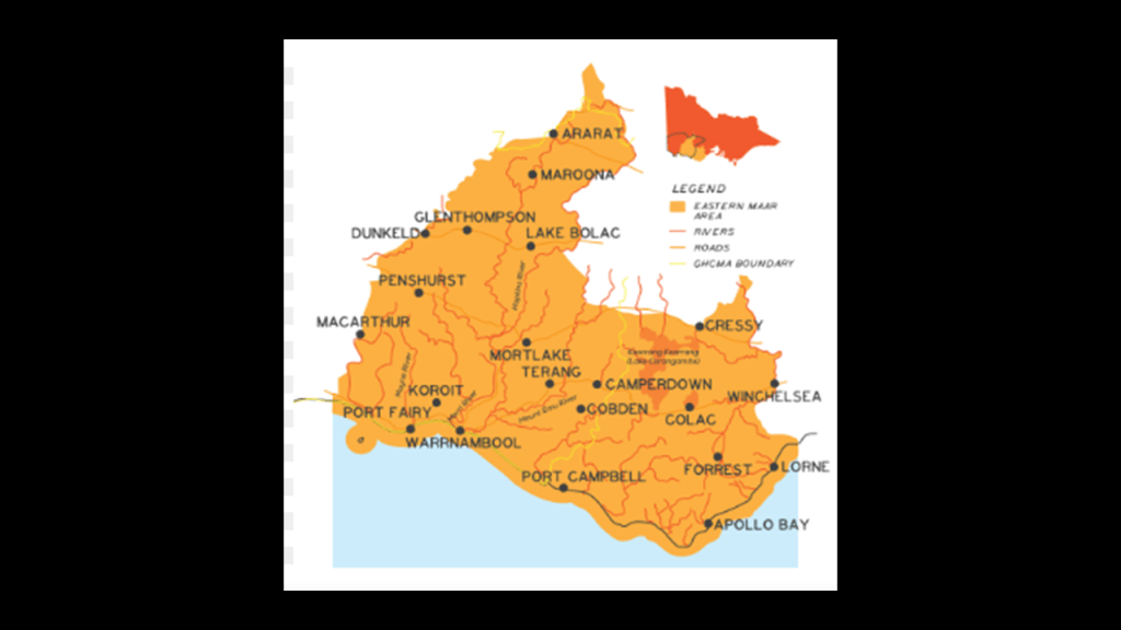
The “Twelve Apostles” are located in the traditional lands in south-western Victoria State of the Eastern Maar Peoples, a name adopted by a number of Victorian Aboriginal groups that identify as “Maar.”
A word looking and sounding very close to the word “Moor.”
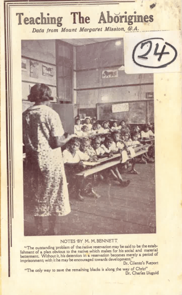
If it’s hard to understand how whole groups of people could not know their true heritage, just like the indigenous peoples of the Americas, the original people of Australia were subjected to cultural genocide, among other forms of genocide, by the introduction of mission schools for its children, and reservations for its people.
Like the Mount Margaret Mission, which was established by missionaries from New South Wales, in Western Australia in 1921.
We are told that it was at places like Mission schools that the original people of the region were given a western education and learned about Christianity.
I think the experience of the original people in Australia and around the world was one of extreme brutality, inhumane treatment, trauma, and genocide that caused them to accept a new cultural identity since their old identity was stripped from them and claimed by the western European colonizers.
I am sure there was a lot more of this going on during the reset than we can even begin to fathom because we have all been lied to about our true history.

Back to the Twelve Apostles.
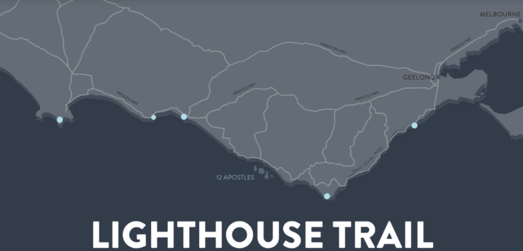
They are the main attraction found on the Great Ocean Road between Torquay and Port Fairy along the southern coast of Australia in Victoria State.
There are five lighthouses found all along the Great Ocean Road through here.
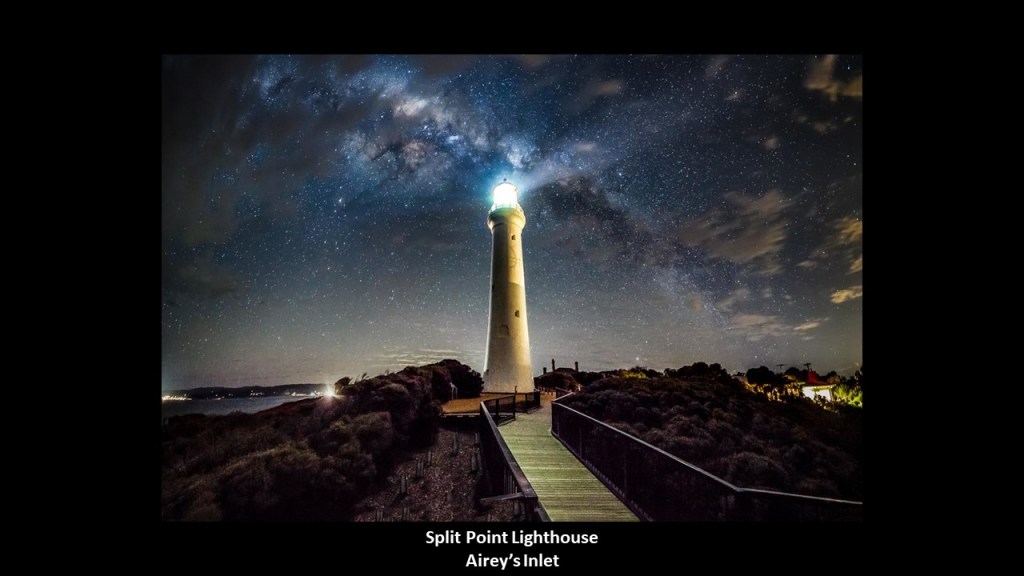
The Split Point Lighthouse at Airey’s Inlet was said to have been constructed in 1891, and which also aligns with the Milky Way, like what is found at the lighthouses of the Apostle Islands in Wisconsin.
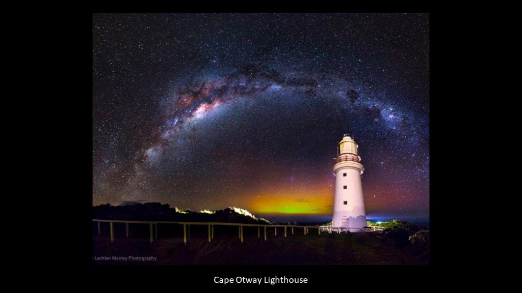
This is the Cape Otway Lighthouse on the Victoria coast near the Twelve Apostles, said to be the oldest surviving lighthouse in Australia, and said to have been built in 1848 also has a nice alignment with the Milky Way.
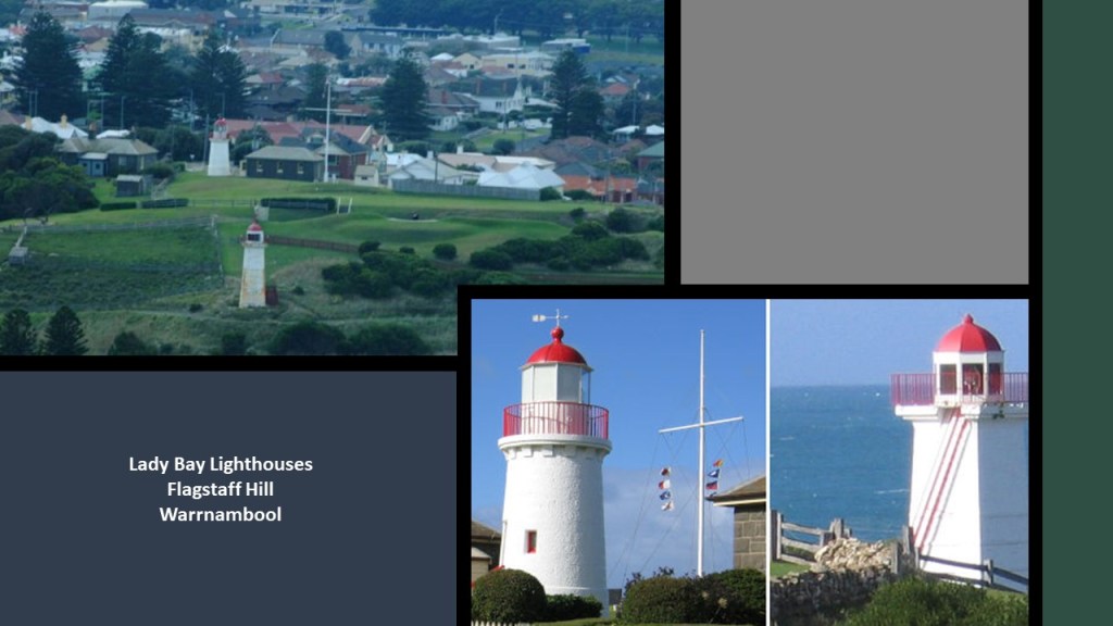
The two lighthouses at Lady Bay come next, located in the Flagstaff Hill Maritime Museum in Warrnambool, and the Lady Bay Complex was originally built between 1858 and 1859, with something of a convoluted history of being moved from original locations and so forth.
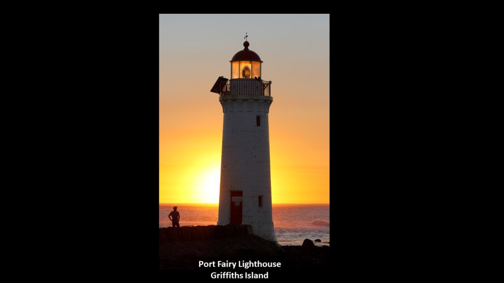
Lastly on the Great Ocean Road, the Port Fairy Lighthouse on Griffiths Island was said to have been built in 1859, shown here with the sun coming up behind it in alignment.
Like everything else we have been told to explain what is in existence in our world, I don’t believe lighthouses were built to guide ships by whom they were said to have built them when they were said to have been built.
What I am seeing is that they ended up next to the edge of water when the land around them sank, and were repurposed into navigational aids in the New World to guide ships through the now broken landmasses in the surrounding waters.
I have come to believe “lighthouses” were literally “houses for light” for the purpose of precisely distributing light energy generated by this gigantic integrated system that existed all over the Earth that was in perfect alignment with everything on Earth and in heaven.
While we have always been given the explanation that lighthouses were constructed to guide ships through rocky shoals and dangerous waters, and railroads were built around the same time period in the 19th-century, what I am seeing is that these were places that were in perfect resonance within a perfectly-resonant system, and that when the energy grid system was directly attacked, it caused the entire system around it to go haywire, and the surrounding land sank, or turned into like swamps, bogs, barrens, or deserts and dunes.
I consistently find the infrastructure of railroads, lighthouses, star forts, and all manner of the original infrastructure, all being in locations with the same characteristics of wetlands, shallow water, and sunken lands, as well as deserts and dunes, all over the Earth.
I am not drawing these conclusions from a few examples, but of many that I have found in years of doing research, including a lot of work tracking cities and places in alignment all over the Earth.
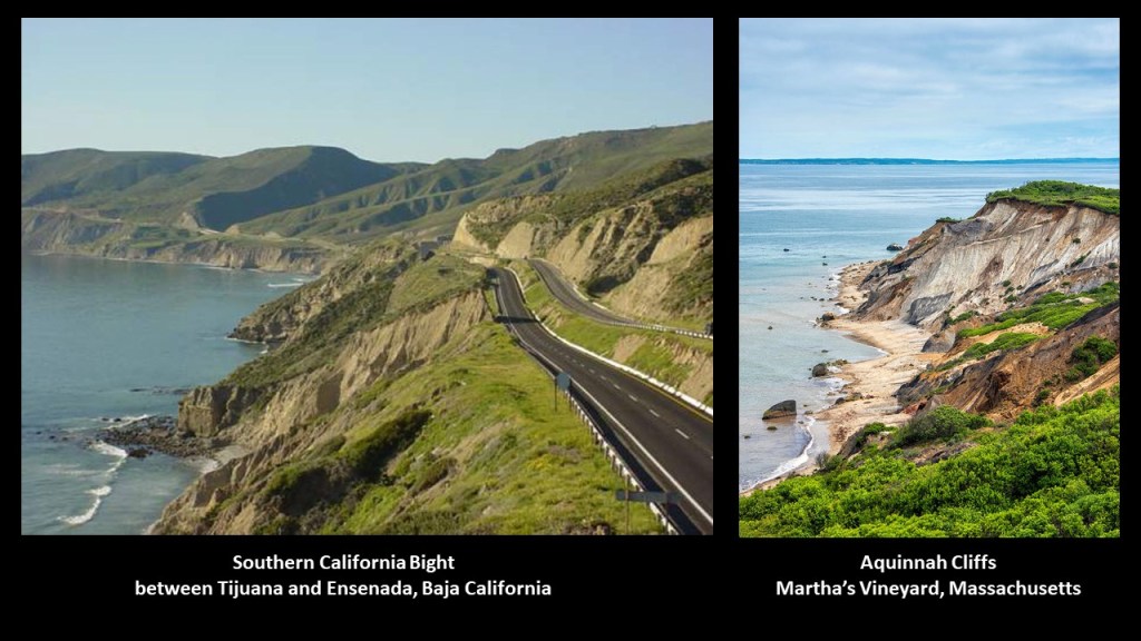
Here is an example of the same sheared-off, unstable-eroded-looking landscape, as seen on this stretch of coastal road on the Pacific West Coast on the left, and the Aquinnah Cliffs on Martha’s Vineyard on the East Coast.
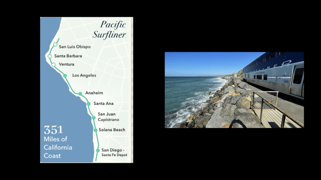
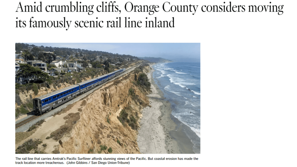
There is still an active Amtrak passenger railroad line, called the “Pacific Surfliner,” running along the Pacific Coast of the Southern California for 351-miles, or 565-kilometers, from San Diego to San Luis Obispo…
…and like the Gay Head Lighthouse on Martha’s Vineyard that I mentioned just a little bit ago in this post, is endangered by crumbling cliffs from coastal erosion, and we are told is under consideration for being moved in-land.
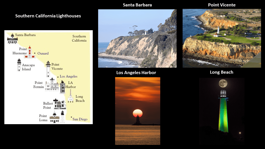
There are also lighthouses found along the coast of Southern California, like the Santa Barbara lighthouse in the top middle; the Point Vicente Lighthouse on the top right, both high atop cliffs next to the shore line; the Los Angeles Harbor Lighthouse on the bottom middle, as seen with a perfect solar alignment; and the Long Beach lighthouse with a lunar alignment on the bottom right.
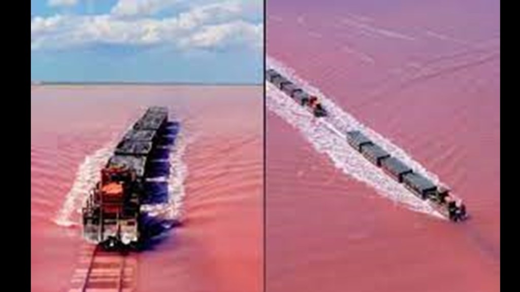
Another example of a rail-line in an anomalous place is at the pink-colored Lake Burlinskoye in Siberia, where the rail-line still operates right through the water.
Does it make sense that this rail-line was actually built through water, or could possibly have been above water at one time and sank?
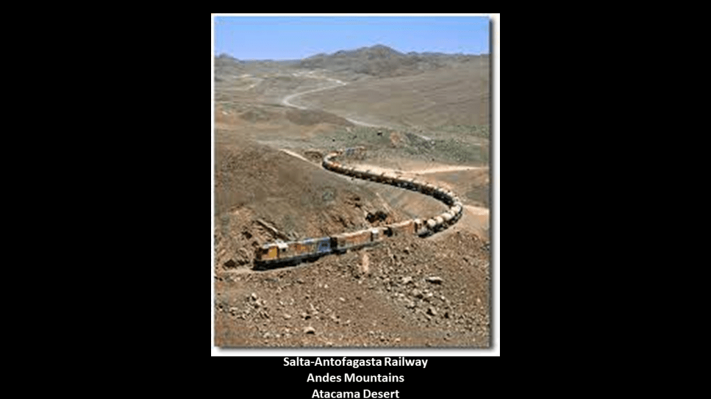
And the Salta-Antofagasta railway links Argentina and Chile through one of the driest places on Earth, the Atacama Desert across the Andes Mountains.
These are just a few of many examples of railroads in anomalous places, and there are many more rail-lines that have been abandoned or removed all over the world.
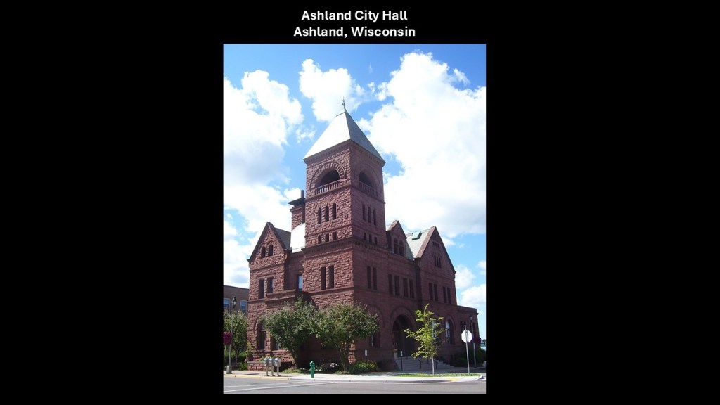
Next I am going to take a quick look at Ashland, Wisconsin, and see what comes up.
As I already mentioned, Ashland is located at the junction of US Highway Route 2 and Wisconsin 13.
It is the seat of Ashland County, with its city hall said to have been built in 1893 from locally-quarried brownstone.
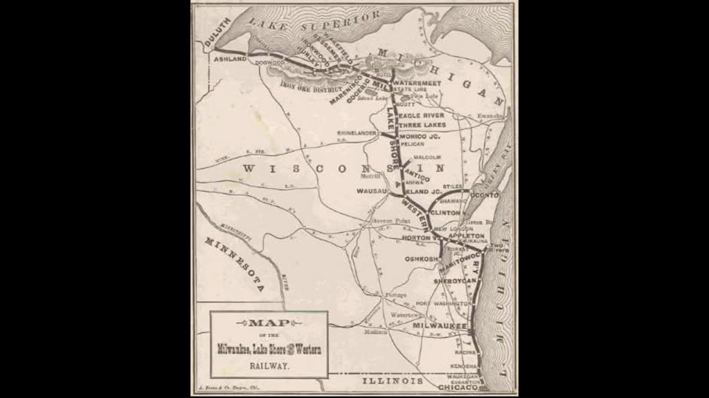
We are told the Milwaukee, Lake Shore, and Western Railway platted the city of Ashland in 1885 as railroad construction moved to the west.
Also known as the “Lake Shore Road,” this railway connected Milwaukee, the Upper Peninsula and northwest Wisconsin, with a connection to Chicago.
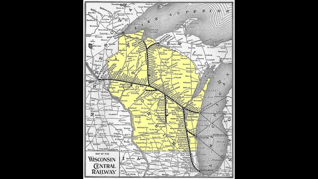
The Wisconsin Central Railway Company also had a presence in Ashland having been created in 1897 from the bankruptcy reorganization of Wisconsin Central Railroad, which existed from 1871 to 1899.
The Wisconsin Central Railway Company was merged into the Soo Line Railroad in 1961.
More on “The Soo” to come shortly in this post.
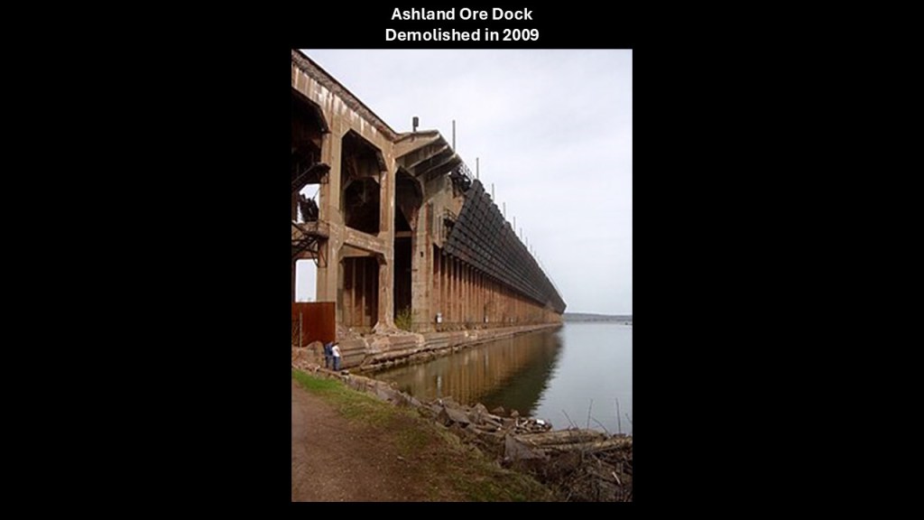
The Wisconsin Central Railway had a massive ore dock in Ashland that was 1,800-feet, or 550-meters, in length.
The ore dock was demolished in 2009, unable to be saved by local preservationists.
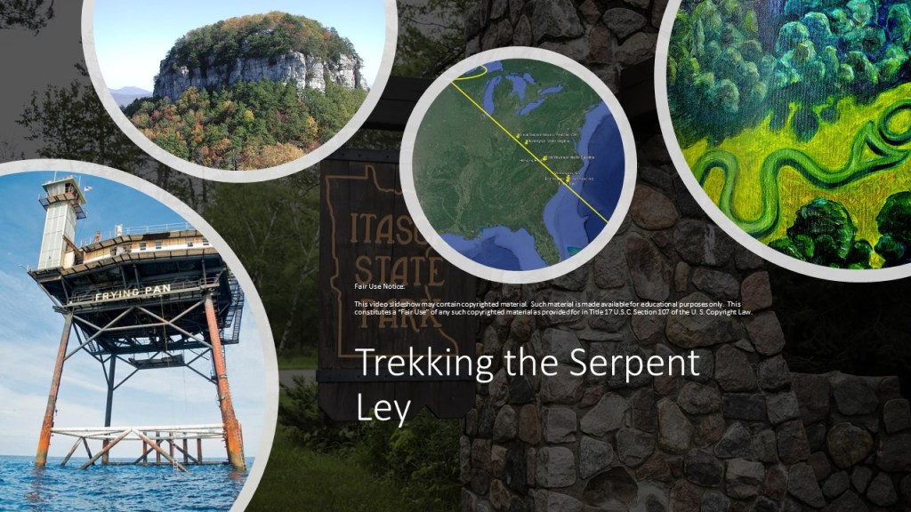
When I do the Lake Michigan part of this series on the Great Lakes, I will talk more in-depth on what I found in Wisconsin and Minnesota when I tracked the Serpent Ley that was identified by gaiagrapher Peter Champoux (his website is geometryofplace.com) from the Bermuda Triangle to Lake Itasca in Minnesota
Suffice it to say for now that both Wisconsin and Minnesota are filled with marshes, wetlands, and lakes, like the previously referenced Rock Lake in Wisconsin long-reputed to have pyramid structures at the bottom of it.
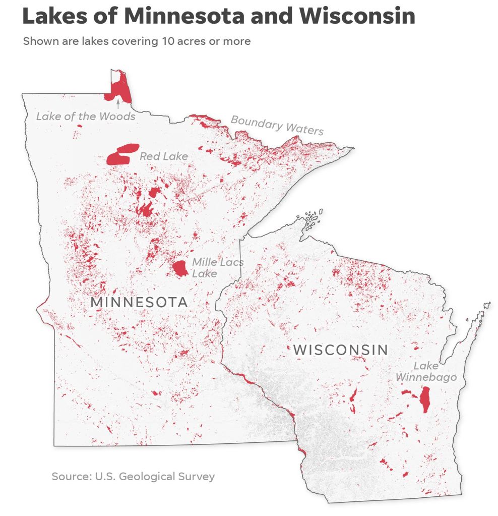
There are almost 27,000 lakes between the two states.
Wisconsin is listed as having 15,074 and Minnesota having 11,842, with Wisconsin counting ponds as small as a half-acre, or .2-hectares, and Minnesota only counting lakes that are 10-acres, or 4-hectares, or more, and the high number of lakes from small to large quite noticeable throughout this region.
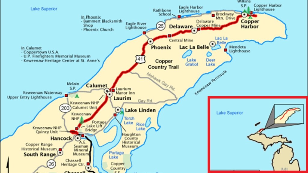
The next place I am going to take a look at after leaving Ashland on the southern shore of Lake Superior in Wisconsin is the Keweenaw Peninsula, which is part of the land mass of Michigan’s Upper Peninsula.
While the Minnesota/Ontario side of Lake Superior is known for the high-quality iron ore from its Iron Ranges, the Upper Peninsula of Michigan is known for its high-quality copper.
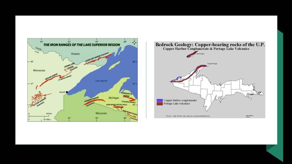
Keweenaw is the northernmost county of the State of Michigan, and it shares the Keweenaw Peninsula with Houghton County.
The Keweenaw Peninsula is formed by the largest freshwaters on Earth…
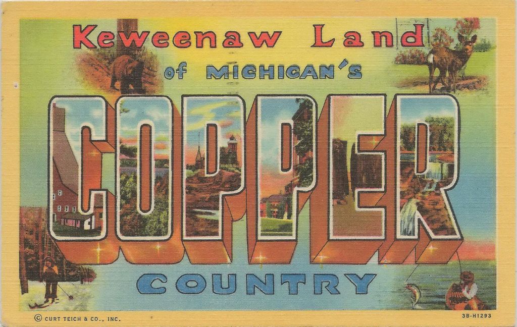
…and, along with several other adjacent counties in the Upper Peninsula, is collectively called “Copper Country,” and in its hey-day, in the late 19th- and early-20th-century, it was the world’s greatest producer of copper.
The copper here is predominately what is known as native, or pure, copper form without the compound elements, like oxides and sulfides, that are found in other copper deposits.
There is a lift bridge in Houghton County, like the Duluth Aerial Lift Bridge mentioned earlier in this post.
Known as the “Portage Canal Lift Bridge,” it connects the cities of Houghton and Hancock across Portage Lake, which is part of the waterway which cuts across the Keweenaw Peninsula with a canal linking the five-miles to Lake Superior to the northwest.
The steel swing, or vertical, bridge was said to have first been built in 1895 to replace a damaged wooden swing bridge that was built in that location in 1875, and that the current steel bridge replaced the previous steel bridge in 1959.
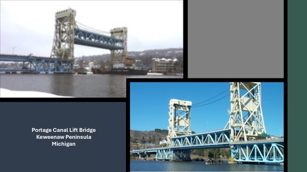
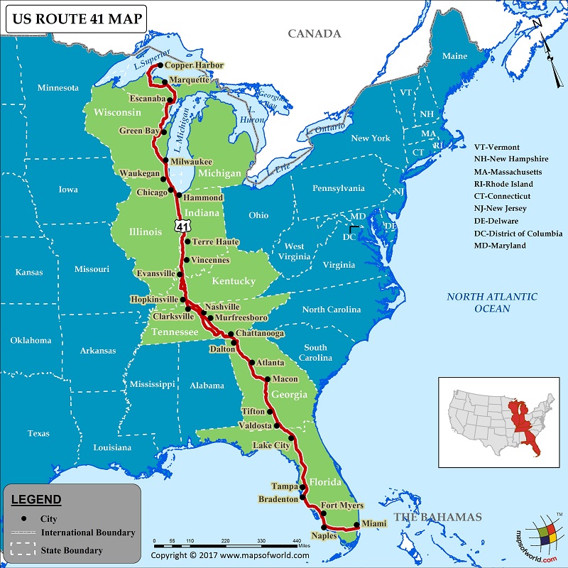
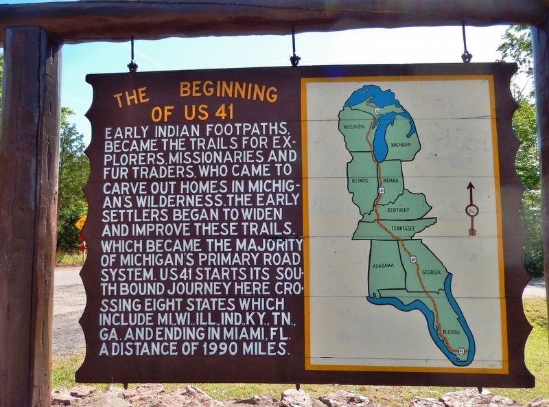
The Portage Canal Lift Bridge is on the only land-route across the waterway, which is U. S. Highway 41, that originates in Miami, Florida.
The Keweenaw Waterway is described as “part artificial and part natural,” and separates Copper Island from the mainland, in this case referring to Keweenaw County.
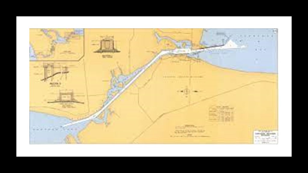
The building of the canal was said to have started in 1868, after the legislation authorizing the building of it passed in 1861, and completed in 1874…and widened in 1935.
Interesting to note the straight railroad track and canal running parallel to each other…
…which is a configuration I have seen in the past, at places like the Lehigh Canal and railroad tracks in Bethlehem, Pennsylvania…
…and at Point-of-Rocks in Maryland, near Harper’s Ferry, West Virginia.
Other places on the Keweenaw Peninsula include:
The Houghton County Courthouse, with the cornerstone said to have been laid on July 24th of 1886, and the new courthouse dedicated a little over a year to the day later, on July 28th of 1887.
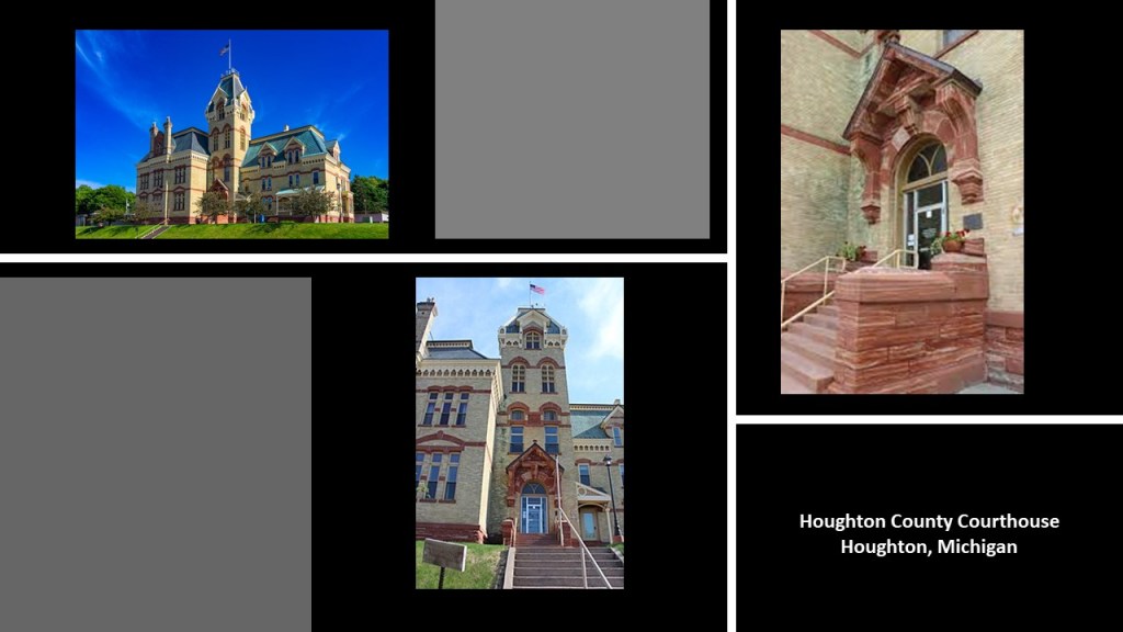
So…built in a year…in Northern Michigan no less…
…a place where winters are cold, and spring and fall still tend to be on the cold and moist side.
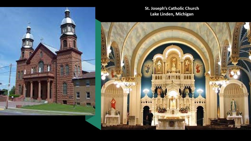
Also, the Catholic Church in Lake Linden was said to have been built between 1901 and 1912.
There used to be a trolley line here between the cities of Calumet and Houghton…
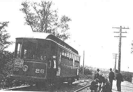
…as well as many train stations, but all the tracks have been pulled up.
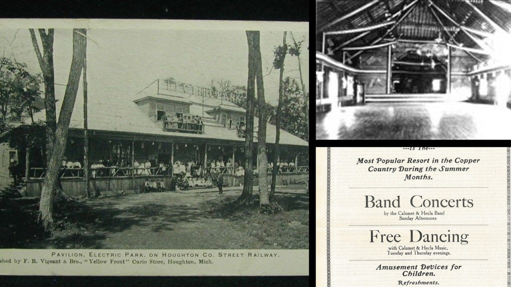
According to this map of the Houghton County Traction Company that operated the trolley line, there even was an “Electric Park” way up here!
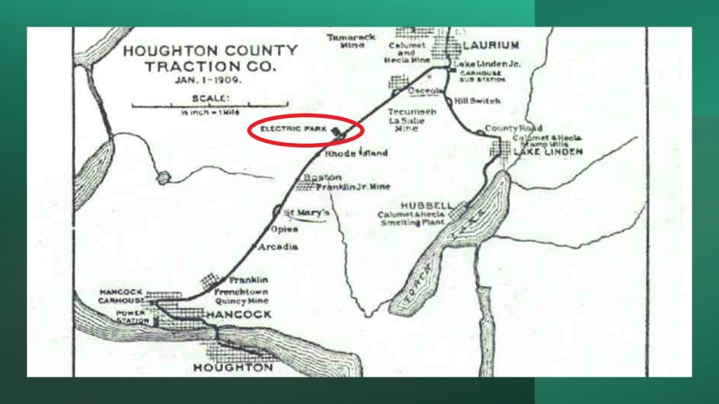
It was a popular recreation destination, also known as a trolley park, between 1902 and 1932, which was when all operations of the Houghton County Traction Company ended, and the park disappeared completely from the scene by World War II, we are told, because of the cost of maintenance upkeep, etc, with the main pavilion sold, scrapped and reassembled as a potato barn.
Memories from Mr. Rogers’ Neighborhood just popped into my head when I saw this here.
Though I am more from the Captain Kangaroo generation of young children’s television programming in the 1960s…

…I would watch Mr. Rogers on occasion with my younger brothers.
I wonder if there were hidden meanings, beyond a clever way to tell a story to young children, behind Trolley and the Neighborhood of Make-Believe in the long-running children’s show Mr. Rogers’ Neighborhood.

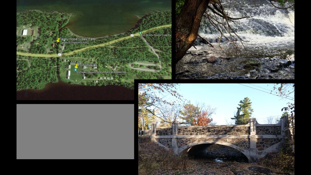
There is a lot more to find here, including the historical Fort Wilkins at the tip of the Keweenaw Peninsula, said to have been established in 1844…
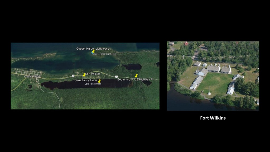
…sandwiched from east-to west between the beginning of Highway 41 marker…
…and Copper Harbor, also established in 1844…
…and from north-to-south between Copper Harbor Light House, said to have first been built in 1849, and then dismantled, and using the same stones as the first lighthouse, re-built and lit in 1866…
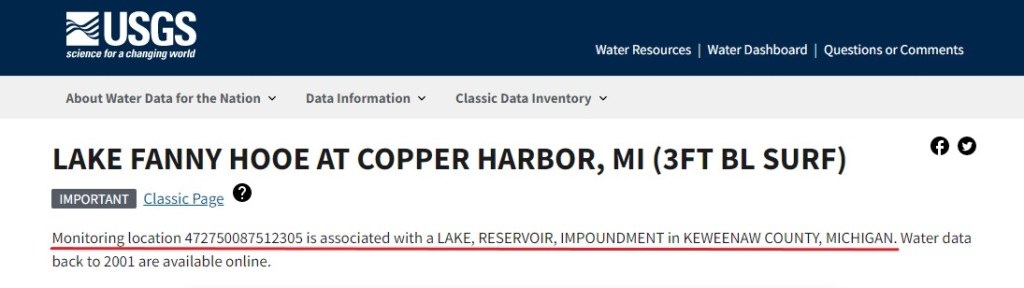
…and the long, skinny Lake Fanny Hooe.
There are a number of different women coming up as the subject in the tales of how the lake was named.
The slang meaning of “hooe-y” in English, having the same pronunciation with a silent “y” added at the end in the spelled form, is “nonsense.”
It is interesting to note that the only indication I could find that this might be a man-made lake in a search is this from the USGS website.
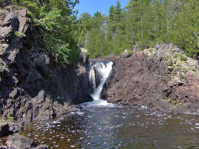
In the short distance between Lake Fanny Hooe and Lake Superior, I found the Fanny Hooe Creek Falls and the bridge on Highway 41 crossing the creek, said to have been built in the 1920s.
There are other waterfalls hereabouts, but there is one other I want to highlight, the Upper Montreal Falls on the Keweenaw Peninsula’s Montreal River.
These particular falls are not located far from Lac La Belle, which at one time…
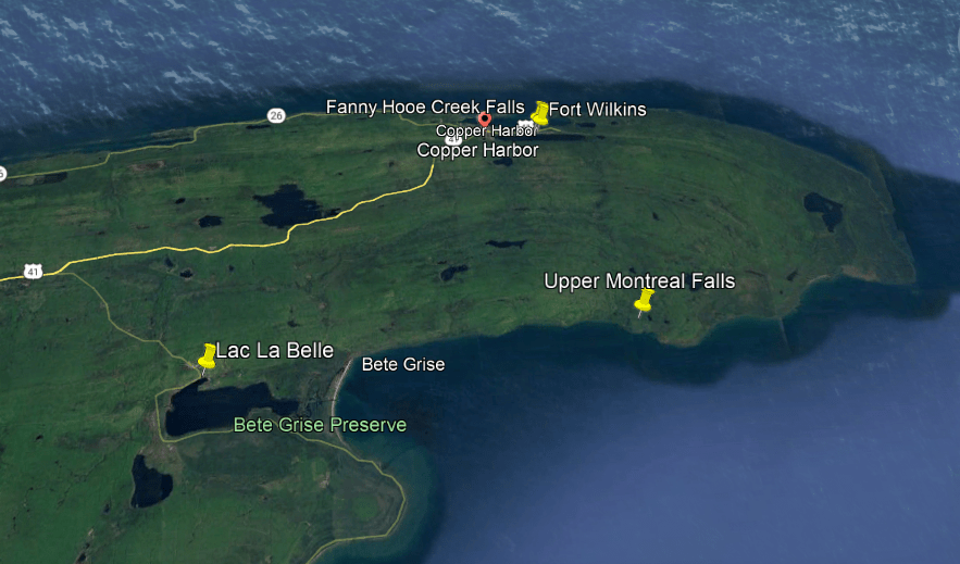
…was a railroad depot, as shown in the map on the right.
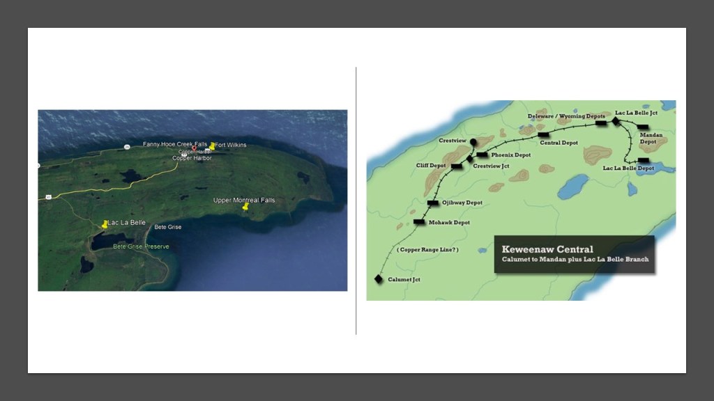
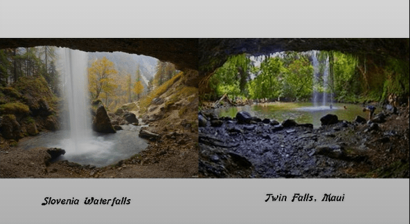
Two things I have consistently found in my research are waterfalls of the same make and model in different places all over the world…
…and correlations in location between railroads and canals, like I showed previously in this post with the Portage Canal of the Keweenaw Waterway, as well as the additional correlation of star forts located nearby, which I have studied extensively in past research, like on this post from September of 2019 on the “Correlations Between the Physical Infrastructure of Railroads, Canals & Star Forts and Other Interesting Things.”
Another place that I would like to mention about the Keweenaw Peninsula is the Keweenaw Rocket Range.
We are told it was used by NASA between 1964 to 1971 to send rockets into the atmosphere to collect information about electron density; solar x-rays; energetic electron precipitation; and other scientific measurements.
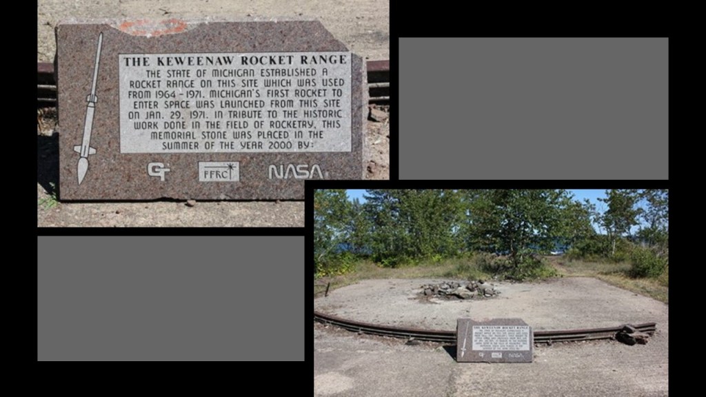
It is only 7-miles, or 11-kilometers, away from Copper Harbor at the tip of the Keweenaw Peninsula, but takes an hour to get there because of the poor road condition.
One more interesting thing to note with respect to US Highway Route 41 while we are here at its northern Terminus at the top of the Keweenaw Peninsula.
When I said earlier that the Moors, Egyptians, Israelites, Moslems, and Masons were all one and the same, and their land and legacy stolen, I have found further circumstantial evidence to support this statement based on what I have found in past research that the same Tribes of Israel not only occupied the same continent in different places, they were also found on other continents, as I started coming across people who identified as lost tribes of Israel all over the world.
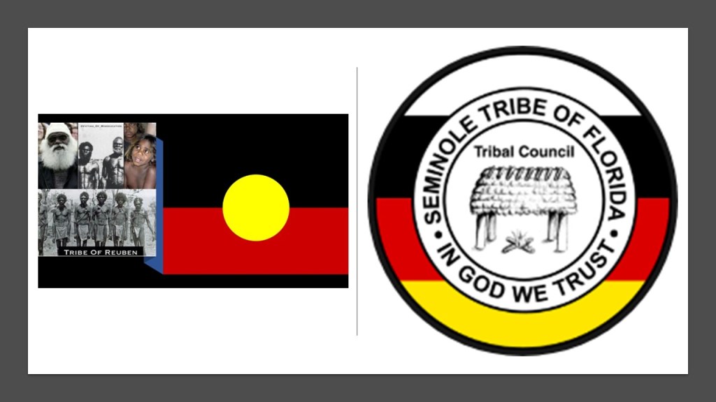
Like the Seminole Indians identifying as the Tribe of Reuben, and are considered to be a Native American people originally from Florida, most of whom were forced to the Oklahoma Indian Territory as well, with the exception of six reservations in South Florida.

While the most famous Miami of all is located at the southern tip of the east coast of the Florida peninsula, the starting point for Highway 41, and the traditional land of the Seminole, as we have already seen, this same Highway 41 goes all the way up to the very tip of Michigan’s Keweenaw Peninsula on Lake Superior, and passes through the traditional lands of other Miami in Indiana, and near Ohio, along the way.
Interesting to note that I also found the original people of Australia identified as the Tribe of Reuben as well, with the same colors of black, red, and yellow in their flag as the Seminoles have in their seal.
Now I am going to look at the cities of Marquette and Munising on my way going eastward along the southern coast of Lake Superior on the Upper Peninsula of Michigan.
First Marquette.
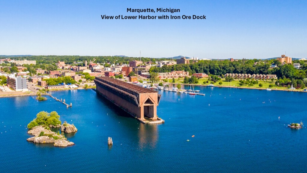
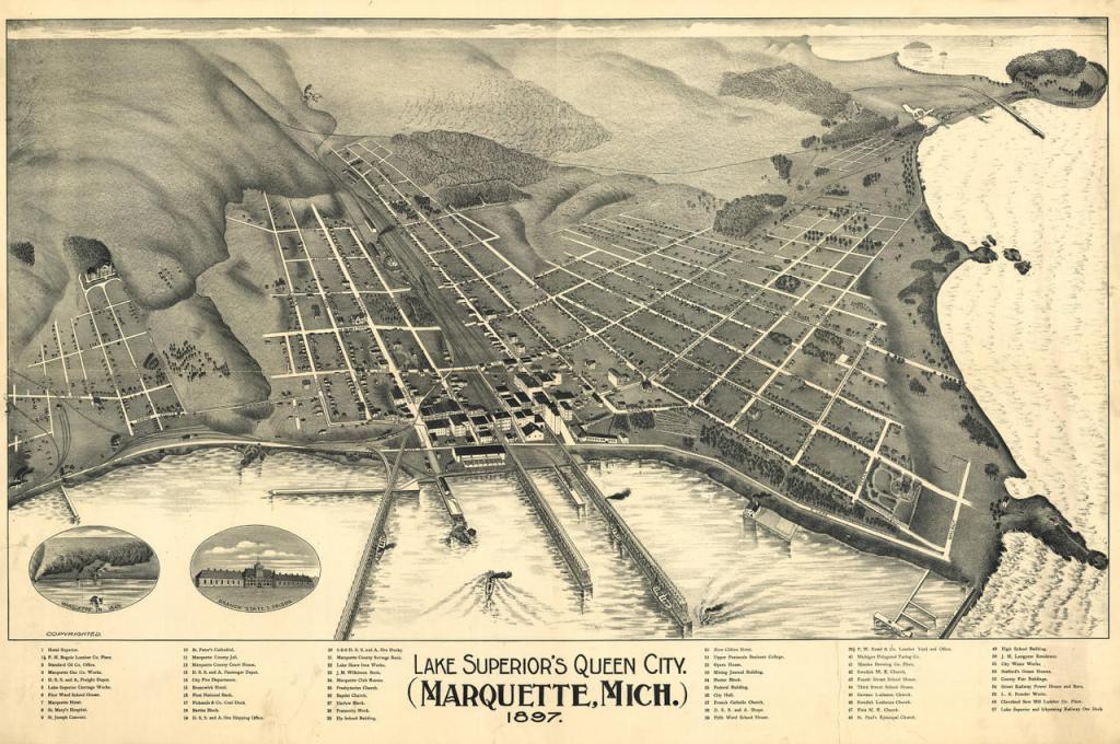
Marquette is the largest city in the Upper Peninsula of Michigan.
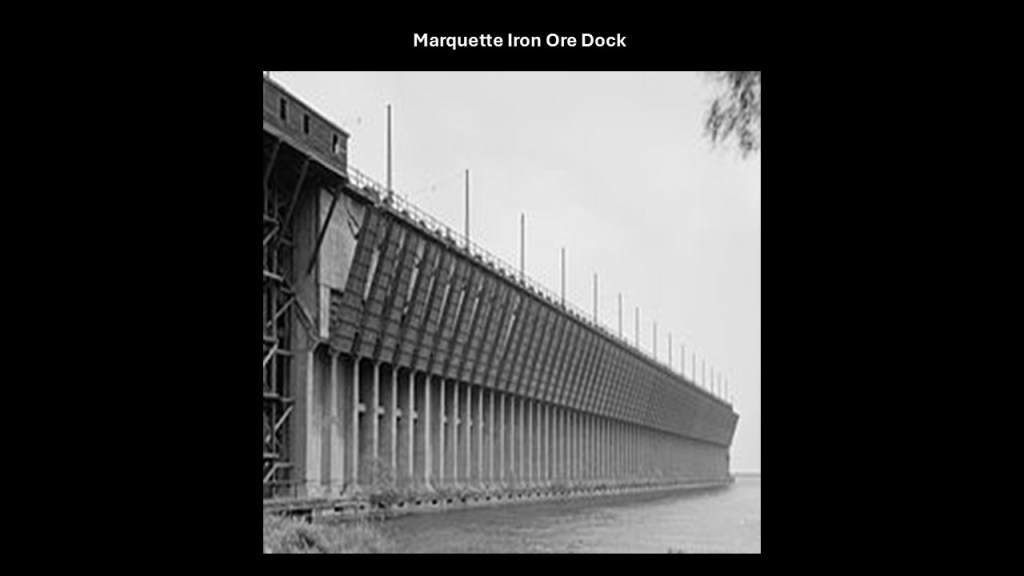
It is a major port on Lake Superior known primarily for shipping iron ore from the Marquette Iron Range.
While the iron ore dock in Marquette’s lower harbor is still standing, unlike the one in Ashland, but has not been used as an ore dock since 1971.
I read about some plans to revitalize it and possible turn it into a public park.
Historical ore docks were typically long, high structures with railway tracks on the top, and pockets where ore was unloaded by gravity from the railcars.
Then each pocket had chutes with which to unload the ore into the hold of a cargo ship for transport.
By the 1890s, Michigan was the largest supplier of iron ore in the United States.
This is what we are told about the history of Marquette.
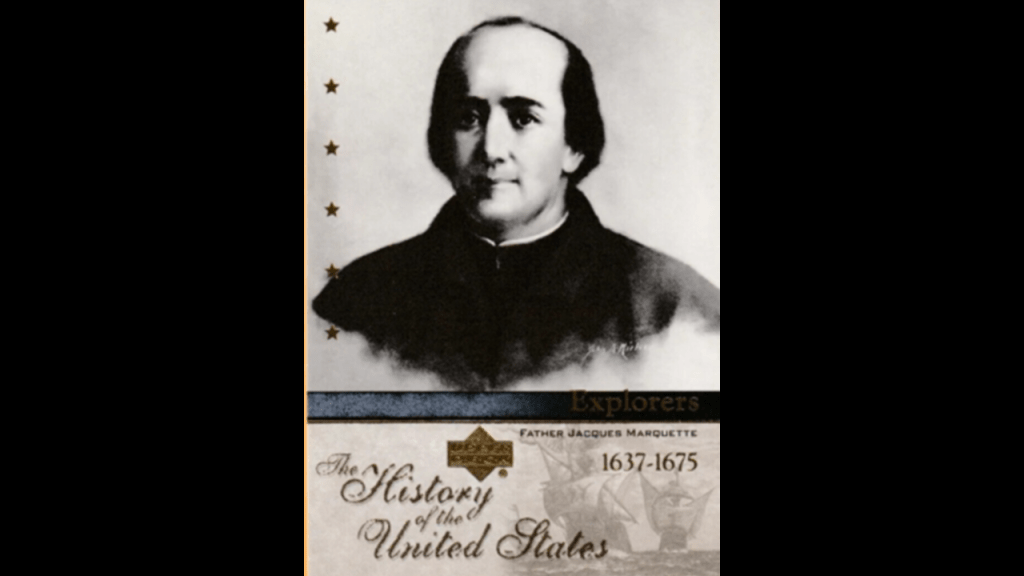
We are told it was named after Jacques Marquette, a French Jesuit explorer of the Great Lakes Region and Mississippi River Valley starting around 1668 to his death in 1675.
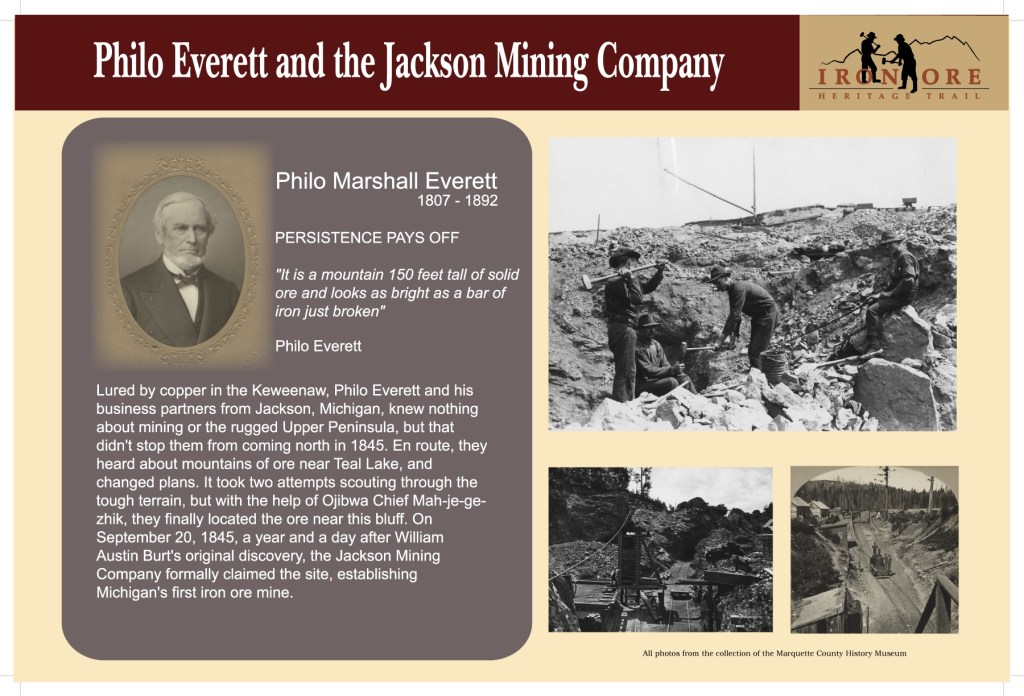
Then in 1844, the area started to be developed after iron deposits were found at Teal Lake west of Marquette.
Subsequently,the Jackson Mining Company was formed in 1845, the first organized mining company in the region.
Then in 1849, a second iron ore-related company was formed, the Marquette Iron Company, which marked the beginning of the Village of Marquette.
This iron company had failed by 1852, but in 1854, the Cleveland Iron Mining company flourished, and had the village platted.
The village was incorporated in 1859 and it was incorporated as a city in 1871.
We are told that in the 1850s, Marquette was linked by rail to numerous mines, and became the leading shipping center of the Upper Peninsula.
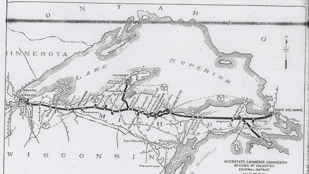
The Duluth, South Shore, and Atlantic Railway was American railroad that served the Upper Peninsula of Michigan, and the Lake Superior shoreline of Wisconsin, providing service from Sault Ste. Marie, Michigan, and St. Ignace, Michigan, westward through Marquette to Superior, Wisconsin, and Duluth, Minnesota.
Branchlines of this railroad extended up the Keweenaw Peninsula to the cities of Houghton, Calumet, and Lake Linden.
The first of this railway line started operating in 1855; then came under the control of the Canadian Pacific Railway in 1888; and was in operation all together from 1855 to 1960 as an independently-named subsiderary of the Canadian Pacific Railway.
What’s left of it was merged to the Soo Line in 1961.
Every winter, the region served by this railroad line annually receives a considerable amount of snow, with the Keweenaw Peninsula averaging 20.1-feet, or 6.1-meters, of snow, and was cited as one of the many reasons the railroad line was notorious for poor-quality service.
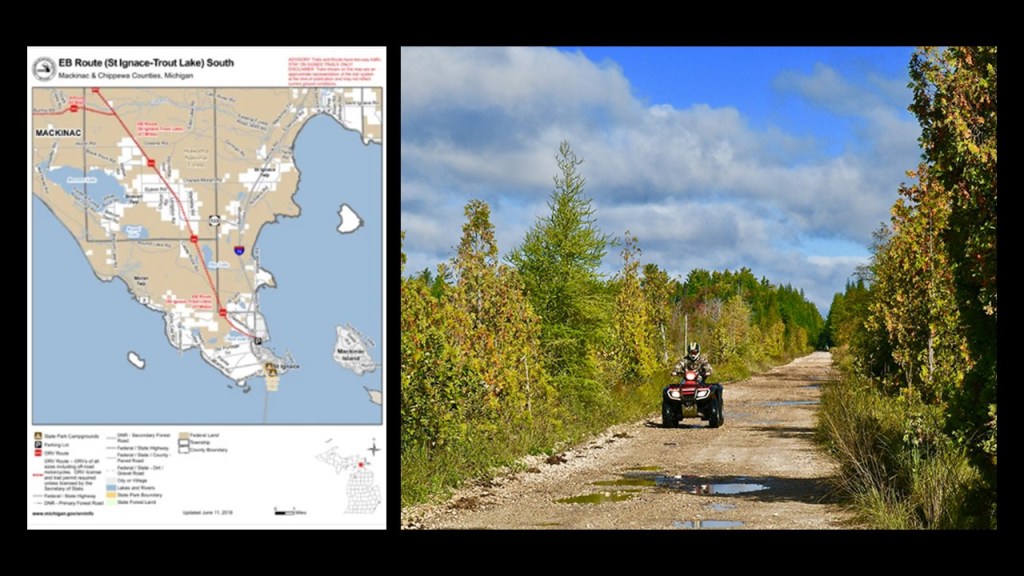
Parts of the Duluth, South Shore, and Atlantic Railway were converted to rail-trails, like the St. Ignace – Trout Lake Trail, which is 26-miles, or 42-kilometers, of multi-use recreational trail in its former railbed.
The European history of St. Ignace began when Jacques Marquette founded the St. Ignace Mission here in 1671, and named it after the founder of the Jesuits, St. Ignatius of Loyola.
In our historical narrative, Pope Paul III issued a papal bull forming the Jesuit Order in 1540, under the leadership of Ignatius of Loyola, a Basque nobleman from the Pyrenees in Northern Spain.
The Jesuit Order included a special vow of obedience to the Pope in matters of mission direction and assignment.
Whoever the Jesuits and the Freemasons were are at the top of my list of suspects for who was primarily responsible for giving us our new, fabricated historical narrative.
Two years later, in the year of 1542, we are told Pope Paul III established the Holy Office, also known as the Inquisition and the Congregation for the Doctrine of the Faith.
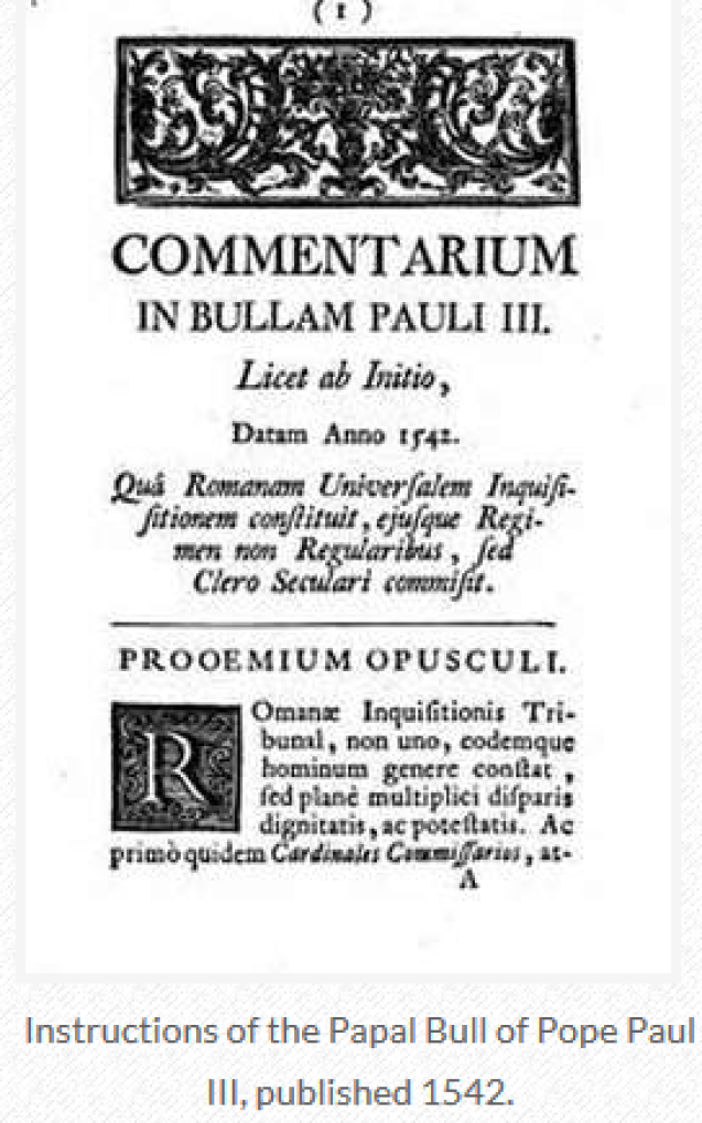
I will go more into a lot more detail about St. Ignace in the part of the series about Lake Huron, where it is located in the Upper Peninsula on the northern side of the Straits of Mackinac, but it shows up in this one a couple of times.
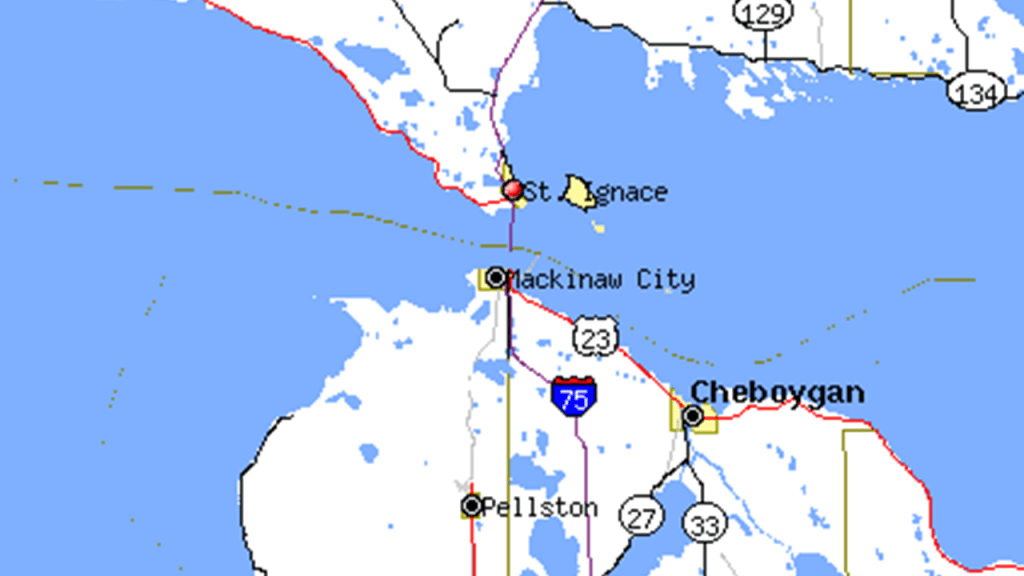
One more thing before I move on from the city of Marquette is that there are two lighthouses in Marquette.
One is the Marquette Harbor Lighthouse, located in the lower Marquette Harbor.
The Marquette Harbor Lighthouse was said to have been constructed in 1852 and first lit in 1853 after Congress approved funds in 1850 to build it to help with navigation to the ore docks.
The current structure was said to have been built starting in 1865, which was the same year the American Civil War ended in our narrative.
Like other lighthouses we have seen through this post, the Marquette Harbor Lighthouse also has an alignment with the Milky Way.
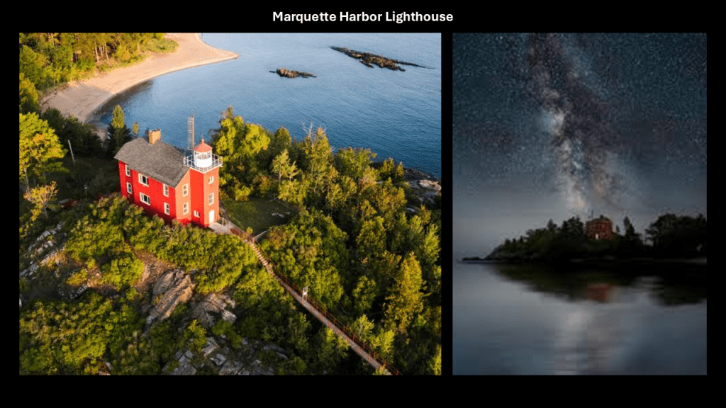
The other current lighthouse is the Presque Isle Harbor Breakwater Light in Marquette’s Upper Harbor.
We are told that between 1897 and 1902, the U. S. Army Corps of Engineers constructed a breakwater, and that in 1935, the Corps undertook another project to dredge the port and extend the breakwater.
In conjunction with this project, in 1938, the United States Lighthouse Service announced plans to place an automated lighthouse on the breakwater. Both projects were said to have been completed by 1941, which would have been during World War II.
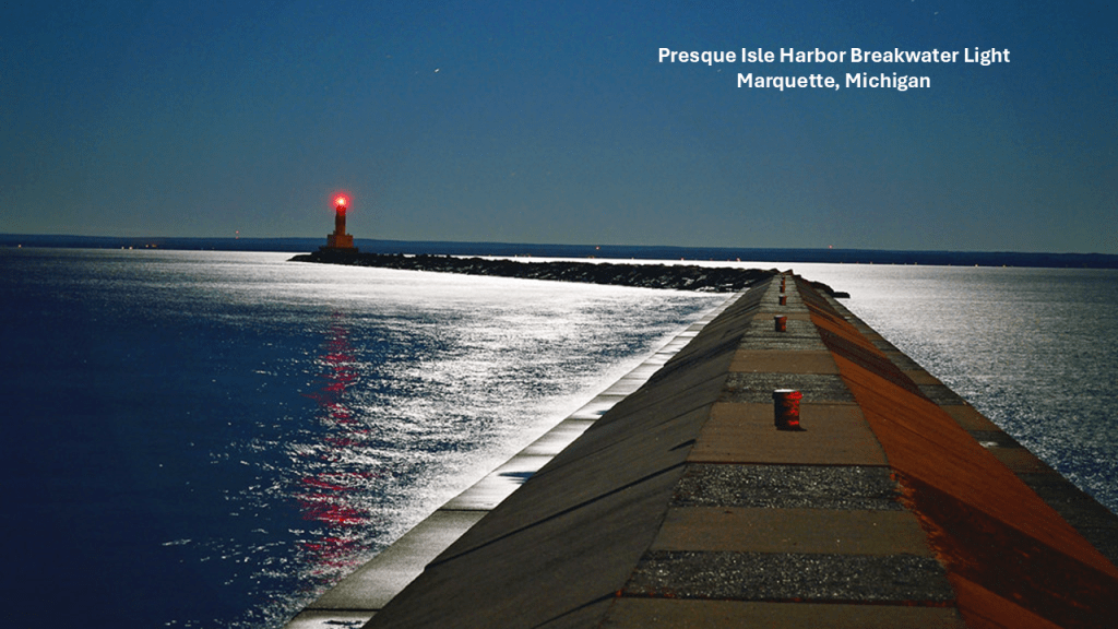
Next I am going to take a look at Munising, Michigan.

Munising is best known as the western gateway to “Pictured Rocks National Lakeshore.”
The “Pictured Rocks” are described as dramatic, multicolored cliffs with unusual sandstone formations.
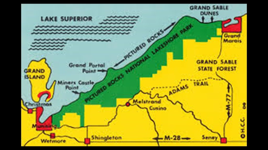
Formations with names like “Miners Castle Rock…”
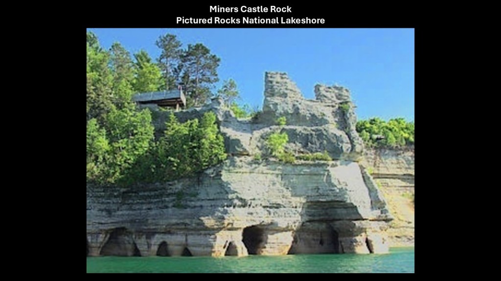
…and the Grand Portal Rock as seen in this lithograph from 1851…
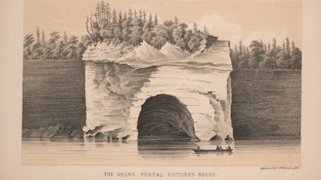
…which mysteriously collapsed in the early 1900s, from the believed cause of erosion but no one really knows what might have caused it.
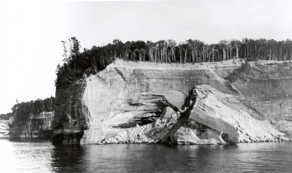
There are all manner of what are called natural archways all along the lakeshore, like the one called “Lovers Leap.”
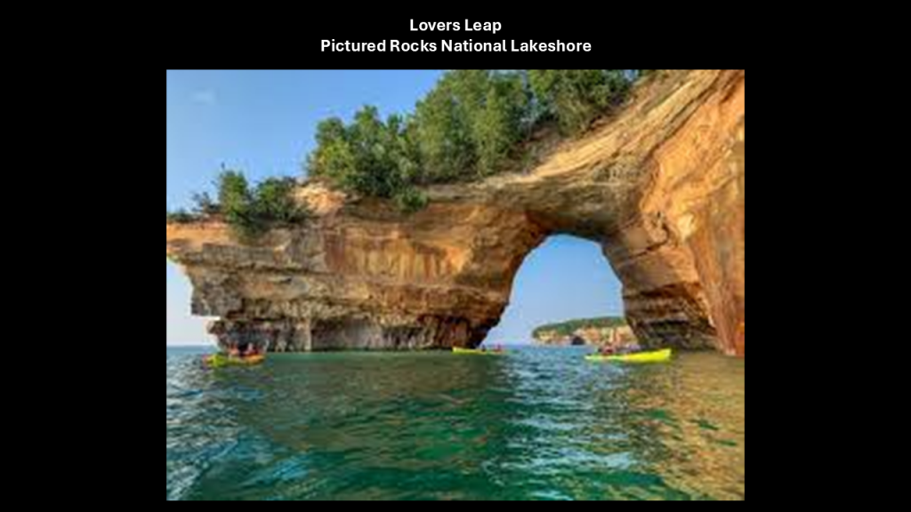
Another unusual formation was named “Chapel Rock.”
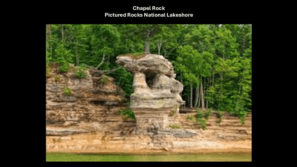
The Grand Sable Dunes run along the northeast end of the Pictured Rocks Lakeshore for 6-miles, or 10-kilometers.
This is the view of them from what is called the “Log Slide Overview,” where in the 19th-century, loggers used them to slide logs from the top of the dunes to the shoreline so they could be transported out.
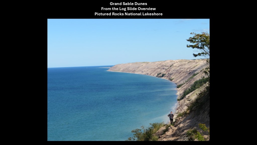
Other places located at this end of the Pictured Rocks National Lakeshore include Sable Falls, which flow 75-feet, or 23-meters, over what is called Munising and Jacobsville sandstone formations to Lake Superior.
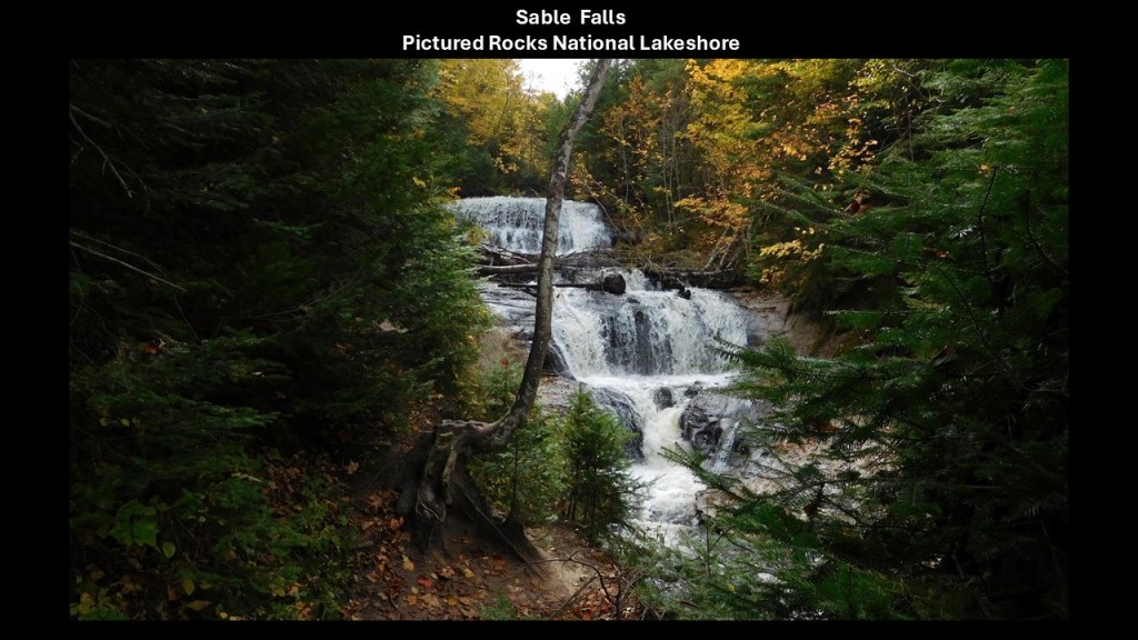
The general area around Munising has many waterfalls.
Others waterfalls in the area include: Alger Falls; Horseshoe Falls; Memorial Falls; Munising Falls; Miners Falls; Scott Falls; Tannery Falls; and Wagner Falls.
The Au Sable Point Lighthouse is located in the area of the Grand Sable Dunes and Sable Falls, and it is nicknamed the “Beacon of the Shipwreck Coast.”
The lighthouse here was said to have been built between 1873 and 1874.
And yet another lighthouse with an alignment to the Milky Way.
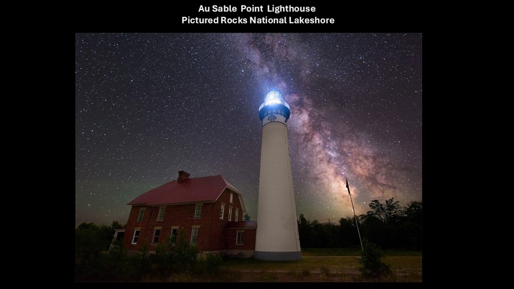
There are a number of shipwrecks to be found around Au Sable Point, like the mingled remains of the Sitka, an iron ore ship that was stranded here in 1904 from high winds and fog, and the Gale Staples, a coal-carrying ship, was grounded here on a reef in 1918, having been driven off-course by high winds.
These are just two of numerous historic shipwrecks found here.
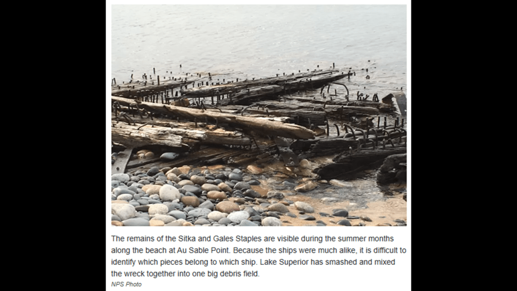
There are six lighthouses to be found around the city of Munising on the other end of the Pictured Lakes National Lakeshore from Au Sable Point.
These include:
The Grand Harbor Front and Rear Lights also known as the Bay Furnace Lights, and were said to have been established in 1867.
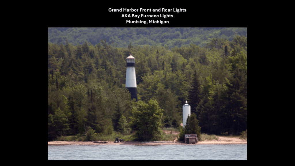
They are located on either-side of Michigan Highway 28 where it runs right next to the shore of the lake.
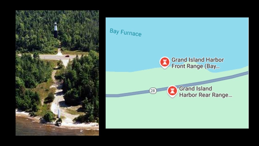
The Grand Island North Lighthouse is located on Grand Island, and part of Grand Island Township, and all part of the Grand Island National Recreation Area in the Hiawatha National Forest.
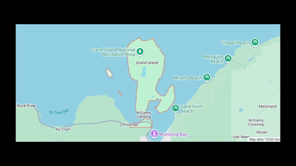
The Grand Island North Lighthouse was said to have been built in 1867.
Like with previously-shown examples, this lighthouse is situated right next to the edge of a cliff.
It is privately-owned in the present-day and was converted into a summer home.
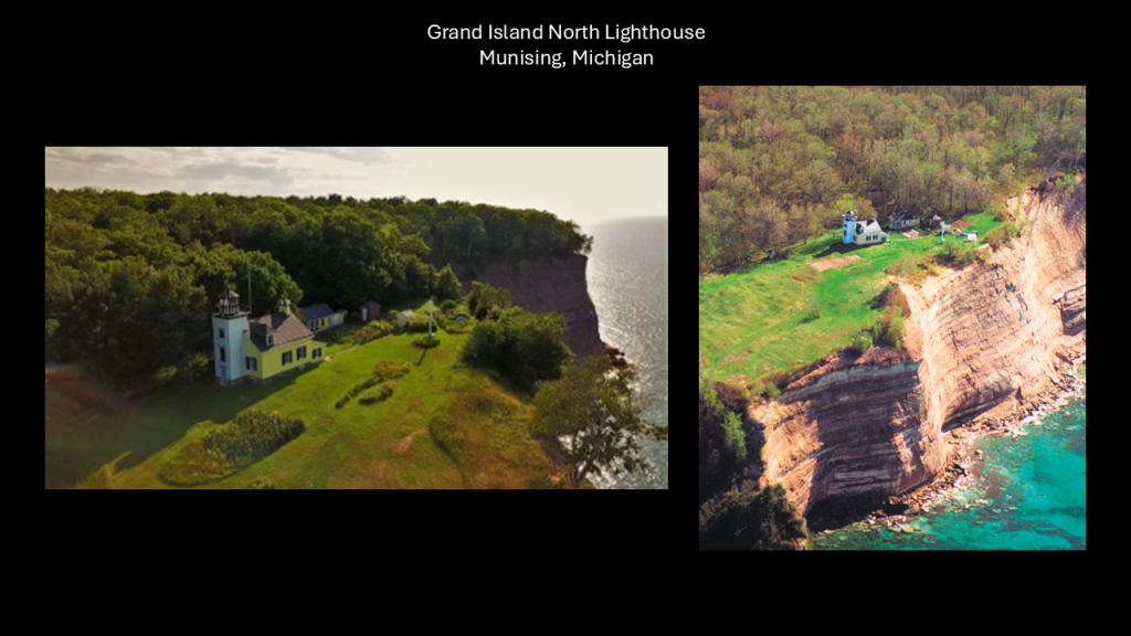
The wooden Grand Island East Channel Lighthouse was first opened for service in 1868.
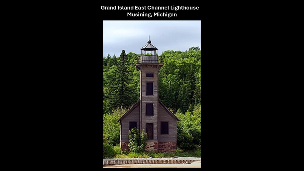
It was discontinued from service some time in the early 1900s, for the given reason of difficulty seeing it from Lake Superior and difficult maintenance, leading to the construction of the Front Range and Rear Range Lights in the western part of Munising, as there are what are described as several dangerous rock ledges that are serious navigational hazards in the East Channel.
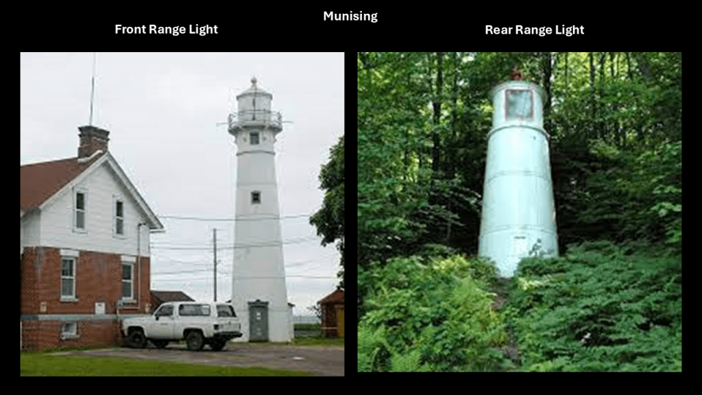
The Munising Front Range Lighthouse is on the western edge of of Munising north of Michigan State Highway 28, and the Rear Range Lighthouse is on the other side of the highway, like is the case with the Grand Harbor Front and Rear Lights.
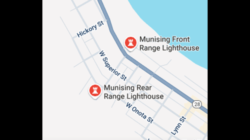
Michigan Highway 28 traverses nearly all of the Upper Peninsula from east-to-west, from Wakefield to Sault Ste. Marie, and along with US-2, form the primary highways linking the Upper Peninsula from end-to-end, and providing major access for traffic from Michigan and Canada along the southern shore of Lake Superior.
This is how Michigan Highway 28 is described.
Across the Upper Peninsula, Michigan Highway 28 passes through forested woodlands, bogs, swamps, urbanized areas, and along the Lake Superior shoreline along its course.
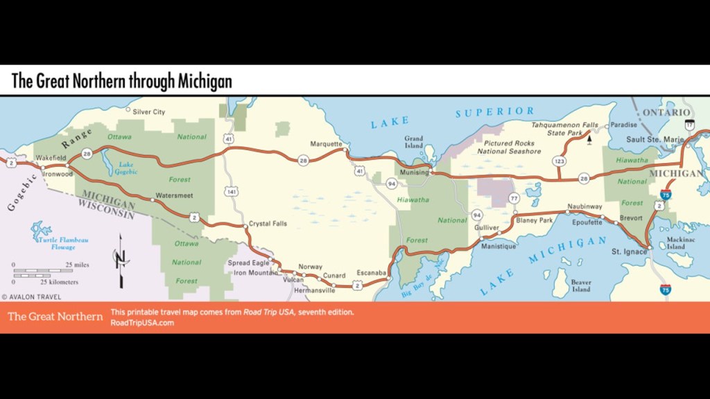
The “Seney Stretch” of Michigan State Highway 28 between Seney and Shingleton, a “straight-as-an-arrow” highway, goes across the “Great Manistique Swamp.”
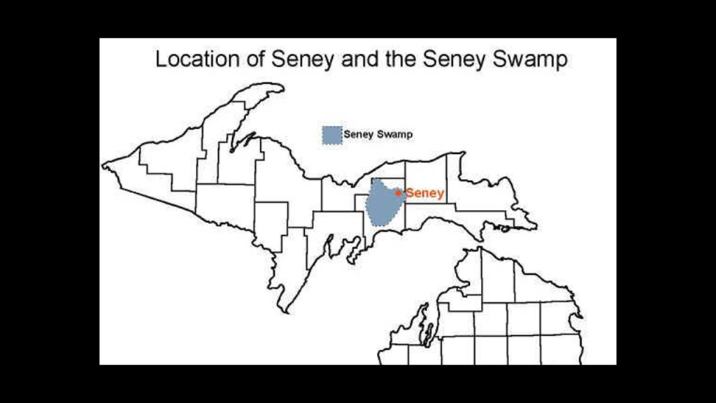
The “Great Manistique Swamp” which is part of the Seney National Wildlife Refuge, which includes the Seney Wilderness Area and the “Strangmoor Bog National Natural Landmark.”
The “Strangmoor Bog” is classifed as a “sub-arctic patterned bog ecosystem,” and the best surviving example of one in the 48 contiguous states, and has things like parallel strips of dune and wetland.
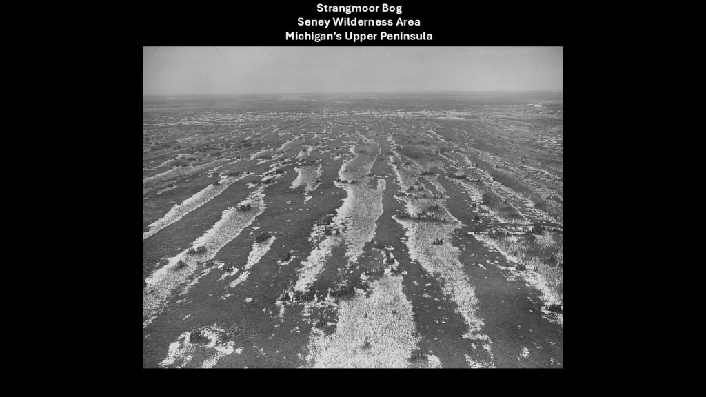
We are told the road across the swamp was built parallel to the previously-mentioned “Duluth, South Shore and Atlantic Railway.”
The “Duluth, South Shore and Atlantic Railway” in-turn became what was called the “Soo Line.”
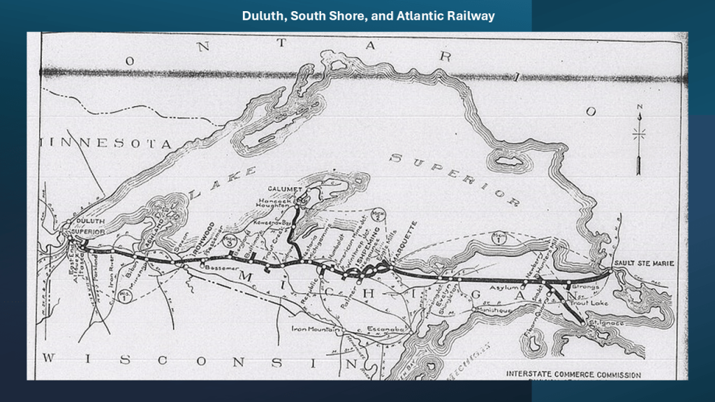
The Soo Line of today was named for the Minneapolis, St. Paul and Sault Ste. Marie Railroad , and was formed by the consolidation of the Duluth, South Shore and Atlantic Railway and the Wisconsin Central Railway.
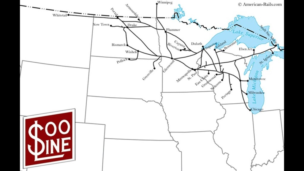
When I was doing research back in June of 2023 for “Of Railroads and Waterfalls and other Physical Infrastructure of the Earth’s Grid System,” I found numerous examples of identical infrastructure and engineering from all across the United States of railroads and waterfalls in particular being connected to hydroelectric power in gorges and canyons with dams and reservoirs, and sophisticated, impossible-seeming, engineering feats that are totally integrated across vast distances.
How is this even possible according to the history we are taught?
In the course of doing the research for this blog post, I was taken to Mackinaw City, Michigan, by following U. S. Highway 23, a major North – South U. S. Highway between Jacksonville, Florida, and Mackinaw City, Michigan at I-75.
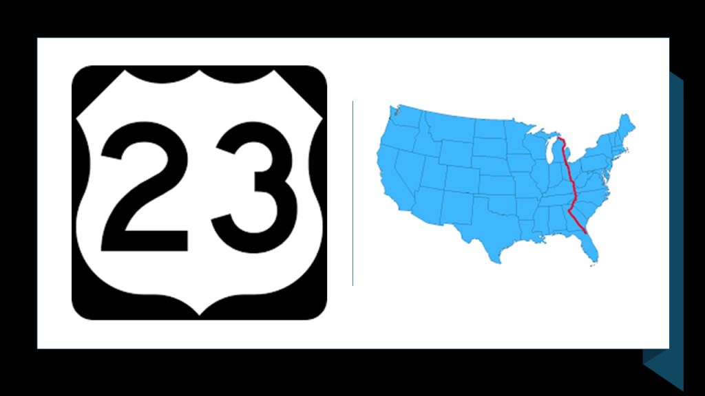
Mackinaw City is just a short-distance south on I-75 from St. Ignace, the previously mentioned eastern terminus of the western segment of US-2 where it meets I-75.
The northern terminus of I-75 is Sault Ste. Marie, Michigan, which I will be talking about shortly.
Mackinaw City is not far from the location of the Tahquamenon Falls State Park, where there are a series of waterfalls on the Tahquamenon River before it empties into Lake Superior in the northeastern part of the Upper Peninsula of Michigan, and the Tahquamenon Falls.
The Tahquamenon Falls are on Michigan State Highway 123, and are accessible from Michigan Highway 28.
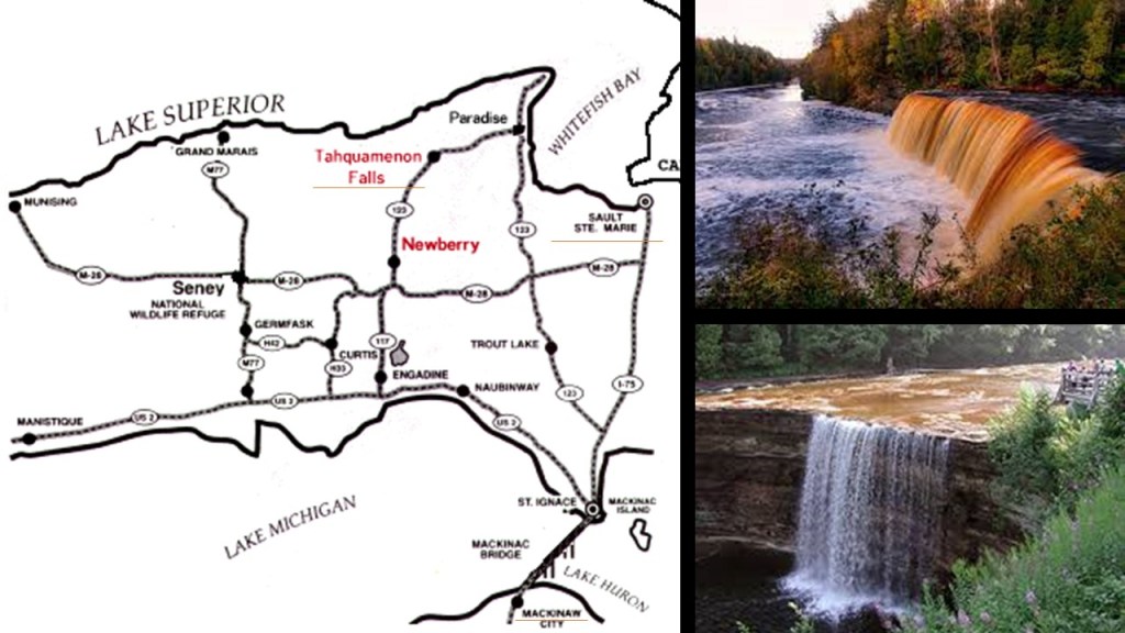
I was able to find an historical rail presence at Tahquamenon Falls when I searched and what came up was the “Tahquamenon Falls Riverboat Tours & Toonerville Trolley.”
It is a 6 1/2-hour wilderness tour that starts at Soo Junction that includes a narrow-gauge train ride and riverboat cruise to the Falls.
I found this information about the Tahquamenon Falls and Toonerville Trolley because I was looking at the Tallulah Gorge and Falls in Georgia, which are also on US-23.
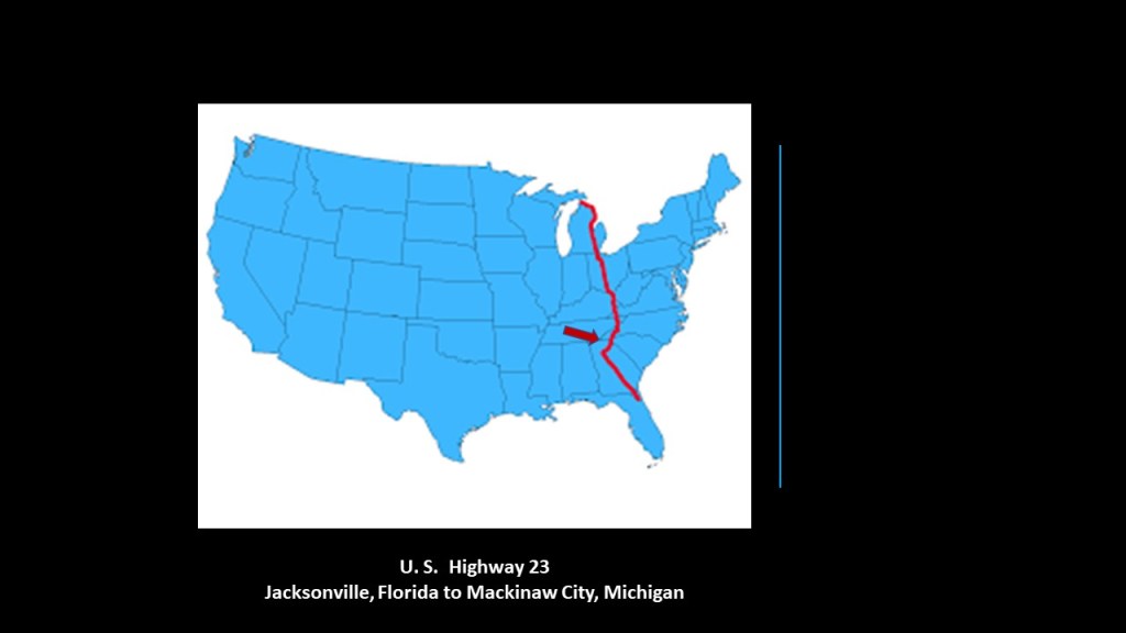
The Tallulah Gorge and Tallulah Falls in North Georgia are close to the South Carolina State Line.
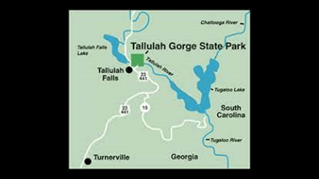
A State Park since 1993, the major attractions of the park are the 1,000-foot, or 300-meter, deep Tallulah Gorge; the Tallulah River which runs through the gorge; and six major waterfalls known as the Tallulah Falls which cause the river to drop 500-feet, or 152-meters, over one-mile, or 1.6-kilometers.
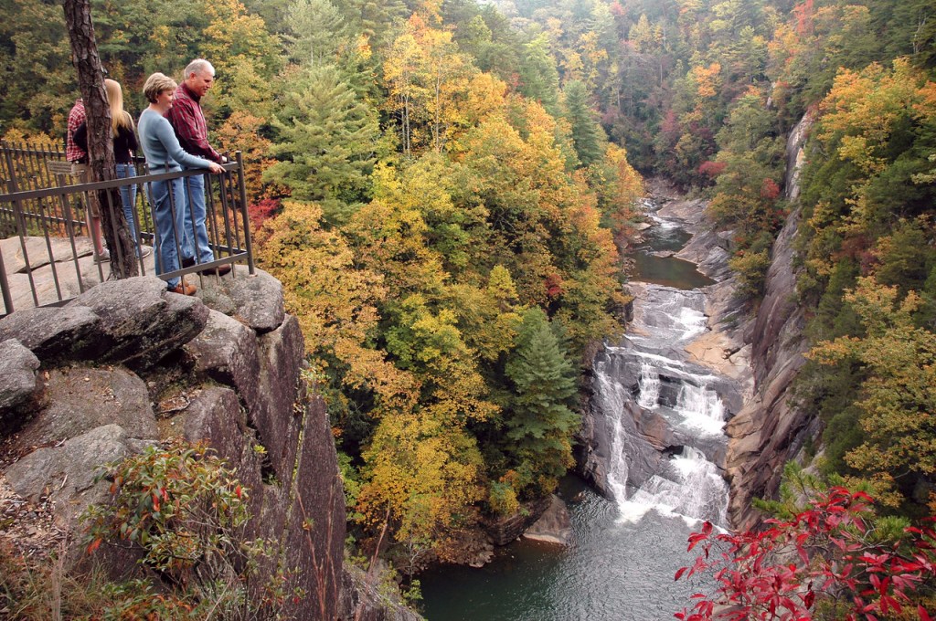
This is what we are told.
In 1854, The General Assembly of the State of Georgia first enacted legislation for the construction of a railroad linking the towns of Athens and Clayton in North Georgia, and the railroad opened in sections starting in 1870, with construction of the railroad having been delayed with the outbreak of the Civil War between 1861 and 1865.
When the railroad arrived at Tallulah Falls in 1882, tourism to the area intensified, bringing thousands of people a week to the area.
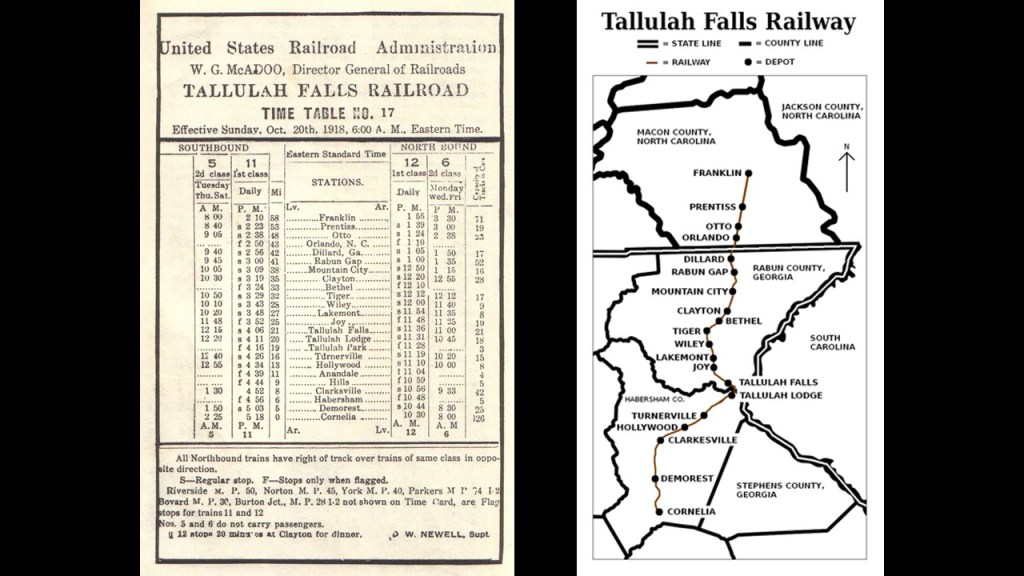
At one time, there were seventeen restaurants and boarding houses here catering to wealthy tourists.
Places like the Tallulah Lodge, said to be the grandest lodge at Tallulah Falls with over 100-rooms and built in the 1890s, and located one-mile, or 1.6-kilometers, south of the depot on the rim of the gorge.
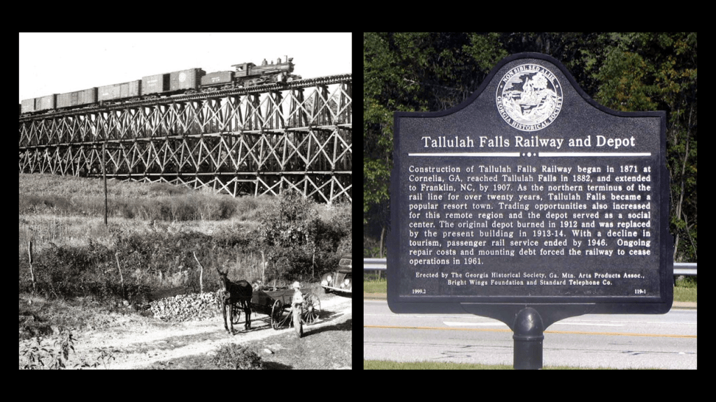
The Tallulah Lodge burned down in 1916.
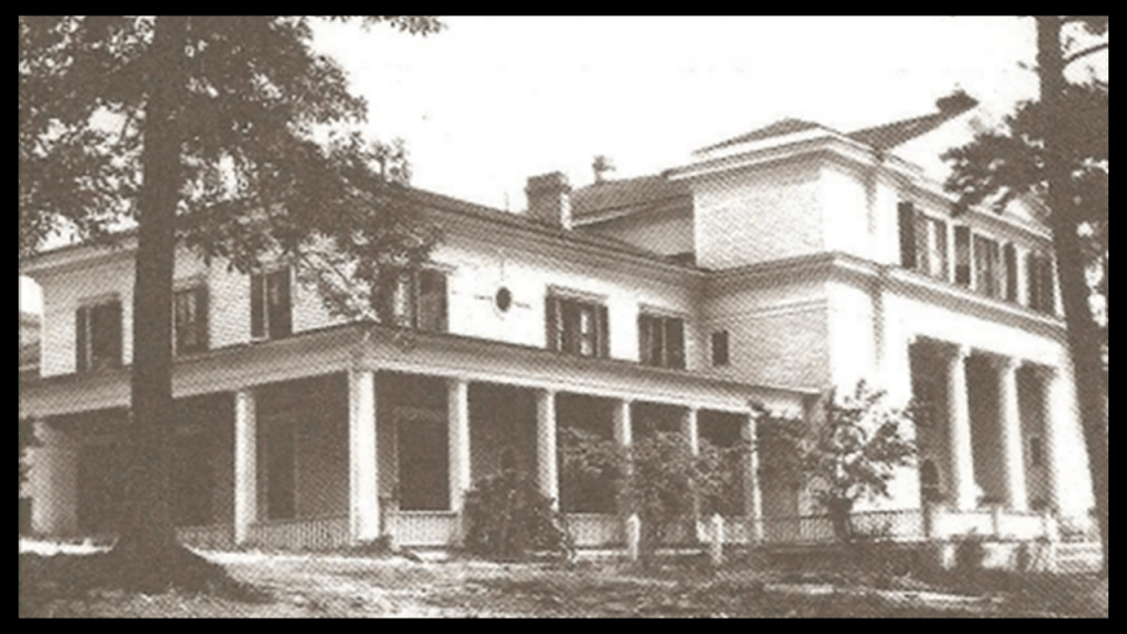
There was an historical fire in Tallulah Falls in 1921 that wiped out almost the entire town.
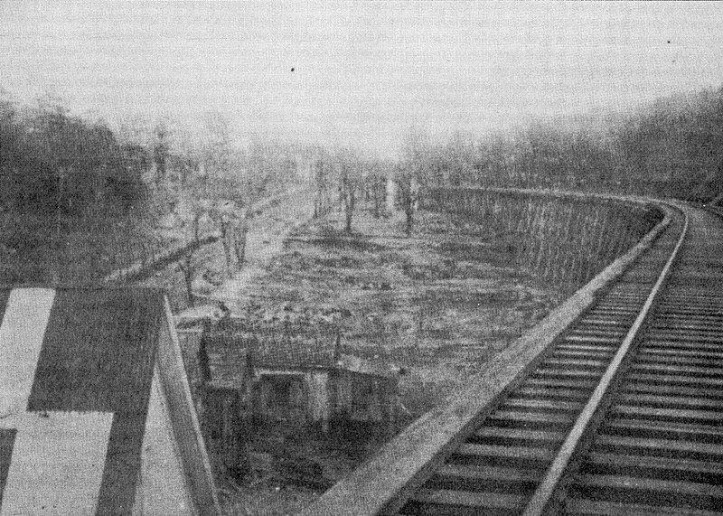
The Cliff House boasted 50-rooms and was located on the edge of the gorge across the tracks from the train depot, and was said to have been built in 1882.
When it finally burned down in 1937, all the grand hotels and boarding houses were gone.
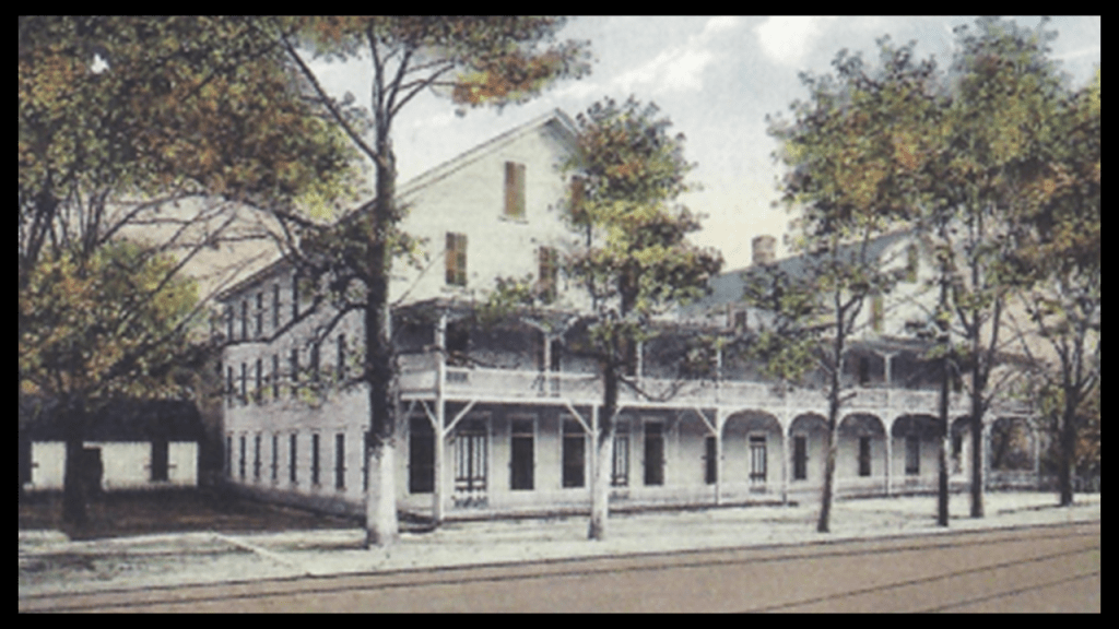
We are told that starting in 1909, the Georgia Railway and Power Company, had scouted the Tallulah River and Gorge with its drop in elevation as the ideal place to construct a dam and hydroelectric plant in order to provide electrical power to Atlanta, and that it ended up being one of six being constructed along a 26-mile, or 42-kilometer, stretch of the Tallulah and Tugaloo Rivers with a 1,200-foot, or 366-meter, drop in elevation, between 1913 and 1927.
The construction of the dam at Tallulah Falls was said to have started in 1910 with the purchase of land at the rim of the Tallulah Gorge, and completed in 1914 after the company won a legal battle to halt its activities in the Tallulah Gorge.
Here is a postcard with the Tallulah Falls Bridge on U. S. Highway 23/State Road 15 crossing right in front of the dam and the Lake Tallulah Reservoir.
The bridge was said to have been built between 1938 and 1939.
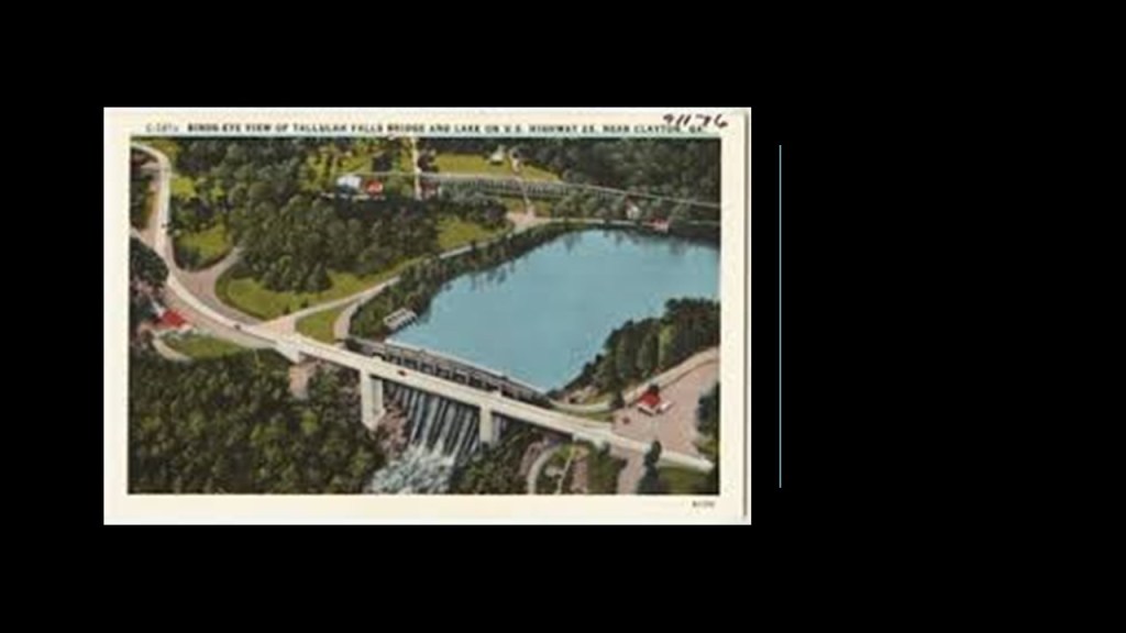
So now I am going to turn my attention to the binational region known collectively as “The Soo,” the nickname given to the Sault Stes. Marie of Michigan and Ontario which are located directly across from each other on the International Border of the St. Mary’s River.
The cities of Sault Ste. Marie was said to have been founded by the French Jesuit missionary, Father Jacques Marquette, in 1668. It was said to be named for both the “Sault,” the name given to the St. Mary’s River rapids, and the Virgin Mary, and called the first European city in the Great Lakes Region.
Sault Ste. Marie was one city until the border between the United States and Canada was established at the St. Mary’s River in a treaty after the War of 1812, creating Sault Ste. Marie, Michigan, and Sault Ste. Marie Ontario, and on both sides of the river, the area is referred to as the “The Sault” or even “The Soo.”
Sault Ste. Marie is the oldest city in Michigan, and said to be the third-oldest city in the United States.
The Soo Locks, the largest waterway traffic system on Earth, are called the “Linchpin of the Great Lakes,” allowing ships to travel between Lake Superior and the lower Great Lakes.
Lake Superior meets Lake Huron with a 21-foot, or 6-meter, drop in elevation.
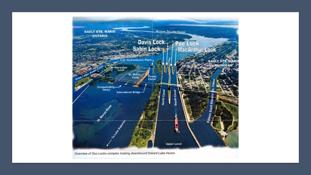
The main course of the St. Mary’s River, starts at Whitefish Bay at the eastern end of Lake Superior, and flows 74.5-miles, or 119.9-kilometers, southeast around Sugar Island into Lake Huron.
At the River of History Museum in downtown Sault Ste. Marie, Michigan, where we find out that St. Mary’s River is 8,000-years-old, and “born out of the trauma of this land as it buckled and ruptured, and gave way amidst thunderous sound and gigantic force – carved and formed by nature’s relentless sculptor – the glacier.
So, let’s take a look at what this violently-formed, nature-carved river looks like.
Before the St. Mary’s River even comes to the Lock Systems, from the direction of Lake Superior, this is what the shore-line looks like on the Ontario-side, with points and straight-edges…

…and even another canal going up into the city as pointed out by the arrows, with the last arrow showing where it looks like the canal was cut-off and drained.
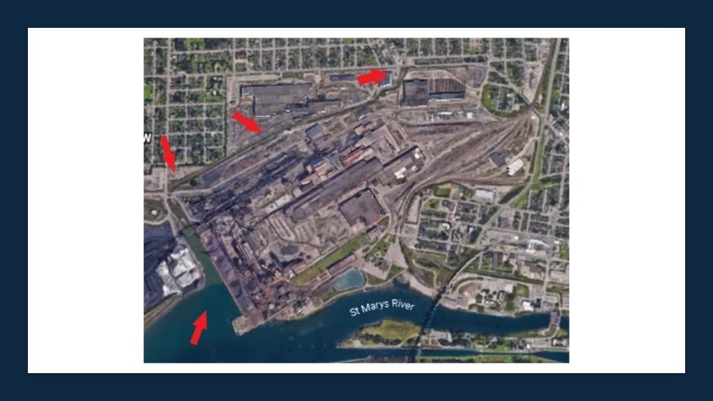
There a couple of things I am going to focus on in this binational region called “The Soo.”
First, I am going to look at the Power Canal on the American-side.
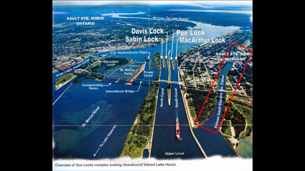
The Edison Sault Electric Company Canal, also known as the Edison Sault Power Canal, supplies the St. Mary’s Falls Hydropower Plant, an 18-MW, with capacity up to 30-MW, hydroelectric generating plant.

Made from sandstone masonry, it was said to have been built under the supervision of the U. S. Army Corps of Engineers, starting in 1898, with operation starting in 1902, and is one of the oldest, continuously-operating power plants in North America.
Just want to point out the doors in the middle of the building, above ground level.
Seems to be an odd location for a full-size set of doors.
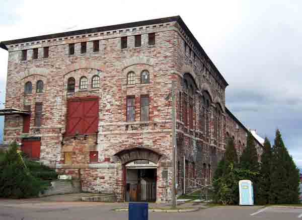
The water velocity of the power canal varies at times but can be up to 7-mph, or 11-kph, with the entrance being controlled by four steel headgates.
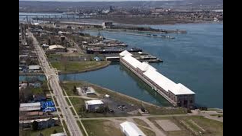
Next I am going to look at the canal locks on the American-side.

The Soo Locks are considered a wonder of engineering and human ingenuity.
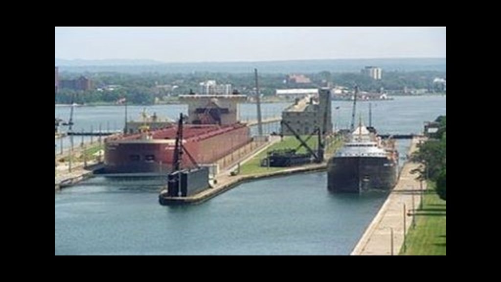
They by-pass the rapids of St. Mary’s River.
The river drops 21-feet, or about 6.4-meters, over hard red sandstone in a short 3/4-mile, or 1.2-kilometer, stretch.
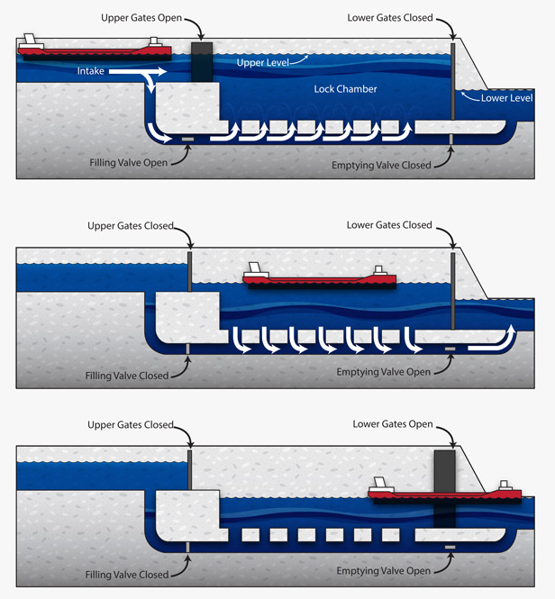
We are told the first locks were built here in 1855, and operated by the State of Michigan until transferred to the U. S. Army Corps of Engineers in 1881, who own, maintain, and operate the St. Mary’s Falls Canal, within which the locks are located.
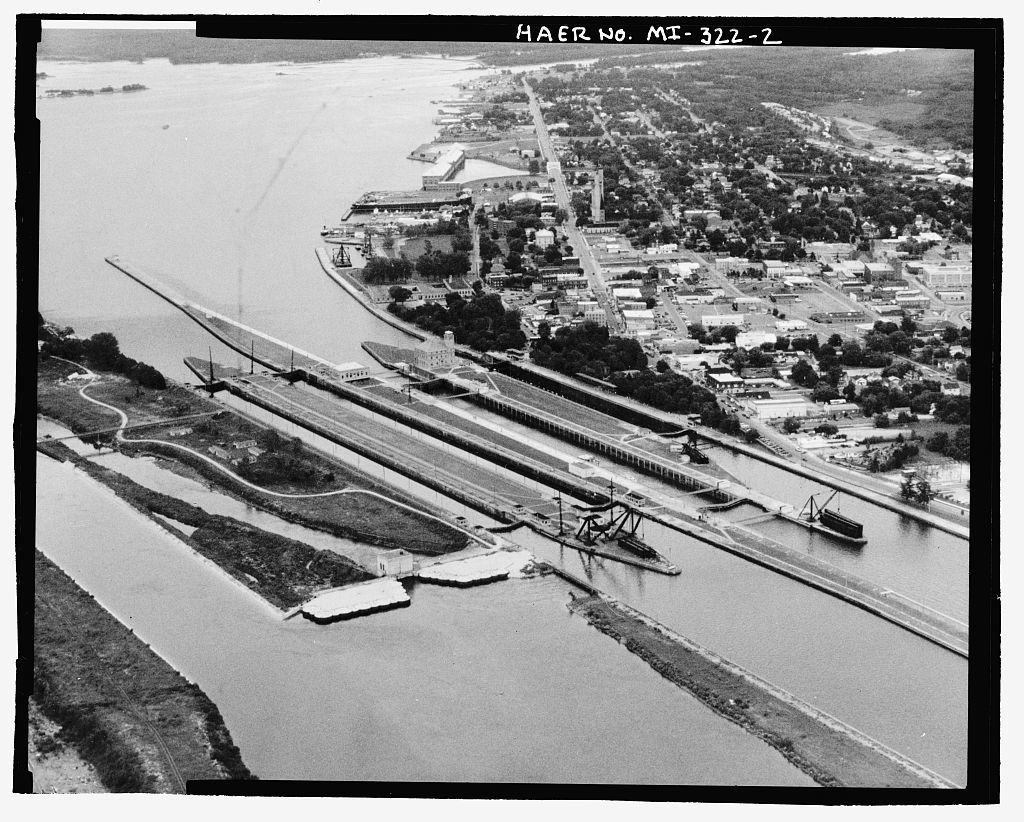
In the South Canal, the smaller MacArthur Lock was said to have been built in 1942, which would have been during World War II, and the wider Poe Lock in 1896.

The two buildings seen here, the larger one beside the MacArthur Lock, and the smaller one beside the Poe lock…
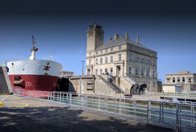
… have all the same features of the heavy masonry that we have already seen, in places like Ashland in Wisconsin on the right.
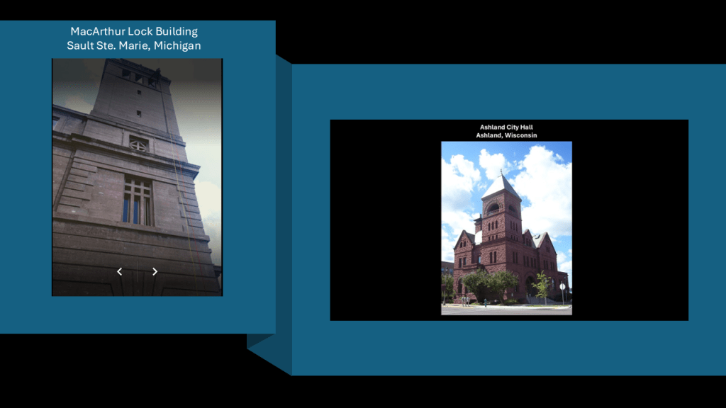
In the North Canal, the Davis Lock, said to have been built in 1919, is used infrequently for light freighters, tour boats, and small craft when the traffic warrants, and the Sabin Lock, said to have been built in 1914, is no longer in use.
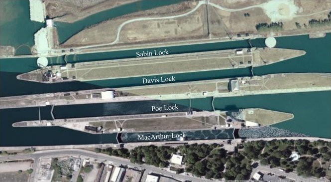
There are two hydroelectric powerhouses next to the Soo Locks, together generating 18.4-MW for the Soo Locks complex.
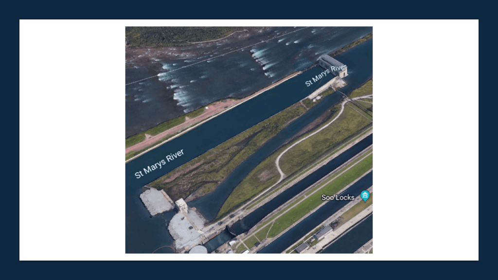
Next, the Sault Ste. Marie International Bridge is highlighted by the red box in this graphic.
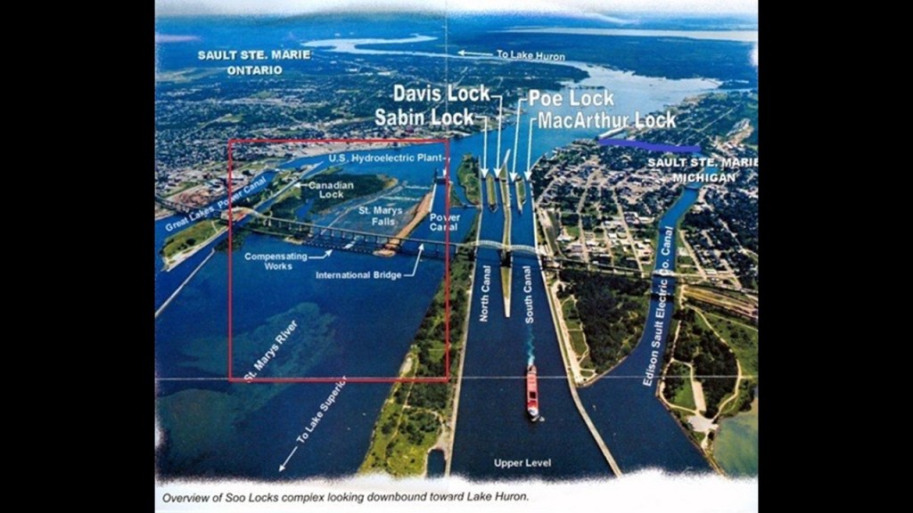
…between the United States and Canada, which permits vehicular traffic to pass over the locks.
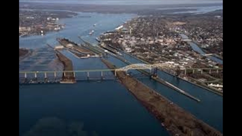
As I already mentioned, Sault Ste. Marie in Michigan is the northern terminus of Interstate-75, which goes all the way to Miami, Florida.
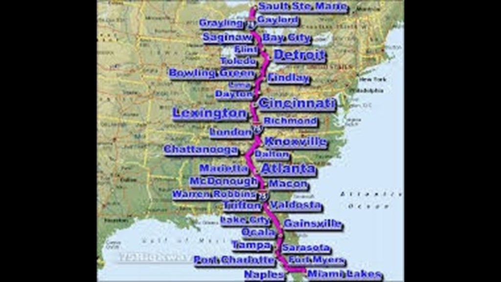
The Sault Ste. Marie International Railroad bridge runs adjacent to the International Bridge, and was said to have been built in 1887.
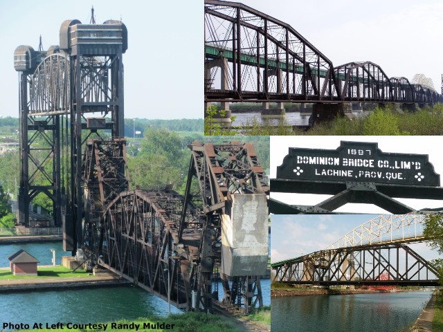
Like the previously-seen Duluth Aerial Lift Bridge and Portage Canal Lift Bridge in the Keweenaw Peninsula, this bridge has a vertical lift bridge as well.
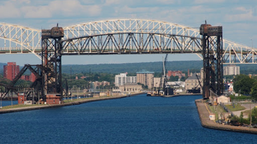
It also has swing bridge features as well.
Pretty sophisticated engineering technology for 1887!
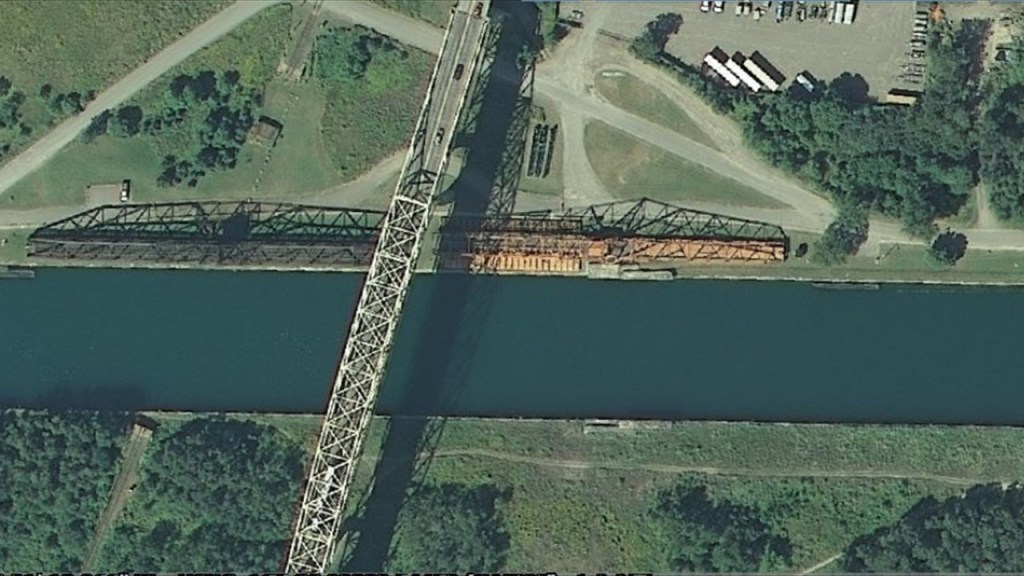
So addition to these examples of the same kind of sophisticated engineering technology in building bridges found in other places include, but are far from limited to, these three bridges I found in rural Illinois.
The Joe Page Bridge in Hardin, Illnois, named after a local politician who lived between 1845 and 1938, is a vertical-lift bridge that links Greene and Calhoun Counties across the Illinois River.
Its lift-span is just a little over 308-feet, or 94-meters, -long, making it the longest span of this type in the world.
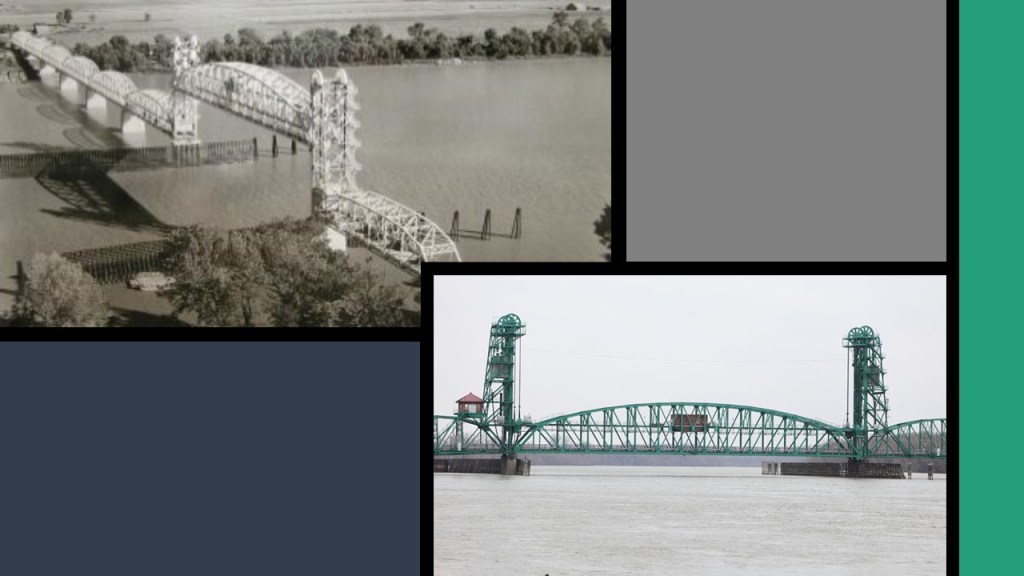
The bridge was said to have been built in 1931 by an “unknown” builder, though the State of Illinois Division of Highways is given credit for the engineering & design work.
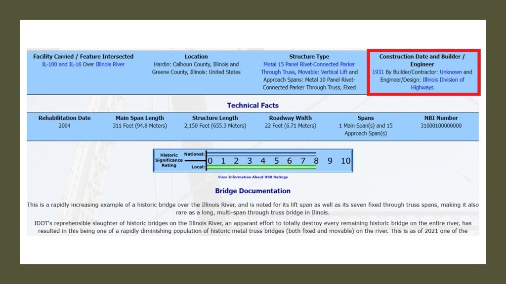
The Joe Page Bridge is the southernmost of three vertical-lift bridges on the Illinois River used by Illinois Route 100, which makes up much of the Illinois River Road, a U. S. National Scenic By-way.
The Florence Bridge, which connects the town of Florence, Illinois, to Scott County, Illinois.
The population of Florence was 71 at the time of the 2000 Census, and Scott County is the fourth least-populated county in the State of Illinois.
The Florence Bridge was said to have first opened in 1929…
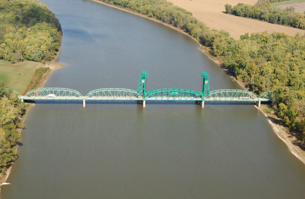
…and like the Joe Page Bridge is also listed as “Builder Unknown.”
The northernmost of the three vertical-lift bridges crossing the Illinois River is the Beardstown Bridge, located at Beardstown, Illinois, between Schuyler County, Illinois, and Beardstown.
The current bridge was said to have been built in 1955, and rehabilitated in 1985.
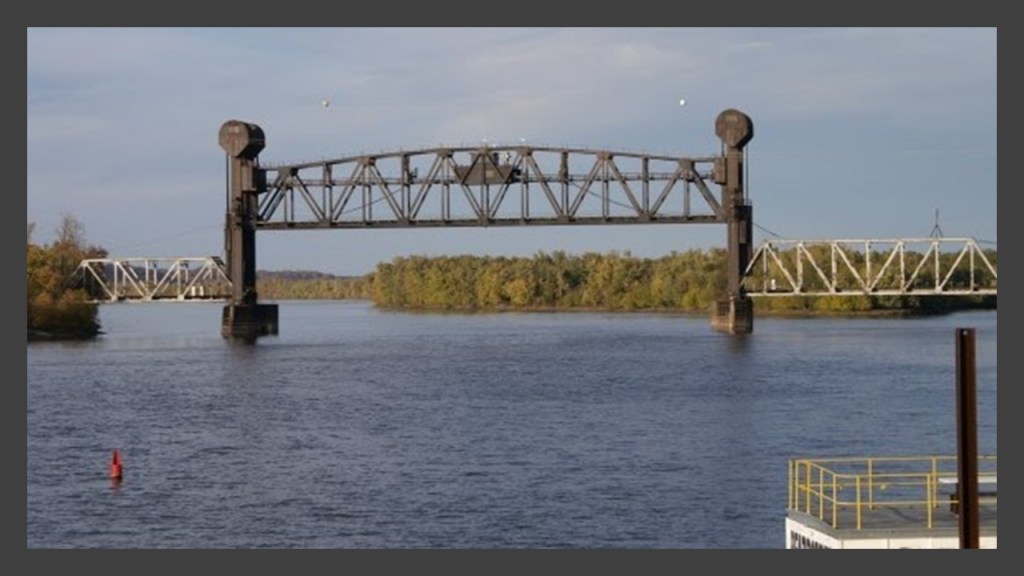
I can’t find out much information on the Beardstown Bridge either.
The next place we come to as we make our way across “The Soo” are the St. Mary’s Falls, of which the International boundary goes through the middle.
In the right foreground of this photo, in front of the International Bridges, is what are known as the Compensating Works.
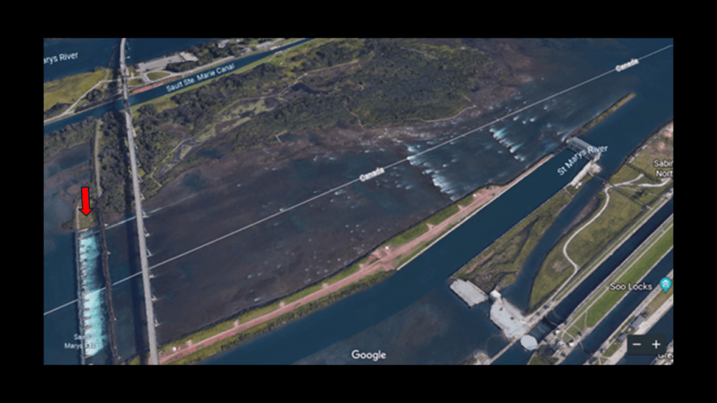
They consist of 17 piers and concrete aprons bearing on sandstone bedrock.
Piers 1 – 9 are in Canada, and Piers 10 – 17 are in the United States.
These were said to have been constructed between 1913 and 1919 (with World War I occurring between 1914 and 1918), and have an extremely sophisticated sluice-gate and gate-machinery system.
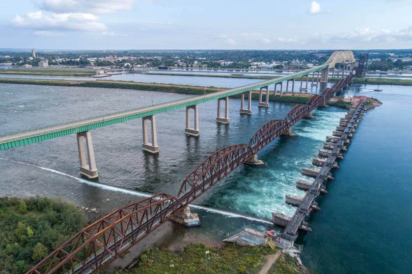
The Sault Ste. Marie Canal is in Canada, on the other side of the St. Mary’s Falls and Compensating Works.
It is a National Historic Site, and part of the National Park System of Canada.
The date of a lock here is said to go back to 1798, with its destruction in 1814 in an attack by U. S. forces in the War of 1812, and what is here presently was said to have been constructed in 1895.
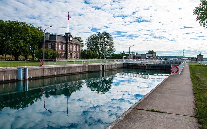
This illustration is said to depict the upper entrance to the Sault Ste. Marie canal in 1857.
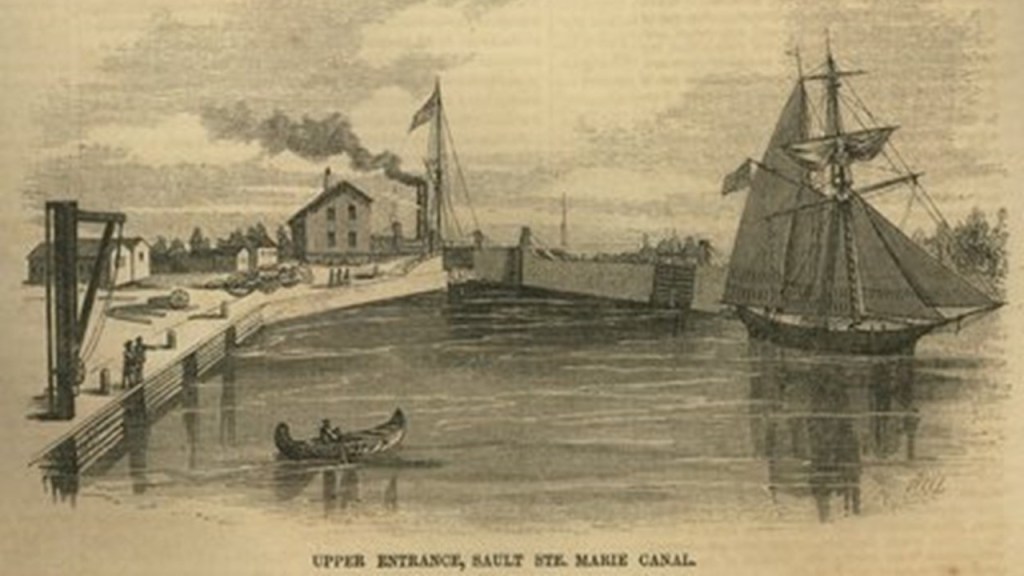
Next we come to the Great Lakes Power Canal on the Ontario side of Sault Ste. Marie.
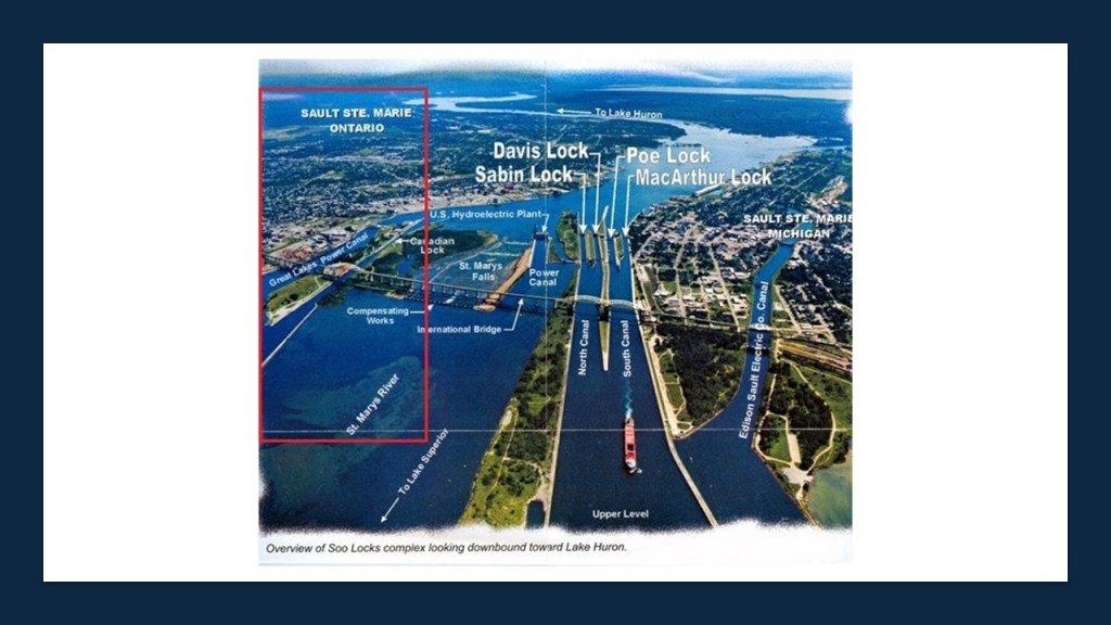
Great Lakes Power was established in the early 1900s by Francis H. Clergue.
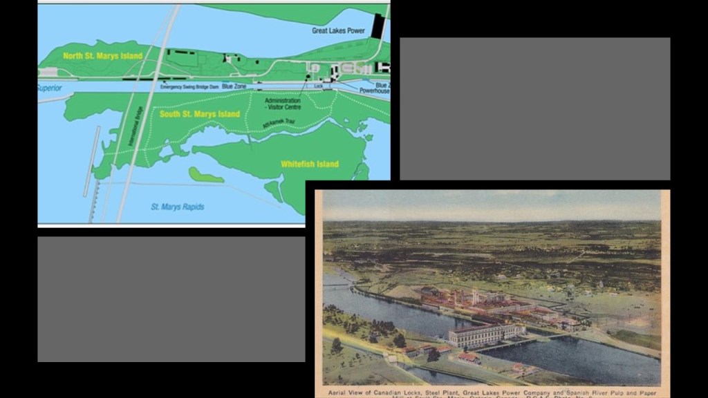
Francis H. Clergue was an American businessman who became the leading industrialist of Sault Ste. Marie, Canada, in the late 1800s and early 1900s.
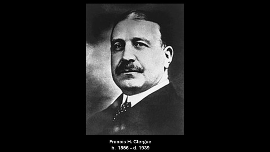
In addition to Great Lakes Power, he was also credited with establishing lmany other industrial companies,including, but not limited to, the Sault Ste. Marie Pulp and Paper Company in 1895, as we will see going through this region.
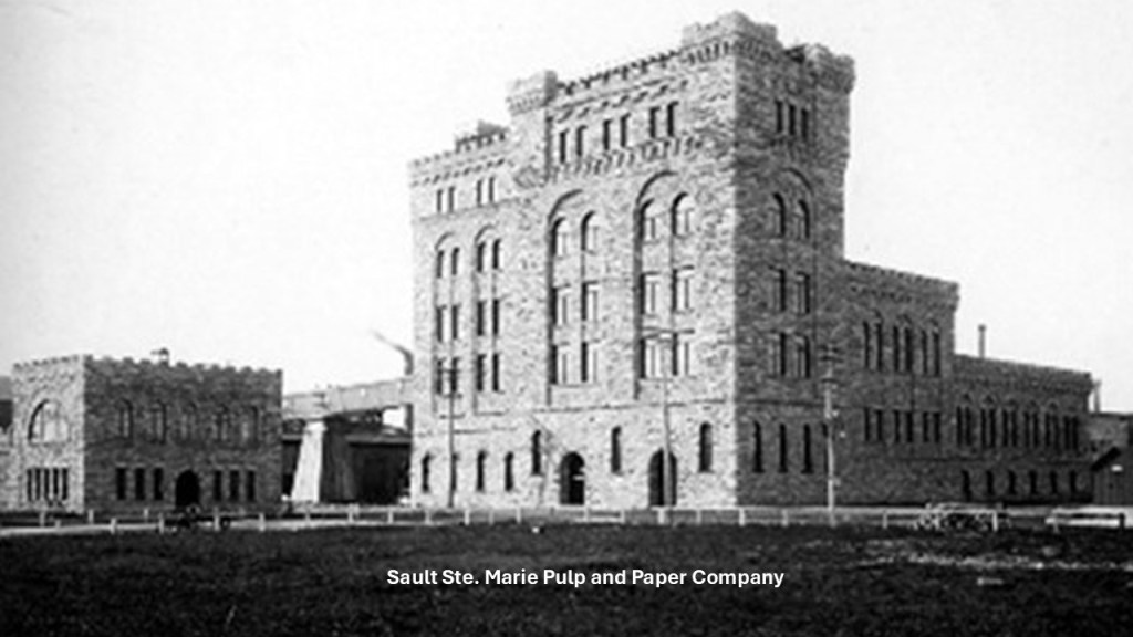
I also found this interesting photo of the Pulp and Paper Mill.
What is it showing us?
A recently built canal and building as they want us to believe?
Or far older infrastructure, perhaps after a cataclysm?
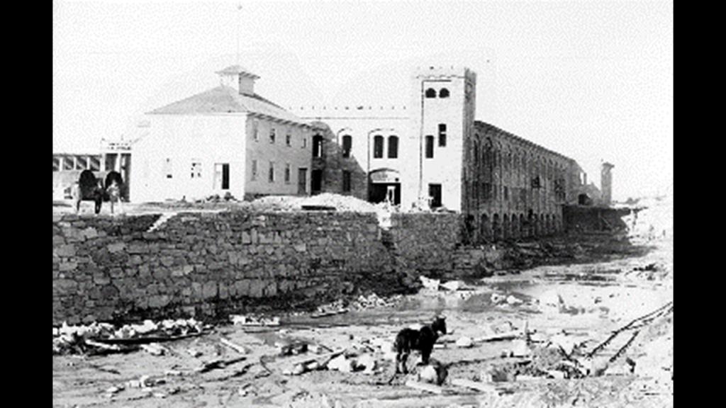
We are told Francis Clergue was behind the establishment and construction of the Algoma Steel Factory, which is said to have first opened for steel production in 1902, at which time the factory was said to have produced its first rail-tracks when the first Bessemer Converter was put into operation using pig iron made from the Helen Mine, about which I will talk about shortly.
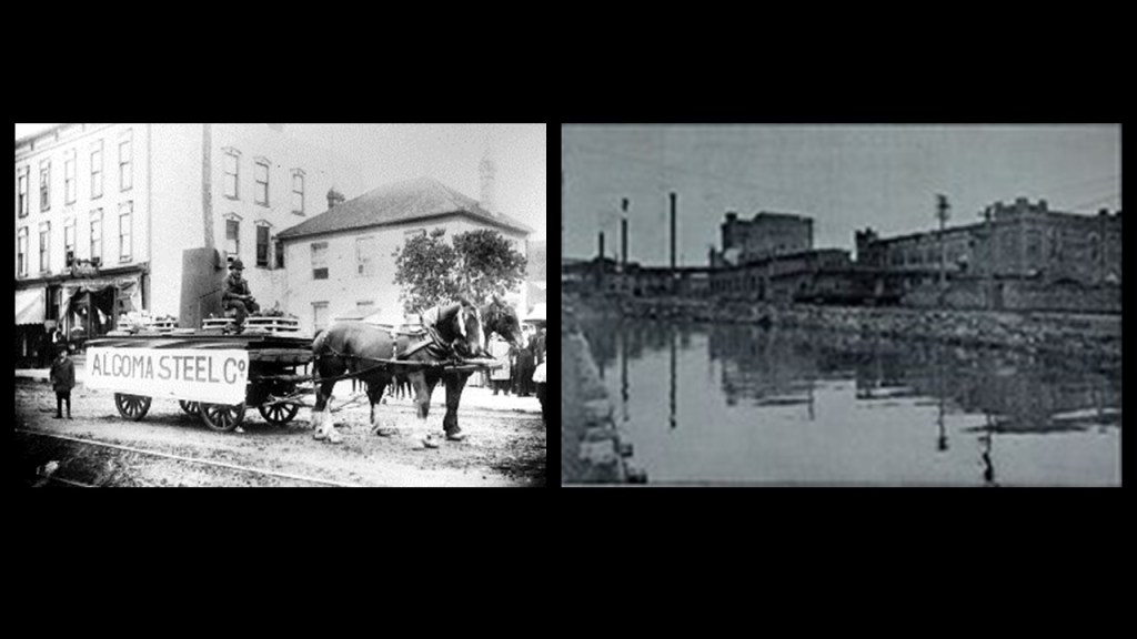
The massive blast furnaces for pig iron manufacture were not said to have been completed at the site until 1904.
This is incredibly high building and industrial technology and expertise for what we are taught we were capable of at the time.
Ford’s Model T wasn’t even in production yet ~ it entered the transportation scene in the fall of 1908.
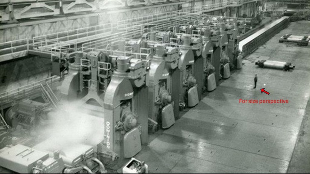
It is interesting to note that we are told during this same time, Clergue’s financial operations suffered reverses and having to shutter operations in 1903, which led to the 1903 Consolidated Lake Superior Riot.
I want to mention this here because this kind of story is one example of many with all of the mining and manufacturing in the Great Lakes region, and more of this type of thing with respect to labor relations will be coming up in other parts of this series.
The Consolidated Lake Superior Riot took place from September 28th – 30th of 1903 as a result of lay-offs and unpaid wages.
The riot resulted in the injuries of four protestors and two police officers, and military forces were called in to end the riot – first the local militia, and shortly thereafter, the members of the Royal Canadian Regiment and Mounted Royal Dragoons, and from Toronto, members of the Queen’s Own Rifles, and 48th Highlanders.
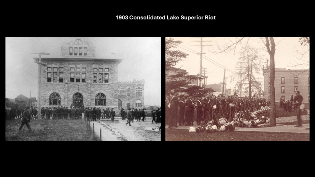
Clergue was also credited with the development of the Algoma Central Railway, connecting it to the Transcontinental artery of Canada.
He was said to have initially owned it, and needed a way to transport logs from the Algoma District in northeastern Ontario for his pulp mill, and iron ore for the steel factory, and that it was chartered on August 11th, 1899.
It was said to have been completed to Hearst, Ontario in 1914.
Never made it all the way to Hudson Bay as was planned, we are told.
Here is a comparison with a railroad trestle bridge for the Algoma Central Railway on the left, and the one shown previously for the Tallulah Railroad at Tallulah Falls in the northeastern corner of Georgia on the right.
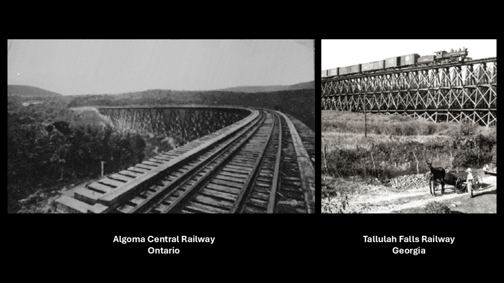
This is the Algoma Central & Hudson Bay Railway Terminal Station in Sault Ste. Marie, Ontario, said to have been built in 1912.
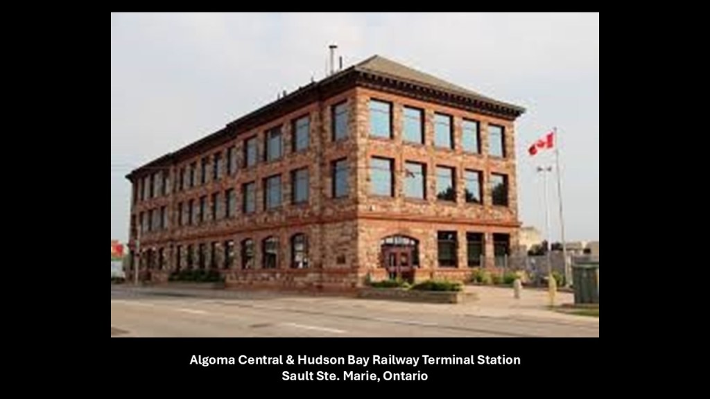
Other places we find in Sault Ste. Marie, Ontario, include:
The Algonquin Hotel, circa 1919, on the left, and the Algonquin Hotel today on the right.
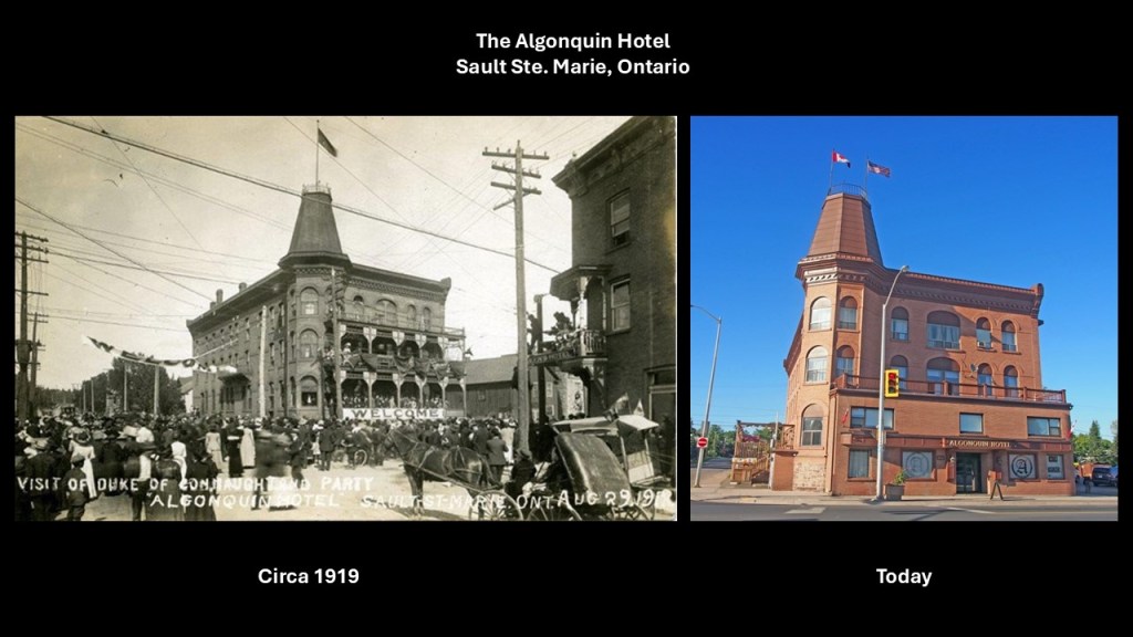
…and the Old Post Office.
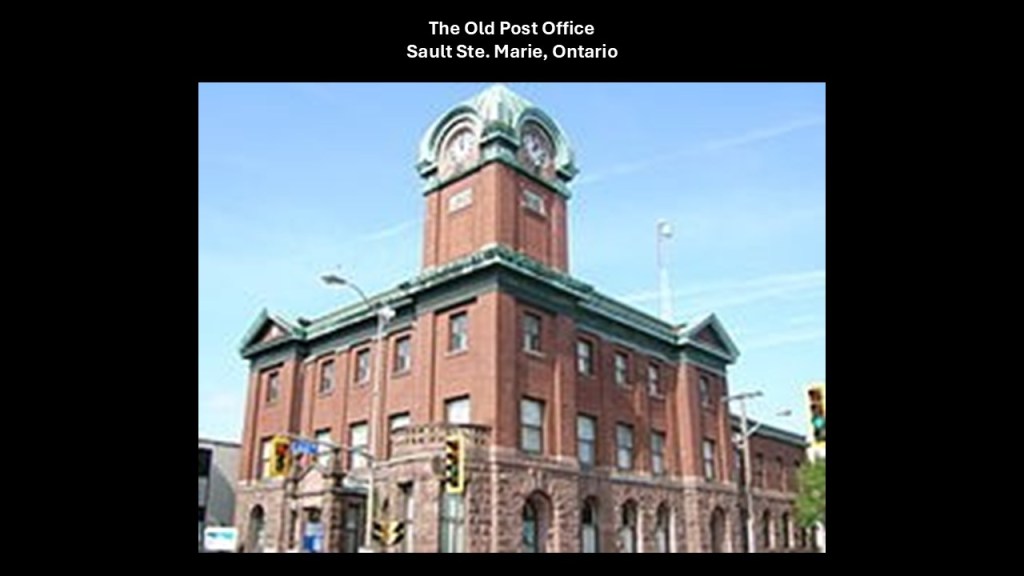
What is known to us as The Soo today appears to have been technological wonderland, and showcasing what I believe were technologies built by the original advanced Moorish Civilization and in place up until what we would consider relatively modern times.
I did an in-depth study of the region known as “The Soo” in September of 2019.
The next place I am going to mention continuing up the shore of Lake Superior from “The Soo” is Lake Superior Provincial Park, one of the largest provincial parks in Ontario, covering 598-square-miles, or 1,550-square-kilometers.
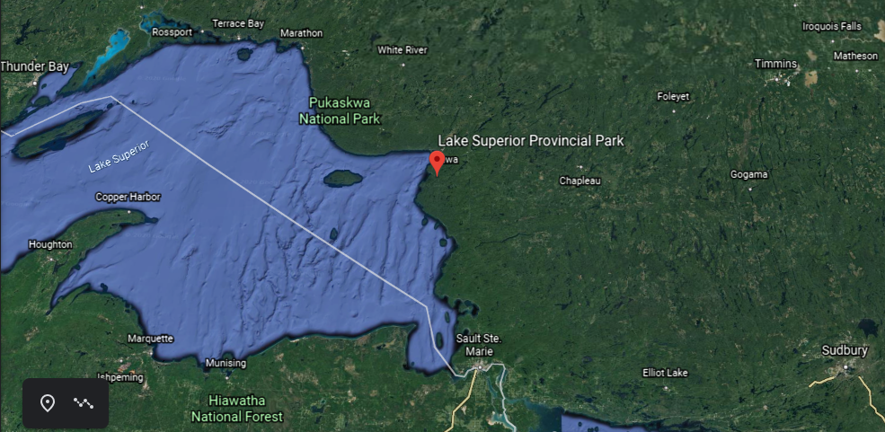
Ontario Highway 17 crosses through the park, which is part of the Trans-Canada Highway, though at the time it was designated as a Provincial Park, there was not road access.
Highway 17 is the only highway linking the eastern and western parts of Canada.
The Ojibwe indigenous to the region were forced to cede their lands to the Canadian government under an 1850 Treaty in exchange for annuities and reservations.
We are told a large tract of land was signed over to the British Crown in 1850 as part of the Robinson Superior Treaty covering the North Shore of Lake Superior.
This was two days after the signing of the Robinson-Huron Treaties, which covered the northern eastern shores of Lake Huron, which also established annuities and reservations.
In both cases, the Crown pledged to pay an annuity to these First Nations people, originally set at $1.60 per treaty member, and it was last increased to $4 in 1874, where it is fixed to this day.
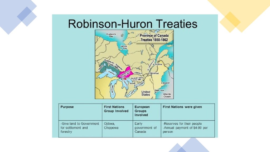
On the left is a photo of Katherine Cove at Lake Superior Provincial Park, compared for similarity of appearance with Lake Arcadia in Edmond, Oklahoma, in the middle, and the Gulf of Bothnia on the right, on the alignment earlier in this post, between Sweden and Finland.
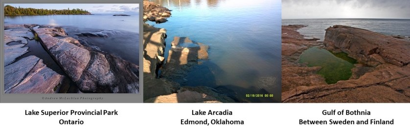
The stone steps and walls pictured here are also at Lake Superior Provincial Park.
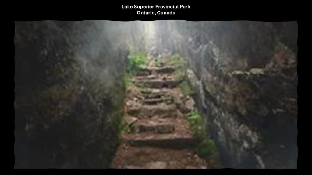
Not too far from the northern end of Lake Superior Provincial Park, and the Township of Wawa, there are numerous mining concerns, including gold…
…and historical mining for high-quality iron ore at the defunct Helen Mine and Magpie Mine.
Starting in 1900, the Helen Mine was owned and mined by Francis Clergue.
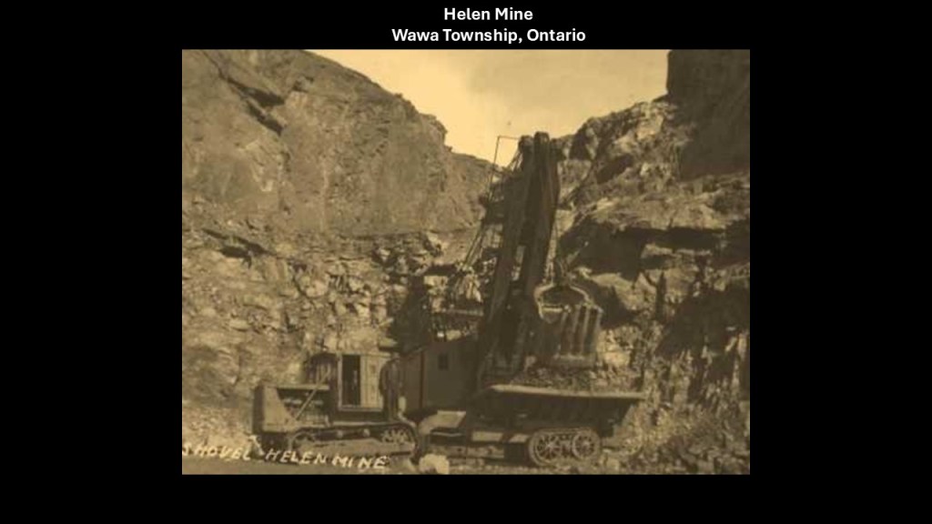
In our historical narrative, Clergue built a railroad from the Helen Mine to Michipicoten Harbor on Lake Superior, which was only 10-miles, or 16-kilometers, away from the mine.
It was here that we are told Clergue had ore docks built in Michipicoten Harbor which facilitated the transfer of the iron ore to the blast furnaces of steel mills.
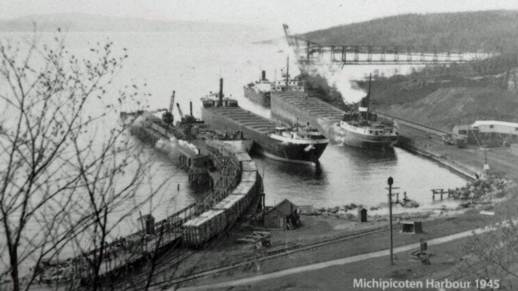
Here’s a view of remnants of infrastructure in Michipicoten Harbor in the present day, left to rot in place, which was not an uncommon thing to do as we shall see in our journey throughout the Great Lakes region.
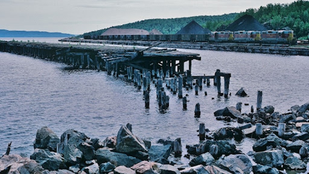
We are told that a lighthouse was built at the entrance to Michipicoten Harbor at Little Gros Cap and put into operation in 1902.
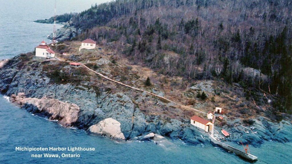
Interestingly for a “navigational aid,” the light was said to be not visible from the wharves of the harbor.
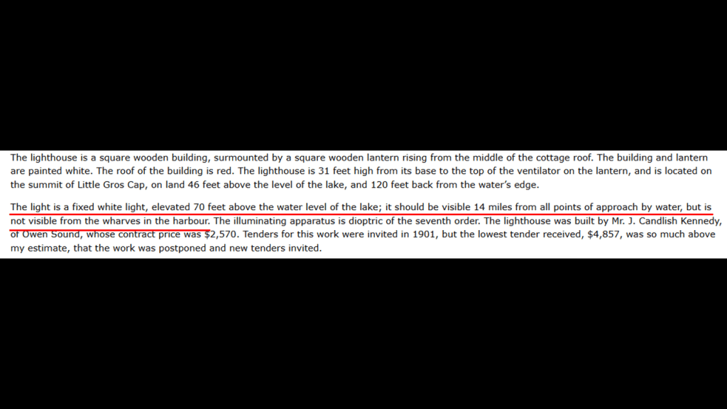
We are told that another large iron deposit was discovered north of the Helen Mine in 1909.
The land was purchased by the Algoma Steel Company, and the Magpie Mine was commercially developed, in production between 1914 and 1926.
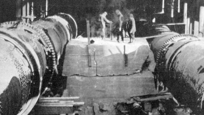
Michipicoten Island is located in Lake Superior just off the coast of Ontario, between Sault Ste. Marie to the northwest and Wawa Township to the southwest.
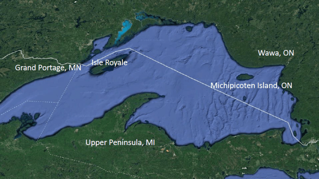
The lands of Michipicoten Island, which include some smaller islands and shoals, are primarily preserved wilderness today, with a few human visitors in the form of owners of camps on a small number of private in-holdings; commercial fishermen and a commercial outpost camp.
The main island of Michipicoten is heavily forested, with over twenty lakes.
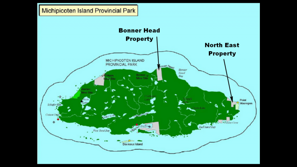
There are things like kayaking tour packages of the island available for those who are interested in visiting this remote island that has been called “An Island Lost to Time.”
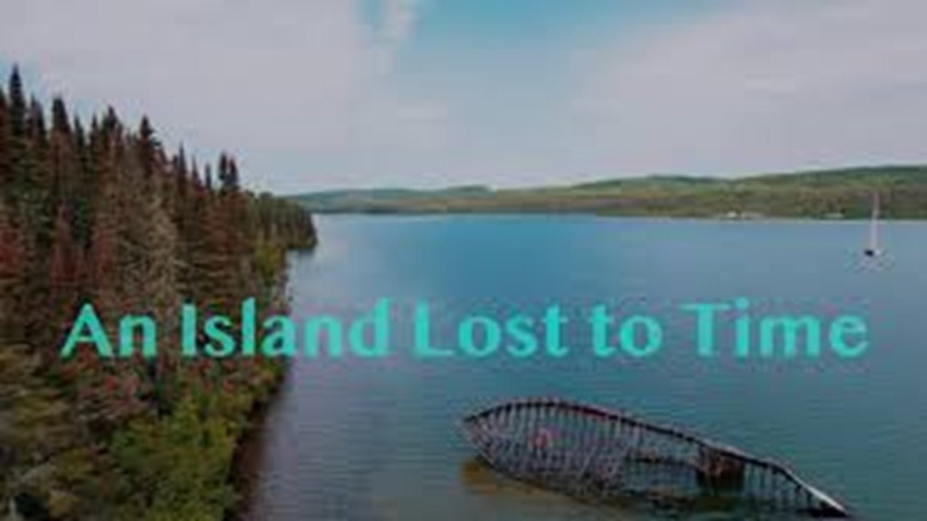
If you visit the island, there are things to see there like old stone walls long-overgrown with trees…
…shipwrecks in shallow waters just off-shore…
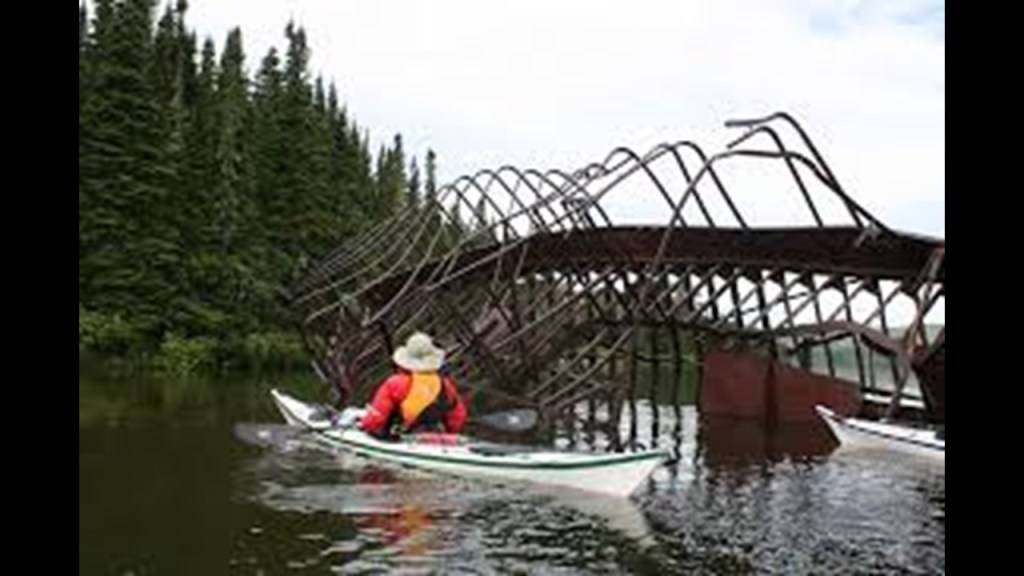
…overgrown equipment left-over presumably from a copper-mining past because that’s the only explanation we have ever been given…
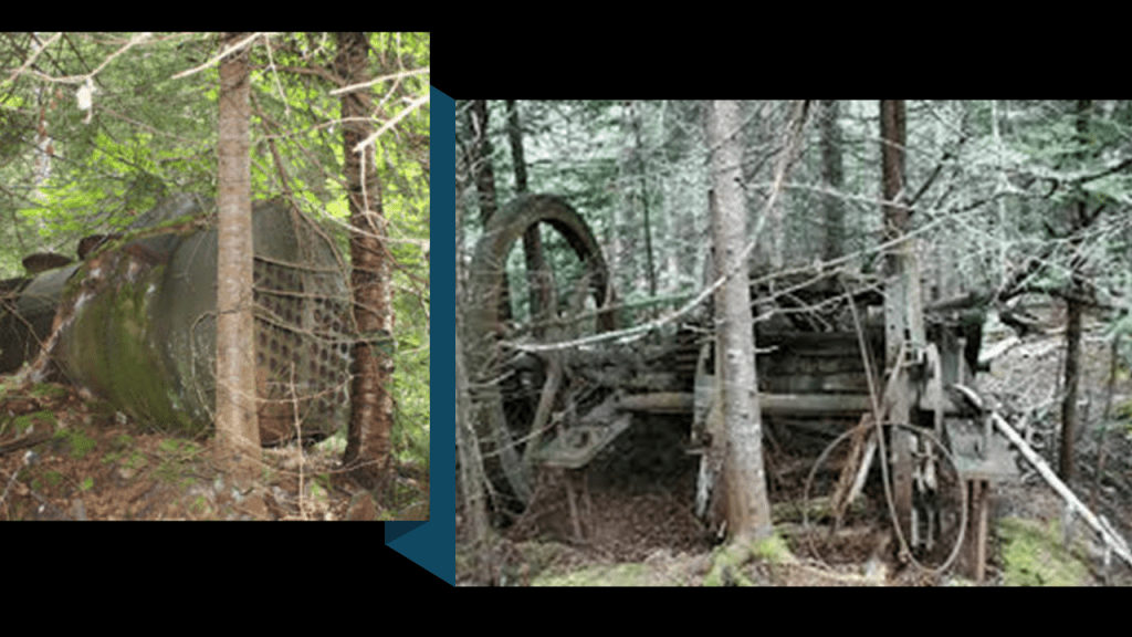
…and one remaining of three original lighthouses on Michipicoten Island.
The still-standing lighthouse is called the East End Lighthouse, which sits on top of rocky land right to the water’s edge, and which we are told was the third-one built sometime around 1912, the year it became operational at the beginning of navigation season in the warmer months of the year.
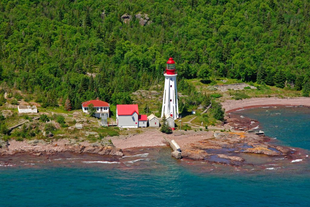
The other two historic lighthouses on Michipicoten Island were located in the island’s Quebec Harbor, which were a pair of range lighthouses like we saw back in Munising with the two pairs of lighthouses with a front light and a rear light.
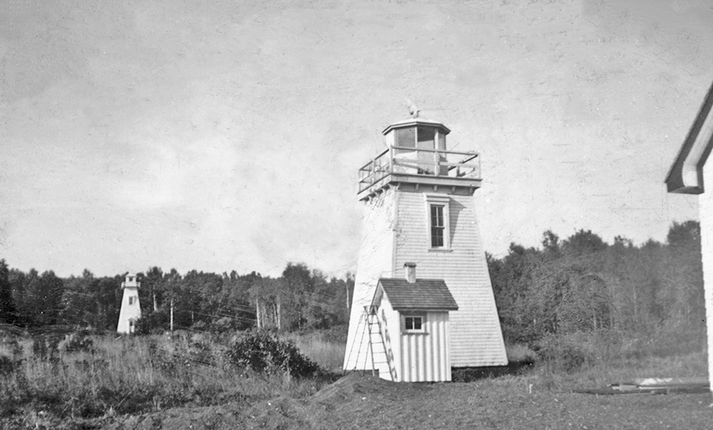
There was a third lighthouse on the nearby Porphyry Island.
The construction of these last three lighthouses was said to have been authorized by the Canadian Parliament in 1872.
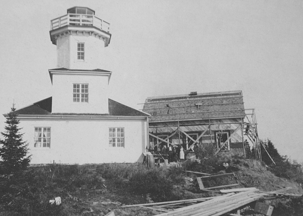
While there is still a lighthouse on Porphyry Point today, with this one said to have been constructed in 1960, it is not in use and has been vandalized over the years.
Like the East End Lighthouse, this one also sits on rocky land right next to the water’s edge, where you can see more rock going down below the surface of the water in this photo of it.
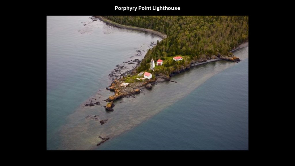
There are just a few more places to look at on Lake Superior western shoreline as we are coming to the end of the journey around Lake Superior’s entire shoreline, and they are Marathon; Rossport; the area around Nipigon and the Sleeping Giant in Thunder Bay.
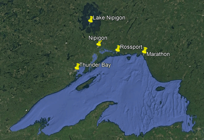
The first place we come to towards the end of this journey around the lake is Marathon.
Marathon’s resource-based economy was built on pulp, until the company managing it, Marathon Pulp Inc, in operation since 1944, shut-down operations indefinitely in February of 2009, eliminating hundreds of jobs and negatively impacting the local economy.
The Marathon Pulp and Paper Mill was completely demolished by the end of 2015.
Since the mid-1980s, however, the Marathon economy expanded to include mining operations like gold-mining, with several gold-mining operations in operation here, and mining elsewhere in the region as there are a lot of mining concerns throughout this part of the world as mentioned throughout this post.
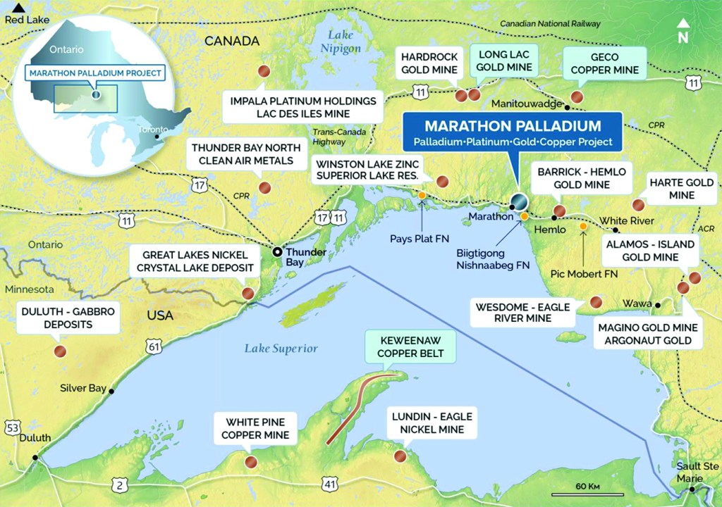
Marathon is a short-distance west of Trans-Canada Highway 17, and the town is served by among other things, the Canadian Pacific Railway, a geographically important airport, and 9-hole golf course.
The next place we come to is Rossport.
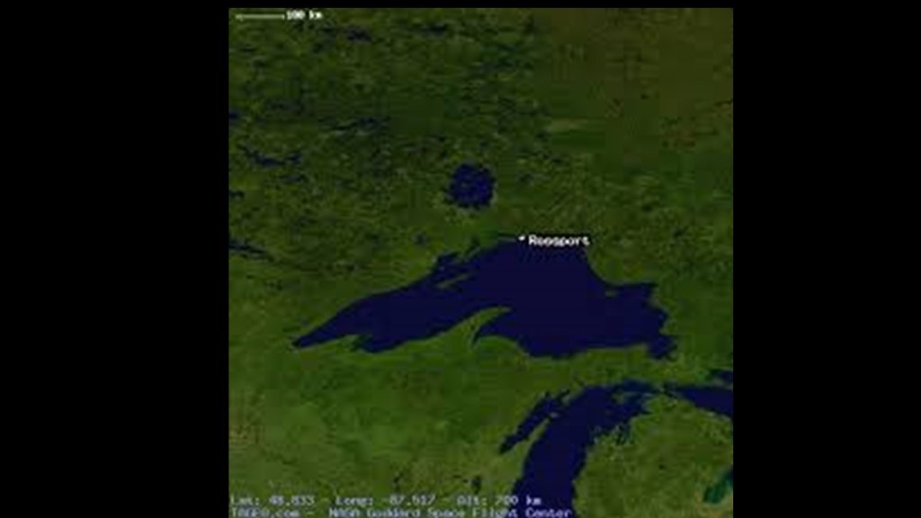
Rossport is a rural community today that was named after the construction manager for the Canadian Pacific Railway from August of 1882 to June of 1885, John Ross.
After the construction of the railroad was finished in 1885, Rossport became an important commercial fishing center, with a reputation for prime freshwater fish.
At one time in the 20th-century, Rossport was the location of an international fish derby, until the non-native species of lamprey eel arrived at the lake and caused the downfall of the fish derby.
In 1901, Rossport became a regular stop for steamships owned by Francis Clergue, along with other communities here, between Port Arthur, today’s Thunder Bay and Sault Ste. Marie.
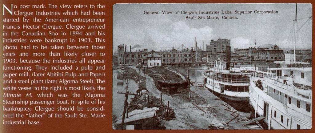
Lastly of note in Rossport before I move on, in 1911, the luxury steam-yacht “Gunilda” owned by oil baron William Harkness of Cleveland, sank on the McGarvey Shoal on the north side of Copper Island.
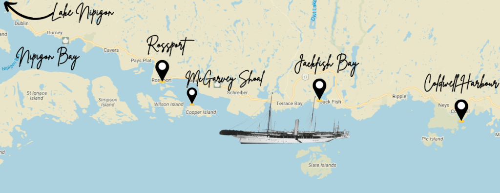
Harkness and his family and friends on-board were ultimately rescued, but the famous yacht of the day sank, and came to rest at 270-feet, or 82-meters, below the surface of the lake.
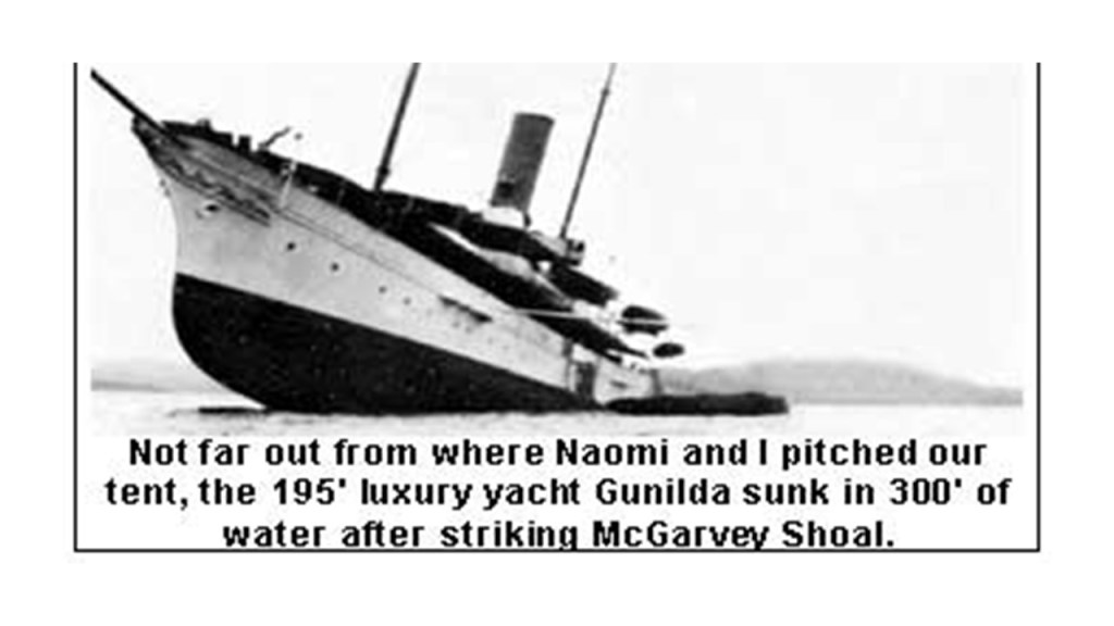
A shoal is defined as a place where a body of water is shallow, and where a ridge, bank or bar is close to the surface of the water, and poses a danger to navigation.
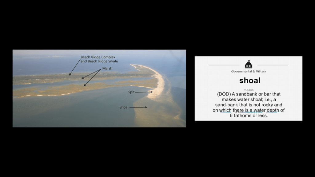
The next place I am going to look at in the location of Lake Superior is the area around Nipigon.
Nipigon is the northernmost community on the Great Lakes.
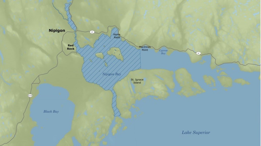
We are told that the Nipigon area was home to a succession of fur trading forts and posts during the time of European colonization, which started in 1665, and French explorers were said to have built several forts on Lake Nipigon shortly thereafter.
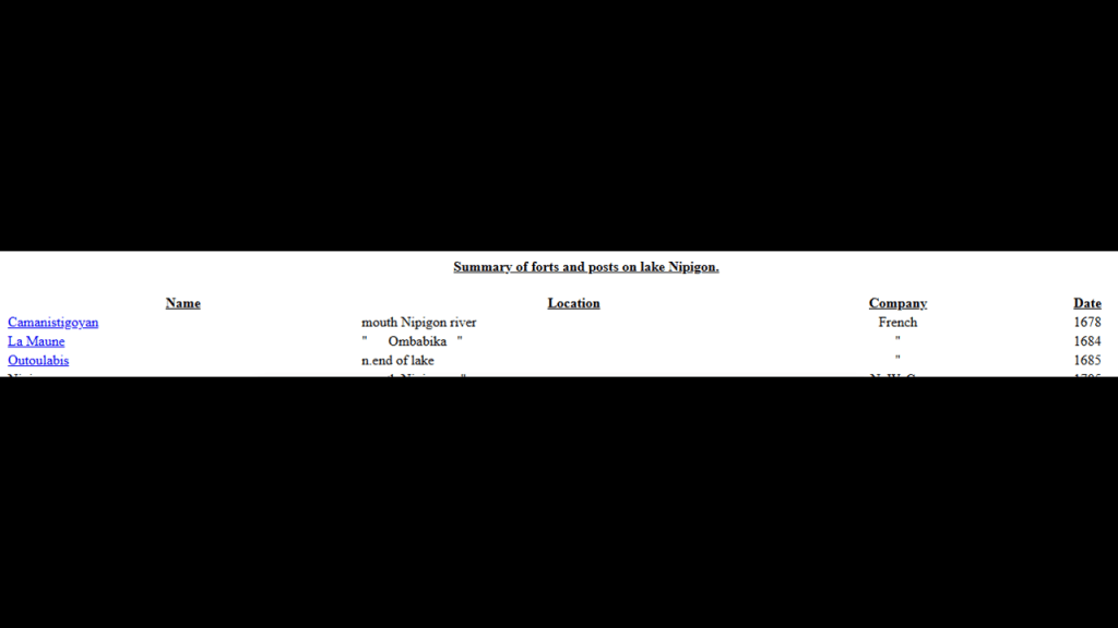
Then starting in 1785, the previously-seen fur trading companies in the region seen at the beginning of this post, the North West Company and the Hudson’s Bay Company, were said to have established fur trading posts/forts here, with the two companies merging together to become one big Hudson’s Bay Company in 1821.
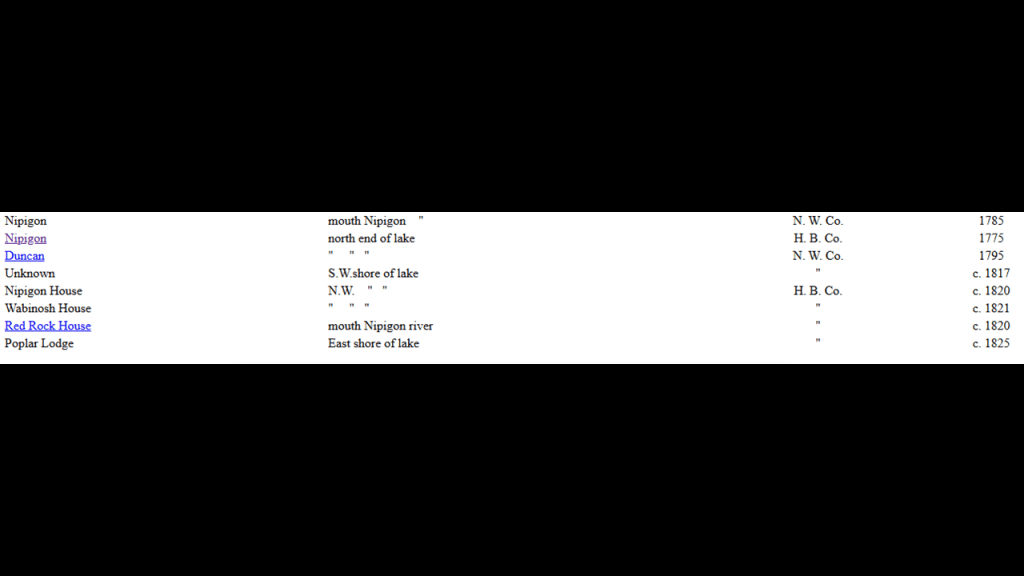
We are told in the historical narrative that in 1859, the Hudson’s Bay Company set-up a trading post at the location of the current township of Red Rock, and built Fort Nipigon to as a transshipment point for cargo and to protect the trading post.
In 1882, Red Rock was the headquarters of the Company’s Michipicoten District, and in 1892, it was the headquarters of the Lake Superior District until 1902 when the trading post burned down, and the headquarters moved to Fort William, which was today’s Thunder Bay.
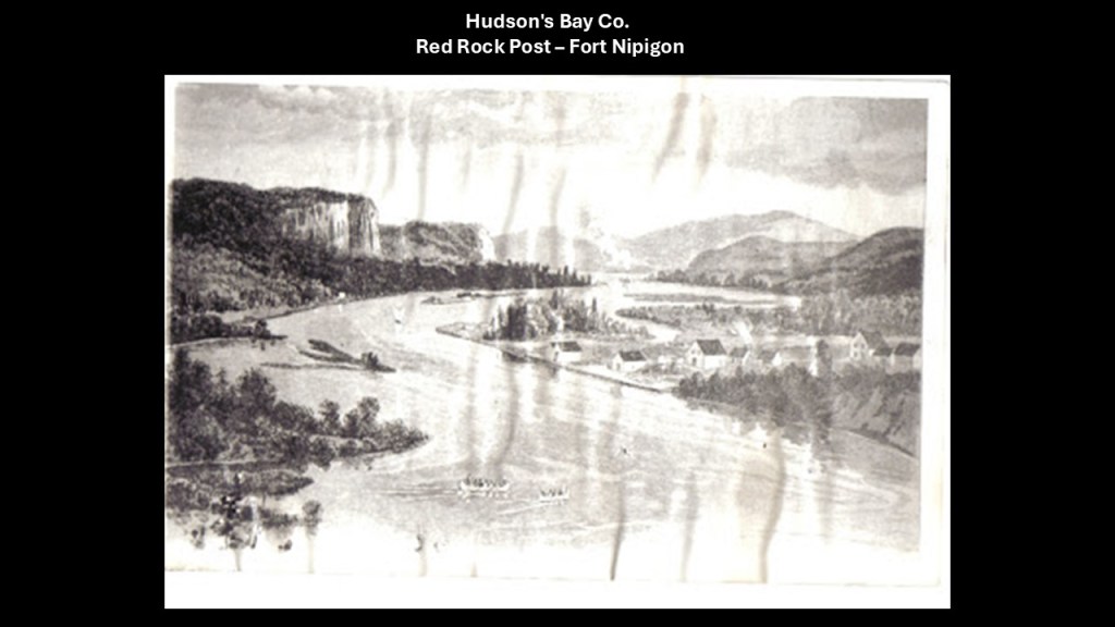
We are told the Canadian Pacific Railway tracks were completed across the North Shore of Lake Superior in 1885, and that starting around 1910, the Canadian Northern Railway was built through the town, and opened for passenger service in 1915.
By 2005, all railroad traffic on the Canadian Northern Railway through town had ended, and the rails were removed in 2010.
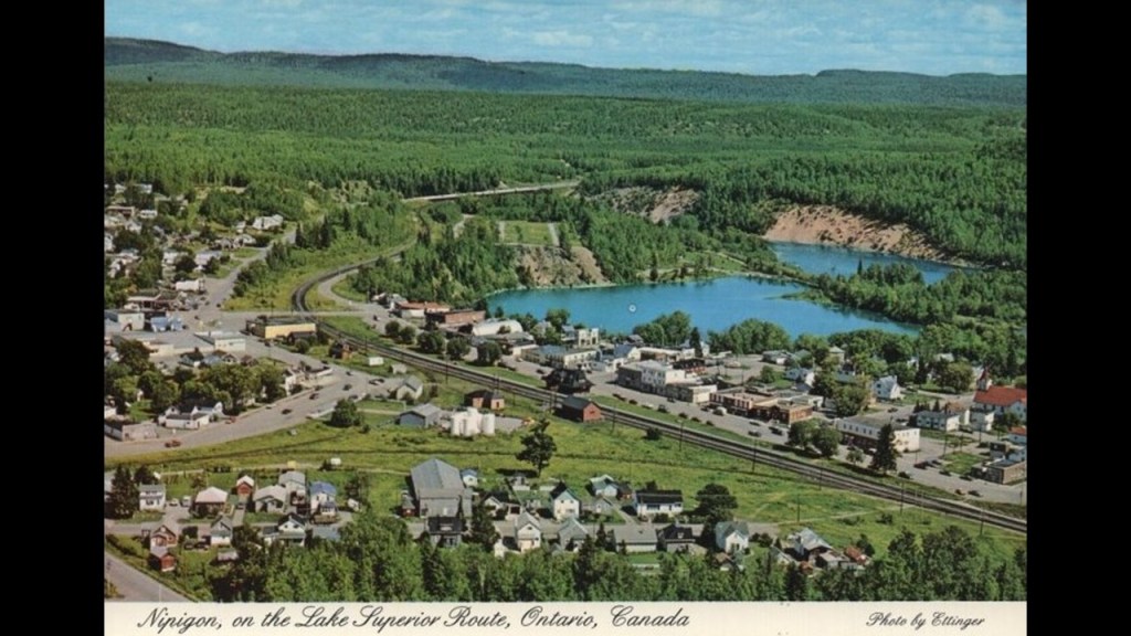
We are told the Nipigon River Bridge for the Trans-Canada Highway was built in 1937.
It is considered the most important bridge in Canada because it is the only crossing for east-west traffic in the region for the flow of goods, people, and trains between eastern and western Canada.
It carries both the Trans-Canada Highway, and both the Canadian Pacific and Canadian National Railways.
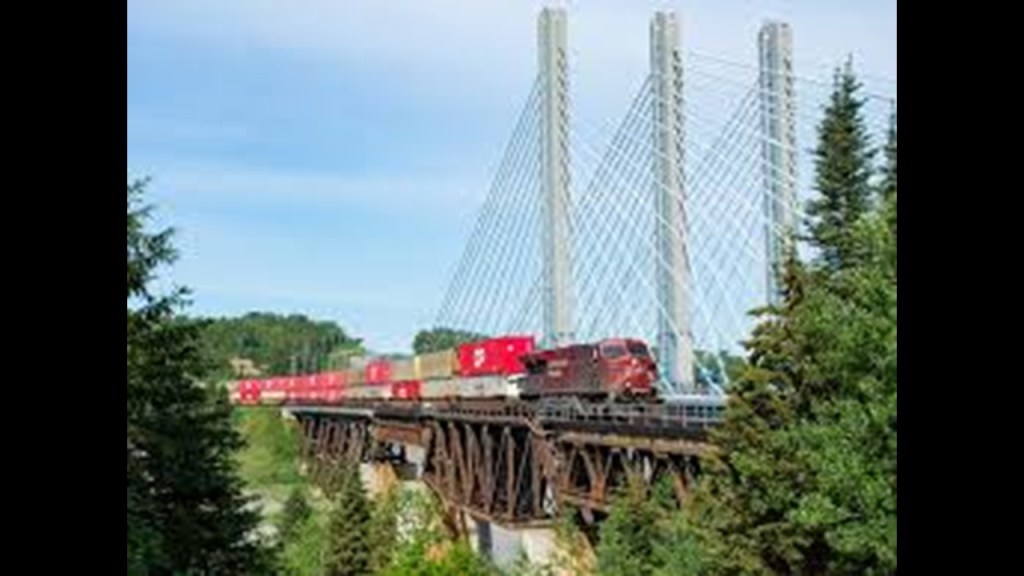
In February of 2007, the mill for Nipigon’s main employer, Multiply Forest Products, burned to the ground less than a month after mill workers had purchased it from the previous company, Columbia Forest Products of Portland, Oregon.
The mill produced hardwood underlay for vinyls, plywood and laminate flooring.

With regards to the area surrounding Nipigon, I want to first look at Lake Nipigon on one side, and then end with a look at the Lake Superior Archipelago and the Sleeping Giant Provincial back in Thunder Bay as here we have come full-circle around Lake Superior.
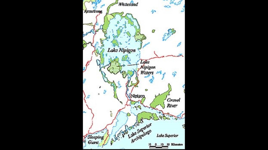
Lake Nipigon has a total area of 1,872 square miles, or 4,848 square kilometers, including numerous islands.
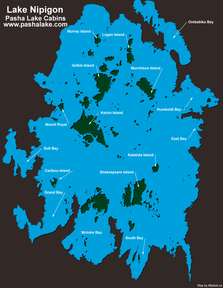
One of the largest islands of Lake Nipigon is called Shakespeare Island, on the left side of this satellite image.
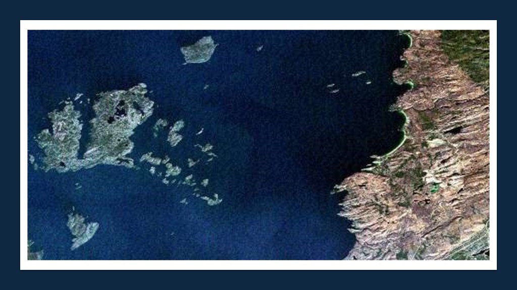
Here are some photos of what Shakespeare Island looks like up close.
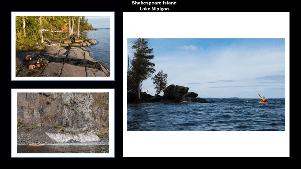
And here’s a comparison between what is found at Shakespeare Island on the left; Bundabeh in New South Wales in Australia at low tide in the middle, and on the island Republic of Malta in the Mediterranean Sea on the right.
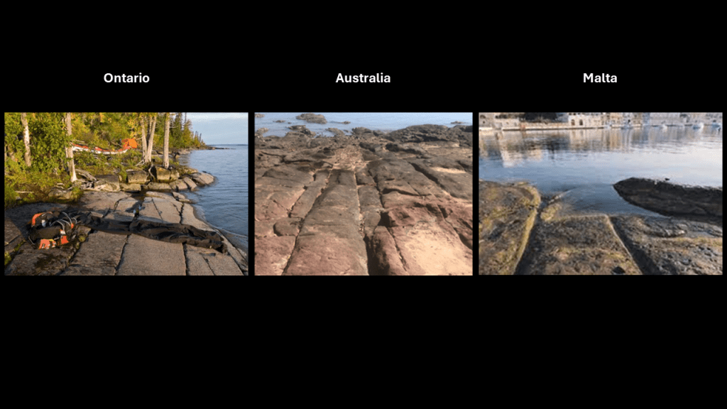
Next, the islands of the Lake Superior Archipelago on the other side of Nipigon, which includes St. Ignace Island.
St. Ignace Island is the second-largest island in Lake Superior after Isle Royale, and the 11th-largest lake-island in the world.
The Nipigon Strait separates St. Ignaice Island from the large Black Bay Peninsula.
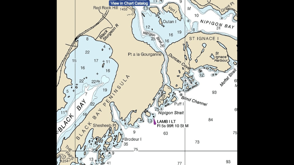
St. Ignace Island has the highest point in Ontario, which is Ishpatina Ridge, at 2,274-feet, or 693-meters, in elevation.
I found reference to an historic lighthouse on Talbot Island in the vicinty of St. Ignace Island.
The lighthouse named for St. Ignace was said to have been completed in 1867, after having been contracted in 1866.
We are told that by the end of the navigation season in 1872 the decision had been made to discontinue the light because it wasn’t as valuable for the fisheries of the area as anticipated and because two lighthouse keepers had died trying to reach the mainland from the station.
Then in 1875, two lighthouses were said to have been contracted for either end of the entrance to Nipigon Bay, one on Lamb Island and the other on Battle Island.
This is a photo of the original lighthouse on Lamb Island from 1935 that was said to have become operational by 1876…
…and that in 1961, a forty-foot, or 12-meter, -tall skeletal tower replaced the original lighthouse.
There is still a lighthouse on Battle Island as well right next to the edge of a high rocky cliff on the water’s edge, like the others we have seen.
The one standing there today was said to have been built in 1911 to replace the one originally built around 1875 at the same time as the first Lamb Island Lighthouse.
Like St. Ignace in Michigan, we are told St. Ignace in Lake Superior was named after the founder of the Jesuit Order in the early French Jesuit exploration of the region.

I am going to end this post about Lake Superior where it began in Thunder Bay, at the Sleeping Giant Provincial Park.
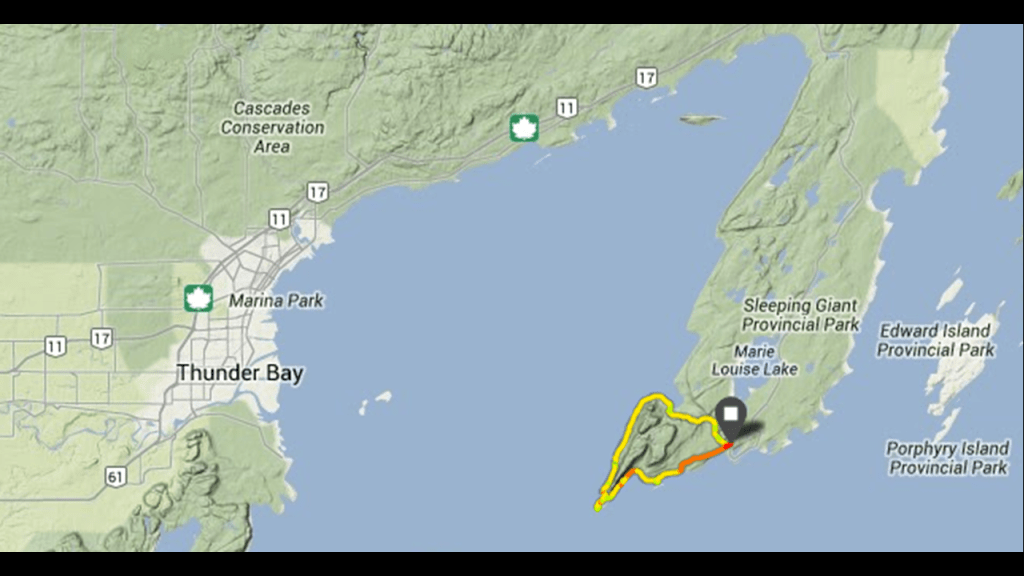
The most visible feature of the Sleeping Giant Provincial Park is what is called the “Sleeping Giant,” described as a series of mesas that resemble a giant lying on its back when viewed from the west-to-northwest section of Thunder Bay.
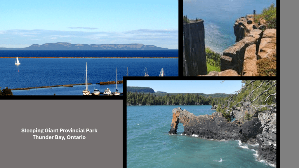
In conclusion to the first-part of this series on the Great Lakes and Lake Superior, while I do think the land buckled and ruptured, I don’t think it was from the “glacier” as was stated in the River of History Museum in Sault Ste. Marie, Michigan, about the St. Mary’s River
Like I’ve been saying in this post, I believe that the landscape we see today all over the world was born out of the trauma and changes to the earth’s surface as it buckled and ruptured, and gave way amidst thunderous sound and gigantic force of the deliberate destruction of the original free energy grid that was for the benefit of all life everywhere, and subsequently transformed into what we know as the Matrix for the benefit of the very few behind the reset of the original earth’s history.
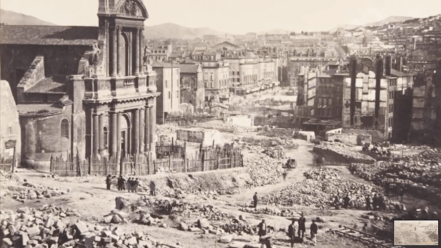
A small number of related, elitist family bloodlines, hidden in different nationalities and religions to carry out their plans for world domination, brought into existence a New World built upon the ruins of the Old World, and have stolen the legacy and identity of the original people and the true builders of all of the original infrastructure of the Earth; claimed their legacy as their own while at the same time, robbing us blind of resources, wealth, and energy without us knowing anything about it because they educated us a new history with them written in to it, and at the same time removed everything about the Old World from our collective awareness.

In the second-part of this series, I am going to be taking a close look at Lake Michigan, where we will be seeing more of exactly the same kinds of things as we have seen in the trip around Lake Superior, including but not limited to, places like the Indiana Dunes National and State Parks, and the adjacent Gary, Indiana, on the southern shore of Lake Michigan.