This is the third and last part of a three-part series in which I am looking at exactly what is found along an alignment between the Quetzelcoatl Pyramid at Teotihuacan in Mexico and the Great Pyramid of Giza in Cairo, Egypt.
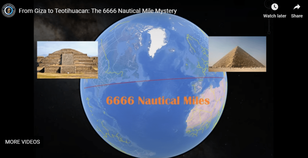
My friend Aaron plotted the alignment between the two pyramids in these locations on Google Earth and forwarded me the alignment information to look at.
He decided to plot the alignment on Google Earth after watching this video “From Giza to Teotihuacan: The 6666 Nautical Mile Mystery” on the Ancient Explorer YouTube Channel.
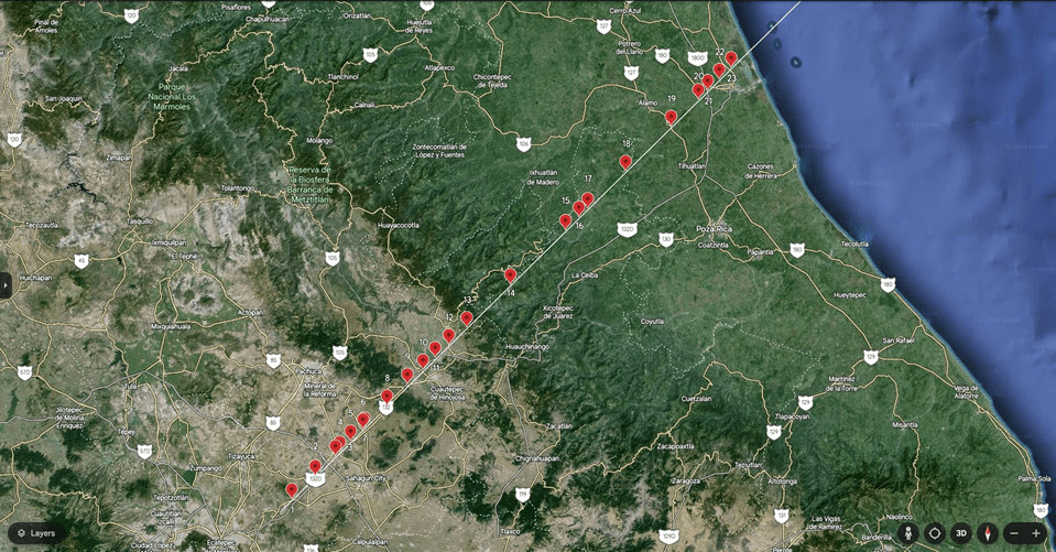
In Part 1 of this series, I tracked the alignment from the Quetzelcoatl Pyramid in Teotihuacan as far as the port city of Tuxpan de Rodriguez Cano on the Gulf Coast.
Along the way, among many other findings, I found such things as three airports; thirteen schools of all kinds; six agriculture-related locations; four telecom-related locations; five health-related locations; eight sports venues; one church-related locations; three government sites; and rail history.
I am sure there are more along these lines that I missed because of the Spanish-to-English translation.
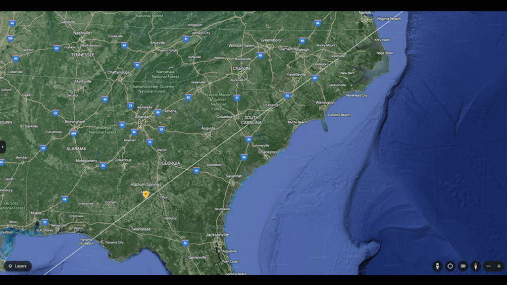
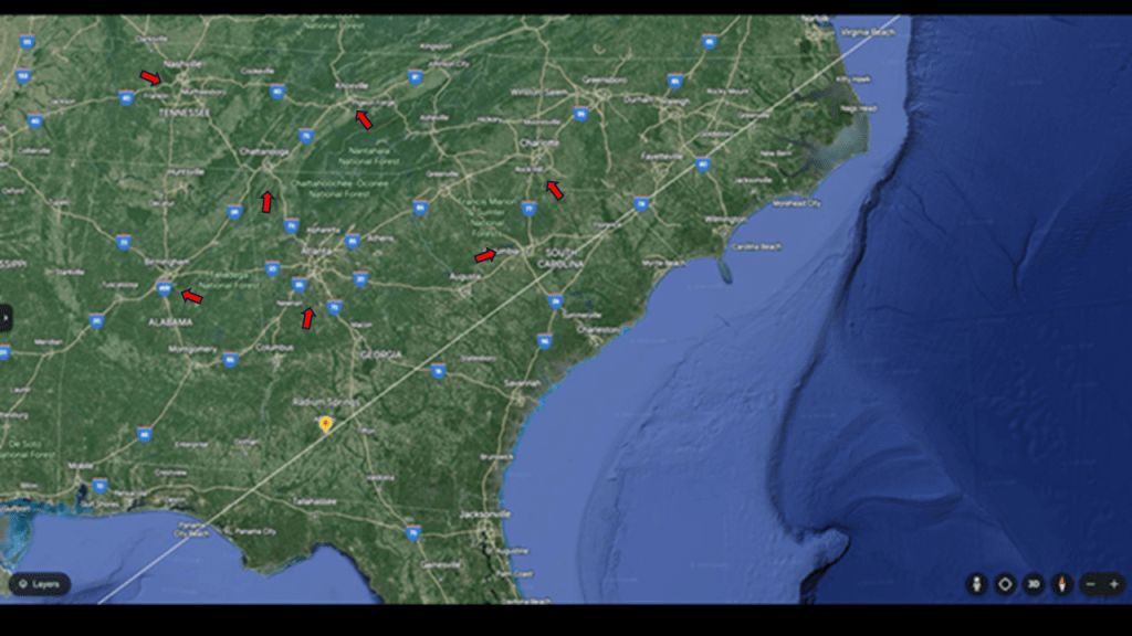
In the second part of this series, I tracked the alignment from where it enters the United States in Panama City Beach in the Florida Panhandle to where it leaves it at Carova Beach, a small unincorporated community in North Carolina, in the northern Outer Banks just south of the Virginia State line.
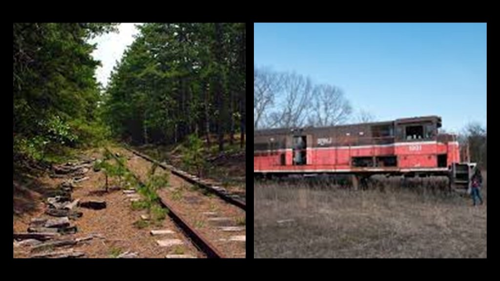
In tracking the United States part of the alignment, some of the things I found from data points I counted along the way included: fifteen airports/airfields; five military-related installations, including Air Force bases; twenty-four schools of all kinds; seventeen agriculture-related locations, including both produce and animal breeding; one telecom-related location; three health-related locations; seven sports venues; ninety-five church-related locations; forty-seven cemeteries; three government sites; eight places with rail history; eighteen golf courses; ten plantations; and eleven shopping locations, including among others, Walmart; and eleven racing tracks or circuits.
I encountered the Savannah River Nuclear Site; the Chemours Fayetteville Works Plant; the Goldsboro B-52 nuclear weapon event; and a history of environmental contamination at these places and others along the way.
Also along the alignment, I encountered numerous estuaries, dunes, and swamps, on both coastal areas and inland locations.
My working hypothesis is that the Earth’s original free-energy grid system, which was pyramid-based, was deliberately destroyed, and subsequently intentionally-abused and misused, turned into instead the matrix of control we have been living under without realizing it.
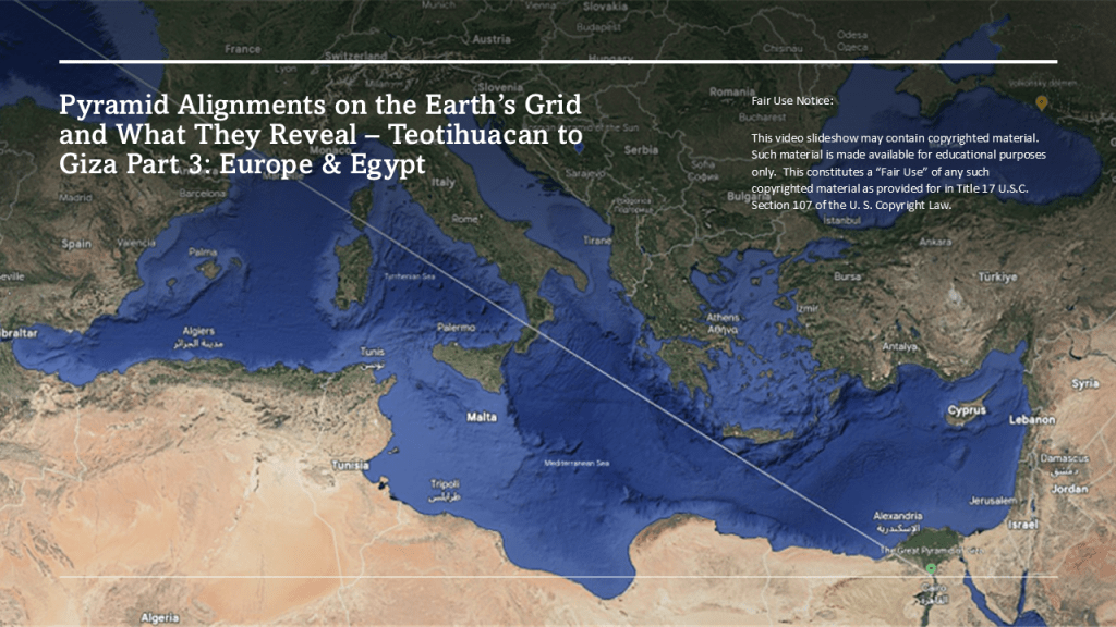
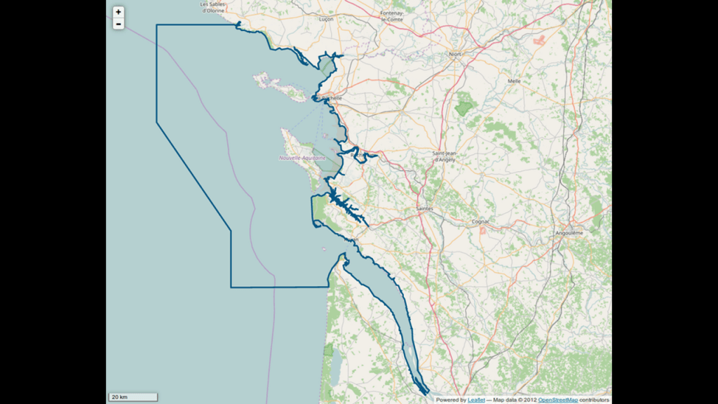
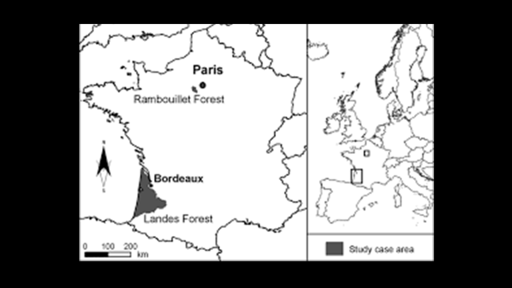
In this last part of the series, I am going to explore this pyramid alignment from where it enters Europe in France near Bordeaux, and track it across bodies of water through France, Corsica, the toe of the boot of Italy and where it enters Egypt near Alexandria to the location of the Great Pyramid on the Giza Plateau.
I can already tell from the things I am seeing just from looking at the screenshots of the alignment Aaron sent me of this part of the leg on the other side of the Atlantic Ocean that I am going to find the same things that I found in Mexico and the United States.
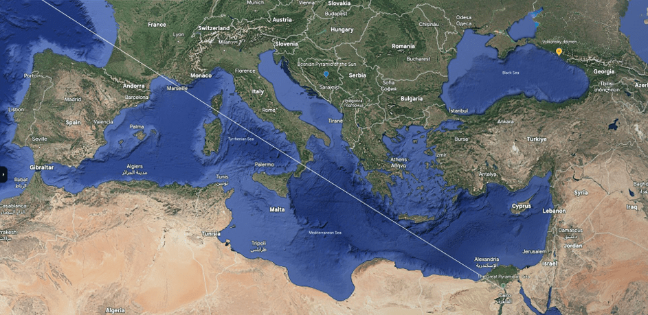
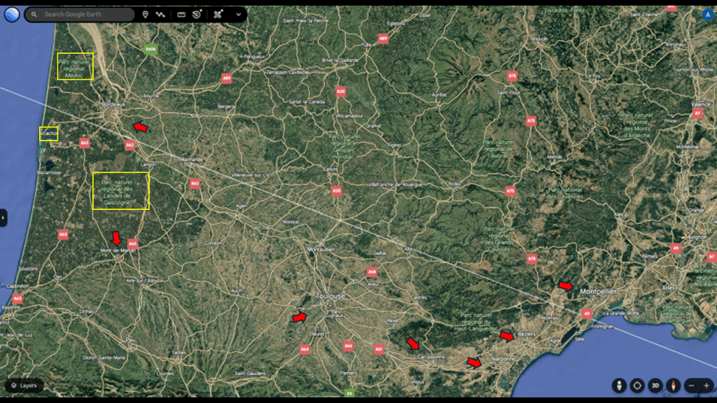
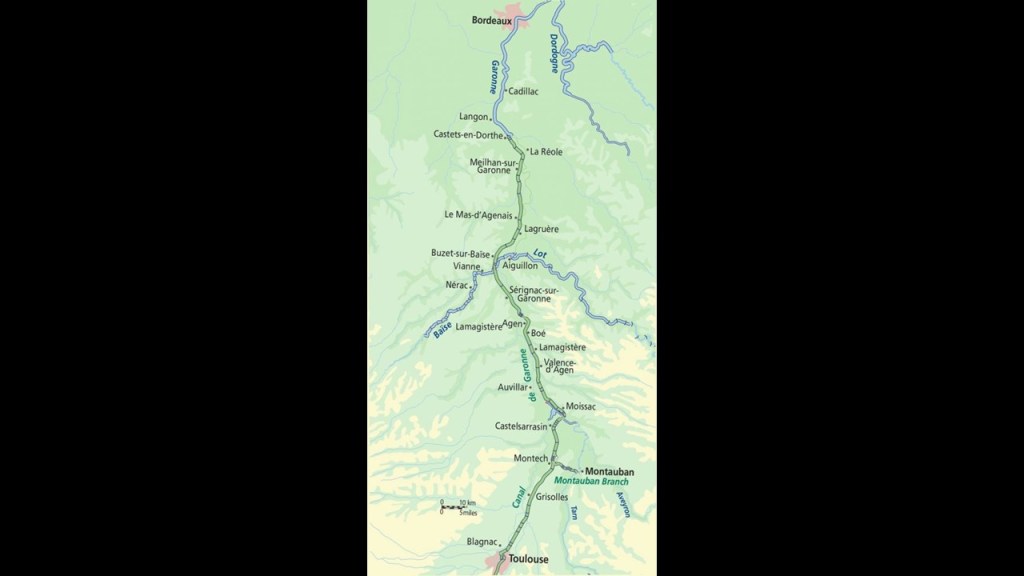
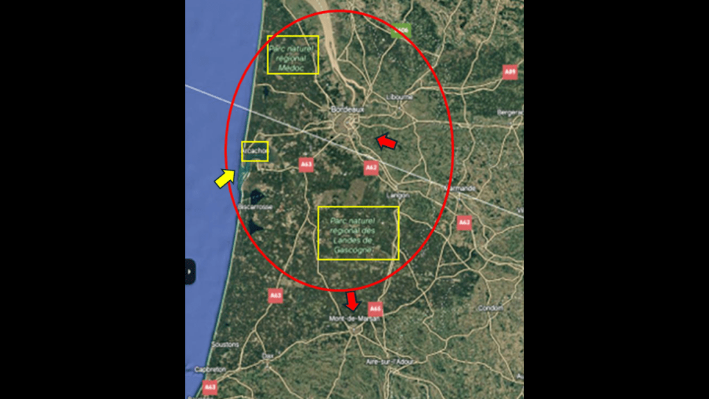
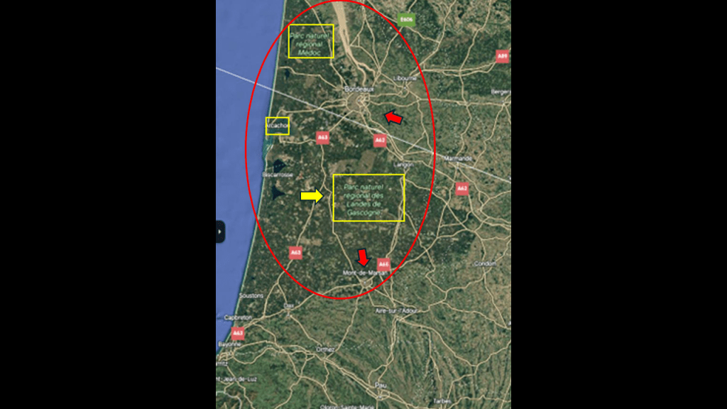
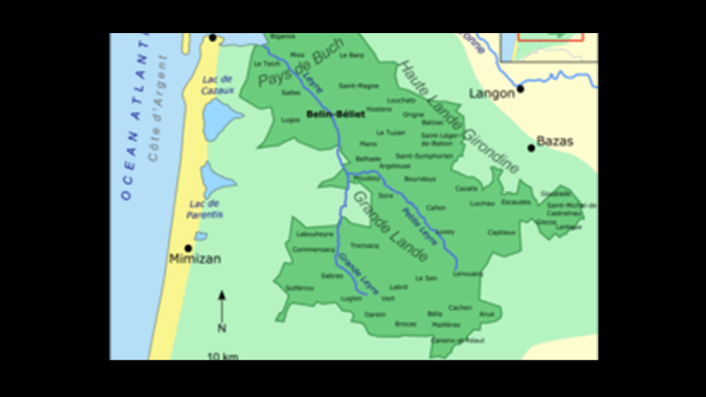
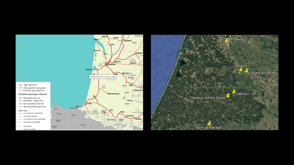
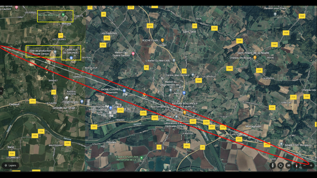
This first screenshot shows an overview of the alignment where it goes through France.
I have marked places and features that I want to highlight here before I start drilling down into the specific places found along the alignment.
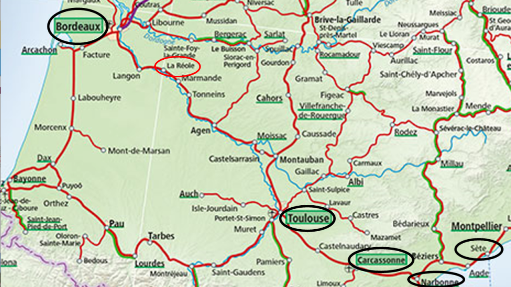
Before I go into the places highlighted by a yellow box on the Atlantic-side of the screenshot where the alignment enters France, I want to point out with red arrows the radial patterns of the roadways and major highways emanating from major cities of the region, like Bordeaux; Mont-de-Marsan, south of Bordeaux; and from there going in an easterly direction, Toulouse; Carcassone; Narbonne; Beziers; and Montpelier.
There are several points I would like to make around this particular finding of the radial patterns of the roadways here.
The first is that these same radial patterns are found around major cities in the United States…
…and Mexico, where the examples are of cities appearing at the junctions of two roadways, forming “x’s” in the landscape, instead of the star-shaped radial patterns appearing in the United States and in southern France, where more than two roadways come together in a distinct pattern.
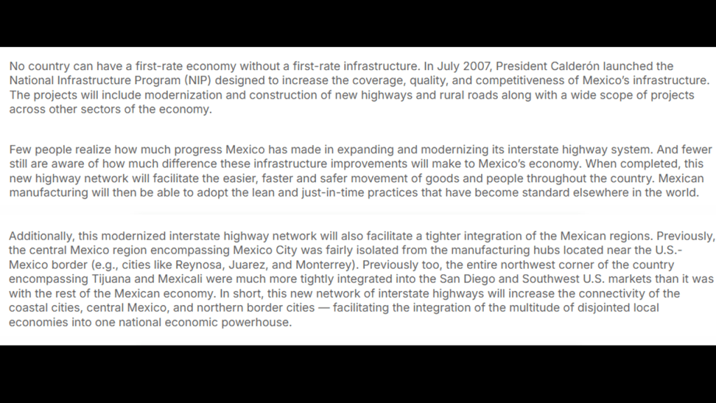
The reason for this finding in Mexico could possibly be that the Highway system there does not have all the original infrastructure built out and in use in the way that it is in other countries…
…and it is still in the process of “modernizing” its highway system.
Let me first give you examples of what I believe these radial patterns represent from the United States, and I talked about this also in Part 2 of this series.
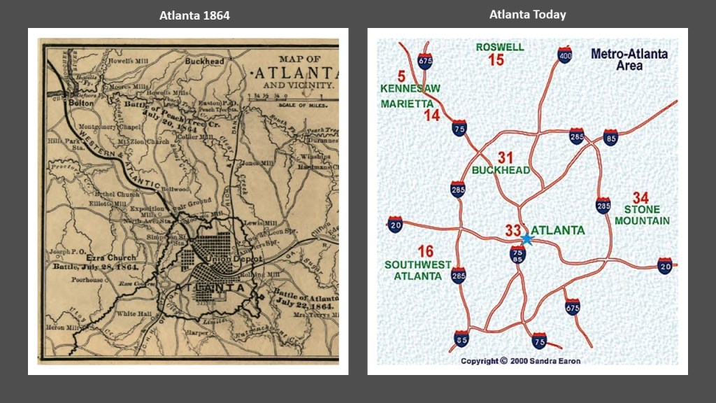
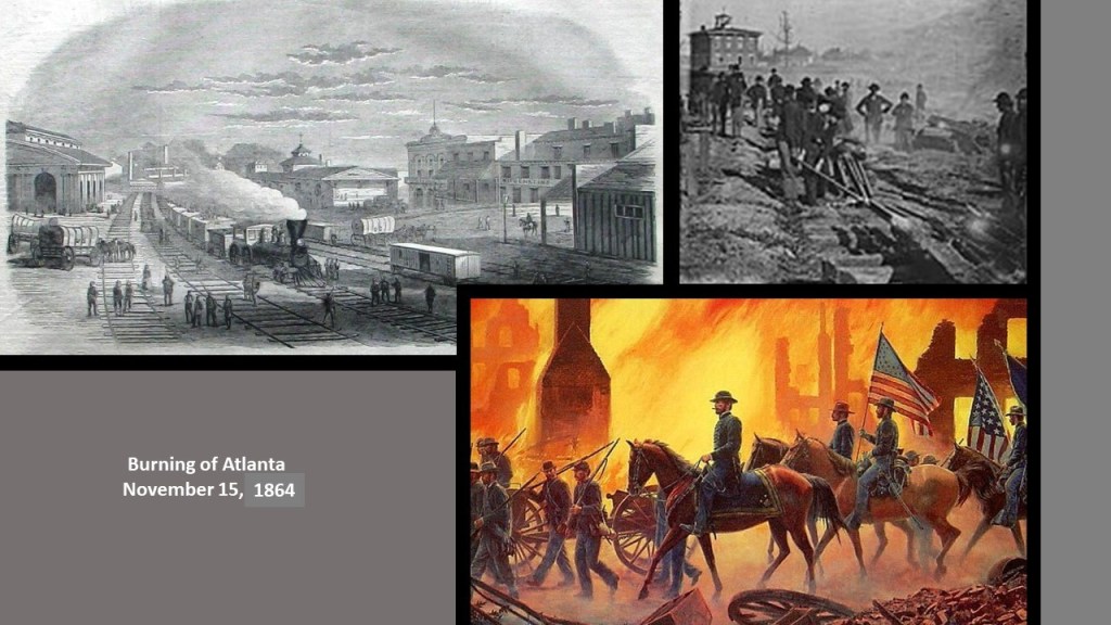
The city of Atlanta was a railway hub at the time of the Civil War, and is a highway hub today.
General Sherman’s “March to the Sea” campaign in the American Civil War, in which his forces were ordered to use a “scorched-earth” policy to destroy transportation hubs, included the burning of Atlanta in November of 1864 and ended with the capture of Savannah on December 21st of 1864.
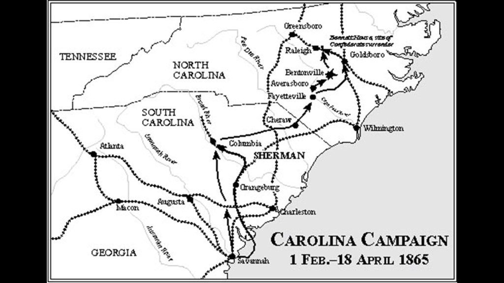
Then in January of 1865, after the completion of the “March to the Sea,” General Sherman turned his attention northwards to the “Carolinas Campaign,” again destroying everything of value along the way.
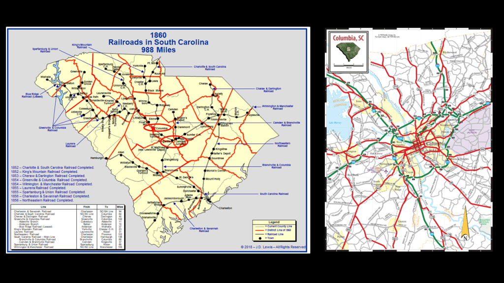
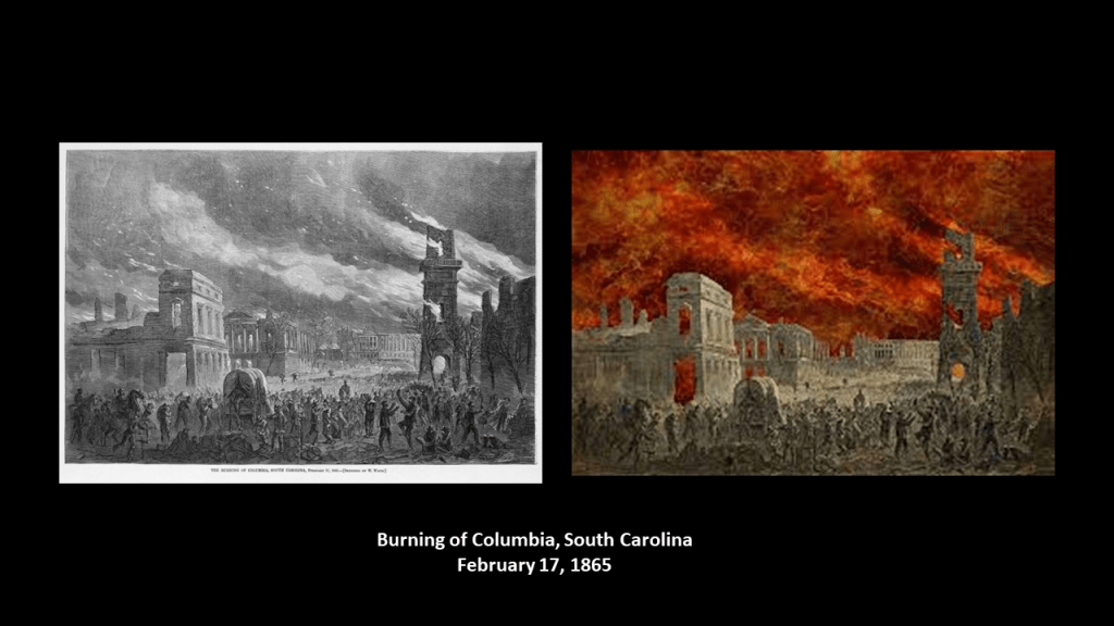
Like Atlanta, Columbia in South Carolina was a transportation hub with regards to rail infrastructure, and a highway hub today.
Columbia, the state capital of South Carolina and an important political and supply center for the Confederacy, was said to have surrendered to General Sherman on February 17th, 1865, after the Battle of Rivers’ Bridge.
On the same day, the fires started, burning much of Columbia, though there is disagreement between historians regarding whether or not the fires on that day were accidental or intentional, but on the following day, General Sherman’s forces destroyed anything of military value, including railroad depots, warehouses, arsenals, and machine shops.
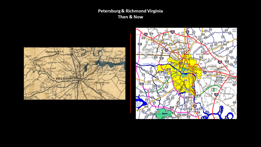
Almost two months after the burning of Columbia, the Burning of Richmond took place on April 2nd of 1865, the capital of Virginia and the Confederate States of America.
This is a lithograph depicting it by Currier & Ives.

In our historical narrative, the Confederate General Robert E. Lee surrendered to the Union General Ulysses S. Grant days later, on April 9th of 1865, after his final defeat at the Battle of Appomattox Court House that same day.

As we just saw in Atlanta and Columbia, there’s a very similar configuration between the Petersburg Rail-lines of the Civil War-era, and the highways around Richmond and Petersburg today.
And where there have been toll roads in one form or another for a long time, where we are “charged” to use the highway route.
Since 1958, that section of I-95 has been known as the “Richmond-Petersburg Turnpike,” but there have been toll roads in the area since 1826.
I think these cities were hubs of the free-energy grid system and that likely the nexus-point where initially the railroad lines intersected, most of which were later replaced by the highway system, were possibly at one time giant tree locations or near giant tree locations.
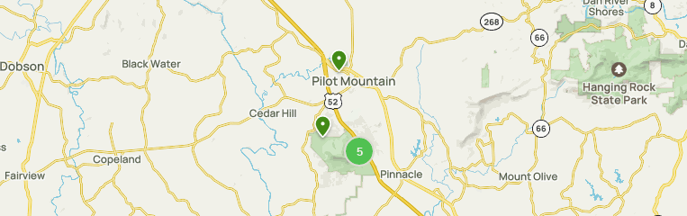
The best example I know of this direct connection of the energy grid to giant trees is Pilot Mountain, in North Carolina as demonstrated by the incredible ley-line work of Peter Champoux, which is found on his website geometryofplace.com.

Peter shows Pilot Mountain in North Carolina is a hub for long-distance ley-lines on the home page of his website, looking like the cities we are seeing that serve as transportation hubs for multiple rail-lines and/or highways.
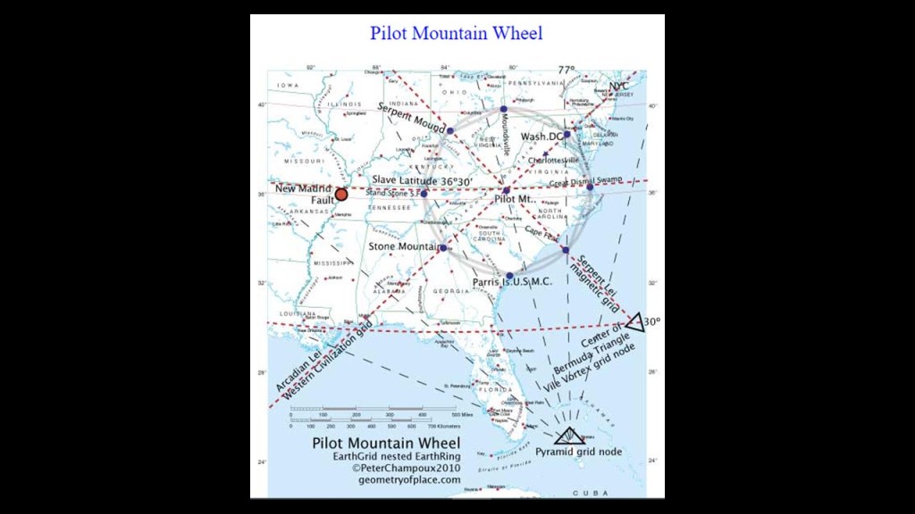
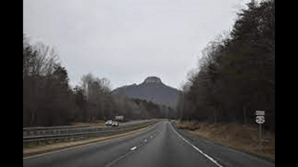
Pilot Mountain, near Mount Airy, is seen here centered on U. S.. Route 52.
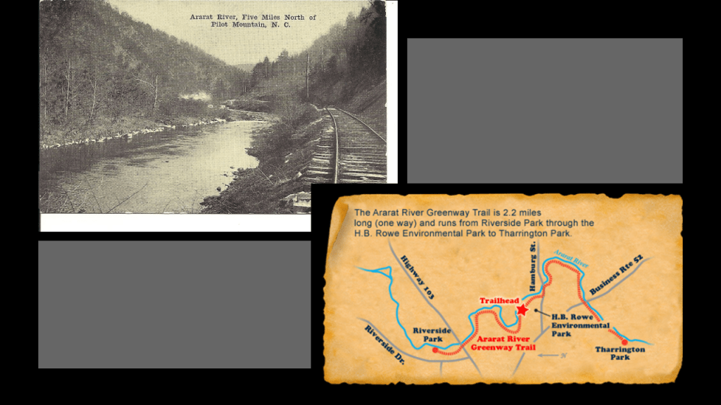
Before it was called Pilot Mountain, it was known as Mount Ararat.
I looked into it and found the historic Ararat River with rail infrastructure running beside it on the top left, and today’s Ararat River Greenway Trail where the railroad used to be on the bottom right.
The Ararat River Greenway Trail is at the eastern edge of the city of Mount Airy.
There are some things about US-52 and Pilot Mountain I would like to point out.
U. S. Route 52 follows a northwest to southeast route across the country.
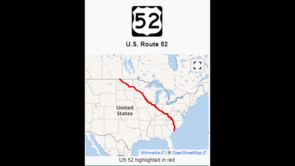
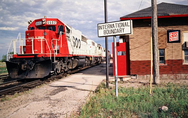
The northwestern terminus of U. S. Route 52 is in Portal, North Dakota, in the Bakken Oil Field Region and on the International Border with Canada at North Portal Saskatchewan.
On its southeasterly journey across the United States, US Route 52 passes through places like Indianapolis, Indiana, another large central hub of transportation routes.
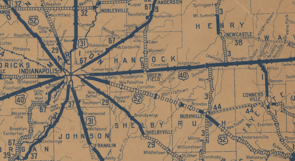
…Pilot Mountain in North Carolina as previously mentioned…
…to the southeastern terminus of U. S. 52 in Charleston, South Carolina, at Number 2 Meeting Street and White Point Harbor at the Battery along the Charleston Harbor, not far from the place the American Civil War started at Fort Sumter in Charleston Harbor on April 12th of 1861.
Pilot Mountain is described as a “Quartzite Monadnock,” which translates to a “hard, metamorphic rock that was originally pure quartz sandstone that is an isolated rock hill, knob, ridge, or small mountain that rises abruptly from a gently sloping or virtually level surrounding plain.”
Here are some other examples of places classified as “Monadnocks.”
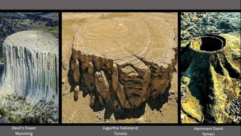
Besides Pilot Mountain on the top left, Harteigen in Norway is seen on the top right; Devil’s Tower in Wyoming on the bottom left; and Cooroora in Australia on the bottom right.
I think “Monadnock” is a word used to cover-up the existence of gigantic tree stumps.

In this comparison, we have the Devil’s Tower from another angle on the left; the Jugurtha Tableland in Tunisia in the middle; and the volcano in the middle of the city of Hammam Damt in Yemen looking very much like giant tree stumps!
In the region of France known as Auvergne, to the northeast of Bordeaux in central France, we are told there is a chain of approximately eighty extinct volcanoes that run from north to south near Clermont-Ferrand, the capital of the Auvergne Region.
Clermont-Ferrand ranks as one of the oldest cities of France.
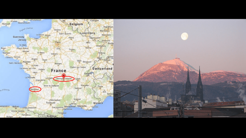
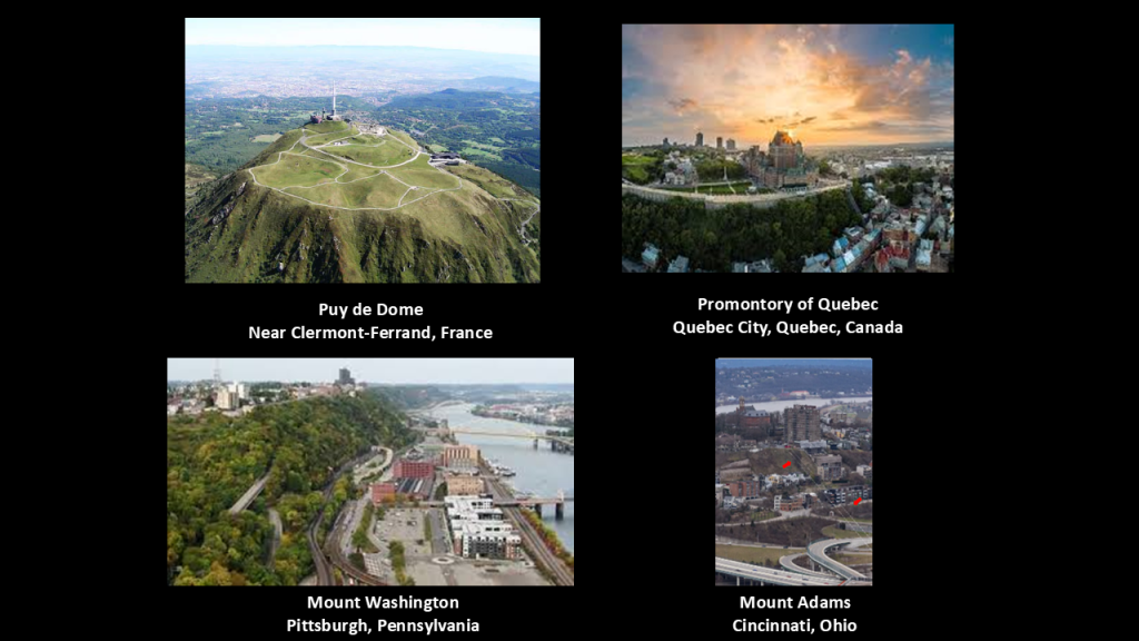
The highest is called Puy de Dome, which is located 8-miles, or 13-kilometers, from the center of the city, and is pictured on the top left.
The summit can be reached by a cog railway train, which is a steep-grade railway and fitted with a toothed rack-rail and cog-wheels that mesh with the rack, and at the top of it there is an ancient Temple of Mercury; the Clermont Observatory of Terrestrial Physics; a French Television and Radio Transmission Antenna; and a tourist area.
Puy de Dome brought to mind in appearance what is called the Promontory of Quebec on the top right.
It is the location of Old Quebec and a city borough of Quebec City, and the famous Chateau Frontenac, a massive castle that was said to have been built as a hotel by the Canadian Pacific Railway.
It is accessible by the Old Quebec Funicular, which is an incline railway located next to the Chateau Frontenac that we are told started operating in 1879.
It also brought to mind Mount Washington in Pittsburgh, Pennsylvania, on the bottom left.
Mount Washington is a neighborhood in South Pittsburgh that is accessibly by what we are told are the two oldest, continuously-operating incline-railways in the world, out of what was originally seventeen on Mount Washington, named the Monongahela, which started operating 1870, the same year the Standard Oil Company was founded, and the Duquesne Incline, in 1877.
Similarly, Mt. Adams in Cincinnati has an historic neighborhood on top of its elevated height, and Mount Adams had one of Cincinnati’s five historic incline railways, none of which exist anymore.
Similar to cog-railways, incline railways, also known as funiculars, work like an obliquely-angled elevator, in which cables attached to a pulley-system raise-and-lower the cars along the grade.
Two cars are paired at opposite-ends and act as each other’s counterweight. As such, there is not a need for traction between the wheels and rails, and thereby allowing them to scale steep slopes, unlike traditional rail-cars.
Thing is, there used to be a lot more of them than there are now, and incline-railways were a worldwide thing.

I have found evidence of what are called volcanoes and volcanism all along the alignments I’ve tracked over the years, and like the ones I found out about in Central France in March of 2019 when I was tracking a long-distance alignment through there that started and ended in Algiers in Algeria.
I found the same thing in Part 1 of this alignment in Mexico.
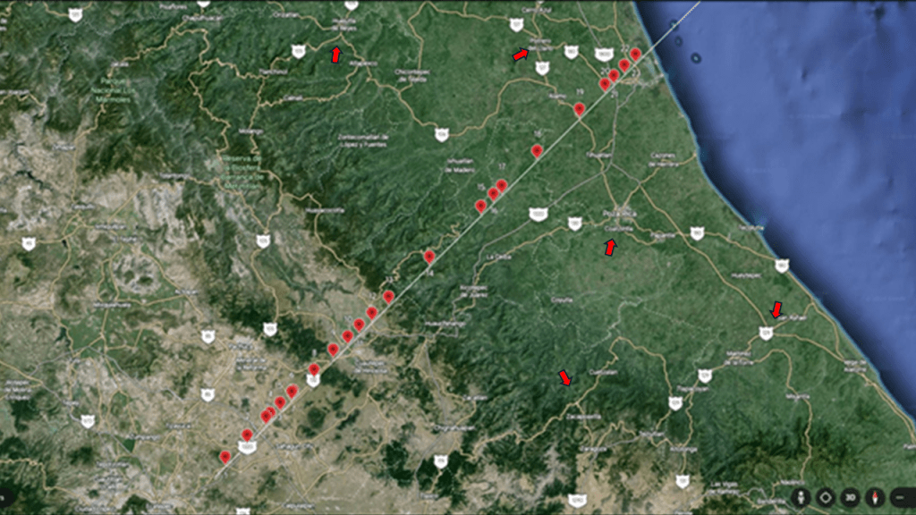
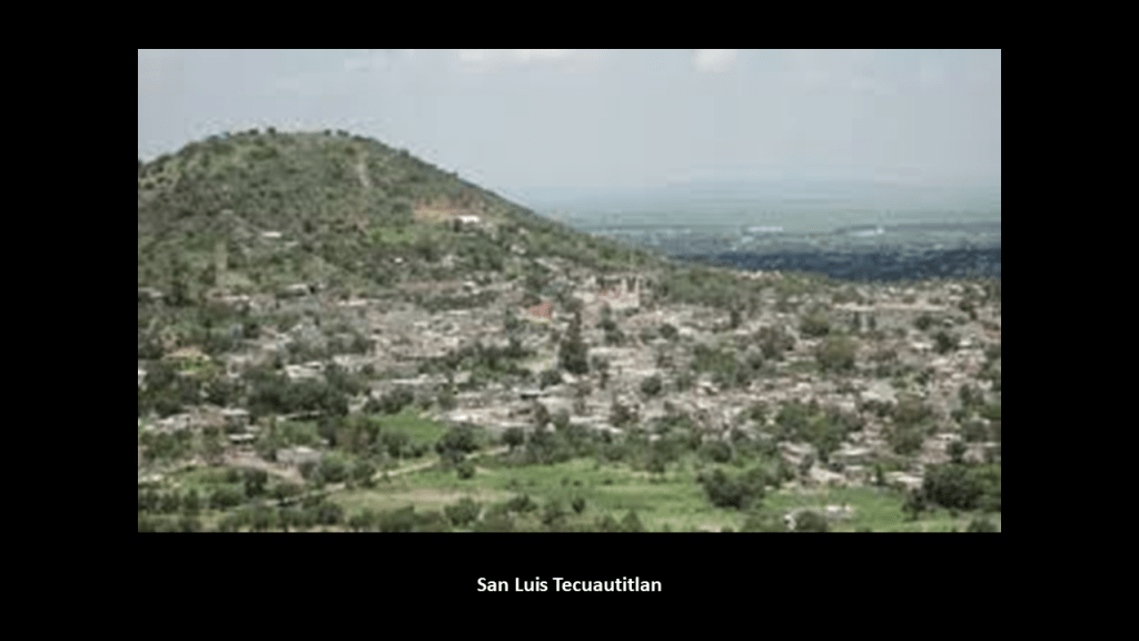
I have circled some places from Part 1 of this series that I am wondering what we are looking at there, and one of the places I have circled is the town of San Luis Tecuautitlan.
San Luis Tecuautitlan is located in altitude at 2,450-meters, or 8,038-feet on Cerro Gordo-Tonantépetl.
Cerro Gordo means “Fat Hill” and is an inactive volcano.
It also has a giant tree stump-looking appearance.
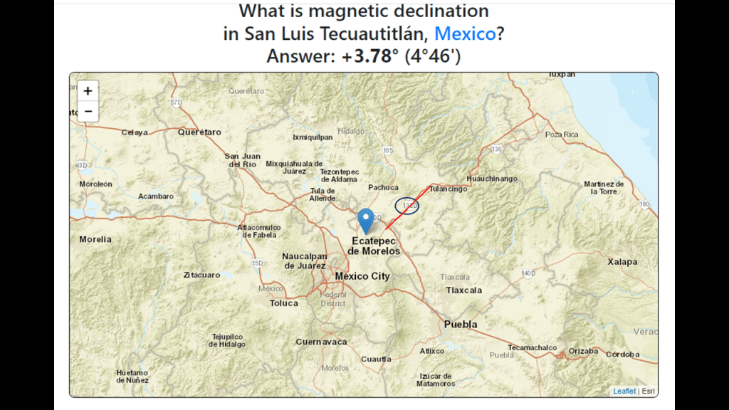
Mexico Federal Highway 132 connects Ecatepec de Morelos and Tulancingo shown in this map.
I found this map when I typed in “San Luis Tecuautitlan” to look for information on it.
It was in a link about the magnetic declination there.
“Magnetic Declination,’ also known as “Magnetic Variation,” is the angle between true north and magnetic north at a specific location on Earth.
This is important because it is needed to determine true north and affects the accuracy of navigational tools for aircraft.
This finding is one of the many reasons that I think the giant trees were an integral component to the Earth’s magnetic field, among many other things.
At this point in my research I think it is highly likely that ancient giant trees and the root system emanating from them were also an integral part of the Earth’s energy grid and leyline system.
The original rail-lines and canals would have been providing power for the free-energy system, and the original architecture and infrastructure would have provided the antiquitech to process and utilize the free energy throughout the worldwide system.
The Earth’s original free-energy grid system was based on exact and precise geometric alignments of cities and places.
The Controllers have worked very hard not only to remove gigantic trees from our awareness, but they have also removed the Earth’s grid system from our collective awareness, and I am sharing the supporting evidence I have been finding in the course of my research over the years that supports the existence of giant trees, and that their “roots,” became today’s highway “routes” and recreational trails.

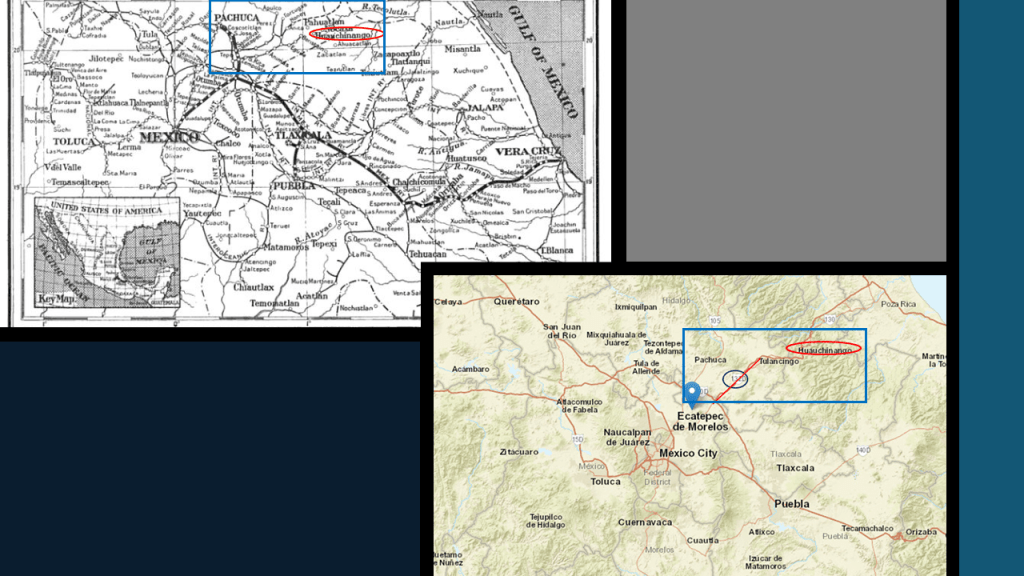
So in this example, in the top left-hand corner, I have a Mexican Railway map circa 1912 and in the bottom right-hand corner, the map I just showed of Mexican Federal Route 132 for comparison of the locations highlighted in the blue box, between San Luis Tecuautitlan, Huauchinango and Pachuca.
It is hard to find an exact match, but the comparison shows that there were historic railroad lines in the same geographic area.
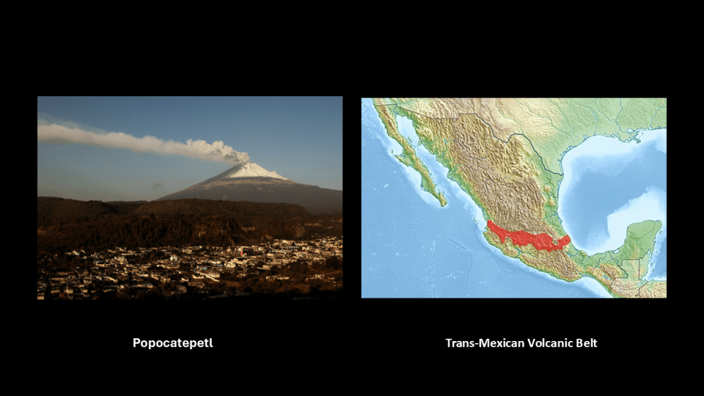
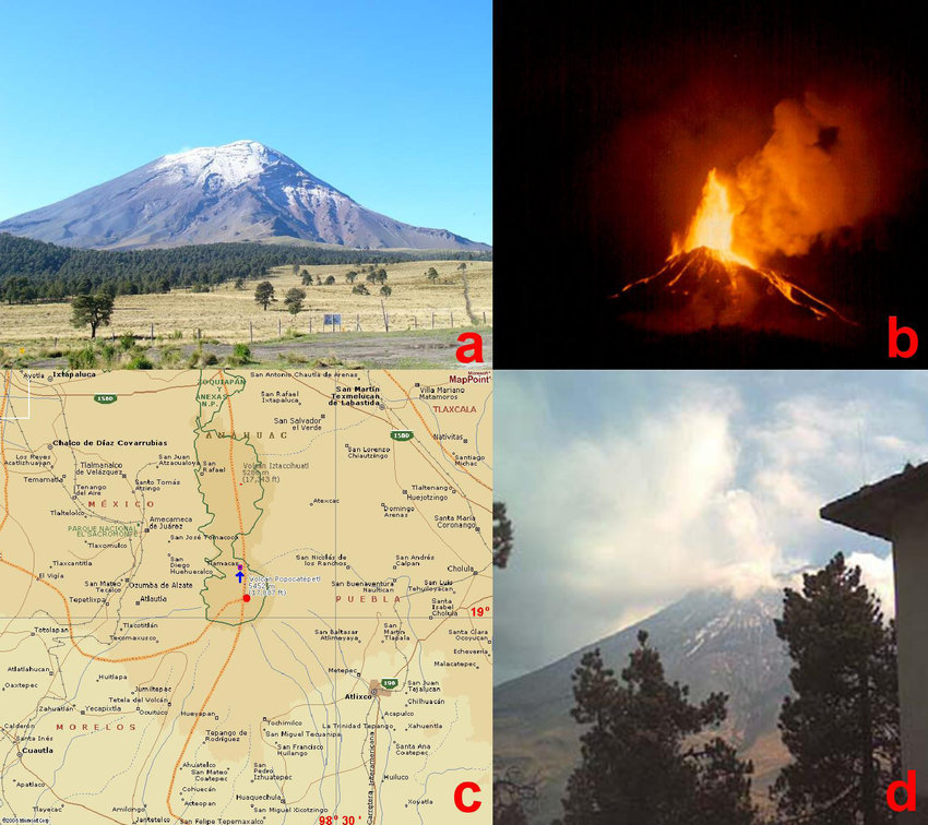
There are other volcanoes in the vicinity of Teotihuacan, like the active stratovolcano Popocatepetl, and which are part of the Trans-Mexican Volcanic Belt, also known as the Sierra Nevada Mountains of Mexico.
I believe that the deliberate destruction of this energy grid system caused incredible destruction to the surface of the Earth, and the destruction of the ancient giant trees created what we see as volcanoes, and we know nothing about the giant trees because they no longer look like trees and we have been told nothing about their existence.
From what I have been finding in my research, I think there are at least two categories of giant trees in our world, ones that have been terraformed by the Master Builders of the energy grid system, like the examples I have shared like the places in cities with architecture and rail infrastructure on them; and I think there were giant trees all over the Earth that had their tops blown-off that we know as volcanoes, like Popocatepetl in Mexico.
This cataclysmic event involving the destruction of the Earth’s original energy grid caused the land to undulate and buckle, causing among other things, swamps, bogs, deserts, dunes, and whole land masses to shear-off and submerge under seas and oceans.
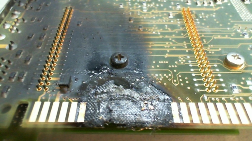
I have come to believe that the circuit board of the Earth’s grid system was deliberately blown 0ut by one or more forms of directed frequency or energy of some kind into different places on the Earth’s grid, either at the same time, or different times within a finite period, because there’s just so much devastation on the entire surface of the Earth.
I also believe that those behind the destruction of the energy grid ushered in the creation of a New World Order built on top of the ruins of the Old World, and that what we think of as modern infrastructure because that was what we have been told in the official narrative, was actually pre-existing infrastructure, including railways, canals, and airports among the many examples available to choose from.
Not only that, but then these malevolent Controllers reverse-engineered the original pyramid-based energy grid system for the benefit of all life everywhere into what is commonly called the Matrix for power and control, as well as the harvesting of energy, or “inner chi” of all living beings, for the benefit of the very few.

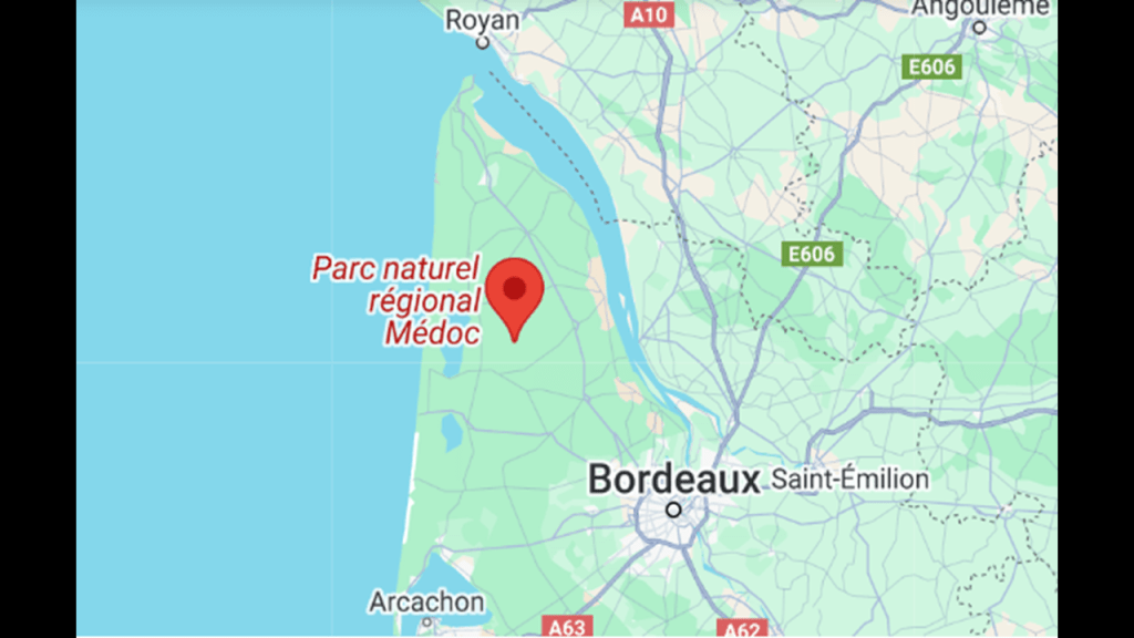
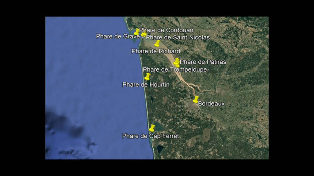
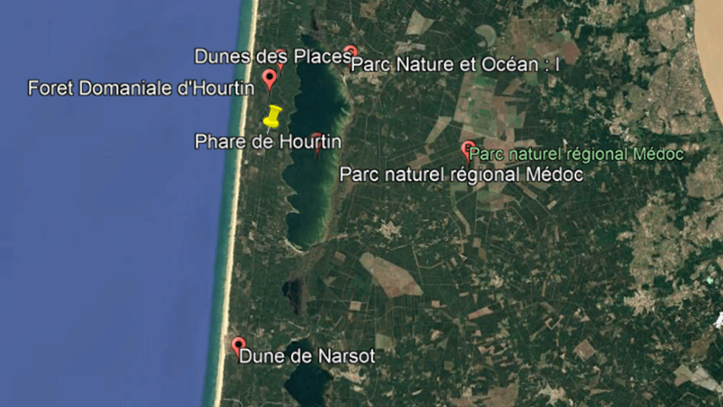
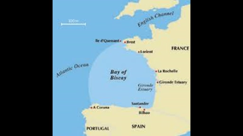
Next, I would like to take a closer look at the places and areas I have highlighted in France by the yellow boxes before I drill down into the specific places found along the alignment – the Medoc Regional Natural Park; Arcachon and Arcachon Bay; and the Landes de Gascogne Regional Natural Park.

First, the top yellow box on the left-side of the screenshot is highlighting the “Parc Naturel Regional Medoc,” or “Medoc Regional Natural Park” in the Gironde Department of the Nouvelle Aquitaine region, and described as “dunes, marshes, ponds, lakes, lagoons, and forests.”
It is bordered to the East by the Gironde Estuary and to the west by the Bay of Biscay, a gulf of the northeast Atlantic Ocean.
More on the Gironde Estuary and Bay of Biscay shortly.
The Medoc Regional Natural Park extends from the gates of the Bordeaux Metropole…
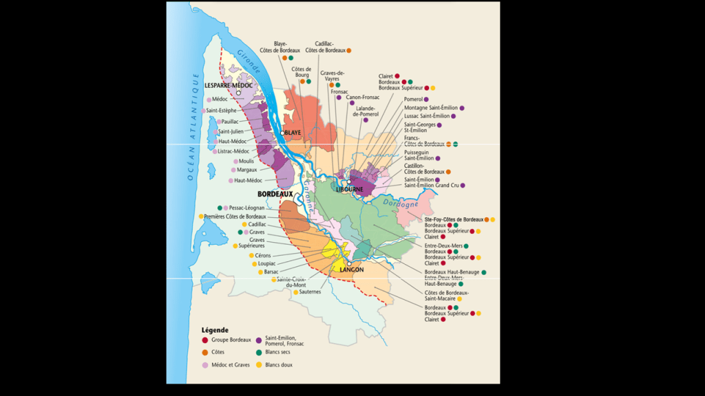
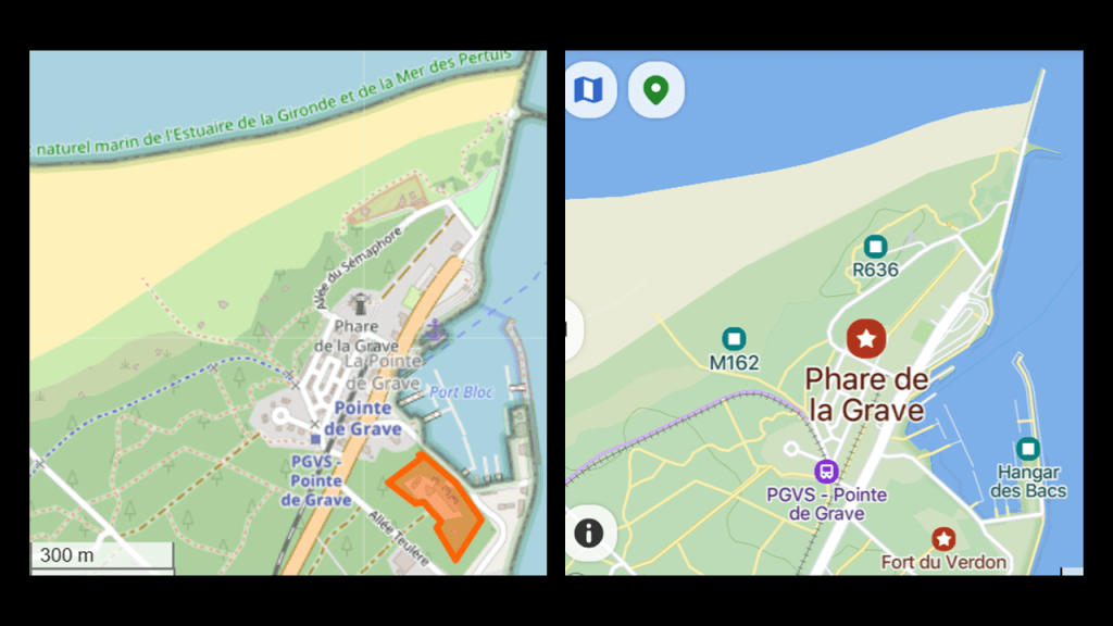
…to the Pointe-de-Grave, the northernmost tip of the Medoc Peninsula, which has historic lighthouses, star forts, and a railroad line along the eastern edge along to Bordeaux. there are historic lighthouses still standing around the edges of the peninsula, which are called “Phares” in French.
The Grave Lighthouse is located directly on the Pointe de Grave, and is a museum today.
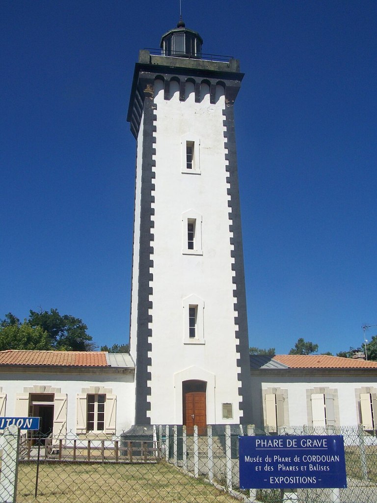
The Grave Lighthouse on the Pointe-de-Grave is located close to the Pointe-de-Grave Train station and Fort du Verdon,
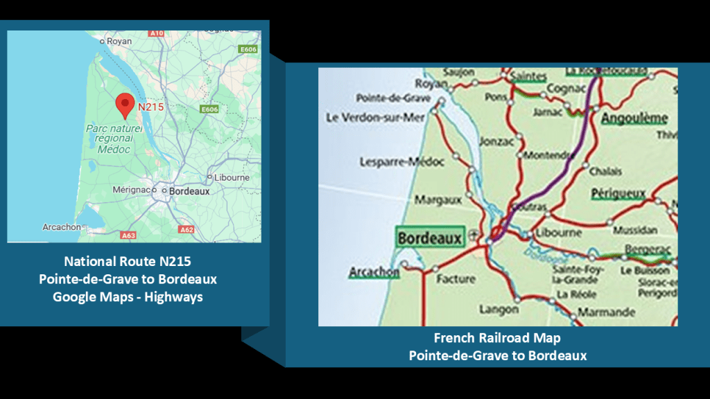
The French National Route 215 on the left closely approximates the route of the railroad line between La Pointe de Grave and Bordeaux across the Medoc Peninsula between those two places.
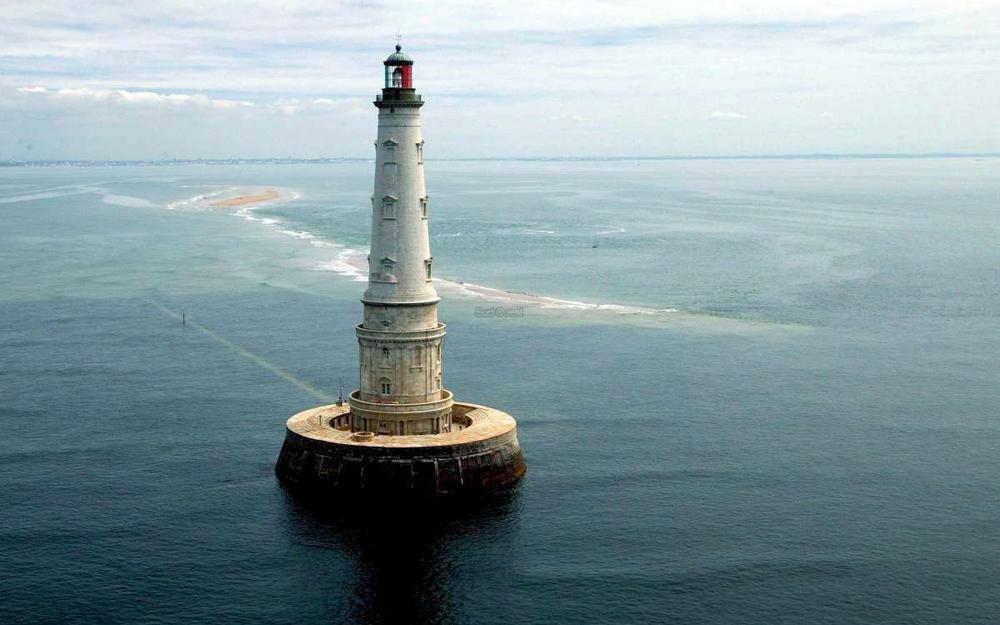
The Cordouan Lighthouse is located 4-miles, or 7-kilometers, out into the open sea, located at the mouth of the Gironde Estuary, and was said to have been built between 1594 and 1611.
It is the only lighthouse at sea off the coast of France that is still inhabited by lighthouse keepers, the oldest still in operation, and the only one in the world open to visit.
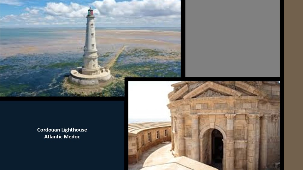
The best time to visit the Cordouan Lighthouse is during low-tide season from April to October because it is not accessible at high-tide because the rocky islet upon which it stands is covered by water.
There might have been a third lighthouse here at this location.
The Pointe-de-Grave Monument was said to have been an American Monument marking the country’s entry into World War I, but was destroyed by the Germans some time during their occupation of France, which took place between May of 1940 to December of 1944.
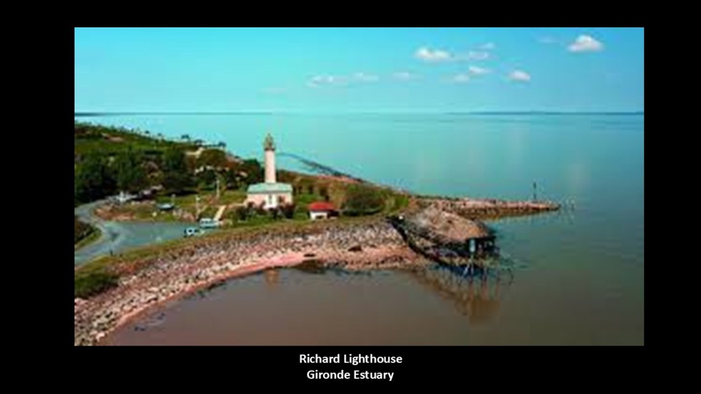
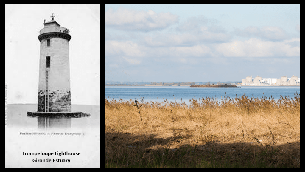
On the estuary side of the Medoc Regional Natural Park, there are three historic lighthouses that are no longer in operation.
They are the Richard Lighthouse…
…the Patiras Lighthouse…
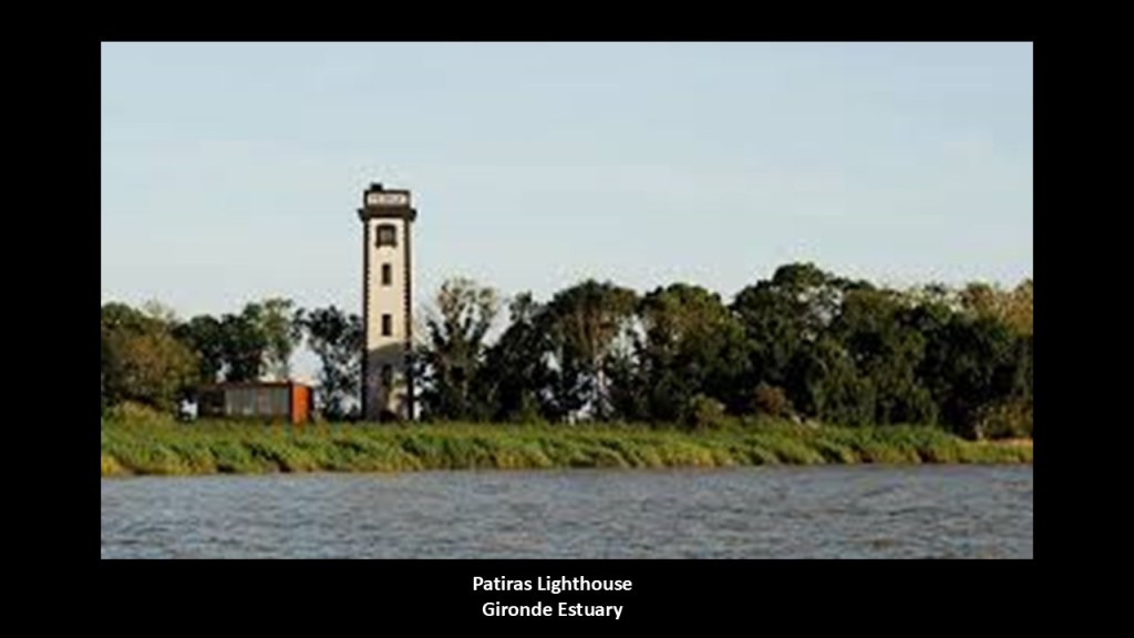
…and the Trompeloup Lighthouse, which no longer exists except for its base still visible in the estuary.
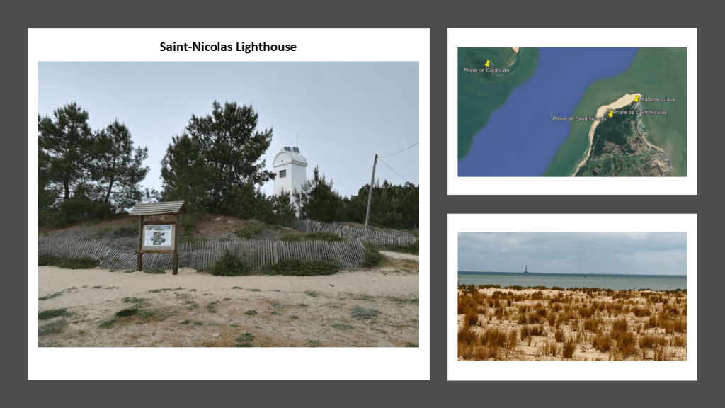
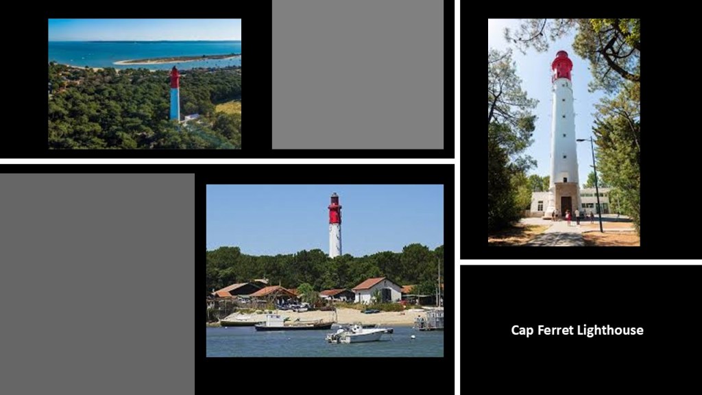
Besides the Cordouan and Grave Lighthouses, there are the Saint-Nicolas, Hourtin and Cap Ferret Lighthouses along the coast.
On the Atlantic-side of the Medoc Regional Natural Park, there are five lighthouses still in operation.
The Saint-Nicolas Lighthouse is located on the Dune of LaClair on the Pointe-de-Grave and forms an alignment with the Cordouan Lighthouse and Grave Lighthouse.
There are two lighthouses at the Hourtin location, situated 650-feet, or 200-meters, apart from each other on a north-south axis, and said to have been built in 1860 on the coastal dunes of Hourtin.
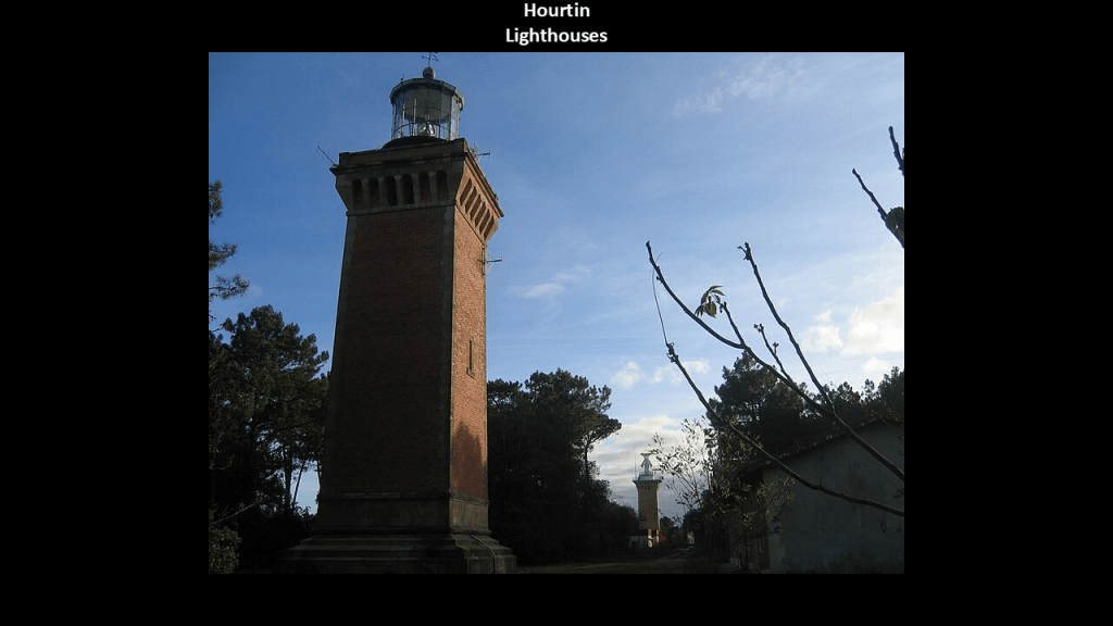
The Hourtin Dunes and Marshes National Nature Reserve, a system of dunes, marshes and large lakes, is on the coastal strip in the western part of the Medoc Regional Natural Park.
Lastly at this location on the Medoc Peninsula is the Cap Ferret Lighthouse.
The original lighthouse here at the entrance to Arcachon Bay was said to have been built between 1839 and 1840; destroyed by the Germans in 1944; and rebuilt in 1947 to look the same as the first one.
Next I am going to take a look at the Gironde Estuary.
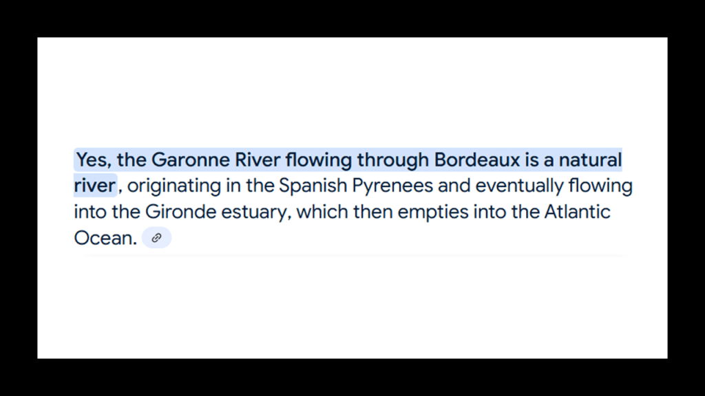
Tje Gironde Estuary is the largest estuary in western Europe, and formed from the meeting of the Dordogne and Garonne Rivers just downstream from the city-center of Bordeaux.
Since 2015, it has been part of the Gironde Estuary and Pertuis Sea Marine Nature Park.
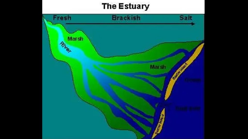
An “estuary” is defined as a partially-enclosed, coastal body of brackish water, which is water that is salty, dirty & unpleasant, with one or more rivers flowing into it, and a connection to the open sea.
It is also my opinion that what we are told were “natural” rivers were actually man-made canal systems.
I am going to use the example of the Garonne River of the two rivers here to illustrate my belief that what are called “natural rivers” were all man-made canal systems.
This is the Garonne River in Bordeaux, with manmade banks.
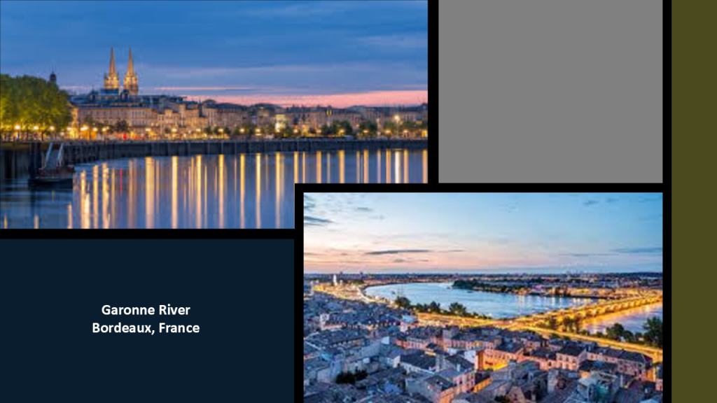
Yet we are told that it is a natural river, and this is the case with major rivers around the world.
Interesting to note that what is called the “Garonne Canal,” is said to meet the tidal Garonne River at Castets-en-Dorthe and connects with the “Canal du Midi” in Toulouse, which is 120-miles, or 193-kilometers, in length and has fifty-three locks.
The Garonne Canal was said to have been constructed between 1838 and 1856.
What is called the “Canal du Midi” connects Toulouse with the Mediterranean Sea, and both canals together are called the “Canal des Deux Mers” or the “Canal of Two Seas.”
The “Canal du Midi” was said to have been authorized in 1666, and constructed between 1666 and 1681.
It’s original name was the Royal Canal in Languedoc and we are told renamed during the French Revolution in 1789.
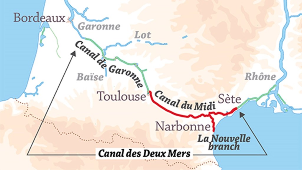
The Bordeaux-Sete Railway also operates along this same route, said to have been opened in several stages between 1855 and 1858.
This is part of the same rail infrastructure that connects the Pointe-de-Grave with Bordeaux along the western edge of the Gironde Estuary.
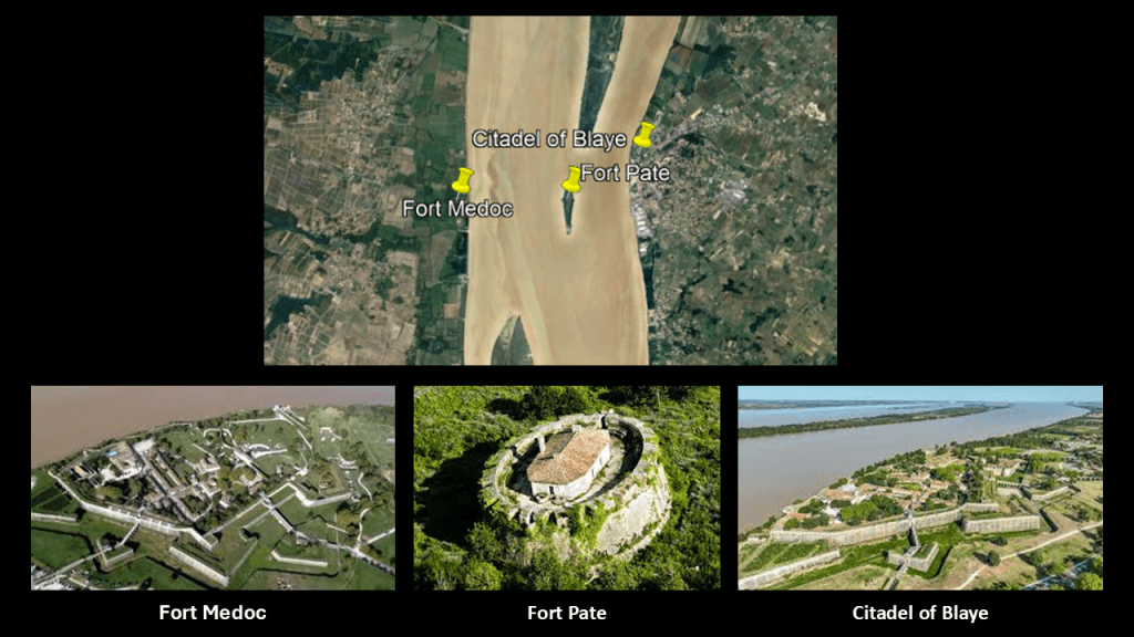
The Citadel of Blaye is located on the right Bank of the Gironde Estuary, near the A10 Autoroute, and other highway connections, and is located 35-miles, or 56-kilometers, north of Bordeaux.
It is served by a rail line for freight, but not passenger, service.
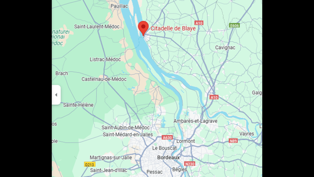
The Citadel of Blaye was said to have been designed by the engineer Sebastien Vauban, and built during the reign of King Louis XIV between 1686 and 1689 to protect the city of Bordeaux from enemy attacks.
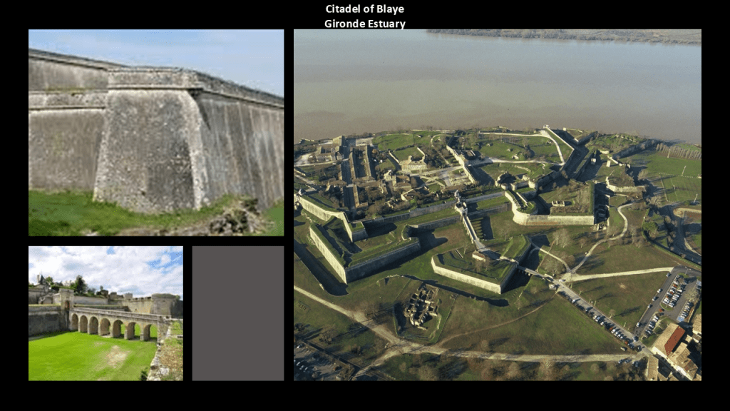
The Citadel of Blaye was said to be part of a three-fort defense system designed by Vauban, known as the “Bolt of the Estuary” and the “Vauban Triptych,” that include Fort Pate in the middle of the estuary, and Fort Medoc on the left bank of the estuary across from the other two.
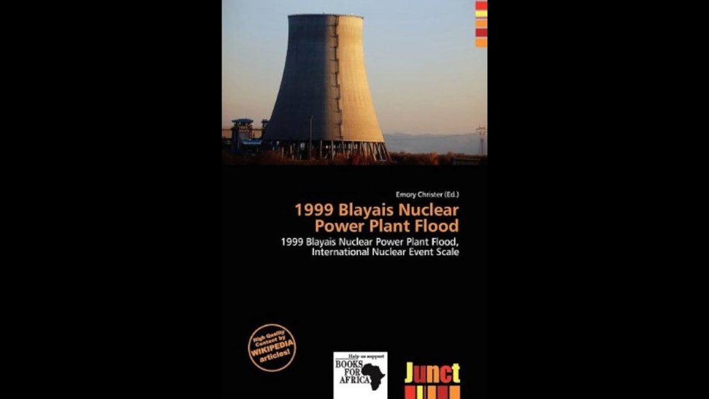
The Blayais Nuclear Power Plant is just a little ways up the right bank of the Gironde Estuary from the Citadel of Blaye.
The Blayais Nuclear Power Plant first became operational in 1981.
In December of 1999, parts of the nuclear power plant were flooded when a combination of wind and high-tides overwhelmed the sea-walls at the location, resulting in the loss of the plant’s off-site power supply, and knocked-out several safety-related back-up systems.
It was rated as an “Incident,” a number 2-level event on the “International Nuclear Event Scale.”
Shortly after it happened, it was reported by the regional newspaper as being “very close to a major accident,” which was never contradicted.
It is noteworthy that within the Gironde Estuary and the Medoc Peninsula are fertile lands for agricultural activities, and this region is well-known for its wine-making.
Further north of the mouth of the Gironde Estuary is Fort Boyard in the Pertuis d’Antioche straits between the Ile d’Aix and the Ile d’Oleron off the western coast of France, said to have been built starting in 1801 under Napoleon Bonaparte, and completed in 1852, and in use as a fortification until 1913.
This stadium-shaped fortification is 223-feet, or 68-meters,-long and 102-feet, or 31-meters-wide, and 66-feet, or 20-meters, -high.
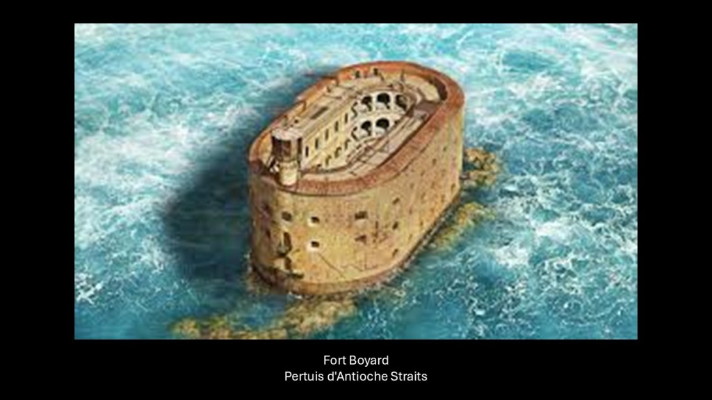
Since 1990, it has been a filming location for the French game show of the same name, where teams compete in physical and mental challenges to win a treasure.
Then when I was looking around for more information on Fort Boyard, like the name of the stone construction material, I stumbled upon a whole lot of star forts and batteries, and another lighthouse, in the Pertuis d’Antioche straits on and around the Ile d’Aix and the Ile d’Oleron.
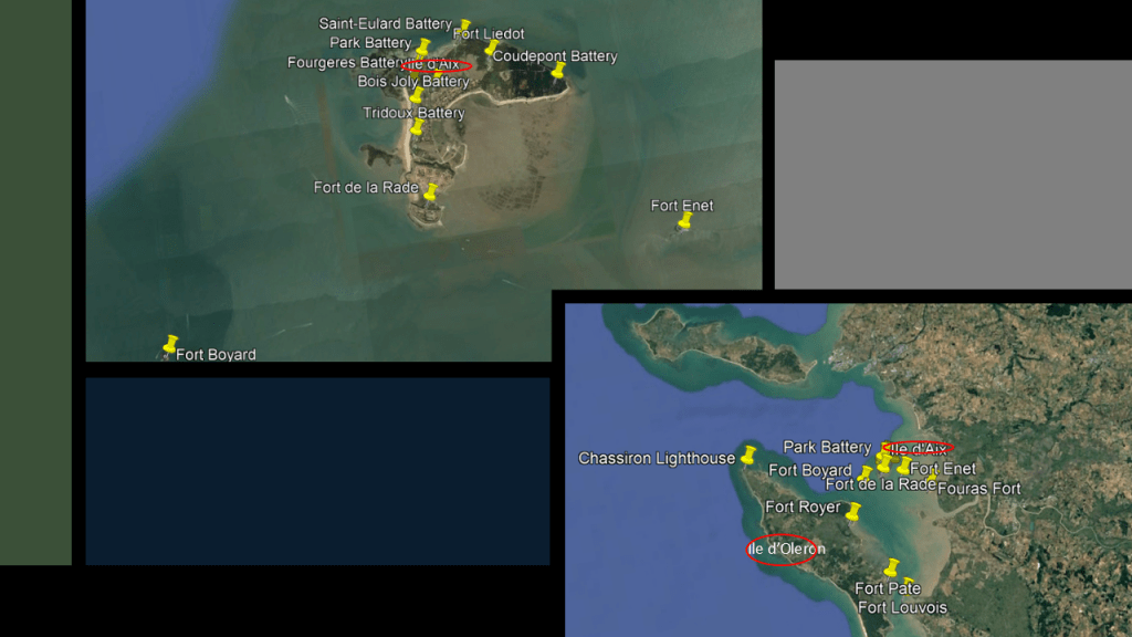
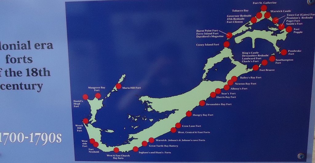
Over the course of years of doing research along the Earth’s leylines, I have found other island locations loaded with star forts and batteries, which we have always been told were military fortifications in our narrative.
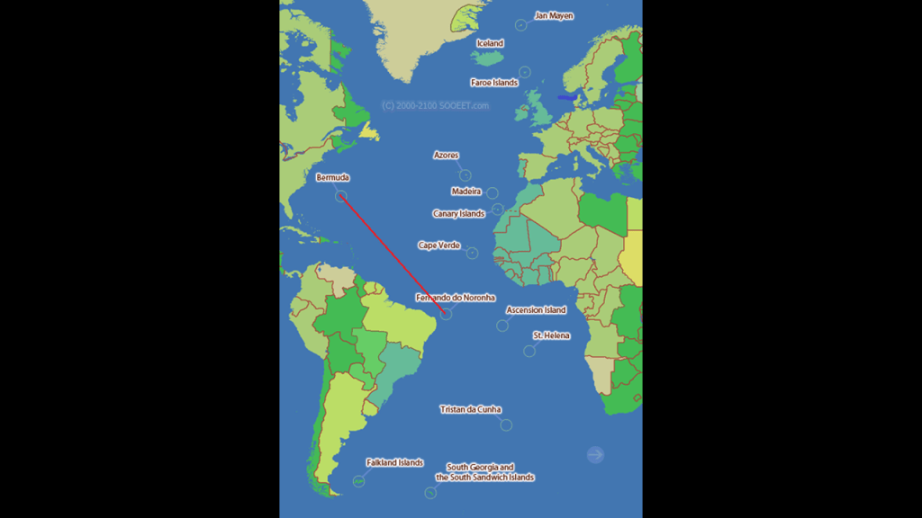
This includes places like the small island of Bermuda in the North Atlantic Ocean…
And the Fernando de Noronha islands, off the coast of Brazil near the city of Natal.
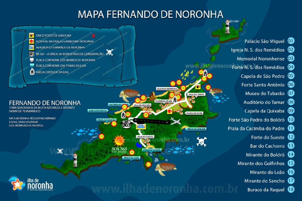
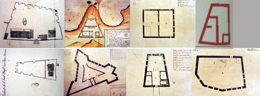
Here are historic drawings of eight of the ten I found out about within an archipelago whose area totals 10-square miles, 26-kilometers squared.
Both are in the Atlantic Ocean, separated by 3,277-miles, or 5,274-kilometers.
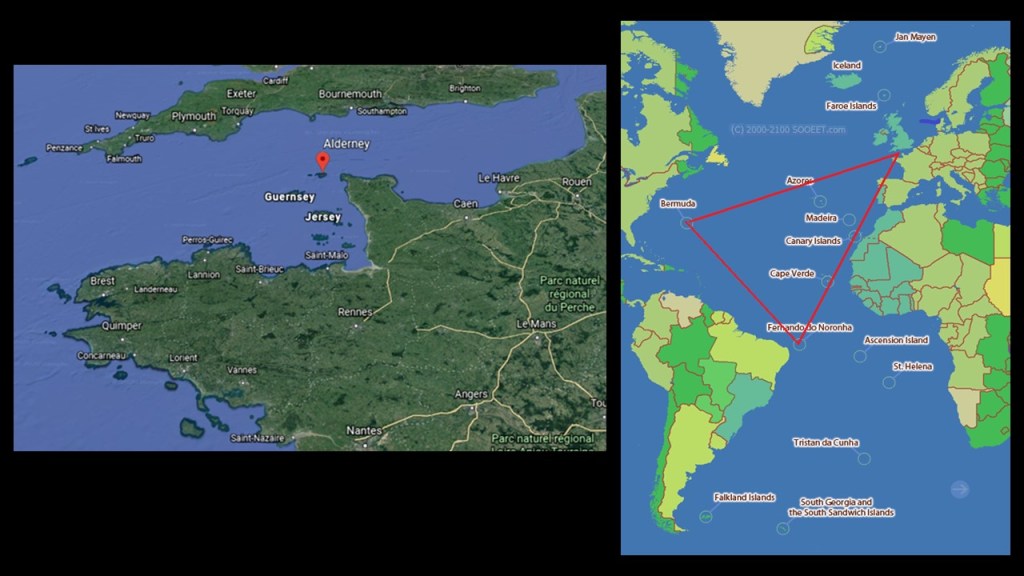
Alderney in the Channel Islands of the English Channel between southern England and northern France is also loaded with star forts.
Alderney Island is only 3-miles, or 5-kilometers, -long, and 1 1/2-miles, or 2.4-kilometers, -wide.

Alderney is the northernmost of the inhabited Channel Islands.
Alderney is the closest of the Channel Islands to both England and France, and is separated from the Cap de la Hague in France’s Normandy region by the Alderney Race, described as a dangerous passage because of the strong currents that run through it.
From this particular map, it certainly looks like there is more of Alderney Island below the water than above it.
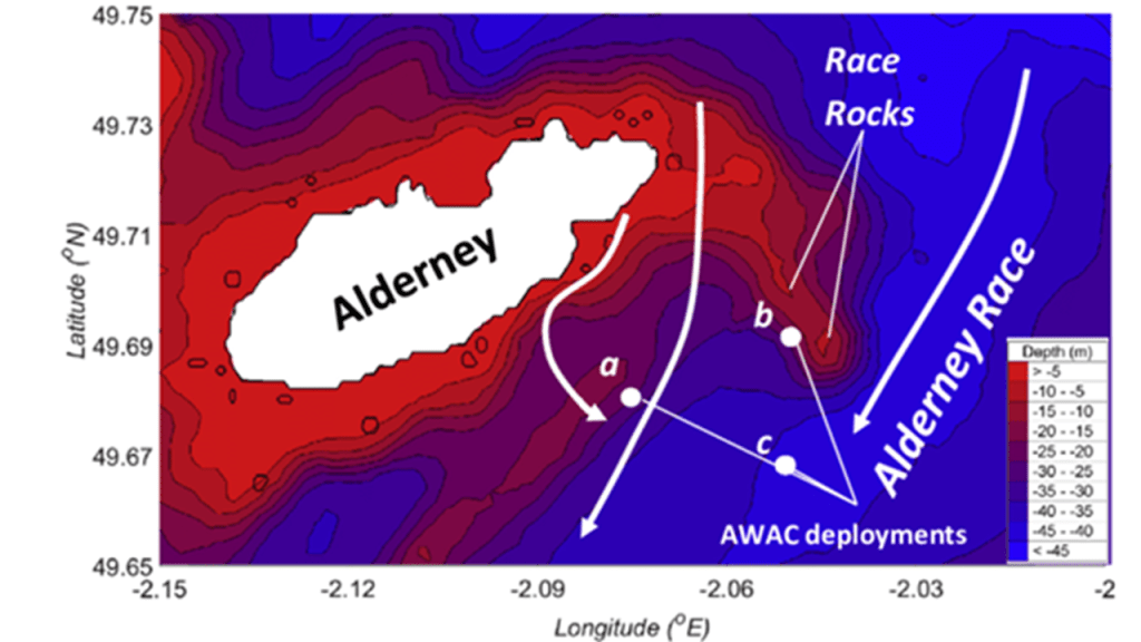
I used this Google Earth screenshot to orient myself to Alderney’s location with respect to England and France in order to match up Alderney’s location with this map, and to show what appears to be a triangulated relationship between these three places with a high-concentration of star forts for their small sizes.
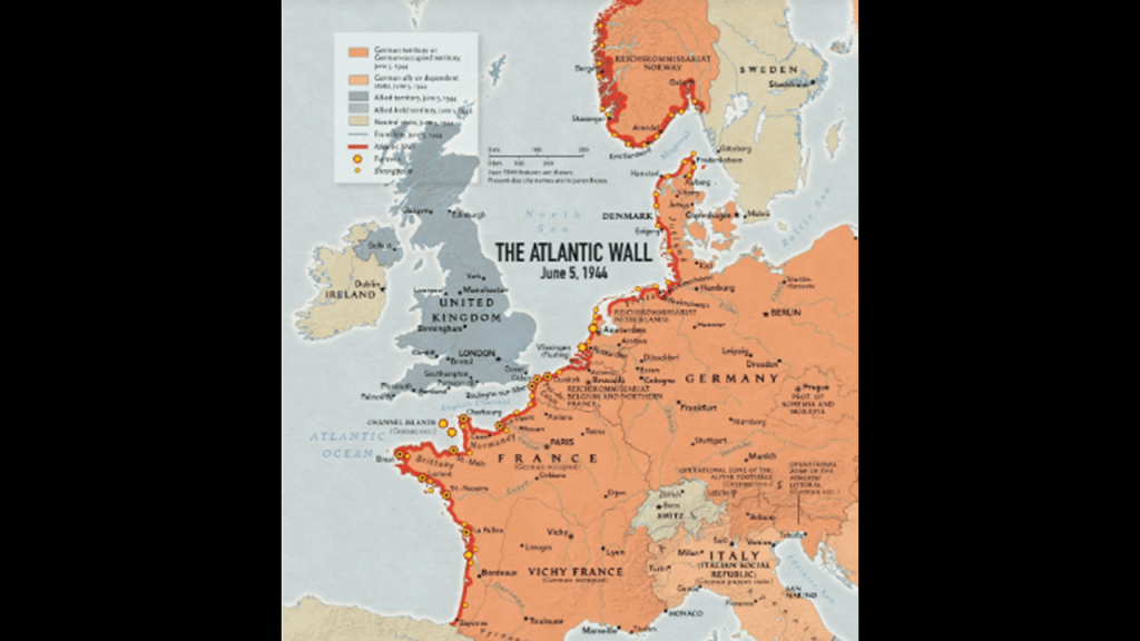
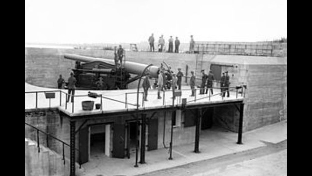
Alderney became one of the most heavily fortified sections of Hitler’s Atlantic Wall, one of the largest building works of the 20th-century, fortifications built between 1942 and 1944, envisioned to make an Allied invasion of the Western European mainland from the sea impossible.
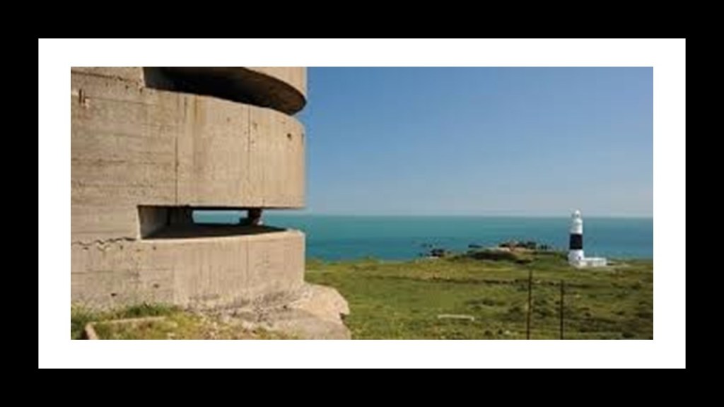
The Atlantic Wall was said to have been an extensive system of coastal defenses built by Nazi Germany along the coast of continental Europe and Scandinavia.
Just like France, the Channel Islands were occupied by the German Armed Forces long-term during the war, in this case from June 30th of 1940 to May 9th of 1945, and were the only part of the British Isles occupied by Germany.
It is interesting to note that for all the time, effort and energy the Germans were said to have put into the Atlantic Wall to make an Allied invasion of the Western European mainland from the sea impossible, we are also told that when the Allied forces landed on the beaches of Normandy on June 6th of 1944, known to us in history as D-Day, most of the coastal defenses there were stormed within hours.

Something is not adding up here.
All of these massive building projects for making an Allied invasion from the sea impossible amounted to absolutely nothing?
What was really going on here?
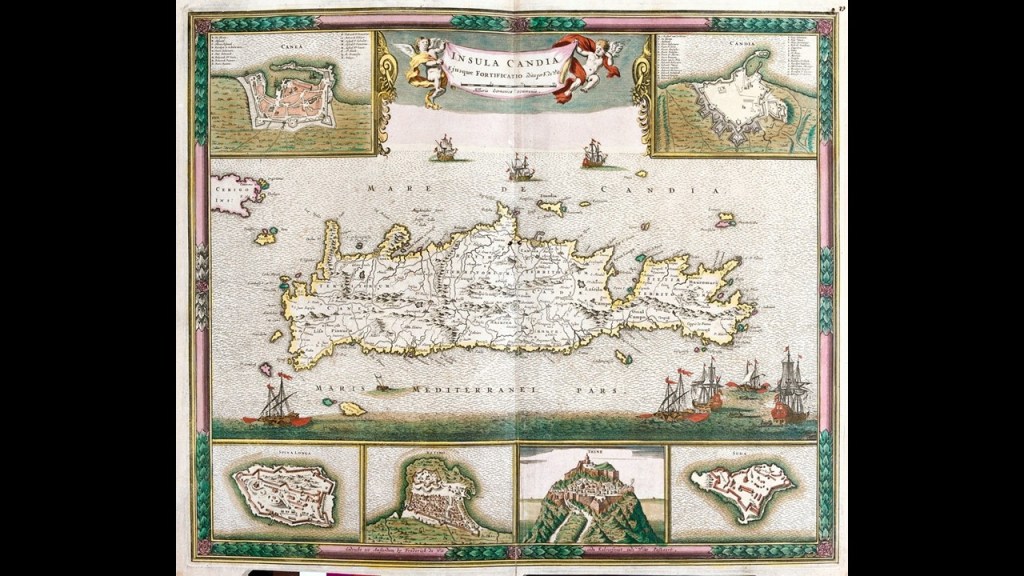
Crete is another island that I have encountered that has numerous star forts.
Crete, also known as Candia, is the largest and most populous of the Aegean Islands, and a place where the Venetians, Genoese, Byzantines, and Turks were all said to have built forts to defend the island from enemies and pirates, with 15 Genoese forts alone.
I think places like these examples were significant power centers for the Earth’s original energy grid system, and star forts represented the definition of battery meaning “a device that produces electricity that may have several primary or secondary cells arranged in parallel or series, as well as a battery source of energy which provides a push, or a voltage, of energy to get the current flowing in a circuit,” and that this is the reason there are so many star forts that are paired together, or even the reason clusters of them are found in the same location.

Many features on star forts, or so-called fortifications near them, are actually called “batteries,” even though they were re-purposed in many cases, but not in all, to the second definition applied to them in the new time-line in order for them to appear to have a strictly military function, which is “…the heavy fire of artillery to saturate an area rather than hit a specific target” that we are led to believe in our current historical narrative.
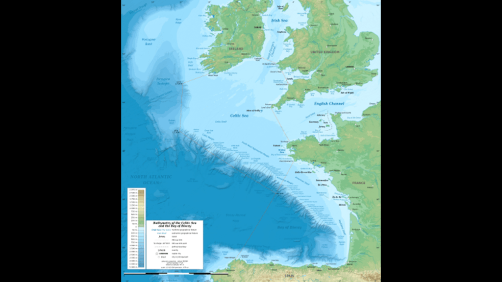
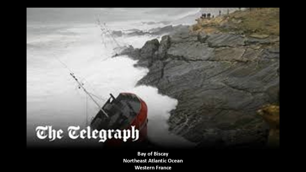
Next, I am going to turn my attention to the Bay of Biscay.
The Bay of Biscay is a gulf in the Northeast Atlantic that lies along the coast of Western France and the northern coast of Spain.
Just for point of information, Basque districts lie along the Bay, including Bilbao, the capital of the Basque Country in Spain, and Biscay was the name for Basque up until the early 19th century.
Parts of the Continental Shelf extend far into the Bay of Biscay.
What are called “Continental Shelves” are found all along the Earth’s coastlines, and I believe are actually submerged landmasses and ruined land from this recent cataclysmic event which destroyed the Earth’s original energy grid, along with land features like estuaries. wetlands, deserts and dunes.
I will continue to give evidence to support why I believe this throughout this post.
My belief is at odds, however, with the official explanation, which is that of a worldwide Great sea level rise as a result of melting glaciers from the last Ice Age and the expansion of seawater as it warms, and both are due to global warming.
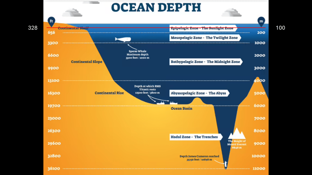
Here is a more detailed look at the bathymetry of the Bay of Biscay.
Bathymetry is the study of the underwater depth of the “floors” of oceans, lakes, and rivers.
So in this example, the shelf running along the European continent at this location is only 100-meters, or 328-feet, in depth, at its shallowest, which extends out quite a distance from the coast of France and well into the entrance of the English Channel.
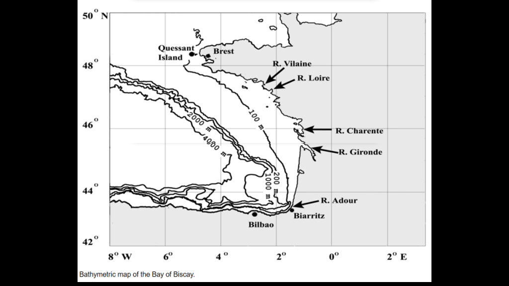
Here is another view of what these different depths look like from a different perspective on a chart measuring ocean depth.
Abnormally high waves and rough seas occur here, and the Bay of Biscay is known for having heavy storms, especially in the winter months.
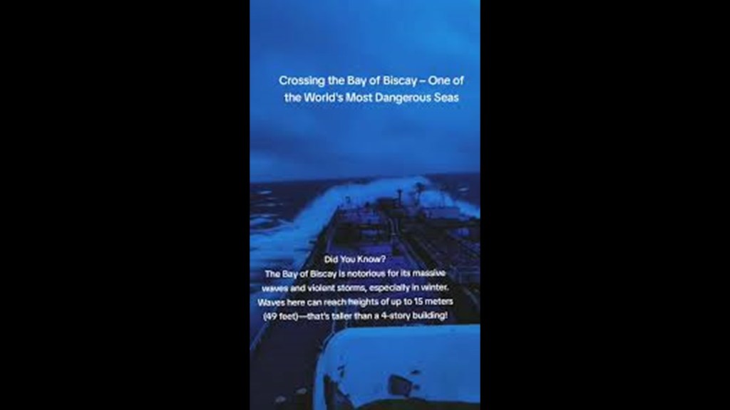
The Bay of Biscay is notable for having a long history of shipwrecks, and is counted among the most dangerous waters on Earth..
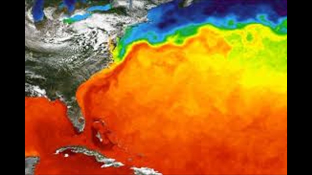
Also the Gulf Stream enters the Bay of Biscay, and follows the continental shelf’s border counterclockwise, keeping the temperature moderate.
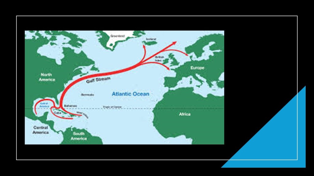
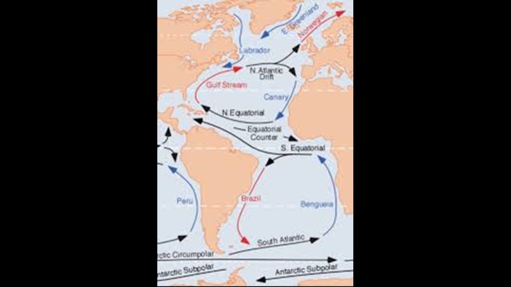
The “Gulf Stream” is described as a warm and swift current in the Atlantic that originates in the Gulf and flows through the Straits of Florida and up the Eastern coastline of the United States.
It veers east near the 36-degree North latitude at North Carolina and moves toward northwest Europe as the North Atlantic Current.
More on the 36-degree North latitude and North Carolina to come in this video.
The North Atlantic Current eventually splits in two, with the northern stream called the North Atlantic Drift heading into Northern Europe, and the southern stream, known as the Canary Current, recirculating along the coast of West Africa.
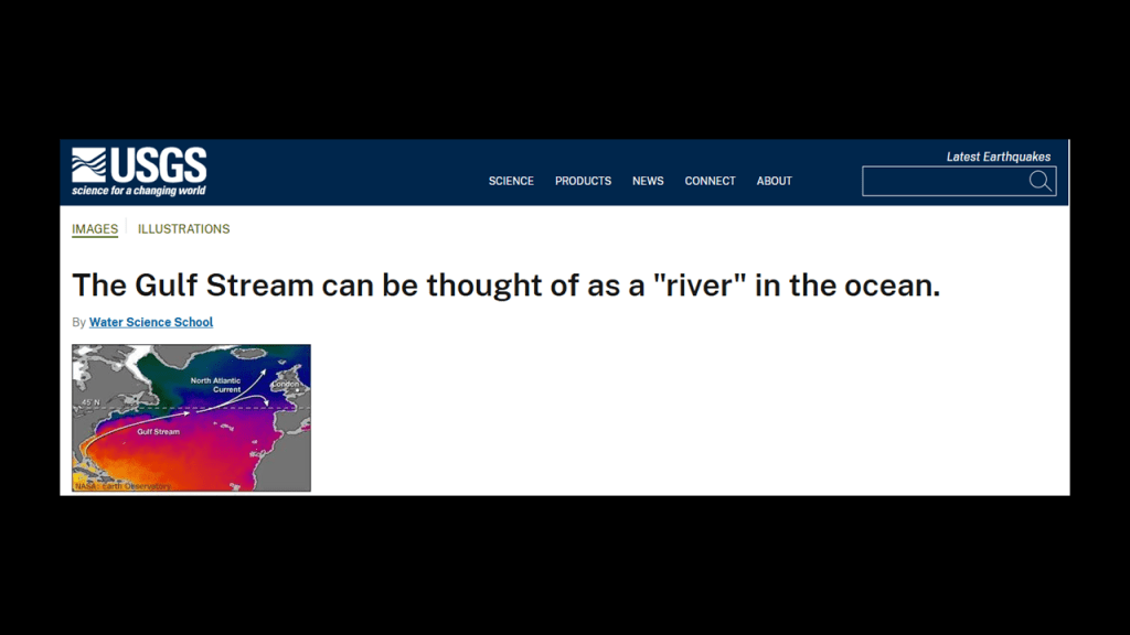
I found on the official USGS.gov website that “The Gulf Stream can be thought of as a “river” in the ocean.”
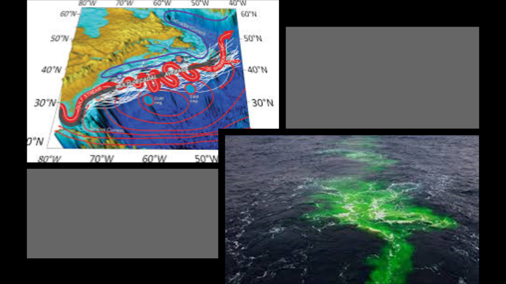
What I am wondering is if the “Gulf Stream” is a sunken river system, and I have already shared my belief that what are called “natural rivers” were in actuality man-made canal systems.
For example in this slide, there is a graphic showing the Gulf Stream with snaky, S-shaped bends on the top left, and on the bottom right, a photograph of the Gulf Stream, looking like a river in the ocean.
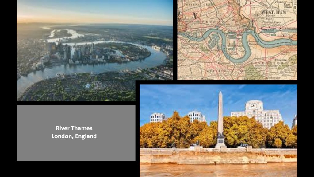
In this next slide, the snaky, S-shaped River Thames is shown on the top as it winds its way through London, and the masonry banks of the Thames as seen at the location of Cleopatra’s Needle on the bottom.
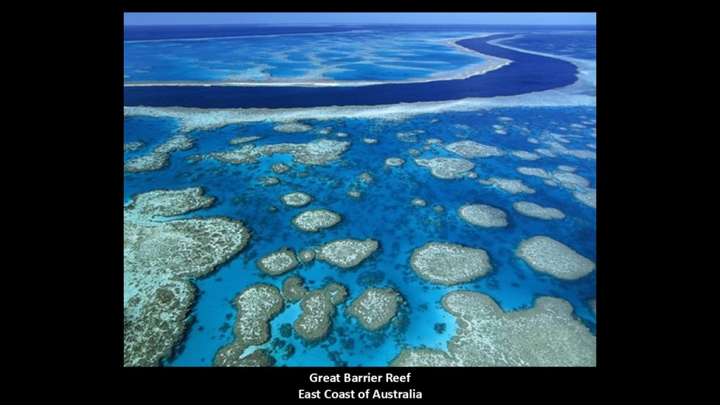
Here is a photo taken in the waters of the Great Barrier Reef, looking very much like a river in shallow water.
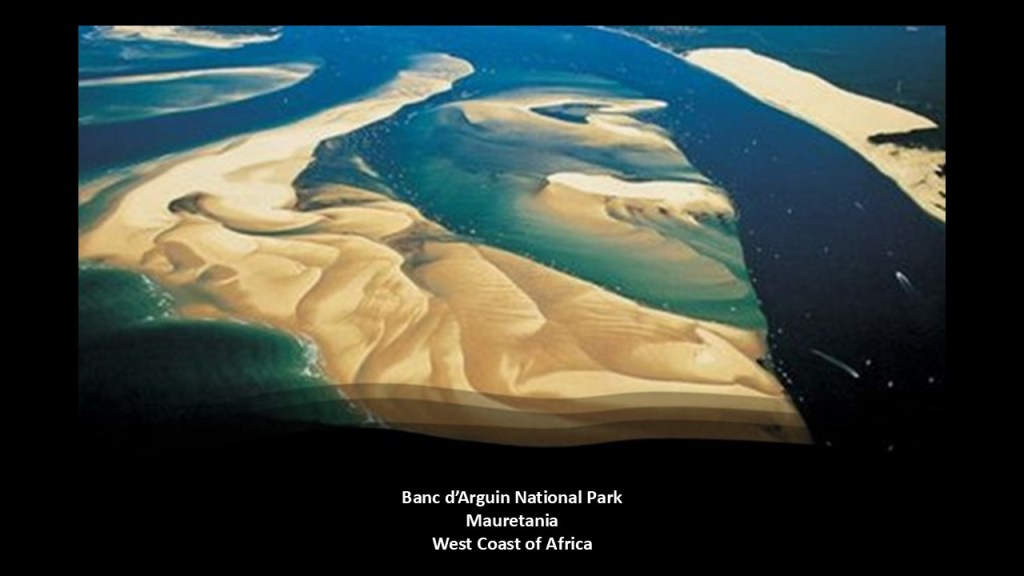
The shallows of the Banc d’Arguin National Park off the coast of West Africa in Mauretania are said to be remnants of a vast river delta from a time when waters flowed from what is now the Sahara Desert, and many channels are clearly visible in this location.
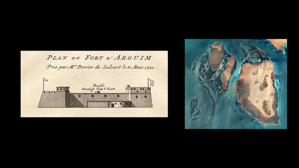
Oh, and there used to be a star fort here as well on the island of Arguin in the National Park, but there isn’t one to be found here any more.
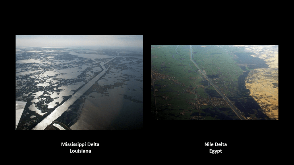
And here are aerial views on the left of the Mississippi Delta, which is on the southeastern coast of Louisiana, showing many geometric and straight channels, and the same type of straight, geometric channels are also found in the Nile Delta on the right.
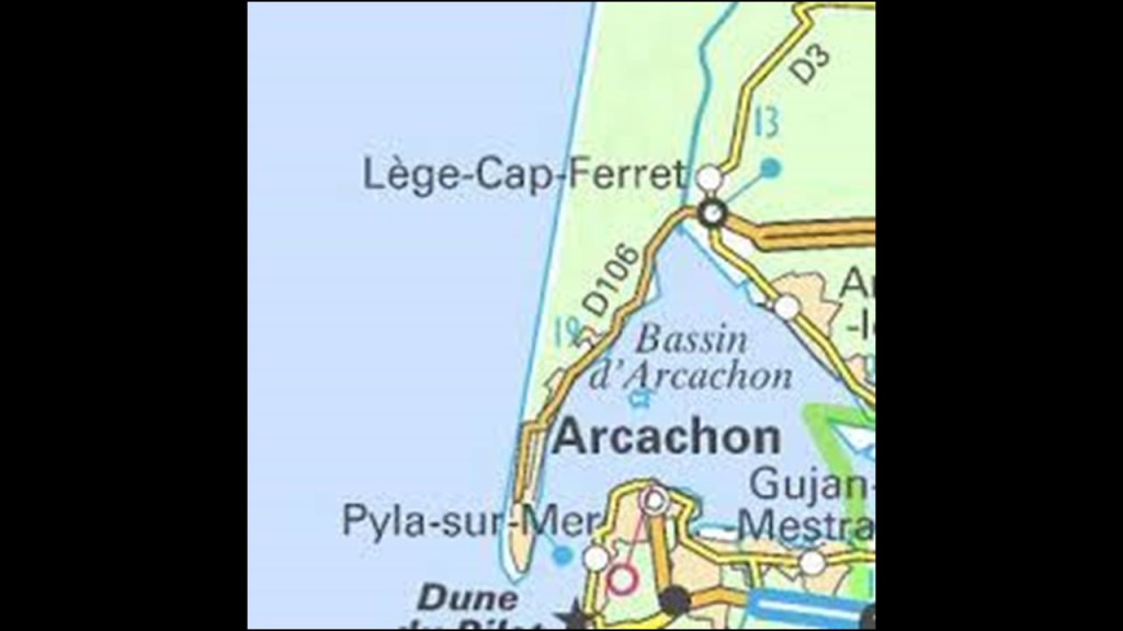
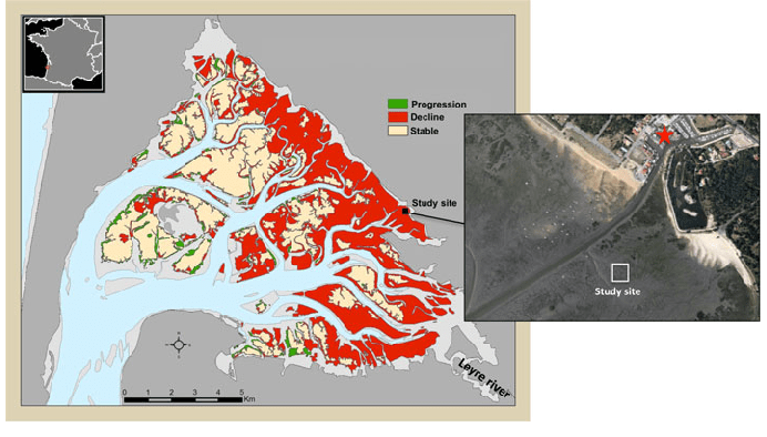
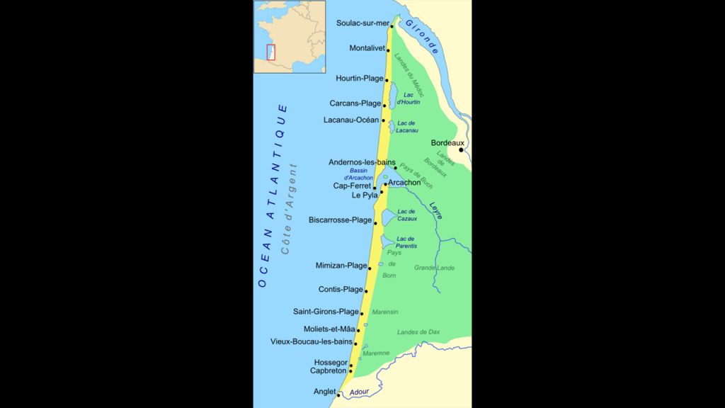
Now, I am going to take a closer look at Arcachon and Arcachon Bay, which is located very close to where this Pyramid alignment between Mexico and Egypt enters France, and in-between the Medoc Regional Natural Park and the Landes de Gascogne Regional Natural Park.
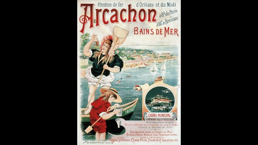
Arcachon is a popular beach resort 34-miles, or 55-kilometers, southwest of Bordeaux, and accessible by rail from Bordeaux since 1857, the year that the French Emperor Napoleon III signed an imperial decree that Arcachon was an autonomous municipality, and it turned from a small fishing village into a health and beach resort.
Arcachon is known for the Arcachonnaise-style of architecture said to have been built there during the 19th-century, often described as a type of Victorian architecture.
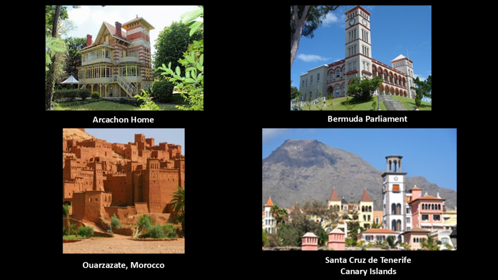
Here is one example of a Arcachonaise home on the top left, with the architectural feature of a tower that brings to mind the Bermuda Parliament building in Hamilton, Bermuda on the top right, facing in the same direction as the one in Arcachon; the towers in this photo of Ouarzazate in Morocco on the bottom left; and the towers in Santa Cruz de Tenerife on the island of Tenerife in the Canary Islands on the bottom right, and these two on the bottom are also facing in the same direction.
If I were to take a guess, because I don’t know for certain, everything was oriented to the cardinal points of North, South, East, and West.
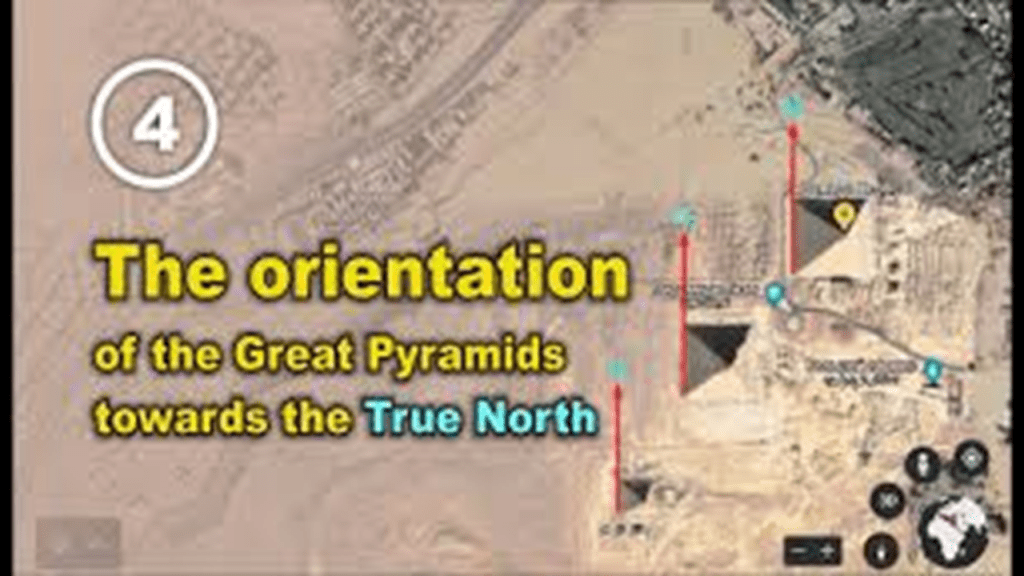
I do know for certain that the Pyramids of Giza are.
I think everything was built by the original advanced Moorish civilization that was removed from our awareness, and that the Victorian-era and the second French Empire under Napoleon III in the 19th-century was the major time of the reset of our historical narrative, and provided the cover-story needed to explain what was already in existence, and being brought back on-line after the energy grid was destroyed.

Next, I am going to turn my attention to Arcachon Bay.
The general shape of Arcachon Bay is described as that of an equilateral triangle pointing north, and the southwest corner of which is open to the sea, between Cap Ferret, the location of the previously-mentioned lighthouse, and the town of Arcachon.
Arcachon Bay is also described as an estuary, where saltwater and freshwater mix, and in which we are told that tidal currents result in features like sand bars, sand flats and a channel system.
The Cap Ferret has a narrow-gauge tramway that links the shores of the Arcachon Bay with the beaches on the Atlantic Coast that runs from April to September.
The line first operated in 1879 and was pulled by a horse.
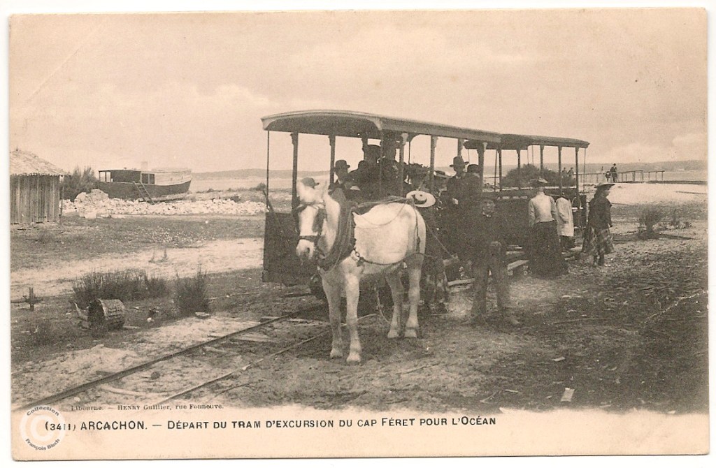
Locomotives took over in 1925 and it operated until 1935, and then service was started again in its current form in 1952.
What we are told were remnants of the Atlantic Wall are visible at the beach terminus of the tramway.
The Dune of Pilat is located at the southern entrance of Arcachon Bay, and is the tallest sand dune in Europe.
Prior to being called the Dune of Pilat in the 1930s, the area was called “Les Sabloneys,” or “the New Sands.”
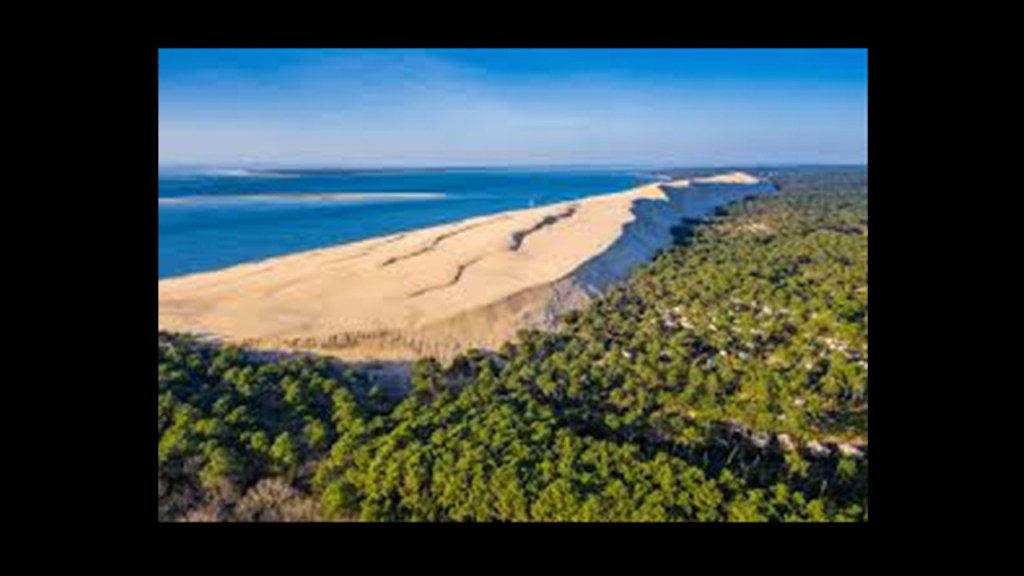
We are told the dune has moved landward, and has pushed back forest to cover houses, roads, and more portions of the Atlantic Wall.
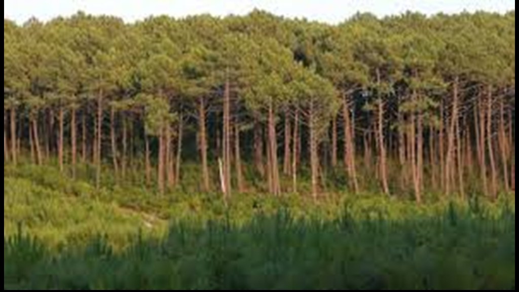
Arcachon is in what is called the “Landes Forest,” called the largest manmade forest in western Europe.
Composed mostly of maritime pine, the “Landes Forest” covers a large part of the Nouvelle Aquitaine region and is also the location of the Landes de Gascogne Regional Natural Park, which I will be looking at shortly.
The history of the “Landes Forest” goes like this.
Most of the region covered by the “Landes Forest” was swampy-land and sparsely-inhabited until the 19th-century, when the “19 June 1857 Law” led to wide-scale reforestation to rehabilitate the landscape and provide for economic development.
We are told that prior to this time, local inhabitants were using stilts to move from place-to-place in the wet terrain.
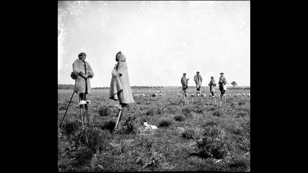
The area of the forest is approximately 3,900-square-miles, or 10,000-square-kilometers, of which nine-tenths of the forest is what is called a “pine plantation” planted with maritime pines in the 19th-century on fairly poor, sandy soils.
One-tenth of the forest is said to be old-growth natural forest, of oak, alder, birch, willow, and holly.
I am going to pivot now to the Atlantic Coast of the United States for some comparisons of what is found where I have been looking on both sides of the Atlantic.
Firstly, pine barrens.
There are three remaining large Atlantic Coastal Pine Barrens in New Jersey, Central Long Island, and Coastal Massachusetts.
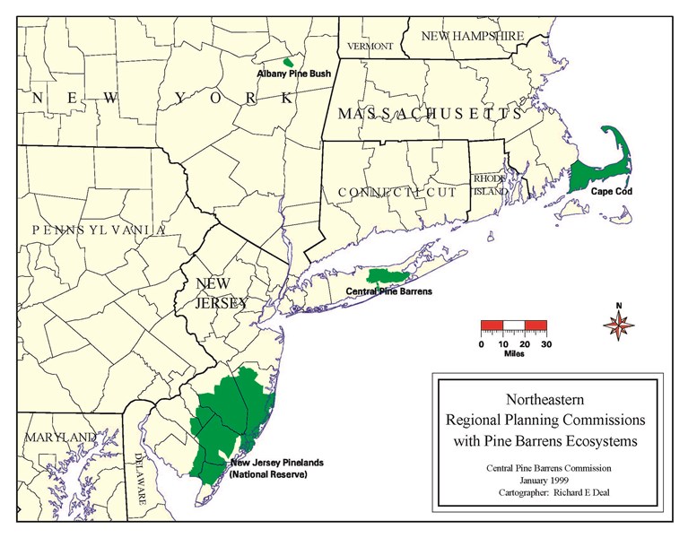
Like the “Landes Forest,” these pine barrens also have nutrient-poor, sandy and swampy soil.
In New Jersey, the pine barrens are part of 1.1-million-acres of the Pinelands National Reserve, occupying 22% of New Jersey’s land area.
In our historical narrative, the Central Railroad of New Jersey was building its rail-lines right through the desolate, swampy and forbidding Pine Barrens between nearby large population centers and the Jersey Shore.
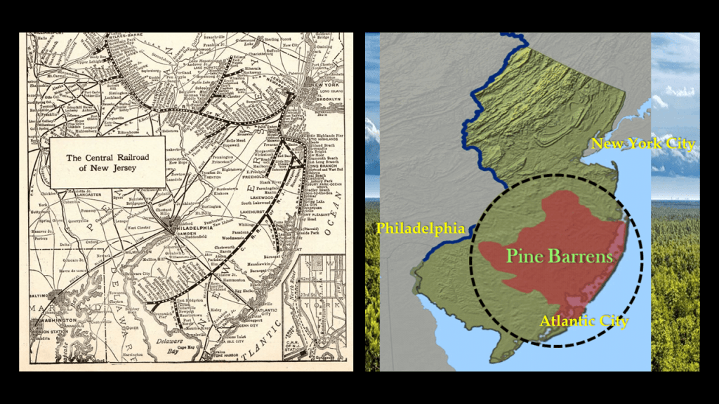
Today there are abandoned trains and railroad tracks found throughout the New Jersey Pine Barrens.
This whole area is part of the New York – New Jersey Harbor Estuary System, which we are told forms one of the most intricate natural harbors in the world, as well as being the busiest port in the world as the Ports of New York and New Jersey are contained within it.
it is described as a harbor system of bays and tidal rivers where the Hudson, Hackensack, Rahway, Passaic and Raritan Rivers meet the Atlantic Ocean.
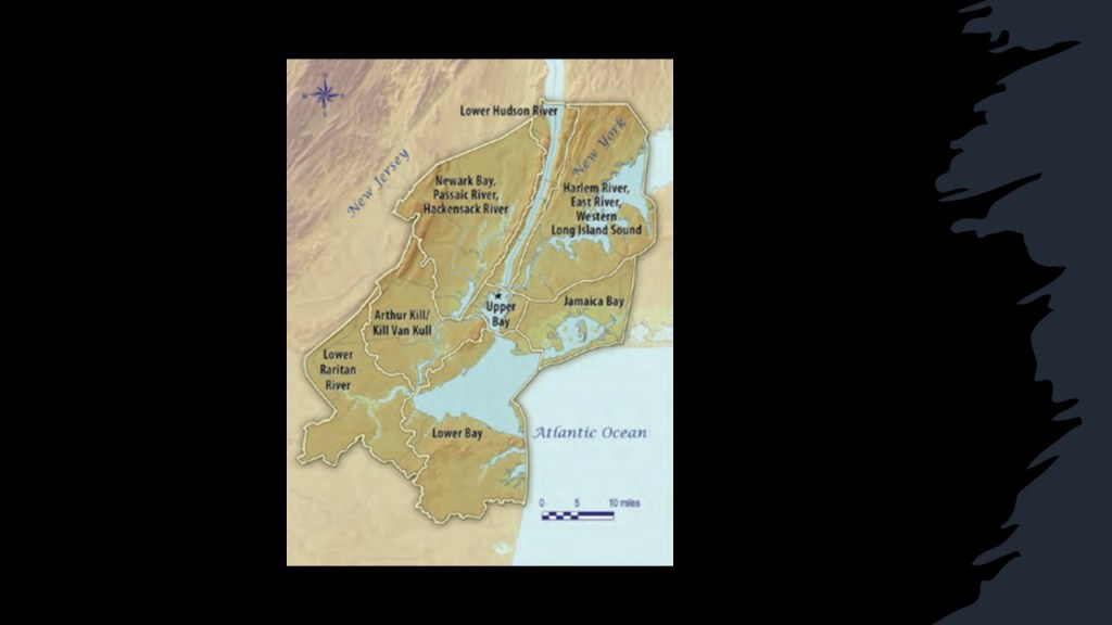
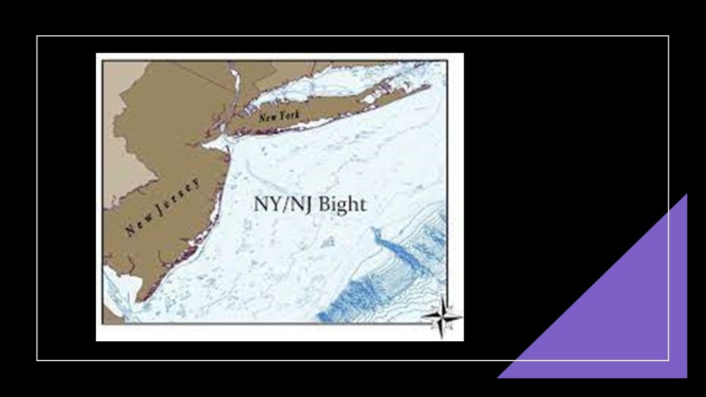
To the southeast, the Lower New York Bay that is part of the harbor system opens into the New York Bight in the Atlantic Ocean.
The New York Bight is described as a roughly triangular indentation along the Atlantic Coast of the northeastern United States from Cape May, New Jersey, to Montauk Point on the Eastern tip of Long Island.
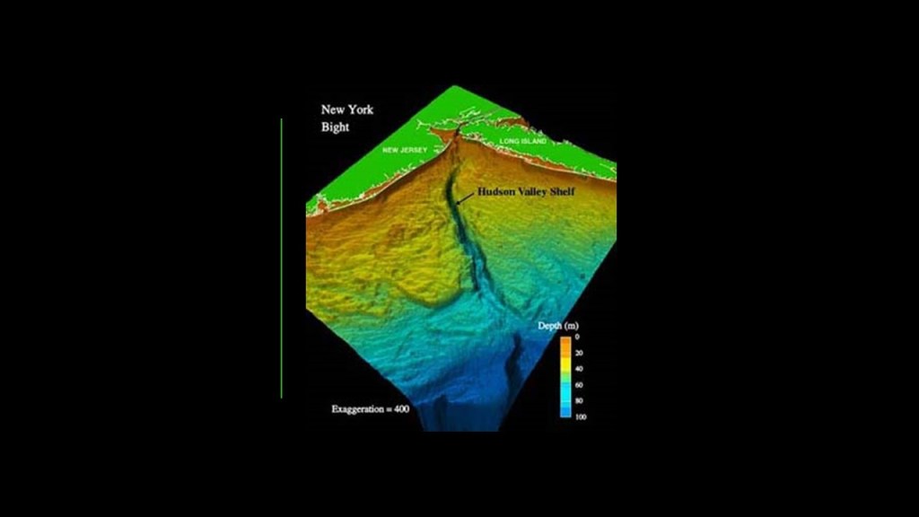
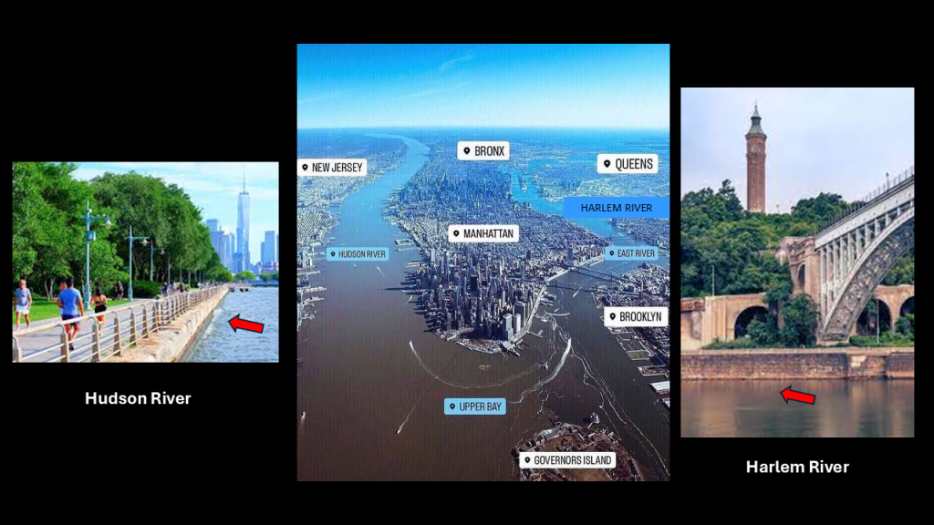
The Hudson Valley Shelf, also known as the Hudson Canyon, is an underwater canyon that begins at the shallow outlet of the estuary at the mouth of the Hudson River, said to begin as a natural channel but in my mind, another candidate for a man-made canal.
The Hudson River with a masonry bank is shown on the left, and the Harlem River with a masonry bank shown on the right in this location in New York City and New Jersey.
There’s a lot to unpack here on the Atlantic Coast of the United States that is like what we’ve already seen on the Atlantic Coast of western Europe, so I will bring forward the comparisons I want to make.
So I am going to start breaking this down into smaller parts at Plymouth, Massachusetts on Cape Cod, the location of the Southeastern Massachusetts Pine Barrens Alliance.
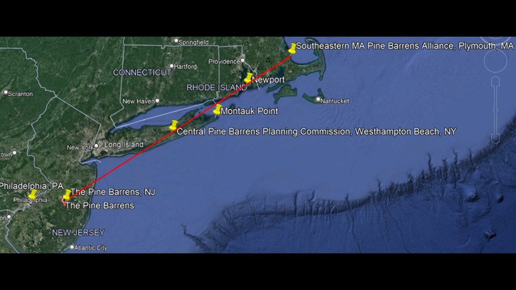
The Southeastern Massachusetts Pine Barren Association is headquartered at The Center at Center Hill Preserve in Plymouth.
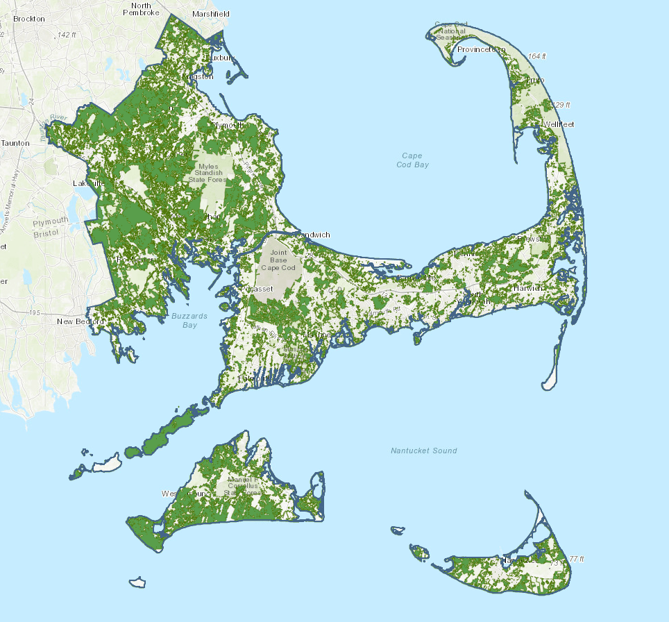
The SEMBP on land extends from Duxbury to Provincetown along the Cape Cod Bay shoreline, covering Cape Cod, the Elizabeth Islands, Nantucket Island and Martha’s Vineyard, and inland includes Southeastern Massachusetts, including Plymouth and surrounding communities.
This is the same Plymouth that was the location of the Plymouth Colony in our historical narrative where the Pilgrims in 1620 after they journeyed from England to the New World on the Mayflower, seeking religious freedom, as we are taught and celebrate every year in the United States at Thanksgiving.
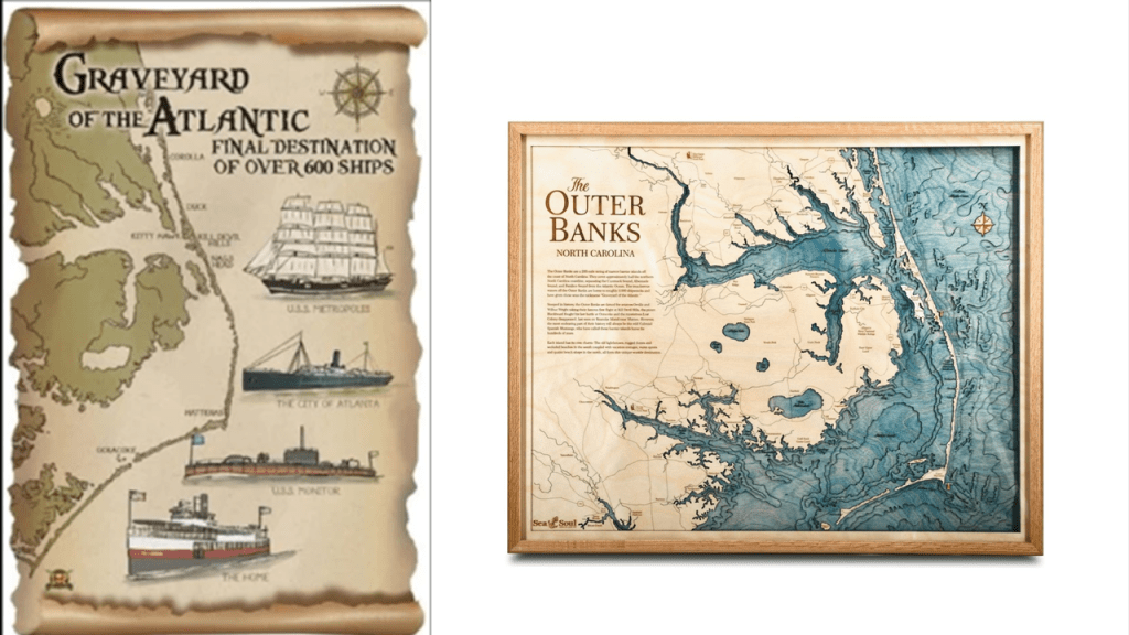
Like the dangerous waters of the Bay of Biscay, Cape Cod is also known as a “Graveyard of the Atlantic” due to the large number of shipwrecks that have occurred here because of its dangerous shallows.
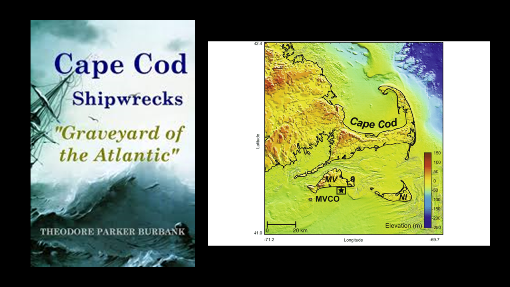
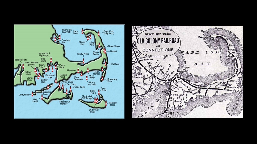
Here is the map showing fourteen lighthouses on Cape Cod alone, as well as other lighthouses of this part of New England, on the left, as well as the historic Old Colony Railroad that traversed the length of the narrow Cape Cod.
The landscape all through here has a sheared-off-looking quality to them, like the example of Aquinnah Cliffs on the island of Martha’s Vineyard, which is part of the Massachusetts Coastal Pine Barrens…
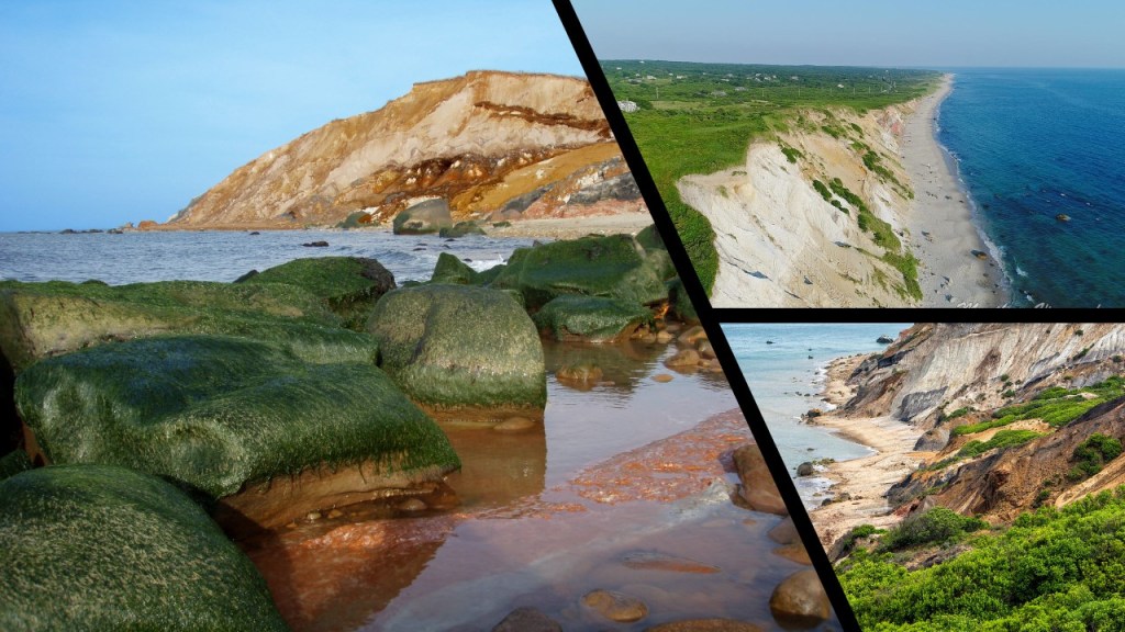
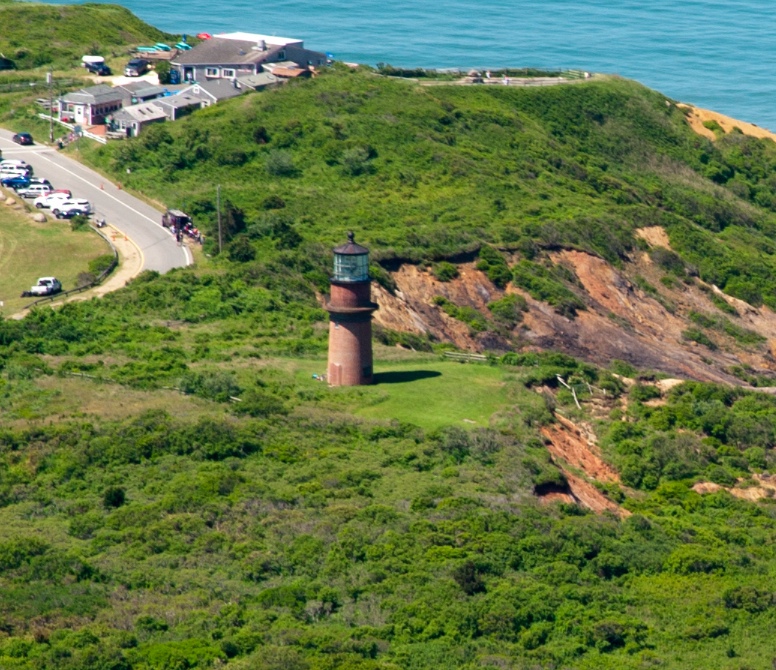
…and the location of the Gay Head Lighthouse on Martha’s Vineyard and its location next to eroding cliffs, and where it looks like there is more to the lighthouse under the ground.
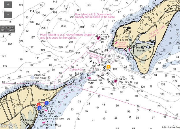
Like the Alderney Race in the Channel Islands between Alderney and the Normandy coast of France, the Plum Gut at the entrance to Long Island Sound, between the lighthouse on Plum Island and the lighthouse at Orient Bay on the easternmost point of the North Fork of Long Island, is notorious for its extremely turbulent currents.
The Long Island Sound is also a tidal estuary of the Atlantic Ocean.
Long Island Sound is 110-miles, or 180-kilometers, -long, and runs between the East River in New York City, along the North Shore of Long Island.
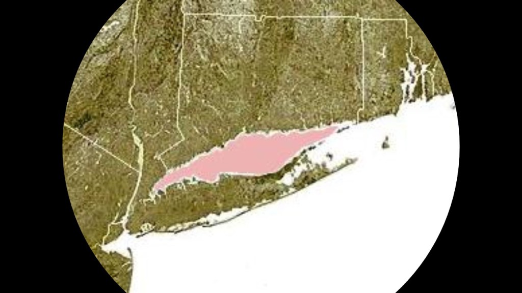
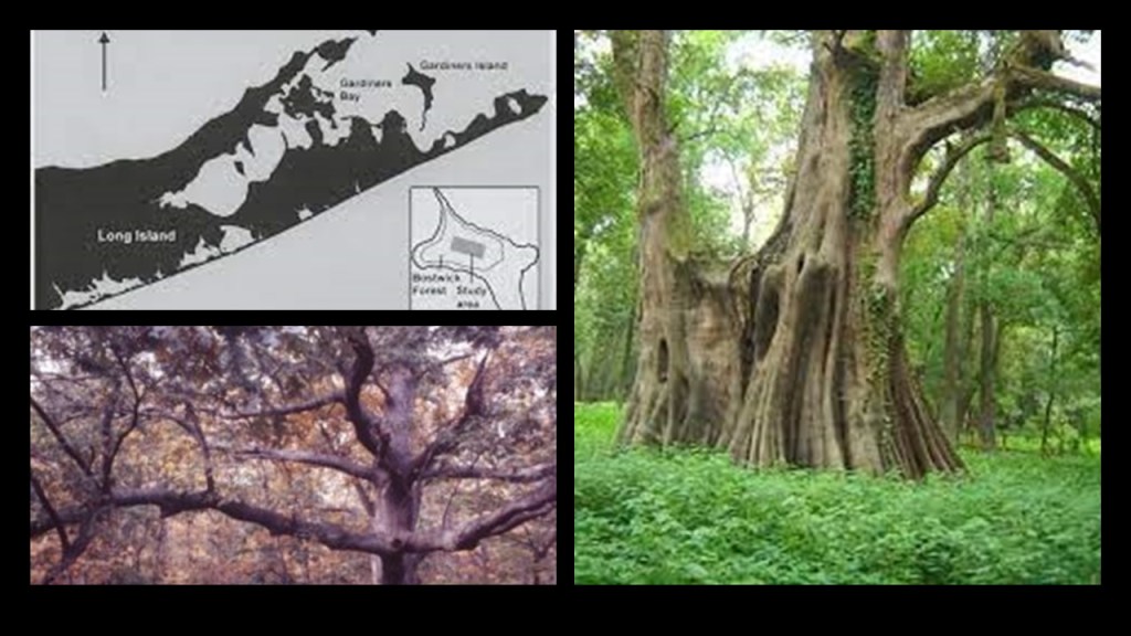
Gardiners Island, located in Gardiners Bay between the North and South Forks of Long Island, was the first English settlement in New York, circa 1639, and has been privately owned by the Gardiner family ever since.
Even though Gardiners Island is just a little over 5-square-miles, or 13.4-kilometers-squared, it has more than 1,000 acres of old growth forest, considered to be the largest old-growth forest on the northeast coast of the United States.
Besides having the largest stand of white oak in the American Northeast, other trees include swamp maple, wild cherry, and birch.
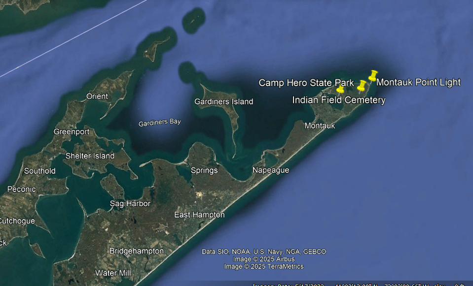
Montauk Point is located on the far eastern end of the South Fork of Long Island.
The Montauks, also known as Montauketts, once resided in large numbers on the eastern end of Long Island.
Interesting to note there is a “Pharoah” surname amongst the Montauks.
This a painting of David Pharaoh of the royal family of the Montauk tribe, pictured with loads of sand and dunes.
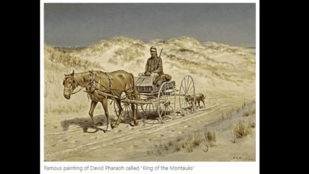
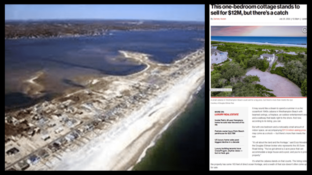
In today’s world, the Westhampton dunes on eastern Long Island is considered prime land and luxury real estate for those that can afford it.
The Montauk Point Lighthouse is on Turtle Hill at the easternmost tip of Long Island, was said to be the first built within the State of New York between 1792 and 1796, and the fourth-oldest active lighthouse in the United States.
Today it is a privately-run museum.
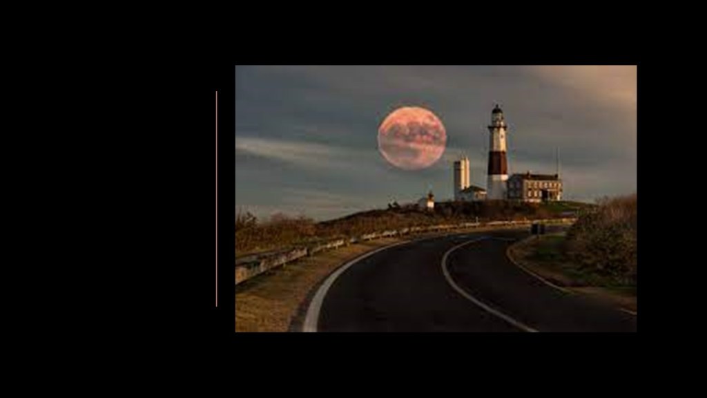
The U. S. Army took over the lighthouse during World War II, and opened Camp Hero, or Montauk Air Force Station, in 1942, adjacent to the lighthouse.
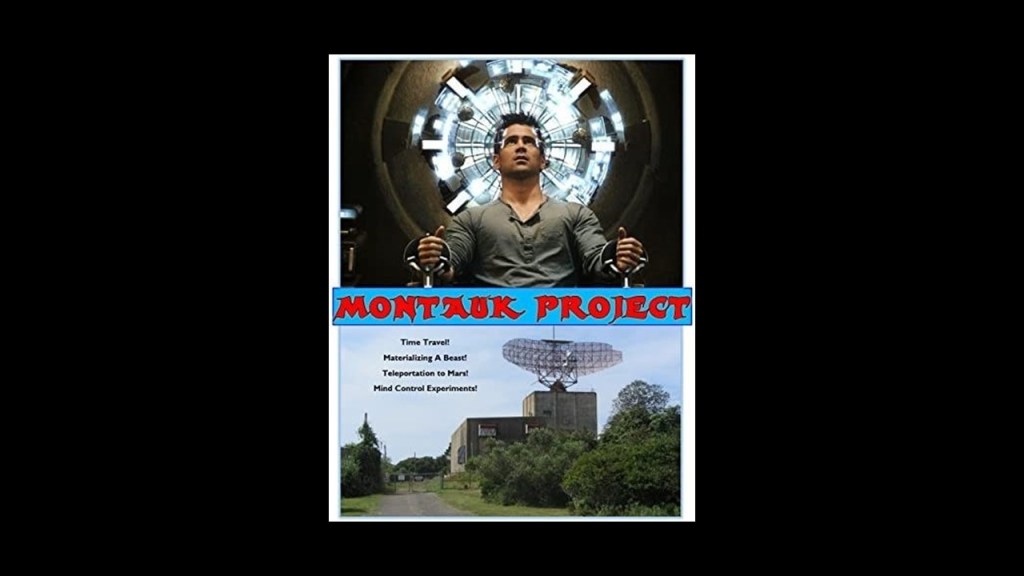
Camp Hero on Montauk Point is alleged to be the location of the Montauk Project, a series of U. S. Government projects with the purpose of developing things like psychological warfare techniques, like MK Ultra, and time-travel research, among others.
The Montauk Reservation on Montauk Point was located in the vicinity of Camp Hero State Park and the Lighthouse, and not far from Gardiners Island in-between the North Fork and the South Fork of Long Island.
There was an extensive railroad system on Long Island historically, and even today is the busiest commuter railroad in the United States, and operates continuously…
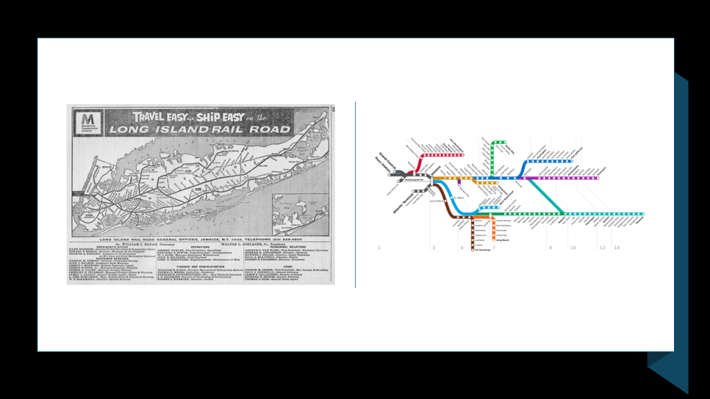
…across a landscape of wetlands, pine barrens, lakes and lagoons on an island that is 118-miles, or 190-kilometers, -long, and 23-miles, or 37-kilometers-wide.
This is the same kind of infrastructure and landscape we have been seeing on the Medoc Peninsula on the Atlantic Coast of western France.
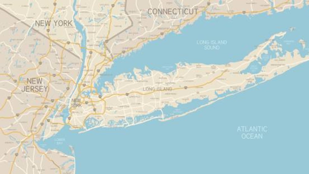
Before I leave this part of the North Atlantic coast, I would like to mention what are called the “New England Seamounts,” that begin at the edge of the continental shelf off of this part of New England close to Cape Cod and Long Island.
The New England Seamounts are described as a chain of twenty underwater extinct volcanic mountains known as “seamounts.”
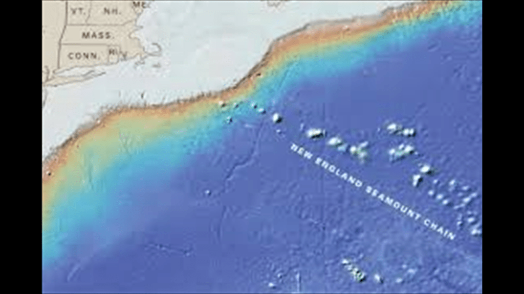
A “seamount” is defined as a large, submarine landform that rises from the ocean floor without reaching the surface of the water.
Oceanographers classify them as independent features typically formed from extinct volcanoes that rise abruptly from the sea-floor from 3,300-to-13,100-feet, or 1,000-to-4,000-meters, in height.
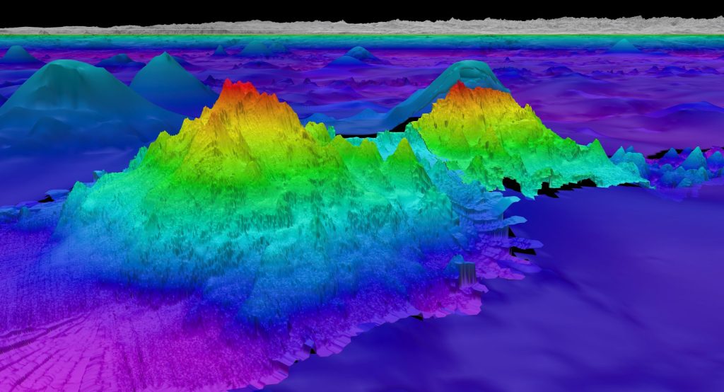
Guyots are seamounts with a flat-surface on top that we are told was created by such things as wave action over a long period of time.
So, for example, the Bear Seamount, part of the New England Seamount chain is an example of a “guyot,” and shown here next to the Physalia Seamount.
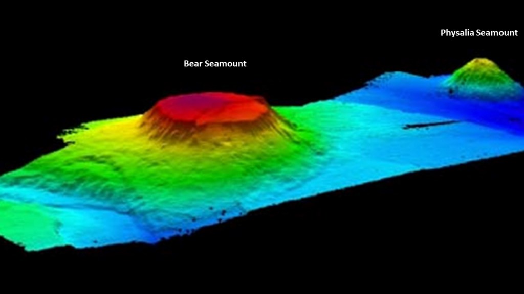
Both the Bear and Physalia Seamounts are part of the Northeast Canyons and Seamounts Marine National Monument, which were created on September 15th of 2016 by President Obama by Proclamation 9496, which was a power granted by the U. S. Congress under the Antiquities Act of 1906, which gave the President the authority to create national monuments from federal lands to protect significant natural, cultural or scientific features.
It is the first U. S. Marine National Monument in the Atlantic Ocean, and protects four seamounts and three submarine canyons on the edge of the Continental Shelf.
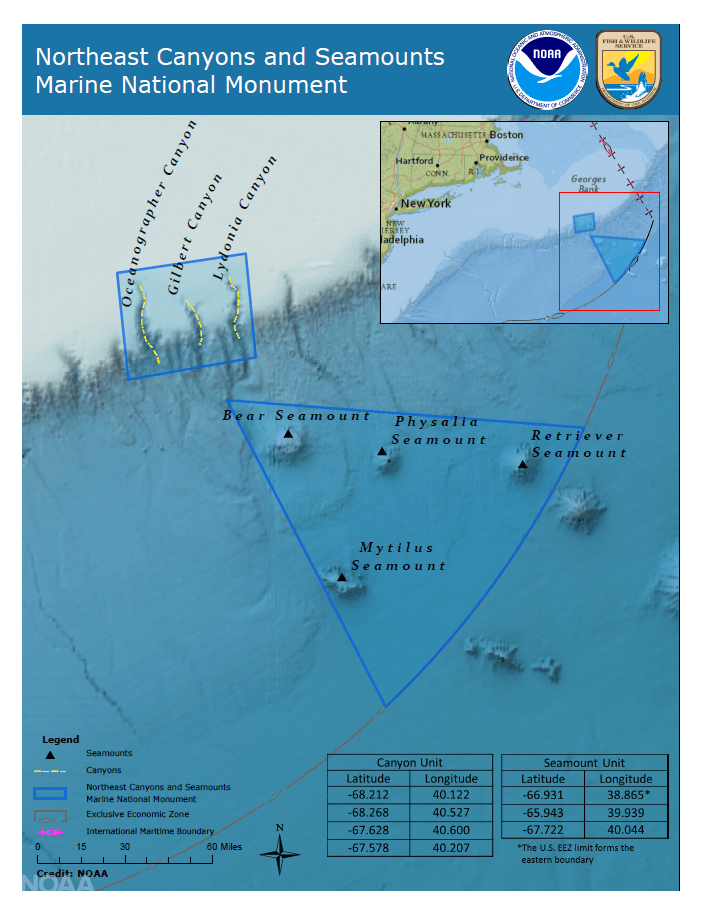
It is interesting to note that these seamounts, described as large, submarine landforms that rise abruptly from the ocean floor and independent features typically formed from extinct volcanoes sounds very similar to the definition of the previously-mentioned “Monadnocks” found on land, and here is a comparison of the three examples I showed earlier of the Devil’s Tower in Wyoming; the Jugurtha Tableland in Tunisia; and the Hammam Damt volcano in Yemen on the left, with the Bear Seamount in the Atlantic Ocean on the right.

Now I am going to go further south along the Atlantic Coast of the United States to one of the areas I was looking at in Part 2 of this series, where the alignment crosses over the coastal plain of North Carolina, and exits at Carova Beach, just south of the state’s border with Virginia.

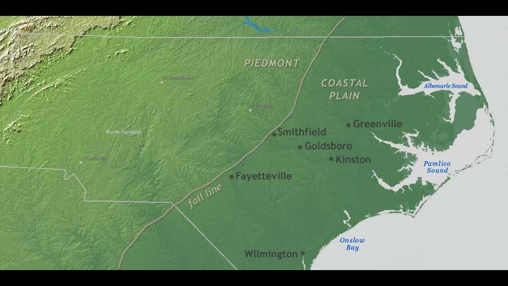
North Carolina’s Coastal Plain is described as low, flat land along the Atlantic Ocean that makes up about 45% of the state’s total land area.
Wetlands are a dominant feature of the Coastal Plain.
About half of the state’s original freshwater wetlands have been drained and converted to other uses, like agriculture or urban uses.
About 240,000 acres, or 97,124-hectares, were originally in salt marshes, and approximately 85% of those marshes remains undisturbed.
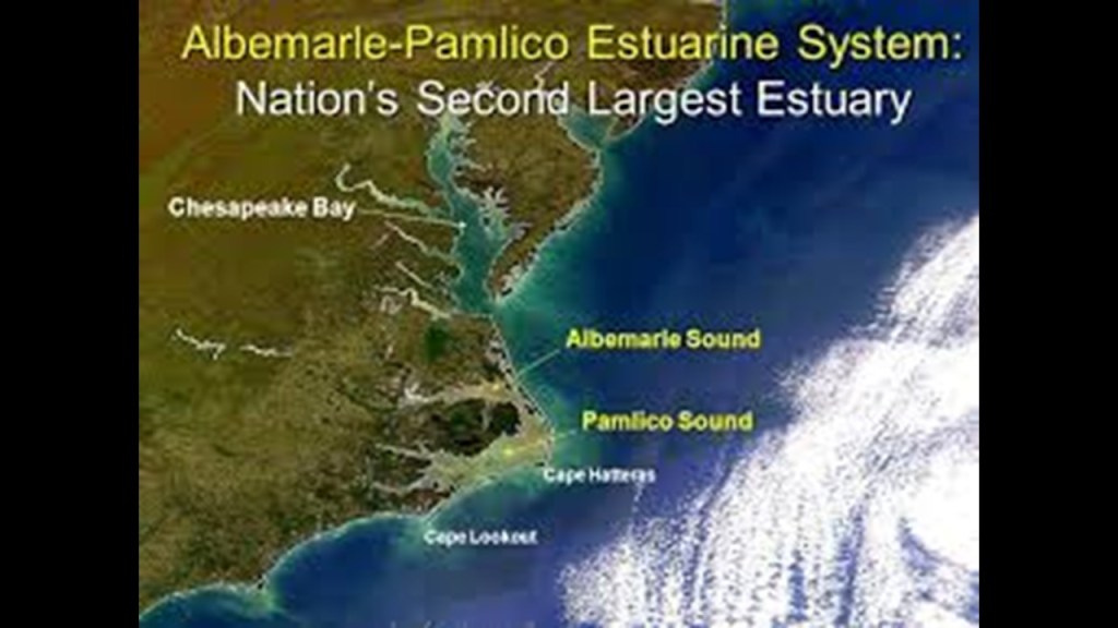
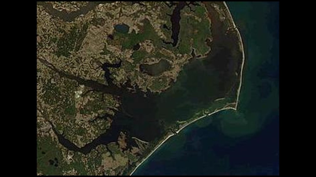
Pamlico Sound is the largest estuarine lagoon along the North American East Coast, at 80-miles, or 130-kilometers, -long and 15- to 20-miles, or 24- to 32-kilometers, -wide, and is connected to a large, interconnected network of similiar sounds known collectively as the Albemarle-Pamlico Sound System.
The combined estuary has over 3,000-square-miles, or 7,800-kilometers-squared, of open water, making it the second-largest estuary in the United States, after the Chesapeake Bay just to the north of it.
The Pamlico Sound is separated from the Atlantic Ocean by the Outer Banks, a row of low, sandy barrier islands, where we find more historic forts, like what we saw on the Atlantic coast of France, some pre-Civll war and some Civil War-era, are found up and down the coast-line here.
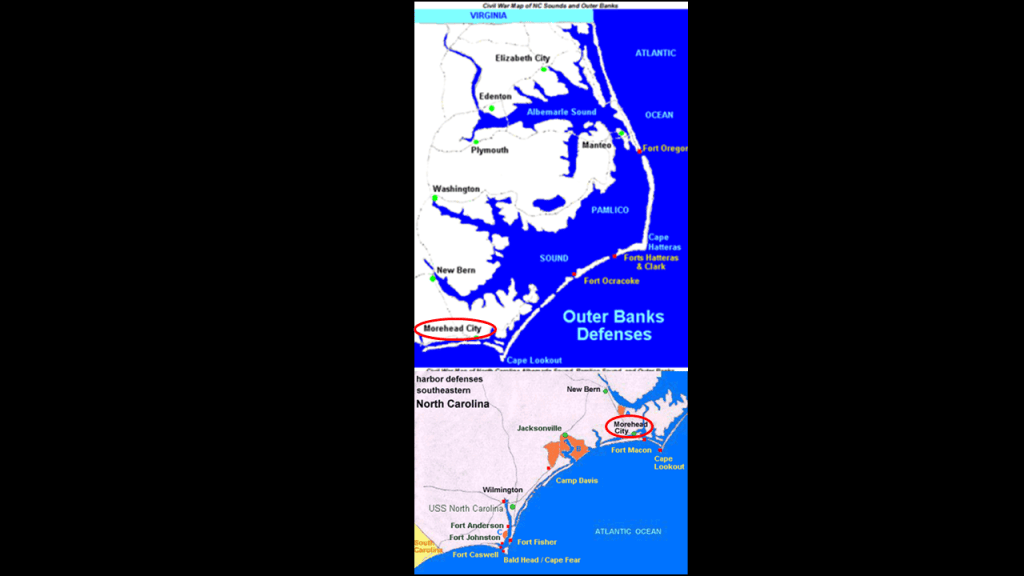
Also, like we saw in France, the Outer Banks alone has five historic lighthouses along the coast line of the barrier islands of the Outer Banks…
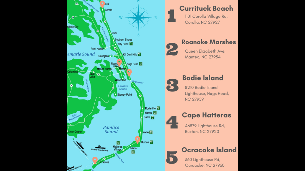
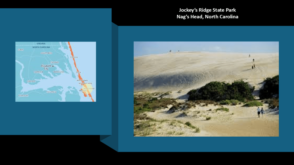
…and there are sand dunes found in the Outer Banks, like those at Jockey’s Ridge State Park at Nag’s Head.
Jockey’s Ridge is called the tallest active sand dune system in the eastern United States, and is just a short distance south of where this pyramid alignment leaves the United States at Carova Beach in the northern Outer Banks, and the Dune of Pilat, the tallest dune in Europe at Arcachon Bay in western France is located just a short distance south of where this alignment enters Europe across the Atlantic Ocean.
These examples of just two of many I have found of coastal dunes and inland dunes in tracking this pyramid alignment, and in tracking other long-distance alignments are well.
Barrier Islands are classified as shoals that are called a natural submerged ridge or bank covered by sand or some other material that rises from the bed of a body of water close to the surface that poses a danger to navigation, as the Pamlico Sound and its ocean inlets are noted for wide-expanses of shallow water.
Like Cape Cod in Massachusetts, the treacherous waters of the Outer Banks have also given it the nickname of “Graveyard of the Atlantic” because of the numerous shipwrecks that have occurred here because of its treacherous waters consisting of things like shallows, shifting sands, and strong currents.
The Dismal Swamp State Park is located at the border with North Carolina and Virginia, and part of the larger Great Dismal Swamp of the coastal plain region between Norfolk in southeastern Virginia and Elizabeth City in northeastern North Carolina, and is near where this pyramid alignment leaves the United States at Carova Beach on the coast.
The adjoining Northwest River Natural Area Preserve is in Virginia, and the Northwest River Marsh and Gameland in North Carolina.
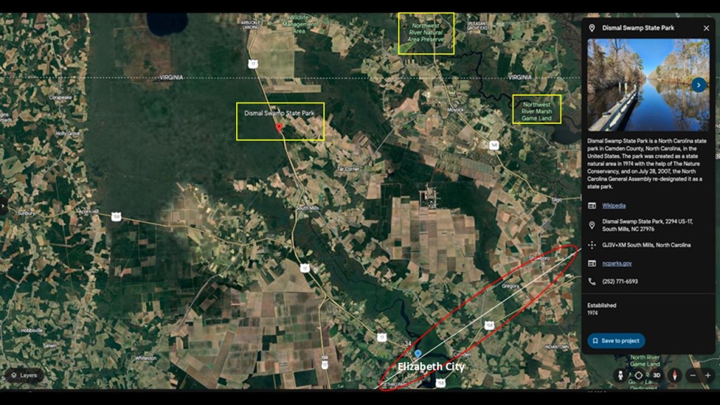
The “Dismal Swamp Canal” runs for 22-miles, or 35-kilometers, along the eastern edge of the Great Dismal Swamp.
We are told that the Dismal Swamp Canal is the oldest continually operating, man-made canal in the United States, and was said to have been built between 1793 and 1805 under the direction of the Dismal Swamp Canal Company, and the labor provided primarily by slaves rented from local landowners who dug the canal by hand.
Today it is still in use by recreational boaters and is maintained and operated by the United States Army Corps of Engineers as one of two inland routes that connect the Chesapeake Bay and the Albemarle Sound
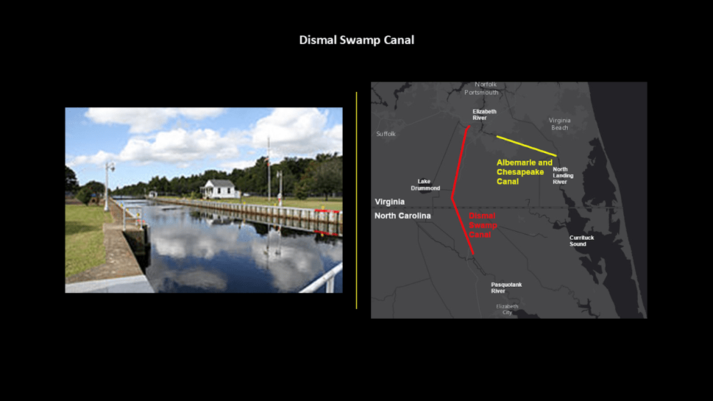
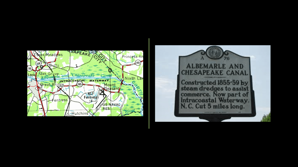
The nearby Albemarle and Chesapeake Canal was said to have been built by a corporation somewhere between 1855 and 1859, which would have been right before the start of the American Civil War, and is also still maintained and operated by the United States Army Corps of Engineers.
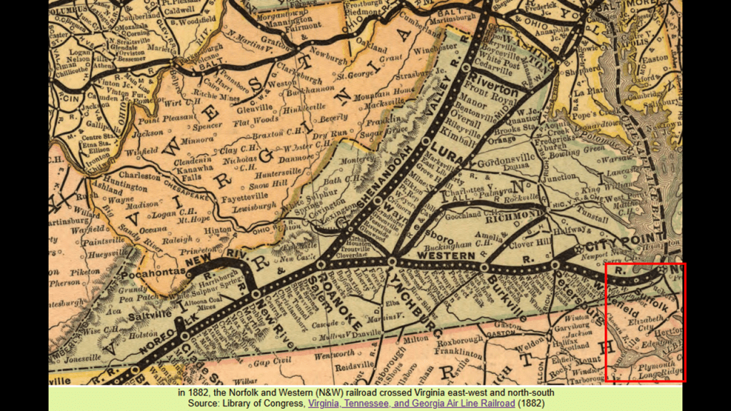
What became the “Norfolk Southern” railroad started out as the Elizabeth City and Norfolk Railroad Company in 1870, and by 1883 it was operating as the Norfolk Southern Railroad through there until 1974.
This railroad paralleled the Dismal Swamp Canal and was said to have competed with both canals for freight and passengers.
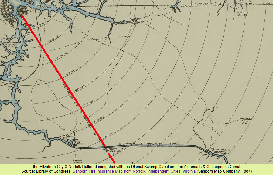
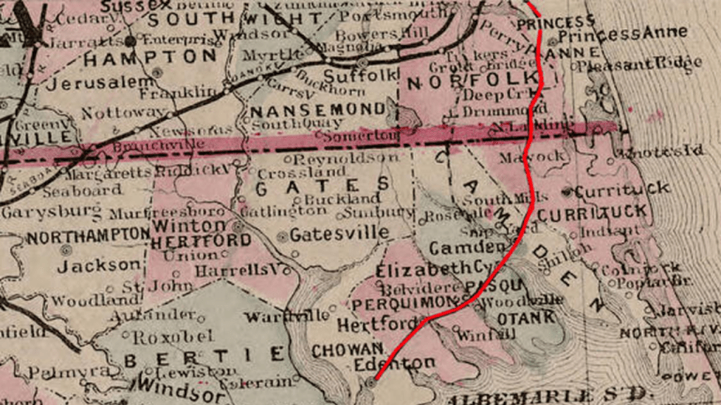
This is a map of historical railroad trackage in Virginia and North Carolina circa 1882, which includes the area between Norfolk in southeastern Virginia and Elizabeth City in northeastern North Carolina where the Great Dismal Swamp is located, highlighted by the red box.
I will have more to say about the latitude of the Great Dismal Swamp later in this post because it reveals some interesting findings.
And again, they really want us to believe that they built these railroads through places like these swampy wetlands.
Just north of this location at North Carolina’s border with Virginia is an area of great historical significance in our narrative.
It includes Norfolk and Hampton Roads, which is described as the world’s largest “natural” harbor, with all of its straight-edges, located at the mouth of the Chesapeake Bay.

Hampton Roads has the largest concentration of military personnel in the nation, and besides being the location of the historic Fort Monroe on the top left; the Naval Station Norfolk on the top right; the Joint Base Langley Air Force Base – Fort Eustis Army Base on the bottom left; and the Joint Expeditionary Base Little Creek – Fort Story on the bottom right.
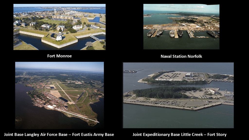
In addition to its extensive military presence, the Hampton Roads location has a long history of being a strategic transportation point, the place where many railway lines started, and having an extensive network of interstate highways, bridges, tunnels, and three bridge-tunnel complexes.

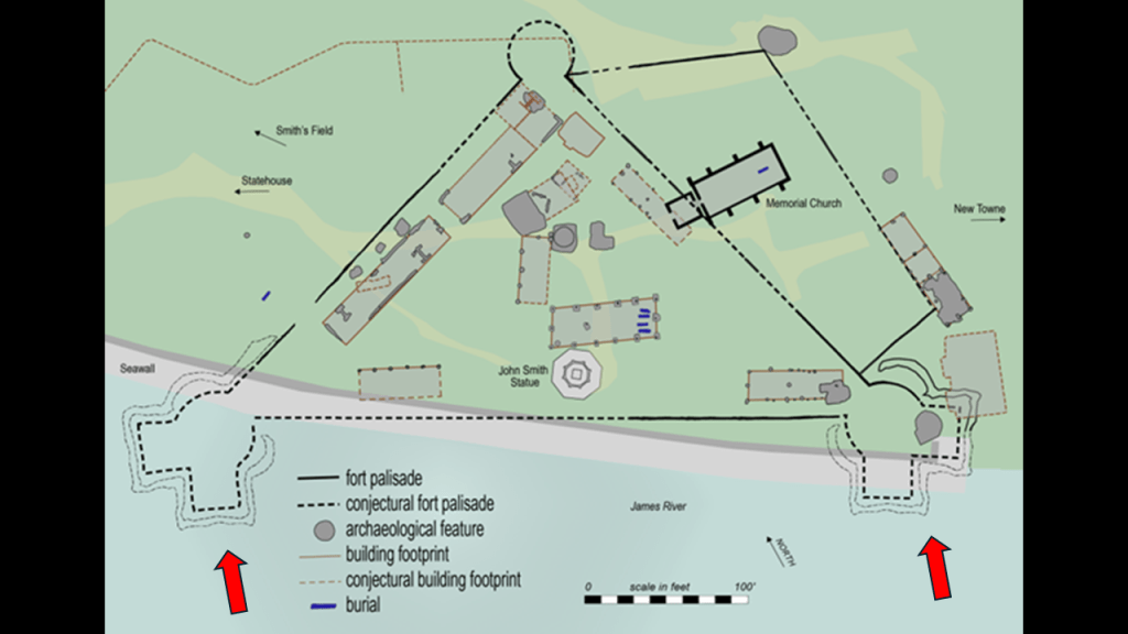
Further north of Norfolk is the location of Jamestown, the first permanent English settlement in North America.
Jamestown served as the capital of the Virginia Colony from 1616 until 1699, at which time it was abandoned when the capital was moved to nearby Williamsburg.
It’s interesting to note these two bastions of the historic James Fort at Jamestown are off-shore in the water, like land subsidence occurred at this location.
Also, interesting to note that in 1907, the Jamestown Exposition was held in Sewell’s Point in Norfolk, located at the mouth of the Hampton Roads port, and said to commemorate the 300th-Anniversary of the founding of Jamestown in the Virginia Colony.

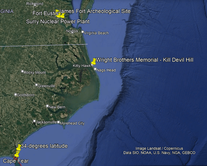
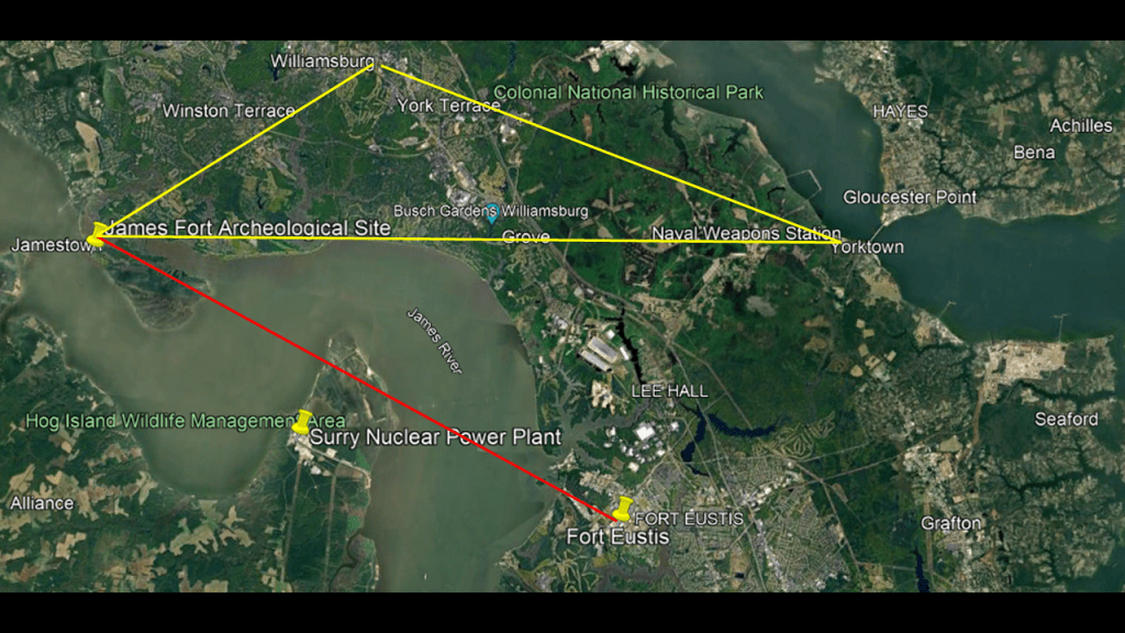
I will point out a couple of places in close vicinity to Jamestown, and the previously mentioned James Fort archeological site, that are noteworthy.
The Surry Nuclear Power Plant on Hog Island, and Fort Eustis, the headquarters of the U. S. Army’s Training and Doctrine Command which oversees training of forces and the development of operational doctrine, are to the southeast of the James Fort Archeological Site.
The Busch Gardens Williamsburg amusement theme park; the Naval Weapons Station Yorktown, which provides weapons and ammunition storage and loading facilities for ships of the U. S. Atlantic Fleet; and the city of Yorktown, where the British General Charles Cornwallis surrendered to General George Washington during the American Revolutionary War, are directly to the east of it.
Williamsburg, where Colonial Williamsburg is a living history museum and was the center of British authority in Virgina in the 18th-century, is to the northeast of James Fort.
Together, Jamestown, Yorktown, and Williamsburg form what is called the “Historic Triangle.”
And there’s tidal marshland all over the place around here, like everywhere else along the coast!
The Hog Island Wildlife Management Area, which includes 50-acres of tidal wetlands, is directly adjacent to where the Surry Nuclear Power Plant is located on Hog Island, a very similar finding to the Blayais Nuclear Power Plant on the right bank of the Gironde Estuary in France, where we saw there was a level 2 incident when the plant was flooded that could have been much worse.
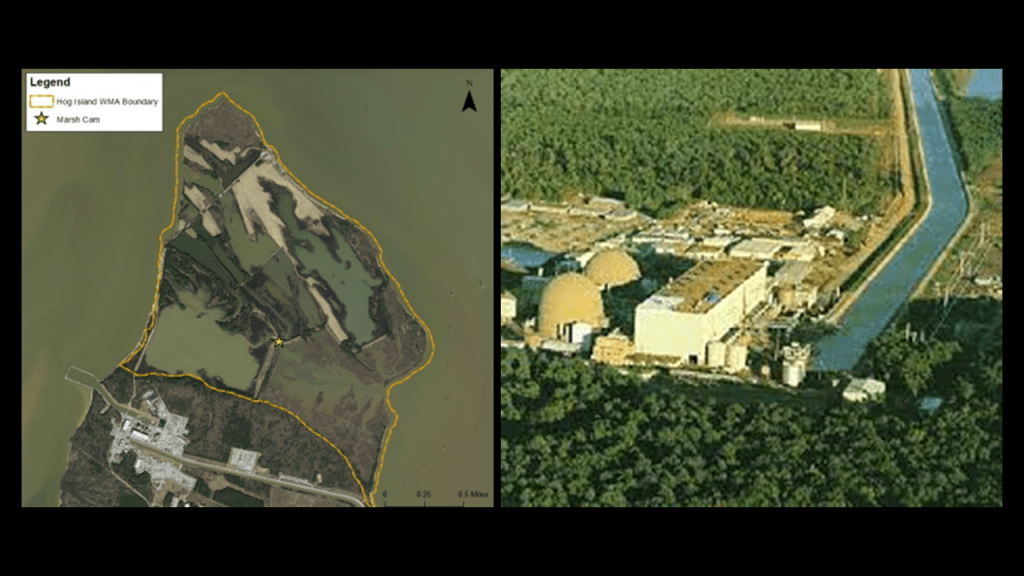
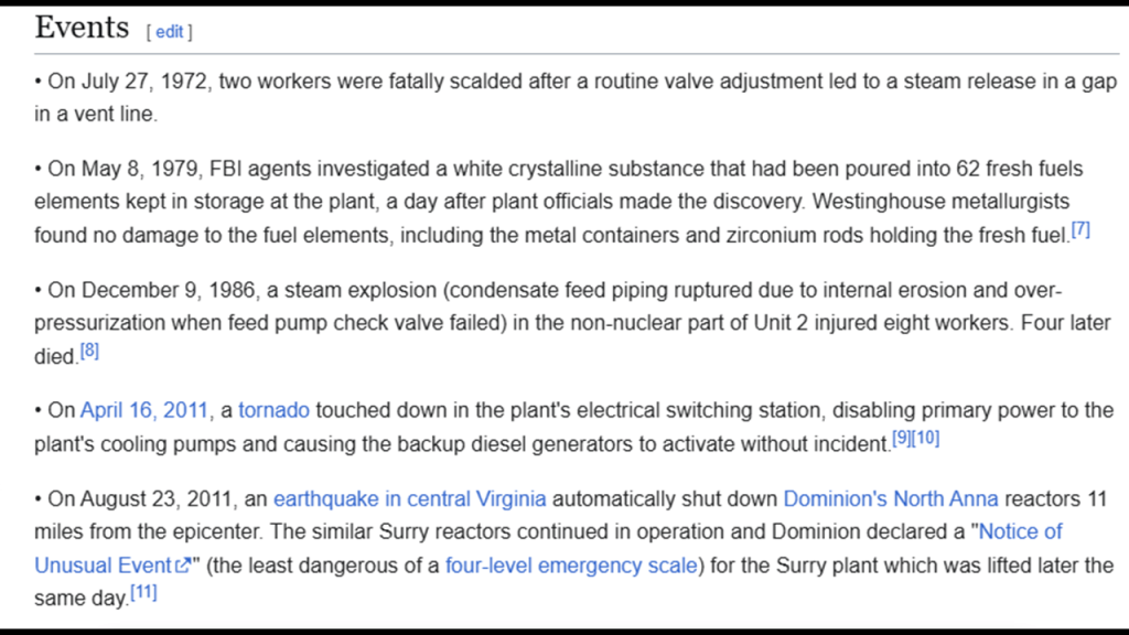
The Surry Nuclear Power Plant has a history of problematic incidents since it became operational in the early 1970s.
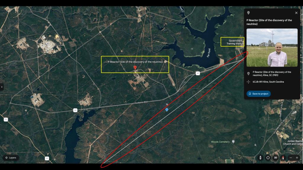
In the second part of this series, I found the Savannah River Site on this pyramid alignment in Kline, South Carolina.
Among other things, the Savannah River Site was the location where the neutrino was discovered at the “P Reactor.”
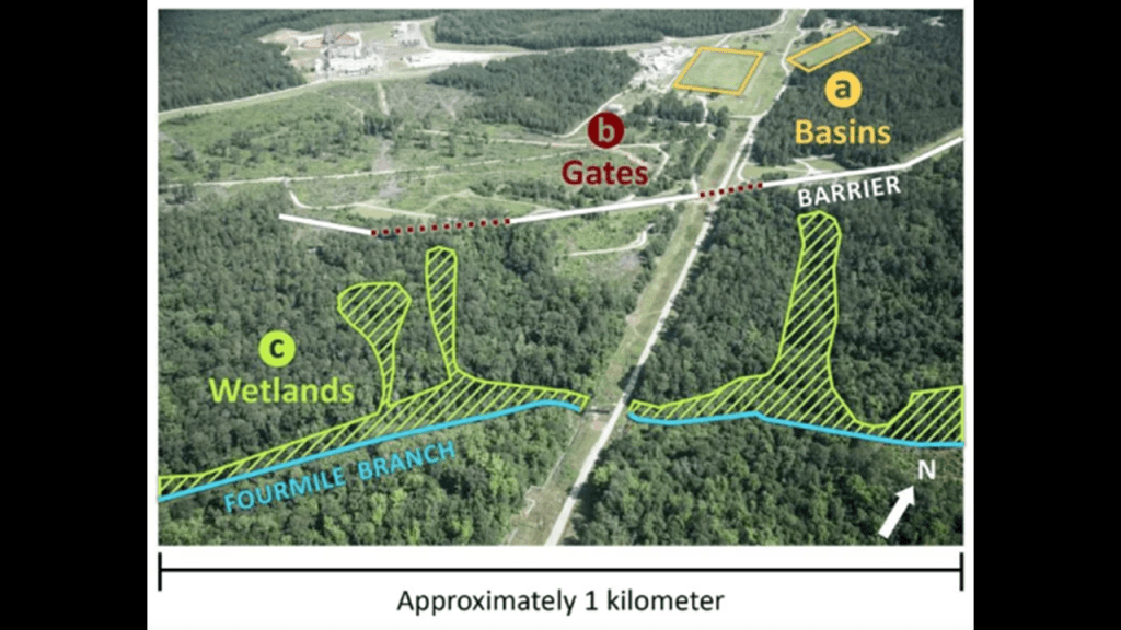
A significant portion of the Savannah River Site is built on, or includes, various wetland areas.
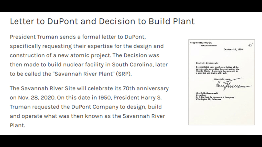
We are told the Savannah River Site was constructed in the early 1950s to produce the basic materials used in the fabrication of nuclear weapons.
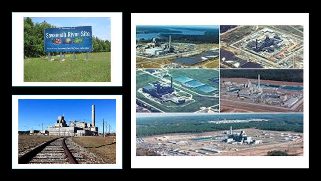
In 1950, President Harry S. Truman formally requested DuPont’s help in the design and construction of the Savannah River Project.
So, was there actually a conscious decision made to build nuclear powerplants in marshy wetlands?
Or were nuclear powerplants also pre-existing technology that was brought back on-line in the present-day, and not operated safely or cautiously?
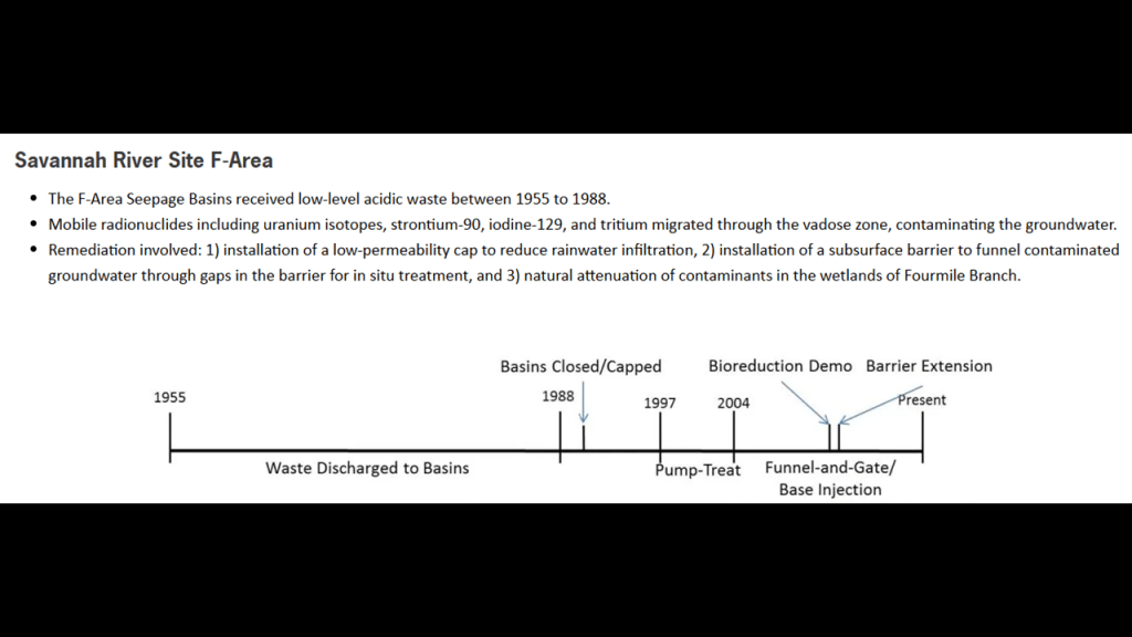
The Savannah River Site also has a long-history of environmental contamination.
DuPont has a very poor track record when it comes to the prevention of environmental contamination at its facilities, like the Fayetteville Works Plant, which is also on this alignment in North Carolina.
The Fayetteville Works Plant is located right next to the William O. Huske Locke and Dam on the Cape Fear River.
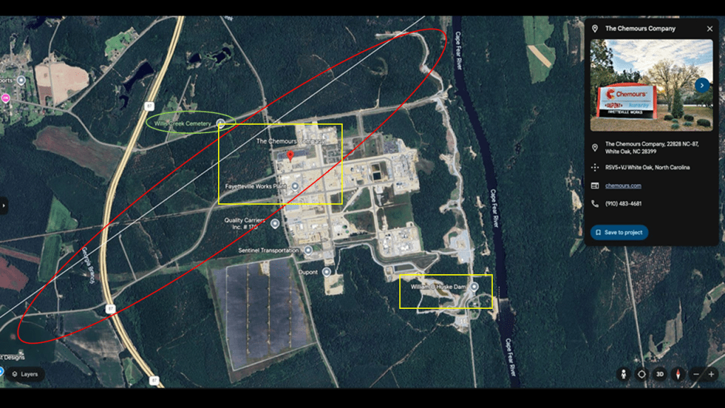
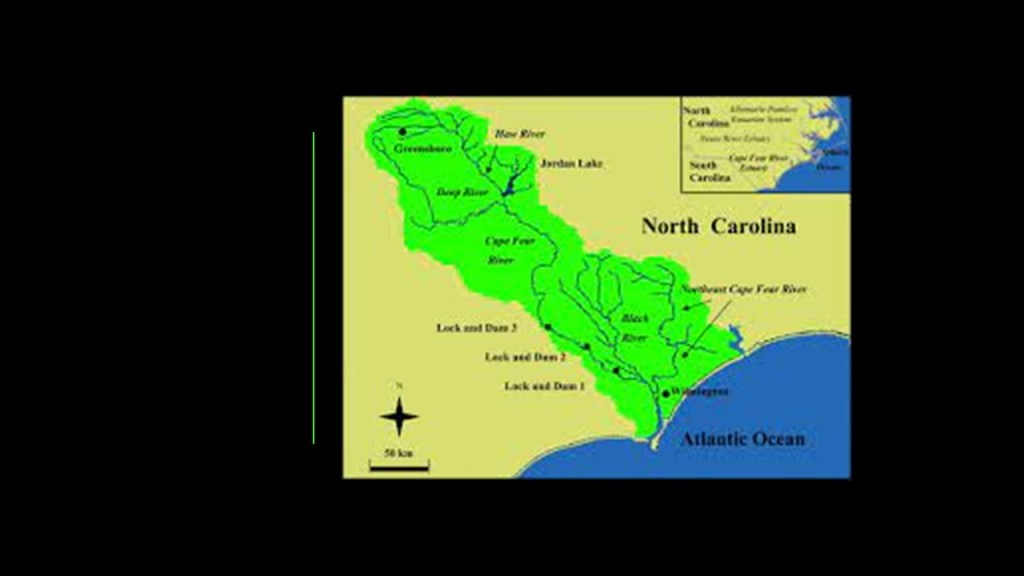
The William O. Huske Lock and Dam, also known as “Lack and Dam#3, was said to have been completed in 1935 – which would have been during the Great Depression – and located 95-miles, or 153-kilometers, above Wilmington, and one of three locks and dams on the Cape Fear River as it flows northwest from Wilmington.
Even though locks and dams are canal features, the Cape Fear River is called natural with human modifications.
DuPont, and a company connected to DuPont called Chemours, have operated the “Fayetteville Works Plant” since the 1970s, amidst on-going controversies regarding the subject of environmental chemical contamination.

The last place I am going to look at highlighted by a yellow box before I am going to start looking at the specific places on the alignment across France is the Landes de Gascogne Regional Natural Park.
The Regional Natural Park of the same name is located in the “Landes de Gascogne” natural region of Nouvelle-Aquitaine.
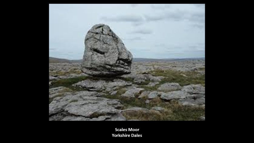
“Landes de Gascogne” is also called the “Gascony Moors.”
Just for point of information, what are called “Moors” in Great Britain are described as being characterized by low-growing vegetation on acidic soils, and includes uncultivated hill-land, as well as low-lying wetlands, so more of the same of what we have already been seeing on both sides of the Atlantic Ocean.
“Moors” in Great Britain are also often blanketed by what appear to be megalithic stones, like the example of “Scales Moor” in the Yorkshire Dales National Park.
Personally, I think the memory of the original people is retained in the name, and they’re telling us something without telling us they are telling us.
What we are told in our historical narrative is that the lands within the park were largely unpopulated throughout history, and that the roughly triangular area of today’s park was an inland sea which had receded, and left infertile soil that did not attract settlement, and was originally a sandy plain covered by lakes and ponds, and bordered by moving dunes that were stabilized by the plantation of maritime pines starting in 1801.
It is also considered a coastal plain like what we saw across the Atlantic in North Carolina.
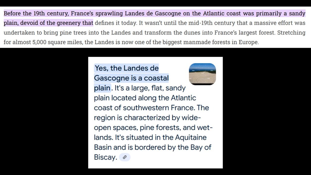
We are told that large-scale public works projects in the 19th-century helped to drain, clear, and reforest the area but thee transformation was limited, and that by the mid-twentieth-century, the focus had become protecting the natural environment.
There are forty-one communes throughout the park, with a total population of approximately 60,000 people.
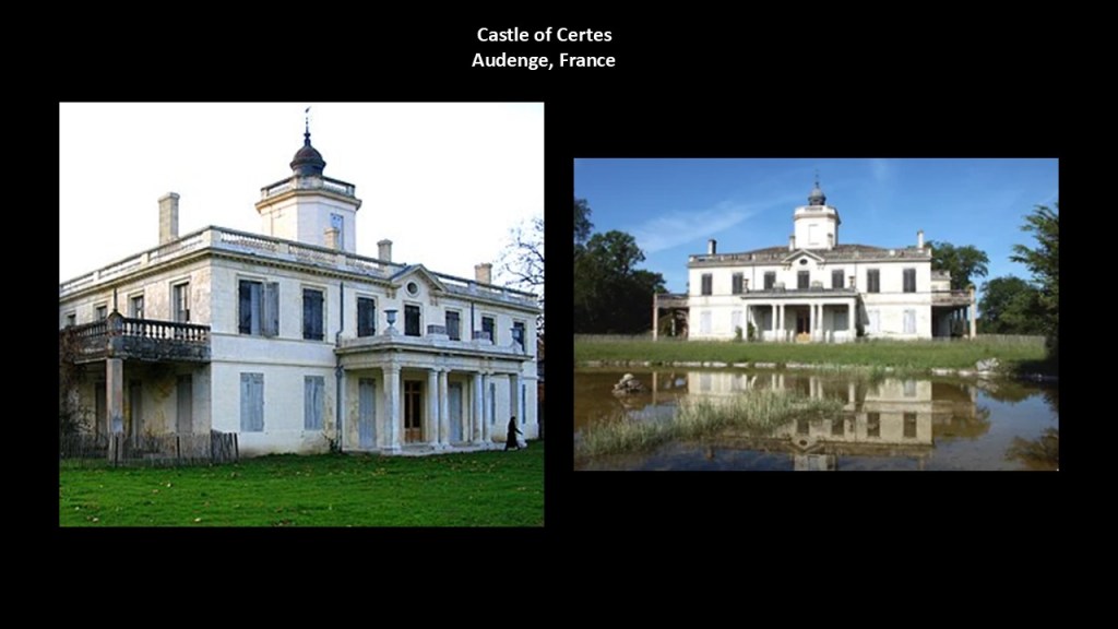
These communes include places like Audenge next to Arcachon Bay, where the Castle of Certes is located, a former salt production and fish farm said to have been rebuilt in the 1850s.
Today the grounds are accessible to the public for nature walks.
And places like Captieux, with its imposing Saint-Martin Church, said to have been built between the 12th- and 15th-centuries as a place of worship and priory, and classified as an historical monument in 1840.
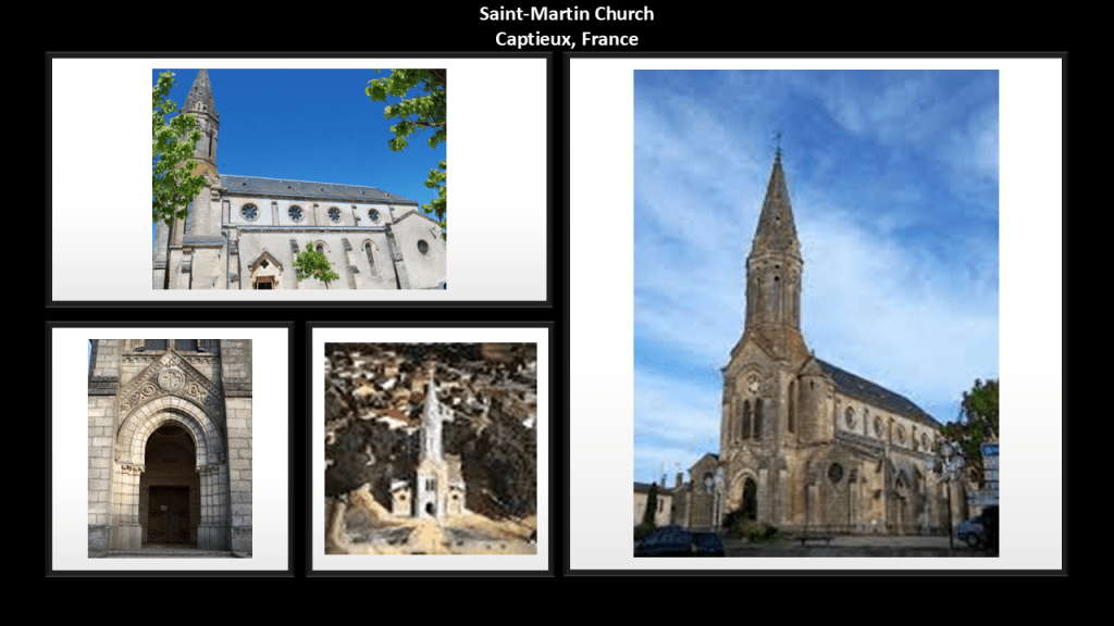
Interesting to note that Captieux was the location of the U. S. Army’s “Captieux Ammunition Depot” from 1950 to 1967, and was one of the largest U. S. Army installations in Europe.
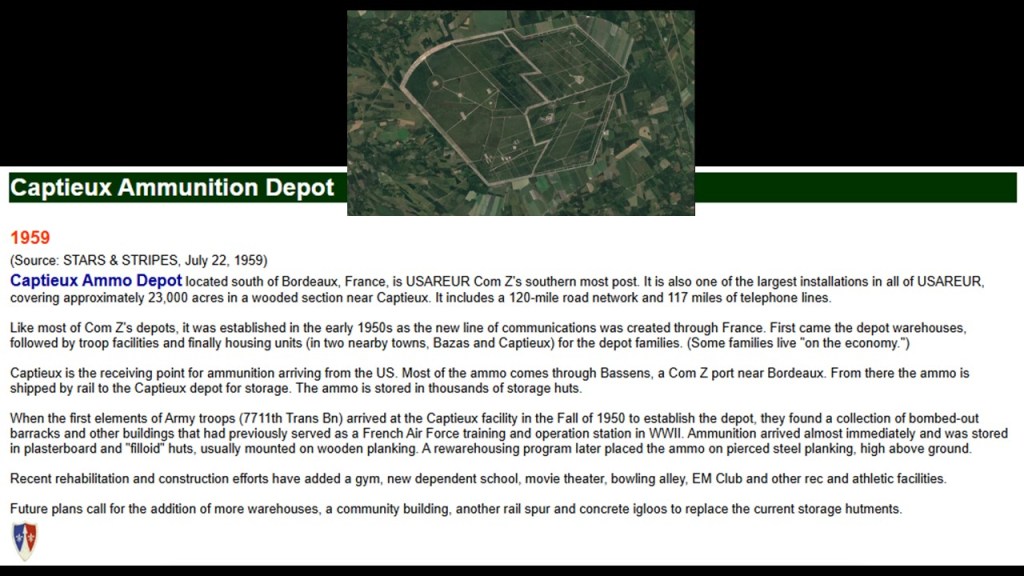
Captieux and the former Captieux Ammo Depot are roughly midway between Langon on the Garonne River right before it becomes the Garonne Canal at Castets-en-Dorthe, and Mont-de-Marsan at the southern edge of the Landes de Gascogne Regional Park, both of which have rail connections.
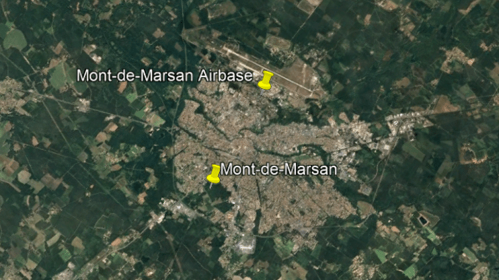
Mont-de-Marsan was also one of the cities with the radial highway connections that I mentioned at the beginning of this post, as was Bordeaux.
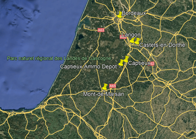
Mont-de-Marsan is the capital of the Landes-de-Gascogne region.
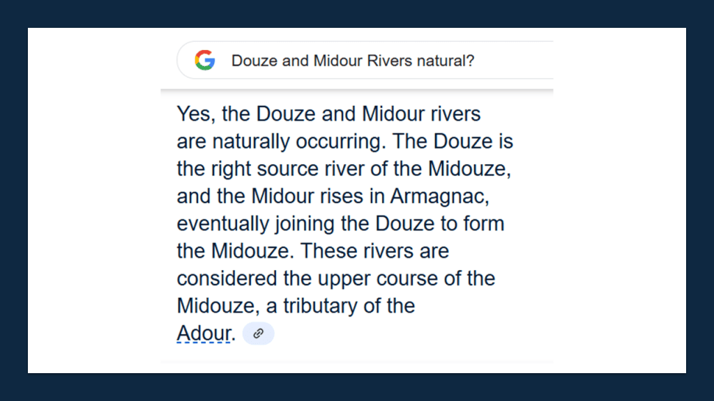
It is located at the confluence of the Douze and Midour Rivers, where they form the Midouze.
I am still calling these so-called rivers with masonry banks canal systems…
…but the writers of the official narrative want us to believe these are natural rivers.
The Mont-de-Marsan Airbase is located 1.2-miles, or 2-kilometers, north of the city, and is one of the main operational bases for the French Air and Space Force.
The base includes an aeronautical research and test center, a radar command reporting center, and a control training site.
It was formerly home to France’s first operational squadron of nuclear bombers.
I am sure there is a lot more I can find around here in the Mont-de-Marsan and Landes-de-Gascogne region, but this gives you the idea.
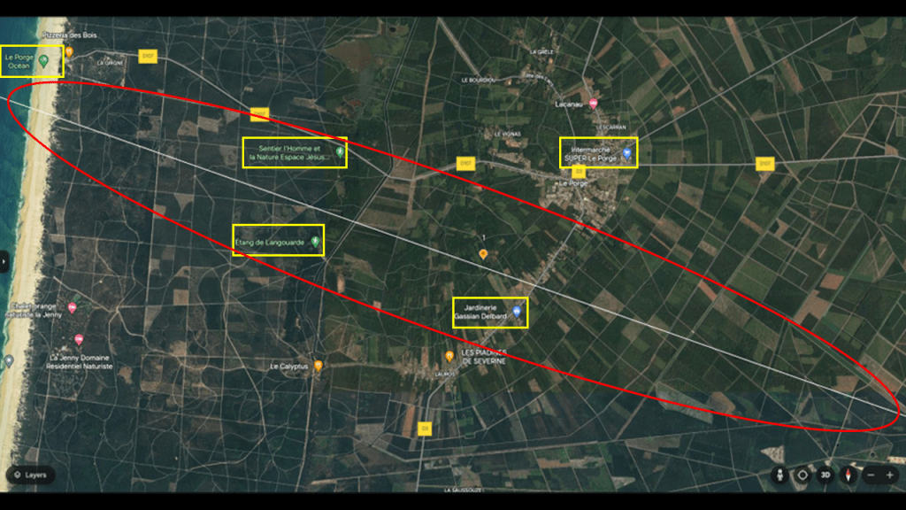
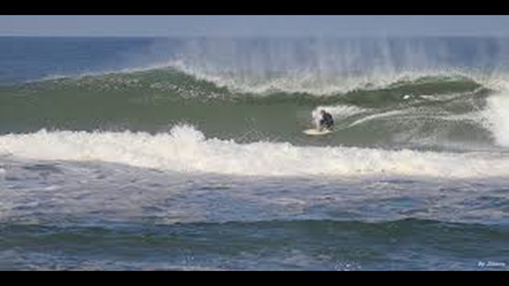
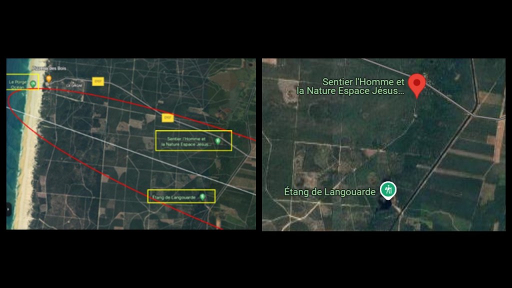
So now I am going to go ahead and take a look at what exactly is found on the alignment itself, starting where it enters France close to the beach at Le Porge Ocean.
I have highlighted Le Porge Ocean; the Sentier l’home et la Nature Espace Jesus; the Etang de Langouarde; the Intermarche Super Le Porge; and the Jardinerie Gassian Delbard.
Le Porge Ocean is called the closest and quietest of the beach towns near Bordeaux.
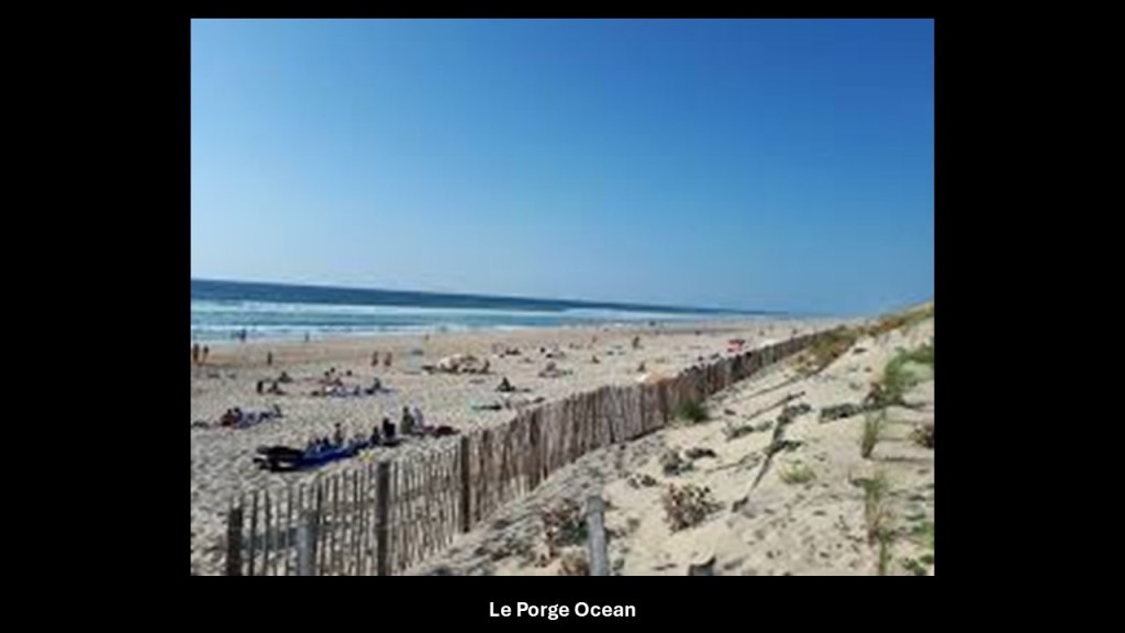
This beach is known for its large waves and strong undertow, and a place one could go to surf if so inclined.
According to the information I could find on it, until the 19th-century, the area of Le Porge was moors, marshes and dunes, and that with human and natural interventions, the area was transformed, and the number of acres of moors and marshes decreased considerably between 1827 and 1887.
Then the area was developed along a north-south axis following an arc between the dunes, rivers and drained wetlands.
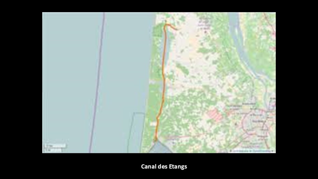
We are told that the “Canal des Etangs,” which translates to “pond canal” in English, was inaugurated, or formally opened for use, in 1864, which was in the same period in our historical narrative as the American Civil War.
The section of the “Canal des Etangs” that connects Lake Lacanau with Arcachon Bay is called the “Canal du Porge,” and has six locks.
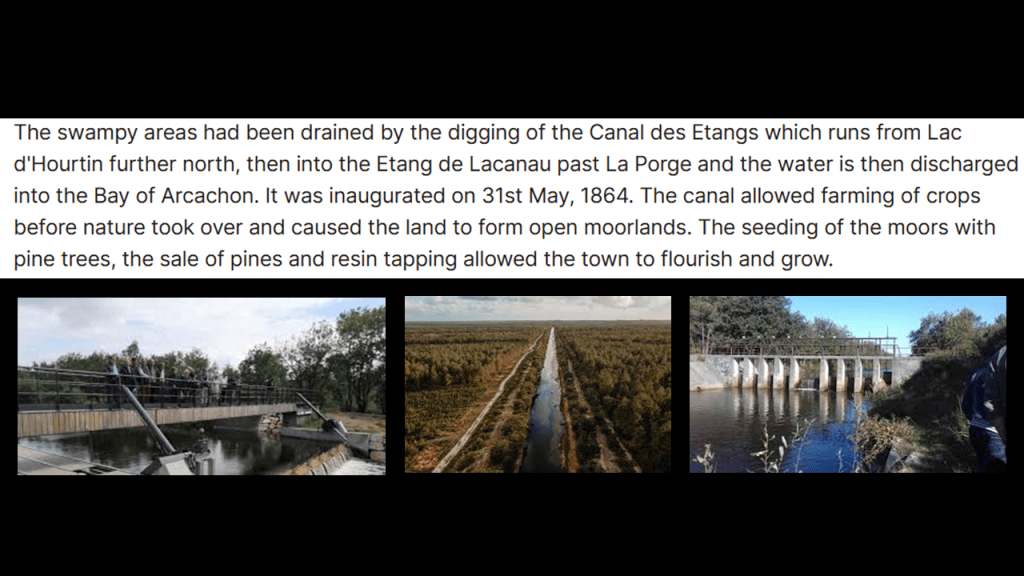
The “Canal des Etangs” links Lake Hourtins and Carcans at its northern end, located in the Hourtin Dunes and Marshes National Nature Reserve and the largest freshwater lake entirely in France and part of the “Great Landes Lakes”, through Lake Lacanau, another of these lakes, with the Arcachon Bay at its southern end.
The “Great Landes Lakes” are right behind the dune-belt, and part of the string of wetlands along the Nouvelle Aquitaine coast.
I don’t think it’s a stretch to say there is original infrastructure under these dune systems.
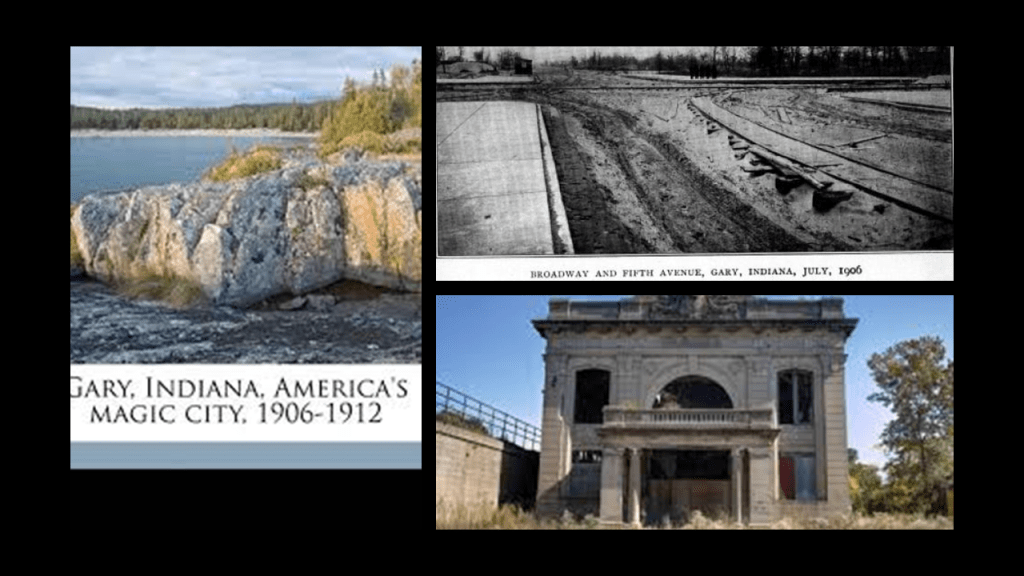
I would like to give the example of Gary, Indiana, to support this assertion.
Gary is located right next to the Indiana Dunes on the southern shore of Lake Michigan, which is called one of the most biodiverse areas in the United States, and includes sand dunes and wetlands, including bogs, existing right next to each other in the same location, and both are beside railroad tracks, circled on the bottom right.
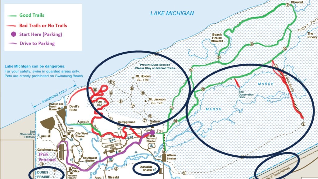
The South Shore Line runs in this part of Indiana starting in South Bend, and goes between Michigan City just to the east of the Indiana Dunes, to Gary, Indiana, located just to the west of the Indiana Dunes, on its way to Chicago, Illinois.

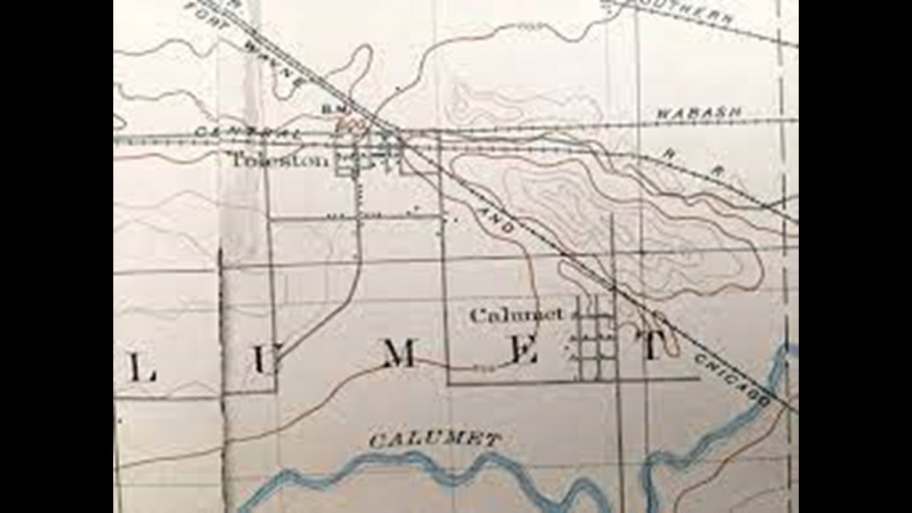
In June of 1906, the location of what became the city of Gary, about 26-miles, or 42-kilometers, east of Chicago, Illinois, was a wasteland of drifting sand and patches of scrub oak.
No one lived there, and there was no agricultural value to the land.
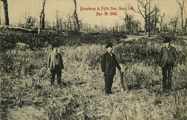
Yet, three or four railroads passed through the area and the S-shaped Grand Calumet River wound its way around sand dunes to get to Lake Michigan.
It was in June of 1906 that the first shovelful of sand was turned for the creation of the new steel town of Gary.
Laborers were housed in tents and shacks, and were digging trenches as very little work was being done above-ground.

By 1908, lo-and-behold, the city of Gary had taken on its shape and form!
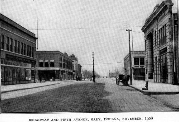
Gary was heralded as a “Magic City,” having been transformed from sand dunes in record time!
It was established to be the “company town” for U. S. Steel, and became home to the largest steel mill complex in the world, with its operation starting in June of 1908, only two-years after the first shovelful of sand was turned at this location.
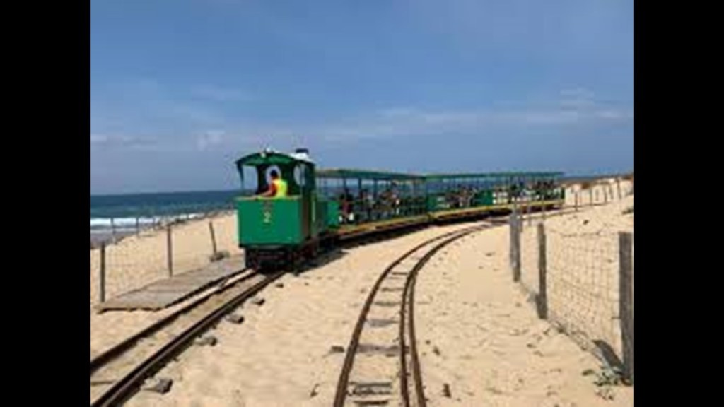
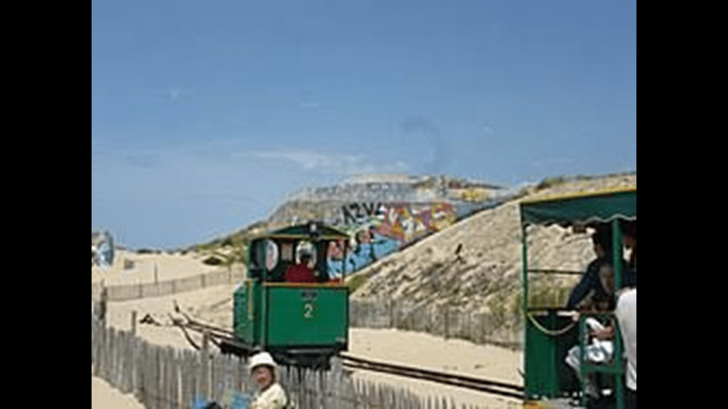
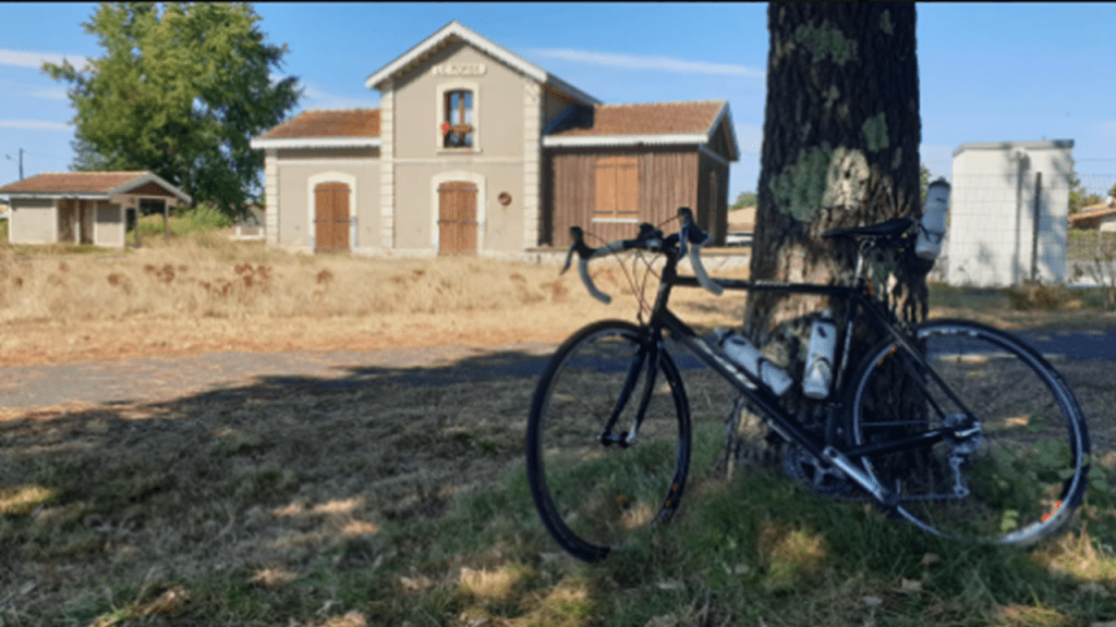
Le Porge has an historic rail connection as well.
The former railway line between Le Porge and Lacanau Ville is a popular bike path today, and the old train station of Le Porge still stands.
Next at this location, I am going to take a quick look at the following places near the alignment: the Sentier l’home et la Nature Espace Jesus; the Etang de Langouarde; the Intermarche Super Le Porge; and the Jardinerie Gassian Delbard.
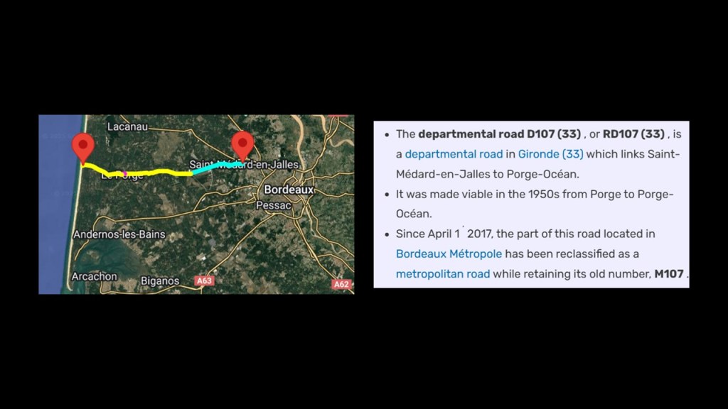
The alignment runs between the “Sentier l’Homme et la Nature Espace Jesus,” where there is a nature trail, and the “Etang de Langouarde,” and both are located next to the “Canal des Etangs” where it passes through the Le Ponge area, with D107 a short distance to the north of both places.
D107, the French Departmental road in Gironde, links Le Porge Ocean with Saint-Medard-en-Jalles on the western outskirts of Bordeaux.
It was said to have been “made viable” between Le Porge and Le Porge Ocean in the 1950s.
Likewise, the alignment runs between the Intermarche Super Le Porge and the Jardinerie Gassian Delbard.
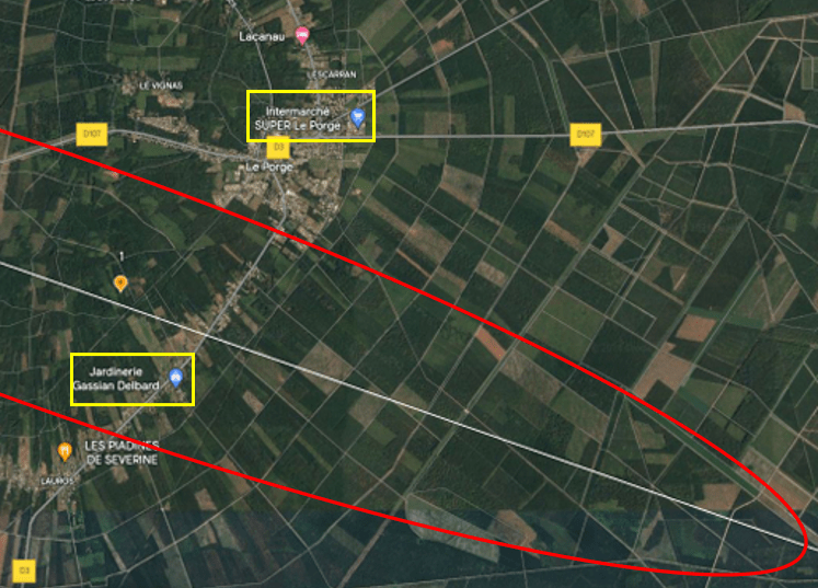
The Intermarche Super Le Porge is part of the major retail chain “Intermarche,” which offers four different types of stores – hypermarkets, a large retail department store and grocery store; supermarkets for grocery-shopping; Express Convenience stores; and Contact convenience stores in rural areas.
This is noteworthy because I have been consistently finding the same kinds of stores along the alignment on the other side of the Atlantic as well, including, but by no means limited to, Walmart department stores and grocery stores.

On the other side of the alignment from the Intermarche supermarket is the Jardinerie Gassian Delbard.
The Jardinerie Gassian Delbard is a family-owned and operated garden center that offers a wide selection of plants and trees, and other gardening and pet needs.
Again, the same as with the department and grocery stores, I found this kind of business consistently on the alignment as I was tracking it on the other side of the Atlantic, as well as other agricultural-type activites, from farming to animal breeding, including the historical growing of genetically-modified crops in Mexico.

The next segment of the alignment makes its way across France to the southwest of the major city of Bordeaux.
Bordeaux is the capital of the Nouvelle-Aquitaine region of France, and a port city, known as the Port of the Moon.
Bordeaux is the world’s major wine industry capital.
Also, the historic part of the city is on the UNESCO World Heritage list for what is called “an outstanding urban and architectural ensemble of the 18th century.”
After Paris, Bordeaux has the highest number of preserved historical buildings in France.
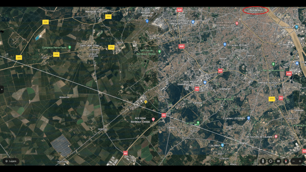
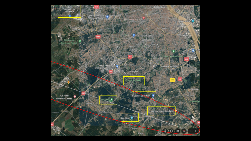
In this location on the alignment, I have highlighted the following places to look at: the “Complexe Pierre Favre;” the Bordeaux Airport; Lac Vert; Lac Bleu; the Prieure de Cayac; the E. Leclerc in Leognan; and Les Sources des Caudalie.
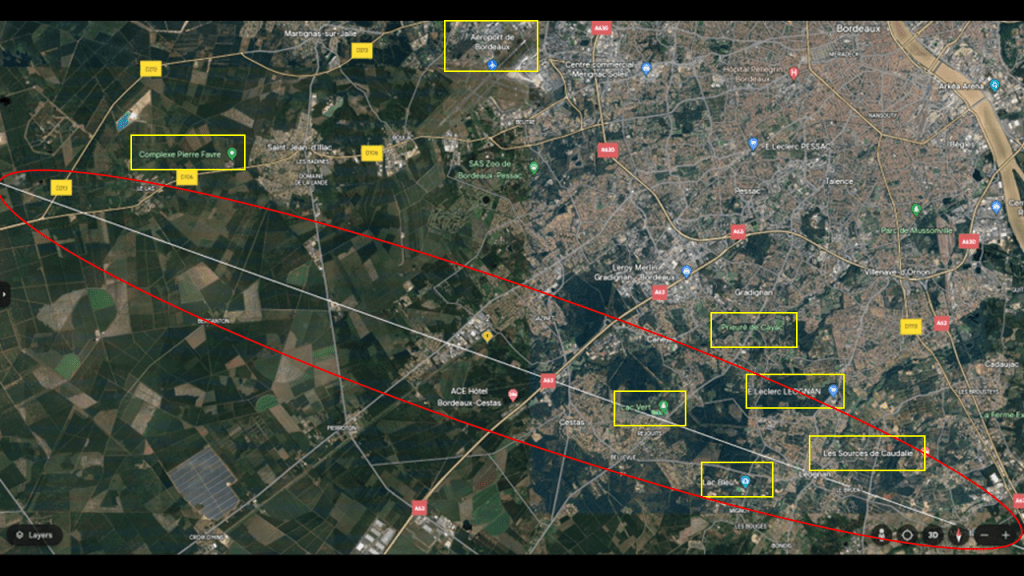
The “Complexe Pierre Favre” is a sport center for local residents, with things like a fully-equipped gym; fitness classes; tennis courts; swimming pools; and so forth.
I have been consistently encountering fitness centers and sports’ venues like these as well on, or near, this alignment in Mexico and in the United States.
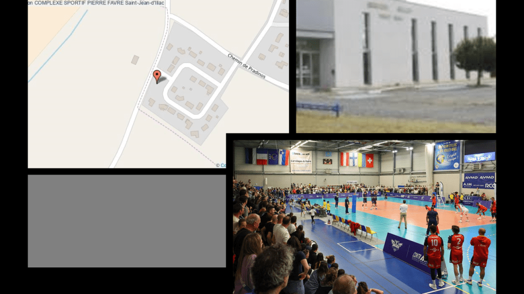
Same thing with airports, so not a surprise to find the Bordeaux Airport nearby.
The Bordeaux-Merignac Airport is an international airport with public use, and it is also in use as a strategic airbase by the French military.

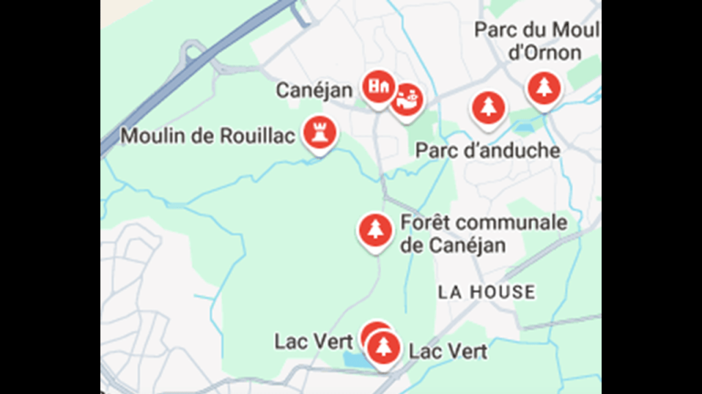
Lac Vert, or the Green Lake, is directly on the alignment.
The lake is described as a leisure center that first opened in 1996 at the location of an abandoned gravel quarry where people come for fishing, picnicking, walking and jogging on nature trails in the surrounding area, like in the Canejan Forest.
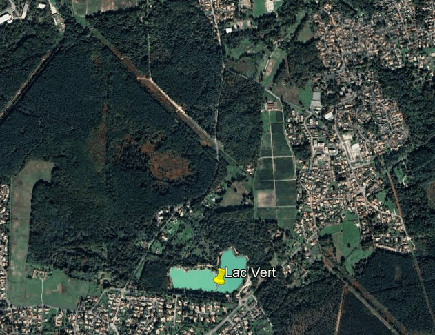
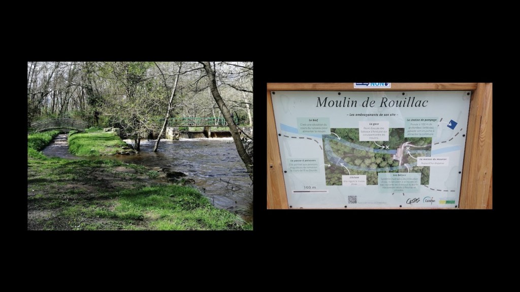
Lac Vert is close to the location of the Rouillac Mill, located on the River Bourde.
It was said to have been a flour mill owned in the 19th-century by Baron Haussmann, but a lot of old places and ruins are explained as mills in our historical narrative.
Baron Haussman was credited with the massive urban renewal program of new boulevards, parks, and public works known as “Haussmann’s Renovation of Paris” under Emperor Napoleon III between 1853 and 1870.
I think mills fall in the category of repurposed infrastructure, like star forts being turned into military fortifications from what their original use was.
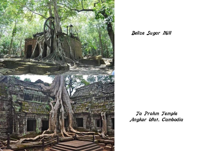
My favorite example of this is what is called a sugar mill in Belize with the gigantic cogwheel, and the tree growing out of it.
How long does it take a tree to grow like that out of a building?
It immediately reminded me very much of pictures I have seen of Angkor Wat in Cambodia, with tree and roots and all firmly rooted in ancient temples, like the one shown in the bottom photo.
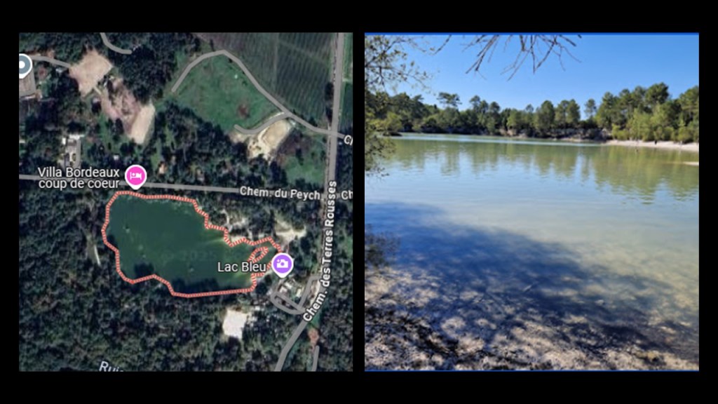
Just a short distance down the alignment from Lac Vert is Lac Bleu, a forest park in Leognan.
It is described as a crystal clear lake with a sandy white beach nestled in a pine forest, and also a place where people come to enjoy the trails that criss-cross the park.
Next I am going to focus on the three more places near the alignment that are close to Lac Vert and Lac Bleu – the Prieure de Cayac; the E. Leclerc in Leognan; and Les Sources des Caudalie in that order.
First, the Priory of Cayac.
It is offically called the Notre-Dame de Cayac Priory-Hospital, and was said to have been built in two stages – between 1210 and 1230, and between 1310 and 1320 – on an ancient Roman road.
We are told the complex initially consisted of a church; a hospital; and a cemetery.
It was deconsecrated as a church in 1791 when it was sold as a state property.
We are told that from 1823 to 1860, it housed an industrial glassworks, and during World War II, the Italian Army occasionally used the church to repair its vehicles.
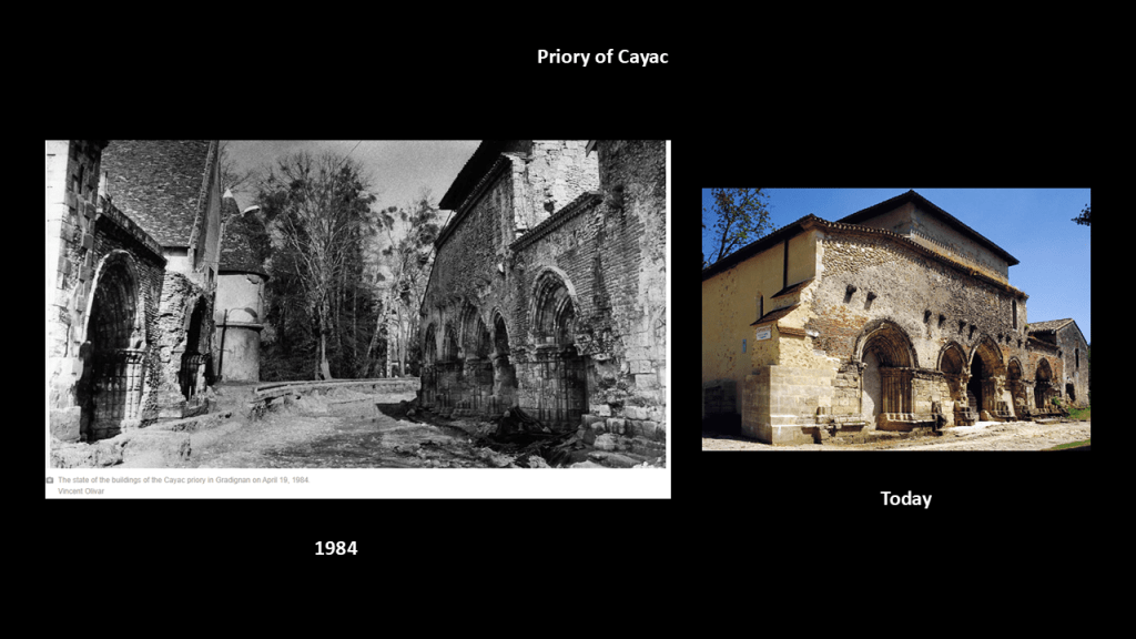
The Priory of Cayac is a stop on the Tours Route of the famous pilgrimage of the Camino de Santiago, or the way of St. James leading to where his remains are said to be buried at the Cathedral of Santiago de Compostela in Galicia in Spain.
The Tours Route starts at the Saint-Jacques Tower in Paris and is one of four main routes that end at Santiago de Compostela.
Next, the the E. Leclerc in Leognan.
Now the French hypermarket chain E. Leclerc is often compared to Walmart in the United States, and is the largest retailer in its home market of France.

The last place I am going to look at near the alignment in this segment is Les Sources des Caudalie.
Today this is a 5-star hotel and spa.
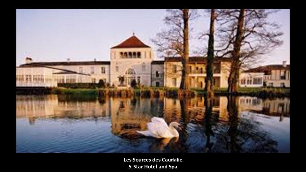
When I see the tower and the 5-windows of the main building, I can’t help but think of the examples I showed previously in Arcachon; Bermuda; Morocco and on the island of Tenerife in the Canary Islands.
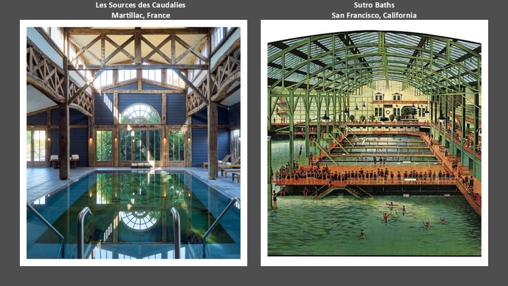
Similarly, the indoor swimming pool at this location on the left reminds me of the glorious swimming pools of a by-gone era, most of which are long-gone because they were taken out for some reason, just like the railroads and streetcars.
An example would be the Sutro Baths in San Francisco on the right, which were first opened in 1896, and destroyed by a fire determined to have been caused by arson in 1966.
The next two screenshots are where the alignment crosses through La Reole, which is located on the right bank of the Garonne River.
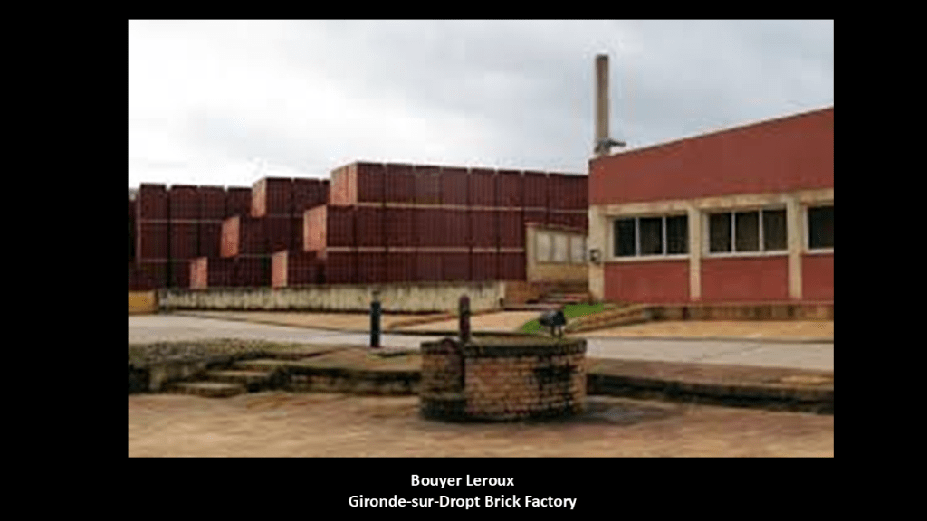
I am going to start with this first one where I have highlighted in the top left the Morizes Moto Club; the production site for Bouyer Leroux; and the Carreaux de Gironde.
The Morizes Moto Club stands out to me because I found all kinds of motorcycle racing, and other race courses, along this alignment going through the southeastern United States, especially in Georgia, South Carolina, and North Carolina.
The Morizes Moto Club track is known as a “long track,” which is a form of motorcycle racing where teams or individuals race opponents around an unpaved oval track.
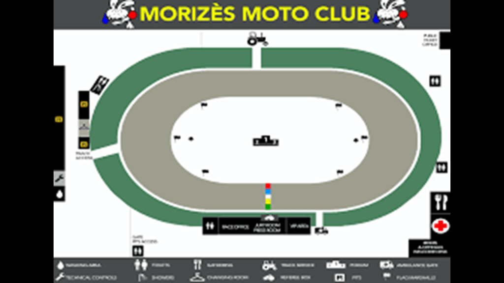
It hosts International events like the International Motorcycling Federation Long Track Team World Championship races.

A production site for Bouyer Leroux is close to the alignment, which is a leader in wall and partition bricks, and terracotta products like chimney flues.
The Gironde-sur-Dropt brick factory has been established since the 1900s, and the clay for the bricks comes from two quarries here.
Lastly for this screenshot of the alignment entering La Reole, I highlighted the Carre Aux de Gironde in the Gironde-sur-Dropt area.
This is where the Storme-Pruvost Company manufactures tiles, roof tiles and bricks to primarily a local market in the part of France where we have been looking around Bordeaux.
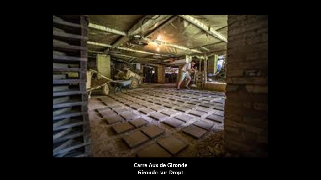
I don’t know exactly what the significance is, but all I know is that there is something about clay and bricks that shows up on alignments.
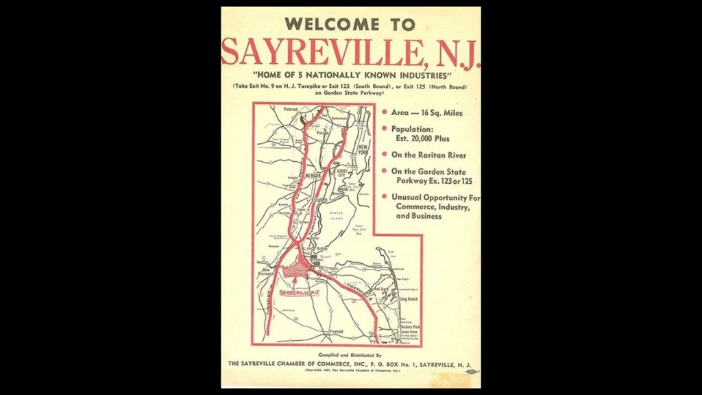
One of the first examples of this that I encountered was tracking an alignment that started, and ended, in Washington, DC, through Sayreville in New Jersey several years ago, near the Raritan Bay in the previously-mentioned New York – New Jersey Harbor Estuary system.
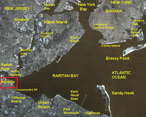
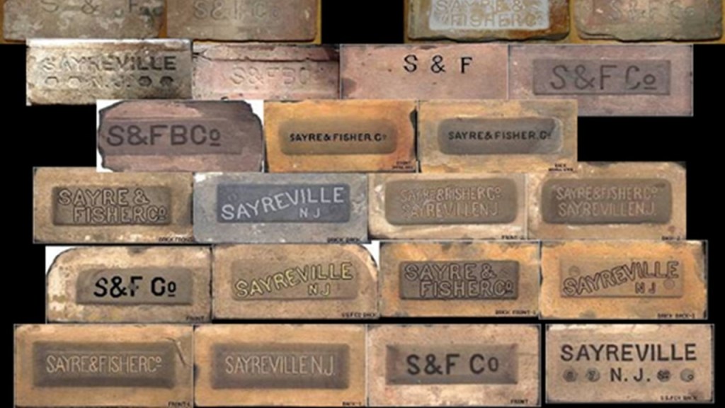
Sayreville received its final naming from James Sayre, Jr, of Newark, one of the two co-founders of the Sayre and Fisher Brick Company in 1850.
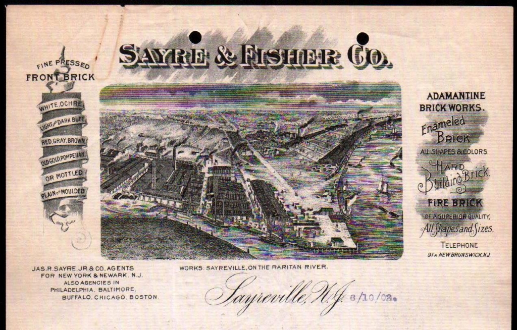
There are extensive clay deposits in the area, and the Sayre and Fisher Company quickly became one of the largest brick-making companies in the world.
Big companies including, but not limited to, DuPont established plants in Sayreville for gunpowder production initially in 1898, and later for paint and photo products.
This next screenshot is also of the alignment where it crosses through La Reole, but picks up several more places I want to highlight than the ones I just shared, including the Sagne Cuisines Showroom, a home goods store, directly on the alignment; a short distance to the southwest of it is an Intermarche hypermarket, another department store and Frimon Horticulture, another garden center, right next to each other; in the bottom of the screenshot is the Skydiving Center and another airport; to the northeast of there is the Aux Fontaine Restaurant directly on the alignment, and just southeast of there is artisan bakery and pastries shop; and just above there, I have highlighted the hospital and a dance school and a sports’ stadium, all the kinds of places I have been finding all along this alignment.
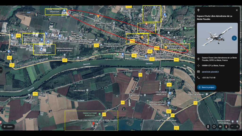
I happened to notice several other places of interest on the Garonne River when I was looking around the area where the alignment leaves La Reole: the La Reole Train Station; the Millesme Festival; and the La Reole Moto Club.
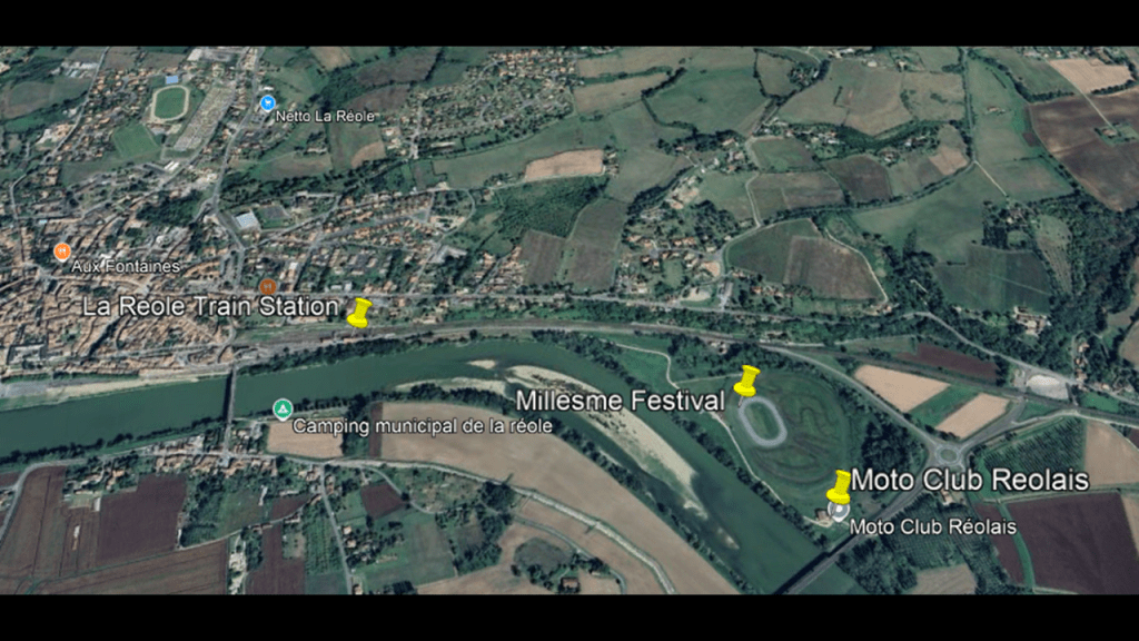
La Reole on the previously mentioned Bordeaux to Sete railway line running along the Garonne River through here.
It provides rail service between Bordeaux and Agen.
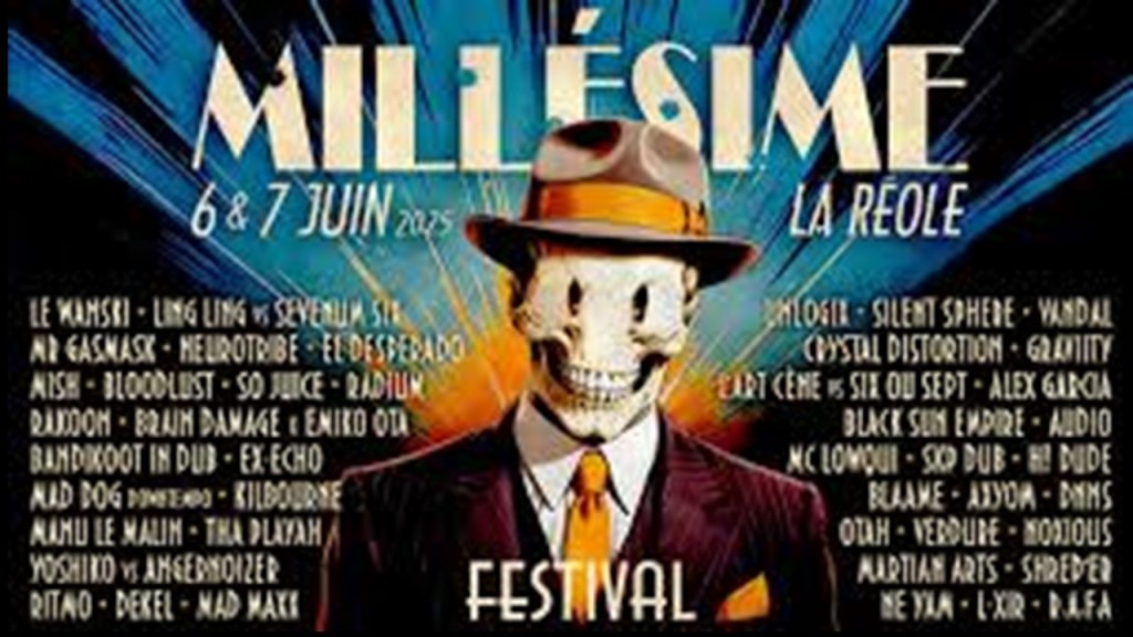
The Millesme Festival, or Vintage Festival, is an annual, two-day music event featuring electronic music including acid, techno, and trance.
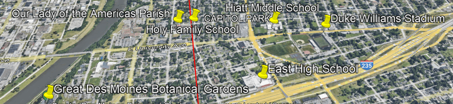
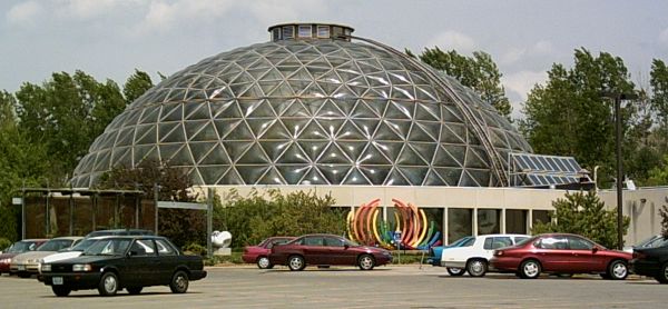
It is interesting to note that several years ago when I was tracking an alignment between the Ames Campanile, a massive bell-tower on the campus of Iowa State University in Ames, Iowa, and the dome of the State Capitol building in Des Moines, it crossed near the location of the Des Moines Botanical Gardens , several blocks west of the alignment just north of the Iowa State Capitol Complex.
The present-day botanical center, with it’s geodesic dome roof, was said to have been completed in 1979.
From 1986 to the mid-2000’s, it was used as a Do-it-Yourself venue for the Des Moines Underground, Punk, and Hardcore music scene in the rental halls there, with nationally-touring bands like “Scream” and “Saint Vitus,” as well as regional and local bands.

I have come to believe as a result of my research over the years that the people of the original civilization were brought into resonance and harmony worldwide by frequency, vibration, and solfeggio healing tones delivered throughout the original energy grid system, which was a perfectly-tuned scientific and musical instrument, and I believe that having this type of music on the energy grid system has an opposite and negative impact on our collective consciousness.
Solfeggio frequencies make-up the ancient six-tone scale used in sacred music, and each solfeggio tone is a frequency that can be used to balance one’s energy and keep one’s body, mind, and spirit in harmony.
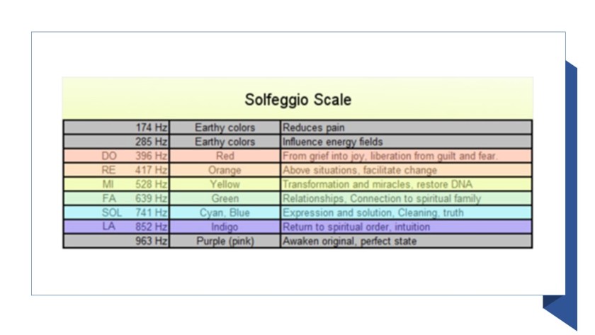
The modern suppression of solfeggio frequencies has been a deliberate manipulation and is a major issue facing Humanity.

The current musical scale is not tuned into the solfeggio frequencies, and the results of this are believed to negatively affect our thinking skills and emotional states.
Right below the Millesime Festival location is the Moto Club Reolais, another French Championship raceway for motorcycles, and hosts the “Grass Track International.”

In this next screenshot, just a short distance down the highway from the Moto Club Reolais on this alignment, is the “Speedway of Lamothe – Landerron.”
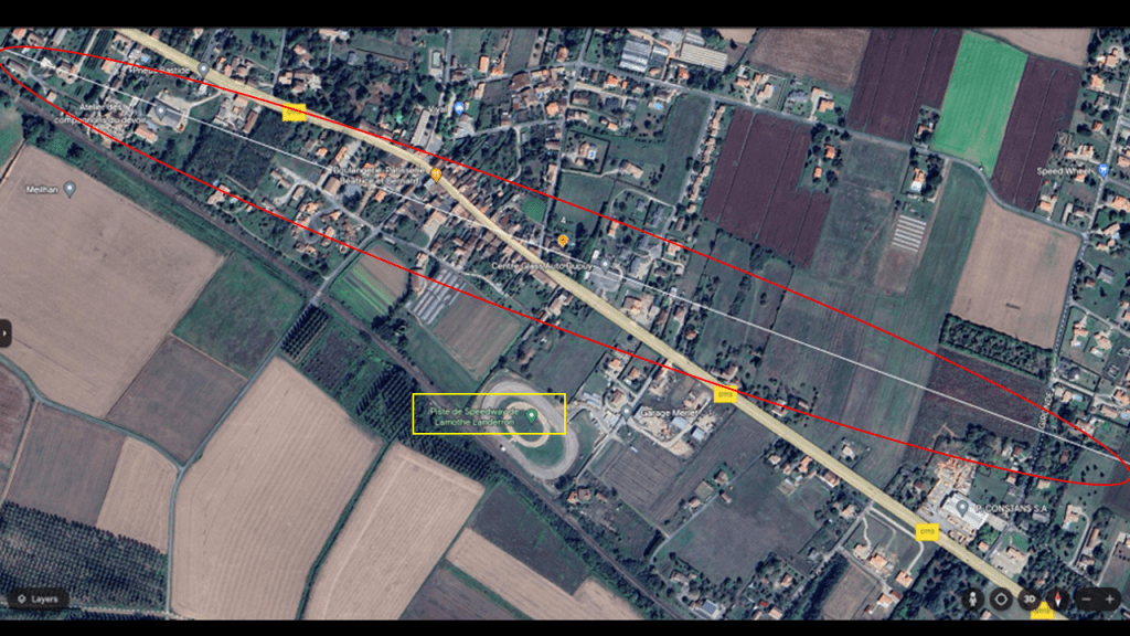
This is another international championship speedway for motorcycle racing, so there are three in close proximity to each other in this section of the alingment.
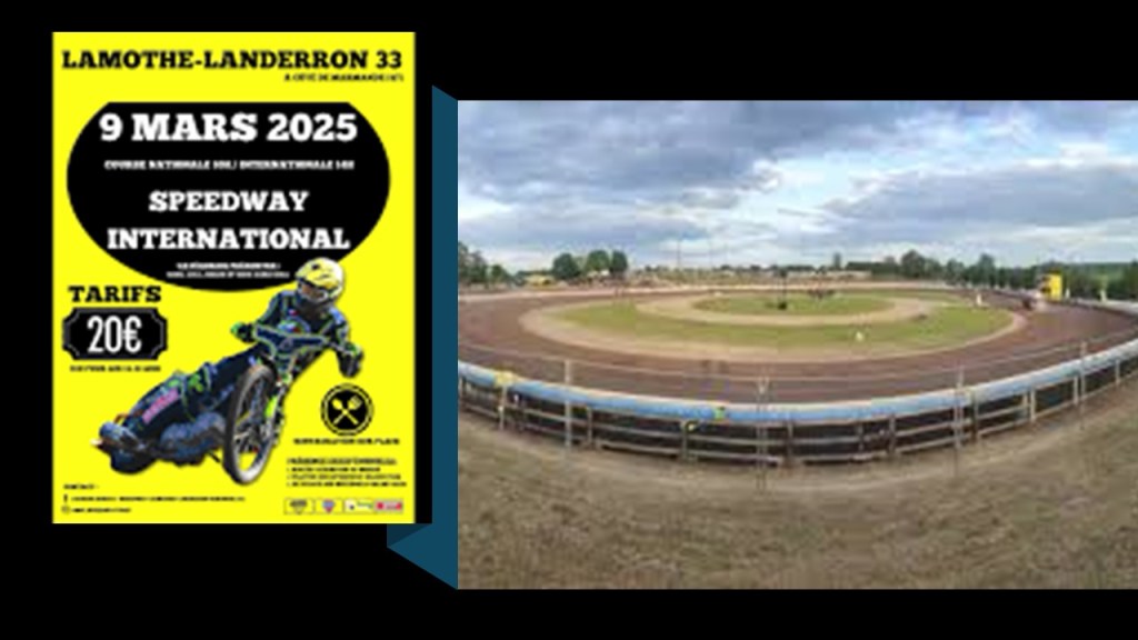
I think we are being told in our everyday language what the function was of specific infrastructure on the Earth, which I believe was arranged as a circuit board for the once, free-energy-generating electromagnetic grid system of the Ancient Advanced Civilization all over the surface of the Earth.
A circuit board is a physical piece of technology that allows for the assembly of electrical circuits or data circuits on a horizontal layer of material.

I think what are now being used as racing-tracks were once components of the circuitry of the Earth’s electro-magnetic grid system.
The sport of racing uses the word “circuit” in the following ways: the course over which races are won; the number of times the racers go around the track; an established itinerary of racing events involving public performance; and in bicycle racing, a circuit race is a mass-start road-cycle race that consists of several laps of a closed-circuit, where the length of the lap is slightly longer each time.
Electrical Circuit definitions Include: A closed path in which electrons from a voltage or current source flow, and includes devices that give energy to the charged particles the current is comprised of, such as batteries and generators; devices that use current, like lamps, electric motors, and computers; and the connecting wires or transmission lines.

Wouldn’t it stand to reason that those behind the reset when setting up the New World would take advantage of the super science of the different types of circuits in the Earth’s grid system, including racing circuits, in order to harness their inherent power, likely for multiple energy purposes that we are not aware of and are not for our benefit?
Next on the alignment we come to the village of Verteuil-d’Agenais.
Just to the southwest of the alignment is the location of “Crystal Vibrations,” experts in crystal singing bowls.
There are two automative businesses around the alignment – Sarl Stop Automobiles and Rodriguez DaSilva; the “Residence Eulalie” is a nursing home; and “Le Panier de Mathieu” is a grocery store.
There are also what appear to be groves circled in red on the right side of the screenshot, but I have not been able to find out what kind in a search, just that they are fruit trees of some kind, but again, another example of agricultural activity on this alignment.
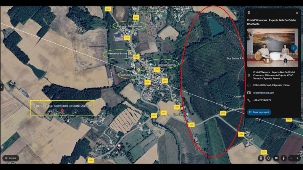
It’s noteworthy to find “Crystal Vibrations” on this alignment after finding the annual”Millesme Festival” in the previous location with its different genres of electronic music.
It is a meditation and wellness center that specializes in the sounds and energy of quartz vibrational instruments.
Generally-speaking, quartz crystal-singing bowls produce powerful vibrations that resonate with body’s cellular structure and have a positive effect on physical and emotional well-being, promoting balance, relaxation and healing.
The range is singing bowls is between 110- hz and 900-hz,and when compared to metal-singing bowls, ones made of crystal tend to have smoother and steadier frequencies.

Crystal singing bowls can also be tuned to Solfeggio healing frequencies, which are specific to different ailments, and/or out of different types of crystals with specific healing properties as well.

This kind of sound healing technology has a positive and beneficial impact on the energy grid, countering whatever negative frequencies are being pumped into it from other sources, and those that are aware of this can use things like crystal singing bowls as a tool for good and raising our collective vibration instead of lowering it.

As Nikola Tesla famously said, “If you want to find the secrets of the Universe, think in terms of energy, frequency, and vibration.”

In the next screenshot, the alignment crosses through the area around Villeneuve-sur-Lot.
There are two schools on or near the alignment -the Ecole Primaire de Petite Tour, a primary school for younger children aged from 6 – 11; and the Lycee Polyvalent Georges Leygues, a high school for older students; the Complex Sportif de la Myre-Mory, a large sports complex and stadium; Sostraso Logistiques, a logistical and supply chain transportation company; the Chateau de la Sylvestrie; and the Bugat Pyrotechnique/Upgrade.
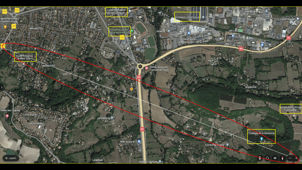
I have consistently found schools for students of every age all along this alignment, as well as sports complexes as previously mentioned, and logistical and supply chain companies as well, numerous examples of which is found in Albany Georgia, where there are logistical, warehouse, and distribution entities on and all around the alignment, like the Marine Corps Logistics Base directly on the alignment just above Radium Springs.
Radium Springs was known for its healing properties and crystal clear waters.
We are told that a resort and golf course was developed there in the 1920s, but that sadly, the Great Depression led to the closure of the resort in 1939.
Today only the Radium Springs Gardens, where you can visit and walk around, and look at the beautiful surroundings, but you can no longer swim.
As the alignment leaves the Villeneuve-sur-Lot-area, the Chateau de la Sylvestrie is directly on the alignment, and the Bugat Pyrotechnique/Upgrade is just a short-distance from the Chateau de la Sylvestrie to the northeast of both.
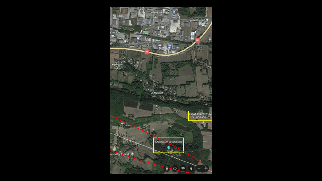
All that I am really able to find out about the Chateau de la Sylvestrie is that we are told that it is located on the edge of a plateau overlooking the Cambes Valley, and dates from the early 13th-century, and that the Cambes Valley is known for its vineyards.
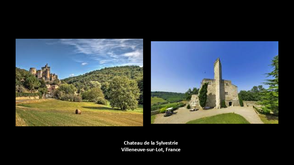
The nearby Bugat Pyrotechnique/Upgrade is a fireworks manufacturer known for its high quality and colorful fireworks and unique shows for every occasion.

In the next screenshot, the alignment crosses through Caussade.
Caussade is in the Occitania region of southern France where the Occitan language was historically spoken and home to most of its speakers, and which is native to Spain, Italy, and Monaco as well.
Caussade is described as an ancient city in the hills of Quercy.
It is nicknamed the “hat city” due to hat-making production starting in the late 19th- century.
For a point-of-information, mercury was used in the hat-making process in the 19th-century, resulting in a high-rate of mercury poisoning in those working in this industry, causing things like neurological damage, slurred speech, memory loss and tremors.
The phrase “Mad as a Hatter” in the Victorian-era was used to suggest someone was insane.

In this location, I have highlighted an Intermarche Contact convenience store and funeral home directly on the alignment, and there are several supermarkets which are marked by the balloons surrounding it.
I have also circled Quercy O, which is an indoor aquatic venue and another sport center; the Spanish Cemetery, and I find cemeteries along the alignments; and what is called the “Dolmen Tombeau de Geant,” or “the Giant’s Tomb.”
I will address the location highlighted by the large yellow circle in the upper right-hand corner in the next screenshot.
In this one, I am going to take a look at “the Giant’s Tomb.”
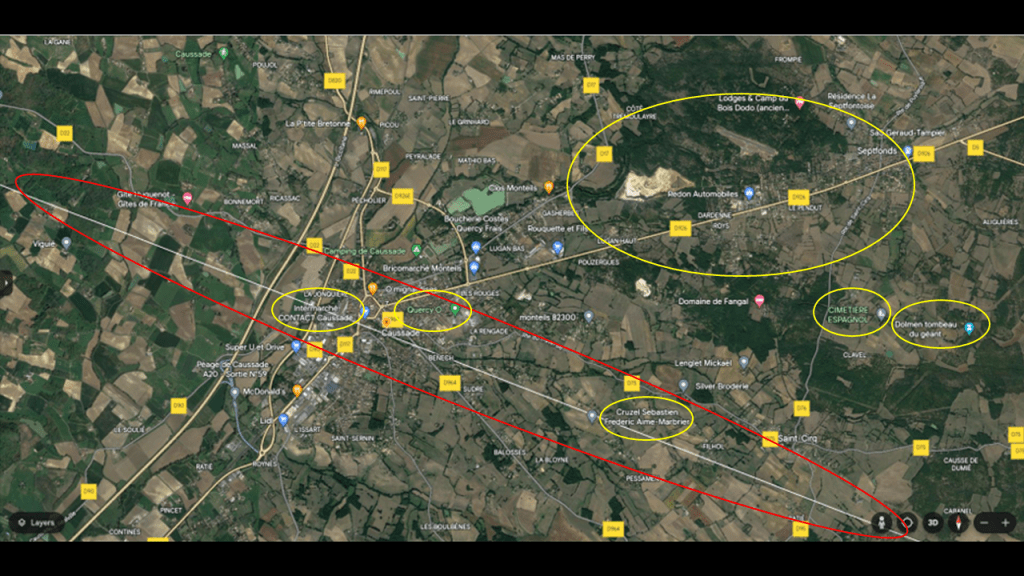
“The Giant’s Tomb” is a dolmen in the middle of oak woods, and one megalithic stone structure of approximately 800 in this Quercy region of France.
What we are told about dolmens is that they are ancient megalithic structures built with upright stones and a capstone, and that the best explanation our narrative can give us is that they were believed to have been used as burial sites or ceremonial sites, though.
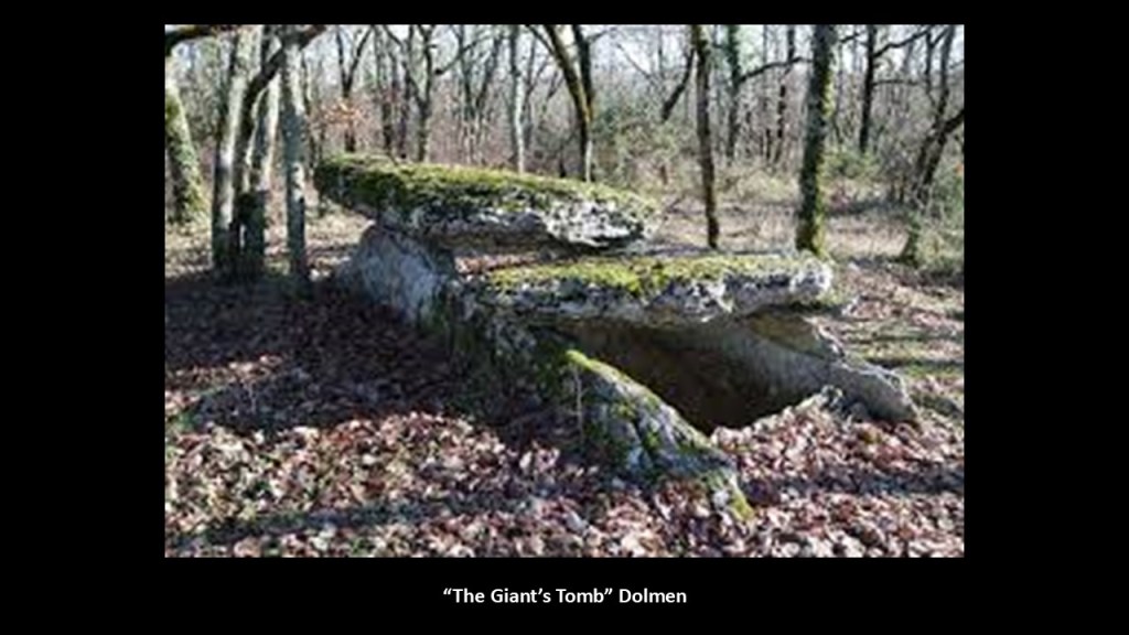
And in places like the United States and Canada, the exact same thing as a dolmen everywhere else is a called a “Glacial Erratic,” or created by rocks transported by glaciers often far from their original source.
This next screenshot zooms in on the location circled in yellow in the upper-right hand corner.
I have circled here Sematec; the “Dolmen de Finelle-Haut;” the “Dolmen de Peyrelade;” all of which are close to the Aerodrome of Septfonds.
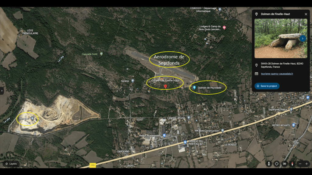
Sematec is a company that specializes in quarrying, and the type of rock quarried here is used for aggregates, which are used in construction materials.
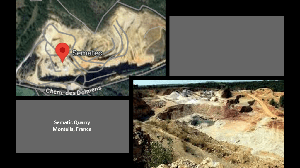
The “Dolmen de Finelle-Haut” and the “Dolmen de Peyrelade” are both located right next to the local airstrip called the Aerodrome de Septfonds, so another airplane-related location close to the alignment.
It wouldn’t surprise me in the slightest bit to find out that dolmens were an ancient technology of some sort.
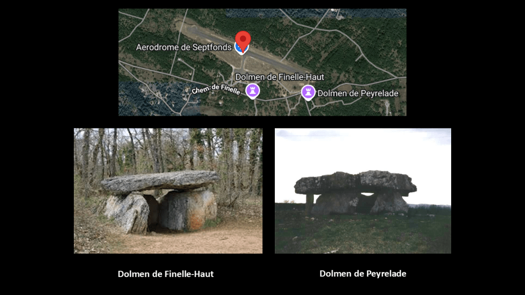
In the next slide, the alignment is crossing through the French commune of Bellegarde-Marsal in the Tarn Department, named after the River Tarn.
The Tarn Department is one of the original 83 departments created in March of 1790 during the French Revolution.
It was created from part of the former Province of Languedoc in a region called the County of Toulouse ruled by the Count of Toulouse, and independent from the Kings of France.
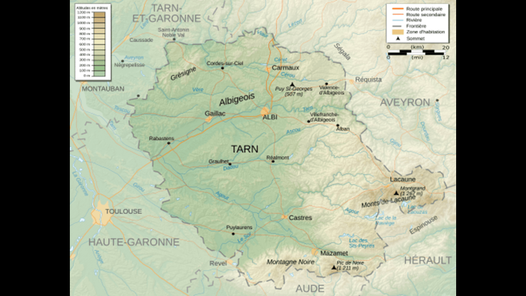
The Languedoc takes its name from the Langue d’Oc, or Language of Oc, and is the same as the Occitan language, and interestingly was at one time understood and celebrated throughout most of educated Europe.
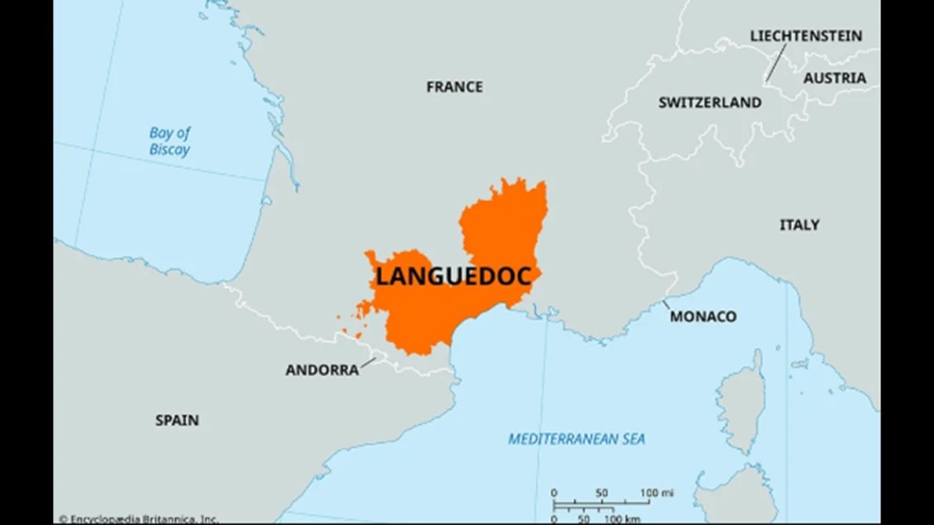
The Languedoc was also a home of the Cathars, a peaceful gnostic people.
In our historical narrative, the Cathar Crusade, also known as the Albigensian Crusade, took place in this part of France between 1209 and 1229, at which time the highly-spiritual Cathars were brutally massacred in a campaign initiated by the Roman Catholic Pope at the time and promulgated by the French Crown.
The aftermath of the Albigensian Crusade resulted in a significant diminishment in the distinct regional culture of the Languedoc and a realignment of the County of Toulouse with the French Crown.
When I was a kid, and the only oral history on my Dad’s ancestors was that they were French Huguenots, the only information available was that they were reformed Calvinists who were for some obscure, unknown reason were persecuted and massacred in France for 100 years.
My understanding now in the Internet Age is that the Huguenots were Moors and Cathars.

The Dominican Order was founded during the Albigensian Crusade by Pope Honorious III via his papal bull called the Religiosam Vitam and gave universal recognition to the order.
The Dominicans were said to have been specifically founded to examine heretics in Southern France and in Italy and they were heavily involved in historical Inquisitions.

The Cathars were definitely competent stonemasons.
The is the Cathar Castle of Peyrepertuse between Perpignan and Carcassone in the historic Languedoc region.
It was associated with the Counts of Narbonne and Barcelona.
Peyrepertuse is the biggest of the “Five Sons of Carcassone,” all situated atop promontories, which are defined as high points of land that project into this case a lowland or into body of water.
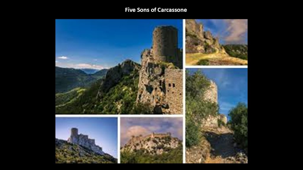
The region of Languedoc in southern France was part of the historic Catalonia which was partitioned between France and Spain, and includes the principality of Andorra.
The Principality of Andorra is co-ruled by two unelected Princes, constituting what is known as a diarchy – whoever is the Catholic Bishop of Urguell and whoever is the President of France.
This unique form of government we are told has existed since 1278, less than 50-years after the end of the Albigensian Crusade.
So the two institutions responsible for the genocide of the Cathars, the Roman Catholic Church and the French Ruler (first monarch, now president) have held a co-rulership in an unelected position for centuries over the very land of the Cathars, and the people who live there?
Why the oppression of the Catalan people and suppression of the culture and history of this region?

I would say there are many reasons that this is the case, but perhaps one reason is that there is a very strong tradition here that this was the part of the world where Mary Magdalene was said to have gone after the crucifixion of Jesus, that Jesus and Mary were husband and wife, and had children.
Is this the driving force behind the brutal animosity towards the people of this land, and the desire to control it in perpetuity?
Or is there even more to the story that has been hidden from us?

It is particularly important to note here that “Black Madonnas” are venerated throughout Europe, including, but not limited to, by Popes.

It is there to find but we have no context for “Black Madonnas” because the picture we have always given for all of this is completely different.
There is a Black Madonna at Montserrat, a monastery in Catalonia near Barcelona nestled amidst ancient stones.
Our Lady of Montserrat is known in the Catalan language as “La Moreneta,” or “the Little Dark-Skinned One,” with the “moor” sound in the name.
Even the massive basilica in nearby Barcelona, which was credited in our narrative to its native son and architect Antoni Gaudi, and construction starting in 1882, is named “Sagrada Familia,” or “Holy Family.”
Was there another “Holy Family” besides the one that we know of implied by the name of this beautiful basilica in Catalonia, the region where Mary was believed to have gone with their children after the crucifixion?
Now I’ll turn my attention back to where this pyramid alignment crosses through Bellegarde-Marsal and bring forward a few places and features.
Directly on the alignment on the top left is “La Bastide des Vassals.”
I have red arrows pointing to where the alignment crosses over the tops of two, S-shaped bends of the River Tarn.
The “Plage du Tarn Marsal” is circled close to the alignment at the top of the second river-bend.
I have also highlighted on or near the alignment and the River Tarn, two chapels – the “Chapelle Saint-Jean-Baptiste Les Farquettes” and the “Chapelle de la Maurinie” – and three vacation rentals – the “Gite Chouquette;” the “Gite Au Bord du Tarn;” and the “Gite des Rives du Tarn.”
I will start with “La Bastide des Vassals” on the alignment.
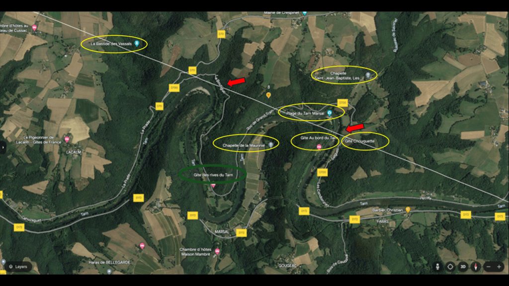
What I could find out about this place is that it was the location of the ruins of “La Bastide des Vassals.”
Said to have been constructed between the 13th- and 15th-centuries, its remnants in a forested area include a bridge, a mill and a keep.
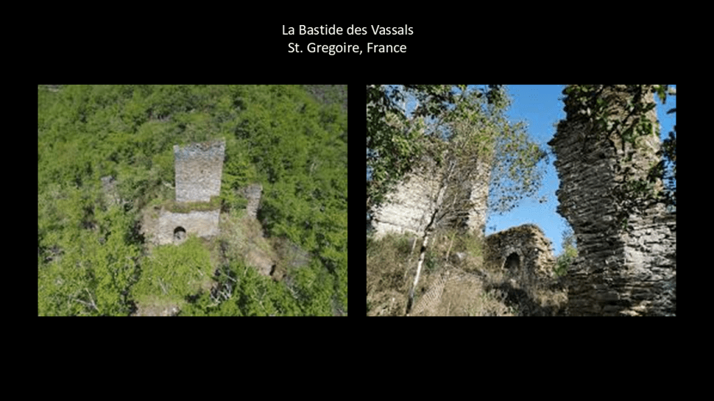
I find the S-shaped river bends here on the Tarn in southern France the world over, and believe them to have an important function on the Earth’s energy grid system.
In this sample of countless examples, the Tarn River here in France is in the top left; the Brisbane River in Brisbane, Australia, is in the middle; the Platano River in Honduras is on the top right; the Thames River in London, England, on the bottom left; and the Red River in Winnipeg, Manitoba on the bottom right.
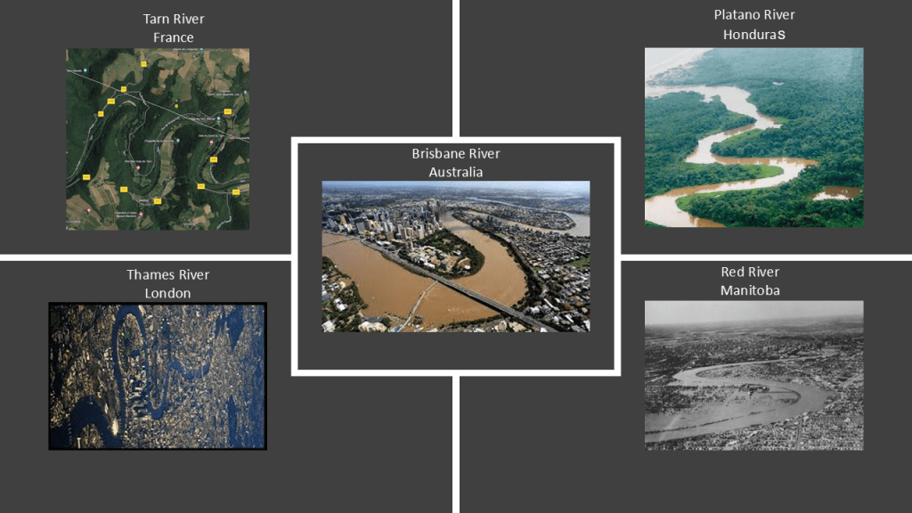
I think the shapes of these river-bends relate to the hydrodynamics of S-shapes that the Austrian scientist Viktor Schauberger was studying.
Viktor Schauberger was a pioneer in the field of water and energy research in the early 20th-century, and specialized in the flow of water and natural energies.
Between 1928 and 1935, he worked on developing a device for the production of living water, water with an enhanced structure and necessary minerals, and described the motions of this water flow energizing water.
Conversely, he believed that modern industries destroy healthy water, including the processes of municipal water treatment plants, which decompose healthy water.
I highlighted the “Plage du Tarn Marsal” that is close to the alignment at the top of the second river-bend.
The Plage de Tarn Marsal is a popular beach and recreational area on the bend of the river.
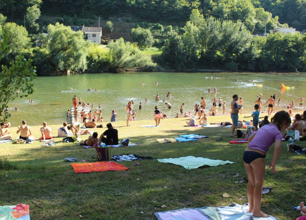
I have also highlighted on or near the alignment and the River Tarn two chapels and two vacation rentals, and what I would like to share about these four places is the old stone-building style found throughout this region, though I have consistently found churches of all kinds along this alignment.
In the next screenshot, we come to where the alignment leaves southern France and enters the Gulf of Lion in the Mediterranean Sea.
There are a few places that I would like to highlight in this location: the Maguelone Cathedral; Villeneuve-les-Maguelone; and where the site of the Ancient fou de la Digue d’arret du Chenal Sud got my attention.
First up, the Maguelone Cathedral.
It was said to have been sold as national property during the French Revolution and designated as a historic monument in 1840…
I find it highly noteworthy that the massive Maguelone Cathedral, said to have been constructed in the 11th-century…
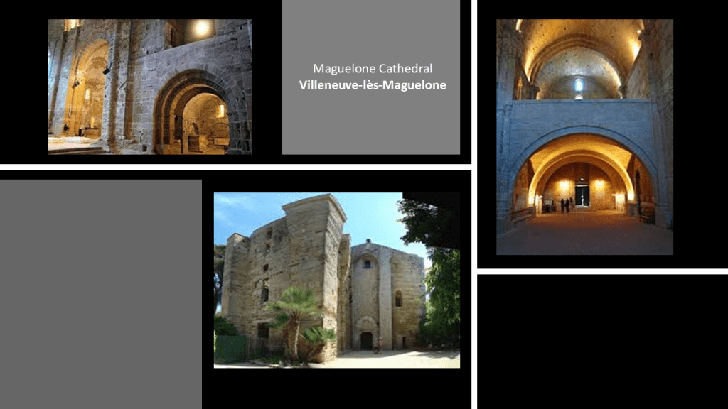
…is located on this tiny strip of land, called an isthmus, in the middle of what is called “Etang de L’Arnel,” or “Pond of the Arnel,” which is separated by the Mediterranean Sea’s Gulf of Lion by a narrow strip land consisting of several beaches.
This is like what we saw on the western coast of France where the alignment enters Europe at Le Porge Beach on the Medoc Peninsula, where there is also a long, narrow coastal strip of beaches, dunes, ponds and lakes down the coast, and the same things are found all along the Atlantic Coast of the United States, with the example on the top right of Great Egg Harbor on the New Jersey Shore.
The tiny strip of land upon which the Maguelone Cathedral sits in the middle of a narrow “pond” is opposite from the present-day town of Villeneuve-lès-Maguelone, which translates in English to the “new city” pertaining to Maguelone.
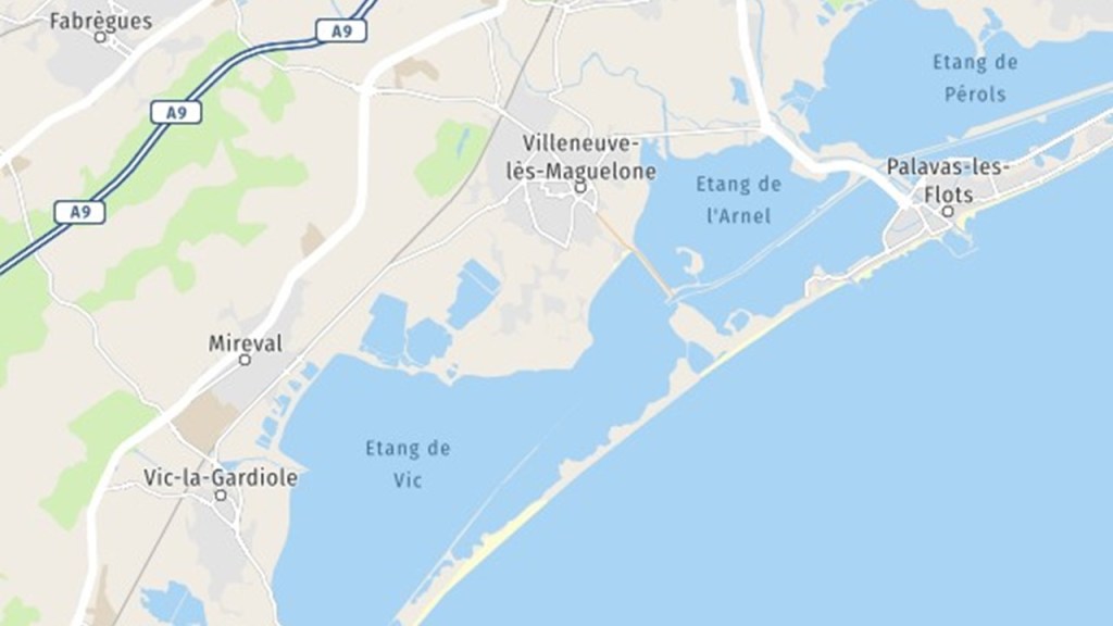
La Porte de Maguelone, or the Maguelone Gate, sits by itself on the end of the isthmus where the Maguelone Cathedral is located.
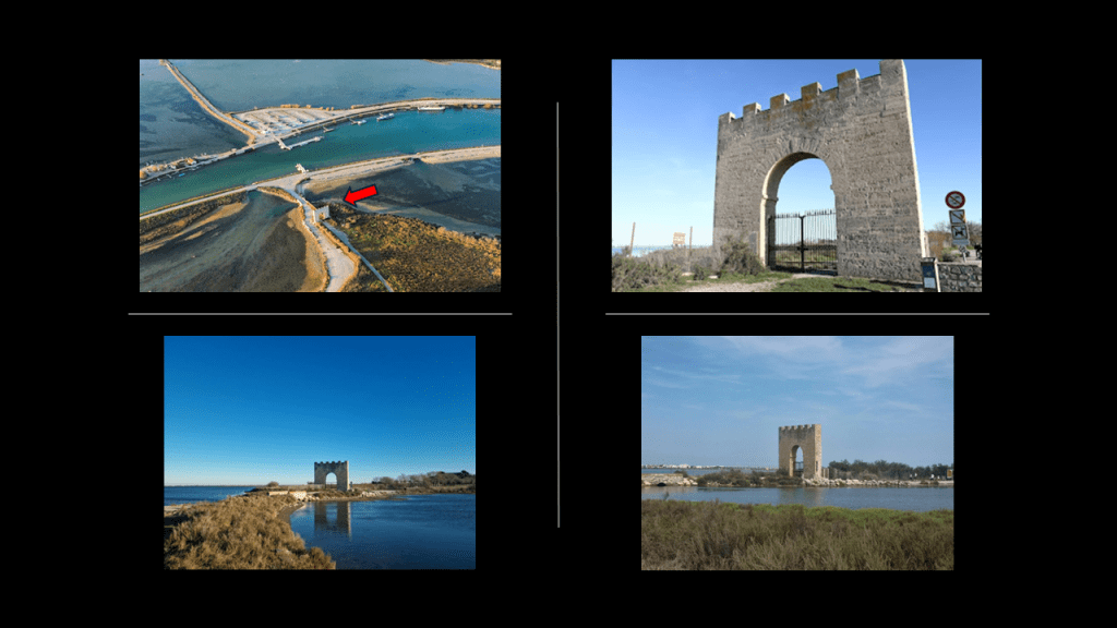
This is what I found when I was looking for more information on the lonely Maguelone Gate.
The Rhone-to-Sete Canal pointed out by the red arrows, separates the “Pond of the Moors” and “the Pond of the Arnel” above the canal, and the “Pierre Blanche Pond” and the “Pond of the Prevost” below it.
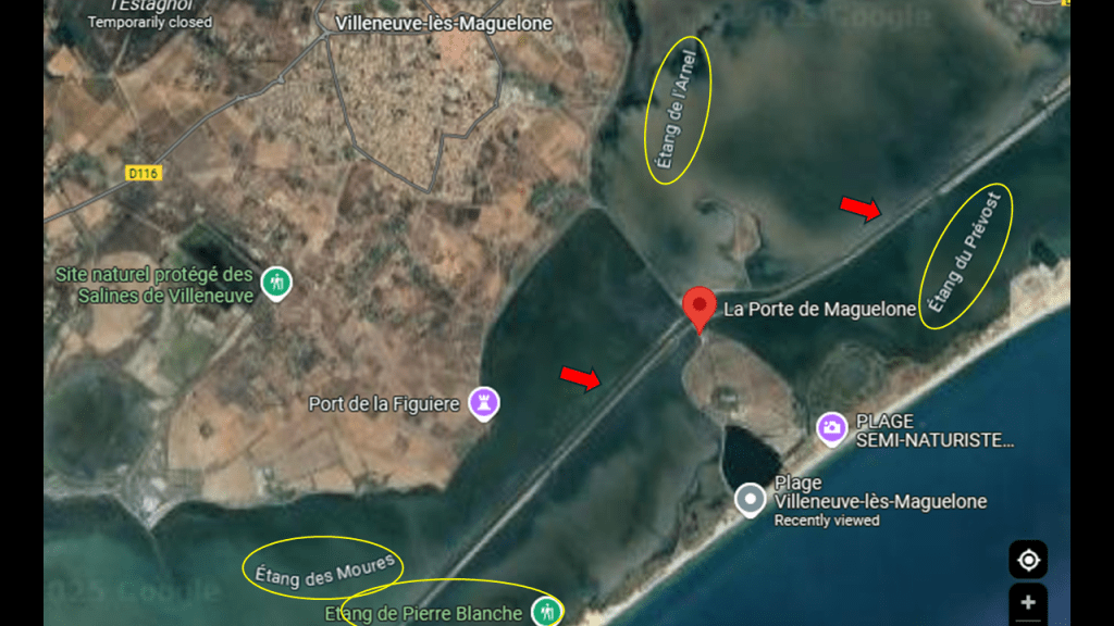
We are told that construction of the Rhone-to-Sete Canal started in the 17th-century and was finally completed in 1808.
It brings to mind of the examples I provided earlier in this post of places that appear to be sunken rivers, like the Gulf Stream in the Atlantic ocean.
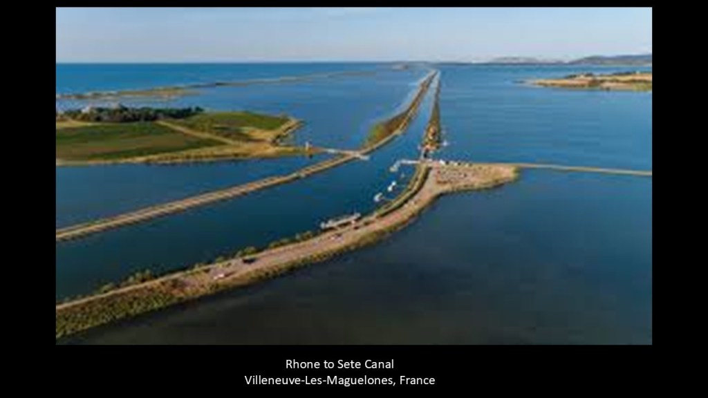
This is a very watery location for such a huge undertaking as building a sophisticated engineering project like a canal, especially starting in the 17th-century.
It runs for 61-miles, or 98-kilometers through wetlands, from Beaucaire on the Rhone River to Sete at the edge of the “Etang du Thau” or “Thau Pond,” where it connects with the previously-mentioned “Canal du Midi.”
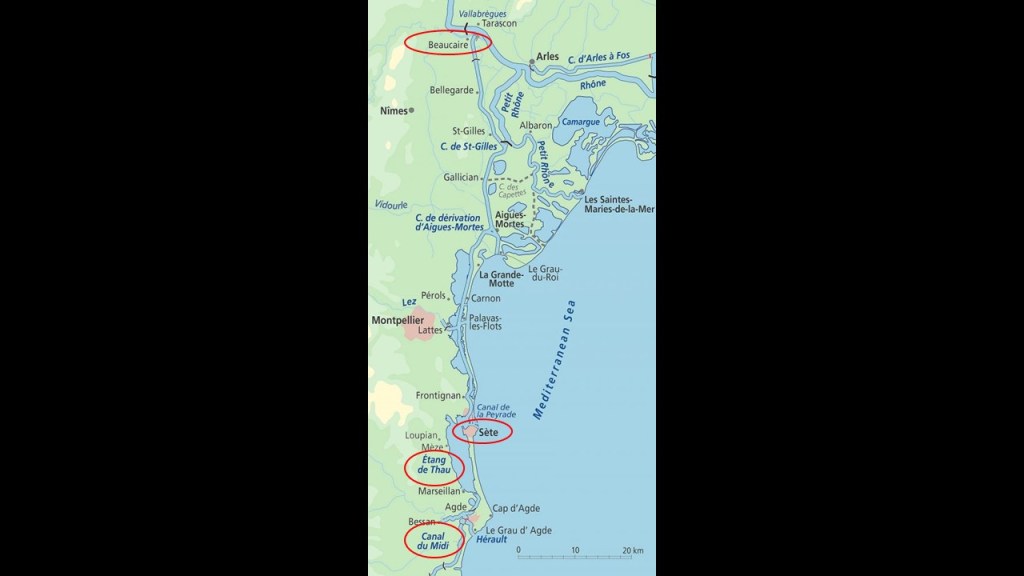
Again, we saw the same manifestation earlier in this post on the Medoc Peninsula with the “Canal des Etangs” running along the coastline in the same kind of wetland environment, and said to have been completed in 1864, linking Lake Hourtins and Carcans at its northern end, through Lake Lacanau with the Arcachon Bay at its southern end.
The “Chemin du Pilou,” or “Path of Pilou” crosses between the “Pond of the Moors” and the “Pond of the Arnel” and over the canal in order to get to the Isthmus from land where the Gate of Maguelone and Maguelone Cathedral are found.
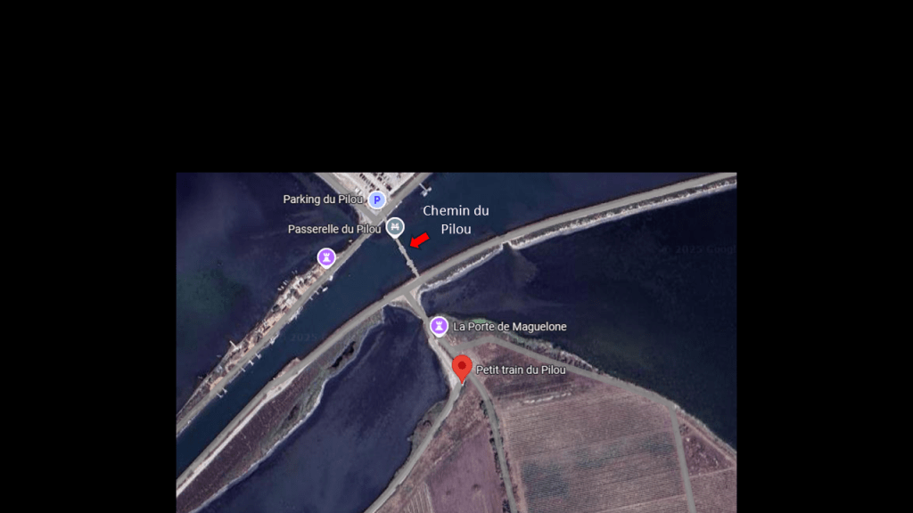
The “Chemin du Pilou,” or “Path of Pilou,” today is a bridge which can be used by those on bicycles, skateboards, or on-foot to get across.
It is also what is called a “bascule bridge,” as it swings upward to provide clearance for boat passage.
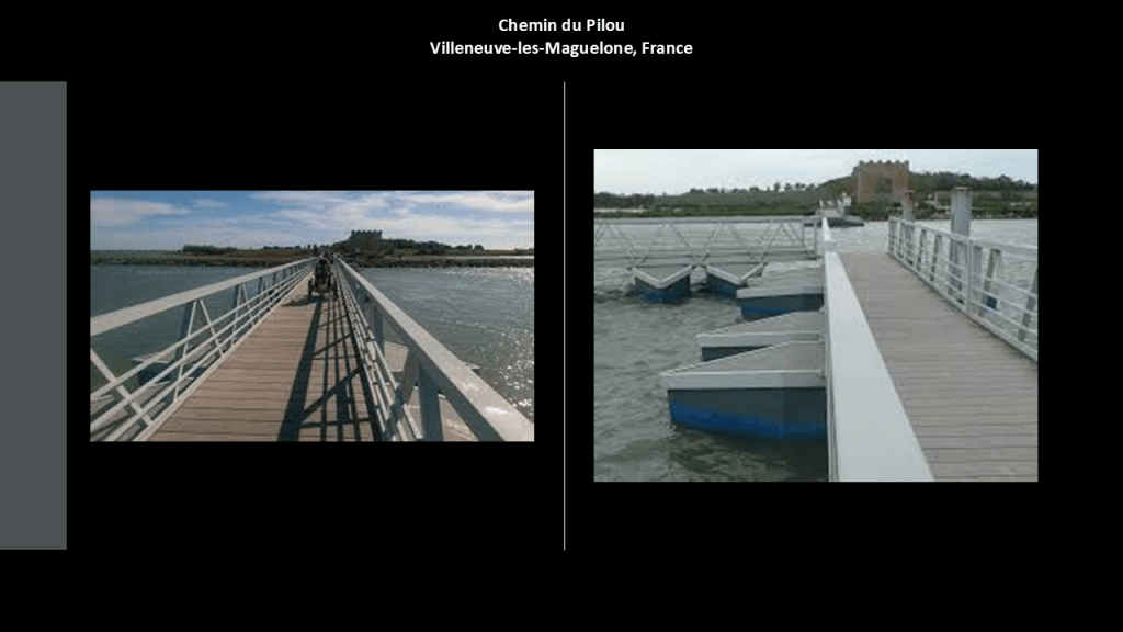
Bascule bridges, and other types of lift, and/or swing-bridges were quite common as railroad bridges at one time in our history, like this example from the second-part of this series still in use by the Norfolk Southern Railroad across the Ablemarle and Chesapeake Canal near the Great Dismal Swamp in Virginia mentioned earlier in this post.
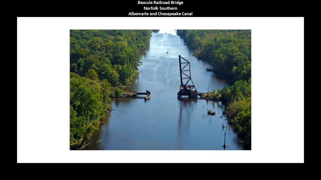
And while there is not a train on rails there today, there is what is known as the “Petit Train du Pilou,” or “Small train of Pilou,” to take you from the bridge to the beach in the summer season.
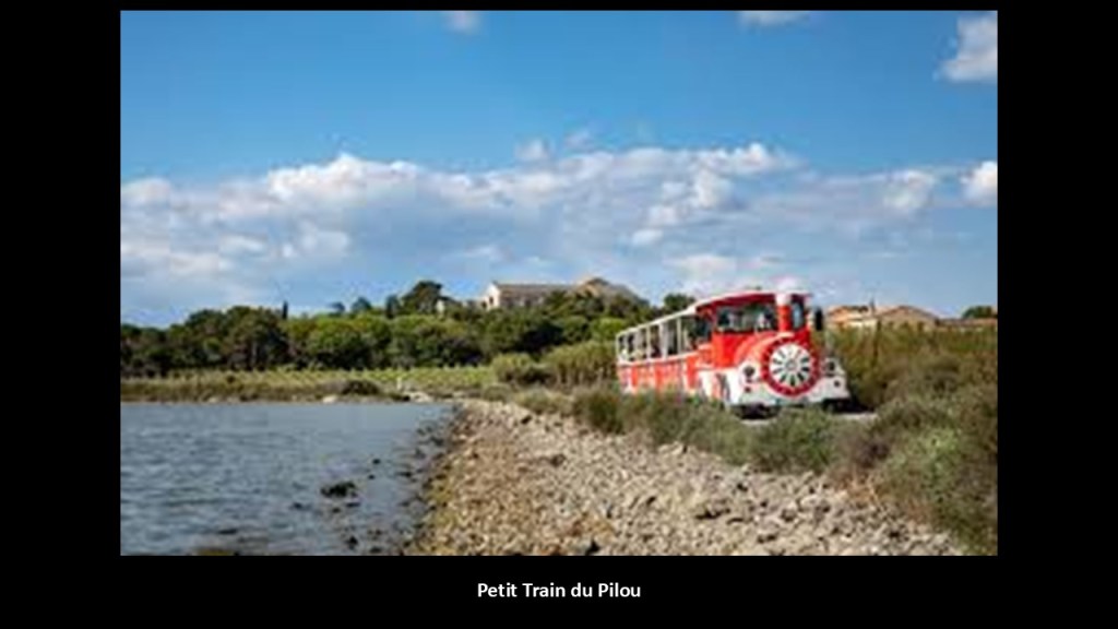
There is a rail service at the nearby Villeneuve-lès-Maguelone, which runs along the Mediterranean coastline and connects to other rail-lines in southern France.
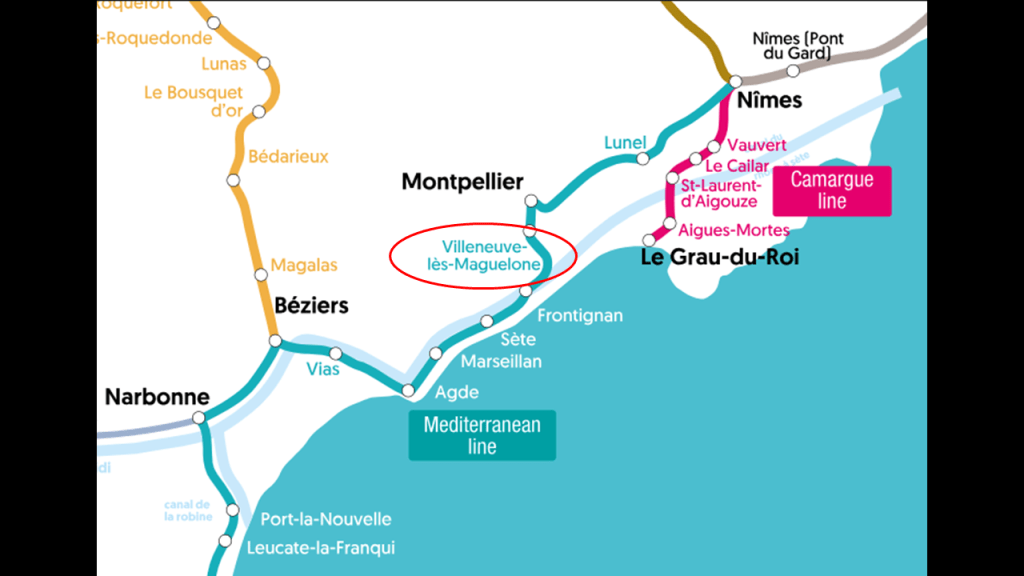
The original city of Maguelone at this location was one of seven cities, along with Elne, Agde, Narbonne, Lodeve, Beziers and Nimes, in a region known historically as “Septimania.”
One of the names for the star cluster of the Pleiades is the “Seven Sisters.”
I found a depiction of the Pleiades and compared it with a map of these seven cities in southern France to see if a case could be made that they constitute a star map, and I think there can be.
There is a signficant evidence that the original advanced civilization built everything on the Earth as a mirror of the Heavens, from ancient to modern times.
I will address this subject again when I get to Egypt, the Great Pyramid and the Giza Plateau.
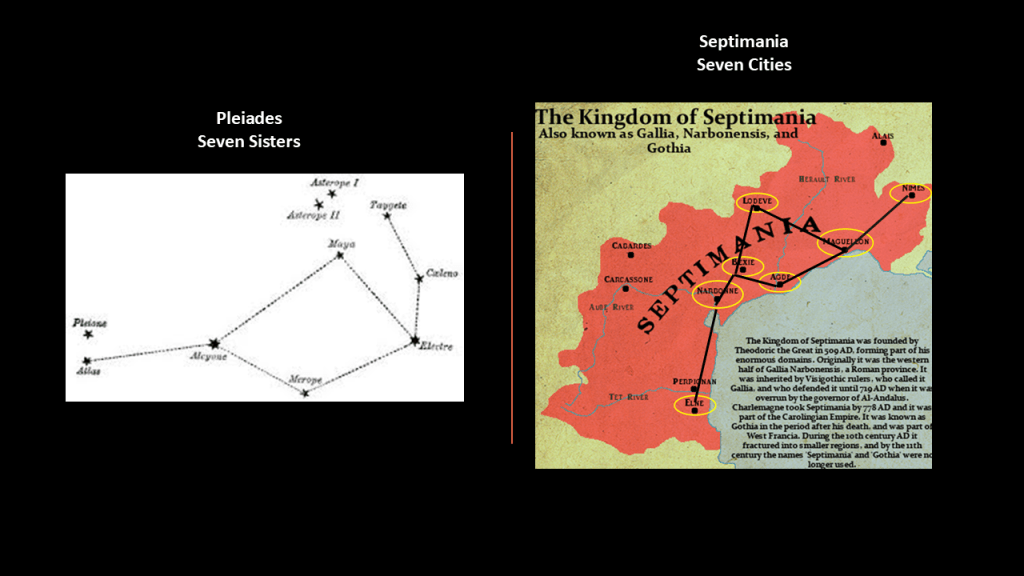
Just a few more things about Maguelone that I would like to bring forward.
While the name “Maguelone” sounds kind of like “Magdalene,” we are told its meaning is a varation of the Latin “Margarita,” or “pearl.”
But there are some other intriguing references found in the area that indicate a connection to Mary Magdalene.
One is that the hill on which Villeneuve-les-Maguelone is situated on is called the “Mount of the Madeleine.”
“Madeleine” is the name in French used to refer to Mary Magdalene.
Hold this thought for a moment because now I am going to go over to the nearby coastal region of the Camargue in the two arms of the Rhone River Delta, and is a wetland area of salt marshes and lagoons cut off from the sea by sandbars, like we have already seen in this post along coastal areas.
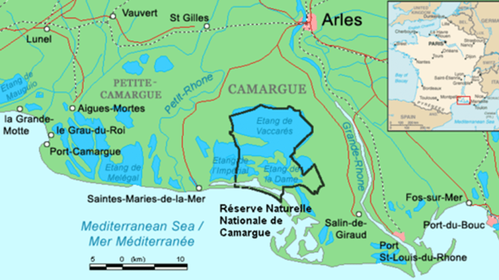
The Camargue region is known for its pink salt lakes, flamingos, and horses.
Before I get to Saintes-Maries-de-la-Mer, the capital of the Carmargue, and its significance, I would like to highlight the “Ancient fou de la Digue d’arret du Chenal Sud,” that I mentioned earlier near this part of the alignment; “Le Phare de L’Espiguette,” and Fort de Peccais.
I found out that the “Ancient fou de la Digue d’arret du Chenal Sud” was the location of a former lighthouse that was said to have been constructed in the 19th-century.
And just like we saw where the alignment enters the western coast of France, right next to where the former lighthouse was located is a current lighthouse, the “Phare de L’Espiguette,” situated amidst the dunes of the “Pointe de Espiguette,” which is a vast dune system on the coast that is 11-miles, or 18-kilometers-long.
It was said to have been built in 1869.
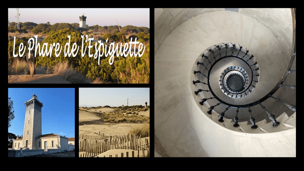
Both of these lighthouse locations are close to Fort de Peccais.
The location of Fort de Peccais is hard to get to where it is on a bad road in the salt marshes, which we are told it was built to guard the salt flats in the 14th-century because it was a source of taxation of the king.
It is located in a bend of the watercourse going around it.
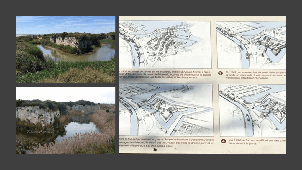
It also has canals on both side of it…
…and wetlands all around it.
So with regards to the nearby city of Saintes-Maries-de-la-Mer, the capital of the Carmargue, the point that I would like to bring forward is this.
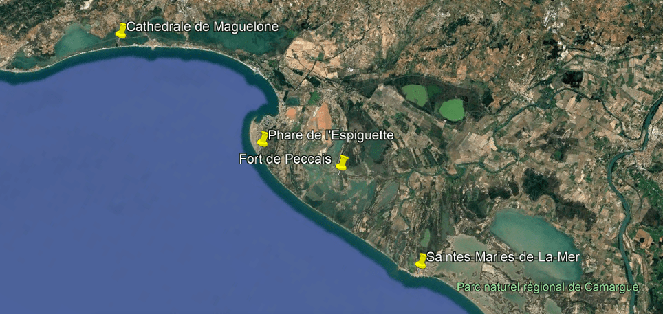
The name of Saintes-Maries-de-la-Mer refers to Mary Magdalene, Mary Salome, and Mary of Clopas.
These three women were closely linked to Jesus, and at the time of his crucifixion, the first witnesses to the empty tomb and the resurrection of Jesus.
Subsequently, they escaped persecution in Judaea by travelling across the sea in a boat, and living out the rest of their lives in the Camargue.
The Roma people of southern France, also known as gypsies, venerate Saint Sara-la-Kali, or “Sara the Black” in the Romani language, a black madonna whose statue is in the Church of Saintes-Maries-de-la-Mar, and is famous throughout the world as the patron saint of gypsies.
While Christian theologians tend to identify her as an Egyptian handmaiden to Mary Magdalene, her actual identity remains a mystery.
But there are all these intriguing connections showing up on a long-distance pyramid alignment between the between Egypt and Mexico.
I have one more screenshot on this location before the alignment leaves France that I would like to share, and that is one that shows another airport, the Montpellier-Mediterranee Airport, a short-distance to the northeast of the alignment.
This particular airport is a commercial airport, as well as being the location of the French Civil Aviation University.
We are told aircraft first landed here at this location in 1938, and that in 1944, the German Luftwaffe used it, but which led to United States Air Force sorties bombing it several times that year during World War II.
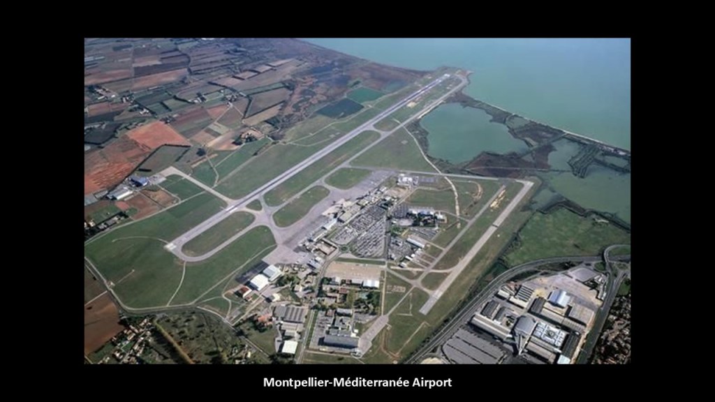
Now the alignment enters the Gulf of Lion.
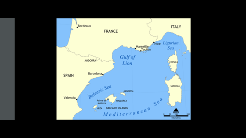
Like the Bay of Biscay off the coast of western France, the Continental Shelf extends far into the Gulf of Lion, with the depths close to the shoreline being quite shallow, where as we have already seen much of which is composed of ponds, lakes, lagoons, and salt marshes, and the offshore underwater canyons slope rapidly to great depths to the floor of the Mediterranean Sea.
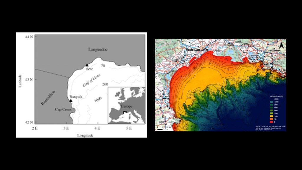
Also like the Bay of Biscay, the Gulf of Lion is known for its extreme weather, with sudden violent cold and blustery winds known as the Mistral and the Tramontane that threaten boats and ships, as seen here off the coast near the port city of Marseille.
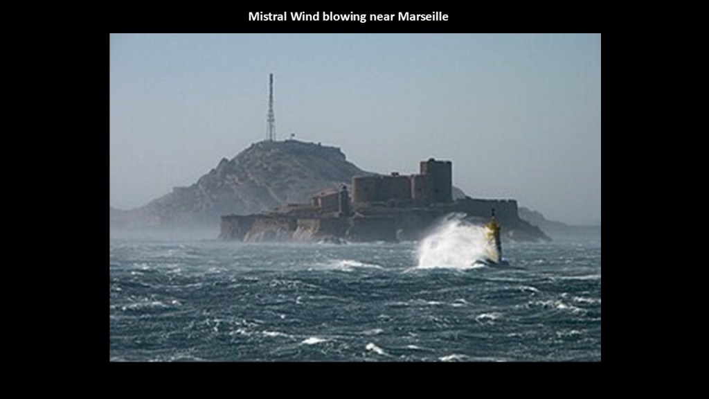
Like I said earlier in this post, I believe what are called “Continental Shelves,” which are found all along the Earth’s coastlines, are actually submerged landmasses and ruined land from this recent cataclysmic event which destroyed the Earth’s original energy grid, along with creating land features like estuaries. wetlands, deserts and dunes.
This belief is at odds with the official explanation, which is that of a worldwide Great sea level rise as a result of melting glaciers from the last Ice Age and the expansion of seawater as it warms, and both are due to global warming.
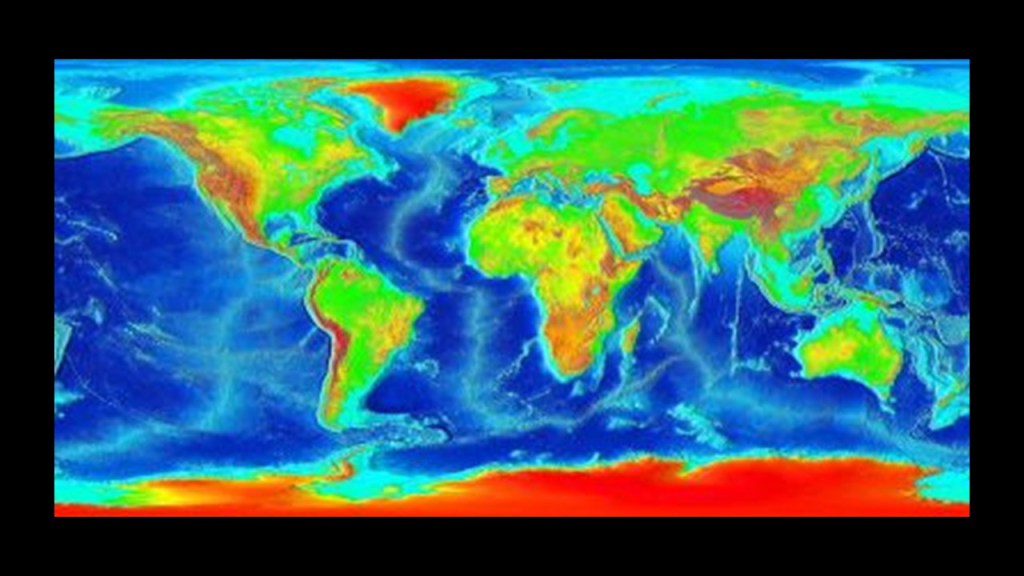
“The Principles of Geology” were published by Sir Charles Lyell in three volumes between 1830 and 1833, in which he presented the idea that the Earth was shaped by the same natural processes that are still operating today at similar intensities, and as such a proponent of “Uniformitarianism,” a gradualistic view of natural laws and processes occurring at the same rate now as they have always done.
This theory was in contrast to “catastrophism,” or theory that Earth has been shaped by sudden, short-lived violent events of a worldwide nature.
As a result of Lyell’s work, the glacial theory gained acceptance between 1839 and 1846, and we are told during that time, scientists started to recognize the existence of ice ages, and do to this day.
Sir Charles Lyell’s books on “Uniformitarianism” and “Ice Ages” in geology became the only accepted model taught by Academia.

Another one of the bedrock foundations of modern science are the accepted scientific theories of Plate Tectonics and Continental Drift that are closely connected to the gradualistic view of natural laws and processes occuring at the same rate now as they have always done in the Uniformitarian worldview of Sir Charles Lyell.
In 1915, Alfred Wegener, a 1905 graduate of the Humboldt University of Berlin that produced the great scientists and scholars of our day, published “The Origins of Continents and Oceans,” in which he theorized that Earth’s continents move or drift relative to each other over long periods geologic time, and that the continents were once joined together in a large landmass “supercontinent.”
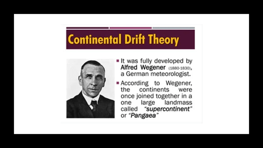
So apparently the idea that at one time there was one large supercontinent is not in dispute.
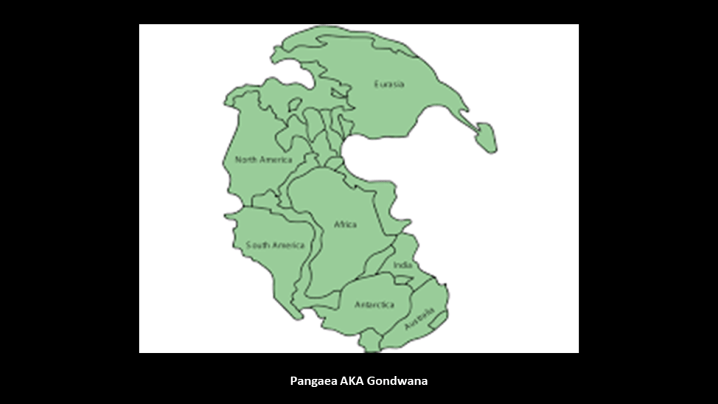
The issue is when and how the continents separated: slowly and over geologic time vs. suddenly and catastrophically.
And once again, Academia supports Uniformitarianism without question as the only explanation for what we see in today’s world.
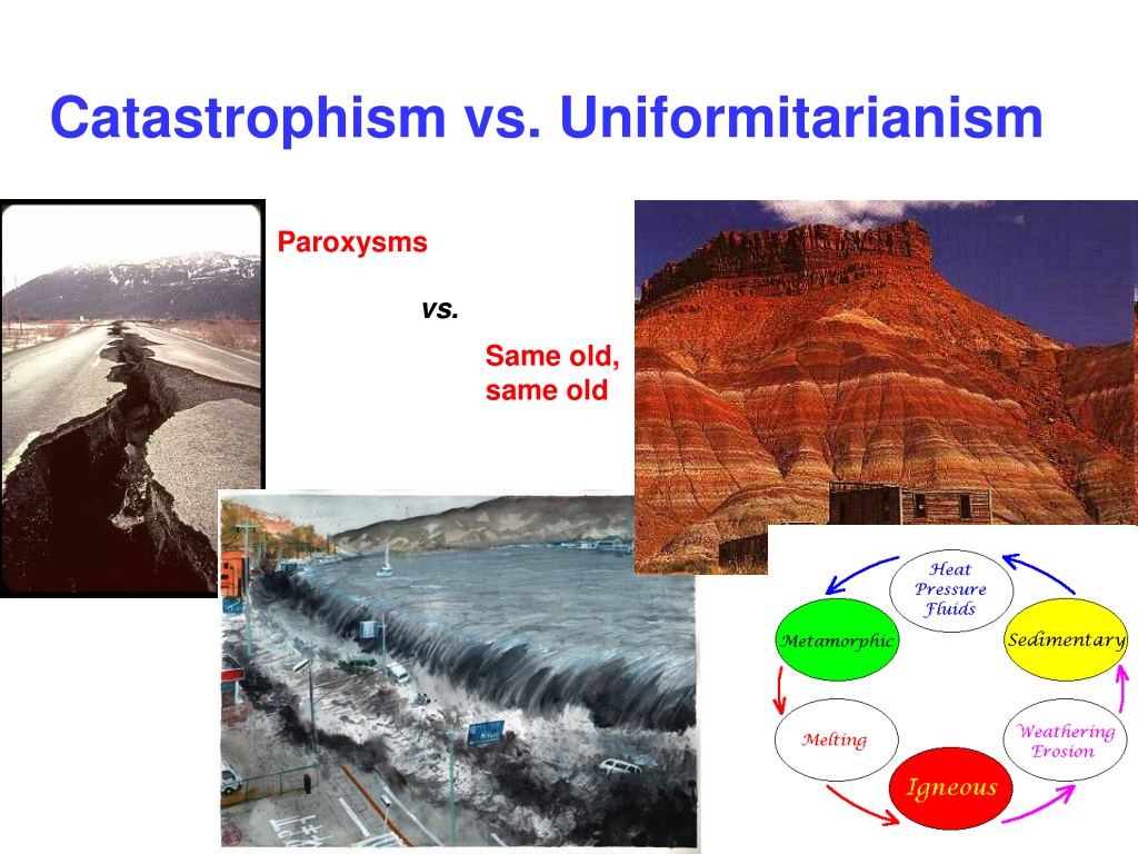
And even though initially Wegener’s theory was not accepted by Academia because there was not a proposed mechanism, the Continental Drift theory was later incorporated into Plate Tectonics, the scientific theory that Earth’s lithosphere is comprised of a number of large tectonic plates that have been slowly moving for 3 – 4 billion years, and this is what we are taught today.
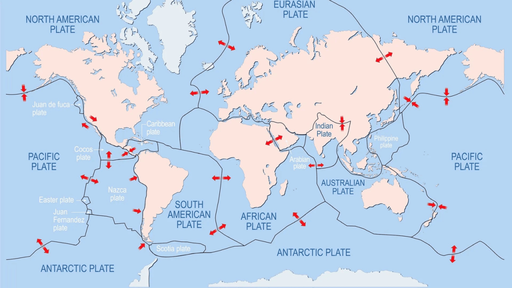
Let’s take a look at that particular subject here in the “Mediterranean Sea.”
The literal meaning of “Mediterranean” from the Latin “medius” and “terra,” is “middle” and “earth or land.”
So it would be translated into English along the lines of “Middle Earth” Sea.
I really think there was more land than water here at one time in Earth’s history, and not the “sea” we see today.
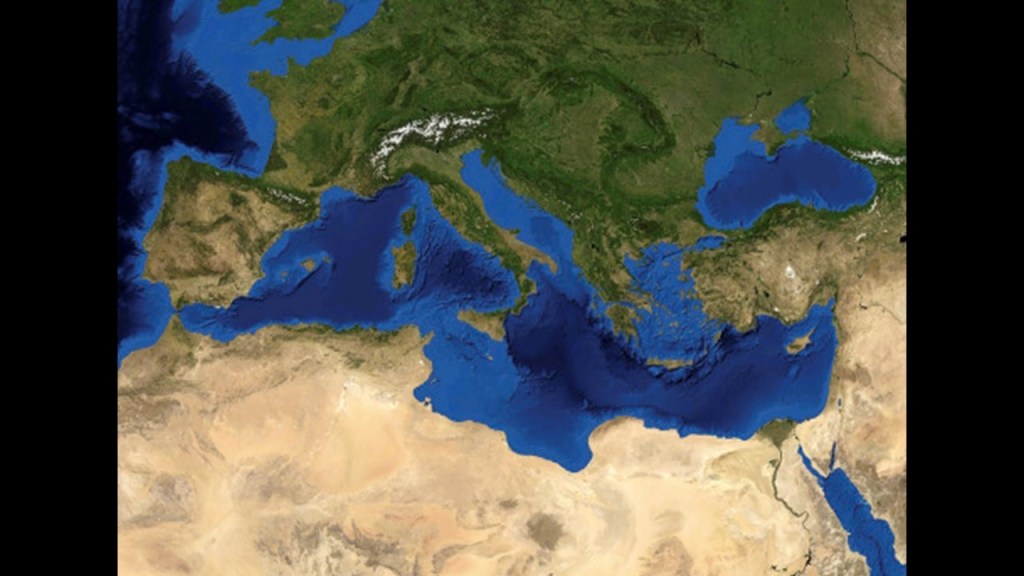
When you search for the term “Middle Earth,” it’s mostly the work of J. R. R. Tolkien that fills up the internet search page.
When you plug “Midgard” into the search engine, you get that “Midgard” is the abode of Human Beings in Norse Mythology, and the “middle realm” that is situated in the branches of Yggdrasil, the world tree. that provides the “Axis Mundi,” the “Axis of the Universe” that connects all realms.
Also, we are told the Great Pyramid of Giza in Egypt, a country on the Mediterranean Coast of North Africa, is in the exact center of the Earth’s landmass.
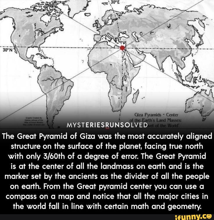
Marseille is located on the edge of the Gulf of Lion, where it meets the Mediterranean Sea, and is a major port city.
We’ve already seen that the continental shelf extends for a long distance into the Gulf of Lion before coming to the offshore underwater canyons that slope rapidly to great depths to the floor of the Mediterranean Sea.
The Cliffs of Marseille primarily refer to the steep limestone cliffs of Calanques National Park that plunge into the Mediterranean Sea, bearing in mind that most of the coastline of the Gulf of Lion is composed of ponds, lakes, lagoons, and salt marshes.
This exact same manifestation of cliffs next to the sea or ocean is found worldwide, looking like land just violently broke off from the landmass.
Here are a few of countless examples.
The sheer cliffs along the coastline of Hengam Island in the Persian Gulf’s Strait of Hormuz on the top left, compared for similarity of appearance with the sheer white cliffs of Dover on the coast of southern England on the top right, and the cliffs along the southern coast of Australia in Victoria State where the Great Ocean Road runs for a long distance next to a sheer cliff, and showing the location of the 12 Apostles, the name given to what are called “limestone stacks” in the water off Port Campbell.
When the word “sheer” is used to refer to a cliff, it means a high area of land with a very steep side.

One of the meanings of the word “shear” spelled with an “a” is to break off, or be cut off, sharply.

A synonym of the word for “sheer cliff” is “bluff.”
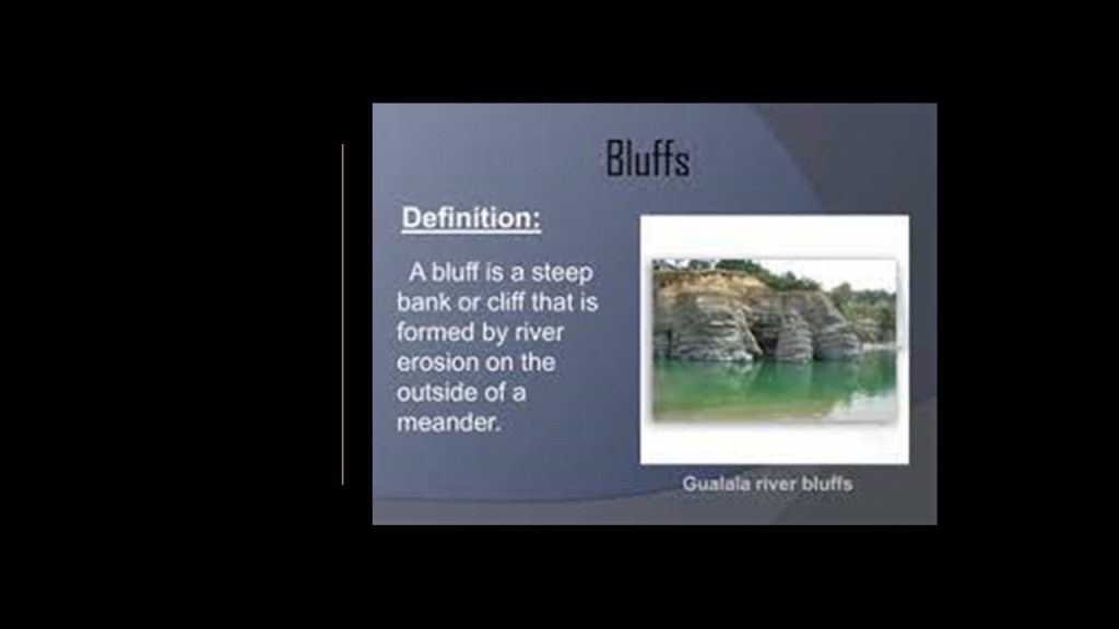
Another meaning of the word “bluff” is a deception, or an attempt to deceive.

Like the star forts and batteries on small islands we saw earlier in this post in the Bay of Biscay in the Pertuis d’Antioche straits on and around the Ile d’Aix and the Ile d’Oleron…
…the Chateau d’If is located on the small island of the Ile d’If, which is 7/8th of a mile, or 1.5-kilometers offshore of Marseille.
It was said to have been built in the 16th-century, and later served as a prison until the end of the 19th-century.
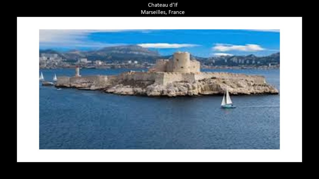
Malta in the Mediterranean Sea, located between Sicily and the coast of North Africa, is one place on the Earth that I can think off the top of my head that is known for its mysterious “cart ruts” leading into, and under, the water.
And that’s exactly what they are referred to as ~ “ruts.”
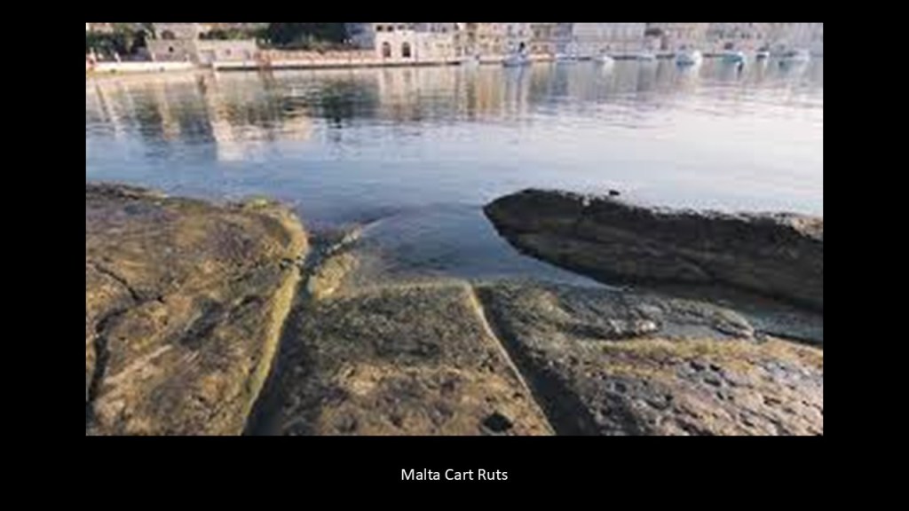
Ruts are defined as “a long, deep track made by the repeated passage of the wheels of vehicles.”
Like the ruts you encounter on unpaved roads.
Just leaving all this here as something to think about, along with everything else.
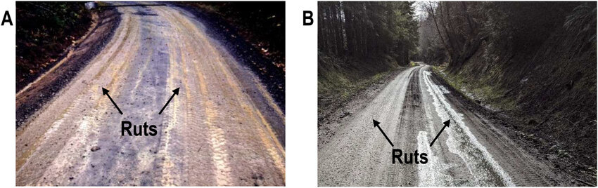
Bundabah is 97-miles, or 156-kilometers to the northeast of Sydney on the east coast of Australia.
The photo from Bundabah on the left shows what appears to be megalithic stone work going downwards into the water that is visible at low tide, like what is found in Malta.
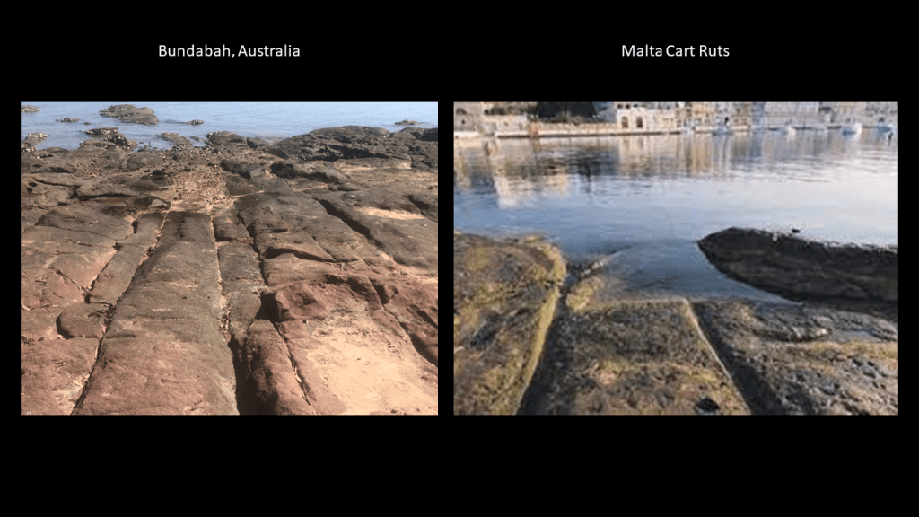
As found everywhere else, the continental shelves of Australia are broad and shallow, and extend out for quite a distance from the landmass before reaching deep waters.
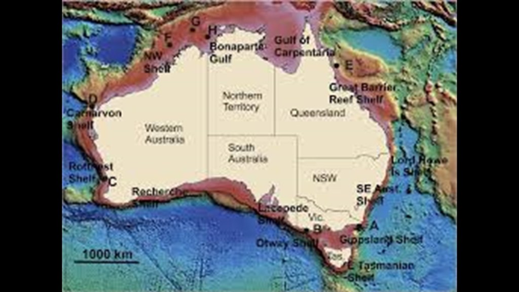
Here’s a photo of what appears to be something man-made going down in to the water in the Torres Strait Islands, a group of at least 274 small islands between Australia’s Cape York and New Guinea.
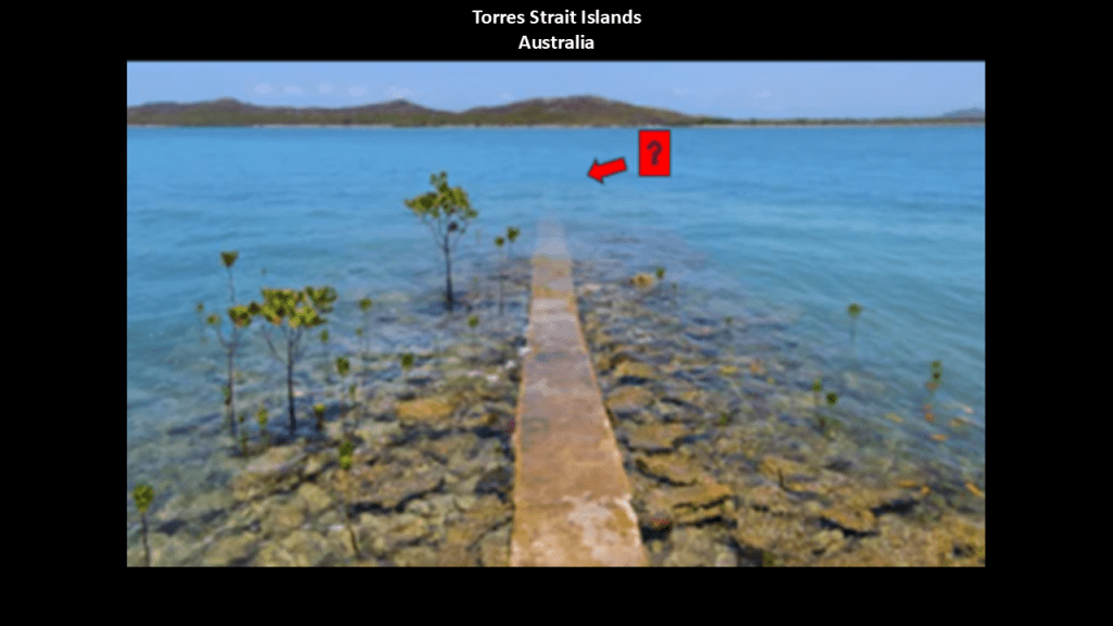
Now back to the pyramid alignment where it goes through the Mediterranean Sea.
In this part of the post where the alignment crosses over land in southeastern Corsica; across the toe of the boot of the Italy near Sicily; and goes right by the western edge of the island of Crete, I am going to look at these places more generally rather than at specific places on the alignment like I have been doing across France because there are some noteworthy points of information I would like to bring forward about these places.
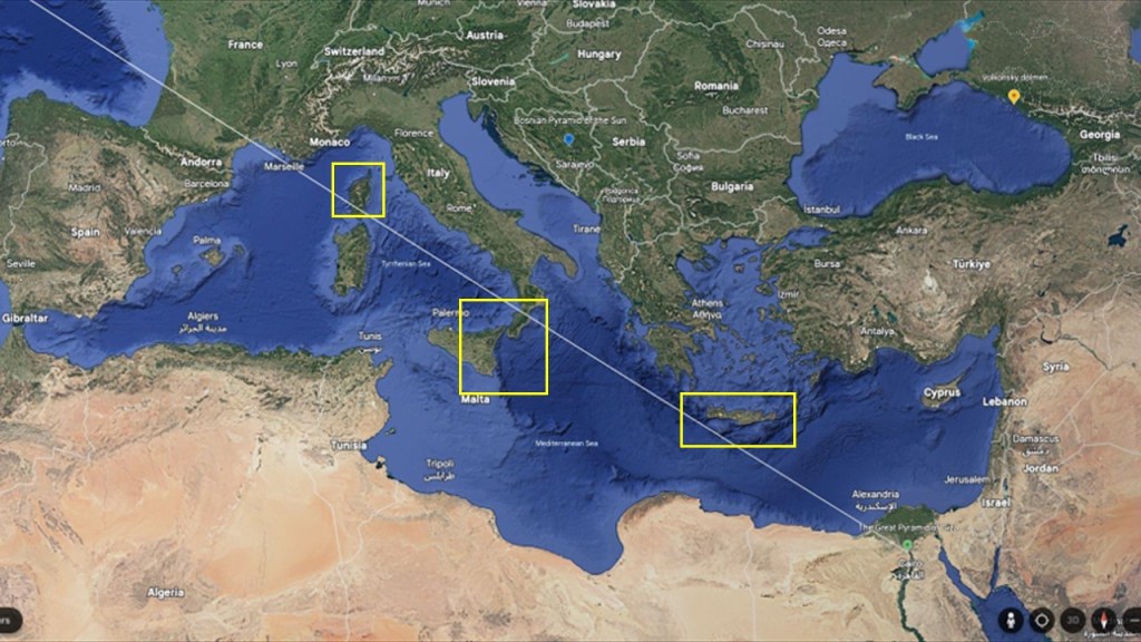
First, Corsica.
The island of Corsica is one of the eighteen regions of France.
It is separated from the coast of Italy to the north by the Ligurian Sea; from Italy to the east by the Tyrrhenian Sea; to the west of it is the Mediterranean Sea; and just to south of it is the larger island of Sardinia, one of the twenty regions of Italy.
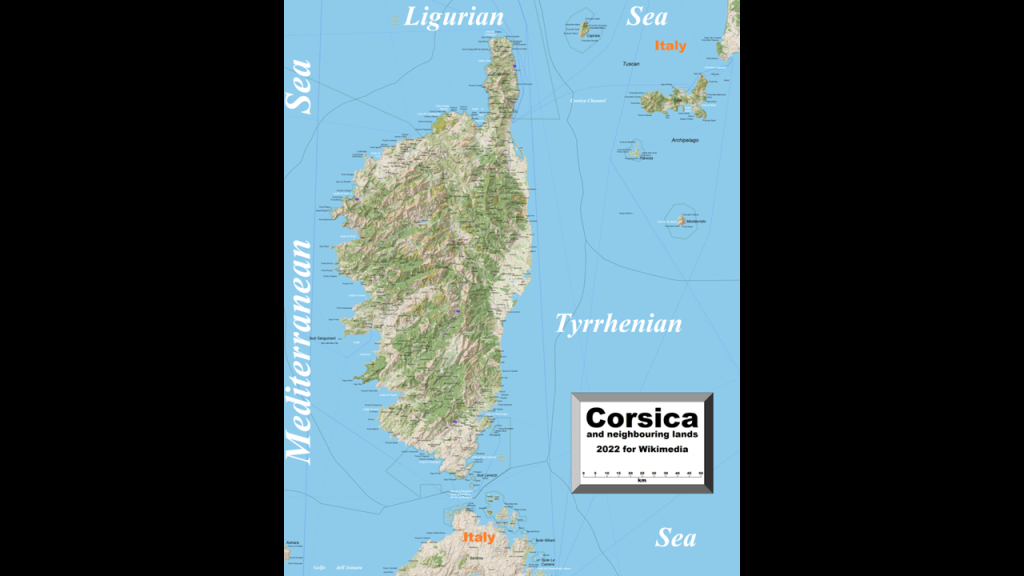
Like what we have already seen along coastlines, the bathymetry of the Ligurian Sea region includes a continental shelf and steep underwater canyons rapidly sloping down to the seafloor.
The floor of the Ligurian Sea is characterized as featuring active erosion and sediment mass landslides, particularly in the canyons.
Eddies are common features off the northwest coast of Corsica in the Ligurian Sea.
Eddies are circular currents of water, and in this location typically have an intermediate size range of 20 – 50-kilometers, or roughly 12 – 31-miles, and caused by the interaction with the water flow, seabed, and other currents.
The example shown here is of an anticylonic eddy that is 12-miles, or 20-kilometers from the coast with a radius of 10-miles or 16-kilometers.
Anticyclonic eddies rotate in athe opposite direction of the prevailing winds in their hemisphere.
What we are told about Corsica in the accepted modern scientific paradigm is that it was formed about 250 million years ago with the uplift of a granite backbone on its western side.
Then about 50-million years ago, sedimentary rock was pressed against this granite, forming the schists on the eastern side.
It is the most mountainous island in the Mediterranean, and called a “mountain in the sea.”
Corsica is separated from Sardinia to the south of it by the Strait of Bonafacio, which has a width of 6.8-miles, or 11-kilometers at its narrowest point.
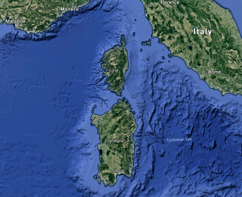
The flag and Coat-of-Arms of Corsica have a single Moor’s Head on a white background.
The flag and Coat-of-Arms of Sardinia is virtually identical to that of Corsica, except it has four Moors’ Heads on a white background separated into quarters by a red cross.
Interesting that there is information like this to be found tacitly in flags, because otherwise we have no information about the true identity of the ancient advanced, Moorish civilization missing from our collective awareness.
The one thing I will mention about Sardinia here is that it is known for its Nuraghe, the main type of ancient megalithic edifice found here.
While they are called tower-fortress-type structures, these too have astronomical alignments.
The only time I have specifically done research on Corsica in the past was for the “Advanced Engineering of Reservoirs & Hydro-Electric Projects – Part 2 Europe, Africa, Asia, and the South Pacific.”
In Part 1 of this two-part series, I looked at reservoirs and hydroelectric projects in Canada and the United States.
In both parts of this series, among other things, I brought forward their characteristics of advanced engineering which do not fit our historical narrative.
I looked into what Corsica has in the way of dams and reservoirs because I was intrigued that it showed up on this map of the dams and reservoirs on rivers in Europe, and found out there are a lot more in Corsica as well than one dot on the map would indicate.
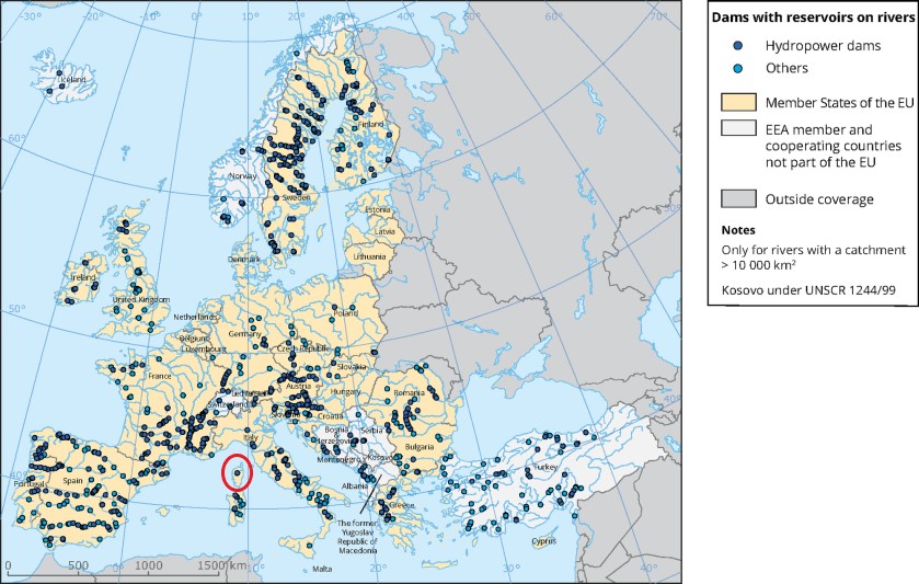
Here is a listing of dams and reservoirs in North and South Corsica.
Here are some examples of what is found in South Corsica:
The Tolla Dam in the Prunelli Gorge was said to have been built between 1958 and 1960.
It is a concrete, curved gravity, and hydroelectric dam, and impounds the Prunelli River.
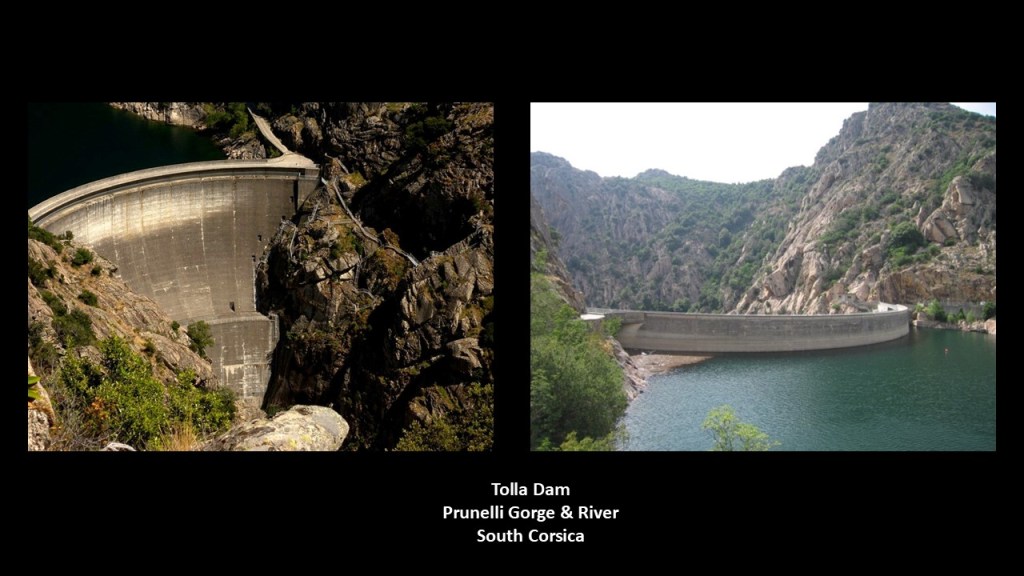
There is also the L’Ospedale Dam, which supplies drinking water to the very southern part of Corsica.
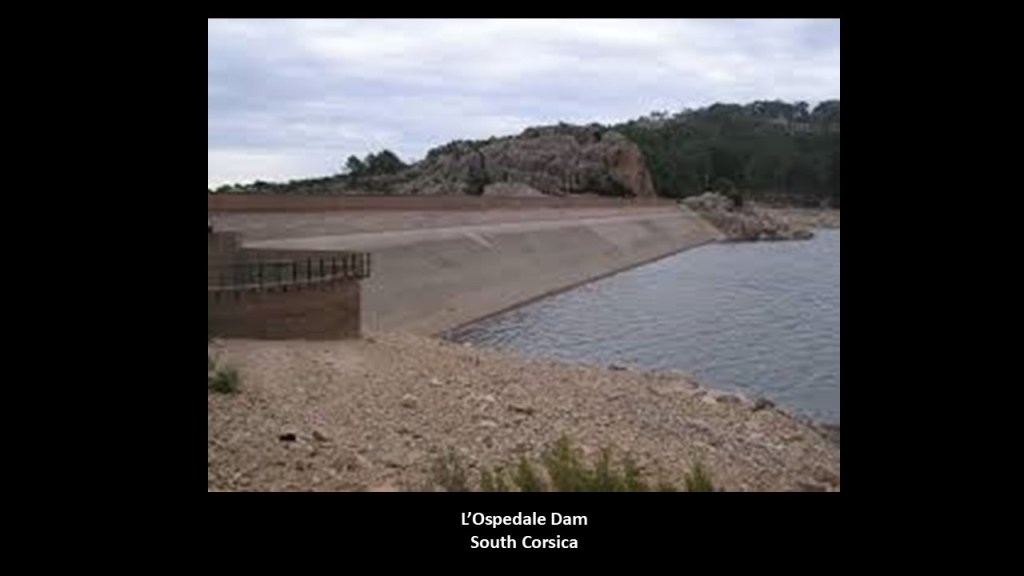
Here is L’Ospedale Lake, with its submerged tree stumps.
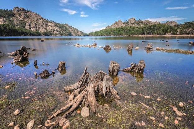
…and all part of L’Ospedale Massif, and massifs are defined as compact groups of mountains containing one or more summits…
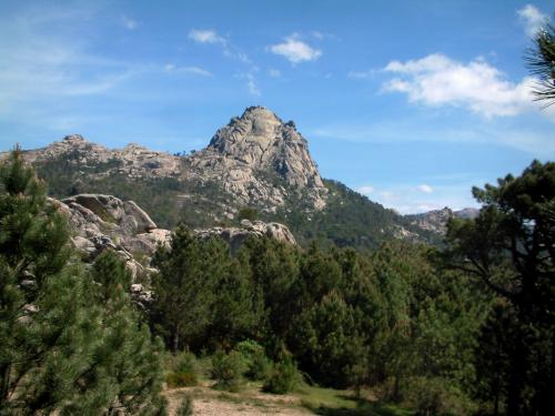
…where we also find waterfalls like this one on the top left that looks like what we see on the Hawaiian Island of Molokai on the top right; on the island of Agattu, one of the westernmost islands in the Aleutians, on the bottom left; and the Mandhab Kunda waterfall, one of the highest in Bangladesh.
I have found the same style of waterfall in different places all pver the Earth, around the world, from, from small to large.
I believe that waterfalls were an integral part of the Earth’s original energy grid.
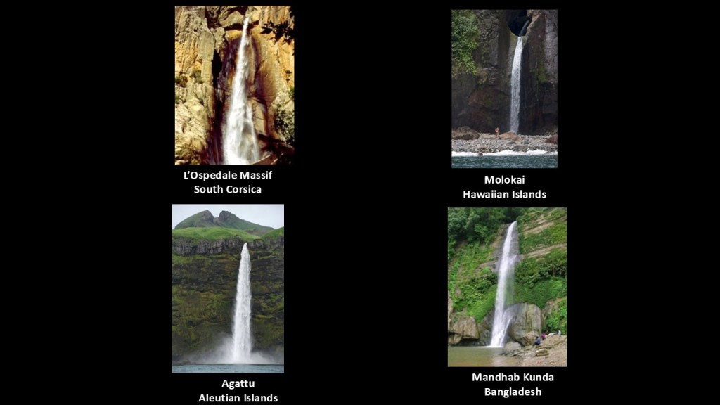
I explored this subject in depth in my blog post “Of Railroads and Waterfalls and other Physical Infrastructure of the Earth’s Grid System.”
There is also at least one balanced rock found at the L’Ospedale Massif, examples of which are also found all over the Earth, like the Kummakivi Balancing Rock in Finland.
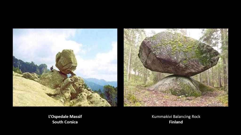
Napoleon Bonaparte was the most famous son of Corsica in our historical narrative, where he was born in 1769, in Ajaccio, the capital and largest city of Corsica.
Ajaccio is located just a short distance northeast of where this alignment enters Corsica, as is the Napoleon Bonaparte Airport, also highlighted by a yellow box in this screenshot.
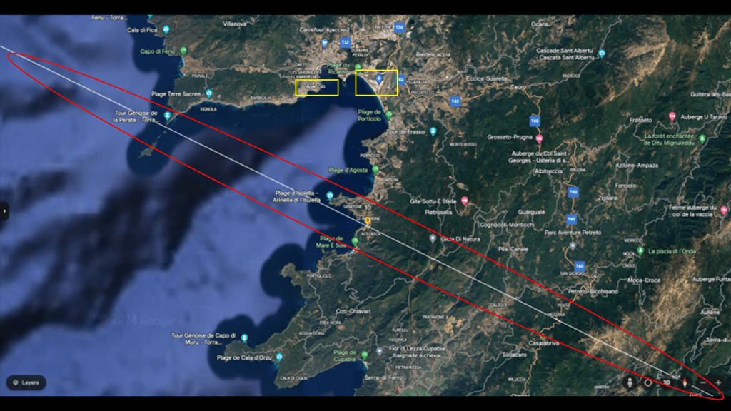
It is significant to note that the historic Ajaccio Citadel, also known as star fort, and lighthouse are situated right next to the Gulf of Ajaccio…
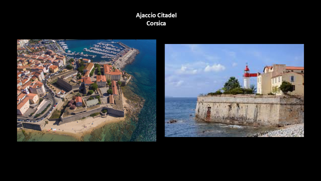
…and that there was an historic rail network on the island, including lines that run along the coast, as well.
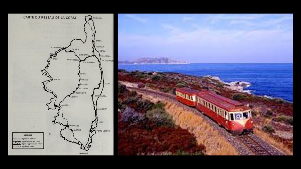
Napoleon rose to prominence in the French Revolution that took place between 1789 and 1799, and led a series of military campaigns across Europe during the French Revolutionary and Napoleonic Wars in the years between 1796 and 1815.
The Napoleonic Wars were a series of major conflicts between Napoleon’s France and a fluctuating array of European coalitions betwee 1803 and 1815 across continental Europe before Napoleon and the French Empire was ultimately defeated.
More often than not Napoleon is portrayed with his right-hand tucked into his waistcoat, which is a well-known Freemasonic handsign signifying “Master of the Second Veil and the easiest way to identify whether or not a historical figure was a Freemason.

Napoleon was crowned “Emperor of the French” in 1804.

Napoleon’s historic presence was significant in the region of the Mediterranean Theater of the Napoleonic Wars and I will share some examples of my findings of this from my past research of alignments as I go through the region.

I’ll say here before I continue that I believe that Napoleon and the Napoleonic Wars were major players in the early years of the reset of our historical narrative for the New World Order, which was built upon the recently ruined Old World, and set the stage the justification for taking the land of other nations after he lost who had been pro-Napoleon; for the rise of the modern nation-states and the British Empire, as well as for the future world conflicts and wars between nations.
I also believe, like with other wars and conflicts of our modern era, what we are taught was going with them on was far different from what was really happening.
For example, the Congress of Vienna was said to be one of the most important international conferences in European history.
It was a meeting of ambassadors of European states held in Vienna in Austria between 1814 and 1815 in order to remake Europe after the downfall of Napoleon.
The stated goal was to re-size the main powers so they could balance each other and in this way remain at peace, and not simply to restore old boundaries.

As a result of the Congress of Vienna, France lost all of its recent conquests, while Prussia, Austria, and Russia made major territorial gains.
Most of the discussions took place in informal, face-to-face sessions among the ambassadors of Austria, Britain, France, Russia, and sometimes Prussia, with limited or no participation by other delegates.
As such, the so-called Congress of Vienna never met in plenary session, which means a session in which all members of all parties are able to attend

Next, I am going to look at the Tyrrhenian Sea.
It is bounded to the west by Sardinia and Corsica; to the north and east by the Italian Peninsula; and to the South by Sicily.
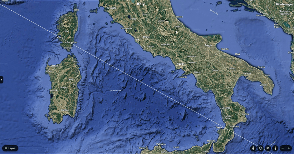
It is named for the Tyrrhenian people, who were identified with the Etruscans of ancient Italy.
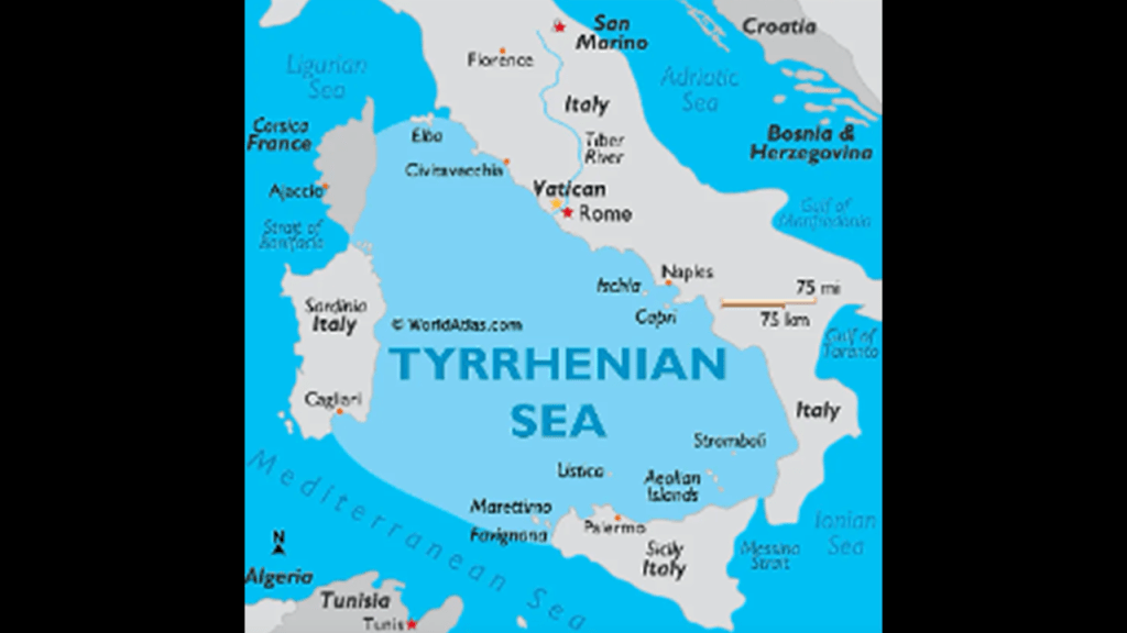
The Etruscans are a bit of a mystery in our historical narrative, but we are told that they were known for their advanced civilization in Italy until it was supplanted by Rome in the first-century BC.
And there is polygonal megalithic masonry found throughout Italy that is identical to that found in other places all over the Earth, like in this example of Peru.
Polygonal masonry, also known as cyclopean masonry, was a construction technique where large polygonal stone blocks of irregular shapes were joined together seamlessly without mortar.
The bathymetry of the Tyrrhenian Sea is varied and complex, with continental shelf areas, abyssal plains, tectonic movements, volcanic seamounts and volcanic island chains.
The pyramid alignment heads across the Tyrrhenian Sea and enters into the toe of the boot in the Calabrian region of Italy, right beside the Aeolian Islands, which are a volcanic group of islands that are listed as a UNESCO World Heritage Site.
The seven main inhabited islands of the Aeolian Islands are Lipari, Salina, Filicudi, Alicudi, Panarea, Vulcano, and Stromboli, along with smaller uninhabited islands and rocky places found here as well.
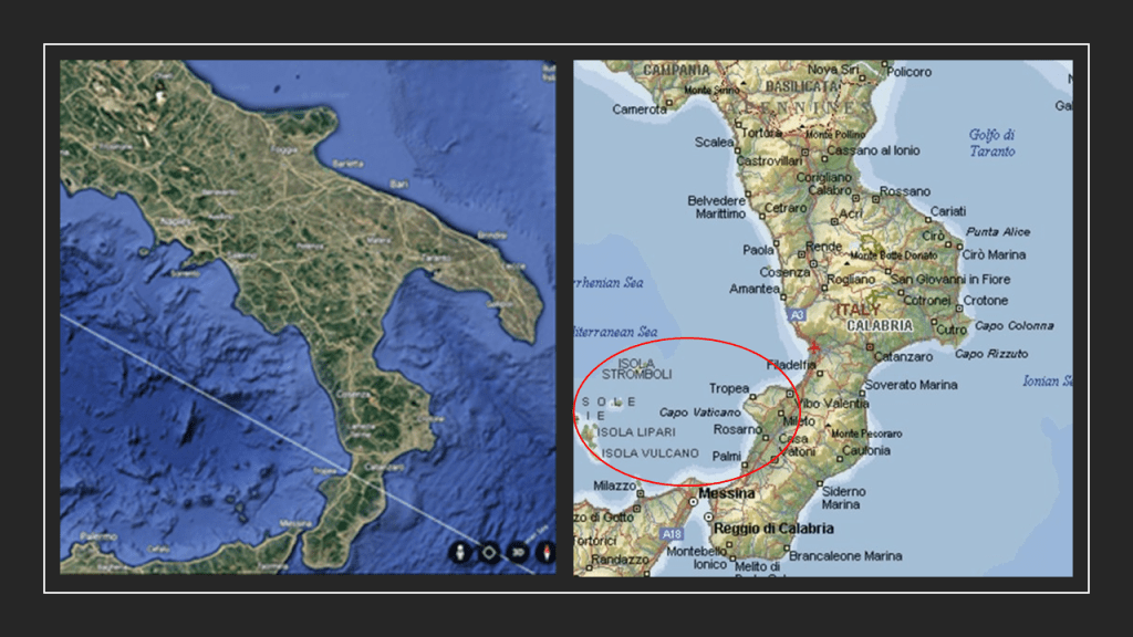
These seven volcanic islands cover an area of 620-square-miles, or 1,600-kilometers-squared, and there is a series of underwater volcanoes as well, the formation of all of which are attributed to volcanic activity over 260,000-years.
The Aeolian Islands rise from the Tyrrhenian Basin, which is characterized as a sedimentary basin, in which subsidence has occurred and thick sequences of sediments have accumulated to form layers of sedimentary rock.
Of the seven main islands, two have active volcanoes – Vulcano and Stromboli.
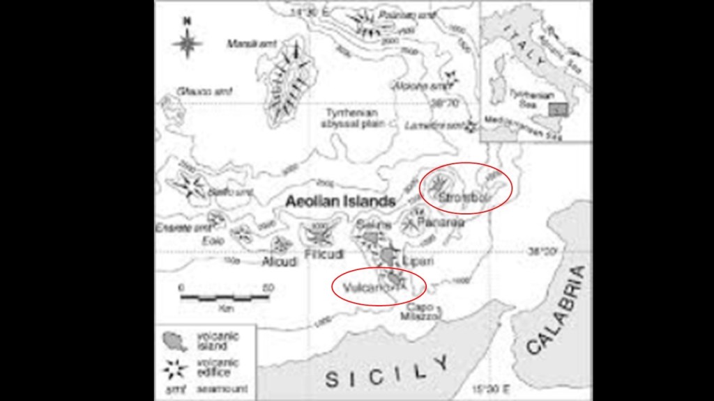
The last eruptions of the volcano on Vulcano Island took place between 1888 and 1890.
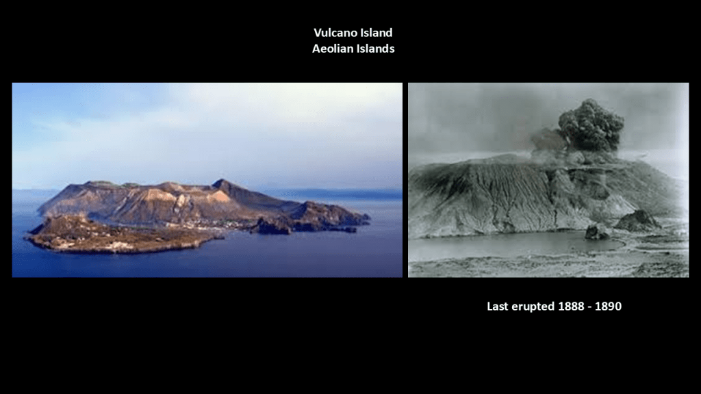
The volcano on Stromboli, however, has erupted many times and is constantly active with minor eruptions, giving it the nickname “Lighthouse of the Mediterranean.”
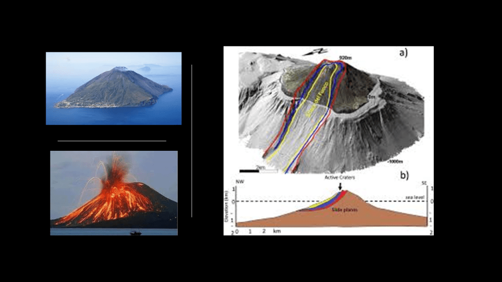
What we are taught is that these places with above-water and underwater volcanoes, called “hotspot tracks,” are regions of the Earth’s mantle where magma arises from within the Earth and forms volcanoes on the crust above when a tectonic plate moves over a stationary plume of hot mantle material, or hotspot, deep within the Earth.
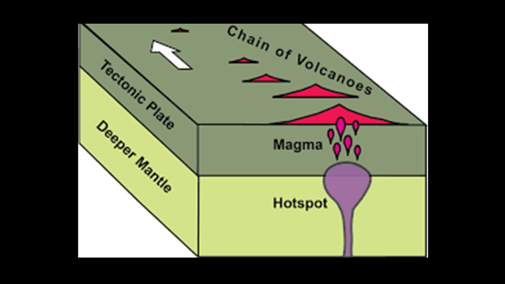
The bedrock foundations of our modern scientific paradigm, referring to the solid rock foundations that our scientific worldview is founded upon and the only one that has been taught to generations of students in our educational systems and not to be questioned, can be summarized follows.
So this carries over directly into what the accepted science of our day tells us causes volcanic activity, and earthquakes for that matter – that it’s connected to active tectonic settings where tectonic plates move or interact, like in subduction zones where plate boundaries meet.
Everything perfectly, neatly, and nicely explained in one package.
Now I am going to show how these hotspot tracks might have a different explanation, and that they are quite possibly representatives of a once-existing world-wide system of Giant Trees that were connected to each other by magma streams and hydrothermal systems on the Earth’s energy grid system instead of the standard explanation we are given by the modern scientific paradigm.
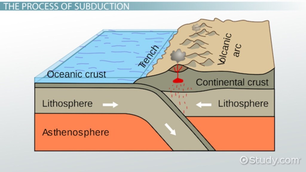
I am going to start with Jules Verne’s classic 1864 novel “A Journey to the Center of the Earth,” in which the central figure, Professor Otto Lidenbrock, an eccentric German scientist, had reason to believe there were “volcanic tubes” that reach the center of the Earth after reading an original runic manuscript of an Icelandic saga and a note he found in runic script from a 16th-century Icelandic alchemist saying it was possible by journeying down the crater of Snaefellsjokull, a large stratovolcano in Iceland said to be one of seven great energy centers of the Earth and an entrance to Inner Earth.
The professor, his nephew and an Icelandic guide rappel down the Snaefellsjokull crater and find themselves in a strange underground world where they contend with many dangers, like caverns and rockslides, an underground river, an underground world with an ocean, a vast ceiling with clouds, and a permanent, light-giving aurora.
They eventually left this subterranean world via a volcanic chimney that ejected them from the Stromboli volcano in the Aeolian Islands, and there is a distance of 2,374-miles, or 3,821-kilomter between Stromboli and Snaefellsjokull.
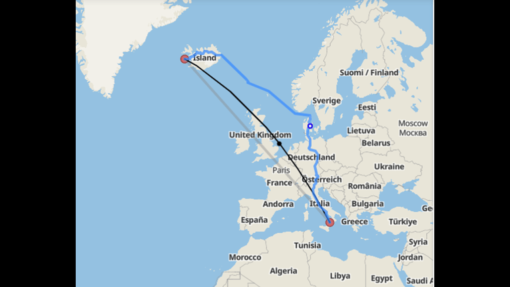
Next, a look at Athanasius Kircher, Sir Isaac Newton, and Alexander von Humboldt.
Athanasius Kircher was a German Jesuit who published somewhere around 40 major works of comparative geology, religion and medicine.
In 1665, he published the “Mundus Subterraneus,” depicting Earth’s geography through text and drawings, and attempts to describe the structure of the Earth from a physical and chemical standpoint.
He delved into such subjects as oceanic currents; volcanoes; thermal springs; and mineralogy and mining.I believe that Jesuits like Kircher were deeply-involved in the revisionist history and science that gave us what we are taught in school today, and which covers up the True History of the Earth.
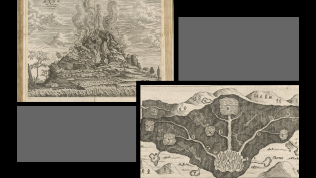
This illustration from “Mundus Subterraneus” seems to be showing trees on a grid pattern connected by a root system exploding simultaneously.
If that is actually what this is depicting, it would account for why we don’t recognize them as giant trees any more.
Around the same time that Athanasius Kircher was publishing “Mundus Subterraneus,” Sir Isaac Newton had his initial breakthroughs with his foundational law of gravity in 1665 and 1666.
We are told that Sir Isaac Newton had been developing his theory of gravity as far back as 1665, and that in 1666, Newton famously observed the falling apple upon which he developed his foundational law that gravity is universal, incorporating the idea that Kepler’s Laws must also apply to the orbit of the moon around the Earth and then to all objects on Earth.
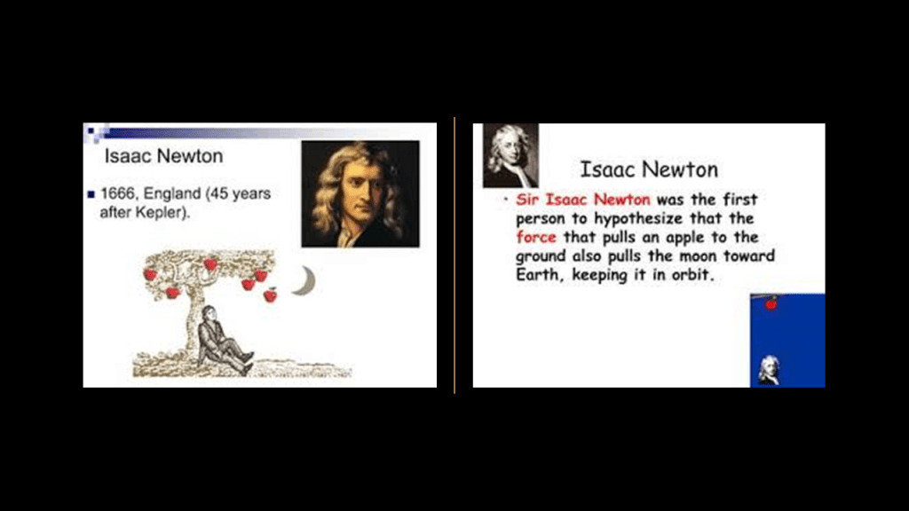
In 1609, the German astronomer Johannes Kepler had published his “Laws of Planetary Motion,” in which he described the orbits of planets around the sun, and his work further backed-up the now-only-accepted Copernican model by the scientific establishment of the Earth spinning on its axis in a heliocentric universe.
Kepler’s work was said to have improved the 1543 model of Copernicus by introducing more defined terminology for the orbits of the planets around the sun instead of just saying that’s what they do.
Then in 1687, Sir Isaac Newton published his “Principia,” in which he combined his own laws of motion with new mathematical analyses to explain Kepler’s empirical results in the form of a law of universal gravitation in which any two objects are attracted by a force proportional to their mass and inversely proportional to their separation squared, further codifying these scientific explanations.

The scientific study of the Earth’s magnetic field is called geomagnetism.
Our current scientific paradigm tells us that the Earth’s magnetic field is generated through a process known as “geodynamo” by electric currents due to the motion of convection currents of a mixture of Earth’s molten iron and nickel in Earth’s outer core and connected to the Earth’s rotational axis.
Next, Alexander von Humboldt was a Prussian naturalist and explorer who had the one of the world’s pre-eminent universities in the study of Natural Sciences in the 1800s and 1900s named after him and his brother Wilhelm, the Humboldt University in Berlin.
Famous faculty and alumni of Humboldt University included such famous names in our current historical narrative, besides the previously mentioned Alfred Wegener of Continental Drift fame, include: the theoretical physicist Albert Einstein; Karl Marx and Friedrich Engels, c0-collaborators on “The Communist Manifesto;” Otto von Bismarck, first Chancellor of the German Empire; Georg Hegel, whose philosophy gave us the “Hegelian Dialectic” of Problem-Reaction-Solution; and the Brothers Grimm, best-known for their fairy tales such as “Little Red Riding Hood and “Hansel and Gretel.”
Alexander von Humboldt is considered one of the founders of the science of geomagnetism, having studied in great detail the systematic change of magnetic field strength with distance from the equator and initiated synchronized magnetic field observations across the Earth, and he made significant contributions to the charting of the Earth’s geomagnetic field, measuring isodynams between 1790 and 1830.
The definition of isodynam, or isodynamic, is connecting points on the Earth’s surface that have the same magnetic intensity, as opposed to geodynamic, the study of dynamic processes and forces within the Earth occurring on a large-scale and affecting the Earth’s crust, including mantle convection and plate tectonics.
I think Alexander von Humboldt was measuring what was left of the Earth’s magnetic field at former giant tree locations, and we have been given an incredible amount of false science to cover everything up.
More on this in a moment.
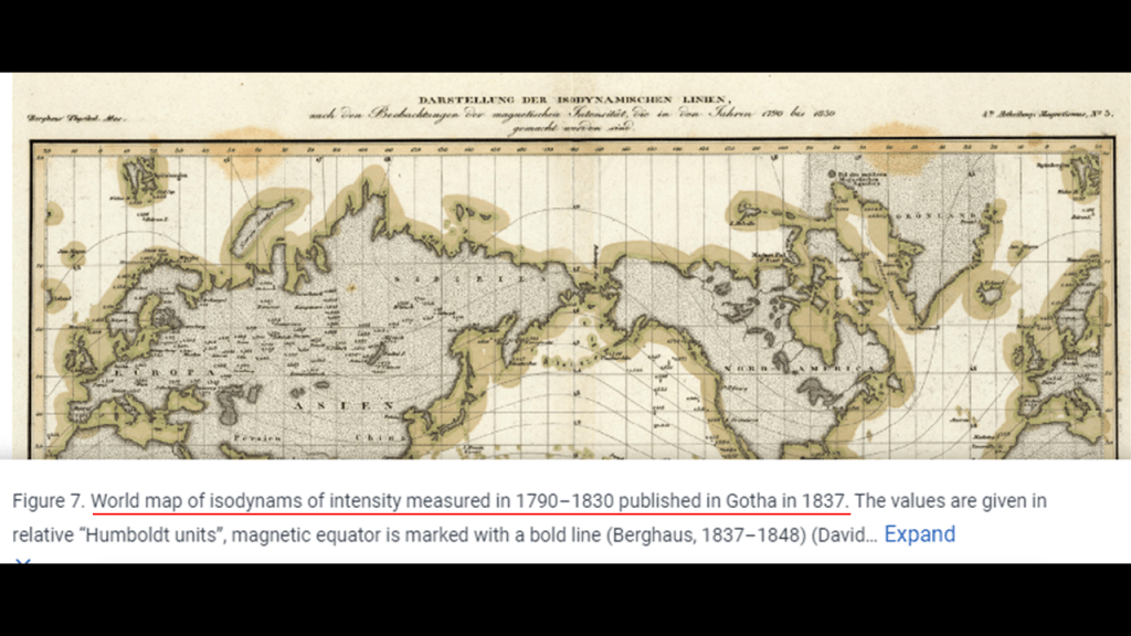
Around the same time Alexander von Humboldt was mapping and measuring isodynams, and the same time the Napoleonic Wars were taking place in Europe, major explorations around the world were taking place, like between 1801 and 1803, Capt. Matthew Flinders led the first in-shore complete navigations around mainland Australia…
…and the Lewis and Clark Expedition between 1804 and 1806.
I believe these explorations and others that took place primarily from the beginning of the 1800s to around 1850 or so were of a post-cataclysmic world, in which different European countries were engaged in exploring and claiming landmasses for their respective countries, and also remote islands and island groups all over the Earth that were actually the remnants of giant trees and sunken landmasses, and annexing them as “Overseas Countries, Territories and Outermost Regions.”
As a result of this process of colonization of the entire surface of the Earth, seemingly insignificant islands and island groups were the subjects of territorial disputes between countries, most of which are still on-going in the present day.
All of these places and islands are viewed as highly-coveted prizes, and as a critical part to nation-building plans.
Why?
I definitely think there is much more to the story that we are not being told, especially with regards to the once-existence of giant trees on Earth that were integral to the Earth’s grid system, and the reason has been deliberately hidden from our view.
I have come to believe as a result of my research that the giant trees were generating the Earth’s magnetic field, and not the “geodynamo” process accepted by mainstream science connected to the interaction of the Earth’s rotational axis with the molten iron and nickel in the Earth’s outer core.
I believe this is why volcanoes and seamounts are on Airline flight trackers, and are for navigational purposes and not for entertainment alone.
I gave the example earlier in this post of finding information about magnetic declination for “San Luis Tecuautitlan” in Mexico, a town on Cerro Gordo-Tonantépetl which is an inactive volcano, and that this information is necessary for the navigation of aircraft because it determines the angle between true north and magnetic north at a specific location on Earth.
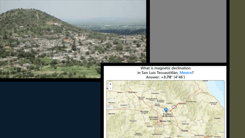
And I can’t help but wonder if the Athanasius Kircher illustration on the left and the imaging map of the Earth’s hotspots on the right are connected to each other.
There is one more thing about the Aeolian Islands that I want to mention here.
The islands are named after Aeolus.
Aeolus was the keeper of the winds encountered by Odysseus in the Greek poet Homer’s “Odyssey.”
Zeus, the chief deity of the Greek Gods, gave Aeolus the ability to still or rouse whatever wind he wanted to.
Aeolus was the king of Aeolia, described as a floating island surrounded by a “wall of unbreakable bronze” where the “cliffs run up shear.”
In the Odyssey, King Aeolus gave the warrior-king Odysseus a bag of strong winds containing all the winds except the gentle west wind on his way home to Ithaca from the Trojan War, a journey that took him 10-years, and in which he encountered many trials and tribulations.
When Odysseus and his men were almost home, his men opened the bag of winds thinking the bag contained treasure, and instead they were blown all the way back to Aeolia, at which time King Aeolus sent them on their way with no further help.
In the Roman poet Virgil’s “Aeneid,” Aeolus keeps the winds contained in a cave on Aeolia.
I find these points of information noteworthy, about Aeolus, the Keeper of the Winds, and the Aeolian Islands because of the two cold, blustery winds I have encountered thus far just looking at the Mediterranean Sea part of this alignment that cause violent weather in the Gulf of Lion off the southern coast of France – the Mistral and the Tramontane.
Come to find out there is a whole bunch of winds that affect the Mediterranean region.
One of them, the Sirocco wind, is a described as a warm, humid Mediterranean wind that comes from the Sahara, and can reach hurricane speeds in North Africa and Southern Europe, especially during the summer months.
Next, I am going to look at the Strait of Messina, a narrow strait between the eastern tip of Sicily and the western tip of Calabria in Italy very close to this location near where the pyramid alignment crosses the Aeolian Islands and the toe of the boot of Italy.
The bathymetry of the Strait of Messina is characterized by a shallow central area around it’s narrowest point; it is marked by the Messina Canyon at the bottom; there are intense erosional and sedimentary depositional processes here; and there are strong tidal currents as well..
The narrowest point of the Strait of Messina is between the Punta del Faro in Sicily on the left, where you can see a flat surface just underneath the water and megalithic stone blocks jumbled up in the area and the Punta Pezzo in Villa San Giovanni in Italy’s Calabria region on the right.
At the most northeastern point of Sicily, where the Ionian Sea meets the Tyrrhenian Sea, Punta del Faro, or lighthouse point, was supposedly the lair of Charybdis, one of the two beautiful women who had been turned into grotesque monsters by jealous goddesses in Greek mythology.
In one version of the myth, Charybdis would partially hide herself beneath a fig tree there, and would frequently leap out into the sea in order to swallow huge quantities of water, creating a whirlpool that would suck down passing ships, and she would belch the water up afterwards.
Garofalo whirlpools, otherwise known to the world as Charybdis, are found in the Strait of Messina.
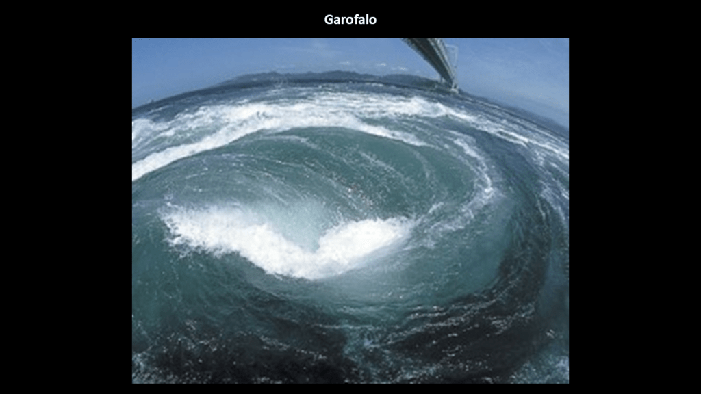
Whirlpools are caused by the interaction of opposing water currents, which create a turbulent flow that result in a rotating vortex and are known to occur where coastal and bottom configurations have, among things, narrow passages of deep depth.
They are large-scale eddies like what we saw earlier back off the northwest coast of Corsica in the Ligurian Sea.
I strongly suspect places like these examples in the Strait of Messina and the Ligurian Sea have whirlpools created by broken, craggy, underwater topography due to the presence of fractured landmasses right below the surface of our oceans and seas all over the Earth.
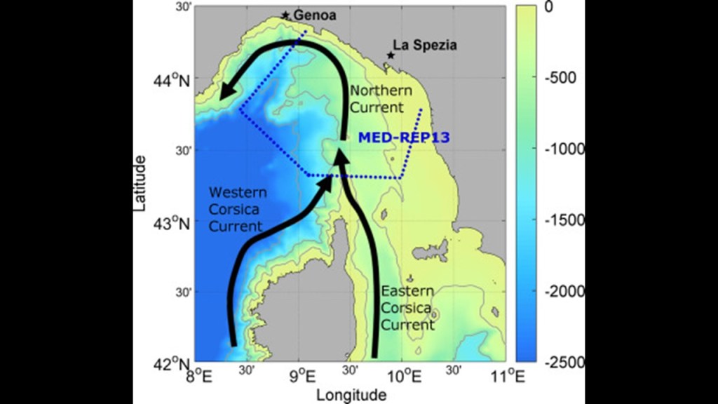
Just a short distance north of Calabria’s Punta Pezzo across the Strait of Messina from Sicily’s Punta del Faro, we find the Ruffo Castle of Scilla, described as an ancient fortification, and situated on a promontory in the Strait of Messina in the town of Scilla.
It houses the Scilla Lighthouse.
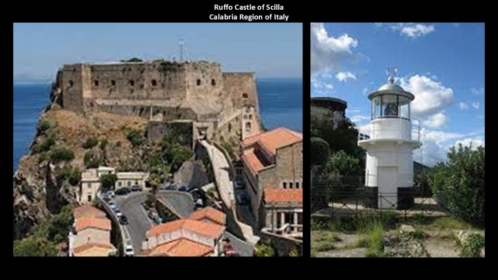
Scilla is also the traditional site associated with the sea monster Scylla of Greek mythology, with its location right at the entrance to the Strait of Messina.
The linguistic idiom “between Scylla and Charybdis” means having to choose between two similarly dangerous situations, like the more common idiom “between a rock and a hard place.”
This part of Calabria in the toe of the boot of Italy at the Strait of Messina was a focal point for Napoleon Bonaparte’s conquests during the Napoleonic Wars.
Napoleon’s forces conquered Calabria in 1806 and he made his older brother, Joseph-Napoleon, the King of Naples and Sicily between 1806 and 1808, who we are told, implemented administrative reforms in 1806 that abolished the ruling system that was in place here, and the Lordship of Fiumara disappeared.
Then, starting in June of 1810, we are told the new King of Naples, Joachim Murat, and the brother-in-law of Napoleon, ruled the southern Kingdom from this part of Calabria for four months, and during that short period of time he was given the credit for having built the fort of Punta Pezzo on the left; the Castello Altafiumara on the top right; and the Torre Cavallo on the bottom right.
Messina in Sicily is right across the Strait from this part of Calabria.
It is a major port city.
We are told that the Forte del Santissimo Salvatore located at the port’s entrance was built in the 16th-century.
The Stele of the Madonna Lettera, erected on the fort, was said to have been consecrated and inaugurated in 1934.
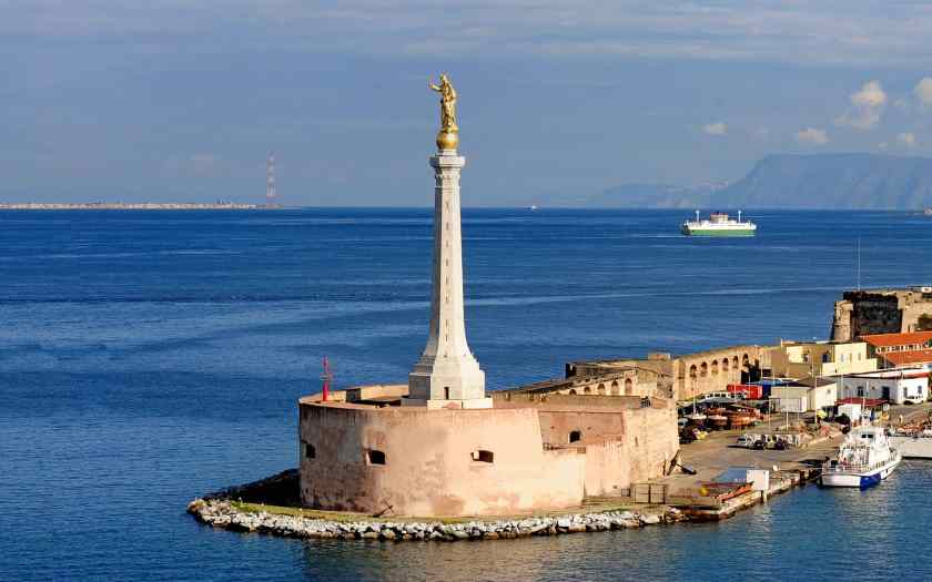
Mount Etna is located on th east coast of Sicily, southwest of the Strait of Messina.
It is located between the cities of Messina and Catania.
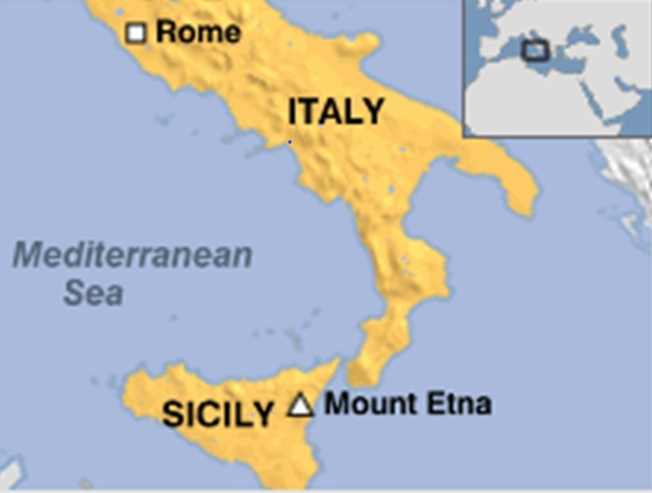
It is a stratovolcano that is one of the most active in the world, and is in an almost constant state of activity.
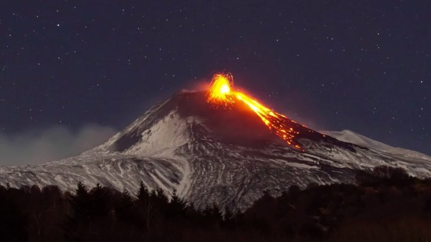
Mythology associated with Mount Etna is as follows.
Mount Etna was where Zeus trapped the giant Typhon.
Typhon was the son of Gaia (Earth) and Tartarus, a deep abyss in the underworld, known as the world of the dead, located beneath Mount Etna, used a dungeon of torment and suffering for the wicked, and the location where the Titans were imprisoned, the pre-Olympian gods that were overthrown and replaced by Zeus and the Olympians after a ten-year war called the Titanomachy.
Typhon attempted to overthrow Zeus for the supremacy of the Cosmos, and they fought a cataclysmic battle which Zeus won with the aid of thunderbolts, and Typhon was cast into Tartarus beneath Mount Etna.
The thunderbolts of Zeus brought to mind the “brahmastra” in the Mahabharata, a major Sanskrit epic of India, a magical weapon said to have been detonated at the end of the 18-day Battle of Kurukshetra.
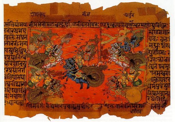
A “brahmastra” was said to have been “a single projectile charged with all the power in the Universe.”

Any target hit by the “brahmastra” would be utterly destroyed; land would become barren and lifeless; rainfall would cease; and humans and animals would become infertile.
The Pandavas were said to have vanquished their enemy, the Kauravas, with the devastating weapon, but the few surviving Pandavas discovered there was nothing left to occupy, and no one left to rule.
The “brahmastra” had turned the region of what is present-day Rajasthan to desert.
Well, to support this, evidence exists that exactly this part of the world was devastated by nuclear war at some point in time.
Perhaps in ancient times like we are told, but I believe this took place much more recently in time…much more recently than we can even begin to imagine.
It is also interesting to note that the feathered-serpent imagery of Quetzelcoatl in Mexico was also present with Typhon, with his serpent lower-body and wings on his shoulders, as well as the melanated skin depicted here in this illustration.
I learned several years ago in a Megalithomania presentation by Antoine Gigal about pyramids around Mount Etna, and I am drawing from her research in the next slides about this obscure subject.
Antoine Gigal is a French writer, researcher and explorer, and the founder of Giza for Humanity who went to Sicily when she heard about 12 pyramids there.
Instead of finding the 12 pyramids she was told about, she found 23 pyramids around Mount Etna, and proceeded to literally do field research, as the pyramids were in the middle of fields.
She found pyramids of different shapes and sizes…
…like an oblong step pyramid between the towns of Passopisciaro and Francavilla, which has a standing stone…
…a rectangular pyramid between Linguaglossa and Randazzo…
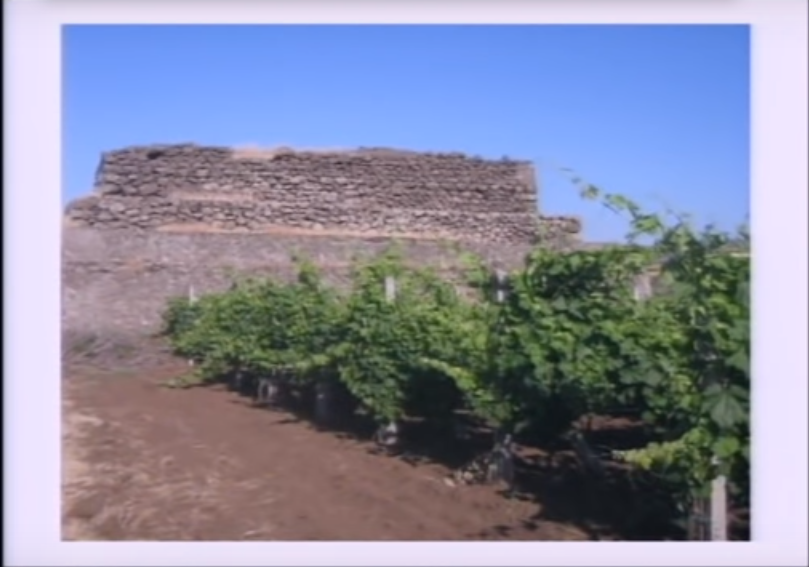
…and this rectangular pyramid on Mount Etna’s north side.
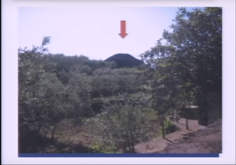
In Antoine Gigal’s presentation, she demonstrates that the construction style of the Sicilian pyramids is like that of the Guimar Pyramids of Tenerife in the Canary Islands in the Atlantic Ocean, and also like that of the pyramids of the island nation of Mauritius in the Indian Ocean.
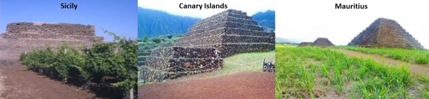
The city of Catania is located at the foot of Mount Etna, and is an ancient port city.
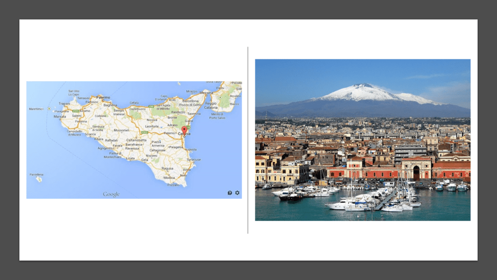
This illustration was said to be of a 1679 eruption of Mount Etna that impacted Catania and also shows what looks to be a star fort around the city or a star city.
Just something to think about here.
Why would a major city like this be built at the foot of a known volcano, and subject to destruction by lava flows, if it has always been a volcano?
Perhaps it was a city built at the base of what was once a giant tree.

It is important to note as well that beneath the surface-level city of Catania, there are several layers of underground cities.
…and an underground river, named Amenano.
The island Republic of Malta is located in the Mediterranean Sea between Sicily and Tunisia in North Africa.
The capital city of Malta is Valletta.
Valletta is a star city, surrounded by star forts.
Napoleon led the French invasion of Malta in 1798, which was part of the Mediterranean Campaign in the War of the Second Coalition of the French Revolutionary Wars.
The Order of the Knights Hospitallers, the rulers of Malta since 1530 in our historical narrative, surrendered to Napoleon when the French landed there.
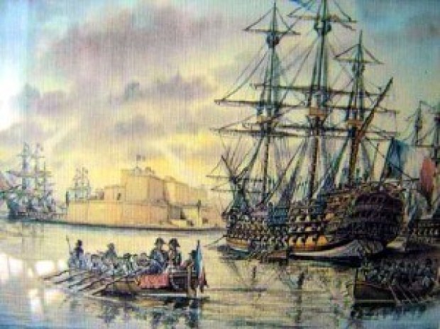
We are told that during the short time Napoleon was in Valletta between June 12th and 18th of 1798, he did such things as reforming, among other things, national administration with the creation of a Government Commission and twelve municipalities; creating a public finance administration, and the organization of public education, and providing for primary and secondary education, all before sailing for Egypt, and leaving a substantial garrison in Malta.
All this in a week?
Why?
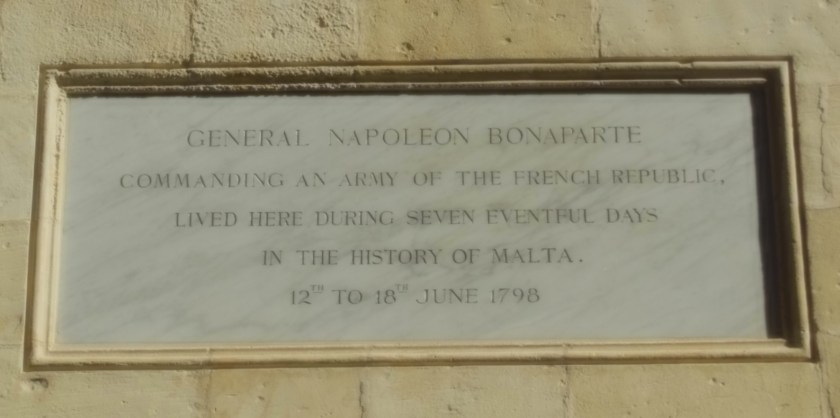
After the British Royal Navy destroyed the French Mediterranean fleet at the Battle of the Nile in Egypt on August 1st, 1798, the British were able to initiate a blockade of Malta, assisted by an uprising of the native Maltese against French rule.
The blockade effectively ended the French Occupation of Malta in 1800, and replaced it with British Protectorate, returning control of the central Mediterranean to Great Britain.
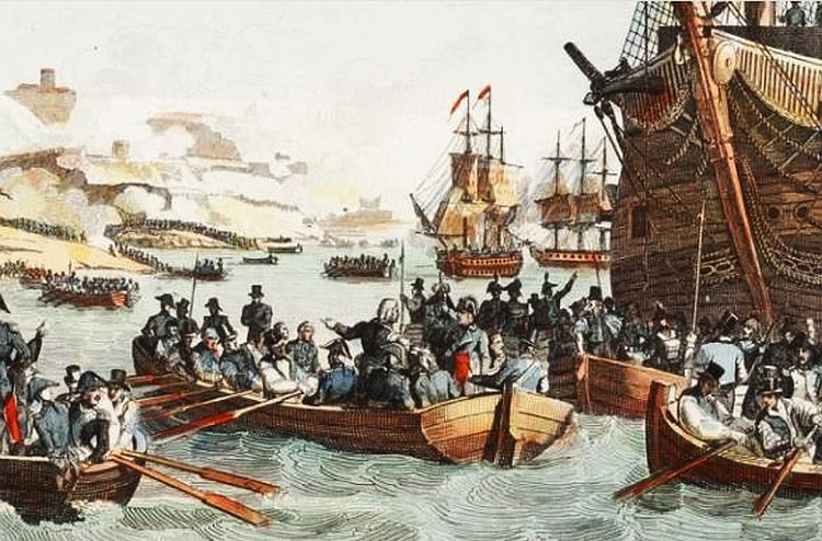
In the 1814 Treaty of Paris, Malta officially became part of the British Empire and was used as a shipping way-station and fleet headquarters.
Malta was also heavily bombed by the Germans and Italians in World War II from June of 1940 to November of 1942, which started the day the British Crown Colony of Malta joined the war on the side of the Allies, and Malta was one of the most intensively bombed areas doing the entire war, with over 3,000-bombing runs and 6,700-tons of bombs dropped in Valletta alone.
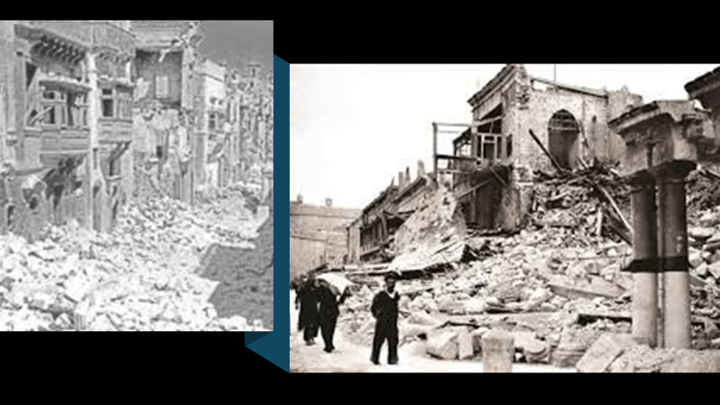
Now I am going to bring forward and apply information that came into my awareness when I was doing the research for the second part of this series looking at the places the pyramid alignment crosses in the United States that has a direct connection to this third-part of the series and this location where the same alignment crosses the Mediterranean Sea.
The Great Dismal Swamp is just a short distance to the northwest of where this pyramid alignment crosses over the area in northeastern North Carolina to Carova Beach in the Outer Banks, where it leaves the continental United States.

I had noticed that the Great Dismal Swamp is the location where the center line of the Pilot Mountain Wheel identified by Peter Champoux enters the continental United States at the latitude of 36-degrees, 30-minutes North, with Pilot Mountain at the center, and the New Madrid Fault on the opposite side of the wheel from the Great Dismal Swamp.
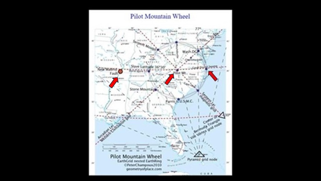
I wasn’t familiar with what the “Slave Latitude” referred to, but this is what I found out about it in a search.
The “Parallel of 36-degrees, 30 minutes” is a circle of latitude that is 36.5-degrees North of the equator, and of particular significance in the United States, especially with respect to the 1820 Missouri Compromise, which prohibited slavery in any new states formed north of this line in the Louisiana Purchase territory, and allowed slavery south of the line, and in our historical narrative, the tensions between free states and slave states was what directly led to the American Civil War.
I am going to look first at the latitude of 36-degrees, 30-minutes in what became the United States.
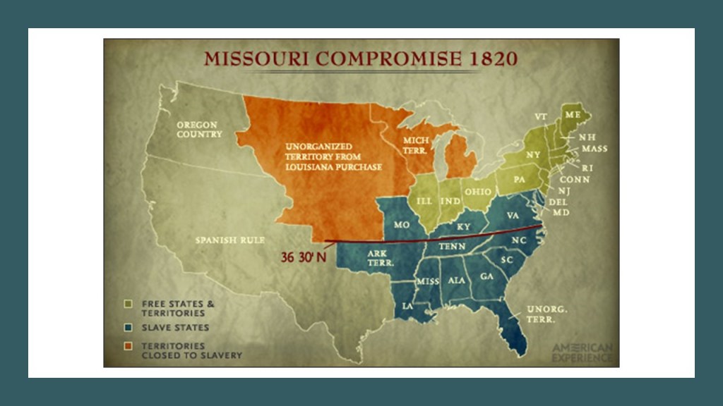
It was based on the Royal Colonial Boundary of 1665, which marked the border between the Colony of Virginia and the Province of Carolina from the Atlantic Ocean westward, and became a boundary for several states as far west as the Oklahoma Panhandle.
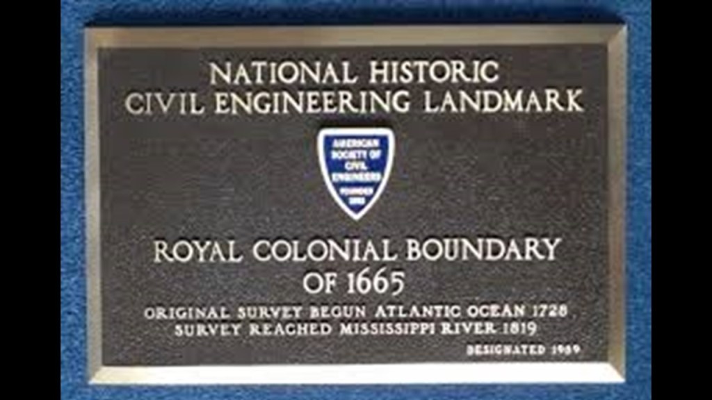
We are told that by 1819, it had been surveyed as far west as New Madrid, Missouri, and the location of the “Kentucky Bend.”
This would have only been seven years after the New Madrid earthquakes.
The “Kentucky Bend” is considered an exclave, or part of, Kentucky that is entirely surrounded by the states of Missouri and Tennessee, that is defined as an “Oxbow loop meander” of the Mississippi River.
The Kentucky Bend was developed as a major cotton-producing area due to its highly productive soil in the river’s flood plain.
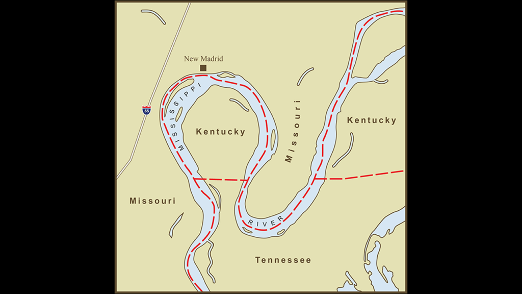
It is perhaps best-known for the New Madrid Earthquakes, three of which in the winter of 1811 and 1812 were said to be the largest earthquakes ever recorded in the United States.
The first large one took place on December 16th of 1811; the second one on January 23rd of 1812; and the third large one on February 7th of 1812.

Descriptions of what happened during the first one included rolling ground; uprooted trees; huge chasms opening up and swallowing whatever was above; the Mississippi River flowing backwards; and general pandemonium from frightened people.
We are told that the series of earthquakes in the New Madrid region dramatically affected the landscape, causing bank failures along the Mississippi River; destroying entire communities; causing landslides along the Chickasaw Bluffs in Tennessee and Kentucky; large tracts of land subsiding on the Mississippi flood plain; and liquified subsurface sediment spread over a large area at great distances.

Liquefaction was described as widespread and severe.
Sand blows, described as large sandy deposits resulting from an eruption of water and sand to the ground surface, formed over an area of 4,015-square-miles, or 10,400-square-kilometers.

The St. Francis Sunken Lands Wildlife Management Area in northeastern Arkansas today was said to have sunk during the New Madrid earthquakes, turning once fertile and abundant landscape into a swamp.
These descriptions are actually a snapshot of what I believe took place across the entire surface of the Earth through the deliberate destruction of the original energy grid.
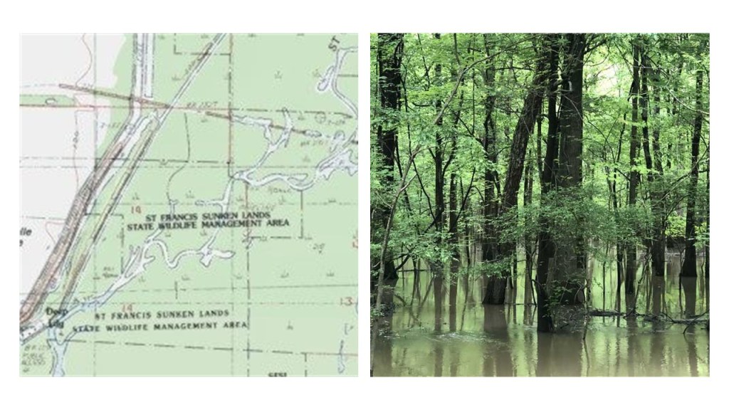
When I was looking into the parallel of 36-degrees, 30-minutes North,when I was researching it for the second leg of this pyramid alignment in the United States, there were several places it passes through that caught my attention in this part of the world that pertain to this alignment.
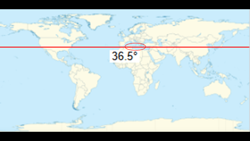
The same parallel that goes through the Great Dismal Swamp, Pilot Mountain in North Carolina, and the historical location of the New Madrid Earthquakes that devastated the region and created places like the St. Francis Sunken Lands Wildlife Management Area in northeastern Arkansas, goes through the Mediterranean Sea region just south of Sicily, and just North of Santorini, as well as other island groups in the Aegean Sea.
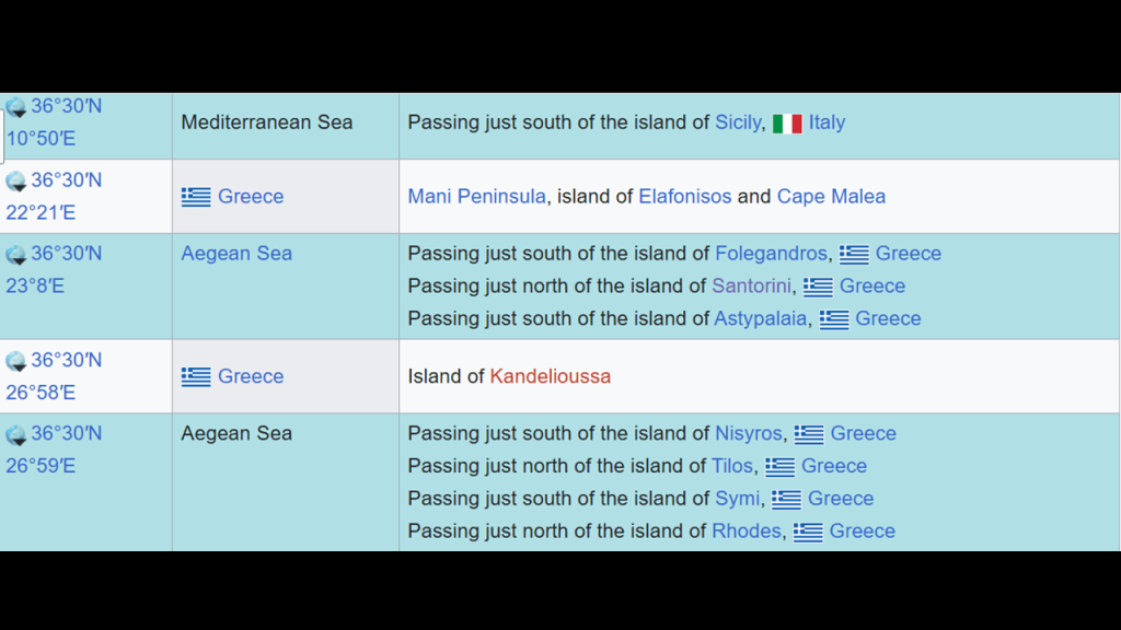
In this screenshot of this part of the alignment, I have Sicily highlighed on one side of the alignment where it goes through the last area of focus in the Mediterranean Sea, and the island of Crete highlighted, with its western edge touching the alignment.
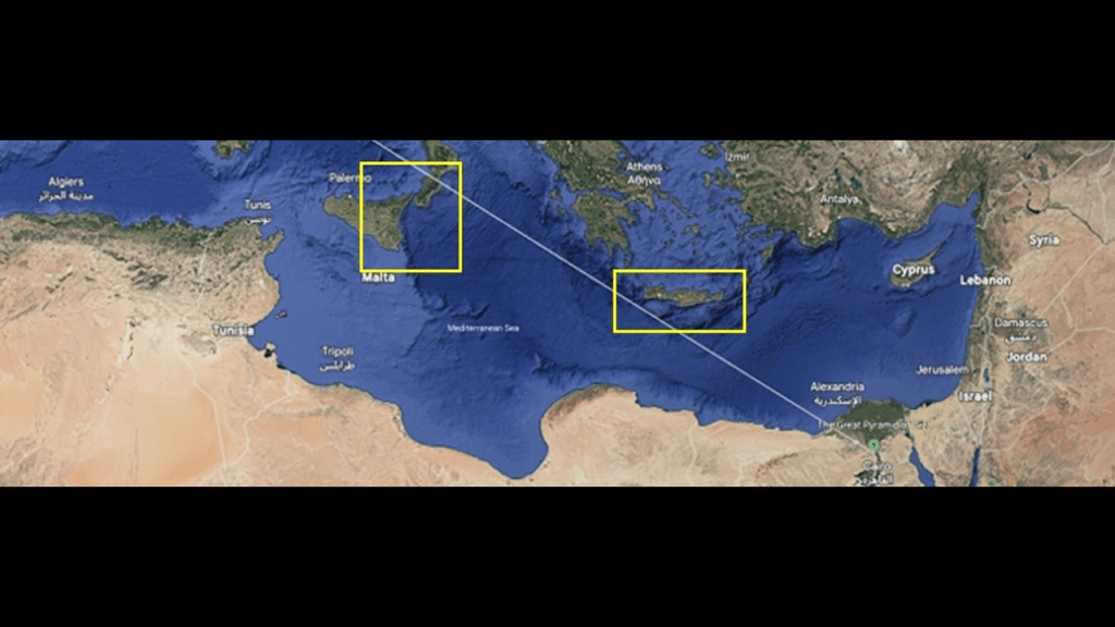
Santorini is just north of Crete in the Cyclades islands, and Rhodes is to the east of Crete in the Dodecanese islands.
Both of these places are in the South Aegean Sea.
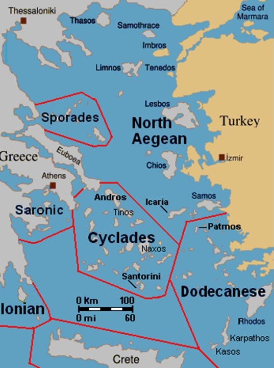
Santorini is the largest island of a small circular island group formed by the Santorini caldera, a large, mostly submerged caldera, located 75-miles, or 120-kilometers, north of Crete.
It is the most active volcanic center in the South Aegean volcanic arc, the formation of which in the modern scientific paradigm was caused by plate tectonics, and the movement of plates like the African, Eurasian, Arabian Sea, and Aegean Sea plates.
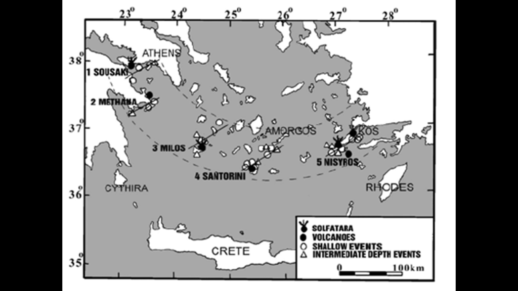
Santorini is noteworthy in our historical narrative for having been devastated by the Minoan eruption, which has been dated to the year 1,600 BC.
It destroyed Akrotiri on Santorini, as well as communities on nearby islands and the coast of Crete with subsequent earthquakes and tsunamis.
The Volcanic Explosivity Index (VEI) for it was 7, and was one of the largest volcanic events in human history.
The precise date of the eruption has been fiercely debated by archeologists and volcanologists for decades, with no definite conclusion.
The Akrotiri Lighthouse on Santorini was said to have been built in 1892 by a French company.
It ceased operating during World War II, and then was recommissioned by the Greek Navy at the war’s end in 1945.
I mentioned previously that Crete is another island that I have encountered that has numerous star forts, like the example of the one in Candia, also known as Heraklion.
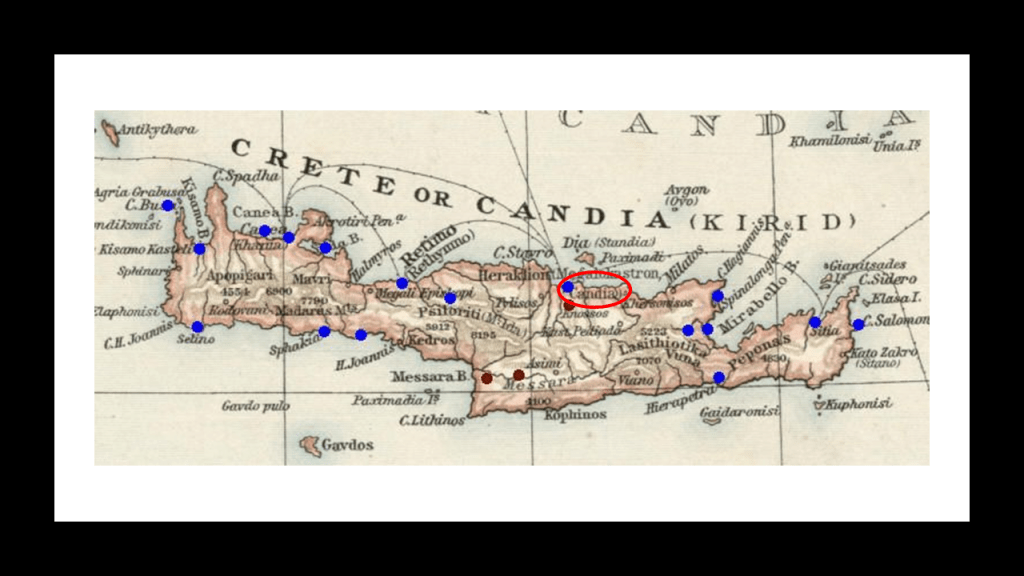
We are told that after the Fall of Constantinople and the Byzantine Empire in 1453, Venetians started the construction of Candia’s fortifications in 1462, and it took them over 100-years to complete it.
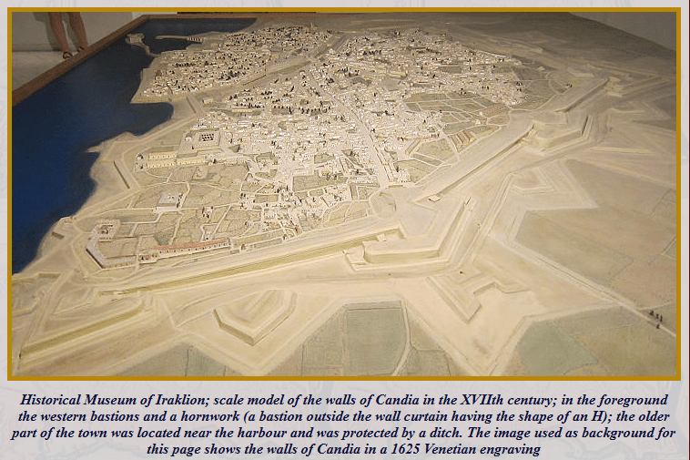
In today’s world, Crete is one of the thirteen-administrative units of Greece.
In the world of the past, we are told it was the center of Europe’s first advanced civilization, the Minoan, from 2,700 BC to 1,420 BC.
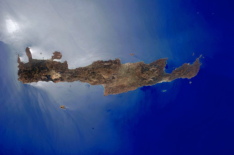
The island of Rhodes is the largest of the Dodecanese Islands
Historically, Rhodes was famous for the “Colossus of Rhodes,” one of the “Seven Wonders of the Ancient World.”
It was said to be a statue of the Greek god Helios, the god who personifies the sun, and constructed in 280 BC to celebrate the successful defense of Rhodes city against an attack from a Macedonian king.
It was the tallest statue in the ancient world at 108-feet, or 33-meters, -high, until an earthquake toppled it in 226 BC, only 54-years later.
This same 36-degree, 30-minute parallel north also crosses the island of Kandelioussa, a small, uninhabited island in the Dodecanese island group.
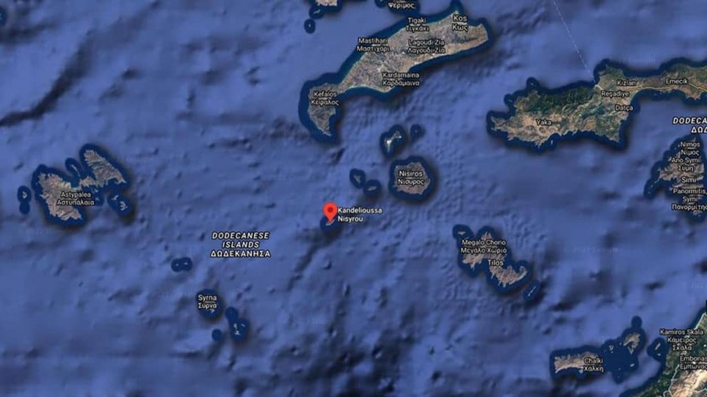
Kandelioussa does have a lighthouse on it though, said to have been operating from 1890, and built by the French company of Ottoman Lighthouses.
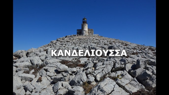
As a matter of fact, the Greek lighthouse network is considered one of the largest, densest and more organized in the world.
Interestingly, the Germans destroyed most of the lighthouses in the Aegean Sea during World War II, leaving 28 operating ones out of an original 400.
Here’s the Tourlitis lighthouse in the Aegean Sea, looking like land it was on is missing.
It was said to have been built in 1897 off the coast of the island of Andros in the Cyclades.
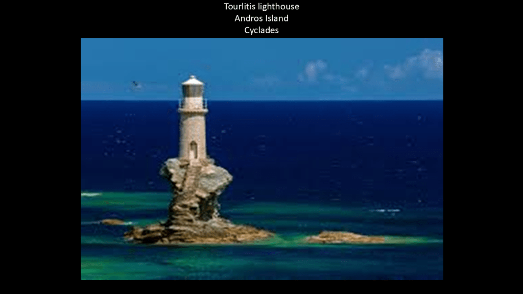
According to the information I found in an internet search, this region of modern-day southern Greece was a one time known as the Kingdom, or Realm, of the Morea.
Known as the Morea until the 19th-century, it was said to have been conquered by the Venetians from the Ottoman’s in the Sixth Ottoman – Venetian War between 1684 and 1699 in the Aegean Sea.
It is important to note that Napoleon was in this part of the world known today as the Ionian islands, of which there are seven main islands, and located northwest of Crete off the coast of the Greek mainland in the Ionian Sea.
The Ionian Islands were said to have become part of the Venetian Republic in 1500 A.D., also known as La Serenissima, or Most Serene Republic of Venice, described as a sovereign state and maritime republic.
Interesting to note, the location of Venice is in coastal wetlands that include salt marshes, mud flats, reed beds and seagrass meadows.
The famous city is situated on 100 small islands in the Venetian lagoon on the Adriatic Sea, with no roads – just canals, and it is well-known that Venice is sinking.
Then in 1797, the Treaty of Campoformio was signed by Napoleon Bonaparte and Count Philipp von Cobenzi, as representatives of the French Republic and the Austrian Monarchy respectively, ending the first stage of the French Revolutionary Wars between France and Austria.
This treaty disbanded and partitioned the Venetian Republic by the French and the Austrians, and the Ionian Islands were awarded to France.
At that time, the Ionian Islands became the short-lived French Department of Ithaque, as it fell to the Russians in 1798, and was officially ended in 1802.

Between the years of 1800 and 1807, the Ionian Islands were known as the Septinsular Republic under Russian and Ottoman rule after the Russian/Ottoman fleet defeated Napoleon Bonaparte.

Then in 1807, Napoleon signed two agreements in the town of Tilsit in what was Prussia in East Germany, one between Emperor Alexander I of Russia, and the second treaty was signed with Prussia, and the Ionian Islands were returned to France, becoming a French Protectorate.

Then, in 1809, the British blockaded the Ionian Islands as part of the war against Napoleon, in September of that year, hoisted the British flag on the island of Zakynthos, with Kefalonia and Ithaca soon surrendering. The British installed provisional governments here.
The Treaty of Paris of 1815 recognized the United States of the Ionian Islands, and established them as a British Protectorate.
One last place I would like to bring to your attention here is Antikythira, a small island in the Aegean Sea, located near the island of Crete at the Kythira-Antikythira Strait, where the waters of the Mediterranean Sea enter the Gulf of Crete.
Antikythira is noteworthy for the discovery of the Antikythira Mechanism, reported to have been found in a shipwreck off the coast of the island in 1901.
The Antikythira Mechanism is the oldest known example of a mechanical computer, dated to about 87 BC, and could be used to predict astronomical positions and eclipses decades in advance.
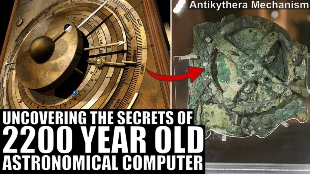
Now, I am going to pick up the pyramid alignment where it enters Egypt across a coastal strip just a short distance west of the Western Harbor of Alexandria.
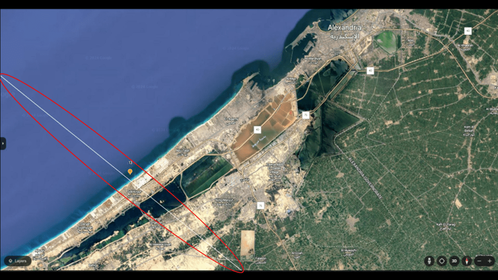
The exact location where the alignment enters Egypt looks very much like the coastal strips seen all along the coasts of this alignment on both sides of the Atlantic, like the coastline of southern France…
…the coastline of western France…
…the coastline of North Carolina where the alignment leaves the United States at Carova Beach near the Great Dismal Swamp…
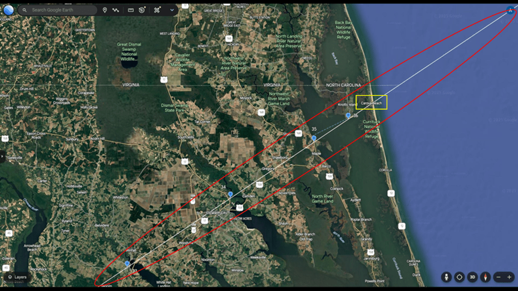
…the Gulf coastline of western Florida around where the alignment enters the United States at the Sunnyside Beach and Tennis Resort in Panama City Beach…
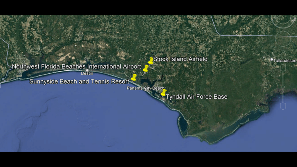
…and the Gulf coastline where the alignment leaves Mexico at Tuxpan de Rodriguez Cano on it’s way to the United States.
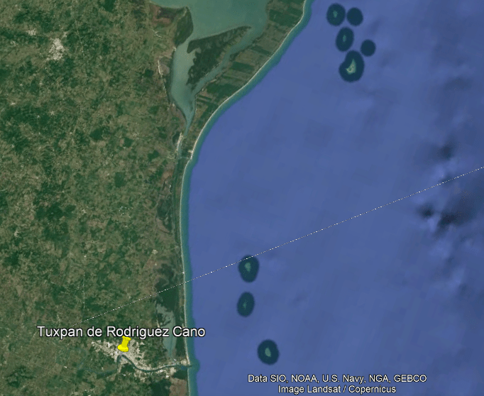
The Pharos of Abusir is located to the west of where the alignment enters Egypt, marked by the red dot, and the historic location of the Pharos of Alexandria was located to the east of it, in the city’s Eastern Harbor, which is adjacent to the Western Harbor.
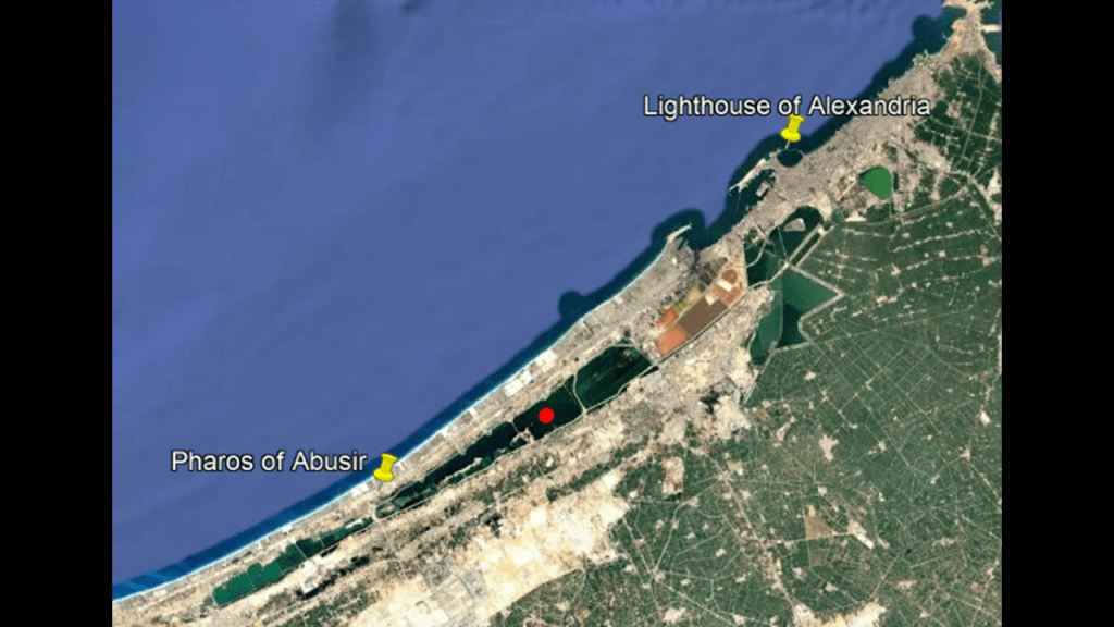
The Pharos of Abusir is located at the ruins of an ancient temple on the shore of Lake Mariout, and what we are told about it is that it was an ancient replica of the famed Pharos of Alexandria.
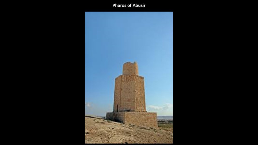
Another name for Abusir is “Taposiris Magna,” or the “Great Tomb of Osiris.”
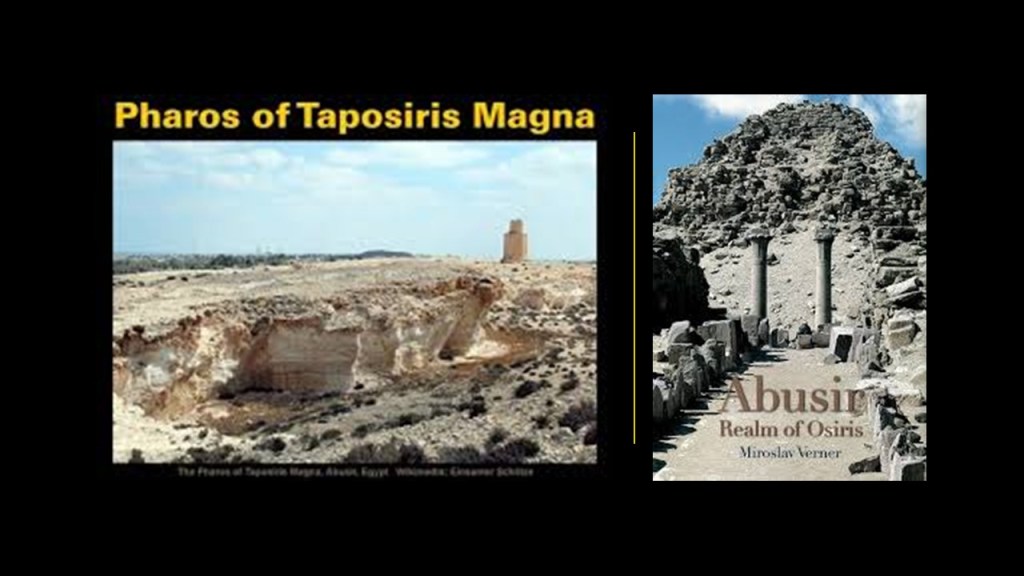
There is also what is called a temple or shrine of Isis at the ruins of Abusir.
Abusir is located on the shore of Lake Mariout, also known as “Lake Mareotis,” on the western edge of the Nile Delta, and is described as a “brackish” lake, meaning that it has more salinity than freshwater, but not as much as seawater.
We are told that at the beginning of the 20th-century, the lake covered 77-square-miles, or 200-kilometers-squared, and had a navigable canal, and that at the beginning of the 21st-century, the lake covered 19-square-miles, or 50-kilometers-squared.
In my recent blog post “Finding Osiris – In Search of the Missing Moors and their Highly Advanced, Ancient Civilization,” I took an in-depth look at the Osiris Myth, from the perspective that it is an allegory for what happened to the Moors, whose advanced civilization was completely wiped from our collective memory, their history fragmented into a million pieces, and then re-written into a false historical narrative and how we came to the world we live in today, which is very far from our original evolutionary path.
The Osiris Myth concerns the murder of the god Osiris, primeval King of Egypt whose lineage stretched back to the Creator of the World, Ra or Atum, and the consequences of Osiris’ murder.
Osiris’s murderer, his brother Set, usurped his throne.
Osiris was connected with life-giving power, righteous kingship, and the rule of Ma’at, which was the ideal natural order whose maintenance was a fundamental goal in ancient Egyptian culture.
Set was closely associated with violence and chaos.
And, again from an allegorical standpoint, the world we have been taught about and have been living in today is representative of Set’s association with violence and chaos.
One version of the Osiris myth’s similar story-lines, at a banquet, Osiris was lured into getting into an elaborate chest made by Set that only fit him. The lid of the chest was then slammed shut, and the chest containing his body was thrown into the Nile River.
Later on in the story, Set steals the body of Osiris after it had been found, dismembered it, and scattered his body-parts across Egypt.
His Queen Isis finds the dismembered body parts and puts his body back together again and posthumously they conceived Horus.
Horus became Set’s rival for the throne, and ultimately triumphs over Set, restoring the cosmic and social order of Ma’at to Egypt and completes the process of the resurrection of Osiris.
Osiris represented the “Third-Eye” in ancient Egyptian spiritual schools, also called “The Eye of Osiris.”
The “Awakening of Osiris” refers to the process of awakening and becoming consciousness itself, which is the full activation of the pineal gland and super-consciousness mind, a process all Human Beings have access to if they know about it and desire to attain it.
The two serpents in this illustration of the “Staff of Osiris” with the pineal gland at the top depict kundalini energy, which represents our life-force energy.
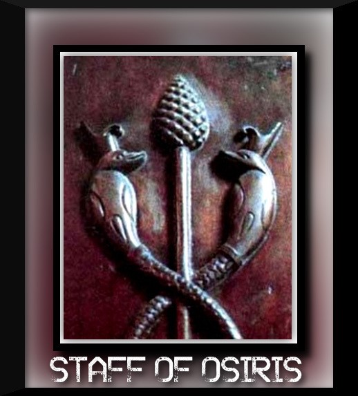
The starting point for the journey on this pyramid alignment was the Quetzelcoatl Pyramid in Teotihuacan in Mexico.
Teotihuacan was also known as the “place where men became gods.”
What we are told in our historical narrative was that Quetzelcoatl, also known as the Feathered Serpent, was a Deity found in many Mesoamerican religions, connected with things like the Creation of the World and Humanity, and compared to a mix of bird and serpent.
Interestingly, the symbol of a bird and a serpent for Quetzelcoatl in Mesoamerica is identical to the symbol for Wadjet, the Egyptian Goddess depicted as a Winged Serpent and closely associated with the Eye of Ra and Eye of Horus.
And both of these symbols reflect the same imagery used to depict Kundalini energy, or “Serpent Energy,” which is represented as a serpent coiled at the base of the spine.
The original advanced civilization on earth was learning how to raise Kundalini energy from the base of the spine, up to the pineal gland, and in so doing, re-connect with their Divine natures, represented by the the wings and the disk at the top of the head, or crown chakra.
Also known as the Third Eye, when activated, the pineal gland opens the door to psychic abilities and is our connection to the Divine.
Much has been done to keep the Third Eye of people from opening, including the use of fluoride in toothpaste and water which causes the calcification of the pineal gland.
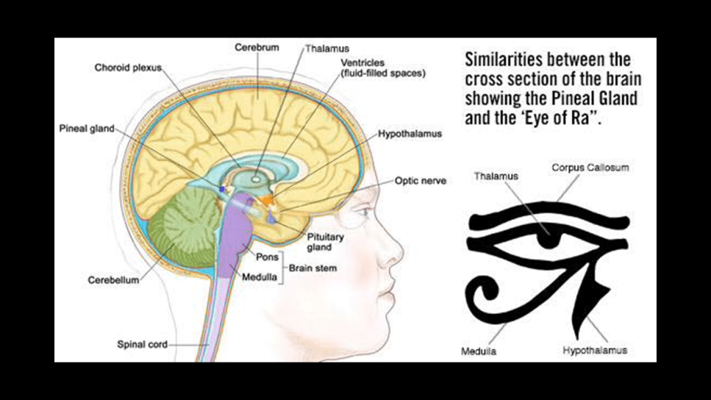
As noted previously back at Mount Etna in Sicily, we saw the same imagery of the winged serpent with the image depicted of Typhon, who was cast into by Zeus into Tartarus, a deep abyss in the underworld used a dungeon of torment and suffering and the location where the Titans were imprisoned, after Typhon attempted to overthrow Zeus for the supremacy of the Cosmos, and lost cataclysmic battle which Zeus won with the aid of thunderbolts.
The famed Pharos of Alexandria on the other side of the alignment, like the previously seen Colossus of Rhodes, was one of the Seven Wonders of the Ancient World.
Widely considered to have been the world’s first lighthouse, it was said to have been built in 270 BC during the reign of Ptolemy II.
At 330-feet, or 100-meters, in overall height, it was one of the tallest manmade structures in the world.
It was located right next to the Citadel of Qaitbay in Alexandria’s Eastern Harbor.
What we are told is that the Pharos of Alexandria was destroyed by an earthquake in 1323 AD, and that in 1994, a team of French archeologists dove in the waters of the Eastern Harbor and discovered remains of the lighthouse on the sea-floor, so more sunken infrastructure.
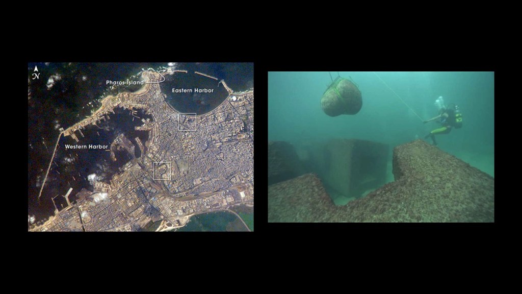
We are told the adjacent Citadel of Qaitbay on a rocky outcrop surrounded by water was established by the Sultan Al-Ashraf Sayf al-Din Qa’it Bay, and that remaining stones of the Pharos of Alexandria were used in the building of the citadel from 1477 to 1479.
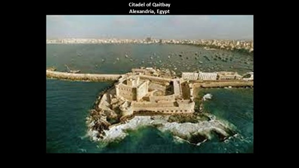
I want to mention here two ancient stone structures I became aware of years ago in Texas that look like melted lighthouses, and compare them both to what the Pharos of Alexandria was believed to have looked like on the right.
The feature in the Palo Duro canyon in West Texas on the top left is actually called the Lighthouse, and has a twin in Big Bend National Park in south Texas, on the bottom left.
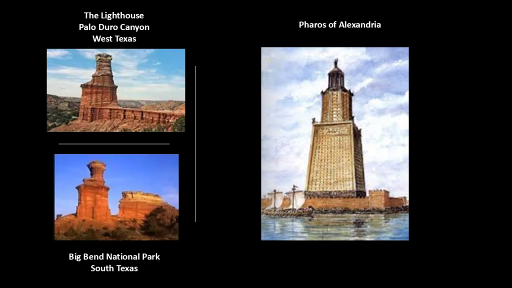
It is interesting to note that at least in the Romance languages, the word for lighthouse includes the root sound of “Far.”
In Italian and Spanish, the word for lighthouse is “Faro…”
As we have already seen in French, the word for lighthouse is “Phare.”
In Portuguese, it is “Farol…”
…and in Romanian, “Far.”
They are spelled and sound like they are related to the word “Pharaoh,” which we are told was the common title for monarchs of ancient Egypt from the First Dynasty, starting in 3,150 BC, up to the annexation of Egypt by the Roman Empire in 30 BC.
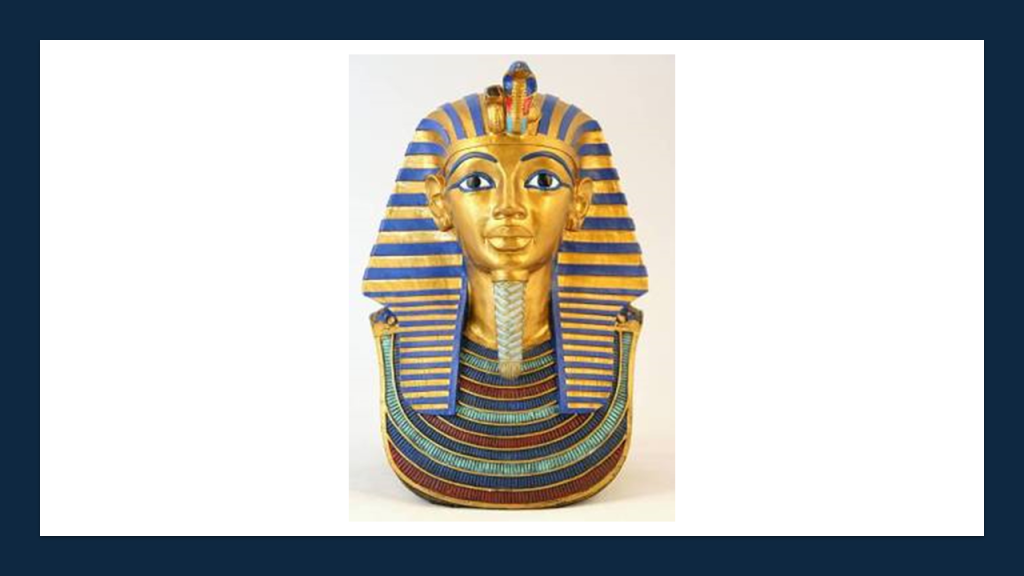
As we have already seen, lighthouses were said to have been built by the Colonizers in the 19th- and 20th-century for the sole purpose of navigational aid and then by-and-large deactivated with some exceptions.
Perhaps “lighthouses” were literally “a house for light” for the purposes of precisely distributing light-energy through this gigantic, integrated energy grid system.
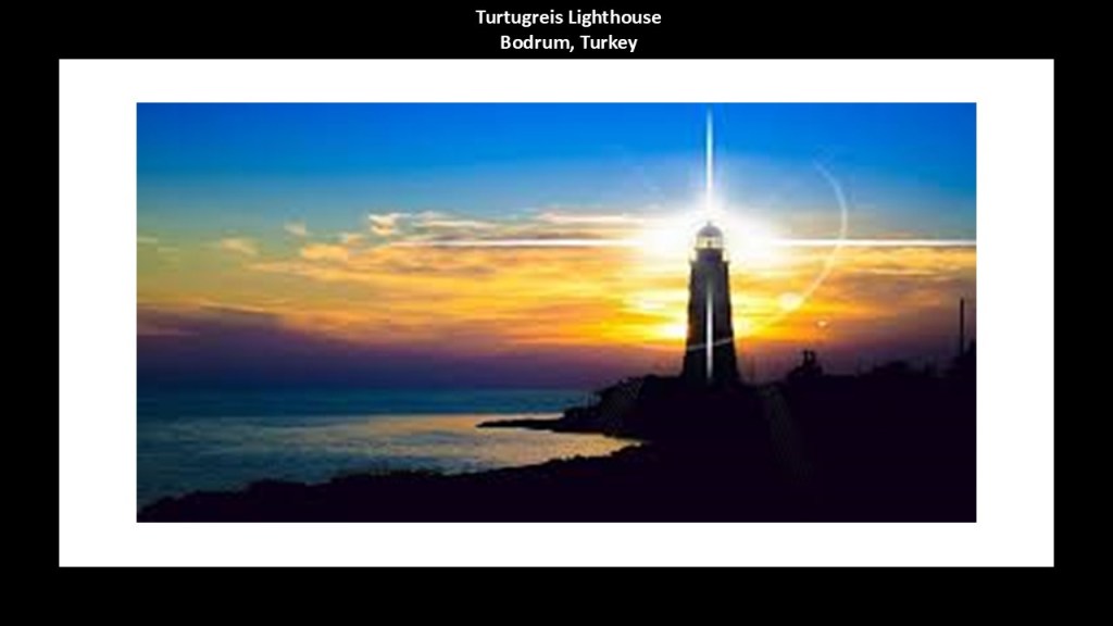
The energy grid system that existed all over the Earth was in perfect alignment with everything on Earth and in heaven.
Even the Statue of Liberty in the Upper New York Bay was a lighthouse, and served as a lighthouse from 1886 to 1902.
Perhaps “Pharoahs” were originally light-energy keepers via the lighthouses.
I gave the example of the Montauk Pharoahs of eastern Long Island earlier in this post, where there is a lighthouse on their traditional land at Montauk Point.
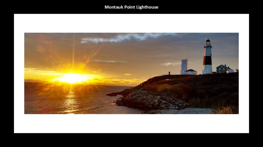
Back in Alexandria, Montaza Palace is further east along the waterfront from the Pharos of Alexandria location and the Qaitbay Citadel in the Eastern Harbor.
Montaza Palace was said to have been built in 1892, which was around exactly the same time as the lighthouses we just saw in the Aegean Sea were said to have been built.
The story that goes along with the Montaza Palace is that the ruling family of Egypt, Al Salamlik, had it built as a hunting lodge for the Khedive and his friends.
“Khedive” was the title of the Viceroy of Egypt under Turkish rule from 1867 to 1914.
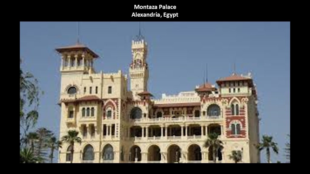
It is noteworthy that the Montaza Palace on the top left looks identical in architectural-style to the previously seen architecture in Santa Cruz de Tenerife on the Canary Islands off the coast of Morocco, on the top right; the Bermuda Parliament Building in Hamilton, Bermuda, in the North Atlantic Ocean, on the bottom left; the example of the Arcachonnaise-style in Arcachon Bay in western France, in the bottom center; and a view of old Ouarzazate in Morocco, nicknamed “The Door of the Desert,” and is considered a gateway to the Sahara Desert.
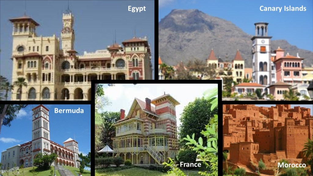
The Mahmoudiyya Canal of Alexandria was said to have been constructed sometime under the rule of Ptolemy I Soter, which was between 367 BC and 282 BC.
Ptolemy I Soter was a Macedonian General who was the successor of Alexander the Great of Macedon, who we are told founded the Ptolemaic Kingdom in Egypt, and turned it into a thriving center of Greek culture.
I have highlighted the name of the canal in a red box, as well as where it mentions in the graphic a “shifting shore from earthquakes, rising seas, sinking land and new construction have dramatically reshaped the ancient coast and harbors shown here.”
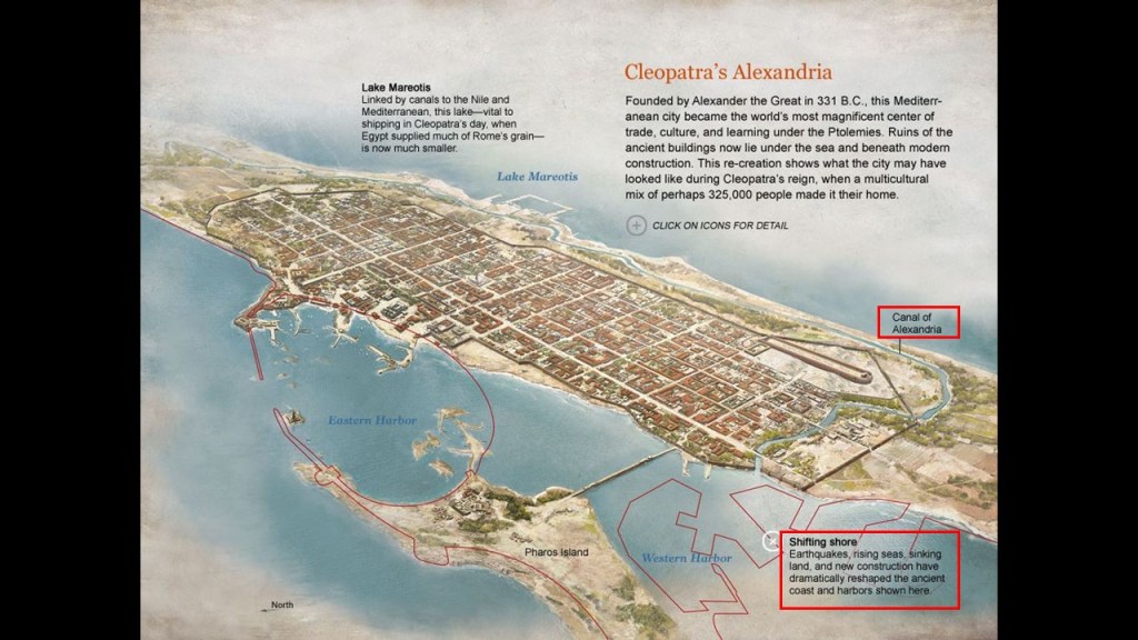
The Alexandria Railway Station is considered the oldest railway station in Africa and the Middle East, and we are told it was established in 1856 after the Khedive Abbas Hilmi II decided to establish the first railway line in Egypt to connect Alexandria and Cairo in 1851.
The year of 1851 was the same year as the Crystal Palace Exhibition in London.
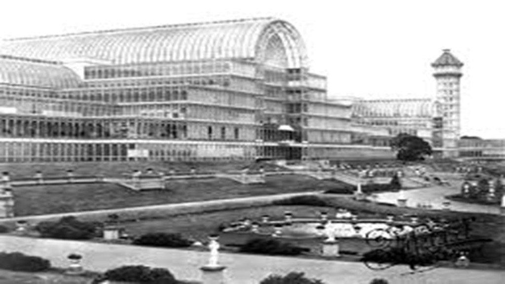
Also known as Great Exhibition of the Works of All Nations,” I have come to believe it was the official kick-off for the New World Order timeline, and it was opened by Queen Victoria.
It was attended by famous influencers in our historical narrative, like Charles Darwin, Karl Marx, George Peabody, Charles Dickens, Lewis Carroll, and many others.
I believe that In the hundred or so years following the Crystal Palace Exhibition in 1851,these Exhibitions, Expositions, and World Fairs were showcasing the technology and architectural wonders of the original civilization before being hidden away or forever destroyed.
This was a scene at the New York World Fair of 1939 to 1940, almost 100 years later, where we still see incredibly big, what appear to be luminescent structures in the background, and in the foreground, statues much bigger than the size of the people standing near them.
The Egyptian National Railways has been in operation since 1854, and has rail infrastructure along the Mediterranean Coast and along the Nile River, among other places.
Alexandria still has an operational streetcar service.
It began operation in 1863 under horse-drawn power, and was electrified by 1902.

This alignment crosses Egypt from the west of Alexandria, along the west-side of the Nile Delta, on its way to the Great Pyramid of Giza on the western outskirts of Cairo, the capital city of Egypt.
In this zoomed-out screenshot of the location, I noticed the same distinct patterns of roadways and major highways emanating from major cities of the Nile Delta region, where two or more roadways come together to form star-shaped radial patterns or “x’s” in the landscape, that I talked about in-depth in France, the United States, and Mexico at the beginning of this post.
The cities at the centers of these patterns of the Nile Delta are Tanta; Mansoura; Mit Ghamr; Banha; and Zagazig.
Now I am going to take a quick look at them and what I can find out about them.
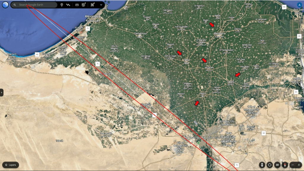
First, Tanta.
Tanta is a city of over 650,000 people, and the capital of the Gharbia Governate.
A major railway line comes through Tanta.
We are told that in 1856, Tanta became a stop on the railway network for the benefit of exporting to Europe the cotton from the large cotton plantations of Tanta and the surrounding area.
Tanta is also a center for the cotton-ginning and textile industries.

Next, Mansoura.
Mansoura has a population of over 620,000 people, and is the capital of the Dakhalia Governate.
It is located on the Damietta Branch of the Nile River.
Mansoura is connected to the Egyptian Railway Network via the Tanta-El Mansoura – Damietta Line.
Mit Ghamr is another city in the Nile Delta region with this distinct pattern, on the eastern branch of the Nile River.
Mit Ghamr is a major industrial zone, including, but not limited to, being an aluminum-producing center, accounting for more than 70% of Egypt’s total aluminum production.
Mit Ghamr is also served by the Egyptian National Railway.
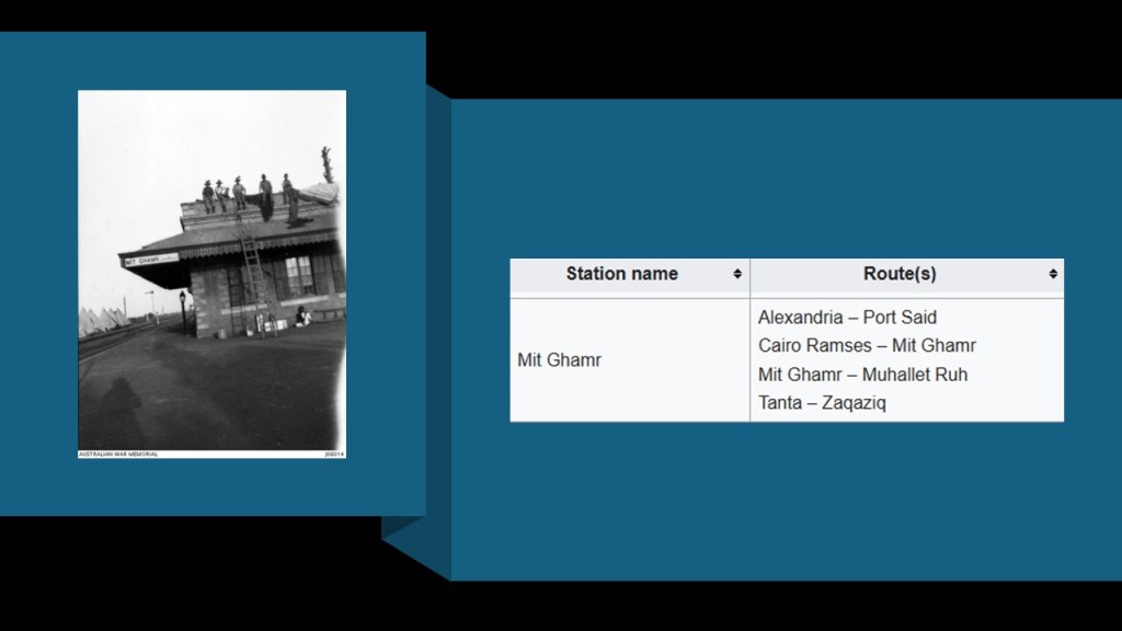
Banha is another one of these cities.
In our historical narrative it was founded in 1850.
It is the capital city of Qalyubiyya Governate, and located between Tanta and Cairo.
Banha is a major junction in the rail network, as rail-lines from Cairo to various cities in the Nile Delta pass through it.
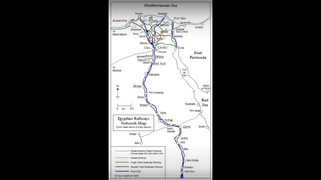
The last city I noticed with the distinctive pattern here in the Nile Delta is Zagazig.
Said to have been founded in the 1820s when cotton cultivation spread to the eastern Delta, it is the capital city of the Sharqia Governate with a population of around 430,000.
Zagazig is located on the Muweis Canal and is a hub of the cotton and corn trade.
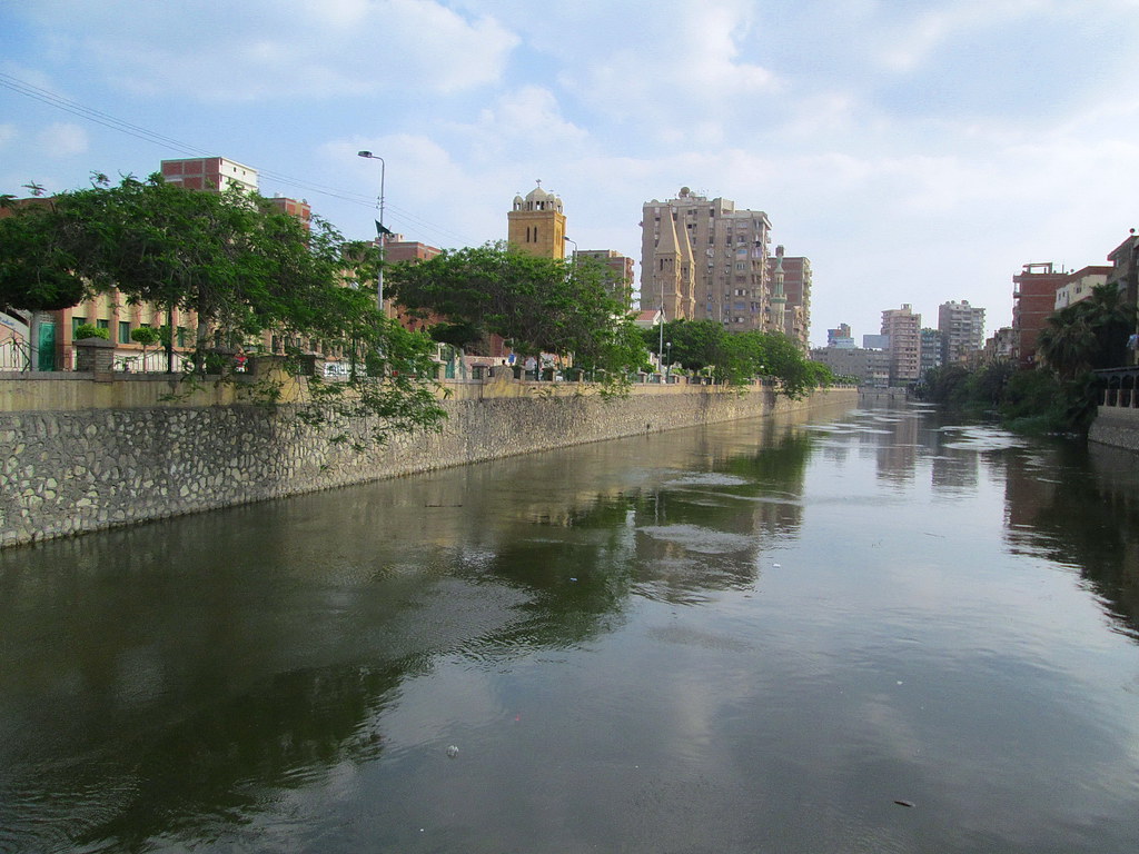
Zagazig is also part of the Egyptian Railway Network.
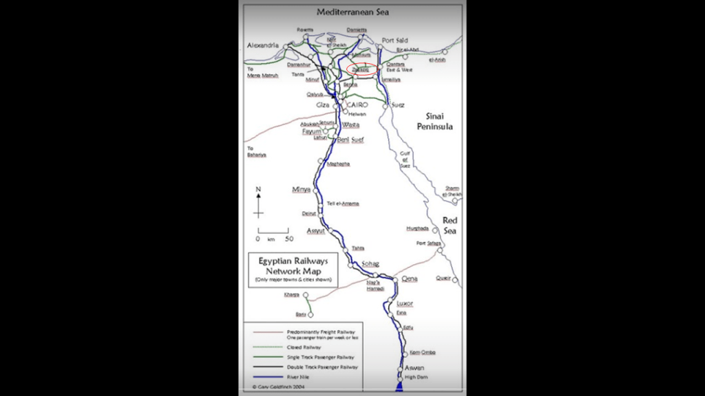
In the next few screenshots, we are coming to our destination of the Great Pyramid of Giza, starting with El Sadat City.
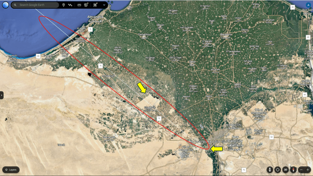
In spite of El Sadat City having a dry and blown out look to it, it’s quite a busy place.
What we are told about it is this.
It is a first-generation new urban community and one of the largest industrial cities in the country.
The University of Sadat City is right on the alignment, and the Dar Misr Shopping Mall is right next to it.
So another school and another shopping center to add to the count of those found on the alignment.
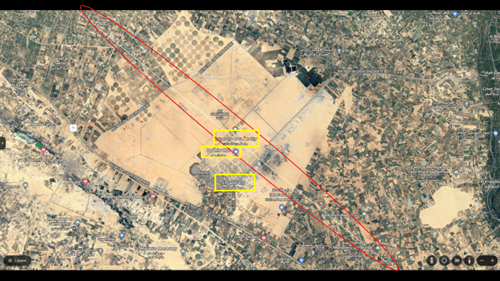
Established in 2013, the University of Sadat City is an Egyptian Governmental University, meaning it is funded and operated by the Egyptian Government.
The Dar Misr Mall was the first commercial shopping mall in Sadat City, and first opened in 2018.
In addition to a variety of shops and office spaces, it has a pool with fountains right in the middle of it.
In the next screenshot we come to yet another airport near the alignment.
The Sphinx International Airport serves Giza and was first open to commercial flights in October of 2018.
It shares some infrastructure with the adjacent military airport, the Cairo West Air Base.
In this screenshot, we come to the location of the Great Pyramid, which has the Marriott Mena House Hotel and it’s golf course right next to it.
I consistently find golf courses on these alignments, and in the second part of this series, there were eighteen golf coursesthat showed up on the alignment in the United States.
“Links” is another name used to refer to golf courses, and I think that’s a clue to what they originally were on the energy grid system – “links” of some sort between the circuitry of the grid system.
The Mena House Hotel is located approximately a half-mile, or 700-meters from the Great Pyramid.
The Mena House Hotel on the left, like the Les Sources des Caudalie on the right back on the alignment in Leognan, France, is a luxury 5-star hotel, and they both have the distinctive tower design with the closely set-together rectangular windows that we have already seen in different locations on the Earth.
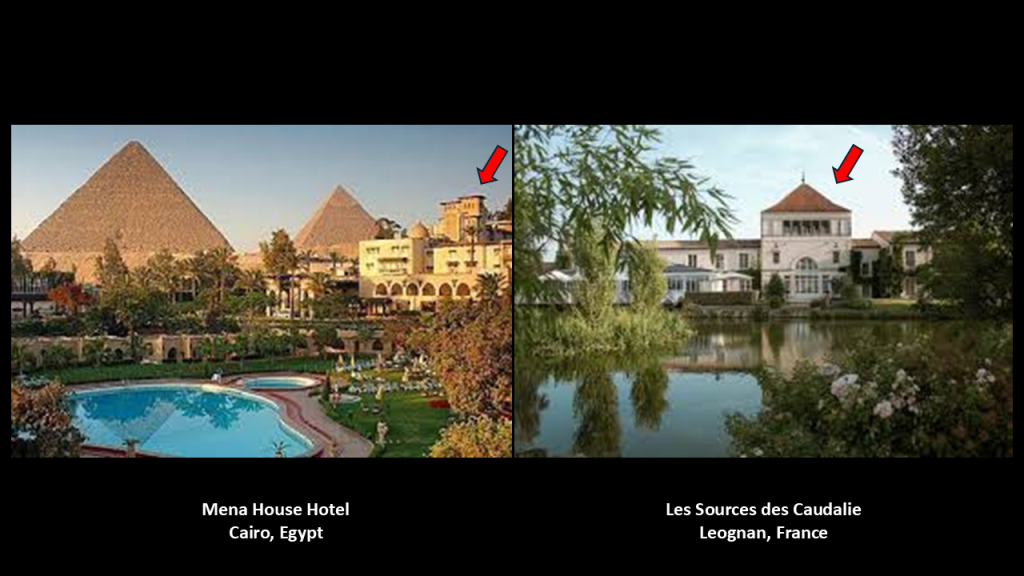
We are told the Mena House Hotel was established in 1886.
It has been frequented by the powerful, rich and famous throughout its history.
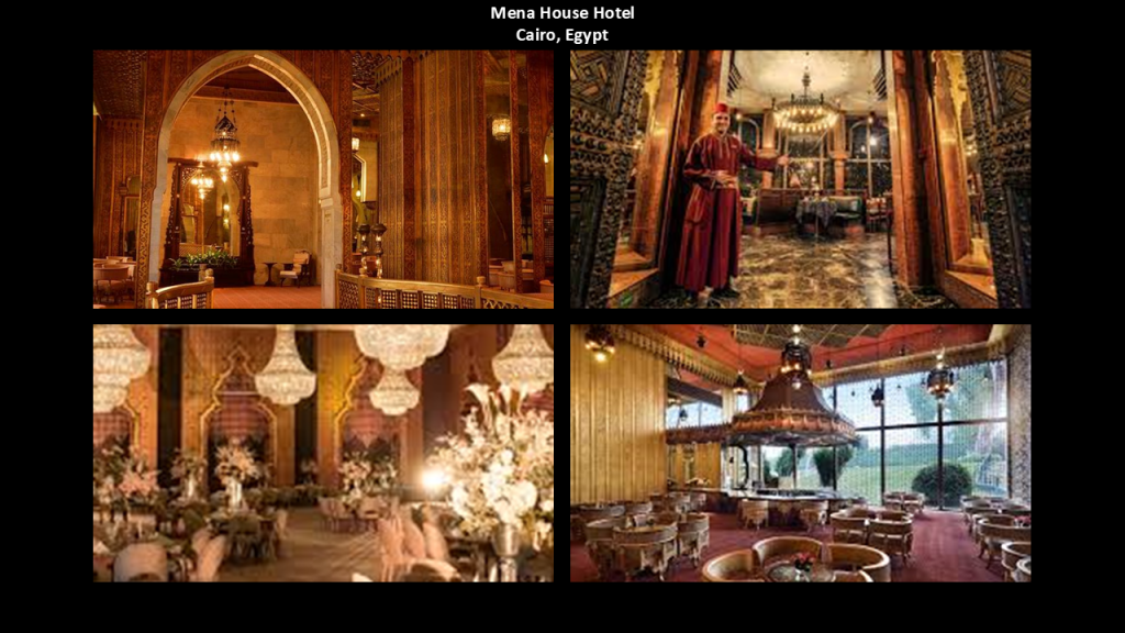
Up until 1851, the Great Pyramid was the Prime Meridian, located at the center of the Earth’s landmass.
Longitude fixes the location of a place on Earth east or west of a North-South zero-line of longitude called the Prime Meridian, given as an angular measurement that ranges from 0-degrees at the Prime Meridian to +180-degrees westward and -180-degrees eastward.
In 1851, again the same year as the Crystal Palace Exhibition in London, Sir George Biddell Airy, the seventh Astronomer Royal from 1835 to 1881, established the new prime meridian of the Earth, a geographical reference line, at the Royal Observatory of Greenwich in London, and by 1884, over two-thirds of all ships and tonnage used it as the reference meridian on their charts and maps.
Carl Munck deciphered a shared mathematical code in his book “The Code,” related to the Great Pyramid, in the dimensions of the architecture of sacred sites all over the Earth, one which encodes longitude & latitude of each that cross-reference other sites.
He turned his findings in “The Code” into a video series which can be found on YouTube.

He shows that this pyramid code is clearly sophisticated and intentional, and perfectly aligned over long-distances.

The Sphinx is located behind the Great Pyramid on the Giza Plateau, and still on the alignment.
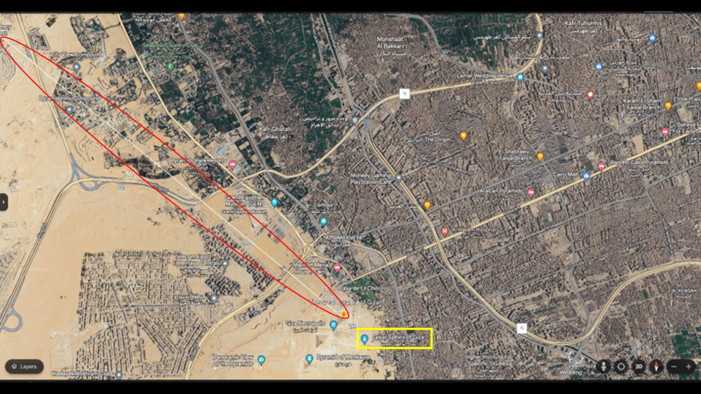
The Sphinx was covered up to its shoulders, as seen in this 1886 painting of Napoleon Bonaparte sitting on horseback before it that hangs in the Hearst Castle in San Simeon, California.
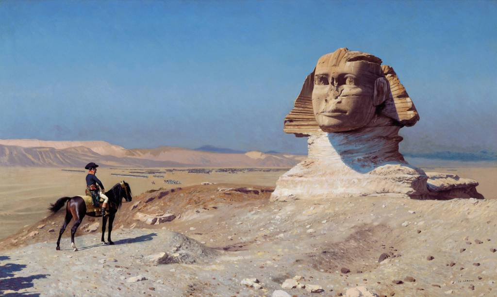
So the Sphinx needed to be dug out from the sand that surrounded it.
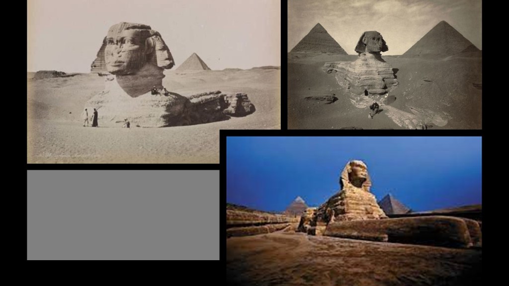
Other places that come to mind that needed to be dug out were on Easter Island in the southeastern Pacific off the coast of South America, where the famous heads were discovered to have bodies…
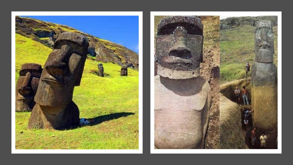
…and Gobekli Tepe in Turkey, said to have the world’s oldest stone megaliths dating back to at least 9500 BC.
Gobekli Tepe was first noted in a survey in 1963, and the site was said to have been intentionally backfilled with earth when it was mysteriously abandoned in 8000 BC.
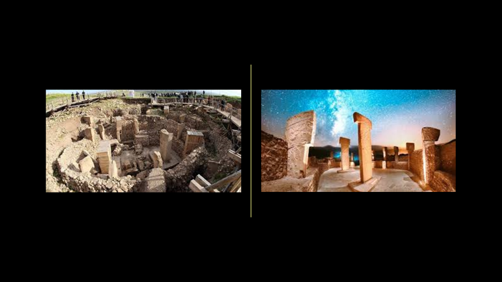
Intentionally back-filled with Earth?
Hmmmm.

The defacing of ancient statues and monuments is quite common, with many examples of missing noses, heads and badly damaged bodies of statues.
The Sphinx in Egypt is another well-known example of this practice.
Legend has it that the troops of Napoleon used it for target practice in 1798.
Whatever the reason, the Sphinx nose is missing.
Why?
Napoleon himself was said to have said that history is a set of lies agreed upon.
Again why, and what on Earth are they covering up?

As I previously mentioned when I looked at the seven cities of Septimania in southern France, I found a depiction of the Pleiades and compared it with a map of these seven cities in southern France to see if a case could be made that they constitute a star map, and I mentioned I would address this subject again when I got to Egypt, the Great Pyramid and the Giza Plateau.
One thing I have long-believed is that if we knew the true history of the Earth, there would be no mysteries, but all that has been taken away from us, and we are left with things that make no sense and without context.
The Giza Plateau has been long-studied by all different kinds of researchers, and perhaps the starting point for many of us in delving into the many mysteries to be found on the Earth.
What I am sharing here are just a few of countless examples.
The Golden Ratio can be found throughout the Giza Plateau.
The Golden Ratio, also known as the Golden Number, Golden Proportion, or Divine Proportion, is a ratio between two numbers that equals 1.618, which is the value for Phi, the basis of the Golden Ratio, and found in architecture, the human body, DNA and nature, among others.
The Pyramids of Giza also correlate to the stars of Orion’s Belt.
The Great Pyramid of Giza, also known as Khufu, correlates to Alnitak; the second pyramid, known as Khafre, to Ainilam; and the third, Menkaure, to Mintaka.
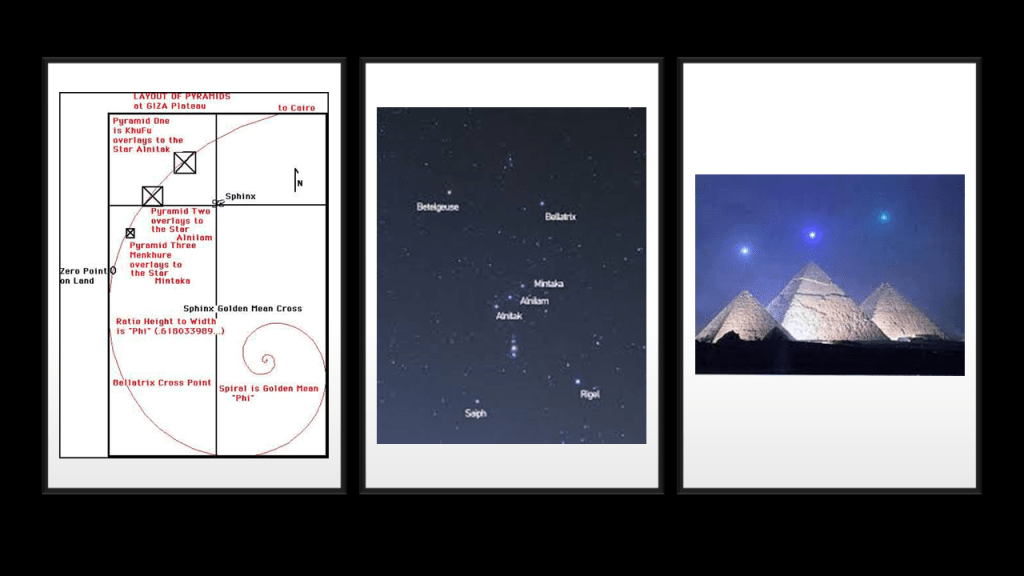
The constellation Orion was associated with Osiris, and the belt stars as the resting place of his soul.
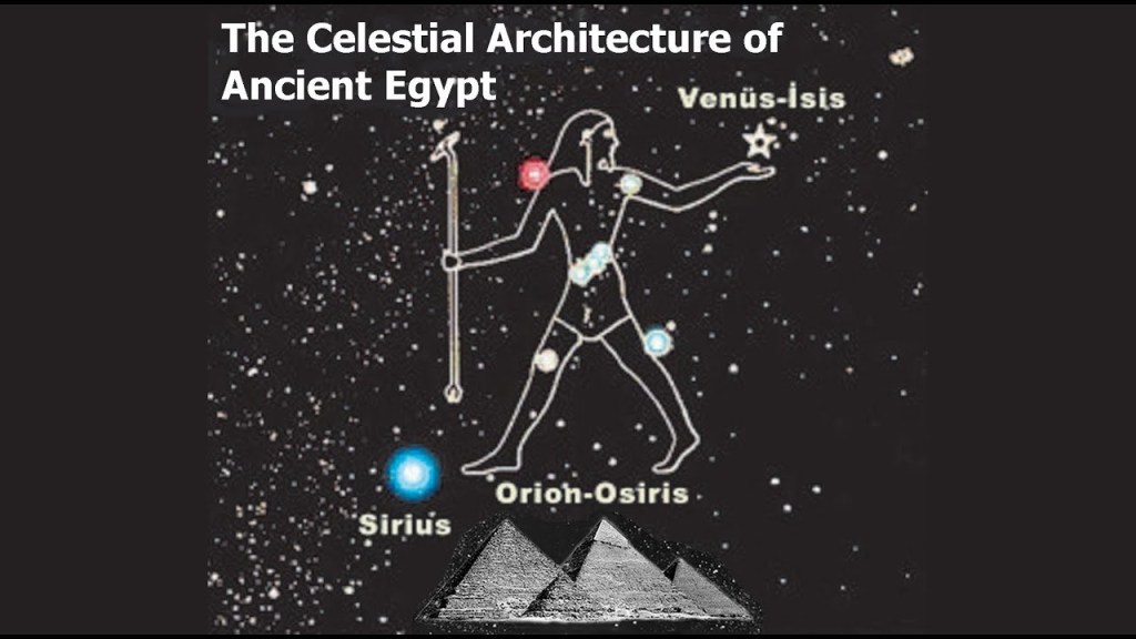
There is significant evidence all over the world that what the original advanced Moorish civilization built on the Earth was a mirror of the Heavens, from ancient to modern times.
With regards to the same precise alignments happening in what we would consider modern times, this is a photo of Manhattanhenge, an annual event during which the setting sun or the rising sun is aligned with the East-West street grid of Manhattan on dates evenly spaced around the summer solstice and winter solstice.
There similar alignments with the sun and street plan that occur in other major cities, like Toronto, Baltimore, Chicago, and Montreal.
I think the ancient Moorish Civilization was the same highly-technologically advanced Atlantean Civilization that we have been told sank thousands of years ago.
I have come to believe from my research that it was a worldwide civilization that sank hundreds of years ago at the most, and not only from the evidence I have presented in this post by following this alignment between the Great Pyramid in Egypt and the Quetzelcoatl Pyramid at Teotihuacan in Mexico, but from research I have done in other places, and tracking other alignments of cities and places around the world like I have done in this series.
I believe this was a pyramid-based system that provided the cosmic energy for the Earth’s Energy grid system.
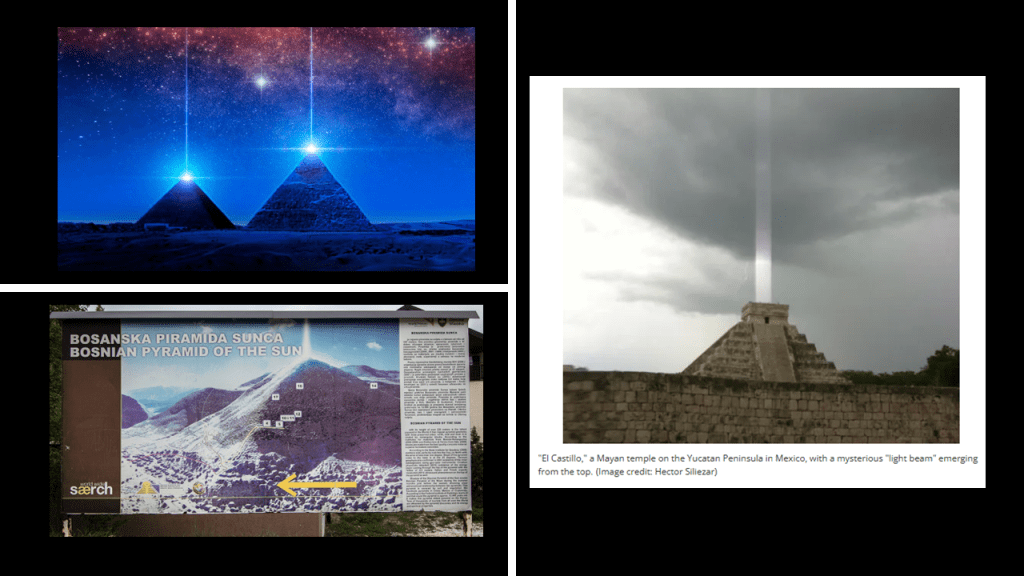
This civilization was beautiful and harmonious and every thing in it and on it was placed precisely for a reason in a perfectly-tuned scientific and musical instrument in an energy grid that was part of a worldwide free energy generating system.
I came across this photo of the Cathedral of Petropolis in Brazil several years ago, with the steeple emanating a striking blue glow.
Petropolis was a German-colonized mountain town 42-miles, or 68-kilometers, north of Rio de Janeiro.
Interesting to note that the first cinema in the world was said to have opened in Petropolis in 1897, showing the Lumiere Brothers first films.
The Lumiere Brothers had premiered ten short films in Paris on December 28th, 1895, considered the breakthrough of the technique of motion picture photography, and marking the beginning of using moving pictures to shape our world-view and turn our collective experience into one of virtual reality.

This video clip of a steeple in Poland spontaneously activating with blue-energy recently showed up on one of my social media feeds.
Steeple-like towers have been systematically-removed from historical buildings all over the world.
This one near where I live in Prescott, Arizona, is just one of countless examples.
We are told it was built as a Catholic church starting in 1891, and that the steeple was removed in 1930 after having been “struck by lightning” several times.
Today it is the Prescott Center for the Arts.
This free-energy grid and its beautiful advanced civilization was destroyed unbeknownst to us because it was removed from our history, and replaced with a very cruel, resource- and energy-harvesting system and occulted timeline that benefited the few and has caused untold misery and unimaginable suffering for all life on Earth.
The parasitic and multi-dimensionally aware beings behind all of this want us to believe that suffering, sickness, misery, destruction, death was and is our normal state of being, and not question what we have been taught about who we are.
They are the only ones who benefit because they energetically feed on Humanity’s negative emotional states, at the same time they have sucked up all the wealth and energy of the Earth for themselves.

I think Earth was one landmass until the energy grid was destroyed by massive directed frequency and energy attacks, and the destruction of what was a perfectly-resonant scientific and musical instrument was heightened by a domino-effect that caused everything on the grid to go haywire, and the surrounding landmasses sank, or turned into swamps, bogs, barrens, or deserts and dunes, both in coastal regions and inland.
I mentioned earlier in this post that the 1905 Humboldt University graduate Alfred Wegener published “The Origins of Continents and Oceans” in 1915, in which he theorized that Earth’s continents move or drift relative to each other over long periods of geologic time, and that the continents were once joined together in a large landmass “supercontinent.”
So again, the idea that at one time there was one large supercontinent is not in dispute.
The issue is when and how the continents separated: slowly and over geologic time vs. suddenly and catastrophically.
And once again, Academia supports Uniformitarianism, also known as Gradualism, without question as the only explanation for what we see in today’s world.
Let’s take a closer look at things that are found on the floor of the Atlantic Ocean.
The Atlantis Massif in the Mid-Atlantic Ridge is described as a prominent mountain mass in the North Atlantic Ocean.
It is roughly 10-miles, or 16-kilometers, across, and about 14,000-feet, or 4,267-meters, in elevation where it rises from the sea-floor.
Its highest point is only 2,297-feet, or 700-meters, beneath the surface of the ocean.
It is slightly east of the intersection of the Mid-Atlantic Ridge and the Atlantis Transform Fault in the Atlantis Fracture Zone.
A Transform Fault is defined as a fault along a plate boundary where the motion is predominantly horizontal.
A Fracture Zone is defined as a linear feature on the ocean floor over a long-distance that we are told is caused by plate tectonics.
The word “fracture” itself is commonly associated with the “Breaking of a hard object or material.”
As we know, fractures can happen suddenly as well, not only as a slow gradual process over time.
Among other things, the Atlantic Massif is particularly noteworthy for a feature called the “Lost City.”
What we are told about “Lost City” is that it is a hydrothermal vent field that was discovered by a crewed, deep ocean research submersible named DSV Alvin owned by the U. S. Navy and operated by the Woods Hole Oceanographic Institute in December of 2000.
DSV Alvin is supported by the RV Atlantis, a Research vessel that is also owned by the Navy and operated by Woods Hole.
You’d think they might be interested in trying to find the lost Atlantis or something like that.
In conclusion, I think we have been so deceived that we don’t even know we’ve been deceived!
Not only that, the deceivers have even convinced us to worship them!

Towards the end-goal of deceiving us completely, we’ve been given a false narrative to explain how everything came into existence…

…false science to completely fool us as to the nature of this reality…

…an economic and legal system that has unknowingly enslaved us all…

…and an endless supply of addictions and distractions to keep us from seeing a thing, and not only that, we don’t even think it.

I am going to end here with these thoughts.
I am of the firm belief that this is not our future but there is a lot of evidence in what I am sharing here that there are more questions than answers to be found in everything we have been taught about the world we live in.
My findings, and interpretations of them, that I have shared in this series are based on several years worth of researching places, people, and our historical timeline, in addition to all the things I have found along the way between the Quetzelcoatl Pyramid in in Mexico and the Great Pyramid in Egypt
But no matter what happened here and how it happened, the Truth about our world has been deliberately removed from our collective awareness so we would not know it in order to exploit and control us for the benefit of the very few.
All of this has directly brought us to the strange world we live in today, where everything is turned upside-down and inverted, and what we are told to believe by the Establishment nowadays makes no sense and they don’t care about Humanity in the slightest except for what they can take from us.