
Over the course of the years I have been doing my own research along leylines and finding the precisely- and geometrically-placed infrastructure on them, as well as researching places viewers have suggested, I have come to view the lay-out of the Earth’s original advanced civilization and its great cities as a circuit-board that collected, generated, and transmitted perpetual free-energy that powered a worldwide energy grid.
I have also found evidence in this process for its deliberate destruction through the energy grid, and who was responsible for building the new world on the ruins of the old world and bringing us the world we live in today.
In this post, I am going to be bringing forward research I have done in the past on the city of Toronto in the province of Ontario in Canada, and the city of Baltimore in Maryland in the United States, to provide a direct comparison between these two cities.
I am going to begin with a discovery of airports having racing tracks in angular relationships short distances away.
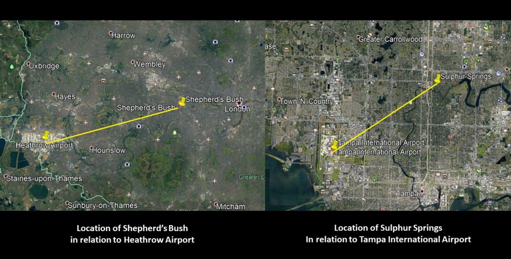
I first noticed this when I was doing research on the Shepherd’s Bush District of West London based on a viewer’s suggestion.
In the process of doing that research, I realized I had seen the same angular relationship between London’s Heathrow Airport, and Shepherd’s Bush, where there had been a huge track at one time in White City, that had been used for Greyhound racing; and in my own field research of the Tampa, Florida, neighborhood of Sulphur Springs, where I had noticed that the Tampa International Airport, and the Sulphur Springs neighborhood in Tampa, Florida, where there was a greyhound racing track, had the same angular relationship as the one mentioned in London.
Shepherd’s Bush being 10-miles, or 16-kilometers in a straight-line, from London’s Heathrow Airport on the left; and on the right, the Sulphur Springs neighborhood of Tampa in a straight-line is 6-miles, or 10-kilometers, from Tampa International Airport.
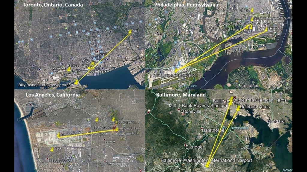
After I made that initial connection, viewers left other examples of the same kind of relationship between airports and racing tracks, past and present, including, but not limited to, places like Montreal, Quebec, Canada, on the top right; Philadelphia, Pennsylvania on the middle left; Toronto, Ontario, Canada, in the middle ; Los Angeles, California on the middle right; and Sydney, Australia, on the bottom.

In addition to airports and racetracks, I also found things like railroad yards, professional sports complexes, star forts and even amusement parks with the similar characteristics and relationships to each other that I found in different cities around the world.
In these Google Earth screenshots, all the lines drawn go through or to professional sports complexes, and railyards in Toronto, Philadelphia, Los Angeles, and Baltimore.
Along these lines, I have researched both Toronto and Baltimore in-depth and I am going to start the comparison of these two cities with Toronto.
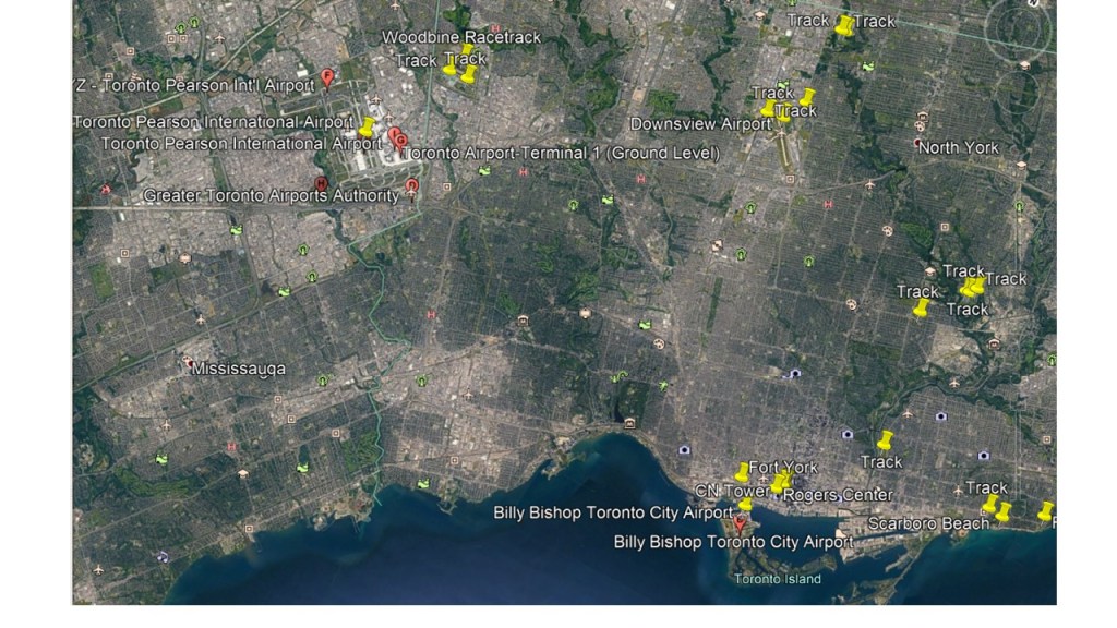
First, the Woodbine Racetrack is a short-distance northeast of the Toronto Pearson International Airport, in a straight-line distance of 2.3-miles, or 3.7-kilometers.
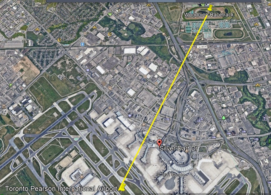
The Woodbine Racetrack has been a Thoroughbred horse-racing venue at this location since 1956.

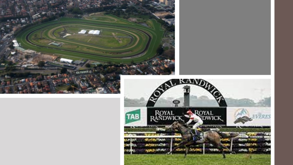
Similarly in Australia, the Royal Randwick Racecourse is the short-distance of 3.4-miles, or 5.5-kilometers, northeast of the Sydney International Airport.
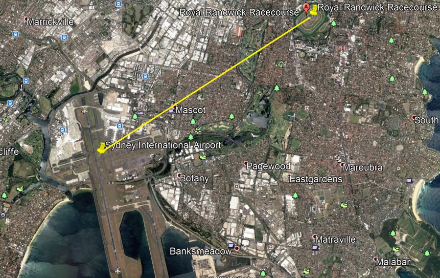
The first race at Randwick was held in 1833, and in the present-day is the host of racing championships with millions of dollars in prize-money.
The Downsview Airport further east of the Toronto Pearson International Airport has a number of tracks close by.

And the Billy Bishop Toronto City Airport on Toronto Island has a track located northeast of it in a line that crosses through the real estate containing the CN Tower, Rogers Center, and Roundhouse Park and downtown Toronto.
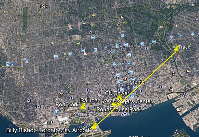
The CN, or Canadian National, Tower is 1,815-feet, or 553-meters, high, a communications and observation tower located on what is known as Railway Lands, a large railway switching yard on the Toronto Waterfront, and said to have been completed in 1976.

Roundhouse Park next to the CN Tower was the location of the John Street Roundhouse, said to have been built in 1929 to maintain Canadian Pacific Railway trains during the Golden Age of Railways, where maintenance teams worked on as many as 32 trains at a time.
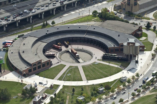
The Roundhouse is the last such building in Toronto, and survived the demolition of other railway facilities nearby that took place to make room for the new stadium, the Rogers Center, which opened in June of 1989.
The Rogers Center is the home of Major League Baseball’s Toronto Blue Jays, as well as a large-event venue.

Fort York is located Just a short distance west of this busy spot on Toronto’s water-front, and a short-distance north of the Billy Bishop Toronto City Airport.

What we see at Fort York was said to have been built between 1813 and 1815 to house soldiers of the British Army and Canadian Militia and to defend the entrance of Toronto Harbor…

…and made of stone-lined earthwork walls, and eight buildings within the walls.

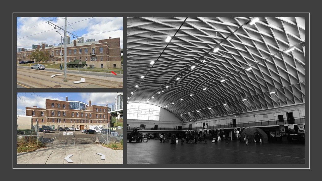
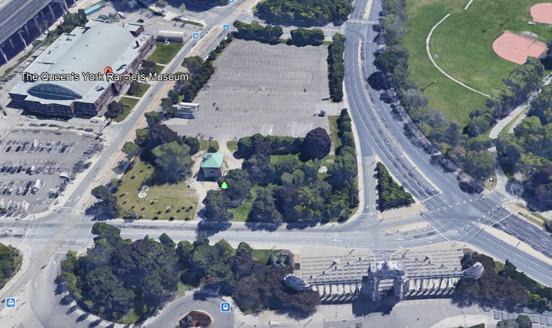
The Fort York Armory is interesting, and also houses the Queen’s York Rangers Museum.
It is cut-off from the Old Fort by the Expressway…
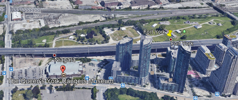
…but you can get to the Old Fort from here, between the pair of old stonemasonry arches at this entrance.

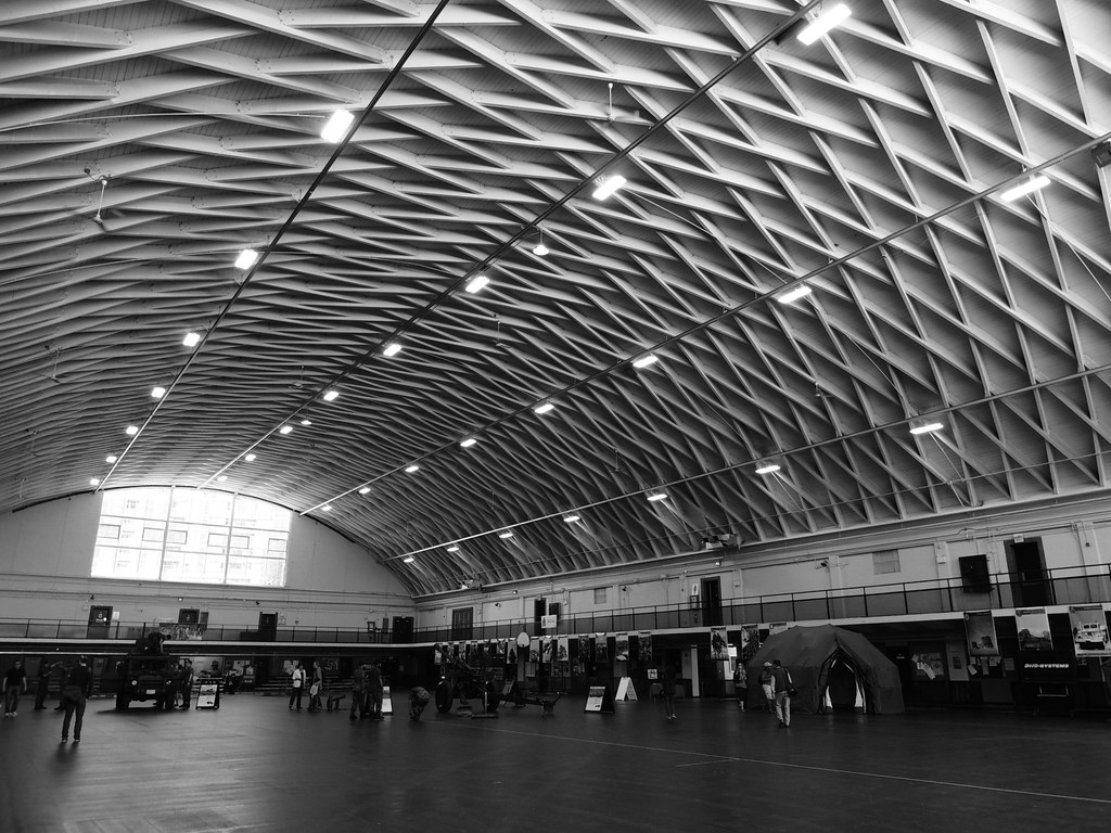
We are told the Armory was built with private funds in 1933, and has the largest lattice wood arched roof in Canada.
There is some interesting window action going on here at the Armory.
Most of the the front of the Armory and the west-side of the building appears the same.
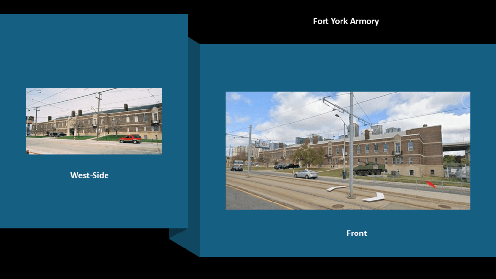
But at the east-end of the building, there is uneven ground and windows at ground-level. and appears to show a whole floor underneath.
We could call that a basement or sub-floor, right?
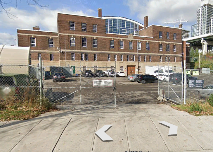
Well, but if it was planned this way, it was sure sloppily done, like what is seen here in the front corner with regard to the ground-level windows, especially for the building with the stunning perfection shown in the largest lattice wood-arched roof in Canada.
And, literally right around the corner from the Fort York Armory…
…is a triumphal arch and monumental gateway known as the Prince’s Gate at Exhibition Place.
The Prince’s Gate was said to have been constructed out of cement and stone between April and August of 1927…
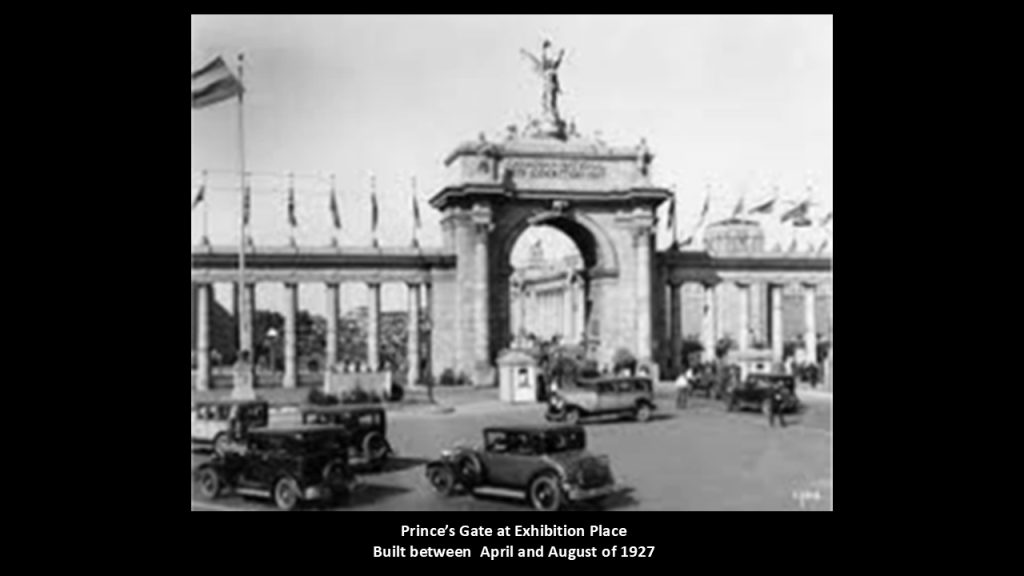
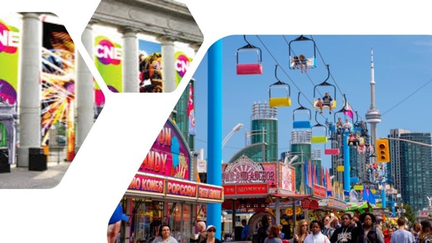
…and serves as the eastern gateway of the Canadian National Exhibition, an annual agricultural and provincial fair.
Now I am going to head in the direction of a Toronto neighborhood known as The Beach, or The Beaches.
It is considered part of the old city of Toronto.
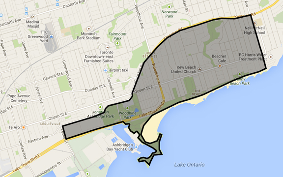
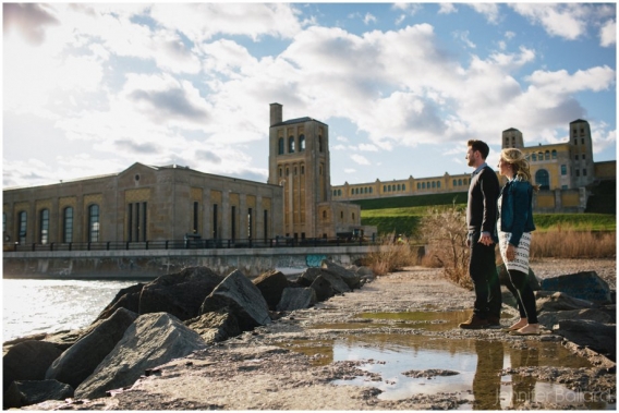
There is a long series of what are called groynes, which are jetties on the shoreline around both sides of the RC Harris Water Treatment plant that create and maintain beach, and reduce erosion.

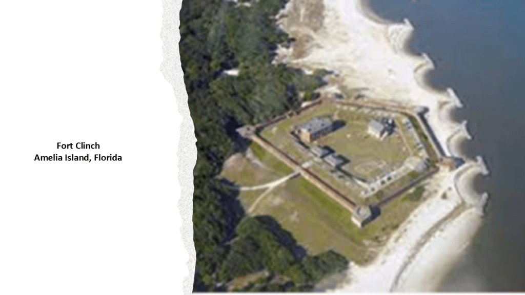
The groynes on either side of the RC Harris Water Treatment Plant remind me in appearance of the ones in front of Fort Clinch, a star fort on Amelia Island on North Florida’s Atlantic Coast near the state border with Georgia.
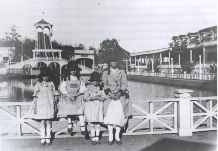
There were historically several amusement parks here, the only pictorially documented one being the Scarboro Beach Park, in operation from 1907 until 1925, when apparently the owner of the park, the Toronto Railway Company, locked the gates to the property.
Eventually the Scarboro Beach Park property was sold to a company which removed the rides and buildings, and replaced the land with housing.
The Victoria Park Amusement Park, said to have been in operation from 1878 to 1906, would have been right about where the “x” is, at the intersection of Queen Street and Victoria Park Avenue.

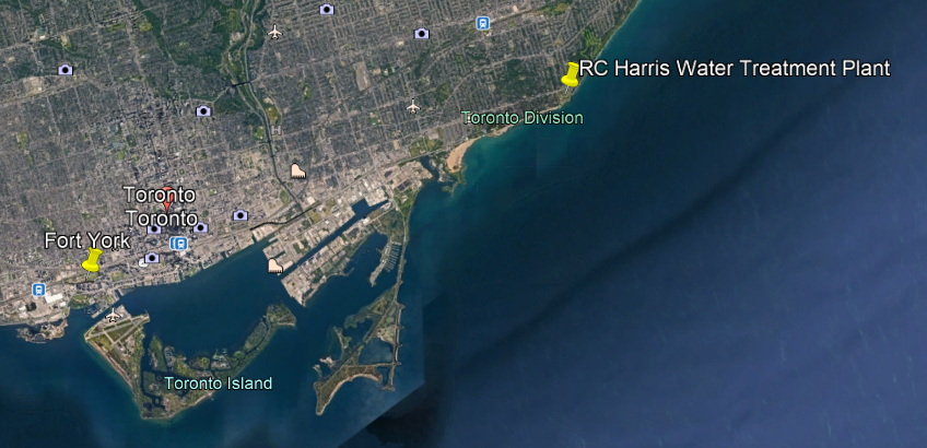
The RC Harris Water Treatment Plant Complex is located right next to where the Victoria Park Amusement Park was located.
I am going to postulate that the original purpose of this complex was a star fort.

Here’s why I think that.
First, star forts had many different shapes.
Most have pointed bastions, but some have round bastions, or a different shape altogether, and where I find one, there is at least one more in the vicinity to be found.
Here is the example in Puebla, Mexico, of Fort Guadalupe with pointed bastions, and Fort Loreto with round bastions.

Here is the geographic relationship of the locations of Fort York and the RC Harris Water Treatment Plant.
This is a photo of one of the round bastions at the RC Harris Water Treatment Plant, and cut-and-shaped stone blocks with straight edges in the foreground.

We are not given any other explanation in our historical narrative, so we typically don’t ask questions about how they got this way.
Like the buildings of Fort York, the RC Harris Water Treatment Plant is built on top of earthworks…

…and the brick-masonry here is massive, sophisticated and intricate.

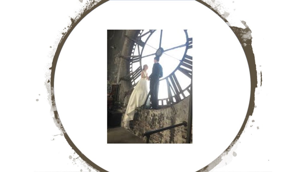
It’s even a popular spot in Toronto for engagement picture photo shoots!
It is definitely quite impressive on the inside as well!

This megalithic stone wall runs parallel to Queen Street at the front-boundary of the complex…

…with the Neville Street Loop for the Queen Street streetcar line the eastern terminus of Toronto’s longest streetcar route, just off the northwest corner of the RC Harris complex.

Here is what we are told about the RC Harris Water Treatment Plant.
Its construction started in 1932, and the building became operational on November 1st of 1941 (during World War II, and a little over a month before the bombing of Pearl Harbor).

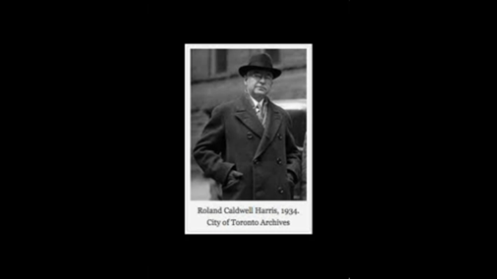
It was named after the long-time Commissioner of Toronto’s Public Works, Roland Caldwell, or RC, Harris, overseer of the construction project.
Next, I am going to look at some places in downtown Toronto.
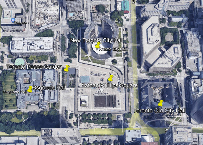
First, Nathan Phillips Square.
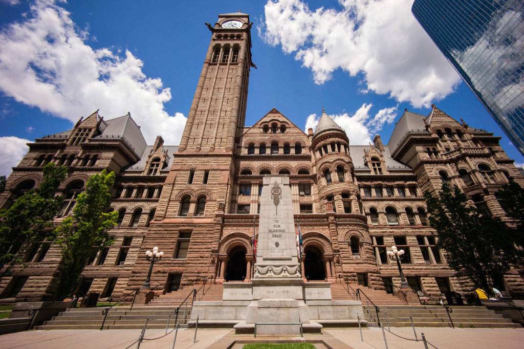
Nathan Phillips Square is an urban plaza in Toronto, with the Old City Hall directly to the east of it, said to have been built between 1889 and 1899…
…the New City Hall on the north-side of Nathan Phillips Square,with construction between 1961 and 1965…
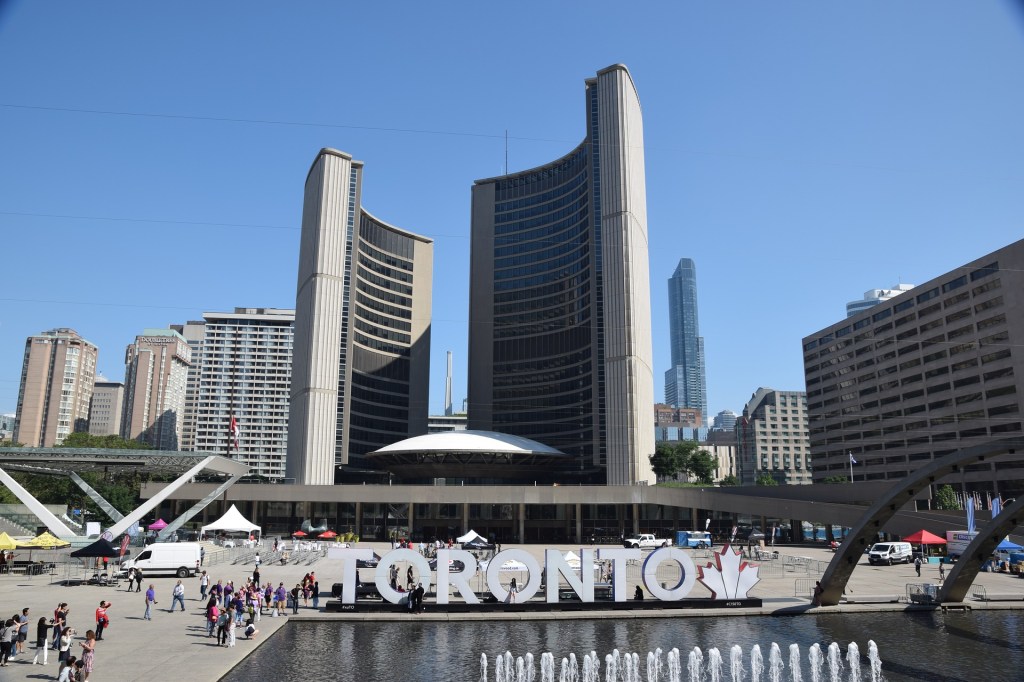
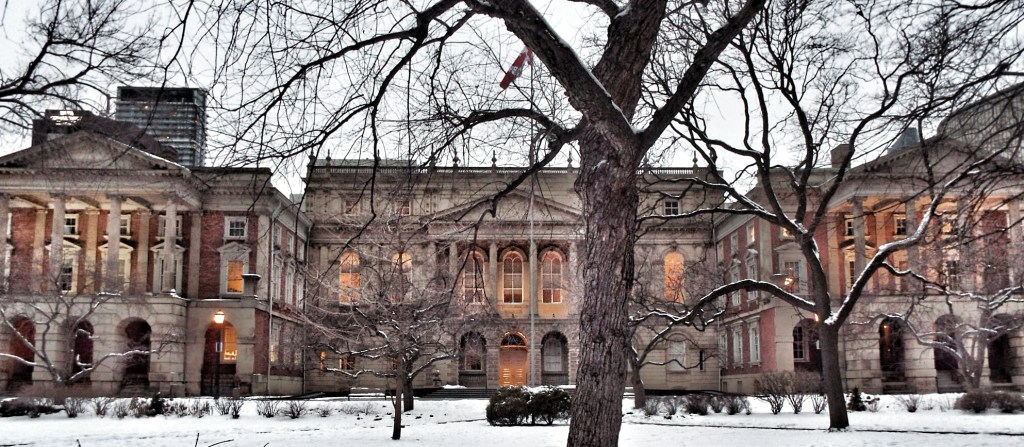
…and Osgoode Hall just to the west of the square, which serves currently as an office building and court house.
It was said to have been built between 1829 and 1832 as a law school.
The Toronto Peace Garden today is situated in the northwest corner of Nathan Phillips Square.
The original Toronto Peace Garden was in front of the New City Hall between 1984 and 2010, at which time it was decommissioned, and moved to the west- side of Nathan Phillips Square during the massive revitalization of the entire square.
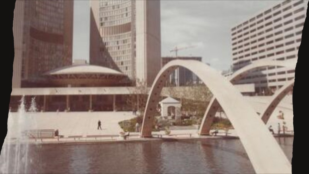
The new Toronto Peace Garden was re-dedicated on May 18th of 2016, six-years later.

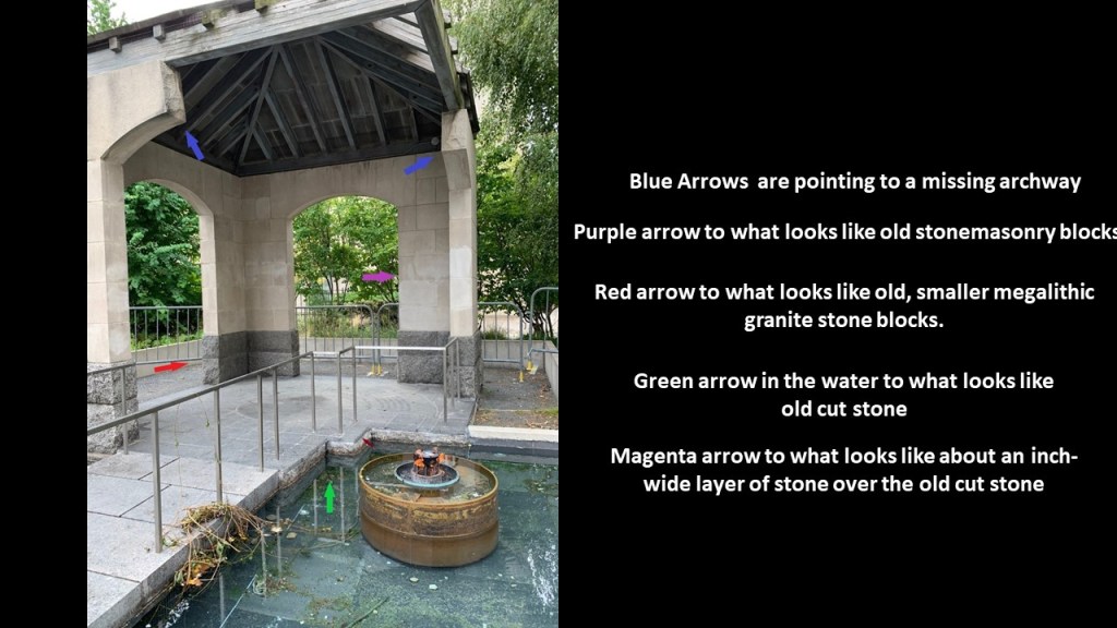
This stone structure looks like it has missing archways, pointed out by the blue arrows; old stonemasonry blocks, as shown by the purple arrow; and a red arrow is pointing to what looks like old, smaller megalithic granite stone blocks.
Then in the pool of water surrounding the predominantly stone structure appears to be cut rock as shown by the green arrow, and a small magenta arrow is pointing towards what looks like an inch-wide layer of stone tiles over the old cut stone.
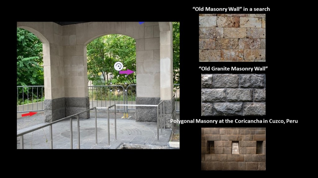
To provide a comparison of the stonework seen in the Peace Garden structure, I searched for examples of an “old masonry wall;” “old granite masonry wall;” and “polygonal masonry.”
One more thing, when I was looking for a good photo of the New Toronto City Hall, I found this one of it being constructed…and the classical-looking “Registry of Deeds and Land Titles Building” sitting right next to next to it in what appears to be a busy excavation scene of some kind.
The old “Registry of Deeds and Land Titles Building” was demolished in 1964 to allow the New City Hall to be completed, and would have been in the general vicinity of the Toronto Peace Garden today.

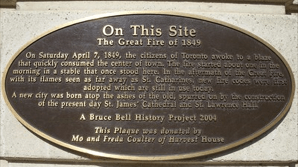
We are told the first Great Toronto Fire occurred in 1849.
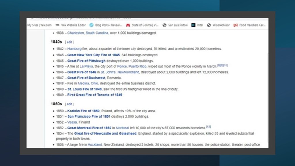
This is a good place to mention that there have been lots and lots of “Great Fires of ______” in our historical narrative, wreaking great destruction in cities the world over.
Here is only a partial list from the mid-19th-century, as the list of fires truly goes on and on:
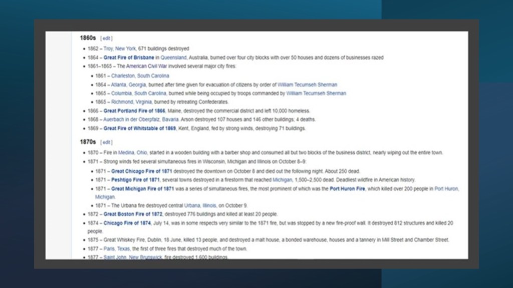
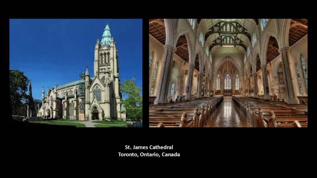
The 1849 Toronto Fire was also known as the Cathedral Fire, and was the first major fire in the history of Toronto, with much of the business core of the city being wiped out, including the predecessor of the St. James Cathedral, home of the oldest congregation in the city, according to what we are told.
The St. James Cathedral was said to have been rebuilt starting in 1850, and opening to the public in 1853.
This is a depiction of the 1831 City Hall and Market building at King and Front Street (now Nelson Street), said to have been destroyed in the 1849 Toronto Fire and torn down …
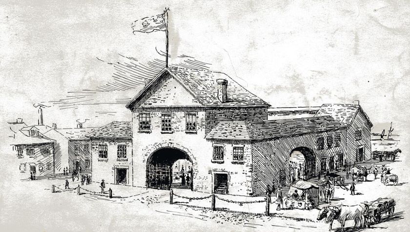
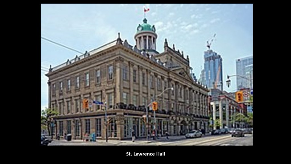
…and was said to have been rebuilt in 1850, and called C a meeting hall in a north-south orientation, and the first to be known as the St. Lawrence Market.
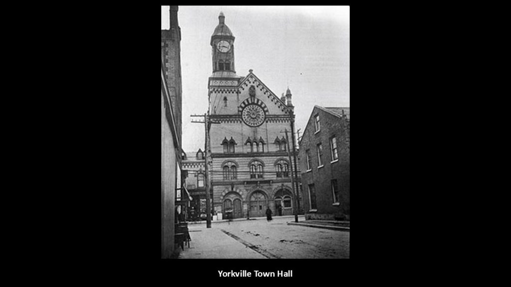
The railways were said to arrive in Toronto in 1850, and street rail-lines were said to have been operating from the Yorkville Town Hall in 1861 to the St. Lawrence Market.
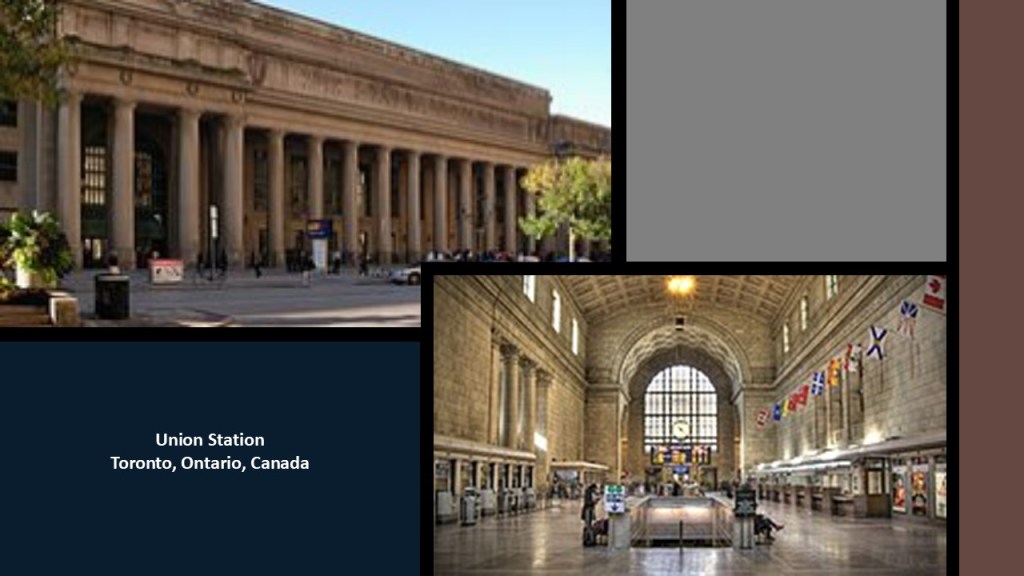
The main railroad station in Toronto is the Union Station, which was said to have been built starting in 1914, the first year of World War I, and first opened in 1927.
We are told the Great Fire of Toronto in 1904 destroyed a large section of downtown Toronto.
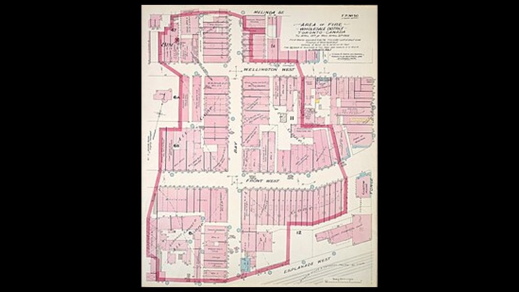
It was said to have started in a factory on the evening of April 19th, possibly from a faulty heating stove or electrical fire though the exact cause was unknown, and that it was out by 4:30 am the next morning, but that sporadic fires over the next two weeks continued to cause damage.
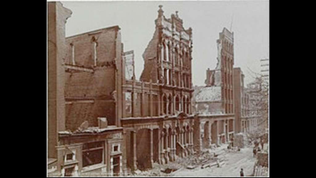
When it was all done, over 100 buildings were destroyed by the fire.
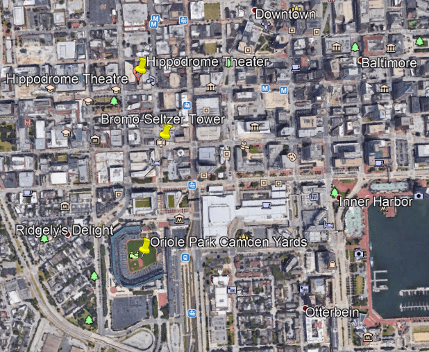
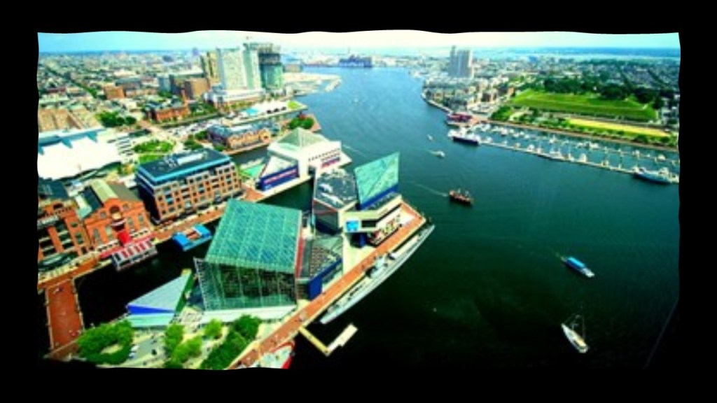
Now I am going to turn my attention to Baltimore, the largest city in the state of Maryland.
Starting with the airport, I found school tracks at a similar angular relationship to Baltimore-Washington International Airport that I have found in other cities.
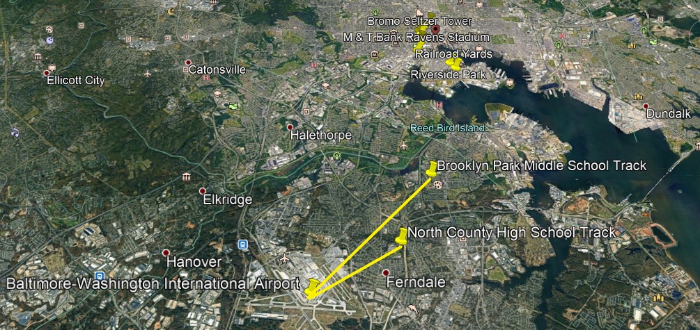
Also, like what I have found in Toronto and other major cities, the Baltimore professional sports complexes are relatively close to the airport, in South Baltimore.
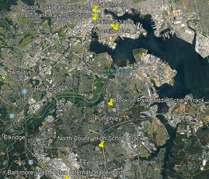
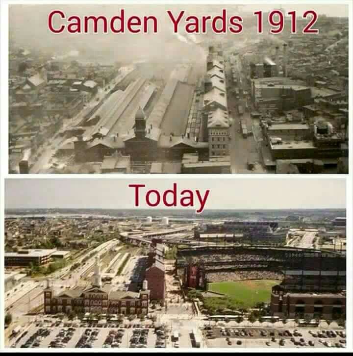
Camden Yards was previously a yard for the Baltimore & Ohio Railroad, and was converted into today’s Oriole Park for the Baltimore Major League Baseball Team, first opening in April of 1992…
…and the M & T Bank Stadium, the home of the National Football League’s Baltimore Ravens, is located next to Oriole Park at Camden Yards, and first opened in September of 1998.

There are still railyards fairly close to this location today.

The next three places are located in downtown Baltimore and located close to Oriole Park at Camden Yards.

Baltimore’s famous landmark, the Bromo Seltzer tower, was said to have been designed by local architect Joseph Evans Sperry, and erected between 1907 and 1911 for Bromo-Seltzer inventor Isaac Edward Emerson.

Bromo-Seltzer was a brand of antacid invented in Baltimore in 1888 for the relief of pain from things like heartburn, upset stomach and indigestion.
It was original made from sodium bromide and acetanilide, both of which are toxic and were later removed from its formulation, and replaced with sodium bicarbonate and citric acid, which create effervescence when mixed with water.
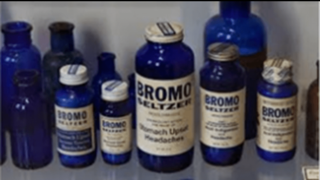
Like the RC Harris Water Treatment Plant in Toronto, the Bromo-Seltzer Tower in Baltimore is also popular for photo shoots.
The Hippodrome Theater near the Bromo-Seltzer Tower was said to have been built in 1914, and was the foremost vaudeville house in Baltimore as well as a movie theater.
It was renovated in 2004, and is now part of the France-Merrick Performing Arts Center.

The Basilica of the Assumption is a number of blocks northeast of the Hippodrome in downtown Baltimore, and said to be the first Roman Catholic Cathedral built in the United States between 1806 and 1821.

The architect of the Baltimore Basilica was said to be Benjamin Henry Latrobe, the “Father of American Architecture,” and best-known for having been given the credit for designing the U. S. Capitol Building.

Looking at other places around Baltimore, we find the tidal portion of the Patapsco River forming the Baltimore Harbor…
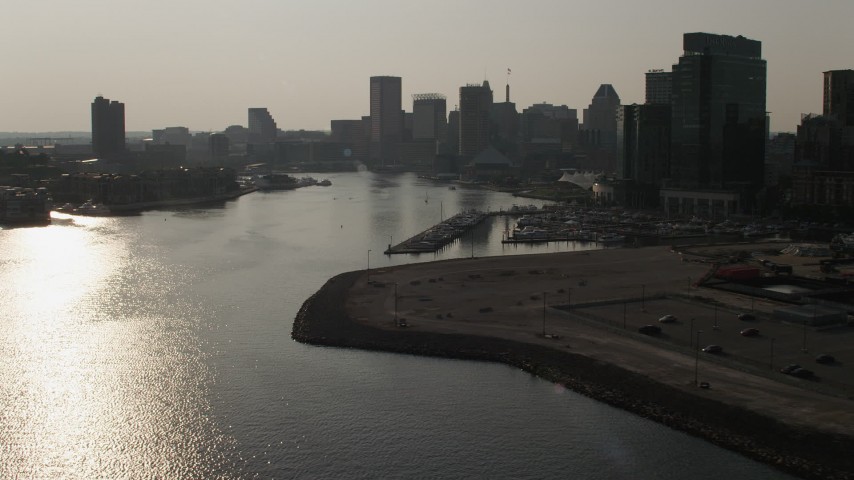
…including the Inner Harbor, which is located at the mouth of the Jones Falls, creating the wide and short northwest branch of the Patapsco River.
Jones Falls is described as an 18-mile, or 29 kilometer, major North-South stream that runs from the North through Baltimore City before it empties into the Inner Harbor.
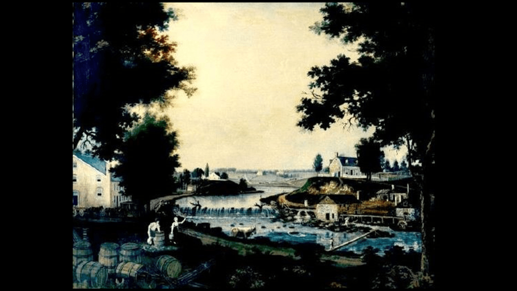
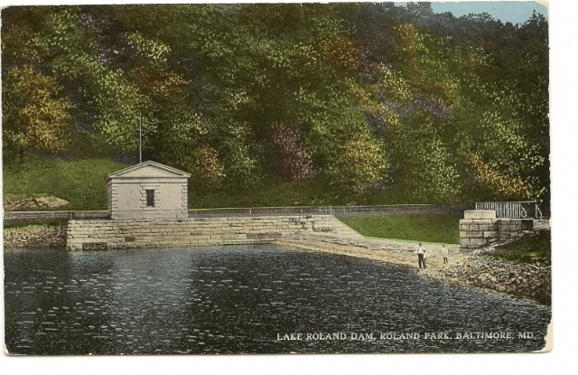
This is the Lake Roland Dam in Baltimore County, north of Baltimore City, described as a defunct reservoir since 1915, and said to have been built between 1854 and 1861.
Jones Falls flows in to, and out from, Lake Roland.
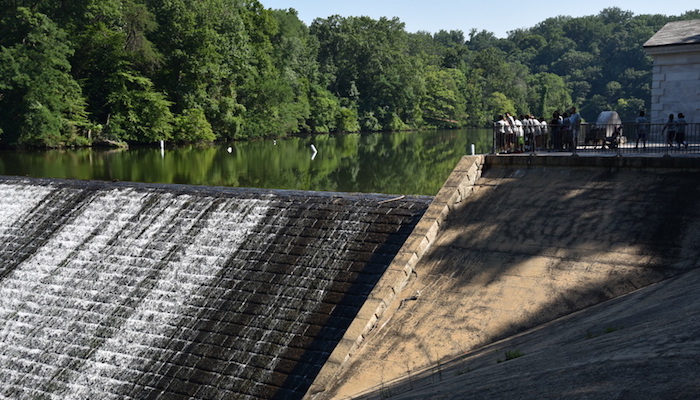
They sure put an enormous amount of effort into building something that wasn’t used for very long….
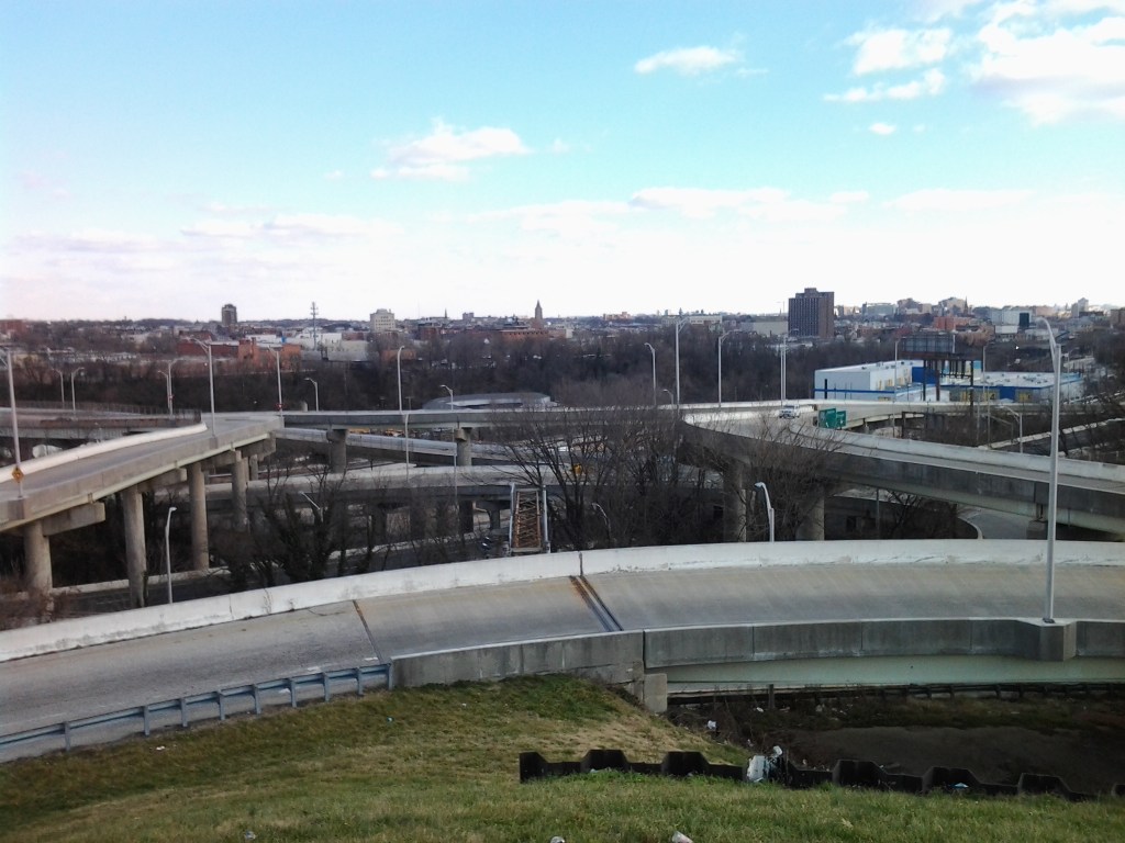
Jones Falls skirts the eastern edge of Druid Hills Park…
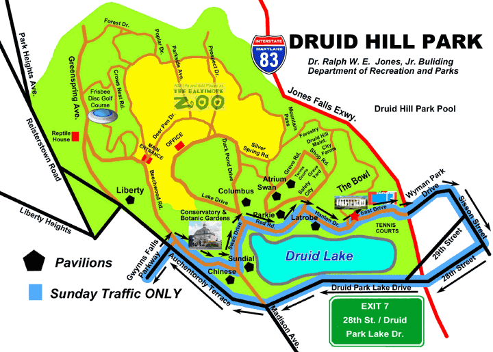
…over which I-83 was built over top of and is known as the Jones Falls Expressway.
I attended the University of Maryland Baltimore County (UMBC) from 1986 – 1989, and I was shocked when I lived there to find out that the Jones Falls Expressway was literally built over Jones Falls, and this didn’t sit well with me even then.
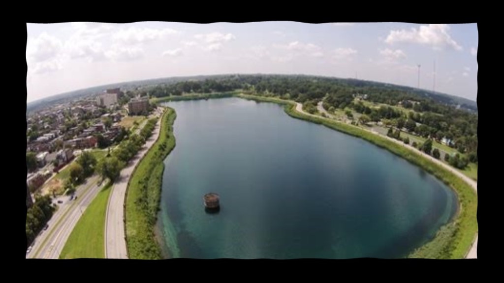
This is Druid Lake, said to have been constructed in 1863, which was in the middle of the Civil War, and is called one of the country’s largest earthen dammed lakes.
It served at one time as a reservoir for the Baltimore metropolitan area public water system.
This structure is located at the southeast corner of Druid Lake, and is actually called the Moorish Tower, but said to have been designed and built by George Frederick in 1870…
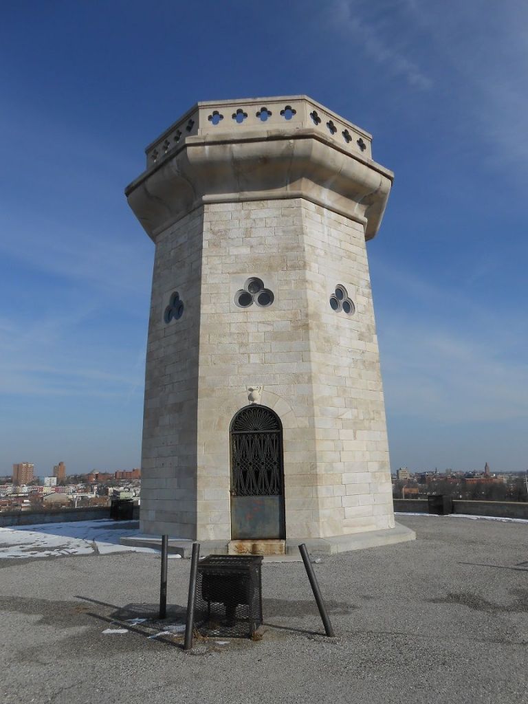
…and also sits atop an earthwork.
The tower itself is 30-feet. or 9-meters, -high, and is said to have marble walls.
The entrance was sealed at some point in the 1900s, so entry is no longer possible.
It has also been referred to as the Baltimore Tower.
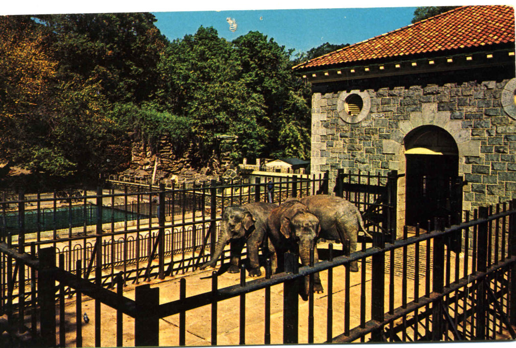
The Maryland Zoo, formerly the Baltimore Zoo, is in Druid Hill Park as well. It is said to be the third oldest zoo in the country, with construction starting in 1876.
This is the old elephant house, with its heavy masonry and port-hole windows.
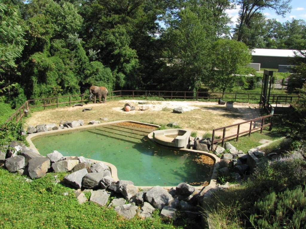
This location is part of the elephant exhibit, with its big block-y rocks with flat faces and straight edges in the foreground…
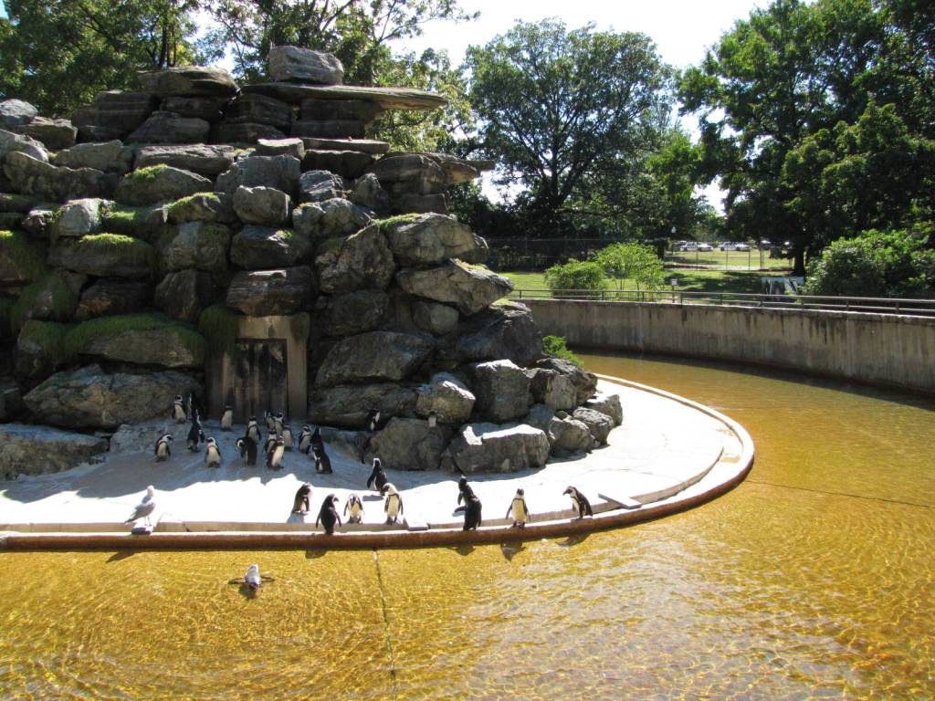
…and same block-y rocks at the penguin venue.
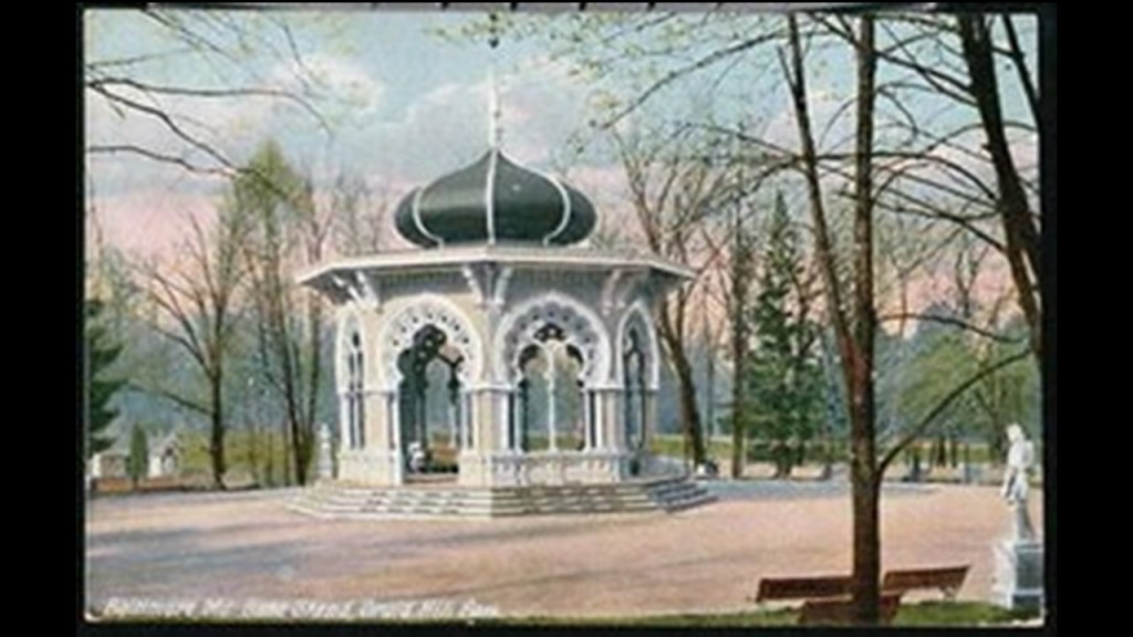
This is a postcard circa 1910 showing the Moorish-looking band stand at Druid Hill Park, with its onion dome, unique arches and columns, which was demolished for some reason in the 1950s.
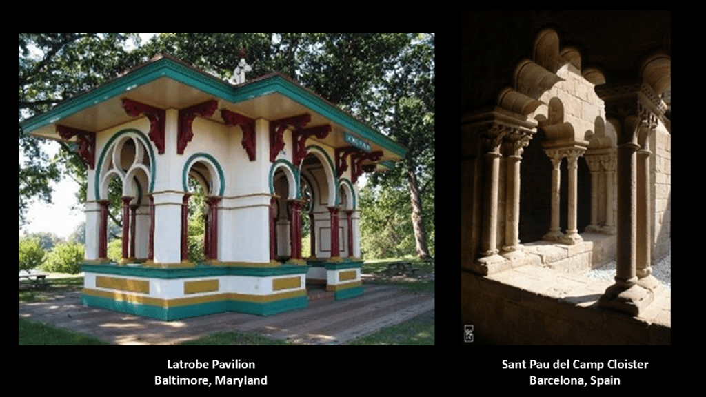
This is the Latrobe Pavillion in Druid Hill Park on the left, with its interesting arches and double-columns.
Still standing today, it was said to have been built sometime around 1863 or 1864 by the same George Frederick credited with the Moorish Tower in Druid Hill Park.
At one time in history, it was a railroad stop in this location.
On the right is the 12th-century Sant Pau del Camp Cloister in Barcelona, Spain, where the arches are described as reminiscent of the Moorish style, where on some arches there are 3-lobes, and on others, 5-lobes, and double-columns, too, like the Latrobe Pavilion in Baltimore.
Jones Falls also passes close to Baltimore’s Pennsylvania Station (originally known as Union Station), called the main transportation hub in Baltimore.
This building was said to have been constructed starting in 1910, and first opened in September of 1911, to replace the previous train station which was demolished in January of 1910.
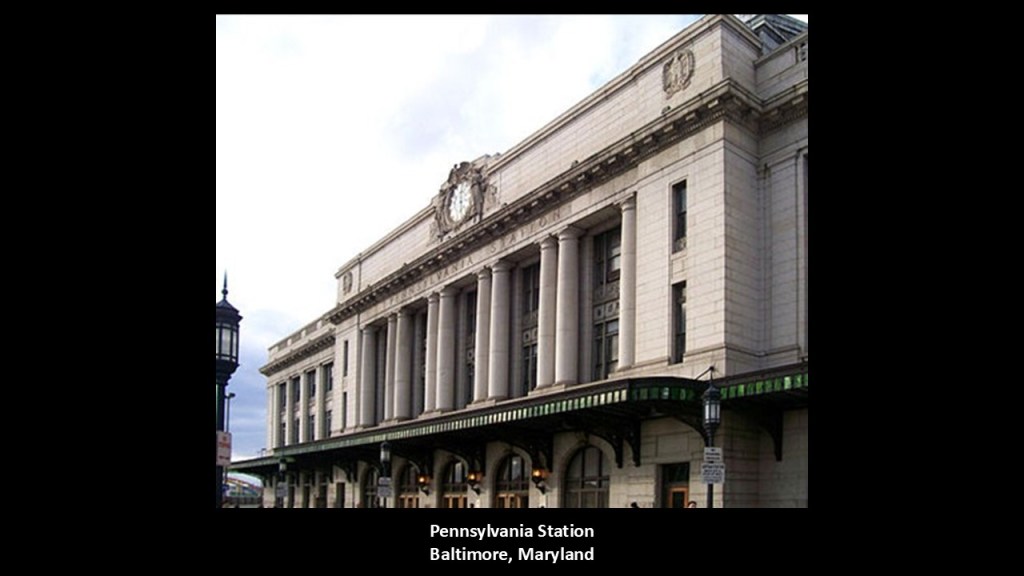
It is described as sitting on an island between two open trenches, one for the Jones Falls Expressway…
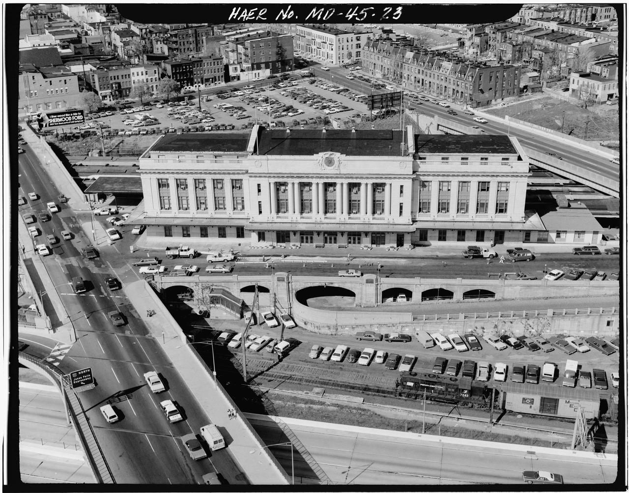
…and on the other side, the tracks of the Northeast Corridor (NEC) as its westernmost stop.

Next, Hawkins Point is the location of the tide station for the Patapsco River.
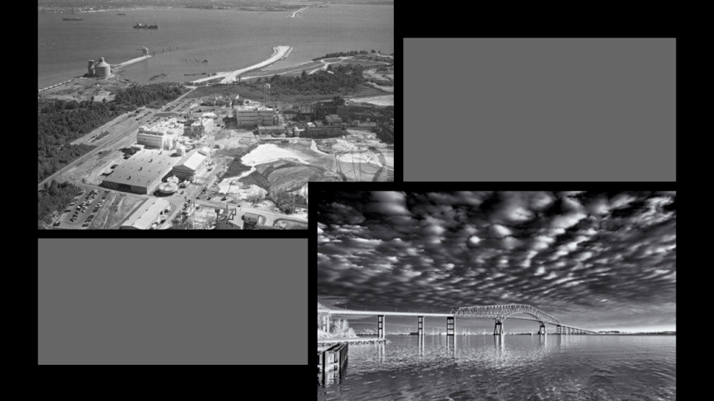
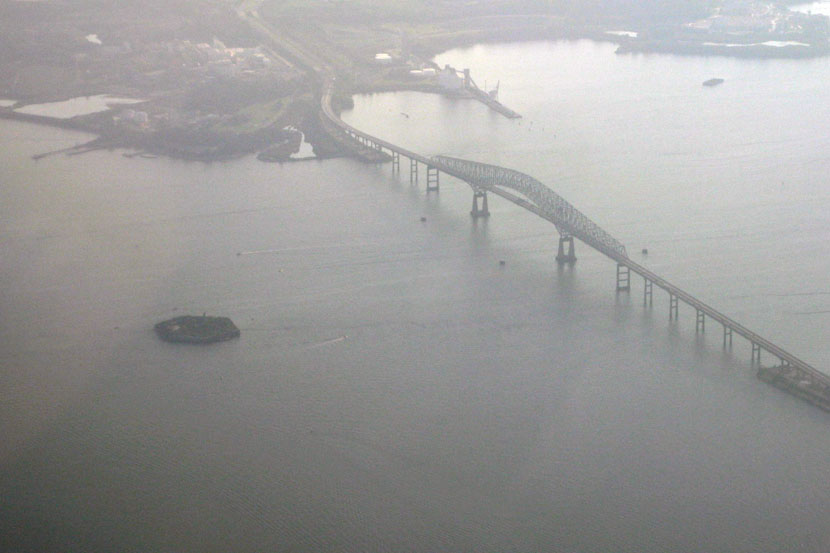
We are told this was an aerial view of Hawkins Point before the Key Bridge construction started in 1972…and after.
Fort Carroll is a short distance on the other side of the Key Bridge from Hawkins Point.
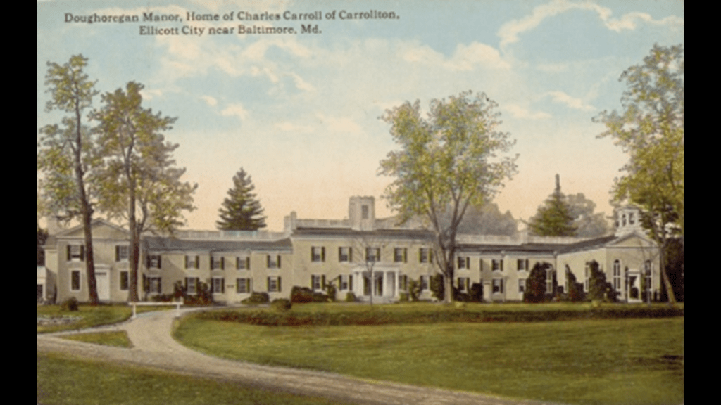
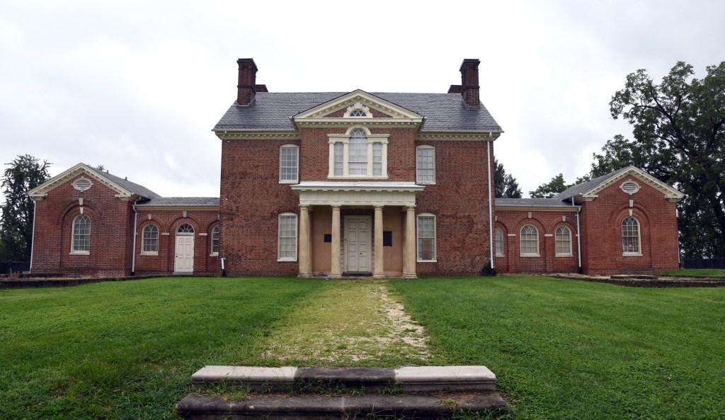
It is described as an artificial island and abandoned hexagonal sea fort, in the middle of the Patapsco River, just south of Baltimore, and said to be named for Charles Carroll of Carrollton, a signer of the Declaration of Independence.
More on Charles Carroll in a moment.
Here I have compared Fort Carroll on the top left and right, with Fort Jefferson, located west of Key West, Florida, now Dry Tortugas State Park, on the bottom left and right
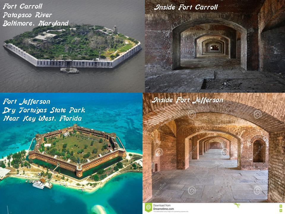
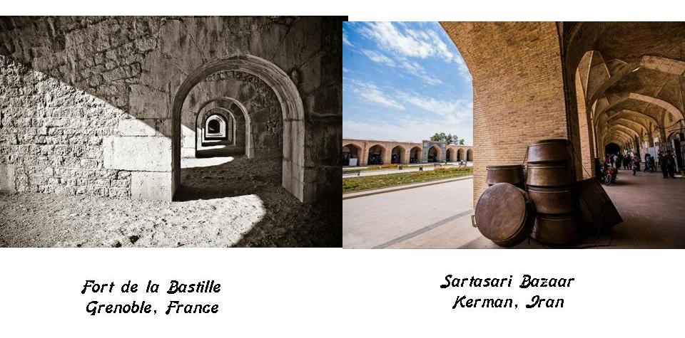
Compare the insides of these forts for similarity with the Fort de la Bastille in Grenoble, France, and the Bazaar-e-Sartasari in Kerman, Iran.
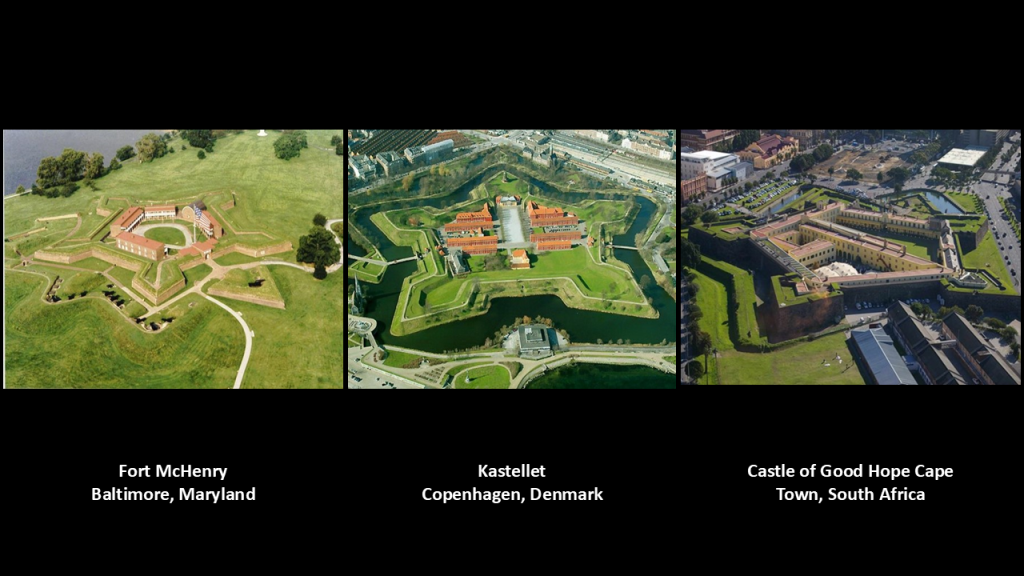
Fort McHenry pictured on the left is the best known fort in Baltimore.
The Star Spangled Banner was said to have been written by Francis Scott Key after he witnessed the bombardment of Fort McHenry during the Battle of Baltimore in 1814, a battle that took place in what is called the War of 1812.
Compare the appearance of Fort McHenry with Kastellet in the middle in Copenhagen, Denmark, and with the Castle of Good Hope in Cape Town, South Africa, on the right.
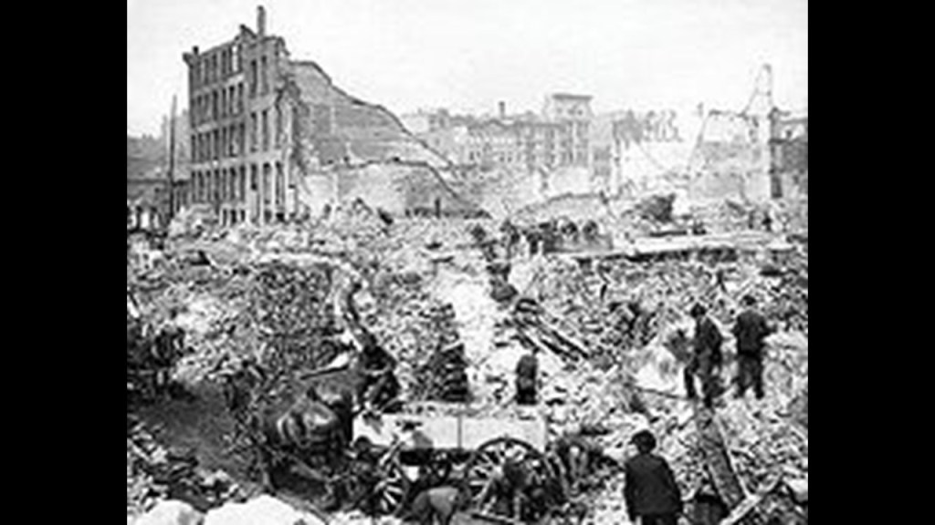
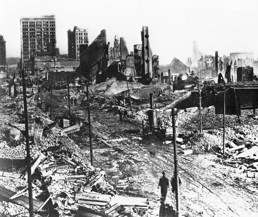
Next, the Great Fire of Baltimore of 1904, which was the same year as the second Great Fire of Toronto.
The Great Fire of Baltimore took place over two-days in February of 1904, and destroyed much of Central Baltimore.
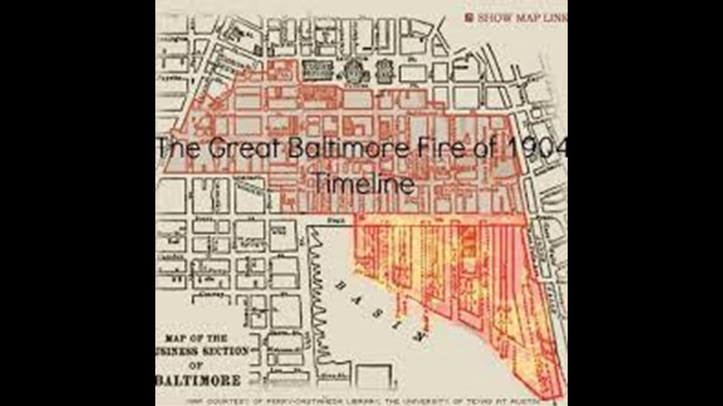
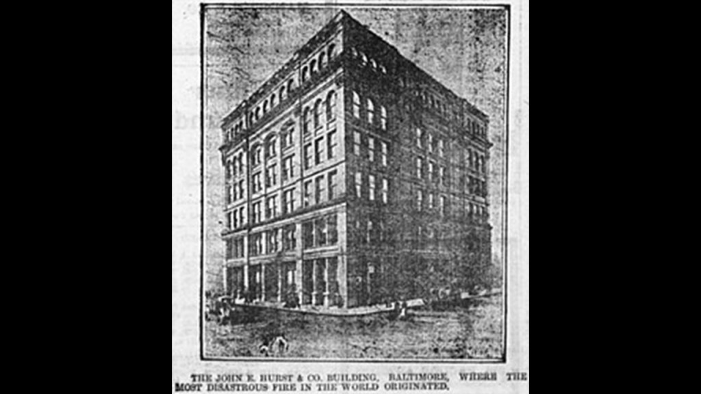
The Baltimore fire started at the John E. Hurst building in the western part of downtown Baltimore around 11 am on the morning of Sunday, February 7th, and spread quickly.
We are told that firefighting tactics included the dynamiting of buildings around the existing buildings to create a firebreak, but that this technique didn’t work and the destructive fire wasn’t brought under control until around 5 pm on Monday, February 8th.
When this fire was over, there were approximately 1,500 buildings either completely destroyed or severely damaged, and $100 million in property loss.
Now a little bit more about Charles Carroll.
Charles Carroll of Carrollton represents the State of Maryland in the National Statuary Hall.
He was an Irish-American politician, planter, and the only Catholic signer of the Declaration of Independence.
He was considered one of the Founding Fathers of the United States, and was known as the “First Citizen” of the American Colonies.
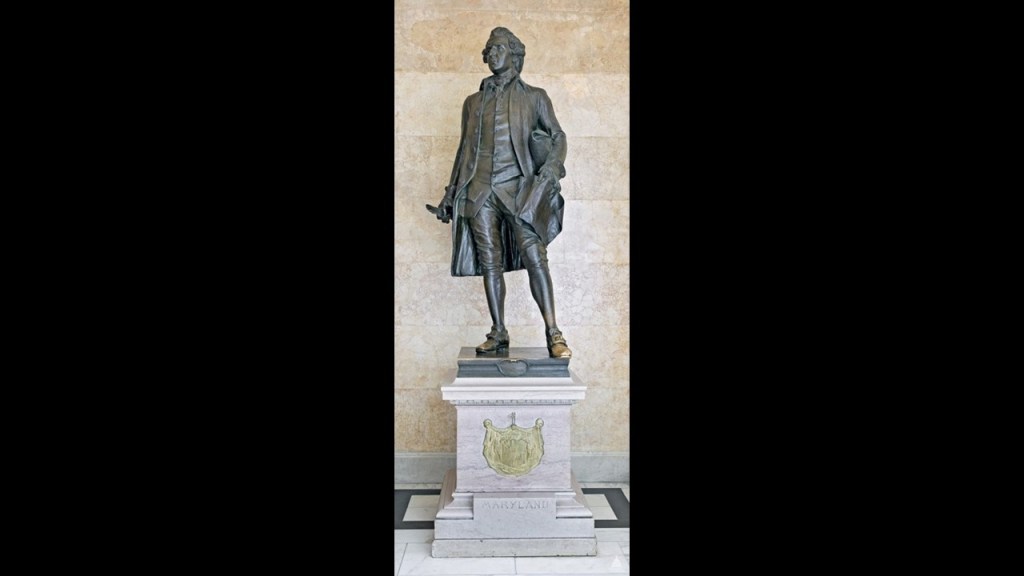
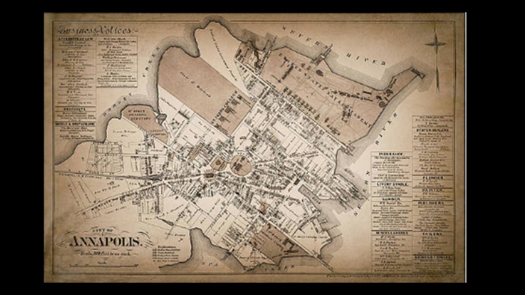
Charles Carroll was born in Annapolis in the English colony of Maryland in 1737 to the prominent, land-holding Irish Carroll family.
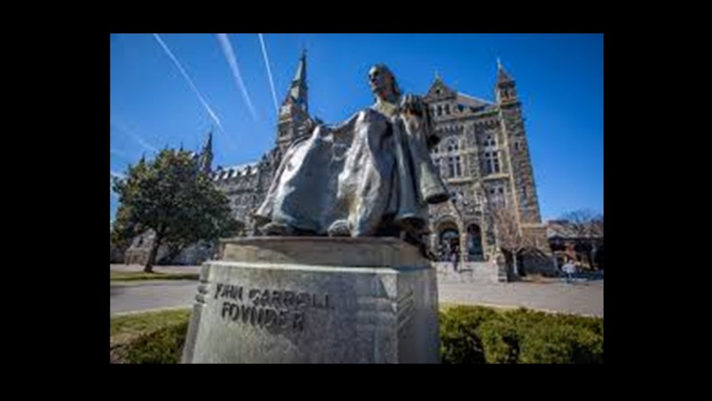
Charles Carroll received a Jesuit education first in Maryland and finished in Europe.
As a matter of fact, his first cousin was John Carroll, the first Catholic Bishop in the United States and the founder of the Jesuit Georgetown University.
When Charles Carroll returned to Maryland from Europe in 1765, his father granted him what became known as Carrollton Manor.
He became not only one of the wealthiest men in Maryland, but of anywhere in the British Colonies, with his extensive agricultural estates, but also what are called a collection of colonial-era industrial buildings along the Patapsco River near what is now Elkridge, Maryland, and that he provided the capital to finance new enterprises on the Western Shore of the Chesapeake Bay.
After retiring from public life in 1801, Carroll helped established the Baltimore & Ohio Railroad, which was founded in 1827 and broke ground for the construction of its headquarters and America’s first commercial railroad tracks on July 4th of 1828.
This is where aspects of the influential Carroll family of Maryland and Charles Carroll’s life and the history of the B & O Railroad intersect.
Mount Clare is called the oldest Colonial-era structure in Baltimore, Maryland, and was built on a Carroll-family plantation starting in 1763 by Charles Carroll the Barrister, a distant cousin of Charles Carroll of Carrollton.
This is what we are told.
The street grid of the city of Baltimore near Mount Clare began to grow and inch towards the southwest, with the dense development of streets and alleys of different styles of brick row-houses by the 1820s, and there was competitive economic pressure with the opening of the Erie Canal to develop the Port of Baltimore and the accompanying transportation systems like the Baltimore & Ohio Railroad with this new transportation technology from Great Britain and the proposed Chesapeake & Ohio Canal, of which both projects broke ground on the same day – July 4th of 1828 – and that there was an intense rivalry between the two.
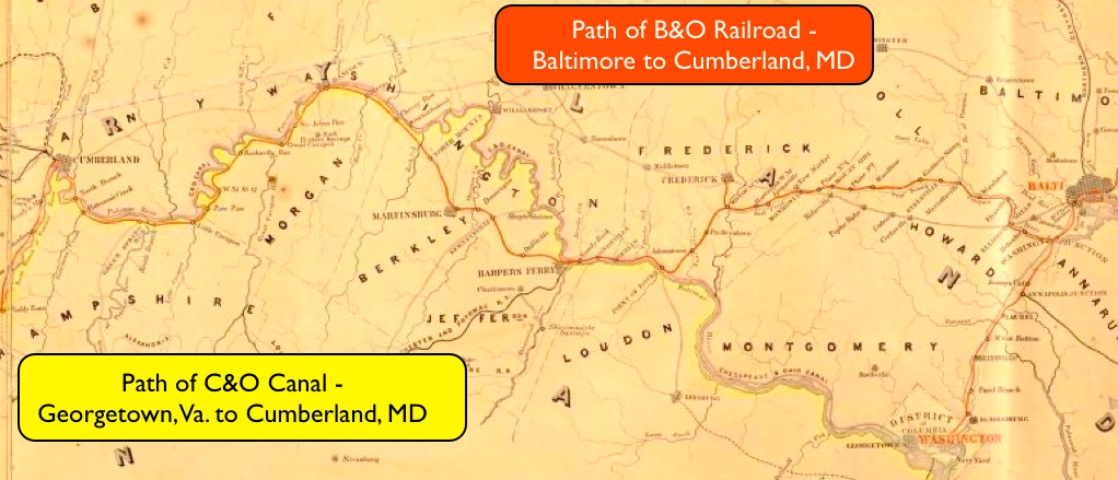
The Baltimore & Ohio Railroad Company was formed in 1827, of which Charles Carroll of Carrollton was one of its Directors, and he was the one that had the honor of laying the first stone for the railroad at the ceremony after the celebratory festivities at the July 4th ground-breaking in 1828, near the Mount Clare Mansion.
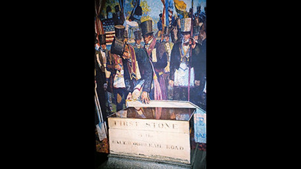
The Mount Clare Shops, of which this aerial photo is circa 1971, is the oldest railroad manufacturing complex in the United States, located on a portion of the Carroll family’s Mount Clare Estate, and the mansion left the family’s ownership in 1840.
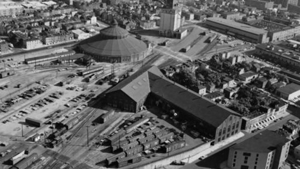
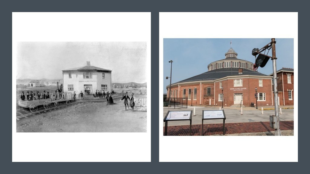
Mount Clare Station was first said to have been erected in the 1830s and the Roundhouse in 1884, with the current Mount Clare Station building having been constructed in 1851.
Today the Baltimore & Ohio Railroad Museum, we are told the original Mount Clare passenger station, the first in the nation, was abandoned, and was located where the parking lot is for the museum is today.
I am going to end this post with these thoughts.
After doing extensive research of the subjects I have brought up in ths post, along with many other subjects, I have come to the conclusion that the Jesuits, and other Catholic orders including, but not limited to the Franciscans, and the European Freemasons and other secret societies, including, but not limited to the Odd Fellows, were the primary architects and implementers of what needed to happen in order to pull-off covering-up the existence of the original advanced civilization and all of its infrastructure, and replace it with a new false narrative so we would have no idea that anything came before what we know as world.

The same stories are repeated everywhere, not just the examples provided in the two main cities of Toronto and Baltimore in the post, with things like all the effort it would take to build infrastructure, and then only using it for a short period of time; building architectural wonders in an incredibly short period of time or during wartime or times of depression; and great fires destroying cities to the point of making them look like bombed out war zones.
The list goes on and on.
What we are told in our historical narrative to explain how and when everything came into existence just doesn’t make any sense when held up under scrutiny, and I firmly believe we have been lied to about everything in our world.


Great research, most appreciated!
LikeLike
Hi I thought you might be interested…. I felt an earthquake last night and I checked the earthquake register to see if I was correct – I was. What was more interesting is the location of the quake. I’ve sent the link to the (gov) site below but the quake relates to the one at Singleton (epicentral time 23/04/2025 02.55.02). When I zoomed in to see the location, the epicentre appears to be right beside an open cut coal mine (Mount Thorley) and Singleton Military Area. The last few days here in NSW we have experienced significant ocean swells that have seen incredible (never before seen) coastal waves along the shore. There have also been other ‘unusual’ weather occurrences beyond the simple weather manipulation that we are used to. Along with specific astrological events currently occurring, I believe Mother Earth has been ‘freed’ from ‘enslavement’ and is ‘reacting’ to the new found freedom. I’m expecting heightened volcanic activity, probably from ‘extinct’ or inactive volcanoes and I have been wary that the NSW coast may be an area of new volcanic activity as Lemuria and Atlantis energies ‘rise’ along with Mother Earth’s new freedom. I don’t know if any of this is the kind of stuff you find interesting – I tend to watch the human consciousness and it’s collective influence on planet earth where earth is just one planet within the multiverse being ‘watched’ by other dimensions. Maybe I’m way off what you’re interested in but I thought to share with you. kind regardsSusan
https://earthquakes.ga.gov.au/
LikeLike
Thank you for sharing! Yes, I do find things like that very interesting indeed!
LikeLike