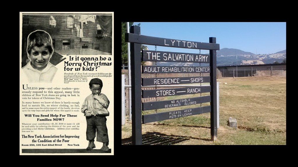
The Salvation Army was one of the earliest NGOs, along with “Anti-Slavery International,” the “YMCA,” and the “American Red Cross,” and was first established as a protestant church in 1865.
It is interesting that when you delve into specific Non-Governmental Organizations, invariably there are more questions than answers as the perception of NGOs by the general public is that they are benevolent and philanthropic organizations with a stated purpose of helping Humanity in a particular area or time of need, particularly since they are formed independently from government.
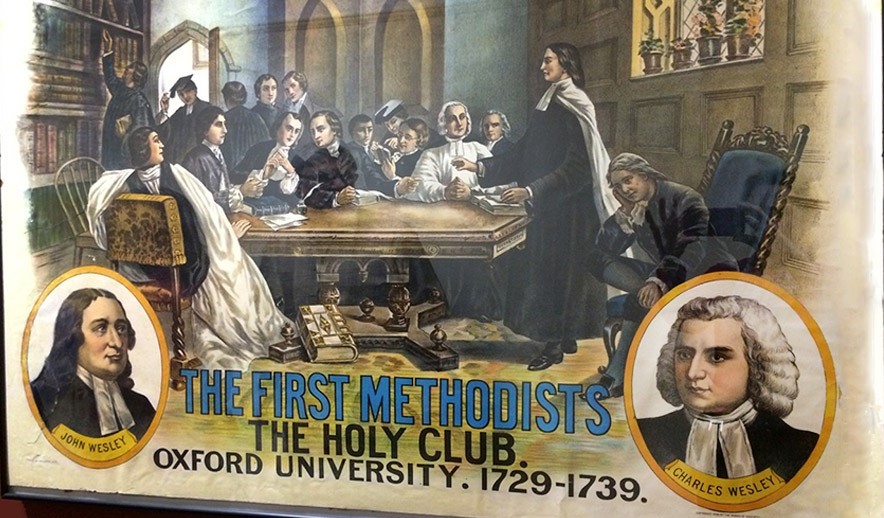
The theology of the Salvation Army comes from Methodism, a revival movement within the Church of England which started in the 18th-century and was based on the teachings of John and Charles Wesley & George Whitefield.
The Salvation Army is distinctive in its practices.
One is its use of designating its ministers as “officers” by using military ranks, beginning with Lieutenant and going all the way up to General.
This is what we are told about the origins of the Salvation Army.
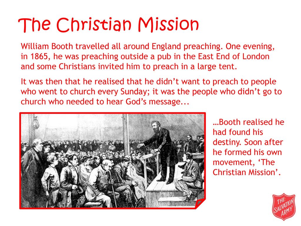
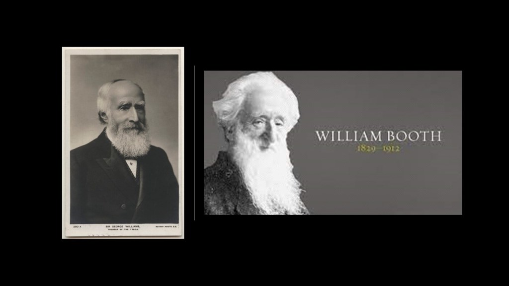
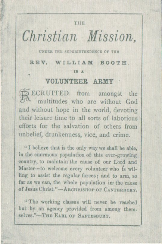
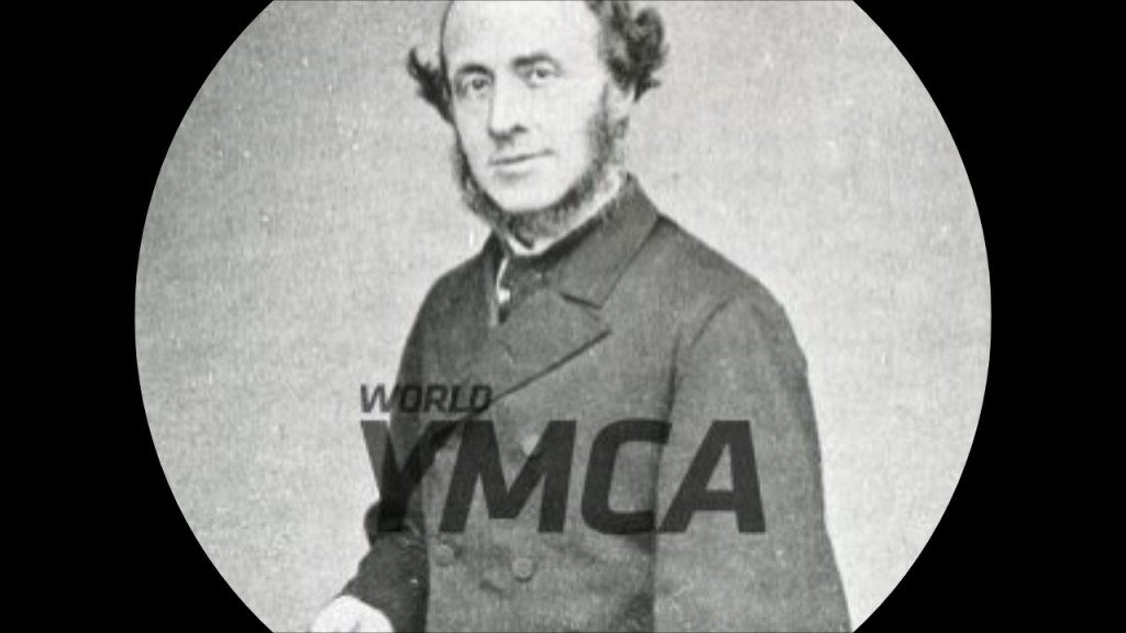
It was founded in 1865 by Methodist-Reform Church Minister William Booth and his wife Catherine Booth as the “East London Christian Mission.”
This name was used until 1878, when the mission became known as the “Salvation Army” and officially modelled after the army, with William Booth becoming the “General,” and his wife Catherine became known as the “Mother of the Salvation Army.”
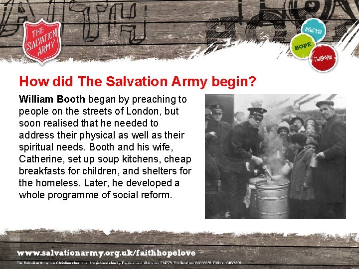
William focused on converting poor Londoners, including prostitutes, gamblers, and alcoholics to Christianity, who were its main converts.
Catherine focused on speaking to wealthy people to gain financial support for their work, as well as acting as a minister.
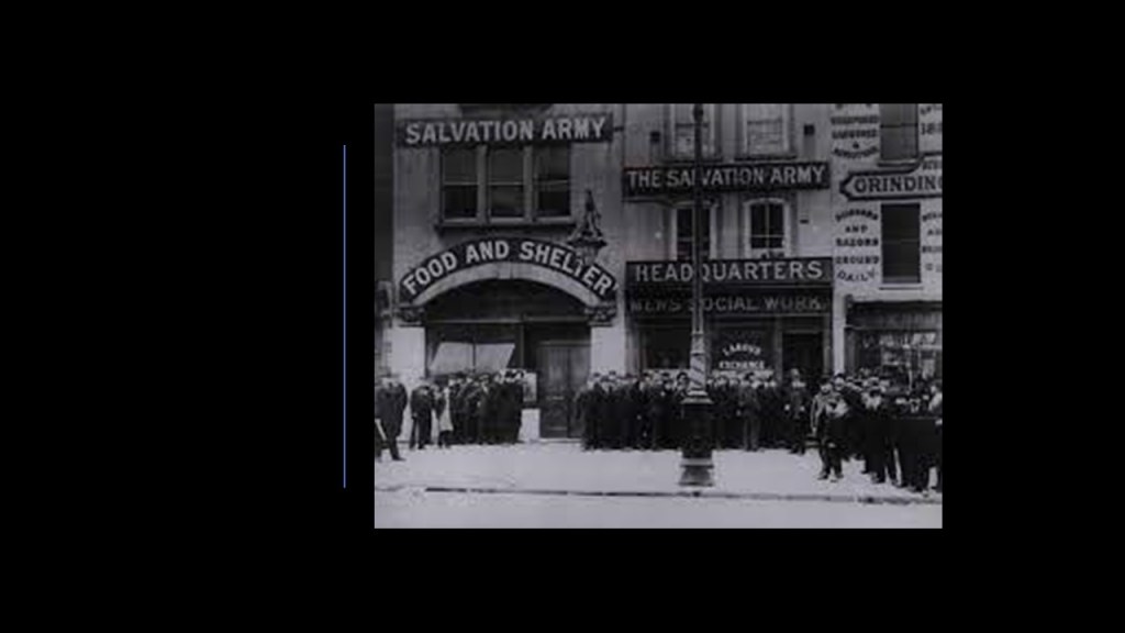
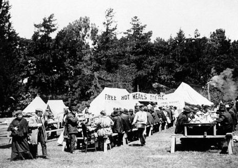
William Booth described the Salvation Army’s work with the down-and-out as the three S’s: soup; soap; and salvation.
In 1880, the Salvation Army started its work in three other countries – the United States; Ireland; and Australia.
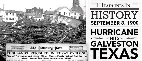
We are told the Salvation Army’s reputation improved in the United States as a result of its disaster relief efforts following the 1900 Galveston Hurricane…
…and the 1906 San Francisco earthquake and fire.
Today, the Salvation Army is in administered primarily in 5 regional zones, encompassing 128 countries, and is one of the world’s largest providers of social and humanitarian aid.
All this sounds really great, and I, among many others, have admired and supported the Salvation Army in my life.
I am going to dig around the personal histories of the founders William Booth and Catherine Booth, and see what turns up.
First, William.
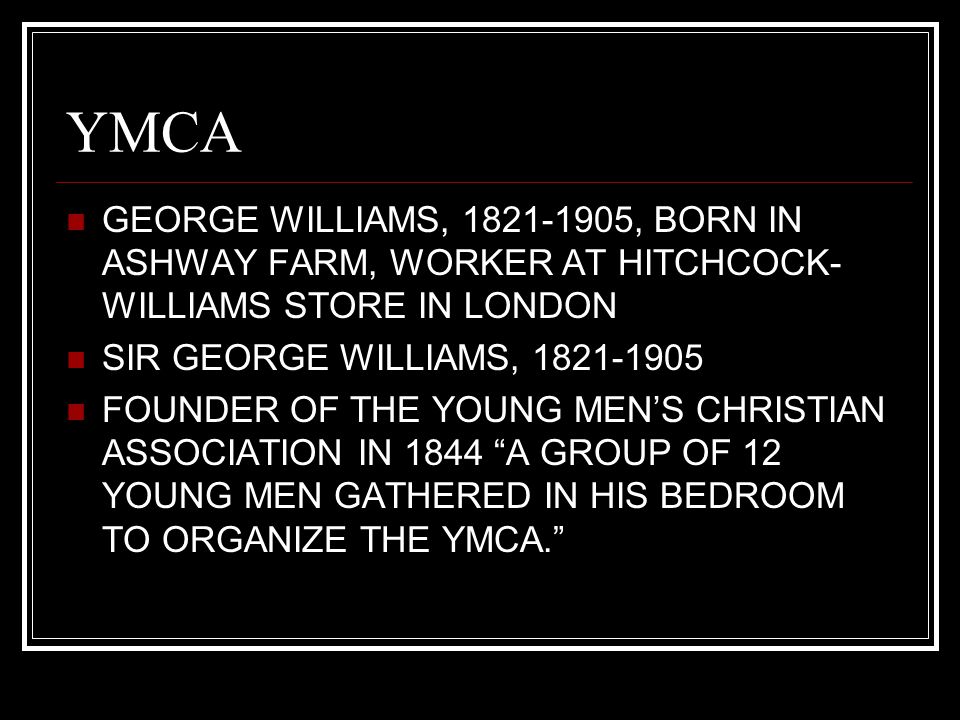
William Booth was born in April of 1829 in Nottingham, England, to a family that went from relative wealth to poverty, and in 1842, William was apprenticed to a pawnbroker at the age of 13.
Bear in mind that George Williams was apprenticed to a draper in 1841, three-years before he founded the YMCA, as mentioned previously.
They even bore a resemblance to each other in their later years.
Also, like George Williams, who converted to Congregationalism from Anglicanism after becoming an apprentice, William Booth converted to Methodism after becoming one.
Booth proceeded to train himself in writing and speech in order to become a Methodist preacher, and from there became an evangelist, and along with his friend Will Sansom, preached to the poor and sinners of Nottingham in the 1840s, and he continued to preach in the open-air when he moved to London in 1849.
In 1851, Booth became a full-time preacher for the Methodist Reform Church.
He and Catherine Mumford became engaged in 1852, and were married three-years later.
Like her husband, Catherine Mumford Booth was born in 1829, though she was born to Methodist parents and had a strong Christian upbringing.
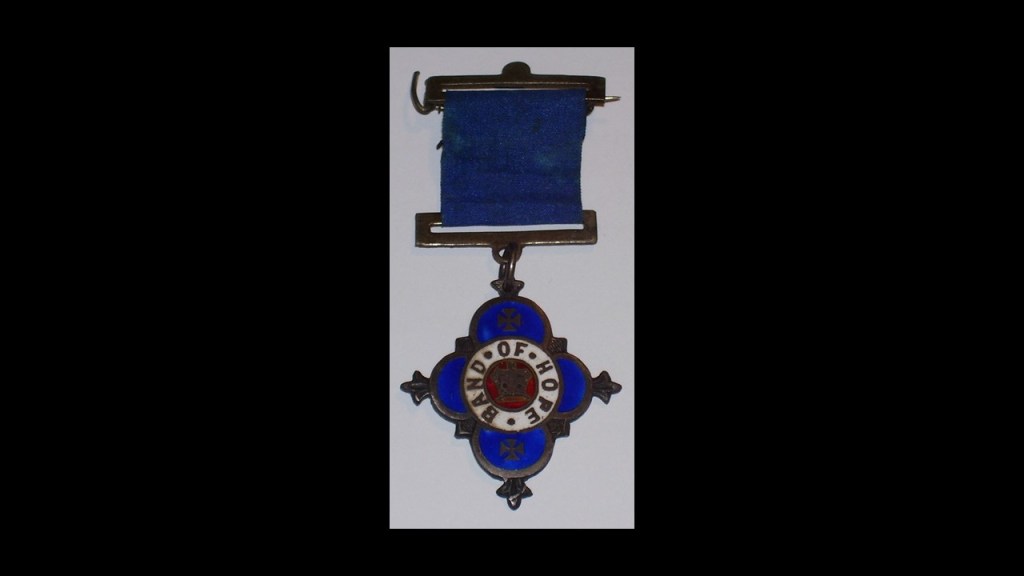
She was particularly concerned about the problems of alcoholism and was secretary of a Juvenile Temperance Society.
She was also a member of the Band of Hope, a Christian charity in the UK which educates children and young people about drug and alcohol abuse.
Band of Hope meetings started in 1847, and in 1855 it became a formal organization.
In 1850, when Catherine refused to condemn the Methodist Reformers, the Wesleyan Methodists expelled her.
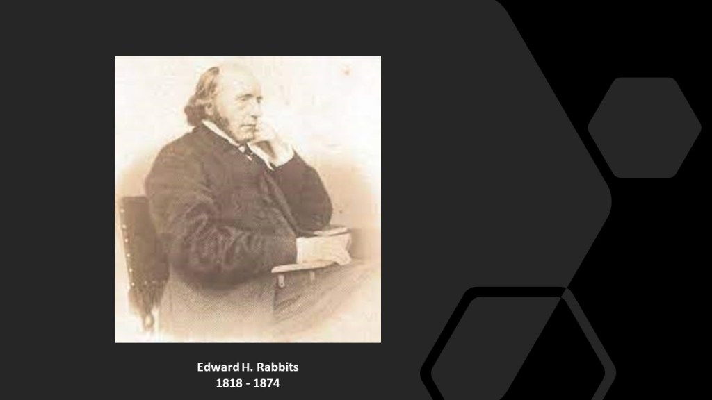
She met William Booth, who had also been expelled by the Wesleyans for reform sympathies, at the home of Edward Rabbits in 1851, and they married in 1855.
Rabbits was a Methodist Reformer who also established one of the largest shoe factories in the world, and his financial backing helped William Booth establish the Salvation Army.
Within Methodism, William Booth preferred evangelism to pastoring, and he became an independent evangelist when he was barred from evangelical campaigning in Methodist congregations.
By 1865, William and Catherine Booth had opened the “Christian Revival Society” in London’s East End, which was subsequently renamed the “Christian Mission,” then the “East End Christian Mission.”
Among other things, they created homeless shelters and soup kitchens during this time.
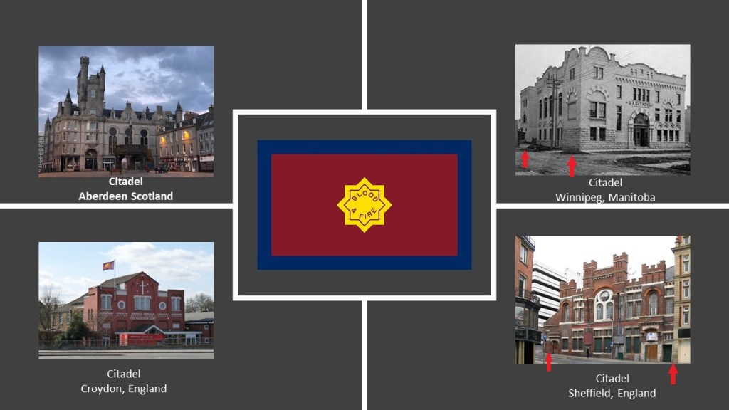
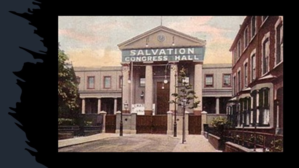
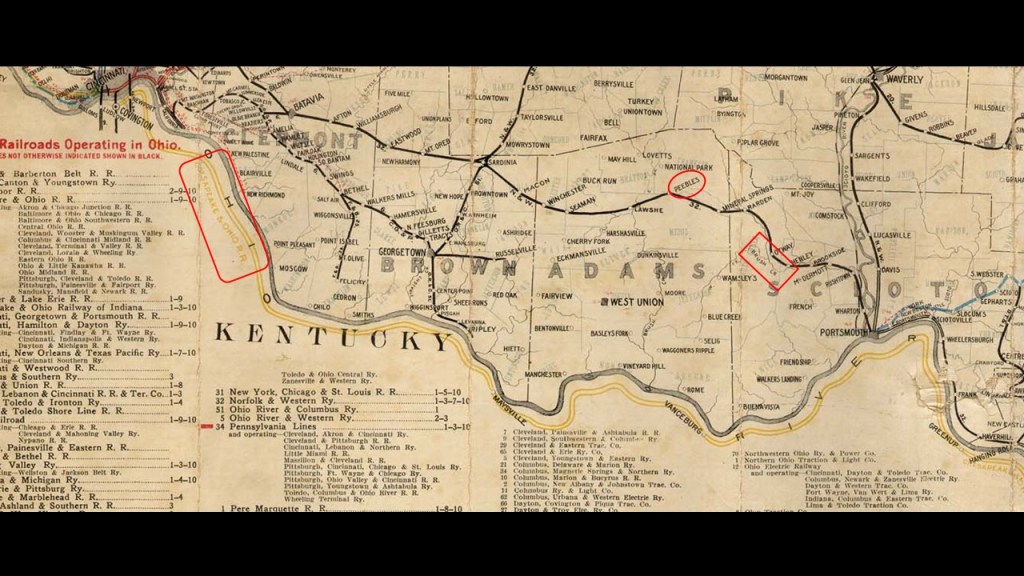
In addition to the Salvation Army’s churches around the world, known as “Corps,” or “Barracks” or “Temples” or “Citadels,” of which I have included several examples of citadels here, showing lovely old Castle or Cathedral-like buildings, two of which show classic evidence of mud-flood, with the slanting road and un-level windows…
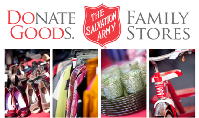
…the Salvation Army is known for things like its Thrift Stores…
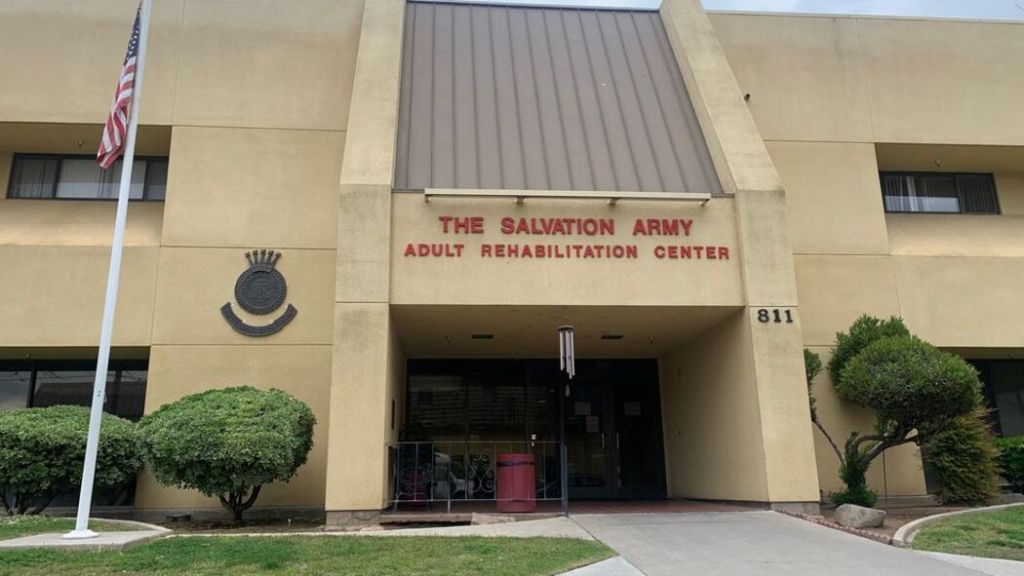
…Adult Rehabilitation Centers…
…homeless shelters…
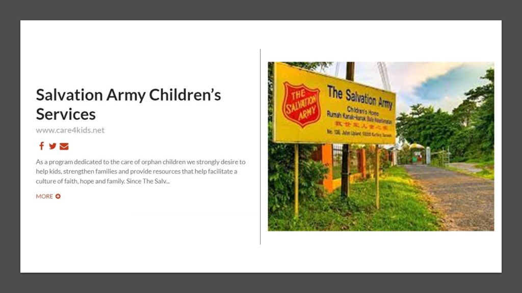
…children’s homes for orphans…
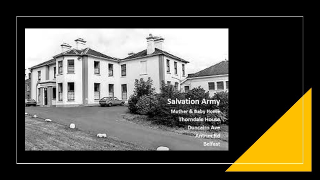
…Mother and Baby homes…
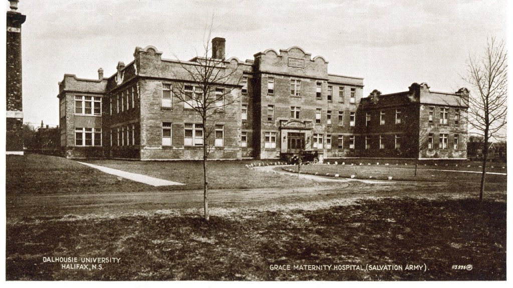
…and Maternity hospitals, to name a few of their human and social services.
While William Booth and the Salvation Army had its detractors, towards the end of his life, he was received and admired by kings, emperors, and presidents.
When William Booth died in August of 1912, his body lay-in-state for three-days at Clapton Congress Hall, where 150,000 people were reported filing by his casket…
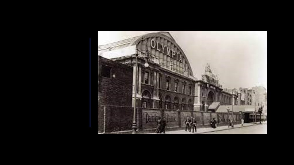
…and his funeral service was held at London’s Olympia, attended by 40,000 people, including Queen Mary…
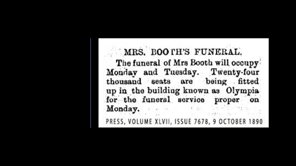
…and Catherine Booth received a similar send-off when she died before her husband, in October of 1890.
William and Catherine were buried together at the Abney Park Cemetery in London, which was the main burial ground for the non-conformist ministers of the 19th-century.
So this is the conventional version of what we are told about the Booths, and their popularity and reach.
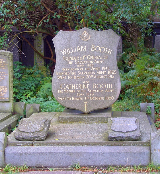
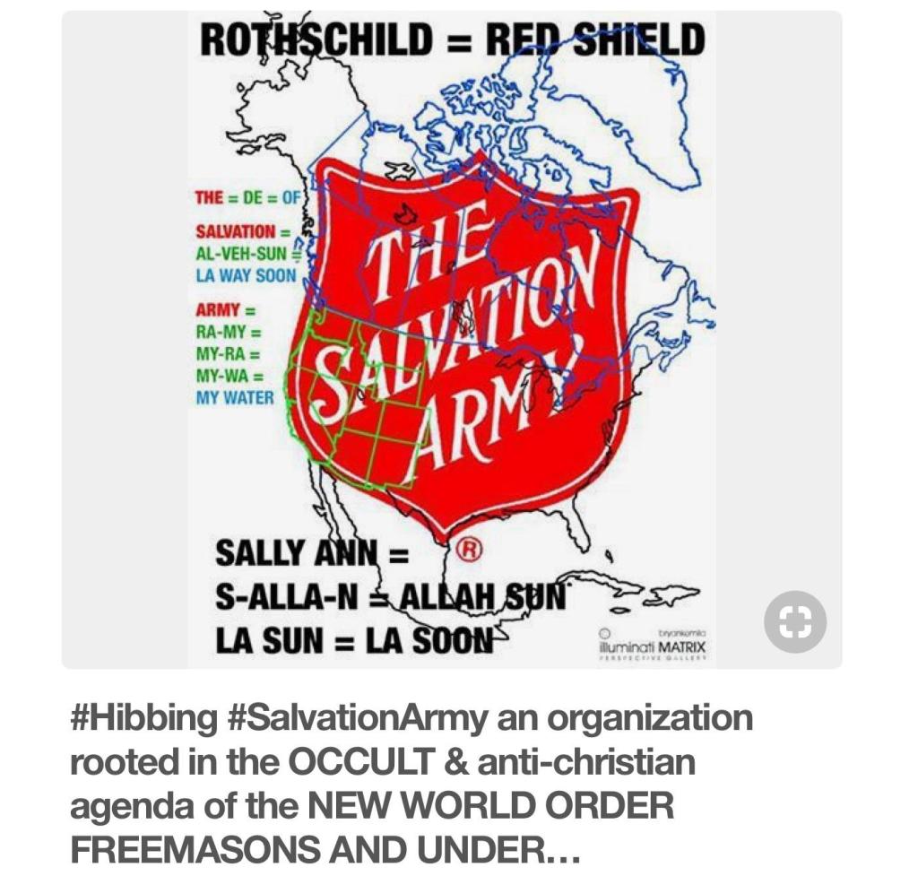
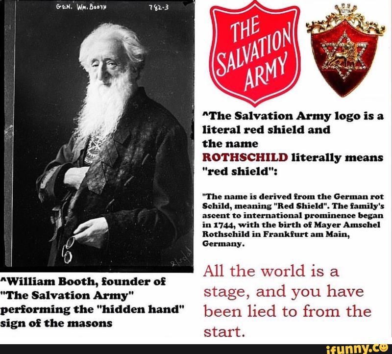
Let’s start with the Salvation Army shield seen at their gravesite.
The red shield is an internationally-recognized symbol of Salvation Army front-line service to those in need.
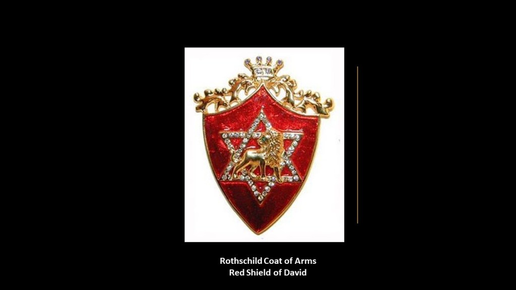
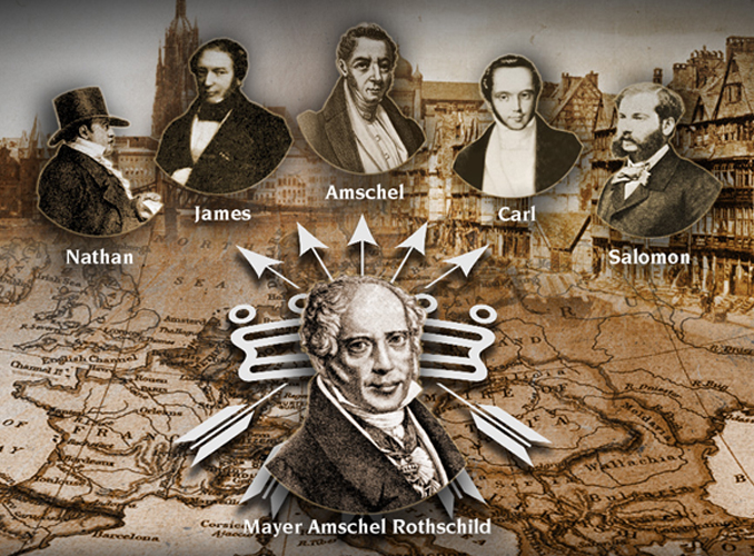
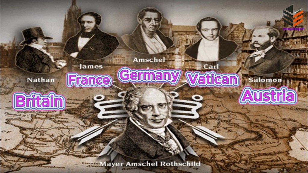
This is the Rothschild Coat of Arms.
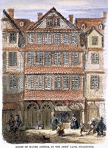
The Rothschilds were an Ashkenazi Jewish family from Frankfurt that gained prominence through Mayer Amschel Rothschild, who was born in Frankfurt in 1744 when it was part of the Holy Roman Empire, and died there in 1812, when it was part of the Confederation of the Rhine.
The family was said to have gotten its name from the house lived in by an ancestor of Mayer Amschel Rothschild, who lived at “the House of the Red Shield” in what was called the Frankfurt Judengasse, or the Jewish ghetto of Frankfurt.
Mayer Amschel Rothschild established an international banking family empire through his five sons:
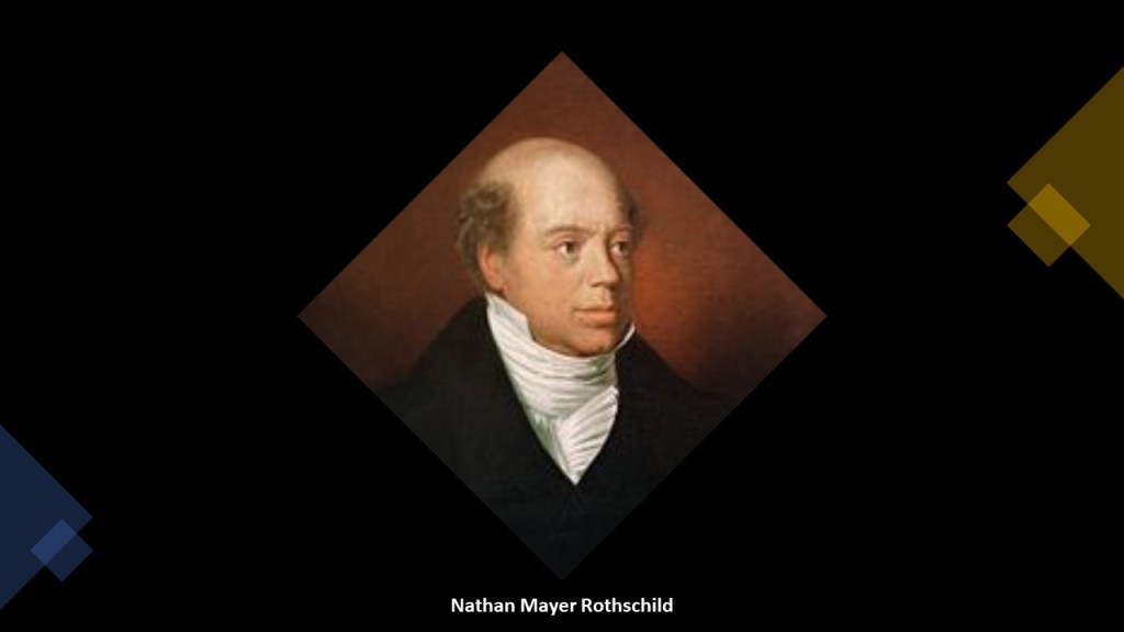
His son Nathan, for example, settled in Manchester, England in 1798.
Nathan established a business in textile trading and finance, and made a fortune in a banking enterprise he began in London in 1805 that dealt in foreign bills and government securities.
Nathan had become a freemason in London of the “Emulation Lodge, No. 12, of the Premier Grand Lodge of England” in October of 1802.
By the time of his death in 1836, Nathan Mayer Rothschild had secured the position of the Rothschilds as the preeminent investment bankers in Britain and Europe, and his own personal net worth was over 60% of the British national income.
So was the emblem of the red shield of the Salvation Army a random choice, or was there a connection to the Rothschilds?
I had heard about this potential connection awhile back, but this is the first time I have looked into it myself, and was how I knew to look for it.
Some people certainly believe there was a connection.
I even found this reference alluding to the possibility that William Booth was himself a Freemason.
The Hidden Hand refers to the Freemasonic pose in this illustration, signifying “Master of the Second Veil.”
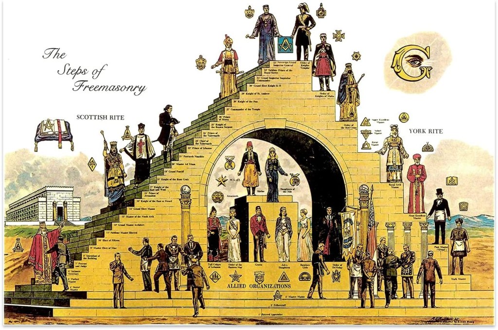
Here’s another possible masonic connection worth mentioning, that I thought about when I was looking into Catherine Mumford Booth and her interest in the temperance movement from a young age.
This is a common illustration depicting “The Steps of Freemasonry.”
In western freemasonry, a mason’s first step involves becoming an “entered apprentice,” which goes to the third step.
The “entered apprentice” can either stay there, which is what most freemasons do, or if he decides to go into the hierarchy, would either enter the Scottish Rite or the York Rite.
In the Scottish Rite, there are 30-steps, or degrees, and in the York Rite, 10-steps or degrees.
The highest degree in the Scottish Rite is the 33rd-degree, and in the York Rite, it is the order of the Knight Templar.
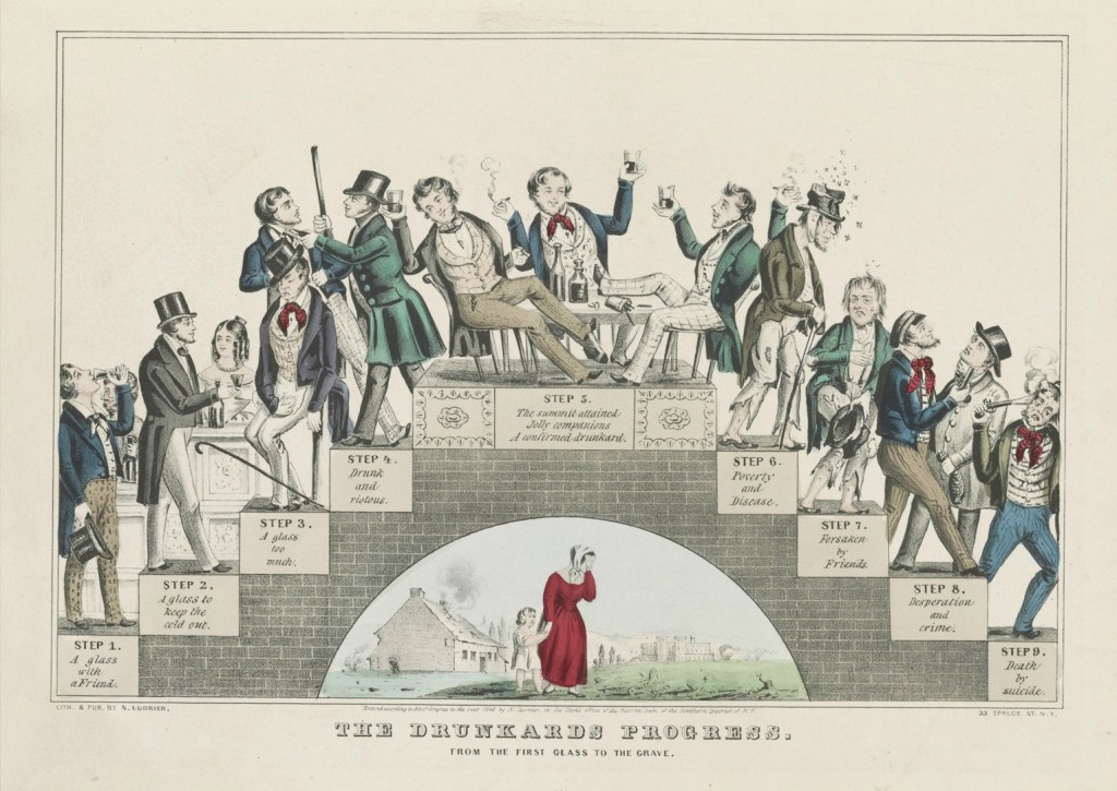
The Temperance Movement was a social movement against the consumption of alcohol that gained momentum starting in the 1820s.
This was Nathaniel Currier’s depiction showing how moderate drinking leads to disaster step-by-step called “The Drunkard’s Progress,” looking a lot like the depiction of “The Steps of Freemasonry.”
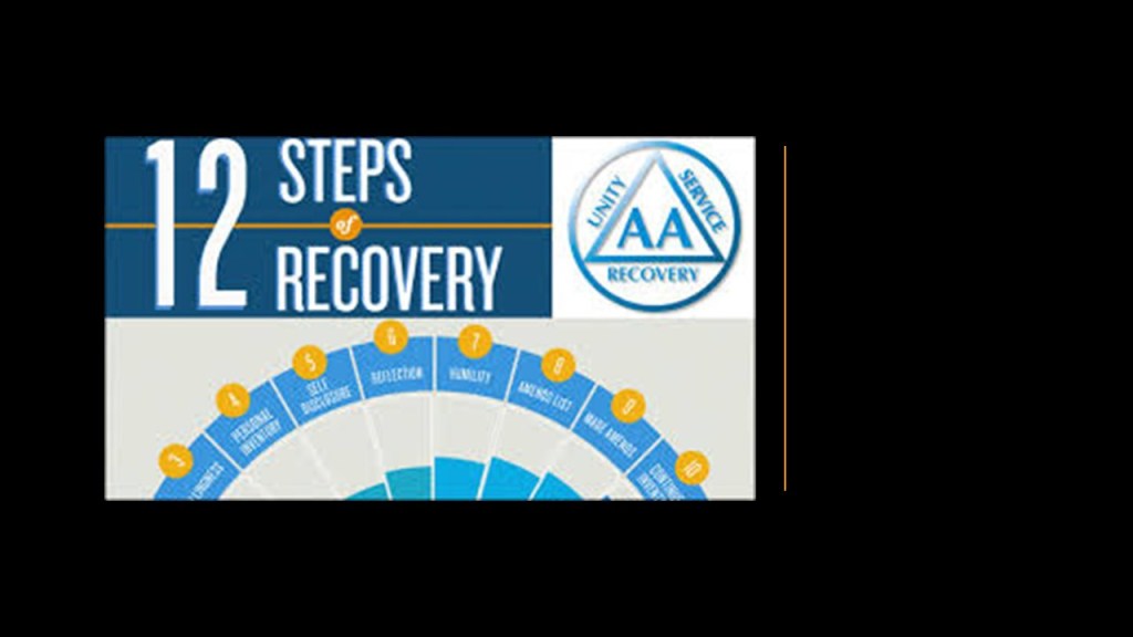
Even recovery programs like Alcoholics Anonymous refer to “steps.”
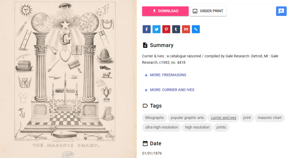
I can’t seem to find out directly if Nathaniel Currier, an American lithographer who headed the company of Currier and Ives, was a freemason, but judging from this Currier and Ives lithograph called “The Masonic Chart” there seems to be more than a passing familiarity with freemasonry within the lithography firm
What I find interesting about all this interest in temperance was that the establishment was pumping out alcoholic beverages to the people in vast quantities during this same period of time.
Distilleries and breweries were going up literally everywhere.
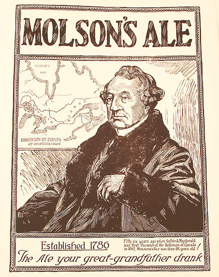
Just a couple of countless examples include Molson’s brewery in Montreal.
Between 1788 and 1800, John Molson’s business quickly grew into one of the larger ones in Lower Canada, having sold 30,000 gallons, or 113,500-liters, of beer by 1791.
John Molson was a freemason, and appointed the Provincial Grand Master of the District Freemasonic Lodge of Montreal in 1826, a position he held for five years before resigning in 1831.
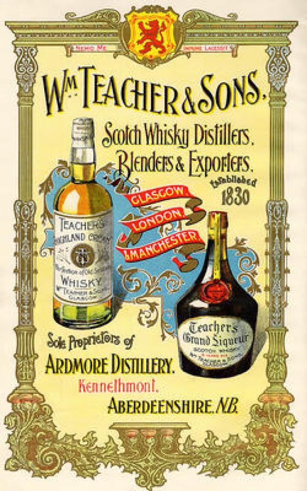
Another was Teacher’s Scotch Whiskey was established in Glasgow in 1830.
William Teacher established his whiskey product in 1830, and by the 1850s, began to open public houses known as “dram shops,” in which customers could drink whiskey.
The main attraction of the “dram shops” was their reputation for providing customers with high quality whiskey.
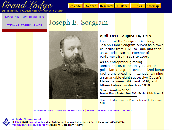
I can’t find a reference to William Teacher being a freemason, but Joseph Seagram, the founder of Seagram’s Distillery in Ontario, was one.
I have definitely come to believe that addictions like alcoholism were created and promoted intentionally to keep Humanity stuck in a diminished-level of consciousness.
This created the juxtaposition of a culture on one hand that encouraged the profuse consumption of alcohol, and at the same time a counterforce within that same culture that not only criticized alcohol consumption, but that got involved in “charitable institutions” with a stated mission of guiding the poor out of impoverishment supposedly caused by the character-weakness of alcoholism in many cases.
The world’s Non-Governmental Organizations are perceived by the general public as benevolent and philanthropic organizations with a stated purpose of helping Humanity in a particular area or time of need.
But when you delve into specific Non-Governmental Organizations, invariably there are more questions than answers.
A Non-Governmental Organization, also known as “NGO,” is defined as one that was formed independently from government.
Typically considered non-profit organizations, they are organized and operated for the benefit of the collective benefit as opposed to as a business generating a profit for its owners.
NGOs as we know them date back to the 19th-century, and by 1914, the same year that World War I started, there were estimated to be almost 1,100 worldwide.
The world’s first NGO was “Anti-Slavery International,” which was founded in 1839 as the “British and Foreign Anti-Slavery Society.”
It is considered the world’s oldest international human rights organization, working against slavery and other abuses.
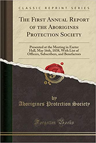
The “Aborigines Protection Society” was formed in 1837, we are told to ensure the “health and well-being, as well as the sovereign, legal, and religious rights of the indigenous peoples while promoting the civilization of the indigenous people who were subjected under colonial powers.”
The Aborigines Protection Society was set-up largely through Quakers, also known as the “Religious Society of Friends.”
The Protestant denomination that came to be known as “Quakerism” came to the world through Englishman George Fox, who was guided by a vision from the Lord in 1652 to start a new religion with a “priesthood of believers” when he saw that it was possible to have a direct experience of Christ without clergy.
In addition to their abolitionist stance, Quakers also refused to participate in war; wore plain clothing; and were not supposed to drink or use swear words.
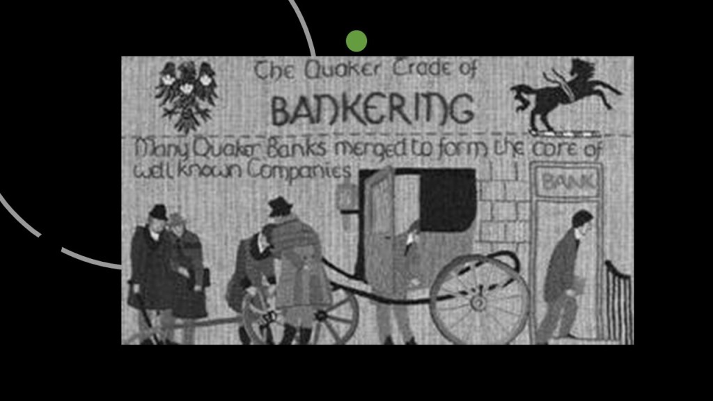
It is interesting to note that the relationship of Quakers to big banks.
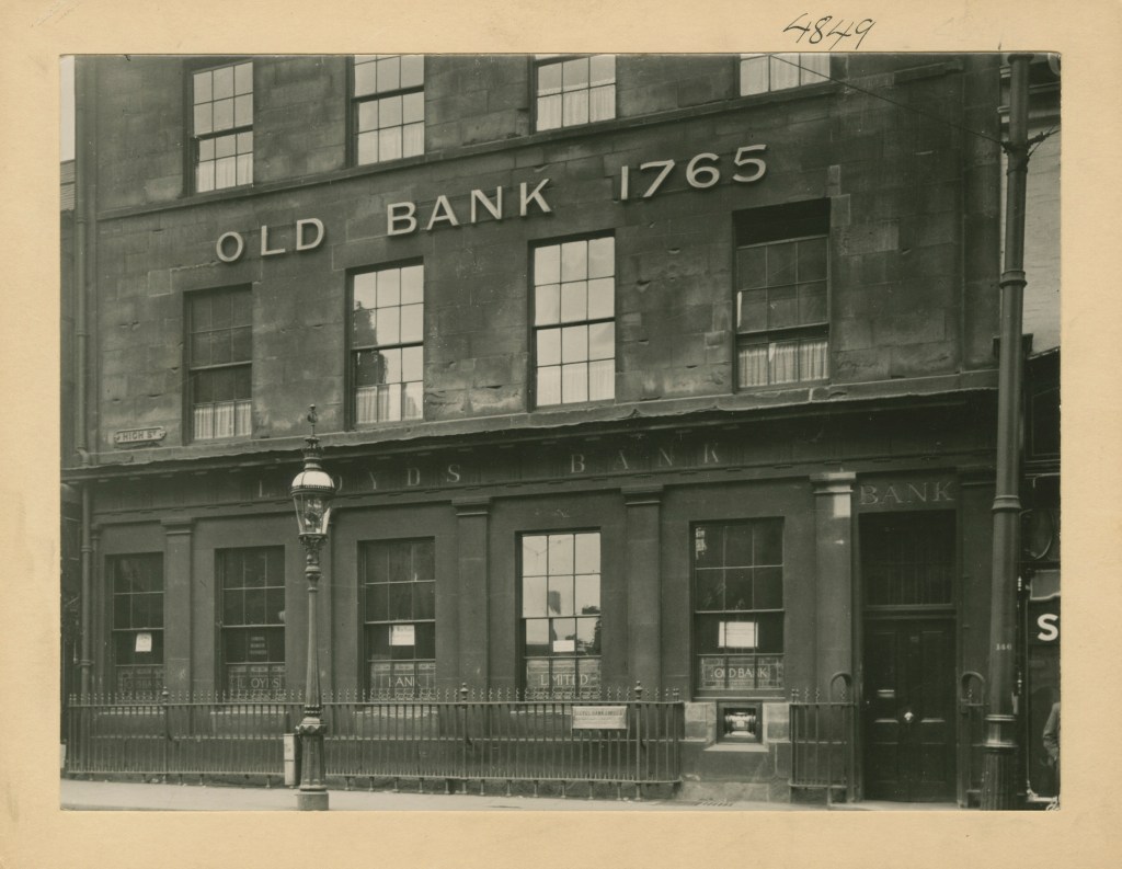
The origins of Lloyds Bank, the largest retail bank in Great Britain, go back to 1765, when Quaker iron producer and dealer Sampson Lloyd set-up a private banking business in Birmingham with industrialist John Taylor.
E
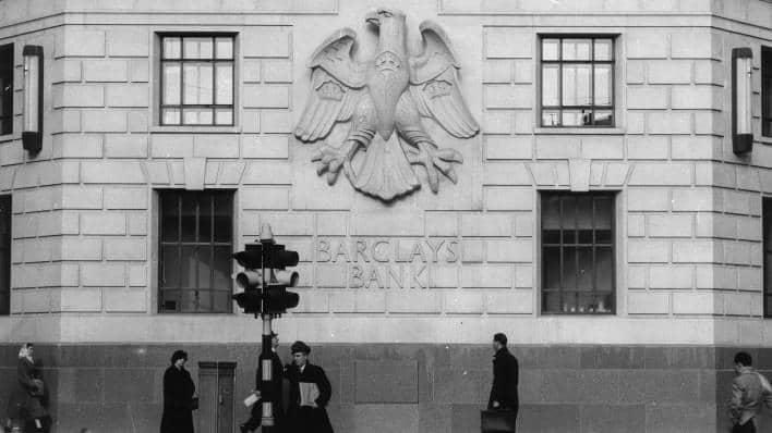
The multinational universal bank Barclays traces its origins Quaker goldsmiths John Freame, his brother-in-law Thomas Gould, and their apprentice James Barclay in 1690, at a during which goldsmiths held cash deposits and issued receipts that came to be used as money.
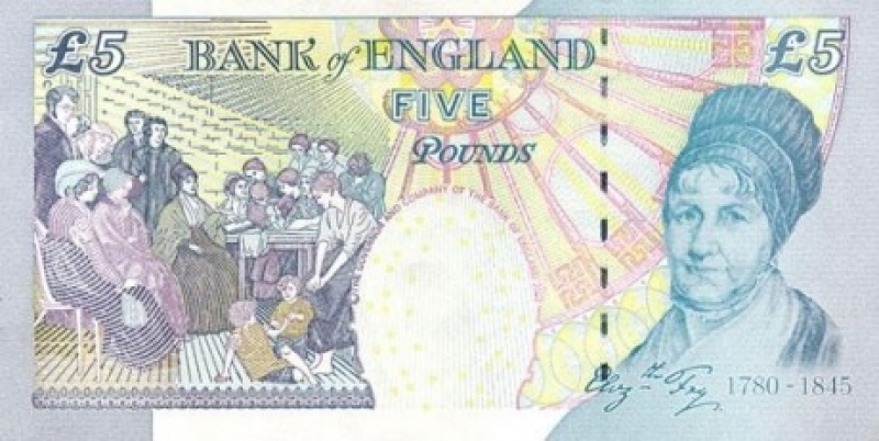
Barclay descendent Elizabeth Gurney Fry was a prominent Quaker figure in Victorian times.
Also known as Betsy Fry, she was an English prison and social reformer, being instrumental in such things as the “1823 Gaols Act,” which mandated the gender-segregation of prisons, and female wardens for female prisoners, to protect them from sexual exploitation.
All her reform efforts were supported by Queen Victoria, and to commemorate her achievements, Elizabeth Fry was honored by having her picture on the Bank of England 5-pound note that was in circulation between 2002 and 2016.
Elizabeth Fry’s brother-in-law, Member of Parliament Thomas Fowell Buxton, set up a parliamentary select committee in 1835 to examine the effect of white settlement on indigenous peoples.
Then in 1837, Dr. Thomas Hodgkin, a leading pathologist that Hodgkins Disease was named for, was behind the establishment of the Aborigines Committee at an annual Quaker meeting, and it was around this time the “Aborigines Protection Society” was formed.
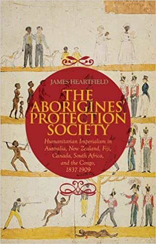
This book by David Heartsfield looks at the “Aborigines Protection Society” from the perspective of “Humanitarian Imperialism in Australia, New Zealand, Fiji, Canada, South Africa, and the Congo between 1836 and 1909,” and mentioned things like how the policy of native protection turned out to be a reason for the growth of imperial rule, particularly that of the British Empire…
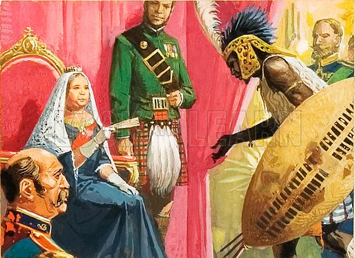
…and about the Society bringing King Cetshwayo of the Zulus in South Africa to England to meet Queen Victoria…
.
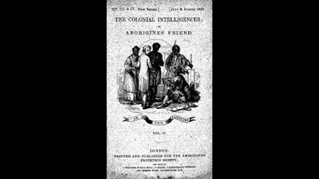
The Aborigines Protection Society published a journal called the “Colonial Intelligencer and Aborigines Friend,” which was comprised of “…interesting intelligence concerning the Aborigines of Various Climes and Articles Upon Colonial Affairs, with Comments Upon the Proceedings of Government and of Colonists toward Native Tribes.”
This doesn’t sound very friend-like to me!!!
The “Aborigines Protection Society” and the “British and Foreign Anti-Slavery Society” merged in 1909, and together they became known as the “Anti-Slavery and Aborigines Protection Society.”
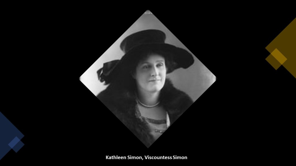
The Irish anti-slavery activist Kathleen Simon, Viscountess Simon was the most prominent member of this merged society.
Her story was that she witnessed slavery first-hand when she was living in Tennessee with her first husband, Irish physician Dr. Thomas Manning.
After he died, she moved to London, and ended up becoming first the governess, and subsequently wife, of the widowed Sir John Simon, a British politician who held senior cabinet posts from the beginning of World War I to the end of World War II, serving in the capacities of Home Secretary, Foreign Secretary, Secretary of the Exchequer, and Lord Chancellor.
She became well-known for her commitment to ending slavery through such things as writing and speaking.
She was made a Dame Commander of the Order of the British Empire, in other words knighted, for her efforts in 1933.
What had become the “British and Foreign Anti-Slavery Society” in 1909 went through several other name-changes over the years, and with the last name-change became “Anti-Slavery International” in 1995.
Here are this organization’s slavery statistics worldwide from 2020.
So 40.3 million people in slavery total, with at 10 million of those people being identified directly as children, as recently as 2020?
And don’t those numbers seem incredibly high for something that isn’t talked about openly in our day and age?
Since Quakers were so involved in the founding of what became known as the Anti-Slavery International NGO today, I went looking around to see if the founder of Quakerism, George Fox, had any masonic connections or anything like that, and not that I could find on an that in an internet search.
What I did find that was interesting was a pdf chapter on the University of London School of Advanced Studies website, which archives “The Journal of the Friends Historical Society.” Quakers are also known as “Friends.”
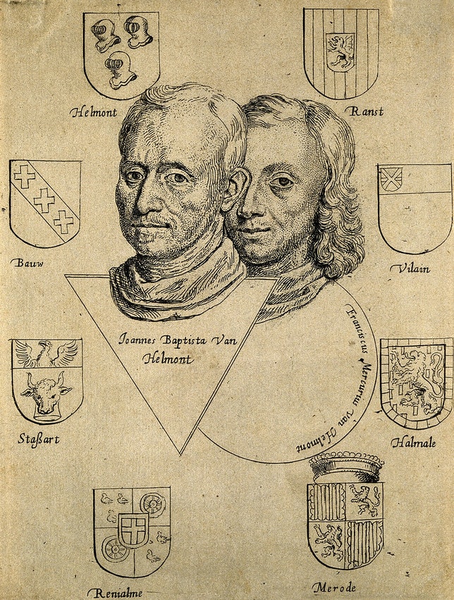
The title of the pdf chapter is “Early Friends and the Alchemy of Perfection,” and at the beginning it mentions George Fox meeting a German in London in 1660.
While it was not known exactly who the German was, the author of the chapter spectulated that it was quite possibly, from what little information Fox provided, someone by the name of Franz Mercurius van Helmont, a Flemish physician and alchemist who had settled in London by the 1670s, and became a Quaker himself until sometime around 1690.
Throughout all this time, van Helmont was heavily involved in kabbalistic metaphysics.
He spent his remaining years in Germany, until his death in 1699.
The author went on to say that Franz Merkurius Van Helmont was the son of the leading exponent on the European content of the Paracelsian-Alchemical tradition, and also a physican, Johan Baptiste van Helmont, and that both carried on the Paracelsian philosophy of medicine, as well as interest in the Kabbalah of the Jewish Mystical tradition.
The van Helmonts emphasized direct personal observation and experiment, and that Franz expressed admiration for the mystical nature of the spiritual experiences of the Quakers.
The author of this pdf document went on to speculate about whether or not there was something in Quakerism that appealed to the alchemists, or something about alchemy that appealed to the Quakers.
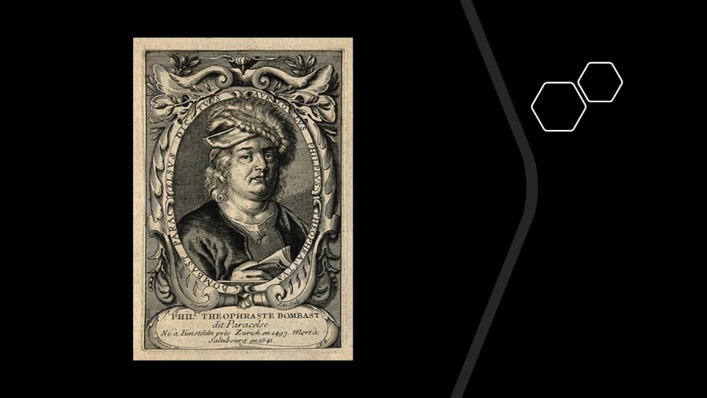
The author of the chapter touched on the subjects of Paracelsus, whom the van Helmonds were proponents of, and Hermeticism.
The given name of the man known to history as Paracelsus, a Swiss-German doctor and scholar, was Philippus Aureolas Theophrastus Bombastus von Hohenheim.
Interesting to note that the English meaning of “Bombastic” is “high-sounding but with little meaning.”
Paracelsus, a student of Hermeticism, was also an alchemist and physician, and said to have wedded alchemy and medicine.
His work on alchemy exerted a big influence on reformers seeking to restore the true knowledge of an earlier age, and reliance on the direct and immediate experience of truth.
The ancient Hermetic tradition surfaced in the West around 1460 A.D. and Hermeticism was a major influence on Renaissance thought.
It was a combination of gnosticism, magic, and mysticism that derived its name from “Hermes Trismegitus,” or “Thrice- Great Hermes,” an ancient Egyptian Magus who was associated with the Egyptian-God Thoth, and Thoth is also associated with the Greek God Hermes.
The Corpus Hermeticum was a collection of written works attributed to said individual that offered insight into the Egyptian mysteries and religious philosophy that started circulating in the early centuries of the Common Era.
I am spending time on this line of inquiry about the early influences on what became major institutions in our world because I believe it is very important to understanding what has really taken place here, as opposed to what we have been told.
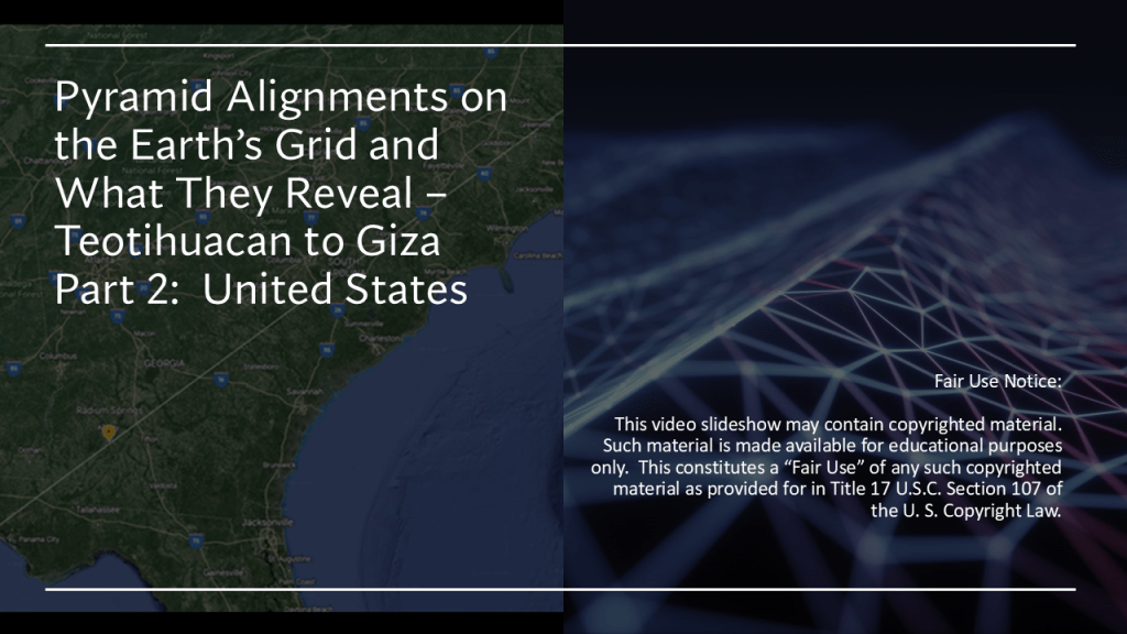
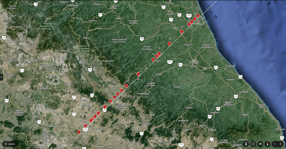
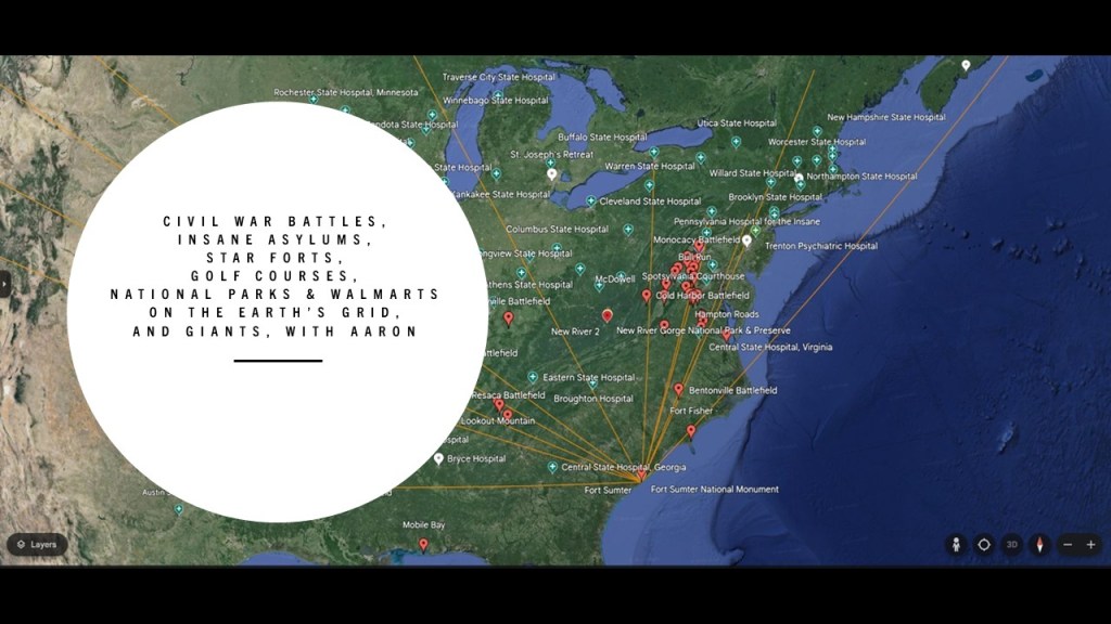
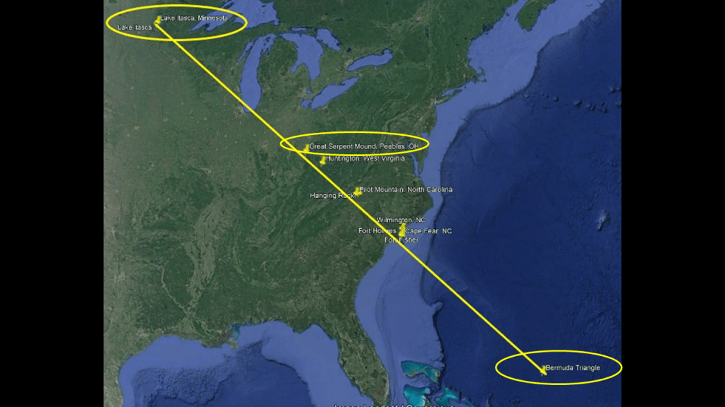
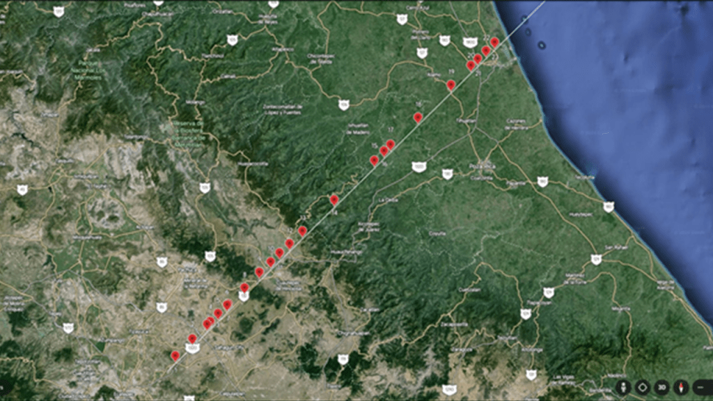
This is the second-part 2 of a three-part series in which I am looking at exactly what is found along an alignment between the Quetzelcoatl Pyramid at Teotihuacan in Mexico and the Great Pyramid of Giza in Cairo, Egypt.
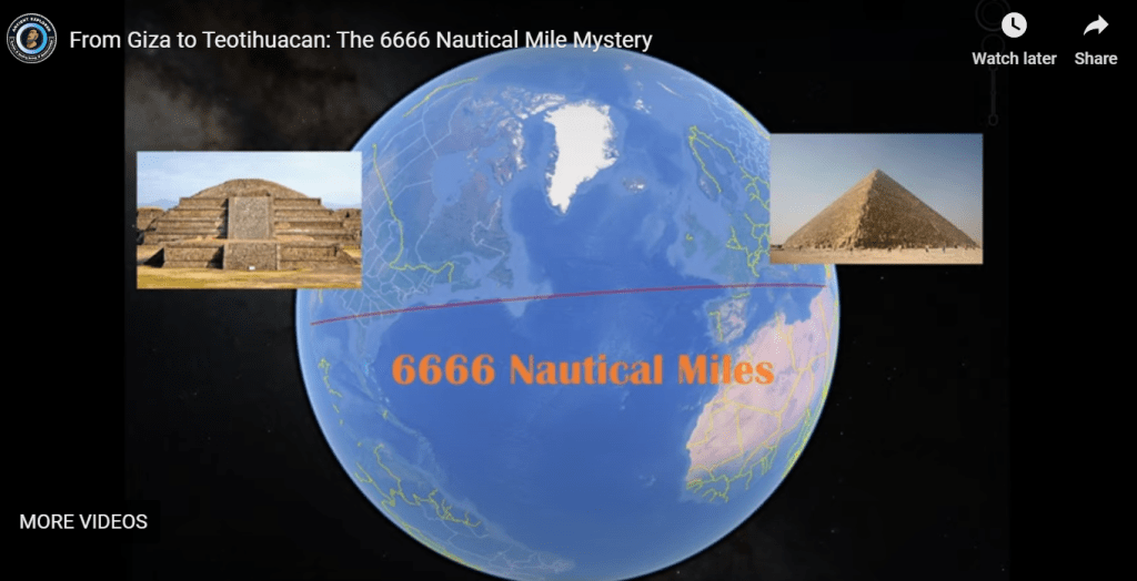
My friend Aaron plotted the alignment between two pyramids in these locations on Google Earth and forwarded me the alignment information to look at.
He decided to plot the alignment on Google Earth after watching this video “From Giza to Teotihuacan: The 6666 Nautical Mile Mystery on the Ancient Explorer YouTube Channel.”
In Part 1 of this series, I tracked the alignment from the Quetzelcoatl Pyramid in Teotihuacan as far as the port city of Tuxpan de Rodriguez Cano on the Gulf Coast.
Along the way, among many other findings, I found such things as three airports; thirteen schools of all kinds; six agriculture-related locations; four telecom-related locations; five health-related locations; eight sports venues; one church-related locations; three government sites; and rail history, including a train station.
I am sure there are more along these lines that I missed because I had difficulty with the Spanish-to-English translation.
My working hypothesis is that the Earth’s original free energy grid system was intentionally-abused and misused, and turned into instead the matrix of control we have been living under without realizing it.
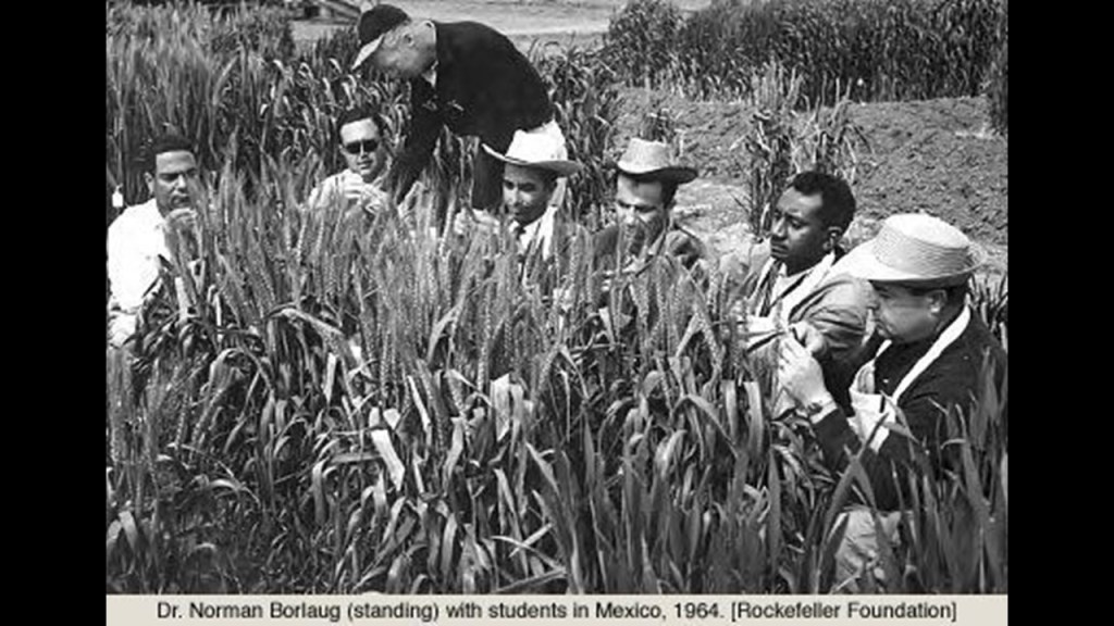
With regards to all the agricultural locations I found on the Mexican leg of the alignment, I had also included in Part 1 past research I have done with regards to the presence of the Rockefeller Foundation in Mexican agriculture.
The Mexican President Avila Camacho, who was elected in 1940, wanted to augment Mexico’s industrialization and economic growth, and the U. S. Vice-President Henry Wallace, who saw this as beneficial to the interests of the United States, persuaded the Rockefeller Foundation to work with the Mexican government in agricultural development.
They in turn contacted leading agronomists who proposed the Office of Special Studies within the Mexican Government to be directed by the Rockefeller Foundation, and staffed by Mexican and American scientists focusing on soil development; maize and wheat production and plant pathology.
Respected plant biologist Dr. Normal Borlaug, who was from Iowa, was tapped to be the head of the newly established Cooperative Wheat Research and Production Program in Mexico, a position which he took over as a geneticist and plant pathologist after he finished his wartime service with DuPont in 1944.
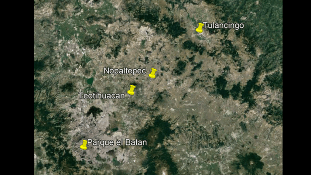
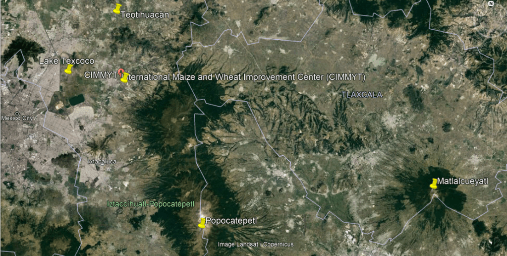
In 1964, he was made the Director of the International Wheat Improvement Program at El Batan on the outskirts of Mexico City, as part of the Consultative Group on International Agricultural Research’s International Maize and Wheat Improvement Center (or CIMMYT), the funding for which was provided by the Rockefeller and Ford Foundations, and the Mexican Government.
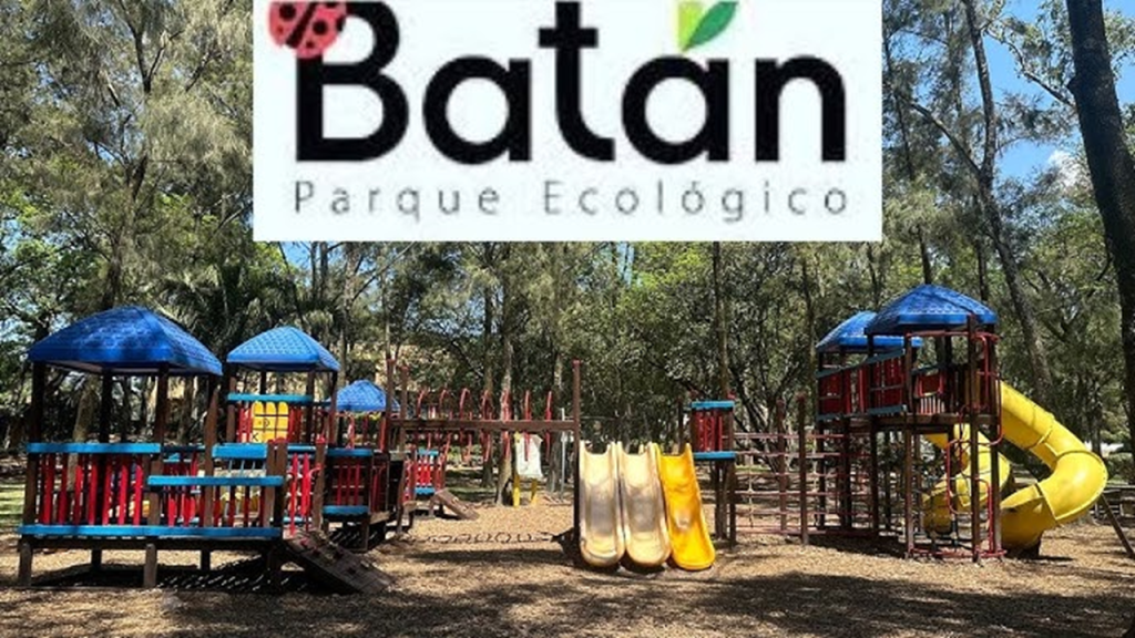
I don’t know if this was the El Batan where the wheat was grown, because today it is called Parque El Batan, and there is no mention of whether or not it was in history I could find on it, but it is interesting to note that it is on this same alignment to the southwest of Teotihuacan.
Today it is an ecological park, with athletic facilities, a playground, dinosaur exhibit and features the last monumental art work of the famous Mexican Communist artist and muralist, Diego Rivera.
The CIMMYT World Headquarters is located to just to the southeast of Teotihuacan, not far from Popocatepetl, an active stratovolcano in the Trans-Mexican Volcanic Belt, and Matlalcueyatl, an inactive volcano.
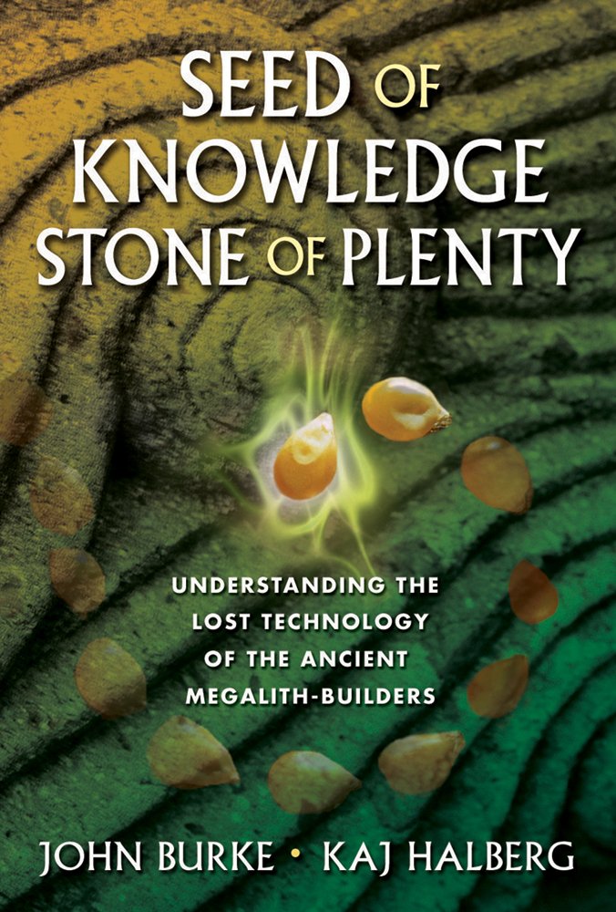
In my journey of being educated about this advanced civilization that is missing from our collective awareness, I learned about work done by John Burke and Kaj Halberg in their book “Seed of Knowledge, Stone of Plenty: Understanding the Lost Technology of the Megalith Builders” in a Megalithomania presentation several years before I started doing my own research along Earth’s ley lines.
They presented scientific evidence about how the ancients constructed temples, mounds and megaliths to increase the fertility of crops.
Judging by what I have seen thus far along various ley lines I have had occasion to track , I would venture to say that not only were the builders of the older megalithic civilization found around the world doing this, they were the same builders of what would be considered modern architecture and infrastructure using their advanced technologies for the purpose of increasing crop yields and enhancing life along the Earth’s electromagnetic, geometrically-aligned, ley lines, and it definitely appears that the Earth’s Controllers usurped and inverted these technologies for their own agendas.
Before I head into the continental United States, there are some places in this Gulf region that I would like to bring to your attention because I want to make some observations about what I have come to see as ruined land and submerged land, and we will see examples of this along this pyramid alignment throughout this post.
It is my belief that there was a recent, deliberately-caused cataclysmic event involving the destruction of the Earth’s original energy grid system, causing the land to undulate and buckle, causing among other things, swamps, bogs, deserts, dunes, and whole land masses to shear-off and submerge under seas and oceans.
I believe that the circuit board of the Earth’s grid system was deliberately blown 0ut, and thinking likely one or more forms of directed frequency or energy of some kind into different places on the Earth’s grid, either at the same time, or different times within a finite period, because there’s just so much devastation on the entire surface of the Earth.
I also believe that those behind the destruction of the energy grid ushered in the creation of a New World Order built on top of the ruins of the Old World, and that what we think of as modern infrastructure because that was what we have been told in the official narrative, was actually pre-existing infrastructure, including railways, canals, and airports among the many examples available to choose from.
Not only that, but then these malevolent Controllers reverse-engineered the original energy grid system into what is commonly called the Matrix for power and control, as well as the harvesting of energy, or “inner chi” of all living beings.
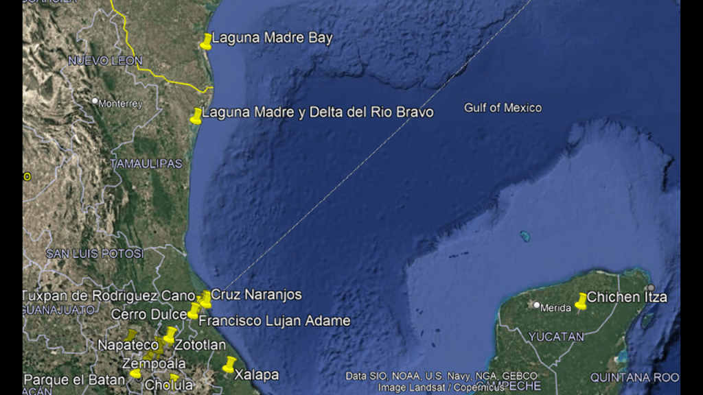
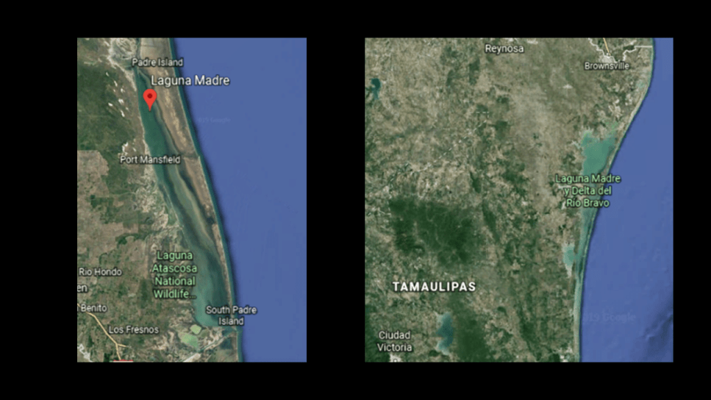
In July of 2019, when I was tracking cities and places in “Circle Alignments on the Planet Washington, DC – Part 22 Port Isabel, Texas to Houma, Louisiana,” I encountered the Laguna Madre Bay on the alignment, one of six hypersaline (or saltier than the ocean) lagoons worldwide as is the Laguna Madre y Delta del Rio Bravo of Tamaulipas State in Mexico, which is located on the Gulf coast just south of the Laguna Madre in Texas.
This location is just up the coast from where this pyramid alignment leaves Mexico on its way across the Gulf to western Florida.
In this example of Laguana Madre Bay in Texas, and the Laguna Madre in Mexico, what are called lagoons and estuaries are found along continental coastlines worldwide.
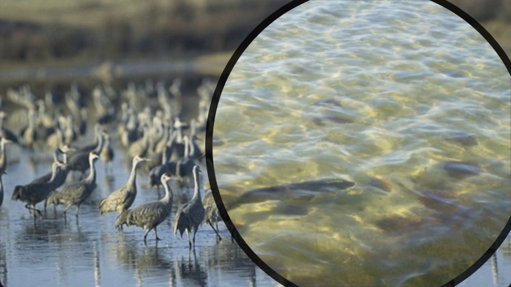
The tidal flats and barrier island beaches of the Laguna Madre Bay in Texas represent the largest continuous expanse of suitable habitats in North America for migrating and wintering shore birds, and is the most productive Texas bay fishery, and one of the best places to fish for red drum, black drum, and spotted sea trout in North America.
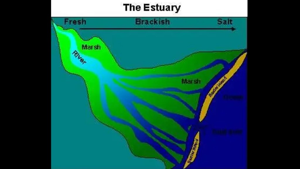
The Laguna Madre Bay is a negative estuary, where seawater flows in rather than out.
The idea that these have always been natural wildlife areas has been continuously reinforced in our narrative.
An “estuary” is defined as a partially-enclosed, coastal body of brackish water, which is water that is salty, dirty & unpleasant, with one or more rivers flowing into it, and a connection to the open sea.
It is also my opinion that what we are told were “natural” rivers were actually man-made canal systems.
Let’s see what else we find here.
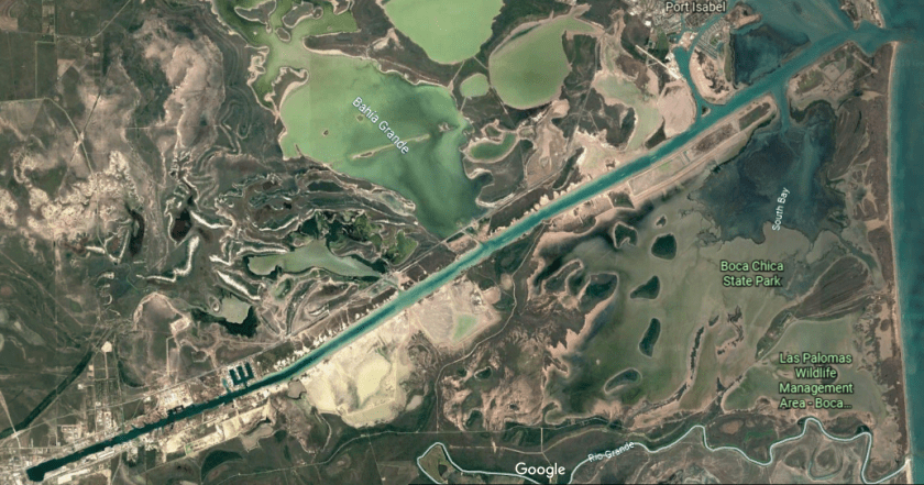
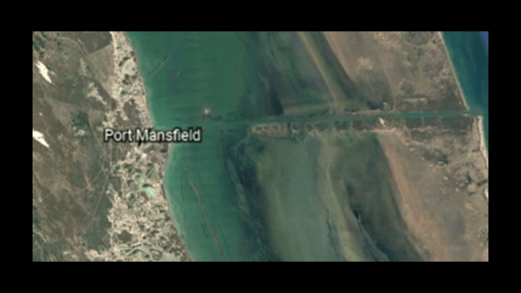
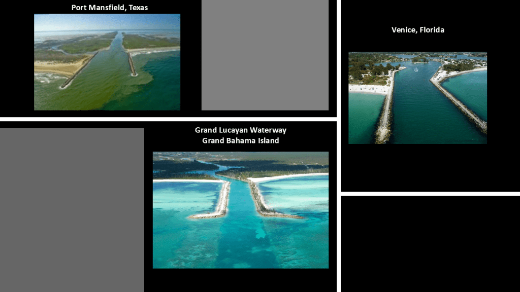
The otherwise land-locked Laguna Madre Bay has two channels connecting it to the Gulf. One is at Port Isabel, which becomes the 17-mile, or 27-kilometer, Brownsville Ship Channel…
…and the other is at Port Mansfield.
I find the two jetties at the entrance of the channel leading to Port Mansfield to be of interest on the top left, because their appearance is reminiscent of these at Venice, Florida on the right and the South Inlet of the Grand Lucayan Waterway at Lucaya, near Freetown, on Grand Bahama Island.
I believe these jetties and channels were part of an ancient worldwide canal system that has been deliberately removed from our awareness.
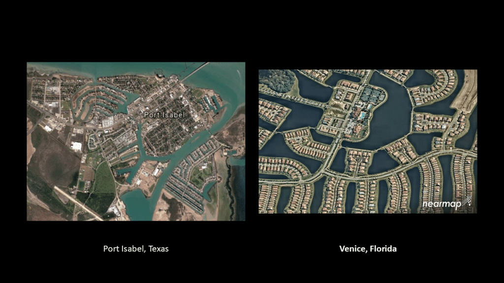
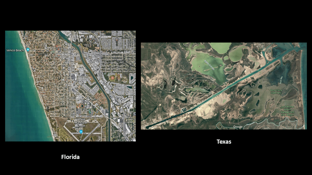
In another example of canal systems in existence throughout this Gulf region, of others that I know of, we see artificially-made channels and canals throughout the city of Port Isabel in Texas, as well as in Venice in Florida on the other side of the Gulf of Mexico for a comparison because these two communities have strikingly similar characteristics, like the residential neighborhoods on artificial islands surrounded by water.
There is also a long, straight channel in Venice, Florida, similar to the Brownsville Ship Channel that starts at Port Isabel.
Not only that, they are practically directly across the Gulf from each other. If they are not exactly, it is close.
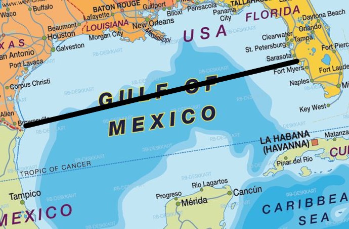
The Gulf is defined as an ocean basin and marginal sea of the Atlantic Ocean.
A marginal sea is a division of an ocean that is partially enclosed by islands or peninsulas, and in this graphic, we can see a shallow shelf along its coastline.
It is bounded on the northeast, north, and northwest by the United States; the southwest and south by Mexico; and the southeast by Cuba.
What are called “Continental Shelves” are found all along the Earth’s coastlines, and I believe are actually submerged landmasses and ruined land from this recent cataclysmic event, along with land features like estuaries. wetlands, deserts and dunes.
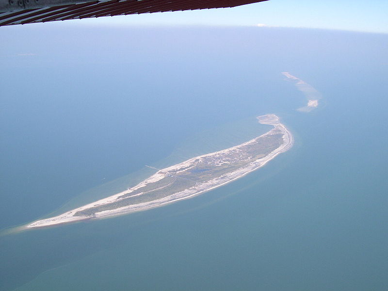
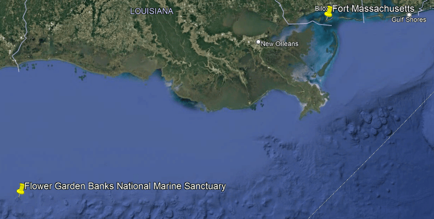
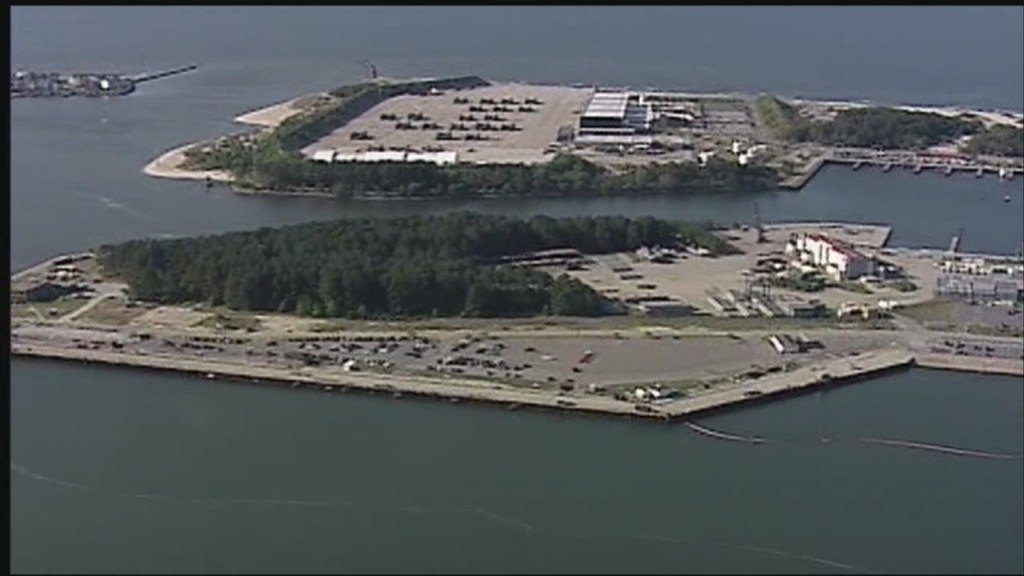
Another place on my radar from tracking the Washington, DC, circle alignment is Ship Island.
Ship Island refers to a barrier island off the Gulf Coast of Mississippi, part of the Gulf Islands National Seashore.
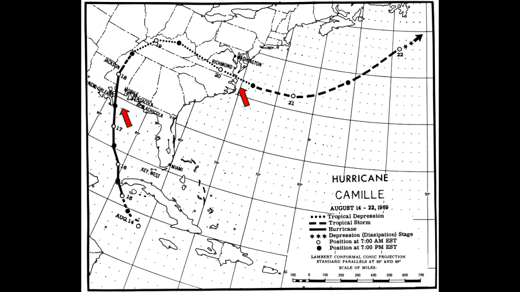
It was split into West Ship Island and East Ship Island by Hurricane Camille in 1969.
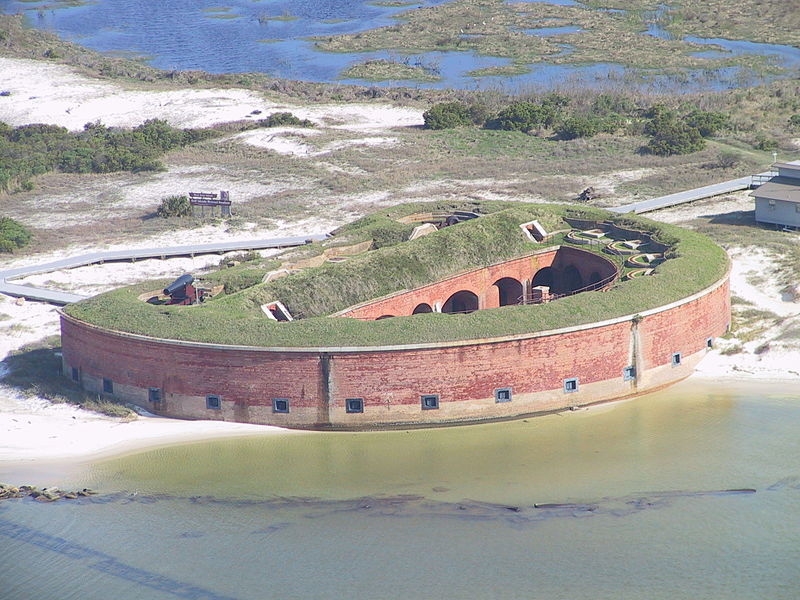
Fort Massachusetts on West Ship Island was said to have been built following the War of 1812 as a coastal defense for New Orleans and the Gulf Coast.
Interesting to note that Fort Massachusetts on Ship Island looks strikingly similar to Fort Quesnard on Alderney Island in the Channel Islands off the coast of northern France in the English Channel.
Fort Quesnard was said to have been built and completed in 1855 as a defense against an attack from France,.
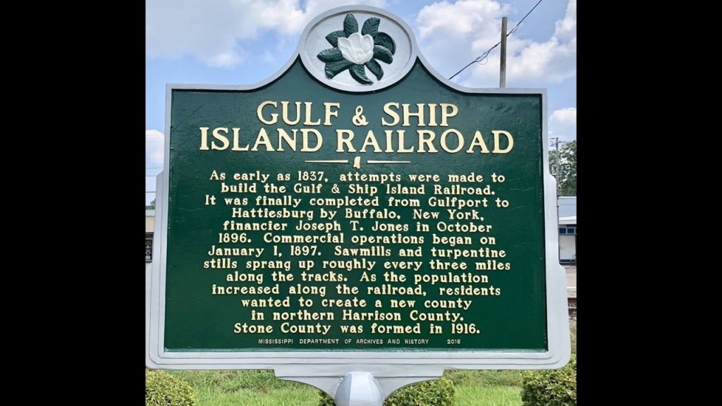
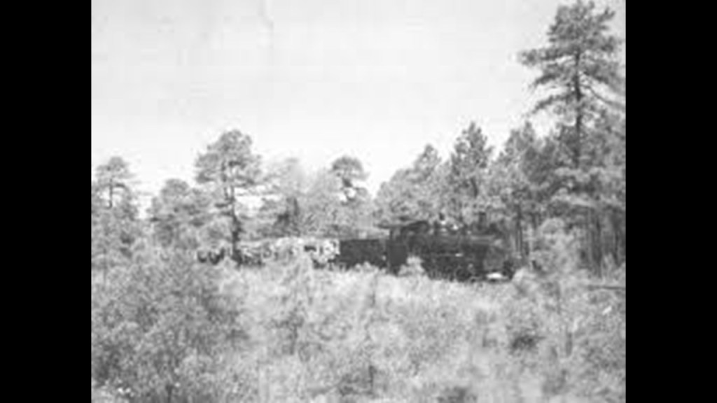
Also interesting to note that the “Gulf and Ship Island Railroad” was in operation from 1882 to 1925 to facilitate the harvesting and processing of a vast expanse of southern yellow pine forests.
In my initial research tracking long-distance alignments like this one, which was my earliest, in-depth research, I wasn’t necessarily looking specifically for star forts – I just kept finding them along the way.
I have consistently found the presence of rail, and canal infrastructure for that matter, in conjunction with star forts, as well as the finding that historically, in a given location, there were always at least two in close proximity to each other, but commonly there were even more than that.
Today there’s usually just one still standing if any part of it still exists at all.
After studying all these same findings in-depth in places all over the Earth, I have come to the conclusion that star forts were batteries, a name which many star forts were actually called.
A “battery” is a device that produces electricity that may have several primary or secondary cells arranged in parallel or series, as well as a battery source of energy which provides a push, or a voltage, of energy to get the current flowing in a circuit.
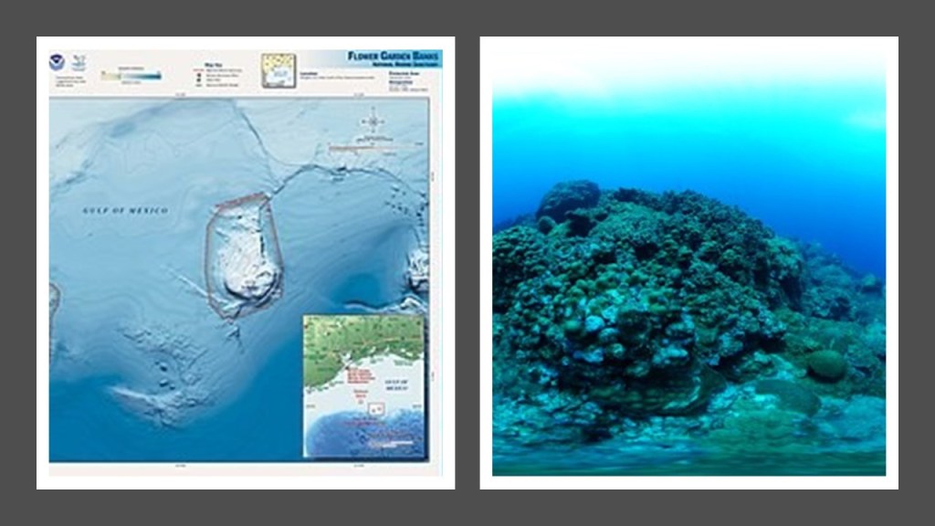
The Flower Garden Banks National Marine Sanctuary, and the only sanctuary site located in the Gulf, is located to the southwest of Fort Massachusetts on West Ship Island.
The Flower Garden Banks are said to have been formed when underlying salt domes forced the seafloor upwards, creating rises and banks.
These were then said to be conducive to reef formation.
So that’s the official explanation.
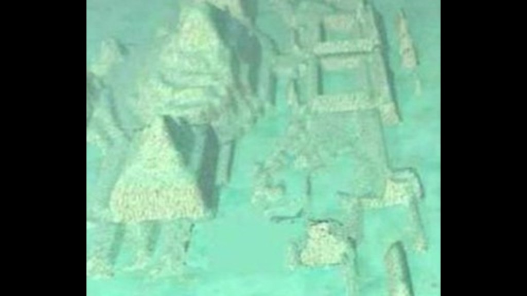
And then there’s the apparent sunken pyramid city that was discovered in western Cuban waters, though if you google it, it is called the “Cuban Underwater Formation.”
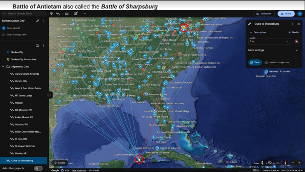
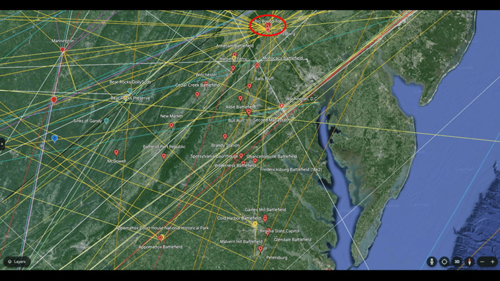
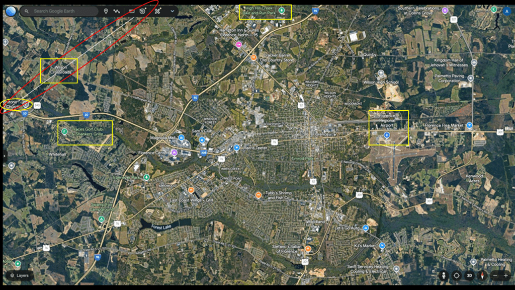
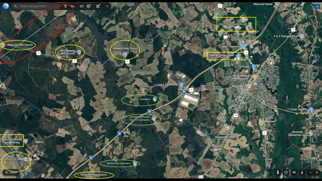
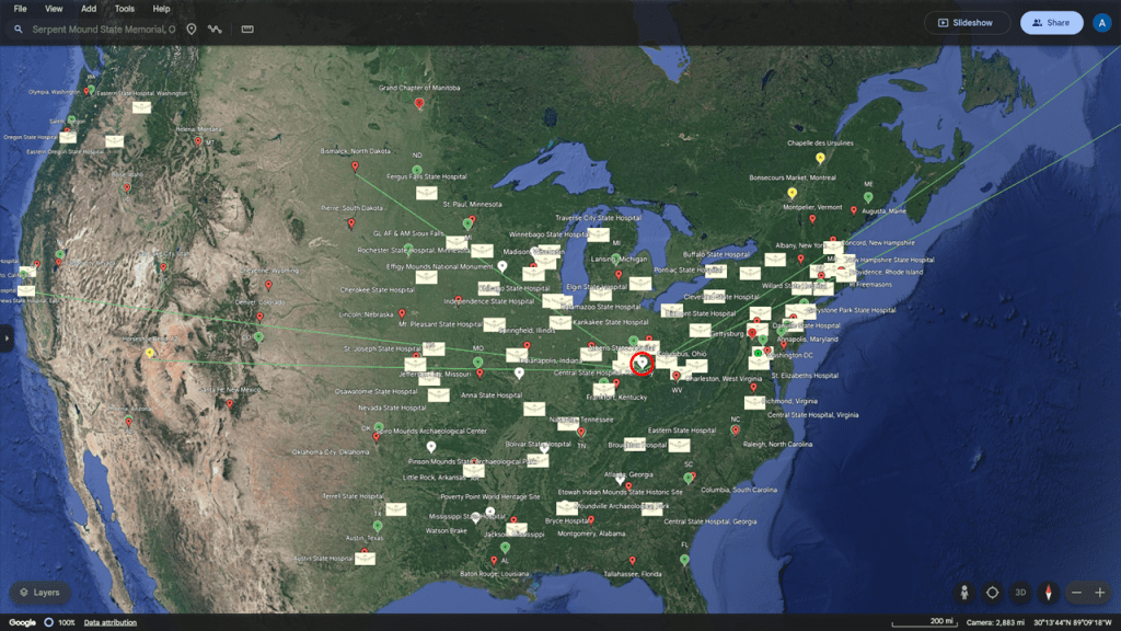
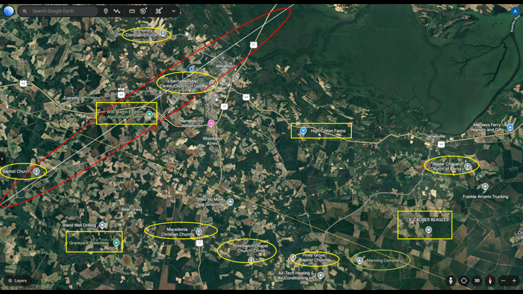
Interestingly, my friend Aaron discovered that this location was a hub for ley lines connecting to places including, but not limited to, star forts, insane asylums and civil war battles like Antietam (shown by the red line to the orange pin) in the continental United States.
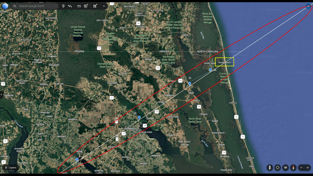
Now let’s see what we find along this pyramid alignment in the continental United States between Mexico and Egypt.
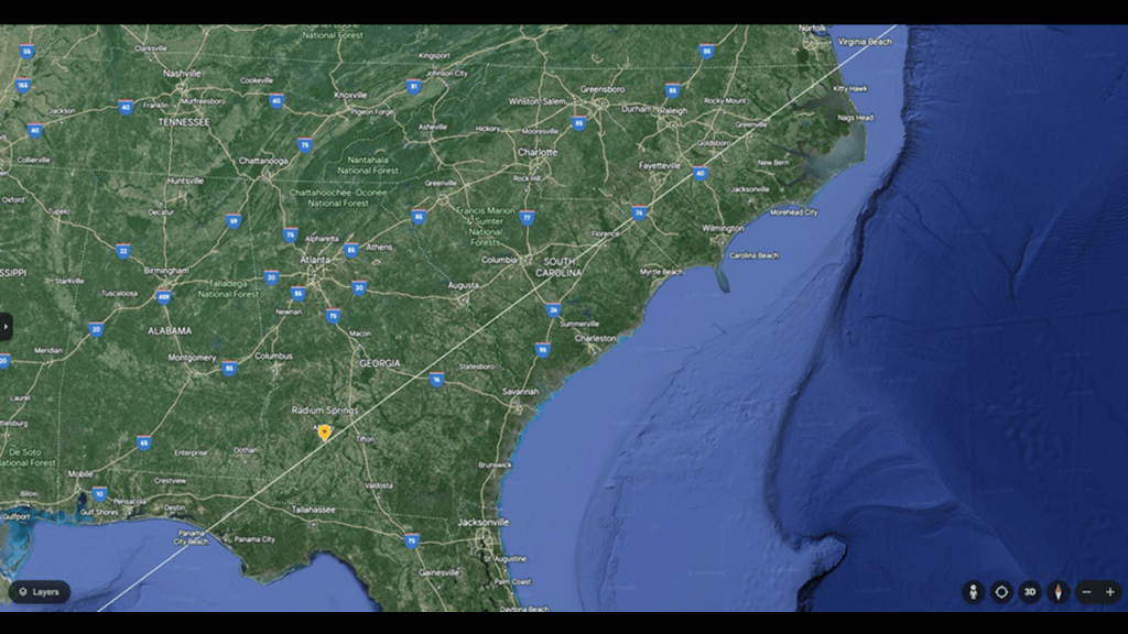
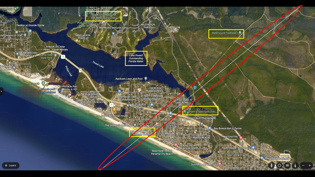
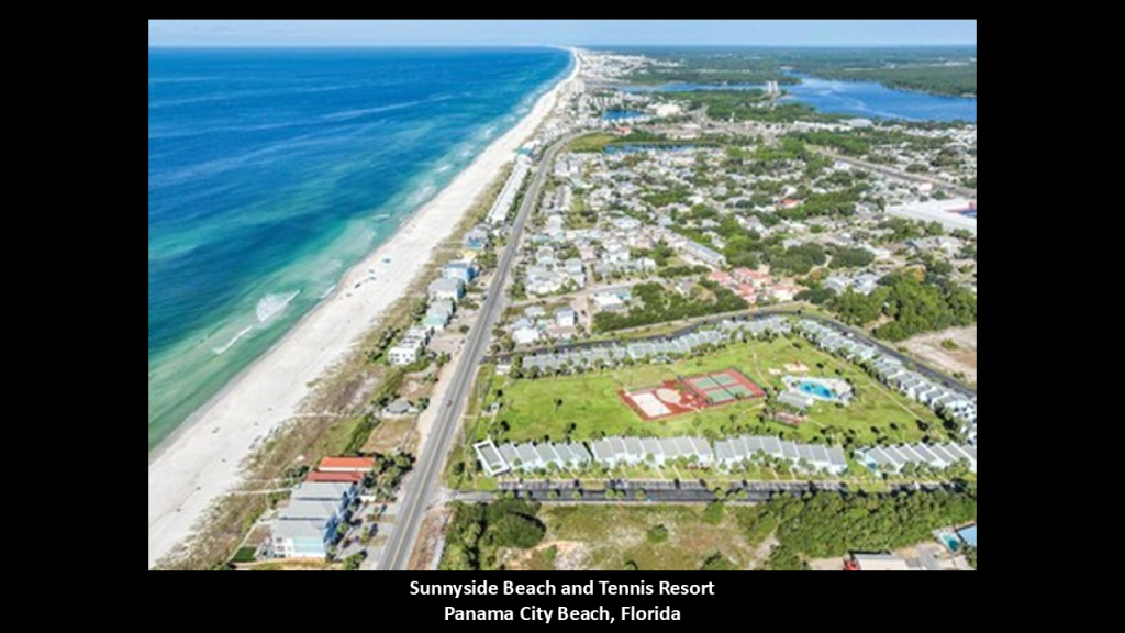
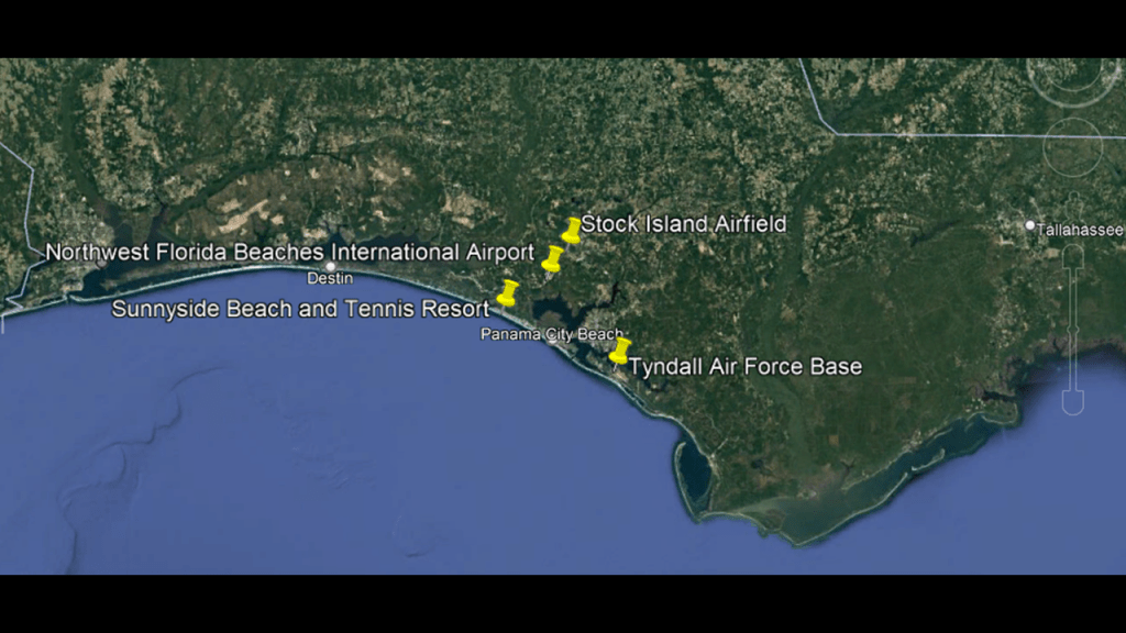
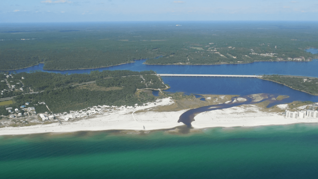
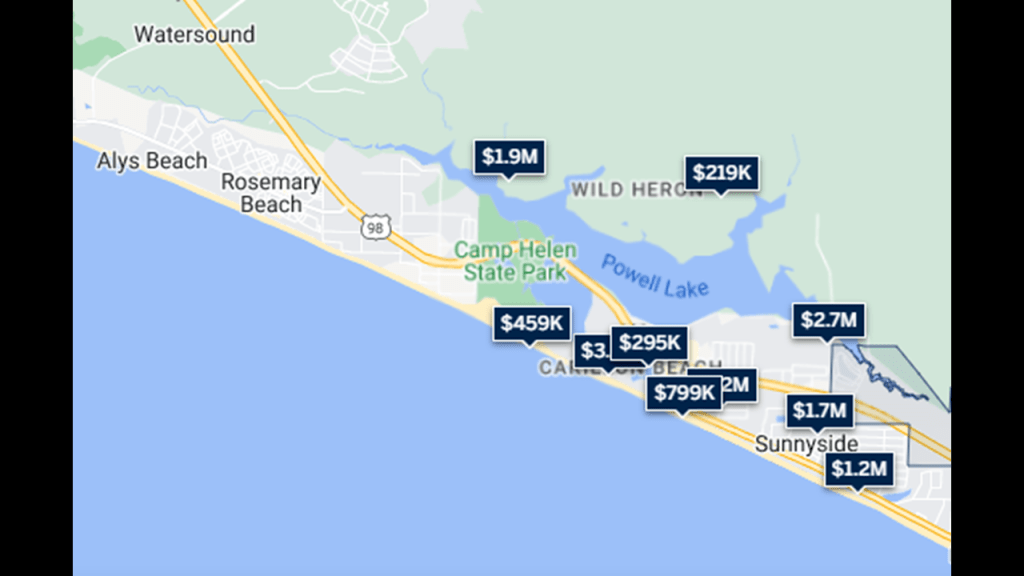
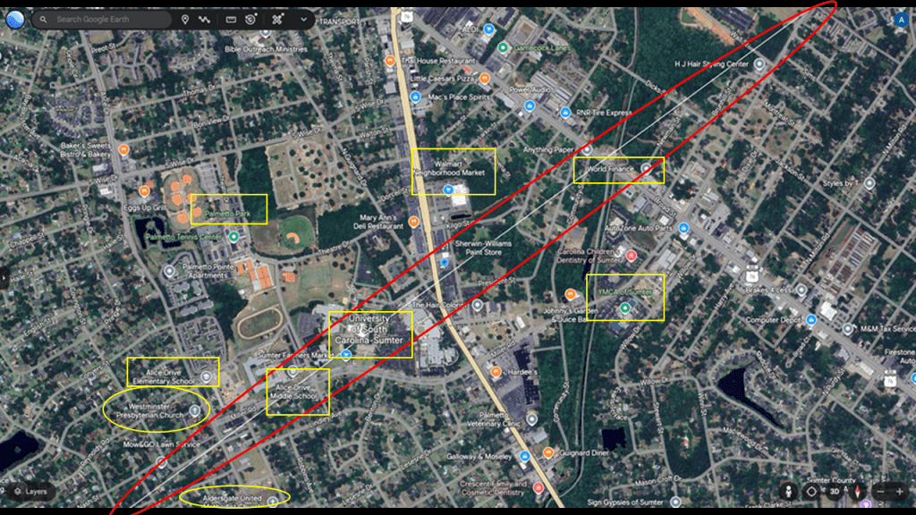
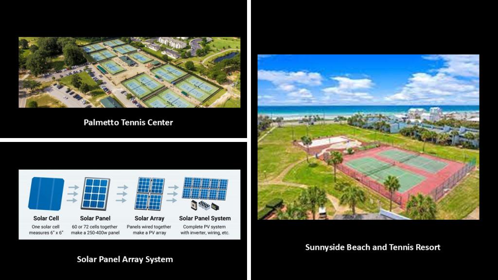
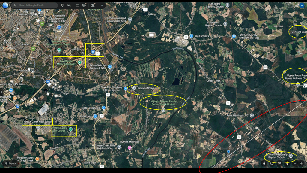
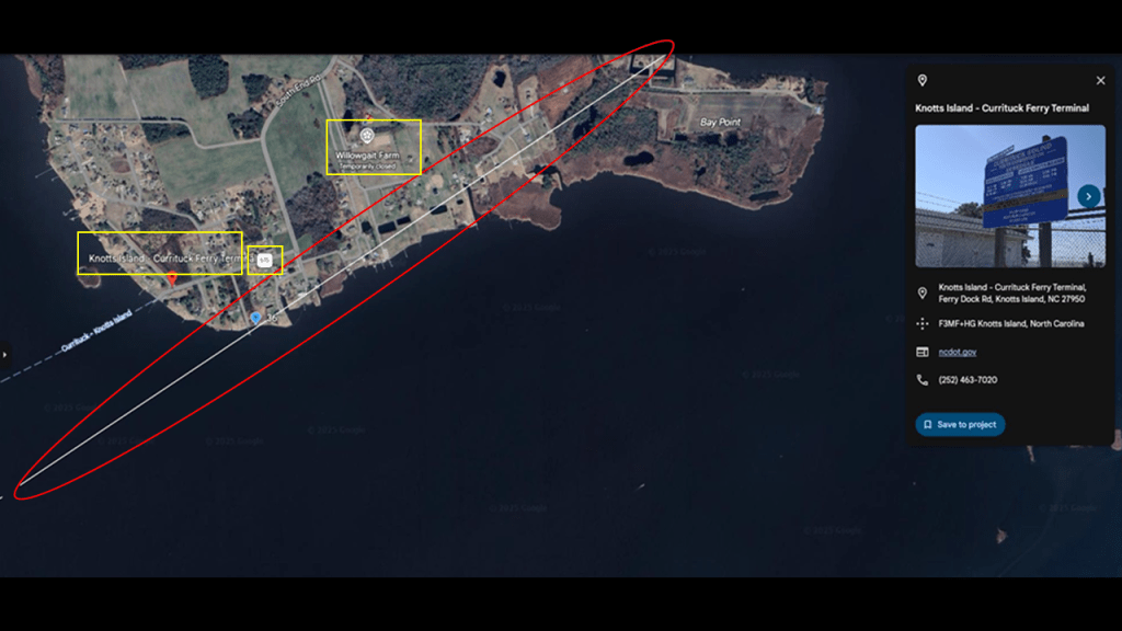
The alignment from Teotihuacan enters the United States in Panama City Beach in western Florida.
It enters right where the Sunnyside Beach and Tennis Resort is located, another sporting venue.
Tyndall Air Force Base is located a short distance to the southeast of this alignment on the Florida Coast in Panama City.
It is a major Air Force Base as the host of the 325th Fighter Wing of the Air Combat Command.
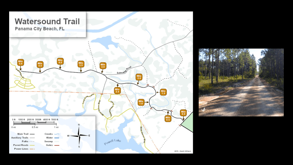
From where the alignment enters western Florida, it goes right through an area known as “St. Joe’s Timberlands,” where the Watersound Trail and other trails in a comprehensive trail system through the area.
The St. Joe Company is a real estate developer here and turning this land into luxury real estate.
I can’t help but wonder if these hiking trails were converted from railroad lines.
As so many railroad lines were.
Then there’s Lake Powell Outstanding Florida Natural Water.
Lake Powell is the largest Coastal Dune Lake in Florida, of fifteen along 26-miles, or 42-kilometers, of coastline in Walton County.
We are told that Coastal Dune Lakes are a unique geographical feature that are only found in a few places in the world. The other places are Madagascar, New Zealand, Australia, and Oregon.
Lake Powell’s water is brackish. There is a continuous mixing of freshwater from upland freshwater systems and saltwater from a meandering outlet to the sea.
Shark’s Tooth Course at Watersound Club is a private club on the shores of Lake Powell.
Panama City Beach is quite the luxury real estate market destination.
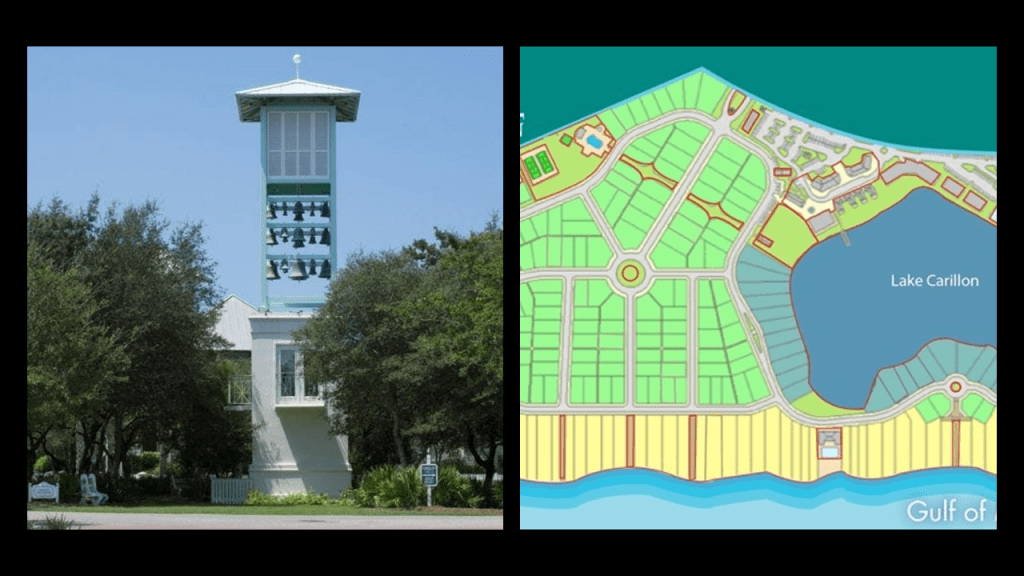
I also noticed the presence Carillon Beach in Panama City Beach.
Carillons are on my radar as old world infrastructure and they are bell towers.
The Carillon here is in the center of the community and all roads lead to Bell Tower Circle.
I have been researching the Earth’s original energy grid system from the perspective that it was a perfectly-tuned scientific and musical instrument, and everything was part of an interconnected, functional system of a civilization that knew exactly how to utilize frequency and vibration in fundamental and harmonious ways.
This perfectly-tuned system included bell-towers, cathedrals, and organs.
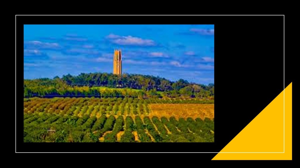
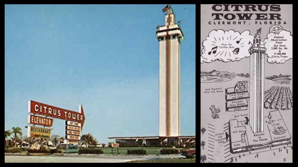
Other examples of bell-towers in Florida include what is known as the Bok Tower in the Bok Gardens at Lake Wales…
…and the Citrus Tower in Clermont, near Orlando.
What was the purpose of massive bell-towers like these reaching up to the clouds for the original civilization?
My belief is that these bell-towers were the generators of healing and harmonious frequencies for the benefit and balance of all of Creation.
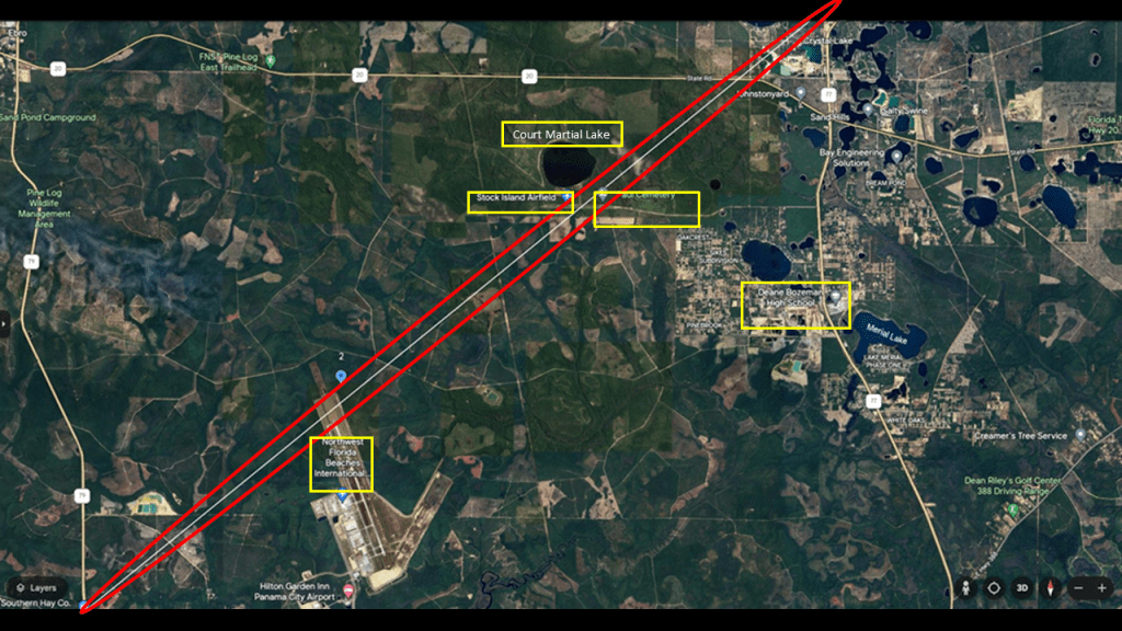
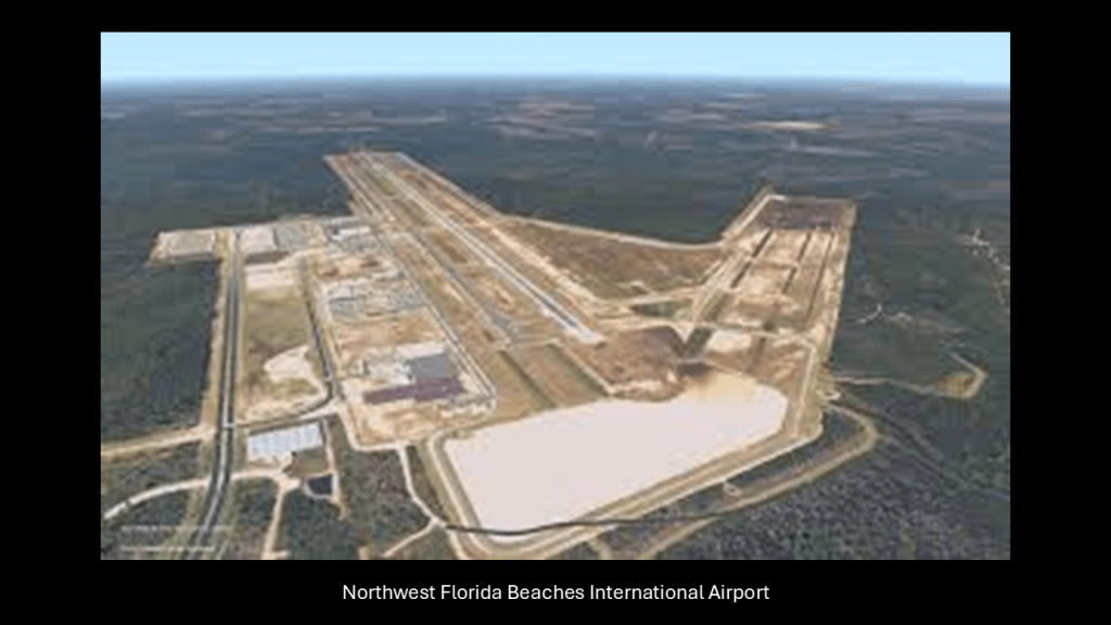
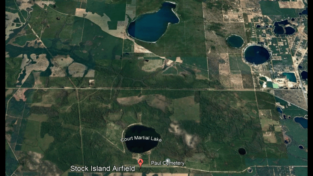
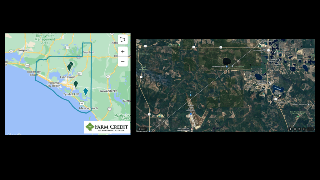
In this next segment of the alignment after leaving the area around Panama City Beach, we come to the Northwest Florida International Beaches Airport; the Stock Island Airfield; the Paul Cemetery; Court Martial Lake; and the Deane Bozeman High School.
The Northwest Florida International Beaches Airport officially opened for commercial flights in May of 2010.
We are told it currently has no scheduled international flights due to the small population in the surrounding area and that visitation to the area is primarily regional or national.
Stock Island Airfield is an airstrip that is privately owned by Stock Island Timber LLC
It is adjacent to the Paul Cemetery and the circular Court Martial Lake.
Court Martial Lake was said to have been named that because it was associated with the belief that General Andrew Jackson executed two British subjects after a military trial in 1818.
There is also no documented evidence to support that Jackson was ever there.
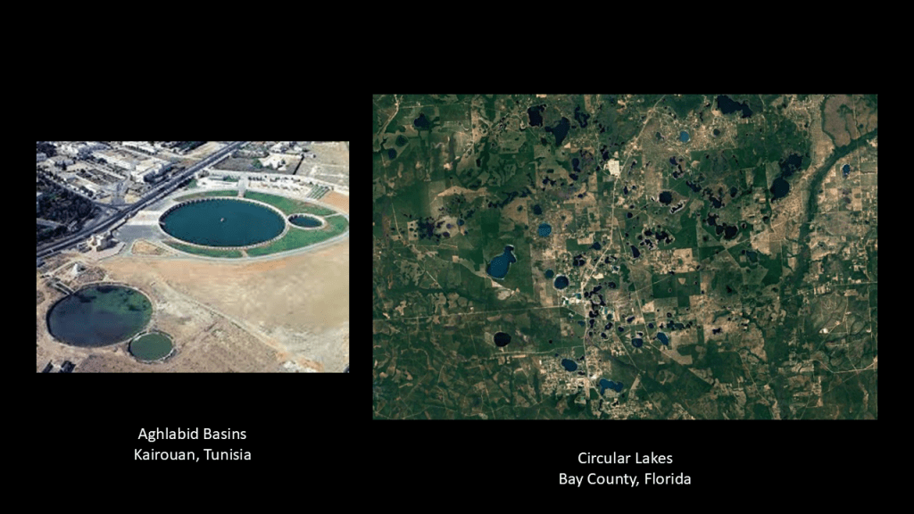
Interesting to note there are quite a few circular lakes in this part of Florida.
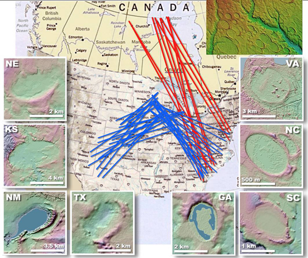
These findings of circular lakes here reminds me of the Bay Lakes, also known as the Carolina Bays, which are described as elliptical or circular depressions, found along the East Coast of the United States in a northwest-to-southeast orientation.
But apparently they have been found in many other places as well.
Explanations proffered for how they were formed include:
Subsurface limestone deposits that gave way to sinkholes;
Giant schools of fish excavating depressions on the ocean floor for spawning when oceans covered the land;
Meteorite shows striking the surface of the Earth;
And natural circular depressions elongated by prevailing winds and water.
My best guess would be that these land features are part of an integrated, pre-existing hydrological system.
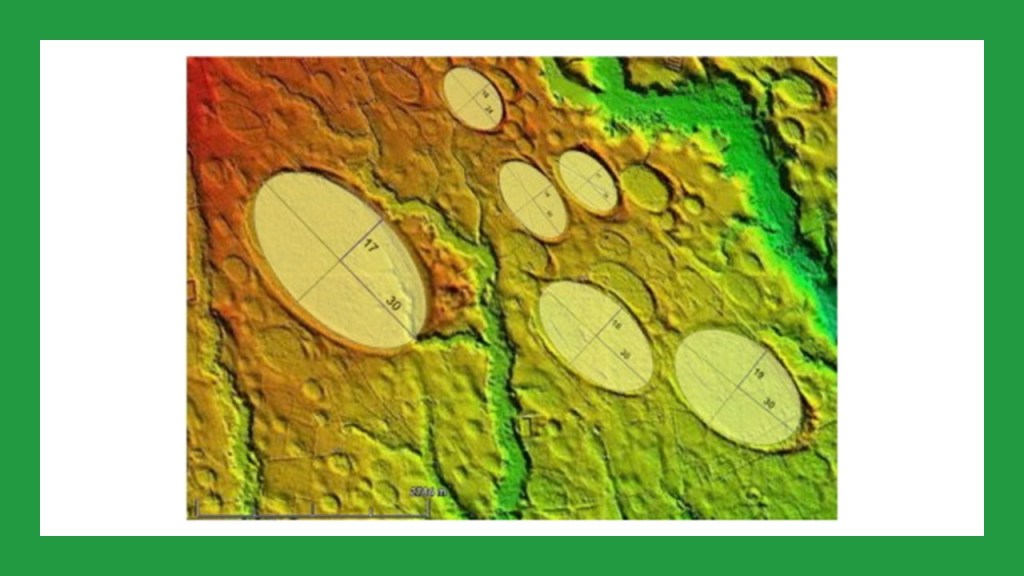
Like the Aghlabid Basins in Kairouan, Tunisia, of which there are two remaining of what are described as water reservoirs of an original fifteen, said to have been constructed between 860 and 862 A.D.
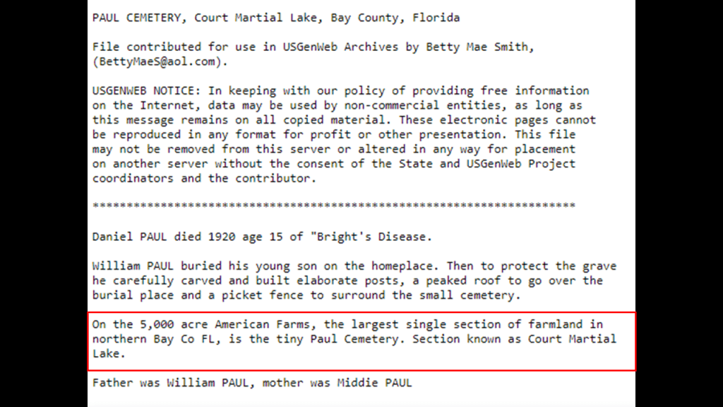
The Paul Cemetery on the alignment is a small family cemetery, and is referenced here as being on the 5,000-acre American Farms, the largest single section of farmland in northern Bay County.
We shall see numerous cemeteries as we journey along the alignment in this post.
I know there is something significant about cemeteries being on the energy grid.
The correlation is clearly there, but the reason for why this would be the case is not clear.
So this whole area is farmland, and already only a short-distance in to the U. S., we are seeing the same kinds of things here that we saw along the alignment in Mexico.
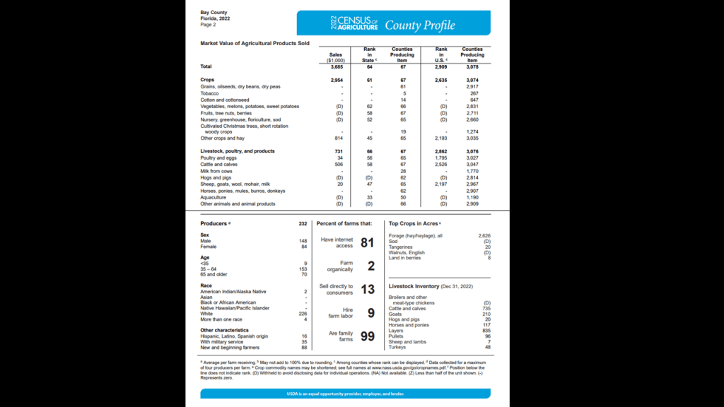
There is all kinds of agriculture in Bay County according to USDA statistics.
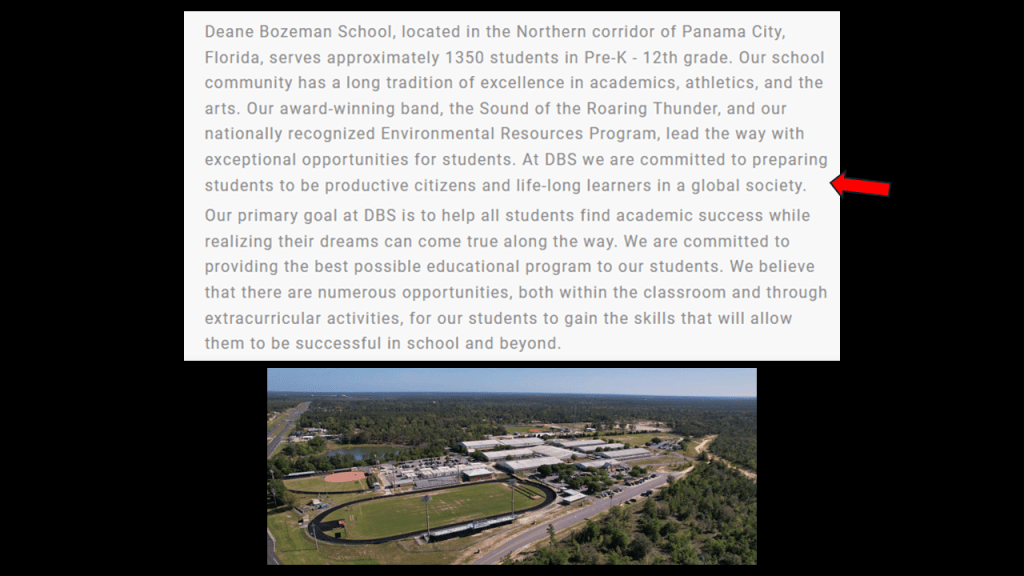
The Deane Bozeman School is a public school educating pre-Kindergarten through 12th-grade students in this very rural part of western Florida.
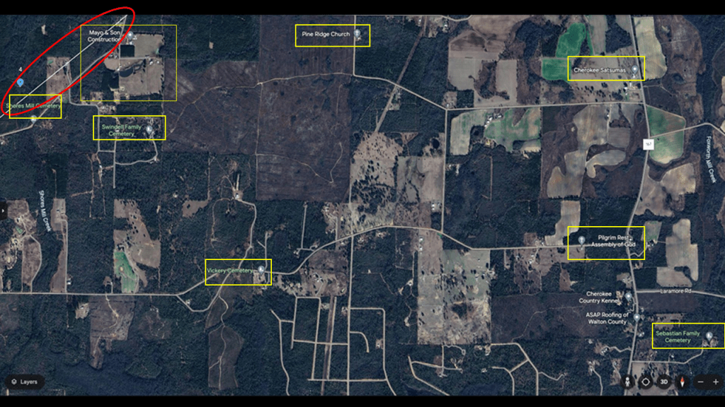
In this next segment of the alignment, we find Mayo and Son Construction and Shores Mill Cemetery directly on the alignment, and nearby are several other cemeteries; Pine Ridge Church; and Cherokee Satsumas – which is a u-pick satsuma farm.
Satsumas are a type of mandarin orange.
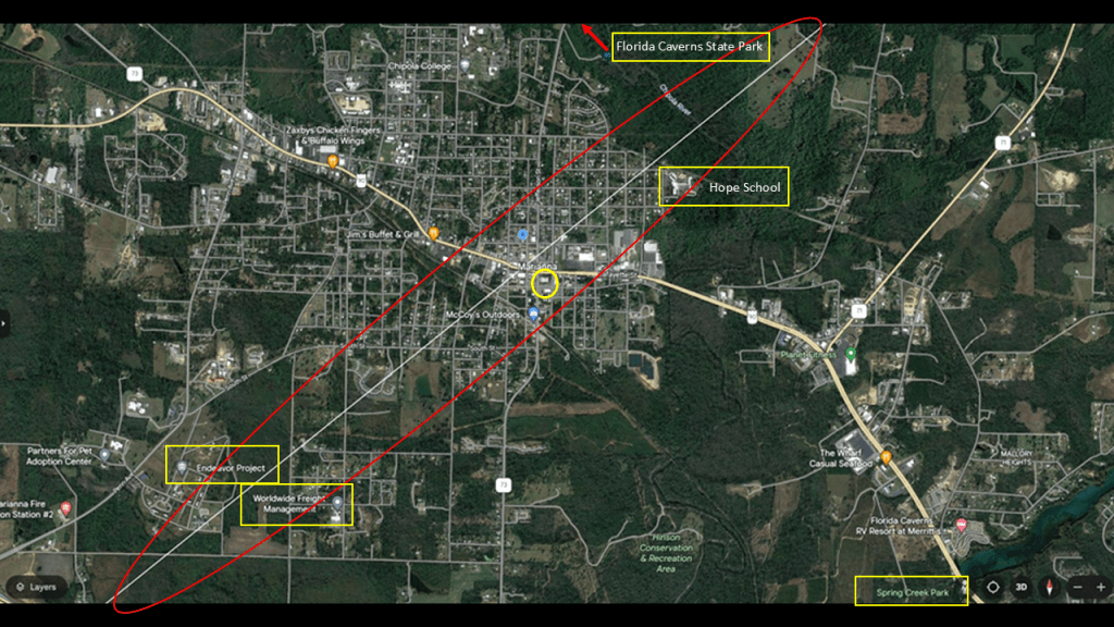
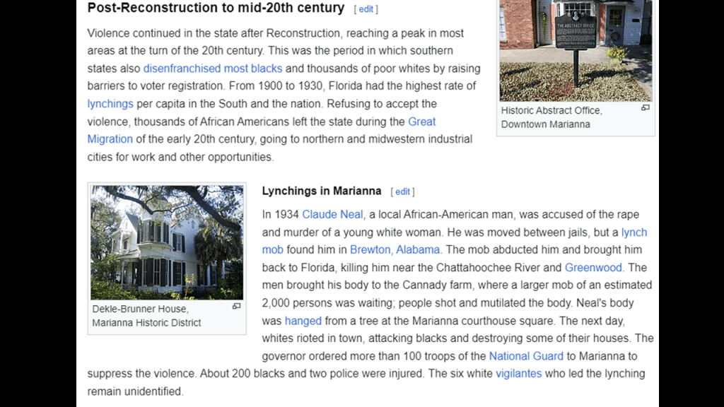
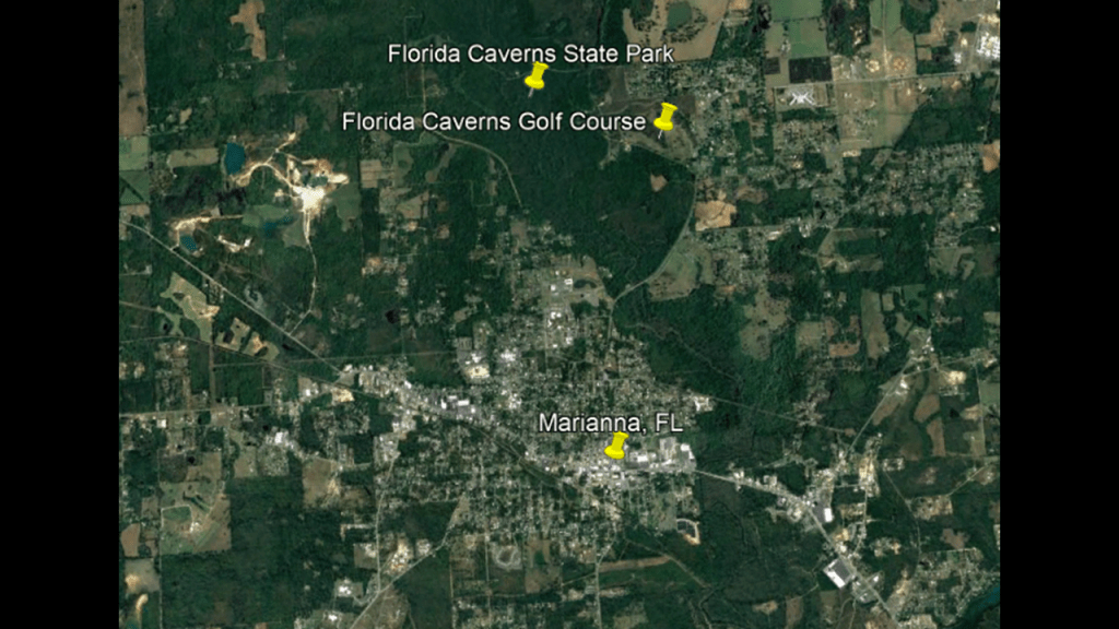
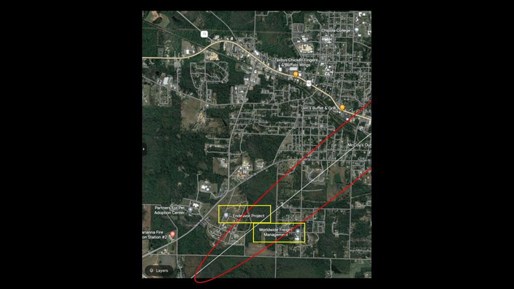
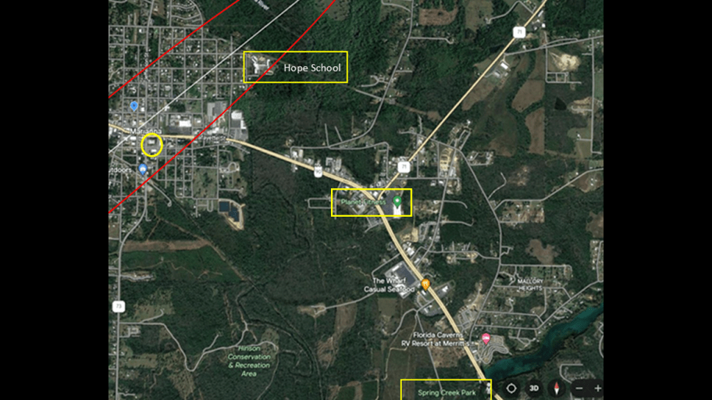
Next, the alignment goes right through the heart of Marianna, Florida, the county seat of Jackson County, where we find the Florida Caverns State Park; the Endeavor Project; Worldwide Freight Management; Spring Creek Park; and Hope School.
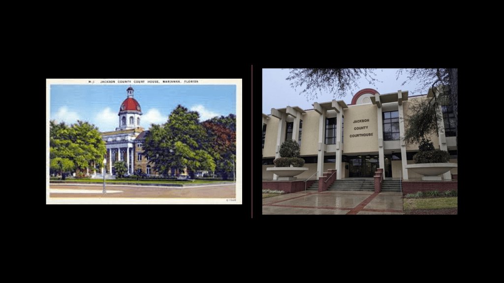
The Jackson County Courthouse is circled in yellow right next to the alignment in the city of Marianna.
The courthouse on the left was said to have been built in 1906 and that the courthouse on the right replaced it in the early 1960s.
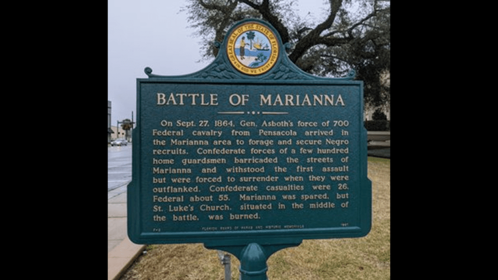
We are also told that Marianna was the site of a civil war battle in 1864 between a small home guard, and 700 federal troops.
And both Marianna and Florida are noteworthy for their history of racial violence.
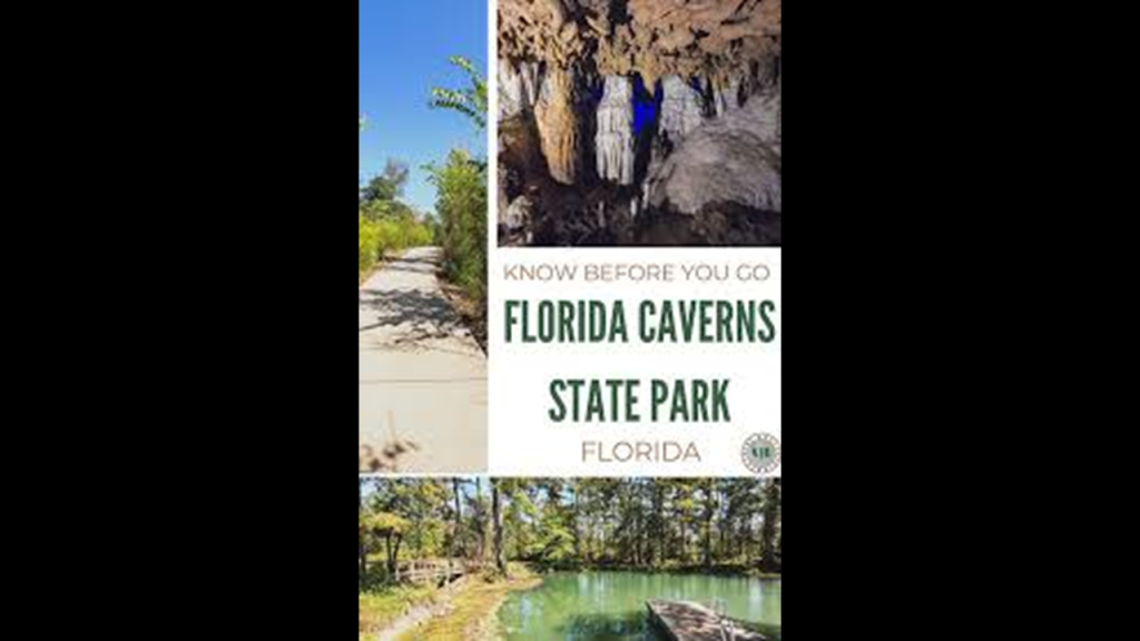
The Florida Caverns State Park is to the north of Marianna, and located to the northwest of the alignment from Teotihuacan.
The Florida Caverns State Park facilities and nearby golf course were said to have been built by the Civilian Conservation Corps as part of the New Deal, and opened in 1942.
It is the only Florida state park with air-filled caves that is open to the public.
There are limestone caves underground, and rivers and springs above-ground on the park’s grounds.
Then there’s the Endeavor Project and Worldwide Freight Management to the southwest of Marianna on the alignment.
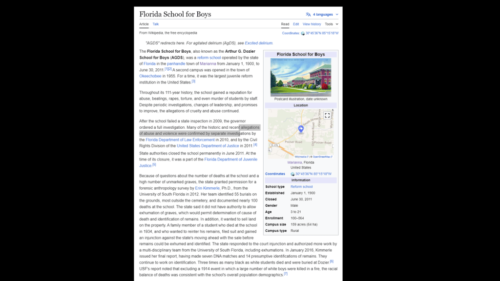
Come to find out that the Endeavor Project near the alignment is the name given to a revitalization project to turn the property of the former Dozier School for Boys, also known as the Florida School for Boys, into an economic driver for the area.
It first opened on January 1st of 1900 as a reform school, which was a penal institution for teenagers, and for a time was the largest in the United States.
Throughout its 111-year history, the school had a reputation for beatings, abuse torture, rapes and murder of students by staff.
The Worldwide Freight Management Company has a warehouse in Marianna.
This company handles all aspects of full service freight management.
Planet Fitness, Spring Creek Park, and Hope School are southeast of the alignment.
There are fitness centers showing up on these alignments, like the “Start Fitness” I found on this alignment back in Nopaltepec, Mexico.
I think these fitness centers are somehow harvesting our physical energy.
This thought first came to me because I had a gym membership at a place where the equipment I liked to use would flash a message at the end of my work-out saying something to the effect that “You have generated enough electricity to power “x” and at the time I thought it was really strange that it would tell me “that” information.
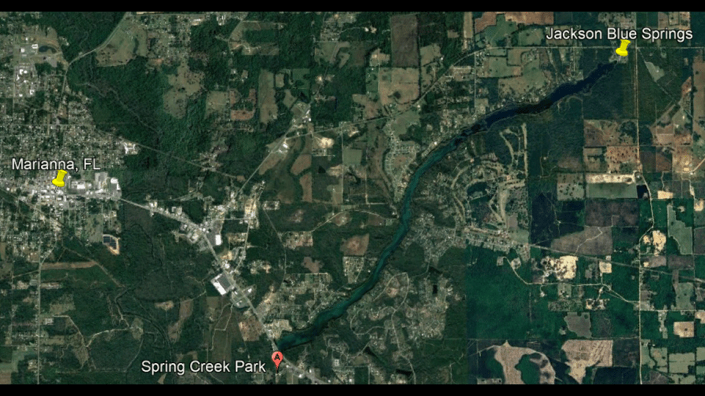
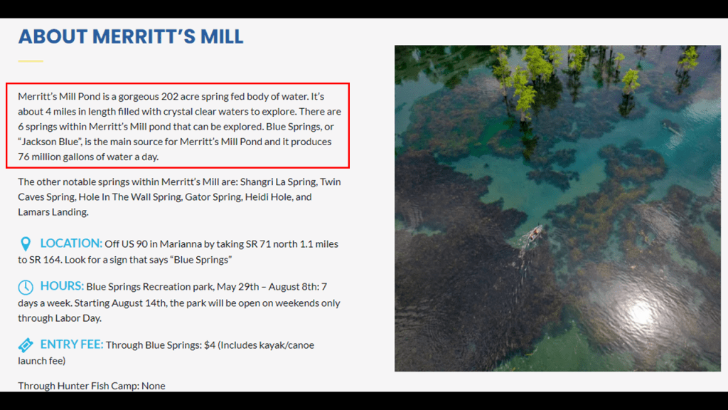
Spring Creek begins at Jackson Blue Springs on the north end of Merritt’s Mill Pond and flows into a reservoir on the opposite side of US-90, an east-west major US Highway that runs between Jacksonville Beach in Florida and Van Horn in Texas.
Merritt’s Mill Pond covers 202-acres, or 82-hectares of land.
It contains six springs and Blue Springs alone here produces 76-million gallons of water per day.
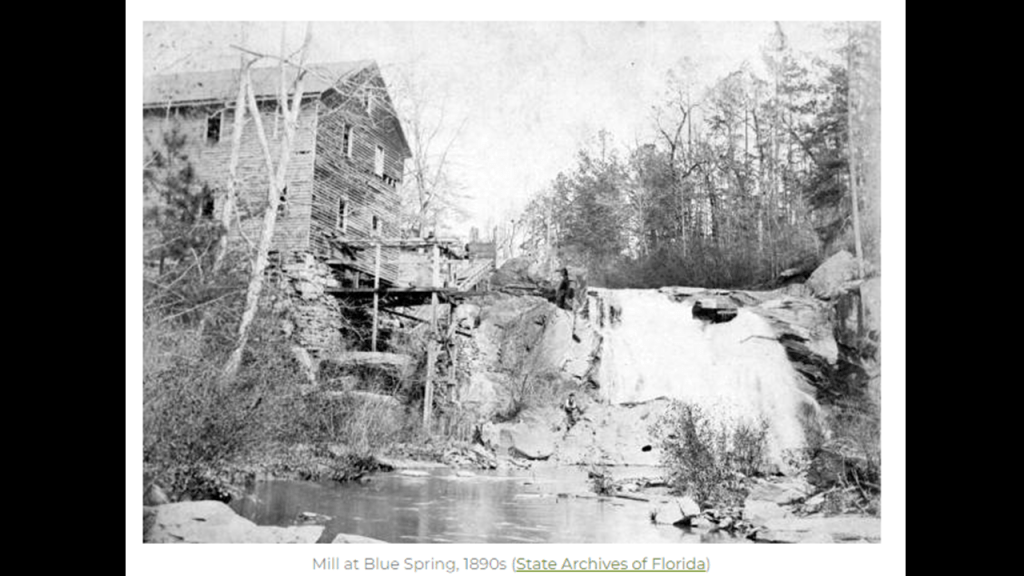
And yes, there used to be a mill here.
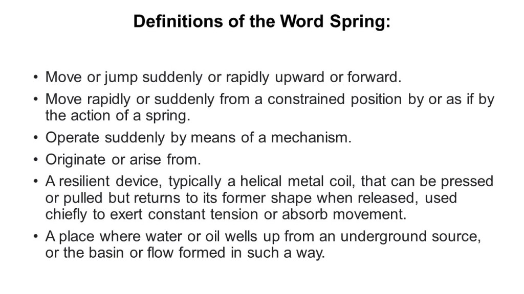
I don’t know what the function of “springs” were in the original free-energy-generating system, but I would speculate that the function of these “springs” is contained within the mechanical definitions of the word “spring.”
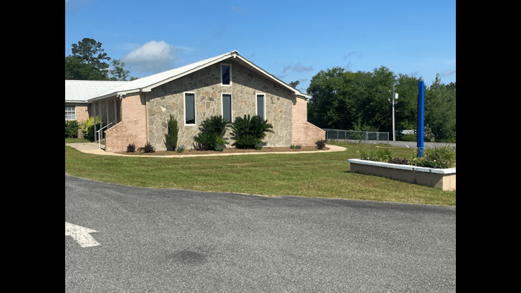
The Hope School is right next to the alignment in Marianna, like the Deane Bozeman School near the alignment in Bay County, is also pre-K through 12th-grade and has a little over 100 students with all the grades combined.
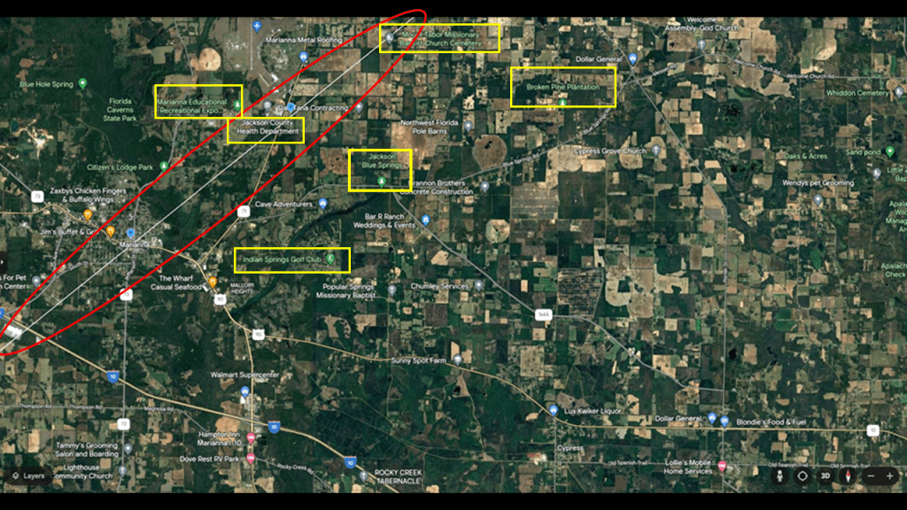
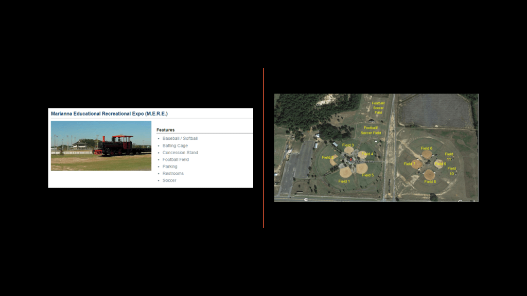
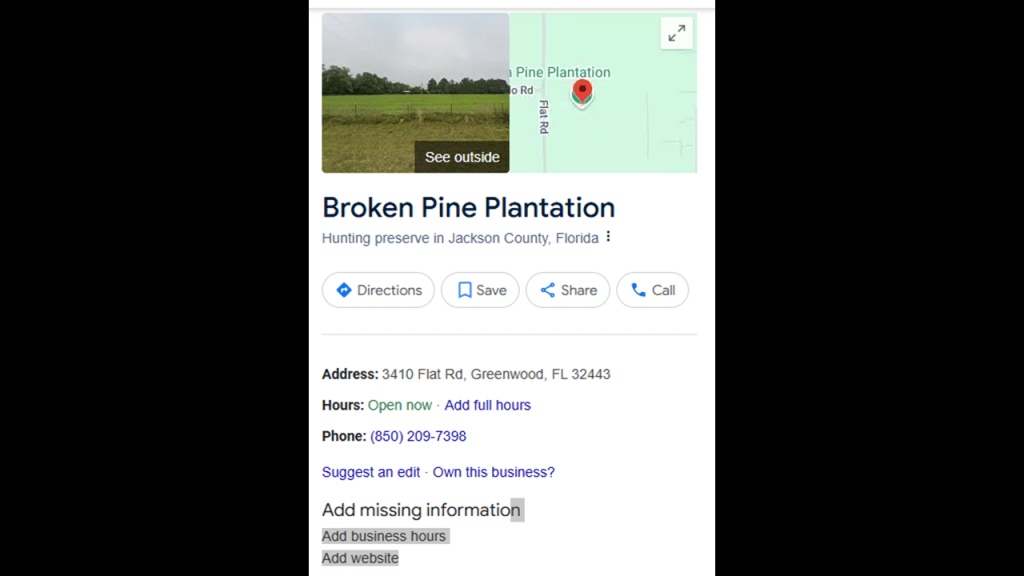
In this next segment of the alignment, we find places like the Marianna Educational Recreational Expo; the Jackson County Health Department; Mount Tabor Missionary Baptist Church Cemetery; Indian Springs Golf Club; and the Broken Pine Plantation.
The Marianna Educational Recreational Expo is close to the alignment, and right next to the Florida Caverns State Park, is a youth sporting complex.
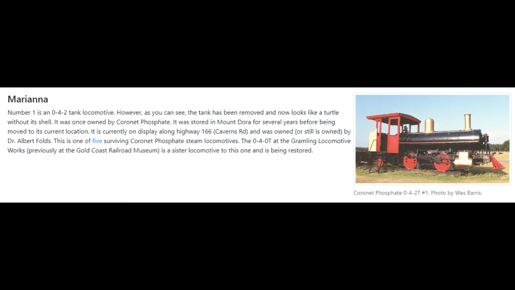
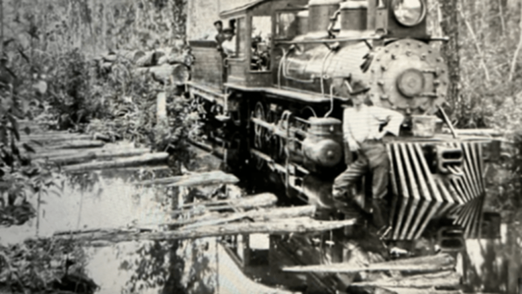
The steam locomotive pictured at the MERE Complex was once owned by Coronet Phosphate.
Phosphate mining in Florida even today accounts for 80% of the phosphate used in the United States.
Phosphate is mined for inorganic fertilizers, animal feed supplements and pesticides…and the mining of it pollutes the air and water, and destroys ecosystems.
Important to note that the short-line Marianna and Blountstown Railroad operated between 1909 and 1972.
The M & B Railroad offered passenger service until 1926 and then shipped agricultural products and lumber until 1972.
The Broken Pine Plantation is described as a hunting preserve, but information about it is scarce.
Here’s what I could find out about it.
This was the first time I encountered the word “plantation” in the United States leg of the alignment, and it won’t be the last time as we go along through here.
In Mexico, I encountered plantations several times along the alignment, especially in the Municipality of Zempoala, where they are called “haciendas.”
Haciendas were historically were large estates and plantations found in Spanish-speaking countries.
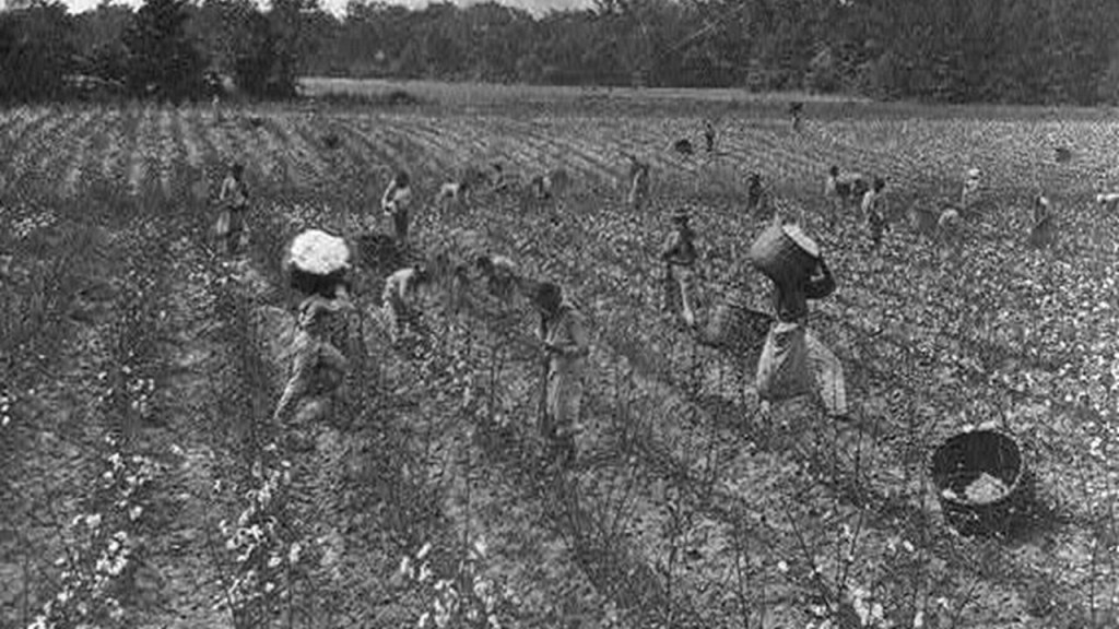
The word “plantation” has negative connotations from its historical association with slavery, as plantations were the center of large-scale enslaved labor operations with the primary focus of producing cash crops.
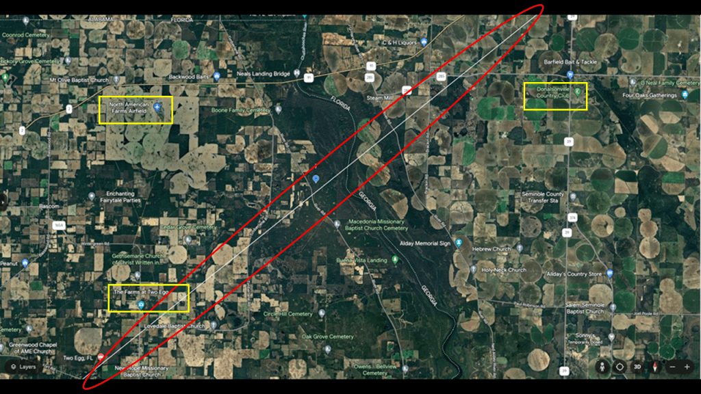
The alignment heads into Georgia across the Chattahoochie River in this next segment of the alignment, where we also see more cemeteries and more churches, as well as the North American Farms Airfield and The Farms at Two Egg in Florida, a cattle and hay farm, and the Donaldson Country Club in Georgia.
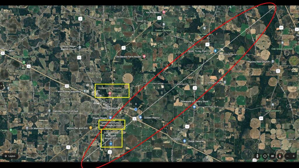
In the next segment going through here, we find the Donaldson Hospital, the Seminole County Middle-High School and the Donaldson Municipal Airport on or near the alignment, as well as more churches and cemeteries in the surrounding area.
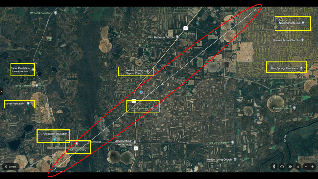
On the alignment’s way into Albany, Georgia, there are more churches and cemeteries, and plantations show-up big time here in this location!
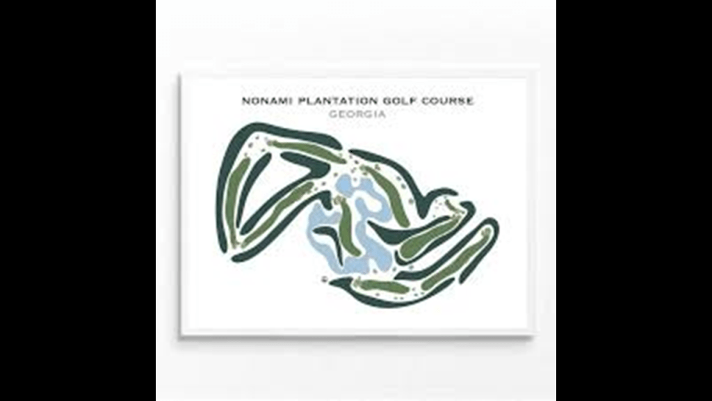
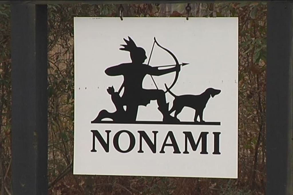
The Nonami Plantation on the top right is a 9,000-acre, or 3,642-hectare, plantation owned by Georgia billionaire and creator of CNN, TNN and TBS – Ted Turner.
Ted Turner is the largest individual landowner in the United States, owning more than 2-million-acres, or 809,371-hectares, of land.
There’s a golf course at Nonami Plantation.
It is also considered one of the best quail-hunting spots in Georgia.
That’s what they tell us anyway!
Don’t know this to be the case, but if they were actually hunting something else besides quail there, this wouldn’t surprise me with the kinds of things that have come out in various media in the last few years.
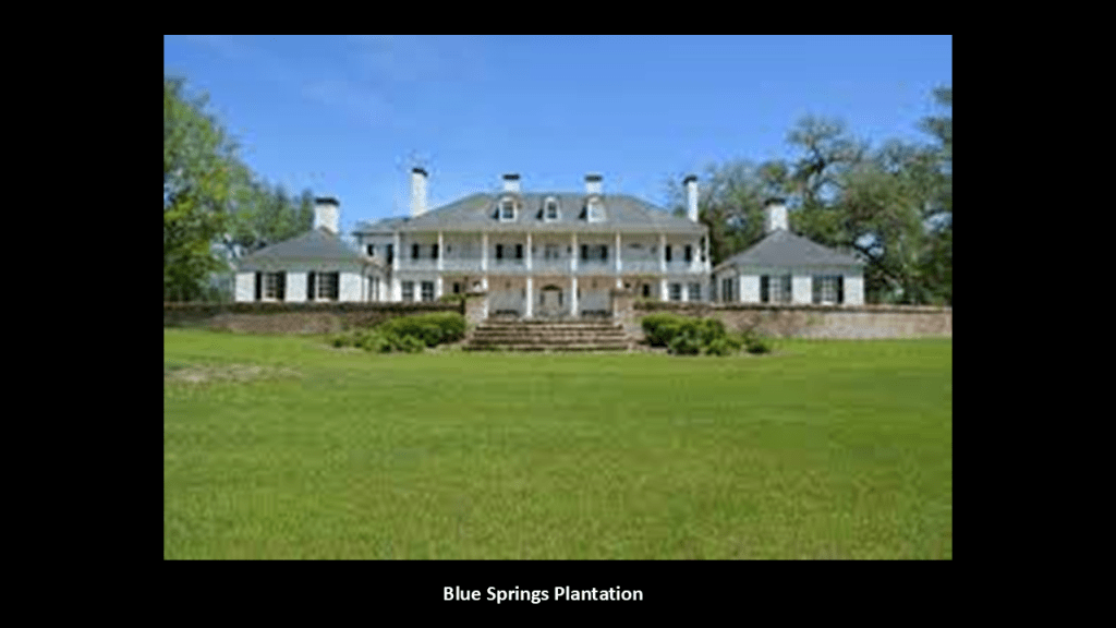
The Blue Springs Plantation is due south of Turner’s Nonami Plantation.
It is also privately-owned plantation.
A little over 7,000-acres, or 2,833-hectares, it was recently purchased for $40-million by Witt Stephens Jr – CEO of the Stephens Group, LLC, investment firm – from another private owner, and is described as having some of the most diverse hunting opportunities in South Georgia for quail and whitetail deer.
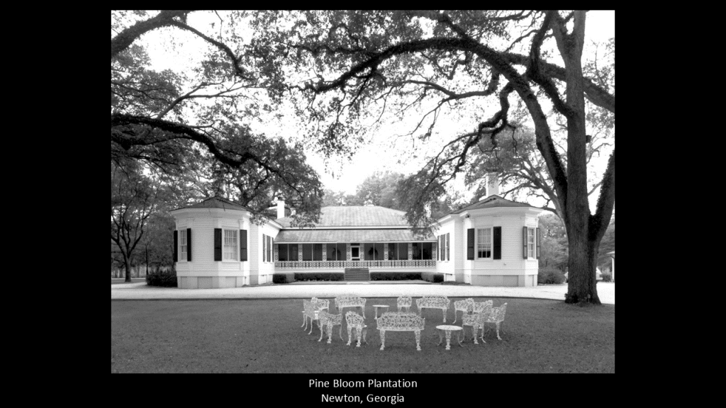
Lower-left is the Pine Bloom Plantation, with its Greek-Revival-style architecture said to have been built in 1850.
For a number of years it was owned by U. S. Steel and utilized as a corporate retreat.
It was purchased by Billionaire John Harbert of Alabama from U. S. Steel in 1981.
It is still owned by members of the Harbert Family.
It is an active farm and hunting plantation.
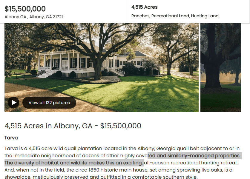
The Tarver Plantation, also known as Tarva, also dates to 1850.
It’s hard to find the information but looks like it is currently on the market, and listed for over $15-million.
It is also a historic hunting retreat location.
In the next segment of the alignment, we come to Albany, the seat of Dougherty County, and the county’s only incorporated city.
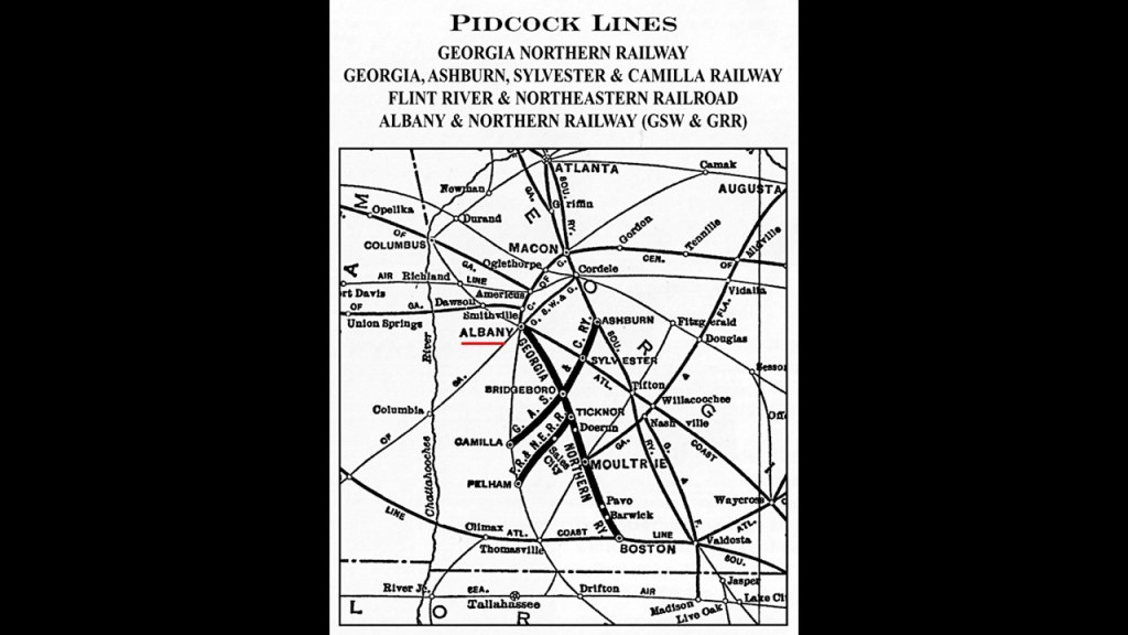
At one time in its history, seven railroad lines met here, and it was a center of trade in the Southeastern United States.
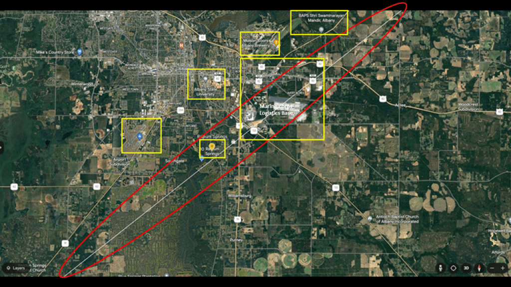
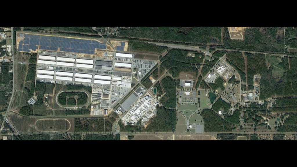
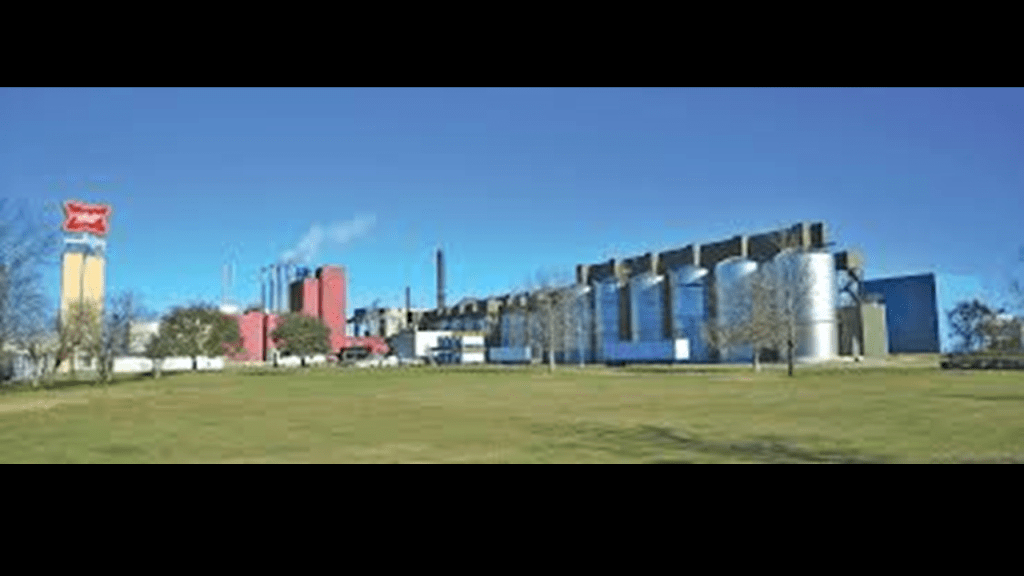
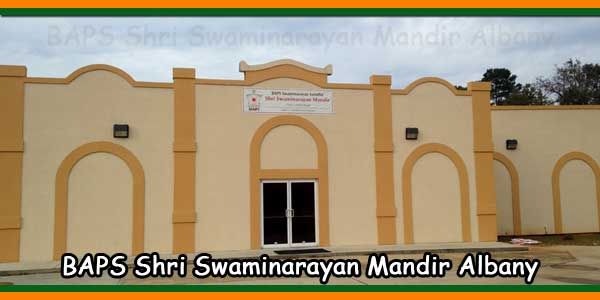
In Albany, the following places cluster around the alignment: The Marine Corps Logistics Base Albany; Radium Springs; the Southwest Georgia Regional Airport; Albany State University; Molson-Coors Albany Brewery; and the BAPS Shri Swaminarayan Mandir.
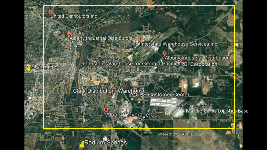
There are a lot of Distributors and Warehouses here in the same general area as the Marine Corps Logistics Base, similar to the finding of the Worldwide Freight Management location on the alignment back in Marianna.
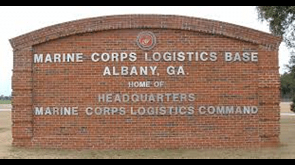
The Marine Corps Logistics Base is located smack dab on this alignment.
It is the headquarters of the Marines Corps Logistics Command.
The primary mission of the units on the base is to rebuild and repair ground combat and combat support equipment and to support installations on the East Coast.
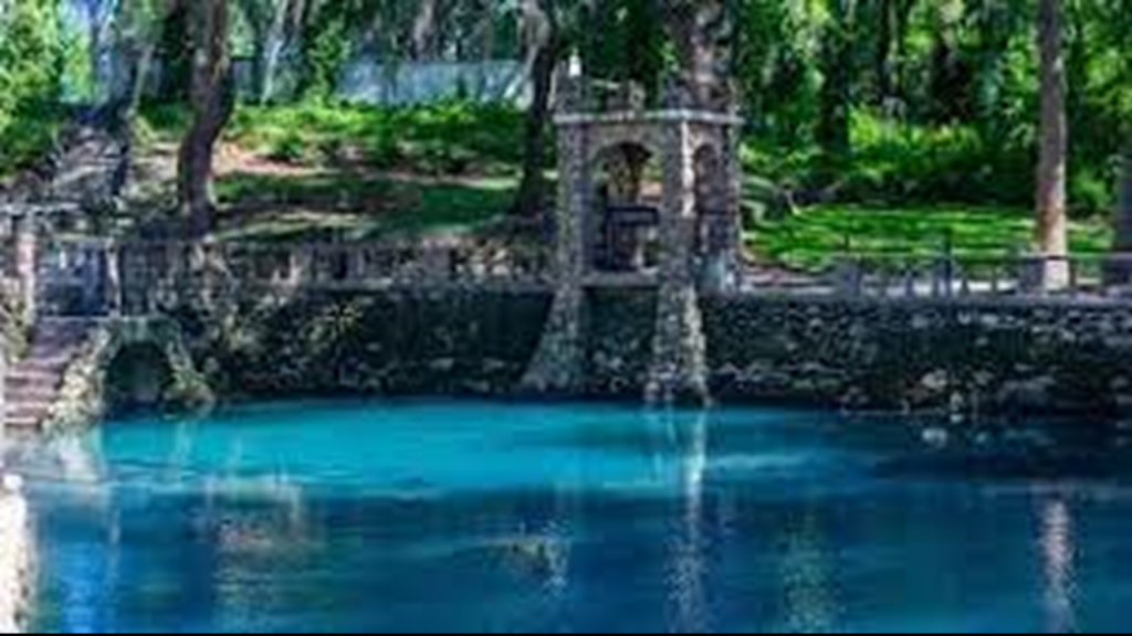
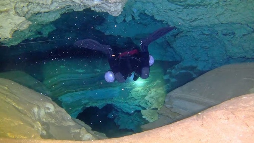
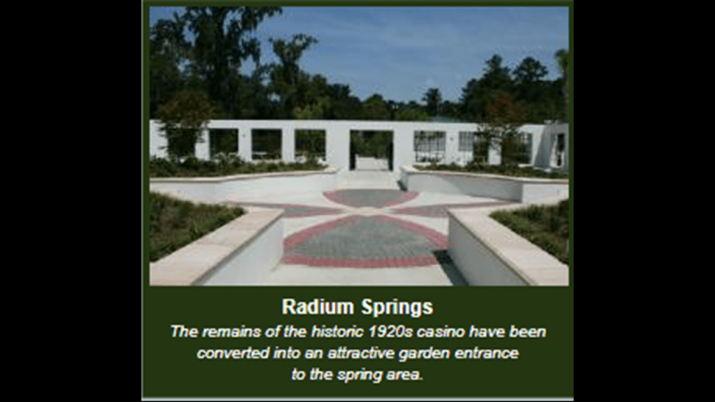
Radium Springs is the largest spring in Georgia, and is called one of the “Seven Natural Wonders of Georgia,” and located directly on the alignment.
The deep blue waters of Radium Springs flow at 70,000-gallons, or 265,000-cubic-meters, per minute into the Flint River.
There is also an extensive underwater cavern system here.
Long known for its healing properties and crystal clear waters, we are told that a resort and golf course was developed here in the 1920s.
Sadly, the Great Depression led to the closure of the resort in 1939, though the golf course remained open intermittently in the years following after it was acquired by a group of investors.
In 1994, the casino building was too severely damaged by Hurricane Alberto to save, so it came down.
Today it is Radium Springs Gardens, where you can visit and walk around, and look at the beautiful surroundings, but you can no longer swim.
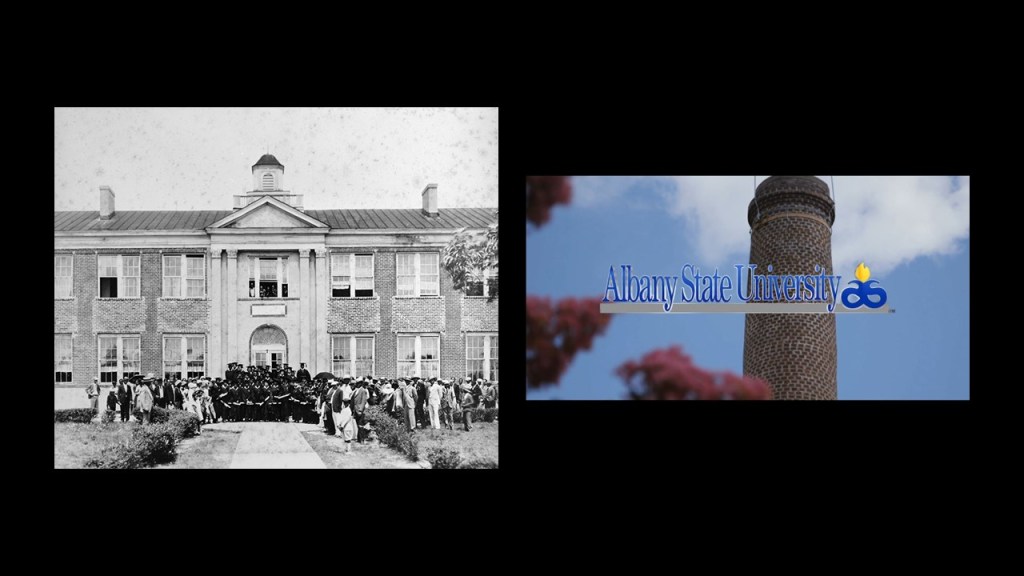
Albany State University was an historically black university until it merged with Darton State College in 2017, to become one university under the University system of Georgia.
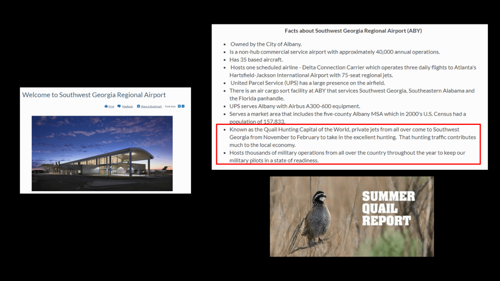
The Southwest Georgia Regional Airport is significant for being the airport where private jets from all over the world come to the “Quail Hunting Capital of the World,” which is southwestern Georgia.
Also for being the host for thousands of military readiness operations involving military pilots from all over the country.
Today’s Molson-Coors Albany Brewery started out as Miller Brewing in 1979, when Miller purchased the former Turner Air Field in Albany to produce Miller Beer products.
The BAPS Shri Swaminarayan Mandir is a Hindu Place of Worship in Albany.
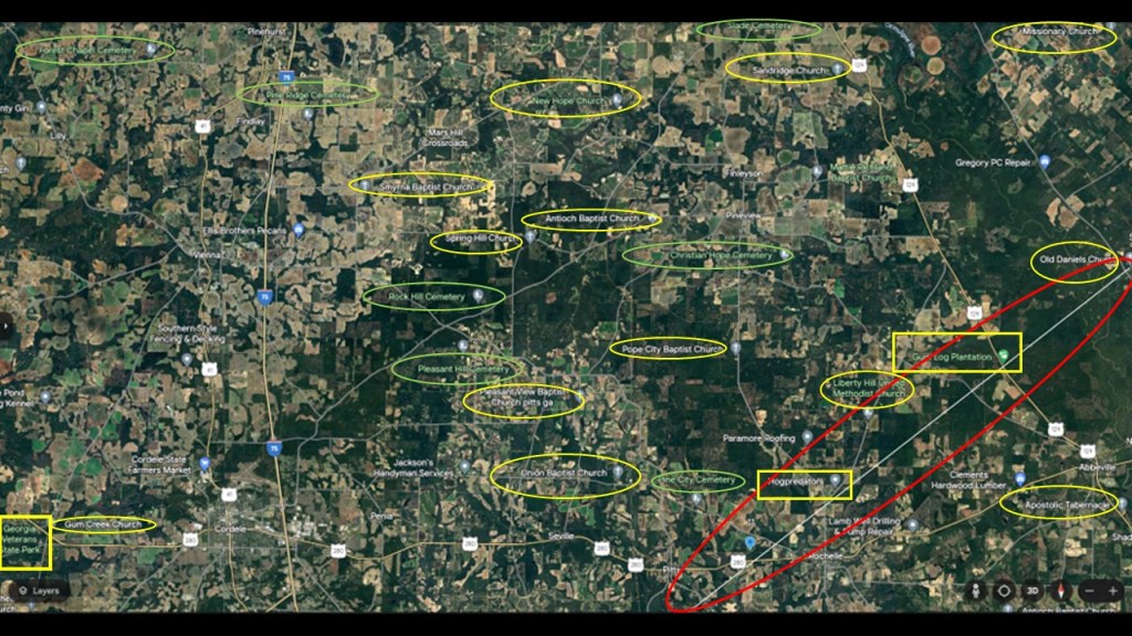
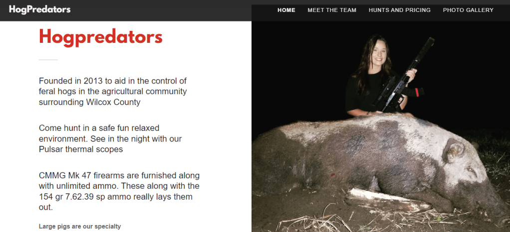
Leaving Albany going on to the next segment of the alignment, we find HogPredators; the Georgia Veterans State Park and Memorial Golf Course; the Gum Log Plantation; thirteen churches and seven cemeteries.
With HogPredators, again we find the theme of the “hunt,” in this case to aid in the control of the feral hogs in the county’s agricultural community, utilizing thermal scopes for night-hunting in a “fun, relaxed environment,” and unlimited ammo that “really lays them out.”
Perhaps a fun experience for the hunters, but definitely not for the hogs!
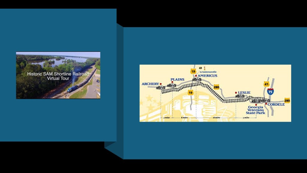
Georgia Veterans State Park and Memorial Golf Course has recreational activities,camping and a SAM Shortline excursion train stop. which is also a rolling state park.
And an excursion train – the Savannah, Americus and Montgomery (SAM) Shortline – that was restored and today runs the historic route from Cordele through Plains to Archery as a tourise attraction.
Former President Jimmy Carter grew up in Archery and lived in Plains, a small farming community whose main crops are corn, cotton,peanuts and soybeans.
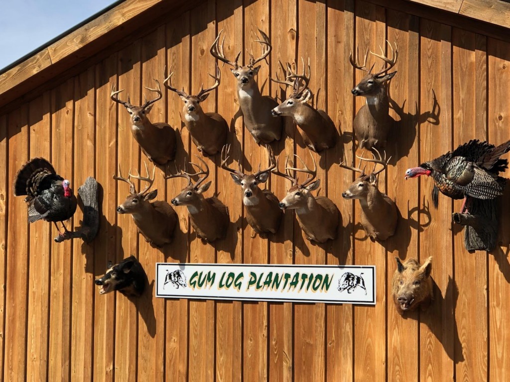
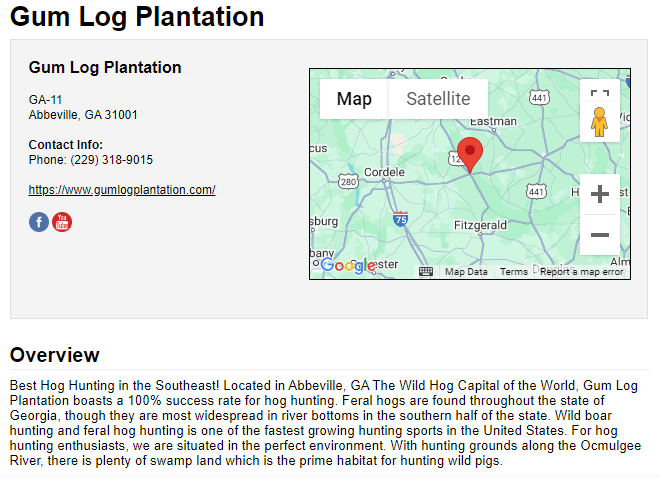
The Gum Log Plantation in Abbeville, Georgia, directly on the alignment is a hunting lodge, and known particularly for hunting wild hogs, deer, and turkey.
Abbeville is known as the “Wild Hog Capitol of the World.”
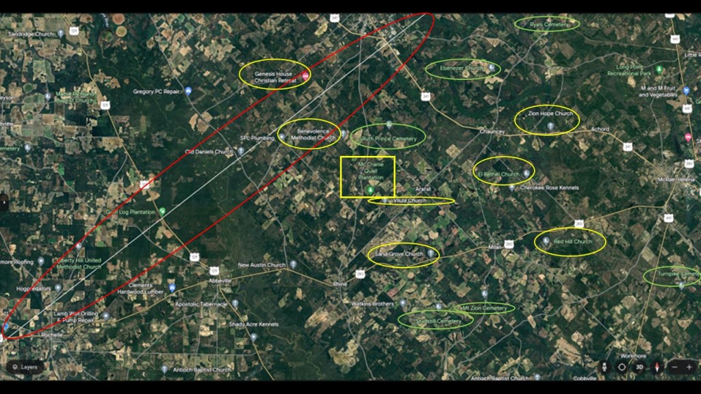
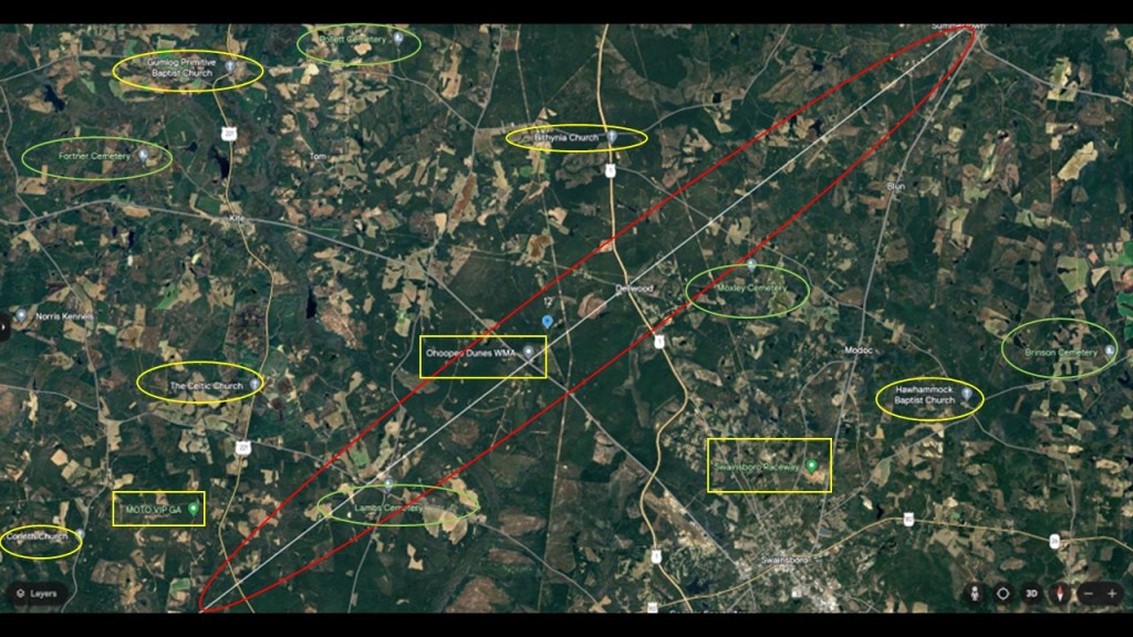
Further up on the alignment from where we were just looking, we find six more churches, six more cemeteries and the McCrainie Quail Plantation.
The McCrainie Quail Plantation advertises itself as the home of some of the finest quail hunting in Georgia, and like the Gum Lodge Plantation, is also a hunting lodge.
It also offers deer, pheasant and turkey hunts.
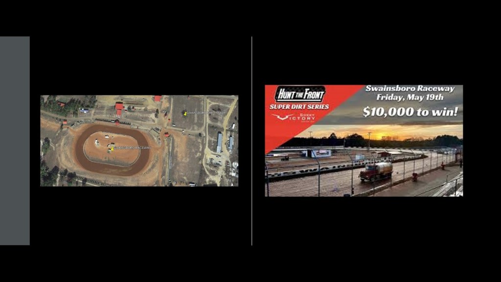
In the next segment of the alignment, we come to MOTO VIP; Ohoopee Dunes WMA and golf course; Swainsboro Raceway; and five more churches and five more cemeteries.
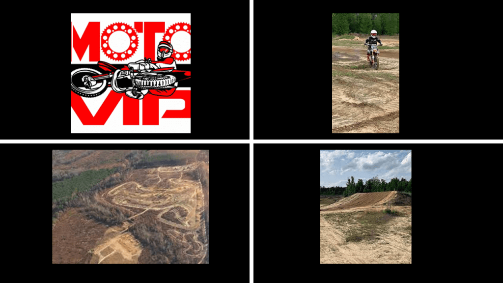
First, MOTO VIP in Adrian, Georgia, is an off-road Motocross facility.
Motocross is a form of off-road motorcycle racing held on off-road circuits, and is the most popular form of motorcycle racing in the United States today, with high-jumps, wheelies and more.
It is also important to note that the risk of injury is high in motocross racing, with an estimated 1-in-200 riders sustaining injuries ranging from mild to severe, and is the leading cause of injuries amongst all other similar extreme sports.
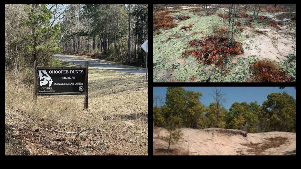
The location of the Ohoopee Dunes Wildlife Management Area is directly on this alignment, and this almost 10,000-acre, or 4,047-hectares, of land is used for recreational aactivities like boating, hiking, hunting and fishing
As mentioned previously, I consistently find dunes and deserts, estuaries and wetlands along all the ley lines I have tracked, and believe them to have unnatural origins resulting from this recent cataclysmic event involving a massive directed attack on the Earth’s ley lines that destroyed not only the surface of the Earth, but as well the original ancient advanced Moorish civilization that built all the infrastructure.
The Ohoopee Dunes are comprised of quartz-based sand that doesn’t hold nutrients and drains quickly, but still manages to support a unique variety of plant and animal life.
There is also a private, members only, golf club here.
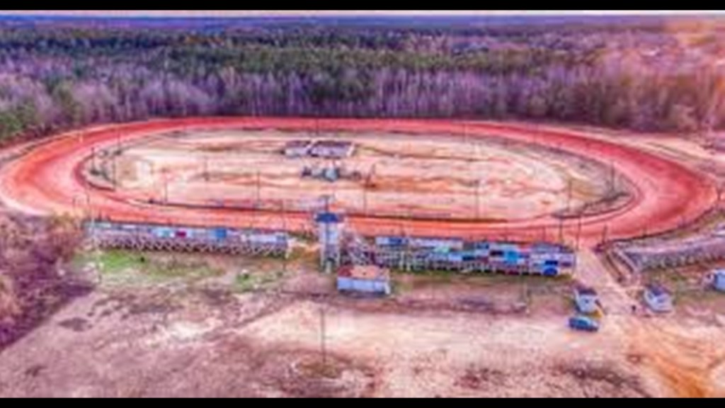
The Swainsboro Raceway is described as a premier racing destination, with a fast 3/10-mile dirt track, and hosts regular races, competitions and series from March through September.
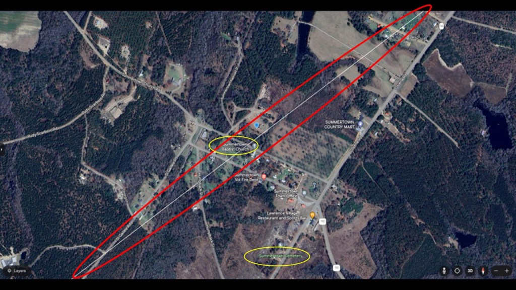
The next place we come to on the alignment is Summertown, which had a population of around 120 people in 2020.
It was said to have been incorporated as a summer retreat in 1906 by the Georgia General Assembly.
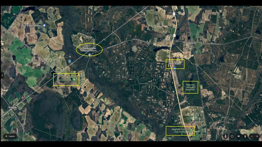
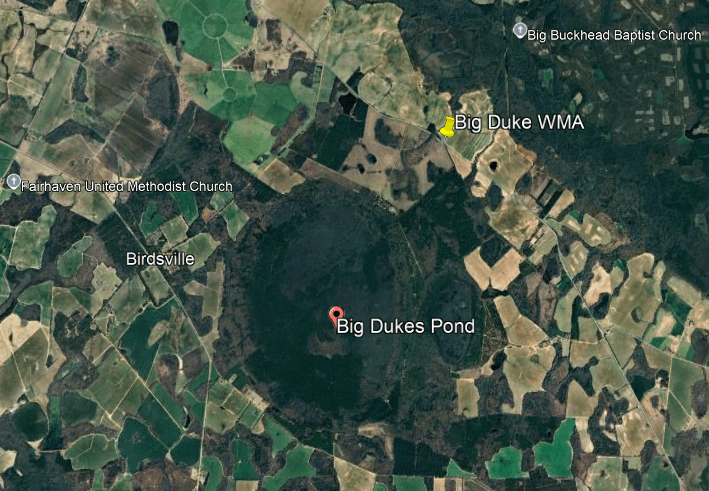
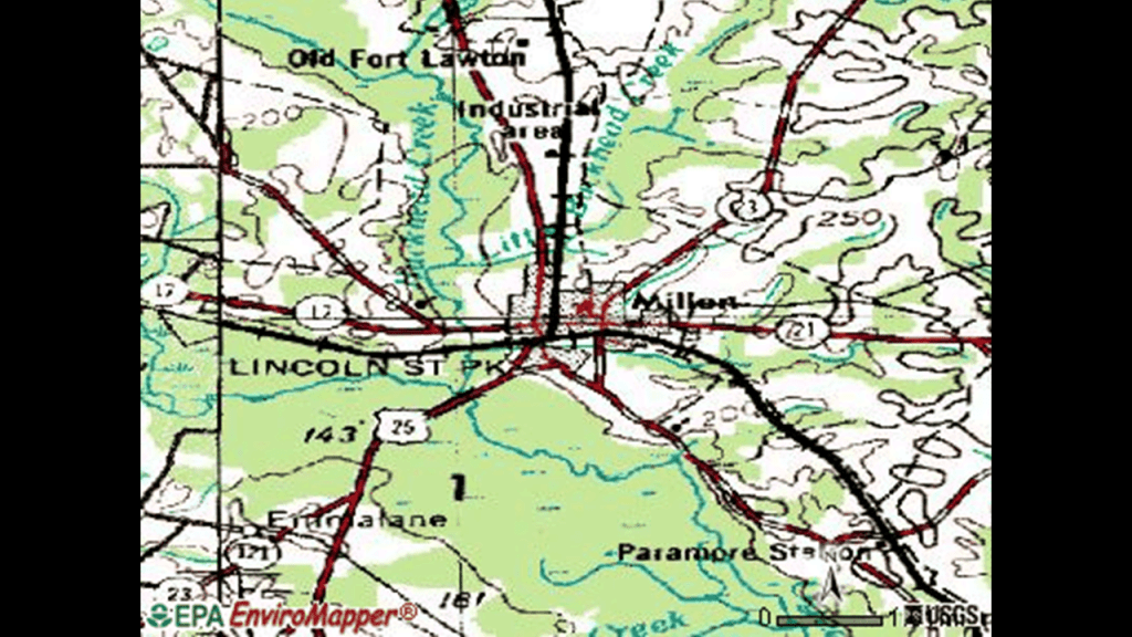
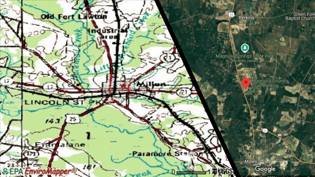
In the next segment of the alignment, we come to the Big Duke Wildlife Management area; Millen Airport; Magnolia Springs State Park; and the Magnolia Country Club Holding.
Big Dukes Pond Wildlife Management Area is a conservation area which allows for the hunting of deer, turkey, small game and waterfowl.
It is over 1,000-acres, or 405-hectares, on a coastal plain with one of the Carolina Bays, which were mentioned previously.
Like I said earlier in this post, My thought is that these “bays” were once part of an ancient hydrological system.
And like Bay County Florida where there are a lot of circular “lakes,” there is also a lot of agriculture here in Jenkins County, Georgia.
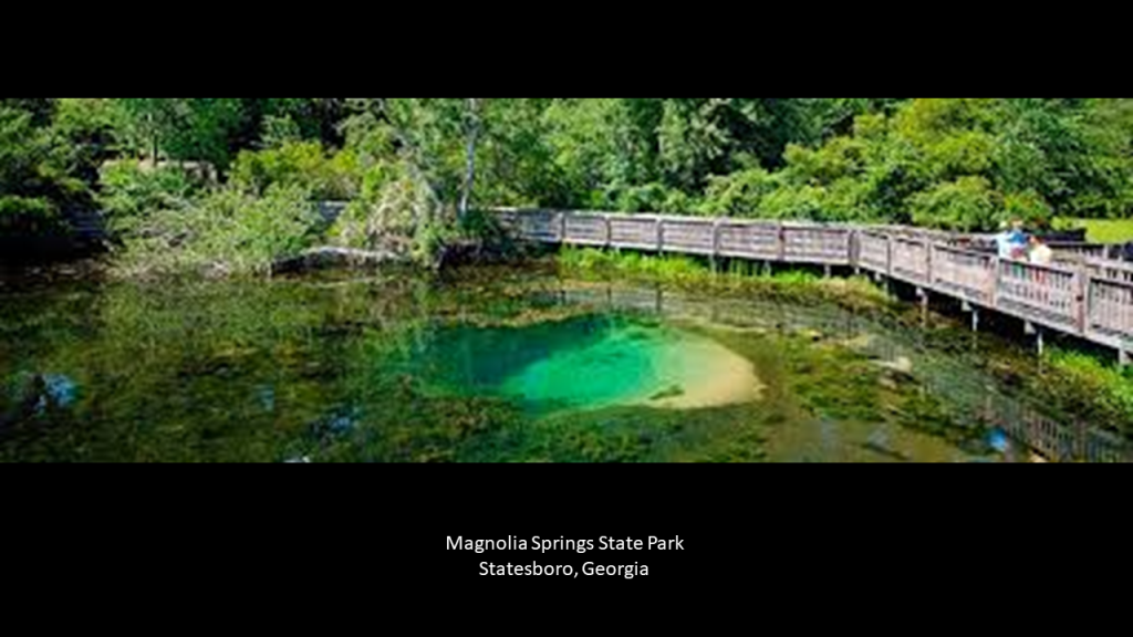
The nearby Magnolia Springs State Park, located between Perkins and Millen, was said to have been built by the Civilian Conservation Corps and opened in 1939.
The crystal-clear springs here are estimated to flow at 7-million gallons, or 26,498-cubic-meters, per day.
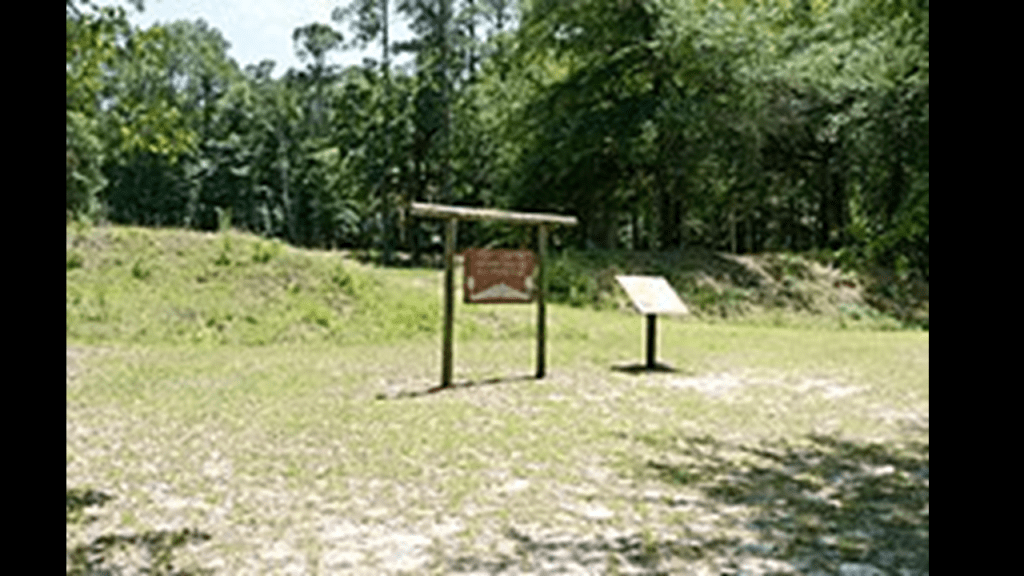
Interesting to note that the day-use area of this park was recorded as having been built as a new prison by the Confederacy during the American Civil War.
Known as Camp Lawton, or Millen Prison, we are told that the earthworks here are remnants of the prison.
Camp Lawton was located right next to the Augusta and Savannah Railroad Right-of-Way, five-miles north of what was Millen Junction, and is now Millen, the county seat of Jenkins County.
Said to have been completed by 1854, it was in operation from 1854 to 1948, when it was absorbed into the Central Railroad of Georgia.
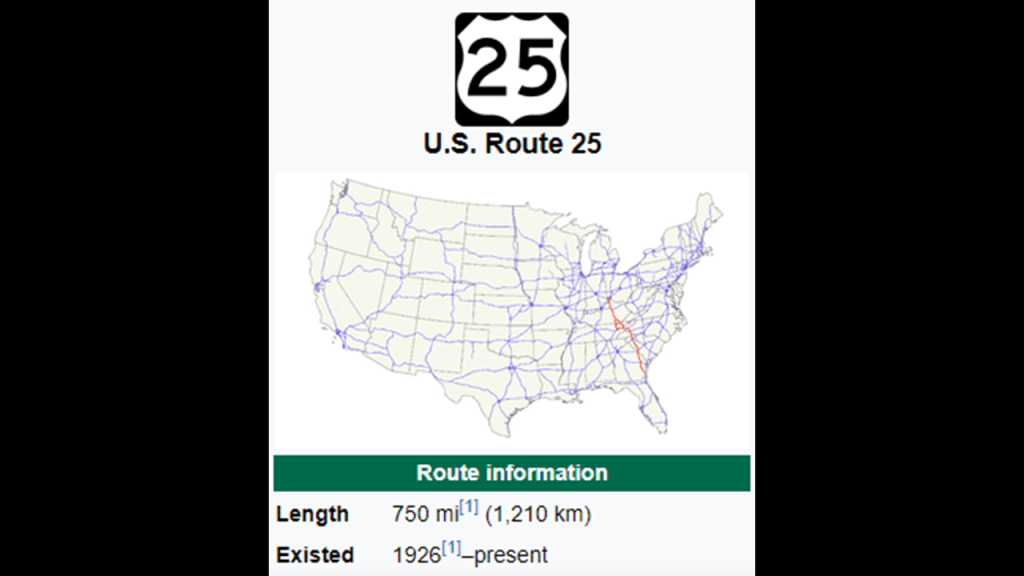
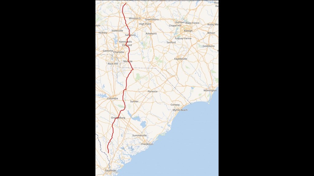
The Magnolia Country Club is also nearby, between Perkins and Millen, on US Highway 25.
US-25 runs from Covington, Kentucky on the Ohio River to Columbia, South Carolina.
I would venture to say that more likely than not, US-25 runs the same “route” as the old railroad line.
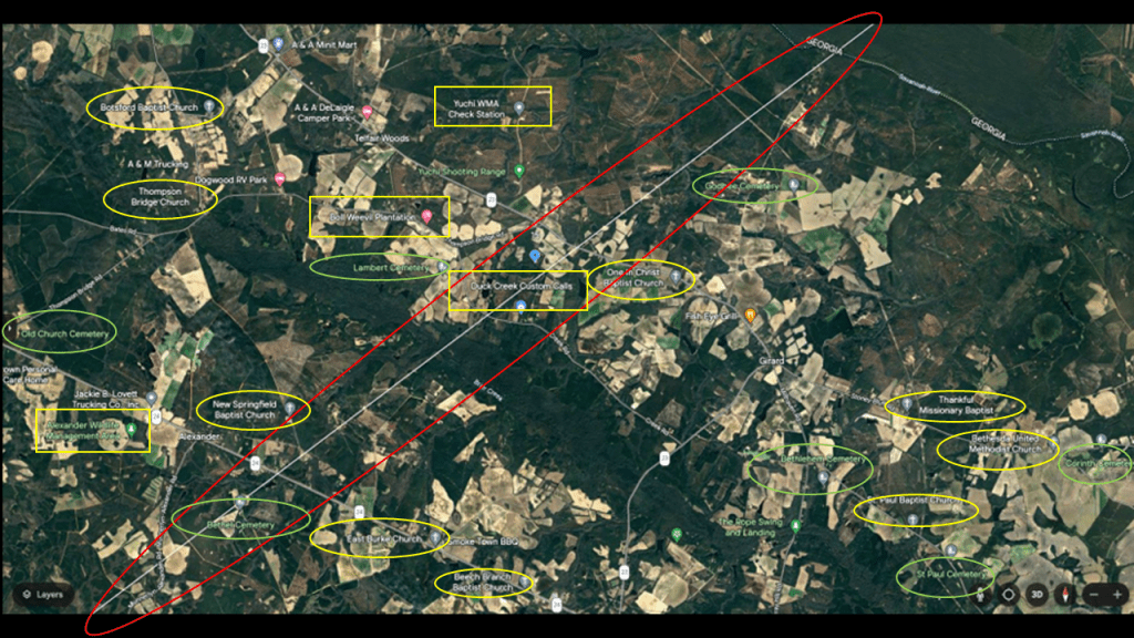
The next segment of this alignment shows it going through Girard and Waynesboro in Burke County Georgia on the Savannah River, the state’s border with South Carolina.
I counted 9 churches and six cemeteries in the area surrounding the alignment.
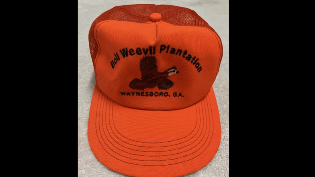
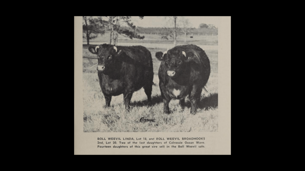
Boll Weevil Plantation near the alignment today is an historic venue for events like weddings, gatherings and has a shooting range with clay targets.
The only thing I could find out about its history was that it was used for the sale of breeding stock of short-horn cattle starting in 1962.
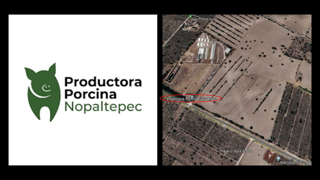
I found the “Productora Porcina Nopaltopec” on the alignment back in Nopaltopec Mexico, which is a place to acquire pure-breed and crossbred pigs for pork production, so another location for animal husbandry like this for breeding, and one of the many types of agriculture that we have seen all along this alignment so far.
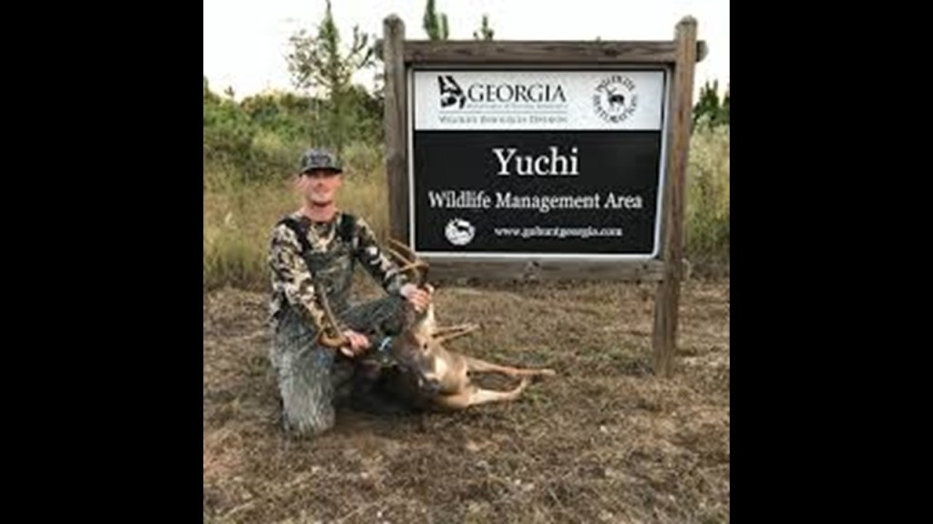
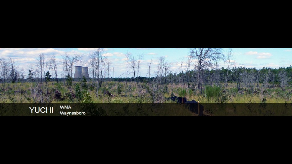
The nearby Yuchi Wildlife Management Area is a 7,800-acre, or 3,157-hectare property managed by the state, and offers hunting opportunities for deer, turkey and small game.
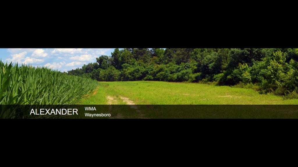
Same thing with the Alexander Wildlife Management Area, which is on 1,300-acres, or 526-hectares of state land, and primarily used for hunting deer, turkey, small game and dove.
Duck Creek Custom Calls is located directly on the alignment in Girard, as is Bethel Cemetery.
So the energy of “the hunt” is found all along this alignment as it goes through Georgia, whether the hunting is for small game or large game, whatever the case may be.
The hunt is filled with adrenalin.
For the hunter, it is all the activities focusing on “the Kill,” the intentional taking of another life for sport.
For the hunted, it is the adrenalin-fueled “flight” for life, knowing that someone is pursuing you to kill you, filled with the energy of extreme fear and terror.
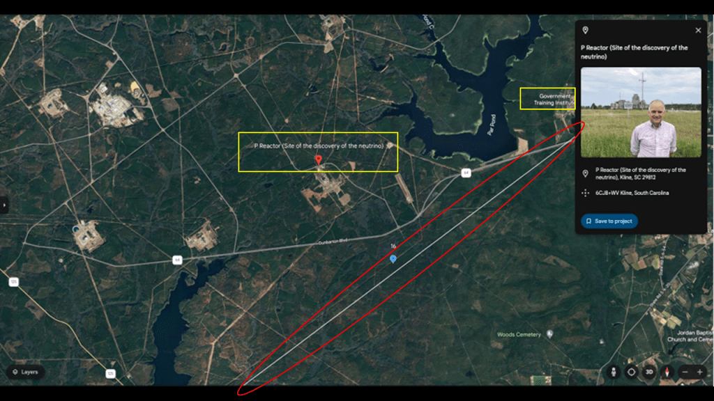
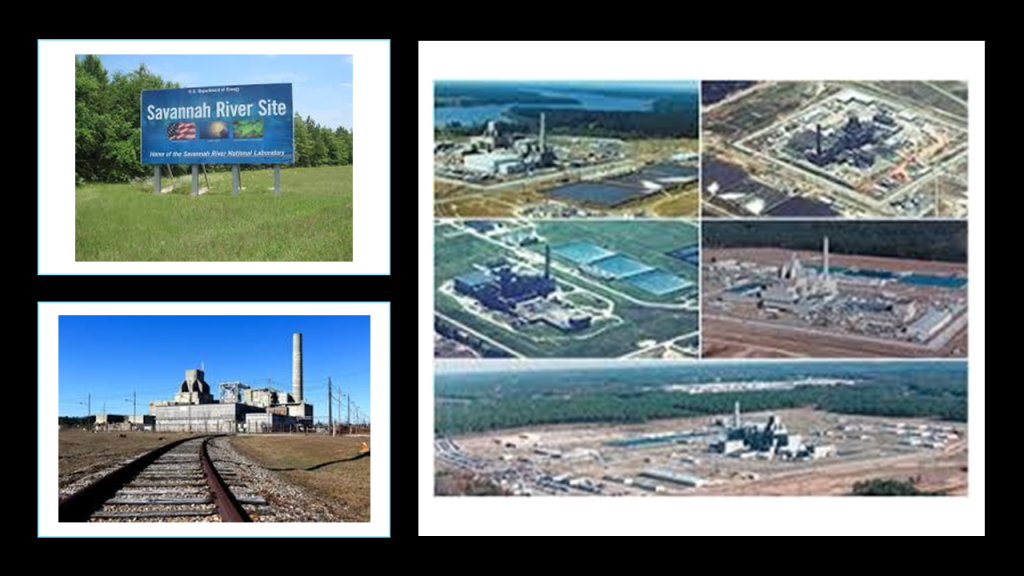
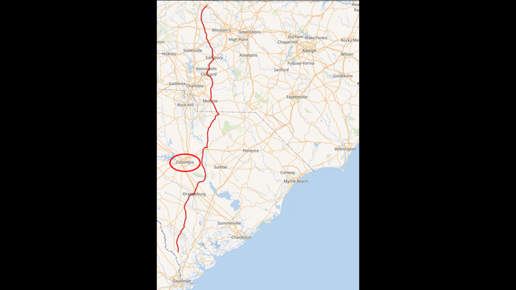
The next place we come to on the alignment is the Savannah River Nuclear Site in Kline, South Carolina. Among other things, the Savannah River Site was the location where the neutrino was discovered at the “P Reactor.”
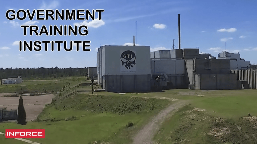
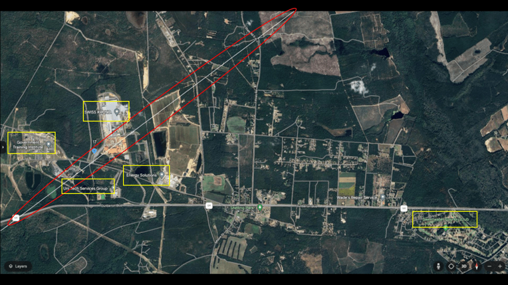
The Government Training Institute shows up on the alignment as well near the Savannah River Site.
The Savannah River Site is visible from the Yuchi Wildlife Management area.
First, the Savannah River Site.
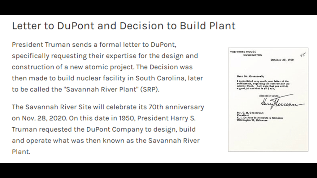
We are told the Savannah River Site was constructed in the early 1950s to produce the basic materials used in the fabrication of nuclear weapons.
In 1950, President Harry S. Truman formally requested DuPont’s help in the design and construction of the Savannah River Project.
So the DuPonts make another appearance here.
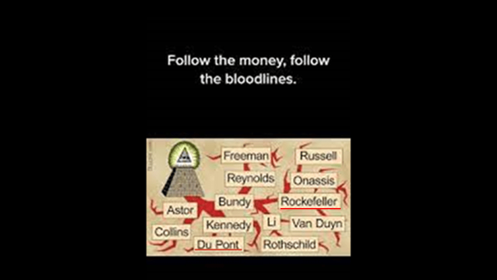
We saw that name earlier in this post in the context of plant biologist Dr. Norman Borlaug, who became the head of the newly established Cooperative Wheat Research and Production Program in Mexico, after he finished his wartime service with DuPont in 1944.
Like the Rockefellers we saw involved with the biological-engineering of agriculture, both of these families are noteworthy as being of the thirteen Illuminati bloodlines.
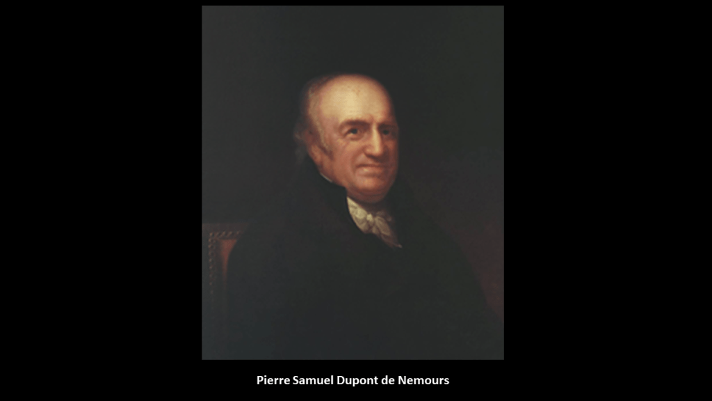
One of the negotiators with France for the terms of the Louisiana Purchase in 1803 on behalf of President Jefferson was the minor French nobleman Pierre Samuel Dupont de Nemours, who was living in the United States at the time.
His son Éleuthère Irénée du Pont, a chemist and industrialist, founded the E. I. du Pont de Nemours and Company to manufacture gunpowder and explosives in 1802, with the du Ponts becoming one of America’s richest families, with generations of influential businessmen, and politicians.
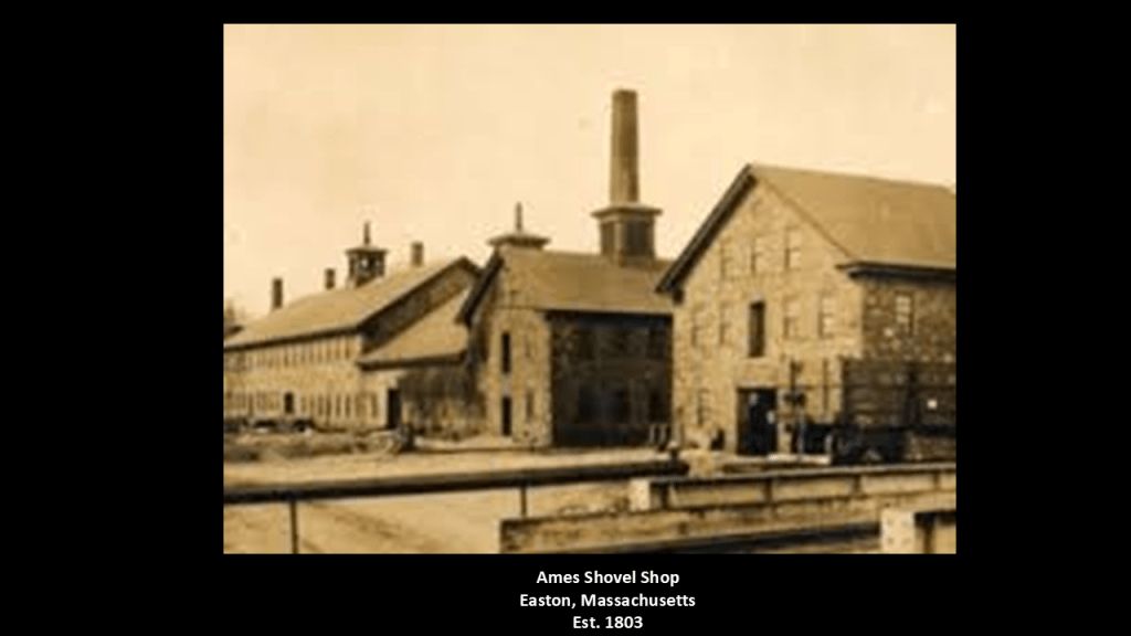
Around the same time the DuPonts were setting up their gunpowder and explosives manufacturing company in 1802, the Ames Shovel Shop was established in Easton, Massachusetts in 1803.
The Ames Shovel Shop became nationally known for providing the shovels for the Union Pacific Railroad, which opened the west. It was said to have been the world’s largest supplier of shovels in the 19th-century.
The Ames Brothers, Oakes and Oliver, Jr, co-owners of the shovel shop that was established by their father Oliver, were major players in instrumental in the completion of the Union Pacific Railroad.
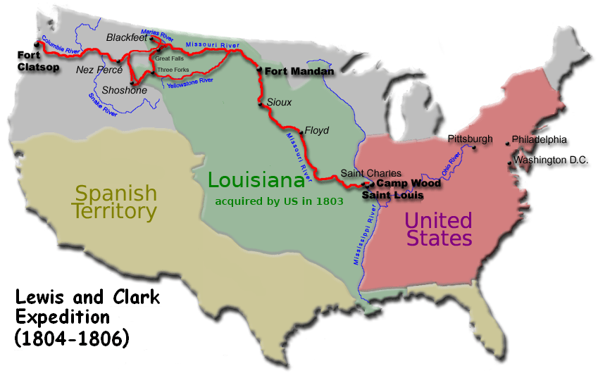
Then, the Lewis and Clark Expedition to explore the Pacific Northwest started from St. Louis in 1804 and lasted until 1806.
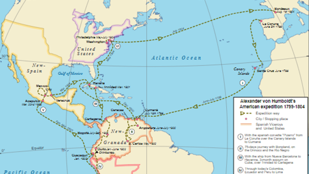
There were several other voyages of exploration taking place around that same time period, like Alexander von Humboldt between 1799 and 1804…
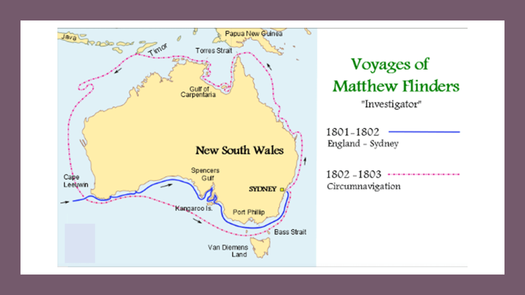
…between 1801 and 1803, Capt. Matthew Flinders led the first in-shore complete navigations around mainland Australia, including the “The Archipelago of the Recherche,” a group of 105 islands, and over 1,200 obstacles to shipping, that stretch 140-miles, or 230-kilometers, west-to-east from Esperance to Israelite Bay In Western Australia in coastal waters designated as the “Recherche Archipelago Nature Reserve.”
“Recherche” translates to “Research” from the French.
It is my belief that all of this explorations, and the immediate need for shovels and explosives, took place in a post-cataclysmic world of recent occurrence.
Now back to the alignment.
The Government Training Institute near the Savannah River Site is a leading military and law enforcement tactical training organization for first responders, and this location is the headquarters and training facility.
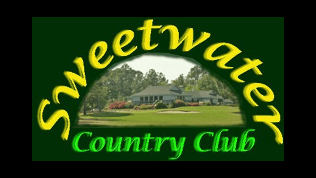
This next segment of the alignment shows the Government Training Institute again, as well as Swiss Krono; Energy Solutions; the Uni Tech Services Group and the Sweetwater Country Club.
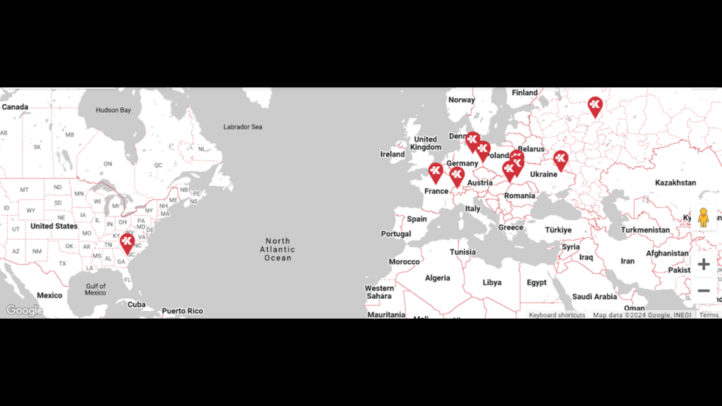
Swiss Krono is a global company with its headquarters in Lucerne, Switzerland, that makes wood products like laminates for flooring that are mass-produced on an industrial scale from natural wood, and is a leading supplier of wood-based materials.
They have been expanding their facilities here in Barnwell, South Carolina, their only location in the United States.
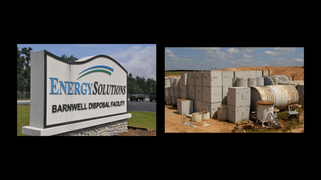
Energy Solutions is an international nuclear services company that advertises the safe transportation, processing, recycling and disposal of radiologic material.
The facility in Barnwell is a host disposal site for the Atlantic Compact, which means the “Atlantic Interstate Low-Level Radioactive Waste Management Compact,” and serves nuclear energy facilities in South Carolina, New Jersey and Connecticut.
In other words, this location is a nuclear waste landfill, otherwise known as a dump.
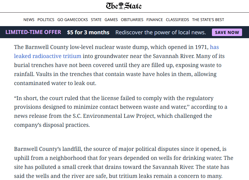
This March 28th, of 2019 article from “The State” newspaper, which is published in Columbia, reported that the South Carolina Supreme Court ruled that the landfill’s operator hadn’t followed regulations that are intended to keep radioactive waste like Tritium from leaking into groundwater beneath the site.
The Uni Tech Services Group became the first licensed provider of radiological laundry in the United States in 1957 and is a leading provider nuclear personnel protection and laundry, and it has expanded its nuclear services to include: materials processing and nuclear waste disposal; nuclear decommissioning support; tool and metal decontamination; just-in-time inventory; and government nuclear services.
The Sweetwater Country Club has one of the oldest and most challenging golf courses in the lower part of South Carolina.
The land for the golf course was said to have been picked out in 1933, and that the course and clubhouse were built with New Deal-era WPA (Works Progress Administration) labor.
I have long-believed that golf courses are a cover-up of mound sites.
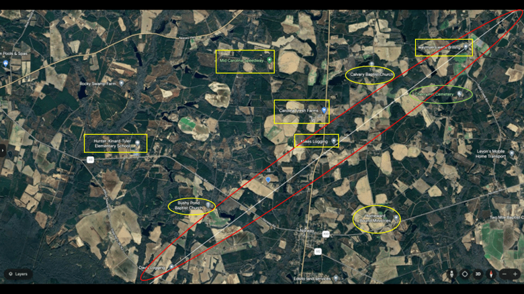
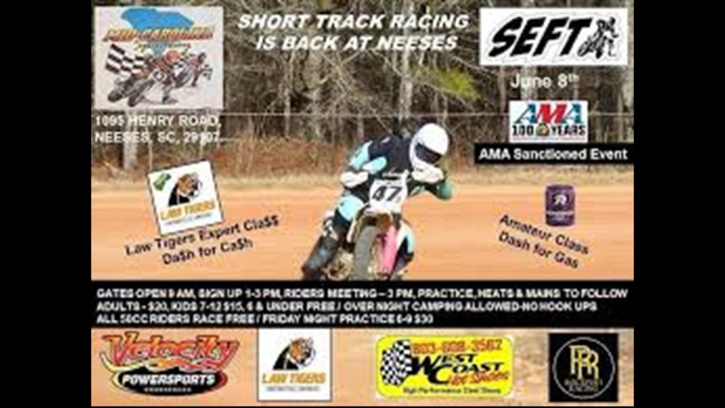
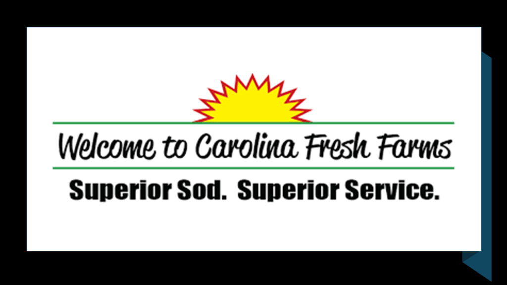
In the next segment we come to Neeses, South Carolina, and places surrounding the alignment include the Mid-Carolina Speedway; the Carolina Fresh Farms; the Hunter-Kinard-Tyler Elementary School; as well as a few more churches and cemeteries; and directly on the alignment are two businesses – Mike’s Logging and Waymyers Wells Drilling.
I am going to highlight the Mid-Carolina Speedway and the Carolina Fresh Farms.
First, the Mid-Carolina Speedway.
The Mid-Carolina Speedway is a motorcycle dirt, flat track race course that is considered South Carolina’s fastest 1/4-mile , or a little less than half-kilometer, dirt track.
I am convinced that all racing circuits and sports’ venues once functioned as circuits on the Earth’s energy grid system.
Electrical Circuits are defined as a closed path in which electrons from a voltage or current source flow, and includes devices that give energy to the charged particles the current is comprised of, such as batteries and generators.
An electrical circuit primarily transmits and converts electrical energy into other forms, like light, heat and motion.
Similarly, but a little different in function, an electronic circuit is a complete course of conductors through which current can travel, and provide a path for current to flow.
Electronic circuits use active components to process, amplify and control the flow allowing for more complex functions.
It makes sense to me that those behind the reset when setting up the New World took advantage of the super science of the different tpes of circuits in the Earth’s grid system in order to harness their inherent power to enhance performance at highly-charged sporting events of all kinds.
Second, the Carolina Fresh Farms.
The Carolina Fresh Farms in Neese is the main operation of one of the largest producers of sod in the South, operating in South Carolina and North Carolina with over 3,000-acres, or 1,214-hectares, of irrigated land.
Eight varieties of turf are produced utilizing the newest technology and most advanced research to produce a higher-quality sod for its customers.
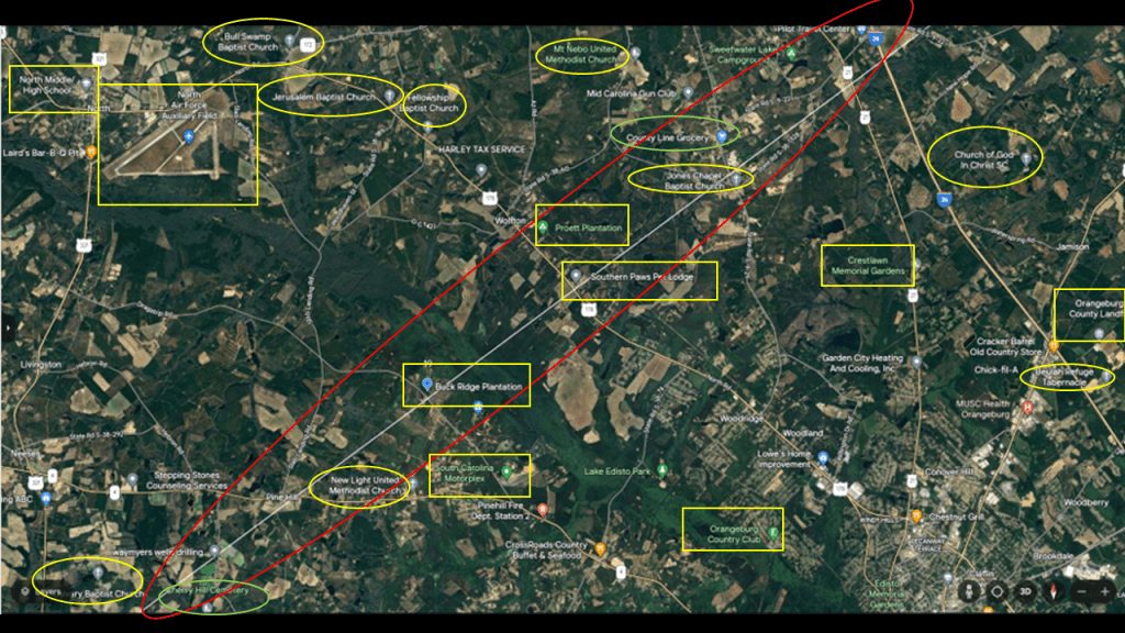
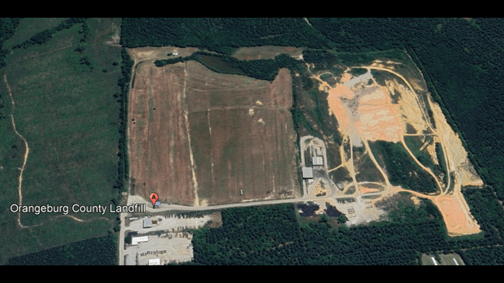
On the next segment of the alignment, we find the following on or near the alignment: the North Air Force Auxiliary Field; North-Middle High School; the Buck Ridge Plantation; the Proett Plantation; the South Carolina Motorplex; the Orangeburg Country Club; the Crestlawn Memorial Gardens; the Orangeburg County Landfill; and more churches and cemeteries.
There’s a lot to choose from, but I am going to highlight the North Air Force Auxiliary Field, the South Carolina Motorplex, and the Orangeburg County Landfill here.
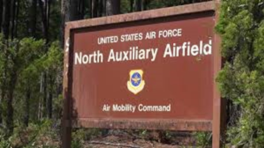
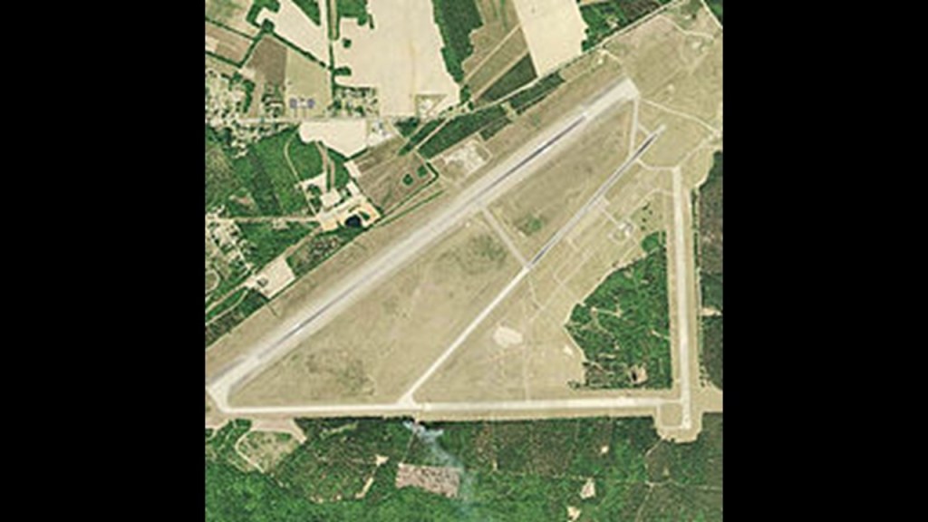
The North Air Force Auxiliary Airfield in North, South Carolina, is a military airfield and used primarily for C-17 Globemaster III training by the 437th Airlift Wing and its USAF Reserve Component at Joint Base Charleston.
What we are told is that the land for it was bought by the United States Army Air Forces between 1942 and 1945.
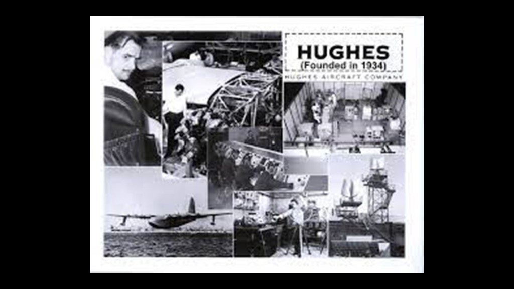
The original dirt runway for it was said to have been constructed in 1943, and among other things, used by the Hughes Aircraft Company for testing.
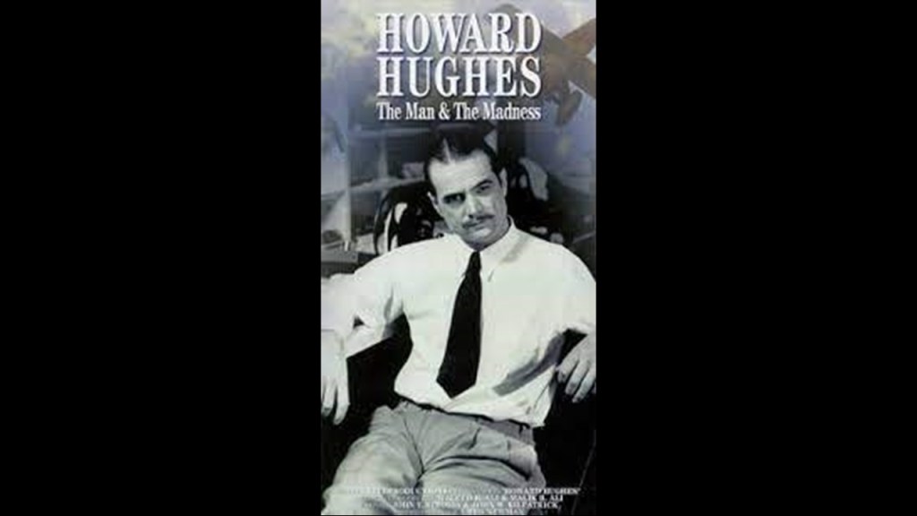
The Hughes Aircraft Company was a major American aerospace and defense contractor founded on February 14th of 1934 by Howard Hughes in Glendale, California.
The company manufactured aircraft like the Hughes H-4 Aircraft, among several others.
Interestingly, in 1953, Howard Hughes donated most of Hughes’ Aircraft’s stock and assets to a charity he created, the Howard Hughes Medical Institute, in a maneuver to reduce his income tax liabilities.
The Howard Hughes Medical Institute headquartered in Chevy Chase, Maryland, is one of the largest private funding organizations for biological and medical research in the United States.
During his lifetime, Howard Hughes was considered one of the richest and most influential people in the world, but he was notorious for his eccentric behavior and reclusive lifestyle.
Just interesting to me finding him here of all places in North, South Carolina.
And what was he doing divesting his Aircraft Company into a biological and medical research Institute to begin with?
There’s something strange with that!
The South Carolina Motorplex and Mudplex is Orangeburg County’s premiere motorsports facility with an 1/8th of a mile dragstrip and a two-acre mud pit.
The South Carolina Mudplex features such events as Tractor Pulls and Demolition Derbies.
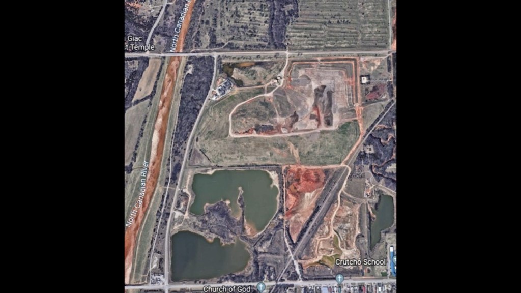
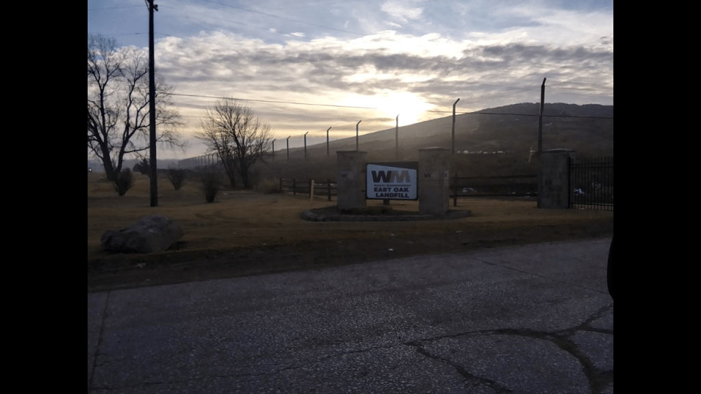
The Orangeburg County Landfill here caught my attention because I have consistently found since I started waking up to this ancient civilization in Oklahoma City that landfills are consistently found on earthworks or flat-topped pyramids of some kind, and that along with the trash dump, there was some kind of energy-harvesting going on in the same location.
The first place I really took notice of this was the landfill site close to the intersection of 23rd Street NE and Sooner Road in Oklahoma City some around 2015 when I first really started to wake up to what was actually in my environment.
I noticed this big huge structure rising up out of the landscape and I went to find and investigate it.
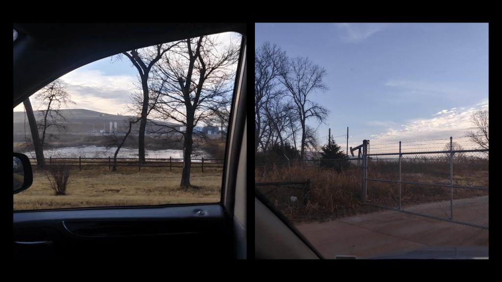
On one side of it, the west-side, is an energy site.
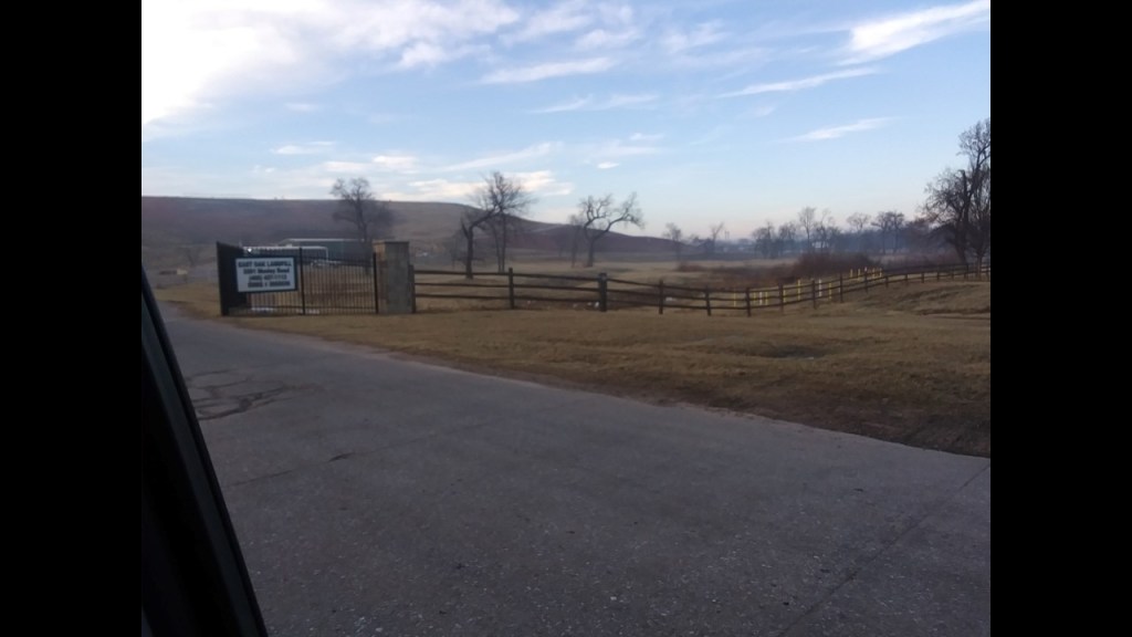
On the east-side, is a landfill operated by Waste Management.
There are two more just like this in OKC – one is in South OKC off of 240, and the other is in West OKC, in Mustang, Oklahoma.
There is another one north of OKC, in Enid. Same idea.
They look like massive ancient earthworks that are being harvested for energy and used for land-fills.
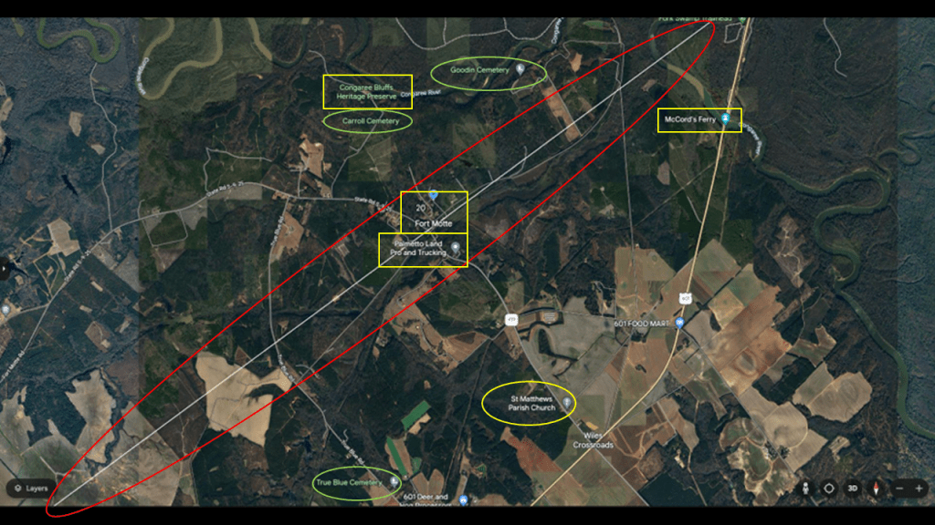
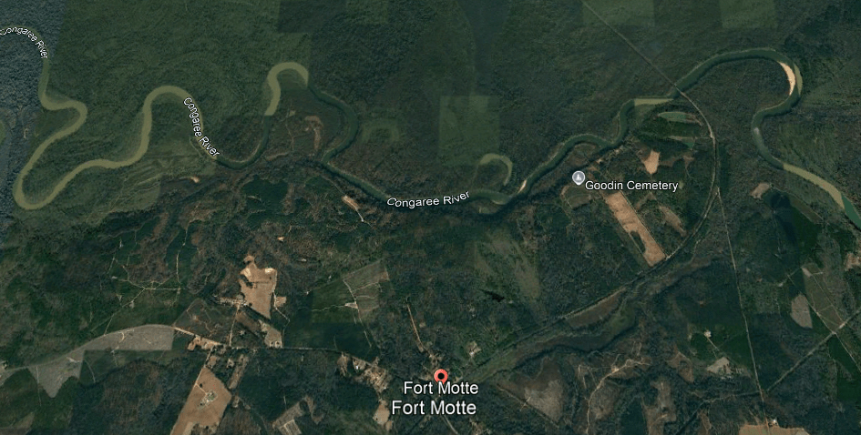
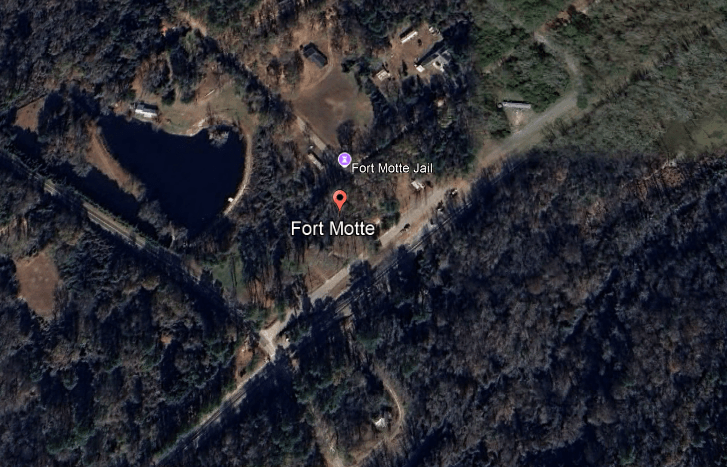
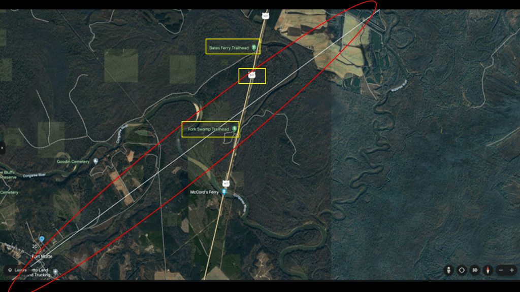
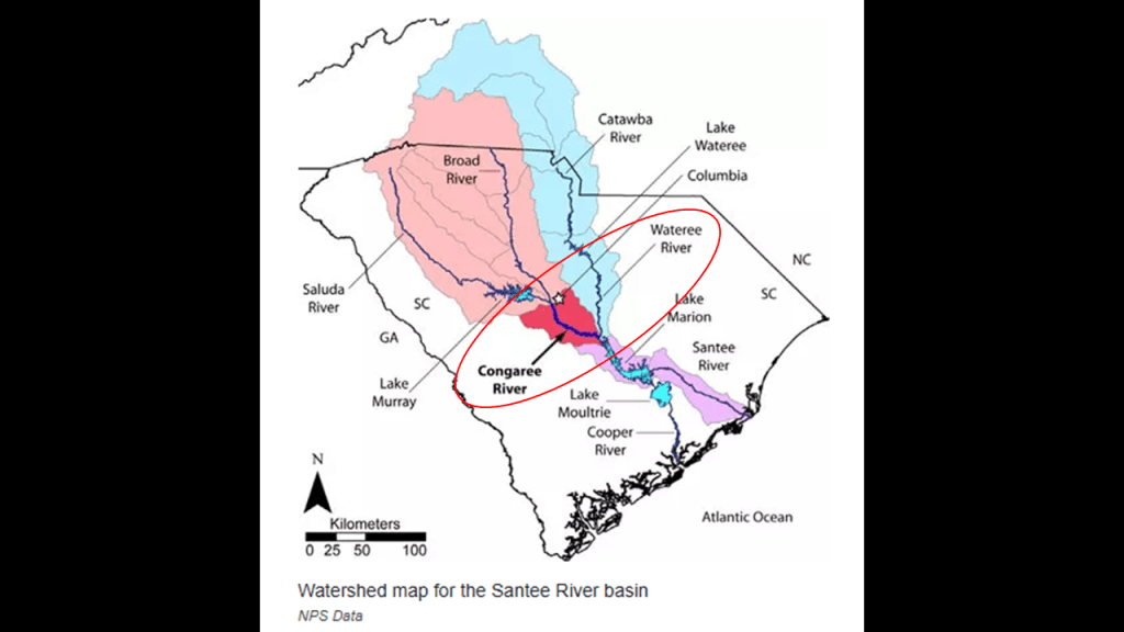
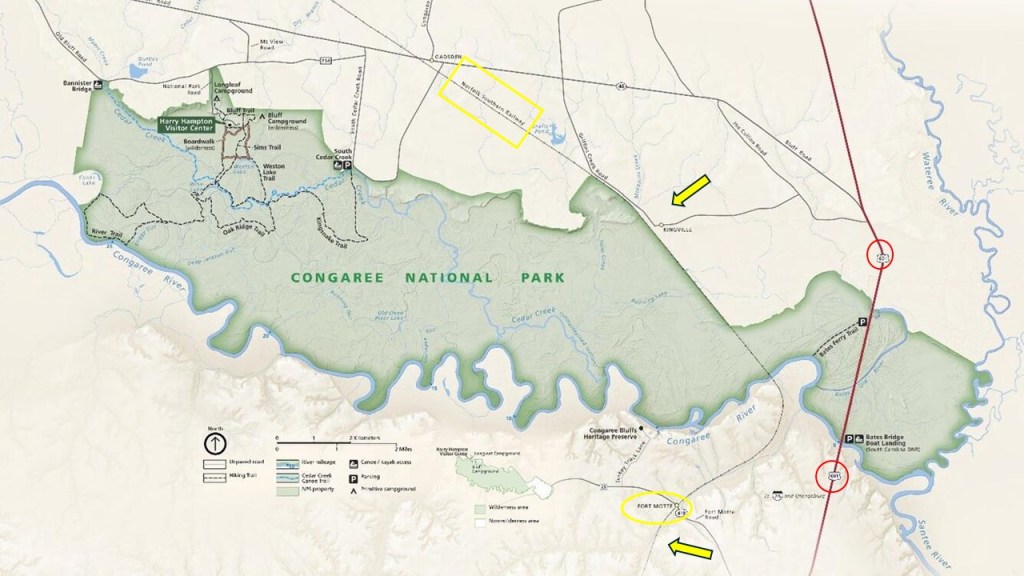
In the next segment of the alignment, we find places like Fort Motte; the Congaree Bluffs Heritage Preserve; a trucking company; McCord’s Ferry; and a church and three cemeteries.
We are told that Fort Motte, directly on the alignment close to the S-shaped bends of the Congaree River, was first developed as Mt. Joseph plantation until it was commandeered by the British in 1780 and fortified as a military outpost during the American Revolutionary War.
These S-shaped water courses, typically called rivers and creeks, are found the world over in exactly the same configuration.
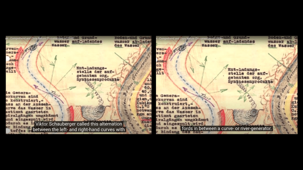
I think an answer to the reason why can be found in the work of Viktor Schauberger and that it relates to the construction of the original worldwide energy grid.
Viktor Schauberger was an Austrian scientist who was a pioneer in the field of water and energy research in the early 20th-century. He specialized in the flow of water and natural energies. on the hydrodynamics of S-shapes.
Schauberger characterized the hydrodynamics of S-shapes energizing water with the motions of this water flow.
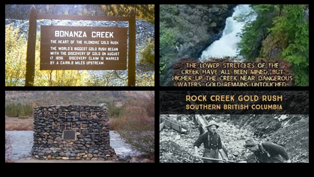
One more thing before I move on from the subject of S-shaped water courses that I have found in my own research is that the historic gold rushes of the 19th-century started at rivers and creeks.
Kinda seems like the “prospectors” knew exactly where to look.
Thinking out loud here.
Gold and water are among the best conductors of electricity.
Wouldn’t it stand to reason that S-shaped water courses were lined with gold for this reason?
I will talk more about these S-shaped river bends and parallel railroad infrastructure shortly.
There is evidence, while not easy to find in a search, that there was railroad infrastructure along the Congaree River once-upon-a-time.
Back to Fort Motte.
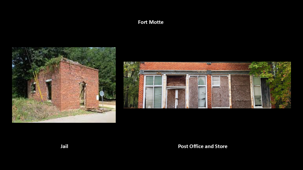
What we are told is that Fort Motte existed as a town from when it was incorporated in 1875, until it vanished sometime in the 20th-century when the interstate system replaced the community’s railroad.
What remains of it include the Fort Motte Jail and the old post office and store.
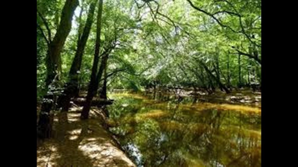
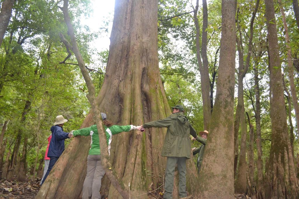
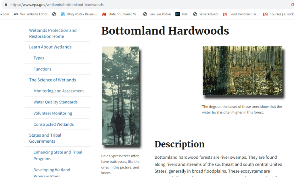
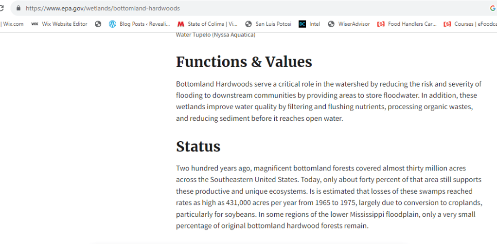
The Congaree Bluffs Heritage Preserve comprises 201 acres, or 81-hectares, and contains steep, undisturbed bluffs bordering the Congaree River.
The Heritage Preserve also harbors significant stands of American beech, oak-hickory and bottomland hardwood forest.
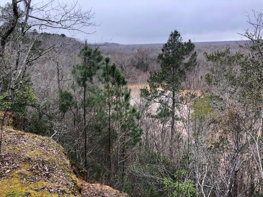
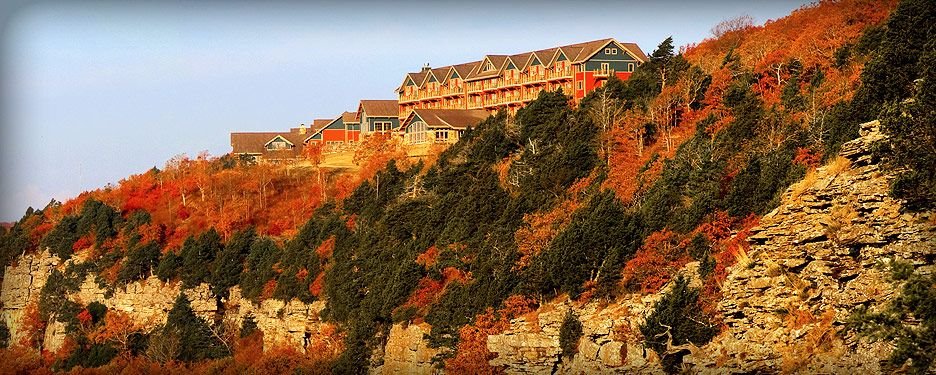
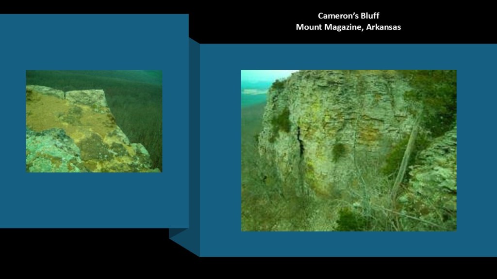
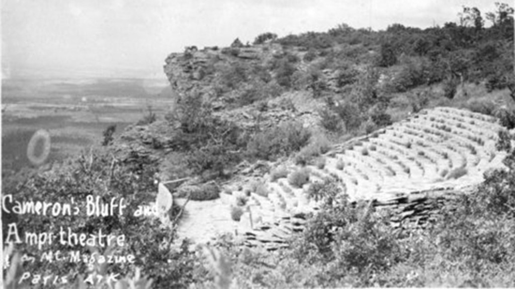
Cameron’s Bluff at Mount Magazine in Arkansas is where I began to crack the cover-up code-words used to cover-up this ancient infrastructure by calling everything natural.
After I checked into the Mt. Magazine Lodge when I visited there in September of 2015, which was said to have been completed in 1940 by the Works Progress Administration (WPA), I left the lodge to take my own tour of Cameron’s Bluff.
As soon as I took the turn-off for the road that skirts the bluff, I started seeing a wall.
It is such an ancient wall that there is some element of doubt.
But there are definitely places you can really tell it is a built structure.
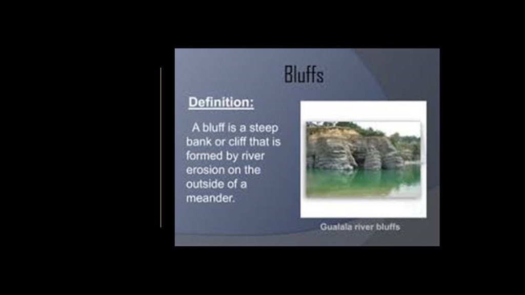
This was when I had the realization that the word “bluff,” meaning a deliberate deception…
…was being used to cover-up ancient infrastructure by calling a high, steep bank or cliff a “bluff.”
Other cover-up code-words besides bluff, include canyon, gorge, cliff, escarpment, mesa, and natural anything – arches, bridges, steps, windows, falls, etc.
It is also important to note at the Mount Magazine State Park that the WPA, which built the roads and facilities at the Mount Magazine State Park, were also given credit for building an amphitheater ithere.
It is my opinion, as I am asserting from this example among others as well, that Roosevelt’s New Deal work programs like the WPA, Civilian Conservation Corps (CCC), and Tennessee Valley Authority (TVA) served multiple purposes: 1) To create Depression-era jobs; 2) To build infrastructure; and 3) to cover-up ancient sites/infrastructure.
The CCC and WPA in particular were responsible for creating access and infrastructure for the park and recreation system around the country.
So when people go to these places, they think that everything they see was created by the CCC & WPA workers.
It was NOT.
If anything, they used and moved pre-existing materials in the construction, and took credit for building everything.
The last place I want to look at in this location around Fort Motte is McCord’s Ferry.
What we are told is that McCord’s Ferry was a strategic river crossing during the American Revolutionary War, and that the British outpost at Fort Motte guarded the river crossing at McCord’s Ferry to protect it’s lines of supply and communication between Charleston and other backcountry posts, both of which were targets during the war.
Also interesting to note the historic railroad lines going through here.
Brigadier General Francis Marion was an American military officer during the American Revolutionary War who was known as “the Swamp Fox.”
Marion engaged in a guerrilla-style, irregular warfare against the Briisth from 1780 to 1781, including this area around the alignment like McCord’s Ferry and Fort Motte.
The Siege of Fort Motte was said to have taken place from May 8th through 12th of 1781, when Francis Marion and Lt. Colonel Harry Lee led a force of patriots to capture the British post at Fort Motte, at the time a fortified plantation at the confluence of the Congaree and Wateree Rivers, at the end of which the American forces burned down the plantation house by shooting the roof with flaming arrows, resulting in an American victory in our historical narrative.
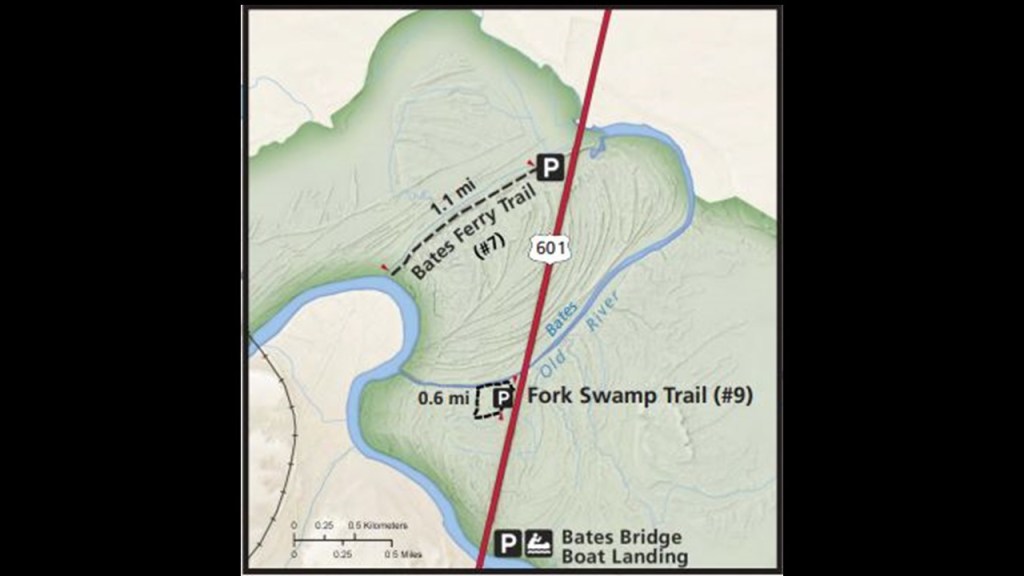
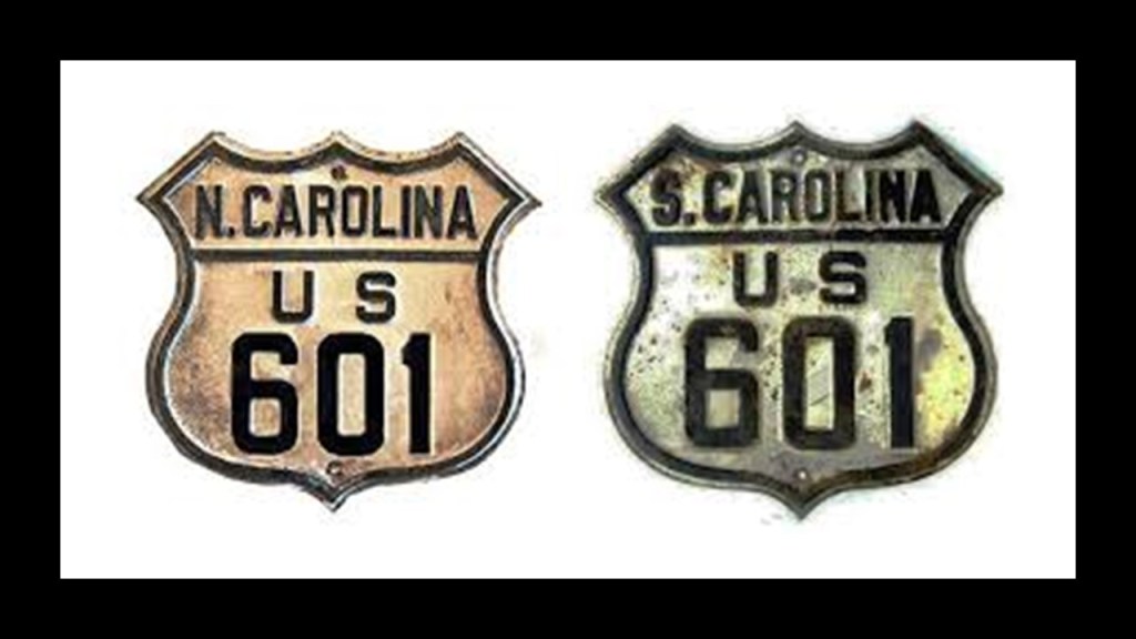
In this next screenshot that goes a little further up the same section around Fort Motte and McCord’s Ferry, we find the Fork Swamp Trailhead; the Bates Ferry Trailhead; and US Highway 601.
I am going to focus on the Fork Swamp Trailhead and US Highway 601 here, and other historical tidbits that came up when looking at these subjects.
First, what we are told is that the history of the swamps in South Carolina was connected to not only the American Revolutionary War, but also the colonization of the land.
With regards to colonization, settlers of the swamps established plantations (there’s that word again) along the Congaree and Wateree Rivers to grow cash crops like rice and indigo.
The Fork Swamp Trailhead is located on US-601, and is the entry-point for a short, looping-trail that passes through the Fork Swamp.
The Fork Swamp sits between the “fork” of the Congaree and Wateree Rivers, and east of the Norfolk-Southern Railroad.
The Norfolk Southern Railroad crosses the Congaree Floodplain along what used to be the eastern of edge of what used to be the 1988 boundary of Congaree National Park, but is now well within the park’s boundaries.
It has followed the same railroad alignment that has been used since 1842, after it was constructed between 1838 and 1842, at which time, the South Carolina Canal and Railroad Company operated the railroad on behalf of the Louisville, Cincinnati, and Columbia Railroad.
So what they really, really want us to believe without question is that they were actually building these railroads through swamps, while I think what they were actually doing was getting pre-existing rail infrastructure up-and-running again.
The Fork Swamp Trail loop leads down to Bates Old River, which we are told prior to a flood in 1852 was the Congaree River.
Keep in mind that starting in the year of 1850, a lot of things were happening in our historical narrative, like the Pine Bloom and Tarver plantation houses said to have been built in 1850 that we saw earlier on the alignment southwest of Albany, Georgia, and in Millen, Georgia, formerly known as Millen Junction, the construction of the Augusta and Savannah Railroad, which was said to have been completed by 1854.
What is really odd is that around the same time in our historical narrative, the railroad infrastructure was being made usable once again, in many cases it was being destroyed a short-time later.
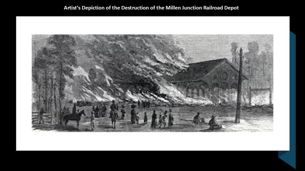
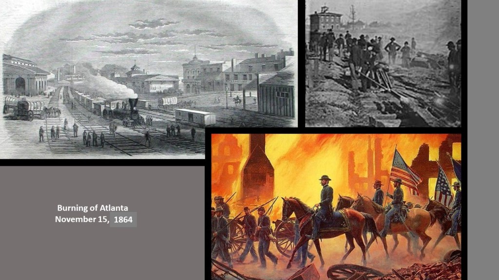
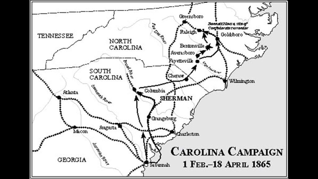
For example, we are told the original Millen Junction railroad infrastructure was destroyed only 10-years-later, in December of 1864, in the “March to the Sea” of Union General William Sherman during the American Civil War, when Sherman’s forces burned down the railroad depot, and all railroad-related buildings.
Here is a good place to bring in who appears to have behind all of this activity in the world at this period of time in our historical narrative.
Around the same time the DuPonts were setting up their gunpowder and explosives manufacturing company in 1802; the Ames Shovel Shop was established in Easton, Massachusetts in 1803, and all the exploration expeditions that took place between 1799 and 1806, as previously mentioned, Alexander Brown, an Irish Linen merchant who immigrated to America, established the first investment banking firm in the United States in 1800, and in 1810, was joined in business by his sons William, George, John, and James and the firm became “Alex. Brown and Sons.”
During the first 100-years of its existence, Brown Brothers & Company helped make paper money standard currency in the United States; underwrote the first railroad and trans-Atlantic steamship companies; and essentially created the first foreign exchange system between the American dollar and the British pound.
In 1931, the Brown Brothers merged with the Harriman Brothers & Company, a private bank started with railway money, to become known as the “Brown Brothers Harriman & Company,” one of the oldest and largest private investment banks in the United States.
Founding partners of the “Brown Brothers Harriman & Company” included W. Averill Harriman, the son of railroad baron E. H. Harriman, and Secretary of Commerce under President Harry S. Truman…
…and Prescott Bush, American banker and politician, and the father of President George H. W. Bush.
Sir William Brown managed the Liverpool office of “Alex.Brown and Sons,” and he helped the American businessman George Peabody establish an office in Liverpool when Peabody first travelled to England in 1827 to purchase wares, and negotiate the sale of American cotton in Lancashire.
This is interesting because by 1825, cotton was Britain’s biggest import, primarily from American cotton fields, and Lancashire was the dominant force in the British economy with its cotton industry, where the raw cotton was turned into thread and fabrics in a factory-based production line with the advent of the Industrial Revolution in this industry, and marked the birth of the British-working class.
Next, the Rothschild International Banking family dynasty was started by Mayer Amschel Rothschild in Frankfurt, Germany, in the 1760s, and who established an international banking family through his five sons.
For example, his son Nathan Mayer Rothschild settled in Manchester, England in 1798, and established a business in textile trading and finance, and made a fortune in a banking enterprise he began in London in 1805 that dealt in foreign bills and government securities.
By the time of his death in 1836, Nathan Mayer Rothschild had secured the position of the Rothschilds as the preeminent investment bankers in Britain and Europe, and his own personal net worth was over 60% of the British national income.
Interesting to note the parallels in the historical record between the Irish-American Brown family business history, the German-Jewish Rothschild family business history, and George Peabody’s business history, all which included links to textiles, banking and railroads.
After Peabody took up residence in London permanently in 1837, he went from being a wholesale dry-goods and cotton merchant, to a merchant-banker offering securities in American railroad and canal enterprises to British and European investors.
He started a banking business trading on his own account a year after he moved to London, and by 1851, he established the banking firm of “George Peabody & Company” to meet the increasing demand for securities issued by American railroads, and his company specialized in financing governments and large companies.
Apparently railroad and canal developers in the early 19th-century in the United States needed investment capital, and turned to European money markets for the funding to complete their projects.
The same year that George Peabody formally established his banking company, 1851, was the same year that the Great Exhibition of All Nations took place, better known as the Crystal Palace Exhibition.
Now I am going bring in information that I came across in “The Secret Founding of America” book by Nicholas Hagger.
This type of information is very hard to find, but it dovetails with other information I have been finding about this period in history.
There is a lot more information contained in the pages of this book, but I am going to concentrate primarily on some things I have uncovered in my research that are 1) either hard to find in writing; or 2) hard to substantiate when found in writing.
This paragraph called “Rothschilds Plan an American Central Bank” from page 73 of “The Secret Founding of America” talks about Mayer Amschel Rothschild funding Adam Weishaupt’s Order of the Illuminati in the 1770s; his five sons controlling banks in the major cities of Europe; the Rothschilds’ wanting to start a central bank in America; and several of the Rothschilds being behind the funding of both North and South “in the planned division.”
In the “planned” division?
Adam Weishaupt established the Bavarian Order of the Illuminati on May 1st of 1776.
Born in Ingolstadt, Germany, Weishaupt was educated by Jesuits starting at the age of 7, and he was initiated into Freemasonry in Munich in 1777.
Interesting to note that the Great Seal of the Moors, pictured on the left, is virtually identical with a few exceptions, including verbiage, to this symbol on the right on the back of the U. S. one dollar bill that is the most strongly associated with the Bavarian Order of the Illuminati.
You can see here that certain symbols were co-opted from the original, and have come to have certain negative associations, like associating the pyramid with the eye on top of it with Big Brother, the New World Order, and the Illuminati.
The Moors are Friends of Humanity, with Five Principles: Love, Truth, Peace, Freedom, and Justice.
They are about the teachings to activate the pineal gland and about the human potential to re-connect to our Divine Natures in this lifetime.
We also find references to U. S. Attorney General Caleb Cushing; British Freemasonic banker George Peabody; and J. S. Morgan, on page 175.
This passage says that Caleb Cushing was affiliated with the Northern Jurisdiction of Freemasonry, and became the architect of the Civil War.
The architect of the Civil War?
Junius Spencer Morgan was hired by George Peabody in 1854 to handle the funds Cushing had transferred from Peabody’s bank to the United States for the Southern insurrectionists who were calling for the dissolution of the Union.
Junius Spencer Morgan was the founder of the company that would become J. S. Morgan & Company in 1864, that was the successor company to George Peabody & Company, of which he became the Junior Partner in October of 1854.
In 1854, Morgan was put in charge of the firm’s iron portfolio, which included the marketing of railroad bonds in London and New York.
By the time J. S. Morgan died in 1890, the Morgan banks were the dominant forces in government and railroad finance, and his son John Pierpont Morgan had taken the helm of the company, becoming known as. J. P. Morgan & Company in 1895.
J. P. Morgan was an American financier and banker who dominated corporate finance on Wall Street throughout this period of time, also known as the “Gilded Age,” between the years of 1870 and 1900.
J. P. Morgan has long been suspected of having been behind what has come down to us as the sinking of the Titanic in our historical narrative.
On April 15th of 1912, we are told the Titanic sank with all the bankers opposed to the creation of the Federal Reserve on board, including John Jacob Astor IV, one of the richest people in the world at the time.
The following year, on December 23rd, 1913, the Federal Reserve Act Passed Congress, and was signed into law by President Woodrow Wilson.
It created and established the Federal Reserve System, and created the authority to issue Federal Reserve Notes (commonly known as the US dollar) as legal tender.
Now I am going to take a close look at US Highway Route 601 that shows up in this location on the alignment going right through the swampy wetlands of the Congaree Floodplain where the red circles are, close to the Norfolk Southern railroad line, in the yellow square, that goes through Fort Motte, in the yellow circle.
Like I said earlier in this post, I consistently find railroad lines in conjunction with star forts on alignments as is the case here.
Also interesting to note that the Congaree National Park is 27,000-acres, or 11,000-hectares, in size, and has the largest, intact area of old-growth bottomland, hardwood forest in the southeastern United States.
There are at least 25 champion trees in the park, including four over 160-feet, or 49-meters, tall, and the old-growth forest here forms one of the highest, temperate, deciduous forest canopies remaining in the world.
As a matter of fact, on the U. S. Environmental Protection Agency website, there is a page on “Bottomland Hardwoods,” which are described as river swamps that are found on the rivers and creeks of the southeast and south-central United States, typically in broad flood-plains.
The EPA website goes onto say that of the original 30-million acres, or over 12-million hectares, of bottomland hardwood forest that once existed, only about 40% of the region can still support that kind of ecosystem and only a small percentage of these forests remain.
With regards to US-601, it was established as an original United States Numbered Highway in 1927.
The US-601 Highway route runs for 316-miles, or 509-kilometers, from US-321 near Tarboro, South Carolina, to US-52 in Mount Airy, North Carolina.
First, a word about the United States Numbered Highway System, also known as the Federal Highway System.
It was actually called an “integrated network of roads and highways numbered within a nationwide grid across the contiguous United States.”
It was approved in 1926.
Drawn up in 1913, by the National Highway Association, this map was said to be the first proposed U. S. Highway Network map.
The red roads were delineated “Main” National Highways; the blue roads “Trunk” National Highways; and the yellow roads were “Link” National Highways to connect all the “Mains” and “Trunks.”
The Nation’s first Federal Highways would not be adopted until 1926, when the American Association of State Highway officials approved the first plans for the numbered highway system, with this section showing Texas, Oklahoma, Tennessee, Arkansas, Louisiana and Mississippi.
I have blue arrows pointing to major cities that are the central point of at least five highways – Dallas, Texas; Tulsa, Oklahoma; Little Rock, Arkansas; Memphis, Tennessee; Nashville, Tennessee; and Birmingham, Alabama.
There were several things about US-601 that immediately got my attention.
The first thing is that Columbia, the capital of South Carolina, is not far from US-601, just to the west of it.
Following General Sherman’s previously mentioned “March to the Sea” in Georgia, in which his forces were ordered to use a “scorched-earth” policy to destroy transportation hubs, which included the burning of Atlanta in November of 1864 and ended with the capture of Savannah on December 21st of 1864.
Atlanta was a railway hub at the time of the Civil War, and is a highway hub today.
Then in January of 1865, after the completion of the “March to the Sea,” General Sherman turned his attention northwards to the “Carolinas Campaign,” again destroying everything of value along the way, going through this same area.
Columbia, the state capital of South Carolina and an important political and supply center for the Confederacy, was said to have surrendered to General Sherman on February 17th, 1865, after the Battle of Rivers’ Bridge.
On the same day, the fires started, burning much of Columbia, though there is disagreement between historians regarding whether or not the fires on that day were accidental or intentional, but on the following day, General Sherman’s forces destroyed anything of military value, including railroad depots, warehouses, arsenals, and machine shops.
Like Atlanta, Columbia was a transportation hub with regards to rail infrastructure, and a highway hub today.
Were these places specifically targeted for destruction because of their importance as transportation and infrastructure hubs on the energy grid during the historical event known to us as the American Civil War and were not destroyed for the reasons we have always been taught?
Almost two months after the burning of Columbia, the Burning of Richmond took place on April 2nd of 1865, the capital of Virginia and the Confederate States of America.
This is a lithograph depicting it by Currier & Ives.
In our historical narrative, the Confederate General Robert E. Lee surrendered to General Ulysses S. Grant days later, on April 9th of 1865, after his final defeat at the Battle of Appomattox Court House that same day.
As we just saw in Atlanta and Columbia, there’s a very similar configuration between Petersburg Rail-lines of the Civil War-era, and the highways around Richmond and Petersburg today.
And where there have been toll roads in one form or another for a long time, where we are “charged” to use the highway route.
Since 1958, that section of I-95 has been known as the “Richmond-Petersburg Turnpike,” but there have been toll roads in the area since 1826.
The next thing that I would like to mention about US-601 is a personal connection that I was unaware of until now.
US-601 goes right through the part of North Carolina where my maternal grandmother was from.
She was born in 1918 in Waxhaw, North Carolina, where her Scots-Irish parents were sharecroppers. Her parents had friends in Florida, and moved with the younger children including my grandmother to Florida, I think when she was in her teens. She eventually married my grandfather, a citrus-grower, and she lived in Florida for the rest of her life.
I lived in Maryland growing up, and when travelling with my parents to see family in Florida and Georgia, we would stop by to see my great aunts and second-cousins in Concord and Kannapolis.
I also have cousins in Monroe and Indian Trail, and I only remember visiting those folks once in my life.
I never got to know that side of the family very well, but what I do know is that they all worked in textile mills.
Like the birth of the British-working class that we saw with Britain’s import of cotton from American cotton fields through such agents in Liverpool as Sir William Brown and George Peabody with the textile mills in Lancashire, this new economic system was introduced to turn raw materials of all kinds into products of all kinds, and the same economic model was employed in the mining industry.
The people of these communities had a job for life working for the company but they weren’t paid much, and the company got it all back from them anyway because they owned everything.
The owners of the “Company Town” offered pay, boarding, and subsistence farming in return for a 16-hour work day.
In many places, their pay came in the form of scrip instead of dollars that could only be used in the company’s stores.
Pretty much the definition of wage slavery.
Any worker strikes demanding better pay and working conditions were ruthlessly suppressed by company managements for a very long time.
One of the countless examples of this took place in Gary, Indiana, the site of one of the steel strikes in 1919 when the American Federation of the Labor was attempting to organize a labor union in the leading company in the American steel industry, leading to strikes at U. S. Steel locations across the country.
In Gary, a riot broke out on October 4th of 1919 between steel-workers and strike-breakers brought in from the outside.
Several days later, the Indiana Governor declared martial law and brought in 4,000 federal troops commanded by Major-General Leonard Wood to restore order.
By January of 1920, the strike had collapsed completely, with U. S. Steel having successfully opposed unionization efforts at that time, and it would be many years before unionization efforts in the steel industry resumed.
Then to add insult to injury, in many places, the companies outsourced their menial, low-paying job model to other countries, leaving the historic American company towns high-and-dry.
US-601 ends at US-52 in Mount Airy, North Carolina.
I have seen US-52 and Mount Airy before in my research.
Pilot Mountain, near Mount Airy, and described as one of the most distinctive natural features in the State of North Carolina, is seen here centered on U. S.. Route 52.
Before it was called Pilot Mountain, it was known as Mount Ararat.
I looked into it and found the historic Ararat River with rail infrastructure running beside it on the top left, and today’s Ararat River Greenway Trail where the railroad used to be on the bottom right.
The Ararat River Greenway Trail is at the eastern edge of the city of Mount Airy.
Pilot Mountain State Park is on the western end of what are called the “Sauratown Mountains,” named after the Saura, or Cheraw People, the Siouan-speaking indigenous people who lived here before the arrival of Europeans and considered extinct as a tribe, so they are left only in place-names in the region.
The Sauratown Mountains are described as an isolated mountain range, sometimes called “the mountains away from the mountains,” and consisting of heavily-forested ridges frequently broken by large quartzite, rock cliffs.
This is the Mount Airy Museum of Regional History, with the uneven-looking appearance of the old brick building, with the arrows pointing to the building’s windows that are not level with the sloping and steep streets beside it, which is a classic indicator for mud flood evidence.
When I was looking up information about the Saura people, I found this Museum of Regional History in Mount Airy, with records mentioning a vanished tribe, and “remnants of their rich cultural heritage recorded in historical journals, still buried in the earth.”
I think that is exactly what happened to the original civilization as a result of this deliberately-caused cataclysm through the Earth’s original energy grid – much of it remains buried in the Earth right beneath our feet.
And I think the people of this ancient, advanced civilization were of a much larger stature than we are today.
Back in the day, giant skeletons were displayed in public places and mentioned in newspaper articles, but all that went away.
On the one-hand, there are reports that the Smithsonian admitted to the destruction of thousands of giant human skeletons in the early 1900s as the result of a U. S. Supreme Court ruling, and on the other hand, there are fact-checkers vigorously debunking this as a satirical claim and false.
Why is there such a contradiction of information, and vehement denial on the subject of giant skeletons, when there were historical records of their existence?
And while giant skeletons were reportedly found at mound sites, presumed to be burial sites, they were often reported as having been randomly found by workmen digging for works projects, like these mentioned in West Virginia on page 10 of “The History of Marion County.”
The information on this page referred to:
–Workmen preparing to build a bridge unearthed three giant skeletons, measuring over 7-feet, or 2-meters, in length, in the village of Rivesville at Paw Paw Creek;
–Other skeletons having been found in the area, like around Boothsville.
This is one example of countless.
Not to mention examples of creepy public art in the world depicting giants entombed in the Earth, in many cases struggling to break free.
Like “The Awakening” at National Harbor in Oxon Hill, Maryland…
…and these in London, same theme.
Is all of this weird public art some sort of soft disclosure, to circumvent the requirement of needing to tell us what they have done to Humanity, without telling us they are telling us?
They are putting these sculptures in public places where people can interact with them and accept them as “Art,” without people realizing that they might be communicating to us something that has been very well-hidden about the world we are living in.
A couple of more things about US-52 and Pilot Mountain before I move on from here.
First, U. S. Route 52 follows a northwest to southeast route across the country.
The northwestern terminus of U. S. Route 52 is in Portal, North Dakota, in the Bakken Oil Field Region and on the International Border with Canada at North Portal Saskatchewan…
On its southeasterly journey across the United States, US Route 52 passes through places like Indianapolis, Indiana, another large central hub of transportation routes.
…Pilot Mountain in North Carolina as previously mentioned…
…to the southeastern terminus of U. S. 52 in Charleston, South Carolina, at Number 2 Meeting Street and White Point Harbor at the Battery along the Charleston Harbor, not far from the place the American Civil War started at Fort Sumter in Charleston Harbor on April 12th of 1861.
Secondly, about Pilot Mountain.
Peter Champoux has done incredible work on specific ley-lines in North America, and other continents as well, as seen on his website geometryofplace.com
Peter shows Pilot Mountain in North Carolina as a hub for ley-lines on the home page of his website, looking much like the cities we are seeing that serve as transportation hubs for multiple rail-lines and/or highways.
Pilot Mountain is described as a “Quartzite Monadnock.”
This translates to a “hard, metamorphic rock that was originally pure quartz sandstone that is an isolated rock hill, knob, ridge, or small mountain that rises abruptly from a gently sloping or virtually level surrounding plain.”
Here are some other examples of places classified as “Monadnocks.”
Besides Pilot Mountain on the top left, Harteigen in Norway is seen on the top right; Devil’s Tower in Wyoming on the bottom left; and Cooroora in Australia on the bottom right.
I think “Monadnock” is a word used to cover-up the existence of gigantic tree stumps.
I have come to believe from my research findings that giant trees were indeed hubs of ley lines on the Earth’s original energy grid.
Here are some examples of giant trees and stumps that are identified as such, similar to what we saw earlier in this post in Congaree National Park.
In this comparison, we have the Devil’s Tower from another angle on the left; the Jugurtha Tableland in Tunisia in the middle; and the volcano in the middle of the city of Hammam Damt in Yemen looking very much like giant tree stumps!
Now, moving up along the alignment to the next segment, we come to Sumter, South Carolina, and directly on or near the alignment, find places like the Sumter Speedway; Audubon Park; the Swan Lake Iris Gardens; Crestview High School, Crystal Lakes Golf Course; and a Walmart Neighborhood Market and Walmart Supercenter.
Zoom-out from this segment of the alignment, we find out that the Shaw Air Force Base and the Sumter Airport are also in the vicinity of the alignment.
First, the Sumter Speedway.
The Sumter Speedway advertises itself as the “Toughest Lil’ Dirt Track in the South.”
First opening in 1957, the Sumter Speedway is the oldest, continuously running dirt track in South Carolina.
Used for car racing, it has been raced by many famous NASCAR stars, including Richard Petty, Dale Earnhardt, Bobby Allison, and Cale Yarbrough.
The Audobon Park neighborhood is on the alignment, near the interestingly named “Burns Down,” another neighborhood in Sumter.
Not much I can find out about these two places except that the real estate tends to be on the pricier-side.
The Swan Lake Iris Gardens in the vicinity of the Audobon Park and Burns Down neighborhoods on the alignment is the only public park in the United States to have all eight species of swans, and is considered one of the finest botanical gardens in the United States.
What we are told about its history is that it began as a private fishing lake for wealthy businessman Hamilton Carr Bland.
Hamilton Carr Bland began landscaping his garden with Japanese Iris flowers, and when they failed, he ordered his gardener to dig them up and throw them in the lake.
The irises in the lake bloomed the following spring creating an “accidental garden,” and got the attention of the locals.
Then in 1938, A. T. Heath Sr deeded the additional acreage on the north side of Liberty Street to the city with the stipulation that Mr. Bland also develop this part of the garden, leading ultimately to the creation of the Swan Lake Iris Gardens encompassing 120-acres, or 49-hectares, of land in Sumter.
The Crestview High School directly on the alignment is another school, and there’s the Crystal Lakes Golf Course; a Walmart Neighborhood Market and a Walmart Supercenter as well.
Aaron and I talked in-depth about Aaron’s findings of golf courses and Walmarts, and many other things, on ley lines he found on alignments associated with civil war battles in our video presentation from July of 2024 entitled: “Civil War Battles, Insane Asylums, Star Forts, Golf Courses, National Parks, Walmarts and Giants with Aaron.”
I really think whatever was going on with the American Civil War had more to do with the Earth’s original energy grid and covering-up the original civilization and was not anything like what we have been told about it in our historical narrative.
Case in point.
This slide is showing Gettysburg as a hub of ley lines, and showing historic Civil War battles taking place on various ley lines.
This next slide shows the golf courses on different ley lines either from the Gettysburg hub, or in proximity to other nearby ley lines…
…and this one shows Walmarts on leylines from, or in proximity to, the Gettysburg hub.
As already mentioned, Shaw Air Force Base and the Sumter Airport are near the alignment here as well.
Shaw Air Force Base is located 8.4-miles, or 13.5-kilometers, from downtown Sumter.
It is one of the largest military bases operated by the United States, and is under the jurisdiction of the U. S. Air Force’s Air Combat Command, hosted by the 20th Fighter Wing.
The Sumter Airport is a public use airport, meaning that it is open to the public for aviation activities.
It is 4.6-miles, or 7.4-kilometers, north of Sumter’s Central Business District.
In this next segment we are still in Sumter, where we find on or near the alignment more of the same – schools, churches, athletic facilities, and another Walmart Neighborhood market.
Schools on or near the alignment are the University of South Carolina, a public 2-year college; the Alice Drive Middle School and the Alice Drive Elementary School.
Athletic facilities nearby are found at Palmetto Park and the YMCA of Sumter.
Palmetto Park has one of the Southeast’s finest tennis facilities, as well as baseball and softball fields, a playground and splash pad, and walking trails.
The Palmetto Tennis Center is a National Tennis Court and considered a world-class facility which hosts both junior and adult tournaments annually.
This is the second tennis venue we’ve seen in this post, the first being right where this alignment entered the United States in Panama City Beach at the Sunnyside Beach and Tennis Resort.
I think all the different kinds of sports fields and tennis courts like we are seeing were different types of circuits on the Earth’s original grid.
The visuals of these tennis courts brought solar array systems to my mind for similarity of appearance.
The other place I want to look at here is the YMCA of Sumter.
The YMCA first opened in Sumter in 1912.
I did some research on the origins of the YMCA a few years back, and here is what I found when I looked into it, bearing in mind there is a lot going on in our historical narrative between 1800 and the 1850s with regards to setting up the new system and new history.
The “Young Men’s Christian Association,” or YMCA, is the world’s the oldest and largest youth charity with a stated mission of supporting young people to belong, contribute, and thrive in their communities, and started in 1844.
The history of the YMCA goes like this:
George Williams, in seeking to create a supportive community to help young men facing social challenges during England’s Industrial Revolution, founded the Young Men’s Christian Association in 1844.
He worked as a draper at the Hitchcock-Williams store, where became a department manager in 1844.
Drapers were retailers or wholesalers of cloth that was mainly for clothing, and we’ve already seen a great deal about cloth and textile mills come up already as part of the new economic system.
Also interesting to note that the use of Arms went from individuals to corporate bodies starting in 1438 with a Royal Charter of incorporation, and the earliest surviving grant of arms was for the “Worshipful Company of Drapers,” and since then have been made continously including, but not limited to, companies & civic bodies.
In the same year of 1844 that Williams became a Department Manager at Hitchcock-Williams , he gathered a group of fellow drapers together in the store where he worked, concerned about the appalling conditions in London for working young men, and was determined to do something about it by forming the YMCA.
At Queen Victoria’s birthday honors in 1894, he was knighted and became Sir George Williams, and upon his death in 1905, he was buried in a crypt in London’s St. Paul’s Cathedral.
This portrait came up for young George Williams on the World YMCA website.
I find the column slightly showing in the portrait to be significant because it is quite common in portraits of prominent historical figures of this era to have features of classical architecture included in it as well.
Around the same time as the founding of the YMCA in 1844, Dun and Bradstreet started out as “The Mercantile Agency” in New York City on July 20th of 1841.
It was formed by Lewis Tappan, who started out in the dry goods business with his father and the silk business with his brother, as the first commercial credit rating agency for businessmen seeking credit, and provided a network of correspondents to provide reliable credit information to its subscribers.
By 1844, the “Mercantile Agency” had over 240 clients, and continued to expand, opening offices in Boston, Philadelphia and Baltimore.
Benjamin Douglass took-over the business in 1849, and he transferred it to Robert Graham Dun in 1859, who changed the named to R. G. Dun & Company, and he continued to expand the business across international boundaries, and it kept growing from there.
Next, we see the alignment in the lower-right-hand corner of this screenshot, where the alignment crosses southeast of Lamar, South Carolina.
I hava highlighted near the alignment: the Cedar Swamp Retrievers; Albert Amerson’s Nursery; the Governor’s Run Golf Course; a high school and a church.
I am going to highlight the Cedar Swamp Retrievers and Albert Amerson’s Nursery.
The “Cedar Swamp Retrievers” are a working kennel that actively breeds, trains, and title their dogs.
Albert Amerson’s Nursery in Lamar offers a wide-range of gardening products and services, and is known for its extensive selection of plants.
So, more examples of animal breeding and husbandry and growing things along this alignment.
In the next segment, the alignment continues across in the upper-left hand corner of the screenshot where it crosses to the northwest of Florence, South Carolina.
Directly on the alignment in this location is a church and “Wilson’s crossroads,” and near it are place like the Traces Golf Club; High Hill Creek Bike & Run Park; and the Florence Regional Airport.
“Wilson’s Crossroads” was the location where the Camden-Mars Bluff Road intersected the road to Darlington, and was on property granted to the settler Reverend John Wilson by the State of South Carolina in 1837.
The Traces Golf Club features three, 9-hole golf courses of undulating fairways and sand-traps.
One of my first a-ha’s in my awareness of the advanced ancient civilization that was hidden in the landscape all around us was the realization that golf courses were a cover-up of mound-sites – just carve out the top of a mound, and voila, you have a sand-trap.
Another word for golf course is “links”
Is the term “Links” for golf courses telling us their actual purpose in the Earth’s Grid system?
Perhaps as “links” of the circuitry of electrical and magnetic components?
The High Hill Creek Bike and Run Park has a four-mile, or almost 6.5-kilometer, trail used primarily for mountain biking which runs along Interstate-95.
The Florence Regional Airport today is a public airport primarily used for general aviation.
The land for it was said to have been purchased in 1928, and that during World War II, the United States Army Air Force used it as a training base.
At the end of World War II, the property was returned to the City of Florence.
In the next segment of the alignment, we find more of the same with three churches , the Country Club of South Caroline, and the Darlington Raceway and Dragway
This also shows where the alignment crosses the Great Pee Dee River.
I am going to focus on the Darlington Raceway here.
The Darlington Raceway is owned by NASCAR, and has hosted a variety of racing events since it opened in 1950.
The Darlington Raceway is a staple of the NASCAR cup series and its “Southern 500” race is one of the most prestigious races on the schedule.
When it first opened in 1950, we are told that Darlington native Harold Brasington sought to replicate the success of the Indianapolis Motor Speedway and the Indianapolis 500 in his hometown.
The Indianapolis Motor Speedway is the largest sports’ venue in the world in Speedway, a short-distance west of downtown Indianapolis,
It was said to have been constructed in 1909.
For an interesting perspective on the size of the Indianapolis Motor Speedway, Vatican City, the Wimbledon Campus, the Roman Colosseum, the Rose Bowl, Yankee Stadium, and the Kentucky Derby would all fit inside thhs automobile racing circuit.
The next segment shows the area around Mechanicsville in South Carolina, where we find directly on the alignment Lowther’s Lake, Mt. Level Cemetery, a church, and a place called “Roadside Park.”
There are several other churches and cemeteries near the alignment, as well as the Great Pee Dee Heritage Preserve and Wildlife Management Area which I am going to highlight here.
The Great Pee Dee Heritage Preserve and Wildlife Management Area runs along a 7-mile, or 11-kilometer, stretch of the Great Pee Dee River, and preserves an ecosystem that contains pristine forest, cypress swampland, and a variety of wildlife.
Like we saw previously with the Sauratown Mountains, named after the Saura, or Cheraw, people, the Great Pee Dee River was named after the Pee Dee people, with their land historically concentrated in the piedmont region of South Carolina, North Carolina and Tennessee, and were part of what is classified as “South Appalachian Mississippian,” part of the mound-building Mississippian culture in our historical narrative.
I seriously doubt the hut with the thatched roof was originally on top of the Town Creek Mound attributed to the Pee Dee Culture near Mount Gilead in North Carolina.
I think it was added much later to support what the narrative says about all the original peoples in North America were hunter-gatherers, like this example from what is called the “Fudge Site,” the largest earthwork in Indiana.
They were said to have built mounds over time by using the primitive methods of digging sticks and dumping baskets of soil.
And yet somehow these otherwise primitive mound-builders knew plane geometry, and not only that, constructed the mounds to precisely line-up with astronomical events.
Hmmm. Something just isn’t adding up here!
In this next segment, we have the alignment crossing the upper left-hand corner of the screenshot, and more churches and cemeteries, as well as “Southern Rotties and Training,” another Walmart Supercenter, and the Dillon Motor Speedway.
Also Interstate-95 is seen running roughly parallel to the alignment in this location as we approach the South Carolina’s border with North Carolina
Next on the alignment we come to the area around Rowland and Lumberton, North Carolina, close to the border with South Carolina.
On or near the alignment, there are more of the same kinds of places, with two cemeteries; eight churches: a Walmart Supercenter; the 710 Dragway; the Pinecrest Country Club; the Adams Airport.
It is still rougly paralleling Interstate-95 in this location, and Interstate-74 intersects with both I-95 and the alignment here.
Interstate 74 runs between, NC-41 in Lumberton and Interstate-80 in Davenport, Iowa, with the entire distance between the two being 542-miles, or 872-kilometers.
It is interesting to note that Interstate-74 has some concurrencies with the previously seen US-52 that Pilot Mountain is situated on near Mount Airy.
The Interstate Highway System is a network of controlled access highways that forms part of the National Highway System in the United States.
Unlike the earlier United States Numbered Highway System, the Interstates were designed to be freeways, with nationally- unified standards for construction and signage, with freeways being defined as an express highway designed for high-speed vehicular traffic.
The National Highway System is a network of strategic highways that includes the Interstate System and other roads that serve major airports, ports, military bases, rail or truck terminals, pipeline terminals and other strategic transport facilities.
I take the idea very seriously that the original giant tree “root” system is today’s highway “route” system, with the giant tree roots providing free energy for the Earth’s original grid, only to have the original rail infrastructure that powered the grid deliberately replaced by cars, trucks and buses as primary transportation, powered by so-called “fossil fuels” on highway and roads system to harvest our energy and make lots of money for those behind the new world system.
People like John D. Rockefeller
John D. Rockefeller, along with Henry Flagler, an American Industrialist and major developer in the state of Florida, founded the Standard Oil Company in 1870, an American oil producing, transporting, refining, and marketing company.
This was roughly a decade after the birth of the American Oil Industry in Titusville, Pennsylvania, in 1859.
Oil in the form of kerosene was used throughout the country as a light source and heat source until the introduction of electricity, and as a fuel source for the automobile, with the first gas-powered automobile having been patented by Karl Benz in 1886.
John D. Rockefeller, Sr, who was born in the United States in 1839, was the progenitor of the wealthy Rockefeller family.
He was considered to be the wealthiest American of all time, as seen in this ranking by CNN Business.
Rockefeller’s wealth soared as kerosene and gasoline grew in importance.
At his peak, he controlled 90% of all oil.
As quickly as possible, a way was found to replace what remained of the free-energy system with their own coal- and oil-based system, and in the process make money hand over fist from the total control of the new system.
Next on the alignment we come to the small community of St. Pauls.
Close to the alignment, there are more churches, a Walmart Neighborhood Market, the high school, a recycling center, a blind cat rescue and sanctuary and the county animal shelter.
St. Pauls today is a community of just a little over 2,000 people in the 2020 census.
At one time in its history, the Virginia and Carolina Southern Railway came through here, and the community became a leading producer of textiles, with three cotton mills in operation starting in the early part of the 20th-century.
The mills were all shut-down in the 1990s, when the textile industry moved to Latin America and southeast Asia from the American South.
There’s also quite a bit of marshy and swampy land in the area surrounding St. Pauls.
The next place we come to on the alignment is the Chemours Chemical Company’s Fayetteville Works Plant, a cemetery, and the William O. Huske Lock and Dam on the Cape Fear River.
I first found the Chemours Chemical Company’s Fayetteville Works Plant and William O. Huske Lock and Dam #3 when I was “Trekking the Serpent Ley” back in August of 2023, from the Bermuda Triangle to Lake Itasca in Minnesota, which was identified by the previously mentioned Peter Champoux, so these these two major ley lines intersect at this chemical-manufacturing plant in Fayetteville, North Carolina.
Pilot Mountain, and the Great Serpent Mound in Adams County, Ohio, are also both located on this Serpent Leyline as well, plus a lot of swamps, dunes, mills and mines, among many other findings.
Like the previously mentioned Savannah River Nuclear Site that was directly on this pyramid alignment back in Kline, South Carolina, which was designed and constructed by DuPont after President Harry S. Truman requested DuPont’s help in 1950, DuPont shows up again here directly on this alignment as well.
DuPont, and a company connected to DuPont called Chemours, have operated the “Fayetteville Works Plant” since the 1970s, amidst controversies regarding the subject of environmental chemical contamination, like the concerns we saw back in South Carolina about the leaking of radioactive waste into the watertable from the host disposal site for the Atlantic Compact landfill in the vicinity of the Savannah River Site.
The William O. Huske Lock and Dam #3 is one of three locks and dams on the Cape Fear River, as it flows northwest from Wilmington.
This is what we are told.
All three Locks and Dams were built by the U. S. Army Corps of Engineers
Lock and Dam #1 was completed in 1915, 39-miles, or 63-kilometers, above Wilmington.
This would have been in the same time period as World War I, which took place between 1914 and 1918.
Same thing with Lock and Dam #2 being completed 2-years later, in 1917, 71-miles, or 114-kilometers, above Wilmington, and still within the time frame of World War I.
We are told this is a photo of it being constructed circa 1916.
Not sure what we are actually seeing here, but that was what they told us on the USACE website.
Then Lock and Dam #3, also known as the William O. Huske Lock and Dam, was said to have been completed in 1935 – which would have been during the Great Depression – and located 95-miles, or 153-kilometers, above Wilmington.
I had “Trekked the Serpent Ley” between the Bermuda Triangle and Lake Itasca in Minnesota, the headwaters of the Mississippi River.
Besides the “Chemours Fayetteville Works Plant” and Pilot Mountain, the ley line goes through the Great Serpent Mound in Ohio.
I just want to make note of the Bermuda Triangle and the Great Serpent Mound here.
The Bermuda Triangle is best known as being a section of the North Atlantic Ocean where people, planes, and ships were said to have disappeared under mysterious circumstances.
Also interesting to note, Ivan T. Sanderson, a British biologist and researcher of the paranormal, wrote about “vile vortices,” of which the Bermuda Triangle and Devil’s Sea, a region in the Pacific, south of Tokyo, were two of ten regions on the Earth known for such anomalous occurrences.
If you search for “pyramids in the Bermuda Triangle,” information like this is out there to find.
But you also find fact checkers saying that pyramids in the Bermuda Triangle are mythical or satirical.
Next, the Great Serpent Mound.
The Great Serpent Mound in Peebles, Ohio, is described as an effigy mound that is 1,348-feet-, or 411-meters-, long, and 3-feet-, or almost one-meter-, high.
An effigy mound is defined as a raised pile of earth built in the shape of a stylized animal, symbol, religious figure, person, or some other figure.
There are astronomical alignments in the S-shapes of the Great Serpent Mound…
…as well as the Serpent Mound being in close proximity to the S-shaped bends of Brush Creek, and its nearby confluences/junctions with other watercourses, as seen in this illustration circa 1883 compared with the Google Earth Screenshot of the location on the right.
Here is a 1914 Railroad Map of Ohio from the Ohio Public Utilities Commission showing all the railroads in Ohio.
It is hard to see in this form, but if you click on the quadrants of the map, it shows a close-up of each.
Here is a close-up of the railroads in the southwestern part of Ohio where Peebles and Adams & Scioto County is located near the state’s border with Kentucky, which is formed by the S-shaped bends of the Ohio River.
The Chesapeake and Ohio Railroad is marked in the yellow on the map, where it parallels the Ohio River.
Peebles is circled in red on the rail-line passing through, and there is a red box around “Brush Creek” showing an historic railroad line there.
It is interesting to note that in the lower right quadrant of the 1914 Ohio Railroad map that insane asylums, and other state institutions, were actually highlighted on it.
It certainly seems like the institutionalization of people for one reason or another was quite common during this time period in our history.
As a matter of fact, Aaron found that the Great Serpent Mound was a leyline hub when he was prompted to look into the relationships between the Great Serpent Mound and the locations of historic Kirkbride Facilities ( white), key masonic lodges (green), and state capitals (red).
Now back to the Teotihuacan to Giza Pyramid alignment.
After leaving the “Fayetteville Works Plant,” the alignment is still passing through the city of Fayetteville in the lower right-hand corner of the screenshot.
In the vicinity of the alignment we find five more churches; the Grays Creek high school; the Fayetteville Motor Speedway; the Cypress Lakes Golf course; the Fayetteville Regional Airport; and the interchange between Interstate-95 and North Carolina Highway 87, the second-longest state highway in North Carolina.
In the next segment, the alignment crosses through Salemburg, and on or near the alignment, we find two schools; a country club; two churches, a cemetery, a dog groomer, a dog trainer, and a Dollar General store.
In the next segment, the alignment is in the upper, left-hand corner where it passes through Sampson County close to its county seat of Clinton.
In the vicinity of the alignment, we find four churches; the Coharie Indian Tribal headquarters; the Twisted Vines Vineyard; another golf Course; and the Horticultural Crops Research Station.
I am going to mention the Horticultural Crops Research Station and the Coharie Indian Tribe here.
The Horticultural Crops Research Station in Clinton conducts research on fruits, vegetables, corn, soybeans, sweet potatoes and oil-seed crops.
The Coharie Indian Tribe of the area was first recognized in 1911 by the State of North Carolina as the “Croatan Indians of Sampson County,” after the Croatan who were indigenous to Coastal North Carolina.
Then in 1971, they were formally recognized as the Coharie Tribe of North Carolina, named after the Great Coharie Creek which is a tributary of the region’s Black River, and this whole area is quite swampy.
The Coharie Tribe is one of eight state-recognized tribes in North Carolina.
Of these state-recognized tribes, only one of them federally-recognized – the Eastern Band of Cherokee Indians, while the Lumbee Tribe has partial federal recognition.
State recognition means that a state government acknowledges a tribe for internal state government purposes.
Federal recognition means that the United States Government formally recognizes a tribe as a sovereign nation with a government-to-government relationship, and granting certain rights, benefits and protectionsl.
In the next segment, the alignment crosses through Goldsboro, where we find the Seymour Johnson Air Force Base directly on the alignment, as well as a Food Lion and Sam’s Club.
There’s also a nearby golf club and church, among many other data points in the surrounding area.
I am going to mentioned the Seymour Johnson Air Force Base at this location.
The Seymour Johnson Air Force Base was said to have been constructed by the United States Army Air Corps as a technical training school after money was authorized for it in December of 1941, so I guess that would have been right after the attack on Pearl Harbor which took place on December 7th of 1941 in our narrative.
Today the 4th Fighter Wing of the United States Air Force Air Combat Command is based here, as well as those of the Air Force Reserve Command.
It is interesting to note that the 1961 Goldsboro B-52 crash came up in association with Seymour Johnson Air Force Base.
This is what we are told about it.
A B-52 Stratofortress based there was carrying two 3.8-megaton Mark 39 nuclear bombs and the aircraft broke-up in mid-air, and its nuclear payload was dropped in the process.
Of the crew, five successfully ejected and three died.
One of the two bombs was reported to have been only one safety switch away from detonation, and they never located the secondary core of one of the nuclear bombs.
Once upon a time I might have believed the official explanation that the aircraft broke-up because of structural failure but not any more as these days I question the narrative about everything!
In the next screenshot, where the alignment crosses is in the upper-left-hand corner, where there is a middle school.
Places nearby include the Eastern Carolina State Veterans Cemetery; the Goldsboro Milling Company; S & W Ready Mix Concrete; and a Walmart Neighborhood Market.
I am going to make note here of the Goldsboro Milling Company; the Veterans’ Cemetery; and S & W Ready Mix Concrete.
First, the Goldsboro Milling Company produces turkeys as well as specializing in the production and distribution of animal feed.
Up until 2021, they also produced hogs, but they permanently shut-down their hog operations citing projected financial losses.
Next, the Eastern Carolina State Veterans Cemetery.
So we’ve already seen a lot of cemeteries on or near this alignment, and I strongly suspect there is something going on with them in relation to the energy grid that we don’t know about.
I am aware of these Veterans’ cemeteries showing up directly on other ley lines, and will be delving more into that subject in the future.
This screenshot here of a section of an alignment that goes from the site of the Vancouver Olympics in 2010 to the Cane Creek Cascades near Spencer, Tennessee, that shows numerous Veterans’ Cemeteries (VC) marked by the V-shaped white icons, and this is just one example of many.
Long’s Plant Farm is right next to this cemetery, a family-owned business that specializes in things like growing bedding plants, hanging baskets, herbs, perennials and starter plants.
Lastly, S & W Ready Mix Concrete.
This is as good place to assert my belief that the concrete and cement industry is built upon pulverizing ancient masonry.
It’s not supposed to be there in our historical narrative, so we don’t even conceive of it, so certain industries can do whatever they want because it doesn’t exist.
This is a photo taken of a roundabout in Clarkdale, Arizona, with ancient masonry blocks in the roundabout in the foreground; the road sign saying Cement Plant Road in the middle of the picture; and in the distance you are seeing the Cement Plant there.
And there’s plenty of ancient masonry everywhere in this area, so they will never, ever run out of raw material.
This Ancient Civilization was so massive that there is an inexhaustible supply of unrecognized masonry all over the world.
The alignment crosses through Snow Hill In the next screenshot, where we find the Nooherooka Monument and Ham Produce on the alignment, and four churches and a high school near the alignment.
I am going to look at the Nooherooka Monument and Ham Produce.
The Nooherooka Monument commemorates the final battle of the Tuscarora War in 1713.
Interesting to note that the monument looks a lot like a gigantic, U-shaped magnet.
The Nooherooka Monument the intersection of Fort Run Road and North Carolina Highway 58, where we are told a native American fort was beseiged by colonists and somewhere around 1,000 indigenous men, women and children were massacred.
The Tuscarora War was considered the bloodiest colonial war in North Carolina.
“Ham Produce” on the alignment is the location of a family-operated company that grows, packs, and ships sweet potatoes and cabbage.
In the next segment we come to, the alignment crosses through Farmville, very close to the WUNK-TV Transmitter; two churches; Cobb Farms, and crosses United States Highway Route 258.
I am going to look at the WUNK-TV transmittter and US-258.
The WUNK-TV Transmitter is used by the North Carolina Public Broadcasting Service (PBS), which is a non-commercial, educational broadcast television network owned by the University of North Carolina.
Next, the United States Highway Route 258 runs for 220-miles, or 354-kilometers, from Jacksonville, North Carolina, to Fort Monroe, in Hampton, Virginia, in the Hampton Roads Metropolitan area.
Jacksonville in North Carolina is the home of the United States Marine Corps Base Camp Lejeune, a military training facility and a major area for amphibious assault training, as well as the nearby New River Air Station, another Marine Corps installation.
Camp Lejeune was on the radar for potential exposure to contaminants in the water supply for people living or working here between 1957 and 1987, when industrial solvents from dry-cleaning waste and benzene from leaking underground fuel storage tanks were detected in the water on the base.
What are called North Carolina harbor defenses, some pre-Civll war and some Civil War-era, are found up and down the coast-line here.
There are similar findings where US-258 ends at Fort Monroe in the Hampton Roads Metropolitan area of Virginia.
Hampton Roads is described as the world’s largest “natural” harbor, with all of its straight-edges, located at the mouth of the Chesapeake Bay.
Hampton Roads has the largest concentration of military personnel in the nation, and besides being the location of the historic Fort Monroe…
…there’s Naval Station Norfolk…
…Joint Base Langley Air Force Base – Fort Eustis Army Base…
…and Joint Expeditionary Base Little Creek – Fort Story.
In addition to its extensive military presence, the Hampton Roads location has a long history of being a strategic transportation point, the place where many railway lines started, and having an extensive network of interstate highways, bridges, tunnels, and three bridge-tunnel complexes.
And interestingly, the same powerful and destructive Hurricane Camille in 1969 that split the previously-seen Ship Island into East and West on the Mississippi Gulf Coast, where Fort Massachusetts was located, exited the continental United States right here in Hampton Roads.
In this next segment of the alignment where it crosses through Greenville, North Carolina, we find a location for the American Materials Company directly on the alignment, as well as Chatermac Horse Farms close to it.
There is also an elementary School; two churches; a veterinary hospital; horse stables; and a Dollar General store.
I am going to look at the American Materials Company and the Chatermac Horse Farms.
The American Materials Company is a for-hire company offering aggregates hauling, trucking and crushing services related to construction materials in North Carolina, South Carolina and Georgia.
This is what I could find out about the Chatermac Horse Farms.
It is a family-owned agricultural business that specializes in sustainable farming practices and high-quality fruits and vegetables.
It also provides equestrian-type activities like jumping lessons.
Otherwise, there is not much info available to find about this place.
In this screenshot, the alignment is still crossing through the Greenville, North Carolina area, where there is an elementary school and grocery store near it.
In the general area, the alignment crosses the Tar River; the Pitt-Greenville Airport and Pitt County Fairgrounds are nearby, as well as business like Ron Ayers Motorsports,which is a motorcycle dealership, and North State Steel, a steel fabrication company.
I am going to focus on the Tar River at this location as it covers several subjects.
This is what we are told about the Tar River, which runs for about 215-miles, or 346-kilometers, to an estuary of the Pamlico Sound.
North Carolina was originally what was called a “Naval Stores Colony,” and the long-leaf pines that covered the area were used by the British Navy for the building of masts for ships, and the pine-pitch used for making tar caulking for ships.
The Tar River got its name from its historic use as a major route for barges carrying tar to the sea.
We are told that during the American Civil War, as the Confederates prepared to evacuate Washington, North Carolina, they sent squads up-and-down the Tar River to destroy all stocks of cotton and naval stores which had been prepared by the small farms along the river to prevent them from falling into Union hands, at which time they were also said to have dumped over 1,000 barrels of Turpentine and tar into the Tar River.
As mentioned, the Tar River runs to an estuary of Pamlico Sound.
Pamlico Sound is the largest estuarine lagoon along the North American East Coast, at 80-miles, or 130-kilometers, -long and 15- to 20-miles, or 24- to 32-kilometers, -wide, and is connected to a large, interconnected network of similiar sounds known collectively as the Albemarle-Pamlico Sound System.
The combined estuary has over 3,000-square-miles, or 7,800-kilometers-squared, of open water, making it the second-largest estuary in the United States, after the Chesapeake Bay just to the north of it.
The Pamlico Sound is separated from the Atlantic Ocean by the Outer Banks, a row of low, sandy barrier islands, where we find more historic forts, and these were said to have been built by the Confederacy at the beginning of the the Civil War in 1861.
The Outer Banks also has five historic lighthouses along the coast line of the barrier islands of the Outer Banks.
Barrier Islands are classified as shoals that are called a natural submerged ridge or bank covered by sand or some other material that rises from the bed of a body of water close to the surface that poses a danger to navigation, as the Pamlico Sound and its ocean inlets are noted for wide-expanses of shallow water.
As a matter of fact, these treacherous waters of the Outer Banks have given it the nickname of “Graveyard of the Atlantic” because of the numerous shipwrecks that have occurred here.
Cape Cod is also known as a “Graveyard of the Atlantic.”
Personally, I think there was solid land here that sank not long ago, where there were star forts and lighthouses, which were part of the Earth’s original energy grid system, but more thoughts and information on this to come shortly.
In the next screenshot going through Martin County in North Carolina’s Coastal Plain, which we’ve been travelling on for awhile, we find on or around the alignment the Bob Martin Eastern Agricultural Center; seven churches; the Graveyard Speedway, a go-kart track; High Cotton Farms, a farmer’s market; X-Caliber Beagles, a breeder of purebred beagles; and one cemetery.
North Carolina’s Coastal Plain is described as low, flat land along the Atlantic Ocean that makes up about 45% of the state’s total land area.
Wetlands are a dominant feature of the Coastal Plain.
About half of the state’s original freshwater wetlands have been drained and converted to other uses, like agriculture or urban uses.
About 240,000 acres, or 97,124-hectares, were originally in salt marshes, and approximately 85% of those marshes remains undisturbed.
This part of the inland Coastal Plain region of eastern North Carolina is known as the “Inner Banks,” which is described as a 21st-century attempt to rebrand the mostly agricultural Coastal Plain east of I-95 as a more attractive destination for visitors and retirees, like the “Outer Banks,” which have long been a popular tourist destination.
The Bob Martin Eastern Agricultural Center directly on the alignment is a large, multi-use event venue that hosts a broad range of activities from horse competitions to monster truck events.
In the next screenshot of the alignment, it crosses the Chowan River into Edenton, adjacent to US Highway 17, known as the “Coastal Highway,” and we find the “51 House;” two churches; and the Chowan County Regional Fair Grounds in the vicinity of both.
The “51 House” has been an Edenton wedding and event venue, though currently closed for business, and paid homage to the Edenton Tea Party, the name given to the boycott of British goods by 51 local women during th American Revolutionary War, and called the country’s first coordinated political act by women.
In the next segment, the alignment crosses through Hertford, the county seat of Perquimans County and over the Perquimans River and intersects with US-17.
On or near the alignment, we find the Southern States Hertford Agronomy Center; a Grammar School and a High School; Albemarle Electric Membership Corporation; a cemetery; A & B Motorsports, a used car dealership; and Black Dog Farm
I am going to look at the Perquimans River and the Southern States Hertford Agronomy Center here.
First, the Perquimans River flows into the Albemarle Sound, one of the previously-mentioned interconnected estuaries that form the the Albemarle-Pamlico Sound System.
The Perquimans River Bridge that carries US-17 across the river is an historic swing-bridge that is currently in the midst of a replacement project.
The original swing-bridge was said to have been built in 1928.
This is a type of bridge that can be rotated horizontally around a vertical axis.
I have done an in-depth study of bridges with sophisticated technology like swing bridges and lift bridges, some still in use and some not, and many that seem to be much older than the time in which they were said to have been built in my blog post “Old World Bridges of the New World.”
Next, the Southern States Hertford Agronomy Center is one of the retail agricultural cooperatives serving seven states in the southeastern United States with agronomy, energy and farm supply needs.
In the next screenshot, the alignment crosses right through the campus of the College of the Albemarle in Elizabeth City, and close to a Food Lion grocery store.
The College of the Albemarle in Elizabeth City is the main campus of a regional community college, and was the first institution of the North Carolina Community College System when it was established in `1960.
The Dismal Swamp State Park in North Carolina is located off of the previously seen US-17, known as the “Coastal Highway,” is just a short distance to the northwest of where the alignment crosses through the Elizabeth City area.
The Dismal Swamp State Park is located at the border with North Carolina and Virginia, and part of the larger Great Dismal Swamp of the coastal plain region between Norfolk in southeastern Virginia and Elizabeth City in northeastern North Carolina.
The adjoining Northwest River Natural Area Preserve is in Virginia, and the Northwest River Marsh and Gameland in North Carolina.
The Great Dismal Swamp has in the center of it what is called one of two, naturally-occurring freshwater lakes in Virginia – the circular Lake Drummond, like the lakes we saw earlier on the alignment in western Florida and the Carolina Bays of the region that I speculated were part of an integrated, pre-existing hydrological system.
Like the example of Lake Manicouagan.
Lake Manicouagan is described as an annular, or ring, lake, covering an area of 750-square-miles, or 1,942-kilometers-squared, in Central Quebec.
We are told that Lake Manicouagan is an impact crater formed by a meteor.
The crater is described as a multiple-ringed structure, about 60-miles, or 100-km, across, with the Manicouagan Reservoir at its 40-mile, or 70-kilometer inner ring being its most prominent feature.
We are also told the creation of the Daniel-Johnson Dam, with its construction starting in 1959, created the Manicouagan Reservoir as it presently exists, and part of the Manicouagan, or Manic, series of hydroelectric projects undertaken by Hydro-Quebec, the provincial electrical utility.
The reservoir, acting as a giant headpond for the Manicouagan River, feeds the Jean-Lesage generating system, which opened in 1967 and the Rene Levesque generating station, which opened in 1976 and is an underground hydroelectric power plant with six power-generating units.
The “Dismal Swamp Canal” runs for 22-miles, or 35-kilometers, along the eastern edge of the Great Dismal Swamp.
We are told that the Dismal Swamp Canal is the oldest continually operating, man-made canal in the United States, and was said to have been built between 1793 and 1805 under the direction of the Dismal Swamp Canal Company, and the labor provided primarily by slaves rented from local landowners who dug the canal by hand.
Today it is still in use by recreational boaters and is maintained and operated by the United States Army Corps of Engineers as one of two inland routes that connect the Chesapeake Bay and the Albemarle Sound
The nearby Albemarle and Chesapeake Canal was said to have been built by a corporation somewhere between 1855 and 1859, which would have been right before the start of the American Civil War, and is also still maintained and operated by the United States Army Corps of Engineers.
This is another one of those sophisticated movable bridges I was talking about like the swing-bridge over the Perquimans River.
This one is called a Bascule bridge, a movable bridge that allows boats to pass underneath it, and it is still in use by the Norfolk Southern Railroad where it crosses the Albemarle and Chesapeake Canal. It is left in that position unless a train needs to cross.
This is a map of historical railroad trackage in Virginia and North Carolina circa 1882, which includes the area we have been looking at between Norfolk in southeastern Virginia and Elizabeth City in northeastern North Carolina where the Great Dismal Swamp is located.
And again, they really want us to believe that they built the railroad through all the swampy wetlands.
What became the “Norfolk Southern” railroad started out as the Elizabeth City and Norfolk Railroad Company in 1870, and by 1883 it was operating as the Norfolk Southern Railroad through there until 1974.
This railroad paralleled the Dismal Swamp Canal and was said to have competed with both canals for freight and passengers.
Starting in 1990, the Chesapeake and Albemarle Railroad short-line railroad, originally part of Norfolk-Southern, was in operation until june of2024 when a train derailment took place and it remains out-of-service.
It ran a distance of 68-miles, or 109-kilometers, between Chesapeake, Virginia, and Edenton, North Carolina, where the “Edenton Tea Party” took place.
In 2010 this same railroad derailed and was fined a little over $15,000 for spilling 1,000 gallons, or 3,800-liters, of fuel into the Intracoastal Waterway.
What was called the “Great Dismal Swamp Train Derailment” took place on May 18th of 1986, when a special Norfolk Southern employee passenger train derailed at the Great Dismal Swamp near Suffolk, Virginia, with the cause given as a misaligned switch on the main-line, and in which 177 people were injured.
Another train derailment in the Great Dismal Swamp took place on June 25th of 2019, when thirty-six railroad cars full of coal went off the tracks, with coal and train cars landing in the middle of the Great Dismal Swamp.
One more thing I would like to bring to your attention about Norfolk Southern and environmental disasters before I move on from this subject.
The East Palestine, Ohio train derailment that took place in February of 2023 involved a Norfolk Southern freight train, and at which time, released into the environment hazardous chemicals, including vinyl chloride, a toxic chemical used in making plastics.
Interesting to note that the Great Dismal Swamp is the location where the center line of the Pilot Mountain Wheel identified by Peter Champoux enters the continental United States at the latitude of 36-degrees, 30-minutes, with Pilot Mountain at the center, and the New Madrid Fault on the opposite side of the wheel from the Great Dismal Swamp.
I wasn’t familiar with what the “Slave Latitude” referred to, but this is what I found out about it in a search.
The “Parallel of 36-degrees, 30 minutes” is a circle of latitude that is 36.5-degrees North of the equator, and of particular significance in the United States, especially with respect to the 1820 Missouri Compromise, which prohibited slavery in any new states formed north of this line in the Louisiana Purchase territory, and allowed slavery south of the line.
it is important to note that in our historical narrative, the tensions between free states and slave states is what directly led to the American Civil War.
It was based on the Royal Colonial Boundary of 1665, which marked the border between the Colony of Virginia and the Province of Carolina from the Atlantic Ocean westward, and became a boundary for several states as far west as the Oklahoma Panhandle.
We are told that by 1819, it had been surveyed as far west as New Madrid, Missouri, and the location of the “Kentucky Bend.”
This would have only been seven years after the New Madrid earthquakes.
The “Kentucky Bend” is considered an exclave, or part of, Kentucky that is entirely surrounded by the states of Missouri and Tennessee, that is defined as an “Oxbow loop meander” of the Mississippi River.
The Kentucky Bend was developed as a major cotton-producing area due to its highly productive soil in the river’s flood plain.
More on this in a moment.
So here I will bring in information that is available to find about what we are told about the 1811 and 1812 New Madrid earthquakes.
New Madrid is the seat of New Madrid County on the Missouri side of the Mississippi River’s Kentucky Bend.
It is perhaps best-known for the New Madrid Earthquakes, three of which in the winter of 1811 and 1812 were said to be the largest earthquakes ever recorded in the United States.
The first large one took place on December 16th of 1811; the second one on January 23rd of 1812; and the third large one on February 7th of 1812.
Descriptions of what happened during the first one included rolling ground; uprooted trees; huge chasms opening up and swallowing whatever was above; the Mississippi River flowing backwards; and general pandemonium from frightened people.
We are told that the series of earthquakes in the New Madrid region dramatically affected the landscape, causing bank failures along the Mississippi River; destroying entire communities; causing landslides along the Chickasaw Bluffs in Tennessee and Kentucky; large tracts of land subsiding on the Mississippi flood plain; and liquified subsurface sediment spread over a large area at great distances.
Liquefaction was described as widespread and severe.
Sand blows, described as large sandy deposits resulting from an eruption of water and sand to the ground surface, formed over an area of 4,015-square-miles, or 10,400-square-kilometers.
This is a photograph of soil liquefaction that occurred during the 7.5 magnitude earthquake that occurred on September 28th of 2018 on the island of Sulawesi in Indonesia.
The St. Francis Sunken Lands Wildlife Management Area in northeastern Arkansas today was said to have sunk during the New Madrid earthquakes, turning once fertile and abundant landscape into a swamp.
These descriptions are actually a snapshot of what I believe took place across the entire surface of the Earth through the deliberate destruction of the original energy grid.
Then, there are odd stories like these that go along with it as well.
Apparently after all of this devastation, it took three-years to get federal action on disaster relief for the region with the onset of the War of 1812.
Congress finally approved $50,000 for the New Madrid Relief Act on February 17th of 1815, making it the nation’s first disaster relief of its kind.
The Act provided that anyone who lost land due to the earthquake was eligible to receive between 160 and 640 “like acres” of land elsewhere in Missouri.
But what we are told actually ended up happening was land agents arriving in the area to buy up the acreage and conned many New Madrid residents, offering them pennies on the dollar, and speculators subsequently claimed the new lands, and that of the 516 certificates issued by Congress, only 20 went to New Madrid residents, with most being held by people in St. Louis.
In the years following, the fertile flood-plain land was developed for growing cotton.
Today, New Madrid is the second-leading producer of cotton in the State of Missouri, and the percentage of organic farming in New Madrid County indicates none.
This is the New Madrid County Courthouse today, said to have been built between 1915 and 1919 in Classical Greek Revival style.
There was also said to be a civil war battle in New Madrid on the Kentucky Bend, from February 28th to April 10th of 1862, called the “Battle of Island Number Ten,” located in Tennessee and located at a tight, double-turn in the Mississippi River, where Union forces defeated Confederate forces.
Just sharing what’s available to find.
As you already know, I have many questions about what was really going on here, and I don’t trust what the narrative tells us one bit.
Now I will get back to the alignment where I left off after jumping head-first down the “Great Dismal Swamp” rabbit hole.
The alignment passes through Currituck County in the next segment, with a church near the alignment, as well as the Currituck County Regional Airport; and the Currituck County YMCA and Animal Control.
The alignment crosses North Carolina Highway 168.
North Carolina Highway 168 is part of the primary North – South Highway of Currituck County and provides a crucial link for traffic between the Hampton Roads region of Virginia and the Outer Banks.
In the next segment, the alignment crosses the Currituck Sound to Knotts Island.
Knotts Island is a marshy island that is shared by Currituck County, North Carolina, and Virginia Beach, Virginia.
It is home to the Mackay Island Wildlife Refuge, a habitat for migratory waterfowl on the Atlantic Flyway, a major north – south flyway for migratory birds in North America.
Knotts Island hosts a small, unincorporated hunting and fishing community of approximately 2,000 people.
Willowgait Farm on the island maintains natural areas and wildflower fields for wildlife and pollinators, and is open to the public for flower-picking from spring until late summer.
Knotts Island is accessible by the Knotts Island – Currituck Ferry managed by the North Carolina Department of Transportation’s Ferry System, from the Currituck Terminal on US-168 to the Knotts Island terminal located at the southern end of North Carolina Highway 615 that connects Knotts Island with mainland North Carolina via the ferry and mainland Virginia, for which the state line is only 9-miles, or 14-kilometers, away.
This next screenshot shows the last stretch of the alignment where it crosses over the area in northeastern North Carolina where have just been looking and where it leaves the continental United States just past Knotts Islan. at Carova Beach, a small unincorporated community in North Carolina, in the northern Outer Banks just south of the Virginia State line.
Carova Beach is only accessible by boat or four-wheel-drive vehicle.
There are approximately fifty year-round residents, and the approximately 740 beach homes are primarily weekly rentals.
While the community has fire, EMS and trash services, and developers continue to build here, there are no restaurants, shops, or other attractions, and flooding is a continual problem.
There are some other things I would like to point out about this part of the world before I end this post.
Carova Beach is located at the latitude of 36-degrees, 31-minutes.
It is located roughly half-way between Norfolk, Virginia, and Kitty Hawk, North Carolina, and I am going to talk about both of these places next.
But first, some history on the colonization of North America with regards to the founding of English colonies in the New World according to what we are told in our historical narrative.
The accession of King James VI of Scotland and King James I of England and Ireland took place on March 24th of 1603, the day that Queen Elizabeth I of England died childless.
The “Union of the Crowns” was dynastic, meaning that the laws and interests of the two countries remained separate and distinct at this time.
The reign of King James VI of Scotland and I of England was a period known to history as the Jacobean-era, a term also used to describe the architecture, arts and literature of this time period.
It is my belief after extensive research that the historical personage we know as King James of Scotland and England was a fictional character under whose name the New World Order agenda of plantation and colonization was rolled-out, but I believe that the fictional King James of the House of Stuart was in fact based on a real person of an ancient royal Scottish lineage of Kings tracing back to King Solomon.
These portraits of King James are both in existence.
The portrait of King James on the left contains in it the inscription “Jacobus.”
The portrait on the right is the far more common portrayal of him.
The Stone of Scone, also known as the “Stone of Destiny” and “Jacob’s Pillow Stone,” is an ancient symbol of Scottish Sovereignty, used for centuries in the coronation of Scottish monarchs, and since 1707 in the coronation of British monarchs.
When not being used for the coronation ceremonies of British monarchs at Westminster Abbey in London, it is kept on display in the Crown Room at Edinburgh Castle, alongside the crown jewels.
Jacob was the son of Isaac and grandson of Abraham, and later received the name Israel.
The Tribes of Israel came into existence through his sons, and King Solomon was descended through the lineage of Jacob’s fourth-son, Judah.
We are told the word plantation first started appearing in the late 1500s to describe the process of colonization.
The Plantation of Ulster began privately in 1606 shortly after the Union of the Crowns under King James in 1603, and began officially in 1609 by the Scottish Parliament.
The Plantation of Ulster was the organized colonization of a province of Ireland, by people from Scotland and England, who had a different culture, and most of the colonized land had been taken from the original Irish chiefs.
We are told the English colonization of North America began at about the same time, and that in 1606, King James VI & I also issued a Royal Charter for the Virginia Company of London, with the objective of raising funds from investors in order to colonize the eastern coast of America.
This graphic breaks-down the types of colonies after a royal charter has been granted.
The Virginia Company in its manifestations was responsible for colonizing the east coast between the latitudes of 34-degrees North and 41-degrees North, and between the latitudes of 38-degrees North and 45-degrees North.
So they knew exactly where they were going.
The latitude of 34-degrees North takes us further down the North Carolina Coast to Cape Fear, and in the general location of one of the previously mentioned “Graveyard of the Atlantic.”
It was actually called the Cape Fear Parallel.
The land was said to have been granted by King James in 1609 and gave the Virginia Company title to the entire tract all the way across the continent to the Pacific Ocean, placing most of the United States and western Canada within the bounds of Virginia.
Then in 1611, we are told King James granted more land to the Virginia Company, relocating the southern boundary to the 29th-Parallel, and also included the island of Bermuda.
We are told that the period between 1611 and 1620 represented the greatest territorial extent of Virginia in its 400-year history.
We are told that the Virginia Company established its first settlement of James Fort in Jamestown in May of 1607.
The Maiden on the Virginia Company’s Coat-of-Arms was the emblem of the Mercers, which was said to have first appeared on a seal in 1425, and it is also said that her origins, and reason why she was chosen as the emblem, are unknown.
Mercers were cloth merchants, and involved in the importation of fine cloth like silk and linen, and other textiles and cloth and piece goods.
The Virginia Company of Plymouth established the Popham Colony near the mouth of the Kennebec River in present-day Phippsburg, Maine in 1607, a few months after the establishment of Jamestown.
The Popham Colony, however, was short-lived, only lasting 14-months before being abandoned due to multiple problems, from lack of funding, to lack of surviving colonists.
Fort St. George was said to have been built there during that time.
Thus, Jamestown was considered the first permanent English settlement in the Americas, and served as the capital of the Virginia Colony from 1616 until 1699, at which time it was abandoned when the capital was moved to nearby Williamsburg.
It’s interesting to note these two bastions of the historic fort at Jamestown off-shore in the water, like land subsidence occurred at this location.
The first permanent colony in New England was the Plymouth Plantation, which at its height occupied most of the southeastern portion of Massachusetts where Cape Cod is located, the location of the other of the previously mentioned “Graveyards of the Atlantic.”
We are told that the Puritan Congregation that settled the Plymouth Plantation had obtained a land patent from the Virginia Company of Plymouth in June of 1619, and they sought to finance their venture through a group of businessmen known as the Merchant Adventurers, who viewed the new colony as a way to make a profit.
Officially known as the Company of Merchant Adventurers of London, it had been founded in the City of London in the early 15th-century, and its main export was cloth, especially undyed broadcloth made from cotton or wool in exchange for a large range of foreign goods.
As we have seen throughout this post, cloth was a silent player in the unfolding of what has taken place here and the new slavery-based economic system, in all of its forms, that was brought in to benefit the very few at the expense of everyone and everything else.
Interesting to see the word “plantation” used so much even from the very beginnings of the New World, and the word “plantation” is still used to this day as we’ve seen so far along this alignment.
In the history of colonialism, plantation was a form of colonization where settlers would establish a permanent or semi-permanent settlement in a new region.
Looks like the colonizers were literally “planting” themselves in a new place.
Not only were settlements and settlers being planted in a new region from somewhere else, this plantation system of the colonizers quickly laid the foundation for slavery on large farms owned by “planters” where cash crop goods were produced.
Also, interesting to note that in 1907, the Jamestown Exposition was held in Sewell’s Point in Norfolk, located at the mouth of the Hampton Roads port, and said to commemorate the 300th-Anniversary of the founding of Jamestown in the Virginia Colony.
I will point out a couple of places in close vicinity toJamestown, and the previously mentioned James Fort archeological site that are noteworthy.
The Surry Nuclear Power Plant on the Hog Island Wildlife Management Area, and Fort Eustis, the headquarters of the U. S. Army’s Training and Doctrine Command which overseas training of forces and the development of operational doctrine, are to the southeast of the James Fort Archeological Site.
The Busch Gardens Williamsburg amusement theme park; the Naval Weapons Station Yorktown, which provides weapons and ammunition storage and loading facilities for ships of the U. S. Atlantic Fleet; and the city of Yorktown, where the British General Charles Cornwallis surrendered to General George Washington during the American Revolutionary War, are directly to the east of it.
Williamsburg, where which Colonial Williamsburg is a living history museum and was the center of British authority in Virgina in the 18th-century, is to the northeast of James Fort.
Together, Jamestown, Yorktown, and Williamsburg form what is called the “Historic Triangle.”
And there’s tidal marshland all over the place around here, like everywhere else along the coast!
Now I am going to take a look at the Wright Brothers’ Monument at Kill Devil Hill in the Outer Banks, approximately 77-miles, or 117-kilometers, south of Norfolk, Virginia.
What we told about it is this.
It is a 60-foot, or 18-meter, -tall, Art-Deco-Style, granite monument that sits atop big Kill Devil Hill, the primary location of the Wright Brothers’ glider experiments.
We are told that the design for it was chosen in a competition, and the winner was the New York Architectural Firm of Rodgers and Poor for their design of a “masonry shaft set on a star-shaped foundation implying an ancient Egyptian motif.”
It was said to have been constructed between December of 1931 and November of 1932, at which time it was dedicated, with all of this all this taking place during the Great Depression.
As I mentioned at the beginning of this post, when I was tracking this pyramid alignment between Mexico and Egypt through Mexico, along the way, I found such things as three airports; thirteen schools of all kinds; six agriculture-related locations; four telecom-related locations; five health-related locations; eight sports venues; one church-related location; three government sites; and rail history, including a train station, and again I am sure there are more along these lines that I missed because I had difficulty with the Spanish-to-English translation.
In tracking the United States part of the alignment, this is what I found from data points I counted along the way: fifteen airports/airfields; five military-related installations, including Air Force bases; twenty-four schools of all kinds; seventeen agriculture-related locations, including both produce and animal breeding past and present; one telecom-related location; three health-related locations; seven sports venues; ninety-five church-related locations; forty-seven cemeteries; three government sites; eight places with rail history; eighteen golf courses; ten plantations; and eleven shopping locations, including among others, Walmart, where we are “charged” for our purchases.
I also encountered the Savannah River Nuclear Site; the Chemours Fayetteville Works Plant; the Goldsboro B-52 nuclear weapon event; and a history of environmental contamination at these places and others along the way.
The definition of Statistical Significance is a determination that a relationship between two or more variables is caused by something other than chance.
The definition of random includes, among others, “lacking a definite plan, purpose, or pattern.’
Our historical narrative leads us to believe that all of the Earth’s infrastructure came into existence as a result of random factors, like some guy in the past bought the land upon which _________________ eventually became a large city.
There is no mystery in my mind as to who and what we are looking at.
I believe that the Master Builders of this ancient Advanced worldwide civilization were Moorish Masons, originally Mu’urs, pertaining to Mu, or Lemuria, and that it was exactly the same civilization that we have come to know as Atlantean civilization.
I believe there was one long-lasting, advanced Moorish civilization, that built all our infrastructure from ancient to modern, and that nothing was placed randomly on this energy grid.
Ley-lines are powerful carriers of electromagnetic energy that were once utilized for the benefit of all life everywhere by the original ancient advanced Moorish-Atlantean civilization.
It is through my awareness and understanding of the Moorish Paradigm that I have interpreted all my findings from the time I first started blogging and making videos in June of 2018, and this still remains the case.
Nothing has changed this, and if anything, I have become more convinced of it than ever in the course of six-and-a-half-years of extensive research with no end of research in sight.
In summary for the second part of this three-part series, my working belief is that the Earth’s original energy grid system was based on geometrically precise and exact leyline alignments, with pyramids playing an imporant role in this worldwide grid system that provided free energy for the benefit of all life everywhere through pre-existing infrastructure that included, but was not limited to, star forts, railways, lighthouses, canals, airports, circuits, mounds, giant trees, and so-forth, and that this energy-grid-system has been intentionally-abused and misused by the Earth’s Controllers in the last couple of hundred years, and reverse-engineered into instead the energy-harvesting system and matrix of control we have been living under without our knowledge our consent.
As previously stated, I believe that the circuit board of the Earth’s grid system was deliberately blown-out, and think likely one or more forms of directed frequency or energy of some kind into different places on the Earth’s grid, either at the same time, or different times within a finite period, caused the destruction of the entire surface of the Earth, with whole land masses ripping apart where the infrastructure was located, like star forts, lighthouses, and rail, and shearing-off where there are bodies of water now, and creating the swamps and wetlands, and desert and dunes we see in our world today.
There is so much more to uncover about this story, and this deep dive into the background of what was going on in our historical narrative among other things reveals the means by which the New World, the world we have been living in and have come to know as real, was planted on top of the Old World, and how this was accomplished, by who and when.
In the third and final part of this series, I will be tracking this alignment from the Quetzelcoatl Pyramid in Teotihuacan where it enters Europe in France to the Great Pyramid on the Giza Plateau in Egypt.