I have viewers from time-to-time who send me photographs that they have taken in their personal explorations and have provided me with information about where the photos were taken.
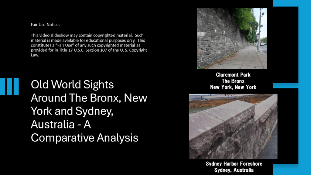
I am going to be developing the content for this blog post around numerous photos sent to me by DM, who lives in the Bronx in New York City and photos from PM, who lives in New South Wales in Australia, and who sent me a number of photos taken of Sydney on a recent visit there.
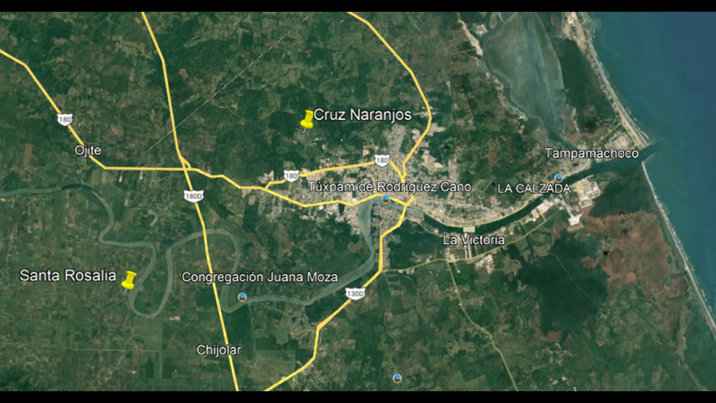
New York is going to be my starting point for this post.
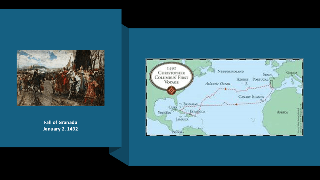
In our historical narrative, what became New York City was part of the colony of “New Netherlands,” that was established by the Dutch East India Company in 1621 to capitalize on the North American fur trade.
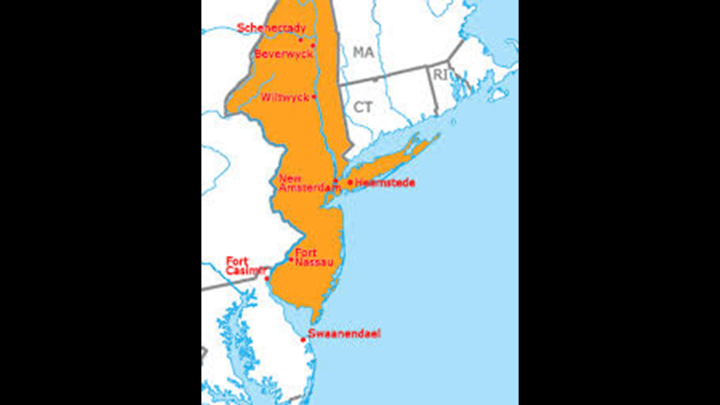
The Dutch Colony primarily included land in what became New York, New Jersey, Delaware, Connecticut and Pennsylvania, and the traditional lands of the Algonquin Lenape people
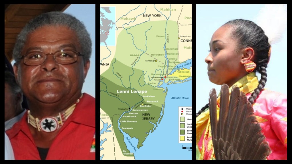
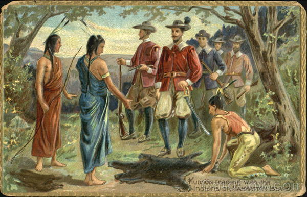
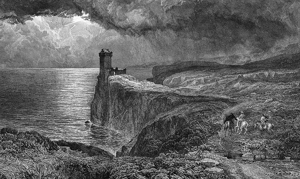
According to the history we have been taught, everything changed for the Lenape who lived here after Henry Hudson, and English seafarer and explorer, sailed up what is now called the Delaware River in 1609 on behalf of the Dutch East India Company, and this painting depicts what we are taught to believe about all the original people of this land – they were hunter-gatherers living off the land, and framing the European colonizers as the builders of infrastructure and civilization in the so-called New World.
On March 20, 1602, Dutch East India Company was chartered to trade with India and Southeast Asian countries when the Dutch government granted it a 21-year monopoly for the Dutch spice trade.
It was a megacorporation, which is defined as a massive conglomerate (usually private) holding near-monopolistic, if not monopolistic, control over multiple markets.

It has often been labelled a trading or shipping company, but was in fact a proto-conglomerate, diversifying into multiple commercial and industrial activities, such as international trade, ship-building, production and trade of East Indian spices, Indonesian coffee, Formosan (Taiwan) sugar-cane, and South African wine.
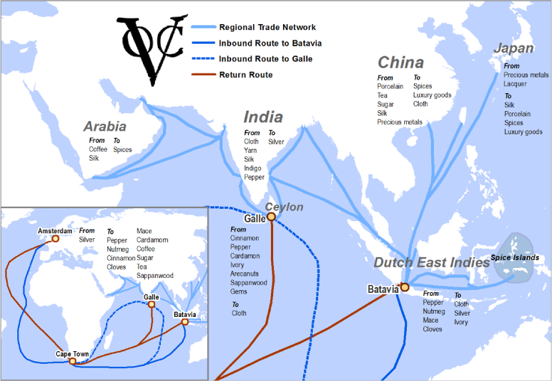
The first formally-listed public company by widely issuing shares of stock and bonds to the general public in the early 1600s, it was the world’s most valuable company of all-time, with a worth of $7.9-trillion.
It was considered by many to be to have been the forerunner of modern corporations.

Peter Minuit was the Dutch East India Company agent in our narrative who was said to have purchased the island of Manhattan from its native inhabitants for 60 guilders, or $24, worth of trade goods, like tools, wares and wampum, a traditional shell bead.
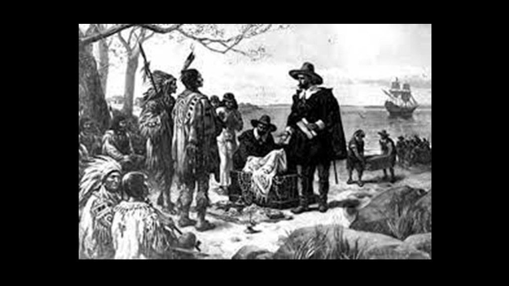
This kind of story about how land was acquired during this time-period was quite typical throughout this region.
Like, the Montaukett Grand Sachem Wyandanch of eastern Long Island was said to have sold Plum Island, which is located off the eastern end of the North Fork of Long Island in 1659 to Samuel Wyllys, the son of Connecticut’s governor George Wyllys, for “…a coat, a barrel of biscuits, and 100 fish-hooks…”
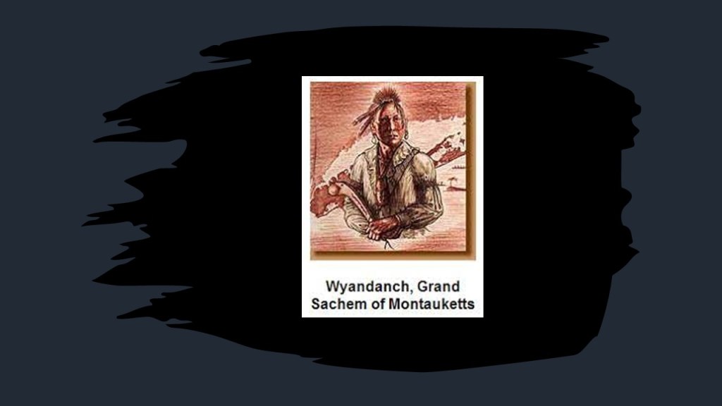
…and who was also said to have sold Gardiners Island, also off the eastern end of Long Island, that same year of 1659, to Lion Gardiner, the founder of the first English Settlement in New York for “…a large black dog, some powder and shot, and a few Dutch blankets.”
Wyandanch also died that same year, and after his death, the title of “Grand Sachem” went into decline and was eliminated by the colonists after they conquered the region of what was known as “New Netherlands” at the time.
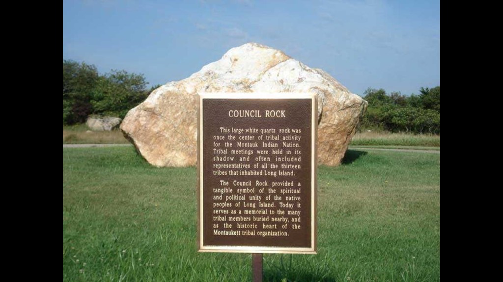
What I am able to find in a search is that the title “Sachem” was the title given to a Native American Chief, in particular the chief of a confederation of Algonquin tribes.

The Montauketts, or Montauks, once resided in large numbers on the eastern end of Long Island.
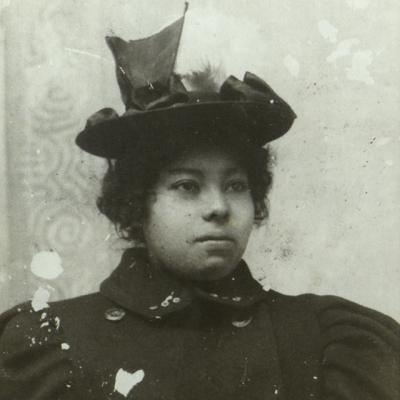
Interesting to note there is a “Pharoah” surname amongst the Montauks.
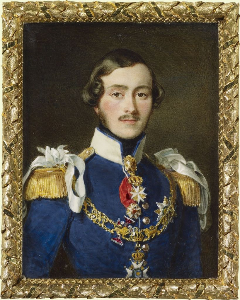
This a painting of David Pharaoh of the royal family of the Montauk tribe.
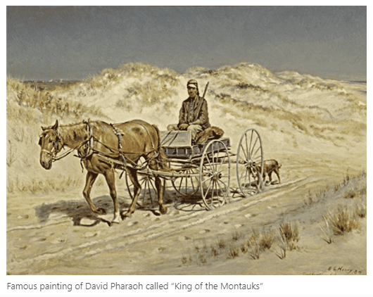
He lived between 1835 and died on July 18th of 1878.
He was buried in the Indian Field Cemetery on the old reservation lands on East Lake Drive in Montauk.
Princess Pocahontas Pharaoh was born on February 15th of 1878, the last Montauk born on the Montauk Reservation at Indian Field on Montauk Point, a year before the reservation was sold.
She was the youngest daughter of King David Pharaoh and Queen Maria Fowler Pharaoh of the Montauk Tribe.
The King of the tribe always came from the Pharaoh family.
Pocahontas Pharaoh was born in the middle of efforts by Arthur Benson and the Long Island Railroad to force the Montauks off their Land.
Benson purchased Montauk in October of 1879 for $151,000 and allowed the railroad to expand its rail service through it.
In 1897, King Wyandanch Pharaoh, Pocahontas’ brother went to court to try to get the Montauk land back and fought until 1910, at which time a New York court held that the Montauk Tribe was extinct and stripped the nation of its tribal lands.
The Montauk are actively working towards the reversal of this decision, as well as the revitalization of their language and culture.
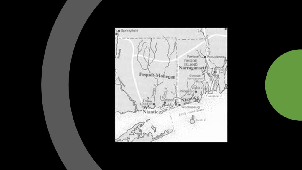
With regards to the language of the original peoples in this part of the world, Mohegan-Pequot was an Algonquin-language spoken by the Mohegan, Pequot, and Niantic people of southern New England, and the Montaukett and Shinnecock of Long Island.
The last living speaker of Mohegan-Pequot died in 1908.
We are told that historically Mohegan-Pequot did not have a writing system, and that the only significant writings came from European colonizers who interacted with speakers of the language.

But in today’s world, the eastern end of Long Island is best known for “the Montauk Project,” a series of U. S. Government projects with the purpose of developing things like psychological warfare techniques, like MK Ultra, and time-travel research, among others.

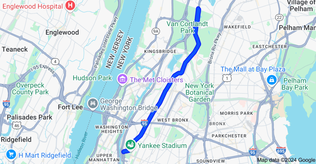
Now I am going to look specifically at the Bronx, and places that DM took photos of in The Bronx.
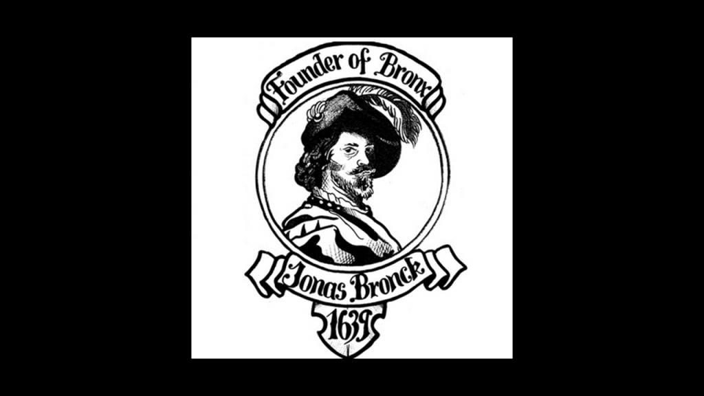
We are told The Bronx got its name from Jonas Bronck, who established the first European settlement in the area in 1639 as part of the New Netherland Colony, and that by 1642, the native Lenape people were displaced by the European settlers.
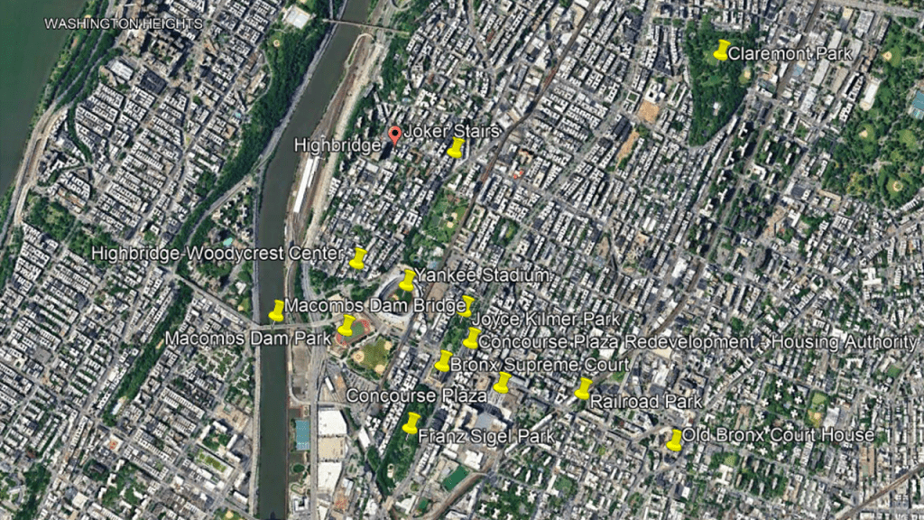
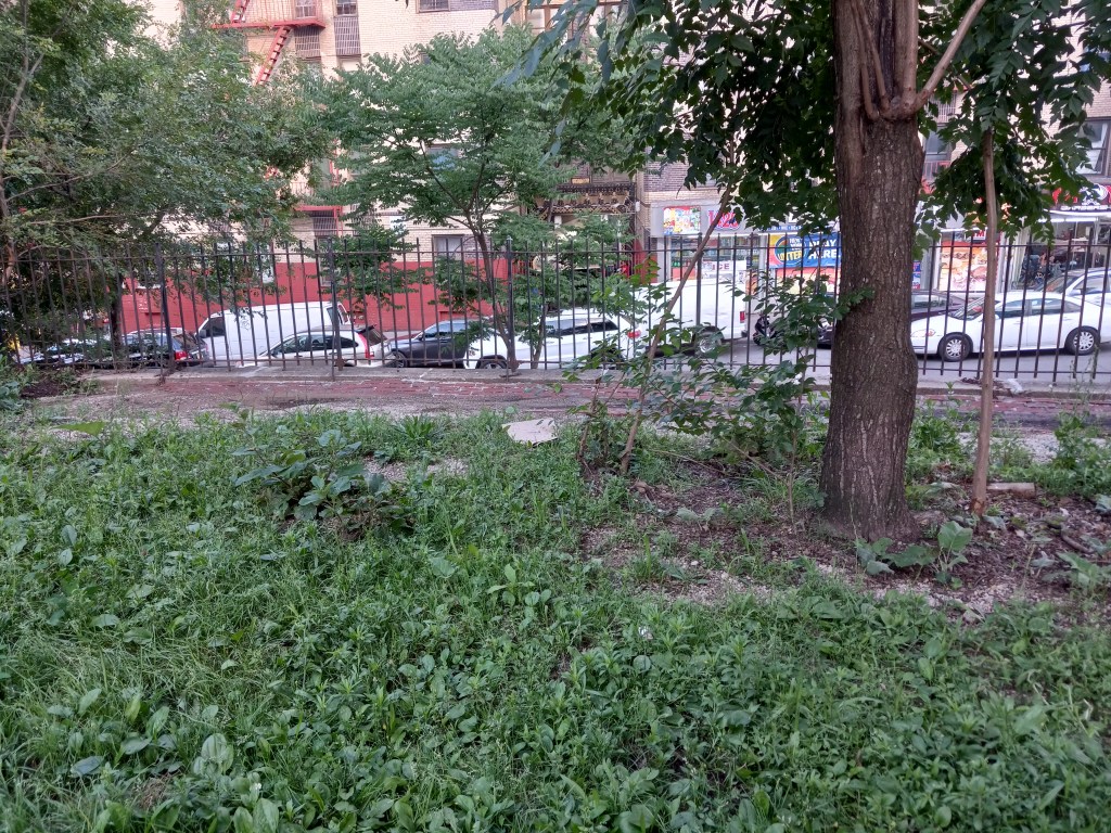
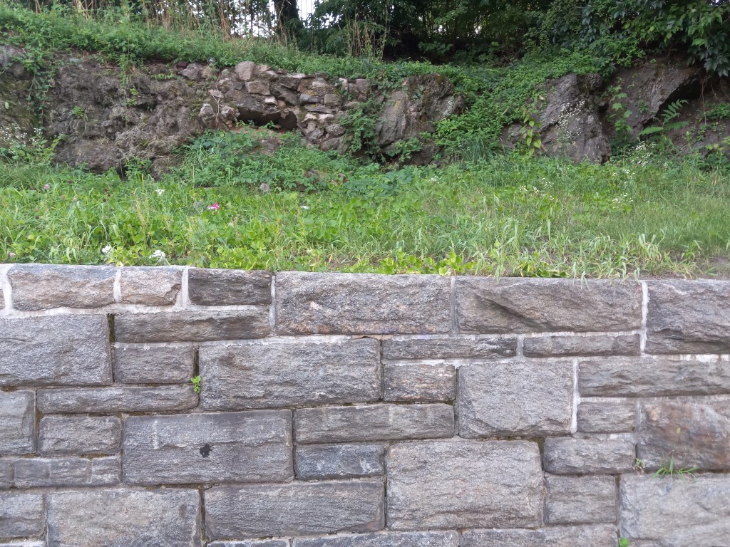
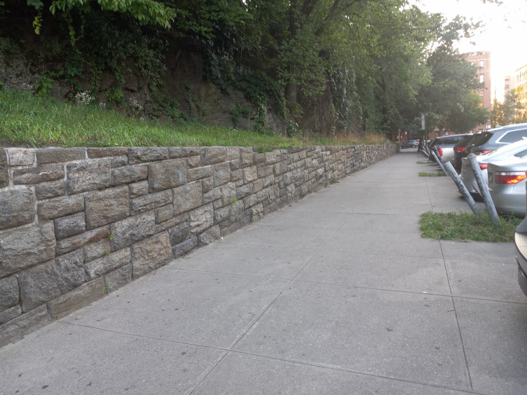
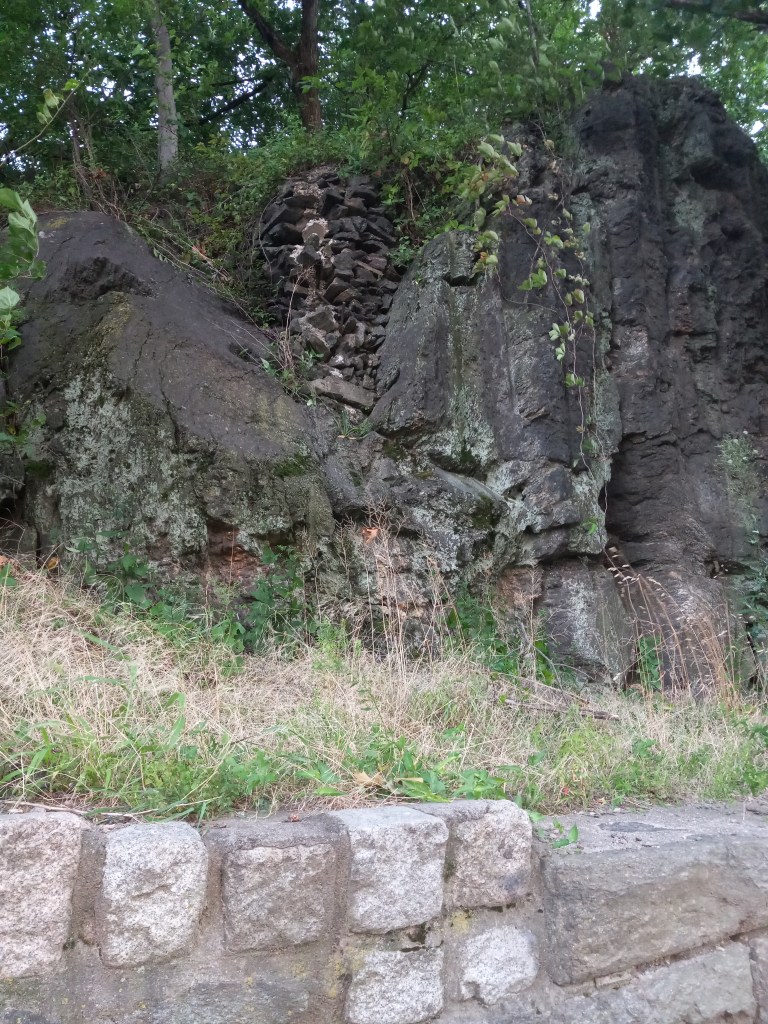
DM has always lived in the Bronx, and went from place-to-place during the summer months taking photos at various locations throughout the northernmost Borough of New York City in the Highbridge Residential neighborhood.
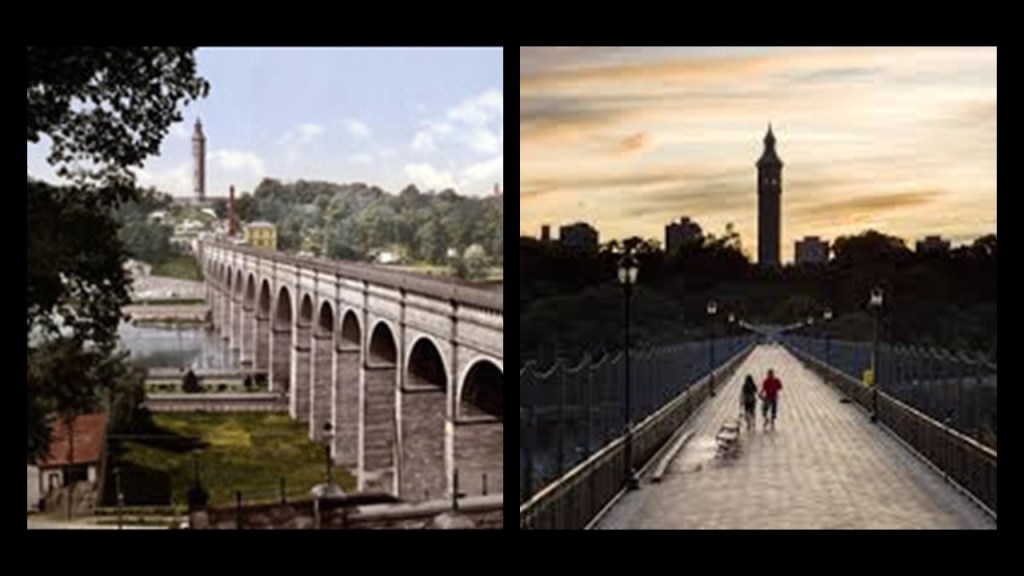
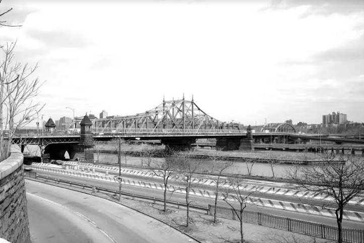
The residential neighborhood was named for the High Bridge crossing the Harlem River there, which was originally part of an aqueduct system delivering water from the Old Croton Aqueduct, said to have been built between 1837 and 1842, originating in Croton in Westchester County…
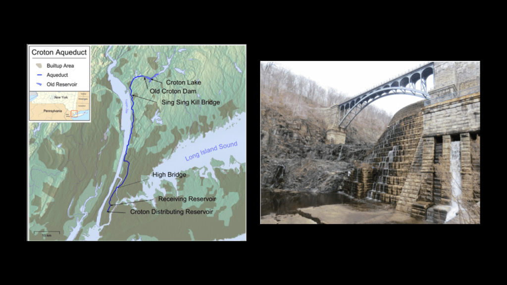
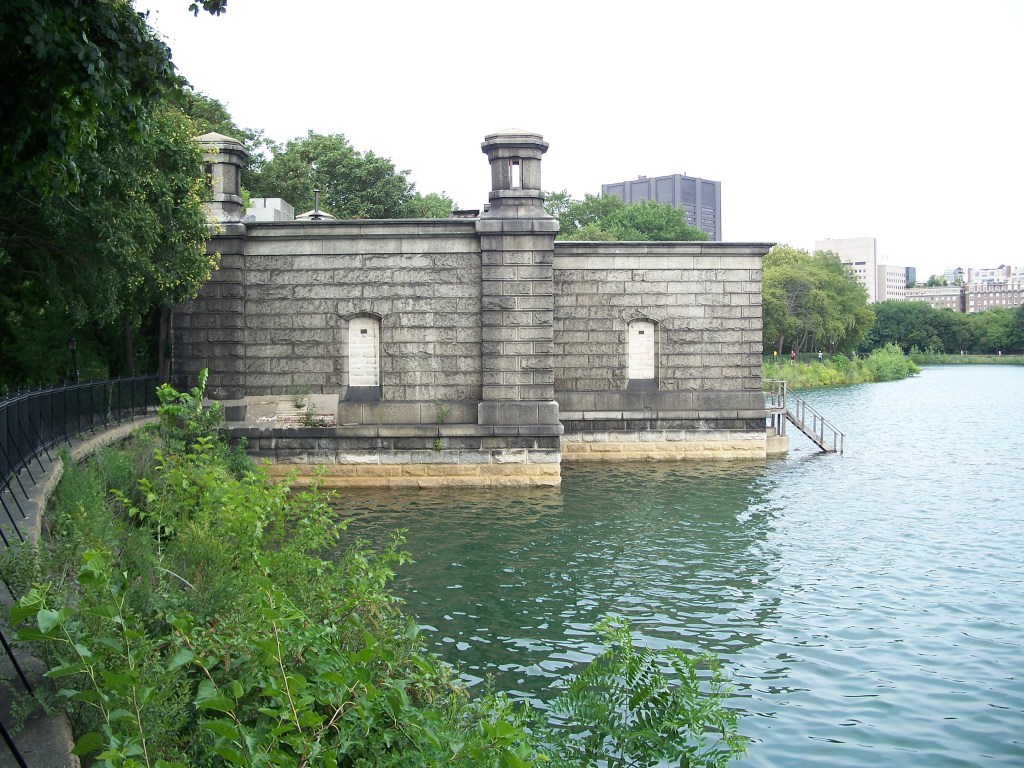
…to the Jacqueline Kennedy Onassis Reservoir in Central Park, a decommissioned reservoir said to have been built between 1852 and 1862 (the Civil War took place between 1861 – 1865).
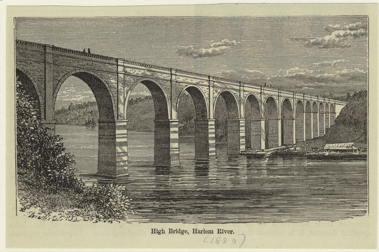
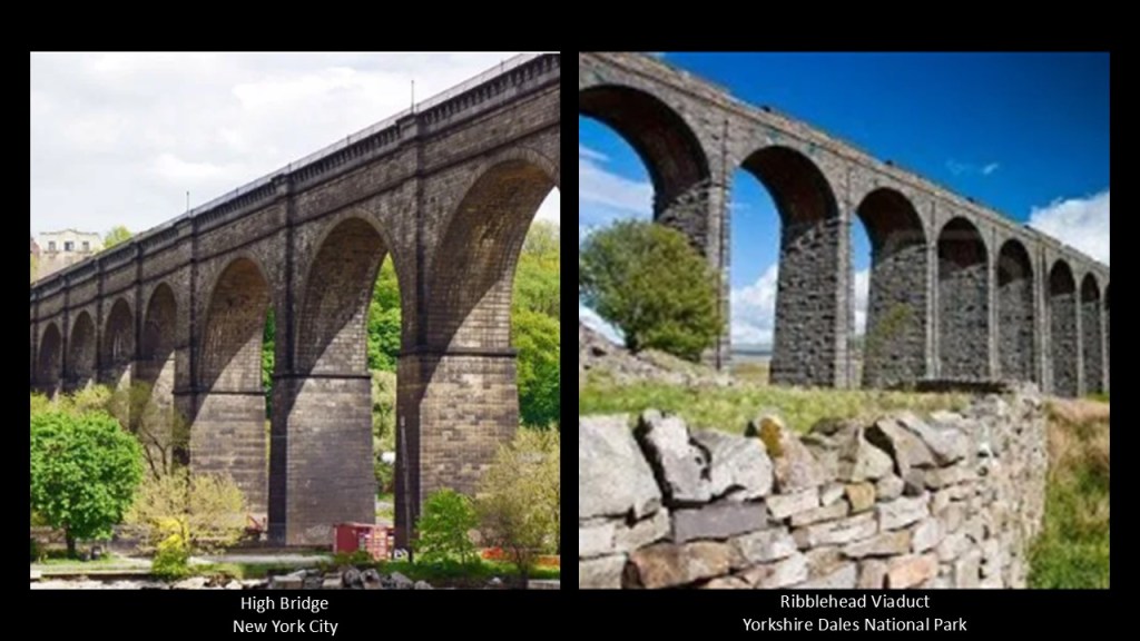
The High Bridge itself was said to have been first completed in 1848 and built by Irish Immigrants, and connects the New York City Boroughs of the Bronx and Manhattan
The High Bridge crossing the Harlem River in New York on the left brought to mind the Ribblehead Viaduct on the right in the Yorkshire Dales National Park in northern England, said to have been built for the railroad between 1869 and 1874.
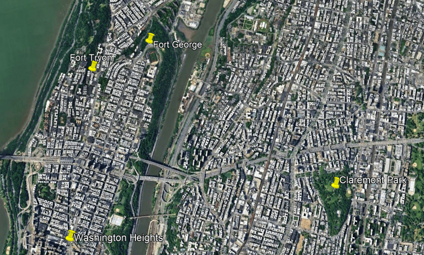
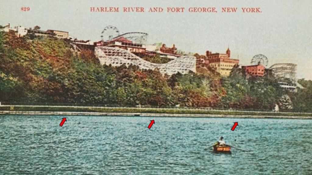
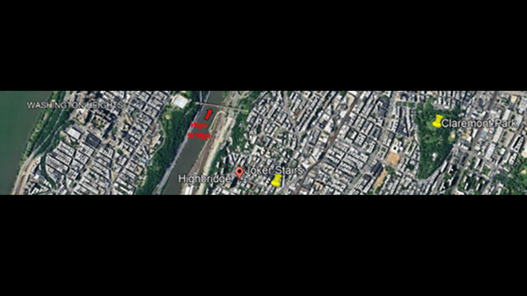
The High Bridge Connects the Highbridge neighborhood of the Bronx with the neighborhood of Upper Manhattan called “Washington Heights, the locations of the historic Fort George and Fort Tryon Parks, at which I am going to stop and take a look.
Fort George was said to have been built in 1776 on Fort George Hill near the intersection of Audubon Avenue and 192nd Street.
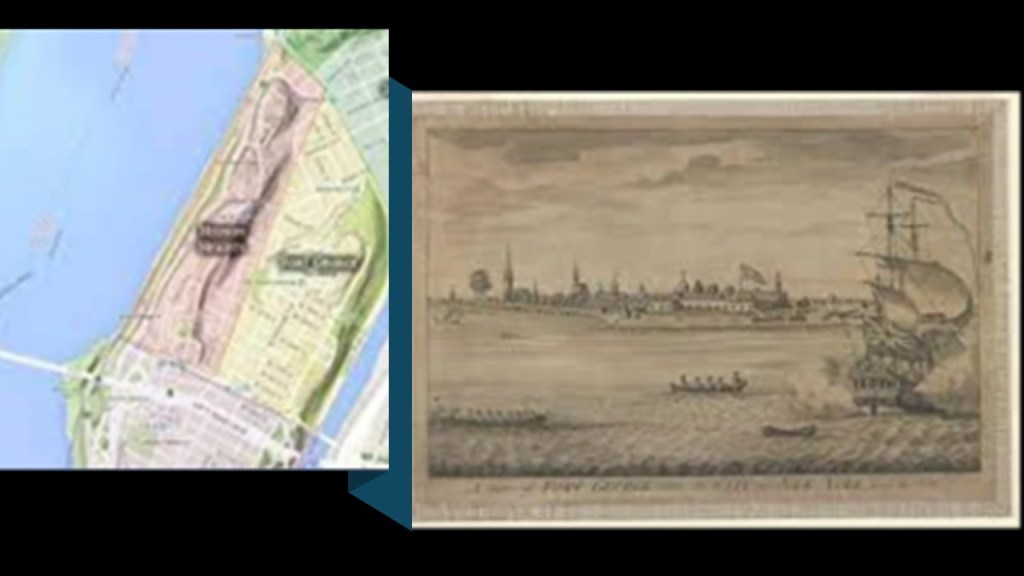
The historic Fort George Trolley Park operated here from 1895 to 1914.
Fort George was located at the end of the Third Avenue Trolley Line, and was said to have been developed as a Trolley Park starting in 1894 in order to give people a reason to use their trolley services at the end of their lines on the weekends and draw the residents of Manhattan to the riverside neighborhood for summer recreation.
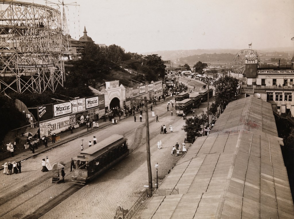
The park’s attractions included things like rides, saloons, casinos, the Harlem River Speedway, and vaudeville shows, sitting atop the masonry banks of the Harlem River.
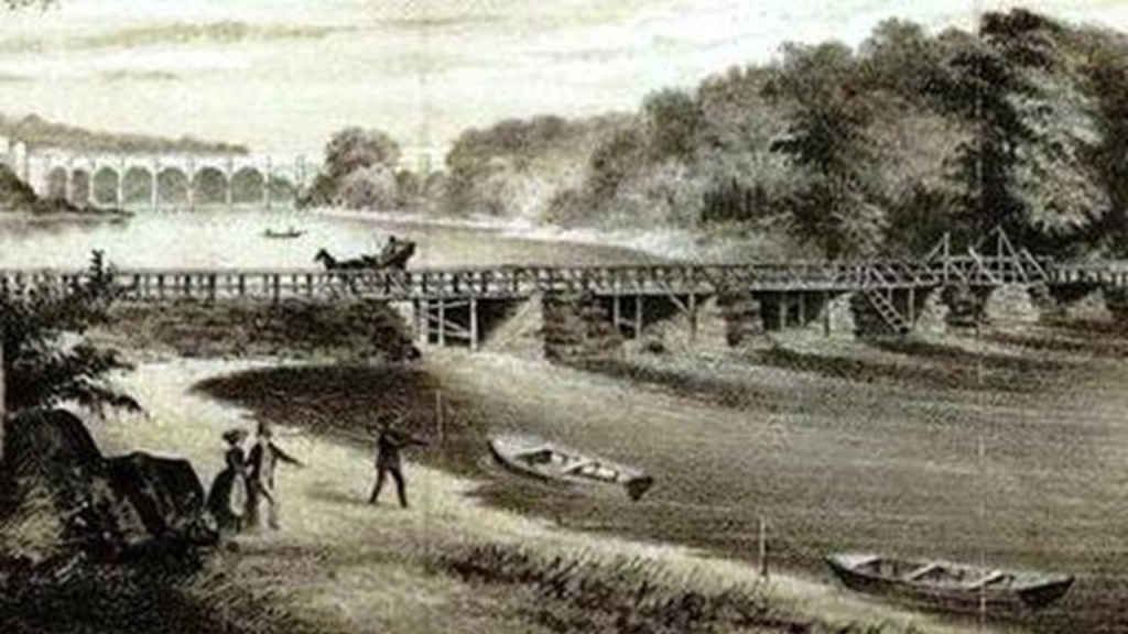
This is a picture of the Harlem River Embankment that was taken sometime between 1899 and 1904 on the left, and on the right is a photo of the Harlem River today where the High Bridge crosses it.
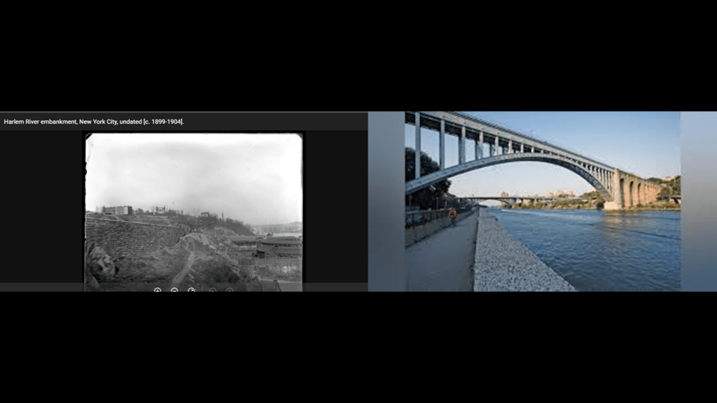
An Embankment is defined as a raised wall, bank or mound made of earth or stones that are used to hold back water or carry a roadway.
So, for examples, roads, railroads, and canals are normally raised on embankments.

While the Fort George Trolley park on the Harlem River prospered for year, we are told that local residents began to petition for its closure in 1910 as benefits to the local economy faded, and the neighborhood suffered from social problems stemming from the park, like public drunkenness and high crime.
There was a suspicious fire on the property in 1911, but repairs were made and the park reopened.
Then in 1913, there was another suspicious fire that devastated the park, and after this one, the property was condemned and the land of the former trolley park was incorporated into Highbridge Park.
Fort Tryon was also located in the Washington Heights neighborhood of Upper Manhattan.
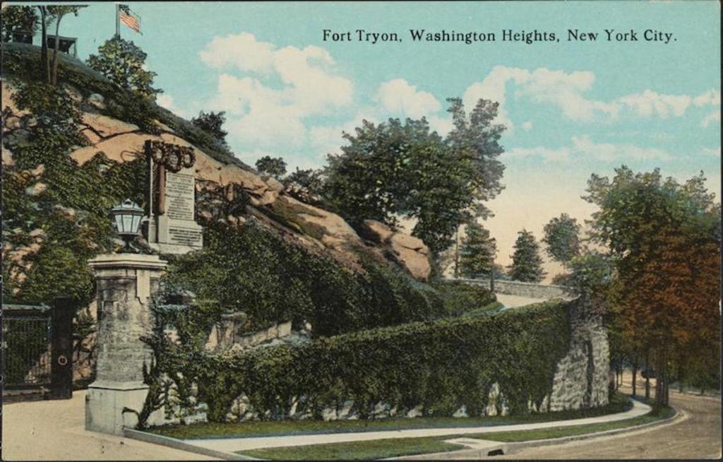
This is what we are told about Fort Tryon.
During the Revolutionary War, it was one of the sites of the Battle of Fort Washington that resulted in a British victory and huge American loss.
During the 19th-century, the area was said to be sparsely populated, but that by the turn-of-the century, Fort Tryon was the location of large Gilded Age country estates.
LIke the Billings Estate, the most luxurious of the estates.

We are told what became known as Fort Tryon Hall was built by wealthy Chicago businessman and horse-breeder Cornelius K. G. Billings, who had purchased 25-acres of land in what was called the “countryside” of northern Manhattan.
Billings, the former President of the People’s Gas Company of Chicago, was said to have started construction of his estate in 1901.
Billings’ estate had a mansion, stables for 60 horses, and an observatory.
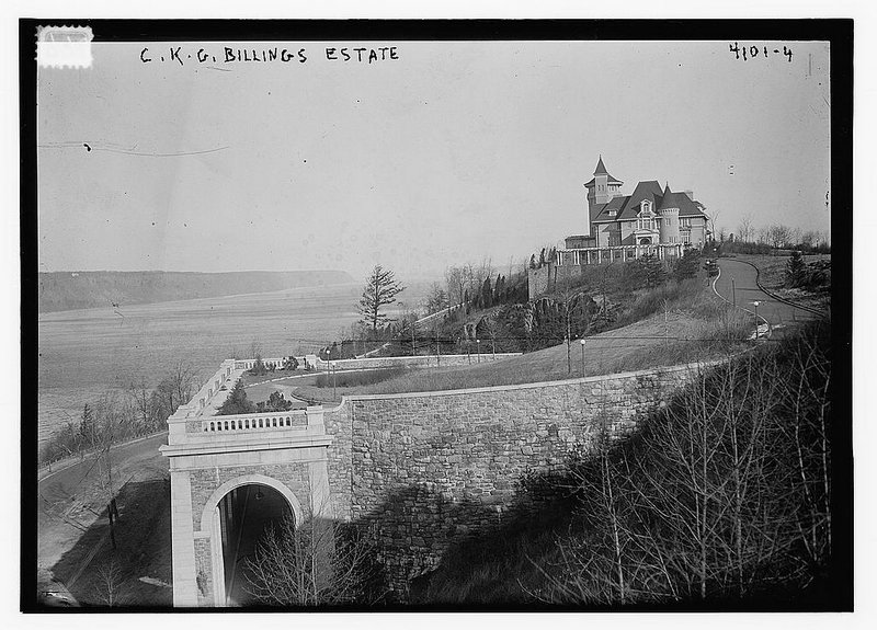
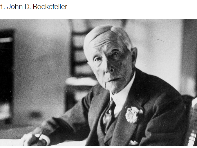
By 1917, Billings was ready to move on, and sold his estate to John D. Rockefeller.
Rockefeller wanted to combine the property of this estate with two other estates and turn the land into a public park.
He wanted to tear down Fort Tryon Hall, but his architects protested so he changed course with other ideas for its use.
Well, I guess fate must have helped Rockefeller out because in 1926, a fire burned down Fort Tryon Hall along with its priceless works of art and other fineries.
We are told that remnants of Fort Tryon Hall include the driveway that Billings had constructed, a sort of bridge that extended over the edge of the hill with a “high, graceful arch at each end.”

John D. Rockefeller was a co-founder of the Standard Oil Company in 1870 along with Henry Flagler, roughly a decade after the birth of the oil Industry at Titusville in Pennsylvania in 1859.

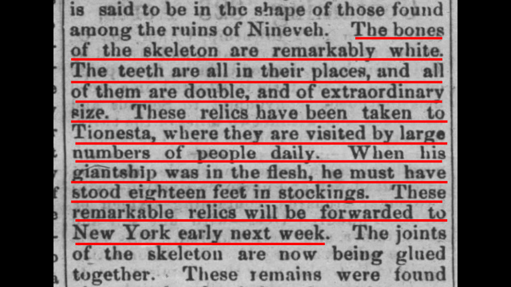
Where oil was found in Titusville in Pennsylvania is just 14-miles or 22-kilometers, south of West Hickory, where the tallest recorded skeleton in North America was found.
This 1870 newspaper article printed in the “Marysvillle Tribune” in Ohio from the “Oil City Times” in Pennsylvania says this with regards to the giant that was found at West Hickory.
Two men were excavating near West Hickory in preparation for erecting a derrick and unearthed the well-preserved skeleton of an enormous human.
The bones of the skeleton were described as “remarkably white;” the double- teeth all in place, of extraordinary-size; and that when the giant was alive, he must have stood 18-feet, or 5.5-meters, in stockings.
The bones were found about 12-feet, or 3.5-meters, below the surface of a mound, and the mound was not more than 3-feet, or less than a meter, above the level of the ground around it.

John D. Rockefeller, Sr, was born in the United States in 1839, and was the progenitor of the wealthy and powerful Rockefeller family.
He was considered to be the wealthiest American of all time, as seen in this ranking by CNN Business.
Rockefeller’s wealth soared as kerosene and gasoline grew in importance.
At his peak, he controlled 90% of all oil.

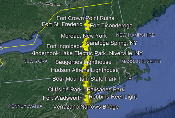
And there were star forts, trolley parks and lighthouses all throughout this part of the world.
I found that between the entrance to the lower New York Bay at the Atlantic Ocean to the locations around the George Washington Bridge across the Hudson River alone, there were eleven historical star forts that are in pairs and/or clusters; five major historic trolley amusement parks; and eleven lighthouses.
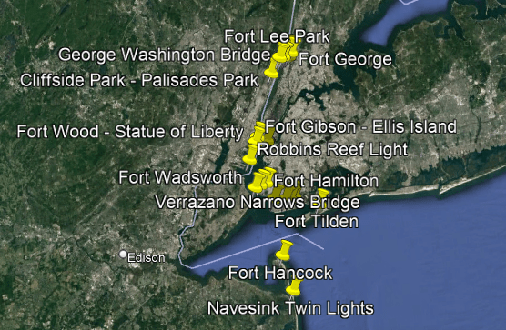
I found much more of the same kinds of infrastructure all the way up the Hudson River.
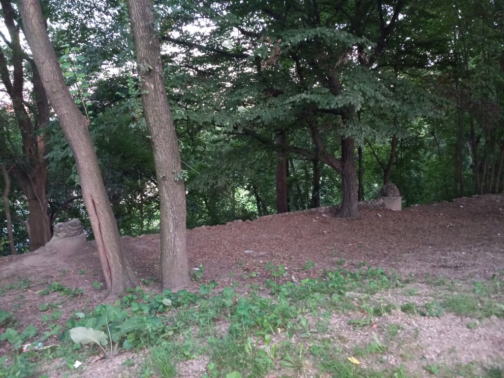
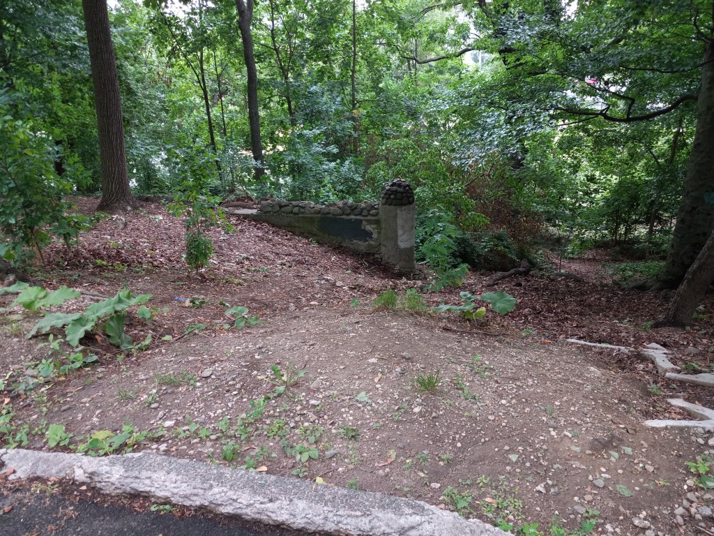
Now, I am going to start looking around the Bronx with photos DM sent me of Claremont Park, which is due east of the High Bridge.
Claremont Park is located on 170th Street between Clay Avenue and Teller Avenue all the way until Morris Avenue and Mount Eden.
The Mount Eden neighborhood is situated between the Highbridge neighborhood and the Claremont neighborhood where Claremont Park is located.
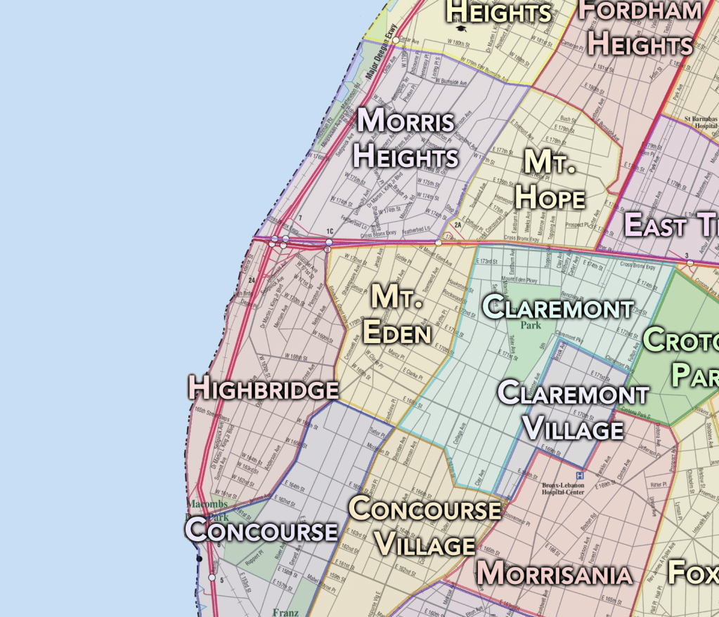
Mount Eden is served by the Mount Eden Avenue Station on the Interborough Transit (IRT) Jerome Avenue Line of the New York subway.
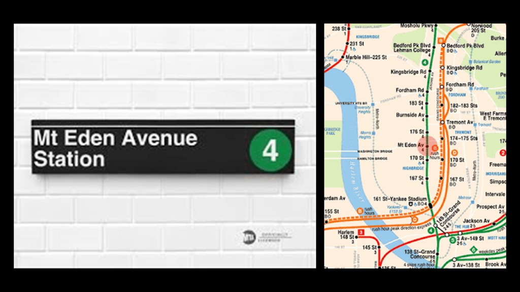
Jerome Avenue is one of the longest thoroughfares in the Bronx, at 5.6-miles-, or 9-kilometers-, long, stretching from the Concourse neighborhood to the Woodlawn Heights neighborhood
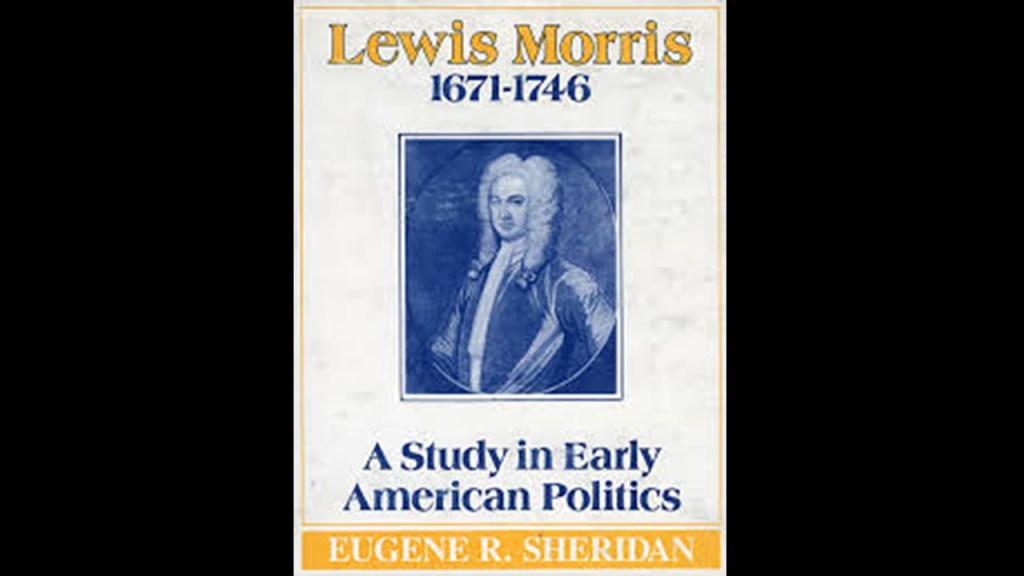
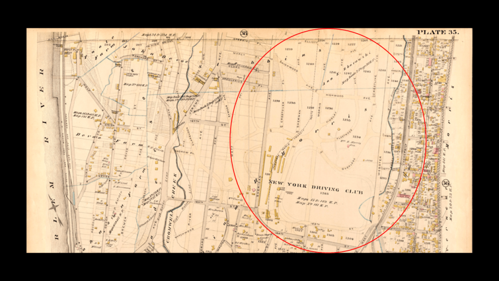
Claremont Park is in the Morrisania section of The Bronx, and is on land that was once part of the Morris Family Estate and the site of what was called the Zborowski Mansion.
We are told that Richard and Sarah Morris moved their estate from Barbados to what became the Bronx after purchasing land for the estate in 1670, and that their infant son Lewis inherited it after they died, making him the first Lord of the Manor of the family estate, which was held in trust until he came of age.
Lewis Morris later became Chief Justice of New York and the British Governor of New Jersey.
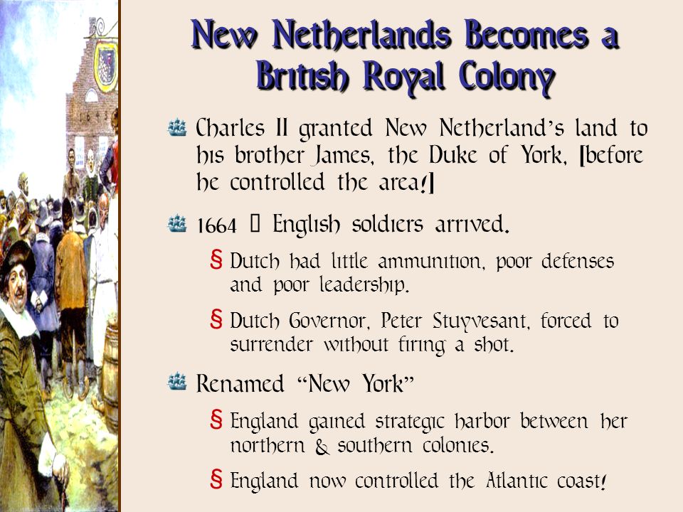
In our historical narrative, we are told the Dutch “New Netherland” Colony became a British Colony in 1664, after a fleet of four British warships under the command of Colonel Richard Nicolls sailed into what became the New York Harbor and demanded that the Director-General of the Dutch Colony, Peter Stuyvesant, surrender the colony to the British, and he surrendered the colony without a fight.
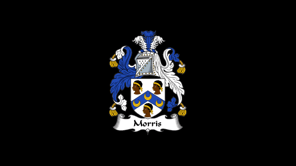
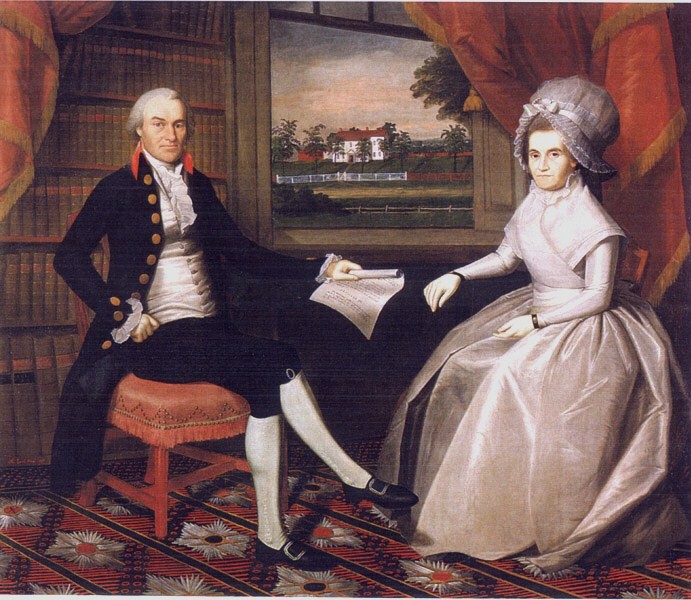
When I looked up the Coat-of-Arms of his grandson Robert Morris in past research, who was a signer of the Declaration of Independence, this is what I found:
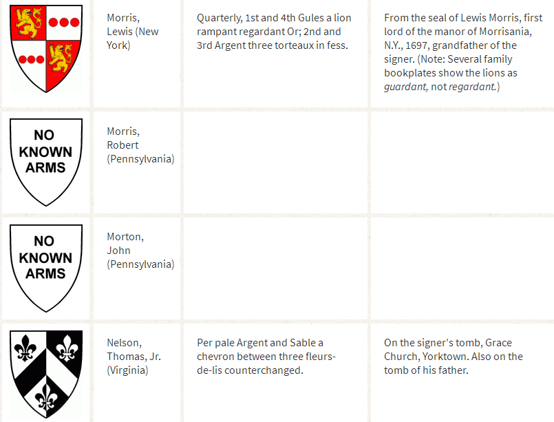
When I looked up the Morris Coat-of-Arms, there were several versions, and this was one of them…
Interesting to note, there are Morris Dancers in England, who practice a group dance form of choreographed steps, with bells on the knees, and wielding sticks, swords, or handkerchiefs.
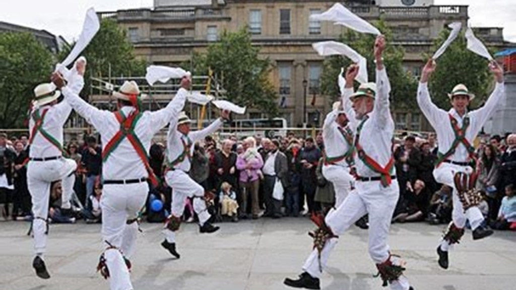
It is said the name of Morris Dance is first recorded in the 15th-century as Moorish Dance.
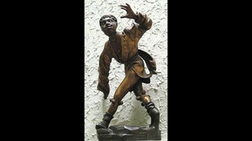
Here is a 1480-dated statue of a Moorish Dancer, with bells on the knees, at the Old Townhall in Munich.
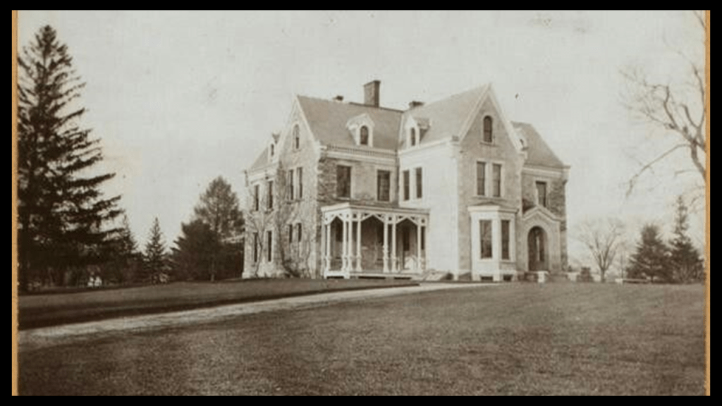
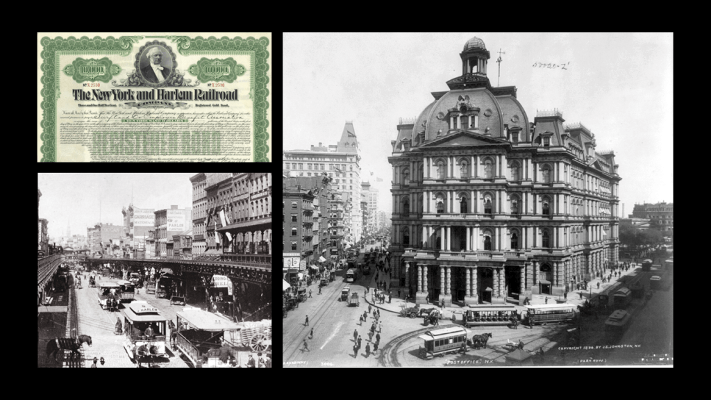
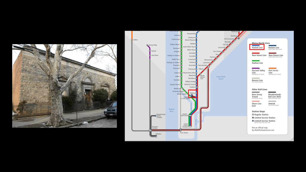
At any rate, we are told that Morris Family Estate land was auctioned off by the descendent of Lewis, Governeur Morris, in 1848, because of the encroachment of the coming of the New York and Harlem Railroad, and a parcel of it was purchased by the newlywed Zborowski couple, who then built the Zborowski Mansion was said to have been built in 1859, and was renowned for its white marble sculptural decor and terraced lawns on 38-acres of land, and that the mansion was torn down in 1938.
The New York and Harlem Railroad, which is today the Metro-North’s Railroad’s Harlem Line, was said to be one of the first railroads in the United States, and the world’s first street railway.
It was said to have been designed by John Stephenson, an American coach builder, who had patented this first streetcar to run on rails in the United States, which formally opened on November 26th of 1832, and was initially a horse-drawn street-car, and that it was opened in states between 1832 and 1852 between Lower Manhattan to Harlem.
Eventually powered by steam-engines, and then by electric-traction cars, all the different operators of the line went into receivership, and it was permanently converted to a bus operation in 1932.
We are told that Frederick Law Olmsted was hired to survey and map the streets of The Bronx in 1879, and that he had recommended the purchase of property to form a greenbelt of parks and parkways, but that his recommended plan was designed.
Then New York Herald Editor, John Mullaly, advocated for the creation of parks in New York City, and to this end, he formed the New York Parks Association in 1881.
The New Parks Act was passed by the New York State Assembly in 1884, and then between 1888 and 1890, land was purchased for parks in the Bronx like Claremont, along with Crotona, Van Cortlandt, Bronx, St. Mary’s, and Pelham Bay.
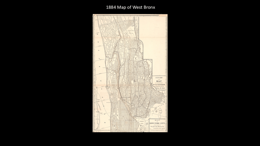
This map was notated as an 1884 map of the West Bronx.
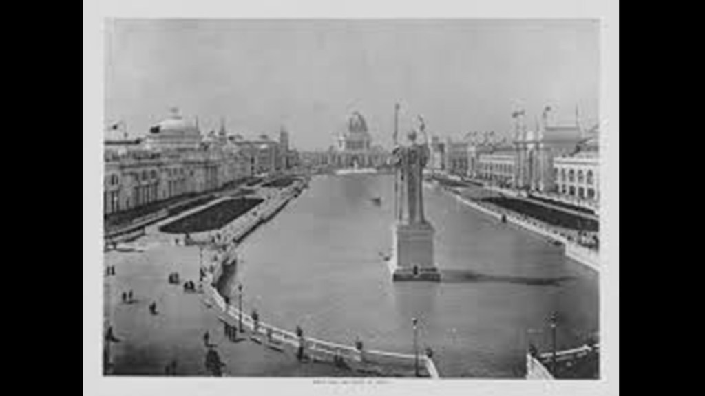
In 1889, Claremont Park, and the nearby harness, horse-racing track called “Fleetwood Park,” was considered as a possible location for the 1892 International Columbian Exposition…
…which was the official name of the 1892 Chicago World’s Fair.
There was also railway service through here from the late 1860s, and Claremont Park Station on the New York Central Railroad’s Harlem Line was said to have come into existence in 1891, around the same time as the Claremont Park.
The Claremont Park Station was closed in 1960, for such reasons given as competition with the subway and the automobile, among other reasons.
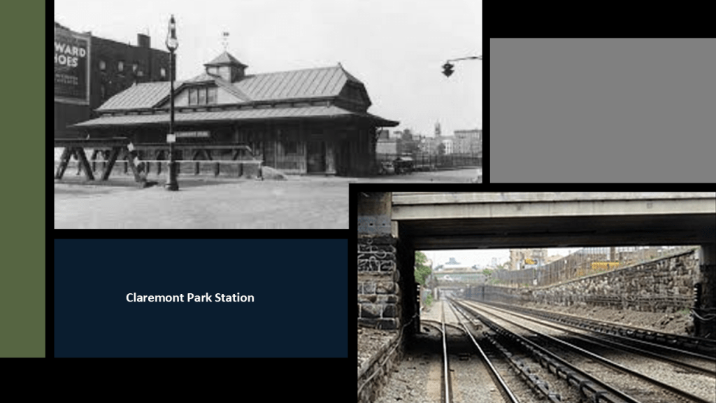
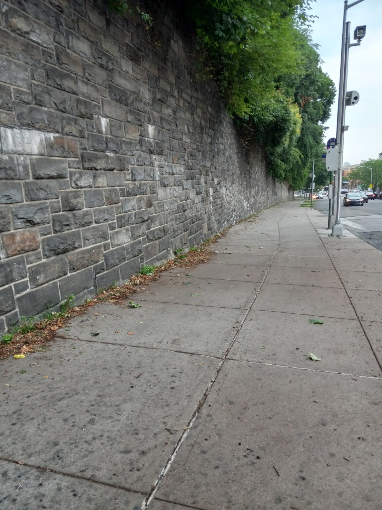
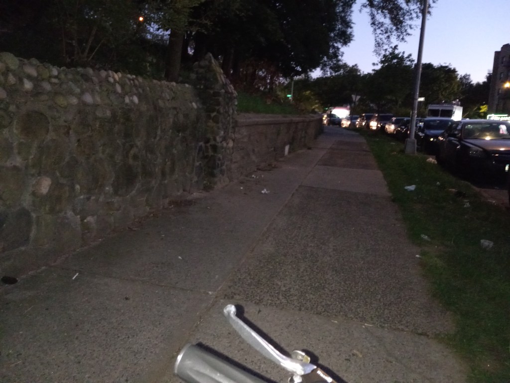
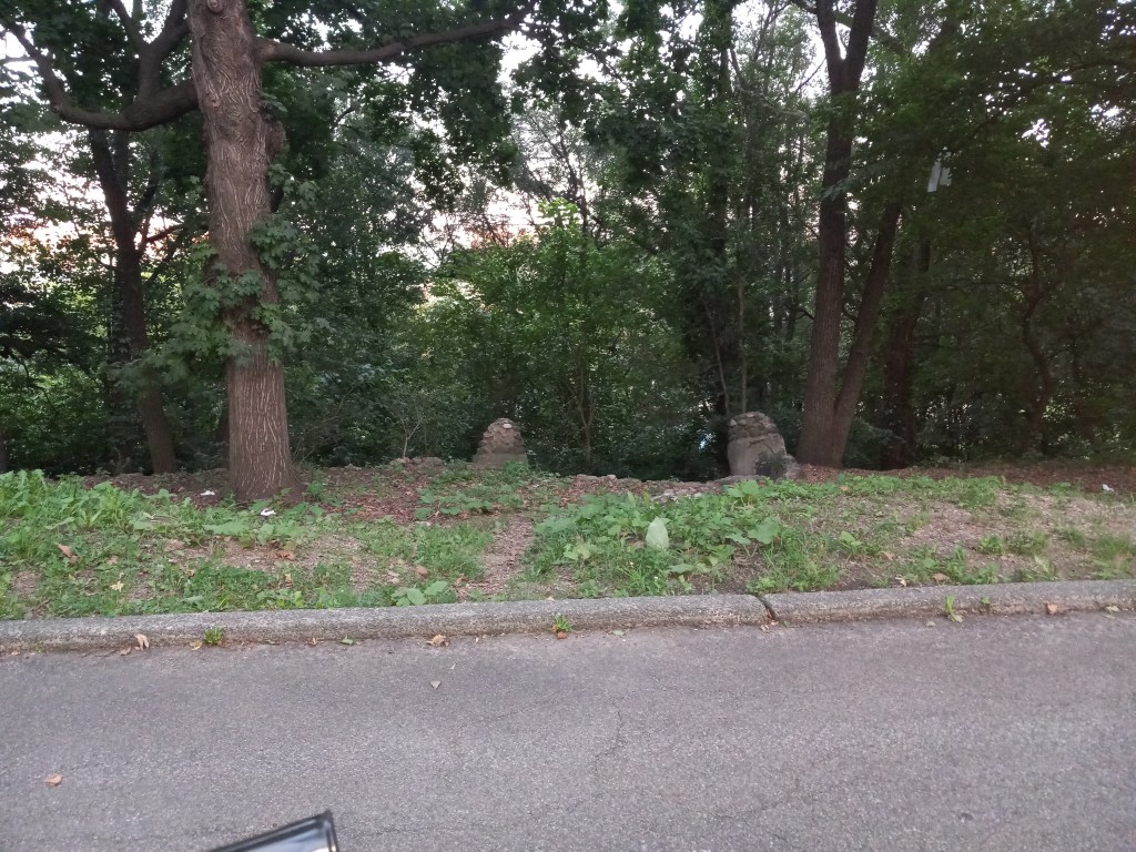
Here are photos that DM sent me of around and through Claremont Park.
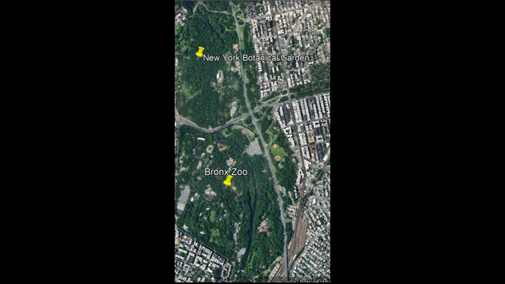
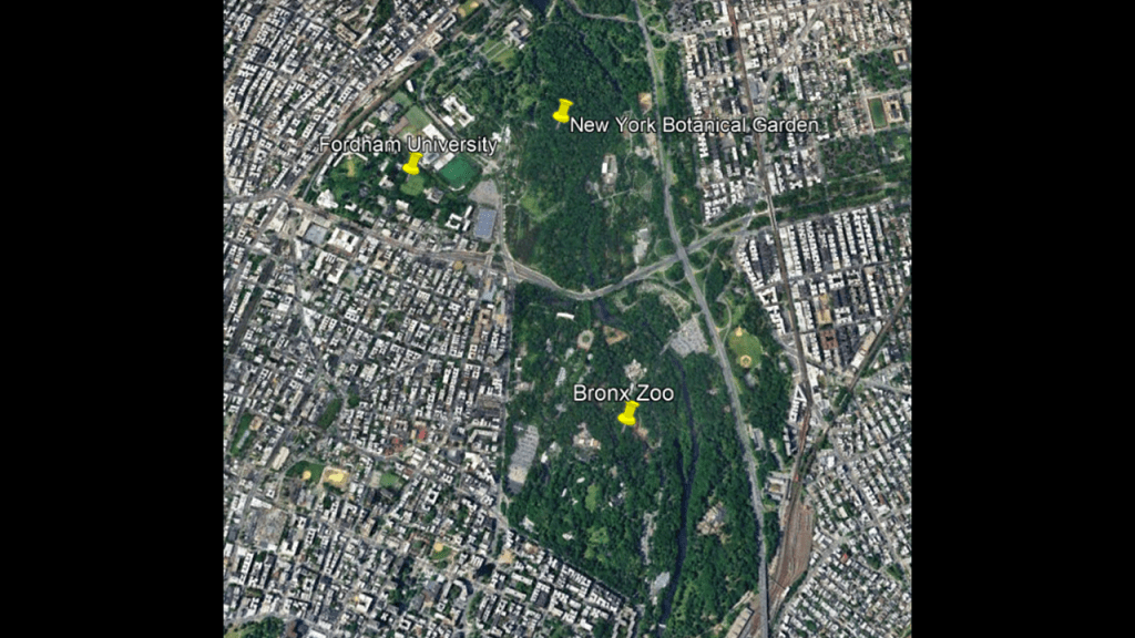
Before I head out from this part of the Bronx to look at other places DM brought to my attention, I would like to take a look at what’s in a space a short-distance to the northeast of Claremont Park, which contains the Bronx Zoo, the New York Botanical Garden, and Fordham University..
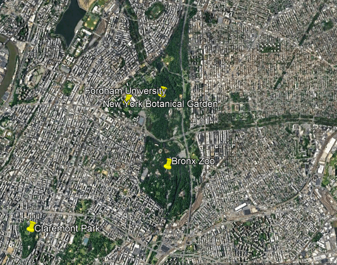
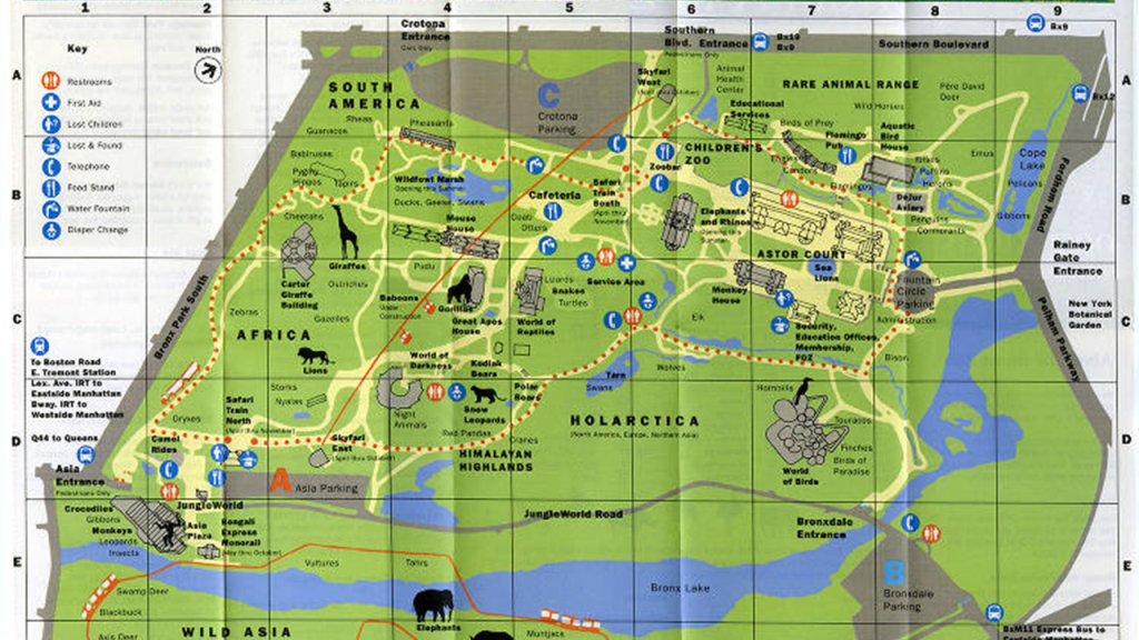
The Bronx Zoo is the largest metropolitan zoo in the United States and one of the largest by area, and first opened in November of 1899, featuring 843 animals in 22 exhibits.
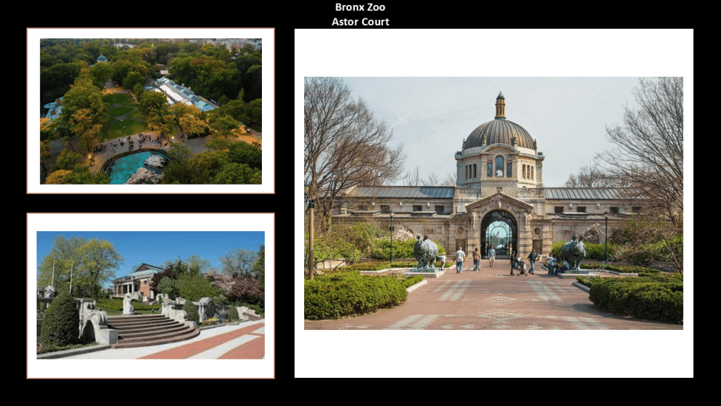
We are told that the zoo’s original buildings, known as “Astor Court,” were designed as a series of Beaux-Arts Pavilions around the circular sea lion pool.
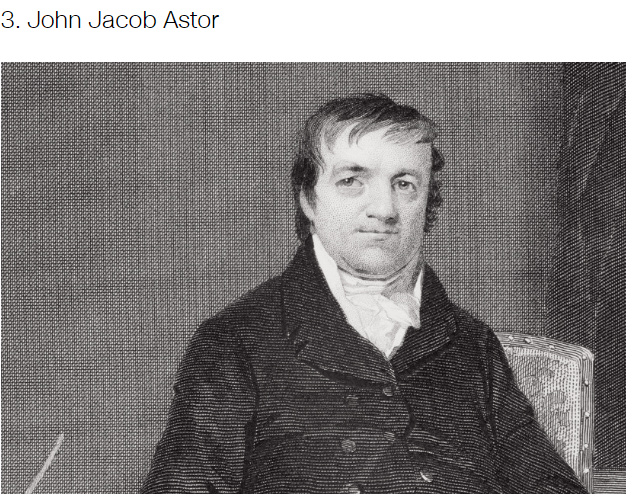
The progenitor of the Astor family in America was John Jacob Astor.
John Jacob Astor was born near Heidelberg in the Baden-Wurttemburg State in Germany in 1763, and immigrated first to Baltimore in November of 1783, just after the end of the American Revolutionary War.
By later in the 1780s, he had opened a fur goods shop in New York City.
Astor went in to make a fortune in real estate investment in and around New York City, the fur trade, and opium smuggling.
John Jacob Astor was considered to be the world’s first multi-millionaire, and the third-richest American of all time according to CNN Business.

The gigantic Rainey Memorial Gates are at the Bronx Zoo’s Main Entrance on Fordham Road, and said to have been sculpted in the Art Deco Style by noted sculptor Paul Manship between 1926 and 1934, as a memorial to big game hunter Paul J. Rainey.
The bronze gates stand over 34-feet, or 10-meters, -high, and are 42-feet, or 13-meters, -wide, like they were made by larger people for larger people.
These gates are completely covered with a green patina, which is caused by the oxidation of the copper element in the bronze reacting with the elements over time.
I wonder how many years it would take for the gates to completely change color like that?
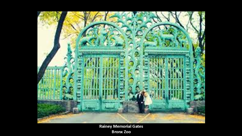
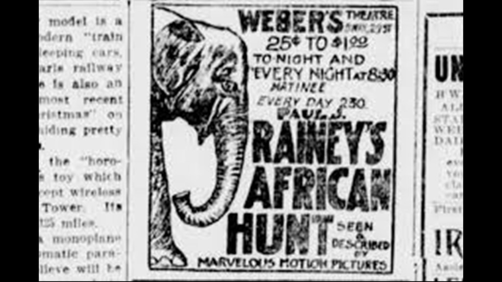
Paul J. Rainey was born into a wealthy family whose fortune came from coal and coke production.
Rainey hunted big game in Africa, and he and his team filmed it, releasing six-reels of documentary film in 1912.
He was involved in making silent documentary films until his death in 1923 at the age of 46 from a cerebral hemorrhage, and his sister was said to have commissioned the gates in his memory.
Ever wonder about the name of Giants for a New York football franchise?

And giant bones and skulls are frequently uncovered around the world in spite of continuous efforts to make them go away.

There was a human exhibit at the Bronx Zoo for a period of time in 1906.
Ota Benga was an Mbuti, a pygmy from the Congo, who had been purchased from a slave trader by Samuel Phillips Verner, a Presbyterian missionary and explorer in the Belgian Congo.
Verner was looking for African Tribespeople to exhibit at the 1904 Louisiana Purchase Exposition in St. Louis.
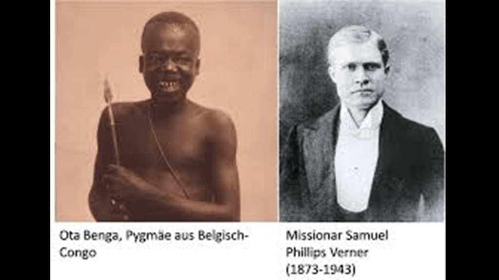
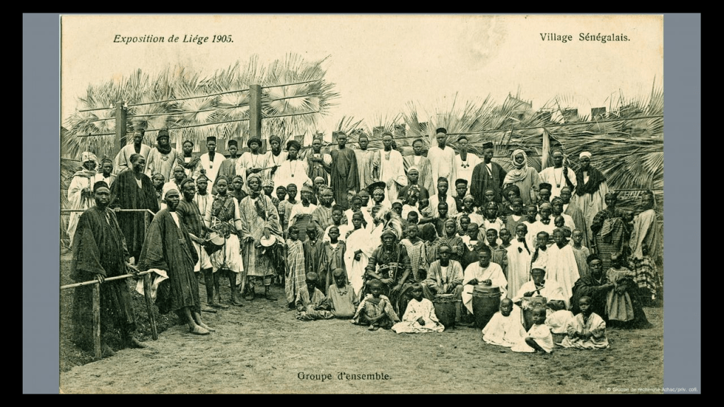
Human Zoos, public displays of people, were commonly found at World’s Fairs, also known as Expositions or Exhibitions, in the 19th- and 20th-centuries.
The exhibits of people from around the colonial world implied the superiority of western society, and emphasized the inferiority of the culture of the exhibits, through themes that marginalized them as “savages.”
There are two definitions of the word exposition.
One is a device used to give background information to the audience about the setting and characters of the story.
Exposition is used in television programs, movies, literature, plays and even music.

What better way to tell your audience the story you want them to believe than the other definition of exposition, a large exhibition of art or trade goods.
I absolutely believe that the original people were the Master Builders of the Earth’s civilizations, not the colonizers that occupied and established control over foreign lands and people, and then they took credit for building everything we see in the world today.
The Colonizers used these “Expositions” and “Exhibitions” to tell the story they wanted people to believe.

The New York Botanical Garden is located on 250-acres, or 100-hectares, across from the Bronx Zoo.
The New York Botanical Garden first opened in 1891, 8-years before the Bronx Zoo, and we are told that the first structures on the grounds opened about a decade-later.
This would include the Enid A. Haupt Conservatory, a greenhouse said to have been designed by Lord & Burnham Company in the Italian Renaissance-style, which first opened in 1902
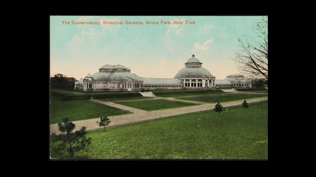
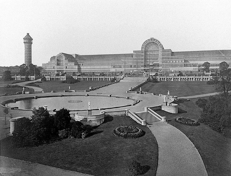
We are told that this conservatory was inspired in part by greenhouse-builder Joseph Paxton’s Crystal Palace, where the 1851 Crystal Palace Exhibition in London was held, the first of a series of major World’s Fairs, Expositions, Exhibitions that took place primarily over the next 100-years, which were described as “large, global exhibitions designed to showcase the achievements of nations.”
So, for example, we are told the purpose of the first Great Exhibition at the Crystal Palace was making clear to the world Britain’s role as industrial leader, while at the same time providing a platform on which other countries from around the world could display their achievements.
I have long seen them as showcasing the technology and architectural wonders of the original civilization before being hidden away or forever destroyed.
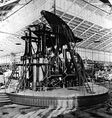
Like the Corliss Engine at the 1876 Centennial Exhibition, the first official World’s Fair in the United States that was held in Fairmount Park in Philadelphia.
We are told that it was held to celebrate the 100th-Anniversary of the signing of the Declaration of Independence.
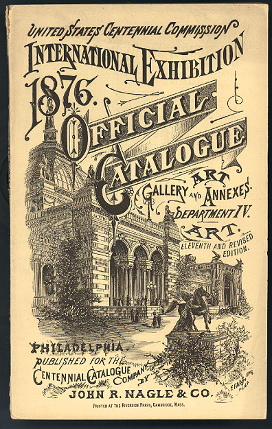
We are told that the largest Corliss Steam Engine ever built, with its 1,400-horsepower engine, was on display in, and generated all the energy used in, the Machinery Hall during the 1876 Exhibition.
The Corliss Steam Engine was said to have been invented by George Henry Corliss, and patented in 1849.
It was described as a steam engine fitted with rotary valves and variable valve timing, and generally 30% more fuel efficient than conventional steam engines.
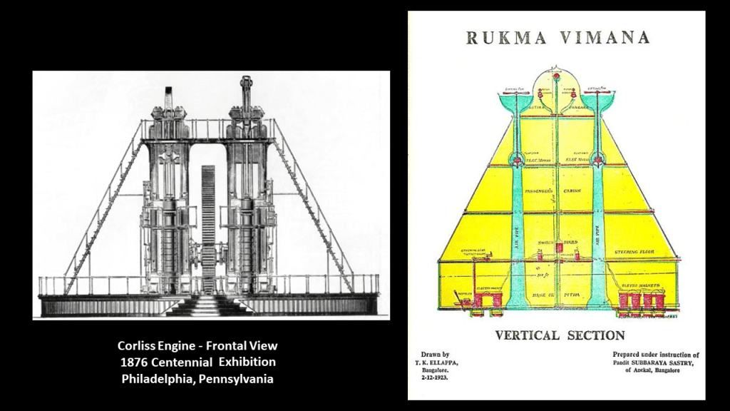
Somebody left me this comment after I uploaded the video four years ago called “Exposing Exihibitions, Expositions, and World Fairs Since 1851” about the Corliss Engine looking like a Rukma Vimana.

I looked it up, and sure enough, it does look like a Rukma Vimana!
This was the frontal view of the Corliss steam engine from the 1876 Centennial Exhibition on the left, and an illustration of the Rukma Vimana on the right.
Vimanas have come down to us as ancient flying vehicles that are described in ancient Indian texts.
Another building on the grounds of the New York Botanical Garden is the LuEsther T. Mertz Library, which was said to have been built in the Renaissance-Revival Architectural-style starting in 1896, and first opened in 1899.
It is the largest botanical research library in the United States and the first library to focus exclusively on botany, with large collections of books relating to botany and horticulture.
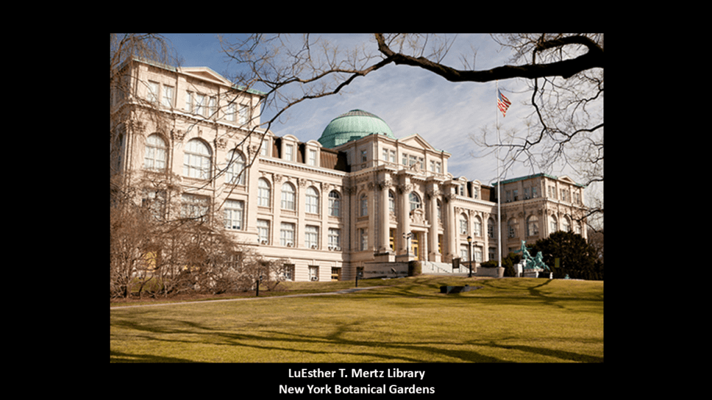
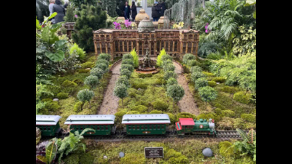
We are told that this location was selected to build the library because of its hilltop location, which was only the short-distance of 1,000-feet, or 300-meters, from the Botanical Garden Station of the New York Central Railroad (which today is the Metro-North Railroad), as seen in the tiny train exhibit at the Haupt Conservatory.
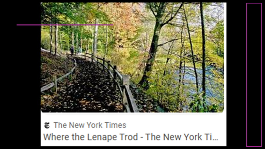
Included in the landscape of the Botanical Gardens of over 1-million living plants there is a 50-acre, or 20-hectare, tract of original old growth forest that has never been logged.
Called the “Thain Family Forest,” it is in a section of the Botanical Gardens along the Bronx River and occupies about 1/5th of the grounds, and once called the most precious natural possession of New York City.
It consists of several different kinds of trees, like oak, hemlock, beech, and sweet gum.
The New York Times tells us in a 2011 article about it that it was “where the Lenape trod,” the original people here, only the article tells us it was land on which they would hunt.
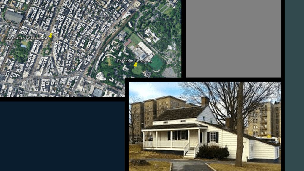
The last place I want to look at in this location is Fordham University, which is adjacent to the Botanical Garden.
Fordham University is a private Jesuit research university that was first established in 1841 as St. John’s College by the Catholic Bishop John Hughes, and the Jesuits began to arrive in 1846.
The educational curriculum at Fordham has been influenced by Jesuit principles.

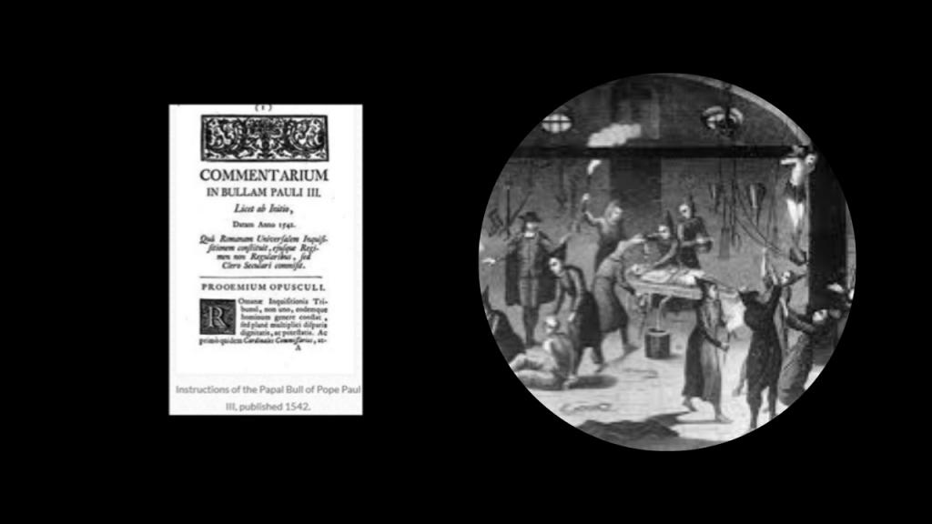
The Jesuit Order was established as a missionary order in 1540 by the issuance of a Papal Bull by Pope Paul III that included a special vow of obedience to the Pope in matters of mission direction and assignment.

A papal bull is an official papal letter or document, named after the leaden seal, or bulla, used to authenticate it.
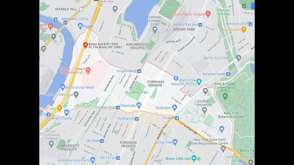
Fordham University was named after the Fordham neighborhood of the Bronx.
Called Fordham Manor, we are told that in 1666, a Dutch-settler who anglicized his named to John Archer established a community at what is now 225th Street near the Harlem River, where Archer owned 3,900-acres, or 1,578-hectares, of land.
The English colonial governor at the time approved the settlement with a “Letter Patent” making Archer “Lord of the Manor, and the Manor lasted from 1671 to 1762.
“Letters patent” are a type of legal instrument in the form of a published, written order issued by a monarch or other head-of-state, granting an office, right, monopoly, title or status to a person or corporation.
Thus, they can be used for the creation of corporations or government offices, or for granting city status or a coat-of-arms.
This is important to note because “Letters Patent” were an important instrument in the colonization, and subsequent subjugation, of foreign lands.
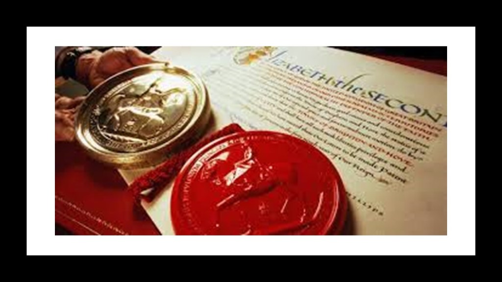
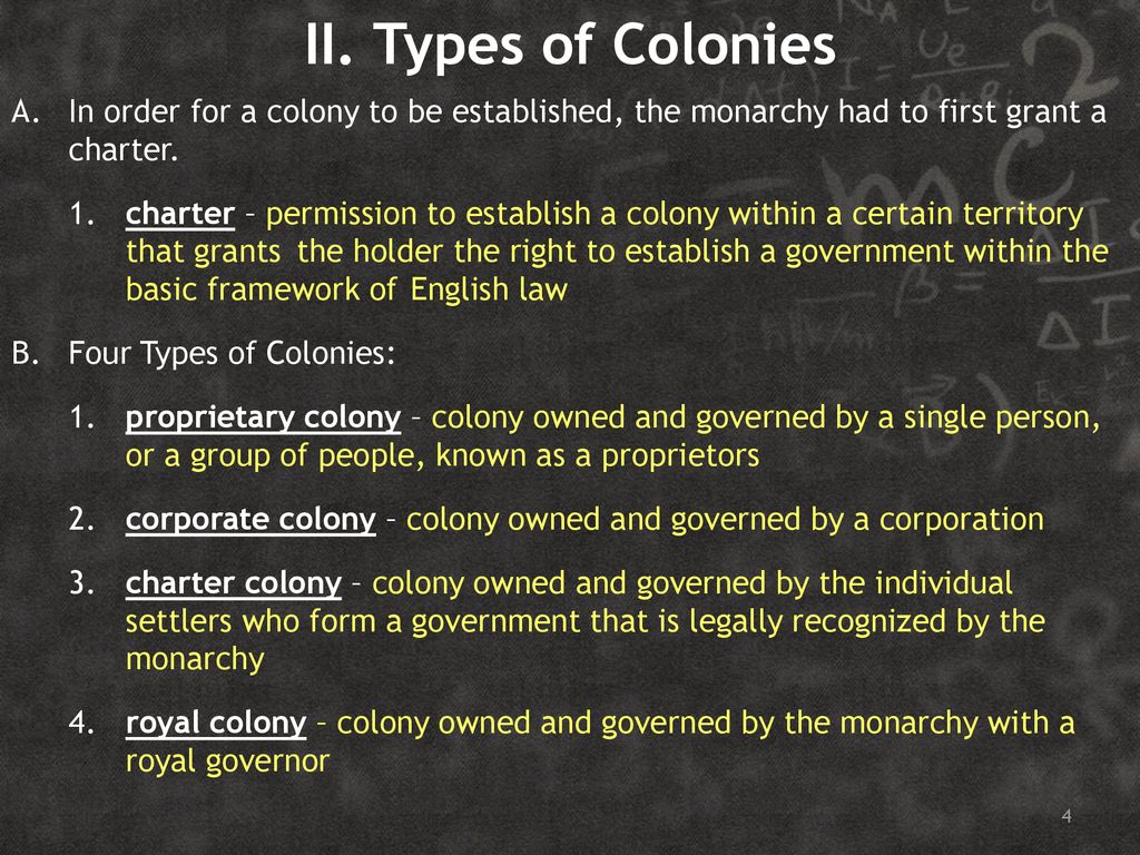
The monarch would issue a Royal Charter to establish a colony, which was a formal grant issued by “royal prerogative” as “letters patent.”
This graphic breaks-down the types of colonies after a royal charter has been granted.
Like Papal Bulls, Royal Charters and Letters Patent figure prominently in the effort to authenticate and legitimize what has taken place on earth in the historical narrative we have been taught.
Fordham University is also considered one of the most haunted universities in the Northeast, with persistent reports of ghostly sightings.

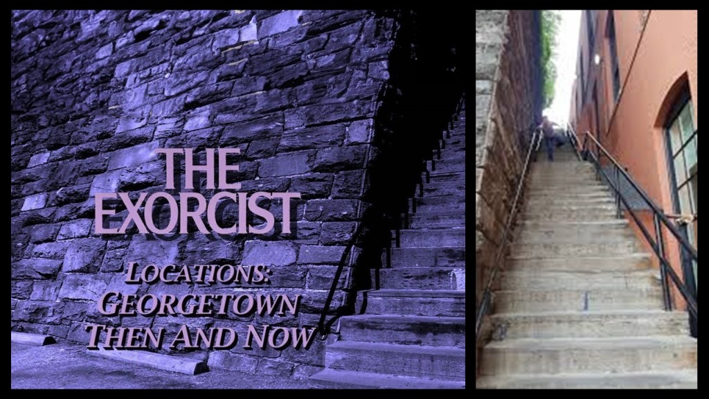
Fordham University was also a filming location for the 1973 horror movie “The Exorcist,” about the demonic possession of a young girl.
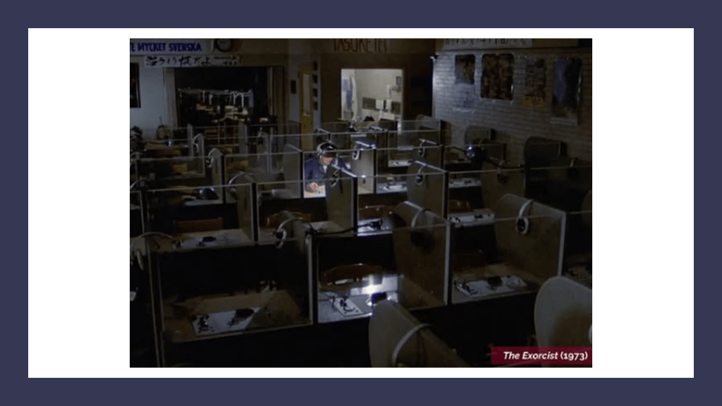
Georgetown University, another Jesuit school and the oldest Catholic institute of Higher Education in the United States that was established in 1789, was also a filming location for “The Exorcist.”
One of the filming locations in Georgetown is still known as “the Exorcist Steps,” depicted in the movie when a priest was thrown down onto them from a house next to the steps, and remains a tourist attraction in today’s world.
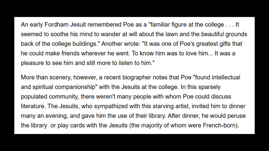
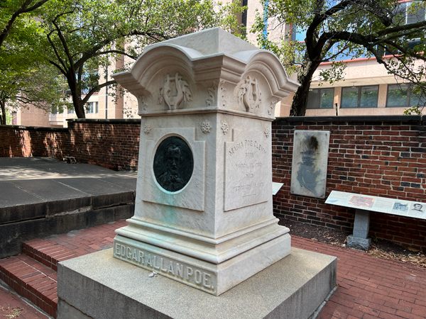
Edgar Allan Poe lived a couple of blocks from Fordham University in a cottage he and his family were said to have moved in to in 1846, which was the same year the Jesuits started to arrive as previously mentioned after the university was established in 1842.
His young wife and first cousin Virginia Clemm, who was the age of thirteen when they married sometime around 1836, died from tuberculosis when they were living at the cottage in 1847.
Edgar Allan Poe befriended the Jesuits during the time he lived there.
At some point after his wife died, he moved from the Bronx to Baltimore, where we are told he died of unknown causes at the age of 40 in 1849.
Edgar Allan Poe was the Stephen King of his day, with his dark and macabre story-lines exploring themes of death, madness, and the supernatural, and considered part of the gothic horror genre.

Next, the Fordham Train Station is one of the busiest rail stations in the Bronx.
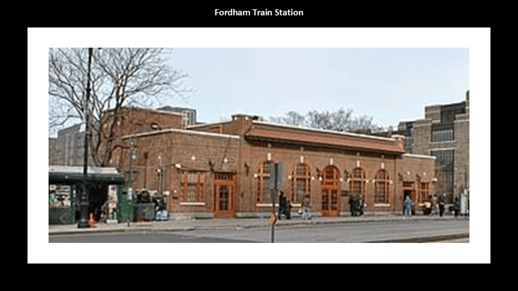
We are told that a station on the New York and Harlem Railroad was first built here in 1850.
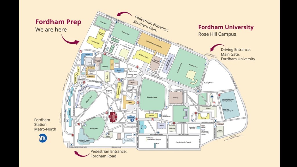
The Metro-North’s Fordham Station is located on the western end of Fordham University’s Rose Hill Campus.
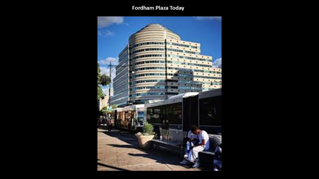
It is part of the Fordham Plaza Complex, a major commercial and transportation hub in the Fordham and Belmont sections of the Bronx.
Besides being the location of the Fordham Train Station, the Fordham Plaza bus terminal is located here, and it is the busiest shopping district in the Bronx.
Historically, we are told that Fordham Plaza was created when the New York Central Railroad electrified the four-track Harlem Division in 1903.
The 3rd-Avenue-El on the left was an elevated railway between the Bronx and Manhattan.
The last elevated railway to operate in Manhattan, it was phased out starting in the early 1950s, and completely closed in May of 1955.
The Trolley was also part of the Third Avenue Railway System (TARS), which operated every streetcar line in the Bronx.
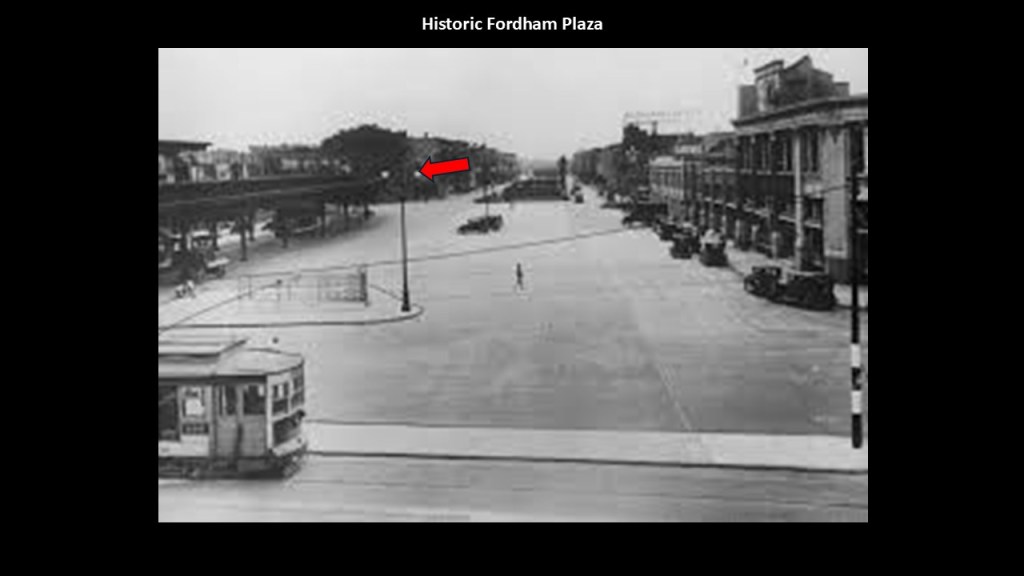
All streetcar lines in the Bronx were were abandoned in the years between 1918 and 1948.


There are a lot of churches in the Bronx.
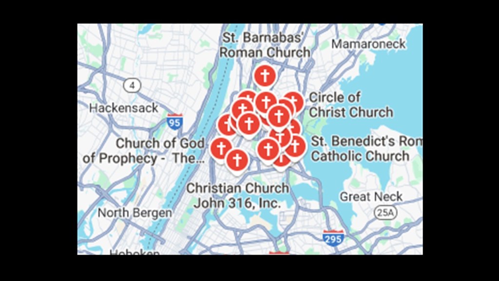
As a sampling, I am going to look at two of them close to this part of the Bronx near Fordham University, the Botanical garden and the Zoo – Our Lady of Mount Carmel Church; and St. Thomas Aquinas Church.
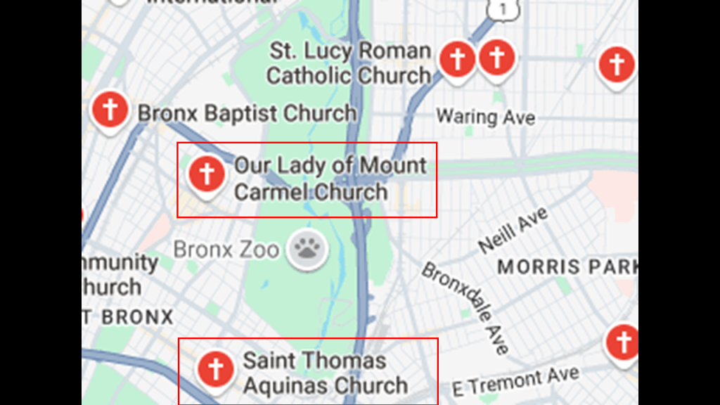
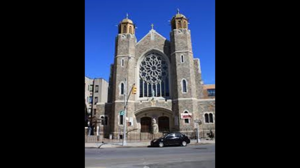
Our Lady of Mount Carmel Church is located three-blocks south of Fordham University.
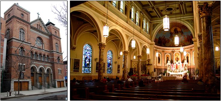
The construction of the church was said to have started in 1906 for Italians living in the neighborhood, with the basement completed by 1907 and the rest of the church by 1912.
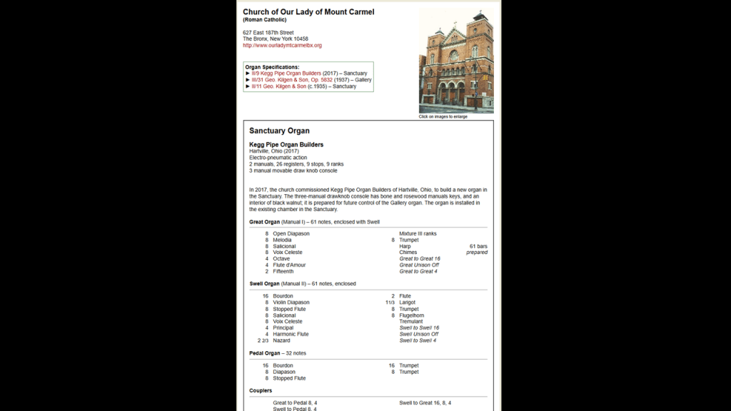
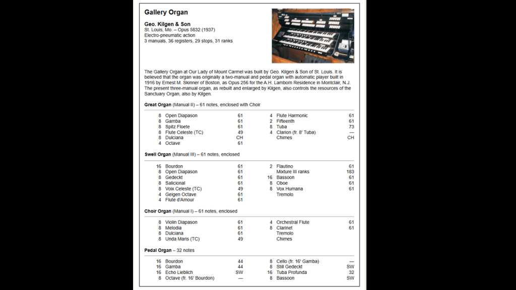
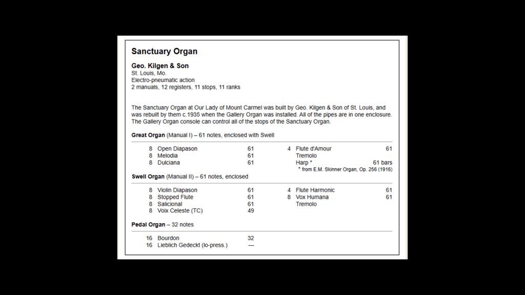
Our Lady of Mount Carmel Church has two organs – one in the Sanctuary and one in the Gallery.
The new Sanctuary Organ was said to have been commissioned in 2017 and installed in the existing chamber in the Sanctuary.
The Gallery Organ was said to have been first built in 1916 for a private residence, and we are told was rebuilt and enlarged in 1937.
The original Sanctuary Organ was said to have been the first one built for the sanctuary, and then rebuilt sometime around 1935, by the same company that rebuilt and installed the Gallery organ.
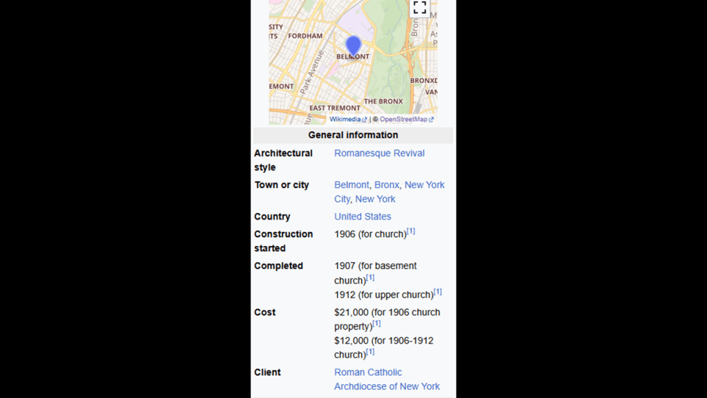
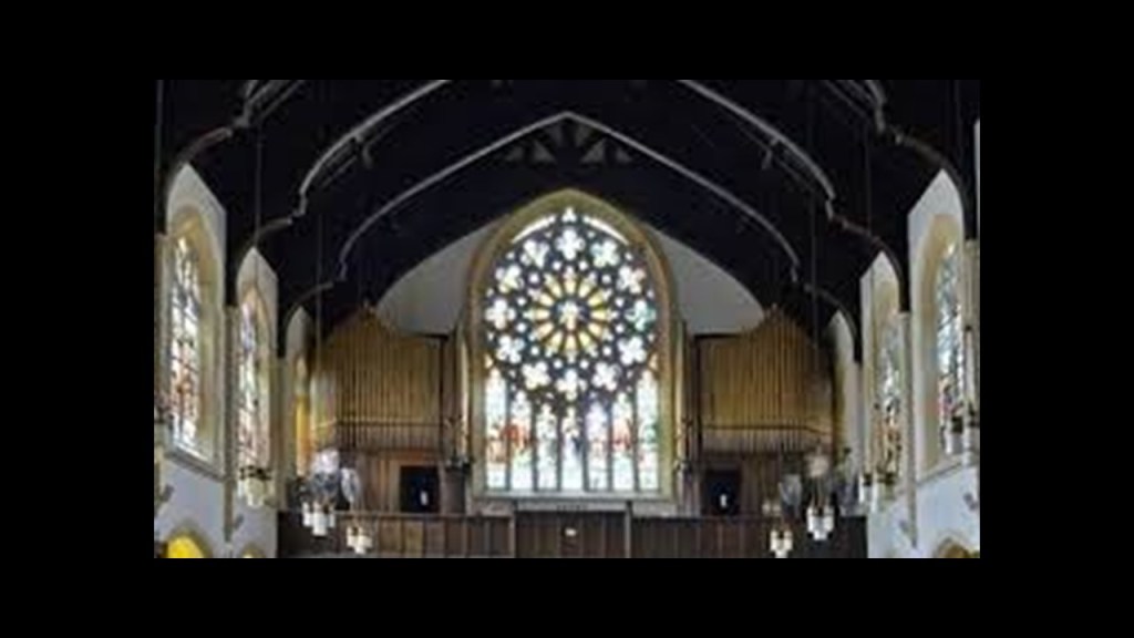
Next, the construction of the present-day St. Thomas Aquinas Church, said to have been designed in the English Gothic-style by Thomas Dunn, was said to have started in 1906 in the neighborhood of the Bronx known as West Farms, the farthest western section of Westchester, and it was dedicated by Cardinal Hayes, the fifth Archbishop of New York, in 1925.
Like Our Lady of Mount Carmel Church, there is an organ presence in this church as well.
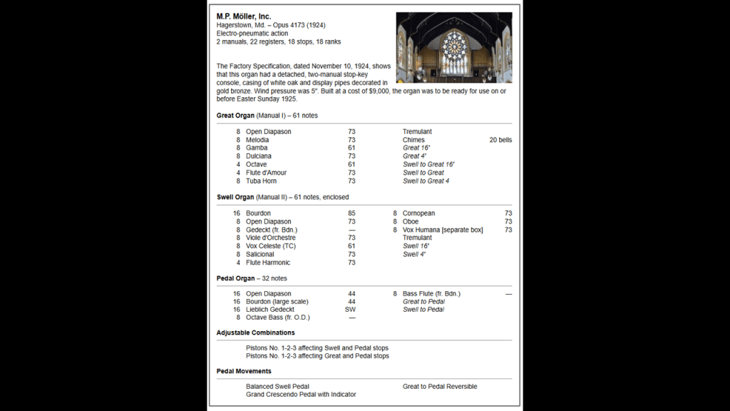
Notice how these organ pipes are situated around the Cathedral’s Rose window.
Cathedral Rose windows look like the cymatic patterns of musical notes.
With the massive organ pipes surrounding the cathedral rose windows, it appears as though this was a musical system designed to generate waves of specific frequencies, like Solfeggio frequencies, through this type of window.

Solfeggio frequencies make-up the ancient six-tone scale used in sacred music, like, for example, Gregorian chants and Tibetan singing bowls.
Each solfeggio tone is a frequency that can be used to balance one’s energy and keep one’s body, mind, and spirit in harmony.

The modern suppression of solfeggio frequencies is an issue for Humanity.
The current musical scale is not tuned into the solfeggio frequencies, and the results of this are believed to negatively affect our thinking skills and emotional states.

Pipe organs are musical instruments that produce sound by driving pressurized air through organ pipes selected from a keyboard.
In biology, what is called an organ is a collection of tissues that structurally form a functional unit specialized to perform a particular function, from the Latin “organum,” meaning an instrument or tool.
Makes me wonder if similarly, pipe organs produced specific frequencies at specific times for specific reasons as needed by the system as a whole.

But sound and frequencies can result in destruction as well.
Resonance occurs in oscillating systems when an external force with the same natural frequency causes a rise in amplitude, which results in a net rise of mechanical energy, and this phenomenon leads to excessive vibrations and structural failure when a forced resonant frequency is applied.

Like Fordham Manor, West Farms was said to have been granted as letters patent in 1666, in this case to Edward Jessup and John Richardson of Westchester, who were said to have jointly purchased the land “of the Indyan Proprietors.”
I just have to say here that the year of 1666 that these places of Fordham Manor and West Farms in the Bronx were founded just screams at me.
The year of 1666 was the same year that Isaac Newton famously observed the falling apple upon which he developed his foundational law that gravity is universal.

This was the same year as the Great Fire of London, which swept through central London in the same area the City of London occupies today.
The City of London, also known as “the Square Mile,” is the primary Central Business District of London, and all the major banks today operate from the City.
Its “sister cities” are Washington, DC, and the Vatican.
All three are not considered any part of the country they are located in.

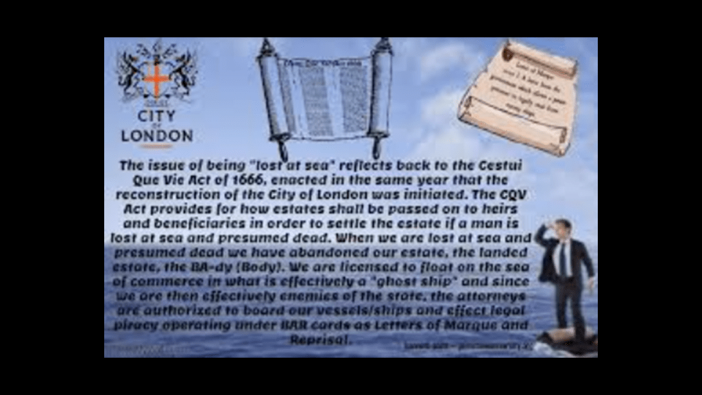
It was also the year that the Cestui Que Vie Act was passed by the British Parliament, after the 1665 Great Plague and 1666 Great Fire in London.
The Cestui Que Vie Act of 1666 subrogated the rights of men and women, meaning all were declared dead or lost at sea.
The government took custody of everybody and their property into a trust, and the state became the trustee, holding all titles to people and property until a living person comes back to reclaim those titles.
The year of 1666 was also the year that Sabbatai Zevi, Jewish Mystic and student of the Kabbalah, was proclaimed Messiah by Nathan of Gaza.

Sabbatai Zevi and his follower Jacob Frank brought Sabbatean-Frankism to the world.

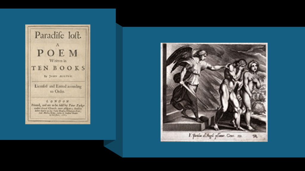
And the following year, in 1667, John Milton’s poem “Paradise Lost” was published.
As related in the poem, newly banished Fallen Angels organize, and the fallen angel Lucifer, now referred to as Satan, volunteers to corrupt the newly created Earth and God’s new and most favored creation, Mankind.
He goes to the Garden of Eden, and convinces Eve by duplicity to eat of the fruit of the tree of knowledge of good and evil, which directly led to their expulsion from the Garden of Eden.

I think this was original disclosure about what has taken place here – Paradise was lost, and we were brought to the corrupted, inverted world we live in today.
There is more happening around this time in our historical narrative, but this gives you the idea that 1666 was a very important year for the Controllers in our current timeline.
So, now I am going to continue on with taking a tour around the Bronx from the photos that DM sent me.
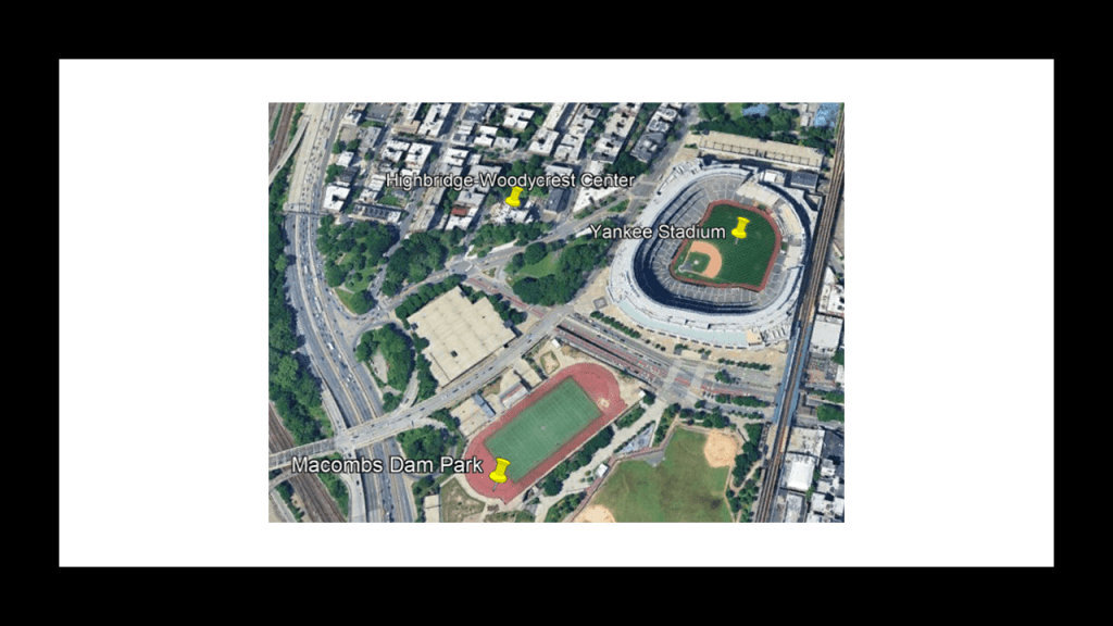
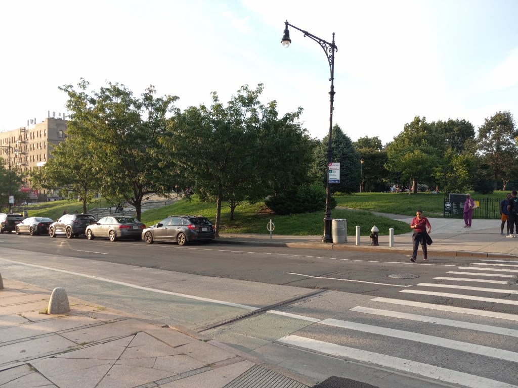
She drew my attention to Woodycrest Park and Woodycrest Center.
This is what she said in her email to me.
“Woodycrest Park is a very small park located on Jerome Avenue and Woodycrest.”
“A few blocks from the Joker stairway.”
She continues “It is across the street from the old world Woodycrest Center…Formerly a home for boys. Very steep hill…Extremely mud flooded. Now all cleaned up. Refaced. Spires and Cones all gone….As a child growing up in Harlem in the 1960’s, on the other side of the East River ( Harlem River ), we walked across the McCombs Dam Bridge bridge to go to the movies. We always could see what we called the haunted house because it was dark, dingy and creepy looking. We called it that until High School when my classmate told me the name of it and that he lived there all his life.”
What I could find out about Woodycrest Center today is that is Skilled Nursing facility and a pioneer in HIV-AIDS treatment.
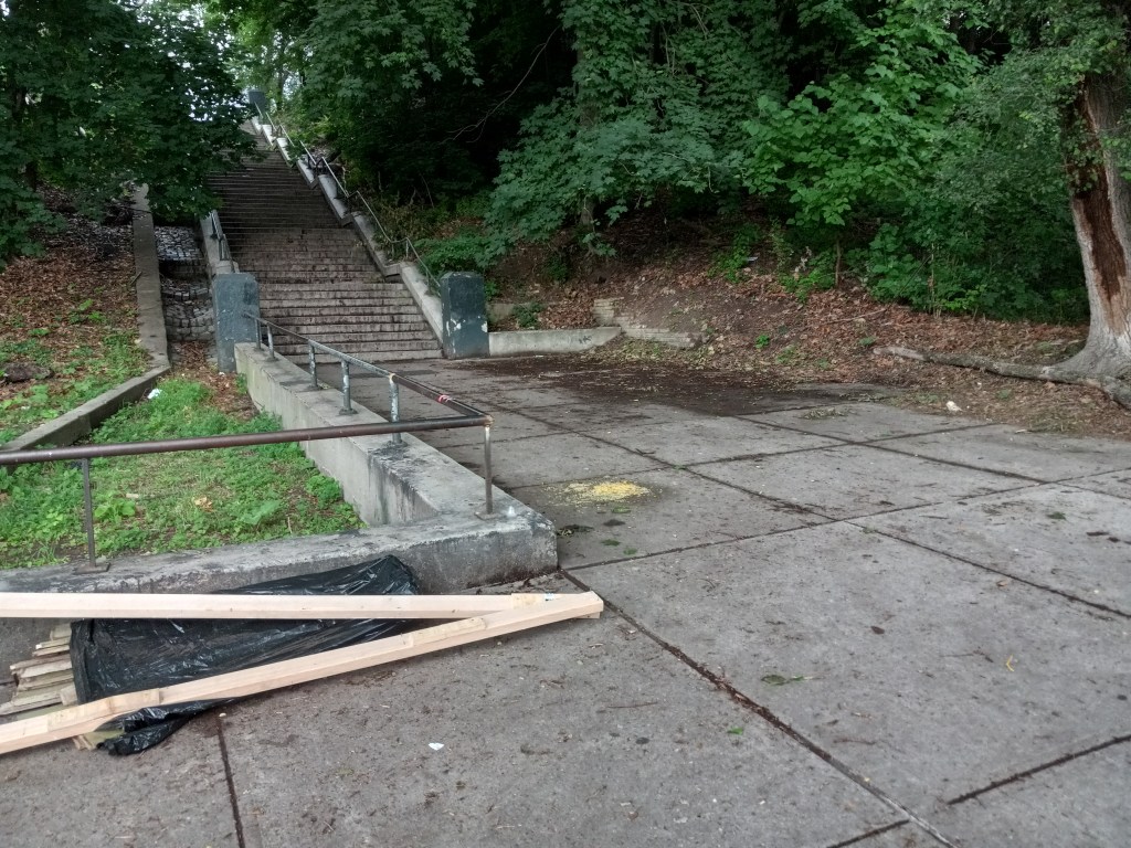
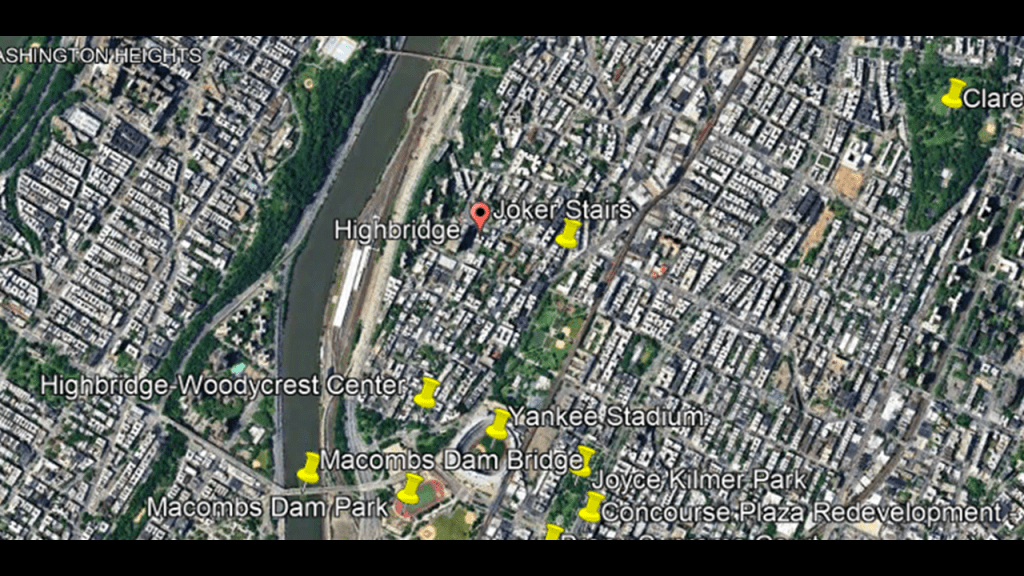
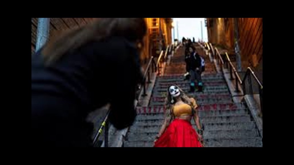
She had mentioned this location is near what is best-known today as the “Joker Stairs.”
Officially the West 167th Street Step Stairs, which connect Shakespeare and Anderson Avenues at West 167th Street near the subway station there in the Highbridge neighborhood, were a filming location for the 2019 film “Joker,” and later were in its 2024 sequel, “Joker: Folie a Deux,” released in September of this year.
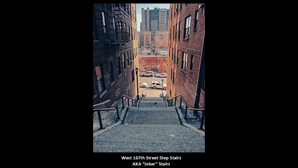
In, for example, the 2019 film, Arthur Fleck walked up and down these stairs as part of his daily routine.
Fleck was a failed clown and wanna-be stand-up comedian whose descent into mental illness turns into an alter-ego known as the “Joker,” and inspires a violent countercultural revolution against the wealthy in the decaying Gotham City.
Towards the end of the film, he dances down the stairs to rock-and-roll music wearing a brightly-colored suit and clown make-up, representing a change in his character.
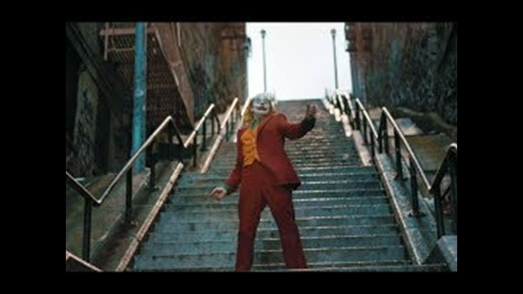
This has resulted in these stairs becoming a tourist destination, and a place where people re-enact the scene in imitation of the “Joker” character, sometimes in costume, sometimes not.
I will revisit this subject later in this post with my thoughts about what I think is its significance.
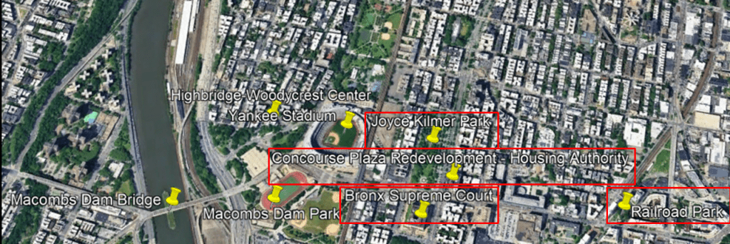
Woodycrest Center is right across from the location of Yankee Stadium in this part of the Bronx.
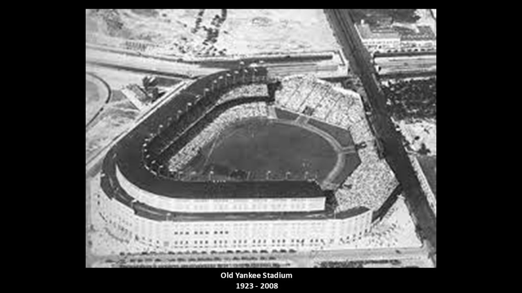
The old Yankee Stadium was said to have been built in 1923 next to the Macombs Dam Park.
The old Yankee Stadium was in use between 1923 and 2008.
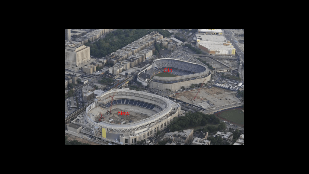
Over the course of its history, the old Yankee Stadium became one of the most famous venues in the United States
Its nickname was “the House that Ruth Built” after Babe Ruth whose best years as a baseball player and home-run hitter coincided with the stadium’s opening and the beginning of the winning history of the New York Yankees.
We are told that Macombs Dam Park first opened in 1899 when the Bronx was still mostly farmland, and that land for the park had been set aside to ensure the developing neighborhood would be livable and sustainable.
In today’s world, Macombs Dam Park, in today’s world, Macombs Dam Park, along with this whole area we have been looking at in the Bronx, is in New York’s 16th-Congressional District.
New York’s 16th-Congressional District is ranked as the poorest in the United States.

The Macombs Dam Bridge crosses the Harlem River that connects Manhattan and the Bronx.
This is an historic view DM sent me of the Macombs Dam Bridge from Harlem.
DM also sent me these photos she took herself of the old stonemasonry foundations of the Macombs Dam Bridge.
We are told that this site was originally the location of a dam that also served as a bridge that existed from 1816 to 1858, and that the current bridge has been there since 1890.
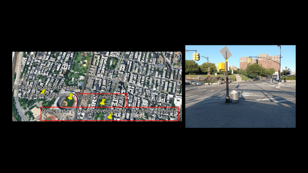
Still in the same general area, DM also sent me photos she took of Joyce Kilmer Park; what is now the Concourse Plaza Redevelopment Housing Authority; the Bronx Supreme Court; Railroad Park; and Franz Sigel Park.
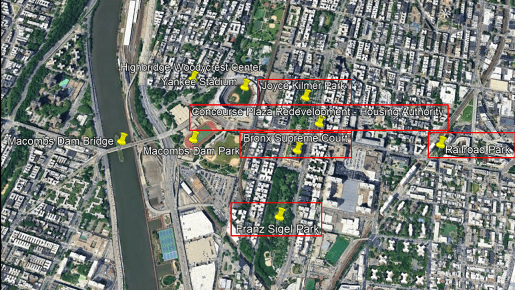
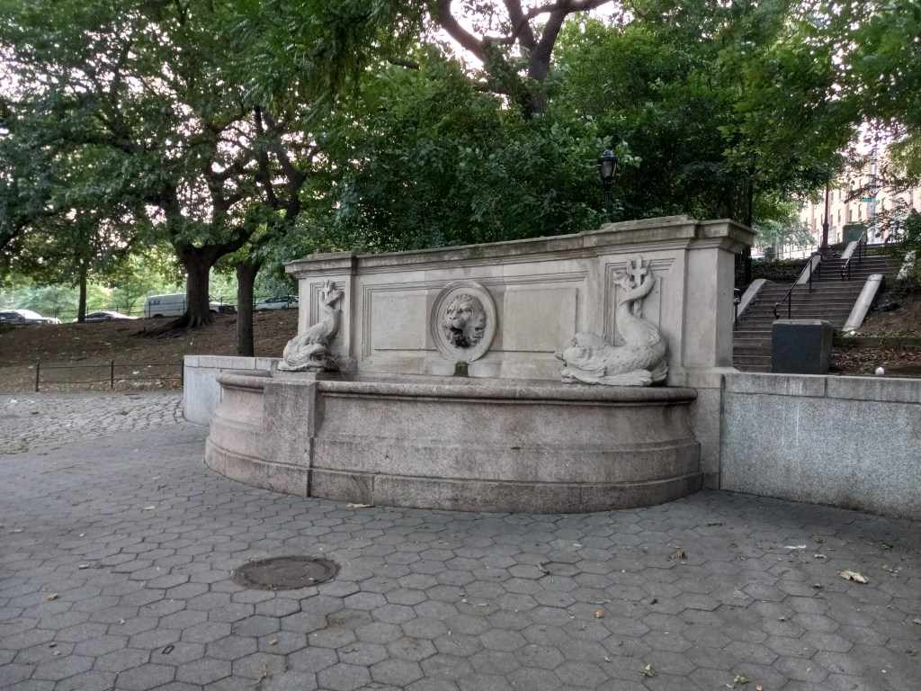
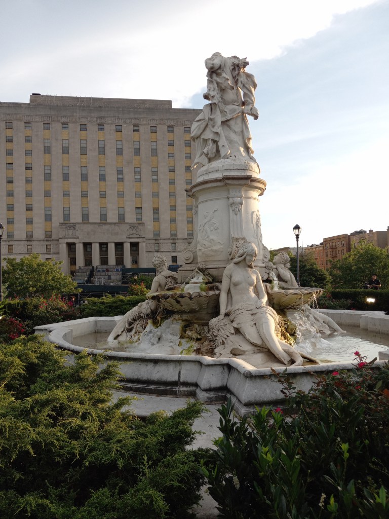
The Joyce Kilmer Park highlighted at the top of the screenshot is located from 161st to 164th streets between what is called the Grand Concourse and Walton Avenue.
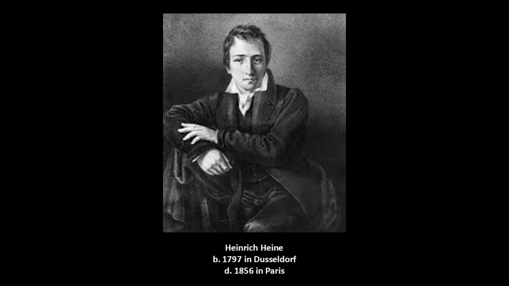
We are told that the Heinrich Heine Fountain at this park pictured here honors a German poet, writer and dissident who never lived in the United States.
This fountain is said to depict “Die Lorelei,” after a poem written by Heine that immortalized a mysterious creature of German Romantic Legend seated on a rock in the Rhine River, surrounded by mermaids, dolphins and seashells.
In the legend of the Lorelei, the maiden was transformed into a siren, a female humanlike being with an alluring voice, after throwing herself into the river.
Afterwards, she hypnotized sailors with her singing, causing them to fall asleep and leading to their deaths.
It is interesting to note here, along with the odd honoree and odd subject matter of the fountain, that this same poet Heinrich Heine, who lived from 1797 to 1856, was considered to be a member of the Young Germany movement and his radical political views led to many of his works being banned in Germany, and who spent the last 25-years of his life living as an expatriate in Paris.
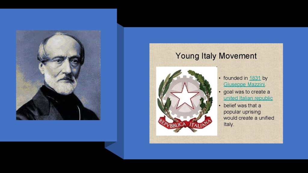
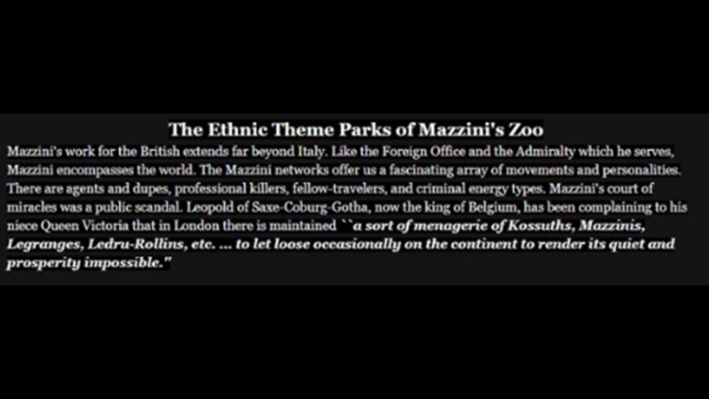
“Young Germany” was an outgrowth of the Young Italy movement started by Giuseppe Mazzini, who had founded a political movement for Italian youth (under age 40) in 1831.
In “The Secret Founding of America” book by Nicholas Hagger…

…on page 174, we find the name of “Giuseppe Mazzini,” taking over the Illuminati in 1834.
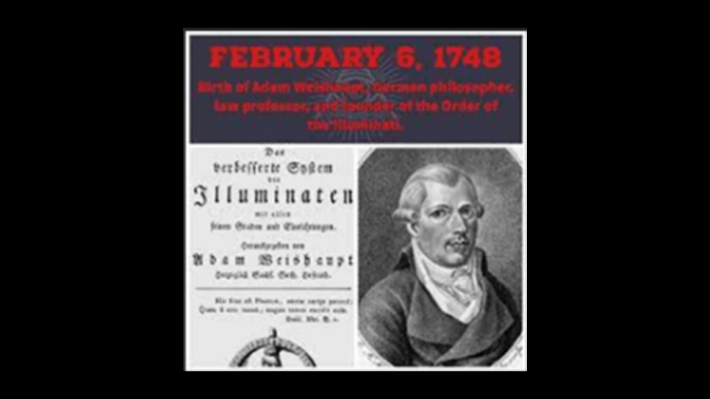
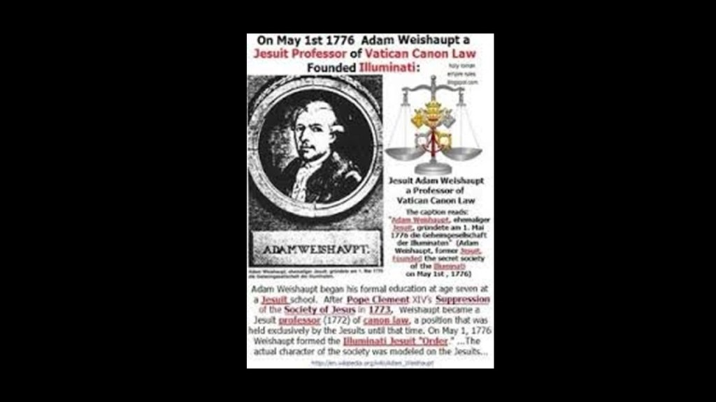
Adam Weishaupt established the Bavarian Order of the Illuminati on May 1st of 1776.
Born in Ingolstadt, Germany, in February of 1748, Adam Weishaupt was educated by Jesuits starting at the age of 7, and was initiated into Freemasonry in Munich in 1777.
He died in Gotha in Germany, under the protection of Duke Ernest II, of Saxe-Gotha-Altenburg in 1830.
The lineage of the Duchy of Saxe-Gotha-Altenburg eventually became the House of Saxe-Coburg & Gotha, to which first-cousins Queen Victoria & Prince-Consort Albert both belonged, which became known to us as the House of Windsor in 1917.

I even found the House of Saxe-Coburg & Gotha in the Republic of Texas.
The Mainzer Adelsverein, or “Nobility Society of Mainz ,” was organized on April 20th of 1842 as a colonial attempt to establish a new Germany within the borders of Texas through organized mass immigration, and land was purchased via land grants from the Republic of Texas.
One of the founding members of the Adelsverein was Ernest II, the Duke of Saxe-Coburg & Gotha, and the older brother of Prince Albert, Queen Victoria’s husband.
Organized German communities in Texas included: New Braunfels; Bettina; Castell; Leningen; Meerholz; Schoenberg; Indianola; Fredericksburg; Sisterdale; Tusculum; New Ulm; Gruene; and Schertz.
The Adelsverein was said to have ended its colonization campaign in 1853 due to a large amount of debt.

The obscure Heinrich Heine’s autobiographical works touched on his political ideas, which were heavily-influenced by Johann Wolfgang von Goethe (1749 – 1832).
Goethe was widely regarded as the greatest and most influential writer in the German language.
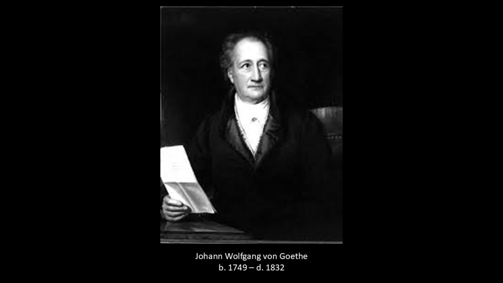
Goethe was an early participant in what was called the “Sturm und Drang” movement, which started for all intents and purposes from the mid-1760s to the late 1780s, so approximately 15-years.
“Sturm und Drang” translates to “Storm and Stress” in “English.
In the “Storm and Stress” movement, which along with literature, included music, visual art and theater, individual subjectivity and extremes of emotion were given free expression in reaction to the perceived restraints of rationalism imposed by the Enlightenment, which extolled an objective view of life.
So the extremes of emotion in this movement included expressions of greed, violence, disturbing visions, nightmares, terror, murder, and other emotionally provocative subjects.

The “Sturm und Drang” movement sounds very much like the “Surrealist” movement that began in the early 20th-century.
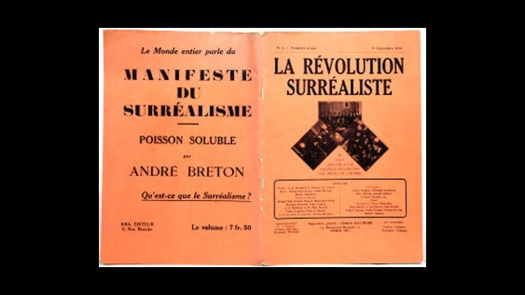
Surrealism was an artistic and literary movement that started in France and Belgium in 1917, and on the surface, one of its aims, we are told, was to release the creative potential of the unconscious mind by the juxtaposition of irrational images.
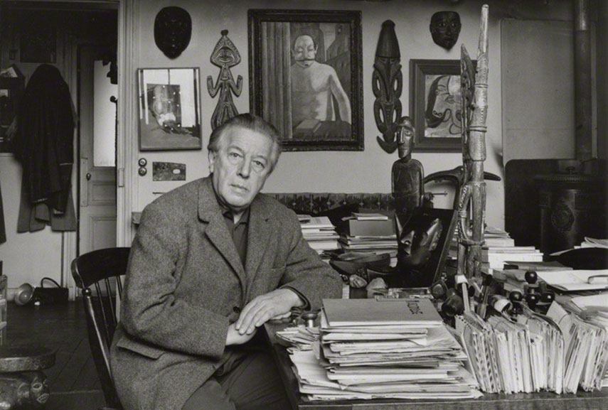
Beneath the surface, the founder of Surrealism, Andre Breton, was a dedicated Marxist. He got his start in the Dada movement, which was said to have developed in reaction to World War I by artists who rejected the logic, reason, and aestheticism of modern capitalist society, instead expressing nonsense, irrationality, and anti-capitalism protest in their works.
He wrote his first of four Surrealism Manifestos in 1924.
The Surrealists sought to overthrow the oppressive rules of modern society by demolishing its backbone of rational thought by tapping into the “superior reality” of the subconscious mind.
The Surrealists hailed the development of the “Paranoiac-critical” surrealistic technique in the 1930s by Salvador Dali, in which the artist invokes a paranoid state, that was said to result in the deconstruction of the concept of identity, allowing subjectivity to become the primary aspect of the artwork.
This is Dali’s “Metamorphosis of Narcissus,” his first painting resulting from this technique in 1937, and currently at the Tate Modern art museum in London.
Like the “Sturm und Drang” movement, the Surrealism movement definitely seemed to promote mental illness and the breakdown of society!
The establishment in 1765 of the Freiburg University of Mining and Technology, the oldest school of mining and metallurgy in the world, by Francis Xavier of Saxony of the House of Wettin, coincided with the beginning of the “Sturm and Drang” movement in Germany in the 1760s.
Its main purpose was the education of highly skilled miners and scientists in fields connected to mining and metallurgy.

Queen Victoria and Prince Albert, first-cousins and members of the House of Saxe-Coburg and Gotha, were part of what was called the Ernestine branch of the same House of Wettin.
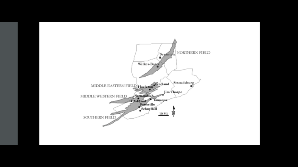
Just ten-years after the Freiburg University of Mining and Technology was established, Anthracite coal was first mined in Pennsylvania in Wilkes-Barre in 1775, the same year as the beginning of the American Revolutionary War.

We are told that anthracite coal-mining fueled urban development in the region, resulting in a string of towns, industries, mines, roads and rail-lines to the south.
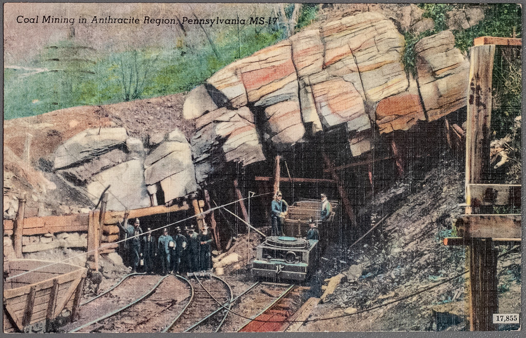
We are told the “Anthracite Region” of Pennsylvania was where the story of “where America was built” began, and was home at one time to major anthracite coal supplies and the mine-to-market process, with a legacy of intense mining, industrial development and rich mixture of ethnic cultures.

Anthracite coal is the purest form of coal, and this region contains most of the world’s supply of anthracite coal, and found in alternating layers of rock said to have been folded into mountains and created by a geological process called “coalification.”
We are told the American Canal Age was between 1790 and 1855, and started in Pennsylvania, where the first legislation surveying canals was passed in 1762, and that the construction of the Union Canal between Middletown and Reading and was said to have started under the administration of President George Washington in 1792, and completed in 1828, and was touted as the “Golden Link” in providing an early transportation route for shipping anthracite coal and lumber to Philadelphia.

The construction for this canal would have started less than ten years after the end of the American Revolutionary War in 1783, supposedly during a time in our history when society was based on agriculture and not technologically advanced.
Keep in mind they were said to have been doing all of this heavy construction work before the start of the Industrial Revolution in America, which would have been in the 1870s according to our historical narrative.
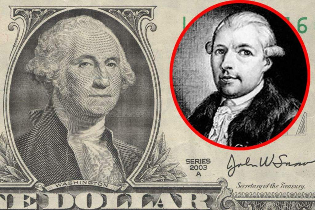
It’s been speculated on alternative media for quite awhile that George Washington and Adam Weishaupt were the same person.
So at the very least they were contemporaries, since the Declaration of Independence was signed on July 4th of 1776, only two-months after Adam Weishaupt established the Bavarian Order of the Illuminati on May 1st of 1776. later.
But nah, that’s probably just another conspiracy theory!
Yet the label of conspiracy theory or theorist has been effectively used to disparage and shut down anyone who dares to question the narrative.

The word “gothic” has several meanings pertaining to darkness here.
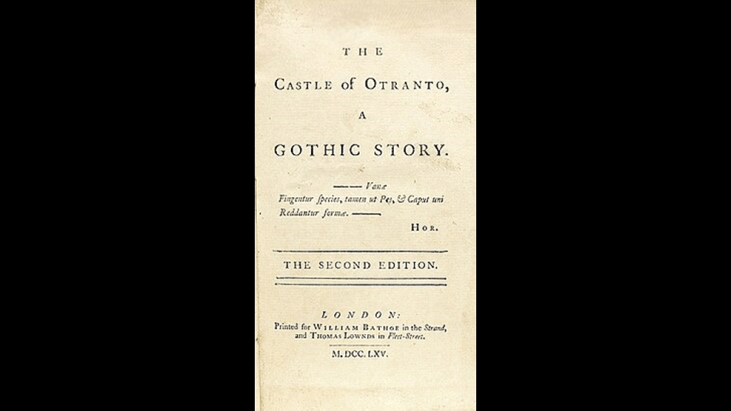
Gothic fiction, sometimes called Gothic horror, started with the publication of Horace Walpole’s 1764 novel “The Castle of Otranto” which was later subtitled “A Gothic Story.”
The setting was a haunted castle, and the plot was filled with psychological terror.
The publication of this story was said to start this literary genre that was extremely popular in th 18th-and-19th-centuries, like that of the previously-mentioned Edgar Allan Poe, Mary Shelley (Frankenstein), Bram Stoker (Dracula) and Robert Louis Stevenson (Dr. Jekyll and Mr. Hyde).
Gothic fiction has such characteristics as an environment of fear; supernatural events; and the intrusion of the past onto the present.
Settings were said to include physical reminders of the past, like ruined buildings which stand as proof of a once-physically-thriving world in a state of decay.
Like the example of the ruins of Wolf’s Crag Castle in Sir Walter Scott’s 1819 historical novel “The Bride of Lammermoor.”
What are called “moors” or “moorlands” feature prominently in gothic fiction, and often depicted not only as a refuge from things like abuse, but also ominous and threatening places, and the location of supernatural encounters took place.
“Moorlands” are described as being characterized by low-growing vegetation on acidic soils, and includes uncultivated hill-land, as well as low-lying wetlands, including bogs like what we have seen in North America.
Moors are also frequently covered by massive cut-and-shaped stones.
I see the memory of the Moors and their advanced and worldwide civilization after its destruction being retained in place-names like these, like the name of “Morris” we saw earlier in the Bronx.

Then there are “goths.”
In today’s world, people who identify as “goths” are part of a subculture that started in the United Kingdom in the early 1980s that embraces dark themes in clothing styles, music, make-up, and so forth.
They are inspired by the gothic arts and liteature of the 1700s and 1800s, as well as horror films.
“Goths” are considered free-thinking and value freedom of expression.
And the “goths” I have known from earlier in my life were troubled kids from broken homes.

The previously-mentioned “Joker” movies filmed in the Bronx took place in “Gotham City,” like all the Batman-related content.
The Batman superhero first appeared in DC Comics in March of 1939.
Gotham City is the primary city appearing in DC Comics, and while New York City has long-been associated with Gotham City, it is depicted as a metropolitan city in the northeastern United States, and one of the the most crime-ridden cities in the world.

And lastly with all these similar sounding words and names that come to mind, I want to bring forward the similar sounding word of “goetia.”
“Goetia” is defined as a type of European sorcery, or witchcraft, transmitted through “grimoires,” or instruction manuals for magical practices, which includes spell-casting and summoning supernatural entities of different kinds, including demons.
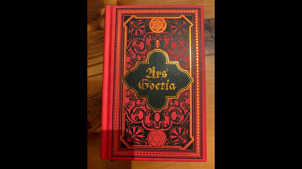
The “Ars Goetia”in particular is considered the “Grand Grimoire,” and lists the main demons, including “Baal” at the top of the list.
I think what we are seeing playing out in our world today is that demonic forces found their way into this world within the last couple of hundred years after destroying the Old World that was ancient and highly advanced in all ways, both technologically and spiritually, by a deliberately-caused cataclysm through the Earth’s original energy grid; and that these parasitic demonic forces have created a New World based on their darkness involving extreme psychological abuse, trauma, and torture in these high-energy and technologically-advanced places, given us an occulted “dark” culture, and have been implementing their desire to break our spirits and psyches in order to turn us into an energy source for them and ultimately to turn us in to them without us even being aware of it, using MK Ultra in all aspects of our lives, not just what is out there to find about the MK Ultra abuse and trauma on an individual level surrounding the Montauk Project on eastern Long Island.
They have given us cultural icons like the Joker, the messed-up person who descended into insanity and whose alter-ego became a criminal mastermind, and people actually celebrate him by going to the “Joker Stairs” as a tourist-destination and imitating him without questioning why that would even be thing, and the same idea with the “Exorcist Steps” in Georgetown.
They want a messed-up and controllable Humanity in their image, and not a Humanity that is functioning at a high-level of consciousness in the image of God

More on this subject to come throughout this post, but for now back to DMs photos of places around the Bronx.
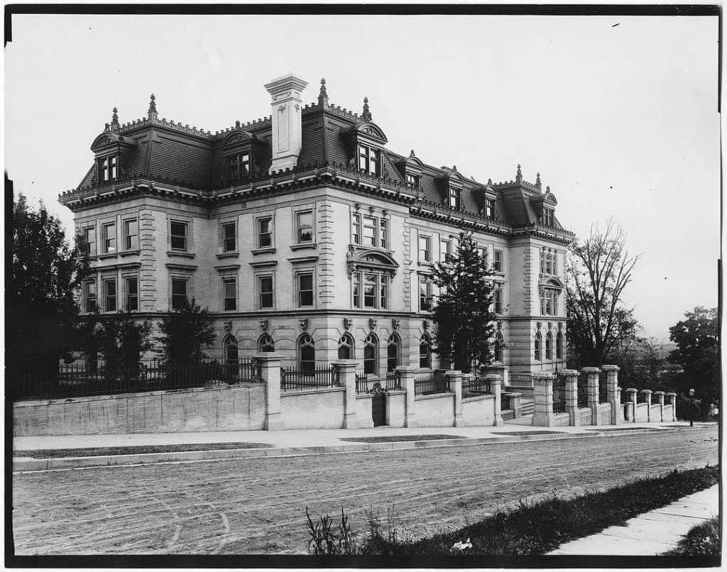
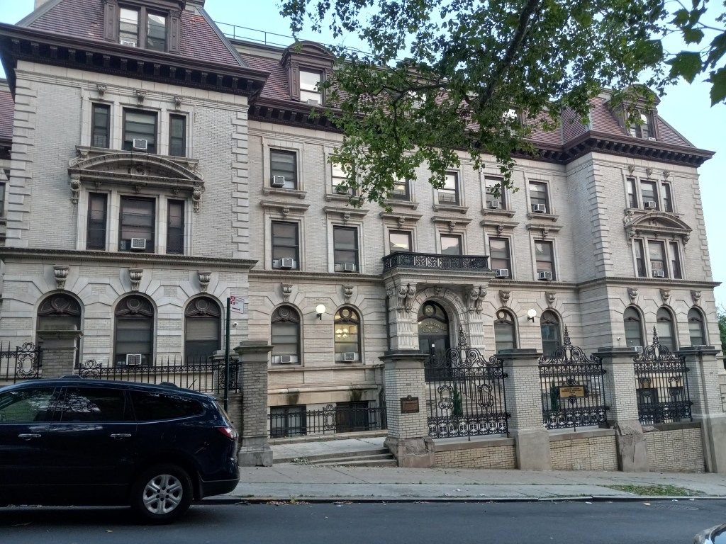
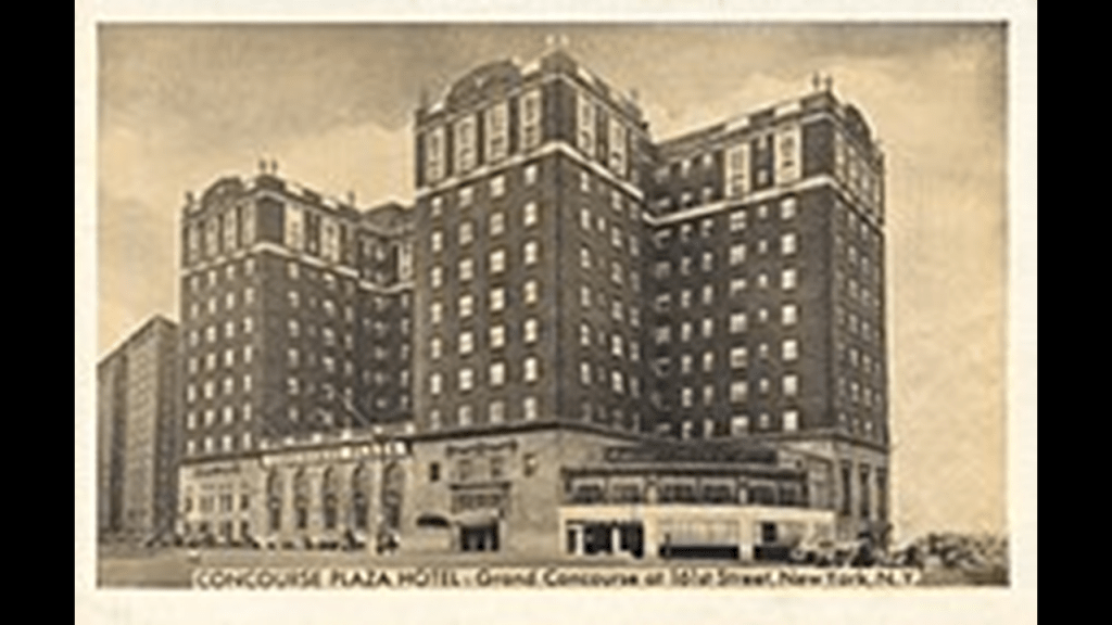
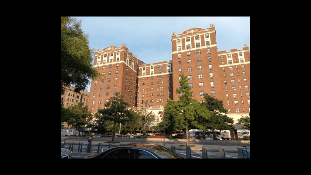
In the next block down from the Joyce Kilmer Park is what used to be the Concourse Plaza Hotel and today is the Concourse Plaza Redevelopment Housing Authority.
The Concourse Plaza Hotel was a luxury hotel for which the construction was said to have started in 1922, and it first opened in 1923.
In it’s hey-day, it was the location for Presidential campaign stops and host to major sports stars.
It had a grand ballroom and four smaller banquet halls, and for years was considered the best location in the Bronx for social, business and fraternal events.
Then starting in 1957, we are told, the hotel starting experiencing financial difficulties, and subsequently went through a series of new owners, who also experienced financial difficulties.
Then during the 1960s, the surrounding neighborhood diminished in value, and by 1968, it became what was called a “welfare hotel” for poor families who relied on the government for shelter.
The property was bought by New York City in 1974 and was turned into the low-income residence for seniors it is today.
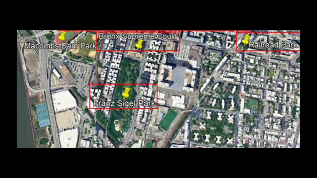
The next two places we come to going down from Joyce Kilmer Park and the Concourse Plaza building are the locations of the Bronx Supreme Court and Railroad Park.
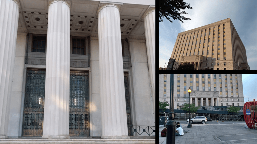
The Bronx County Courthouse, also known as the Bronx County Hall of Justice, which houses the Bronx Supreme Court, was said to have been designed in the Art Deco style in 1931, and built between 1931 and 1934, which would have been in the middle of the Great Depression, which lasted between 1929 and 1939.
There appears to be a disproportionately large-to-our-size entrance-way here at the courthouse, like what we saw back at the Rainey Memorial Gates at the Bronx Zoo.
The Bronx Supreme Court handles civil cases over $50,000, like medical malpractice, labor laws, and motor vehicle cases.
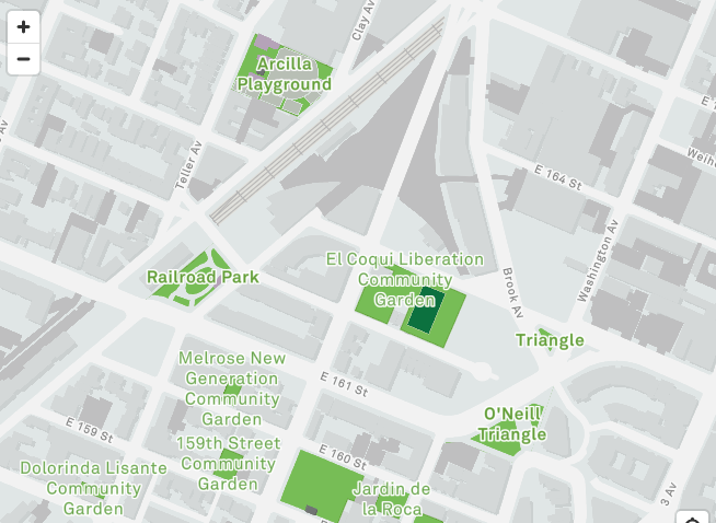
The next place DM sent me photos of was Railroad Park, located from 161st to 162nd between Park Avenue to Courtlandt Avenue. in the Melrose neighborhood of the Bronx.
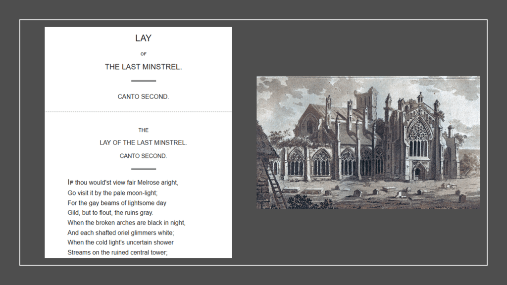
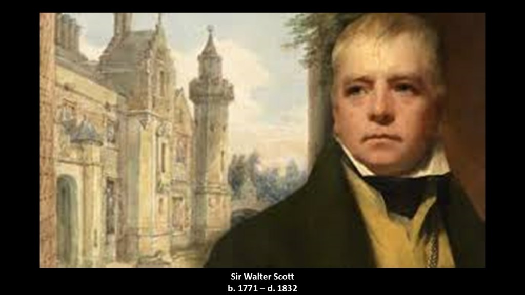
We are told that the Melrose neighborhood was named by a Scottish surveyor as a tribute to the Melrose Abbey mentioned in Sir Walter Scott’s poem “The Lay of the Last Minstrel, Canto Second.”
Melrose Abbey is a ruined monastery in Scotland.
Come to find out, Sir Walter Scott’s literary work had a major impact on European, American and Scottish literature, in a similar fashion to the impact that Goethe had on German literature, and both men died in the same year of 1832.
What we are told about this part of the Bronx is that the Morris family was selling sections of their property mainly to German immigrant families in the 1850s as part of their land-grant from the British crown in the 17th-century, and that the coming of rapid transit in 1908 transformed this place into a bustling urban area.
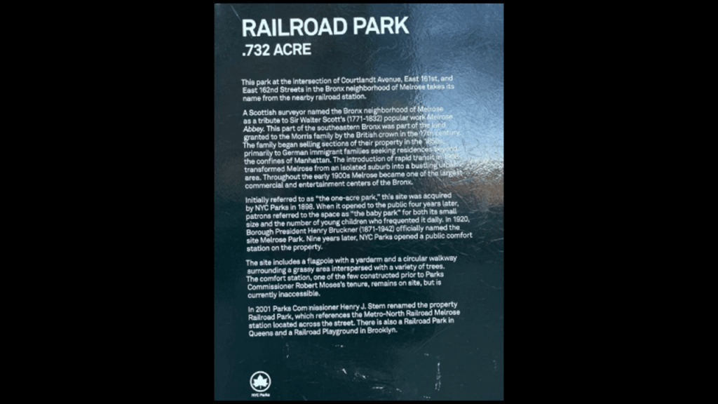
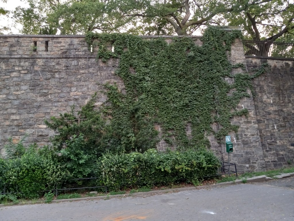
There is an abandoned railroad station at the park, though the Metro-North Railroad’s Harlem Line still run underground right by the park.
DM also sent me photos of Sigel Park, which is located from 153rd to 158th street between the Grand Concourse and Walton Avenue, just below the Bronx County Courthouse/Supreme Court building.
Franz Sigel Park is an urban green space that was named for an obscure historical figure who was a German-immigrant to the United States in 1852
Here are DMs photos from Franz Sigel Park.
Franz Sigel immigrated to the United States from Baden in Germany. after participating in the Revolutions of 1848 as a military officer leading the Baden Revolutionary Forces against the Grand Duchy of Badenwho defeated Sigel’s militia that same year in our historical narrative.

The Revolutions of 1848 were a series of political upheavals throughout Europe that year.
What we are told is that the Revolutions had the goal of removing the old monarchical structures and creating independent nation-states, and was the most widespread revolutionary wave in Europe’s history, with 50 countries being affected.
But from all my research of the time-period and the people involved, including, but not limited to, my blog post “Freemasons, Bankers, Revolutionaries & Civil Wars…
…I have come to the conclusion that the actual goal was to remove the original ancient ruling families, and ultimately replace them with a new form of government, which was ultimately controllable.

All indications are that the Italian revolutionary, Giuseppe Mazzini, leader of the Bavarian Order of the Illuminati during this time, was a major player behind the Revolutions of 1848.

So in our historical narrative, Franz Sigel immigrated to America in 1852, after the Revolutions of 1848, and he was considered one of the German “Forty-Eighters.”
The “Forty-Eighters” were Europeans who left their countries to immigrate to other countries after the “Revolutions of 1848,” for given reasons such as disappointment with their failure to to permanently change the government in places like Germany or the Austrian Empire, or because they were ordered by the governments to leave because of their revolutionary activities.
The “Forty-Eighters” tended to be respected, wealthy, well-educated and politically active, and successful in their new countries.
“Forty-Eighters” emigrated primarily to the United States, South America, United Kingdom and Australia.
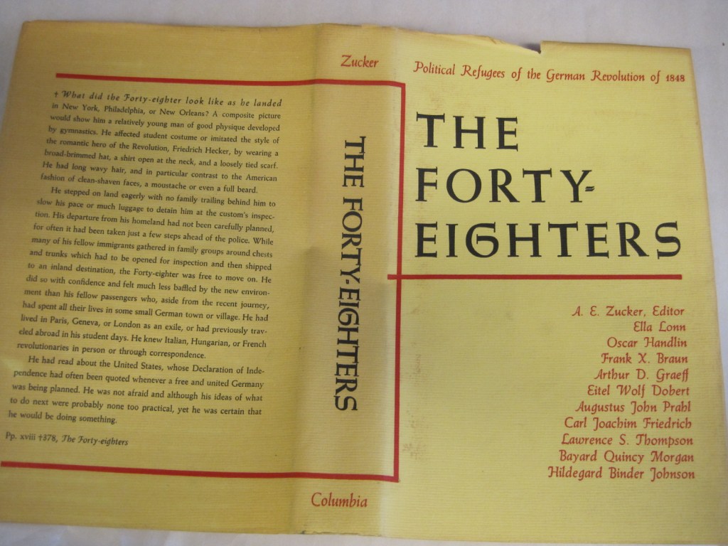
Many of the German “Forty-Eighters” who came to America landed in places like Wisconsin, Missouri, Ohio and Texas, where they developed beer and wine industries and agricultural enterprises.

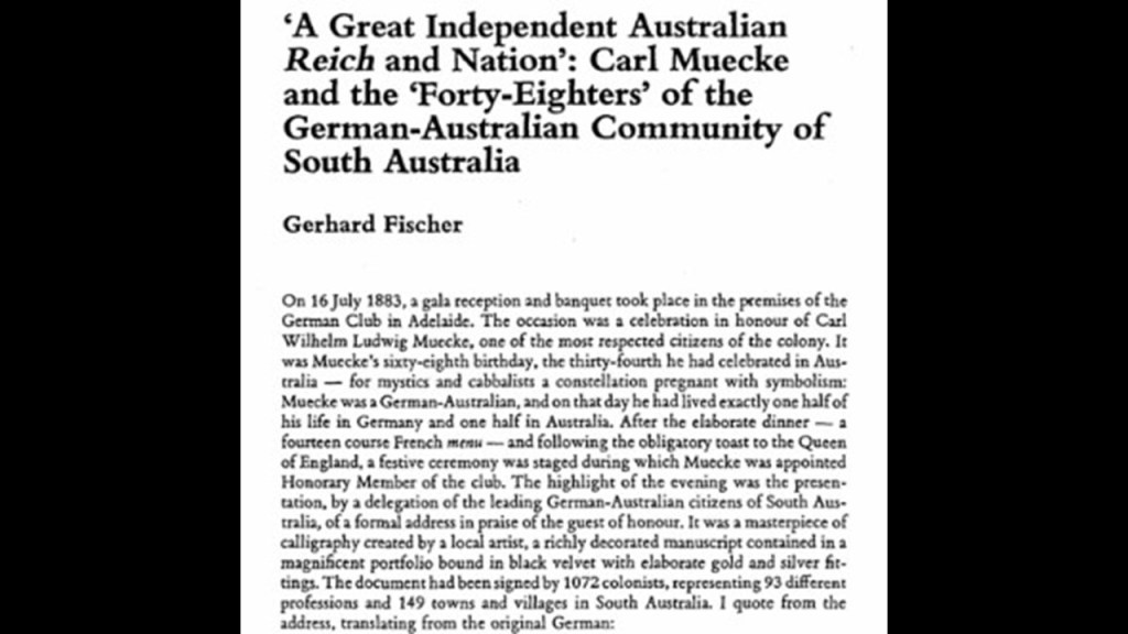
The German “Forty-Eighters” who came to Australia were mainly middle-class professionals of all kinds – from academics and engineers to artists and musicians.
Many became vintners or worked in the wine-industry.
We are told that a German Club was founded in Adelaide in 1854, and played a major role in Australian society.
The “Forty-Eighter” Franz Sigel we find honored in a Bronx park bearing his name lived and worked as a teacher in New York City upon his arrival there, and moved to St. Louis, Missouri, in 1857, where he became a professor at the German Institute there, where there was a huge German immigrant population that became very active during the American Civil War, and Missouri as a border state was a hotbed for both sides of the conflict.
Sigel was commissioned as a colonel of the 3rd Missouri Infantry Regiment in the Union Army, and by August of that year, we are told that President Lincoln had elevated him to the rank of Brigadier-General.
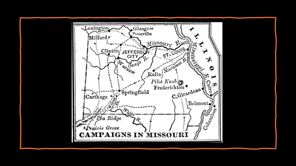
Sigel was listed as having been involved in five civil war battles – Battle of Carthage (Missouri); Battle of Wilson’s Creek (Missouri); Battle of Pea Ridge (Arkansas); Second Battle of Bull Run (Virginia); and Battle of New Market (Virginia).
There are two in particular I would like to bring to your attention – The Battle of Wilson’s Creek and the Battle of Pea Ridge.
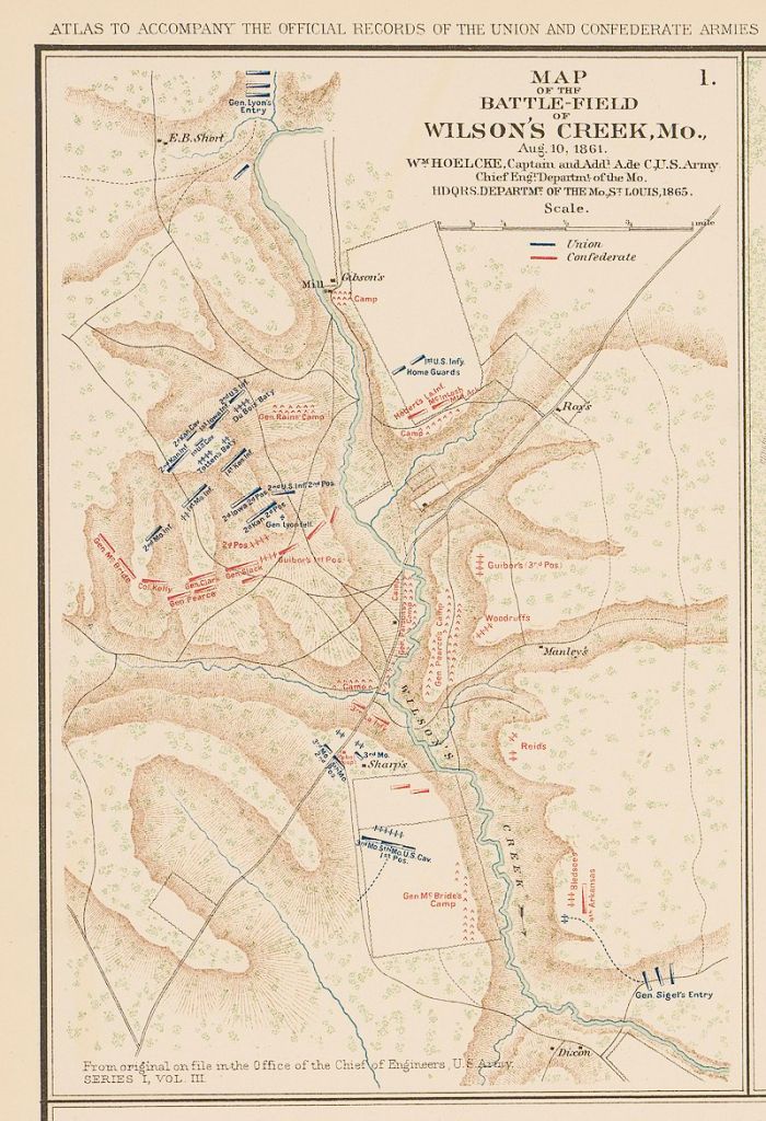
The Battle of Wilson’s Creek was the first major Civil War battle west of the Mississippi, with a date for it given of August 10th of 1861 near Springfield, Missouri.
By the end of the day in our narrative, the battle was called for Confederate forces and as a result, gave control of southwestern Missouri to the Confederates.
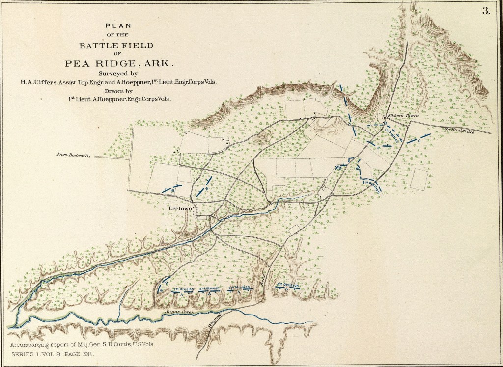
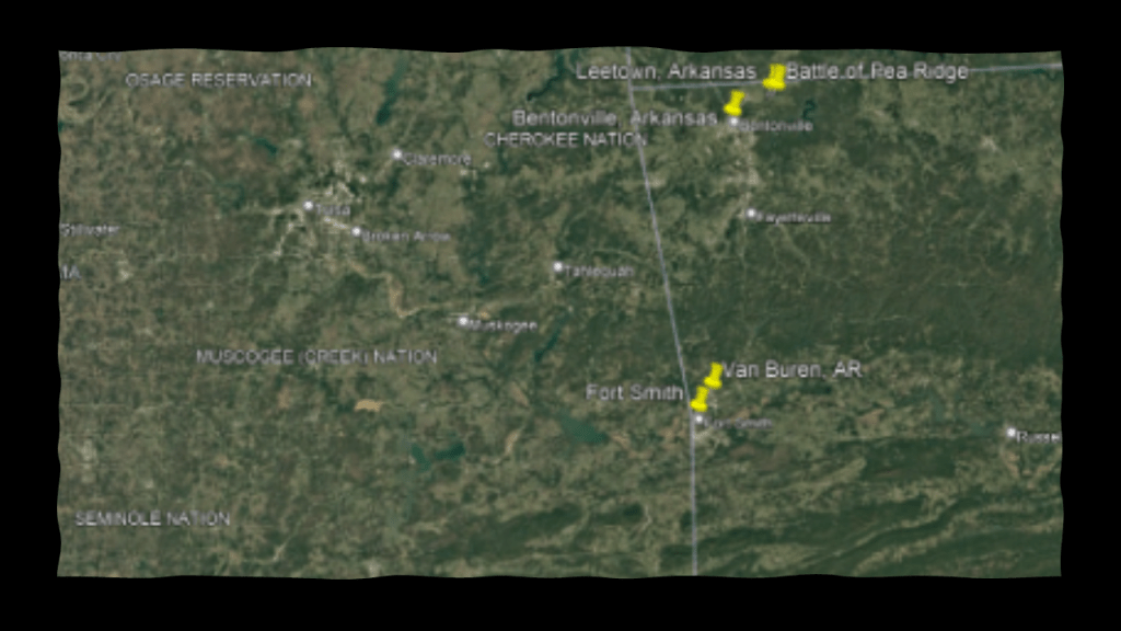
The Battle of Pea Ridge took place in northwestern Arkansas on March 7th – 8th of 1862, near Lee Town in Benton County, Arkansas, not far from the Missouri and Oklahoma State lines of today.
Over the course of the two-days of this battle, there was action in Bentonville.
Bentonville is the county seat of Benton County.

Bentonville is noteworthy as the birthplace and headquarters of the world’s largest retailer, Walmart.

The Battle of Pea Ridge was won by Union Forces, with over half being German immigrants under Sigel’s command, and for a time, established federal control over most of Missouri and northern Arkansas.
Both of these battles took place in the Trans-Mississippi Theater of the American Civil War.
The Trans-Mississippi Theater of the Civil War covered everything west of the Mississippi River as pictured here.
We are told that there were all together 7 battles in Arkansas, New Mexico, Missouri and Louisiana between 1862 and 1864 in the Trans-Mississippi Theater of War.

As a matter of fact, the Trans-Mississippi Department was a geographical subdivision of the Confederate Army.
When Union forces under General Ulysses S. Grant captured the Confederate stronghold of the port of Vicksburg on July 4th of 1863 and divided the Confederacy, Confederate General Edmund Kirby Smith’s forces were cut off from the Confederate Capital of Richmond, Virginia.
At the time, Edmund Kirby Smith was the Commander of the Trans-Mississippi Department, and for the rest of the Civil War, he remained west of the Mississippi River.
As a result of being cut-off from Richmond, Kirby Smith had free reign in a nearly independent area of the Confederacy, and the whole region became known as “Kirby Smithdom” and nobody really knows what was going on there during that time.

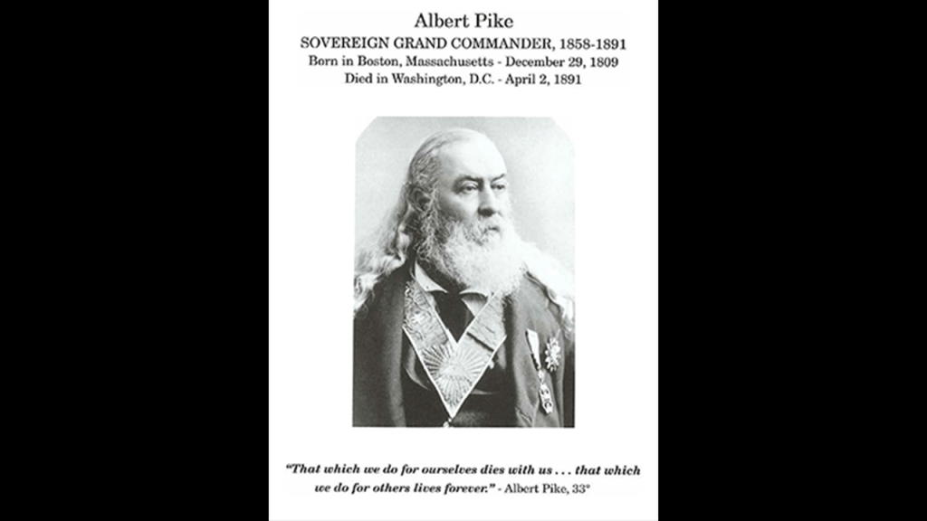
I first learned about the Trans-Mississippi Department when I was doing some research around Albert Pike, an influential 33rd-degree Freemason who was a senior officer of the Confederate Army who commanded the District of Indian Territory otherwise known as Oklahoma.
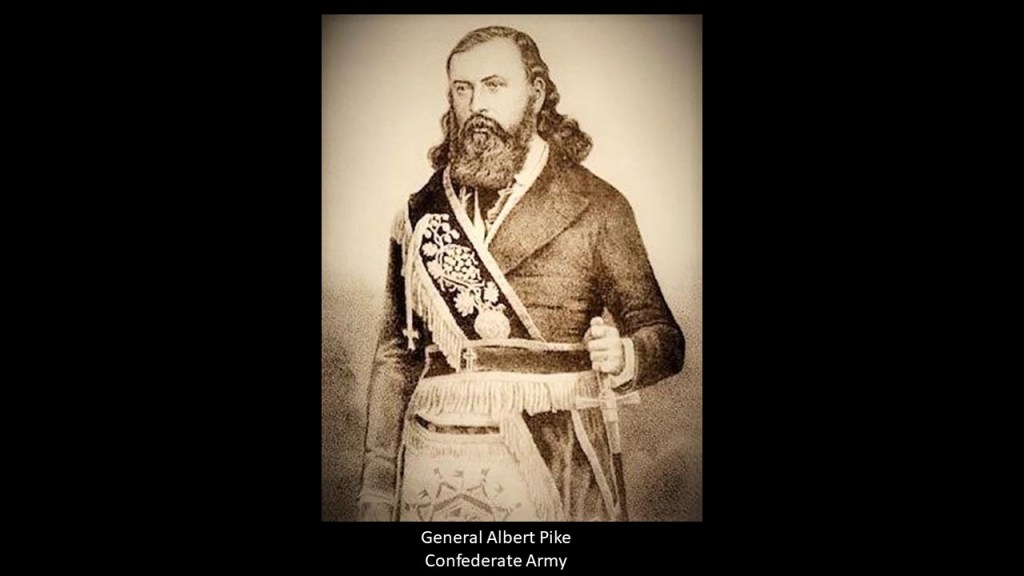
Albert Pike also made the Van Buren and Fort Smith area his home in Arkansas on today’s Oklahoma State line to the southwest of Bentonville from 1833 until after the Civil War, at which time he moved to Washington, DC.
Albert Pike in his day was the most powerful Freemason in the world when he became the Sovereign Grand Commander of the Southern Jurisdiction in 1858, a position he held until his death in 1891.
Along with holding the position of Sovereign Grand Commander of the Southern Jurisdiction, he held the position of Grand Master of the Central Directory in Washington, DC, and Sovereign Pontiff of Universal Freemasonry.
This region was also the heart of the ancient Washitaw Empire, with Monroe, Louisiana being the Imperial Seat, in what was known as “Washitaw Proper.”
I think what was really going on here was very different from what we are told about the American Civil War, and it has everything to do with what actually happened to the advanced, ancient Empire that was originally here.
I can’t help but notice that the map of the ancient Washitaw Empire of North America that has been removed from our collective awareness on the left, roughly corresponds to the map of the Louisiana Purchase in the middle and the Western and Trans-Mississippi Theaters of the American Civil War on the right.

And Albert Pike, the most powerful Freemason in the world for 33-years, and Giuseppe Mazzini, the leader of the Bavarian Order of the Illuminati, were co-conspirators in plotting the direction they wanted the New World to go in, and were in correspondence with each other.
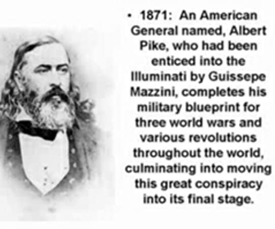
The following three quotes that appear to be the military blueprint for three world wars were said to have been contained a letter written by Albert Pike to Giuseppe Mazzini in 1871.
For the First World War in the letter, Albert Pike was talking about the Illuminati overthrowing the Czars and making Russia a fortress of atheistic communism.

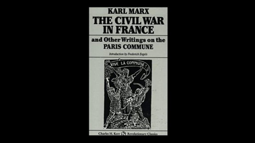
The year of 1871 was the same year Karl Marx first wrote about Communism with regards to the Paris Commune.
The short-lived Paris Commune was established on March 28th of 1871, which was a radical socialist, anti-religious and revolutionary government that ruled Paris until it was suppressed by the French army in May of 1871.
What happened in the Paris Commune was closely followed by London resident Karl Marx, who published a pamphlet in June of 1871, called “The Civil War in France,” about the significance of the struggle of the Communards in the Paris Commune.
What we know of as Commune-ism is also known as Marx-ism, and still very much with us today.
For the Second World War, Pike talked to Mazzini about taking advantage of the differences between Fascists and Zionists; destroying Nazism; Zionism creating Israel, and Communism being strong enough to control Christendom.

And for the Third World War, Pike wrote about the Illuminati taking advantage of the differences between Zionist and Islamic leaders so they mutually destroy each other.
Any of this sound familiar to what we know in the present-day?
It sure does to me.
Could it be that all of these conflicts, at least since the American Civil War, and maybe even the Crimean War and other wars of the 19th-century, been planned, even scripted out, for the Controller’s desired outcome, which was world control and domination?
More thoughts about this to come later in this post.

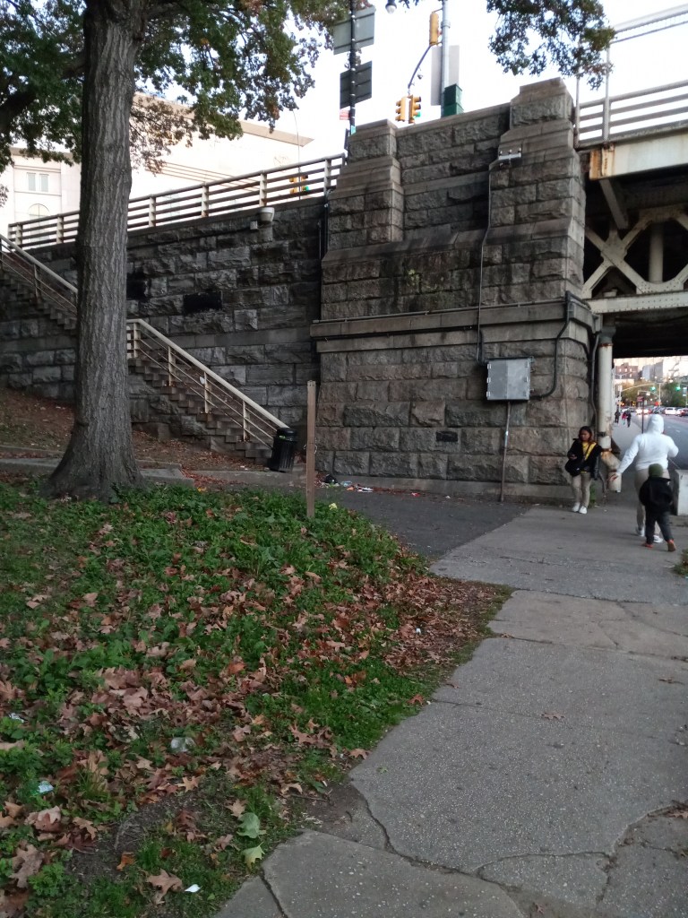
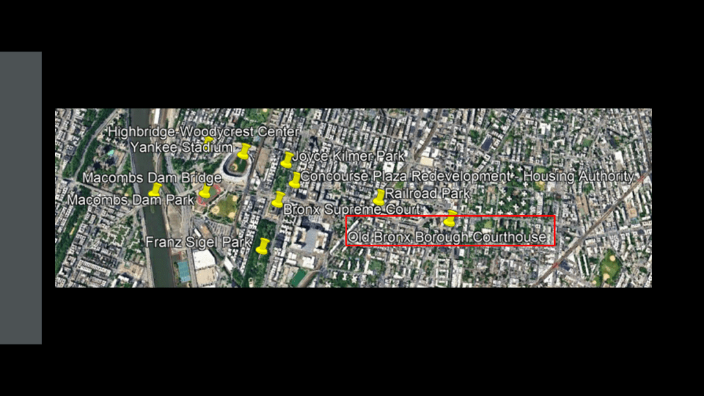
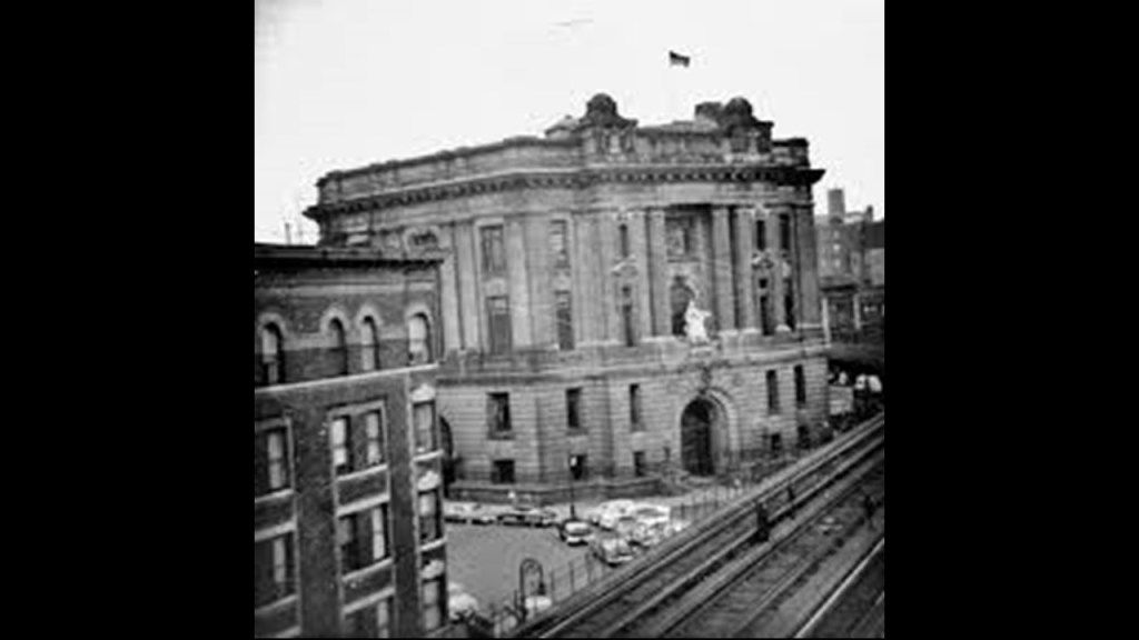
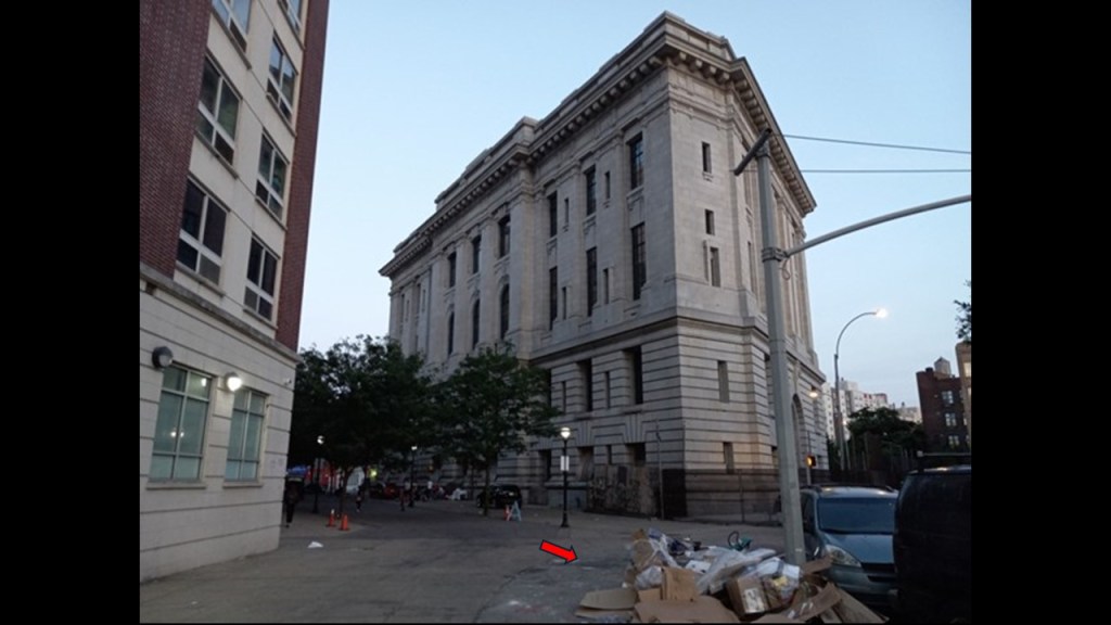
The last place I am going to take a look at in this journey through the Bronx before I head over to Sydney in Australia are the photos DM sent me of the old Bronx Borough Courthouse, just a couple of blocks to the east of these places we have been looking at in the South Bronx, and we are still in the same Melrose neighborhood where the Railroad Park is located.
The Old Bronx Borough Courthouse was said to have been built out of granite in the Beaux-Arts architectural-style between 1905 and 1914.
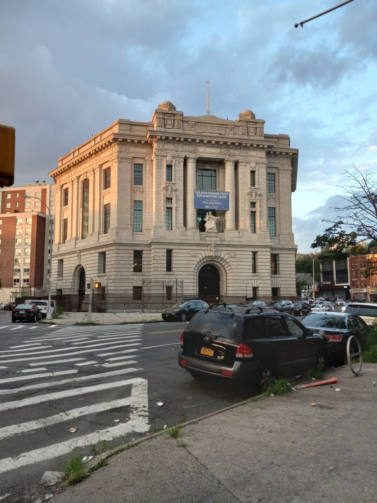
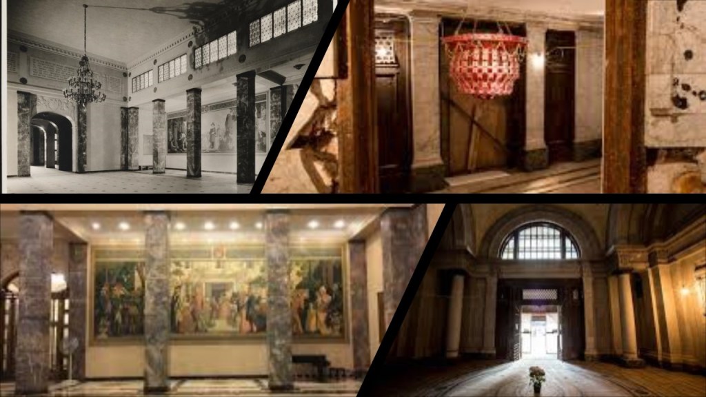
The building’s interior had lavish stairways, chandeliers, ornaments and stained glass windows.
The building was officially closed by the City in 1977 and ntranceways were sealed.
Though it has been abandoned for all intents and purposes since then, the building was designated as a New York City Landmark in 1981, and was added to the National Register of Historic Places in 1982.
The 161st Street Station of the New York City subway’s IRT Third Avenue Elevated Line was in front of the Courthouse until 1973, when the elevated line was eliminated.
DM concluded her correspondence with me by saying: “Thank you for giving me the opportunity to share what I’ve been doing all summer. To show that it really is everywhere. Even here in the Bronx. They tried to burn it, but they couldn’t destroy it all. What is still standing is refaced, fenced off, boarded up, covered with grafitti, severely neglected as a distraction or in the process of tech removal.”
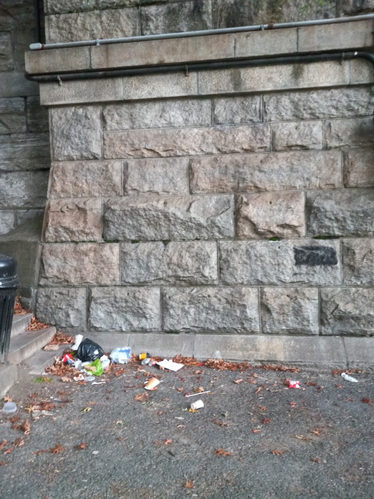
Also interesting to note the trash pile on the sidewalk in the bottom right corner of this photo in front of the once ornate, but long-abandoned Old Bronx Borough Courthouse. Everything was just left to rot in place.
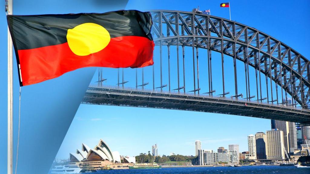
Now I am going to leave the Bronx and head over to Sydney in Australia
This whole post was inspired by PM, who sent me photos from a recent trip to Sydney.
PM lives in another part of New South Wales and sent me photos taken around Sydney when there visiting family.
I already had DMs photos in a file to do something with in a future project and I thought this was the perfect opportunity to do something with both sets of photos in one project.
I thought this was going to be a simple showing of both places, and not take very long for me to complete, but this project has taken on a life of its own with regards to the bigger picture information, and I have already been working on it for several weeks.
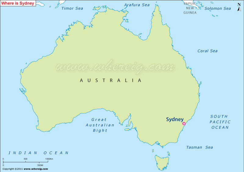
Sydney is the capital of the New South Wales State and the largest city in Australia.
Like the Algonquin Lenape people being the traditional landholders of what became New York, New Jersey, Delaware, Connecticut and Pennsylvania after the colony of “New Netherlands” was established by the Dutch East India Company in 1621, the Eora, Dharawal, and Darug Aboriginal peoples are the traditional landholders of Sydney, with a history of having lived there for at least 30,000-years.
In September of 2023, I took an in-depth look at the question of whether or not the Aborigines of Tasmania and Australia were hunter-gatherers as we are told in our narrative, like the Lenape of the northeastern United States, or actually the builders of its Civilization, and that these original peoples were part of a worldwide Moorish civilization that was identical in design from ancient times to relatively modern times.
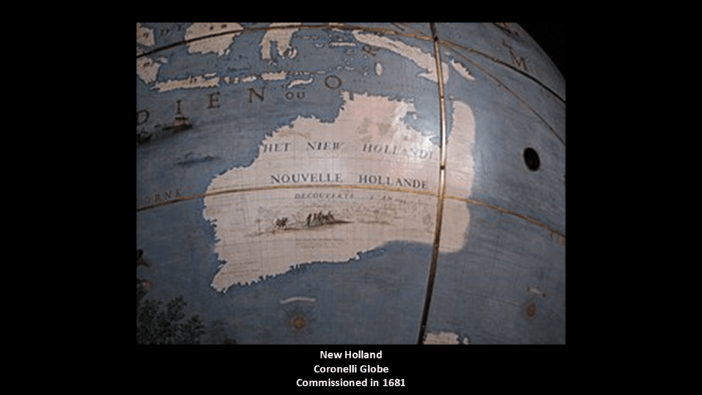
We are told in our historical narrative that mainland Australia first received the name “New Holland” because the first European who sighted it was a Dutch navigator for the Dutch East India Company in 1606 named Willem Janszoon, who was also a colonial Governor in the Dutch East Indies during the years between 1603 and 1616.
This is Australia showing as “New Holland” on the Coronelli Globe, which was commissioned in 1681.
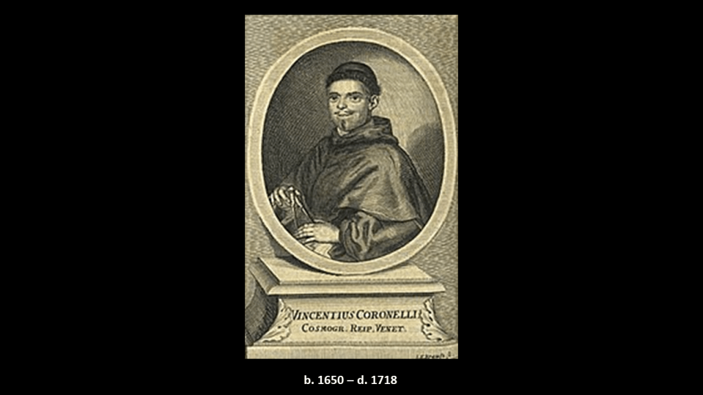
We are told that Vincenzo Coronelli became a Franciscan novice in 1665, around the same time as the red-letter year of 1666 in our historical narrative that I talked about previously, and he went on to become an esteemed cosmographer, cartographer and publisher, known in particular for his atlases and globes, and that in 1678 he was commissioned to make a set of terrestrial and celestial globes for the Duke of Parma.
In 1699, he was made Father General of the Franciscan Order. He lived most of his life in Venice and died there in 1718.
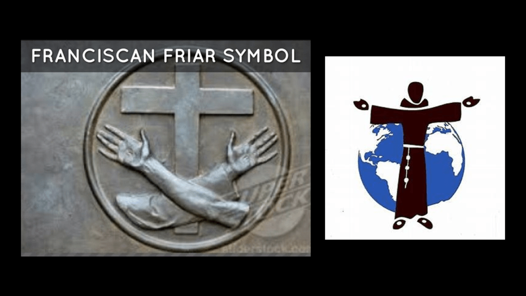
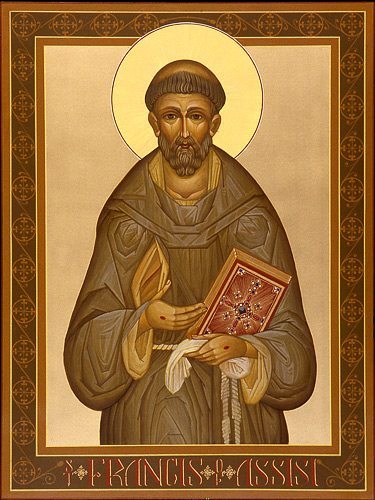
We are told in our historical narrative that the Franciscans were members of related-religious orders that were founded by St. Francis of Assisi in 1209.
We are told the Franciscans were at the vanguard of missionary activity in the New World, aimed primarily at bringing the indigenous people of the Americas to Catholicism.
At this point, I think the Franciscans were, like the jesuits, actually playing a role in advancing the agenda of those behind the New World Order, and probably all Catholic religious orders were for that matter, and that they were actually doing something very different from the pious and holy lifestyle in dedication to God and in service to Humanity that we are taught about them.
More on this subject later.

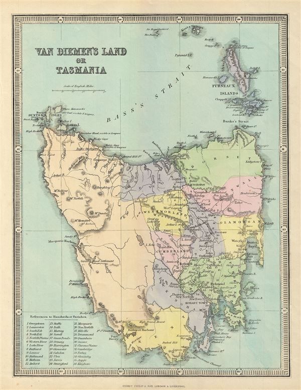
Going back in our official history of the region, Abel Tasman shows up in voyages of exploration between 1642 and 1644.
Abel Tasman was a Dutch seafarer and explorer who was appointed by the Dutch East India Company to explore uncharted regions of the southern Pacific Ocean, and who first applied the name “New Holland” to mainland Australia.
Tasman’s first voyage to the South Pacific takes place in our narrative only twenty-one-years after the New Netherlands Colony in North America was established by the same Dutch East India Company.
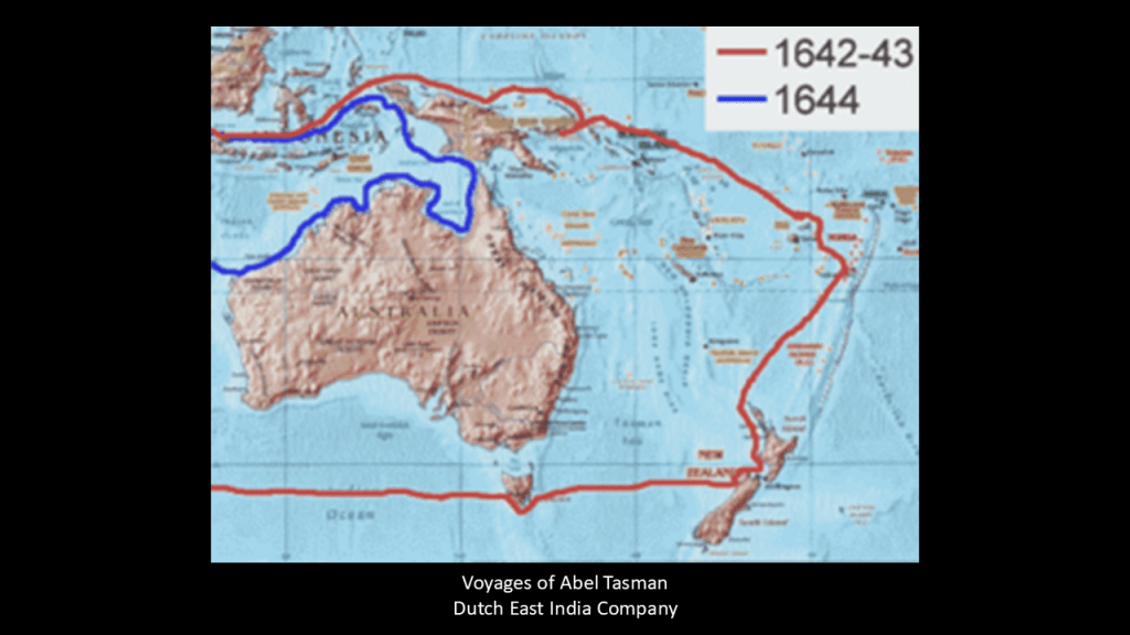
Tasmania got its present-day name from Abel Tasman, but its first European name was Van Diemen’s Land, when Tasman honored his patron Anthony Van Diemen, the Governor-General of the Dutch East Indies at that time.
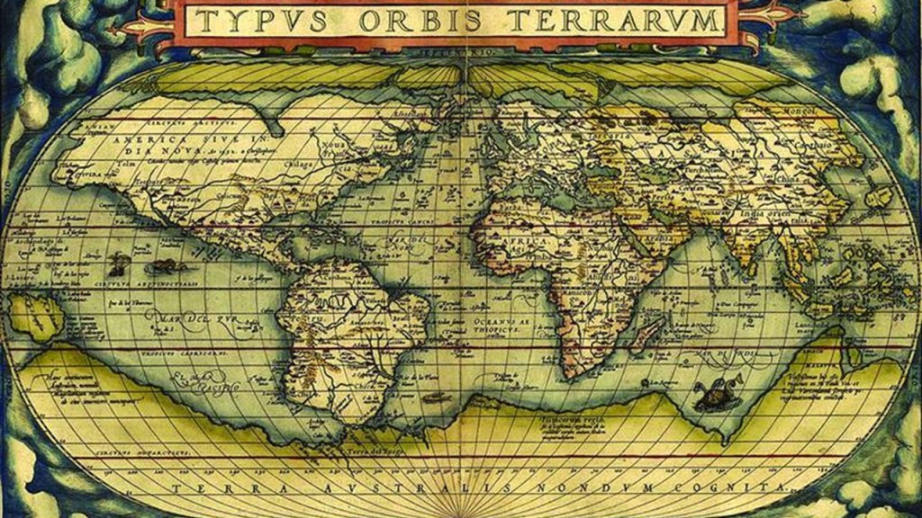
Interestingly, the name “Southern Land” or “Terra Australis” was also used on early European maps of the region.
We are told that “Terra Australis” was a legendary hypothetical continent mentioned since antiquity and appearing on maps between the 15th and 18th centuries.
This information was downplayed and obfuscated in our narrative, but I find this very interesting because I believe we are looking at a substantial amount of sunken landmasses not only here, but all around the world, including where I was just looking in the northeastern United States.
I do a really dive deep into my findings worldwide with regards to this subject in my blog post “On the Trail of Giants in Appalachia and Beyond – Theme 4: The Cataclysm.”
In 1770, Captain James Cook first charted the eastern coast of Australia, and claimed it for Great Britain in August of that year.
Captain Cook returned to London with reports favoring colonization at today’s Botany Bay, to which Sydney is adjacent.
This took place in our historical narrative a little over 100-years after the Dutch “New Netherland” Colony became a British Colony in 1664.
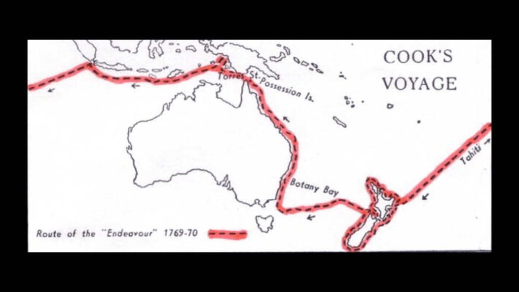
Cook’s initial name for Botany Bay was Stingray Bay, but we are told in his journal it was changed to “Botanists’ Bay” and then became “Botany Bay,” which people have surmised was to honor botanists aboard his ship, led by Sir Joseph Banks, and to mark its floral novelties.
Sir Joseph Banks was also said to have recommended Botany Bay as the ideal location fo a penal colony because of its fertility.

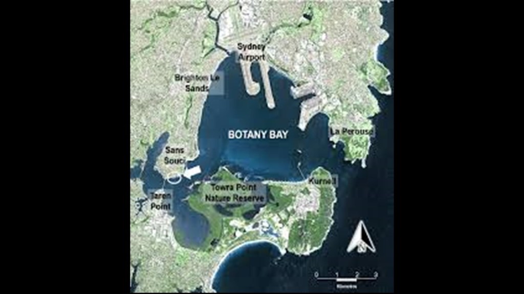
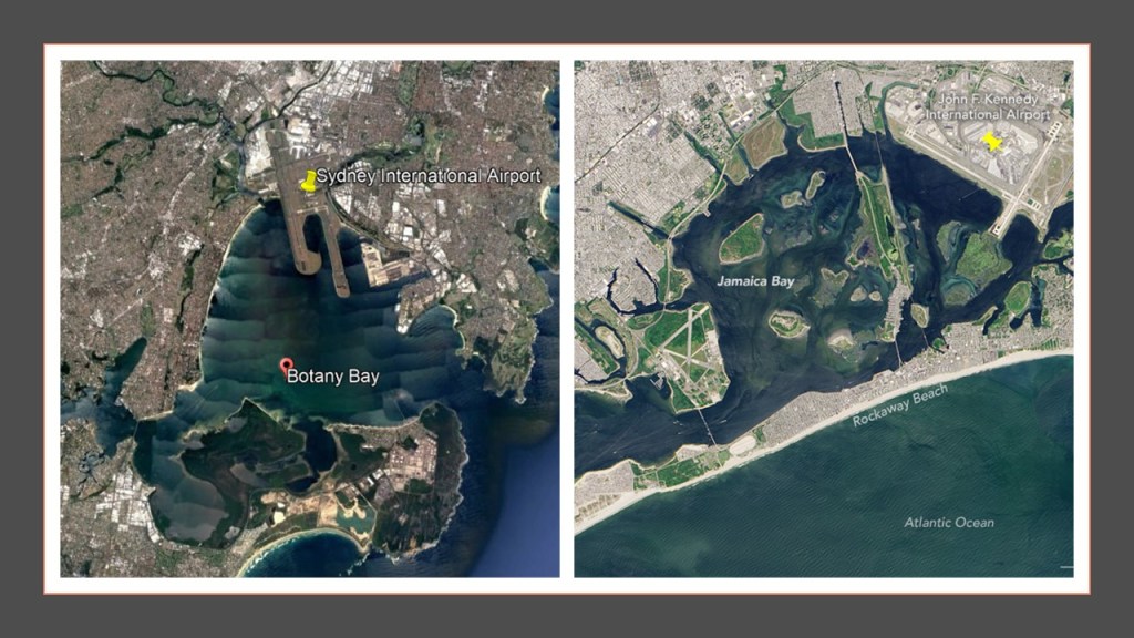
Botany Bay is called a “marine-dominated” estuary, receiving seawater from the Tasman Sea and freshwater from sources like the Cooks and Georges Rivers.
Botany Bay interestingly has a shaped shoreline and the location of the Sydney International Airport is right there next to it.
Jamaica Bay in New York City has a similar appearance on the right, and JFK International Airport right next to it too.
Jamaica Bay is called a partially man-made and partially natural estuary on the western tip of Long Island, and containing numerous marshy islands.
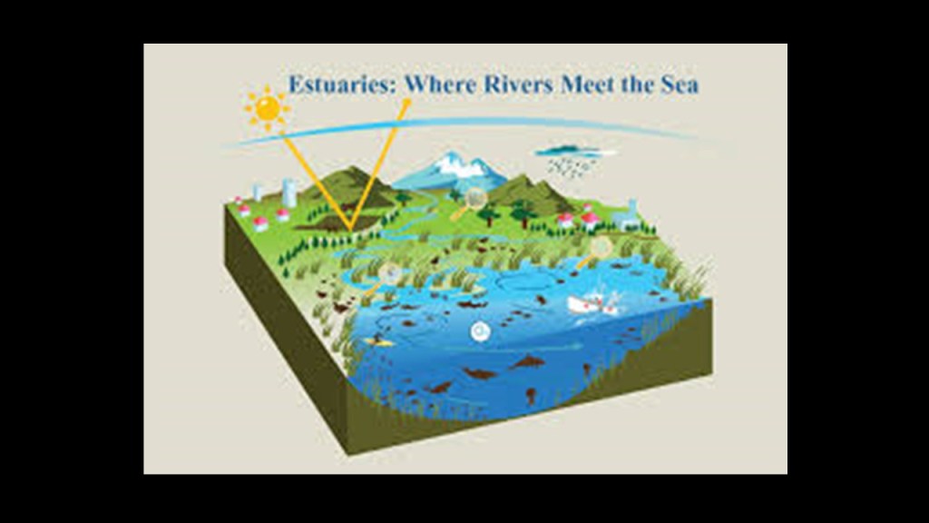
An “estuary” is defined as a partially-enclosed, coastal body of brackish water, which is water that is salty, dirty & unpleasant, with one or more rivers flowing into it, and a connection to the open sea, and are found worldwide.
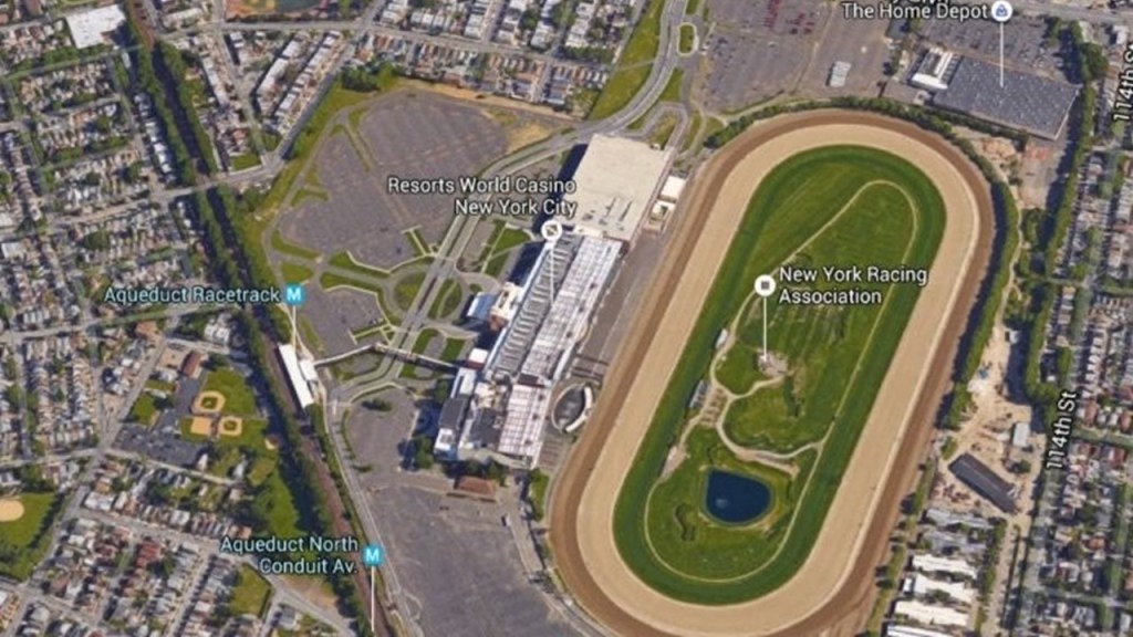
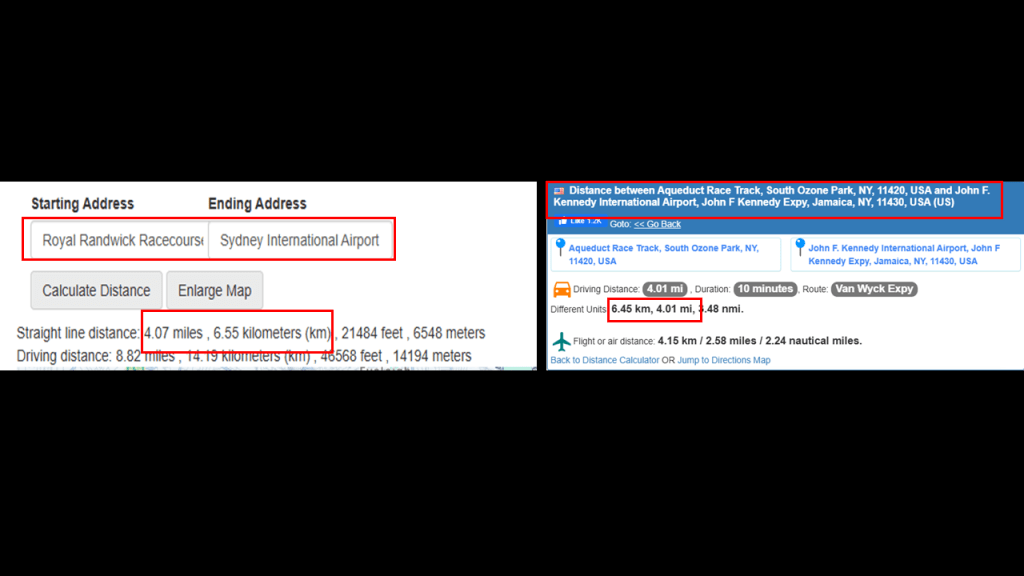
Interestingly, there is a rapid transit line of the New York subway system that operates right through the middle of Jamaica Bay, the IND Rockaway Line that runs between the Aqueduct Racetrack Station terminal, to the northwest of the JFK International Airport, to the Rockaway Park-Beach 116th Street Station terminal, to the southwest of the airport.
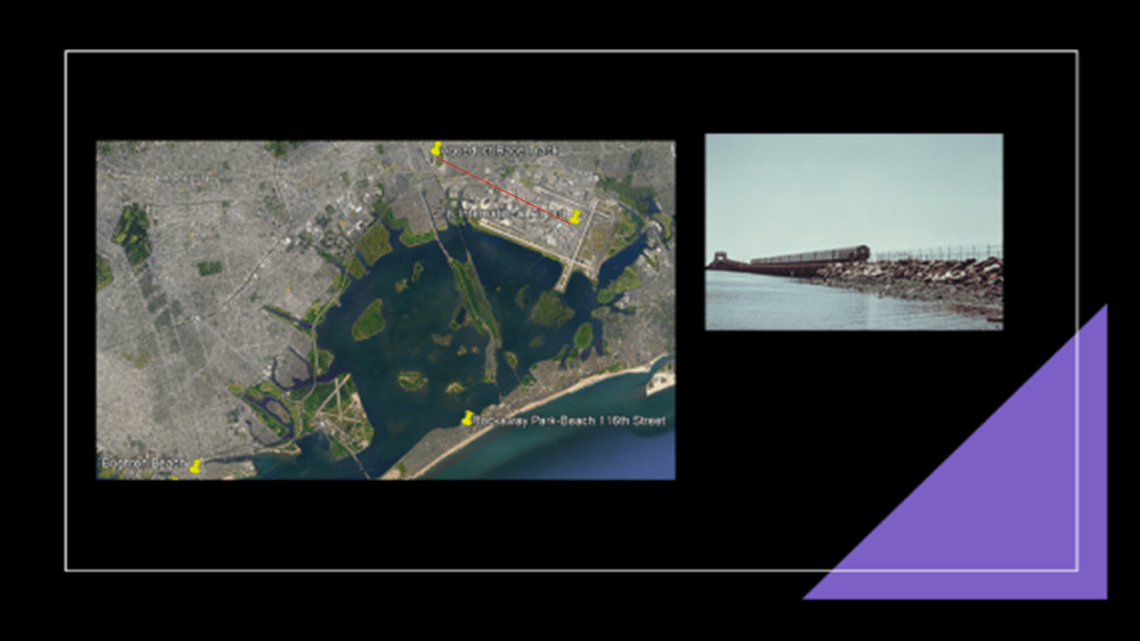
The Aqueduct Racetrack is located the short-distance of 4-miles, or 6.5-kilometers, to the northwest of JFK International Airport.
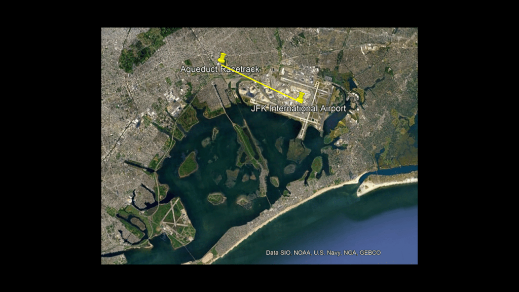
The Aqueduct Racetrack is a Thoroughbred horse-racing track in the Ozone Park and Jamaica neighborhood of Queens, and the only racetrack located within the city-limits of New York City.
The “Resorts World New York City” is co-located with the Aqueduct Racetrack.
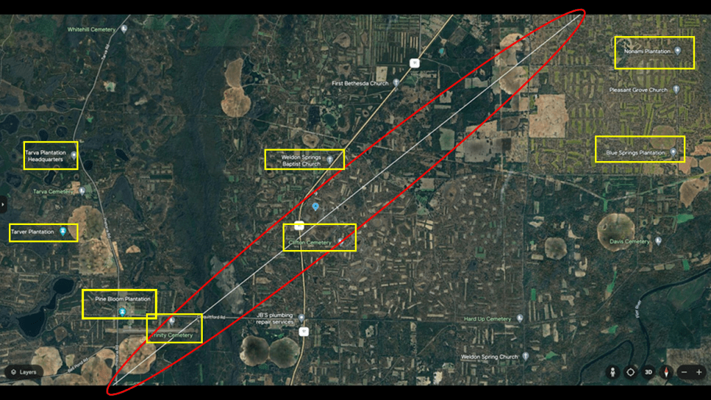
In one of the series that I did on researching places viewers made in comments, I discovered airports all over the world having racing tracks in angular relationships short distances away.
One of the places a commenter suggested was the Sydney International Airport and the Royal Randwick Racetrack.
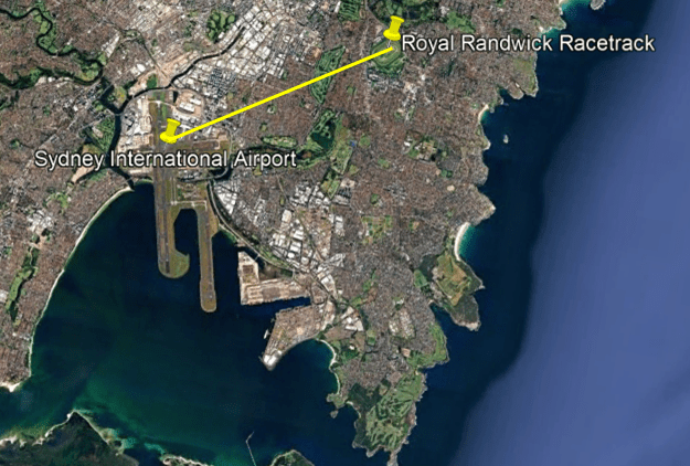
The distance between these two locations is the short-distance of 4-miles, or 6.5-kilometers, northeast of the airport, the same distance that is between the Aqueduct Racetrack and the JFK Airport in New York City.
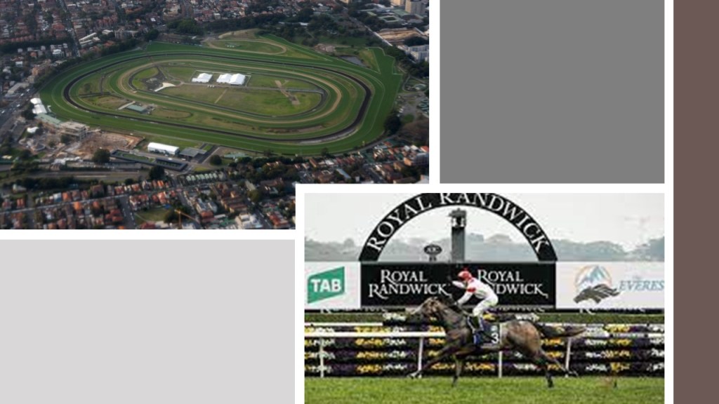
Like the Aqueduct Racetrack,the Royal Randwick Racetrack is also a Thoroughbred horse-racing track .
It is located on Crown Land, which a territorial area belonging to the British Crown, but is leased to the Australian Turf Club.
The first race at Randwick was held in 1833, and in the present-day is the host of racing championships with millions of dollars in prize-money.
There are approximately 30 casinos close to the Royal Randwick Racetrack.
I first noticed this relationship between airports and racetracks when I was doing research on the Shepherd’s Bush District of West London based on a commenter’s suggestion.
In the process of doing that, I realized I had seen the same angular relationship between London’s Heathrow Airport, and Shepherd’s Bush on the top left, where there had been a huge track at one time in White City, that had been used for Greyhound racing; and in my own research of the Tampa, Florida, neighborhood of Sulphur Springs a few years ago, when I had noticed that the Tampa International Airport, and the Sulphur Springs neighborhood in Tampa, Florida, where there was a greyhound racing track, had the same angular relationship.
After I made that initial connection, commenters left other examples of the same kind of relationship between airports and racing tracks, past and present, including, but not limited to, Montreal, Philadelphia,Toronto, Los Angeles, and as I mentioned Sydney.
What are the odds of these similar relationship happening randomly in diverse places across the world over long periods of time, as we are led to believe?

I have provided the evidence I have found that all the Earth’s infrastructure was precisely placed for a specific purpose and function as circuitry on the Earth’s Energy grid in my “Circuit Board Earth” blog post in June of 2021.

And wouldn’t it stand to reason that those behind the reset when setting up the New World would take advantage of the super science of the different types of circuits in the Earth’s grid system in order to harness their inherent power to enhance performance at sporting events, to make lots of money at highly-charged, prestigious gaming and betting venues?

Now back to what the historical narrative says.
With regards to the history of Sydney, we are told that in 1788, Arthur Phillip founded Sydney as a Penal Colony and the first European settlement in Australia.
So, what were they going to do with all these convicts?
Did they just ship them out to get them out of British society, or did they have some specific purposes in mind when they brought them here?

Arthur Phillip was the leader of the “First Fleet of Convicts,” a fleet of eleven ships consisting of two Royal Navy vessels, three store ships, and six convict transports, that brought the first colonists and convicts to Australia to Botany Bay in January of 1788.
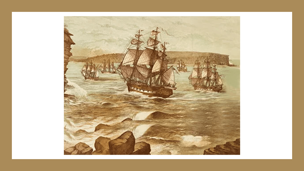
Australia was formally proclaimed a British Colony by now-Governor Arthur Phillip on February 7th of 1788.
Governor Phillip was formally vested with complete control over the inhabitants of the Colony, and the British basically moved in and started the process of taking over absolutely everything, from land to credit for the infrastructure they found there.
This was exactly the same model for taking power and control of foreign lands we saw earlier, with the granting of power and authority to one individual in the form of “Royal Charters” establishing “colonies” granted by the Crown, and Papal bulls issued by the Pope authorizing land-grabs of entire regions, like the “Inter Cetera” Bull of Pope Alexander VI authorizing the land-grab of the Americas in 1493.
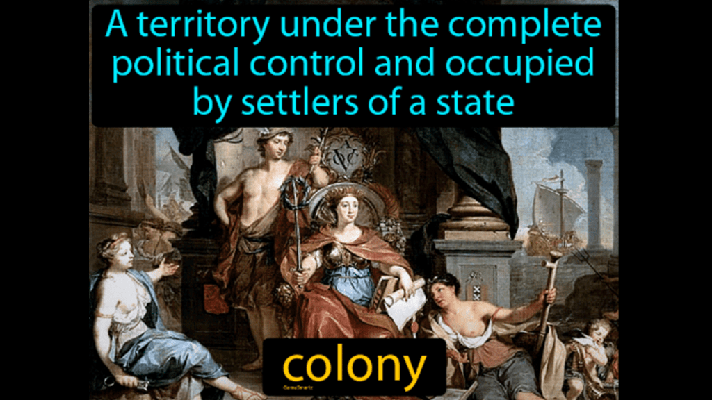
In 1803, Tasmania was claimed by the British as well when a penal settlement of the British Empire was established there, and more than 70,000 convicts were sent there between 1803 and 1853.
In our narrative, the island was inhabited by aborigines from at least 40,000 years prior to the arrival of Europeans.
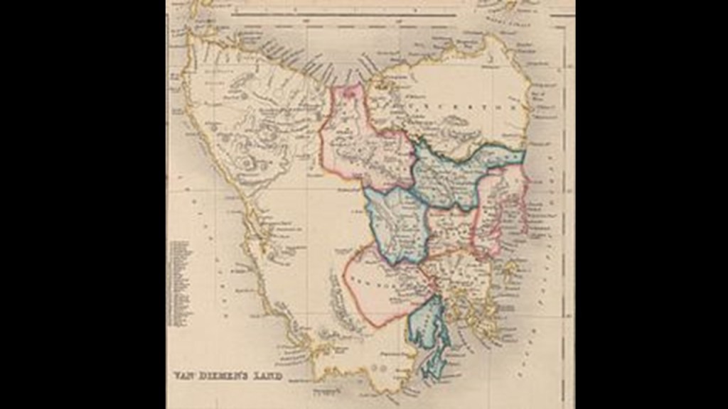
The aboriginal population of the island was almost completely wiped out within 30-years from the time of European settlement, during a period of conflict in Tasmania between the 1820s and 1832 known as the “Black War,” as well as the spread of infectious diseases.

But what kinds of things do we find in, let’s say, the history of the capital city of Hobart, that the Europeans happily take credit for, and leave us instead with these hunter-gatherer images of the indigenous people of Tasmania, and Australia for that matter.
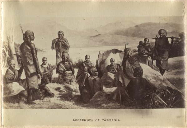
There’s loads of examples, but for one thing, I have known for awhile that there was an International Exhibition held in Hobart, which took place in 1894.
It was said to have been built on 11-acres starting in 1893, for a cost of not more than 10,000 pounds because that was all the money that was available, for the International Exhibition that was held there between 1894 and 1895, and that the builders of it never meant to last, having been built of hardwood…and plaster and concrete to make it look more elegant, and it is long gone!

We are told that the “Aborigines Protection Society” was formed in 1837 with the stated aim of ensuring the “health and well-being, as well as the sovereign, legal, and religious rights of the indigenous peoples while promoting the civilization of the indigenous people who were subjected under colonial powers.”
This book by David Heartfield looks at the “Aborigines Protection Society” from the perspective of “Humanitarian Imperialism in Australia, New Zealand, Fiji, Canada, South Africa, and the Congo between 1837 and 1909,” and mentioned things like how the policy of native protection turned out to be a reason for the growth of imperial rule, particularly that of the British Empire.
The Aborigines Protection Society published a journal called the “Colonial Intelligencer and Aborigines Friend,” which was comprised of “…interesting intelligence concerning the Aborigines of Various Climes and Articles Upon Colonial Affairs, with Comments Upon the Proceedings of Government and of Colonists toward Native Tribes.”
More like foe than friend.
The “Aborigines Protection Society” and the “British and Foreign Anti-Slavery Society” merged in 1909, and together they became known as the “Anti-Slavery and Aborigines Protection Society.”
What had become the “British and Foreign Anti-Slavery Society” in 1909 went through several other name-changes over the years, and with the last name-change became “Anti-Slavery International” in 1995.
Here are this organization’s slavery statistics worldwide from 2020.
According to their own statistics, an organization that supposedly exists to work against slavery and other abuses, as recently as 2020, only three-years ago, there were 40.3 million people in slavery total, with at least 10-million of those people being identified directly as children.
Those numbers seem incredibly high for something that isn’t talked about openly in our day and age, and raises more questions than answers about what is really going on here.

It also brings up the question of how many different forms of human slavery have existed in the past and present-day, including Australia’s history as a penal colony.

What could have possibly happened to its original people to kick them back into the Stone Age from a high-state of civilization, and this didn’t just happen in Australia, it happened all over the world when the European colonizers moved in and took everything over.
No doubt brutal subjugation of the original people is part of the explanation, but there would have been many factors contributing what has taken place here.

To this day, the flags of the original people of Australia, the Aborigines and the Torres Islanders, are flown at government buildings along with the Australian national flag.
These same original people are acknowledged to be the traditional land-holders for tens of thousands of years throughout Australia.
If the European Colonizers didn’t build everything, and the original people as the traditional land-holders didn’t build it as we have been taught to believe, then that leaves a mystery civilization here that no one knows anything about who built everything.
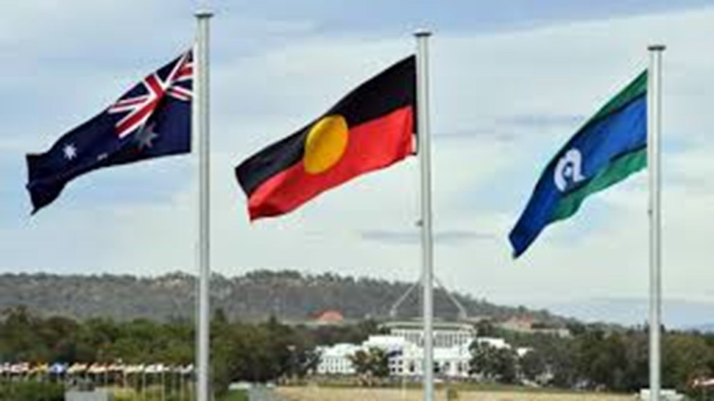
To me there is absolutely no mystery.
The original people of this land were once Master Builders, and part of the advanced Moorish-Atlantean civilization that was here and all over the Earth, and they were all kicked back to the Stone Age as a result of a relatively-recent cataclysm, with subsequent brutalization, marginalization, and outright lies about them by the European colonizers ever since, and the same situation applies to all indigenous people around the world, like Lenape people back where we were looking in the Bronx.
My research has led me to the conclusion that Atlantis was a worldwide civilization that was destroyed, with much of its landmass sinking, at most hundreds of years ago, not thousands of years ago as we have been taught to believe in our narrative.
The original people built this wondrous civilization, not the European colonizers who falsely took credit for everything.

So as I mentioned previously, PMs photos from a recent visit to Sydney inspired this video, along with the photos of the Bronx that DM had sent me prior to that, and this project turned into something much larger with regards to the bigger picture information than I expected.
PM first sent me these photos of flying into Botany Bay in October of 2024.
This photo is of the eastern area from the airport, and said that the Domestic and International terminals are next to each other…
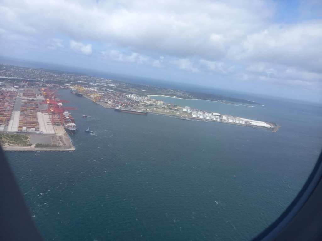
…and about this one said the eastern side of airport has cargo shipping terminals and what looks like an oil refinery although couldn’t find online that it is operational, so thinking it might be a storage place.
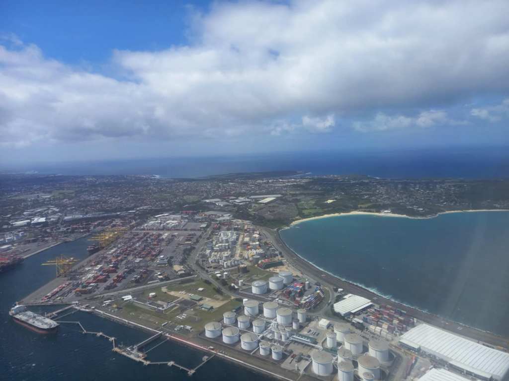
PM said that going further to the east, to the right in this photo, there are the interesting areas of La Perouse and Bare Island, and said scuba diving is possible off the island on good days. A buddy dives there and when PM checked regarding underwater formations, was told walls but didn’t think foundations.
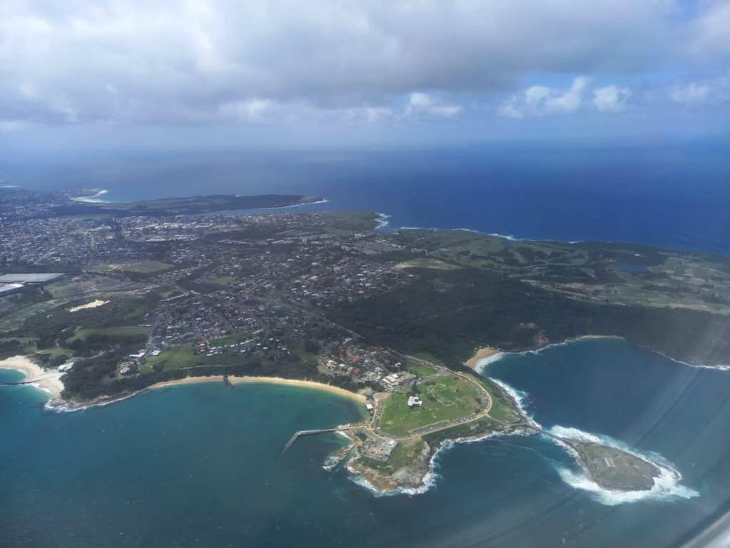
When I looked into La Perouse and Bare Island, this is what I found.
La Perouse is in the eastern suburbs of Sydney in the city of Randwick, which was established in 1859, and the second-oldest local government area in New South Wales after Sydney.
The La Perouse Peninsula is the northern headland of Botany Bay.
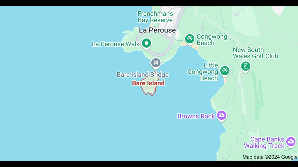
La Perouse was named after the French navigator Jean-Francois de Galaup, Comte de Laperouse.
The Jesuit-educated La Perouse had been commissioned in 1785 by King Louis XVI of France to lead a scientific expedition around the world and explore the Pacific Ocean.
La Perouse landed there on Botany Bay on January 26th of 1788, just a few days after Arthur Phillips’ First Fleet of convicts arrived in Botany Bay on January 20th.
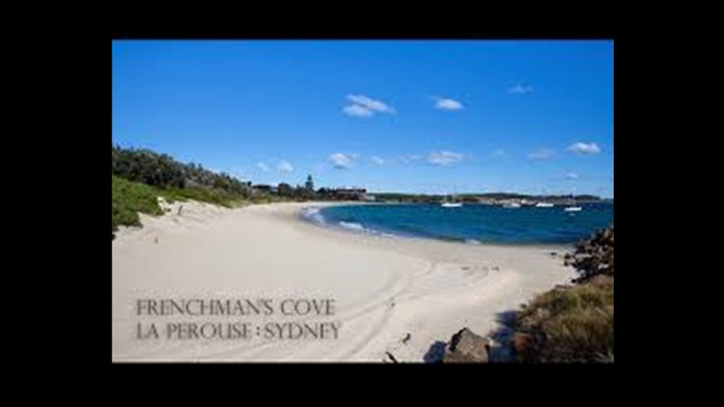
It is interesting to note that like the English and the French arriving at Botany Bay within just a few days of each other, I found the same thing happening when I was looking at the American and French expeditions that “discovered” Antarctica within days of each other.
The U. S. Exploring Expedition under the command of Naval officer Charles Wilkes was an exploring and surveying expedition of the Pacific Ocean and the surrounding lands conducted by the United States between 1838 and 1842, which arrived at and “discovered” Antarctica on January 16th of 1840.

This was five-days before the supposedly completely different French exploring and surveying expedition under the command of Naval officer Jules Dumont d’Urville’s claimed land on Antarctica on January 21st of 1840
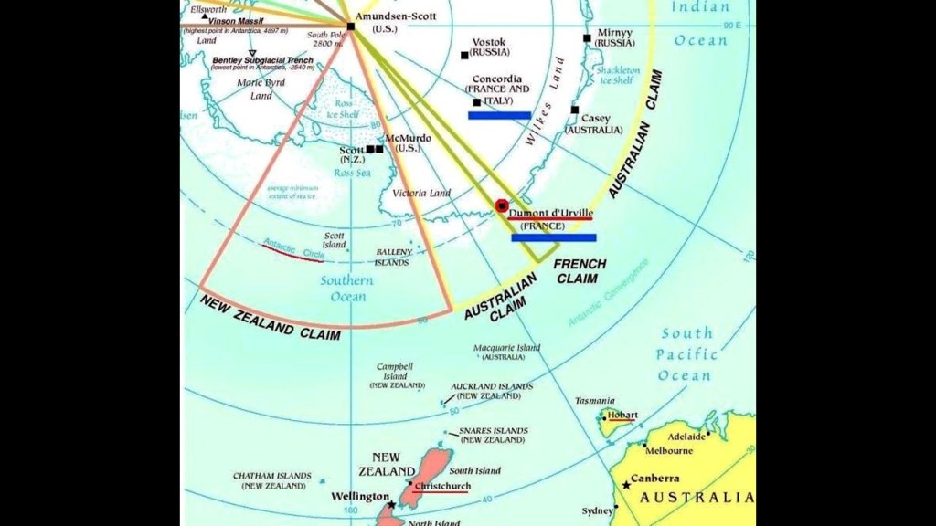
At any rate, Bare Island is connected to the La Perouse Peninsula by the Bare Island Bridge, which is a wooden foot-bridge.
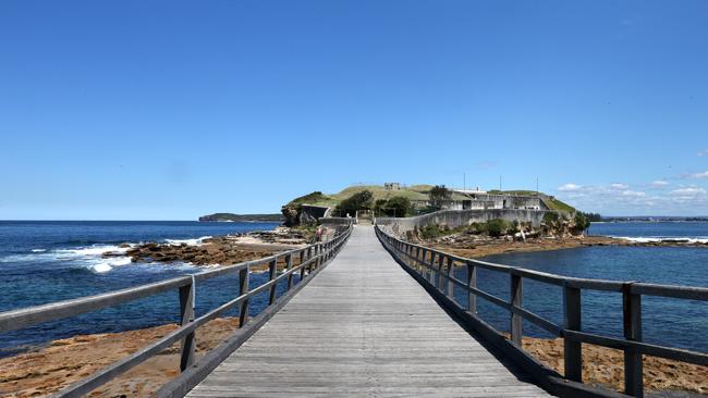
Bare Island is noteworthy for what we are told was a 19th-century fortification designed and built as a coastal fortification between 1881 and 1889.
We are told that right after its completion, a Royal Inquiry Board found that the construction of the fortification’s works was mismanaged, and it was only used for military purposes for a short period of time.
In the early 1900s, the fort was decommissioned as such, with the exception of returning for use as a military fort for a short-while during World War II, and itn 1912, it became a war veterans’ home until that was closed down in 1963, at which time the Randwick Historical Society became caretakers of Bare Island.
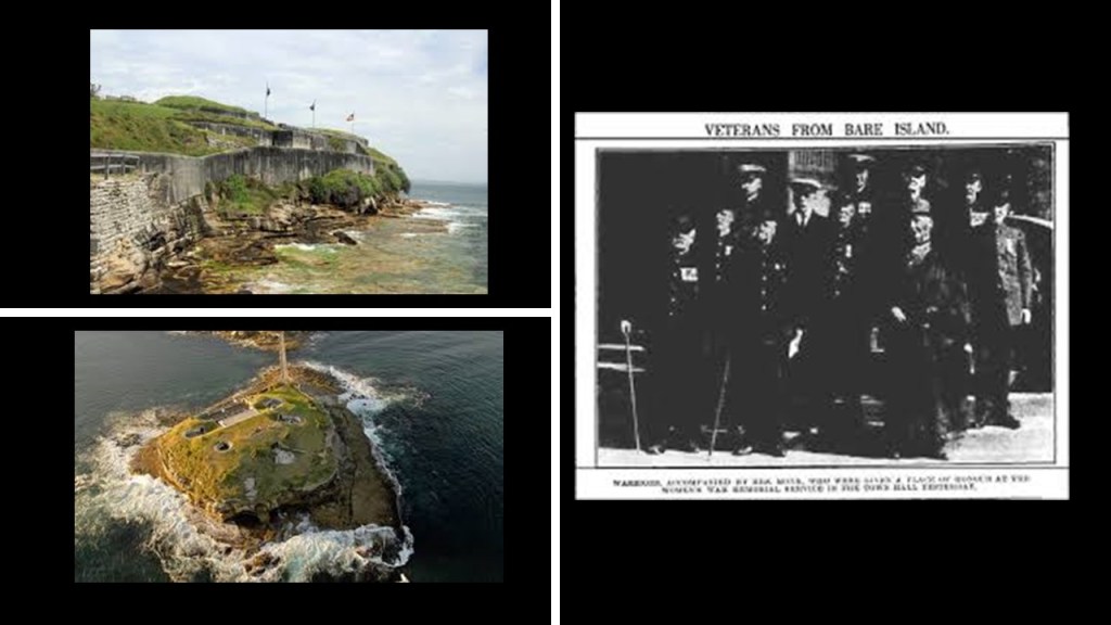
Before leaving the La Perouse Peninsula, I just want to point out a couple of things.
The obelisk-like La Perouse Monument, which was said to have been erected on the site that La Perouse visited in 1788.
We are told that it was commissioned to commemorate La Perouse and his expedition in 1825 on land gifted by the Governor of New South Wales between 1821 and 1825, Sir Thomas Brisbane, and completed in 1828.
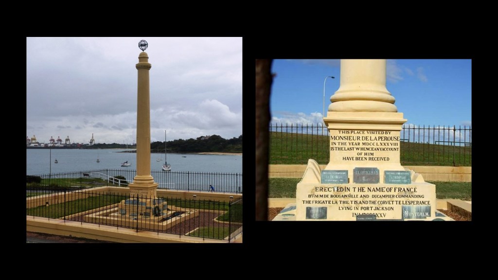
Just for the record, Father Louis Receveur. a Franciscan friar who was a scientific jack-of-all-trades, including Botanist, and the Chaplain for the La Perouse expedition, had been injured on the expedition and died around here somewhere, and was buried on the grounds near the LaPerouse Monument.
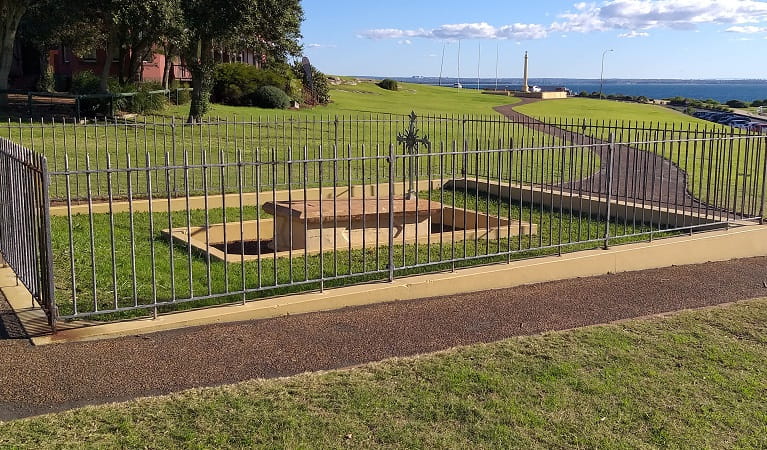
In the same general area of the La Perouse Monument is what is called “La Perouse Macquarie Watchtower,” or more simply “The Barrack Tower,” across from Bare Island.
Considered to be the oldest buildings in Sydney’s Randwick Municipality, it was said to have been built in 1820 in the time of Governor Macquarie, who was the Colonial Governor of New South Wales from 1810 to 1821, as a tower for soldiers to keep watch for smugglers along the coast and that it became a Customs’ House in 1831.
The Barrack Tower looks like one of those places that could have more to it below-ground.
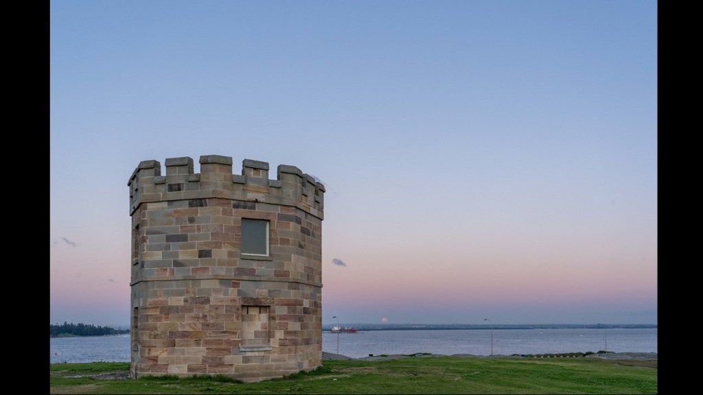
Still going east from La Perouse and Bare Island, PM said there are the New South Wales Golf Club and Kamay-Botany Bay National Park, and that going north from the northern entry side of Botany Bay are two more golf courses -The Coast Golf and Recreation Club and Randwick Golf Course.
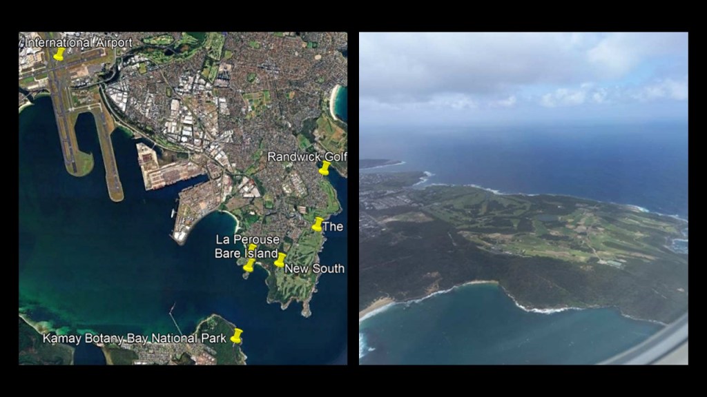
PM has some old knowledge about Malabar, which is located between Randwick Golf Course and Maroubra and Maroubra Beach.
The area was not called Malabar before World War II.
It was known as the Village of Brand or Long Bay.
Malabar Battery is found online, in the same area are Long Bay Jail and Long Bay Hospital.
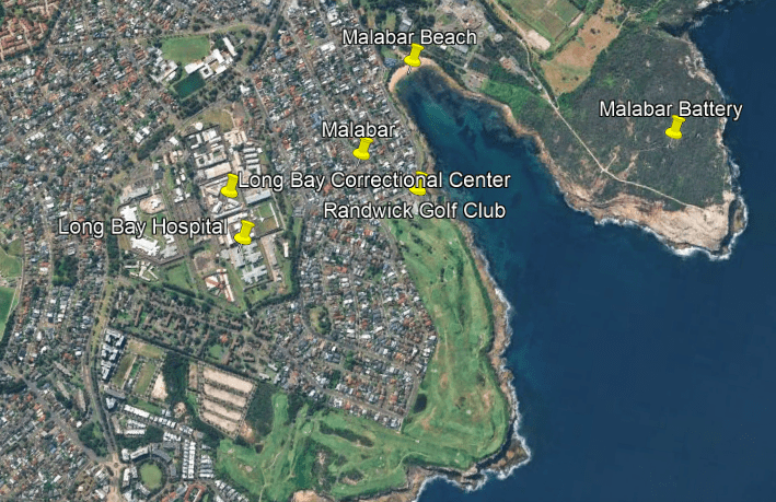
The Malabar Battery was described as a coastal defense battery built in 1943, during World War II, and said to have been built to complement the existing coastal defenses at the previously mentioned Bare Island; the Henry Battery at Henry Head in La Perouse; and the Banks Battery at La Perouse’s Cape Banks.
This photo was notated as “Tram Line Malabar Battery.”
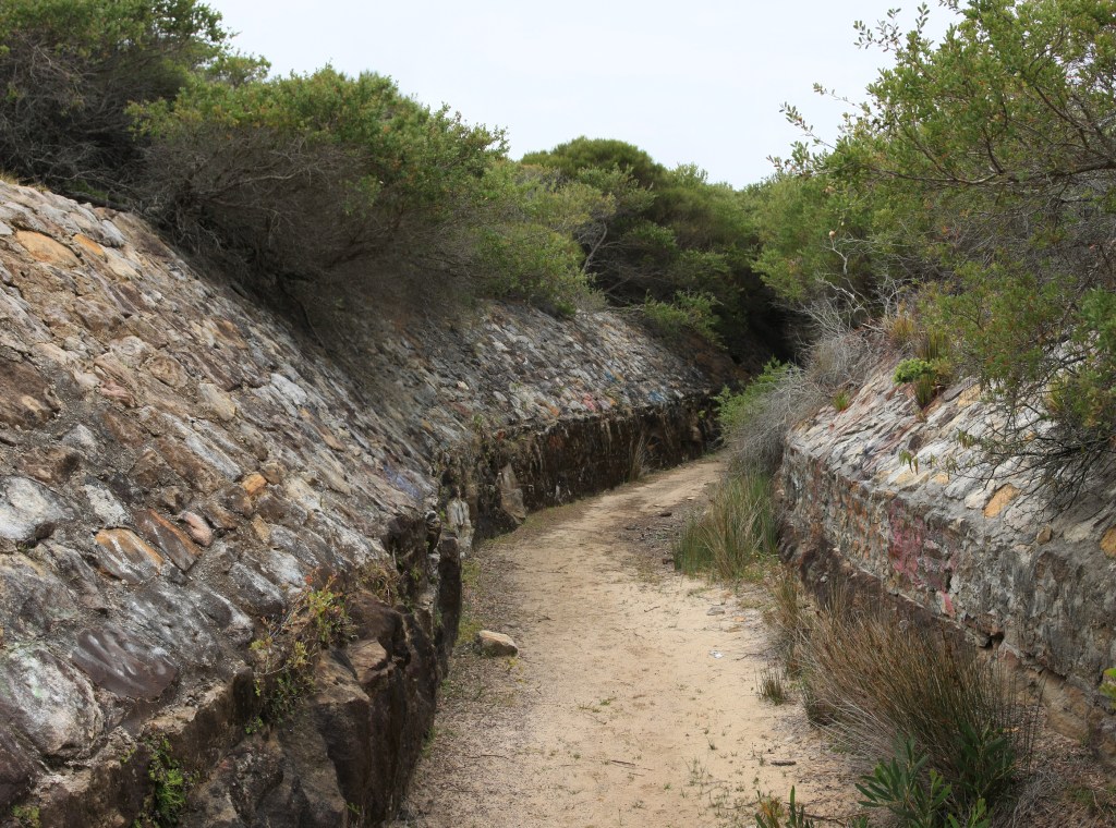
Between the years of 1902 and 1961, the Long Bay Hospital and La Perouse was connected by electric streetcar, or tram, via the Long Bay Line.
The line was electrified in 1905, and in 1909, a special car to transport prisoners to the jail was added until the prisoner transport was replaced by motor vehicles in 1950.
Just like what we saw back in the Bronx and New York City, there is a history in Sydney as well of rail infrastructure like railroads and streetcars being in use for a relatively short period of time in our historical narrative and then being replaced by motor vehicles and then removed.
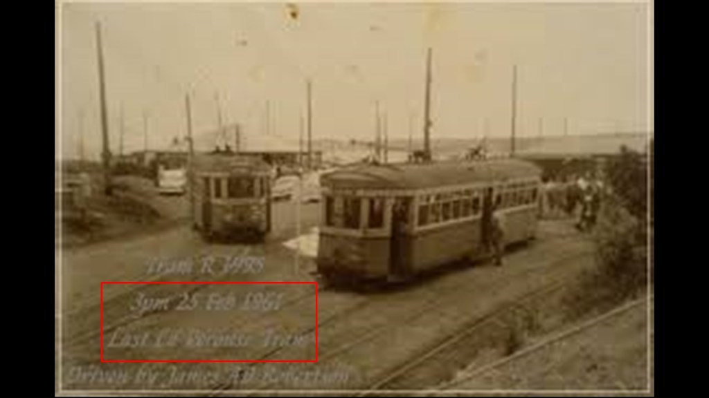
I think these structures called fortifications and batteries for military use were actually functioning originally as batteries on the earth’s energy grid system.
One definition of the word “battery” is a device that produces electricity that may have several primary or secondary cells arranged in parallel or series, as well as a battery source of energy which provides a push, or a voltage, of energy to get the current flowing in a circuit.

This is what we are told about the indigenous people who lived here.
The land between the Cooks River, one of the rivers said to form the Botany Bay estuary, and the La Perouse Peninsua was the traditional land of the Gameygal clan of the Darug aboriginal people, and again we are told that they were hunter-gatherers in our narrative, like the Lenape in the Bronx.
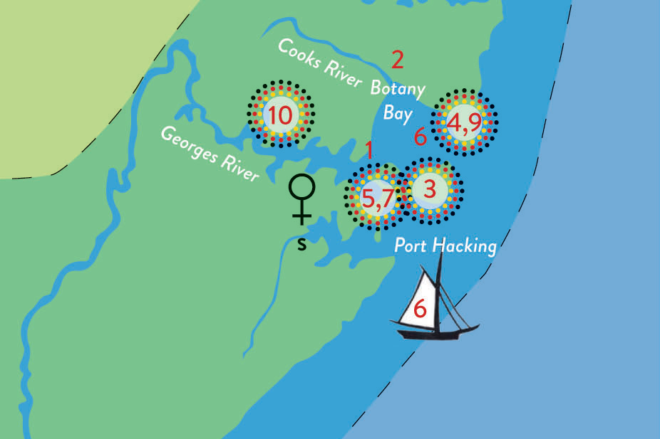
We are told the number of Darug clans in total was 29, and that they lived in different territories, with some clans engaging in fishing and some in hunting depending on where they lived.
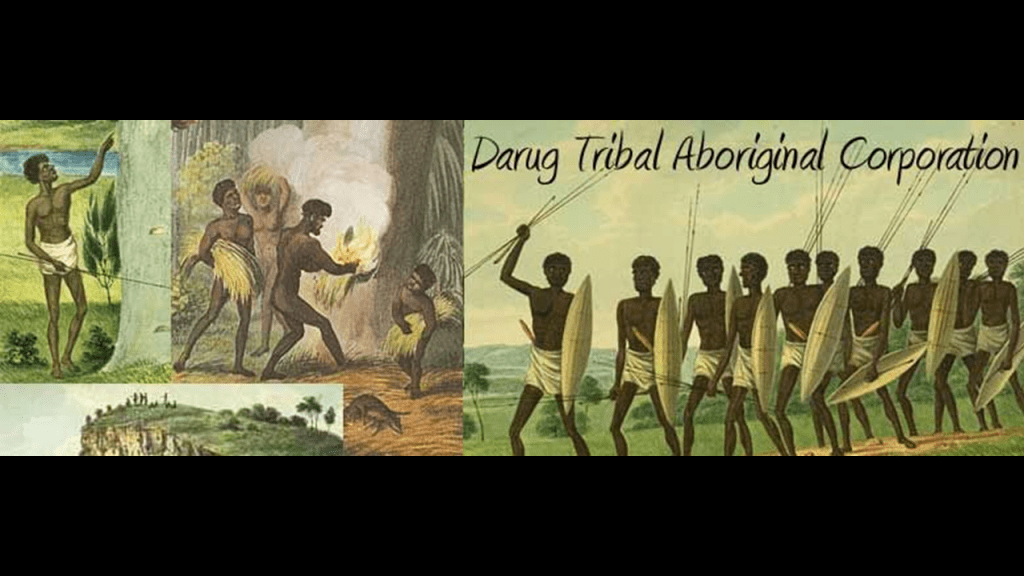
The Darug lands encompassed 2,300-square-miles, or 6,000-kilometers-squared.

The Cooks River is described as a 14-mile, or 23-kilometer, long urban waterway that serves as part of a stormwater system for the 39-square-miles, or 100-kilometers-squared of its watershed.
Today the Cooks River is considered Sydney’s most toxic waterway.
The Cooks River in Sydney has masonry banks, pictured here, like the previously seen Harlem River that separates the Bronx and Manhattan…
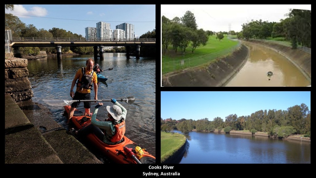
…and the Cooks River Rail Viaduct, the longest brick arch rail viaduct within the New South Wales rail network on the left, is similar to the High Bridge crossing the Harlem River in the middle, and the Ribblehead Viaduct in moorlands of the Yorkshire Dales National Park on the right.
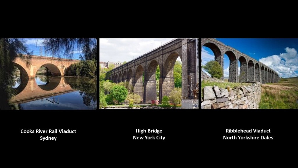
The traditional lands around Sydney of the Dharawal, also spelled Tharawal, aboriginal people were reported to encompass 450-square-miles, or 1,200-kilometers-squared extending from the southern part of Botany Bay.

Dharawal National Park is located between the Georges River and the Illawara Range 28-miles, or 45-kilometers, south of Sydney, with the Dharawal people said to have lived in this area for at least 15,000-years.
The Dharawal National Park contains gorges and waterfalls, as well as different types of woodlands and swampland.
These are Maddens Falls in the park.
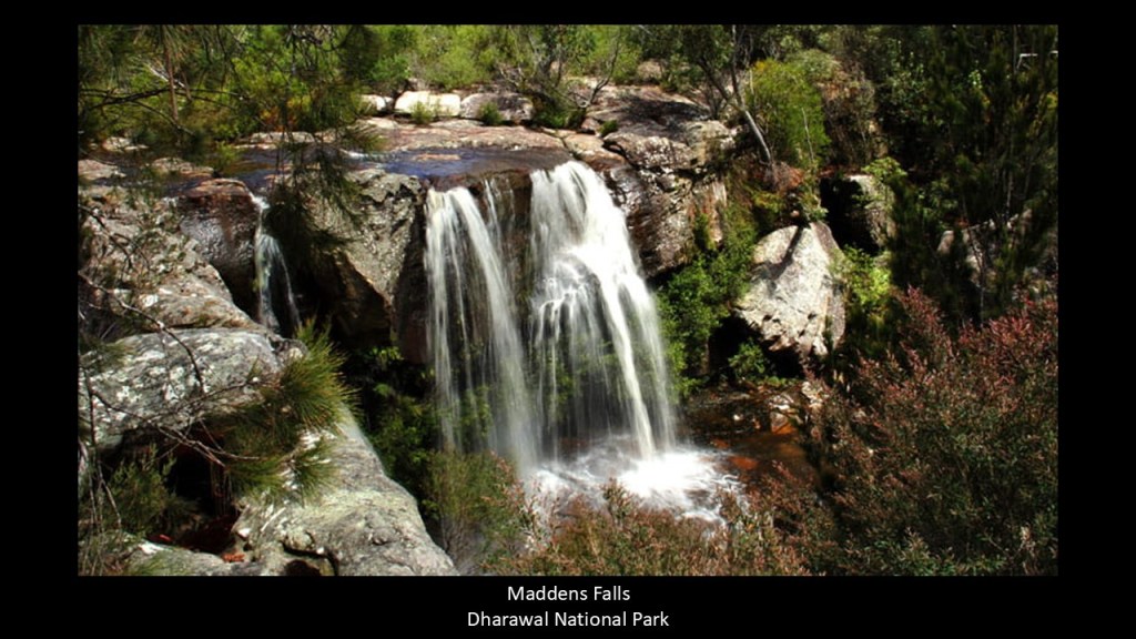
The Dharawal National Park covers both the O’Hares and Stokes Creek catchments.
We have not been told about all the old stone masonry in our world, particularly hydrological stone masonry, so we accept what we see as naturally-occurring, and if it looks manmade to us, than we believe it to be of recent construction like we are told.
These are photos of Stokes Creek weirs.
A “weir” is defined as a low dam built across a river to raise the level of the water upstream or to regulate its flow.
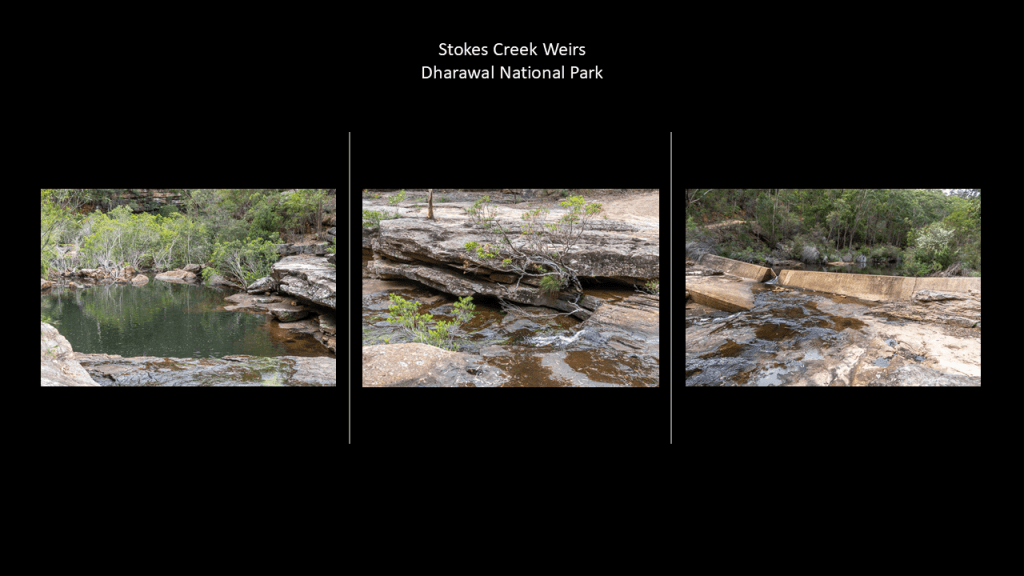
And here are photos of O’Hares Creek weirs.
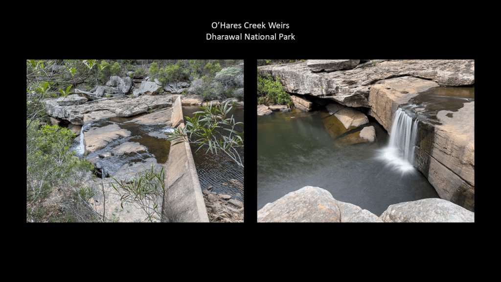
The place where I started waking up to this ancient advanced worldwide civilization was when i was living in Oklahoma from 2012 to 2016, and part of that waking up process was realizing that these were ancient hydrological systems.
Turner Falls in Davis, Oklahoma, which is 114-miles, or 183-kilometers, south of Oklahoma City.
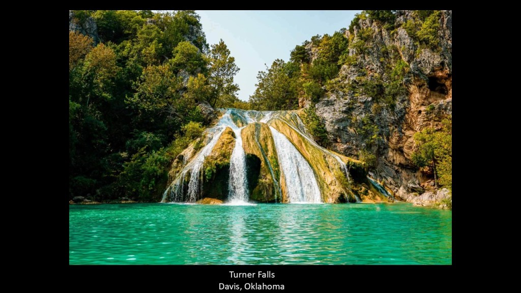
Turner Falls is in Davis, Oklahoma, is roughly 18-miles, or 29-kilometers, slightly to the southwest of the Chickasaw Recreational Area in Sulphur, Oklahoma.
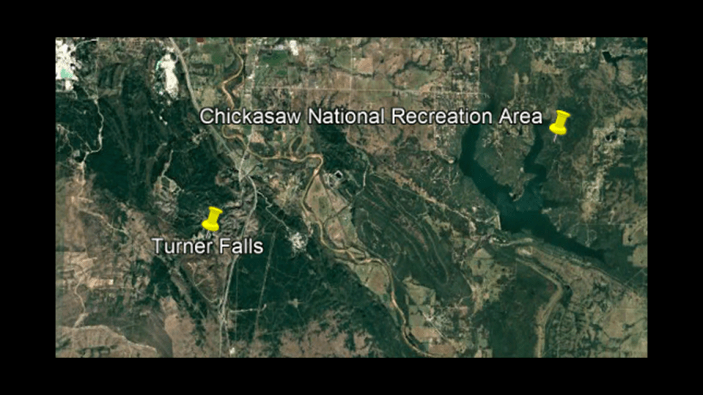
These two places have been cut off from each other in a variety of ways, but I came to the realization when I visited there numerous times that these places were both part of the same ancient hydrological system.
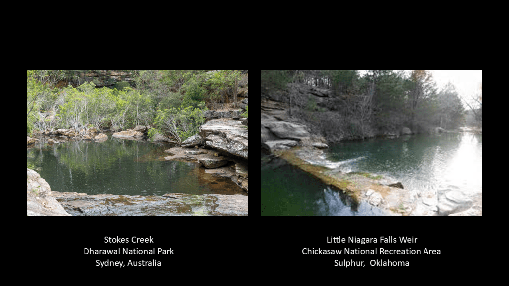
There’s a lot hidden away in the Chickasaw National Recreation Area in Sulphur, Oklahoma, but what i am thinking of here is what is called the “Little Niagara Falls,” where what you see there is very similar to what we find in the Dharawal National Park.
Important to note that the town of Sulphur, Oklahoma, was devastated from a tornado outbreak earlier this year that took place between April 25th – 28th of 2024.
I took particular note of it at the time it happened because I know what is there.

The Eora aboriginal people are also traditional landholders of the Sydney area, and are identified as the people living around the first area of European settlement in Sydney.
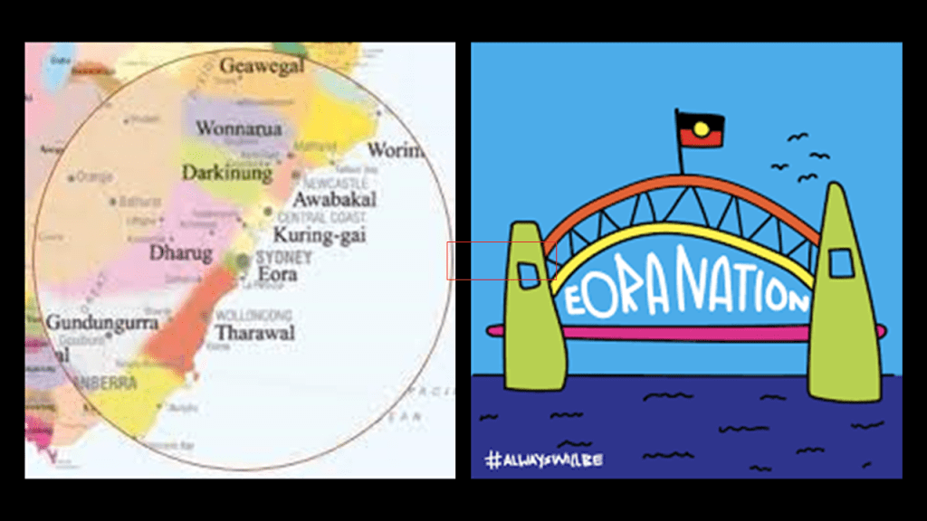
After the First Fleet arrived in January of 1788, and the colony established in what became Sydney, the Eora people experienced the following.
They started to die in large numbers from smallpox, with estimates of a 50% to 90% death rate, starting with the onset of the epidemic in April of 1789.
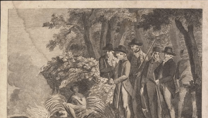
Another thing that happened was the abduction of Eora people to train them to be intermediaries between the settlers and aboriginal people.
One of these abductees was Bennelong.
This is what we are told about him in our narrative.
Bennelong was a leader of the Eora who was abducted on the authority of Governor Arthur Phillip in 1789, who wanted to use him as an intermediary.
At first he escaped, but then in 1790 was said to have established a tenuous connection with the European settlers, and was taken to London in 1792, where he lived for three-years before deteriorating health took him back to his homeland.
There are conflicting stories with regards to his later life.
One is that he died as a respected elder.
Another is that he died an alcoholic.
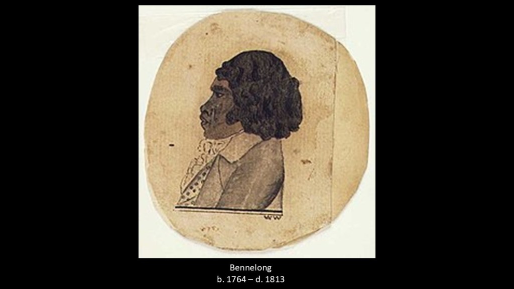
Interesting to note that it is recorded that the island of Memel in Port Jackson in Sydney Harbor, known today as “Goat Island,” was Bennelong’s personal property inherited through his father, and that it is in the process of being transferred by the government of New South Wales back to the Aboriginal community.
“Goat Island” sure looks like an artificial island with a star-fort point to me.
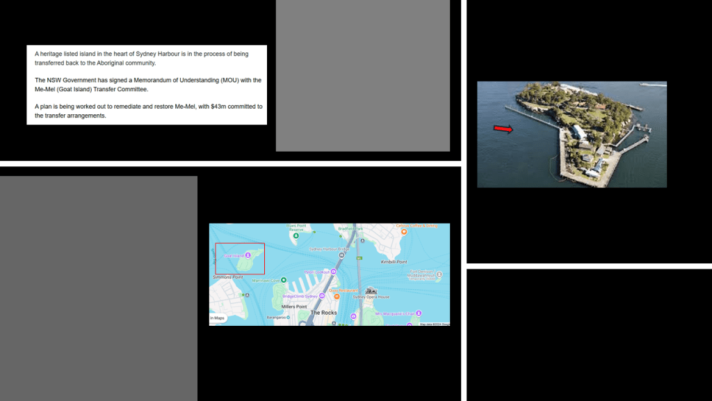
And the Aboriginal flag has been flying permanently above the Sydney Harbor Bridge along with the Australian National flag instead of the New South Wales flag since June of 2022.
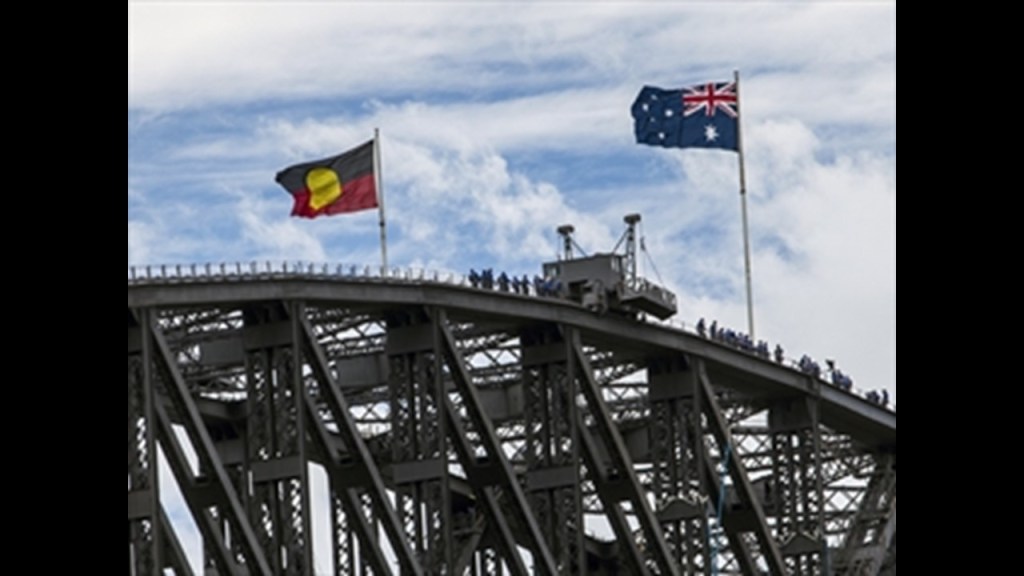
Bennelong is a good place to segue into other photos sent to me by PM because they showcase several locations around Bennelong Point in Sydney Harbor, and the point of land upon which the iconic Sydney Opera House sits.
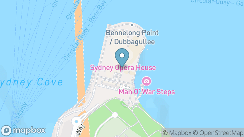
PM sent photos of Kirribilli Point from a water transport in Sydney Harbor, on the other side of the Sydney Harbor bridge from Bennelong Point.
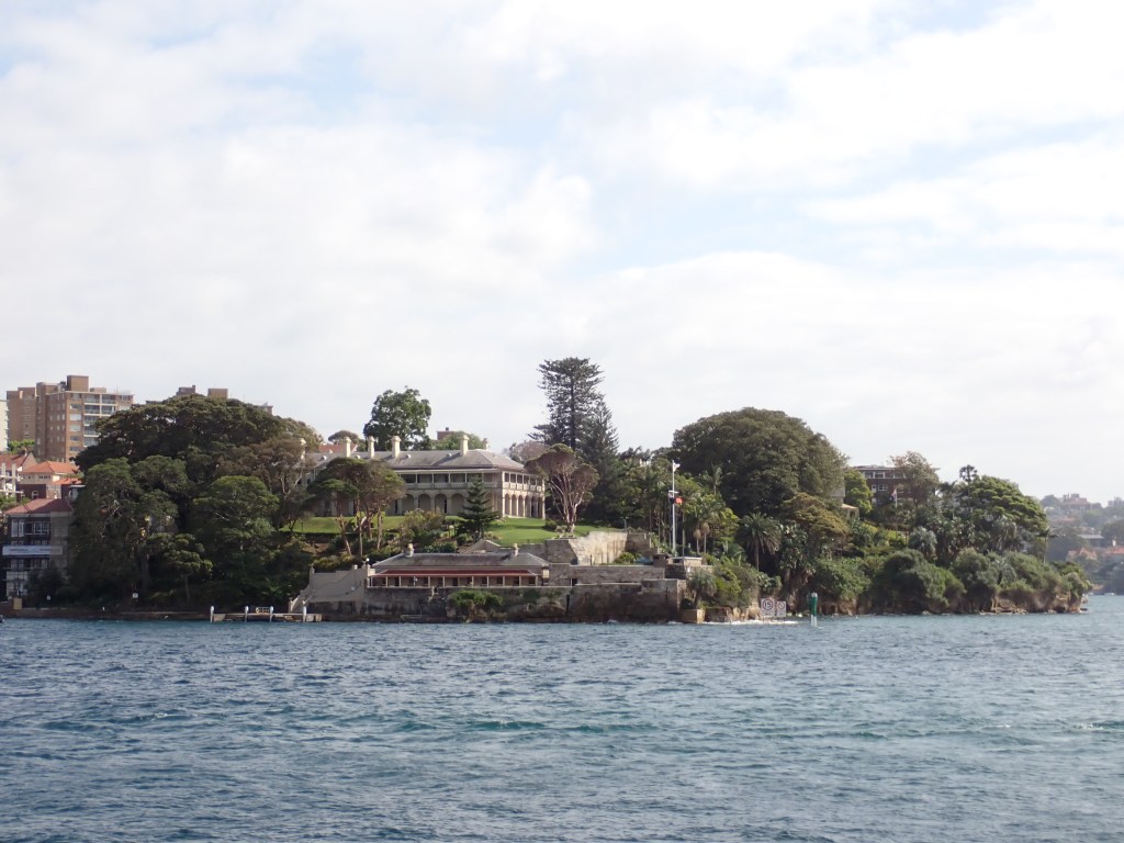
Kirribilli Point was the traditional land of the Cammeraygal clan of the Darug people, and part of today’s North Sydney suburb of Cammeray.
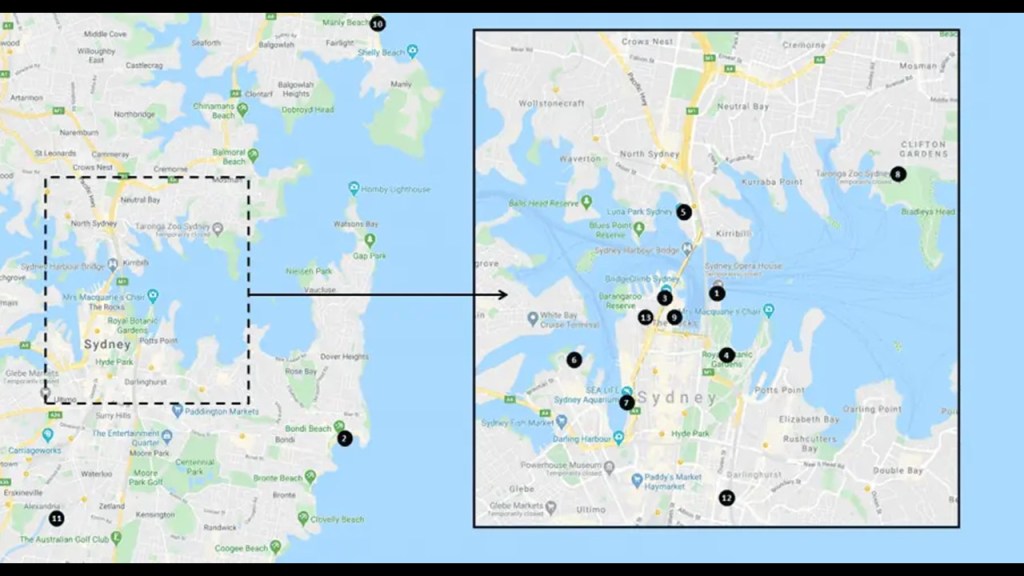
Kirribilli Point is the location of two official government residences.
One is the Admiralty House, one of the two official residences of the Governor-General of Australia, the federal representative of the sitting British Monarch, who is the Head-of-State of Australia, currently King Charles III of the House of Windsor, formerly known as the House of Saxe-Coburg & Gotha.
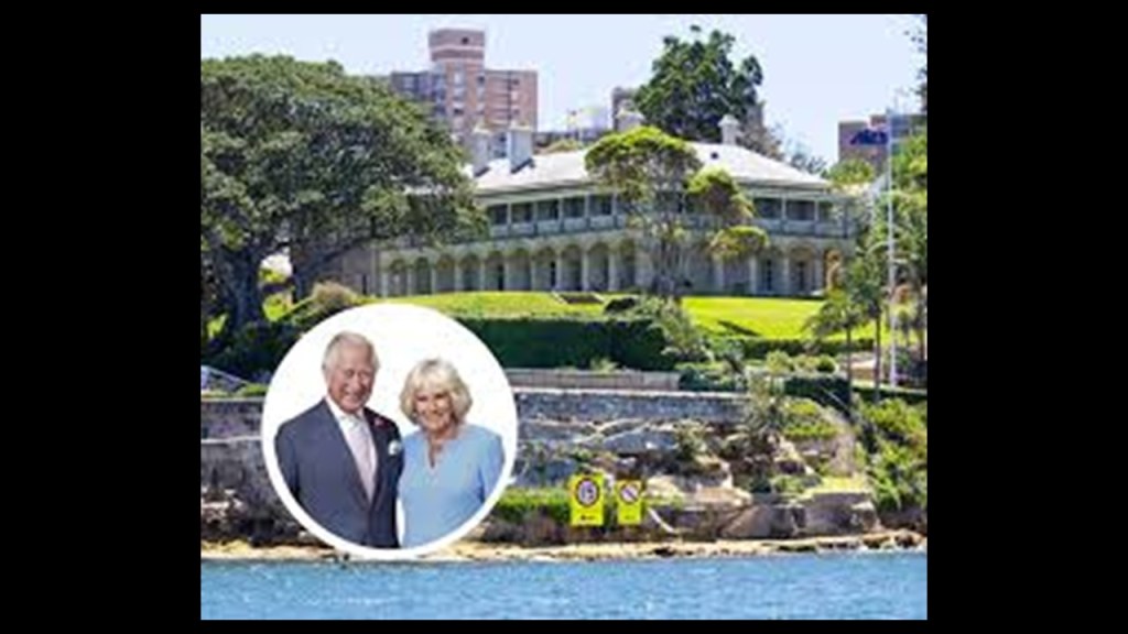
King George V, the grandson of Queen Victoria, changed the name from the House of Saxe-Coburg & Gotha to the House of Windsor on July 17th of 1917 because of concern about anti-German sentiment during World War I.
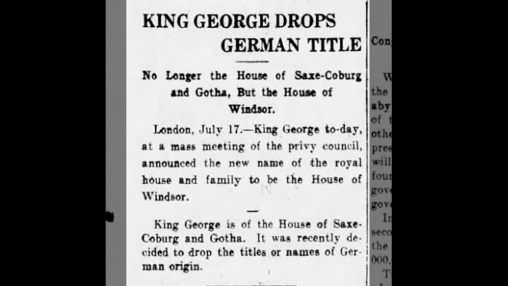
The Admiralty House was said to have been designed in both the Victorian Regency and Victorian Italianate architectural-styles by New South Wales colonial architects James Barnet originally from Scotland, and Walter Liberty Vernon originally from England, and built starting in 1842 and completed in 1843.
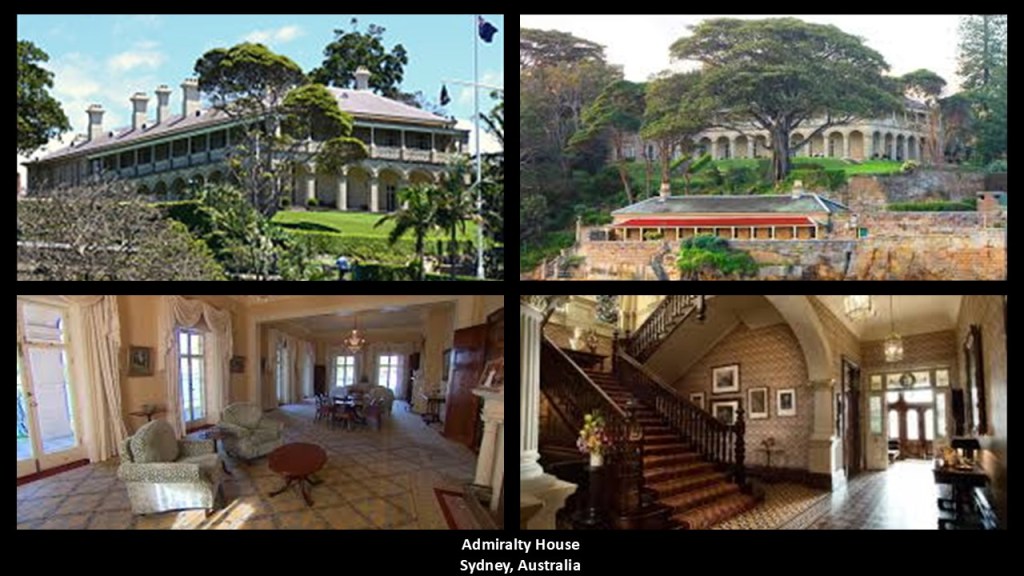
Kirribilli House in this location is one of the two official residences of the Prime Minister of Australia.
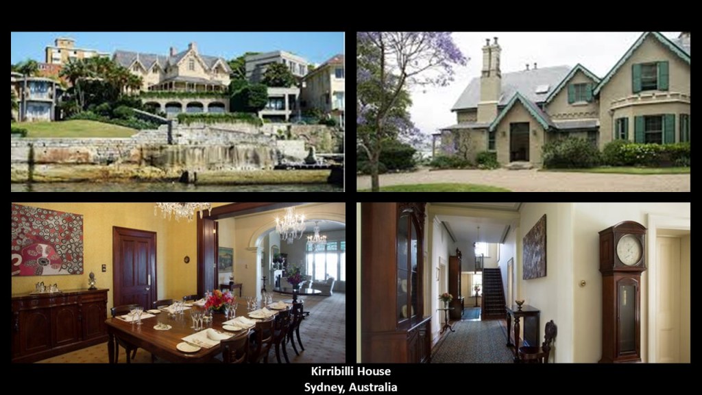
What we are told in our narrative about the origin of the Kirribilli House is that it was built in 1855 by Adolphus Frederic Feez, a German-born merchant and architect who was a recent immigrant to Sydney.
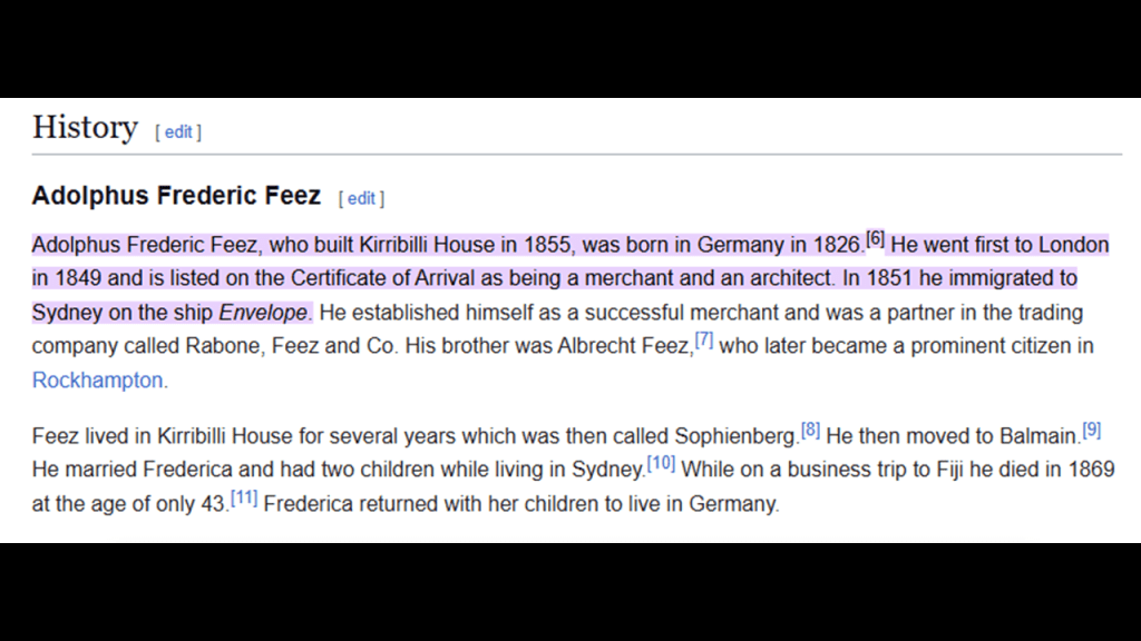
The other two official residences of the Governor-General and Prime Minister – Government House and The Lodge – are in Canberra, the capital city of Australia, and location of the country’s federal government.
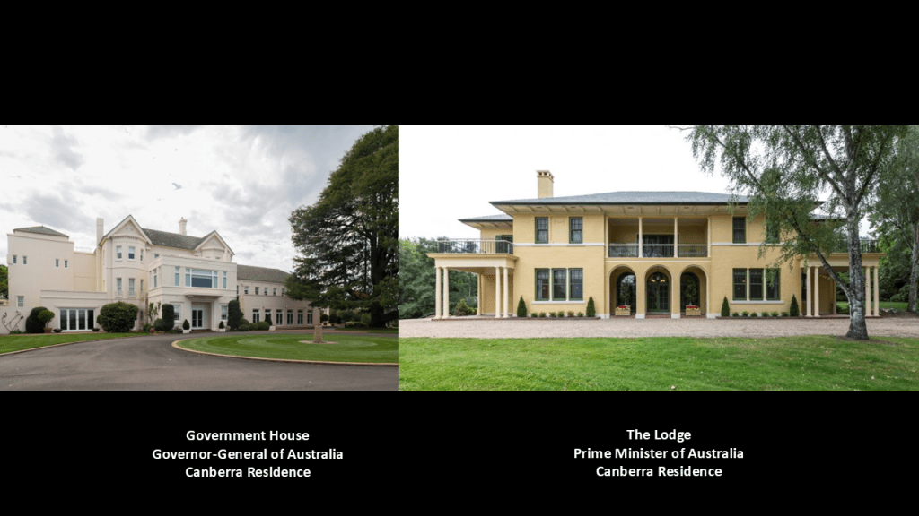
Canberra is located in the Australian Capital Territory, a federal territory of Australia that is an enclave of the State of New South Wales but separate from it.
As such, it is a self-governing city-state, like the status of the previously mentioned Washington, DC, the City of London, and the Vatican.

PM also photographed what is called Fort Denison in between Kirribilli Point and Bennelong Point on “Pinchgut Island” named as such by convicts who were marooned there with meagre rations as punishment for breaches of the peace.
It was said to have been built on a small rocky island between 1841 and 1857, and used for both correctional and military purposes and decommissioned around the 1930s.
Like the Barrack Tower we saw back on the La Perouse Peninsula, it looks like there’s more to Fort Denison under the surface of the water.
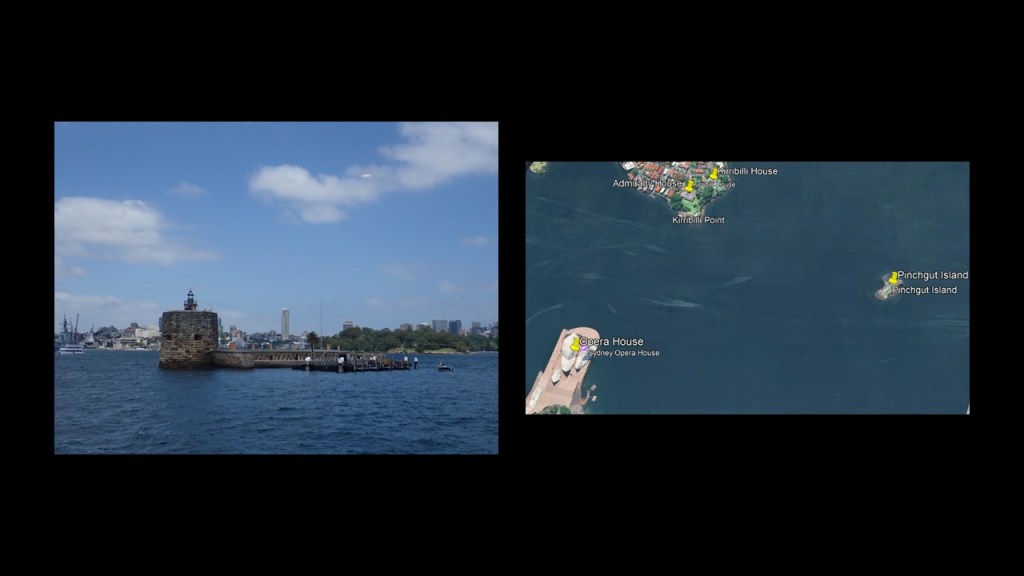
Next, I am going to share the following two photos sent by PM, which were taken to the southwest of the Sydney Opera House on Bennelong Point looking east at the location marked by “A” on this Google Maps screenshot
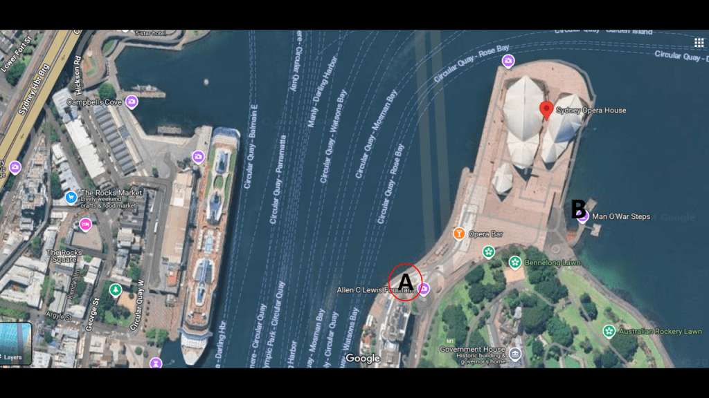
PM said these were taken water side just before Opera House, looking across the roundabout with the wall to the Botanical Gardens on Bennelong Point.
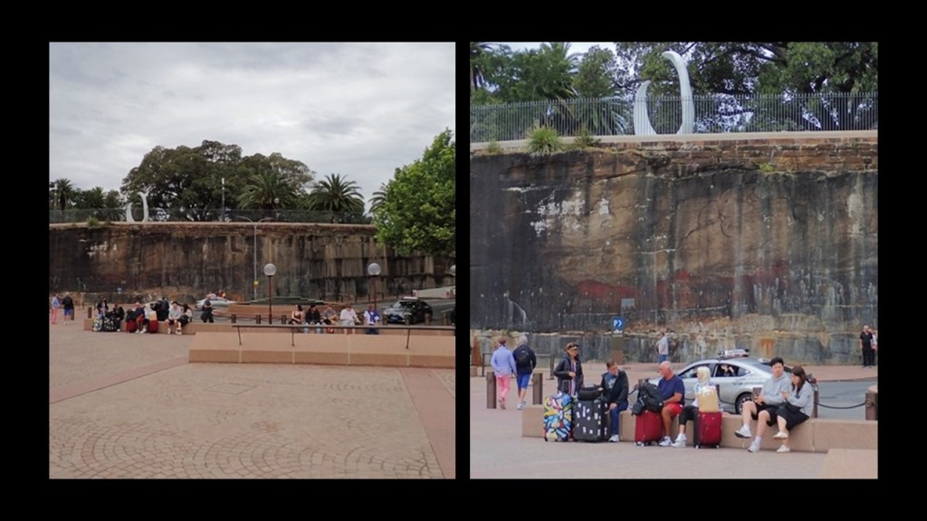
As a side-by-side comparison, here is what looks to be a very old stone wall on the left in Sydney, and on the right, what looks to be a very old stone wall back at the Franz Sigel Park in the Bronx.
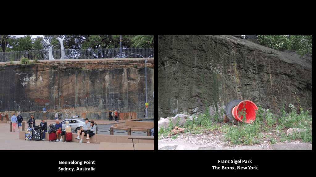
This place on Bennelong Point was the former location of the Fort Macquarie Tram Sheds.
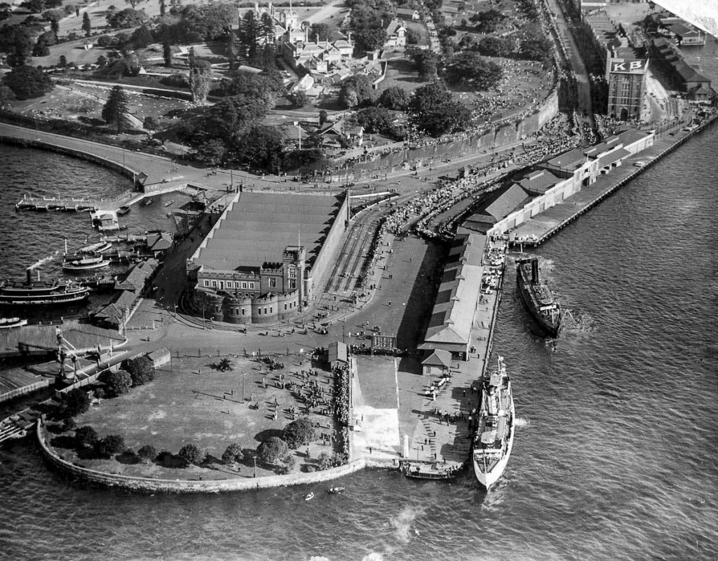
And as we have already seen in this post, like everywhere else in the world it seems, these electric trams, also known as streetcars, used to be all over Australia.
Today, Sydney is one of four population centers that has an operating streetcar system -also in Adelaide, the Gold Coast, and Melbourne.
At its greatest extent between its opening in 1879 to its complete closure in 1961, Sydney had 181-miles, or 290-kilometers of street railway mileage in 1923 at its height, making it the second-largest in the world in the British Empire after London.
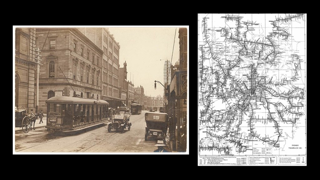
A portion of it was revived as a light-rail-system serving part of Sydney starting in 1997, including the previously seen Randwick Municipality on the north shore of Botany Bay in East Sydney.
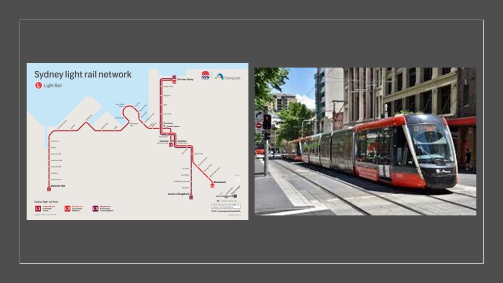
Melbourne still has its network of 24 tram routes, covering approximately 155-miles, or 250-kilometers, which is the largest in the world, having operated continuously in Melbourne since 1885.
Not sure why Melbourne is one of the few places in the world never to completely lose its tram service, and as a matter of fact, retain much of it, but there you go.

The next photographs that I am going to look at from PM were taken looking at the Harbor Wall at Location “B” on this Google Maps screenshot, and are the “Man O’ War Steps” just below the Sydney Opera House on the opposite side of Bennelong Point from the first location, and on the northwestern boundary of the Royal Botanic Garden.

What we are told about the “Man O’ War Steps” is this.
The “Man O’ War Steps” are a heritage-listed jetty.
Initially said to be of wooden construction in 1810, when Governor Macquarie was said to have built a small landing place known as “Man O’ War Steps” for his private use, they were “repaired and improved” over the years, and that by 1850, they were referred to by the Admiralty as a stone pier to be used for watering shipping anchored nearby.
We are told in our narrative that Governor Macquarie laid the foundation stone for Fort Macquarie in December of 1817, and that its construction was completed in 1821.
We are told that Fort Macquarie was then demolished in 1901, only 80-years-later, in order to build the Fort Macquarie Tram Depot, which opened in 1902, and it was demolished in 1958 in order to build the Opera House.
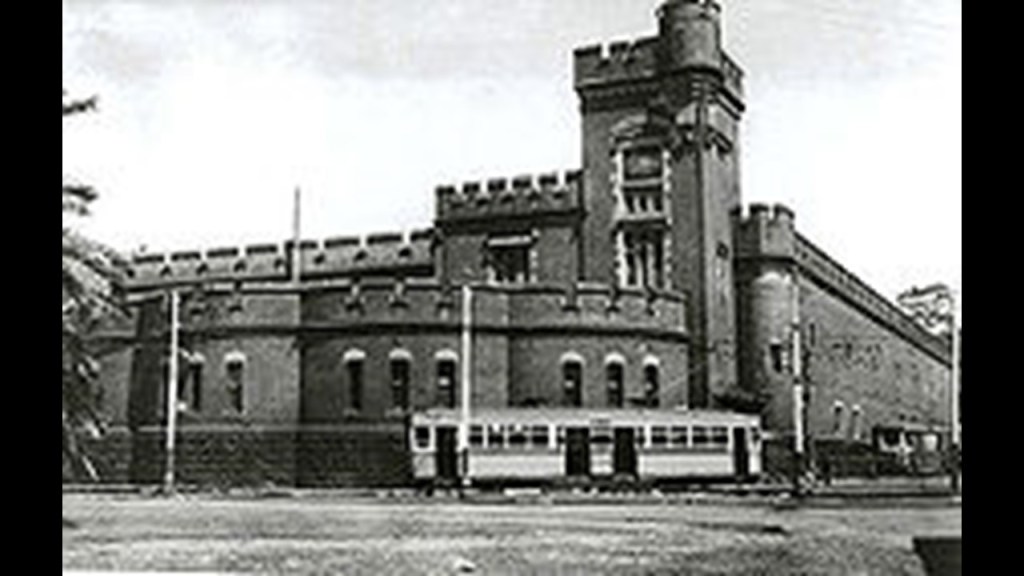
PM also sent me this old picture of a Sydney Harbour scene on the left from the Man O’ War Steps with no date, but showing the walls where these two pictures were taken, shown on the right.
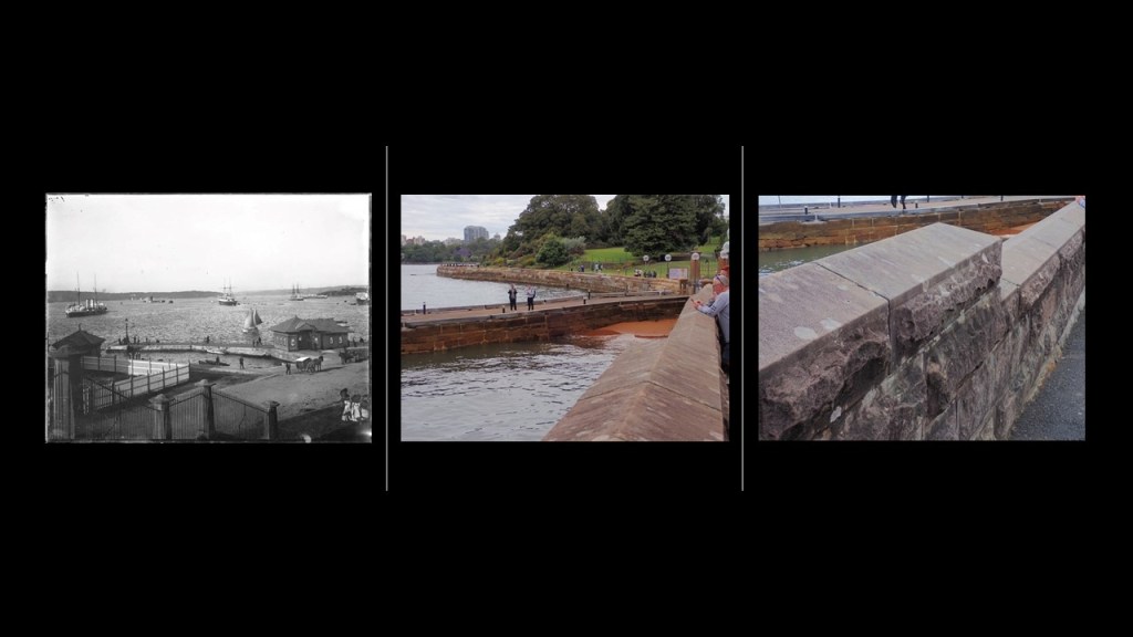
“Mrs. Macquarie’s Chair” is located on the point just to the east of Bennelong Point
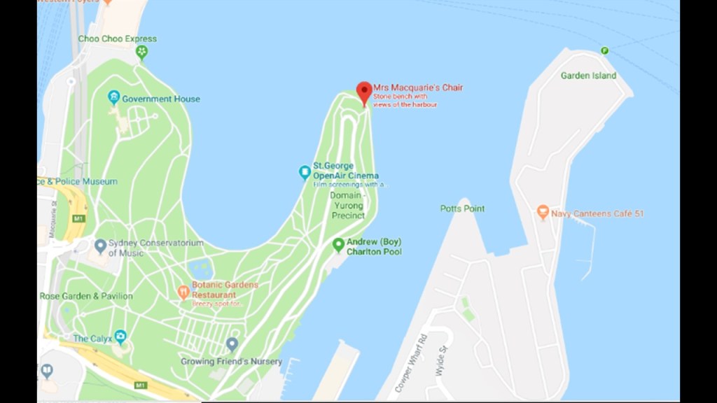
The story that goes along with “Mrs. Macquarie’s Chair” is that it was exposed sandstone that was carved into a bench by convicts in 1810 for Governor Macquarie’s wife Elizabeth, where she used to sit and watch for ships coming into Sydney Harbor from Great Britain.
Major-General Lachlan Macquarie was the Governor of New South Wales from 1810 to 1821.
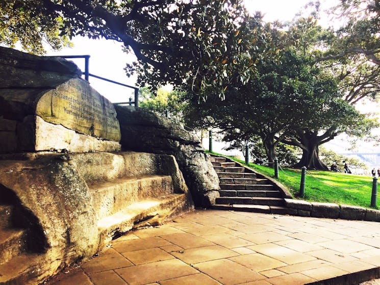
The Royal Botanic Garden occupies 74-acres, or 30-hectares, of land in-between these two points.
The Royal Botanic Garden was founded by Governor Macquarie in 1816 and is the oldest scientific institution in Australia and one of the most important botanical institutions in the world.
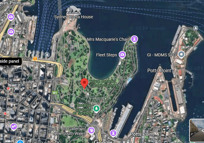
The Government House is located between the Sydney Opera House and the Royal Botanic Garden.
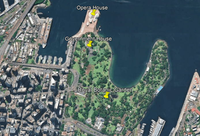
The Government House is the official residence of the Governor of New South Wales and was said to have been constructed between 1837 and 1843 from plans drawn up by Edward Blore, the Royal Architect.
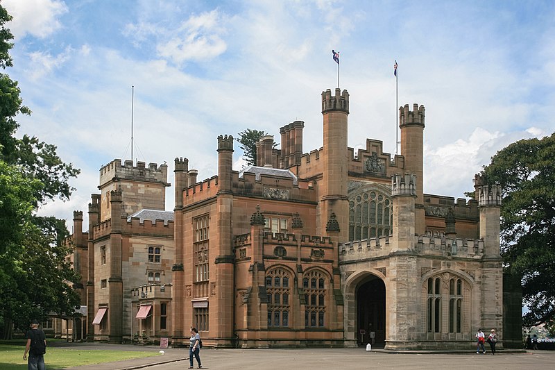
I first encountered mention of Edward Blore several years when I was tracking a long-distance alignment through the Crimea in the Black Sea region.
Edward Blore was credited in our historical narrative with introducing the Scots Baronial and Moorish-Revival architectural-style to the Crimea in the 1820s, like with the Vorontsov Palace in Alupka, Crimea.
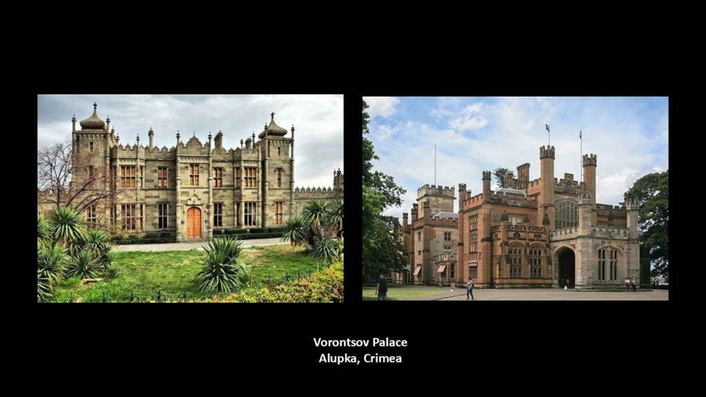
Interesting to note that Edward Blore was also said to not have any formal training in architecture, and that his training was in “Antiquarian Draftsmanship.”
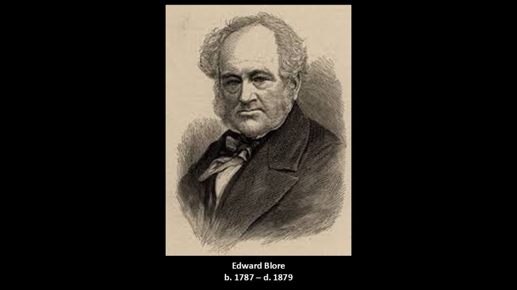
We are told that at one time there was a windmill on the grounds that was said to have been built by the British East India Company near the Government House Stables, but it was said to have been removed in 1835 after a dispute between the Company and the government.
The Sydney International Exhibition of 1879 was held in the Garden Palace of the Royal Botanic Garden, which was said to have been specifically-built for this Exhibition in 8-months.
It was said to have been designed by the colonial New South Wales architect, John Barnet and built by John Young in 8-months.
The Garden Palace was subsequently destroyed by fire in September of 1882.
Next, PM sent me photos of the Queen Victoria Building; the Sydney Town Hall; and St. Andrews Cathedral, which are close toeach other in the Central Business District.
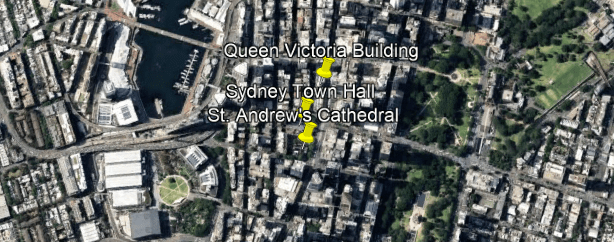
First, the Queen Victoria building is described as a 5-story, late 19th-century building.

It was said to have been designed on the “Scale of a Cathedral” by the architect George McRae, and constructed between 1893 and 1898.
The Queen Victoria Building has cathedral-style windows…
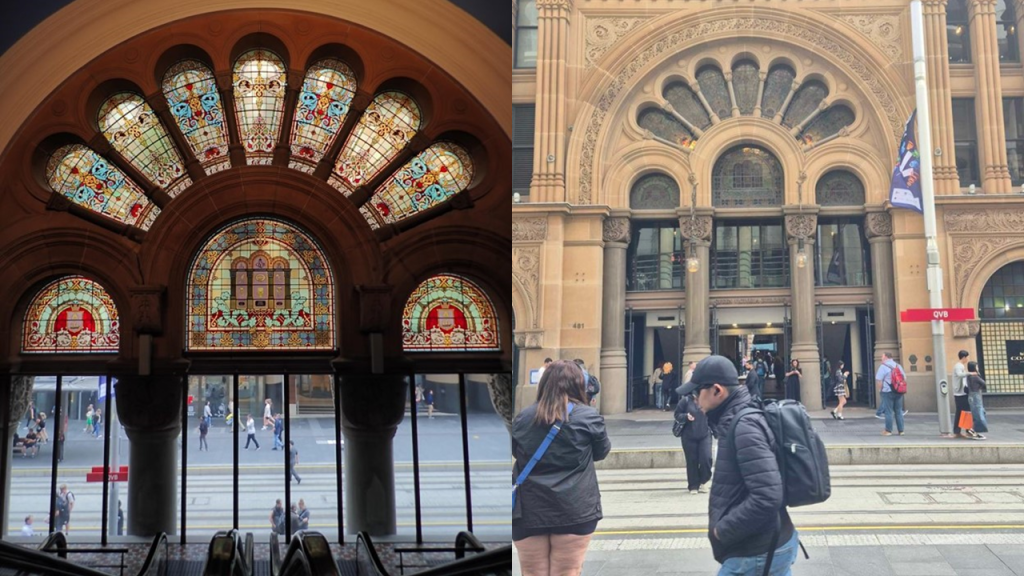
And over 20 domes.
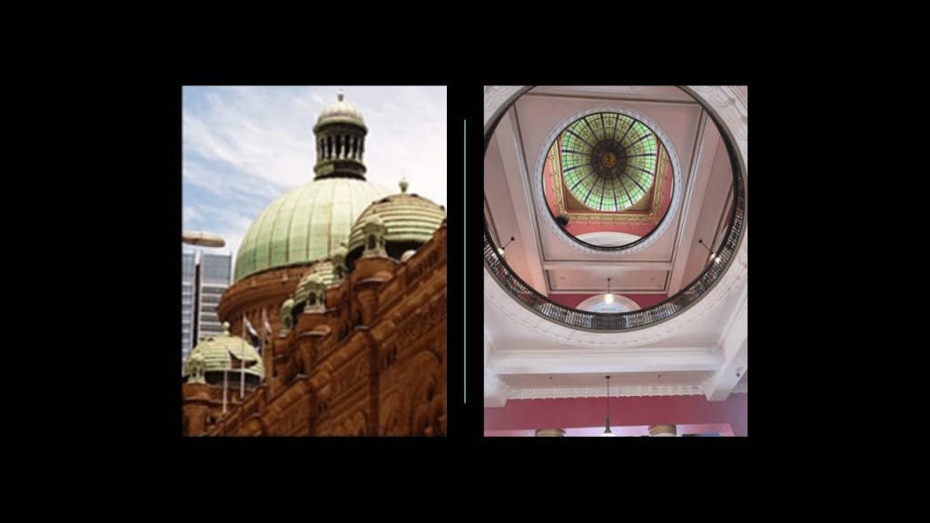
Here is a comparison for similarity of appearance between the Queen Victoria Building in Sydney on the left and the previously-seen Our Lady of Mount Carmel Church in the Bronx on the right.
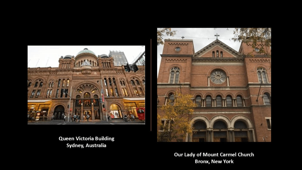
During its history, the Queen Victoria Building has had some different uses, but used primarily as retail space, which it is today.
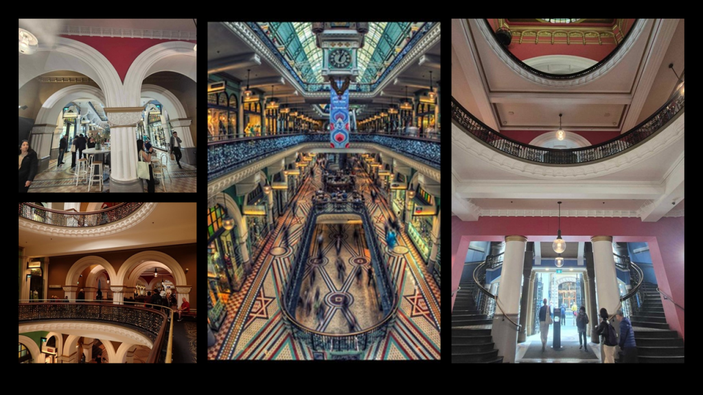
The Queen Victoria building has been threatened with demolition at various times over the years, starting as early as 1959.
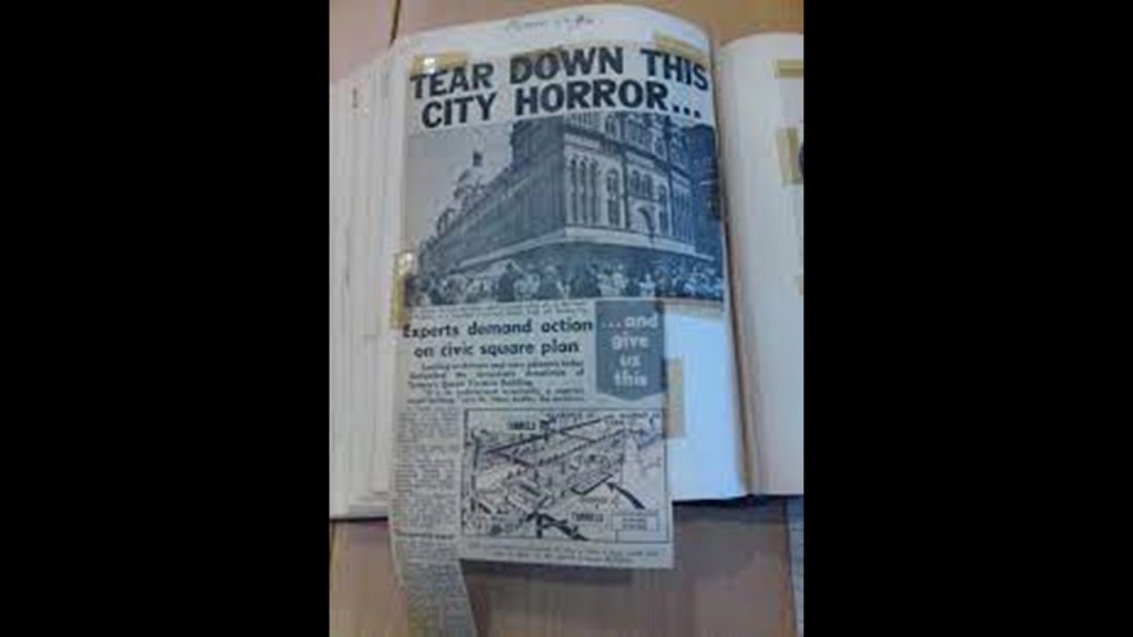
Secondly, the following photos were taken by PM of the Sydney Town Hall.
The Sydney Town Hall was said to have been built between 1869 and 1889 in the Victorian Second Empire Architectural Style, that was inspired by the Second French Architectural style.
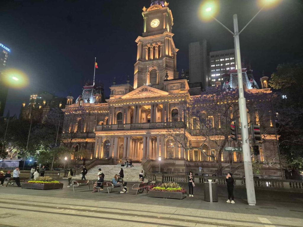
These three pictures taken by PM around the grounds of the Town Hall show old stone-work and below-ground entranceways and windows.
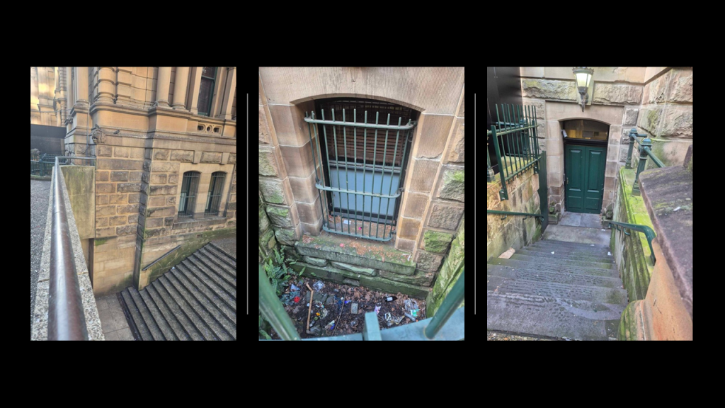
This is a comparison of the Sydney Town Hall on the left with the Philadelphia City Hall on the right, which was said to have been built in the Second French Empire Architectural Style between 1871 and 1901.
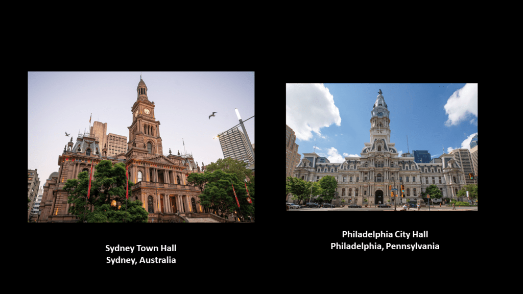
Both of these Town Hall buildings have an underground rail station associated with them.
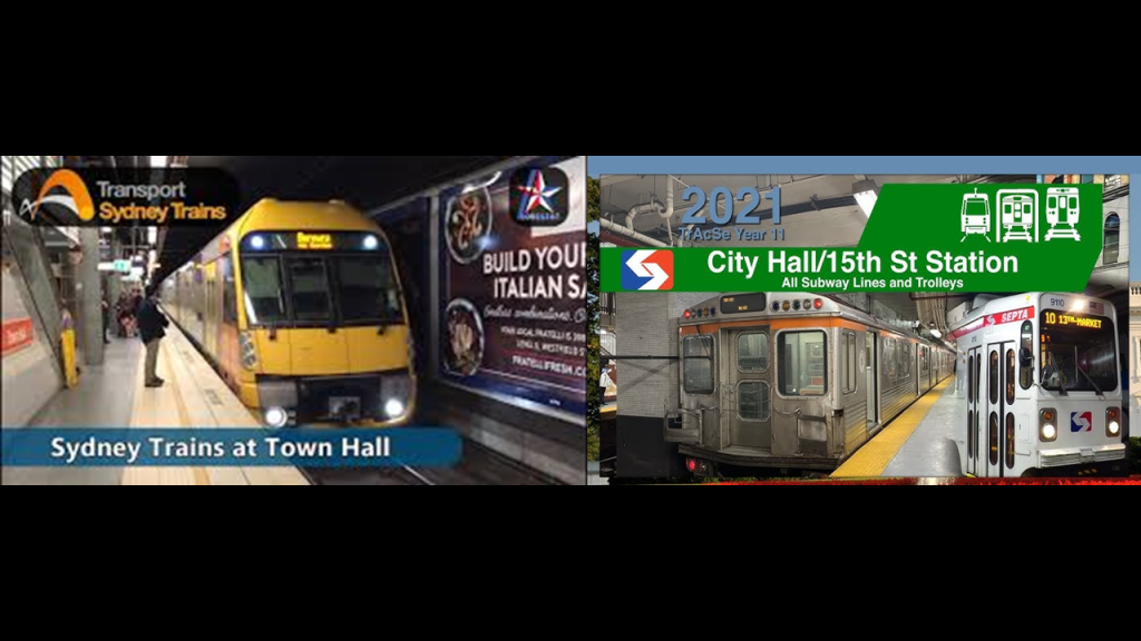
The Sydney Town Hall Grand Organ is the world’s largest organ without any electrical action components.
The Sydney Town Hall Grand Organ is considered the pinnacle of British achievement in organs during the Victorian-era.
It was said to have been constructed between 1886 and 1889 by Hill & Son of London.
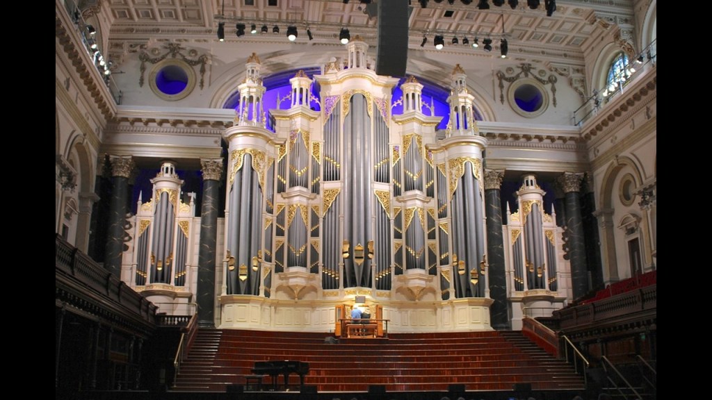
Thirdly, St. Andrew’s Cathedral is a cathedral church of the Anglican Diocese of Sydney and the seat of the Archbishop of Sydney.
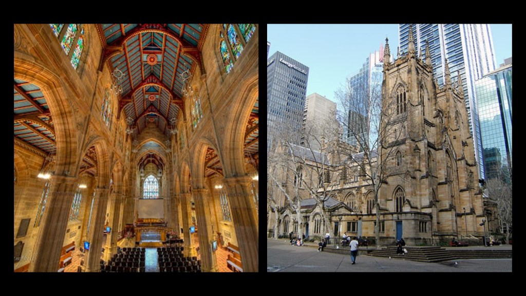
Called the oldest cathedral in Australia, it was said to have been designed primarily by Australian architect Edmund Blacket, and constructed between 1837 and 1868, at which time it was ready for services.
Here are some historic photos on display of St. Andrew’s that were taken by PM near the cathedral.
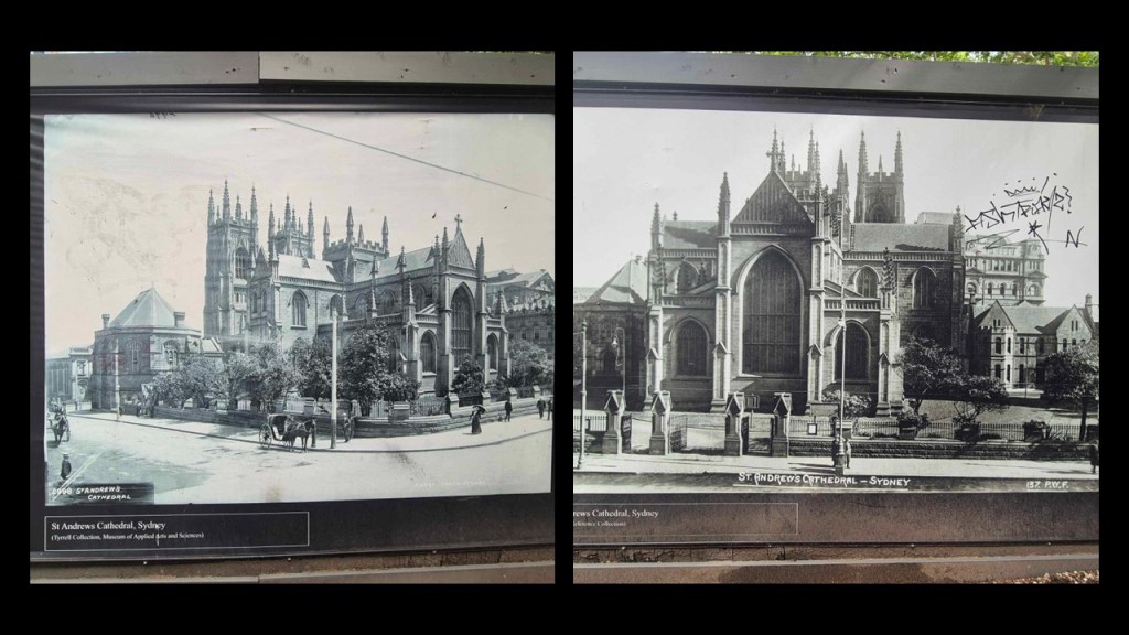
Like the adjacent Sydney Town Hall, St. Andrew’s Cathedral is said to have a Hill & Son of London pipe organ, which was said to have been installed in 1866 in the Cathedral’s South Transept.
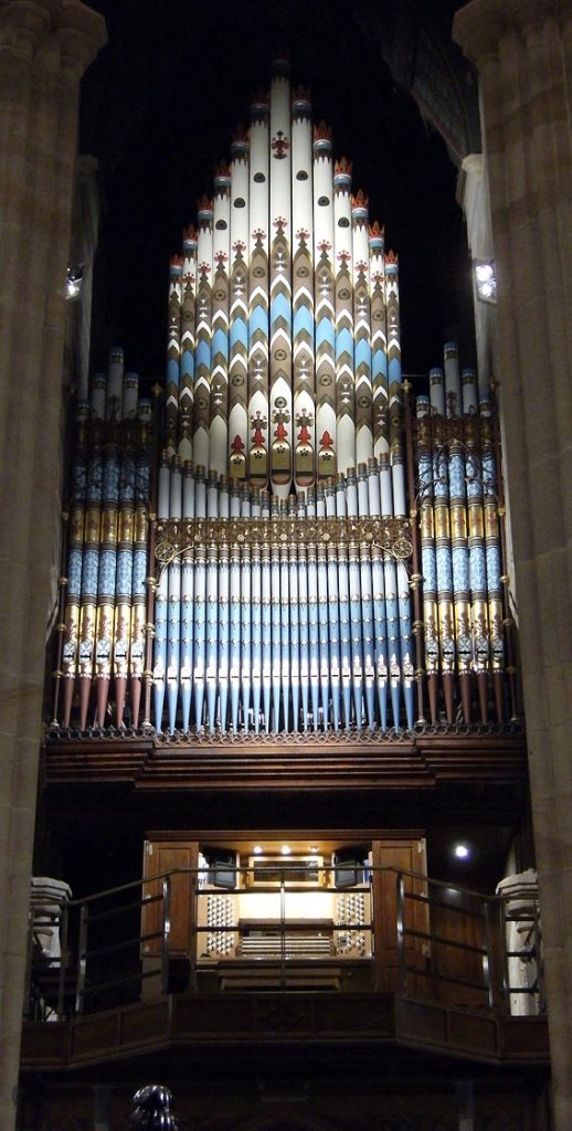
Previously in this post I mentioned organs and their direct placement in conjunction with Cathedral Rose windows that look like the cymatic patterns of musical note, and I mentioned the healing properties of the solfeggio frequencies and their suppression in today’s world as having a negative effect on us.
I have come to believe that the Earth’s original energy grid system was a perfectly-tuned scientific and musical instrument, and that we have been looking at the infrastructure associated with it in these Old World buildings.
As such, cathedrals themselves were infrastructure of this energy grid system.
When you break down the meaning of “Cathedral” from the ancient Greek, “kathados” means“descent” or “down…”
…and “Hedral” refers to a 3D geometric solid.

Cathedrals were acoustic/frequency/energy resonators.
Resonators are used to either generate waves of specific frequencies or to select specific frequencies from a signal, and these diagrams demonstrate the connections between cathedrals, frequency and geometry.
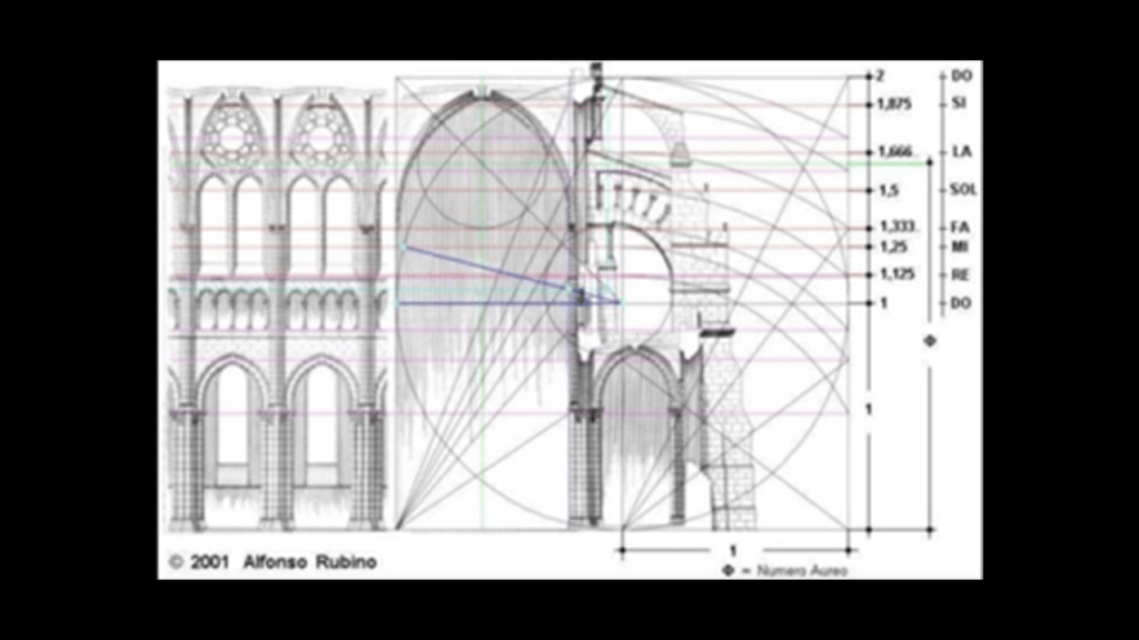
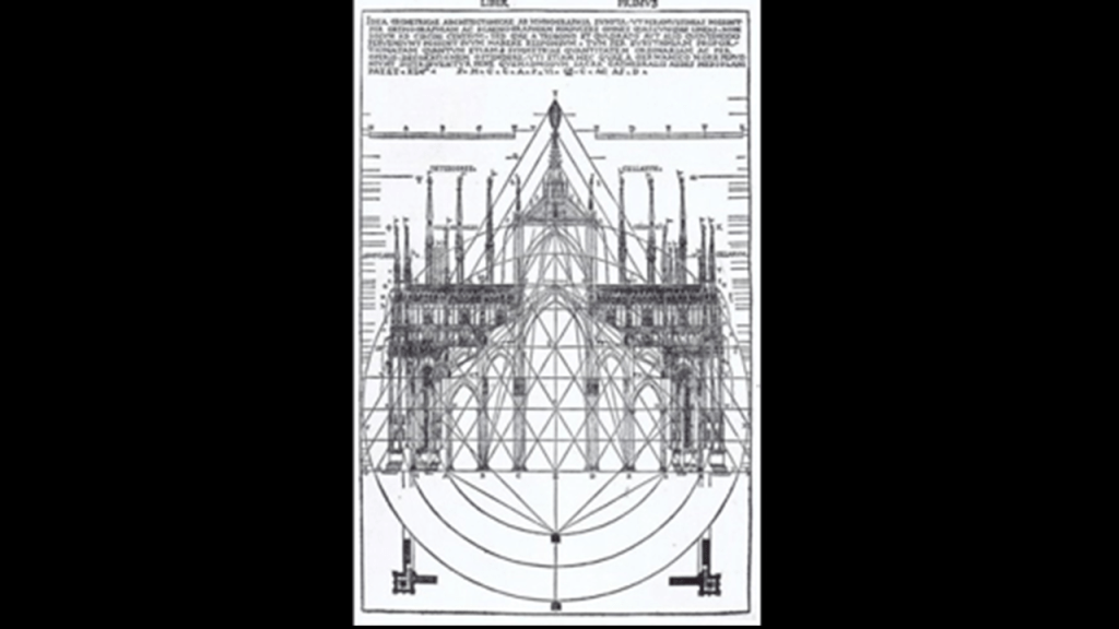
With respect to the function of this type of cathedral window as an antenna, this diagram on the left showing the efficiency in decibels of the axial ratio of two antenna came from an article I found about “Elliptical Polarization,” and the shapes formed in the graph immediately brought this common shape of windows in cathedrals on the right, visually demonstrating that these windows were actually functioning as antennae.

Here is an elaborate version of that same type of window on St. Andrew’s Cathedral in Sydney on the left.
On the right is the Salem Witch Museum in Massachusetts, with the same kind of elaborate window as St. Andrew’s Cathedral.
Salem was the historical location of the Salem Witch Trials and a great example of the points I am making about the relationship between architecture, frequencies, and the subversion of frequencies to lower our collective consciousness.
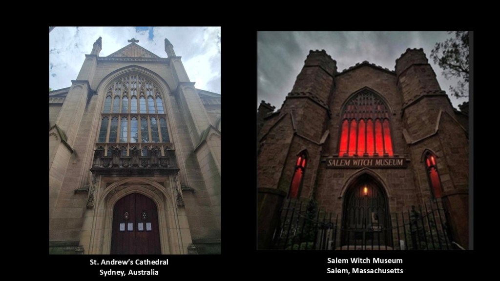
The museum was founded in 1972 with exhibits and tours exploring the famous 1692 Salem Witch Trials.

There is also what is called the “Witch Dungeon Museum” in Salem, also with a nice example of a cathedral-style antenna window…
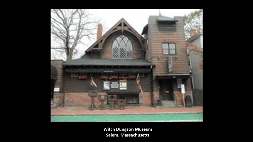
The “Witch Dungeon Museum” is the location of a play about the witch trials in a beautiful theater with a huge pipe organ in the back…
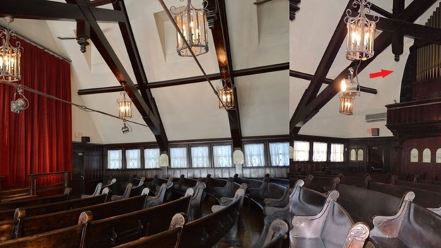
…and where there are also exhibits of jailed people and people hanging from a tree.
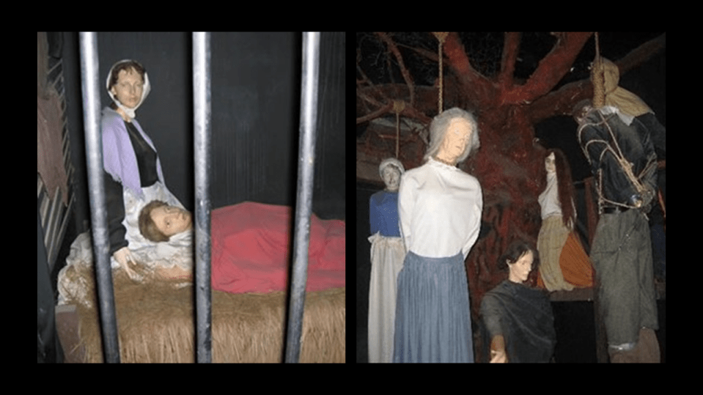
The next place that PM directed my attention to is the Garrison Church on the edge of the suburb of Millers Point where it meets the suburb called The Rocks.
It is located at the corner of Lower Fort Street and Argyle Street.
We are told that the Garrison Church was Australia’s first military church and was built between 1840 and 1846.
It is an active Anglican church today.
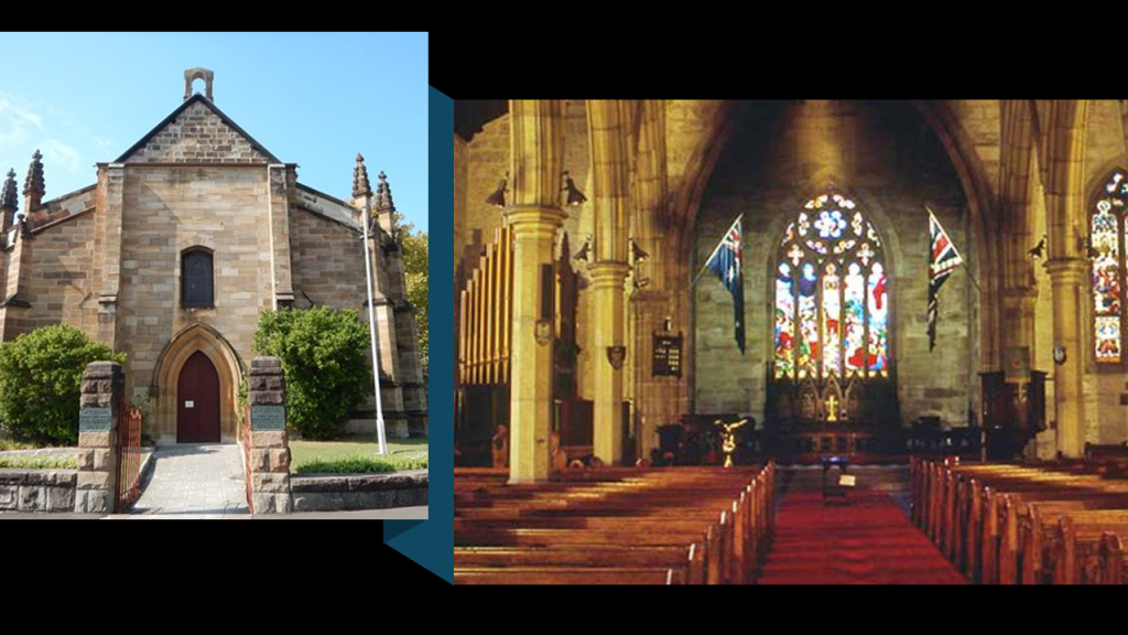
PM shared with me these photos taken of the Garrison Church’s exterior.
So along with the Cathedral Rose windows in the shapes of musical notes like solfeggio frequencies, and elaborate elongated windows shaped like the diagram of the efficiency in decibels of the axial ratio of two antennae, now we have these four-lobed shapes that are commonly found on cathedral-type buildings.
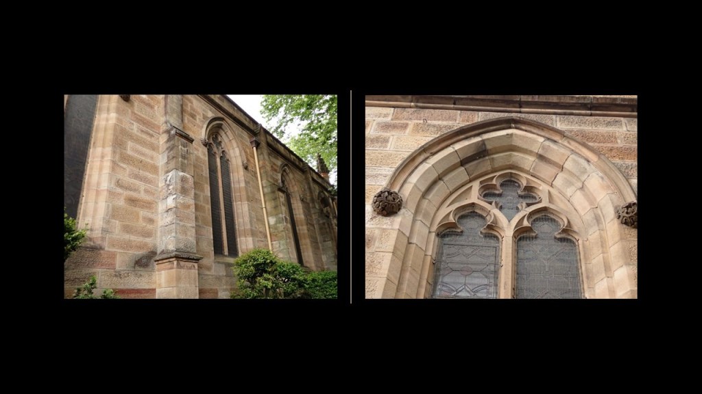
These four-lobed shapes resemble the patterns of different types of hydrogen wave functions.
The window pictured here is from the St. Mary of the Mount Catholic Church in Pittsburgh, Pennsylvania
Could this types of windows then perhaps be connected to atomic wave functions?

The Garrison Church and Millers Point suburb are adjacent to The Rocks suburb.
Millers Point is part of the local government for Sydney.
The Sydney Observatory is located here as well, said to have been built between 1857 and 1859.
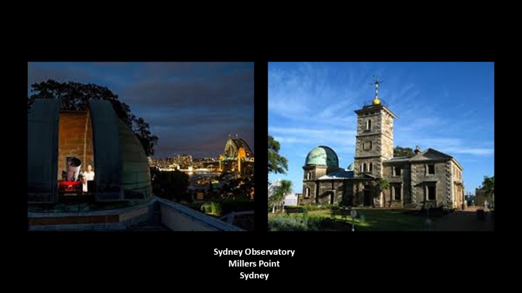
The Rocks is on the southern shore of Sydney Harbor and immediately northwest of Sydney’s Central Business District.
This is the traditional land of the Gadigal aboriginal people of the Eora Nation whose land included land south of Port Jackson, Sydney’s Central Business District, and Sydney Cove, where the Union Jack was first raised marking colonization by Arthur Phillip on January 26th of 1788.
Both of these suburbs are where the Sydney Harbor Bridge crosses over to North Sydney, and just across Sydney Cove and to the west of the places that we have looked at so far in Sydney.
PM sent me photos of what is known as the “Argyle Cut” on Argyle Street in The Rocks suburb.
The “Argyle Cut” was said to have been built between 1843 and 1868 as a link between Millers Point and The Rocks by first convicts in chains using crude tools and then eventually paid labor using explosives, and the property is owned and managed by the Sydney Harbour Foreshore Authority, which was established in 1998 by the government of New South Wales.
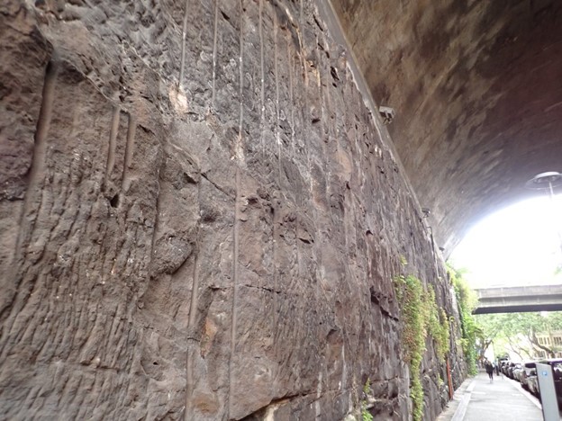
Here’s a comparison of what the rock looks like as seen at the “Argyle Cut” in Sydney on the left, and of rock at Franz Sigel Park in the Bronx on the right.
Not identical in appearance, but similar.
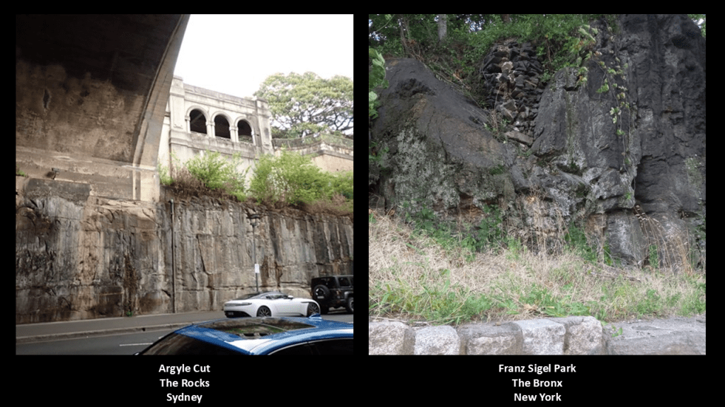
The “Argyle Bridge” that crosses the “Argyle Cut”and “Argyle Street” was said to have been built from 1911 to 1912.
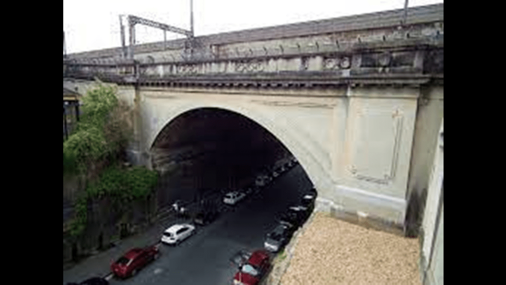
The “Argyle Stairs” are considered part of the “Argyle Bridge,” and PM indicated to me that they oldest surviving stairs in Australia, and were cut into the cliff face to a height of 30-feet, or 9-meters when the Argyle Cut was widened.
They give access to both the walkway on the Cahill Expressway above the Circular Quay and the walkway across the Sydney Harbor Bridge.
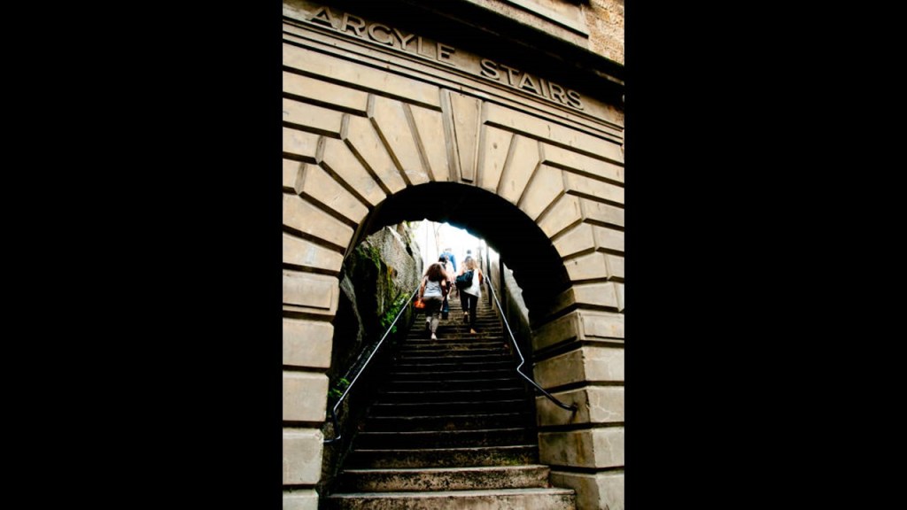
This is a photo PM took of the view from above the “Argyle Stairs.”
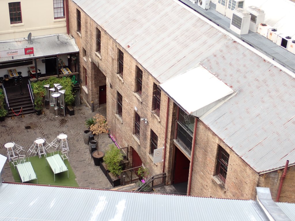
Here’s a comparison for similarity of appearance of the “Argyle Stairs” in Sydney on the top left; and the previously seen “Exorcist Steps” in Georgetown in Washington, D. C. on the bottom left and the “Joker Stairs” in the Bronx in New York on the right, and in all three examples there are old stone walls beside the stone steps.
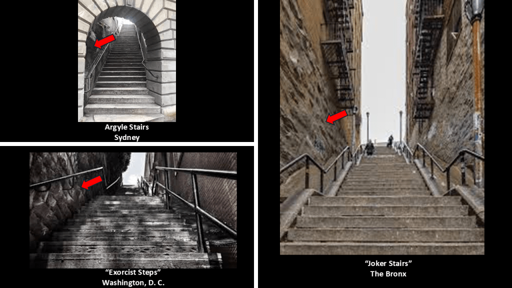
The Circular Quay is on the northern edge of Sydney’s Central Business District on Sydney Cove, where the First Fleet landed in 1788, between Bennelong Point and The Rocks, and is the “C” location on this Google map from PM.
The Circular Quay area, often referred to as the “Gateway to Sydney,” is adestination for tourism, restaurants and shopping, and is a transportation hub for ferry, bus and rail service.
In our historical narrative, in the early years of the Colony, Bennelong lived in the eastern side of what became the Circular Quay.
The entire eastern side of the Quay became part of the “Governor’s Domain” set aside by Governor Phillip for the Crown.
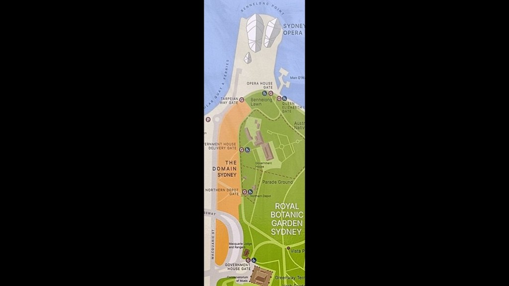
Here are some photos PM took of the eastern side of the Circular Quay.
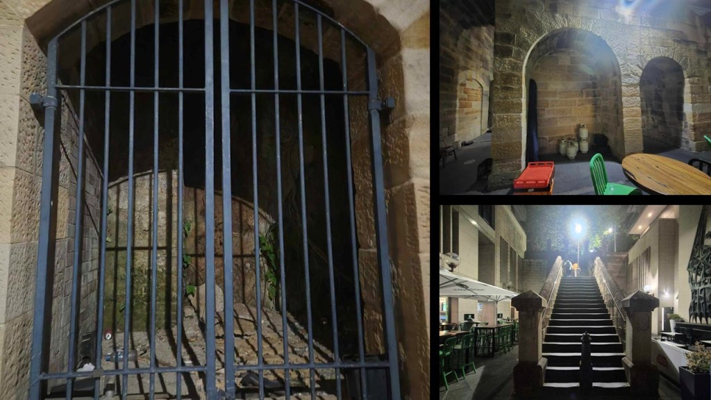
We are told the Circular Quay was constructed between 1837 and 1844 by reconstructing the southern section of Sydney Cove with an artificial shoreline on what were originally mud flats.
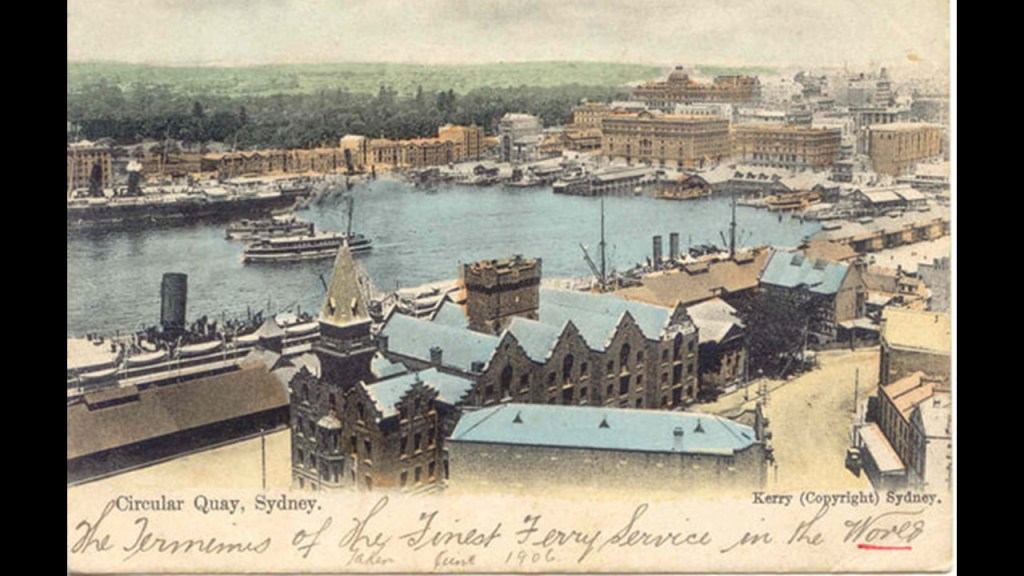
Back in the day, the Circular Quay was a tram hub, with it being the focal terminal point of most electric trams services to the eastern suburbs like La Perouse.
The first tram here started in 1861 as a horse-drawn service and the last tram ran from here on February 25th of 1961.
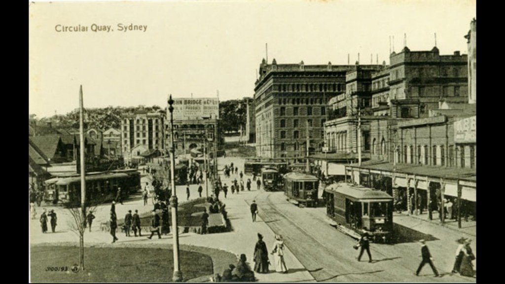
The last place I am going to look at in Sydney is Callan Park, located to the west of Sydney’s Central Business District in the suburb of Lilyfield.
The reason I am looking here is because of the “Callan Park Hospital for the Insane,” which was located on the grounds of Callan Park.
I knew from my friend Aaron’s work on finding Kirkbride alignments that there was a Kirkbride facility in Sydney.
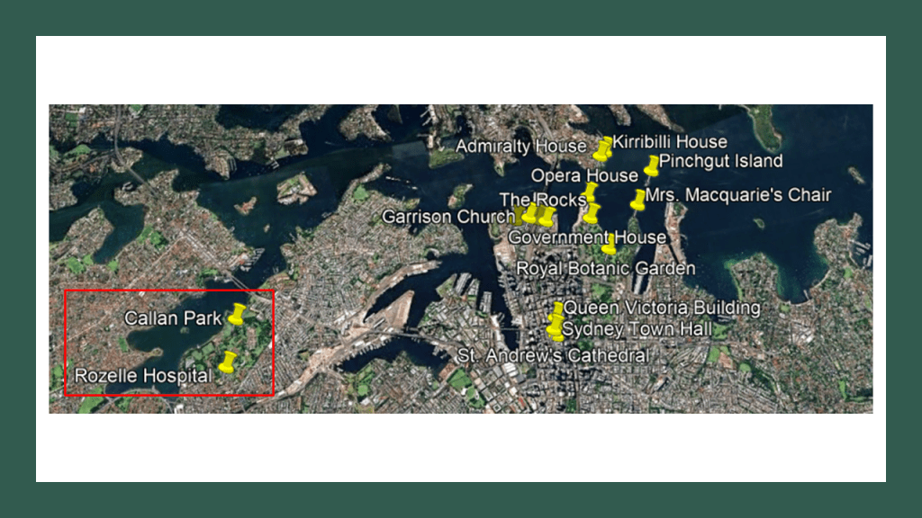
Thomas Kirkbride was a physician from Pennsylvania who was credited with designing a system of insane asylums starting in the mid-19th-century that were said to have been constructed according to the Kirkbride Plan across the U. S. and while numerous Kirkbride structures still exist, many have been demolished, partially-demolished, or repurposed.
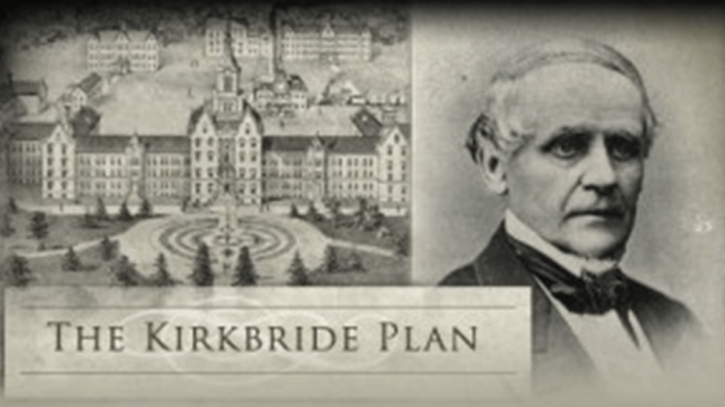
There were two Kirkbride facilities outside of the United States.
One was the Callan Park Hospital for the Insane, which first opened in 1878, and closed as the Rozelle Hospital in 2008.
The former Kirkbride complex housed the Sydney College of the Arts from 1992 until 2019.
It still houses Writing NSW, which provides a variety of services to writers; and the New South Wales Ambulance Headquarters, and the Callan Park landscaped public parklands are the third-largest in Sydney.
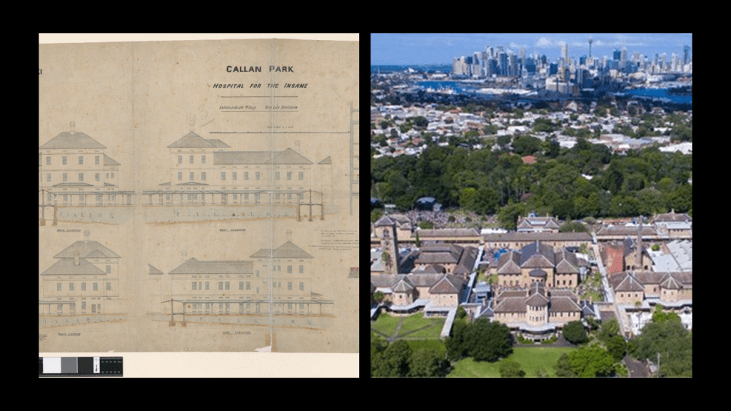
The other Kirkbride facility outside of the U. S. was the Nova Scotia Hospital in Dartmouth, which was first opened as the Mount Hope Asylum for the Insane in 1852 and is still active as a mental health facility today.
The first building said to have been constructed with Kirkbride’s design was the New Jersey State Lunatic Asylum in Trenton, New Jersey, in 1848, also known as the Trenton State Hospital.
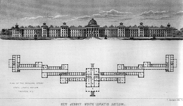
While the original Trenton State Hospital building is largely abandoned…
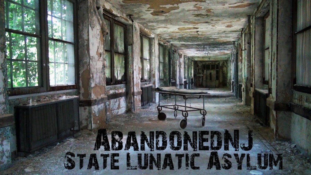
…and considered to be haunted, which is typical of these places…

…there still is a wing of it operating as the Trenton Psychiatric Hospital today.
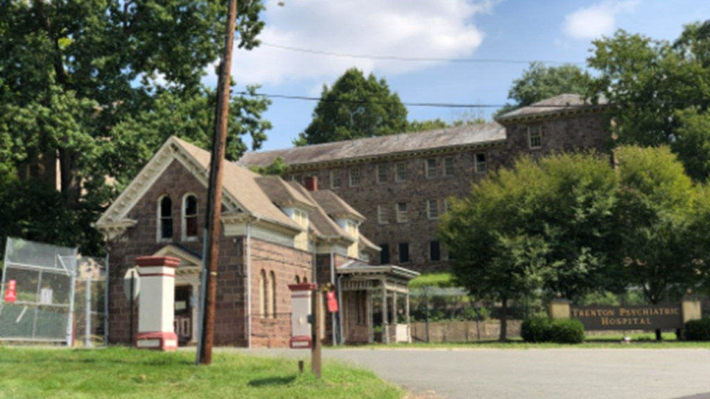
My friend Aaron uncovered Kirkbride alignments when he was prompted to look into the relationship between the locations on Google Earth of Kirkbride buildings (marked by white), key masonic lodges (green), and state capitals (red), and he found a high correlation of these Kirkbride buildings being on or near these alignments.
Gettysburg in Pennsylvania turned out to be a hub, circled in red, with many alignments between all three of these types of locations going out in all directions.
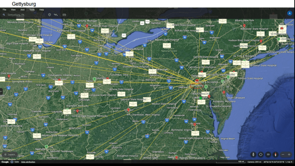
So I asked Aaron to check and see what was an alignment between Callan Park in Sydney and the Bronx.
He sent back the following information about this alignment in screenshots from Google Earth, starting in Callan Park, and ending at the Cloverleaf highway interchange in-between the Bronx Zoo and the New York Botanical Garden in the Bronx.
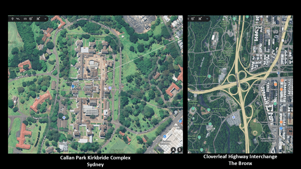
In the first screenshot, the alignment is shown leaving Sydney and crossing the South Atlantic Ocean directly over Fiji; Wallis and Futuna; Tokelau; and Kiribati.
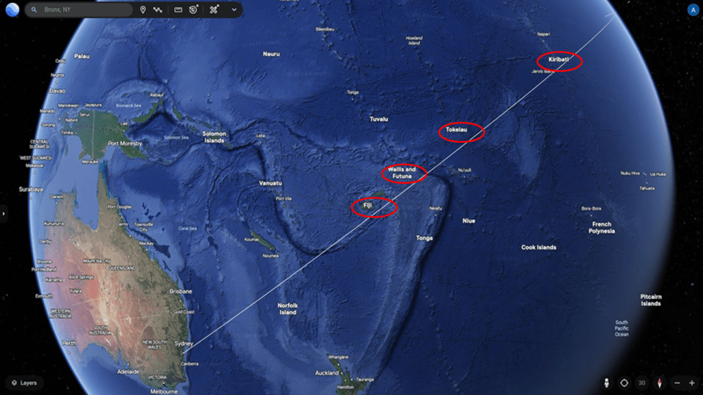
Fiji is an island Republic of 330 islands, with about 110 of them permanently inhabited.
It was a British Crown Colony from 1874 to 1970.
The islands of Wallis and Futuna are a French Overseas Territorial Collectivity in the South Pacific.
Tokelau is a remote group of atolls in the South Pacific, located half-way between New Zealand and Hawaii.
Though it is a dependent territory of New Zealand, it is considered a nation by both the New Zealand government and the Toklauan government, and has the smallest economy of any nation.
Kiribati is an island Republic in the Commonwealth of Nations today, after having been a British Protectorate from 1892 to 1979.
The islands of Kiribati straddle both the equator and the 180th-meridian.
The 180th-meridian is the meridian that is both 180-degrees east and west of the Prime Meridian in a geographical coordinate system, and the longitude of this line can be given as either east or west.
The 180th-meridian is used as the basis for the International Date Line, which determines the boundary between one day and the next.
Here is another view of the alignment from Sydney crossing the South Pacific Ocean before it enters North America in Baja California
This next screenshot shows the alignment crossing the United States to New York, and going northeast through the major U. S. cities of St. Louis, Indianapolis, Dayton, Columbus and Pittsburgh.
In this screenshot, I have highlighted three places, where just before the alignment enters Baja California, it crosses the Isla Guadaloupe; and Socorro and Santa Rosa in New Mexico.
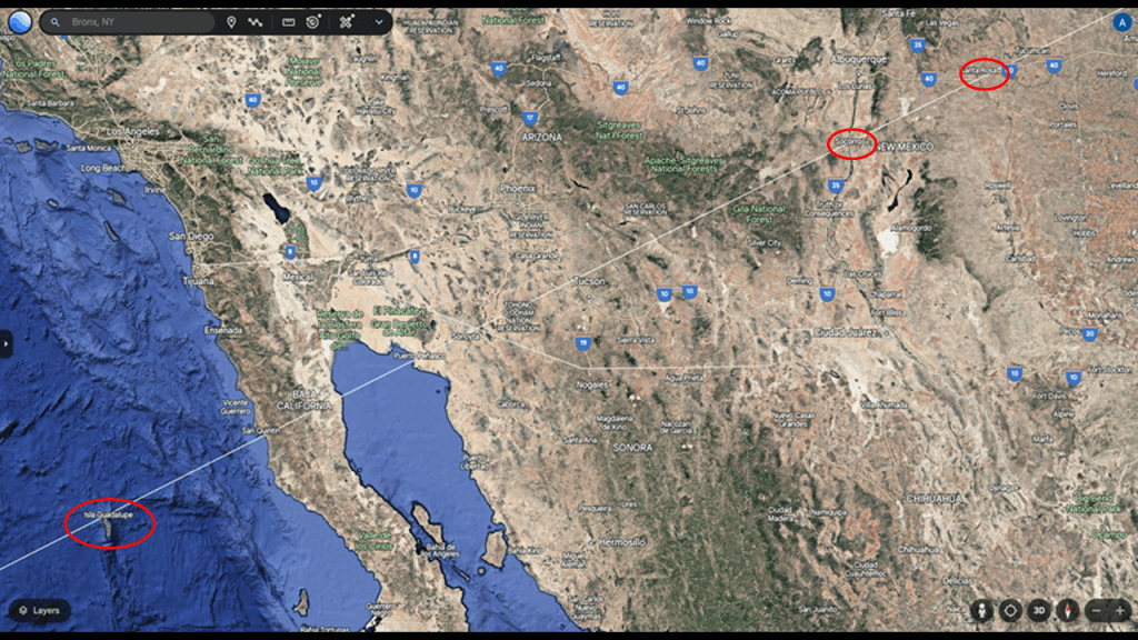
I first encountered Guadalupe Island years ago tracking a different long-distance alignment that started and ended in Montreal, Quebec, Canada.
Guadalupe Island is listed within a biosphere reserve, so visitors have to obtain a permit to go there.
There are small communities of fishing camps on the island, a weather station, and a small airport.
It is also a destination for cage-diving to view great white sharks.
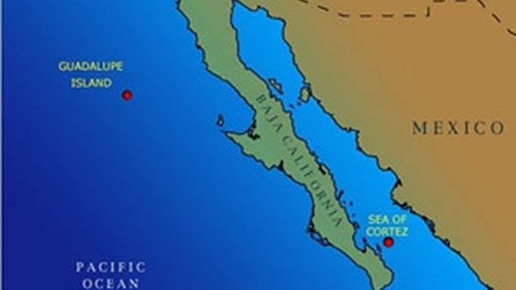
Socorro in New Mexico got my attention because I know it is the location of a National Radio Astronomy Observatory and a very large array of radio telescopes known as the Karl G. Jansky Very Large Array, named after the “Father of Radio Astronomy” who was credited in April of 1933 with the discovery of radio waves coming from the Milky Way in the Sagittarius constellation.
The Very Large Array is considered the most scientifically-productive ground-based telescope location in the world.

The Magdalena Ridge Observatory is in Socorro as well, and is significant for its role in astronomical research, education and national security.

Santa Rosa in New Mexico got my attention because I knew it was the location of the Blue Hole, which is 80-feet, or 24-meters wide-and-deep.
The Blue Hole is one of the most popular dive destinations in the United States, and is described as an artesian well with a constant in-flow of water that stays at a constant 62-degrees Fahrenheit, or 17-degrees celsius.

In this next screenshot, I have highlighted in the eight state hospitals clustered around this alignment in red, as well as the location of St. Louis in Missouri directly on the alignment, in yellow.
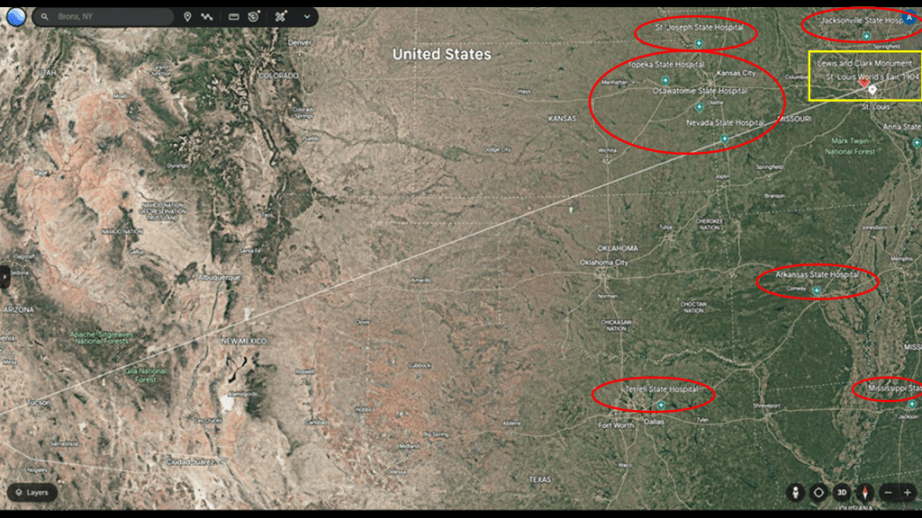
First, the State Hospitals.
Whatever was going on in these places was definitely not good.
In Topeka, Kansas, the Topeka State Hospital, formerly the Topeka Insane Asylum, first opened as a Kirkbride facility in 1872 and was in operation until 1997.
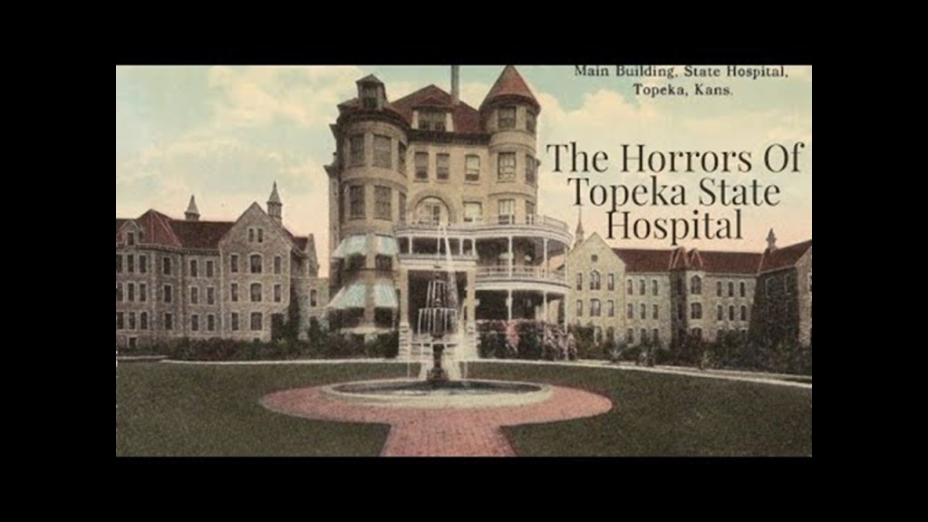
The Osawatomie State Hospital in Osawatomie is the oldest operating psychiatric facility in Kansas.

It first opened in November of 1866 as the “Kansas Hospital for the Insane” as a Kirkbride facility.
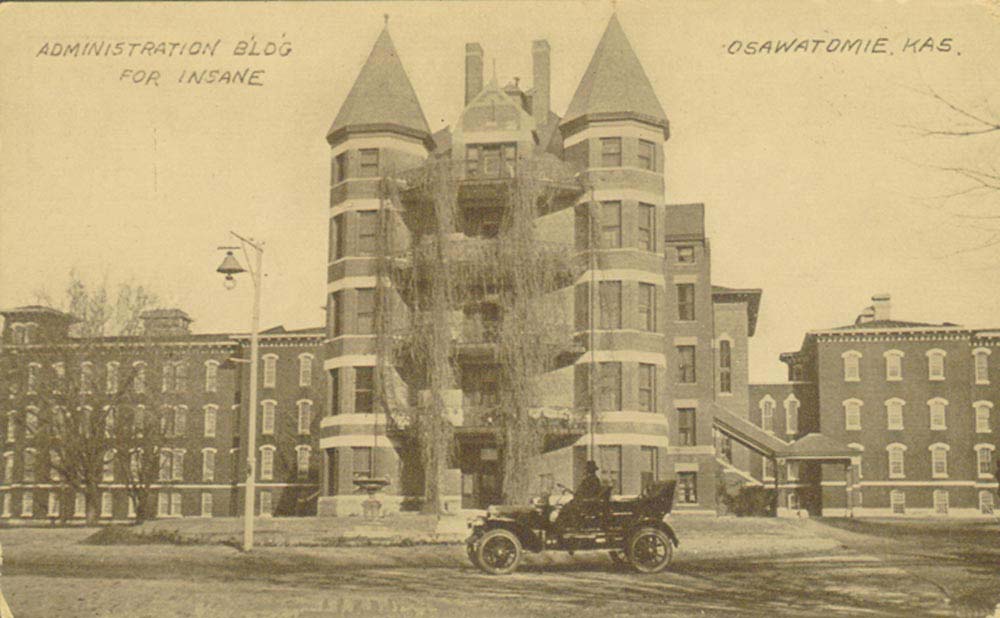
The St. Joseph State Hospital in St. Joseph, Missouri was known as “State Lunatic Asylum #2,” which opened in 1874 and was a Kirkbride facility.
It was in operation until 1997, at which time the psychiatric facility moved to location across the street and was renamed “The Northwest Missouri Psychiatric Rehabilitation Center,” and after partial demolition, what was left of the Kirkbride building was converted into a prison.
Known as the “State Hospital for the Insane #3,” the State Hospital in Nevada, Missouri, first opened in 1887, and was said to have been built in accordance with the Kirkbride Plan.
The Nevada State Hospital officially closed in 1991 and demolished in 1999.
The Jacksonville State Hospital in Jacksonville, Illinois, first opened as the Illinois State Asylum and Hospital for the Insane in 1851 under the Kirkbride Plan as the first state-run institution of its kind in Illinois.
The Jacksonville State Hospital closed for good in 2012 under the name of the “Jacksonville Developmental Center.”
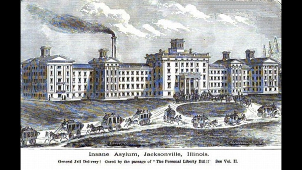
The Arkansas State Hospital in Little Rock first opened as the Arkansas Lunatic Asylum in 1883 in accordance with the Kirkbride Plan.
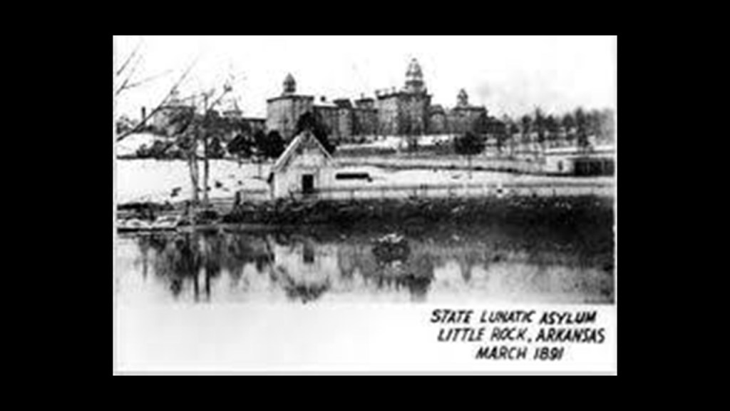
While the original buildings in Little Rock were destroyed in 1963, today the Arkansas State Hospital is the only public psychiatric facility in Arkansas.
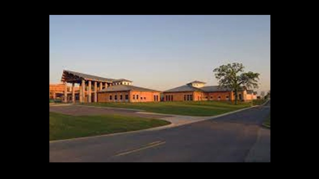
The Terrell State Hospital in Terrell, Texas, is also still a public psychiatric hospital today.
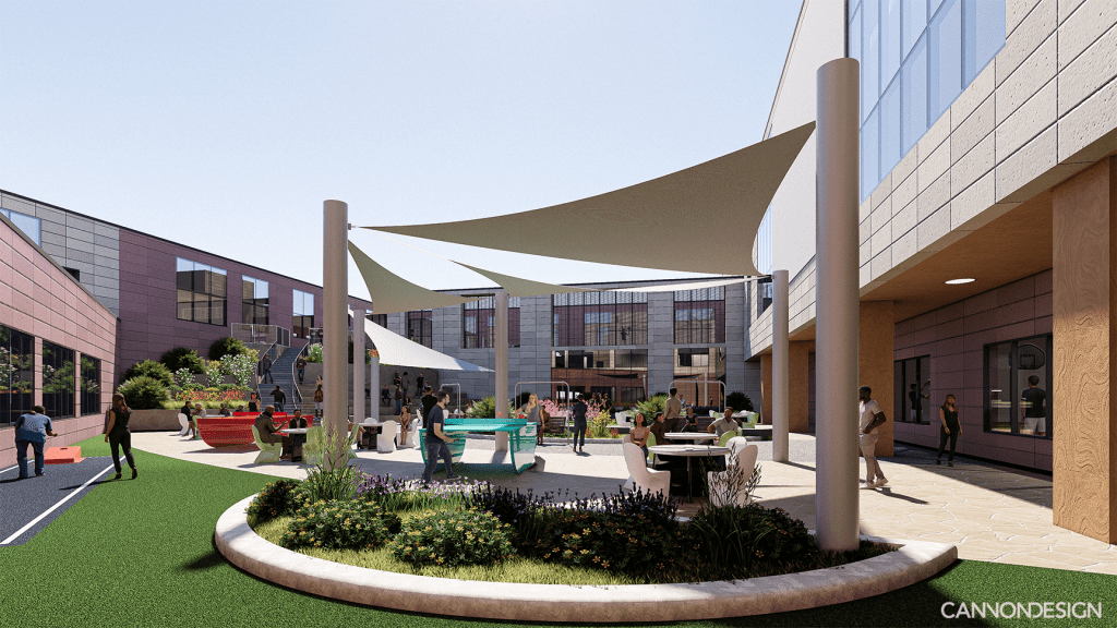
It was first opened in 1885 as the North Texas Lunatic Asylum in accordance with the Kirkbride Plan.
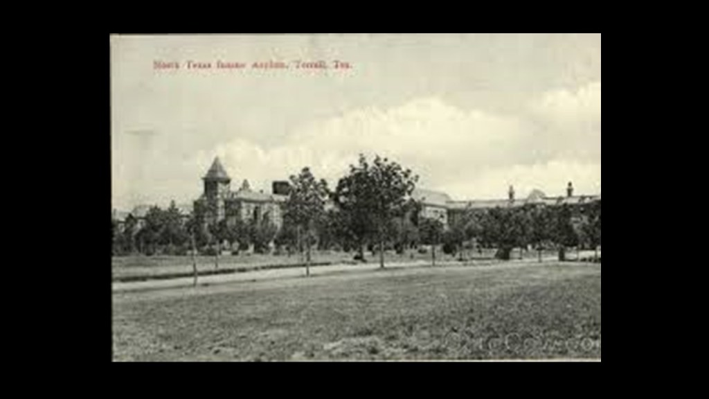
And lastly from this screenshot, the Mississippi State Hospital was first established as the Mississippi State Lunatic Asylum in Jackson, and operated there from 1855 to 1935.
It was said to be the sixth Kirkbride facility in the United States, and the first in the South.
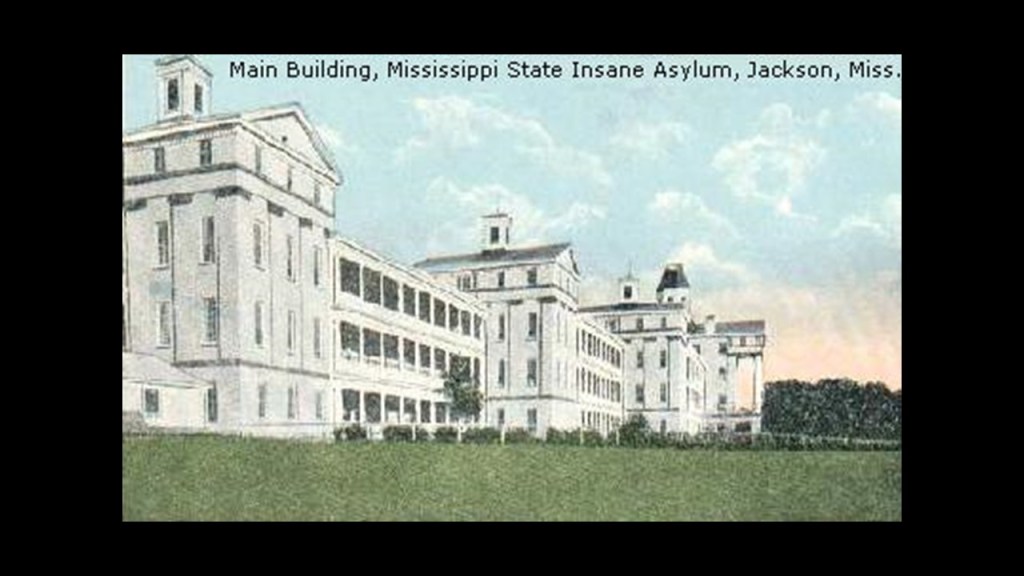
The former location of the Mississippi State Insane Asylum is now the Asylum Hill Cemetery on the campus of the University of Mississippi Medical Center.
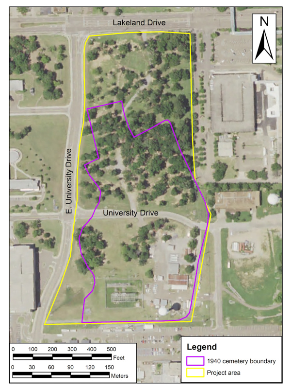
The current Mississippi State Hospital is still in existence in Whitfield, 15-miles, or 24-kilometers, from Jackson, which is the state’s capital.
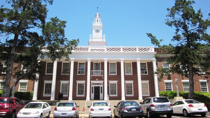
Now I am going to look at St. Louis featuring prominently on this alignment.
The first thing I need to do here is go back to the time of the Louisiana Purchase in our historical narrative.
The Louisiana Purchase was the acquisition of the Territory of Louisiana by the United States from France with the signing of the Louisiana Purchase Treaty on April 30th of 1803, which was officially announced on July 4th of 1803.
It was said to have doubled the size of the United States and paved the way for the nation’s westward expansion.
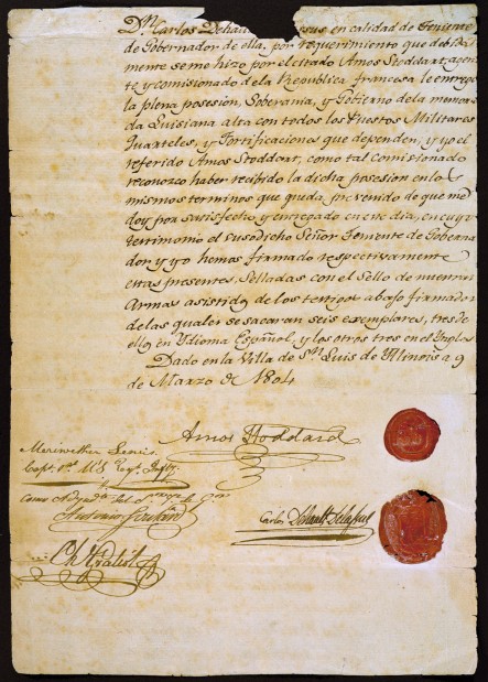
One of the negotiators with France for the terms of the Louisiana Purchase in 1803 on behalf of President Jefferson was the minor French nobleman Pierre Samuel Dupont de Nemours, who was living in the United States at the time.
His son Éleuthère Irénée du Pont, a chemist and industrialist, founded the E. I. du Pont de Nemours and Company to manufacture gunpowder and explosives in 1802, with the du Ponts becoming one of America’s richest families, with generations of influential businessmen, politicians and philanthropists.
Also known as the Corps of Discovery, the Lewis & Clark Expedition started on August 31, 1803 and lasted until September 25, 1806, with a mission to explore and map the newly acquired western portion of the country after the Louisiana Purchase.
They were commissioned by President Thomas Jefferson to find: 1) a practical route across the western half of the country; 2) to establish an American presence in this Territory before European powers tried to claim it; 3) to study plants, animal life, and geography; and 4) to establish trade with the local American Indian tribes.
The launching point of the Lewis and Clark Expedition was Camp Dubois in today’s Wood River, Illinois, near the Cahokia Mounds, both of which were just across the Mississippi River from St. Louis.
Apparently, the city of Wood River was founded in 1907 with the establishment in the vicinity of a refinery for John D. Rockefeller’s Standard Oil Company.
Interesting that this would also be the historical location of the starting point for the Lewis and Clark Expedition.

John Jacob Astor’s presence was also found on the route of the Lewis and Clark Expedition.
His presence was in Fort Pierre, South Dakota, at the location of Fort Pierre Chouteau, one of the most important fur trade forts of the western frontier, and said to have been built in 1832, after John Jacob Astor, head of the American Fur Company, decided to expand operations into the Upper Missouri River region in the 1820s.

John Jacob Astor’s presence was also found in Astoria, Oregon, which was named after him.
This is the John Jacob Astor Hotel in Astoria, said to have been constructed between 1922 and 1923, and opened in 1924.
It is one of the tallest buildings on the Oregon Coast.
Interesting to note, the world’s first cable television system was set up in 1948 using an antenna on the roof of the Hotel Astoria.

So these three of the most visible of the Illuminati’s thirteen bloodline families popped up right away on the Lewis and Clark Expedition.
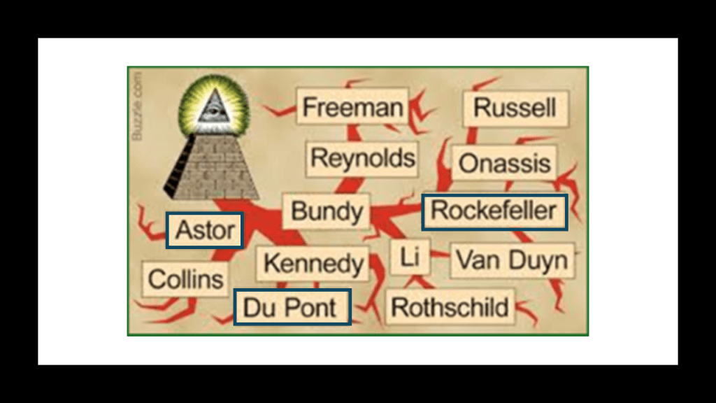
We are told their visit to the Pacific Northwest, maps, and proclamations of sovereignty with medals and flags were legal steps needed to claim title to each indigenous nation’s lands under the Doctrine of Discovery, a concept of public international law expounded by the United States Supreme Court in a series of decisions in 1823.
Under it, title to lands lay with the government whose subjects travelled to and occupied a territory whose inhabitants were not subjects of a European Christian monarch.
In other words, the Supreme Court ruled that the Native Americans didn’t own their land.

Chief Justice John Marshall explained and applied the way that colonial powers laid claim to lands belonging to foreign sovereign nations during the Age of Discovery, and Chief Justice Marshall noted, among other things, the 1455 papal bull Romanus Pontifex and the 1493 Inter Cetera bull in the Court’s decisions to implement the Doctrine of Discovery.
The 1904 St. Louis World’s Fair was called the “Louisiana Purchase Exposition,” to commemorate the centennial anniversary of the 1803 Louisiana Purchase, and ran from April 30th to December 1st of that year.
The Exposition was located on the present-day grounds of Forest Park and the campus of Washington University and was the largest fair in area up to that time.
There were over 1,500 buildings connected by 75-miles of roads and walkways.
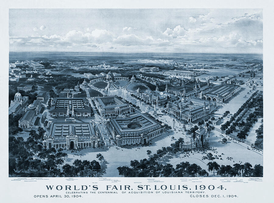
According to our historical narrative, the construction would have taken place between 1901 and its opening at the end of April of 1904, and all but one of the grand, neoclassical exhibition palaces were built as temporary structures out of material made from a mixture of plaster of Paris and hemp on a wood frame.
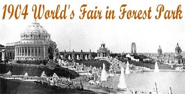
The building that was said not to be made from temporary materials was said to be the Administration Building and is now Brookings Hall at Washington University.
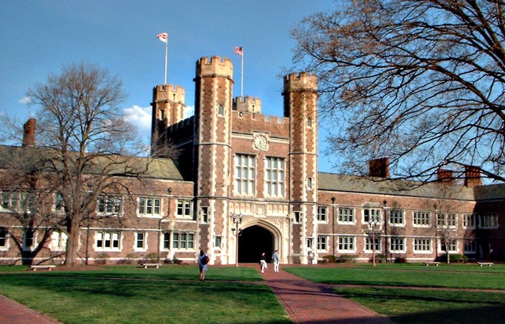
In this next screenshot heading towards the Bronx in New York, I have circled in red the thirteen state hospitals clustered around this alignment -Anna State Hospital, Kankakee State Hospital, and Chicago State Hospital in Illinois; Central State Hospital in Louisville, Kentucky; in Indiana, the Central State Hospital in Indianapolis; in Ohio, Longview State Hospital in Cincinnati; Cleveland State Hospital; Athens State Hospital; Dayton State Hospital; and Columbus State Hospital; in West Virginia, the Spencer State Hospital and Weston State Hospital; and Dixmont State Hospital in Pennsylvania.
Of these thirteen state hospitals, I am only going to highlight those directly on this alignment – Central State Hospital in Indianapolis; the Dayton State Hospital, the Columbus State Hospital in Ohio; and the Dixmont State State Hospital in Pittsburgh.
The Central State Hospital in Indianapolis, formerly referred to as the Central Indiana Hospital for the Insane, was first established in 1848 for patients anywhere in the state because it was the only one, but in 1905 only served Central Indiana because of the establishment of other facilities around the state.
Central State Hospital occupied 160-acres, or 65-hectares of land.
We are told some of the buildings on the campus were designed in accordance with the Kirkbride Plan.
The Indiana Medical History Museum is on the grounds of the Central State Hospital and part of it is the old Pathology Building on the campus, the oldest surviving pathology facility in the nation.
Starting in 1896 until the 1960s, the Pathological Department was involved in medical education and research on the physical causes of mental illness.
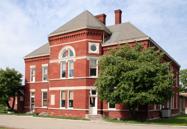
The Central Indiana State Hospital closed for good in 1994, and was known for scandals regarding patient abuse over the years of its existence.
The Dayton State Hospital in Dayton, Ohio, was originally known as the “Southern Ohio Lunatic Asylum.”
It was established in 1855 according to the Kirkbride Plan.
The complex occupied 300-acres, or 121-hectares, of land, and included a main building, hospital farm, and other land.
Treatments included lobotomies and electroshock therapy.
It closed in 2008, and current uses of the complex include the main building now being utilized as a retirement home called “10 Wilmington Place…”
…and the hospital farm is now “Kettering’s Miami Valley Research Park.”

Next, the Columbus State Hospital in Columbus, Ohio, was first known as the Ohio State Hospital for the Insane and first established in 1838, and was the first state-supported hospital in the United States.
We are told the original building was destroyed in a 1868 fire, and that it was rebuilt in 1877 in accordance with the Kirkbride Plan.
Treatments here also included lobotomies and electroshock therapy, which were said to have been considered the best treatments at the time.
This hospital was closed in the 1980s, and demolished in the 1990s.
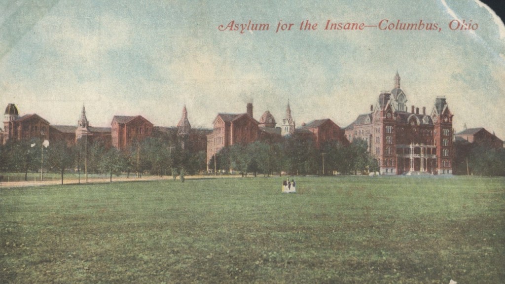
Lastly, the Dixmont State State Hospital in the northwest suburb of Pittsburgh of Emsworth.
It was originally called the Department of the Insane in the Western Pennsylvania Hospital of Pittsburgh.
Construction in accordance with the Kirkbride Plan was said to have started in 1859 and it first opened in 1862, all of which would have been around the beginning of the American Civil War in Fort Sumter in April of 1861.
It closed in 1984, and after over 20-years of abandonment, it was demolished in 2006.
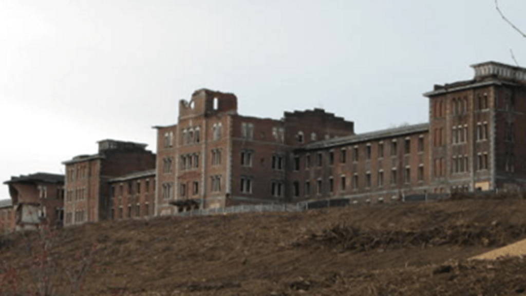
In this next screenshot going northeast along the alignment, there are a couple of places that I would like to highlight.
I am going to share some research I have done in the past about the area where the yellow line is drawn between Altoona and Johnstown, and then information about what is found in the area where the yellow dot is next to Altoona, and then about the Danville State Hospital further up the alignment.

First, what is found between Altoona and Johnstown.
The former Allegheny Traction Railroad ran between Altoona and Johnstown.
It was said to have replaced the original Allegheny Portage Railroad, which was said to be the first railroad constructed through the Allegheny Mountains in 1834, and connected to the Pennsylvania Canal, all of which was said to have been built as part of the transportation by the “Main Line of Public Works,” a package of legislation that was passed by the Pennsylvania Legislature in 1826 to establish a means of transporting freight between Philadelphia and Pittsburgh.
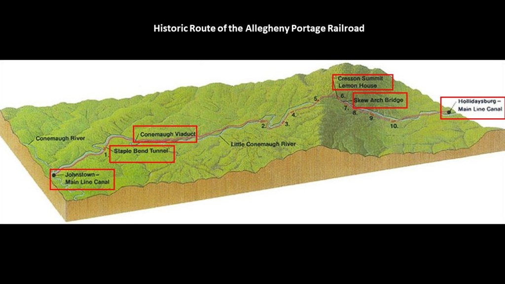
Considered a technological marvel in its day and critical to opening the way to commerce and settlement past the Appalachian Mountains, the original Allegheny Portage Railroad consisted of a series of five inclines on either side of the ridge-line to Cresson Summit alongside what is called the Little Conemaugh River to where it meets the Conemaugh River at Johnstown.
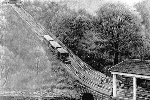
The Allegheny Portage Railroad’s journey through the Allegheny Mountains included Cresson, a borough (which in Pennsylvania is a municipal entity like a town or small city) on top of the Eastern Continental Divide.
Back in the industrial heyday of the late 19th-century and early 20th-century, there were lumber, coal and coke-yard industries located here.
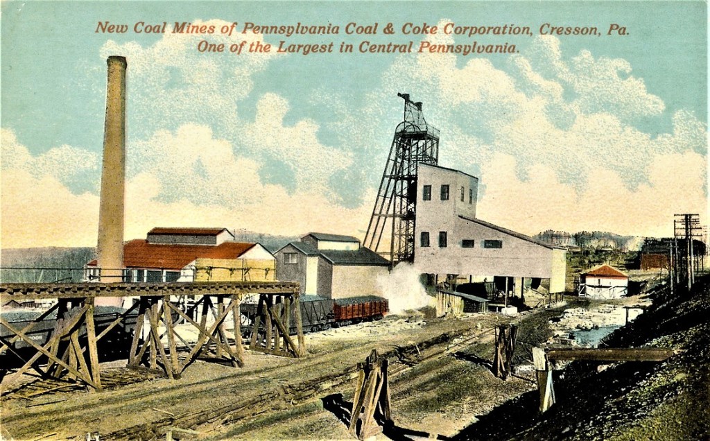
Wealthy Pittsburgh industrialists like Andrew Carnegie, Henry Clay Frick and Charles Schwab, all connected to each other through the steel industry, had summer residences here, like Carnegie’s Braemar Cottage in Cresson.
Andrew Carnegie was a Scottish immigrant to America, who came to Pittsburgh in 1848 with his parents at the age of 12, got his start as a telegrapher, and who by the 1860s, had investments in such things as railroads, bridges and oil derricks, and ultimately worked his way into being a major player in Pittsburgh’s steel industry.
He subsequently acquired other steel mills, and in 1892, the Carnegie Steel Company was formed, of which Henry Clay Frick became chairman. and in 1897, Charles M. Schwab, who had gotten his start as an engineer at the Edgar Thomson Steel Works, became President of the Carnegie Steel Company in 1897.

In 1901, Charles M. Schwab helped negotiate the sale of Carnegie Steel with a merger involving it with Elbert Gary’s Federal Steel Company, and William Henry Moore’s National Steel Company to a group of New York City Financiers led by J. P. Morgan.

After the sale of Carnegie Steel, Andrew Carnegie surpassed John D. Rockefeller as the richest American at the time, and Charles M. Schwab became the first President of the newly minted U. S. Steel Company.
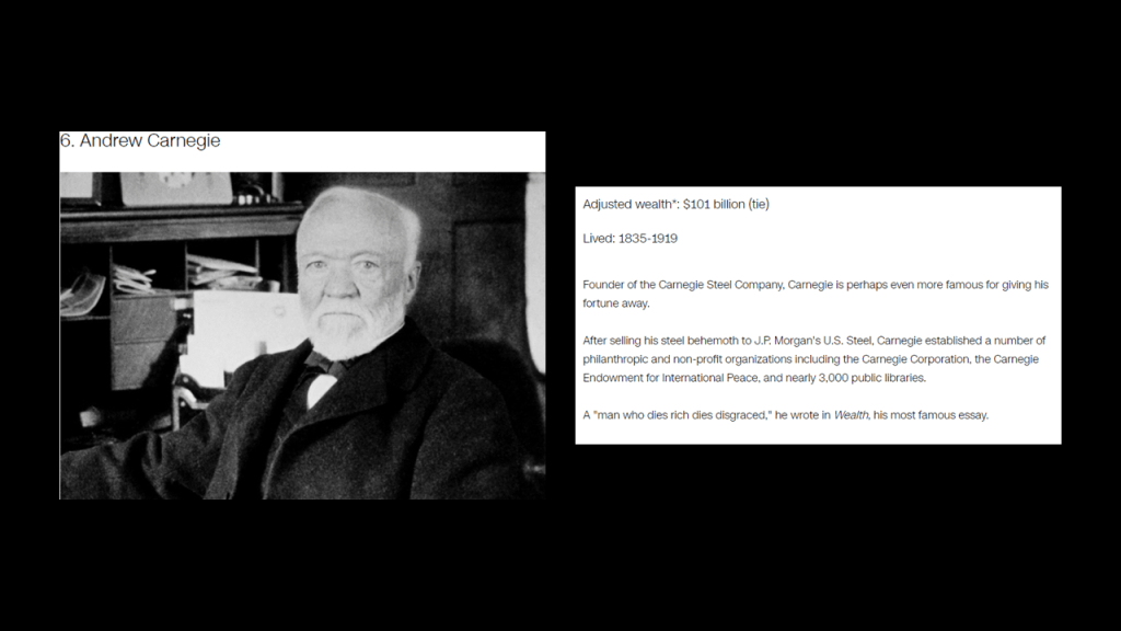
Interesting to note, the spacious building of the former Cresson Sanitorium and Prison is still-standing, albeit in pretty rough shape these days!
This is what we are told about it.
Cresson Sanitorium was built on land that was donated by Andrew Carnegie in 1910, and first opened in 1913 in order to provide hospital and long-term care facilities for individuals and families with tuberculosis and other health conditions.
In 1956, it was incorporated into the Lawrence F. Flick State Hospital for people with mental illness.
In 1983, it was converted to a State Correctional Facility, and operated as such for the next 30-years, until its final closure in 2013.
Also found along the route of the historic Allegheny Portage Railroad was the South Fork Dam, said to have been an earthwork built between 1838 and 1853 as part of a canal system as a reservoir for a canal basin in Johnstown by the Commonwealth of Pennsylvania.
But then, after spending 15-years building the dam, it was abandoned by the Commonwealth, and sold to the Pennsylvania Railroad, who turned around and sold it to private interests.

In 1881, speculators had bought the abandoned reservoir and built a clubhouse called the South Fork Fishing and Hunting Club and cottages, turning it into an exclusive retreat for 61 steel and coal financiers from Pittsburgh, including Andrew Carnegie, Henry Clay Frick, Andrew Mellon, Philander Knox, John Leishman, and Daniel Johnson Morrell.
The South Fork Fishing and Hunting Club was a Pennsylvania Corporation and owned the South Fork Dam.
Henry Clay Frick was a founding member of the South Fork Fishing and Hunting Club, and was actually said to have been largely responsible for the alterations to the South Fork Dam that led to its failure.

What we are told is that the South Fork Dam failed after days of unusually heavy rain, and 14.3-million-tons of water from the reservoir of Lake Conemaugh devastated the South Fork Valley, including Johnstown 12-miles, or 19-kilometers, downstream from the dam, killing an estimated 2,209 people and causing $17-million in damages in 1889, which be $490-million in 2020.
Though there were years of claims and litigation, the elite and wealthy members of the South Fork Fishing and Hunting Club were never found liable for damages.

The famous Johnstown Flood on May 31st of 1889 was the worst flood in the United States in the 19th-century, and was the second major disaster the American Red Cross responded to, after the Michigan Thumb Fire, which started on September 5th of 1881, with hurricane-force winds and hot and dry conditions this was less than four months after the establishment of the American Red Cross in May of 1881.
John D. Rockefeller was amongst several that donated to create a national headquarters for the American Red Cross near the White House in Washington, DC, said to have been built between 1915 and 1917.
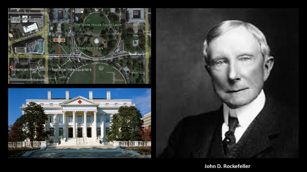
Now I am going to turn my attention to what’s found in the area of the yellow dot next to Altoona on the screenshot, in particular St. Francis University and the Mount Assisi Gardens in Loretto.
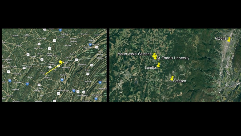
First up, Saint Francis University.
Saint Francis College was one of the first 20 Catholic universities and the first Franciscan college to be founded in the United States.
It was changed to St. Francis University in 2001.
We are told that Brother Giles Carroll, along with five of his friar brothers from the Archdiocese of Tuam Ireland, requested permission from the Pittsburgh Bishop to bring their dream, rooted in the teaching of St. Francis of Assisi, to America, and that they started clearing land in 1847 in Loretto where Saint Francis University was to be built, the same year the Jesuits arrived at what became Fordham University in the Bronx.
Speaking of Jesuits, another Carroll, John Carroll, founded Georgetown University in 1789, and as mentioned previously, it is the oldest Catholic institution of higher education as mentioned previously.
John Carroll was born in Baltimore, but a descendent of the Carroll famly in Ireland.
Here is his statue seated in perpetuity in front of Georgetown University.
We are told that the Old Main building on the campus of St. Francis College was destroyed by a fire on October 30th of 1942.
At the time of the fire, St. Francis College had recently acquired the Charles M. Schwab Estate, and moved everything in there during the period of rebuilding the school.
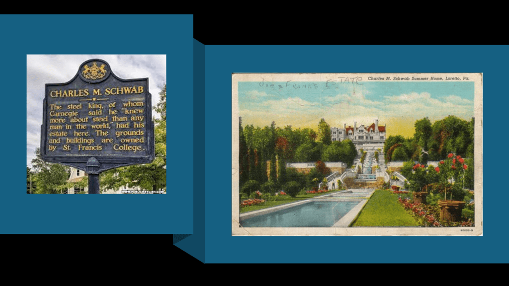
The gardens of the former estate of Charles M. Schwab are open for public viewing and are called the “Mount Assisi Gardens,” or officially known as the “Shrines and Sunken Gardens at Mount Assisi.”
They are located on the grounds of the Franciscan Friary.
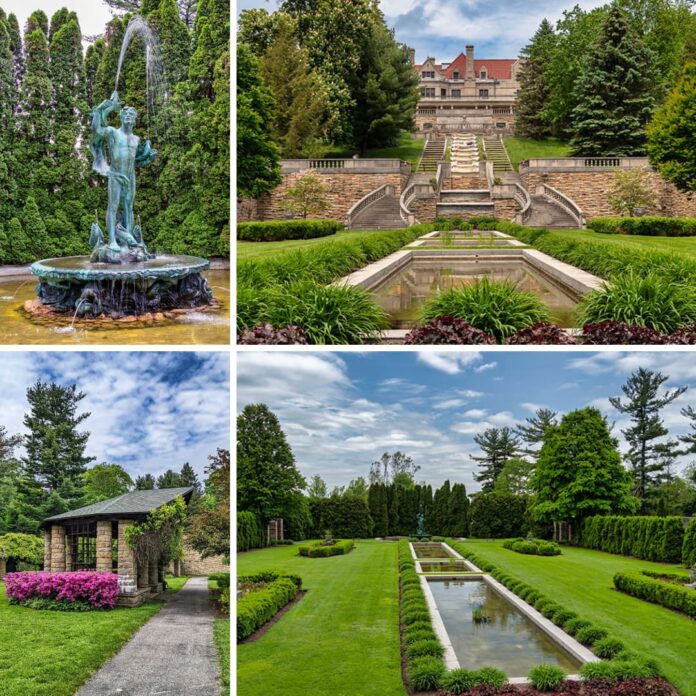
The last place on this screenshot that I am going to mention is Danville State Hospital in Danville, Pennsylvania.
The Danville State Hospital first opened in 1872 as the “State Hospital for the Insane at Danville” in accordance with the Kirkbride Plan.
We are told that in 1881, nine-years after the hospital opened its doors, a fire completely gutted the administration section; all of the female wards; and some of the male wards, and that it took five-years to be rebuilt.
It is still in operation as a psychiatric facility today.

Now we are getting close to the end of the journey along this alignment from Sydney to the Bronx.
I have highlighted the Manhattan State Hospital and the Brooklyn State Hospital in this screenshot to talk about.
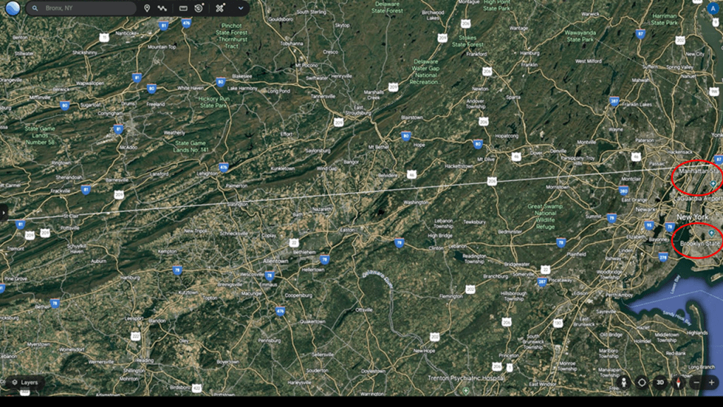
First, the Manhattan State Hospital.
We are told the Manhattan State Hospital’s roots go back to 1848, when it was part of Blackwell’s Island Lunatic Asylum, the first operating in the city of New York starting in 1839.
Blackwell’s Island is called Roosevelt Island today and the ruins of the Smallpox Hospital are still there today, and the only ruins in New York City to be a local landmark.
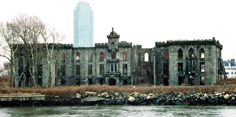
The New York Asylum for the Insane was said to have opened in 1863, and that the building was significantly enlarged in accordance with the Kirkbride Plan in 1871.
The state took over operation of the hospital from Manhattan in 1899, and at the time with 4,400-beds, it was the largest psychiatric hospital in the world.
The current Manhattan Psychiatric Center facility is still active and was said to have been constructed in 1954.
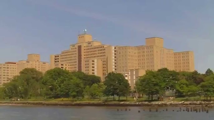
The Brooklyn State Hospital has a history dating back to 1854.
It was first known as the King’s County Hospital.
We are told that In 1882, a fire broke out in the building impacting the men’s section the most.
The building was repaired after the fire, but no significant changes made until 1911, at which time plumbing and wiring were replaced and fire escapes and systems were finally installed.
The hospital was transferred to state government from the county in 1895, and in 1916 it was renamed the Brooklyn State Hospital, and the state invested heavily in it.
Today it is still active as the Kingsboro Psychiatric Center, and is the main psychiatric Center for New York City.
In this last screenshot of the alignment, we have arrived at our destination of of the Cloverleaf highway Interchange location between the New York Botanical Garden and the Bronx Zoo.
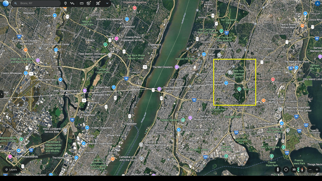
As we have seen, a line can be drawn from the Callan Hospital for the Insane in Sydney all the way to the Bronx, and it crackles and pops with things like insane asylums, major U. S. cities, and noteworthy historical events and people along the way.
But we can also tie this same information about insane asylums appearing on alignments from certain cities that were hubs, including Fort Sumter in South Carolina; the New River Gorge in West Virginia; and Gettysburg in Pennsylvania.
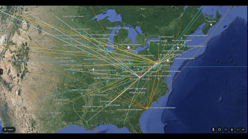
My friend Aaron and I talked in-depth about this subject of Civil War battles taking place on these alignments emanating from certain hubs in our video “Civil War Battles, Insane Asylums, Star Forts, Golf Courses, National Parks & Walmarts on the Earth’s Grid, and Giants, with Aaron.
In this video, we talked about his findings of Civil War battles showing up on alignments emanating from hubs, in particular the hub of Fort Sumter, as depicted here, showing civil war battles and insane asylums.
This includes the Wilson’s Creek and Pea Ridge Civil War Battles that took place in the Trans-Mississippi Theater in which the previously seen German-immigrant Franz Sigel took part in.
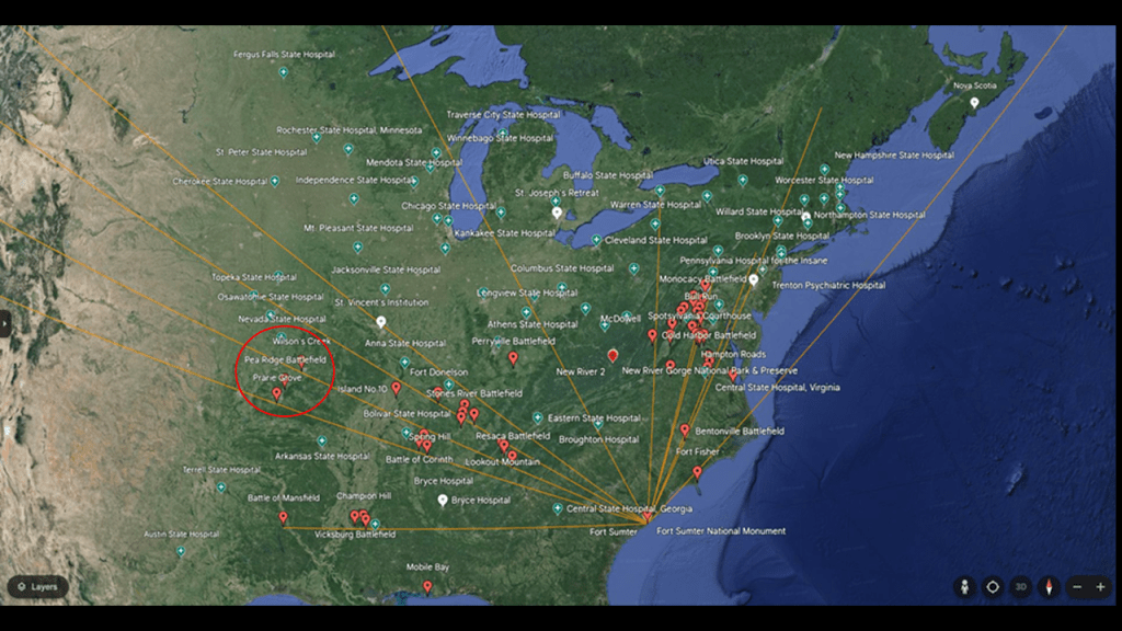
When you take off the overlay of the Civil War battles and just see the insane asylums, we see many of the same ones that showed up on the alignment from Sydney to the Bronx, like the Arkansas State Hospital, Mississippi State Hospital, the Nevada State Hospital, the Anna State Hospital, the Osawatomie State Hospital, and the Topeka State Hospital, among many others in the surrounding area.
I would venture to speculate that whatever was going on in our historical narrative during the American Civil War time-period had more to do with what we are seeing here having to do with the reset of the Old World to the New World, whatever that looked like, than what we have been taught to believe about it.
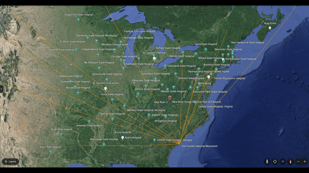
As a result of the research I have presented in this post and in past posts, here’s what I think happened.
Prior to this deliberately-caused cataclysmic event, all of the infrastructure on the Earth was a perfectly-tuned and resonant scientific and musical instrument that was laid out precisely as a circuit board.
All of it worked together in harmony and balance to produce free energy and abundance for all life everywhere – all the cathedrals, rail-lines, bridges, star forts, lighthouses, organs, bell-towers, and much more.

I have come to believe that the circuit board of the Earth’s grid system was deliberately blown 0ut, and thinking likely one or more forms of directed forced-resonant frequency or energy that caused the perfectly-tuned scientific and musical instruments to go haywire, and caused the cataclysmic destruction of the Earth’s surface, causing the land to undulate and buckle, causing among other things, swamps, bogs, deserts, dunes, and whole land masses to shear-off and submerge under seas and oceans.

I believe the dark beings behind the cataclysm were shovel-ready to dig enough of the original infrastructure out of the ruined Earth so they could be used and civilization restarted, which I think started in earnest in the mid-to-late 1700s and early 1800s.
There’s extensive underground infrastructure where people could have survived until the surface of the Earth was habitable.
Then they only used the pre-existing infrastructure until they found replacement fuel sources that could be monetized and controlled by them for what had originally been a free-energy power grid and transportation system worldwide, and when what remained of the original infrastructure was no longer useful to them, or inconvenient to their agenda, they had it destroyed, discontinued, or abandoned, typically in a very short time after it was said to have been constructed.
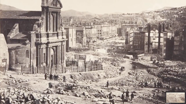
I think there was a hostile take-over of the Earth and it’s grid system, which was then reverse-engineered as a mind-control and energy-harvesting system for human energy, like with the examples given of the insane asylums and low-vibrational imagery being deliberately imprinted on our brains and lowering our collective consciousness, instead of providing uplifting and healing experiences and frequencies that elevated our collective consciousness in the original advanced worldwide civilization.
In the business world, there are two kinds of takeover bids, and I think this is a really important concept to understand with regards to what has taken place here.
The first is called a friendly takeover bid, and occurs when the Board of Directors from both companies (target & acquirer) negotiate and approve the bid.

Then there is the hostile takeover bid, which occurs when an acquiring company seeks to acquire another company – the target company – but the board of directors from the target company has no desire to be acquired by, or merged with, another company.
The two most common strategies used by acquirers in a hostile takeover are a tender offer or a proxy vote.
The tender offer is an offer to purchase shares at a premium to the market price.
The proxy offer is persuading shareholders of the target company to vote out the existing management.

The dark beings behind what has taken place here wanted to set up their dark lord as lord of this world, and wanted a proxy vote for their hostile takeover.
They wanted to persuade enough of Humanity to voluntarily accept their dark lord over the Creator of the Universe.

The only way they can accomplish this acceptance, however, is by outright lies, deception and duplicity because if people knew the true agenda of these controllers, the majority of Humanity would never, ever accept this.

But the problem is in a Free Will Zone like Earth, the Human Beings who live here have to give their consent to choose whether to follow the Light or the Dark.

I bring all this up is because it is important to know this is what has been going on here.
Humans are inherently sovereign beings.
They have gone to all of this trouble because, by Universal Law, they can’t lay a finger on us.
They have tricked us into accepting their sovereignty over our own.

Those that heretofore have been in control of the world in which we live deviously figured out a way to keep us asleep by this new culture they created, and they have been getting filthy rich at our expense because we have been paying for our own poisoning with our addictions; paying for our own mind control programming with distractions; and keeping us in consumerism mode to enrich corporate interests; and ultimately financing our own destruction.
The Controllers have always feared the Great Awakening of Humanity, and thus threw everything they could at us to prevent it from happening and keep us asleep so we would never know what hit us.
But no matter what they do, they can’t keep it from happening. Among many other things, they lost control of the narrative no matter how hard they try to get it back.