I am going to take you on a tour in this video through the Pacific Northwest Region of North America in British Columbia; Washington State; Oregon; and Idaho from perspective of the purposeful reset of our world, both in terms of physical locations and the history that we have been taught about it.
I will show you what is there to find throughout the Pacific Northwest when we look at these places from what is actually there to find versus what our official history, and science, teaches us to believe about everything we see in today’s world.
In the process of looking at specific places throughout this geographic region, I will point out the discrepancies, inconsistencies, and dubious goings-on in our historical narrative, and I will provide a very different explanation for what I think we are seeing that is based on all my research of places, people, and our historical timeline, and what I think happened here that has been deliberately removed from our awareness.
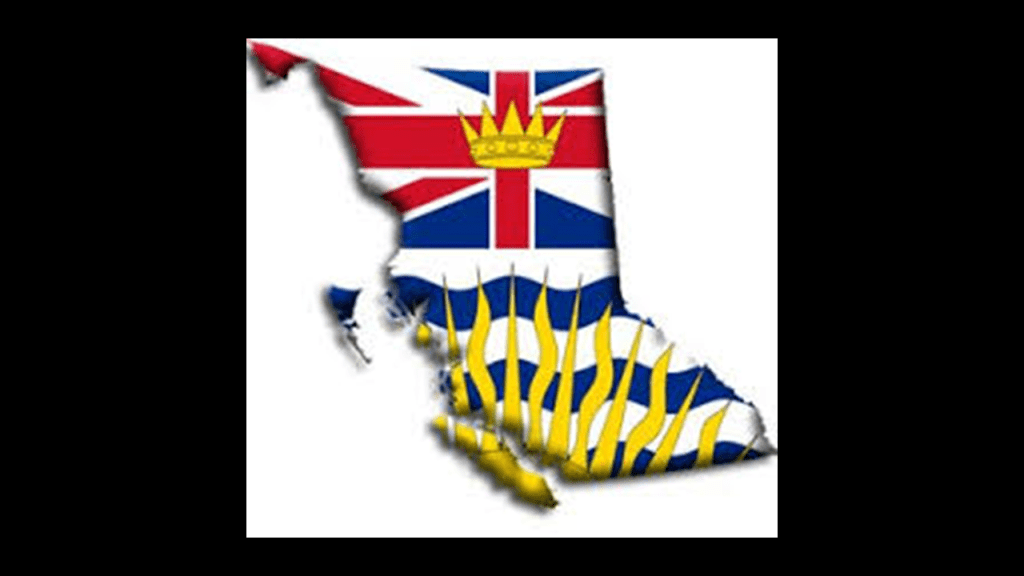
For my starting point in this post, I will take a look at several places in British Columbia.
British Columbia is Canada’s westernmost province, located between the Pacific Ocean and the Rocky Mountains.
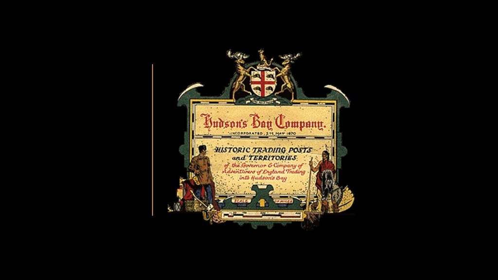
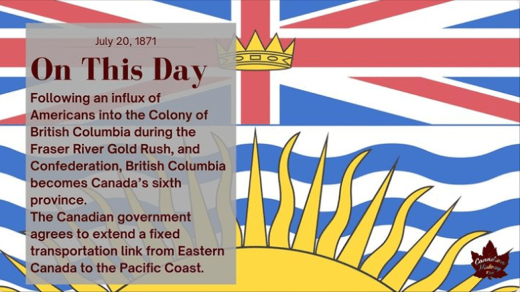
In the 19th-century, with the support of the Hudson Bay Company, the lands that became known as British Columbia were added to the British Empire, which grew exponentially during the reign of Queen Victoria.
In our narrative, the Hudson’s Bay Company is the oldest, incorporated, joint-stock merchandising company in the English-speaking world, having been chartered on May 2nd of 1670 by King Charles II on behalf of French traders who wanted to reach the interior of the North American continent via Hudson’s Bay, and British merchants and noblemen who wanted to back the venture.
The Hudson’s Bay Company was granted wide powers, including exclusive trading rights in the lands crossed by rivers flowing into Hudson Bay, and shows up a lot in the official history of the Pacific Northwest.
It is still in operation today as a Canadian retail business group operating department stores in several countries.
The model of the trading company was the same way the British Crown took over the lands of India.
The British East India Company held a monopoly granted to it by Queen Elizabeth I of England in 1600 between South Africa’s Cape of Good Hope and Tierra del Fuego’s Cape Horn at the southern tip of South America, until 1834 when the monopoly was lost.
The British East India Company ruled over parts of the Indian Subcontinent between 1757 and 1858.

Through the Government of India Act of 1858, the British Crown assumed direct control of the British East India Company-held territories in India in the form of the new British Raj, and exiled the last Mughal Emperor to Burma.

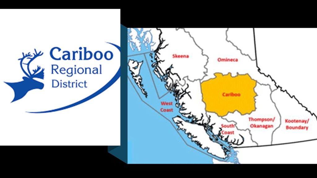
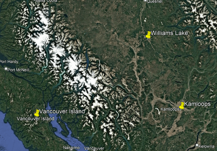
So, for example, in British Columbia, I have looked into places like Williams Lake in past research.
Williams Lake is the second-largest city in what is known as the “Cariboo,” after the city of Quesnel.
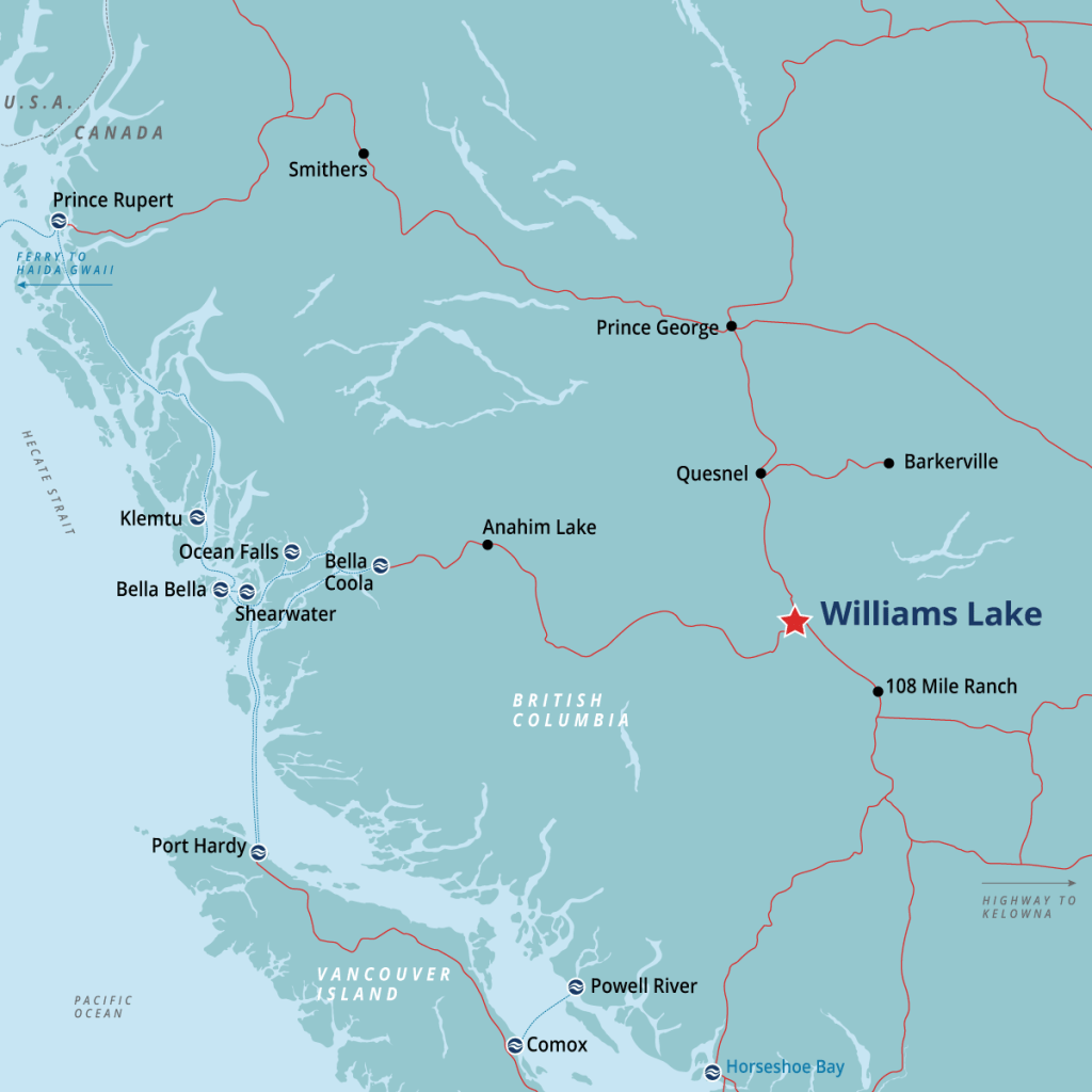
The “Cariboo” region is in the Central Interior of British Columbia, and we are told named after the caribou that were once abundant in the reigon.
While the story of Williams Lake was said to have begun thousands of years ago by the First Nations people here, the outside settlement of the area started in 1860 with the Cariboo Gold Rush.
The Cariboo Gold Rush started in 1858, when gold was discovered at Hills Bar.
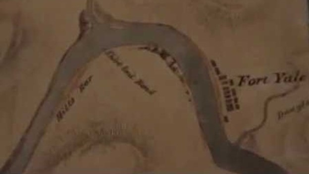
Hills Bar was adjacent to Fort Yale on the Fraser River, founded in 1848 by the Hudson’s Bay Company, and today is the inhabited town of Yale.
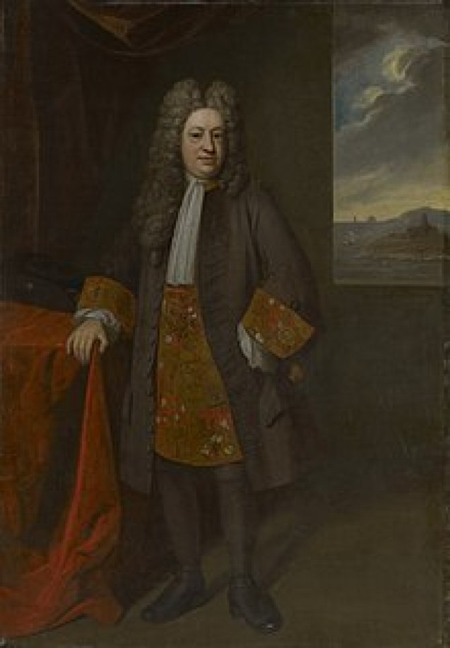
Fort Yale was named after the James Murray Yale, Chief Factor of the the Columbia District at the time, the senior officer responsible for managing trade and men in the Hudson’s Bay Company.

Another Yale, Elihu Yale, was a British merchant, trader, and a President of the British East India Company settlement at Fort St. George (formerly Madras and today’s Chennai), who later became a benefactor of the Collegiate School in the Colony of Connecticut, which in 1718 was renamed Yale College in his honor.
It is important to note that Yale is considered an elite school and associated with American elites and their families, and that since 1832, “Skull and Bones,” also known as “The Order,” “Order 322,” and “The Brotherhood of Death,” is an undergraduate senior secret society at Yale.

At the time Williams Lake was being settled and organized, we are told there were two pack trails leading to the gold mines that met in Williams Lake, which became the center of local government.
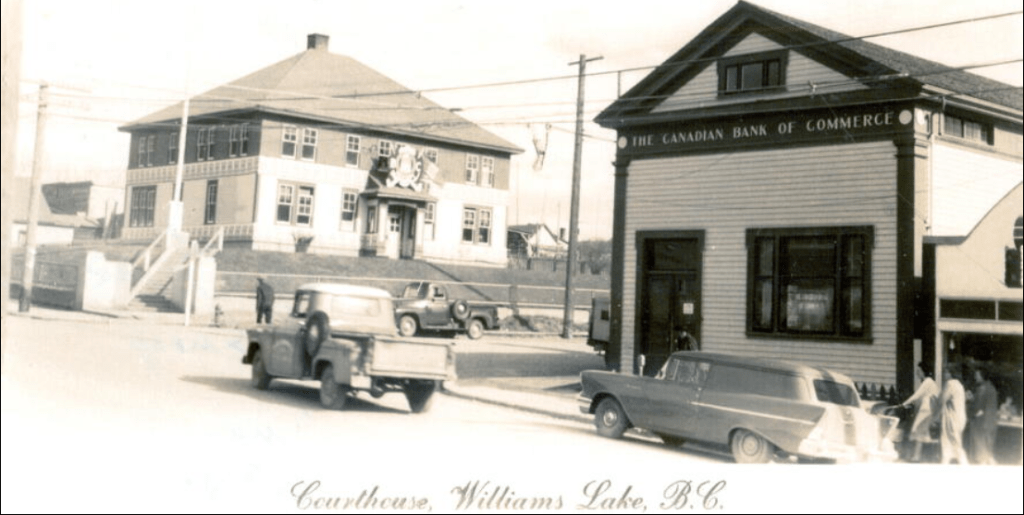
In addition to the courthouse and jail, a road house was established for the huge pack trains and freight wagon convoys that serviced the mining operations.
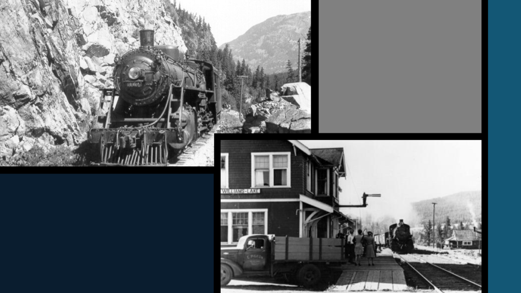
After the Cariboo Gold Rush days, Williams Lake was said to have been re-born in 1919 with the construction of the Pacific Great Eastern Railway.
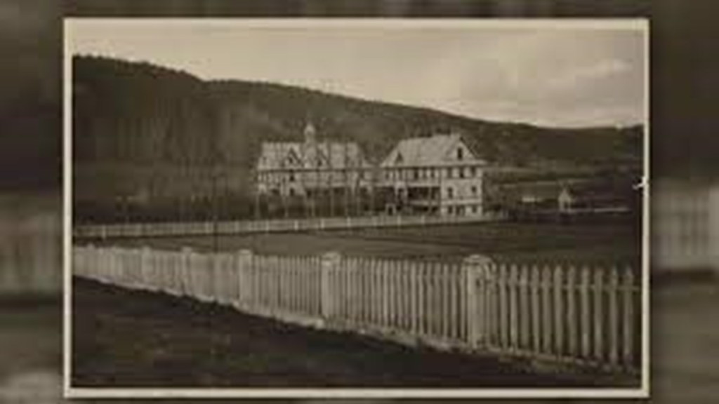
The Roman Catholic Church established the St. Joseph’s Mission half-way between Williams Lake and the Roadhouse in July of 1867, and in 1891 it opened as the St. Joseph’s School, and Indian Residential School.
Over the 90-years it operated, St. Joseph’s became one of the most notorious of the Indian Residential Schools in Canada, with many student deaths recorded over the years as well as staff members imprisoned for sexual abuse.
In 2013, Orange Shirt Day was established as a memorial to the victims of the Canadian Residential School system that is observed nationally on September 30th every year.

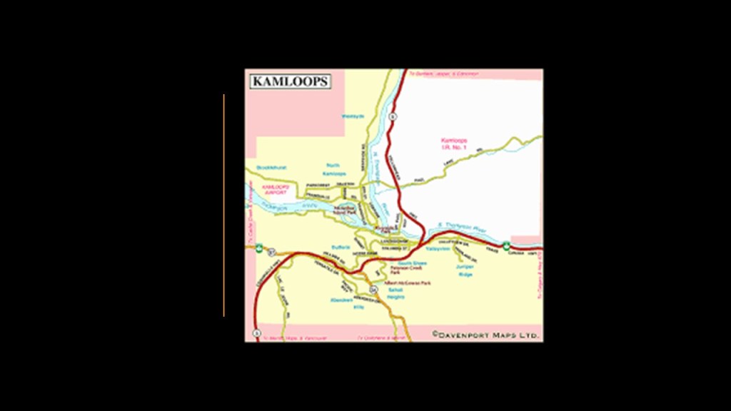
Next, Kamloops is located to the southeast of Williams Lake in British Columbia.
The city that became Kamloops was first established in 1812 as a post by Alexander Ross, a Scots-Canadian fur trader who worked for John Jacob Astor’s Pacific Fur Company, and who was one of the founders of Fort Astoria for Astor at the mouth of the Columbia River.
Another fur trading company, the North West Company, established a rival post at the nearby Fort Shuswap that same year, and they merged in 1813 with the Pacific Fur Company operations there.
Then the Hudson’s Bay Company stepped into the picture when that company merged with the North West Fur Company, and the post became known first as Fort Thompson, and then as Fort Kamloops, on the Thompson River.
Like the Cariboo Gold Rush, the Fraser Canyon Gold Rush on the Thompson River also started in 1858.
Not only was the rush for gold a catalyst in the founding of the Colony of British Columbia, which was also established in 1858…
…we are told that when news of the gold strikes in British Columbia finally reached San Francisco a few years later, sometime in the early 1860s, that within a month, an estimated 30,000 miners from California had descended upon the region, setting a record for mass migration of mining operations in the frontier of North America.
Subsequently, British Columbia became a Province of Canada on July 20th of 1871.
The terrain alongside the Thompson River is unusual, appearing to be flat-topped plateaus of the same height and appearance.
The Thompson River has railroad tracks running alongside of it.
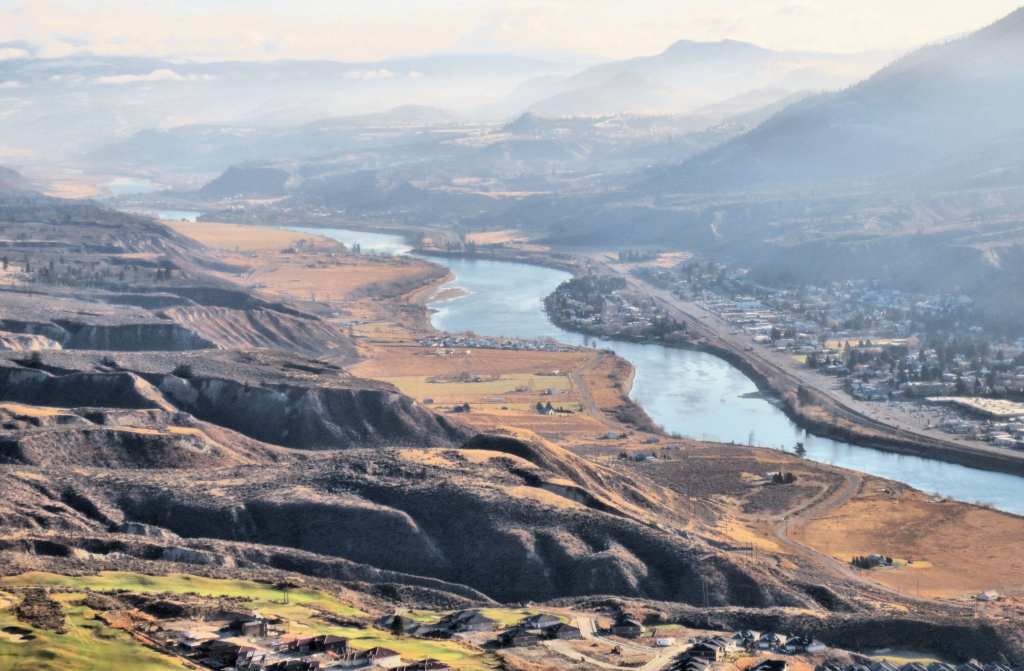
Not only do I find the S-shaped bends of the Thompson River to be of interest, because I consistently find the same S-shaped bends in rivers around the world, like the River Thames in London on the top left; the Brisbane River in Brisbane, Australia, on the top right; and the Red River in Winnipeg, Manitoba, on the bottom left; and the Columbia River, which we are heading towards, on the bottom right…
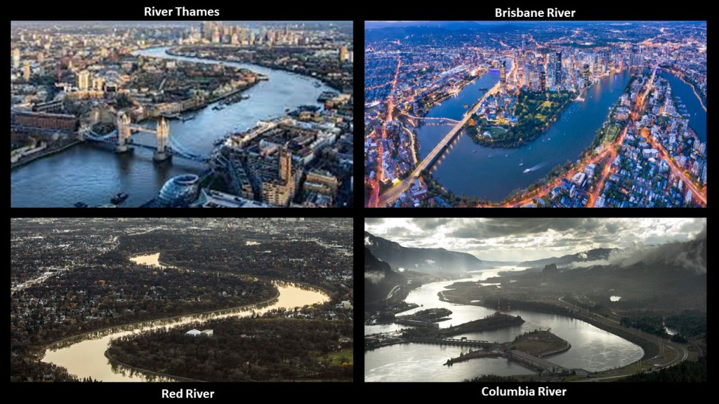
…I also consistently find railroad tracks running alongside these S-shaped rivers all over the place.
Besides the railroad running alongside the Thompson River in British Columbia, there’s the railroad that runs alongside the New River through the New River Gorge in West Virginia on the top left; alongside the Lehigh River through the Lehigh Gorge in Pennsylvania on the top right; the Royal Gorge Railroad alongside the Arkansas River going through the Royal Gorge in Colorado on the bottom left; and alongside the Sacramento River through the Sacramento River Canyon in California on the bottom right.

These are just a few of countless examples of existing railroads running alongside rivers, but most of them have been converted to recreational rail-trails all over the Earth.
I have researched this subject extensively, and have come to the conclusion that Railroads and S-shaped rivers…and the gorges and rapids and bridges and hydroelectric plants that are all found together…were important components of the Earth’s original free energy grid system that powered all of the worlds infrastructure.
Then most of this rail infrastructure was removed and replaced with highways, roads and rail-trails.

This changed the energy flow from what the original integrated energy system was generating to power the electrical grid…to human energy.
We may not be all of it, but we are definitely a part of it.

So back to Kamloops, it was an historical rail transportation hub in the region.
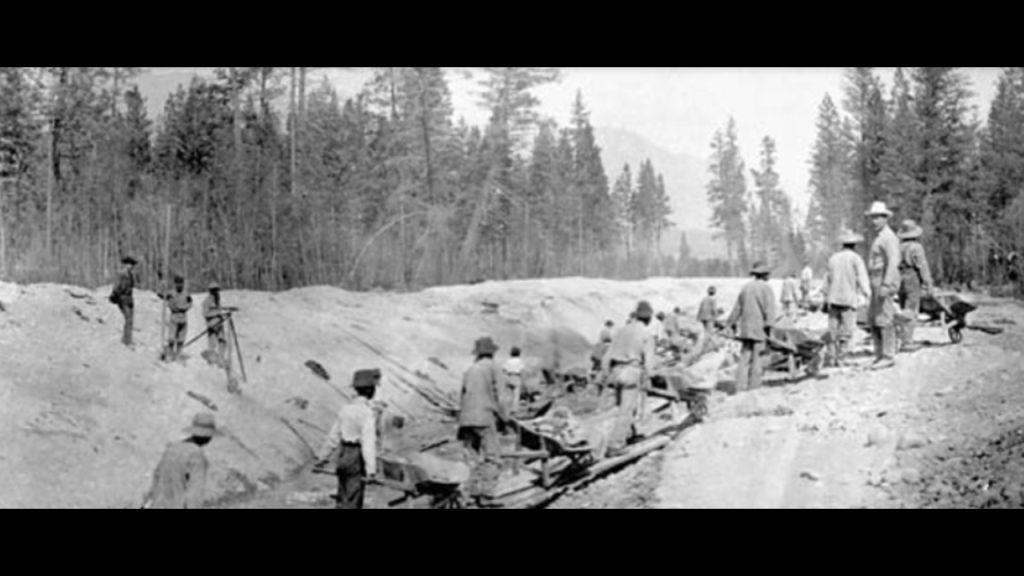
We are told the first railroad construction was completed through Kamloops by the Canadian Pacific Railway between 1883 and 1886.
We are told that the Canadian Pacific Railway took four years to complete utilizing Chinese laborers brought in by ship both from California and China worked on the western side of the continent in the building of the railway and that European laborers worked on the eastern side, beginning at the same time in the early 1880s.
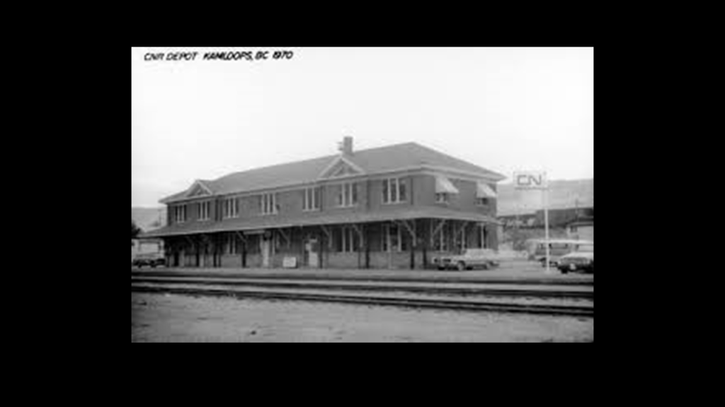
Then in 1912, the Canadian National Railway began mainline rail construction and first opened the Kamloops Station in 1927.
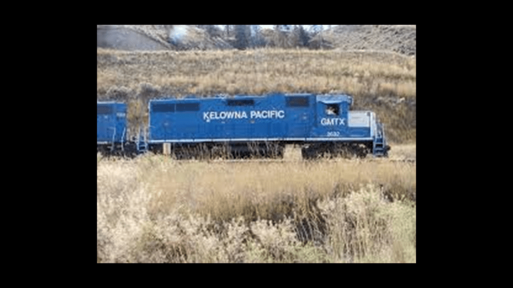
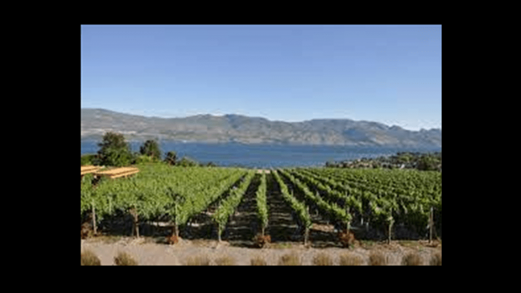
Then starting in 2000, the Kelowna Pacific Railway was operated as a short-line railroad until 2013 between Kamloops and Kelowna, a city on Okanagon Lake in the Okanagon Valley.
The Okanagon Valley is a prime agricultural area known for its vineyards and orchards and famous for its wine industry.
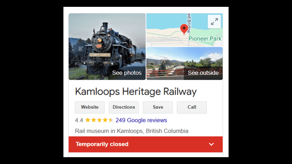
Today, the rail is used by the Canadian Pacific Railway for freight, mainly the export of American coal through Kamloops, and all that’s left today of the passenger rail is the Kamloops Heritage Railway, which was put on temporary static display in 2022.
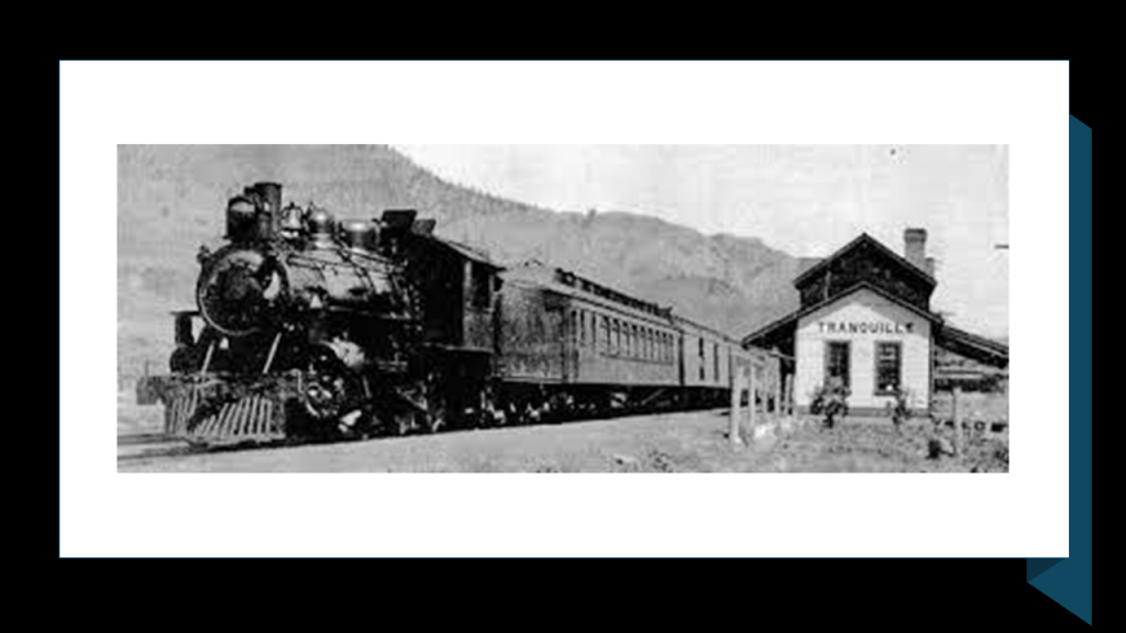
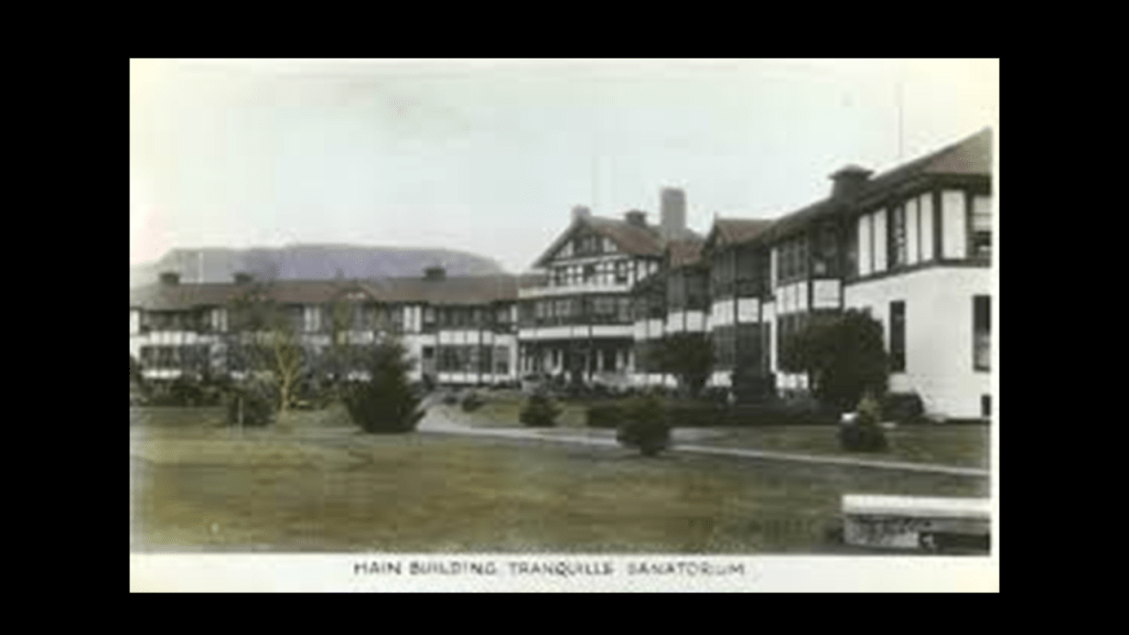
We are told there was what was originally called the “King Edward VII Memorial Sanatorium” that first opened in 1908 in response to a tuberculosis pandemic, and was later renamed the “Tranquille Sanatorium.”
It’s location is on the northside of Kamloops Lake, and was a self-contained agrarian community, with its own power-generating system in its early years, and was located right next to the Canadian National Railway line.
There seems to be a connection of railroads to insane asylums and other institutional-like settings worldwide.
Chad, Adam and I talked about this subject in-depth in “Compelling Evidence for the Harvesting of the Earth’s Original Energy Grid System and Us.”

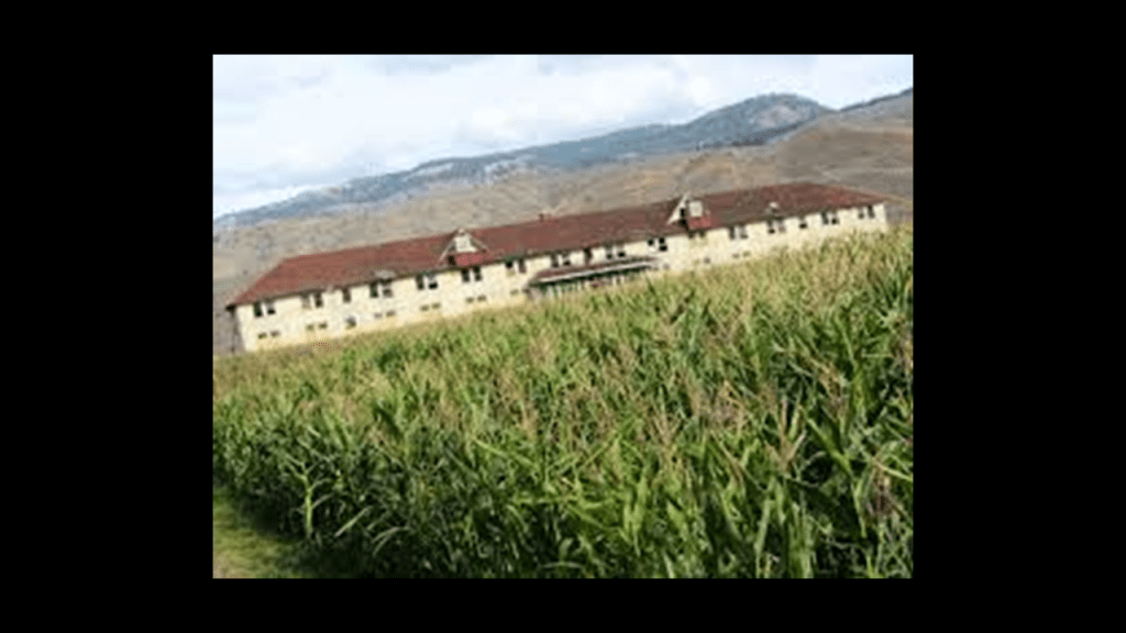
As mentioned, at some point, it was renamed the “Tranquille Sanatorium” and eventually went from treating tuberculosis to the mentally ill. It first closed in 1983, but was used as a juvenile detention center before it closed down permanently around 1990.
Since then, the abandoned site has been turned in to an agricultural site by Tranquille Farm Fresh, and the location has been approved for a future resort community.
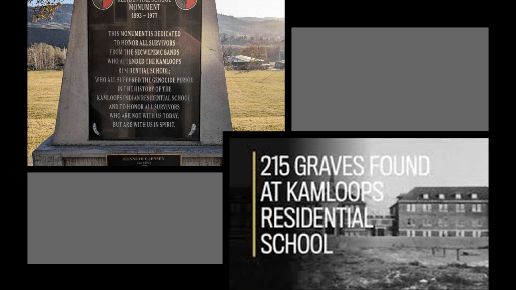
Like we saw back in Williams Lake with the notorious St. Joseph’s Indian Residential School, Kamloops had an Indian Residential school with a dark past including genocide as well.
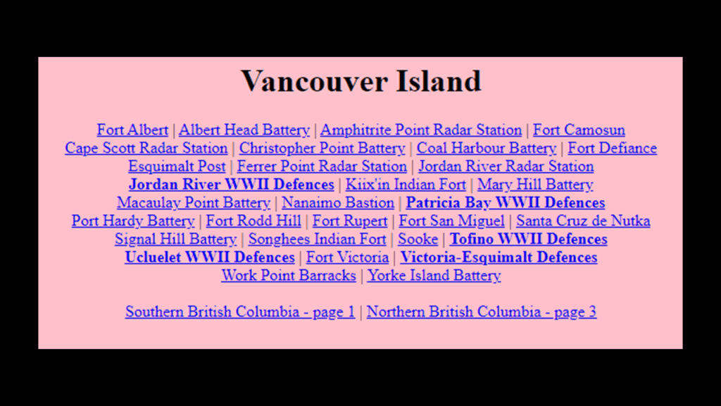
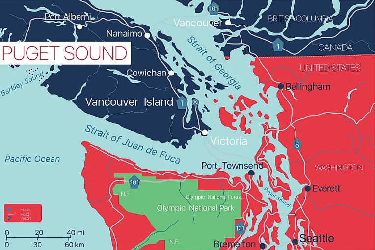
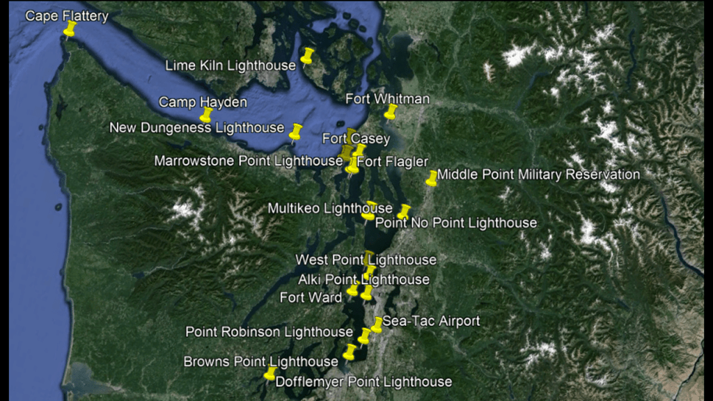
The next stop in British Columbia is Vancouver Island.
The coastline of British Columbia’s Vancouver Island is separated from the United States by the Juan de Fuca Strait.
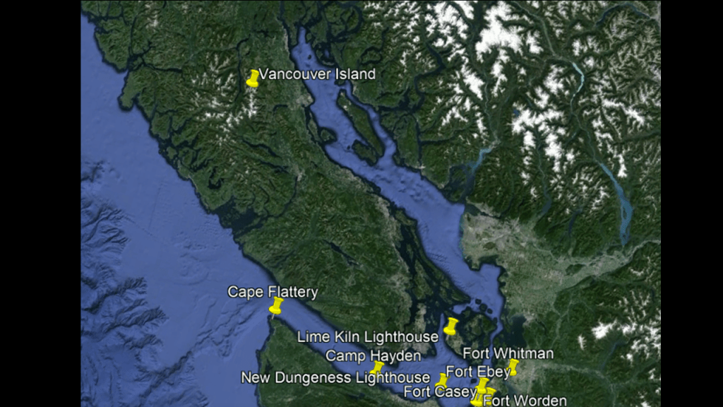
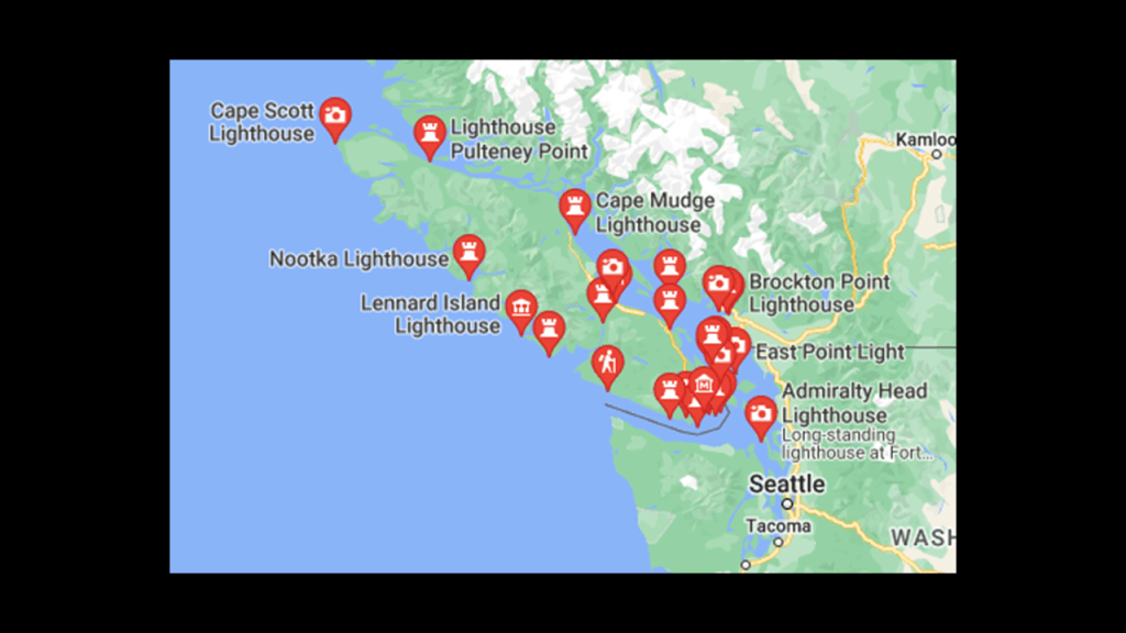
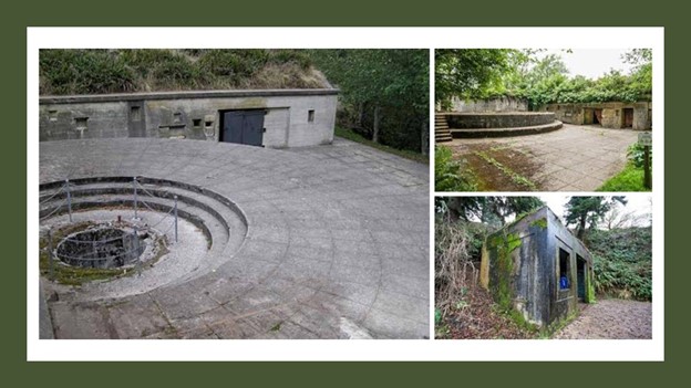
Vancouver Island is loaded with historical forts and military installations…
…and lighthouses.
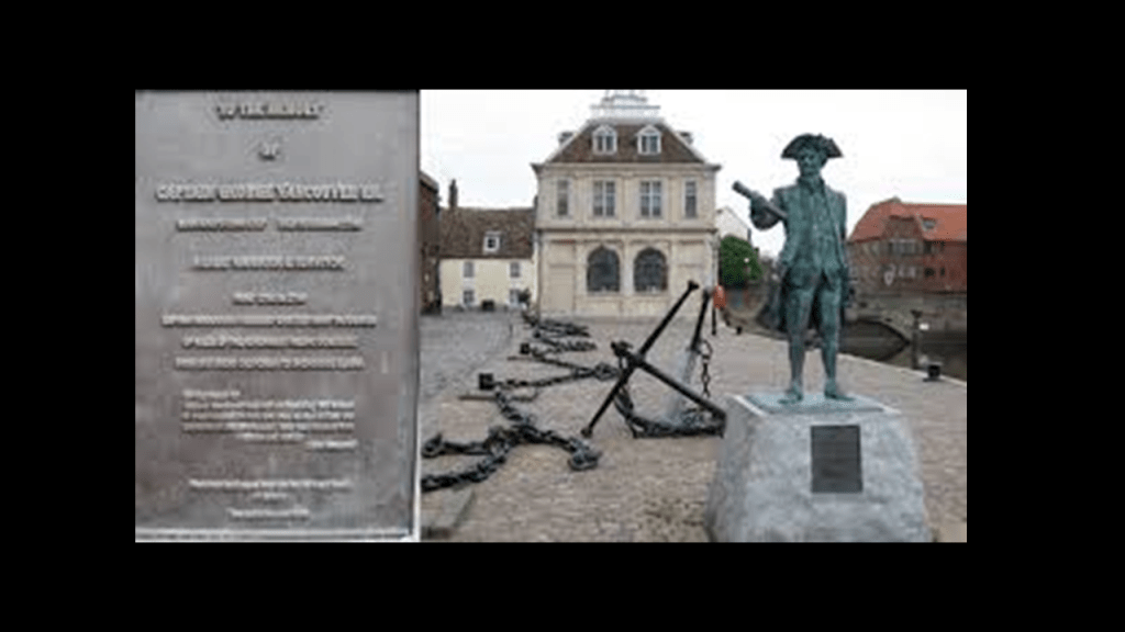
The name Vancouver in this region came from Captain George Vancouver, a British Naval officer best known for exploring and charting the Pacific Northwest in what was knonwn as the Vancouver Expedition between 1791 and 1795.
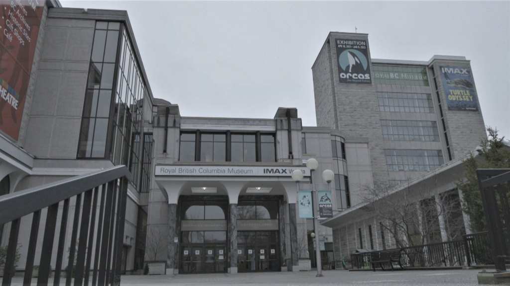
Victoria on Vancouver Island is the capital city of British Columbia, where I found places like the Netherlands Centennial Carillon and the Christ Church Cathedral.
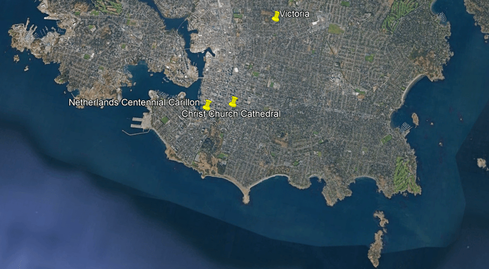
The 62-bell Netherlands Centennial Carillon was said to have been given by the Dutch community of British Columbia in thanks for Canada’s role in liberating The Netherlands in World War II, and officially opened in May of 1968.
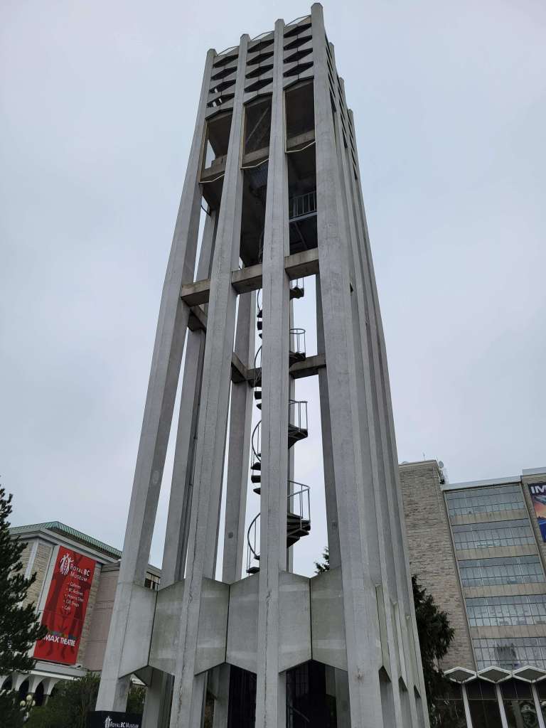
The Carillon is located in front of the Royal British Columbia Museum, which was founded as a history museum in 1886…
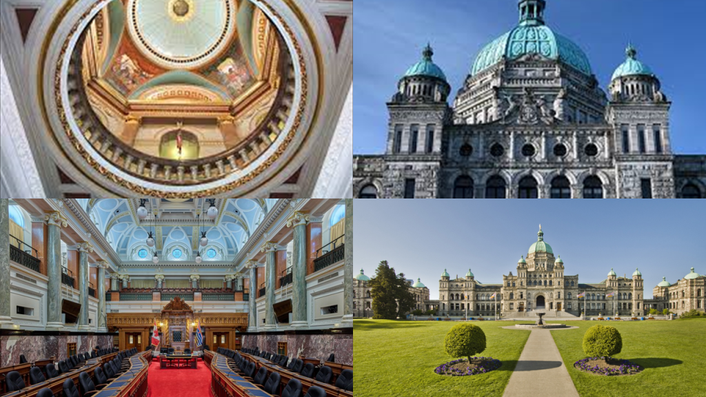
…and across the street from the British Columbia Parliament Building, said to have been built in the Neo-Baroque Renaissance Romanesque Revival-style based on the winning contest design of a recent 25-year-old English immigrant to Victoria by the name of Francis Rattenbury, and first opened in 1898.
The Christ Church Cathedral in Victoria is the Cathedral Church of the Diocese of British Columbia of the Anglican Church of Canada.
The present church was said to have been based on the winning design from a competition that was held between 1891 and 1893, and from which Victoria architect J. C. M. Keith was announced the winner, but that it didn’t actually get constructed until starting in 1923 because of funding difficulties, which turned it into an on-going construction project over decades.

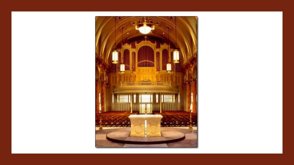
The Christ Church Cathedral has the largest organ on Vancouver Island with over 4,000 pipes, designed around the rose window of the Cathedral’s west wall.
They say that the organ was constructed in 2005, with incredible precision and craftsmanship emulating building practices from hundreds of years ago, but they also tell us the Cathedral was built in 1923, in the 20th-century, from the winning design in a contest as just mentioned.
Let’s just say I have my doubts.

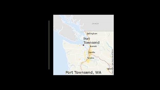
Port Townsend is in Washington State, on the other side of the Juan de Fuca Strait from Victoria.
The Oregon Treaty of 1846 between the United Kingdom and the United States ended the Oregon boundary dispute by settling British and American claims to the region, and establishing the 49th-Parallel North as the International Boundary.
The area had been jointly occupied by both countries since the Treaty of 1818, from which there were competing land claims.
The Americans had called it the “Oregon Country,” and the British the “Columbia District of the Hudson’s Bay Company.”

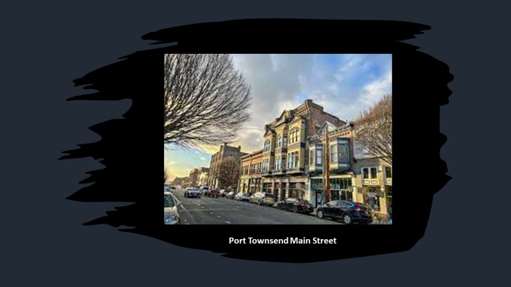
Port Townsend first became a settlement on April 24th of 1851, the year it was first incorporated.
It is called the “City of Dreams” because of early speculation that it would become the west coast’s largest harbor, and is known by its other nickname, the “Key City,” today.
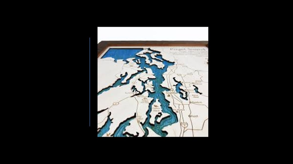
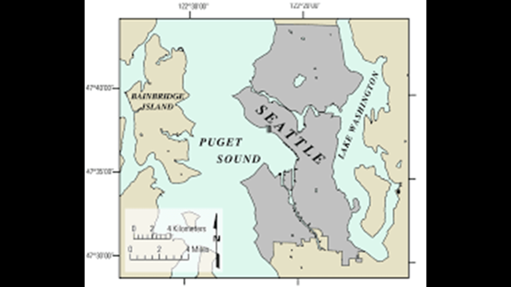
Port Townsend is located next to the entrance of Puget Sound.
Puget Sound is also described as a complex estuary system of connected marine waterways and basins, with an estuary defined as a partially-enclosed coastal body of brackish water with one or more rivers or streams flowing into it, with brackish meaning a combination of salt-water and fresh-water.
We are told that by the late 19th-century, Port Townsend was very active in getting ready for its future expected growth, and that much ornate, Victorian architecture was built here during this time.
What we are told is that though railroad extensions were planned to the port, the Panic of 1893, an economic depression lasting until 1897, caused the funding to dry up and the railroad-lines ended on the other side of Puget sound, and for this reason, Port Townsend never achieved its expected growth, and instead immediately started to decline.
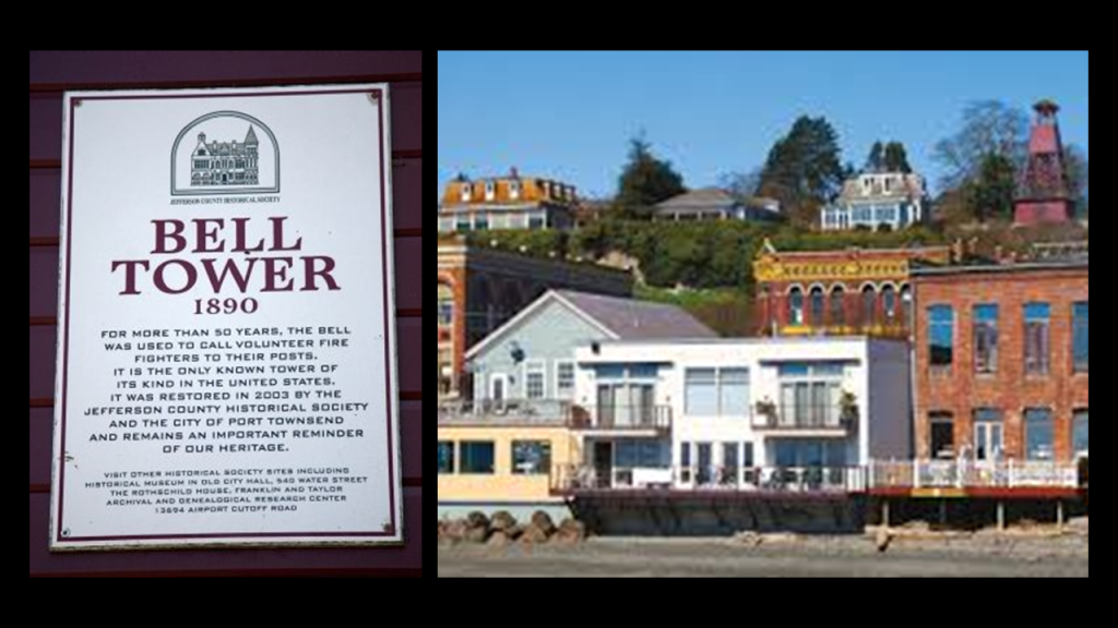
The “Fire Bell Tower” in Port Townsend was said to have been built in 1890 to hold a 1,500-pound, or 680-kilogram, brass bell that was a fire-alarm and the city’s new $900 fire engine.
It is the only known tower of its kind in the United States.
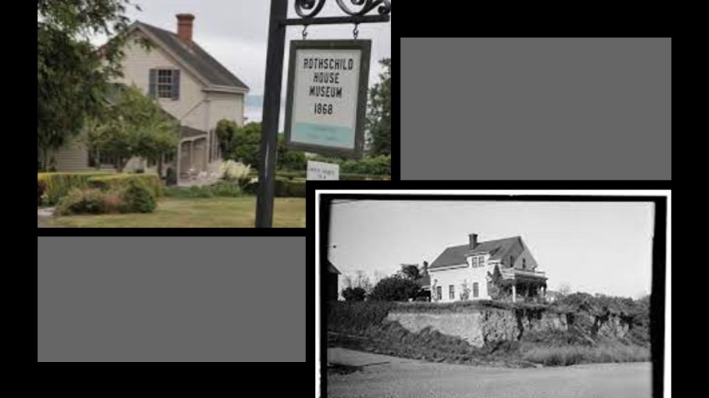
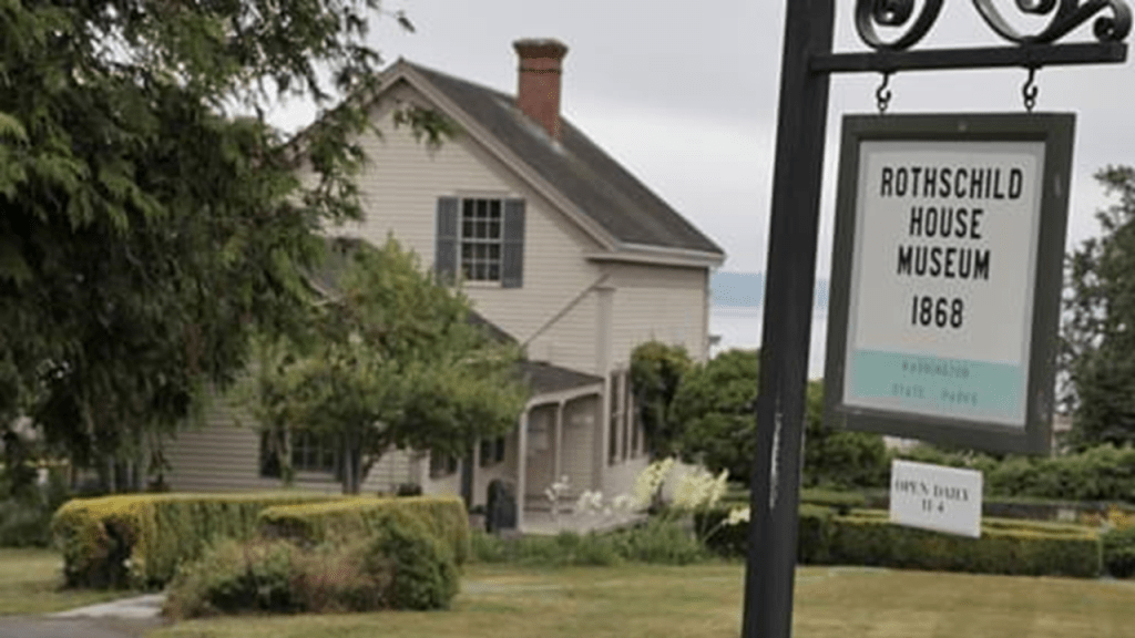
Interesting to note there is also a “Rothschild House” in Port Townsend.
The Rothschild House was said to have been built by David Charles Henry Rothschild as a family home in 1868, and operates as a museum today.
He had immigrated from Bavaria in Germany to the United States in the mid-1840s.
Shortly after settling in Port Townsend in 1858, David Rothschild, known as “The Baron,” established a business there that not only operated as a mercantile store, but as well provisioned ships and did some marine salvage work.
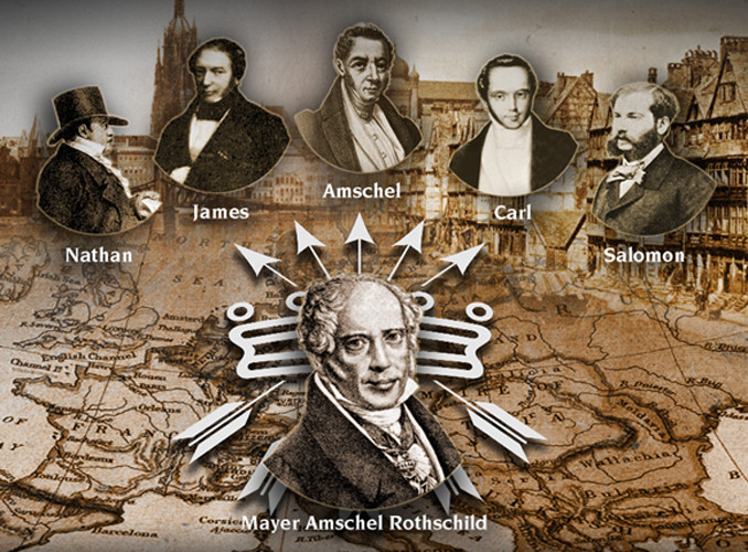
The Rothschilds were to Europe what the Rockefellers were to the United States.
Mayer Amschel Rothschild and his five sons established their International banking family dynasty throughout major cities of Europe.
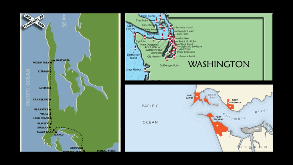
The coast-line of Puget Sound in Washington State has nine locations that were listed as the “Harbor Defenses of Puget Sound” and eleven lighthouse locations.
After years of researching leylines and coastlines, it is my belief that lighthouses, star forts and rail-lines were integrated infrastructure in the perfectly-tuned scientific and musical instrument that was the Earth’s original free-energy grid system, and that this free-energy grid system was destroyed in a deliberately-caused cataclysm by a forced-resonant frequency rippling through it, having such effects as causing the surrounding land to submerge, becoming estuaries, marshes, and wetlands, or turn into deserts and dunes.
Hence all the bodies of water called “sounds” like Puget Sound in this example and the role that bell towers, organs and cathedrals played in this scenario.
I also have come to believe from my research that the ancient giant trees were an integral part of the Earth’s orginal energy grid system, and that when the perfectly-tuned grid system went haywire from the forced-resonant frequency that went through it it, it caused these giant trees to explode and become what we know as volcanoes today.
More to come about all of these subjects as we head down the Pacific Northwest coast.
Then, as soon as they were able to after this cataclysmic event took place, those bloodline families that set up their new systems for power and control over everything came into the ruined lands of the Earth to explore, claim, harvest the resources of, and provide us with the history of the “New World” they had created by the violent destruction of the Old World.

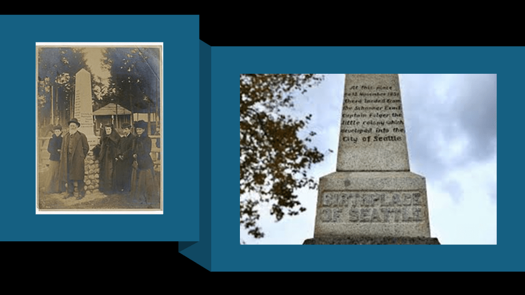
Still looking around Puget Sound, Seattle, situated on a narrow piece of land between Puget Sound and Lake Washington, is the northernmost major city in the United States, with a population of somewhere around 4-million people.
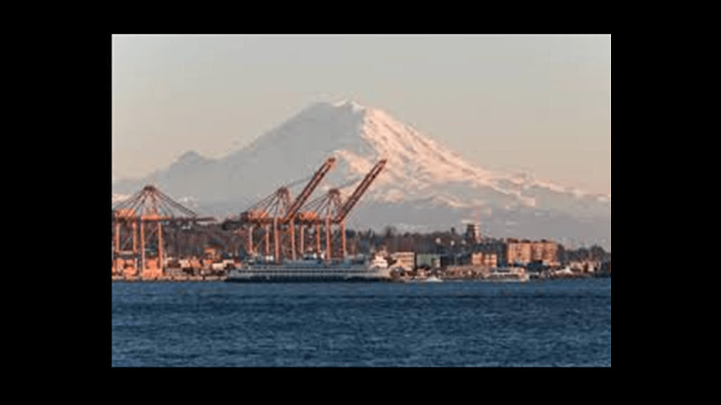
The Port of Seattle is the fourth-largest port in the United States in terms of container-handling as of 2021, and is a gateway for trade in East Asia.
And seen in the background of the this photo, Mount Ranier is described as a large, active stratovolcano in the Cascade Range of the Pacific Northwest in the Cascade Volcanic Arc, and is 59-miles, or 95-kilometers, to the southeast of Seattle.
The Cascadia Volcanic Arc consists of quite a number of volcanoes that extend from southwestern British Columbia to Northern California for a distance of over 700-miles, or 1,100-kilometers.
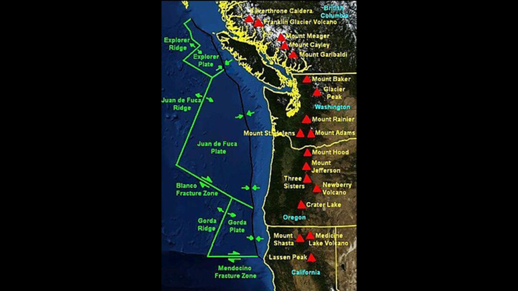
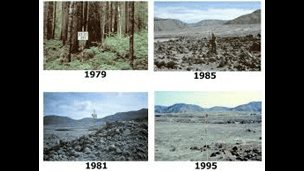
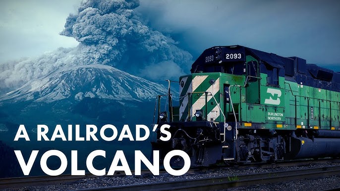
The most recent eruption of one of the volcanoes in the Cascadia Volcanic Arc was Mount St. Helens in 1980.
The eruption of Mount St. Helens took place over several months, starting on 27th of 1980, and involved a series of volcanic eruptions and pyroclastic flows, which are fast-moving currents of hot gas and volcanic matter.

Then on May 18th, a massive explosion occurred, which caused the entire north face to slide away, allowing pyroclastic flows to overtake the landslide and spread-out, as well as mudslides from melted glaciers, reaching as far as the Columbia River 50-miles, or 80-kilometers, away.
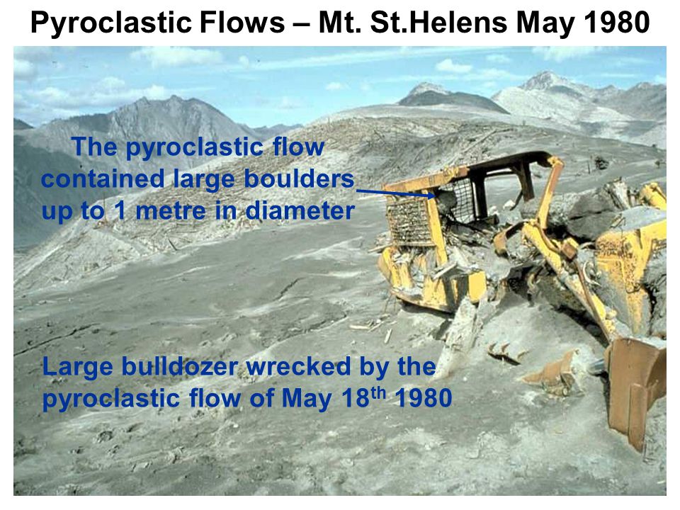
Also, an 80,000-foot, or 24,384-meter, – high eruption column deposited ash in 11 U. S. States and several Canadian Provinces.
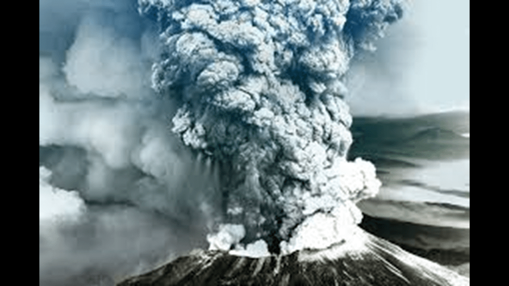
Hundreds of square-miles were reduced to wasteland.
Interestingly, the summit of Mount St. Helens was owned by the Burlington Northern Railroad, but after the eruption, the railroad donated the land to the National Park Service.
At this point in my life, not only from my research, but also personal observation and experience, I don’t believe there are any such things as natural disasters.
I think the Controllers’ have long had the technology to create chaos and destruction through the creation of earthquakes and the manipulation of the weather and convinced us to believe that everything of this nature is occurring randomly and naturally, so we just accept it as such.

Now back to Seattle.
Seattle’s Lake Washington Ship Canal carries more boat traffic than any lock system in the United States.
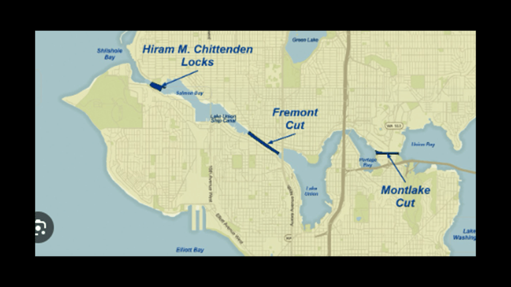
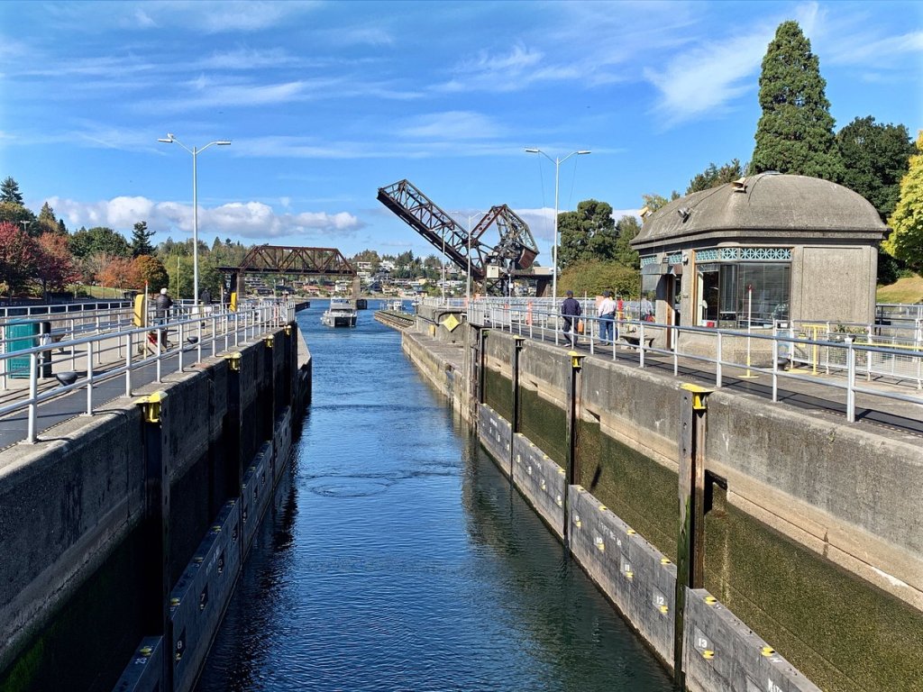
The Hiram M. Chittenden Locks, also known as the Ballard Locks, is a canal-lock complex in the west-end of Salmon Bay in the Lake Washington Ship Canal.
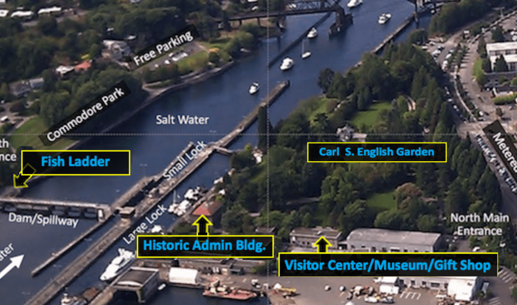
It was said to have been constructed between 1909 and 1917 by the U. S. Army Corps of Engineers under the direction of Hiram M. Chittenden.
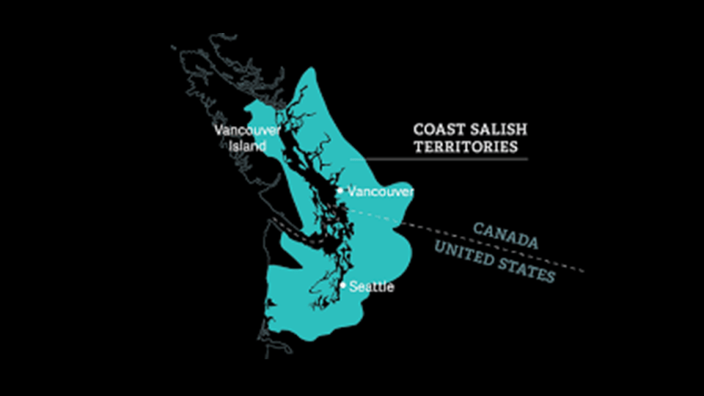
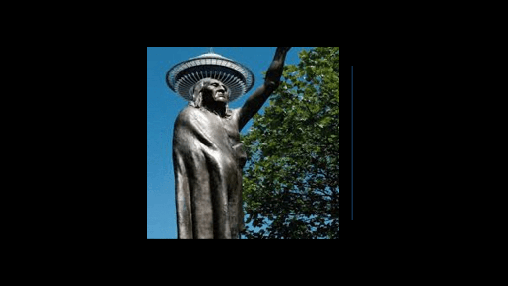
In our historical narrative, the Denny Party was credited with founding Seattle, though today’s Seattle had been inhabited by the indigenous southern Salish people for millenia.
Led by Arthur Denny, and originally from Illinois, the Denny Party arrived in the area via Portland, and settled in Alki Point on November 13th of 1851.
The settlement moved to Elliott Bay in 1852, and named in honor of Chief Seattle, a leader of the Duwamish and Squamish people of the region.
We are told logging was the original industry here…
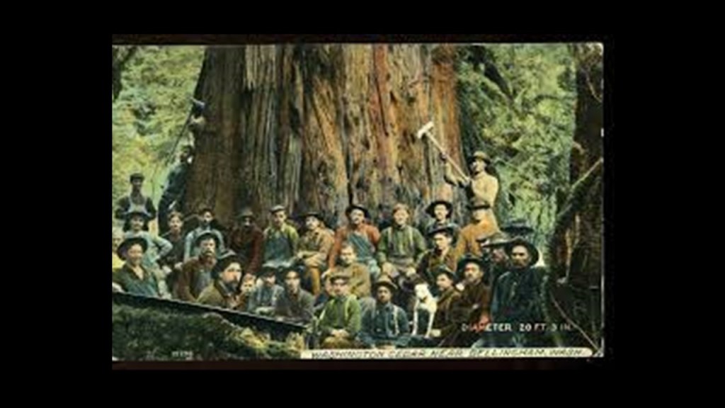
…but that by the late 19th-century, Seattle had become a commercial and ship-building center as a gateway to Alaska during the Klondike Gold Rush.
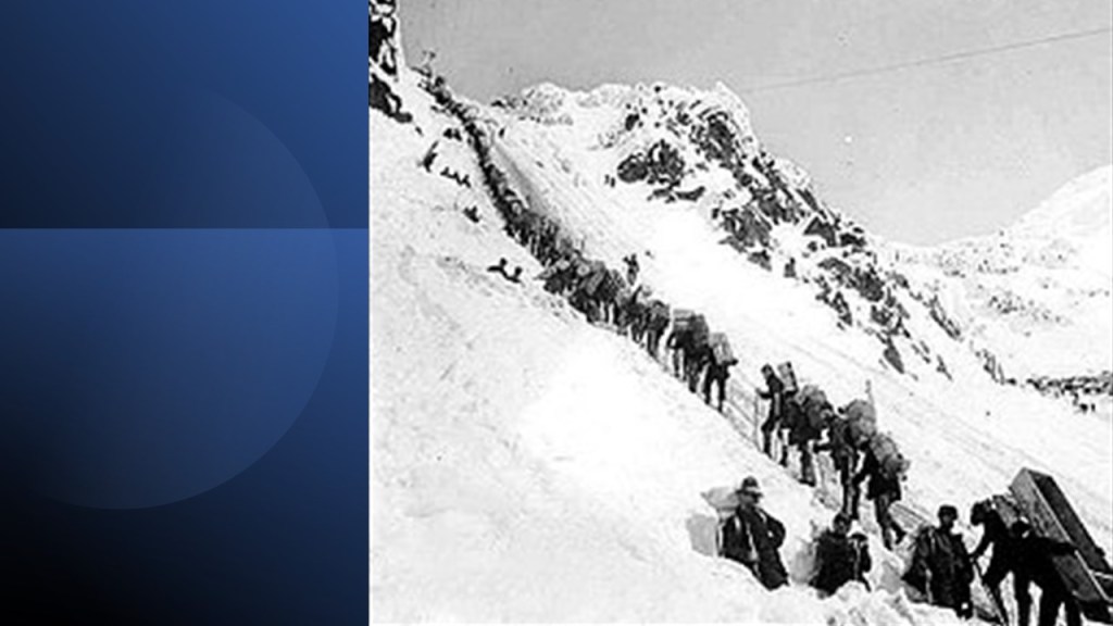
The Klondike Gold Rush was a migration by an estimated 100,000 prospectors to the Klondike region of northern Yukon between 1896 and 1899.
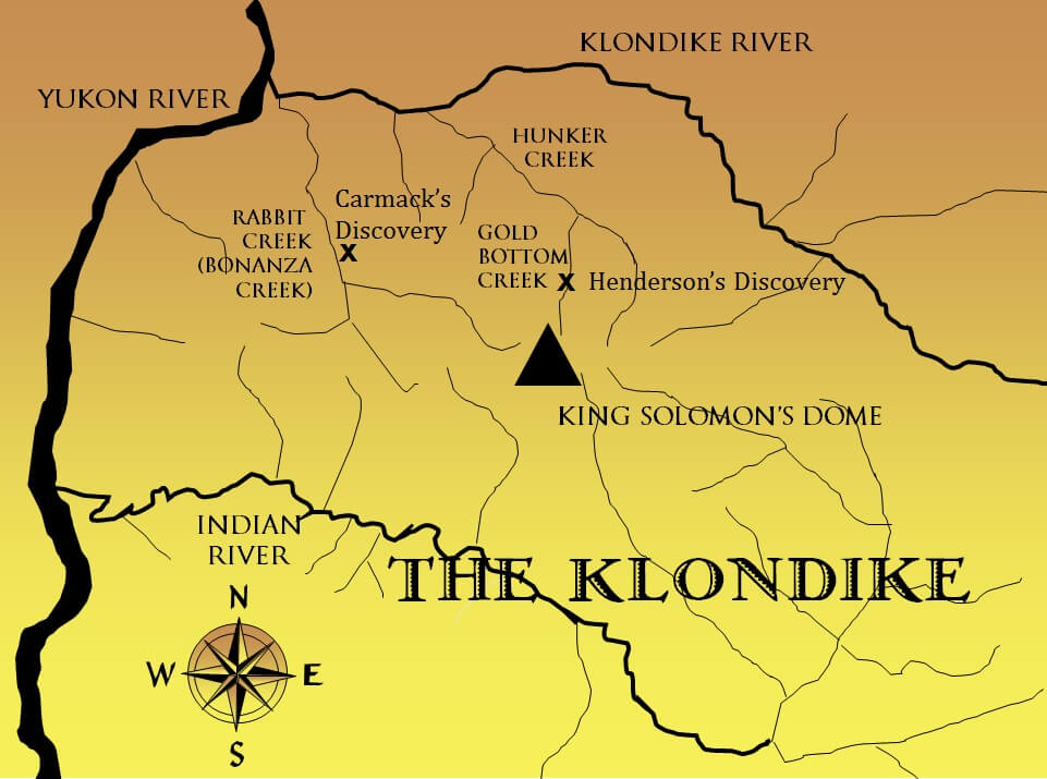
Same kind of story as we have already seen – as soon as word about the discovery of gold in the Klondike reached Seattle and San Francisco, it triggered a stampede of prospectors, immortalized in photos like this of the long-line waiting to cross the Chilkoot Pass, a high-mountain pass between the Boundary Ranges of the Coast Mountains between Alaska and British Columbia.
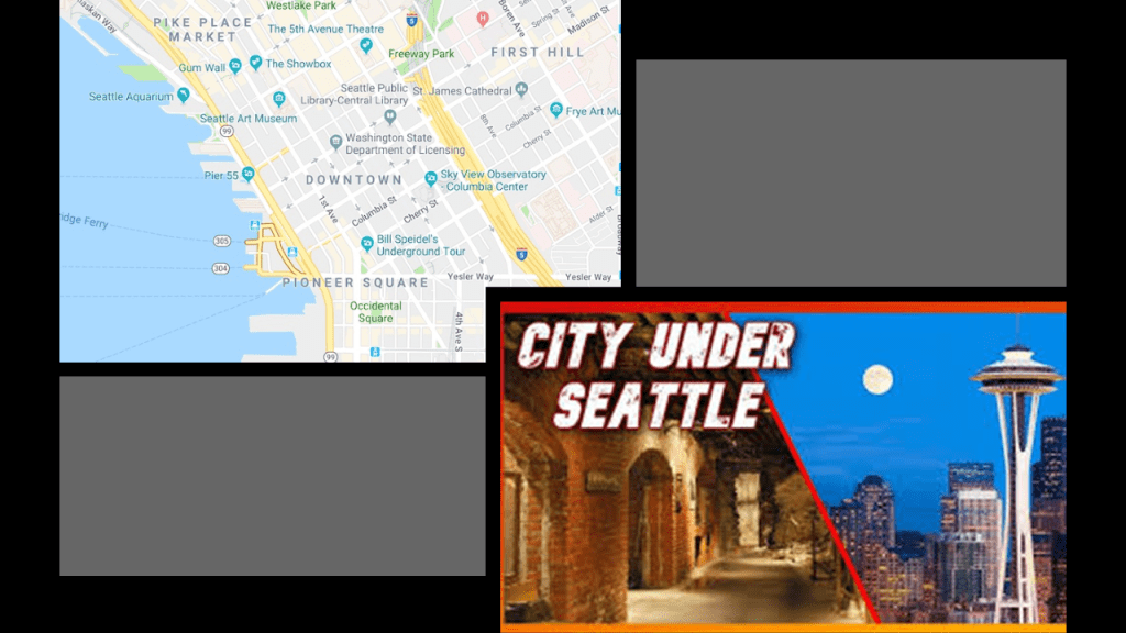
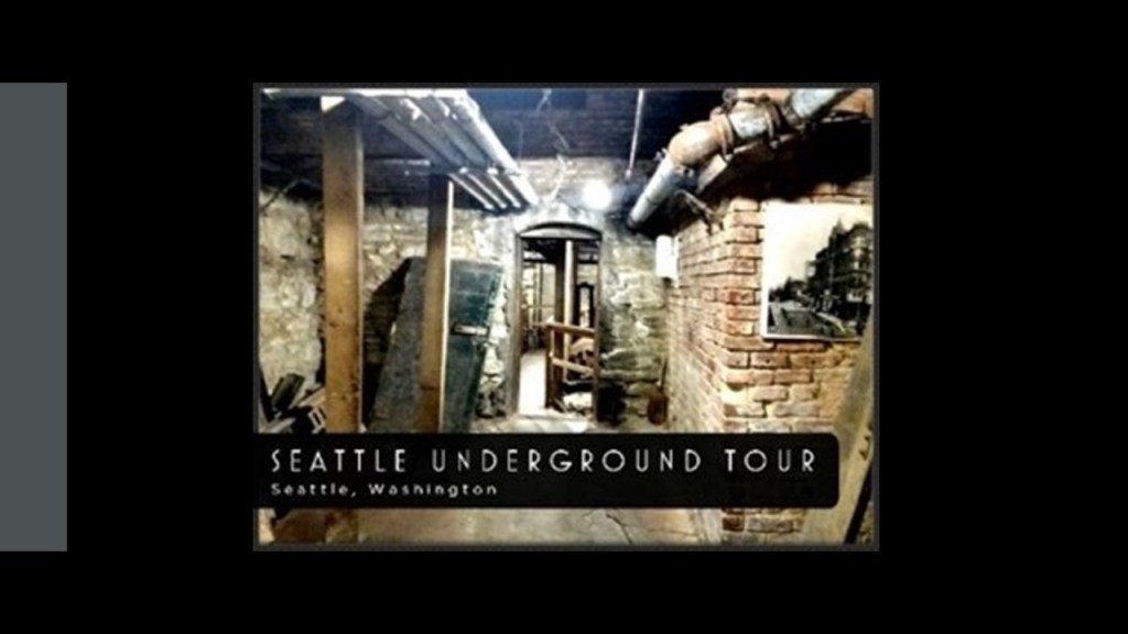
Now, I would like to take a closer look at Seattle’s Underground.
What we are told about it goes something like this.
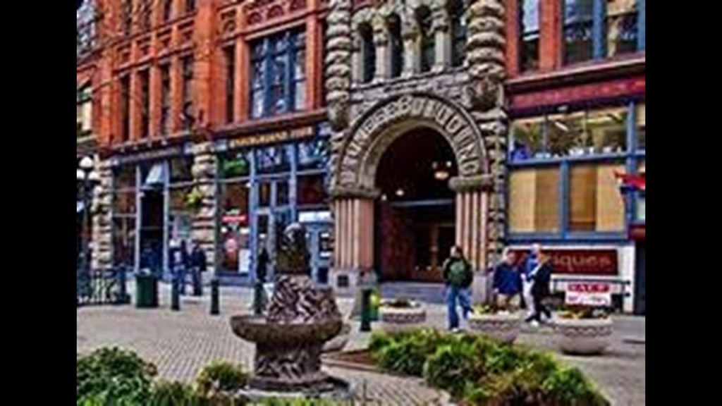
The Seattle Underground is a network of underground passageways and basements beneath Pioneer Square downtown that at one time were at ground-level when the city was built in the mid 19th-century.
The streets here were said to have been elevated after the Great Fire of Seattle in 1889, thereby creating the underground spaces.
We are told new construction was required to be of masonry, and the town’s streets were regraded one to two stories higher in the aftermath of the 1889 fire.
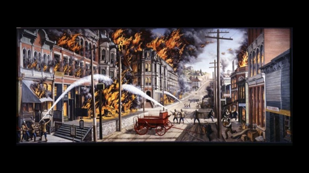
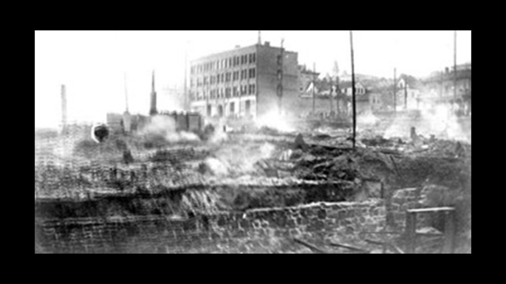
Interesting to note that there were smouldering masonry buildings in this picture of the 1889 Great Fire of Seattle.
Yet, it would seem like they were trying to have us believe that the fire only involved wooden structures.
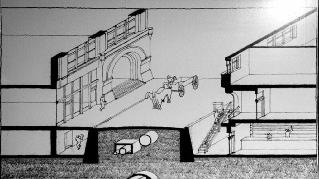
At any rate, we are told after the fire, streets were lined with concrete walls that formed narrow alleys between the walls and the buildings on both sides of the street for the regrade, with a wide alley where the street was.
Then, the naturally steep hillsides were used to raise the streets to the desired new level by washing material into the wide alleys through a series of sluices, and raising the street level by at least 12-feet (or 3.7-meters), and in some places, by 30-feet (or 9.1-meters) high.
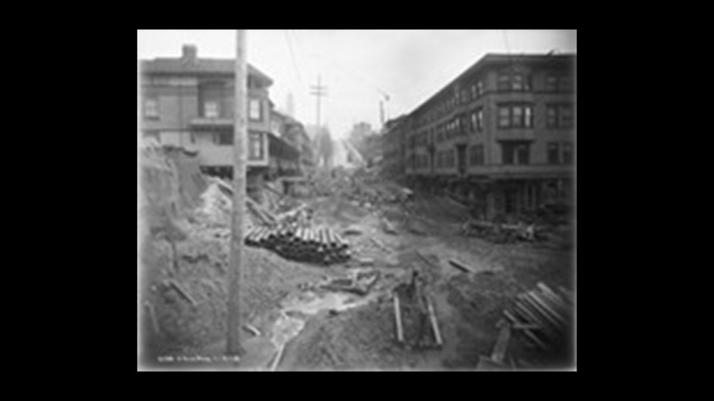
I was able to find this picture labelled as the Seattle regrade.
Just passing along what they are telling us was going on here.
Now I am wondering if what we are seeing is the result of a pyroclastic flow, or deposit of ash from an eruption column, possibly from the nearby Mount Ranier as the result of a sudden cataclysmic explosion.
We are told pedestrians climbed ladders at first to go-between street level and the sidewalks in front of the building entrances.
Then brick archways were constructed next to the road surface, above the submerged sidewalks.
Prism lights were then installed over the gaps between the raised streets and the buildings, creating the area now called the Seattle Underground.
When they reconstructed their buildings, we are told, merchants and landlords knew that the ground floor would eventually be underground and the next floor up would be the new ground floor, being the reason given there was very little decoration on the doors and windows of the original ground floor, but extensive decoration on the new ground floor.
Once the new sidewalks were complete, building owners moved their businesses to the new ground floor, although merchants carried on business in the lowest floors of buildings that survived the fire, and pedestrians continued to use the underground sidewalks lit by the pavement lights (still seen on some streets) embedded in the grade-level sidewalk above.
These underground spaces eventually fell into disuse.
Today, some parts of the Seattle Underground are still open for touring.
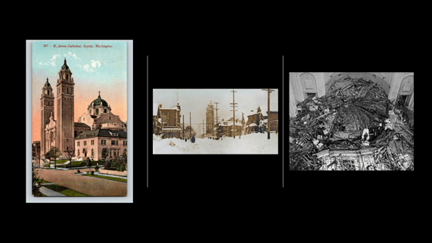
Next, the St. James Catholic Cathedral is the mother church of the Archdiocese of Seattle.
It was said to have been constructed between 1905 and 1907 in the Renaissance Revival Architectural-style.
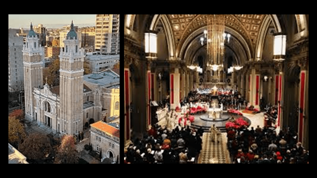
It once had a dome, but unfortunately, we are told that in February of 1916, the 60-foot dome that stood atop the cathedral collapsed under the weight of heavy snow accumulation from a colossal snowstorm, and was never rebuilt.
There are several organs in the St. James Cathedral.
The oldest is said to be a Hutchings-Votey organ in the West Gallery that dates to 1907, and designed by famed Boston organ designer George Hutchings in close collaboration with the cathedral’s first organist.
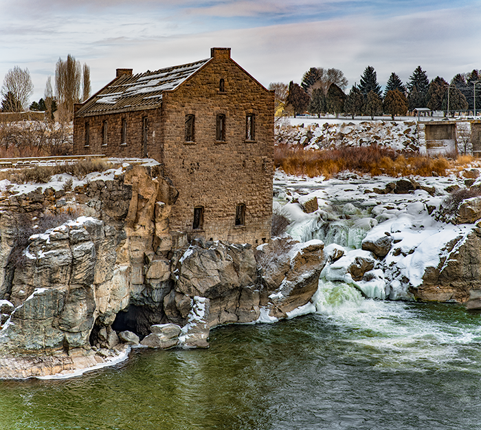
The city of Tacoma is also a port city, located southwest of Seattle, and is the second-largest city on Puget Sound.
The Port of Tacoma is Washington State’s largest port, and a center of international trade on the Pacific Coast.
Tacoma is located even closer to Mount Ranier than Seattle, at a distance of 44-miles, or 68-kilometers.
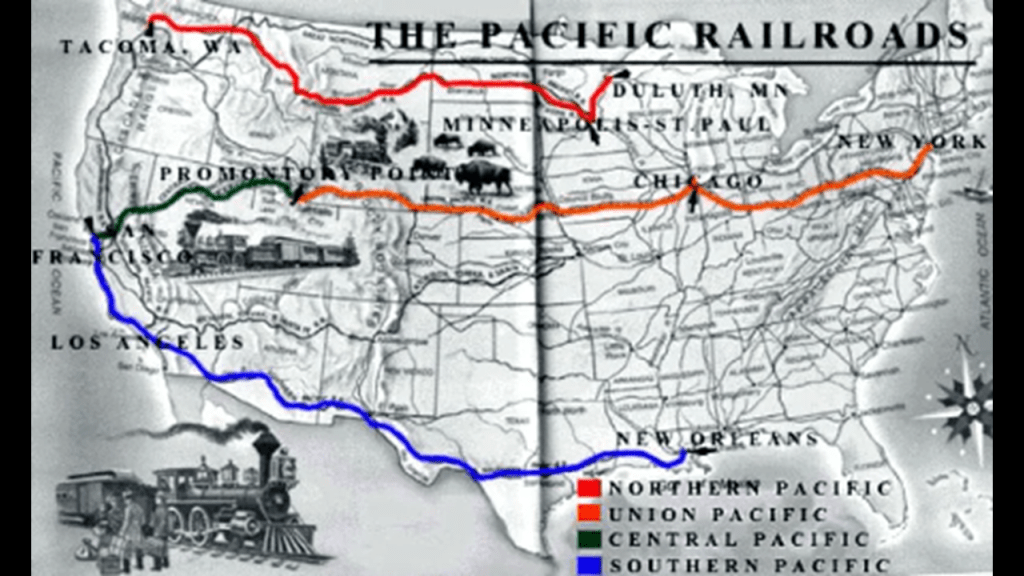
Tacoma’s nickname is the “City of Destiny,” because in the late 19th-century, we are told it was chosen to be the western terminus of the Northern Pacific Railroad because of the deep water port here known as Commencement Bay.
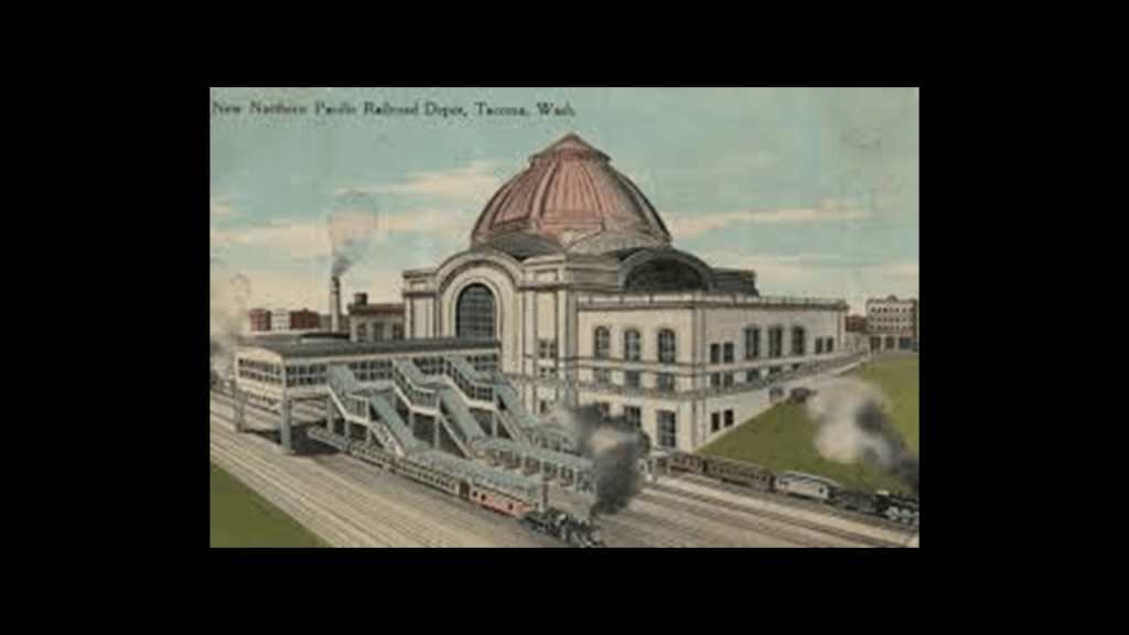
The Northern Pacific Railroad was the part of the transcontinental railroad that operated from Minnesota to the Pacific Northwest in the northern tier of the western United States.
It was first approved and chartered by the U. S. Congress in 1864, which was the year before the end of the American Civil War in 1865, with construction said to have started in 1870.
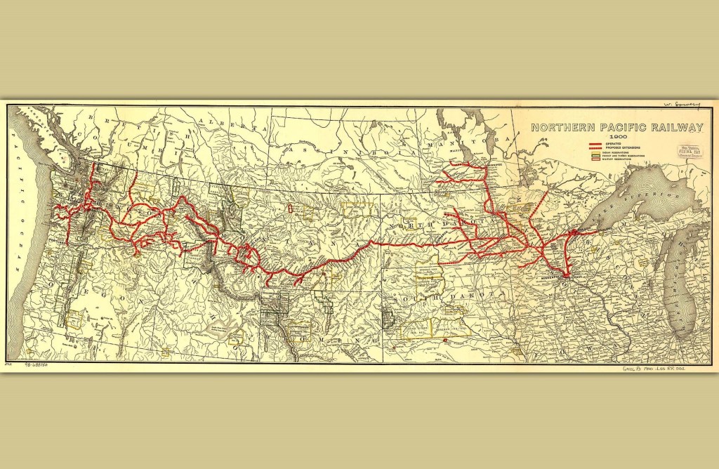
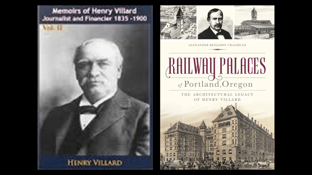
Henry Villard was the president and primary financier of the Northern Pacific Railroad.
He was said to have emigrated from Germany as a teenager without the knowledge of his parents to the United States, and subsequently became a journalist out west, and became a war correspondent covering the American Civil War first, and then sent back to Germany in 1866 to cover the Austro-Prussian War.
While he was back in Germany, he became involved in investments in American Railroads, and in 1874, returned to the United States to oversee German investments in the Oregon and California Railroad, and he acquired other transportation interests as well, including other rail and steamship companies, and in the 1880s, he acquired the “New York Evening Post” and “The Nation” newspapers.
Well, we’ve already seen one Rothschild take up residence in Port Townsend…I wonder if Villard was a Rothschild agent.
That wouldn’t surprise me at all!
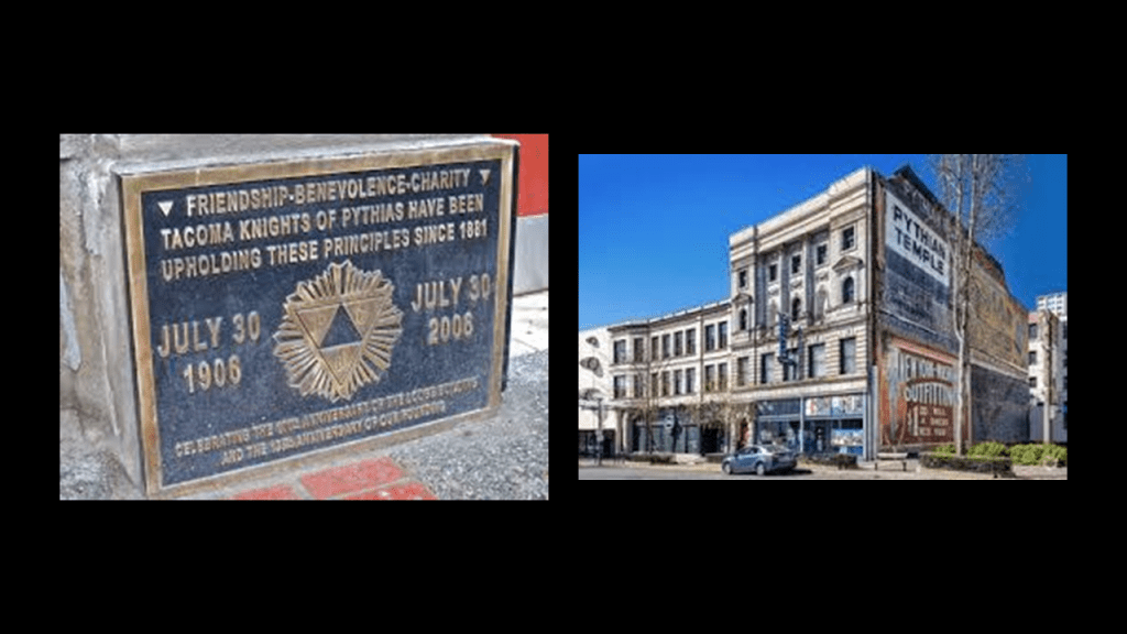
Like the Northern Pacific Railroad, the Knights of Pythias were also chartered by an Act of Congress in 1864.
What we are told about the Knights of Pythias is that it was the first fraternal order to receive a charter by an Act of Congress.
For what purpose would Congress charter a fraternal secret society in wartime?
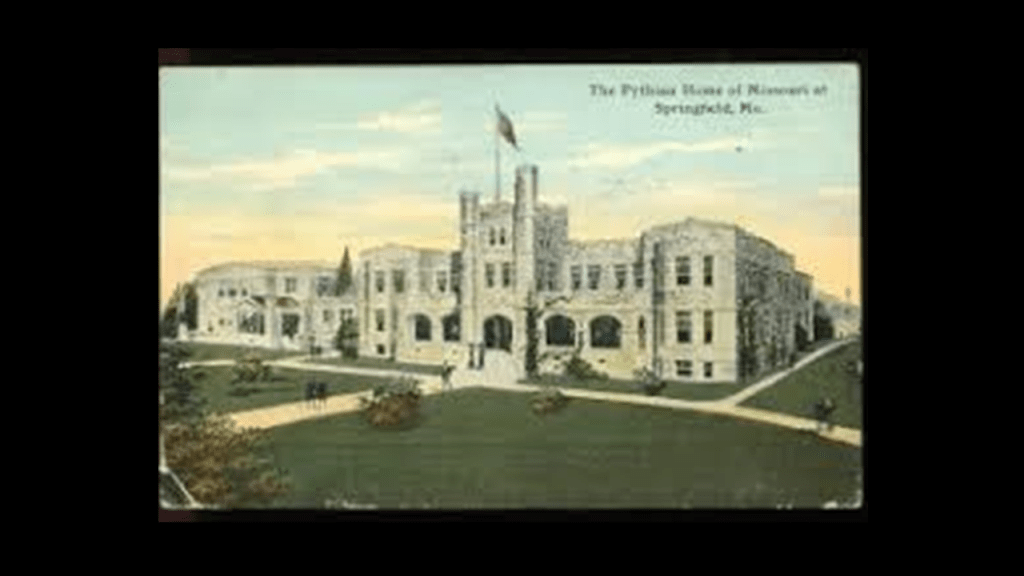
Well, their order provides for “worthy Pythians in distress” and is probably best known for it “Pythian Homes,” said to have been built by them as homes for needy members of the order, and their widows and children, like the Pythian Home of Missouri in Springfield.
And sure enough, there is a Pythian Temple in Tacoma, said to have been built in 1906 for Commencement Lodge Number 7 on Broadway, in the Theater District of Tacoma, and is still in use today by the Pythians, as well as housing a youth theater and a middle school.
So while we are told that the Order of the Knights of Pythias have a noble mission of serving so-called “worthy Pythians” in distress, they are one of several secret societies that I would categorize as “resetters,” heavily involved in providing an explanation for nd repurposing the original infrastructure of the Old World.
Tacoma became famous for the collapse of the Tacoma-Narrows Bridge in November of 1940, less than six-months after it opened in July of 1940.
Though the dramatic collapse of the bridge has been attributed to structural issues and windy conditions, this event it has been presented in physics textbooks as an example of elementary forced mechanical resonance, which is the tendency of a mechanical system to respond at greater amplitude when the frequency of its oscillations matches the system’s natural frequency of vibration closer than it does other frequencies.
Resonance can occur in various systems, whether acoustical, electrical, or mechanical systems, and is desirable in their applications.
Resonance can also be detrimental, however, when it leads to excessive vibrations and structural failure.
It is my belief that a forced resonant frequency that went through the perfectly-tuned grid system of the Earth, causing not only the destruction of the Earth’s grid system but the surface of the Earth as well.
I cover in great detail and depth what I believe caused this cataclysm, including when and how I think it it happened, in my post “On the Trail of Giants, in Appalachia and Beyond – Theme 4: The Cataclysm.”
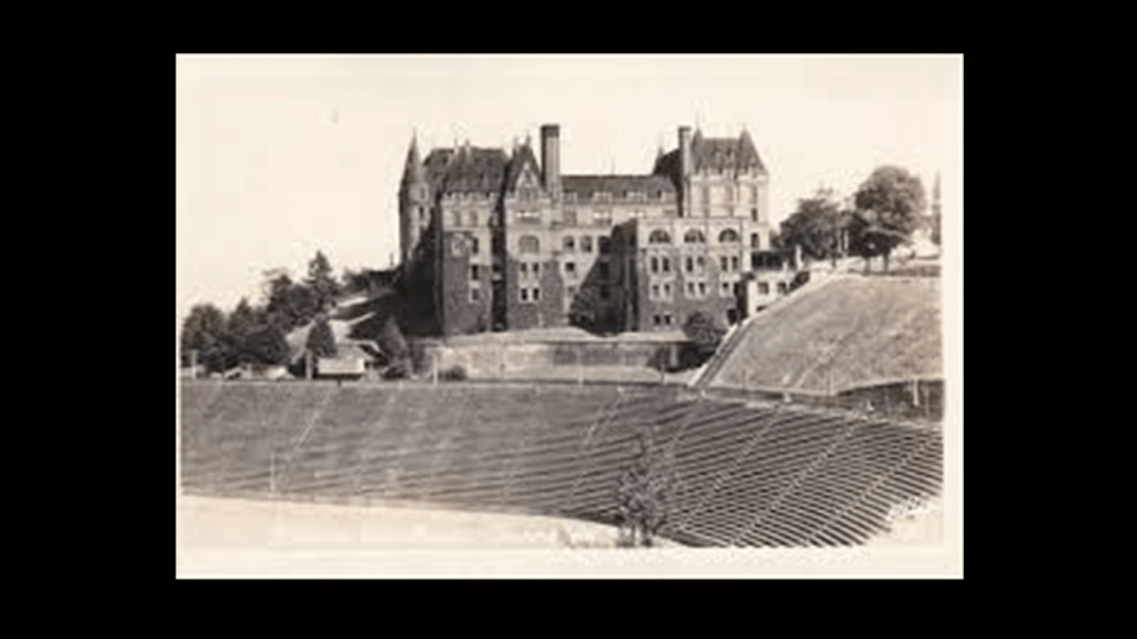
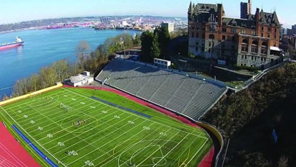
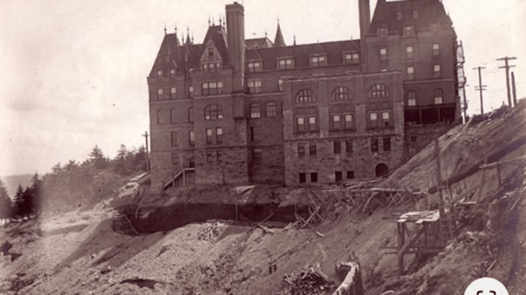
One last place I want to take a look at while I am in Tacoma is the old Stadium High School.
Located near downtown Tacoma, we are told that it was first constructed as a luxury French-chateau-style hotel starting in 1891 for the Northern Pacific Railway.
Then the Panic of 1893 brought construction to a halt, and the unfinished building which still had building supplies in it was gutted by a massive fire in 1898.
Then the Tacoma School District purchased it in 1904 for renovation and repair, and it was said to have first opened as a high school in 1906.
It’s stadium was said to have been built between 1909 and 1910, with an original seating capacity of 32,000, though that got downsized for a variety of given reasons over the years, including soil instability.
The Stadium High School is still in use as a high school today.
Well, there is nothing as dramatic as the aftermath of the Great Seattle Fire of 1889 happening in Tacoma that I can find, but I did find this historic photo of what became the Stadium High School looking as though the site was being dug out of whatever was covering its grounds for the possibility that we are looking at a pyroclastic flow from Mount Ranier here as well, or even perhaps some kind of soil liquefaction from the cataclysmic event.
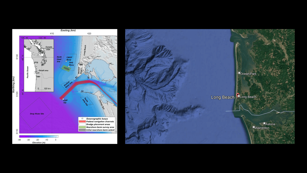
Next, I am going to turn my attention to Long Beach in Washington is located on the Pacific Coast above the mouth of the Columbia River, and is to the southwest of Puget Sound and to the northwest of the Vancouver, Washington and Portland, Oregon Metro-area, on the Long Beach Peninsula, and long been touted as the “World’s Longest Beach.”
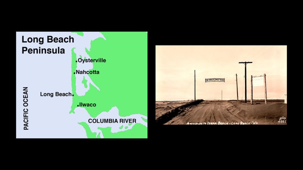
Long Beach is recorded as having been started when Henry Harrison Tinker purchased a land claim in 1880, after which time he platted the town and called it Tinkerville.
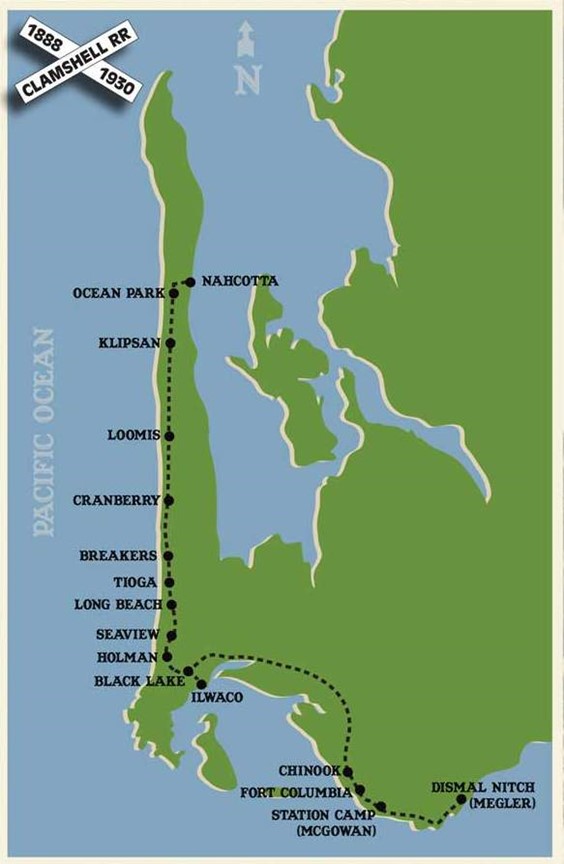
Between 1888 and 1930, the Ilwaco Railway and Navigation Company, a narrow-gauge railway, ran-up the whole, narrow Long Beach Peninsula.
We are told that between the advent of the automobile and financial difficulties, the railroad was abandoned by its owners on July 12th of 1930.
By the summer of 1931, the railroad’s physical infrastructure and rolling stock had been sold to a scrapping firm in Portland, and the rails and ties ripped up from the road-bed.
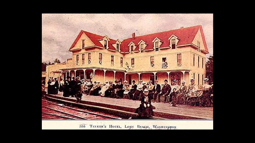
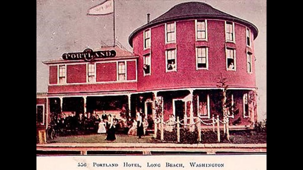
In its hey-day, Long Beach became a resort for the wealthy, where besides the Tinker Hotel, there was the historic Portland Hotel, which burned down in December of 1914 and was never replaced.
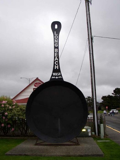
You can still see one of the “World’s largest frying pans” in Long Beach, an attraction there since the early 1940s.
It was said to have been a public sculpture created in 1941 by the Northwest Copper and Sheet Metal Works to promote their first annual clam festival.
But then they neglect to tell us about the giants that lived in North America, and from what I can tell, existed up until not that long ago.
I cover my research on that subject, also in great depth and detail, in this post – “On the Trail of Giants in Appalachia and Beyond – Theme 2 Giants.”
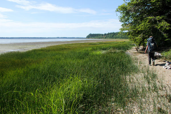
Leadbetter Point State Park is at the north tip of Long Beach Peninsula, and is a nature preserve and public recreation area.
The land here contains what are described as second-growth coniferous forests; dunes; beaches; wetlands; and grasslands.
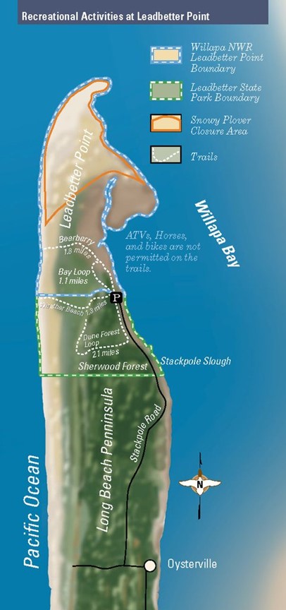
The Willapa National Wildlife Refuge borders Leadbetter Point State Park to the south of it, and is described as 11,000 acres, or 45-kilometers-squared of sand dunes, sand beaches, mudflats, grasslands, and saltwater and freshwater marshes.
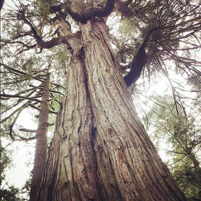
The Willapa National Wildlife Refuge also has old-growth forests, like the ancient cedar grove found on Long Island in Willapa Bay.
The Long Beach Peninsula alone, contained in its length of 28-miles, or 4-kilometers, and width of 1.5-miles, or 2.41-kilometers, has all the land types that I mentioned previously that I believed resulted from the cataclysmic event that destroyed the energy grid and the surface of the Earth – with its marshes, deserts, and dunes on the land above the surface of the water, as well as the historic infrastructure of a railroad that no longer exists, lighthouses, and the star forts I am coming to next.
And I have no doubt the land is submerged here as well.
I found exactly the same kind of everything on Long Island and in Long Island Sound on the Atlantic East Coast of the United States that I find here on the Long Beach Peninsula on the Pacific West Coast – railroad history; old growth forest, dunes, wetlands, and lots of shallow, hazardous water.
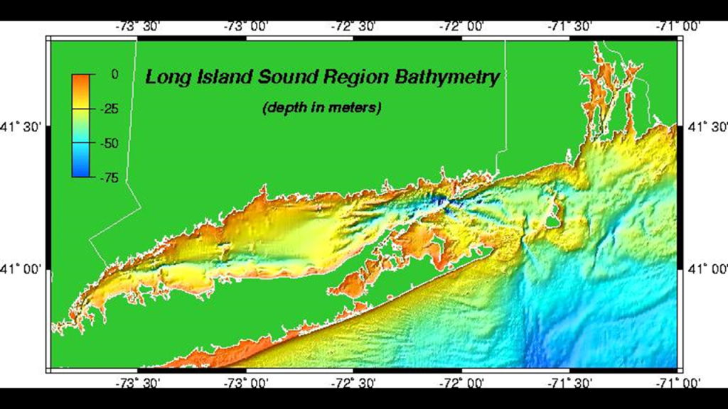
I first extensively researched this region of the East Coast almost two-years ago in my blog post “Recovering Lost History from the Estuaries, Pine Barrens & Elite Enclaves off the Atlantic Northeast Coast of the United States.”
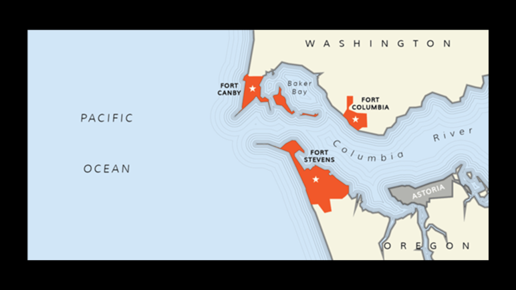
At the southern tip of the Long Beach Peninsula in Washington State, we find Fort Canby at Cape Disappointment State Park.
Fort Cape Disappointment was said to have been built on the northern side of the mouth of the Columbia River between 1863 and 1864, which would have been during the American Civil War, and was later known as Fort Canby…
…along with Fort Stevens, said to have been built in the same time frame on the southern side of the mouth of the Columbia River in Oregon, west of Astoria, Oregon…
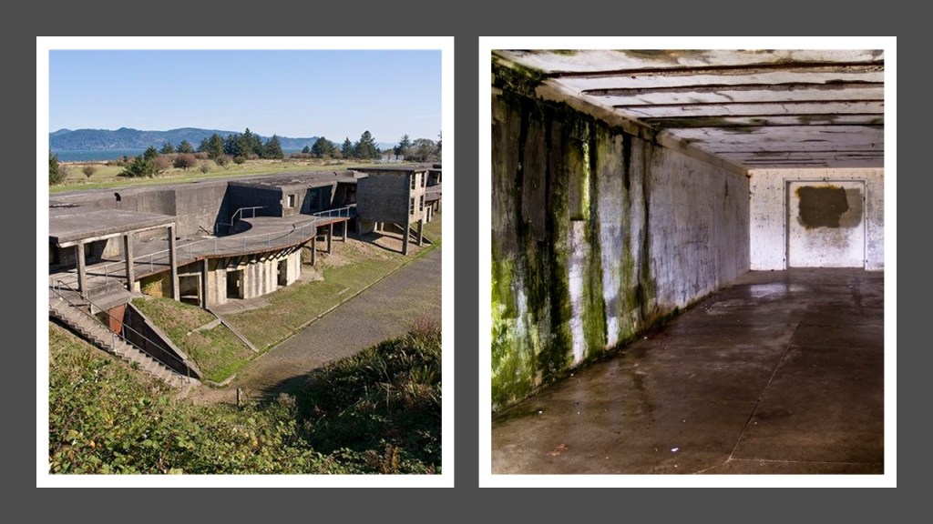
…and Fort Columbia, just east of Fort Canby in Washington State, and said to have been built between 1896 and 1904.
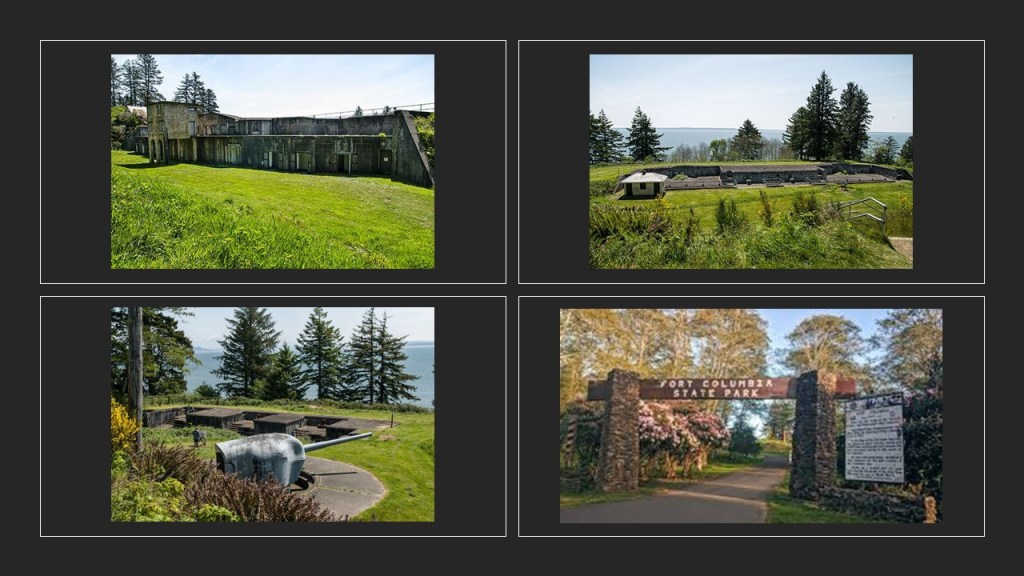
We are told these three forts constituted the “Three Fort Harbor Defense System” at the mouth of the Columbia River.
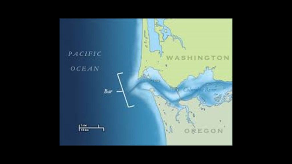
At this location here at the mouth of the Columbia River, it is important to mention what is called the “Columbia Bar,” which is described as a system of bars and shoals, or submerged banks and ridges close to the surface of the water, at the mouth of the Columbia River, and is considered one of the most dangerous bar crossings in the world and known as the “Graveyard of the Pacific.”
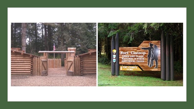
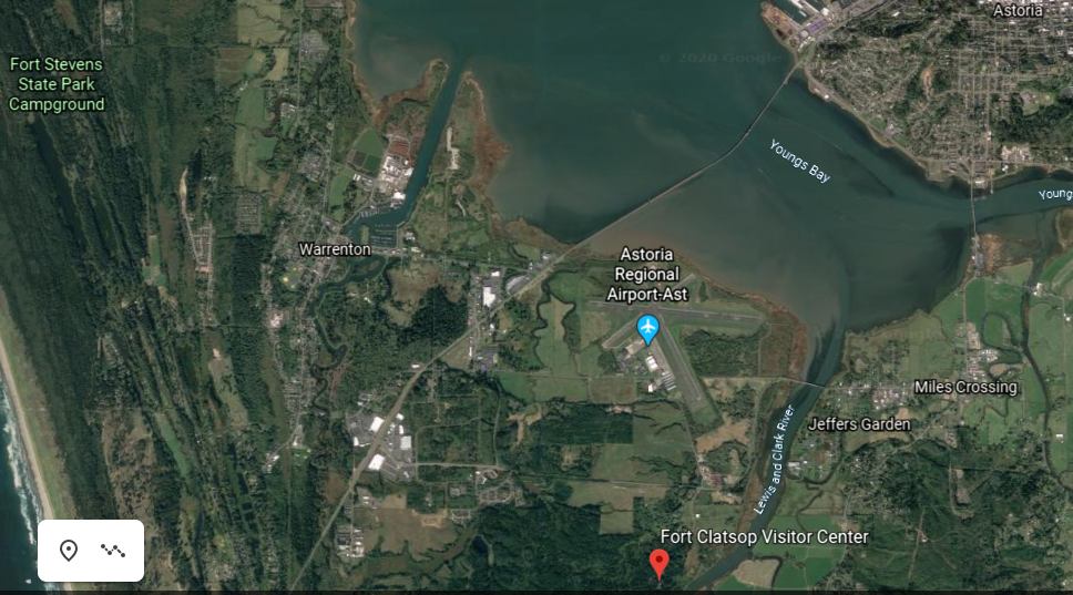
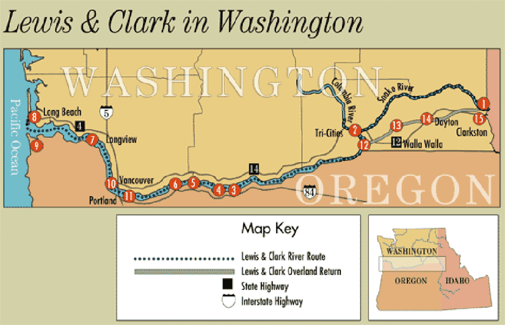
Fort Clatsop is on the Oregon-side of the Columbia River, near Fort Stevens, and was where the members of the Lewis & Clark expedition built Fort Clastop for shelter and protection, in the winter of 1805, and to officially establish the American presence there, with the American flag flying over the fort.
The Lewis and Clark Expedition travelled on the Columbia River on their journey to the Pacific Coast.
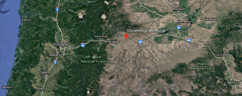
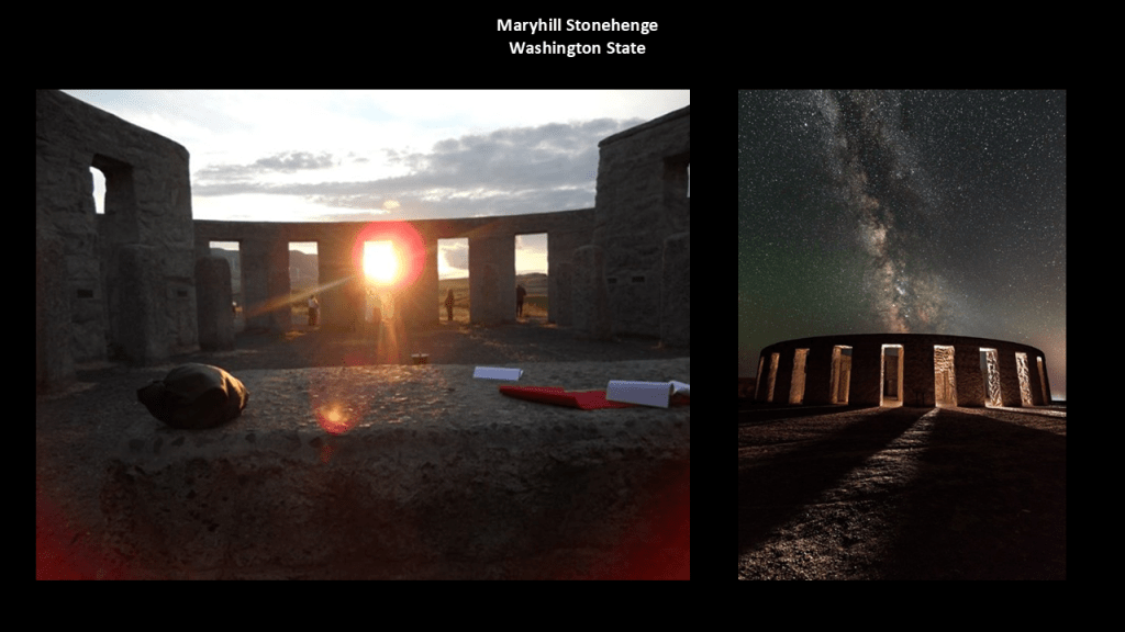
They would have passed right by the physical location of the Maryhill Stonehenge, on a bluff on the Washington-side of the Columbia River…
…even though we are told this perfect Stonehenge was commissioned in the early 20th-century by the wealthy entrepreneur Sam Hill, and dedicated on July 4th, 1918, as a memorial to the people who died in World War I, so of course it wouldn’t have been there in the early 1800s…or would it?
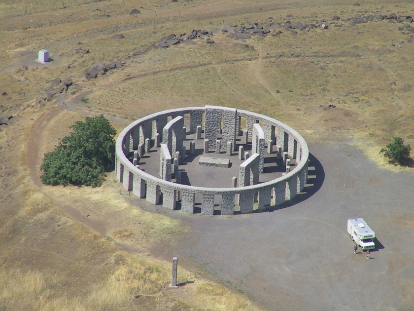
In addition to having a solstice alignment, it also has a nice alignment going on with the Milky Way.
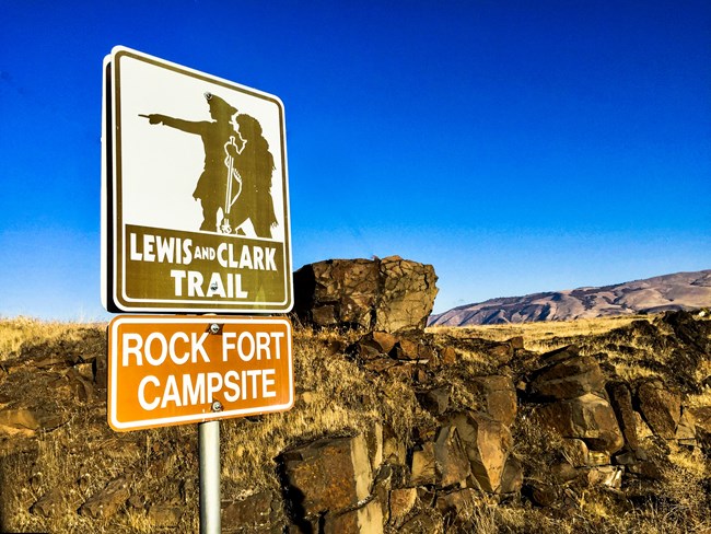
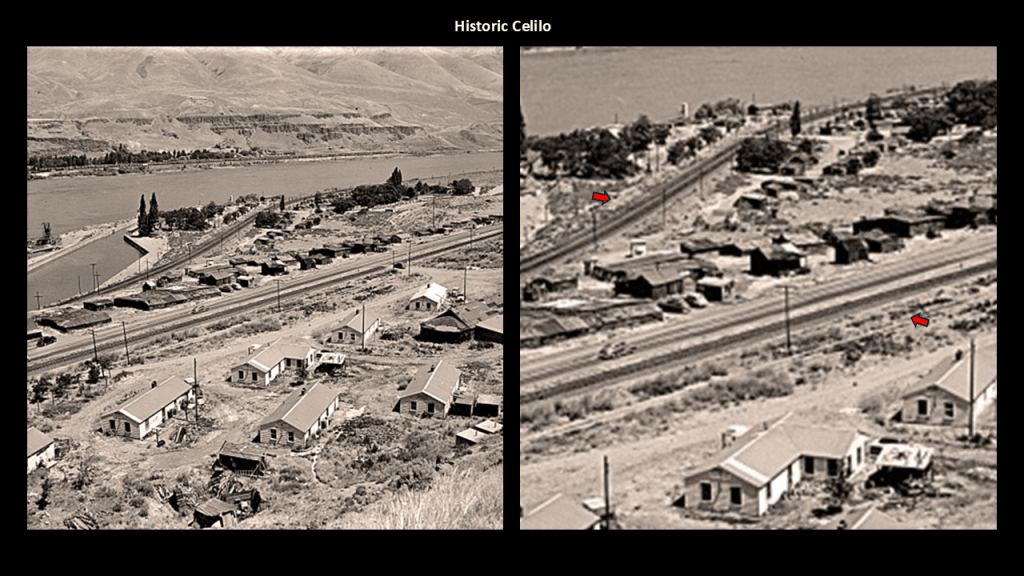
The Lewis and Clark Expedition was said to have camped for three nights on the Columbia River near Celilo, at the Rock Fort Campsite, described as a natural fortification, in late October of 1805.
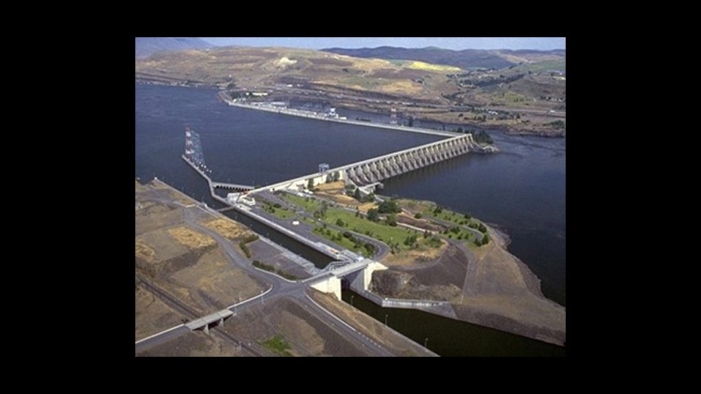
The rising water filling The Dalles Dam submerged the Celilo Falls, and the village of Celilo, in 1957.
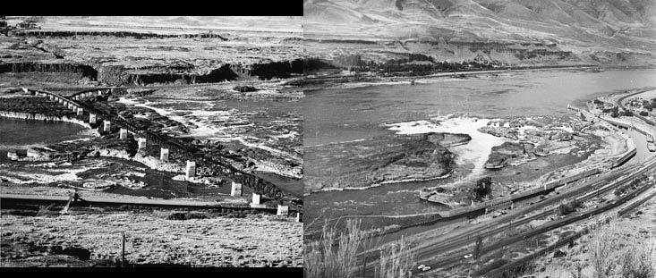
The Dalles Dam is also a concrete, run-of-the-river dam spanning the Columbia River, said to have been built by the U. S. Army Corps of Engineers between 1952 and 1957.
The city of The Dalles was said to be a major Native American trading center for at least 10,000 years, and that the general area is one of North America’s most significant archeological regions.
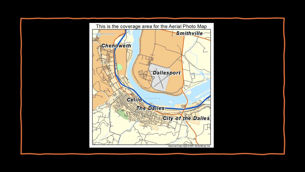
Celilo was the economic and cultural hub of Native Americans in the region, and said to be the oldest continuously inhabited settlement in North America.
Two sets of railroad tracks are visible in the middle of this historic photo.
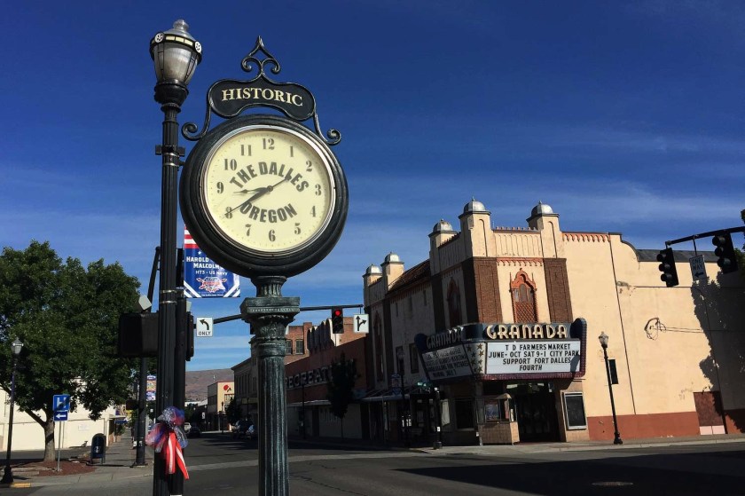
As a matter-of-fact, the historic Granada Theater in the nearby city of The Dalles, and is on the Lewis and Clark Trail, and still in use as a theater today.
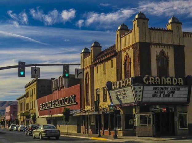
It was said to have been built in the Moorish Revival style, between 1929 and its opening in 1930, and is famous for having been the first theater west of the Mississippi to show a “talkie.”
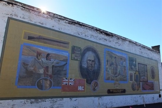
Various fur trading companies were said to have become active in the region around present-day The Dalles starting around 1810, and this continued on with growth of trading networks, like that of the Hudson’s Bay Company, starting in the 1820s through the 1840s.
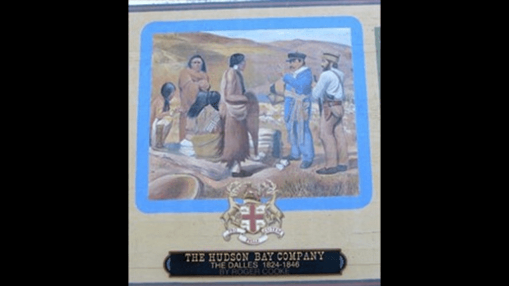
This is the full Hudson’s Bay Company mural in The Dalles.
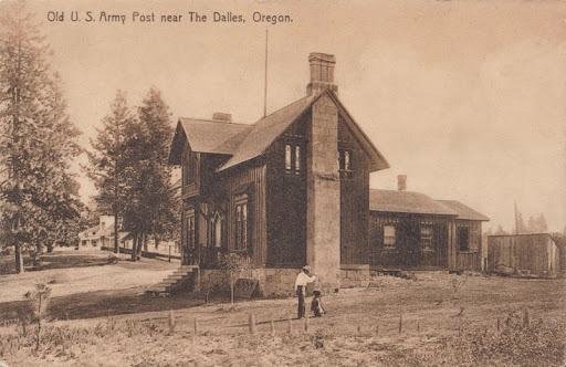
We are told that in 1850, the United States Army founded a small post at the site of an old mission that was here in 1850, and a post office established within the city’s current boundaries in 1851.
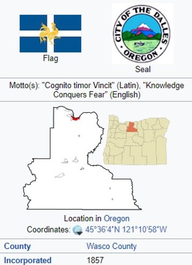
The Dalles was incorporated as a city in 1857.
The Corps of Discovery arrived at the Pacific Ocean around November 21st of 1805, near the location today of Astoria, Oregon and named after John Jacob Astor.
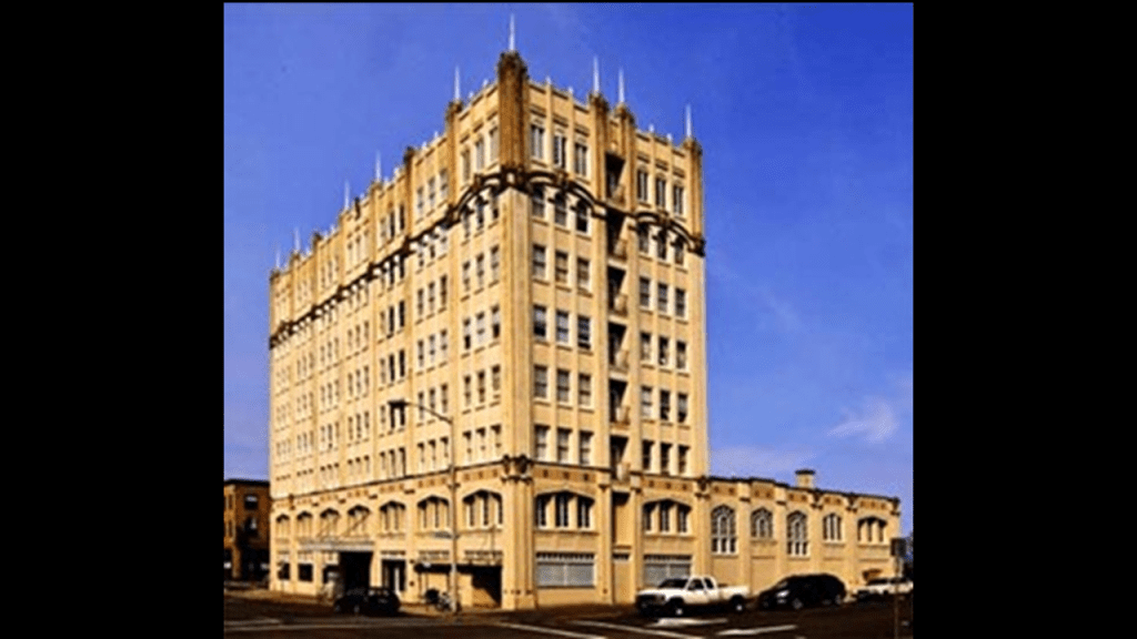
This is the John Jacob Astor Hotel in Astoria, said to have been constructed between 1922 and 1923, and opened in 1924, and is one of the tallest buildings on the Oregon Coast.
Interesting to note, the world’s first cable television system was set up in 1948 using an antenna on the roof of the Hotel Astoria.
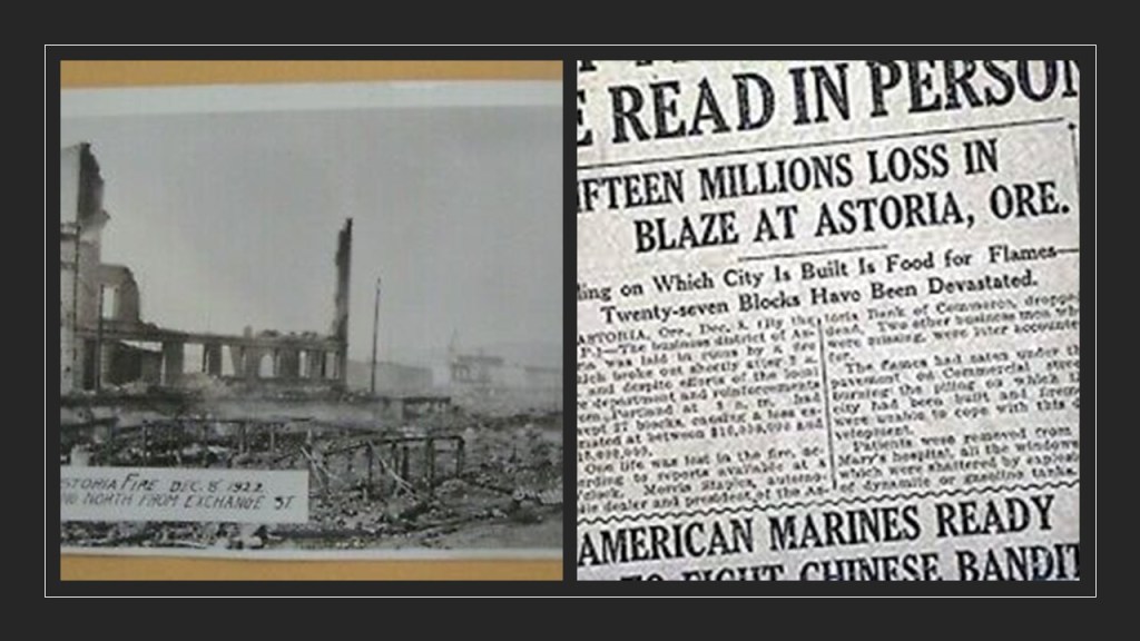
Also, during the same time period the hotel was said to have been built, on December 8th of 1922, a fire destroyed almost all of downtown Astoria.
Back in the winter of 1805, we are told the members of the expedition built Fort Clastrop for shelter and protection, and to officially establish the American presence there, with the American flag flying over the fort.

I looked on Google Earth to see if I could detect the remnants of a star fort on the grounds of the Fort Clatsop National Monument, which I did not – if remnants are there they are most likely covered by trees…
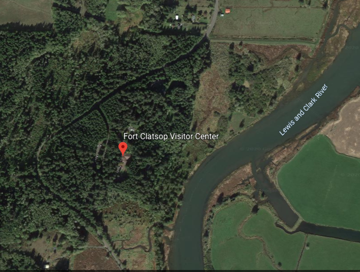
…but I happened to notice Fort Stevens State Park in close vicinity to Fort Clatsop.
John Jacob Astor and the American Fur Company’s fur-trading fort at Fort Pierre, a stopping point of the Lewis and Clark Expedition in Sioux country in present-day South Dakota, was the beginning of the wealth and influence of the Astor family.
When I tracked the history of the entire Lewis and Clark Expedition in Lewis and Clark & the Corps of Discovery – True History or Real Mystery?…
……not only did I find John Jacob Astor’s presence along the way, I found the presence of other big names in the beginnings of the corporatocracy in which we have been living under.

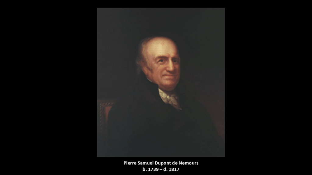
I also found the minor French nobleman Pierre Samuel Dupont de Nemours, one of the negotiators with France for the terms of the Louisiana Purchase in 1803 on behalf of President Jefferson, was who was living in the United States at the time.
His son Éleuthère Irénée du Pont, a chemist and industrialist, founded the E. I. du Pont de Nemours and Company to manufacture gunpowder and explosives in 1802, with the du Ponts becoming one of America’s richest families, with generations of influential businessmen, politicians and philanthropists.
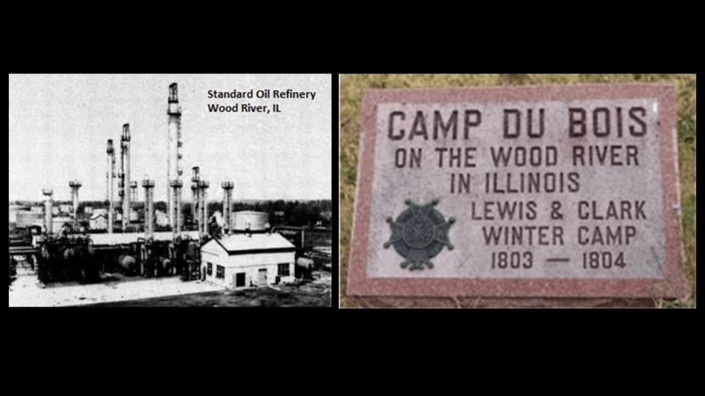
And I found the Rockefellers and the Standard Oil Refinery in Wood River at the location of Camp Dubois on the Illinois side of the Mississippi River, near Cahokia Mounds, which was the official starting point of the Lewis and Clark expedition in 1804.
Apparently, the city of Wood River was founded in 1907 with the establishment in the vicinity of a refinery for John D. Rockefeller’s Standard Oil Company.
And we’ve already seen an acknowledged Rothschild presence in the Pacific Northwest in Port Townsend at the entrance to Puget Sound.
So we find the four big names of the so-called elite bloodline families at the beginnings of the exploration and history of the Pacific Northwest in our narrative, which started with the Louisiana purchase in 1803.
Like I said earlier in this post, it is my belief that as soon as they were able to after this cataclysmic event took place, these bloodline families and their related-minions came into the ruined lands of the Earth to explore, claim, harvest the resources of, and provide us with a new history and their new systems for power and control of the Earth and its people after the Old World was violently destroyed by a deliberately-caused cataclysm .

And I can’t help but notice what appears to be a correlation between the map of the Washitaw Empire on the left, and the map of the Louisiana Purchase on the right.
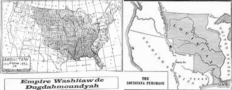
But…who are the Washitaw?
The Washitaw Mu’urs, also known as the Ancient Ones and the Mound-Builders, still exist to this day, and have been recognized by the UN as the oldest indigenous civilization on Earth, with roots going back to Ancient Mu, or Lemuria.
But for some reason the general public has never heard of them.
While the United Nations is dubious, the ancient Washitaw Mu’urs are not.
Unfortunately they’ve been completely removed from our narrative along with all of the Moors.
And it’s very confusing because they’re all part of the same original ancient and advanced civilization, and it’s very hard to find information about any of this.
But the Washitaw have been fighting a battle for years to get recognition for anything and for them to get recognition from the UN as “the oldest indigenous civilization on Earth” was a significant victory for their efforts even though what is rightfully theirs is so much more.

So besides the Louisiana Purchase showing up in our narrative in 1803, and the Lewis and Clark Expedition to explore the Pacific Northwest started from St. Louis in 1804 and lasted until 1806; and the founding of the DuPont gunpowder and explosives company in 1802 in Wilmington, Delaware, other historical events taking place around this same time included:
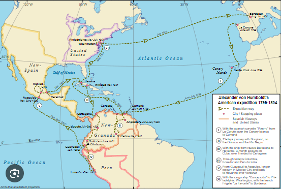
Explorations of Alexander von Humboldt, a Prussian naturalist, who was a pioneer of the fields of biogeography and geomagnetism, and an explorer of the Americas between and 1799 and 1804, starting with an exploration of Mount Teide on Tenerife in the Canary Islands.
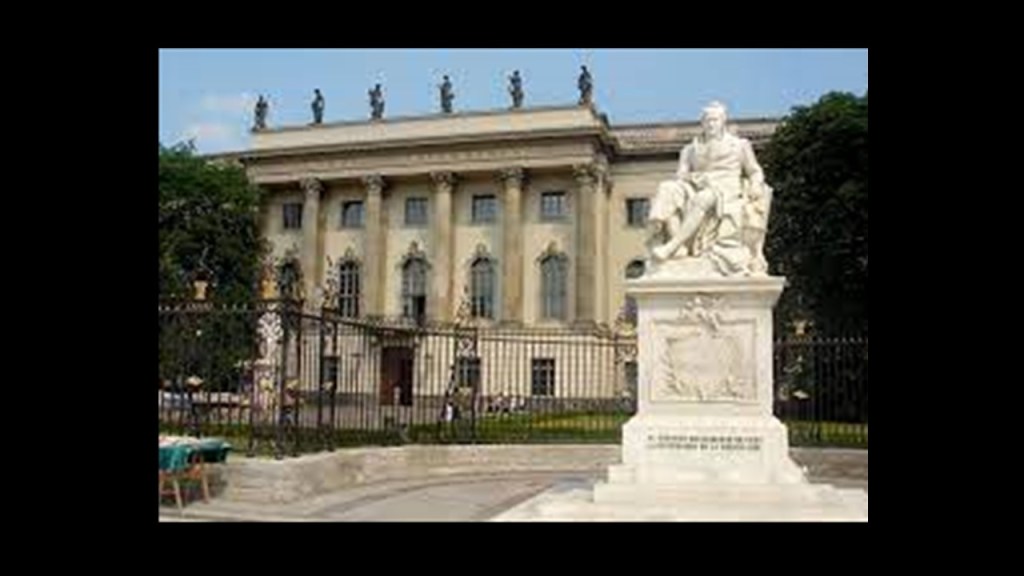
Humboldt University in Berlin was named after Alexander von Humboldt and his brother Wilhelm.
It was first opened in 1810, and was regarded as one of the world’s pre-eminent universities in the study of Natural Sciences in the 1800s and 1900s.
Famous faculty and alumni included such famous names in our current historical narrative, besides the previously mentioned Alfred Wegener of Continental Drift fame, include: the theoretical physicist Albert Einstein; Karl Marx and Friedrich Engels, c0-collaborators on “The Communist Manifesto;” Otto von Bismarck, first Chancellor of the German Empire; Georg Hegel, whose philosophy gave us the “Hegelian Dialectic” of Problem-Reaction-Solution; and the Brothers Grimm, best-known for their fairy tales which has such story-lines as eating people, as in “Little Red Riding Hood and “Hansel and Gretel.”
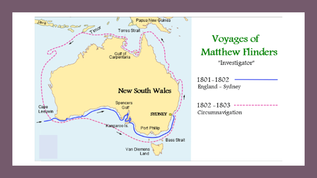
Then between 1801 and 1803, Capt. Matthew Flinders led the first in-shore complete navigations around mainland Australia.
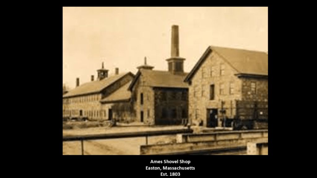
And in 1803, the establishment of the the Ames Shovel Shop in Easton, Massachusetts.
The Ames Shovel Shop became nationally known for providing the shovels for the Union Pacific Railroad, which opened the west. It was said to have been the world’s largest supplier of shovels in the 19th-century.
The Ames Brothers, Oakes and Oliver, Jr, co-owners of the shovel shop that was established by their father Oliver, were major players in instrumental in the completion of the Union Pacific Railroad.
The Pacific Railroad Surveys, a series of explorations of the American West between 1853 and 1857, had the stated purpose of finding and documenting possible routes for a transcontinental railroad across North America.
There were five surveys conducted: the Northern Pacific Survey between the 47th-parallel north and the 49th-parallel north from St. Paul, Minnesota, to Puget Sound; the Central Pacific Survey between the 37th-parallel North and the 39th-parallel North from St. Louis, Missouri, to San Francisco, California; the Southern Pacific Survey along the 35th parallel north from Oklahoma to Los Angeles, California; the Southern Pacific Survey across Texas to San Diego, California; and along the Pacific Coast from San Diego, California, to Seattle, Washington.
All were carried out under the direction of the U. S. Secretary of War Jefferson Davis, the future President of the Confederacy during the American Civil War.
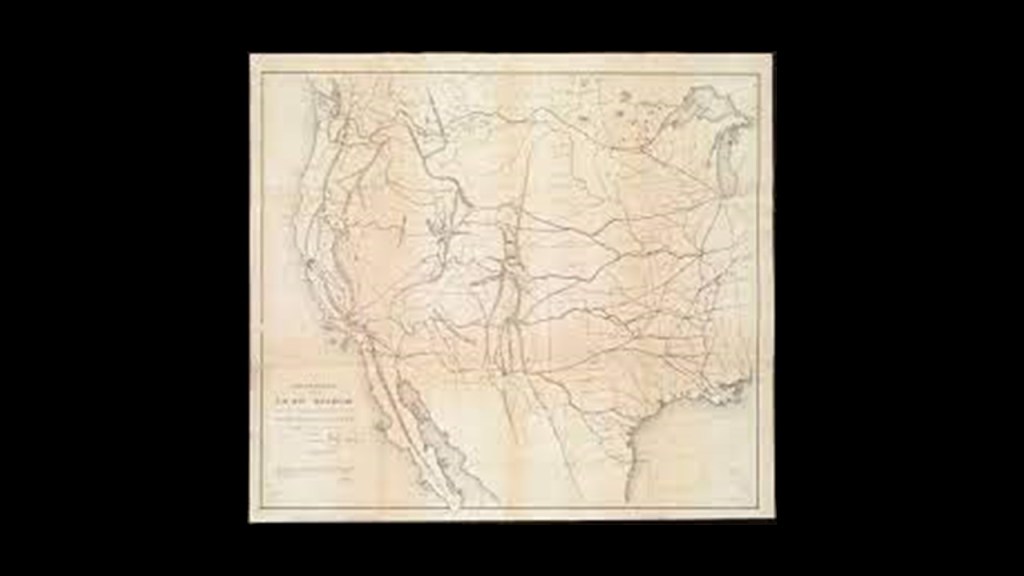
We are told the volumes of information that were produced from these surveys were considered to constitute the single most important contemporary source of knowledge on western geography and history, and that there value was greatly enhanced by beautifully-illustrated color plates showing the scenery, native inhabitants & fauna and flora of the West.

What if the Pacific Railroad Surveys were undertaken to explore a ruined landscape surveying, as in the definition of surveying meaning “looking at and observing,” everything, including pre-existing rail infrastructure in order to restore it to use once again?
What if the deserts in North America weren’t always deserts as we have been taught to believe?

By May of 1869, just fou-years after the end of the American Civil War, the first Transcontinental Railroad in North America was completed with the hammering of the “Golden Spike” connecting the Union Pacific Railroad with the Central Pacific Railroad at Promontory Summit in what was then the Utah Territory.
It is my belief that all of this exploration, surveying, and so-called construction, and the immediate need for shovels and explosives, took place in a post-cataclysmic world of recent occurrence.
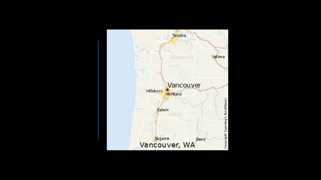
Next, I am going to take a look at the city of Vancouver in Washington State.
It is located on the north bank of the Columbia River, directly across from Portland, Oregon on the south bank.
In 1806, Lewis & Clark visited the area that became Vancouver, calling it the “only desired situation for settlement west of the Rocky Mountains.”
Fort Vancouver was established as a fur trading outpost and headquarters for the Hudson Bay Company in the Columbia Department of the Pacific Northwest. in 1825.
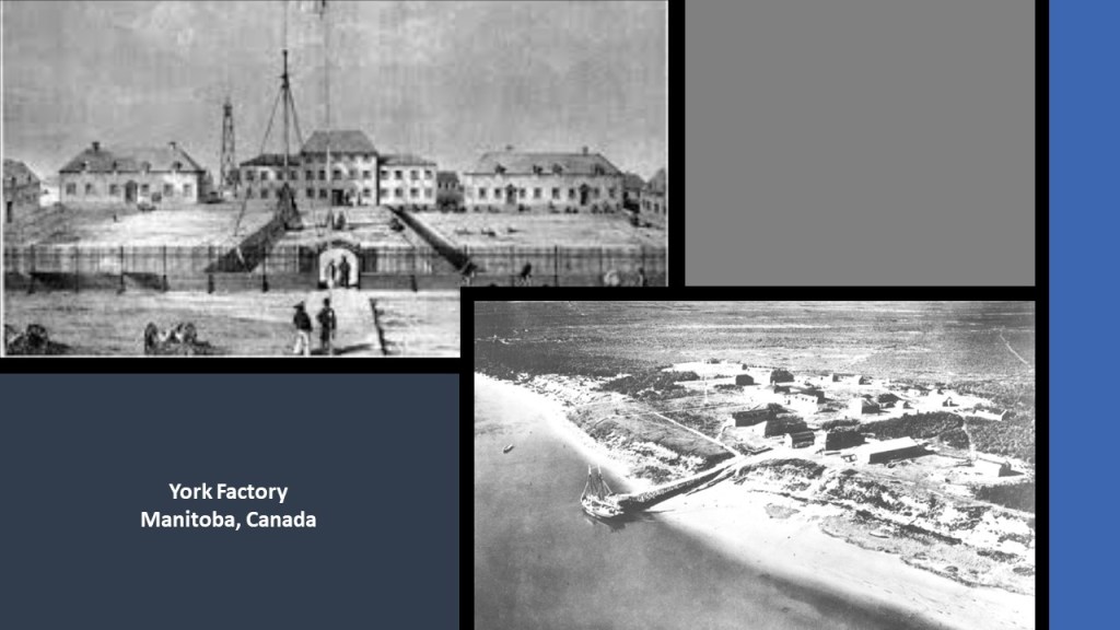
The fort was a major center for fur-trading in the region, with supplies coming from London via either the Pacific Ocean or overland from the Hudson Bay via the “York Factory Express.”
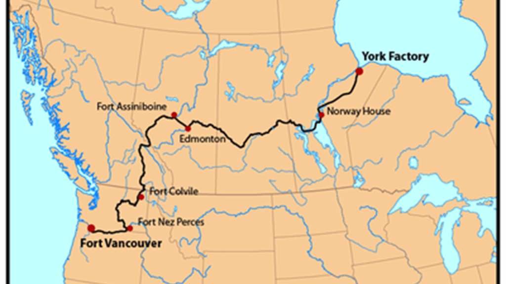
The “York Factory Express” was the main overland connection between Hudson Bay Headquarters at York Factory, which was established in 1864, as a settlement and was the central base of operations for the Hudson Bay Company’s control of the fur trade and other business dealings with the First Nations’ of what was known at the time as Rupert’s Land.
The year of 1864 was one-year before the end of the American Civil War in our historical narrative.
Fort Vancouver in what became Washington State was the principal depot of the Columbia Department at Fort Vancouver, and said to have been built in 1824.
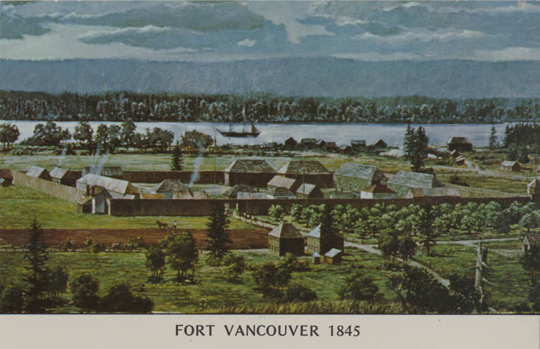
Today, we are told a full-scale replica of the fort is open to the public at the Fort Vancouver National Historic Site.
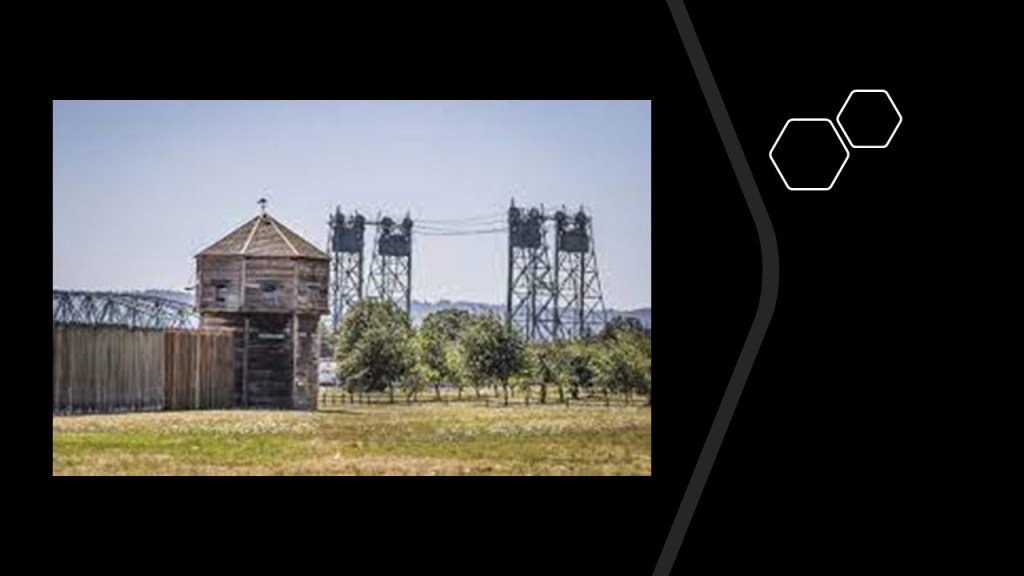
This is what was situated around the old Hudson’s Bay Company Fort Vancouver and Fort Vancouver National Historic Site.
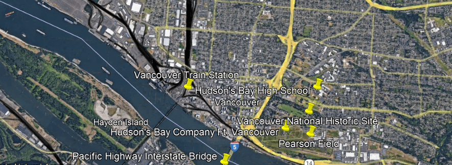
The Hudson’s Bay Company Fort Vancouver is located right next to I-5 and the Pacific Highway Interstate Bridge, a pair of steel, vertical-lift truss bridges that carries the Interstate over the Columbia River between Vancouver and Portland.
The vertical lift spans of the bridge rise vertically while remaining parallel with the deck in order to accommodate shipping lane traffic.
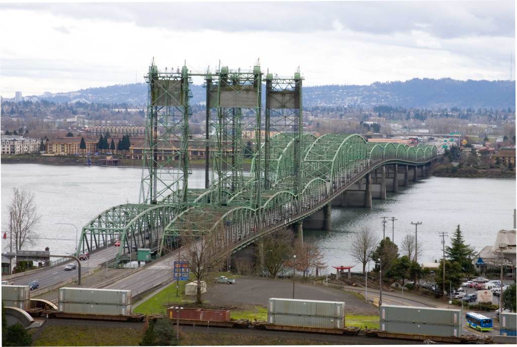
Construction was said to have started in 1915 and opened in 1917 as a single bridge carrying two-way traffic, which would have been in the middle of World War I, which started in 1914 and ended in 1918.
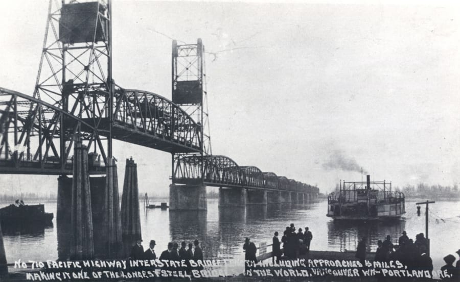
We are told the second bridge opened in 1958.
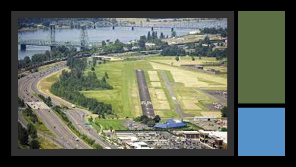
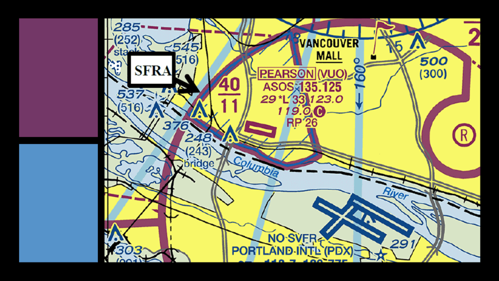
Pearson Field is located on the other side of the old Hudson’s Bay Company Headquarters.
It is the oldest continuously operating airfield in the Pacific Northwest, and one of the two oldest continuously operating airfields in the United States.
It is in the eastern part of the Fort Vancouver National Historic Site, and right next to the reconstructed fort.
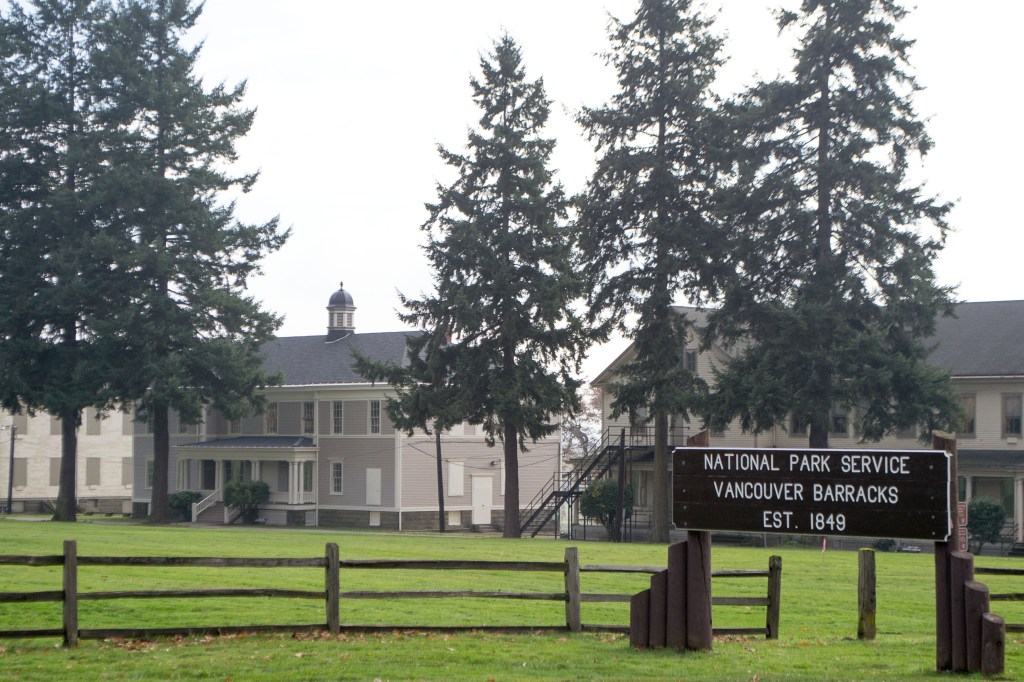
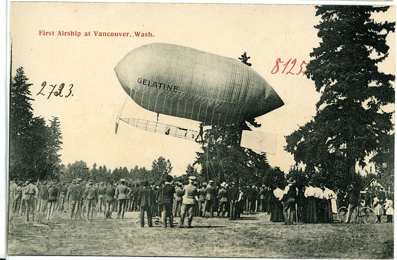
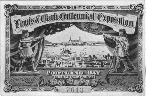
The history of Pearson Field begins with the landing of a Baldwin Airship on the grounds of the U. S. Army’s Vancouver Barracks, the first Army base in the Pacific Northwest, in 1905 as part of a demonstration during the Lewis and Clark Centennial Exposition.
Piloted by Lincoln Beachey, a pioneer American aviator and barnstormer, the airship was launched from the shore of Guild’s Lake in Portland, and travelled a distance of 8-miles, or 13-kilometers, setting an endurance record for flight at the time.
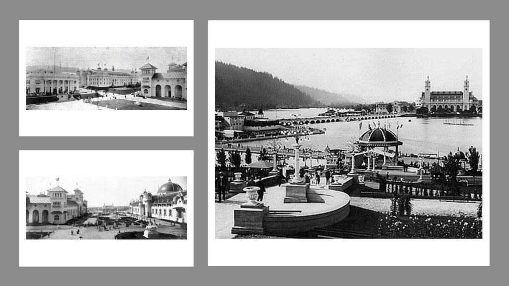
The 1905 Lewis & Clark Exposition was said to have been held in Portland to celebrate the centennial of the Lewis and Clark Expedition.
Numerous individuals were involved in the design and construction of the fairgrounds and buildings.
The Olmsted Brothers, John Charles and Frederick Law Jr, were given the credit for designing the grounds of the Exposition…
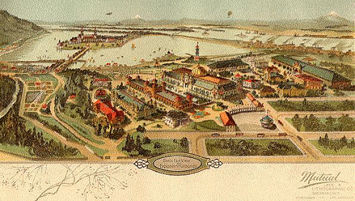
…and architect Ion Lewis was the supervising architect of a board of seven architects that designed the buildings, which were said to be constructed with temporary, plaster and wood, materials, and most of the buildings were torn down the following year.
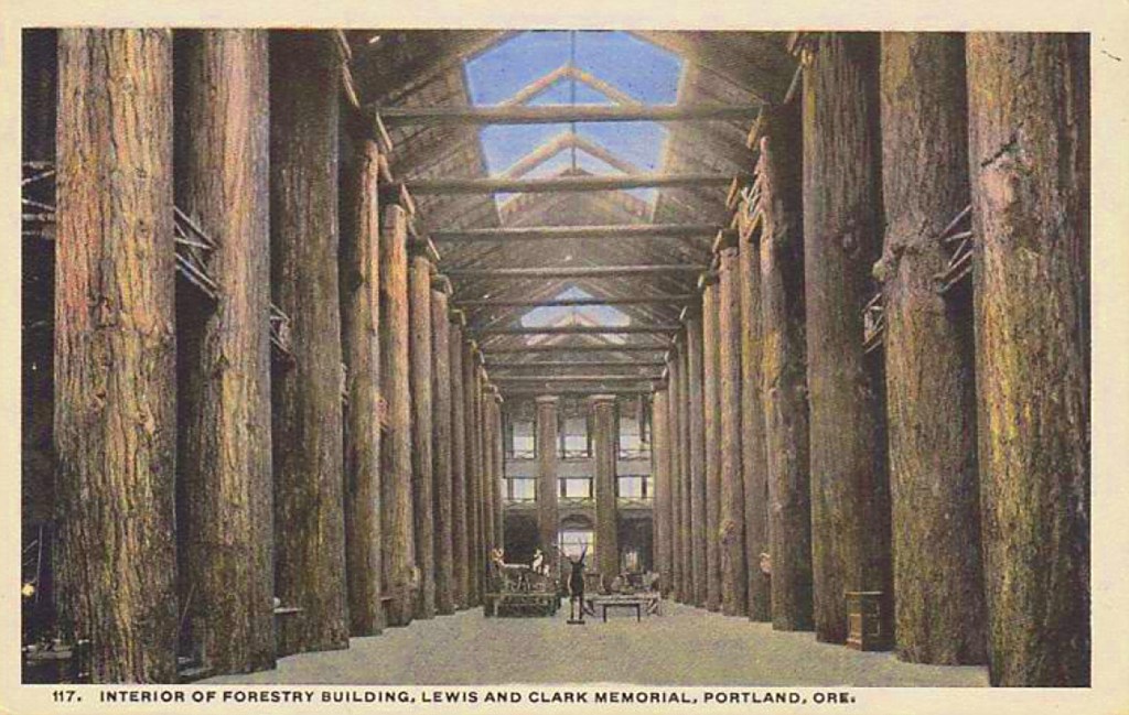
Called the world’s largest log cabin, the Forestry Building at the Exposition was said to have been built for the 1905 Exposition from massive, old-growth logs…
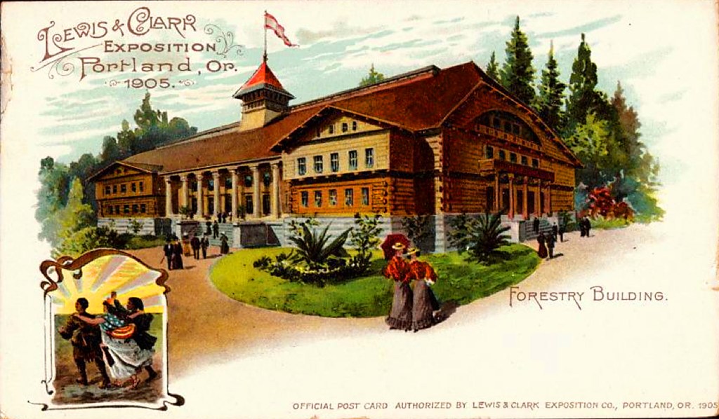
…that, as one of the last-surviving structures from the Exposition, burned down in 1964, we are told, from faulty electrical-wiring.
Directly across the Columbia River from Portland International Airport, Pearson Field’s only runway located directly below the final approach to one of the runways at the Portland Airport.
I am extremely interested in the extensive railroadtrack trackage, the dark ribbons on this Google Earth screenshot, that I am seeing on both sides of the Columbia River at this location.
On the Vancouver-side of the Columbia River, there is a lot of rail activity paralleling the I-5 Interstate and the Columbia River.
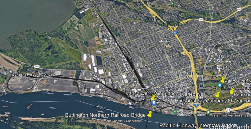
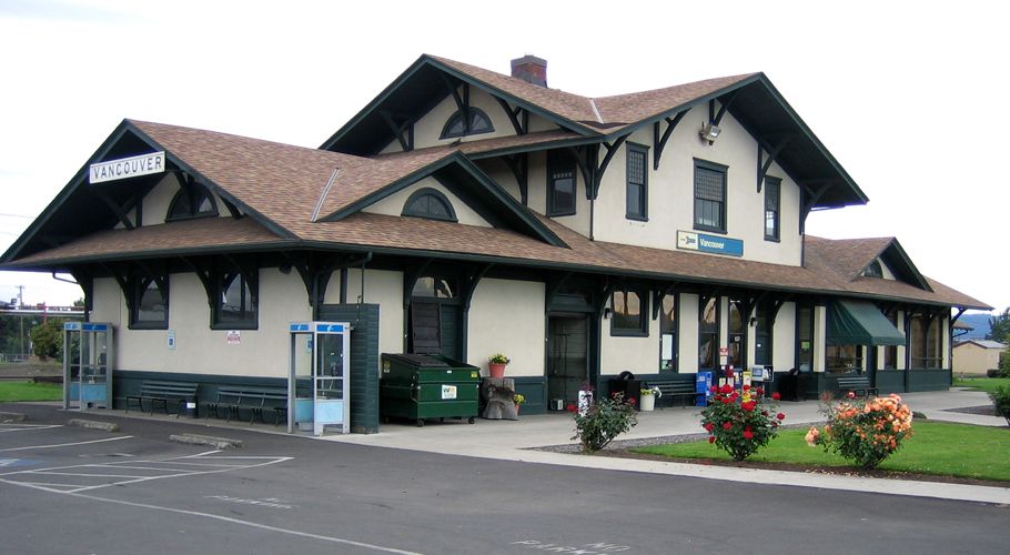
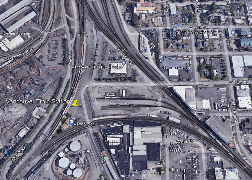
The historic Vancouver Station, said to have been constructed between 1907 and 1908, is still in use by Amtrak today by three different lines for passenger service.
The Vancouver Station is situated in a triangular junction arrangement of the three rail lines with a railroad switch at each corner, along with BNSF Railway offices, which provides freight services and has major railyards in Vancouver.
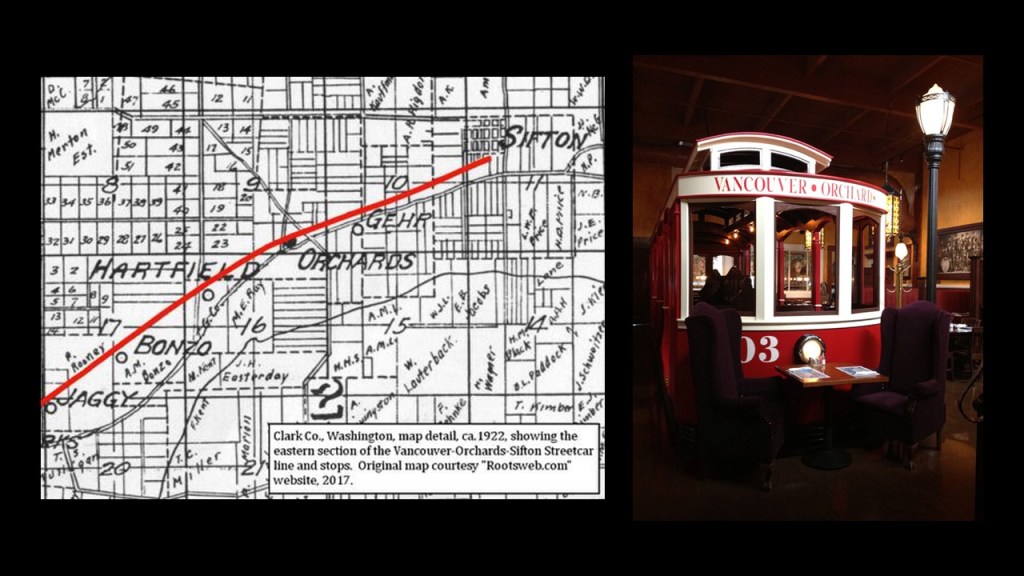
At one time in Vancouver’s history, the neighborhood of Sifton was the terminus of an early electric trolley operated by the North Coast Power Company that also served Orchards from 1910 to 1926, as part of the Orchards-Sifton Route that in part ran along Vancouver’s Main Street.
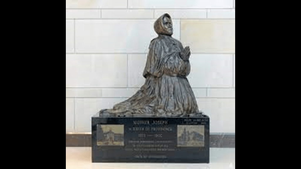
The House of Providence was a former orphanage and school in Vancouver, Washington.
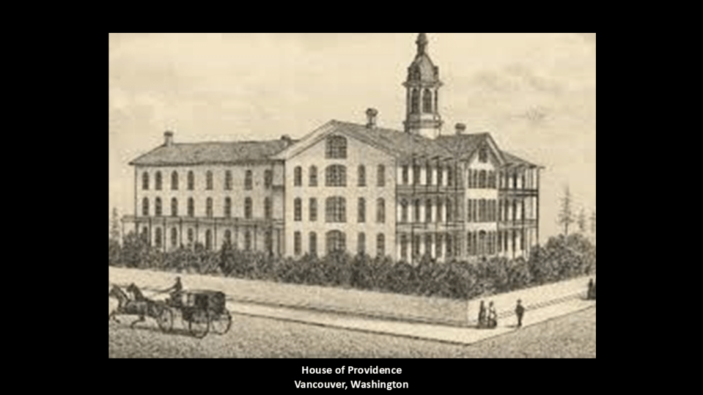
We are told that it was designed by Mother Joseph Pariseau of the Sacred Heart in the Sisters of Providence order of Montreal, Quebec, Canada, and built in 1873.
As well as the name, not a particularly feminine-looking sister.

We are told that Mother Joseph led a group of members of her congregation to the Pacific Northwest, where they established a network of schools and healthcare for American settlers to the region.
In order to raise money for the construction of the House of Providence, Mother Joseph was said to have led begging tours through mining camps.
The House of Providence functioned as a school until 1969, and is an event venue today.
Mother Joseph was credited with the completion of eleven hospitals; seven academies; five schools for Native American children; and two orphanages.
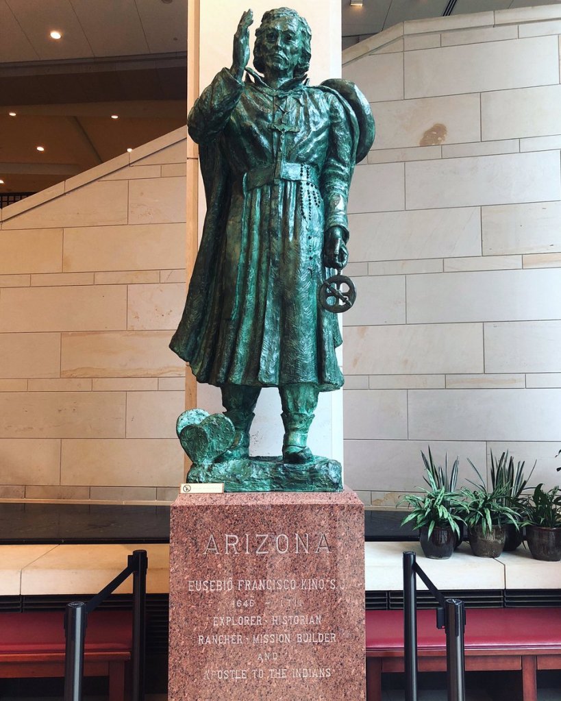
It is interesting to note that Mother Joseph was one of the two individuals chosen to represent Washington State at the National Statuary Hall in the U. S. Capitol building in Washington, DC, for her accomplishments, and finding this historical character in there was one of the reasons I started researching the National Statuary Hall, where I have uncovered a lot of hidden history, including Jefferson Davis as a representative of Mississippi and his role in the Pacific Railroad Surveys as U. S. Secretary of State in the mid-1800s.
The other reason I started looking into the National Statuary Hall was finding out that Father Eusebio Kino, the Jesuit Missionary who introduced cattle ranching to the Southwest, represented the State of Arizona, and my curiousity was piqued as to why historical characters like these two would be in there.
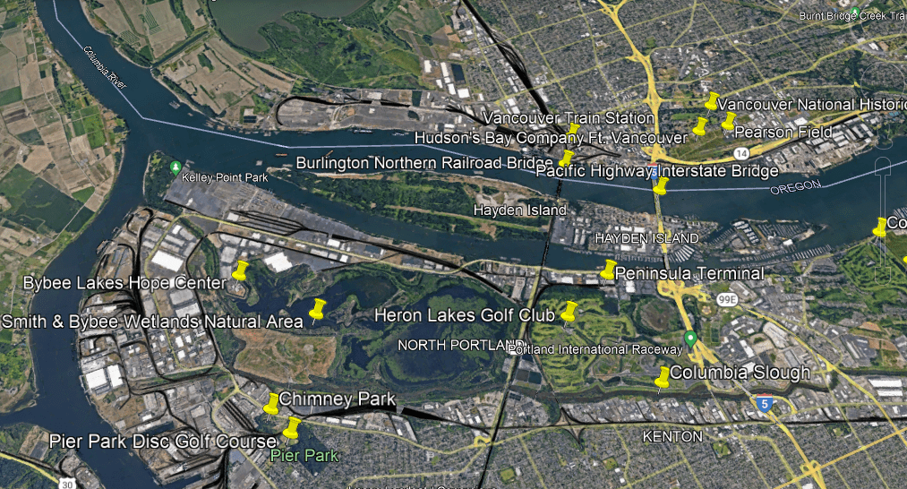
On the Portland-side of the Columbia River, there is also a lot of railway activity showing-up in the wester part of North Portland, all around the edges of what is called the Smith and Bybee Wetlands Natural Area.
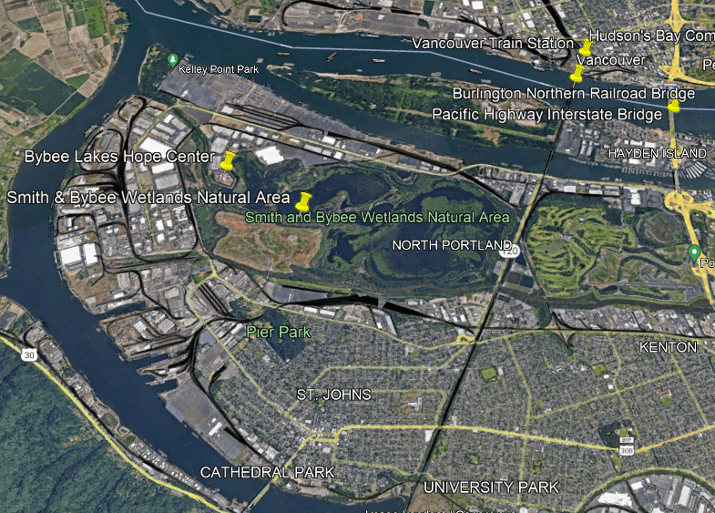
Along with the rail-lines, the Smith and Bybee Wetlands Natural Area is surrounded by warehouses, port terminals, and commercial areas.
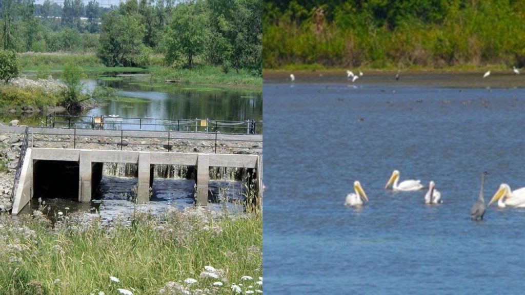
It is one the largest urban freshwater wetlands in the United States, and provides habitat for a wide variety of wildlife.
Like I have already mentioned, wetlands, estuaries, marsh-lands, and the like are all on my radar of things to look for when I do research because I have come to believe they are not as advertised as a natural occurrence.
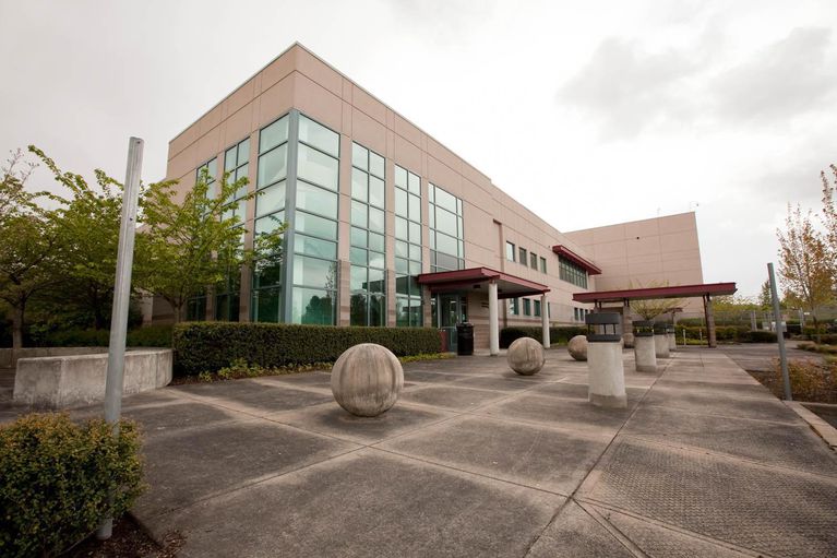
For example, when I took a look around the Smith & Bybee Wetlands Natural Area, I noticed a star fort-point-shape in the landscape.
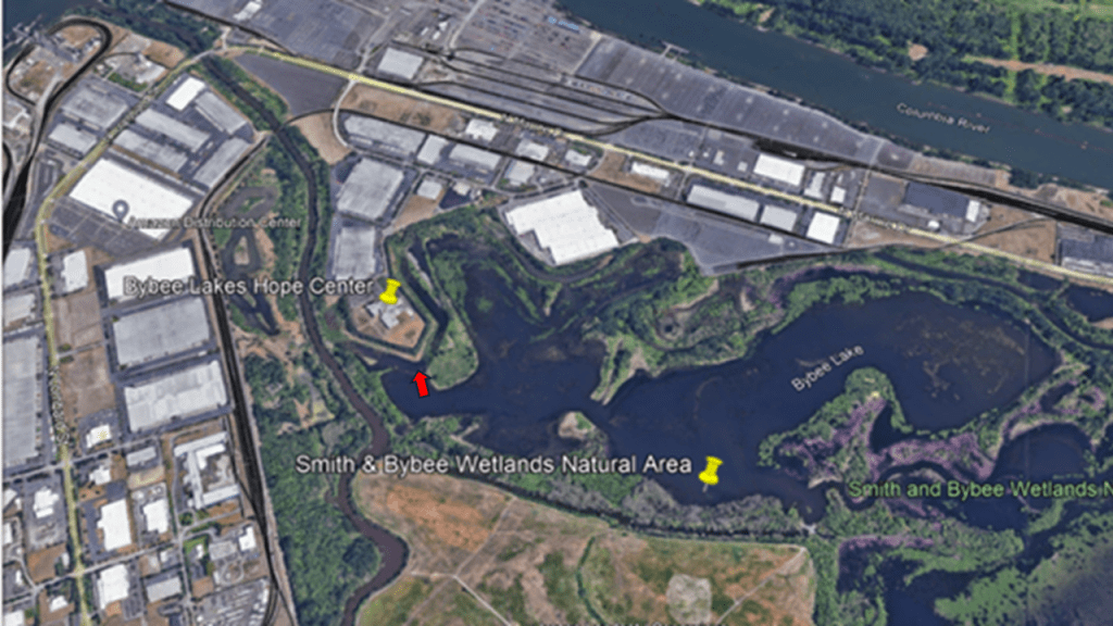
The Bybee Lakes Hope Center is located on top of it, and it has served as a homeless shelter since October of 2020.

Prior to that, it was the Wapato Jail, said to have cost $58-million to built, but which was never used as a jail because Multonomah County could not afford to operate it as such.
It is interesting to note what is found directly across Oregon Route 120 from the Smith & Bybee Wetlands Natural area.
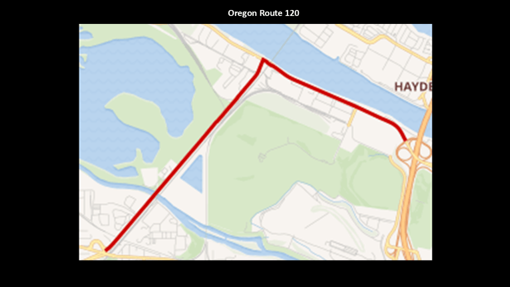
First, Oregon Route 120 is a 2.71-mile, or 4.36-kilometer, – long, unsigned road next to railroad tracks.
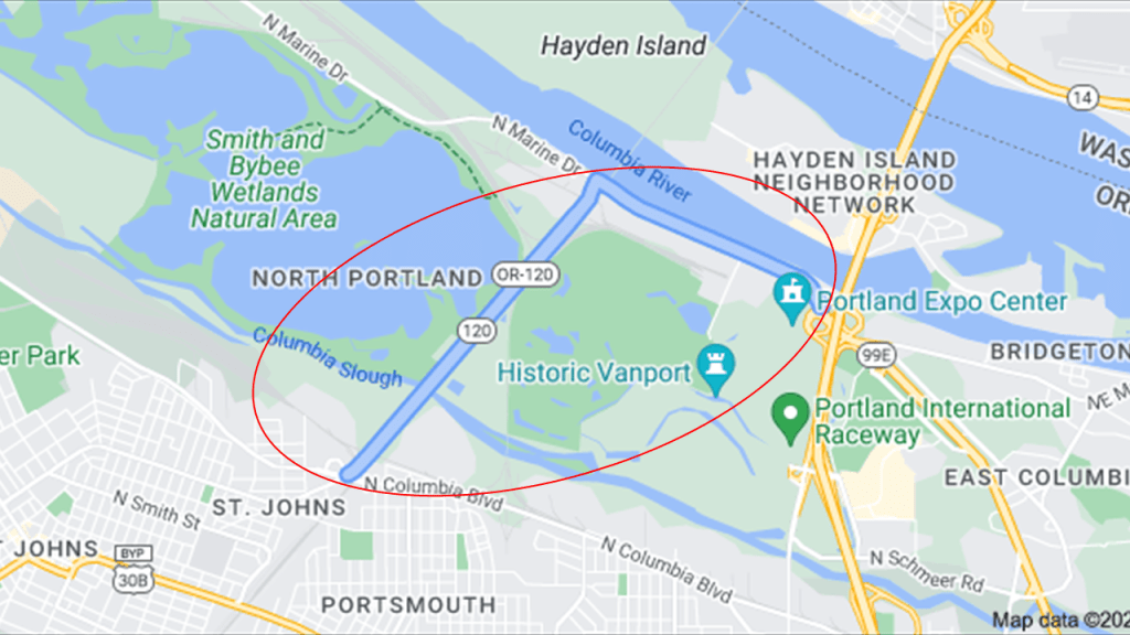
Known to the Oregon Department of Transportation as “Swift Highway 120,” it is a part of the National Highway System, a network of strategic highways in the United States important to the country’s economy, defense, and mobility.
It starts at a Union Pacific Railroad crossing and follows the BNSF Railroad tracks through the Smith and Bybee Wetlands and then turns east along the Columbia River to the Portland Expo Center.
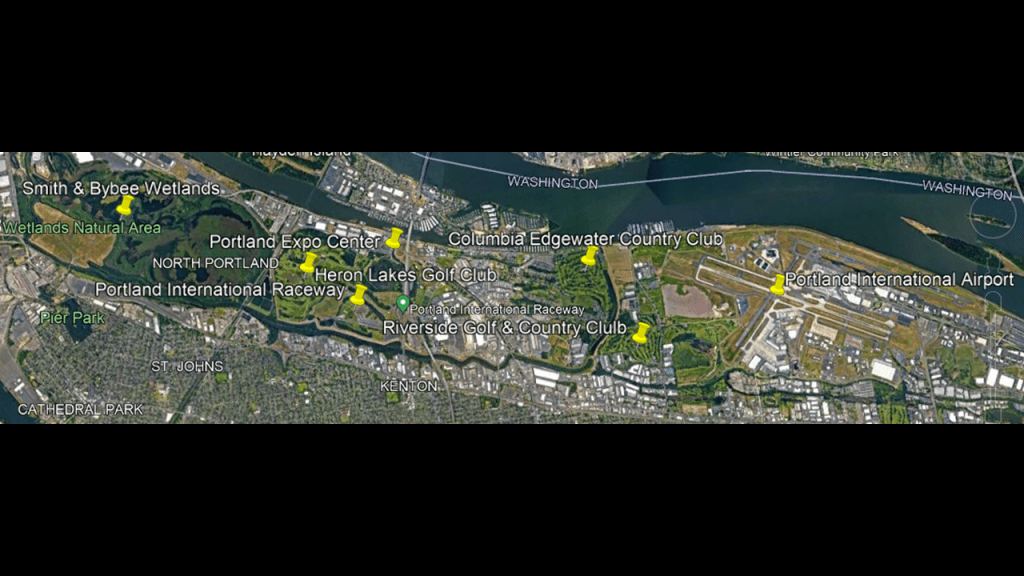
Directly on the other side of Oregon Route 120 from the Smith and Bybee Wetlands Natural area are the following in close proximity to each other:
Besides the Portland Expo Center, there are three golf courses – the Heron Lakes Golf Club; the Columbia-Edgewater Country Club; and the Riverside Golf and Country Club; the Portland International Raceway; and the Portland International Airport.
The Burlington Northern Railroad Bridge 9.6, said to have been built between 1906 and 1908, connects Vancouver, Washington with Portland across the Columbia River via Hayden Island and connects to Oregon Route 120.
It is a through-truss, swing-bridge said to have been completed in 1908.
The railroad travels beside the Smith and Bybee Wetlands on one side, and the Heron Lakes Golf Club on the other side on Oregon Route 120…
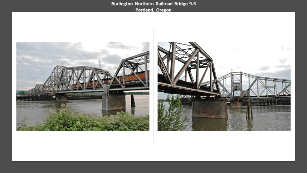
…and the railroad crosses over the Willamette River via the Burlington Northern Railroad Bridge 5.1, a through-truss, vertical-lift bridge today, but said to have had a swing-span when it was completed in 1908.
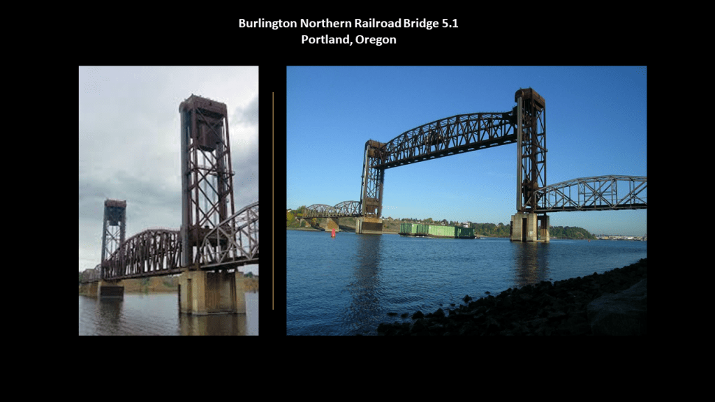
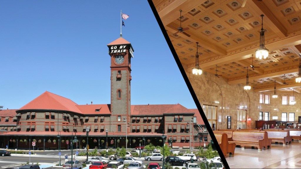
The number in the name of the bridges refers to the distance to Portland’s Union Station, which was said to have been built between 1890 and 1896 in the Romanesque Revival architectural style.
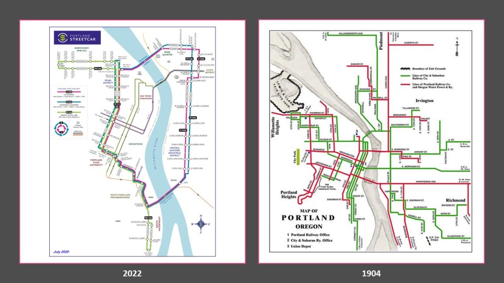
Another point that I would like to make about the historical rail infrastructure here, it is important to note that while Portland still has a streetcar system, it is not nearly as extensive as the streetcar system that existed in 1904, the year before Portland hosted the Lewis and Clark Centennial Exposition.
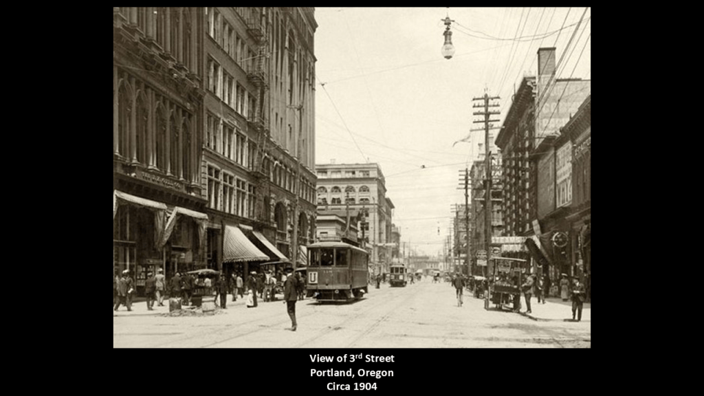
To put this in perspective, this was a view of Portland’s 3rd Avenue in 1904, where we see lots of people walking; electric streetcars and electrical lines…and horse-drawn carriages. No cars yet. Mass production of cars didn’t come along until 1908, four-years after this photo was taken.
Oh yes, and the massive and ornate heavy-masonry buildings with columns and archways, and much more.
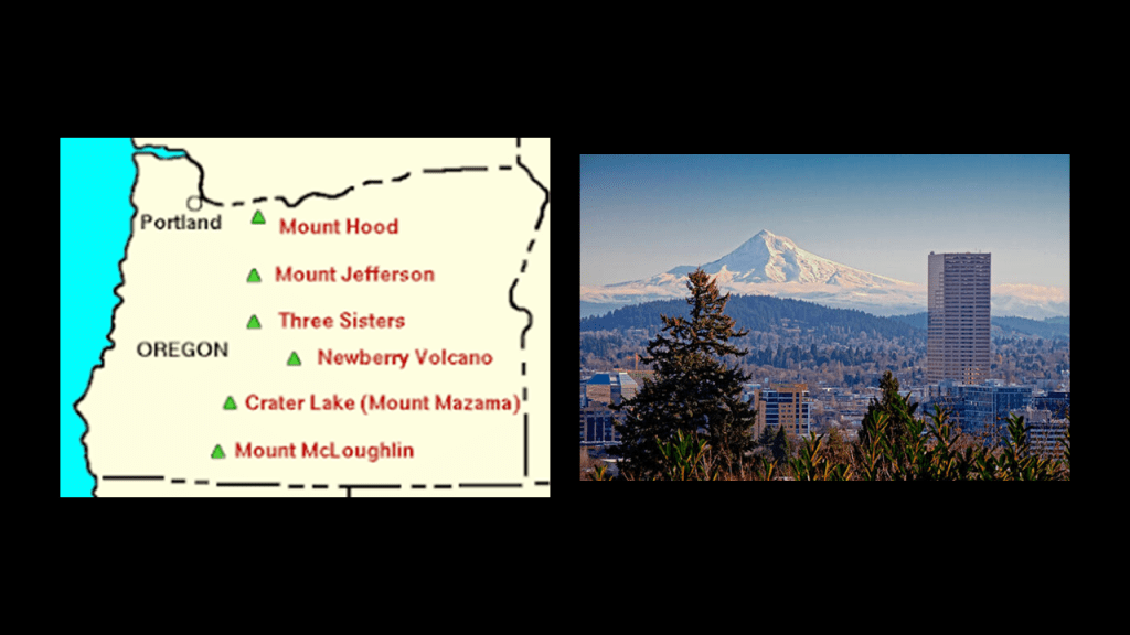
Like Mount Ranier near Seattle, Mount Hood near Portland is an active stratovolcano in the Cascade Range of the Pacific Northwest in the Cascade Volcanic Arc, and is 50-miles, or 80-kilometers, to the southeast of Portland.
The Timberline Lodge on the southern flank of Mount Hood is a National Historic Site that was said to have been built by the Works Progress Administration during the Great Depression between 1936 and 1938.
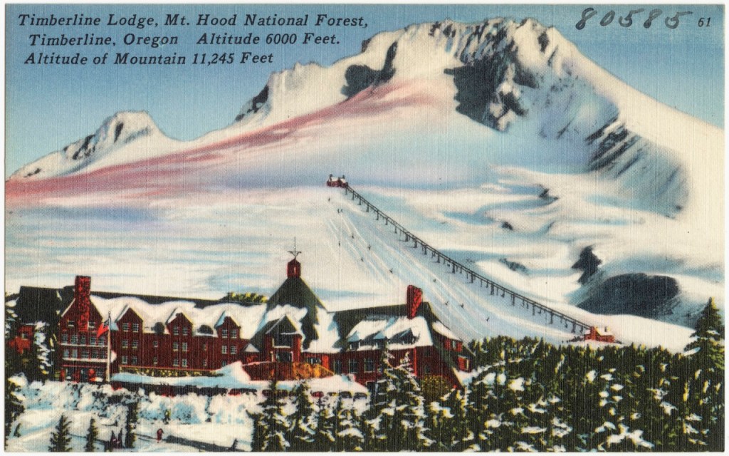
The biggest claim to fame of the Timberline Lodge in today’s culture is that it was a filming location for the 1980 psychological horror movie “The Shining.”

I was able to find some old historic photos of Portland that are similar to ones we have already seen.
This is an 1852 photograph of dirt-covered Front Street in Portland.
We are told the city was laid out in 1845, and that its growth was stimulated by a number of gold rushes and the flow of immigrants along the Oregon Trail established between 1811 and 1840 between what became Portland and Independence, Missouri.
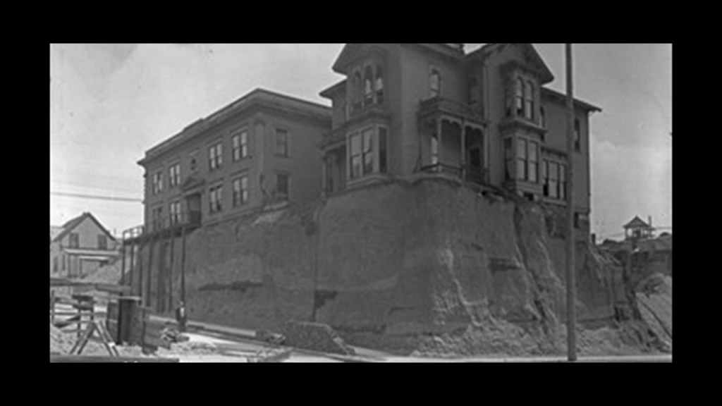
Here is an historic photo of a home in Portland that looks like the one we saw earlier in Seattle sitting high atop a ridge of some kind of dirt-like material.
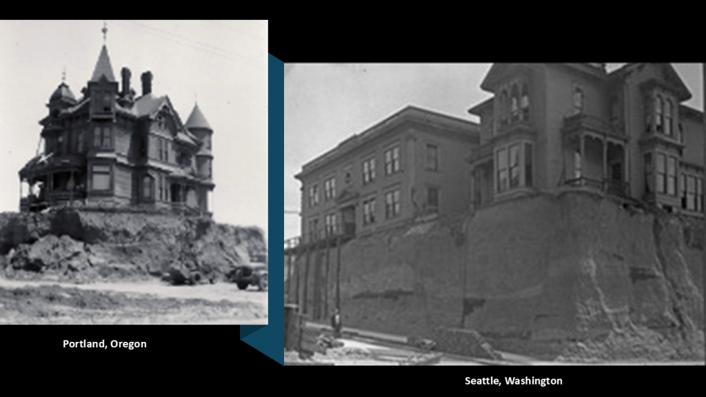
There were also numerous fires and floods in Portland’s history.
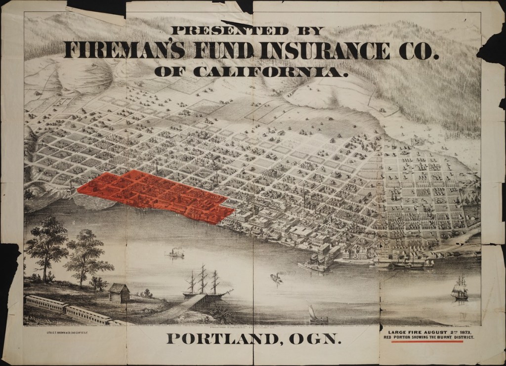
Like the Great Fire of 1873, on August 2nd of that year, destroying a mix of mansions, tenements and commercial property in 22 blocks of downtown Portland on the west-side of the Willamette River…
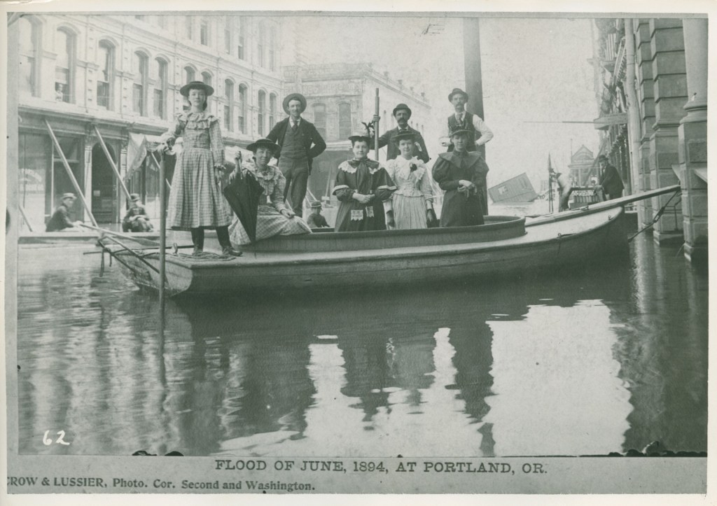
…and the Great Flood of 1894, at which time the Columbia River reached the highest elevation on record at almost 40-feet, or 12-meters high, and the Willamette River reached 33.5-feet, or over 10-meters-, high on June 7th, flooding the downtown business district and farms lands outside the city.
Does this photo look staged to you, because it sure does to me?!
Both fires and floods were common practices of those behind the reset of places all over the world.
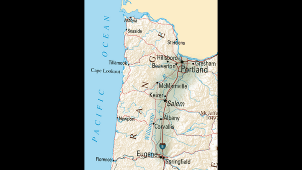
Now I am going to take a look at Salem, the capital of the State of Oregon, and in the center of the Willamette Valley on the Willamette River, which runs for 150-miles, or 240-kilometers, between Portland and Eugene.
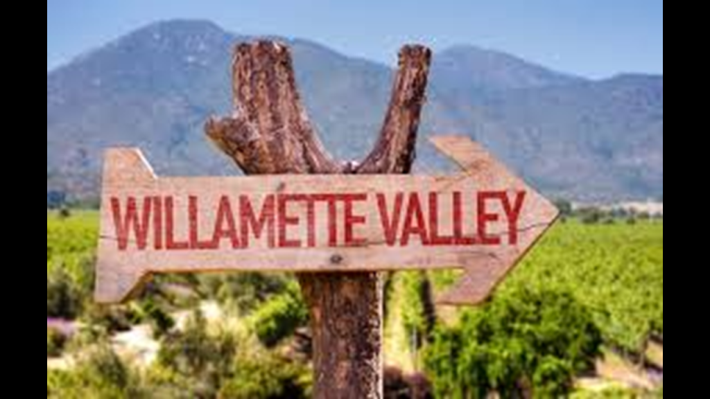
Like the Okanagon Valley in British Columbia, the Willamette Valley in Oregon is massively productive agricultural area, andas well is called “Oregon’s Wine Country.
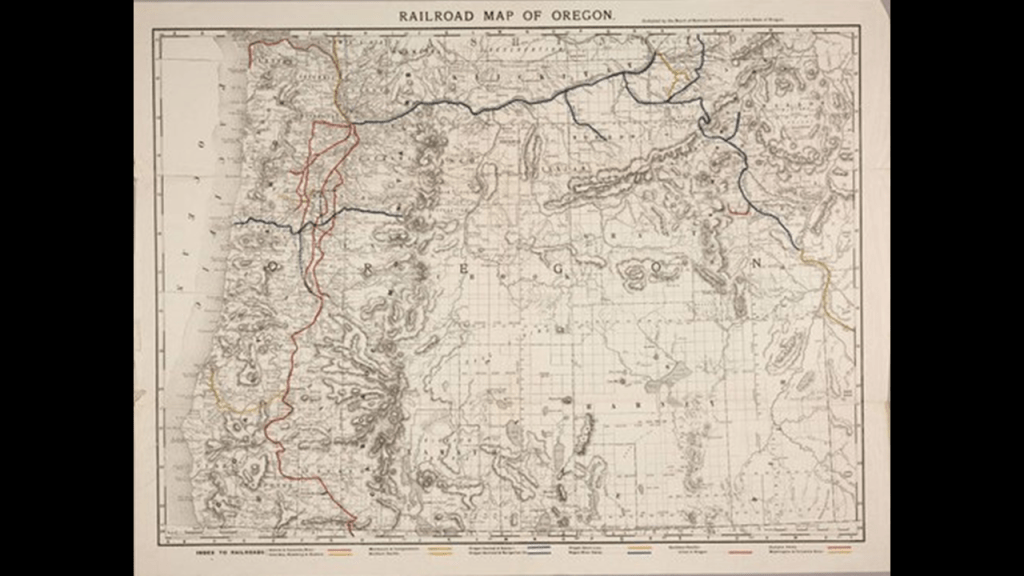
Today, the Portland and Western Railroad and the Willamette and Pacific Railroads have operated through here under these names since the mid-1990s, and primarily haul lumber products, paper and agricultural products.
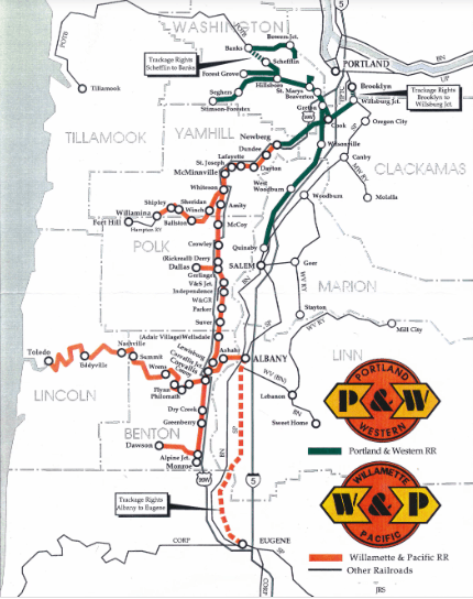
Historically, there has been a massive rail presence through this area, with large railroads like Southern Pacific, Union Pacific, and Burlington Northern.
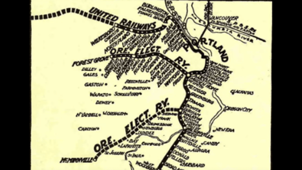
Burlington Northern at one time operated an interurban line from Portland to Eugene via the Oregon Electric Railway, from 1906 to 1970.
Prior to World War II, Interurbans were a type of electric railway system found around the world that consisted of self-propelled rail-cars that ran between cities and towns, and their surrounding urban and rural communities for passenger travel.
They started being removed in the 1930s and replaced by cars and busses as the preferred mode of transportation, with a few examples of this kind of transportation system still existing in Europe and Asia.
Gotta seriously wonder about what the real story was behind these efficient electric rail systems and their removal from our world….
Now a little bit about Salem.
Salem was said to have been founded by Jason Lee and other Methodist missionaries in 1842; became capital of the Oregon Territory in 1851; and incorporated as a city in 1857.
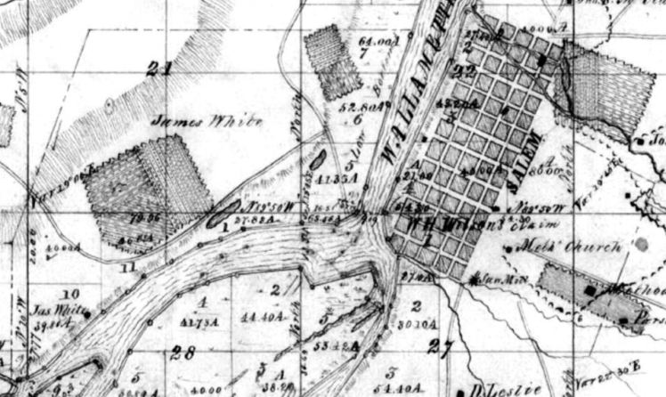
This was notated as a survey map of Salem from 1852.
Jason Lee, called the Father of Salem, established a Methodist Mission here in 1834.
Judging from the familiar pose of his right-hand inserted into his jacket, Jason Lee was apparently a Freemason, another fraternal secret society, like the Pythians, heavily involved in providing an explanation for and repurposing the original infrastructure of the Old World.
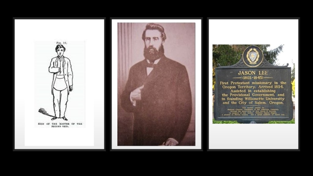
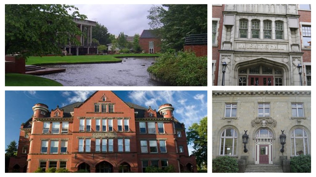
For example, along with founding Salem, Jason Lee was also credited with founding what became Willamette University in 1842, the oldest university in the western United States.
The first financial institution in Salem, the Ladd & Bush Bank, was co-founded in 1867 by William Ladd and Asahel Bush.
The building is known for its elaborate, cast-iron facade.

Construction of the Reed Opera House was said to have commenced in 1869 and was completed in 1870, quickly becoming the center of Salem’s entertainment and social life.

We are told its function as an opera house officially ended in 1900, and became a department store shortly thereafter, because of the opening of the nearby Grand Theater, which had more modern amenities and a ground-floor entrance.
Here is a picture of the Grand Theater with its original architecture on the left, and what the building looks like today minus the extended tower at the center of the building.
It currently houses retail businesses, offices, and a ballroom, and other facilities rented for special events.
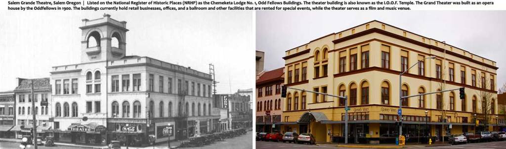
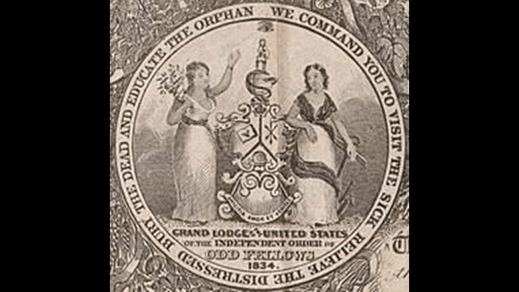
The Independent Order of Odd Fellows (I.O.O.F.) were credited with having built the Grand Theater, and the building later became Odd Fellows Chemeketa Lodge Number 1 and is also known as the I.O.O.F. Temple.
The American lodges formed a governing system separate from the English Order in 1842, and assumed the name Independent Order of Odd Fellows in 1843.
The command of the IOOF is to “visit the sick, relieve the distressed, bury the dead and educate the orphan.”
Like the Pythians and Freemasons, the Independent Order of Odd Fellows was another fraternal secret society that was heavily involved in providing an explanation for and repurposing the original infrastructure of the Old World.

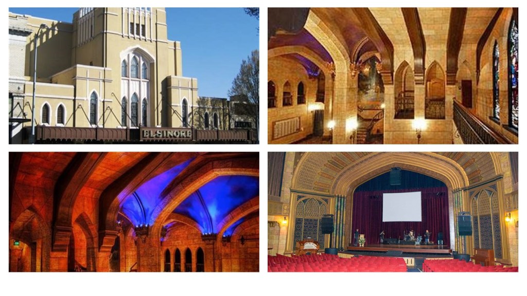
The Elsinore Theater in Salem first opened in 1926, after we are told the owner George Guthrie enlisted the architectural firm of Lawrence and Holford to design the building in the Tudor Gothic style meant to resemble the city of Elsinore from Shakespeare’s play “Hamlet.”
Said to have originally been designed for live performances and silent films, in 1929, the owner leased the theater to Fox West Coast Theaters, and then a year later to Warner Brothers Theaters, which ran it as a movie theater until 1951.
It began a general decline starting in the 1950s into a second-run movie theater, and was set to be demolished in 1980, but was saved by a grass-roots effort.
Over time, massive restoration was undertaken to restore the Elsinore to its former grandeur.
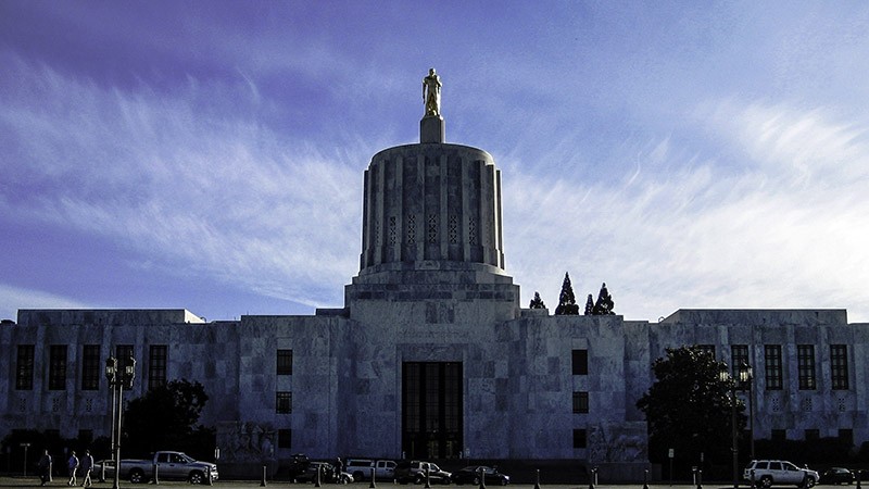
The Oregon State Capitol Building was said to have been constructed between 1936 and 1938, with the first two state capitol buildings having been destroyed by fire, the first in 1855, and the second in 1935.
Marble comprises much of the interior and exterior of the building.
The federal government’s Public Works Administration was said to have partially financed the construction of it during the Great Depression.
The next place I am going to look at is Madras, a small town in the high-desert country of Oregon, and the seat of Jefferson County.
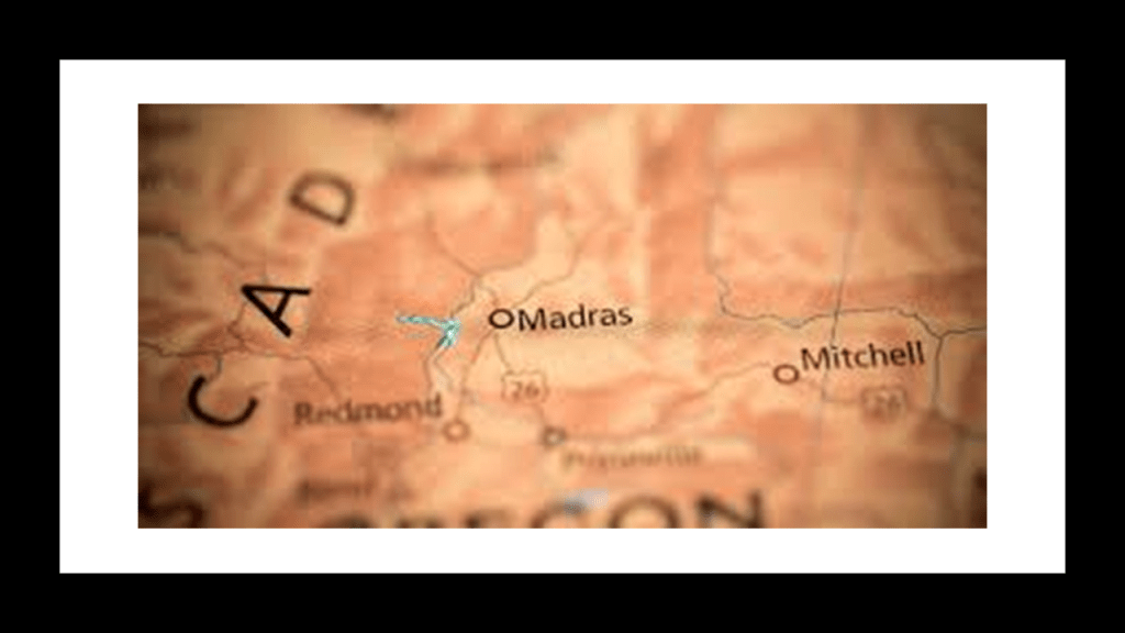
It was originally called “The Basin” for the circular valley it is situated in.
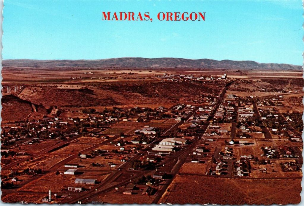
The town was said to have been named after either the city of Madras in India, or the cotton fabric called “madras” which originated from there in India.

Jefferson County was said to have been named after the nearby Mount Jefferson, which is described as a potentially active stratovolcano in the Cascade Volcanic Arc in Oregon’s Cascade Range, like Mount Ranier and Mount Hood.
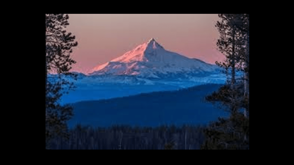
While a potential volcanic eruption is not considered a threat from Mount Jefferson, some scientists consider landslides and mudflows are still a major threat from it.
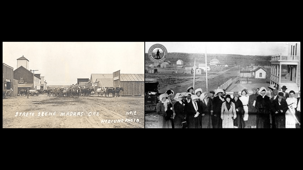
So our historical narrative tells us that the plat for Madras was filed in 1902, and the town was incorporated in 1911, the same year the railroad arrived there.
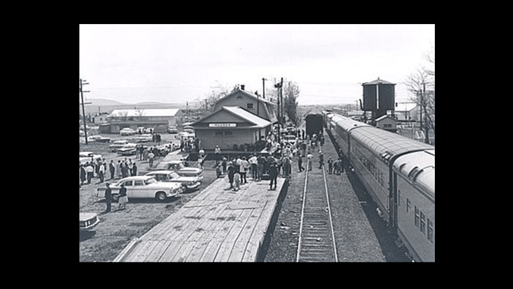
Here is an early street scene of Madras looking like a dirty, Hollywood-western movie set on the left, and another scene where the town looks covered with dirt and mud on the right.
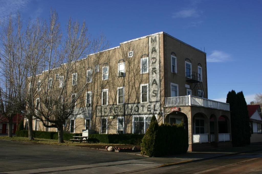
The Madras Hotel, considered to have been the oldest commercial building in Madras at around 100-years-old, mysteriously burned down from unknown causes in 2014, after having been condemned in 2011, and described in an article from the time as the most recent of a long line of historic Madras buildings destroyed by fire over the decades.
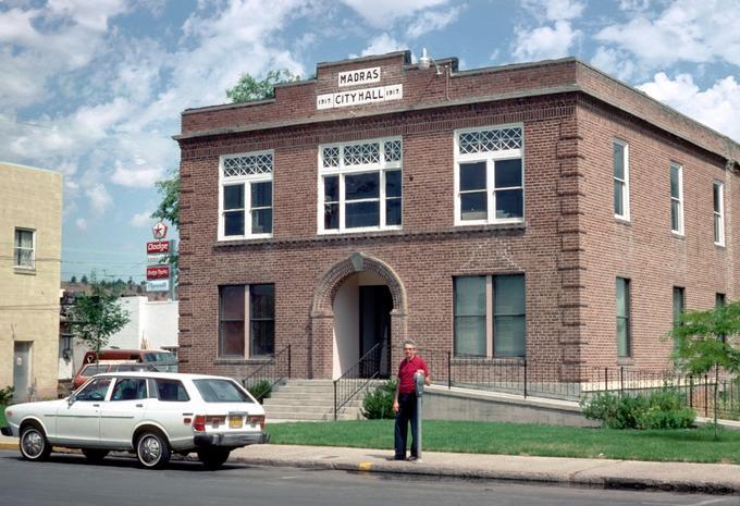
Another historic Madras building, the original combination Jefferson County Courthouse and Madras City Hall was said to have been designed by Oregonian architect Gilbert Brubaker, and built in 1917.
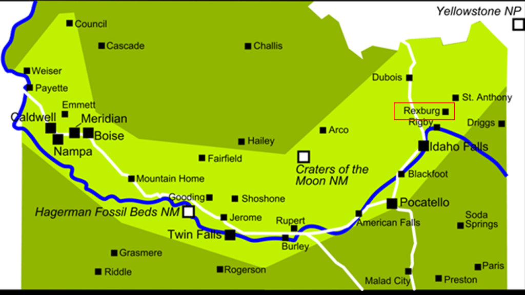
The next place I am going to look at is Rexburg, in Idaho’s Madison County and part of the Idaho’s Snake River Valley region.
The historical marker honoring the Rexburg Stake Pioneers has “The Pioneer Call” inscribed on it.
The “Pioneer Call” reads like this:
“Go into the Snake River Country, found settlements, care for the Indians, stand upon an equal footing, and Co-operate in making improvements…Gain influence among all men, and strengthen the cords of the Stakes of Zion.”
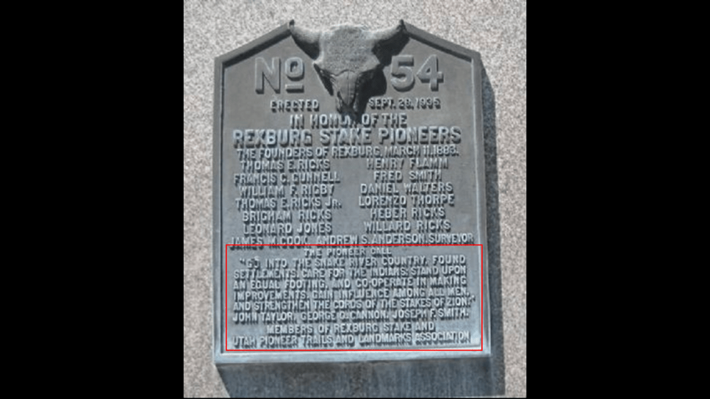
Sounds similar to the Odd Fellows with their command to to “visit the sick, relieve the distressed, bury the dead and educate the orphan.”
And to me the imagery evoked by “strengthen the cords of the Stakes of Zion” in the “Pioneers Call” is not benevolent.
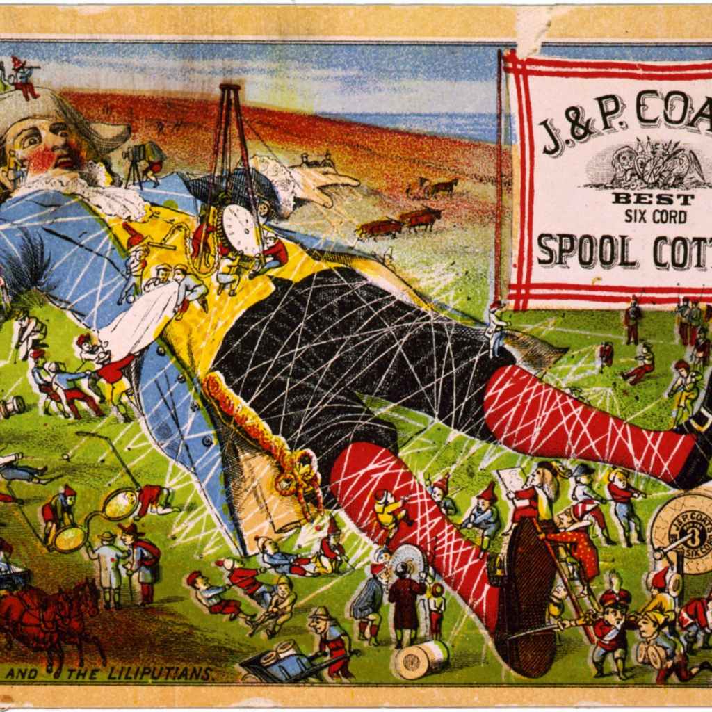
It evokes to me the image of binding something or someone to stakes of some kind, like the sleeping giant -sized Gulliver by the comparatively tiny Lilliputians in Jonathan Swift’s “Gullivers Travels,” which was first published as a “prose satire’ in our narrative in 1726
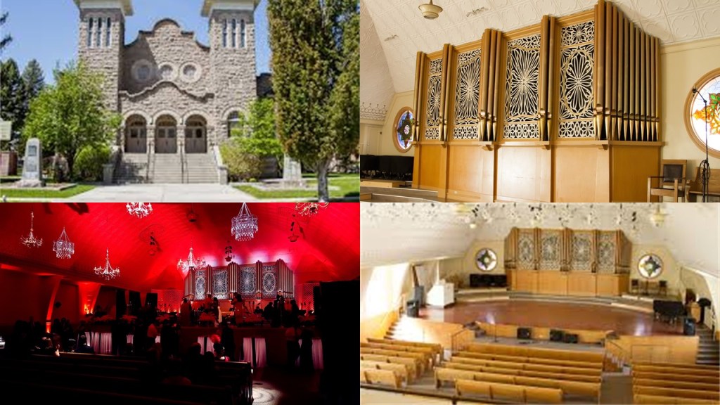
The Rexburg Stake Pioneer marker is located on the grounds of what was the Rexford Stake, also known as Fremont Stake, Tabernacle, which was said to have been built in 1911 and served as a Mormon meeting house for religious services.
It was purchased by the city of Rexford in 1980, and turned into a community civic center.
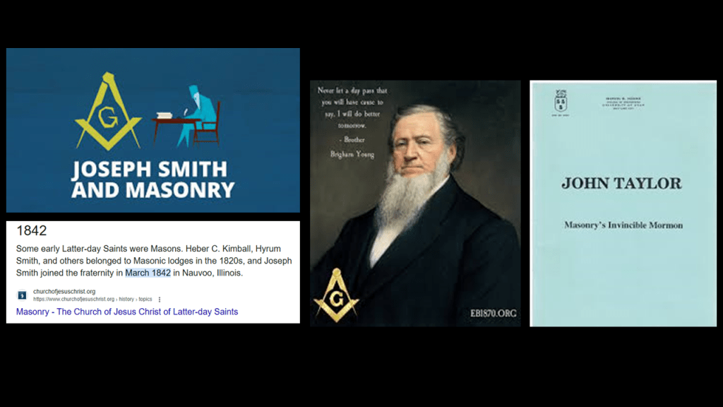
There does happen to be a historical connection between the historical leaders of the Mormon Church, and the previously mentioned fraternal secret society of Freemasonry, like there was in Salem, Oregon, with the Methodist Missionary, Jason Lee.
This includes early leaders like Joseph Smith, Brigham Young, and John Taylor.
And the year Joseph Smith joined the Nauvoo Lodge in 1842 was the same year that Jason Lee founded Salem in our narrative.
The Rexburg Tabernacle Civic Center also houses the Teton Flood Museum, and the Teton Dam flood marker is on the civic center grounds.
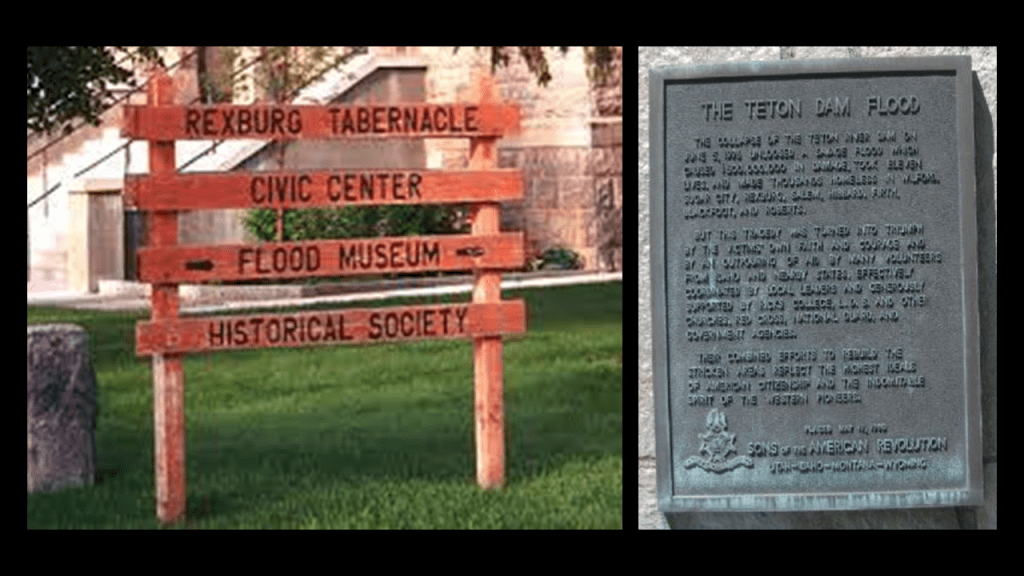
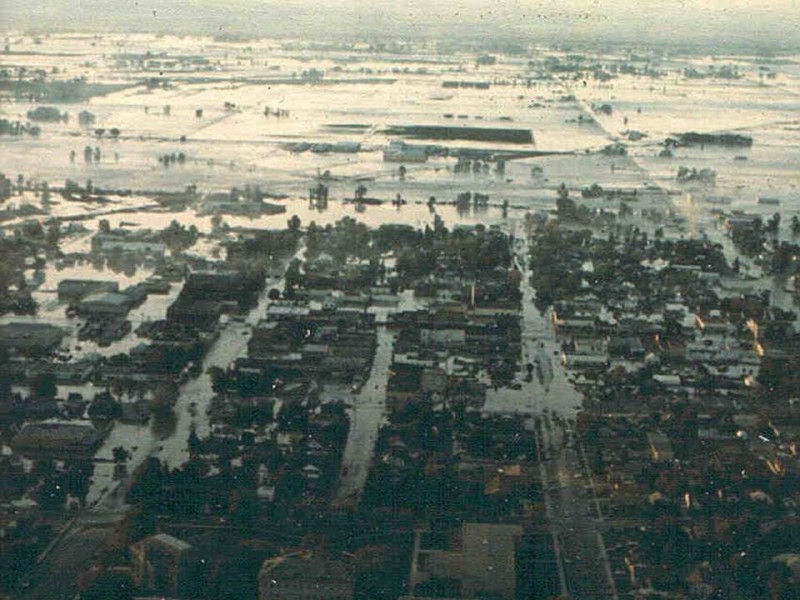
On June 5th of 1976, the Teton Dam unleashed a savage flood which caused $500,000,000 in damages, eleven deaths, and made thousands homeless in the communities of Rexburg, Salem, Blackfoot, Wilford, Sugar City, Hibbard, Firth, and Roberts.
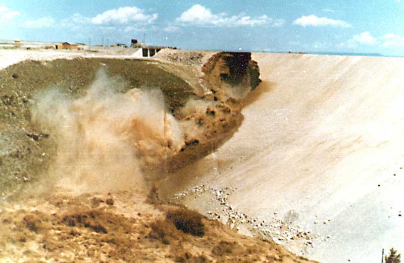
Construction of the dam was said to have been completed by the Bureau of Reclamation in November of 1975, and the dam suffered a catastrophic failure on June 5th, of 1976, with damage to the area estimated to be 80% of existing structures.
Before I move on from Idaho, let’s see what else we see nearby in the Snake River Valley.
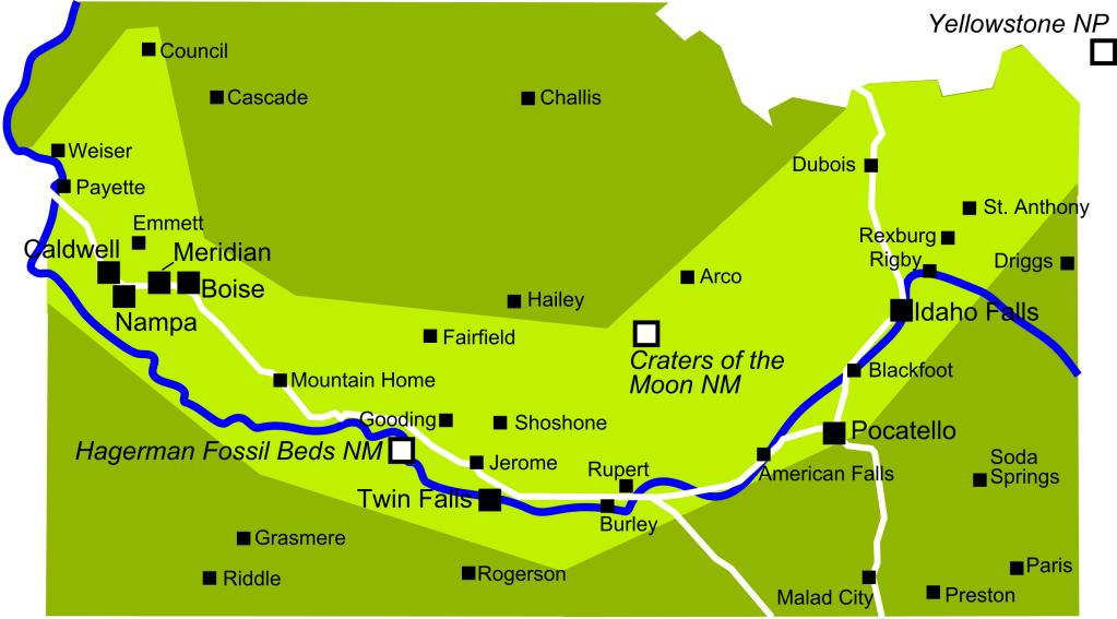
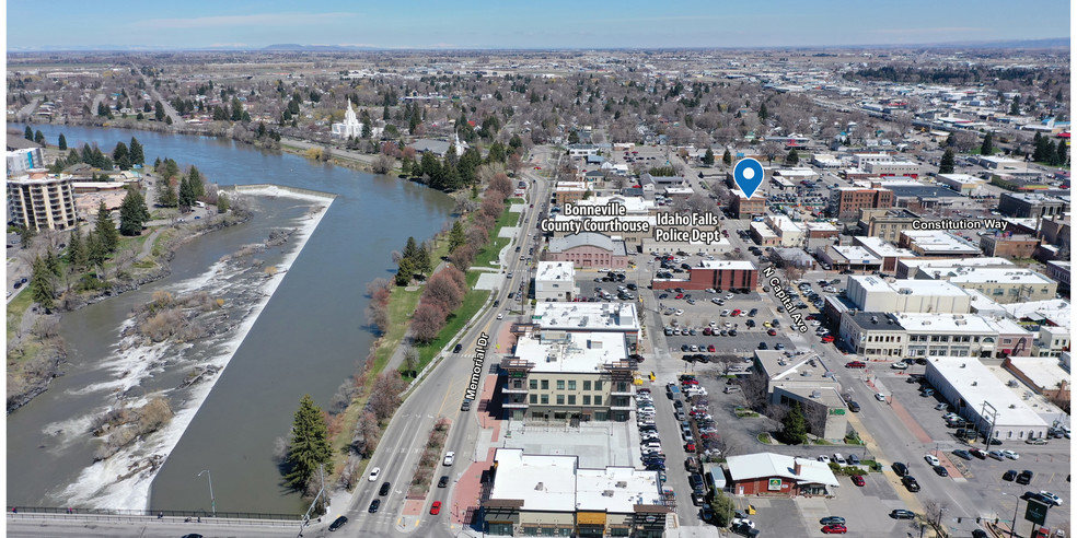
Idaho Falls is 26-miles, or 42-kilometers, southwest of the Rexburg-Sugar City-Salem area on the Snake River.
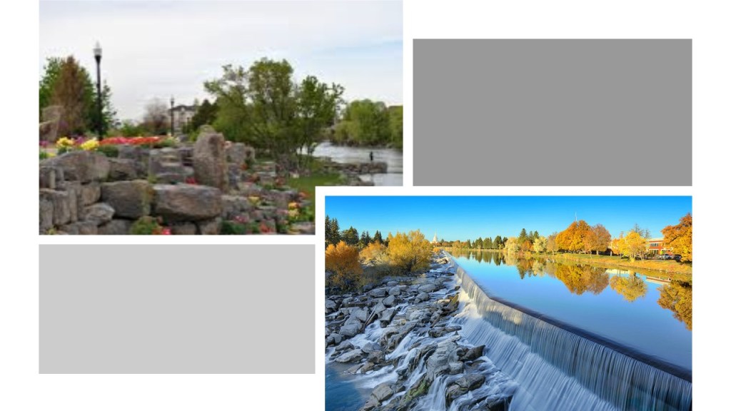
It is the second-largest city in Idaho outside of the Boise metropolitan area, and the seat of Bonneville County.
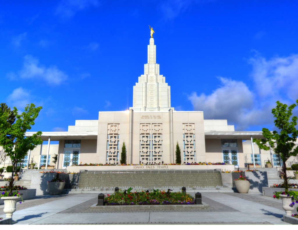
The Idaho Falls Idaho Temple was said to have been the first Mormon temple built in Idaho, and the tenth constructed, and eighth-operating in the world, with a dedication date of September 23rd of 1945.
Blackfoot is located on the Snake River, 15-miles, or 24-kilometers, downriver from Idaho Falls, and is the county seat of Bingham County.
Land claims were filed near present-day Blackfoot in 1866, and by 1880, the makings of a town started to form, especially with the announcement of the Utah Northern Railroad expanding north into Idaho in the 1870s.
This photo taken of Blackfoot in its early days was notated as “early settlers plow the road for Main Street.”
And here is an historic view of Blackfoot’s Main Street by 1909.
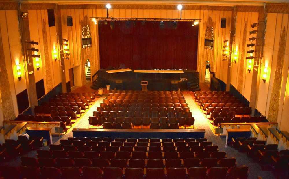
The Nuart Theater in Blackfoot first opened in 1930, and was said to have been built by Paul Demordaunt, and one of seven in Idaho opened by Demordaunt and his business partner Hugh Drennan.
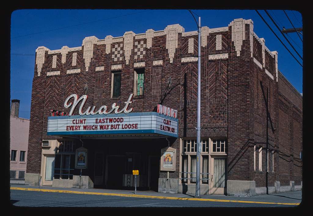
It was said to have been the first theater built in southeastern Idaho, and had superior acoustics from other theaters in that it had been built specifically for the “talking pictures.”
Restoration work on the Nuart Theater started in 1986, and re-opened by about 1988, where the Blackfoot Community Players stage live performances and open the facility for rental as a community center.
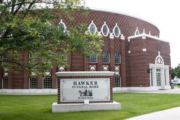
This was the Mormon Tabernacle Civic Auditorium in Blackfoot, said to have been designed by architects Hyrum Pope and Harold W. Burton and completed in 1921.

In 1980, the church sold the building to the city of Blackfoot as a civic auditorium, which it used until the 1990s, and it sat empty until 2003, at which time it was purchased by a local businessman and became the building for the Hawker Funeral Home.
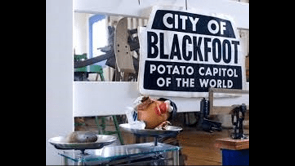
And of all places, Blackfoot boasts the largest potato industry in any one area, and is known as the “Potato Capital of the World.”
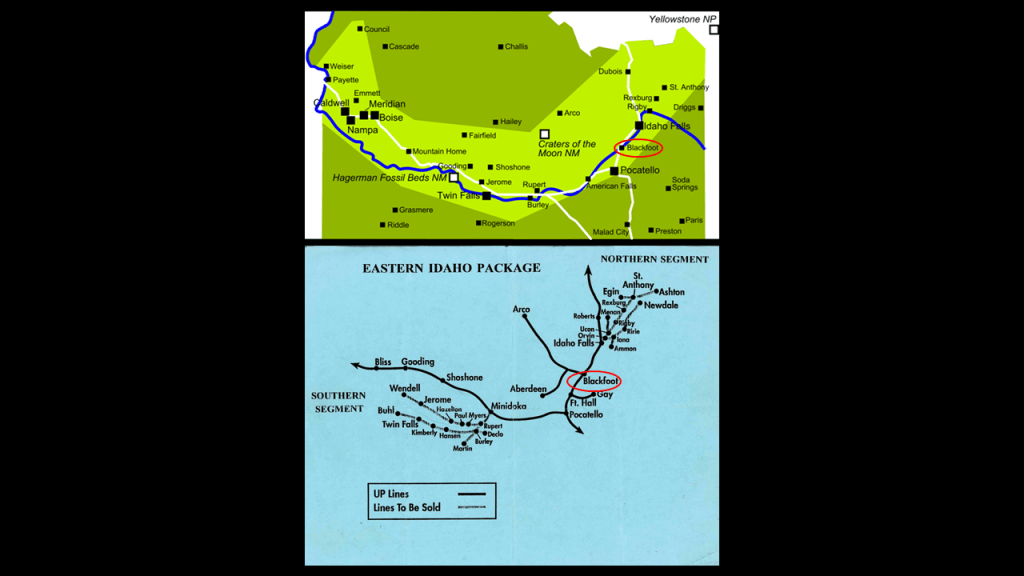
Like the previously seen Willamette Valley in Oregon, and Okanagon Valley in British Columbia, the Snake River Valley in Idaho is fertile agricultural land, for not only potatoes, but also sugar beets, alfalfa, small grains, and grapes , making it another wine-making region, also known as a ‘viticultural area.”
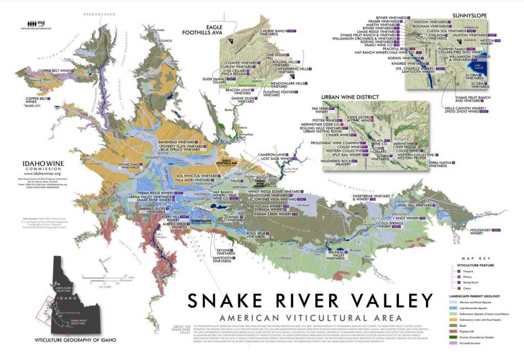
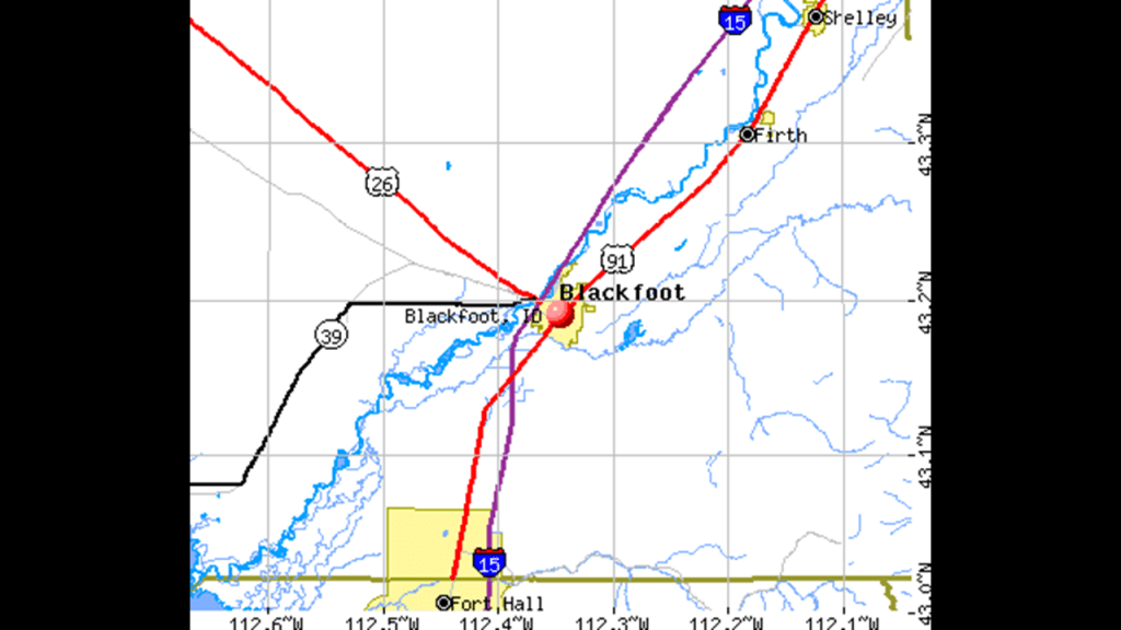
And here is the map of the Snake River Valley that I have been looking at compared to a map from the early 1990s showing United Pacific Rail-lines, using the city of Blackfoot as a reference point next to the Snake River to show the correlation between the two.
Next along the Snake River, we come to American Falls, the county seat of Idaho’s Power County.
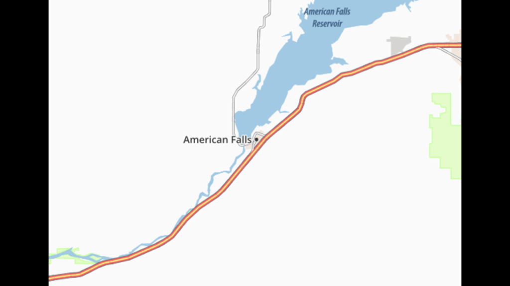
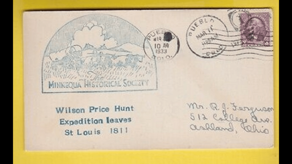
American Falls was a landmark waterfall on the Snake River, where in 1811, the Wilson Price Hunt expedition camped one night.
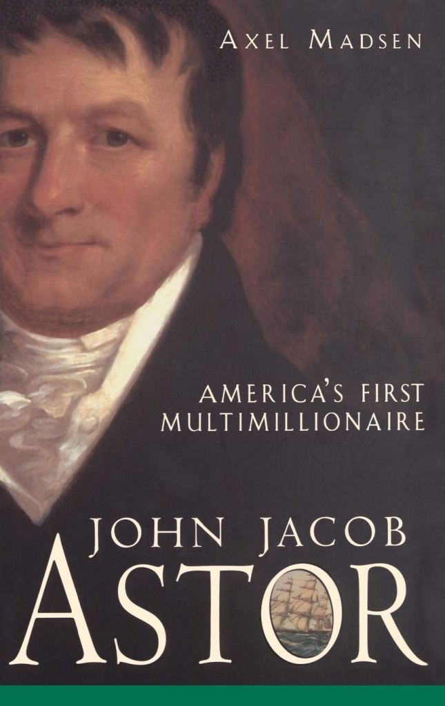
Wilson Price Hunt, an agent in the fur trade under John Jacob Astor, a German-immigrant to the United States and its first multi-millionaire, organized and led the greater part of a group of about 60 men on an expedition to establish a fur-trading outpost at the mouth of the Columbia River.
The Astorians, as they have become known, were the first major party to cross to the Pacific after the Lewis and Clark Expedition.
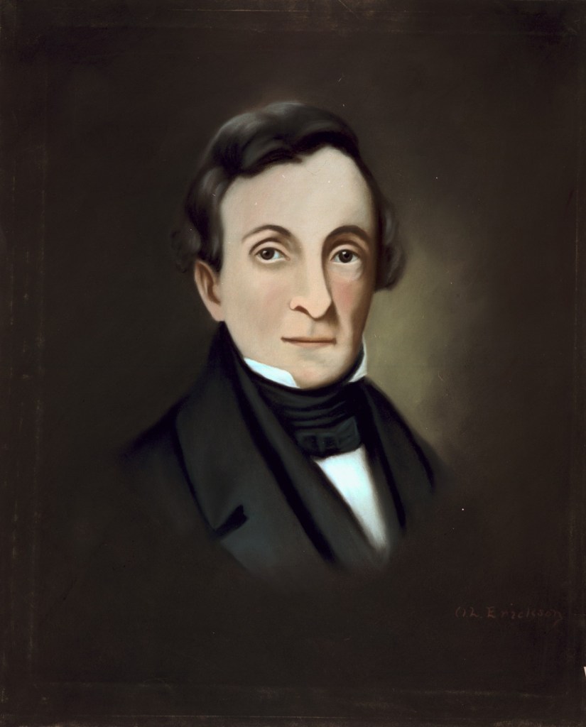
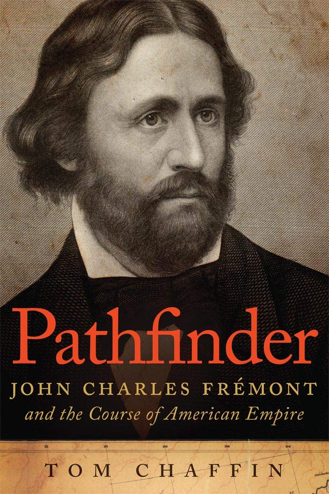
And the expedition of John C. Fremont camped at American Falls in 1843.
During the 1840s, Fremont led five expeditions into the western United States, and became known as “The Pathfinder.”
We are told that In 1925, the town of American Falls became the first town in the United States to be entirely relocated to facilitate the construction of the nearby American Falls dam.
The old townsite sits at the bottom of the reservoir, northwest of the present city.
This is an old power house, the only remnant left-standing of what is left of the old town site that was here previously.
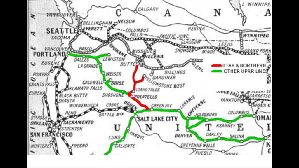
And here is a view of the same old power house with the Union Pacific bridge behind it, which became part of the Oregon Short Line Railroad system following the bankruptcy of Union Pacific in 1897.
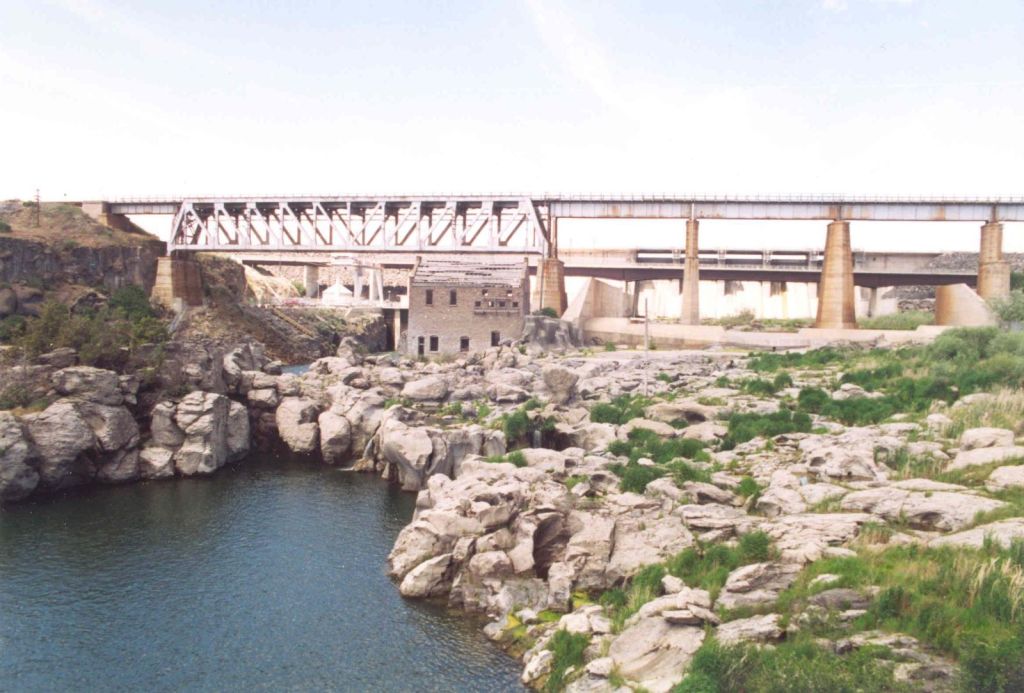
The Oregon Short Line from Pocatello, Idaho, to Huntington, Oregon, was said to have been completed in late 1884.
Salem and Madras in Oregon, and Rexburg, which was close to the historic, but the no longer in existence Salem, Idaho, and the Snake River Valley, were all on the Path of Totality of the 2017 Solar Eclipse, which passed through seven Salems altogether on its path across the United States.

The last place I want to look at before I leave the Snake River Valley in Idaho is the Craters of the Moon National Monument, which encompasses three major lava fields along the Great Rift of Idaho, and we are told represents one of the best-preserved flood basalt areas in the continental United States.
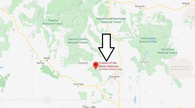
It is located midway between Boise, Idaho, and Yellowstone National Park.
A flood-basalt area is described as where lava flows have covered thousands of square-miles and square-kilometers of land.
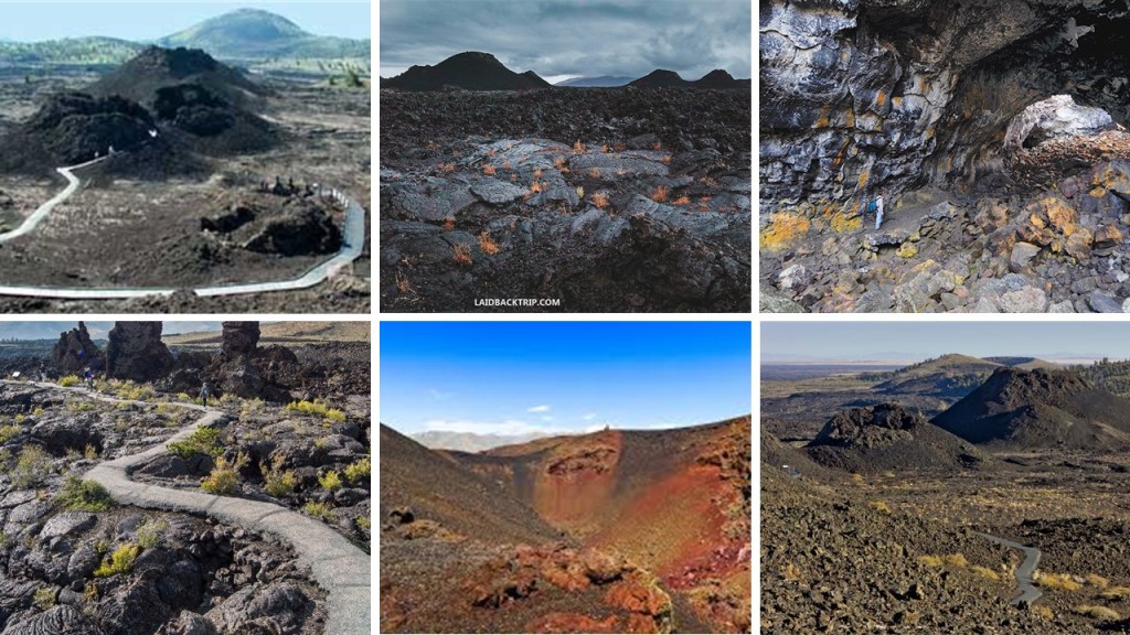
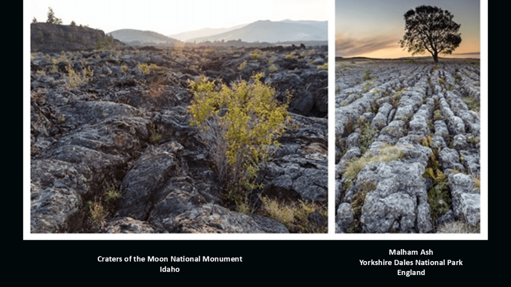
This scene is from the Craters of the Moon National Monument in Idaho on the left, compared with Malham Ash in the Yorkshire Dales National Park in England, which is actually called a limestone pavement on the right.
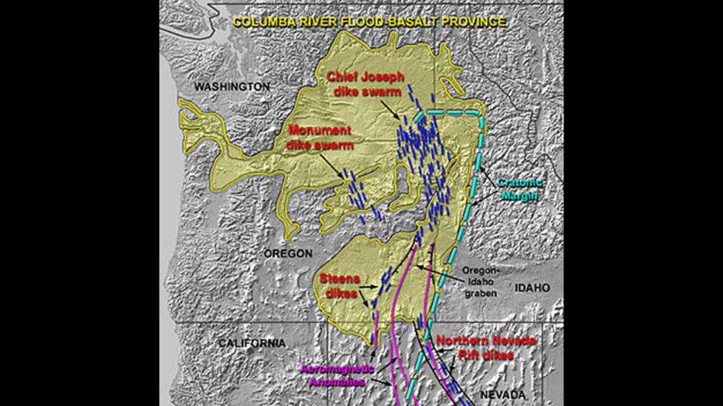
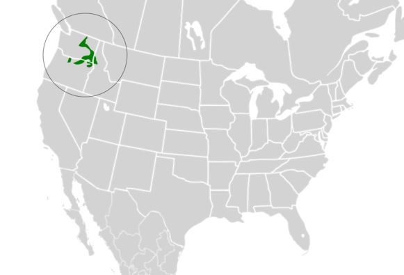
The Craters of the Moon National Monument is considered part of the Columbia River Basalt Group.
The Columbia River Basalt Group is considered the youngest, smallest and one of the best-preserved continental flood basalt provinces on Earth, consisting of eastern Washington and Oregon, as well as western Idaho and part of northern Nevada.
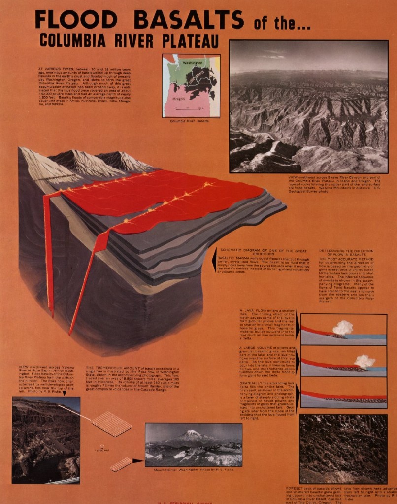
What we are told by modern science is that during the late-to-middle Miocene Epoch, the Columbia River Flood Basalts, defined as the result of a giant volcanic eruption or series of eruptions that covers large stretches of land with basalt lava, engulfed 63,200-square-miles, or 163,700-kilometers-squared, of the Pacific Northwest.
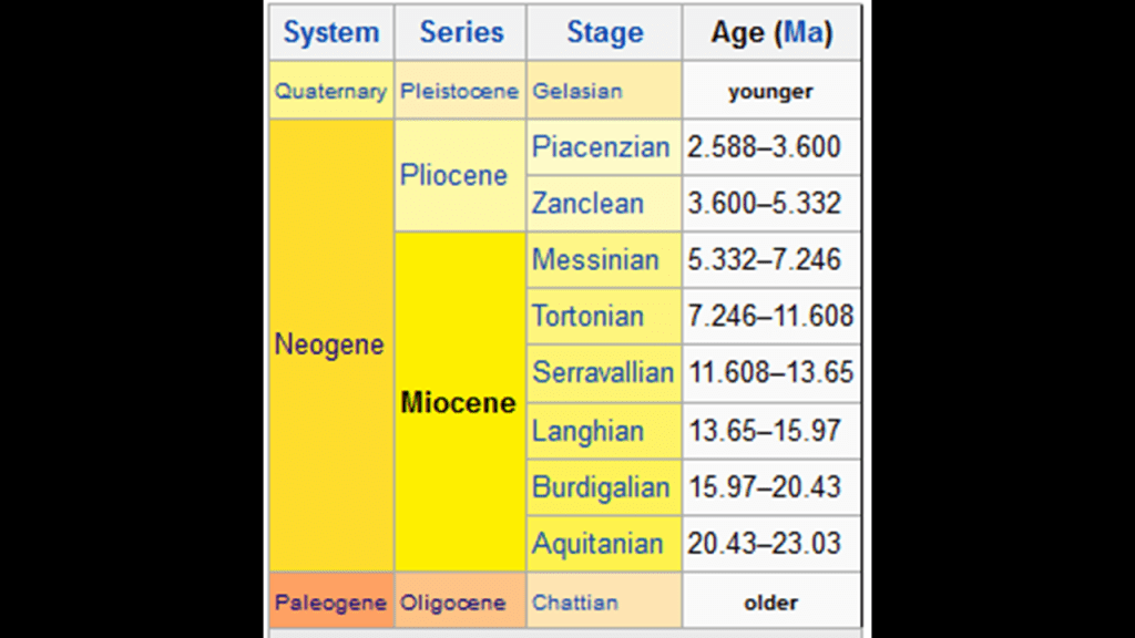
We are told the Miocene Epoch extended from about 23-million-years-ago to about 5-million-years-ago, and was named by Scottish geologist Sir Charles Lyell.
More about Sir Charles Lyell to come later in this post.
Basalt lava is defined as a fine-grained, extrusive, igneous rock that forms from the rapid cooling of low-viscosity lava rich in magnesium and iron that is exposed very close to the surface of the Earth from the Earth’s upper mantle.
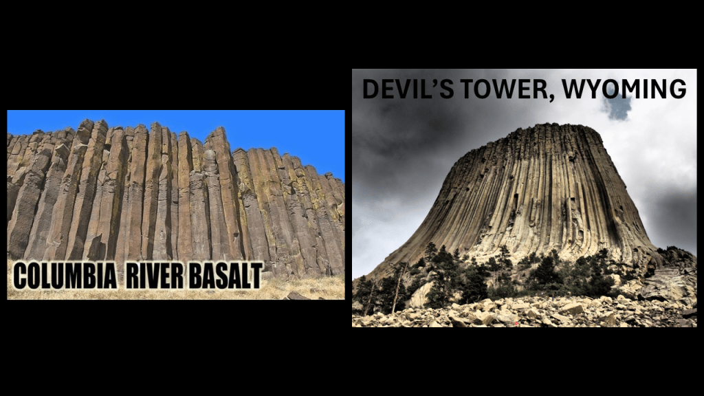
Looking like Columbia River Basalt on the left, the Devil’s Tower in Eastern Wyoming’s Crook County, while though it is said to be a basalt column, it was said to have been formed as a laccolith, which is defined as a body of intrusive rock formed by magma rising up from the Earth’s crust that begins to spread horizontally and pry apart the host rock strata.
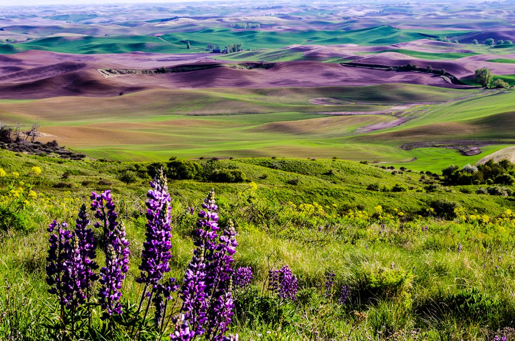
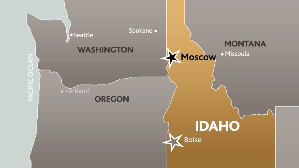
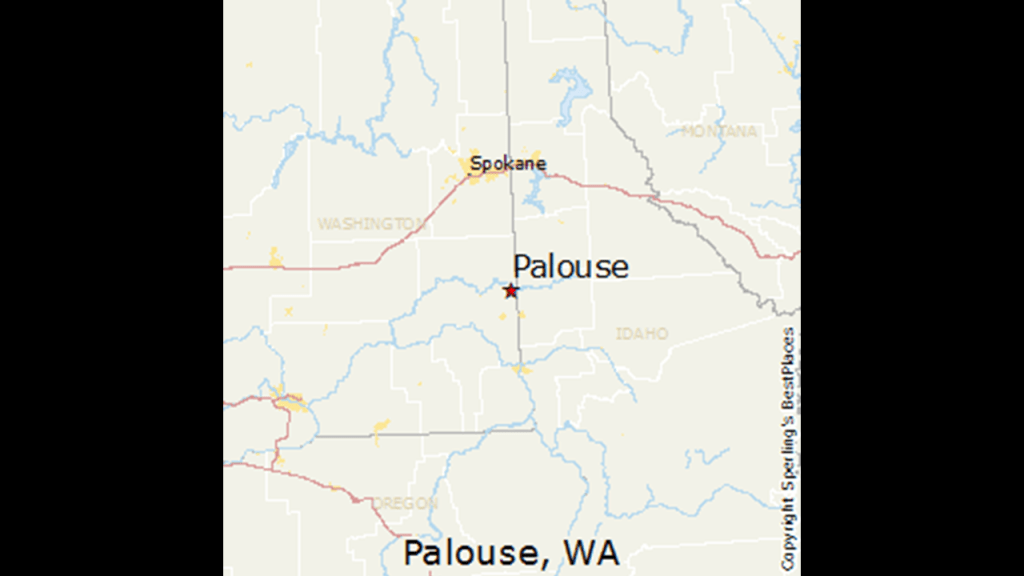
Next, I am going to look at the Palouse geographic region as I work my way back up into Washington State.
It is comprised of northcentral Idaho, southeastern Washington, and parts of northeast Oregon.
It is a distinct geographic region, and a major agricultural area, especially for wheat and legumes.
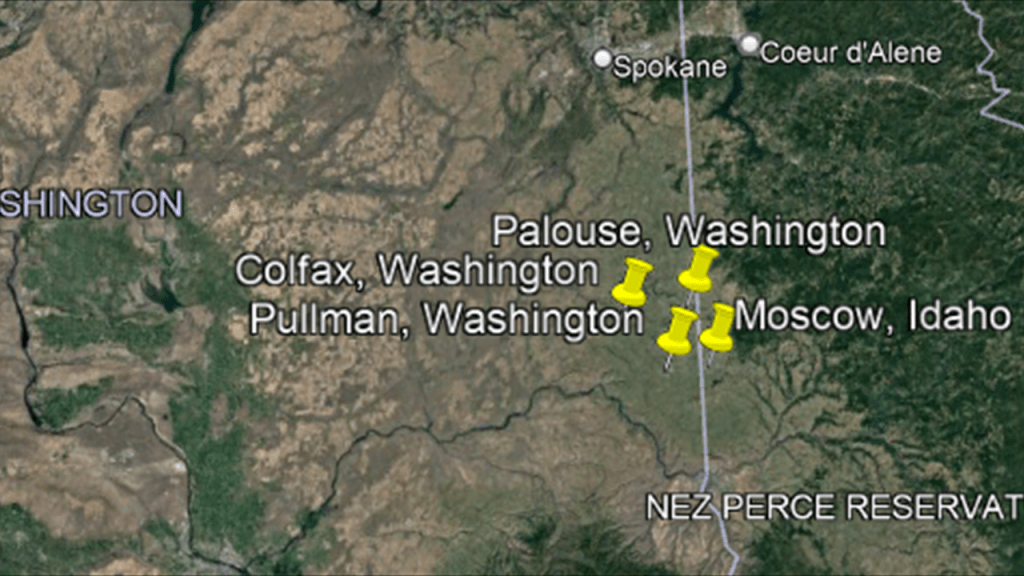
There are four main rural centers in the Palouse that are located geographically close to each other.
One is centered in Moscow,Idaho , and three in Washington State – in Palouse, Pullman, and Colfax .
The city of Moscow in Idaho is an agricultural and commercial hub for the Palouse region.
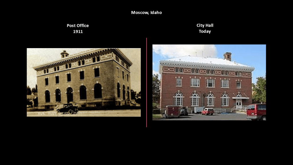
We are told that the first permanent settlers came here in 1871, with the first U. S. post office opening here in 1872, and the old post office and federal building pictured here was said to have been built in 1911 and today serves as the Moscow City Hall.
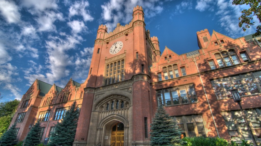
Moscow is the home of the University of Idaho, the state’s only University for 71-years.
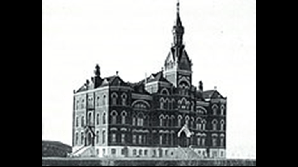
The east-facing Administration building on campus was said to have been built between 1907 and 1909…
…to replace the original Administration building, which was said to have been built in 1899 after having been destroyed by fire in 1906.
Next, in Washington State, first I am going to look at the rural center of Palouse.
It is a small agricultural community today, with a population of 998 in 2010.
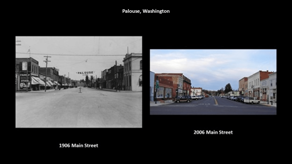
It was founded in 1874, and incorporated in 1888, the same year it was devastated by a massive fire.
Over the next decades, Main Street was rebuilt, becoming a major pioneer-era commercial district for the region.
Here are comparison photos of Main Street circa 1916 and circa 2006.
The railroad arrived in Palouse in 1888 with the Spokane and Palouse Railroad, part of the Northern Pacific Railroad.

Then in 1903, the Potlatch Lumber Company, a subsidiary of Weyerhauser bought out several mills and timber stock in the region, including the Palouse River Lumber Company.
In 1905, they brought in the Washington, Idaho, and Montana Railroad that ran from Palouse to Purdue, Idaho.
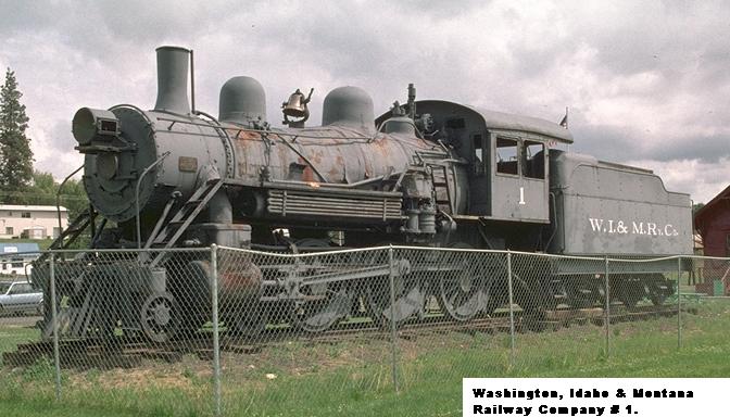
Then in 1906, an Electric Interurban line called the Spokane and Inland Empire Railroad, ran from Spokane, through Palouse, to Moscow, Idaho.
The company slowly converted to bus service, and the last electric rail service to Moscow was in 1939.
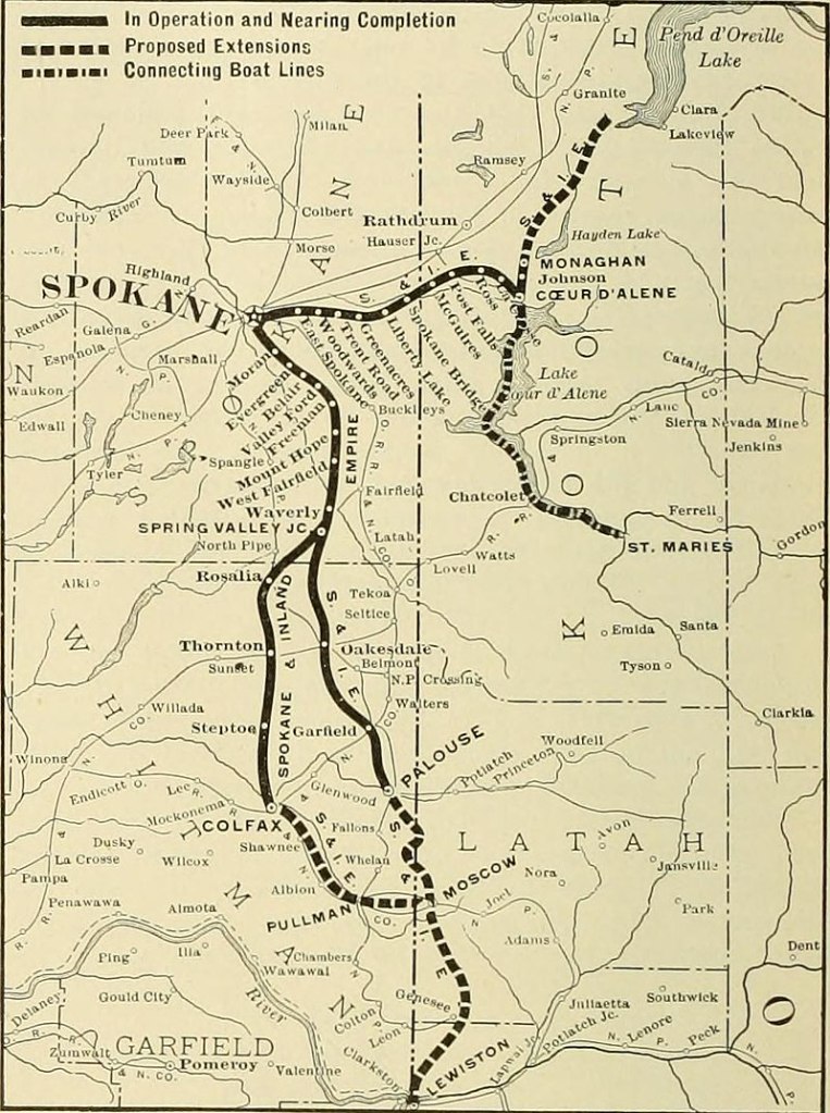
Palouse remains a rich farming area today, with main crops of wheat, barley, dry peas, garbanzos, and lentils.

Next, Pullman is the largest city in Whitman County, Washington, and was named after industrialist George Pullman, known to history as the manufacturer of the Pullman Sleeping Car.
Settlers arrived in the area in 1871, and Pullman was incorporated in 1881.
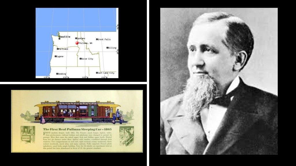
Like Palouse, Pullman is a fertile agricultural area.
It is also home to the flagship and oldest campus of Washington State University, which was established as an agricultural college in 1890, and is also one of the oldest land-grant Universities in the American West.
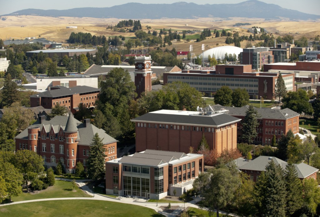
Pullman is situated across four major hills which divide the city into nearly equal quarters.
The four hills are:
Military Hill, which was named for the Pullman Military College that opened in 1891 and burned down in 1893…
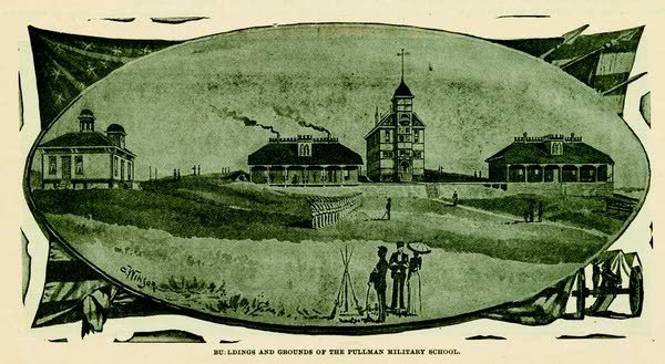
…Methodist Hill, which is now known as Pioneer Hill, with this photo taken from it of Pullman during a flood which devastated the region in 1910…
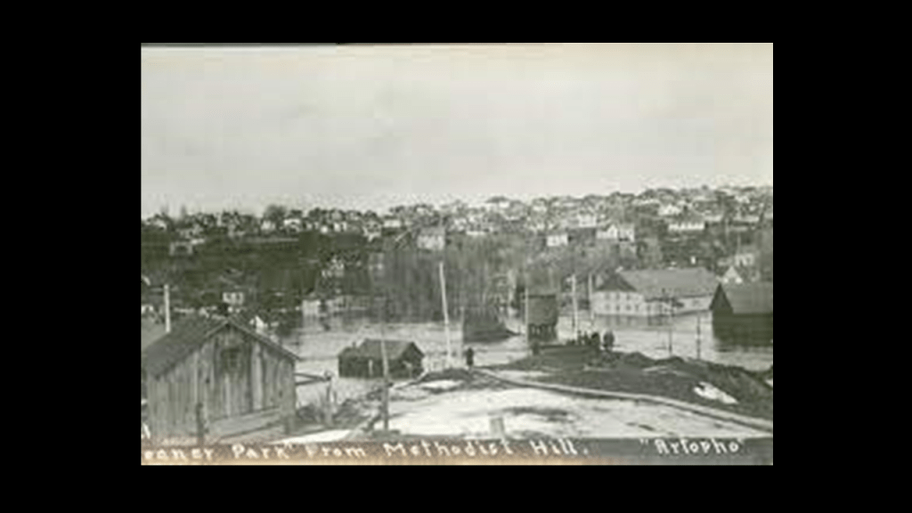
…College Hill, the location of Washington State University…
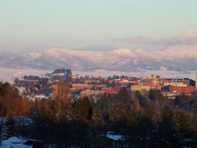
…and Sunnyside Hill, a neighborhood in Pullman.
The last place in the Palouse I am going to look at is the rural center of Colfax.
With the first settlers arriving in 1870, Colfax was incorporated in 1873, and named for Schuyler Colfax, Vice-President of the United States under President Ulysses S. Grant from 1869 to 1873.
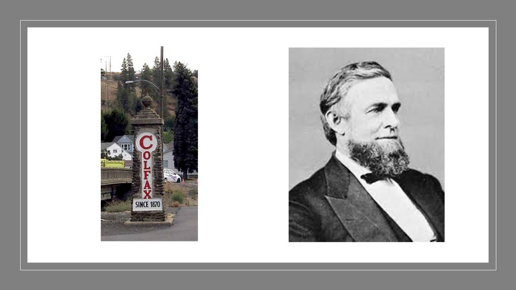
Colfax was situated at the junction of three railroad lines, as well as the confluence of the north and south forks of the Palouse River.

The Colfax Trail is a 3-mile, or 5-kilometer, local trail converted from an old railway line.
The former St. Ignatius Hospital in Colfax was said to have been constructed in 1892 under the supervision of Mother Joseph, and served as a hospital until 1964, and then as an Assisted Living home until 2000.
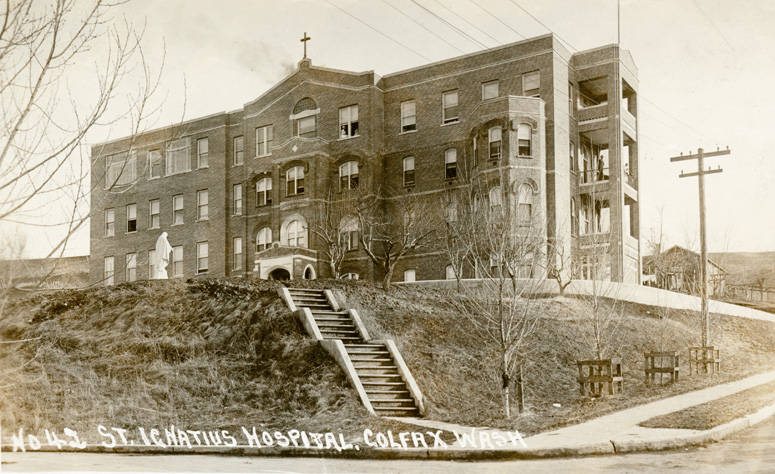
The former St. Ignatius Hospital was abandoned in 2003, though opened-up for ghost tours in 2015, and under new ownership since 2021.
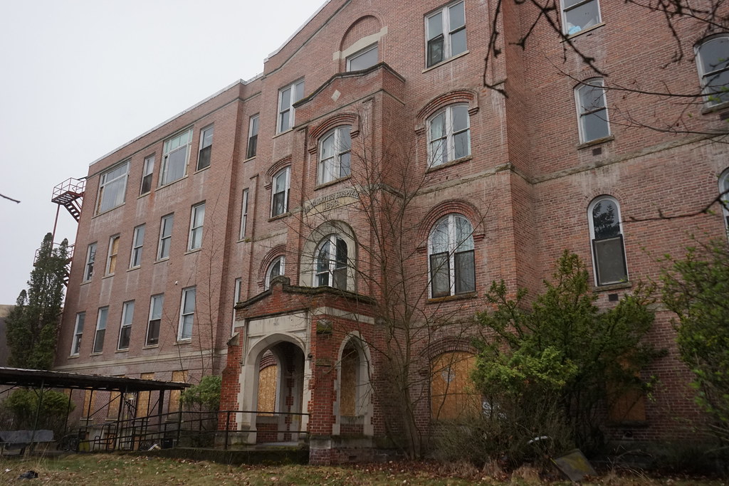
It is famous for its hauntings, and has been featured in such paranormal reality television series as “Paranormal Lockdown” and “Ghost Adventures.”
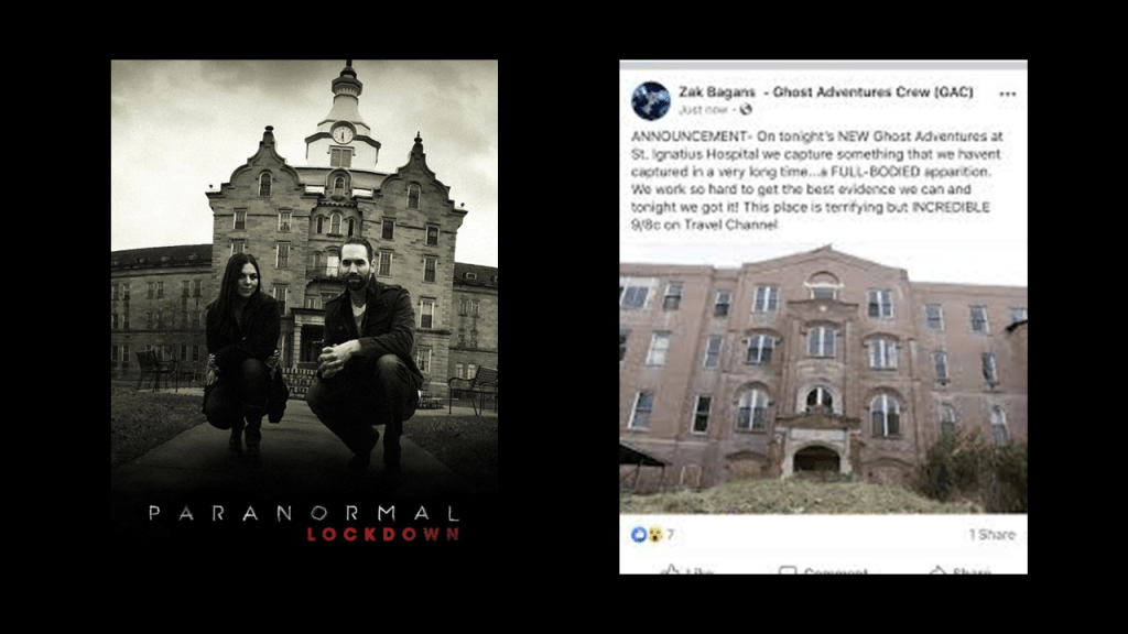
The Palouse River flood of 1910 significantly impacted Colfax, and other cities in the region.
Among other things, the floodwaters left Colfax and Moscow cut-off from the outside world, without train and telegraph service.
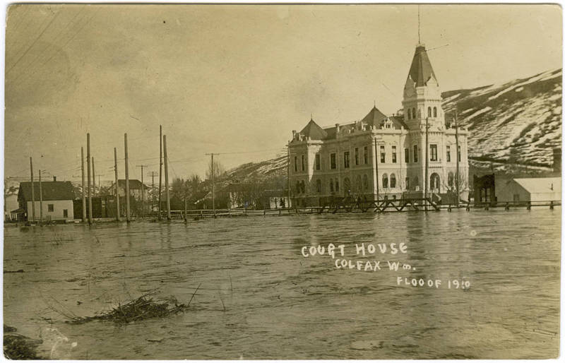
Now I am going to take my leave of the Palouse and take a look at Spokane in eastern Washington, eighteen-miles west of the Idaho border near Coeur d’Alene.
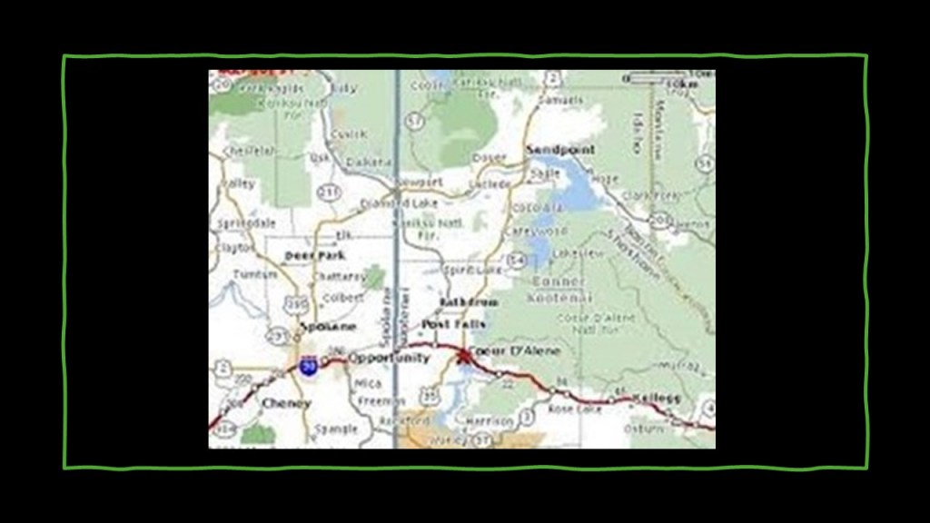
The Northwest Company’s Spokane House was established in 1810, a fur-trading post that was the first long-term settlement in what became Washington State.
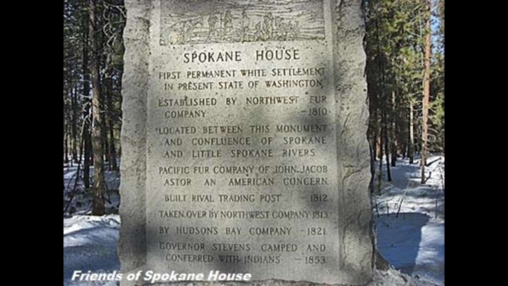
Mentioned earlier in British Columbia this post, the North West Company was a fur-trading business headquartered in Montreal, from 1779 to 1821, at which time it was forced to merge under pressure from the British government with the Hudson’s Bay Company after new regulations governing the fur trade in British North America were passed.
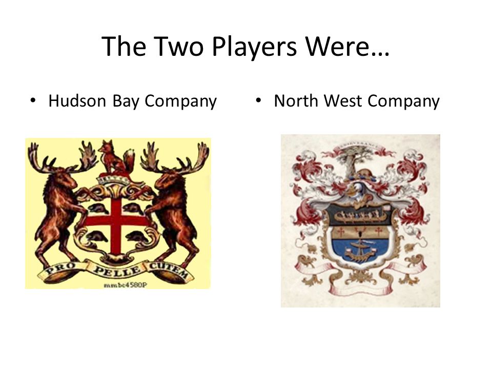
We are told the Northern Pacific Railway first brought settlers to the Spokane area in 1881.
The Northern Pacific Depot in Spokane pictured here was said to have been built in 1890, after the 1889 Great Fire of Spokane.
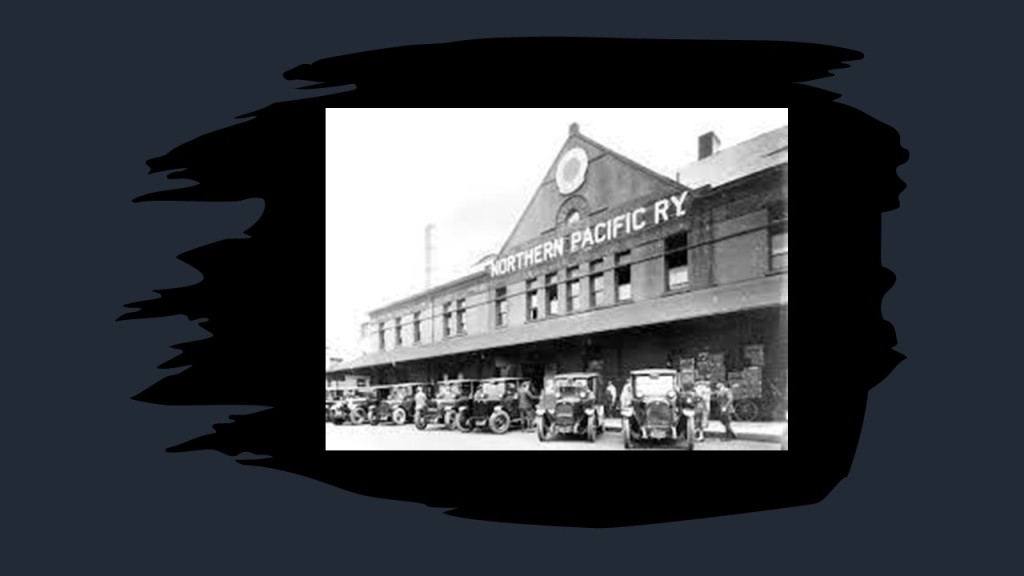
The 1889 Great Fire of Spokane was a major fire in August of that year which affected downtown Spokane, destroying the downtown commercial district of the city, the same year as the Great Fire that destroyed downtown Seattle in June of that year that we saw previously.
Some of the things that we are told about it was that due to a technical problem with the pump station, there was no water pressure in the city when the fire began, and that firefighters demolished buildings with dynamite in a desperate bid to starve the fire.
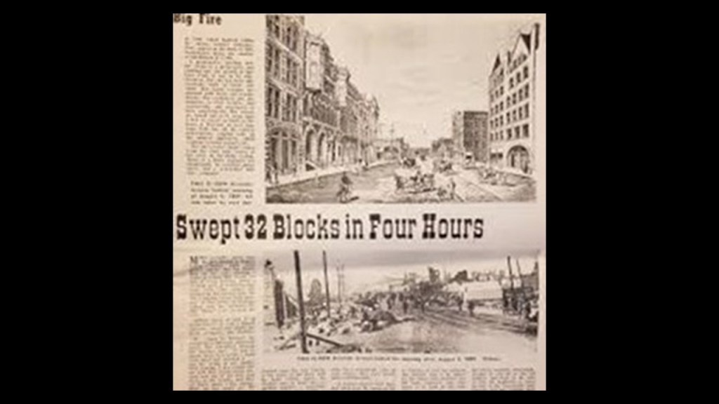
After the fire, architect Kirtland Kelsey Cutter was credited with designing many of the city’s older Romanesque Revival-Style buildings, like the First National Bank…

…the Rookery Building…
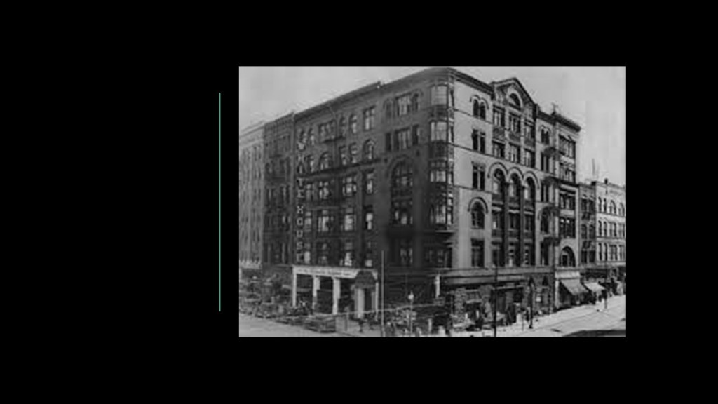
…the Spokane Club…

…and the Davenport Hotel and Restaurant.
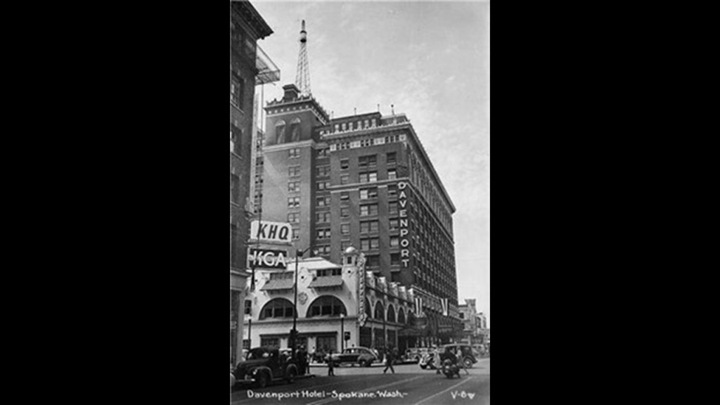
The Davenport Hotel was said to have been commissioned by a group of Spokane citizens headed by Louis Davenport, the hotel’s first proprietor.
The architect who was given credit for designing the building was Kirtland Kelsey Cutter, and it was said to have been built in 1914.
Notable features included the first hotel air conditioning in the United States; a central vacuum system; and a pipe organ.
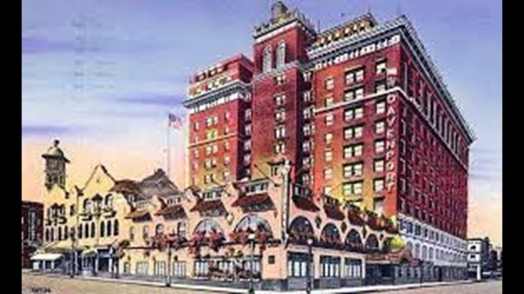
In 1985, the Davenport was closed, and the demolition of the grand building was considered.
However, a local property developer bought the building in 2000, and restored the Davenport to its former grandeur, and it reopened as a hotel in September of 2002.
The Historic Davenport Hotel is still considered the Grandest Hotel in Spokane.
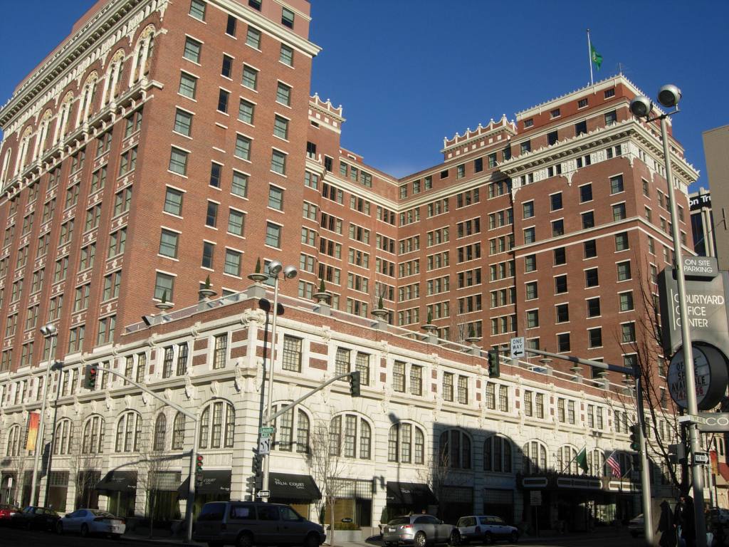
The Patsy Clark Mansion in Spokane was also attributed to the architect Kirtland Kelsey Cutter, circa 1897 – 1898, having been hired by mining millionaire Patsy Clark to replace his mansion that had been burned down in the Great Fire of Spokane in 1889.
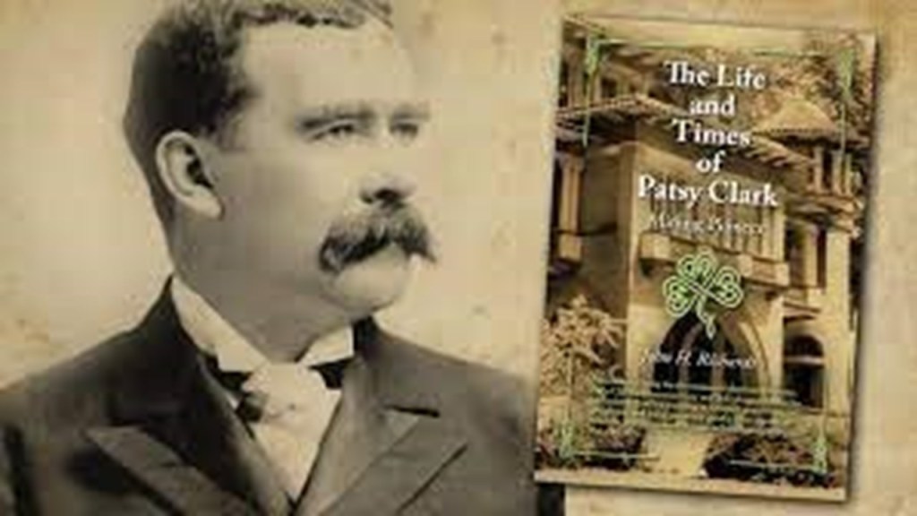
The mansion now houses a law firm and offers private rentals for small events.
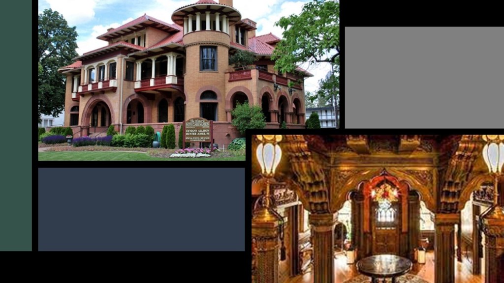
Spokane’s Riverfront Park occupies 100-acres, or 40-hectares along the Spokane River, encompassing the Upper Spokane Falls.
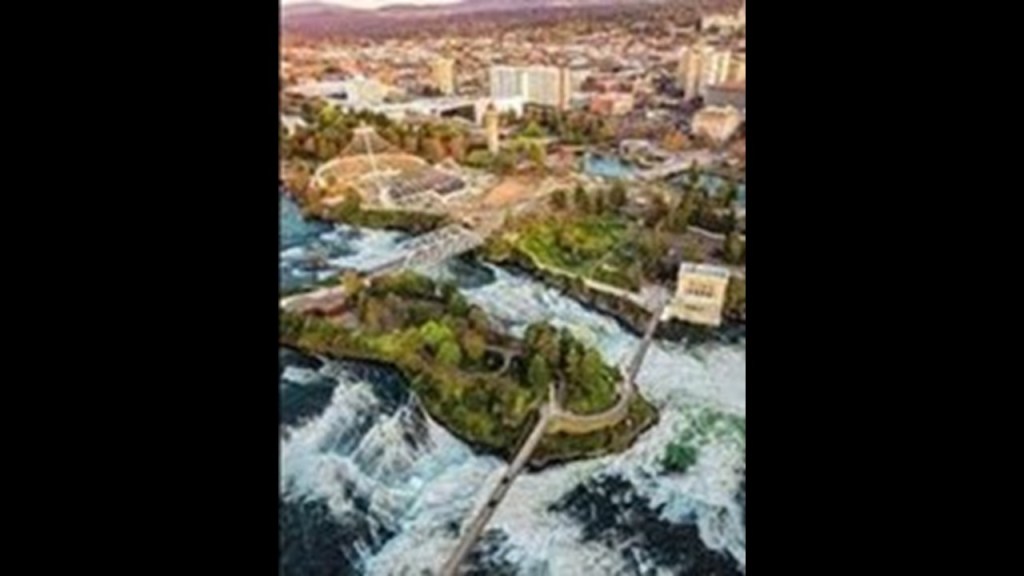
Officially opening in 1978, Riverfront Park is said to be located on the site of a former railyard.
Attractions include the Great Northern Clocktower.
We are told that while the clocktower never had bells, it has an electronic speaker system replicates the sound of bells ringing.

In our historical narrative, the Clocktower is all that remains of what was the Great Northern Depot, which was levelled to make room for the Expo ’74 that was held in Spokane.
The Great Northern Depot and Clocktower was said to have been built between 1892 and 1902.
The Clocktower was almost levelled too, but was saved by a successful preservation effort.
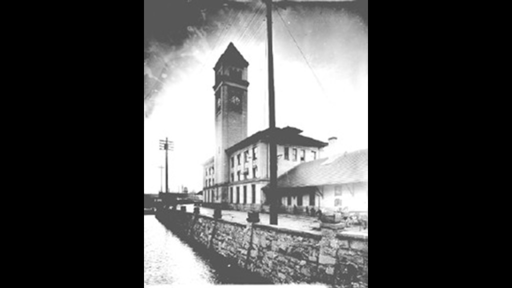
The last thing I am going to look at in the city of Spokane is the Monroe Street Bridge.
It is a deck-arch bridge that spans the Spokane River, and said to have been built in 1911 by the City of Spokane, and designed by city engineer John Chester Ralston.
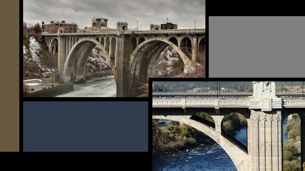
Now I am going to look at the Grand Coulee High Dam, which is a driving distance of 88-miles, or 142-kilometers, to the northwest of Spokane on the Columbia River.
The Grand Coulee High Dam was said to have been built between 1935 and 1942, during the administration of President Franklin D. Roosevelt.
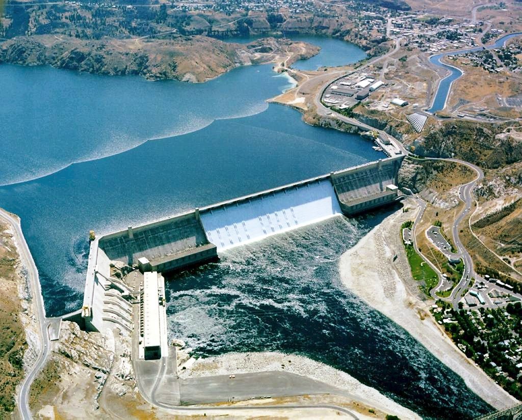
Keep in mind, this would have been during the middle of the Great Depression and half-way through World War II.
By its maximum capacity, it is the largest power station in the United States.
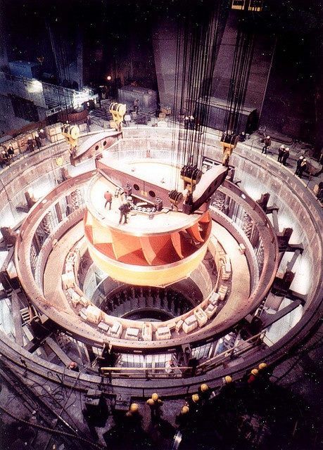
It is a concrete gravity dam on the Columbia River.

The Grand Coulee High Dam is the centerpiece of the Columbia Basin Project.
The Columbia Basin Project is the largest water reclamation project in the United States, supplying water to over 670,000 acres, or 2,700-kilometers-squared, of the 1.1 million acres, or 4,500-kilometers-squared, large project area, all of which was originally intended to be supplied.
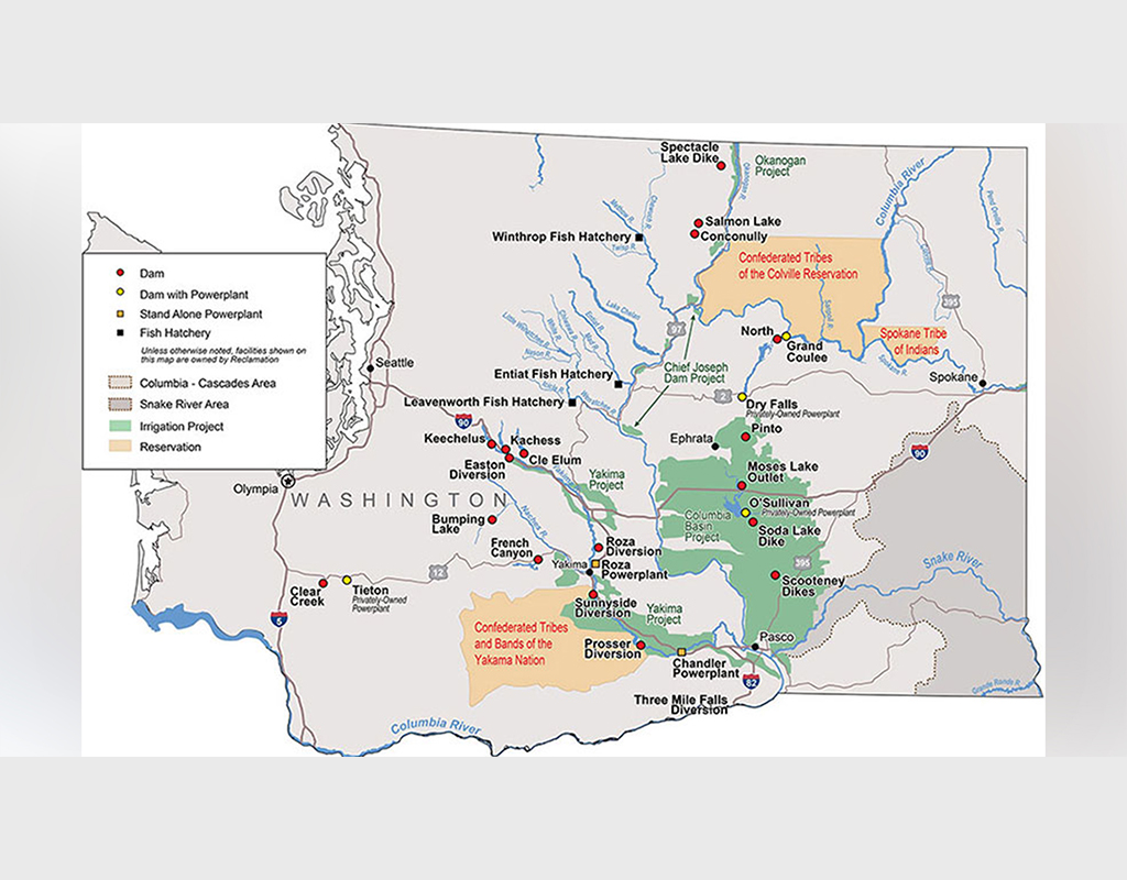
We are told the proposal to build the dam was the focus of a bitter debate during the 1920s between two groups.
One group wanted to irrigate the ancient Grand Coulee with a gravity canal, while the other pursued a high-dam and pumping scheme.
The dam supporters were said to have won, and in August of 1934, FDR endorsed the “high dam” design.
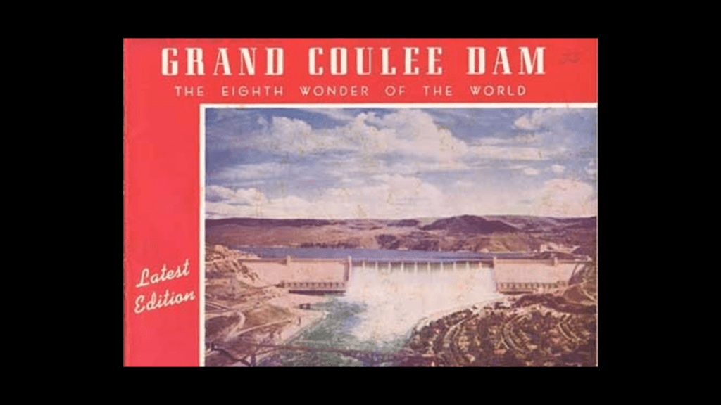
The Grand Coulee is described as an ancient river bed.
A coulee, in the northwestern United States, is defined as a large, steep-walled, trench-like trough, which commonly are spillways and flood channels incised into the basalt plateau.
This was said to be an 1853 lithograph of the ancient Ground Coulee.
It stretches for about 60-miles, or 100-kilometers southwest from the Grand Coulee Dam to Soap Lake, being bisected by Dry Falls in to the Upper and Lower Grand Coulee, and part of the “Channeled Scablands” region of Washington State.

Dry Falls, a scalloped precipice with four major alcoves on the opposite side of the Upper Grand Coulee from the Columbia River pictured on the left, is described as one of the largest waterfalls ever known.
Estimates are that the falls were five times the width of Niagara Falls, with ten-times the flow of all the current rivers in the world combined.
Dry Falls brings to my mind in appearance the King George Falls in the Kimberley region in WesternAustralia, pictured on the right.
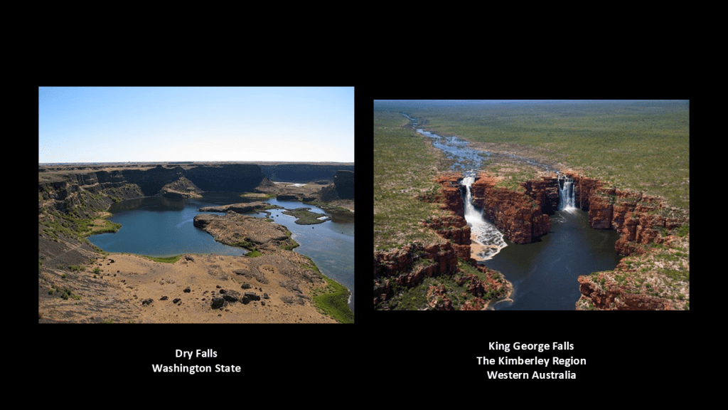
One of the theories about the formation of the “Channeled Scablands” from the 1920’s was that they were created by immense, but short, floods…for which the theorist, J. Harlan Bretz, had no explanation.
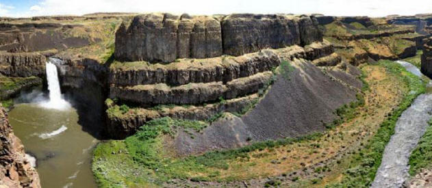
And I can’t help but wonder what story we are not being told about this region, and in general about our history and the world in which we live.
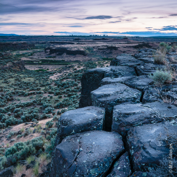
The last place I would like to look at is Snoqualmie Falls and the hydroelectric plant there.
First, Snoqualmie Falls.
Snoqualmie Falls is located 29-miles, or 47-kilometers, east of Seattle on the Snoqualmie River between the cities of Snoqualmie and Falls City.
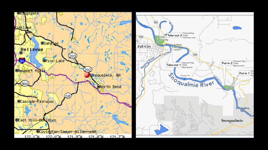
At 268-feet, or 82-meters, -high, Snoqualmie Falls are 100-feet, or 30-meters, higher than Niagara Falls on the Niagara River between New York State and Ontario in Canada.
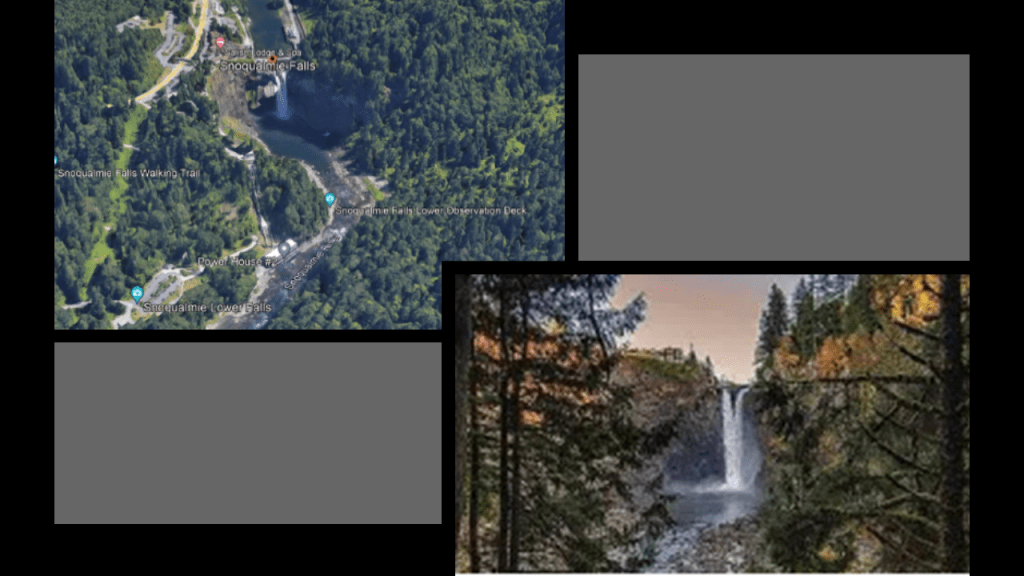
These Falls are considered sacred by the indigenous Snoqualmie people, where they believe the first man and first woman were created.
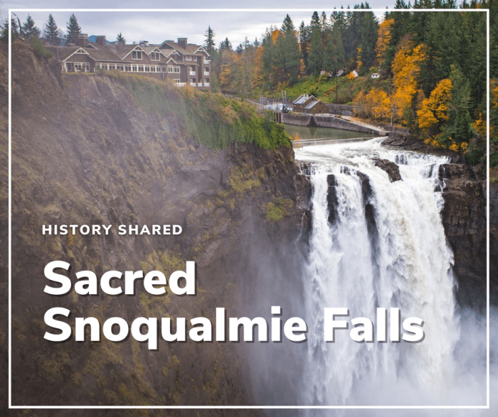
The Snoqualmie area was one of the filming locations for the mystery-horror television show “Twin Peaks” from the early 1990s.
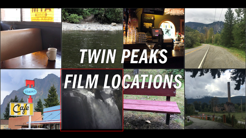
It is significant to note that there is a power plant built into the bedrock beneath the Snoqualmie Falls.
This is what we are told about it.
The Snoqualmie Falls Hydroelectric Plant 1 was completed in 1899, and was the first completely underground hydroelectric plant ever built in the world.
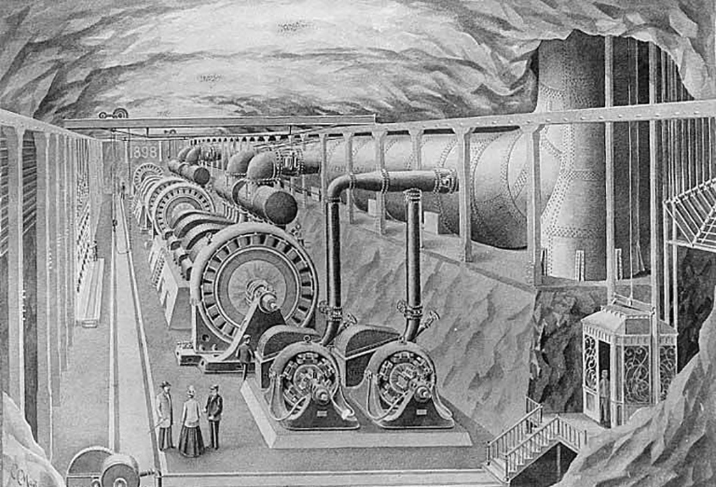
The story we are told is that Seattle engineer Charles Baker envisioned the hydroelectric plant when he passed by the Snoqualmie Falls on the Seattle, Lake Shore and Eastern Railway routinely during his work.
Baker became unemployed after the Panic of 1893, and sought to build the hydroelectric powerplant.
He received funding from his father, wealthy businessman, William T. Baker, and formed the Snoqualmie Falls Power Company, and bought the falls and surrounding land in 1897.
And that’s how we are told the underground Snoqualmie Falls Hydroelectric Plant came to be.
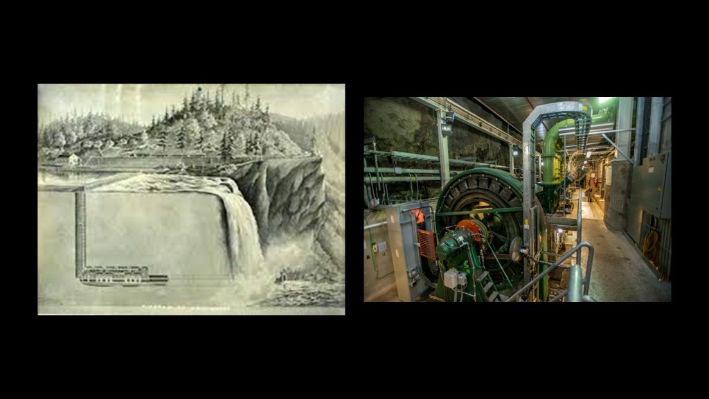
Then in 1910, Plant 2 was built on the right-bank of the Snoqualmie River.
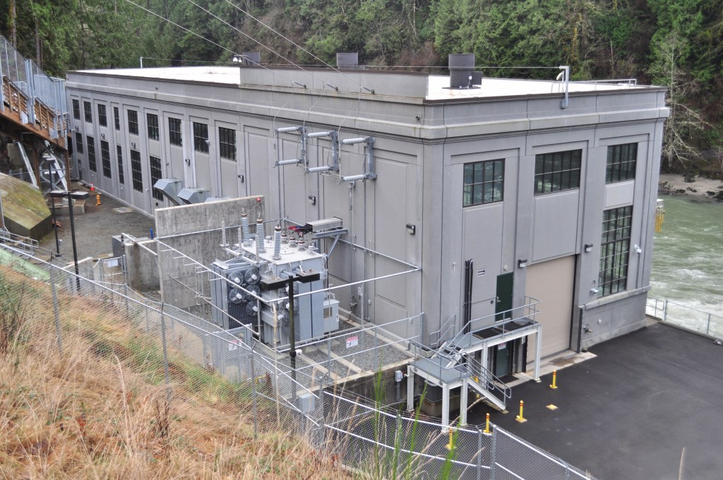
That’s enough for questionable history, though as always there’s plenty more to find.
Now let’s move on to questionable science because that comes up in all that we have been looking at here in the Pacific Northwest as well, so now I will be looking at the bedrock so to speak of what we are taught as the only reasons given to explain what we see in today’s world in our modern scientific paradigm.
One of the bedrock foundations of modern science is the work of the previously-mentioned Sir Charles Lyell.
Sir Charles Lyell was said to have demonstrated the power of known natural causes in explaining Earth’s history.

In his books, “The Principles of Geology,” published in three volumes between 1830 and 1833, he presented the idea that the Earth was shaped by the same natural processes that are still operating today at similar intensities, and as such a proponent of “Uniformitarianism,” a gradualistic view of natural laws and processes occurring at the same rate now as they have always done.
This theory was in contrast to “catastrophism,” or theory that Earth has been shaped by sudden, short-lived violent events of a worldwide nature.
As a result of Lyell’s work, the glacial theory gained acceptance between 1839 and 1846, and we are told during that time, scientists started to recognize the existence of ice ages, and do to this day.
Sir Charles Lyell’s books on “Uniformitarianism” and “Ice Ages” in geology became the only accepted model taught by Academia.

And in so doing, provides the perfect cover for things like megaliths and megalithic stone structures in North America, by calling them “glacial erratics” from the last Ice Age.
“Glacial erratics” are defined as rocks that have been moved by glaciers and deposited in new locations, often far from where they originated.
So, for example, what’s called a “glacial erratic” in North America is called a “dolmen” in many other places around the world!
Dolmens are defined as prehistoric monuments of two or more upright stones supporting a horizontal stone slab and thought to be a tomb by those seeking to explain them.
“Balanced Rock” in North Salem, New York, on the left is categorized as a “glacial erractic,” and the Proleek Dolmen is found in Ireland on the right.
Another one of the bedrock foundations of modern science are the accepted scientific theories of Plate Tectonics and Continental Drift that are closely connected to the gradualistic view of natural laws and processes occuring at the same rate now as they have always done in the Uniformitarian worldview of Sir Charles Lyell.
In 1915, Alfred Wegener, a 1905 graduate of the previously-mentioned Humboldt University of Berlin that produced the great scientists and scholars of our day, published “The Origins of Continents and Oceans,” in which he theorized that Earth’s continents move or drift relative to each other over long periods geologic time, and that the continents were once joined together in a large landmass “supercontinent.”
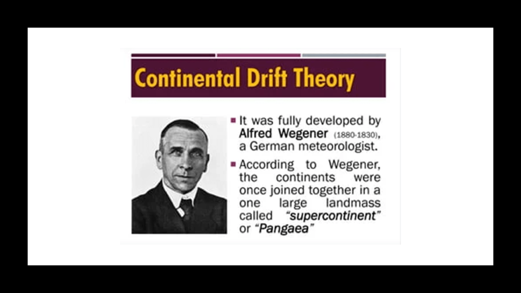
So apparently the idea that at one time there was one large supercontinent is not in dispute.
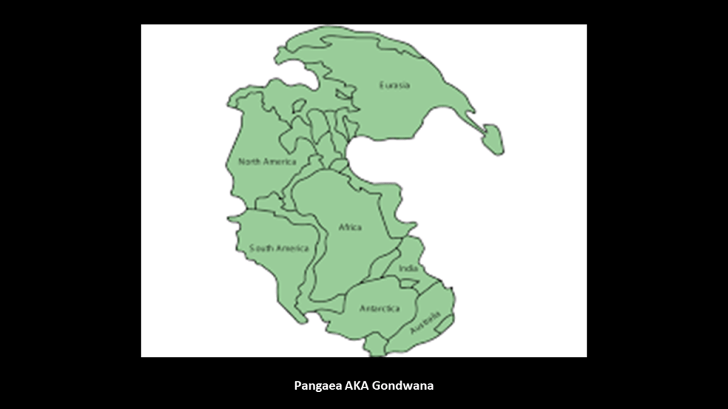
The issue is when and how the continents separated: Slowly and over geologic time vs. suddenly and catastrophically.
And once again, Academia supports Uniformitarianism without question as the only explanation for what we see in today’s world.
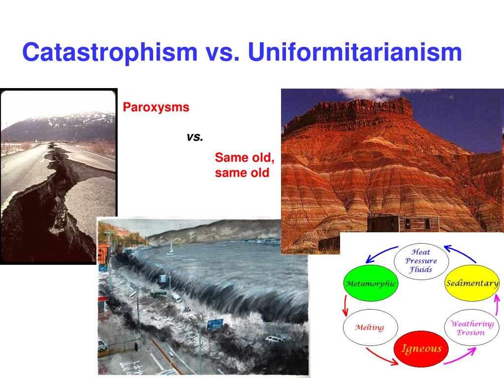
And even though initially Wegener’s theory was not accepted by Academia because there was not a proposed mechanism, the Continental Drift theory was later incorporated into Plate Tectonics, the scientific theory that Earth’s lithosphere is comprised of a number of large tectonic plates that have been slowly moving for 3 – 4 billion years, and this is what we are taught today.
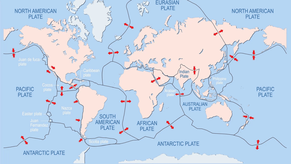
So this carries over directly into what the accepted science of our day tells us causes volcanic activity, and earthquakes for that matter – that it’s connected to active tectonic settings where tectonic plates move or interact, like in subduction zones where plate boundaries meet.
“Well, so what? What’s wrong with that? That sounds right” you might ask, so let’s dig some more.
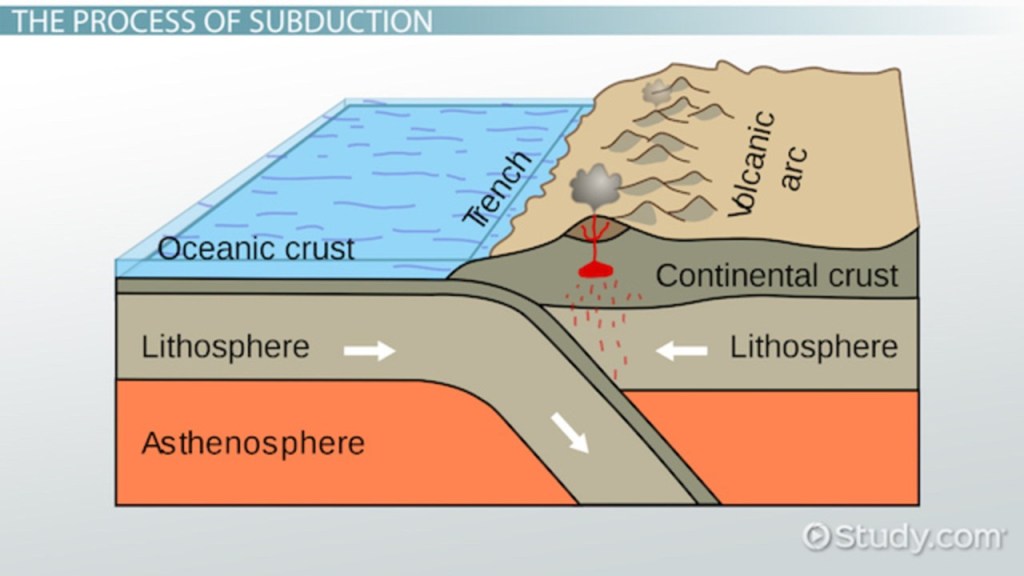
These exact same processes are also connected in our scientific paradigm to the study of the Earth’s magnetic field, which is called geomagnetism.
Within the modern science of geomagnetism, which again, like everything else, is based on the scientific theories of plate tectonics and of events taking place over millions of years of geologic time, there is the recognition of both magnetic and gravity anomalies.
More on magnetic and gravity anomalies shortly.
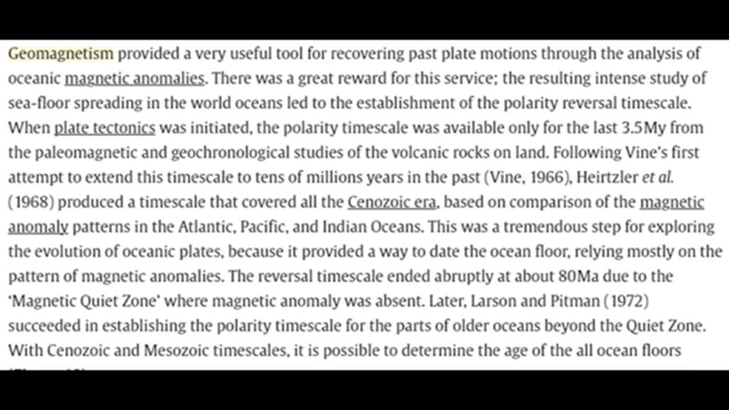
Another bedrock foundation of modern science is the model of Earth as a rotating “planet,” defined as a celestial body that orbits a star.

Our current scientific paradigm tells us that the Earth’s magnetic field is generated through a process known as “geodynamo” by electric currents due to the motion of convection currents of a mixture of Earth’s molten iron and nickel in Earth’s outer core and connected to the Earth’s rotational axis, and for which we are given no other explanation.
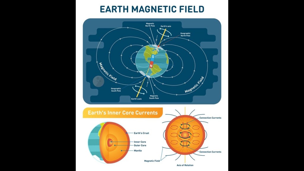
So, the bedrock foundations of our modern scientific paradigm, referring to the solid rock foundations that our scientific worldview is founded upon and the only one that has been taught to generations of students in our educational systems and not only to be questioned, can be summarized follows.
This academically-approved and-enshrined paradigm is opposite to the growing belief among many people, myself included, that the Earth realm exists on a “plane,” and interestingly only one-letter different from “planet” in English, which is a flat horizontal surface that extends indefinitely.

But mainstream thinking is quick to debunk this belief, citing “science” as proof for why the Earth is a globe.

So when and by whom did the globe and mainstream scientific thinking on the solar system originate in our historical narrative?
It appears that the deliberate manipulation of how we viewed the Earth, and our perception of Space and Time, started for all intents and purposes in the mid- 1500s.
In May of 1543, Nicolaus Copernicus was said to have published “On the Revolutions of the Heavenly Spheres,” offering mathematical arguments for the heliocentric, or sun-centered universe, and denying the geocentric model of the Earth-centered universe of Ptolemy.
By the end of that month, we are told Copernicus was dead.
Seemingly right away, the heliocentric model replaced the geocentric model as what was accepted by the current science of the day since the geocentric model was all of a sudden considered inadequate.
So we went from Ptolemy’s earth-centered Universe to a spinning ball orbiting the sun-centered Universe in 1543.

Ptolemy was a second-century mathematician, astronomer and geographer from Alexandria in Egypt who was credited with the only mathematically-sound geocentric model of the solar system, in which everything in the Cosmos orbits around the Earth.
We are not told in our narrative that Ptolemy was telling us the Earth was a plane so much as he was telling us that the Universe revolved around the Earth and not the Sun.
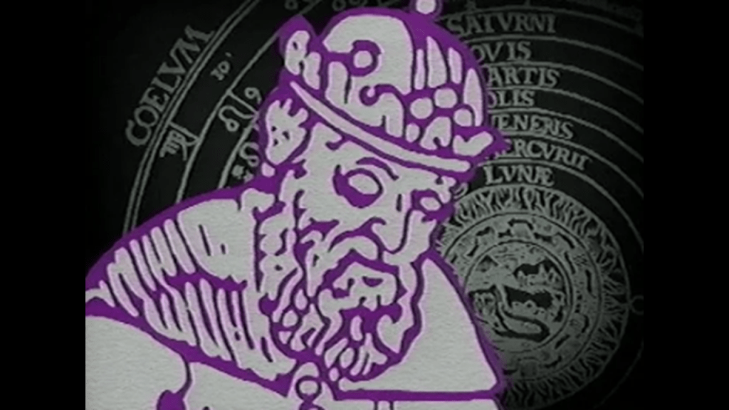
Only three-years prior to the publication of the work of Copernicus establishing the heliocentric Universe, Pope Paul III issued a papal bull forming the Jesuit Order in 1540, under the leadership of Ignatius Loyola, a Basque nobleman from Northern Spain.
The Jesuit Order is a missionary order that included a special vow of obedience to the Pope in matters of mission direction and assignment.

Then in 1542, only two-years later after the Jesuits were formed, the same Pope Paul III established the Holy Office, which was also known to history as the Inquisition.

The Jesuits very quickly went to work implementing the historical atrocities of the Inquisition because the very same year, in 1542, St. Francis Xavier, a co-founder of the Jesuit Order with Ignatius Loyola, landed in Goa on the Indian subcontinent, where we are told he requested the brutal Goa Inquisition, which was subsequently established to enforce Catholic Orthodoxy in colonial-era Portuguese India.
The Jesuit co-founders Ignatius Loyola and Francis Xavier were made saints at the same time by the Pope in 1622, and they were the first two saints of the Catholic Church to go through the beatification and canonization process first.
So the Jesuits and all their behind-the-scenes activities of dubious nature first enter the picture in our historical narrative at the same time the heliocentric universe was being introduced, and I really do believe that the Jesuits were major players in the creation of the new narrative and paradigm, though of course what you can find about them in the narrative is all sunshine and roses, and known for their “commitment to education, service, and justice.”

Interestingly, globes started to appear in our historical record in this same time period as well.
Gerardus Mercator, a Flemish geographer, cartographer and cosmographer, was credited with the creation of this famous early globe in 1541.
Roughly 40-years after the appearance of Mercator’s globe and the work of Copernicus, the Gregorian Calendar was introduced by Pope Gregory XIII in October of 1582, for the given reason of correcting the Julian calendar on stopping the drift of the calendar with respect to the equinoxes, and included the addition of leap years.
Now we have linear time, which was a different way of measuring time from the cyclical calendars measuring natural time used by the Ancients.
Within 30-years of the introduction of the Gregorian calendar, in 1609, Johannes Kepler, a German astronomer, first published his “Laws of Planetary Motion,” in which he described the orbits of planets around the sun, and his work further backed-up the now-only-accepted model by the scientific establishment of the Earth spinning on its axis in a heliocentric universe.
Kepler’s work was said to have improved the 1543 model of Copernicus by introducing more defined terminology for the orbits of the planets around the sun intead of just saying that’s what they do.
Kepler’s “Laws of Planetary Motion” in turn influenced Sir Isaac Newton and his work.
We are told that Sir Isaac Newton had been developing his theory of gravity as far back as 1665, and that in 1666, Newton famously observed the falling apple upon which he developed his foundational law that gravity is universal, incorporating the idea that Kepler’s Laws must also apply to the orbit of the moon around the Earth and then to all objects on Earth.
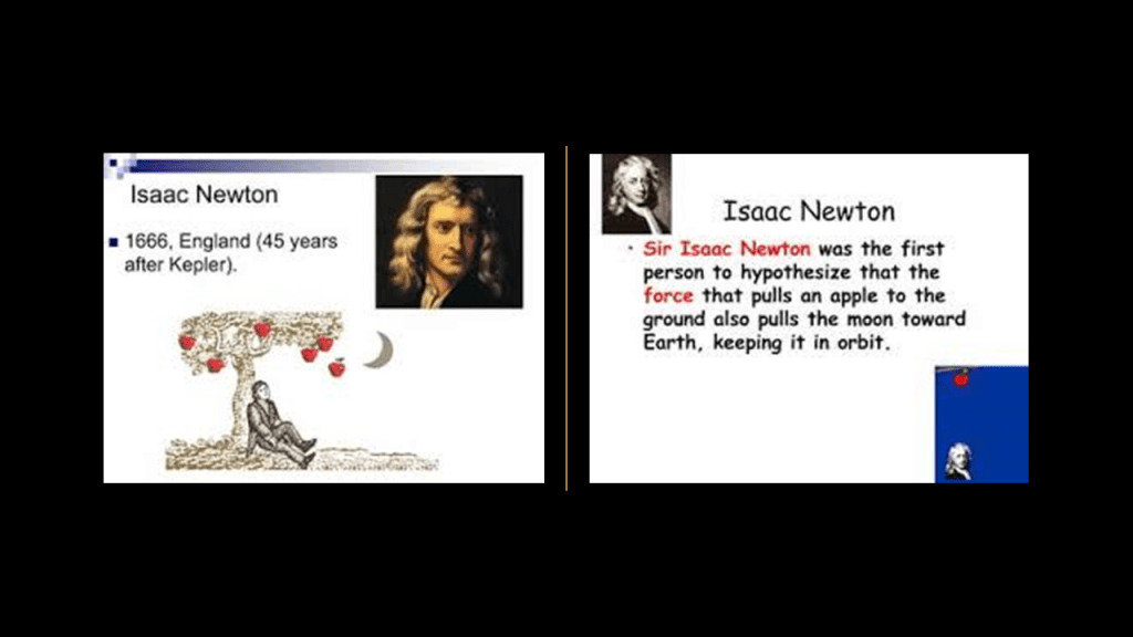
Then in 1687, Newton published his “Principia,” in which he combined his own laws of motion with new mathematical analyses to explain Kepler’s empirical results in the form of a law of universal gravitation in which any two objects are attracted by a force proportional to their mass and inversely proportional to their separation squared, further codifying these scientific explanations.

While it is not known with absolute certainty if Sir Isaac Newton was an initiated Freemason, Newton was President of the Royal Society when the Premier Grand Lodge of London was established in 1717, when he was 74.

It is known that Elias Ashmole was a Freemason, and he was one of the founding fellows of the Royal Society in November of 1660.
Elias Ashmole, an English antiquary and student of Alchemy, was the first English Speculative Freemason initiated in 1646.
And it is no secret within Modern Freemasonry that it is “speculative,” meaning based on conjecture rather than knowledge, as opposed to “operative,” meaning those who actually worked with stone.
Elias Ashmole, one of the founders of the Royal Society, also collected the manuscripts of John Dee, and had a lifelong interest in magic, especially in attempts to make spirits appear.
It is also interesting to note things appearing in the shadowed background of this portrait of Elias Ashmole that are appear to be hinting at something else- a column, and what appears to be a phantom city.
It was quite common for things like this to be hidden in portraits of famous people and architects and the like of the day.
There is no doubt in my mind that these Speculative Freemasons stole the identity and legacy of the original Operative Moorish Masons, and instead used whatever of the original knowledge they possessed for occulting the New World, and, like the Jesuits, the highest degreees of Freemasonry have also been major players behind the creation of the new narrative and paradigm.
This portrait of Sir Christopher Wren show the same shadowy goings-on in the background.
Sir Christopher Wren (b. 1632 – d. 1723) was one of the most highly acclaimed architects in English history.
He was credited with rebuilding much London after the Great Fire, and like Elias Ashmole, was an early Freemason prior to the established of the Premier Grand Lodge of London in 1717.
On the left side of his portrait, you can see what looks like what could be the window sill…or could be the faint outlines of a building.
We are told that Sir Christopher Wren was commissioned after the Great Fire of London in 1666 to rebuild 51 replacement churches of 88 that were destroyed in the fire, as well as St. Paul’s Cathedral, located at the highest point in the city of London and said to have been completed in 1710.
So this is a good place to pivot to an alternative reason for what we might be looking at if this realm is indeed a plane and not a planet, and provide a different explanation for what we are seeing in the form of the past existence of ancient giant trees that were an integral part of the Old World before it was destroyed and to provide an explanation for what might have happened to them and why they are no longer visible to us in their original form.
Chad Williams and I had a recent conversation for his YouTube Channel “Deeper Conversations with Chad,” and it was called “Giant Trees, the Earth’s Grid, and the New World Order,” where we discussed, among many other things, the apparent volcanic nature of these giant trees and their integral relationship to the Earth’s Grid System.

Our conversation started off with this intriguing illustration that Chad found in the Mundus Subterraneus Textbook by Athanasius Kircher in his research and had sent it along to me to take a look at.
It seems to be showing trees as volcanoes on a grid exploding simultaneously, which would account for why we don’t recognize them as trees anymore.
Athanasius Kircher was a German Jesuit who published somewhere around 40 major works of comparative geology, religion and medicine.
The “Mundus Subterraneus” was published in 1665, depicting Earth’s geography through text and drawings, and attempts to describe the structure of the Earth from a physical and chemical standpoint.
He delved into such subjects as oceanic currents; volcanoes; thermal springs; and mineralogy and mining.
As I just mentioned, I do believe that Jesuits like Kircher were deeply-involved in the revisionist history and science that gave us what we are taught in school today, and which covers up the True History of the Earth.
Interesting that the 1665 publication of Kircher’s work “Mundus Subterraneus” falls right in line with when Sir Isaac Newton had his initial breakthroughs with his foundational law of gravity in 1665 and 1666.
And both of these historical occurrences involving Kircher and Newton fall right in-line with the passing of the Cestui Que Vie Act in 1666 by the British Parliament right after the 1665 Great Plague and 1666 Great Fire in London.
The Cestui Que Vie Act of 1666 subrogated the rights of men and women, meaning all were declared dead or lost at sea.
The government took custody of everybody and their property into a trust, and the state became the trustee, holding all titles to people and property until a living person comes back to reclaim those titles.
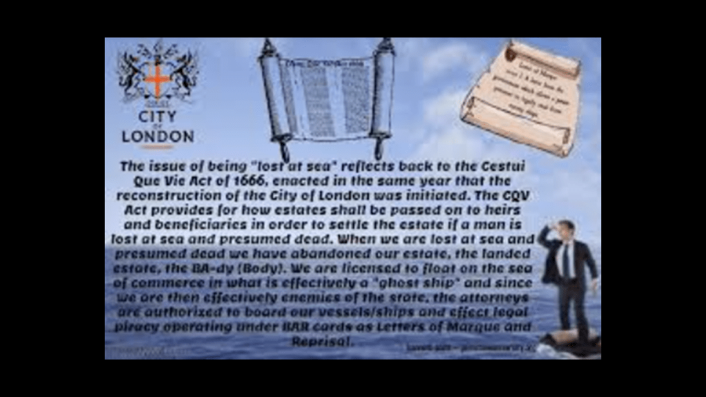
The year of 1666 was also the year that Sabbatai Zevi, Jewish Mystic and student of the Kabbalah, was proclaimed Messiah by Nathan of Gaza,
Sabbatai Zevi and his follower Jacob Frank brought Sabbatean-Frankism to the world.

And in 1667, John Milton’s poem “Paradise Lost” was published.
As related in the poem, newly banished Fallen Angels organize, and Lucifer volunteers to corrupt the newly created Earth and God’s new and most favored creation, Mankind.
Lucifer goes to the Garden of Eden, and convinces Eve by duplicity to eat of the fruit of the tree of knowledge of good and evil, which directly led to their expulsion from the Garden of Eden.
I think this was original disclosure about what has taken place here – Paradise was lost, and we were brought to the corrupted, inverted world we live in today.
There is more happening around this time in our historical narrative, but this gives you the idea that 1666 was a very important year for the Controllers in our current timeline.
So going back to the Pacific Northwest, it is great place to talk about all of this because it has the required elements for a comprehensive look at this entire subject that I have encountered so far in my research – what and who brought us from a plane to a planet; who was behind the fake history and fake science we have been taught to explain the New World they had created from the destruction of the Old World; and provide an alternative explanation for what we might be actually looking at based on the evidence that is available to find.
I first dove into the subject of what we might be really looking at here when I did the research for “History Reads like a Book on the Earth’s Grid System – Part 2 The North Atlantic Ocean & the New England Seamounts to the Maldives in the Indian Ocean.”
It was in the course of doing the research in the North Atlantic Ocean and the New England Seamounts there that I started to learn about underwater features called seamounts and guyots, and as well as what are called “hotspots,” and I found exactly the same things in the Indian Ocean.
I also found evidence for recently submerged landmasses in the fabled locations of Atlantis and and Lemuria in both places, even though again the conventional scientific explanations I have already covered are provided for everything we see there, particularly with regards to plate tectonics, continental drift, volcanoes and the mechanisms for volcanism.
These same elements are present in the Pacific Northwest.
I have already talked about the active stratovolcanoes of the Cascadia Volcanic Arc and the explanation given for the Columbia River Flood Basalts, and the now I am going to talk about the Yellowstone Hotspot, also known as the Continental Hotspot.
This volcanic hotspot in the Pacific Northwest is said to be responsible for large-scale volcanism in Wyoming, Idaho, Oregon, Nevada and Montana, and formed when the North American Tectonic Plate moved over it.
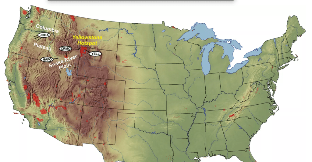
The Yellowstone Hotspot is said to currently lie under the Yellowstone Caldera.
The Yellowstone Caldera is called a “supervolcano,” and measures 43- by 28-miles, or 70- by 45- kilometers.
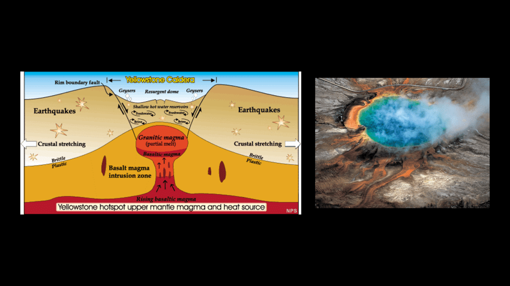
We are told that over the last 16.5-million years, the Yellowstone hotspot has generated explosive eruptions, leading to flows of basaltic lava and the creation of other calderas, with the most recent occurring 640, 000-years-ago, though scientists have expressed fear for its potential to create another cataclysmic event.
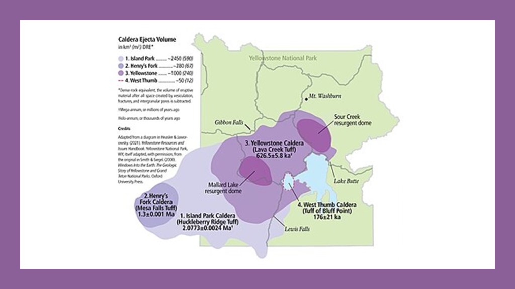
What we are taught about “hotspots” is that they are a region of Earth’s mantle where magma arises from deep within the Earth and forms volcanoes on the crust above.
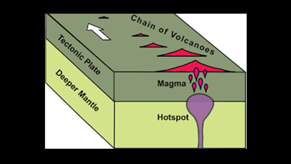
“Hotspot Tracks,” or “Trails,” are said to be chains of volcanoes that are formed when a tectonic plate moves over a stationary plume of hot mantle material, or hotspot, deep within the Earth’s crust.
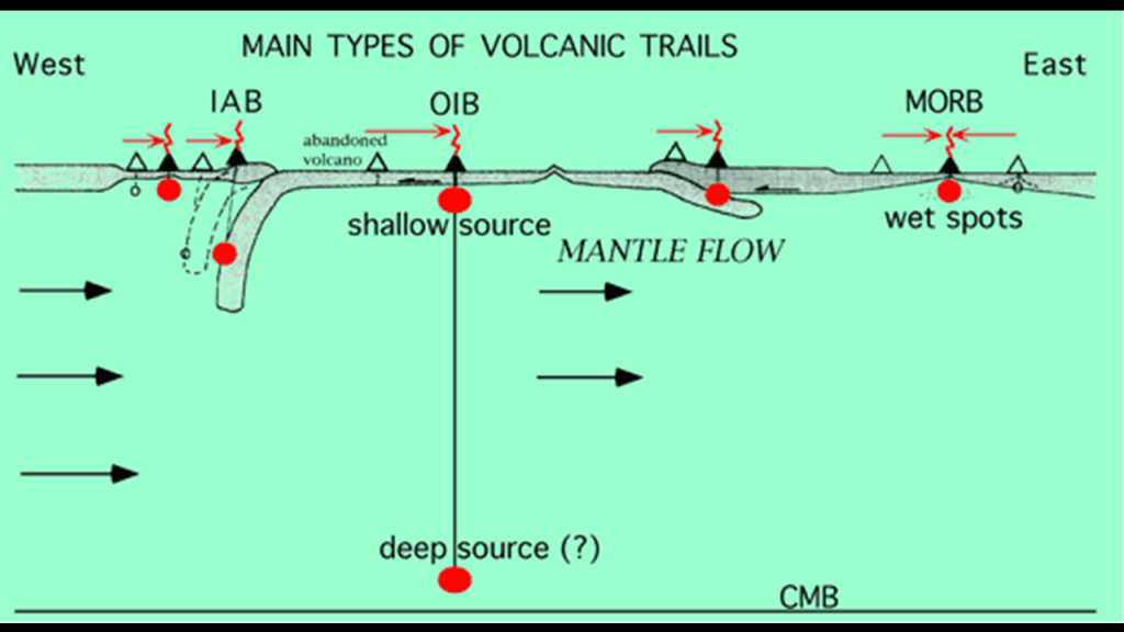
This is the Yellowstone Hotspot Track, going in a southwesterly direction from the Yellowstone Caldera, across the previously-seen Snake River Plain and Craters of the Moon National Monument.
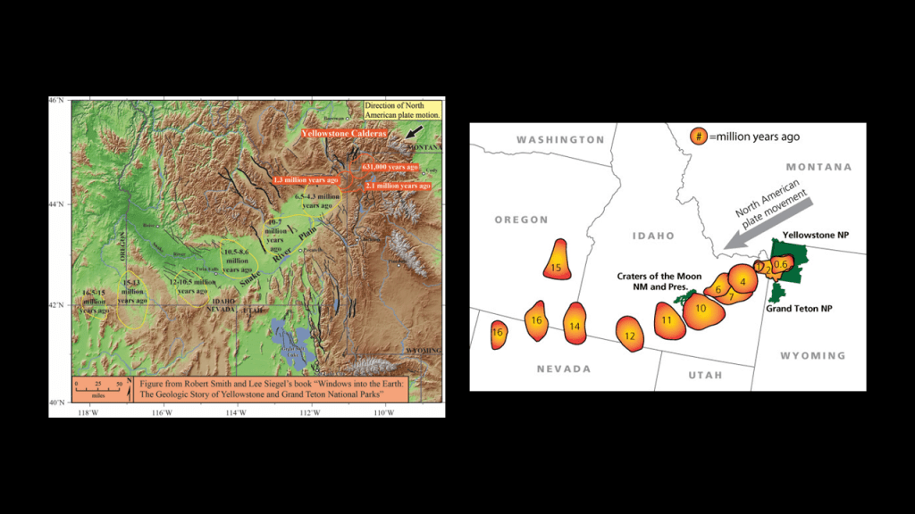
As I mentioned previously, I first encountered “hotspots” and “hotspot tracks” not long ago when I was looking in the North Atlantic Ocean and the Indian Ocean.
First, the North Atlantic Ocean.
The New England Seamounts, along with the neighboring Corner Rise Seamounts, are part of what is called the New England Hotspot, located underneath New England.
What we are told is that these seamounts were formed when the North American Plate moved over the New England Hotspot 75-million years ago.
The New England Seamounts are described as a chain of twenty underwater extinct volcanic mountains known as “seamounts.”
A “seamount” is a large, submarine landform that rises from the ocean floor without reaching the surface of the water.
They are defined by oceanographers as independent features typically formed from extinct volcanoes that rise abruptly from the sea-floor from 3,300-to-13,100-feet, or 1,000-to-4,000-meters, in height.
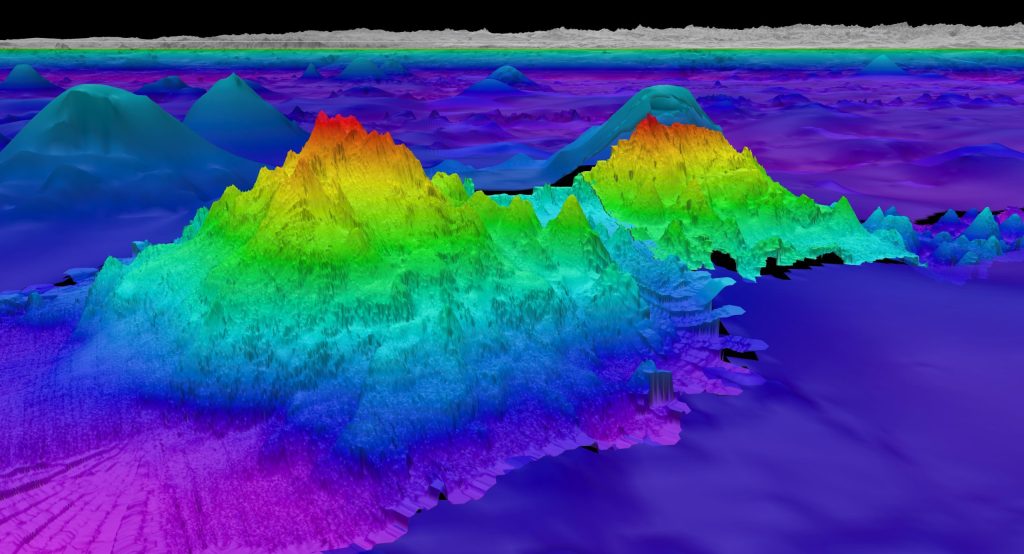
Guyots are seamounts with a flat-surface on top that we are told was created by such things wave action over a long period of time.
So, for example, the Bear Seamount, part of the New England Seamount chain is an example of a “guyot.”
It is shown here next to Physalia Seamount.
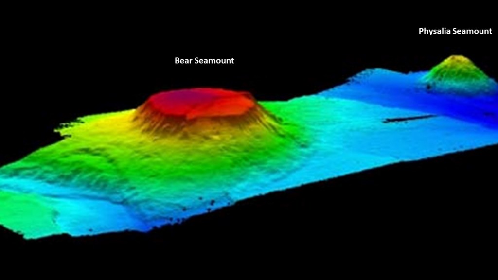
It is interesting to note that these seamounts, described as large, submarine landforms that rise abruptly from the ocean floor and independent features typically formed from extinct volcanoes sounds very similar to the definition of “Monadnocks,” which are found on land.
This translates to a “hard, metamorphic rock that was originally pure quartz sandstone that is an isolated rock hill, knob, ridge, or small mountain that rises abruptly from a gently sloping or virtually level surrounding plain.”
Here are some other examples of places classified as “Monadnocks.”
Pilot Mountain in North Carolina on the top left; Harteigen in Norway is seen on the top right; Devil’s Tower in Wyoming on the bottom left; and Cooroora in Australia on the bottom right.
But what if “Monadnock,” for one example, is a word used to cover-up gigantic tree stumps?

Here are some examples of giant trees and stumps that are identified as such.
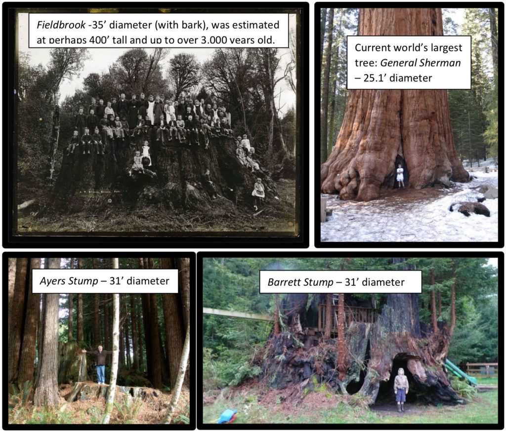
In this comparison, we have the Devil’s Tower from another angle on the left; the Jugurtha Tableland in Tunisia in the middle; and the Hammam Damt volcano in Yemen looking very tree-stumpish!
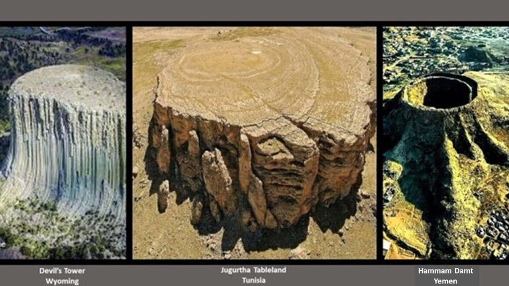
Now compare these three with the Bear Seamount on the right.

Next, I found the Reunion Hotspot and Hotspot Track in the Indian Ocean.
This is an illustration of the postulated track of the Reunion Hotspot Track, from its present site at the still-active Piton de la Fornaise volcano on Reunion Island to the Deccan Traps in India, and goes acorss numerous volcanic island chains.
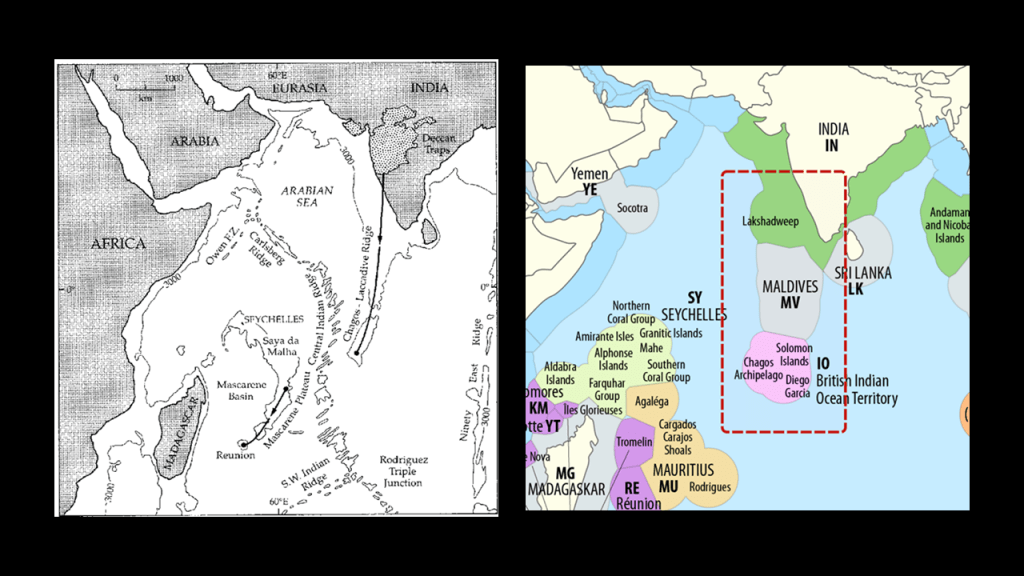
Like the Columbia River Flood Basalts, the Deccan Traps in the region of west-central India is described as a large-igneous province consisting of layers of flood basalts, and said to have been formed around 65-million-years ago from the still-active Reunion Hotspot.
The Deccan Traps are on the Deccan Plateau, and the Deccan Plateau is the location of Hampi, known as the “Lost City of Asia,” and home to a large number of palaces, temples, structures, and ruins, and considered to be the largest open monument in the world.
The Piton de la Fornaise volcano on Reunion island, the present site of the Reunion Hotspot, is one of two main volcanoes there.
Piton de la Fornaise, or Piton “of the Furnace,” is described as a very active shield volcano on the southeastern end of the island, one of the most active in the world, along with Kilauea in the Hawaiian Islands; Mount Etna in Sicily and Mount Stromboli on an island off the coast of Sicily; and Mount Erebus in Antarctica.
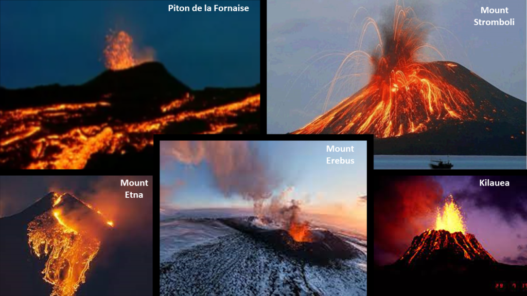
Piton des Neiges, or Snow Peak, on the northwestern end of Reunion Island is the highest point on the island, as well as considered to be the highest point in the Indian Ocean.
According to what we have been told, unlike its neighbor volcano on the island to the southeast of it, it has not been active for 20,000-years.
All of these examples lead me to ask this question.
What if the Yellowstone Hotspot Track in the Pacific Northwest; the New England Hotspot Track and Seamounts in the North Atlantic Ocean; and the Reunion Hotspot Track and volcanic islands in the Indian Ocean are representative of a once-existing world-wide system of ancient Giant Trees that were connected to each other by magma streams and hydrothermal systems on the Earth’s Energy Grid System?
But is there any evidence to support that belief?
It’s circumstantial evidence only, but certainly quite suggestive of this possibility.
First, I can’t help but wonder if the Athanasius Kircher illustration on the left and the imaging map of the Earth’s hotspots on the right are connected.
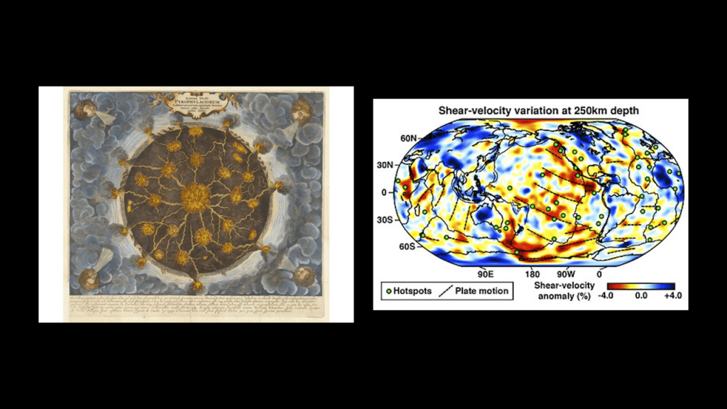
Here is another map diagramming the Earth’s hotspots on the bottom, and on the top is a map of showing the consistent pattern of western countries claiming these small islands and island groups in remote locations as their colonies or territories. and upon closer examination, it appears they were making a concerted effort to claim for their own purposes what was left of these giant trees in what I believe was a recently- post-cataclysmic-world as I have already mentioned.
Not only that, a lot of these islands and groups are the subject of long-standing, on-going disputes between countries.
Why?
I have looked into this subject in-depth in my blog post “What is it Exactly About the World’s Disputed Islands?”
It is important to note here that the previously-mentioned Prussian naturalist and explorer Alexander von Humboldt was considered one of the founders of the science of geomagnetism, having studied in great detail the systematic change of magnetic field strength with distance from the equator and initiated synchronized magnetic field observations across the Earth, and he made significant contributions to the charting of the Earth’s geomagnetic field.
In this world map of his, von Humboldt measured “isodynams” between 1790 and 1830.”
The prefix “iso-” means “equal, like, or similar” and the definition of isodynam, or isodynamic, is connecting points on the Earth’s surface that connects points of equal horizontal magnetic intensity
Was Humboldt measuring and mapping ancient giant tree locations?
I think so.
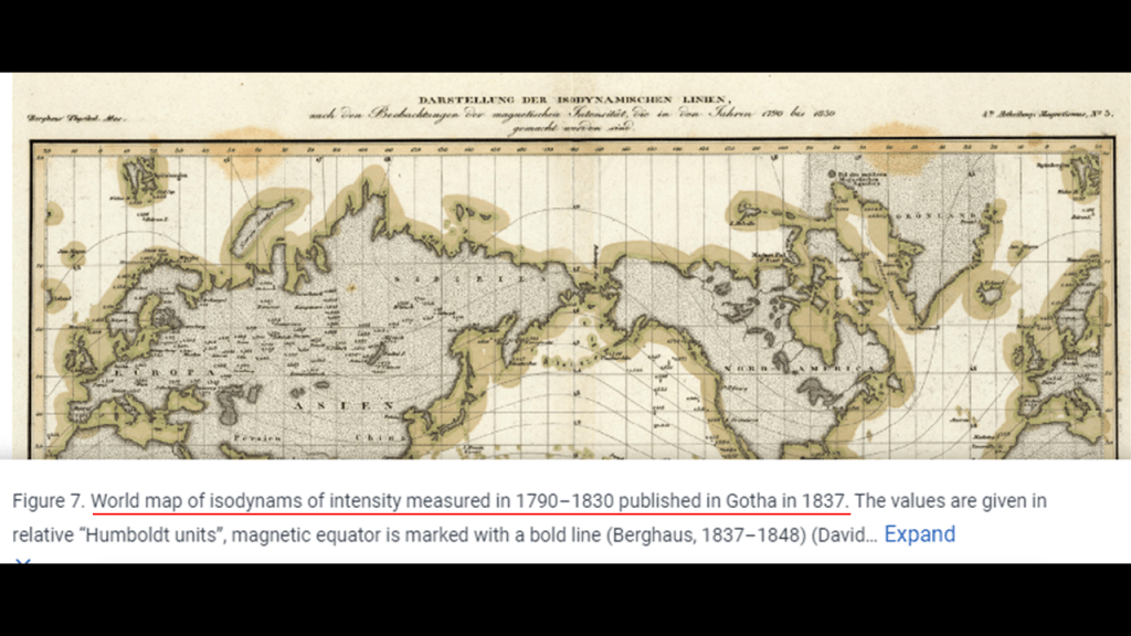
It is my belief that the ancient giant trees were generating the magnetic field of the Earth on a plane, and not the “geodynamo” process that is accepted by mainstream science connected to the spin of the Earth on an axis.

Is this the reason why volcanoes and seamounts are on Airline flight trackers – for navigational purposes and not for entertainment alone?
I recently found a mountain in Mexico associated with magnetic declination just outside of Teotihuacan on an alignment I am currently researching.
The town of San Luis Tecuautitlan is located in altitude at 2,450-meters, or 8,038-feet on Cerro Gordo-Tonantépetl.
Cerro Gordo means “Fat Hill,” and has that giant tree stump-looking appearance.
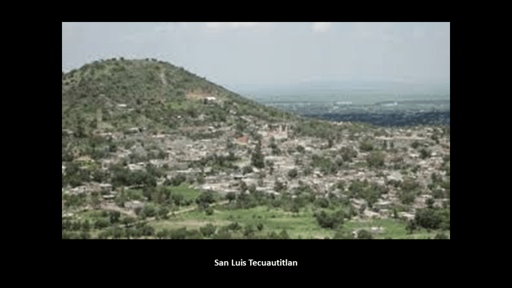
I found this map when I typed in “San Luis Tecuautitlan” to look for information on it, and it was in a link about the magnetic declination there.
“Magnetic Declination,’ also known as “Magnetic Variation,” is the angle between true north and magnetic north at a specific location on Earth, and this is important because it is needed to determine true north and affects the accuracy of navigational tools.
Then, there’s the fabled “Rupes Nigra,” or “Black Rock,” to consider as a giant tree stump.
In a nutshell, the “Rupes Nigra” was believed to be an enormous mountain of magnetic stone located at the magnetic North Pole, and 33-miles, or 53-kilometers, -wide, and explained why compasses always pointed north.
This is known as the 1595 Arctic Map of Gerardus Mercator, and was published after his death in 1594 by his son.
But the “Rupes Nigra” also comes down to us as a phantom island, defined as an island that existed on maps for a period of time but was found later not to exist.
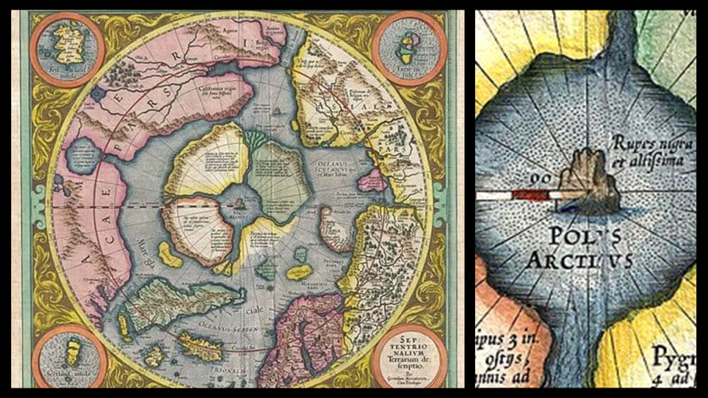
Here are some data points to consider in search of support that is available to find for this belief.
First, a look at magnetic and gravity anomalies in the context of geomagnetism.
A magnetic anomaly is defined as a variation in the Earth’s magnetic field that can be detected and measured, and attributed to geologic features that enhance or depress the local magnetic field, like, for example, the magnetism in volcanic rocks which contain iron-bearing minerals that align themselves with the Earth’s magnetic field as they cool.
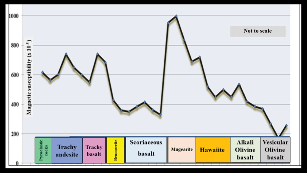
A gravity anomaly is defined as a difference between the locally-observed and theoretically-calculated value of gravity that reflects local variations in the density of rocks, and are correlated with density variations in the Earth’s mantle densities.
.
We are explicitly taught by modern science that magnetism and gravity are not related.
But perhaps there is a direct connection between magnetism and gravity that is denied by mainstream science in order to support the accepted paradigm.

In summary, I have come to the conclusion that 1) There is much to question in the official history and science that has come down to us as unquestionable truths.
And as the Freemason Napoleon is famously attributed as saying, “History is a set of lies agreed upon.”
A set of lies most likely agreed upon by Freemasons and Jesuits and other major players behind what has taken place here.

And 2) that the original civilization of the Earth was nothing like what we have been taught, and though the clues and evidence for the original civilization are everywhere, we just don’t recognize them as such because we have no points of reference for them.

Truths are told to us as fiction and hidden away in classic literature, like in Jules Verne’s classic science fiction novel “Journey to the Center of the Earth” that first published in 1864, which would have been right before the end of the American Civil War.
In this book, an eccentric German scientist believes there are volcanic tubes that reach to the very center of the Earth, so he, his nephew, and their Icelandic guide journey into Iceland’s celebrated inactive stratovolcano Snaefellsjokull, contend with many dangers inside the Earth, and eventually the three explorers are spewed back to the surface by the active stratovolcano Stromboli in southern Italy.
I wonder where he got that idea from?
Interesting to note that Jules Verne is another one of those celebrated historical figures for which there is no explicit connection to Freemasonry, but his writings indicate a connection somewhere along the way.

We’ve been lied to so badly about our history that we can’t even imagine how beautiful, advanced, and integrated it once was, and not that long ago, like what we see in the background of the portrait of Queen Elizabeth II and Prince Phillip from 1953.
And guess who else was a Freemason?
They show up in a lot of high places!
It was beautiful and harmonious and every thing in it was placed precisely for a reason in a perfectly-tuned scientific and musical instrument in an energy grid that was part of a worldwide free energy generating system.
This energy grid and advanced civilization was destroyed unbeknownst to us because it was removed from our history, and replaced with a very cruel, resource and energy harvesting system and occulted timeline that benefited the few and has caused untold misery and unimaginable suffering for all life on Earth.
We have been so deceived that we don’t even know we’ve been deceived!
And the deceivers have even convinced us to worship them!

Towards the end-goal of deceiving us completely, we’ve been given a false narrative to explain how everything came into existence…

…false science to completely fool us as to the nature of this reality…

….an economic and legal system that has unknowingly enslaved us all…

…and our educational system has been functioning as an indoctrination system, and worse, in the case of residential and boarding schools where sexual abuse and genocide regularly occur.
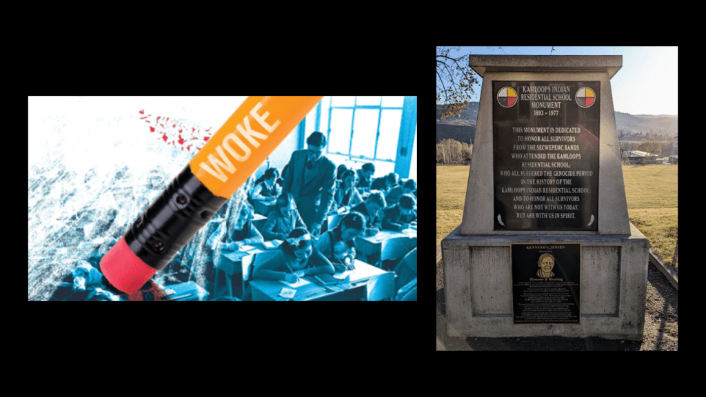
Many people have been conditioned to want to watch scary movie and television “programming” that uses the Old World to perpetuate this collective trauma, like filming “The Shining” at the Timberline Lodge and the use of Snoqualmie Falls as a setting for Twin Peaks, or watch paranormal reality shows that feature places of unimaginable suffering, like the haunted “St. Ignatius Hospital” in Colfax, Washington, or even visit them in person.
They have somehow gotten us not only to want our trauma, but even pay for it to experience it!

I am going to end here with these thoughts.
I am of the firm belief that this is not our future but there is a lot of evidence in what I am sharing here that there are more questions than answers to be found in everything we have been taught about the world we live in.
The Pacific Northwest has ample examples of the discrepancies, inconsistencies, and dubious goings-on in our historical narrative.
My findings, and interpretations of them, that I have shared in this post are based on several years worth of researching places, people, and our historical timeline.
But no matter what happened here and how it happened, the Truth about our world has been deliberately removed from our collective awareness so we would not know it in order to exploit and control us for the benefit of the very few.