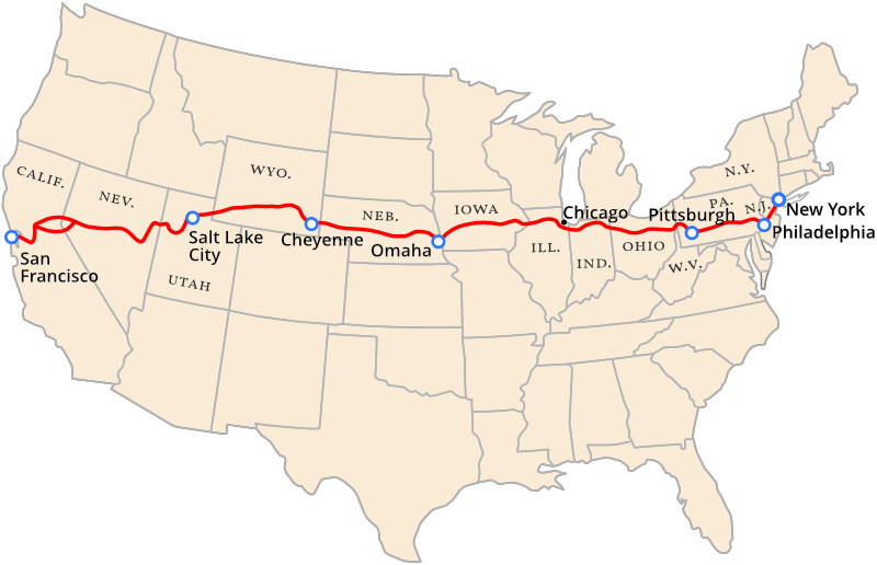
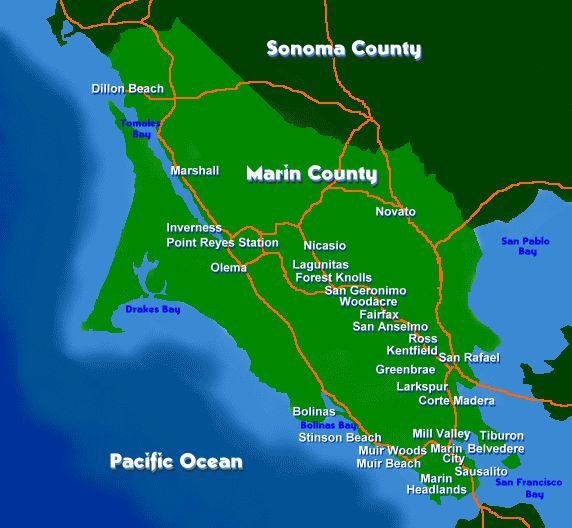
I had originally planned to compile the extensive amount of research that I have done in the past on Boston and the surrounding area in Massachusetts for this post because it is a great case study in what has taken place during the reset of our history.
It quickly turned into something much larger because Boston and the surrounding area played a huge role in the English colonization and plantation of the New World, first with the establishment of the Plymouth Colony in 1620 and then the Massachusetts Bay Colony in 1630.
There is so much more to this story, and a deep dive into the background of what was going on in our historical narrative reveals the means by which the New World, the world we have been living in and have come to know as real, was planted on top of the Old World, and how this was accomplished and when.

First, some history on the colonization of North America with regards to the founding of English colonies in the New World according to what we are told in our historical narrative.
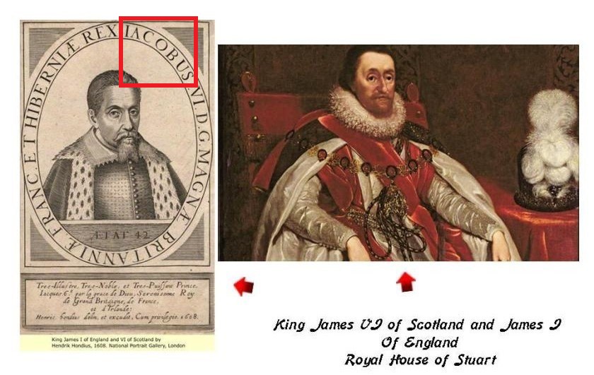
The accession of King James VI of Scotland as King James I of England and Ireland took place on March 24th of 1603, the day that Queen Elizabeth I of England died childless.
The “Union of the Crowns” was dynastic, meaning that the laws and interests of the two countries remained separate and distinct at this time.
The reign of King James VI of Scotland and I of England was a period known to history as the Jacobean-era, a term also used to describe the architecture, arts and literature of this time period.
It is my belief after extensive research that the historical personage we know as King James of Scotland and England was a fictional character under whose name the New World Order agenda of plantation and colonization was rolled-out, but I believe that the fictional King James of the House of Stuart was in fact based on a real person of an ancient royal Scottish lineage of Kings tracing back to King Solomon.
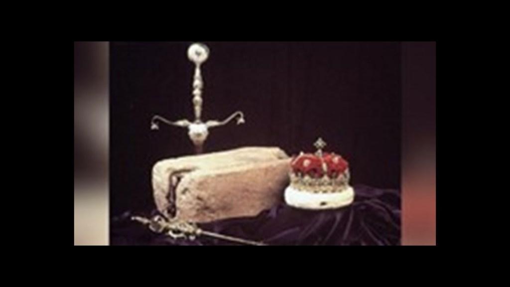
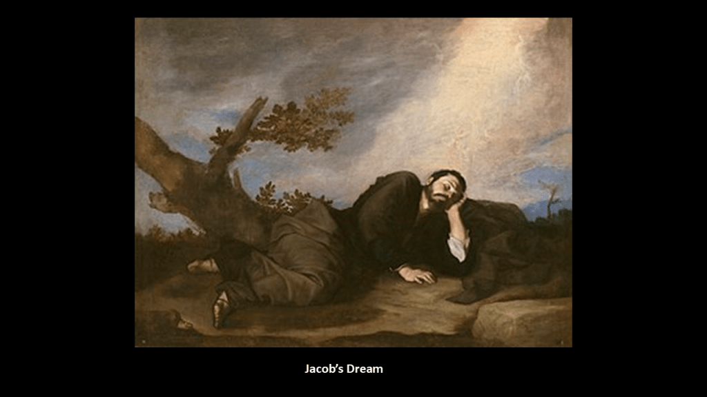
The Stone of Scone, also known as the “Stone of Destiny” and “Jacob’s Pillow Stone,” is an ancient symbol of Scottish Sovereignty, used for centuries in the coronation of Scottish monarchs, and since 1707 in the coronation of British monarchs.
When not being used for the coronation ceremonies of British monarchs at Westminster Abbey in London, it is kept on display in the Crown Room at Edinburgh Castle, alongside the crown jewels.
Jacob was the son of Isaac and grandson of Abraham, and later received the name Israel.
The Tribes of Israel came into existence through his sons, and King Solomon was descended through the lineage of Jacob’s fourth-son, Judah.
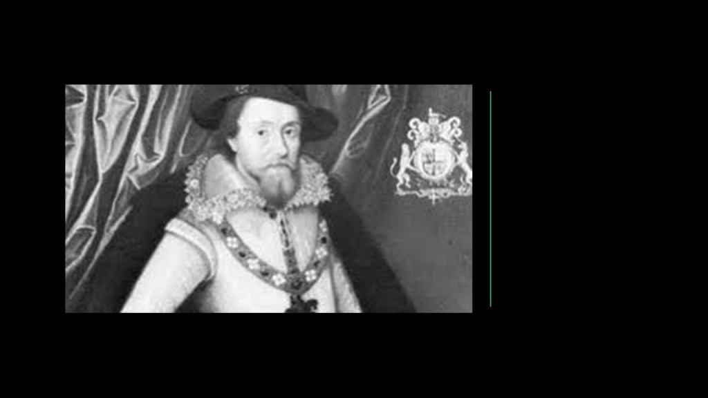
These portraits of King James are both in existence.
The portrait of King James on the left contains in it the inscription “Jacobus.”
The portrait on the right is the far more common portrayal of him.
We are told the word plantation first started appearing in the late 1500s to describe the process of colonization.
The Plantation of Ulster began privately in 1606 shortly after the Union of the Crowns under King James in 1603, and began officially in 1609 by the Scottish Parliament.
The Plantation of Ulster was the organized colonization of a province of Ireland, by people from Scotland and England, who had a different culture, and most of the colonized land had been taken from the original Irish chiefs.
We are told the English colonization of North America began at the same time.
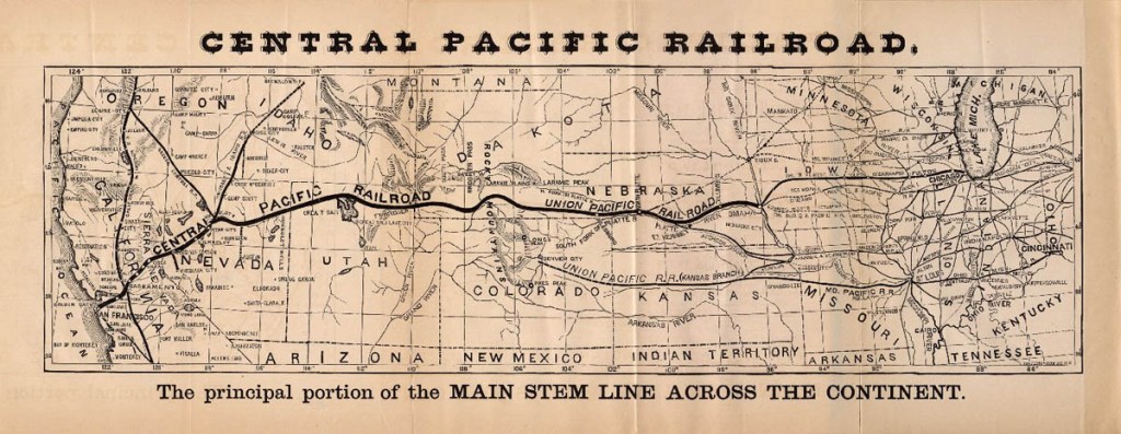
In 1606, King James VI & I also issued Royal Charters for what became known as the Virginia Company and the Virginia Company of Plymouth, with the objective of raising funds from investors in order to colonize the eastern coast of America.
This graphic breaks-down the types of colonies after a royal charter has been granted.
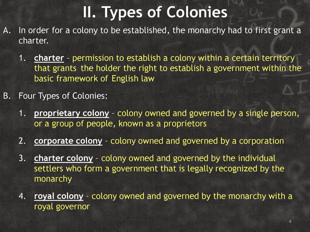
A royal charter is a formal grant issued by a monarch under “royal prerogative” as “letters patent.”
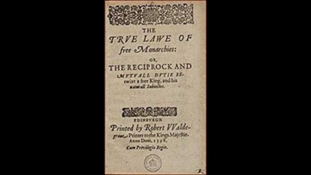
We are told that King James authored the “True Law of Free Monarchies” around 1597 and 1598, where he stated there is a theological basis for monarchy and in which he sets out the “Divine Right of Kings” as a political and religious doctrine of the legitimacy of a monarchy.
He also proposed an absolutist monarchy by which a king may impose new laws by “royal prerogative,” a body of customary authority, privilege and immunity recognized in common and civil law jurisdictions within a monarchy as belonging to the sovereign that becomes widely vested in government.
“Letters patent” are a type of legal instrument in the form of a published, written order issued by a monarch or other head-of-state, granting an office, right, monopoly, title or status to a person or corporation.
Thus, they can be used for the creation of corporations or government offices, or for granting city status or a coat-of-arms.
Since the 1300s in our historical narrative, royal charters have been used to grant a right or power to an individual or “body corporate,”the formal term for a corporation.
A “body corporate” functions as a “legal person” in law that can do the things a human person is usually able to do but are not literal people.

A “chartered company” is an association with investors and shareholders that is “incorporated,” or formed into a new corporation, and granted rights for the purposes of trade, exploration, or colonization.
Until the 19th-Century, royal charters were the only means that a company could become incorporated, other than by an Act of Parliament.

The Council for New England was also said to have been established by a Royal Charter from King James as an English joint-stock company in order to to found colonial settlements between 1620 and 1635.

The Council for New England Charter provided for the establishment of colonies on land between 34-degrees N and 44-degrees N, becoming the Plymouth Colony, the Massachusetts Bay Colony, the Province of New Hampshire, the New Haven Colony, and the Province of Maine and to be managed by landed gentry.

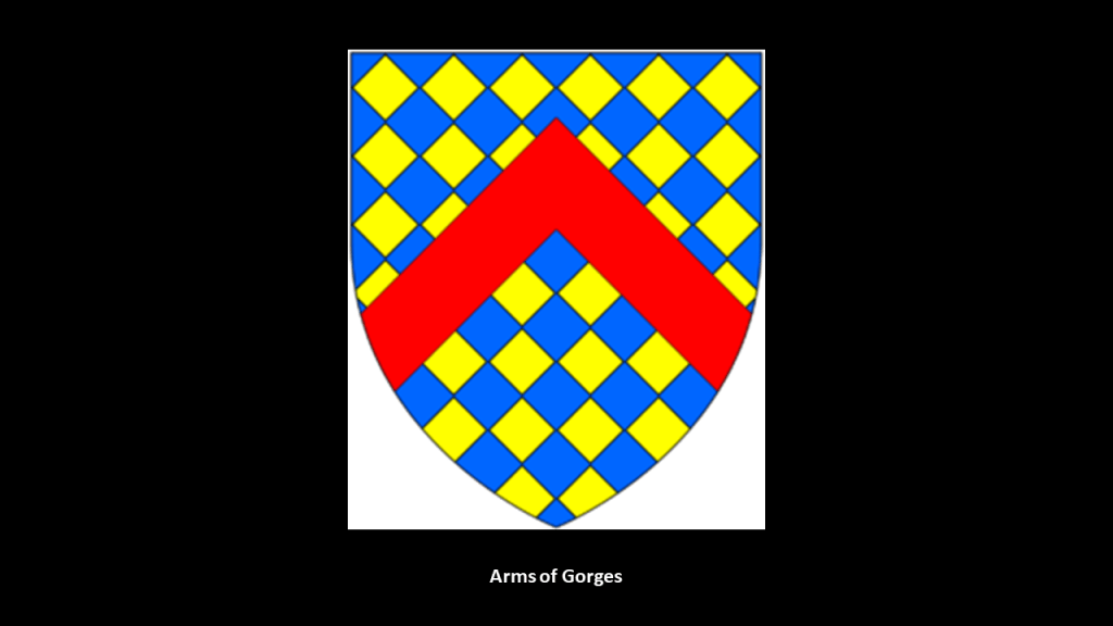
The Council for New England was largely the creation of Sir Ferdinando Gorges, a military commander and Governor of the Port of Plymouth in England who was called the “Father of English Colonization in North America,” and a member & beneficiary of the Council for New England.
Gorges first became involved in colonization efforts in 1607, when he became a shareholder in the Plymouth Company, and helped to establish the short-lived Popham Colony in Maine in 1607, the same year the much-longer-lasting Jamestown Colony was established in Virginia.
He later received a land-patent in 1622 from the Council of New England for the Province of Maine, and was influential in the early settlement of Maine.

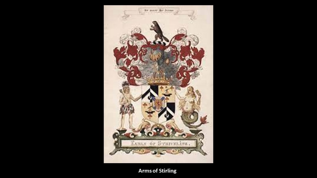
Another member and beneficiary of the Council of New England was William Alexander, the 1st Earl of Stirling.
The Earl of Stirling was a title in the Scottish Peerage that was created by King Charles I, the son of King James, on June 14th of 1633 for William Alexander, 1st Viscount of Stirling.
William Alexander had been granted a Royal Charter by King James in 1621, which appointed him Mayor of a large territory in Nova Scotia , which was enlarged into a lordship and barony of modern-day Nova Scotia, New Brunswick, and parts of the northern United States.
The Baronetage of Nova Scotia was formed in 1625 by King James as a means to settle the “plantation” of Nova Scotia by creating 100 baronets who in turn would support six colonists for two-years for a certain amount of money, and pay William Alexander a certain amount as the charter holder.
This region was contested with the French, and was returned to France by Treaty in 1632.
Though the region was lost to Great Britain for awhile, William Alexander’s settlement in Nova Scotia at Charles Fort, later Port Royal, provided the basis for Scottish claims to Nova Scotia.
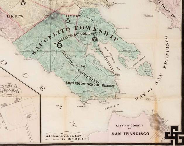
So for an example from New England of how this set-up with the Council for New England worked, the Elizabeth Islands, a small chain of islands off the southern coast of Cape Cod, were formally laid claim to and settled by colonizers in the name of the British Crown in 1641, and named for Queen Elizabeth I.
That same year, in 1641, Thomas Mayhew the Elder of Watertown, Massachusetts bought the Elizabeth Islands – along with Martha’s Vineyard and Nantucket – from the Earl of Stirling, William Alexander, and Sir Ferdinando Gorges.
All of the Elizabeth Islands today, with the exception of Cuttyhunk and Penikese…
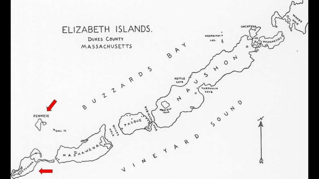
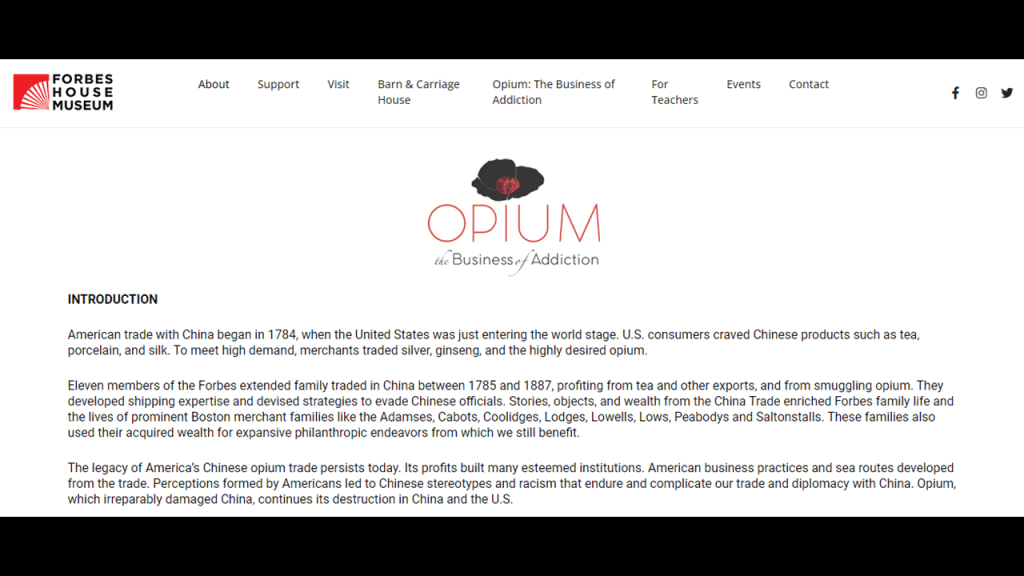
…are privately-owned by the Forbes family, a wealthy American family of Scottish descent long prominent in Boston.

The Forbes family’s original fortune came largely from trading opium and tea between North America and China in the 19th-century.
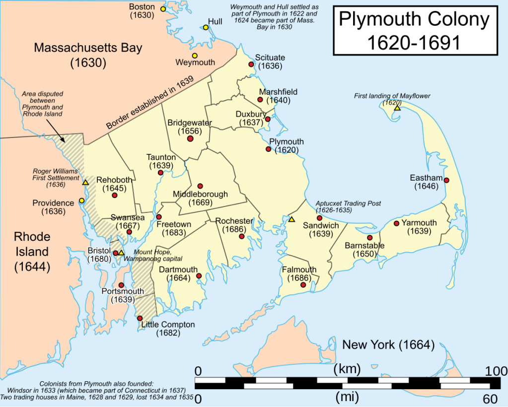
The first permanent colony in New England was Plymouth Colony, which at its height occupied most of the southeastern portion of Massachusetts.
The people known as Pilgrims and events surrounding the founding of the Plymouth Colony are celebrated every year as Thanksgiving in the United States.
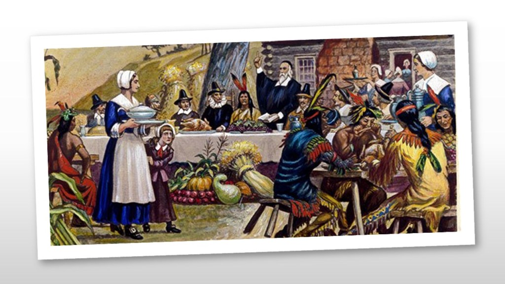
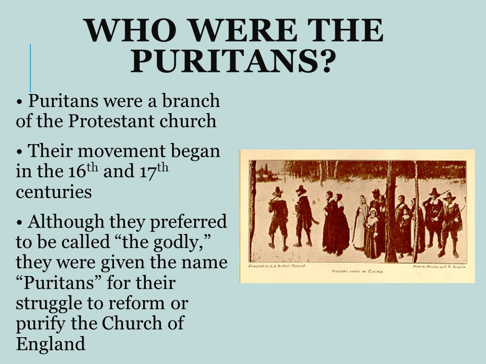
The story that we are told in our historical narrative is that the Pilgrims were Puritan Separatists who came to the New World so they could worship according to their own beliefs without persecution.
Puritans were English Protestants who wanted to “purify” the Church of England of remaining Roman Catholic practices, as it had not fully-reformed, and was not Protestant “enough.”
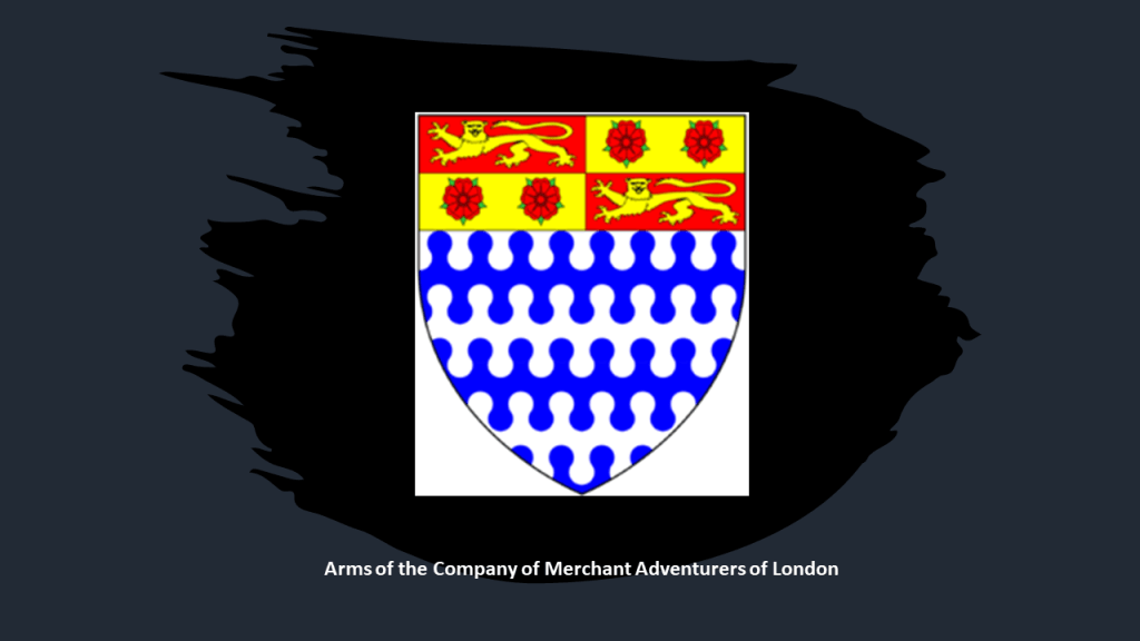
We are told that the Puritan Congregation that settled the Plymouth Colony had obtained a land patent from the Virginia Company of Plymouth in June of 1619, and they sought to finance their venture through a group of businessmen known as the Merchant Adventurers, who viewed the new colony as a way to make a profit.
Officially known as the Company of Merchant Adventurers of London, it had been founded in the City of London in the early 15th-century, and its main export was cloth, especially undyed broadcloth in exchange for a large range of foreign goods.
More on cloth to come.
Cloth was a silent player in the unfolding of what has taken place here.
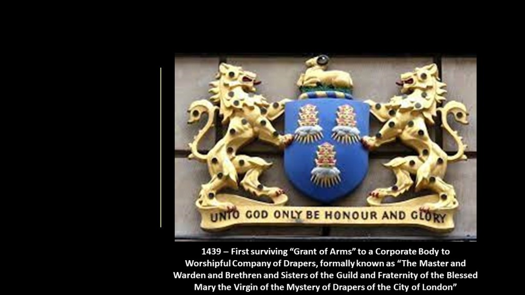
The use of Arms went from individuals to corporate bodies starting in 1438 with a Royal Charter of incorporation for the “Worshipful Company of Drapers.”
Drapers were retailers or wholesalers of cloth used mainly for clothing.
Funding obtained from the Merchant Adventurers paid for provisions and passage of members of the Congregation on the Mayflower living in England, and on the Speedwell for those living in the Netherlands, incurring a debt which needed to be repaid.
The Merchant Adventurers had also recruited a group of people known as “The Strangers” to assist the Pilgrim colonists, known as “Saints” as needed, like merchants, skilled labor, indentured servants, and several young orphans.
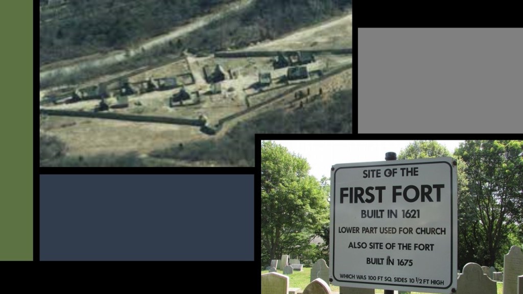
One of the “Strangers” was Myles Standish, the Military leader of the Plymouth Colony, and was officially designated as the captain of the colony’s militia in February of 1621, shortly after the Mayflower arrived in December of 1620.
Standish led several exploratory expeditions of Cape Cod, as well as military raids on “Indian Villages.”
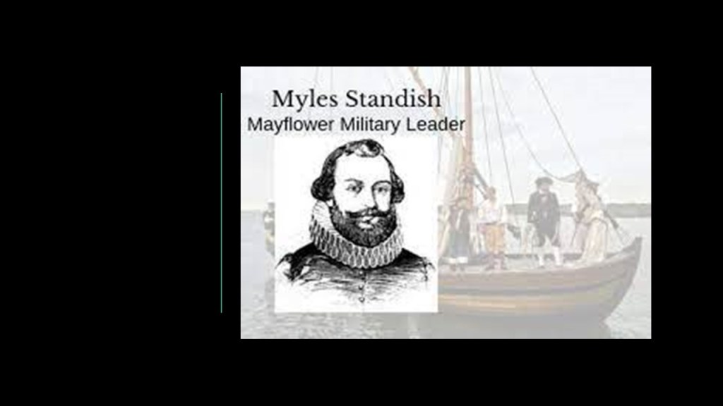
Standish was credited with the design of the defensive lay-out of the Pilgrims first settlement, known as the Plymouth Fort.
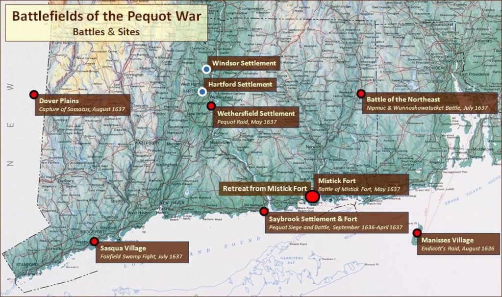
The Pequot War of 1637 was the first major war in New England, and originated in 1632 with a dispute between Dutch fur traders and Plymouth officials over control of the Connecticut River Valley, with representatives of the Dutch East India Company and the Plymouth Colony claiming they had deeds showing they had rightfully purchased the land from the indigenous Pequots.
This led to a rush of English settlers to the area to beat the Dutch to it, and this led to retaliation by the Pequots and the initiation of hostilities between 1636 and 1638, and eliminated the Pequots as a viable political entity.
The other major conflict between colonists and the indigenous people of the region, was King Philip’s War, the fighting during which took place between 1675 and 1676.
Metacomet, also known as King Philip, was the younger son of the Wampanoag sachem Massasoit.
Massasoit had maintained a long-standing alliance with the colonists.
After Metacomet became sachem in 1662 shortly after his father’s death, he forsook the alliance between the Wampanoags and the colonists that had been made by his father because of repeated violations by the colonists, and he led a coalition of tribes native to the region known as New England, including the Narragansetts, against the colonists starting in 1675.
By the end of the war, the Wampanoag and their Narragansett allies were almost completely destroyed, and King Philip was killed in August of 1676.
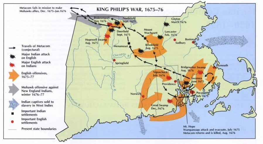
King Philip’s War was said to have officially ended with the signing of the Treaty of Casco in 1678 in the most northern part of New England, between the Wabanaki Confederacy and the English Settlers.
There are no existing copies of the treaty or its proceedings, however, so historians use a summary of clergyman and historian Jeremiah Belknap in his 1784 “History of New Hampshire.”

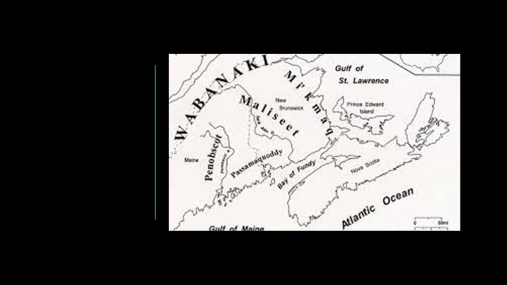
The Wabanaki Confederacy consisted of the four principal Algonquin nations of the Mi’kmaq, Maliseet, Passamaquoddy, and Penobscot of present-day Nova Scotia, New Brunswick, Prince Edward Island, Quebec, and Newfoundland in Canada, and present-day Maine, Vermont and New Hampshire in the United States.
The Plymouth Colony was ultimately merged with the Massachusetts Bay Colony in 1691, and along with other territories, formed the Province of Massachusetts Bay.
John Winthrop was an important figure during this time-period of the start of the English colonization of North America.
He was a key figure in the founding of the Massachusetts Bay Colony, and I did extensive research about him when I found him representing the State of Massachusetts in the National Statuary Hall at the U. S. Capitol Building in Washington, DC.
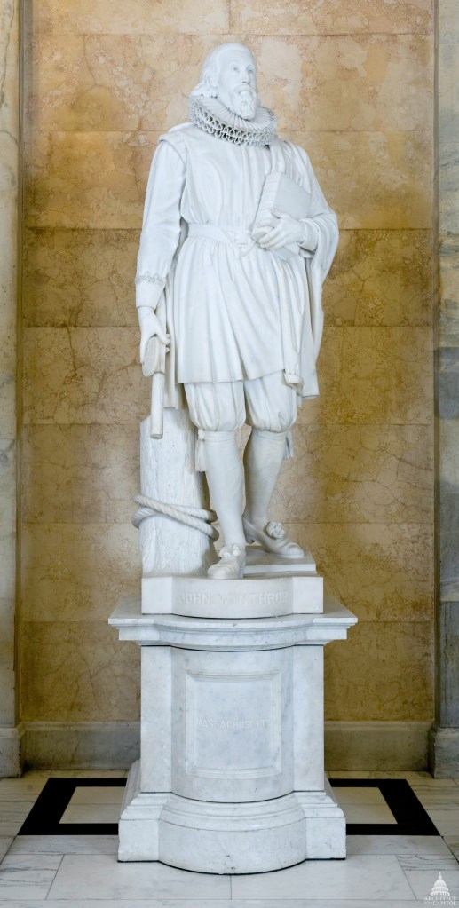
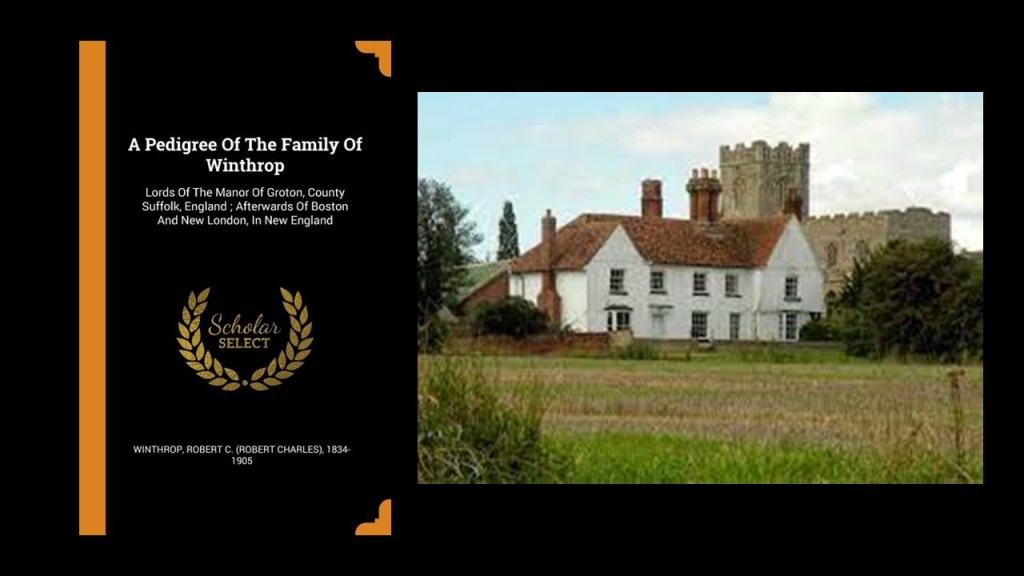
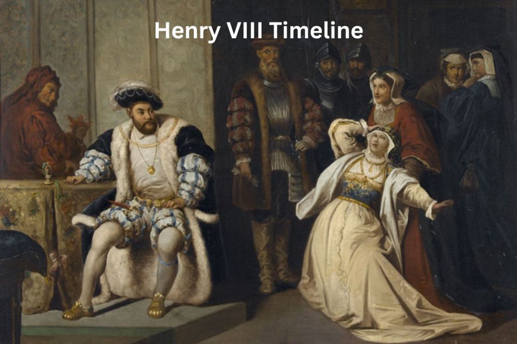
The future Puritan leader John Winthrop was born in January of either 1587 or 1588 in Suffolk, England, to a prosperous, land-owning family.
The Winthrop family was granted Groton Manor after the Dissolution of the Monasteries that took place in English history between 1536 and 1541 during the reign of King Henry VIII , as the Lord of the Groton Manor had previously been the Abbot of the Bury St. Edmunds Abbey, and John’s parents moved in when he was young.
In 1613, Winthrop’s father transferred the family holdings in Groton to him, and he became Lord of the Manor at Groton, the landholder of a rural estate, enjoying manorial rights.
The Dissolution of the Monasteries took place between 1536 and 1541, in which King Henry VIII disbanded the approximately 850 monasteries, convents and friaries in England, and leaving none.
Their income was taken and assets disposed of, and in many cases, like that of Glastonbury Abbey, the buildings on the property were left in ruins.

The Winthrop Coat of Arms was confirmed to John’s uncle by the College of Arms in 1592.
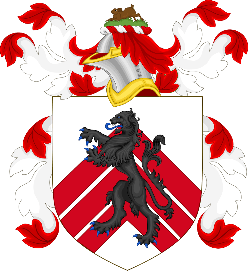
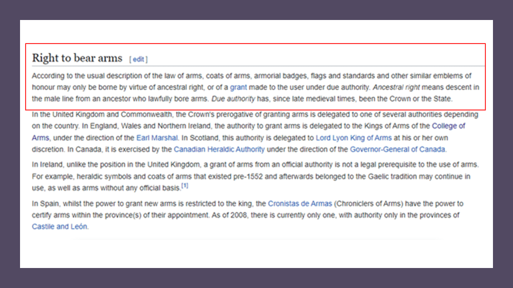
“The Laws of Heraldic Arms” govern the ‘bearing of arms,’ which is the possession, use or display of arms, also called “Coats-of-Arms” and “armorial bearings.”
According to the “Law of Heraldic Arms,” “Coats-of-Arms” and other similar emblems may only be borne by 1) ancestral right, or descent from an ancestry through the male line; 2) or a grant made to the user under due authority, like the State or the Crown.
With regards to the “Law of Arms” as part of the general law, such armorial bearings are considered a form of property, and confer certain rights upon the grantee.
The College of Arms was said to have been first incorporated as a Royal Corporation in March of 1484 under King Richard III, and then re-incorporated in 1555 under Queen Mary I of England.
Heralds are appointed by the British Monarch and delegated to act on behalf of the Crown on all matters of heraldry, besides the granting of new Coats-of-Arms, including genealogical research and the granting of pedigrees.
During King Henry VIII’s reign, it was said that the College of Arms “…at no time since its establishment, was the college in higher estimation, nor in fuller employment, than in this reign.”
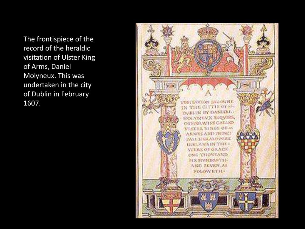
In 1530, King Henry VIII conferred the duty of “heraldic visitation” on the College, that of tours of inspection between 1530 and 1688 around England, Wales, and Ireland to register and regulate the Coats of Arms of Nobility, gentry and boroughs, and to record pedigrees.
During the time of the Dissolution of the Monasteries between 1536 and 1541, this duty gained even more importance as the Monasteries were formerly the repositories of local genealogical records, and from then on, the College was responsible for the recording and maintenance of genealogical records.
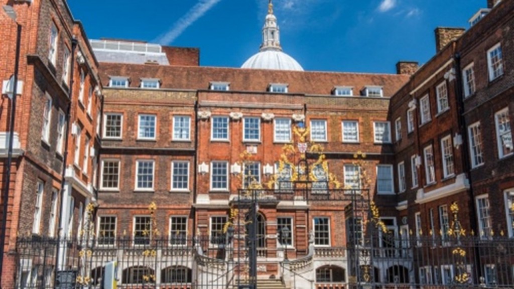
The College of Arms has been on Queen Victoria Street in the City of London in the shadow of St. Paul’s Cathedral since 1555.
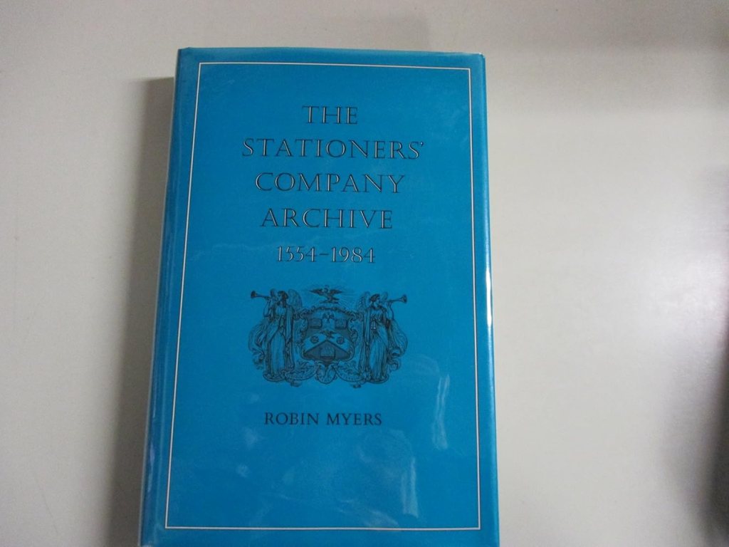
About the same time the College of Arms was housed on Queen Victoria Street in London in 1555 in our historical narrative, the Stationers’ Company Register was established as a record book for the Stationers’ Company of London, a trade guild given a royal charter in 1557 to regulate the professions of the publishing industry and an early form of copyright law.
The Stationers’ Company charter gave it the right to seize illicit editions and bar the publication of unlicensed books.
It is considered a crucial resource for the English literature of the 16th and 17th-centuries, containing “factual data” and “hard data” that is found nowhere else.
Along with the “Master of the Revels,” which relates to dramatic performance, the Stationers’ Record supplies many of the facts some scholars possess on the works of William Shakespeare, Ben Jonson, and all of their immediate predecessors, contemporaries, and successors.
All of this speaks of the documentation of the “new” everything, and the empowerment of the seizure and suppression of everything else.
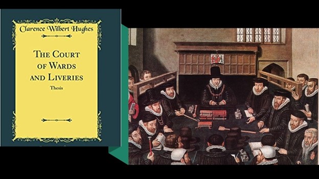
Also, at the same time the “Dissolution of the Monasteries” was going on between 1536 and 1541, the Court of Wards and Liveries was established starting in 1540 during the reign of King Henry VIII by two Acts of Parliament – the Court of Wards Act of 1540 and the Wards and Liveries Act of 1541.
It was established around the issues of practical matters relating to the Crown’s right of wardship and livery of young, orphaned heirs where their father had been a Tenant-in-Chief of the Crown, including having rights over the deceased’s estate, including income and land, so this special court also administered a system of levying and collecting feudal dues.
I find this information about the “Court of Wards and Liveries” very intriguing, with the Crown taking over the estates and rights of orphaned heirs and would love to know more about what was going on here that is not found in the historical record – who were they and how were they orphaned, and why would this be important?
And was there a connection between the English words “livery” and “delivery?”
What exactly is “livery?”
Well, if you look up the meaning, livery is an identifying design, such as a uniform, ornament, symbol, or insignia that designates ownership or affiliation.
Most often it would indicate the wearer of the livery was a servant, dependent, follower or friend of the owner of the livery.

It is interesting more to this point that definitions of the word “delivery” include 1) the transfer of something from one place or person to another; 2) the process of giving birth; and in law 3) the formal or symbolic handing over of property to a grantee or third-party – which is more descriptive of what this court was actually said to be doing in practice than the word “livery” denotes.

It is my belief that all of this activity starting with King Henry VIII conferring the duty of “heraldic visitation” on the College of Arms in 1530, and the beginning of inspections around England, Wales, and Ireland to register and regulate the Coats of Arms of Nobility, etc, and then the destruction of the former repositories of genealogical records in the “Dissolution of the Monasteries” from 1536 to 1541, was actually about replacing the original ancient nobility with a brand-new nobility, and parceling out their original holdings to new family lineages, like with the examples we have already seen of the Winthrop family, and also with William Alexander, the 1st Earl of Stirling in the Scottish Peerage that was created by King Charles I in 1633,
This issue can be considered from the perspective of earlier heraldry of British nobility that still exists in the historical record.
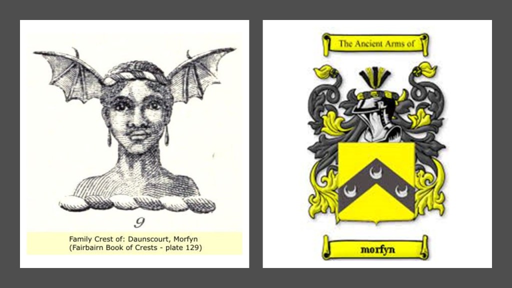
Let’s take a look at the Morfyn family crest.
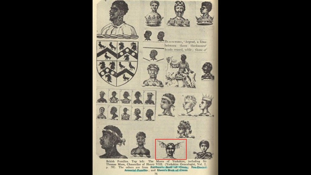
The original Morfyn family crest is on the left, in comparison with today’s Morfyn family arms on the right, and if there is a face beneath the helmet of armor at the top, it is not visible.
Like King James, I have a lot of questions about King Henry VIII’s role in the new historical narrative, and think that he may well have also been a fictional character under whose name the foundations for English involvement in the development of the New World were established.
While I believe that the fictional King James of the House of Stuart was based on a real person, I have serious doubts that King Henry VIII ever even existed and was just a fabrication, a phantom character in our narrative, of which I think there were many phantom characters and events in a fabricated chronology.
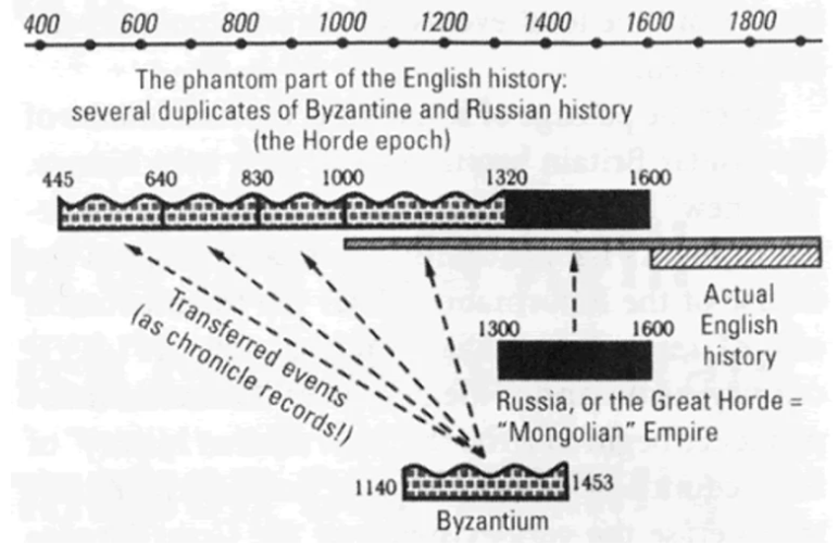
Support for thinking along these lines come from a chronology proposed by Anatoly Fomenko, a Russian mathematician, and his colleagues, Russian mathematician Gleb Novosky and Bulgarian mathematician Yordan Tabov, where they posit that events of antiquity generally attributed to the civilizations of the Roman Empire, Ancient Greece and Ancient Egypt, actually occurred during the Middle Ages, more than a thousand years later.
The theory further proposes that world history prior to 1600 AD has been widely falsified to suit the interests of a number of different conspirators including the Vatican, the Holy Roman Empire, and the Russian House of Romanov.
Of the central concepts of new chronology asserted by Fomenko and colleagues was that up to the 17th-century, historians and translators often “assigned” different dates and locations to different accounts of the same historical events, creating multiple “phantom copies” of these events, and that this chronology was largely manufactured by Joseph Justus Scaliger.
According to our narrative, in 1583, Joseph Justus Scaliger published his “Work on the Amendment of Time,” establishing the New Chronology by investigating ancient systems of determining epochs, calendars, and computations of time, and synchronizing all of ancient history in two major works, the other one being called the “Thesaurus Temporam” in 1606, the same year that the Plantation of Ulster started in Ireland and the English colonization of North America began.
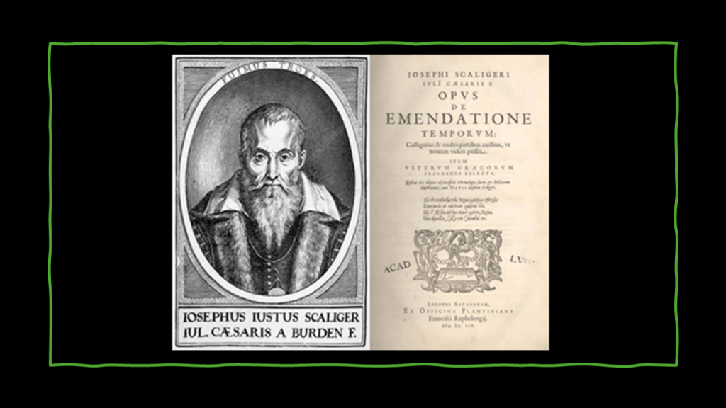
Chronology is defined as: 1) the arrangement of events or dates in the order of their occurrence; 2) a document displaying an arrangement of events in order of their occurrence; 3) the study of historical records to establish the dates of past events.

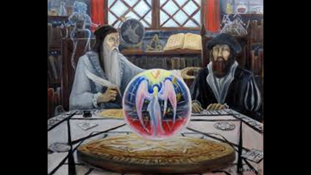
During the 1582 – 1589 time period in England, around the same time as Scaliger’s New Chronology, two occultists were said to have been involved in skrying activities that ended up bringing Fallen Angels and other negative beings into this dimensional plane.
These two men were John Dee, Queen Elizabeth I’s court astronomer and advisor, and Edward Kelley.
John Dee was considered the most learned man of his time in England and had an extensive library.
He also had in his possession a collection of mirrors and other skrying devices.
Edward Kelly was an occultist and spirit medium.
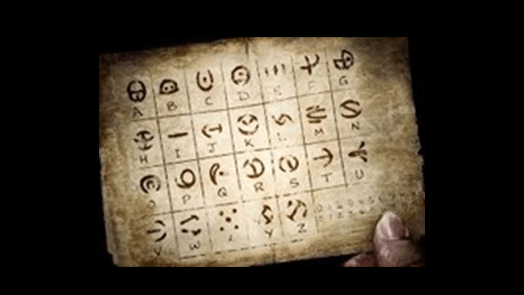
Enochian is an occult-constructed language recorded in the private journals of Dee and Kelley and described by them as angelic, as the language was received by them from these angels during their skrying sessions.
The Enochian language is central to the practice of Enochian magic, which involves the evocation and commanding of various spirits.
Sorcery is defined as the use of magic, in particular black magic, which is the use of power gained from the assistance or control of evil spirits.
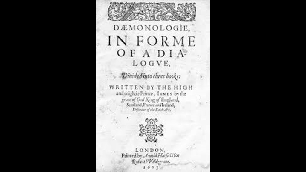
It is important to note that King James was said to have first published “Daemonologie” in 1597, called a philosophical discussion about necromancy, or the summoning of spirits, as well as the various methods of divination used from black magic and a classification of demons.
This would have been close to the same time that Dee and Kelley were engaged in their occult practices geared towards summoning and controlling spirits.
John Dee constructed what were called “sigillums,” or “sigils,” for the practice of Enochian magic, a range of rituals and ceremonies designed to evoke spirits for interaction.
I am including this subject because it is central to understanding what has taken place here – we have been experiencing an occulted timeline, and whether we like it or not, have been unknowingly subjected to unseen forces through occult practices to this day.
Occult symbolism is embedded everywhere in our world.
This is just one of countless examples.
So back to King Henry VIII in all this.
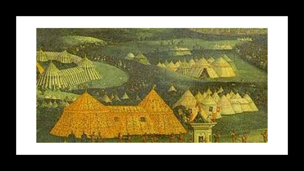
It is interesting to note that in our historical narrative, King Henry VIII and the French King Francis I met in 1520 in an obscure summit in the English part of northern France, that was said to have been held to increase the friendship bonds between the two kings.
This summit was known to history as the “Field of the Cloth of Gold,” so-named for the lavish tents and costumes at the summit made of gold and silk cloth, and a very expensive display of wealth of the two kings.
Said to be designed to improve relations between the two great rival kingdoms, it was reported as eighteen-days of feasts, tournaments, religious services, and masquerades taking place in elaborate tents.
But what was “The Field of the Cloth of Gold” really all about, and does what we are told about it even make sense?
Could it actually have been the recording of an event that conveyed a recognition of and goodbye to the splendor of the original civilization?
Themes similar to “The Field of the Cloth of Gold” come up in “masques.”
A “masque” was a festive form of courtly entertainment that flourished in the 16th- and 17th-centuries in Europe which involved music, dancing, singing and acting, and elaborate stage design by an architect.
The English word “masque” is phonetically identical to the word “mask,” a word which describes hiding something from view.
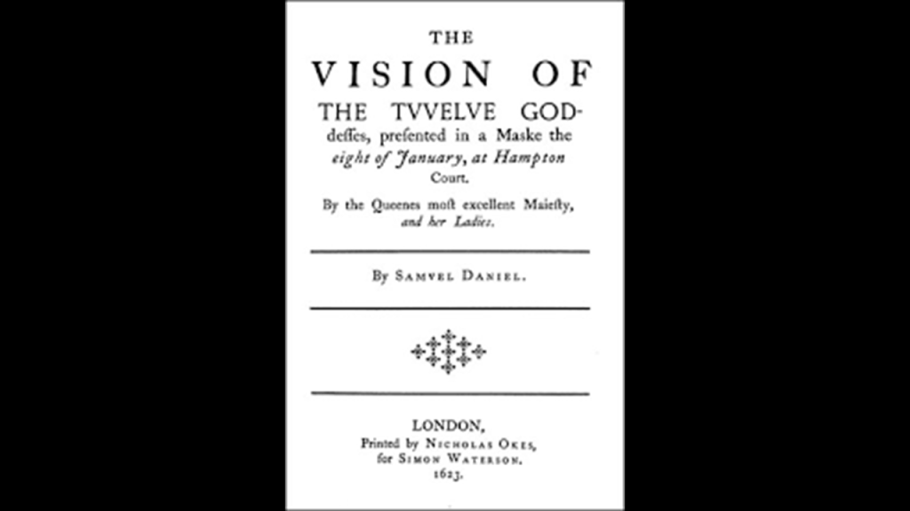
We are told that after the “Union of the Crowns” in 1603, at the Stuart Court of King James and his wife, Queen Anne of Denmark, the narrative elements of the masques became more significant.
“The Vision of the Twelve Goddesses” was written by Samuel Daniel and said to have first been performed in 1604.
The set for “The Vision” consisted of a large mountain; a Temple of Peace; and a Cave of Sleep.
The performance featured Queen Anne of Denmark taking the role of Pallas Athena, and eleven of her ladies-in-waiting taking the roles of other goddesses.
Their costumes were said to have been created from ransacking the wardrobe of the dead Queen Elizabeth I, with her gowns providing embroidered satin, as well as cloth of silver and gold, for the goddesses portrayed in the masque.
The ransacking of the wardrobe of Queen Elizabeth I to create the costumes for the “masque” just sounds bizarre to me, and contributes to my belief that the Court of King James was used to roll-out the New World Order agenda of plantation and colonization, and replacing fine cloth made with satin, silk, silver, and gold with plain broad cloth made of wool and cotton was very much a part of that agenda.
As mentioned previously, the Company of Merchant Adventurers of London, whose main export was cloth, especially undyed broadcloth, had funded the Puritan Congregation that settled the Plymouth Colony, who viewed the new colony as a way to make a profit.
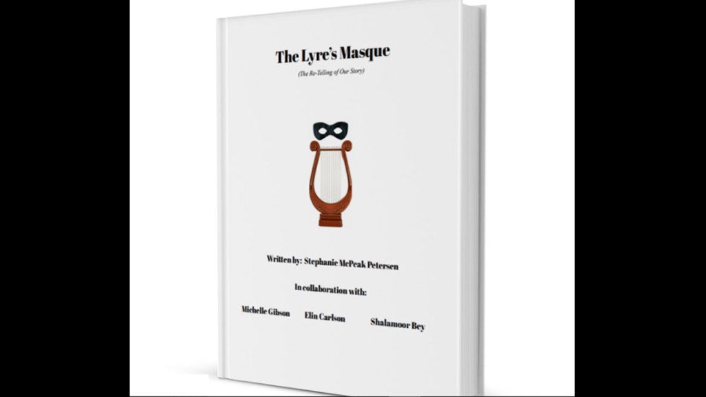
I have my friend Stephanie McPeak Petersen to thank for showing me that the literature from this time period, including but not limited masques, the works of Shakespeare and other literary figures of the day, contains truths otherwise hidden from our eyes.
Stephanie was part of the collaborative team that recently published “The Lyre’s Masque,” in eBook form, along with myself, Elin Carlson, and Shalamoor Bey, and which was brilliantly written by Stephanie.
Our story involves the Hero’s Journey of our hero, Prince Tamino, from Mozart’s “Magic Flute,” representing Humanity as he goes on an adventure after he accidently portals into the 21st-century while cleaning his flute, to the location where the three Muses of the Lyre, the daughters of Apollo, were living in an RV; reveals truths and learns new lessons with the task required to get him back home, which was playing the lyre he received from Apollo in a Masque for three days to entertain the three Fates; and at the end, wins a victory with his newfound knowledge and a return trip back to his home time.
Now back to John Winthrop, the Puritans and the founding of the Massachusetts Bay Colony.
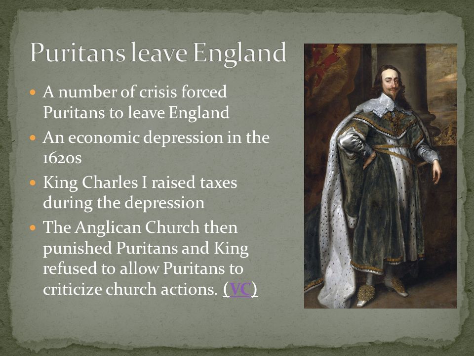
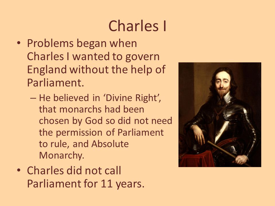
Our historical narrative tells us the religious atmosphere for Puritans to started to change in England in the mid-to-late 1620s, after the son of King James, King Charles I ascended to the throne in 1625, and had married a Roman Catholic.
We are told that the atmosphere of intolerance towards Puritans and this state-of-affairs led more Puritan leaders to consider emigration to the New World as means to escape persecution.
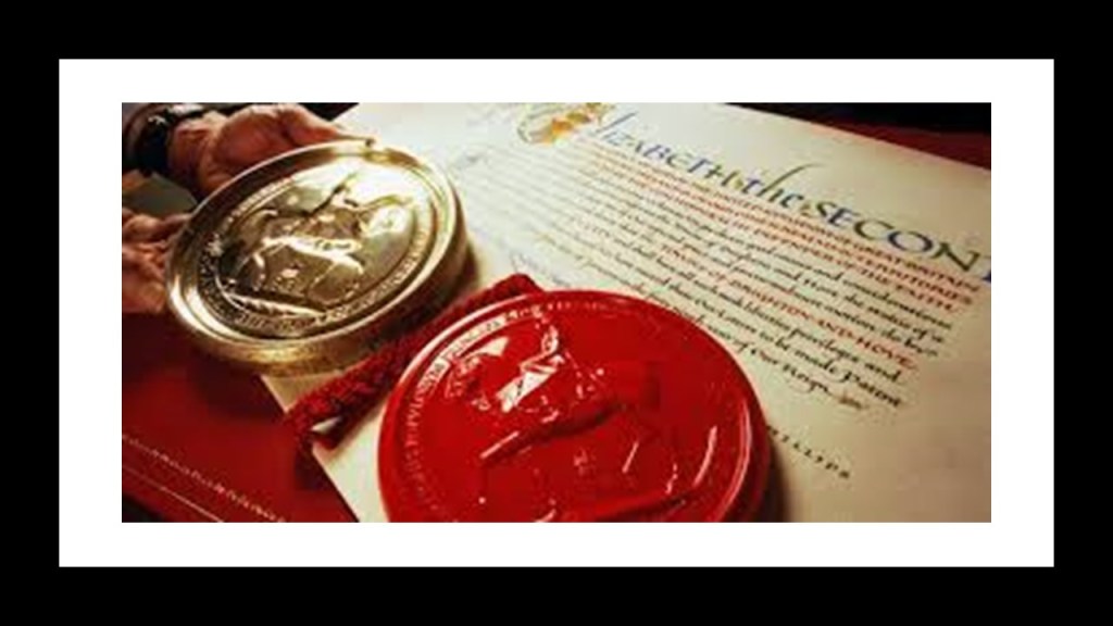
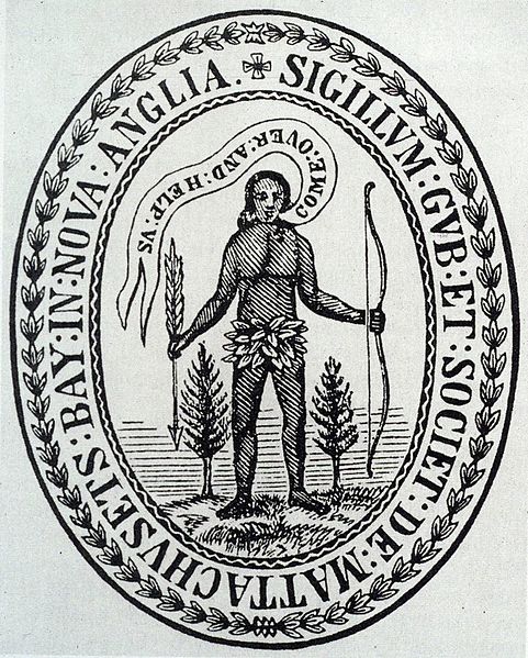
In 1629, a royal charter, which included the authority to make and use a seal, from King Charles I was received by Puritan investors known as the “Massachusetts Bay Company.”
It is interesting to note that this seal for the “Massachusetts Bay Company” contains the word “Sigillum,” as well as a giant-sized man, proportionally to the two trees on each side of him, clothed only by some kind of leafy-loin-cloth, speaking the words “COME:OVER:AND:HELP:US,” which are coming out of his mouth backwards.
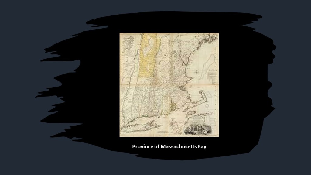
The Royal Charter established the legal basis for the new Massachusetts Bay Colony for the governance of a land grant of territory between what became known as the Charles River in eastern Massachusetts and the Merrimack River, which starts in New Hampshire and flows southward into Massachusetts.
This is especially noteworthy because this region of northeastern North America has been long-believed to be the legendary Norumbega, and includes today’s New England states like Massachusetts, Maine, New Hampshire, and Vermont.
Any information on Norumbega is very sparse, so I am going to share with you what is available to find.
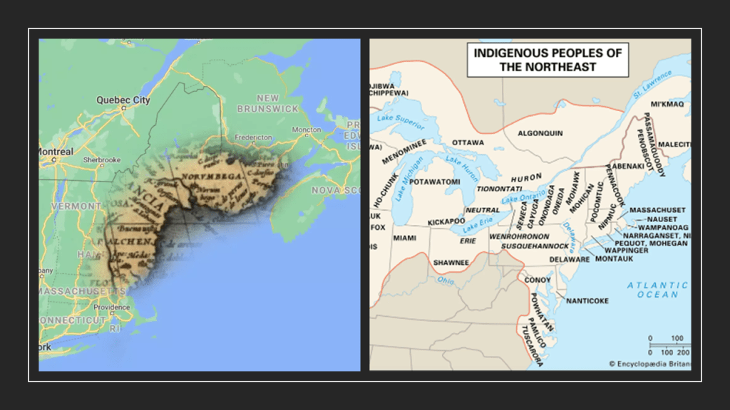
The following references to Norumbega pertain to events and places in the state that became known as the Commonwealth of Massachusetts.
This is information from an 1889 communication by Eben Horsford to the American Geographic Society in Watertown, Massachusetts, on the “Ancient City of Norumbega.”
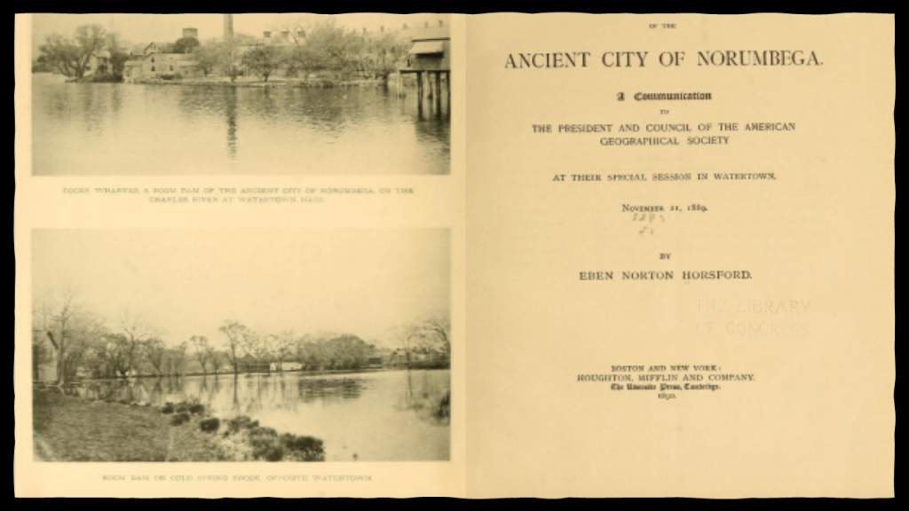
First, that the story of Norumbega was very old for Massachusetts.
It gets a little strange with the recounting of the story of the English sailor, David Ingram, who was apparently left on-shore by Sir John Hawkins in 1568, due to lack of provisions, along with 120 others, on the Gulf of Mexico at Tampico, which is in today’s Mexico.
So this David Ingram wandered all the way across the country from Mexico to the “banks of Norumbega.”
He returned home to England by way of a French ships from St. Mary’s Harbor, an earlier name for Boston Bay, a few hours from Norumbega. When he got back to England, he met again the guy who had abandoned him on a foreign shore far from home, Sir John Hawkins.
Ingram told Hawkins that when he was in Norumbega, he had seen monarchs borne on golden chairs, and houses with pillars of crystal and silver.
So here Norumbega in North America was described as a opulent place of wealth and abundance, even mentioning visiting the home of an “indian” chief, he saw a quart of pearls.
So while the context of the story sounds strange…
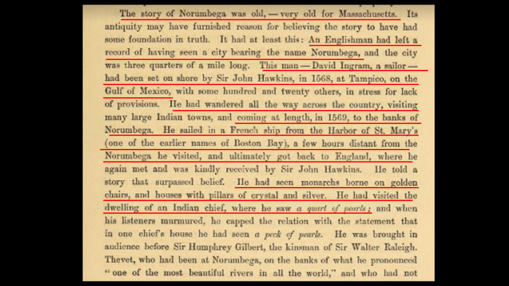
…that description of Norumbega does not jive at all with the hunter-gatherer narrative we’re taught in the official narrative about all Native Americans, including those from New England, from cradle-to-grave.
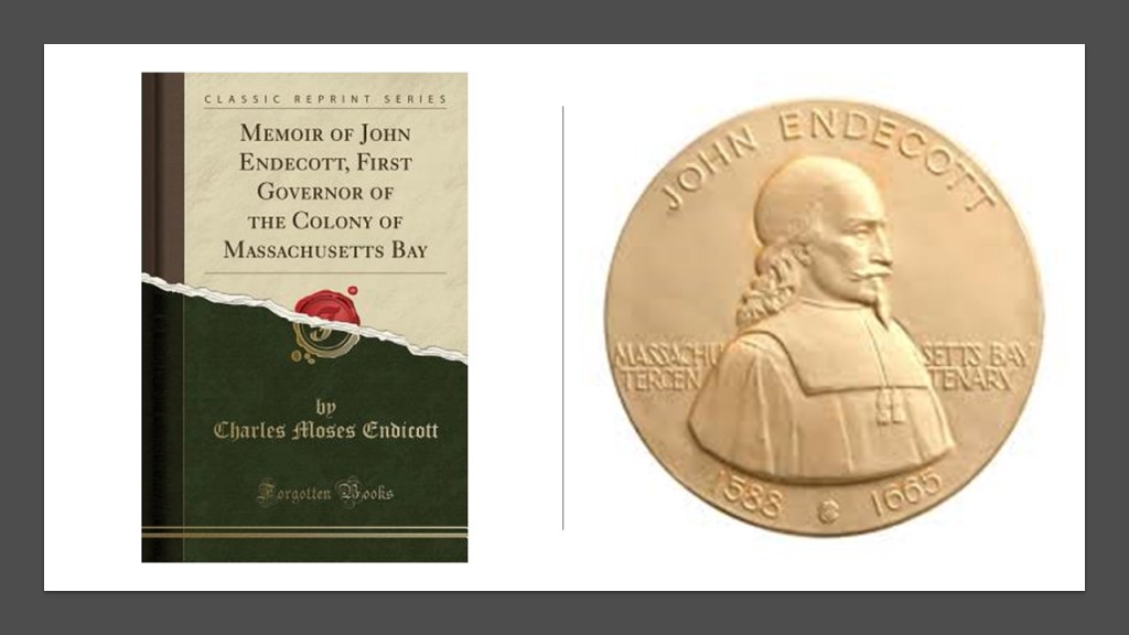
Puritan John Endecott led a small group of settlers to the area around this time to prepare the way for a larger migration, and he became the first Governor of the Massachusetts Bay Colony from 1629 to 1630, and served as governor several more times over the years, for a total of sixteen years all together.
The exact connection by which John Winthrop got involved with the Massachusetts Bay Company is not known, but he had connections with individuals associated with the company.
Also in 1629, King Charles I dissolved Parliament, beginning a historical period known as “11 years of rule” without Parliament.
This worried Massachusetts Bay Company principal investors, and John Winthrop as well.
The Governor of the Massachusetts Bay Company proposed the company reorganize and transport its charter and governance to the colony, and as the months went on, John Winthrop became more involved with the company, and a major supporter of emigration there.
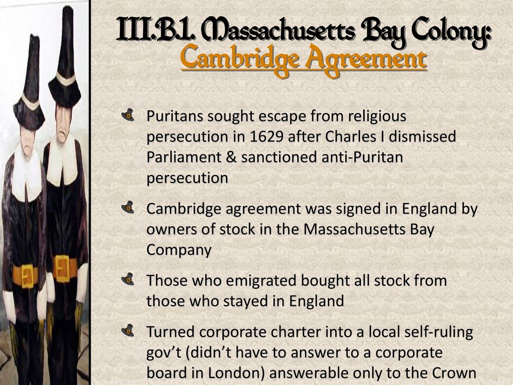
John Winthrop was a signatory on the Cambridge Agreement, which was signed on August 29th of 1629 by company shareholders.
Under its terms, those who wanted to emigrate to the New World could purchase shares from those shareholders who didn’t want to leave home.
The Cambridge Agreement also set forth that the Massachusetts Bay Colony would be under local control, and not governed by a London-based corporate board.
The company shareholders met in August of 1629 to enact the agreement.
At this time, John Winthrop was chosen as the new Governor of the Massachusetts Bay Company, and, along with other company officials, set about making all the necessary arrangements for the venture of settling in the New World.
John Winthrop was on one of four ships of the transport fleet that left the Isle of Wight on April 8th of 1630.
All together, there were eleven ships that carried roughly 700 emigrants to the new colony.
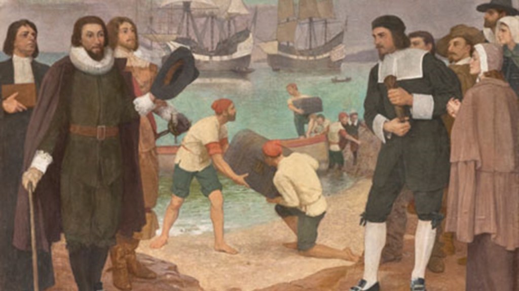
John Winthrop, with the charter for the Massachusetts Bay Colony in hand, and the new colonists arrived in Salem, Massachusetts, in June of 1630, and were welcomed by John Endecott.
We are told that in its early months, the new colony struggled, losing around 200 people to various diseases.
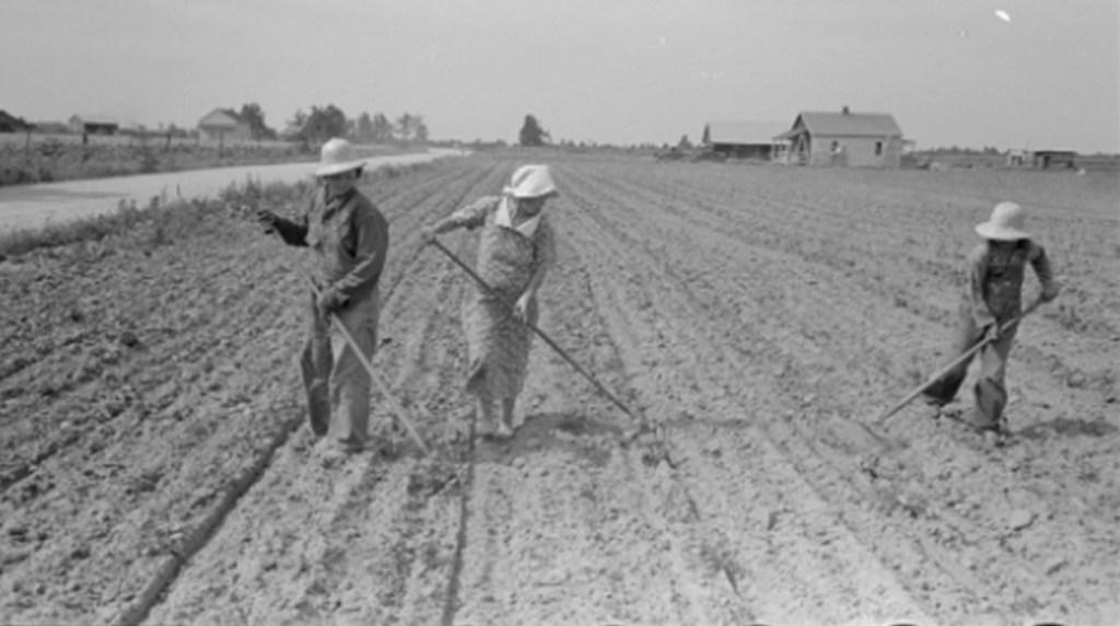
Winthrop worked alongside the laborers and servants in the work of the colony, setting an example for the other colonists to do all the work that needed to be done on the “plantation.”
Interesting to see the word “plantation” used so much even from the very beginnings of the New World.
In the history of colonialism, plantation was a form of colonization where settlers would establish a permanent or semi-permanent settlement in a new region.
Looks like the colonizers were literally “planting” themselves in a new place.
Not only were settlements and settlers being planted in a new region from somewhere else, this plantation system of the colonizers quickly laid the foundation for slavery on large farms owned by “planters” where cash crop goods were produced.
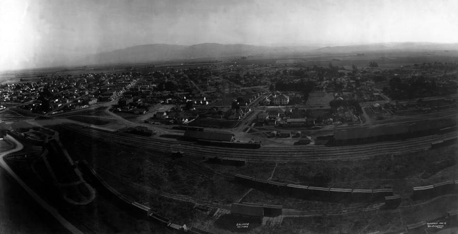
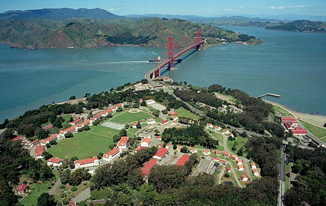
We are told Winthrop found the Salem area inadequate for the arrival of all the new colonists, so he and his deputy, Thomas Dudley, surveyed the area, and eventually settled on the Shawmut Peninsula, where they founded what became the city of Boston.
They also established settlements along the coast, and banks of the Charles River, we are told, in order to avoid presenting a single point that hostile forces might attack.
So along with Boston, these settlements were Cambridge, Roxbury, Dorchester, Watertown, Medford, and Charlestown.
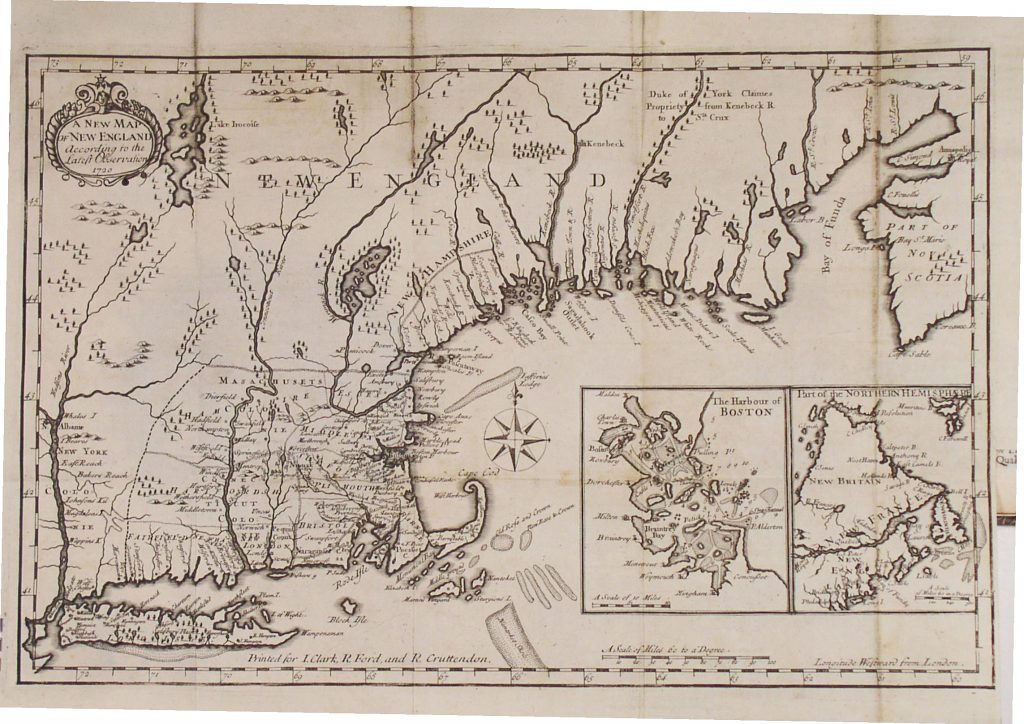
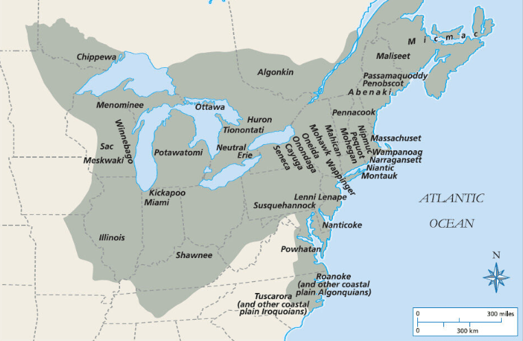
This map was the illustration that appeared opposite the title page of William Wood’s book from that time entitled: “New Englands Prospect” and called “A true, lively and experimentall description of that part of America commonly called New England; discovering the state of that Countrie, both as it stands to our new-come English Planters; and to the old native inhabitants. Laying down which that which might enrich the knowledge of the mind-travelling reader, or benefit the future voyager.”
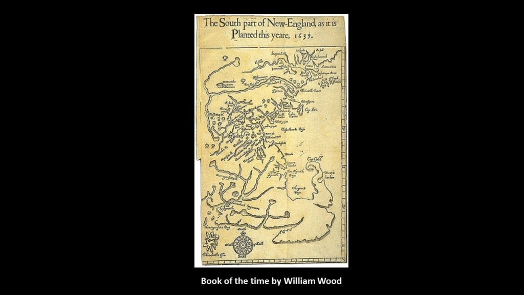
This selection from William Wood’s book was of a map showing the plantations along Massachusetts Bay, and the word or name Sagamore is showing in several places.
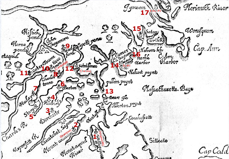
The word “Sagamore” or “Sachem” denoted a leader of the Algonquin-speaking peoples.
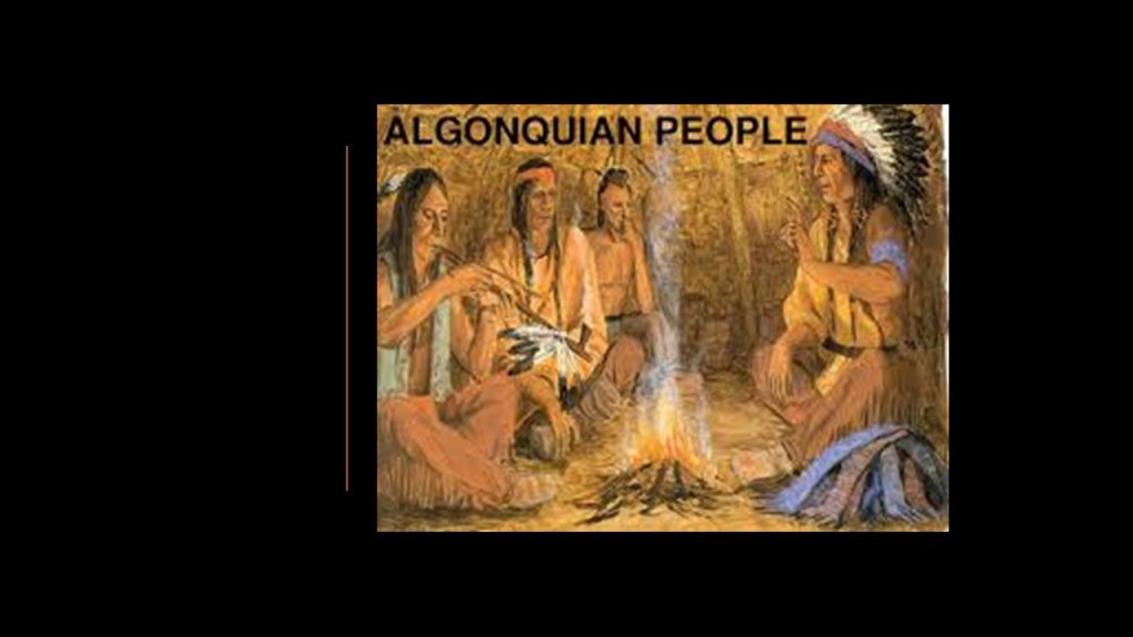
I just want to say again that it is extremely difficult to find information about who the Algonquin people really are because the visuals we see are typically like this.
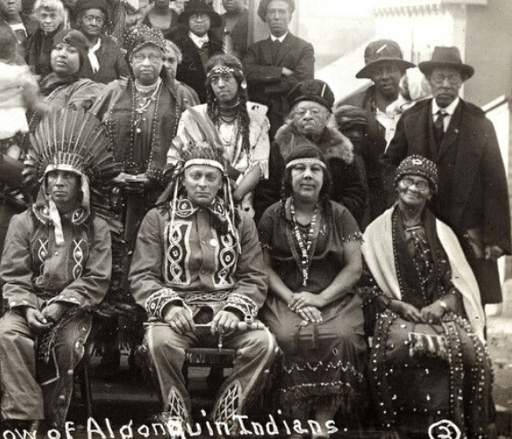
Here is an historic photograph that I came across of the Algonquin Narragansett people of Rhode Island, circa 1925.
It is interesting to note that for the Puritans leaving England for the New World because of religious intolerance, completely uprooting their lives and venturing into the unknown for religious freedom…they were remarkably intolerant of people with other religious beliefs, including those within their own community.
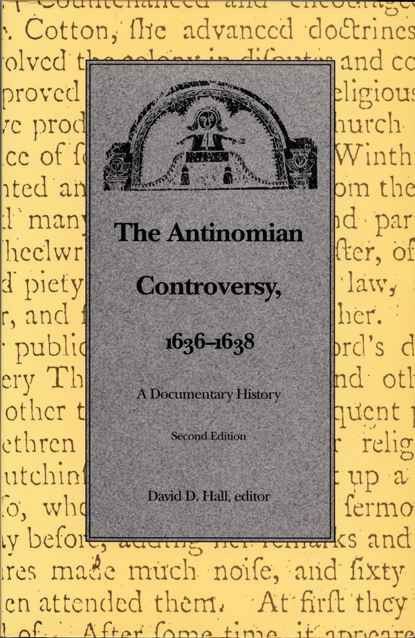
The Antinomian Controversy significantly divided the Massachusetts Bay Colony from October of 1636 to March of 1638.
It pitted most of the Colony’s ministers and magistrates against some of the adherents of the Free Grace theology of Puritan Minister John Cotton, and revolved around a theological debate concerning Cotton’s “Covenant of Grace,” which taught that following religious laws was not required for salvation, and the “Covenant of Works” of other Puritans, including John Winthrop, which taught that by doing good works and obeying the law, a person earns and merits salvation.
The outcome was that the leading advocates of Antinomianism, Anne Hutchinson and John Wheelwright were banished from the Massachusetts Bay Colony, and their supporters were disarmed, dismissed, disenfranchised, or banished in this New World.
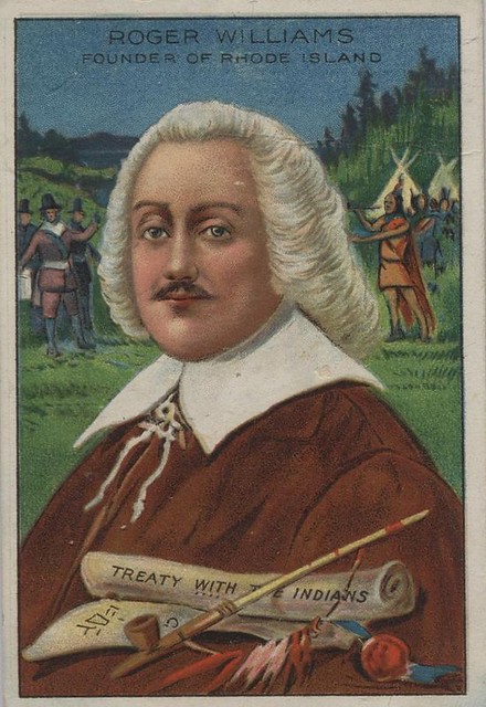
After her banishment, Anne Hutchison and her supporters established the settlement of Portsmouth in 1638 in what became known as Rhode Island, with encouragement from the Providence Plantations founder, fellow-banishee from the Massachusetts Bay Colony Roger Williams, in what became known as the Colony of Rhode Island and Plymouth Plantations.
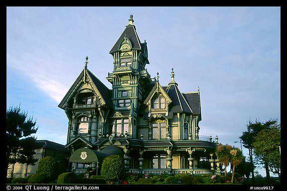
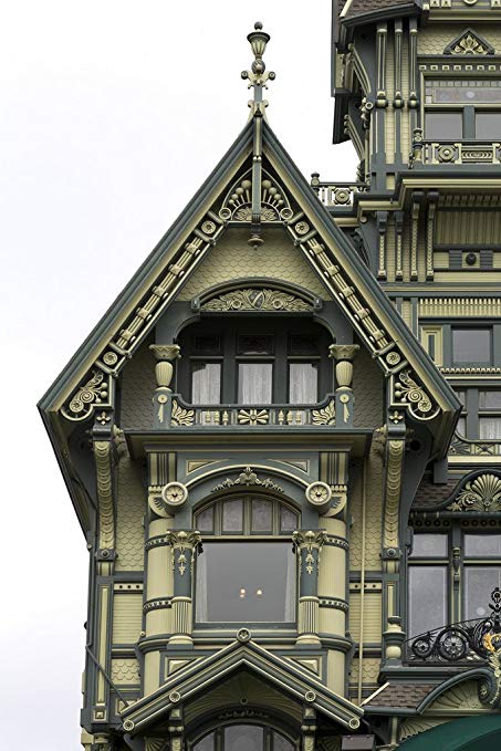
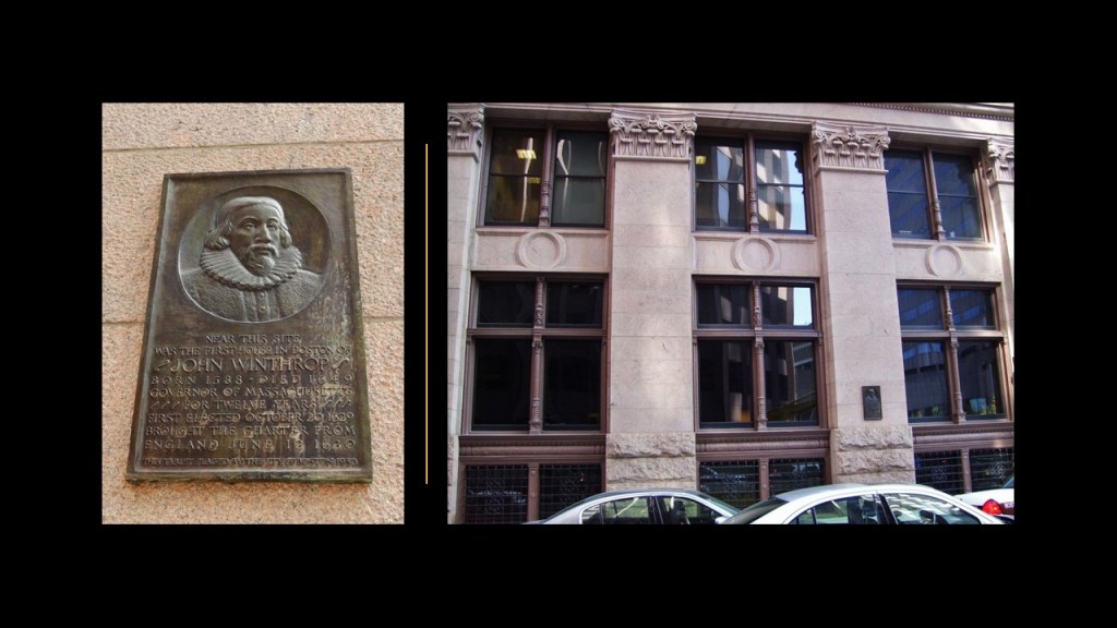
Back in Boston, this plaque on the left memorializes John Winthrop’s first house there, said to have been built nearby.
The marker was placed on the old Boston Stock Exchange Building on the right, located at 53 State Street, by the City of Boston in 1930.
The old Boston Stock Exchange Building was said to have been built between 1889 and 1891 from designs by the architectural firm of Peabody & Stearns, and one of the largest office buildings in America back in the day, and in its hey-day housed banks, corporations, safe-deposit vaults, lawyers, and businessmen.
Governor Winthrop was also granted an estate on the southern bank of the Mystic River in Somerville, Massachusetts, by the Massachusetts Bay Colony in September of 1631 that he called “Ten Hills Farm.”
It was so-named for what were called “ten small knolls” on the property, which included orchards and meadows for grazing cattle.
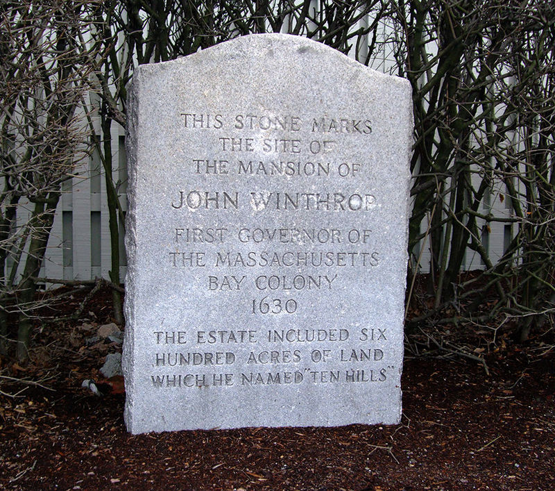
Ten Hills Farm was inherited by his son, John Winthrop, Jr, in 1649, who was the Governor of the Connecticut Colony between 1659 and 1676.
Winthrop spent a lot of time writing, including his “The History of New England: 1630 – 1649,” also known as “The Journal of John Winthrop,” which was apparently not published until the late 18th-century.
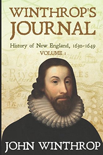
We are told that John Winthrop died of natural causes in March of 1649 and was buried in the King’s Chapel Burying Ground, the oldest cemetery in Boston and a site on the Freedom Trail.
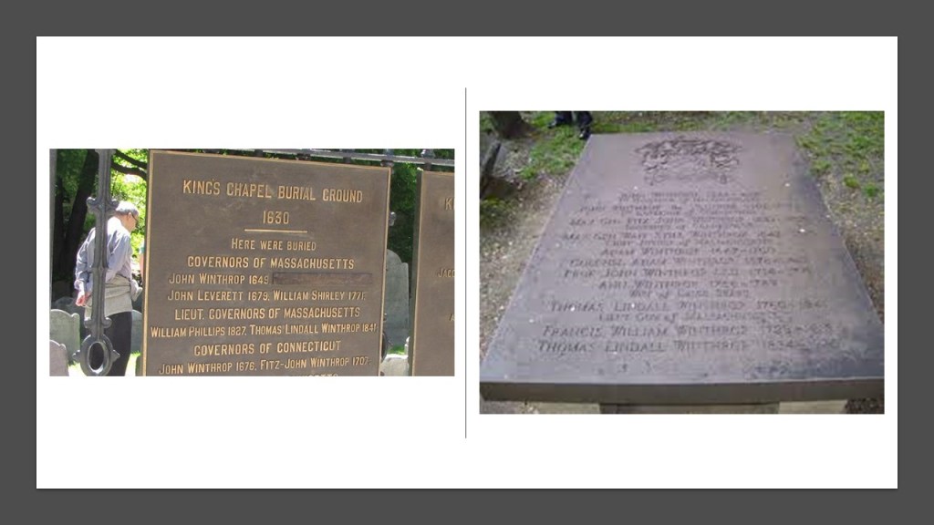
The Freedom Trail is a 2.5-mile, or 4-kilometer, -long path through Boston with sixteen locations significant to the history of the United States that was established in 1951.
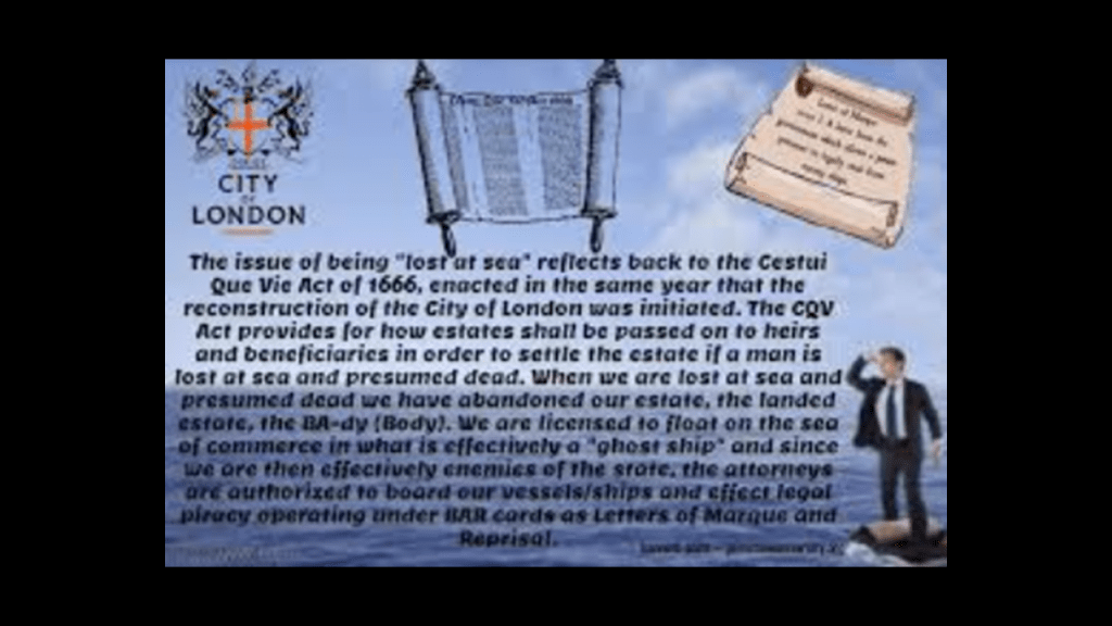
With the year of Winthrop’s death, in 1649, we are heading towards some significant events that took place around 1666, a red-letter year for the Controllers in our historical narrative.
The Cestui Que Vie Act was passed in 1666 by the British Parliament, after the 1665 Great Plague and 1666 Great Fire in London.
This subrogated the rights of men and women, meaning all were declared dead or lost at sea.
The government took custody of everybody and their property into a trust, and the state became the trustee, holding all titles to people and property until a living person comes back to reclaim those titles.
The year of 1666 was also the year Turkish Jewish Mystic Sabbatai Zevi was proclaimed the Messiah by Nathan of Gaza, a theologian and author who became known as Zevi’s Prophet.
Zevi was the founder of the Sabbatean Movement.
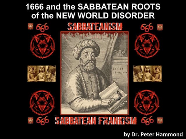
He and his follower Jacob Frank brought the world Sabbatean-Frankism.
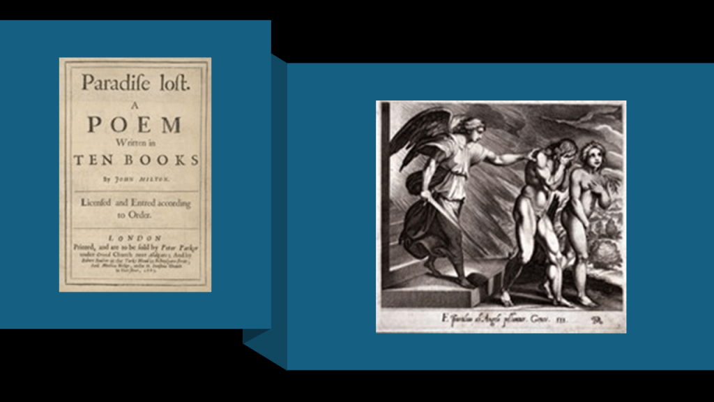
In 1667, John Milton’s poem “Paradise Lost” was published.
As related in the poem, newly banished Fallen Angels organize, and Lucifer volunteers to corrupt the newly created Earth and God’s new and most favored creation, Mankind.
Lucifer goes to the Garden of Eden, and convinces Eve by duplicity to eat of the fruit of the tree of knowledge of good and evil, which directly led to their expulsion from the Garden of Eden.
I think this was original disclosure about what has taken place here – Paradise was lost, and we were brought to the corrupted, inverted world we live in today.
In the poem, it is interesting to note the spelling of the verb “to die” in the poem referring to death is spelled “dye,” the verb for a substance used to color something, including but not limited to cloth.
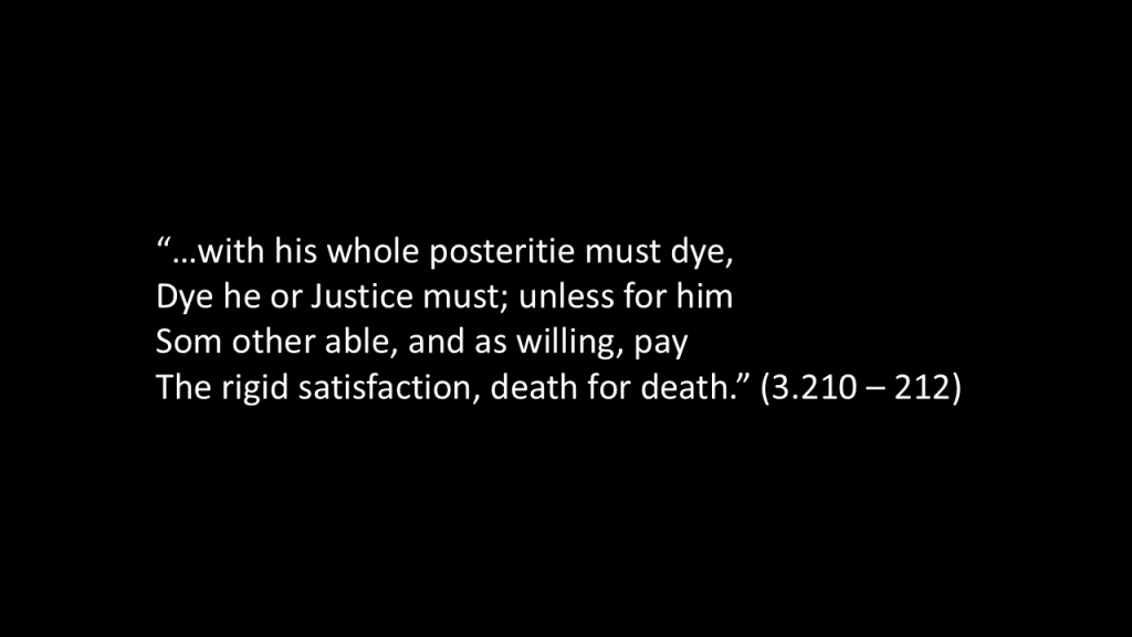
After their fall, the Son of God tells Adam and Eve about God’s judgment. Before their fall the Father foretells their “Treason” (3.207) and that Man:
“…with his whole posteritie must dye,
Dye hee or Justice must; unless for him
Som other able, and as willing, pay
The rigid satisfaction, death for death.” (3.210–212)
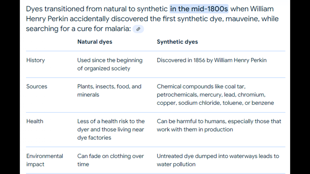
Interesting to note that dyes for coloring cloth went from being obtained from natural sources to being primarily synthetically sourced starting in the mid-1800s.
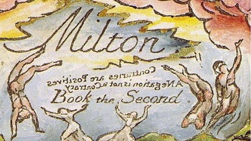
English poet William Blake’s epic poem “Milton” was illustrated between 1804 and 1810, and was about a strange connection that existed between Blake and Milton in which they undergo a spiritual journey.
Among other things, the first part of the poem describes the activities of Los, who creates a complex universe within which other character debate the actions of Satan, and the fall is pictured as each of the five senses plummeting into an abyss, where each broods in fear and desperation.
Interesting there is backwards writing on this cover page similar to the writing on the “Sigillum” of the Massachusetts Bay Company we saw earlier.
This definitely sounds like where Humanity has been stuck collectively – conditioned by fear and caught up in satiating our senses of sight, smell, hearing, taste and touch, and generally-speaking, not focusing on our higher spiritual development.

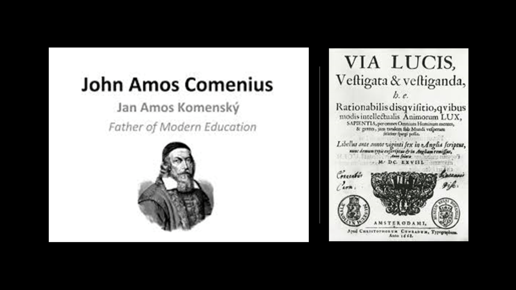
A year after Milton’s “Paradise Lost” was published in 1667, John Amos Comenius, a Czech philosopher and theologian who is considered by some to have been the “Father of Modern Education,” published the “Via Lucis” in 1668.
In the “Via Lucis,” Comenius outlined his recommendations for the “improvement” of humanity through pansophy, or all-encompassing knowledge into one amalgamation of all sciences through a union of knowledge of alchemy and magic with divine wisdom.
He advocated for a new world language; for scholars from all nations to take place in this global reform; and a Collegium Lucis, or Collegium of Light, based in London to coordinate all of this activity to overcome the “world’s misery, ignorance, confusion, and war.”
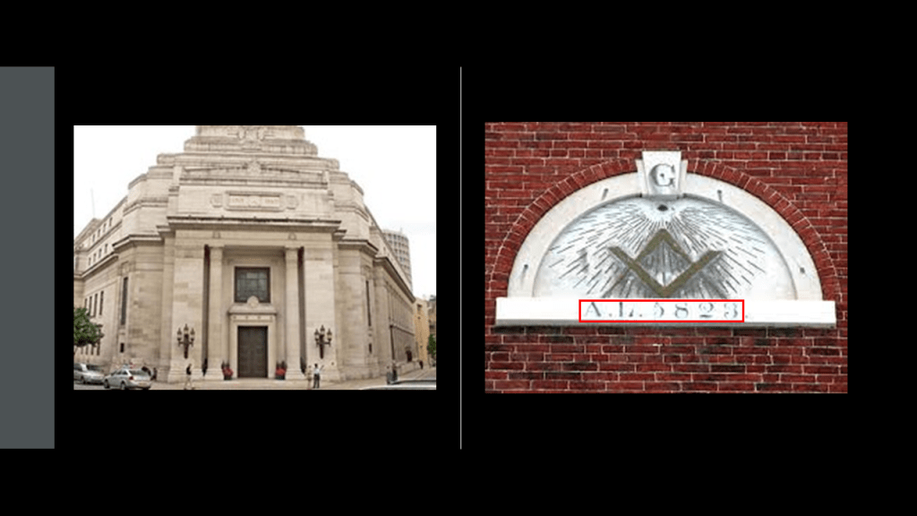
On June 24th of 1717, the Premier Grand Lodge of England was founded in London – the first Free-Mason Grand Lodge.
The Freemasons of the Premier Grand Lodge of England formally adopted the Anno Lucis that same year of 1717, in which 4,000 years were added to the current year of the Anno Domini, for masonic dating for ceremonial occasions
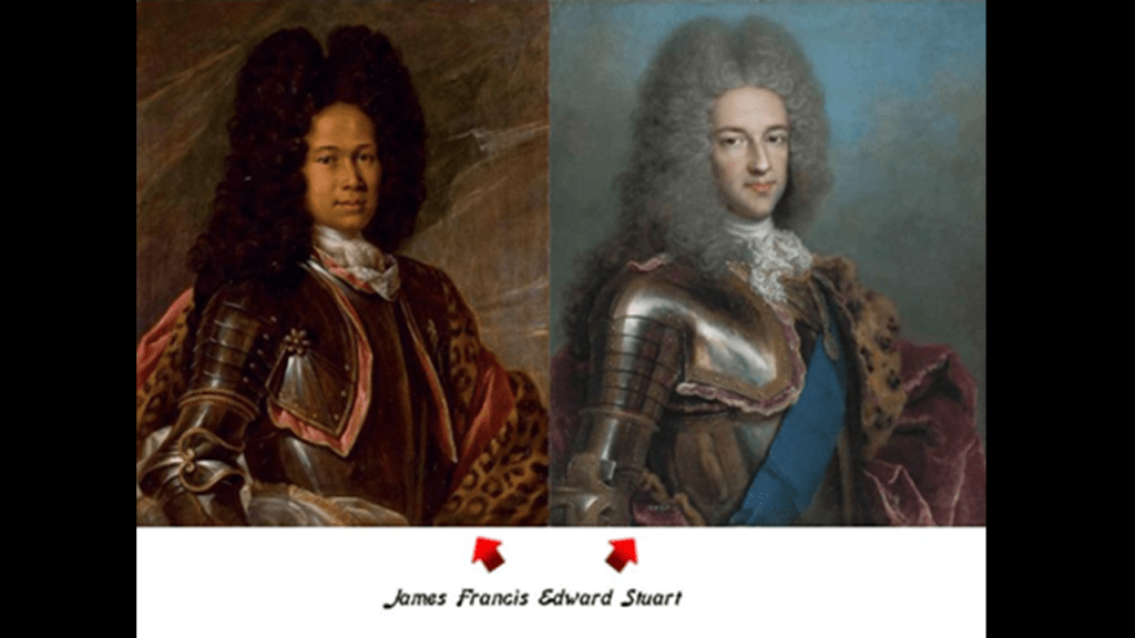
In February of 1717, the Stuart Heir James Francis Edward Stuart, the Duke of Rothesay, Prince and Great Steward of Scotland, and Lord of the Isles, left where he was living in France to seek exile with Pope Clement XI in Rome, and he died in Rome in 1766.
I found the portrait on the left of James Francis Edward Stuart, which was believed to have been painted of him while he was living in France, and on the right is the typical portrait of James Francis Edward Stuart.
He was forcibly prevented from claiming the throne when he tried to do so in the Jacobite Uprising of 1715.
So what was up with that?
Well, in doing some digging, there’s quite a back-story to go along with that set of circumstances.
I followed the trail back to Elizabeth of Bohemia of the Royal House of Stuart.
She lived from 1596 to 1662, and was the daughter of King James and Queen Anne of Denmark.
In 1613, Elizabeth married Frederick V, the Elector-Prince of the Palatinate, one of the Holy Roman Empire’s greatest Prince-Electorates.
The Electors were responsible for electing the Holy Roman Emperor.

The daughter of Elizabeth of Bohemia and Frederick V was Princess Sophia.
Princess Sophia was the founder of the Hanoverian line of British Monarchs, and through her mother, a descendent of the House of Stuart.
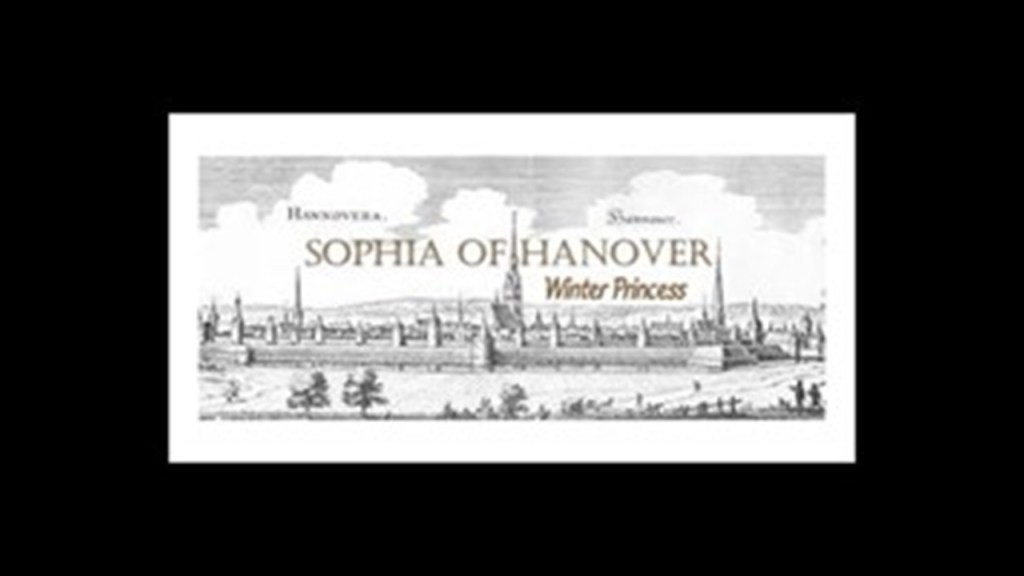
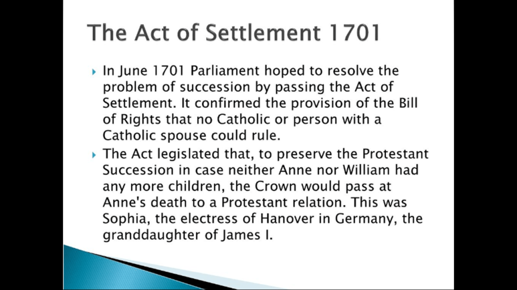
Thus, Princess Sophia, the granddaughter of the Stuart King James, was named heir-presumptive to the Crown by the 1701 Act of Settlement.
The 1701 Act of Settlement was passed to settle the succession of the Crown to Protestants only, and their daughter Princess Sophia was the next Protestant in-line for the throne after Queen Anne, the last Stuart monarch from 1702 to 1714.
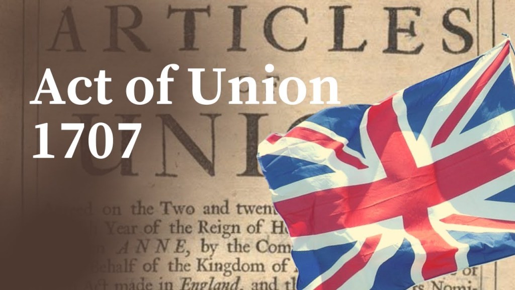
Then in 1707, the Act of Union between the Parliament of Scotland and the Parliament of England formally unified both Kingdoms as the Kingdom of Great Britain, and when the heir-apparent of the British throne started assuming the titles of the Duke of Rothesay, Prince and Great Steward of Scotland, and Lord of the Isles, which continues to this day.
With regards to Princess Sophia of Hanover and the 1701 Act of Settlement naming her as Heir-Presumptive to the Throne, she unfortunately died on June 8th of 1714, almost two-months before the death of Queen Anne, the last Stuart monarch, who died on August 1st of 1714.
So Princess Sophia’s son became King George I on August 1st of 1714, establishing the House of Hanover as the new British Royal House, with her Stuart bloodline to legitimize it.
The last monarch of the House of Hanover was Queen Victoria, and where the obscure German lineage of the House of Saxe-Coburg and Gotha got inserted into this royal bloodline.
Duke Francis of Saxe-Coburg-Saalfeld was born in July of 1750, and was the progenitor of the House of Saxe-Coburg and Gotha line, which seeded the lineage of the new royals.
Francis succeeded his father, Duke Ernest Frederick, as the reigning Duke of Saxe-Coburg-Saalfeld in 1800.
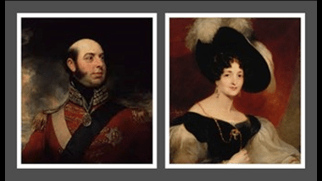
King Leopold I of Belgium, the youngest son of Duke Francis, had strong ties to Great Britain as he had moved there and married Princess Charlotte of Wales in 1816, second-in-line to the British throne, after her father the Prince-Regent, who became King George IV.
She is recorded as having died after delivering a stillborn child a year after they were married, leaving King George IV without any legitimate grandchildren.
Baron Stockmar of Coburg was the personal physician of Leopold I at the time of his marriage to Princess Charlotte, and after her untimely death, stayed on as his private secretary, comptroller of the household, and political advisor, and later, a very important and influential advisor of Victoria and Albert.
King George III’s son, the Prince-Regent George’s brother, Prince Edward, ended-up proposing to Leopold I’s older sister Victoria, of Saxe-Coburg-Saalfeld, who were the parents of the future Queen Victoria.
Through Queen Victoria and Prince Albert, who were first cousins, the House of Saxe-Coburg & Gotha continued to seed the new Royal Houses of Europe.
So Queen Victoria was a direct descendent not only of Duke Francis of Saxe-Coburg-Saalfeld, but also of King James through his granddaughter Sophie of Hanover.
This one obscure German Ducal line ended up taking over the whole shebang!

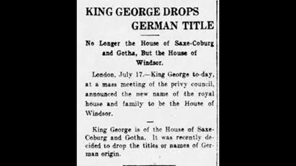
Then on July 17th of 1917, during the reign of King George V, the name of the royal house was changed to Windsor from Saxe-Coburg and Gotha, for the given reason of anti-German sentiment generated by World War I.
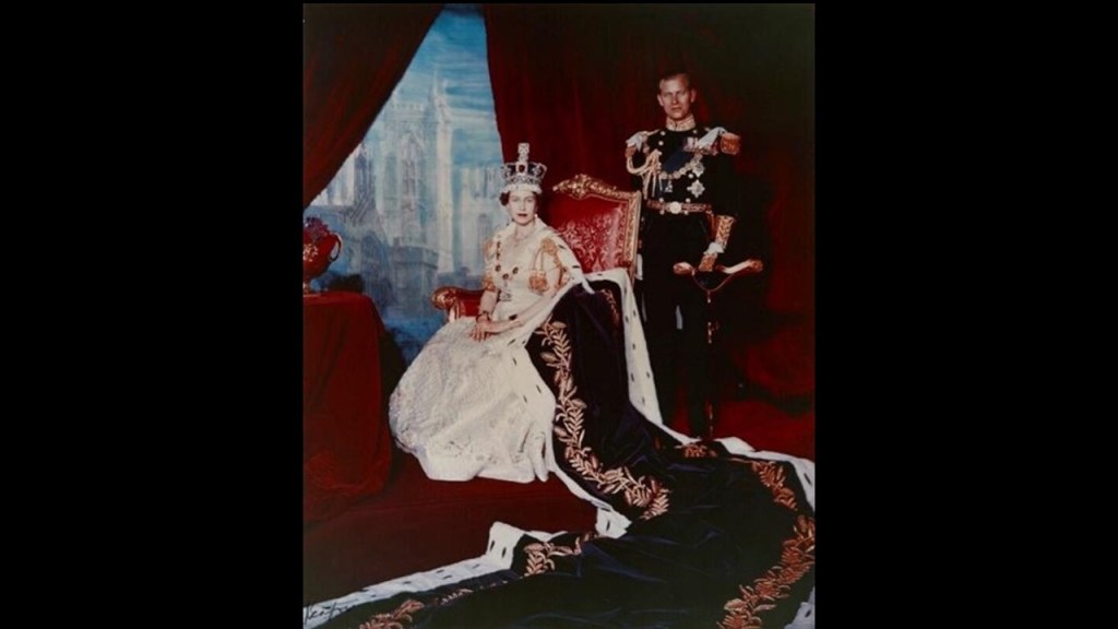
This was one example of many where portraits of prominent individuals in our historical narrative had other things painted faintly in the background.
There was a fantastical-looking city-scape with tall buildings painted behind the curtains in the background of this official portrait from the 1950s of Queen Elizabeth II and Prince Philip.
They are telling us something here.
They are just not telling us they are telling us.
What I am seeing is that the reign of the British Queen Victoria of the House of Saxe-Coburg & Gotha, between 1837 and 1901 was the major time of reset and staging of the New World and its new systems that were put in place for world domination and control.
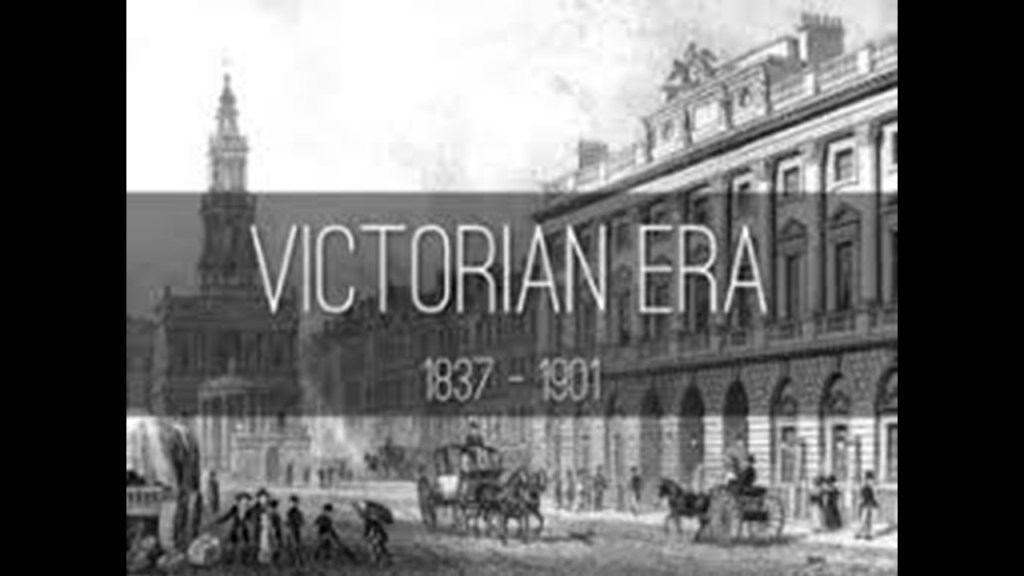
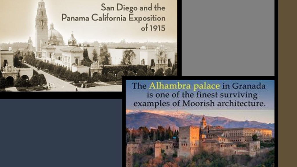
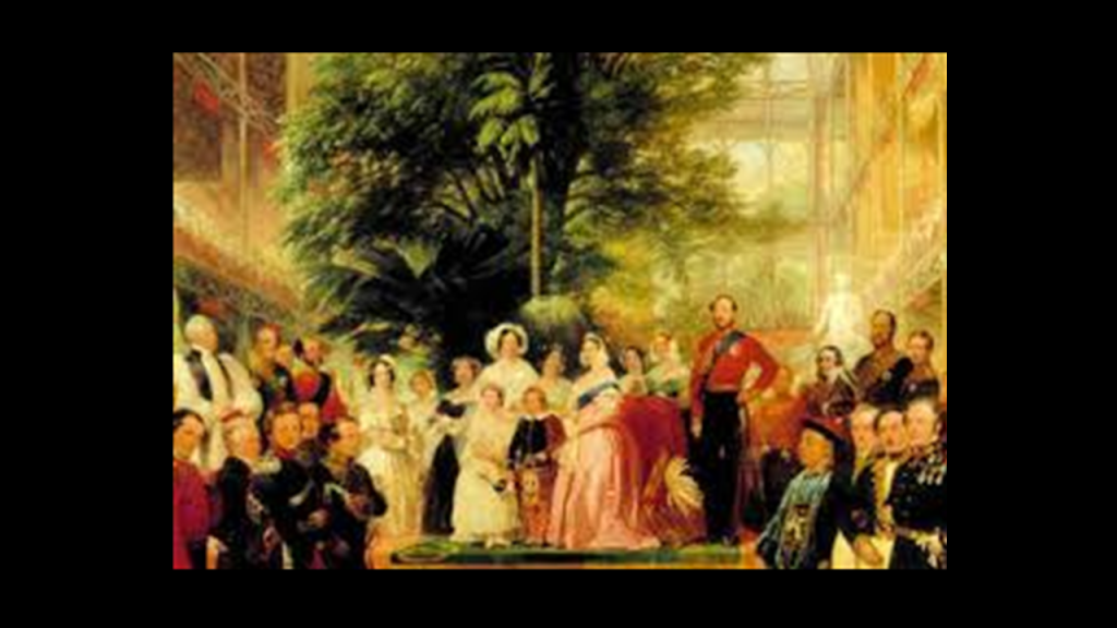
I have long-believed that the Crystal Palace Exhibition in London in 1851 was the official kick-off to the New World Order timeline, and the beginning of a long series of Exhibitions, Expositions, and World Fairs spanning a century, where the technology and architectural wonders of the original civilization were showcased and laid claim to before being hidden away or forever destroyed.
So let’s return to the subject of cloth as a silent player in the unfolding of what has taken place here…and in the occulting of the New World Order timeline.
Again, it is interesting to note that King James would be publishing a philosophical discussion in 1597 about necromancy, the summoning of spirits, as well as the various methods of divination used from black magic and a classification of demons, in his book “Daemonologie” just a few years prior to the Union of the Crowns in 1603, and fourteen-years prior to the publication of the King James Version of the Bible, and that Dee and Kelley would be in communication with angels and constructing an occulted “angelic” language for use in summoning and controlling spirits.
Why would this be happening?
What in the world was going on?

Sorcery is defined as the use of magic, in particular black magic, which is the use of power gained from the assistance or control of evil spirits.
As mentioned previously, a group of businessmen called “Merchant Adventurers” financed the Puritan Congregation that settled the Plymouth Colony in 1620.
The Company of Merchant Adventurers of London had cloth as its main export, especially undyed broadcloth, in exchange for a large range of foreign goods.
We are told that under the 1505 Royal Charter of King Henry VII, the first Tudor monarch, the Merchant Adventurers had a governor and 24 assistants.
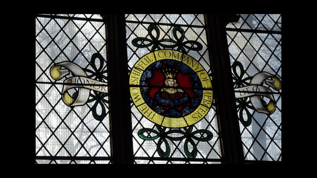
The members were trading investors, and many of them believed to have been “mercers.”
Mercers were cloth merchants, and involved in the importation of fine cloth like silk and linen, and other textiles and cloth and piece goods.
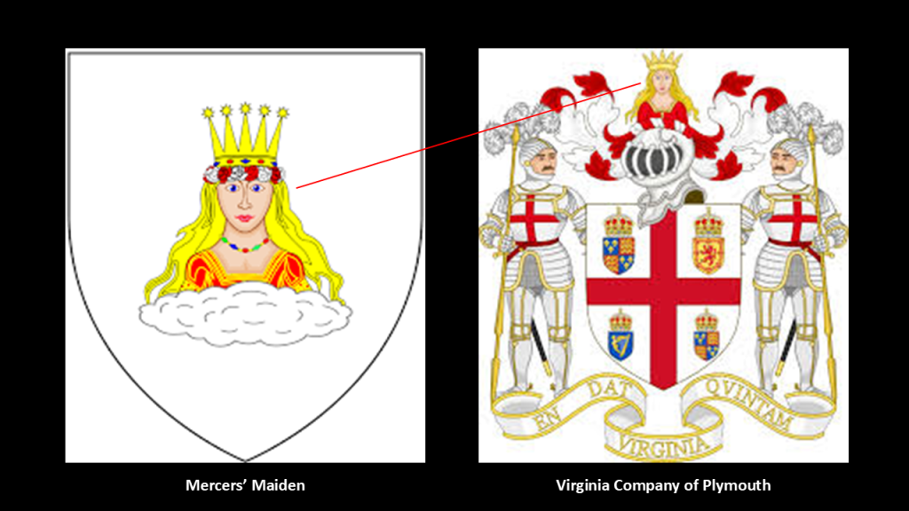
The Maiden on the Coat-of-Arms is the emblem of the Mercers, and was said to have first appeared on a seal in 1425, and it is also said that her origins, and reason why she was chosen as the emblem, are unknown.
The same “Mercers’ Maiden” also shows up on the Coat-of-Arms of the Virginia Company of Plymouth that was first chartered by King James in 1606 to colonize, or “plant” as we have seen, the east Coast of North America.
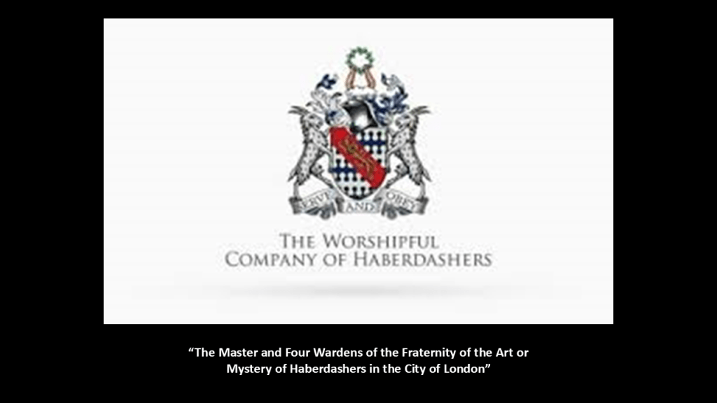
Haberdashers as well are connected to the clothing business.
In Britain, haberdashers sell small items for sewing, dressmaking and knitting, and in the United States, they sell men’s clothing, including suits, shirts, and ties.
We are told the Haberdashers’ Company received its first royal charter in 1448.
Interesting to note that the Haberdashers’ Company maintains a strong tradition of supporting schools, primarily boys’ schools and girls’ schools.
Milliners, also known as hatters, make hats.
They are included in the “Worshipful Company of Feltmakers.”
The “Feltmakers,” or makers of felt hats, were incorporated by “Letters Patent” granted by King James in 1604.
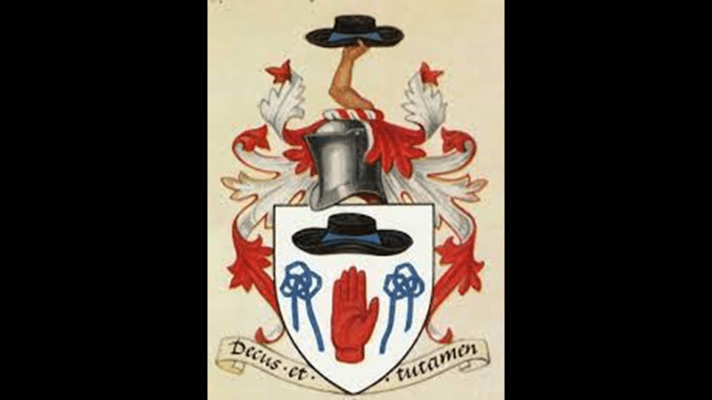
Felt is a textile made by matting, condensing, and pressing fibers together, whether natural fibers or synthetic fibers, and leads-in to the human-slavery-based economic system of the fields and the mills set up by the Controllers, both in terms of physical bondage, workhouses and wage slavery.
In William Blake’s poem in the preface of his previously mentioned epic poem “Milton,” are the words to what became best-known as “Jerusalem,” a hymn with music written by Sir Hubert Parry in 1916.
It is framed primarily by a series of questions about the holy lamb of God being in England, and was Jerusalem built here among those dark Satanic mills, referring primarily to the mills of the industrial revolution, and so forth about building Jerusalem once-again here in this green and pleasant land.

These three professions are known as “mercery,” “haberdashery,” and “millinery.”
Was there a connection between the practice of “sorcery,” and the textile-related occupations of “mercery,” “haberdashery,” and “millinery?”
Could there be magic embedded in the modern English language?
The simplest example to demonstrate this likelihood is the word “spell.”
The word “spell” in English means reciting the letters in a word, as in “spelling a word” or “how do you spell that word?”

But the word “spell” also means a series of words that has magical powers, like an incantation, or being under a magical spell, when what you do is out of your control.

So let’s take a look at what was going on in the 1800s that relates to all of this about cloth.
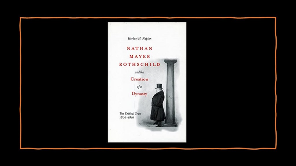
First, Mayer Amschel Rothschild’s son, Nathan Mayer Rothschild settled in Manchester, England in 1798, and established a business in textile trading and finance, and made a fortune in a banking enterprise he began in the City of London in 1805 that dealt in foreign bills and government securities.
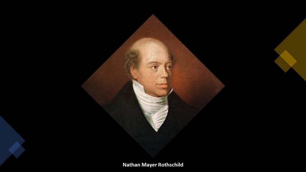
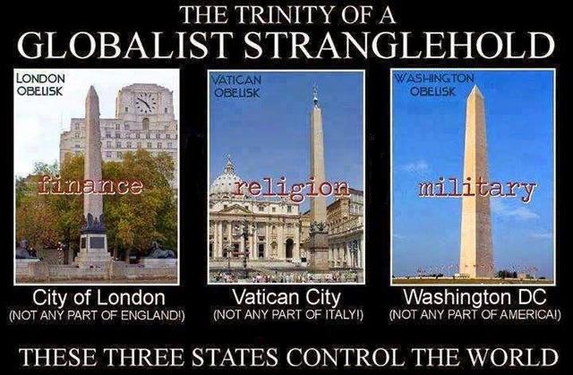
The City of London is the primary Central Business District of London and one of the leading financial centers of the world, with the Bank of England and London Stock Exchange in its boundaries.
Its local authority is the City of London Corporation.
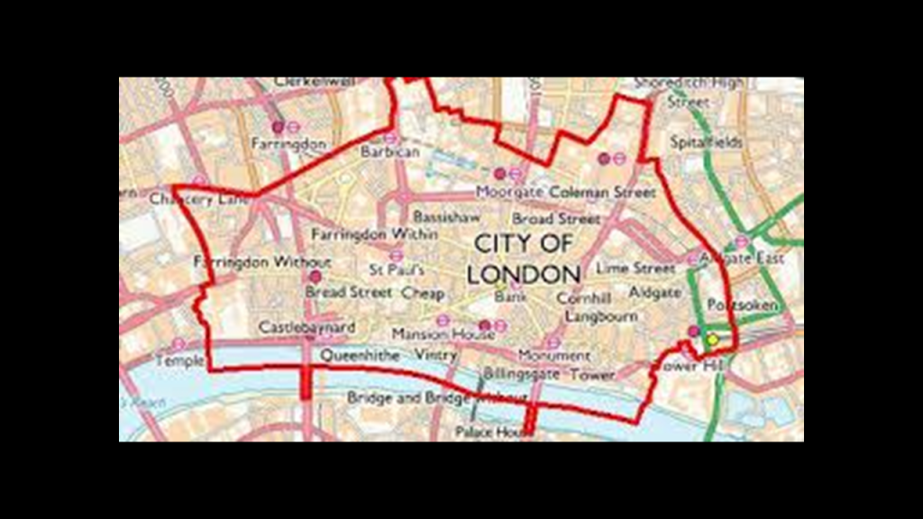
Its “sister cities” are Washington and the Vatican.
All three are not considered any part of the country they are located in.
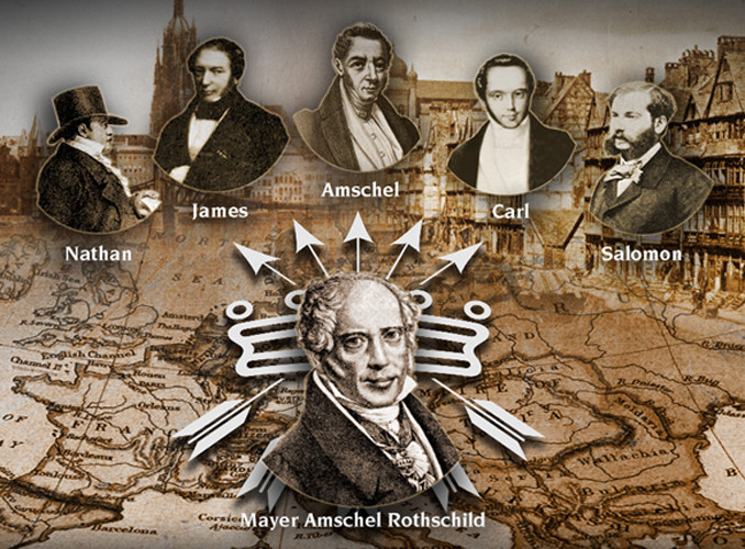
A Freemason since 1802 in the “Premier Grand Lodge of England,” by the time of his death in 1836, Nathan Mayer Rothschild had secured the position of the Rothschilds as the preeminent investment bankers in Britain and Europe, and his own personal net worth was over 60% of the British national income.
Mayer Amschel Rothschild started the Rothschild International Banking family dynasty through his five sons in Frankfurt, Germany, in the 1760s, who were each placed in major cities throughout Europe.

Besides Nathan in the City of London, son James was in Paris; son Amschel succeeded his father in Frankfurt; son Carl was in Naples; and son Salomon in Vienna.
And this is the saying that has been attributed to more than one prominent member of the Rothschild family, starting with Nathan Rothschild.

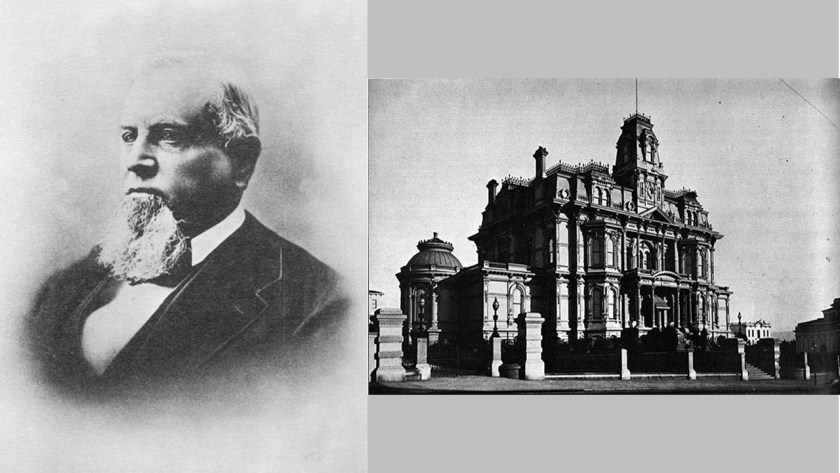
In America, Alexander Brown was an Irish linen merchant who immigrated to America, and established the first investment banking firm in the United States in 1800, just five-years before Nathan established the Rothschild bank in London.
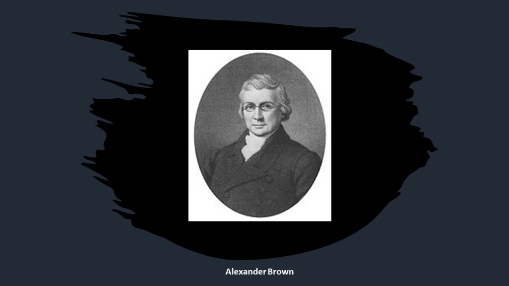
He was joined in business by his sons William, George, John, and James, and the firm became “Alex. Brown & Sons” in 1810.
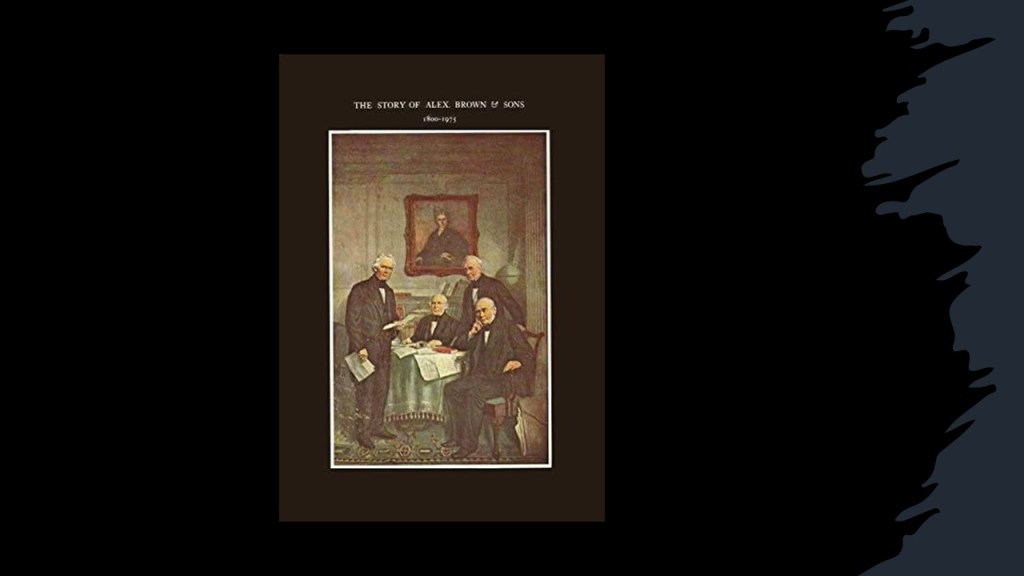
His son William established the Liverpool office in England of the family business; George and John founded “Brown Bros. & Company” in Philadelphia, Pennsylvania; and James opened a branch in New York City and Boston.
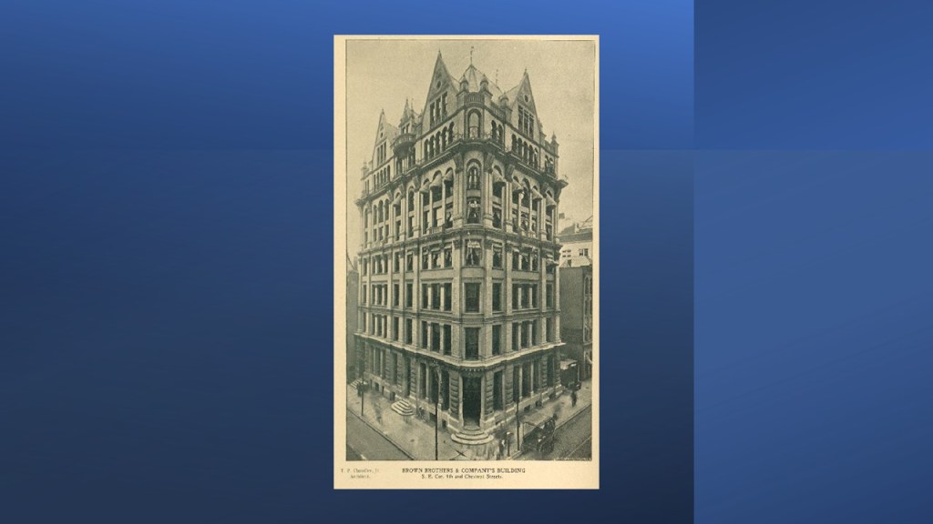
This is what we are told about Brown Brothers & Company, that during the first 100-years of its existence, it helped make paper money standard currency in the United States; underwrote the first railroad and trans-Atlantic steamship companies; and essentially created the first foreign exchange system between the American dollar and the British pound.

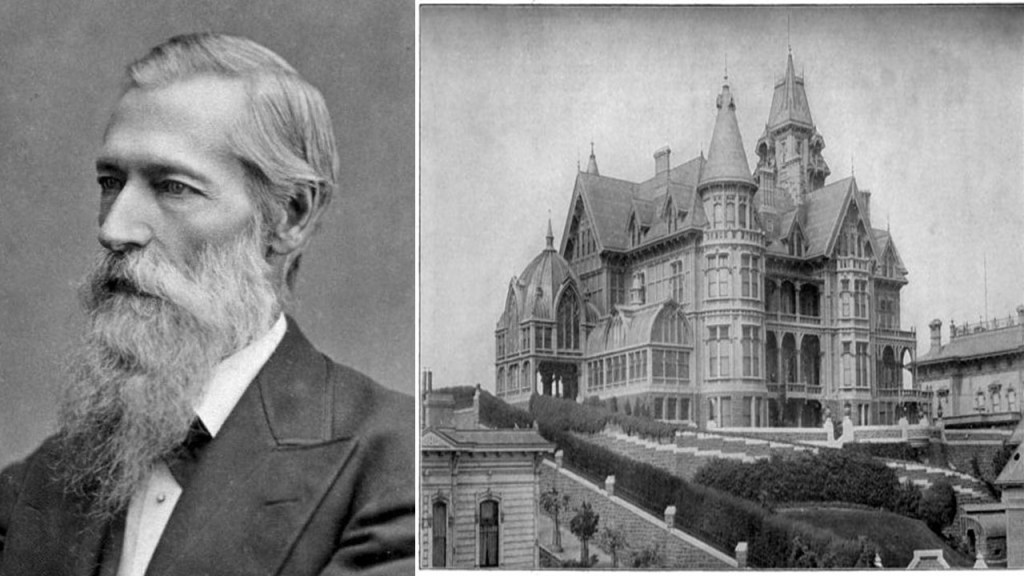
In 1931, the Brown Brothers merged with the Harriman Brothers & Company, a private bank started with railway money, in 1931 to become known as the “Brown Brothers Harriman & Company,” one of the oldest and largest private investment banks in the United States.
Founding partners of the “Brown Brothers Harriman & Company” included W. Averill Harriman, the son of railroad baron E. H. Harriman, and Secretary of Commerce under President Harry S. Truman…

…and Prescott Bush, American banker and politician, and the father of President George H. W. Bush.

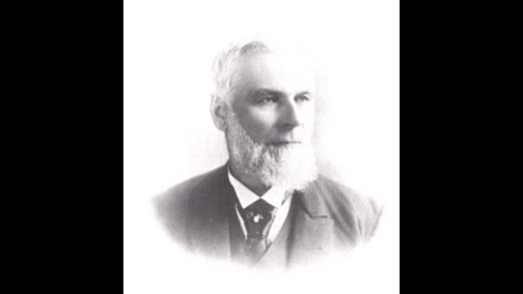
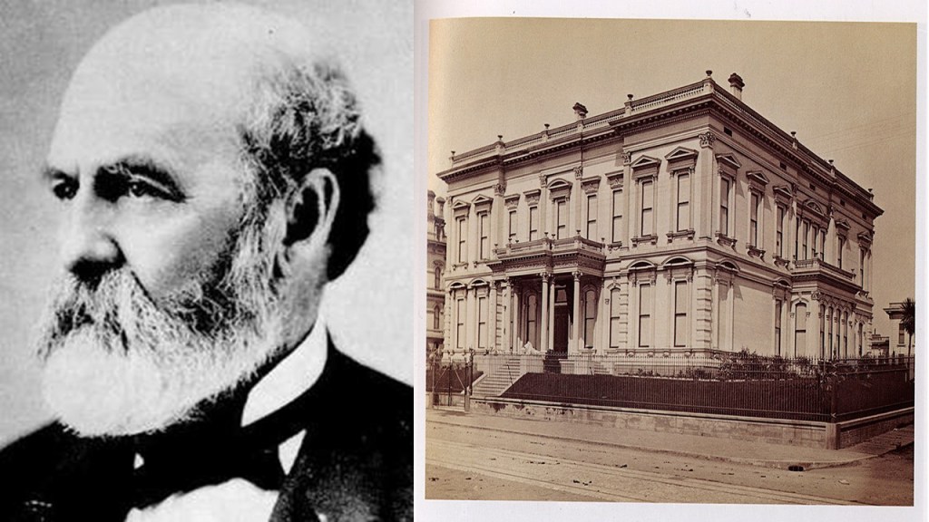
Another noteworthy American financier who emerged between 1800 and 1840 was George Peabody.
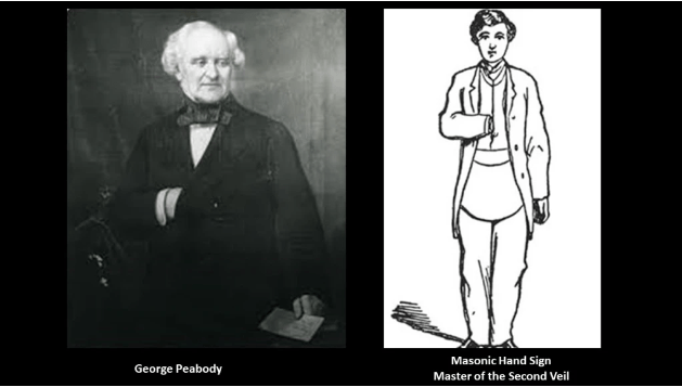
George Peabody got his start in the dry goods business with his brother in what is now Peabody, Massachusetts, and when their store burned down, George went to Georgetown in the Washington, DC, area in 1811 to work in a wholesale dry goods warehouse.
Not long after, he became an office boy for the owner of the warehouse, Elisha Riggs, and not long after that, he became a partner in the wholesale dry goods firm of Riggs, Peabody and Company.
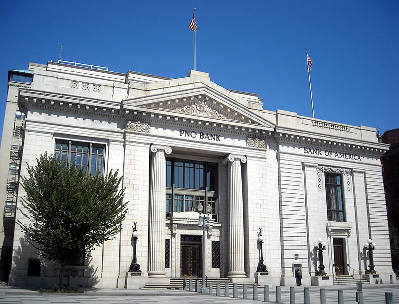
Elisha Riggs also financed the founding of Riggs National Bank, which was organized by his son George Washington Riggs.
This building on Pennsylvania Avenue in Washington, DC, said to have been completed in 1902, served as the headquarters for Riggs National Bank until 2005, when Riggs was dissolved, and acquired by PNC Financial Services.
During the years George Peabody lived in Baltimore, he established his own career as a businessman and financier.
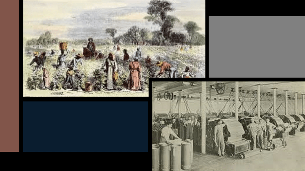
He first travelled to England in 1827 to purchase wares, and negotiate the sale of American cotton in Lancashire.
By 1825, cotton was Britain’s biggest import, primarily from American cotton fields, and Lancashire was dominant force in the British economy with its cotton industry, where the raw cotton was turned into thread and fabrics in a factory-based production line with the advent of the Industrial Revolution in this industry, and marked the birth of the British-working class.

George Peabody opened an office in Liverpool, with British business playing a more and more important role in his business affairs.
The bankers who helped establish him in Liverpool included Sir William Brown, 1st Baronet of Richmond Hill, one of the sons of Alexander Brown, who managed his father’s Liverpool office.
With all of his great connections, George Peabody branched out.
He took up residence in London permanently in 1837, and went from being a wholesale dry-goods and cotton merchant, to a merchant-banker offering securities in American railroad and canal enterprises to British and European investors.
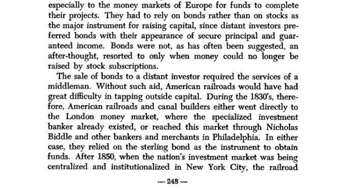
He started a banking business trading on his own account a year after he moved to London, and by 1851, he established the banking firm of “George Peabody & Company” to meet the increasing demand for securities issued by American railroads, and his company specialized in financing governments and large companies.
Apparently railroad and canal developers in the early 19th-century in the United States needed investment capital, and turned to European money markets for the funding to complete their projects.
Likely this investment capital was needed to dig them out of the mud, muck and dirt, and make them operational again.
Apparently the development of the textile sector in the economy led directly to the large investments of capital needed for the creation of the New World.

Along with everything else, I am seeing that rail-tracks, and all pre-existing infrastructure for that matter, were dug-out from a deliberately-caused cataclysmic event known as the mud flood, which messed with time as well, resulting in the hijack of the original positive timeline
I think it was all-electrified prior to the mud flood, and when the Earth’s free energy grid was taken down, most energy sources for mass transportation were replaced by oil and coal until they could get the electricity up and running again, later to be replaced by cars and buses.

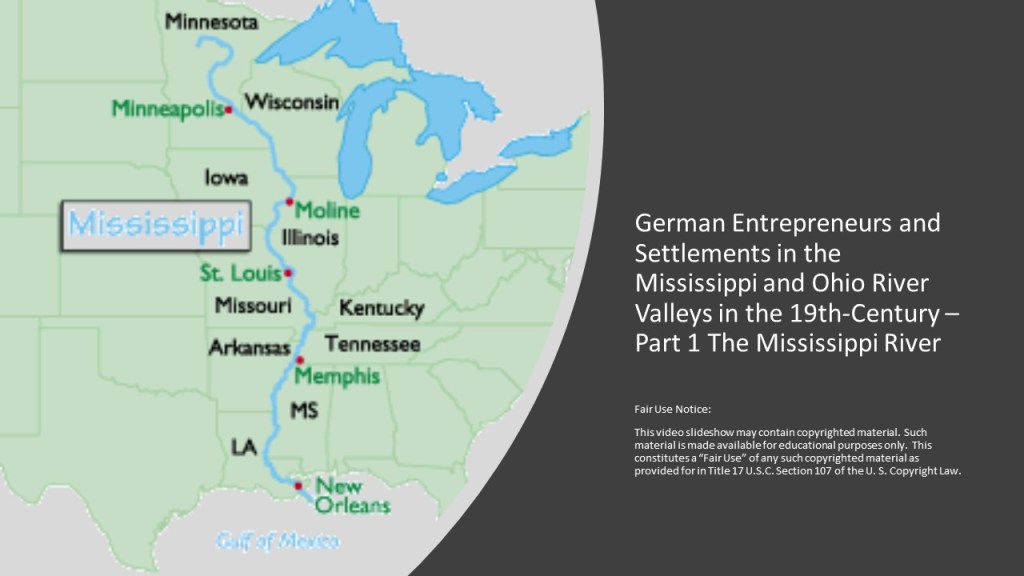
Here’s some information related to cotton and another noteworthy connection that I found researching “German Entrepreneurs and Settlements in the Mississippi and Ohio River Valleys in the 19th-Century along the Mississippi River” back in February of 2021.
The German-Jewish community in Natchez, Mississippi, started to organize in the 1840s, many of whom opened retail stores in the Under-the-Hill District, though there had been some early arrivals in the late 1700s.
Interesting there would be a cotton boll in the Star of David picture here.
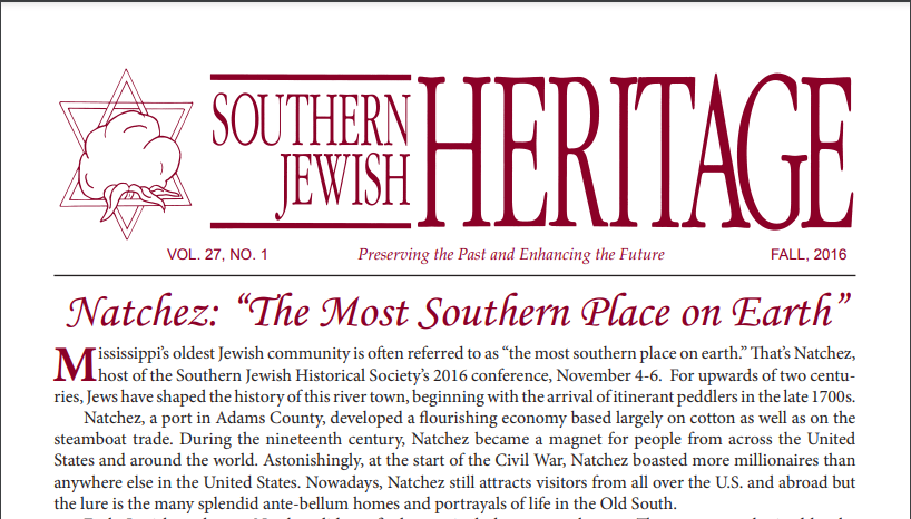
Apparently, according to an 1858 survey, 8-out-of-12 Jewish businesses in Natchez traded in clothing or dry-goods, merchants like Aaron Beekman.
We are told that after the Civil War, the Natchez Jewish community continued to grow in size and prominence.

It is interesting to note there was a Monsanto Chemical Company connection to Natchez.
The Monsanto brothers Benjamin and Jacob were from a Sephardic Jewish slave-trading family originating in Spain, who ended up coming to live in Natchez.
Benjamin Monsanto, a slave-holder-and-seller, purchased the cotton-producing Glenfield Plantation in 1787.

A Natchez Monsanto descendent by the name of Olga Mendez Monsanto married John Francis Queeny, who founded the Monsanto Chemical Company in St. Louis in 1901 and named it after his wife’s family.
“Monsanto” means sacred or holy mountain in Spanish and Portuguese.

The first product the Monsanto Chemical Company manufactured was saccharine, which Queeny sold to the Meyer Brothers Drug Company in St. Louis.

Monsanto was acquired by the German multinational Bayer Pharmaceutics and Life Sciences Company after gaining United States and EU regulatory approvals on June 7th of 2018 for $66-billion in cash, and Monsanto’s name is no longer used.

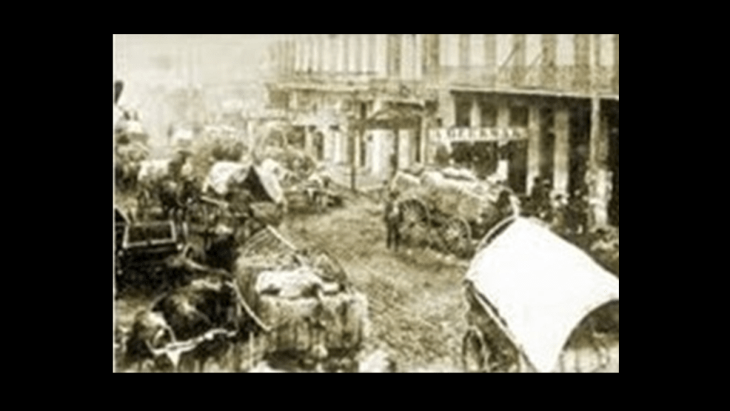
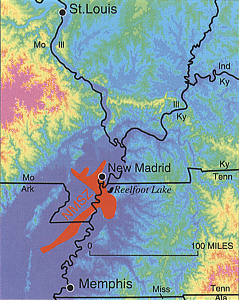
Next, the New Madrid Earthquakes and the cotton connection.
New Madrid is located on the Missouri-side of the Mississippi River’s Kentucky Bend.
In our historical narrative, the New Madrid Earthquakes took place on December 16th of 1811; on January 23rd of 1812; and on February 7th of 1812.
They were estimated to be the largest earthquakes ever recorded in the United States, that the USGS estimated were between 7 and 8 on the Richter Scale.

The series of earthquakes in the New Madrid region dramatically affected the landscape, causing bank failures along the Mississippi River; destroyed entire communities; caused landslides; large tracts of land subsided on the Mississippi flood plain; and liquified subsurface sediment spread over a large area at great distances.
Descriptions of what happened during the first one included rolling ground; uprooted trees; huge chasms opening up and swallowing whatever was above; the Mississippi River flowing backwards; and general pandemonium from frightened people.

It is interesting to note that after all of this devastation, it took three-years to get federal action on disaster relief for the region with the onset of the War of 1812.
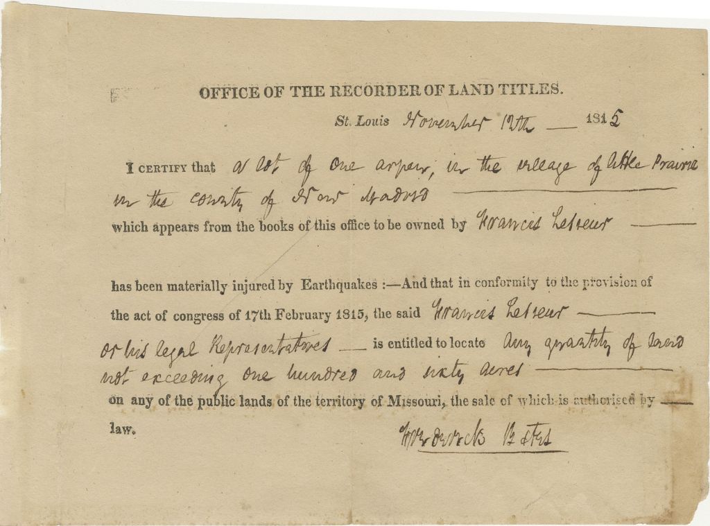
Congress finally approved $50,000 for the New Madrid Relief Act on February 17th of 1815, making it the nation’s first disaster relief of its kind.
The Act provided that anyone who lost land due to the earthquake was eligible to receive between 160 and 640 “like acres” of land elsewhere in Missouri.
What we are told ended up happening was land agents arriving in the area to buy up the acreage and conned many New Madrid residents, offering them pennies on the dollar, and speculators subsequently claimed the new lands, and that of the 516 certificates issued by Congress, only 20 went to New Madrid residents, with most being held by people in St. Louis.
In the following years, the fertile flood-plain land was developed for growing cotton.
Today, New Madrid is the second-leading producer of cotton in the State of Missouri, and the percentage of organic farming in New Madrid County indicates none.

It is significant to note that unless certified by the Global Organic Textile Standard (GOTS), cotton fabrics are known to contain chemicals like ammonia, heavy-metal-based dyes, formaldehyde, flame retardants, petroleum scours and softeners.

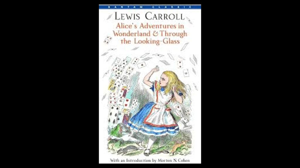
“Alice’s Adventures in Wonderland” was first published in 1865 by Lewis Carroll.
It is a favorite book of those who have occulted our timeline, and there is a lot of encoded information in the book about what has taken place here in a book characterized as belonging in the genres of “literary nonsense” and “fantasy.”
Of particular interest for me here in the context of this subject matter is the character of the “Hatter” in the book.
The “Hatter” appears in the “A Mad Tea-Party” chapter of the book.
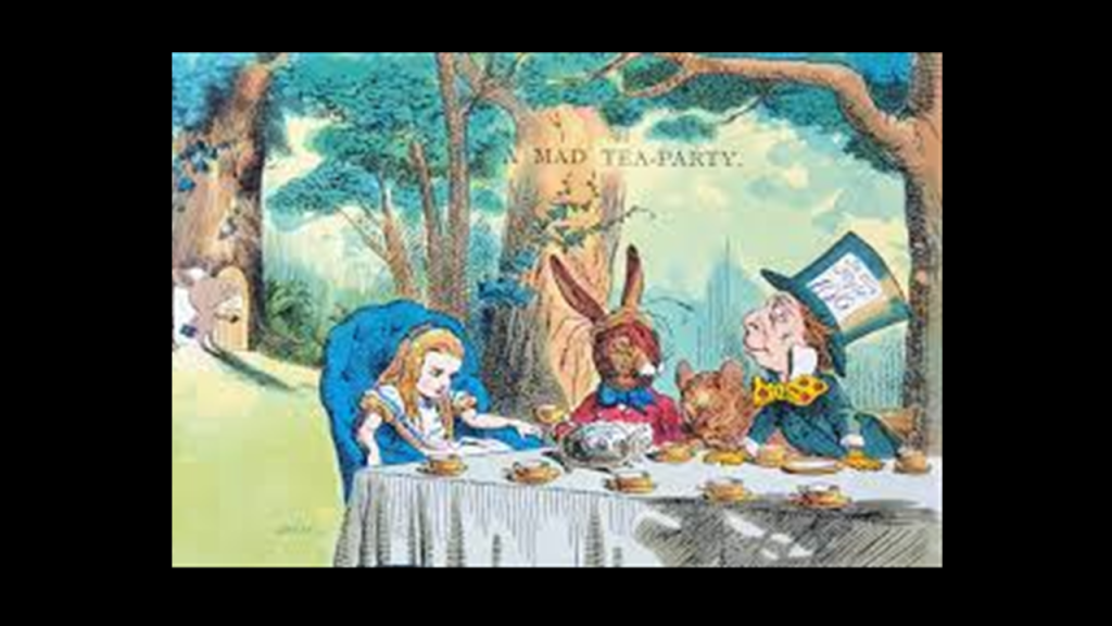
The phrase “Mad as a Hatter” in the Victorian-era was used to suggest someone was insane.
Apparently, the chemical element mercury was used in the manufacturing of felt hats during the 19th-century, causing a high-rate of mercury poisoning in those working in the textile industry.
Mercury poisoning caused neurological damage, resulting in things like slurred speech, memory loss and tremors, and many of the afflicted workers ended up living in lunatic asylums.
Was there a direct connection between the word “mercery,” and the word “mercury?”

Have the Controllers been using Alchemy against us?
With the information that’s available to find, I would say yes, definitely!
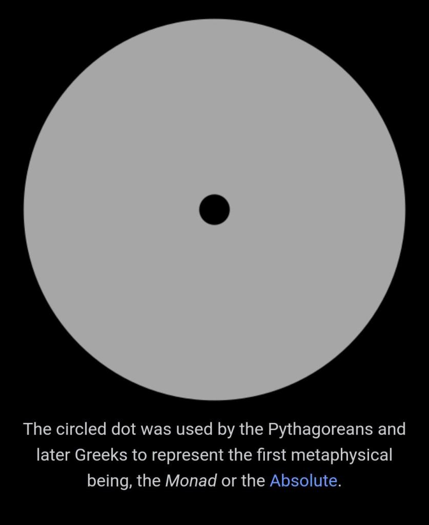
The alchemical symbol for mercury is on the left, and John Dee’s “Hieroglyphic Monad” is on the right bearing an unmistakeable resemblance to it.
Dee said his “Hieroglyphic Monad” contained the essence of alchemical transformation and spiritual evolution.
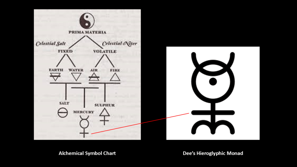
Dee’s Hieroglyphic Monad also contains the representation of the Monad used in philosophical schools like that of the Pythagorean to represent the Absolute – the Supreme Being, Divinity, and the Totality of All Things.
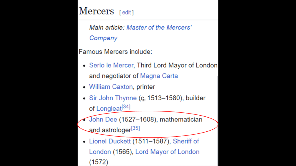
Dee was also said to have joined the Worshipful Company of Mercers in 1555, the same year the College of Arms took up residence on Queen Victoria Street in the City of London and the Stationers’ Company Register was established as a record book for the Stationers’ Company of London as a means to record publications.
The alchemists of the original civilization used mercury and red mercury (also known as cinnabar) as sacred substances, an elixir of life, and as a medicine…even though mercury in any form is poisonous.
The red mercury Cinnabar was a candidate for the Philosopher’s Stone, an alchemical substance capable of turning base metals such as mercury into gold, and considered the “elixir of life,” used for rejuvenation and immortality.
Cinnabar is a compound of mercury, sulfur, and salt, or otherwise known as a salt of mercury sulfide.

There were also large quantities of mercury found in three chambers underneath the Quetzelcoatl (Feathered Serpent) pyramid at Teotihuacan in Mexico.
Teotihuacan was known as the “place where men became gods.”

Alchemy is currently defined as the medieval forerunner of chemistry, based on the supposed transformation of matter, and concerned particularly with converting base metals into gold.

Khem was the ancient name of Egypt, and associated with both Alchemy and Chemistry.

What if Egypt means much more than what we have come to know as one geographical location on the Earth?
Just leaving this concept I found in my research here for consideration as well.

It gets really confusing because we have been thoroughly lied to about our real history here on Earth, along with many other things happening up to the present-day.
And what was really one, integrated, harmonious civilization all over the Earth had their identity, wealth and legacy stolen.
An ancient Moorish civilization dating back to ancient Mu, or Lemuria that continued on through Atlantis, that we have not been told about existed up until relatively recently in time, much more recently than one would think.
Everything we have come to know as separate from each other were all one and the same in the original Moorish civilization, and Moorish Science was highly advanced in all aspects.
Those behind the New World Order separated everything out in order to create discord, division, and disharmony, and all of the Moorish symbolism was taken over, their works and legacy falsely claimed, and/or given a darker meaning by association with certain things that were not the original meaning.
The Rothschilds purchased Jerusalem in 1829, and subsequently acquired considerable land in Palestine in the 1800s and early 1900s.

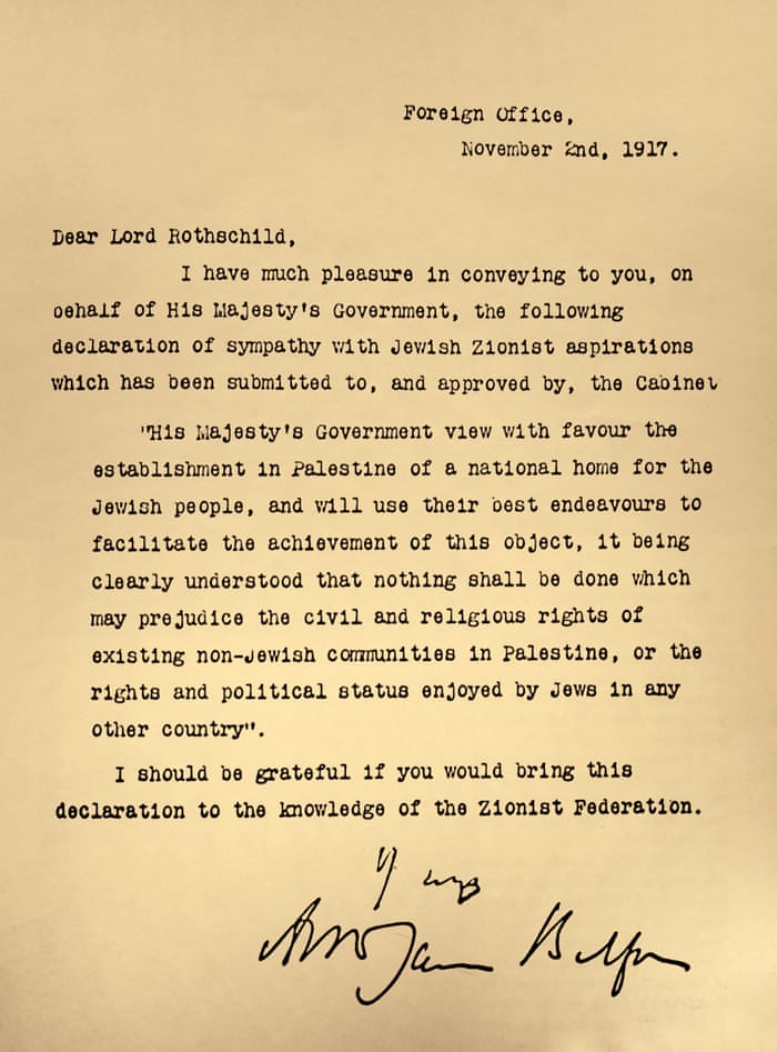
In 1917, the Balfour Declaration was issued by the British government, during the first World War, announcing the support for the establishment of a national home for the Jewish people, written by the Foreign Secretary Arthur Balfour to Lord Rothschild, a leader of the British Jewish community.
A League of Nations Mandate was a legal status for certain territories transferred from the control of one country to another after World War I, in this case territories that were conceded by the Ottoman Empire following the end of World War I in 1918.
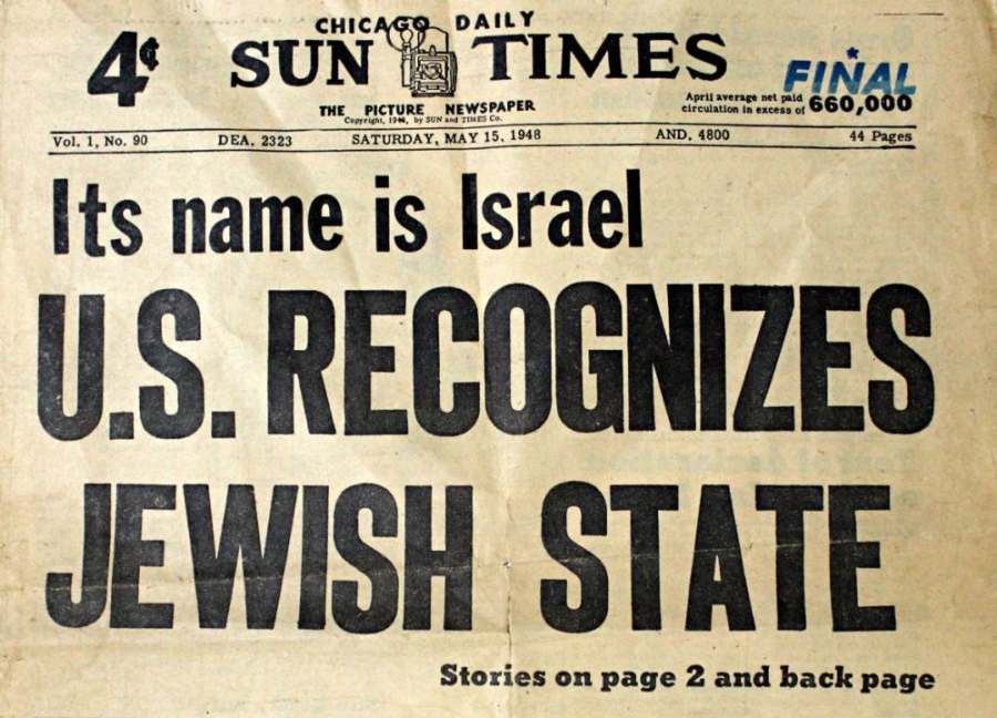
Despite growing conflict between Palestinian Arabs and Palestinian Jews, Truman ultimately decided to recognize Israel.
David Ben-Gurion proclaimed the establishment of the modern State of Israel on May 14th of 1948, and President Truman recognized the new nation on the same day.
On the same day the new State of Israel was proclaimed, and the British Army withdrawn, gun-fire broke out between Jews and Arabs, and Egypt had launched an air assault that evening, and thus the seeds for future conflict were sown right away, and still with us in the present-day.
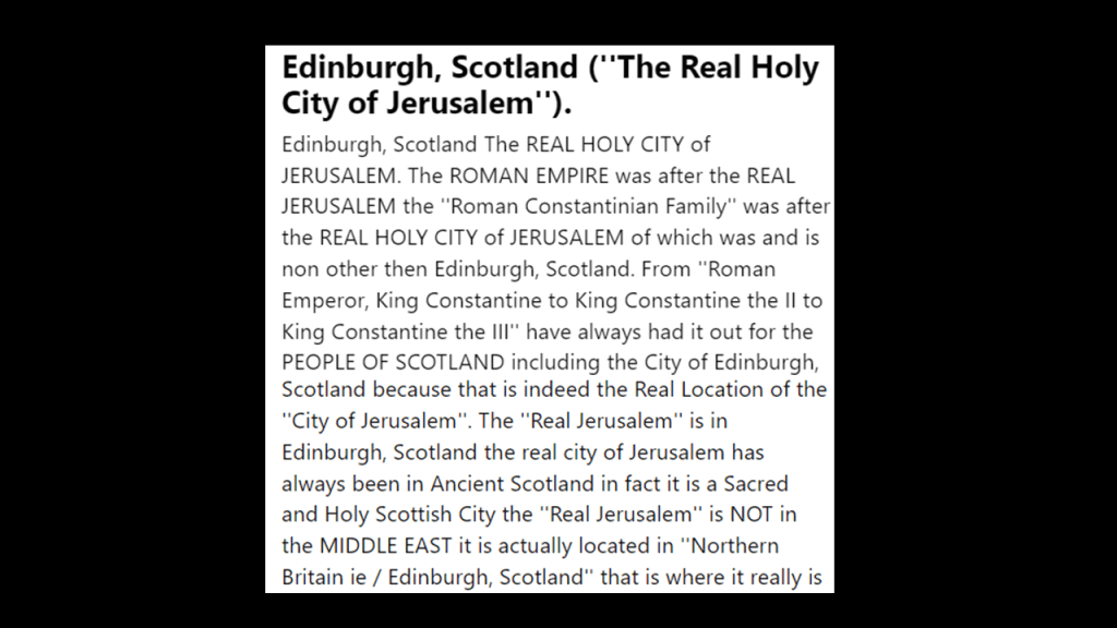
So could the Controllers possibly be hiding from us that the real Jerusalem is in Scotland, where the Crown Jewels are kept at Holy Rood Palace in Edinburgh along with the Stone of Scone coronation stone, AKA Jacob’s Pillow?
They didn’t rewrite history from scratch – they rewrote the historical narrative to fit their agenda for world domination.
I don’t know exactly where fabricated history ends, and real history begins, but at some point the Controllers wrote themselves into history and all we have been taught is the official narrative from cradle-to-grave.

We don’t see the copious evidence for the original ancient, advanced civilization in the environment around us because it is not supposed to be there.
And then it becomes readily apparent once we start realizing that what is there all around us does not match the narrative, and start to question the narrative.

The Controllers have always feared our Awakening, and they have thrown everything they’ve got at us to prevent it from happening
They have poisoned our bodies with our clothing, food, Big Pharma medicine, water, air, and so many other things.
Once we wake up, claim our power, and know about their severe crimes against Humanity, they are toast.
Our Awakening can’t be stopped and is happening now.