
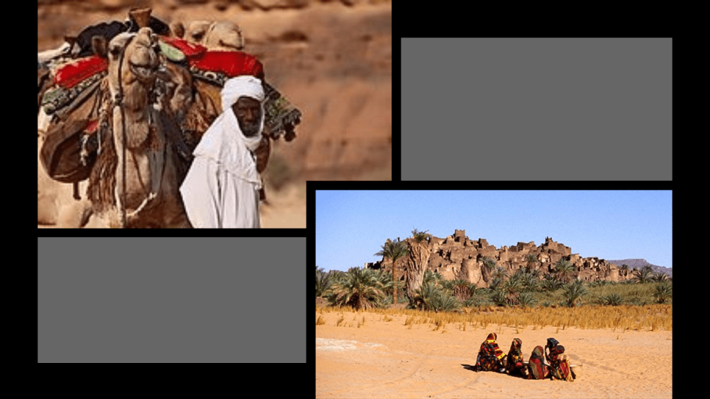
I ended Part 1 of this series in Portland, Maine, where this alignment emanating off the North American Star Tetrahedron leaves North America and crosses over the Atlantic Ocean and heads towards North Africa.
I will be starting this post in the North Atlantic Ocean and the New England Seamounts on the way to the island of Tenerife in the Canary Islands then across the North African Countries of Western Sahara; Algeria; Niger; Chad; Sudan; Ethiopia; Somalia; and ending it at the island Republic of the Maldives in the Indian Ocean.
I am going to focus on things like striking similarities in building styles and design features, landscape features, some of what we know of its history and the extensive mining and resource extraction activities of this region.
I speculated at the end of Part I of this series, as I have in other posts, that what are called “Continental Shelves” and the marshy estuaries that are found all along the Earth’s coastlines, are actually submerged landmasses and ruined land.
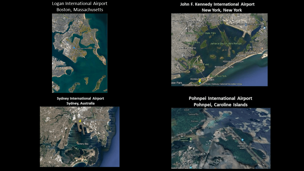
I have been studying harbors and bays in-depth around the world in present and past research.
They have` similar characteristics of what appears to be sunken and destroyed land, in particular along continental coastlines, and in these cases shown here, next to international airports and bodies of water that are described as either estuaries or lagoons.
On the top left, is Logan International Airport, located right next to Boston Harbor, which is described as a natural harbor and estuary of Massachusetts Bay; and the same configuration as the JFK International Airport in New York, alongside Jamaica Bay; Sydney International Airport on Botany Bay in Australia; and the Pohnpei International Airport, on a small lagoon islet connected to the main island of Pohnpei by a mile-long causeway, in the Caroline Islands in the Federated States of Micronesia.
I have come to believe that the sinking of Atlantis happened at the most hundreds of years ago, and not thousands of years ago as we have been taught, and that this advanced civilization was worldwide.
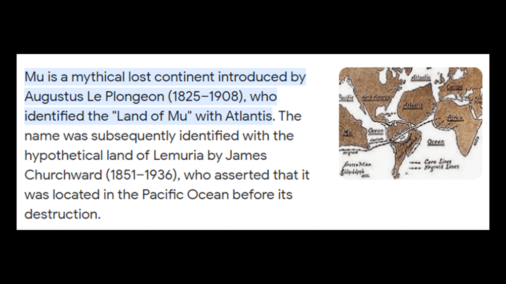
This advanced civilization that developed on Earth originated in the far distant past in ancient Mu, also known as LeMuria; and that this was the same civilization known as “Atlantis,” which I believe existed up until relatively recent times and represents the missing positive timeline of Humanity.
The process of doing the research along this alignment and other alignments has provided extensive evidence for a worldwide, advanced civilization, which has been deliberately suppressed, misattributed and removed from our collective awareness so that we wouldn’t know about its existence.
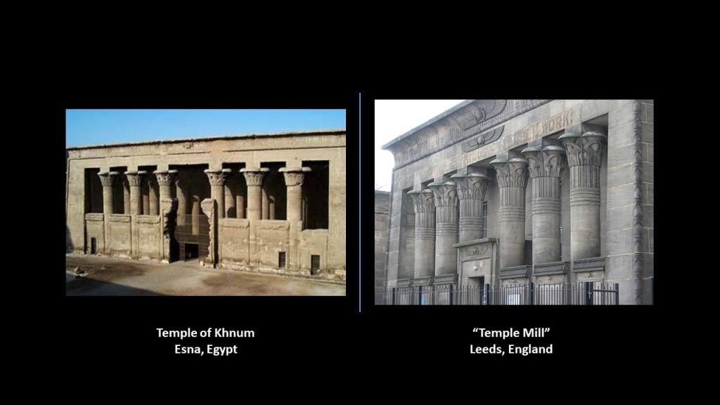
For comparison of similarity of appearance is the Temple of Khnum in Esna , Egypt, pictured on the left, and the Victoria-era “Temple Mill,” in Leeds, England, on the right.
While this map may not represent the actual extent of the Earth’s landmass at the time of the “Fall of Atlantis,” it is the closest representation on a map that I could find to a depiction of the continental landmasses being much more connected than what we have been taught to believe in our historical narrative, a narrative which doesn’t even officially confirm the actual existence of Mu, also known as LeMuria, and Atlantis.
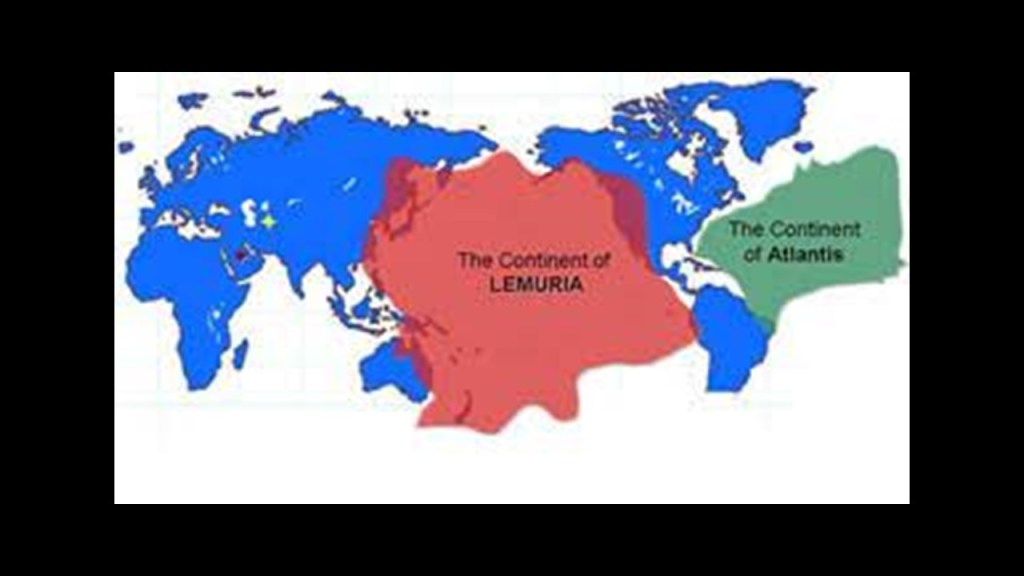
Mu and Atlantis are treated more like historical “maybes” – maybe they once-existed, and maybe they didn’t – and typically placed in the elusive “mythical” category by Academia.
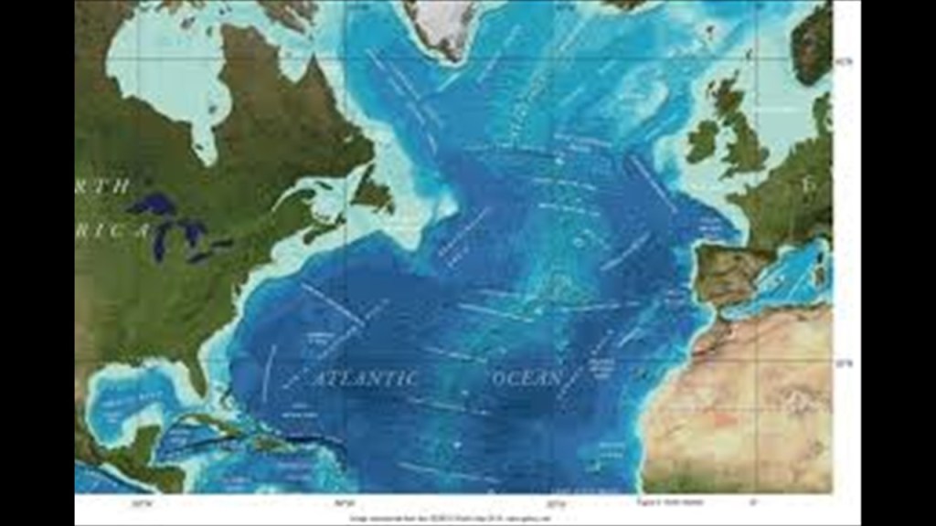
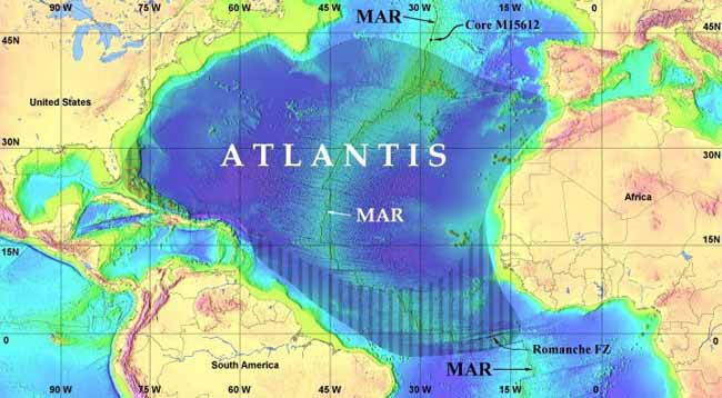
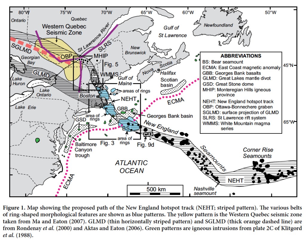
Now I am entering the North Atlantic Ocean on this alignment of cities and places along the that originated at the northern apex of the North American Star Tetrahedron in Edmonton, Alberta.
The “Atlantic” Ocean is one of the most enduring locations of the fabled Atlantis.
Most of the research in this post is based on a series that I published here in 2018, shortly after I started blogging in 2018, though I will also be adding in a considerable amount of research along the way from other projects covering the same places that I have done in the six-years since then.
But this is the first time I have at looked at the North Atlantic Ocean and its underwater topography.
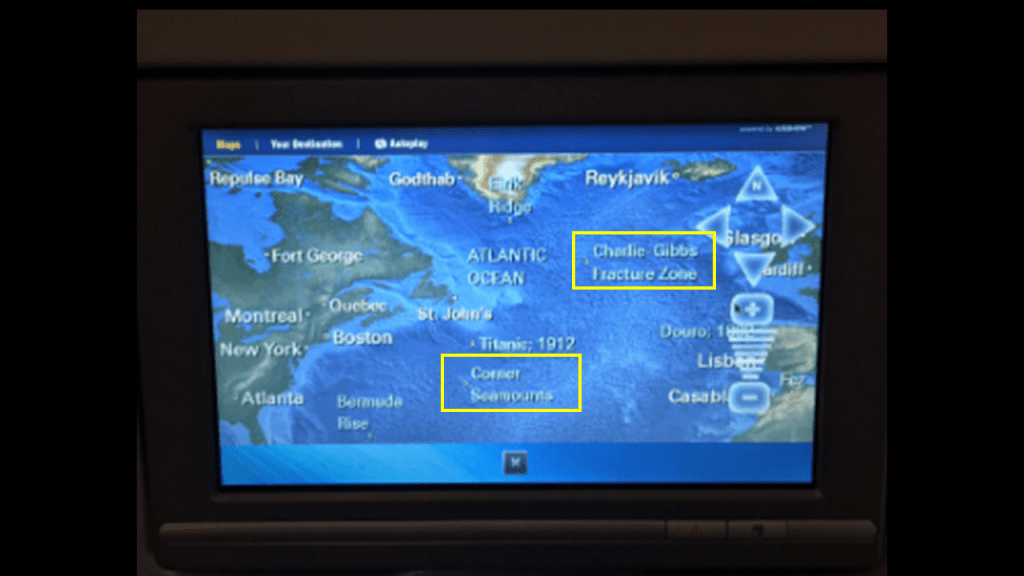
I didn’t think about looking into it until my trip earlier this summer to the Balkans.
On my airline flights across the Atlantic and back, I watched the in-flight tracking map for my entertainment.
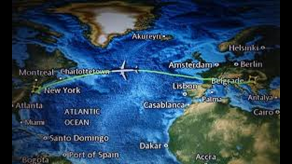
And I kept seeing things like seamounts and fracture zones come up on the screen.
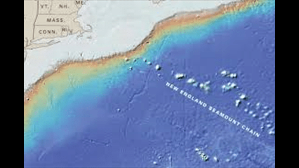
And then when I was looking for images for the area around Portland, Maine, at the end of my last post, I came across images of the New England Seamounts and the surrounding in the North Atlantic Ocean that placed them on the alignment on its way to the Canary Islands, where I had started previously.
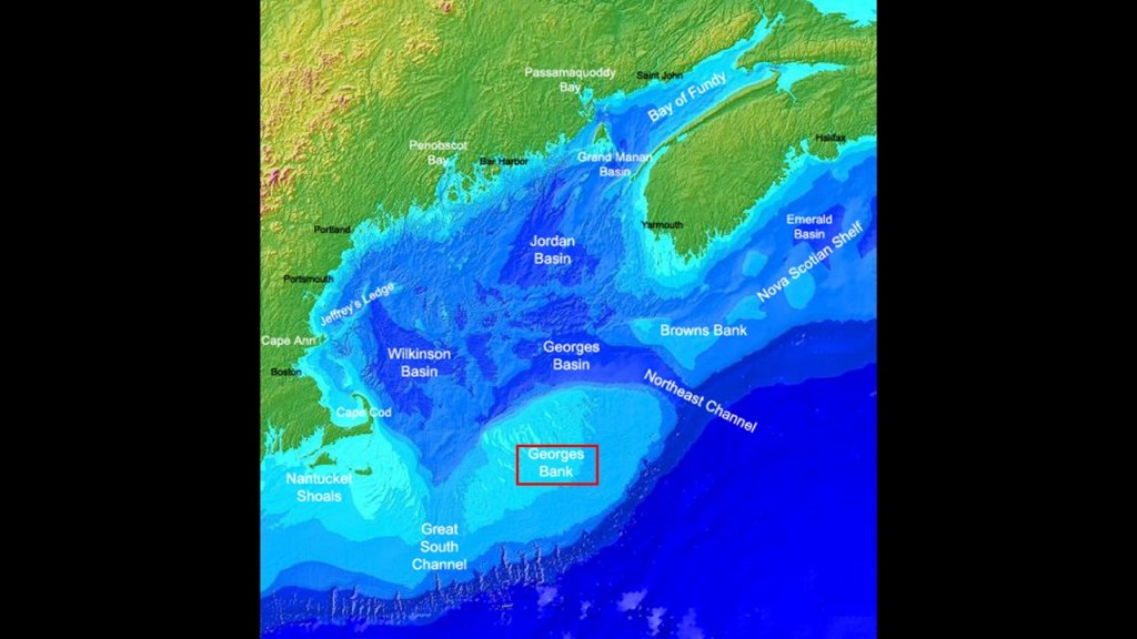
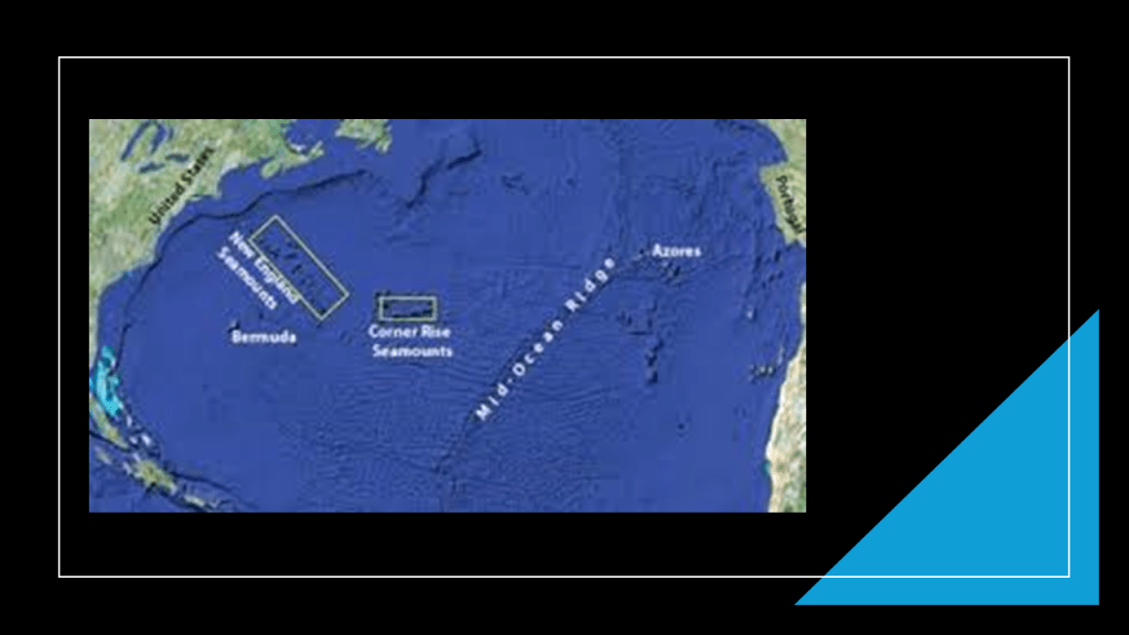
So I am going to look at the following places circled in red on this map: Georges Bank; the New England Seamounts; the Corner Rise Seamounts; Bermuda; and the Mid-Atlantic Ridge.
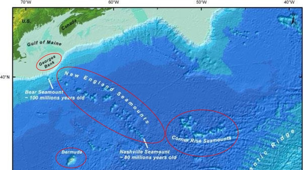
Georges Bank is a large, elevated area of sea floor between Cape Cod, Massachusetts, and Cape Sable Island, Nova Scotia, and separates the Gulf of Maine from the Atlantic Ocean.
Georges Bank is the most westward of the Great Atlantic fishing banks, and has supplied lucrative fisheries for Atlantic Cod and Halibut for centuries.
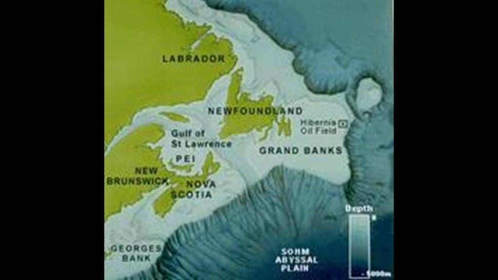
We are told is that the now-submerged portions of the North American mainland are in the Continental Shelf running from the Grand Banks of Newfoundland and that it was part of the mainland as recently as 8,000-to-12,000-years-ago.
The Grand Banks of Newfoundland are a series of underwater plateaus southeast of Newfoundland on the Continental Shelf, and one of the world’s richest fishing grounds.
The underwater plateaus of the Grand Banks are relatively shallow, ranging from 50-to-300-feet, or 15-to-91-meters, in depth.
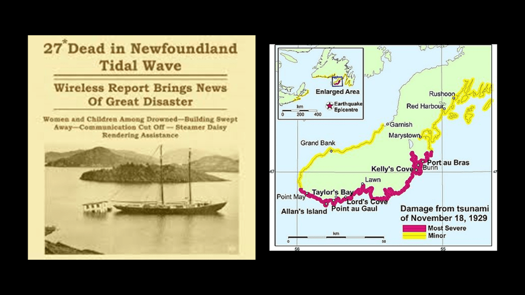
Interesting to note that the 7.2-magnitude Grand Banks Earthquake in 1929, which took place on November 18th, struck the southwestern part of the Grand Banks bordering the Laurentian Channel, causing an underwater landslide, Canada’s largest ever, that severely damaged underwater cables.
It also generated tsunamis that struck the southwest coast of Newfoundland and the French Overseas Territory of St. Pierre and Miquelon, killing an estimated 27 people, but there was never an official report made.
I make note of this because while at one time I would have believed the official narrative that earthquakes are “natural” disasters, I just don’t accept that explanation without question these days.
Same thing with Hurricanes and tornadoes.
I now believe technologies for causing earthquakes and weather warfare exist and are being used today, and that they have existed for far longer than we think.
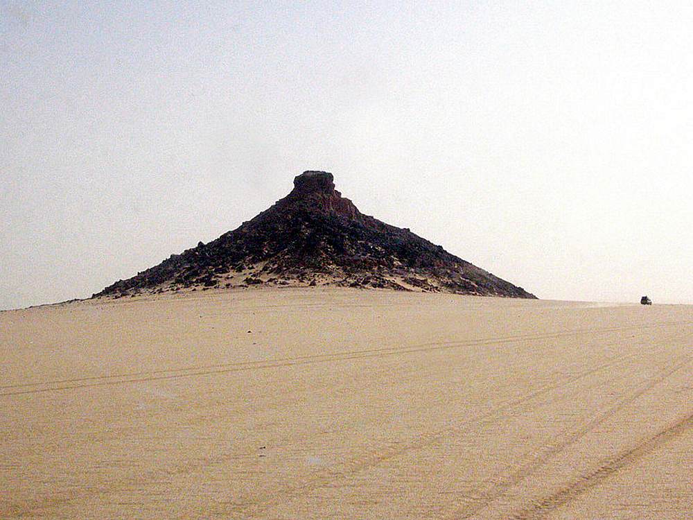
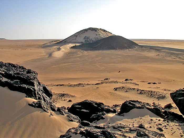
Next, the New England Seamounts.
The New England Seamounts are described as a chain of twenty underwater extinct volcanic mountains known as “seamounts.”
A “seamount” is a large, submarine landform that rises from the ocean floor without reaching the surface of the water.
They are defined by oceanographers as independent features typically formed from extinct volcanoes that rise abruptly from the sea-floor from 3,300-to-13,100-feet, or 1,000-to-4,000-meters, in height.
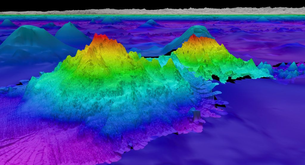
Guyots are seamounts with a flat-surface on top that we are told was created by such things wave action over a long period of time.
So, for example, the Bear Seamount, part of the New England Seamount chain close to Georges Bank, is an example of a “guyot.”
It is shown here next to Physalia Seamount.
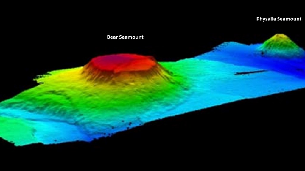
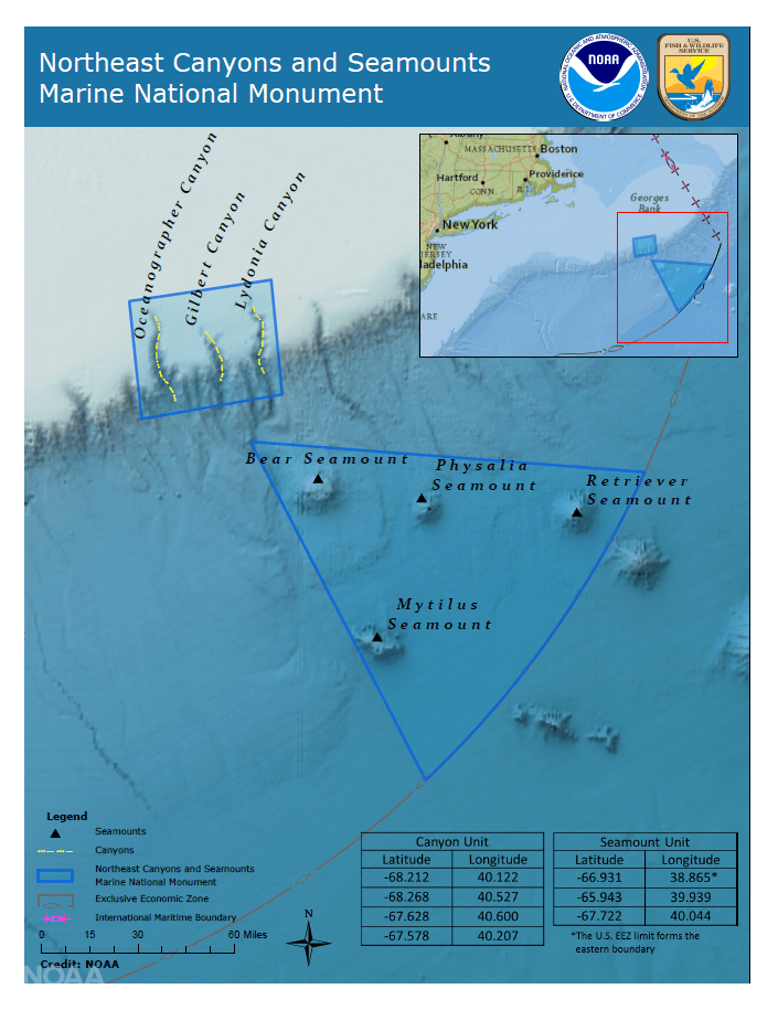
Both the Bear and Physalia Seamounts are part of the Northeast Canyons and Seamounts Marine National Monument, which were created on September 15th of 2016 by President Obama by Proclamation 9496, which was a power granted by the U. S. Congress under the Antiquities Act of 1906, which gave the President the authority to create national monuments from federal lands to protect significant natural, cultural or scientific features.
It is the first U. S. Marine National Monument in the Atlantic Ocean, and protects four seamounts and three submarine canyons on the edge of the Continental Shelf.
It is interesting to note that these seamounts, described as large, submarine landforms that rise abruptly from the ocean floor and independent features typically formed from extinct volcanoes sounds very similar to the definition of “Monadnocks,” which are found on land.
This translates to a “hard, metamorphic rock that was originally pure quartz sandstone that is an isolated rock hill, knob, ridge, or small mountain that rises abruptly from a gently sloping or virtually level surrounding plain.”
Here are some other examples of places classified as “Monadnocks.”
Pilot Mountain in North Carolina on the top left; Harteigen in Norway is seen on the top right; Devil’s Tower in Wyoming on the bottom left; and Cooroora in Australia on the bottom right.
But what if “Monadnock,” for one example, is a word used to cover-up gigantic tree stumps?

Here are some examples of giant trees and stumps that are identified as such.
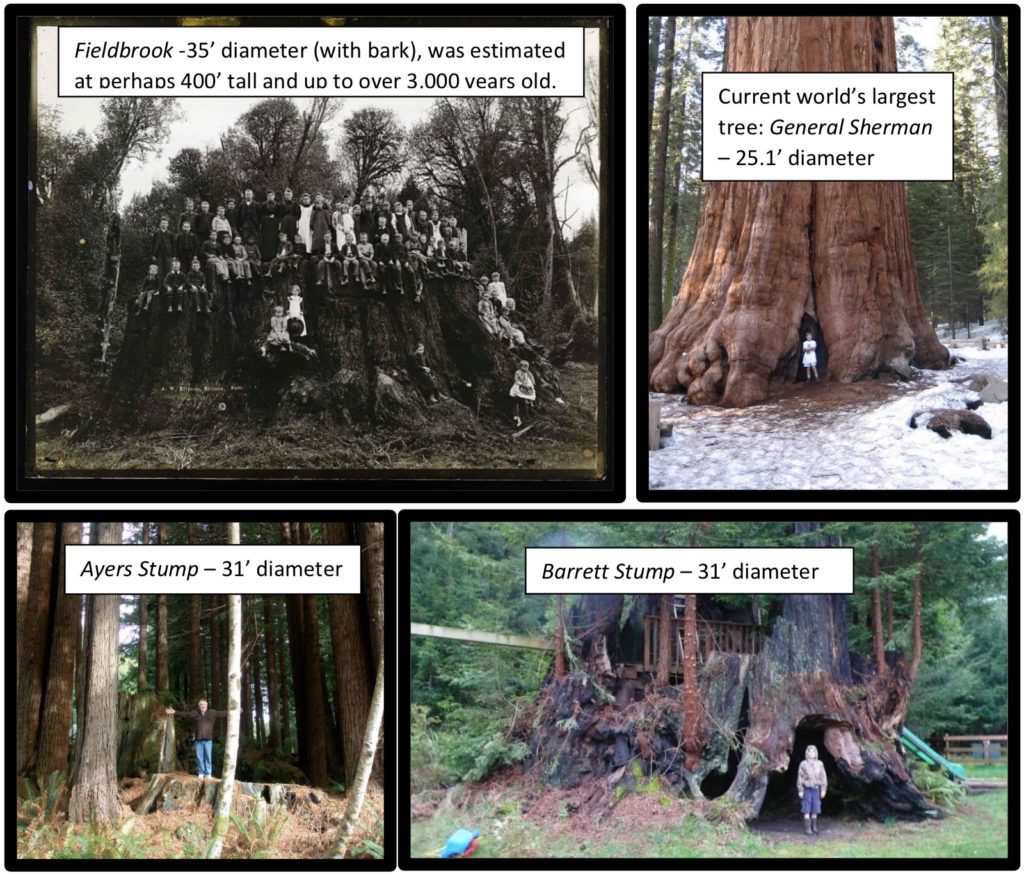
In this comparison, we have the Devil’s Tower from another angle on the left; the Jugurtha Tableland in Tunisia in the middle; and the Hammam Damt volcano in Yemen looking very tree-stumpish!
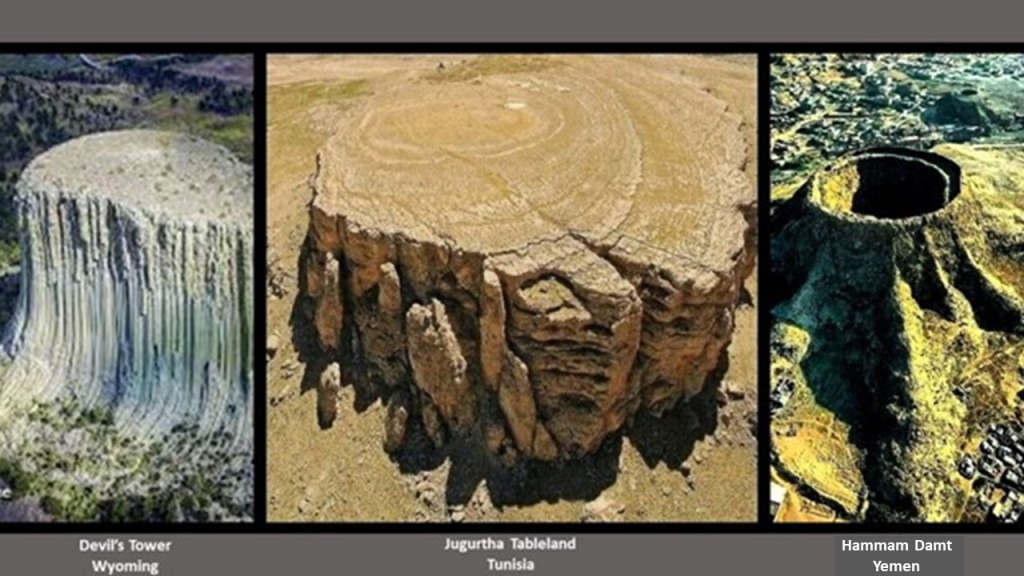
Now compare these three with the Bear Seamount on the right.

The New England Seamounts, along with the neighboring Corner Rise Seamounts, are part of the New England Hotspot, also known as the Great Meteor Hotspot.
What we are told is that these seamounts were formed when the North American Plate moved over the New England Hotspot 75-million years ago.
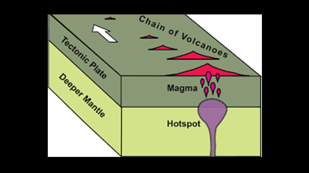
Hotspots are defined as a region of Earth’s mantle where magma arises from within the Earth and forms volcanoes on the crust above.
Now I am going to take a look at Bermuda, just to the southwest of the New England and Corner Rise Seamounts.
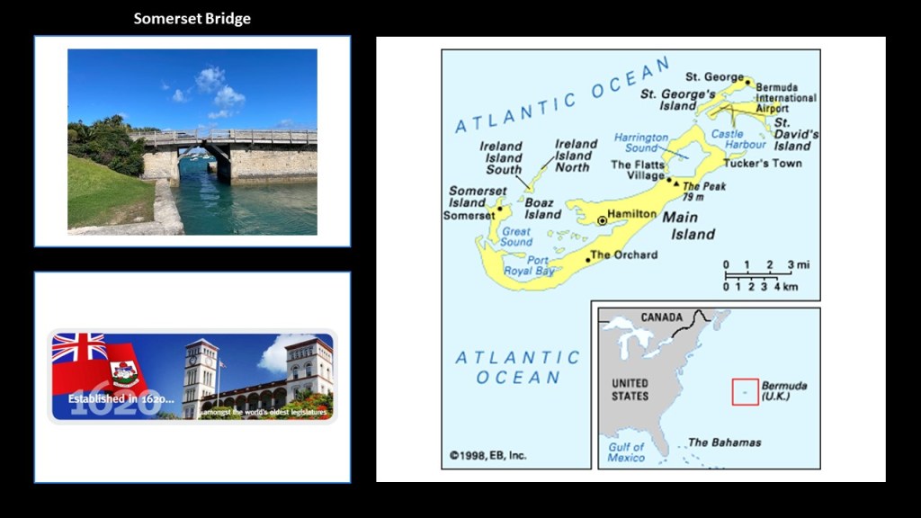
Bermuda is described as an archipelago of over 170 islands, with the most significant islands connected to each other by bridges, like the Somerset Bridge, the world’s smallest working drawbridge, that was said to have been constructed in 1620, as it was mentioned in the Acts of Parliament of Bermuda’s first parliament in August of 1620.
Bermuda is the oldest of the British Overseas Territories, having been first settled by the English in 1612.
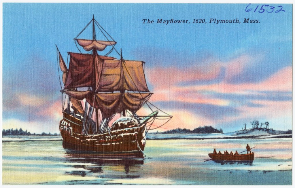
For historical perspective in our narrative, 1620 is the same year the Pilgrims on the Mayflower left Plymouth in England bound for North America on September 16th.
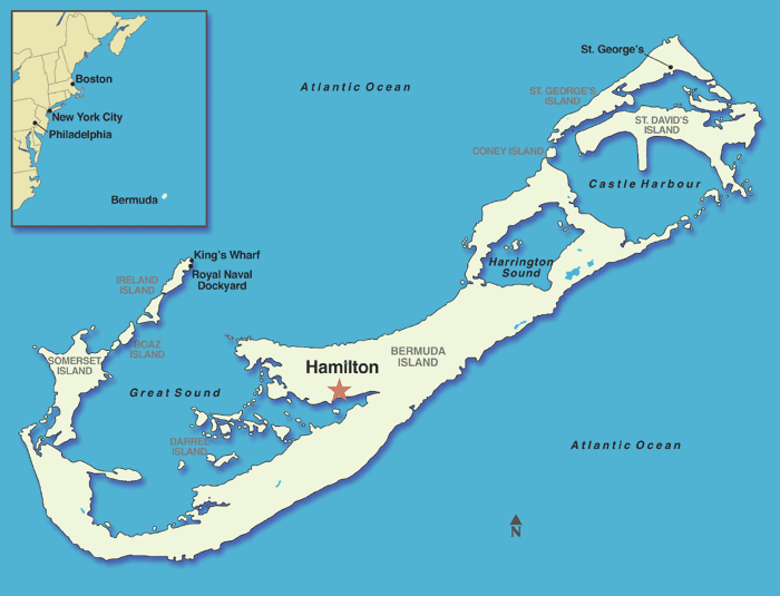
The capital of the British Overseas Territory of Bermuda is Hamilton.
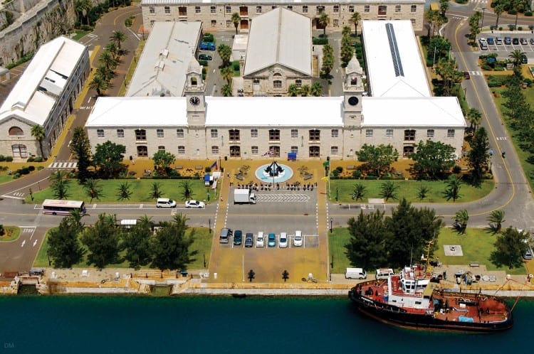
This map shows the location of the Royal Navy dockyards in Bermuda.
We are told it was built by the British Royal Navy in 1795.
It was once home to Britain’s largest naval base outside of the United Kingdom until it closed permanently as a naval base in 1995.
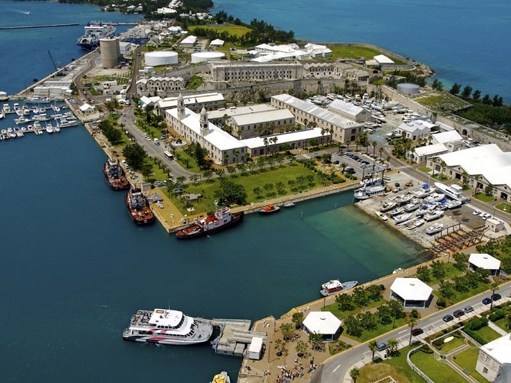
Now it is the home of the Clocktower Mall, hosting a variety of shops, boutiques and restaurants.
This is a 1624 map of Bermuda, attributed to Captain John Smith, who was involved with the Virginia Company of London’s plan to colonize Virginia for profit.
Smith’s books and maps were important in the English colonization of the New World.
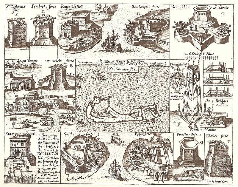
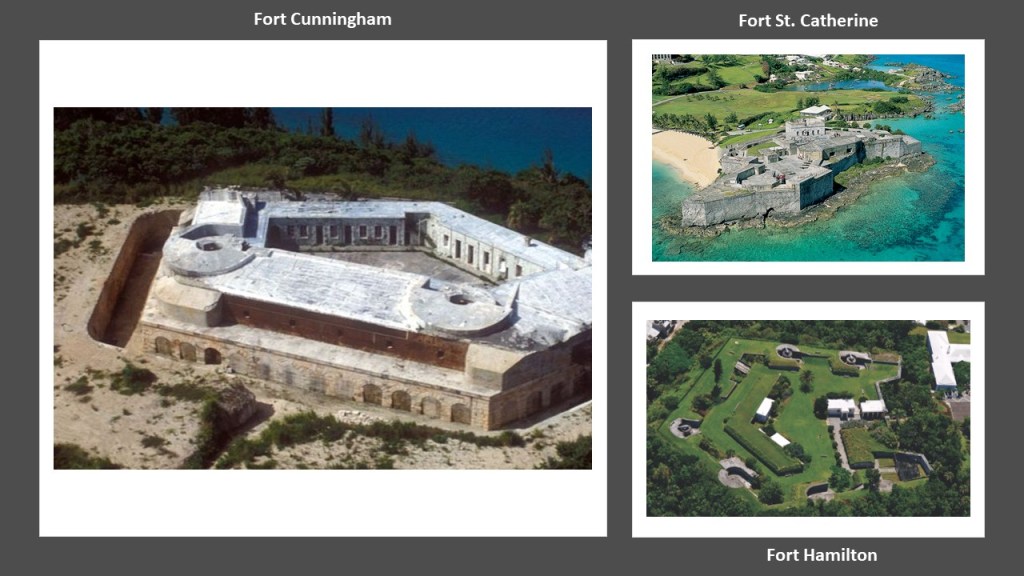
As a matter of fact, there are dozens of old forts on the island of Bermuda to this day, like Fort Hamilton, Fort St. Catherine, and Fort Cunningham.
What we are told is that in 1606, King James I of England & VI of Scotland issued Royal Charters for what became known as the Virginia Company and the Virginia Company of Plymouth, with the objective of raising funds from investors in order to colonize the eastern coast of America.
The Virginia Company was responsible for colonizing the east coast between the latitudes of 34-degrees N and 41-degrees N, and the Plymouth Company between the latitudes of 38-degrees N and 45-degrees N.
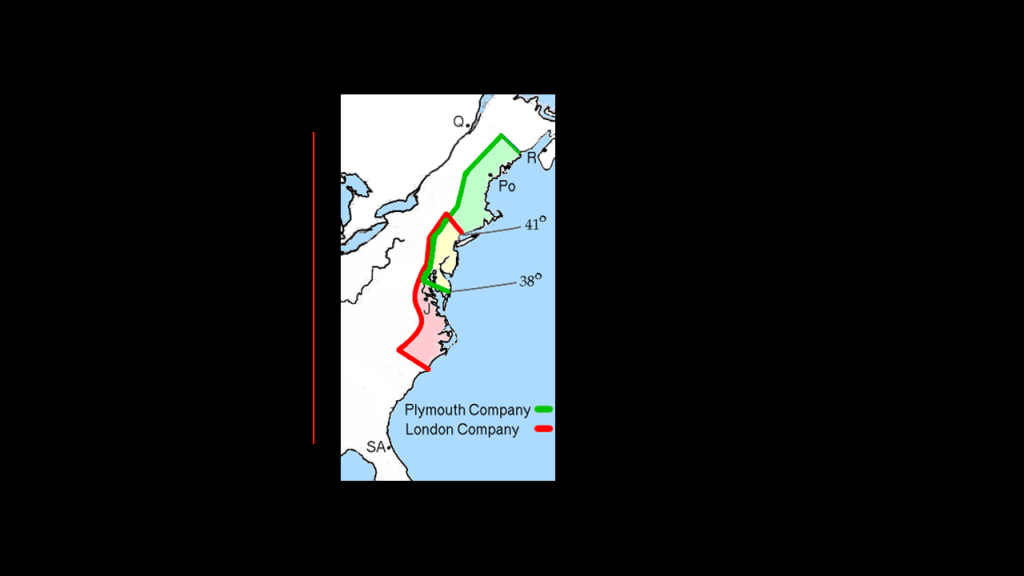
The Virginia Company established its first settlement of James Fort in Jamestown in May of 1607 and the same year established the Popham Colony in Maine.
Jamestown was considered the first permanent English settlement in the Americas, and served as the capital of the Virginia Colony from 1616 until 1699.
The Popham Colony near the mouth of the Kennebec River in present-day Phippsburg, Maine in 1607, was established a few months after Jamestown.
The Popham Colony, however, was short-lived, only lasting 14-months before being abandoned due to multiple problems, from lack of funding, to lack of surviving colonists.
Yet Fort St. George was said to have been built there during that time.
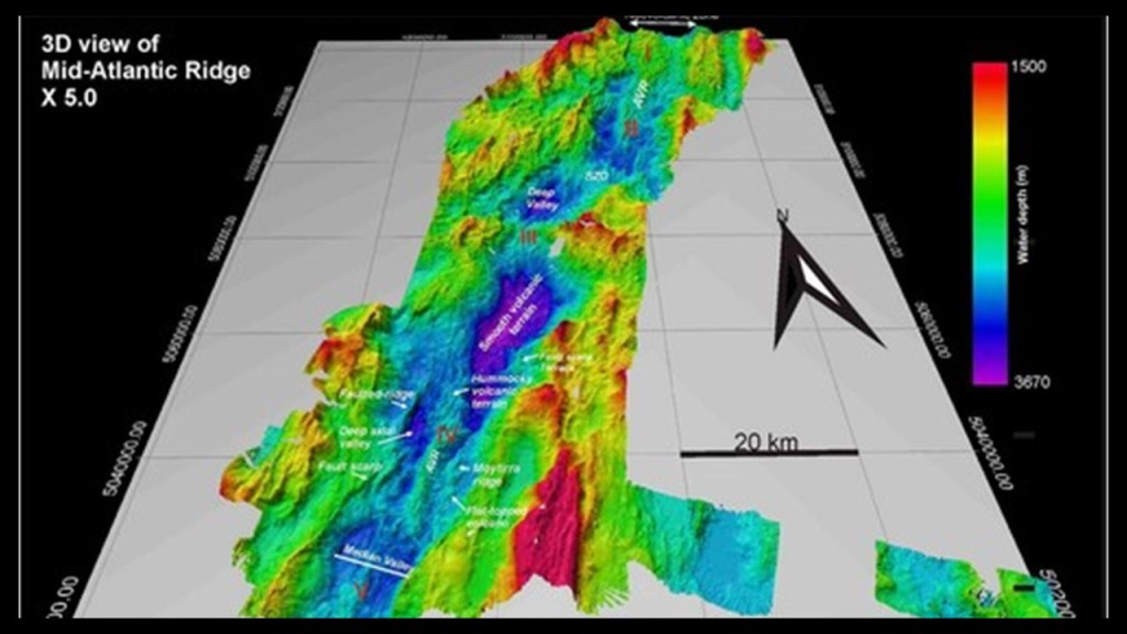
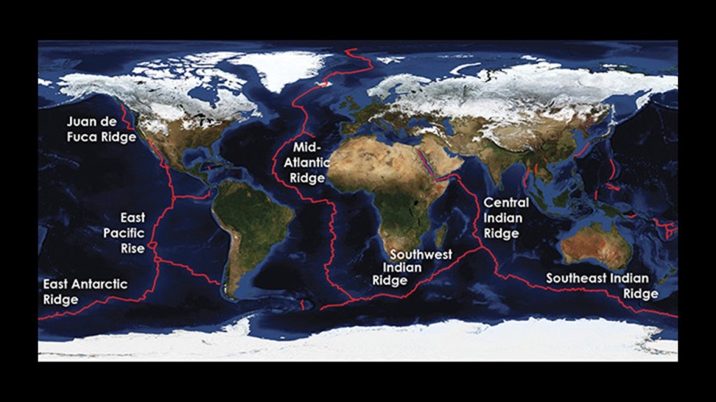
Next I am going to take a look at the Mid-Atlantic Ridge.
The Mid-Atlantic Ridge is described as a mid-ocean ridge located on the floor of the Atlantic Ocean and part of the longest mountain range in the world.
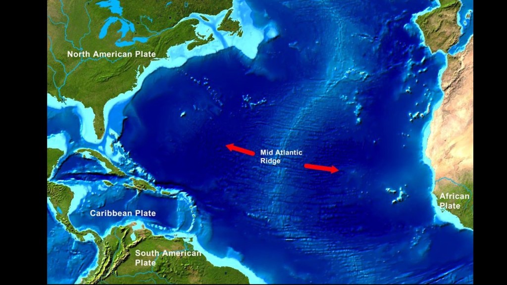
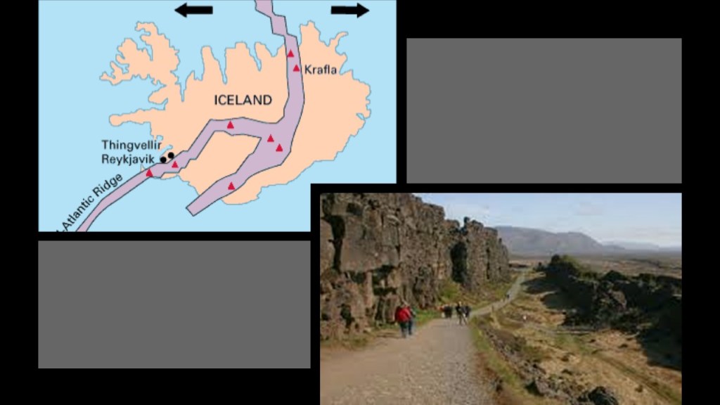
Although mostly underwater, the Mid-Atlantic Ridge runs across Iceland, where it can be seen above-sea-level.
We are told that the existence of this ridge was identified first by an American expedition in 1853, and confirmed by a British expedition in 1872, and again by a German expedition in 1925.
Then in the 1950s, the Earth’s ocean floors were mapped by a team of American geologists.
Amongst the team’s discoveries was that the bathymetry of the Mid-Atlantic Ridge showed valleys and ridges…
…and also that it is part of a 25,000-mile, or 40,000-kilometer, -long, continuous system of mid-ocean ridges on the floors of all the Earth’s oceans.
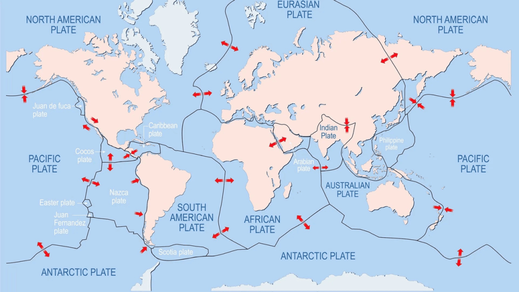
This led to the theory of sea-floor spreading, and general acceptance of the continental drift theory proposed by German geologist, Alfred Wegener, in 1915, who was a 1905 graduate of the Humboldt University of Berlin.
In 1915, Wegener published “The Origins of Continents and Oceans,” in which he theorized that Earth’s continents move or drift relative to each other over geologic time.
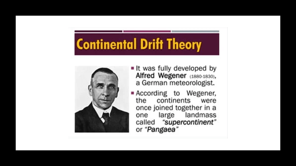
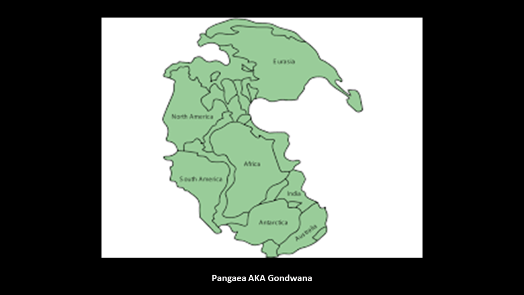
So apparently the idea that at one time there was one large supercontinent is not in dispute.
The issue is when and how the continents separated: Slowly and over geologic time, known as uniformitarianism or gradualism vs. suddenly and catastrophically.
And Academia supports the former explanation.
So while initially Wegener’s theory was not accepted by Academia because there was not a proposed mechanism, the Continental Drift theory was later incorporated into Plate Tectonics, the scientific theory that Earth’s lithosphere is comprised of a number of large tectonic plates that have been slowly moving for 3 – 4 billion years, and this is what we are taught today.
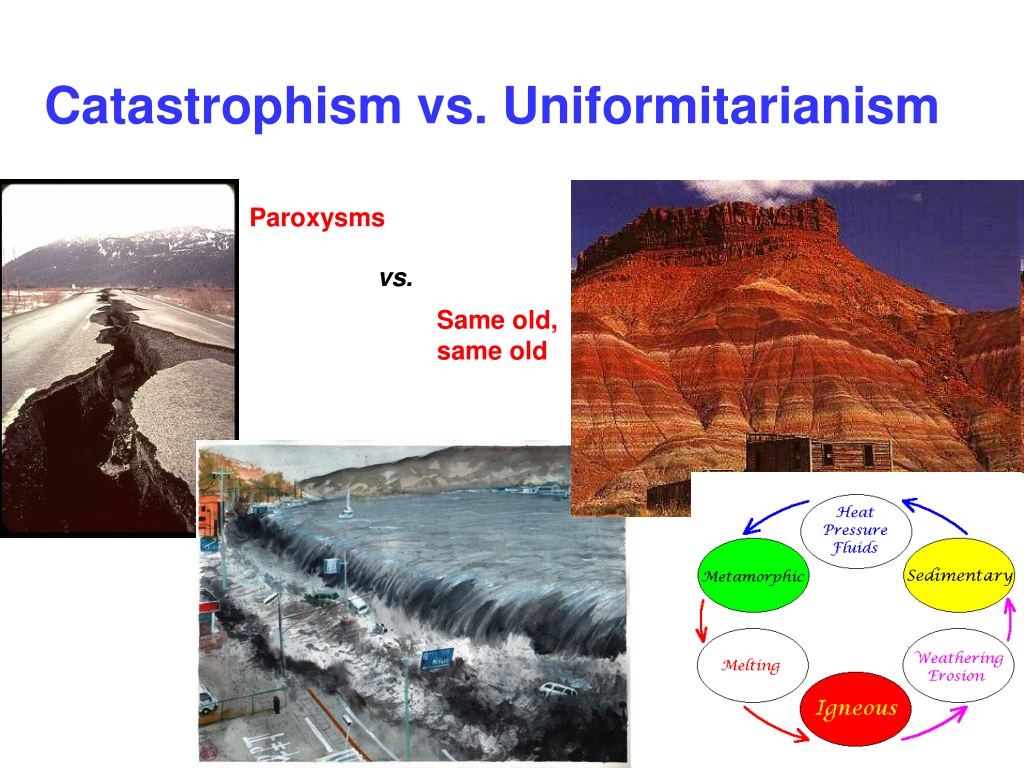
In similar fashion, Sir Charles Lyell, Scottish geologist, was said to have demonstrated the power of known natural causes in explaining Earth’s history.

In his books, “The Principles of Geology,” published in three volumes between 1830 and 1833, he presented the idea that the Earth was shaped by the same natural processes that are still operating today at similar intensities, and as such a proponent of “Uniformitarianism,” a gradualistic view of natural laws and processes occuring at the same rate now as they have always done.
This theory was in contrast to “catastrophism,” or theory that Earth has been shaped by sudden, short-lived violent events of a worldwide nature.
As a result of Lyell’s work, the glacial theory gained acceptance between 1839 and 1846, and we are told during that time, scientists started to recognize the existence of ice ages, and do to this day.

And in so doing, provides the perfect cover for things like megaliths and megalithic stone structures in North America, by calling them “glacial erratics” from the last Ice Age.
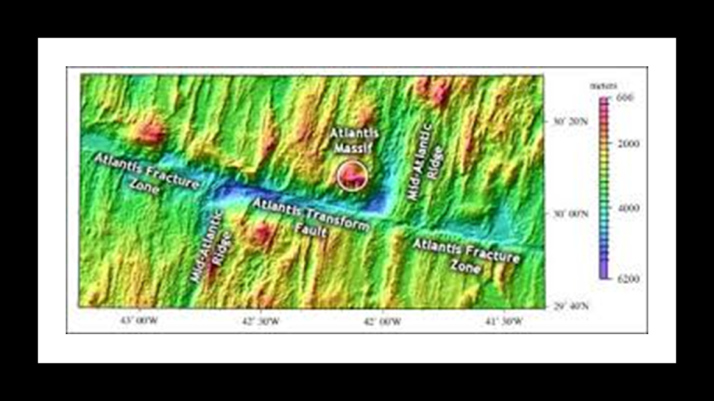
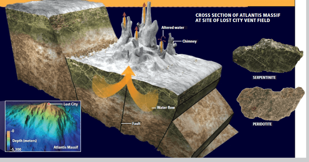
Now I want to take a look at the Atlantis Massif in the Mid-Atlantic Ridge.
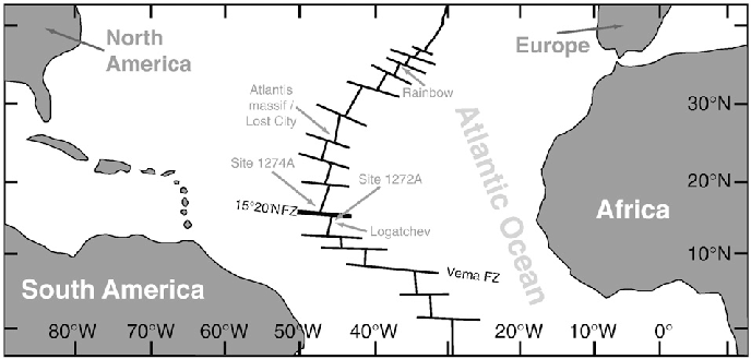
The Atlantis Massif is a prominent mountain mass in the North Atlantic Ocean.
It is roughly 10-miles, or 16-kilometers, across, and about 14,000-feet, or 4,267-meters, in elevation where it rises from the sea-floor.
Its highest point is only 2,297-feet, or 700-meters, beneath the surface of the ocean.
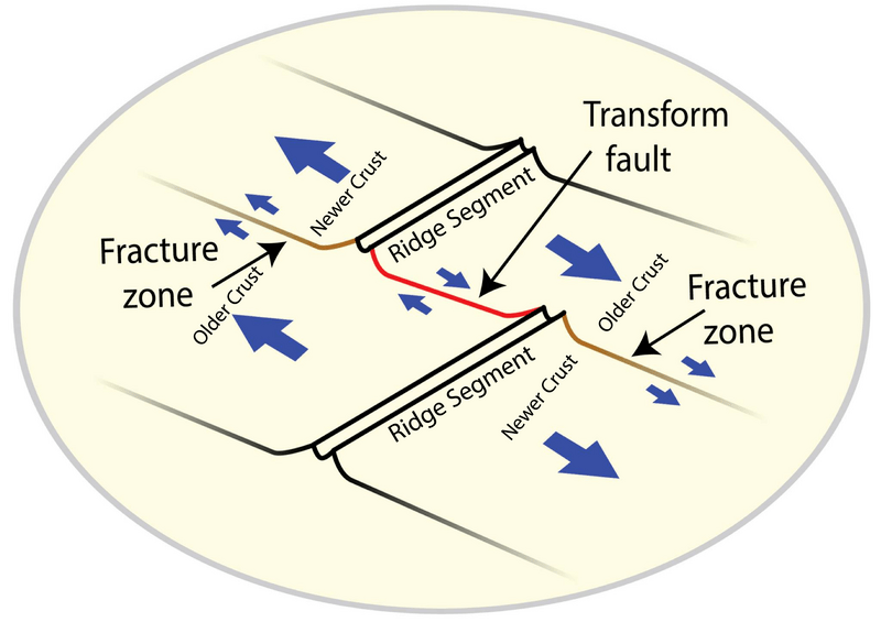
It is slightly east of the intersection of the Mid-Atlantic Ridge and the Atlantis Transform Fault in the Atlantis Fracture Zone.
A Transform Fault is defined as a fault along a plate boundary where the motion is predominantly horizontal.
A Fracture Zone is defined as a linear feature on the ocean floor over a long-distance that is caused by plate tectonics.
The word “fracture” itself is commonly associated with the “Breaking of a hard object or material.”
As we know, fractures can happen suddenly as well, not only as a slow gradual process over time.
Among other things, the Atlantic Massif is particularly noteworthy for a feature called the “Lost City.”
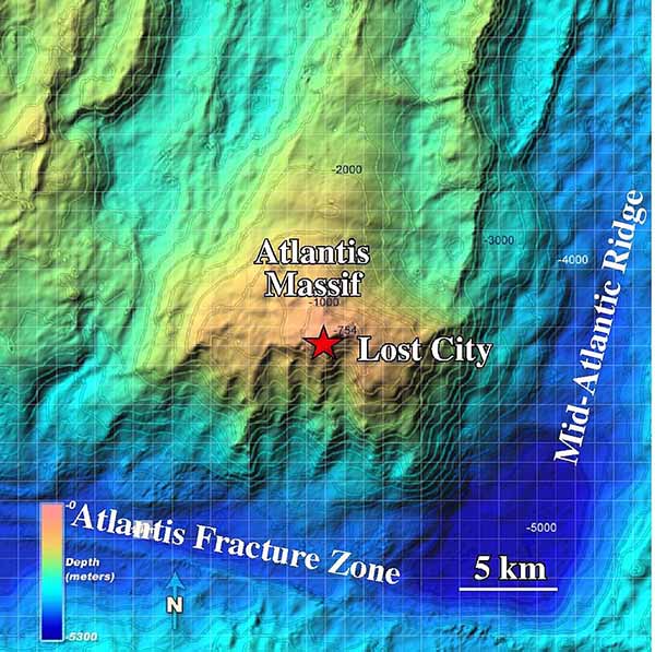
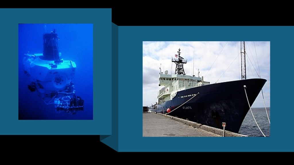
What we are told about “Lost City” is that it is a hydrothermal vent field that was discovered by a crewed, deep ocean research submersible named DSV Alvin that owned by the U. S. Navy and operated by the Woods Hole Oceanographic Institute in December of 2000.
DSV Alvin is supported by the RV Atlantis, a Research vessel that is also owned by the Navy and operated by Woods Hole.
You think they might be interested in trying to find the lost Atlantis or something?
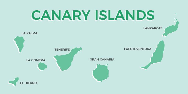
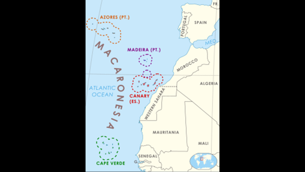
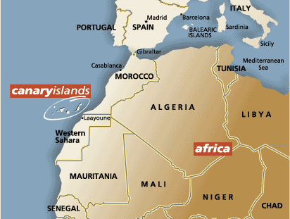
Next on this alignment, we come to the Canary Islands, an island group and the southernmost autonomous community of Spain in the Atlantic Ocean.
Historically, the Canary Islands have been considered a bridge between Africa, North America, South America, and Europe.
The Canary Islands have also long-been believed to be part of the legendary continent of Atlantis, along with the Azores, Madeira, and Cape Verde Islands.
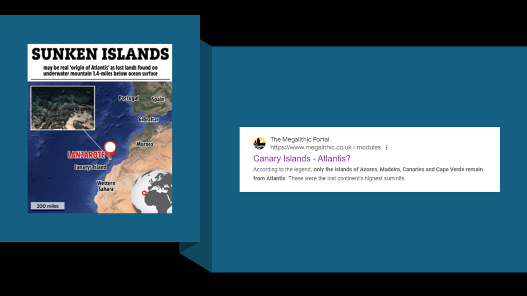
These island groups are collectively known as”Macaronesia,” from the Greek words meaning “Islands of the Fortunate.”
This is what we are told about these four island groups, known as archipelagos, in the North Atlantic Ocean.
Each archipelago is made up of a number of Atlantic oceanic islands which are formed by seamounts on the ocean floor whose peaks have risen above the surface of the ocean.
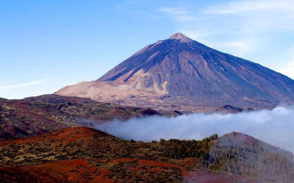
I am going to focus my attention here on the island of Tenerife, in the Canary Islands, which are on this alignment.
Mount Teide, a volcano on the island of Tenerife, is the highest point in Spain, and the highest point above sea-level in the islands of the Atlantic.
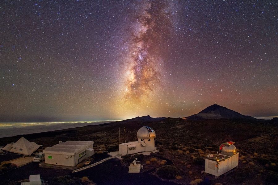
Teide Observatory, a major international astronomical observatory, is located on the slopes of Mount Teide.
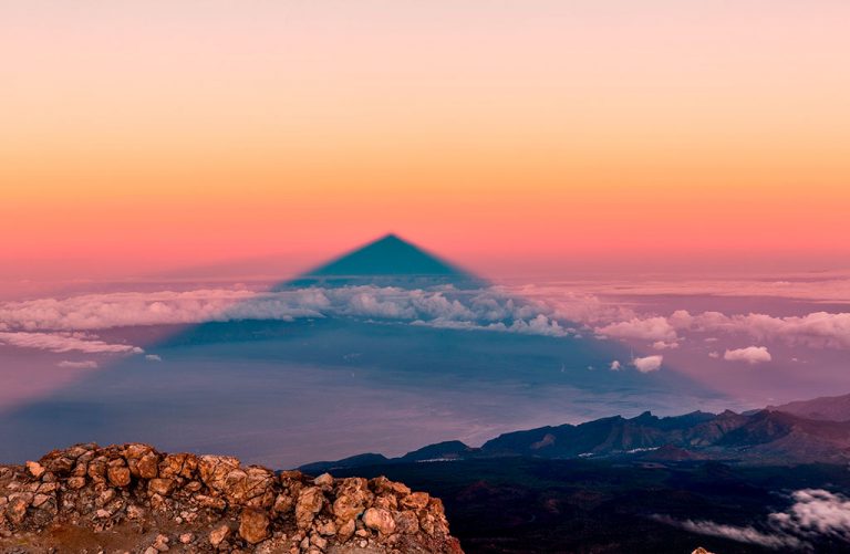
Although the peak of Teide seems to not have a completely regular shape, this is the projection of its shadow.
Tenerife is largest and most populated island of the Canary Islands, and its capital is Santa Cruz de Tenerife.
The Canary Islands are an Autonomous Community Province of Spain, and are located off the coast of Morocco.
In our historical narrative, the Spanish conquest of the Canary Islands in 1496 was considered the basic model of European attack on the New World: violent colonization that involved enslavement of the local population; genocide; and the mining of the land’s resources that radically changed the landscape.
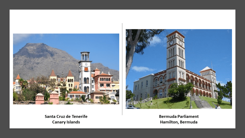
This is a picture of a view of Santa Cruz de Tenerife, showing a similarity of tower construction, compared with the Bermuda Parliament building in Hamilton on the right, with the similar architectural design in both locations on different sides of the Atlantic Ocean.
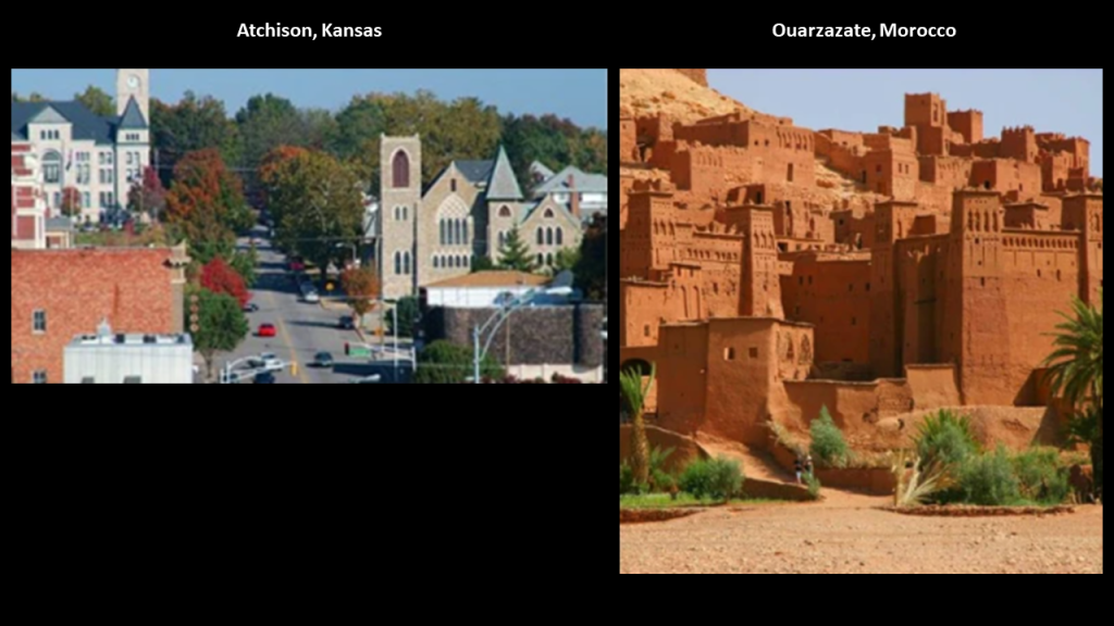
Among other examples, I came across exactly the same style in Atchison, Kansas, and the ancient city of Ouarzazate in Morocco.
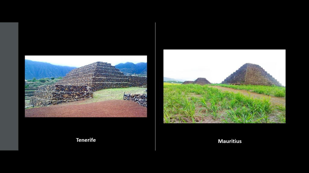
The Pyramids of Guimar are located in the town of Guimar on the island of Tenerife.
Terraced structures that were built from lava stone without the use of mortar.
Compared with the Pyramids of Mauritius in the Indian Ocean, also terraced structures made of lava stone. There are seven terrace pyramids in Mauritius and six in Guimar.
In both places they are in perfect astrological alignment with the winter and summer solstice.
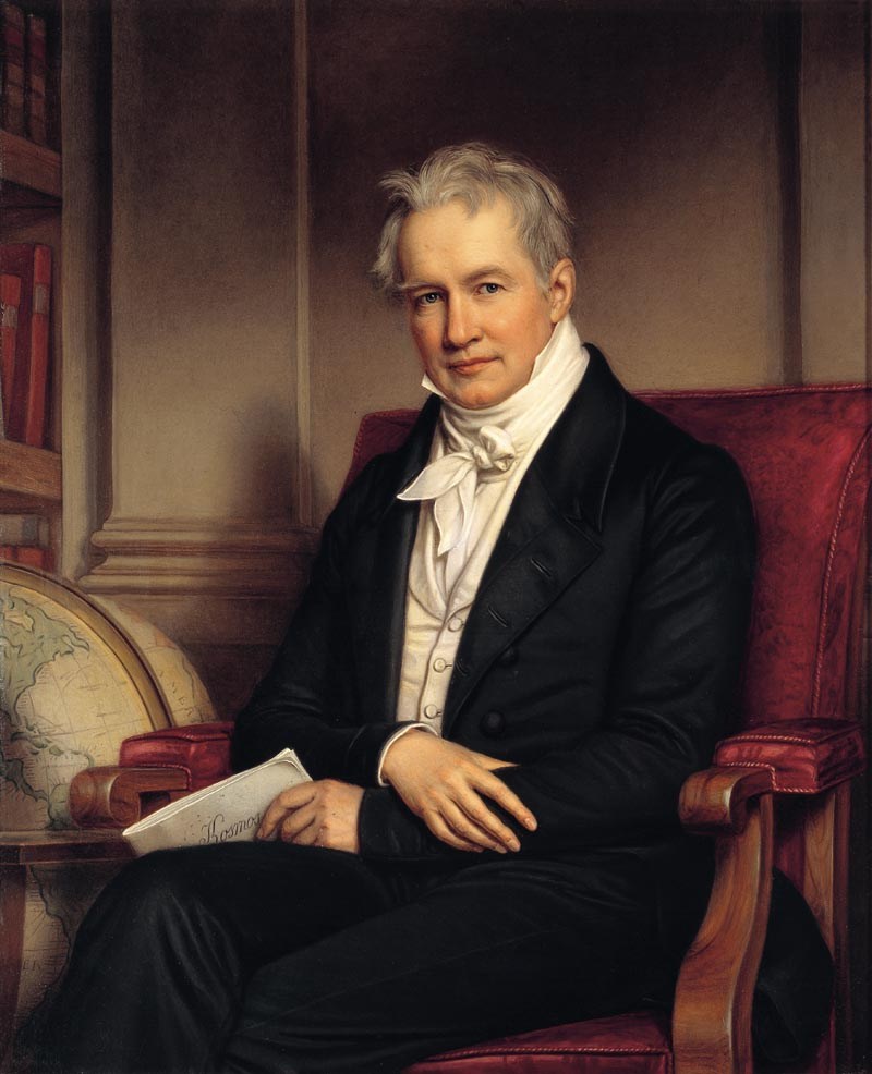
As already mentioned, the Canary Islands are said to be of volcanic origin, and have been visited by researchers from the very beginning of the 19th-century, including Alexander von Humboldt in 1799, a Prussian naturalist and explorer, who was said to have climbed the Teide volcano, before heading off to study Venezuela.
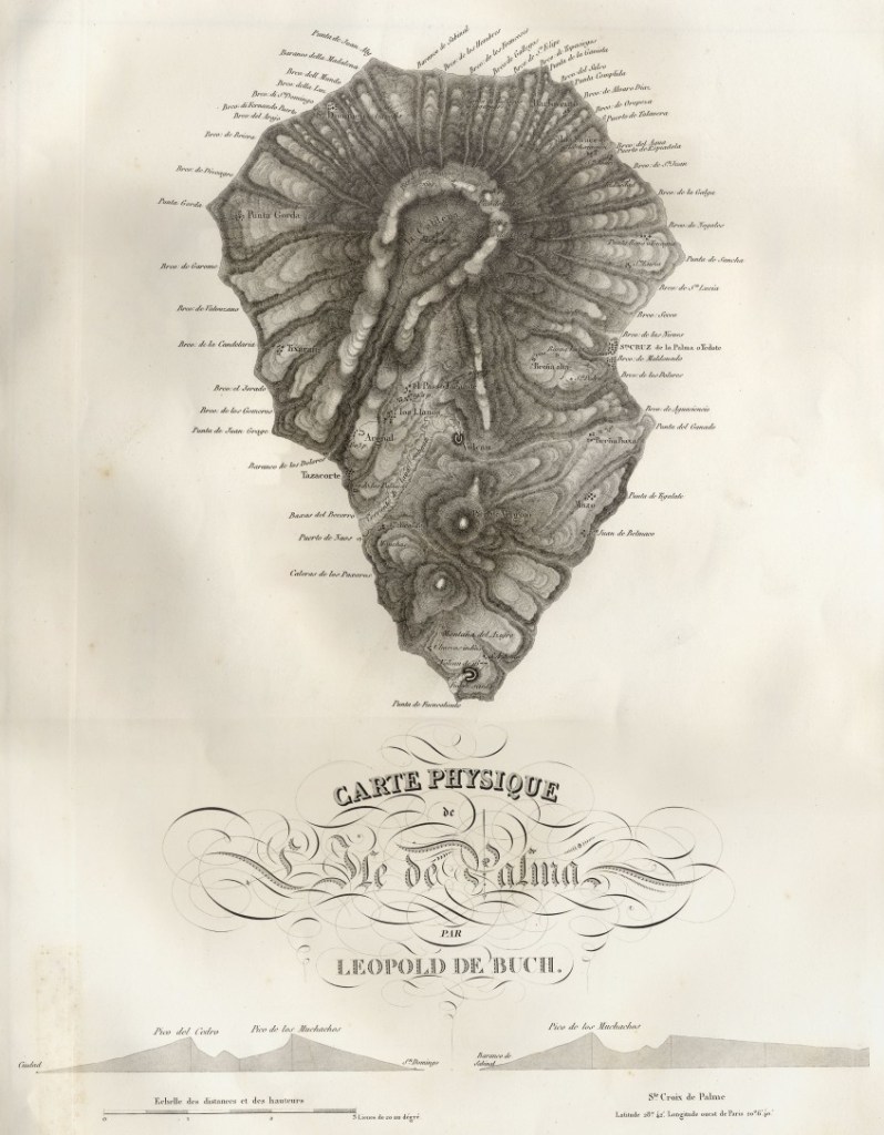
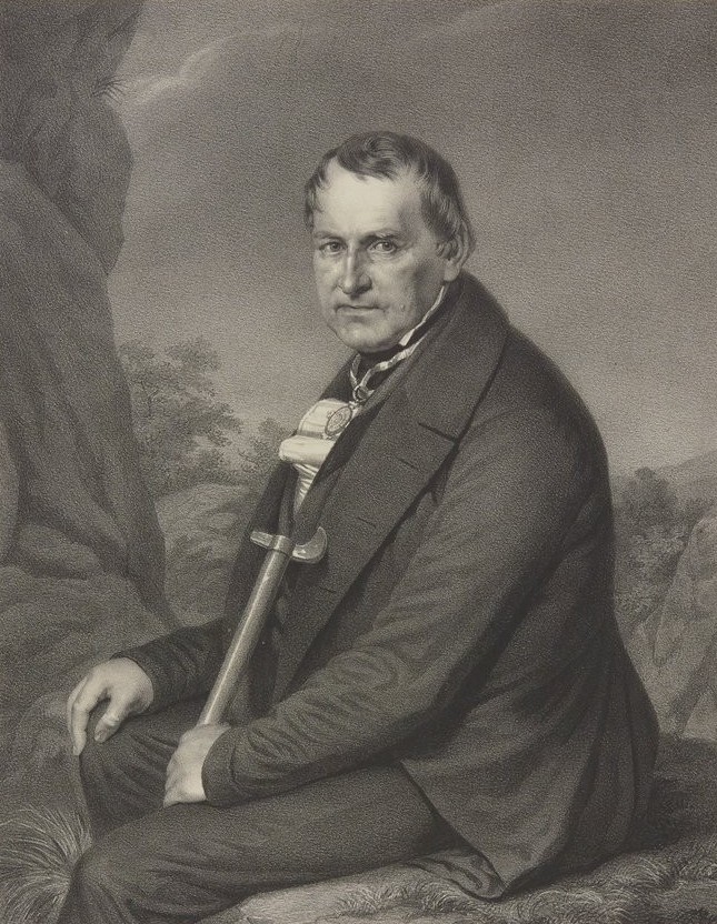
In 1815, the German geologist and paleontologist Leopold von Buch visited the Canary Islands, where he primarily studied the production and activities of volcanoes.
Von Buch studied with Alexander von Humboldt at the Freiburg School of Mining, and was considered a founder of modern geology.
The Freiburg University of Mining and Technology is the oldest school of mining and metallurgy in the world, having been established in 1765 by Francis Xavier of Saxony of the House of Wettin.
Its main purpose was the education of highly skilled miners and scientists in fields connected to mining and metallurgy.

It is interesting that the coat of arms of the German noble House of Wettin has a wyvern tail in the middle of it, and I found this coat of arms of Tenerife, showing a large tree in the center, and wyvern supporters on either side.
I do think these heraldic devices are telling us Truths that have been well-hidden from us.
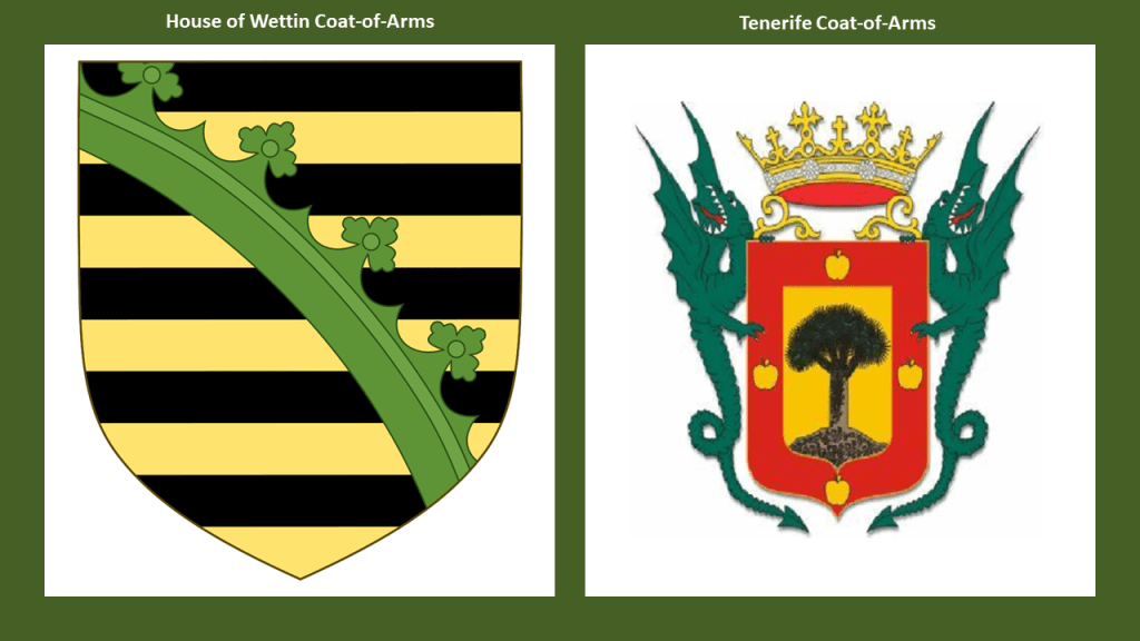
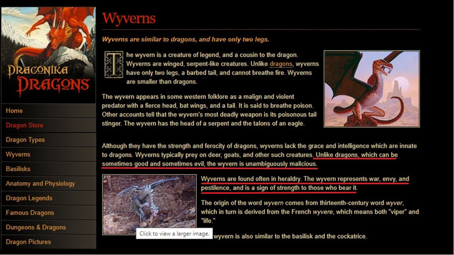
Wyverns are two-legged, winged creatures that are similar to dragons, but unlike dragons, which can be good or evil, they are unambiguously malicious predators.
Wyverns in heraldry signify war, envy and pestilence.
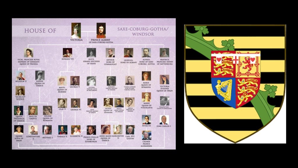
Primarily through Queen Victoria and Prince Albert, first-cousins and members of the House of Saxe-Coburg and Gotha of the Ernestine branch of the House of Wettin, the original royal houses of Europe were completely replaced by this obscure German Ducal lineage.
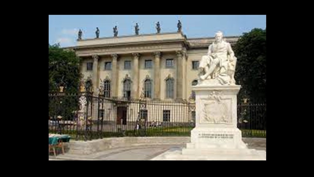
Humboldt University in Berlin was named after Alexander von Humboldt and his brother Wilhelm.
It was first opened in 1810, and was regarded as one of the world’s pre-eminent universities in the study of Natural Sciences in the 1800s and 1900s.
Famous faculty and alumni included such famous names in our current historical narrative, besides the previously mentioned Alfred Wegener of Continental Drift fame, include: the theoretical physicist Albert Einstein; Karl Marx and Friedrich Engels, c0-collaborators on “The Communist Manifesto;” Otto von Bismarck, first Chancellor of the German Empire; Georg Hegel, whose philosophy gave us the “Hegelian Dialectic” of Problem-Reaction-Solution; and the Brothers Grimm, best-known for their fairy tales which has such story-lines as eating people, as in “Little Red Riding Hood and “Hansel and Gretel.”
Now back to the alignment.
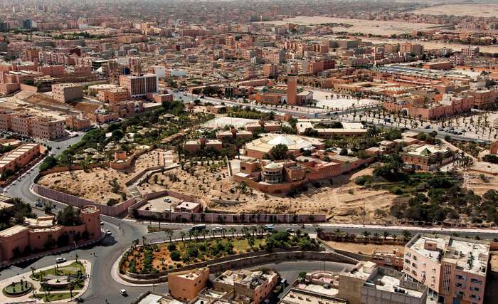
The next place on the alignment we come to is Laayoune, the capital of Western Sahara.
Also known as El Aaiun, the meaning of both names refers to water springs.
Western Sahara is a disputed territory, and classified as a non-self-governing territory by the U.N.
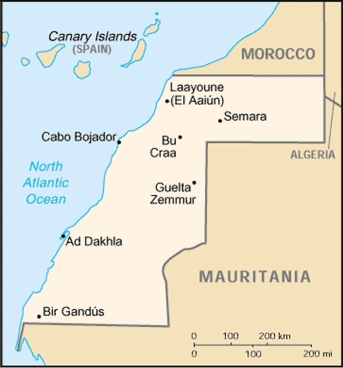
It is claimed by, and de facto administered by Morocco, in on-going dispute with the native inhabitants, the Sahrawis, who want self-governance.
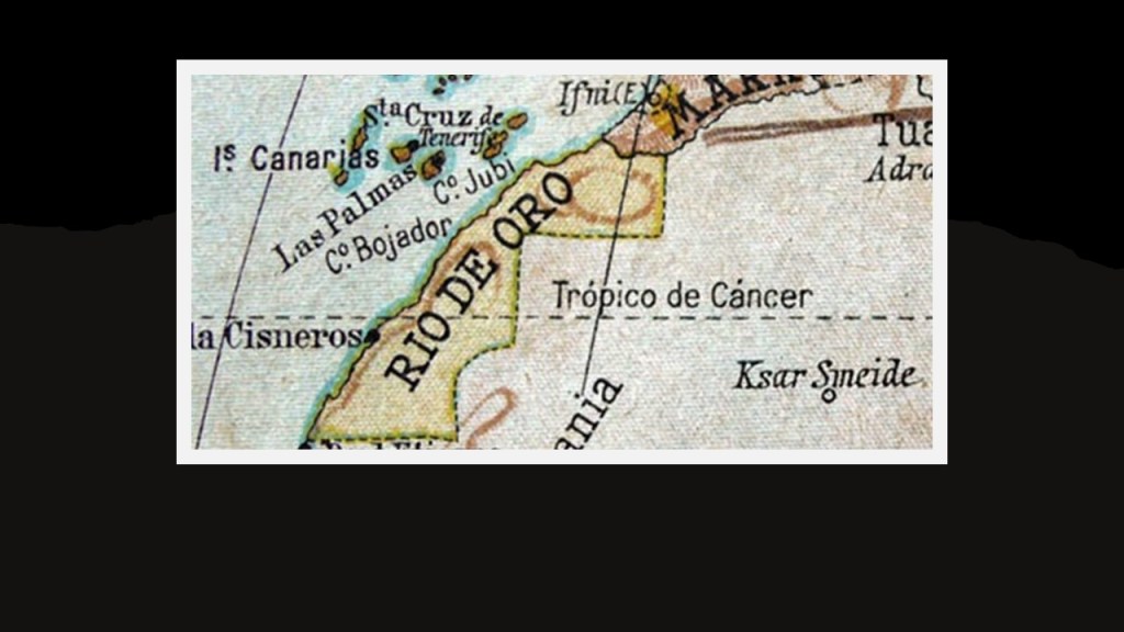
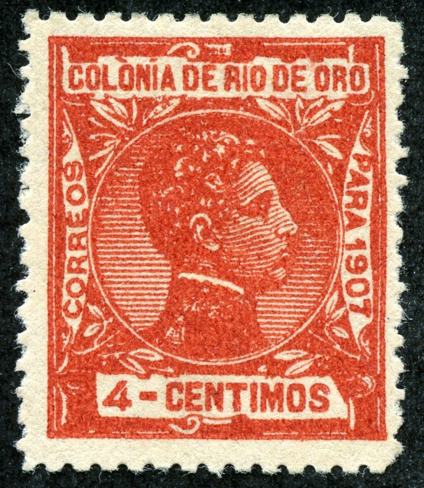
The Western Sahara is composed of the geographic regions that include Rio de Oro (meaning “River of Gold” in Spanish).
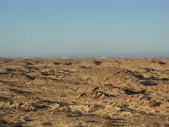
This is what the landscape there looks like today.
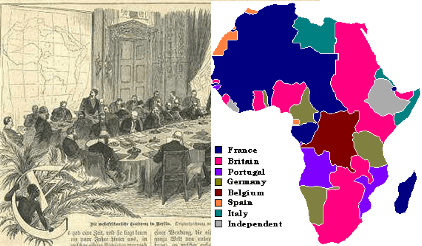
We are told that Rio de Oro became a Spanish protectorate in 1884 as a result of the Berlin Conference.
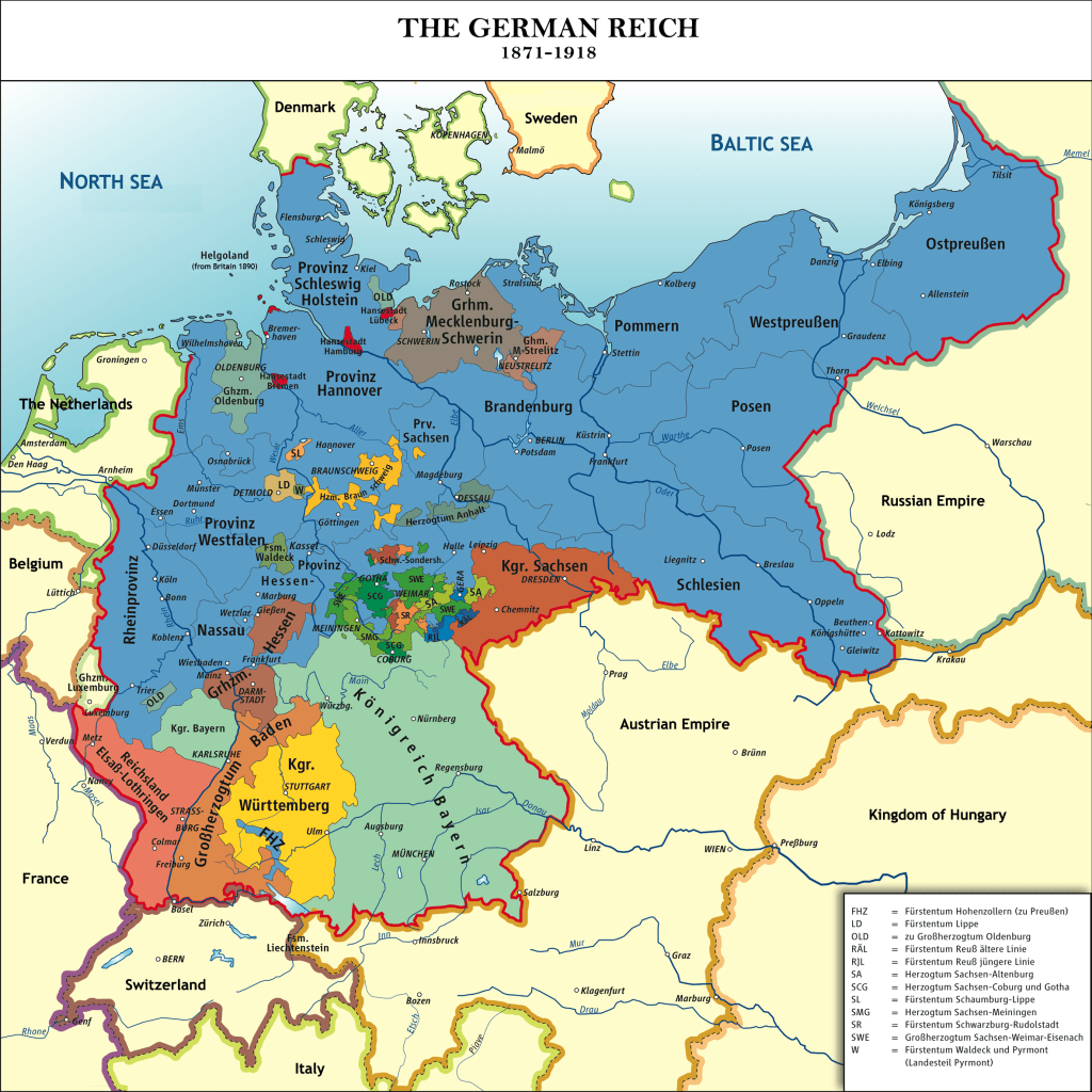
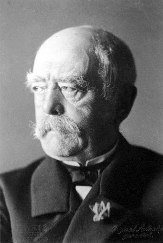
The Berlin Conference of 1884 – 1885 was organized by the German Chancellor Otto von Bismarck, and regulated European colonization and trade in Africa during the New Imperialism period, and coincided with Germany’s sudden appearance as an imperial power.
The Imperial State of Germany in our historical narrative existed from the Unification of Germany, starting on January 1st of 1871, and ending in 1918 at the end of World War I.
It was also called the “Second Reich.”
And who were the Nazis, anyway?
I wonder if there could be a connection to “Ashke-nazi.”
The same word is actually in the name.
Maybe it’s just a coincidence.
But then again, maybe it isn’t a coincidence.

Mayer Amschel Rothschild was born in 1744 in Frankfurt, Germany.
He established his banking business there in the 1760s, which became the start of the international banking family.

The Rothschilds were to Europe what the Rockefellers were to the United States.
Mayer Amschel Rothschild and his five sons established their International banking family dynasty throughout major cities of Europe.
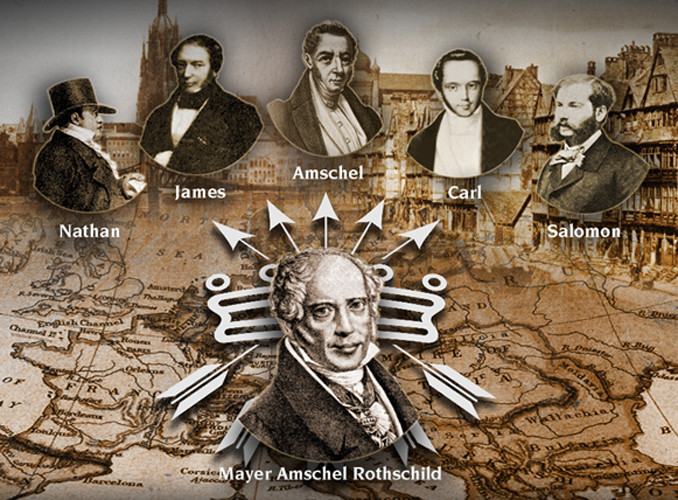
And this is the saying that has been attributed to more than one prominent member of the Rothschild family, starting with the first London family banker, Nathan Mayer Rothschild.

Nathan had become a freemason in London of the “Emulation Lodge, No. 12, of the Premier Grand Lodge of England” in October of 1802.
By the time of his death in 1836, Nathan Mayer Rothschild had secured the position of the Rothschilds as the preeminent investment bankers in Britain and Europe, and his own personal net worth was over 60% of the British national income.

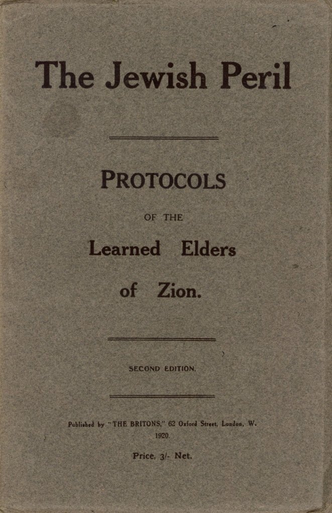
Same folks that want you to believe that “The Jewish Peril – The Protocols of the Learned Elders of Zion,” first published in Russia in 1903, and describing a Jewish plan for global domination, was an anti-semitic forgery.
At any rate, Otto von Bismarck was the mastermind behind the unification of Germany and the formation of the German Empire in 1871, and served as its first chancellor until 1890.
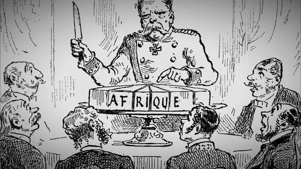
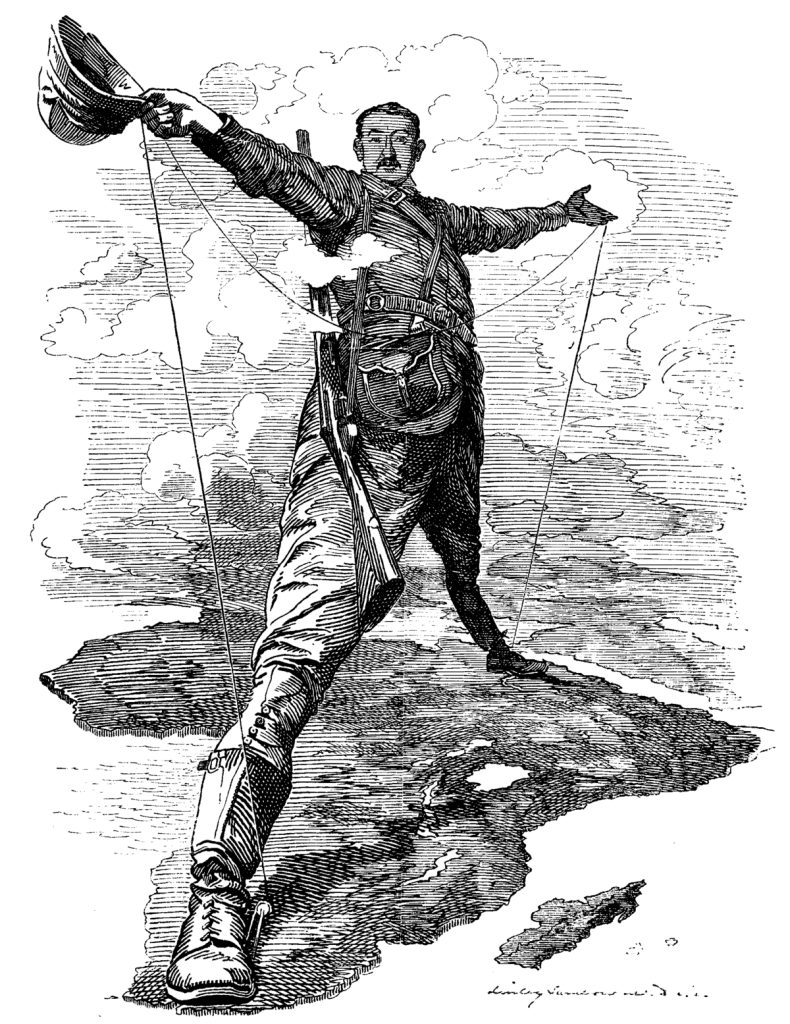
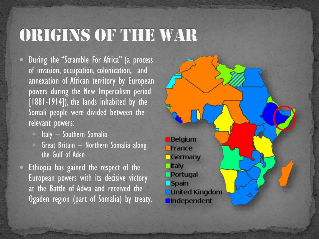
The outcome of the “General Act of the Berlin Conference” can be seen as the formalization of the “Scramble for Africa,” also known as the “Partition of Africa” or the “Conquest of Africa,” was the invasion, occupation, and division of African territory by European powers during the New Imperialism period between 1884 and 1914, the year in which World War I started.
The period of history known as New Imperialism is characterized as a period of colonial expansion by European powers, the United States, and Japan during the late 1800s and early 1900s.
I am sure this was a motive for the Berlin Conference.
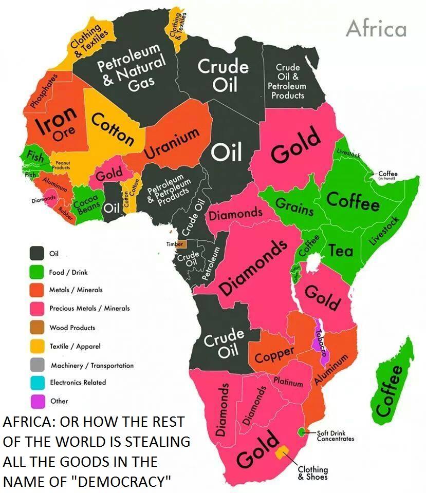
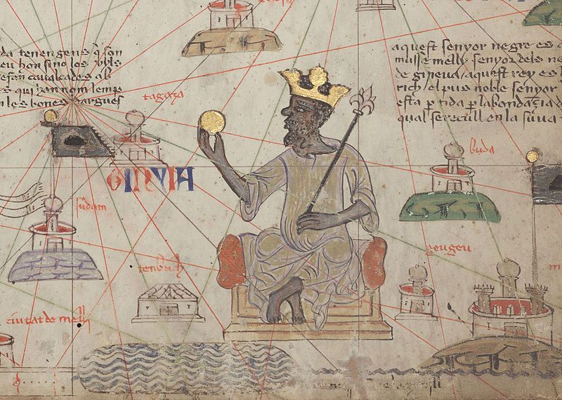
There was also a rich and proud heritage of Africa and its people that has been removed from the collective awareness that was replaced with something quite different from what it originally was.
Mansa Musa was the King of Mali between 1312 and 1337….but has the general population ever heard of him?
Mansa Musa was one of the richest men in World history, if not the richest.
During his reign, Mali may have been the largest producer in the world of gold.
This kind of immense wealth does not fit the historical narrative we have been given about this part of the world.
Instead, the minds of generations of children have been programmed with images of Africa like that of Tarzan to shape their perceptions.

In the same way that generations of children have been programmed to believe that Hollywood westerns represent real history.
Now back to Laayoune and Western Sahara.
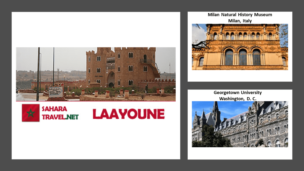
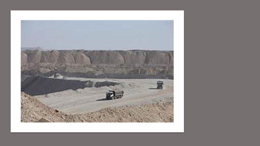
Laayoune was said to have been founded in 1938, and is a hub for phosphate mining in the region.
Compare for similarity of appearance the double-windows in the building in Laayoune on the left, with the double-windows of the Natural History Museum in Milan, Italy on the top-right, and Georgetown University in Washington, DC, on the bottom-right.
Vast phosphate deposits are mined at Bu Craa, southeast of Laayoune, where abundant, pure phosphate deposits lie near the surface.
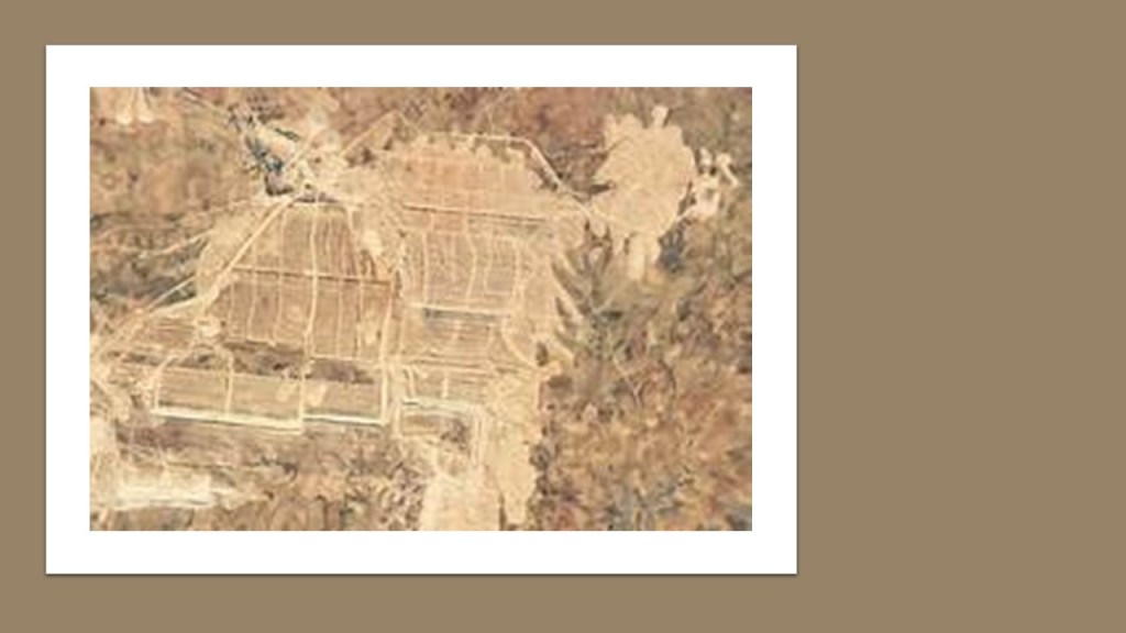
It produces about 2.5 million tons of phosphates each year.
Phosphate, a form of the chemical element of phosphorus, is a component of things like synthetic fertilizer, animal feed, and food additives, as well as many other things.
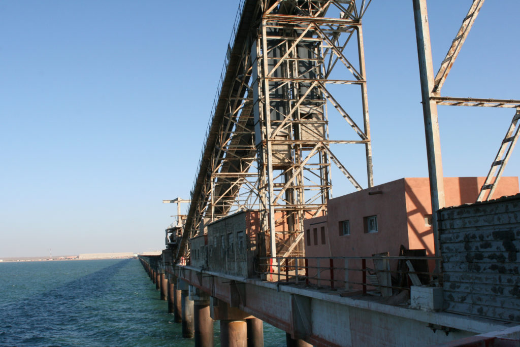
Aided by the longest conveyor belt in the world, which travels 61-miles, or 98-kilometers, phosphates are shipped from Bu Craa to Laayoune.
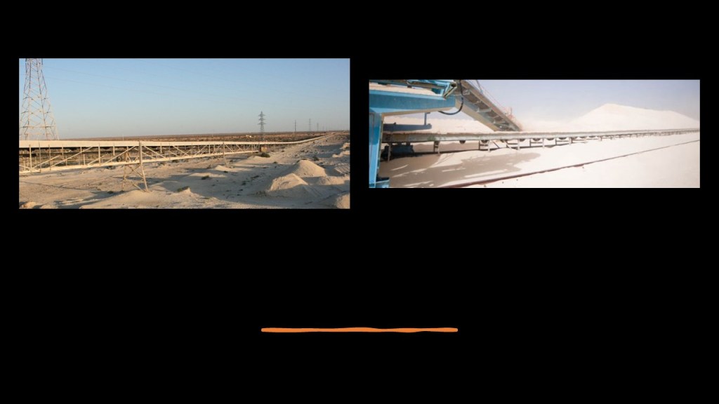
Where ships await to transport phosphates around the world.
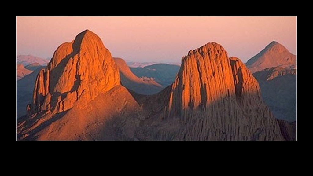
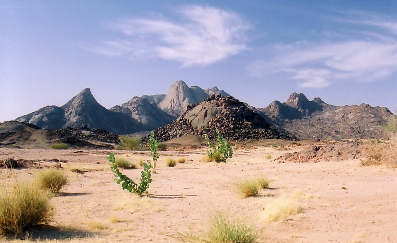
The next place we come to on this alignment, is Abalessa in Algeria’s Tamanrasset Province in southern Algeria.

Abalessa is the former capital of the Ahaggar Mountain Highland region in the central Sahara, along the Tropic of Cancer.
Abalessa is famous for the Tin Hinan Tomb, the 1,500-year-old monumental grave, we are told, built for the Tuareg matriarch, Tin Hinan.
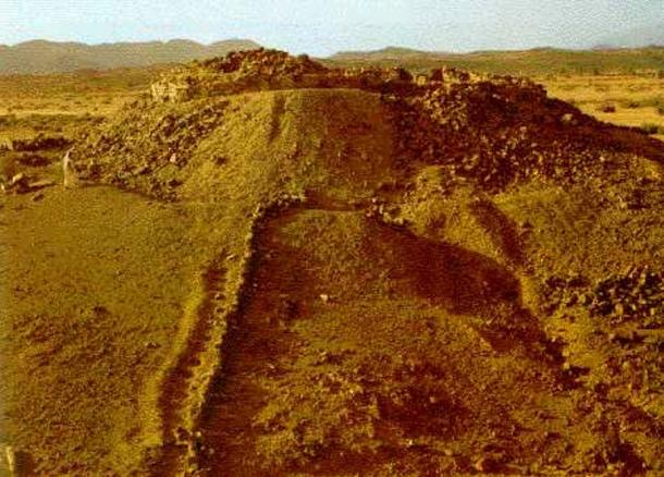
Tin Hinan was believed to have lived between the 4th and 5th centuries A.D.
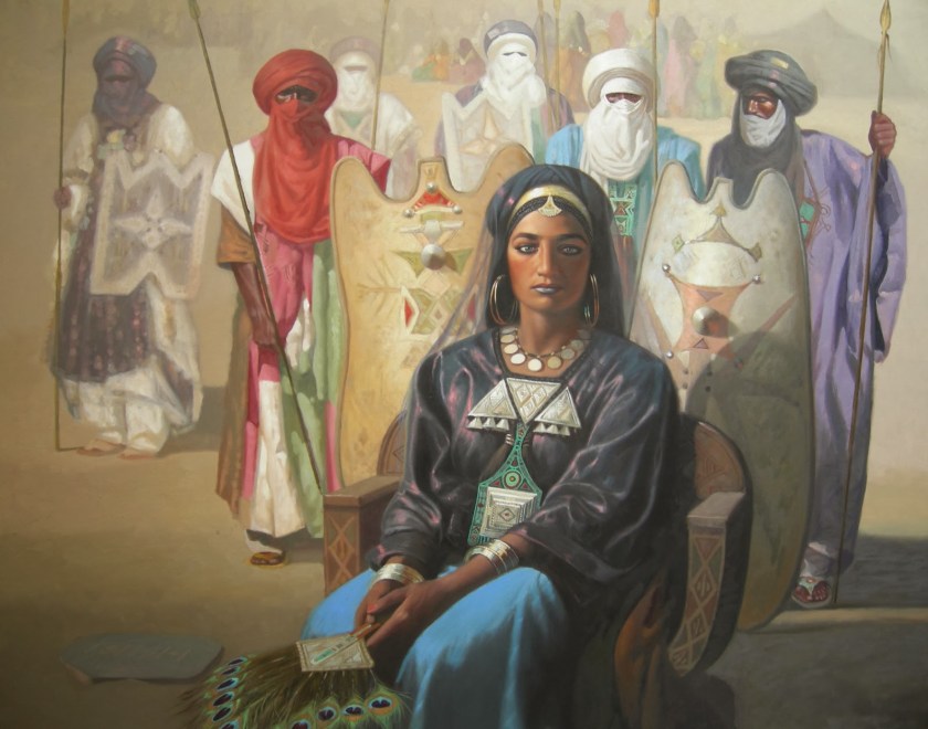
Women have a high status in the matriarchal and ancient Tuareg society. Among other things, primarily women own livestock, and other movable property, while personal property can be inherited by both women and men.

The Tuareg Shield, from which are told the Ahaggar Mountains were formed, is a host for world-class gold deposits, with at least 600 gold occurrences having been identified…
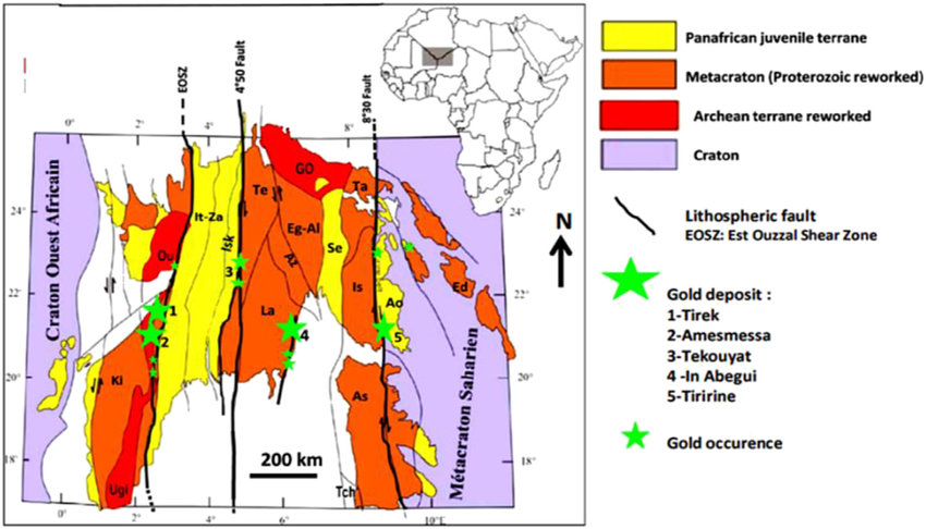
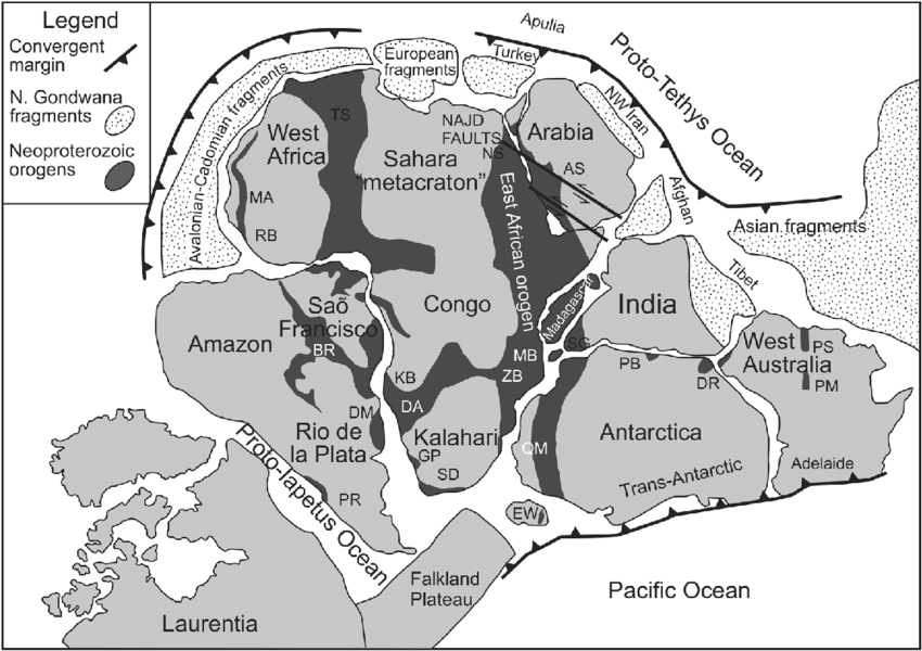
…and is part of the 3,000-kilometer, or 1864-mile, long Pan-African, Trans-Saharan belt that was believed by some geologists to have been one of the most important orogenic systems leading to the formation of the Supercontinent.
We are told that Orogenic means events that cause distinctive structural phenomena related to tectonic activity, affecting rocks and crusts in particular regions, happening within a specific period, in this case said to have been during the end of the Neoproterozoic era, the unit of geological time said to have been between 1,000-million years ago, and 541-million years ago, so once again, something that happened in the very distant past and given no other explanation.
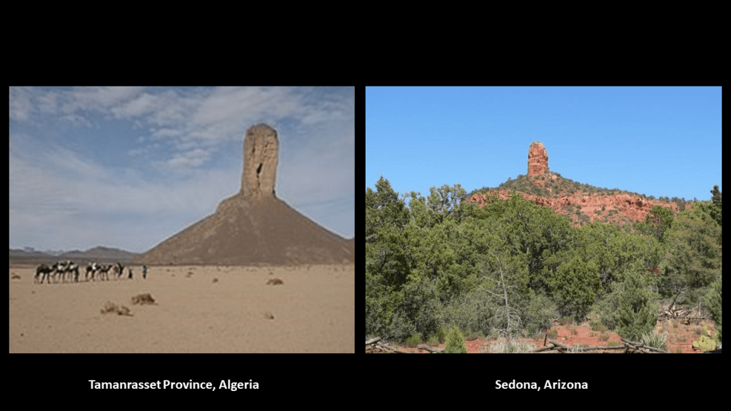
The landform on the left is in Tamanrasset Province, and the one pictured on the right is Chimney Rock in Sedona, Arizona.
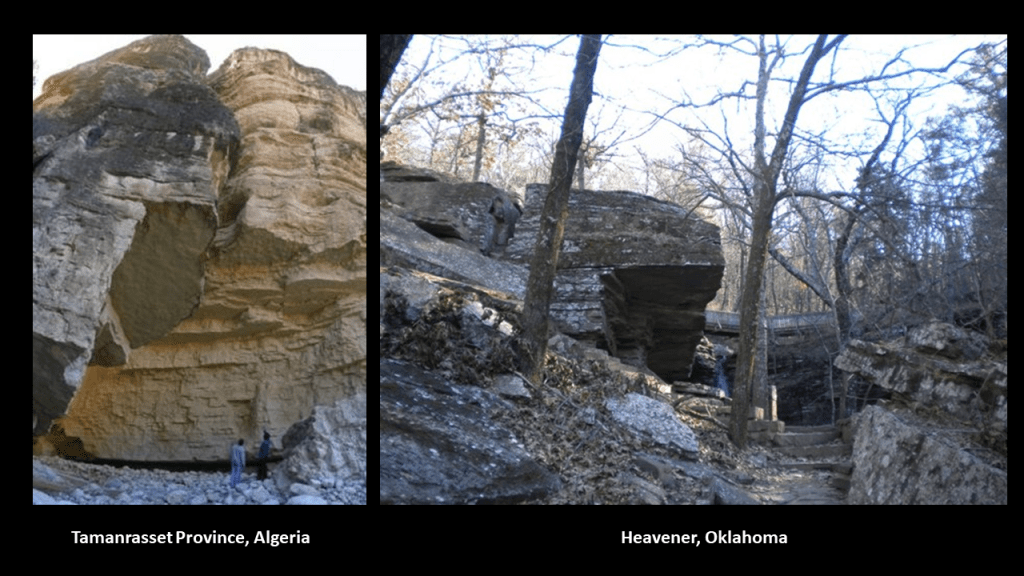
Also this image on the left taken in Tamanrasset Province is very much like what is pictured on the right in Heavener Runestone State Park in Heavener, Oklahoma.
A few more things before I leave Algeria.
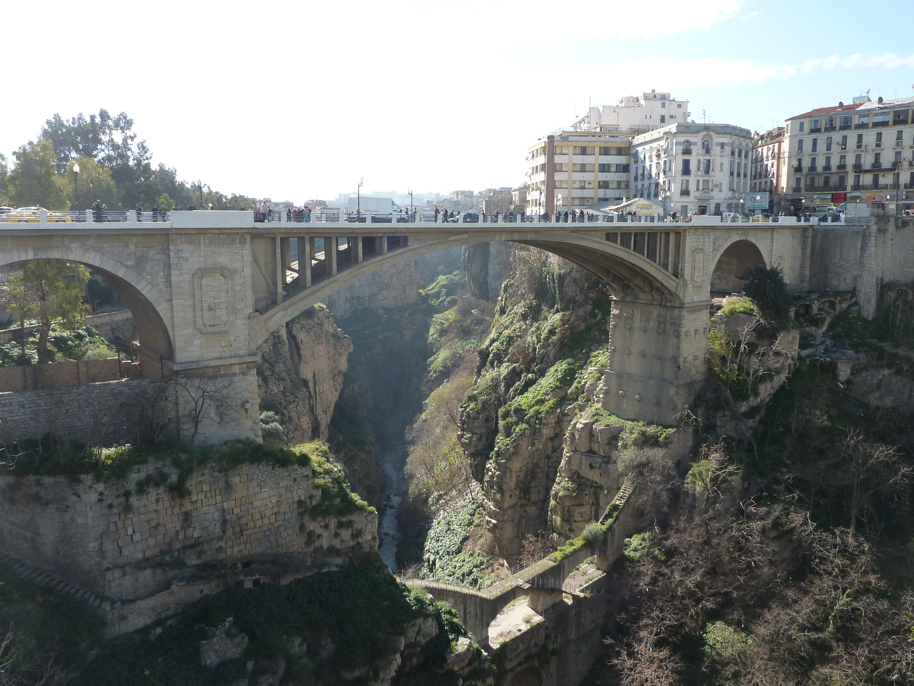
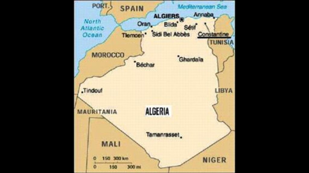
The first is that I would like to point out a few things in Constantine, Algeria – which is in northeastern Algeria, close to the Mediterranean Sea.
Constantine is called the “City of Bridges.”
Whoever built this place is comfortable with stone and heights!
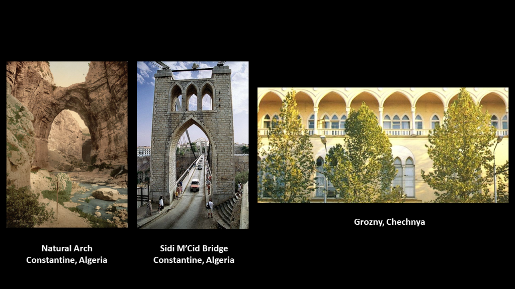
For another comparison of similarity of appearance, the photo on the left is called in English “Natural Arch” in Constantine; the middle one is what is called the “Sidi M’Cid” bridge in Constantine; and on the right is taken of a building in Grozny in the Chechen Republic in Russia.
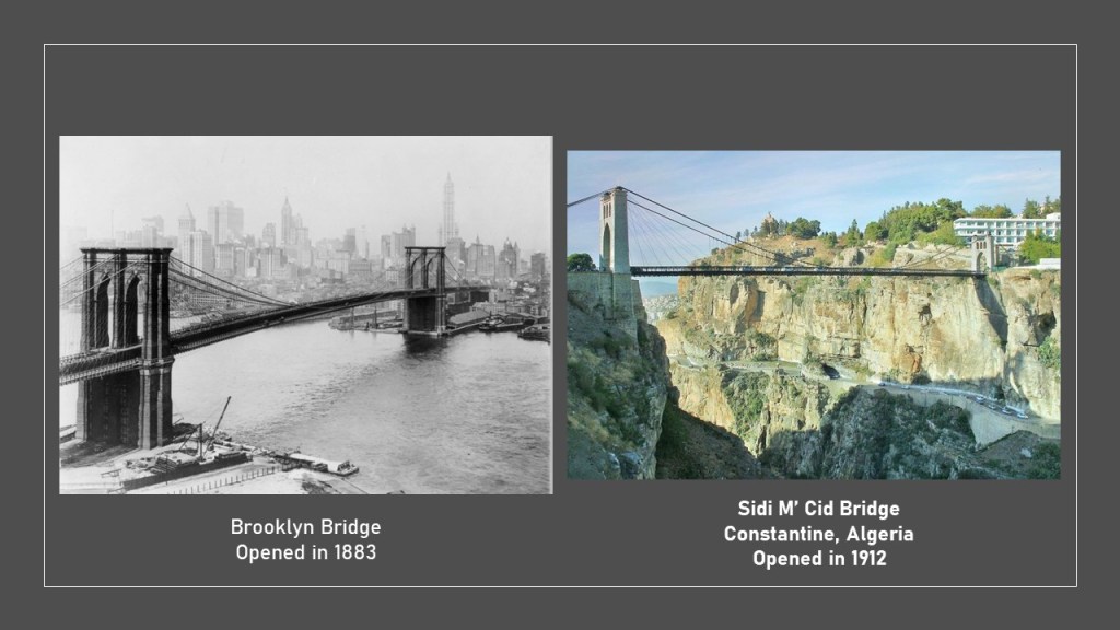
Another is a side-by-side comparison of the Brooklyn Bridge on the left, which reminds me in appearance of the Sidi M’ Cid Bridge on the right, which at one time was the highest suspension bridge in the world.
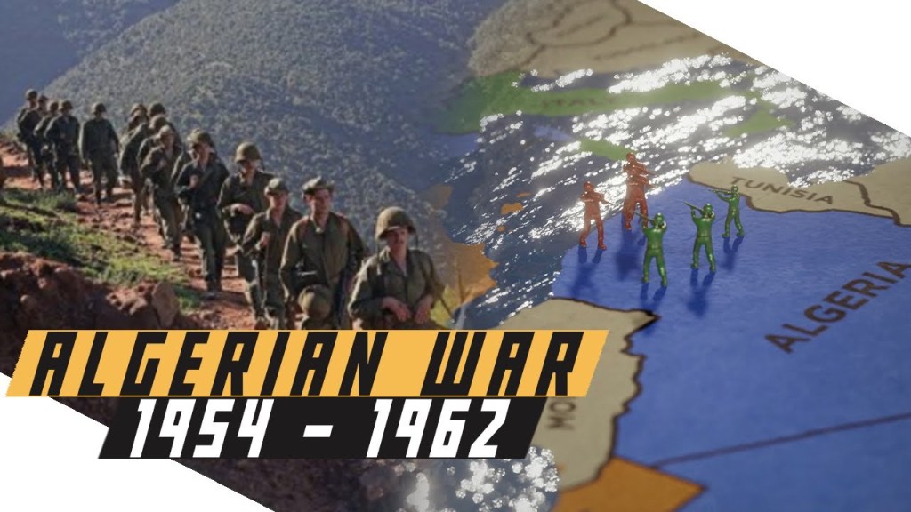
Second, is that the French started the process of colonizing Algeria starting in 1830, and by 1848, much of Algeria was under French control, when coastal Algeria was incorporated into the French departments of Algiers, Oran and Constantine.
During the French conquest of the Regency of Algeria, which had been a regency of the Ottoman Empire, the “Pacification of Algeria” had started in 1835 and lasted until 1903, with the aim of putting an end to the resistance of the Algerians to the French invaders.
Atrocities of the “Pacification of Algeria,” included a scorched-earth policy against the population that had a devastating effect on the socio-economic and food balances of the country and deporting, banishing and/or killing entire tribes, and has been called a genocide.

France began its nuclear testing program in Reggane, Algeria, in 1960 – 1961, before Algeria’s independence. They conducted four atmospheric nuclear tests, which contaminated the Sahara Desert with plutonium, negatively impacting those who live here to this day – not only Reggane, but far beyond.
Between 1960 and 1966, a total of 17 nuclear tests were conducted in the Reggane District of Algeria.
It is called Africa’s Hiroshima.
Algeria’s Independence from France came in 1962, after the Algerian War of Independence from 1954 to 1962.
Noteworthy for horrible atrocities and crimes against humanity on both sides, estimates of between 350,000 and 1,000,000 Algerians died during the war.
Algerian Independence did not usher in a stable system of government.
There have been civil wars ever since then, like the Algerian Civil War, the duration of which was between 1991 and 2002.
It involved an armed conflict between the Algerian government and various Islamic rebel groups.
It began after a coup negating an Islamist electoral victory in which the government was trying to crush the Islamist movement, but armed groups emerged to fight against the government, and again, many Algerians were killed.

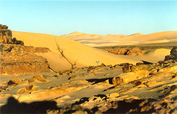
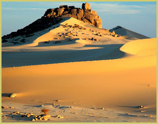
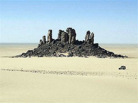
From Algeria, the alignment crosses into the country of Niger, where it goes through the Air and Tenere National Nature Reserves.
Pictured top and bottom to the right of the map show pyramidal shapes in the desert sands.
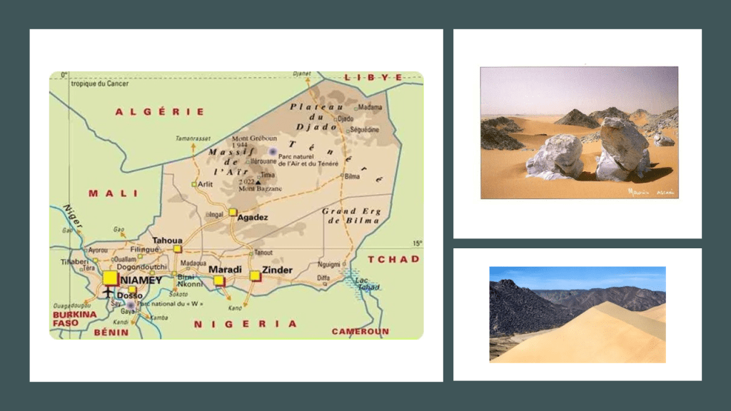
The Air and Tenere National Nature Reserve is a UNESCO World Heritage Site, and covers 29,870 square miles (77,360 square kilometers), and is the eastern half of the Air Mountains, and the western half of the Tenere Desert.
I believe there is enduring infrastructure underneath all that sand.
From there, the alignment crosses through Bilma, Niger.
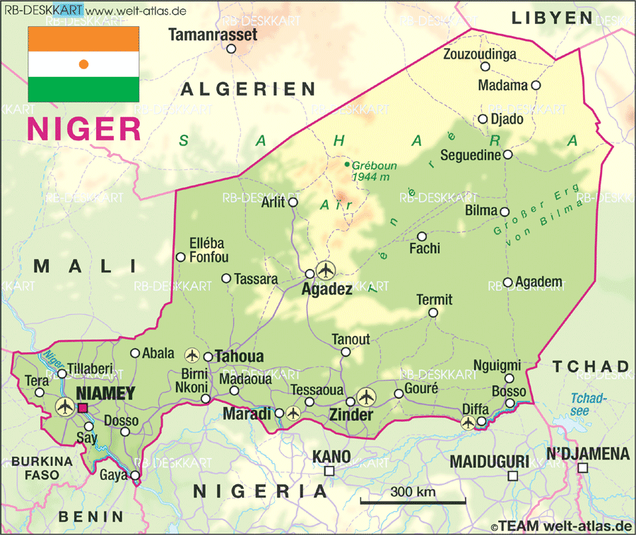
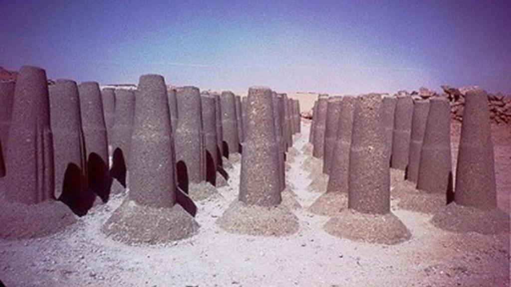
Bilma is known for its salt and natron production through the salt pans there…
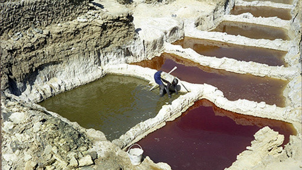
…and from which things like salt cones are made, sold for livestock use throughout western Africa.
Salt is a crystalline compound of sodium chloride and widely used, for example, for seasoning food and in food preservation…

…and natron, a sodium bicarbonate component of salt, and historically used as well as a cleaning product for home and body.

We are told that Natron refers to Wadi el Natrun, or Natron Valley, in Egypt, from which natron was mined by the ancient Egyptians…
…for the burial rites of mummification.
Bilma is primarily inhabited by the Kanuri people.
The Kanuri people are described as the African people that founded the powerful pre-colonial Kanem-Borno Empire.
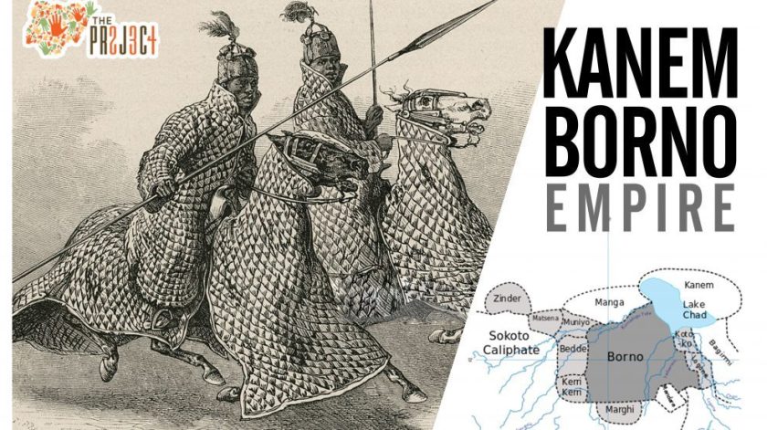
The Kanem Empire was said to have existed from 730 AD to 1380 AD…

…and then continued as the Bornu Empire until 1900.

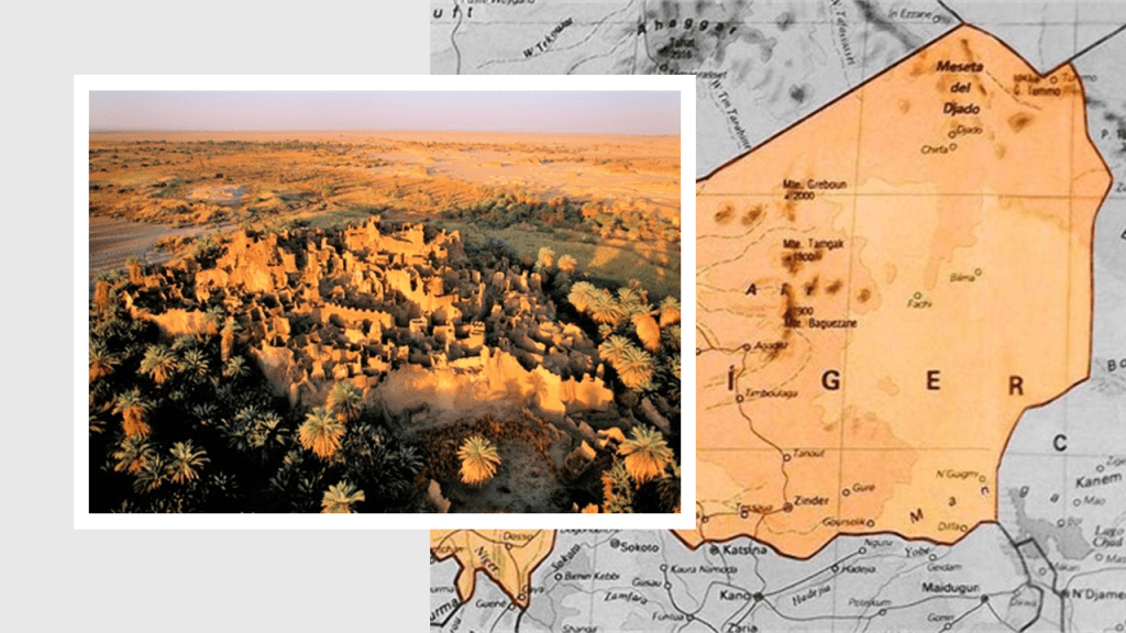
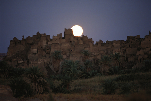
This is the ruined city of Djado, which lies on the southern end of the Djado Plateau in Niger, just to the north of Bilma and near this alignment but not directly on it.
Once inhabited by the Kanuri people, in the present day it is largely uninhabited, with abandoned towns still visible.
This is Kanuri politician Sir Kashim Ibrahim arriving in London for a short tour in 1910.
It looks and sounds like he was a person of importance back in his day!
Now Toubou nomads are in Djabo to tend the date palms of the region.
So, apparently the Bornu Empire lasted right up until the 20th-century. What happened to it?
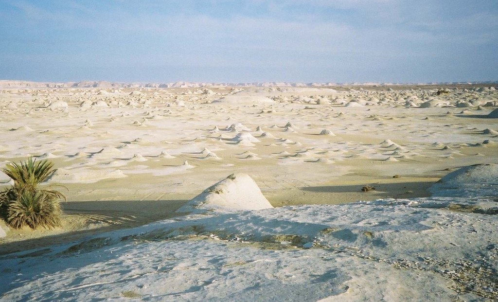
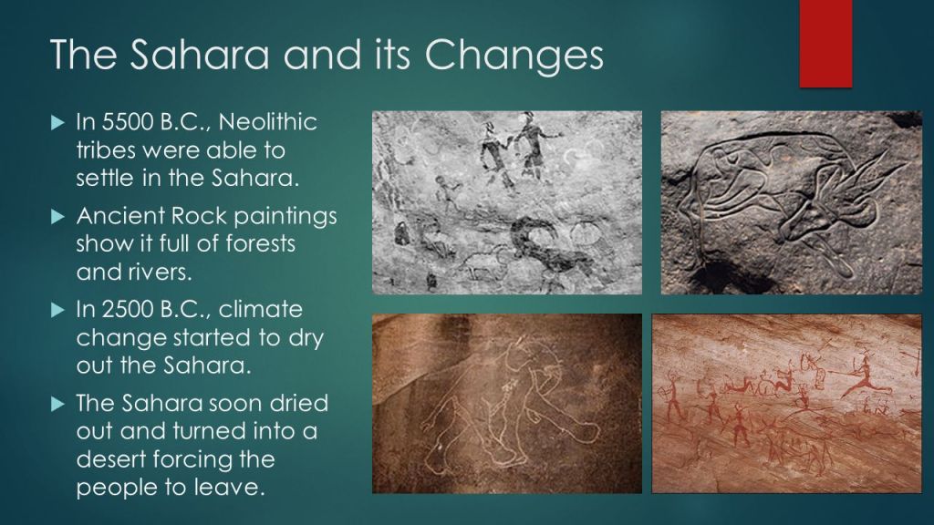
At one time, not only did the Sahara have a fertile, savannah-type ecosystem, supporting a wide-and-varied wildlife population, like these life-sized giraffes carved in rock in Djado…
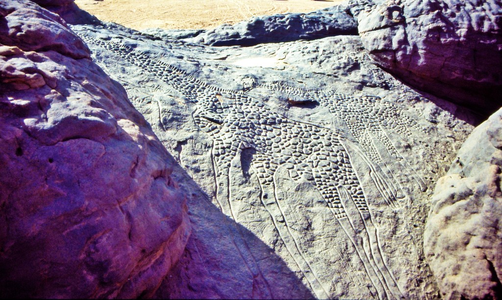
…the region now called the Sahara desert had great forests, including but not limited to, oak, elm, alder, juniper, and pine. As you can see in this picture, we are taught the desertification of this region started happening a long time ago.
Again, the occurrence of a recent, sudden cataclysmic event is not an explanation we are given in our historical narrative.
And the silence about the history of this area in the present-day is deafening.
I will continue to do my best to fill in the gaps from what’s in the historical narrative that is available to find, and as we’ve already seen, the modern history of this region, and Africa in general as well, is very disturbing.
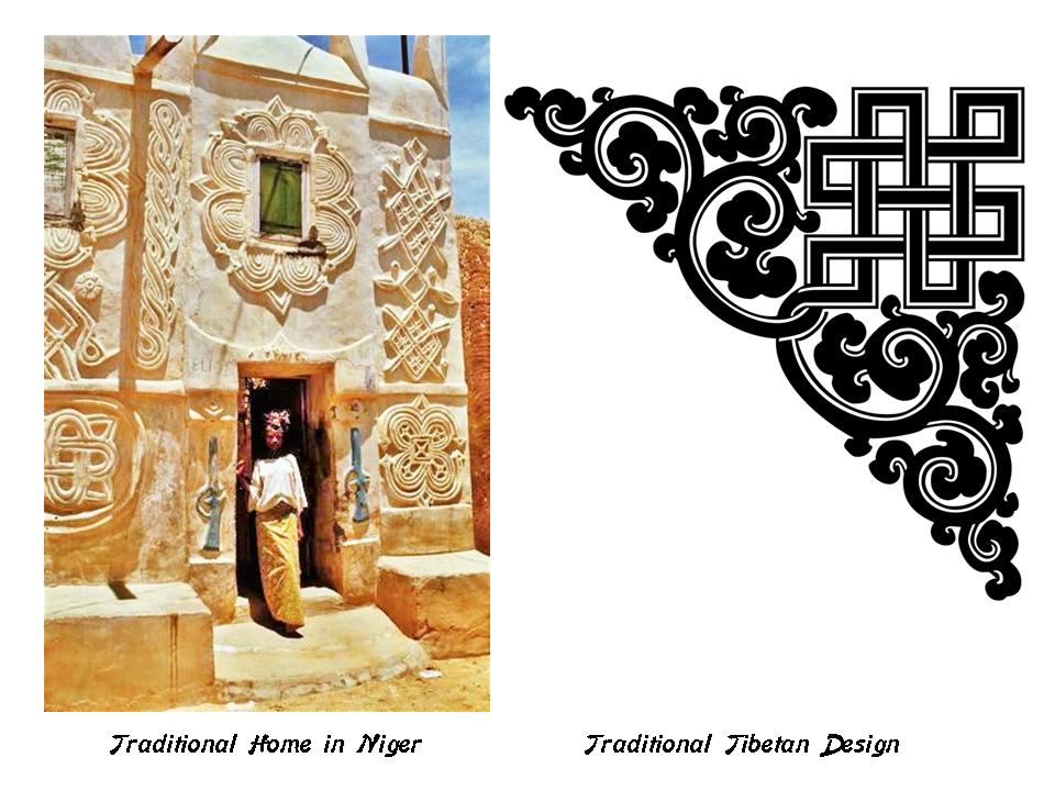
This is a traditional home in Niger on the left, and the designs on it reminds me of traditional Tibetan design elements on the right.
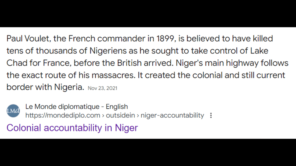
Niger was colonized by France during the “Scramble for Africa,” and became part of French West Africa.
Like what we saw back in Algeria, the invasion and colonization of Niger was also marked by atrocities and Crimes against Humanity.
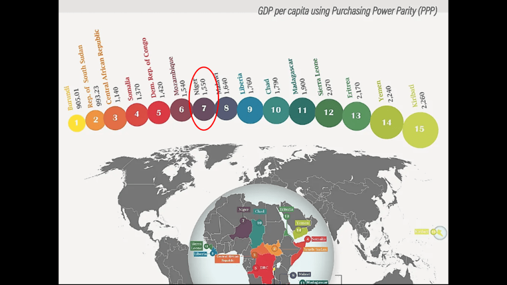
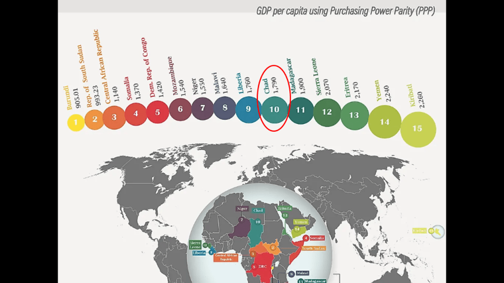
In today’s world, Niger is one of the poorest countries in the world, ranked as number 7-out-of-15 GDP per capita using Purchasing Power Parity.
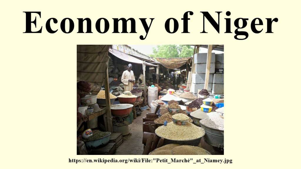
The economy is primarily based on subsistence agriculture…and the export of raw materials, including uranium ore.
Since independence from France in 1960, Niger has experienced five coups d’etat and four periods of military rule.
Since a coup in 2023, Niger has been ruled by a military junta.

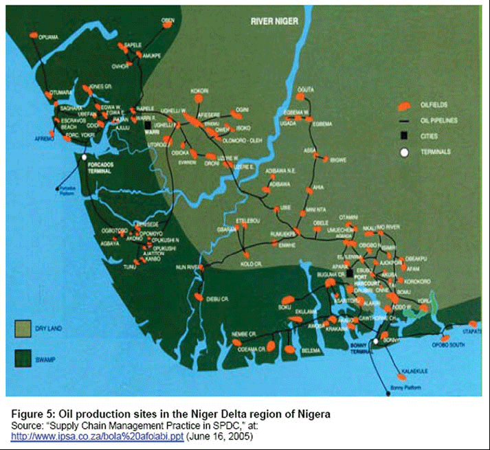
Lastly, I would like to point out the Niger Delta Civil War and Boko Haram.
There has been conflict in the Niger Delta since the early 1990s as well, mostly between foreign oil companies and minority ethnic groups, and has been on-going in one form or another since that time.
The Islamic State in West Africa has been active in Niger, Nigeria, Chad, and Northern Cameroon since 2002, and has been known as Boko Haram since 2015.
It is a militant jihadist group that advocates for Sharia Law, and has been particularly noteworthy for militant insurgency and child kidnappings, among many other things.

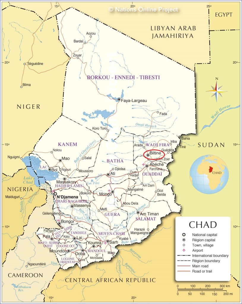
The next place on the alignment is Biltine, the capital of the Wadi Fira region of Chad, formerly known as the Biltine Prefecture.
Chad is a land-locked country in north-central Africa.
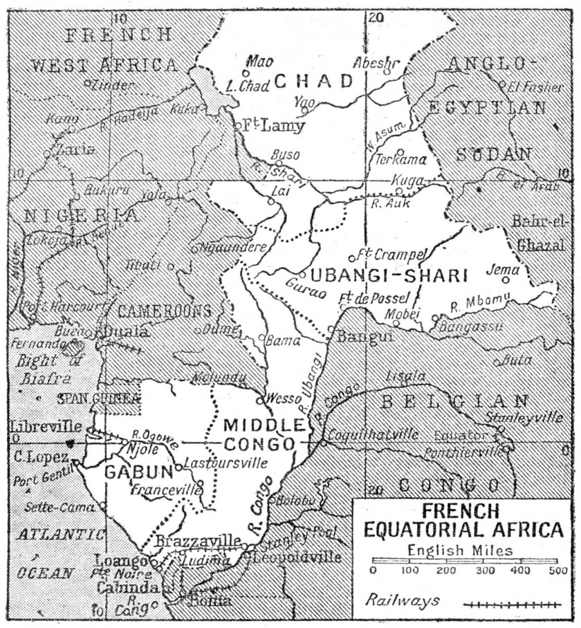
France conquered the territory in 1920, and incorporated it as part of French Equatorial Africa, a French colonial empire that lasted from 1900 until 1960.
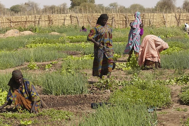
Like the other countries that we have been looking at through this part of Africa, since its independence from France in 1960, Chad has been plagued by political violence, and is one of the poorest countries in the world, with most of its inhabitants living in poverty as subsistence herders and farmers.
Chad is ranked as Number 10 out of fifteen for GDP per capita using Purchasing Power Parity .
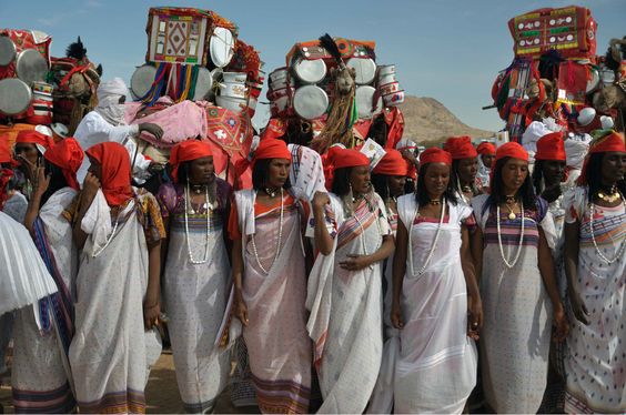
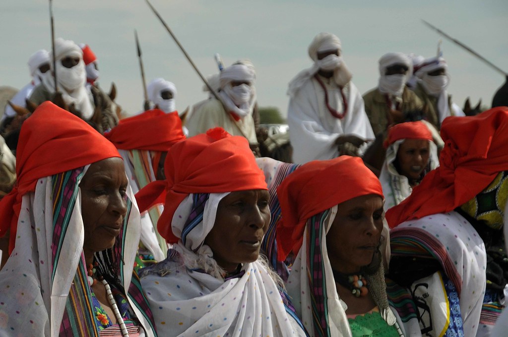
The Zaghawa people are described as a central African Muslim ethnic group of eastern Chad and western Sudan, and as nomads who obtain their livelihood through herding cattle, camels and sheep and harvesting wild grains.
Interestingly, it is said that in the Girgam, the royal history of the Kanem-Bornu Empire I mentioned previously, refers to the Zaghawa people as the Duguwa, the line of kings of the Kanem Empire prior to the rise of the Islamic Seyfawa dynasty in 1086 AD.
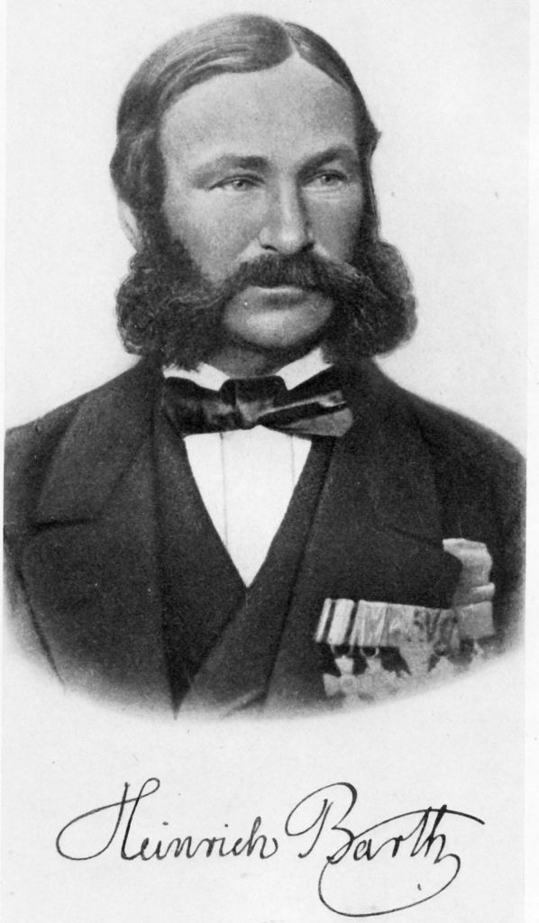
We are told that in 1851, a copy of the Girgam was given by a local associated with the Seyfawa Dynasty of the Kanem-Bornu Empire to Heinrich Barth, an Arabic-speaking German explorer of Africa, and he published a translation of it in 1852.
He travelled throughout Africa between 1850 and 1855, establishing friendships with rulers ands scholars, and carefully documenting the details of the cultures he visited.
Heinrich Barth also received his higher education at the Humboldt University in Berlin, starting in 1839, including geology under Karl Ritter, one of the founders of modern geology, along with Alexander von Humboldt; the classics under August Bockh; and under historian Jakob Grimm, the editor of Grimm’s Fairy Tales, one of the two Brothers Grimm with his younger brother Wilhelm.
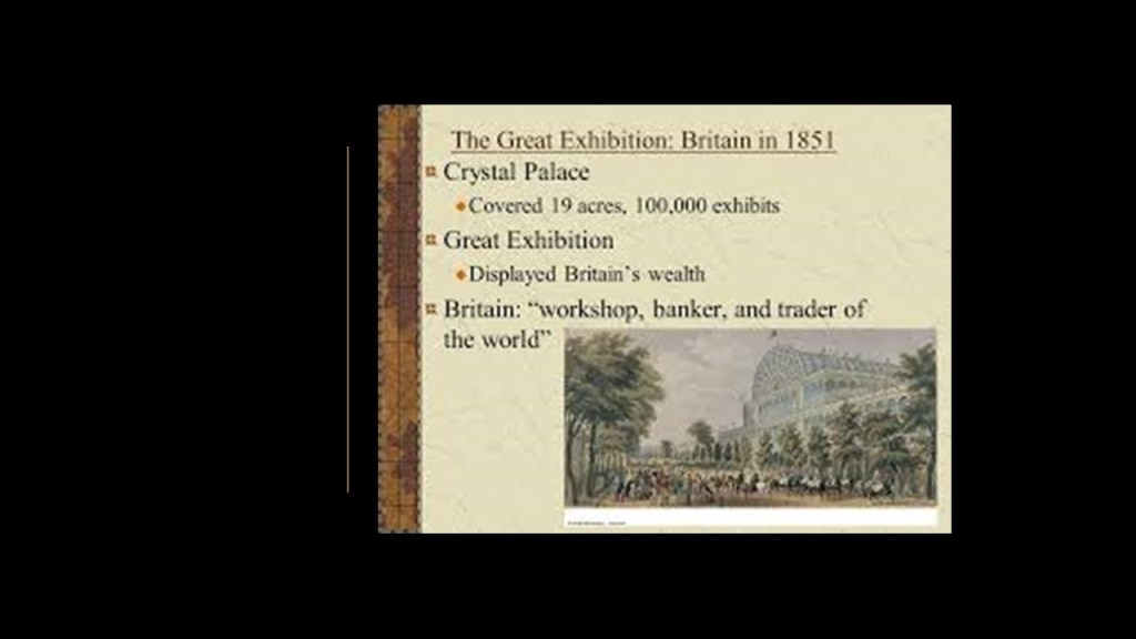
The year that Heinrich Barth received a copy of the Girgam in Chad, in 1851, was the same year as the Crystal Palace Exhibition in London in the reign of Queen Victoria, and the first major world’s fair of the modern era, and which I think were showcasing the technology and architectural wonders of the original civilization before being hidden away or forever destroyed.
We are told that the Crystal Palace Exhibition took only 9-months to develop, from plans and organization to the Grand Opening with Queen Victoria.

I believe it was the official kick-off of the New World Order timeline.
And, as I mentioned previously, first-cousins Queen Victoria and Prince Albert were members of the House of Saxe-Coburg and Gotha of the House of Wettin, the same obscure German ducal lineage that Franz Xavier of Saxony came from, who founded the Freiburg University of Mining and Technology in 1765.
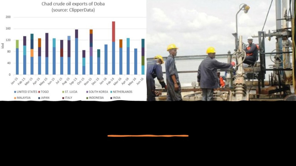
It is Important to note that Chad has sizeable reserves of crude oil, which is the country’s primary source of export earnings.
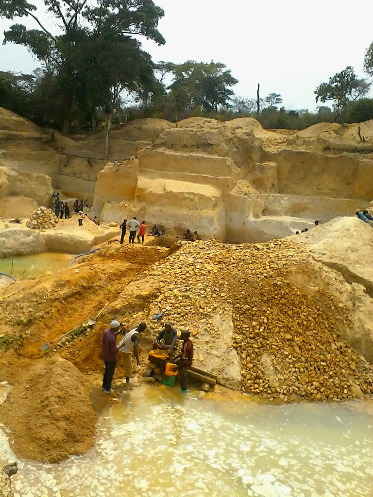
Also, the Wadi Fira region of which Biltine is the capital is reported to have large deposits of gold-bearing quartz, as well as deposits of natron, uranium, silver and diamonds.
Most of the mining in Chad is small-scale due to the lack of foreign investment because of political and cultural instability.
There have been roughly four Civil Wars in Chad since independence from France in 1960. The last one started in 2005 between Muslims in the North and Christians in the South, and is continuing on in some form or another to the present day.
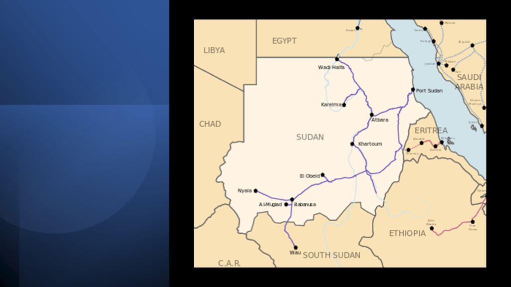
From Chad, the alignment crosses through El Obeid, Sudan, which is the capital of North Kurdafan.
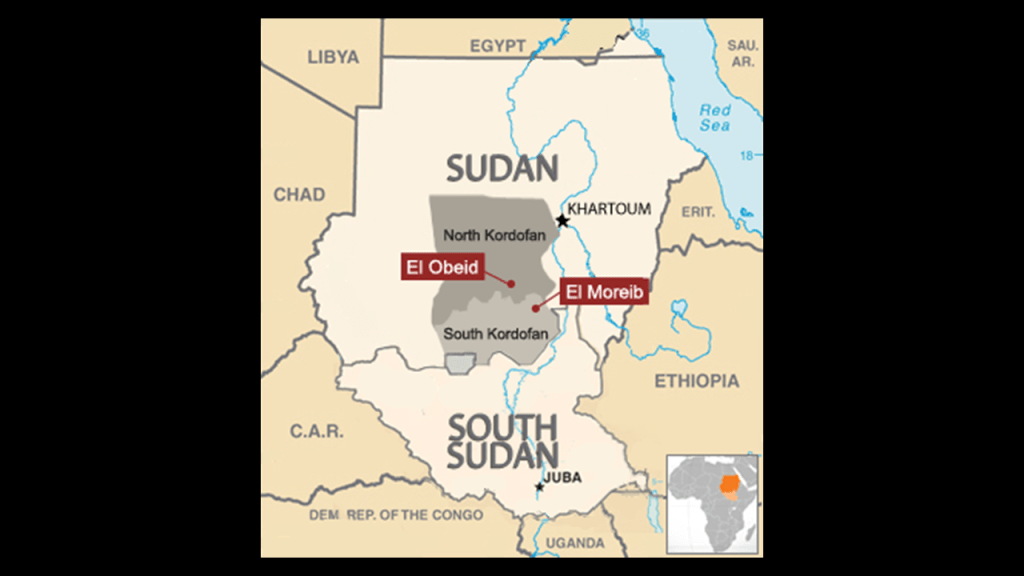
El Obeid is a terminus of Sudan Railways.

Sudan has 2,935-miles, or 4,725-kilometers, of narrow-gauge, single-track railways that serve the northern and central part of the country, with construction of the railroad said to have first started in 1878.
There is an oil refinery in El Obeid.
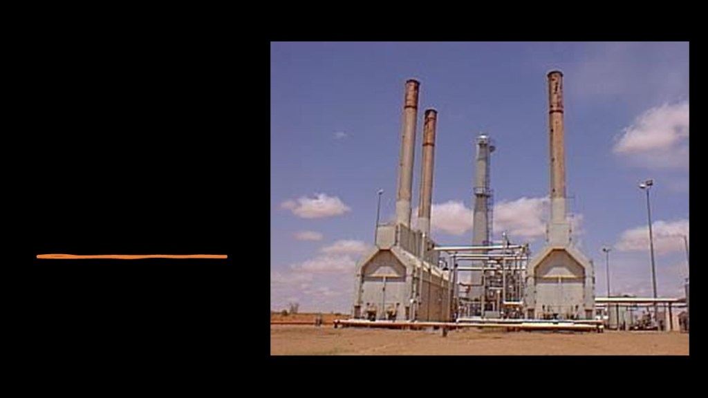
As of 2016, Sudan held 5-billion barrels of proven oil reserves, ranking 23rd in the world.
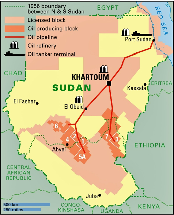
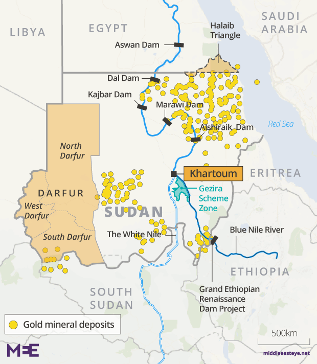
Also, there are more than 40,000 gold-mining sites, and about 60 gold-processing companies operating in Sudan.
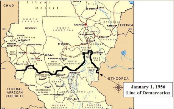
It looks like Sudan’s resources have been developed in a way that Chad’s has not, in spite of both countries having the same issue of political and cultural instability since independence from Britain in 1956.
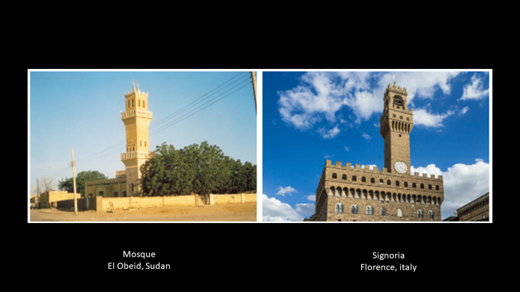
Here is a comparison of a mosque in El Obeid, Sudan on the left, and the Signoria, which was the government building of medieval and renaissance Florence, Italy, in our historical narrative.
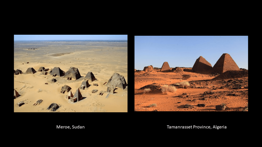
Also, there are Pyramids in Sudan, located in Meroe which is northeast of the country’s capital of Khartoum.
As the map shows, Sudan is due south of Egypt.
Meroe was an ancient city that sits on the east bank of the Nile River as well.
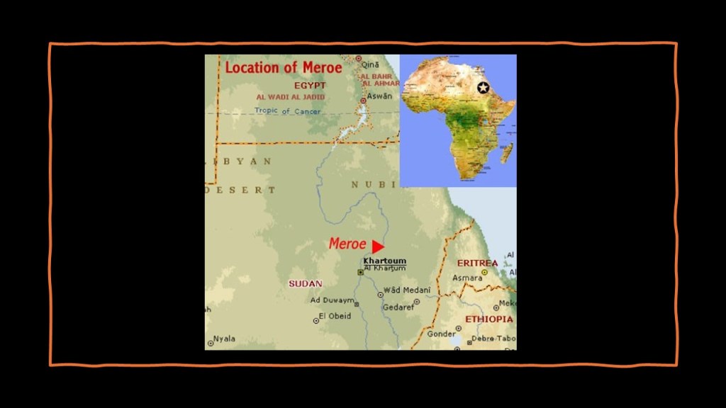
It was the royal capital of the Kingdom of Kush.
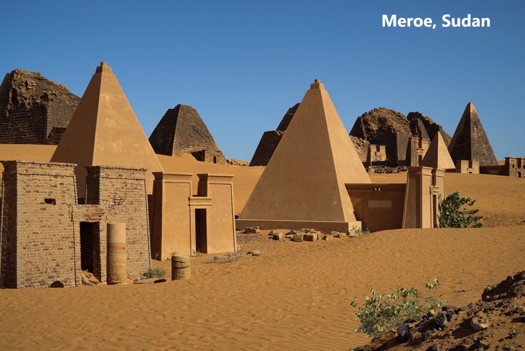
The ancient Kingdom of Kush, also known as Nubia, was at one time a powerful civilization in this part of Africa.
Here is an aeriel view of the Meroe Pyramids on the left compared with similar-looking pyramids in Tamanrasset Province back in Algeria on the right.
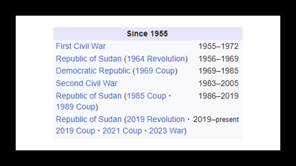
The first Sudanese Civil War started in 1955 between the northern part of Sudan, and the southern Sudan region that wanted representation and more regional autonomy.and lasted for 17-years.
During that 17-year-period, over half-million people are estimated to have died.

This is what we are told about it.
The British government administered the primarily Muslim and Arab Northern Sudan and mostly Christian and animist Southern Sudan as separate regions under international sovereignty until 1956, at which time the two regions were merged into a single administrative region as part of British strategy in the Middle East, and without the consultation of the minority southern leaders, who were fearful of being absorbed into Northern Sudan, for whom the British had shown favoritism, and tensions between the North and South escalated between the two.
Following Sudan’s independence from Britain, the southern ruling class were powerless in the merged Sudan’s politics and government compared to the northern ruling class, and unable to address the injustices against their people.
Hostilities escalated characterized by insurgencies and political turmoil, which included in-fighting between Marxist and non-Marxist factions in the ruling military class.

There have been intermittent states of civil war in Sudan to the present-day.
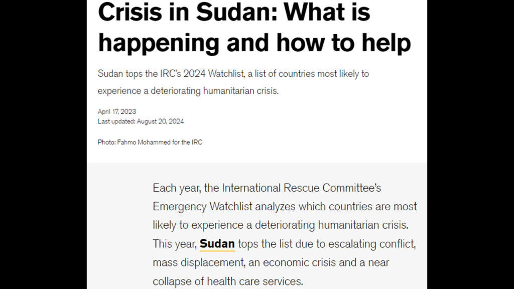
While not listed in the graphic showing the top 15 poorest countries rated by GDP per capita using Purchasing Power Parity, the population of Sudan is still poverty-stricken, and is currently on an Emergency Watchlist monitoring countries most likely to experience a deteriorating humanitarian crisis due to escalating conflict, mass displacement, economic crises, and a near collapse of health care services.
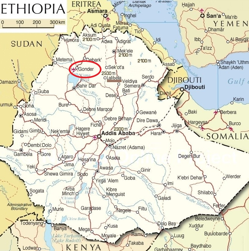
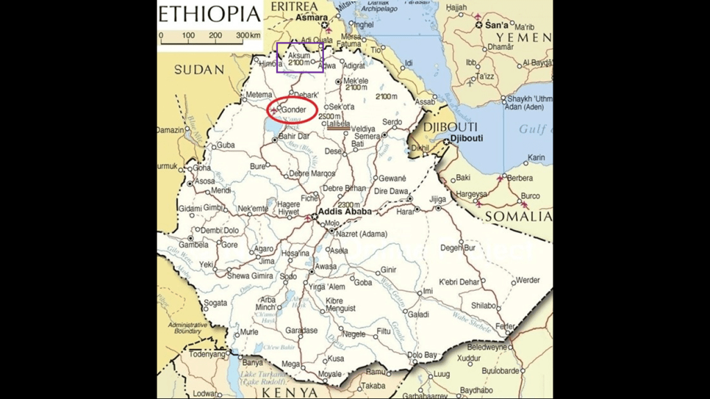
Next on the alignment, we come to Lake Tana and Gonder, a city and district in Ethiopia.
First, Lake Tana.
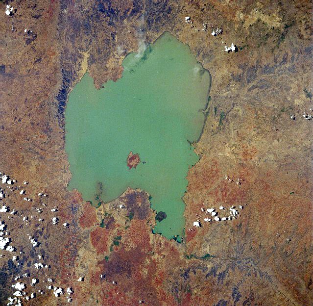
Lake Tana is the source of the Blue Nile, and the largest lake in Ethiopia, and is also a sacred lake.
It has been a registered UNESCO Biosphere Reserve Site since 2015, along with its seven ancient monasteries, like the main monastery of Narga Selassie on Lake Tana’s Dek Island.
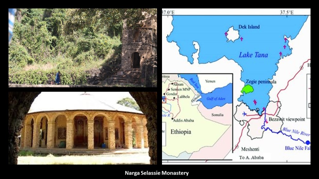
Among other things, the heart-shaped Lake Tana has living traditions about being a place where Joseph, Mary, and Jesus stayed on their way back to Israel after fleeing Herod, and also as a place where the Ark of the Covenant was kept for 800 years before going to Axum, where it is said to currently be located.
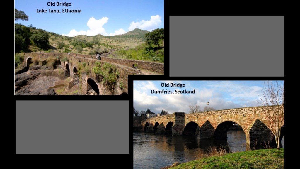
This photo is a comparison for similarity of appearance of an old bridge near Lake Tana on the top left, with the River Nith Old Bridge, one of the oldest standing bridges in Scotland, in Dumfries, on the bottom right.
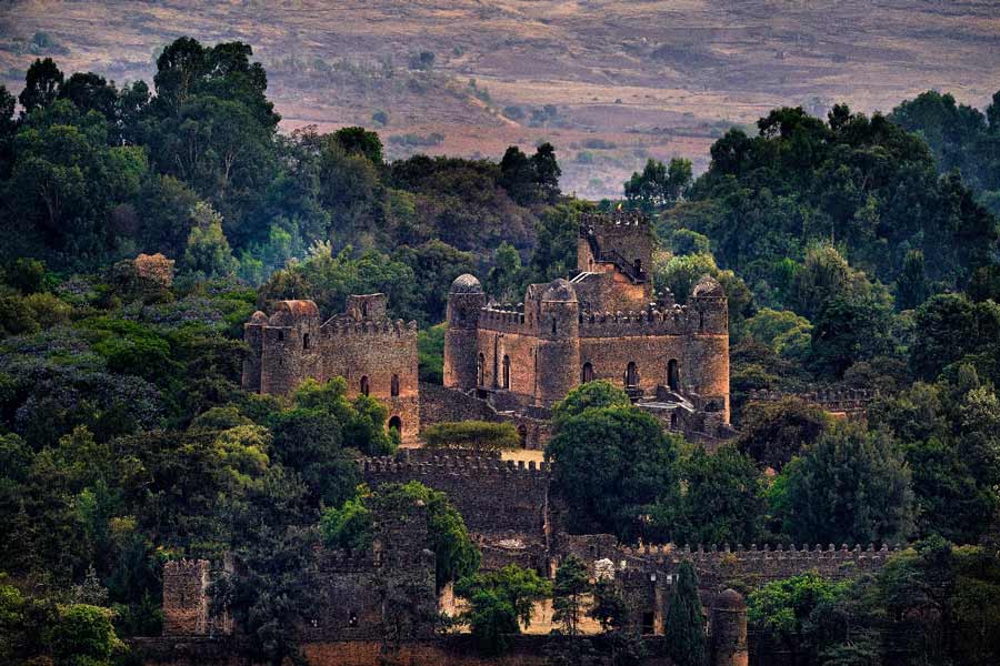
Next, Gonder.
Gonder was the royal city of Ethiopia.
Today it is a UNESCO World Heritage Site.
It was the capital of the historic Ethiopian Empire and we are told the Imperial Seat from the 1200s to the 1900s.
The Fasil Ghebbi, nicknamed the “Camelot of Ethiopia,” was the home of Ethiopia’s Emperors in our historical narrative from the 17th-century to the 20th-century.
The Solomonic dynasty, also known as the House of Solomon, was the former ruling dynasty of the Ethiopian Empire.
Its members were lineal descendants of King Solomon and the Queen of Sheba through their son Menelik I, the first Emperor of Ethiopia.
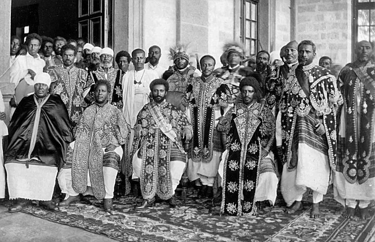
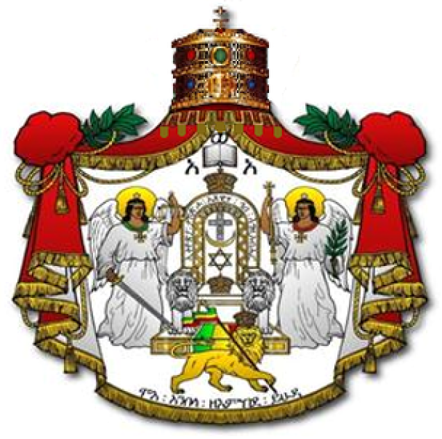
Haile Selassie was the last Emperor of Ethiopia from 1930 to 1974.
The full title traditionally of the Emperors of Ethiopia was: “Elect of God, Conquering Lion of the Tribe of Judah and King of Kings of Ethiopia.”

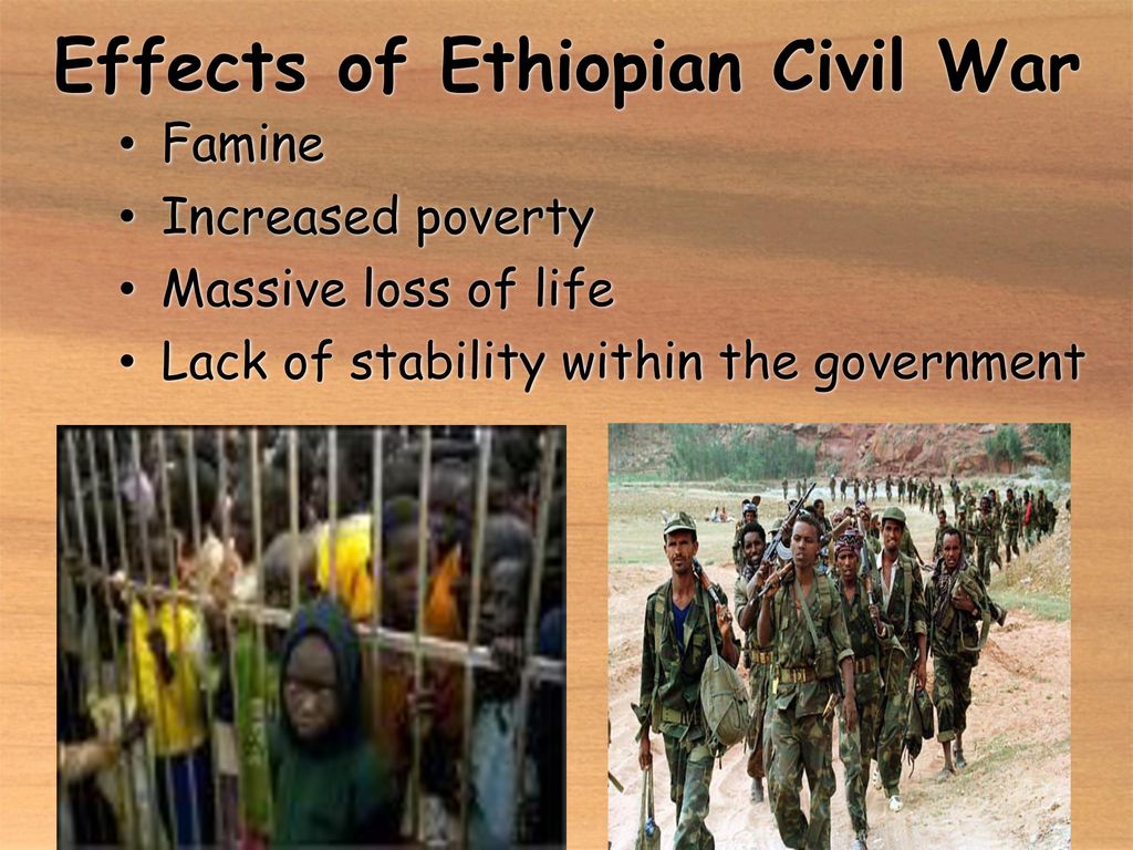
The overthrow of the Ethiopian Emperor Haile Selassie took place on September 12th of 1974, in a coup initiated by a Marxist-Leninist factions in the military, and marked the beginning of a 17-year-long Ethiopian Civil War, which formally ended in 1991.
The civil war left at least 1.4 million dead.
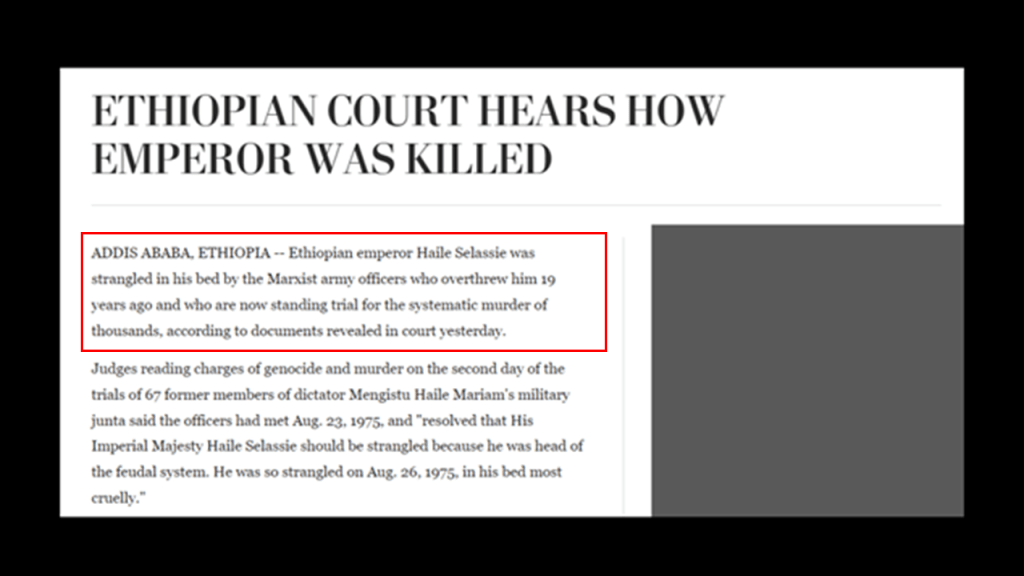
The last Ethiopian Emperor was apparently murdered in August of 1975 by the same Marxist Army officers who had overthrown him the year before.
Ethiopia became a Federal Democratic Republic in 1991 after the end of the Ethiopian Civil War.
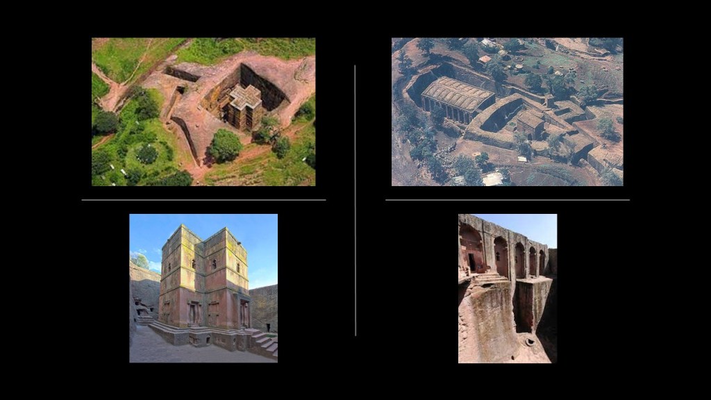
Lalibela is also on this alignment.
Lalibela is the second holiest of Ethiopia’s cities, after Aksum.
It is famous for its complex of all together eleven monolithic churches, meaning cut out of one rock.
It has been a UNESCO World Heritage Site since 1978.
The population of Lalibela is almost completely Ethiopian Orthodox Christian.
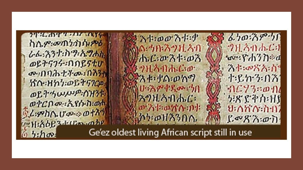
The ancient Ethiopian language of Ge’ez is the oldest African script still in use to this day, and is the liturgical language of the Ethiopian Orthodox Tewahedo Church and the Jewish Community in Ethiopia.
The Ethiopian Orthodox Tewahedo Church dates back to the acceptance of Christianity by the Kingdom of Axum in 330 AD.
The Jewish community in Ethiopia is dated back to at least 15-centuries.
Aksum, the holiest city in Ethiopia, is just to the northeast of Gonder on the alignment.
A UNESCO World Heritage Site since 1980, it is in Ethiopia’s Tigray National Regional State.
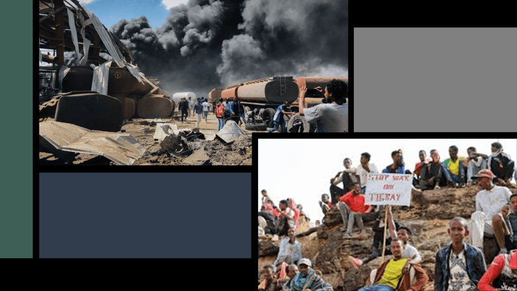
Between 2020 and 2022, the Tigray War took place between the Ethiopian Federal Government and the Tigray People’s Liberation Front, during the course of which infrastructure was destroyed, and many war crimes were commited, including mass extrajudicial killings of civilians took place throughout the region, including Aksum.
The conflict in Tigray led to major humanitarian crises, widespread famine, and severe economic damage to the tune of an estimated $20-billion.
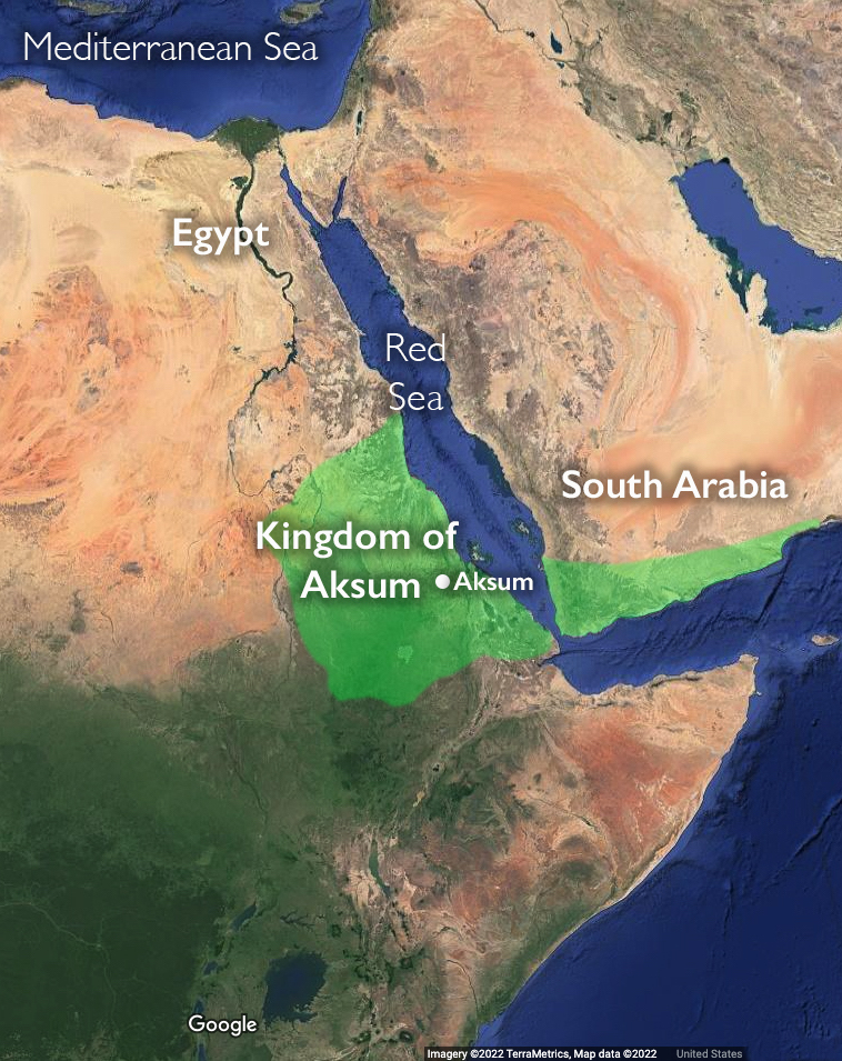
Aksum was the capital of the historic Kingdom of Aksum, a naval and trading power that ruled the whole region as well as parts of what is now Saudi Arabia, and Yemen
There are a couple of noteworthy things to mention about the ancient city of Aksum.
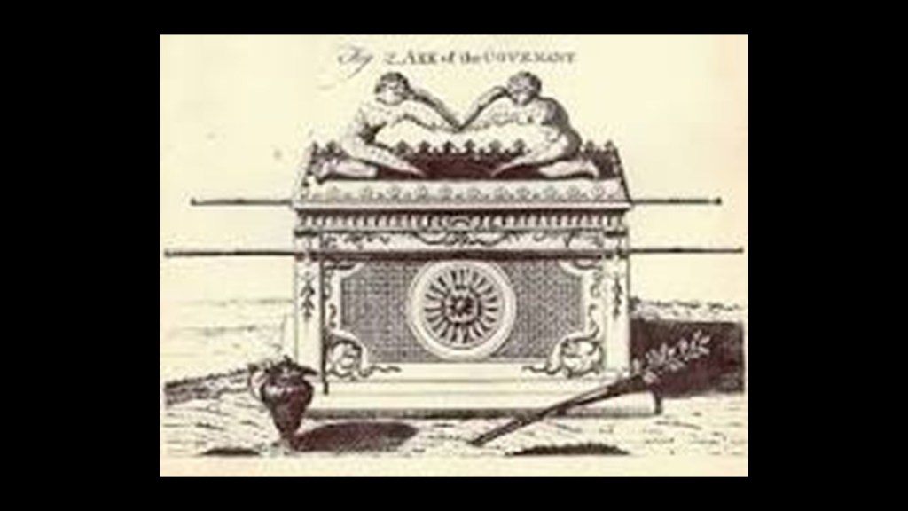
The first is that it is believed to be the home of the Ark of the Covenant at the Saint Mary of Zion Church, and that the Tablets of Stone upon which the Ten Commandments were inscribed lay inside the Ark.
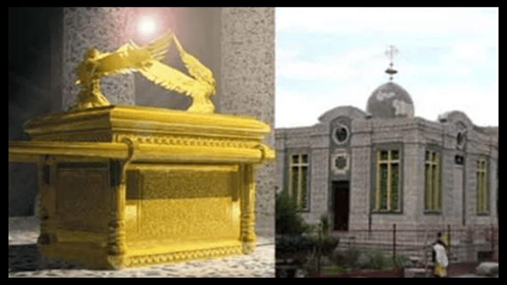
The Ark is closely guarded by one custodian known as the “Keeper of the Ark,” who is the only person allowed to enter the resting chamber of the Ark.
The keeper is appointed for life and can’t leave the sacred grounds until death.
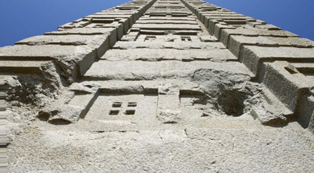
Then there are also the monolithic obelisks.
Though there is more than one obelisk here, this is the granite Obelisk of Axum.
It is 24 meters high, and weighs 160 tons.
Like the churches of Lalibela, it is monolithic in that it was crafted from a single piece of stone.
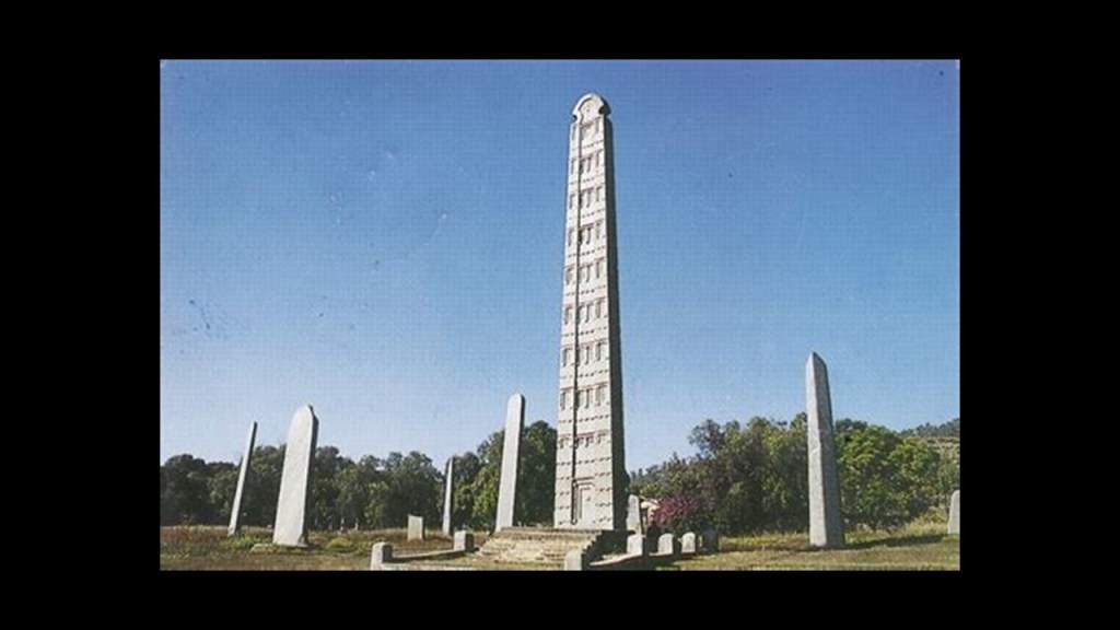
The Obelisk of Axum is in the Northern Stelae Park in Aksum.
There are 120 stelae here, each made from a single piece of granite, and standing as high as 82-feet, or 25-meters.
Each stela looks like a building, with intricately carved windows, marked stories, and false doors at the bottom.
And…yes…there is mining in Ethiopia, including but not limited to gemstones like diamond and sapphire, industrial minerals, gold and tantalum.
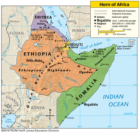
Next we come to Hargeysa, Somalia, in Somaliland in the Horn of Africa.
Hargeysa is the largest city and capital of the self-declared province of Somaliland, which is not recognized internationally.
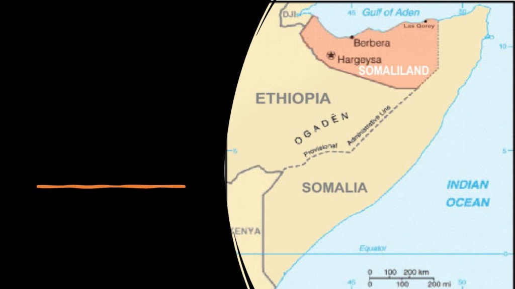
The Horn of Africa is the peninsula that is the easternmost projection of the continent, and referred to in ancient and medieval times as Barbara, and denotes the region containing Somaliland, Djibouti, Eritrea, Ethiopia, and Somalia.
Somaliland was established as a British Protectorate from the late 1800’s until 1960, at which time it was unified with the rest of Somalia, which had been under Italian colonial-rule.
This is a map showing oil concessions in Somaliland circa 2007.
There have been exploratory geological surveys done here, but the mining industry is new and looking for developers.
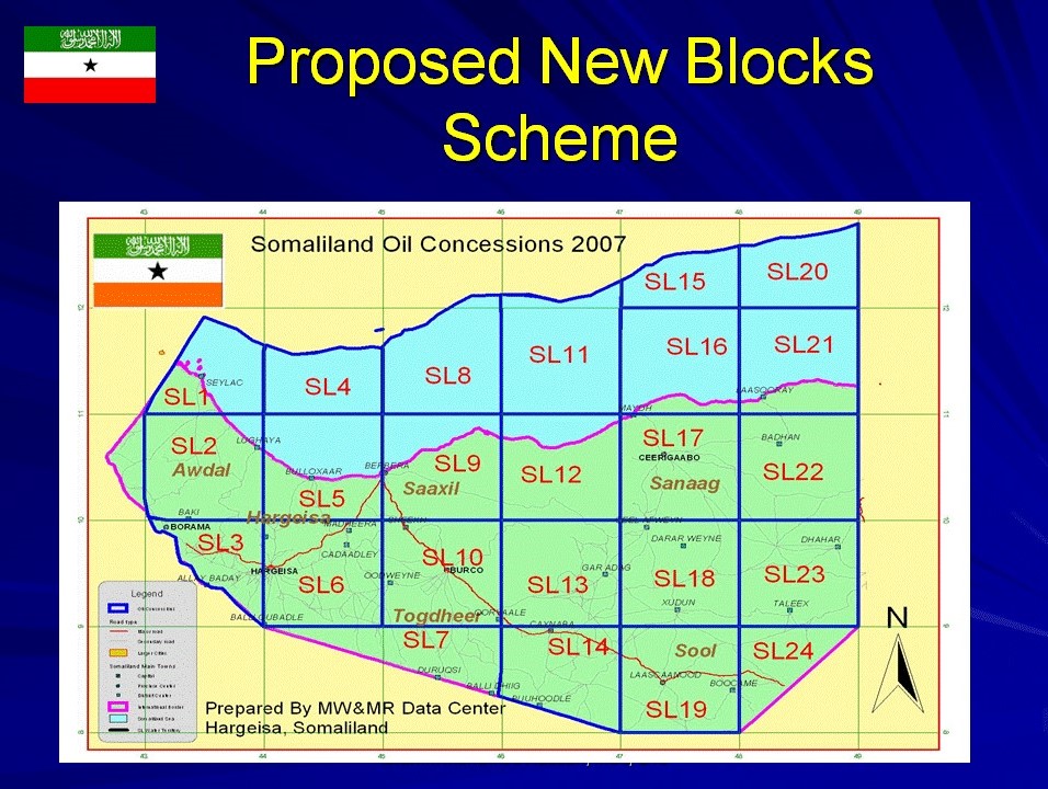
Around Hargeysa, the mineral resources include sodium, copper, tin and gypsum in the region as well.
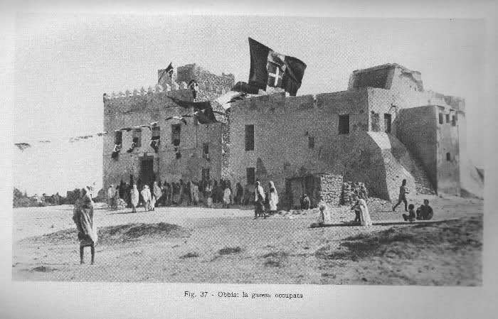
So, as is typical of so many places, this is the fate of the much of the beautiful historic architecture of Somalia, here and elsewhere…
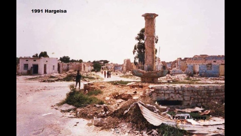
…contrasted with the cathedral in the background in this historic photo of Hargeysa.
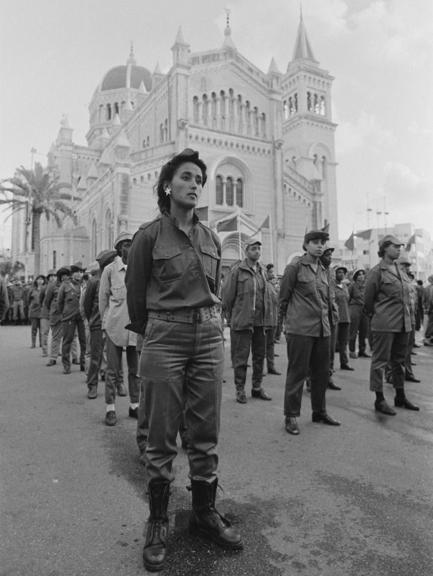
The Hargeysa Holocaust, also known as the Isaaq Genocide, took place from 1987 to 1989, by the Somali Democratic Republic, a socialist state that existed from 1969 to 1991, during the Somaliland War of Independence.
The Isaaq people are a major Somali clan in the Horn of Africa.
The genocide of upwards of 200,000 civilians, and displacement of at least more than double that number, included the levelling and complete destruction of Hargeysa (90% destroyed) and Burao (70% destroyed).
Lastly, the alignment leaves Somalia at the city of Eyl.
This region of Somalia is known as Puntland, which was established in 1998.
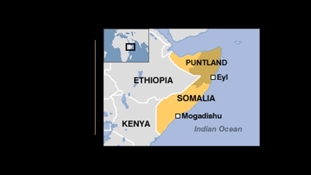
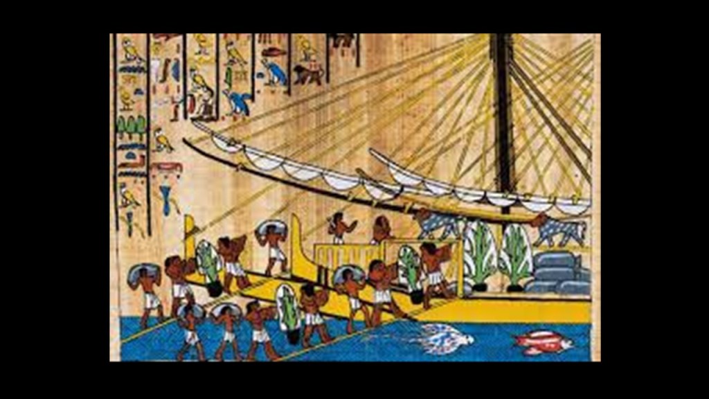
Somalia itself is more than likely the ancient Land of Punt.
Punt was a trading partner with Egypt, and was a wealthy country that was rich in resources and exotic goods.
Cape Guardafui is just to the northeast of Eyl in today’s Puntland.
Ras Hafun juts out into the Guardafui Channel, and is considered the easternmost point in Africa.
Ras Hafun has numerous ruins and structures, and it was believed to be the location of Opone, an old trading emporium serving seemingly the whole world – Africa, Asia, Greece, Rome, and Indonesia, among other places.
It was also known as the center of the world’s spice trade.
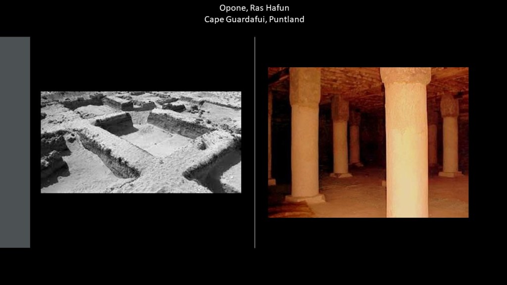
Cape Guardafui was known as “Aromata,” or the cape of spice, due to the abundance of spices it produced, including frankincense, cinnamon, and indian spices.

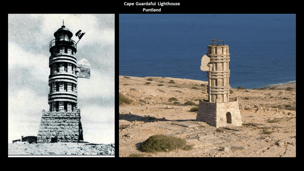
By 1930, the region was part of Fascist Italy, which existed under Mussolini’s totalitarian rule as Prime Minister and Dictator between 1922 and 1943.
The Cape Guardafui lighthouse was said to have been inaugurated in 1930 by Italian Fascist authorities when it was part of Italian Somaliland.
Alula is the capital of the Bari Region of Puntland.
It is on a headland that juts out into the Guardafui Channel on the easternmost point in Africa.
Alula is situated next a shallow lagoon lined by mangroves, a type of tree that grows in brackish water.
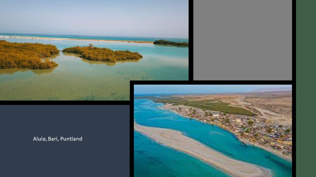
Here is a picture of mangroves covering the coast of this area by Alula on Google Earth.

Mangrove swamps are coastal wetlands characterized by these salt loving trees and shrubs that are typically found in estuaries, where salt water meets freshwater.
Estuaries have water that is salty, dirty & unpleasant, and there are one or more rivers flowing into it, and a connection to the open sea.
I have been speculating for awhile now from my research that the Earth’s estuaries are actually ruined and sunken land that once had the infrastructure of civilization on it.

Back in Eyl on the alignment, this is the Dervish Castle today…
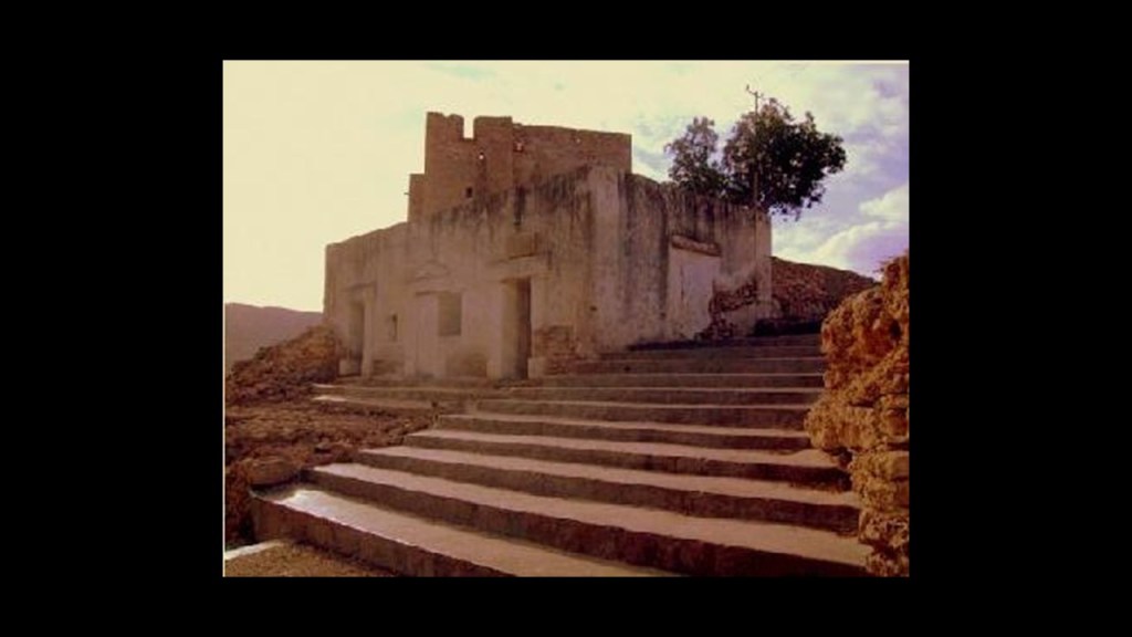
…and a photo of an historic building in Eyl.
In today’s world, Eyl was notable as the secret capital for Somali pirates, and for a number of years was a prime operating base for everyone involved in the plunder of ships passing through the Gulf of Aden, an important shipping route between the Mediterranean Sea and the Arabian Sea.
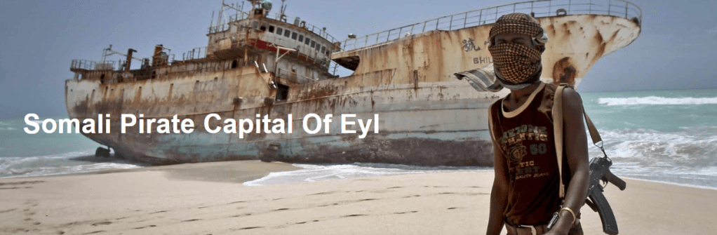
Apparently the last time a ship was hijacked here was in 2009, the pirates are gone, and since then has become a tourist destination in the Horn of Africa.
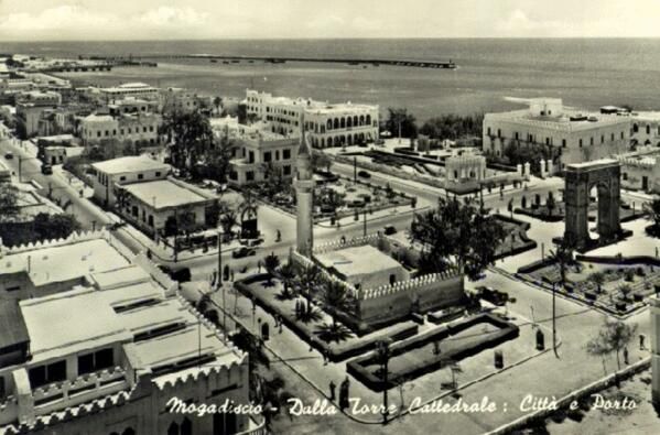
While not on this particular alignment I am tracking, this is an historic photo of Mogadishu.
It was the capital of Italian Somaliland from 1889 to 1936.
When the Somali Republic became independent from Italy in 1960, it was known as the “White Pearl of the Indian Ocean.”
We are told that the causes of the Somali Civil War go back to that Ogaden War that took place between Ethiopia and Somalia between July of 1977 and March of 1978.
The administration of the British Protectorate of Somaliland had given Ethiopia this land in 1948 as the result of an 1897 Treaty.
Ethiopia won the war with the support of Cuban armed forces, Soviet advisors, and over $1-billion worth of military supplies airlifted by the Soviet Union.

Consequently, the Somali Armed Forces and the people of Somalia were demoralized, and eventually led to the overthrow of President Siad Barre in 1991, who had been the Marxist-Leninist Military Dictator of Somalia since 1969 after the assassination of the President of the Somali Republic, the name given to the newly independent state of Somalia after its independence from Great Britain.

The following photos will show you what happened to the historic buildings of Mogadishu as a result of years of civil war.
This is the Villa Somalia, the presidential residence, before the president was ousted and afterwards.

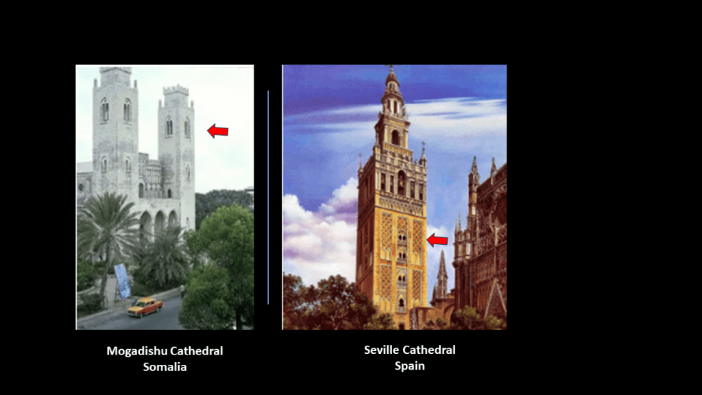
This is an historic picture of Mogadishu Cathedral on the left and Seville Cathedral on the right.
Seville was the capital of Moorish Spain.
In particular, note the same double-window design component of both of the cathedrals’ towers.
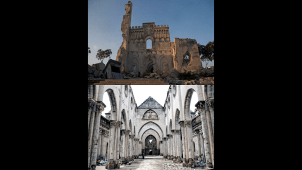
This is what remains of Mogadishu Cathedral today.
Gotta wonder if these Civil Wars were/are created to destroy the infrastructure and people of the original civilization.
The Somali Civil War has been on-going for years.
The situation started to stabilize in 2011, and in 2012 a new government was formed with a passing of a constitution and election of a president, but it has never ended.
It is estimated that at least 500,000 people have been killed as a result of it.

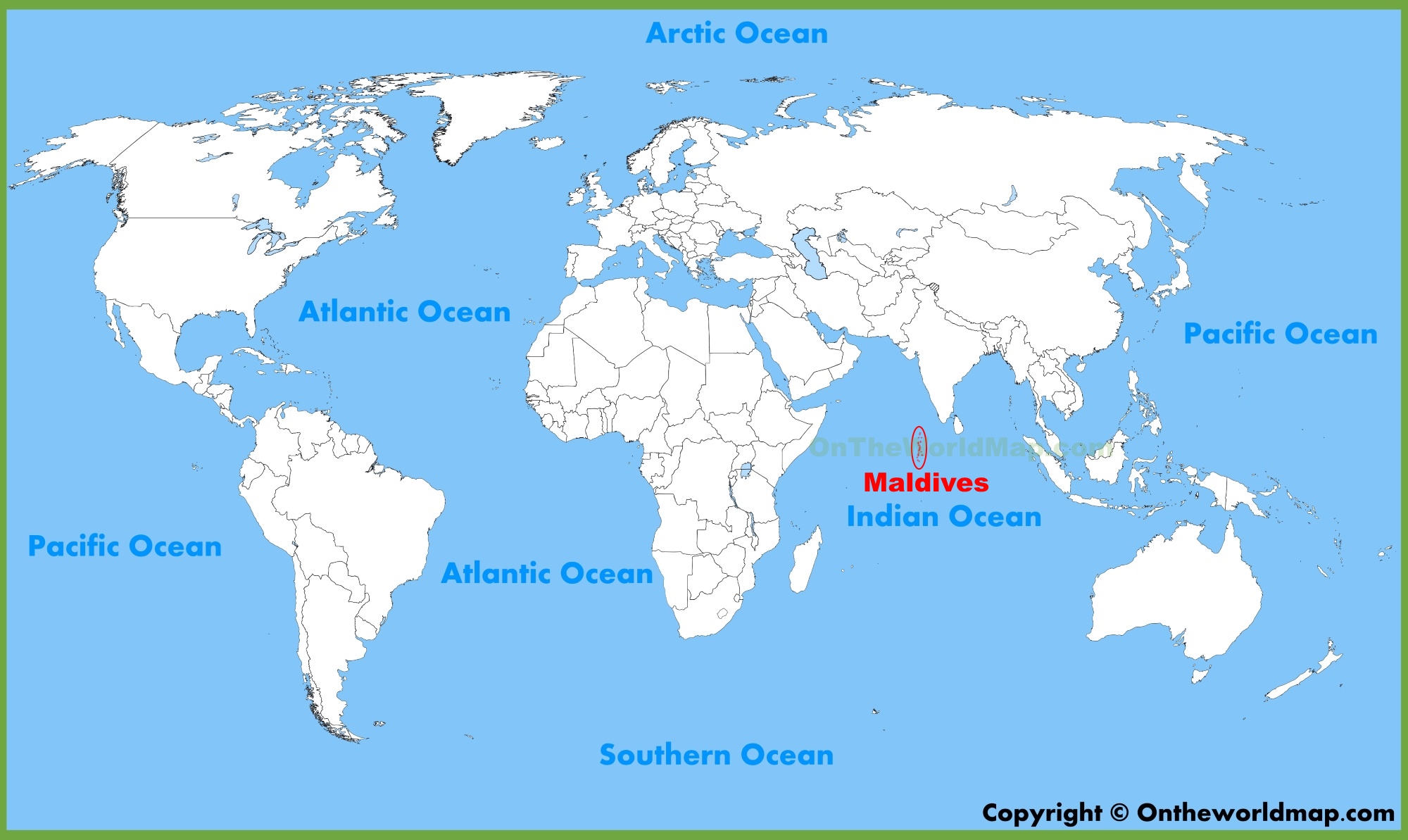
Leaving Eyl on the alignment, I head south east towards the island Republic of the Maldives in the Indian Ocean.
Now I am going to look at the Maldives, and after that, the surrounding underwater topography in the Indian Ocean.
First the Maldives.
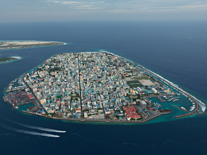
The island Republic of the Maldives is a sovereign state in the Indian Ocean, and to the southwest of Sri Lanka and India, and the alignment crosses over in the area of Male, the capital city of this island country.
With a population of 250,000 occupying a tiny island the size of 3.2-square-miles, or 8.29-kilometers-squared, it is one of the most densely-populated cities in the world.
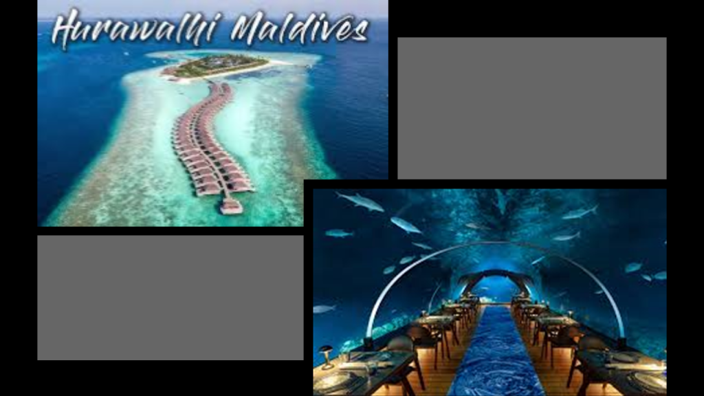
The Maldives is considered a premier tropical beach holiday destination, offering some of the most luxurious resorts in the world.
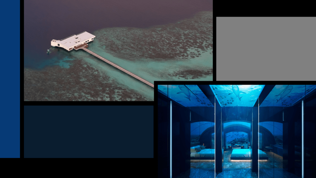
This even includes underwater restaurants, like the Hurawalhi Island Resort, which has the world’s largest all-glass undersea restaurant…
…and the luxury Muraka Hotel that is beneath the waves of the Indian Ocean in the Conrad Maldives Rangali Island Resort.
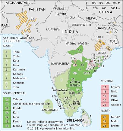
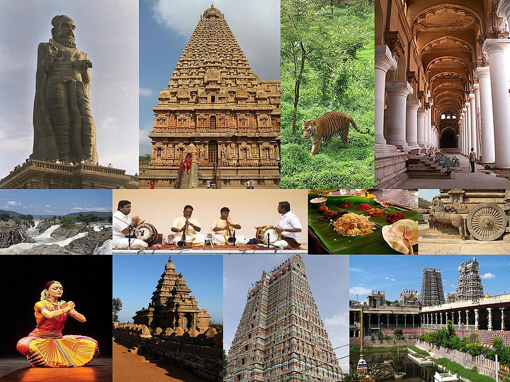
The Maldives have a strong cultural and linguistic connection to the Tamil Dravidian culture of India and Sri Lanka.
While not pictured here, the Maldives lie a relatively short distance southwest of the Dravidian map pictured here.
More about this to come later in this post.
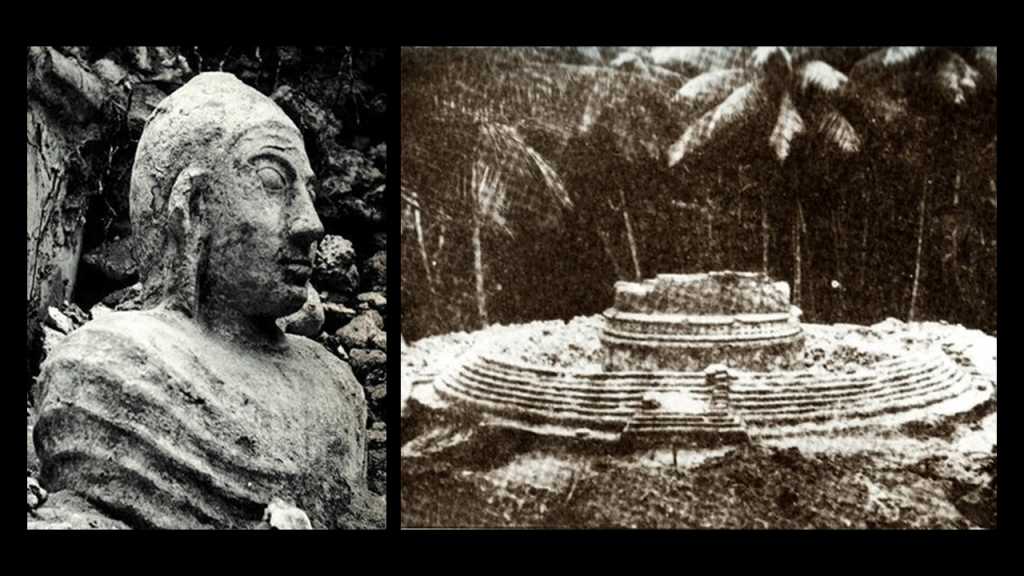
We are told that the Maldives became a sultanate in 1153 when the King converted to from Buddhism to Islam.
Before that the Maldives were Buddhist, prior to that Hindu, and originally was a matriarchal society with each atoll ruled by a chief queen.
These historical photos show a Buddhist Statue and Stupa from the Maldives.
In today’s world, Islam is the mandatory religion in the Maldives.
This is the old Friday Mosque in Male.
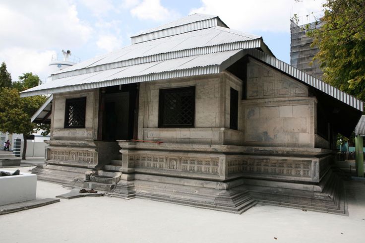
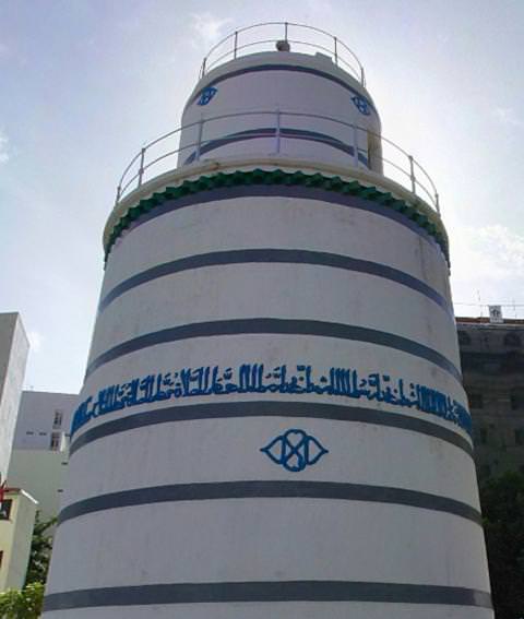
It is made from coral stone, and has unique coral stonework and woodwork, as well as lacquerwork, on the inside.
The formal title of the former Sultan of the Maldives was: “Sultan of Land and Sea, Lord of the twelve-thousand islands and Sultan of the Maldives.”
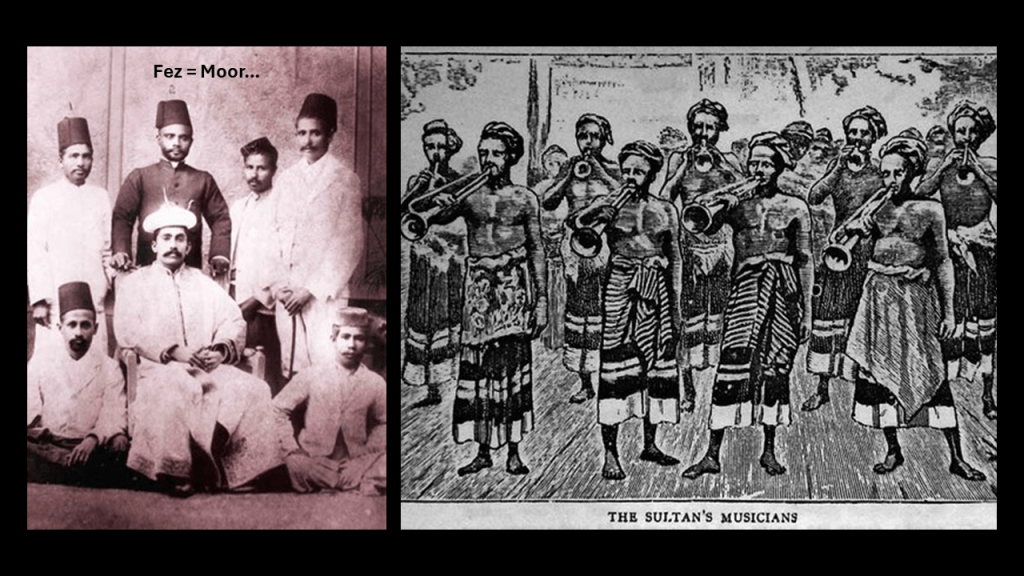
The men surrounding the Sultan in the previous slide are wearing the Fez.
The Fez is the ancient and modern national headdress of the Moors.
The Moorish Legacy and headdress have been usurped by western Freemasons, who claimed it all for themselves.

In 1796, the British included the Maldives as a British Protected area, and it officially became a British Protectorate in 1887, with an understanding that they were involved in external affairs like military defense, and the Sultan was responsible for Home Rule.
Eventually the Sultan’s ruling powers were taken over by his Ministers, and a Constitutional Monarchy was proclaimed in 1932, with the Sultan remaining as nominal head.
In 1965, the Sultan became a King with independence from Britain.
Then in 1968 the new monarchy ended with the establishment of a Republic in a national referendum.
This is a photo of the last monarch of the Maldives – King Muhammad Fareed Didi.

The Sultan’s Palace was demolished and the grounds became Sultan Park, and what was left of the palace was converted into the Maldives National Museum, which houses a complete collection of royal artifacts, as well as archeological finds throughout the islands.
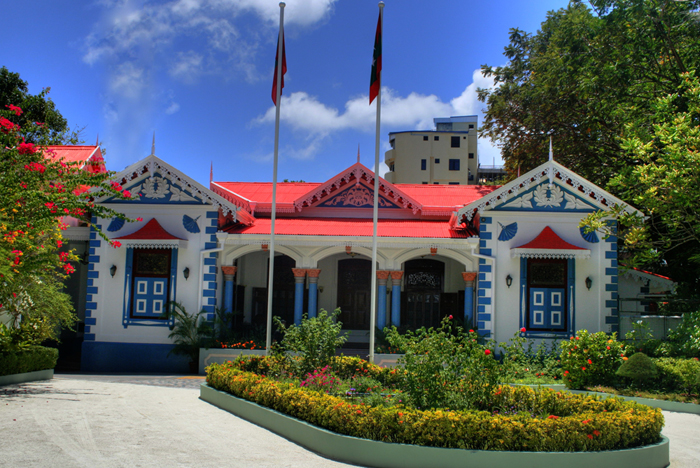
This is the Mulee’aage, now the Presidential residence, but was said to have been completed in 1919 as a residence for the heir of the Sultan at the time.
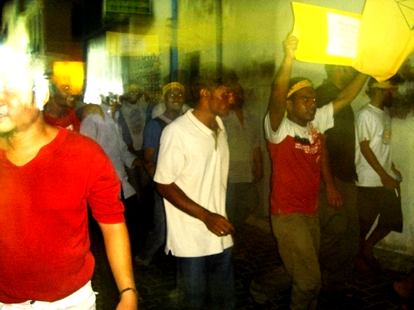
As we have seen with all the other countries on this alignment crossing northern Africa, in the decades since the establishment of the Republic in 1968, the political history of the Maldives has been rather tumultuous, punctuated with many episodes of civil unrest and political instability.
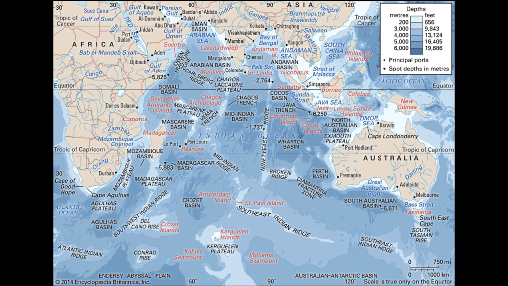
Now, onto looking at the Indian Ocean.
Here is a map showing the underwater topography of the Indian Ocean as well as the surrounding continents and islands.
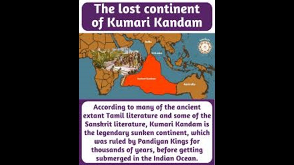
Firstly, I would like to point-out that this part of the world was associated as the part of the lost continent of Lemuria that has been identified as Kumari Kandam, sunken lands of the ancient Tamil civilization.
We are told that the discussion about a lost continent in the Indian Ocean came about starting in 1864, when the English lawyer and prominent zoologist, Philip Sclater, proposed the idea that a continent that he called Lemuria had existed, to explain geological and other similarities between Madagascar and the Indian Subcontinent, as well as Africa and Australia
It was theorized that it had sunk beneath the Indian Ocean, but we are told that the theory that it had sunk was discredited by the previously mentioned scientific theory of plate tectonics and continental drift that gained academic acceptance in the 20th-century as the only explanation, as mentioned previously.
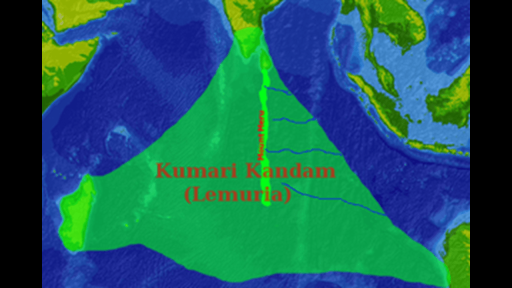
In the 20th-century, Tamil writers started using the name Kumari Kandam, after connecting it with Pandyan legends of lands described in ancient Tamil and Sanskrit texts.
According to these writers,an ancient Tamil civilization existed on Lemuria before it was lost to the sea in a catastrophe.
The Pandyans were an ancient Tamil dynasty of South India.
The Tamils were considered to be highly advanced, with sophisticated urban settlements; a rich cultural and artistic heritage, and advanced planning and engineering skills.
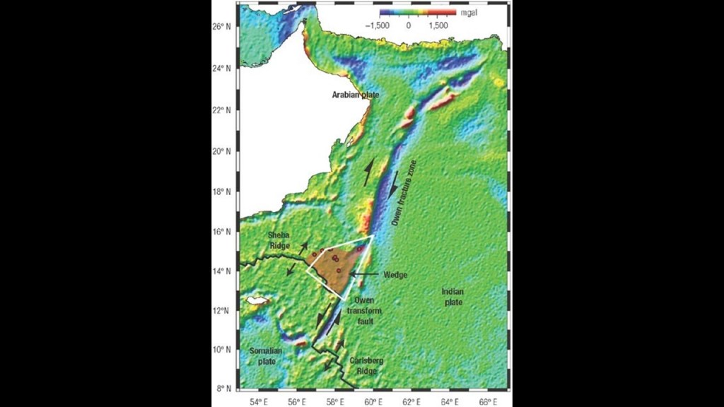
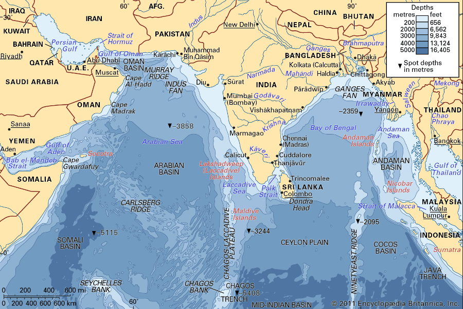
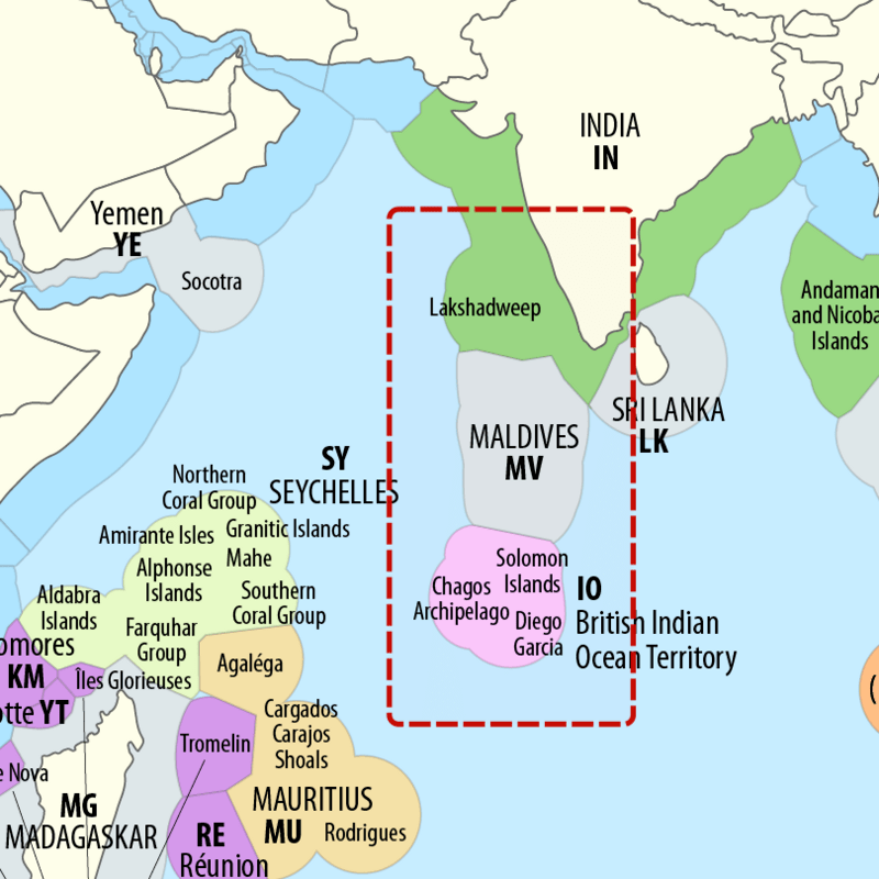
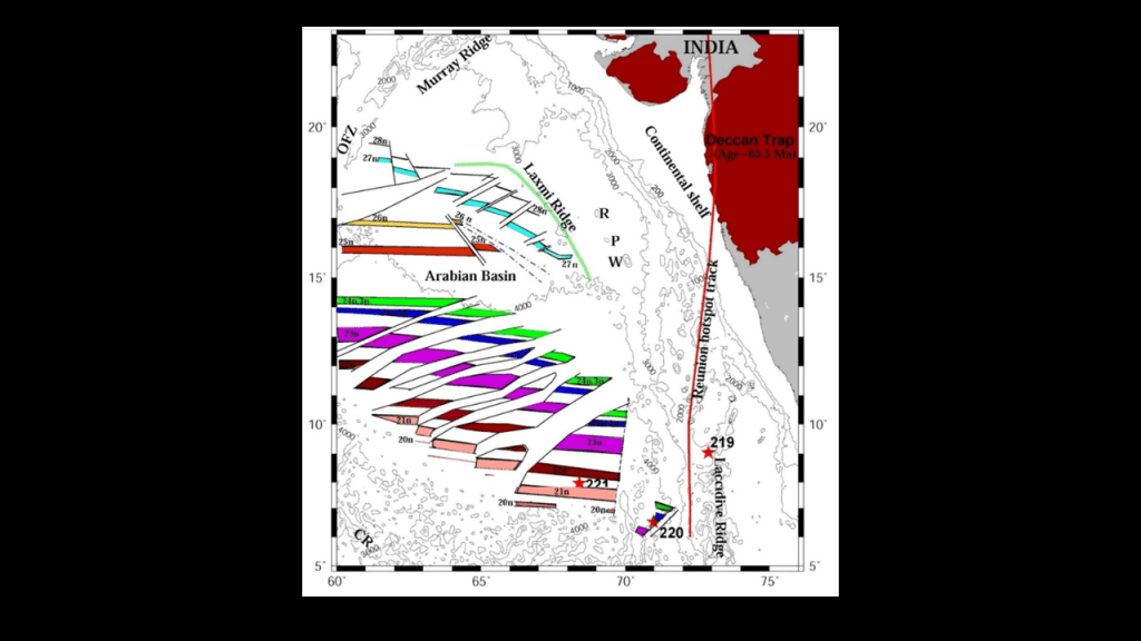
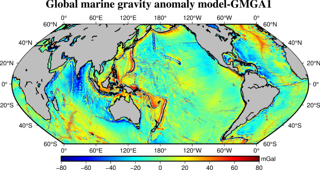
Now I am going to go back and take a look at the underwater topography of the Indian Ocean surrounding the Maldive Islands: the Owen Fracture Zone; the Carlsberg Ridge; the Arabian Basin; and the Maldives are located on the Chagos-Laccadive Plateau.
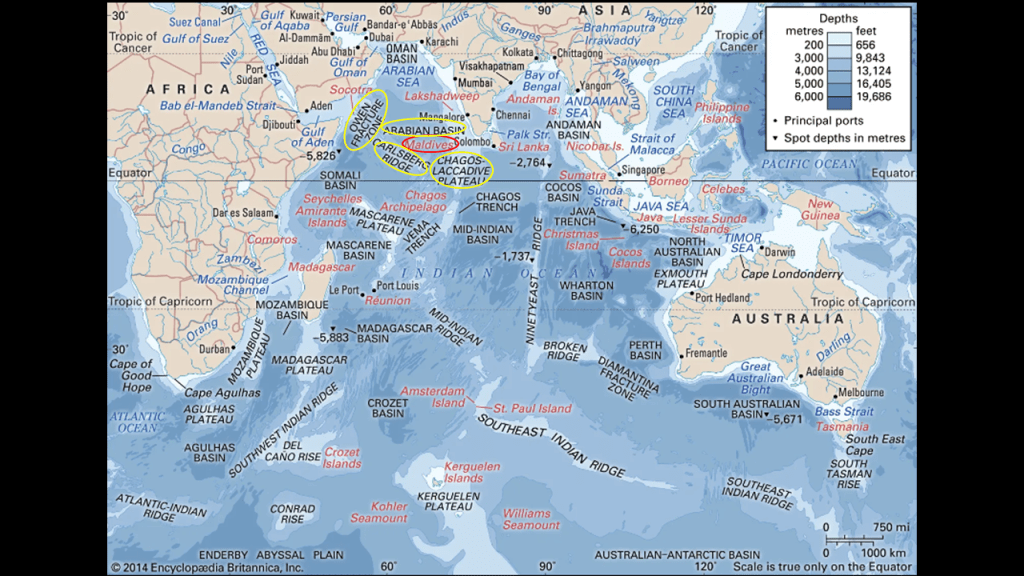
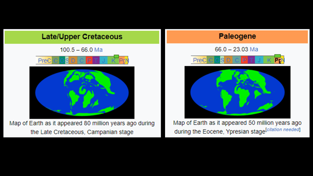
First-up, the Owen Fracture Zone/Transform Fault is to the West of the Maldives on the alignment separates the Arabian and African Plates from the Indian Plate, and is said to represent the left-side of the northward motion of the Indian Subcontinent during the Late Cretaceous – Palaeogene break up of what was originally a supercontinent.
Attributing it to the the Late Cretaceous – Palaeogene epochs of geologic time puts the break-up of the supercontinent taking place from 100.5-million-years-ago to 23-million-years-ago, and the continental plates have been drifting relative to each other over geologic time for forever.
Next, the Carlsberg Ridge is to the South of the Maldives.
The Carlsberg Ridge is the northern section of the Central Indian Ridge, a north-to-south trending mid-ocean ridge, which as mentioned previously in this post are said to be a seafloor mountain system formed by plate tectonics that is part of a 25,000-mile, or 40,000-kilometer, -long, continuous system of mid-ocean ridges on the floors of all the Earth’s oceans.
The Central Indian Ridge is traditionally said to separate the African Plate from the Indo-Australian Plate, and the Carlsberg Ridge extends northward from where these two plates meet at the Rodigues Triple Junction Point with the Antarctic Plate, to the Owen Fracture Zone.
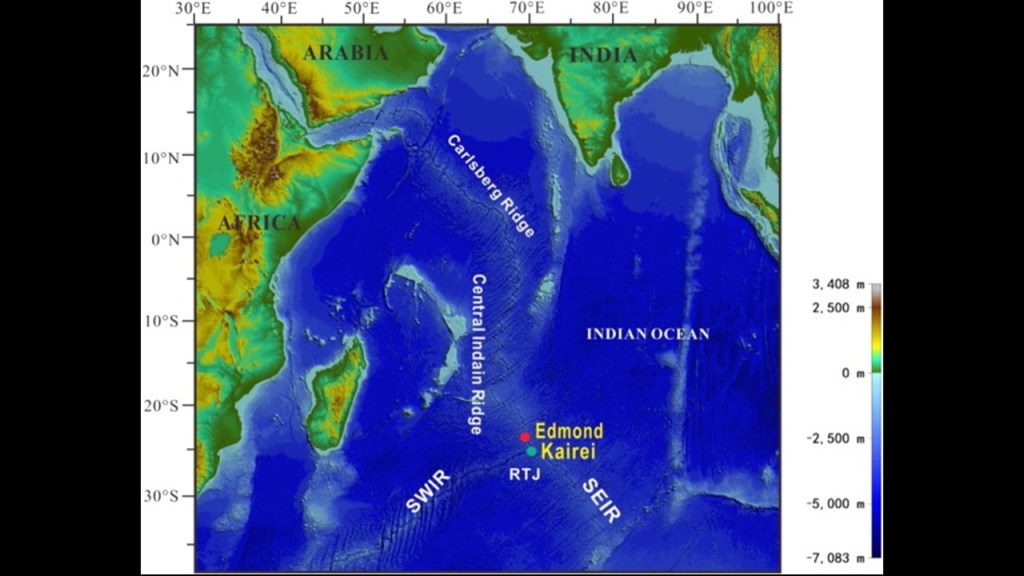
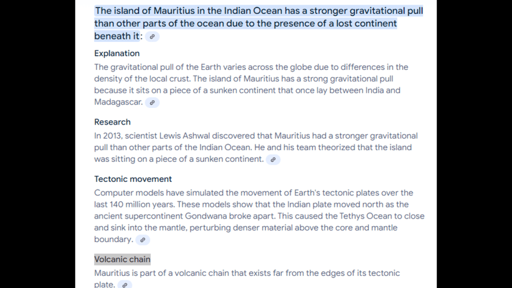
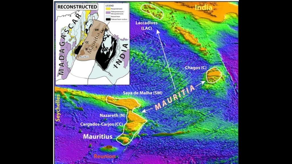
The Rodrigues Triple Junction is near the island of Rodrigues, which is an outer island in the island Republic of Mauritius.
Mauritius was a British Colonial holding for all intents and purposes starting in 1810, and became the British Empire’s largest sugar-producing colony, and was a sugar-dominated plantation-based colony until its independence in 1968.
On the main island of Mauritius, there appears to be an underwater waterfall next to a land feature on the Le Morne Brabant, a peninsula on the extreme southwestern tip of the island.
Yet what they tell us is that it is an optical illusion and not actually a waterfall.
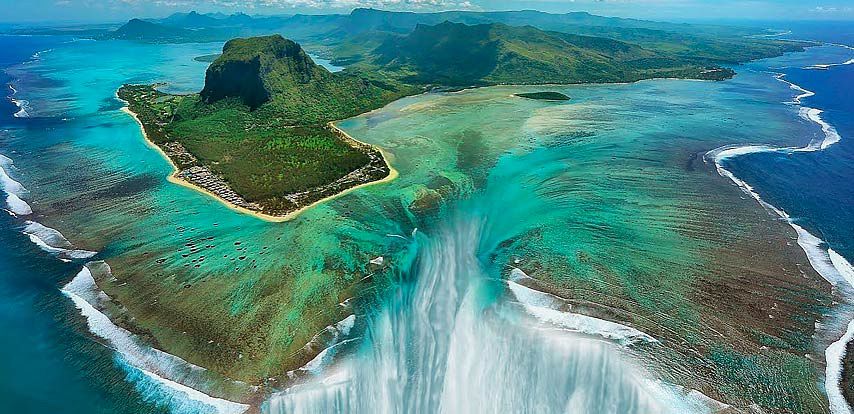
Even though Mauritius is being researched for possibly being the remnants of a lost continent, and known for its strong gravitational pull.
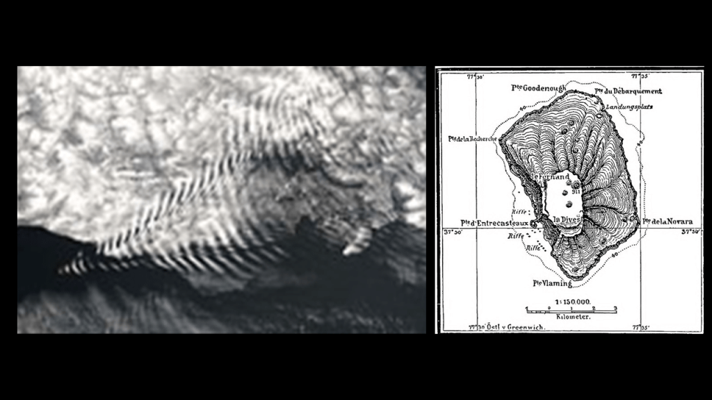
Amsterdam Island is further southeast of Mauritius in the Indan Ocean is considered the northernmost volcano above the water-line on the Antarctic Plate.
It is one of the “French Southern and Antarctic Lands,” and was officially claimed by France in 1892.
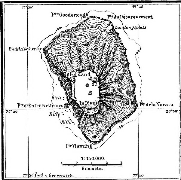
Here is a map of the island circa 1901, showing the island looking rather like a tree stump, with the Cliffs of Entrecasteaux right below what is described as two volcanic calderas.
One of the scientific fields of study here by the French are the geomagnetics of this island.
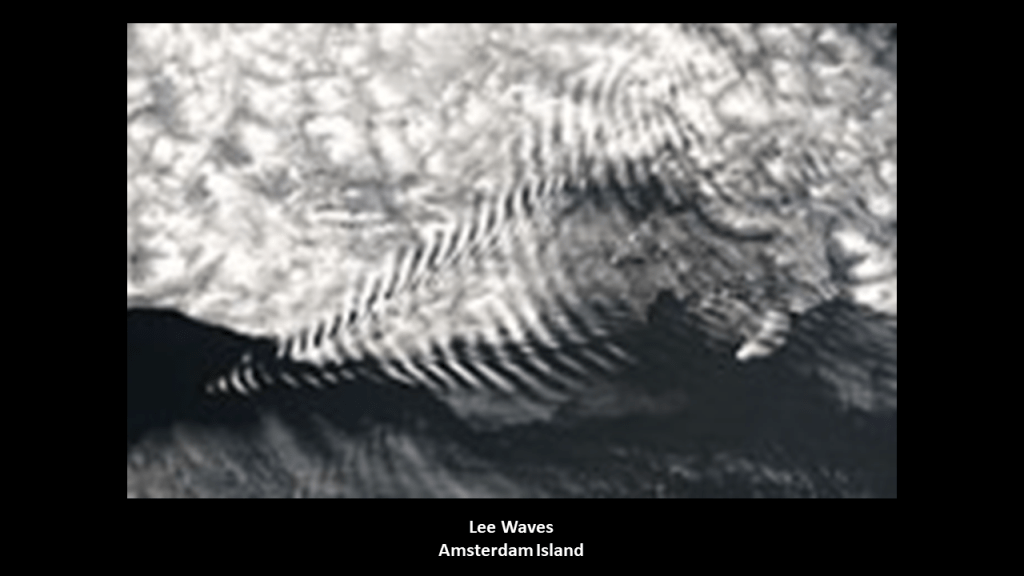
Here is a photograph of Lee Waves taken on Amsterdam Island.
Lee Waves are atmospheric stationary waves, and are a form of internal gravity waves.
Now on to the Arabian Basin to the North of the Maldives.
The Arabian Basin is located in the southern end of the Arabian Sea between the Arabian Peninsula and India.
It is an oceanic basin, which is defined as anywhere on Earth that is covered by seawater.
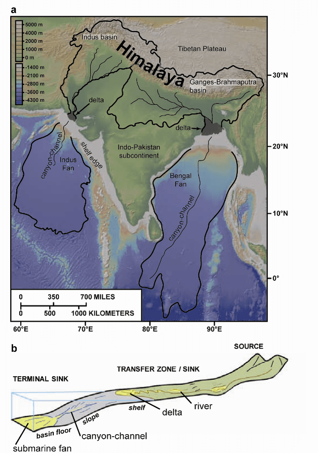
We are told that the floor of the Arabian Basin is covered by sediments from the Indus Submarine Fan.
Submarine Fans are described as accumulations of sediment deposits at the terminals of land-to-deep-sea sediment-routing systems.
In the case of the Indus Submarine Fan, we are told that sediments were deposited in an unconfined setting on the continental shelf, rise and basin floor covering much of the Arabian Sea, extending over an area 42,471-square-miles, or 110,000-kilometers-squared, and 5.5-miles, or 9-kilometers, from toe-of-slope.
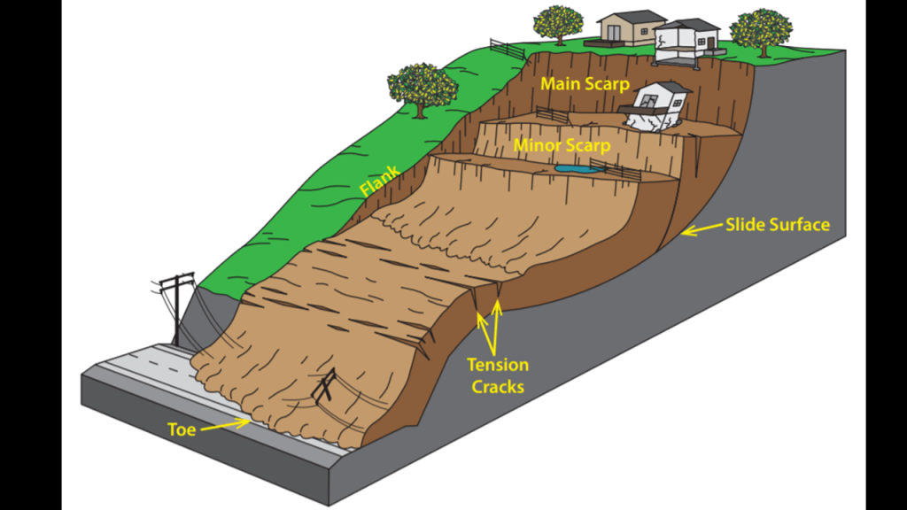
It is interesting to note that the term of “Toe-of-Slope” is used to refer to the outermost margin of displaced material that marks the end of a landslide’s movement.
So the Indus Submarine Fan is being described in the same way that a landslide would be described.
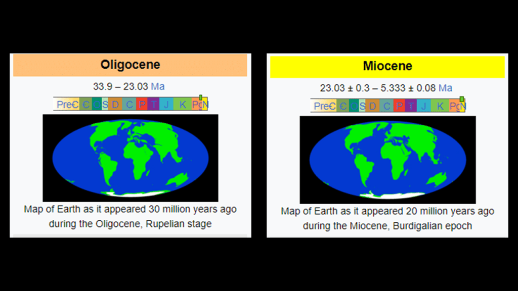
Yet, the explanation we are given for its existence is that it was created by the erosion of the Karakoram and Western Himalayan mountain ranges that was estimated to have begun at the end of the Oligocene or beginning of the Miocene geologic epochs of geologic time, roughly 23-million-years-ago.
“Continental Shelves” are found all over the Earth’s surface, and defined as a portion of a continent that is submerged under an area of relatively shallow water.
I have come to believe that these “Continental Shelves”along with marshy estuaries and mangrove swamps that are found all along these coastlines, are actually submerged landmasses and ruined land.
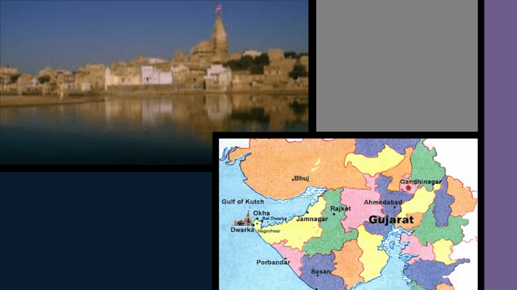
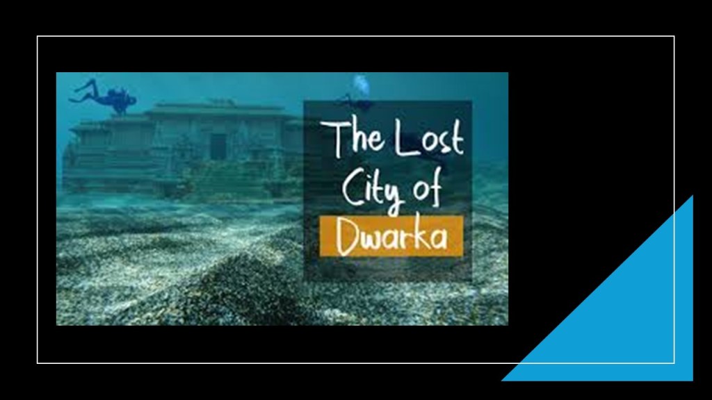
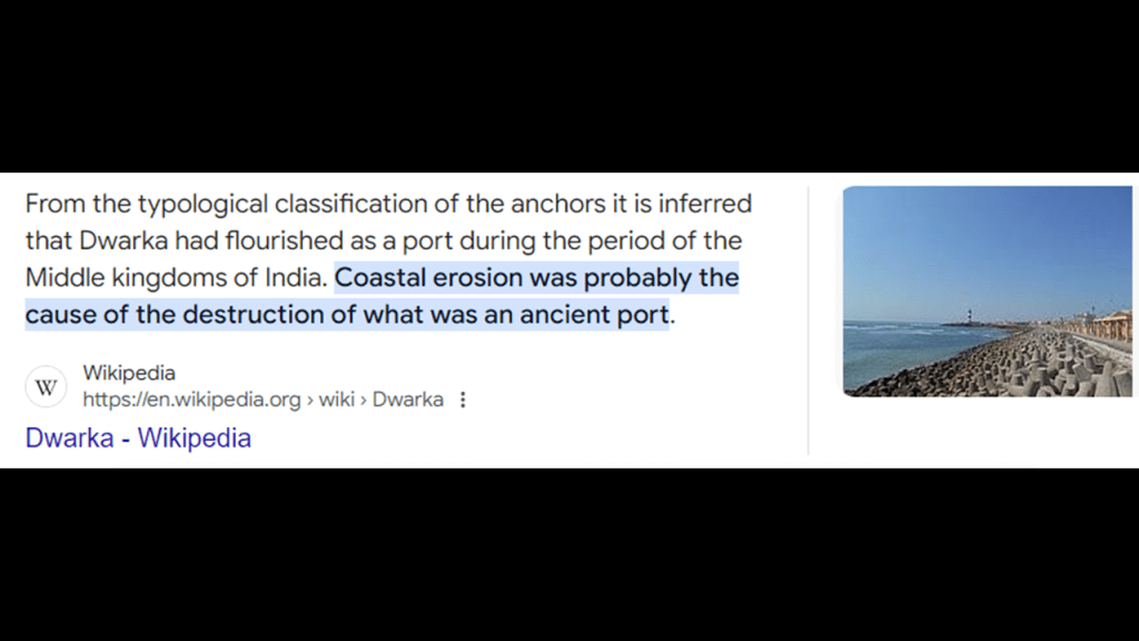
It is also interesting to note that there have been underwater archeological studies done in the Arabian Sea, offshore from Dwarka in India.
Dwarka is an important pilgrimage site and religious center for Hindus and has several notable temples.
Between 1983 and 1992, detailed underwater archeological explorations were carried out almost every year in the waters off Dwarka.
Numerous submerged buildings and artefacts were revealed in waters from 13 to 39-feet, or 4 – 12-meters, -deep.
And not surprisingly, the explanation of coastal erosion for how it happened comes up here as well
Next, the Maldives are part of the Chagos-Laccadive Ridge.
Also known as the Chagos-Laccadive Plateau, it is described as a prominent volcanic ridge and oceanic plateau between the northern and central Indian Ocean.
After 1973, the Indian government de-recognized the colonial word “Laccadive” and renamed it “Lakshadweep,” meaning “One Hundred Thousand Islands” in the original language.
This ridge extends from the Lakshadweep Islands on the northern end through the Maldive Islands to the Chagos Islands on the southern end, all of which are described as atolls resting on former volcanoes created 60 to 45-million years ago that subsequently submerged below sea-level.
I found this map of the Arabian Basin and adjoining region when I was looking for images, and found the Reunion Hotspot Track in close parallel to the Chagos-Laccadive Ridge, which is called a trace of the hotspot.
This is an illustration of the postulated track of the Reunion Hotspot Track, from its present site at the still-active Piton de la Fornaise volcano on Reunion Island to the Deccan Traps in India,
As I mentioned previously in this post with regards to the New England hotspot track I came across in the Atlantic Ocean, hotspots are defined as a region of Earth’s mantle where magma arises from within the Earth and forms volcanoes on the crust above.
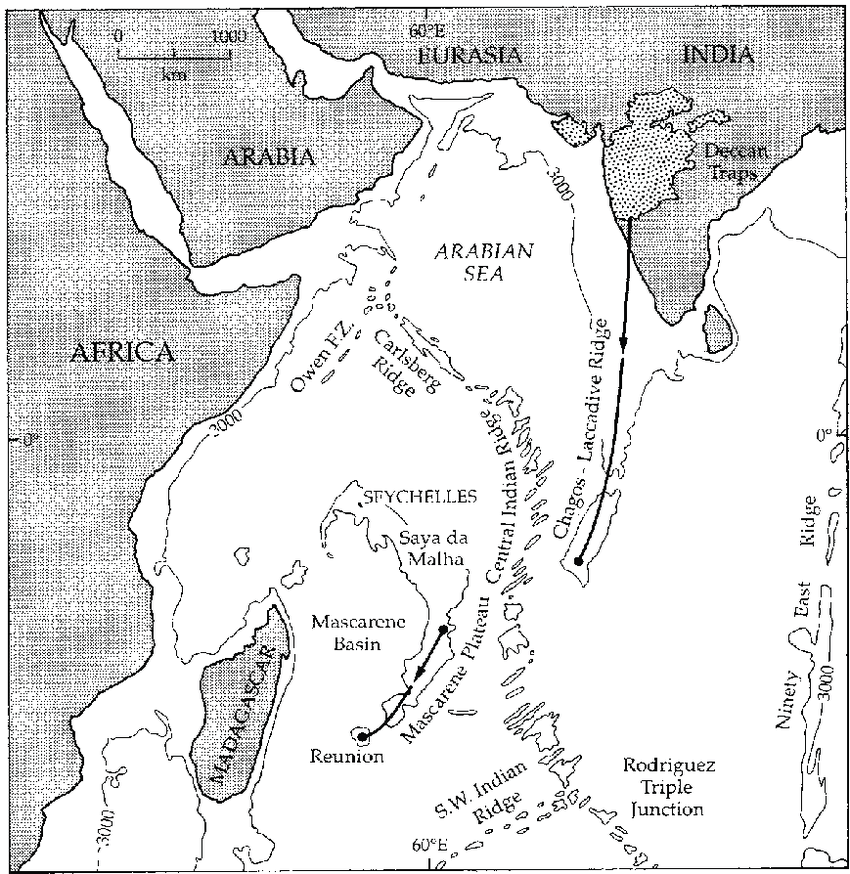
The region of west-central India known as the Deccan Traps is described as a large-igneous province consisting of layers of flood basalt in west-central India said to have been formed around 65-million-years ago from the still active Reunion Hotspot.
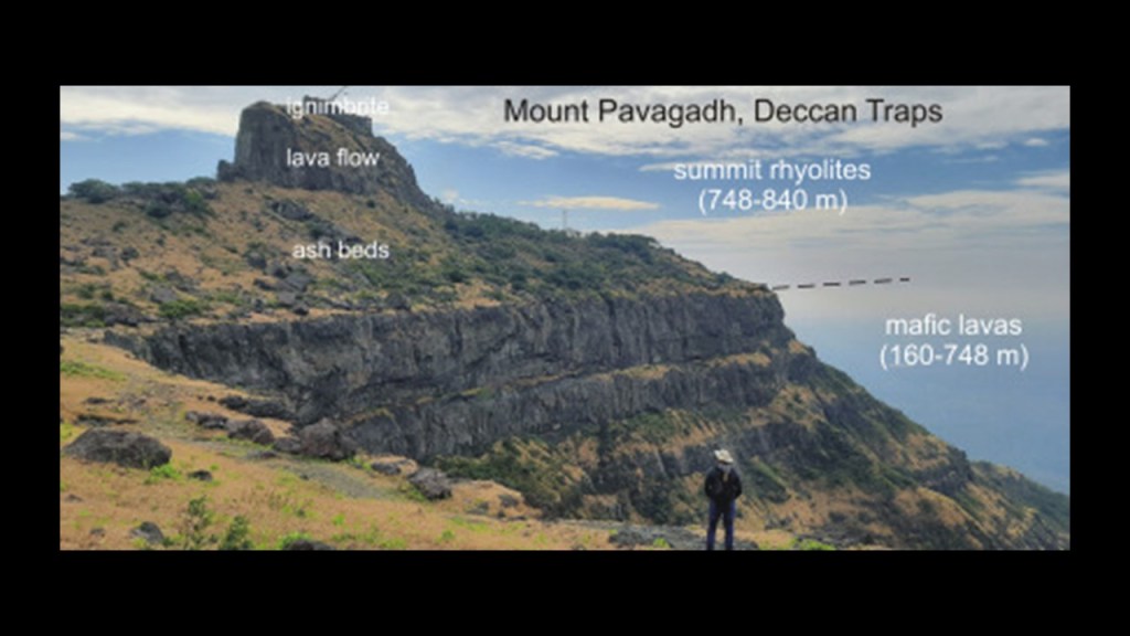
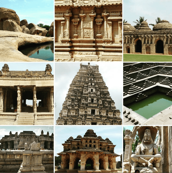
The Deccan Traps are on the Deccan Plateau, and the Deccan Plateau is the location of Hampi, known as the “Lost City of Asia,” and home to a large number of palaces, temples, structures, and ruins, and considered to be the largest open monument in the world.
Hampi was said to have been plundered and reduced to ruin by the army of the Sultanates that defeated the Vijayanagara Empire in 1565.
The Piton de la Fornaise volcano on Reunion island, the present site of the Reunion Hotspot, is one of two main volcanoes there.
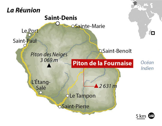
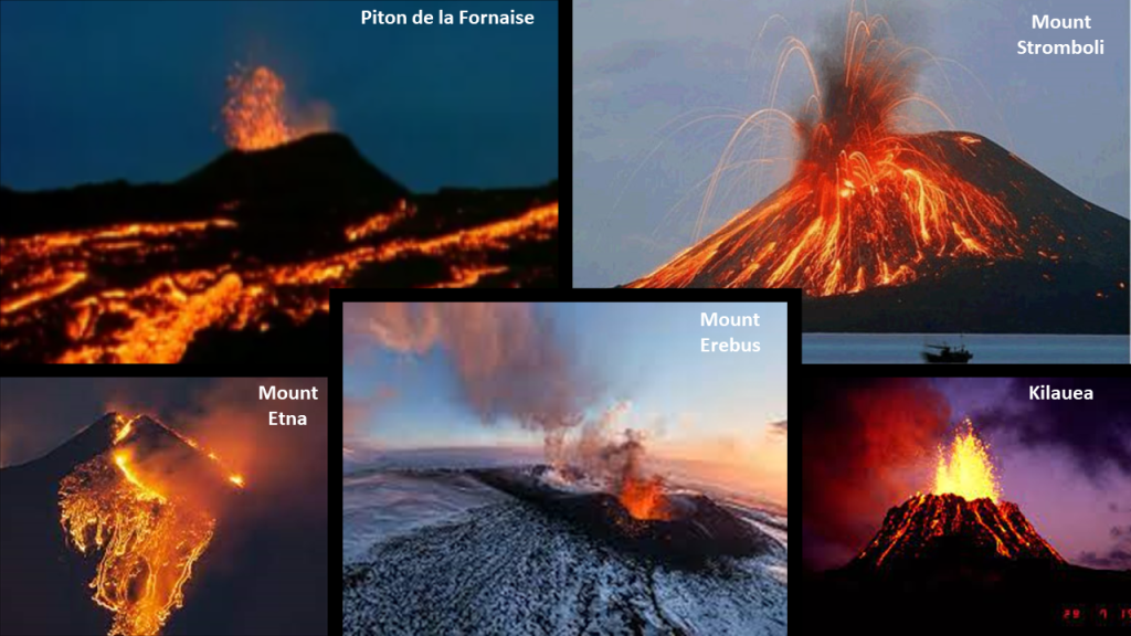
Piton de la Fornaise, or Piton “of the Furnace,” is described as a very active shield volcano on the southeastern end of the island, one of the most active in the world, along with Kilauea in the Hawaiian Islands; Mount Etna in Sicily and Mount Stromboli on an island off the coast of Sicily; and Mount Erebus in Antarctica.
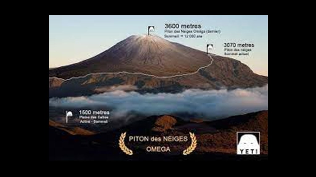
Piton des Neiges, or Snow Peak, on the northwestern end of Reunion Island is the highest point on the island, as well as considered to be the highest point in the Indian Ocean.
According to what we have been told, unlike its neighbor volcano on the island to the southeast of it, it has not been active for 20,000-years.
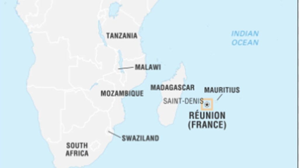
Reunion Island, home to nearly 1,000,000 people, has been governed as a French region since 1946, and is the outermost region of the European Union.
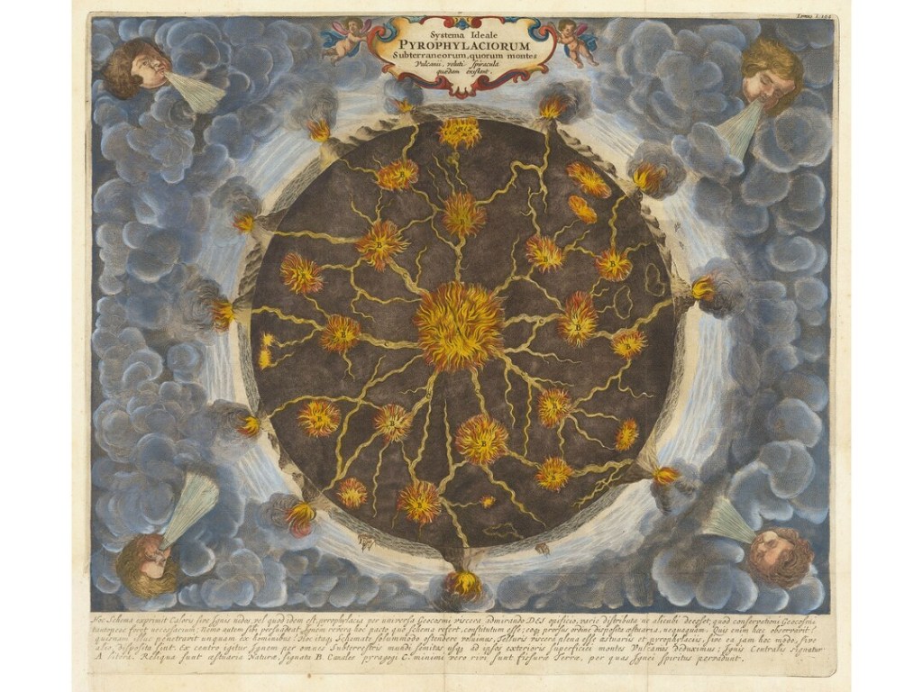
Chad Williams and I had a recent conversation for his YouTube Channel “Deeper Conversations with Chad,” and it was called “Giant Trees, the Earth’s Grid, and the New World Order,” where we discussed, among many other things, the apparent volcanic nature of these giant trees and their integral relationship to the Earth’s Grid System, and how this might in turn connect to what might have taken place to render the giant trees as unrecognizable as such.
Our conversation started off with this intriguing illustration that Chad found in the Mundus Subterraneus Textbook by Athanasius Kircher in his research and had sent it along to me at take a look at.
It seems to be showing trees on a grid exploding simultaneously, which would account for why we don’t recognize them as trees any more.
In the course of this same conversation with Chad, we also talked about the consistent pattern of western countries claiming these small islands and island groups in remote locations as their colonies or territories. and upon closer examination, it appears they were making a concerted effort to claim for their own purposes what was left of these giant trees in what I believe was a recently- post-cataclysmic-world
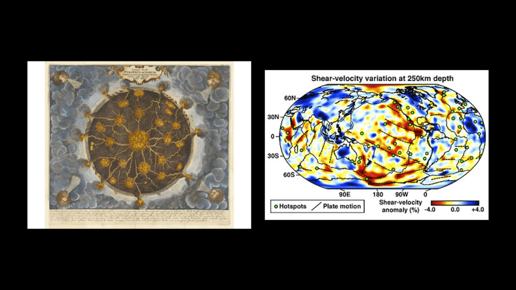
And I can’t help but wonder if the Athanasius Kircher illustration on the left and the imaging map of the Earth’s hotspots on the right are connected.
Athanasius Kircher was a German Jesuit who published somewhere around 40 major works of comparative geology, religion and medicine.
The “Mundus Subterraneus” was published in 1665, depicting Earth’s geography through text and drawings, and attempts to describe the structure of the Earth from a physical and chemical standpoint.
He delved into such subjects as oceanic currents; volcanoes; thermal springs; and mineralogy and mining.
I do believe that Jesuits like Kircher were deeply-involved in the revisionist history and science that gave us what we are taught in school today, and that covers up the True History of the Earth.
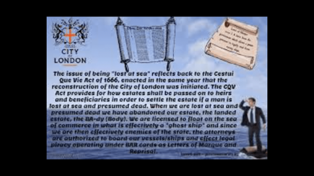
It is interesting to note that the 1665 publication of Kircher’s work falls right in line with the passing of the Cestui Que Vie Act by the British Parliament after the 1666 the 1665 Great Plague and 1666 Great Fire in London.
This subrogated the rights of men and women, meaning all were declared dead or lost at sea.
The government took custory of everybody and their property into a trust, and the state became the trustee, holding all titles to people and property until a living person comes back to reclaim those titles.
The year of 1666 was also the year that Sabbatai Zevi was proclaimed Messiah, the Jewish Mystic and student of the Kabbalah.
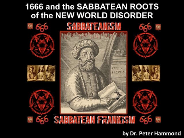
He and his follower Jacob Frank brought the world Sabbatean-Frankism.
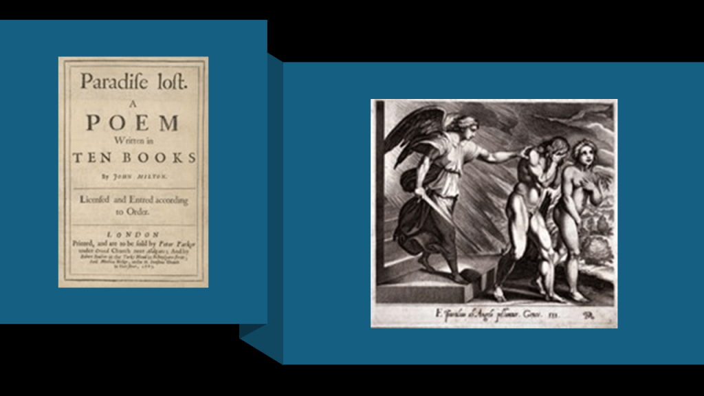
And in 1667, John Milton’s poem “Paradise Lost” was published.
As related in the poem, newly banished Fallen Angels organize, and Lucifer volunteers to corrupt the newly created Earth and God’s new and most favored creation, Mankind.
Lucifer goes to the Garden of Eden, and convinces Eve by duplicity to eat of the fruit of the tree of knowledge of good and evil, which directly led to their expulsion from the Garden of Eden.
I think this was original disclosure about what has taken place here – Paradise was lost, and we were brought to the corrupted, inverted world we live in today.
There is more happening around this time in our historical narrative, but this gives you the idea that 1666 was a very important year for the Controllers in our current timeline.
Now let’s take a look at the possibility that the Reunion Hotspot Track and volcanic islands in the Indian Ocean and the New England Hotspot Track and seamounts in the Atlantic Ocean are representatives of a once-existing world-wide system of Giant Trees that were connected to each other by magma streams and hydrothermal systems on the Earth’s energy grid system instead of a chain of volcanoes that are formed when a tectonic plate moves over a stationary plume of hot mantle material, or hotspot, deep within the Earth.
Then also look at how this in turn might connect to what has taken place to destroy the surface of the Earth and render the giant trees as unrecognizable as such.
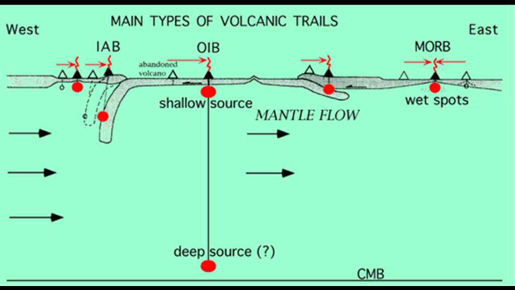
I want to start by taking a look at the Earth’s magnetic field, geomagnetism, and electromagnetism.
It is important to note that I have understand for quite some time from other research that I have followed that the Earth’s energy grid system is electromagnetic in nature.
I have to work my way through our current scientific explanations and piece together to the best of my ability a different possibility to present for consideration because our current scientific explanation tells us things like the Earth’s magnetic field is generated through a process known as “geodynamo” by electric currents due ot the motion of convection currents of a mixture of Earth’s molten iron and nickel in Earth’s outer core and connected to the Earth’s rotational axis.
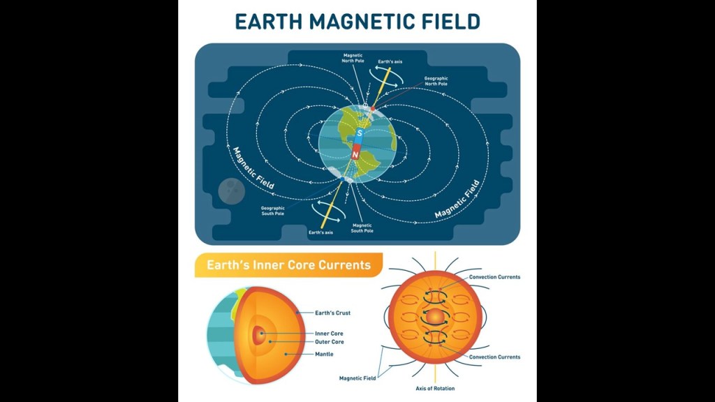
The scientific study of the Earth’s magnetic field is called geomagnetism.
Within the modern science of geomagnetism, which again, like everything else, is based on the scientific theories of plate tectonics and of events taking place over millions of years of geologic time, there is the recognition of both magnetic and gravity anomalies.
First, a magnetic anomaly is defined as a variation in the Earth’s magnetic field that can be detected and measured, and attributed to geologic features that enhance or depress the local magnetic field, like, for example, the magnetism in volcanic rocks which contain iron-bearing minerals that align themselves with the Earth’s magnetic field as they cool.
Second, a gravity anomaly is defined as a difference between the locally-observed and theoretically-calculated value of gravity that reflects local variations in the density of rocks, and are correlated with density variations in the Earth’s mantle densities.
.
So, I’ve already mentioned that Mauritius has a strong gravitational pull, and this anomaly is currently being researched as being caused by a lost continent…
…and that atmospheric Lee waves, a form of internal gravity waves, are studied at Amsterdam Island, which is a place where the geomagnetism is studied as well.
Also, Amsterdam Island is called a volcanic island, formed from a rupture in the Earth’s surface where tectonic plates are drifting together or drifting a part.
But as mentioned previously, looks rather like a large tree stump.
Yet, we are explicity taught by modern science that magnetism and gravity are not related.
But is there actually a direct connection between magnetism and gravity that is denied by mainstream science?

Here are some things I am finding when I look for information about electromagnetism and free energy.
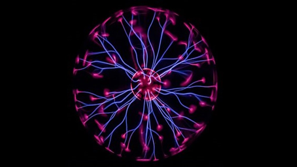
In basic terms, electromagnetism is interaction that occurs between particles with an electric charge via electromagnetic fields.
So, for example, the glowing filaments seen in this picture of a plasma globe are explained as being caused by electromagnetic interactions.
When looking for information on free energy, I encountered these bits of information.
In thermodynamics, free energy is an energy-like property of a system in thermodynamic equilibrium, and energy is defined as the capacity for doing work in various forms like potential, kinetic, thermal, electrical, chemical, nuclear and so forth.
Thermodynamics deals with the transfer of energy from one place to another and one form to another, and is the only accepted science that we are taught in school regarding the relationship between heat, work, temperature and energy, as codified in the Laws of Thermodynamics.
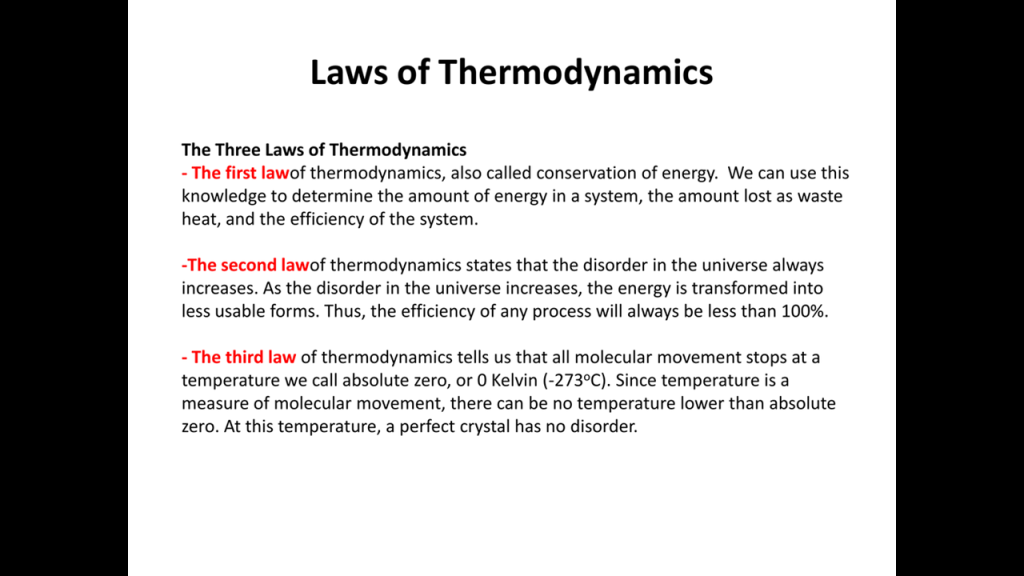
So as I am looking for the information that is available to find on the subject of free energy, by and large it seems to refer back to the codified Laws of Thermodynamics as to why it’s not possible.
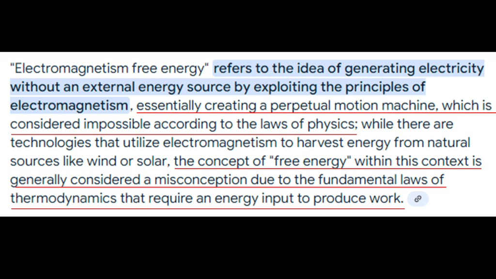
I found this summary on why harnessing the Earth’s electromagnetic fields for infinite free energy is appealing but challenging, and it brings up several points as to the reasons we can’t.
Like the first point on the principle of energy conservation, which says that energy can not be created or destroyed, only transformed and that any energy extracted from the electromagnetic fields would have to come from somewhere else because they themselves are not a source of energy, only a generator of electricity.
The second point mentions the weakness of the Earth’s magnetic fields as being a reason it wouldn’t work – the fields don’t have enough strength to generate significant amounts of electrical power.
Same idea with the third point about technology limitations – while there is some current techology for harnessing electromagnetic energy, it is not developed enough to harness the Earth’s natural, electromagnetic fields in an efficient and economically viable man.
The fourth point the writer made of practical implementation was that even if a way was found to extract the energy from the Earth’s electromagnetic field, the required infrastructure and technology to do so would be enormous, and therefore not feasible.
I highlighted the last point because the infrastructure and technology to do so was already here on Earth and a highly-advanced civilization was extracting, generating and transmitting free energy via an integrated Energy grid system that existed all over the Earth
But it was all deliberately destroyed and I will get to that subject shortly.
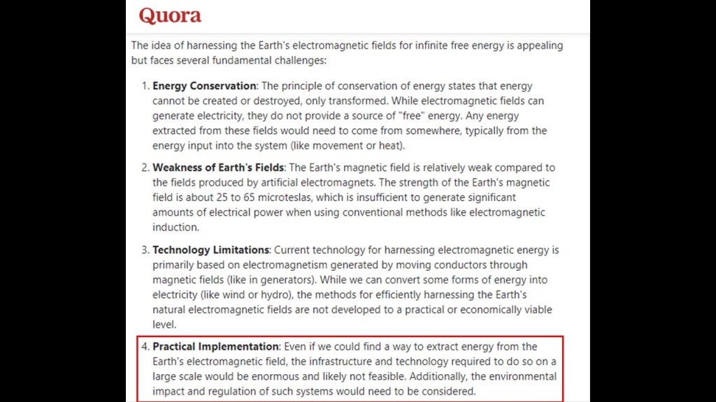
I also found this information on “magnetic free energy,” which is defined as the potential energy within a magnetic field.
I have highlighted the point made here that a stronger magnetic field leads to higher magnetic free energy because I am heading in that direction here with another possible explanation for what creates Earth’s magnetic fields besides the “geodynamo” process that is promoted and taught by Academia.
in the process of doing this, I will provide a very different explanation of what we may actually be looking at with regards to the destruction of both the Earth’s energy grid and the surface of the Earth, and how Earth’s magnetic fields were weakened.
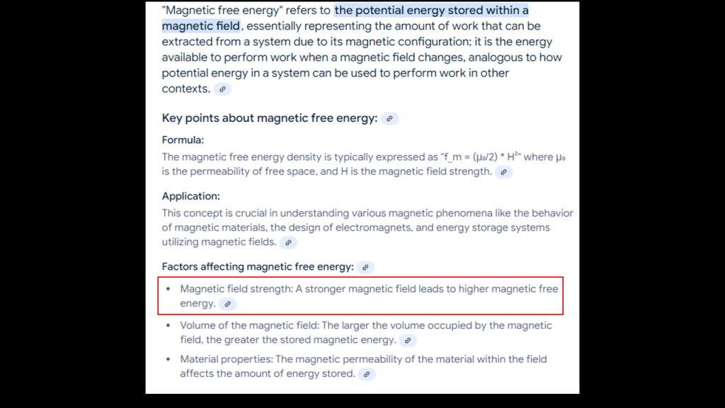
First, I would like to revisit the previously-mentioned Alexander von Humboldt, the Prussian naturalist and explorer who was so keen to climb Mount Teide on Tenerife in 1799, and who had the one of the world’s pre-eminent universities in the study of Natural Sciences in the 1800s and 1900s named after him.
Alexander von Humboldt is considered one of the founders of the science of geomagnetism, having studied in great detail the systematic change of magnetic field strength with distance from the equator and initiated synchronized magnetic field observations across the Earth, and he made significant contributions to the charting of the Earth’s geomagnetic field.
In this chart of Humboldt’s of the Earth’s magnetic field, there are two points of information I would like to bring forward in what I have underlined in red at the bottom.
The first is that this is a “world map of isodynams measured between 1790 and 1830.”
The definition of isodynam, or isodynamic, is connecting points on the Earth’s surface that have the same magnetic intensity.
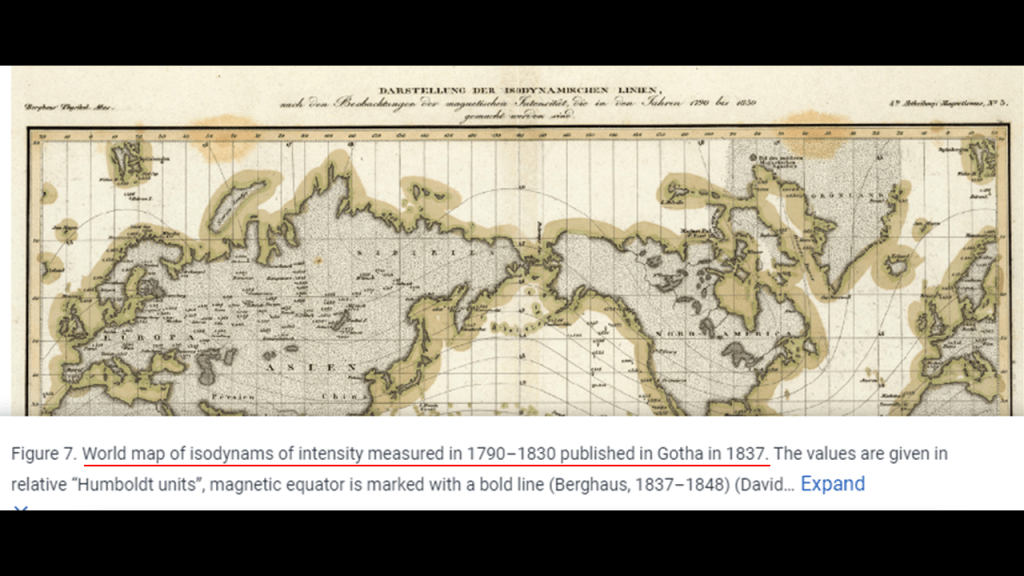
The other point that I want to bring forward is that it was published in Gotha in 1837.
Gotha was the home base and origin place of the House of Saxe-Coburg and Gotha, the obscure German ducal lineage that replaced the original royal houses of Europe, primarily through first-cousins Queen Victoria and Prince Albert, but the original royal houses were also replaced through other descendents of Duke Francis of Saxe-Coburg-Saalfeld, the progenitor of this ducal lineage who was born in 1750.
Gotha was also where Adam Weishaupt, the founder of the Bavarian Order of the Illuminati in 1776, went to live in 1784 under the protection of Duke Ernest of Saxe-Gotha-Altenburg, when Weishaupt’s radical views on Illuminism got him into trouble with the ruler in Bavaria after his writings were intercepted and deemed seditious.
We are told he was born in 1748, just two-years before Duke Francis was born, and died in Gotha in 1830.
You know, the founder of that Illuminati!
And, as I mentioned previously in this post, members of the House of Saxe-Coburg and Gotha had wyverns and wyvern tails prominently featured in the their Coats-of-Arms, like this one of the Portuguese Royal House of Braganza that married into the obscure ducal family in 1836, when Prince Ferdinand of Saxe-Coburg and Gotha married Queen Maria II of Portugal.
Again, wyverns are described as unambiguously malicious predators, and wyverns in heraldry signifies war, envy and pestilence, which is certainly something we have been seeing all along this alignment in our modern history.
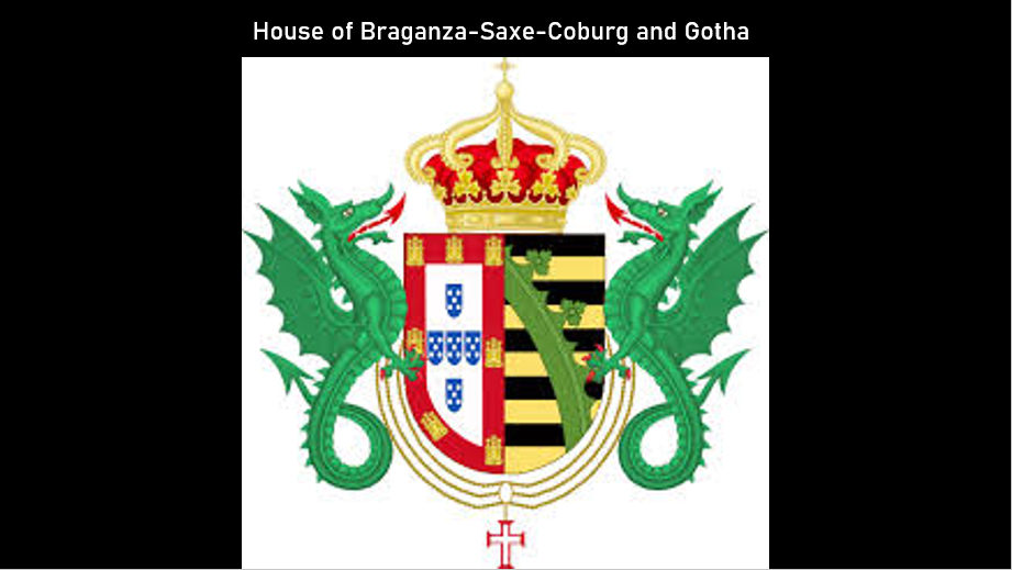
So, Mayer Amschel Rothschild, the founder of the Rothschild Banking International banking family dynasty throughout major cities of Europe was born in 1744; Adam Weishaupt, the founder of the Bavarian Order of the Illuminati, was born in 1748; and Duke Francis of Saxe-Coburg-Saalfeld, the progenitor of the obscure ducal lineage that replaced the original royal houses of Europe, was born in 1750.
These three men were all born in Germany within six-years of each other, and in the nine-year time-period after the Great Frost of Ireland, an extraordinary cold weather event in Ireland between 1740 – 1741, during which time, the Irish population endured 21-months of bizarre weather without known precedent that defied conventional explanation, and the cause was not known.
This leads into how I believe the Great Frost of Ireland was a rip in the fabric of space-time caused by the Philadelphia Experiment, which then allowed great evil in the form of parasitic non-human souls to incarnate in human form on the Earth, and subsequently created the conditions for the world we are living in today.
More on this belief to come later in this post.
Interestingly, there was a movie made in 1980 called like “The Final Countdown,” which was about a time-travelling naval vessel in the form of the USS Nimitz going back in time to the day before the attack on Pearl Harbor on December 7th of 1941.

And I do believe that the Coat of Arms of Tenerife I showed earlier is telling us a something that is otherwise hidden from our awareness, with the image of a tree on the shield that is enclosed between a wyvern supporter on either side.
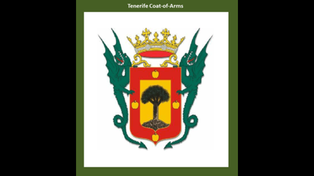
Is Mount Teide on Tenerife the remnants of a tree, as well all the other volcanic islands, seamounts, guyots and monadnocks?
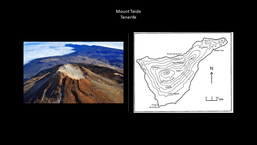
Interestingly, the term “Monad” found in the word “monadnock” has been used in philosophical schools like that of the Pythagorean to represent the Absolute – the Supreme Being, Divinity, and the Totality of All Things.
Among many things, Chad and I talked about this in-depth in our previously mentioned “Deeper Conversation with Chad” on “Giant Trees, the Earth’s Grid, and the New World Order.”
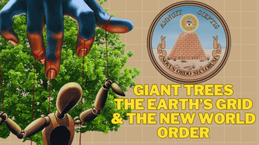
Furthermore, were the giant trees generating the Earth’s magnetic field, and not the “geodynamo” process accepted by mainstream science connected to the interaction of the Earth’s rotational axis with the molten iron and nickel in the Earth’s outer core?
Is this why volcanoes and seamounts are on Airline flight trackers – for navigational purposes and not for entertainment alone?
I recently found a mountain in Mexico associated with magnetic declination just outside of Teotihuacan on an alignment I am currently researching.
The town of San Luis Tecuautitlan is located in altitude at 2,450-meters, or 8,038-feet on Cerro Gordo-Tonantépetl.
Cerro Gordo means “Fat Hill,” and has that giant tree stump-looking appearance.
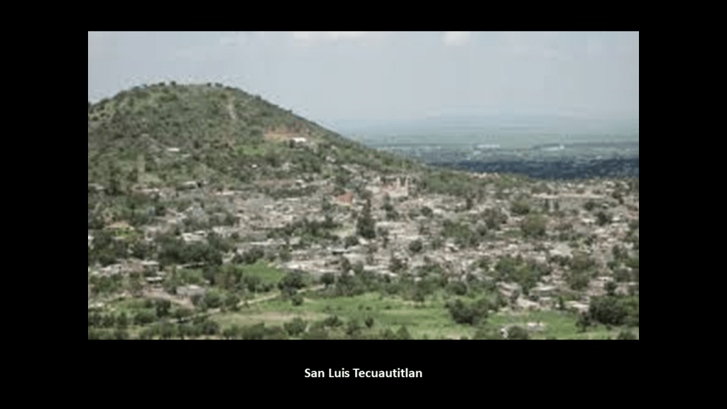
I found this map when I typed in “San Luis Tecuautitlan” to look for information on it, and it was in a link about the magnetic declination there.
“Magnetic Declination,’ also known as “Magnetic Variation,” is the angle between true north and magnetic north at a specific location on Earth, and this is important because it is needed to determine true north and affects the accuracy of navigational tools.
Then, there’s the fabled “Rupes Nigra,” or “Black Rock,” to consider as a giant tree stump.
In a nutshell, the “Rupes Nigra” was believed to be an enormous mountain of magnetic stone located at the magnetic North Pole, and 33-miles, or 53-kilometers, -wide, and explained why compasses always pointed north.
This is known as the 1595 Arctic Map of Gerardus Mercator, and was published after his death 1594 by his son.
But the “Rupes Nigra” also comes down to us as a phantom island, defined as an island that existed on maps for a period of time but was found later not to exist.
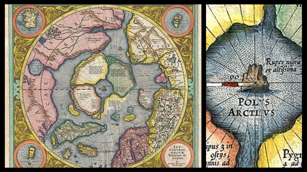
In our historical narrative, Gerardus Mercator was a Flemish geographer, cartographer and cosmographer who was also a globe-maker, like this one from 1541.
And the Earth’s leylines started to disappear from maps when Gerardus Mercator published a world map in 1569 that is considered to be the first where sailing courses on the sphere were mapped to the plane map, allowing for a “correction of the chart to be more useful for sailors.”
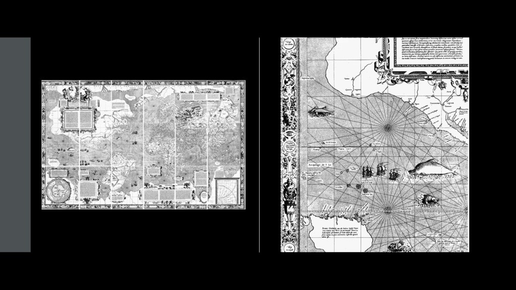
Now…what about the electro part of the electromagnetic grid?
I think in ancient times, known to us as neolithic, it was comprised of different kinds of stone circles and standing stone configurations; other types of henges, cursus, dolmens, barrows, and so forth, like what you see at Stonehenge in England and Carnac in Brittany in France, for two examples of countless found all over the Earth.
There’s even a perfect stonehenge in Washington State, but it was said to have been built as a war memorial between 1918 and 1929.
And the Miami Circle was discovered in 1998 in downtown Miami, Florida, when the building complex sitting on top of it was torn down.
It had a septic tank in it too.
In 2002, it was listed on the National Register of Historic Places, and in 2009 it was declared a National Historic Landmark.
Back in England, the stone circle of Arbor Low in England has a tree reference right in it, with an arbor being defined as “A shady garden alcove with sides and a roof formed by trees or climbing plants trained over a wooden frame.”
Arbor Low is a hub of leylines, as seen in this screenshot I received from Adam Szecowka of Alchemy Spectrum.
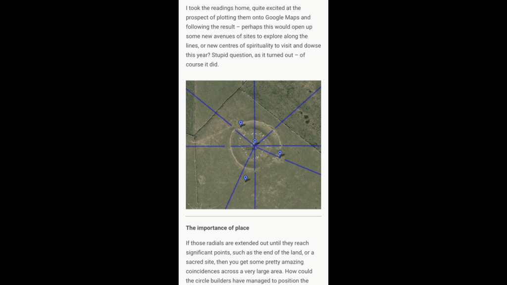
Adam works with leylines to heal people and places, and he also makes videos about his leyline research.

Adam has joined Chad and I in three “Deeper Conversations with Chad,” where we bring together our different lines of research and talk about what we think has taken place here.

Similar to Arbor Low in England, the monadnock Pilot Mountain in North Carolina was identified as a leyline hub by gaiagrapher, Peter Champoux, on the home page of his website.
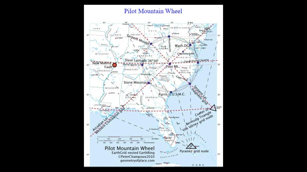
Peter Champoux has done incredible work on specific ley-lines in North America, and other continents as well, as seen on his website geometryofplace.com

As time went on from the megalithic infrastructure of the Neolithic, or “New Stone,” Age, the “electro” part of the electromagnetic grid evolved into rail infrastructure, lighthouses, star forts, s-shaped rivers, hydroelectric plants, bridges, and so much more.
What was interesting was finding out that the megalithic infrastructure was still part of the electromagnetic grid system as it evolved.
Using Pilot Mountain as an example, it was known as Mount Ararat before it was called Pilot Mountain.
I looked into it and found the historic Ararat River with rail infrastructure running beside it on the top left, and today’s Ararat River Greenway Trail where the railroad used to be on the bottom right.
The Ararat River Greenway Trail is at the eastern edge of the city of Mount Airy.
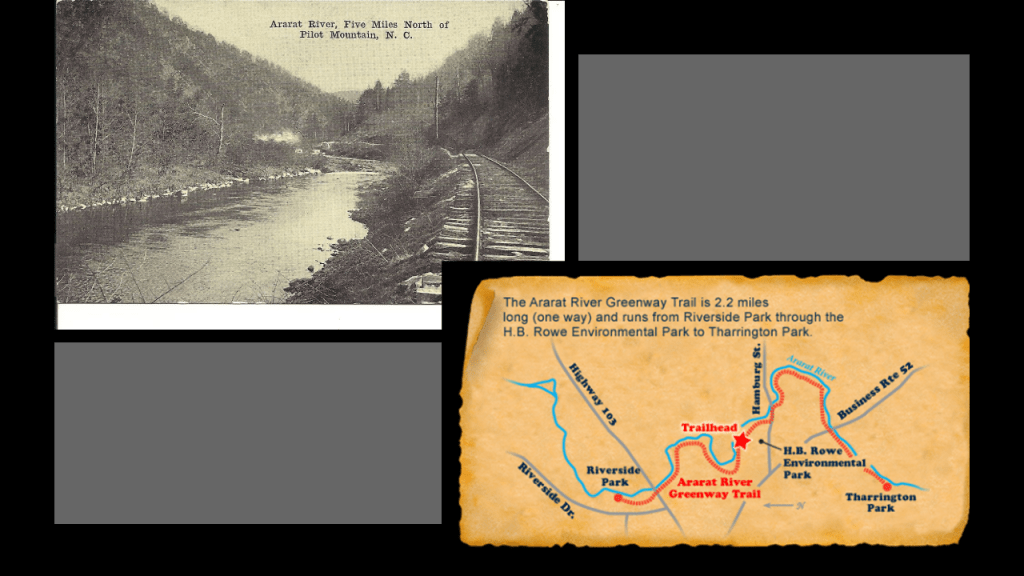
More examples of finding out that the megalithic and ancient infrastructure was still part of the electromagnetic grid system as it evolved, include, but are not limited to:
Macchu Picchu in Peru, which is accessible by a train, which runs along beside in the S-shaped Urubamba River …
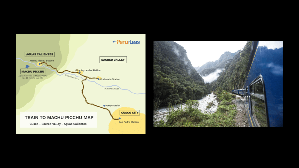
…and the Great Serpent Mound in Peebles in Adams County, Ohio.
The Great Serpent Mound is in close proximity to the S-shaped bends of Brush Creek, and its nearby confluences/junctions with other watercourses, as seen in this illustration circa 1883 compared with the Google Earth Screenshot of the location on the right.
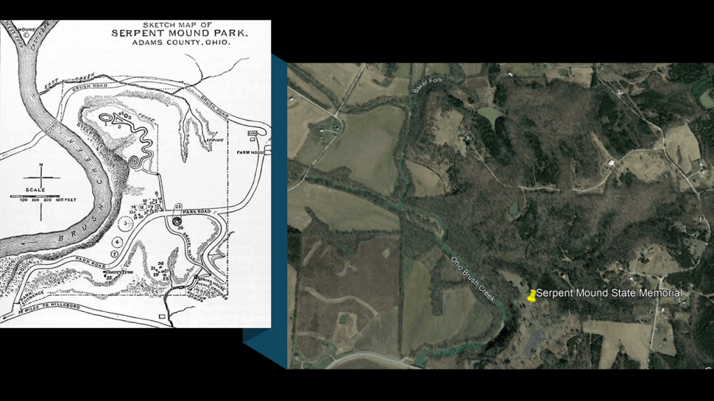
From the 1914 Railroad Map of Ohio from the Ohio Public Utilities Commission, here is a close-up of the railroads in the southwestern part of Ohio where Peebles and Adams County is located near the state’s border with Kentucky, which is formed by the S-shaped bends of the Ohio River.
The Chesapeake and Ohio Railroad is marked in the yellow on the map, where it parallels the Ohio River.
Peebles is circled in red on the rail-line passing through, and there is a red box around “Brush Creek” showing an historic railroad line there.
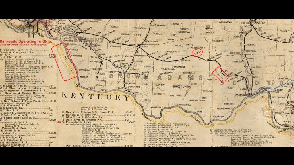
I am going into the evolution of the Earth’s electromagnetic energy grid system because I believe that the circuit board of the Earth’s grid system was deliberately blown 0ut in order to bring about the “New World Order,” causing whole land masses to shear-off and submerge under seas and oceans; and creating among other things, swamps, bogs, estuaries, deserts, dunes, and so forth.
After doing this research where underwater trees have come up, I think the destruction of the grid further caused a Magnetic pole shift which resulted in what is commonly known as the mud flood, in which the surface of the Earth liquified, undulated, and buckled, and the Earth’s magnetic field was weakened considerably.
Hence Alexander von Humboldt’s detailed readings on the strength of the magnetic field from different locations around the world.
They needed to see what they had left to work with.

Now I am going to provide supporting evidence from the area of study in this post on North Atlantic Coast of North America and the Indian Ocean for what I am talking about and seeing all over the place.
I recently compiled numerous places around the world with similar characteristics of what appears to be sunken and destroyed land, particularly along continental coastlines. in “On the Trail of Giants in Appalachia and Beyond – Theme 4 The Cataclysm,” and I also talk in detail about how I believe the energy grid was destroyed, which I will also touch on a little bit here as well.
So, places that I have looked at on the North Atlantic Coast of North America include Cape Cod in Massachusetts.
Here is a current map showing fourteen lighthouses on Cape Cod alone, as well as other lighthouses of this part of New England, on the left, and an historic Old Colony Railroad that traversed the length of Cape Cod.
I think the rail-lines and lighthouses were part of a worldwide energy grid system in perfect-resonance and I believe that a forced resonance went throughout the grid system and caused the system to go haywire, and the surrounding land sank, or turned into swamps, bogs, barrens, or deserts and dunes.
The lighthouses were then repurposed for guiding ships through the newly-formed rocky shoals and dangerous waters they were now right beside.
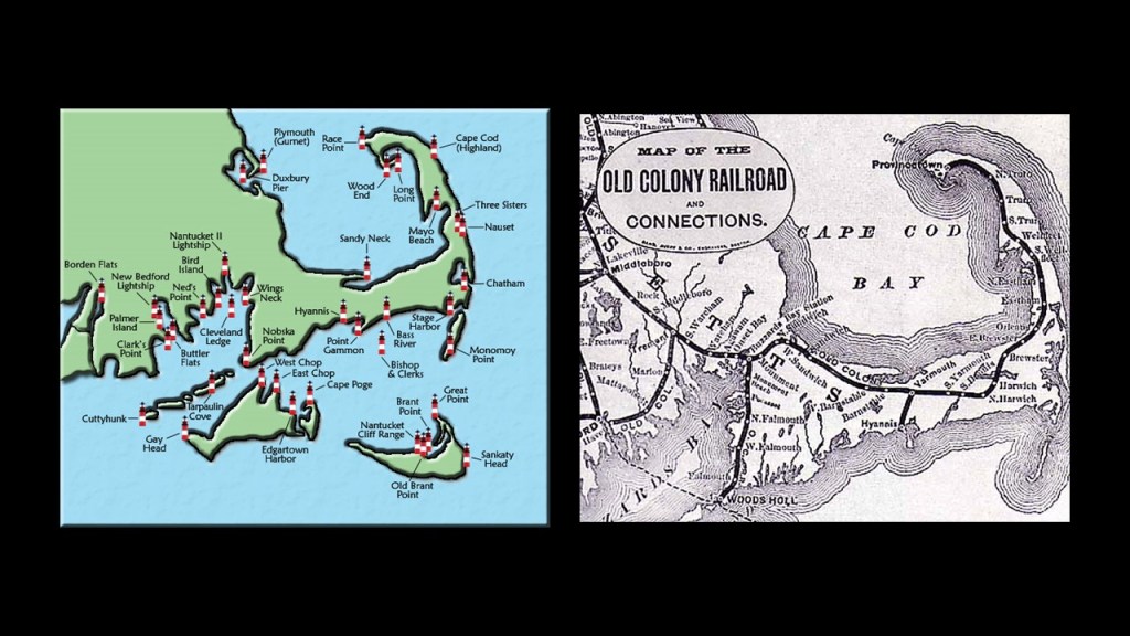
I do not believe the original purpose of lighthouses was for guiding ships, but functioned more as light energy distribution systems for the energy grid.
I have also looked in-depth at the numerous star forts and lighthouses in Portland, Maine’s Casco Bay and the same in Boston Harbor just a short-distance down the North Atlantic coast from Portland.
Both places are described as an estuary, and both have a considerable number of islands, with Casco Bay having what are called the “Calendar Islands,” so- named because there is said to be an island for every day of the year, and thirty-four of the islands in Boston Harbor have been part of the Boston Harbor Islands National Recreational Area since 1996.
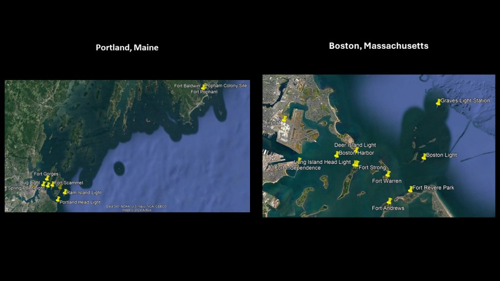
And these two places in Maine and Massachusetts are located where I started this post on the continental shelf off the coast of New England and the New England Seamounts.
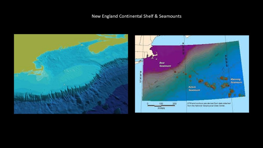
I find the same thing where I have been looking in the Indian Ocean.
Here is a map showing all the lighthouses along the coasts of India on the left, and the railways of India on the right, including railway that traverses coastal India as well.
So with this in mind, back in Dwarka where there is known sunken infrastructure off the northwest coast of India seen earlier in this post, we find the Dwarka Lighthouse.
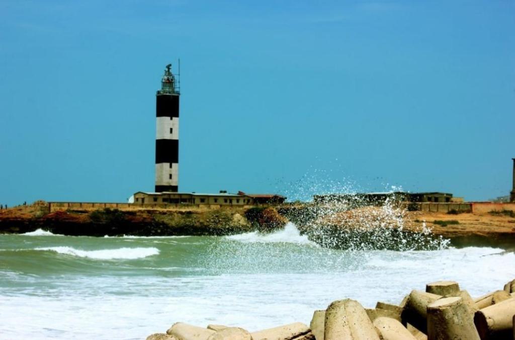
The Dwarka Lighthouse is located 2.5-miles, or 4-kilometers from the Dwarka Railway Station.
The Dwarka Lighthouse was said to have been built in 1866, and the railroad was said to have first come here in 1922.
And in this Google Earth screenshot, you can see the shallow, murky waters with bits of land poking up here and there.
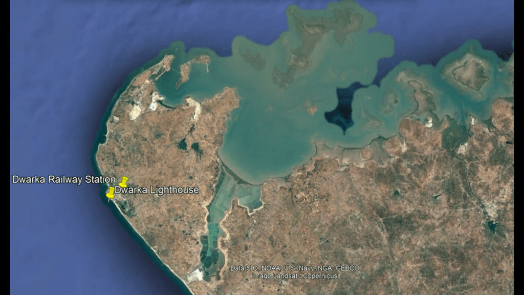
I would also like to share what I found at the chain of low islands and reefs called Adam’s Bridge, also known as Rama’s Bridge, or Ram Sethu, which separates the southern tip of India from Sri Lanka.
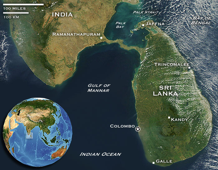
There’s a rail-line today that still operates from the town of Mandapam in Tamil Nadu to the Indian side of Adam’s Bridge.
The Pamban Bridge crossing through here is described as a masterpiece of engineering, and has a movable section midway that is raised to allow ship and barge traffic to pass through.
Over a mile-long, at 6,776-feet, or 2,065-meters, It was said to have been constructed between 1911 and 1914, which was the year World War I started.
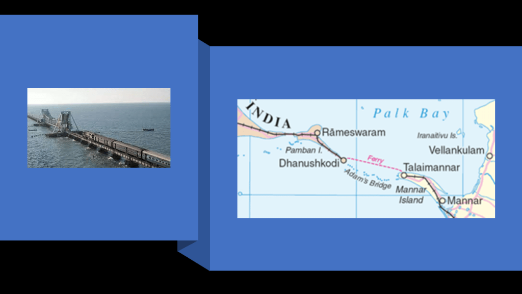
You can take a ferry across, in the same general location as the sunken parts of Adam’s Bridge, to Talaimannar, on Sri Lanka’s Mannar Island, and catch the train on to anywhere you want to go in Sri Lanka.
The Mannar Line was said to have been built by 1914 to connect Talaimannar to the Sri Lankan mainland.
There are two lighthouses on Pamban Island, also known as Rameswaram Island, located between the southern tip of India and Sri Lanka in what is called the Rama Setu Archipelago.
Both of these lighthouses were said to have been built in 1845.
Rameswaram is the principal town on the island is a major Hindu Pilgrimage center as one of the holiest cities in India.
It is also the terminus of a Railway line in Tamil Nadu State from Chennai and Madurai, and is connected to the mainland by the previously-mentioned engineering-masterpiece, the Pambam Bridge.
As seen on this map, there is an arrow point at Dhanushkody right by the waters edge on the Indian side of Adams Bridge.
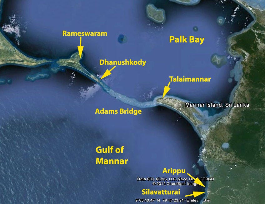
There was a railway station at Dhanushkody.
It was serving the Manamadurai-Rameswaram branch line of the Madras Railway from about 1914, and was part of what was called the “Boat Mail Express,” that connected Madras in India, today’s Chennai, with a combined train -ferry- train service to Colombo in Ceylon, which is today’s Sri Lanka.
Then we are told that 1964 Rameswaram Cyclone destroyed the town of Dhanushkody, and it was never rebuilt and abandoned.
There are also two historic lighthouses in Talaimannar on Sri Lanka’s Mannar Island.
What is called the new Mannar Lighthouse was said to have been built in 1915, and is where the rail-line ends next to the water.
What is called the old Mannar Lighthouse was also said to have been built in 1915, and was decommissioned.
I believe that the electromagnetic grid system evolved from a worldwide megalithic system into a worldwide integrated system of things including, but not limited to, lighthouses, rail infrastructure, S-shaped rivers and canals, star forts, and much, much more.
And, I think that ancient giant trees and the root system emanating from them were an integral part of the Earth’s energy grid and leyline system.
The original rail-lines and S-shaped rivers and canals would have been providing power for the free-energy system, and the original architecture and infrastructure would have provided the antiquitech to process and utilize the free energy throughout the worldwide system.
The Earth’s original free-energy grid system was based on exact and precise geometric alignments of cities and places.
Nowadays, the giant tree “roots,” are highway “routes” and recreational trails, which has more to do with human energy being harvested from their use instead of infrastructure creating free-energy for the system to use for the benefit of all life everywhere.

I don’t believe we got to crazy town in our world today as the result of random events, but that we got here as the result of a deliberate, multi-generational plan.
This realm and the New World Order timeline we find ourselves on was occulted, inverted, subverted, perverted and implemented by demonic, non-human, parasitic beings, who only want what we can provide them and feed on the lowest vibrational states of organic life.

I believe this man, Aleister Crowley, caused the destruction of the Earth’s precisely-tuned grid system, which destroyed the surface of the Earth, and facilitated the incarnation of satanic and demonic forces into this realm, turning upside-down the original advanced civilization once living here in peace, beauty, and harmony.

Important players involved in the creation of the New World Order and new narrative, included the Jesuit and Franciscan missionaries, the Hierarchy of the Roman Catholic Church and the Royal Houses of Europe…
…along with the involvement of the highest echelons of secret societies including, but not limited to, the Freemasons, Odd Fellows, and Knights of Pythias, and the Skull and Bones Society.
In this video on “The Destruction, Exploitation, and Reverse-Engineering of the Earth’s Grid System, “Chad, Adam of Alchemy Spectrum, and I talked in-depth about things like the subject of Aleister Crowley and what I am calling the “Philadelphia Experiment Leyline,” as well as evidence for his involvement in the reverse-engineering of the Earth’s grid system from positive and life-enhancing for the benefit of all life everywhere, to a negative, control-system for the benefit of a very few.
Adam lives in Warwickshire, near where Crowley was born and raised in Royal Leamington Spa near Warwick, and is a leyline specialist who has done a lot of work on finding Crowley connections all around this area of Warwickshire with respect to finding evidence through the leylines here about how the Earth’s grid system was reverse-engineered by Crowley.

Coincidently, or not, Aleister Crowley’s home town of Royal Leamington Spa was also the location of the Rosalind Franklin Laboratory.
The Rosalind Franklin Laboratory first opened in June of 2021 and was the United Kingdom’s first COVID PCR testing “mega lab” and part of the “Lighthouse Laboratory Network” that was at the heart of the UK Health Security Agency’s plans for managing COVID-19.
It ceased operation in February of 2023.
In author Peter Moon’s book,“Synchronicity and the Seventh Seal,” which is where I first learned about the Crowley connection to the Philadelphia Experiment, Peter mentioned that he had a correspondence with Crowley’s son Amado, and that Amado related to him that on the day of the Philadelphia Experiment, which he gave as August 12th of 1943, Crowley had passed him as a child through the circular megalith at Men-an-Tol in Morvah, Cornwall, and that when he did this, it caused a line of rough energy to cross the ocean.
This passage in the book also goes onto say further that while the OTO disputed this, others had no problems with his claim, and reported that during an eclipse ceremony on August 11th in 1998 at Men-an-Tol…
…an eclipse shadow line ran from Cairo, Egypt, to Montauk, Long Island, straight through Men-an-Tol.
So with regards to the alleged Crowley connection with the Philadelphia Experiment, I extended the Pine Barrens alignment that I found connecting the three pine barrens of the New Jersey, Central Long Island, and Coastal Massachusetts.
Going in the northeast direction, the alignment connected to Morvah in Cornwall, the location of Men-an-Tol, and going in a southwest direction, I took it as far the bayous in Louisiana.
Along with at least one abandoned train found out in the middle of nowhere in the New Jersey Pine Barrens, there is at least one abandoned train in a bayou in Ascension Parish.
What I think could have happened is that the rough line of energy caused by Crowley’s ritual ceremony on Cornwall caused a forced resonant frequency to go throughout the Earth’s entire grid system, either all at the same time, or in waves, like the aftershocks of earthquakes, and causing it to go haywire, leading to the destruction of the entire system and dramatically changing the face of the Earth, and consider the possibility that the manipulation of time and space involved in the Philadelphia Experiment could have also carried this forced resonant frequency back in time to create the cataclysmic event as opposed to something that happened in the present moment.
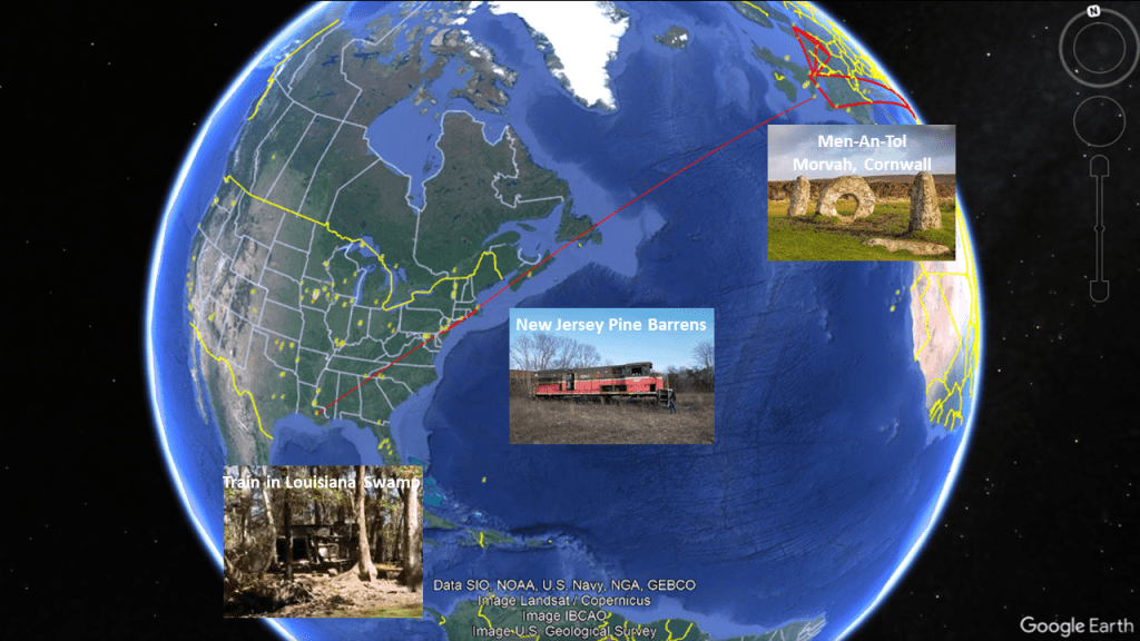
All three of the Pine Barren ecosystems of Coastal Massachusetts, Central Long Island, and New Jersey are on this alignment, as seen on the top left.
Provincetown at the bottom left, at the tip of Cape Cod where the Pilgrim Monument is located, is also on the alignment and all of Cape Cod, as well as the Elizabeth Islands, Martha’s Vineyard, and Nantucket, is part of the Southeastern Massachusetts Pine Barrens Alliance, on the right.
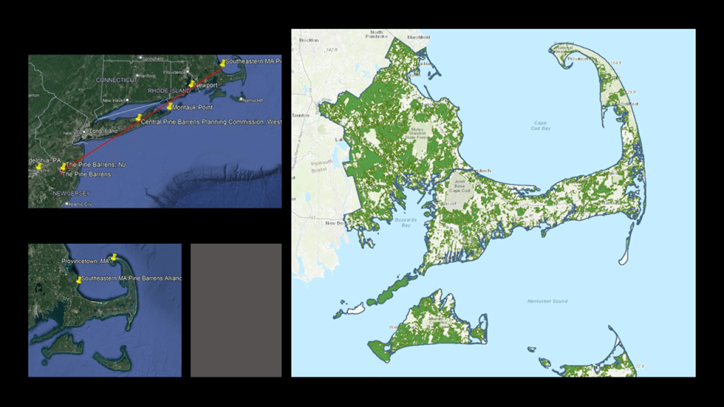
The Pilgrim Monument is a bell-tower that is the tallest granite structure in the United States, and granite rings with a bell-like sound when it is struck.
If Crowley’s ritual ceremony at Men-an-Tol did in fact send a line of rough energy towards Long Island, as claimed by his son Amado to Peter Moon as mentioned previously, it would have crossed through or near the Pilgrim Monument, with the energy thereby striking it, either directly or indirectly, and caused a forced resonant frequency to go through the grid system.
Resonance occurs in oscillating systems when an external force with the same natural frequency causes a rise in amplitude, which results in a net rise of mechanical energy.
Forced resonance leads to excessive vibrations and structural failure.
It is interesting to note that Provincetown, the same location as the towering Pilgrim Monument is located on the tip of Cape Cod, is one of the most LGTBQ-inclusive places in the country, and has been for a long time!
As early as 1900, when an artists’ colony and experimental theater developed there, including drag shows in the 1940s.
Aleister Crowley was known openly as the “Wickedest Man in the World.”
I am sure that some of you will be aware of who this person is, but I would surmise that this name would be unfamiliar to most people.

Crowley was also known as “the Beast.”

Crowley claimed that when he was honeymooning with his wife Rose Kelly in Cairo, Egypt, he was contacted by a disembodied entity named “Aiwass,” who provided him with “The Book of the Law,” which became the basis for Thelema, an esoteric and occult religious movement that Crowley founded in the early 1900s, and Crowley identified himself as the prophet of a new era of spiritual development for Humanity.
The basic tenet of “The Book of the Law,” and Thelema, is: “Do what thou wilt shall be the whole of the law.”
In other words, you can do anything you want without guilt, no matter how bad it is or how much it hurts others.
Crowley was highly involved in Freemasonry, and in ceremonial magical practices, including sex magic, and he was known to have been bisexual.
He also assumed the title of Baphomet within the Ordo Templi Orientis, AKA OTO, originally founded in the early-20th-Century by German Occultists, and modelled after Freemasonry.
Crowley described the Baphomet as a divine Androgyne, and the “Hieroglyph of Divine Perfection.”
Not a surprise to find out that the first formal presence of Crowley’s OTO in the United States was the Agape Lodge, which would have served Hollywood as it was established in Los Angeles in 1935, and today the Star Sapphire Lodge serves the Greater Los Angeles area.
I believe this information is quite relevant to the bizarre agendas we see playing out in the world today, and they want to turn us into them.
The image on the left popped up when I searched for “they want to turn us into them,” instead of us being in the image of God on the right.

Crowley was said to have died on December 1st of 1947, and that his ashes were buried under a tree in Hampton, New Jersey, a town with a railroad junction, in the garden of German occultist Karl Germer.
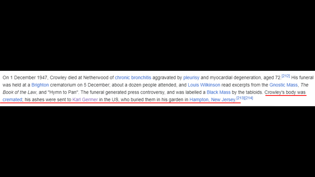
But I don’t think Crowley actually died.
I think he morphed into Barbara Bush.
I don’t think she was his daughter, which has been making the rounds on alternative media for quite some time.
I believe Barbara Bush was actually Aleister Crowley, and interestingly as seen here, making a “Shhh” gesture in the photo that is identical to the raised index finger in front of the mouth of what is commonly known as the “Shhh” Statue on the waterfront in New Jersey directly across the Hudson River from New York City.
The 80-foot, or 24-meter, -tall statue named “Water’s Soul” was unveiled in October of 2021.
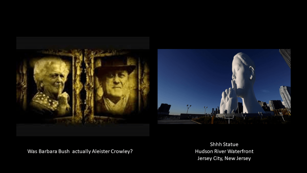
And the world’s controllers, the globalist elite, love in particular to pass off men as women to an unknowing public and rub our noses in it.
These are just two of the best-known of countless examples.

Then, to add insult to injury, they bring out fact-checkers to deny what has become more obvious to more people as time goes on.

Yet, here is the person identifying as Brigitte Macron engaging in the same “Shhh” gesture that we just saw in the Bush-Crowley photo, and the gigantic head on the Hudson River waterfront.

It sure looks like to me that a rich, vibrant & unacknowledged history of Humanity has been plundered and destroyed, only to be replaced with violence, death and destruction.
As I have been discussing throughout this post, knowledge of the Earth’s energy grid system was deliberately removed from our collective awareness by malevolent Beings who definitely do not have humanity’s best interest at heart, our history was revised, and the truth became shattered and fragmented, and instead, we have been kept in the dark and fed garbage – fake history, fake science, fake fact-checkers, fake food, and goodness knows what else.
While I absolutely believe that Humanity has a much better future in-store for us than what was planned for us, this is what we have been dealing with here.
From the Controllers’ perspective, we are not supposed to know anything true or real.
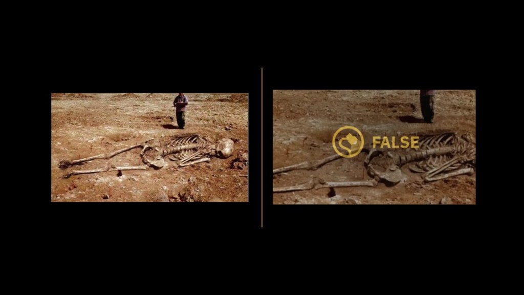
I am going to end this post here, and in the next post pick up the alignment where it leaves the Maldives, and continues across the Indian Ocean into Indonesia through the Sunda Strait, and I am going to track it across Indonesia to the Island of Timor, which while it is in the Timor Sea, it is still part of the Indian Ocean.
it is interesting to note that the first place I am heading to, the Sunda Strait, is the location of the island of Krakatoa.
Krakatoa is a volcanic island that was recorded to have exploded in a major eruption in 1883 with global effects.

I have been waiting for this ema
LikeLike
hello Michelle- been following your work for some time. Your work is supurb, thank you. I recently moved to grass valley ca. (an old gold mining town) having some background in the unusual and out of place found. Hiding right in plain sight in the middle of town, a large core sample from the mining era with a series of 9 star holes bored into the stone. If you know about star holes they are very rare, mysterious, and found all over the US and the realm. Mostly in ancient quarries and random places but the ones here were right there out in the open. No old miner and seasoned local had even heard or seen them before. All are baffled. Not to mention there is evidence of what are currently recognized as petrified titanic tree remains complete with integrated tree sap quartz. I wonder if you’ve ever looked much into California, it’s lay lines or history of this area… there is, in my estimation, a great mystery here that is right under the surface. This area has the largest or maybe deepest mine network around and I suspect they were looking for more than just gold especially since I found these these star holes. If you like and are curious I can send you photos of my findings. All the best, Lay
LikeLike