
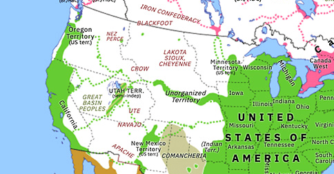
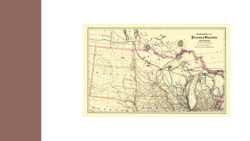
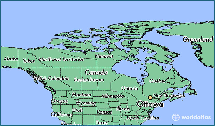
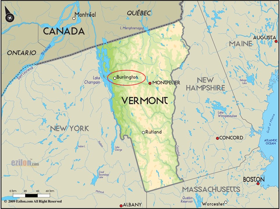
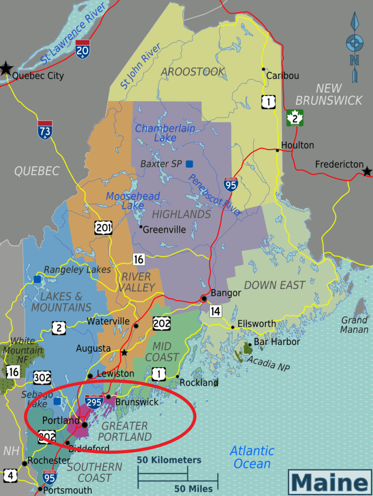
In this post, I will take a closer look at one side of what I call the North American Star Tetrahedron.
I am looking at the side of the star tetrahedron that extends from Edmonton in Alberta, Canada, and goes to Ottawa in southern Ontario, and the national capital of Canada.
From Ottawa, I will extend the alignment out starting from Burlington, Vermont in the United States, and follow cities and places in alignment with each other across oceans and continents, all the way to Capetown, South Africa.

The preparation that I had that helped me find all of this was a passionate lifelong interest in history’s mysteries, including megaliths; long-distance alignments discovered by other researchers, and knowledge about sacred geometry, which I learned about in a Flower of Life Workshop in Fairbanks, Alaska, in 2007.
I started receiving the stream of information about the Moors, the builders of the original ancient advanced civilization, after I met a Moorish-American man when I moved from Fairbanks to Oklahoma City in 2013, and he was one of three friends I travelled with to sacred sites in Oklahoma, Arkansas, and Louisiana, between 2013 and 2016, and during which time I started to see the ancient civilization emerge from the landscape around me.
Another one of those travel friends gave me a map of the world during those years, saying that “I needed it.”
I put it on a bulletin board next to my dining room table, where I could study it when I ate.
I started noticing cities lining up in lines in North America.
As mentioned, I had learned about Sacred Geometry in 2007, so I knew about the sacred geometric shape called the star tetrahedron, which I found in North America by connecting cities in 2016.
This finding of the North American Star Tetrahedron is what my original research is based on.
In the process of tracking this particular, I will be highlighting some ancient sacred sites and infrastructure, as well as hot spots in our modern history.
Most of the research in this post is based on a series that I published here in 2018, shortly after I started blogging in 2018, though I will also be adding in a considerable amount of research along the way from other projects covering the same places that I have done in the six-years since then.
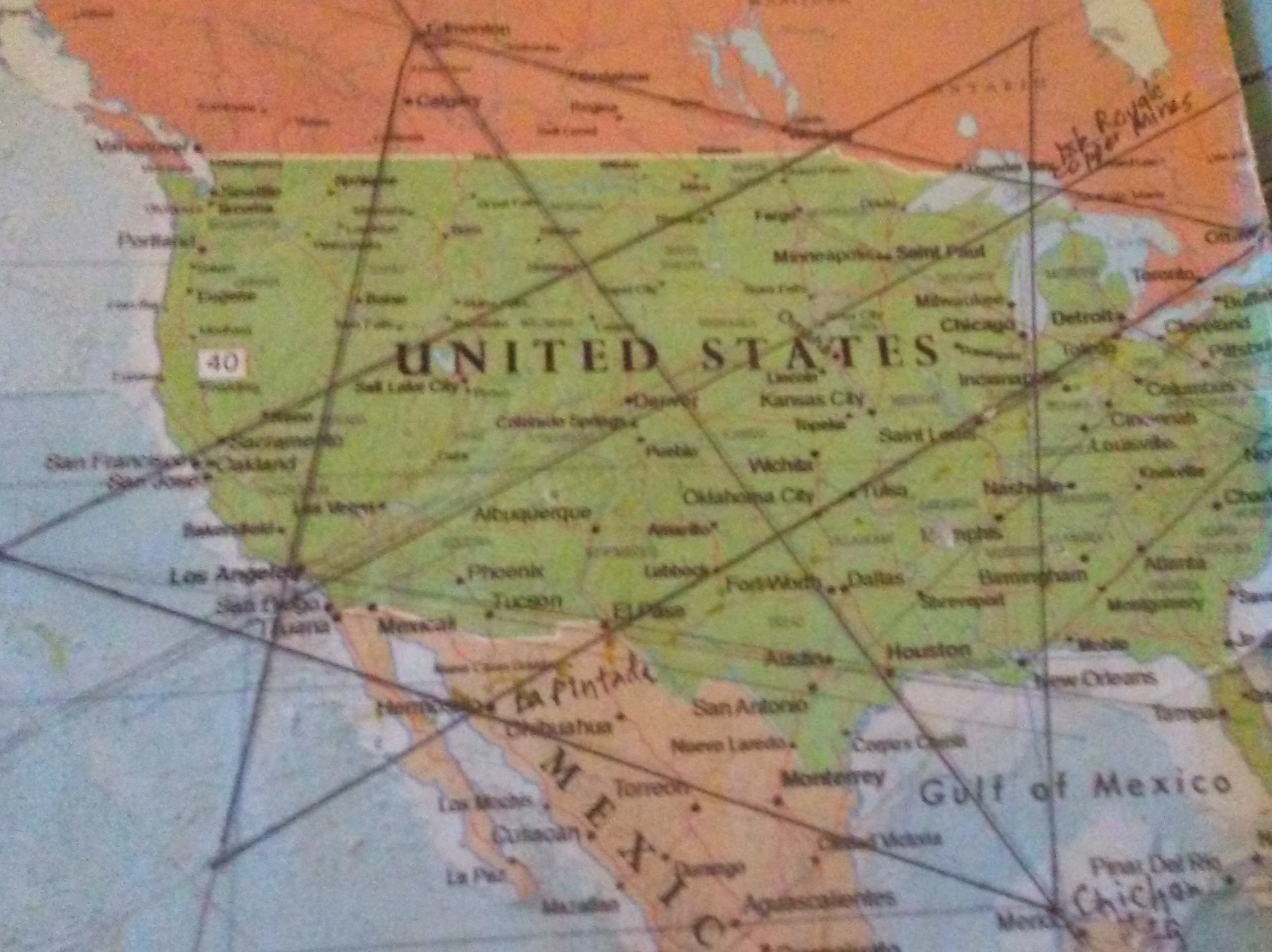
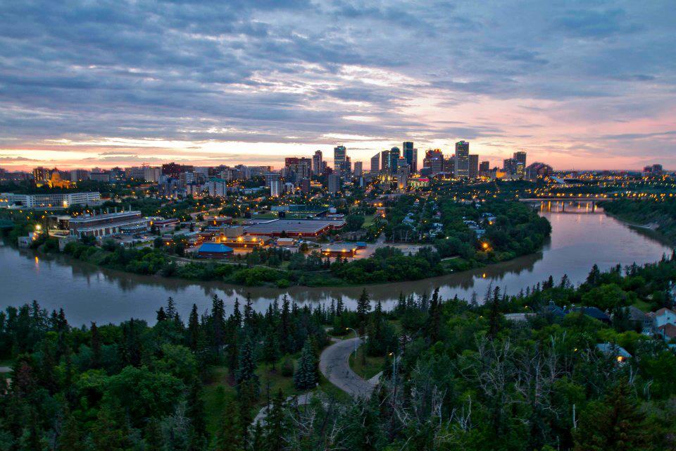
The northern apex of the star tetrahedron is Edmonton, Alberta.
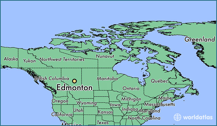
Edmonton is the capital of the Province of Alberta.
It is situated in bends in the North Saskatchewan River.
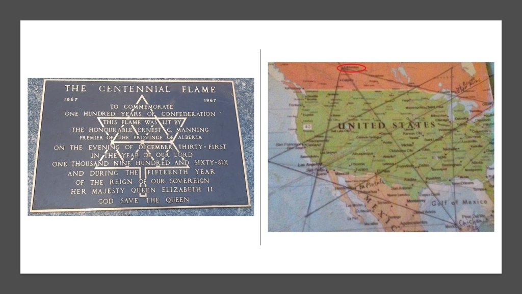
A viewer from Edmonton, Alberta, sent me some photos of something she noticed while on her stroll through the south lawns of the legislature there.
The Alberta Legislature Building, also known as “The Ledge,” was said to have been constructed in the “Beaux Arts Style,” starting in 1907 and completed in 1913, under the supervision of architects Allan Merrick Jeffers and Richard Blakey.
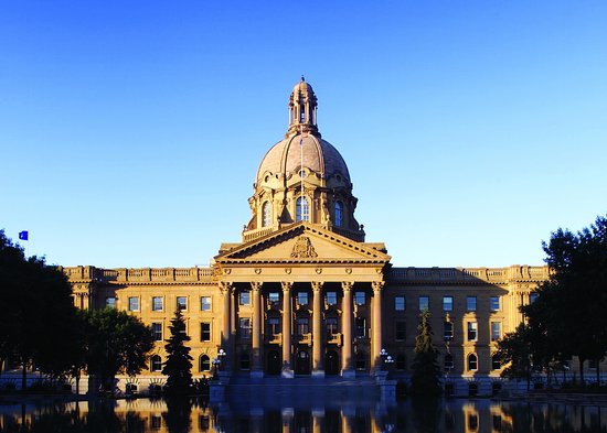
The diagram on “The Centennial Flame” signage on the grounds reminded her of the star shape that I mentioned at the beginning of this post…
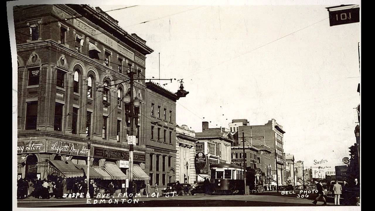
This is a historic view of Jasper Avenue in Edmonton, with building in the foreground on the left with its heavy masonry and arched windows.
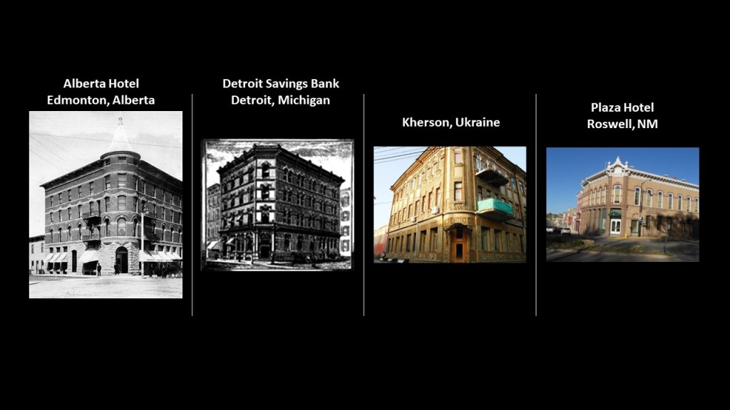
And here on the left is the Alberta Hotel, compared with the Detroit Savings Bank on the left middle; a building on Kherson, Ukraine on the middle right; and the Plaza Hotel in Roswell, NM, on the right.
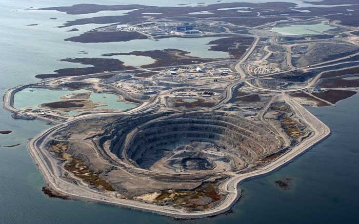
Known as the “Gateway to the North,” Edmonton is the staging area for large-scale oil sands projects in northern Alberta…
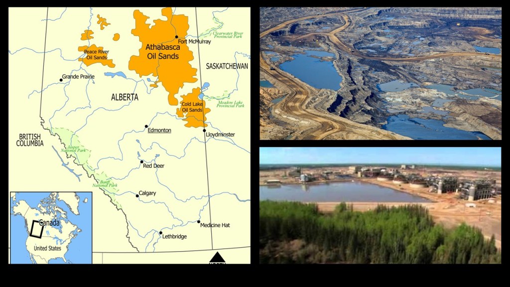
…and large-scale diamond-mining operations in the Northwest Territories.
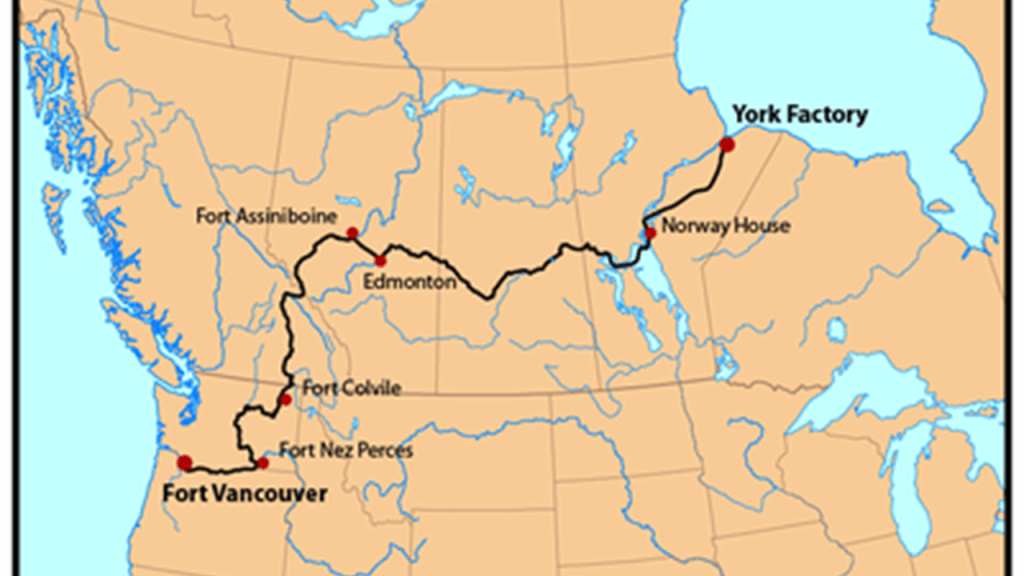
Next on the alignment we come to Ft. Assiniboine, a small hamlet in Alberta not far from Edmonton and said to have been founded as a trading post by the Hudson Bay Company in 1824.
Fort Assiniboine was a stop on what was called the “York Factory Express,” a 19th-century fur brigade run by the Hudson’s Bay Company between their York Factory headquarters on the southwestern shore of Hudson Bay in northeastern Manitoba, and Fort Vancouver, the principal depot of their Columbia Department.
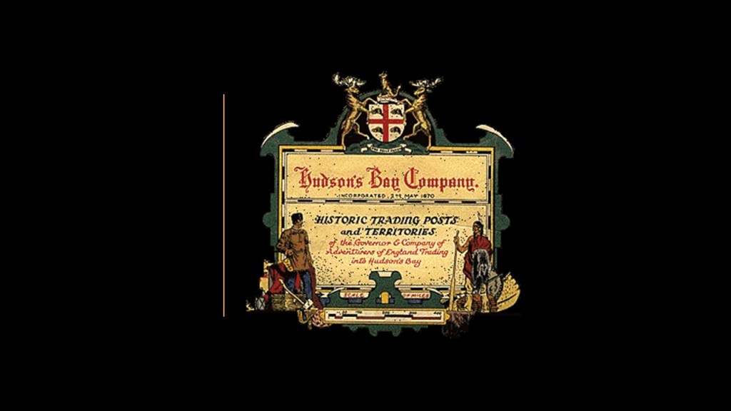
The Hudson’s Bay Company is the oldest, incorporated, joint-stock merchandising company in the English-speaking world, and said to have been chartered on May 2nd of 1670 by King Charles II on behalf of French traders who wanted to reach the interior of the North American continent via Hudson’s Bay, and British merchants and noblemen who wanted to back the venture.
The Hudson’s Bay Company was granted wide powers, including exclusive trading rights in the lands crossed by rivers flowing into Hudson Bay.
It is still in operation today as a Canadian retail business group operating department stores in several countries.
The Assiniboine people are centered today in Saskatchewan though they once populated this whole region, and were a major part of an alliance known as the Iron Confederacy, or Nehiyaw Pwat.
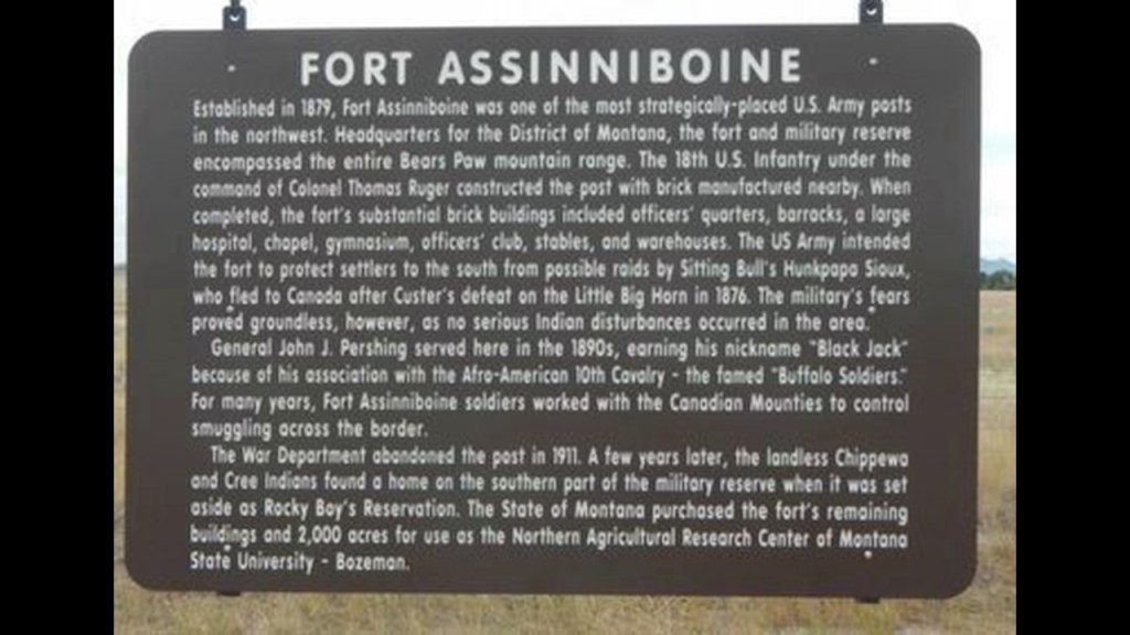
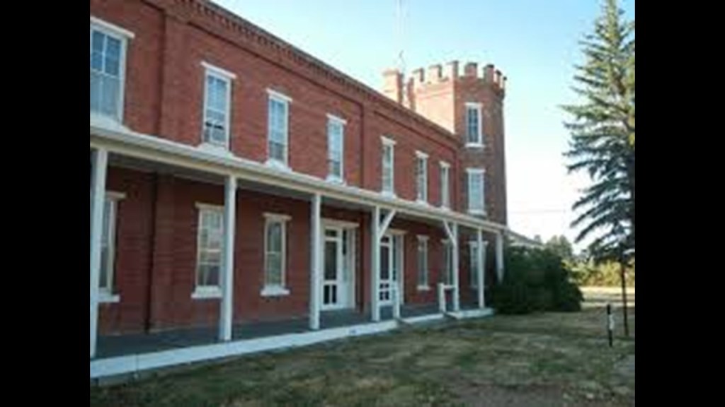
There is also another Fort Assiniboine south of Edmonton in Montana, and was to be a U.S. Army post that was established in 1879, and abandoned in 1911.
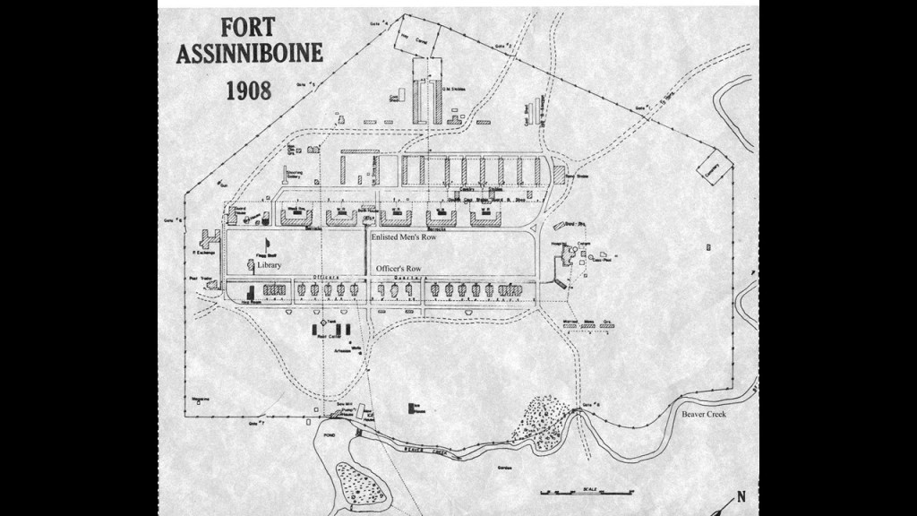
It was said to have been established to prevent Sioux chief Sitting Bull from returning to the United States from Canada, as well as to control the local indian population.
This is what the Bachelor Officers Quarters looked like with its turreted tower.
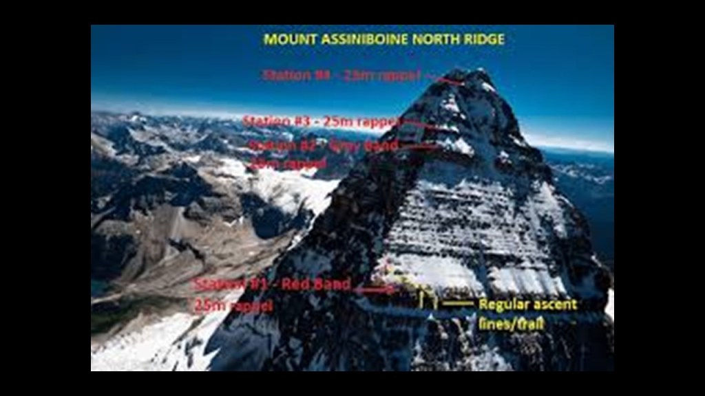
And this is the pyramidal-shaped Mt. Assiniboine, on the British Columbia border with Alberta in what are called the Canadian Rockies.
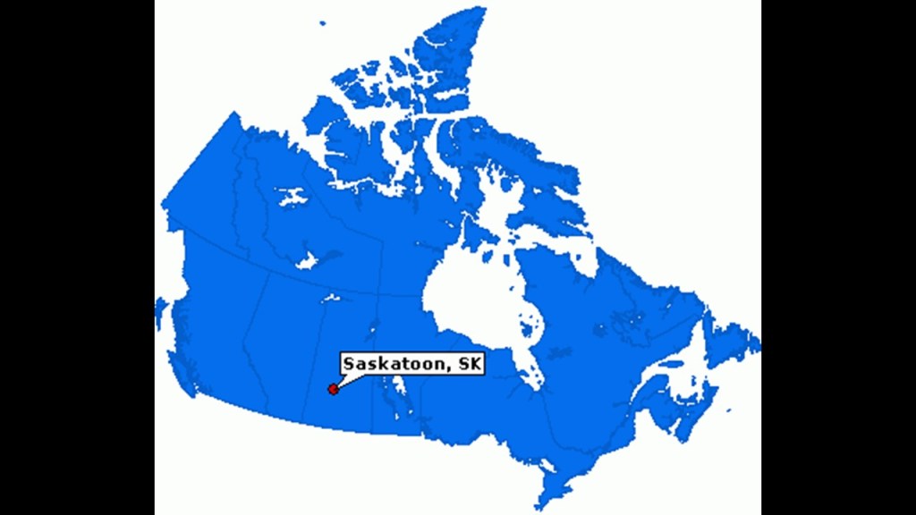
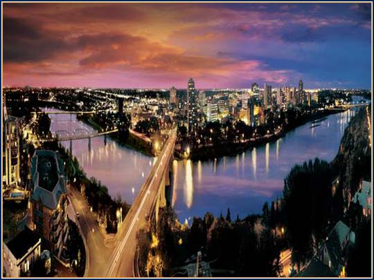
From Edmonton, this alignment passes through Saskatoon, the largest city in the Province of Saskatchewan.
Like, we saw in Edmonton, Saskatoon straddles a river bend, in this case, the South Saskatchewan River.
We are told that the founding of Saskatoon started with the purchase of 21-sections of land straddling the South Saskatchewan River by the Toronto-based Temperance Colonization Society in 1882, for the purposes of setting-up a dry community in the prairie.
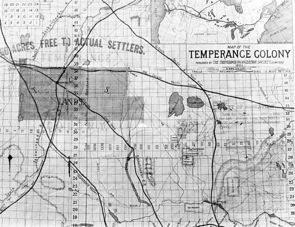
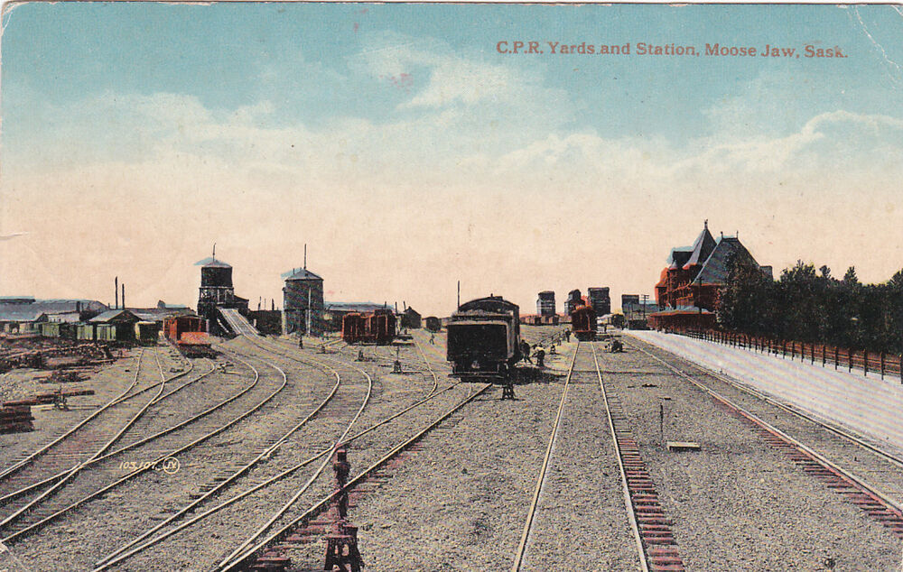
The first settlers were said to have arrived by railway from Ontario to Moose Jaw in Saskatchewan, then complete the final leg to what became Saskatoon by horse-drawn cart, as the railway had yet to be completed to Saskatoon.
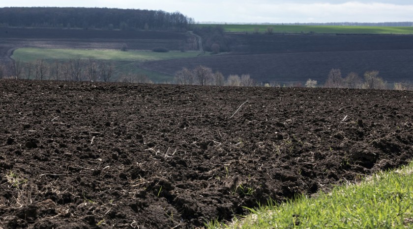
Saskatoon lies on a long, rich belt of rich potassic chernozem, which is a rich, black-colored soil containing a high-percentage of humus, or amorphous organic soil material, and high-percentages of phosphoric acids, phosphorus, and ammonia.
It is very fertile, and can produce high agricultural yields.
The palatial Delta Bessborough Hotel in Saskatoon was said to have been built for the Canadian Pacific Railway between the years of 1928 and 1932.
The Grand Railway Hotels of Canada were said to have been built by the Canadian Railway Companies, like the Canadian Pacific Railway, in conjunction with the expansion of the railway.
According to our historical narrative, there was nothing like that in North America, no castles, no nothing – it was an empty land, free for the taking.
Grand palatial and castle-like buildings weren’t supposed to have been here, so we naturally have assumed that whatever we are told about different places is true.
If we are told a structure like a castle like this was built by the railroad in the early 1900s, we believe it.

Yet the years it was said to have been built, between 1928 and 1932, would have been during the Great Depression, in which Canada was one of the countries most severely affected by the economic decline.
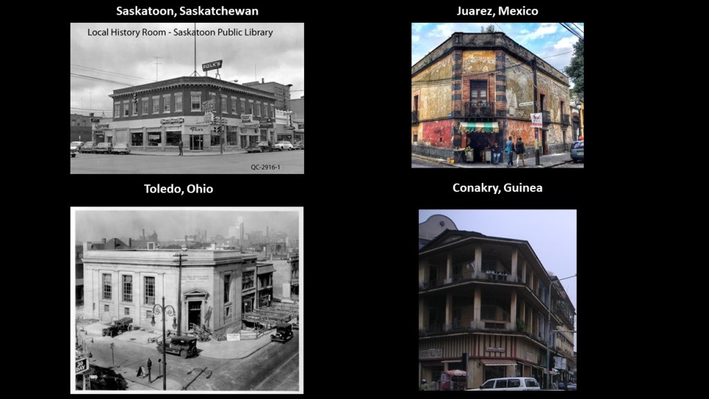
And there is more of the same corner architecture and layout in Saskatoon like we saw back in Edmonton, and that is seen worldwide, like at the historical photo of the Local History Room of the Saskatoon Public Library on the top left; and the buildings in Juarez, Mexico, on the top right; in Toledo, Ohio, on the bottom left; and in Conakry, in the west African country of Guinea on the bottom right.
Next on the alignment is Winnipeg, the capital city of Manitoba.
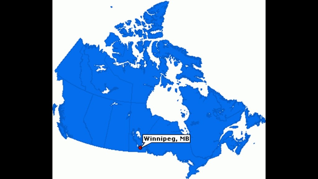
Winnipeg is situated at the confluence of the Red and Assiniboine Rivers.

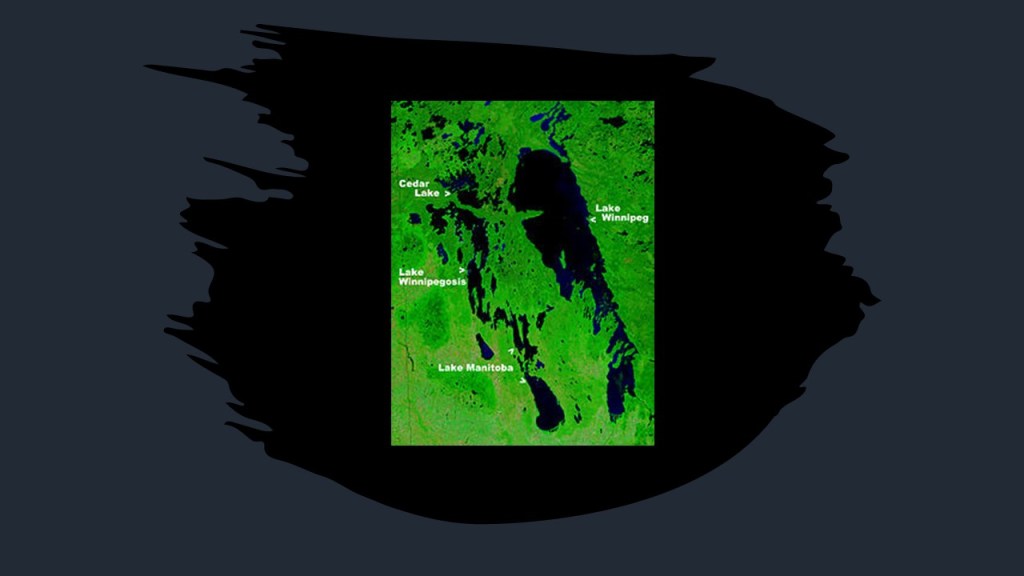
The city is named for the nearby Lake Winnipeg…
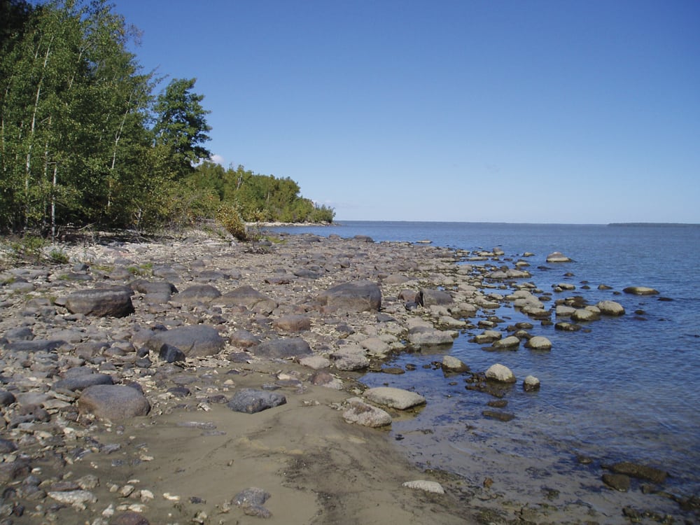
…which has the largest watershed of any lake in Canada, receiving water from four U. S. states, and four Canadian provinces.
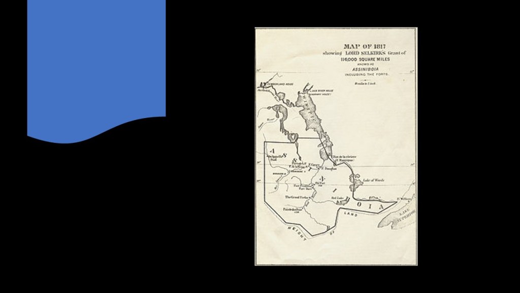
Lord Selkirk, a Scottish philanthropist, was involved with the first permanent settlement by sponsoring immigrant settlements in Canada starting in 1811 at what was known as the Red River Colony.
He was said to have purchased the land from the Hudson’s Bay Company, and surveyed the river lots for immigrant settlement.
We are told Winnipeg developed rapidly after the coming of the Canadian Pacific Railway in 1881.
There were several historic Forts hereabouts, including Fort Rouge, which was said to have been constructed by the French in 1738 for the fur trade, and Fort Gibraltar, which was renamed Fort Garry, was said to have been constructed for the North West Company, a fur trading company that was first in competition with, and then forced to merge with the Hudson’s Bay Company by the British Government in 1821.
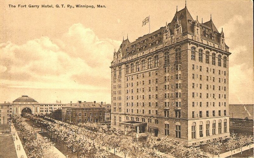
The Fort Garry Hotel in Winnipeg, described as a “Canadian Castle,” was said to have been built for the Grand Trunk Railroad as a luxury hotel for elite railway travelers, and first opened in 1913.
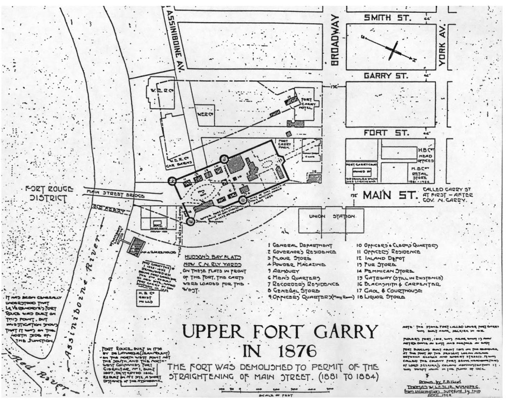
The land adjoining the Fort Garry Hotel was once occupied by the Upper Fort Garry, which was the Hudson’s Bay Company Headquarters until 1882, after which time the land was sold and the fort demolished to widen Main Street, and the former Fort Rouge was located in what today is called Winnipeg’s Fort Rouge District at the confluence of the Assiniboine and Red Rivers.
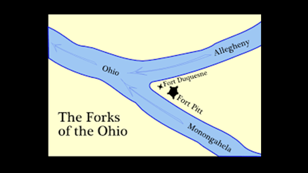
I typically find historic fort locations at river confluences, including but far from limited to Fort Duquesne and Fort Pitt at the confluence of the Allegheny and Monongahela Rivers at the Forks of the Ohio in Pittsburgh…
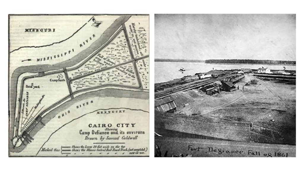
…and the historic Fort Defiance at the confluence of the Mississippi and Ohio Rivers in Cairo, Illinois, said to have been constructed under the direction of Union General Ulysses S. Grant in order to gain strategic access to the rivers.
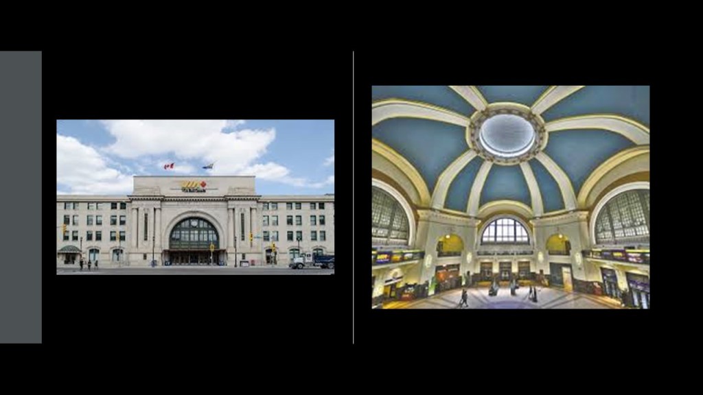
The Union Station in Winnipeg was located very close to the historic Fort Rouge and Fort Garry, and said to have been constructed between 1908 and 1911, and first opened in 1912.
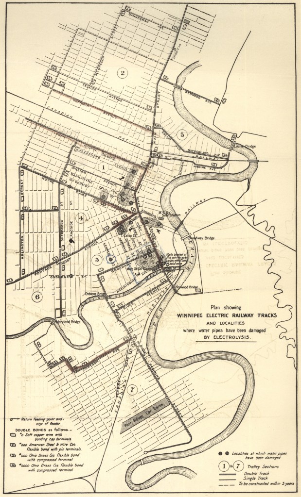
According to the historical narrative, streetcars operated in Winnipeg starting in 1882 until September of 1955 marked the end of its street rail service.
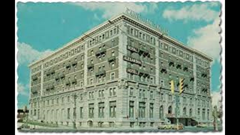
The Royal Alexandra Hotel was said to have been built in Winnipeg in 1906 by the Canadian Pacific Railway, and named after Alexandra of Denmark, wife of King Edward VII.
The hotel was in operation as such until 1967 and subsequently demolished in 1971.
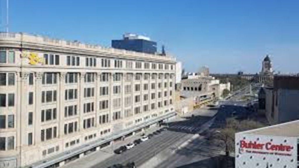
The Hudson’s Bay Company flagship department store in Winnipeg was said to have been built starting in September of 1925 and first opened for business in November of 1926.
The downtown store closed to the public in 2020, and in 2022, it was gifted by the Hudson’s Bay Company to the First Nations’ Southern Chiefs Organization for economic and social reconciliation.
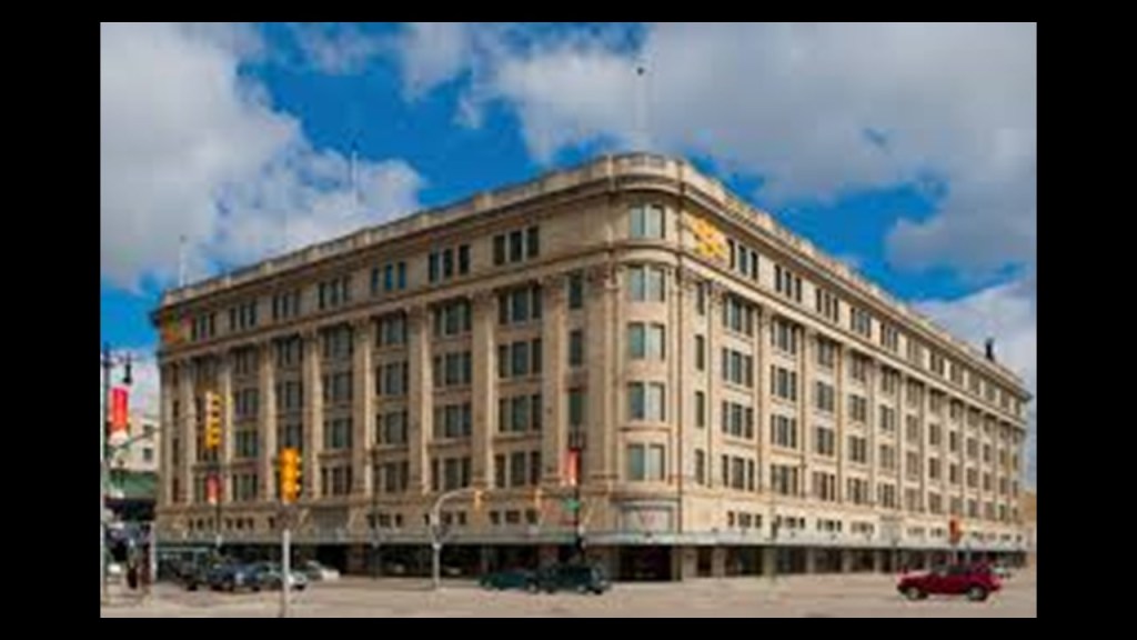
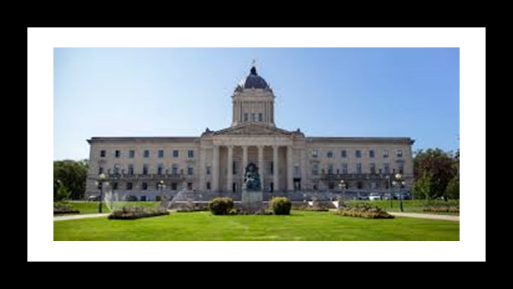
This location is just down the street from the Manitoba Legislative Building.
The construction of the current Manitoba Legislative Building was said to have started in 1913 and completed in 1920.
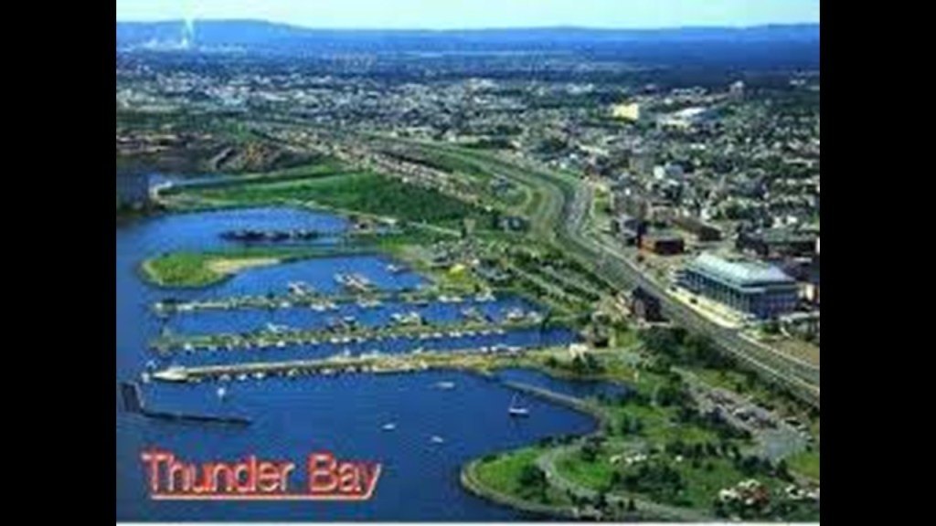
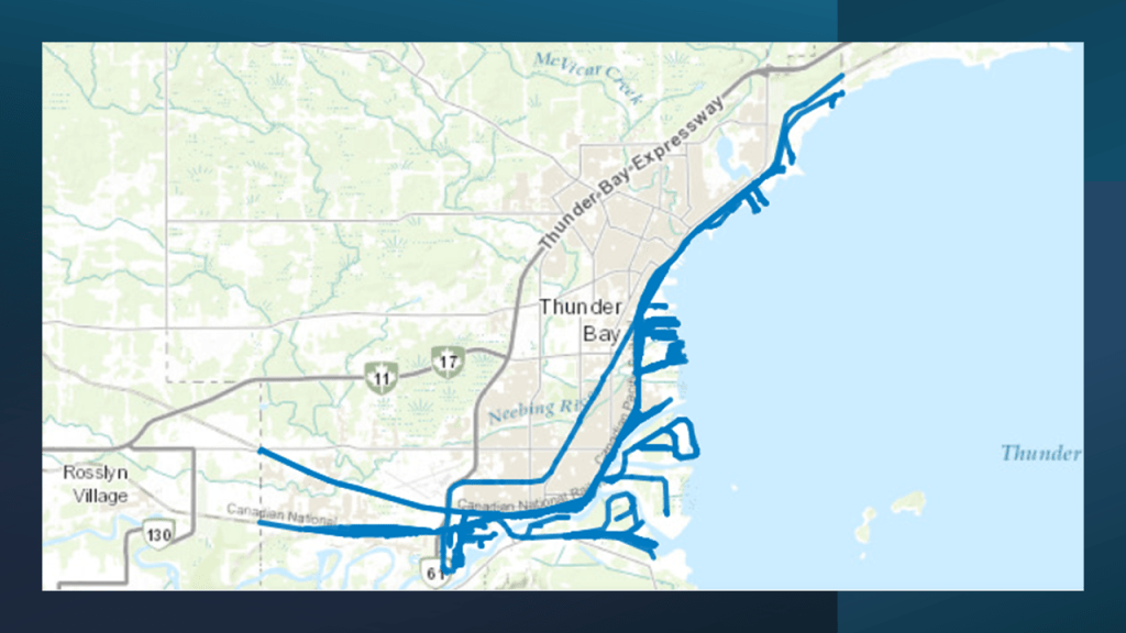
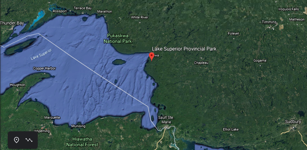
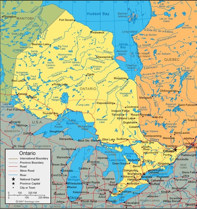
Next on the alignment, we come to Thunder Bay, Ontario.
Thunder Bay is the seat of the Thunder Bay District in Ontario and is located at the head of Lake Superior.
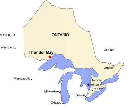
It was previously known by the names of Fort William and Port Arthur.
What we are told is that the Hudson’s Bay Company merged with the original trading post located at Fort William pictured here.
So what we are taught to believe these is that these buildings constructed of wood were the original structures of the area…
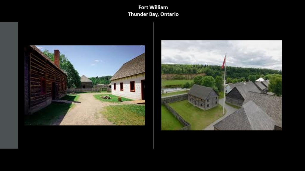
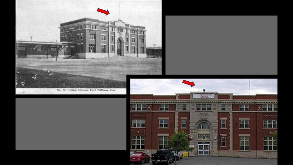
…instead of solid masonry buildings, like the historic Union Station in Fort William, which was said to have been built in the Beaux-Arts-style some time around 1910 or 1911 by the Canadian Pacific Railway and the Grand Trunk Pacific Railway as a passenger terminal and headquarters for the grain-handling facilities located here.
The building still stands today, though minus a couple of features that were present on the building in the earlier photo in the top center of it, as if the resetters wanted to remove antiquitech or something.
This practice was actually quite common with respect to old world buildings that are still here and not demolished as so many have been.
Thunder Bay is still an important railway hub for the Canadian National and Canadian Pacific Railway.
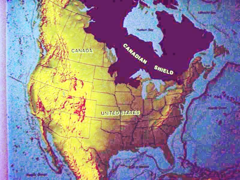
We have also crossed into the southern edge of the Canadian Shield, also known as the Laurentian Plateau.
It is called one of the world’s largest geologic continental shelves, of exposed precambrian igneous and high-grade metamorphic rock that forms the ancient geological core of North America.
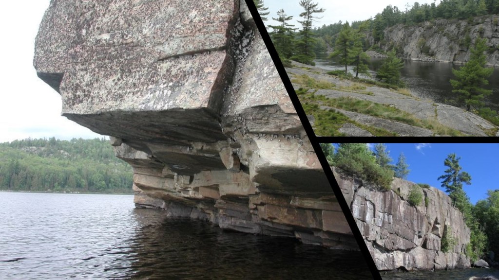
Here are some photos of what the Laurentian Shield looks like, in particular noting the presence of straight edges, angles, and flat and smooth stone surfaces.
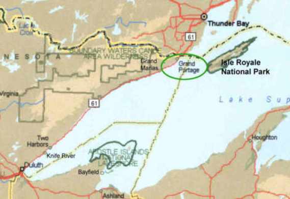
Next we come to Isle Royale in Lake Superior.
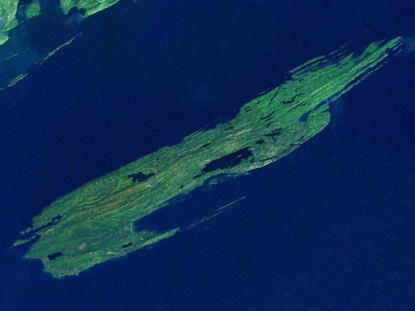
While geographically it is very close to Grand Portage in Minnesota, it is part of the State of Michigan.
It is the only national park in Michigan, and the only island national park in the United States.
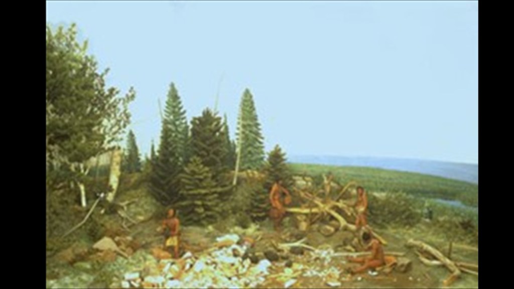
Isle Royale was known for its ancient copper mines dating at least back to the Bronze Age, and is considered the purest copper in the world.
And our narrative can’t explain who was responsible for the mining, and how it got to Europe.
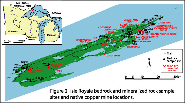
The best western Archeologists can come up with is that somehow Indians in loincloths figured out how to mine copper 5,000 years ago, and that somehow, we really don’t know how, it got to Bronze-Age Europe before there was transoceanic trade.
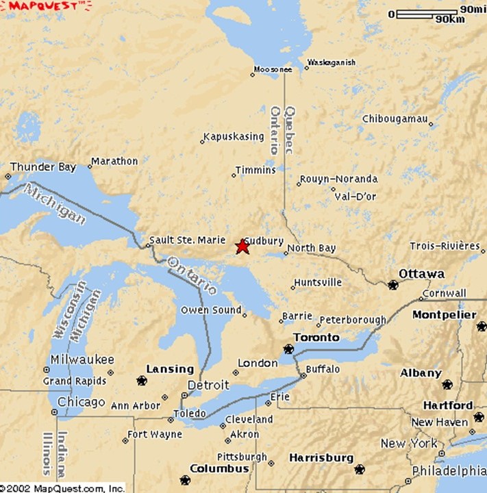
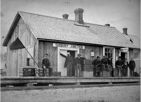
Next we come to Sudbury, officially Greater Sudbury, the largest city in Northern Ontario, a geographic and administrative region of Ontario, but is administered as a Unitary authority, and not part of any district, county or regional municipality.
We are told the Sudbury region was inhabited by the Ojibwe, an Anishanaabe people of the Algonquin Group, for 9,000-years.
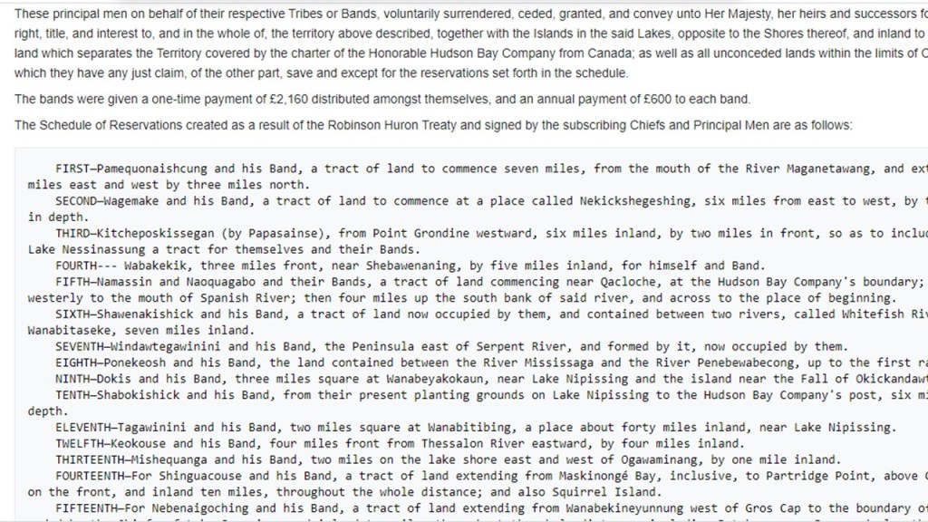
Our historical narrative tells us that a large tract of land, including what is now Sudbury, was signed over to the British Crown in 1850, by the local chiefs, as part of the Robinson-Huron Treaty.
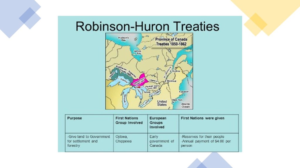
In return, the Crown pledged to pay an annuity to these First Nations people, originally set at $1.60 per treaty member, and it was last increased to $4 in 1874, where it is fixed to this day.
Reservations were also established as result of this Treaty.
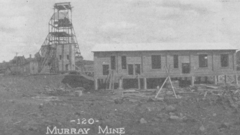
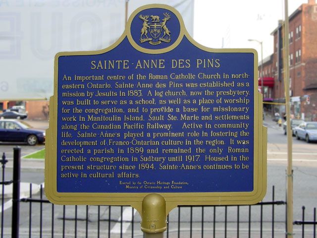
Then, in 1883, the same year Sudbury was founded, nickel-copper, ore was discovered here during the construction of the transcontinental railway.
The Murray Mine, where there was a high concentration of nickel-copper ore, was said to have been the first mine established in 1883, apparently “discovered” by a blacksmith in the railway construction gang.
It was mined during different periods of time between 1883 and 1971.
The Jesuits arrived here that same year as well, and established the Sainte-Ann-des-Pins Mission.
The Lake Superior Provincial Park is northwest of Sudbury, and one of the largest provincial parks in Ontario.
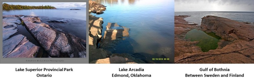
On the left is a photo of Katherine Cove at Lake Superior Provincial Park, compared for similarity of appearance with Lake Arcadia in Edmond, Oklahoma, in the middle, and the Gulf of Bothnia on the right, between Sweden and Finland.
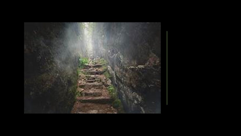
The stone steps and walls pictured here are also at Lake Superior Provincial Park.
The next stop is Ottawa, the national seat of government of Canada.
Ottawa is on the south bank of the Ottawa River on Ontario’s border with Quebec, with Gatineau on the other side of the river in Quebec.
We are told that it was founded as Bytown in 1826, which was marked by a sod-turning, and a letter from Governor-General Dalhousie which authorized Lt. Col. John By to divide up the town into lots.
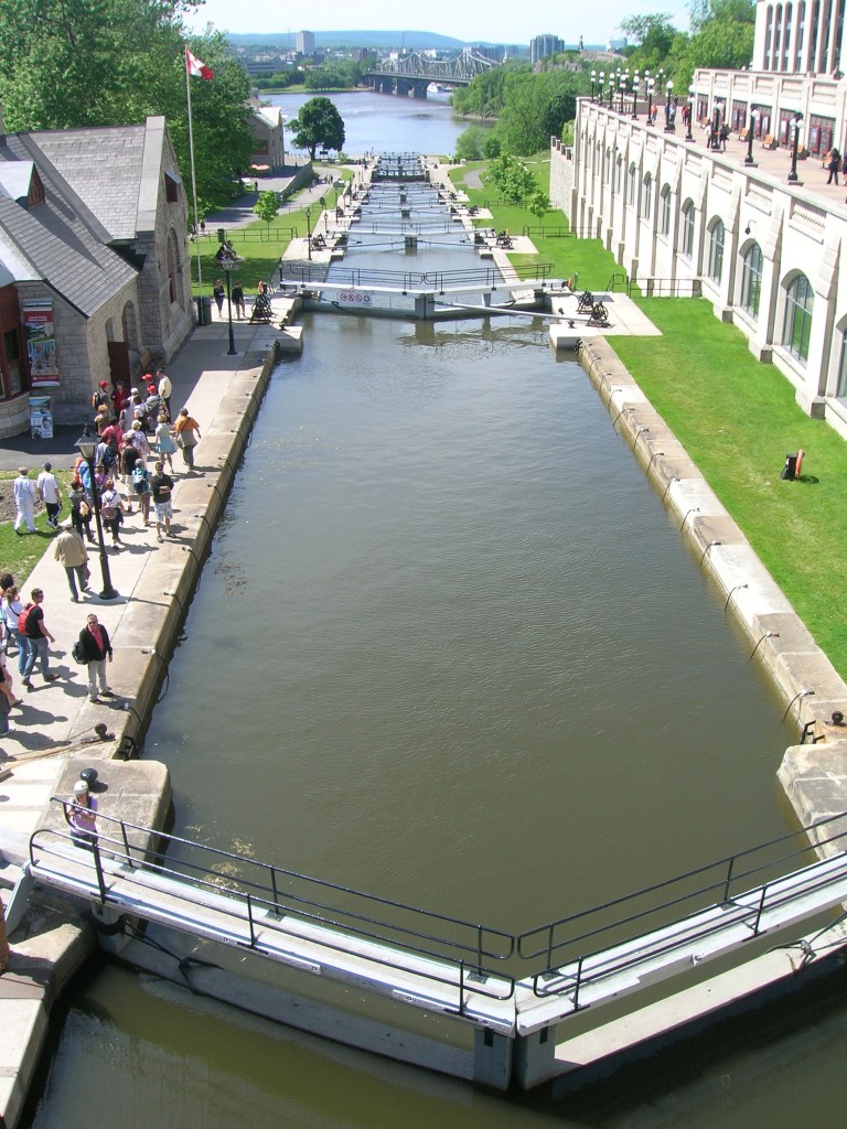
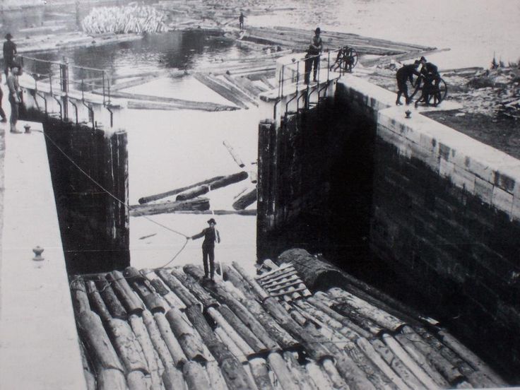
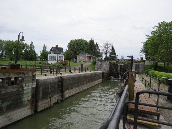
We are told Bytown came about as a direct result of the construction of the Rideau Canal, which was said to have been built by Lt. Col. By, and opened in 1832…
…and Bytown was said to have grown because of the Ottawa River timber trade.
Bytown was incorporated as a town on January 1st of 1850, and this was superseded by the incorporation of the city of Ottawa on January 1st of 1855.
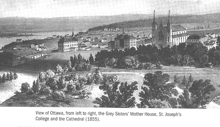
This is a depiction of Lower Town in Ottawa in 1855.
Lower Town is said to be the oldest part of the city.
Our history tells us that on New Year’s Eve of 1857, Queen Victoria was presented with the responsibility of choosing the location for the permanent capital of Canada, with Ottawa being described as a small, frontier town.

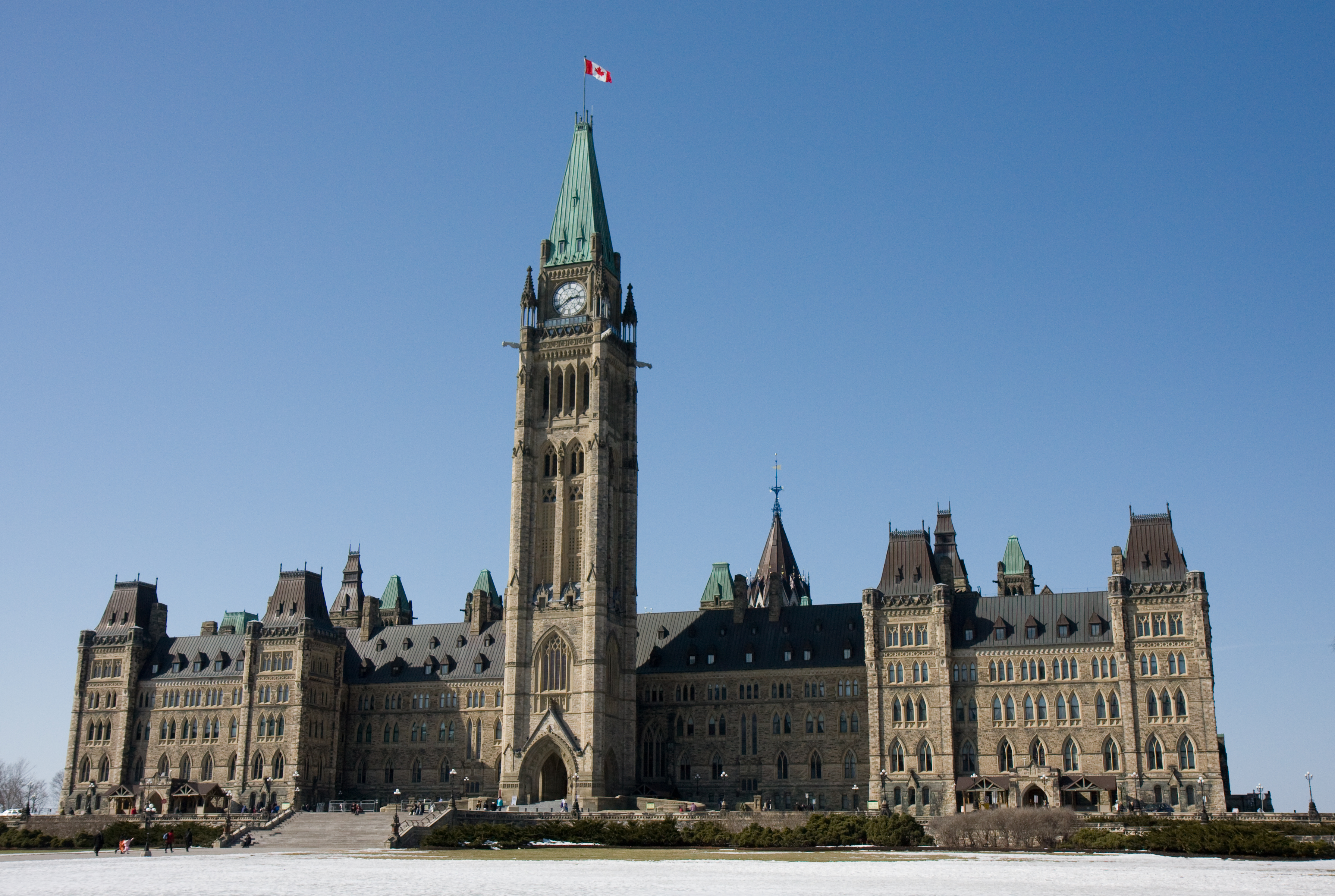
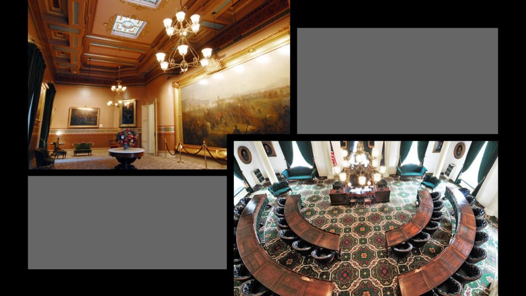
The Parliament buildings were said to have been constructed between 1859 and 1866, in an architectural style called Gothic Revival.
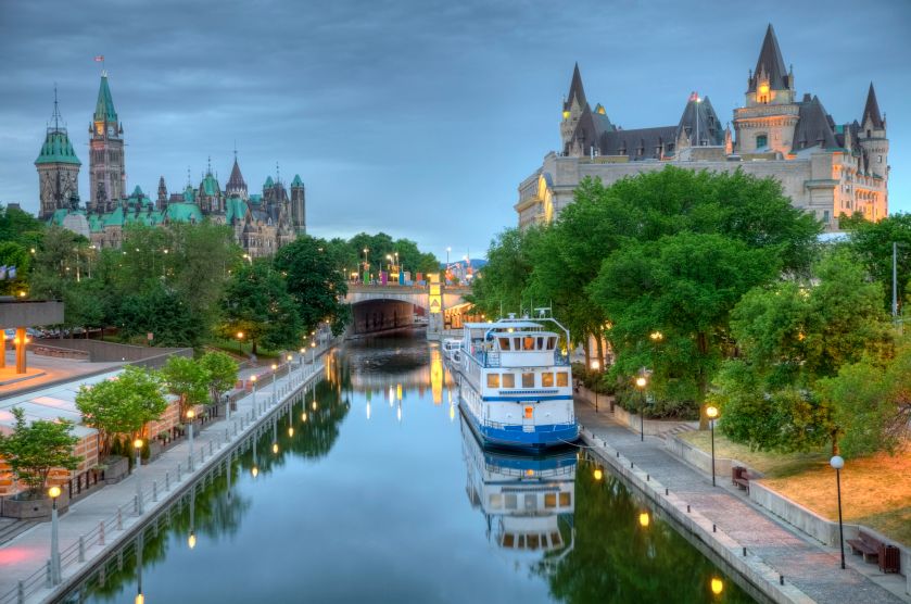
This a view of Parliament Hill from the Rideau Canal.
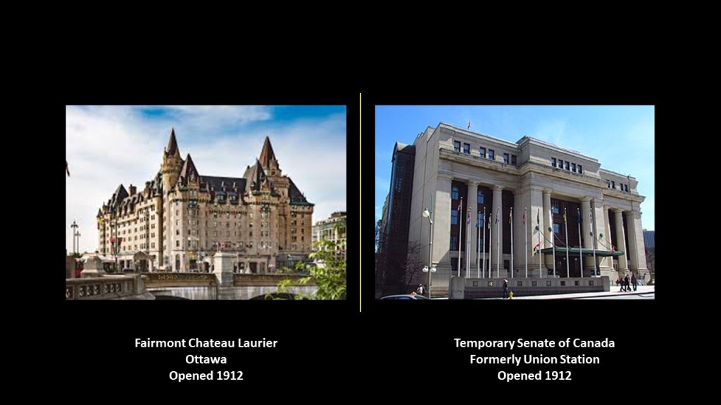
The Fairmont Chateau Laurier in Ottawa was said to have been built between 1909 – 1912 for the Grand Trunk Railway, and built in tandem awith the downtown Union Station across the street, which first opened in 1912.
Today the Union Station building is the temporary seat of the Senate of Canada.
This location is in close proximity to places like Parliament Hill and the Rideau Locks.
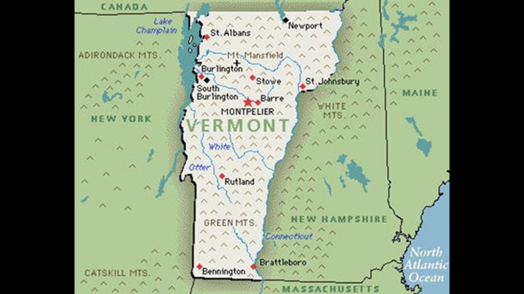
Next, we are heading across the International Border to Burlington in Vermont.
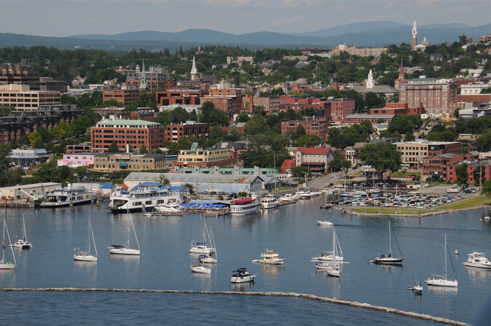
Burlington is the largest city in the state of Vermont, and is located 45-miles, or 72-kilometers, south of Vermont’s border with the Canadian province of Quebec.
Burlington is the largest city in Vermont, with a population of 50,000 and is located on the eastern shoreline of Lake Champlain.
We are told it became a Port-of-Entry and center for trade after the completion of the Champlain Canal in 1823, which connected Lake Champlain with the Hudson River system…
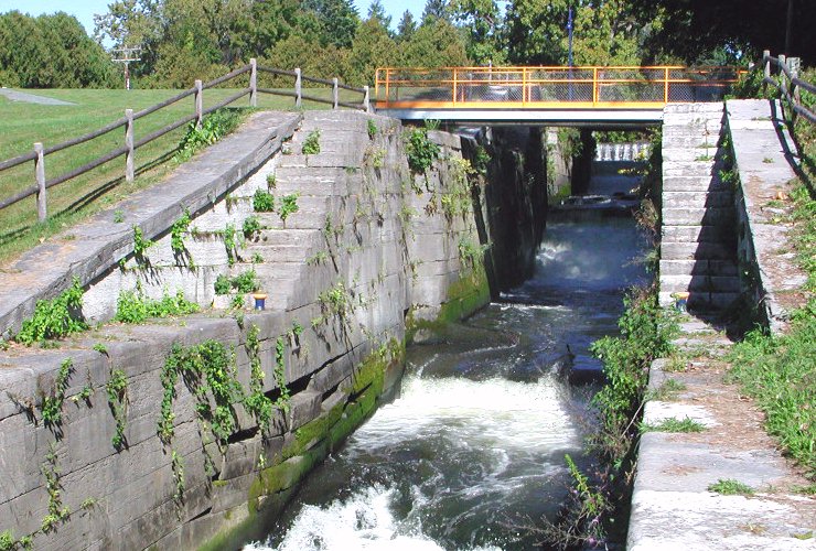
…the Erie Canal in New York State in 1825…
…and the Chambly Canal along the Richelieu River in Quebec in 1843, part of a waterway that connects the St. Lawrence River with the Hudson River in New York.
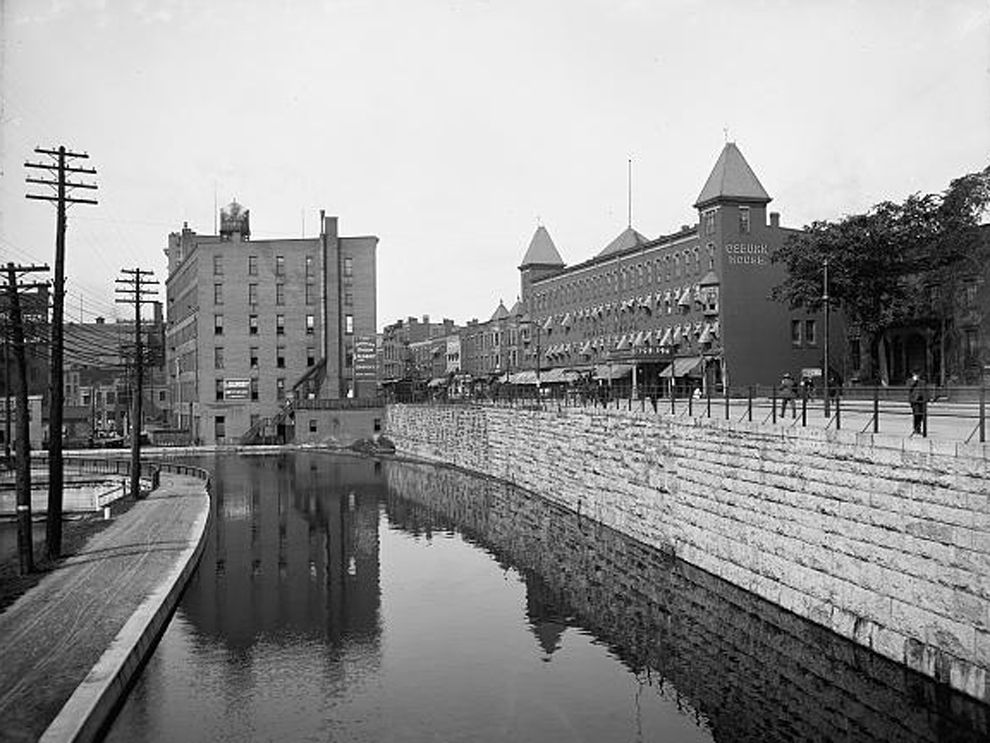
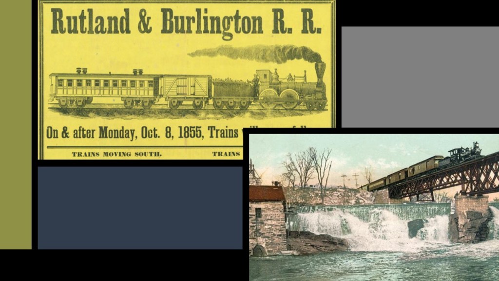
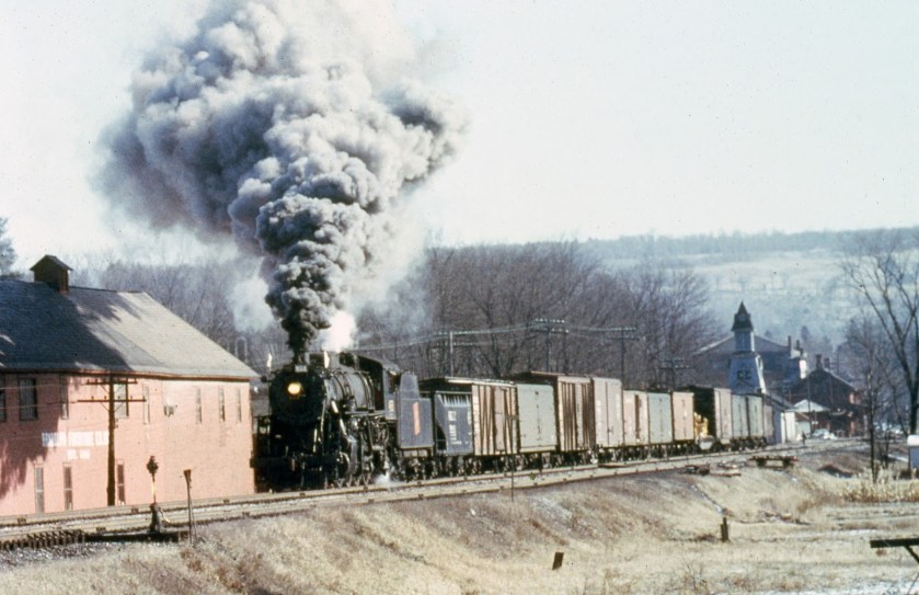
Steamboats connected freight and passengers with the Rutland and Burlington Railroad, which was said to have been chartered to build in 1843, and the Vermont Central Railroad, also said to have been chartered in 1843.
Again, the historical narrative we have been given in no way explains the existence of all of these massive long-distance engineering projects, which then seeks to inform us, after putting forth all that effort to build them, that in most cases, canals became obsolete as transportation arteries because the railways were so much more efficient.
At any rate, Burlington became a transportation hub and manufacturing center for the region, and it was incorporated in 1865, which was the same year the American Civil War ended.

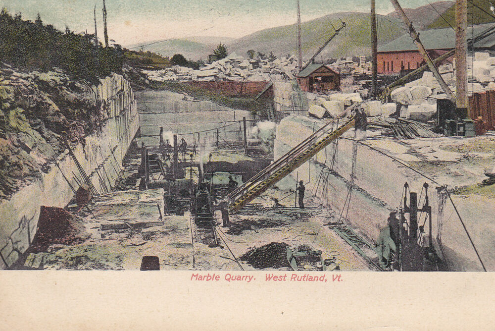
Starting in the early 19th-century, high-quality marble deposits were found in Rutland, Vermont, which is 69-miles, or 111-kilometers, southeast of Burlington.
We are told that by the 1840s, small firms had begun excavations, but that marble quarries proved profitable only after the arrival of the railroad in 1851.
Marble is a type of limestone used as a stone building material since antiquity, like in the Pantheon in Rome pictured here.
The Pantheon was said to have been built as a Roman Temple between 113 AD and 125 AD.
Rutland went on to become one of the world’s leading marble producers when, we are told, the marble quarries of Carrara in Italy became largely unworkable because of their extreme depth.
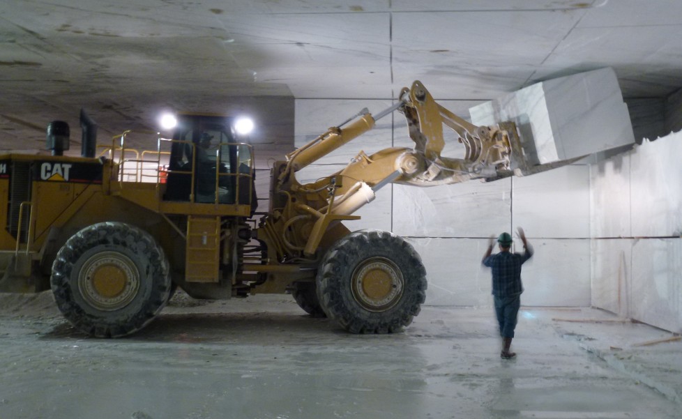
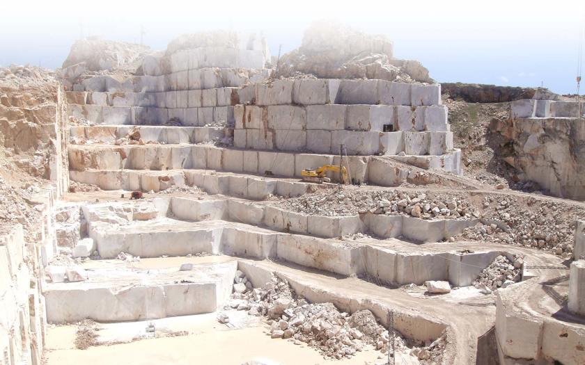
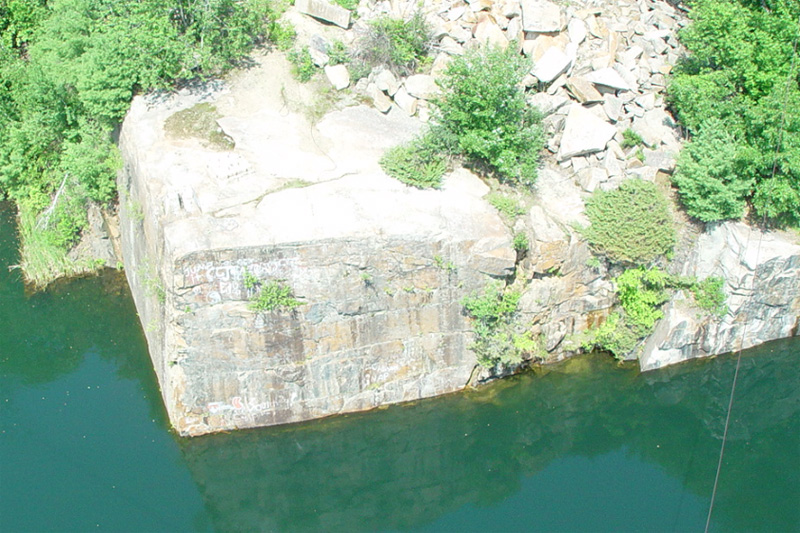
Inside Proctor Mountain in Danby, Vermont, which is south of Rutland, is the Vermont Danby Quarry, the world’s largest underground marble quarry, from where ten different types of marble are extracted.
This is what the Vermont Danby Quarry looks like:
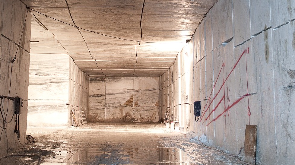
The stone in marble quarries like this one already has the appearance of being pre-existing huge stone rectangular blocks.
Are they actually quarrying pre-existing megalithic stone infrastructure?
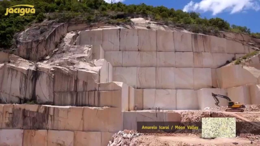
Other examples showing this are the marble quarries of Carrara in Italy…
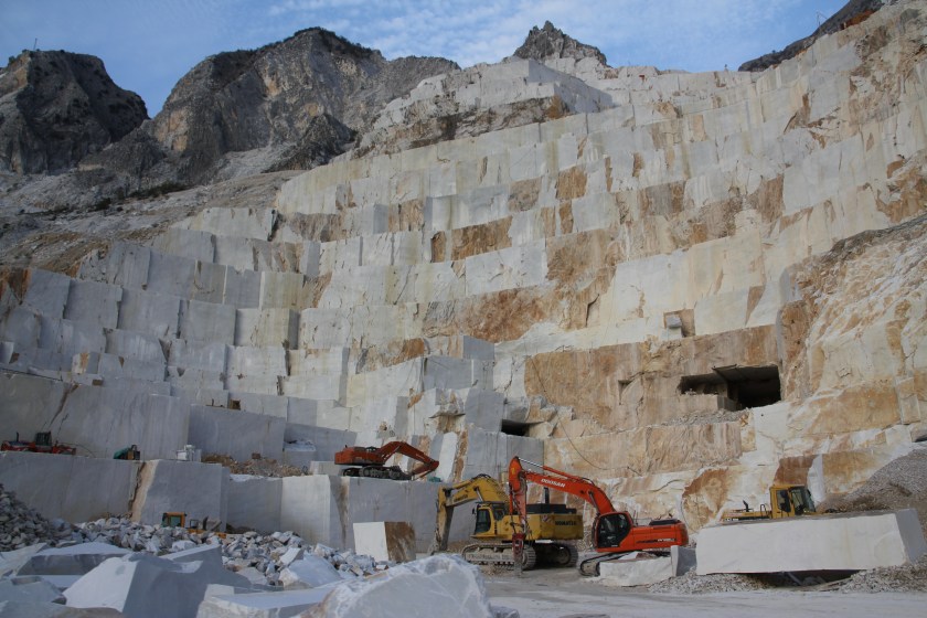
…at this marble quarry in Afyon, Turkey…
…and this one in Victoria Brazil.
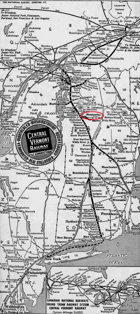
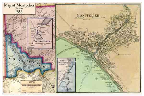
Next the alignment goes through Montpelier, Vermont, the least populous state capital in the United States.
The current Vermont State House building was said to have opened in 1859, which would have been two years before the beginning of the American Civil War in 1861.
It is described as a “gold-domed Greek Revival building…”
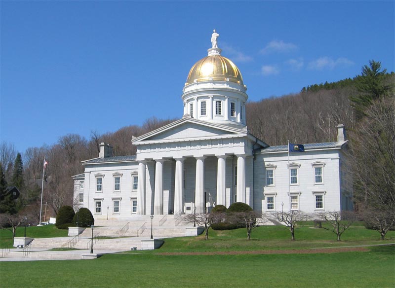
…with decorative and fine arts collections.
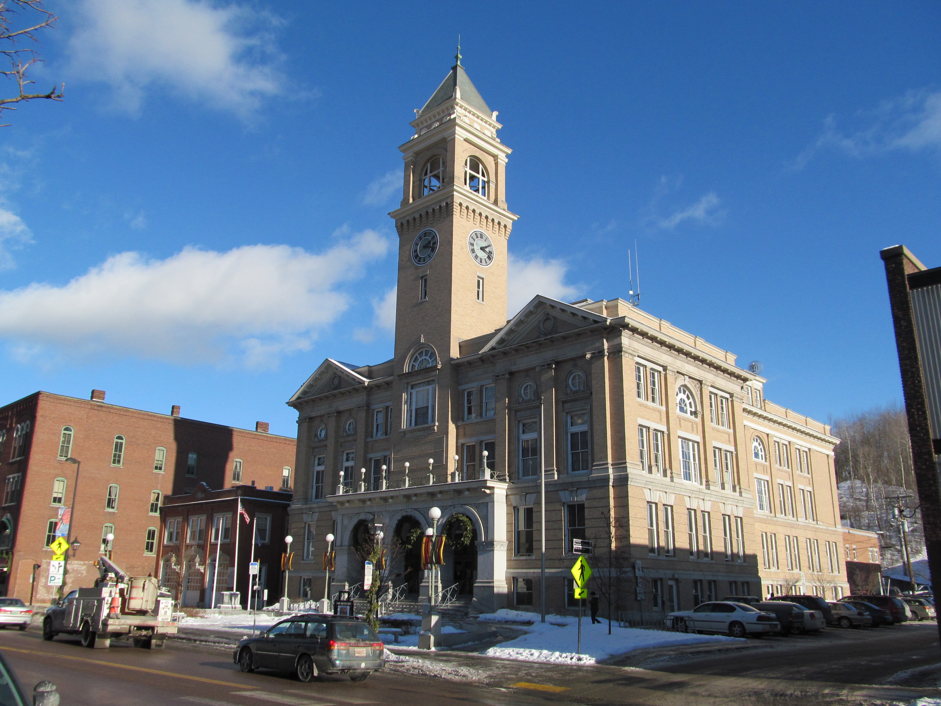
The Montpelier City Hall was said to have been constructed starting in 1908 and opened in 1909.
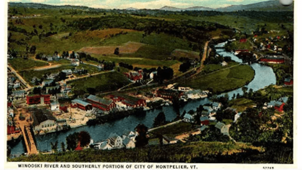
The city center of Montpelier is described as being in a flat clay zone, surrounded by hills and granite ledges, with the Winooski River flowing along the south edge of downtown Montpelier.
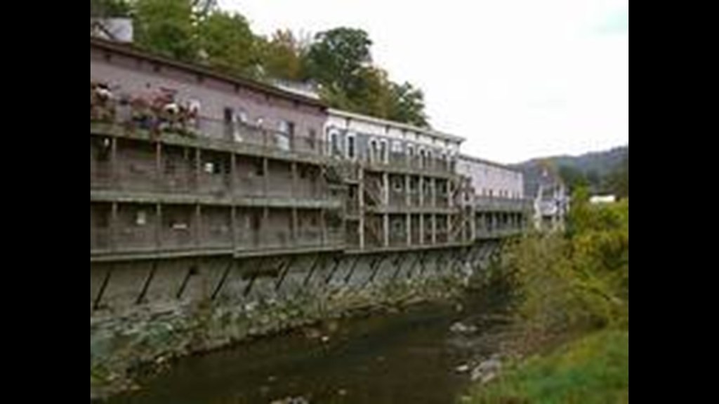
Here is a photo of the Winooski River Houses in Montpelier, situated right on top of old stonemasonry.
Montpelier was incorporated as a village in 1818, and the town developed into a center for manufacturing, especially after the Central Vermont Railway opened in Montpelier on June 20, 1849.
We are told the layout of the main streets paralleling the rivers was in place by 1858, and that the downtown street pattern has changed very little since that time.
In 1895, Montpelier was incorporated as a city.
Graniteville is located on the alignment south of Montpelier.
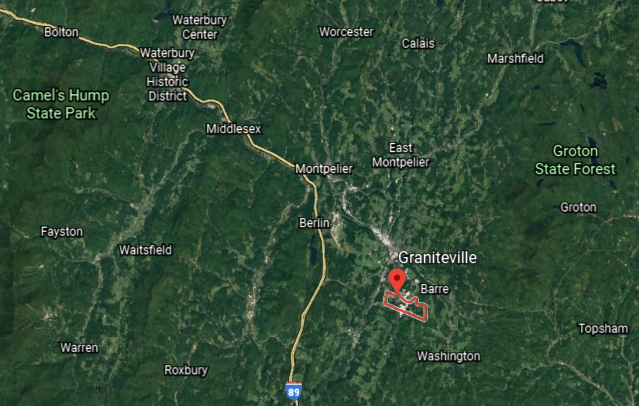
Here we find the Rock of Ages Quarry, with the same big blocks of stone going on.
It is the world’s largest, deep-hole dimension granite quarry, and provides memorials of all kinds, as well as granite for precision machine bases.

The next place we come to on the alignment is Haverhill in New Hampshire.
It includes the villages of Woodsville, Pike, and North Haverhill, Haverhill Corner, and the district of Mountain Lakes.
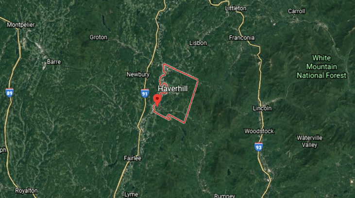
It was said to have been incorporated in 1763, and that by 1859, had 2,405 inhabitants…and three grist-mills; twelve saw-mills; a paper mill; a large tannery; a carriage manufacturer; an iron foundary; seven shoe factories; a printing office; and several mechanic shops.
Here is an historic depiction of Woodsville in Haverhill…
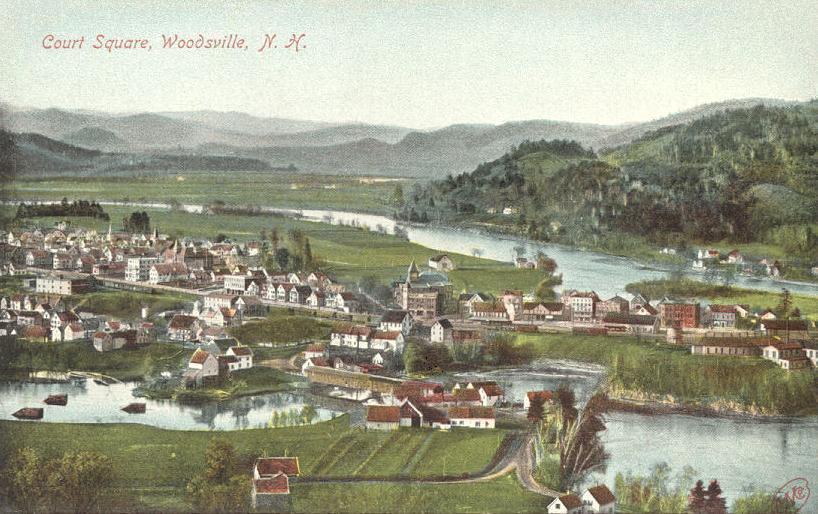
…and, as well, Woodsville was once an important railroad center.
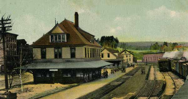
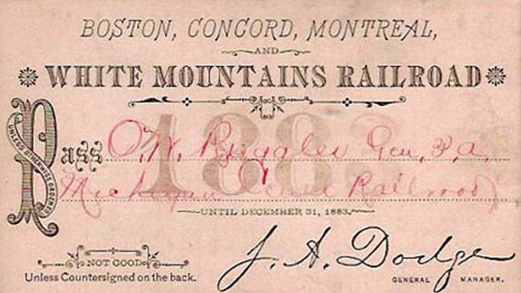
A railway supply enterprise was said to have been developed there by saw-mill operator John Woods, after the establishment of the Boston, Concord & Montreal Railroad, which was said to have opened in Woodsville in 1853, and was where the railroad established its division offices and a branch repair shop.
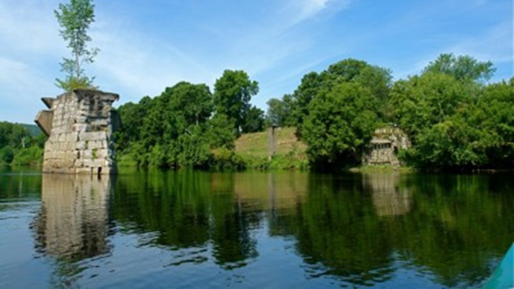
Haverhill is the location of the Bedell Bridge State Historic Site, which was the location of the second-longest covered bridge in the country, and which was unfortunately, we are told, destroyed by wind in 1979.
All that remains are the stone piers of the bridge in the Connecticut River.
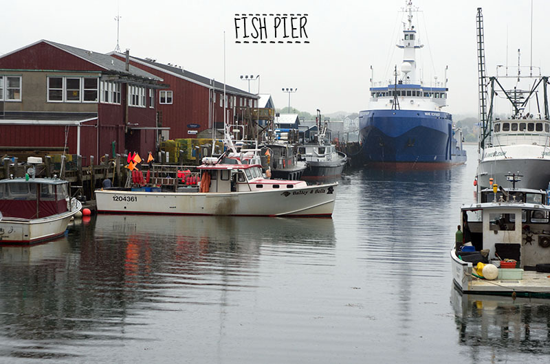
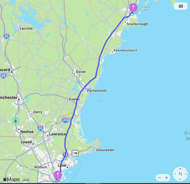
Next we come to Portland, the largest city in the state of Maine.
It is the largest metropolitan area in northern New England, with the Greater Portland metro area having over a 500,000 people, which is one-third of Maine’s total population.
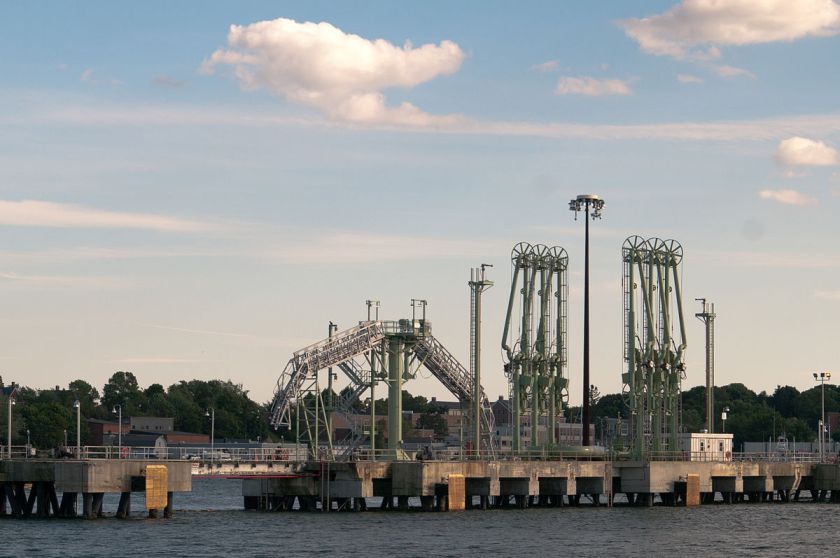
The Port of Portland is the largest tonnage seaport in New England.
The Old Port is a district of Portland, known for its cobblestone streets, 19th-century brick buildings…
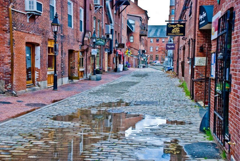
…and its fishing piers.
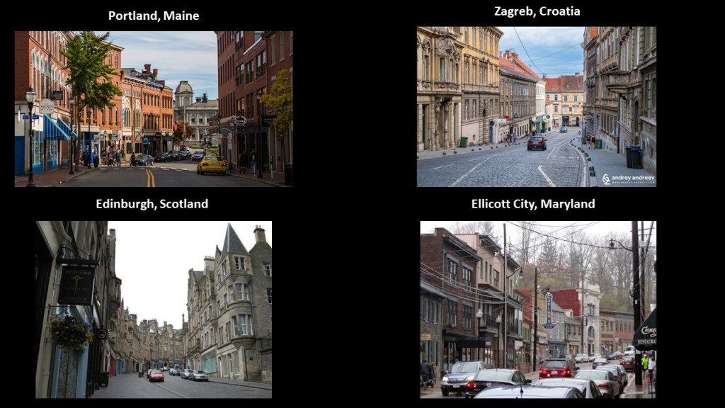
Here is a street view of Portland on top, compared with a very familiar look to me from other cities in very different places – bottom left is Edinburgh, Scotland; middle is from Zagreb, Croatia; and on the bottom right is Ellicott City, Maryland.
Portland has numerous lighthouses.
This is a comparision of the Portland Head Light on the left, and Peggy’s Cove in Nova Scotia on the right.
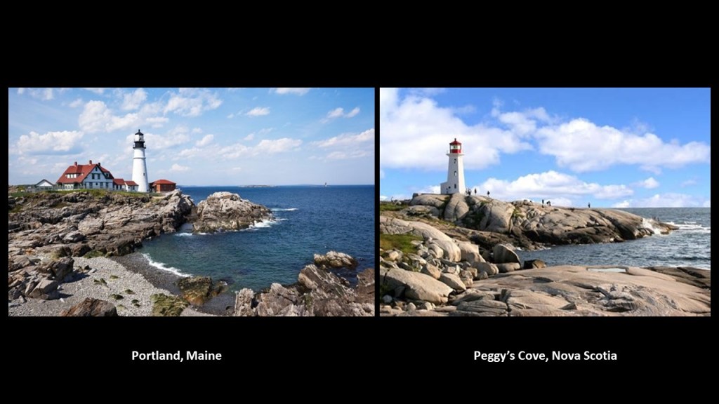
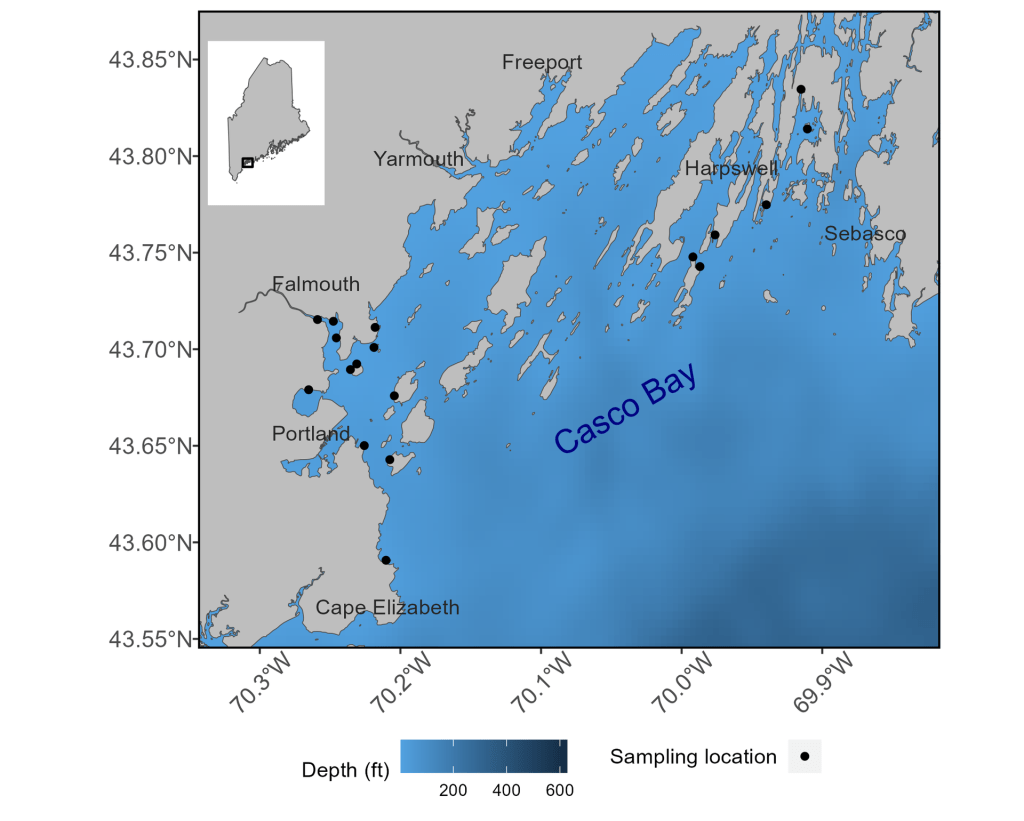
The Portland Head Light is at the entrance to the primary shipping channel into Portland Harbor in Casco Bay in the Gulf of Maine.
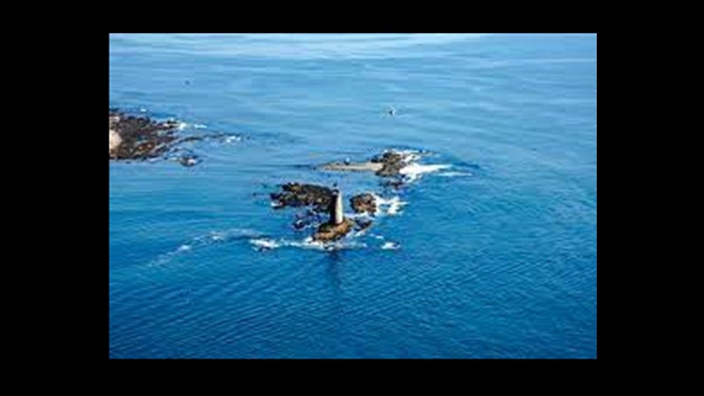
Casco Bay is filled with what are named the “Calendar Islands,” so-called because there is said to be an island for every day of the year.
It is also classified as an estuary, which is defined as a partially-enclosed body of brackish water with one or more rivers flowing into it, and a connection to the open sea.
More thoughts on this to come.
Other lighthouses of Portland include the following:
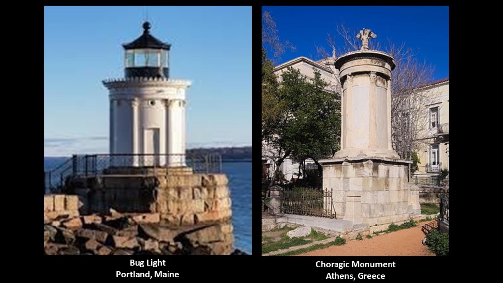
The present Portland Breakwater Light, also known as the Bug Light, was said to have been built in 1875 to resemble a 4th-century Greek monument called the Choragic Monument of Lysicrates in Athens.
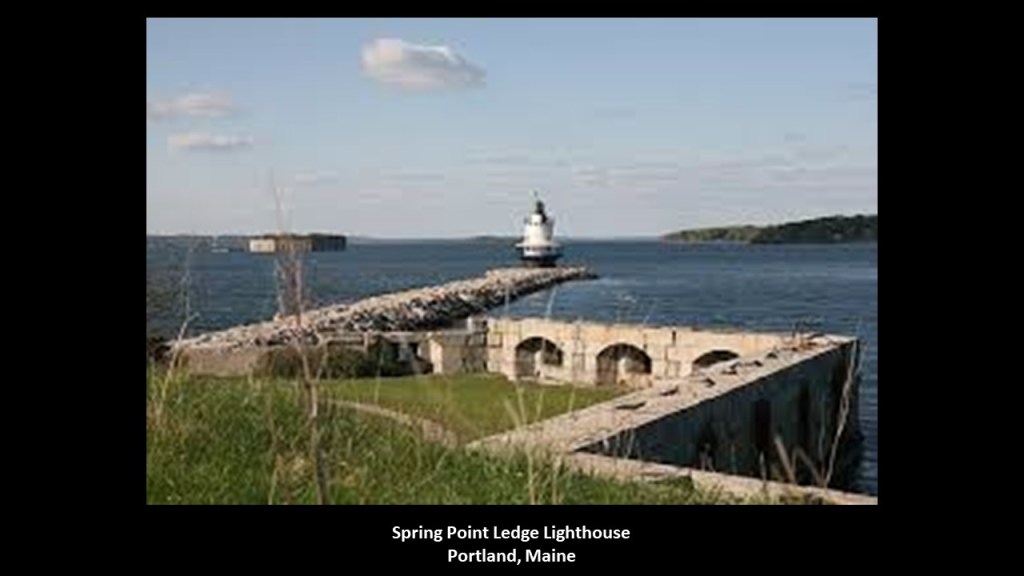
The Spring Point Ledge Lighthouse was said to have been constructed in 1897 on top of a “ledge” that was considered a dangerous obstruction on the west side of the main shipping channel in Portland.
The Ram Island Ledge Lighthouse is at the northern end of the main shipping channel into Portland.
It was said to have been built in 1883.
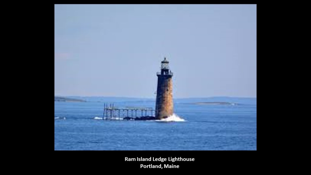
The Ram Island Ledges are a series of stone ledges, some of which break the waters at the southern end of Casco Bay, that also pose a hazard to shipping.
So…when did Portland first come into being?
I am going to start with some history about the English colonization of North America.
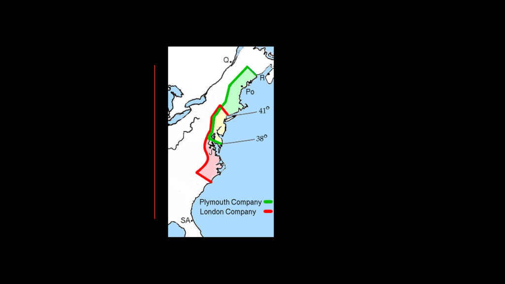
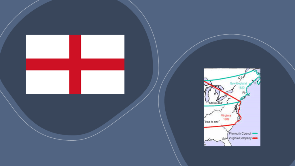
What we are told is that in 1606, King James I of England & VI of Scotland issued Royal Charters for what became known as the Virginia Company and the Virginia Company of Plymouth, with the objective of raising funds from investors in order to colonize the eastern coast of America.
The Virginia Company was responsible for colonizing the east coast between the latitudes of 34-degrees N and 41-degrees N, and the Plymouth Company between the latitudes of 38-degrees N and 45-degrees N.
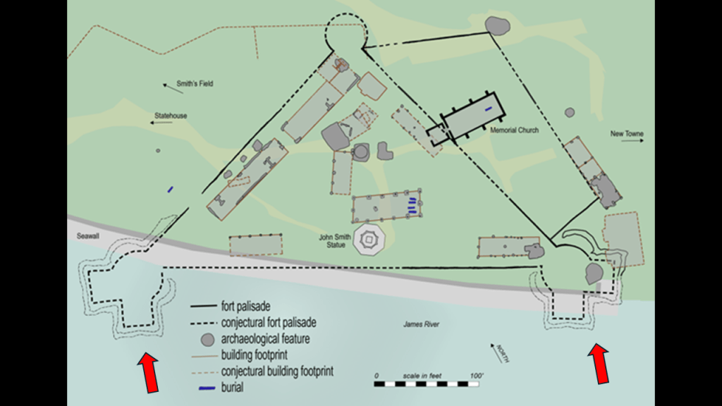
The Virginia Company established its first settlement of James Fort in Jamestown in May of 1607.
Jamestown was considered the first permanent English settlement in the Americas, and served as the capital of the Virginia Colony from 1616 until 1699, at which time it was abandoned when the capital was moved to nearby Williamsburg.
It’s interesting to note these two bastions of the historic fort at Jamestown off-shore in the water, like land subsidence occurred at this location.
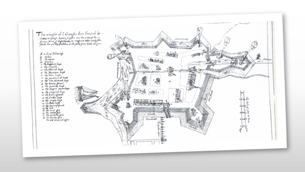
The Plymouth Company, officially known as the Virginia Company of Plymouth, established the Popham Colony near the mouth of the Kennebec River in present-day Phippsburg, Maine in 1607, a few months after the establishment of Jamestown.
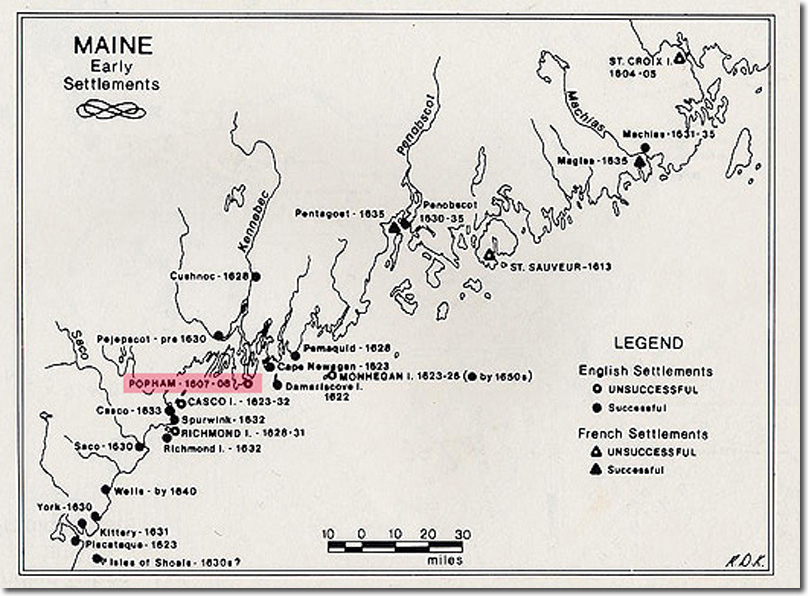
The Popham Colony, however, was short-lived, only lasting 14-months before being abandoned due to multiple problems, from lack of funding, to lack of surviving colonists.
Fort St. George was said to have been built there during that time.
Then, the Council for New England was established by a Royal Charter from King James I and VI as an English joint-stock company in order to found colonial settlements between 1620 and 1635.
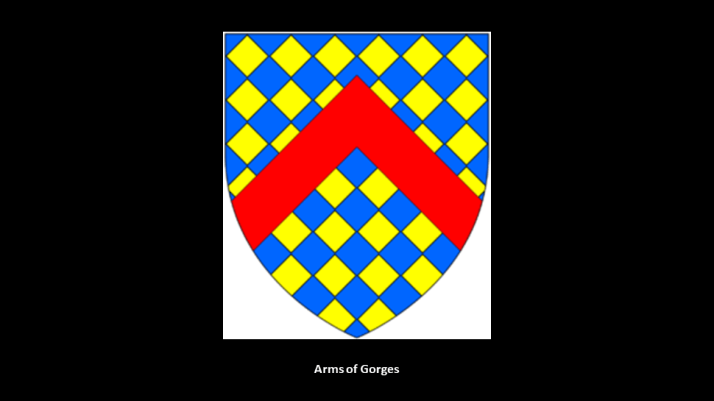
The Council for New England was largely the creation of Sir Ferdinando Gorges, a military commander and Governor of the Port of Plymouth in England who was called the “Father of English Colonization in North America,” and a member & beneficiary of the the Council.
Gorges first became involved in colonization efforts in 1607, when he became a shareholder in Plymouth Company, and helped to establish the short-lived Popham Colony.
He later received a land-patent in 1622 from the Council of New England for the Province of Maine, and was influential in the early settlement of Maine.

He was said to have built a stone house, left a company of ten men, and departed for England to write a book in order to bolster the settlement, but the settlement failed within a year, and the fate of the men unknown.

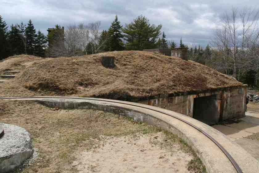
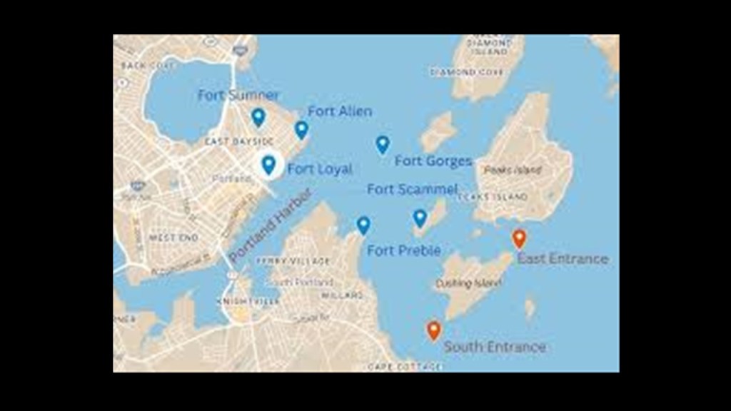
Fort Levett on Cushing Island in Casco Bay was named for him, a U. S. Army fort said to have been built beginning in 1898.
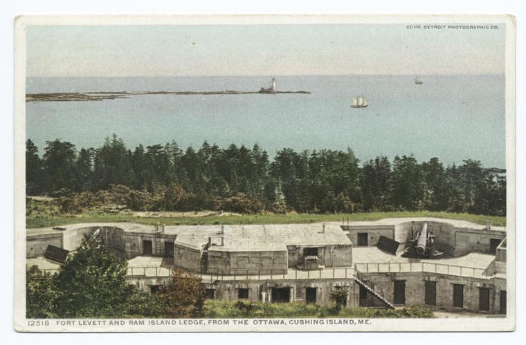
We are told that Fort Levett was part of the Harbor Defenses of Portland, a U. S. Army Coast Artillery Corps Harbor Defense Command that was active between 1895 and 1950, and which also included Fort Baldwin, said to have been constructed between 1905 and 1912…
…Fort Popham, said to have been commissioned in 1857, and built starting in 1861…
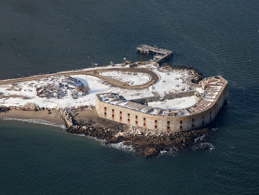
…Fort Scammel, which was said to have been built in 1808…
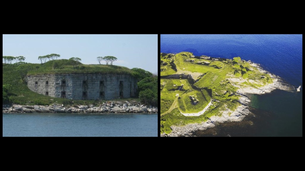
…and Fort Gorges was said to have been built between 1858 and 1864.
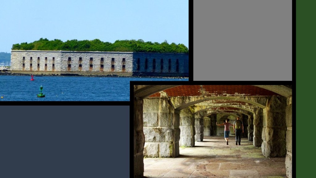
There were several other forts here as well.
It is important to note that this region of northeastern North America has been long-believed to be the legendary Norumbega, and includes today’s New England states like Maine, New Hampshire, Vermont, and Massachusetts.
Any information on Norumbega is very sparse, so I am going to share with you what is available to find.
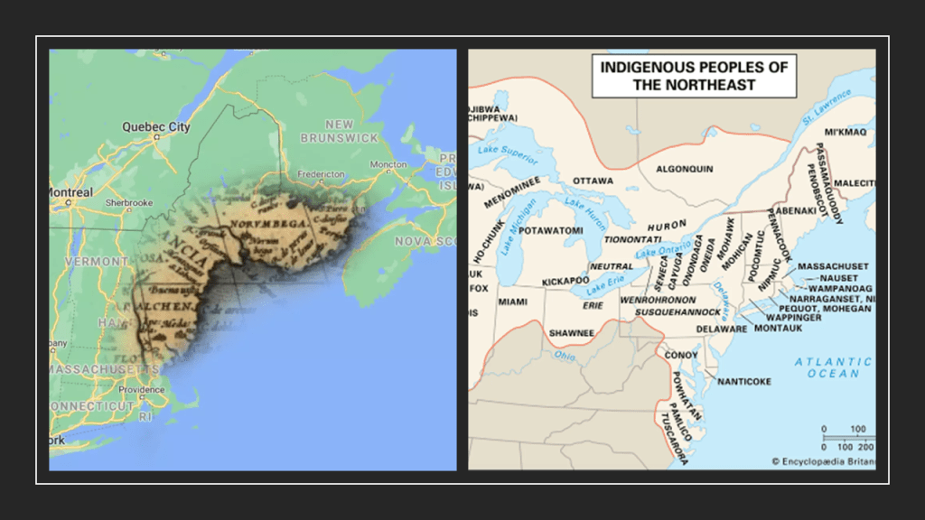
The following references to Norumbega pertain to events and places in the state that became known as the Commonwealth of Massachusetts.
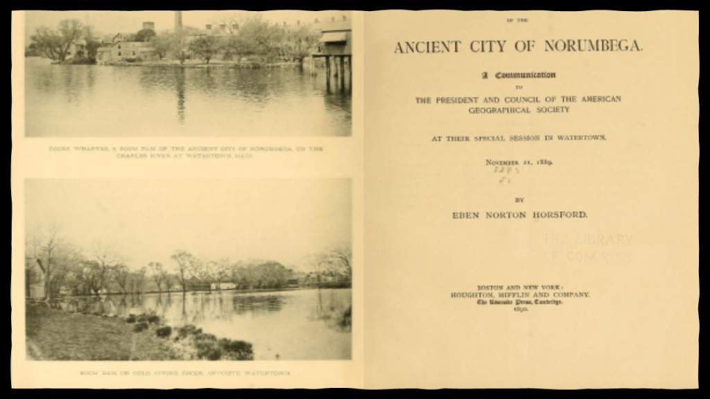
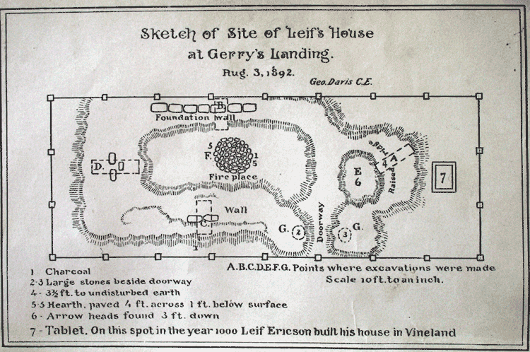
This is information from an 1889 communication by Eben Horsford to the American Geographic Society in Watertown, Massachusetts, on the “Ancient City of Norumbega.”
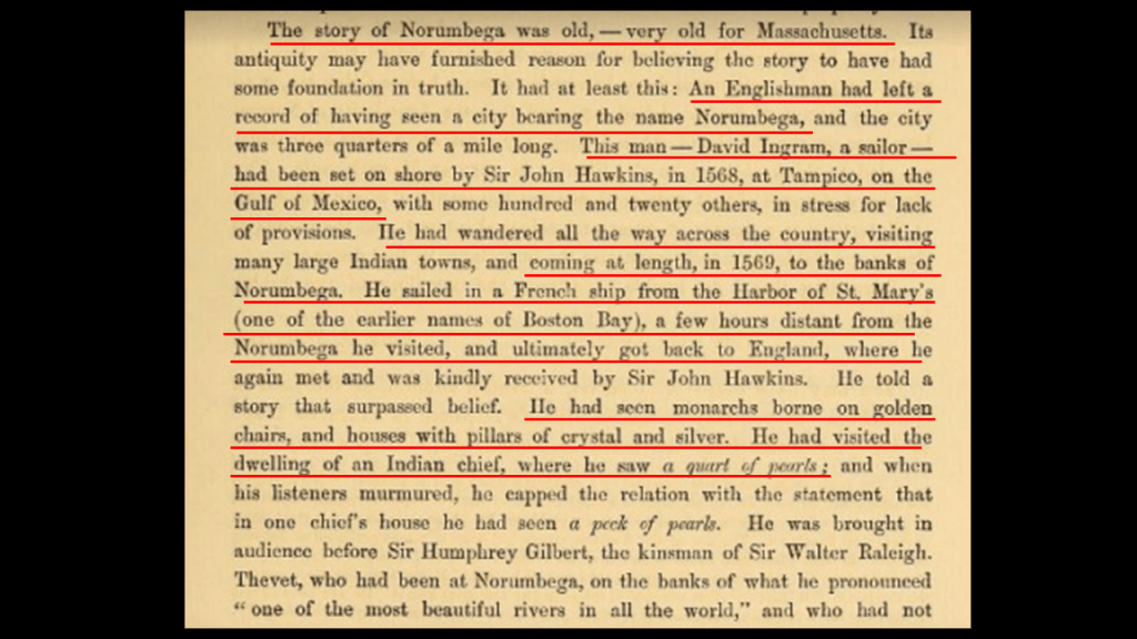
First, that the story of Norumbega was very old for Massachusetts.
It gets a little strange with the recounting of the story of the English sailor, David Ingram, who was apparently left on-shore by Sir John Hawkins in 1568, due to lack of provisions, along with 120 others, on the Gulf of Mexico at Tampico, which is in today’s Mexico.
So this David Ingram wandered all the way across the country from Mexico to the “banks of Norumbega.”
He returned home to England by way of a French ships from St. Mary’s Harbor, an earlier name for Boston Bay, a few hours from Norumbega. When he got back to England, he met again the guy who had abandoned him on a foreign shore far from home, Sir John Hawkins.
Ingram told Hawkins that when he was in Norumbega, he had seen monarchs borne on golden chairs, and houses with pillars of crystal and silver.
So here Norumbega in North America was described as a opulent place of wealth and abundance, even mentioning visiting the home of an “indian” chief, he saw a quart of pearls.
So while the context of the story sounds strange…
…that description of Norumbega does not jive at all with the hunter-gatherer narrative we’re taught in the official narrative about all Native Americans, including those from New England, from cradle-to-grave.

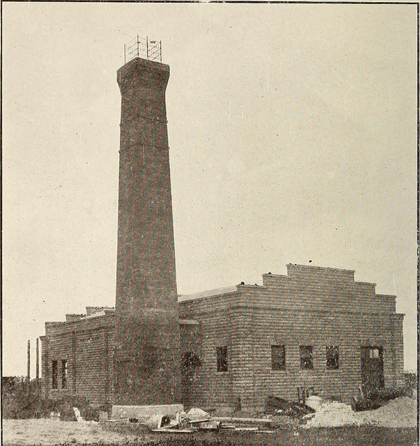
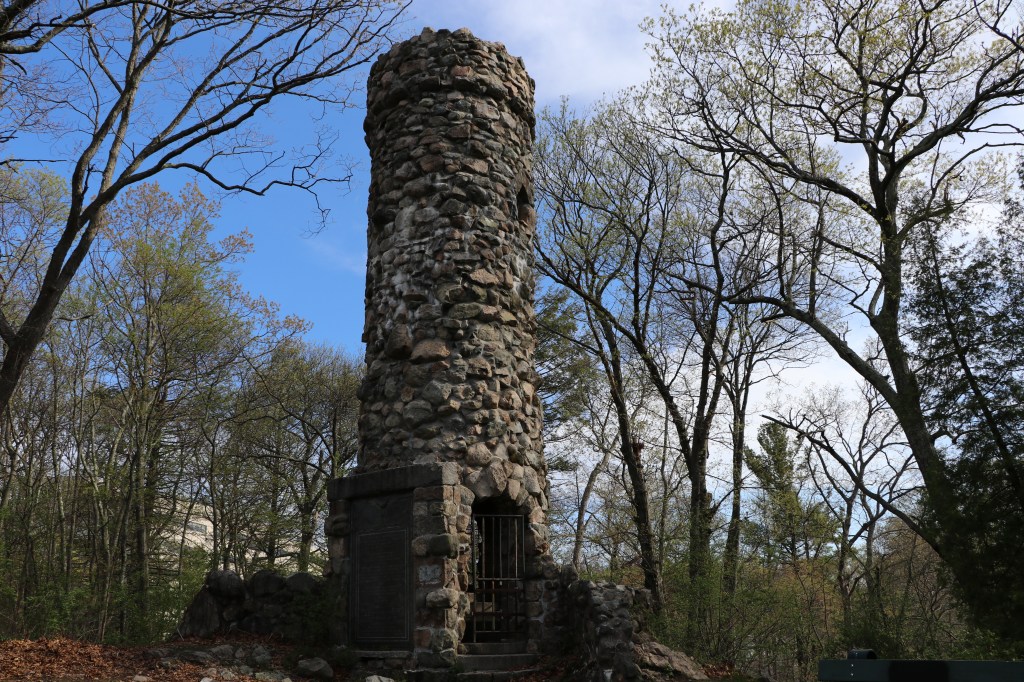
The viking story came to us through Eben Horsford, who was said have built the Norumbega Towerin 1889 in Weston, Massachusetts, to mark the location of “Fort Norumbega,” which he was said to believe was a legendary Norse fort and city.
As a matter of fact, it sounds like Eben Horsford was the chief promoter of the idea that the general region called the eastern Algonquin word “Norumbega,” that is now coastal New England, was derived from “Norvega,” meaning Norway, from exploration and settlement by Norse Explorers from the Icelandic sagas, like Leif Erikson.
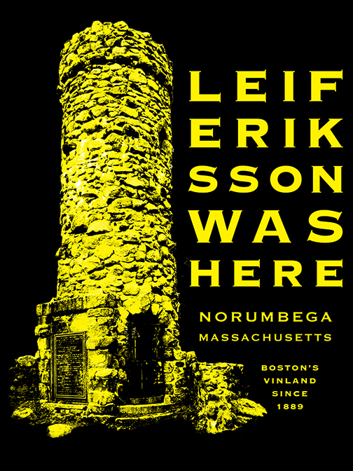
So instead of the original people getting credit for building everything here, like we see in this example, the explanation we are given is that “Viking explorers must have done it!”
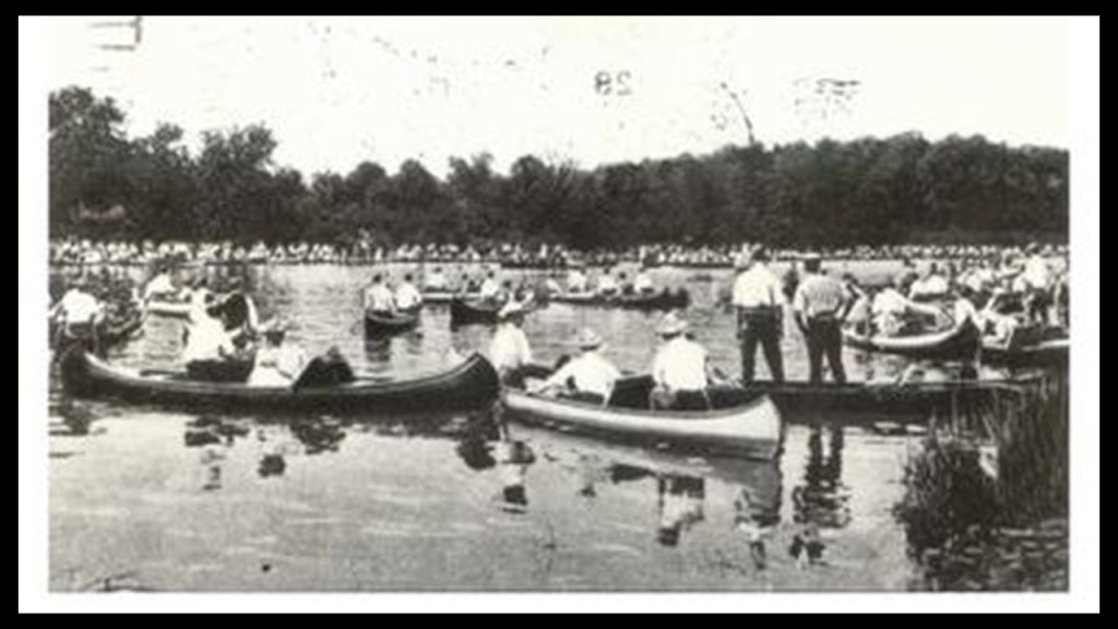
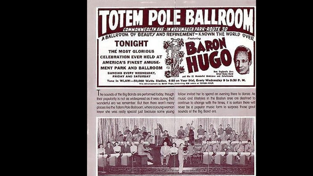
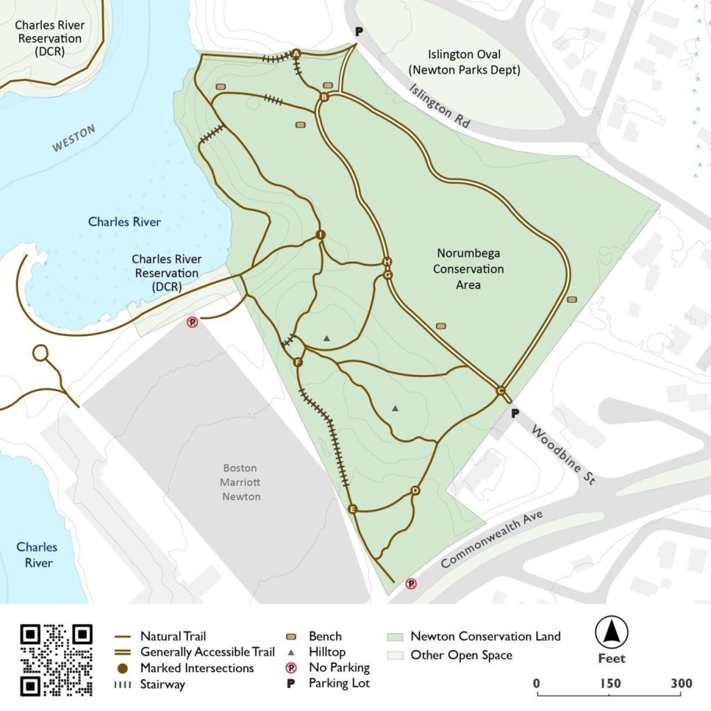
The Norumbega Tower was located in Massachusetts near Norumbega Park, an historic trolley amusement park that we are told was built by the Commonwealth Avenue Street Railway and first opened in June of 1897, for the given reason of increasing patronage and profits on the trolley line that ran between Boston and Auburndale.
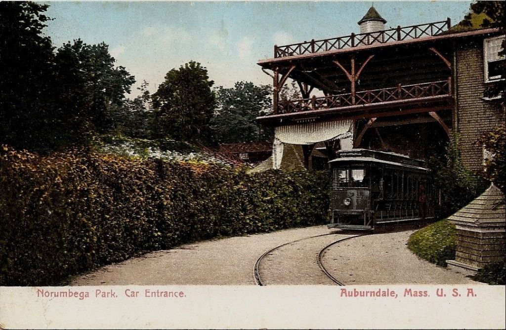
From the time Norumbega Park first opened, we are told it was very popular, attracting hundreds of thousands of visitors each season for people who sought affordable recreation outside of the city environment.
The “Great Steel Theater” there was the largest in New England.
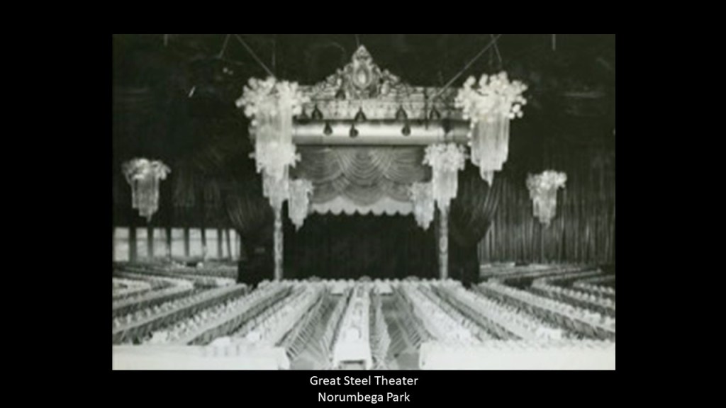
The “Great Steel Theater” became the “Totem Pole Ballroom” during the 1930s, and over the course of the thirty-years, became a premier location to see the most celebrated entertainers in the United States, and music from the Ballroom came to be broadcast nationally over CBS, ABC, and NBC.
We are told that the popularity of Norumbega Park declined after World War II, and by 1964, the famous amusement park and entertainment venue was all gone.
This story was pretty typical for these popular trolley amusement parks back in their hey-day, which was pretty much between during that same time period that Norumbega Park was in operation.
Today, the former location of the park is occupied by the Newton Marriott Hotel and the Norumbega Park Conservation Area with walking trails and river access.
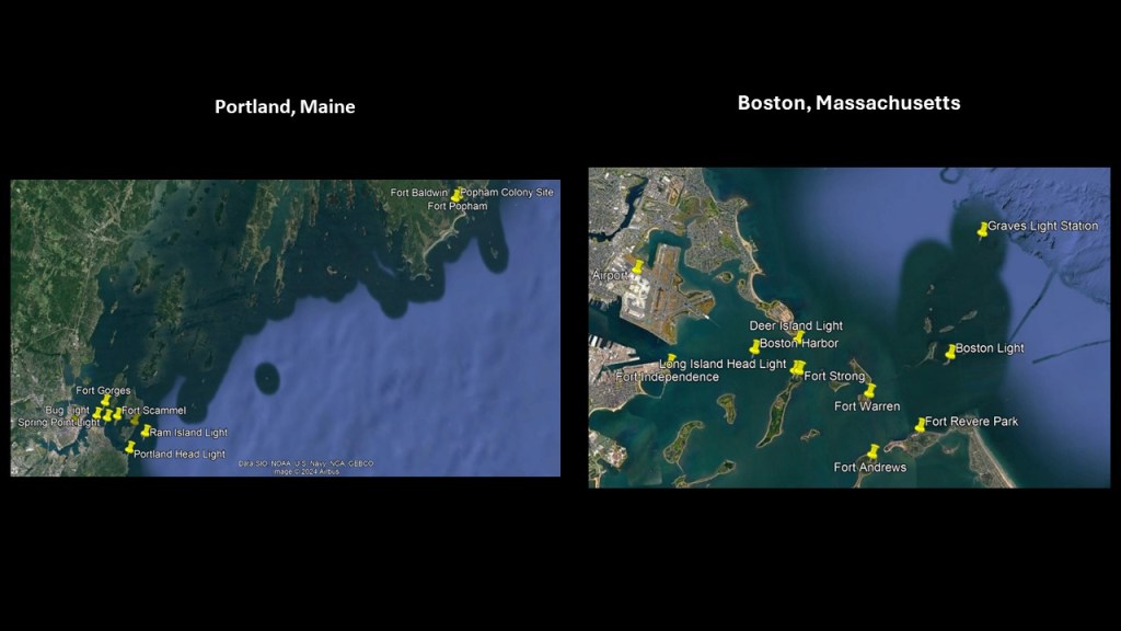
I want to return to the subject of Portland’s Casco Bay Estuary, and the lighthouses and star forts and “Calendar Islands” and “ledges” found here, and then compare it with the lighthouses, star forts and islands in Boston Harbor,
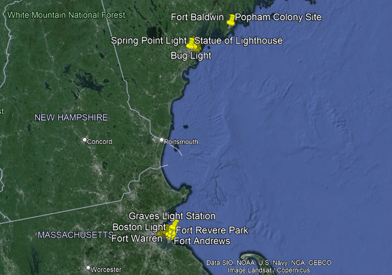
Portland is only 107-miles, or 172-kilometers, northeast of Boston, Massachusetts, on the Atlantic coast.
I recently studied Boston Harbor in-depth in “On the Trail of Giants in Appalachia and Beyond – Theme 4 The Cataclysm” as well as other places around the world with similar characteristics of what appears to be sunken and destroyed land, in particular along continental coastlines.
Like Casco Bay in Maine, Boston Harbor is described as an estuary, and has a considerable number of islands, thirty-four of which have been part of the Boston Harbor Islands National Recreational Area since 1996.
Found within the Boston Harbor Islands, there are five star forts – Fort Independence, Fort Warren, Fort Andrews, Fort Revere, and Fort Strong – and four light houses – the Long Island Head Light, the Deer Island Light; the Boston Light; and the Graves Light.
These locations are just two of countless examples found around the world of what I believe actually reflects the deliberately caused destruction of the Earth’s grid system by one of more forms directed energy that caused it to go haywire, and the surrounding land either turned into estuaries, swamps, bogs, barrens, or deserts and dunes, or sank completely.
So countless star forts and lighthouses all over the Earth ended up looking like they were built on tiny islands instead of solid land for a completely different energy function on the Earth’s grid system than what we are taught they were built for.
“Continental Shelves” are found all over the Earth’s surface, and defined as a portion of a continent that is submerged under an area of relatively shallow water.
I have come to believe that these “Continental Shelves” and the marshy estuaries that are found all along these coastlines, are actually submerged landmasses and ruined land.
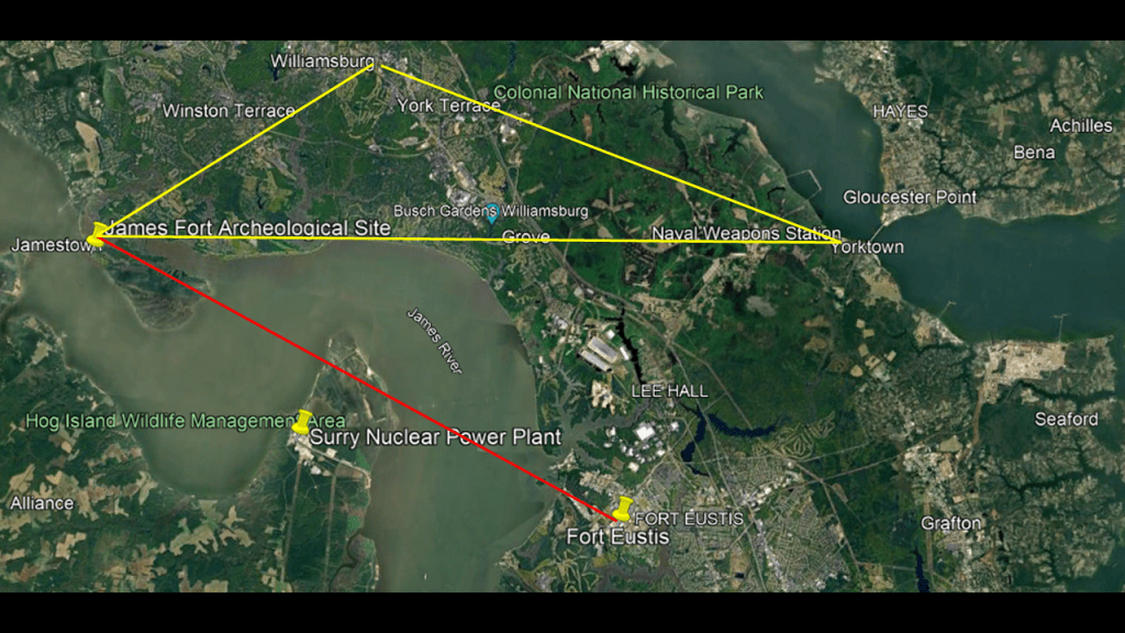
I gave the example earlier of the diagram of the fort at Jamestown have two bastions off-shore int he waters, so I am going to head on down the Atlantic coast to take a look at the location of Jamestown in Virginia.
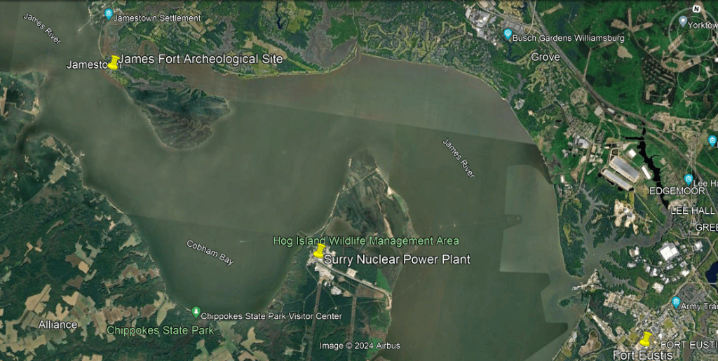
I will point out a couple of places in close vicinity to the James Fort archeological site that are noteworthy.
The Surry Nuclear Power Plant on the Hog Island Wildlife Management Area, and Fort Eustis, the headquarters of the U. S. Army’s Training and Doctrine Command which overseas training of forces and the development of operational doctrine, are to the southeast of the James Fort Archeological Site.
The Busch Gardens Williamsburg amusement theme park; the Naval Weapons Station Yorktown, which provides weapons and ammunition storage and loading facilities for ships of the U. S. Atlantic Fleet; and the city of Yorktown, where the British General Charles Cornwallis surrendered to General George Washington during the American Revolutionary War, are directly to the east of it.
Williamsburg, where which Colonial Williamsburg is a living history museum and was the center of British authority in Virgina in the 18th-century, is to the northeast of James Fort.
Together, Jamestown, Yorktown, and Williamsburg form what is called the “Historic Triangle.”
And there’s tidal marshland adjacent to James Fort and on Hog Island.
I already know I could spend days or weeks looking around here since there is so much to find, but this gives you the idea that this was a significant location.
There is one last thing back in Maine that I would like to mention.
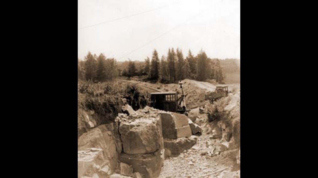
There is a great deal of rock-quarrying there, like what we saw in Vermont.
We are told that the granite which was used to build Fort Popham, for example, came from quarries on the nearby Fox Islands in Casco Bay.
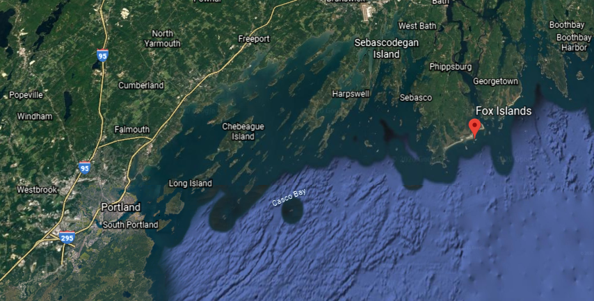
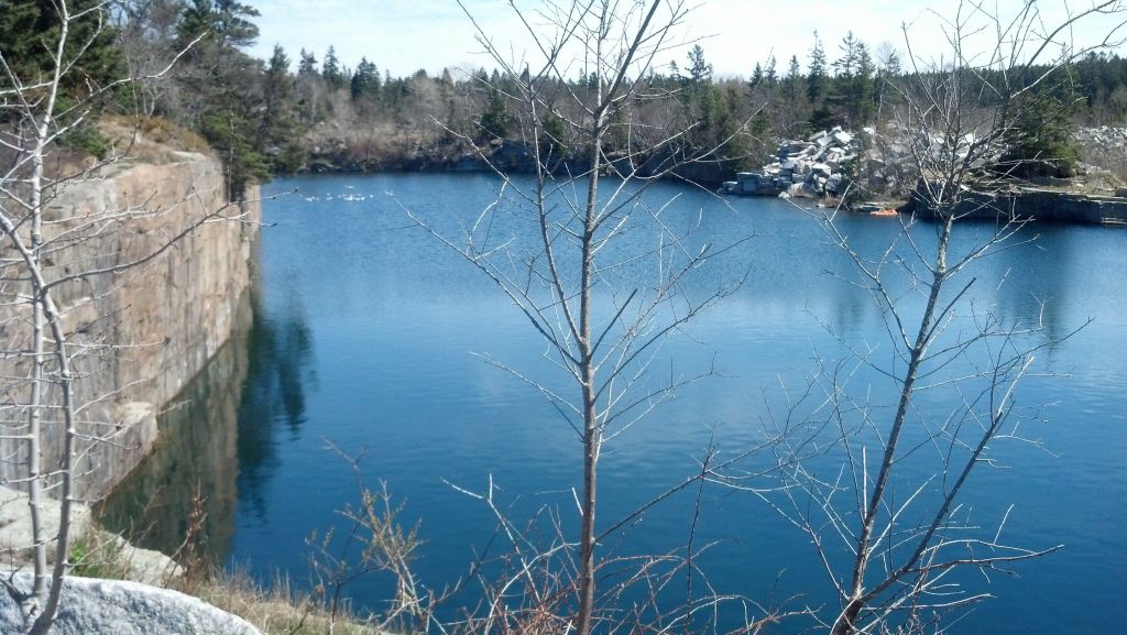
This is the old granite quarry at Vinalhaven, a small town on the larger of the two Fox Islands.
The Millennium Granite Quarry and Stoneworks is just south of Portland, in Wells, Maine.
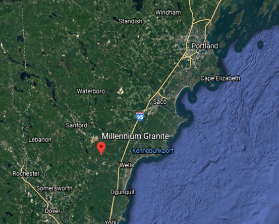
It has been quarried for centuries…
…and provides a superior-quality, soft-pink granite.
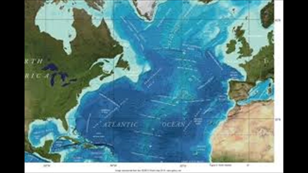
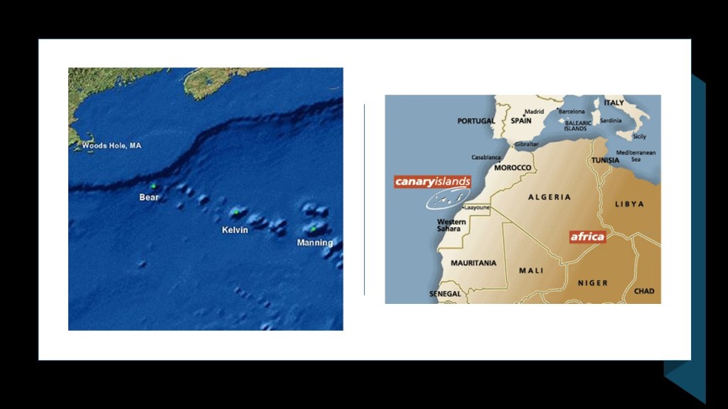
I am going to end the first part of this series here, and in the second part, track the alignment across over the North Atlantic Ocean and the New England Seamounts, to Tenerife in the Canary Islands off the northwest coast of Africa.

Thank you. Those granite quarries raise some suspicions for sure and the continental shelf theory is most interesting. Now you are heading into Africa where I’ve recently been looking into the mid Atlantic ridge which I find most interesting.
Sent from my iPhone
LikeLike
Michelle,
I am very impressed with your research, this opens up a whole new rabbit hole that I enjoy going down. I hope you are doing well my friend, it has been about 10 years and someone has been very busy 🙂 Thank you for all your hard work on bringing this to the collective!
Your friend,
Dana May
LikeLike
I recently drove through Indiana and came through the fairly rundown town of Lebanon. All of a sudden we passed a huge building so startlingly out of place. I immediately thought of you and wondered if you have done any research on this town or if it has come through the lay lines you research. The building is the Boone County Courthouse in Lebanon, Indiana.
LikeLike
Not Lebanon in Indiana specifically, though I have researched places in Indiana in the past and it is quite the place!
LikeLike