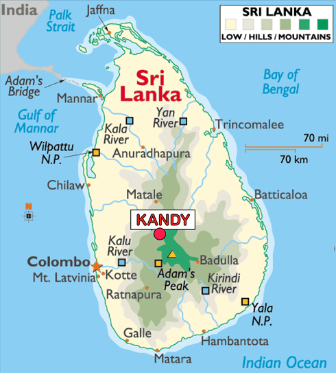
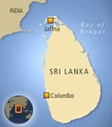
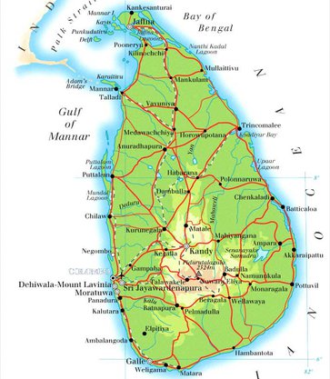
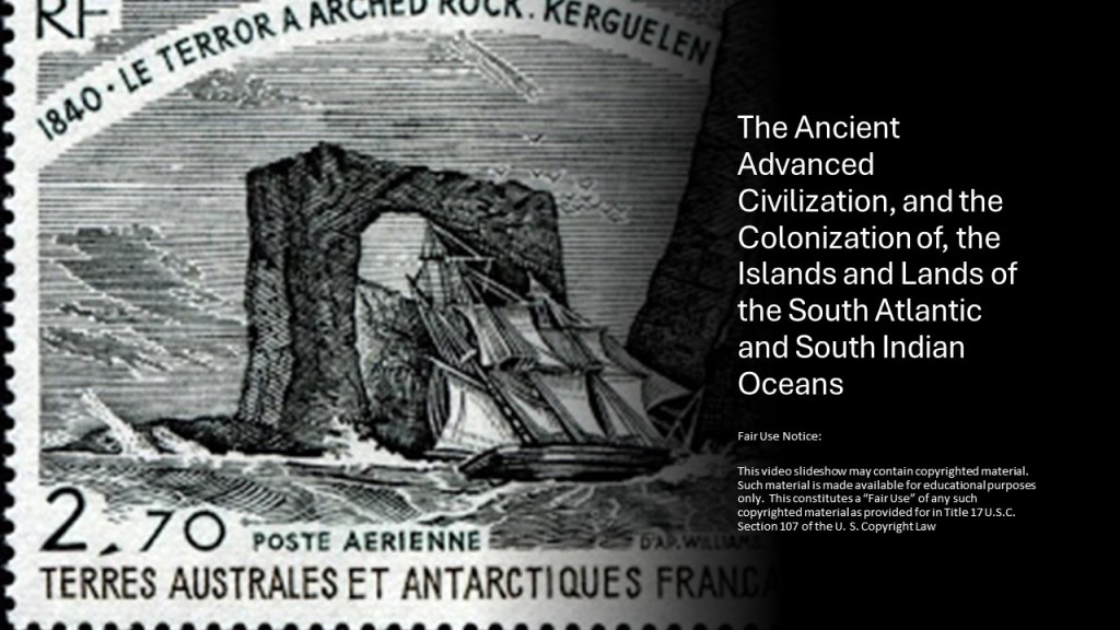
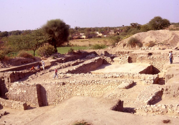
In this post, after leaving the islands and lands of the South Atlantic and South Indian Oceans that I looked at in the previous video, I am going to be picking up the alignment in Matara, at the southern end of Sri Lanka, and following the alignment where it crosses through the center of the island country of Sri Lanka, and on over the Palk Strait into India, where I track the alignment all the way through to Pakistan, and share what I found along the way, both in terms of physical infrastructure, and what our official narrative has to say about it.
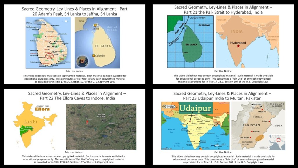
I did a a 23-part series in 2020 called “Sacred Geometry, Ley Lines & Places in Alignment” in which I tracked a long-distance alignment of cities and places that started in San Francisco from which most of the research in this post came, and this post is based on the last parts of the original series.
So far in 2024, these recent posts I have published are based on the original 2020 series.
I have put together many different pieces of the puzzle I have collected over the years for your consideration from the process of tracking cities and places in several different alignments over the years.
I have found this type of geographically-focused research yields a considerable amount of information that is not immediately apparent when looking at places in isolation from each other.
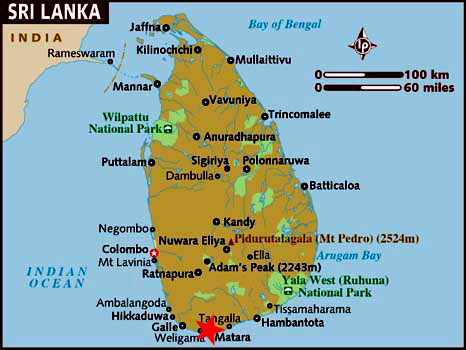
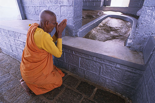
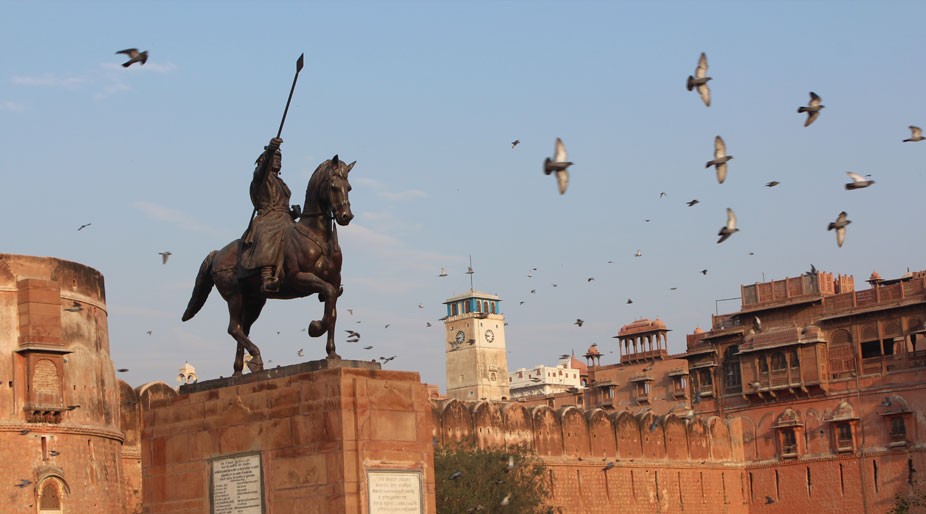
The next stop on the alignment I have been tracking in this series is Matara, a major commercial hub and city in Sri Lanka’s Southern Province.
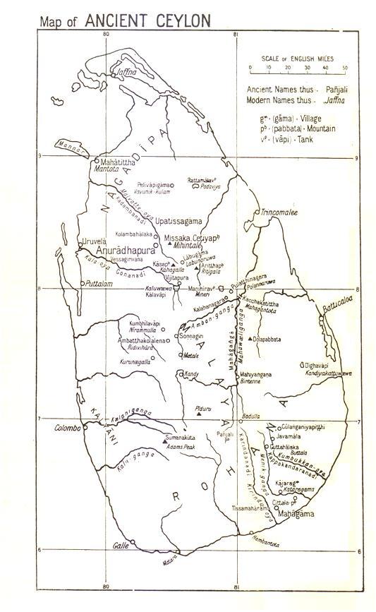
Matara historically is part of an area that was known as the Kingdom, or Principality, of Rohana, or Ruhunu, one of the three kingdoms of what is known in the present-day as Sri Lanka, and known in the past as Ceylon.
The Buddhist temple in the middle of town was built by the ancient kings, and is on the site of a fig tree sacred to, and protected by, the Buddhists who live here.
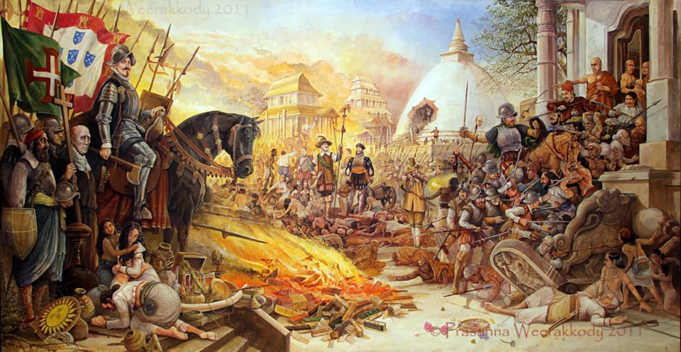
In the 16th- through 18th-centuries, we are told Matara was ruled by the Portuguese, and Dutch, respectively.
The Portuguese rule of Matara was said to have been ruthless, during which time they were said to have plundered and ransacked buildings, store-houses and shrines.
The Dutch were said to have captured Matara from the Portuguese in 1640.
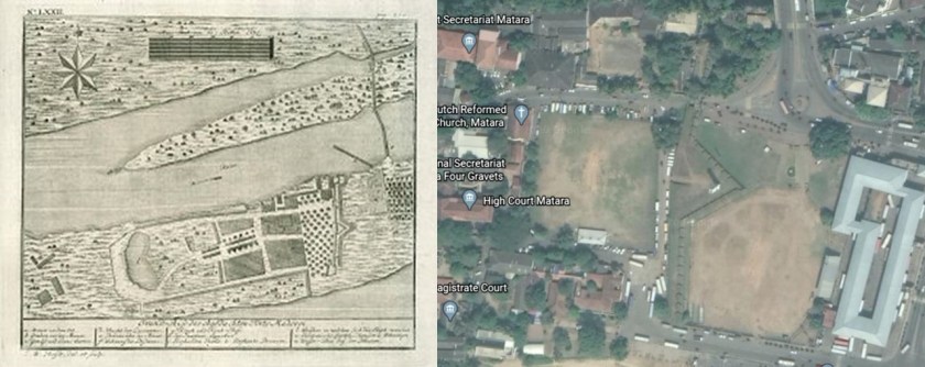
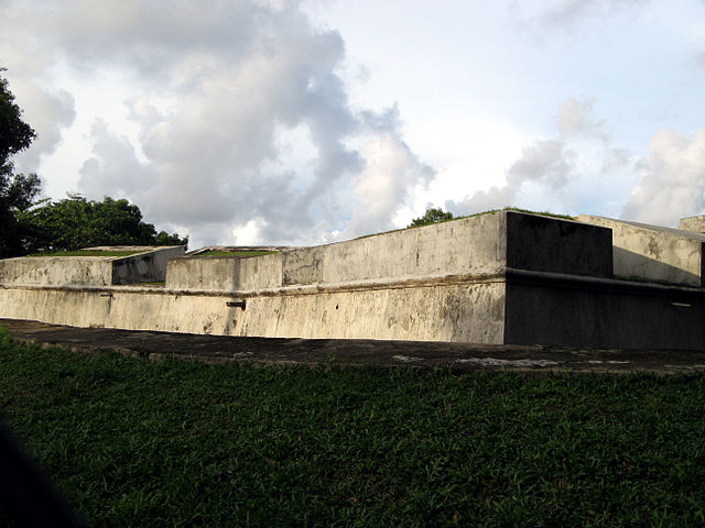
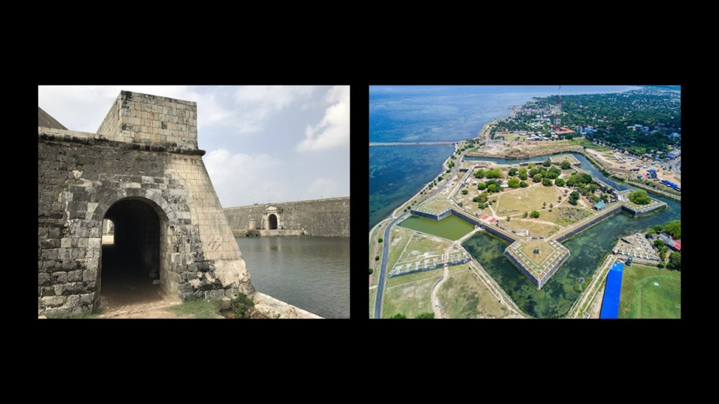
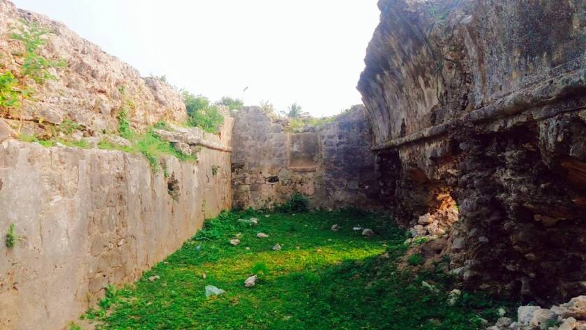
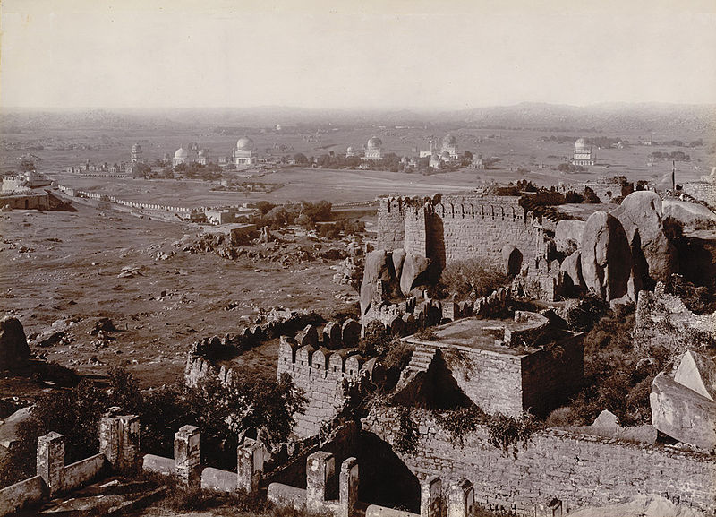
There is a section of Matara called “Fort,” between the ocean and the Nilwala River.
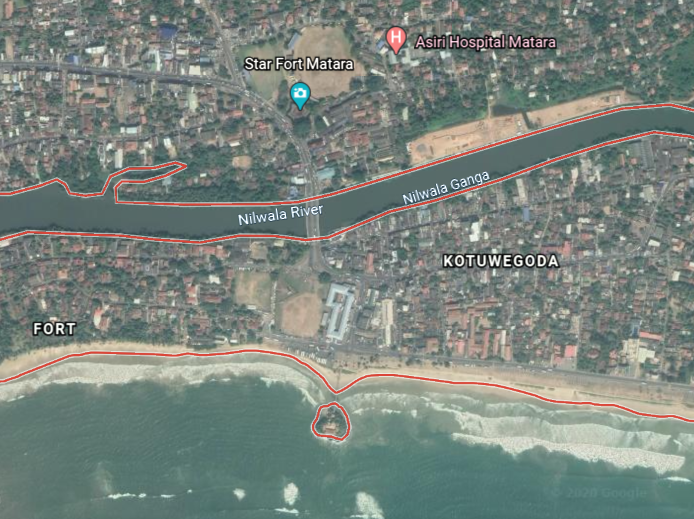
The Matara fort was said to have been built by the Portuguese in 1560, and largely rebuilt by the Dutch in 1640, an illustration of which is pictured on the left, and on the right, is all that remains of the Matara fort today, though it is the location of the administrative center of the entire Matara District.
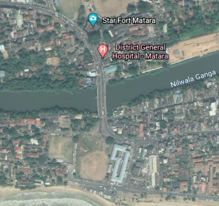
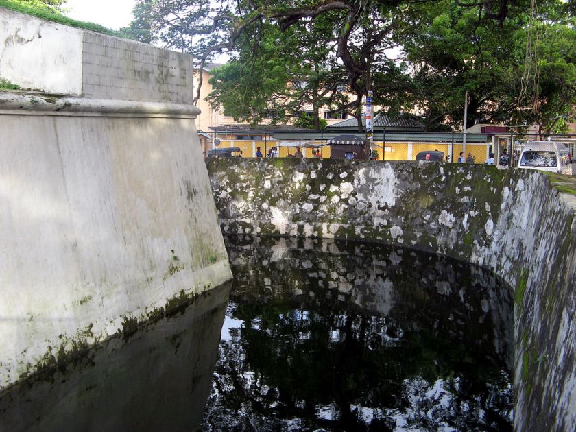
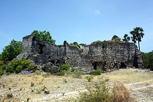
Directly across the Nilwala River from the remains of the Matara Fort is what is actually called “Star Fort Matara” on Google Earth.
The Dutch were said to have built the Star Fort Matara between 1761 and 1765 to protect the main fort from attacks originating from the river.
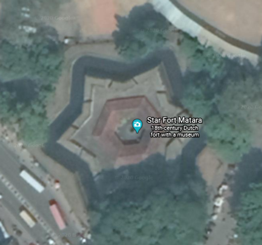
At the top of the entrance to the star fort, the “VOC” symbol of the Dutch East India Company is prominently and permanently engraved.

It is far easier to add engravings than build a structure of this nature and size.
I typically find star forts in pairs and clusters on alignments all over the Earth, and believe they were not military in nature as we have been taught.
I think they functioned as part of the electrical circuitry of the earth’s worldwide grid system.
One of the definitions of the word battery is “a device that produces electricity that may have several primary or secondary cells arranged in parallel or series, as well as a battery source of energy which provides a push, or a voltage, of energy to get the current flowing in a circuit.”

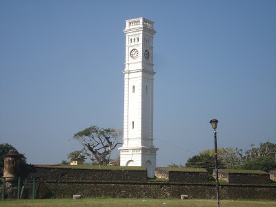
The Matara Clock Tower is situated on the rampart of the Matara Fort in the Fort section of Matara…
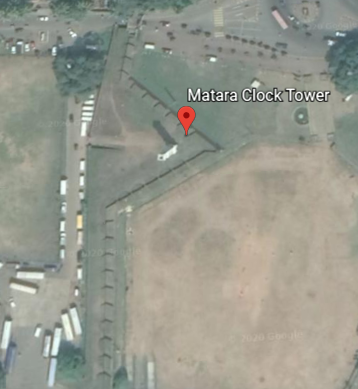
…and was said to have been built by the Dutch in 1765.
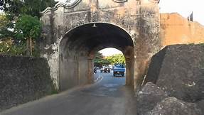
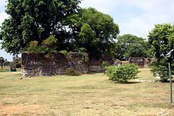
This is one of the massive gates of the Matara Fort.
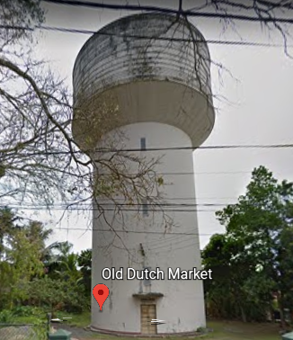
What is called the “Old Nupe Market” or “Old Dutch Market” in Matara was said to have been built by the Dutch in 1784.
Today it is part of the Ruhunu Cultural Center.
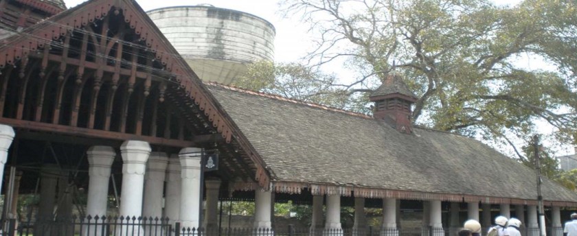
I am interested in what looks like a water tower made of stone pictured behind the front of the market. I am having a hard time finding information about it.
I will just leave this picture here of it from the Google Earth street-view.
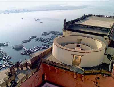
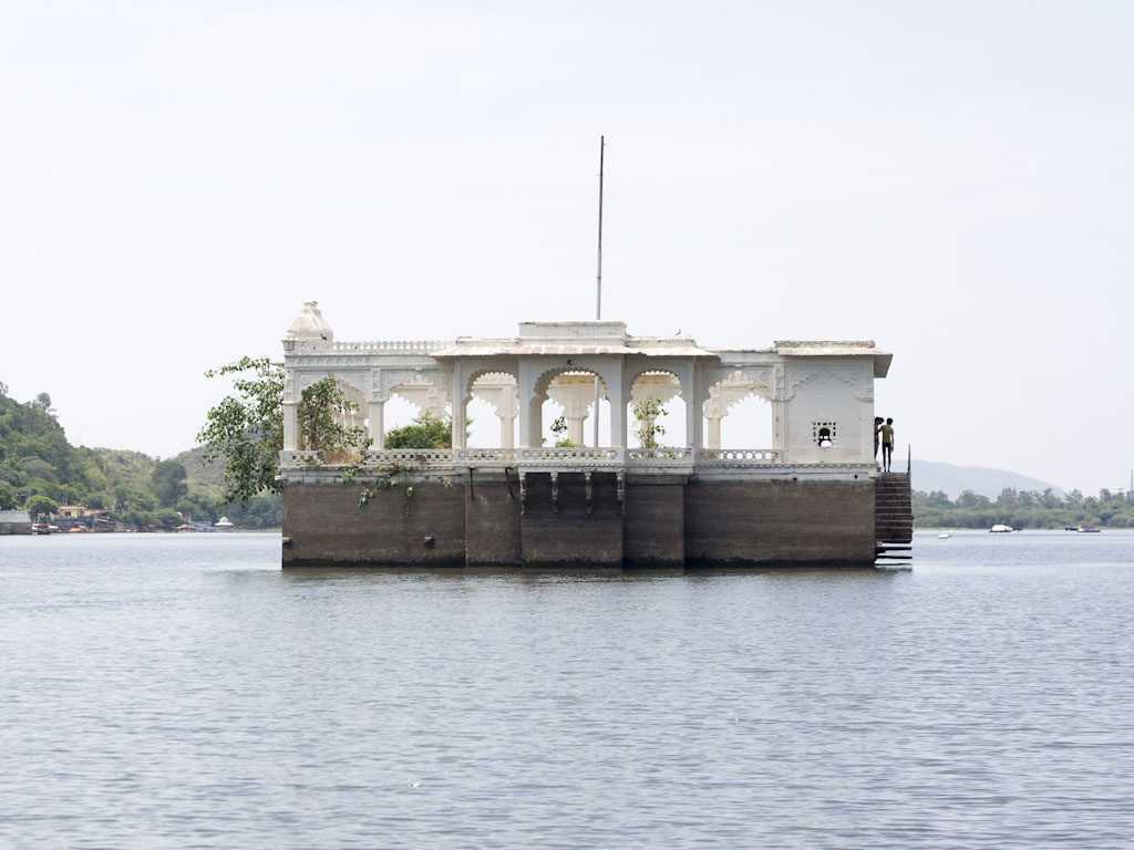
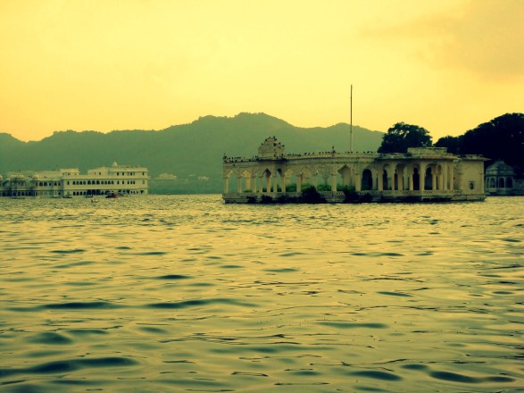
I am drawn to look into in an area right next to Matara, now called Dondra, but was historically called Devinuwara or Dewundara, an historic temple-port town. It is said to mean “Gods City” or “Gods port” in the Sinhalese language
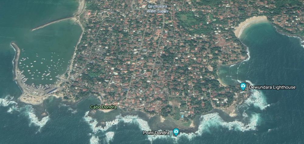
And indeed, one of the most celebrated religious sites of the island, with a thousand Hindu and Buddhist statues at one time, and the ruins of Hindu shrines and a Buddhist temple.
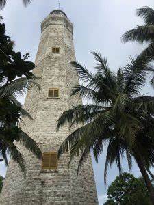
Sri Lanka’s tallest lighthouse is located here.
It is 161-feet, or 49-meters, tall, and said to have been designed and built by two English engineers starting in 1887; first lit in 1889; and opened in 1890.
This picture was said to have been taken circa 1890.
Now, let’s just take a picture of ourselves beside the lighthouse, and no one will know the difference!
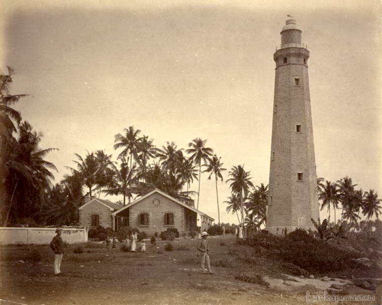
Not only that, we are told the granite used in its construction was said to have come from Scotland and Cornwall in England; and the bricks and steel from England.
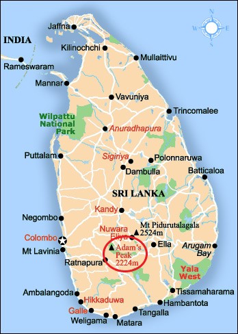
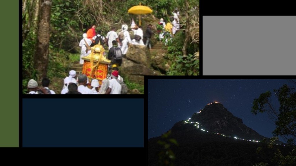
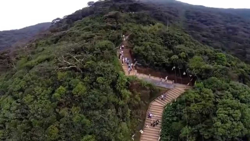
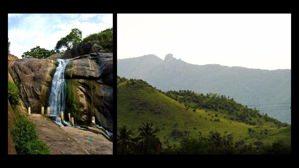
Next, I am picking up the alignment at Adam’s Peak, located in the southern reaches of Sri Lanka’s Central Highlands.
It is described as a tall conical mountain…
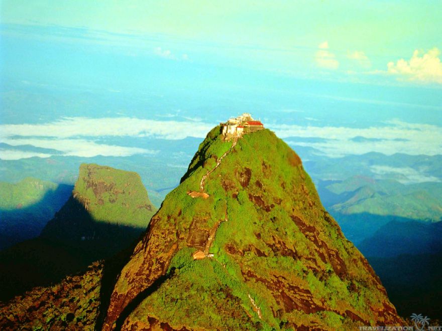
…well known for the Sri Pada, or “Sacred Footprint,” near the summit, revered as a holy site in Buddhist tradition to be the footprint of the Buddha, in Hindu tradition the footprint of Shiva or Hanuman, and in some Christian and Islamic traditions, that of Adam…or St. Thomas.
It is an important pilgrimage site.
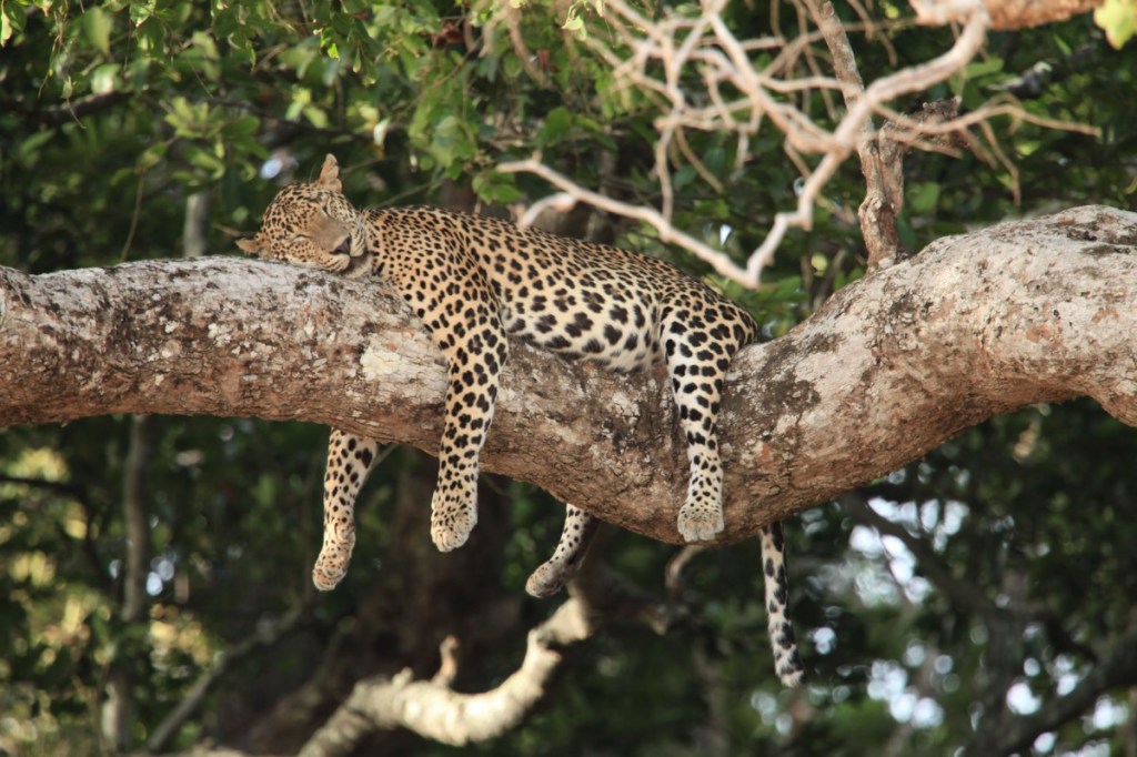
The region along the mountain is a wildlife reserve, home for species like elephants and leopards.
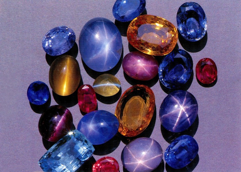
The districts to the south and east of Adam’s Peak yield gemstones, for which the island of Sri Lanka is famous.
The greater part of the track leading from the base to the summit consists of thousands of steps.
The next place I am going to take a look at on this alignment is Kandy, a major city in Sri Lanka, and the last capital of the ancient Kings’ era of Sri Lanka.
The Kingdom of Kandy was said to have been founded in 1469.
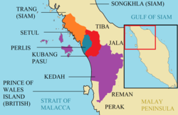
This map is described to be that Sri Lanka in the 1520s, known previously as Ceylon.
In 1592, Kandy became the capital city of the last remaining independent kingdom in Ceylon after the coast regions had been conquered by the Portuguese.
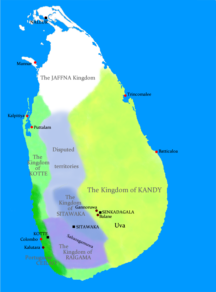
From that time, the Kingdom of Kandy kept the Portuguese and Dutch East India Company at bay, but succumbed finally to British colonial rule when the kingdom was absorbed into the British Empire as a protectorate via the Kandyan Convention of 1815, an agreement signed between the British and members of the King’s court which ceded the kingdom’s territory to British rule, and the last king was imprisoned.
Ceylon was a British Protectorate until its independence in 1948, and the name of the country was changed to Sri Lanka when it became a republic in 1972.
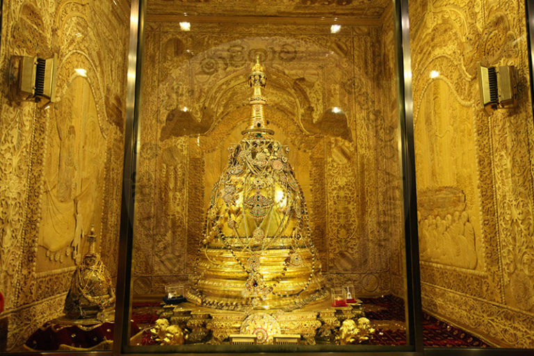
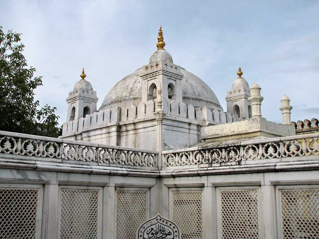
The Kandyan Convention was signed in the Temple of the Sacred Tooth Relic.
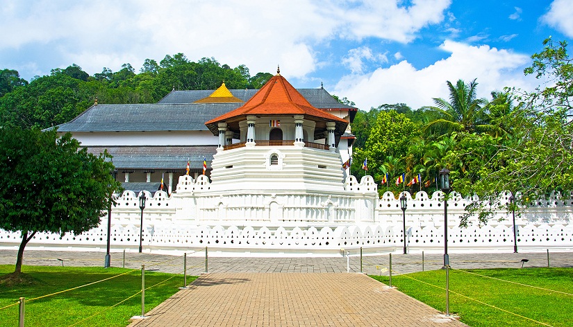
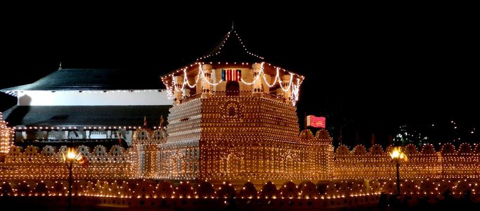
Also known simply as the Temple of the Tooth…
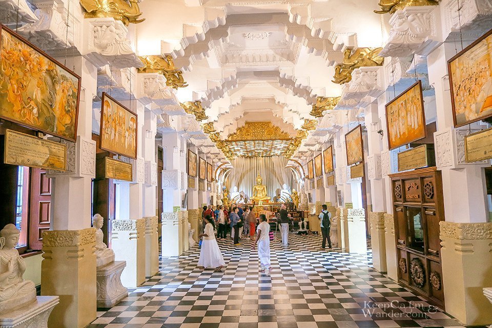
…it houses the tooth of the Buddha, venerated as the Buddha’s only surviving relic.
It is believed that whoever holds the relic, holds the governance of the country.
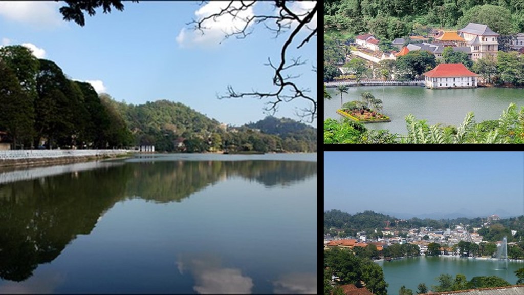
The Temple of the Tooth, or Sri Dalada Maligawa, is part of the Royal Palace Complex of the former Kingdom of Kandy, located on a canal…
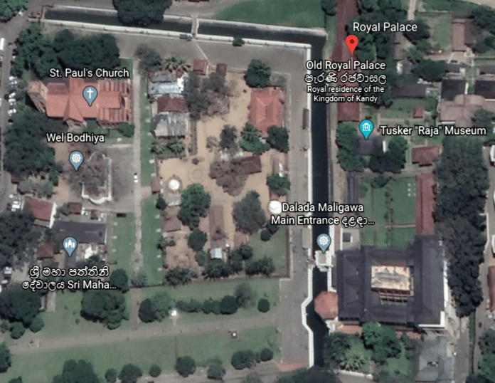
…extending from Kandy Lake, also known as the Kiri Muhuda, or Sea of Milk…
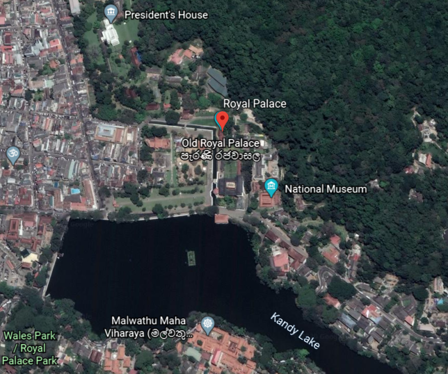
…an artificial lake, and said to have been built next to the Temple of the Tooth by the last King of Kandy in 1807.
After the kingdom’s downfall, the Royal Palace of Kandy became the residence for the primary British agent, and nowadays is a museum of archeology.
The Royal Audience Hall, or Magul Maduwa, was where the king met his ministers and carried out his daily administrative tasks, as well as being a center of religious and national festivities connected with the Kandyan Court.
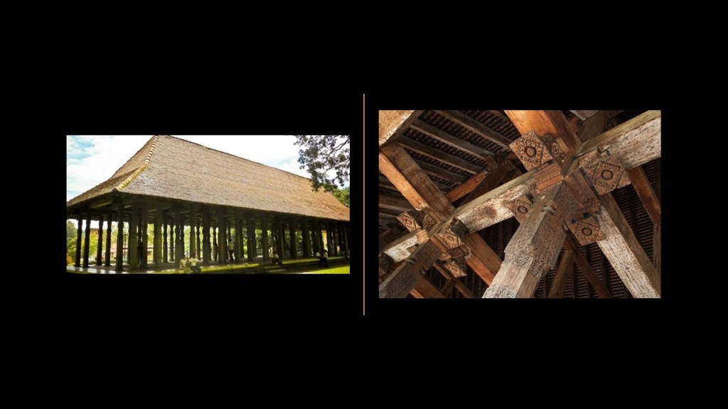
There were at least three star forts in Sri Lanka’s interior region between Kandy and the coast.
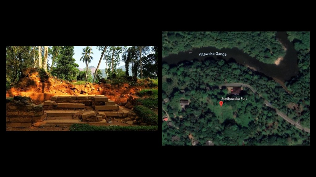
One was called the Sinhalese Sitawaka fort, which was adjoined with the palace of the king of Sitawaka.
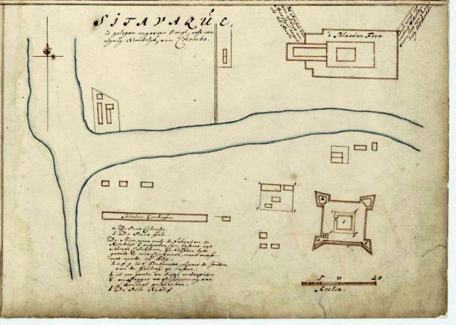
Both the palace and the fort were destroyed by the Portuguese.
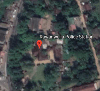
The Ruwanwella fort was said to have been constructed first as a wooden structure by the Dutch around 1665…
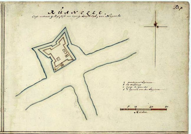
Today it is being used as a police station.
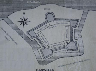
Then there was the Hanwella fort, located at the site of an ancient ferry crossing on the Kelani River.
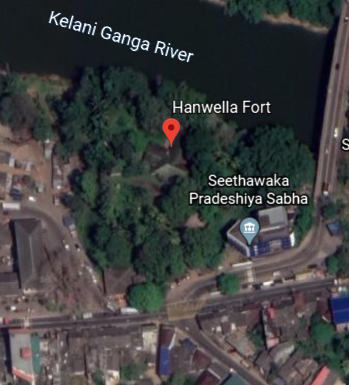
We are told that the fort was thought to have been originally constructed by King Mayadunne of Sitawaka, who ruled between 1521 and 1581.
Then, we are told, Portuguese occupied the fort in 1597 and re-built it.
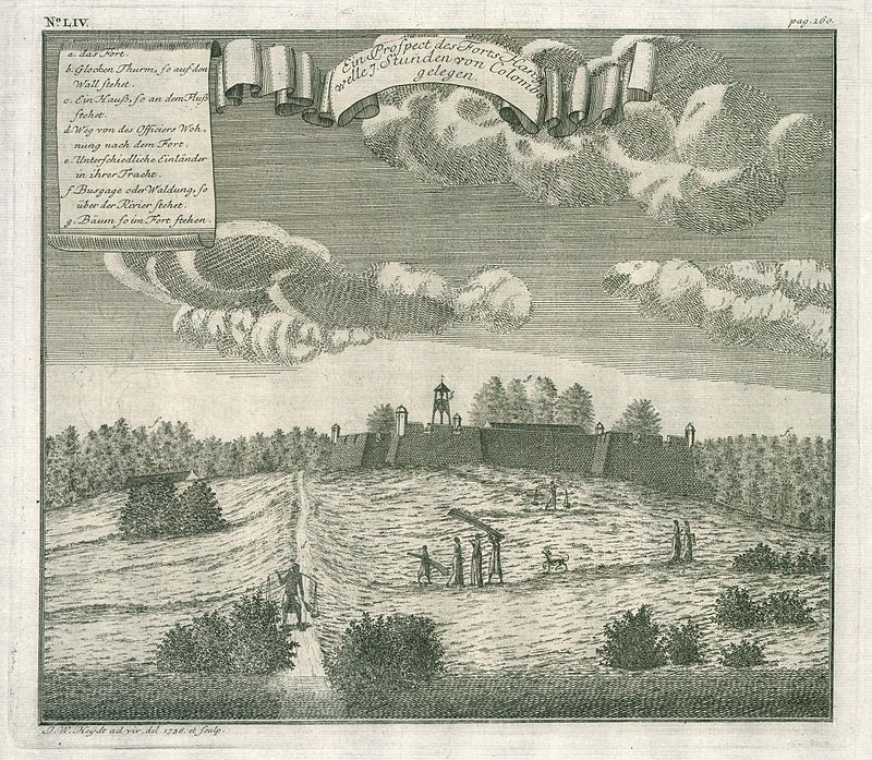
The Dutch were said to have captured it, and constructed a star-shaped fort, completing the work in 1684.
Eventually the fort came under control of the British in 1786, and little evidence of the fort remains with the exception of remnants of the fortifications and the moat.
This is a rest house said to have been built by the Dutch where the fort was…
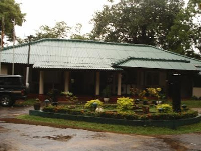
…that was even visited by the Prince of Wales, Albert Edward, in 1875, who, we are told, planted a jackfruit tree on the site to commemorate his visit to Ceylon, and the tree, and two stone seats said to have been constructed for the royal visit, are still on the site.
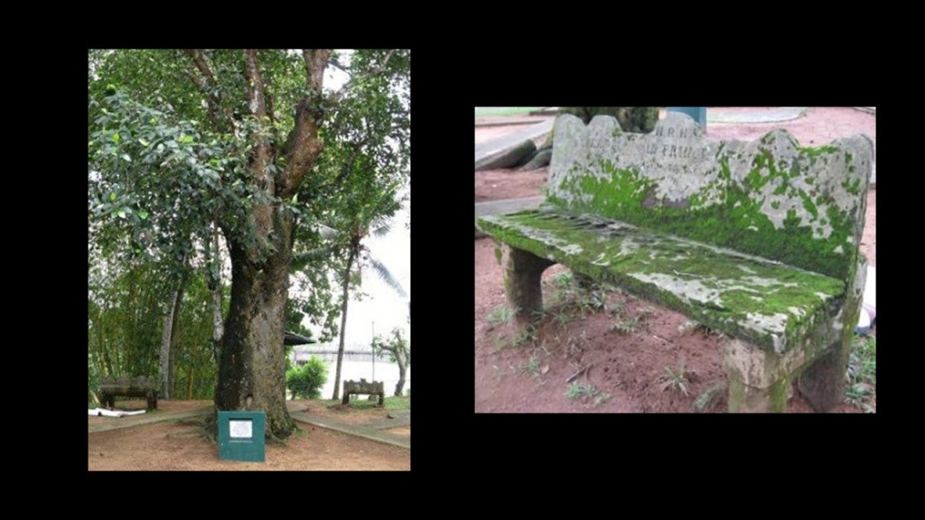
The jackfruit is the national fruit of Sri Lanka, and is native to that part of South Asia.

One more point I would like to make before moving on to the next place on the alignment.
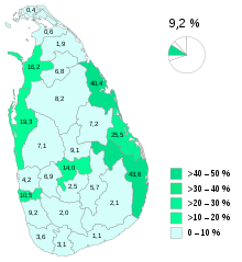
Sri Lanka is one of the few places that I know of to have an acknowledged ethnic minority group called Moors.
They comprise 9.2% of the population, which is approximately a population of 1.9 million Moors in the country, with Kandy being one of their population centers.
They are mainly native speakers of the Tamil language…

…with the influence of Sinhalese…

…and Arabic words.

The Moors of Sri Lanka are predominantly followers of Islam…and are also matrilineal, in which kinship is traced, and great influence is held by, women.
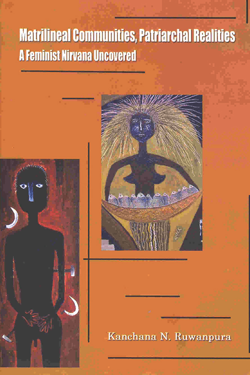
This book is a study about Muslim, Sinhalese, and Tamil households in Sri Lanka.
So…how…did…that…happen according to what we are told in our narrative?!
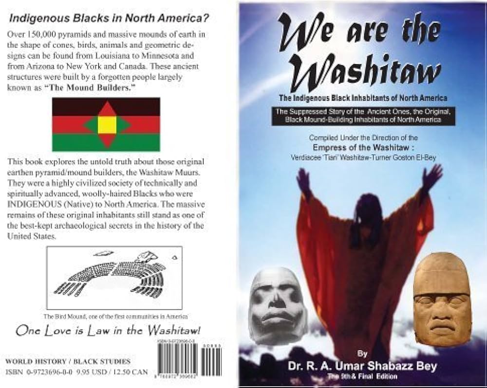
For one thing, the Moors were matrilineal, and not patriarchal, a civilization which has been left out of the history books, including the ancient Washitaw Mu’urs of North America.
The Washitaw are ruled by an Empress to this day.

Yes, the Washitaw, also known as the Ancient Ones, are still very much here with us today..
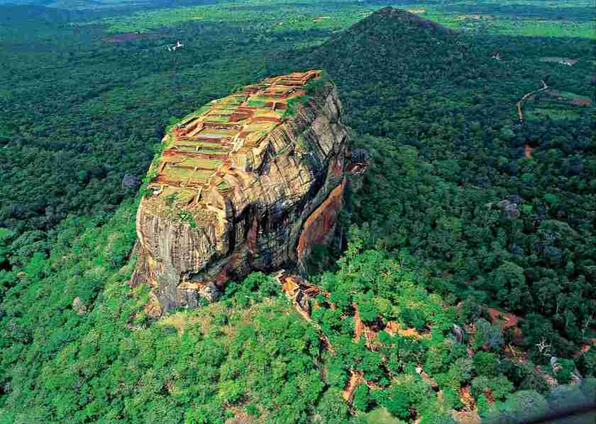
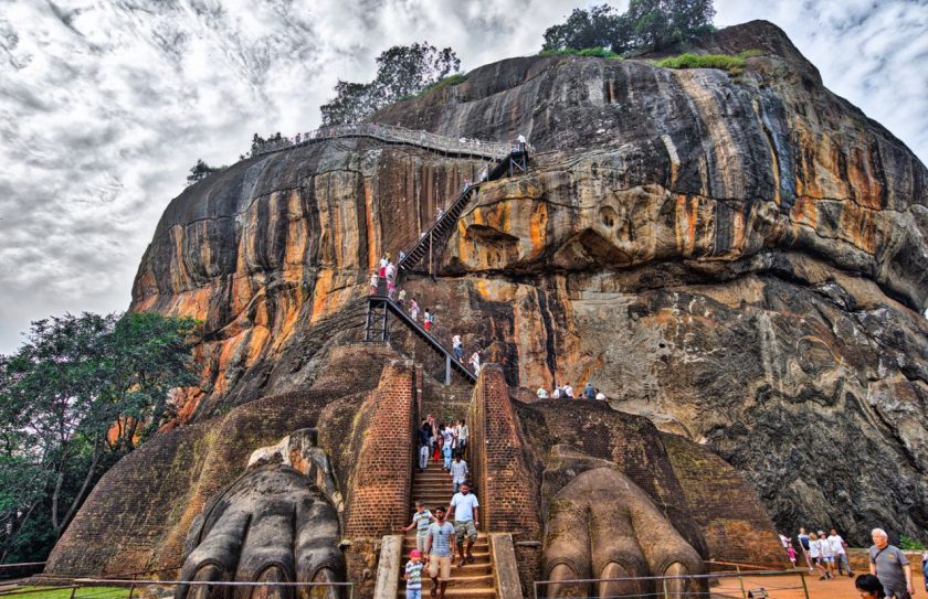
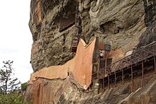
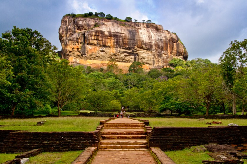
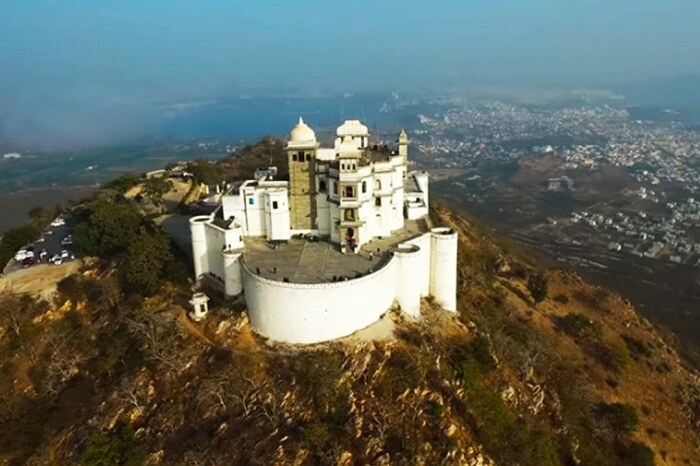
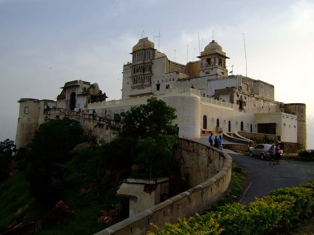
Sigiriya is described as an ancient rock fortress near Dambula in Sri Lanka’s Central Province.
It is dominated by Lion Rock.
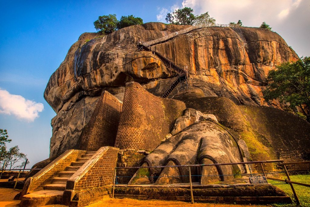
King Kashyapa was said to have built his palace between 477 and 495 AD, on top of Lion Rock, which he had decided to make his new capital.
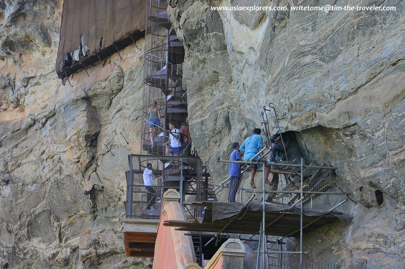
There are 1,200 steps going to the top of Lion Rock, starting from where he built a gateway in the form of enormous lion paws.
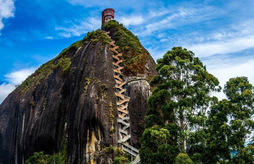
It reminds me visually of the Stone of El Penol, that I found tracking an alignment in Guanape, Colombia.
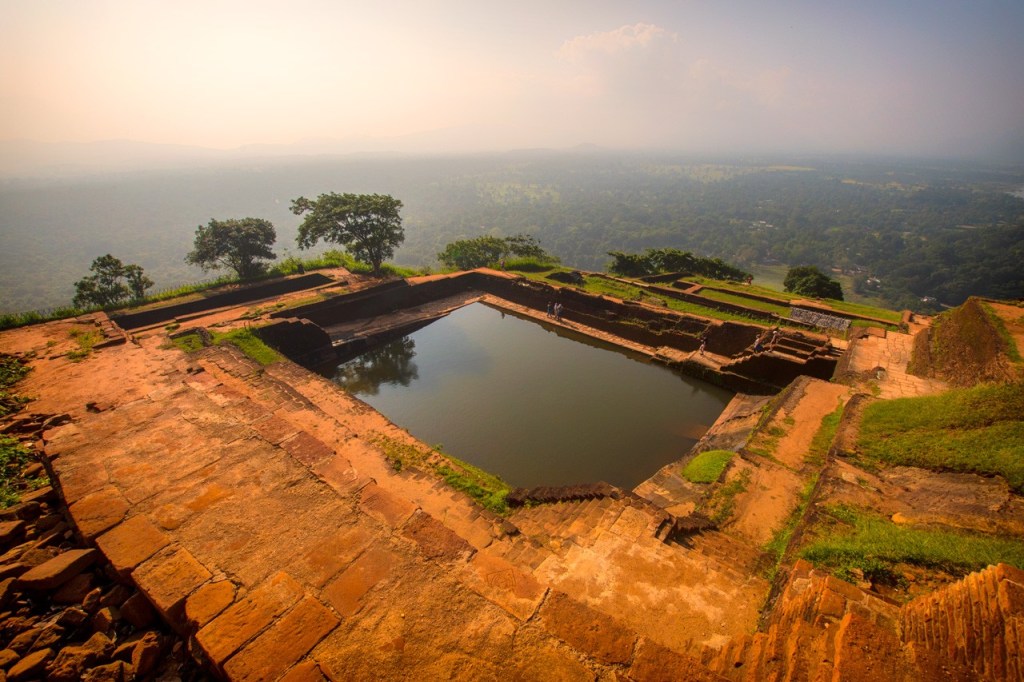
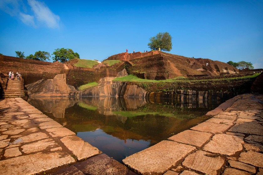
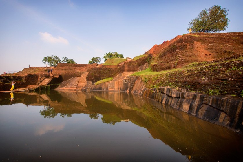
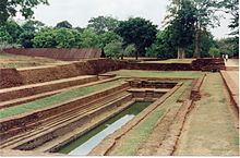
This is a view of the water gardens of Sigiriya from the summit of the rock.
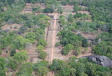
They are built symmetrically on an east-west axis, connected with the outer moat to the west…

….and the large artificial lake to the south of Sigiriya rock.
All the pools are interlinked using an underground conduit network fed by the lake, and connected to the moats.
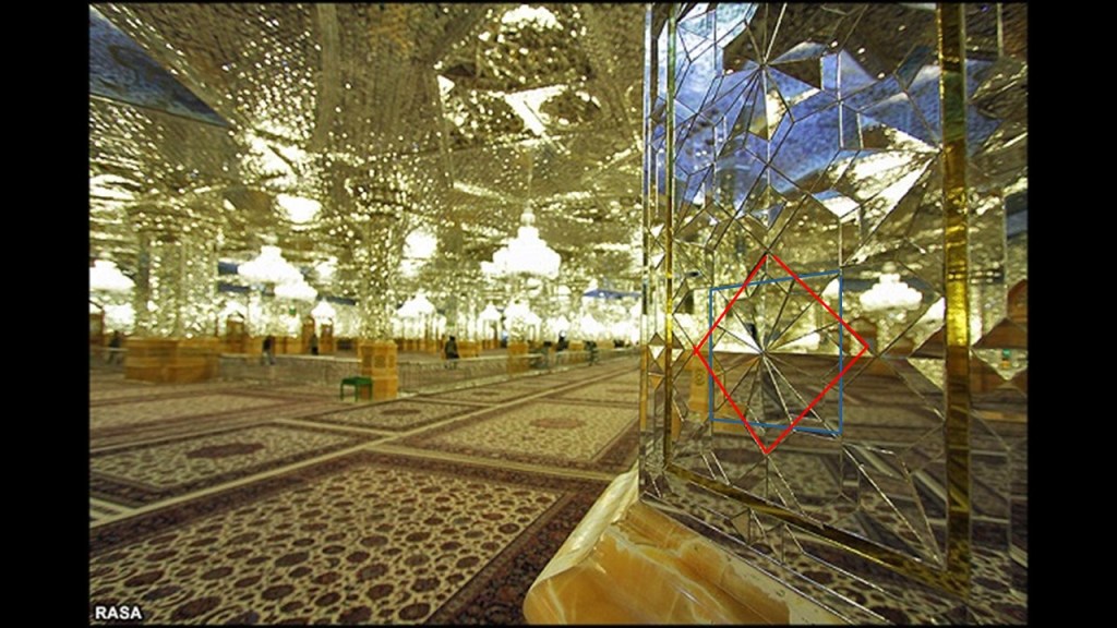
The mirror wall is located in the mid-level terrace where the lions entrance is located, and was said to have been originally so highly polished that the king could see himself while he walked alongside it.
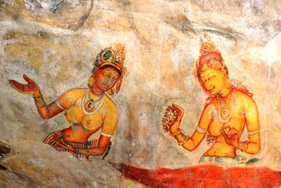
A Spiral staircase at the mirror wall…
…leads to fresco paintings depicting women that cover most of the western face of the rock, called the largest picture gallery in the world.
After all the work that King Kashyapa put into this place, we are told the capital and royal palace were abandoned after his death, and that it was used as a Buddhist monastery until the 14th-century.
Sigiriya is listed as a UNESCO World Heritage Site, and is considered one of the best-preserved examples of urban planning in the world.
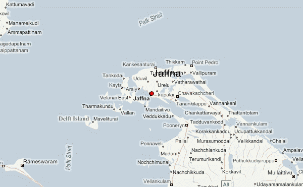
Jaffna is the next place on the alignment, and is the capital city of Sri Lanka’s Northern Province.
It is the administrative headquarters of the Jaffna District, on the Peninsula of the same name.
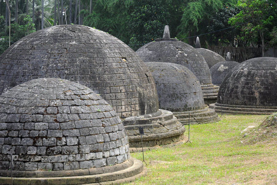
Jaffna is located 6-miles, or 9.7-kilometers, from Kandarodai, a famous emporium city and capital of Tamil kingdoms in northeastern Ceylon from classical antiquity, and the location of the ancient Buddhist monastery known as Kadurugoda Vihara.
Jaffna and the surrounding region was part Naga Nadu, and inhabited by one of the ancient tribes of Ceylon, the Nagas, generally represented as a class of super humans.
Also called Serpents of Wisdom, nagas were masters of raising serpent-like kundalini energy from the base of the spine to the third-eye. connecting with higher self in physical form…

…and masters of higher human abilities called “Siddhis.”
Jaffna was said to have been made into a colonial port town by the Portuguese around 1618, at which time they were said to have built the Jaffna fort…
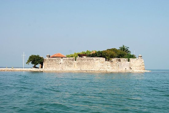
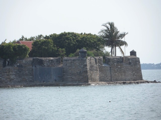
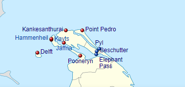
…Fort Hammenheil, built in 1618, around a small island between the islands of Kayts and Karaitivu on the Jaffna Peninsula…
…the Kayts Island fort in 1629…
…the Delft Island fort is attributed to the Portuguese some time during that time period…
…and the Pooneryn Fort, just adjacent to the Jaffna Peninsula..
The forts on the Jaffna Peninsula at Kankesanthurai, Point Pedro, Pyl, Beschutter, and Elephant Pass were all completely destroyed at some point in time during colonial times.
Then the Portuguese lost Jaffna to the Dutch East India Company in 1658, the world’s most valuable company of all-time, worth $7.9-trillion.

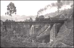
The Dutch were said to have lost their possessions in Sri Lanka in 1796, when they were taken over by the British, after which time the British were said to have built the major roads and railways connecting Jaffna with Kandy, Colombo, and the rest of the country…
…with the Ceylon Government Railway having been founded in 1858…
…and the rail network introduced by the British Colonial government in 1864.
This is said to be a picture circa 1880 of a steam-powered train on the hill-country Colombo – Badulla line.
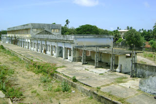
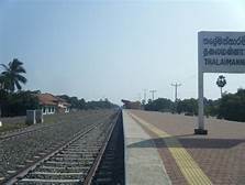
This is the Jaffna Railway Station today, said to have been built originally in 1902, and reconstructed in the time-frame around 2011-2013…
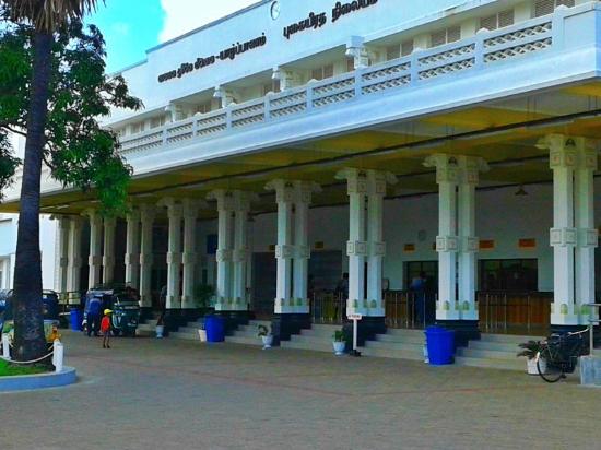
…due to damage it sustained during Sri Lanka’s civil war in the years between 1983 and 1995.
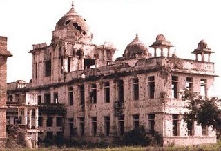
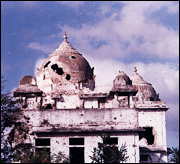
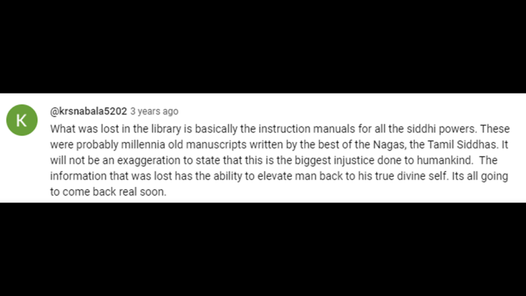
The Jaffna Public Library was said to have originally been built in 1933, and one of the largest libraries in Asia, with over 97,000 books and manuscripts.
Built in what was called an Indo-Saracenic style, we are told it was burned down by an organized mob in 1981.
After I first published this same information in a video in 2020, this comment was left by someone on my YouTube Channel about the burning of the Jaffna Public Library in 1981.
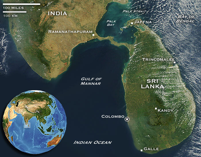
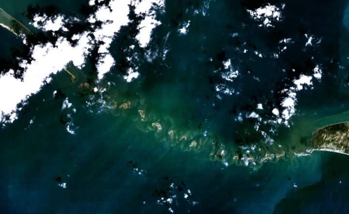
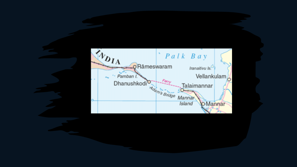
The alignment from Jaffna crosses the Palk Strait, located between the Jaffna District of the Northern Province of Sri Lanka and the Tamil Nadu state of India.
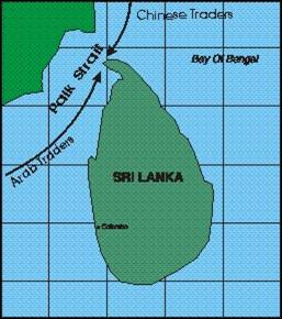
It connects the Bay of Bengal…
…the largest bay in the world, at 839,000-square-miles, or 2, 172,000-square-kilometers…
…with Palk Bay, to the southwest.
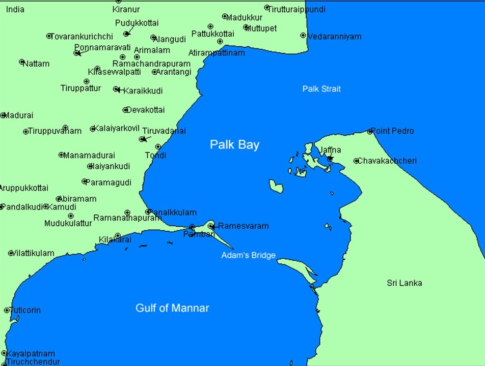
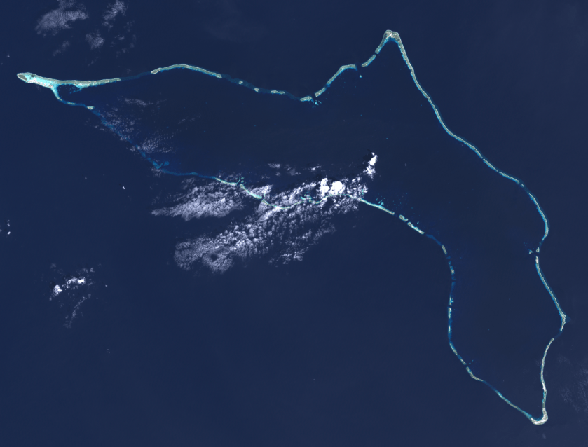
The chain of low islands and reefs called Adam’s Bridge, also known as Rama’s Bridge, or Ramsethu, which separates the Gulf of Mannar, known for having one of the most productive Pearl fisheries in the world, from Palk Bay.
This is a depiction I found of what this place might have looked like when it connected India and Sri Lanka location circa 1480…
…at which time supposedly a cyclone deepened the channels between the two places.
At any rate, the Pamban Bridge, a railway bridge, connects the town of Mandapam in Tamil Nadu with Pamban Island and Rameswaram to the Indian Railways, ending at the Indian side of Adam’s Bridge.
It was said to have been constructed between 1911 and 1914, which was the year World War I started.
It is over a mile-long, at 6,776-feet, or 2,065-meters.
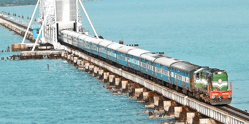
Described as a masterpiece of engineering, it has a movable section midway that is raised to allow ship and barge traffic to pass through.
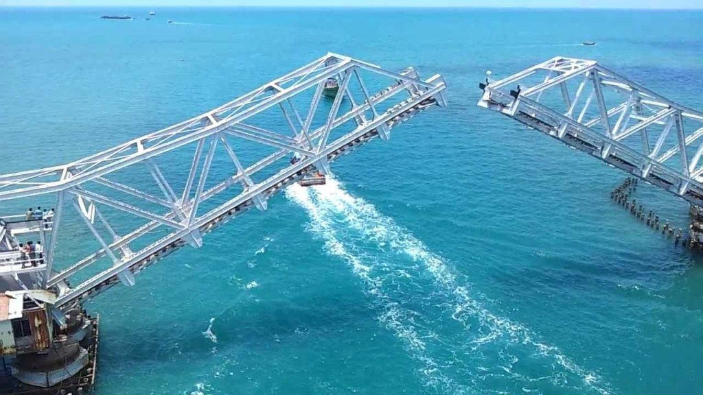
There are similar movable sections on the Sault Ste. Marie International Railroad Bridge, with a swing bridge…and a vertical lift bridge.
It was said to have been built in 1887.
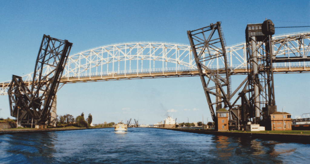
For perspective in the historical narrative we have been taught, the Model T Ford first came into production in 1908…

…and the Wright Brothers had their first flight at Kitty Hawk in North Carolina’s Outer Banks in 1903.
So, were we actually capable of engineering feats like these based on the technology we are taught existed that at those times?.
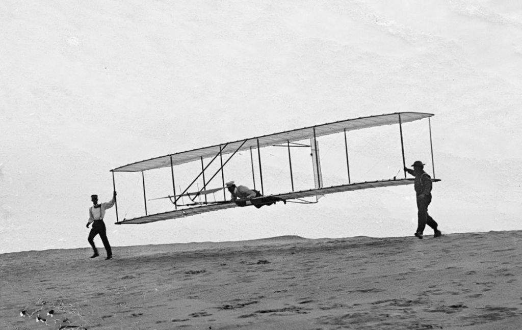
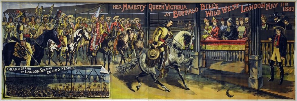
And what in the world was going on in 1887, the year the Sault Ste. Marie International Railroad Bridge was said to have been built?
Well, for one, Buffalo Bill took his Wild West Show…
…to Great Britain for the celebration of the Jubilee Year of Queen Victoria in 1887.
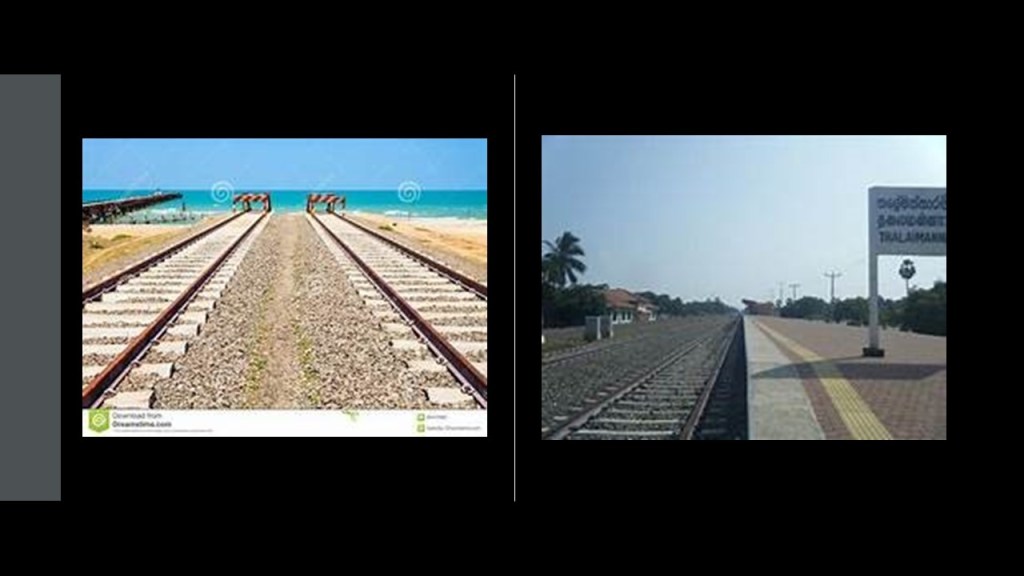
Back to Palk Bay, you can take a ferry across, in the same general location as the sunken parts of Adam’s Bridge, to Talaimannar, on Sri Lanka’s Mannar Island, and catch the train on to anywhere you want to go in Sri Lanka.
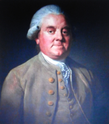
The Palk Bay and Palk Strait were named for Sir Robert Palk, an officer in the British India Company that served as the Governor of Madras between 1755 and 1763…
…during the period called Company Raj period, or Company rule in India, when the British East India Company ruled over parts of the Indian Subcontinent between 1757 and 1858…

…commencing after the 1757 Battle of Plassey, called a decisive victory over the Nawab of Bengal, Mir Jafar, after which time the Nawab ceded revenues to the what was called the “Company.”
Mir Jafar was considered the first dependent Nawab of Bengal of the British East India Company, and this was considered to be the start of British Imperialism in India, and a key step in the eventual British domination of vast areas there.
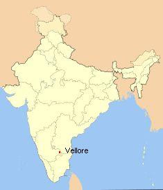
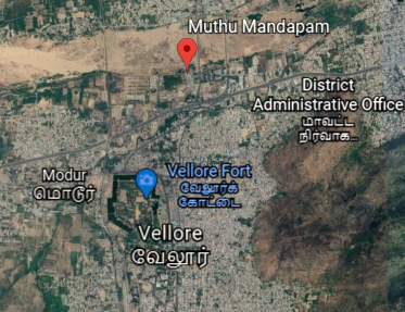
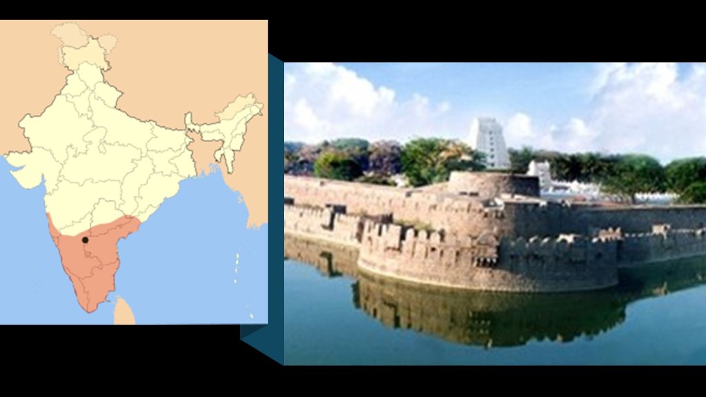
The next place I come to tracking the alignment from Jaffna, is Vellore, a city and administrative headquarters of the Vellore District in the northeastern part of the Indian state of Tamil Nadu.
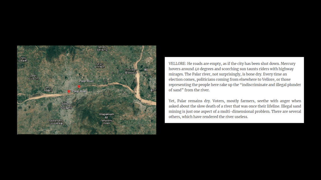
It is located on the banks of the dry-looking Palar River today…
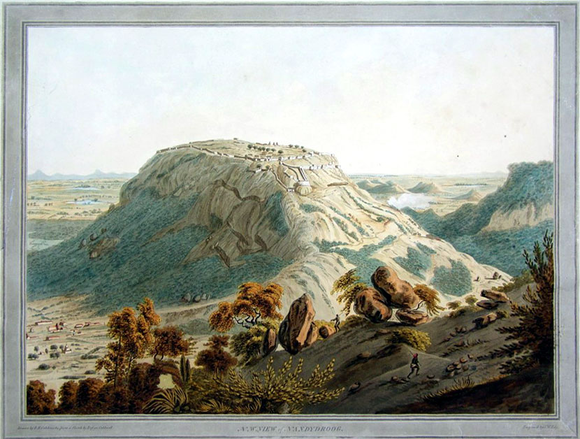
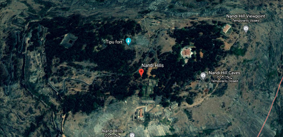
…which historically flowed from the Nandi Hills, also known as Nandidurg, an ancient hilltop fortress in Karnataka State that was at one time believed to have been impregnable…
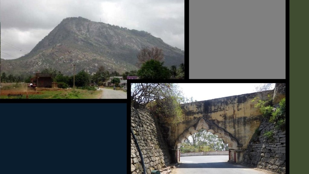
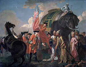
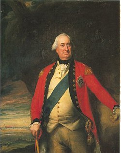
…but was successfully stormed by the Army of Charles Cornwallis in 1791, the 1st Marquess of Cornwallis in the Third Anglo-Mysore War, a conflict in South India between the British East India Company and the Kingdom of Mysore…
…and the same General Cornwallis famous for being defeated at the Battle of Yorktown in 1781, and being forced to surrender, basically ending the American Revolutionary War.
In spite of his loss and surrender to the Americans in the Revolutionary War, Cornwallis was knighted in 1786, and in the same year became the Governor-General and Commander-in-Chief of the British Colony in India.
Nandi Hills later became a resort for British Raj officials during the hot season.
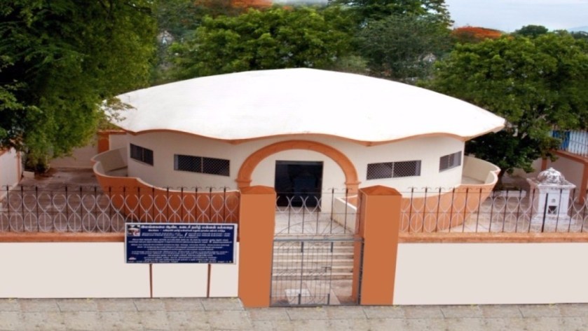
The Muthu Mandapam, or Pearl Hall, located on the banks of the Palar River…
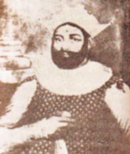
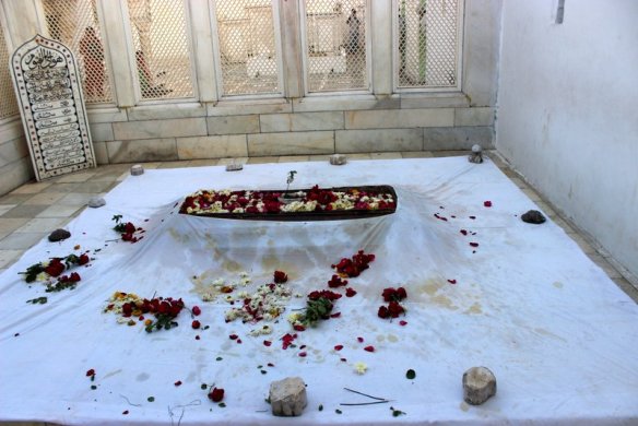
…is the resting place of the last King of Kandy in Sri Lanka, Sri Wickrama Rajasinghe, and a place where Sri Lankans journey to in order to pay their respects to him.
He had been arrested by the British in 1815, and ended up in exile in India.
In January of 1816, he and his families were sent to Madras on the HMS Cornwallis…
…which was the same ship on which the Treaty of Nanking, or Nanjing, between the British Empire and China would be signed after China’s defeat, after the First Opium War in 1842.
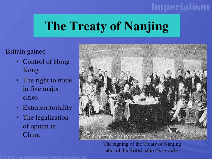
The First Opium War was fought between Qing Dynasty of China and Britain between 1839 and 1842, a military engagement that started when the Chinese seized opium stocks at Canton in order to stop the opium trade, which was banned.
The British government insisted upon free trade and equality among nations and backed the merchants’ demands.
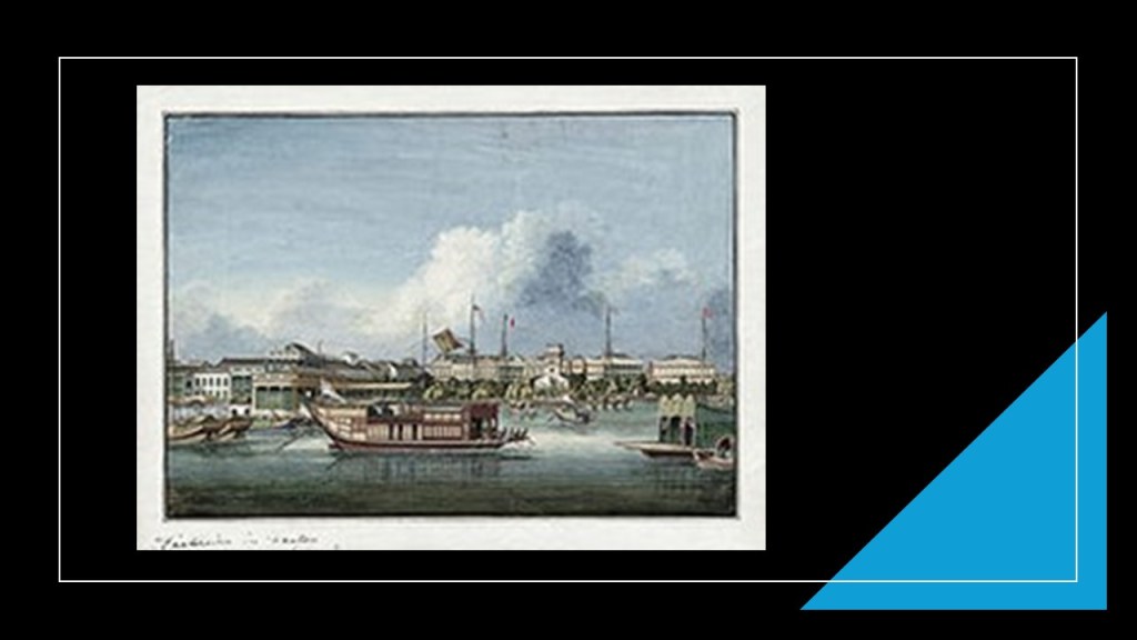
From 1757 to 1842, the Canton System served as a means for China to control trade with the west by focusing all trade in the southern port of Canton.
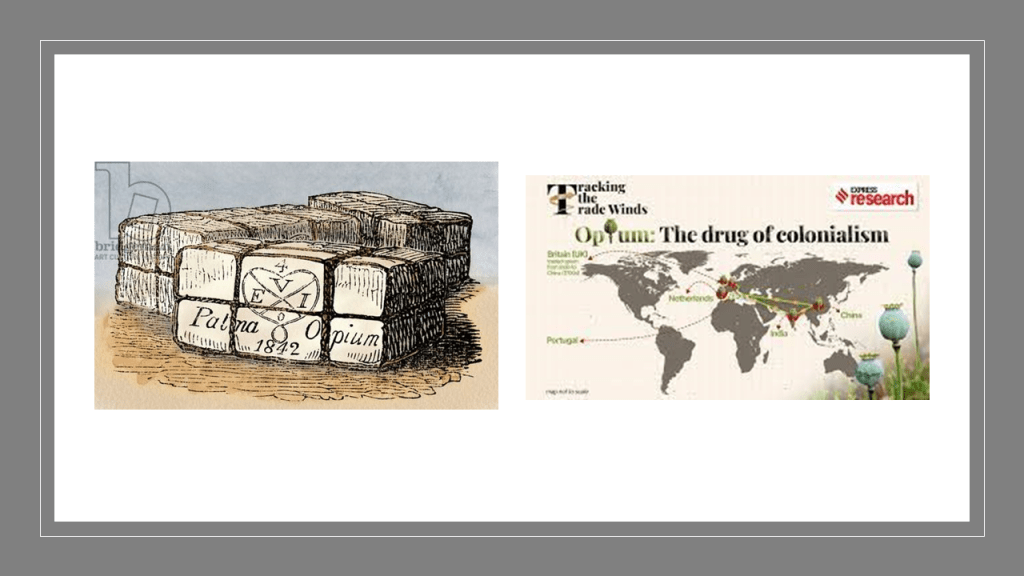
To counter this, the British East India Company began to grow opium in Bengal, in present-day Bangladesh, and allowed private British merchants to sell opium to Chinese smugglers for illegal sale in China.
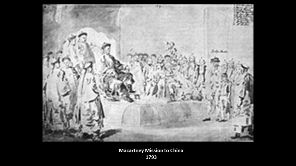
It is interesting to note that in the last post from this most recent series called “The Advanced Ancient Civilization, and the Colonization of, the Islands and Lands of the South Atlantic and South Indian Oceans,” which was based on this same long-distance alignment I tracked back in 2020, I had mentioned that in 1793, Amsterdam Island was a stop for the Macartney Mission, the first British diplomatic mission to China.
While it was said to have failed to achieve its initial objectives, the Macartney Mission was noted for having brought back extensive cultural, political, and geographical observations that its participants recorded.
The goals of the Macartney Mission were to: 1) Open new ports for British trade in China; 2) the establishment of a permanent embassy in what was then called Peking, now Beijing; 3) the cession of a small island off the coast of China for Britain’s use; and 4) the relaxation of trade restrictions on British merchants in Canton in southern China.
So, the follow-up to this event in history was also found on this alignment – only 50-years after the Macartney Mission, the First Opium War took place and Great Britain got exactly what it wanted.
As a result from these events in history, opium dens, establishments where opium was sold and smoked, became prevalent in many parts of the world throughout the 19th-century.
Sounds like these events were the origins of the same drug trade that plagues the world today, a means by which to keep Humanity asleep and unconscious as much as possible, and make a ton of money in the process.
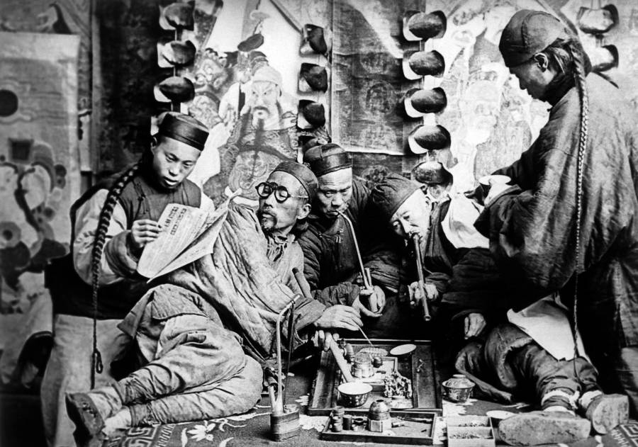
Some of the world’s wealthiest families today earned a fortune engaging in the opium business, like the Astor, Forbes, Russell, Perkins and Delano families.
They don’t even hide it.

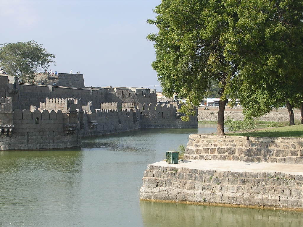
The Vellore Fort is situated in the heart of Vellore…
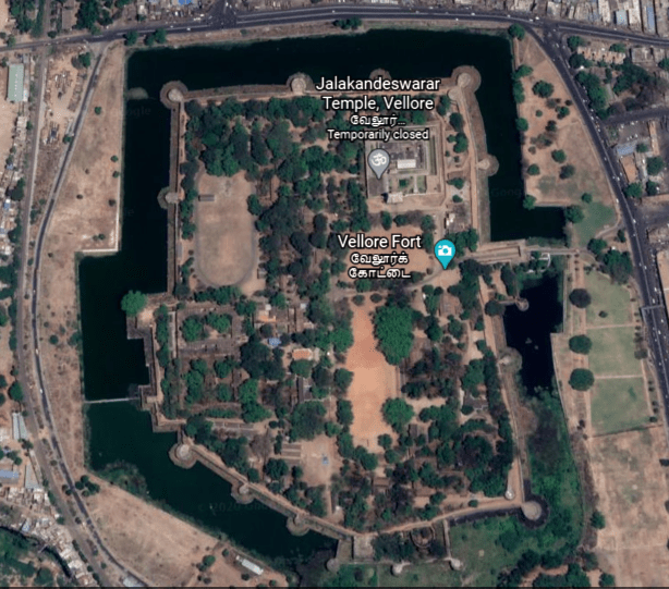
…said to have been built by the Vijayanagara, also called the Karnata Empire, that was based in the Deccan Plateau Region of South India.
The Vellore Fort is known for its grand ramparts, wide moat, and robust masonry.
The fort’s ownership was said to have passed from the Karnata Empire to the Bijapur Sultans, to the Marathas, to the Carnatic Nawabs, and finally to the British…
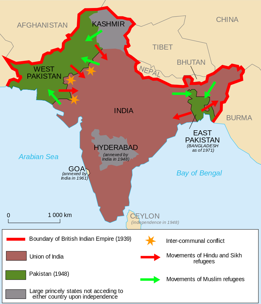
…who held the fort until India gained independence in 1947, at which time the heart-wrenching Partition of India displaced 10- to 12-million people along religious lines, and created an overwhelming refugee crisis in the newly constituted independent dominions of India and Pakistan, as well as large-scale violence and death.
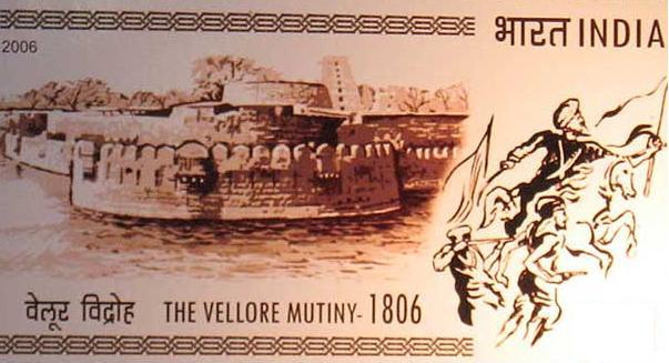
The first significant rebellion against British rule erupted at Vellore Fort in 1806, known as the Vellore Mutiny, or Vellore Sepoy Mutiny.
While it only lasted one day, it was the first instance of a large-scale and violent mutiny by Indian Sepoys against the British East India Company.
The Sepoys seized the Vellore Fort, and killed or wounded 200 British soldiers, but the mutiny was subdued by the end of the day by cavalry and artillery from another nearby British unit.
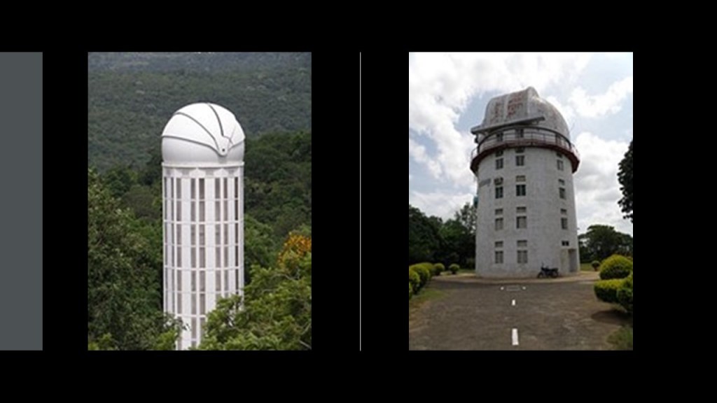
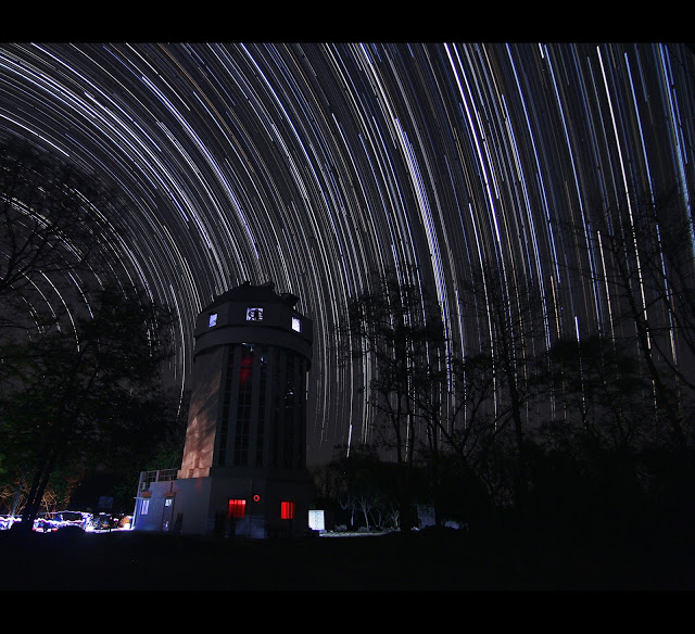
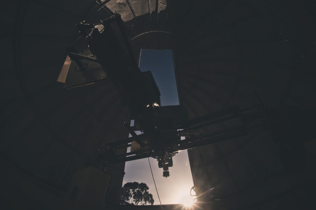
The Vainu Bappu Observatory in Kavalur in the Vellore District…
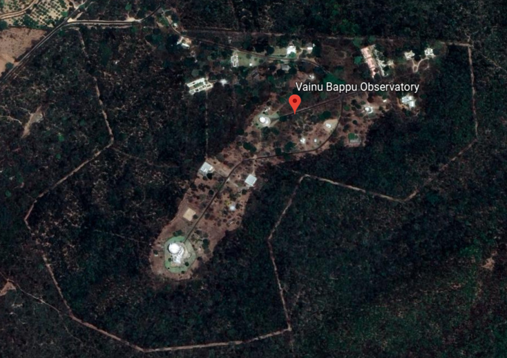
…is in what are called the Javadi Hills of the Eastern Ghats.
It is the biggest observatory in Asia, with observations said to have started here in 1968.
Its location 12-degrees north of the equator allows for the coverage of the northern and southern hemispheres, and it is the only major astronomical facility between Australia and South Africa for observing the southern objects.
On-going programs include the observations of stars, star clusters, novae, super novae, blazars, galaxies, solar system objects, and many others.
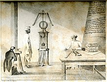
William Petrie was an officer in the British East India Company in Madras in the 1780s. An amateur astronomer, he was given the credit for making the first modern astronomical observations outside of Europe in Madras in 1786.
We are told his home observatory and instruments contributed to the first modern observatory outside of Europe, the Madras Observatory, shown here, said to have been built around 1792, with the first observations on the meridian being in 1793, said to have been designed by Michael Topping, the Chief Marine Surveyor of Fort St. George in Madras.
The Madras Observatory was described as having a single room that was 40-feet, or 12-meters, long and 20-feet, or 6-meters, wide, with a 15-foot, or 5-meter, high ceiling, as well as a granite pillar weighing 10-tons, or 9-metric tonnes, in the center of the room.
Seriously, a 10-ton granite Pillar?
Well, the granite pillar still exists in the present-day, with an engraving by those said to have erected it.
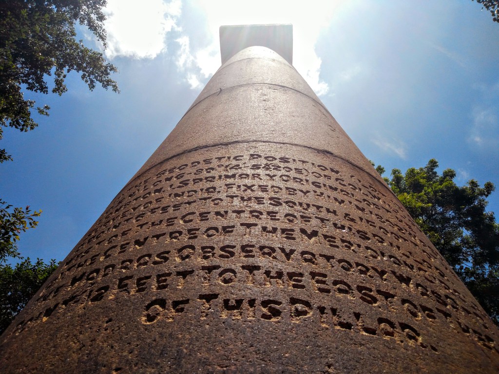
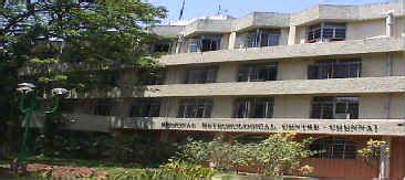
It is on the grounds of the present-day Regional Meteorological Centre in Chennai, what Madras is called today, and the original building of the Madras Observatory no longer exists, though I read other stone slabs and broken pillars are found in a fenced-off section on its grounds.
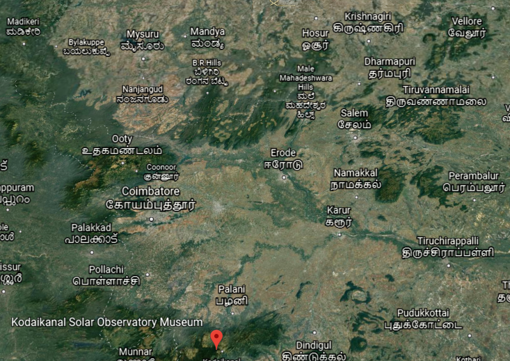
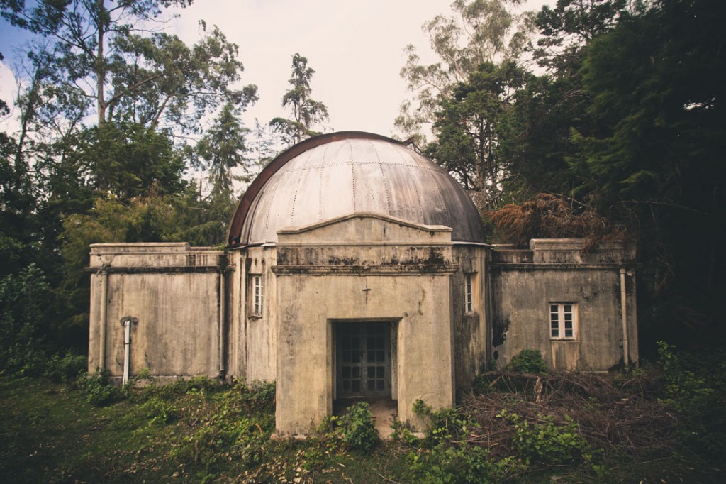
Another observatory in South India is the Kodaikanal Solar Observatory…
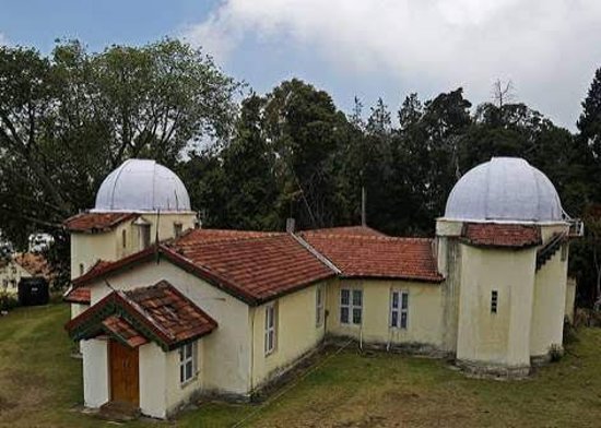
…located in the Palani Hills, southwest of Vellore in Tamil Nadu State.
Founded in April of 1899, legend has it that the observatory’s 6-inch telescope was said to have been brought on foot by four men who climbed steep valleys and braved the attack of wild animals, carrying the telescope on their shoulders for almost three-months.
It is interesting to note that there are abandoned observatories dotting the landscape of the hills behind Kodaikanal.
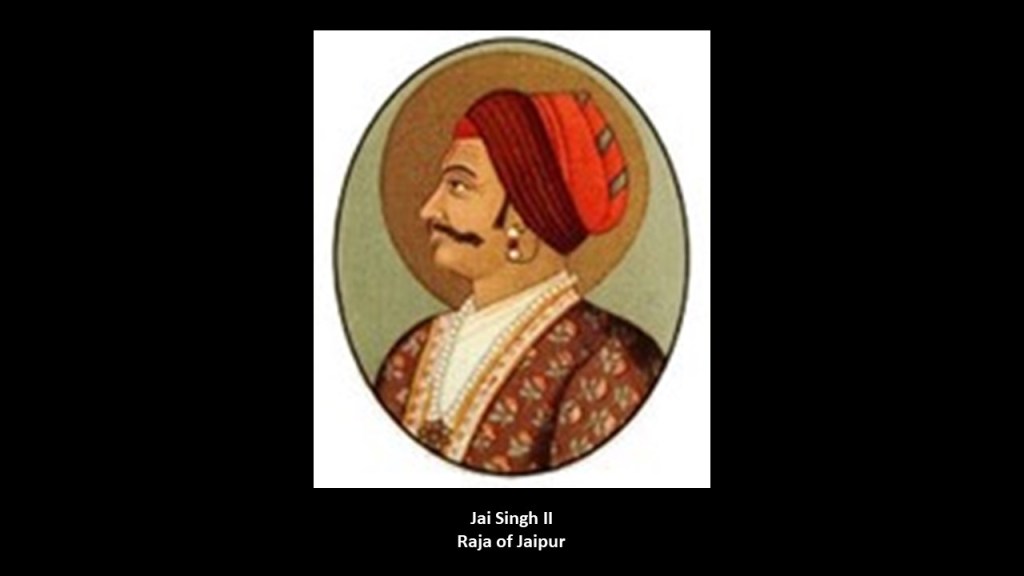
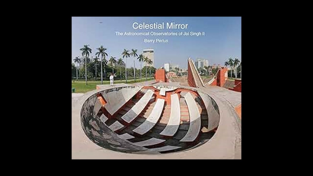
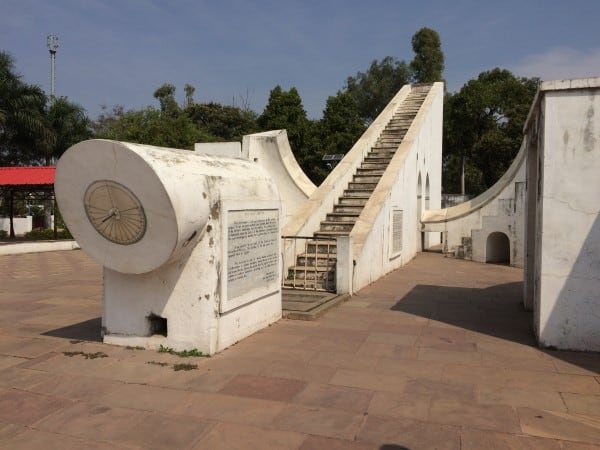
In northern India, we are told that between 1724 and 1730, Jai Singh II, the Raja of Jaipur, oversaw the construction of five monumental stone observatories, called Jantar Mantars, across his domains.
The primary purpose of these observatories was for the study of space and time.
There is one in Delhi, an ancient city and the seat of the Mughal Empire.
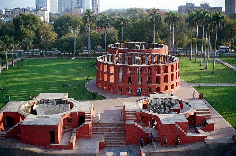
It is interesting to note that the Jantar Mantar in what is now called New Delhi is surrounded by the government buildings of India, in a rather geometric-looking configuration…
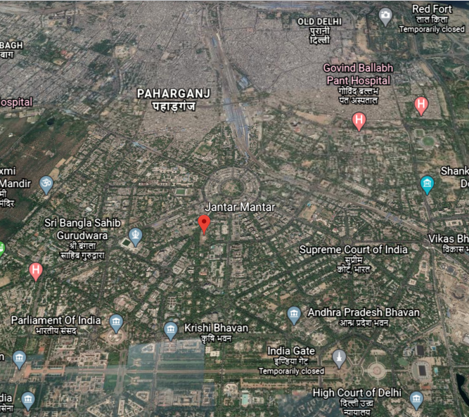
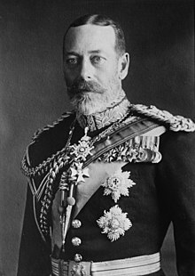
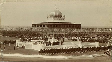
…which the British were said to have built New Delhi between 1911 and 1931, after the laying of the foundation stone laid by Emperor George V of India, a title used by British Monarchs from 1876 to 1948…
…during the Delhi Durbar of 1911, an Indian imperial-style mass-assembly organized by the British at Coronation Park to mark his accession as Emperor of India.
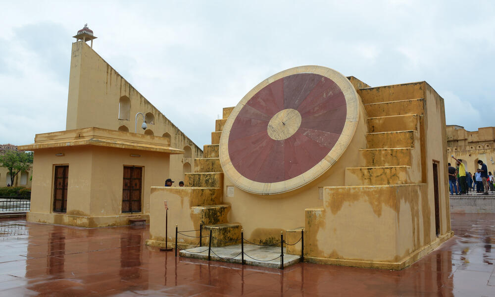
Other Jantar Mantars are in Jaipur, a collection of nineteen architectural instruments forming the largest stone observatory in the world…
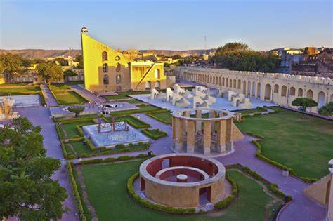
…including the world’s largest stone sundial…
…in Varanasi, India, a major religious center in India, and considered the holiest city of Hinduism and Jainism…
…in the holy city of Ujjain, with thirteen architectural astronomy instruments…
…and the Jantar Mantar of Mathura, an ancient city believed to be the homeland and birthplace of Krishna.

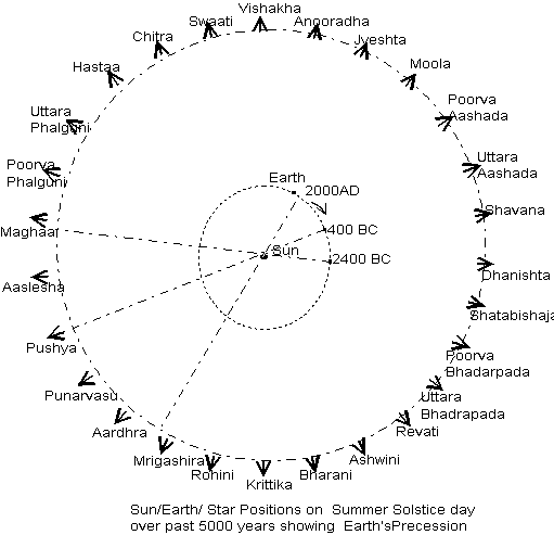
Vedic astronomy has ancient roots in India…
…going back thousands of years.
Yet they want us to believe things like the British East India Company brought the science of astronomy to India?
One more place I would like to take a look at before leaving Tamil Nadu State is its capital in modern-times, Chennai, known historically as Madras.
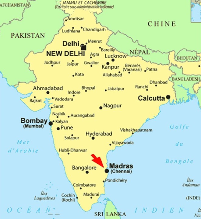
The British East India Company arrived in what came to be known as Madras in 1600, making it their principal settlement, and we are told, constructed Fort St. George in 1644.
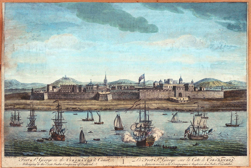
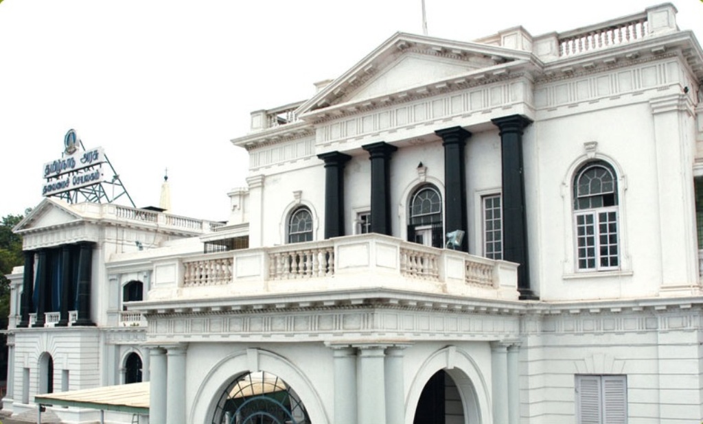
…which serves today as the Secretariat and Legislative Assembly of the Tamil Nadu Government.
The British East India Company was said to have come here in order to have a port close to the Malaccan Straits, the main shipping channel between the Indian Ocean and Pacific Ocean, and to secure its trade lines and commercial interests in the spice trade.
It is one of the most important shipping lanes in the world.
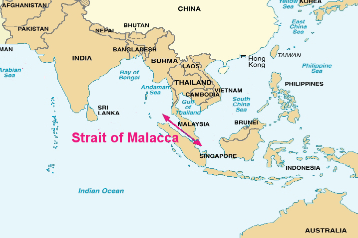
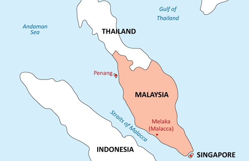
They must have succeeded in their securing their goals, because the British East India Company officer I mentioned previously, who was said to have made the first astronomical observations outside of Europe, William Petrie, was also the Governor of Prince of Wales Island in the Malaccan Strait between 1812 to 1816.
Prince of Wales Island is known today as Penang Island, the main constituent island of the Malaysian state of Penang.
St. Mary’s Church at Fort St. George is said to the oldest Anglican church in India, built between 1678 and 1680…
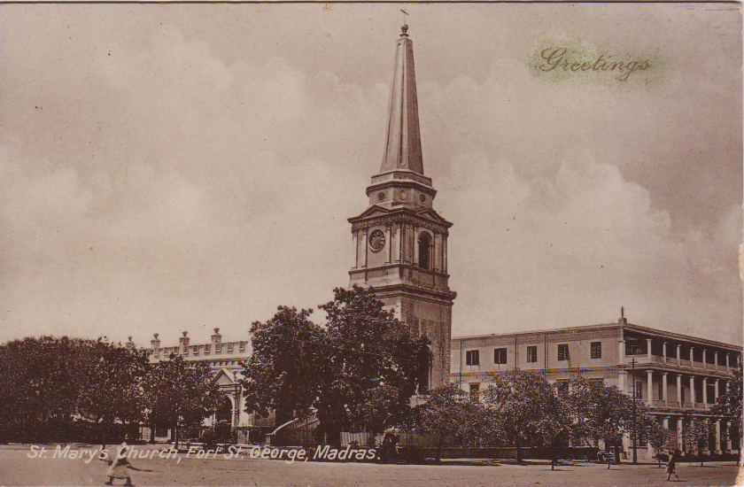
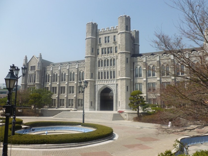
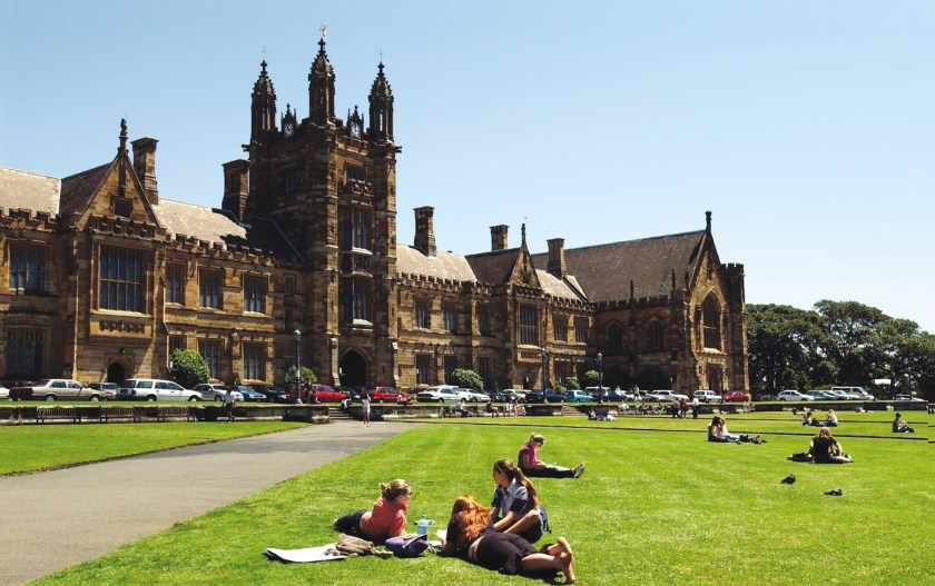
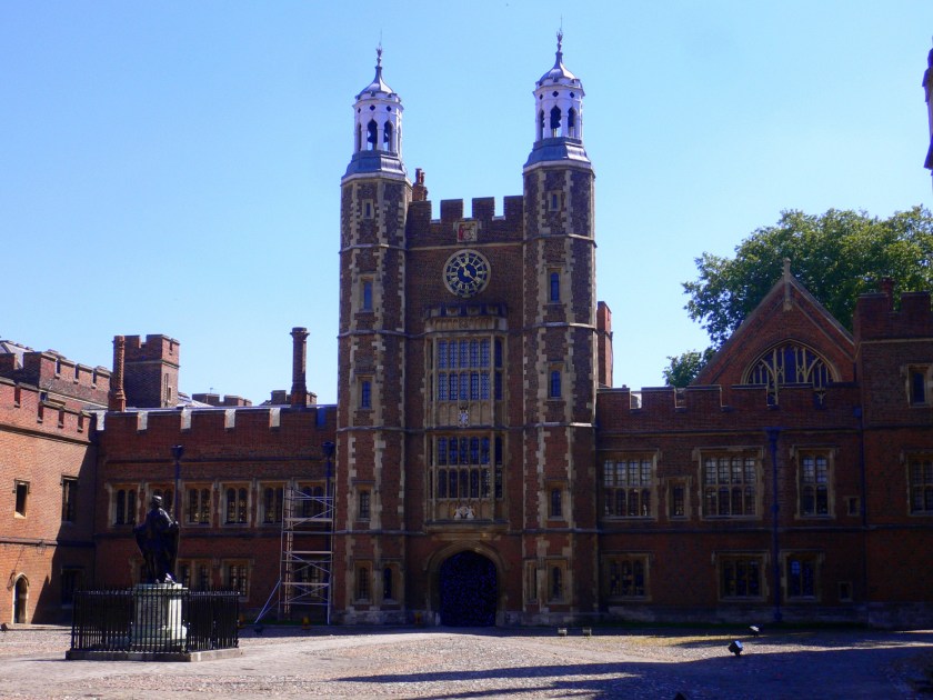
…and Elihu Yale, a British merchant, trader, and a President of the British East India Company settlement at Fort St. George, was married at St. Mary’s Church.
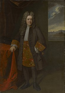
Elihu Yale later became a benefactor of the Collegiate School in the Colony of Connecticut, which in 1718 was renamed Yale College in his honor.
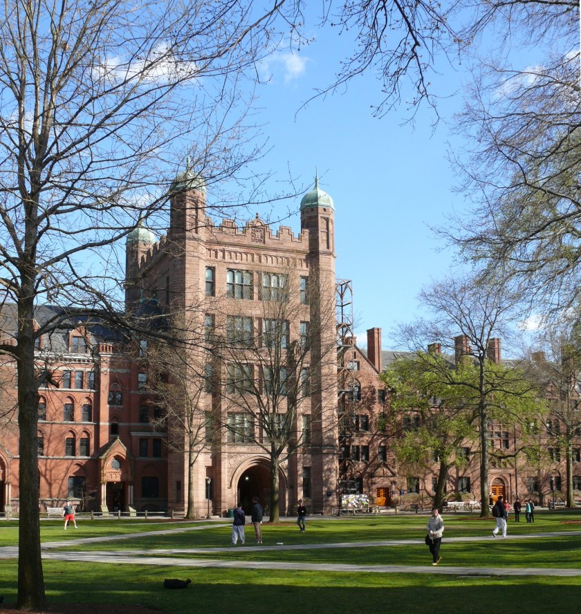
I have found the same style of architecture at universities and colleges around the world, including, but not limited to, Korea University in Seoul, Korea…
…the University of Sydney, in Australia…
…and Eton College, in Windsor, England.
The Madras Presidency, or the Presidency of Fort St. George, was an administrative subdivision of British India, and established in 1652, and of which Elihu Yale became president in 1684.
At its greatest extent, the Madras Presidency included most of southern India, including the whole of the states of Tamil Nadu and Andhra Pradesh; parts of Odisha, Kerala, and Karnataka; and the union territory of Lakshadweep, a group of islands off India’s southwestern coast.
The Madras Presidency ended with the advent of Indian independence on August 15th of 1947.
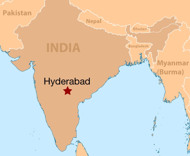
We come to Hyderabad next on the alignment, the capital and largest city of India’s Telengana State on the Deccan Plateau.
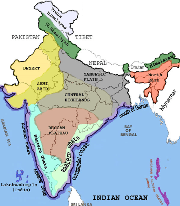
The Deccan Plateau is bounded by the Eastern Ghats and the Western Ghats…
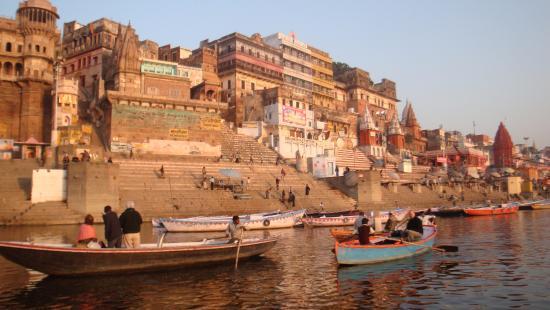
…and it is important to the note that ghats in India are also a series of steps leading down to water, like the Harishchandra Ghat in Varanasi.
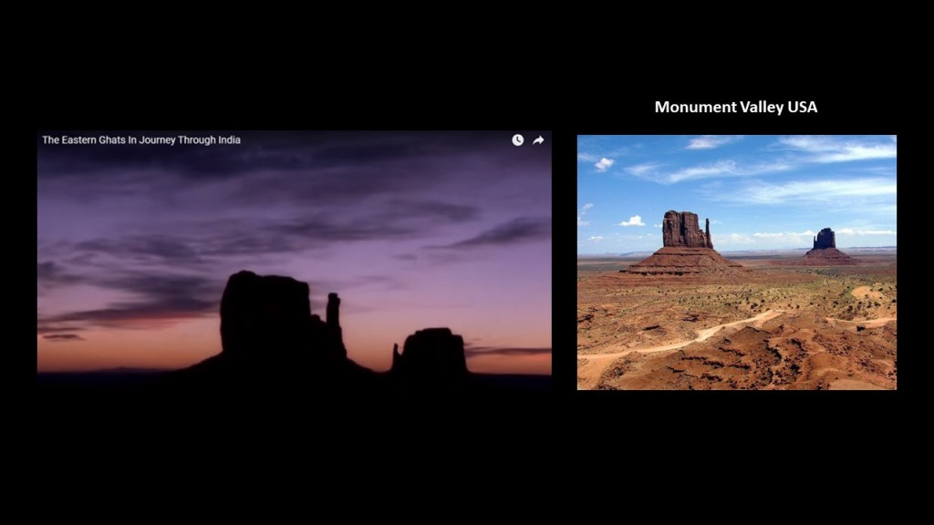
This is a screenshot from a YouTube video I watched several years ago entitled “The Eastern Ghats in Journey through India” on the left, showing this part of the subcontinent of India looking like Monument Valley, in Arizona near the border with Utah in the American Southwest on right.
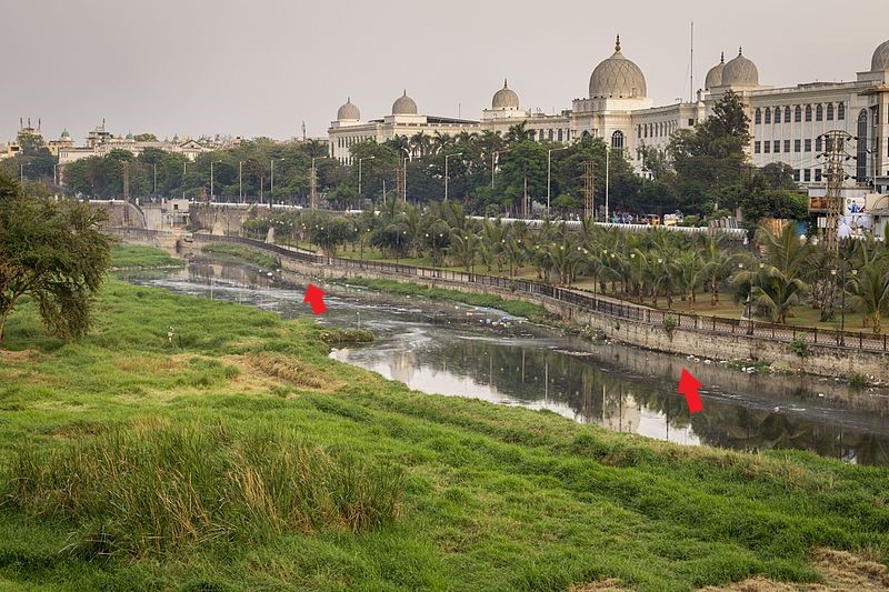
Hyderabad occupies 241-square-miles, or 625-square-kilometers along the Musi River.
This is a view of the Salar Jung Museum in Hyderabad showing masonry banks on the Musi River.
The Salar Jung Museum is described as having the largest collection of antiques belonging to a single person, said to have been sourced from Nawab Mir Yusuf Ali Khan Salar Jung III, former prime minister of the 7th Nizam, the title of the ruler of what was then the princely state of Hyderabad.
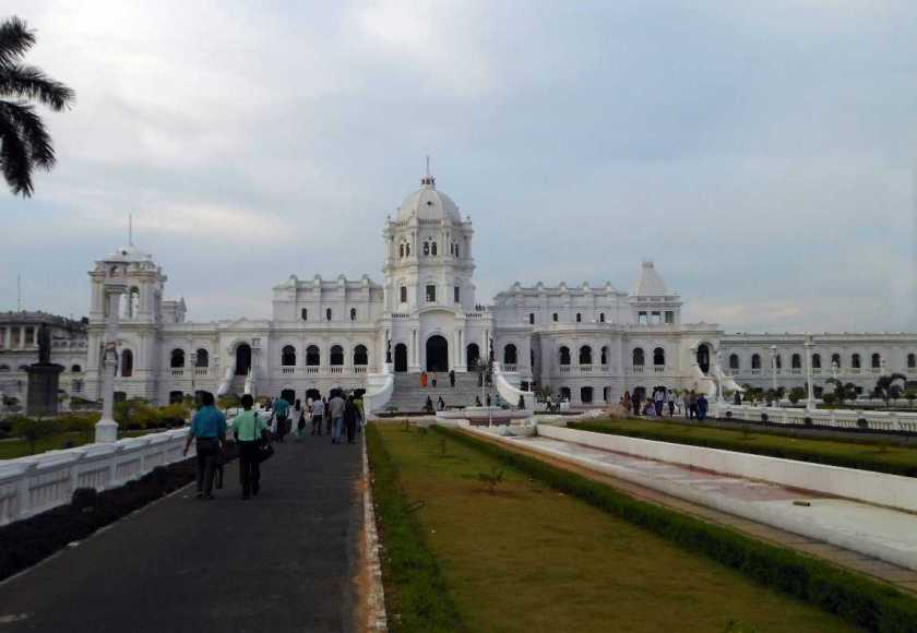
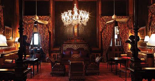
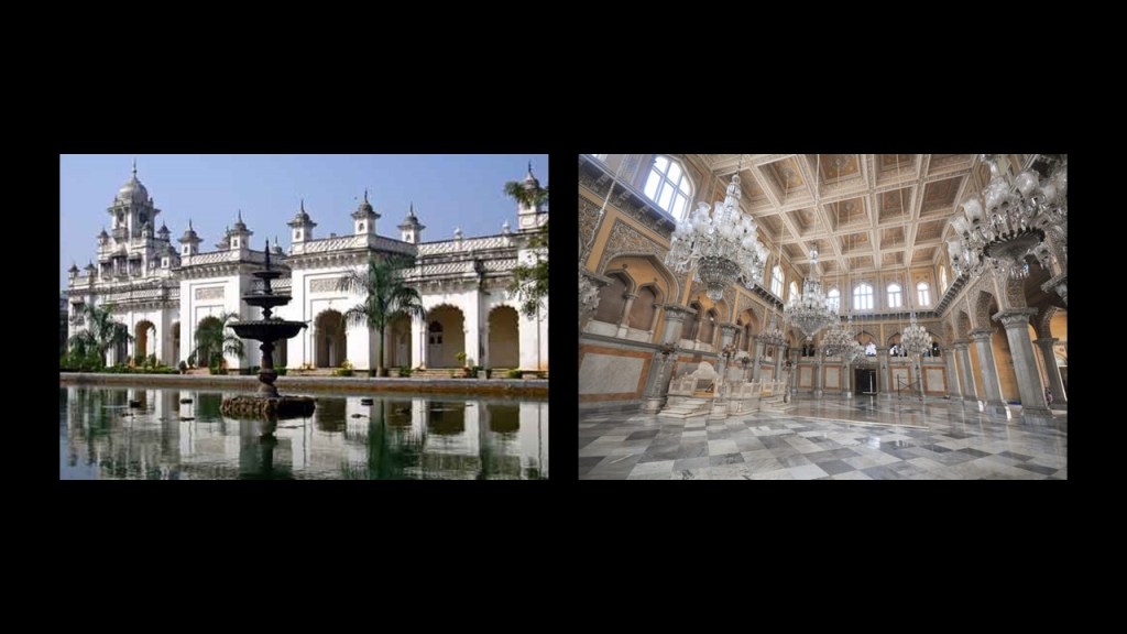
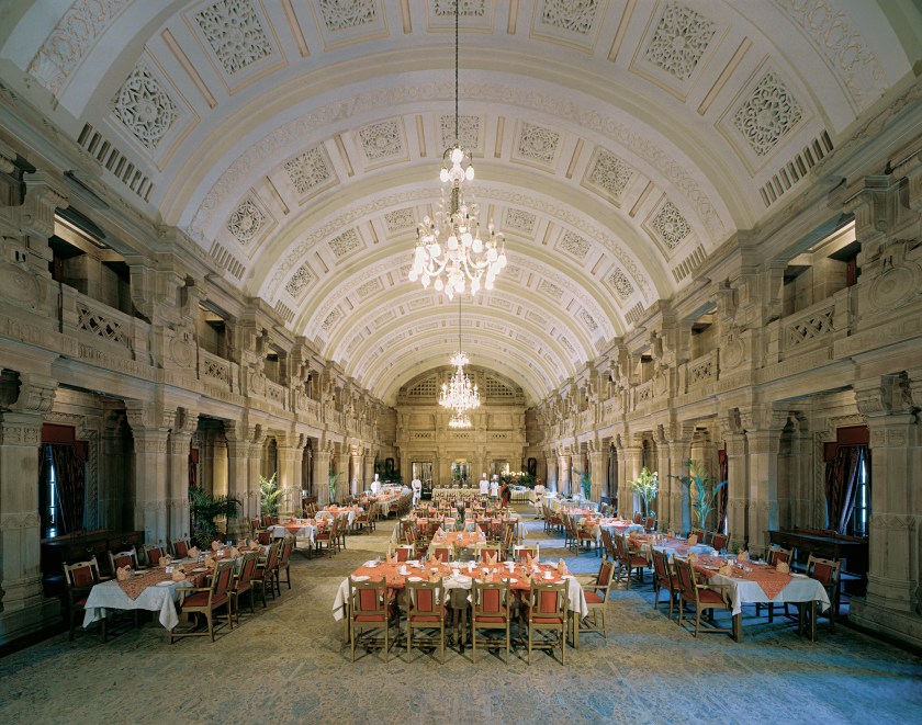
The Palace owned by the Nizam of Hyderabad, the Falaknuma Palace, was said to have been built in 1893, and converted into a 5-star hotel in 2010.
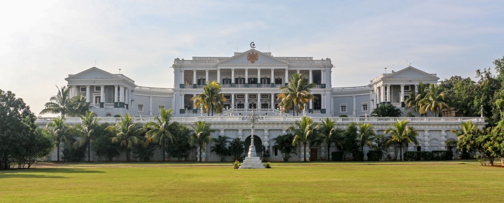
There are 60-rooms and 22-halls inside the Falaknuma Palace…
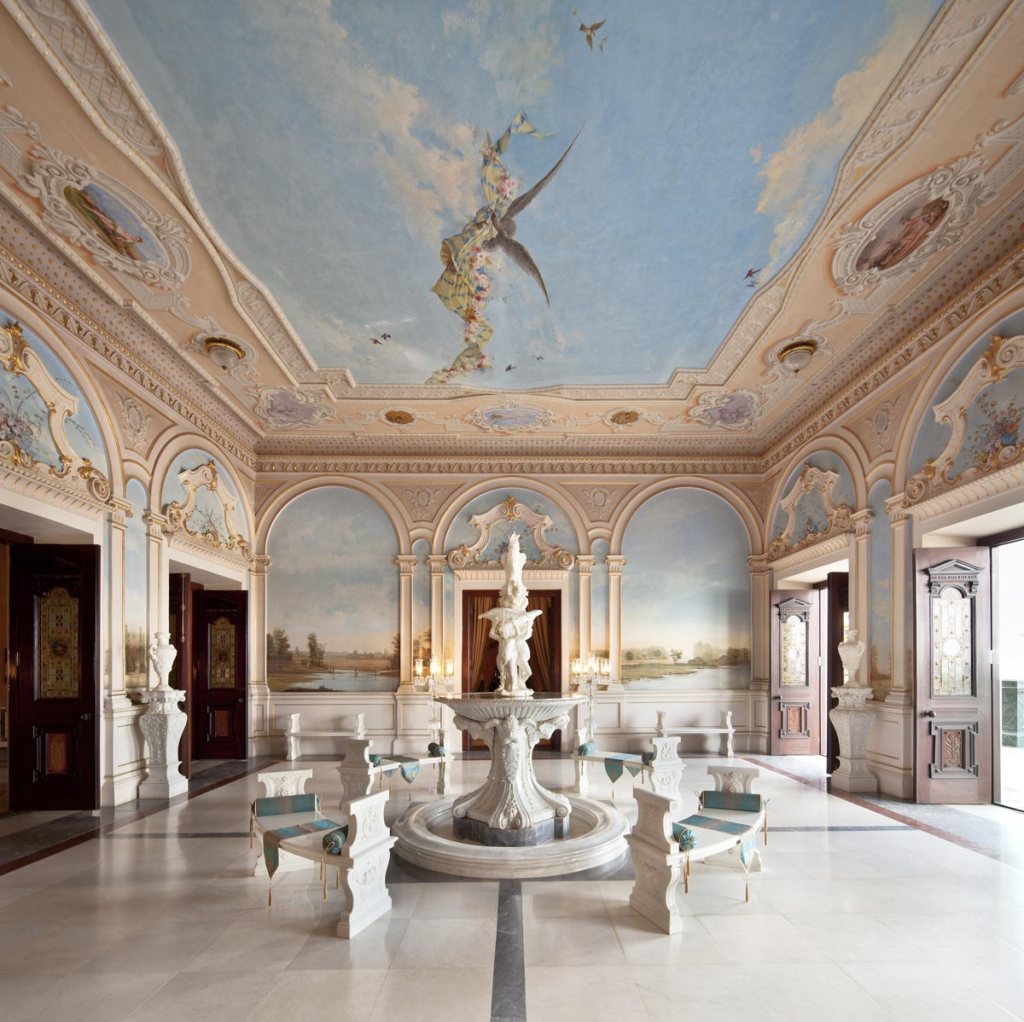
…as well as a large collection of the Nizam of Hyderabad’s treasures, including furniture, paintings, statues, books and manuscripts.
The official residence of the Nizams of Hyderabad was the Chowmahalla Palace, said to have been built starting in 1750.
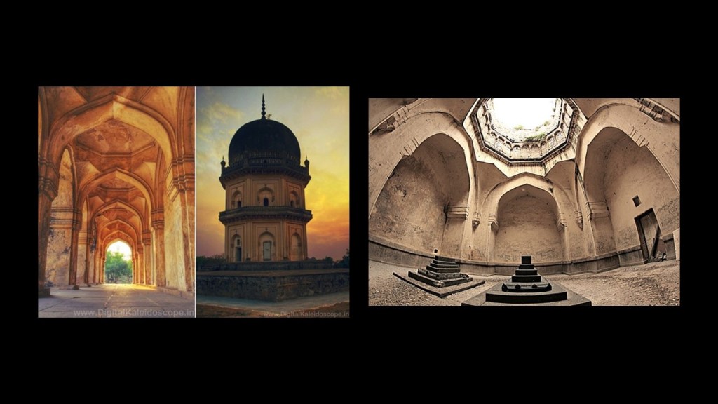
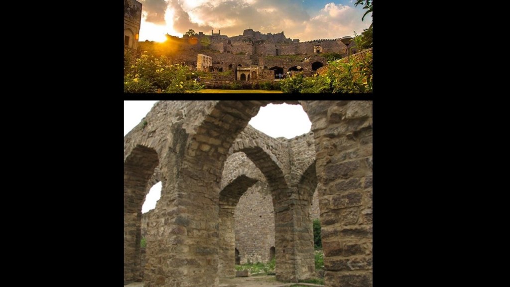
The Qtub Shahi tombs are located in the Ibrahim Bagh, or Garden District, near the Golconda Fort in Hyderabad.
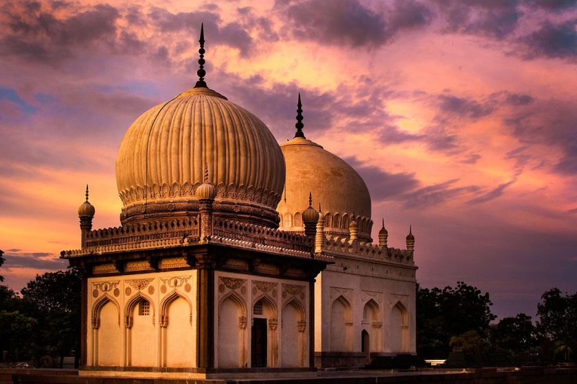
We are told they are the tombs and mosques were built by the various kings of the Qtub Shahi, which ruled the Golconda Sultanate of South India between 1518 and 1687.
There are seven tombs all together, built of grey granite.
I found this picture of a view of the Qtub Shahi tombs from the Golconda Fort said to date to around 1902 that brings mud flood immediately to mind.
I am sharing what I am finding in the written historical record, and I know many things happened to take down the original ancient advanced Moorish civilization and erase it from our collective memory.
Just leaving this here for consideration as to one of the ways this might have happened.

The Golconda Fort is described as a 12th-century citadel with four forts, eighty-seven bastions and numerous buildings.
It is described as an early capital of the Qtub Shahi kings.
Golconda flourished as a trade center of large diamonds, known as Golconda Diamonds.
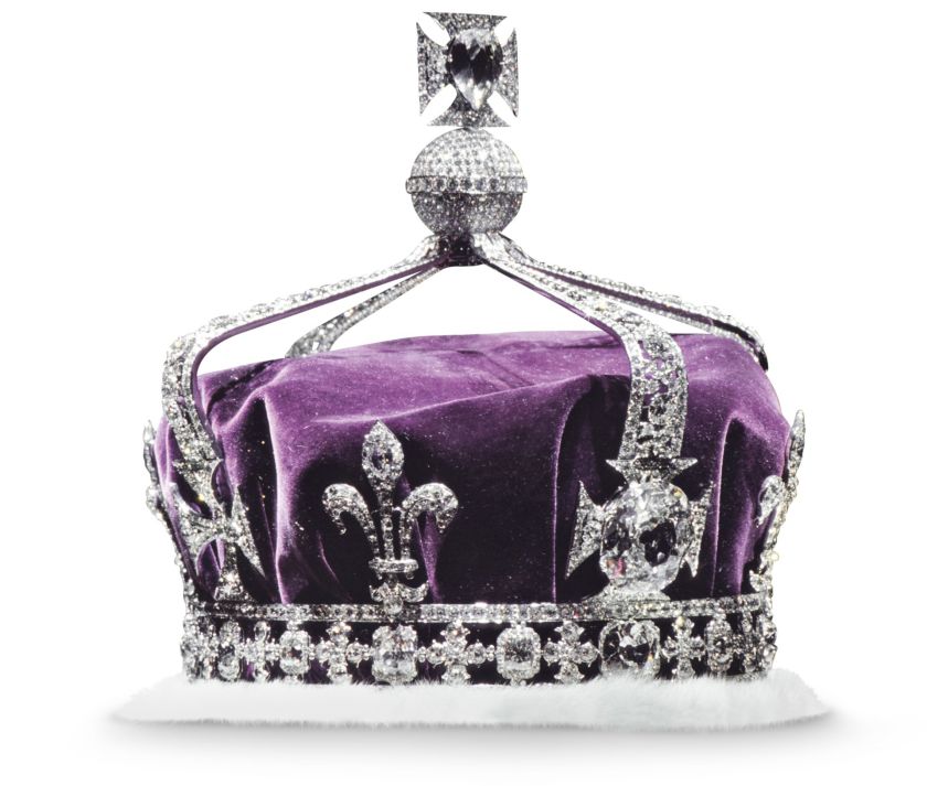
It has produced some of the world’s most famous diamonds, including the Koh-i-Noor, one of the largest cut diamonds in the world. This is a glass replica of it…
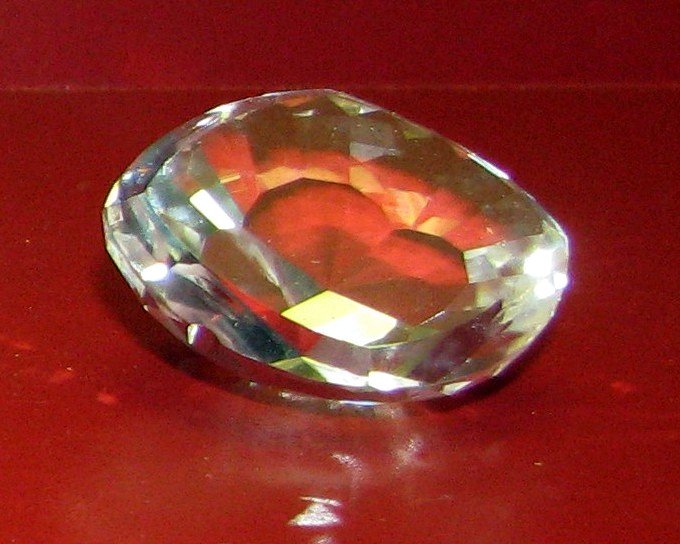
…because the real one is part of the British Crown Jewels…
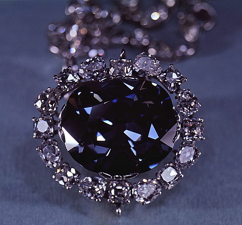
…and the Hope Diamond, a famous, blue-diamond that is on exhibit at the Smithsonian in Washington, DC.
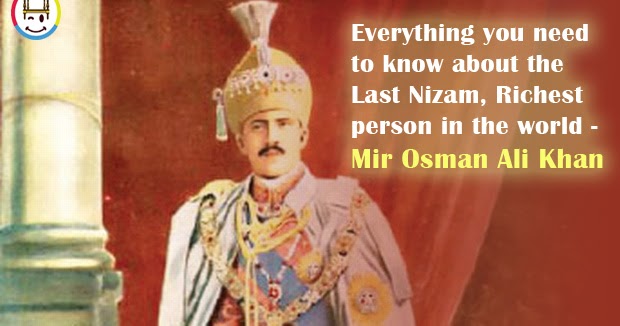
After India gained independence in 1947, the Nizam of Hyderabad, Mir Osman Ali Khan, the world’s richest man of his time, declared his intention to remain independent rather than become part of the Indian Union.
The Hyderabad State Congress began to agitate against him, with the support of the Indian National Congress and Communist Party of India, and in 1948, the Indian Army invaded Hyderabad, and he ended up surrendering to the Indian Union, signing a instrument of Accession which made him a Princely Governor of Hyderabad until October 31st of 1956.
Then on November 1st of 1956, Hyderabad was split into three parts, and merged into neighboring states. Eventually, the Telengana State, of which Hyderabad is the capital, was formed on June 2nd of 2014.

India was called the “Jewel in the Crown” of the British Empire. and its largest, and most important, overseas possession.
Much of the British Empire was built around India, in order to provide routes to, or protection for, India.
India was prosperous and rich, in spices, silk, indigo, gold, cotton, and other products and resources.
Trade with, and eventual political dominance of large parts of India, was what provided Britain with large parts of its wealth in the 1700s through 1900s.

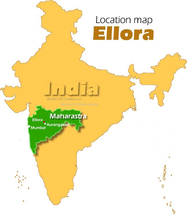
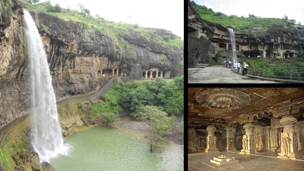
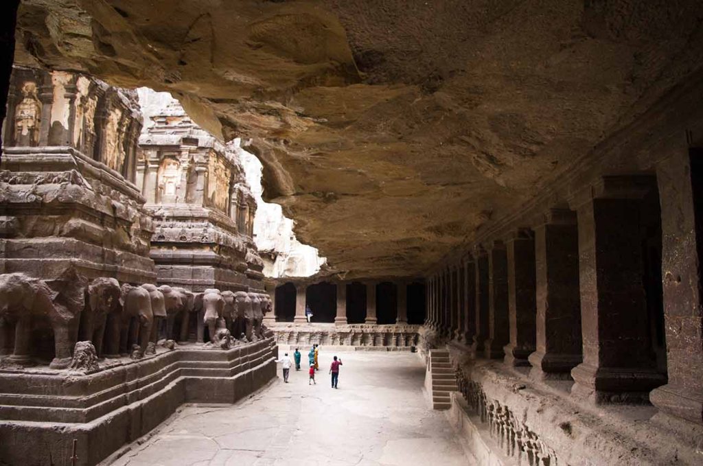
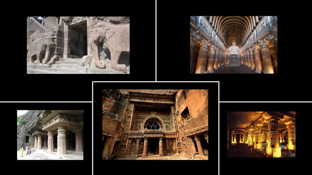
Next on the alignment we come to the Ellora Caves, located in the Aurangabad District of Maharastra, India.
A UNESCO World Heritage Site, it is one of the largest rock-cut, monastery-temple cave complexes in the world, featuring Hindu, Buddhist, and Jain monuments and artwork, and we are told dating to the time-period of 600 – 1000 AD.
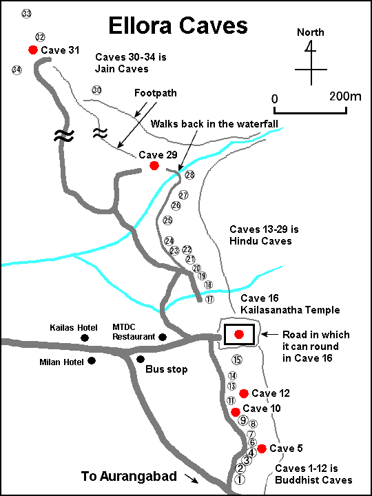
Of the 100-or-so caves at the site, excavated from the basalt cliffs in the Charanandri Hills, thirty-four are open to the public.
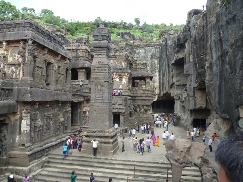
The Kailasa is the largest of the rock-cut temples at the Ellora Caves.
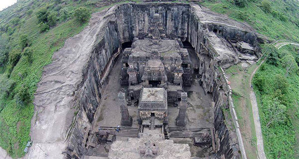
Carved from a rock-cliff face, it is considered one of the most remarkable cave temples in the world because of its size, architecture, and sculptural treatments.
It is the world’s largest monolithic structure, meaning carved-out from the rock.
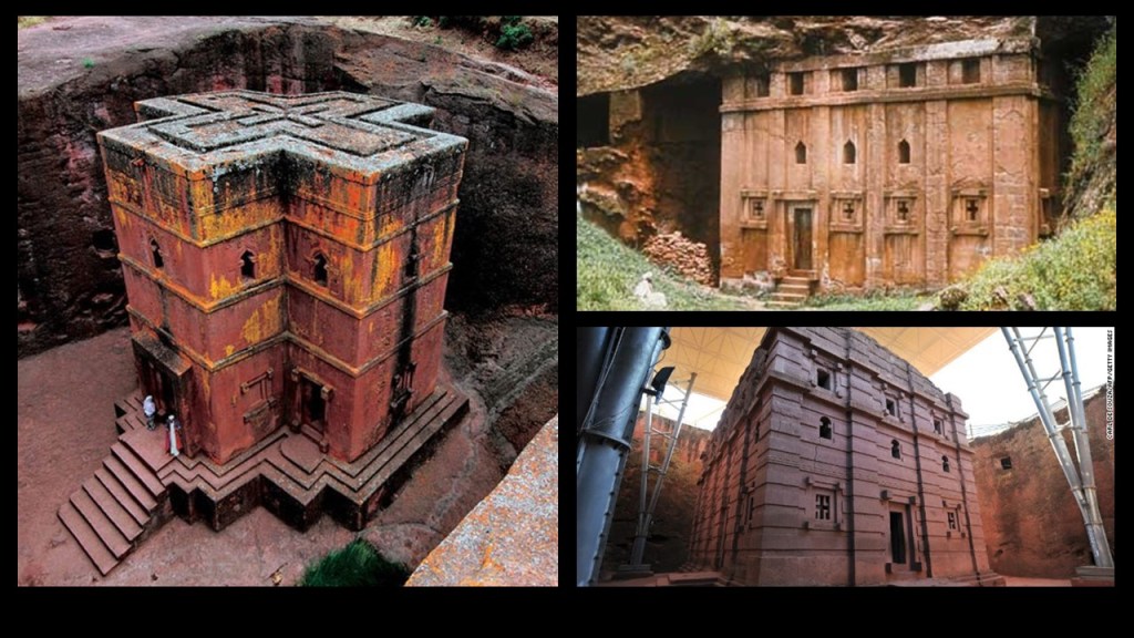
Examples of places in other countries with massive architecture cut directly out of rock include the eleven monolithic churches of Lalibela in Ethiopia.
Here are three of the churches in Lalibela.
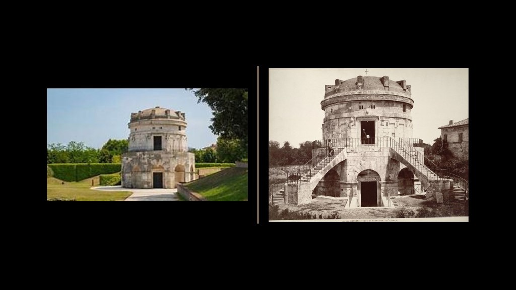
The roof of the mausoleum of Theodoric outside of Ravenna in Italy is described as a single, 230-ton, or 209-metric-tonne type of limestone, which for some reason no longer has its beautiful double-stone-staircase, and other features it used to have that look like they have been filled in.
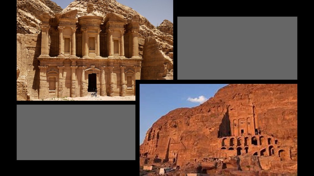
The ancient site of Petra in Jordan is also monolithic…
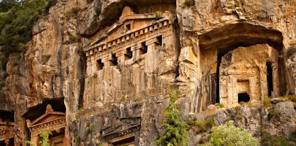
…as are the Lycian rock-cut Dalyan temples in the province of Antalya in southern Turkey.
The Ajanta Caves are also in the Aurangabad District of Maharashra state…
…almost thirty rock-cut Buddhist cave monuments, said to date from the 2nd-century BC to about 480 AD.
…and believed to be among the finest surviving examples of ancient Indian art, and masterpieces of Buddhist religious art.
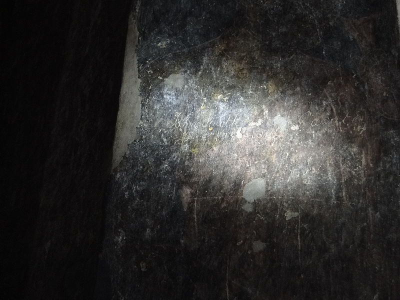
The Ajanta Caves were said to have been re-discovered in 1819 by a British officer named John Smith.
While hunting tigers, he was said to have discovered the door to cave #10 when a local shepherd boy guided him to the location and the door.
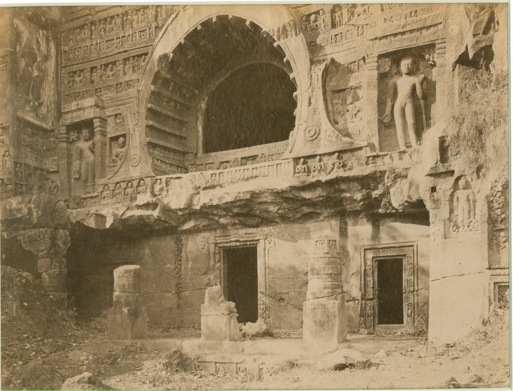
John Smith went to a nearby village to get help gaining entrance to the temple, after which time he vandalized the wall by scratching his name and the date over a painting on the wall.
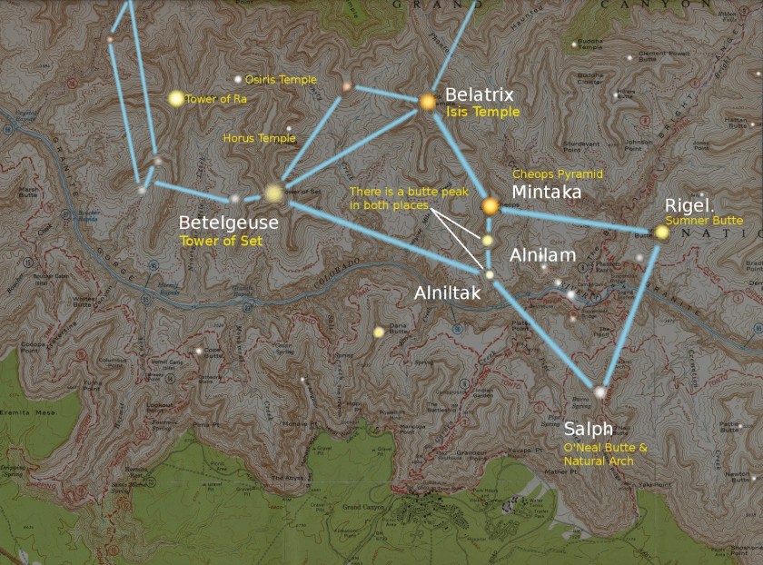
It is interesting to note that the Grand Canyon has Hindu names for some of its rock features, like the “Three Hindu Gods at the Grand Canyon…”
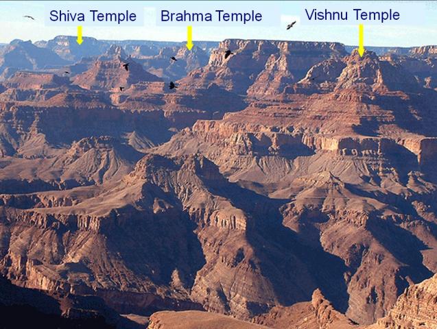
…as well as ones with Egyptian names, which are a part of the formation of a star map of the constellation Orion.
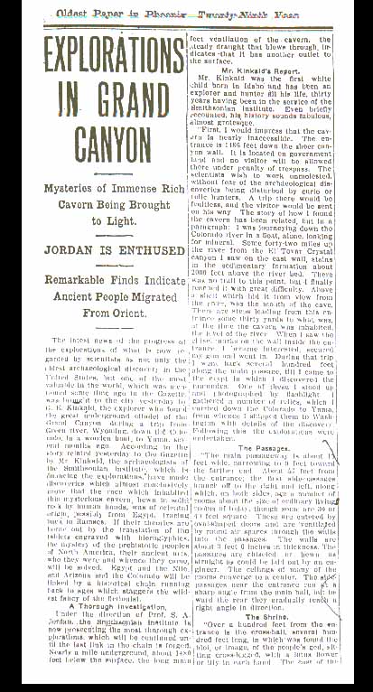
And there are stories from early explorers of the Grand Canyon, like the one of G. E. Kinkaid, who claimed to have found an entrance to a mysterious underground citadel…
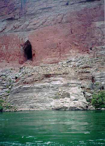
…which led to the finding of a massive chamber from which scores of passages radiated…
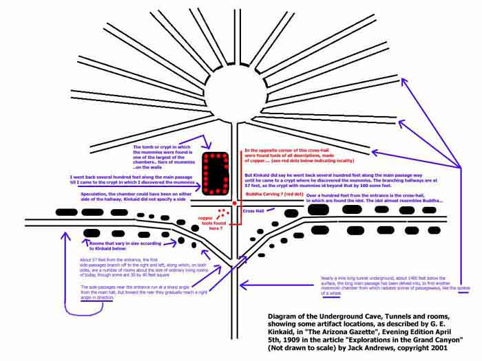
…and finding, among many other similar things, an idol sitting cross-legged, with a lotus flower in each hand.
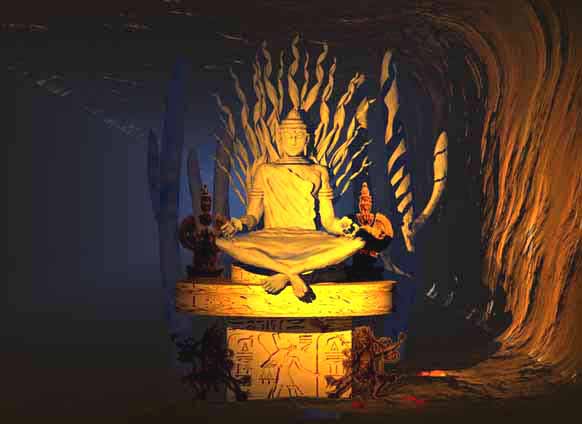
An expedition to a rock-cut vault in the Grand Canyon in 1909 by a Professor S. A. Jordan of the Smithsonian received front-page coverage in the Phoenix Gazette, about which the Smithsonian in short order was said to have claimed to not have knowledge of the discovery or the discoveries.
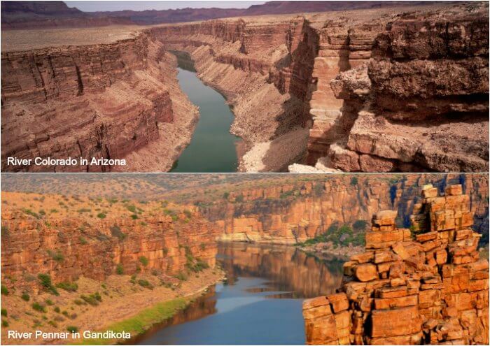
The “Grand Canyon of India…”
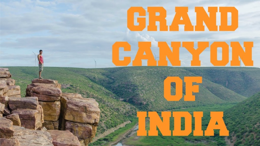
…is in a place called Gandikota, in the Andhra Pradesh State, along the Pennar River.
Here is a comparison of the Colorado River in the on the top in the vicinity of the Grand Canyon in Arizona, and Pennar River in Gandikota in India on the bottom.
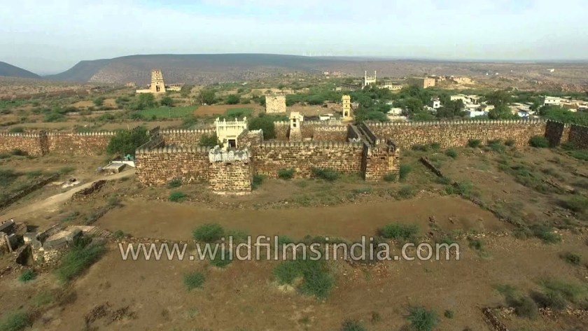
Gandikota, the center of power for various dynasties, including the Golconda Sultanate mentioned in the last post, also has a massive fort at Gandikota, built of granite, with a 20-foot, or 6-meter, high entry gate in a fort wall running around a 5-mile, or 8-kilometer, perimeter.
It has 101 bastions, each about 40-feet, or 12-meters, high.
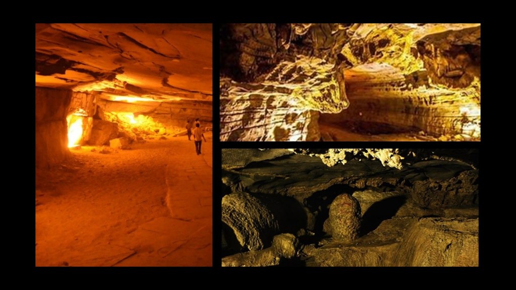
The Belum Caves, approximately two-hours from Gandikota in Andhra Pradesh…
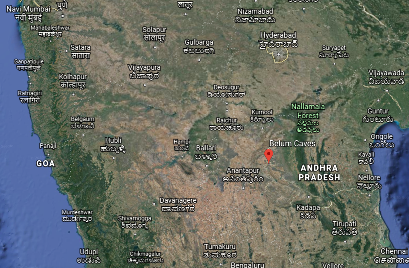
…are the largest and longest cave system open to the public on the Indian Subcontinent.
The Bezeklik Thousand Buddha Caves are found in Turpan, in the Uighur Autonomous Region of China, a complex of 77 rock-cut cave grottoes said to date from between the 5th and 14th centuries…
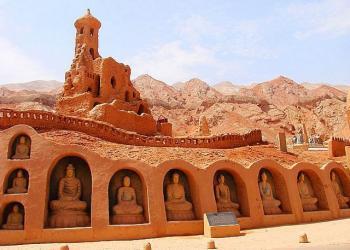
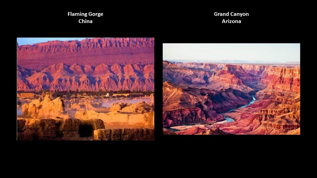
…and are located in what is called the Flaming Gorge…Here is the Flaming Gorge in China compared to the appearance of Arizona’s Grand Canyon.
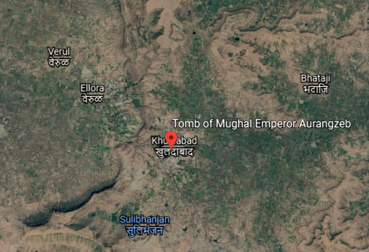
Just a short distance from the Ellora Cave-Temple Complex in Khuldabad is the Tomb of Aurangzeb, considered the last of the strong Mughal Emperors, and who died in 1707 in our historical narrative.
Aurangzeb means “Ornament of the Throne” in Persian.
A Persian name for the ruler of the Mughal Empire of the Indian subcontinent?
His burial site is located on at the complex of the dargah, or shrine, of Sheikh Zainuddin, a Sufi saint of the Dahkan, also known as Deccan, of India, and the spiritual and religious teacher of Aurangzeb.
As a matter of fact, Khuldabad is known popularly as the “Valley of Saints” because several Sufi saints resided there in the 14th-century.
Who were the Sufis?
They were mystics, and practitioners of the inward dimension of Islam.
Sufism emphasizes personal experience with the Divine, and concentrating one’s energy on spiritual development rather than focusing on the teachings of human religious scholars.
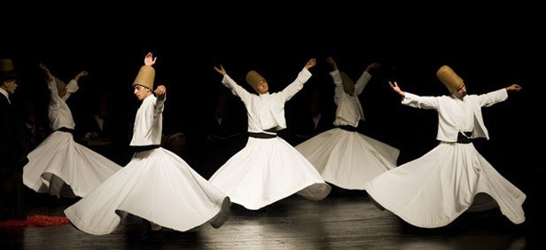
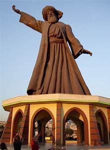
For example, followers of the Persian Sufi Mystic Rumi, from the Greater Khorasan…

…established the Mevlevi Order in Konya, Turkey, otherwise known as Whirling Dervishes, who practice a spinning dance used to connect with the Divine.
Okay, this information about the Mughal Emperor Aurangzeb having a Persian name and being a Sufi…
…and Rumi being a Persian from the Greater Khorasan is really nudging at my consciousness to bring in another stream of information.
Some of what I am about to share is based on things I have learned in tracking alignments over the years, and some of it is based on things I remember learning at some point in my life.
I am going to surf the synchronicities here because that is all I am able to do.
The validity of this information is gone from the official historical narrative about whether or not I am correct going in this direction.
I can’t definitively prove what I am going to say, but I can bring forward something that wants to come out in a meaningful way.

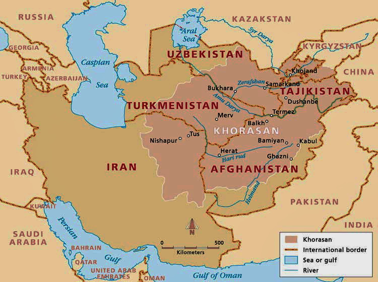
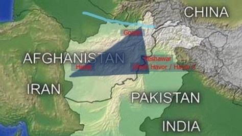
I have found alignments running through a region historically called “the Greater Khorasan,” forming the northeast province of what is called Iran today, Persia historically, and comprising the present territories of northeastern Iran, parts of Afghanistan, and much of Central Asia.
Khorasan is said to mean something along the lines of “Land of the Sun,” or “Where the Sun Arrives from” in Persian.
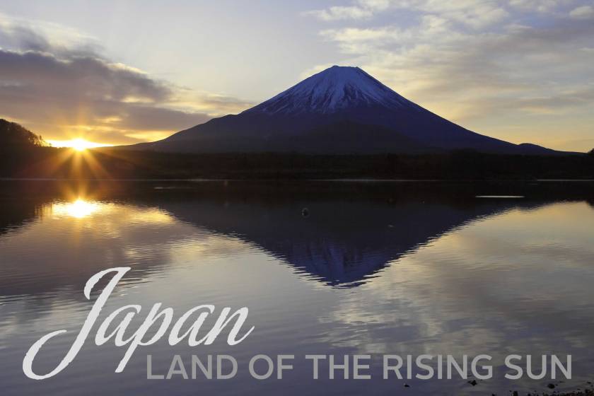
Historically modern Turkey was known as Anatolia, and also means something along the lines of “Rising Sun” in ancient Greek.
Also, the “Land of the Rising Sun” is a popular nickname for the country of Japan.
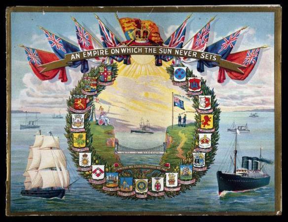
So what this tells me is that the whole concept of the sun always rising on the empires of the ancient advanced civilization was embedded in language and collective awareness.
In similar fashion, we learned that the “Sun never set on the British Empire.”
We are told that between the 18th- and 20th-centuries, Britain acquired more and more territories, making it the largest empire in history.
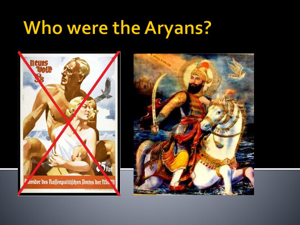
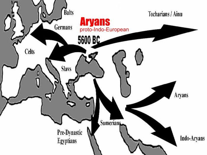
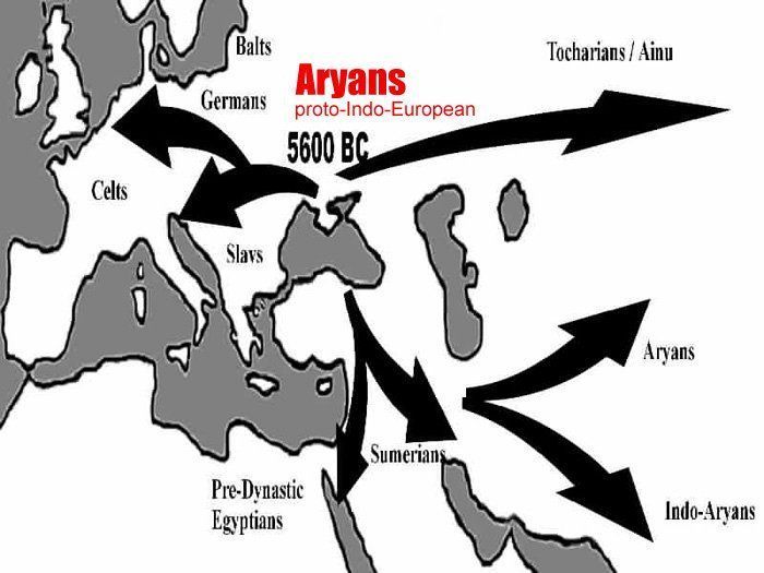
When I saw the Persian name of the Mughal Emperor Aurangzeb, I vaguely recollected something about the Aryans. It rang the bell of a distant memory.
In looking up definitions of Aryan, here is what I am finding:
The Aryans brought Hindu religious thought to India;
The term was used by the Indo-Aryan people of the Vedic period in Ancient India as a religious label for themselves;
The Iranian people used the term as an ethnic label for themselves in the Avesta scriptures, the religious texts of Zoroastrianism, and the word “Aryan” forms the source of the country name Iran;
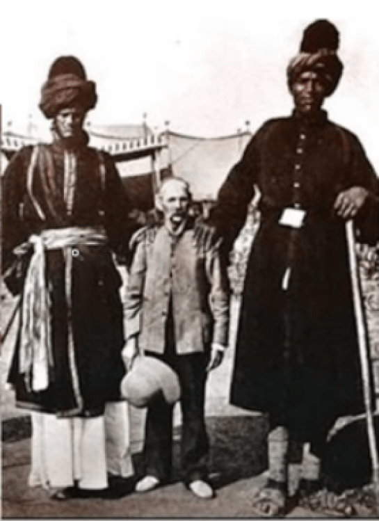
The definition of an Aryan, described by the Nazi Germans as a member of the Master Race, was not Jewish and had nordic features.
What exactly was the Nazi obsession with creating a Master Race all about?

Was this actually an obsessive desire to re-create the original Master Race of a worldwide civilization that was destroyed in a cataclysm we haven’t been told about?
Giant human beings who, among many other things, were capable of creating massive monolithic stone infrastructure like it was no big deal?
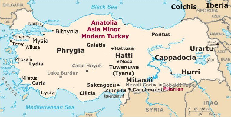
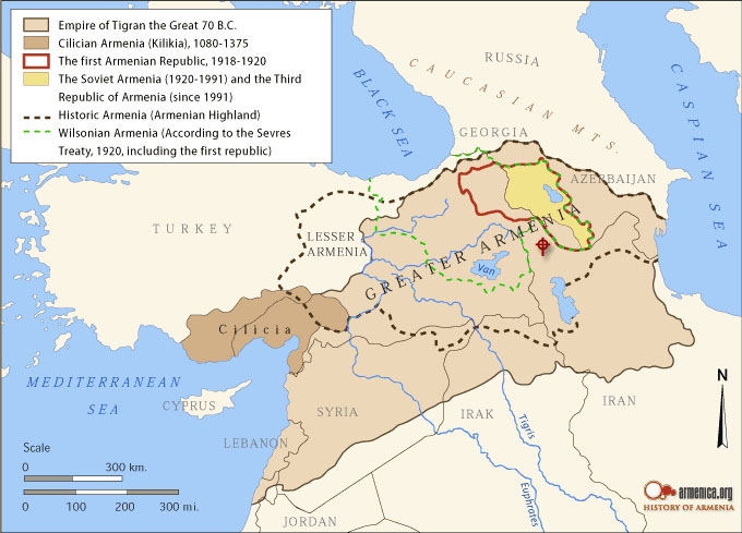
When I was tracking an alignment through the modern country of Turkey, in the ancient region of Lake Van, I learned about the Kingdom of Urartu…
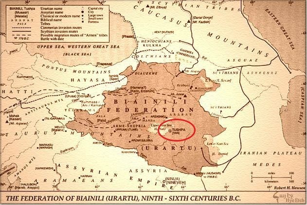
…which was historically part of Armenia.
Which brings me to the question: Who were the People of Ar?

Mt. Ararat, the legendary landing place of Noah’s Ark, was located in the historical Armenia, though now is within the boundaries of modern Turkey.
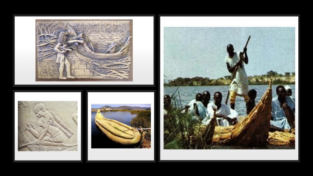
The Sumerians called Ararat “Arrata,” and they tell of this land of their ancestors in the Armenian Highlands in the epic poem of Gilgamesh.
Compare the boat pictured here with the Sumerian Gilgamesh on the top left with an ancient Egyptian boat on the bottom left; a boat on Lake Titicaca in Peru on the bottom center; and a boat on Lake Chad in Africa on the right.
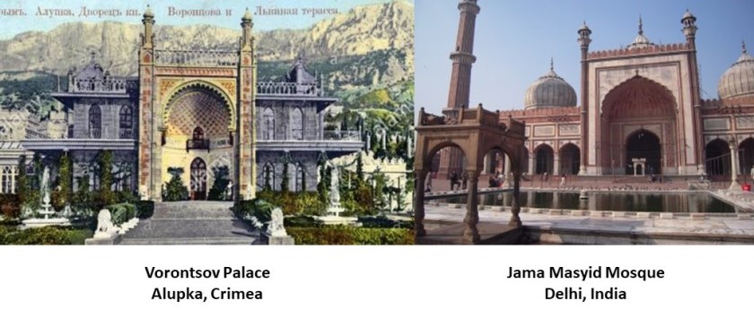
As a matter of fact, Arrata is said to be now recognized as the world’s most ancient, known civilization, dating back to 22,000 BCE, developing in the steppes north of the Black Sea, in modern Ukraine and believed to spread out from there to India, Mesopotamia, Egypt, Western China, and across Europe.
This is the Vorontsov Palace in Alupka, on the Black Sea’s Crimean Peninsula, which was historically part of the Ukraine, on the left, in comparison with the Jama Masyid Mosque in Delhi, India, on the right.
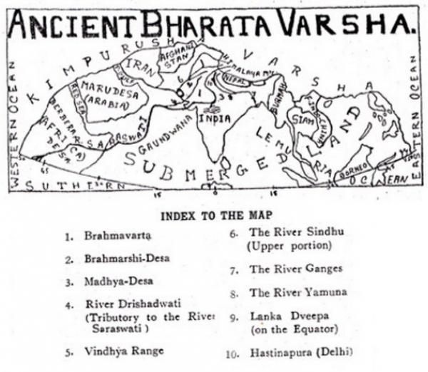
I found out that ancient India was known as Bharata Varsha at one time…or does the term Bharata Varsha refer to the entire earth?

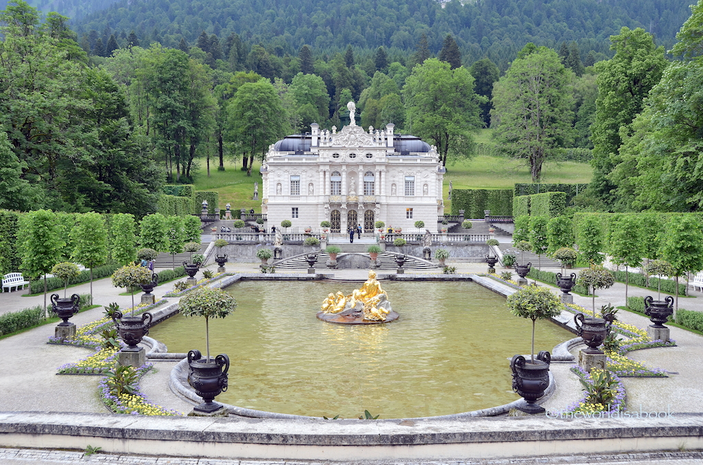
Let’s take a look at Bavaria, a state in Germany, at the Linderhof Castle, the smallest of three castles said to have been built by mad King Ludwig II, constructed between 1863 and 1886.
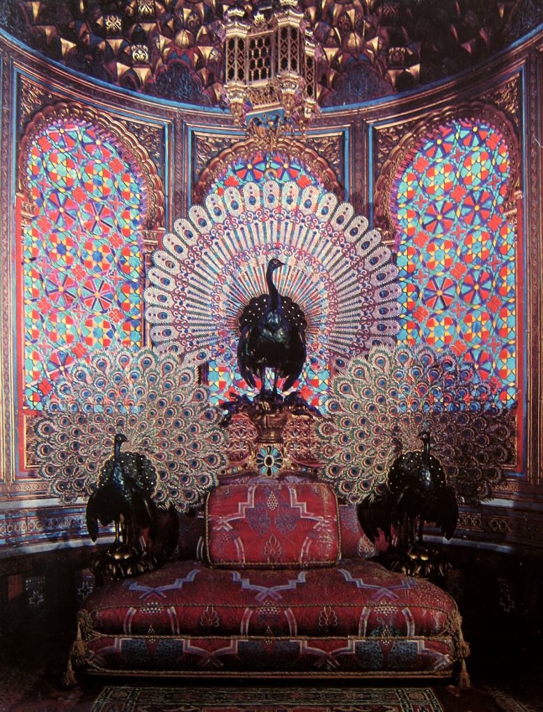
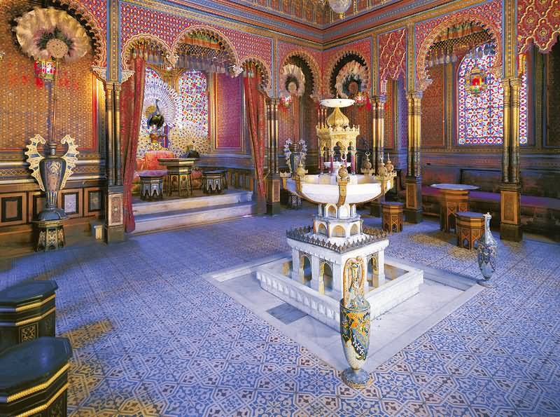
This is the Peacock Throne found inside the Linderhof Palace.
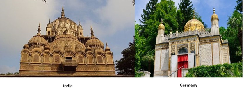
…and Moorish architecture is found in this amazing room inside the main Linderhof Palace…
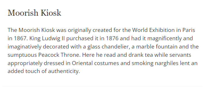
…in this building located on the grounds of the Linderhof Palace called the “Moorish Kiosk.”
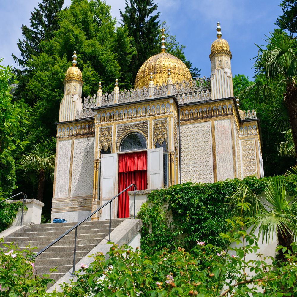
This is what we are told about the Moorish Kiosk.
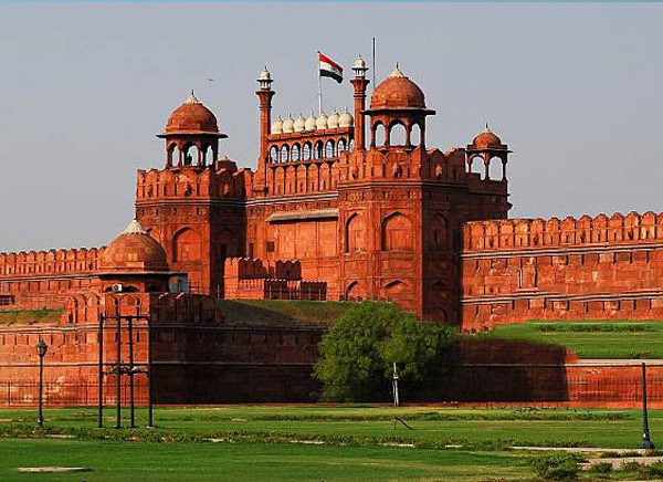
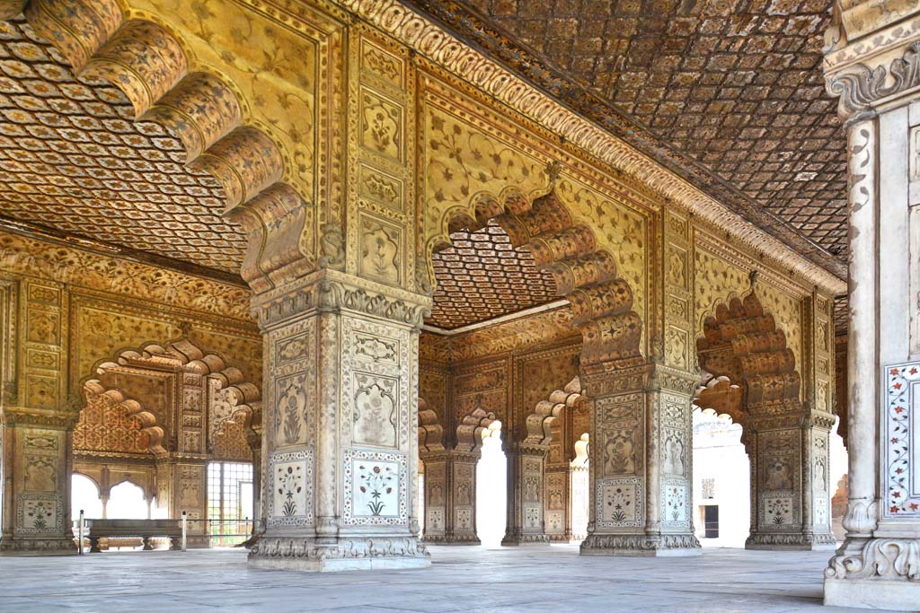
The Peacock Throne of the Mughal Emperor in India was also a famous jewelled throne…
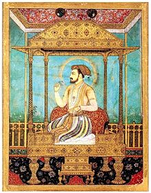
…located in the Hall of Private Audiences…
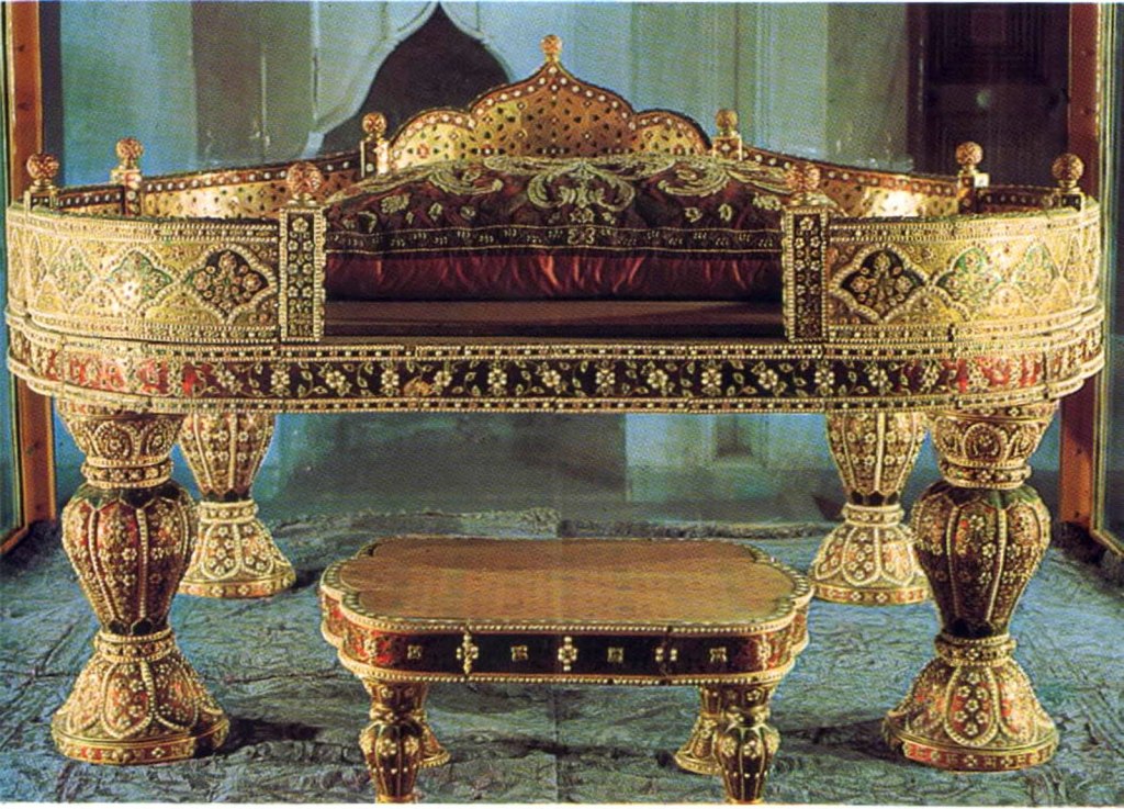
…at the Red Fort, in Delhi, India, the main residence of the Mughal Emperors.
…and now the Mughal Peacock Throne is on display at the Topkapi Palace in Istanbul, Turkey, not in India.
Where else can I find “Ars, like “BavARia?”
Tartary, or Tartaria, a historical region in northern and Central Asia…
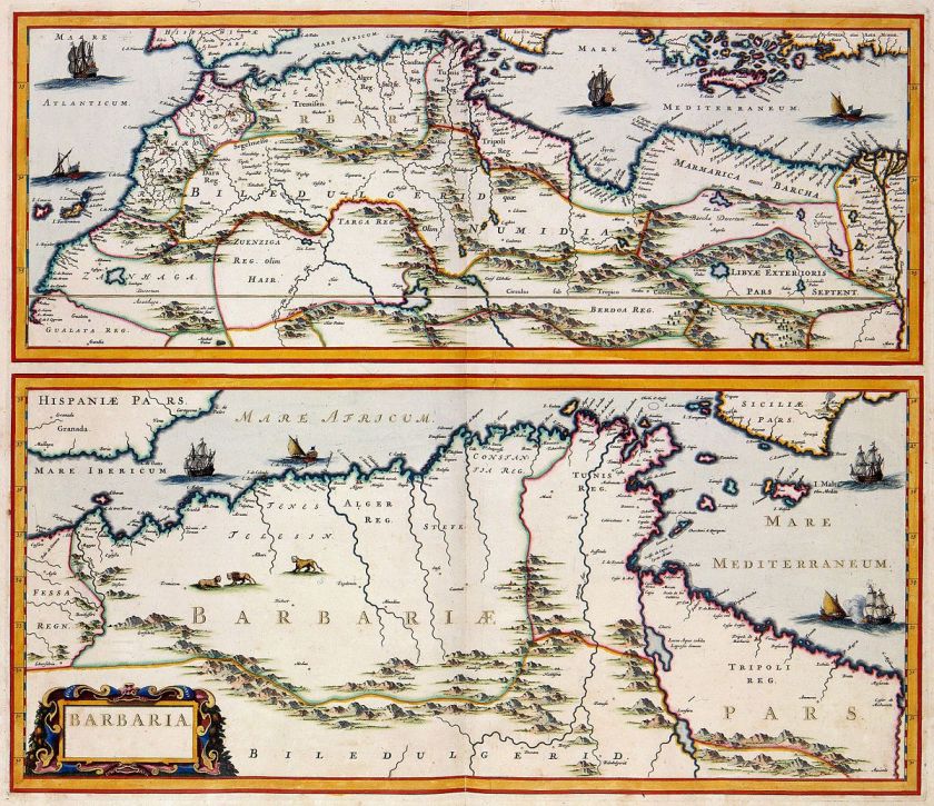
…the Barbary Coast, or Barbaria, the name given to a vast region stretching from the Nile River Delta, across Northern Africa, to the Canary Islands…
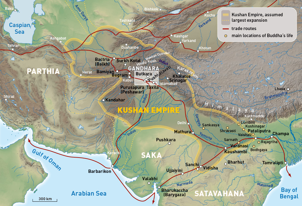
…Gandhara, an ancient Buddhist Kingdom primarily in what is now Pakistan, and part of the Kushan Empire…
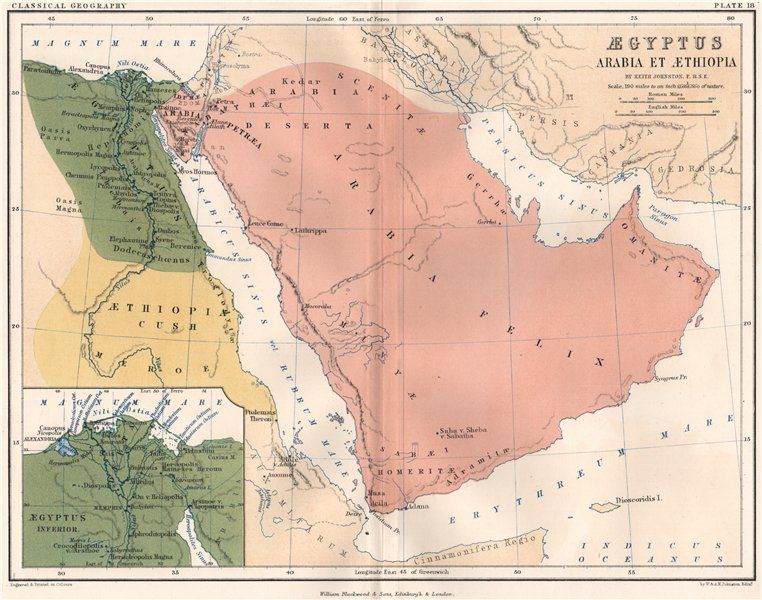
…Arabia…
…Arizona in the United States, with its flag on the top, compared with the flag of Tibet on the bottom, both looking very much like a sunrays in the background…

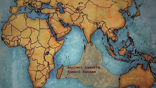
…and Kumari Kandam, a lost continent in the Indian Ocean that had an ancient Tamil civilization, to name just a few.
Who were the People of Ar?
Now back to India.
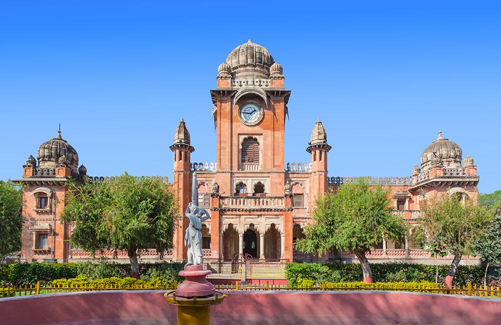
The next place I want to take a look at on the alignment is Indore, the largest and most populated city in the Indian state of Madhya Pradesh.
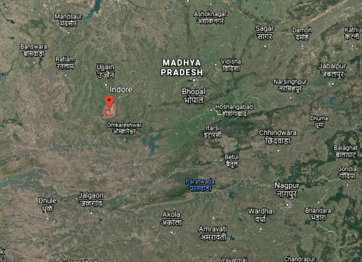
We are told Indore was founded in the 16th-century as a trading hub between Delhi and the Deccan region of India.
It was ruled as a princely state by the Holkar Dynasty until they acceded to the Union of Indian in 1947.
The first Holkar of the Dynasty was Malhar Rao Holkar, who ruled from 1731 to 1766.
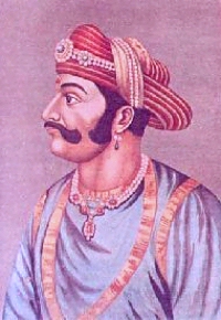
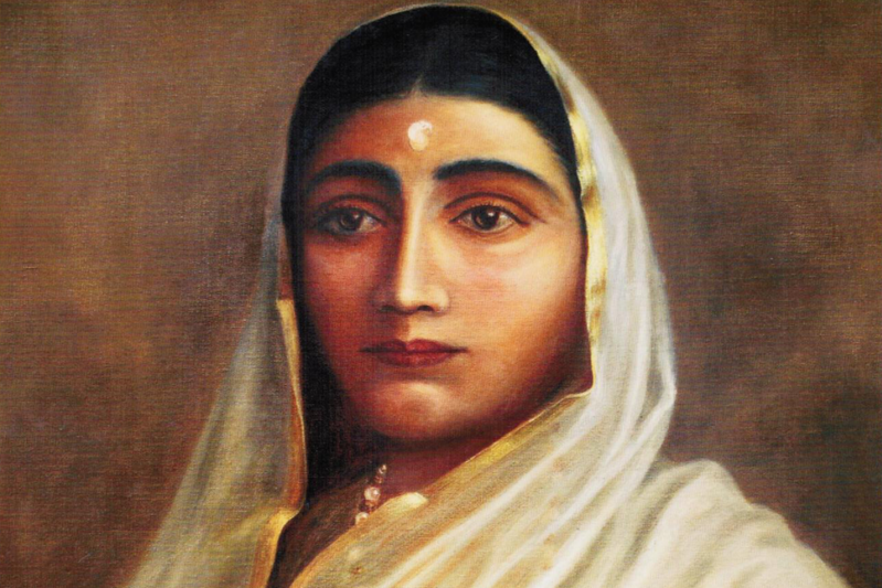
This is the Chhatri, the definition of which is funerary monument, for him that was said to have been built by his daughter-in-law, Ahilyabai Holkar…
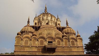
…who became Queen in the Holkar Dynasty after the death of her husband, Malhar Rao Holkar’s son, Khanderao Holkar.
Now compare the similarities between Malhar Rao Holkar’s Chhatri on the left with the Moorish Kiosk we saw previously on the grounds of the Linderhof Palace in Bavaria, Germany, on the right.
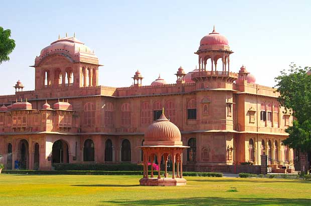
The Rajwada Palace in Indore was a royal residence of the Holkars…
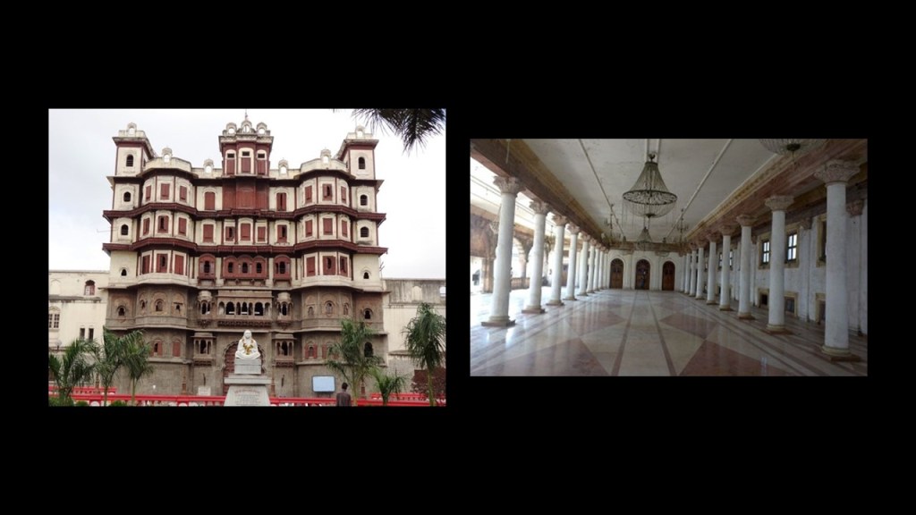
…as was the Lal Bagh Palace.
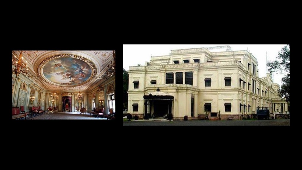
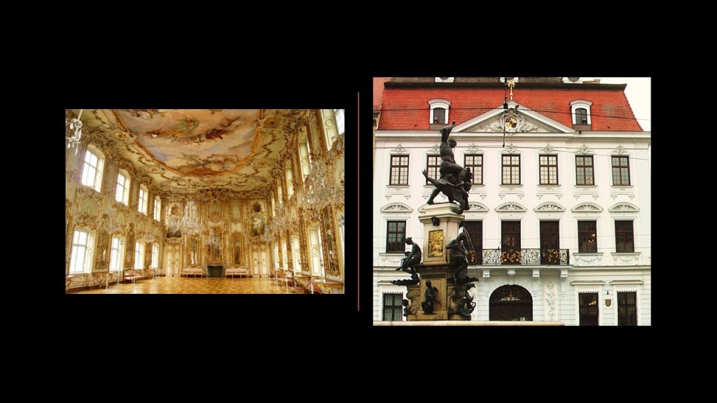
The Lal Bagh Palace brought to mind the Schaezlerpalais in the city of Augsburg, in Bavaria, Germany, which I remember visiting when I was stationed there in the Army in the mid- 1980s.
The Mahatma Gandhi Town Hall in Indore was said to have been built in 1904, named King Edward Hall, and renamed to honor Gandhi in 1948.
The Kanch Mandir in Indore is a Jain temple, said to have been built starting in 1903.
Meaning “Temple of Glass,” the inside is entirely covered by glass panels and mosaics, including the floor, columns, walls, and ceilings.
One side-note before ending this post.
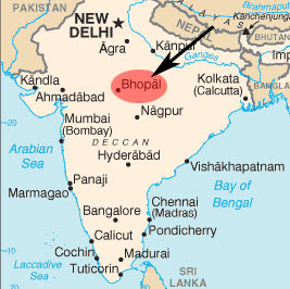
It is important to note that the capital of the Indian state of Madhya Pradesh is Bhopal, which is 107-miles, or 172-kilometers, from Indore.
Bhopal was the location of the world’s worst industrial disaster in December of 1984, when the Union Carbide pesticide plant there leaked highly toxic methyl isocyanate gas, which made its way into the surrounding areas.

The official death toll at the time was 2,259, and this major gas leak caused over half-a-million injuries, with on-going effects over time.
One last point of information about Bhopal.
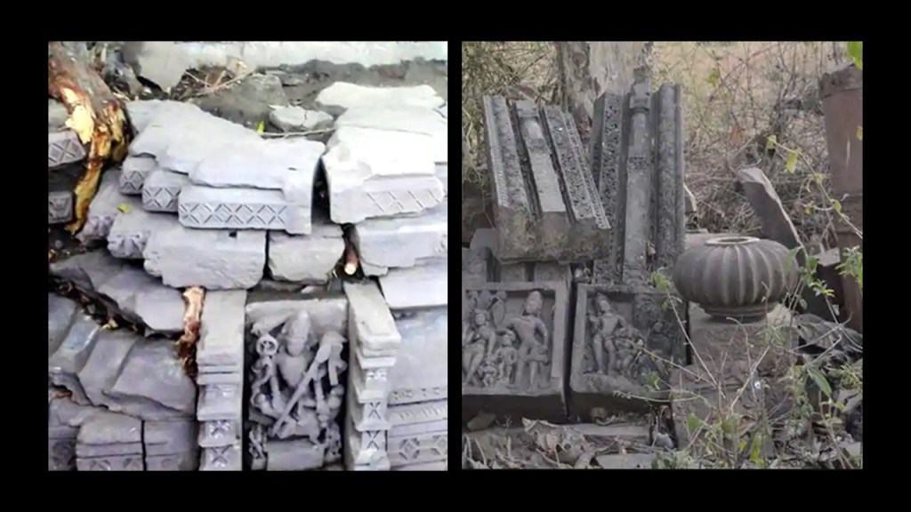
About ten years ago, archaeologists found the remains of twenty-one temples near Bhopal, in the village of Ashapuri, believed to date back 1,300-years .
These people were remarkably prolific builders.
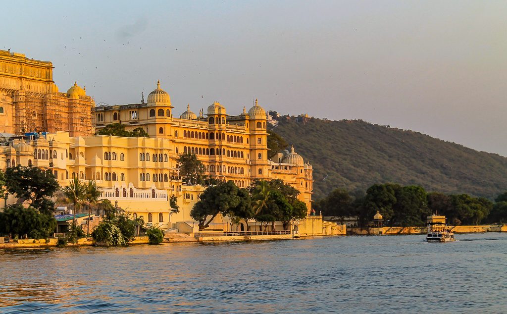
The next place on the alignment is Udaipur, also known as the “City of the Lakes,” in India’s Rajasthan State.
Another nickname of Udaipur is “Venice of the East.”
It was the historic capital of the Mewar Kingdom…
…said to have been founded in 1558 by Udai Singh II of the Sisodia clan of Rajput…
…after he shifted his capital from Chittorgarh…
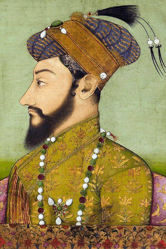
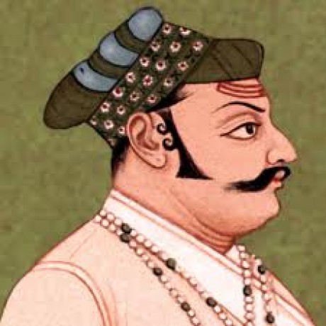
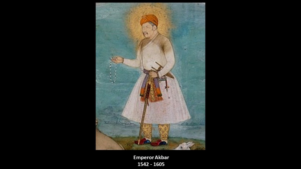
…because it was beseiged by the third Mughal Emperor, Akbar, who reigned from 1556 to 1605.
Yet I find this portraitof Akbar looking more like a Sufi saint, with the light of spiritual illumination surrounding his head, than a depiction of a general who was said to have extended the influence of the Mughal Empire over almost the entire Indian subcontinent because of military, political, cultural, and economic dominance.
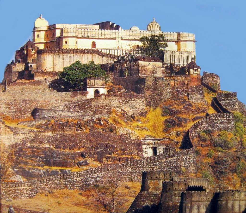
Udai Singh II was said to have been crowned by the nobles of Mewar in 1540 in the Kumbhalghar, a Mewar fortress said to have been built in the Aravalli Hills around Udaipur in the 15th-century by the Mewar King Rana Kumbha.
It is a UNESCO World Heritage Site included in the Hill Forts of Rajasthan.
Udai Singh II was said to have built his new palace on a location chosen for him by a hermit he came across while looking for a place to build it, called the “City Palace” today.
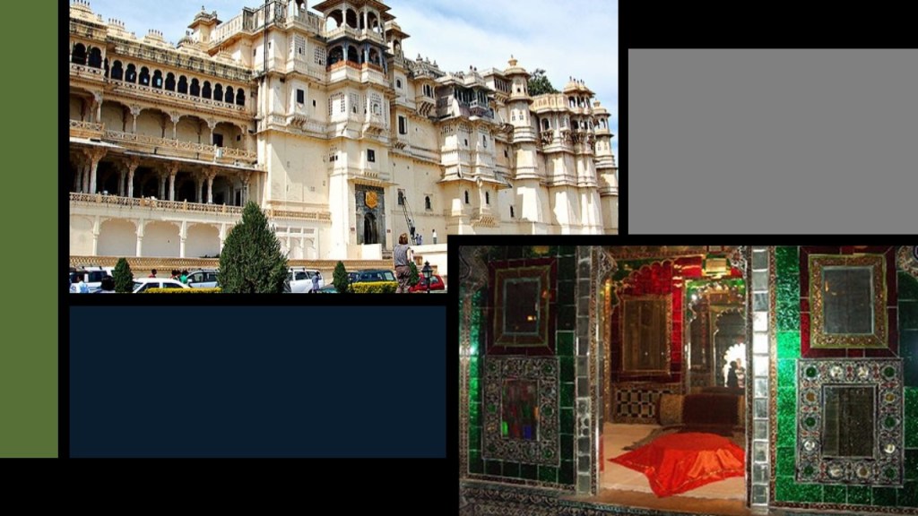
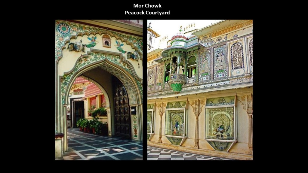
This is the entrance to the Peacock Courtyard at the City Palace, known as the “Mor Chowk.”
This courtyard was used for royal banquets, and has mosaics of peacocks on the walls surrounding the courtyard.
Udai Singh II was also said to have built a 4-mile, or 6-kilometer, long wall, with 7-gates, in order to protect Udaipur from external attacks.
This is one of the wall’s gates…the gate of the City Palace…known as the “Tripolia Pol,” or “Triple Gate.”
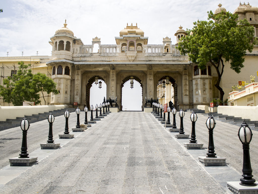
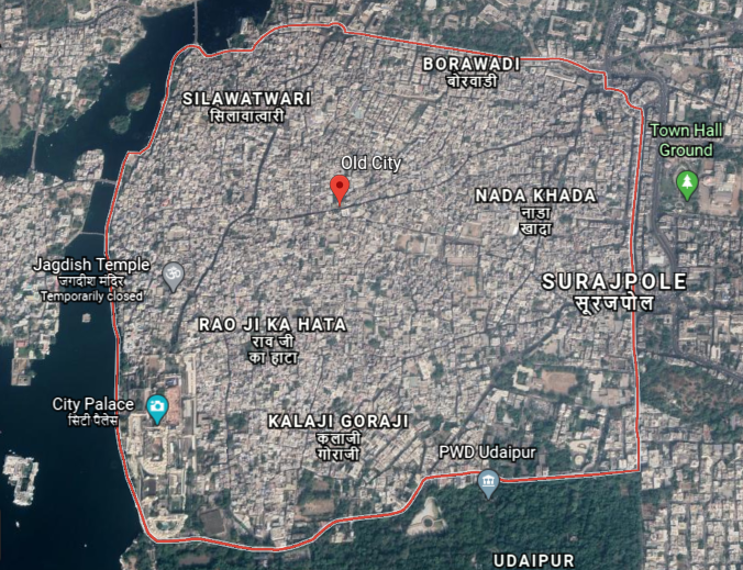
The area within this wall is still known as the “Old City” or “Walled City.”
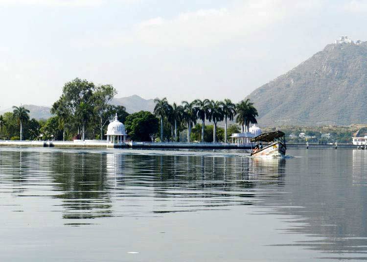
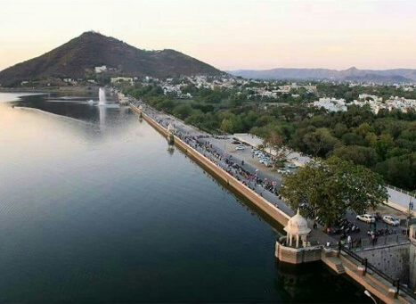
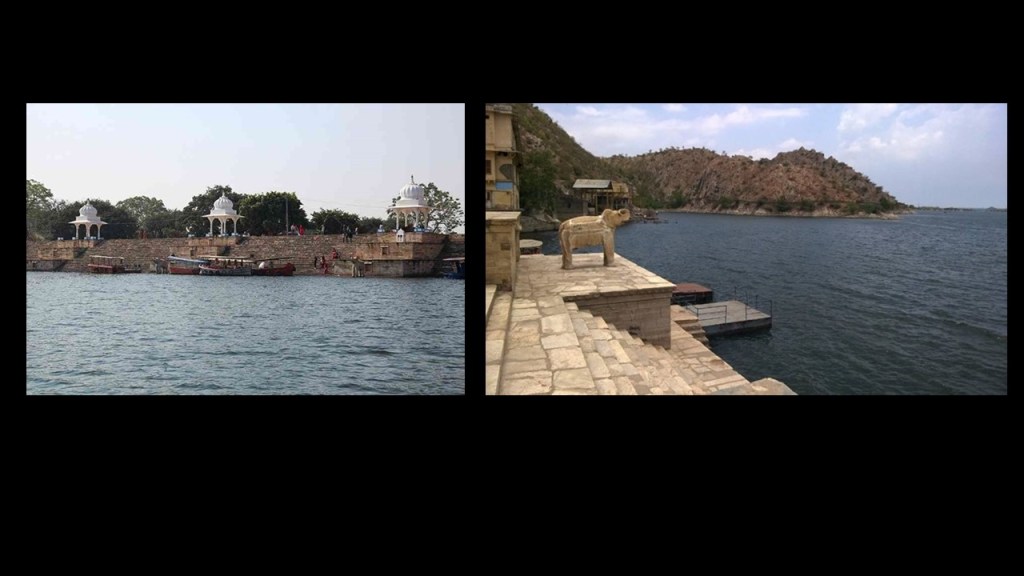
This is a view of the City Palace in the Old City from Lake Pichola.
Lake Pichola is described as an artificial freshwater lake that was said to have been created in 1362 by Picchu Banjara, a gypsy tribesman who transported grain during the reign of Maharana Lakha, the third Maharana of the Mewar Kingdom.
Are we being told one man built this artificial lake?
I looked for other references, but the available historical record consistently came back to the lake having been built by this man…in the 1300s…before Udaipur was said to have even been founded.
In addition, Lake Pichola has four artificial islands.
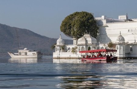
The Jag Niwas, where the Lake Palace is built.
Now a hotel, it was said to have been built between 1743 and 1746, under the direction of Mewar Maharana Janat Singh II.
Jag Mandir is an island and palace in Lake Pichola, said to have been constructed by three Maharanas some time between 1551 and 1652…
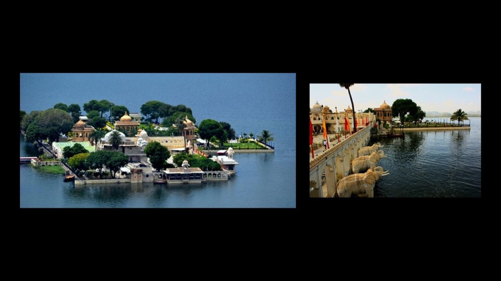
…as well as the island of Mohan Mandir…
…and Arsi Vilas.
Large masonry structures completely surrounded by water?
How did they even build them in water like that?
So far, the origin stories of Udaipur, contrasted with the magnificence of the architecture and infrastructure, are just not adding up.
Let’s take a look at some other places in Udaipur and see what we find.
The Sajjan Garh fort is a hilltop palatial residence in Udaipur, with a panoramic view of the city’s lakes, palaces, and surrounding countryside…
…and named after Maharana Sajjan Singh, who was said to have built it in 1884.
Also known as the Monsoon Palace, it was said to have been built there in order to watch the monsoon clouds.
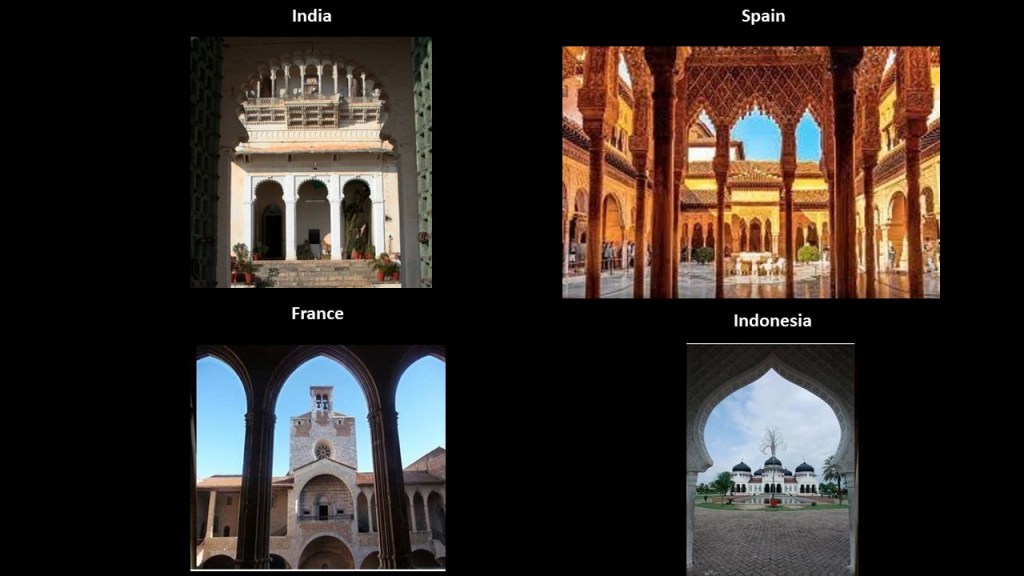
Here is a beautiful example of the symmetry, proportion and alignment of archways and openings at Sajjan Ghar on the top left that I have found around the world, like the Alhambra, in Grenada, Spain, and a classic example of Moorish architecture on the top right; the Palace of the Kings of Majorca in Perpignan, in southern France, on the bottom left; and in Indonesia, at the Baiturraman Grand Mosque in Banda Aceh, on the bottom right.
The Sajjan Ghar Fort overlooks Fateh Sagar Lake, another of Udaipur’s artificial lakes.
Fateh Sagar Lake was said to have been built in 1680s, with no details on the builders of it.
Udaipur Solar Observatory is on one of three artificial islands in the lake.
Said to have been built in 1976, it has one of the most powerful solar telescopes in the world.
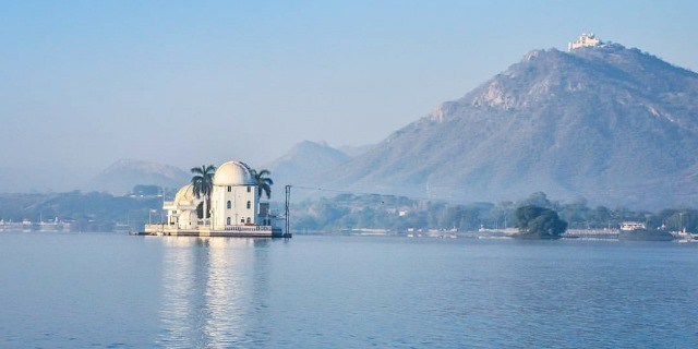
It was said to follow the model of the solar observatory at Big Bear Lake in Southern California.
Dhebar Lake near Udaipur is India’s second-largest artificial lake.
Dhebar Lake was said to have been created in the 17th-century by Rana Jai Singh when he built a marble dam across the Gomati River, resulting in the largest artificial lake in the world at the time.
The tribe of Bhil Minas inhabits all three islands on Dhebar Lake.
The Bhils, who speak a subgroup of the western zone of the Indo-Aryan languages, are one of the largest indigenous groups in India, as well as among the most economically deprived peoples of India.
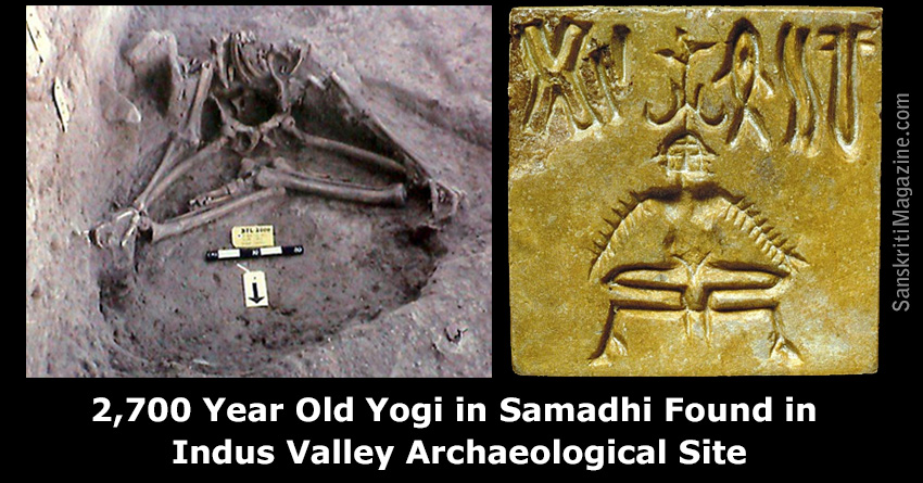
This is interesting to note because they are among the oldest communities in India and were inhabitants of the ancient Indus River Valley civilization.
As a matter of fact, the ruins of Balathal in the Udaipur District were from what was connected the Ahar-Banas Culture of the Harappans of Indus River Valley, one of at least 90 Ahar Culture sites in the basins of the Ahar and Banas rivers…
..and where the skeletal remains of a 2,700-year-old yogi were found, sitting in a state of what is called “samadhi,” a meditative consciousness in which human consciousness becomes one with cosmic consciousness.
The Bhil Minas tribe was the ruling tribe before the Kachhawaha clan of Rajputs, otherwise known as the Mewar Kingdom, forced them to hide out in the Aravalli Hills, and they were named a criminal tribe by the British government in 1924 to keep them from regaining power over the Rajputs.
They were subsequently given protection as a Scheduled Tribe after the upliftment in 1949 of the Criminal Tribe Act, which had been enacted on October 12th of 1871.
The Criminal Tribes Act of 1871 criminalized entire communities by designating them as habitual criminals, and restrictions on their movements imposed, including men having to report to the police once per week.
A Scheduled Tribe is recognized by the Indian Constitution, has political representation, and yet they are legally totally or partially excluded from various types of services important for leading a healthy life, and altogether, the Scheduled Tribes of India make-up almost 10% of the population, and are considered India’s poorest people.
This is a panoramic view of Udaipur’s Old City, which was said to date back to the city’s founding by the Mewar king, Maharana Udai Singh II, in 1558.
Udaipur is a great case study of the marginalization, and even criminalization, of the earth’s ancient indigenous people, and the re-written history to explain the existence of their masterful infrastructure.
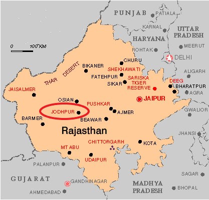
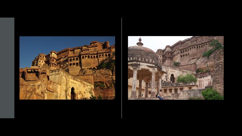
The next place on the alignment is Jodhpur, the second-largest city of India’s Rajasthan state, and historically the capital of the Kingdom of Marwar.
Also known as the Blue City, Jodhpur is dominated by Meheranghar Fort.
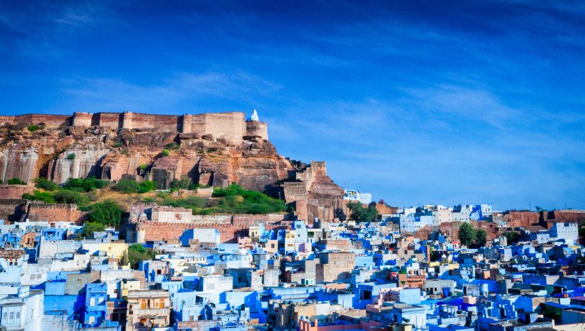
Meheranghar Fort is one of the largest forts in India, situated 410-feet, or 125-meters, above the city, and enclosed by thick walls.
It was said to have been built by Rao Jodha, the 15th Rathore ruler, starting in 1459, who we are told was the founder of Jodhpur.
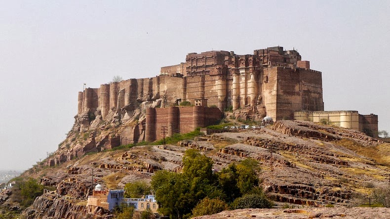
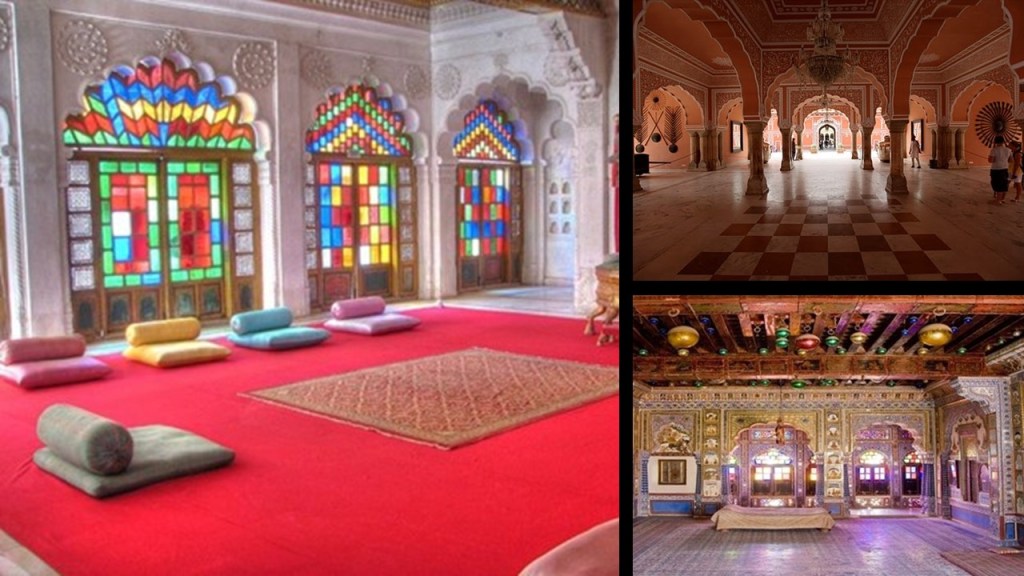
Also called the Citadel of the Sun, inside the walls of Meheranghar Fort there are several palaces known for their intricate carvings and expansive courtyards.
The palaces of Mehrangahr Fort constitute one of the finest museums in Rajasthan.
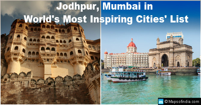
In 2016, Jodhpur, along with Mumbai, made it on the list of the world’s most inspiring cities.
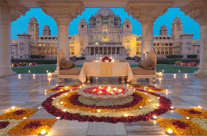
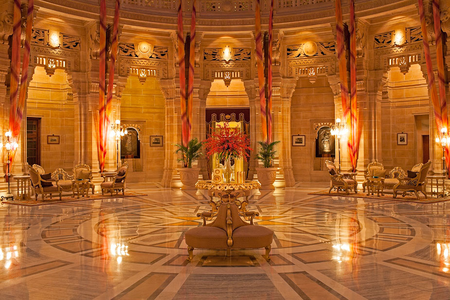
The Umaid Bhawan Palace in Jodhpur is one of the world’s largest private residences.
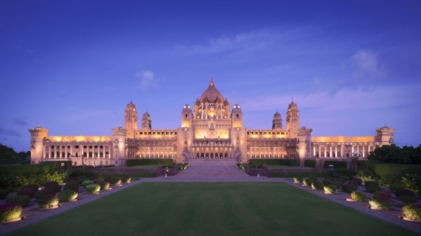
It was said to have been built starting in 1929 by the Majarana Uwaid Singh as the principal residence of the former Jodhpur royal family, and still owned by the family in the present-day.
We are told the Majarana decided to build the palace to help the farmers of Jodhpur, who had just experienced a severe famine, and that he commissioned the British architect, Henry Vaughan Lanchester, for the design of the palace.
We are told it took 2,000 to 3,000 farmers 14-years to complete the construction project, which took place in 1943 (in the middle of World War II).
A part of the palace is managed by Taj Hotels, and it recently received an award as the world’s best hotel.
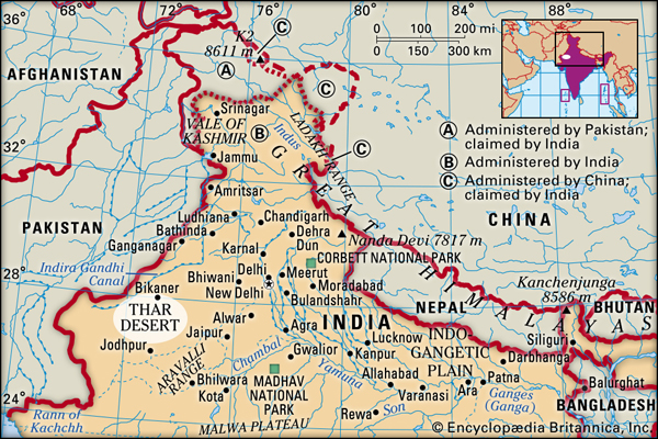
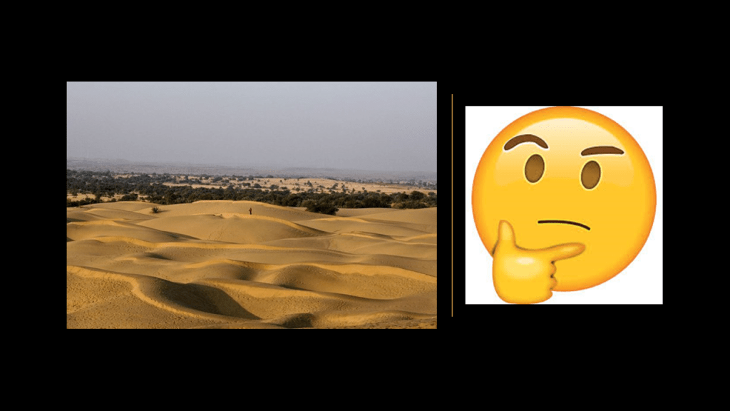
Jodhpur is situated next to the Thar Desert, also known as the Great Indian Desert, covering about 66,000-square-miles, or 170,000-kilometers-squared.
I wonder if there is enduring infrastructure underneath all those sand dunes….
The next place I would like to look at is a city on the other side of the Thar Desert from Jodhpur, and which is Bikaner, also in India’s Rajasthan state.
Formerly the capital of the Princely state of Bikaner, it was said to have been founded in 1488 AD by Rao Bika, the son of Rao Jodha, the founder of Jodhpur.
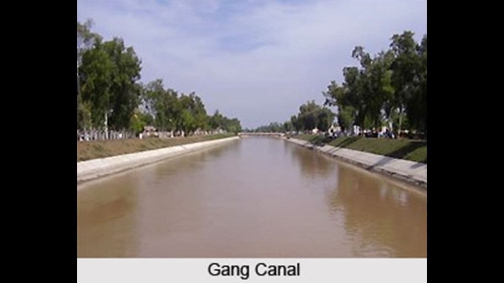
The Gang Canal, also known as Ganga Canal, of Rajasthan was said to have been an irrigation system of canals built between 1925 and 1927 by Maharaja Ganga Singh of Bikaner.
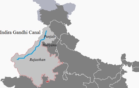
The Indira Gandhi Canal runs near here as well.
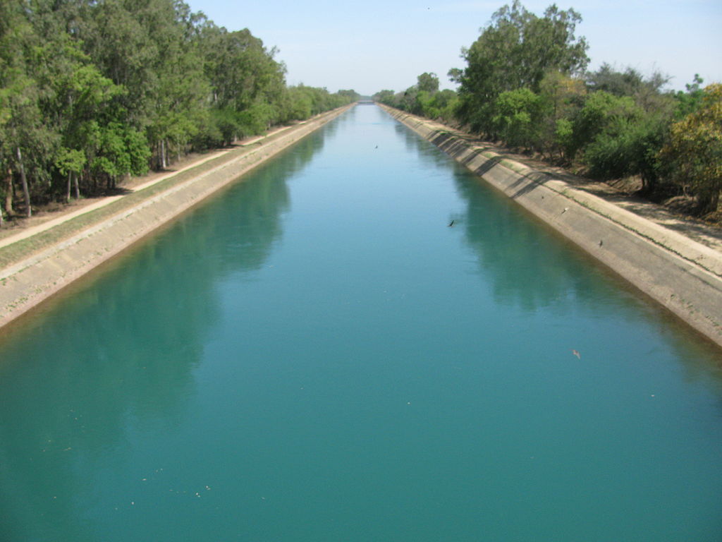
It is the longest canal in India, and was said to have been completed in 1983.
It runs 400-miles, or 650-kilometers, from northern India to irrigation facilities in the Thar Desert.
Junaghar Fort in Bikaner was said to have been built between 1589 and 1594.
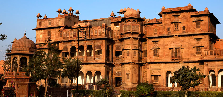
While it was said in records that in its history, the fort was attacked by enemies in an effort to capture it, the fort complex is also studded with palaces, temples and pavilions.
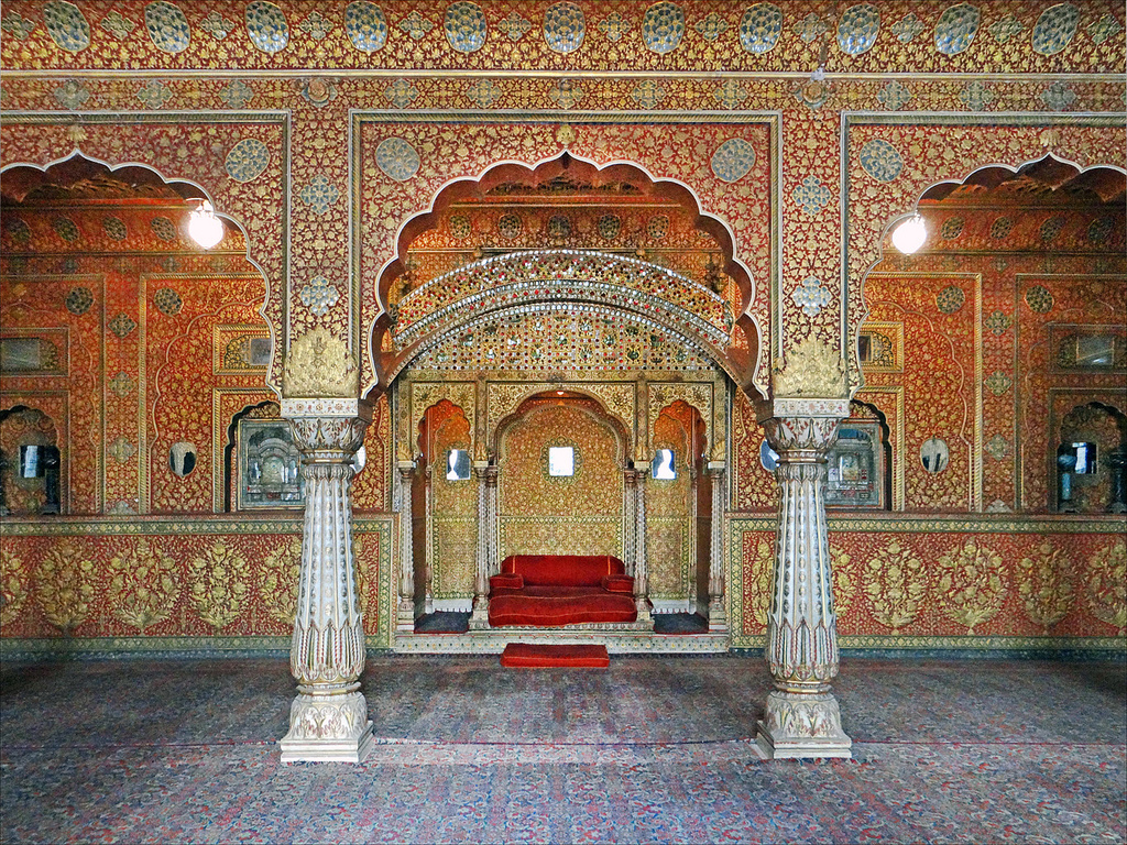
Lalgarh Palace is a palace and heritage hotel in Bikaner, located near the Junaghar Fort.
It has a story somewhat similar to the Umaid Bhawan Palace back in Jodhpur.
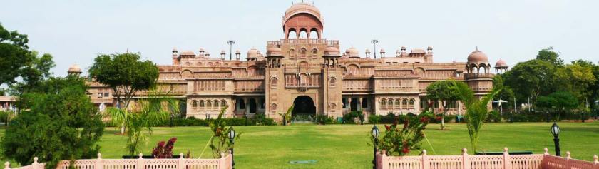
Lalgarh Palace was said to have been commissioned by the British-controlled regency for Maharaja Ganga Singh while he was still in his minority because they considered the existing Junaghar Fort Palace as unsuitable for a modern monarch.
Here is a comparison of the two palace complexes in Bikaner so that you can see that they are built in a similar style, and Lalgarh Palace doesn’t appear to have been modernized in comparison of the two.
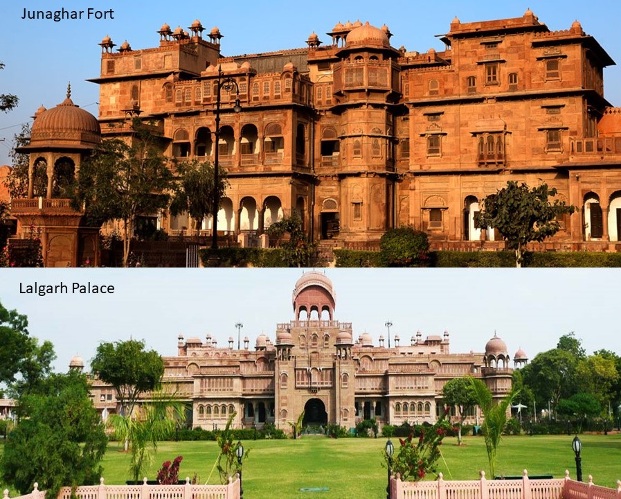
It’s construction was said to have begun in 1902, with the complex having been designed in Indo-Saracenic style by British architect Sir Samuel Jacob Swinton, and completed in 1926.
The last place I am going to look at in this post on this alignment is Multan, the major cultural and economic center of the southern Punjab Province of Pakistan.
Multan’s history stretches way back into antiquity.
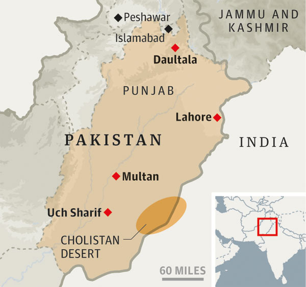
Multan was the location of the ancient Multan Sun Temple, said to date back 5,000 years…
…which would make it contemporaneous with the neolithic complex of Avebury in southern England…
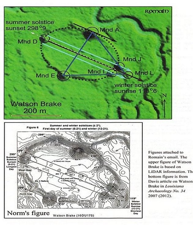
…and the Watson Brake Mounds, in Richwood, Louisiana, near Monroe and Poverty Point.
Watson Brake is dated to 5,400 years ago, and is considered the oldest earthwork mound complex in North America. Note the summer and winter solstice alignments depicted here in this diagram of Watson Brake.
This is the entrance to what is called the Multan Fort is on the left, and for comparison on the right is the Soldiers and Sailors Memorial Arch at Bushnell Park in Hartford, Connecticut.

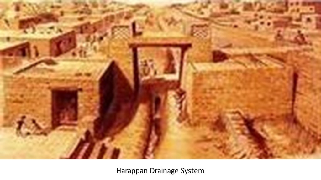
The ancient Harappan Civilization of this region, also known as the Indus River Valley Civilization, was known for their urban-planning, baked-brick houses, elaborate drainage systems, water-supply systems, clusters of large, non-residential buildings, and metallurgy.
I even read where they even had street-lights, and extremely accurate systems of weights and measures.
Multan was one of the most important trading centers of medieval Islamic India, and attracted a multitude of Sufi mystics in the 11th- and 12th-centuries, and is known as the “City of the Saints.”
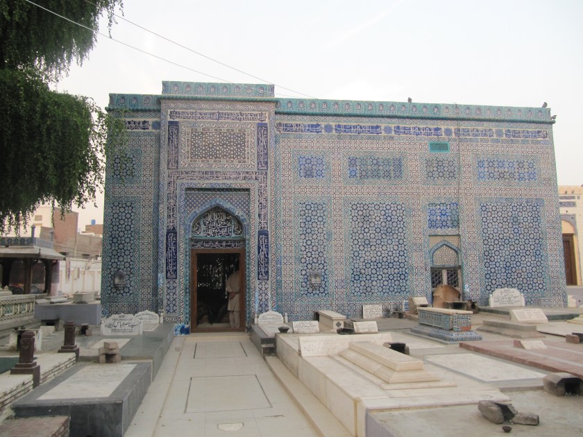
Multan is renowned for its large number of Sufi shrines from that time…
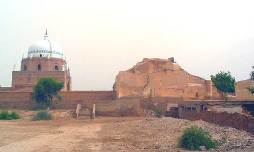
…as well as the Sufi shrines in the nearby city of Uch…
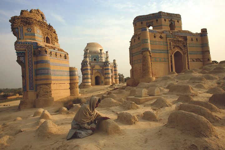
…of which the original shrines seem to be missing large chunks from the original architecture.
As I mentioned previously, Sufis were mystics, and practitioners of the inward dimension of Islam.
Sufism emphasizes personal experience with the Divine, and concentrating one’s energy on spiritual development rather than focusing on the teachings of human religious scholars.

So here we have been passing through this part of the world, known as a highly spiritual place with people actively pursuing a deep, personal connection with the Divine.
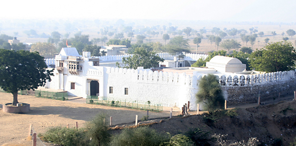
It is interesting to note that we find the Shri Jasnath Ashram in the Thar Desert, in the Nagaur District of Rajasthan, between Jodhpur and Bikaner.
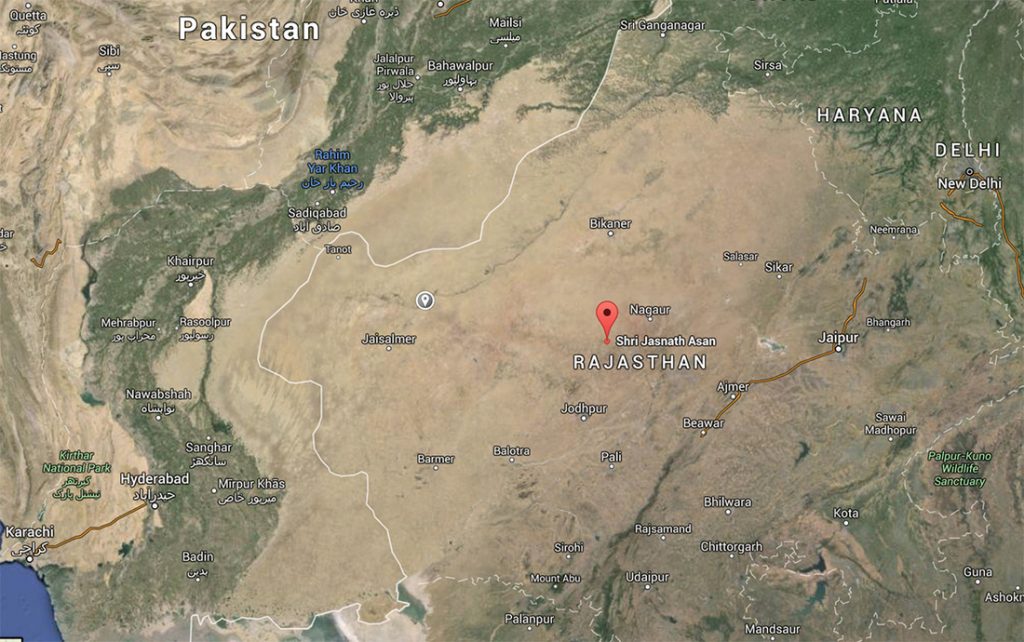
This yogic retreat is in the village of Panchla Siddha, or place of deep meditation, said to have been founded over 500 years ago, and considered a place highly charged with spiritual energy.
In the the Mahabharata, a major Sanskit epic of India, a magical weapon described as an “brahmastra” was said to have been detonated at the end of the 18-day Battle of Kurukshetra.
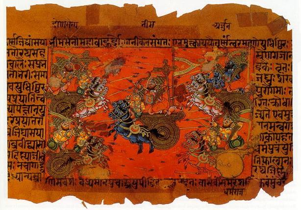
A “brahmastra” was said to have been “a single projectile charged with all the power in the Universe.”
Any target hit by the “brahmastra” would be utterly destroyed; land would become barren and lifeless; rainfall would cease; and humans and animals would become infertile.

The Pandavas were said to have vanquished their enemy, the Kauravas, with the devastating weapon, but the few surviving Pandavas discovered there was nothing left to occupy, and no one left to rule.
The “brahmastra” had turned the region of present-day Rajasthan to desert.
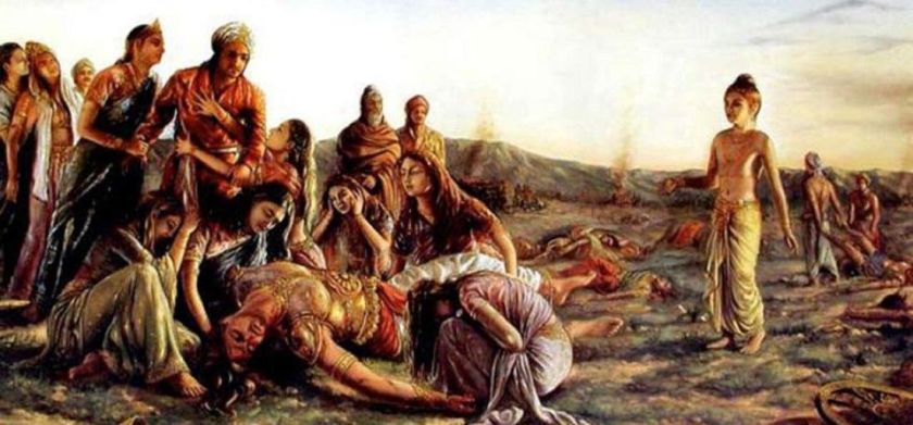
Well, to support this, evidence exists that exactly this part of the world was devastated by nuclear war at some point in time.
Perhaps in ancient times as suggested here in this reference, but I believe it could have taken place much, much more recently in time than what we are told.
As a result of my research tracking various leylines, I have come to believe there was deliberately-caused cataclysmic destruction of the Earth’s surface along the Earth’s Grid System in order to bring about the “New World Order,” causing the land to undulate and buckle, causing among other things, swamps, bogs, deserts, dunes, and whole land masses to shear-off and submerge under seas and oceans.
I believe that the circuit board of the Earth’s grid system was deliberately blown 0ut as the result of one or more forms of directed frequency or directed energy of some kind into different places on the Earth’s grid, either at the same time, or different times within a finite period, because there’s just so much devastation covering the entire surface of the Earth…

…and that ever since then we have been at the mercy of a parasitic consciousness that has the rigged the system to provide the non-stop flow of wealth for them and converting our natural Divine Source energy into the negative energy of our lowest states of consciousness of fear and suffering that they need to survive.

Here are more thoughts on what I think is really has been going on here.
The Pashtun tribal peoples are the primary inhabitants of Pakistan and Afghanistan in a region regarded as Pashtunistan, which became split between the two countries since the formation of the Durand Line border between the two countries in 1893 after the second Anglo-Afghan War.
The name sake of the line, Sir Henry Mortimer Durand, was a British Diplomat and Civil Servant of the British Raj.
We are told that together with the Afghan Emir, Abdur Rahman Khan, it was established to “fix the limit of their respective spheres of influence and improve diplomatic relations and trade.
Well, that certainly sounds good…but what was really going on here?
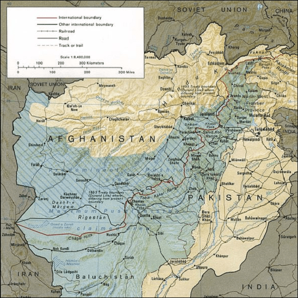
The Durand Line cuts through the Pashtunistan and Balochistan regions, politically dividing ethnic Pashtuns and Baloch, who live on both sides of the border.
But, really, why divide a people in this fashion?
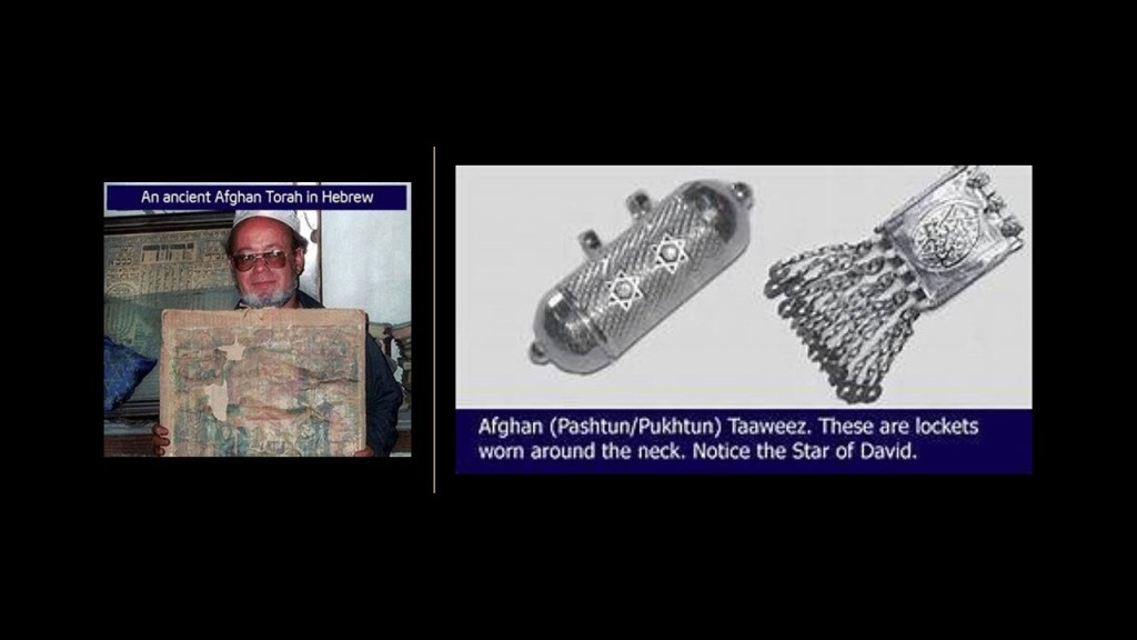
The Pashtun are a tribal nation of millions of Afghani and Pakistani Muslims who also have a strong oral tradition that they are descendants of lost ten Tribes of Israel, and they refer to themselves as Bani Israel.

Here is an example of a Pashtun textile piece showing the sacred geometric shape of a star tetrahedron in the center, also known as the Star of David.
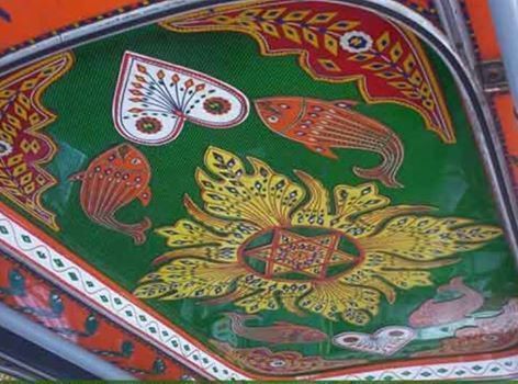
So, according to the history we have been taught, how can the Pashtun be Hebrew Israelites and Muslim at the same time?
For many reasons, this is a good opportunity to share why I think there was one original spiritual tradition, and that organized religion came in with the hijack of the original timeline for the purposes of control and serving an agenda not in Humanity’s best interests.
Not long ago, I realized that earth’s true history was not about organized religions, which was a stumbling block for me because of what we have been taught.

The controllers didn’t rewrite history from scratch – they rewrote the historical narrative to fit their agenda.
And from the new official historical reset year, which I believe was 1850 or 1851, we have been immersed in learning their history of what has taken place here from a very young age.
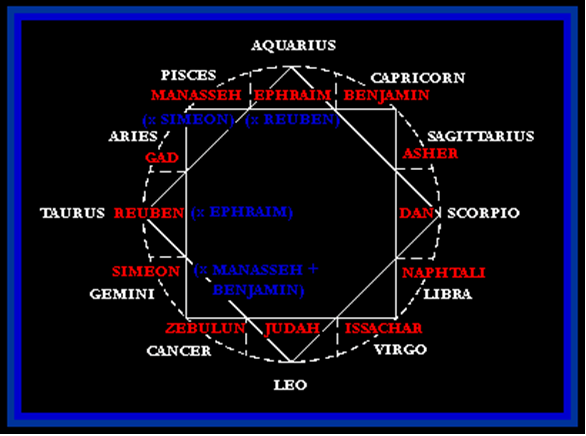
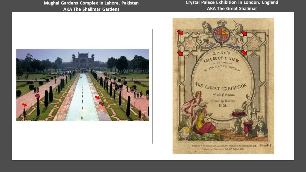
I have found this symbol contained within the twelve main constellations and the twelve Tribes of Israel in many different places…
…like the Mughal Garden complex in Lahore known as the “Shalimar Gardens” on the left, and on the right, the same design patterns are seen on the Great Exhibition brochure for the Crystal Palace Exhibition in London in 1851 , also known as “The Great Shalimar.
I believe the Crystal Palace Exhibition was the official kick-off of the “New World Order” timeline we have been living on.
I find this 8-pointed star everywhere, including, but far from being limited to, the Mabel Tainter Theater in Menomonie, Wisconsin…
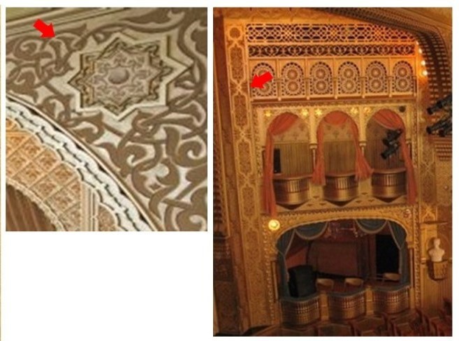
…and the the exquisitely-crafted interior of the Imam Reza shrine in Mashhad, Iran.
Does it make sense that the original world was inherently destructive and constantly at odds as we are taught when it was capable of creating such beauty and harmony in diverse places?
The identity of the True Israelites of the worldwide ancient advanced Moorish civilization was co-opted by the Khazarian Jews and Zionists.

The Rothschilds purchased Jerusalem in 1829, and subsequently acquired considerable land in Palestine in the 1800s and early 1900s.
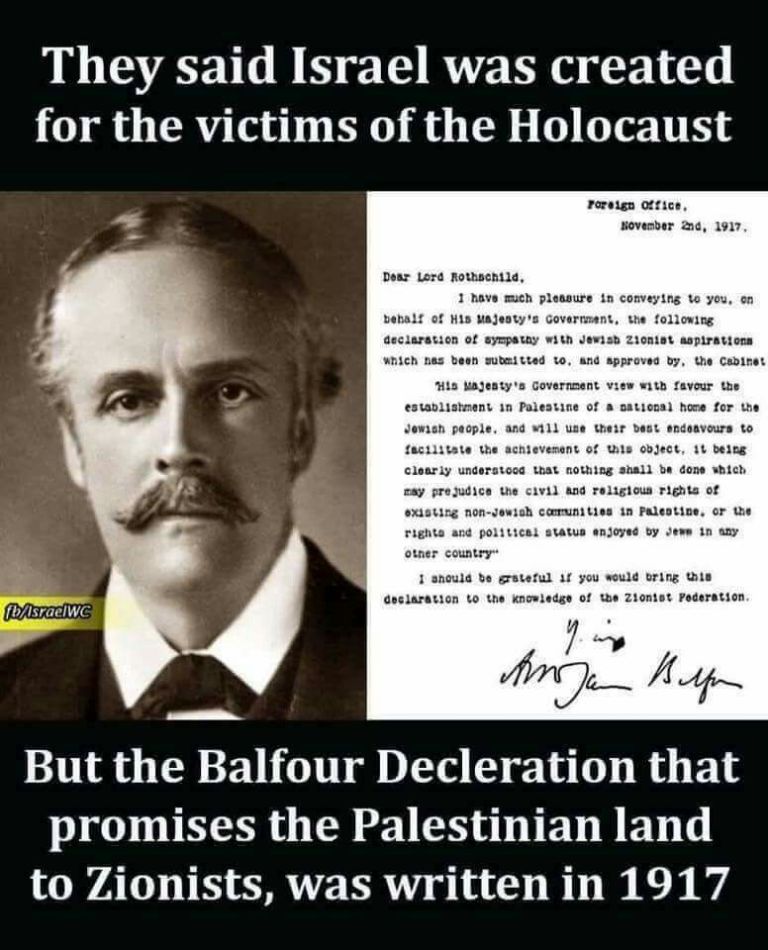
Great Britain was granted a colonial mandate for Palestine and Transjordan by the League of Nations on April 25th of 1920, which lasted until the formation of Israel in May of 1948.
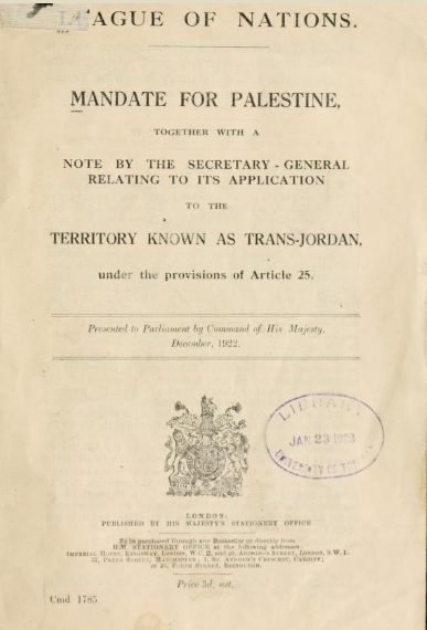
A League of Nations Mandate was a legal status for certain territories transferred from the control of one country to another after World War I, in this case territories that were conceded by the Ottoman Empire following the end of World War I in 1918.
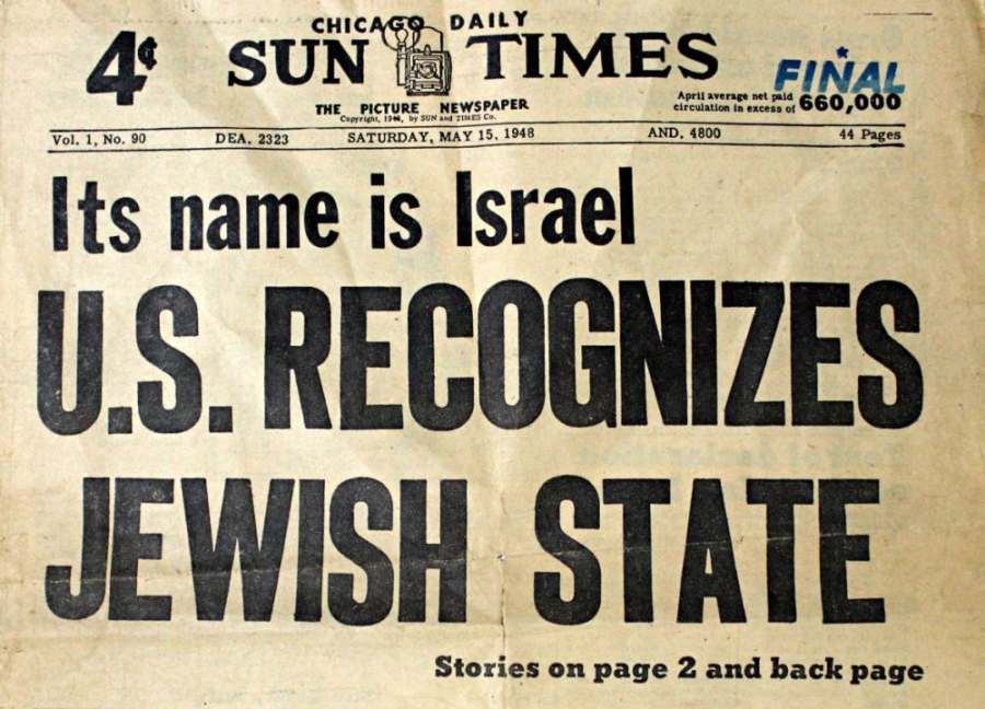
Despite growing conflict between Palestinian Arabs and Palestinian Jews, 32nd- degree Freemason Harry S. Truman ultimately decided to recognize Israel.
David Ben-Gurion proclaimed the establishment of the modern State of Israel on May 14th of 1948, and President Truman recognized the new nation on the same day.
Also on the same day the new State of Israel was proclaimed, and the British Army had withdrawn, gun-fire broke out between Jews and Arabs, and Egypt had launched an air assault that evening.
There is one more stream of information I would like to share before I start tying my thoughts together.
I started to figure this out after reading and internalizing the information in Key 2-1-5, Verse 70, of “The Keys of Enoch” transcribed by J. J. Hurtak.
This particular key really reached out and grabbed my attention.
The Keys collectively explain how the Divine is extended and manifested through Higher Thought-forms that unfold throughout all realms of life.

One of the places mentioned in this key I am about to share was Lop Nor in China, which I was already familiar with being a nuclear test site because I had found and studied it in my earlier work by connecting the dots, in following the lines I had found, around the world.
There are other nuclear tests sites that I know of besides the ones listed below on the earth’s grid system.
Novaya Zemlya, a large island in the Arctic Ocean off the northern coast of Russia is one, and another is Reggane, Algeria, where the French did nuclear testing.
I am sure there are others as well.
This awareness led me to make the intuitive jump into looking for and compiling the following information from looking up these places on the internet, using among other things the key word “nuclear” or “nuclear test”.
Key 2-1-5, Verse 70:
Accordingly, the twelve energy grid areas for space-time transcription, and areas of proto-communication established by the conversion of each tribe of Israel for the watch and deliverance of the present program from the Treasury of Light, are the areas of:
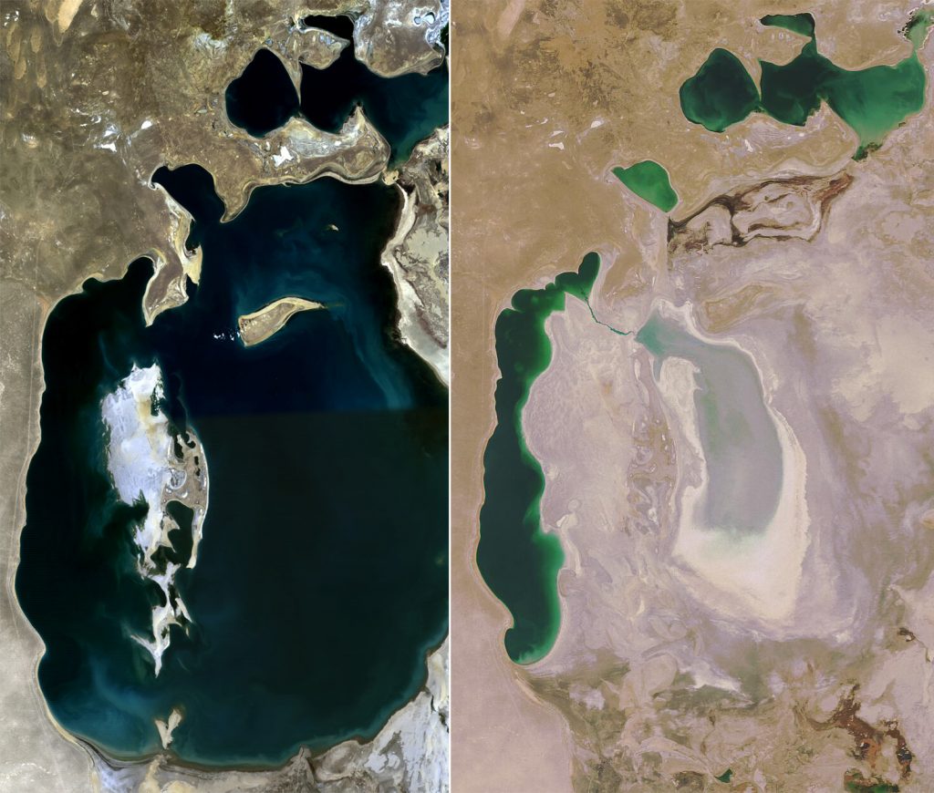
1) Aral Sea-Kungrad (Uzbekistan)
The shrinking of the Aral Sea, diverted by irrigation projects, has been called one of the planet’s worse environmental disasters, and the region is heavily polluted.
2) Takla Maklan – Lop Nur, Sinkiang
Lop Nur is an ancient salt lake in the Takla Maklan Desert in the Southeastern portion of the Uighur Autonomous Region of Xinjiang in China.
Chinese nuclear weapons test base had four nuclear testing zones from 1959 – with H-bomb detonation in 1967 – until 1996, with 45 nuclear tests conducted.
3) The Philippine Islands
The 1965 Philippine Sea A-4 crash was a “Broken Arrow”* incident in which a USNA-4E Skyhawk attack aircraft carrying a nuclear weapon fell into the sea from the aircraft carrier U.S.S. Ticonderoga. Described as a “Free Fall nuclear weapon on a handling dolly” on 12/5/1965.
A “Broken Arrow” incident is defined as an unexpected event involving nuclear weapons that result in the accidental launching, firing, detonating, theft, or loss of the weapon. To date, six nuclear weapons have been lost and never recovered.

4) The Kwajalein – Marshall Islands
The location of the Pacific Proving Grounds, which was the Name given by the U. S. government to a number of sites in the Marshall islands and a few other sites in the Pacific Ocean between 1946 – 1962. One Hundred five atmospheric and underwater nuclear tests were conducted in the Pacific.
The Marshall Islands composed 80% of tested yields at 210 megatons.
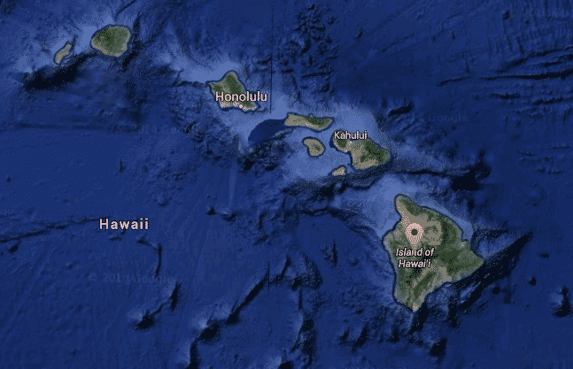
5) The Hawaiian Islands
The location of the Pearl Harbor attack in 1942 which brought the United States into World War II.
Johnston Atoll was controlled by the military for 70 years, and used for testing and as a chemical weapon and Agent Orange storage and disposal site.
Kaho’olawe island was used as a bombing range by the Armed Forces during World War II, and was known as the “Target Isle.”
6) Vancouver Island
A Mark IV nuclear device dumped or exploded off the coast was found on 2/13/1950 similar to the atomic bomb that was dropped on Nagasaki. The American B-36 bomber carrying it crashed en route from Alaska to Texas.

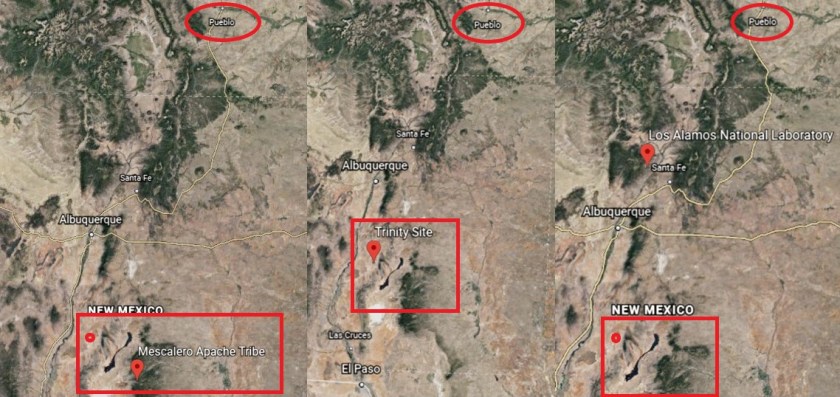
7) From Pueblo, CO, to the Mescalero Apache Reservation of New Mexico
It is important to note that contained within the location described, are both Trinity Site, the first nuclear test detonation site near the Mescalero Apache Indian Reservation; and Los Alamos National Labs, which was established in 1943 as Site Y of the Manhattan Project to design and build the first atomic bomb. Still in use today.
8) From Lexington, Kentucky, to Tennessee
The Oak Ridge National Labs is in Oak Ridge, Tennessee, with a nickname of the Atomic City…it was established in 1943 as part of the Manhattan Project.
It was chosen as a site for a graphite reactor to create plutonium from uranium. Still in use for nuclear research and development.

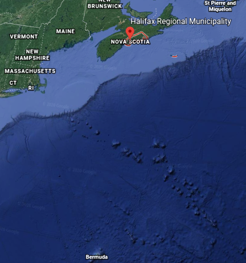
9) Nova Scotia connecting with the Bermuda Islands
The date of the Halifax Explosion was December 6th of 1917, when a ship collision in the harbor caused a 2.9 kiloton detonation of TNT, killing at least 2,000 people, and injuring 9,000 – the largest manmade explosion prior to the development of nuclear weapons.
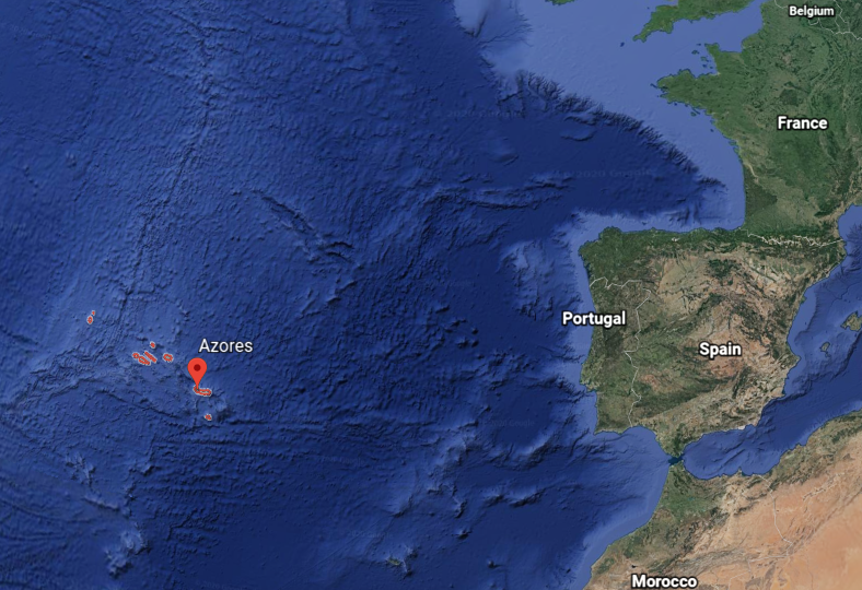
10) The Azores
There was a “Broken Arrow” incident on May 22nd of 1968, involving the loss of a nuclear reactor and two W34 nuclear warheads when a U.S. submarine sank from unknown causes, approximately 400 Nautical Miles southwest of the Azores.
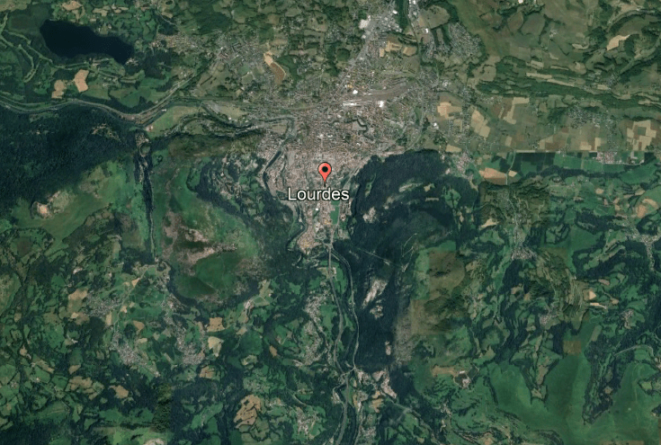
11) Lourdes, France
Nothing that I know of, however, it is a major Catholic pilgrimage site, known both as a location for an appearance of the Virgin Mary here to a young woman in 1858 and a place for spring water with healing and miraculous healings.
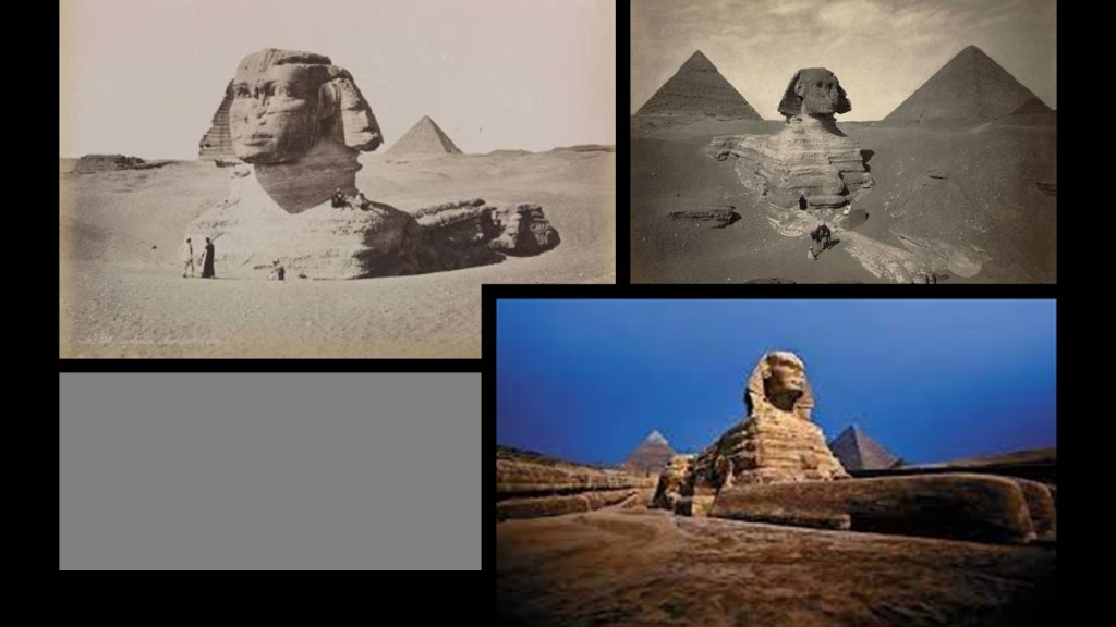
12) And Giza in Egypt, and while nothing I know of directly…
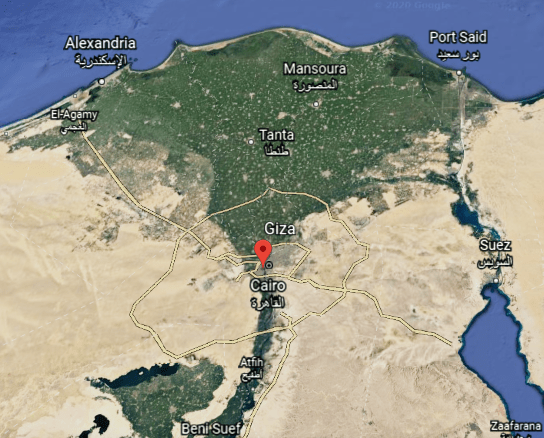
…I do know that at one time the body of the Sphinx, for example, was covered by desert sands, and had to be dug out to show what we see today.
They want us to believe it is the result of the passage of time and natural processes, but I definitely question what the official narrative tells us about anything!
I find it more than statistically significant that at least ten out of the twelve places listed as being the twelve important energy grid areas for the space-time transcription of each Tribe of Israel had some kind of environmental disaster; nuclear testing facilities and/or test-site locations, nuclear accidents; or some kind of massive explosion.
As I mentioned earlier, I see all of this as an extremely hostile destruction and takeover of the earth’s grid system and the original advanced ancient human civilization, and this was done in a war against the Creator and Creation through manipulating Humanity in much lower consciousness than it was before all of this took place.
And what we know today as India went from having fabulous wealth and a high standard-of-living, to the third-world conditions that exist in many places for many people there today.
The same thing can be said about most, if not all, the world’s countries, especially compared with what was actually here before the reset event and new historical timeline.
Moorish ISLAM was originally all about: I-Self-Law-Am-Master, and was not the Islam we see operating as a destructive force in the world today, and Moorish Masons of the original civilization built all the of the world’s infrastructure, not western freemasons, who stole the identity and legacy of the original masons for their own purposes and agendas.

Islam was turned into the weaponized belief system we see today that was developed to divide and conquer by the western freemasons, as seen in this quote by the the Freemason Albert Pike.
Pike was the Sovereign Grand Commander of the Supreme Council of the Scottish Rite’s Southern Jurisdiction from 1859 to 1891, and a major player during the American Civil War and in the development of western Freemasonry, with his publication of “Morals and Dogma of the Ancient Accepted Rite of Freemasonry” in 1871, the same year as this quote about the Third World War.

And were the Children of Israel originally called the Children of Asarel?
I know it’s all very confusing, but that’s because everything is meant to confuse us. It’s much easier to control us when we don’t know what’s true and what’s not. Heavy programming on the divide-and-conquer-side, and light on the unity-side.
Earlier in this post, I expressed an idea that the Nazi obsession with creating a master race was based on re-creating the original Aryans, who were members of a worldwide advanced civilization known as Arrata which is now recognized as the world’s most ancient, known civilization.
Bharata-Varsha was said to be a name for ancient India, but this illustration depicts much more than the Indian subcontinent.
I tracked the “Ar” sound is contained in many historic place names, like some of the ones I mentioned here, like Armenia; Bavaria; Barbaria; Tartaria; Arabia; and Arizona.
These are “ar” sounds I reference in this post alone: Mewar Kingdom; Akbar, the Mughal Emperor; Kumbhalgar Fort; Aravalli Hills; Picchu Banjara; Maharana; Maharaja; Arsi Vilas Lake; Fateh Sagar Lake; Dhebar Lake; Ahar-Banas culture of the Harappan Civilization; Marwar Kingdom; Sardar Singh; Thar Desert; and the Mahabharata.
There are so many “ars” to be found when you start to look.
There is even an “ar” to be found in the spelling of “earth.”

One more thought in closing.
When I first started my research several years ago I thought that with all of the detailed history of India in the historical narrative we are given, it wasn’t destroyed like other places, and had to be taken down by other means.
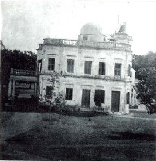
As mentioned earlier, this is a picture of the Qtub Shahi Tombs from the Golconda Fort in Hyderabad, India, circa 1902 or 1903.
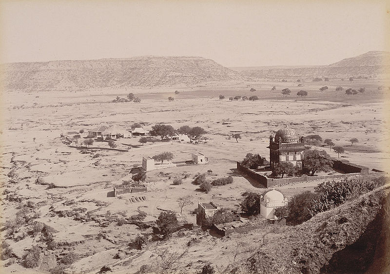
And this photo was said to be of Khuldabad Rest House, near the Ellora Caves, circa 1890.
As I stated previously in this post, I believe that cataclysmic events that were deliberately-caused by one or more forms of directed frequency or directed energy of some kind into different places on the Earth’s grid, causing the land to undulate and buckle, causing among other things, swamps, bogs, deserts, dunes, and whole land masses to shear-off and submerge under seas and oceans in order to bring about the “New World Order,” wiping out the original ancient advanced Moorish civilization and erasing it from our collective memory.
A new historical narrative was created, based on the underpinnings of the original civilization, but original meanings and intents were twisted and subverted in order to create a system of control for Humanity.
I also believe we are living in times of tremendous change.
We are seeing some of what was planned for us by the controllers playing out right now, but I do personally believe we are on the verge of a great change and shift that will change everything for the better…and soon.