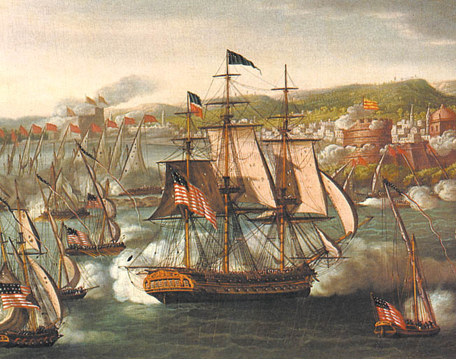
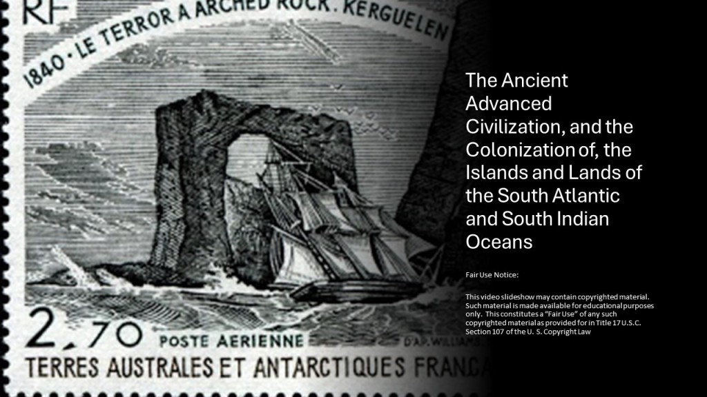
I am going to be taking a close look in this post of the islands and lands of the South Atlantic and South Indian Oceans, starting with the Brazilian possessions of the Fernando de Noronha Archipelago off the coast of Brazil near Natal, and the Trinidade and Martin Vaz Archipelago, off the Brazilian coast at Espirito Santo; to the British Overseas Territory of Tristan da Cunha, which today is part of the British Overseas Territory of the South Atlantic which also includes Ascension Island and St. Helena; to the French Southern and Antarctic Lands of the Kerguelen islands, the Crozet Islands, Adelie Land, the French claim on the continent of Antarctica, the Scattered Islands, and the islands of St. Paul and Amsterdam.
I did a a 23-part series in 2020 called “Sacred Geometry, Ley Lines & Places in Alignment” in which I tracked a long-distance alignment of cities and places that started in San Francisco from which most of the research in this post came.
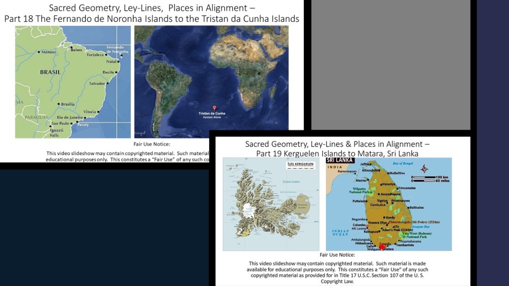
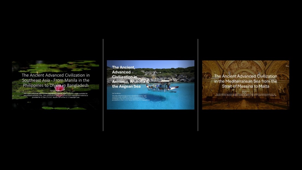
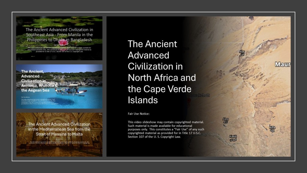
So far in 2024, I have posted the following from the original 2020 series:
The Ancient Advanced Civilization in Southeast Asia – From Manila in the Philippines to Dhaka in Bangladesh;” “The Ancient Advanced Civilization in Armenia, Anatolia & the Aegean Sea;” “The Ancient Advanced Civilization in the Mediterranean Sea from the Strait of Messina to Malta;” and :The Ancient Advanced Civilization in North Africa and the Cape Verde Islands.”
I have collected a variety of puzzle pieces about different places from the process of tracking cities and places in several different alignments over the years, bringing a bigger picture into focus that is not immediately apparent on the surface from this type of geographically-focused research.
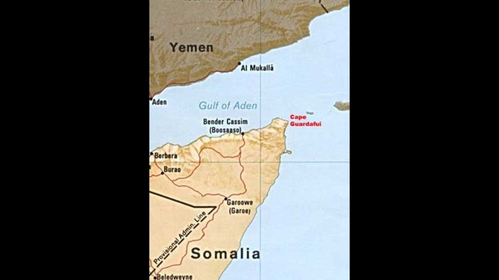
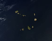
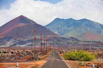
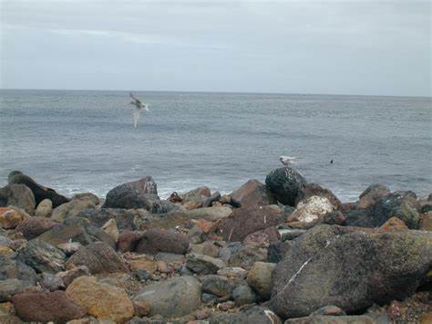
I am picking up the alignment where it crosses over Fernando de Noronha, the name of the main island and its archipelago, off the coast of Brazil near the city of Natal.
It is a UNESCO World Heritage Site…and on at least two other alignments that I know of.
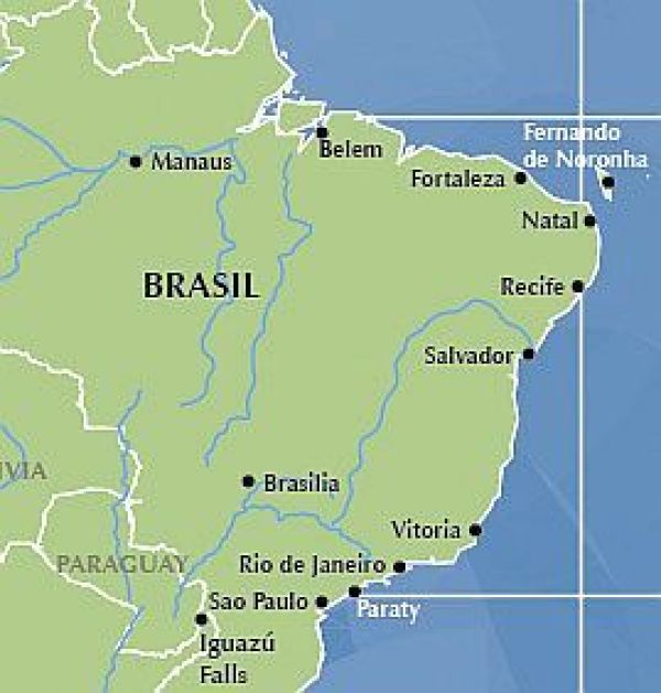
The main island has an area of 7.1 square miles, or 18.4 kilometers-squared, and the archipelago’s total area is 10 square miles, or 26 kilometers-squared.
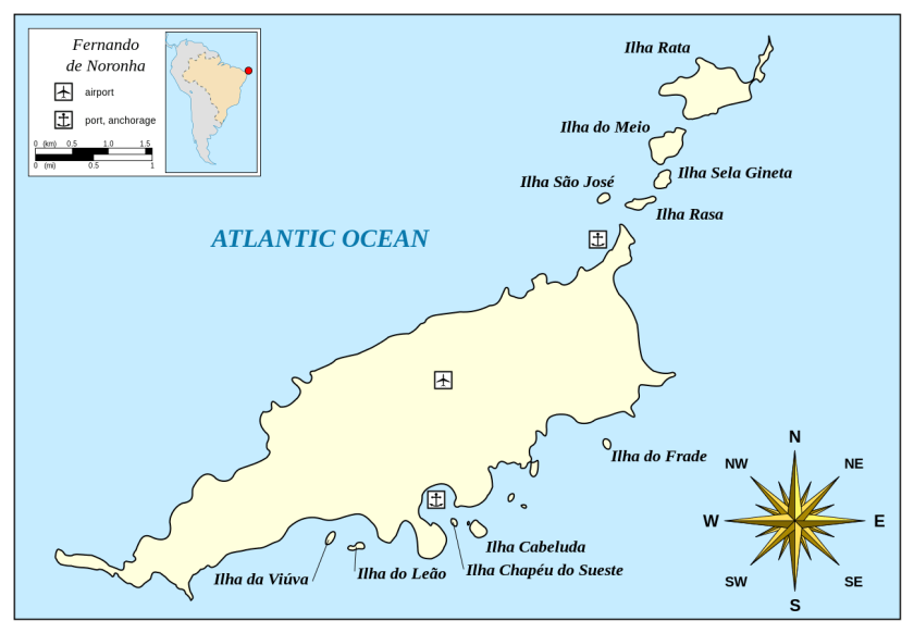
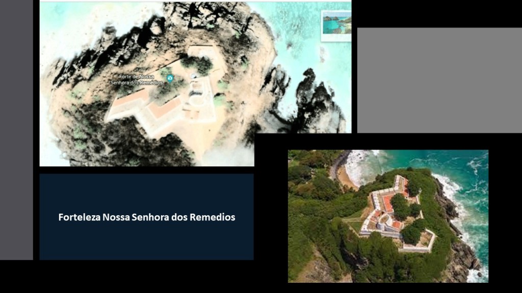
So what I just found that is really interesting about this place is that in its relatively small area, there were at least ten star forts here at one time.
The largest and best-preserved is the Forteleza Nossa Senhora dos Remedios.
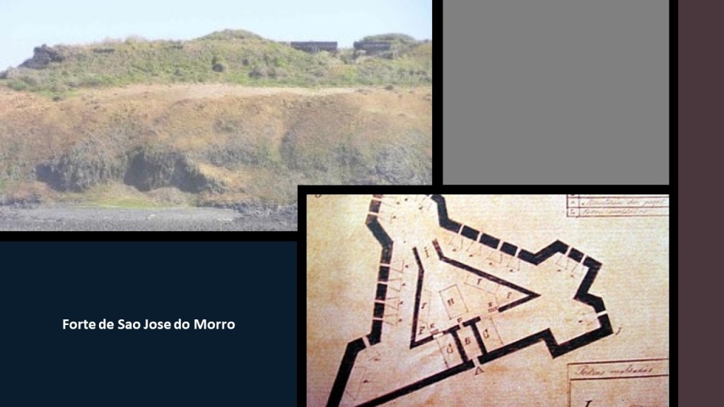
The Forte de Sao Jose do Morro was the only fort built on a secondary island. It still has imposing ruins.
Interesting to note that while the Portuguese word “morro” translates to “hill or mound,” there is definitely a “moor” sound contained within it.
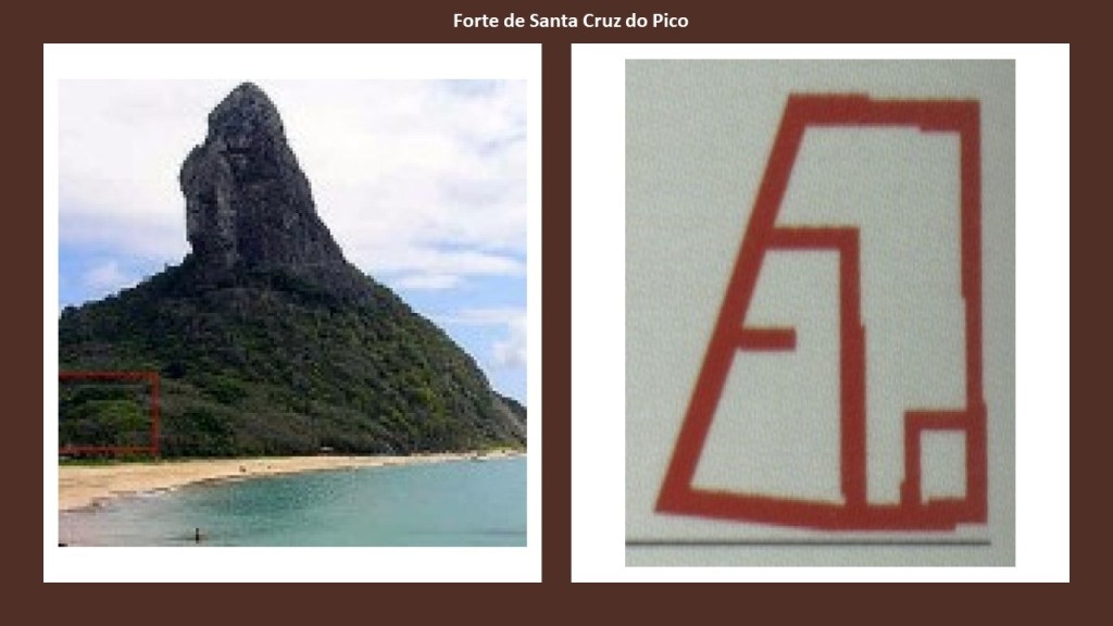
The Forte de Santa Cruz do Pico was described as a small redoubt, defined as a temporary or supplemental fortification, typically square or polygonal.
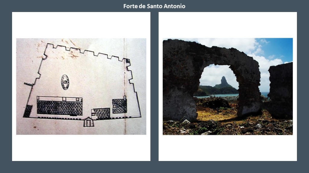
Forte de Santo Antonio construction was an irregular, four-sided, polygon.
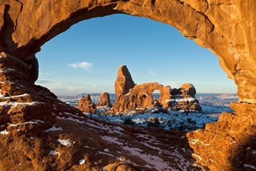
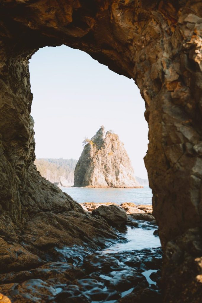
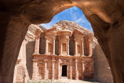
You can see the Forte de Santa Cruz do Pico framed through this archway at the Forte de Santo Antonio…
…like what you see of the Winter Turret through this arch at Arches National Park in Utah…
…at the Garden of the Gods in Colorado…

…at the Hole-in-the-Wall on Rialto Beach on Washington State’s Olympic Peninsula…
…and at Petra in Jordan.
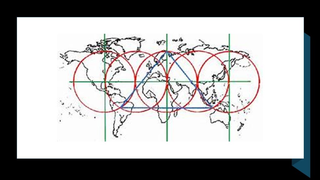
There is no doubt in my mind that these alignments were intentional and not coincidental.
There will be more examples of what appears to be intentional kinds of things throughout this post, and not the result of natural forces.
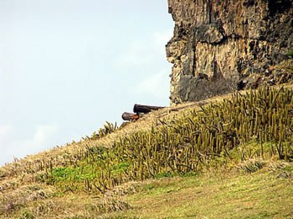
The Forte de Sant’ana was situated over the old harbor in the Vila dos Remedios.
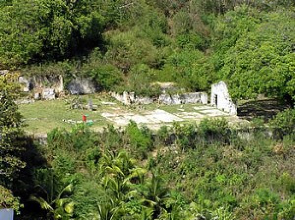
Ruins of the Forte de Nossa Senhora da Conceicao are visible in the vegetation.
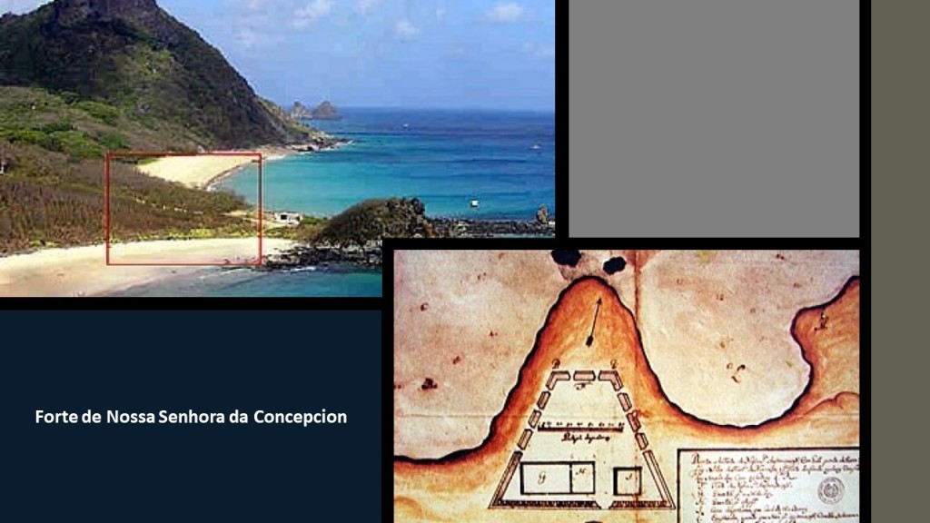
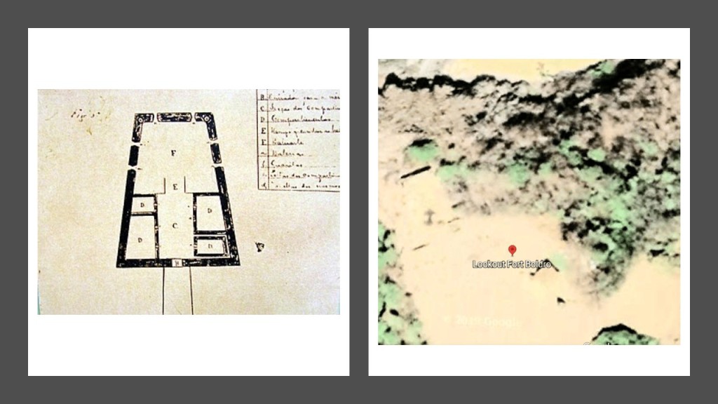
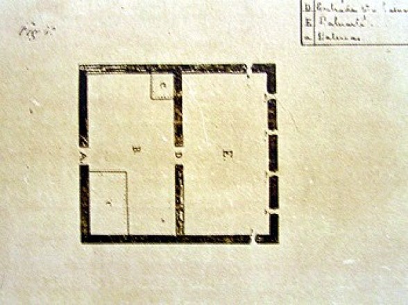
This is an old map of the Forte de Sao Pedro do Boldro.
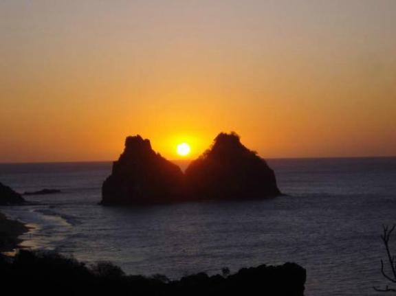
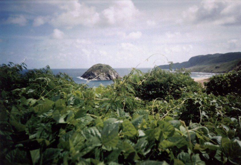
People come to the Lookout Fort Boldro for sunsets.
There is a good view from the Lookout Fort Boldro of the Two Brothers Rock, which appears to be in alignment with the sun…
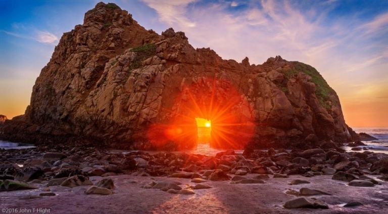
…like Keyhole Rock at Pfeiffer Beach at Big Sur in California, where the light comes through the Keyhole arch perfectly during the winter solstice time-of-year in December and January…
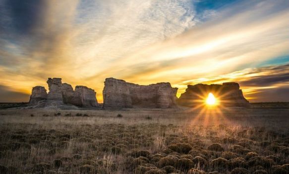
…a solar alignment at Monument Rocks National Natural Landmark, otherwise known as the Chalk Pyramids, in Gove County, Kansas…
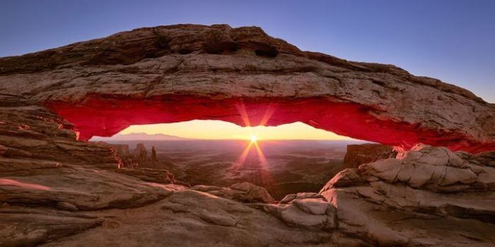
…at Mesa Arch in Canyonlands National Park in Utah…
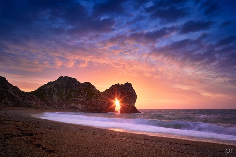
…and at Durdle Door, near Lulworth, England, in Dorset, during the winter solstice period.
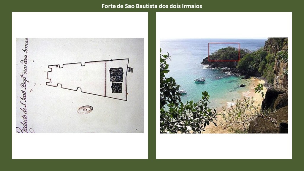
Back on Fernando de Noronha, there was also the Forte de Sao Bautista dos dois Irmaios…
…the Forte de San Juaquim do Sueste…
…and lastly the Forte do Bom Jesus do Leao.

It is interesting to note that two other places with a high concentration of star forts like Fernando de Noronha, one being Bermuda in the North Atlantic Ocean…
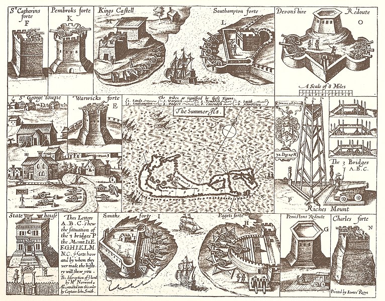
…another being at Alderney in the Channel Islands off the coast of France in the English Channel…
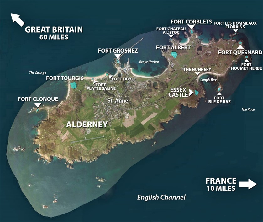
…are in a linear geometric relationship to each other.
I typically find star forts in pairs and clusters on alignments all over the Earth, and believe they were not military in nature as we have been taught. I think they functioned as part of the electrical circuitry of the earth’s worldwide grid system.
One of the definitions of the word battery is “a device that produces electricity that may have several primary or secondary cells arranged in parallel or series, as well as a battery source of energy which provides a push, or a voltage, of energy to get the current flowing in a circuit.”

We are told the island group of Fernando de Noronha was named after a wealthy Portuguese merchant Fernao de Loronha, who was granted the first captaincy of the islands of Sao Joao da Quaresma.
He was the financier and organizer of a private commercial expedition to exploit Brazil wood from new lands to the Crown, and the flagship of the expedition he organized to do this hit a reef near the island in 1503 and had to be salvaged.

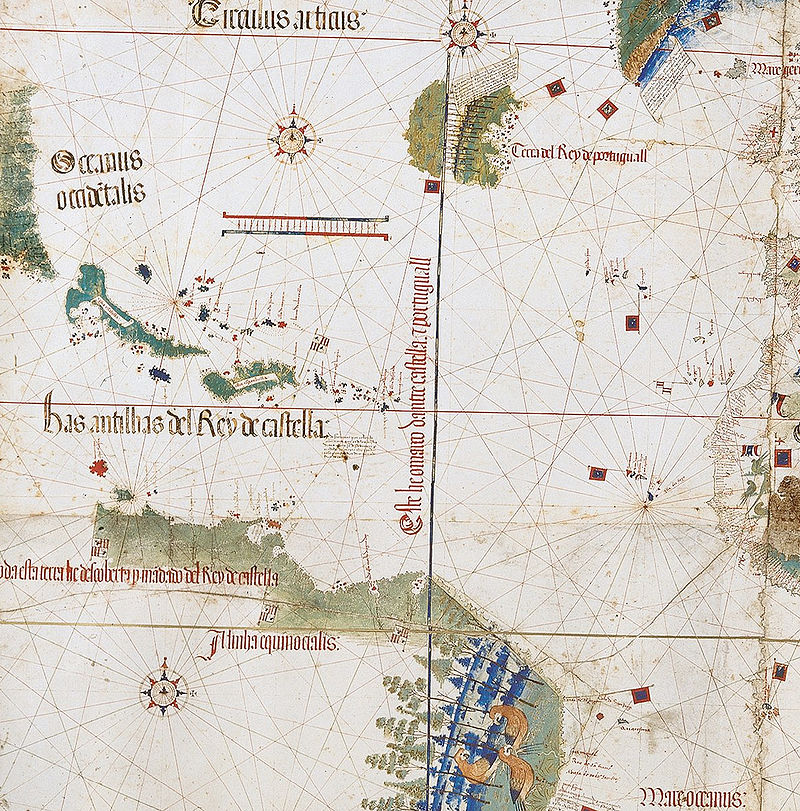
There was an island named Quaresma in the cartographic record, showing up in a map called the Cantino Planisphere, said to have been completed by an anonymous Portuguese cartographer before 1502.
A planisphere is defined as a map formed by the projection of a sphere or part of a sphere on a plane.
There are a couple of things I would like to point out the Cantino Planisphere.
The first is that the earth’s leylines appear on it…
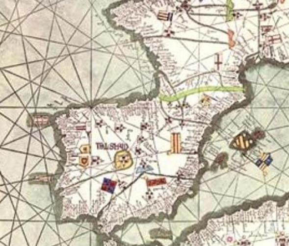
…which also appear on the Catalan Atlas of the Majorcan Cartographic School. The Catalan Atlas is considered the most important map of the Medieval period in the Catalan language, dated to 1375.
This is a depiction of the Iberian Peninsula, with Madrid in its center, in the Catalan Atlas.
The Catalan Atlas all together has six vellum leaves, each being 26 inches, or 65 centimeters, by 20 inches, or 50 centimeters in size. Each leaf includes the mapping of the geometric lines and shapes that you see depicted here.
It would seem that the Earth’s grid-lines started to disappear from maps in the 1500s, when Gerardus Mercator, a Flemish geographer, cartographer and cosmographer…
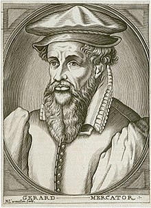
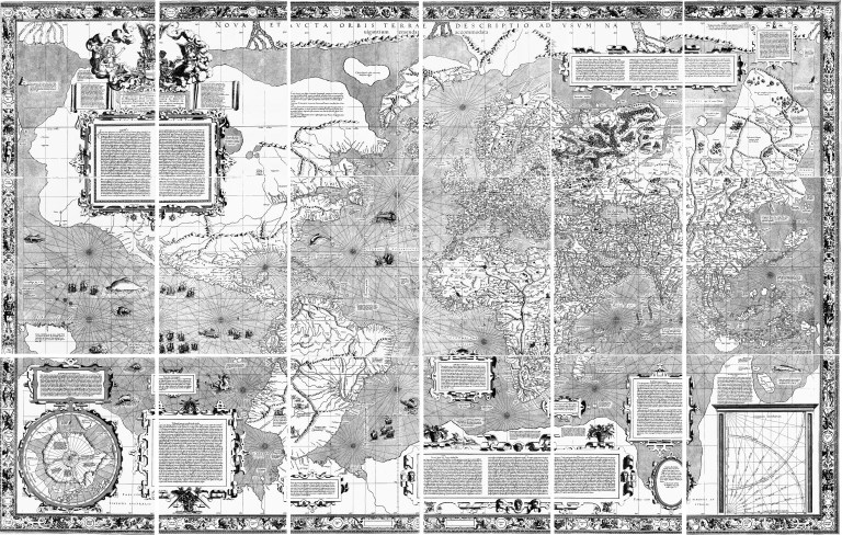
…published a world map in 1569 that is considered to be the first where sailing courses on the sphere were mapped to the plane map, allowing for a “correction of the chart to be more useful for sailors.”
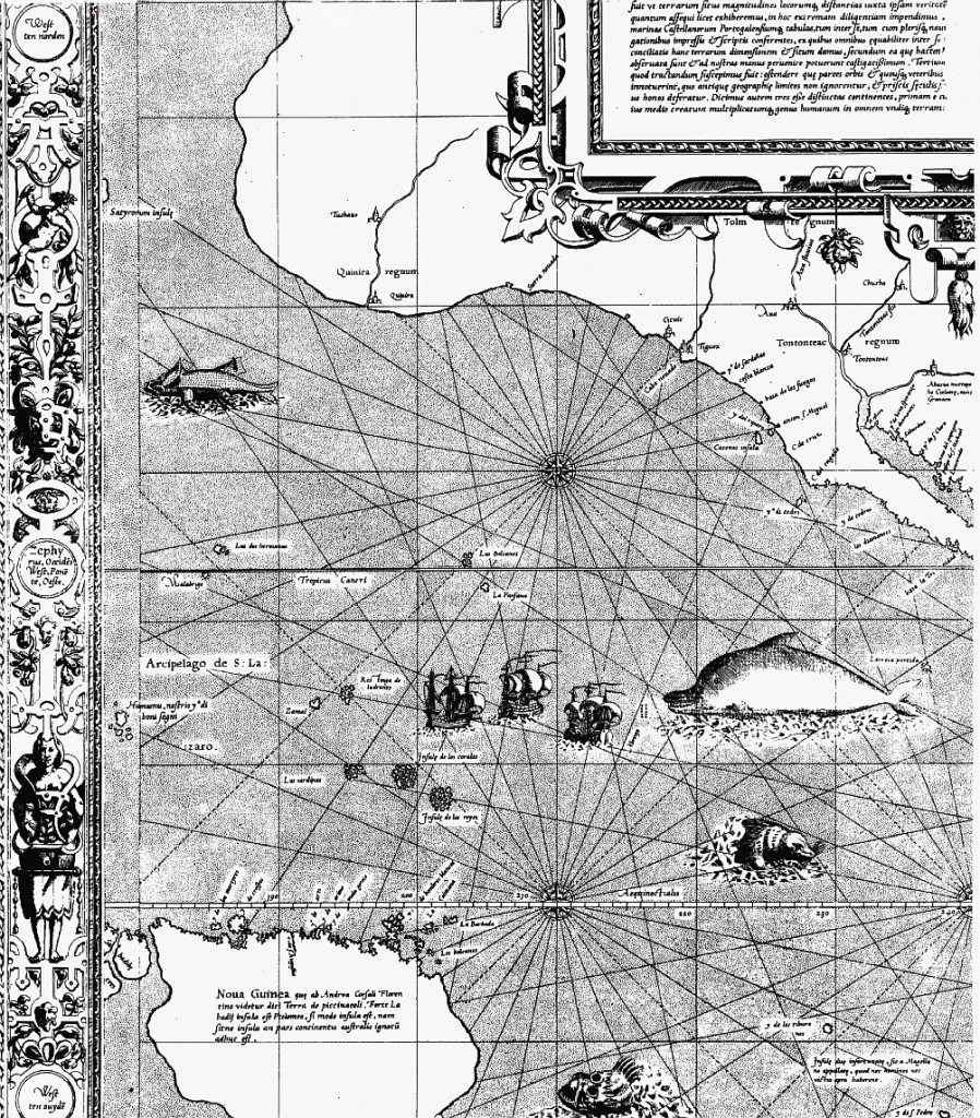
Here is a close-up section of the 1569 map showing the depiction of straight ley-lines in the seas, but not on land and sea as were present on the flat projections of the Cantino Planisphere and the Catalan Atlas.
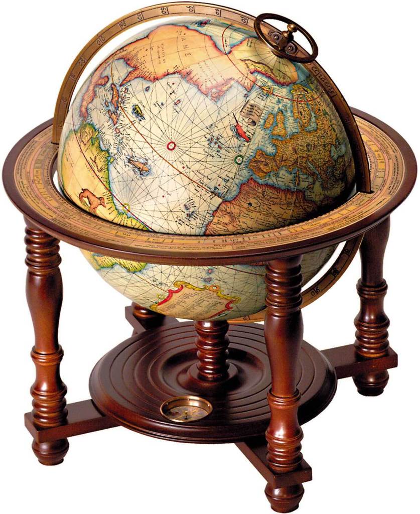
Not only that, Mercator was also a globe-maker, like this one from 1541.
So Mercator was said to have made a revolutionary flat projection map that corrected the chart for sailors…and the earth as a globe as well?
That’s interesting, because of another thing that was happening in our historical narrative Shortly thereafter.
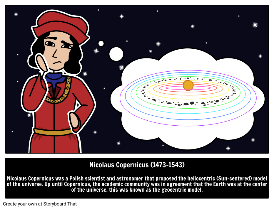
In May of 1543, the work “On the Revolutions of the Heavenly Spheres,” of Nicolaus Copernicus was published, offering mathematical arguments for the heliocentric, or sun-centered universe, and denying the geocentric model of the Earth-centered universe of Ptolemy, which the heliocentric model superceded, meaning that while once widely-accepted, current science considered the geocentric model inadequate.
History has it recorded that Copernicus had been seized with “apoplexy and paralysis” at the end of 1542, and that he died on the day he saw the final printed pages of his work, allowing him to say farewell to his life’s work.
I think it is important to include some information here about different concepts of space and time.
The study of geodesy is the science of accurately measuring and understanding the Earth’s shape, orientation in space, and gravitational field.
A geographic coordinate system enables every location on Earth to be specified by a set of numbers, letters and symbols, where one of the numbers represents a vertical position, and the horizontal position, from the East-West lines of longitude.
What we are told is that in cartography, the science of map-making, a map projection is the way of flattening the globe’s surface into a plane in order to make it into a map, which requires a systematic transformation of the latitudes and longitudes of locations from the surface of the globe into locations on a plane.
But what if the same process is actually happening in reverse for the tools we have available to us in our world, and that the Earth’s surface has been projected from a plane in order to make it into a globe shape by the use of the very same geographic coordinate system, and that it’s exactly the same information in a different projection?
After all, one definition of the word “coordinate” is “to bring different elements into a relationship that will ensure efficiency or harmony;” and another definition of the same word is “a group of numbers used to indicate the position of a point, line, or plane.”

The only tools that I am aware of that we have available to us to work with to precisely determine where everything is on the Earth, and ourselves in relationship to it, are tools like GPS, Google Earth and Google Maps.
We wouldn’t be able to use GPS efficiently and harmoniously in our every day lives to get from point A to point B if it wasn’t based on accurate information, even if they are still pushing the globe narrative with all of this.
So do I believe we have been lied to about the shape of the Earth?
Absolutely!
I think they have lied to us about a lot more than that!
But it also stands to reason that whatever navigational system and accompanying tools we have given to use in today’s world has to be based on accurate information or none of the systems in place in our world would work.
Exactly the same locations on the Earth, but in different projections.

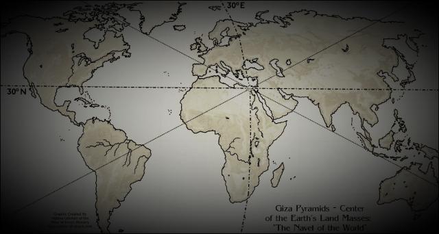
Not only that, the Great Pyramid of Giza, which is located at the center of the Earth’s landmass, was the Prime Meridian, until the Prime Meridian was moved in 1851 to the Royal Observatory of Greenwich in London by the British Astronomer Royal at the time, Sir George Biddell Airy.
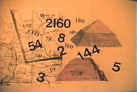
Carl Munck deciphers a shared mathematical code in his book and YouTube video series called “The Code,” related to the Great Pyramid, in the dimensions of the architecture of sacred sites all over the Earth, one which encodes longitude & latitude of each that cross-reference other sites.

He shows that this pyramid code is clearly sophisticated and intentional, and perfectly aligned over long-distances.
So getting back to what I was saying, leylines were included on earlier maps, and then started to disappear on Mercator’s projections, who also happened to be a globe-maker, around the same time that the work of Copernicus was published in 1543, enshrining in science, the model of the heliocentric universe and supplanting the geocentric universe of Ptolemy.
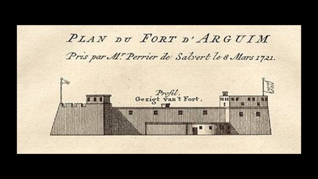
Here’s a close-up of the region on the Cantino Planisphere depicting Quaresma off the coast of Brazil, shown by the lower arrow…and the upper arrow points to the Cape Verde Islands at the center of a circle with multiple radial lines and sectors emanating from it.
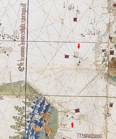
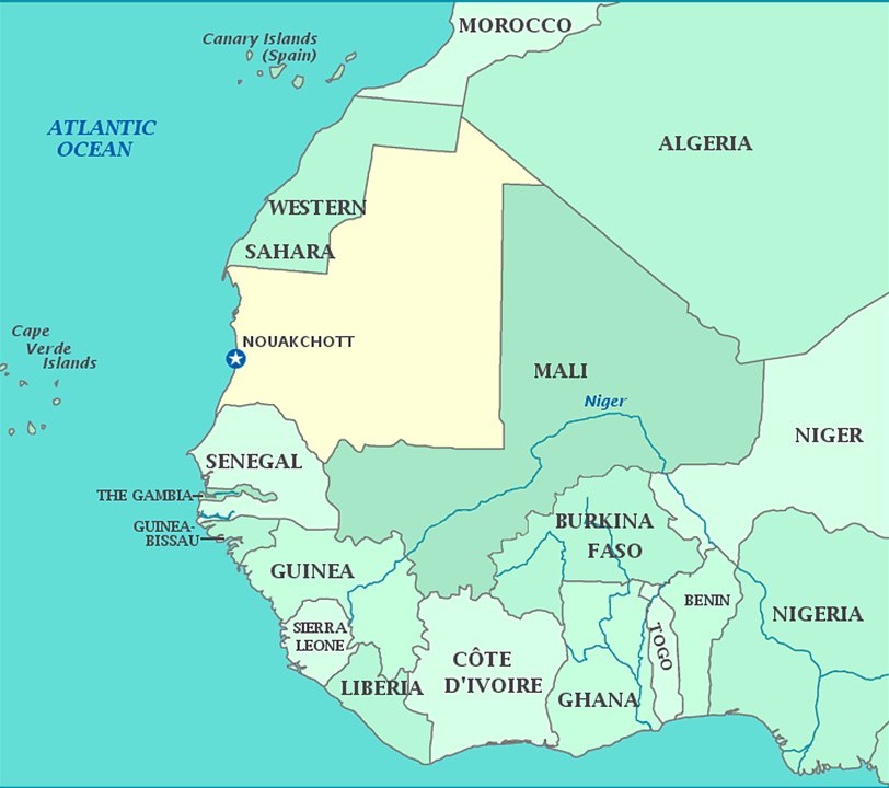
This would indicate to me that the Cape Verde Islands off the west coast of Africa near Mauretaniawere an important location on the earth’s geometric grid system.
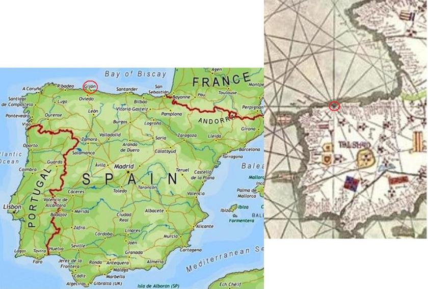
I found a similar geometric place of importance on the Catalan Atlas centered in the city of Gijon, the largest city of Asturias in northern Spain, and port on the Bay of Biscay.
I have placed a modern map of Spain on the left, with the city of Gijon circled, because the circle with sixteen sectors depicted in the Catalan Atlas on the right appears to center on the city of Gijon.
It indicates a past importance to Gijon that is no longer recognized.
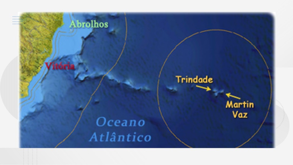
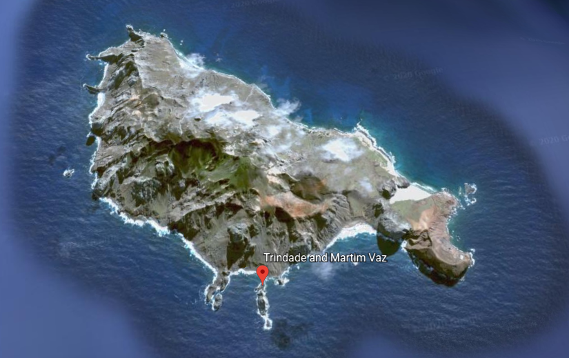
The next location on the alignment I am tracking in this post is the Trinidade and Martin Vaz Archipelago, located in the southern Atlantic Ocean, 680-miles, or 1,100-kilometers, east of the coast of Espirito Santo, Brazil, which it is part of.
This group of islands has a total area of 4-miles, or 10.4-kilometers, and a population of 32 Brazilian Navy personnel.
They were said to have been discovered by the Portuguese in 1502, and, along with Brazil, became part of the Portuguese Empire until 1822, the year Brazil became independent from Portugal.
Trindade, also known as Trinidad, is the largest island.

Many military and scientific expeditions from Europe and North America visited the islands.
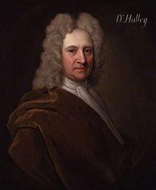
For example, another British Astronomer Royal , Edmund Halley, for whom Halley’s comet was named, was said to have taken possession of the islands on behalf of the British monarchy in 1700.
At least one visitor to these islands was a fortune-seeker.
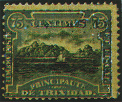
We are told that In 1893, James Harden-Hickey, a French-American newspaper editor, author and adventurer born in San Francisco in 1854, proclaimed himself James I, Prince of Trinidad in the South Atlantic Ocean, known as Trindade Island today.
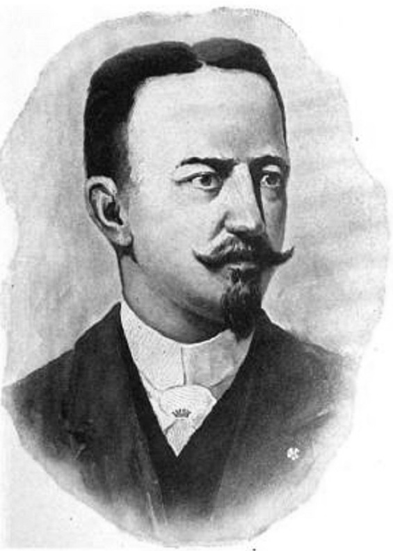
He started selling Principality of Trinidad government bonds, opened an office in New York City, started making secretarial appointments and he designed postage stamps for it.
Prince James I of Trinidad’s new principality didn’t last long, however, as the British seized Trinidad as a telegraph cable relay station, and he was forced to surrender it to them.
The British occupied what they called South Trinidad in 1895 and 1896 until an agreement was reached with Brazil.
Since there is relatively little in the written historical record about this place, I am going to point out some things about the islands topography that draw my attention.
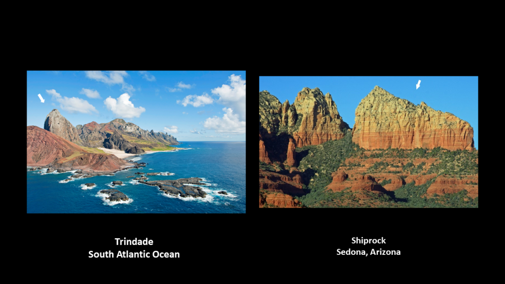
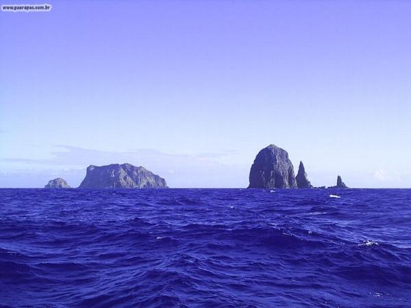
The first are the pyramidal peaks on display in this photo near the island’s shore.
The tall pointed peak in the foreground reminds me of Ship Rock in Sedona, Arizona.
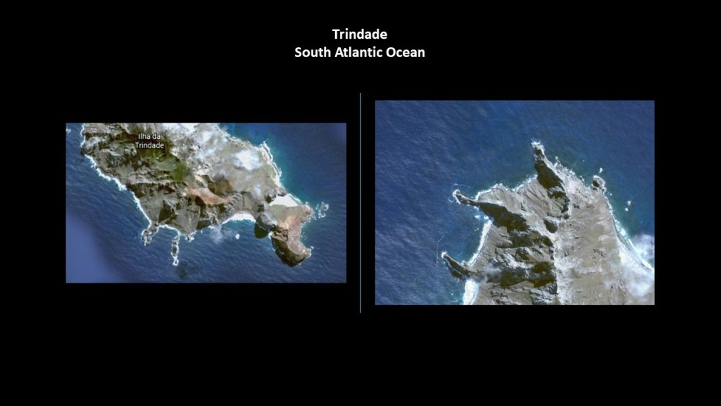
The second are the shapes of the shoreline and coves on the island of Trindade…
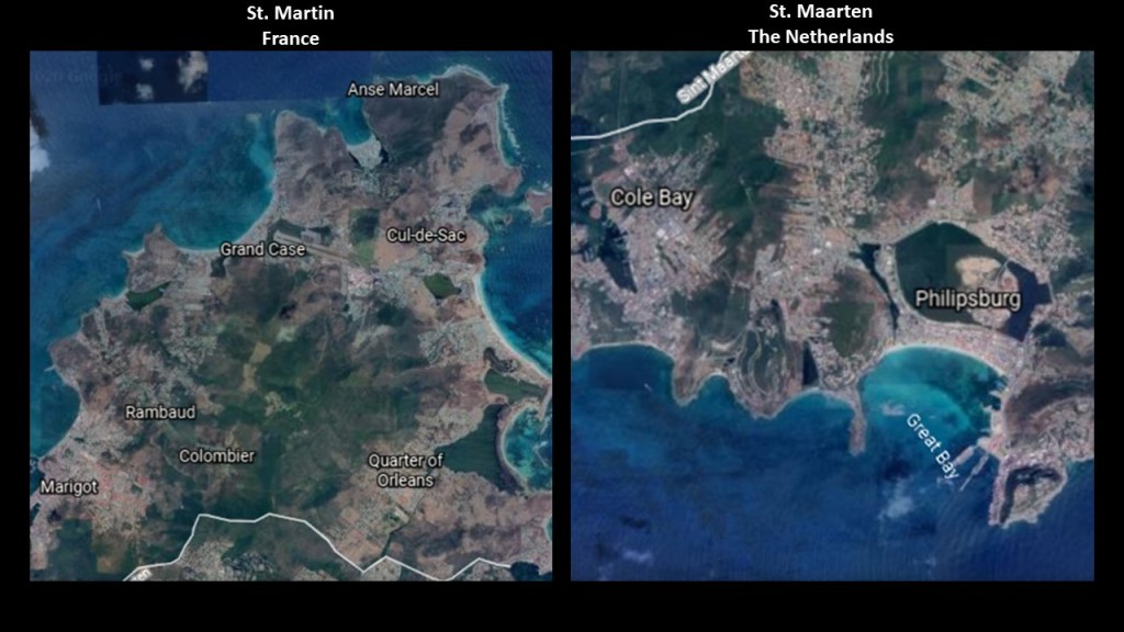
…which are quite similar in appearance to the coastline of an island in the Caribbean – the northern 60% of which is governed as a Collectivity of France called St. Martin, and the southern 40% is governed by the Netherlands and called St. Maarten…
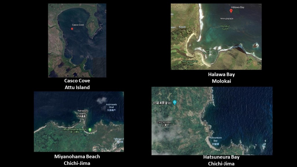
…as well as the that of Casco Cove on the Near Island of Attu, the furthest west of Alaska’s Aleutian Islands in the Bering Sea, on the top left; and the same double beach-head configurations can be found at Halawa Bay on the Hawaiian Island of Molokai on the top right, and there are many similar beach-heads on the island of Chichi-jima, one of the Japan’s subtropical Bonin Islands, like Miyanohama Beach on the bottom left and Hatsuneura Bay on the bottom right.
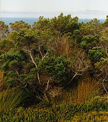
We are also told that until 1850, 85% of this island was covered by a forest of Colubrina Grandulosa trees, after which time, the indiscriminate cutting of trees, and the introduction of non-native animals, led to an extinction of the trees that were once there, and causing a heavy erosion throughout the island.
The other islands of this archipelago, the islands of Martin Vaz, consist of four islands ~ North Island; Crack Island; Needle Rock; and South Island.
Have you ever heard of these places?
I sure hadn’t before I started tracking these alignments, and these island groups I am covering in this post typically show up on more than one alignment.
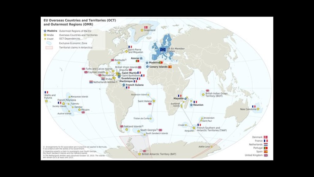
The next place we come to tracking this alignment is today’s British Overseas Territory of the South Atlantic, which consists of three remote islands: Ascension Island; St. Helena; and Tristan da Cunha.
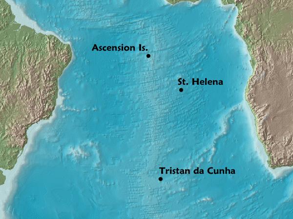
First, Ascension Island.
Besides being a British colonial outpost, Ascension Island has a U.S. military airbase, satellite and submarine tracking stations, a BBC transmitter, and a listening post run by GCHQ’s Composite Signals Organization.
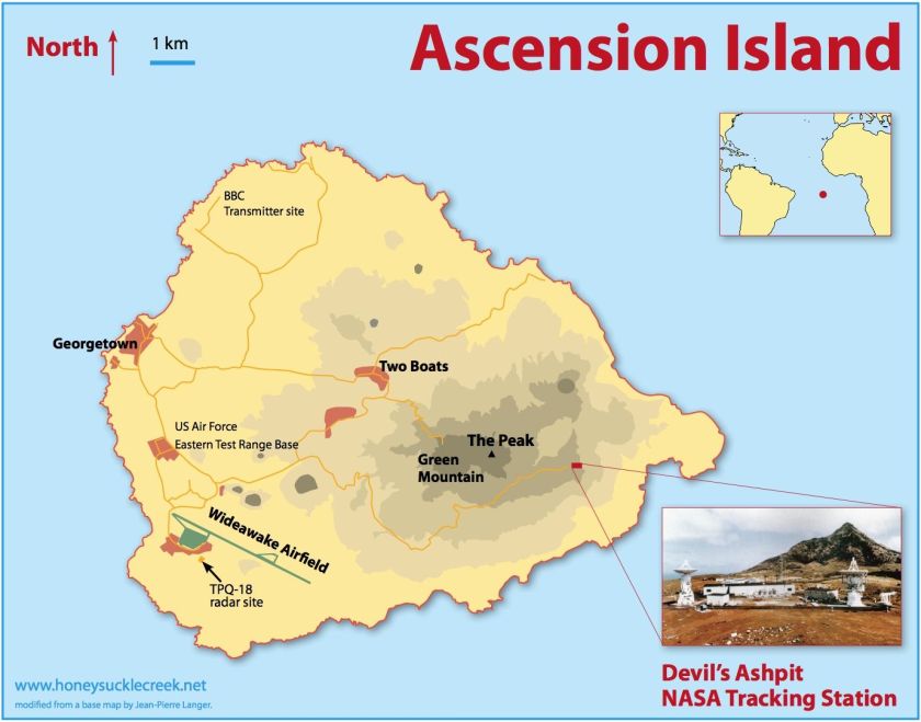
Ascension Island’s residents have been squeezed out for over 100 years.
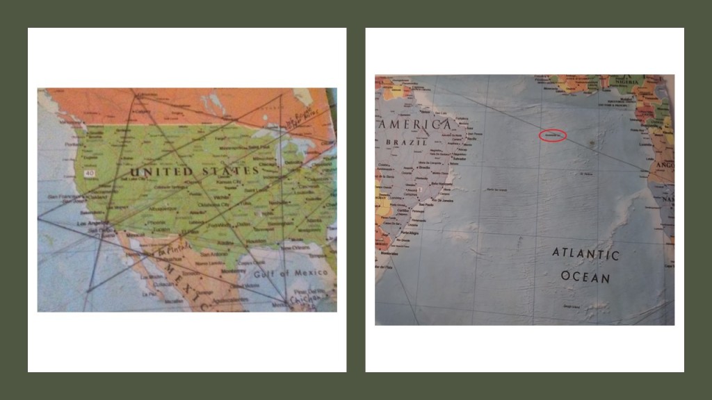
Also, I first found the location of Ascension Island on a major alignment emanating off of the North American Star Tetrahedron, where one of the lines extending from Merida, Mexico, crosses right over Ascension Island, which is a tiny speck of land in this part of the Atlantic Ocean.
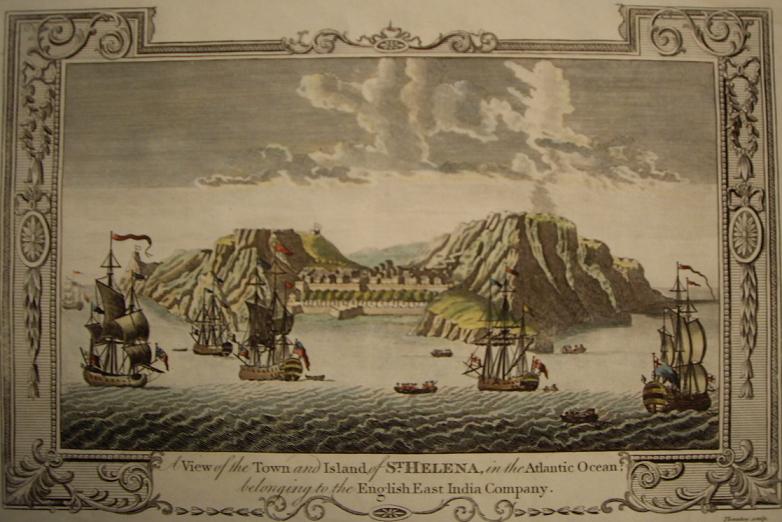
Next, the island of St. Helena.
St. Helena was where Napoleon lived in exile in our historical narrative from 1815 until his death in 1821.
Other noteworthy things about St. Helena that I have found in my research include:
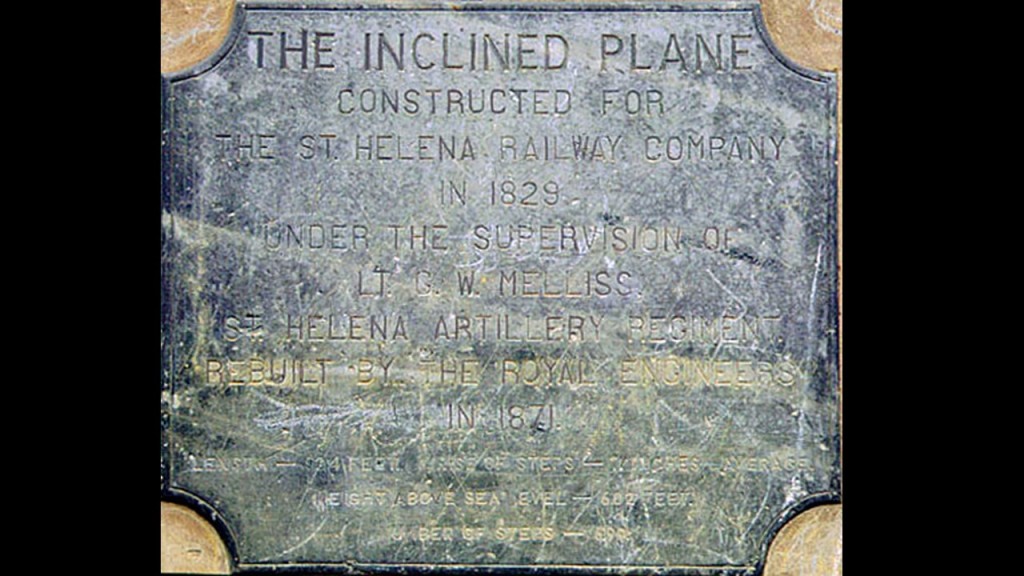
A two-car inclined railway to carry cargo was said to have been constructed in 1829 between the island’s main settlement of Jamestown and the Ladder Tree Fort at the top.
We are told it was powered by a team of three-donkeys that rotated around a capstan connected to the cars by iron chain and pulleys.
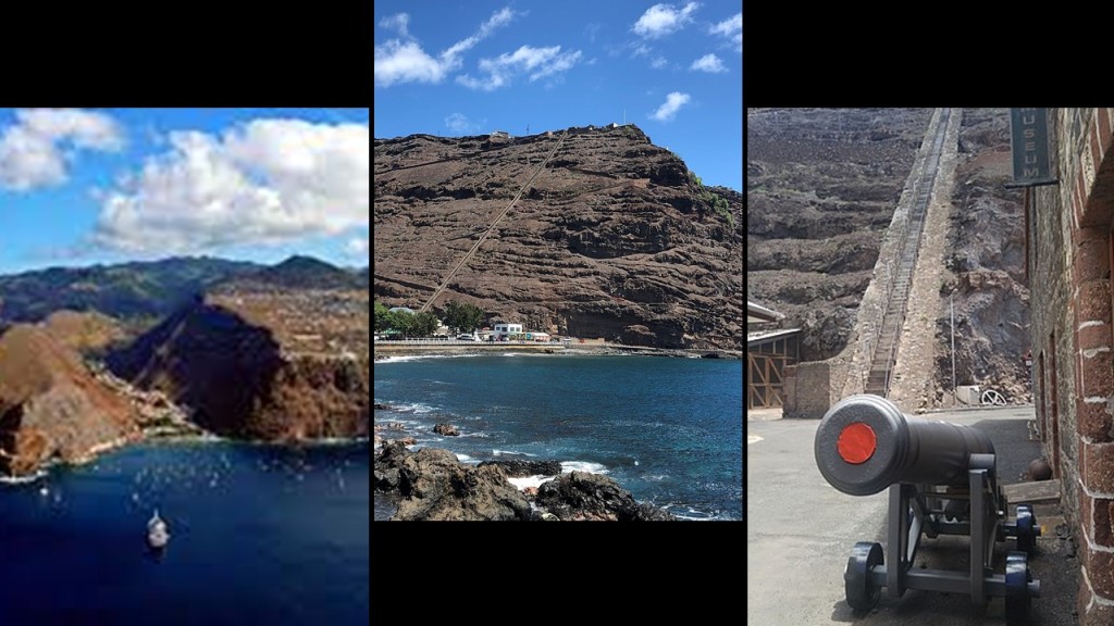
Inclined railways typically worked like an obliquely-angled elevator, in which cables attached to a pulley-system raised- and-lowered the cars along the grade by way of pairing two cars at opposite-ends that act as each other’s counterweight.
As such, there’s no need for traction between the wheels and rails, and thereby allowing them to scale steep slopes, unlike traditional rail-cars.
Thing is, there used to be a lot more of them than there are now, and inclined-railways were a worldwide thing.

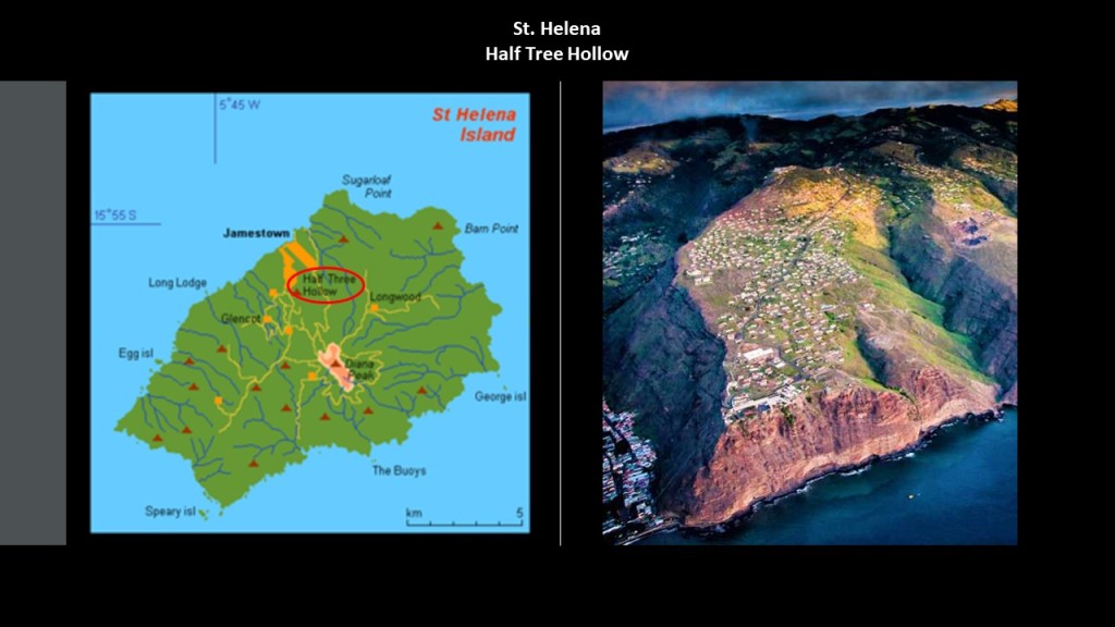
What we are told about this particular one on St. Helena is that in 1871, termite damage to the wooden ties of the railway led to the Royal Engineers to removing the cars, rails and associated machinery of the inclined railway, and today is a staircase known as Jacob’s Ladder.
Jacob’s Ladder leads to the historic location of the Ladder Hill Fort, and the present-day neighborhood of “Half Tree Hollow.”
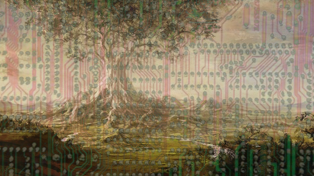
Are they telling us something without telling us they are telling us here?
Like that maybe perhaps St. Helena was a former giant tree location?
When I originally did the research in 2020 tracking the alignment through the South Atlantic and South Indian Oceans, I did not have an awareness of the former giant trees of our world,.
I came into this understanding in April of 2023 in my first conversation with Chad of the “Deeper Conversation with Chad” YouTube channel about giant trees, where in the course of our conversation coming from different perspectives, we found common ground upon which our ideas merged together.
Then in October 2023, Chad and I had a deeper conversation on the subject of “Giant Trees , the Earth’s Grid & The New World Order.”

In this conversation, we discussed in depth the idea that the European
Colonizers were going after all these little islands, and many others as well,
in a post-cataclysmic world that were once the locations of giant trees.
There is one last thing I want to mention about St. Helena before I move on to the next place.
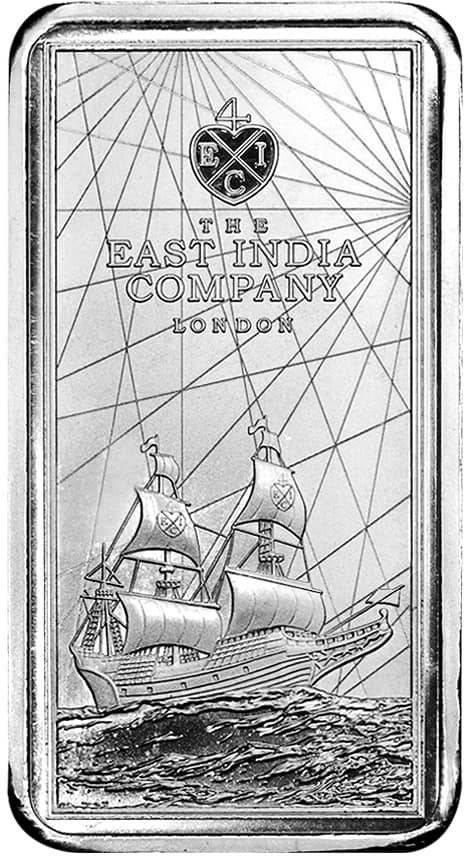
The Currency Commissioners of St. Helena produce commemorative coins.
In past research, I found this 10 ounces of silver piece that was minted on St. Helena in 2021 commemorating the East India Company.
Interesting that not only was it in honor of the East India Company, it also shows leylines on it.
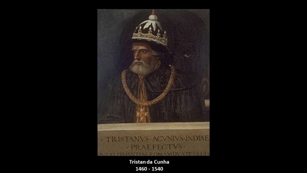
The next place on the alignment is the island group of Tristan da Cunha (UK), named for Portuguese explorer Tristan da Cunha who was credited for its discovery in 1506.
He was said to have been born in 1460 and died in 1540.
I find it interesting to note that this Portuguese explorer with an island group named after him was an almost exact contemporary of the previously mentioned Portuguese explorer with an island group named after him, Fernao de Noronha, who was born in 1470 and also died in 1540.
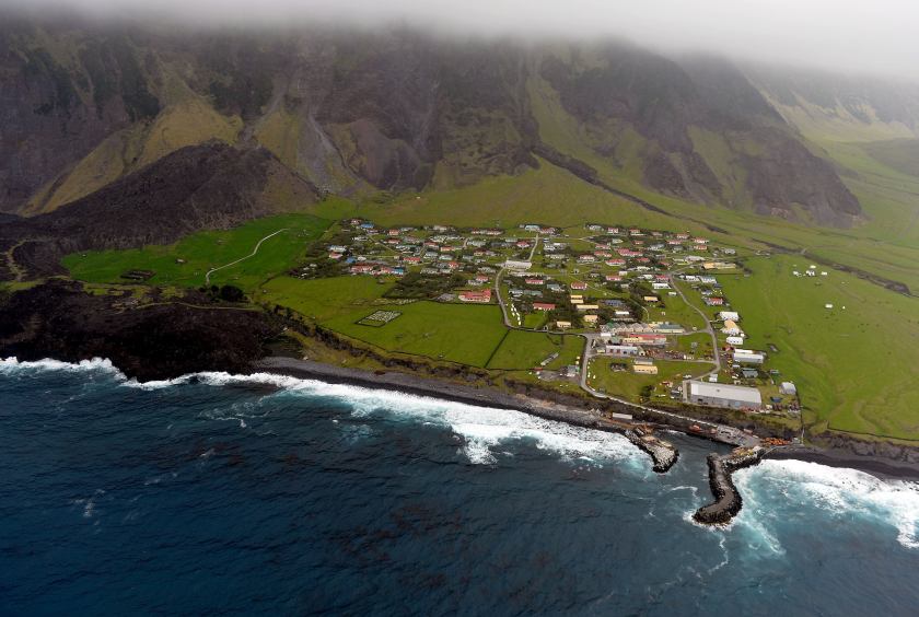
Tristan da Cunha is home to British citizens living in the world’s most isolated settlement.
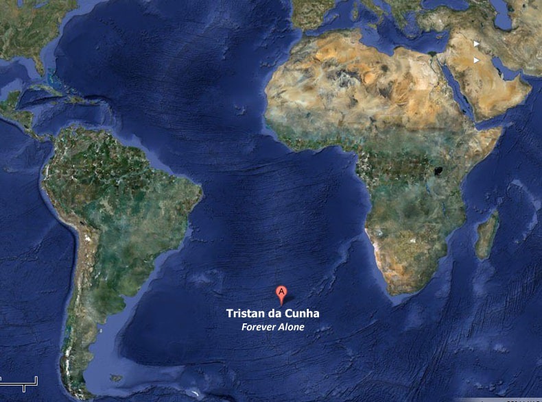
The main settlement of the main island of Tristan da Cunha is Edinburgh of the Seven Seas, which is located on the only inhabited island here, with ship or boat being the only way to travel in-or-out on a six-day journey to-or-from Cape Town in South Africa.
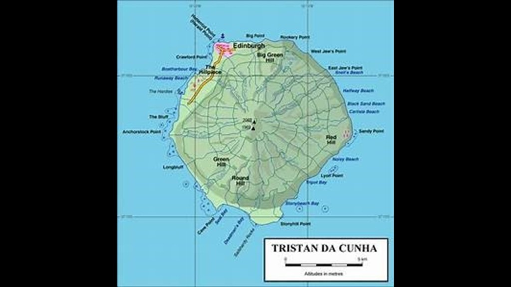
It was named in 1867 in honor of the visit of Prince Albert, the Duke of Edinburgh, the second son of Queen Victoria.
It has approximately 250 permanent inhabitants in the present-day.
We are told that the first undisputed landing was the Dutch East India Company ship, Heemstede, on February 7th of 1643, and that Dutch made four more stops there in the next 25-years, making the first rough charts of the islands in 1656.
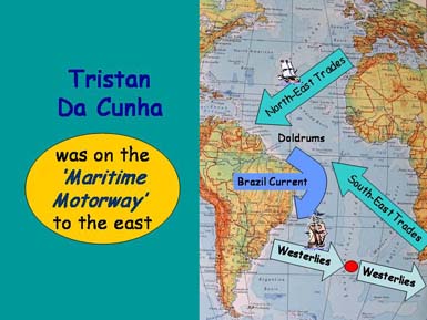
Tristan da Cunha was favorably located on the world’s historic shipping lanes between the West and the East.
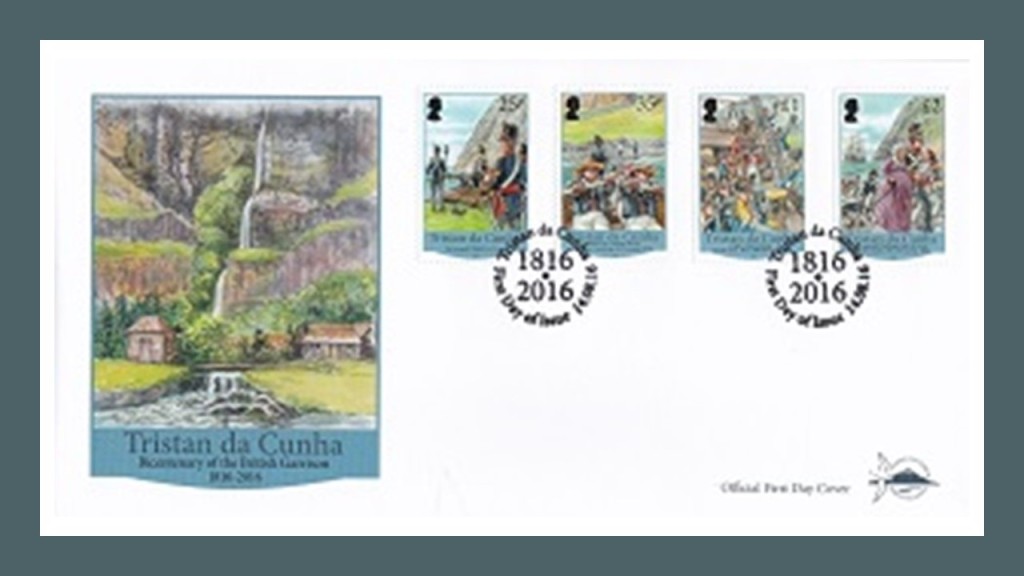
The islands of Tristan da Cunha were annexed by the United Kingdom in 1816, making them a dependency of the Cape Colony in South Africa, for the stated reasons of preventing the islands’ use as a base for any attempt to free Napoleon Bonaparte from his prison on St. Helena, and for preventing the United States from using the islands as a base for naval cruisers.
While possession was abandoned by the United Kingdom in 1817, a garrison of British marines stayed and formed the nucleus of a permanent population, which gradually grew, and was once a stopping point for lengthy sea voyages until the time of the opening of the Suez Canal in 1869.
It eventually became a dependency of the British Crown in October of 1875.
In January of 1938, Britain declared Tristan Da Cunha a dependency of St. Helena, and at that time created the British Crown Colony of St. Helena and Dependencies.
Then shortly afterwards, Tristan da Cunha was commissioned as a stone frigate, meaning a naval establishment on land, and used as a secret signals’ intelligence station to monitor Nazi U-boats and shipping movements in the South Atlantic Ocean.
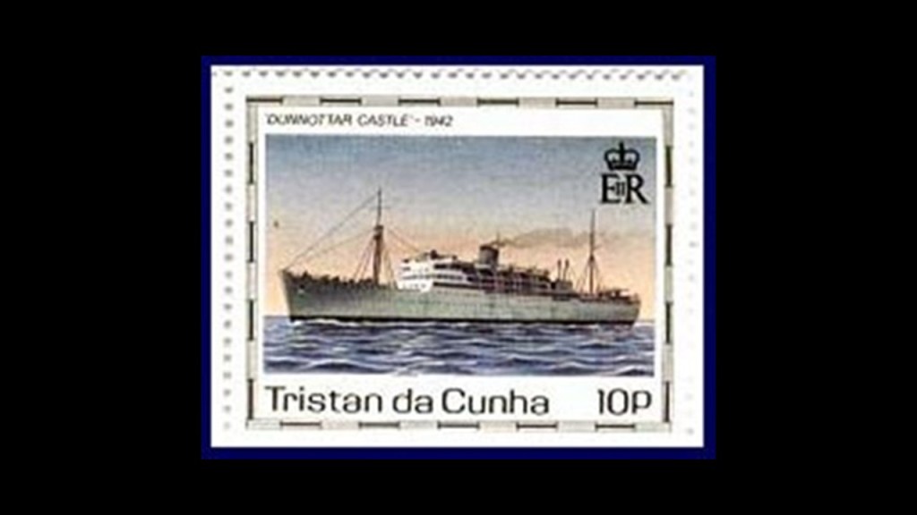
As seen as this stamp for the island, the Dunnottar Castle was an ocean liner said to have has its keel laid down in 1936 for Cape Town Service, launched in 1936, and retired in 2002, operating for 66-years.
In 1942, the Dunnottar Castle was seconded for a special assignment, and was used to sail on the top-secret mission of erecting the meteorological and wireless radio station on Tristan da Cunha used for this secret intelligence collection.
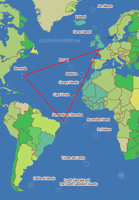
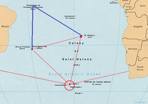
I can also make a circumstantial case that islands I have talked about thus far in this post have an octagonal geometric relationship between each other.
I found a map showing the relationship in red of an equilateral triangle between the Trindade & Martin Vaz Islands; Tristan da Cunha; and St. Helena.
I added Fernando de Noronha in blue to Trindade and Martin Vaz, and St. Helena, to form an octagon…with Ascension Island off the right side of the upper triangle.
Next on the alignment we enter into lands claimed by the French colonizers.
The French Southern and Antarctic Lands have been an overseas territory of France since 1955.
They consist of:
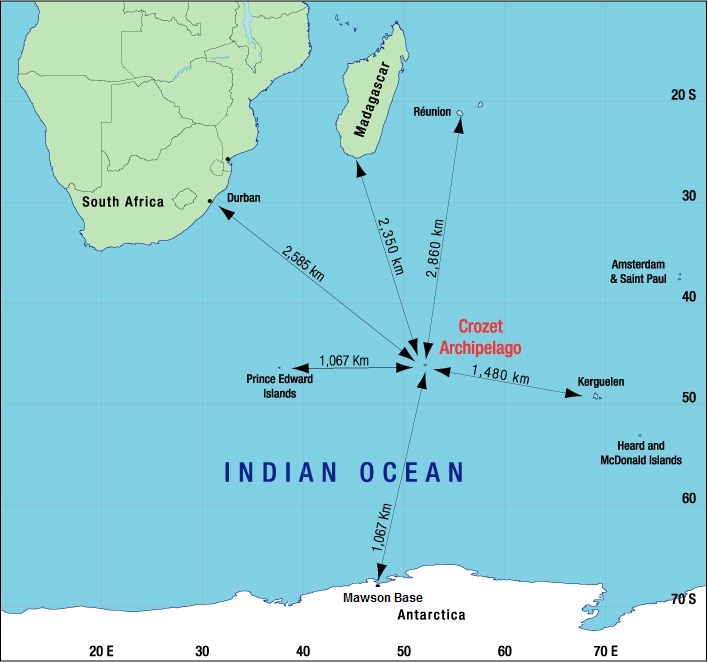
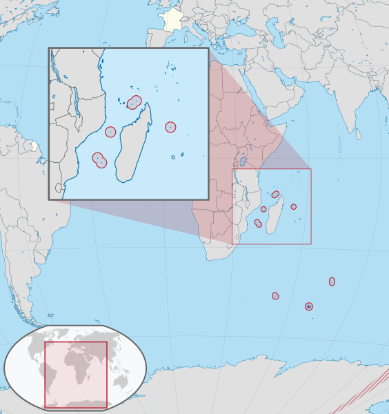
–the Crozet Islands, a group in the southern Indian Ocean, south of Madagascar;
–Adelie Land, the French claim on the continent of Antarctica. Adelie land;
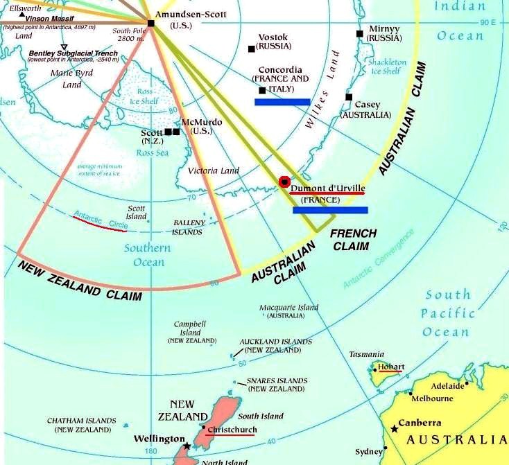
–the Kerguelen Islands, volcanic islands in the southern Indian Ocean, southeast of Africa, approximately equidistant between Africa, Antarctica and Australia;

— St. Paul and Amsterdam Islands, a group to the north of Kerguelen.
–and the Scattered Islands, a group of dispersed islands around the coast of Madagascar, of which the principal station for these islands is on Tromelin Island.
The French Austral Lands and Seas were inscribed as a UNESCO World Heritage Site on July 5th, 2019.
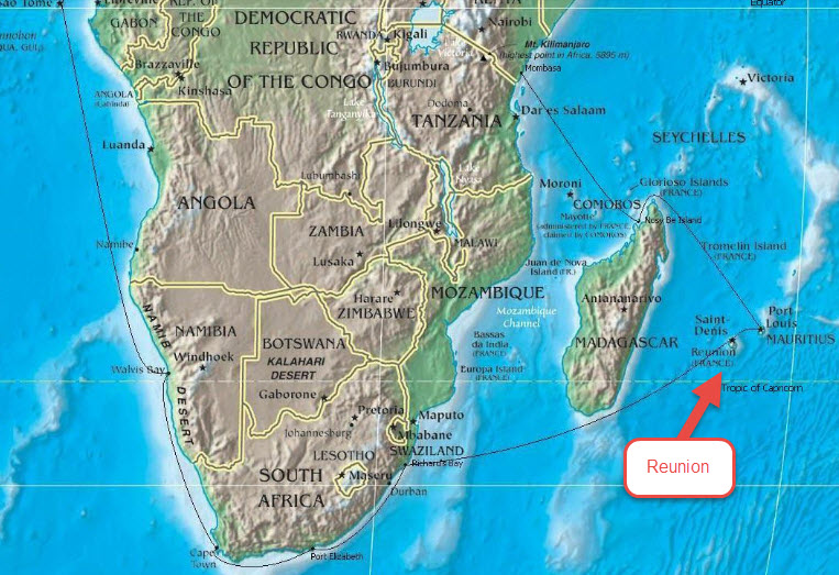
The French Southern and Antarctic Lands are administered by a prefect with headquarters in Saint-Pierre on Reunion Island.
I am going to spend some time looking into the life and voyages of Jules Dumont d’Urville because I believe his story is important to understanding the historical narrative we have been taught.
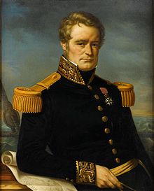
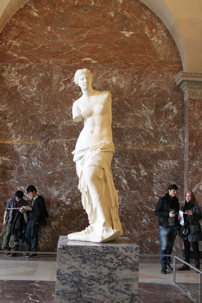
Early in his naval exploration career, as a result of being in the right place at the right time on a naval hydrological survey of the Greek islands in the Aegean Sea, Dumont d’Urville was given the credit, and a knighthood in the Legion of Honor, for ultimately enabling the famous Venus de Milo marble statue to come from the Greek island of Milos to the Louvre in Paris instead of going to Constantinople.
After the Aegean Sea expedition, he planned an expedition, with another naval officer, of the Pacific Ocean, an area France had been forced out of as a result of the Napoleonic Wars.
They set out on their expedition to collect scientific and strategic information in August of 1822, on a ship named originally La Coquille, and sailed to the Falkland Islands; the coasts of Peru and Chile in South America; New Guinea; New Zealand and Australia.
The expedition carried out research in the fields of botany and insects, bringing back thousands of specimens to the Natural History Museum in Paris.
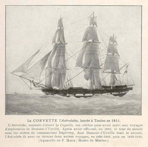
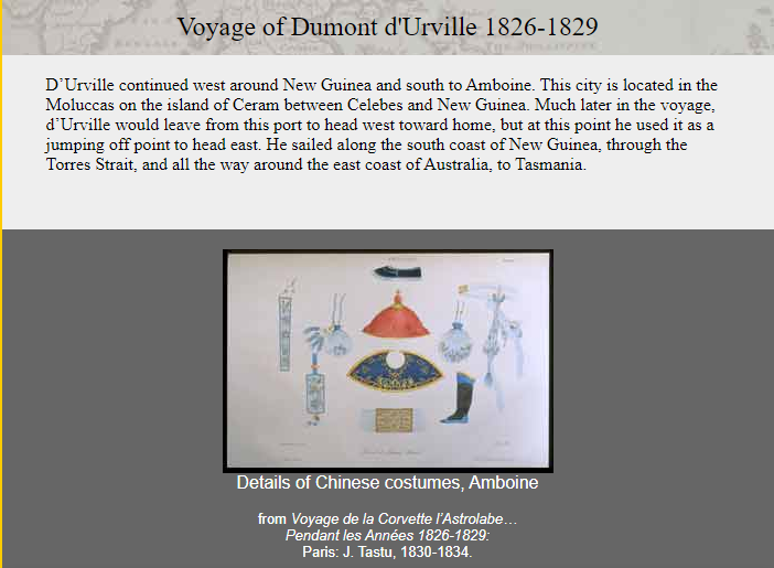
Then Dumont d’Urville departed on La Coquille, now called L’Astrolabe, or the Astrolabe, named for a navigational device, and sailed in 1826 for three-year voyage to New Zealand; Fiji; the Loyalty Islands; New Guinea; the Solomon Islands, Caroline Islands, and the Moluccas in eastern Indonesia.
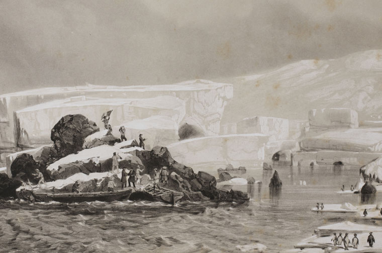
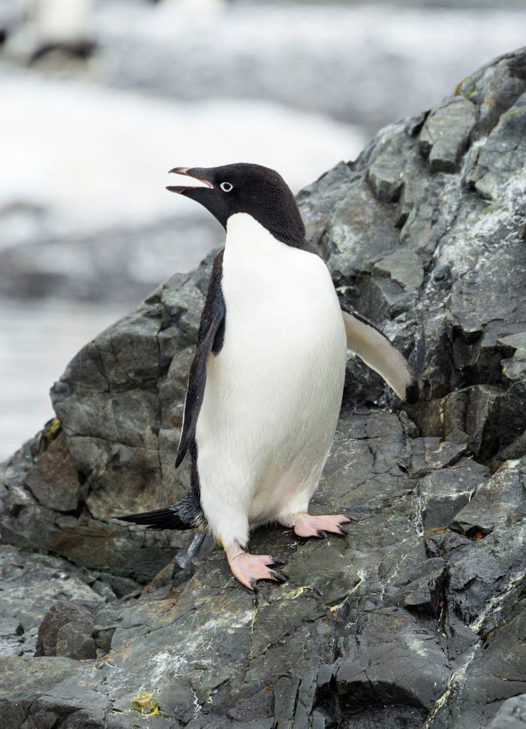
In 1837, Dumont d’Urville set out yet again on the Astrolabe for the South Orkney Islands in the Southern Ocean; the Marquesas Islands; Tasmania; along the coast of Antarctica, at which time he claimed land on January 21st of 1840 for France, considered it his most significant achievement. He named it Adelie Land after his wife Adele.
He also named the Adelie penguin for his wife.
He then sailed onto New Zealand; the Torres Strait; Reunion Island; and St. Helena island, and returning to France later in 1840.
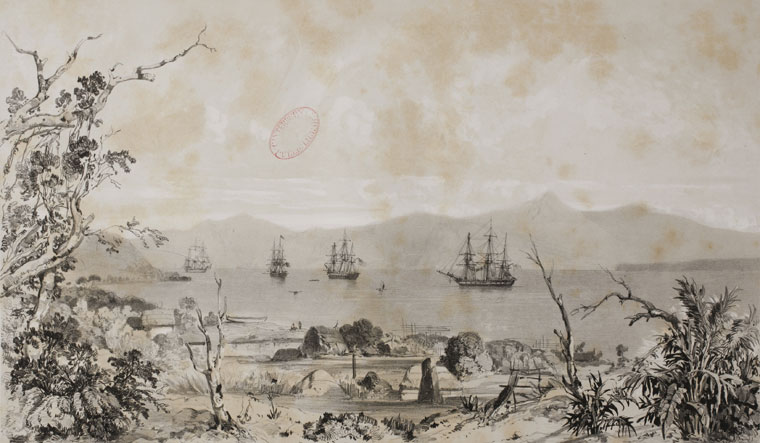
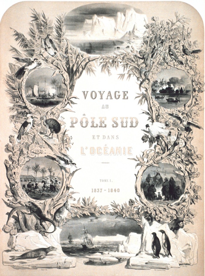
He was promoted to Rear Admiral upon his return, and he wrote a report of the expedition entitled “Voyage au Pole Sud et dans L’Oceanie sur les Corvettes Astrolabe et la Zelee 1837 – 1840,” which was published between 1841 and 1854 in 24 volumes.
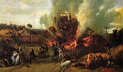
An interesting side-note about Dumont d’Urville’s life was his death – he and his entire family were killed in the first ever rail disaster in France in May of 1842, called the Versailles Rail Accident, in which the train’s locomotive derailed, the wagons rolled, and the coal tender ended up at the front of the train and caught fire. This was said to be a painting of the incident.
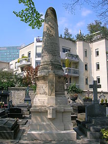
Remains said to have been identified as his by a doctor who had been on-board the Astrolabe with him, and were interred here at the Montparnasse Cemetery in Paris.
Could this be a case of “Dead men tell no tales” as it were?
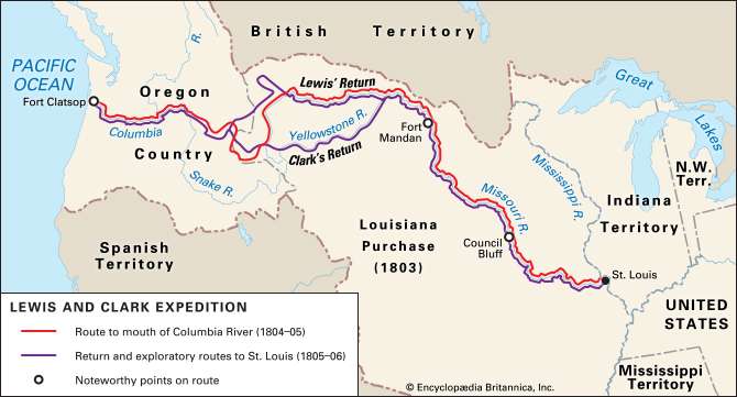
Like, perhaps, explorer Meriwether Lewis, who died of gunshot wounds in 1809?
Meriwether Lewis had returned from the Lewis & Clark Expedition in 1807; was made Governor of Louisiana Territory by Thomas Jefferson; and had made arrangements to publish his Corps of Discovery Journals.
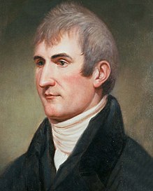
For a point of information, he was initiated into freemasonry between 1796 and 1797, from where he was born and raised in Ablemarle County, Virginia Colony, shortly after he joined the United States Army in 1795.
Being Governor of the Louisiana Territory didn’t work too well for him for a variety of reasons, and he set out for Washington, DC, to address financial issues that had arisen as a result of denied payments of drafts he had drawn against the War Department when he was governor…and he carried with him his journals for delivery to his publisher.
He decided to go overland to Washington instead of via ship by way of New Orleans, and stayed for the night at a place called Grinder’s Stand, southwest of Nashville, Tennessee.
Gunshots were heard in the early morning hours, and he was found with multiple gunshot wounds to the head and gut.

We are told that Thomas Jefferson and some historians generally accepted Lewis’ death as a suicide. His family never accepted that it was suicide, and the matter is still debated. No one was ever charged with his murder.
Just sharing some strange deaths of famous explorers that are out there, and easy to find, in the historical narrative we have been given.
Also, it is interesting to note there were similar naval expeditions by other countries around the same time of those of Dumont d’Urville for France.
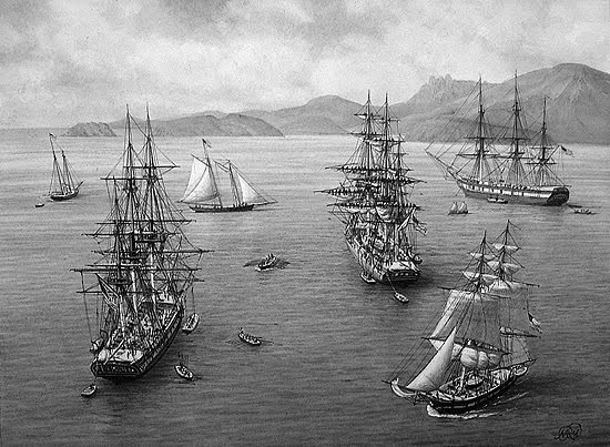
The U. S. Exploring Expedition was an exploring and surveying expedition of the Pacific Ocean and the surrounding lands conducted by the United States between 1838 and 1842.
The expedition was described as of major importance to the growth of science in the United States, and that during the events of its occurrence, armed conflict between Pacific Islanders and the expedition was common, and dozens of natives were killed, as well as a few Americans.
It involved a squadron of four ships, with specialists on each including naturalists, botanists, a mineralogist, a taxidermist, and a philologist, which is someone who studies written and oral histories.
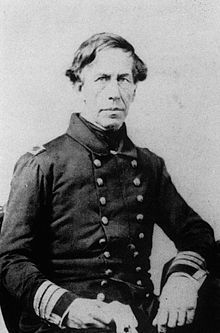
It is sometimes referred to as the “U. S. Ex. Ex.” or “Wilkes Expedition,” after the commanding officer, Navy Lt. Charles Wilkes.
The ships of the Wilkes Expedition departed from Hampton Roads in Virginia for the first stop the Madeira Islands off the coast of Africa on August 18th, 1838.
The routes of the expedition went something like this – all over the place.
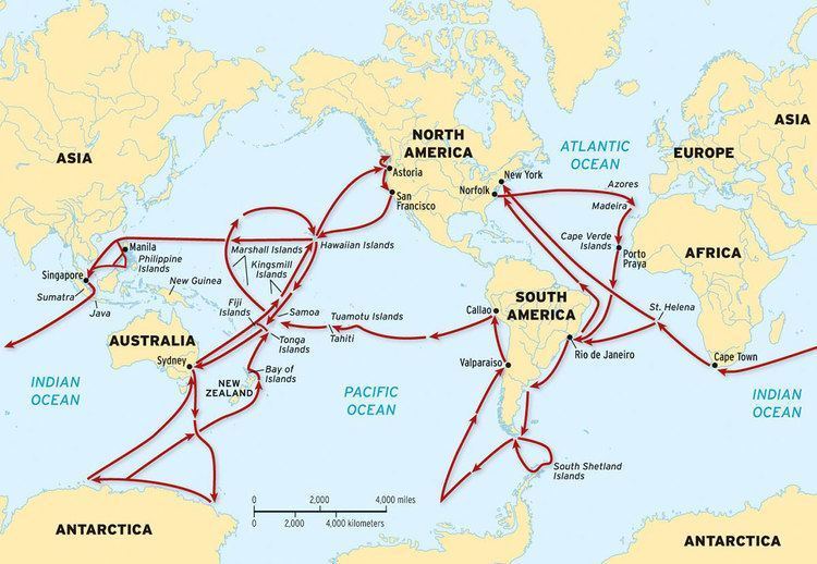
The squadron of ships pretty much sailed together, at different rates of speed, from their first stop at Madeira, to Rio de Janeiro in Brazil; Tierra del Fuego at the southern tip of South America; Valparaiso in Chile; Callao in Peru; the islands of Tahiti, and Samoa, in the South Pacific; Sydney in Australia; Antarctica, which they arrived at and “discovered” on January 16th of 1840, just mere days before the completely different expedition (?) of Dumont d’Urville’s claimed land on Antarctica on January 21st of 1840; and then, by way of Fiji, to the Sandwich Islands (otherwise known as the Hawaiian Islands), before returning to the United States. The ships did break-off into pairs on occasion to explore different places in the same general location.
Then there were the voyages of the HMS Beagle, originally a Cherokee class 10-gun boat of the British Royal Navy, said to have set off from the Royal Dockland of Woolwich at the River Thames on May 11th of 1820.

The HMS Beagle’s first voyage was between 1826 and 1830, accompanying the larger ship, HMS Adventure, on a hydrologic survey of Patagonia and Tierra del Fuego, under the overall command of the Australian Navy Captain, Phillip Parker King.
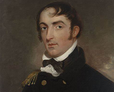
The second voyage of the HMS Beagle, between 1831 and 1832, was joined by naturalist Charles Darwin, on a second trip to South America, and then around the world.
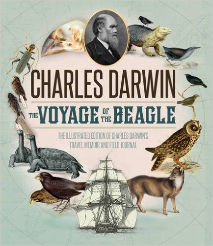
Charles Darwin kept a diary of his experiences, and rewrote this as a book titled “Journal and Remarks,” becoming published in 1839 as “The Voyage of the Beagle.”
The third voyage of the HMS Beagle took place between 1837 and 1843, and was a third surveying voyage to Australia, stopping on the way at Tenerife in the Canary Islands; Salvador on the coast of Brazil in Bahia State; and Cape Town in South Africa. I have found all three of these places on planetary grid alignments.

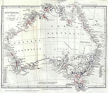
In Australia, the crew surveyed Western Australia, starting in what is now Perth, to the Fitzroy River; then both shores of the Bass Strait in Australia’s southeast corner; then north to the shores of the Arafura Sea, across from Timor. Again, all of these places figure prominently on grid alignments.
In 1845, the HMS Beagle was refitted as a Coast Guard watch vessel in Essex, in the navigable waters beyond the Thames Estuary, moored in the middle of the River Roach, until oyster companies and traders petitioned to have it removed in 1851, citing the vessel was obstructing the river and its oyster beds.
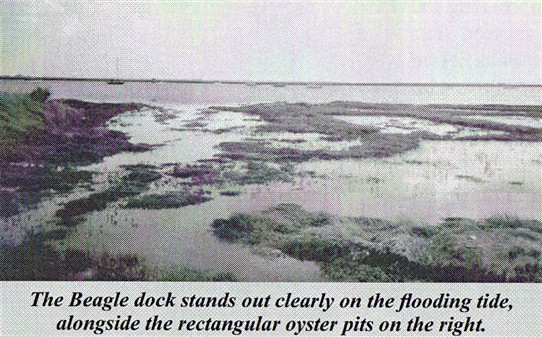
The Navy List shows that on May 25th of 1851, the Beagle was renamed “Southend ‘W.V. No. 7′” at Paglesham, and sold in 1870 to be broken-up.
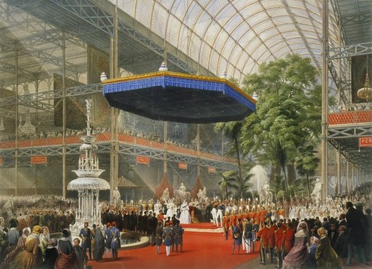
Just for point of reference, the Crystal Palace Exhibition took place in London’s Hyde Park between May 1st of 1851 to October 15th of 1851.
I believe the Crystal Palace Exhibition of 1851 was the official kick-off to the reset timeline of the New World Order.
I believe the history of Earth has been replaced with the history of those that took over and claimed the legacy of the original builders of civilization, and I believe all of these voyages of exploration were part of how they did it.
The earth, and all that was in it, was surveyed after the mud flood event, and before the official start of the new reset timeline in 1851, from which our new history was based on.
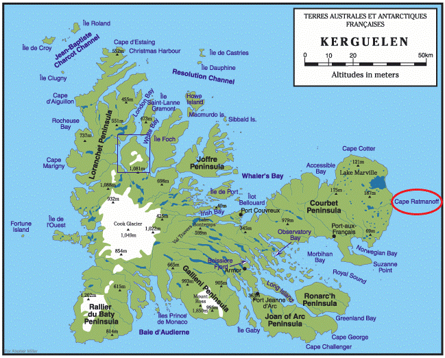
Now, on to the Kerguelen Islands, also known as the Desolation Islands, and administered as part of the French Southern and Antarctic Lands as mentioned previously.
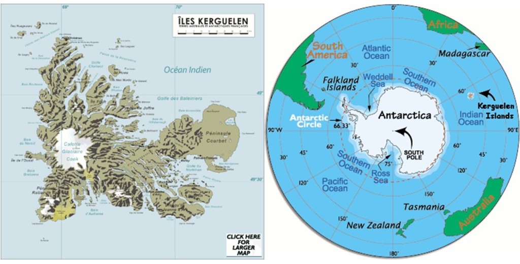
The Kerguelen Islands themselves are considered an exposed part of the Kerguelen Plateau, which is considered a large igneous province, or an extremely large accumulation of igneous rocks, mostly submerged by the southern Indian Ocean.
The main island, known as Grande Terre, is 2,577 square-miles, or 6,675 kilometers-squared.
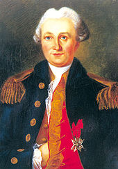
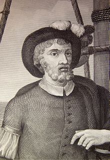
The islands were officially discovered by the French navigator Yves-Joseph de Kerguelen-Tremarec on February 12th of 1772.
Then, apparently the very next day, a member of the expedition named Charles de Boisguehenneuc, landed on the island, and claimed it for the French Crown.
The island was visited regularly by whalers and sealers after its discovery, and between the 18th- and 20th-century, the regions whales and seals were hunted to the point of near extinction.

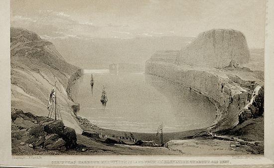
The islands were not completely surveyed until 1840 during the Ross Expedition, a voyage of scientific exploration of the Antarctic between 1839 and 1843.
This is said to be an engraving from the Ross Expedition of Christmas Harbor at Kerguelen Island, from an elevation 600-feet, or 183-meters.
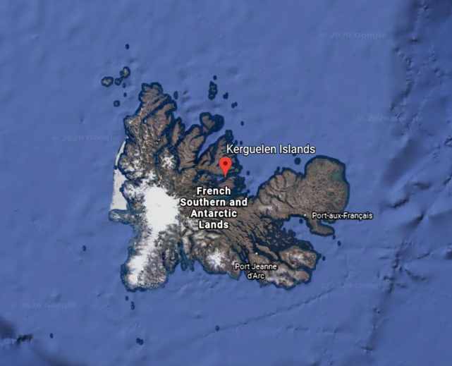
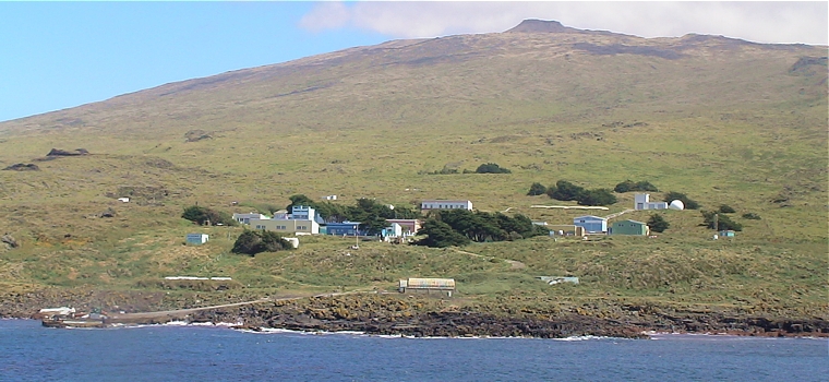
The main base, or so-called capital of the Kerguelen Islands, is at Port-aux-Francais, on the eastern shore of Grande Terre.

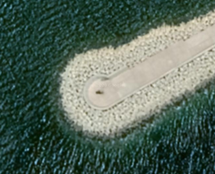
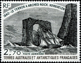
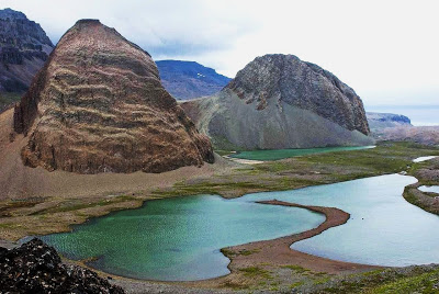
This is the best known feature of the Kerguelen Islands, known as the Arch of Kerguelen at Port Christmas, where there was formerly a geomagnetic station.
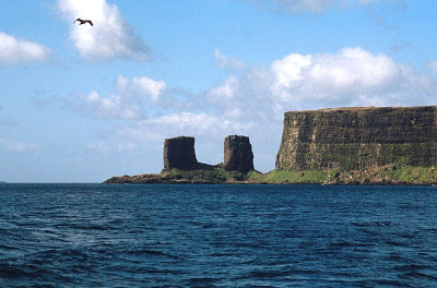
Apparently the Arch of Kerguelen actually looked like an arch at one time.
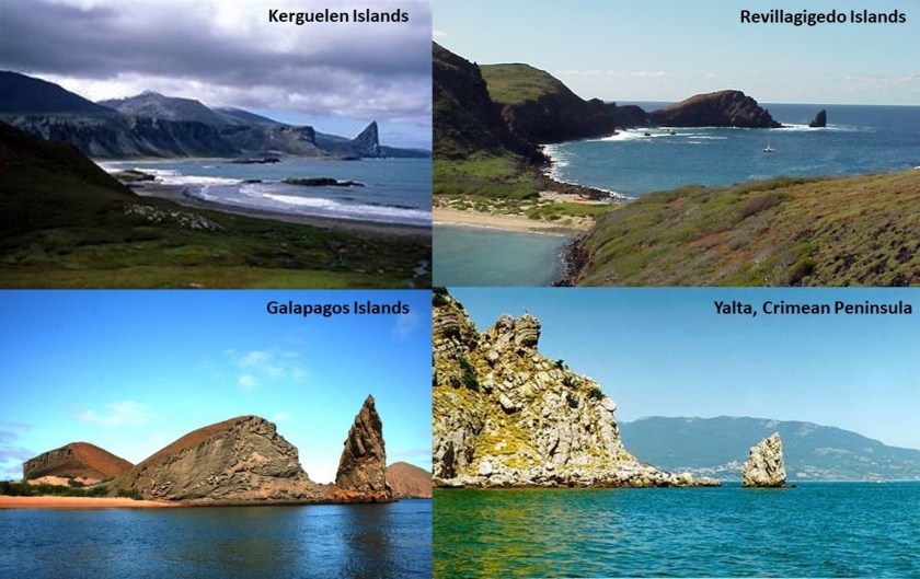
Also, what looks to be a version of the same land feature in the Kerguelen islands, called St. Anne’s Finger on the Gallieni Peninsula in the Baie Larose, on the top left, is found in the Revillagigedo Islands, in the Pacific Ocean near the west coast of Mexico, and part of its Colima Province, on the top right; and on the bottom left, a feature found in the Galapagos Islands, off the coast of Ecuador on the northwestern side of South America; and on the bottom right, one is also found near Yalta on the Crimean Peninsula in the Black Sea.
Mount Ross is the highest point of Kerguelen Island, at 6,069-feet, or 1,850- meters, also on the Gallieni Peninsula.
Other land features of Kerguelen Island include Mounts Simoun and Diane.
George Biddell Airy, whom we saw earlier as the Astronomer Royal who moved the Earth’s Prime Meridian from the Great Pyramid of Giza to the Royal Observatory of Greenwich in London, organized and equipped five expeditions to different parts of the world, of which three were sent to the Kerguelen Islands, to observe the 1874 Transit of Venus.
Between 1874 and 1875, altogether British, German, and United States expeditions visited Kerguelen to observe the Transit of Venus.
The 1874 Transit of Venus took place on December 9th of that year, and was the first of the pair of Venus Transits which took place in the 19th-century, the second one being in 1882.
A transit of Venus takes place across the sun when the planet Venus passes directly between the sun and a superior planet, becoming visible against the solar disk.
Interestingly, this is a diagram of the orbit of Venus as seen from Earth.
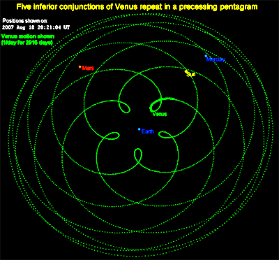
There is a geomagnetic station at Cap Ratmanoff in the present-day, the easternmost point of the Kerguelen Islands.
So, even today, the principal activities on the islands focus on scientific research, mostly earth sciences and biology, as well as a French satellite- and rocket station near Port-aux-Francais, like to what we saw back on Ascension Island with American and British facilities doing the same thing in the Atlantic Ocean…
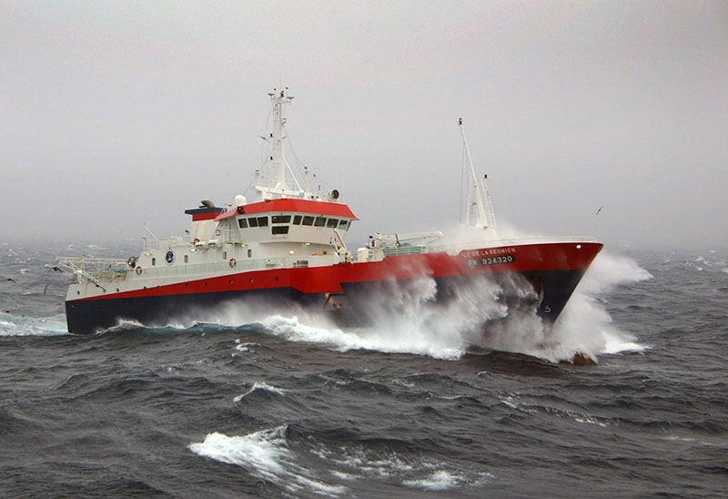
…and there is a small fleet of fishing vessels that are owned out of Reunion Island and licensed to fish in this exclusive economic zone based here.
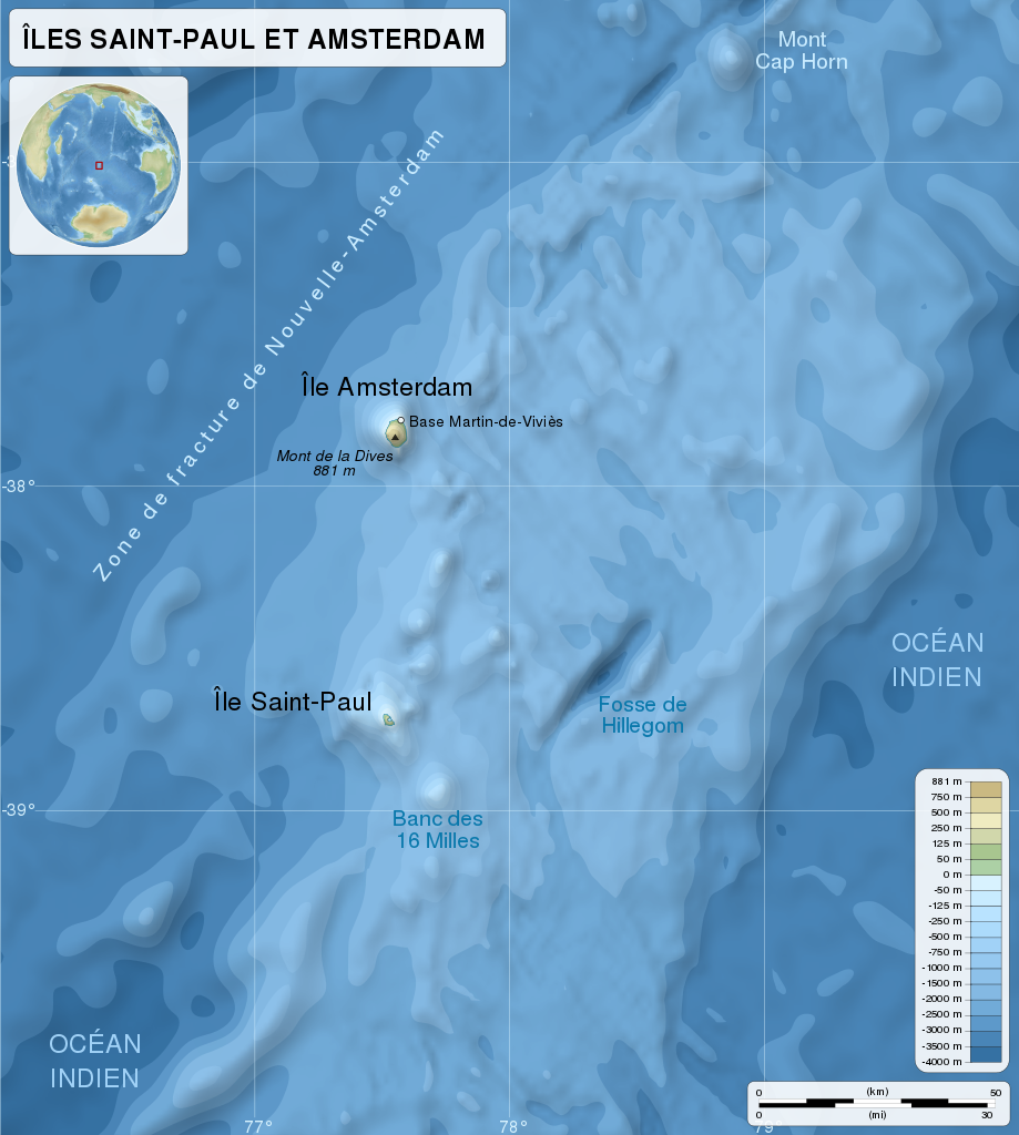
Next on the alignment, we come to Ile St-Paul, or St. Paul Island, another part of the French Southern and Antarctic Lands mentioned previously.
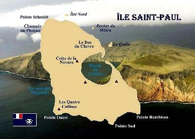
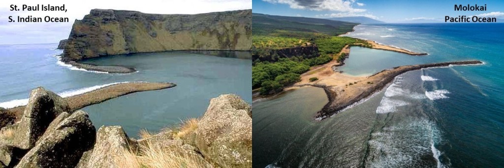
We are told in 1780, the thin stretch of rock that used to close off the crater of the active volcano it sits on top of collapsed, admitting water through a 330-foot, or 100-meter, channel. The entrance is shallow, allowing only small ships and boats to enter.
For comparison in appearance, on the left is the entrance to what is called the “Bassin du Cratere” or “Lac Cratere,” or in English “Crater Lake” on Ile Saint-Paul in the South Indian Ocean, compared with what is found on the Hawaiian Island of Molokai, in the middle of the Pacific Ocean.
While the Portuguese were first credited with discovering the island in 1559, and the Dutch with sighting it in 1618, the French laid claim to it in 1842, apparently when a group of fisherman from Reunion Island that were interested in setting-up a fishery on Saint-Paul, pressed the Governor of Reunion to take possession of Saint-Paul, as well as Amsterdam Island, which we will be coming to next on the alignment.
Apparently, he did so, by official decree, on June 8th of 1843.
All fishery activities were abandoned in 1853, however, when the French government renounced its possession of the two islands.
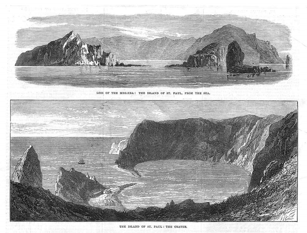
The HMS Megaera, a British troop transport, was wrecked on the Ile Saint-Paul in 1871, and it took approximately 3-months to rescue all 400 persons that were on board.
This is said to be a print of the Ile Saint-Paul from that time period in 1871.
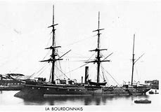
Then, in 1892, the crew of the French ship Bourdonnais again took possession for the French government of Saint-Paul and Amsterdam Islands.
These days, the main human activity on Ile Saint-Paul is a scientific research cabin used for scientific or ecological short campaigns only, and no permanent human population.
Other activity involves its importance as a seabird breeding site.
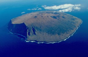
The next place we come to on the alignment I am tracking is the Ile Amsterdam, or Amsterdam Island, which was claimed by France in 1892.
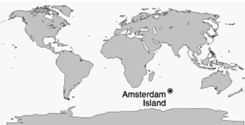
Amsterdam Island is roughly equidistant from the land masses of Madagascar, Australia, and Antarctica.
While a Spanish explorer by the name of Juan Sebastian de Elcano was said to have sighted the island in 1522, when he was completing the first circumnavigation of the world after Magellan’s death in the Phillippines in 1522…
…Amsterdam Island was said to have gotten its name over one-hundred years later…
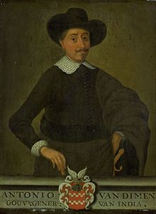
…in 1633, from a Dutch sea captain, Anthony van Diemen who named it after his ship, Nieuw Amsterdam, which was named after the Dutch settlement of Nieuw Amsterdam (which later became New York City).
Amsterdam Island was a stop for the Macartney Mission in 1793, the first British diplomatic mission to China.
The goals of the Macartney Mission were to: 1) Open new ports for British trade in China; 2) the establishment of a permanent embassy in what was then called Peking, now Beijing; 3) the cession of a small island off the coast of China for Britain’s use; and 4) the relaxation of trade restrictions on British merchants in Canton in southern China.
While it was said to have failed to achieve its initial objectives, the Macartney Mission was noted for having brought back extensive cultural, political, and geographical observations that its participants recorded.
After having been claimed for France in 1892, the islands were part of the French Colony of Madagascar from 1924 until August 6th of 1955, when the French Southern and Antarctic Lands were formed.
The only settlement on Amsterdam Island is a seasonal research station, which studies biology, meteorology, and geomagnetics.
Phylica Arbora trees grow on Amsterdam Island.
It was called the “Great Forest,” covering the lowlands of the island, until most of the trees were cleared by fires set by sealers around 1825.
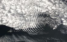
Here is a photograph of Lee Waves taken on Amsterdam Island. Lee Waves are atmospheric stationary waves, and are a form of internal gravity waves.
It definitely seems as though the location of the islands I have been tracking in the Atlantic and South Indian Oceans are in a favorable location with regards to: 1) Trade Winds, or the permanent east-to-west prevailing winds that flow in the earth’s equatorial region between 30-degrees north and 30-degrees south, and which allowed trade routes to become established across the Atlantic and Pacific Oceans, making various places on earth easy or difficult to access…
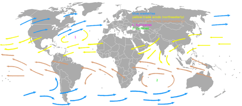
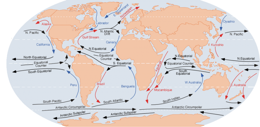
…and 2) on the Earth’s ocean currents, which are like giant conveyor belts flowing through the ocean and moving huge amounts of water all of the time, and which look very similar to the depiction of the direction of the trade winds.
Like George Biddell Airy, another previously seen Astronomer Royal in this video, Edmond Halley, who was said have taken possession of the Trindade and Martin Vaz Islands on behalf of the British monarchy in 1700, makes an appearance in history with regards to the subject of the Trade Winds as well.
In addition to being Astronomer Royal, Edmond Halley was also a geophysicist, mathematician, meteorologist and physicist.
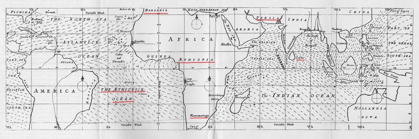
This is a map he made in 1686 of the earth’s trade winds.
In 1686, he made this map of the Earth’s trade winds.
Note the place-names of his time depicted on this map, like:
The Ethiopick Ocean on the left bottom of the map;
Ethiopia prominently displayed in the center of the African continent;
Barbaria on the coast of North Africa;
Persia, the historic name of Iran on the top right;
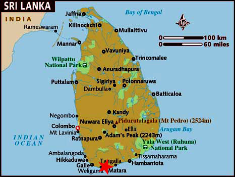
And Ceylon, on the right middle, the historic name of what is called Sri Lanka today.
Pertaining to this place-name information, I want to mention that I have long-suspected that there was a much, much greater significance to Ethiopia and what it actually represented in our True History than what we have been told in our official narrative.
I am going to end this post here, and in the next post, I will be picking up this alignment in Matara, Sri Lanka, which will be the final post of this particular series based on my findings in tracking a long-distance alignment back in 2020, called “The Advanced Ancient Civilization in Sri Lanka, India, and Pakistan.”