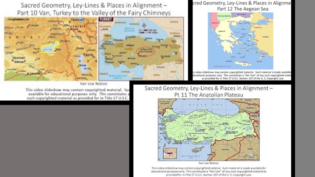
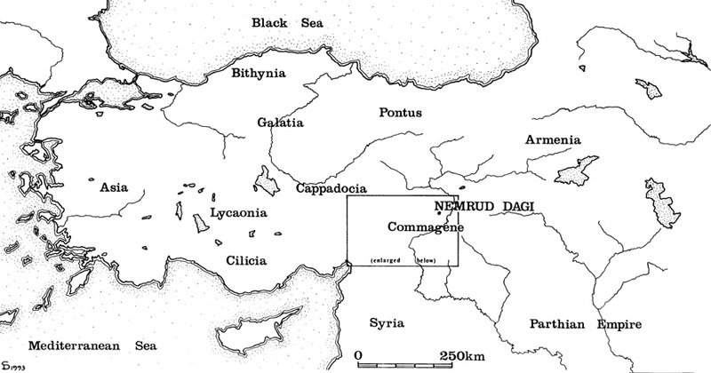
I am going to be looking into places in alignment starting in historical Armenia, and going across the Anatolian Plateau, both of which are part of the modern country of Turkey, as well as looking at places in the Aegean Sea, a section of the Mediterranean Sea that stretches between Anatolia and Greece.
From the process of tracking cities and places in several different alignments I have collected a variety of puzzle pieces about different places that bring a bigger picture into focus that is not immediately apparent on the surface, and I have been engaging in this process over the course of almost six years of doing extensive research.
The more research I do, the more connections I find that show this ancient civilization was advanced, interconnected and worldwide, and when I go back and look at research I have done in the past, I can see these connections even more clearly than before.
As a result, I have been able to extrapolate common elements and piece together the bigger picture from this type of geographically-focused research in the following blog that I have been able to extrapolate common elements and piece together the bigger picture.
The research in this post came from a 23-part series called “Sacred Geometry, Ley Lines & Places in Alignment” that I did back in 2020 tracking a long-distance alignment of cities and places that started in San Francisco.
I decided to showcase another part of the original series before I go back to another project I am currently working on.
Not long ago I posted The Ancient Advanced Civilization in Southeast Asia – From Manila in the Philippines to Dhaka in Bangladesh” from the same 23-part series.
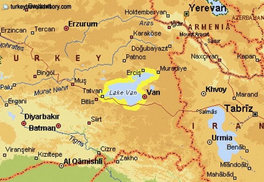
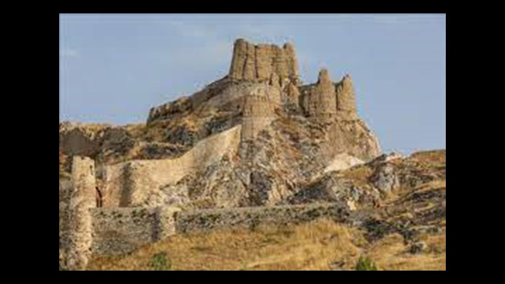
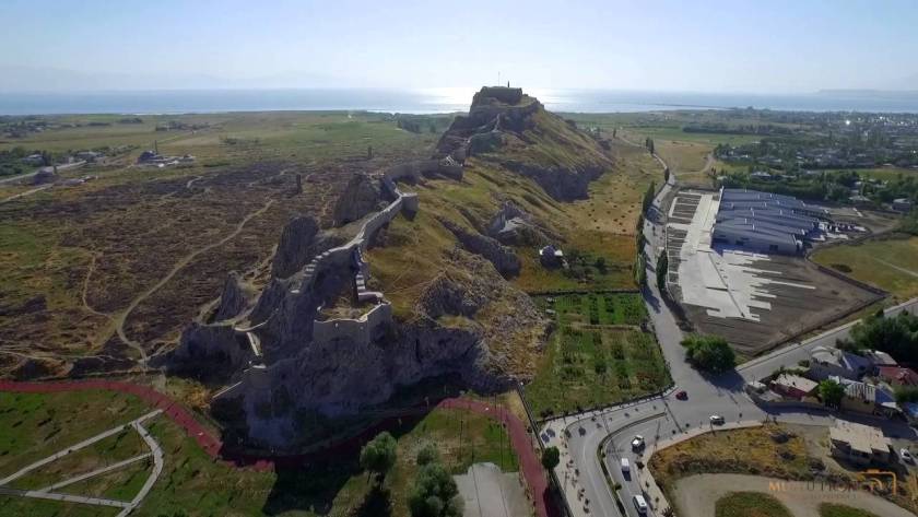
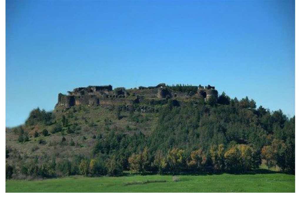
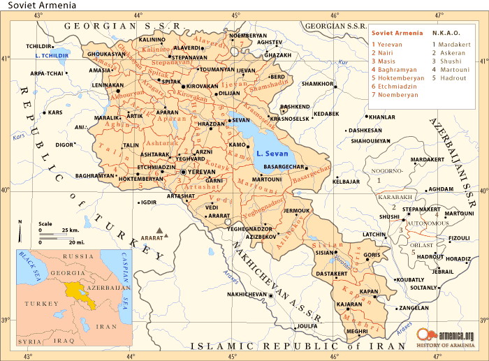
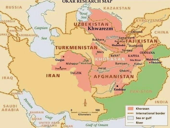
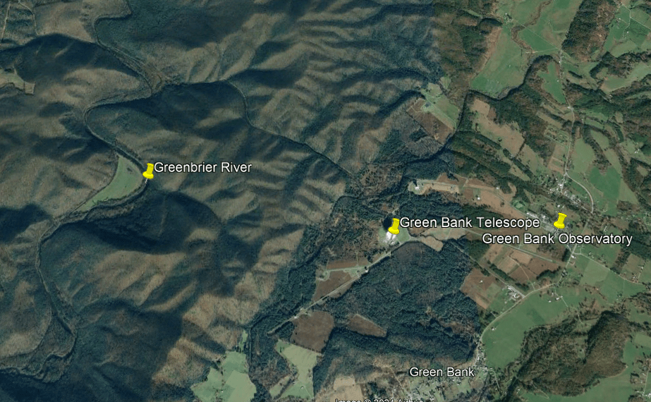
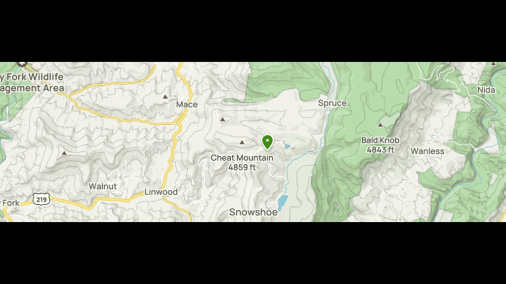
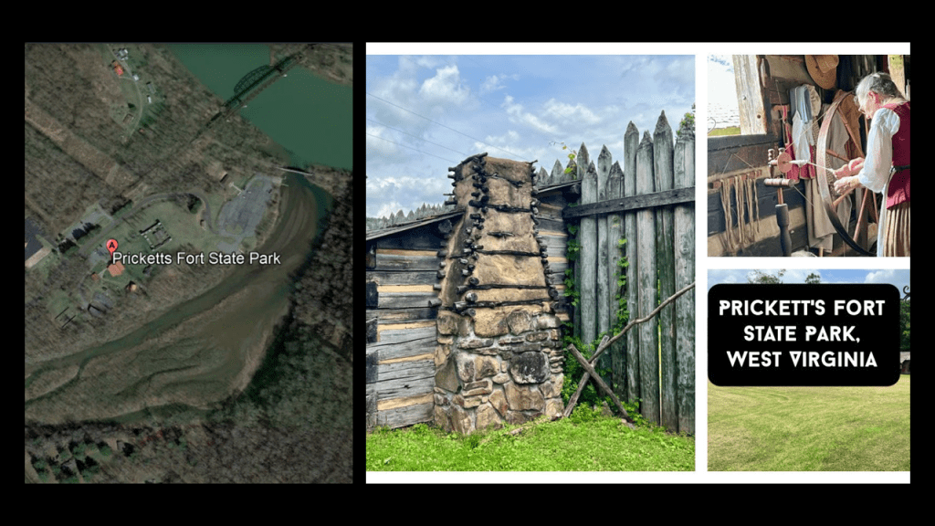
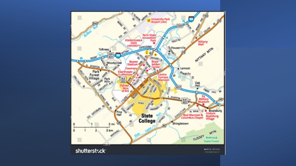
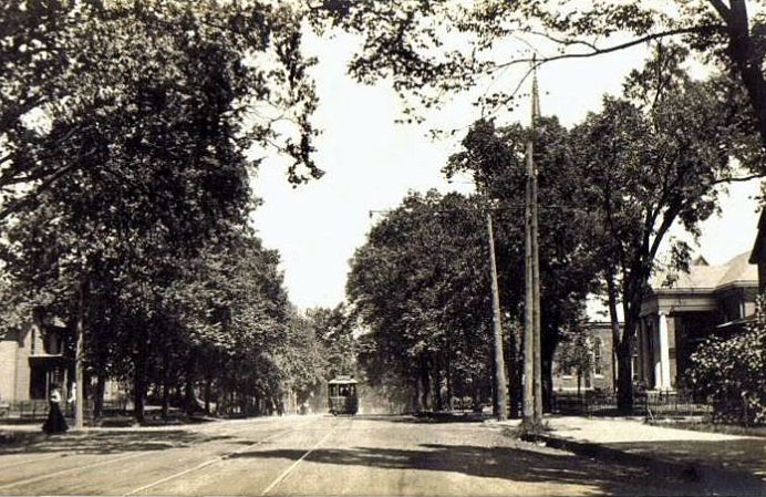
My starting point for this part of the journey along the alignment is Van, the name of a city and province in eastern Turkey, and on the eastern shore of a lake of the same name.
Van has a long history a major city.
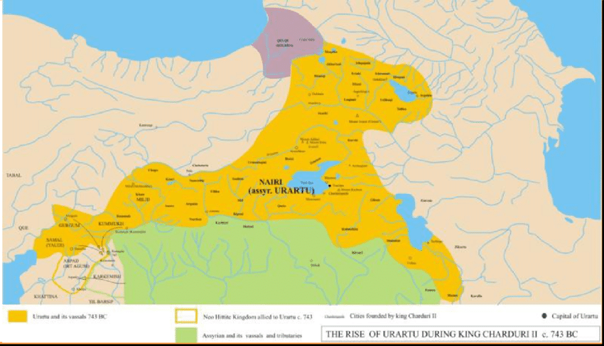
It was the capital of the Kingdom of Urartu of ancient Armenia from the 9th-century BC to the 6th-century BC, when it was called Tushpa.
Tushpa was situated on the steep-sided bluff now known as Van Fortress or Castle…
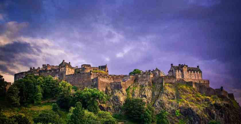
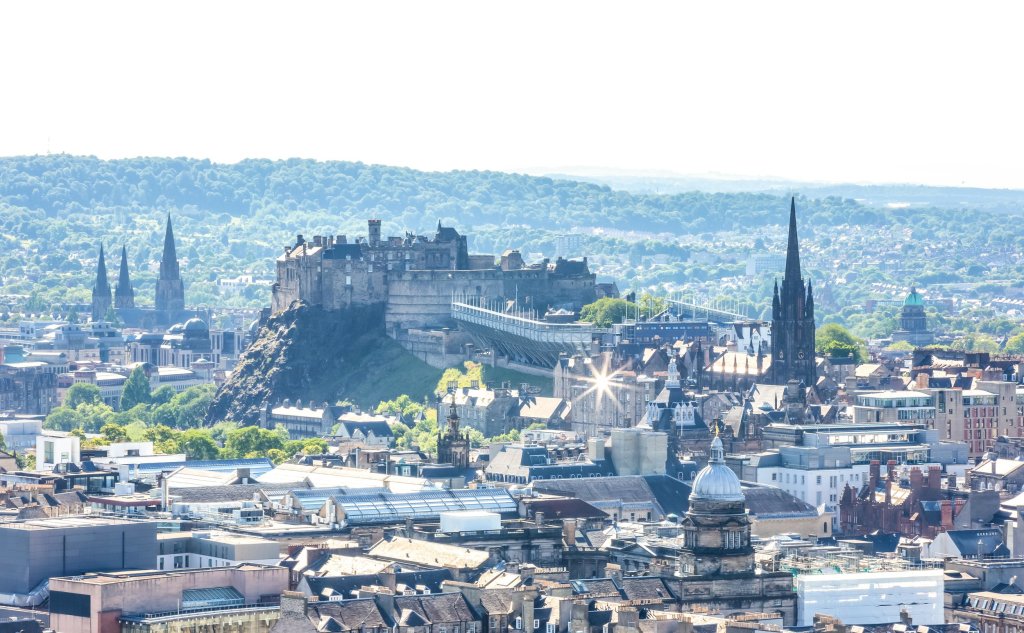
…which is similar in appearance and location to the Edinburgh Castle, said to be somewhere around 1,100-years-old in Scotland on top of Castle Rock, which is called the plug of an extinct volcano.
Van Castle was said to have been built in the 9th-century BC by King Sarduri I, the third monarch of Urartu,who was said to have moved the capital of Urartu to Van.
King Sarduri used the title of “King of the Four Corners of the World,” a title of great prestige claimed by powerful monarchs in ancient Mesopotamia.
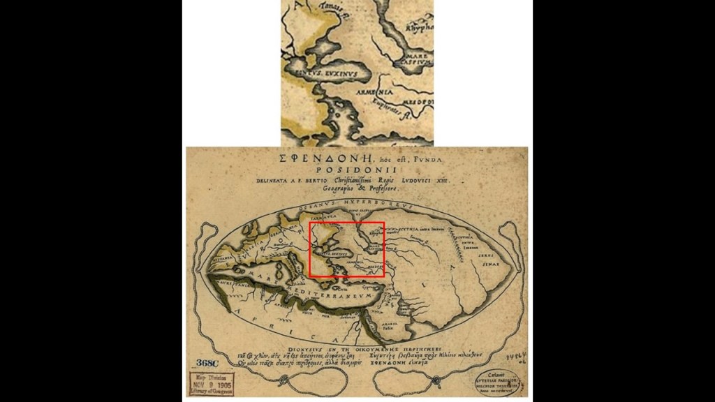
As a matter of fact, there was a time when Armenia was considered the center of the world, as depicted in this map.
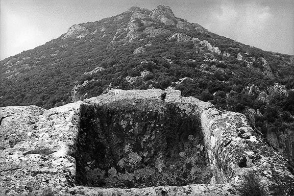
So, in the case of Van Castle, almost 3,000 years ago we were capable of building massive stone fortresses on top of solid rock?
Not an easily location to build on by any stretch of the imagination…
…and apparently working with huge stone blocks was not a problem!
More of this kind of thing to come as we go along the way!
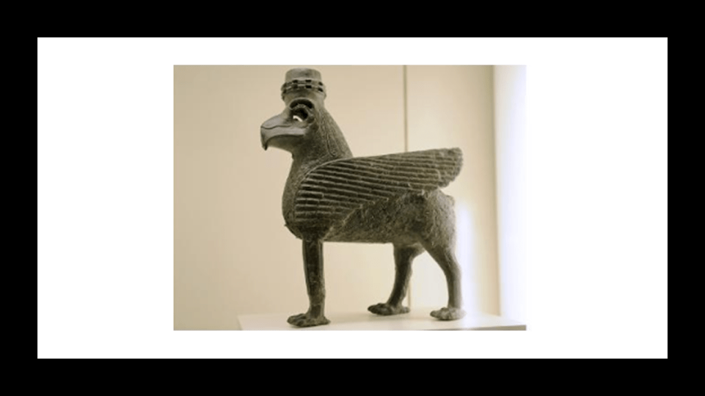
This is described as a bronze sphinx dated to the 7th-century BC, and said to be from either Tushpa…
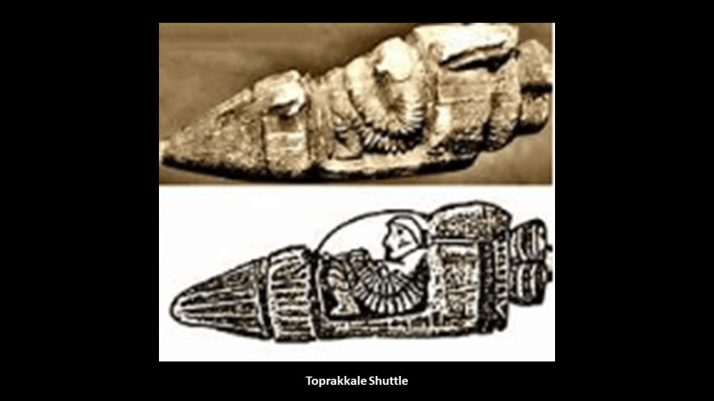
…or Toprakkale, southwest of Lake Van.
Some interesting things I found about Toprakkale when I looked it up is that there is a high fortress there as well (and I find the flat landscape surrounding the hill and fortress to be noteworthy)…
…and it is known for being the place where the Toprakkale Shuttle was found, which was taken out of display in Istanbul because some believed it to be a hoax.
Others believed the Toprakkale Shuttle to be over 2,000-years-old.
I think it is important to spend some time looking at the history of this geographical area because it seems to have great importance.
What was this place historically?
Who were the People of Ar?
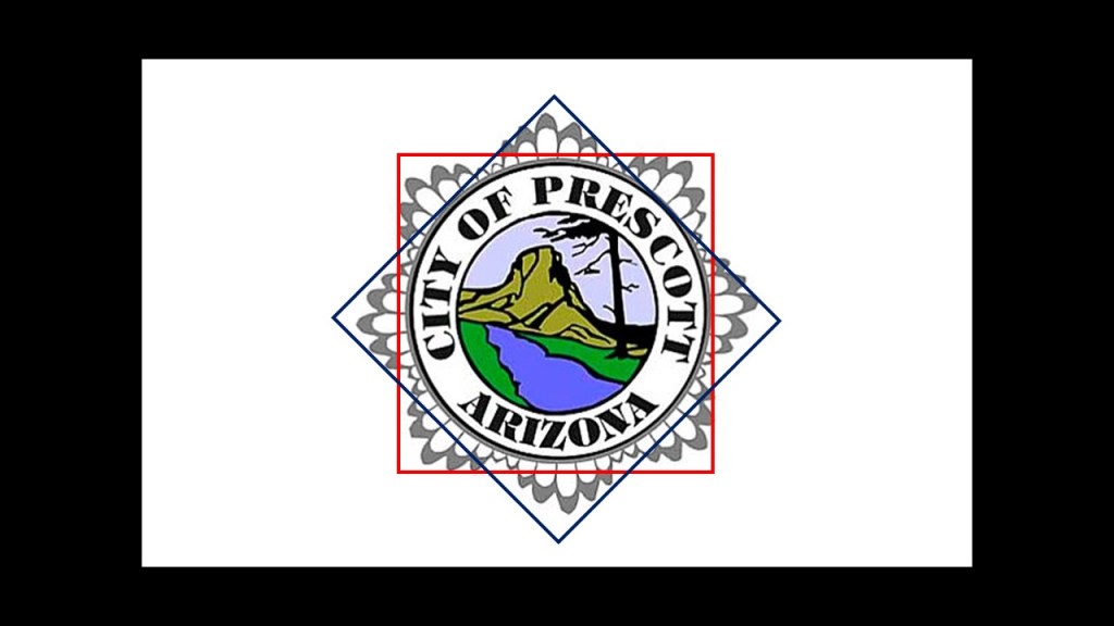
They identify with that eight-pointed star symbol as well that I keep seeing everywhere…
…including, but far from limited to, the Gumti Monument in Faisalabad, Pakistan…
…at the Imam Reza Shrine in Mashhad, Iran…
…and even in the city seal of Prescott, Ar-izona.
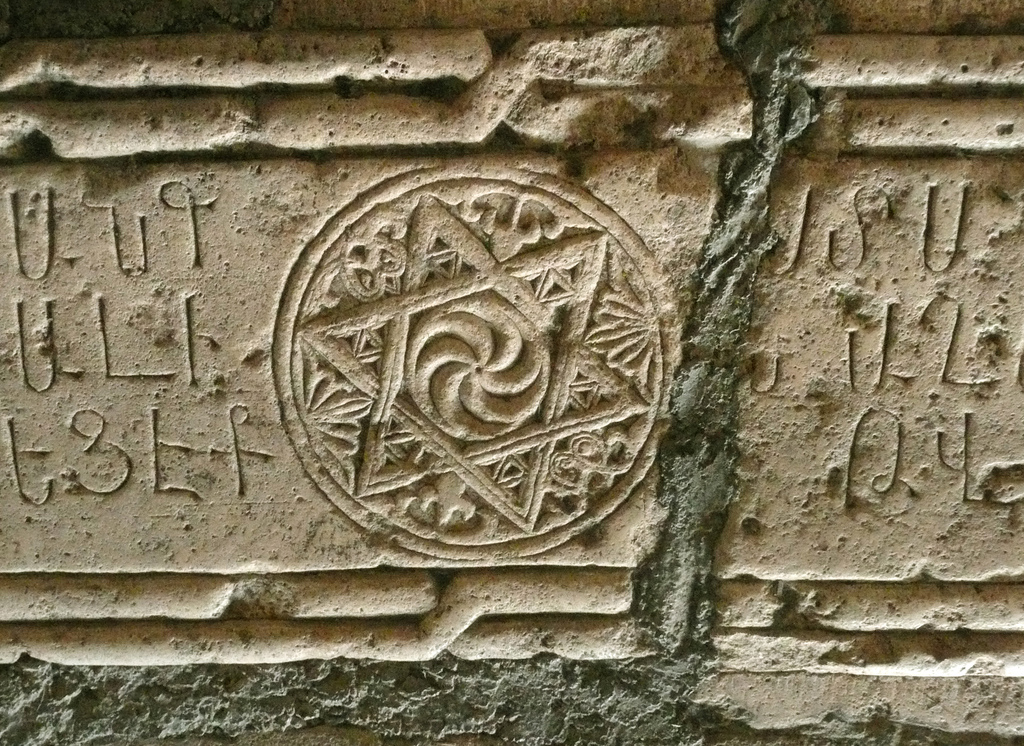
This six-pointed star tetrahedron is found carved throughout Armenia
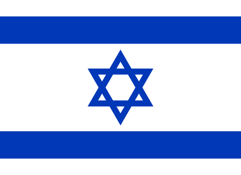
…also known as the Star of David…
…and the Merkaba, the geometric shape of the Human Lightbody in its three-dimensional form.
Some psychically-gifted people are able to see the Human aura, or energy body, but most are unable to see it without the help of special aura photography.
This is because the natural psychic abilities of Humanity have been deliberately deactivated by not teaching us about them, and by active efforts to close down our primary psychic organ, the pineal gland, also known as the third-eye, by doing things like fluoridating water supplies, which leads to the calcification of the pineal gland.
Back to the Lake Van region, and historical Armenia.
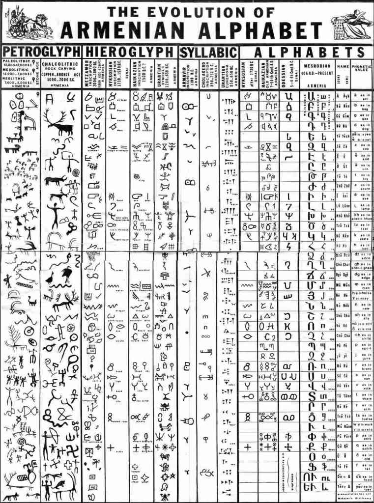
The Armenian alphabet at one time was hieroglyphic…
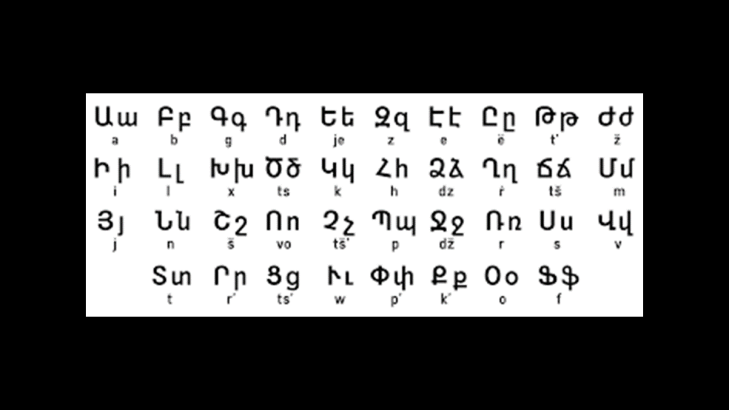
…and in 405 AD, the introduction of the Armenian alphabet still in use today was credited to Mesrop Mashtots and Isaac of Armenia.
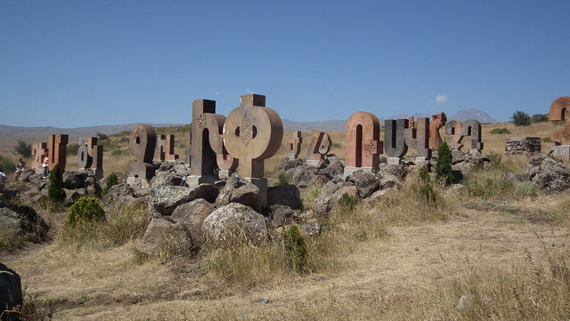
We are told that the Armenian alphabet was carved in stone in 2005 by Armenian architect Jim Torosyan in Artashavan, Armenia, on the eastern slope of Mt. Aragats, on the northern end of the Ararat Plain, near Mashtot’s final resting place to celebrate the 1,600th-anniversary of its creation.
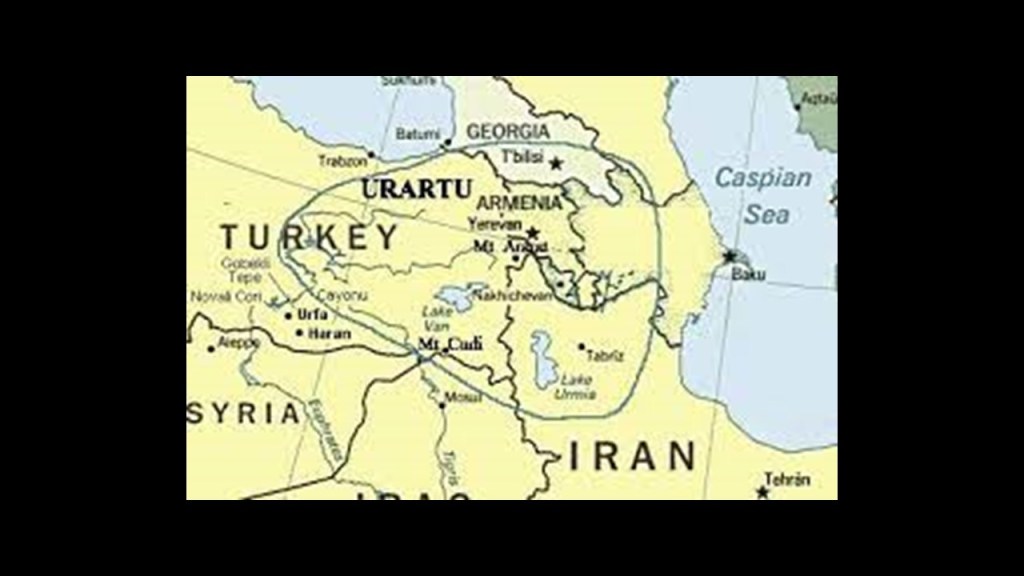
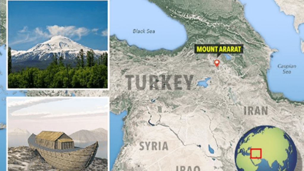
We are told that Mt. Ararat, the legendary landing place of Noah’s Ark, was located in Urartu, and now it is part of modern Turkey.
The Sumerians called Ararat “Arrata,” and they tell of this land of their ancestors in the Armenian Highlands in their epic poems of Gilgamesh and Arrata, which also both describe a great flood which fell…from the highlands of Armenia.
The ancient metallurgical and astronomical center of Metsamor, near Armenia’s modern-day capital of Yerevan, gives its name to the Metsamor Civilization, believed by some to be the world’s first civilization.
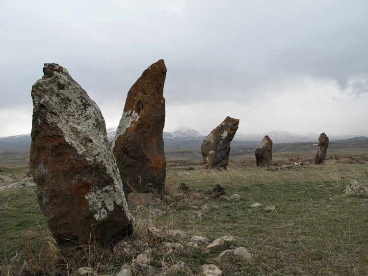
This is Carahunge Stone Circle in southern Armenia, an astronomical observatory marking the movement of the sun, moon and stars.
It is believed to be 7,500-years-old.
Great Britain is much better known for its standing stone circles with archeoastronomical correlations.
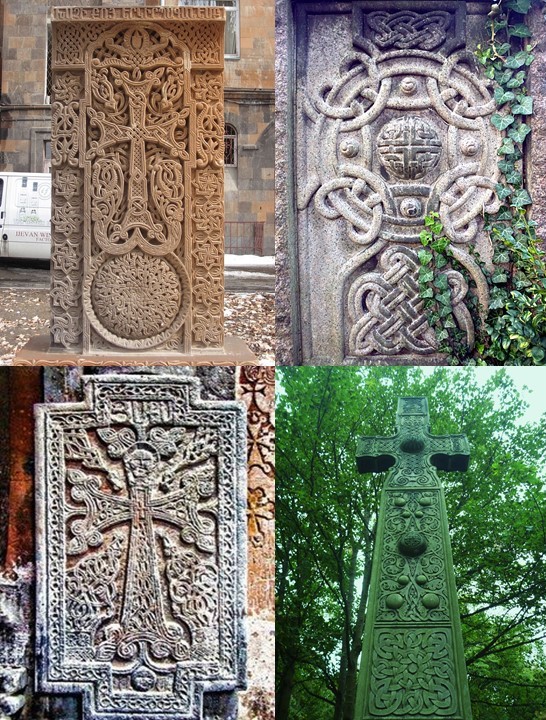
The two photographs on the left show Armenian stone crosses, and on the right are two stone crosses found along the River Leith in Edinburgh, Scotland. Not identical, but similar stylizations.
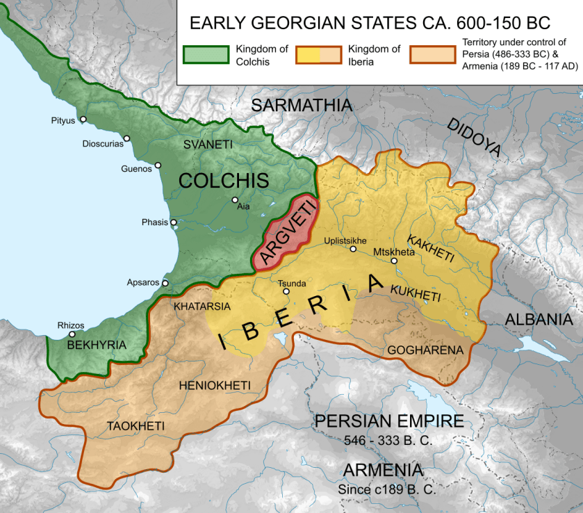
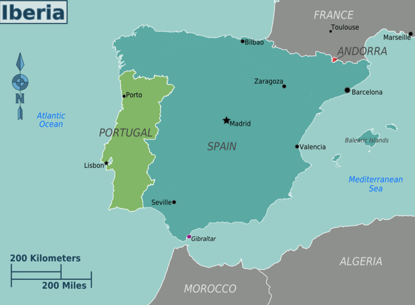
Interestingly, I found this map referencing the Kingdom of Iberia in Armenia’s part of the world, the Transcaucasia, a geographical region in the southern Caucasus Mountains that corresponds to modern Georgia, Armenia, and Azerbaijan.
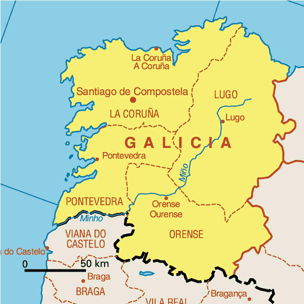
I knew about Spain and Portugal being called Iberia, and occupying what is called the Iberian Peninsula.
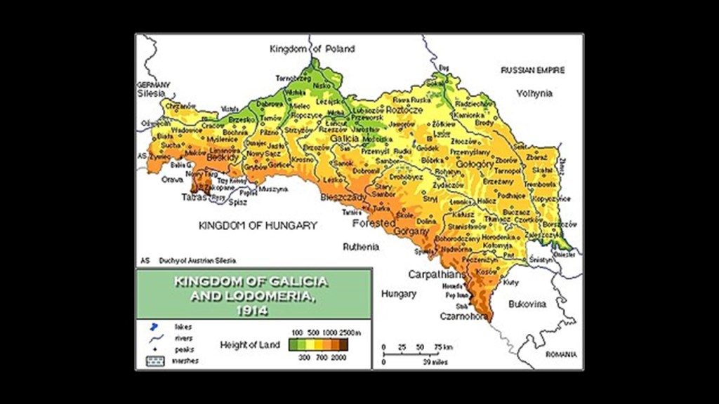
I know there is a province of Galicia in Spain…
…and the region of Galatia in Turkey…
…and there was a Kingdom of Galicia & Lodomeria, located historically between what is now Poland and Ukraine, and which was dissolved in 1918.
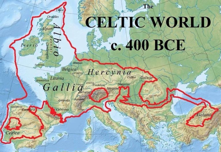
This research led me to this map of the Celtic World circa 400 BC.
How and why did the history of this part of the world get so obscured? What are we not being told?
And when was what was historically part of Armenia was absorbed into modern Turkey?
What happened?
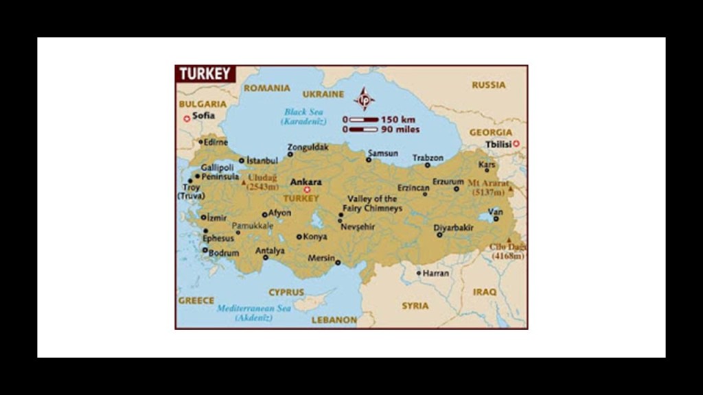
This is what we are told about Turkey’s history.
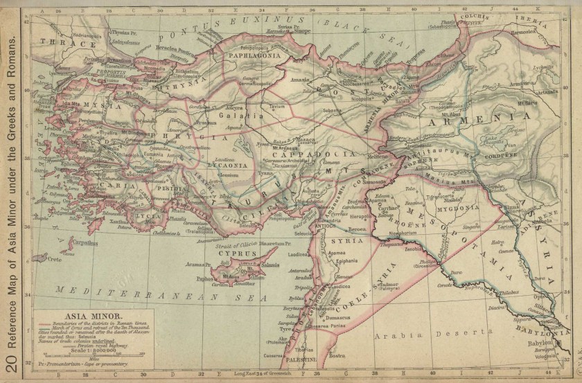
Ancient Asia Minor, or Anatolia, consisted of the majority of modern-day Turkey, which is a country in both Asia and Europe.
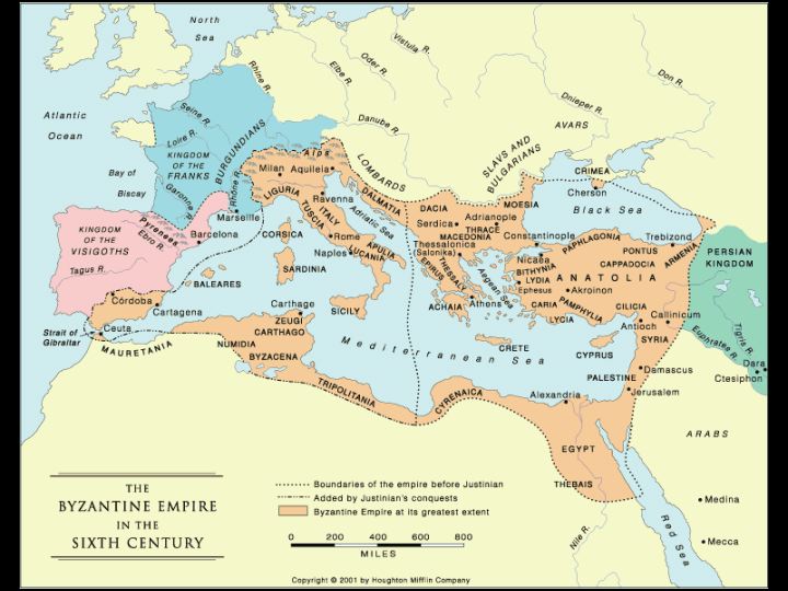
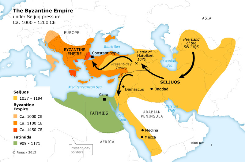
What is now modern Turkey was once part of the Byzantine Empire until the Seljuk Turks started coming into Anatolia in the 11th-century.
They defeated the Byzantines in battle in 1071, and reign of the Seljuk Turks was said to symbolize the founding of Turkey.
Then the Seljuk Turks fell to Mongol invasions, which started in 1241.
The Mongols ruled as the “Ilkhanate” in Anatolia between 1243 and 1335.
Then, we are told the Ottoman Empire was founded at the end of the 13th-century in northwestern Anatolia and existed as a vast empire and center of interactions between east and west until the end of World War I, when it was defeated as an ally of Germany and occupied by Allied forces.
At this time, the Ottoman Empire was partitioned and lost its Middle East holdings, which were divided between the Allied Forces.
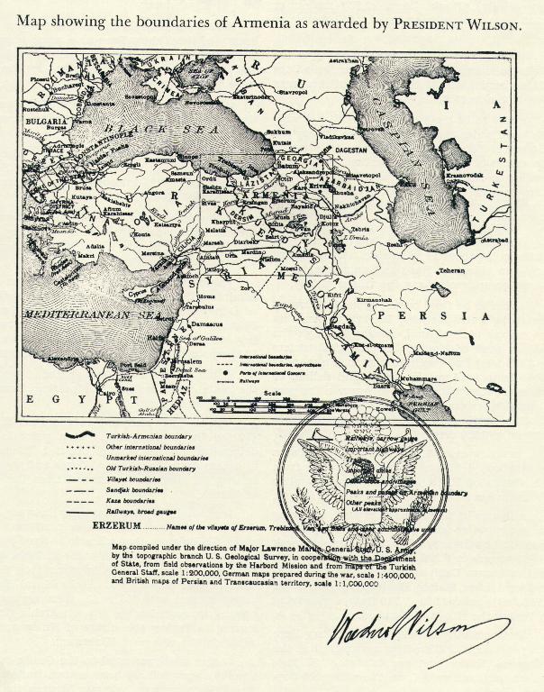
Thus, at the end of World War I, the victorious powers sought to divide up the Ottoman Empire, and the 1920 Treaty of Sevres promised to maintain the existence of the Armenian Republic and to attach the former territories of Ottoman Armenia to it.
Ottoman Armenia was referred to as Wilsonian Armenia because the new borders were to be drawn by U. S. President Woodrow Wilson.
The Treaty of Sevres never came into effect because it was rejected by the Turkish National Movement, which used the occasion to declare itself as the rightful government of Turkey.
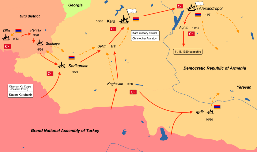
Turkish Nationalist Forces invaded Armenia in 1920 from the east, ultimately forcing most of the Armenian military forces to disarm, cede back the former Ottoman lands granted to Armenia by the Treaty, and to give up “Wilsonian Armenia.”
And during the same time frame, the Soviet Eleventh Army invaded Armenia, and ultimately took complete control of it in 1921.
Thus, the Turkish War of Independence initiated under the leadership of Mustafa Kemal Ataturk against the occupying powers resulted in the abolition of the monarchy in 1922, and the establishment of the Republic of Turkey in 1923. Ataturk was the first president of the new republic, moving the country’s seat of power from Istanbul to Ankara.
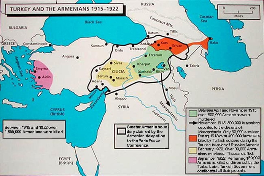
Obviously this region of historical Armenia was highly prized, and its people were persecuted and many were killed.
The Armenian genocide was the systematic destruction of the Armenian people and identity in the Ottoman Empire during and after World War I.
The estimate of deaths ranges from 600,000 to 1.5-million people.
There’s a lot more to look at here, but I am going to move on to the next place on the alignment.
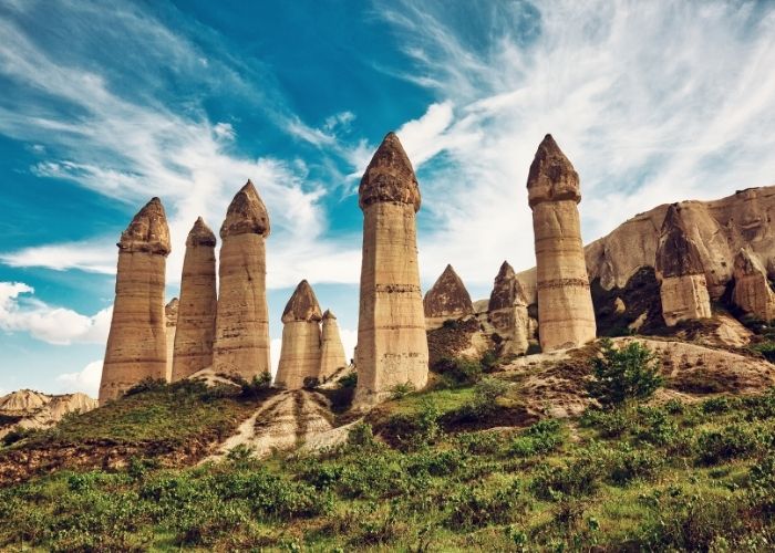
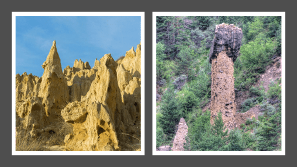
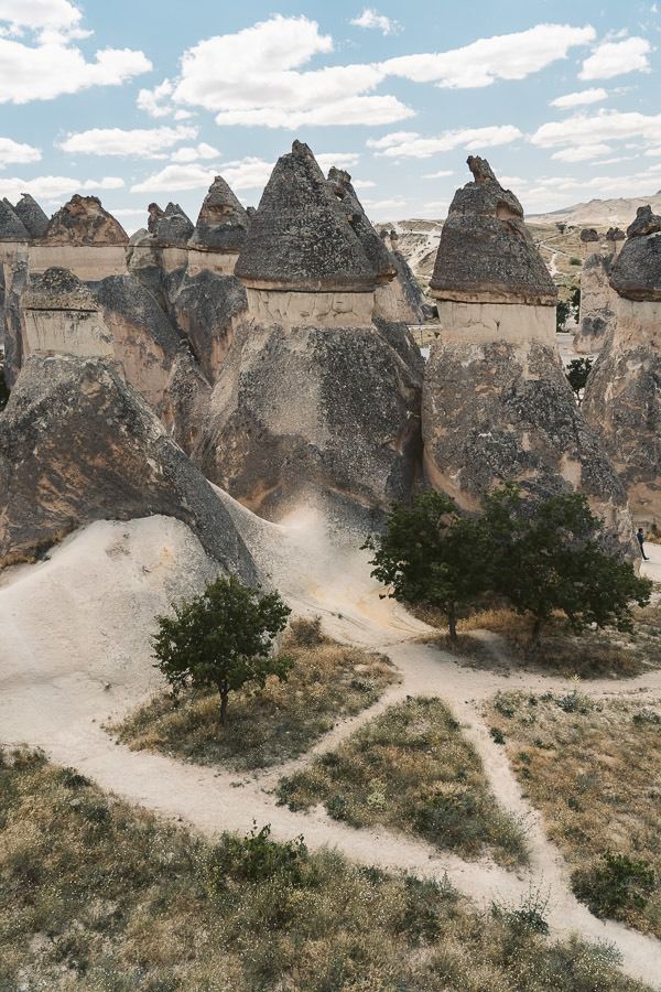
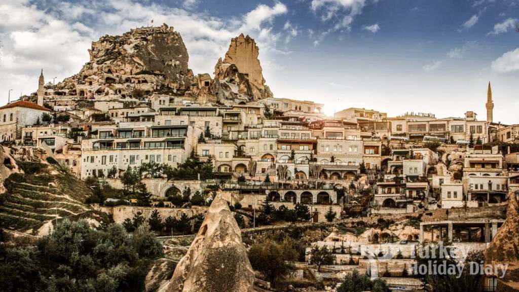
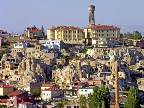
The next place I am going to look at is what is called “The Valley of the Fairy Chimneys,” in Cappadocia, a historical region of Central Anatolia known for its unique cultural and historical heritage.
These fairy chimneys are in Goreme National Park, part of the Rock Sites of Cappadocia UNESCO World Heritage Site.
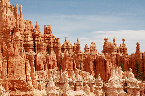
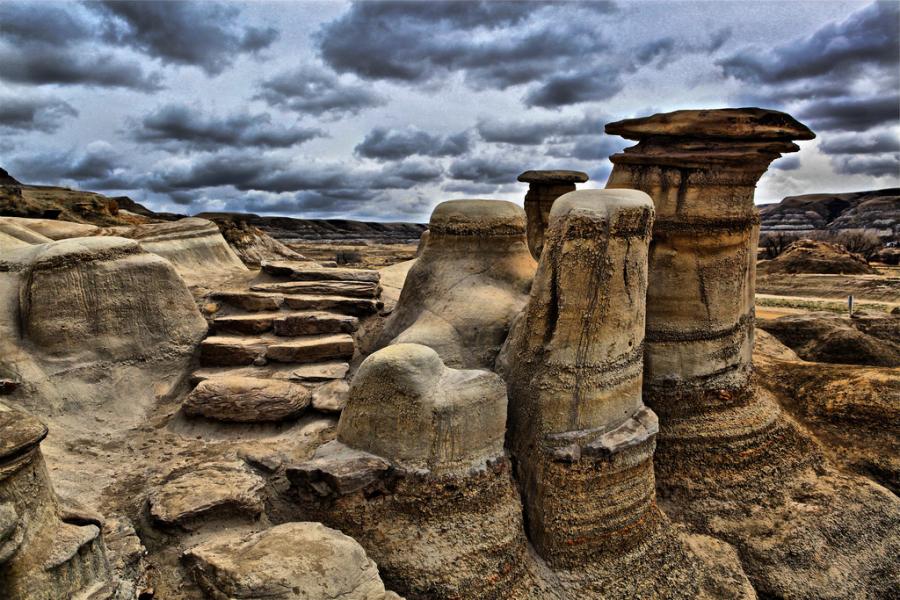
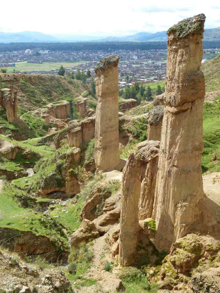
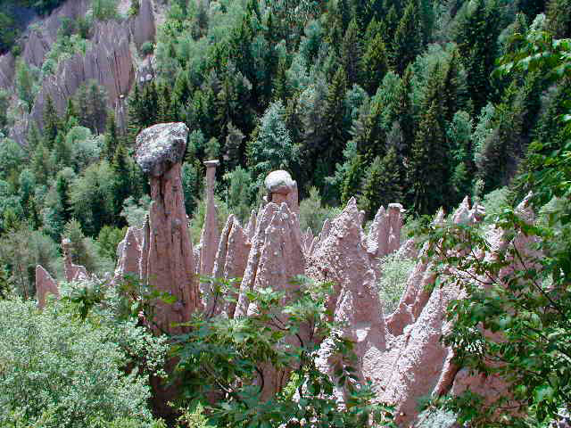
I find it noteworthy that shapes like these are found around the world, including what are called “hoodoos” in Bryce Canyon in southwest Utah…
…in Alberta’s Drumheller Badlands in Canada…
…the Torre Torre in Huancayo, Peru…
…in Renon, Italy…
…and in Zaragoza, Spain, to a name a few of the many places where these are found.
Here are more in the Pasabag Valley of Goreme National Park in Cappadocia.
So we are told that these phallic shapes were all created by natural geologic forces.
Okay. Well, maybe, but I really don’t think so!
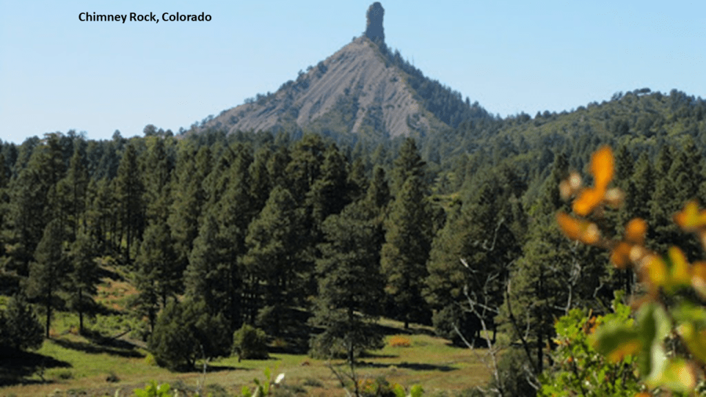
These phallic shapes are also found on land features that are undeniably shaped like pyramids, like Chimney Rock in Colorado, another one of many examples I have seen of the same configuration.
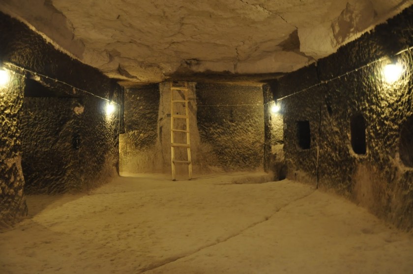
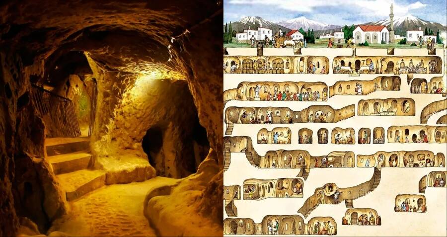
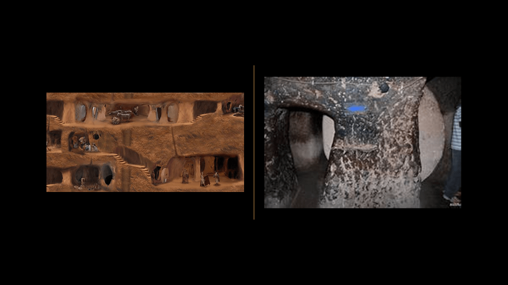
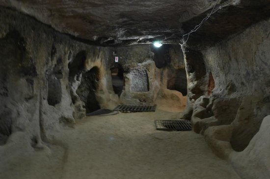
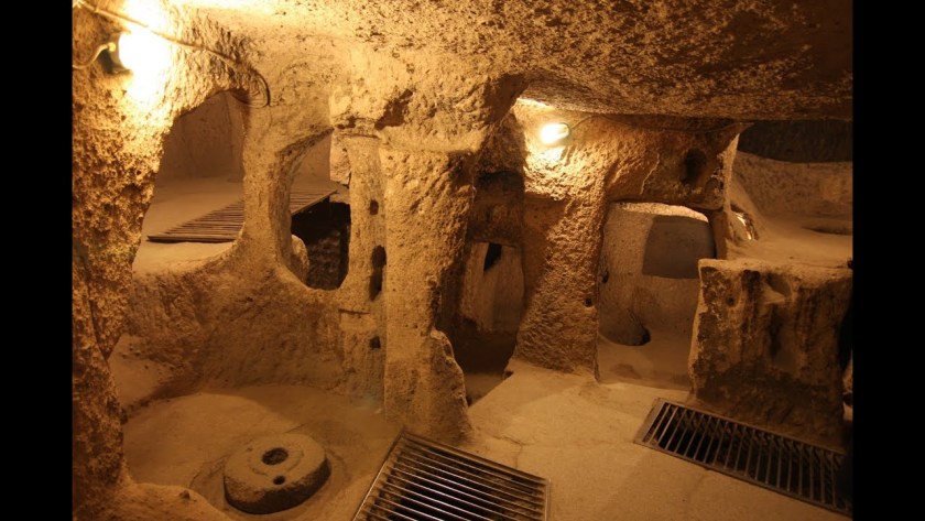
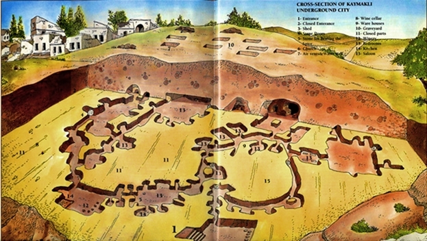
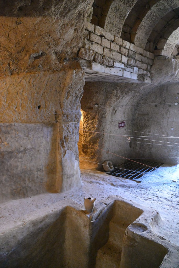
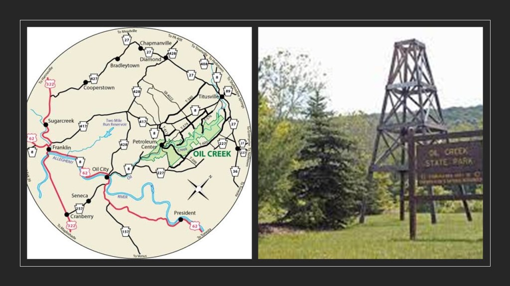
Besides so-called fairy chimneys, the region of Cappadocia has been determined to have 40 underground cities, of which 6 are open to the public:
The underground city of Tatlarin, considered one of the most important of Cappadocia’s underground cities, discovered in 1975…
…Derinkuyu, an ancient, deep multi-level underground city said to be large enough to shelter 20,000 people together with their livestock and food supply, and opened to visitors in 1969…
…the underground city of Ozkonak, discovered in 1972, which had a water well, pipe communication system, winery, and moving stone doors…
…and there’s Mazi Underground City, opened to visitors in 1995…
…Kaymakli Underground City, opened to the public in 1964…
…and Kaymakli is the widest underground city…
…and the last one that is open to the public is Gaziemir Underground City, which was discovered in 2006.
So not only is all of this massive stone-work going on underneath the surface of Cappadocia, it was also going on above ground.
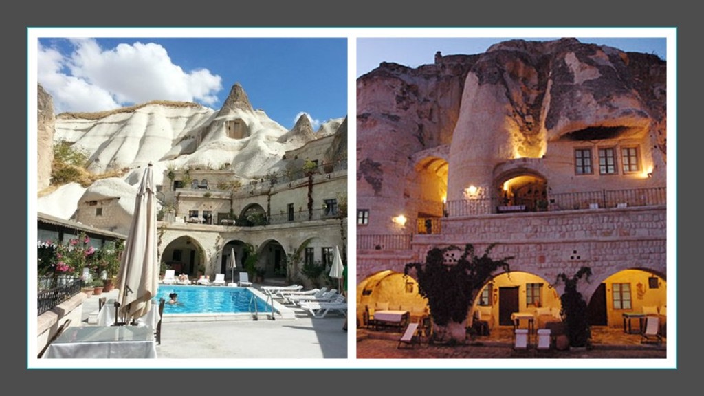
Cappadocia is known for its cave-homes and cave-hotels…
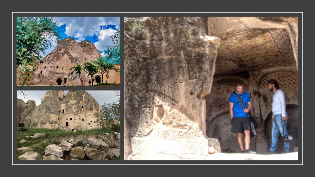
…and places like the Keslik Monastery in Cappadocia appear to be carved right out of the solid rock.
The tourism center of Urgup is not far from Keslik Monastery, and here are dwellings found there.
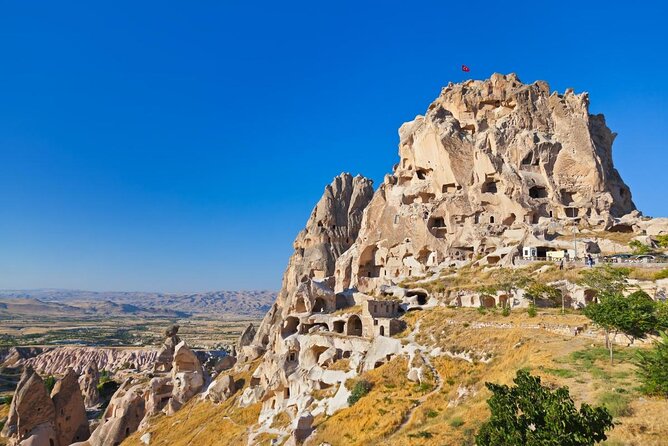
Uchisar, located on the edge of Goreme National Park, with its 197-foot, or 60-meter, high castle-mountain, criss-crossed by passageways and was said to have 1,000 people living inside it at one time, but apparently not anymore.
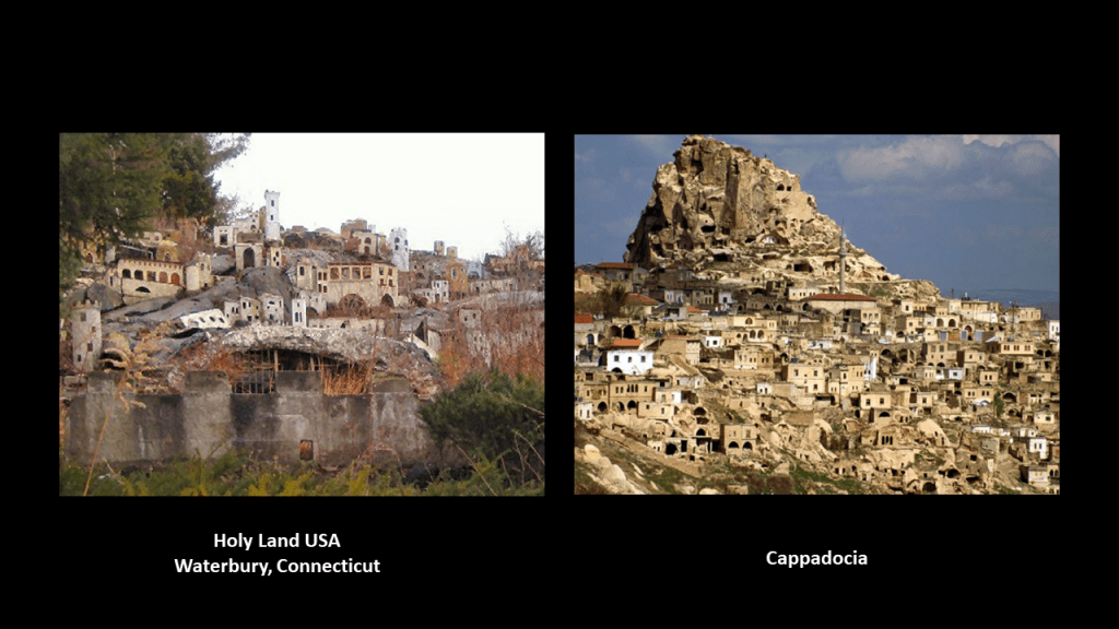
Before I leave Cappadocia and pick up the alignment as it crosses the Anatolian Plateau, I would like to share a find from the state of Connecticut when I was tracking a different alignment.
Waterbury in Connecticut was the location of Holy Land USA on the left, which we are told was a theme park inspired by passages from the Bible that opened in 1955 and closed in 1985 and today the location is in an advanced state of disrepair.
On the right is a photo from a location here in Cappadocia.
Next I am going to look at the Anatolian Plateau as a whole.
The Anatolian Plateau is called the central upland region of the ancient region of Anatolia, known as Turkey today.
The region of Cappadocia and its Valley of the Fairy Chimneys where I was just looking is centrally located on the Anatolian Plateau.
Anatolia is said to mean something along the lines of “Rising Sun” or “the East” in ancient Greek, and has been a bridge between Europe and Asia for thousands of years.
In a similar fashion, Khorasan, the name historically given to the northeastern Persia Empire which came up in previous posts on this alignment, is also said to mean the “Land where the Sun Rises” or the “Eastern Province.”
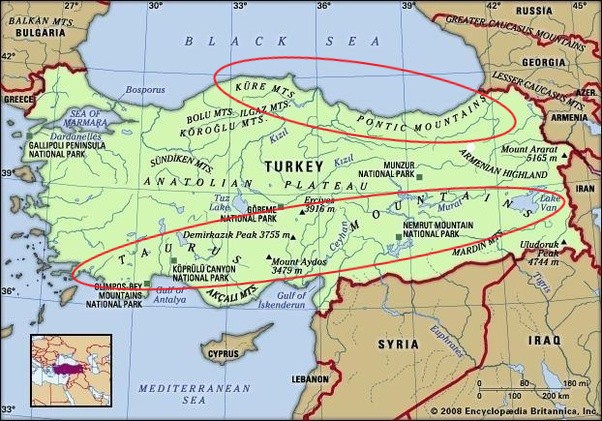
The Anatolian Plateau is hemmed in by several mountain ranges – the Taurus to the South, and the Pontic Mountains in the northeast & the Kure Mountains in the northwest.
While I am here, I am going to take this opportunity to venture off the alignment and explore this ancient place because I know there is a lot to find.
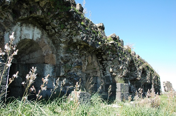
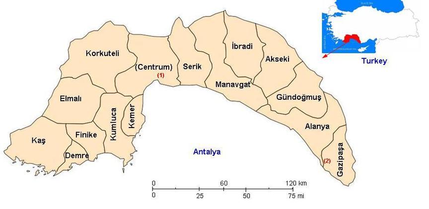
The Taurus Mountains separate the Mediterranean Coastal Region of Turkey from the Central Anatolian Plateau, extending in a curve from the Province of Antalya in the West…
…to the upper reaches of the Tigris and Euphrates Rivers in the East.
Antalya Province, also known as the Turkish Riveria, is the center of Turkey’s Tourism Industry, and its capital, Antalya, is the fifth-largest city in Turkey.
It is the largest city on Turkey’s Mediterranean coast, with a population of over one-million.
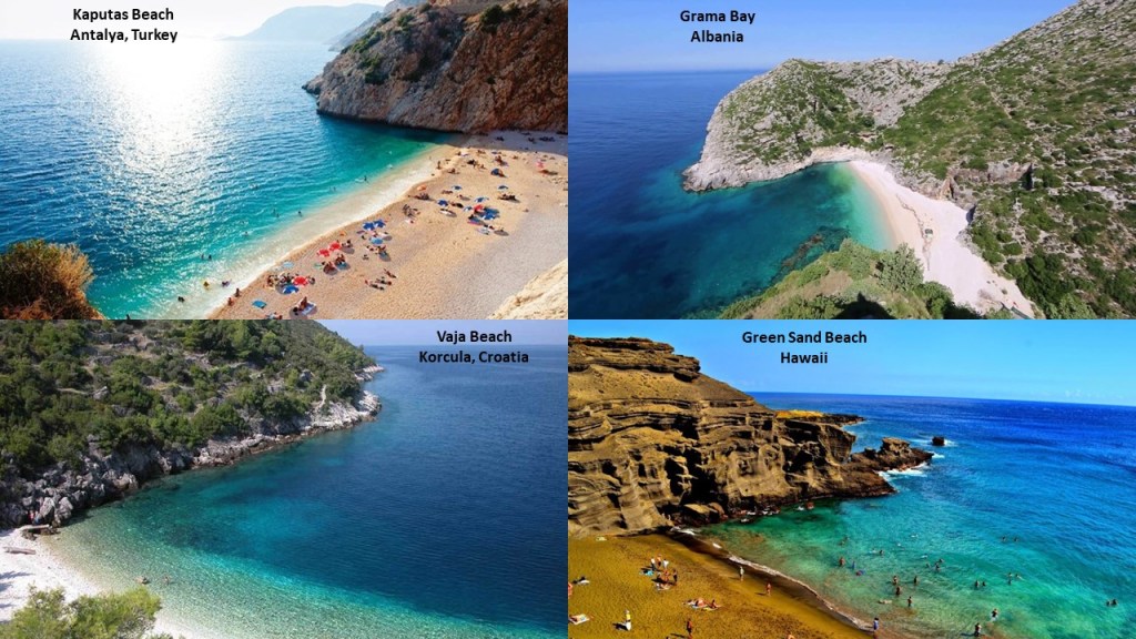
This is Kaputas Beach on the Mediterranean Sea in Antalya on the top left, compared for similarity of appearance with Grama Bay in Albania on the top right; Vaja Beach in Korcula, Croatia, on the bottom left; and Green Sand Beach on the big island of Hawaii on the bottom right.
These are just a few of many examples I have found that demonstrate similar shapes and angles of beach and rocky coastline in very different places.
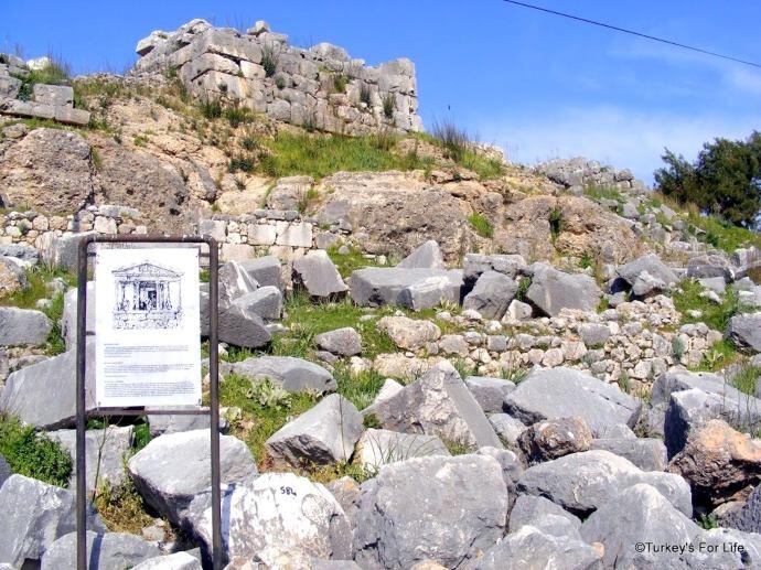
The UNESCO World Heritage Site of Xanthos is in Antalya Province, said to be an ancient Lycian city.
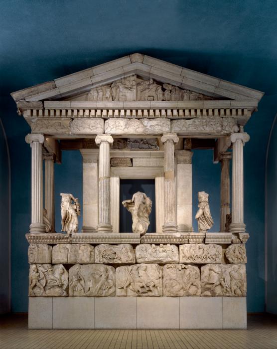
This is what remains of the Nereid Monument in Xanthos, with its megalithic base, and believed to be a tomb…
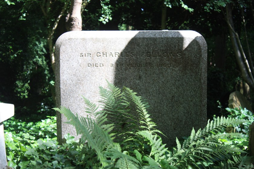
…that was discovered by a British explorer of Turkey, Charles Fellows, who led the archaeological excavation of Xanthos in the early 1840s and shipped an enormous amount of antique monuments to London, where they were reconstructed in the halls of the British Museum, including the Nereid Monument.
Interesting to note the headless and armless statues on display.
Charles Fellows was even knighted in 1845 for his services in the removal of Xanthian antiquities to Britain.
This is a surprisingly plain tombstone for him at London’s Highgate cemetery ~ I wonder what that signified!
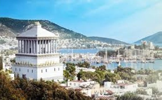
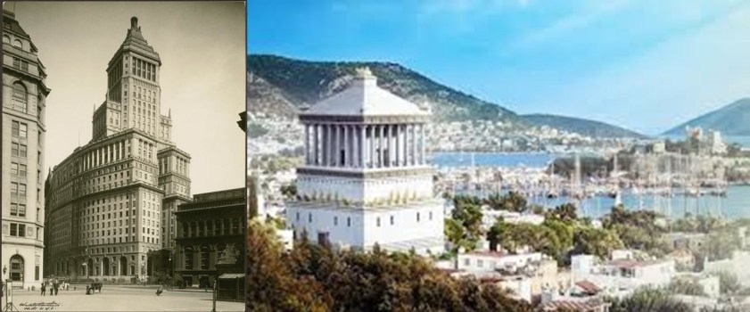
The Lycian Nereid Monument was said to have inspired the Mausoleum of Halicarnassus, said to have been built between 353 and 350 BC as a tomb for King Mausolus, ruler of Caria, a region of western Anatolia north of Lycia…
…and the Mausoleum of Halicarnassus was said to have been the inspiration for the old Standard Oil Headquarters in Manhattan on the left.
Said to have been built between 1884 and 1928??
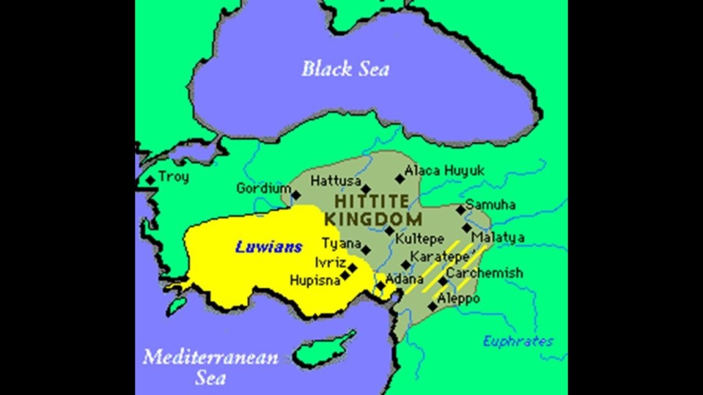
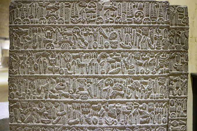
Lycia was a geopolitical region in Southern Anatolia, populated by speakers of the Luwian Language group…
… said to have been a language with a hieroglyphic script in use, like early Armenian, between 1,300 BC and 600 BC…
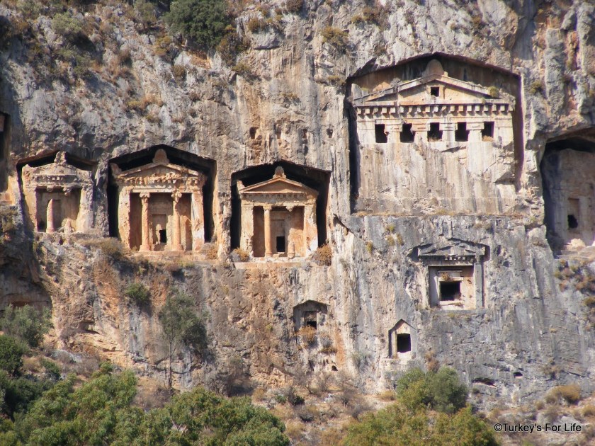
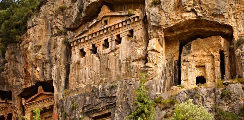
Here are the Lycian rock-cut temple tombs of Dalyan, said to date back to the 4th-century BC.
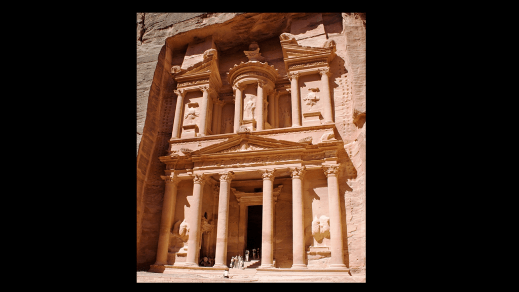
…which are reminiscent of rock-cut Petra in today’s Jordan.
There are headless statues here in the front of the building known as “The Treasury,” like what we saw at the reconstruction of the Lycian Nereid at the British Museum.
Did all the heads just fall off from the ravages of history?
Or were the heads removed deliberately so we couldn’t see what they actually looked like?
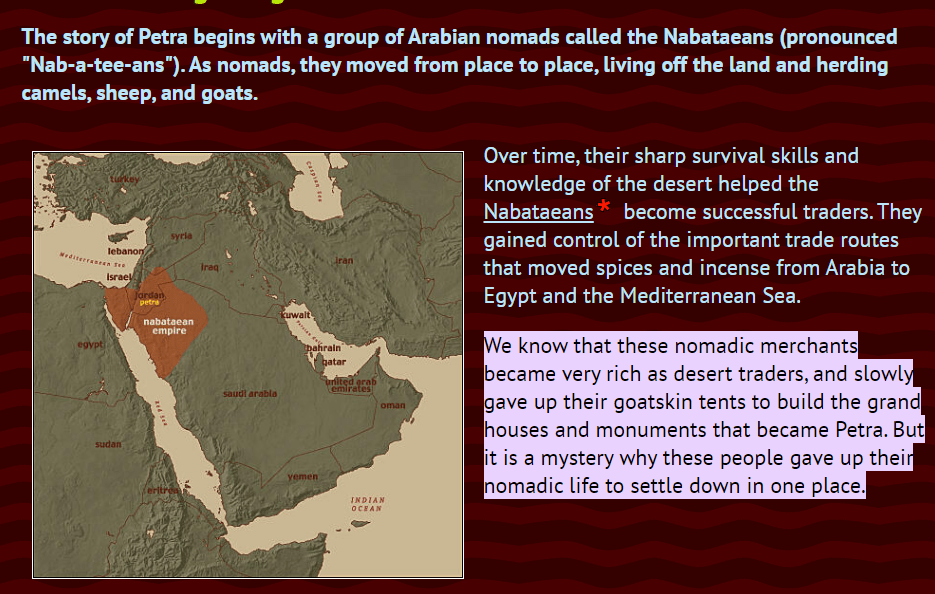
Petra was attributed to the Nabataeans, who we are told were nomadic traders and livestock herders until for some reason they decided give up their goatskin tents and nomadic lifestyle to build the grand houses and monuments of Petra.
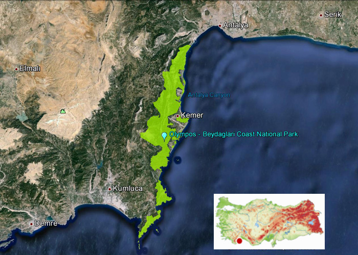
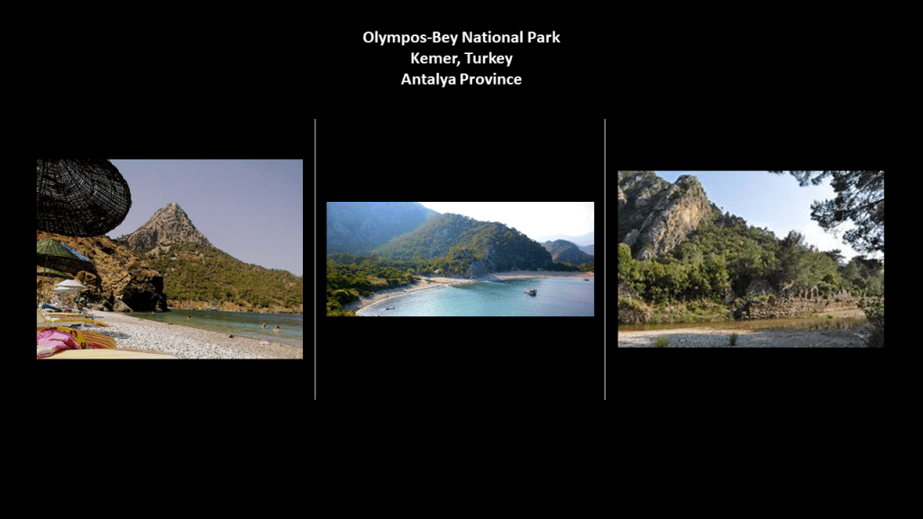
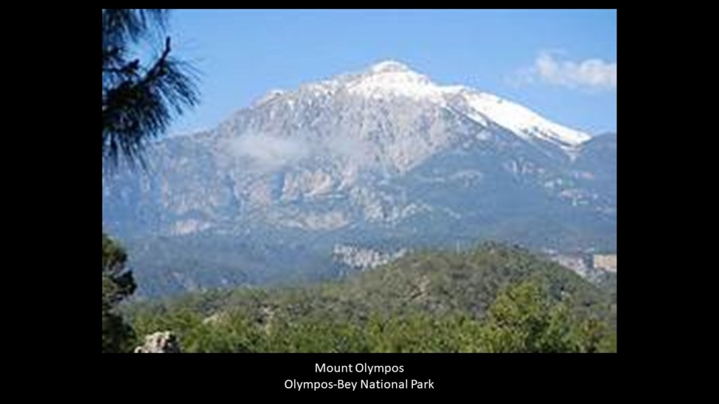
Once considered part of ancient Lycia, the Olympos-Beydaglari National Park is located in the Taurus Mountains in Antalya, along the Mediterranean coast, near the Kemer and Kumluca Districts. It is also called Olympos-Bey National Park.
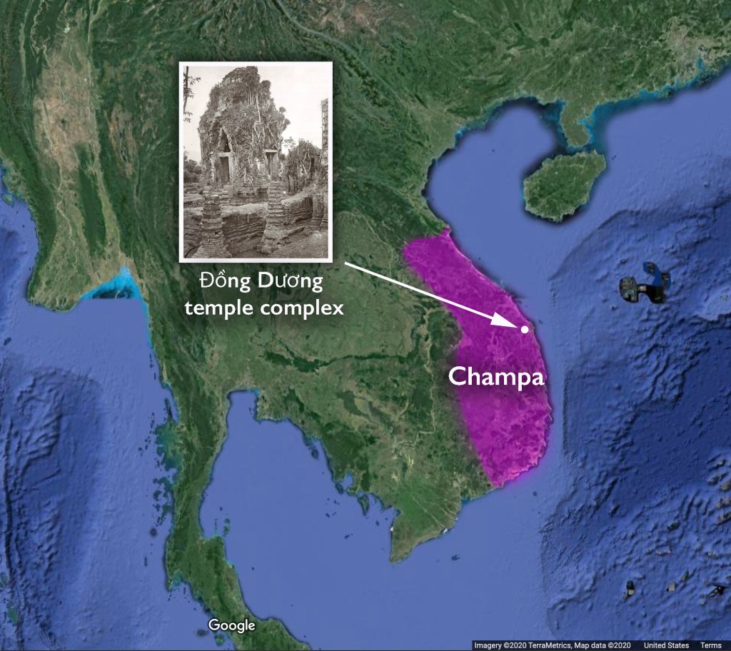
There is that “Khem” sound again that I discussed in finding in Viet Nam and throughout Southeast Asia and other places in the world like Cymru, the original name for Wales, in “The Ancient Advanced Civilization in Southeast Asia – From Manila in the Philippines to Dhaka in Bangladesh” mentioned at the beginning of this video.
Ancient Khem is a shortened version of Ancient Khemit, the name we are told given to a technologically and spiritually advanced civilization that existed in a Golden Age that predated dynastic Egypt.
Screenshot
And the Bey of Olympos-Bey Bey is one of the five noble titles of the Moors, along with Dey, El, Al, and Ali.
All just coincidences?
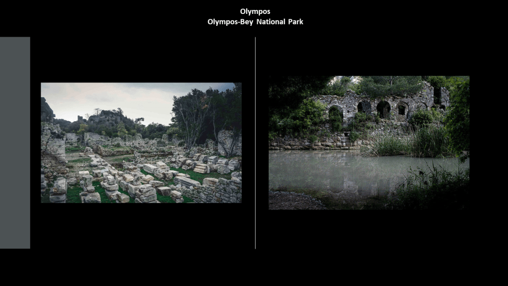
Let’s take a closer look at Olympos-Bey National Park that is adjacent to Kemer.
The Olympos-Bey National Park contains the ruins of what was called the city of Olympos…
…and the park includes Mount Olympos, the highest mountain in Turkey.
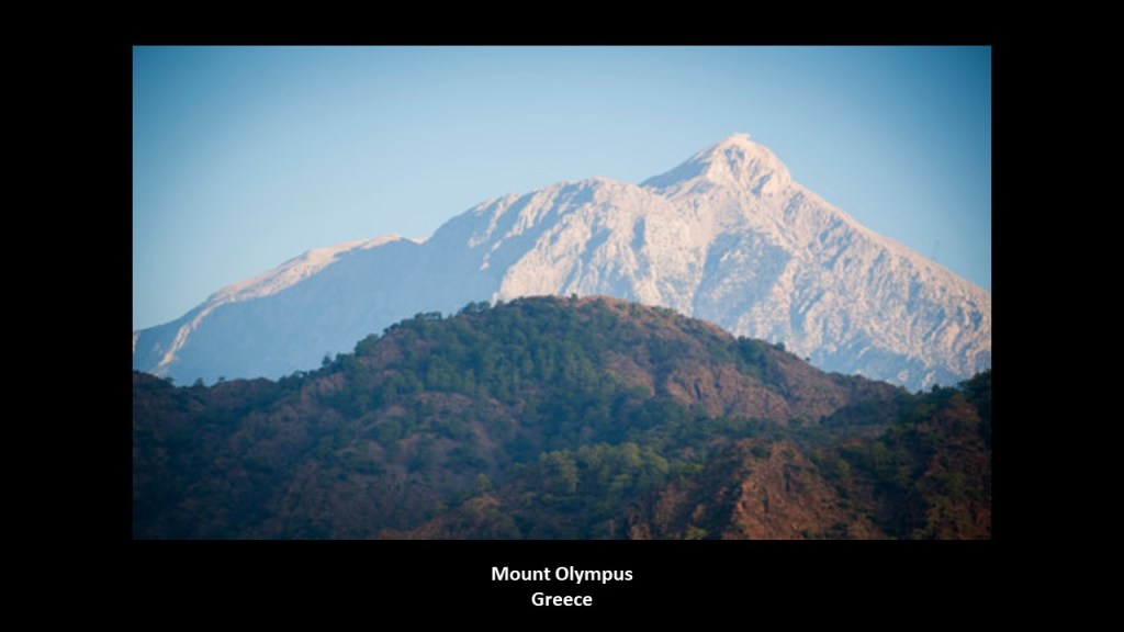
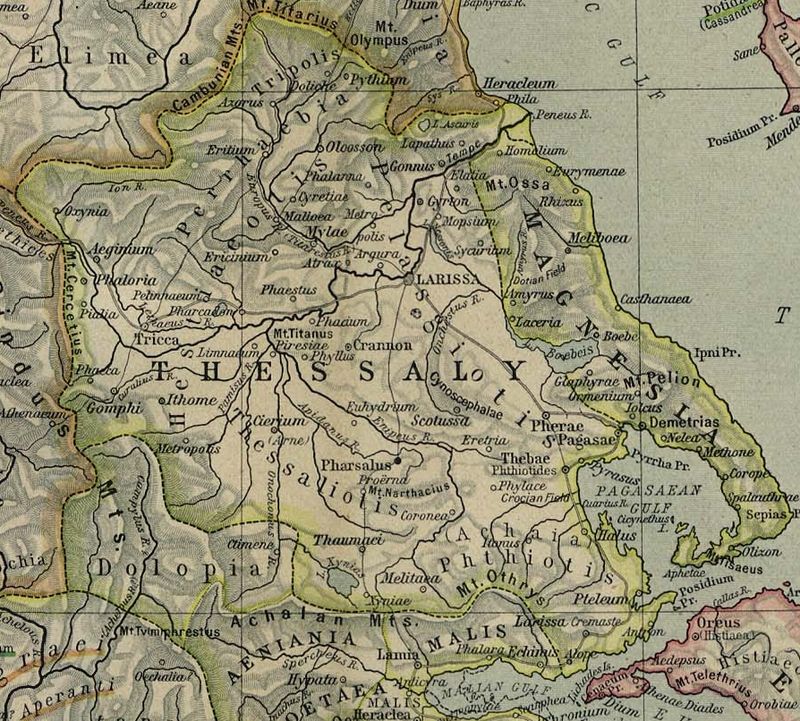
This is not to be confused with Mount Olympus in Greece, on the border between Thessaly and Macedonia.
It is the highest mountain in Greece, and notable in Greek mythology for being the home of the Greek gods.
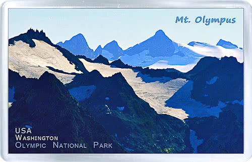
But wait…in North America, there is a Mount Olympus in Washington State, the highest mountain on the Olympic Peninsula there…
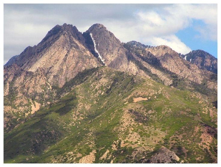
…and there is a Mount Olympus in Utah, near Salt Lake City in the Wasatch Range.
Named after Mount Olympus in Greece?
That’s certainly what we are led to believe by historical omission, but what if there is some kind of connection between them that we are not being told about?
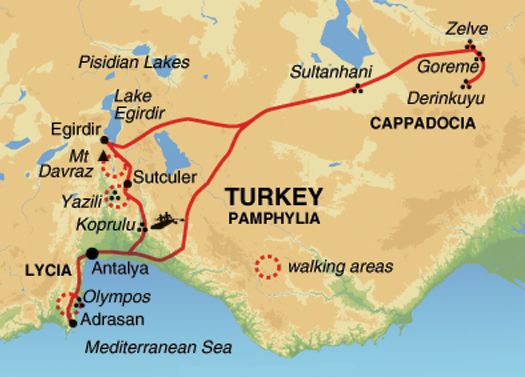
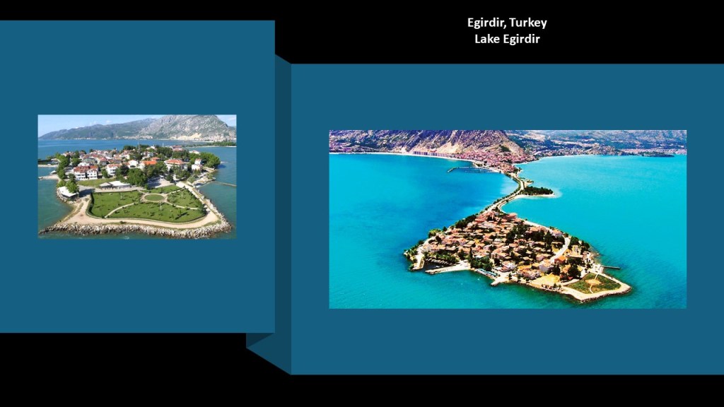
The next place I am going to take a look at is Lake Egirdir.
Lake Egirdir is located in the Taurus Mountains.
The ancient town of Egirdir on the lake shore looks to have an artificial island, called “Yesil Ada” or “Green Island,” attached to it by a causeway.
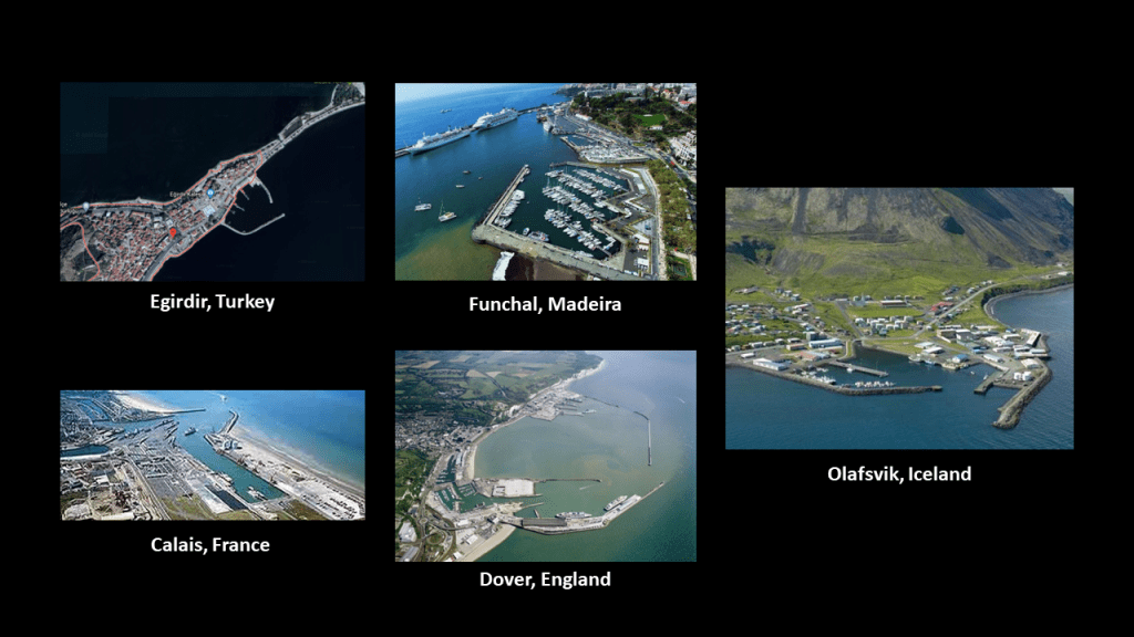
There is also a protected harbor here at Egirdir on the top left, that looks like protected harbors I have seen around the world, like Funchal Harbor on the island of Madeira in the top middle; Olafsvik Harbor in Iceland on the right; and the ports of Calais, France and Dover, England on the bottom left and middle, that are located right across from each other in the English Channel, to name just a few.
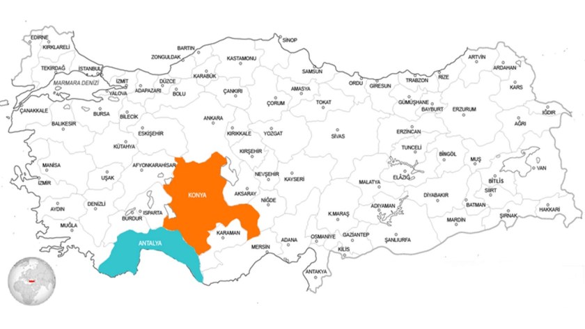
Heading east across the Taurus Mountains running along the southern part of the Anatolian Plateau, we come to the province and city of Konya.
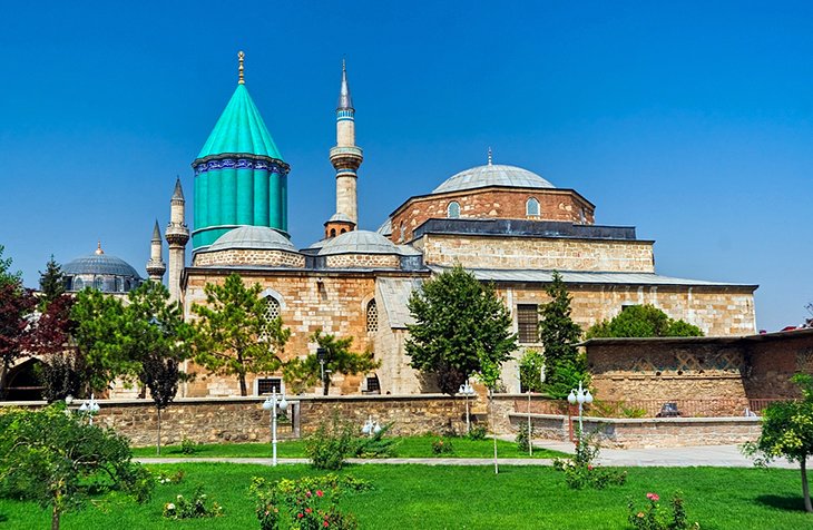
The Mevlana Museum is in the city of Konya.
The Mevlana Museum is also the mausoleum of the Sufi Mystic Rumi…
…whose followers founded the Mevlevi Order based there, better known as the Whirling Dervishes, who practice a spinning dance used to connect with the Divine.
The Turkish rug on the left from Konya has similar design patterns to the Persian rug from Mashhad, Iran, on the right.
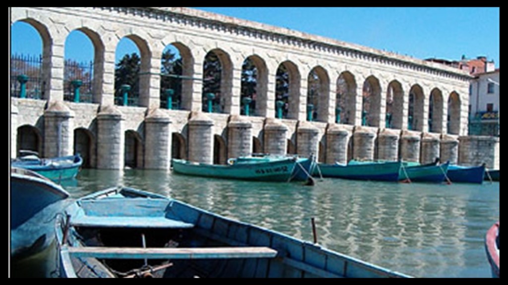
The heavy masonry of the Taskopru, or Stone Bridge, is a combined regular dam and bridge in Konya Province, a flood barrier said to have been built between 1908 and 1912 on what was called a ruined arch bridge…
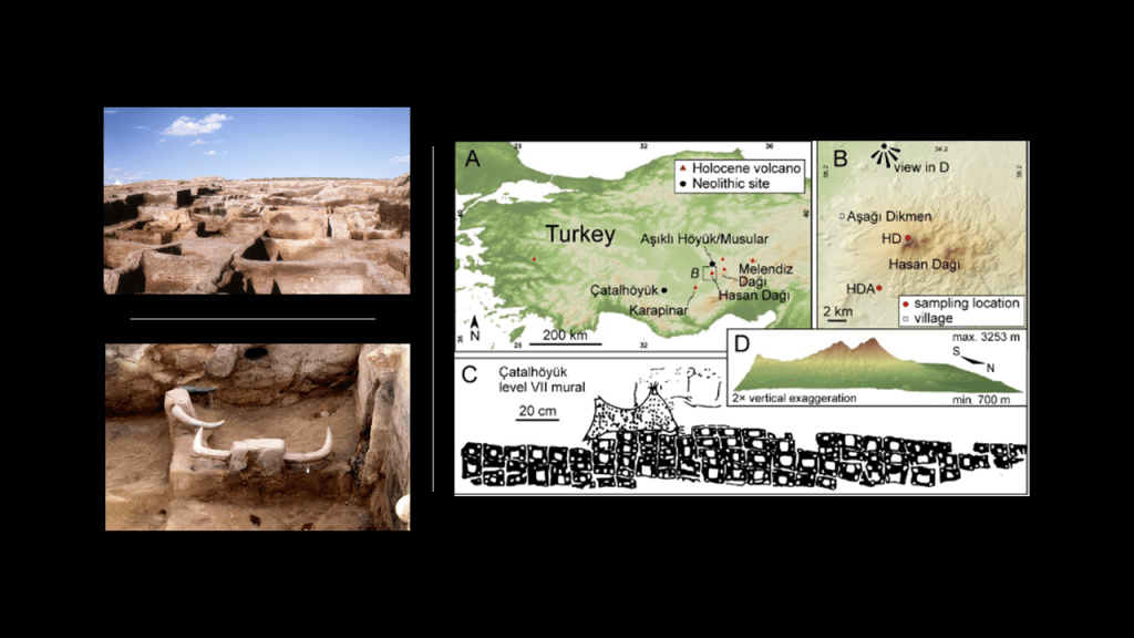
…and Catalhoyuk is located in Konya Province, a neolithic city that is dated back to origins in 7,100 BC…
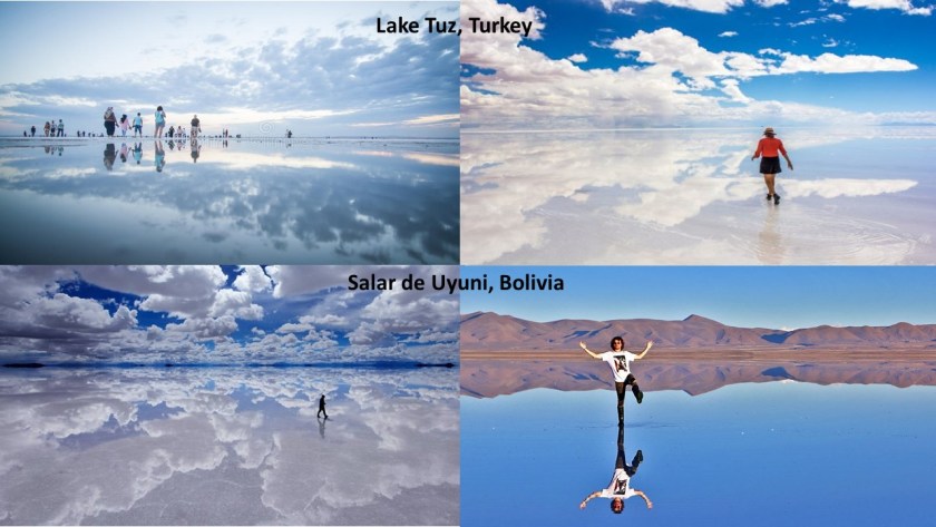
…and Lake Tuz, pictured on the top, is in Konya Province, the second-largest lake in Turkey, and one of the largest hypersaline lakes in the world. It is compared with the world’s largest salt flat on the bottom, the Salar de Uyuni in Bolivia.
Both are incredibly reflective, like a mirror of heaven!
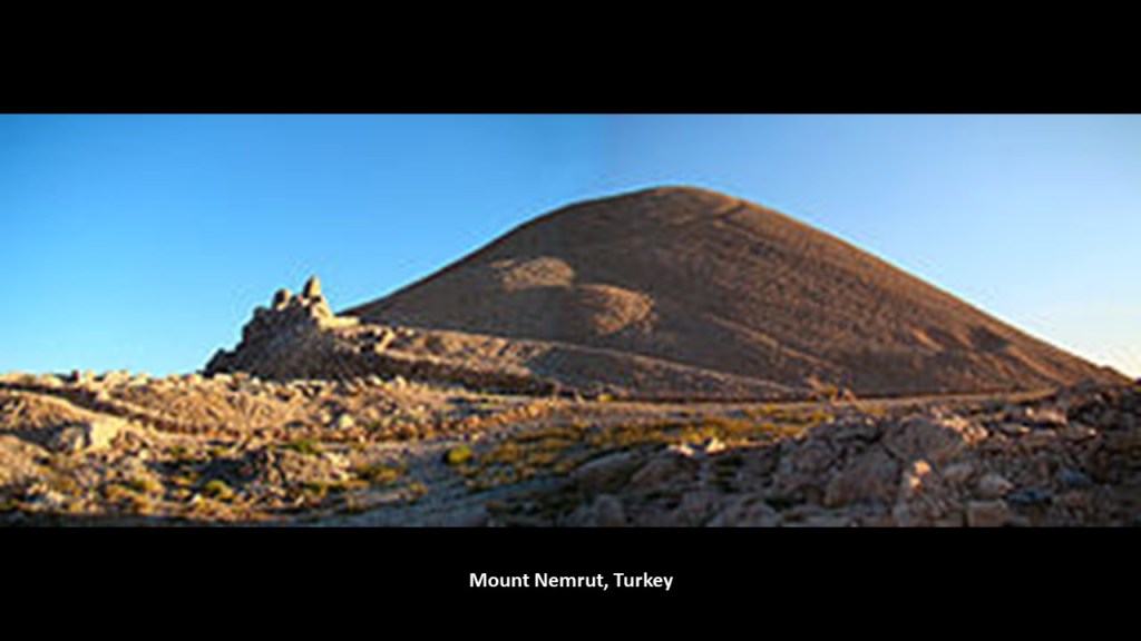
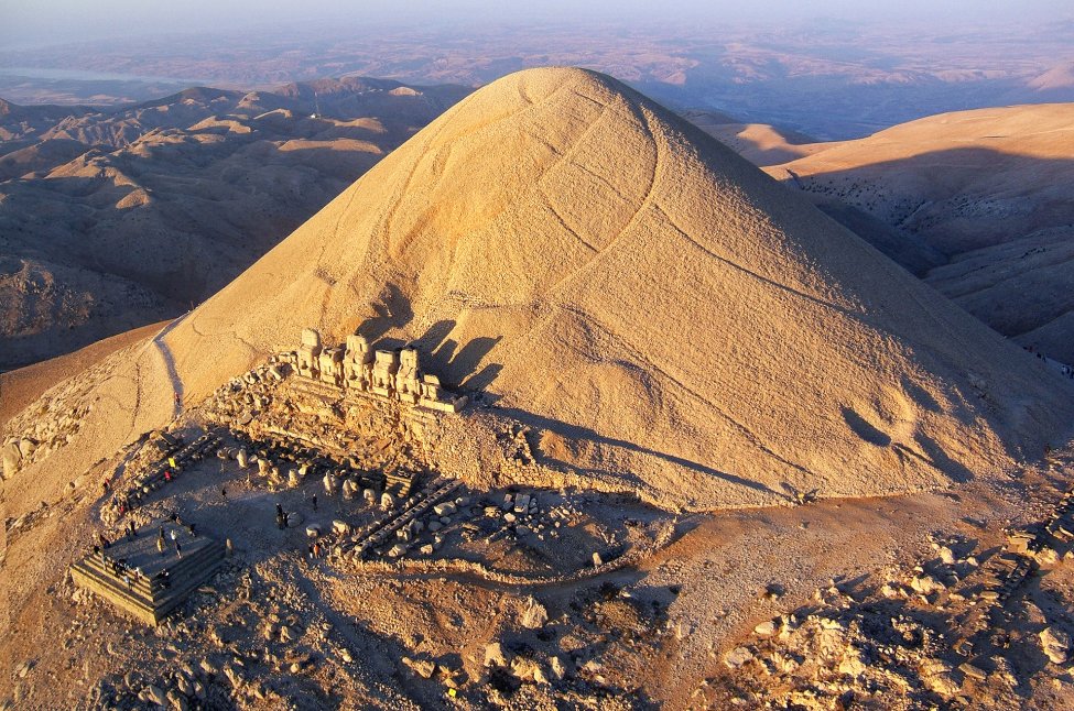
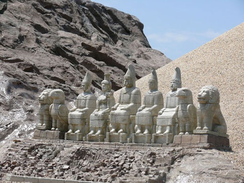
Further east, we come to more interesting places, like Mount Nemrut…
…in Commagene, a historical kingdom of Armenia located in what is now Turkey.
Mount Nemrut is described as a tomb-sanctuary built by King Antiochus I Theos, ruler of Commagene from 70 BC – 36 BC.
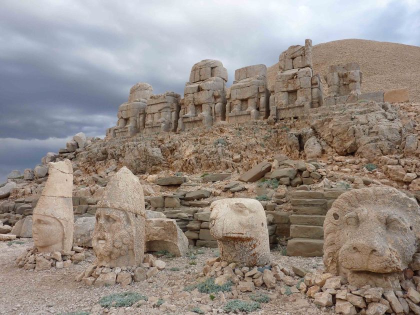
On the eastern side of the complex, there are what appears to be just colossal human and animal heads.
The question is: broken heads, like we are told, or buried heads…
…because, on the western side of the complex, there is a row of intact colossal full statues with similar heads…
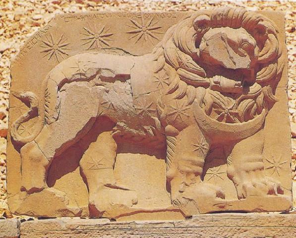
…as well as a large relief with a lion superimposed with an arrangement of stars, and said to depict the planets of Jupiter, Mercury, and Mars as a star chart that gives us the date of July 7th in 62 BC, and is surmised to be an indication of when construction on the complex began.
At any rate, this is what the available information has to say about it.
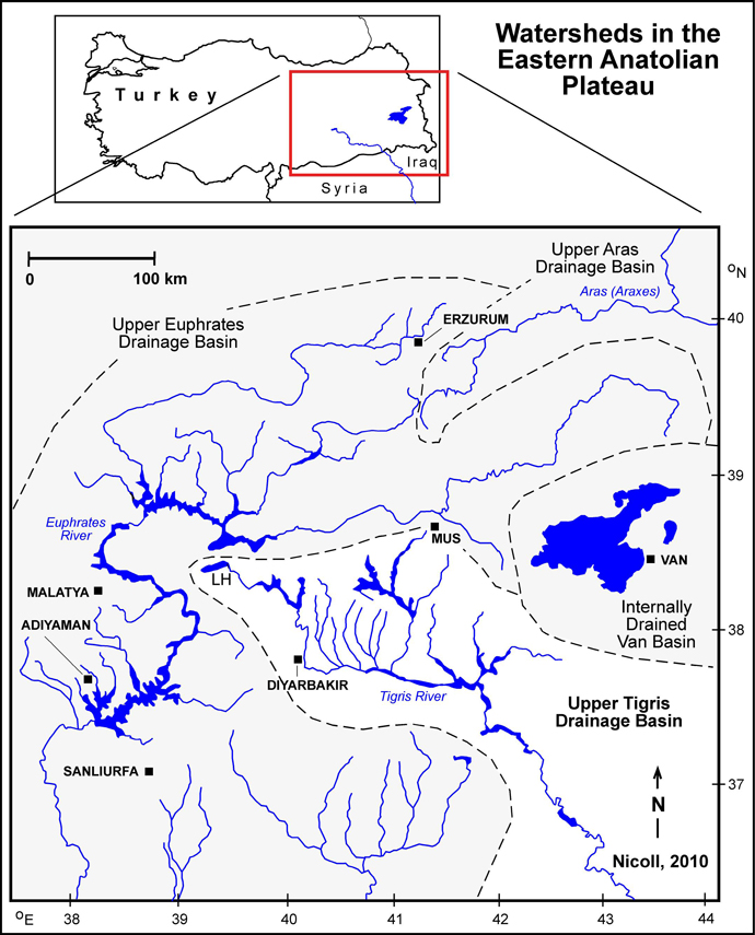
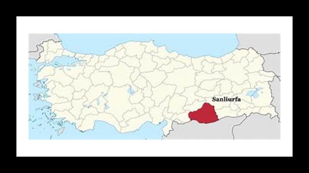
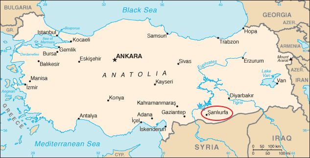
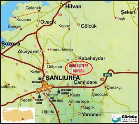
Heading further along towards the eastern end of the Taurus Mountains in the upper reaches of the Tigris and Euphrates Rivers, we are close to the province of Sanliurfa in southeast Turkey near the country’s borders with Syria and Iraq.
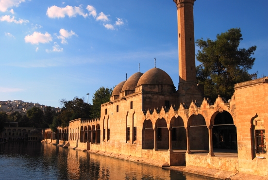
The capital of Sanliurfa Province, is Sanliurfa, also known as Urfa. It is also believed to be Ur Kasdim, or Ur of the Chaldeans, the hometown of Abraham, and is approximately 50-miles, or 80-kilometers, east of the Euphrates River.
The location of Abraham’s birthplace, with the entrance pictured here, is generally believed to have been in Harran, less than 20-miles, or 32-kilometers, from the city of Sanliurfa.
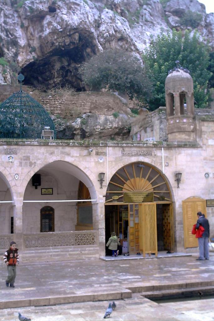
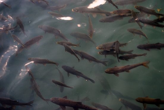
The Pool of Abraham, or Balikli Gol, in the city of Sanliurfa is believed to have been where Nimrod threw Abraham into a fire, but God turned the flames into water, and the logs into fish.
The carp in the Pool of Abraham are held sacred, and protected to this day.
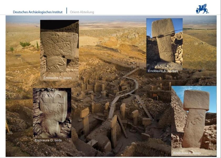
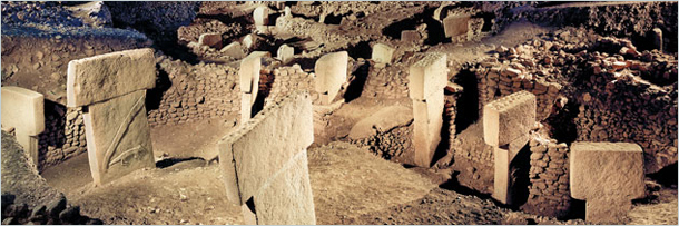
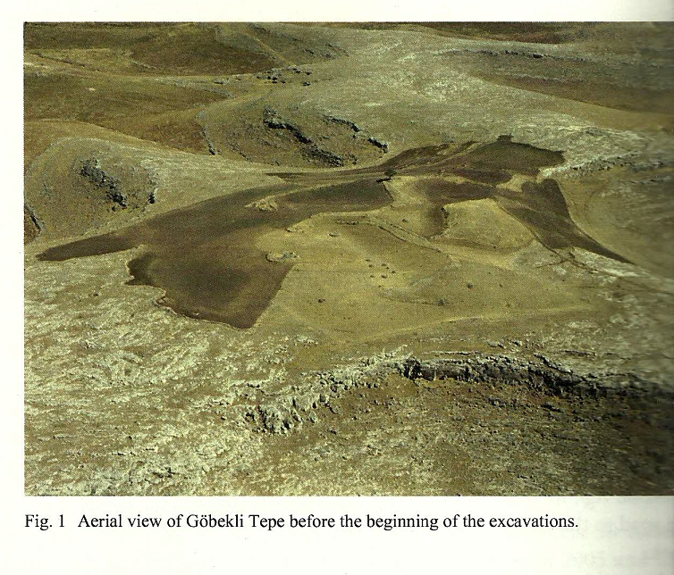
Gobekli Tepe is an archaeological site approximately 7-miles, or 12-kilometers, northeast of the city of Sanliurfa.
It was one of the twelve primary nodal points of the Earth’s original energy grid.
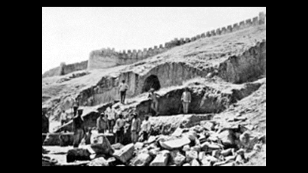
In 1994, Klaus Schmidt of the German Archaeological Institute reviewed an archaeological survey done in 1963 conducted jointly by Istanbul University and the University of Chicago.
The site was completely buried, and the following year, in collaboration with the Sanliurfa Museum, Klaus Schmidt unearthed the first of many huge T-shaped pillars.
More than 200 stone pillars in about 20 circles are known through geophysical surveys, with heights up to 20 feet, or 6-meters, and weighing up to 10-tons, and fitted into sockets hewn out of bedrock.
It is dated back to the 10th-century BC, or 12,000 years ago, and is considered the oldest man-made temple complex yet discovered.
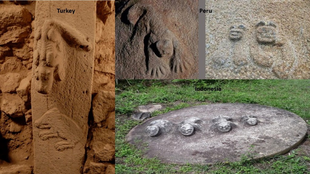
Interestingly, there are animal reliefs carved onto the pillars like this one on the left, compared with similar-looking carvings found at Cutimbo in Peru, near Lake Titicaca, on the top right; and at the Lore Lindu National Park on the island of Sulawesi in Indonesia on the bottom right.
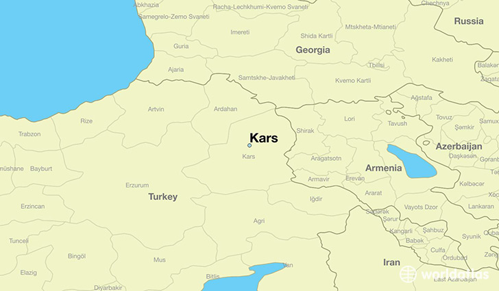
Moving northeast, close to the Pontic Mountains, is the city of Kars, in eastern Anatolia.
Kars is the largest city along Turkey’s closed border with Armenia, and a settlement that was historically a crossroads of Armenian, Turkish, Georgian, Kurdish, and Russian cultures.
As such, apparently it was of great interest, and the history we are told about it is filled with battles and sieges for control of it.
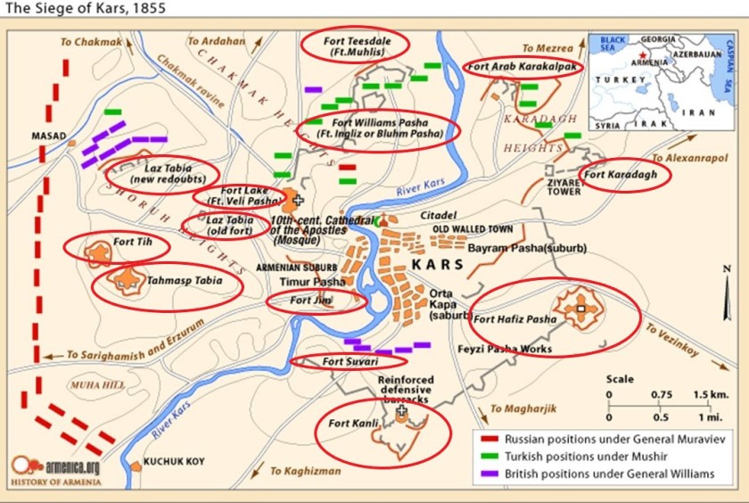
The Siege of Kars of 1855, for example, was the last major operation to take place during the Crimean War of 1853 to 1856, between the Russian Empire, which ultimately lost the war, and an alliance between the Ottoman Empire, France, Britain, and Sardinia.
Interestingly, in 1854 a British general had been sent to Kars by the supreme commander and chief of British Expeditionary Forces in Crimea to assess the situation.
When I look at this map depicting the siege, I see what appear to be at least thirteen star forts, and which appear to no longer exist in modern times.
Here is an antique map of Kars which also appears to show shapes that indicate the presence of star forts.
I believe that star forts functioned as part of the circuitry of the original grid system of the earth, and were not military in nature as we have been told.
I find them all over the alignments I have found, and they seem to have been prime targets for explorers, European colonial empires and wars.
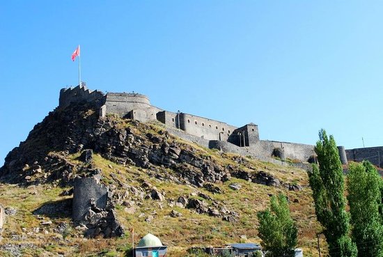
The Kars Citadel is still here, though apparently only seven of the original 220 towers remain.
It was said to have been built by the Saltuks in 1152 AD.
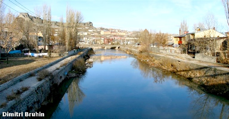
There were canals in Kars…
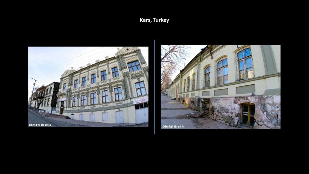
…and these two photos taken in Kars show classic mud flood evidence of like steep streets with disappearing windows at ground-level, and below-ground level.
I can go less than a mile, or 1.6-kilometers, from where I live to the downtown historic district of Prescott, Arizona, and find exactly the same thing.
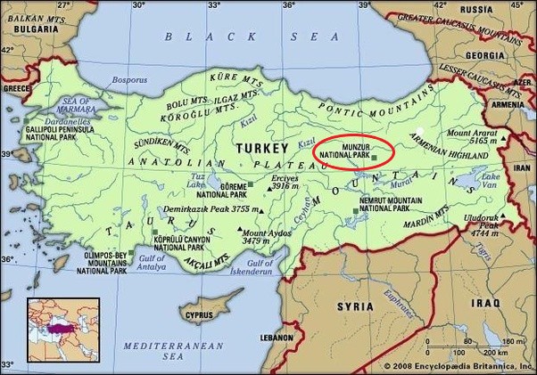
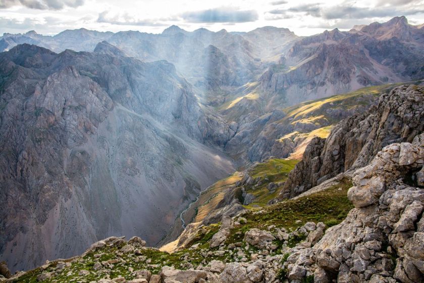
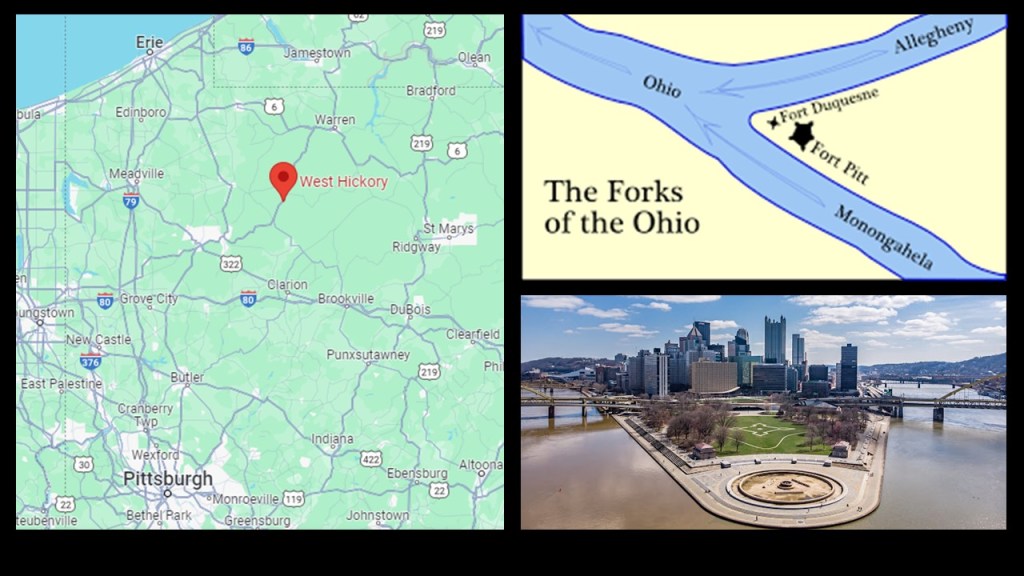
Next, I would like to look at Munzur National Park on the Anatolian plateau, situated between the Taurus and Pontic Mountains, and the Armenian Highlands.
It is the largest national park in Turkey, and was established in 1971.
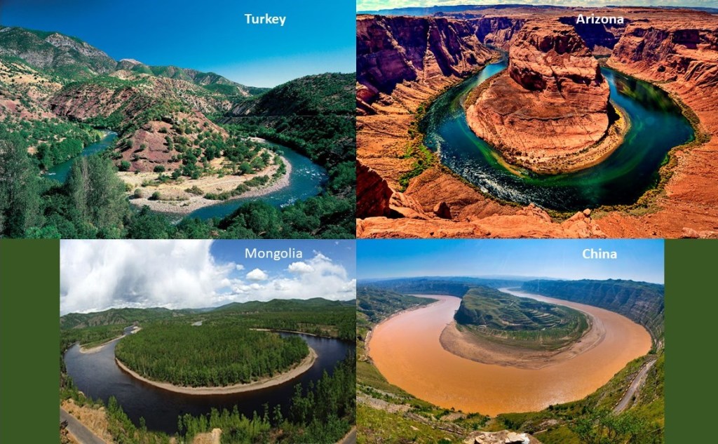
This is a bend of the Munzur River in the national park in Turkey on the top left, compared with Horseshoe Bend in Arizona on the top right; this riverbend in the Hulunbuir Grasslands of Inner Mongolia on the bottom left; and a bend of the Yellow, or Huang He River, the Mother River of China.
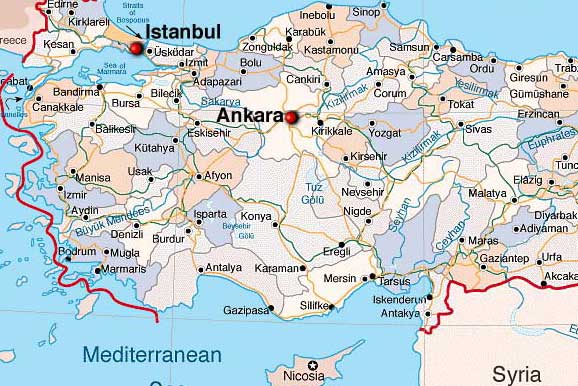
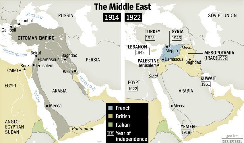
The capital of Turkey was moved to the Anatolian Plateau in 1923, when the city of Ankara was chosen as the capital of the new state to remove it from the former imperial capital of Istanbul and to place the capital in a more central location in the country.
It appears that Ankara is quite the mix of ancient and modern infrastructure!
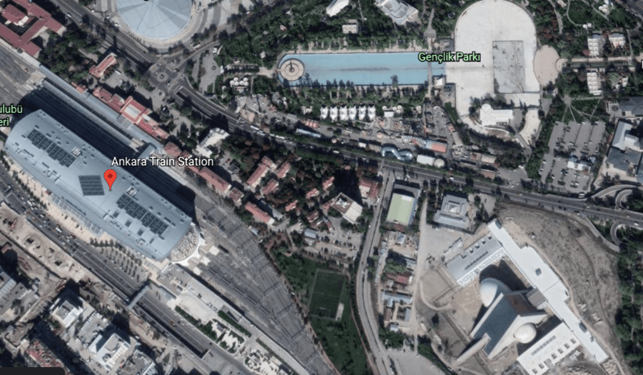
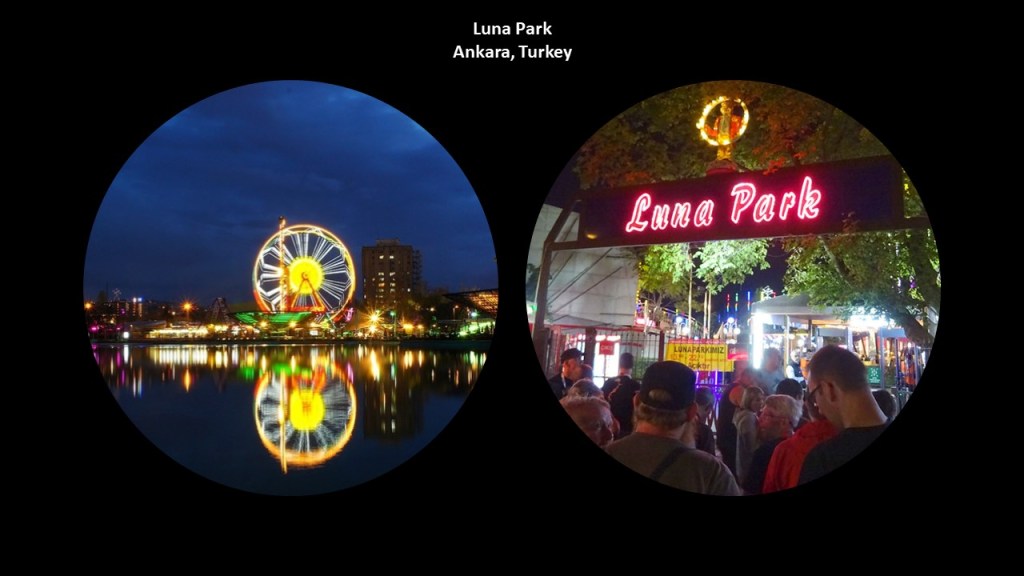
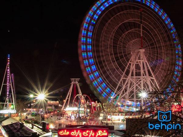
Within Genclik Park, which is a public park just across the street from Ankara’s main train station…
…we find Ankara’s Luna Park amusement park.
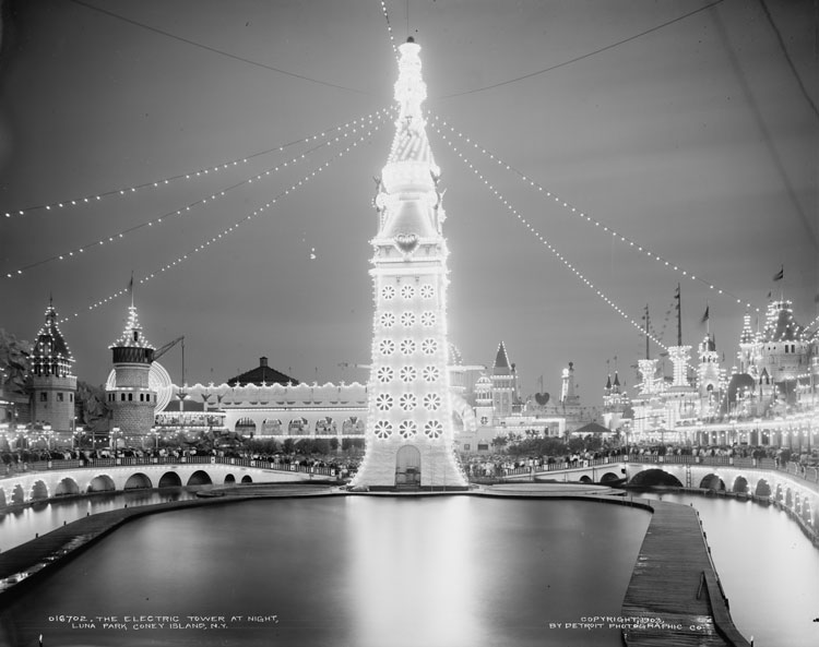
Luna Parks were found all over the world, in the past and some with the same name still exist into the present day, though not in their original splendour, like the historic Luna Park on Coney Island.
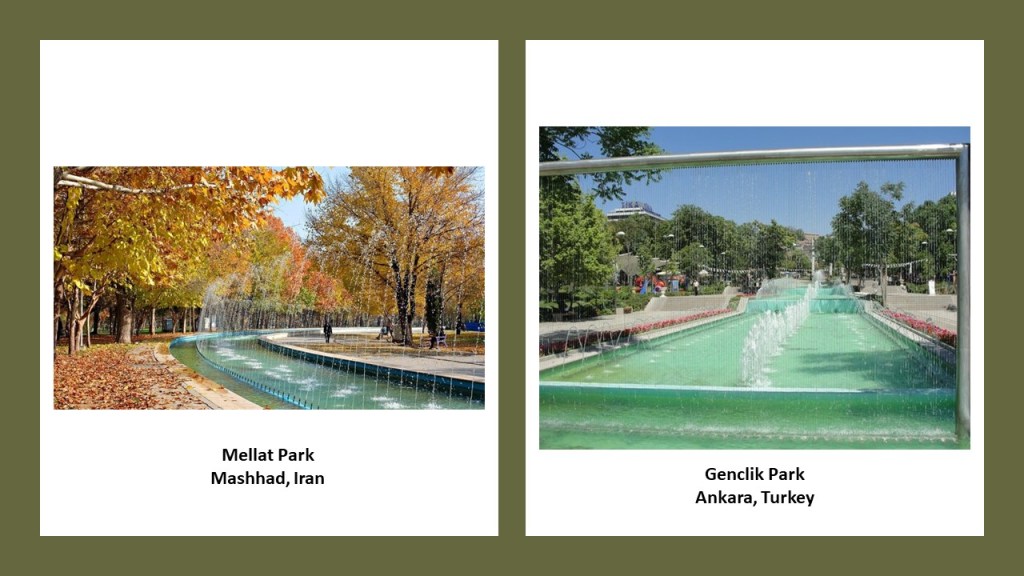
I even found that Mashhad in Iran has a Luna Park as well, in its Mellat Park, what was also on this alignment I was tracking in 2020 that started in San Francisco.
Mellat Park in Mashhad has amazing hydrological features and beautiful fountains on the left, as does Genclik Park in Ankara on the right.
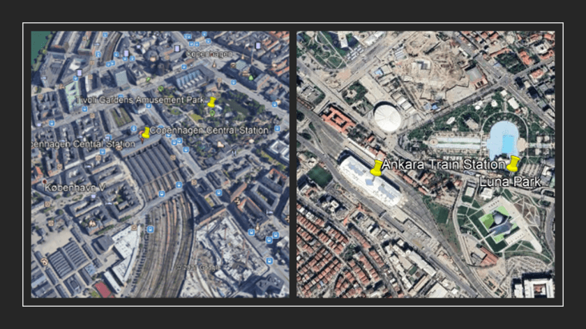
It is interesting to note that the Tivoli Gardens in Copenhagen, Denmark, are located right next to the main train station too, as seen on the left, like Like Luna Park in Ankara on the right.
I absolutely believe there was a direct connection between railroads and amusement parks in the Earth’s original energy grid system.
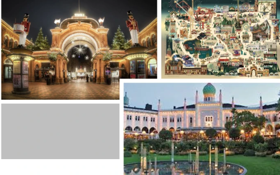
In our historical narrative, the Tivoli Gardens Amusement Park in Copenhagen opened in 1843, making it the third-oldest operating amusement park in the world, after Bakken in Denmark, which first opened in 1538, and the Wurstelprater in Vienna, Austria, which opened to the public in 1766.
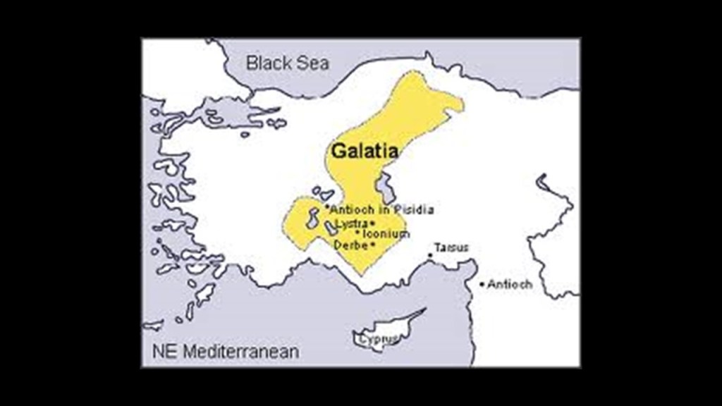
We are told Ankara was one of the main tribal centers of the Galatians in Anatolia, and part of the ancient Celtic World on this previously seen map.
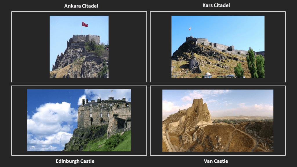
Interestingly, when I see Ankara Citadel on the top left, the foundations of which were said to have been laid by the Galatians in more ancient times (no date was given but prior to Roman times) on a prominent lava outcrop, I am once again reminded of Edinburgh Castle on the bottom left, which was said to have been built starting around 1100 AD on the plug of an extinct volcano; the Kars Citadel, said to have been built circa 1152 AD by the Saltuks; and the rocky outcrop Van Castle is situated on in Van, Turkey, said to have been built by the Urartian King Sarduri in 900 BC.
They all look strikingly similar, yet we are told they were all built randomly by different people at different places and times.
In the years since I originally did the research for this post, I have come to believe that the builders of these places were actually building on top of what were giant tree stumps. where there would have been a synergetic relationship between the two.
Here’s another photo of Edinburgh Castle to illustrate this line of thinking.
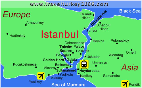
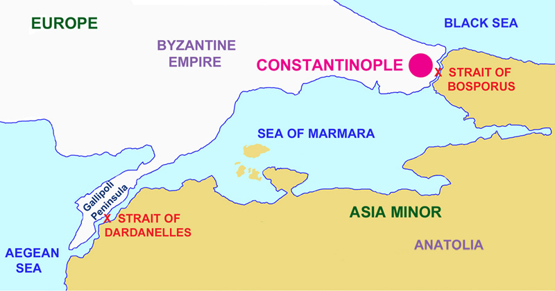
When Ankara became the capital of the new Republic of Turkey in 1923, it had been moved from Istanbul, the country’s imperial, historic, economic, and cultural center straddling the continents of Europe and Asia across the Bosphorus Strait.
Prior to the capital’s move to Ankara, Istanbul was known as Constantinople, at one time the capital of the Roman Empire, the Byzantine Empire, the Latin Empire, and from 1453 to 1923, the Ottoman Empire.
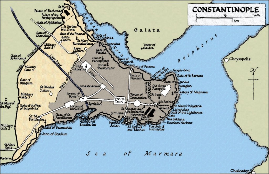
I am immediately drawn to look into Galata, situated between the Bosphorus Strait and what is called the Golden Horn, directly across from the main part of historical Constantinople.
In this history I read about Galata, the name is said to have come from the Greek “Galatai, referring to a Celtic tribe of Gauls who were said to have camped here during Hellenistic times before moving on to the Galatia region in Central Anatolia.
Why would they name a place permanently for temporary inhabitants that were only passing through?
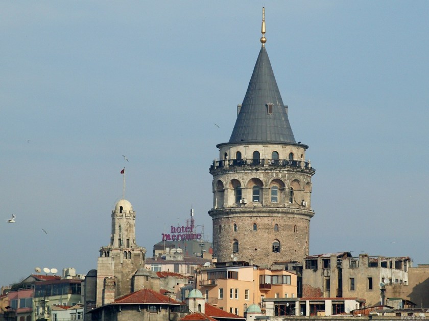
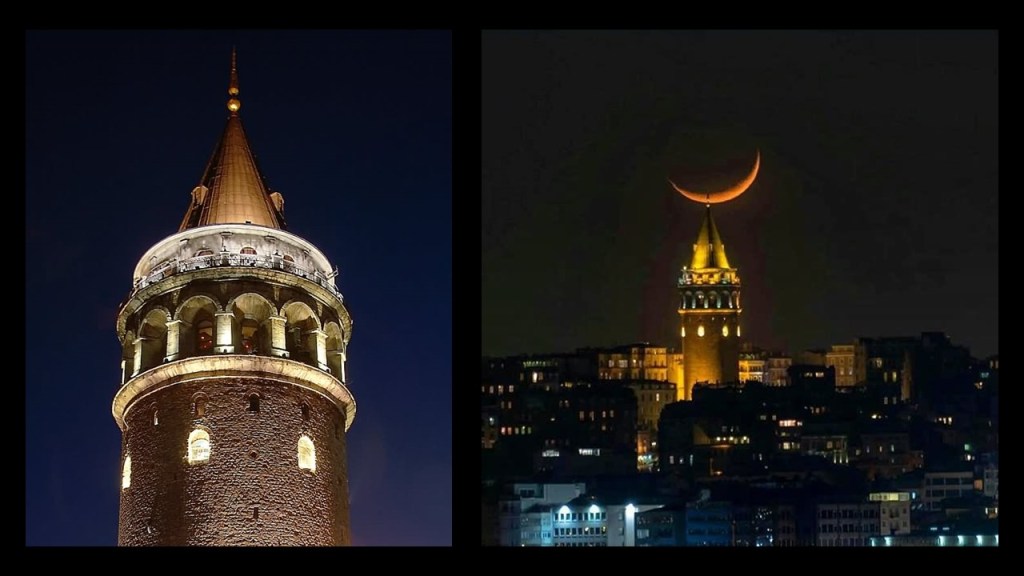
And the Galata Tower there is massive and absolutely dominates everything in its surroundings!
However, we are told the Genoese get the credit for building it in 1378, when they had a colony here between 1273 and 1453, at the apex of the walls of the citadel, also said to have been built by the Genoese, that no longer exists.
Here are more photos of the outside of the Galata Tower…
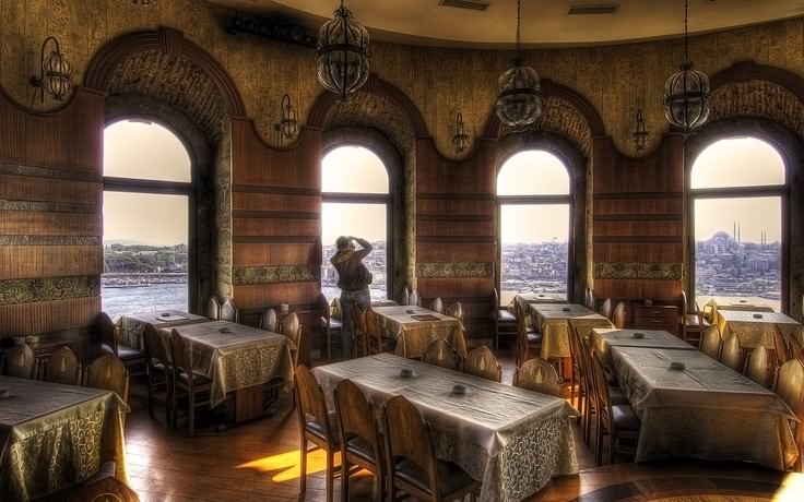
…and of the inside of the Galata Tower.
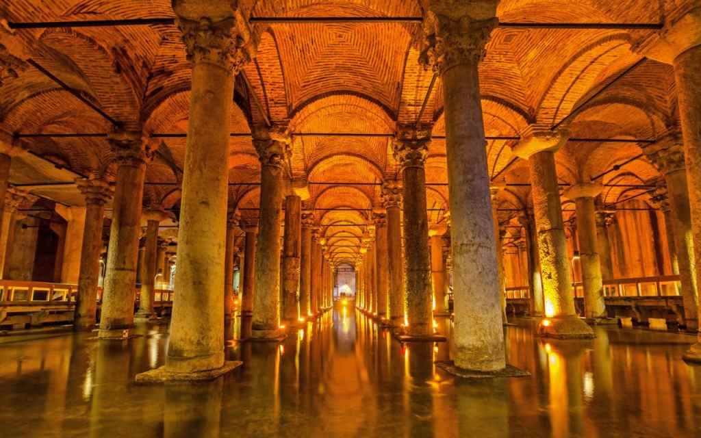
Next, the Basilica Cistern is the largest of several hundred ancient cisterns that lie beneath Istanbul, and said to have been built during the reign of the Byzantine Emperor Justinian I between 527 to 565.
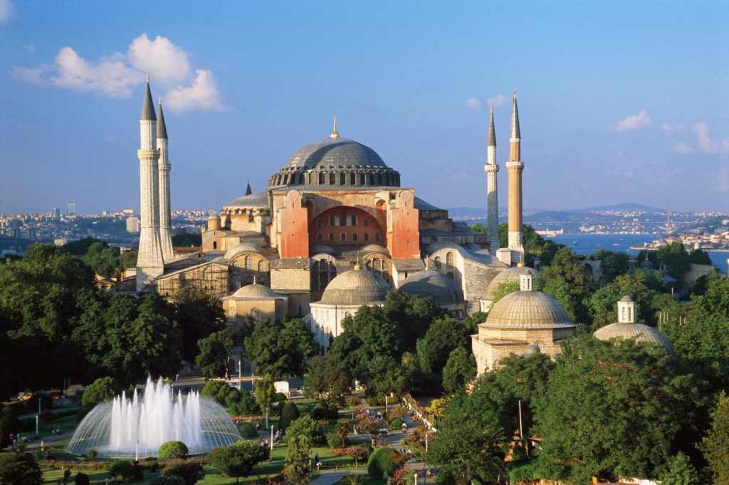
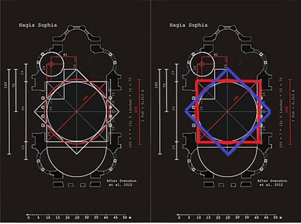
The Basilica Cistern is located 490-feet, or 150-meters, from the Hagia Sophia, also said to have been built during the reign of Emperor Justinian I, between 532 and 537 AD.
I found this diagram showing the geometric lay-out of the Hagia Sophia…which contains an eight-pointed star, as seen earlier in this post.
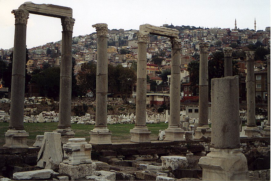
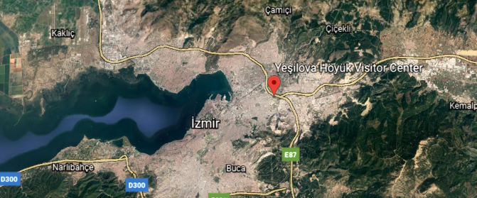
The next place I am going to look at is the city of Izmir, a city on the western edge of the Anatolian Plateau before heading west on this alignment.
Known in times past as Smyrna, from ancient times to around 1930, at which time it became predominantly known by its Turkish counterpart, Izmir.
Izmir has more than 3,000 years of recorded urban history…
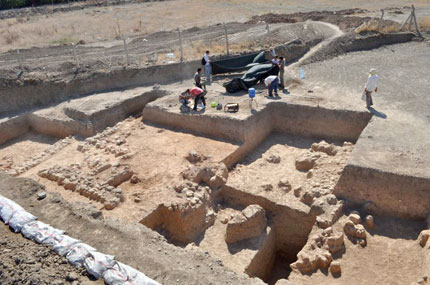
…and up to 8,500 years as a human settlement since the Neolithich area, with Yesilova Hoyuk being continuously inhabited at least between 6,500 BC and to 4,000 BC.
Discovered in 2003, the Yesilova Hoyuk site was at some point in its history…
…covered in silt.
Silt is defined as a fine sand clay, or other material carried by running water and deposited as a sediment.
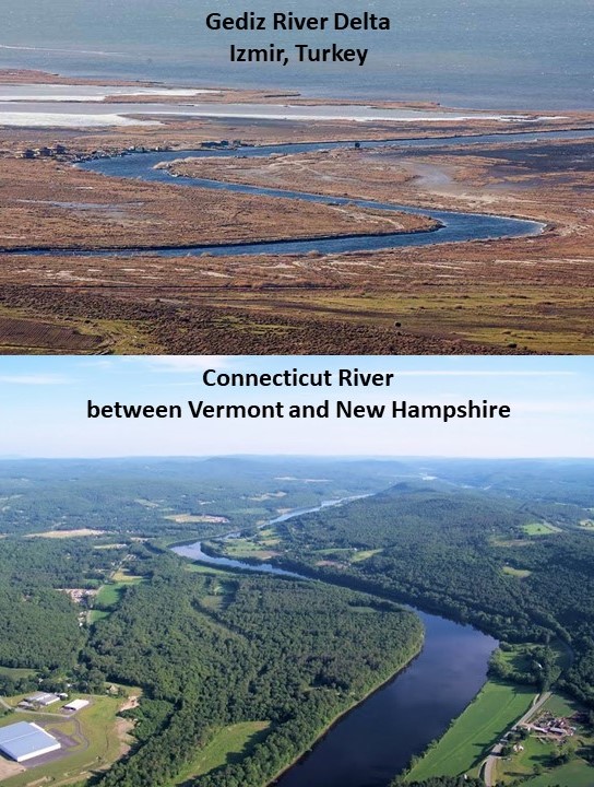
Izmir’s Metropolitan area extends along the outlying waters of the Gulf of Izmir, where we see what appears to be a shaped, masonry shoreline…
…and inland to the north across the Gediz River Delta, which has a shape similar to the Connecticut River along the Vermont – New Hampshire border in the United States.
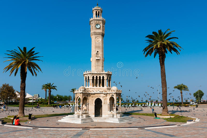
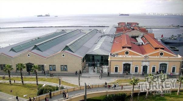
The last place I am going to take a look at in Izmir is Konak Square.
This is the clock tower there, said to have been built in the Moorish style in 1901 by the Levantine French architect Raymond Charles Pere.
Levantine refers to the Latin Church of the Catholic Church in the Middle East, in the Levant, which included the country now called Turkey.
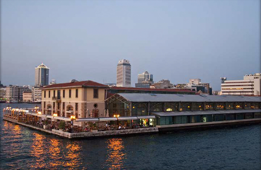
This is the Konak Pier on the eastern end of Konak Square.
Gustav Eiffel is credited with its construction in 1890, a French civil engineer and architect most famous for the tower in Paris bearing his name.
Konak Pier is now an upscale shopping mall in Izmir.
It is clear that this geographical region known since 1923 as Turkey, for less than 100-years, and known as Anatolia for far longer, has a very ancient and storied and obscured past, which goes back at least 12,000 years with the dating of the Gobekli Tepe Complex, and with many places showing evidence of having been covered over massively with silt, or mud, or whatever would have caused things like needing to be dug out from the earth.
Now I am going to be picking up the alignment leaving Izmir to where it enters the Aegean Sea.
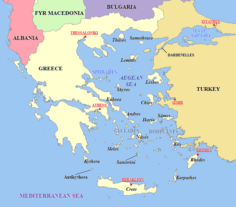
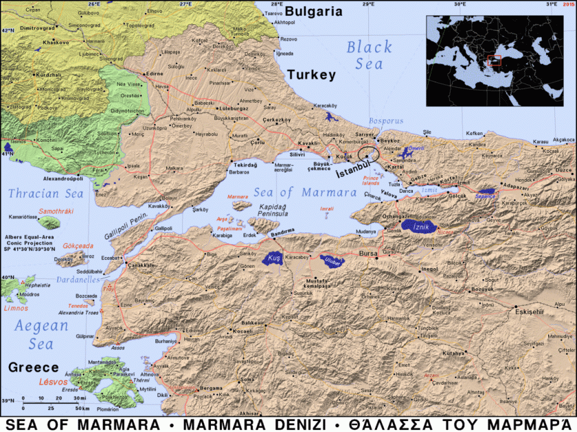
The Aegean Sea is called an elongated embayment, or bay, of the Mediterranean Sea between the Anatolian and Greek Peninsulas.
In the North, the Aegean is connected to the Sea of Marmara, entirely within the borders of Turkey, and which connects the Black Sea to the Sea of Marmara, and separates Turkey into its European and Asian parts…
…and said to take its name from Marmara Island, from the Greek word for marble, and it is rich in sources of marble…
…between the Straits of Dardenelles and Bosphorus.
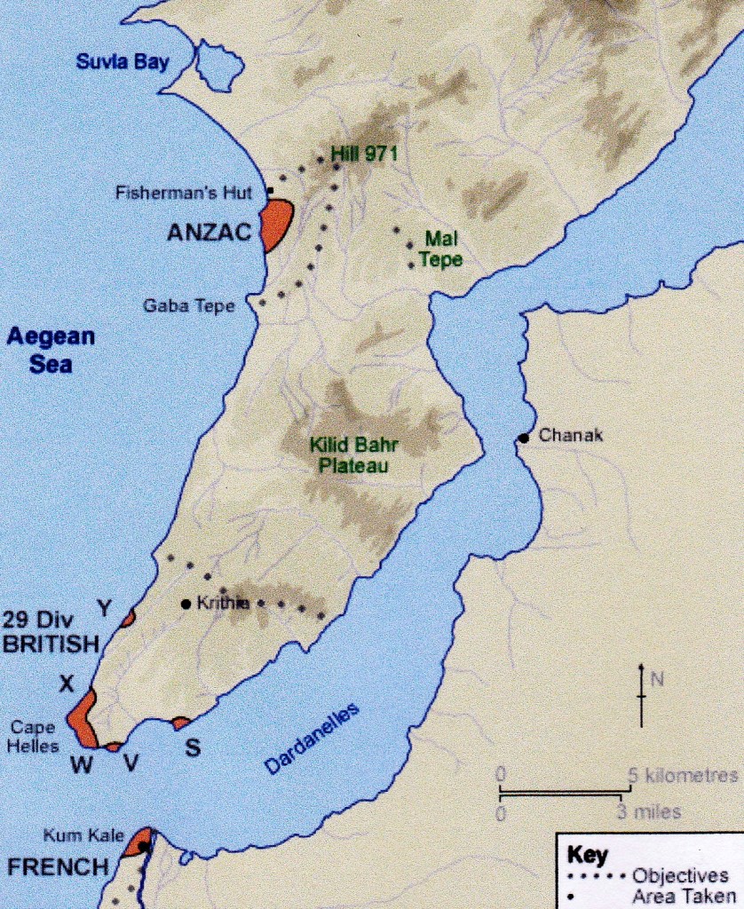
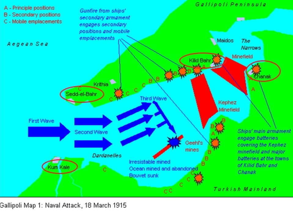
The Strait of Dardenelles was the location of the Gallipoli Campaign, one of the bloodiest battles of World War I.
The Gallipoli Campaign took place between April 25, 1915, and January 9, 1916. A joint British and French operation was mounted to capture the Ottoman capital of Constantinople (known as Istanbul since 1923) and secure a sea route to Russia.
While the Ottomans were victorious at the end of this campaign, they ultimately lost the war. At the end of World War I, the Ottoman Empire was partitioned and lost its Middle East holdings, which were divided between the Allied Forces.
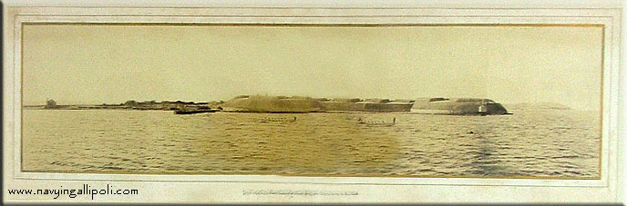
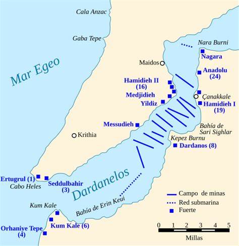
The first thing I am finding in researching information about the Gallipoli Campaign are the presence of many forts on both sides of the entrance to the Strait of Dardenelles, including, but not limited to the places circled here: Fort Sedd-el-Bahr at Cape Helles and Kilid Bahr on the European side of the Strait; and Kum Kale and Chanak, or Canakkale, on the Asian side.
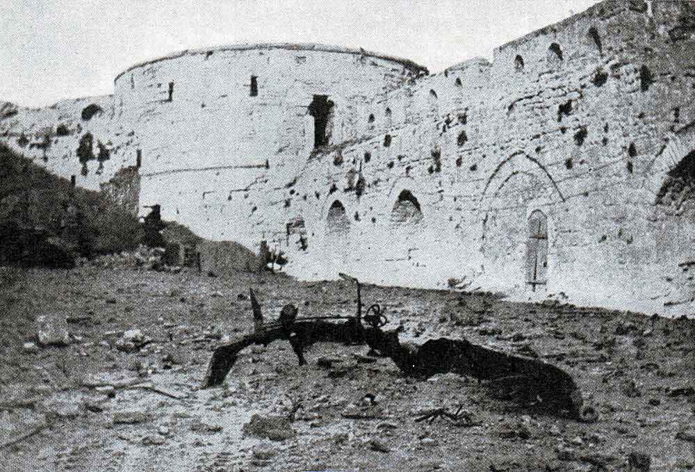
Fort Sedd-el-Bahr, said to mean “Key of the Sea,” was on Cape Helles at the entrance to the Straits.
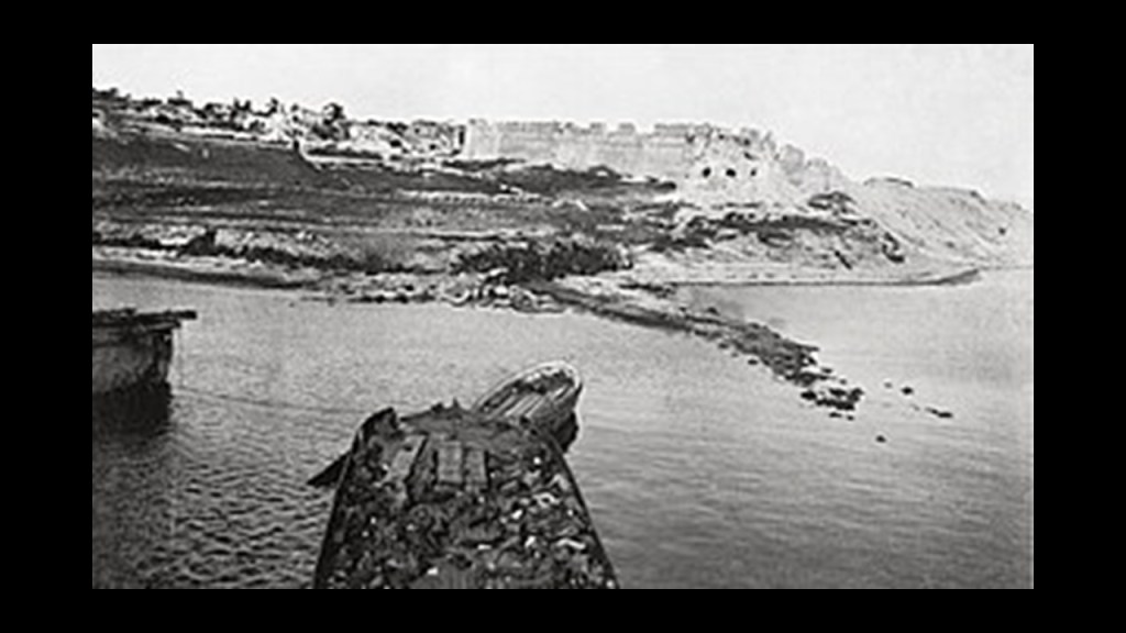
This is a view of the Sedd-el-Bahr from the bow of the SS River Clyde, a collier, at the start of the joint-British-and-French amphibious invasion of the Gallipoli Peninsula at Cape Helles on April 25th, 1915.
Its location was designated as “V Beach” of the Gallipoli Campaign.
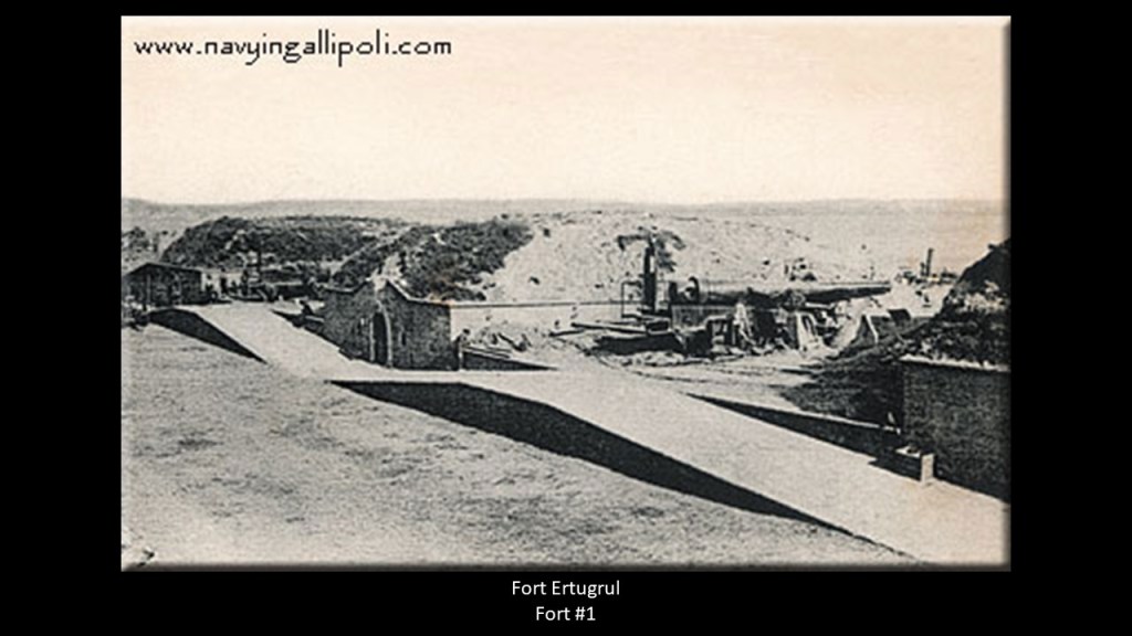
The Royal Navy bombarded the Sedd-el-Bahr, also known as Fort #3, along with Fort Ertugrul, known as Fort #1 on the other side of “V Beach.”
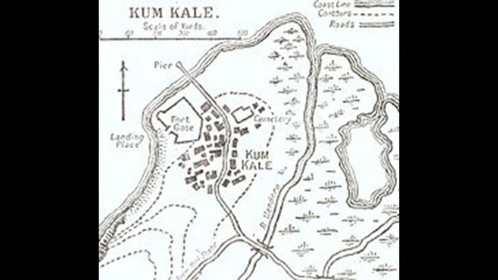
The Fort at Kum Kale was on the opposite side of the entrance to the Strait of Dardenelles from Cape Helles.
The Battle of Kum Kale was said to have been fought on April 25th, 1915, between Ottoman defenders and French troops as a diversion from the main landings on the Gallipoli Peninsula.
The fort at Kum Kale was completely destroyed by naval gun fire early in the operations.
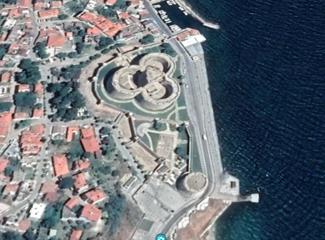
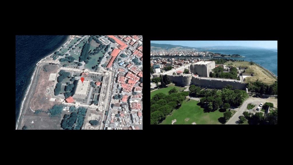
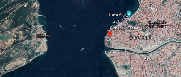
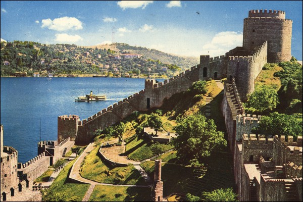
Further up, we find the Fort of Kilitbahir and Cimenlik Castle situated across from each other on the Strait of Dardenelles.
Kilitbahir, or “Lock of the Sea,” was said to have been built by Sultan Mehmet II in 1463 in the form of a clover…
…and Cimenlik Castle was also said to have been built in the same year as Kalitbahir by Mehmet II to be defenses, we are told, to ensure the protection of the Dardenelles, and to control the maritime traffic to-and-from Constantinople.
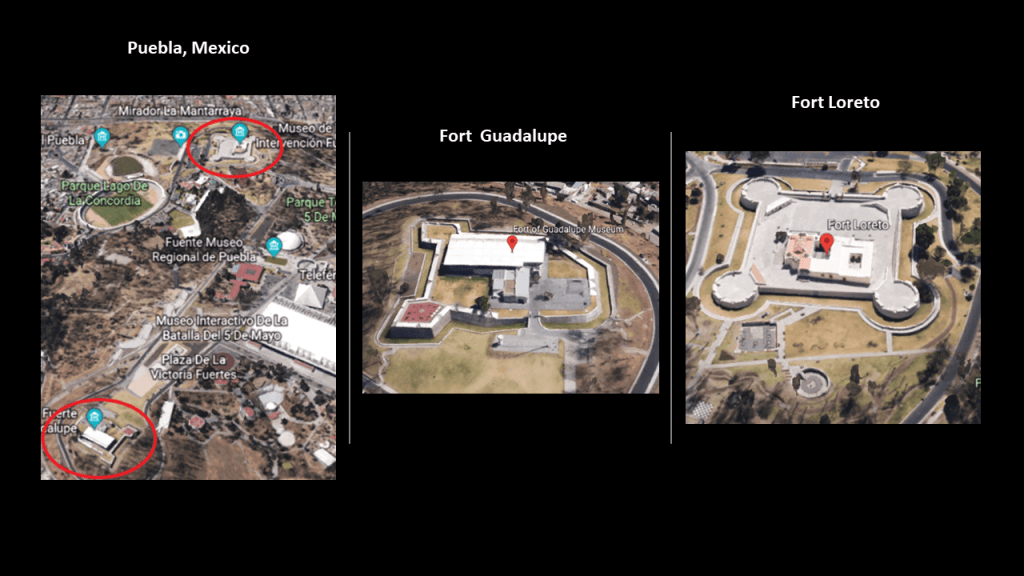
I have consistently found star forts paired together, among other things, like here in the Strait of Dardenelles…
…and many other places around the world, like the two star forts in Puebla, Mexico, the Fort of Guadalupe and Fort Loreto that are situated relatively close to each other, on a hill not far from the city center of Puebla.
The Battle of Puebla is where the legendary Cinco de Mayo battle took place on May 5, 1862, where poorly-equipped Mexican forces were said to have defeated superior French forces.
I have also found clusters of star forts in the same location.
As I alluded with the numbering of Fort Sedd-el-Bahr and Fort Ertugrul earlier, there were at least 24 numbered forts in the Strait of Dardenelles…because Fort Anadolu Hamidiye was number 24, said to have been built by the Ottoman Sultan Bayezid I between 1393 and 1394.
I found this map of what are described as the Dardanelles defenses circa 1915, showing the places I have shared with you, and many more, situated in pairs, or clusters in alignment with each other.
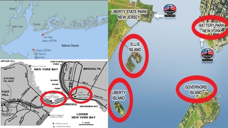
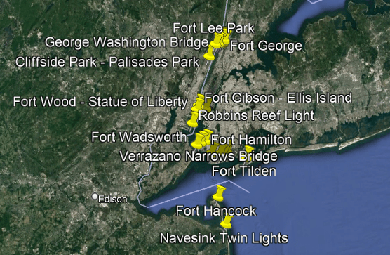
Along the same lines, I can make a case that there were four pairs of star forts along the Lower and Upper New York Bay, with each pair situated along various points starting from Fort Hancock on Sandy Hook island in New Jersey and Fort Tilden on the Rockaway Peninsula in New York at the entrance of the Lower New York Bay, up through the pair of Fort Jay on Governors Islands and what was Fort Amsterdam in Battery Park in Lower Manhattan.
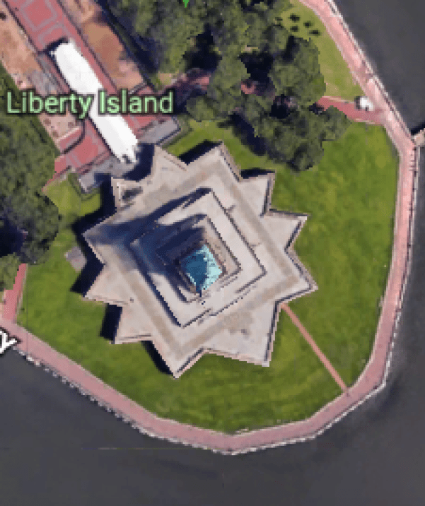
The physical structure of what was called Fort Gibson on Ellis Island is long obscured, but the Statue of Liberty stands right on top of Fort Wood.
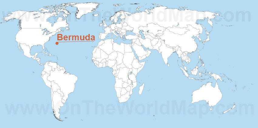
Another shared feature of the Strait of Dardenelles and other places is that there seem to have been certain locations with a high concentration of star forts, like the island nation of Bermuda, which is located in the North Atlantic Ocean, 665-miles, or 1,070-kilometers, east-southeast of Cape Hatteras, North Carolina.
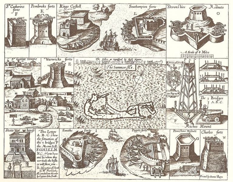
This is a 1624 map depicting numerous star fort looking structures that were found at one time throughout Bermuda, and said to have been made by Captain John Smith of Pocahontas and Virginia fame in our historical narrative.
Another place in the Atlantic Ocean with a high-concentration of star forts is Fernando de Noronha, off the coast of Brazil near the coastal city of Natal. Here are historic drawings of eight of the ten I found out about within an archipelago whose area totals 10-square miles, 26-kilometers squared.
Then I found what appears to have been at least thirteen star forts in the city of Kars at one time, the largest city on Turkey’s closed border with Armenia that we saw earlier in this post.
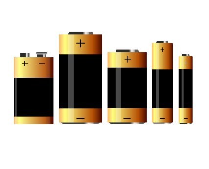
I think places like these were significant power centers for the energy system of the planetary grid, and star forts represented the definition of battery meaning “a device that produces electricity that may have several primary or secondary cells arranged in parallel or series, as well as a battery source of energy which provides a push, or a voltage, of energy to get the current flowing in a circuit…”
…and not the definition of battery meaning “The heavy fire of artillery to saturate an area rather than hit a specific target” that we are led to believe in our current historical narrative, though that definition for these certainly made them military fortifications, and targeted for destruction.
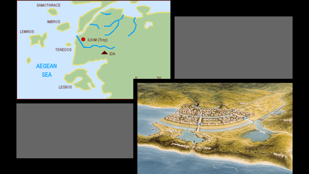
Before I move on from the Strait of Dardenelles where it meets the Aegean Sea, I would like to point out that ancient Troy, the location of the famous Trojan War between the troops of King Priam of Troy and King Agamemnon of Mycenae, was situated between the mouth of the Strait of Dardenelles…
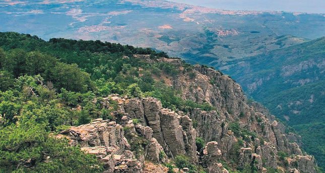
…and Mount Ida, the location in Homer’s Iliad where the Olympian Gods gathered to watch the progress of the Trojan War is nearby
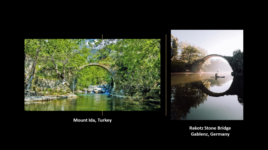
I found this old stone bridge in the Mount Ida region in Turkey on the left that looks similar to the Rakotz stone bridge in Gablenz, Germany.
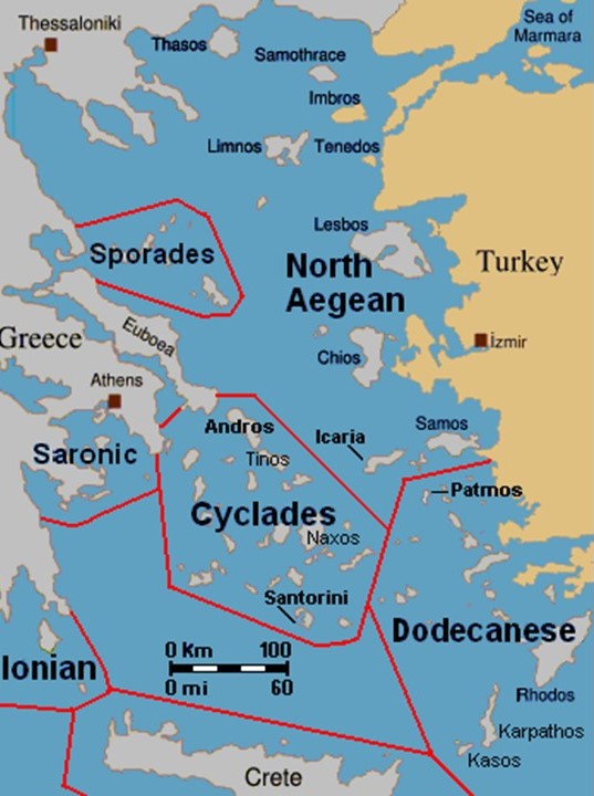
Now I am going to turn my attention to the numerous islands and island groups in the Aegean Sea.
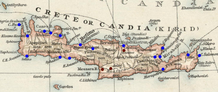
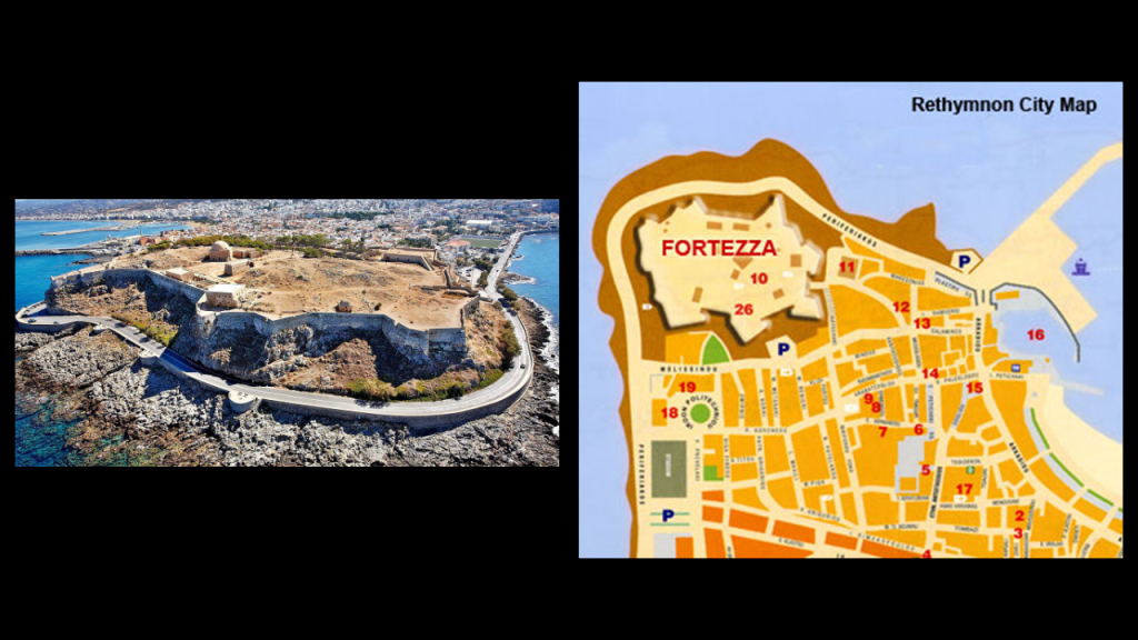
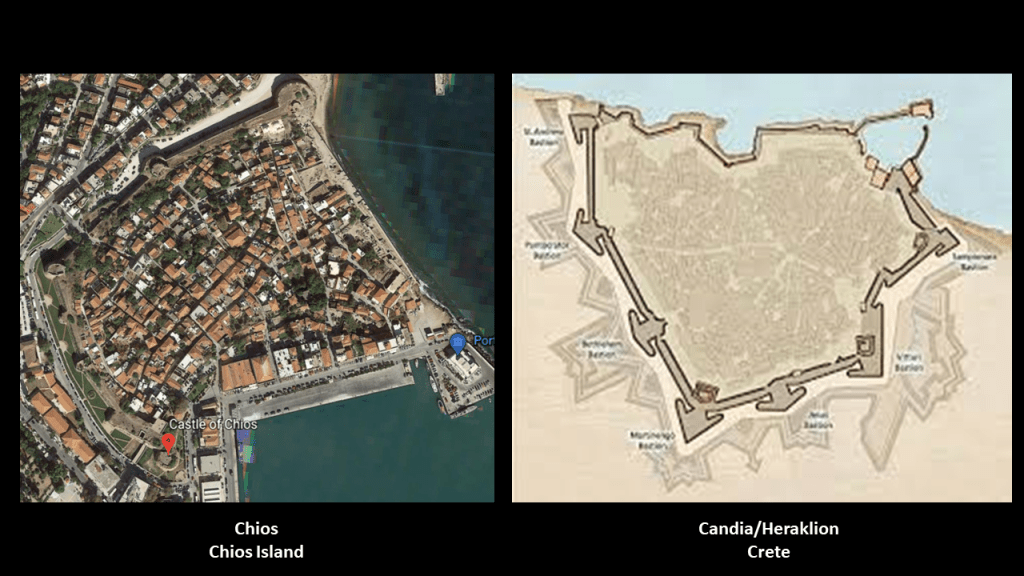
Crete is the largest and most populous of the Aegean Islands, and yet another small island packed with star forts, notated by the blue dots on this map, said to have been forts built to defend the island from enemies and pirates, by Venetians, as well as other historical influences on Crete like from the Genoese, Byzantines and Turks.
Like the one at Rethymnon…
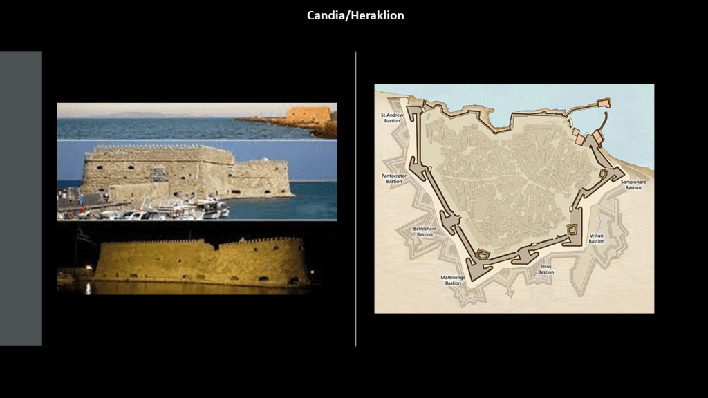
…and Candia was said to have been built by the Venetians, known today as Heraklion, the capital of modern Crete.
The Dodecanese Islands, which includes the Island of Rhodes, which is the place for which the State of Rhode Island was named when Giovanni da Verrazzano likened an island near the mouth of Narragansett Bay to the Island of Rhodes in 1524…
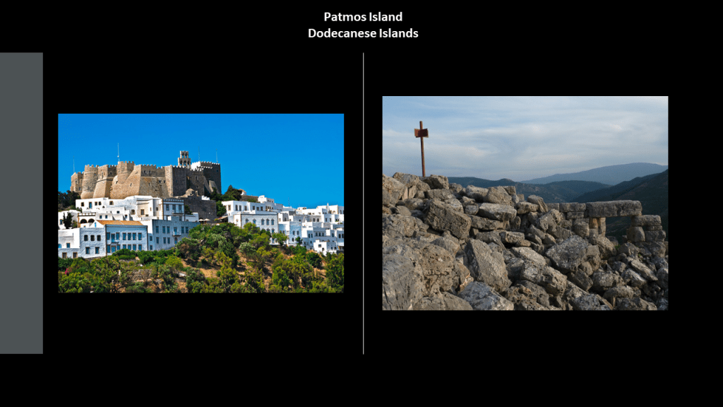
…the island of Patmos, where John the Apostle was given the vision in the Book of Revelation…
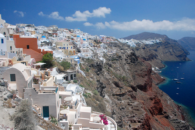
…the Cyclades Island group, which includes Santorini, known for having one of the largest volcanic eruptions in history, and by the way, what an interesting lofty, rocky spot to built on top of…
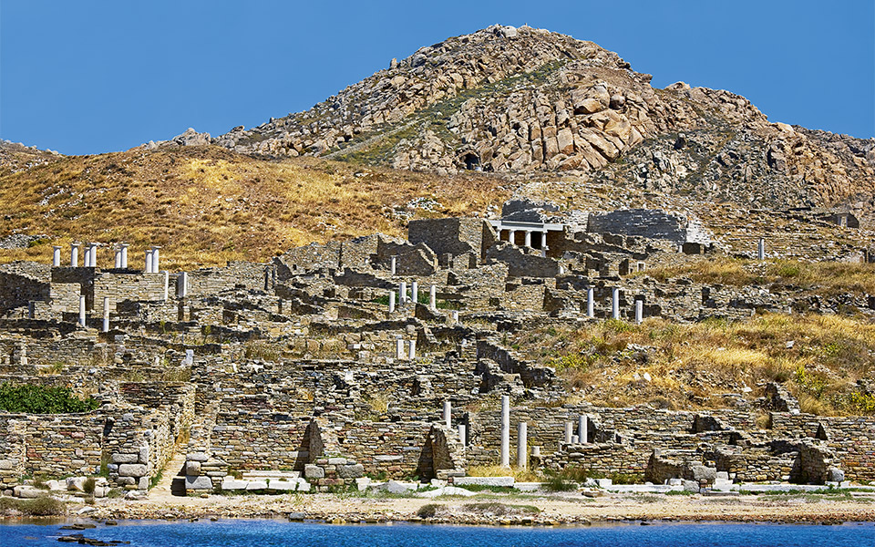
…and Delos, one of the most important mythological, historical and archeological sites in Greece, and once considered a holy sanctuary.
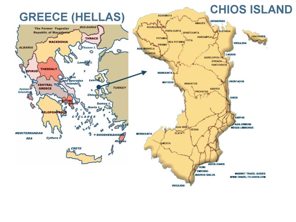
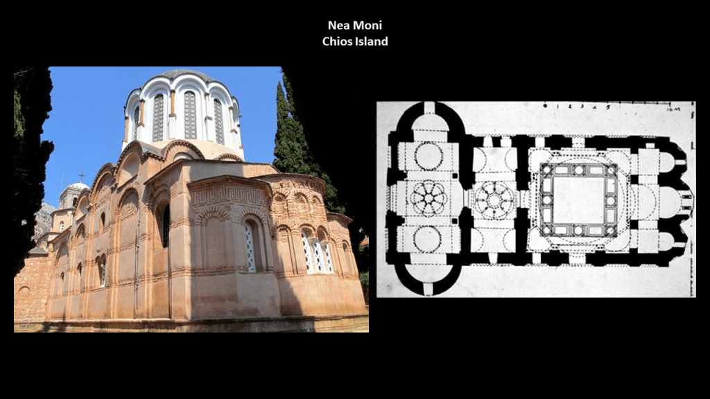
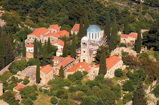
The alignment I have been tracking goes across the island of Chios in the North Aegean Sea. While it is separated only a relatively short distance from Turkey by the Chios Strait, it is part of Greece.
The Nea Moni Monastery on Chios was said to have been constructed during the reign of the Byzantine Emperor Constantine IX Monomachus, starting in 1042 AD, with the main building having been opened in 1049 AD…
…and the complex having been completed in 1055 AD, after Constantine’s death.
Nea Moni was designated as a UNESCO World Heritage Site in 1990, one of 18 in Greece.
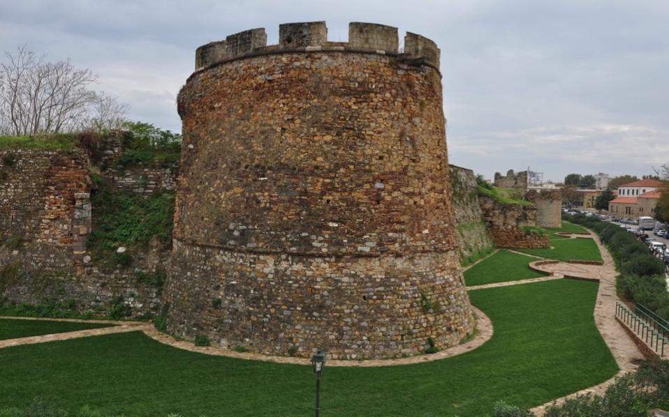
Chios is the main population center of the island, and apparently what is called the Chios Castle, called a medieval citadel said to have been built first by the Byzantines, and then finished by the Genoese…
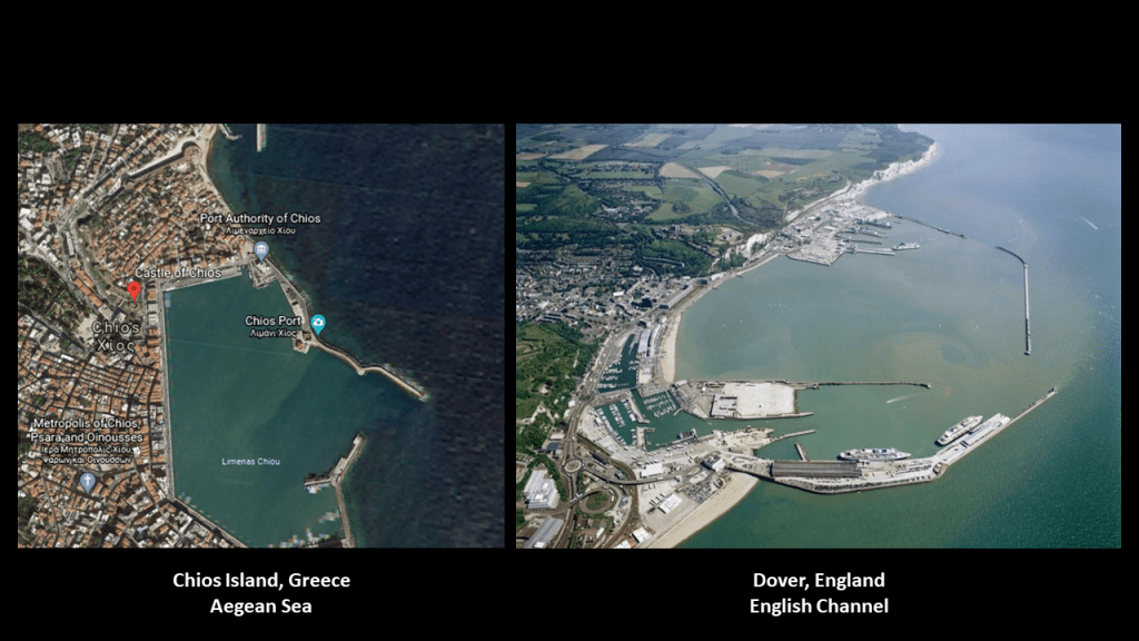
…next to what looks like an artificially made port facility at Chios, with its straight lines and angles, like we saw in an earlier example at Egidir in Turkey compared with other places in the world, like Dover on the English Channel on the right.
…and Chios appears to be one of the many shapes a star city takes, like what we just saw on the island of Crete.
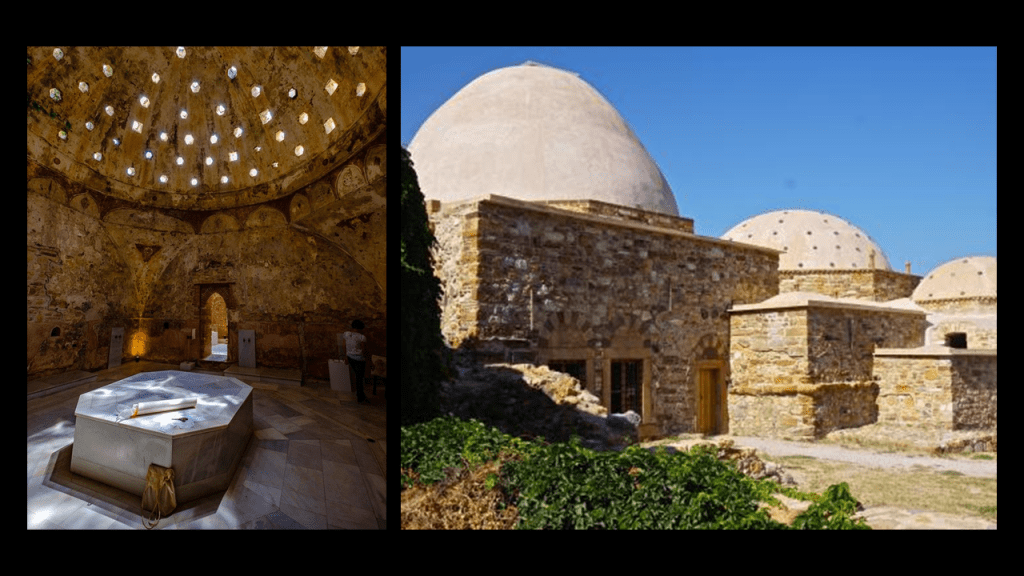
Not only that, there are Turkish, also known as Ottoman, baths at Chios Castle.
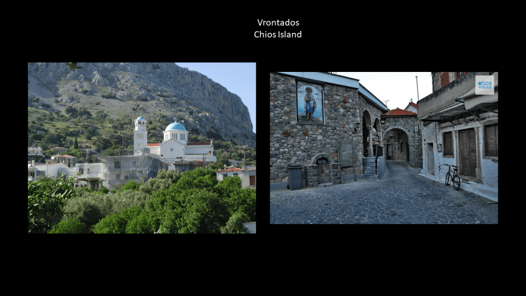
Just north of Chios Town is the town of Vrontados…
…which claims to be the birthplace of Homer, the blind poet of ancient Greece best known for the epic poems of the Iliad, about the Trojan War, and the Odyssey, about Odysseus’ ten-year voyage trying to get back home after the Fall of Troy.
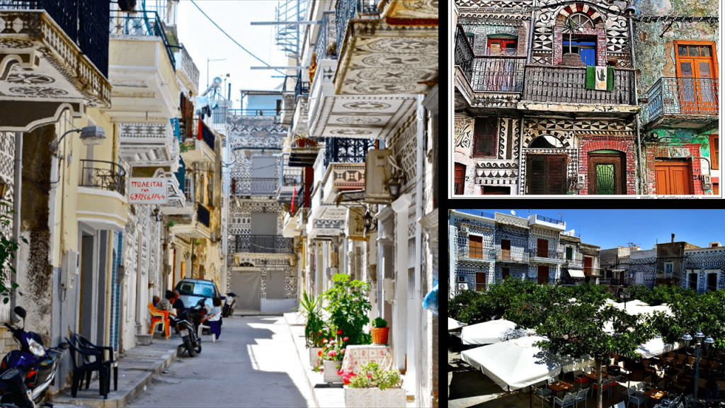
Pyrgi Village is south of Chios, known for the decoration of its houses…
…and as being the traditional seat of the Mastic Villages, where the residents engage in mastic agriculture, farming the resin of the mastic tree, used as a chewing gum, treatment for things like digestive problems, and for making a liqueur and oil.
As of 2018, there were twenty-four Mastic Villages on the island of Chios dedicated to the cultivation and production of mastic.
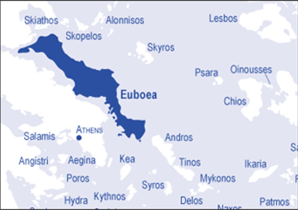
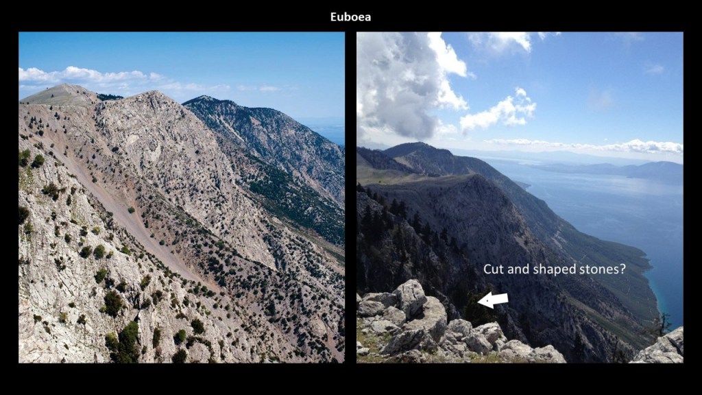
From the island of Chios, the alignment crosses the Aegean Sea to the island of Euboea, which is administered as part of Central Greece.
Euboea is the second-largest Greek island, after Crete, and separated from Boeotia in mainland Greece by the narrow Euripus Strait.
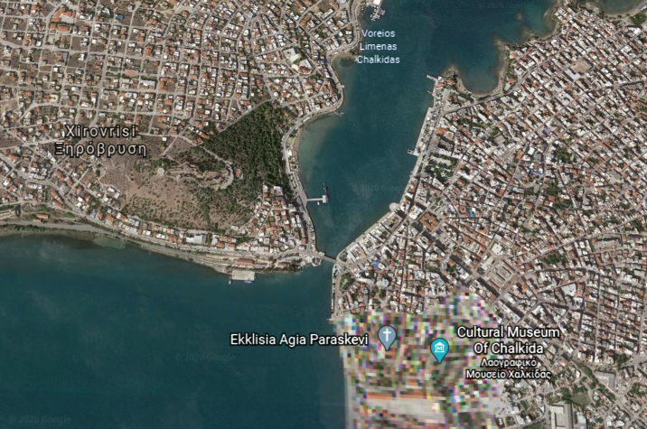
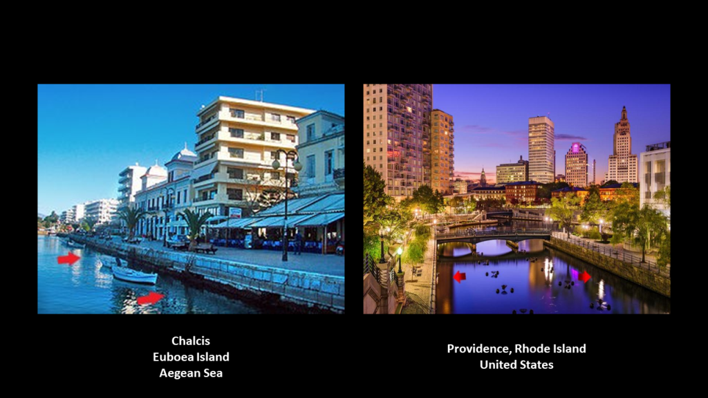
Euboea’s main city of Chalcis is situated around the narrowest point of the Euripus Strait.
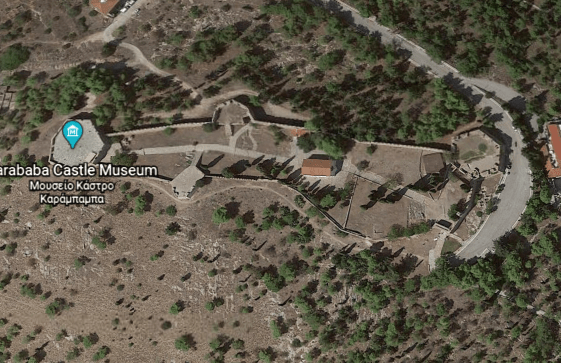
The Karababa Castle is situated on a hilltop right next to this narrow point, and said to have been built by the Ottoman Turks in 1684 to protect the city from Venetians.
And this is the waterfront of Chalcis, with its masonry banks on the left, compared with the masonry banks of the Providence River in Providence, Rhode Island, on the right.
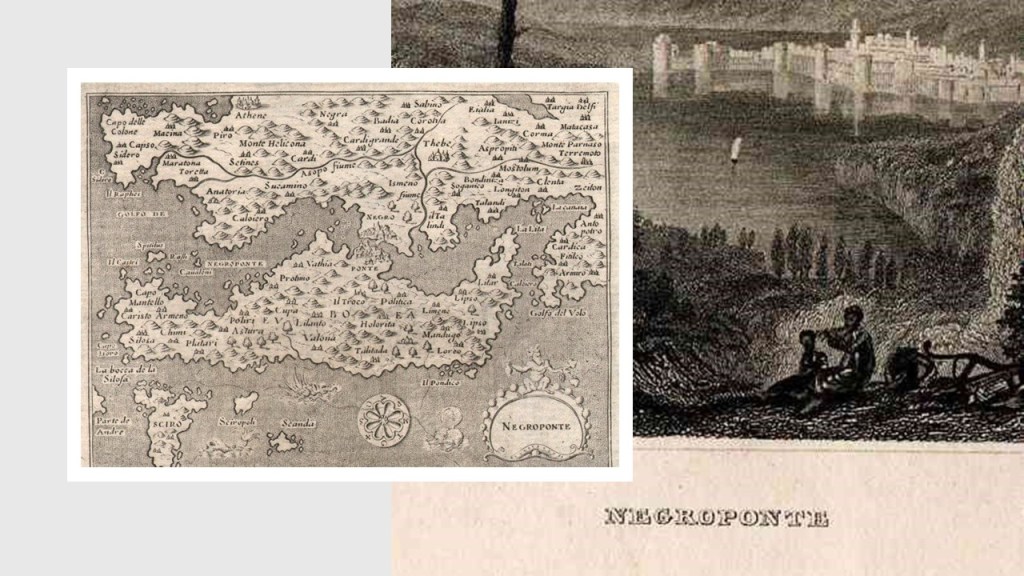
At one time, the island of Euboea was known by another name…Negroponte…
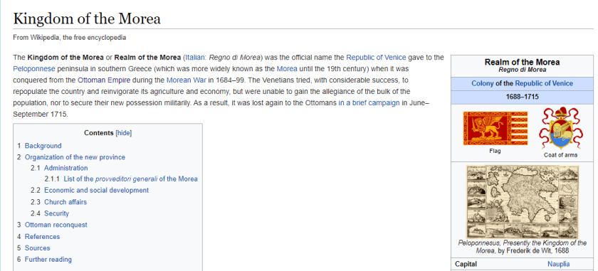
…and part of what was known as the Kingdom, or Realm, of the Morea.
The island of Euboea is long and narrow, with a mountain range, we are told, traversing the length of it.
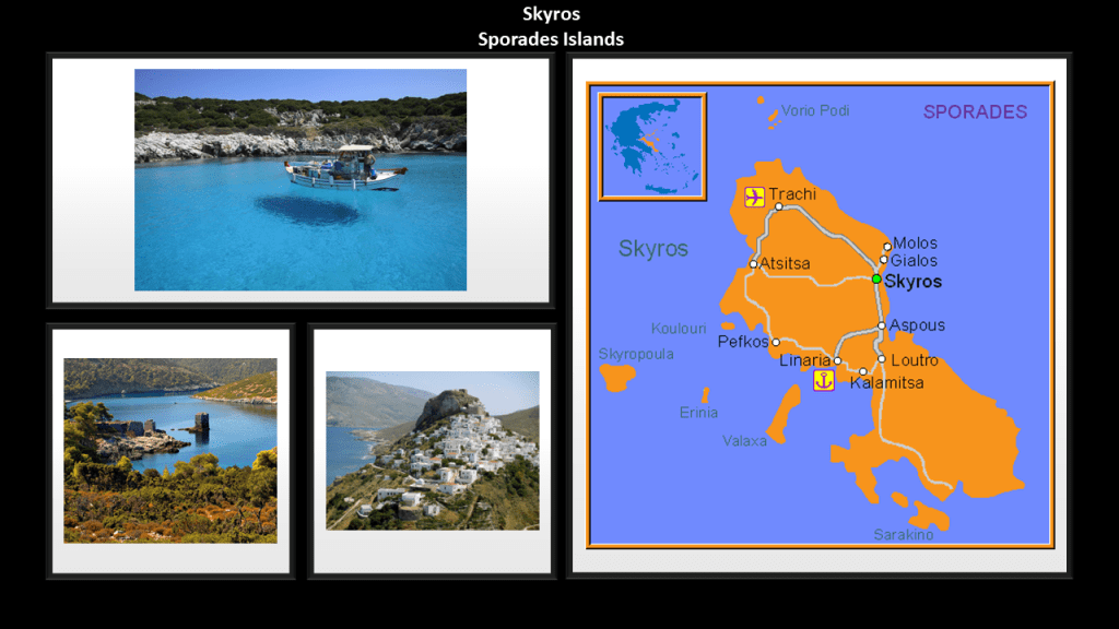
The island of Skyros is a regional unit of Euboea, and is the southernmost of the Sporades Islands.
Around 2,000 BC, we are told, Skyros was known as the Island of the Magnetes, identifying their homeland in Thessaly, in a part that is still known as Magnesia.
Well, that information caught my attention because awhile back I remembered reading something about Plato describing Magnesia in “The Republic” as an ideal city and society living in harmony.
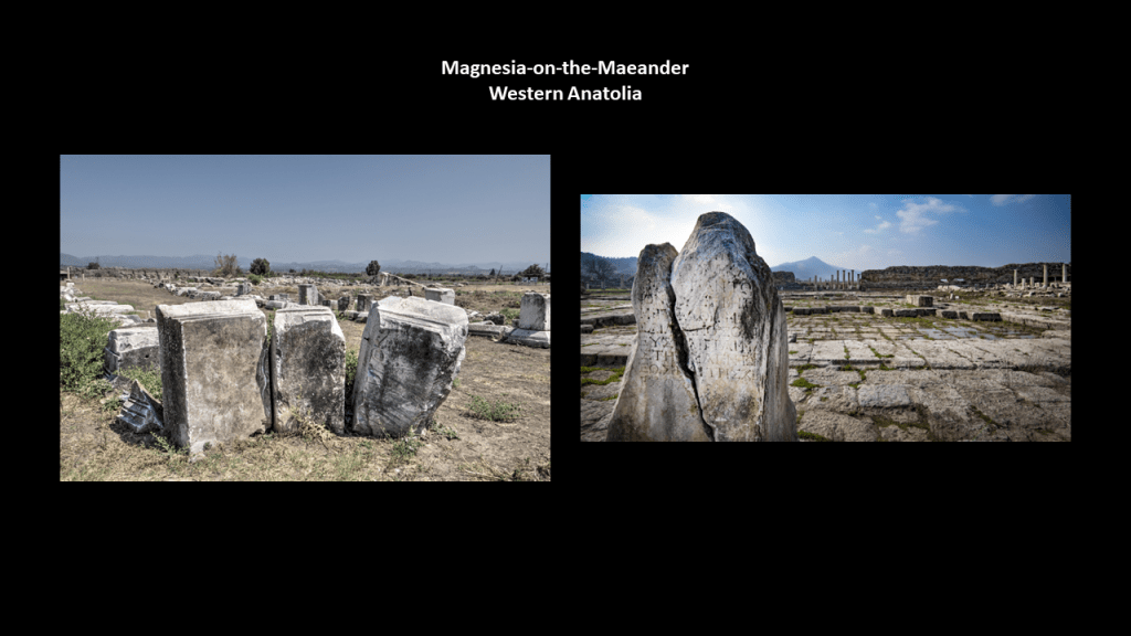
There were two prosperous cities in western Anatolia with the name of Magnesia. They were Magnesia-on-the-Maeander…
…and Magnesia ad Sipylum.
Given that I believe the original ancient advanced Moorish civilization lived in peace, balance, and harmony with each other and the heavens, I find that the information that Plato gives us that described Magnesia as an ideal society really resonates with me as actually having existed at one time, and wasn’t just a fictional, idealized society as we we have been taught to believe, and instead teaching us that the world was full of discord, division and war, and that Earth’s original history just somehow unfolded randomly all over the world.
I hope I have provided enough information in this post to show you why I believe that Humanity was very advanced and connected at one time, and have given you other possibilities to consider with regards to what our True History might have been, and how and why it has been hidden from us so we would never know anything about it.
I have been researching aspects of what I am presenting in this post for years, but this subject came about as an in-depth research topic for me through a viewer, Aaron, who sent me rock formations at locations in Appalachia he had identified to look at that looked like megaliths.
Megaliths were structures made of large stones by ancient cultures.
In other words, they are acknolwedged to have been constructed intentionally, and megaliths have been identified as such all over the Earth.
But not identified as megaliths, and man-made, in North America.
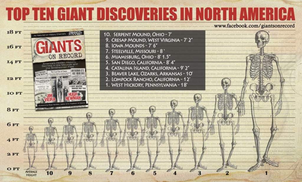
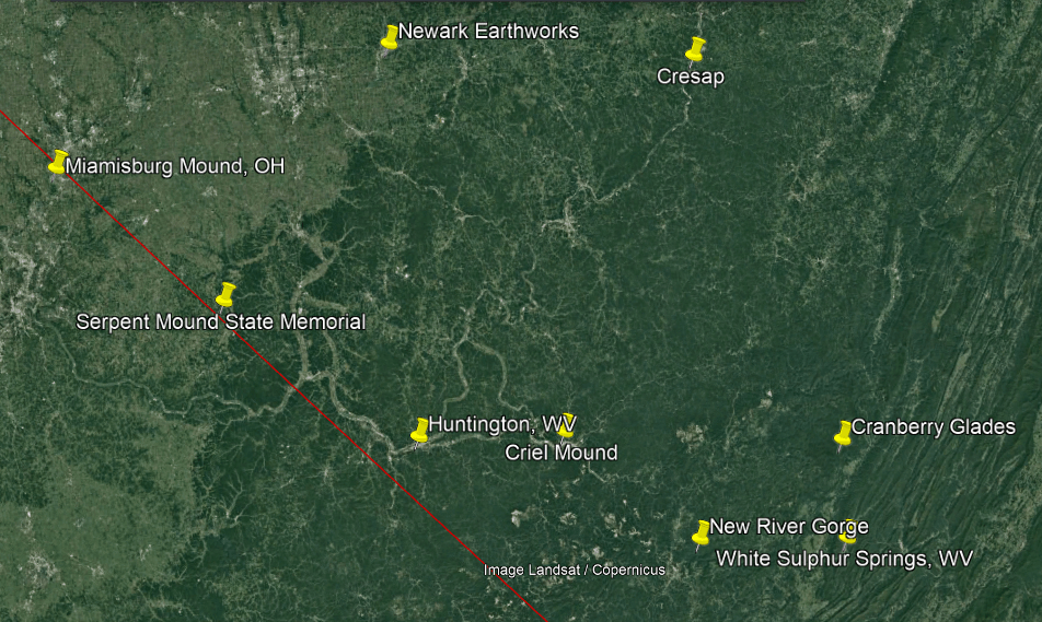
As soon as I started doing the research into the rock formations described as natural “rock cities” in State Parks in Pennsylvania and West Virginia, four main themes clearly unfolded and were interwoven in the research for my original post”On the Trail of Giants, in Appalachia and Beyond.”
I am bringing forward these four main themes separately for your consideration in this series.
This is the third-themed segment that is done, with the featured theme of “The Energy Grid.”
The last themed-segment will be on my findings related to evidence for “The Cataclysm” which connects directly to “The Energy Grid.”
The first two themed-segments were on “Robber Barons and Resetters” and “Giants.”
This particular post on “The Energy Grid” will be focusing on topics including, but not limited to, the consistent finding of a history of railroads running in parallel to S-shaped riverbends, also called “horseshoe” river bends, and other transportation infrastructure; findings on the integral role giant trees played on the Earth’s grid system; and how the infrastructure of this energy grid system has been reverse-engineered into a control system.
When I first started out doing the research for the original post, my plan for it was just to look at the places with megalithic-looking rock formations that Aaron had identified in Pennsylvania and West Virginia.
Well, that was my plan anyway.
And that was exactly how my research started-out.
And I kept seeing the same story repeating over and over again.
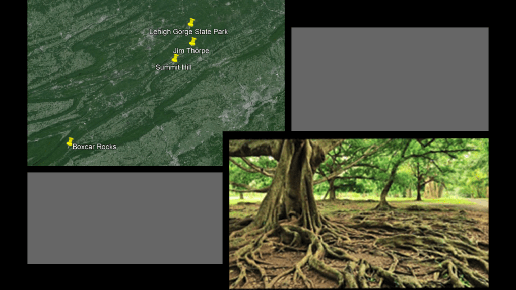
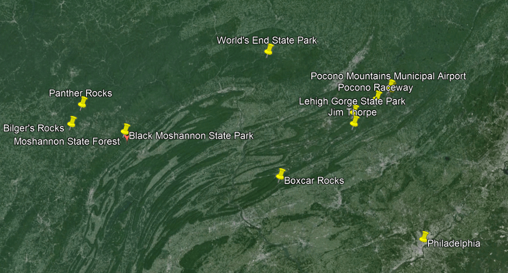
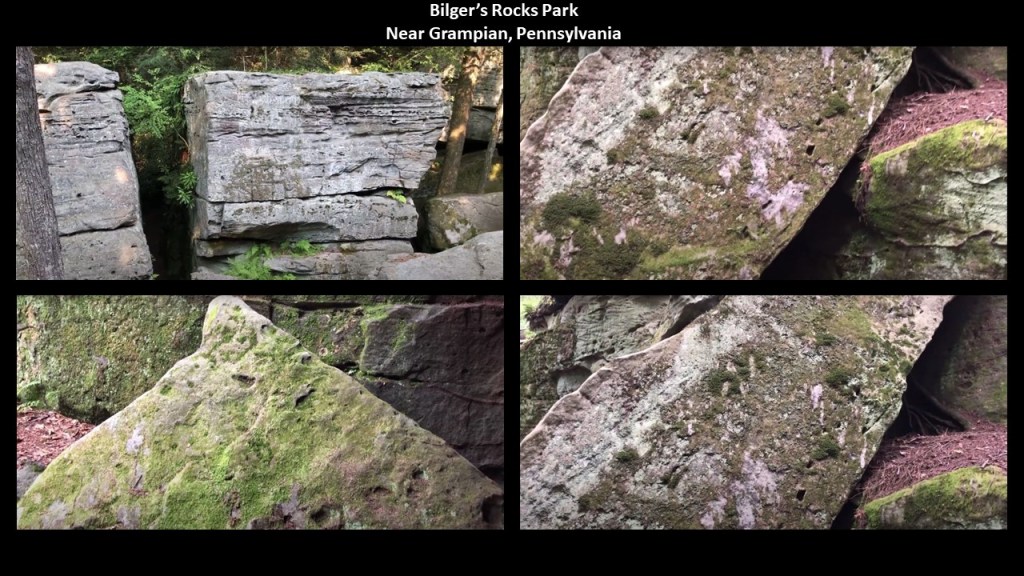
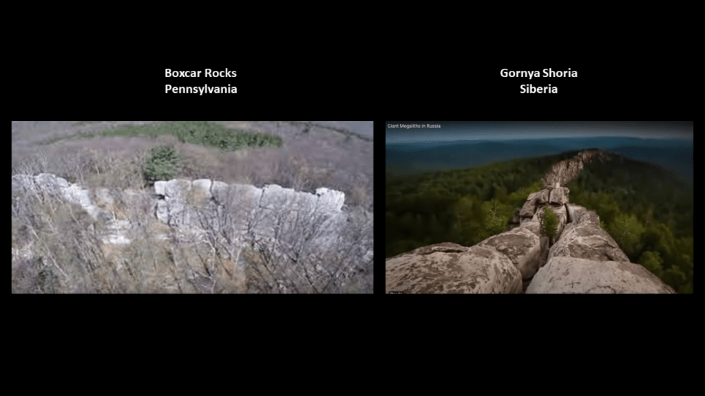
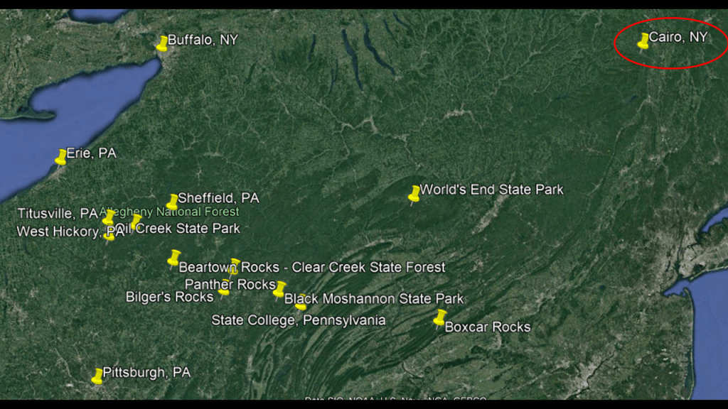
The first place I checked-out Boxcar Rocks on Gold Mine Road in Pennsylvania’s Lebanon County.
We are told that they are a natural geologic formation described as a long line of stacked boulders that were likely left over from melting glacial deposits during the last Ice Age.
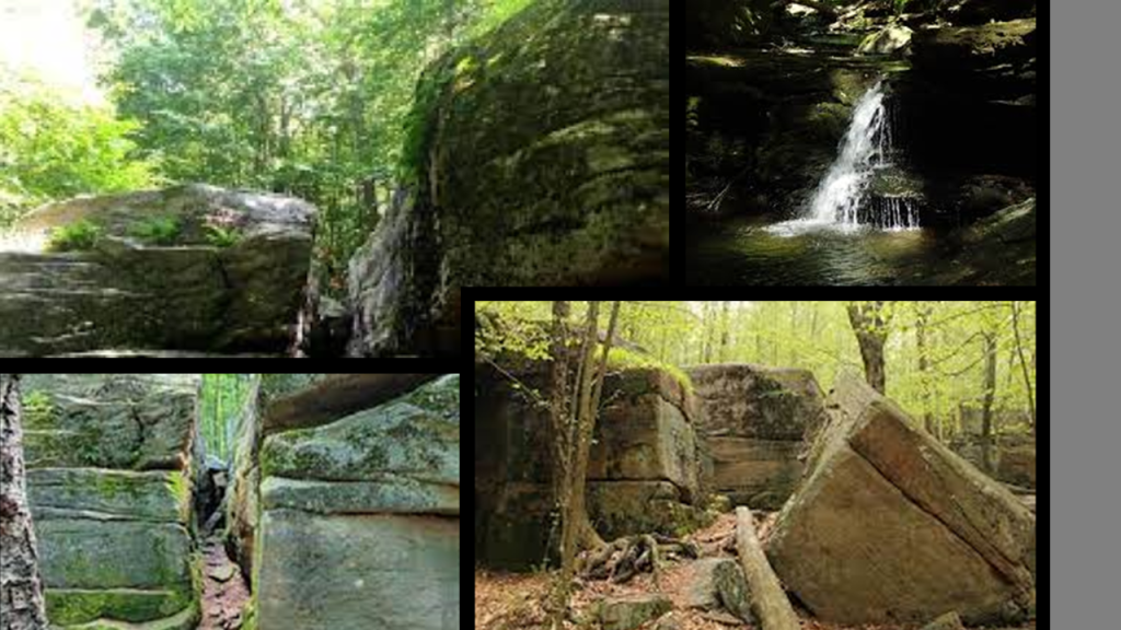
Yet here are images that Aaron sent me where the stone blocks of Boxcar Rocks look like they have been cut-and-shaped!
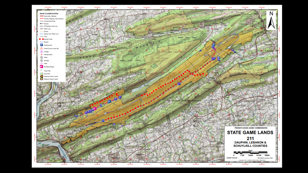
Boxcar Rocks are located on “Pennsylvania State Game Lands #211,” who manage the lands for the purposes of hunting, trapping, and fishing.
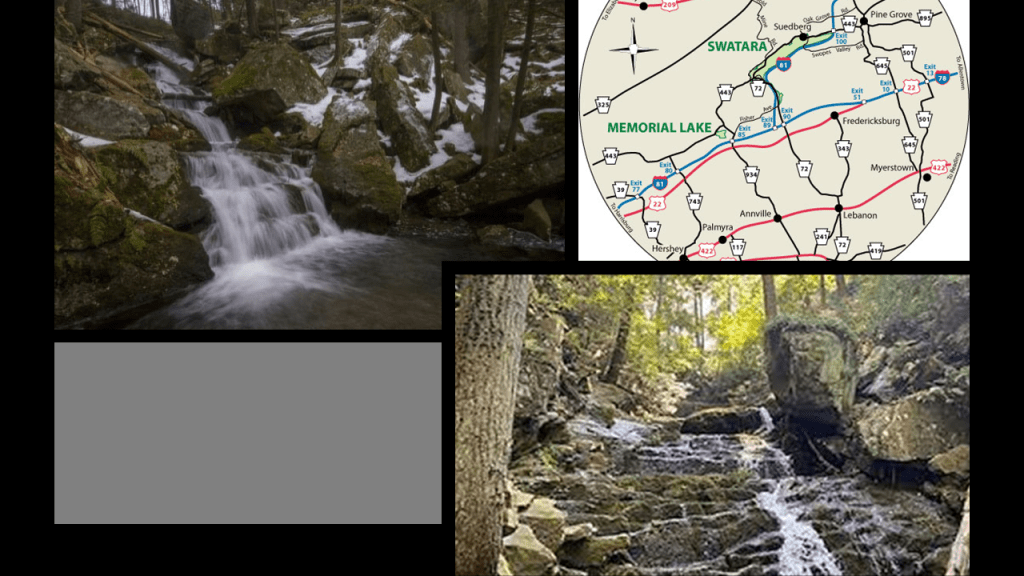
The Appalachian Trail runs through “Pennsylvania State Game Lands #211” in Swatara State Park…
…where we still find sections of the old Union Canal on the “Bear Hole Trail” of Swatara State Park.
This section of the Union Canal was said to have been closed after the dam holding the reservoir was washed away by a devastating flood in 1862.
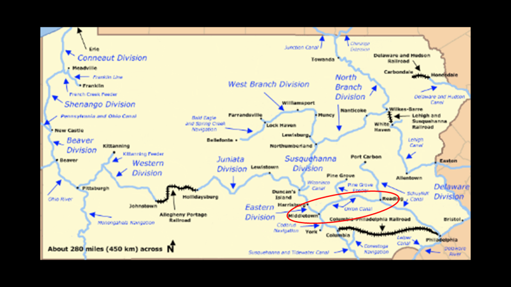
The Union Canal was said to have been built between 1792 and 1828, running from Middletown, Pennsylvania to Reading, Pennsylvania.
We are told it was closed to use in 1885 because it could not compete with the “efficiency of the railroad.”
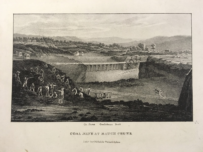
We are told in our historical narrative that the construction of the Union Canal started under the administration of President George Washington in 1792, and was touted as the “Golden Link” in providing an early transportation route for shipping anthracite coal and lumber to Philadelphia.
So early on in the narrative, there was a stated focus on the harvesting of resources such as coal and lumber, which is one of the many recurring themes in this post.
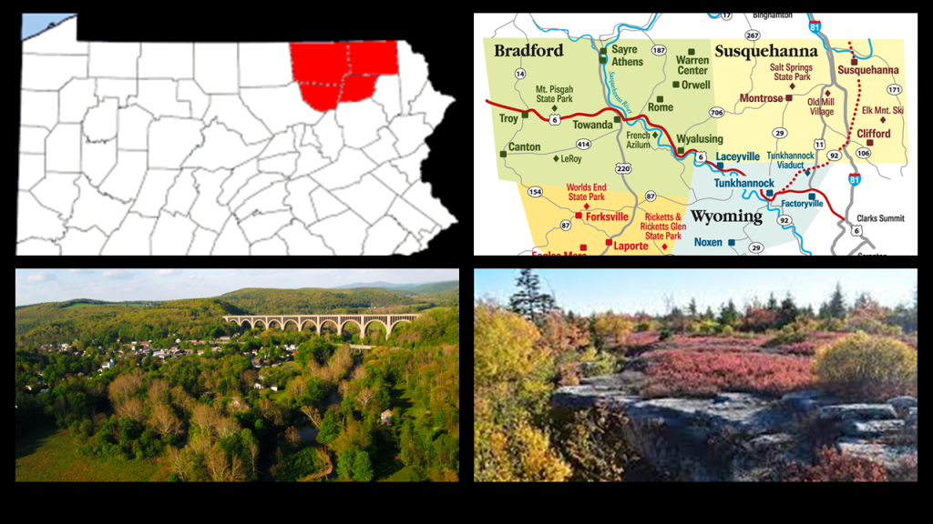
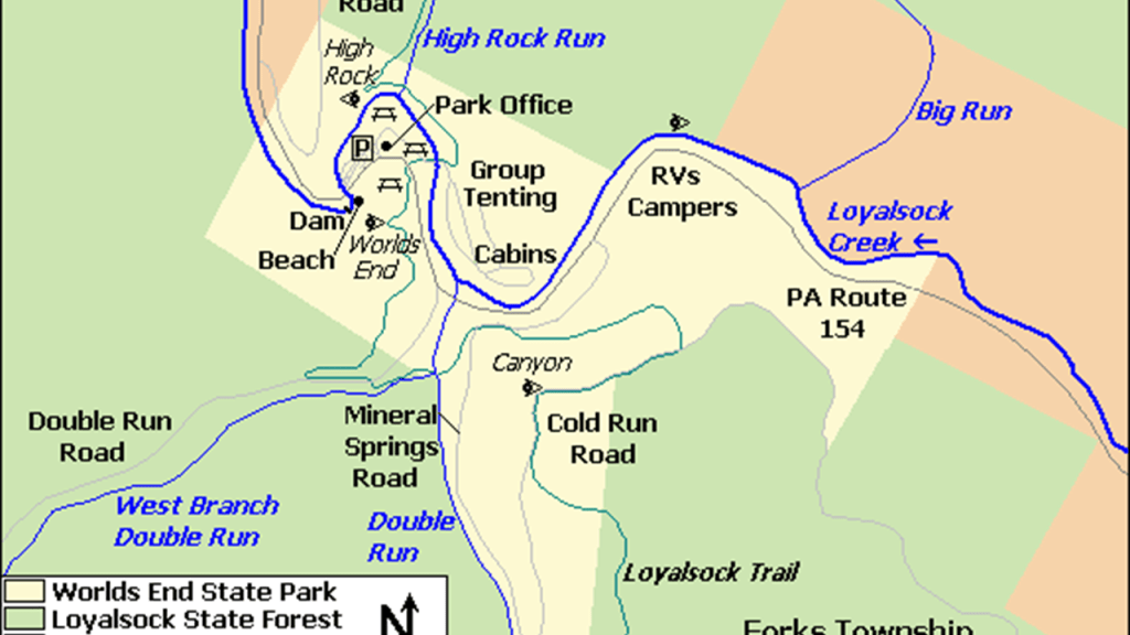
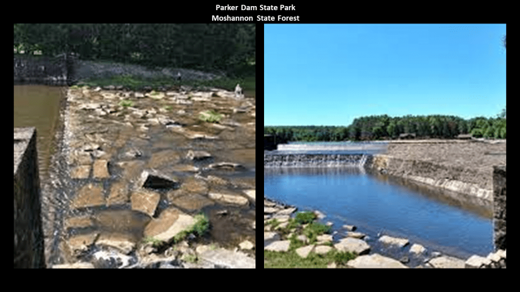
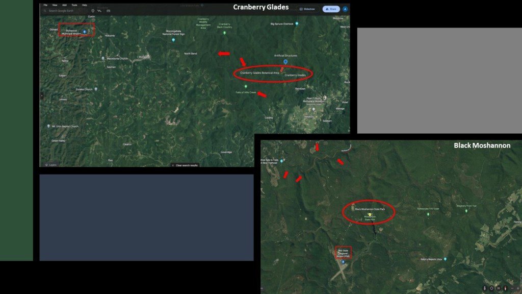
The very next place I looked at was the World’s End State Park in the Loyalsock State Forest.
World’s End State Park is in what is called the “Endless Mountains,” a region of northeastern Pennsylvania that are not considered true mountains, but a dissected plateau on the Allegheny Plateau.
We are told the “Endless Mountains” are comprised of sedimentary rocks of sandstone and shale that were part of a lowland that collected sediments from mountains to the southeast that eroded millions upon millions of years ago.
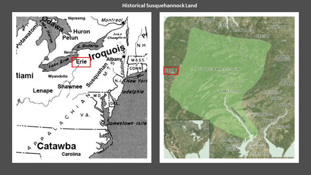
This region was historically inhabited by the Susquehannock, Iroquois, and Munsee-Lenape peoples.
Here are some photos from the “World’s End State Park,” with what appears to be shaped and cut, block-shaped stone-work.
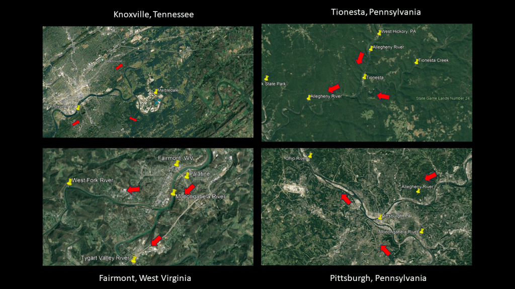
Before I move on to the other places I looked at for “On the Trail of Giants, in Appalachia and Beyond,” I would like to mention that I was already dialed in to the co-location of S-shaped river bends, railroads, canals, hydroelectric plants, gorges, and waterfalls, as all being part of the Earth’s original energy grid system.
I did extensive research on these findings as seen in a post I published on June 9th of 2023 titled “Of Railroads and Waterfalls and other Physical Infrastructure of the Earth’s Grid System.”
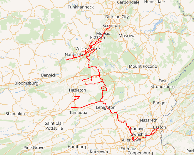
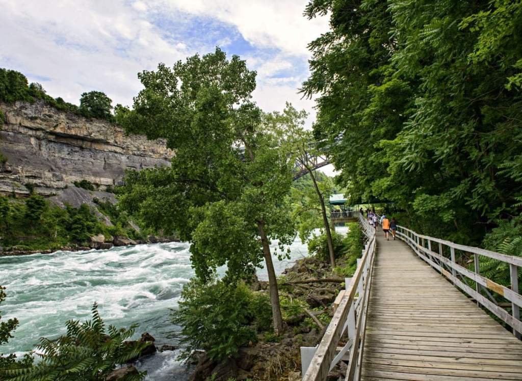
In this post, I looked closely at this same infrastructure found, past and present, along the Potomac River Maryland, Virginia, and West Virginia; along the Niagara Riverbetween New York and Ontario; the Tallulah River in North Georgia; the Tahquemon River in Upper Michigan; and the Sacramento River in Northern California.
How is this even possible according to the history we are taught?
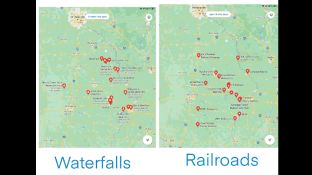
I also looked in-depth into this subject several years ago, when viewer JG connected with me about correlations she had found between railroads and waterfalls in Iowa.
She sent Google Maps showing the locations of railroads and state parks with waterfalls, and racetracks, as well as another set of maps with more key things like the locations of powerplants, mines and sports stadiums.
I focused this particular research on the correlations between railroads and waterfalls in Iowa that JG sent me as a grouping.
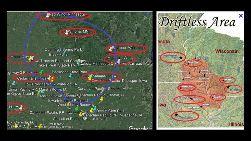
The places JG sent me turned out to be in the part of Iowa where Iowa, Minnesota, Wisconsin and Illinois meet, in a region called the “Driftless Area.”
This part of North America is called the “Driftless Area” because it was said to have been by-passed by the last glacier on the continent and we are told lacks glacial drift.
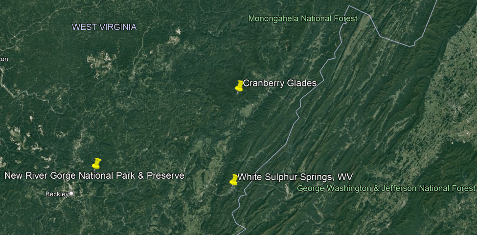
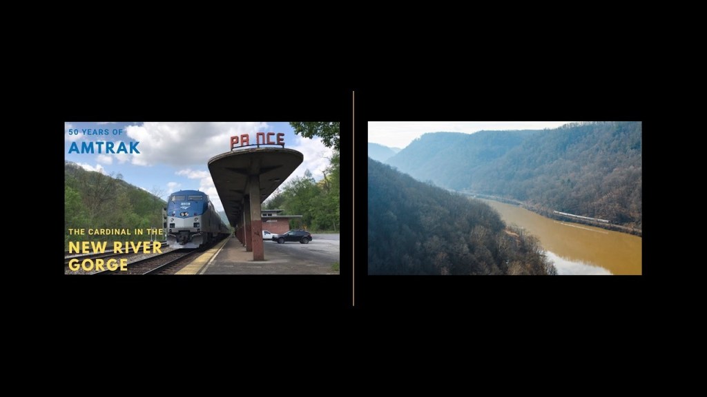
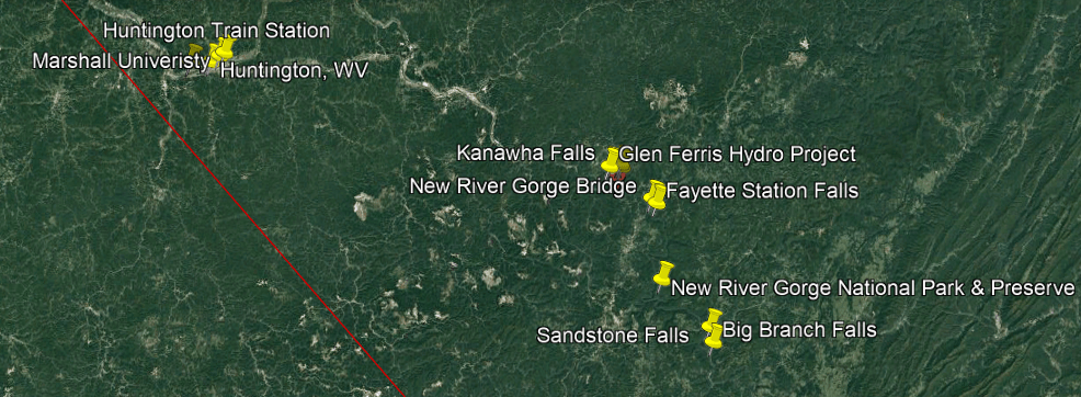
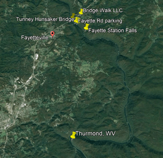
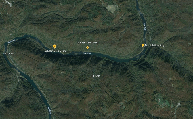
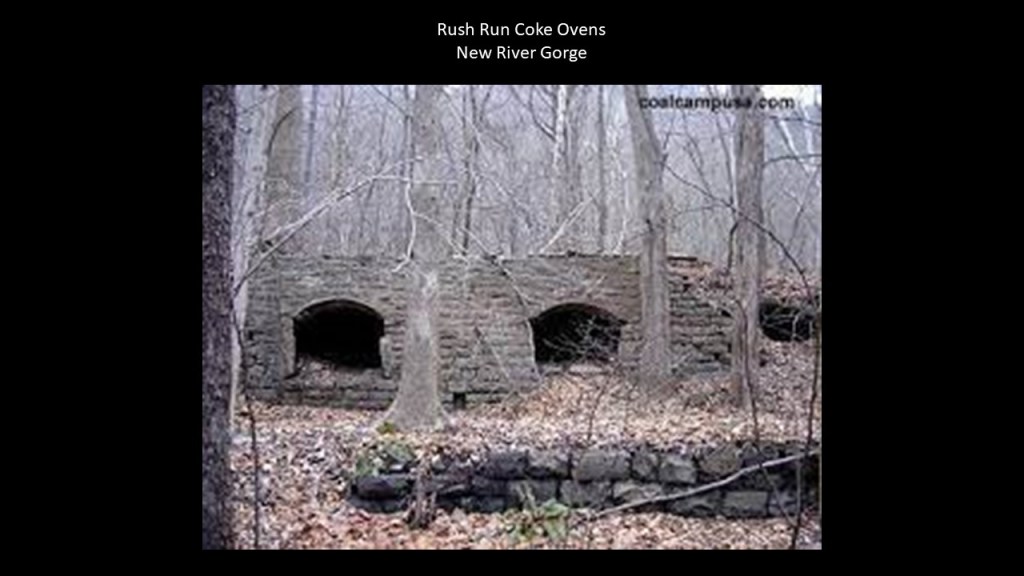
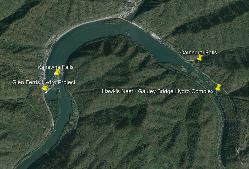
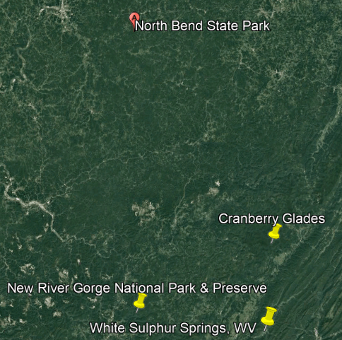
I also looked in-depth at the rail, river, waterfall, and hydroelectric power plants along the New River and New River Gorge for research that I did for “Trekking the Serpent Lei,” a major southeast to northwest ley-line identified by Peter Champoux.
I will be bringing up the New River Gorge in several capacities in this post, and the Serpent Lei went right through this region that I will be talking about throughout this post.
In “Trekking the Serpent Ley,” I started in the Bermuda Triangle and ended at Lake Itasca in Minnesota, the headwaters of the Mississippi River.
So, to return to the second place I looked at when I started to do this research for “On the Trail of Giants – in Appalachia and Beyond,” the World’s End State Park near Forksville in the Loyalsock State Forest, and is situated around the S-shaped bends of Loyalsock Creek, with Pennsylvania Route 154 running right beside it.
Pennsylvania State Route 154 meets Pennsylvania State Route 87 in Forksville.
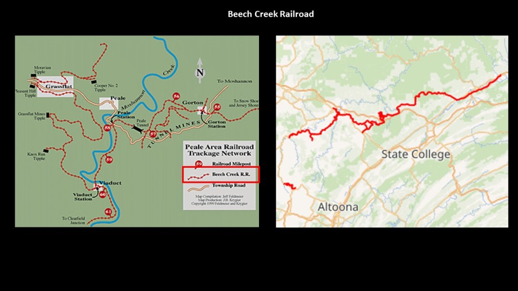
I looked for a railroad history through here along Loyalsock Creek.
Many more examples of what I am talking about with regards to past railroads and present-day highway routes to come.
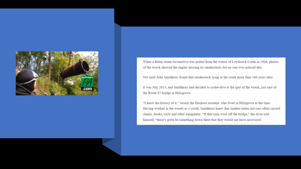
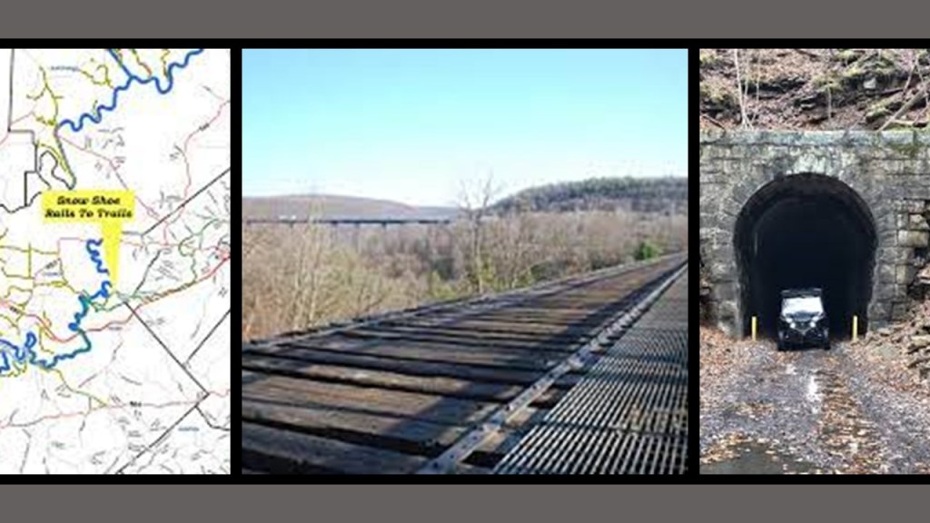
There’s not much available to find concerning this on the internet, however I was able to find this specifically concerning a railroad history on Loyalsock Creek.
A steam locomotive missing its smokestack was pulled from Loyalsock Creek in 1906 east of the Route 87 bridge in Hillsgrove, Pennsylvania, near Forksville.
Then in 2013, a local scuba diver familiar with the history found the missing smokestack.
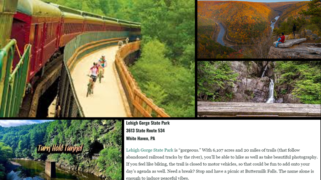
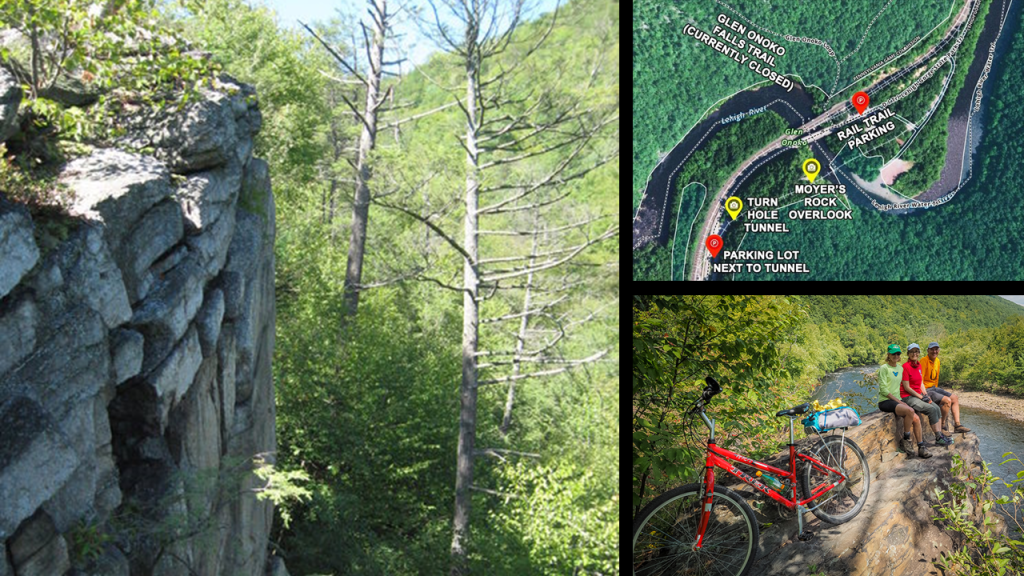
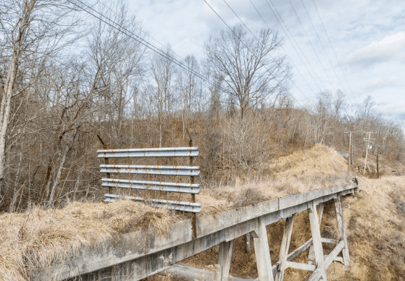
But in the process of trying to pinpoint information about a railroad history on Loyalsock Creek, I stumbled across the Lehigh Gorge, its abandoned railroad tracks that are now a recreational rail-trail, and its Scenic Railway, and another place I can add to my list of places I know of off the top of my head featuring the co-location of S-shaped river bends, railroads, canals, gorges, and waterfalls.
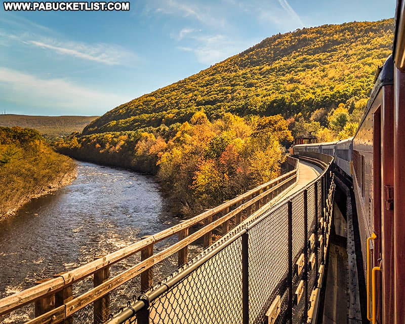
The Lehigh Gorge is described as a “steep-walled gorge carved by a river, thick vegetation, rock-outcroppings, and waterfalls characterize the state park.”
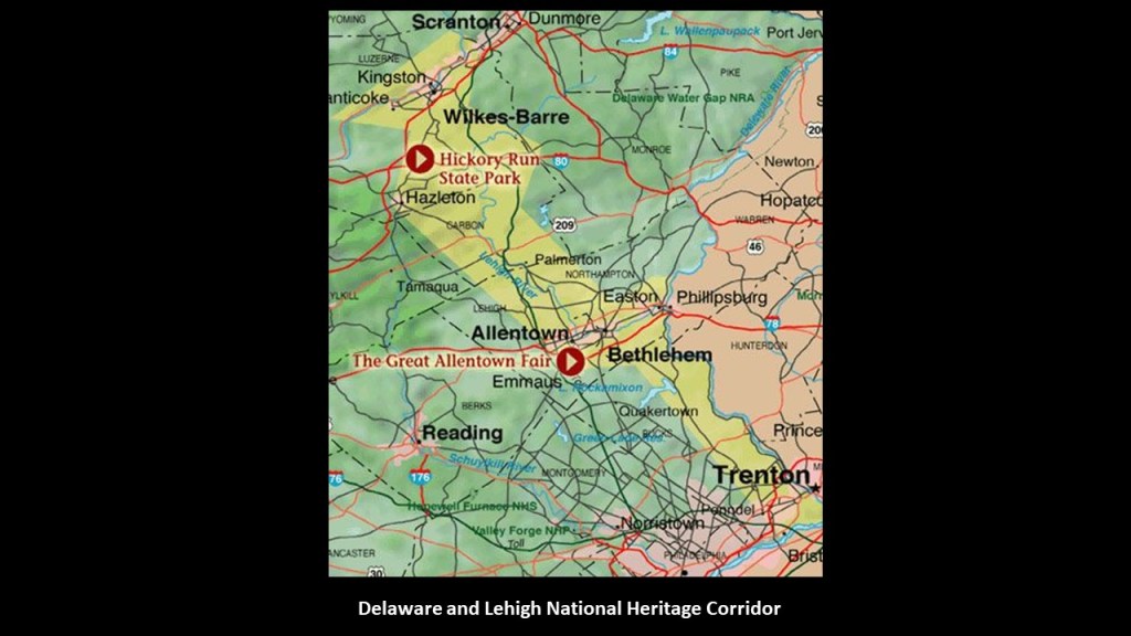
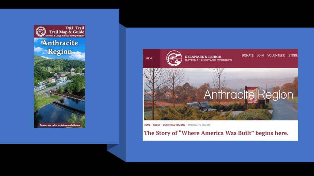
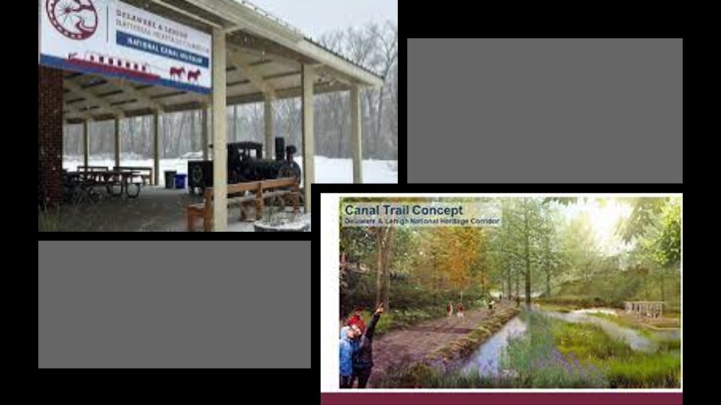
The Lehigh Gorge Trail follows more than 20-miles, or 32-kilometers of the Delaware and Lehigh Trail, part of the larger Delaware and Lehigh National Heritage Corridor, which is 165-miles, or 266-kilometers, -long.
The Lehigh Gorge Trail is on abandoned railroad grade beside the river.
This is what we are told about the Delaware and Lehigh National Heritage Corridor by the National Park Service.
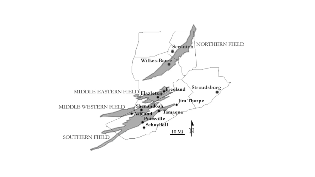
The Delaware and Lehigh National Heritage Corridor preserves the historic pathway that carried coal and iron from Wilkes-Barre to Philadelphia as a vital connection to nature, recreation and our nation’s industrial heritage, as well as having a more than $250-million per year economic impact for the region.
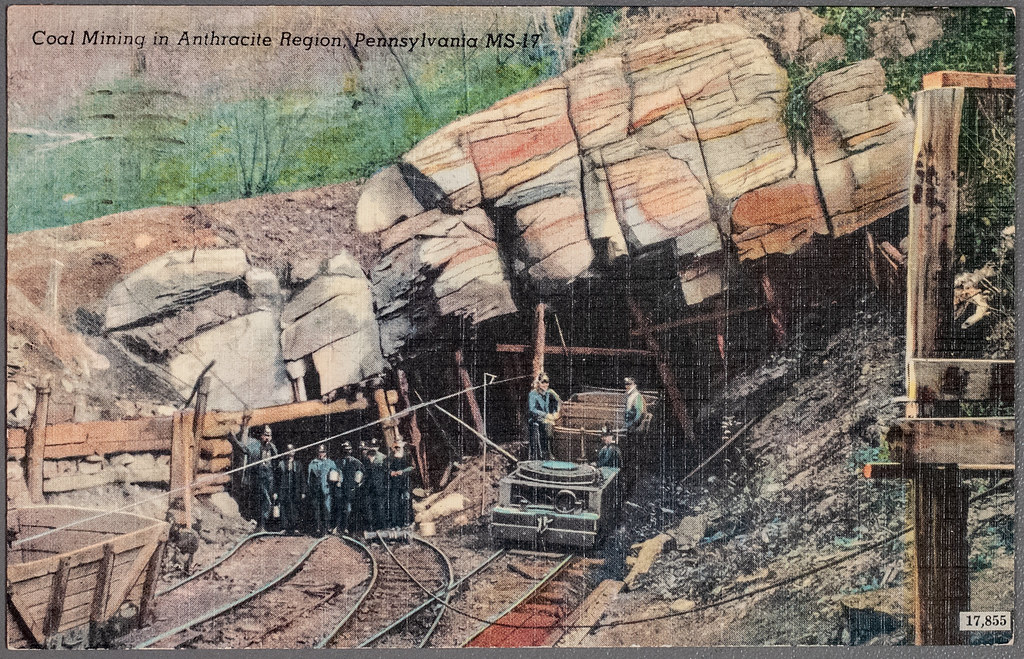
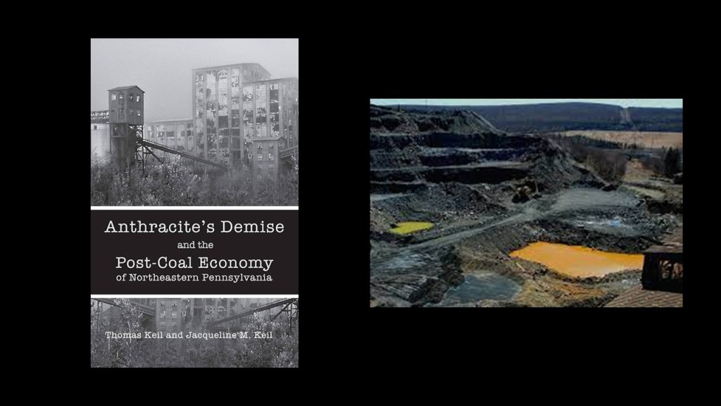
The Delaware and Lehigh National Heritage Corridor was also known as the “Anthracite Region” where the story of “where America was built” began.
What we are told about the Anthracite Region is this.
It was home at one time to major anthracite coal supplies and the mine-to-market process, with a legacy of intense mining, industrial development and rich mixture of ethnic cultures.
Anthracite coal was first mined in Wilkes-Barre in 1775, and we are told that its fueled urban development in the region, resulting in a string of towns, industries, mines, roads and rail-lines to the south.
It is interesting to note here that the Freiburg University of Mining and Technology, the oldest school of mining and metallurgy in the world, was established just 10-years prior to the beginning of anthracite coal-mining in Wilkes-Barre, having been established in 1765 by Francis Xavier of Saxony of the House of Wettin.
Its main purpose was the education of highly skilled miners and scientist in fields connected to mining and metallurgy.
Primarily through Queen Victoria and Prince Albert, first-cousins and members of the House of Saxe-Coburg and Gotha of the Ernestine branch of the House of Wettin, the original royal houses of Europe were completely replaced by this obscure German Ducal lineage.
Back to the Anthracite Region.
We are told that the demand for anthracite coal increased in the 1820s and 1830s as coal-power replaced water power, and with the growth of the iron industry in Pennsylvania.
Anthracite coal is the purest form of coal, and this region contains most of the world’s supply of anthracite coal, and found in alternating layers of rock said to have been folded into mountains and created by a geological process called “coalification.”
Today, this part of northeastern Pennsylvania is considered one of the largest concentrations of disturbed terrain in the world, with billions of tons of debris found in the landscape of abandoned strip mines and this region has among the highest poverty and unemployment rates in the United States with job loss from the descrease in coal mining and the outmigration of people because of it.
We are told the American Canal Age was between 1790 and 1855, and started in Pennsylvania, where the first legislation surveying canals was passed in 1762.
As mentioned previously, the construction of the Union Canal between Middletown and Reading and was said to have started under the administration of President George Washington in 1792, and completed in 1828, and was touted as the “Golden Link” in providing an early transportation route for shipping anthracite coal and lumber to Philadelphia.
The “Main Line of Public Works,” of which the Union Canal was a part of, was passed by the Pennsylvania Legislature in 1826, and funded various transportation systems, including canal, road, and railroad.
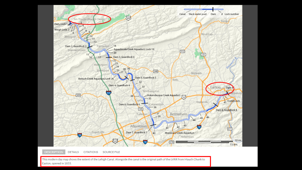
We are told the lower section of the Lehigh Canal was built between Easton, Pennsylvania and Mauch Chunk, now known as Jim Thorpe, Pennsylvania, with construction said to have been started in 1818, and completed in 1838.
This map also has a caption at the bottom that says this was the original Lehigh Valley Railroad line as well, which was said to have opened in 1855.
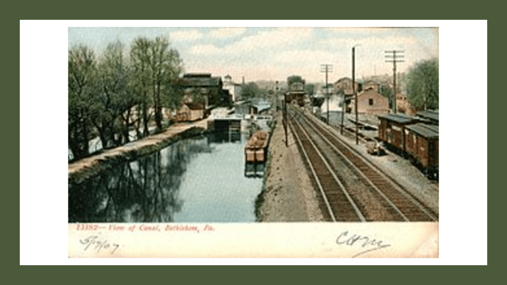
This is a view of the Lehigh Canal at it appeared at one time in our history in Bethlehem, Pennsylvania – located along this section in-between today’s Jim Thorpe and Easton.
The National Canal Museum in Easton is dedicated to telling the story of America’s historic towpath canals.
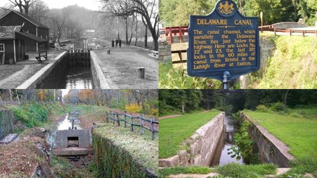
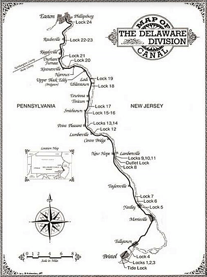
In Easton, the Lehigh Canal connected with the Pennsylvania Canal’s Delaware Division and the Morris Canal.
Also known as the Delaware Canal, the Pennsylvania Canal was said to have built the Delaware Canal to feed anthracite coal to Philadelphia in the years between 1828 and 1834.
It ran along the right bank of the Delaware River for 60-miles, or 97-kilometers, to Bristol, just north of Philadelphia.
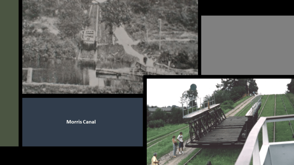
The Morris Canal was 107-miles, or 172-kilometers, -long and said to have been completed in 1832 to carry anthracite coal across northern New Jersey between where it connected to the Delaware Canal in Easton, to what is today Jersey City on the Hudson River.
It was closed in 1924.
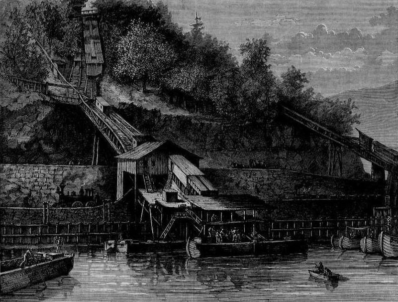
It was hailed as an ingenious, technological marvel for its use of water-driven, inclined planes.
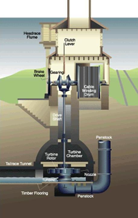
The builders of the Morris Canal used a sophisticated power house technology, pictured here, to power the water turbine that was set in motion to raise or lower cradled boats on the inclined planes by means of a cable.
You mean to tell me all of this extremely sophisticated and advanced canal-engineering technology was being implemented prior to the beginning of the Industrial Age, according to the history we are taught.
Seriously?
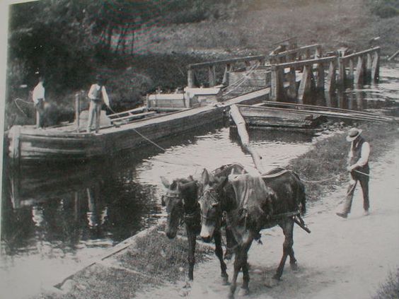
And, by the way, mules were still needed to be used to pull the canal boats in places on the Morris Canal in spite of all that sophisticated technology?
Food for thought about the difference between what we are told, and what does not hold up under scrutiny.
I would like to insert my belief at this point that there was a deliberately-caused cataclysm that sent directed energy through the free-energy-generated Earth-grids that devastated the surface of the Earth and destroyed the original ancient advanced Moorish civilization that built all of this infrastructure.
As I mentioned at the beginning of this post, I will be talking about this cataclysm and its aftermath in-depth in the fourth and final themed-segment of this series.
In short, I believe the beings behind the cataclysm were shovel-ready to dig enough of the original infrastructure out of the ruined Earth so they could be used and civilization restarted, which I think started in earnest in the mid-to-late 1700s and early 1800s.
They only used the pre-existing infrastructure until they found replacement fuel sources that could be monetized and controlled by them and when what remained of the original infrastructure was no longer useful to them, or inconvenient to their agenda, they had it destroyed, discontinued, or abandoned, typically in a very short time after it was said to have been constructed.
So the first original infrastructure we see coming on-line in the post-cataclysmic “New World” were the canals.
In the “Old World,” the power supply for the canals would have been the same free-energy generated by the Earth’s worldwide grid system, and in the “New World,” they had to use mule-power to be able to utilize the original canal system because that was all they had available for power.
Back to the Lehigh Gorge State Park.
The over 6,000-acres of land follow the Lehigh River from the Francis E. Walter Dam to the north to Jim Thorpe at the southern end of the park.
We are told that the Francis E. Walter Dam was constructed as an embankment dam by the U. S. Army Corps of Engineers in 1961 for flood control at the confluence of the Lehigh River and Bear Creek.
A reservoir ended up being created, which in turn became a popular recreational destination.
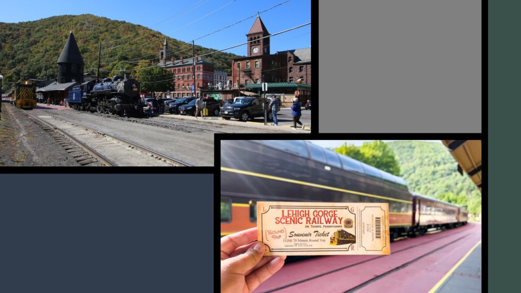
What remains of the original Lehigh Valley Railroad operations run today as the Lehigh Gorge Scenic Railway.
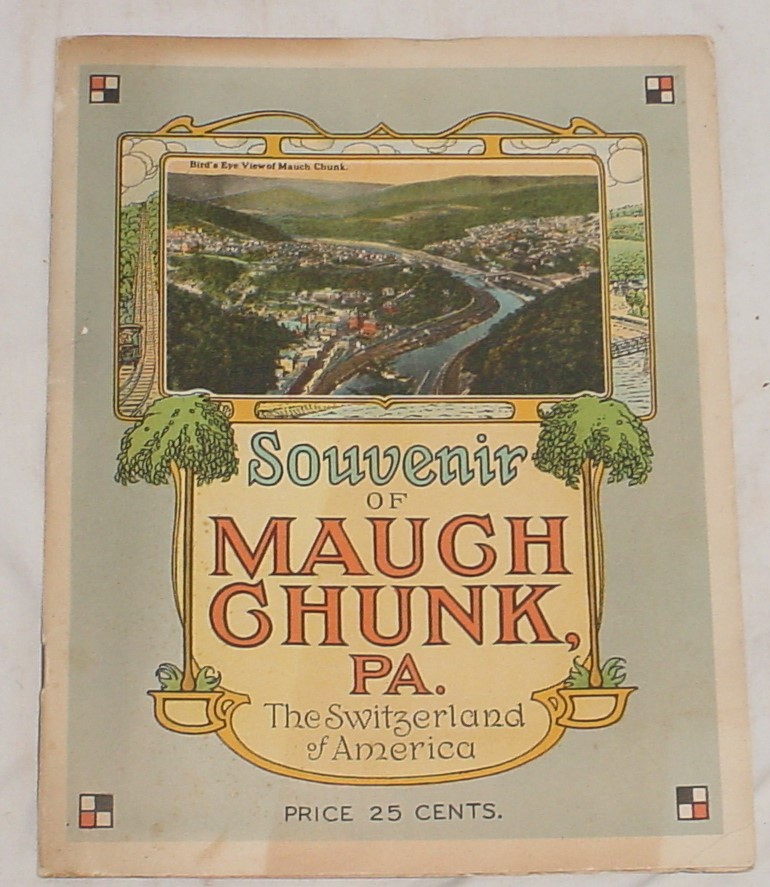
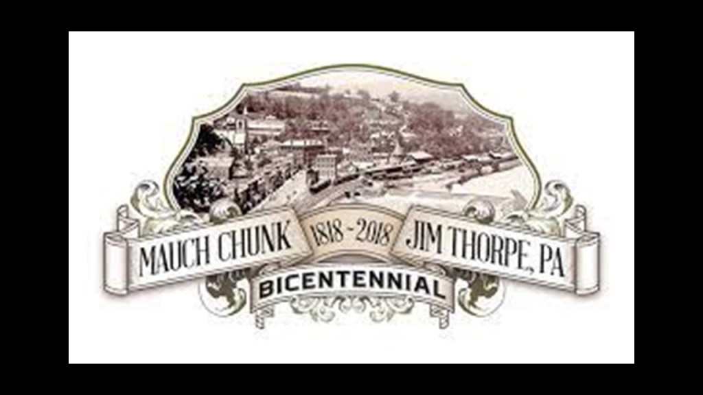
The excursion through the Lehigh Gorge begins in Jim Thorpe, Pennsylvania, formerly known as Mauch Chunk, at the southern end of the state park.
Mauch Chunk was nicknamed “The Switzerland of America” for its steep hillsides, narrow streets, and terraced gardens.
Renamed Jim Thorpe in 1954 for the Native American sports’ legend who was buried here, it was founded as a company town in 1818 by Josiah White and his partners who were also founders of the Lehigh Coal and Navigation Company.
The Lehigh Coal and Navigation Company was a mining and transportation company that was headquartered in Mauch Chunk.
It operated from 1818 until it was dissolved in 1964 and was known for having an early and influential role in the American Industrial Revolution.
The Lehigh Coal and Navigation Company was considered to be the first vertically-integrated company in the United States.
Vertical integration is where the supply chain of a company is owned by the company.
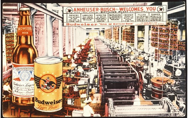
Other examples of the adoption of the business practice of “vertical integration” off the top of my head was by Adolphus Busch as head of Anheuser-Busch Brewing Association.
Busch adopted vertical integration as a business practice, in which he bought all the components of his business, from bottling factories to ice-manufacturing plants to buying the rights from Rudolf Diesel to manufacture all diesel engines in America.
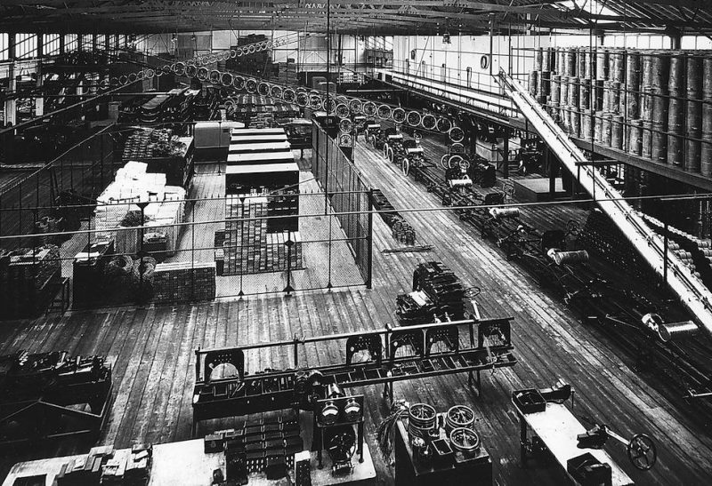
This illustration was of the Bevo Bottling Facility in St. Louis.
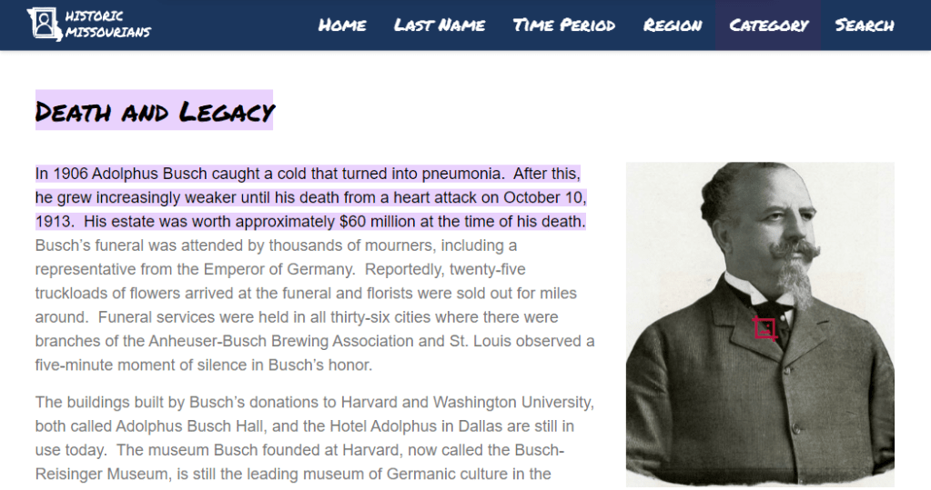
Adolphus Busch died in 1913, with a net worth $60 million in US dollars at the time of his death.
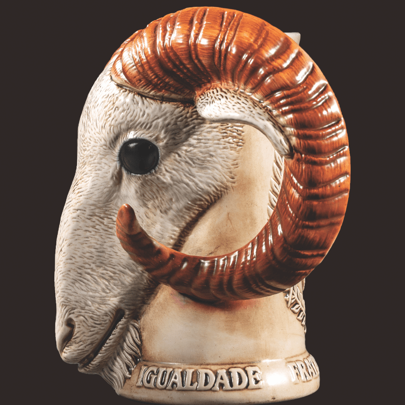
I couldn’t find any information showing that Adolphus Busch was a Freemason, but I did find this mug that was made in 1994 by Anheuser-Busch for the Freemasons of Rio Negrinho in Brazil, featuring a life-like goat-head, and the Brazilian words for “Liberty, Equality, and Fraternity” in the base.
Henry Ford also utilized the practice of “vertical integration” in the Ford Motor Company.
The introduction and refinement of the assembly line facilitated the mass production of new cars, which in turn made the purchase of a new car affordable for most people.
As we go through all the information that will be presented in this post, we will see why this was yet another replacement technology for the original transportation system, which was powered by free energy.
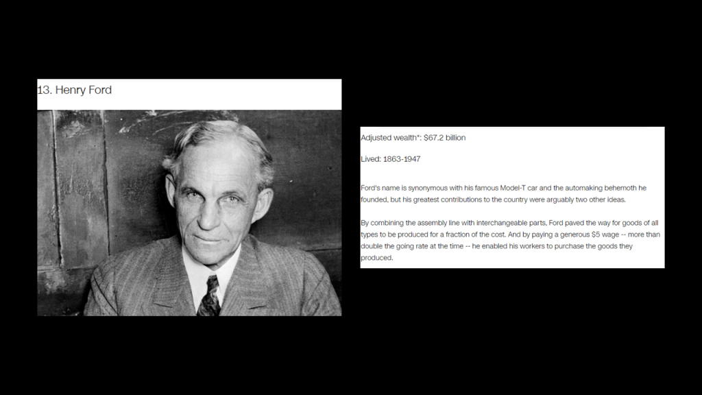
Henry Ford was also the 13th-wealthiest American of all-time according to CNN Business, with an adjusted wealth of $67.2-billion.
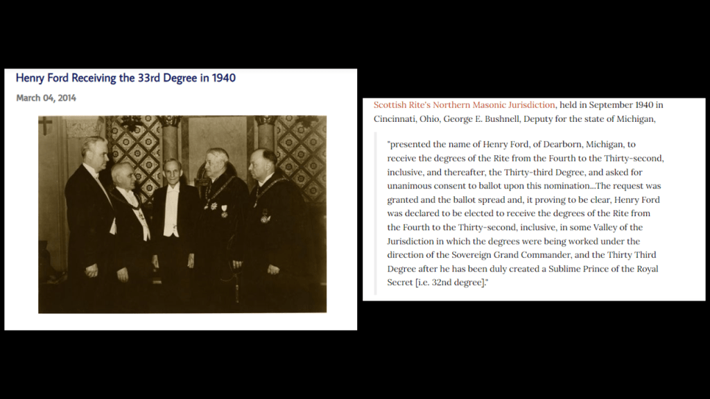
Henry Ford was also an acknowledged 33rd-degree Freemason…
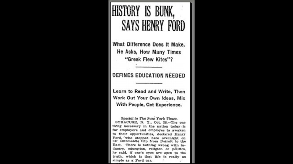
…and famous for saying “History is bunk.”
Though fact-checkers are denying that he could have meant the definition of “bunk” meaning “trash, junk, or lies.”
Back to the Lehigh Coal and Navigation Company and Mauch Chunk.
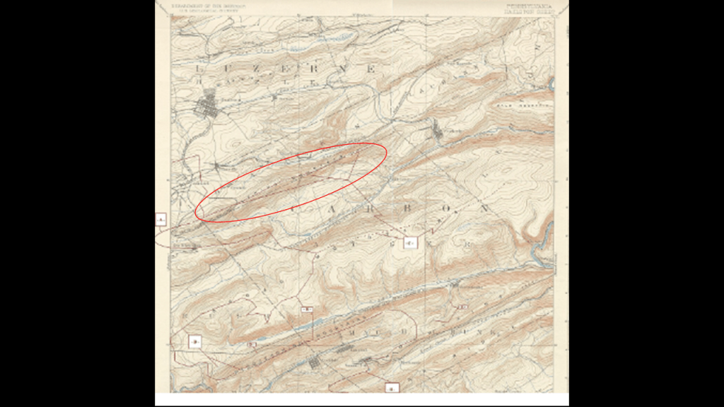
It had its beginnings as the Lehigh Coal Mine Company in 1792, after, we are told, a hunter named Philip Ginter discovered anthracite coal on Pisgah Mountain near Summit Hill, near the border between Luzern and Carbon Counties.
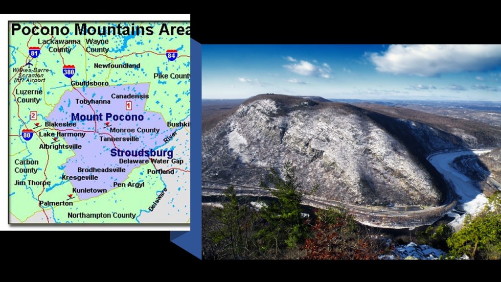
This part of the Appalachian Mountains in northeastern Pennsylvania is a subregion called the Pocono Mountains.
Though they are described very similarly to the nearby “Endless Mountains” of northeastern Pennsylvania, as a “dissected plateau of the Allegheny Plateau,” geographically, the Poconos are designated separately from the “Endless Mountains.”
“Pocono” is said to mean “Crack between two hills” in the language of the original Munsee Lenape people of the region.
I am taking time on this subject right now because this will be recurring subject throughout this post, but I want to show you a comparison of the ridge-like appearance of this region around Jim Thorpe and Summit Hill near where the anthracite coal was found here on Pisgah Mountain in 1792 on the top left, with the ridge-like appearance of the root system of a large tree on the bottom right.
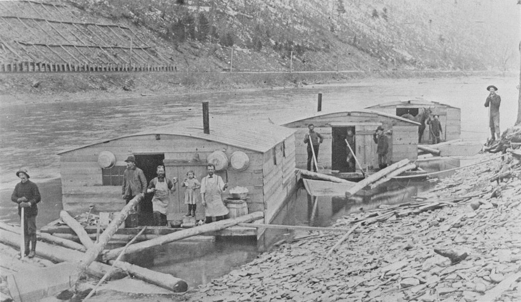
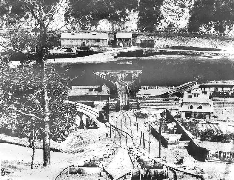
The Lehigh Coal Mine Company was incorporated in 1793 and acquired 10,000- acres, or 4,000-hectares, in and around the Panther Creek Valley and Pisgah Mountain, in order to bring anthracite coal from the large deposits on Pisgah Mountain to Philadelphia via mule-trains and coal arks, or one-time single use boats, on the Lehigh and Delaware Rivers.
We are told that while the original Lehigh Coal Mine Company was able to sell all the coal it could to the available market, it lost a lot of coal to the rough waters of the unimproved Lehigh River, so they sold the original company to Josiah White and his partners in 1818.
In a nutshell, this is what we are told.
In the same year, in 1818, the new owners of the Lehigh Coal Mine Company, began the construction of the Lehigh Canal, and that it became usable in 1820.
The Lehigh Canal enabled the transport of anthracite coal, a primary energy source at the time, to the primary markets in the northeastern United States, and, we are told, inspired the development and connection of other regional canals.
The new owners of the Lehigh Coal Mine Company were said to have been behind of the construction of the Lehigh and Susquehanna Railroad between 1839 and 1841…
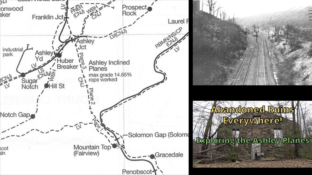
…the Ashley Planes, an historic freight-cable railroad between Ashley and Mountain Top said to have been built between 1837 and 1838 to transport millions of tons of anthracite coal over the Wilkes-Barre Mountain…
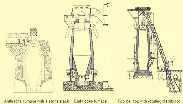
…. and brought in blast furnace technology to the Lehigh Valley, a type of metallurgical furnace used for smelting to produce industrial metals.
Smelting is defined as a process by which metal is obtained, either as a single element or compound.
In 1822, the company became the Lehigh Coal and Navigation Company, after which they built the Mauch Chunk and Summit Hill Railroad.
The Mauch Chunk and Summit Hill Railroad, also known as the Mauch Chunk Switchback Railway, was said to have been built in 1827 and operated until 1932.
It was said to be the second permanent railway constructed in the United States, and used to transport coal down Summit Hill to the Lehigh Canal.
Some of the architecture of today’s Jim Thorpe include:
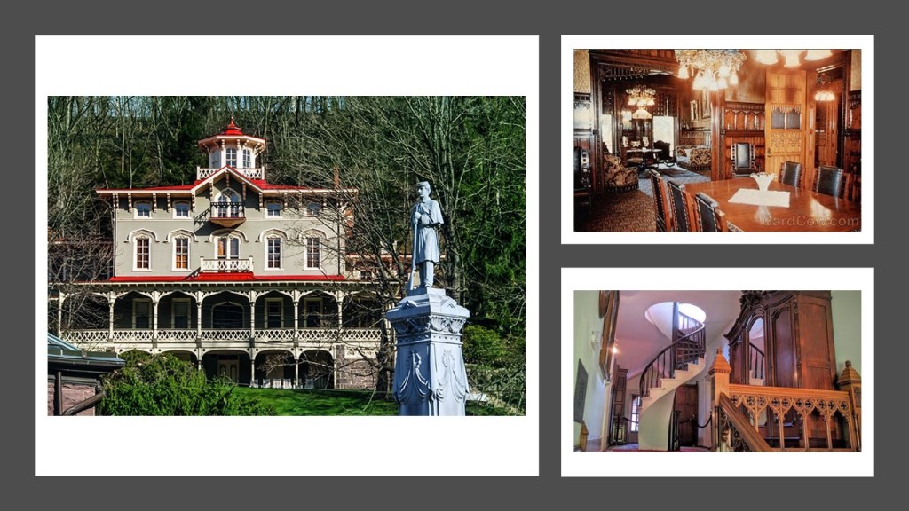
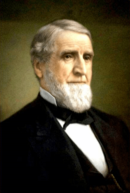
The Asa Packer Mansion was said to have been completed in 1861, which would have been the first year of the American Civil War.
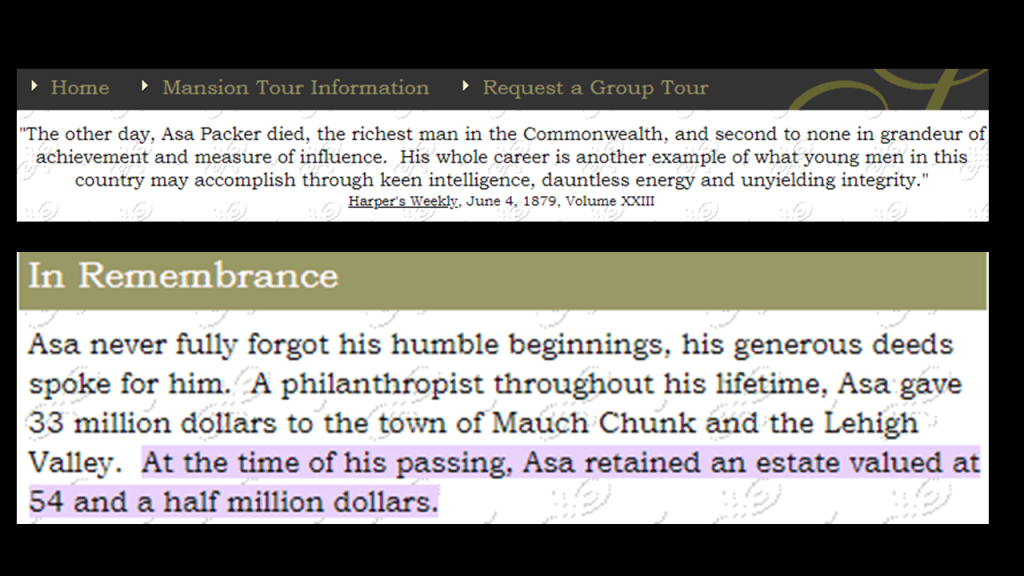
Asa Packer was, among other things, a coal and railroad magnate, philanthropist…
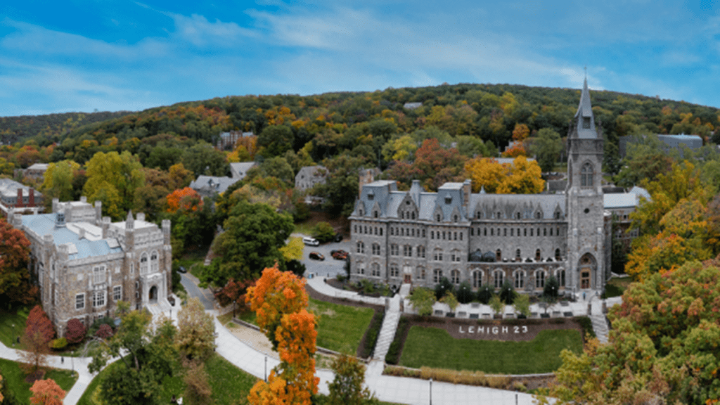
…and founder of Lehigh University in nearby Bethlehem, Pennsylvania, which was founded in 1865, the last year of the American Civil War.
At the time of his death, the value of Asa Packer’s estate was $54.5-million, and he was considered to be the richest man in the Commonwealth of Pennsylvania at that time.
And Asa Packer was a Freemason too.
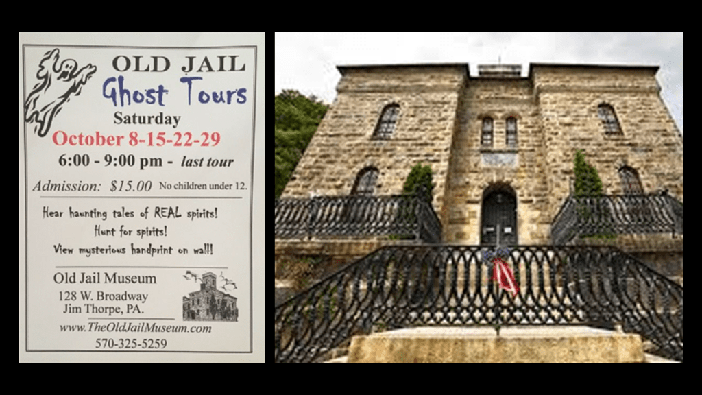
Another place I want to show you in Jim Thorpe was the Old Jail, in which seasonal tours are offered, including the ghostly kind, as it is considered one of the most haunted places in Pennsylvania.
It was said to have been built between 1869 and 1870 and in use as a jail until 1995.
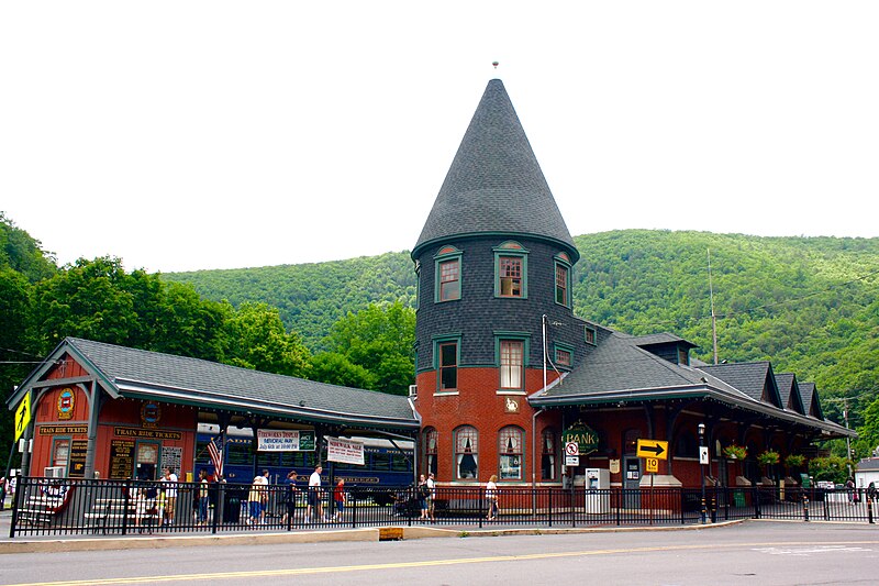
Mauch Chunk/Jim Thorpe was a key location on the Central Railroad of New Jersey in the shipping of anthracite coal.
The Central Railroad of New Jersey was said to have built the Mauch Chunk Station in 1888 in the Queen Anne Victorian Architectural-style.
Today it is owned and operated by the Lehigh Gorge Scenic Railroad.
This is what we are told about the Central Railroad of New Jersey.
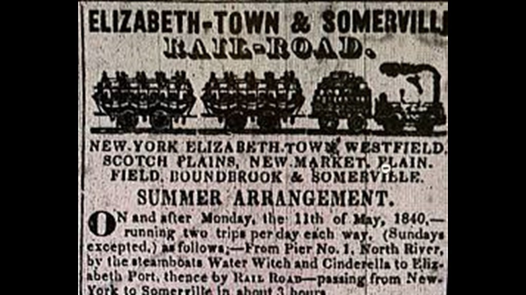
The origins of the Central Railroad of New Jersey began in 1831 with the incorporation of the Elizabeth and Somerville Railroad, and which was operational by 1842.
In 1847, the Somerville and Easton Railroad was incorporated, purchased the Elizabeth and Somerville, and the name was changed to the Central Railroad Company of New Jersey.
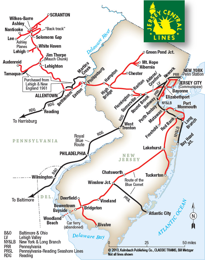
By 1852, the line reached Phillipsburg, New Jersey, on the Delaware River and was extended across Newark Bay to Jersey City in 1864 (one-year before the end of the American Civil War in 1865).
From Jersey City, the railroad kept extending out to major cities like Newark, Flemington, Perth Amboy, Chester and Wharton.
We are told that the Lehigh Coal and Navigation Company built the CNJ’s lines in Pennsylvania, which was used primarily for the shipment of anthracite coal.
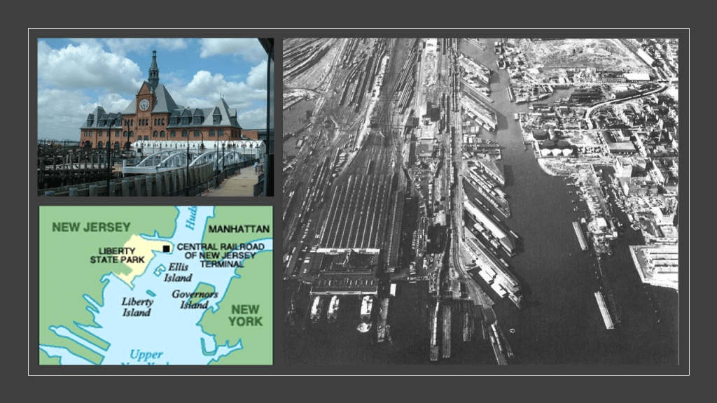
The Central Railroad of New Jersey Terminal in Jersey City was said to have been built in 1889 to replace an earlier one, and is located next to the Big Basin of the Morris Canal on the Hudson Waterfront in today’s Liberty State Park, as it is in close proximity to Ellis Island and the Statue of Liberty in Upper New York Bay.
It was operational as a terminal until April 30th of 1967.
An estimated 10.5 million immigrants processed through here at one time in America’s history when Ellis Island was operational as an immigrant processing station between 1892 and 1954.
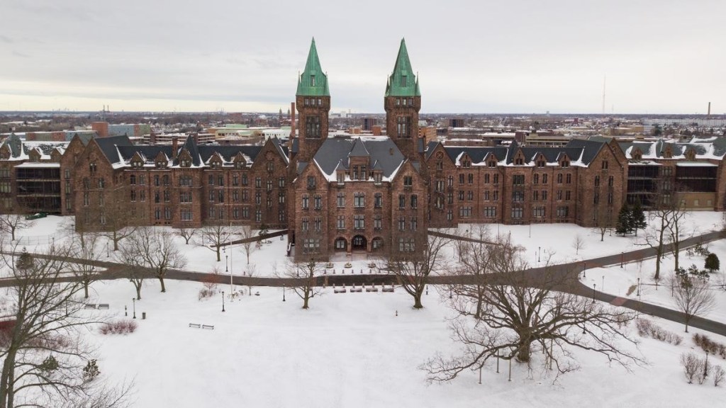
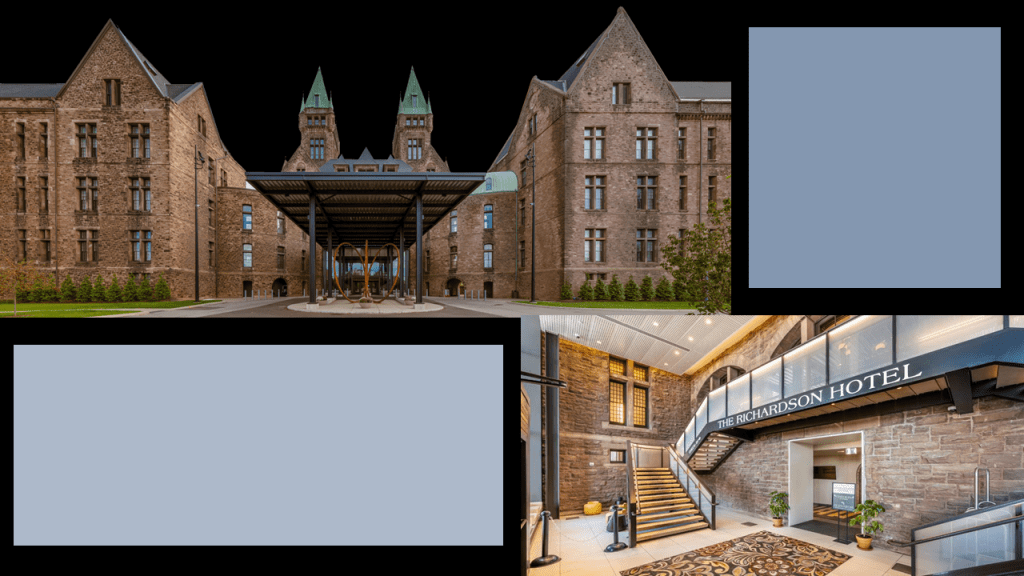
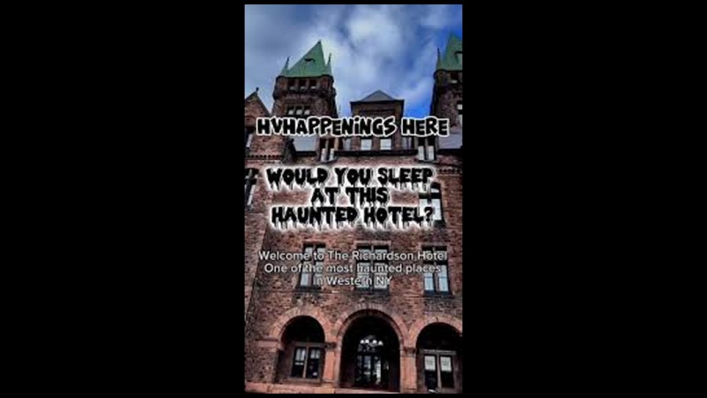
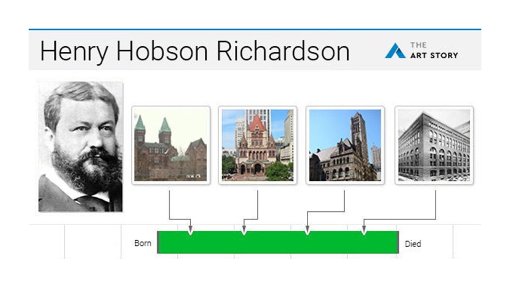
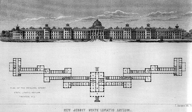
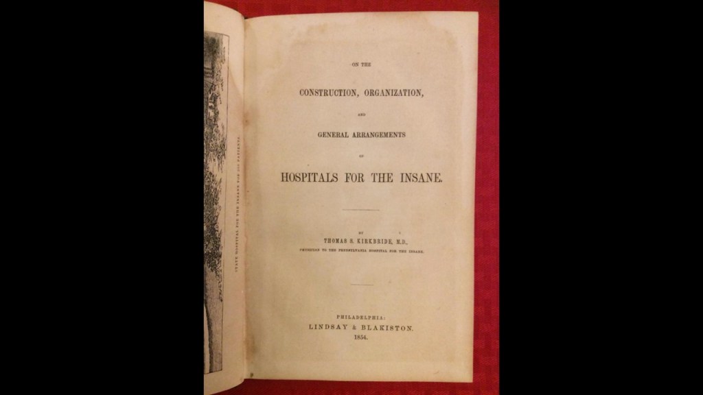
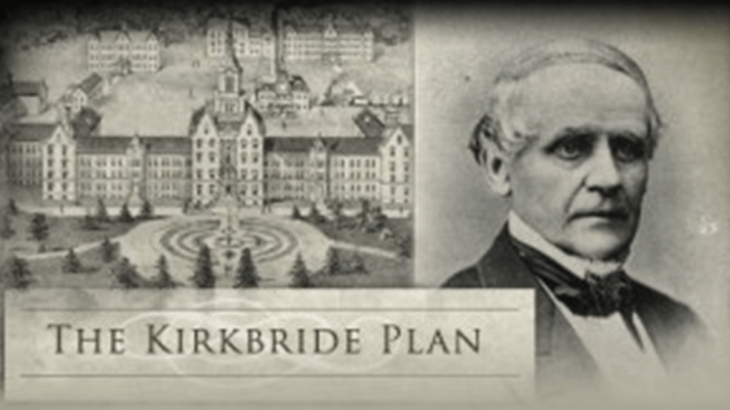
The architectural style of the Central Railroad of New Jersey Terminal building is called Richardsonian Romanesque, after architect Henry Hobson Richardson, who first used elements of this style in the Buffalo State Asylum for the Insane in Buffalo, New York, which he is said to have designed in 1870, and Frederick Law Olmsted was the landscape architect, and the Kirkbride Plan treatment for people with mental illsness was implemented here. More on the Kirkbride Plan to come later in this post.
The Buffalo State Asylum for the Insane was closed for that purpose in the 1970s.
Today now known as the Richardson Olmsted Complex, and was repurposed as a hotel which opened in 2023.
…and is considered one of the most haunted places in Buffalo, if not western New York.
Richardsonian Romanesque is described as a free revival style, incorporating 11th and 12th century southern French, Spanish, Italian Romanesque characteristics.
Henry Hobson Richardson had a relatively short career,and didn’t even complete his architecture school training in Paris because he lost family backing because of the American Civil War, yet somehow by the time he died at a relatively young age of 47, he left behind a legacy of mind-blowingly ornate architecture!
Hmmm. You don’t say!
One more thing about the Central Railroad of New Jersey here.
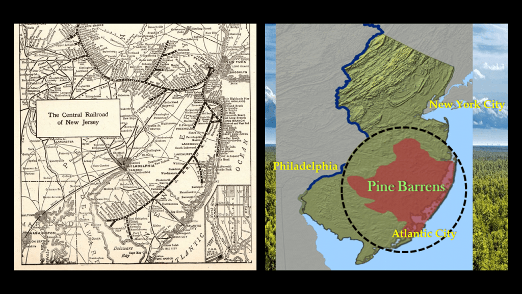
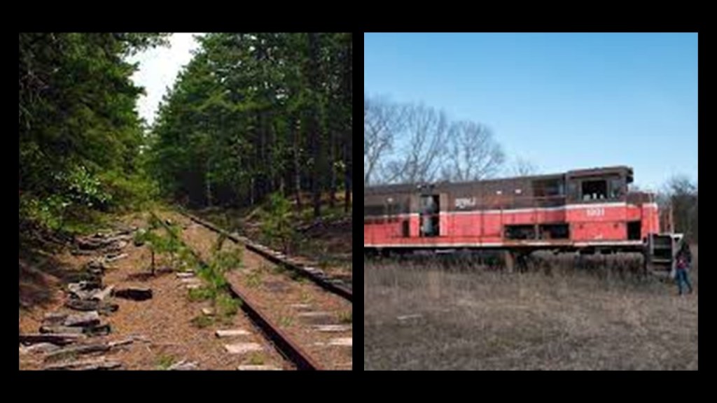
All of the new railroad lines that were popping up betwixt and between these large population centers and the Jersey Shore were, like Atlantic City, were going right through the desolate, swampy and forbidding Pine Barrens.
Today there are abandoned trains and railroad lines found throughout the New Jersey Pine Barrens.
I will expand on this finding in the next and final part of this series, on “The Cataclysm.”
I originally explored this region in-depth over a year ago in my blog post called ” Recovering Lost History from the Estuaries, Pine Barrens & Elite Enclaves off the Atlantic Northeast Coast of the United States.”
Before I move on from the Poconos, I’d llke to take a look at Mount Pocono.
This is what we are told about the history of the Mount Pocono Borough.
Early records showed a settlement at today’s Tobyhanna, where the Tobyhanna and Lehigh Lumber Company operated not only a lumber mill, but a clothespin factory and silk mill.
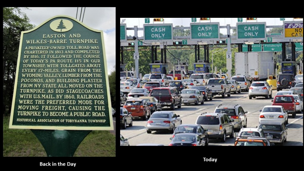
Tobyhanna Mills was situated along the Easton and Belmont Turnpike, a turnpike that was said to have been chartered in 1812 (the beginning of the War of 1812) and completed in 1820.
Turnpikes are still with us today, in which a fee, or toll, is assessed for passage.
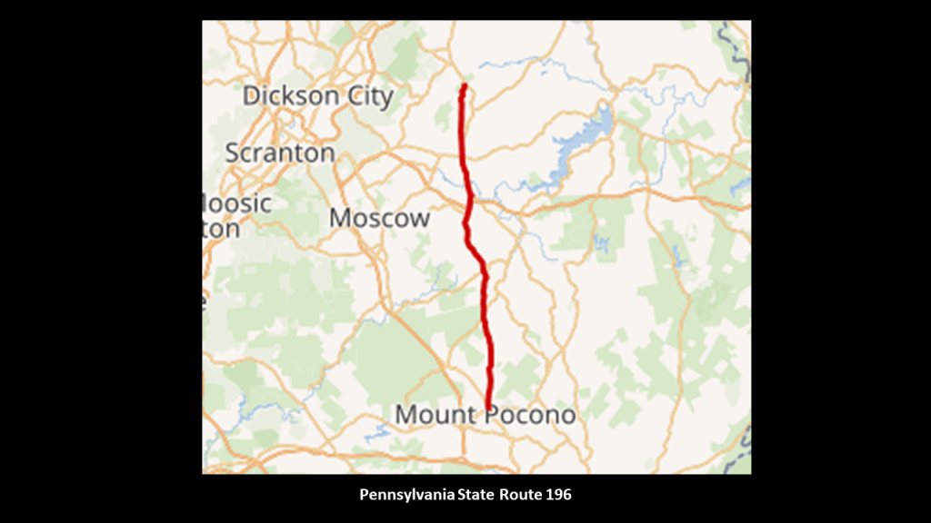
Today the former Belton to Easton Turnpike is Pennsylvania State Route 196 in the Poconos, that runs for 26-miles, or 41-kilometers north from Mount Pocono to where it meets up with State Route 296 in Varden.
Besides Pennsylvania State Route 196, two other state highways serving Mount Pocono.
One is Route 611 and the other is Route 940.
And there are six Interstate Highways serving the region of the Pocono Mountains.
They are Interstates I-80, I-81, I-84, I-78, I-380, and I-476.
More on this subject to come.
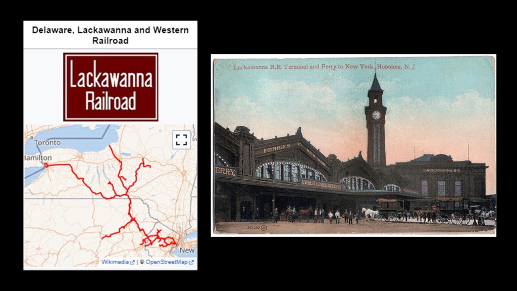
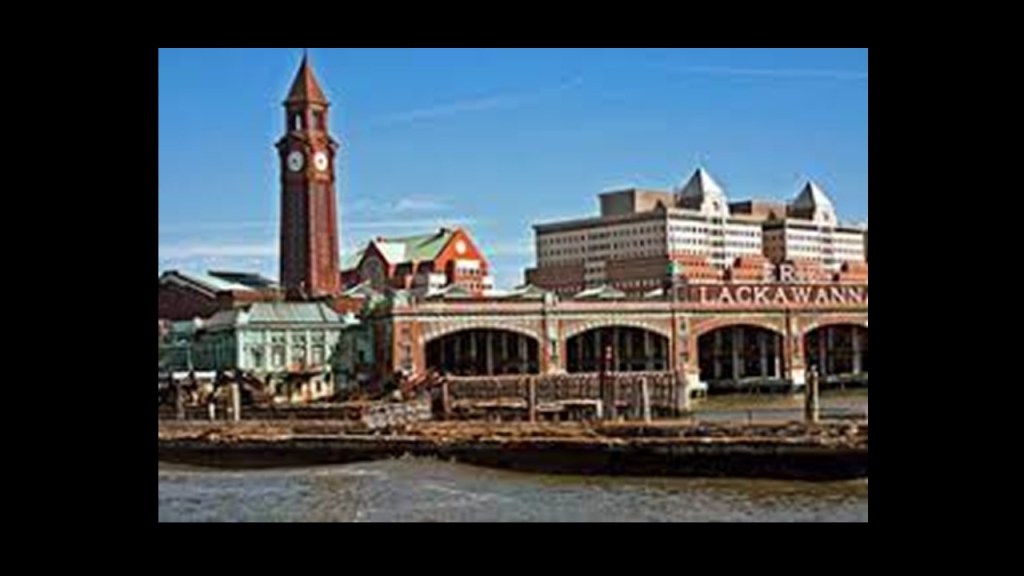
The Delaware, Lackawanna and Western Railroad main line passed through the southern end of the Mount Pocono Borough, which provided access to the borough from New York City via the terminal at Hoboken, New Jersey.
One of the New York area’s major transportation hubs, the terminal at Hoboken, Nwas said to have been constructed by the Delaware, Lackawanna and Western Railroad in 1907, and combined railroad, ferry, subway, streetcar and pedestrian services.
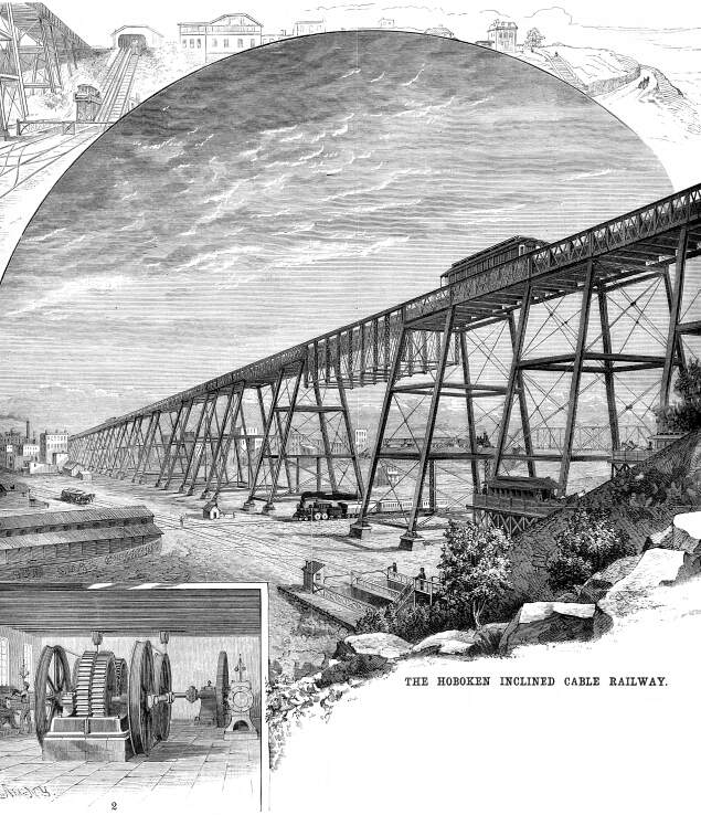
We are told that numerous electric streetcar lines originated and ended at the station until the completion of “Bustitution” in August of 1949, at which time they were replaced by buses.
This included the Hoboken Inclined Railway…
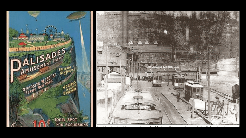
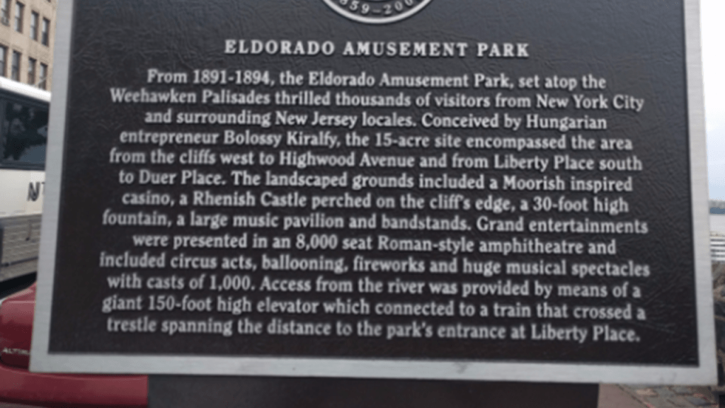
…which consisted of several lines including the Palisade Line that travelled from Edgewater to Palisades Amusement Park, which operated from 1898 to 1971…
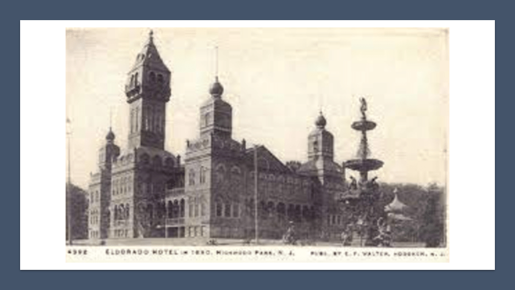
…and the Eldorado Elevator, which met a streetcar line that travelled along a trestle to a cut in the Palisades which ran parallel to the Eldorado, and amusement park that opened in 1891 and closed as an amusement park in 1894, except for the hotel casino.
The Eldorado’s main building was used to host boxing matches and Vaudeville performances until it burned down in a massive fire in 1898.
There is still a Hoboken Terminal in use today as an intermodal transportation hub.
A Delaware, Lackawanna and Western Railroad station was built at the crossing of what is now Pennsylvania State Route 611 in 1886, but that most of that station was demolished in 1937 when the highway was widened, and passenger service to the station ended completely in 1956.
The rails are still in place and used by freight trains and occasional excursions from the Steamtown National Historic Site.
The location might possibly come back to life as a proposed New Jersey Transit Rail Operations Station.
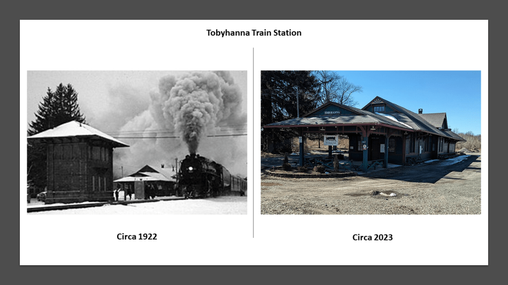
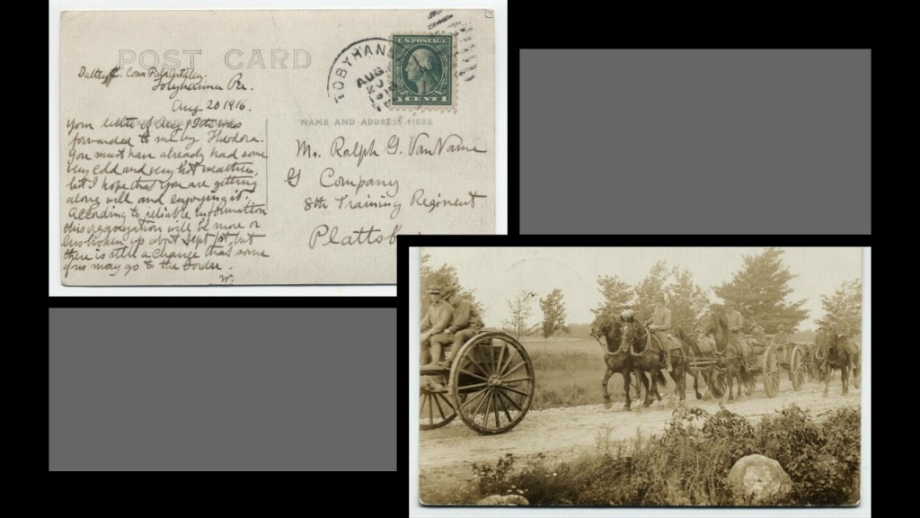
From 1912, Tobyhanna was said to have a railroad station on the Delaware, Lackawanna and Western Railroad line, as well as a post office and telegraph station, and local industries included shipping ice to different locations, including Florida.
Also starting in 1912, the ground was laid for the U. S. Government to purchase thousands of acres of land for a military installation, which started out as an artillery training range, with all their horse-drawn wagons, right in time for the beginning of World War I, which started in July of 1914.
The Tobyhanna Army Depot these days is a full-service electronics maintenance facility for the United States Department of Defense.
I want to leave one more bit of information here about the Delaware, Lackawanna and Western Railroad line as another placeholder for expansion upon in the next post on “The Cataclysm.”
I have come to believe this whole region in the northeastern United States was ground zero for at least one deliberately-caused cataclysm that brought us to the world we live in today.
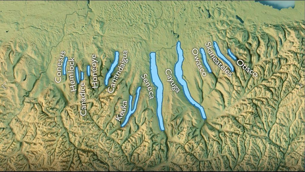
The Cayuga and Susquehanna Railroad ran in New York from Owego on the Susquehanna River to Ithaca, on the southern shore of Lake Cayuga, one of the Finger Lakes.
It was said to be chartered in 1828 and the third railroad, and longest at the time built in the United States.
We are told at the time it was planned, it was to provide the missing link connecting the Erie Canal and the Great Lakes to the coal fields of Pennsylvania and the Chesapeake Bay, but it never lived up to this potential for a variety of reasons.
The right-of-way was completely abandoned in 1956 and it later became part of the South Hill Recreation Way in Ithaca.
I will continue to bring forward examples of findings like this as I work my way through different locations in this video, but it’s not hard to visualize the Finger Lakes, and this whole region for that matter, as once having been giant tree roots.
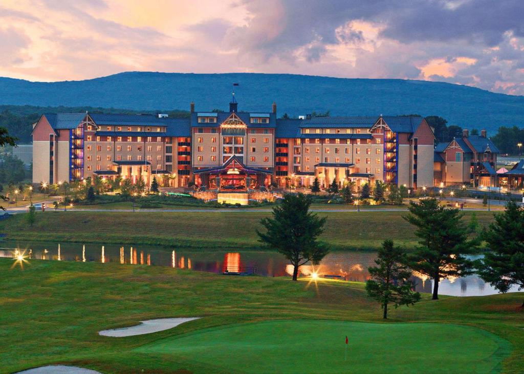
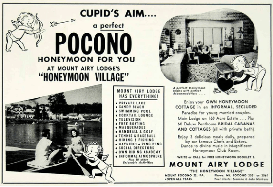
There’s a few other things I would like to mention about the Pocono Mountains before I move on from here.
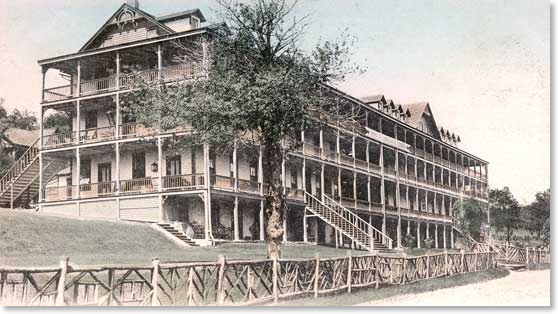
What we are told is that the Pocono Mountains became a well-known resort getaway early in the 20th-century.
So, for example, this was an early postcard showing the Pocono Mountain House and Springs.
It was one of the largest resorts that served visitors to the Pocono Mountains, and was located on Route 611 in the Mount Pocono Borough.
It was said to have started as a sportsmen’s club in 1874 and grew into a popular resort.
Besides recreational activities of all kinds, there were springs here that were known for healing properties.
The resort closed permanently to the public in 1933, and we are told that by 1974, it had fallen into such disrepair that the local fire department had to burn it down.
But not all those resorts in what became known as the “Honeymoon Capital of the World” in the Pocono Mountains burned down.
The Poconos are littered with abandoned resorts that were left to rot in place.
Today’s Mount Airy Casino Resort in Mount Pocono operates as Pennsylvania’s first AAA Diamond Casino Resort.
We’ll see another Mount Airy later in this post.
It was said to have been built on the site of the Mount Airy Lodge, which our narrative tells us was originally built in 1898, and then reconstructed in the 1950s asnd became known as America’s premiere honeymoon hideaway and for its top entertainment.
The 1950s building was said to have been demolished in 2001 and the current resort opened in 2007.
Another place I would like to bring your attention to here before I move on is the Pocono Raceway in Long Pond, Pennsylvania.
The Pocono Raceway is a superspeedway nicknamed the “Tricky Triangle.”
It is one of six superspeedways in the United States, along with Indianapolis, Daytona, Talladega, Michigan and the Auto Club Speedway in California.
I first published the “Circuit Board Earth” post in June of 2017, which was a compilation of my research findings up to that time of consistently finding infrastructure on the Earth arranged in specific linear arrangements in relationship to each other all over the surface of the Earth, and providing the model of Earth as a circuit board as an explanation for these findings that they were components of the once, free-energy-generating electromagnetic grid system.
I covered a lot of information and examples in this blog post to support this concept, but what I want to bring forward here is the example of the same finding in the Pocono Mountains, that of airports having racing tracks in angular relationships short distances away.
I first noticed this when I was doing research on the Shepherd’s Bush District of West London several years ago based on a commenter’s suggestion.
In the process of doing that, I realized I had seen the same angular relationship between London’s Heathrow Airport, and Shepherd’s Bush on the top left, where there had been a huge track at one time in White City, that had been used for Greyhound racing; and in my own research of the Tampa, Florida, neighborhood of Sulphur Springs the previous summer, when I had noticed that the Tampa International Airport, and the Sulphur Springs neighborhood in Tampa, Florida, where there was a greyhound racing track, had the same angular relationship.
After I made that initial connection, commenters left other examples of the same kind of relationship between airports and racing tracks, past and present, including, but not limited to, places like Montreal, Quebec, Canada, on the top right; Philadelphia, Pennsylvania on the middle left; Toronto, Ontario, Canada, in the middle ; Los Angeles, California on the middle right; and Sydney, Australia, on the bottom.
I think the various shapes being used as racing-tracks were once components of the circuitry of the Earth’s electro-magnetic grid system.
The sport of racing uses the word “circuit” in the following ways:
The course over which races are won; the number of times the racers go around the track; an established itinerary of racing events involving public performance; and in bicycle racing, a circuit race is a mass-start road-cycle race that consists of several laps of a closed-circuit, where the length of the lap is slightly longer each time.
Electrical Circuit definitions Include:
A closed path in which electrons from a voltage or current source flow, and includes devices that give energy to the charged particles the current is comprised of, such as batteries and generators…
…and an electronic circuit is a complete course of conductors through which current can travel, and provide a path for current to flow.
Wouldn’t it stand to reason that those behind the reset when setting up the New World would take advantage of the super science of the different types of circuits in the Earth’s grid system in order to harness their inherent power to enhance performance at sporting events, to make lots of money at highly-charged, prestigious gaming and betting venues?
More on this topic to come later in this video.
Now I am going to move on from the Poconos, but this is the information that came up to the surface just in looking at Boxcar Rocks and the what appears to be shaped and cut, block-shaped stone-work at World’s End State Park on the S-shaped Loyalsock Creek.
Next I am going to turn my attentiont to what is found in the Moshannon State Forest.
The Moshannon State Forest is in five counties – Centre, Elk, Cameron, Clinton and Clearfield – with its main offices in Penfield, Pennsylvania in Clearfield County’s Huston township at the intersection of State Routes 153 and 255.
In the 2020 census, the population of Huston Township as a whole was recorded as a little under 1,300 people.
At one time in Penfield’s history, it was a company town for the logging and coal mining industries in what was a local resource extraction economy, and the railroad came through here at one time.
Immigrants from Europe settled in the area to work the deep mines scattered through the Benzette Valley here.
There’s not much left to speak of in Penfield, but there are recreational activities nearby at Moshannon State Forest, Bilger’s Rocks Park, Parker Dam State Park and Black Moshannon State Park.
Moshannon State Forest was formed as a direct result of the depletion of the forests of Pennsylvania that happened in the mid-to-late 19th-century, when lumber and iron companies clear-cut the forests and sparks from passing steam-locomotives caused wildfires from the remnants of the forest-lands, preventing the growth of new forests.
The land that became Moshannon State Forest was purchased by the State in 1898.
The old-growth forest was gone by 1921, with a second-growth forest replacing it since then.
Interesting to note that a tornado in 1985 tore through the forest and destroyed an estimated 88,000 trees.
Panther Rocks at Moshannon State Forest are described as a small rock city made of several large sandstone blocks, complete with streets, overhangs, channels, crevices and a short tunnel
They were said to have formed during the Pennsylvania Age of the Carboniferous period of the Paleozoic era more than 300-million-years ago in the Pottsville Group, a rocks formed by sediments deposited in streams and rivers.
The nearby Bilger’s Rocks in Clearfield County’s Bloom Township near the town of Grampian, and is larger stone-city than what is found at Panther Rocks.
The creation of Bilger’s Rocks was also said to have taken place during the Pennsylvania Age of the Carboniferous period of the Paleozoic era more than 300-million-years ago, in the Homewood Formation of the Pottsville Group, a rock-unit formed by sediments deposited in streams and rivers.
Bilger’s Rocks has many examples of what appears to be toolmarks, and linear patterns that look like they were carved or molded, and has the same rock-city-like qualities of these other places we have been looking at tucked away in the Pennsylvania Park system.
Parker Dam State Park is surrounded by the Moshannon State Forest.
The Park was said to have been constructed by the Civilian Conservation Corps during the Great Depression.
The original dam here was said to have been constructed as a splash dam for the movement of lumber after he leased lumbering rights at some point after lumber harvesting began here in 1794, and the CCC was said to have built the current dam there to replace it as part of the improvements the otherwise unemployed, unskilled young men made when they came to work on the park.
There was much logging going on from this region, so the “Susquehanna Boom” was said to have been built in the 1850s across the West Susquehanna River at Williamsport, a system of cribs and chained logs designed to catch and hold floating timber until it could be processed, and logging railroads built to transport the lumber, to the tune of 45-cars per day until logging ended here in 1911, when all the trees were gone.
The lumbermen left a barren landscape that was devastated by fires, flooding and erosion more many years, until the CCC came in the 1930s and started replanting trees after the State of Pennsylvania bought the deforested land from the Central Pennsylvania Lumber Company in 1930.
The Civilian Conservation Corps CCC operated from 1933 to 1942 in the U.S. for unemployed, unmarried men to do manual labor related to the conservation and development of natural resources in rural lands owned by federal, state, and local governments.
Originally for young men ages 18–25, it was eventually expanded to ages 17–28.
In the nine-years of its operation, the CCC employed 3,000,000 young men, providing them with food, shelter and clothing, and a wage of $30/month, $25 of which had to be sent home to their families.
There is no doubt in my mind that the CCC, and the other alphabet programs of FDR’s New Deal during the Great Depression, like the WPA and TVA, were being used to cover-up the ancient advanced civilization.
Black Moshannon State Park is largely surrounded by the Moshannon State Forest.
It is located in Rush Township in Centre County, and surrounds a lake formed by another dam, also said to have been constructed by the CCC, on Black Moshannon Creek at the site of a former mill-pond dam.
Black Moshannon State Park is the home to the largest reconstituted bog in Pennsylvania, a wetland that accumulates peat as a deposit of dead plant materials, which contains carnivorous plants, orchids, and species typically found further north.
The boggy Black Moshannon State Park in Pennsylvania has a similar story as Cranberry Glades in West Virginia.
Cranberry Glades, protected in the “Cranberry Glades Botanical Area” area, are a cluster of five, separate boreal-type bogs in southwestern Pocahontas County in West Virginia, and like Black Moshannon State Park, species are found at both these locations that are typically further north.
These species include cranberries, sphagnum moss, skunk cabbage, and carnivorous plants, and the Cranberry Glades are the southernmost home of many of the plant species found here.
Both Black Moshannon State Park in Pennsylvania and Cranberry Glades Botanical Area in West Virginia, , have s-shaped river bends and airports nearby, with the name of the parks notated by an oval; the airports by a box; and the river bends are pointed at by arrows.
The “Snowshoe Rails to Trails” is near Black Moshannon, as seen here in the top-left-hand corner, right next to the Moshannon Creek where the arrows are pointing.
The “Snowshoe Rails-to-Trails” has 19-miles, or 31-kilometers, of abandoned railroad bed along 37-miles, or 60-kilometers, of legalized Snowshoe Township Roads for ATVS/UTVs.
We are told that it was originally the route of the Beech Creek Railroad between the South Jersey Shore and Mahaffey Borough, Pennsylvania, and part of the Susquehanna and South Western Railroad, and used for coal mining services in the region starting in 1884.
Mahaffey Borough, first incorporated in 1841, was located on U. S. Route 219, at the junction of the New York Central Railroad and the Hudson River Railroad.
The arrows point to where railroad tracks ran along S-shaped river-bends. on this section of Route 219 going through Mahaffey Borough.
This railroad project in Pennsylvania was said to have been backed and financed by William H. Vanderbilt, President of the New York Central Railroad.
The New York Central Railroad was said to have begun operating in 1853 with the consolidation of earlier independent companies running between Albany and Buffalo. This graphic depicts the New York Central rail system as of 1918.
We are told extensive trackage existed in the states of New York, Pennsylvania, Ohio, Michigan, Indiana, Illinois, Massachusetts, and West Virginia, plus additional trackage in Ontario and Quebec, and by 1925 operated 26,395-miles, or 42,479-kilometers, of track.
William Vanderbilt had developed a plan to facilitate railroad access to enter the “Clearfield Coalfield,” a large, juicy coal-mining area in Clearfield County, which would have been otherwise exclusively accessed by the Pennsylvania Railroad.
It was said to have been constructed starting at the end of 1882 to high-standards, including extensive curvature, bridges, and a tunnel, and became operational in November of 1884.
In West Virginia, Cranberry Glades is located close to both the New River Gorge National Park and Preserve, and White Sulphur Springs.
First, New River Gorge National Park and Preserve.
The New River Gorge is one of the places that I know of that still has a railroad operating right along beside the S-shaped New River.
The Amtrak Cardinal still runs through the New River Gorge 3 days/week – on Sundays, Wednesdays and Fridays.
Besides the railroad line that runs along the New River through the New River Gorge in West Virginia, there are things found in the gorge like historic coal mines, waterfalls, and hydro projects.
We are told that after the Chesapeake and Ohio Railway opened up this rugged wilderness in 1873, coal was carried out of the New River Gorge to the ports in Virginia and to cities in the Midwest.
As a result, by 1905, thirteen cities sprang up between Fayette and Thurmond, which was 15-miles, or 24-kilometers, upstream, and provided the West Virginia coal that contributed greatly to the industrialization of the United States until the 1950s.
After the coal seams were exhausted and mines closed, these company towns like Fayette were for the most part completely abandoned, with the possible exception of Thurmond which had a very small population of 5 in 2010.
Aaron sent me information about the Red Ash and Rush Run Coke Ovens near Thurmond.
The Rush Run Coke Ovens were said to belong to the Rush Run Mining Company, and there were believed to have been up to 180 of them at this location, which borders the railroad tracks.
Coke ovens are described as being made of brick, or some kind of heat-resistant material, and used to separate the coal-gas, coal-water, and tar.
Coke is formed when the coal-gas and coal-water fuse together, and is used primarily in steel-production.
The nearby Red Ash coal camp was developed by the Red Ash Coal and Coke Company in 1891, for a high-quality coal that burned with a “fine red ash.”
There were estimated to be 80 coke ovens here at one time, and the mine was exhausted by the 1950s.
There’s a service tunnel at the location of the Red Ash Coke Ovens.
The fine brick-work found at the Red Ash facilities reminds me of the fine brickwork I have seen in tunnels all over the place, including what is called the Great Tunnel of the C & O Canal in Allegheny County, Maryland, and part of the Paw Paw Bends section of the Potomac River as it is winding its way through West Virginia and Maryland.
Built using more than 6,000,000-bricks, this tunnel has been described as the “greatest engineering marvel along the Chesapeake and Ohio Canal National Historical Park.”
It is located roughly mid-way between Black Moshannon State Park in Pennsylvania and Cranberry Glades in West Virginia.
The Paw Paw Tunnel was said to have been built between 1836 and 1850 for the C & O Canal to by-pass the bends in the Potomac River near Paw Paw, West Virginia.
The C & O Canal closed to canal boats in 1924.
We are told that the C & O Canal, and other canals, were made obsolete because the railroad was so much more efficient and canals couldn’t compete with them.
Such as the Wabash and Erie Canal, which was said to have been built during roughly the same time period as the C & O Canal.
Canals like the C & O Canal subsequently became popular hiking, biking and canoeing venues, as we are seeing with the Rails that quietly became trails when no one was paying attention.
It is interesting to note that at one time in its history, Thurmond was a prosperous railroad town that was the largest, revenue-generating stop on the C & O Railroad, where passenger and coal trains rolled through here throughout the day.
Today, a visitor center for the National Park Service operates here in the old railroad depot.
CSX Transportation, formerly the C & O Railroad, has freight transportation operations in and through historic Thurmond, and the Amtrak Cardinal passenger route goes through here, the second-least-used Amtrak station in the nation.
The Chesapeake and Ohio Railway was formed in 1869 from several smaller Virginia Railroads under the guidance of Collis P. Huntington, in order to connect the coal reserves of West Virginia with the new coal piers that were built in Hampton Roads and Newport News, Virginia, and first opened in 1873, forging a rail link to places like Chicago in the Midwest.
Collis P. Huntington was one of the Big Four of western railroading, along with Leland Stanford, Mark Hopkins and Charles Crocker.
In 1888, Huntington lost control of the railroad to J. P. Morgan, an American financier and investment banker who dominated corporate finance on Wall Street during the Gilded Age between 1877 and 1900, and William K. Vanderbilt, who managed the Vanderbilt family’s railroad investments.
William K. Vanderbilt was was the grandson of Cornelius Vanderbilt, one of the richest Americans in history, who was an American magnate, and who built his family’s fortune in shipping and railroads.
The process continued on for the C & O Railroad to consolidate and merge railroads, and, for example, to gain access to productive coal fields throughout the region, through the 1920s.
There are waterfalls and hydro-electric projects found on the New River as it winds its way through the gorge.
I was able to find several waterfalls here that are accessible by road, and reference to over 100 others .
The first two waterfalls I found that are accessible by road are the Kanawha Falls and Cathedral Falls.
They are directly across from each other on a river-bend, and they both have hydro projects next to them.
Starting at the North Bend State Park in Cairo, West Virginia, northwest of Cranberry Glades and northeast of the New River Gorge, there is the 72-mile, or 116-kilometer, – long hiking corridor known as the “North Bend Rail Trail” running between Cairo and Ellenboro, West Virginia.
What is now the North Bend Trail was at one time one of the most distinguished railroad lines in United States History.
It was said to have been constructed between Grafton, West Virginia, and Parkersburg, West Virginia, by the Northwestern Virginia Railroad between 1851 and 1857, at which time it was sold to the Baltimore & Ohio Railroad and became known as the “B & O Parkersburg Branch.”
The Parkersburg Branch was said to have been built to high engineering standards with 23 tunnels and 52 bridges to minimize curvature, and had a maximum grade of 1.5%
During its prime, it hosted the B & O Railroad’s premiere passenger train, the National Limited, between New York City and St. Louis, Missouri.
In 1827, the State of Maryland chartered the Baltimore and Ohio (B & O) Railroad, the first common carrier, and the oldest, railroad in the United States.
The first section of the B & O Railroad was said to have opened in 1830, and it was said to have reached the Ohio River in 1852, the first eastern seaboard railroad to do so.
Unfortunately, we are told that with the rise of automobile ownership, ridership declined, and B & O ended its passenger service in 1971, at which time Amtrak took over and passenger service continued for another ten-years.
Eventually the rail-line that was part of the North Bend Rail Trail became freight-only, and the line was abandoned and dismantled in 1988.
The trail was completed between 1991 and 1996, and also has beautiful, red-brick tunnels along the way.
Now I am going to take a look at White Sulphur Springs, West Virginia, which is roughly 24-miles, or 39-kilometers, to the southeast of the bogs at Cranberry Glades.
White Sulphur Springs was said to have been settled in 1750, and developed as a health spa in the 1770s, as the story goes after a woman was healed of rheumatism after bathing in the springs, and calls itself “America’s Resort since 1778.”
The springs are on the grounds of the Greenbrier Hotel, which was said to have been built by the Chesapeake & Ohio Railroad Company in 1913.
So far we have seen springs here as well as at the former Pocono Mountain House and Springs in this post, where the fire department had to burn down the resort because it was in such bad condition after years of abandonment.
Even today, the same Amtrak Cardinal Line that runs through the New River Gorge has a station at White Sulphur Springs.
The Greenbrier Resort was at one time a Presidential getaway, with President Eisenhower the last President in office to have stayed there.
The Presidents’ Cottage is a museum today.
It remains a favorite retreat location for members of the U. S. Congress.
As a matter of fact, there was a top-secret, super-sized underground bunker, said to have been constructed there in the 1950s during the Eisenhower Administration to serve as a relocation point for the U. S. Congress in the event of a nuclear war, but when the secret came out in 1992 in a newspaper article, it was decommissioned.
The Greenbrier River Trail is located between the Greenbrier Resort in White Sulphur Springs and Lewisburg on Interstate 64, and was also a former railroad bed and right-of-way.
Lewisburg is located near the junction of Routes 219 and Interstate 64.
This is the same U. S. Route 219 we saw back in Pennsylvania in connection with Mahaffey Borough, which was located on U. S. Route 219, at the junction of the New York Central Railroad and the Hudson River Railroad.
This was the beginning of me noticing that U. S. Route 219 showing up a lot at the places where my research was taking me to the “On the Trail of Giants in Appalachia and Beyond” and which led me to intriguing connections with U.S. Highway 19 as well.
What is now the Greenbrier River Trail was gifted to the State of West Virginia in the late 1970s and opened as a recreational, multi-use trail in 1980.
It runs between North Caldwell, which is 3-miles, or 5-kilometers, east of Lewisburg on U. S. Route 60/Interstate 64,and Cass in Eastern West Virginia.
Cass, West Virginia, was founded as a company town in 1901 for the West Virginia Pulp and Paper Company, and named for Joseph Kerr Cass, the Vice-President and co-founder of the pulp and paper company.
Most of the town named for Joseph K. Cass, and its buildings, were bought by the State of West Virginia in 1961 after the pulp and paper mill closed in 1960, and it became the Cass Scenic Railroad State Park.
The Cass Scenic Railroad State Park continues to offer trips to Whittaker Station; the ghost town of Spruce; and Bald Knob, the highest point of the Back Allegheny Mountain in Pocahontas County.
Now I am take a look at the National Radio Astronomy Observatory in Green Bank, West Virginia, on West Virginia Route 28 between the Durbin Depot and Cass Depot on this map.
The National Radio Astronomy Observatory at Green Bank, situated near the S-shaped bends of the Greenbrier River, is part of the United States National Science Foundation, which is headquartered at the University of Virginia in Charlottesville, and used for the purposes of radio astronomy.
Besides Charlottsville and Green Bank, other National Radio Astronomy Observatories are located in Socorro, New Mexico; Tucson, Arizona; and San Pedro de Atacama, Chile.
The Green Bank Telescope is the world’s largest, fully-steerable radio telescope.
Interesting to note that I found this bit of information in reference to the location of the Green Bank Observatory.
The area around the Observatory was at one time planted with pines with needles of a certain length to block electromagnetic interference at the wavelengths used there, which is a very intriguing find.
The Green Bank National Radio Astronomy Observatory is in the National Radio Quiet Zone, in which radio transmissions are restricted by law.
Researchers like Karl Jansky, credited with the discovery of radio waves coming from the Galactic Center, at the Bell Labs complex in Holmdel, New Jersey, were credited with the development of radio astronomy, among other things.
The Holmdel Complex, in use by Bell Labs for approximately 44-years starting from around 1962 was called “The Biggest Mirror Ever,” and located near the entrance to lower New York Bay.
It is also located near Red Bank, New Jersey, where Karl Jansky died.
Red Bank, New Jersey, and Green Bank, West Virginia?
A Coincidence? Or not?
The Bell Labs Holmdel Complex in New Jersey was also in an alignment with Montauk Point, where the experiments of the Montauk Projects were said to have been carried out at the former Montauk Air Force Station at Camp Hero State Park; and Brookhaven National Laboratory, where among many other things, the Relativistic Heavy Ion Collider (RHIC) is located, the first and one of two operating heavy-ion colliders, the other being CERN in Geneva, Switzerland, which the one in Brookhaven is the reverse of; the JFK International Airport, which sits besides Jamaica Bay, and is described as a partially man-made and partially natural estuary on the western tip of Long Island, and containing numerous marshy islands; Coney Island; and Philadelphia southwest of Bell Labs on the alignment.
Besides much more along these lines throughout this area, there were three major historic trolley amusement parks alone on Brooklyn’s Coney Island Peninsula – Dreamland, Luna Park, and Steeplechase Park – as well as the Brighton Beach Race Course.
Historically, there was a very high concentration of star forts, trolley amusements parks, lighthouses in this one location on Earth.
Between the entrance to the lower New York Bay at the Atlantic Ocean to the locations around the George Washington Bridge across the Hudson River alone, I have specifically looked at eleven star forts that are in pairs and/or clusters; five major historic trolley amusement parks; and eleven lighthouses.
And this does not include what was found of the same all the way up the Hudson River.
Lighthouses were also part of the Earth’s Energy Grid system and also have either been decommissioned, demolished, or are being used in a different capacity than what they were originally.
I have come to believe “lighthouses” were literally “a house for light” for the purposes of precisely distributing the energy generated by this gigantic integrated system that existed all over the Earth that was in perfect alignment with everything on Earth and in heaven.
Back in West Virginia, one more thing about the location of the Green Bank National Radio Astronomy Observatory , it is also near Cheat Mountain.
Cheat Mountain was once the home of the largest red spruce forest south of Maine.
Cheat Mountain is flanked on the western side by our old friend U.S. Route 219 and on the eastern side by the Western Maryland Scenic Railroad.
East to west it is crossed by U. S. Route 33 on one side, and U. S. Route 250 on the other side.
We are told that during the American Civil War, Cheat Mountain was of strategic importance during the early part of the Operations in West Virginia Campaign.
The Battle of Cheat Mountain, also known as the Battle of Cheat Summit Fort, took place between September 12th to 15th of 1861, and was the first battle that General Robert E. Lee led troops into combat.
Still a part of Virginia at the time, since what became the state of West Virginia was not formed until after the Civil War, troops under Lee sought to regain confederate territory that had been gained by the Union after Union troops had advanced into the western region of Virginia from Ohio.
We are told that the Battle of Cheat Mountain was a Confederate attempt to regain the Union occupied Fort Milroy on top of Cheat Mountain, but they were unsuccessful and “lost” the battle.
Some interesting things turn up when we look at the view from above of this location.
One is that there was a strip mine here at one time, as seen in the name of the trailhead notated next to the location of the fort
This view we see the first of many patterns like this, with lines emanating out from a central point, in this case Cheat Summit Fort.
In this current view of the area around Cheat Summit Fort from Google Earth, it is easier to see that it is as the meeting place of at least three S-shaped river bends.
Barton Knob on the left-hand side was the location of strip-mining prior to its acquisition by the Monongahela National Forest in 1986.
Before the 1880s, the landscape was dominated by old-growth red spruce and red-spruce northern hardwood forests.
Starting in the 1880s until the 1940s, the vast majority of this forested land was clear-cut, after which the ecosystem was only 10% of its original range.
This area was strip-mined between the 1950s and the 1980s by the Mower Land and Lumber Company.
Strip-mining is the practice of mining a long-strip of material by removing overlying soil and rock, most commonly used to mine coal.
Barton Knob is also the location of an abandoned “Fire Tower.”
We are told there has been a radio repeater at the same location since 2012.
We are told the fire tower on Barton Knob has been in existence at least since 1939.
There are 79 registered former fire lookout sites in West Virginia alone.
Many of these what are called fire, or observation, towers and their access roads, were said to have been built by the CCC between 1933 and 1942, having received credit for building an estimated 250 of them.
Like I said earlier in this post about the dams at the Moshannon State Forest, there is no doubt in my mind that the CCC, and the other New Deal programs of FDR’s during the Great Depression, were being used to cover-up the ancient advanced civilization.
Apparently there were over 8,000 fire look-outs located in 49 states, with only 2,000 remaining.
Also, Cheat Bridge is in close proximity to the historic Cheat Summit Fort.
Cheat Bridge is the name of an unincorporated community near U. S. Route 250’s crossing of the Shaver’s Fork of the Cheat River.
It was named for a historical bridge located here that was said to have been a “Pinned Pratt through Truss” bridge built in 1912 by the Canton Bridge Company of Canton, Ohio.
The “Pinned Pratt through Truss” was said to have been developed in 1844 under patent of Thomas and Caleb Pratt, with “diagonals in tensions, verticals in compression, except for the hip verticals immediately adjacent to the inclined end-posts of the bridge.
I have done a deep dive on the “Old World Bridges of the New World,” in which I seriously question the narrative of who we are told built what and when in the bridge category of infrastructure.
Cheat Bridge is also a stop for the Cheat Mountain Salamander Train operated by the Durbin and Greenbrier Valley Railroad.
The Durbin and Greenbrier Valley Railroad is a heritage and freight railroad that also offers passenger service.
Cheat Bridge was also a part of the Staunton – Parkersburg Turnpike, which was first established as a toll-road some time around the mid-1800s.
This 1848 article is advertising stage-coach service on the Staunton – Parkersburg Turnpike.
Not the first turnpike/toll road we have seen early in the history of the United States, and not the last one we will see, where they are “charging” “currency” for use of the roadway.
The last thing that I would like to mention about the Cheat Mountain location before I move on from here is this.
The Cheat River runs along this section of West Virginia between the state’s border with both Pennsylvania and Maryland.
Aaron sent me this reference to giant skeletons having been uncovered in the location of the Cheat River.
The first reference was a Tucker County resident finding giant bones protruding from the ground in the area on the Cheat River known as “Horse Shoe” in 1774, that he estimated would have been from someone 8-feet, or almost 2.5-meters, -tall when he laid them out.
Also, other settlers found large-size bones nearby in what is described as an “ancient village” that had earthen and stone mounds, earning the area the nickname “Giant Town.”
Back in Huntington, West Virginia, near the New River Gorge and named for “Big 4” Railroader Collis P. Huntington, it was one of the first American cities to have electric streetcars, with service believed to have started around the end of 1888.
Then, starting in the 1920s, the Ohio Valley Electric Railway had organized a gas-powered bus service, which by November 1937 had completely replaced all of Huntington’s former electric streetcar lines.
Exactly the same story we saw back in Hoboken, where we saw that by August of 1949, electric streetcars had been replaced by buses in a process known as “bustitution.”
Also, Camden Park in Huntington first opened as a trolley park in 1903.
It was said to have been first established as a “picnic spot” by the Camden Interstate Railway Company in 1903, which was a street railway and interurban system that ran between Huntington, West Virginia, and Ashland, Kentucky, and which by 1916 was owned by the Ohio Valley Electric Railway, who became new owners of the park.
Today Camden Park is one of thirteen remaining trolley parks that remain open in the United States, long minus trolleys, and the only operating amusement park in West Virginia.
Like what we saw in Hoboken, New Jersey, locati0ns of historical trolley parks, of which there were an estimated 2,000 at one time, are long-gone.
I couldn’t find one when I looked for a map showing the the Ohio Valley Electric Railway lines, but I did find one for the Ohio Electric Railway.
This is what we are told about the Ohio Electric Railway, as one of many of the same stories.
It was formed in 1907 upon the consolidation of fourteen smaller interurban railways.
At its peak, it operated 617-miles, or 993-kilometers, of track.
The company went bankrupt in 1921 and dissolved into their constiuent companies.
Eventually all the interurban lines went away…everywhere.
I have marked with red dots the hubs of interurban lines, where three or more lines meet at a central point.
Along with the tallest skeleton by far being 18-feet, or 5.5 meters, -tall at West Hickory in Pennsylvania, which I will be looking at later in this post, of the ten featured on this graphic, three are in the vicinity of where we have been looking at around Huntington, West, Virginia.
Number 10 on the list was found at the Great Serpent Mound, at 7-feet, or a little over 2-meters, -tall; #9 at Cresap Mound in West Virginia at 7-feet, 2-inches, still a little over 2 -meters, – tall; and #6 at Miamisburg, Ohio at a little over 8-feet, or 2.5-meters, -tall.
These giant skeleton findings are consistent with other recorded giant skeleton finds in the surrounding area, with some have been reported to have been found in mounds, and some randomly found in proximity to rivers.
The next place I am going to look at in West Virginia is Fairmont, the seat of Marion County.
Fairmont is located just above the confluence of where the West Fork and Tygart Valley Rivers meet to form the Monongahela River.
I couldn’t help but notice all the s-shaped riverbends going on around here meeting in the vicinity of Fairmont!
So, I searched for more information on Fairmont’s railroad history and this is what I found.
First, the Fairmont & Clarksburg Electric Railroad was an inter-urban electric streetcar system that served the Fairmont and Clarksburg areas, linked by a main-line, and connected the communities of Bridgeport, Fairview, Mannington and Weston.
It offered both passenger and freight services, and connected communities and coal camps.
It became operational in 1901.
We are told that now the electric streetcar services just couldn’t compete with the advent of automobiles reducing demand for these services, and this interurban streetcar system was abandoned entirely by 1947, when the system had transitioned entirely to bus services.
This was the crossing of this interurban line at Hawkinberry Run near Rivesville.
In time, the Fairmont & Clarksburg Electric Railroad was managed by the larger West Penn Railway system of electric streetcars that was headquartered in Connellsville, Pennsylvania, and was said to be part of the regions power-generation utility.
It consisted of 339-miles, or 546-kilometers, of electric streetcar track at its height.
It was operational from 1904 to 1952.
Next, the Fairmont, Morgantown & Pittsburgh Railroad once connected Fairmont to Uniontown in Pennsylvania, a distance of 56-miles, or 17-kilometers.
It became operational in 1894.
We are told the importance of this line waned as the coal mines along the route closed, and in 1953, passenger service ended.
By 1991, most of the line between Fairmont and Uniontown was abandoned, with the exception of two short stretches that are still in use today, like the one I mentioned that is owned and operated by CSX Transportation between Grafton and Rivesville.
This map of the Industrial Heartland Trails Coalition’s Parkersburg to Pittsburgh (P2P) Corridor shows its plan to have a fully-connected recreational rail-to-trail between the two cities, with the proposed segments overlaid in red.
I have put a blue box around the Fairmont to Uniontown segment of the former railroad line, and a red box around the section between the West Fork River Trail, which starts just outside of Fairmont, and goes to Parkersburg, and includes the previously mentioned North Bend Rail- Trail.
Aaron sent me this information on p. 10 in “The History of Marion County.”
The information on this page referred to:
–Workmen preparing to build a bridge unearthed three giant skeletons, measuring over 7-feet, or 2-meters, in length, in the village of Rivesville at Paw Paw Creek;
–“Fort Hill” about 2-miles, or 3-kilometers, north of Fairmont, and traces of an aboriginal fort;
The only fort I can find any information on to speak of near Fairmont is “Pricketts Fort,” which just happens to be the same distance north of Fairmont that is referenced on the “History of Marion County” page.
Pricketts Fort State Park is at the confluence of the Monongahela and Pricketts Creek.
What the historical narrative tells us is that it is was a reconstructed “refuge fort,” built on Jacob Pricketts’ homestead, to defend local settlers from hostile indian raids, and these days commemorates life on the Virginia frontier in the late 18th-century.
A couple of interesting things to note about the Pricketts Fort location.
First is that the site of the fort is located on a river-bend, right next to an old railroad bridge that is now part of the Marion County Rail-Trail, and there are railroad tracks right next to the Monongahela River, still in use by the Fairmont Subdivision, a railroad from Grafton to Rivesville that is owned and operated by CSX Transportation on what used to be part of the B & O Railroad Mainline.
The Marion County Rail Trail runs for 2.5-miles, or 4-kilometers, from the Pricketts Fort State Park, along Pricketts Creek through rural Marion County, to Fairmont.
The trail’s main highlight is a 1,200-foot, or 366-meter, -long lighted tunnel, which runs under Speedway Avenue and Suncrest Boulevard. said to have been built in 1914 by the Monongahela Railroad.
The land for the trail was purchased from the railroad by the County in 1989.
The last thing I would like to mention in this part of West Virginia, all in the vicinity of the bogs of Cranberry Glades, is that there is a pattern of North-South-oriented, perfectly-straight parallel lines that are detectable in the landscape on Google Earth that Aaron had noticed and sent me this screenshot.
I followed the straight lines visible at Cranberry Glades northwards.
While not directly north of it, Pittsburgh isn’t far away from being due north of Cranberry Glades.
In addition, here’s a screenshot of the same kind of parallel lines appearing in the landscape west of Gettysburg that Aaron found, the historical location of a very famous Civil War Battle.
It would make sense that these massive parallel lines that are part of the landscape were part of the Earth’s original energy grid system.
Now, I’m going to return to the area around the bog of Black Moshannon State Park and take another look there for the purposes of comparison to the area around Cranberry Glades.
Black Moshannon State park is 22-miles, or 35-kilometers, from State College, Pennsylvania, which is only a difference of 2-miles, or 4-kilometers, of the distance between the bogs at Cranberry Glades and the community of White Sulphur Springs, with its luxurious and exclusive Greenbrier Resort.
State College, Pennsylvania, is the home of Penn State University.
It is connected to Phillipsburg and Black Moshannon State Park via Pennsylvania U. S. Route 322.
Penn State was founded in 1855 as the Farmers’ High School of Pennsylvania, and in 1863, it became the state’s first land-grant university.
Besides U. S. Route 322, State College is surrounded by U. S. Route 220 (also part of I-99), and State Routes, like 550; 150; 45; and 26.
State College is also surrounded by s-shaped water courses, like Spring Creek, Buffalo Run, and Slab Cabin Run.
Now a word about the United States Numbered Highway System, also known as the Federal Highway System, that we have already seen examples of come up in this post.
It was actually called an “integrated network of roads and highways numbered within a nationwide grid across the contiguous United States.”
It was first approved in 1926.
Drawn up in 1913, by the National Highway Association, the map was said to be the first proposed U. S. Highway Network map.
The red roads were delineated “Main” National Highways; the blue roads “Trunk” National Highways; and the yellow roads were “Link” National Highways to connect all the “Mains” and “Trunks.”
The Nation’s first Federal Highways would not be adopted until 1926, when the American Association of State Highway officials approved the first plans for the numbered highway system, with this section showing Texas, Oklahoma, Tennessee, Arkansas, Louisiana and Mississippi.
I have blue arrows pointing to major cities that are the central point of at least five highways – Dallas, Texas; Tulsa, Oklahoma; Little Rock, Arkansas; Memphis, Tennessee; Nashville, Tennessee; and Birmingham, Alabama.
What we see happening with the highway system of certain cities being the central point of multiple highways, is also seen with rail-lines, as we have also seen thus far, like with the example seen previously of the Ohio Electric Railway lines.
This Civil War era-example shows that Petersburg in Virginia, just south of Richmond, was a central point of multiple rail-lines emanating from it in all directions.
Petersburg was the focal point of the railroads that supplied Richmond during the Civil War, and was the primary target for the Union Army in Virginia from the last half of 1864 until April of 1865.
The third major Civil War fire was the April 2nd of 1865 Burning of Richmond, the capital of Virginia, and of the Confederate States of America.
Also known as the “Evacuation Fire,” and the “Fall of Richmond,” Richmond was set on fire on the night of April 2nd by Confederate forces after Confederate President Jefferson Davis was said to have ordered the burning of warehouses and bridges after Union General Ulysses S. Grant had taken nearby Petersburg.
This is a lithograph depicting it by Currier & Ives.
In our historical narrative, the Confederate General Robert E. Lee surrendered to General Grant days later, on April 9th of 1865, after his final defeat at the Battle of Appomattox Court House that same day.
There’s a very similar configuration between Petersburg Rail-lines of the Civil War-era, and the highways around Richmond and Petersburg today.
And where there have been toll roads in one form or another for a long time, since this subject has been coming up as well.
Since 1958, that section of I-95 has been known as the “Richmond-Petersburg Turnpike,” but there have been toll roads in the area since 1826.
Two other major fires in history have come down to us as Acts of War during the American Civil War.
The first was the Burning of Atlanta, which we are told took place in 1864, an important rail and commercial center at the time of the Civil War.
General Sherman and his Union Forces captured the city of Atlanta in September 2nd of 1864, and occupied from then until November of 1864.
He gave orders to destroy Atlanta as a transportation hub and as a war material manufacturing center, and in particular the railroad system and everything connected to it.
His orders were carried out destroying physical infrastructure, and on November 15th, everything that had been destroyed was set on-fire.
Like Petersburg/Richmond, Atlanta was a railway hub at the time of the Civil War, and is a highway hub today.
Then, after Atlanta was burned down by General Sherman and his troops in November, the following February, Columbia, the capital of South Carolina and an important political and supply center for the Confederacy, was said to have surrendered to General Sherman on February 17th, 1865, after the Battle of Rivers’ Bridge.
On the same day, the fires started, burning much of Columbia, though there is disagreement between historian regarding whether or not the fires on that day were accidental or intentional, but on the following day, General Sherman’s forces destroyed anything of military value, including railroad depots, warehouses, arsenals, and machine shops.
Like Petersburg/Richmond and Atlanta, Columbia was a transportation hub with regards to rail infrastructure, and a highway hub today.
Were these places specifically targeted for destruction because of their importance as transportation and infrastructure hubs on the energy grid during the historical event known to us as the American Civil War?
And were not destroyed for the reasons we have always been told?
Now back to State College in Pennsylvania.
As I mentioned previously, besides State and US Routes, State College is also surrounded by S-shaped water courses, like Spring Creek, Buffalo Run, and Slab Cabin Run.
And, yes, there is a railroad history to be found in the area around State College too.
Whereas West Virginia was mined exhaustively for its coal, this part of Pennsylvania came to be mined exhaustively for its iron ore.
Andrew Carnegie had begun mining iron ore in Scotia in 1881 for his steel mills in Pittsburgh, and by 1887, we are told that a new era of iron-making in the Nittany Valley began, with the opening of the Nittany and Bellefonte Furnaces along Buffalo Run near its junction with Spring Creek, and three railroads that were said to have been constructed to haul the iron ore to them – the Bellefonte Central (BFC), Central Railroad (CRR) and Nittany Valley Railroad (NV).
By 1911 both of these furnaces had been shut-down.
By 1950, all the railroads that had once served the area, either for the iron-related industry or passenger service, including the Pennsylvania Railroad lines, circled in blue, were no longer in service.
The only rail here that became operational again was a portion of the Bellefonte Central after the Bellefonte Historical Railroad was organized as an excursion line in 1985, and occasionally offers runs as a tourist attraction.
I also looked to see if Penn State University has an underground tunnel system, and it does, though its origin seems mysterious for some reason.
We are told there is a system of tunnels said to have been built for maintenance purposes, and many of which are used today to generate steam to heat the Penn State sidewalks and keep them clear of snow in the wintertime, and other tunnels for other maintenance purposes.
Interesting to note that the Garfield Thomas Water Tunnel, the world’s largest water tunnel at the time it was built in cooperation with the Navy in 1949, is at Penn State, and for a long time was the largest circulating water tunnel in the world.
It is still one of the Navy’s principal experimental hydrodynamic research faciilities, and has been declared a historic mechanical engineering landmark.
The Garfield Thomas Water Tunnel, the world’s largest water tunnel at the time it was built, sounds like what we saw back in Green Bank, West Virginia, with the world’s largest fully-steerable telescope at the radio astronomy observatory there.
Not only that, both locations are in close proximity to US Route 219; the bogs and Black Moshannon State Park and Cranberry Glades; Green Bank is close to Cheat Mountain and Penn State is close to Mount Nittany, which are geographically close to Mount Pocono.
.
Mount Nittany near Penn State was said to have gotten its name from the Algonquin word “Nit-a-Nee,” meaning “Single Mountain.”
For the purposes of comparison for similarity, I recently found a different university with tunnels on a route near a single mountain.
In this photo of the Wake Forest University Campus, you can see the Wait Chapel building in a direct alignment with Pilot Mountain in the background.
The tunnels at Wake Forest University were also said to have been built for heating and maintenance purposes. They have tours, but they are typically not open for public view.
Pilot Mountain, which was just pictured in alignment with the Wait Chapel on the Wake Forest, is described as one of the most distinctive natural features in the State of North Carolina, with two distinctive features, one named “Big Pinnacle,” and the other “Little Pinnacle.”
It is seen here centered on U. S.. Route 52.
U. S. Route 52 follows a northwest to southeast route across the country.
The northwestern terminus of U. S. Route 52 is in Portal, North Dakota, in the Bakken Oil Field Region and on the International Border with Canada at North Portal Saskatchewan…
…where we find the the historic Soo Line going through North Dakota from northwest to southeast, quite similar to the route of US-52.
On its southeasterly journey across the United States, US Route 52 passes through places like Indianapolis, Indiana, another large central hub of transportation routes.
…Pilot Mountain in North Carolina as previously mentioned…
…to the southeastern terminus of U. S. 52 in Charleston, South Carolina, at Number 2 Meeting Street and White Point Harbor at the Battery along the Charleston Harbor, not far from the place the American Civil War started at Fort Sumter in Charleston Harbor on April 12th of 1861.
Peter Champoux has done incredible work on specific ley-lines in North America, and other continents as well, as seen on his website geometryofplace.com
Peter shows Pilot Mountain in North Carolina as a hub for ley-lines on the home page of his website, looking much like the cities we are seeing that serve as transportation hubs for multiple rail-lines and/or highways.
Pilot Mountain is described as a “Quartzite Monadnock.”
This translates to a “hard, metamorphic rock that was originally pure quartz sandstone that is an isolated rock hill, knob, ridge, or small mountain that rises abruptly from a gently sloping or virtually level surrounding plain.”
Here are some other examples of places classified as “Monadnocks.”
Besides Pilot Mountain on the top left, Harteigen in Norway is seen on the top right; Devil’s Tower in Wyoming on the bottom left; and Cooroora in Australia on the bottom right.
What if “Monadnock” is a word used to cover-up gigantic tree stumps?
What if other “Mounts” that we have seen thus far, like Mount Pocono, and even Cheat Mountain, are also in that category.
And if so, what was their significance to this post about “The Energy Grid?”
I believe the example of Pilot Mountain being a hub of ley-lines provides a significant clue for us.
Here are some examples of giant trees and stumps that are identified as such.
In this comparison, we have the Devil’s Tower from another angle on the left; the Jugurtha Tableland in Tunisia in the middle; and the volcano in the middle of the city of Hammam Damt in Yemen looking very tree-stumpish!
Pilot Mountain State Park is on the western end of what are called the “Sauratown Mountains,” named after the Saura, or Cheraw People, the Siouan-speaking indigenous people who lived here before the arrival of Europeans and considered extinct as a tribe, so they are left only in place-names in the region.
The Sauratown Mountains are described as an isolated mountain range, sometimes called “the mountains away from the mountains,” and consisting of heavily-forested ridges frequently broken by large quartzite, rock cliffs.
Interesting to note that a viewer left me a comment that before it was called Pilot Mountain, it was known as Mount Ararat.
I looked into it and found the historic Ararat River with rail infrastructure running beside it on the top left, and today’s Ararat River Greenway Trail where the railroad used to be on the bottom right.
The Ararat River Greenway Trail is at the eastern edge of the city of Mount Airy.
And we previously saw a place called Mount Airy Casino Resort earlier in this post at Mount Pocono.
The only Mount Ararat I have ever heard of is in modern Turkey today, and historic Armenia in the past, the legendary landing place of Noah’s Ark.
What’s Mount Ararat doing in North Carolina?
And why was the name changed to Pilot Mountain?
Way back when I believed the narrative I probably would have accepted it as a being “named after” situation, but not anymore!
Mount “Airy” North Carolina was Andy Griffith’s home town, and the place Mayberry was based on in “The Andy Griffith Show.”
Next, I am going to take a look at Altoona in Pennsylvania just down the road from State College and Penn State University.
Altoona is only 43-miles, or 70-kilometers southwest of State College.
Altoona was said to have been established by the Pennsylvania Railroad in 1849.
Aaron drew my attention to Altoona with information he sent me about the nearby “Horseshoe Curve.”
The “Horseshoe Curve” is a three-track railroad curve that is described as one of the world’s most incredible engineering feats, and was accomplished by the Pennsylvania Railroad in 1854 as a way to reduce the westbound grade to the summit of the Allegheny mountains.
It was said to have replaced the original Allegheny Portage Railroad, which was said to be the first railroad constructed through the Allegheny Mountains in 1834, and which was 36-miles, or 58-kilometers,-long, and connected to the Pennsylvania Canal.
Considered a technological marvel in its day and critical to opening the way to commerce and settlement past the Appalachian Mountains, the original Allegheny Portage Railroad consisted of a series of five inclines on either side of the ridge-line from Blair Gap to Cresson Summit alongside what is called the Little Conemaugh River to where it meets the Conemaugh River at Johnstown.
This is the same kind of infrastructure as the Ashley Planes seen previously that were said to have been built by the Lehigh Coal Mine Company between 1837 and 1838 for use in transporting millions of tons of anthracite coal over the Wilkes-Barre Mountain.
Interesting things to note along the historic route of the Allegheny Portage Railroad include:
The “Skew Arch Bridge,” which we come to after leaving the main canal location of Hollidaysburg and going up towards Cresson Summit, and called the “only purposefully built bridge on the Portage” and crossed over the railway.
The “Skew Arch Bridge” was said to have been built in the 1830s, and was also part of the early road system, said to have gotten its name for its shape when it was being built from a bend in yet another Turnpike, the “Huntington, Cambria, and Indiana Turnpike” which was said to have been first authorized in 1810.
Today, the “Skew Arch Bridge” is preserved in the middle of “Old U. S. Route 22” and the new “U. S. Route 22.”
U. S. Route 22 is an East-West Numbered Highway from 1926 that runs from Cincinnati in Ohio to Newark in New Jersey, and passes through West Virginia and Pennsylvania on the way.
In Pennsylvania, U. S. 22 follows the route of the historic William Penn Highway, which was officially dedicated on November 15th of 1916, that ran parallel to the Pennsylvania Railroad through most of Pennsylvania.
First established in 1846, at its peak in 1882 , the Pennsylvania Railroad was the largest railroad, transportation enterprise, and corporation in the world.
This map of the extent of the Pennsylvania Railroad was dated November 3rd of 1857, which would have been four-years before the start of the American Civil War.
But seeing a side-by-side comparison of these two maps, it certainly appears as though most of US-22 is on or right next to what used to be the main railroad line for the Pennsylvania Railroad.
The next landmark n the Allegheny Portage Railroad’s journey through the Allegheny Mountains is the summit at Cresson, a borough on top of the Eastern Continental Divide.
US Route 22 is one of the highways that accesses Cresson.
Back in the industrial heyday of the late 19th-century and early 20th-century, there were lumber, coal and coke-yard industries located in Cresson.
Wealthy Pittsburgh businessmen like Andrew Carnegie, Henry Clay Frick and Charles Schwab, all connected to each other through the steel industry, had summer residences here, like Carnegie’s Braemar Cottage in Cresson.
Like what we saw at Mount Pocono in Pennsylvania, with resorts like the long-gone Pocono Mountain House and Springs, and White Sulphur Springs in West Virginia, with the Greenbrier Luxury resort that is still very here with us, Cresson was known for its therapeutic mineral springs, and we are told that in 1881, the Pennsylvania Railroad opened the Mountain House Resort Hotel.
Carnegie’s Braemar Cottage is still standing on the 400-acre property, which had 32-lots for private-cottages.
What we are told is that the reason for the demise of the Mountain House Resort Hotel and Cresson Springs was that America’s appetite for “mountain” or “inland” resorts began to decline in favor of beach resorts, just like canals falling by the wayside for railroads, and railroads the same for automobiles, and so on.
The Mountain House Resort Hotel had ceased operations by the early 1900s, and in 1916, it was completely razed to the ground, and the original hotel building was gone.
Interesting to note, that unlike the luxurious Mountain House Resort Hotel that got razed to the ground, the likewise spacious building of the former Cresson Sanitorium and Prison is still-standing, albeit in pretty rough shape these days!
This is what we are told.
Cresson Sanitorium was built on land that was donated by Andrew Carnegie in 1910, and first opened in 1913 in order to provide hospital and long-term care facilities for individuals and families with tuberculosis and other health conditions.
In 1956, it was incorporated into the Lawrence F. Flick State Hospital for people with mental illness.
In 1983, it was converted to a State Correctional Facility, and operated as such for the next 30-years, until its final closure in 2013.
The building is located on Old Route 22.
After the former Allegheny Portage Railroad left the summit at Cresson, it descended in elevation into Johnstown along the Little Conemaugh River, and we come to South Fork of the Little Conemaugh River and what was the former location of the South Fork Dam.
The famous Johnstown Flood on May 31st of 1889, the worst flood in the United States in the 19th-century, was caused by the catastrophic failure of the South Fork Dam, and was the second major disaster the American Red Cross responded to, which was founded in May of 1881.
John D. Rockefeller was amongst several that donated to create a national headquarters for the American Red Cross near the White House in Washington, DC, said to have been built between 1915 and 1917.
The South Fork Dam was said to have been an earthwork built between 1838 and 1853 as part of a canal system as a reservoir for a canal basin in Johnstown by the Commonwealth of Pennsylvania.
But then, after spending 15-years building the dam, it was abandoned by the Commonwealth, and sold to the Pennsylvania Railroad, who turned around and sold it to private interests.
In 1881, speculators had bought the abandoned reservoir and built a clubhouse called the South Fork Fishing and Hunting Club and cottages, turning it into an exclusive retreat for 61 steel and coal financiers from Pittsburgh, including Andrew Carnegie, Andrew Mellon, and Henry Clay Frick.
The South Fork Fishing and Hunting Club was a Pennsylvania Corporation and owned the South Fork Dam.
Henry Clay Frick was a founding member of the South Fork Fishing and Hunting Club, and was actually said to have been largely responsible for the alterations to the South Fork Dam that led to its failure.
South Fork Fishing and Hunting Club members and friends, Andrew Carnegie, the 6th-wealthiest American in history according to CNN Business, with an adjusted wealth of $101-billion, and Andrew Mellon, the 15th-wealthiest American according to the same source, with an adjusted wealth of $63.2-billion, and Henry Clay Frick, had all been initiated into Freemasonry.
I keep bringing up these Freemasonry-ties because I absolutely there no doubt in my mind of the connection between Freemasonry and everything that has taken place here.
What we are told is that the South Fork Dam failed after days of unusually heavy rain, and 14.3-million-tons of water from the reservoir of Lake Conemaugh devastated the South Fork Valley, including Johnstown 12-miles, or 19-kilometers, downstream from the dam, killing an estimated 2,209 people and causing $17-million in damages in 1889, which be $490-million in 2020.
Though there were years of claims and litigation, the elite and wealthy members of the South Fork Fishing and Hunting Club were never found liable for damages.
In 1904, the South Fork Fishing and Hunting Club corporation was disbanded and assets sold at a public auction by the sheriff, and there were permanent exhibits in many places, like Atlantic City, depicting the horrors of the Johnstown Flood experience for public consumption, billed as a “Thrilling Account of the awful floods and their appalling ruin.”
Johnstown is located 57-miles, or 92-kilometers, east of Pittsburgh at the confluence of the Conemaugh and the Stonycreek Rivers.
The is a map of the 1889 Johnstown Flood direction from the National Park Service map.
“Mass of debris” is marked at the Stone Bridge location.
The Stone Bridge is a 7-arch railroad bridge that was said to have been constructed by the Pennsylvania Railroad between 1887 and 1888.
The Stone Bridge itself survived the flood, but it trapped all kinds of debris, including miles of barbed wire, that had been swept away by the raging floodwaters.
From 1834 to 1854, Johnstown was a key transfer point on the Pennsylvania Main Line Canal.
At the head of the canal’s western branch, canal boats were transported over the mountains by the Allegheny Portage Railroad to continue the trip by water to Pittsburgh at the “Forks of the Ohio” and on to the Ohio River Valley.
More on the “Forks of the Ohio” to come in this post.
Both Johnstown on the one side of the Allegheny Portage Railroad and the Horseshoe Curve near Altoona on the other side, might have operational remnants of the original incline railway system, though that’s not what we are told about them.
The Johnstown Inclined Plane was said to have been designed by Hungarian-American engineer Samuel Diescher, and completed in 1891 to serve as an escape route from floods in the valley at the confluence of the Conemaugh and Stonycreek Rivers, and to connect Johnstown with the Borough of Westmont on Yoder Hill.
Samuel Diescher was also credited with the design of four of Pittsburgh’s seventeen original Inclines, of which only two remain, the Monongahela and Duquesne Inclines on Mount Washington, another “Mount” to wonder about!
Billed as the “World’s steepest vehicular inclined plane,” it’s slope has a grade of 71.9%, the Johnstown Incline takes only 90-seconds for it to travel in-between the two stations. Pretty darn fast!
The Johnstown Incline is closed for rehabilitation work, now projected to be completed in 2024.
The Inclined Plane Railway back at Horseshoe Curve near Altoona was said to have been built in the 1990s to take tourists up to the park above to get a gscenic view of the incredible engineering feat by the Pennsylvania Railroad circa 1854 of the Horseshoe Curve and its three-tracks that eliminated the need for the Allegheny Portage Railroad’s 10-inclined planes.
Like the one at Johnstown, this incline has been closed for repairs, and is also expected to reopen in 2024.
Incline railways work like an obliquely-angled elevator, in which cables attached to a pulley-system raise- and-lower the cars along the grade.
Two cars are paired at opposite-ends and act as each other’s counterweight. As such, there is not a need for traction between the wheels and rails, and thereby allowing them to scale steep slopes, unlike traditional rail-cars.
Thing is, there used to be way more of them than there are now, and inclined-railways were a worldwide thing.
Now they are mostly either tourist attractions, or kept on as an important part of a communities’ transportation infrastructure from low-ground to high-ground.
I looked at the subject of Incline Railways in-depth in this post, “Incline Railways of the Past and Present.”
Like the canals, railroads, electric streetcars and luxurious holiday resorts of the past, most of the world’s incline railways were largely made to go away for one reason or another.
Back in Johnstown, come to find out that the main highway connecting Johnstown to the Pennsylvania Turnpike is once again our old friend US Route 219!
It would certainly appear that some U. S. Highway routes were particularly important to the Controllers.
This is a great place to revisit the U. S. Number Highway System and see what comes up to the surface.
First up, a deeper look into US-219.
US Route 219 is a spur of US Route 19.
It is 535-miles, or 861-kilometers, -long, and runs from West Seneca, New York, at the eastern end of Lake Erie south of Buffalo, and ends at Bluefield, Virginia, right across the state border from Bluefield, West Virginia
In West Virginia, US-219 is said to follow what was known as the “Seneca Trail,” a network of trails of “unknown age” used by indigenous Americans for commerce, trading and communication.
The “Seneca Trail” ran through the Appalachian Valley from what was to become Upper New York State, and went well into Alabama, though they are described to us in our historical narrative strictly as “footpaths.”
What we are told is that by the time the land was settled by Europeans starting in the 18th-century, it was largely abandoned by its previous inhabitants.
So we’ve already seen where US-219 is a highway corridor that links the bogs of Black Moshannon State Park near Penn State University and State College and Cranberry Glades, near White Sulphur Springs and the Greenbrier Resort.
Both of these boggy lands are located in close proximity to former railroad infrastructure, with the previously seen Snowshoe Rail-to-Trails at Moshannon Creek, and the Greenbrier Rail-to-Trails running along US-219 and the Greenbrier River near Cranberry Glades.
As mentioned, these two highways meet at Bluefield in Virginia, of which there is one city on other side of the West Virginia/Virginia border with that name.
The land beneath the two Bluefields contains the richest deposit of bituminous coal in the world, known as the “Pocahontas Coalfield,” or the “Flat-Top Pocahontas Coalfield,” named after the Flat Top Mountain on US-19 in West Virginia, and Pocahontas, Virginia, where the first coal-seam here was discovered.
Bituminous Coal is the second-rank of coal after Anthracite, and contains bitumen, also known as asphalt.
It is the most abundant rank of coal, found around the world, and used primarily for electrical power generation and in the steel industry.
The Pocahontas Coalfield started to be mined in 1882.
Pocahontas in Virginia was named after the famous daughter of Chief Powhatan in connection with the 17th-century Jamestown Colony, the first permanent English settlement in the Americas.
This is the most famous depiction of Pocahontas from her time on the left, but this how we have been taught to see Pocahontas and Powhatan on the right.
We are told that Bluefield in West Virginia, with its great location with respect to the developing Pocahontas Coalfield, was selected as the location of a major Division point on the Norfolk and Western Railway in the late 19th-century, and that the railroad greatly stimulated to the town’s growth, so much so that in its hey-day, Bluefield was considered a “Little New York.”
Next, I am going to take a deeper look at U. S. Route 19 starting at its northern terminus, and then come back to Bluefield and continue the journey southward on US-19.
Now, on to more about U. S. Route 19.
The North-South U. S. Route 19 runs from its northern terminus at U. S Route 20 at Lake Erie in Erie, Pennsylvania to its southern terminus at an interchange with U. S. 41 in Memphis, Florida, just south of St. Petersburg.
Erie is located just about right in-between Cleveland, Ohio, which is 90-miles, or 140-kilometers, southwest of Erie, and Buffalo, New York, 80-miles, or 130-kilometers, northeast, on the southern shore of Lake Erie.
Pittsburgh is 128-miles, or 206-kilometers, south of Erie.
Erie was an important railroad hub during the mid-19th-century.
We are told the first railroad station in Erie was established in 1851, and replaced in 1866 by the Romanesque Revival Union Depot seen on the left, which was demolished in 1925.
The current Art Deco Union Station in Erie on the right was said to have opened in 1927, and designed by the Fellheimer and Wagner, an architectural firm credited with a bunch of railroad stations between 1923 and 1940.
The Erie Union Depot is used as an Amtrak stop on the Lake Shore Limited route, and is otherwise used for commercial space today.
The Pittsburgh & Lake Erie Railroad was said to have been incorporated on April 1st of 1858, with operations starting in March of 1860.
Then on April 1st of 1870, the Pennsylvania Railroad took-over operations.
It was an 83-mile, or 134-kilometer, -long railroad between Girard just west of Erie, and points south around the Pittsburgh area.
Today, it looks like what was the Pittsburgh and Lake Erie line followed what is now Pennsylvania State Route 18 going south out of Girard, through these same two towns of Beaver Falls and Aliquippa on its way to Pittsburgh; US-19 is just east of there, going south from Erie on its way to Pittsburgh; and Pennsylvania State Route 8 leaves Erie and heads south through Titusville on its way to the greater Pittsburgh area.
Back in Erie, one more thing I want mention is Waldemeer Park & Water World.
Like Camden Park in Huntington, West Virginia, it is billed as one of only thirteen trolley parks still operating as an amusement park in the United States.
But what we see today is not what used they to be!
Waldemeer Park was first leased as a trolley park in 1896 by the Erie Electric Motor Company, and is the fourth-oldest amusement park in Pennsylvania, and the tenth-oldest in the United States.
Waldemeer has operated continuously since then under different owners, but the trolleys of the park are long-gone.
Trolley parks were said to have started in the United States in the 19th-century as picnic and recreation areas at the ends of streetcar lines, and were precursors to today’s amusement parks.
They were said to have been created by streetcar companies for reasons like giving people a reason to use their services on weekends.
By 1919, there were estimated to be between 1,500 and 2,000 such parks.
But like what we have already seen, these magnificent trolley parks went the way of the dinosaur too, along with countless electric streetcar lines, canals, railroad lines, and historic resorts.
I have come to believe that they were somehow involved with recharging the Earth’s energy grid for the original civilization in a really fun way, as they were located at the end terminals of streetcar lines, and were just utilized by the bringers-in of the world’s new system for a short time until they were no longer needed, or just plain inconvenient to the new narrative.
So, in this example, dozens of trolley parks were operating at one time in this part of Pennsylvania, just in the location alone between Erie and Pittsburgh, much less everywhere else!
One of Pittsburgh’s first amusement parks, Aliquippa Park was said to have been established sometime in the 1880s by the Pittsburgh & Lake Erie Railroad as a way to bolster ridership, but by 1905 had fallen into disrepair, and the land was purchased by the “Jones and Laughlin Steel Corporation” that year to construct the “Aliquippa Works.”
Giant skeletons were uncovered here in the past as well, as reported on in this newspaper article.
And now I am going to put this area near Erie and US-19 into the perspective of this new system in our historical narrative with its proximity to Titusville, which we come to going south out of Erie on Pennsylvania State Route 8.
The petroleum industry in the United States began in earnest in 1859 when Edwin Drake found oil on a piece of leased-land near Titusville, Pennsylvania, in what is now called Oil Creek State Park.
For this reason, Titusville is called the Birthplace of the Oil Industry, and for a number of years this part of Pennsylvania was the leading oil-producing region in the world.
Today, not surprisingly, the Oil Creek State Park Trail runs on the bed of the first railroad line to reach Titusville, the Oil Creek Railroad.
Samuel Kier had established America’s first oil refinery in Pittsburgh in 1854 for making lamp oil, just five-years before oil was “found” in Titusville.
So. it certainly appears like the petroleum industry was developed in the 1850s in order to provide a replacement energy technology for the free energy technology of the original civilization.
Roughly a decade after the birth of the oil Industry at Titusville, in 1870, John D. Rockefeller, along with Henry Flagler, an American Industrialist and major developer in the state of Florida, founded the Standard Oil Company, an American oil producing, transporting, refining, marketing company.
Oil was used in the form of kerosene throughout the country as a light source and heat source until the introduction of electricity, and as a fuel source for the automobile, with the first gas-powered automobile having been patented by Karl Benz in 1886.
John D. Rockefeller, Sr, who was born in the United States in 1839, was the progenitor of the wealthy Rockefeller family.
He was considered to be the wealthiest American of all time, as seen in this ranking by CNN Business.
Rockefeller’s wealth soared as kerosene and gasoline grew in importance.
At his peak, he controlled 90% of all oil.
As quickly as possible, a way was found to replace what remained of the free-energy system with their own coal- and oil-based system, and in the process make money hand over fist from the total control of the new system.
West Hickory is 14-miles, or 23-kilometers southeast of Titusville; 12-miles, or 20-kilometers, east of Oil Creek State Park, in Oil City.
West Hickory in Pennsylvania was the location of the where the tallest recorded skeleton in North America was unearthed, at 18-feet, 5.5-meters.
Aaron sent me this article from the “Oil City Times” from the “Marysville Tribune” of Marysville, Ohio, dated January 26th of 1870.
Two men excavating near West Hickory in preparation for erecting a derrick first exhumed an enormous rusty helmet of iron…
…and then they unearthed a 9-foot, or almost 3-meter, – long sword.
So they made the hole bigger, and soon came upon the bones of two enormous feet.
After a few hours, they unearthed the well-preserved skeleton of an enormous human.
The bones of the skeleton were described as “remarkably white;” the double- teeth all in place, of extraordinary-size; and that when the giant was alive, he must have stood 18-feet, or 5.5-meters, in stockings.
The relics were being viewed in nearby Tionesta before being sent on to New York.
In a similar configuration at the confluence of rivers as we have been seeing, like what we saw earlier in Fairmont, West Virginia, located where the S-shaped West Fork and Tygart Valley Rivers meet to form the s-shaped Monongahela River pictured on the right, West Hickory, on the left, is located on the S-shaped Allegheny River right before it meets the s-shaped Tionesta Creek at the borough of Tionesta.
From there, the Allegheny River goes onto meet the Monongahela River at the “Forks of the Ohio” in Pittsburgh, where they form the confluence of the Ohio River.
There were two star forts – known to us as Fort Duquesne and Fort Pitt – where there are well-preserved masonry banks on both sides of today’s “Point State Park,” appearing as if these were canals, as seen the bottom right.
Looking just like what we see in Pittsburgh at the Forks of the Ohio, on the top left is a photo of the Monocacy Railroad Junction in Maryland circa 1873, and on the bottom right is a photo of the confluence of the Des Moines and Raccoon Rivers in Des Moines, Iowa, one of countless examples of so-called river confluences that look exactly like this
A junction is defined as a “an act of joining or adjoining things,” implying intentionality as opposed to something that just happens randomly.
An electrical junction is defined as a point or area where multiple conductors or semi-conductors make physical contact.
It took some digging because it was hard to find out this information, but I was able to find a reference to a railroad history in this part of Pennsylvania near West Hickory in Forest County in neighboring Warren County.
Among showing other railroads running along rivers and creeks throughout the county, it shows a railroad along the Allegheny River where the red arrow is pointing.
Today’s US-62 runs along the Allegheny River through here.
US-62 is an east-west United States Numbered Highway that runs from the Mexican Border at El Paso, Texas, all the way to Niagara Falls, New York, near the Canadian Border.
It passes right through Oil City, Tionesta, and West Hickory where it runs along the Allegheny River for 45-miles, or 72-kilometers.
Important to note here that at the end of US-62 in New York, there was an historic train route at Niagara Falls, called the Niagara Belt-Line, which traversed the Niagara Gorge.
Today, you can take a leisurely stroll at the “White Water Walk” where the Niagara Belt-Line once was.
While we are still here in this part of Pennsylvania, this is a good place to mention that this is the historical land of the Susquehannock People.
The Susquehannock People were known for their height.
This was not a secret.
On the left is a size comparison between a Susquehannock skeleton compared with a European-sized skeleton.
One last place I want to look at before I go back to continue down US-19 where we left off at Bluefield, Virginia, is Gornaya Shoria, on a different continent in Siberia.
Aaron sent me photos of Gornaya Shoria to bring it to my attention regarding its similarity to these rock formations we keep seeing in State Parks in North America.
Here is Boxcar Rocks in Pennsylvania on the left compared with Gornaya Shoria on the right.
Gornaya Shoria is found in Russia in southern Siberia, east of the Altay Mountains, and is known for its gigantic megalithic stone structures.
Here are some things this region in southern Siberia has in common with what we have been seeing in Appalachia.
Gornaya Shoria is in a region that is rich in ores, like the abundant iron ore we saw in State College,Pennsylvania, and is in the Kuznetsk Basin, one of the largest coal-mining areas in Russia with one of the largest coal deposits in the world, like the Pocahontas Coal Field, the richest deposit of bituminous coal in the world, back in southern West Virginia and western Virginia.
So this brings me to look at the Kemerovo Oblast of which Gornaya Shoria is a part.
Kemerovo is the administrative center of the Oblast and is the coal-mining capital of Russia.
It is located at the confluence of the Iskitimka and Tom Rivers, and is situated in an S-shaped bend of the Tom River.
The Kuznetsk Railroad Bridge crosses the Tom River at Kemerovo.
The Western Siberia Railway branch of the Great Trans-Siberian Railroad passes through Kemerovo, which has two railroad stations.
The Great Trans-Siberian Railway is the longest railway line in the world.
At 5,772-miles, or 9,289-kilometers,-long, it connects Moscow in European Russia to Vladivostok in the Russian Far East.
We are told that the first railway projects in Siberia began after the completion of the Saint Petersburg to Moscow Railway in 1851.
The Siberian line was divided into seven sections, and construction started in 1891, and we are told most of the line was simultaneously worked on by 62,000 workers.
This was labelled as an 1895 photo of convicts working on the railroad in East Siberia near Khabarovsk.
Back in Kemerovo, there are still electric streetcars in use today in the Kemerovo Tram System.
There are numerous amusement parks with rides in downtown Kemerovo, like Wonderland and Antoshka.
There is even what we think of as classical Roman architecture here in Siberia, like the Kemerovo Regional Lunacharsky Drama Theater.
You know, Siberia!
And wherever this picture was taken in the Siberian winter has an operational incline railway!
And yes, and giants too!
This is that part of the world known previously as Grand Tartaria, or Tartary.
The Tartarian Empire in Asia was part of the worldwide ancient advanced Moorish Civilization, with its roots in Ancient Mu.
So, now I am going to head back to where I left off in Pennsylvania and pick up US-19 in Pittsburgh.
The routes I looked at leaving southward out of Erie – US-19, US-18, and US-8 – meet on the highway system around Pittsburgh.
Pittsburgh looks like another one of those central hubs we saw earlier with the US Highway System and historic Railroad lines.
Pittsburgh is the largest city in Appalachia and the Ohio Valley.
It developed as the vital link between the Atlantic Coast and the Midwest, with examples like the Allegheny Portage Railroad connecting the Pennsylvania Main Canal to Pittsburgh and the Ohio River and points west of the Allegheny Mountains.
Now I am going to leave Pittsburgh, and head south on US-19, back to where it meets US-219 in Bluefield, Virginia.
It is important to note this location at the two Bluefields and the Pocahontas Coalfield is on the alignment of the Serpent Lei identified by Peter Champoux and the red line in this Google Earth screenshot, that I tracked in a previous post from the Bermuda Triangle to Lake Itasca in Minnesota, which passes through the “monadnock,” Pilot Mountain in North Carolina right before it passes through this location.
It was from tracking the Serpent Lei alignment that I first encountered Burkes Garden, Virginia, which is just south of Bluefield, accessed from US-19, and the next place I want to bring to your attention.
Burkes Garden has a population of about 300 people, in a place considered to have the most fertile soil in Virginia, but no post office; no cell phone or cable service; cool-to-cold weather; and one paved road to Tazewell, the nearest town about 15-miles, or 23-kilometers away.
Burkes Garden is known as “Vanderbilt’s First Choice” for the Grand Biltmore Estate.
We are told that the land-owners there wouldn’t sell to George Washington Vanderbilt II, so he went to Asheville in North Carolina instead.
Why here???
Burkes Garden is also called “God’s Thumbprint,” and is the highest valley in Virginia and largest rural district.
So, a couple of things I want to mention about Burkes Garden and Tazewell County which US-19 passes through.
The Norfolk & Western Railroad’s Clinch Valley Line between the coalfields of Bluefield and Norton ran through Tazewell County beside US-19 for a little ways, and then went their separate ways at the southwestern end of the county, near Richlands, though there were numerous other Norfolk & Western Coal Lines throughout this region.
The coalfields of the Clinch River Valley south of Richlands were a signifcant source of high-quality coal during the hey-day of coal-mining operations here.
Arrows point to the mainline of the Clinch Valley Line following the s-shaped bends of the Clinch River.
The Norfolk and Southern Railroad continues to carry freight on the Clinch Valley Line.
On the other side of the high land-feature upon which Burkes Garden sits on top of is the North Fork of the Holston River.
On one end of the North Fork of the Holston River, just above Burkes Garden, there is an abandoned railroad for the New River, Holston and Western Railroad between Narrows and Sutter, Virginia.
It was said to have been constructed starting in 1903 to supply a tannery in Narrows with virgin stands of timber.
By the 1930s, the timber along the line started to be exhausted, and the railroad line was dismantled in 1946.
Portions of the former New River, Holston and Western Railroad became part of Virginia Route 61.
The Holston River is the main river flowing from the northeast to the southwest in this region, to which these other rivers are connected.
Today, there is still railroad operating called the “Knoxville and Holston River Railroad.”
The Knoxville and Holston Railroad is a short-line railroad in Tennessee that runs between Knoxville, and Marbledale, 20-miles away on the French Broad River.
Knoxville is situated at the confluence of three s-shaped rivers – the Holston, French Broad, and Tennessee Rivers.
This configuration in Knoxville on the top left looks just like what we have seen previously at Tionesta in Pennsylvania, where Tionesta Creek meets the Allegheny River; Fairmont in West Virginia, where the Monongahela River meets the West Fork River and the Tygart Creek River; and Pittsburgh, where the Allegheny River and Monongahela meet to form the Ohio River.
One more thing before I head south on US-19.
Tazewell, Virginia, prides itself on at one time being the smallest town in America with an electric streetcar.
It ran from the railroad depot to Main Street.
There was a horse-drawn streetcar in town from 1892, until the introduction of the electric streetcar in 1904, which operated until 1933.
The next place I am going to look at on US-19 is Abingdon.
Abingdon in Virginia is located near Virginia’s borders with Tennessee and North Carolina.
Like we saw in Tazewell, Abingdon was an active line on the Norfolk and Western Coal Lines…
…and the Norfolk & Southern still runs freight through the remaining track in Abingdon.
Abingdon is better-known for as the beginning or the end of the “Virginia Creeper Trail.”
It operated as a branch of the Norfolk & Western Railroad until 1974, and track removal began in 1977.
Today’s “Virginia Creeper Trail” was completed in 1984.
It is a 34-mile, or 55-kilometer, -long rail-trail from Abingdon to the Whitetop Station at the Virginia-North Carolina border.
Well wasn’t that nice of them, to take out all these railroad tracks when they no longer needed them for mining, and have them replaced with super-fun, multi-use recreational trails!
Ya think they did it because they’re being really nice?
I sure don’t!!!
The last place I want mention on US-19 is Asheville in North Carolina.
US-19 is co-signed with other highways and routes along its length, including Asheville.
It is interesting to note that two are more highways running together are called “concurrencies”
The word “currency” is used not only in this application, but as a word denoting money and money exchange, as well as a word with applications in electricity, where it is defined as a stream of charged particles, such as electrons or ions, moving through an electrical conductor or space.
Asheville is also located on the French Broad River, and as a matter of fact, Asheville is only 81-miles, or 130-kilometers, southeast of Knoxville.
Asheville is at the confluence of the French Broad and Swannanoa Rivers.
George Washington Vanderbilt II’s Biltmore Estate in Asheville, his “second choice” and can also accessed via US 19, is divided by the French Broad River, and its confluence with the Swannanoa River is on the Biltmore Estate.
The Western North Carolina Railroad was said to have been constructed through here starting in the 1850s, and today the existing track is operated by different railroads to transport freight, primarily Blue Ridge Southern, Norfolk Southern, and CSX.
This whole region we have been looking at through here was part of the traditional lands of the Cherokee people.
They were said to have ceded their land here around Asheville in 1819.
The Cherokee were one of the five civilized tribes to be forcibly removed from their land after the Indian Removal Act of 1830 was passed by Congress, and the Cherokee were marched west to Indian Territory in one of several Trails of Tears.
The Swannanoa Gap Tunnel near Asheville is said to be the longest hand-dug tunnel in the world.
It is 1,832-feet, or 558-meters, long, and 123-feet, or 7-meters, underground.
Just like what we saw with the convict labor building the Trans-Siberian Railroad, It was said to have been dug out by convict laborers digging it out, with the help of nitroglycerine, working from opposite ends of the mountain, and miracle of miracles, these two tunnels lined up perfectly when they met!
It is estimated that 300 convicts died as a result of cave-ins caused by the use of the nitroglycerin explosives.
Completed in March of 1879, we are told it opened up Asheville as a railway hub for North Carolina’s western counties.
Next I am going to share original findings by Aaron about the grid system that he uncovered when he was prompted to look into the relationship between the locations of Kirkbride buildings, key masonic lodges, state capitals, sacred sites, and other infrastructure as well.
Before I go into sharing the screenshots of what he found, let me first talk about Thomas Story Kirkbride, the Kirkbride Plan, and what that entailed.
Thomas Story Kirkbride was a Pennsylvanian whose great-great-grandfather, Joseph Kirkbride, was one of the original land-grant settlers of Pennsylvania, and Thomas lived there throughout his life.
We are told the “Pennsylvania Hospital for the Insane” was built to replace the Pennsylvania Hospital’s crowded insane wards at 8th & Spruce Streets, which was founded in 1751, and considered the first hospital in America, the original Pennsylvania Hospital building is still in use as such today.
In Philadelphia in 1844, Kirkbride helped found the “Association of Medical Superintendents of American Institutions for the Insane,” and held various leadership positions for it from 1844 to 1870.
The Kirkbride Plan was said to be a system of mental asylums he designed in the mid-19th-century.
The first building said to have been constructed with Kirkbride’s design was the New Jersey State Lunatic Asylum in Trenton, New Jersey, in 1848, which also known as the Trenton State Hospital.
Dr. Henry Cotton was the medical director of the Trenton State Hospital between 1907 and 1930.
He left a legacy there of the removal of teeth and body parts, allegedly as a means of preventing infection, that continued on for years after he left the facility.
While the original Trenton State Hospital building is largely abandoned…
…and considered to be haunted, like the abandoned Cresson Sanitorium we saw back in Pennsylvania…
…there still is a wing of it operating as the Trenton Psychiatric Hospital today.
In 1854, Kirkbride first published what was considered the source book in the 19th-century for Psychiatric Directives entitled “On the Construction, Organization, and General Organization of Hospitals for the Insane, ” with some remarks on insanity and its treatment.
We are told that throughout the 19th-century, numerous psychiatric hospitals were designed and constructed according to the Kirkbride Plan across the U. S. and while numerous Kirkbride structures still exist, many have been demolished, partially-demolished, or repurposed.
As I mentioned, Aaron has been making original findings about the earth’s grid system in relationship to Kirkbride facilities.
He uncovered what I am going to share next when he was prompted to look into the relationship between the locations on Google Earth of Kirkbride buildings (marked by white), key masonic lodges (green), and state capitals (red).
You will see in the following screenshots of what he found, there is a high correlation of these buildings being on or near these alignments.
Gettysburg turned out to be a hub, circled in red, with many alignments between all three of these types of locations going out in all directions.
He found the same thing happening with the New River Gorge in West Virginia as a hub, with many alignments between all three of these types of locations going out in all directions.
He also looked up these three types of location alignments from the address of the previously mentioned Biltmore Masonic Lodge, which is marked in orange and circled in red, and found some interesting linear patterns emerging from North America.
Here is a more localized view of alignments of Kirkbrides, masonic lodges and state capitals to the northeast of the Biltmore Lodge, and upon which the earlier Kirkbride example I gave of the Trenton State Hospital falls directly, circled at the top of the screenshot.
The Vanderbilts were known Freemasons…
…and Aaron sent me the link to the Biltmore Lodge saying that George W. Vanderbilt II procured the Lodge Hall for the Biltmore Masons to conduct business.
Aaron also found a lot of alignments with these three types of location emanating from Boise, Idaho, out in the western U. S….
…and from Gornaya Shoria where he found many alignments, including an alignment to Palenque in Chiapas in southern Mexico.
The alignment from Gornaya Shoria in Siberia on its way to Palenque in Mexico passes through such place as the Independence State Hospital in Independence, Iowa; the Mt. Pleasant State Hospital in Mount Pleasant, Iowa; and the Arkansas State Hospital in Little Rock, Arkansas, all three of which were established as Kirkbride facilities in the years between 1861 and 1883, as well as Poverty Point in Epps, Louisiana.
The original name of Poverty Point was Awulmeka, and it was an ancient sacred site of the Washitaw Mu’urs.
What became known to us as Poverty Point, so named we are told because the farming was terrible here, it was located thirty-eight miles, or 61-kilometers, northeast of Monroe, Louisiana, the Imperial Seat of the Ancient Washitaw Empire, and this part of Louisiana is called Washitaw Proper.
This is the Washitaw flag.
The Washitaw Mu’urs are also known as the Ancient Ones, and the Mound Builders.
The Ancient Ones don’t just refer to a people that existed a long time ago. It refers to an Ancient People that are living in the present day.
The United Nations recognized the Washitaw Mu’urs as the Oldest Indigenous Civilization on Earth in 1993.
Aaron found the same relationships when he was prompted to look into the relationship between the Great Serpent Mound in Peebles in Adams County, Ohio, another location of historic giant skeletons, and the locations on Google Earth of Kirkbride Facilities ( white), key masonic lodges (green), and state capitals (red).
There are astronomical alignments in the S-shapes of the Great Serpent Mound…
…as well as the Serpent Mound being in close proximity to the S-shaped bends of Brush Creek, and its nearby confluences/junctions with other watercourses, as seen in this illustration circa 1883 compared with the Google Earth Screenshot of the location on the right.
I mentioned to Aaron that I was having difficulty finding information on historic railroad in this area next to the Great Serpent Mound.
So he sent me a link he found when he looked as well of a 1914 Railroad Map of Ohio from the Ohio Public Utilities Commission showing all the railroads in Ohio.
It is hard to see in this form, but if you click on the quadrants of the map, it shows a close-up of each.
Here is a close-up of the railroads in the southwestern part of Ohio where Peebles and Adams & Scioto County is located near the state’s border with Kentucky, which is formed by the S-shaped bends of the Ohio River.
The Chesapeake and Ohio Railroad is marked in the yellow on the map, where it parallels the Ohio River.
Peebles in circled in red on the rail-line passing through, and there is a red box around “Brush Creek” showing an historic railroad line there.
It is interesting to note that in the lower right quadrant of the 1914 Ohio Railroad map that insane asylums, and other state institutions, were actually highlighted on it.
It certainly seems like the institutionalization of people for one reason or another was quite common during this time period in our history.
Viewer JF directed the attention of Aaron and myself into looking into the work of Viktor Schauberger on the hydrodynamics of S-shapes.
Viktor Schauberger, an Austrian scientist, was a pioneer in the field of water and energy research in the early 20th-century, specializing in the flow of water and natural energies.
Between 1928 and 1935, he worked on developing a device for the production of living water, water with an enhanced structure and necessary minerals.
Schauberger described the twisting and turning of water courses as “space-curve,” similar to the entire solar system as it follows its path through the galaxy, and that the motions of this water flow energizes water.
Conversely, he believed that modern industries destroy healthy water, including the processes of municipal water treatment plants, which decompose healthy water.
Aaron studied the Serpent Mound in relationship to these concepts and found that the Serpent Mound is representative of this in one way or another, and shared the following information:
From the vortices in the tail to the egg shape at the mouth, it represents living water flow…
…and Aaron also said that from his research, the Serpent Mound also relates to the Bindu.
Researching further, he found that Bindu Visarga belongs to the highest plane of truth.
…and that the Awakening of Bindu provides you with the ultimate truth of nature and the Universe.
He also mentioned that the Hindu symbol, Om, also has Bindu in it at the uppermost part.
It is a small spot above the crescent moon.
All the chakras are represented within the Om symbol.
Bindu is kept above all of it because it is transcendental and beyond the limit of nature.
One more thing before I move on from the subject of S-shaped water courses that I have found in my own research is that the historic gold rushes of the 19th-century started at rivers and creeks.
Kinda seems like the “prospectors” knew exactly where to look.
Thinking out loud here.
Gold and water are among the best conductors of electricity.
Wouldn’t it stand to reason that S-shaped water courses were lined with gold for this reason?
Aaron also shared images with me from Gary Schoenung’s work on”Ruins of Old Earth” showing these same patterns we have been seeing with regularity in this post, with a central hub and multiple lines that emanate out in every direction from the hub, whether it be for as we have seen rails, or roads, or Kirkbrides/Masonic Lodges/State Capitals.
I noticed the same kind of “star-burst” pattern found by Gary Schoenung on the top left appearing around Knoxville, Tennessee, on the bottom right when I was looking at it earlier.
Aaron also recently sent me a link to a 2019 on-line article posted on the CNN website about what was described as the finding of the root system of the world’s oldest forest of fossilized trees in an abandoned quarry in upper New York State near Cairo, New York.
The Finger Lakes region of New York State that I mentioned previously in this post is in-between Buffalo to the west of it and Cairo to the East.
The team investigating the site after its discovery hypothesized that the forest was killed in a catastrophic flood.
The forest itself was dated back to 385-million-years ago.
The 300-million-year-plus dating of the age of the fossilized forest brings to mind the dating of the “rock formations” that look like rock cities that we saw in Pennsylvania at the beginning of this post, like Panther Rocks and Bilger’s Rocks,which were dated back to the Pennsylvania Age of the Carboniferous period of the Paleozoic era more than 300-million-years ago, and said to have been formed by sediments deposited in streams and rivers.
It is almost as if “300-million-years ago” is their “go to” place when they want to date something.
At this point in my research for this post, and research from before, I think it is highly likely that ancient giant trees and the root system emanating from them were an integral part of the Earth’s energy grid and leyline system.
The original rail-lines and canals would have been providing power for the free-energy system, and the original architecture and infrastructure would have provided the antiquitech to process and utilize the free energy throughout the worldwide system.
The Earth’s original free-energy grid system was based on exact and precise geometric alignments of cities and places, which is actually what we are seeing in high-definition with Aaron’s Kirkbride alignments.
The Controllers have worked very hard not only to remove gigantic trees from our awareness, but they have also removed the Earth’s grid system from our collective awareness.
Nowadays, the giant tree “roots,” are highway “routes” and recreational trails, which has more to do with human energy being harvested from their use instead of infrastructure creating free-energy for the system to use for the benefit of all life everywhere.
Railways have been replaced mostly with asphalt roadways, the primary use of bitumen production, in which this petroleum-based product it is used to bind aggregate particles like gravel…and ultimately requires a lot of road maintenance.
We drive vehicles with tires made primarily from rubber.
Rubber is an insulator that limits the transfer of electricity and the disposal of worn tires ultimately creates a environmental problem.
The harvesting of rubber also made a fortune for the owners of plantations of rubber trees, past and present, who use overworked and underpaid workers.
This is an historic photograph of an electric streetcar in a Charlotte, North Carolina neighborhood.
Electric streetcar systems at one time were in existence everywhere, and not just limited to a few places here and there, like what we see today in some of the larger cities around the world.
But mostly, the removal of the electric streetcar lines all over the world left us with the chaotic traffice patterns of today, like what we see in Hanoi in Viet Nam in our day and age…
…which at one time in its history had a state-of-the-art electric streetcar system.
As I mentioned earlier in this post, it certainly appears like the petroleum industry was developed in the 1850s in order to provide an energy technology to replace the free energy transportation system of the original civilization and to make insane amounds of money from the harvesting of non-renewable resources, and the imposition of a wage-slavery work system throughout the world.
Let’s look at the example of a typical company town in Appalachia to illustrate this.
The people of these towns were pretty-much dependent on the company for everything.
They have had a job for life working for the company but they weren’t paid much, and the company got it all back from them anyway because they owned everything.
Appalachia historically, and even today, is one of the poorest regions in the United States, and it is believed that the cycles of poverty came as a direct result of company-town structure.
Railroad, coal, lumber and banking barons early on controlled the capitalistic economic system came in to form in largely rural Appalachia.
They offered pay, boarding, and subsistence farming in return for a 16-hour work day.
In many places, their pay came in the form of scrip instead of dollars that could only be used in the company’s stores.
Pretty much the definition of wage slavery.
Then to add insult to injury, the companies outsourced their menial, low-paying job model in other countries, leaving American company towns high-and-dry.
And what about coal?
Is there more to that story as well?
Coal is mostly carbon, with varying amounts of other elements, primarily hydrogen, sulfur, oxygen and nitrogen.
Carbon is the chemical backbone of life on Earth.
All organic life is comprised of carbon.
Carbon is a non-metal that has the atomic number of 6.
It has 6 protons, 6 neutrons, and 6 electrons, and can bond with other carbon atoms to an almost unlimited degree.
Four allotropes, or physical forms, of carbon are graphite, diamond, fullerene, and graphene.
Silicon is the closest analogue of carbon.
Silicon is a hard, brittle crystalline solid.
It is non-metal and a semiconductor.
Semiconductors are essential components of electronic devices.
I think there is something going on here between carbon and silicon that is being kept for our awareness, but I don’t know enough about this subject to say anything conclusively.
I will speculate that receiving a lump of coal at Christmas for being naughty may be misrepresenting the importance of coal and what it stands for.
Chad Williams and I talked at length about his thought that tree “roots” could be highway “routes” in our recent conversation “Giant Trees, the Earth’s Grid, and the New World Order.”
In this conversation, among many other things, Chad and I talked about ideas like giant trees were integrally-connected to the Earth’s original grid system, and that “tree energy” equalled “free energy,” and that those behind the reset of history and the New World Order they were ushering sought to capitalize on the power of the giant trees and the Earth’s energy grid, but in a negative way that sought to only benefit them.
What I have found as a result of my on-going research for “On the Trail of Giants, in Appalachia and Beyond” provides a substantial amount of supporting evidence for the ideas we discussed.
This is what I have come to believe has taken place here, in the course of all the past and present research I have done for my blog posts in 5 1/2-years of extensive research.
Like I said earlier in this post, I believe that there was a deliberately-caused cataclysm that sent directed energy through the free-energy-generated Earth-grids that devastated the surface of the Earth and destroyed the original ancient advanced Moorish civilization that built all of this infrastructure.
In short, I believe the beings behind the cataclysm were shovel-ready to dig enough of the original infrastructure out of the ruined Earth so they could be used and civilization restarted, which I think started in earnest in the mid-to-late 1700s and early 1800s.
They only used the pre-existing infrastructure until they found replacement fuel sources that could be monetized and controlled by them and when what remained of the original infrastructure was no longer useful to them, or inconvenient to their agenda, they had it destroyed, discontinued, or abandoned, typically in a very short time after it was said to have been constructed.
I believe that the Earth’s original free energy grid system, which was originally designed to benefit all life everywhere, was reverse-engineered into a control system used against Humanity by those responsible for what has taken place here for the benefit of a very few.
Oh yes, and they claimed the very best of everything for themselves, including but not limited to, what became the luxurious Greenbrier Resort.
While the new elite class lived in the lap of luxury, and helped themselves to the best of everything, they had little care for anyone or anything else – not at all.
Quite the opposite.
They have actively facilitated the demise of all the rest of us, who they call “useless eaters,” into the present-day.
Those that heretofore have been in control of the world in which we live deviously figured out a way to keep us asleep by this new culture they created, and they have been getting filthy rich at our expense because we have been paying for our own poisoning with our addictions; paying for our own mind control programming with distractions; and keeping us in consumerism mode to enrich corporate interests; and ultimately financing our own destruction.
So again, I think there was a hostile take-over of the Earth and it’s grid system, which was reverse-engineered as a mind-control and energy-harvesting system for human energy.
A sudden cataclysmic event, creating swamps, deserts, and even submerging entire landmasses around the Earth, would account for how a highly advanced worldwide civilization of giants could be wiped from the face of the Earth and erased from our collective memory.
In the business world, there are two kinds of takeover bids, and I think this is a really important concept to understand with regards to what has taken place here.
The first is called a friendly takeover bid, and occurs when the Board of Directors from both companies (target & acquirer) negotiate and approve the bid.
Then there is the hostile takeover bid, which occurs when an acquiring company seeks to acquire another company – the target company – but the board of directors from the target company has no desire to be acquired by, or merged with, another company.
The two most common strategies used by acquirers in a hostile takeover are a tender offer or a proxy vote.
The tender offer is an offer to purchase shares at a premium to the market price.
The proxy offer is persuading shareholders of the target company to vote out the existing management.
The negative beings behind what has taken place here wanted to set up a new god as lord of this world – Lucifer – and wanted a proxy vote for their hostile takeover.
They wanted to persuade enough of Humanity to voluntarily accept Lucifer over the Creator of the Universe.
The only way they can accomplish this acceptance, however, is by outright lies, deception and duplicity because if people knew the true agenda of these controllers, the majority of Humanity would never, ever accept this.
But the problem is in a Free Will Zone like Earth, the Human Beings who live here have to give their consent to choose whether the follow the Light or the Dark.
I bring all this up is because it is important to know this is what has been going on here.
Humans are inherently sovereign beings.
They have gone to all of this trouble because, by Universal Law, they can’t lay a finger on us.
They have tricked us into accepting their sovereignty over our own.
The Controllers have always feared the Great Awakening of Humanity, and thus threw everything they could at us to prevent it from happening and keep us asleep so we would never know what hit us.
But no matter what they do, they can’t keep it from happening. Among many other things, they lost control of the narrative no matter how hard they try to get it back.
As mentioned previously, I will be talking about my findings regarding a relatively recent cataclysmic event in-depth in the fourth and final themed-segment of this series.