
I am in the process of organizing my recent blot post “On the Trail of Giants – In Appalachia and Beyond,” into the four main themes that are interwoven throughout the original post that I want to bring forward separately for your consideration.
This is the first segment that is ready-to-go, with the featured theme of “Robber Barons and Resetters.”
I take a very close look at this region and its official history in this video, which among other things, was important to the settlement and industrialization of America, and also the wealthy and influential men behind it all.
The other three segments will feature the following main themes of the original video: ”Giants;” “The Energy Grid;” and “The Cataclysm.”
I have been researching aspects of what I am presenting in this post for years, but this subject came about as an in-depth research topic for me right now because a viewer, Aaron, suggested that I look into this particular topic.
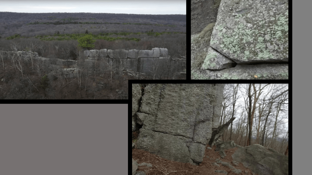
My starting point for the research in this post are places in Pennsylvania that Aaron sent me that he had identified as looking like megalithic stone structures
Like “Boxcar Rocks,” also known as the “Chinese Wall,” and the “High Rocks,” on Gold Mine Road in Cold Spring Township in Lebanon County.
We are told that they are a natural geologic formation a little over a half-mile, or .8-kilometers, long, and 60-feet, or 18-meters, high, described as a long line of stacked boulders that were likely left over from melting glacial deposits during the last Ice Age.

Yet here are images that Aaron sent me where the stone blocks of Boxcar Rocks look like they have been cut-and-shaped!
Cold Spring Township was incorporated in 1853, and In 2010, there was a population recorded of 52 people.
Most of the Township is part of “Pennsylvania State Game Lands #211,” who manage the lands for the purposes of hunting, trapping, and fishing.
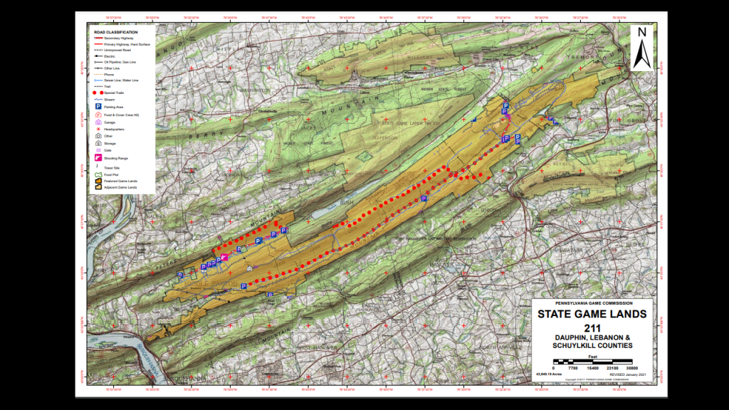
The Appalachian Trail runs through “Pennsylvania State Game Lands #211” in Swatara State Park.
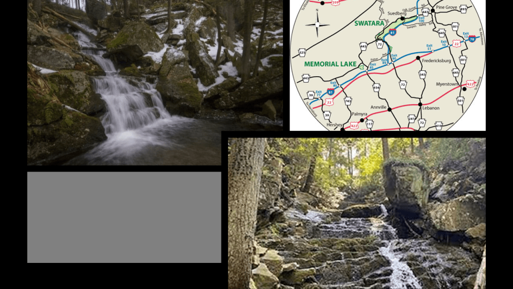
This is Lock #5 of the old Union Canal on the “Bear Hole Trail” of Swatara State Park.
This section of the Union Canal was said to have been closed after the dam holding the reservoir was washed away by a devastating flood in 1862, and the rest of the Union Canal was said to have been closed to use in 1885 because it could not compete with the “efficiency of the railroad.”
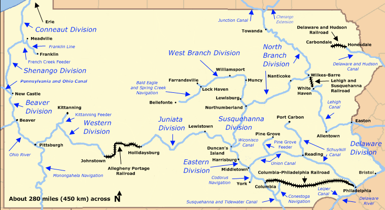
The 82-mile, or 132-kilometer, -long Union Canal in southeastern Pennsylvania between Middletown, Pennsylvania to Reading, Pennsylvania, was said to have been built between 1792 and 1828, until it closed in 1885.

We are told the American Canal Age was between 1790 and 1855, and started in Pennsylvania, where the first legislation surveying canals was passed in 1762.
The construction of the Union Canal was said to have started under the administration of President George Washington in 1792, and was touted as the “Golden Link” in providing an early transportation route for shipping anthracite coal and lumber to Philadelphia.
The “Main Line of Public Works,” of which the Union Canal was a part of, was passed by the Pennsylvania Legislature in 1826.
It funded various transportation systems, including canal, road, and railroad.
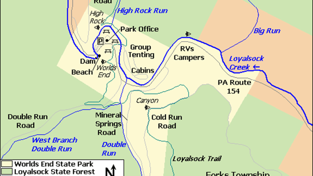
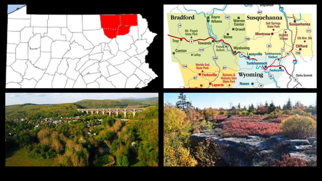
Next, Aaron drew my attention to the World’s End State Park is in Forksville, Pennsylvania, a small village of about 200 people in the Loyalsock State Forest.
World’s End State Park is situated around the s-shaped bends of Loyalsock Creek.
These locations are in Pennsylvania’s “Endless Mountains,” a region of northeastern Pennsylvania that are not considered true mountains, but a dissected plateau on the Allegheny Plateau.
We are told the “Endless Mountains” are comprised of sedimentary rocks of sandstone and shale that were part of a lowland that collected sediments from mountains to the southeast that eroded millions upon millions of years ago.
This region was historically inhabited by the Susquehannock, Iroquois, and Munsee-Lenape peoples.
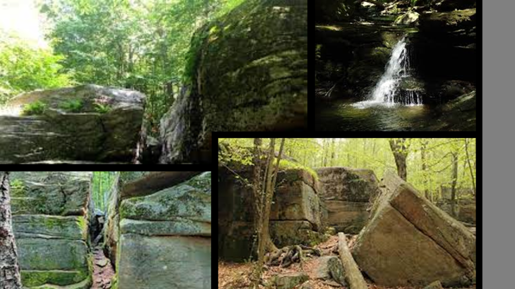
Here are some pictures from the “World’s End State Park,” in the “Endless Mountains.”
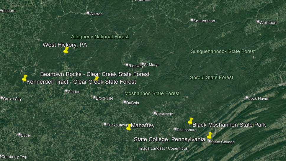
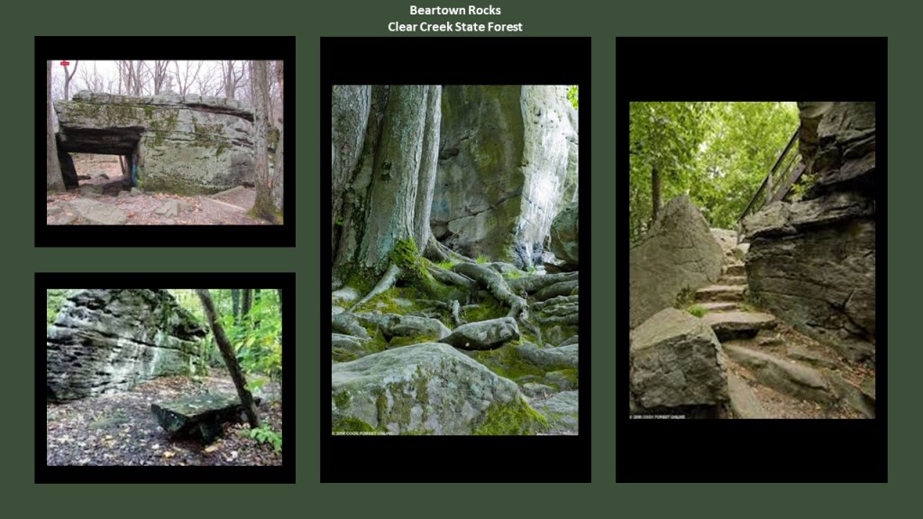
Beartown Rocks can be found in Clear Creek State Forest near Sigel, Pennsylvania, in Jefferson County.
With a population a little bit larger than Forksville, Sigel has a small population of a little over 1,100 residents at last count.
This is what we are told.
Clear Creek State Forest was formed because of the depletion of old-growth forests by lumber and iron companies that took place in the mid-to-late-19th-century.
The forests were clear-cut, and wildfires caused by the sparks of passing steam kept the formation of new-growth forests from occurring.
Conservationists became alarmed that the forest would never re-grow, so they lobbied the state to purchase the land from the lumber and iron companies, which they were happy to sell because they had been depleted of resources.
The land that became the Clear Creek State Forest was purchased in 1919, at the end of the “lumber-era” that had swept through the Pennsylvania Mountains, by the end of which, Pennsylvania was stripped of its old-growth forests.
The entire park was established on three tracts of land in five Pennsylvania counties – Jefferson, Venango, Forest, Mercer, and Clarion.
Beartown Rocks in the part of the park in Jefferson County near Sigel are described as a beautiful rock formation consisting of “house-sized” boulders, that are spread out far enough they have road-like spaces in-between them, making it feel like a “rock city.”

In the section of the park in Venango County, I found references to an historic railroad that ran along-side the curvy Allegheny River in the Kennerdale Tract of the Clear Creek State Park in Venango County that is now part of the hiking trail system here.
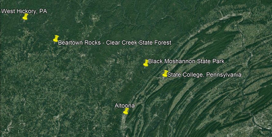
The Clear Creek State Park is very close to West Hickory, Pennsylvania.
As a matter of fact, these other places I am looking at are close to West Hickory too!
More on this as we go.
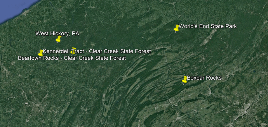
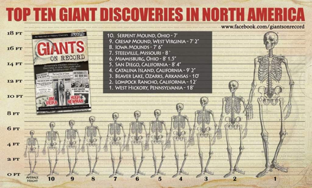
West Hickory is where the tallest recorded skeleton in North America was found, at 18-feet, 5.5-meters.
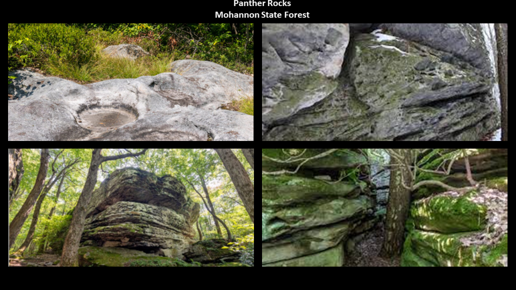
Aaron also directed my attention to Panther Rocks in Moshannon State Forest, with its main offices in Penfield, Pennsylvania in Clearfield County’s Huston Township.
In the 2020 census, the population of Huston Township as a whole was recorded as a little under 1,300 people.

At one time in Penfield’s history, it was a company town for the logging and coal mining industries in what was a local resource extraction economy, and the railroad came through here at one time.
Immigrants from Europe settled in the area to work the deep mines scattered through the Benzette Valley here.
There’s not much left to speak of in Penfield, but there are recreational activities nearby at Moshannon State Forest, Bilger’s Rocks Park, Black Moshannon State Park, and Parker Dam State Park.
We find the same story at Moshannon State Forest that we found at Clear Creek State Forest – it was formed as a direct result of the depletion of the forests of Pennsylvania that happened in the mid-to-late 19th-century, when lumber and iron companies clear-cut the forests and sparks from passing steam-locomotives caused wildfires from the remnants of the forest-lands, preventing the growth of new forests.
The land that became Moshannon State Forest was purchased by the State in 1898.
The old-growth forest was gone by 1921, with a second-growth forest replacing it since then.
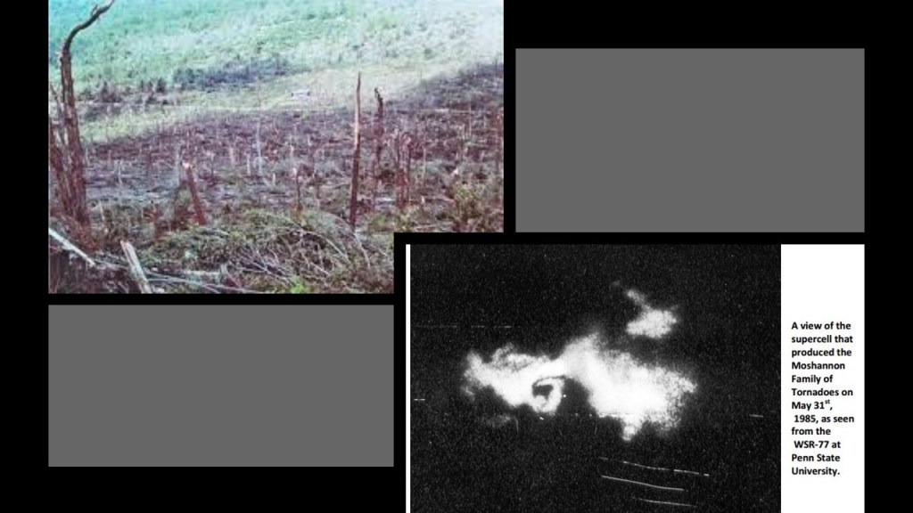
Interesting to note that a tornado in 1985 tore through the forest and destroyed an estimated 88,000 trees.
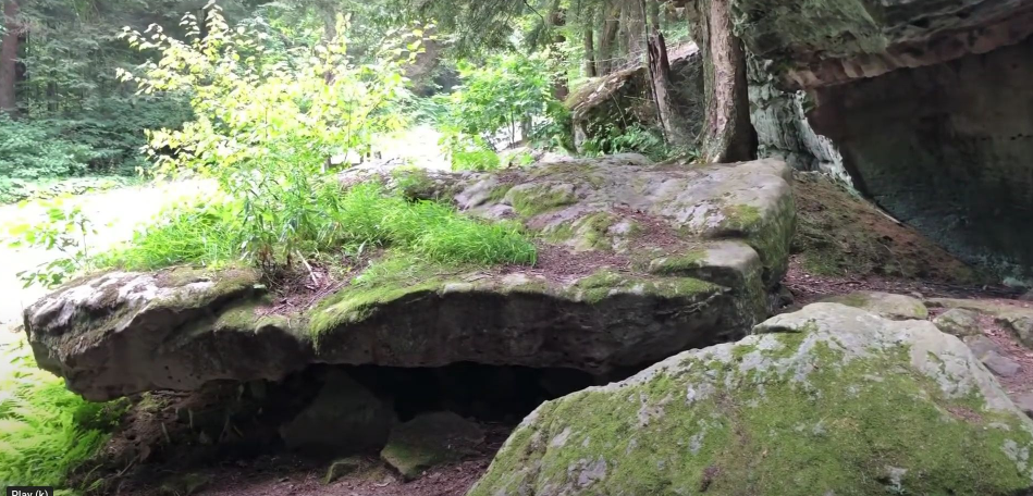
Panther Rocks at Moshannon State Forest are described as a small rock city made of several large sandstone blocks, complete with streets, overhangs, channels, crevices and a short tunnel
They were said to have formed more than 300-million-years ago in the by sediments deposited in streams and rivers.
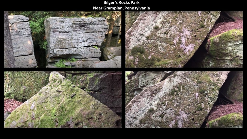
The nearby Bilger’s Rocks in Clearfield County’s Bloom Township near the town of Grampian, and is larger stone-city than what is found at Panther Rocks.
The creation of Bilger’s Rocks was also said to have taken place more than 300-million-years ago, formed by sediments deposited in streams and rivers.
Bilger’s Rocks has many examples of what appears to be toolmarks, and linear patterns that look like they were carved or molded, and has the same rock-city-like qualities of these other places we have been looking at tucked away in the Pennsylvania Park system.
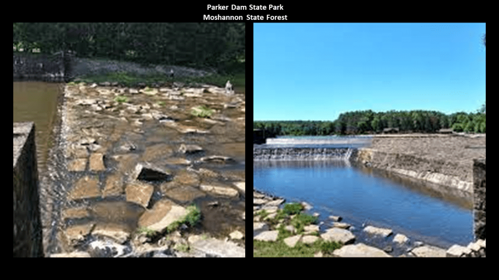
Parker Dam State Park is surrounded by the Moshannon State Forest.
The Park was said to have been constructed by the Civilian Conservation Corps during the Great Depression.
The original dam here was said to have been constructed by William Parker as a splash dam for the movement of lumber after he leased lumbering rights at some point after lumber harvesting began here in 1794, and the CCC was said to have built the current dam there to replace it as part of the improvements the otherwise unemployed, unskilled young men made when they came to work on the park.
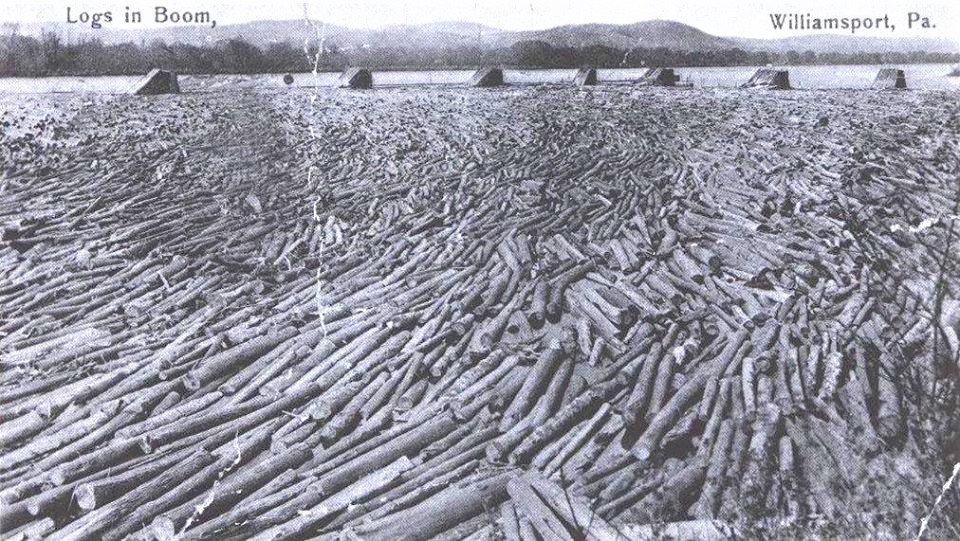
There was much logging going on from this region, so the “Susquehanna Boom” was said to have been built in the 1850s across the West Susquehanna River at Williamsport, a system of cribs and chained logs designed to catch and hold floating timber until it could be processed, and logging railroads built to transport the lumber, to the tune of 45-cars per day until logging ended here in 1911, when all the trees were gone.
The lumbermen left a barren landscape that was devastated by fires, flooding and erosion more many years, until the CCC came in the 1930s and started replanting trees after the State of Pennsylvania bought the deforested land from the Central Pennsylvania Lumber Company in 1930.
The Civilian Conservation Corps CCC operated from 1933 to 1942 in the U.S. for unemployed, unmarried men to do manual labor related to the conservation and development of natural resources in rural lands owned by federal, state, and local governments.
Originally for young men ages 18–25, it was eventually expanded to ages 17–28.
In the nine-years of its operation, the CCC employed 3,000,000 young men.

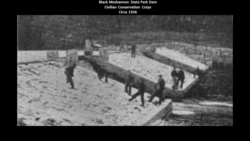
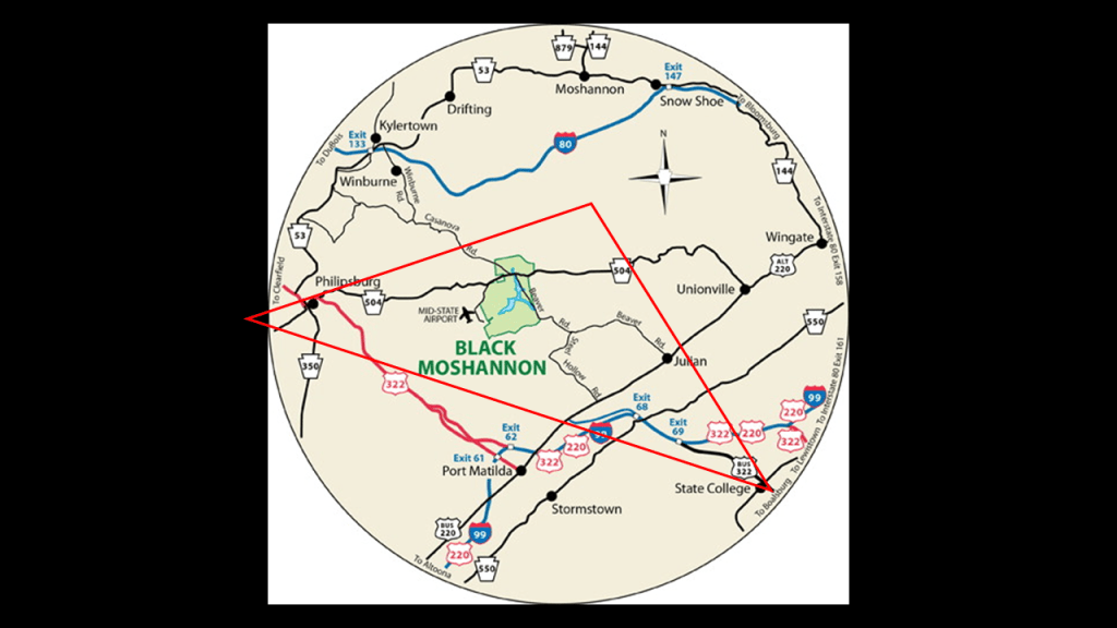
Black Moshannon State Park is largely surrounded by the Moshannon State Forest.
It is located in Rush Township in Centre County, and surrounds a lake formed by another dam, also said to have been constructed by the CCC, on Black Moshannon Creek at the site of a former mill-pond dam.
Black Moshannon State Park is the home to the largest reconstituted bog in Pennsylvania, a wetland that accumulates peat as a deposit of dead plant materials, which contains carnivorous plants, orchids, and species typically found further north.
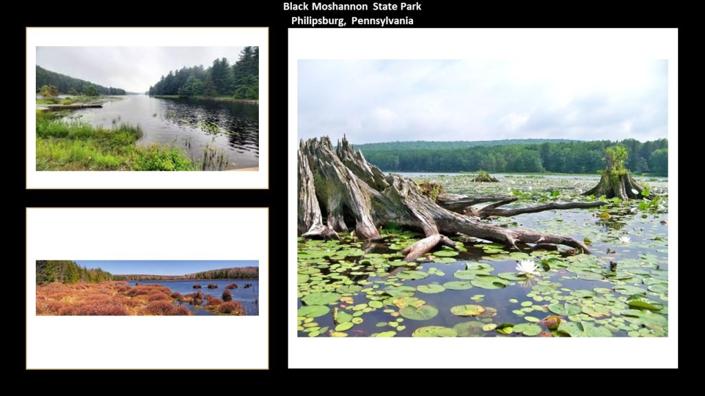
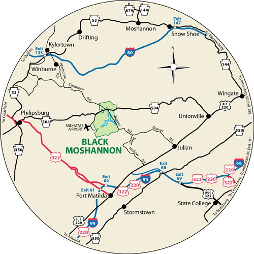
Black Moshannon State Park is is 9-miles, or 15-kilometers east of Phillipsburg on Pennsylvania Route 504.
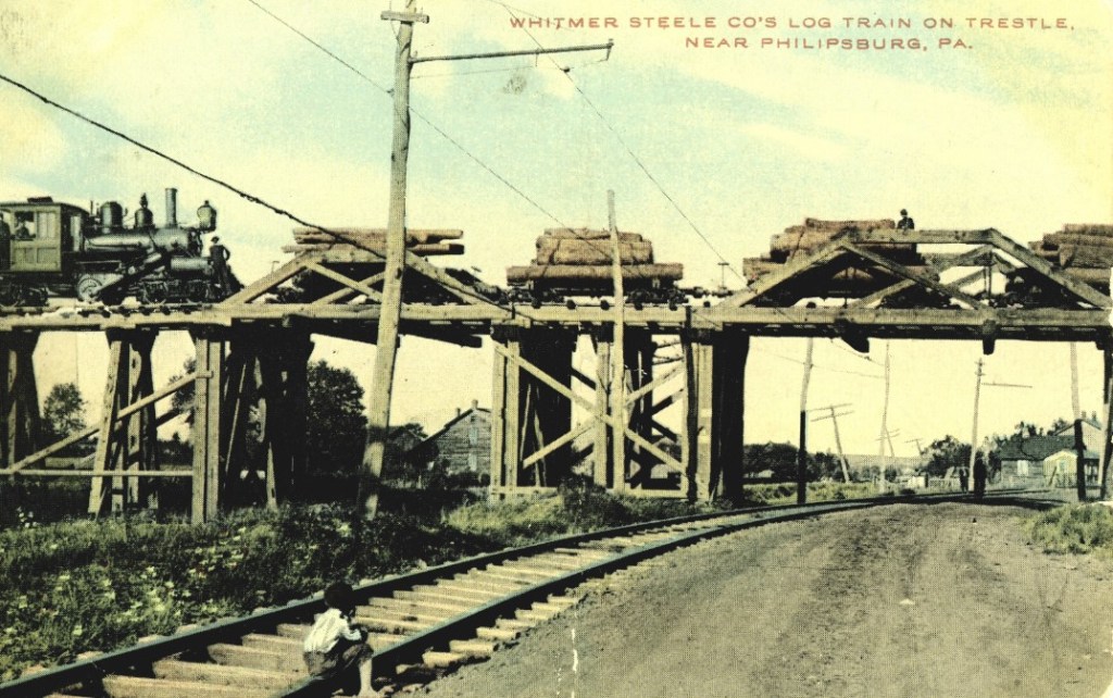
Philipsburg Borough was founded in 1797 by one Henry Phillips, who purchased 350,000 acres on the western side of the Allegheny Mountains for $173,000, and the proceeded to auction the land off on the streets of Philadelphia for two-cents per acre.

The region developed around the lumber and coal-mining industries.
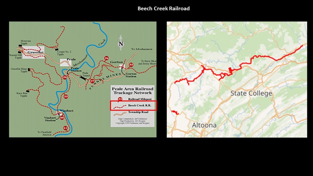
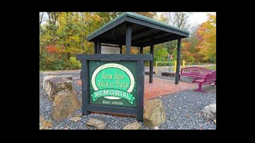
The “Snowshoe Rails to Trails” is near Philipsburg and Black Moshannon, and is seen here in the top-left-hand corner, right next to the Moshannon River where the arrows are pointing.

The “Snowshoe Rails-to-Trails” has 19-miles, or 31-kilometers, of abandoned railroad bed along 37-miles, or 60-kilometers, of legalized Snowshoe Township Roads for ATVS/UTVs.
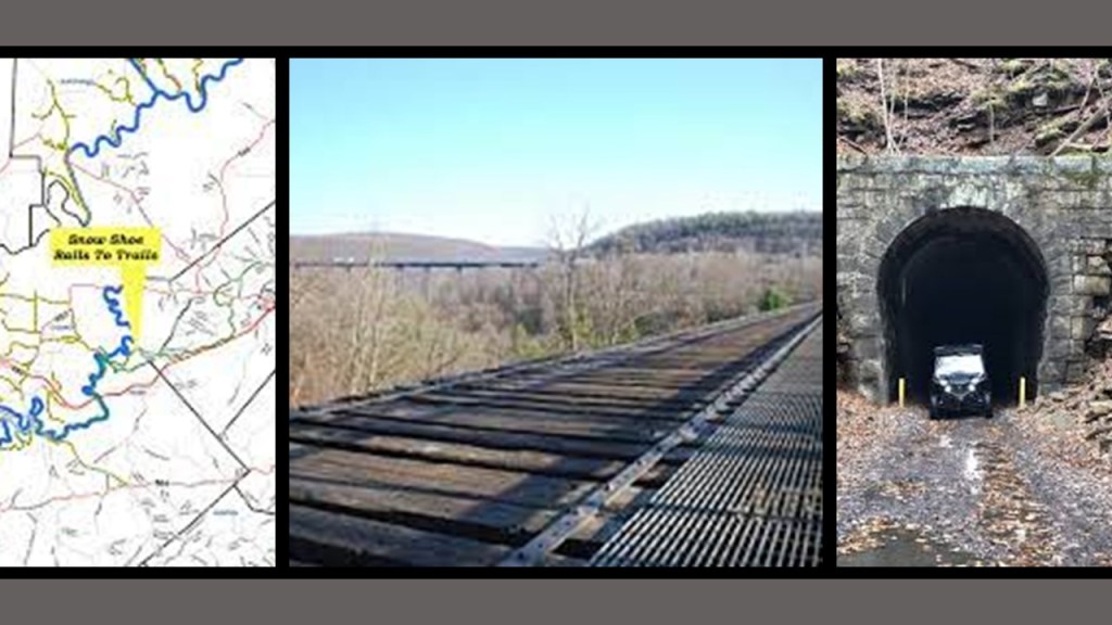
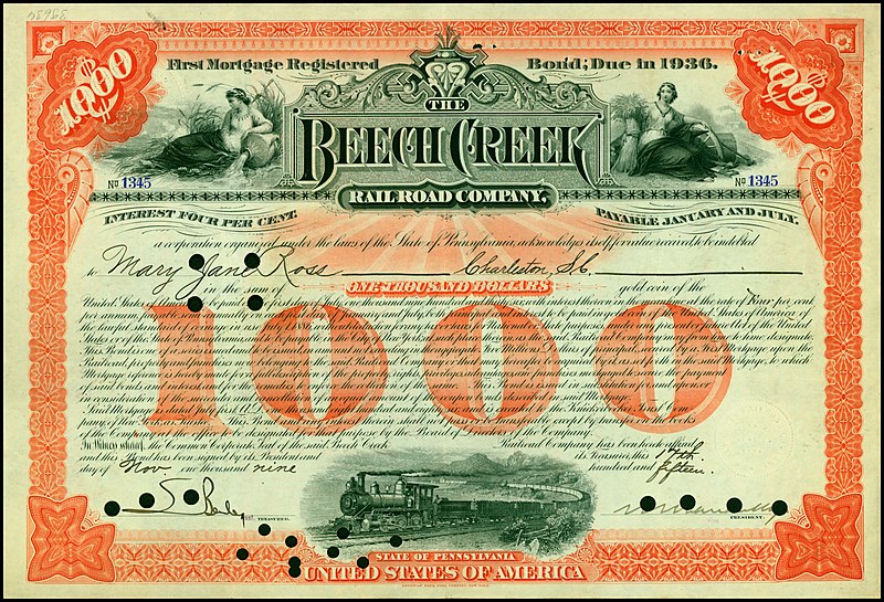
We are told that it was originally the route of the Beech Creek Railroad between the South Jersey Shore and Mahaffey Borough, Pennsylvania, and part of the Susquehanna and South Western Railroad, and used for coal mining services in the region starting in 1884.
This railroad ran near State College, home of Penn State University, and not far from Altoona, Pennsylvania.
More on State College and Altoona to come in this post.
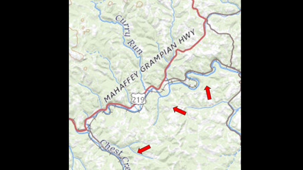
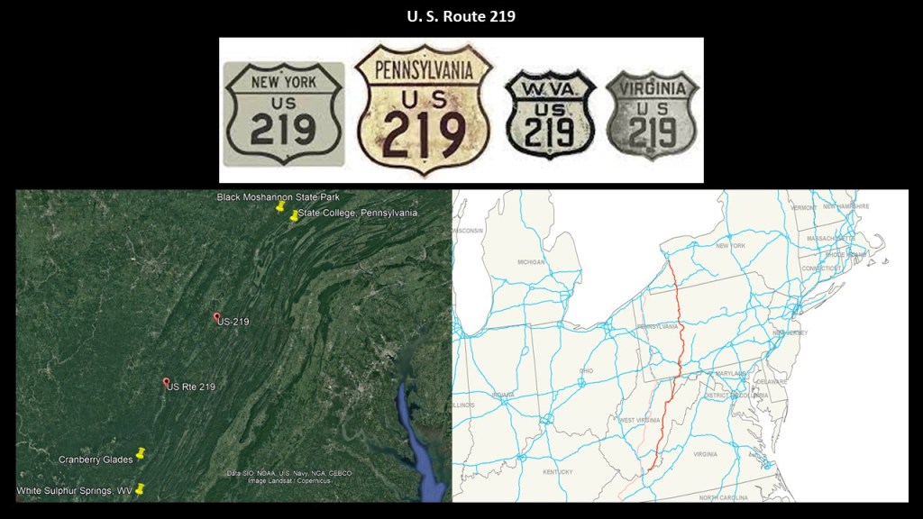
Mahaffey Borough, first incorporated in 1841, was located on U. S. Route 219, at the junction of the New York Central Railroad and the Hudson River Railroad.
The arrows point to where railroad tracks ran along s-shaped river-bends. on this section of Route 219 going through Mahaffey Borough.
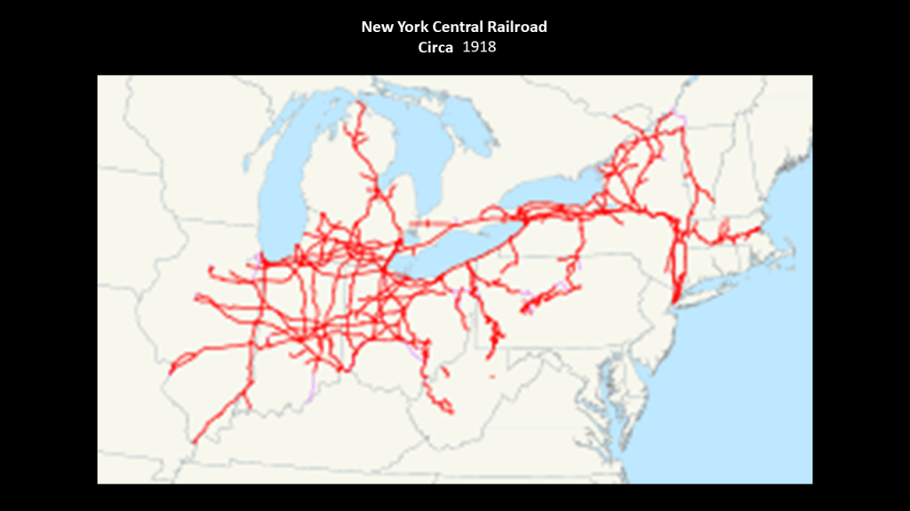
This railroad project in Pennsylvania was said to have been backed and financed by William H. Vanderbilt, President of the New York Central Railroad.
The New York Central Railroad was said to have begun operating in 1853 with the consolidation of earlier independent companies running between Albany and Buffalo. This graphic depicts the New York Central rail system as of 1918.
We are told extensive trackage existed in the states of New York, Pennsylvania, Ohio, Michigan, Indiana, Illinois, Massachusetts, and West Virginia, plus additional trackage in Ontario and Quebec, and by 1925 operated 26,395-miles, or 42,479-kilometers, of track.
William H. Vanderbilt had developed a plan to facilitate railroad access to enter the “Clearfield Coalfield,” a large, juicy coal-mining area in Clearfield County, which would have been otherwise exclusively accessed by the Pennsylvania Railroad.
It was said to have been constructed starting at the end of 1882 to high-standards, including extensive curvature, bridges, and a tunnel, and became operational in November of 1884.
Eventually, this railroad line provided passenger service and used as such until 1990.
In 1994, the right-of-way was acquired by the Headwaters Charitable Trust for the “Snowshoe Rail-to-Trail Project” and the rail went away.
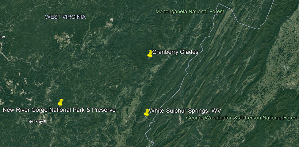
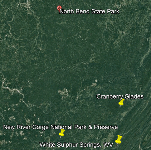
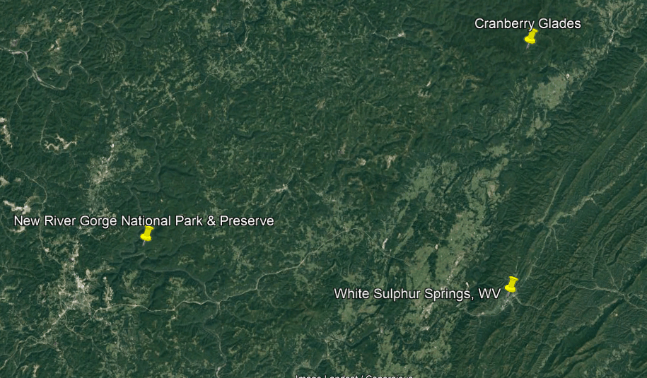
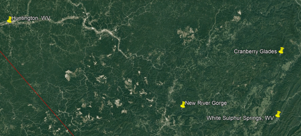
Like Black Moshannon State Park, the Cranberry Glades Botanical Area in West Virgina is an area of boreal bogs located near US Route 219.
This is the same U. S. Route 219 we saw in connection with Mahaffey Borough, located on U. S. Route 219 at the junction of the New York Central Railroad and the Hudson River Railroad.
The Cranberry Glades Botanical Area is located close to both the New River Gorge National Park and Preserve, and White Sulphur Springs.
First, New River Gorge National Park and Preserve.
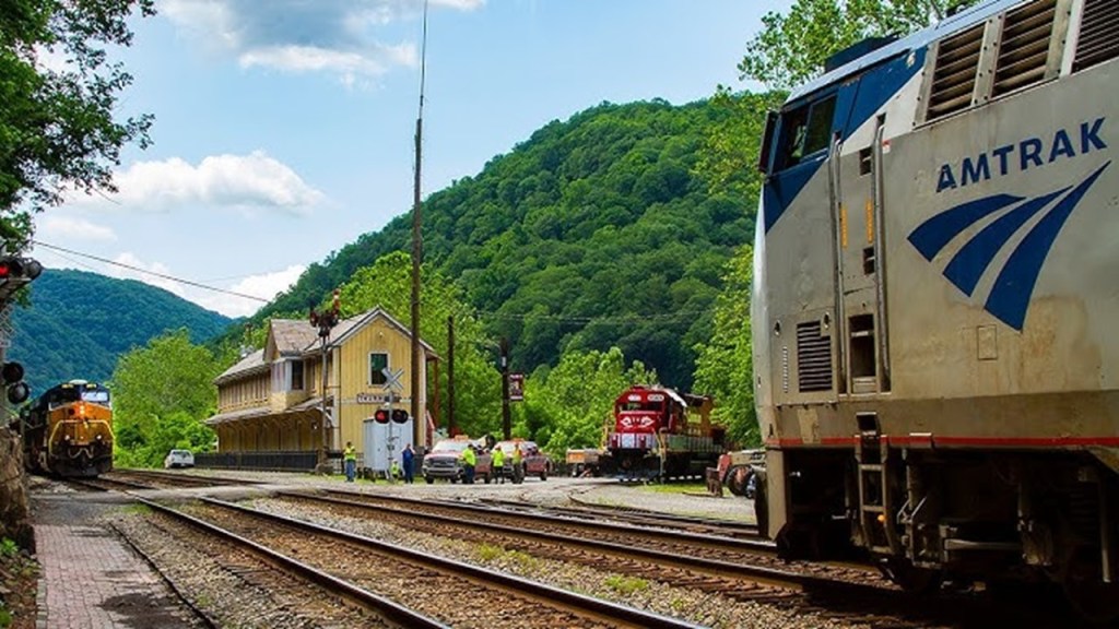
The New River Gorge is one of the few places that I know of that still has a railroad operating right along beside the s-shaped New River.
The Amtrak Cardinal still runs through the New River Gorge 3 days/week – on Sundays, Wednesdays and Fridays.
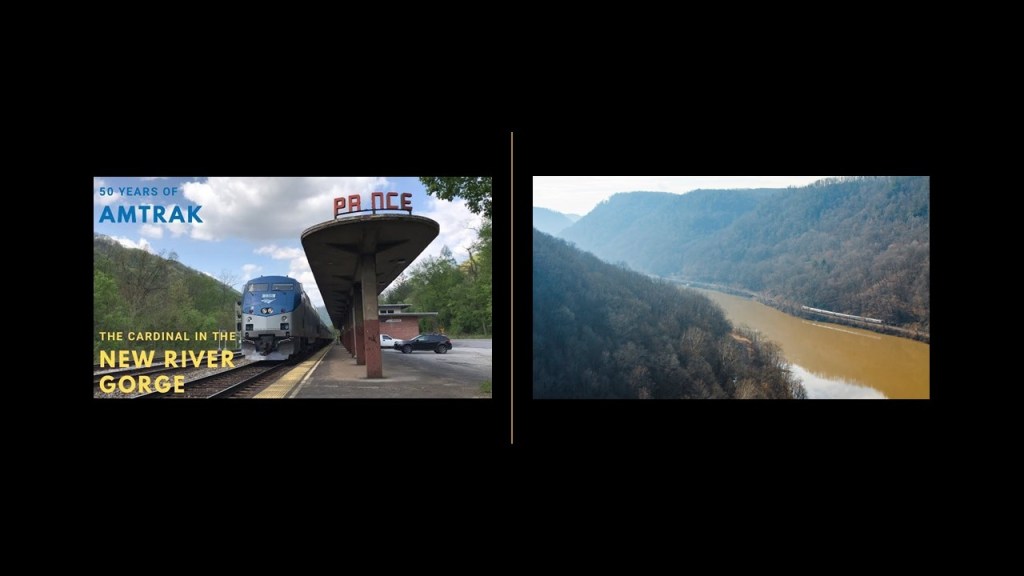
Besides the railroad line that runs along the New River through the New River Gorge in West Virginia, there are things found in the gorge like historic coal mines, waterfalls, and hydro projects.
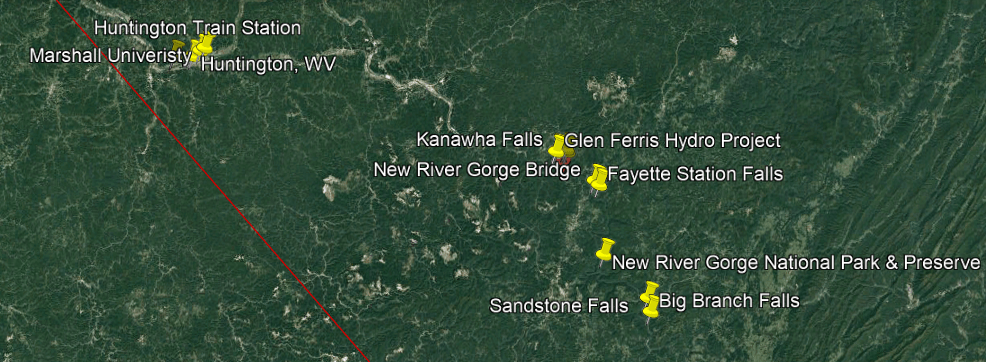
We are told that after the Chesapeake and Ohio Railway opened up this rugged wilderness in 1873, coal was carried out of the New River Gorge to the ports in Virginia and to cities in the Midwest.
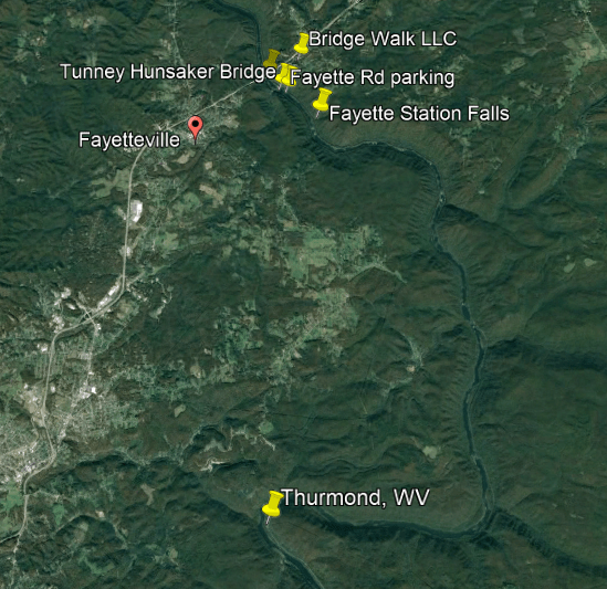
As a result, by 1905, thirteen cities sprang up between Fayette and Thurmond, which was 15-miles, or 24-kilometers, upstream, and provided the West Virginia coal that contributed greatly to the industrialization of the United States until the 1950s.
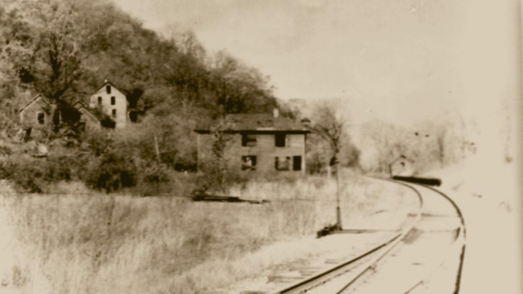
After the coal seams were exhausted and mines closed, these company towns like Fayette were for the most part completely abandoned, with the possible exception of Thurmond which had a very small population of 5 in 2010.
Aaron sent me information about the Red Ash and Rush Run Coke Ovens near Thurmond.
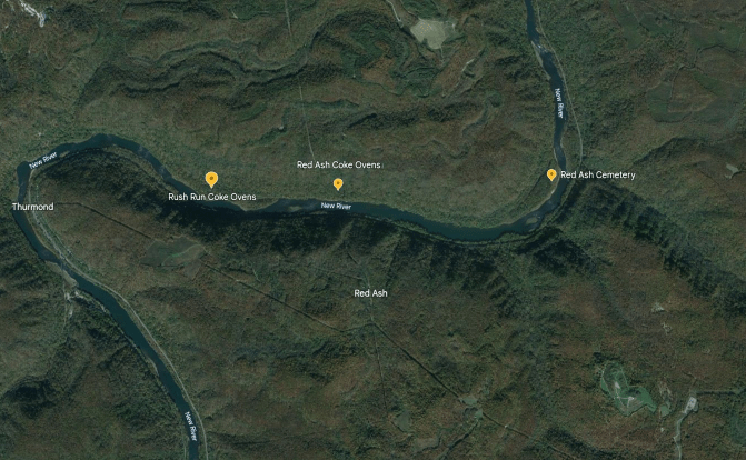
The Rush Run Coke Ovens were said to belong to the Rush Run Mining Company, and there were believed to have been up to 180 of them at this location, which borders the railroad tracks.
Coke ovens are described as being made of brick, or some kind of heat-resistant material, and used to separate the coal-gas, coal-water, and tar.
Coke is formed when the coal-gas and coal-water fuse together, and is used primarily in steel-production.
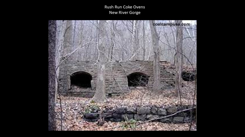
Rush Run was established as a coal-mining community in 1889 when the post office first opened, and boomed until the post office closed in 1939.
The mine there continued to operate until it was closed in the 1940s.
The nearby Red Ash coal camp was developed by the Red Ash Coal and Coke Company in 1891, for a high-quality coal that burned with a “fine red ash.”
There were estimated to be 80 coke ovens here at one time, and the mine was exhausted by the 1950s.
So, the typical pattern seen throughout this whole region known as Appalachia is communities and railroads coming on-line only for a short-time in order to extract resources until they are exhausted, and then they are gone.
We’ve seen multiple examples of this pattern, and we will continue to see it throughout this video.
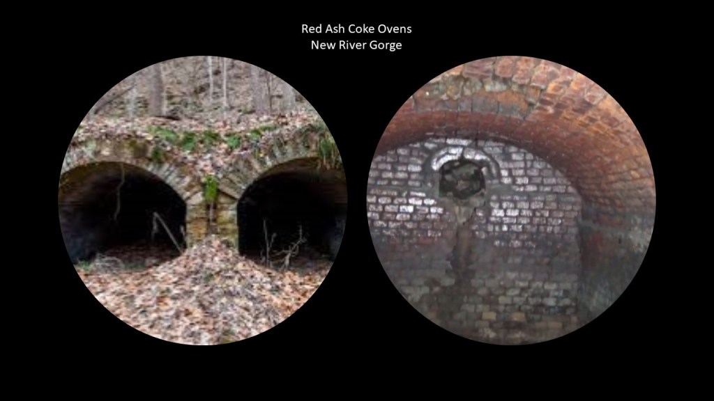
Also, there’s a service tunnel at the location of the Red Ash Coke Ovens.
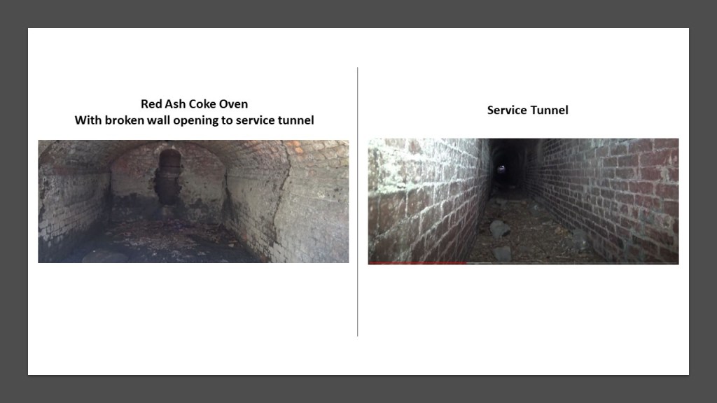
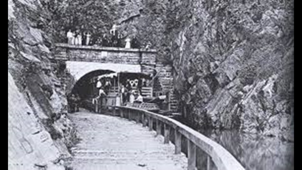
The fine brick-work found at the Red Ash facilities reminds me of the fine brickwork I have seen in tunnels all over the place, including what is called the Great Tunnel of the C & O Canal in Allegheny County, Maryland, and part of the Paw Paw Bends section of the Potomac River as it is winding its way through West Virginia and Maryland.
Built using more than 6,000,000-bricks, this tunnel has been described as the “greatest engineering marvel along the Chesapeake and Ohio Canal National Historical Park.”

The Paw Paw Tunnel was said to have been built between 1836 and 1850 for the C & O Canal to by-pass the bends in the Potomac River near Paw Paw, West Virginia, with no work having been done on it between 1841 and 1847 due to construction and financial problems.
The C & O Canal closed to canal boats in 1924.
Canals, like the railroads, were found running next to rivers, and the Potomac River is a good example of this, like here where the canal and the railroad run side-by-side at Point of Rocks, Maryland.

We are told that the C & O Canal, and other canals, were made obsolete because the railroad was so much more efficient and canals couldn’t compete with them.
Such as the Wabash and Erie Canal, which was said to have been built during roughly the same time period as the C & O Canal.

Canals like the C & O Canal subsequently became a popular hiking, biking and canoeing venue, as we are seeing with the Rails that quietly became trails when no one was paying attention.

It is interesting to note that at one time in its history, Thurmond was a prosperous railroad town that was the largest, revenue-generating stop on the C & O Railroad, where passenger and coal trains rolled through here throughout the day.
Today, a visitor center for the National Park Service operates here in the old railroad depot.

CSX Transportation, formerly the C & O Railroad, has freight transportation operations in and through historic Thurmond, and the Amtrak Cardinal passenger route goes through here, the second-least-used Amtrak station in the nation.
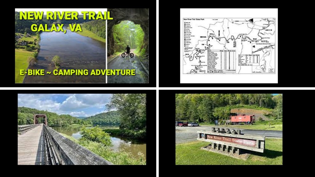
So whereas the railroad that runs alongside the New River in the New River Gorge is still operational for freight and passenger service, the railroad that used to run beside the New River in Galax, Virginia, to the southwest of the New River Gorge, was abandoned in 1985, and the former railroad right-of-way became the New River Rail Trail.
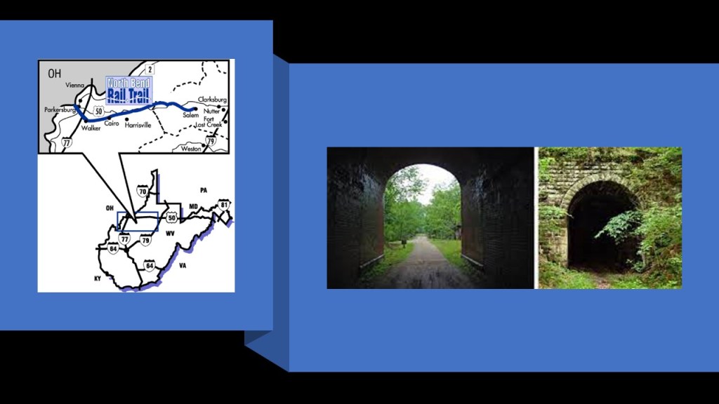
Starting at the North Bend State Park in Cairo, West Virginia, northwest of Cranberry Glades and northeast of the New River Gorge, there is the 72-mile, or 116-kilometer, – long hiking corridor known as the “North Bend Rail Trail.”
What is now the North Bend Trail was at one time one of the most distinguished railroad lines in United States History.
During its prime, it hosted the B & O Railroad’s premiere passenger train, the National Limited, between New York City and St. Louis, Missouri.
Eventually the rail-line that was part of the North Bend Rail Trail became freight-only, and the line was abandoned and dismantled in 1988.
The trail, completed between 1991 and 1996, has beautiful, red-brick tunnels along the way.
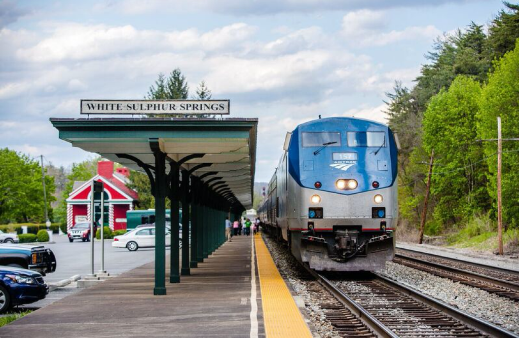
Now I am going to take a look at White Sulphur Springs, West Virginia, which is roughly 24-miles, or 39-kilometers, to the southeast of the bogs at Cranberry Glades.
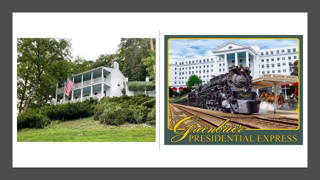
White Sulphur Springs was said to have been settled in 1750, and developed as a health spa in the 1770s, as the story goes after a woman was healed of rheumatism after bathing in the springs, and calls itself “America’s Resort since 1778.”
The springs are on the grounds of the Greenbrier Hotel, which was said to have been built by the Chesapeake & Ohio Railroad Company in 1913.

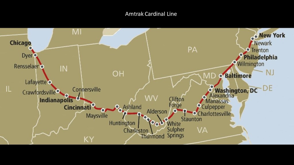
Even today, the same Amtrak Cardinal Line that runs through the New River Gorge has a station at White Sulphur Springs.
The Greenbrier Resort was at one time a Presidential getaway, with President Eisenhower the last President in office to have stayed there, with 27 presidents having stayed at the hotel before him.
The Presidents’ Cottage is a museum today.
A top-secret, super-sized underground bunker was said to have been constructed there in the 1950s during the Eisenhower Administration to serve as a relocation point for the U. S. Congress in the event of a nuclear war, but when the secret came out in 1992 in a newspaper article, it was decommissioned.
It had features like:
–A 25-ton blast door that opened with only 50-lbs of pressure
–It’s own power plant with purification equipment, and the capacity for 75,000-gallons of water storage, and 42,000-gallons of diesel fuel
–Every kind of medical care one would ever need
–Sleeping, meeting, and eating facilities for over 1,000 people.
It was kept stocked with supplies for thirty-years but never used as an emergency location.
In 1995, the government ended the lease agreement with the Greenbrier, and it was opened to the public for tours, which it offers to this day.

Today’s Amtrak Cardinal Line runs between New York and Chicago, by way of Washington, DC; through White Sulphur Springs, Cincinnati, and Indianapolis, on its meandering route.
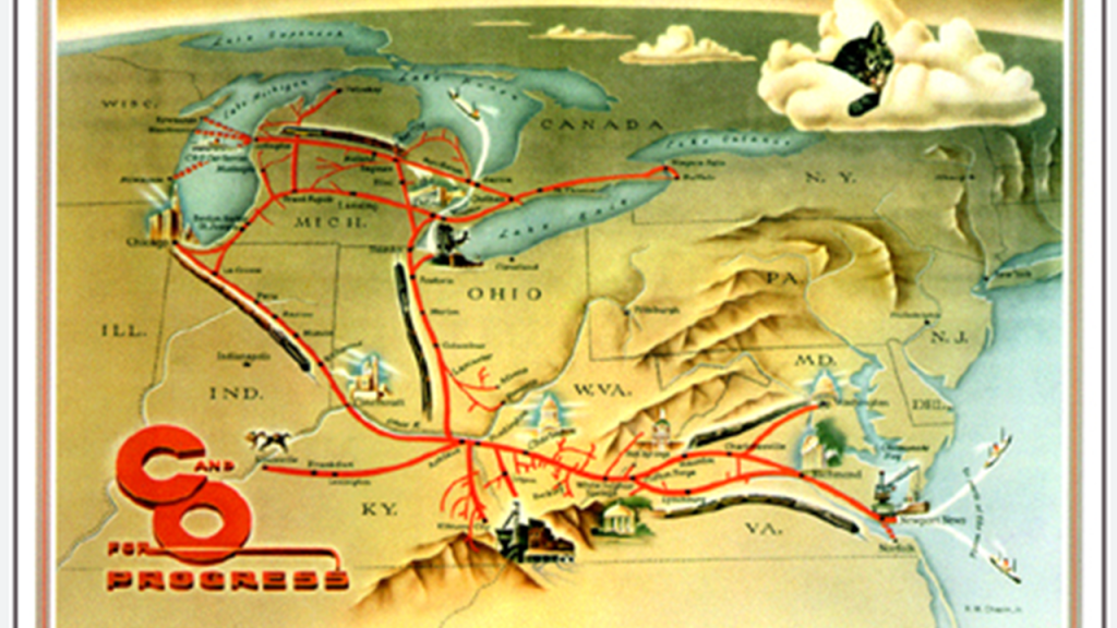
The Amtrak Cardinal Line was once a part of, among others, the Chesapeake and Ohio Railway.
It was formed in 1869 from several smaller Virginia Railroads under the guidance of Collis P. Huntington, in order to connect the coal reserves of West Virginia with the new coal piers that were built in Hampton Roads and Newport News, Virginia, and first opened in 1873, forging a rail link to places like Chicago in the Midwest.
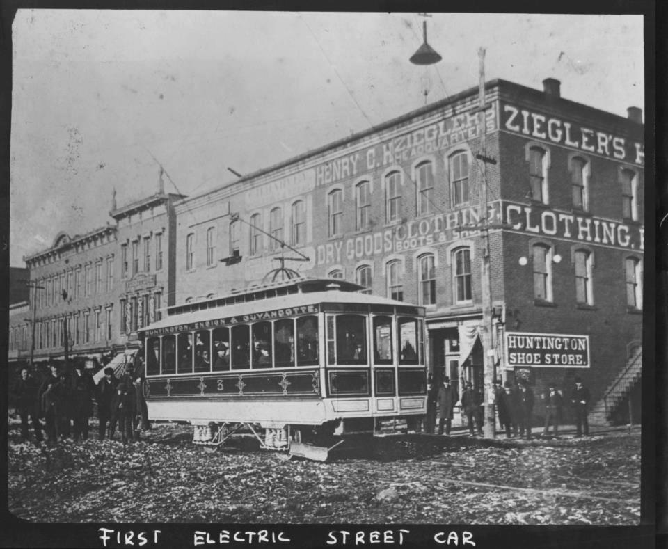
The city of Huntington in West Virginia was named for him.
Huntington was said to be one of the first American cities to have electric streetcars, with service believed to have started around the end of 1888, and ran until the 1920s, during which time the Ohio Valley Electric Railway had organized a gas-powered bus service, which by November 1937 had completely replaced all of Huntington’s former electric streetcar lines.
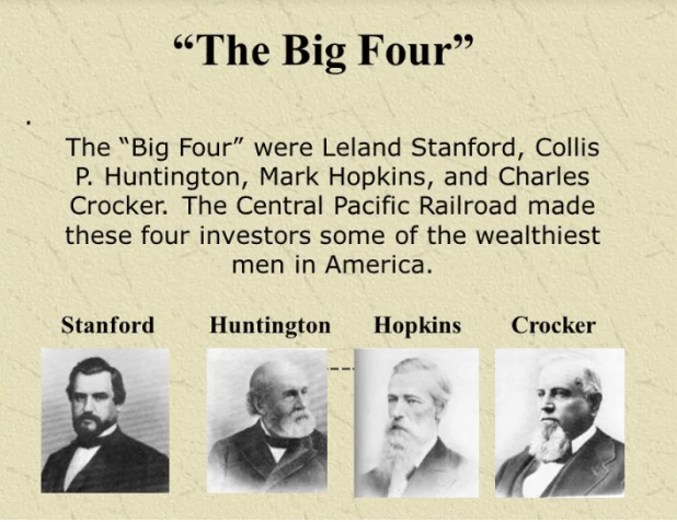
Collis P. Huntington was one of the Big Four of western railroading, along with Leland Stanford, Mark Hopkins and Charles Crocker.
Then in 1888, Huntington lost control of the railroad to J. P. Morgan, an American financier and investment banker who dominated corporate finance on Wall Street during the Gilded Age between 1877 and 1900, and William K. Vanderbilt, who managed the Vanderbilt family’s railroad investments.
William K. Vanderbilt was was the grandson of Cornelius Vanderbilt, one of the richest Americans in history, who was an American magnate, and who built his family’s fortune in shipping and railroads.
The process continued on for the C & O Railroad to consolidate and merge railroads, and, for example, to gain access to productive coal fields throughout the region, through the 1920s.

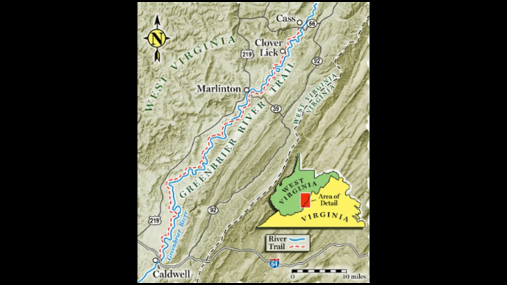
The Greenbrier River Trail is located between the Greenbrier Resort in White Sulphur Springs and Lewisburg on Interstate 64, and was also a former railroad bed and right-of-way.
Lewisburg is located near the junction of Routes 219 and and Interstate 64, just to the south of Cranberry Glades
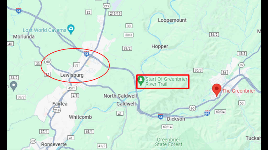
What is now the Greenbrier River Trail was gifted to the State of West Virginia in the late 1970s and opened as a recreational, multi-use trail in 1980.
It runs between North Caldwell, which is 3-miles, or 5-kilometers, east of Lewisburg on U. S. Route 60/Interstate 64,and Cass in Eastern West Virginia.
Cass, West Virginia, was founded as a company town in 1901 for the West Virginia Pulp and Paper Company, and named for Joseph Kerr Cass, the Vice-President and co-founder of the pulp and paper company.
Interestingly, this information on Joseph Kerr Cass on the “My Genealogy Hound” website from the “History of Allegheny County,” published in 1889, shows the following.
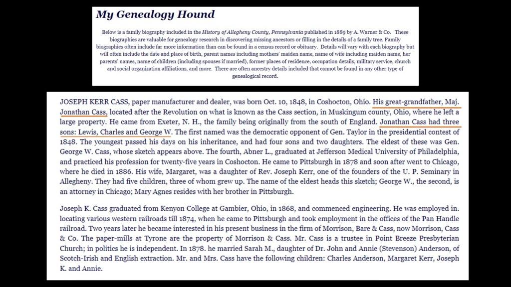
His great-grandfather was Revolutionary War Major Jonathan Cass, and Jonathan Cass was the father of Lewis Cass, who represents the State of Michigan in the National Statuary Hall at the U. S. Capitol.
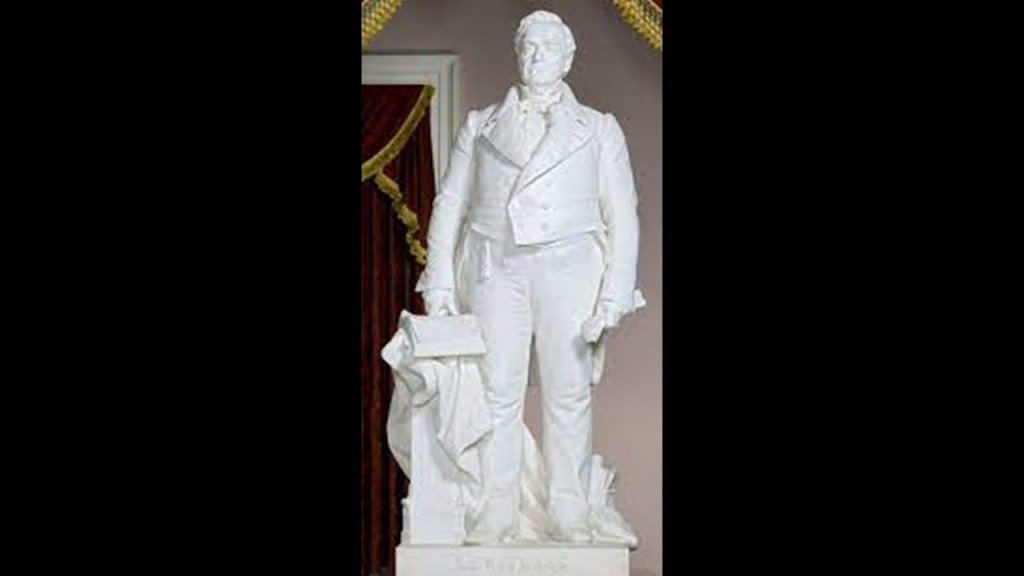
Lewis Cass, among other things, was President Andrew Jackson’s Secretary of War from 1831 to 1836.
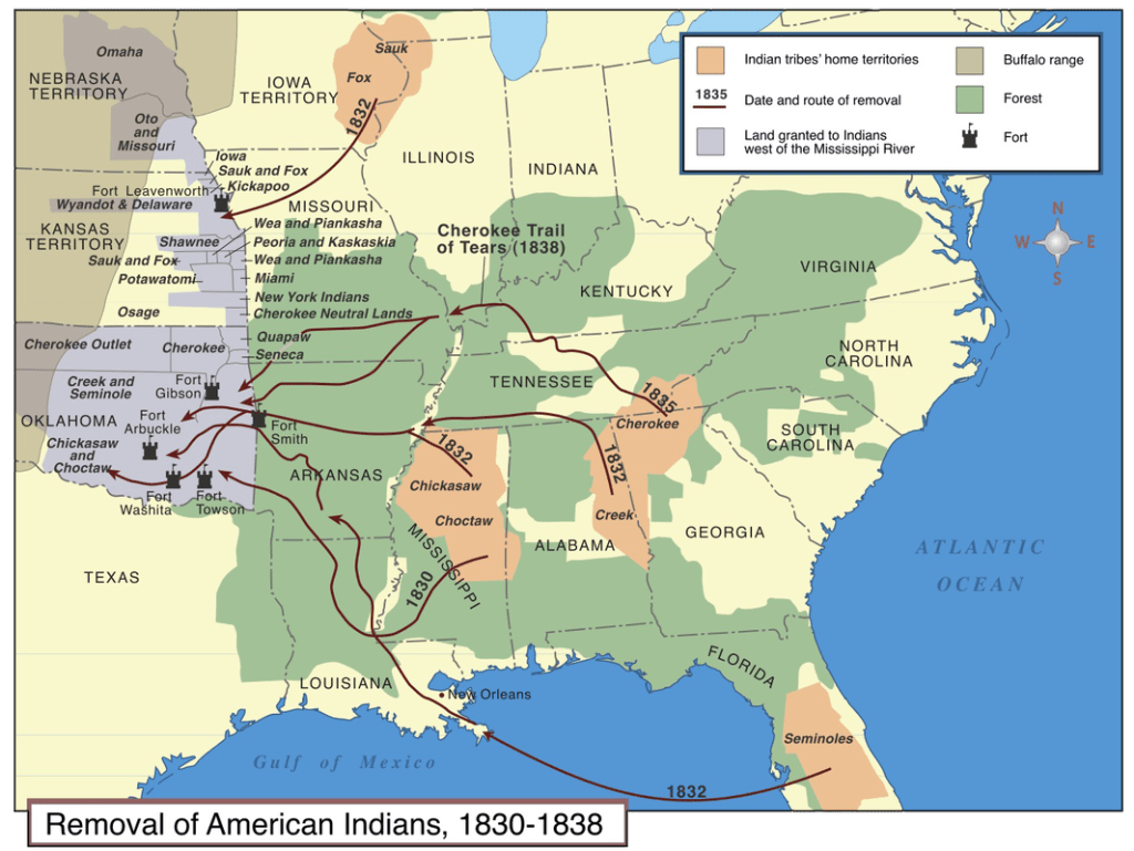
As President Jackson’s Secretary of War, Lewis Cass was central in implementing the Indian Removal policy of the Jackson administration after Congress passed the Indian Removal Act in 1830.
The Indian Removal Act was directed specifically at the Five Civilized Tribes of the Southeastern United States – the Cherokee, Creeks, Seminole, Chickasaw and Choctaw – though it also affected tribes in Ohio, Illinois and other areas east of the Mississippi River.
Most were forced to Indian Territory in present-day Oklahoma, Kansas, and Nebraska.
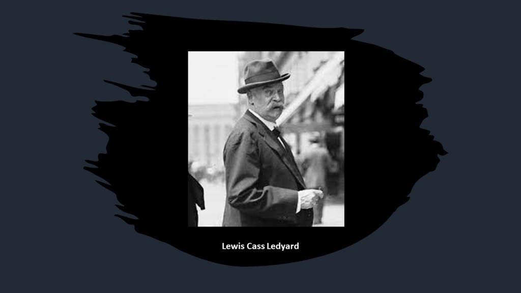
Lewis Cass was the grandfather of Lewis Cass Ledyard, a New York City lawyer, personal counsel to financier J. P. Morgan, and a President of the New York Bar Association.
Most of the town named for Joseph K. Cass, and its buildings, were bought by the State of West Virginia in 1961 after the pulp and paper mill closed in 1960, and it became the Cass Scenic Railroad State Park.
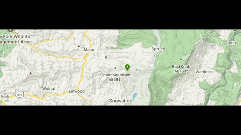
The Cass Scenic Railroad State Park continues to offer trips to Whittaker Station; the ghost town of Spruce; and Bald Knob, the highest point of the Back Allegheny Mountain in Pocahontas County.

The logs for the pulp mill in Cass came from the nearby Cheat Mountain, which were brought by rail to the mill for processing until the mills closure.
Cheat Mountain, which is next to the Back Allegheny Mountain, was once the home of the largest red spruce forest south of Maine.
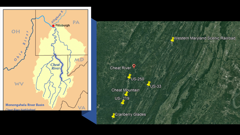
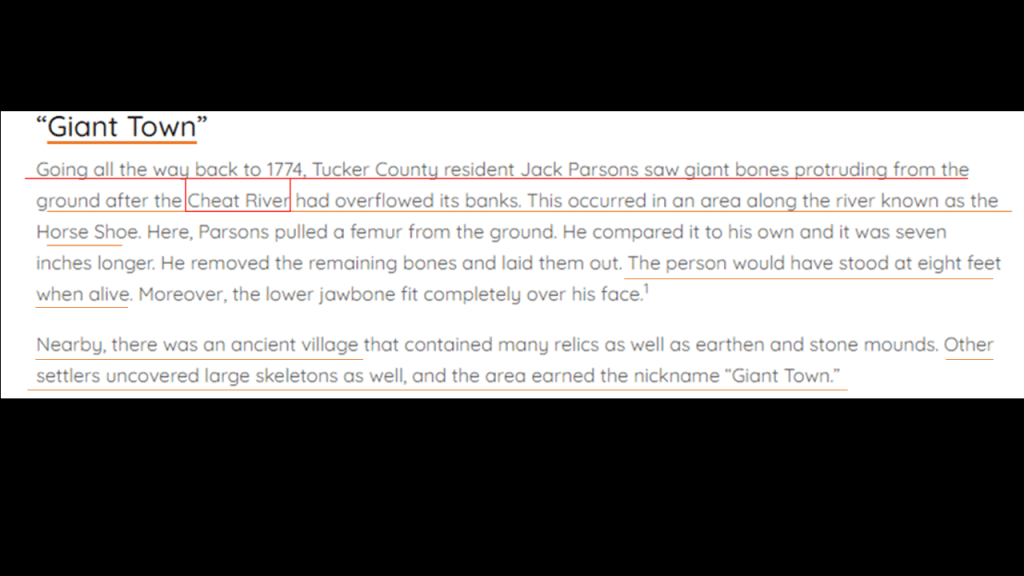
The Cheat River runs along this section of West Virginia between the state’s border with both Pennsylvania and Maryland.
Aaron sent me this reference to giant skeletons having been uncovered in the location of the Cheat River.
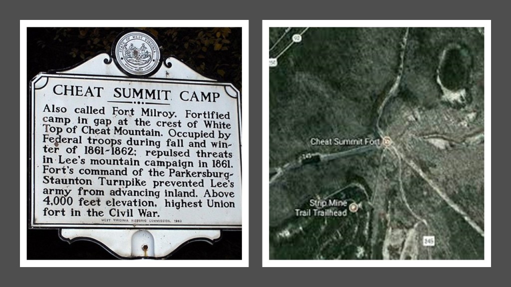
We are told that during the American Civil War, Cheat Mountain was of strategic importance during the early part of the Operations in West Virginia Campaign.
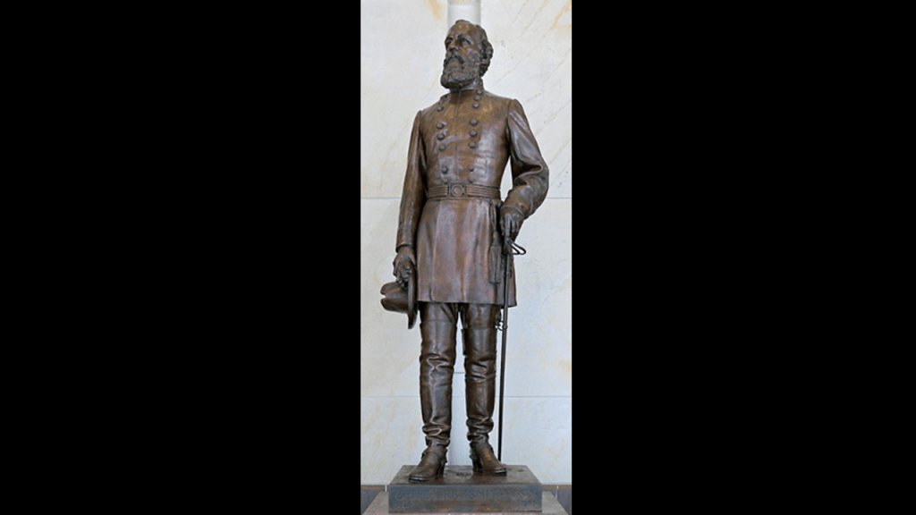
The Battle of Cheat Mountain, also known as the Battle of Cheat Summit Fort, took place between September 12th to 15th of 1861, and was the first battle that General Robert E. Lee led troops into combat.
The Battle of Cheat Mountain was a Confederate attempt to regain the Union occupied Fort Milroy on top of Cheat Mountain, but they were unsuccessful and “lost” the battle.
Aaron also provided me with recorded references to giant skeletons that were found in Marion County, that is tucked in-between West Virginia’s borders with Ohio to the West; Pennsylvania to the North; and Maryland to the East.
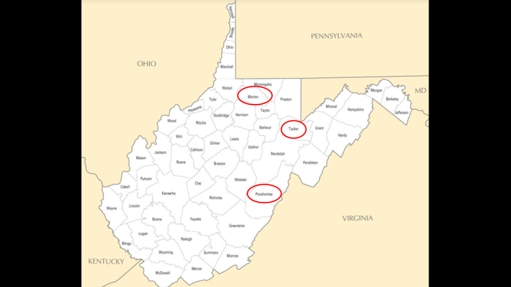
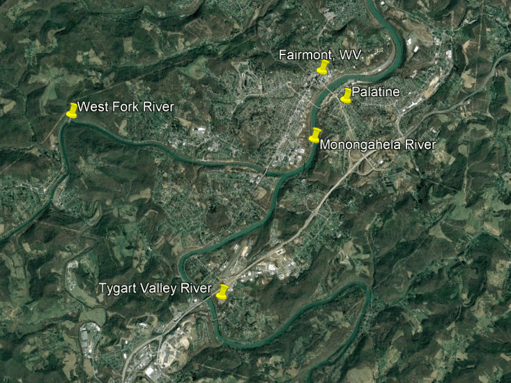
Fairmont is the seat of Marion County.

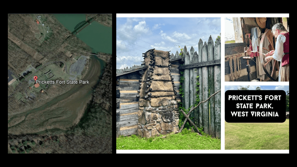
The location of “Pricketts Fort” is a short distance north of Fairmont.

Pricketts Fort State Park is at the confluence of the Monongahela and Pricketts Creek.
What the historical narrative tells us is that it is was a reconstructed “refuge fort,” built on Jacob Pricketts’ homestead, to defend local settlers from hostile indian raids, and these days commemorates life on the Virginia frontier in the late 18th-century.
A couple of interesting things to note about the Picketts Fort location.
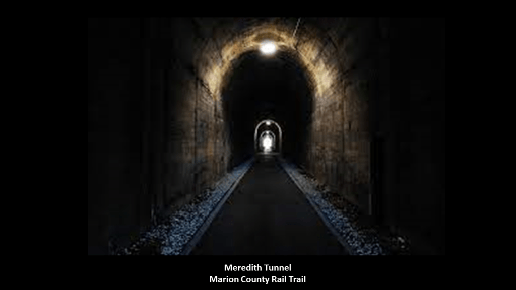
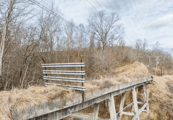
First is that the site of the fort is located on a river-bend, right next to an old railroad bridge that is now part of the Marion County Rail-Trail, and there are railroad tracks right next to the Monongahela River, still in use by the Fairmont Subdivision, a railroad from Grafton to Rivesville that is owned and operated by CSX Transportation on what used to be part of the B & O Railroad Mainline.
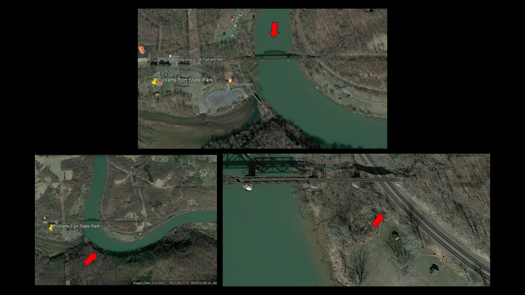
The Marion County Rail Trail runs for 2.5-miles, or 4-kilometers, from the Pricketts Fort State Park, along Pricketts Creek through rural Marion County, to Fairmont, including a long, lighted tunnel, said to have been built in 1914 by the Monongahela Railroad.
Fairmont is located just above the confluence of where the West Fork and Tygart Valley Rivers meet to form the Monongahela River.
I couldn’t help but notice all the s-shaped riverbends going on around here!
I searched for more information on Fairmont’s railroad history and this is what I found.
First, the Fairmont & Clarksburg Electric Railroad was an inter-urban electric streetcar system that served the Fairmont and Clarksburg areas, linked by a main-line, and several other communities and coal camps, starting in 1901.
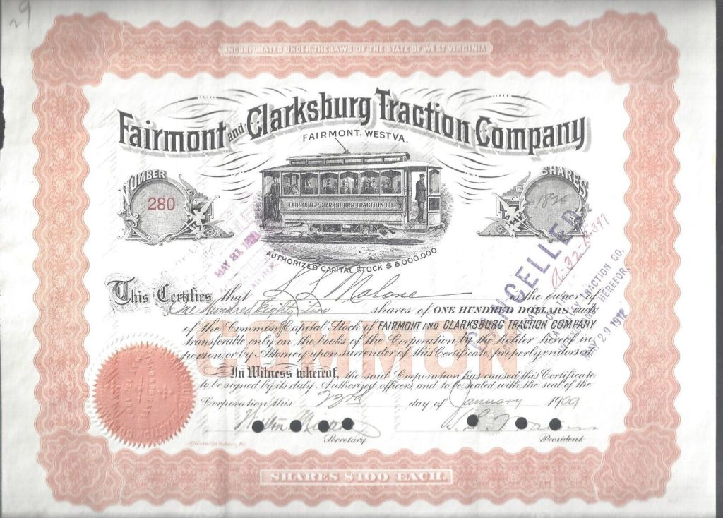
Again, we are told that now the electric streetcar services just couldn’t compete with the advent of automobiles, and this interurban streetcar system was abandoned by 1947, when the system went entirely to bus services.
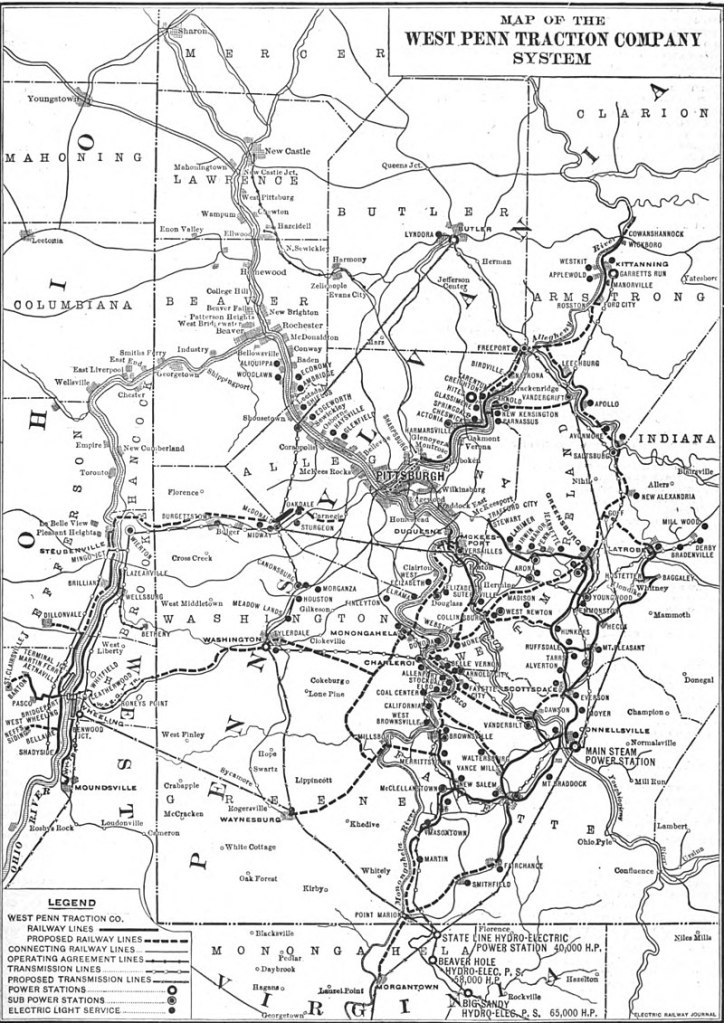
In time, the Fairmont & Clarksburg Electric Railroad was managed by the larger West Penn Railway system of electric streetcars that was headquartered in Connellsville, Pennsylvania, and was said to be part of the regions power-generation utility.
It was operational from 1904 to 1952.
Next, the Fairmont, Morgantown & Pittsburgh Railroad starting in 1894 once connected Fairmont to Uniontown in Pennsylvania, a distance of 56-miles, or 17-kilometers.
We are told the importance of this line waned as the coal mines along the route closed, and in 1953, passenger service ended.
By 1991, most of the line between Fairmont and Uniontown was abandoned, with the exception of two short stretches that are still in use today.

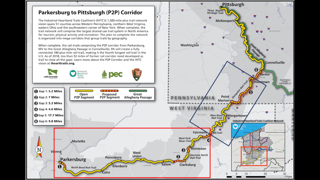
This map of the Industrial Heartland Trails Coalition’s Parkersburg to Pittsburgh (P2P) Corridor shows its plan to have a fully-connected recreational rail-to-trail between the two cities, with the proposed segments overlaid in red.
I have put a blue box around the Fairmont to Uniontown segment of the former railroad line, and a red box around the section between the West Fork River Trail, which starts just outside of Fairmont, and goes to Parkersburg, and includes the previously mentioned North Bend Rail- Trail.
Before I leave West Virginia, and head back up to Pennsylvania, there’s a few more things I would like to mention about Cranberry Glades.
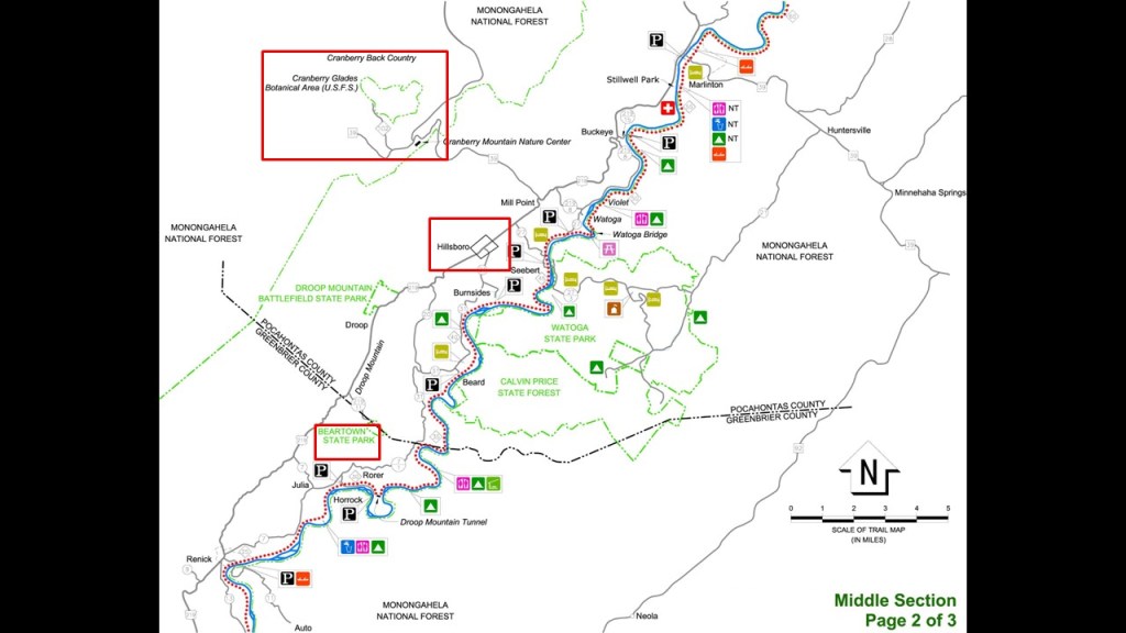
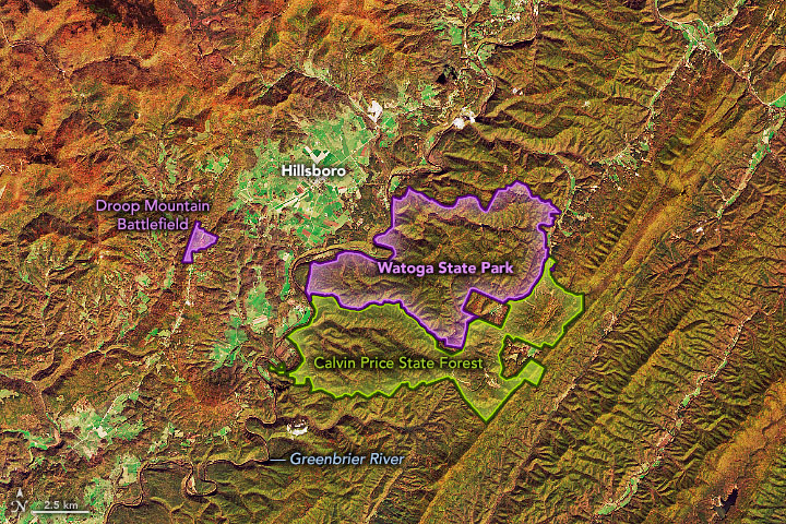
Hillsboro, the town closest to Cranberry Glades, is just 30-miles, or 49-kilometers, up U. S. Route 219 from Lewisburg.
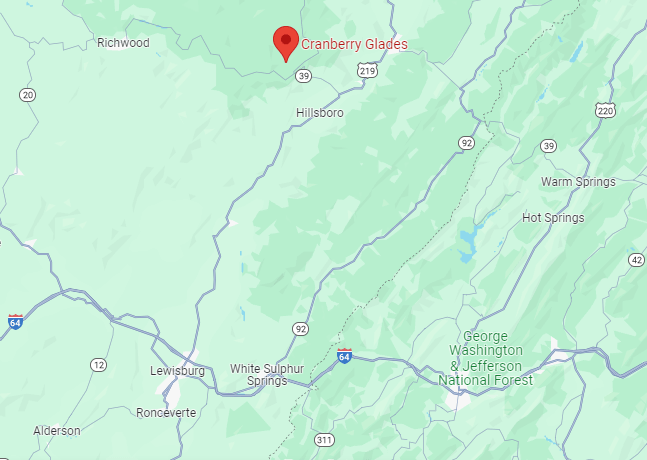
So Cranberry Glades is located near U. S. Route 219; it is very close to the Greenbrier River Trail, that ends in Cass and near Cheat Mountain; and is also very close to West Virginia’s Beartown State Park.
We already saw another Beartown Rocks earlier in Clear Creek State Forest near Sigel, Pennsylvania.
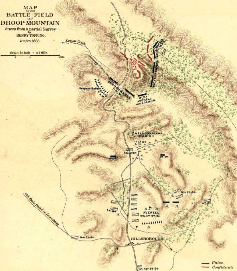
Beartown State Park in West Virginia is located 7-miles, or 11-kilometers, southwest of Hillsboro, on the Eastern Summit of Droop Mountain, and right in the middle between Cranberry Glades and White Sulphur Springs.

There’s a couple of things to unpack here – one is Beartown State Park, and the other is the Civil War Battle of Droop Mountain.
First the rock formations at Beartown State Park in West Virginia are described as having “unusual rocky formations, massive boulders, overhanging cliffs, and deep crevices,” with the deep crevices having a regular criss-crossed pattern making them appear like the streets of a town.
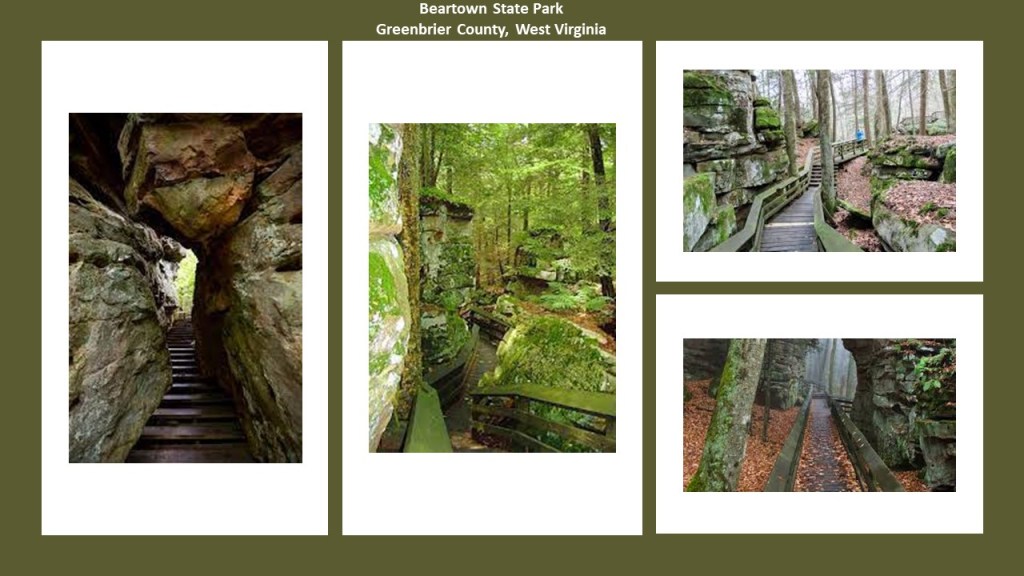
This is very similar to how the Beartown Rocks back in Pennsylvania, were described, which was as ” a beautiful rock formation consisting of “house-sized” boulders, that are spread out far enough they have road-like spaces in-between them, making it feel like a “rock city.”
The Battle of Droop Mountain was said to be the largest battle, and last major battle, of the Civil War to take place in what was to become West Virginia.
It took place on November 6th of 1863.
This is what we are told.
Troops under Union Brigadier General William Averill defeated a smaller Confederate force under Brigadier General John Echols and Colonel William “Mudwall” Jackson, though it was actually considered a tactical victory for the two Confederate Commanders, since the Confederate Army was not eliminated in Lewisburg, and the railroad was not disturbed.
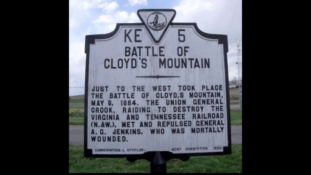
Interesting to note that the following year, on May 9th of 1864, Union troops under Brigadier General George Crook, successfully destroyed a large bridge across the New River on the Virginia and Tennessee Railroad during the Battle of Cloyd’s Mountain in southwestern Virginia, several more bridges along the railroad line and the depot at Dublin, Virginia.
This “victory” was said to sever one of the Confederacy’s last vital lifelines and only rail connection to Tennessee.
Now, I’m going to return to the area around the bog of Black Moshannon State Park and take another look there for the purposes of comparison to the area around Cranberry Glades.
Black Moshannon State park is 22-miles, or 35-kilometers, from State College, Pennsylvania, which is only a difference of 2-miles, or 4-kilometers, of the distance between the bogs at Cranberry Glades and the community of White Sulphur Springs, with its luxurious and exclusive Greenbrier Resort.
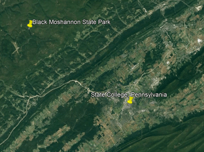
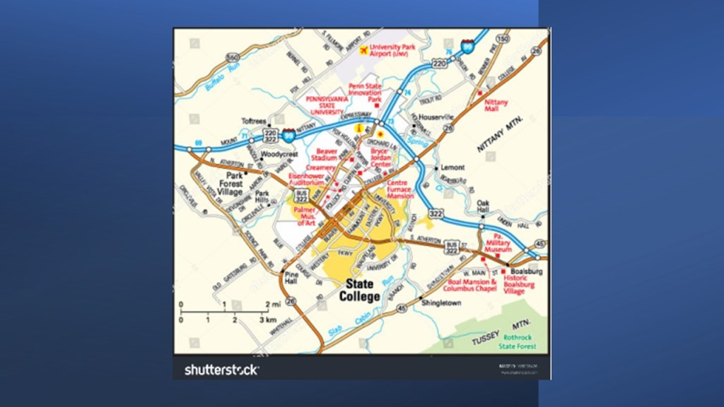
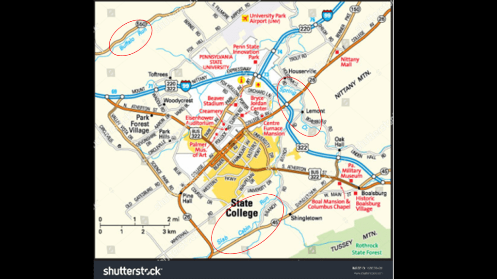
State College, Pennsylvania, is the home of Penn State University.
It is connected to Phillipsburg and Black Moshannon State Park via Pennsylvania U. S. Route 322.
Penn State was founded in 1855 as the Farmers’ High School of Pennsylvania, and in 1863, it became the state’s first land-grant university.

State College is surrounded by many different highway routes and by s-shaped water courses, like Spring Creek, Buffalo Run, and Slab Cabin Run.
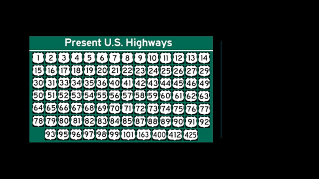
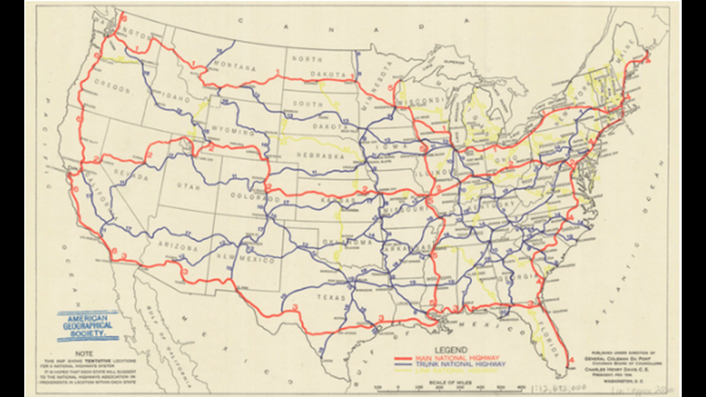
First a word about the United States Numbered Highway System, also known as the Federal Highway System, called an “integrated network of roads and highways numbered within a nationwide grid across the contiguous United States,” and first approved in 1926.
Drawn up in 1913, by the National Highway Association, this map was said to be the first proposed U. S. Highway Network map.
The red roads were delineated “Main” National Highways; the blue roads “Trunk” National Highways; and the yellow roads were “Link” National Highways to connect all the “Mains” and “Trunks.”
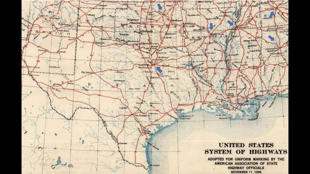
The Nation’s first Federal Highways would not be adopted until 1926, when the American Association of State Highway officials approved the first plans for the numbered highway system, with this section showing Texas, Oklahoma, Tennessee, Arkansas, Louisiana and Mississippi.
I have blue arrows pointing to major cities that are the central point of at least five highways – Dallas, Texas; Tulsa, Oklahoma; Little Rock, Arkansas; Memphis, Tennessee; Nashville, Tennessee; and Birmingham, Alabama.
What we see happening with the highway system of certain cities being the central point of multiple highways, is also seen with rail-lines.
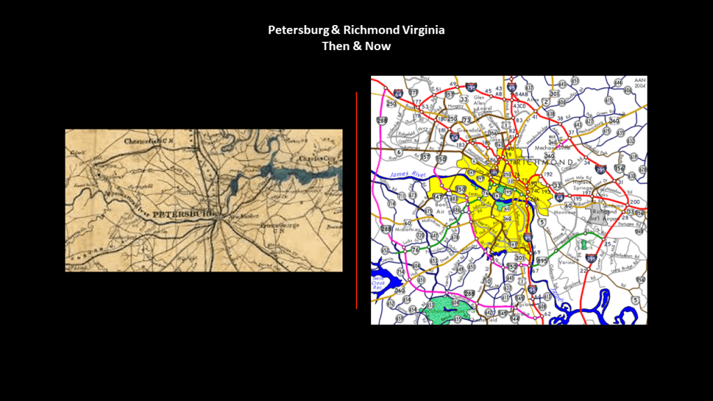
This Civil War era-example shows that Petersburg in Virginia, just south of Richmond, was a central point of multiple rail-lines emanating from it in all directions.
Petersburg was the focal point of the railroads that supplied Richmond during the Civil War, and was the primary target for the Union Army in Virginia from the last half of 1864 until April of 1865.

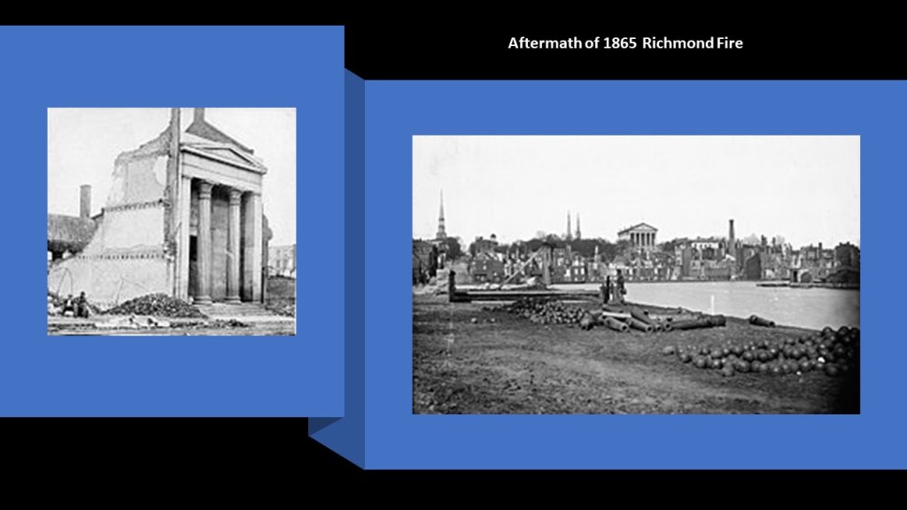
The third major Civil War fire was the April 2nd of 1865 Burning of Richmond, the capital of Virginia, and of the Confederate States of America.
Also known as the “Evacuation Fire,” and the “Fall of Richmond,” Richmond was set on fire on the night of April 2nd by Confederate forces after Confederate President Jefferson Davis was said to have ordered the burning of warehouses and bridges after Union General Ulysses S. Grant had taken nearby Petersburg.
This is a lithograph depicting it by Currier & Ives.

The huge classical temple-like building on the left was the Exchange Bank of Richmond, and said to have been damaged by the fire, and on the right is another view of Richmond and its State Capitol Building in the middle of the picture, as seen from above the Canal Basin in Richmond after the 1865 fire.
LIke Lewis Cass, the enforcer of the Indian Removal Act, the former President of the Confederacy and the man who ordered the burning of Richmond, Jefferson Davis, is also in the National Statuary Hall, representing the State of Mississippi.

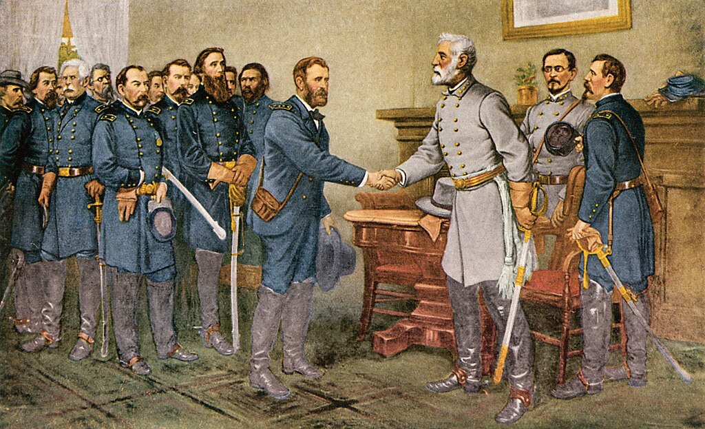
In our historical narrative, the Confederate General Robert E. Lee surrendered to General Grant days later, on April 9th of 1865, after his final defeat at the Battle of Appomattox Court House that same day.
There’s a very similar configuration between Petersburg Rail-lines of the Civil War-era, and the highways around Richmond and Petersburg today.
Back to State College in Pennsylvania.
As I mentioned previously, besides many highway routes, State College is also surrounded by s-shaped water courses, like Spring Creek, Buffalo Run, and Slab Cabin Run.
And, yes, there is a railroad history to be found in the area around State College too.
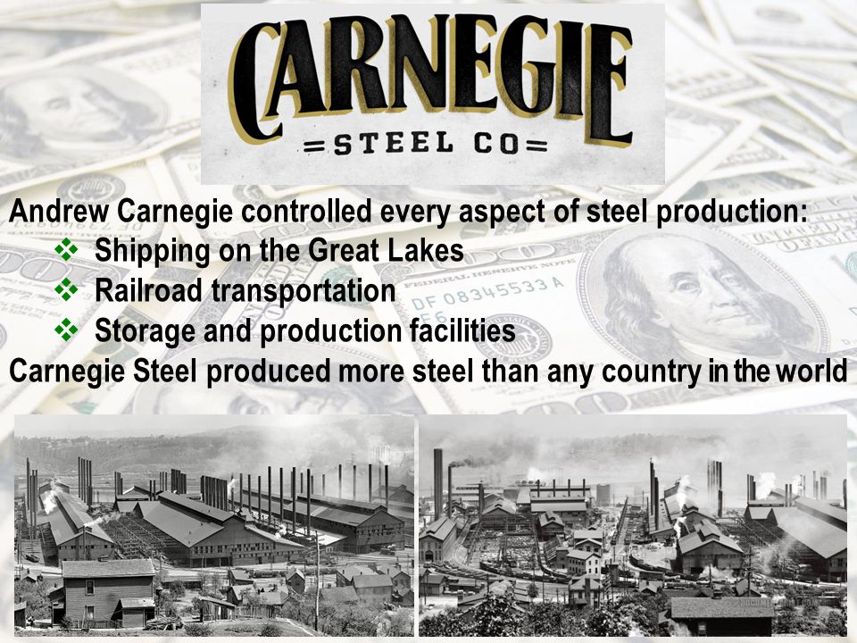
Whereas West Virginia was mined exhaustively for its coal, this part of Pennsylvania came to be mined exhaustively for its iron ore.
Andrew Carnegie had begun mining iron ore in Scotia in 1881 for his steel mills in Pittsburgh, and by 1887, we are told that a new era of iron-making in the Nittany Valley began, with the opening of the Nittany and Bellefonte Furnaces along Buffalo Run near its junction with Spring Creek, and three railroads that were said to have been constructed to haul the iron ore to them – the Bellefonte Central (BFC), Central Railroad (CRR) and Nittany Valley Railroad (NV).
By 1911 both of these furnaces had been shut-down.
By 1950, all the railroads that had once served the area, either for the iron-related industry or passenger service, including the Pennsylvania Railroad lines, circled in blue, were no longer in service.
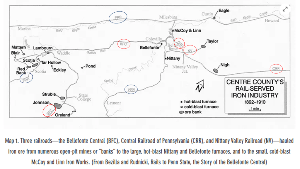
The only historic rail here that became operational again was a portion of the Bellefonte Central after the Bellefonte Historical Railroad was organized as an excursion line in 1985, and occasionally offers runs as a tourist attraction.

Now I am going to take a look at Altoona in Pennsylvania just down the road from State College.
Altoona is only 43-miles, or 70-kilometers southwest of State College.
Altoona was said to have been established by the Pennsylvania Railroad in 1849.
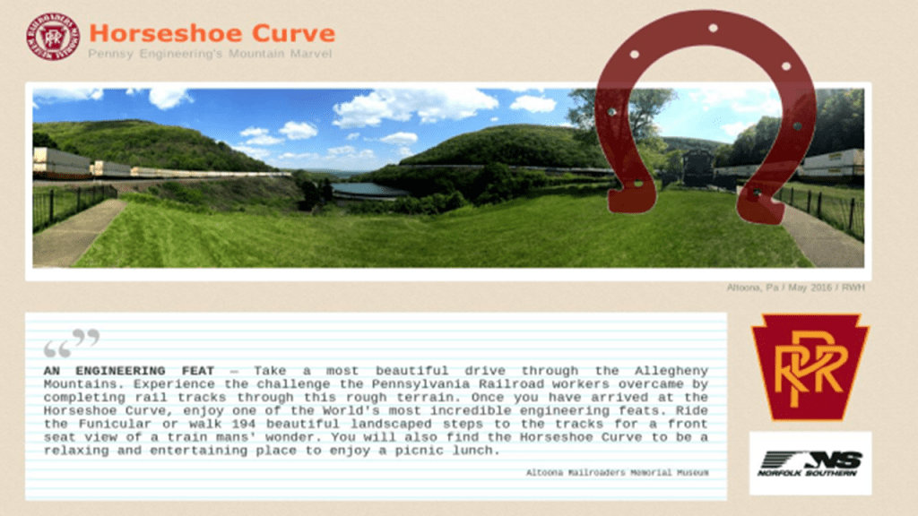
Aaron drew my attention to Altoona with information he sent me about the nearby “Horseshoe Curve.”
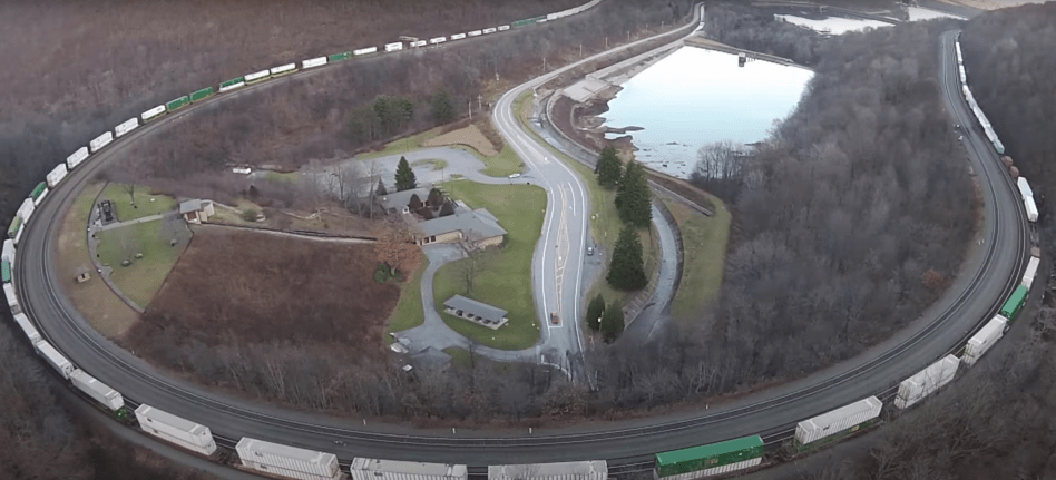
The “Horseshoe Curve” is a three-track railroad curve that is described as one of the world’s most incredible engineering feats, and was accomplished by the Pennsylvania Railroad in 1854.
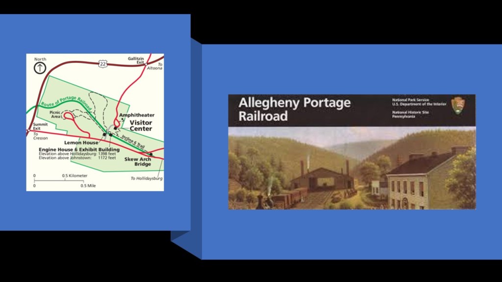
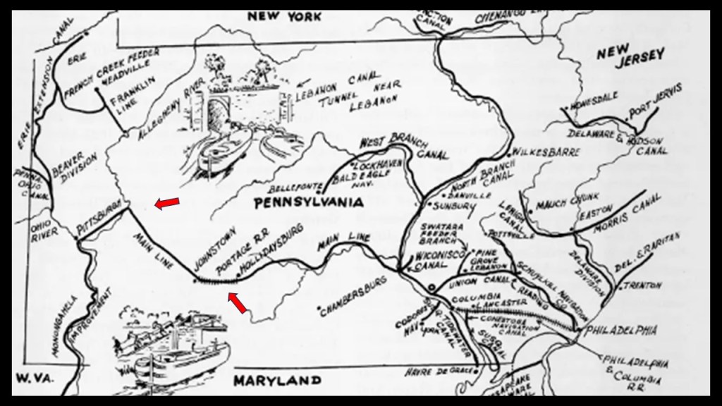
It was said to have replaced the original Allegheny Portage Railroad, which was said to be the first railroad constructed through the Allegheny Mountains in 1834, and connected to the Pennsylvania Canal, all of which was said to have been built as part of the transportation by the “Main Line of Public Works” that was mentioned at the beginning of this post after it was passed by the Pennsylvania Legislature in 1826.
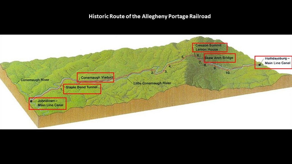
Considered a technological marvel in its day and critical to opening the way to commerce and settlement past the Appalachian Mountains, the original Allegheny Portage Railroad consisted of a series of five inclines on either side of the ridge-line to Cresson Summit alongside what is called the Little Conemaugh River to where it meets the Conemaugh River at Johnstown.
Interesting things to note that along the historic route of the Allegheny Portage Railroad are as follows:
After leaving the main canal location of Hollidaysburg and going up towards Cresson Summit, we first come to the lopsided-looking “Skew Arch Bridge,” called the “only purposefully built bridge on the Portage” and crossed over the railway.
It was said to have been built in the 1830s as part of the early road system.
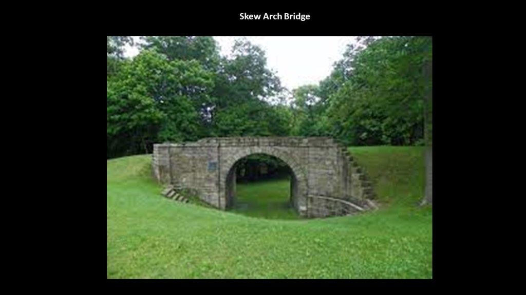
Today, the “Skew Arch Bridge” is preserved in the middle of “Old U. S. Route 22” and the new “U. S. Route 22.”
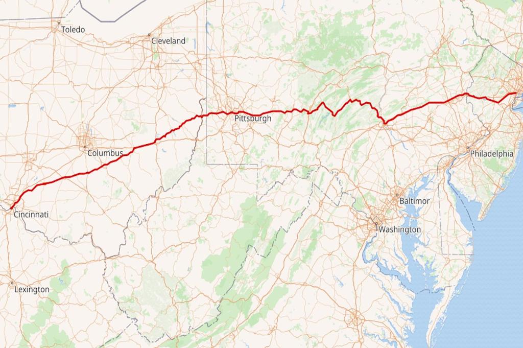
U. S. Route 22 is an East-West Numbered Highway from 1926 that runs from Cincinnati in Ohio to Newark in New Jersey, and passes through West Virginia and Pennsylvania on the way.
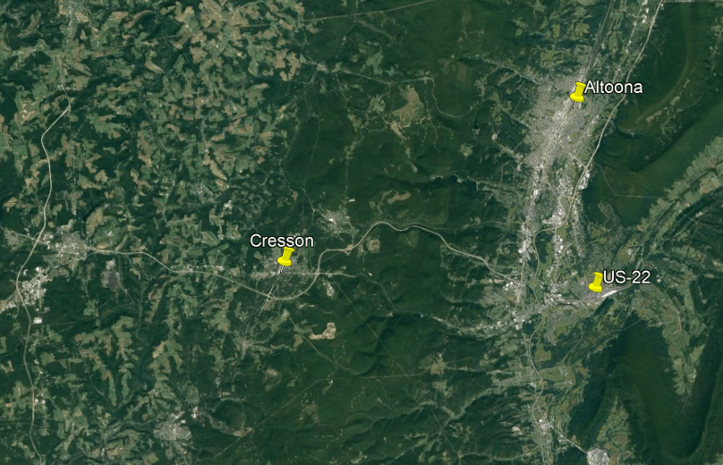
The next landmark n the Allegheny Portage Railroad’s journey through the Allegheny Mountains is the summit at Cresson, a borough (which in Pennsylvania is a municipal entity like a town or small city) on top of the Eastern Continental Divide.
US Route 22 is one of the highways that accesses Cresson.
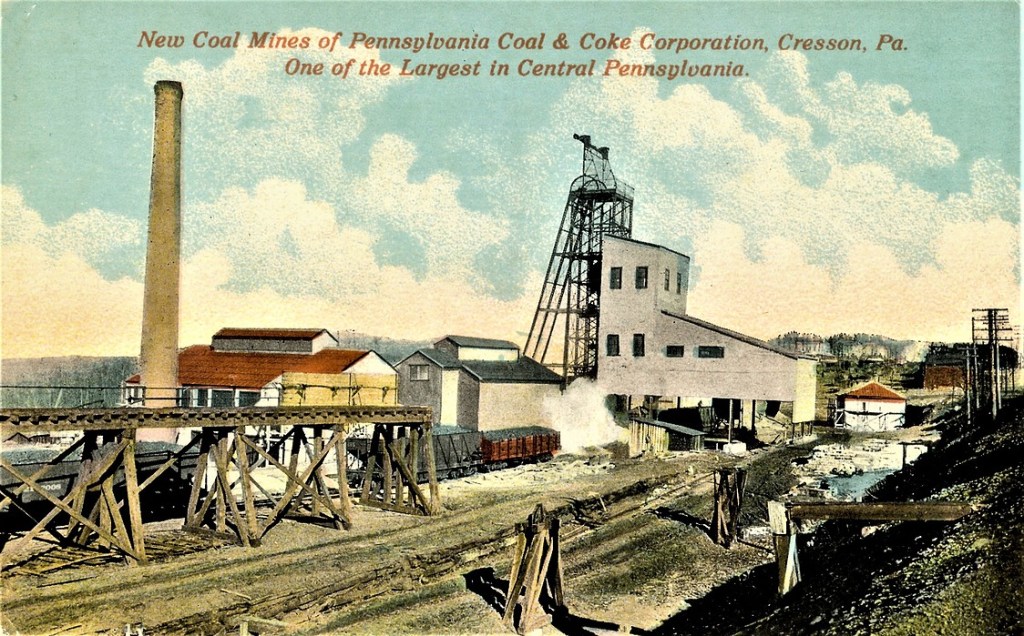
Back in the industrial heyday of the late 19th-century and early 20th-century, there were lumber, coal and coke-yard industries located here.
Wealthy Pittsburgh businessmen like Andrew Carnegie, Henry Clay Frick and Charles Schwab, all connected to each other through the steel industry, had summer residences here, like Carnegie’s Braemar Cottage in Cresson.
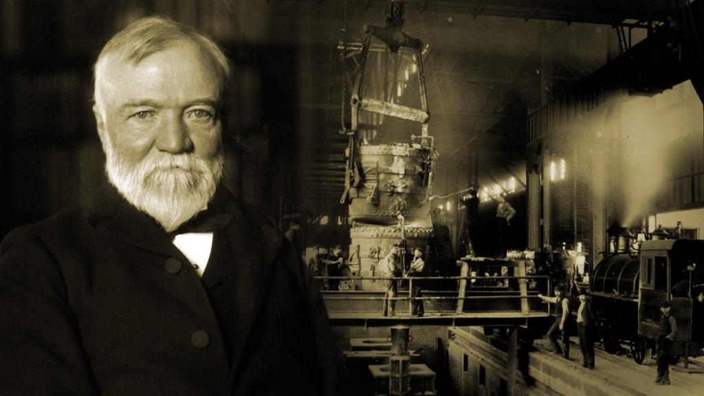
Andrew Carnegie was a Scottish immigrant to America, who came to Pittsburgh in 1848 with his parents at the age of 12, got his start as a telegrapher, and who by the 1860s, had investments in such things as railroads, bridges and oil derricks, and ultimately worked his way into being a major player in Pittsburgh’s steel industry.
I couldn’t find a picture of Andrew Carnegie as a freemason, but I could find a reference to him being a “famous freemason” on a masonic website.

His first steel mill was operational by 1874, the Edgar Thomson Steel Works, named after the President of the Pennsylvania Railroad, with his partners, one of whom was Henry Clay Frick, the owner of a coke manufacturing company, a product used in making steel.

They subsequently acquired other steel mills, and in 1892, the Carnegie Steel Company was formed, of which Henry Clay Frick became chairman. and in 1897, Charles M. Schwab, who had gotten his start as an engineer at the Edgar Thomson Steel Works, became President of the Carnegie Steel Company in 1897.
In 1901, Charles M. Schwab helped negotiate the sale of Carnegie Steel with a merger involving it with Elbert Gary’s Federal Steel Company, and William Henry Moore’s National Steel Company to a group of New York City Financiers led by J. P. Morgan.
After the sale of Carnegie Steel, Andrew Carnegie surpassed John D. Rockefeller as the richest American at the time, and Charles M. Schwab became the first President of the newly minted U. S. Steel Company.

Now back to Cresson.
Cresson was known for its therapeutic mineral springs, and we are told that in 1881, the Pennsylvania Railroad opened the Mountain House Resort Hotel.
Carnegie’s Braemar Cottage is still standing on the 400-acre property, which had 32-lots for private-cottages.

Alas for the Mountain House Resort Hotel and Cresson Springs, just like canals falling by the wayside for railroads, and railroads the same for automobiles, America’s appetite for “mountain” or “inland” resorts began to decline in favor of beach resorts.
The Mountain House Resort Hotel had ceased operations by the early 1900s, and in 1916, it was completely razed to the ground, and the original hotel building was gone.

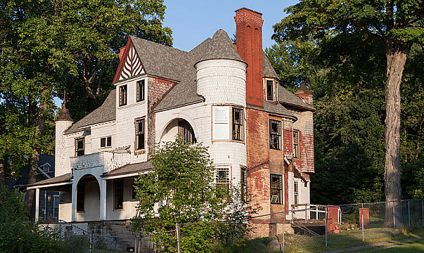
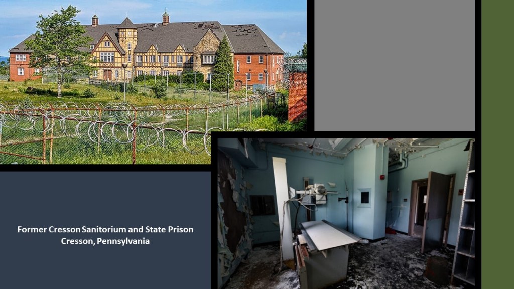
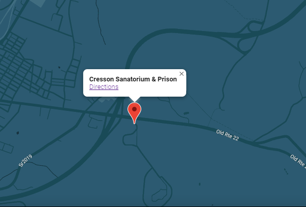
Interesting to note, that unlike the luxurious Mountain House Resort Hotel that got razed to the ground, the likewise spacious building of the former Cresson Sanitorium and Prison is still-standing, albeit in pretty rough shape these days!
This is what we are told.
Cresson Sanitorium was built on land that was donated by Andrew Carnegie in 1910, and first opened in 1913 in order to provide hospital and long-term care facilities for individuals and families with tuberculosis and other health conditions.
In 1956, it was incorporated into the Lawrence F. Flick State Hospital for people with mental illness.
In 1983, it was converted to a State Correctional Facility, and operated as such for the next 30-years, until its final closure in 2013.
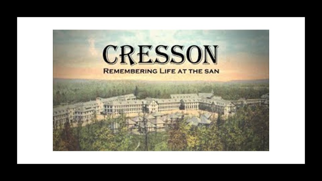
The building is located on Old Route 22.
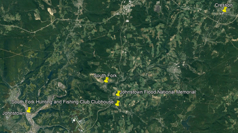
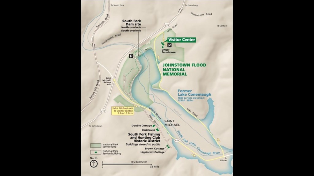
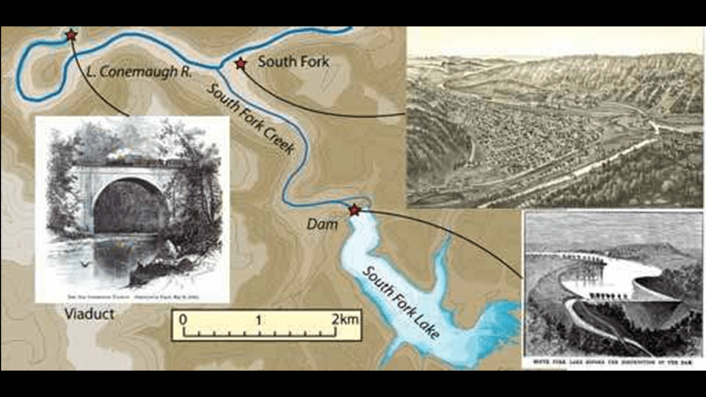
After the former Allegheny Portage Railroad left the summit at Cresson, on its downward descent in elevation into Johnstown, along the Little Conemaugh River, we come to South Fork of the Little Conemaugh River and what was the former location of the South Fork Dam.
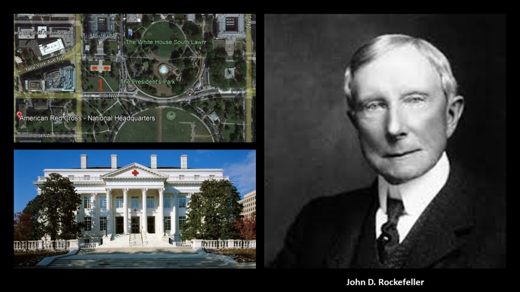
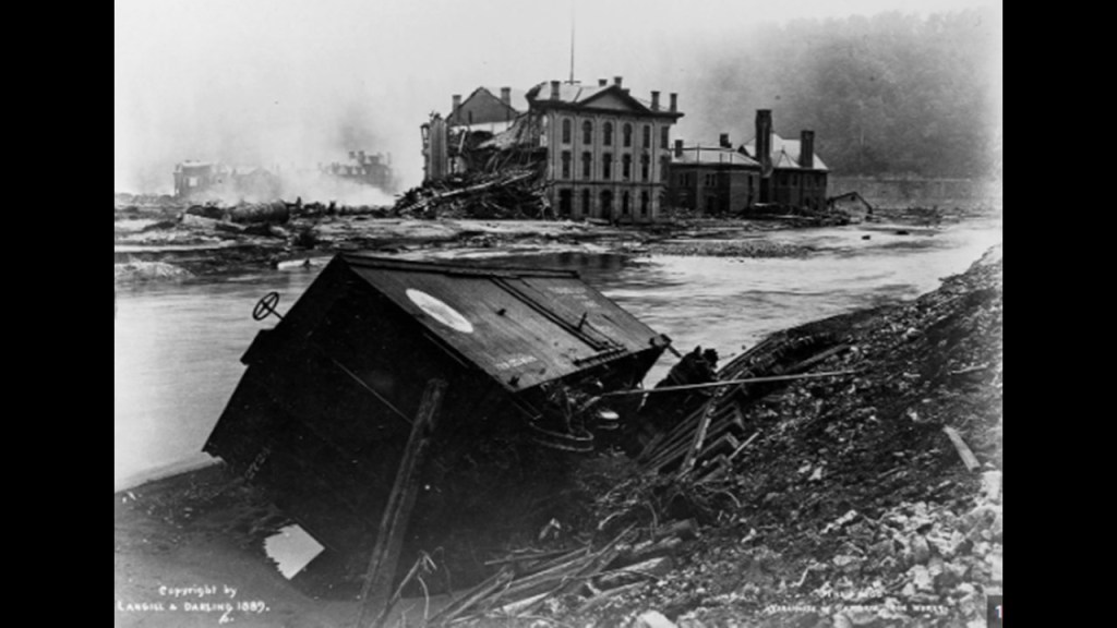
The famous Johnstown Flood on May 31st of 1889, the worst flood in the United States in the 19th-century, was caused by the catastrophic failure of the South Fork Dam, and was the second major disaster the American Red Cross responded to, after the Michigan Thumb Fire, which started on September 5th of 1881, with hurricane-force winds and hot and dry conditions this was less than four months after the establishment of the American Red Cross in May of 1881.
John D. Rockefeller was amongst several that donated to create a national headquarters for the American Red Cross near the White House in Washington, DC, said to have been built between 1915 and 1917.
The South Fork Dam was said to have been an earthwork built between 1838 and 1853 as part of a canal system as a reservoir for a canal basin in Johnstown by the Commonwealth of Pennsylvania.
But then, after spending 15-years building the dam, it was abandoned by the Commonwealth, and sold to the Pennsylvania Railroad, who turned around and sold it to private interests.

In 1881, speculators had bought the abandoned reservoir and built a clubhouse called the South Fork Fishing and Hunting Club and cottages, turning it into an exclusive retreat for 61 steel and coal financiers from Pittsburgh, including Andrew Carnegie, Henry Clay Frick, Andrew Mellon, Philander Knox, John Leishman, and Daniel Johnson Morrell.
The South Fork Fishing and Hunting Club was a Pennsylvania Corporation and owned the South Fork Dam.
Henry Clay Frick was a founding member of the South Fork Fishing and Hunting Club, and was actually said to have been largely responsible for the alterations to the South Fork Dam that led to its failure.

Interesting to note that I did find this reference on the website of the Pleasant Valley Masonic Center in Connellsville, Pennsylvania, that Henry Clay Frick was a freemason in its King Solomon’s Lodge #346 from 1872 to 1877 , at which time he resigned as an active mason, but from what this entry says, his masonic lodge continued to enjoy the benefits of his generosity long afterwards, as well as that of his daughter.

What we are told is that the South Fork Dam failed after days of unusually heavy rain, and 14.3-million-tons of water from the reservoir of Lake Conemaugh devastated the South Fork Valley, including Johnstown 12-miles, or 19-kilometers, downstream from the dam, killing an estimated 2,209 people and causing $17-million in damages in 1889, which be $490-million in 2020.

Though there were years of claims and litigation, the elite and wealthy members of the South Fork Fishing and Hunting Club were never found liable for damages.
In 1904, the South Fork Fishing and Hunting Club corporation was disbanded and assets sold at a public auction by the sheriff, and there were permanent exhibits in many places, like Atlantic City, depicting the horrors of the Johnstown Flood experience for public consumption, billed as a “Thrilling Account of the awful floods and their appalling ruin.”
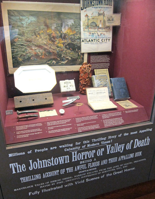
The South Fork Fishing and Hunting Club building and the nine-remaining of sixteen club member cottages still stand today, and are under the auspices of the National Park Service as part of the Johnstown Flood National Memorial.
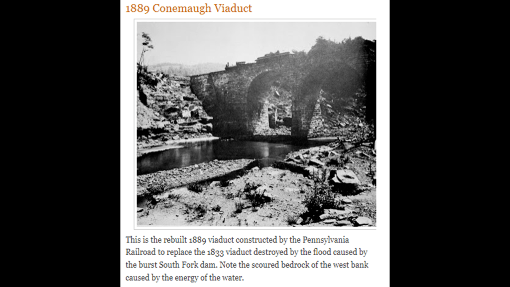
The Conemaugh Viaduct was located between the South Fork Dam and Staple Bend Tunnel on the descent into Johnstown.
This is what we are told in the official narrative about what happened here.
The Conemaugh Viaduct was originally built in 1833 as part of the Allegheny Portage Railroad where it crossed the Little Conemaugh River, and that it was often described as the most beautiful railroad bridge in the world.
We are told that it was a massive stone structure, over 70-feet, or 21-meters, in height, with a single arch.
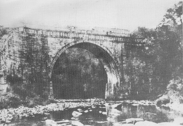
We are told this massive stone structure was ultimately no match for what had become a 90-foot, or 27-meter, – high wave of water coming from the failed South Fork Dam, and was destroyed after a few minutes of holding the flood waters back.
We are told that it was essential that the bridge be replaced immediately to bring in help in the aftermath of the flood, so railroad workers came in from New York and Pennsylvania, and in the short-time of 2 1/2-days, built a temporary railroad trestle, and that on June 14th, roughly 2-weeks after the horrifying flood on May 31st, the Pennsylvania Railroad resumed service.
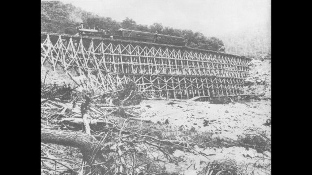
Then we are told that same year, in 1889, the Pennsylvania Railroad rebuilt the Conemaugh Viaduct to replace the temporary wooden structure and original viaduct.
The Staple Bend Tunnel is located just a short distance from the location of the viaduct in the vicinity of Mineral Point, a town just 1-mile, or 1.6-kilometers, down from the Conemaugh Viaduct, which was completely destroyed by the flood.

The Staple Bend Tunnel was said to have been constructed between 1831 and 1834 for the Allegheny Portage Railroad, and was the first railway tunnel constructed in the United States, and the third tunnel of any kind, after two canal tunnels, also in Pennsylvania.
At 901-feet, or 275-meters, in length, we are told the tunnel was rock-bored and stone-lined by workers – being paid $13/month plus room and board for 12-hour days, 6-days/week – who hand-chipped away and blasted through solid rock.
So what was really going on here?
Paying workers meager wages for hard labor in the early 1830’s hand-chipping and blasting away through solid rock to bring a brand-new tunnel into existence…or chipping and blasting away through whatever material was obstructing a pre-existing tunnel?
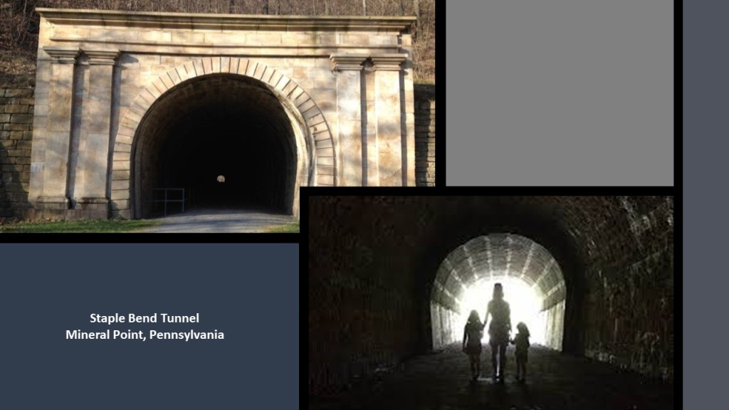
In 1994, the Staple Bend Tunnel was declared a National Historic Landmark, and in 2001, it became part of the “Allegheny Portage Railroad National Historic Site,” and like the Johnstown Flood National Memorial, administered by the National Park Service.
So now we come to Johnstown, which is located 57-miles, or 92-kilometers, east of Pittsburgh.
It is at the confluence of the Conemaugh and the Stonycreek Rivers.
The is a map of the 1889 Johnstown Flood direction from the National Park Service map.
“Mass of debris” is marked at the Stone Bridge location.
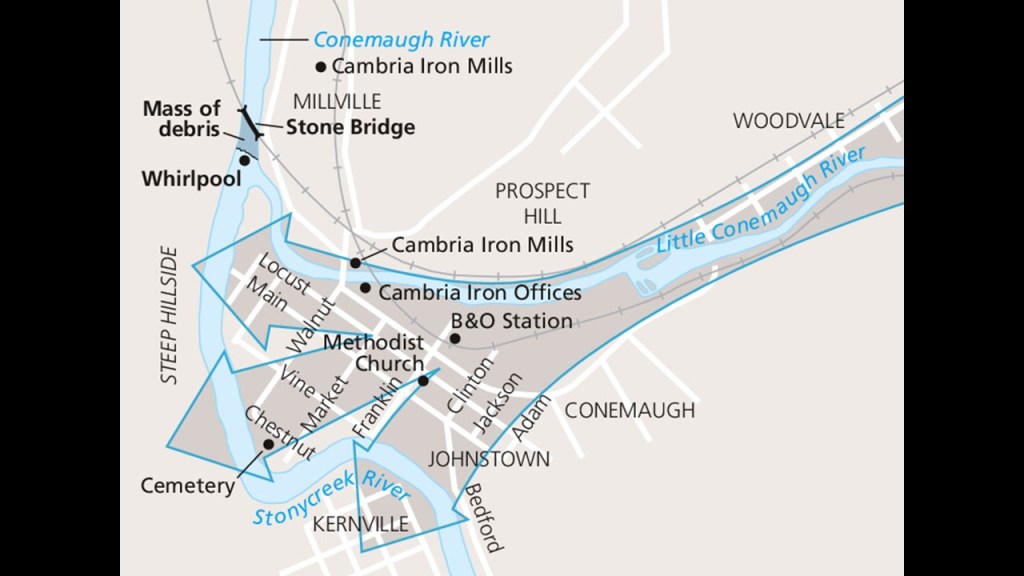
The Stone Bridge is a 7-arch railroad bridge that was said to have been constructed by the Pennsylvania Railroad between 1887 and 1888.

The Stone Bridge itself survived the flood, but it trapped all kinds of debris, including miles of barbed wire, that had been swept away by the raging floodwaters.
The debris at the bridge caught on fire burned for three days, and killed many people that were trapped in the debris.
If the failure of the South Fork Dam, and the subsequent catastrophic Johnstown Flood was deliberately caused by prestigious members of the South Fork Fishing and Hunting Club, which evidence in the narrative suggests was the case, then apparently these men had had no care or concern for the death, destruction and suffering for which they were never held accountable that they caused downriver.

From 1834 to 1854, Johnstown was a key transfer point on the Pennsylvania Main Line Canal.
At the head of the canal’s western branch, canal boats were transported over the mountains by the Allegheny Portage Railroad to continue the trip by water to Pittsburgh at the “Forks of the Ohio” and on to the Ohio River Valley.
We are told that when the Pennsylvania Railroad became connected to Johnstown in 1854, with the completion of the main-line, the same year we are told the amazing Horseshoe Curve in Altoona came into existence, the Pennsylvania Canal became obsolete, and Johnstown grew rapidly as a major producer of steel via the Cambria Iron Company, and at one time was the country’s leading producer of steel.
It operated under this name until 1898, and was under different management two more times, before it closed permanently in 1992.
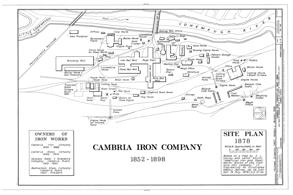
Though the Cambria Iron Company’s facilities were said to have been badly damaged during the flood, the company was able to reopen on June 6th of 1889, a week after the flood, and continued to operate.
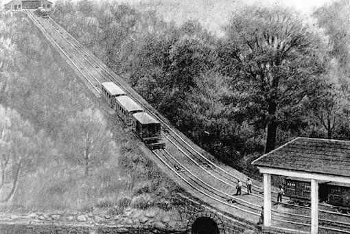
Both Johnstown on the one side of the Allegheny Portage Railroad and the Horseshoe Curve near Altoona on the other side, might have operational remnants of the original incline railway system, though that’s not what we are told about them.
The Johnstown Inclined Plane was said to have been designed by Hungarian-American engineer Samuel Diescher, and completed in 1891 to serve as an escape route from floods in the valley at the confluence of the Conemaugh and Stonycreek Rivers, and to connect Johnstown with the Borough of Westmont on Yoder Hill.
Samuel Diescher was also credited with the design of four of Pittsburgh’s seventeen original Inclines, of which only two remain, the Monongahela and Duquesne Inclines on Mt. Washington.
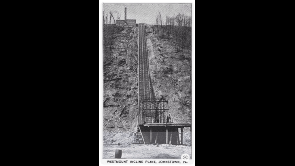
Billed as the “World’s steepest vehicular inclined plane,” it’s slope has a grade of 71.9%, and it takes 90 seconds for it to travel in-between the two stations.
The Johnstown Incline is closed for rehabilitation work, now projected to be completed in 2024.

The Inclined Plane Railway back at Horseshoe Curve near Altoona was said to have been built in the 1990s to take tourists up to the park above to get a gscenic view of the incredible engineering feat by the Pennsylvania Railroad circa 1854 of the Horseshoe Curve and its three-tracks that eliminated the need for the Allegheny Portage Railroad’s 10-incline planes.
Like the one at Johnstown, this incline has been closed for repairs, and is also expected to reopen in 2024.

Incline railways work like an obliquely-angled elevator, in which cables attached to a pulley-system raise- and-lower the cars along the grade.
Two cars are paired at opposite-ends and act as each other’s counterweight. As such, there is not a need for traction between the wheels and rails, and thereby allowing them to scale steep slopes, unlike traditional rail-cars.
Thing is, there used to be way more of them than there are now, and inclined-railways were a worldwide thing.
Now they are mostly either tourist attractions, or kept on as an important part of a communities’ transportation infrastructure from low-ground to high-ground.

I looked at the subject of Incline Railways in-depth in this post, “Incline Railways of the Past and Present.”
Like the canals, railroads, electric streetcars and luxurious holiday resorts of the past, most of the world’s incline railways were largely made to go away for one reason or another.
Back in Johnstown, come to find out that the main highway connecting Johnstown to the Pennsylvania Turnpike is once again our old friend US Route 219!
What is it about US-219?!
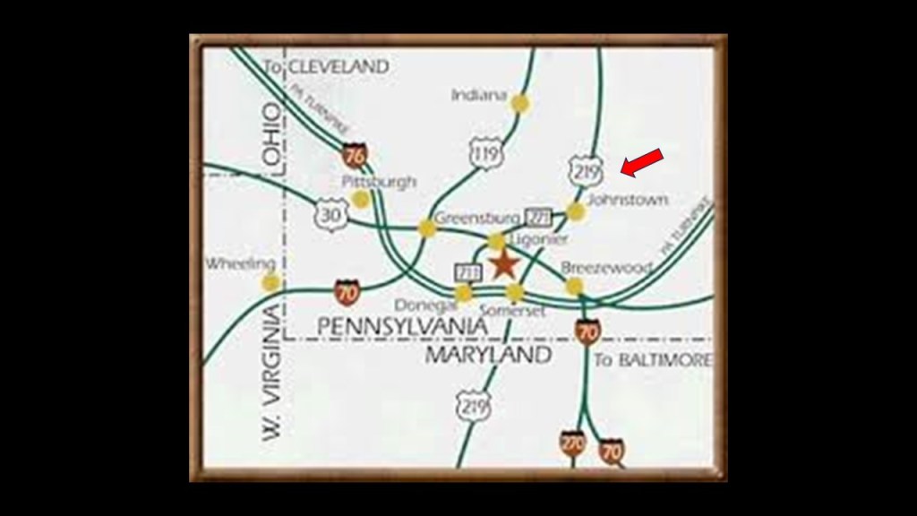
This is a great place to revisit the U. S. Number Highway System and see what comes up to the surface.
First up, a deeper look into US-219.
US Route 219 is a spur of US Route 19.
It is 535-miles, or 861-kilometers, -long, and runs from West Seneca, New York, at the eastern end of Lake Erie south of Buffalo, and ends at Bluefield, Virginia, right across the state border from Bluefield, West Virginia
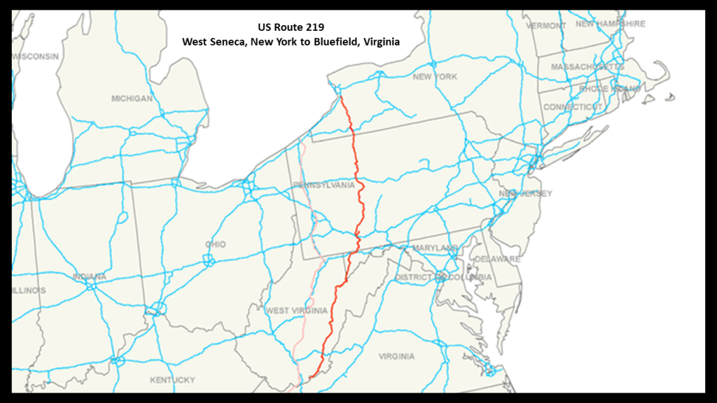
As mentioned previously, these two highways meet at Bluefield in Virginia, of which there is one city on other side of the West Virginia/Virginia border with that name.
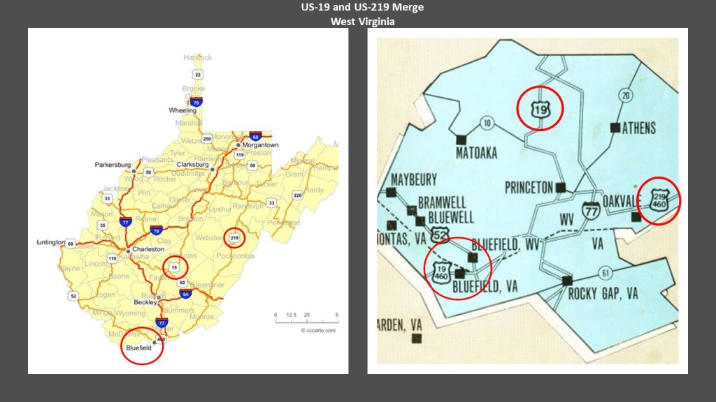
The land beneath the two Bluefields contains the richest deposit of bituminous coal in the world, known as the “Pocahontas Coalfield,” or the “Flat-Top Pocahontas Coalfield,” named after the Flat Top Mountain on US-19 in West Virginia, and Pocahontas, Virginia, where the first coal-seam here was discovered.
The Pocahontas Coalfield started to be mined in 1882.

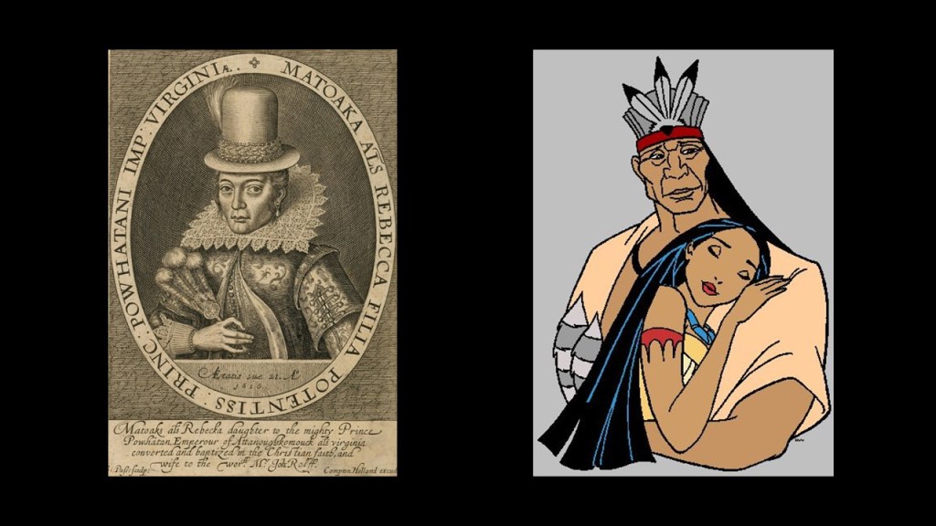
Pocahontas in Virginia was named after the famous daughter of Chief Powhatan in connection with the 17th-century Jamestown Colony, the first permanent English settlement in the Americas.
This is the most famous depiction of Pocahontas from her time on the left, but this how we have been taught to see Pocahontas and Powhatan on the right.
We are told that Bluefield in West Virginia, with its great location with respect to the developing Pocahontas Coalfield, was selected as the location of a major Division point on the Norfolk and Western Railway in the late 19th-century, and that the railroad greatly stimulated to the town’s growth, so much so that in its hey-day, Bluefield was considered a “Little New York.”

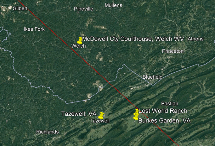
Welch, the county seat of McDowell County, was on the Norfolk and Western Railway, just 23-miles, or 36-kilometers, to the northwest of Bluefield.
I had looked at Welch previously because it was situated where I was looking on the previously mentioned Serpent Lei identified by Peter Champoux.
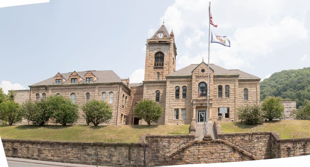
The McDowell County Courthouse was said to have been designed by Frank Pierce Milburn and constructed between 1893 and 1894, after Welch was named the county seat in 1892.
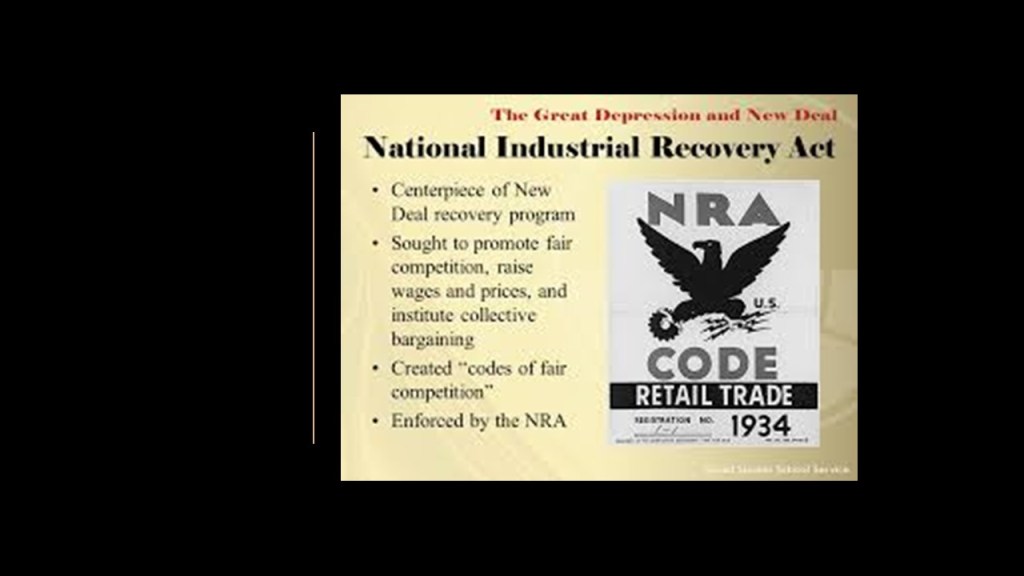
Sid Hatfield and Ed Chambers were murdered on the courthouse steps in 1921 by Baldwin-Felts agents.
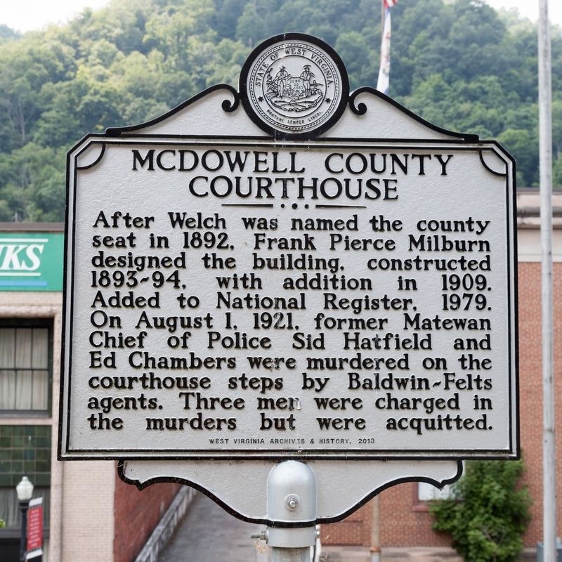
Sid Hatfield was the Matewan Chief of Police at the time of the Matewan Massacre in May of 1920, at which time he joined the side of striking coal miners because he sympathized with the unionization efforts.
The Matewan Massacre took place in the Pocahontas Mining District of southwestern West Virginia on May 19th after detectives from the Baldwin-Felts Agency came to evict families that had been living at the Stone Mountain Coal Camp. They served eviction notices, went to eat, and when they left to go to the train station, long story short, they were surrounded by armed miners and two detectives, seven miners, and the towns mayor were killed.
This was during a time when the United Mine Workers of America were trying to unionize the mine, a place where miners worked long hours in unsafe and poor conditions, received a low wage, and were paid in company scrip for the company store.
This situation was typical of how companies treated and viewed their workforce.
Poor treatment dealt with a very heavy hand!
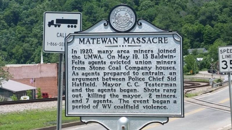
This massacre marked a turning point for miners rights, and thirteen-years later, with the passage of the National Industrial Recovery Act of 1933, American Labor Unions were recognized by the federal government.
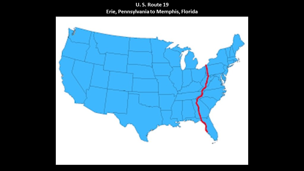
Next, I am going to take a deeper look at the longer U. S. Route 19 starting at its northern terminus, and then come back to Bluefield and continue the journey southward on US-19.
Now, on to more about U. S. R0ute 19.
The North-South U. S. Route 19 runs from its northern terminus at U. S Route 20 at Lake Erie in Erie, Pennsylvania to its southern terminus at an interchange with U. S. 41 in Memphis, Florida, just south of St. Petersburg.
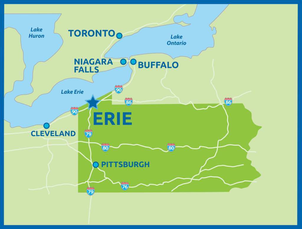
Erie is located just about right in-between Cleveland, Ohio, which is 90-miles, or 140-kilometers, southwest of Erie, and Buffalo, New York, 80-miles, or 130-kilometers, northeast, on the southern shore of Lake Erie.
Pittsburgh is 128-miles, or 206-kilometers, south of Erie.
Erie was an important railroad hub during the mid-19th-century.
We are told the first railroad station in Erie was established in 1851, and replaced in 1866 by the Romanesque Revival Union Depot seen on the left, which was demolished in 1925.
The current Art Deco Union Station in Erie on the right was said to have opened in 1927, and designed by the Fellheimer and Wagner, an architectural firm credited with a bunch of railroad stations between 1923 and 1940.
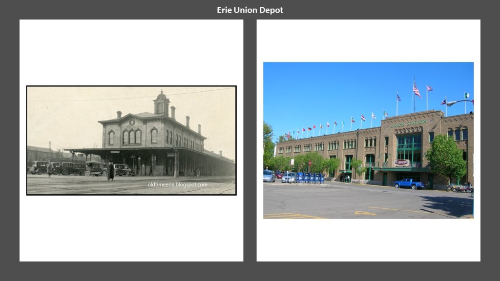
The Erie Union Depot is used as an Amtrak stop on the Lake Shore Limited route, and is otherwise used for commercial space today, like a brew pub.

The Pittsburgh & Lake Erie Railroad was said to have been incorporated on April 1st of 1858, with operations starting in March of 1860.
Then on April 1st of 1870, the Pennsylvania Railroad took-over operations.
It was an 83-mile, or 134-kilometer, -long railroad between Girard just west of Erie, and points south around the Pittsburgh area.
Today, it looks like what was the Pittsburgh and Lake Erie line followed what is now Pennsylvania State Route 18 going south out of Girard, through these same two towns of Beaver Falls and Aliquippa on its way to Pittsburgh; US-19 is just east of there, going south from Erie on its way to Pittsburgh; and Pennsylvania State Route 8 leaves Erie and heads south through Titusville on its way to the greater Pittsburgh area.

One last thing I want mention in Erie itself is Waldemeer Park & Water World.
It is billed as one of only thirteen trolley parks still operating as an amusement park in the United States.
But what we see today ain’t what they used to be!
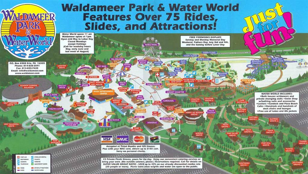
Waldemeer Park was first leased as a trolley park in 1896 by the Erie Electric Motor Company, and is the fourth-oldest amusement park in Pennsylvania, and the tenth-oldest in the United States.
Waldemeer has operated continuously since then under different owners, but the trolleys of the park are long-gone.
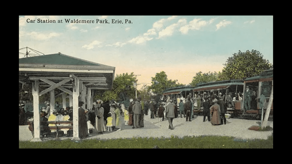
Trolley parks were said to have started in the United States in the 19th-century as picnic and recreation areas at the ends of streetcar-lines, and were precursors to today’s amusement parks.
They were said to have been created by streetcar companies for reasons like giving people a reason to use their services on weekends.
By 1919, there were estimated to be between 1,500 and 2,000 such parks.
But like what we have already seen with countless electric streetcar lines, canals, railroad lines, and historic resorts, these magnificent trolley parks went the way of the dinosaur too.
So, in this example, dozens of trolley parks were operating at one time in this part of Pennsylvania, just in the location alone between Erie and Pittsburgh, much less everywhere else!
This was an historic trolley park at Aliquippa.
One of Pittsburgh’s first amusement parks, it was said to have been established sometime in the 1880s by the Pittsburgh & Lake Erie Railroad as a way to bolster ridership, but by 1905 had fallen into disrepair, and the land was purchased by the “Jones and Laughlin Steel Corporation” that year to construct the “Aliquippa Works.”
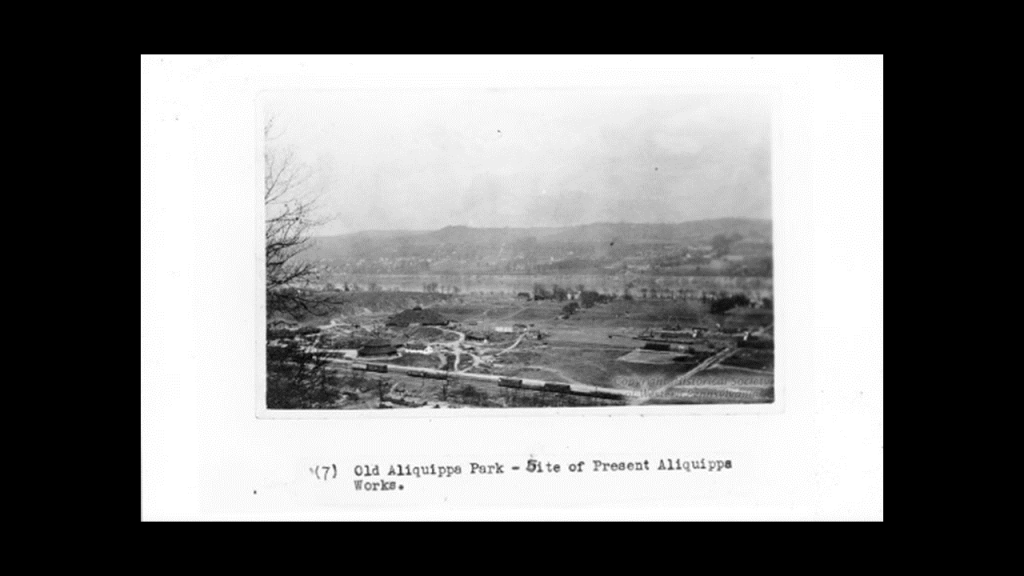
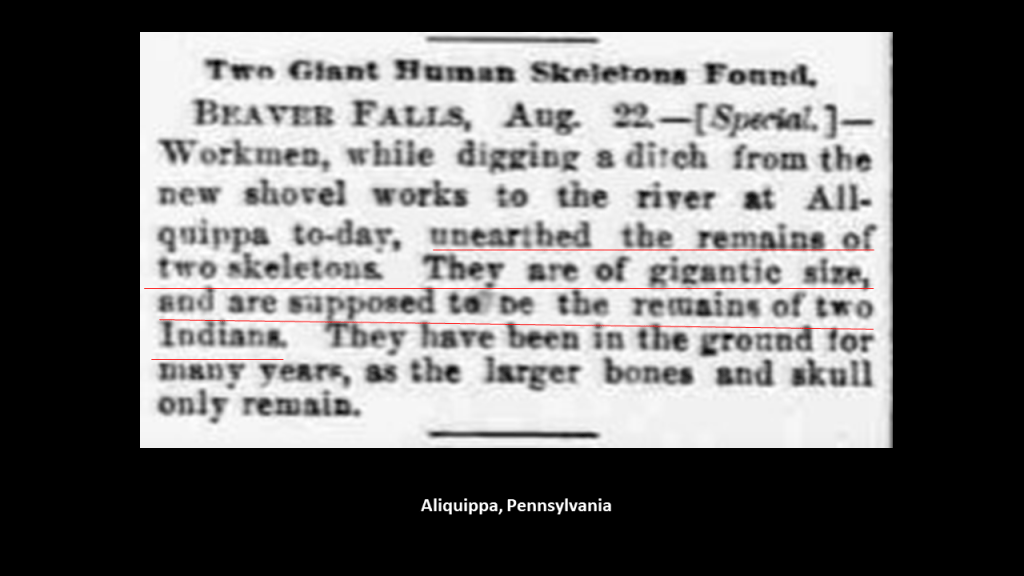
Gigantic skeletons were also reported to have been unearthed in Aliquippa by workers digging a ditch.
With the location of Trolley Amusement Parks being historically at the end-terminals of streetcar-lines, I have come to believe that they were somehow involved with recharging the Earth’s energy grid for the original civilization in a really fun way, and were just utilized by the bringers-in of the world’s new system for a short time until they were no longer needed, or just plain inconvenient to the new narrative.

Now I am going to put this area near Erie and US-19 into the perspective of this new system in our historical narrative with its proximity to Titusville, which we come to going south out of Erie on Pennsylvania State Route 8.
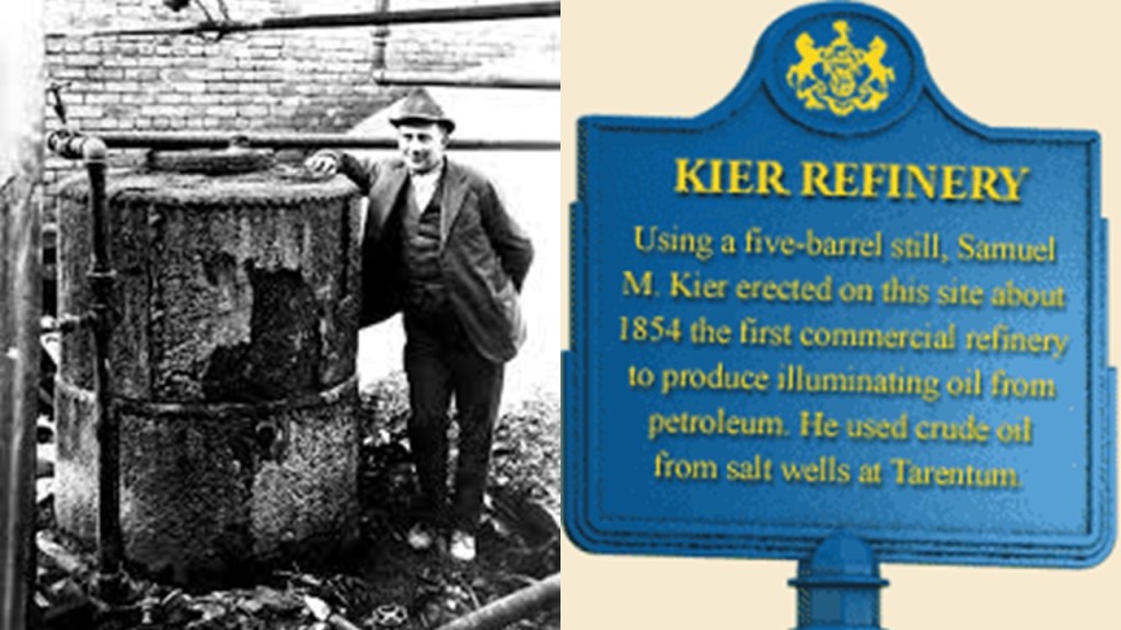
The petroleum industry in the United States began in earnest in 1859 when Edwin Drake found oil on a piece of leased-land near Titusville, Pennsylvania, in what is now called Oil Creek State Park.
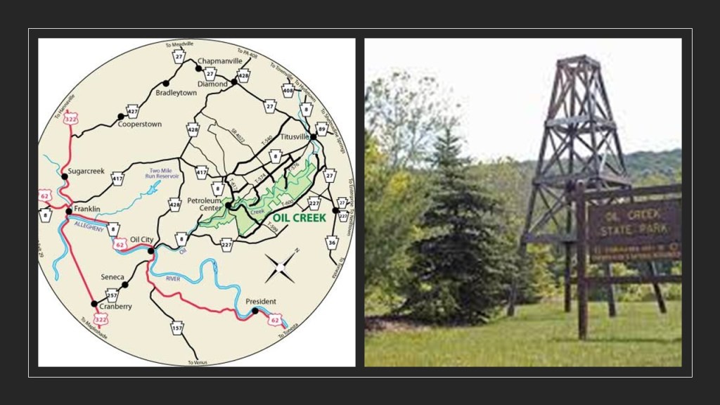
For this reason, Titusville is called the Birthplace of the Oil Industry, and for a number of years this part of Pennsylvania was the leading oil-producing region in the world.
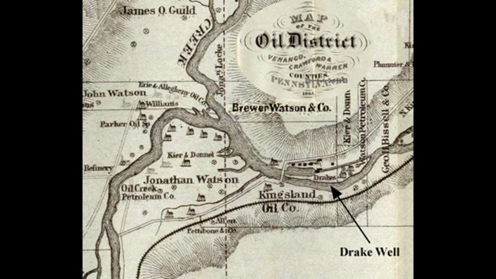
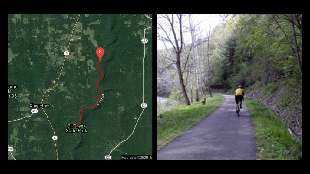
Today, not surprisingly, the Oil Creek State Park Trail runs on the bed of the first railroad line to reach Titusville, the Oil Creek Railroad.
Samuel Kier had established America’s first oil refinery in Pittsburgh in 1854 for making lamp oil, just five-years before oil was “found” in Titusville.
So. it certainly appears like the petroleum industry was developed in the 1850s in order to provide a replacement energy technology for the free energy technology of the original civilization.
Roughly a decade after the birth of the oil Industry at Titusville, in 1870 by , John D. Rockefeller, along with Henry Flagler, an American Industrialist and major developer in the state of Florida, founded the Standard Oil Company, an American oil producing, transporting, refining, marketing company.

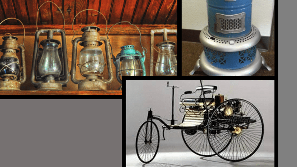
Oil was used in the form of kerosene was used throughout the country as a light source and heat source until the introduction of electricity, and as a fuel source for the automobile, with the first gas-powered automobile having been patented by Karl Benz in 1886.
John D. Rockefeller, Sr, who was born in the United States in 1839, was the progenitor of the wealthy Rockefeller family.
He was considered to be the wealthiest American of all time, as seen in this ranking by CNN Business.
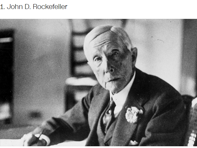
Rockefeller’s wealth soared as kerosene and gasoline grew in importance.
At his peak, he controlled 90% of all oil.
As quickly as possible, a way was found to replace what remained of the free-energy system with their own coal- and oil-based system, and in the process make money hand over fist from the total control of the new system.

Next, I am going to turn my attention to West Hickory, is the the short distance of just 14-miles or 22-kilometers, south of Titusville, where the tallest recorded skeleton in North America was found.
The 1870 newspaper article printed in the “Marysvillle Tribune” in Ohio from the “Oil City Times” in Pennsylvania says this with regards to the giant that was found at West Hickory.
Two men were excavating near West Hickory in preparation for erecting a derrick and unearthed the well-preserved skeleton of an enormous human.
The bones of the skeleton were described as “remarkably white;” the double- teeth all in place, of extraordinary-size; and that when the giant was alive, he must have stood 18-feet, or 5.5-meters, in stockings.
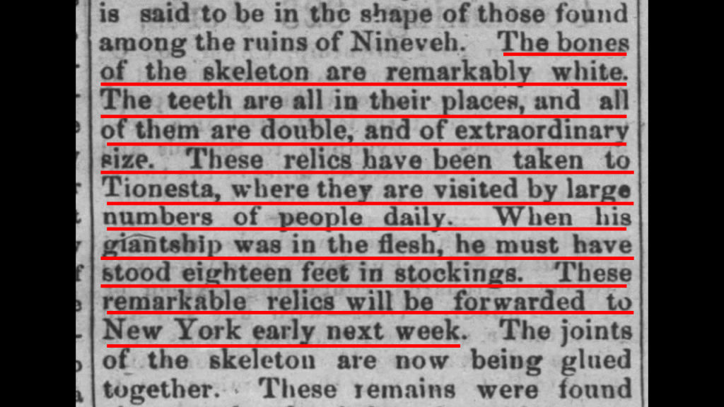
The bones were found about 12-feet, or 3.5-meters, below the surface of a mound, and the mound was not more than 3-feet, or less than a meter, above the level of the ground around it.
Yet another nut for the Antiquarians to crack!

To put that into perspective, this garage has 12-foot walls, so the giant’s bones were found that far below the surface of a mound, which was another 3-feet higher than the ground.
Another mystery for the antiquarians – how did a well-preserved skeleton of an enormous human with “remarkably white” bones get way down there?

Antiquarians are those who study history with a particular attention to artifacts, archaeological and historic sites, and historic archives and manuscripts.

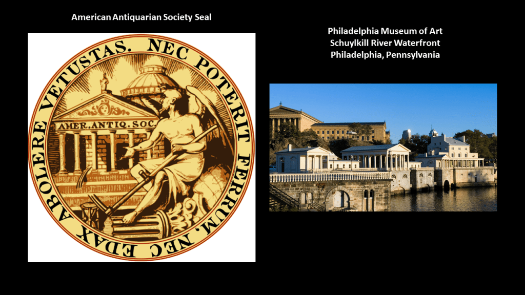
The American Antiquarian Society was established in 1815, said to be a national research library of pre-20th-century American history and culture, and the oldest historical society with a national focus, having been founded in 1812.
Its stated mission is to collect, preserve, and make available for study all printed records of what is known as the United States of America.

Seems like the American Antiquarian Society was established to be a gate-keeper for the new official history, like the “Smithsonian Institution.”
Somehow I don’t think the self-described Antiquarians had any intention of “cracking the nut.”

The seal of the American Antiquarian Society translates from the Latin of Ovid’s Metamorphoses, Book 15, Line 872: “Now I have completed my work, which neither sword nor devouring Time will be able to destroy” complete with an illustration of what we have come to consider Greco-Roman architecture and a broken corinthian pillar at the feet of what appears to be an angel. Hmmm.
The view of the Philadelphia Museum of Art from the Schuylkill River in Philadelphia is pictured on the right.
The Smithsonian Institution was established in August of 1846, and was created by the United States government for the stated purpose of the “increase and diffusion of knowledge.”
Researchers have long suspected the Smithsonian to have played a role in the cover-up of giants.
Back in the day, giant skeletons were displayed in public places and mentioned in newspaper articles, but all that went away.
The previously mentioned rock-city-like Beartown Rocks in Pennsylvania are located in the Clear Creek Forest just 25-miles, or 41-kilometers, southeast of West Hickory.

While we are still here in this part of Pennsylvania, this is a good place to mention that this is the historical land of the Susquehannock People.
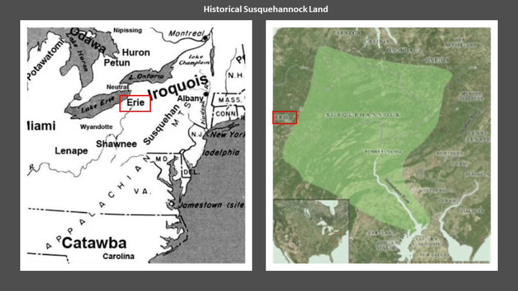
The Susquehannock People were known for their height.
This was not a secret.
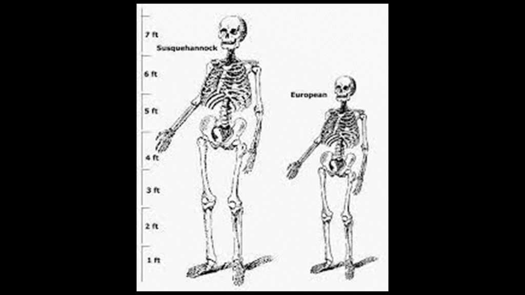
On the left is a size comparison between a Susquehannock skeleton compared with a European-sized skeleton.
Next, there are just two places I would like to bring forward here out of several that I looked at in the original post outside of Pennsylvania. that are along the same lines Bear Rocks and Boxcar Rocks.
They are Heavener Runestone State Park in Oklahoma and Gornaya Shoria in Southern Siberia.
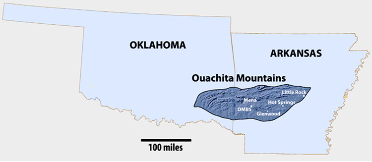
First, Heavener Runestone State Park, the best known tourist attraction in Heavener, located in east-central Oklahoma, very close to the Arkansas State line, on the edge of the Ouachita Mountains in Oklahoma.

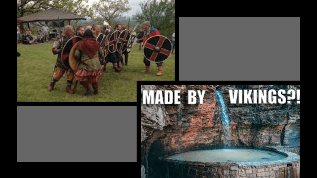
The idea that Vikings came through here once-upon-a-time, and carved the runes on the surface of a huge stone is actively promoted, and there is a Viking festival held here twice a year, once in the spring and once in the fall.
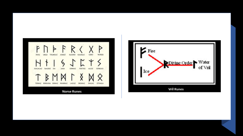
Interesting to note that what we know of as “Norse” runes, and associated with the Vikings, bear a remarkable resemblance to “Vril” runes, referring to “Universal Life Force Energy.”
Heavener Runestone State Park is one of the places that I first started waking up to this ancient civilization in 2015 when I was living in Oklahoma City between 2013 and 2016, and I visited there several times during that time.
The first time I did not take note of my surroundings at the Runestone, and just saw the Runestone.
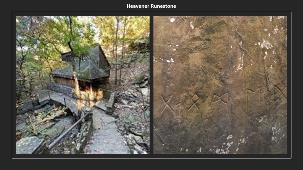
The second time I went there, I noticed that the Runestone was surrounded by an actual wall (which is referred to as a canyon there).

The third time I went to Heavener, I took these photos further up from the Runestone in a different location on the state park grounds, that have absolutely no attention drawn to them whatsoever.

The Ouachita Mountains of southeastern Oklahoma and western Arkansas are named after the Washitaw Mu’urs of North America, one of the many empires of the worldwide ancient advanced Moorish Civilization.
But…who are the Washitaw?
The Washitaw Mu’urs, also known as the Ancient Ones and the Mound-Builders, with a history that goes back to Ancient Mu, also known as LeMuria, still exist to this day, and have been recognized by the UN as the oldest indigenous civilization on Earth.
Matriarchal and matrilineal, the Washitaw Mu’urs are ruled by an Empress to this day.
Empress Verdiacee pictured here passed away in April of 2014, and the reigning Empress of the Washitaw Nation is her granddaughter, Wendy Farica Washitaw.
But for some reason the general public has never heard of the Washitaw.

Washitaw Proper, the ancient Imperial seat, is in Northern Louisiana, in and around Monroe.
How come we’ve never heard anything about the Washitaw?
Quite simply, they don’t want us to know.
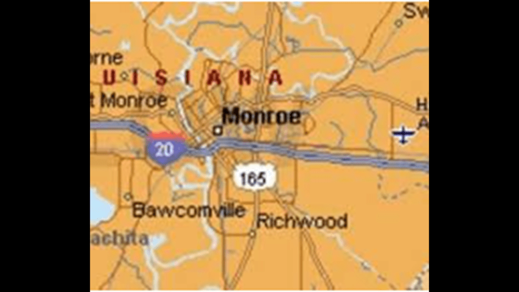
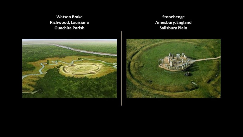
It is quite interesting to note that Watson Brake, an inaccessible archeological site to public view on private property in Ouachita Parish near Monroe in Richwood, Louisiana, is dated to 5,400-years ago, and is considered the oldest earthwork mound complex in North America.
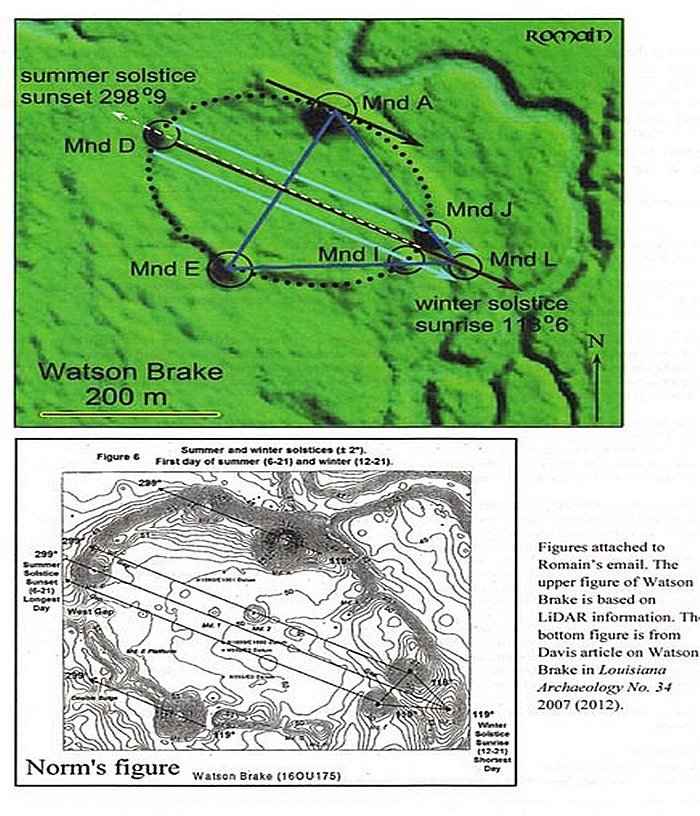
Note the summer and winter solstice alignments depicted here in this diagram of Watson Brake
Stonehenge in Southern England on the right, believed to date similarly to about 5,100 years ago, has a similar earthwork enclosure to what is seen at Watson Brake in Louisiana encircling the big stones.
How is this even possible with history we are taught?
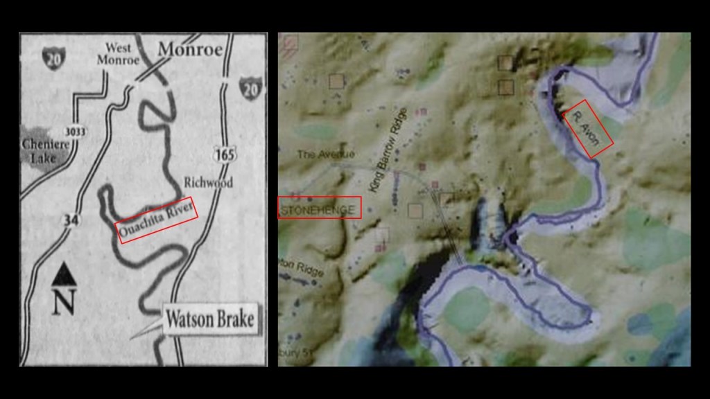
Oh yes, and the illustration of Watson Brake on the left shows s-shaped river bends right next to it.
Another landscape feature it shares with Stonehenge, which has the s-shaped Salisbury Avon right next to it as well.
One more place in the Ouachita Mountains I would like to mention is Pinnacle Mountain State Park outside of Little Rock, Arkansas.
This was definitely one of the places I woke up to this ancient civilization in North America.
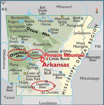
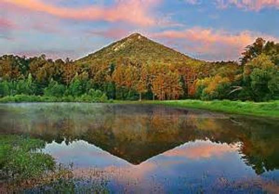
This is a picture of Pinnacle Mountain, which is only viewable like this from the Education Pond at Pinnacle Mountain State Park.
I had first heard of Pinnacle Mountain when I learned about a conference that was held there in 2012.
I didn’t think much of the name Pinnacle Mountain until several years later, in 2015, when finding this image on-line. This was the beginning of my “looking” and then “finding” out more and more. It really got my attention!!!
So I had to go there and see it for myself! It was about a 3 – 4 hour drive from where I was living at the time, and I went twice with friends.
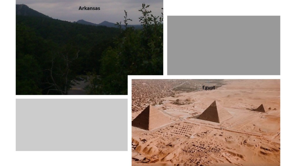
There are two more what appear to be pyramids next to Pinnacle Mountain, and this view is only obtainable from the Visitor Center Observation Deck on a relatively clear day, which I was lucky enough to photograph.
Otherwise, access to all other views is completely cut off by private property and fences, and these are certainly not advertised as pyramids.

Here is a comparison of what is seen from the Pinnacle Mountain Visitor Center Observation deck on the left, and the pyramids on the Giza Plateau in Egypt on the right, in which they all seem to be facing in the same direction.
Another thing is that I can’t help but notice the map of the Washitaw Empire on the left, roughly corresponds to the map of the Louisiana Purchase in the middle and the Western and Trans-Mississippi Theaters of the American Civil War on the right.
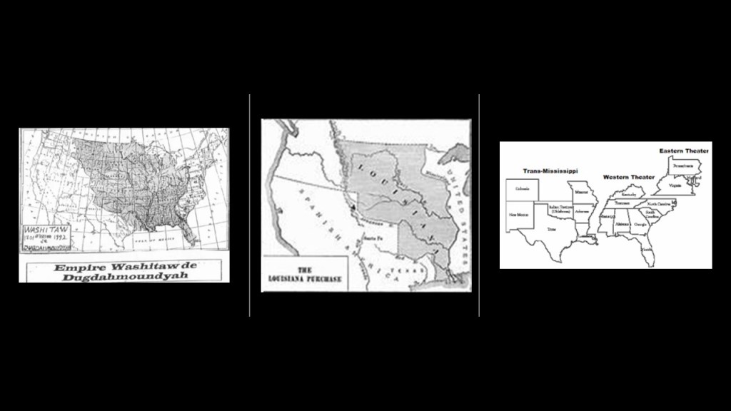
As a matter of fact, the Trans-Mississippi Department was a geographical subdivision of the Confederate Army.
When Union forces under General Ulysses S. Grant captured the Confederate stronghold of the port of Vicksburg on July 4th of 1863 and divided the Confederacy, Confederate General Edmund Kirby Smith’s forces were cut off from the Confederate Capital of Richmond, Virginia.
At the time, Edmund Kirby Smith was the Commander of the Trans-Mississippi Department, and for the rest of the Civil War, he remained west of the Mississippi River.
As a result of being cut-off from Richmond, Kirby Smith had free reign in a nearly independent area of the Confederacy, and the whole region became known as “Kirby Smithdom.”

Like Lewis Cass and Jefferson Davis, Edmund Kirby Smith is in the National Statuary Hall, representing the State of Florida.
I have gotten through about half of the 50 States in the series I have done on who’s in the National Statuary Hall, so I have looked at around 50 out of 100 statues, some of them famous but most of them obscure historical figures, and from what I’ve seen so far, it sure seems like a “Who’s Who” of the New World Order’s Reset Agenda to me!
I first learned about the Trans-Mississippi Department when I was doing some research around Albert Pike, an influential 33rd-degree Freemason who was a senior officer of the Confederate Army who commanded the District of Indian Territory in the Trans-Mississippi Theater of the American Civil War, otherwise known as Oklahoma.
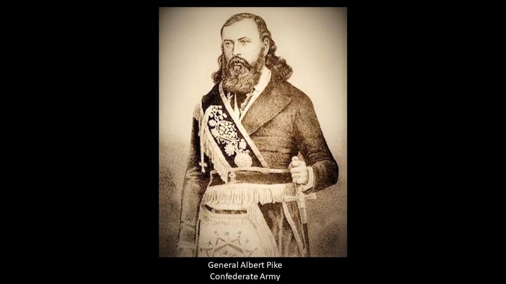
Around this same time period, Albert Pike was the Sovereign Grand Commander of the Supreme Council of Scottish Rite’s Southern Jurisdiction, a position which he held from 1859 to 1891.

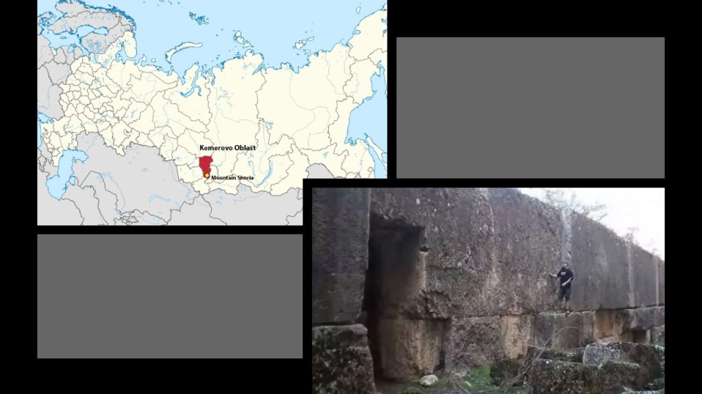
One last place I want to look at before I go back to continue down US-19 where we left off at Bluefield, Virginia, is Gornaya Shoria, on a different continent in Siberia.
Aaron sent me photos of Gornaya Shoria to bring it to my attention regarding its similarity to these rock formations we keep seeing in State Parks in North America.
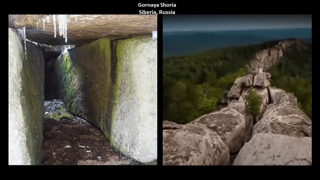
Here is Boxcar Rocks in Pennsylvania on the left compared with Gornaya Shoria on the right.
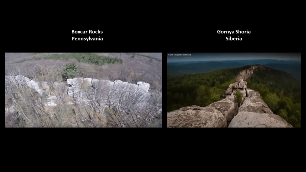
Gornaya Shoria is found in Russian in southern Siberia, east of the Altay Mountains, and is known for its gigantic megalithic stone structures.
There are other similarities to share between Siberia and what we have seen so far in North America.
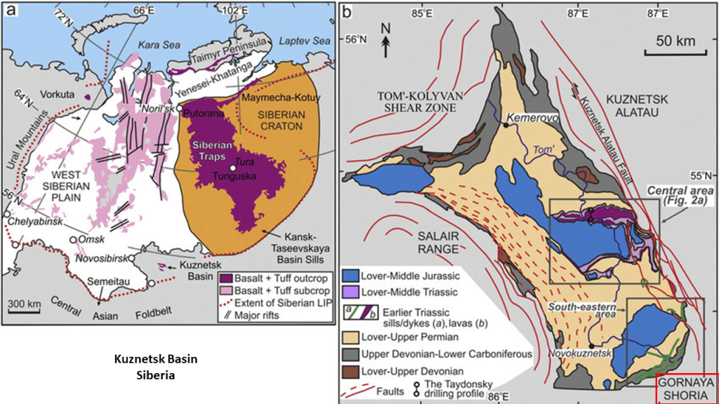
One is that Gornaya Shoria is that it is rich in ores, like the abundant iron ore we saw in State College, and is in the Kuznetsk Basin, one of the largest coal-mining areas in Russia with one of the largest coal deposits in the world, like the Pocahontas Coal Field, the richest deposit of bituminous coal in the world, back in southern West Virginia and western Virginia.
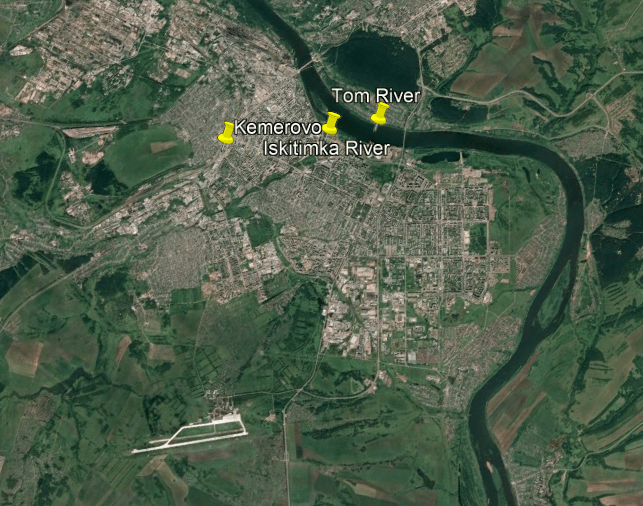
Another shared feature from what we have seen thus far in different places are the s-shaped river bends and confluences, like what we see in Kemerovo, the administrative center of the Kemerevo Oblast and the coal-mining capital of Russia.
It is located at the confluence of the Iskitimka and Tom Rivers, and is situated in an S-shaped bend of the Tom River.
The Kuznetsk Railroad Bridge crosses the Tom River at Kemerovo.
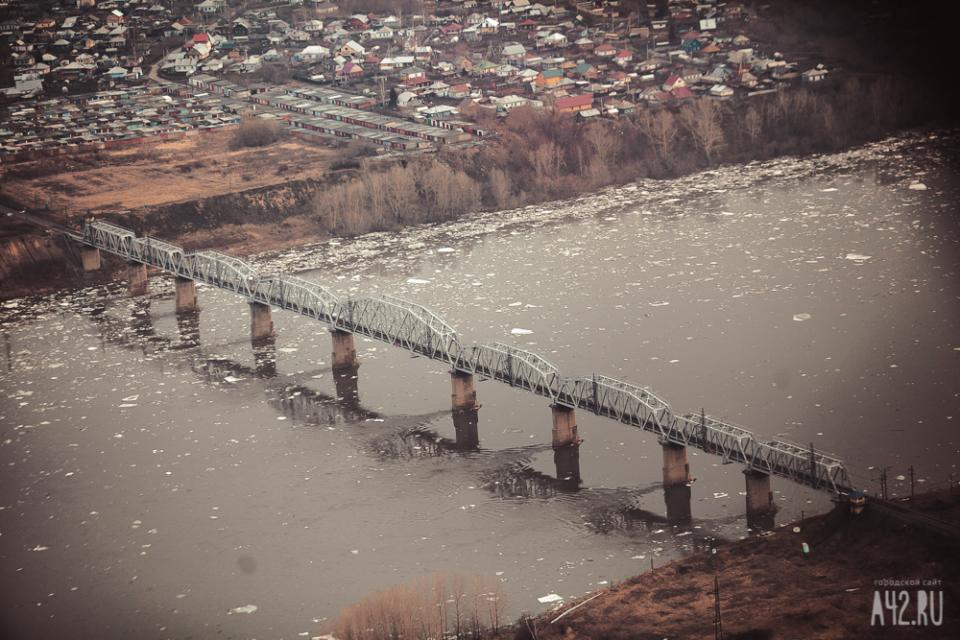
The Western Siberia Railway branch of the Great Trans-Siberian Railroad passes through Kemerovo, which has two railroad stations.

The Great Trans-Siberian Railway is the longest railway line in the world.
At 5,772-miles, or 9,289-kilometers,-long, it connects Moscow in European Russia to Vladivostok in the Russian Far East.
We are told that the first railway projects in Siberia began after the completion of the Saint Petersburg to Moscow Railway in 1851.
The Siberian line was divided into seven sections, and construction started in 1891, and we are told most of the line was simultaneously worked on by 62,000 workers.
This was labelled as an 1895 photo of convicts working on the railroad in East Siberia near Khabarovsk.
This photo with shadowy figures standing in the background reminds me of other creepy, staged-looking photos I see from time to time in my research.
Like this one noted as taken in 1870 in Trenton, New Jersey…
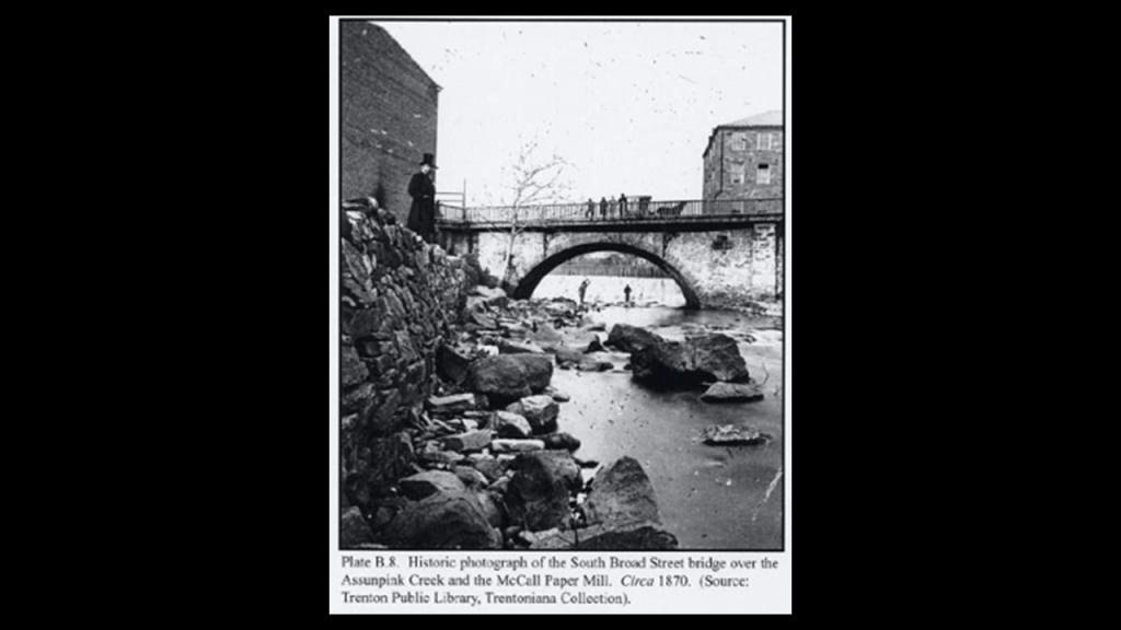
…and from the 1884 Flood of Paducah in Kentucky on the left that even has the words “stage of water” in the title below the photograph, and on the right a similar-looking photo taken in front of the Machinery Hall for the 1888 Centennial Exposition of the Ohio Valley and Central States in Cincinnati.
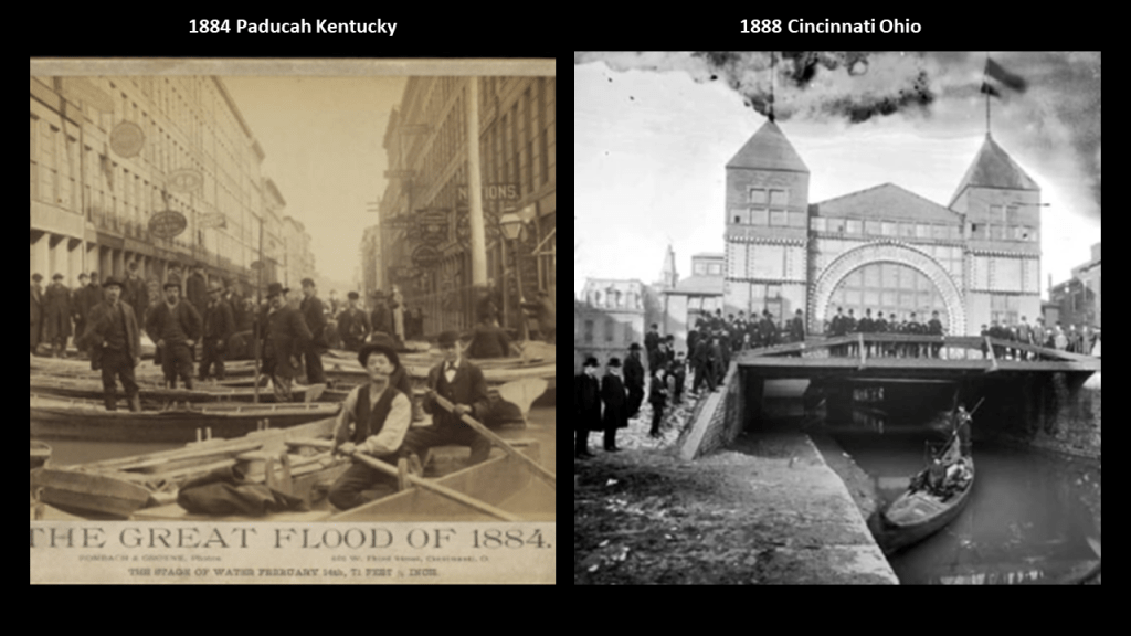
At any rate, the financial support behind the Great Trans-Siberian Railroad was leading European financier Baron Henri Hottinguer through his bank Hottinger & Cie, one of the first private banks, created by the Hottinguer family in Switzerland on August 1st of 1786.
Known today as the Hottinger Group, it is headquartered in the City of London London, and is primarily-owned by the Geneva-based Edmond de Rothschild Group.

Swiss Banks, along with off-shore banks in other countries, are notorious for the ability of wealthy people to hide their money and assets in them.

There is even what we think of as classical Roman architecture here in Siberia, like the Kemerovo Regional Lunacharsky Drama Theater.

You know, Siberia!
And wherever this picture was taken in the Siberian winter has an operational incline railway!

Like what you see in North America and other places, the indigenous Shor people of the Kemerevo Oblast are portrayed as hunter-gatherers and farmers…but who knew how to smelt-iron and make iron objects.
Hence their name from the Russians who encountered them in 1607, the Kuznetsk Tatars, or “Blacksmith Tatars.”
So the indigenous Shors, where the massive megalithic site of Gornaya Shoria is located, were “Tatars,” or Tartars, of the historic Tartarian Empire, one of many ancient empires around the world that were in harmony and balance with each other, and not at war with each other as we have been taught to believe in our historical narrative.
So you have the indigenous peoples of Russia, like the Shor…

…and the Itelmen People of the Kamchatka Peninsula in the Russian Far East looking very much like Native American Tribal people.

Well, that similarity is accounted for in the official narrative with the migration story that the first humans to enter North America came from Siberia across the Bering Land Bridge at the end of the last Ice Age.
Right?
The story we learn about in school anyway.
So, what exactly happened to get us to our present belief systems?

Well, for one way, there was “Wild Bill Cody’s Wild West” Show.
Wild Bill Cody, a Freemason, became internationally known for his touring show, called “Buffalo Bill’s Wild West.”

His “Wild West” Show travelled across the United States, Great Britain, and Continental Europe, starting in 1883.
In 1893, the name was changed to “Buffalo Bill’s Wild West and Congress of Rough Riders of the World” from horse-cultures the world over.
This one, and a plethora of other Wild West Shows, were the precursors of western movies in shaping the New Narrative in the minds of countless young people who grew up believing this was portraying true history.
The first commercially successful western film was “The Great Train Robbery” a silent film that was released in 1903.
The story-line was as follows: outlaw gang holds up and robs a steam locomotive; flee across mountainous terrain; and defeated by a posse of locals.
A pretty standard formula for western movie plots over the years.
The western-movie genre continued to grow as time went on, and in 1914, Cecil B. DeMille in his directorial debut released a silent western called “The Squaw Man.”

Director Cecil B. DeMille was a Freemason…

…and so were actors John Wayne and Roy Rogers, among many other famous actors and film-makers of the day.
Both John Wayne and Roy Rogers were Shriners, an organization comprised of 32nd- and 33rd-degree freemasons, the highest degrees of western freemasonry.

The name “Shriners” is derived from the “Ancient Arabic Order of the Nobles of the Mystic Shrine.”
I think it is accurate to say that the freemasonic Shriners are best known to the general public for their hospitals, circuses and parade antics in little cars.
Even comedian Red Skelton, musician Roy Clark and Mel Blanc, the voice of Bugs Bunny, were Shriners!
These are Prince Hall Shriners of the Ancient Egyptian Arabic Order of the Nobles of the Mystic Shrine.

Ancient Moorish Masonry has 360-degrees of initiation…327 more than western freemasonry.

Prince Hall, and fourteen other Moorish men were initiated into the British Army Lodge 441 of the Irish Registry, after having been declined admittance into the Boston St. John’s Lodge, at Fort Independence in Boston Harbor.
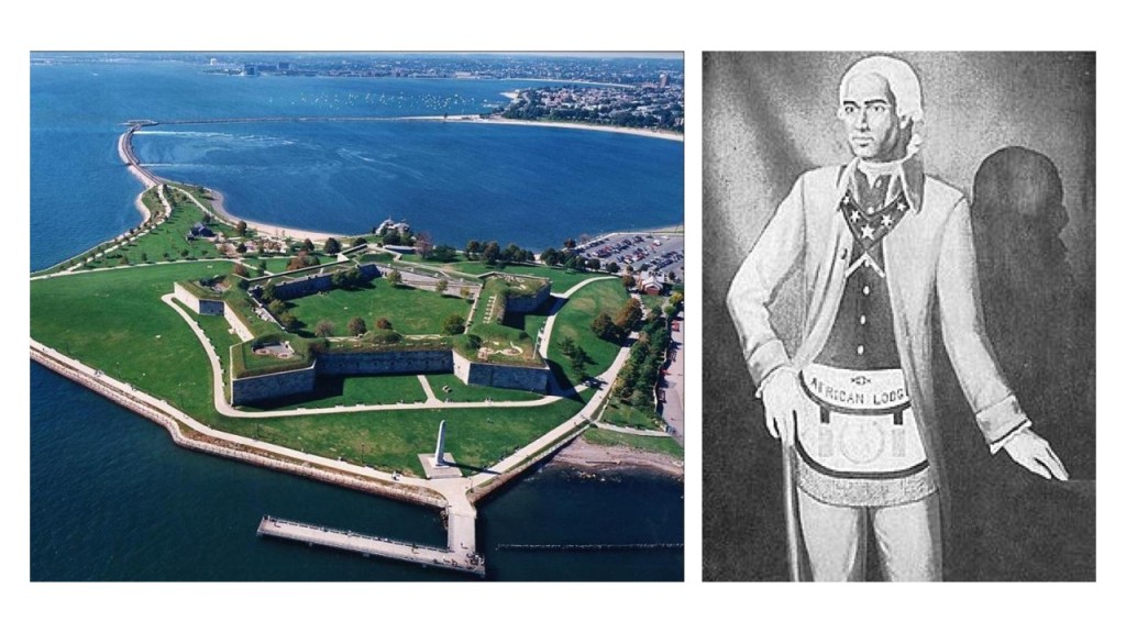
He was the founder of Prince Hall Freemasonry on September 29th of 1784, and the African Grand Lodge of North America.
Until Prince Hall found a way back in, Moorish Masons were denied admittance into Freemasonry.
Moorish Masonry is based on Moorish Science, which also includes the study of natural and spiritual laws, natal and judicial astrology, and zodiac masonry.
This is where the perfect alignments of infrastructure on earth with the sky comes from – the consummate alignment of earth with heaven that is seen around the world – like the lunar roll along the top of this recumbant stone in Crowthie Muir near Forres, Scotland.
Muir is pronounced “Moor.” Like in the Ouachita Mountains in North America, the memory of the people is retained.
Even though the spelling is different, the pronunciation is the same.

What I am seeing and believing is that Humanity was on a completely different and positive timeline from what we are experiencing today.
This civilization, with different empires around the world, but all part of the same civilization, built all of the infrastructure on the earth in alignment with sacred geometry and Universal Law to create Harmony and balance between Heaven and Earth.
According to George G. M. James in his 1954 book “Stolen Legacy,” the European Freemasons stole the legacy for themselves of the original Moorish Masons, the custodians of the Egyptian mysteries.
So, now I am going to head back to where I left off in Pennsylvania and pick up US-19 in Pittsburgh.
The routes I looked at leaving southward out of Erie – US-19, US-18, and US-8 – meet on the highway system around Pittsburgh.
Pittsburgh looks like another one of those central hubs we saw earlier with the US Highway System and historic Railroad lines.
Pittsburgh is the largest city in Appalachia and the Ohio Valley.
It developed as the vital link between the Atlantic Coast and the Midwest, with examples like the Allegheny Portage Railroad connecting the Pennsylvania Main Canal to Pittsburgh and the Ohio River and points west of the Allegheny Mountains.
Pittsburgh played a dominant role in the development of the U. S. Steel Industry.
Many leading industrialists of the 19th-century were based in Pittsburgh, and resided in the East Liberty neighborhood in Pittsburgh’s East End, at one time the richest suburb in America, with names including Mellon, Carnegie, Heinz, and Westinghouse living there.
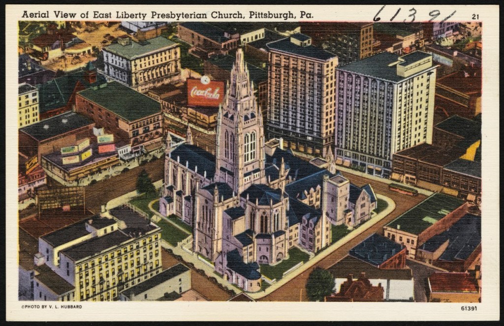
We are told that East Liberty started developing as a commercial area in 1842, when Thomas Mellon, prominent businessman and patriarch of the Mellon family in Pittsburgh, married Sarah Jane Negley, daughter of one of the earliest land-owners in the area, and made East Liberty their home..
We are told that Thomas Mellon made his fortune selling or rented land inherited by his wife, and used the proceeds to finance early industries in Pittsburgh.

In 1870, he and his sons Andrew and Richard established the “T. Mellon & Sons Bank,” and it became the Mellon National Bank In 1902.
It became a force in the mass production revolution in the United States, particularly in the Midwest.
A National Bank is a private bank operating as a commercial bank within the Federal Government’s Regulatory Structure, and under the supervision of the “Office of the Comptroller of the Currency,” rather than a state banking agency.
At one time in our history, National Banks had the authority to print money.

At its height, Mellon Financial Services was one of the world’s largest money management firms.
It merged with the Bank of New York in 2007 to become BNY Mellon.

Richard Mellon, with an adjusted wealth of $103-billion, is listed as the 5th wealthiest American of all-time by CNN Business, and a founder of Gulf Oil and Alcoa Aluminum, as well as a number of other big corporations, along with his brother…
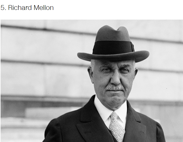
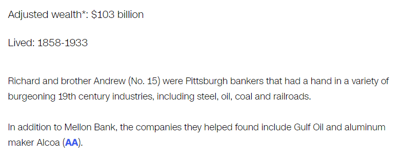
…Andrew Mellon, who is listed as the 15th-wealthiest American of all-time by CNN Business, with an adjusted wealth of $63.2-billion.
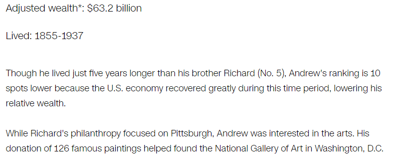
It is important to note that Andrew Mellon was an acknowledged Freemason, and also the U. S. Secretary of the Treasury from March 9th of 1921 to February 12th of 1932, presiding over the Boom years of the 1920s as well as the Wall Street Crash of October 1929, which led directly to the Great Depression.

Andrew Mellon was also a close friend of Henry Clay Frick, and a member of the South Fork Fishing and Hunting Club, along with Andrew Carnegie, on the property where the dam failed that caused the Johnstown Flood, as previously discussed.
Along with Andrew Mellon, as we saw earlier in the section on Johnstown, Andrew Carnegie and Henry Clay Frick were initiated into Freemasonry, with Henry Clay Frick active for only five-years, but supported Freemasonry his entire life.
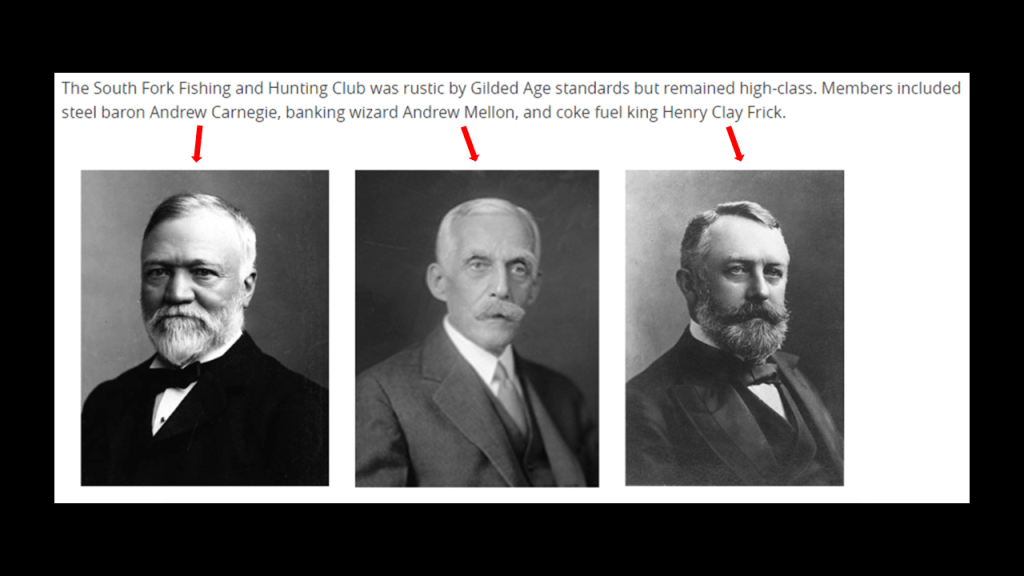
Andrew Carnegie was ranked as the 6th-richest American of all-time by CNN Business, with an adjusted wealth of $101-billion.
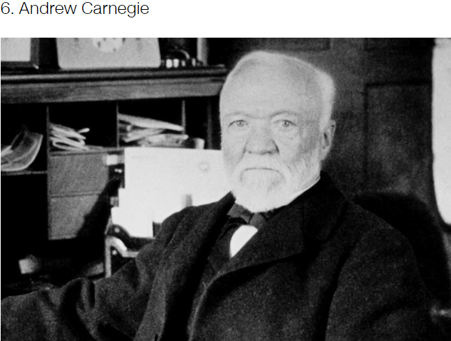
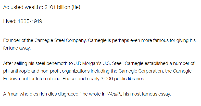
It’s important to note that with the philanthropic activities spoken of these extemely wealthy men, which are made to sound extremely benevolent and meant to benefit Humanity, it seems like their intent was highly questionable as to their actual motives.
We have seen or referenced all four of these men who receive the top billing as “Robber Barons.”
More on Vanderbilt and Morgan to come.
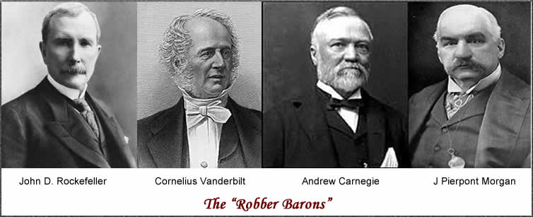
Among many other things, both the Rockefeller and Carnegie Foundations have been involved in the American Educational System…

…from the need to education to train the future workforce….
…to the insidious “Woke” currriculum of today that is taught in American public school classrooms.

And, even as early as 1914, the National Education Association expressed alarm at the activity of the Carnegie and Rockefeller Foundations, and their efforts to control the policies of State educational institutions, and everything related to the educational system.

Now I am going to leave Pittsburgh, and head south on US-19, back to where it meets US-219 in Bluefield, Virginia.
It was from tracking the Serpent Lei alignment, the red line on this screenshot, that I first encountered Burkes Garden, Virginia, which is just south of Bluefield, accessed from US-19, and the next place I want to bring to your attention.

Burkes Garden has a population of about 300 people, in a place considered to have the most fertile soil in Virginia, but no post office; no cell phone or cable service; cool-to-cold weather; and one paved road to Tazewell, the nearest town about 15-miles, or 23-kilometers away.
Burkes Garden is known as “Vanderbilt’s First Choice” for the Grand Biltmore Estate.
We are told that the land-owners there wouldn’t sell to George Vanderbilt II, so he went to Asheville in North Carolina instead.
More on Asheville shortly.

There are a number of historic railroads in the vicinity of Burkes Garden, like the Norfolk & Western Railroad’s Clinch Valley Line between the coalfields of Bluefield running through Tazewell County beside US-19 to the high-quality coalfields of the Clinch River Valley south of Richlands.
The last place I want mention on US-19 is Asheville in North Carolina.

Asheville is at the confluence of the French Broad and Swannanoa Rivers.
George Vanderbilt II’s Biltmore Estate is divided by the French Broad River, and its confluence with the Swannanoa River is on the Biltmore Estate.
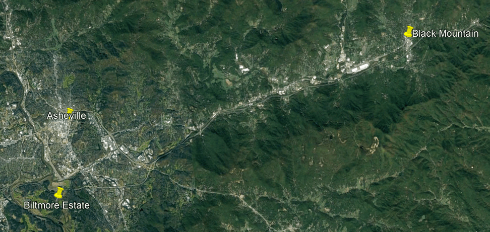
The Western North Carolina Railroad was said to have been constructed through here starting in the 1850s, and today the existing track is operated by different railroads to transport freight, primarily Blue Ridge Southern, Norfolk Southern, and CSX.
This whole region we have been looking at through here was part of the traditional lands of the Cherokee people.
They were said to have ceded their land here around Asheville 1819.
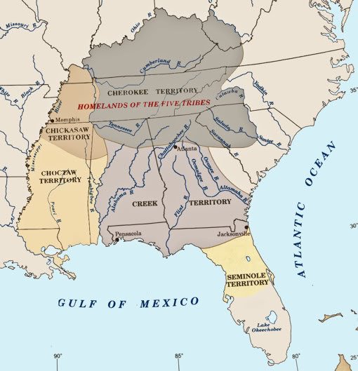
The Cherokee were one of the five civilized tribes to be forcibly removed from their land after the Indian Removal Act of 1830 was passed by Congress, and as mentioned previously, enforced by Lewis Cass, Andrew Jackson’s Secretary of War, and the Cherokee were marched west to Indian Territory in one of several Trails of Tears.
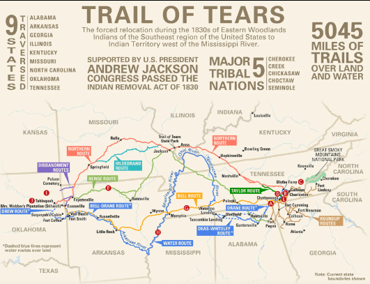
So Asheville on US-19 ended up being the location chosen by George Vanderbilt II for the Biltmore Estate instead of his “first choice” Burkes Garden, also on US-19.
The Biltmore Estate is on 8,000-acres, or 3,237-hectares of land.
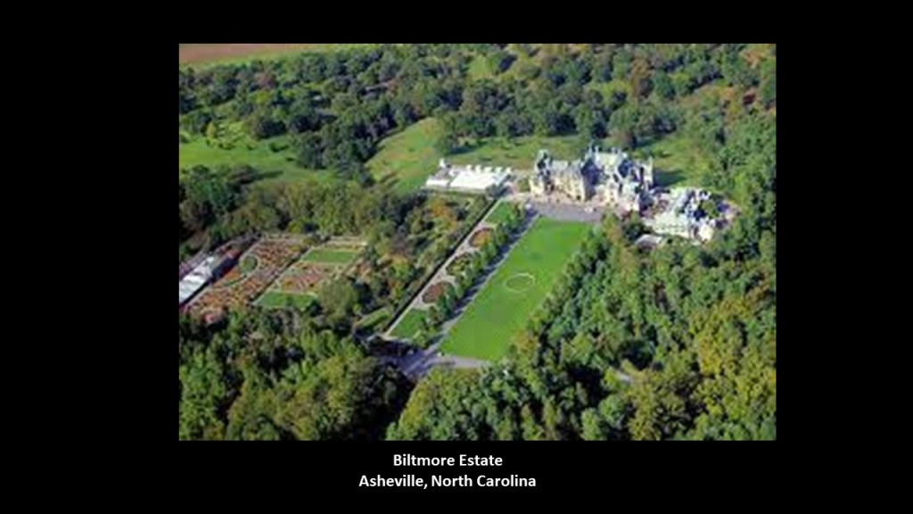
This is what we are told about the Biltmore.
It was said to have been a Chateauesque-style mansion, meaning in the revivalist Renaissance architectural-style of French chateaux of the Loire Valley, built for George Washington Vanderbilt II between 1885 and 1895.
It is the largest privately-owned residence in the United States, and is considered of the most prominent of the Gilded Age mansions.
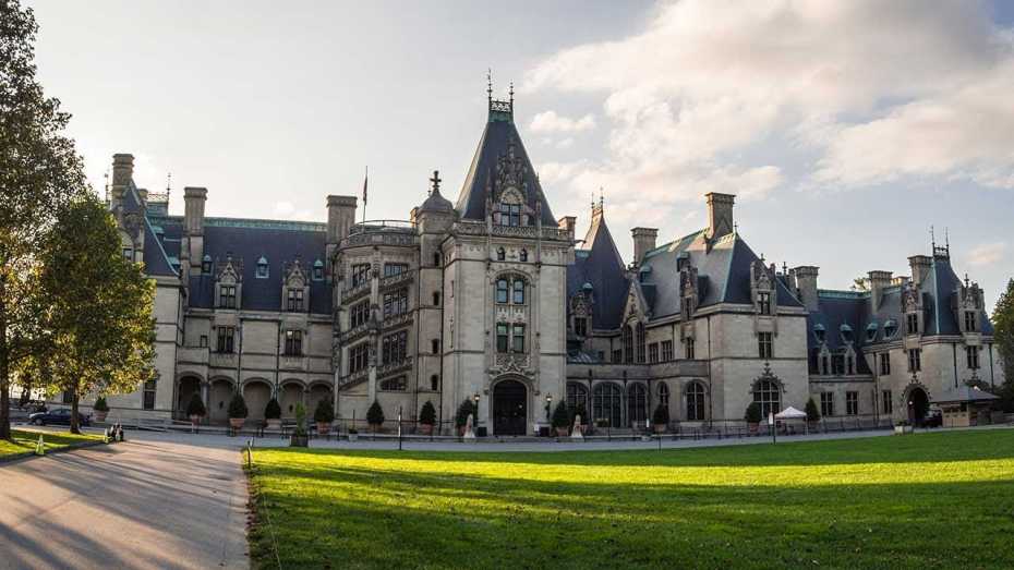
The Gilded Age is the name given to the period of time in American history between 1877 and 1900, a time of rapid industrialization and rapid economic expansion.
This would have roughly corresponded in our historical narrative to the Reconstruction Era after the American Civil War, which we are told ended in 1865, and the Progressive Era, which is what we are told was a period of widespread political activism and reform, that started in 1896.
It was also time when the contrast of the ostentatiousness of the wealthy versus the abject poverty of the working class became more visible.

We are told that the famous landscape architect Frederick Law Olmsted was employed by George Washington Vanderbilt II to design the landscape for the Biltmore Estate.
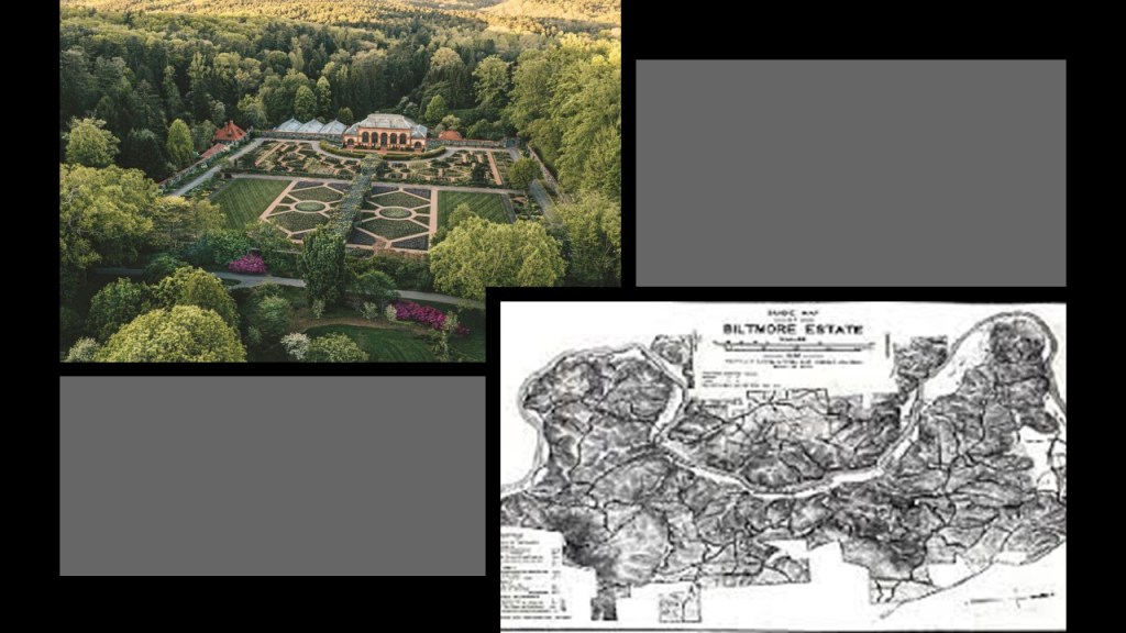
It was said to be Frederick Law Olmsted’s last project, and he was memorialized in a plaque there.
The Biltmore Estate contains numerous ancient Native American sites, including what is known as the “Biltmore Mound,” an earthwork platform mound, and other archaeological discoveries on the grounds.
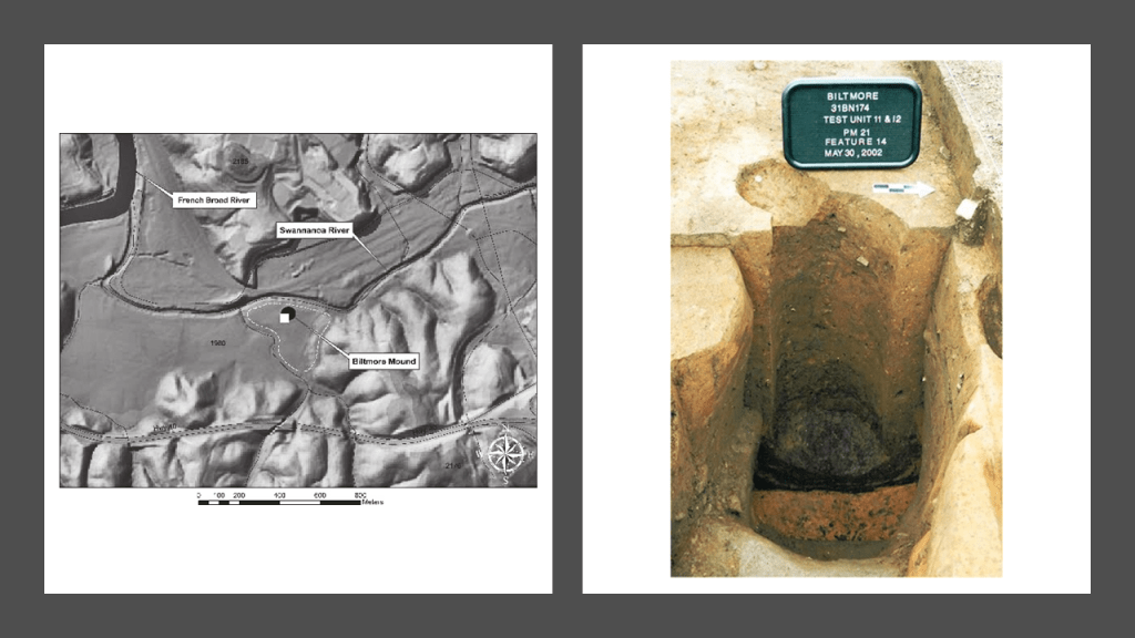
While I can’t find a direct reference to George W. Vanderbilt II himself being a Freemason, I did find a reference that the Vanderbilts were known Freemasons…
…and Aaron sent me the link to the Biltmore Lodge saying that George W. Vanderbilt procured the Lodge Hall for the Biltmore Masons to conduct business.
More on this finding to come.

George Washington Vanderbilt II was William Kissam Vanderbilt’s brother, who was mentioned earlier in this post as having gained control of the Chesapeake & Ohio Railroad, along with financier J. P. Morgan, from Collis Huntington in 1888.

Their grandfather was Cornelius Vanderbilt.
Staten Island-born Cornelius Vanderbilt got his start in regional steamboat lines and ocean-going steamships, and from there got into the railroad business.
He bought control of the Hudson River Railroad in 1864; the New York Central Railroad in 1867; the Lake Shore and Michigan Southern Railroad in 1869; and the Canada Southern Railway in 1876.
He consolidated his two key lines into the New York Central and Hudson River Railroad in 1870, becoming one of the first giant corporations in the history of the United States
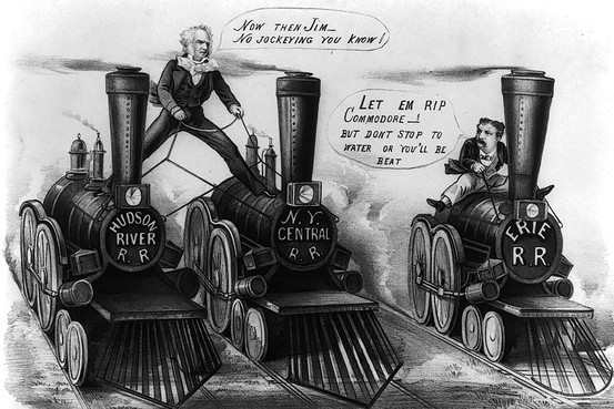
According to CNN Business, Cornelius Vanderbilt was the second-richest American in history, with an adjusted wealth of $205-billion.


George W. Vanderbilt II was supposed to sail on the RMS Titanic with his wife but they changed plans at the last minute and sailed instead on the sister ship of the Titanic, the RMS Olympic, which left port before the Titanic, and arrived in New York before the Titanic sank.
J. P. Morgan has long been suspected of having been behind what has come down to us as the sinking of the Titanic.
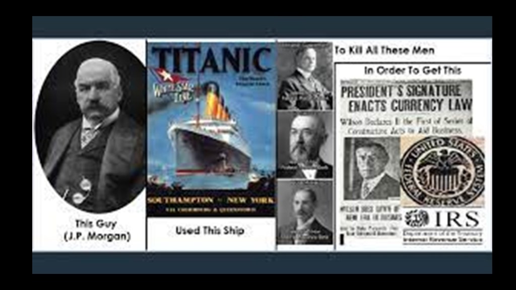
This is what we are told on the Federal Reserve History website.
A secret meeting took place on Jekyll Island off the coast of the State of Georgia to lay the foundations of the Federal Reserve between November 20th and November 30th of 1910.
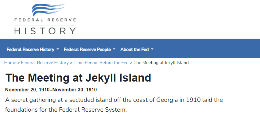
The purpose of the meeting was so secret that what the six men talked about was a closely guarded secret for many years, and they did not admit to it until the 1930s.
They were laying the foundation for what would become the Federal Reserve System.

Again, this information is from the Federal Reserve History website.
J. P. Morgan was a member of the exclusive Jekyll Island Club, was likely the one who arranged for the group to use the club’s facilities.
George’s brother, William K. Vanderbilt was also member of what Munsey’s Magazine described in 1904 as the “richest, most exclusive, and the most inaccessible” club in the world.

Arriving on a private train car, the group of men who attended the 10-day secret meeting on Jekyll Island in November of 1910 adopted the cover story of a “duck hunt” to explain their activities and hide the true purpose of their meeting, and addressed each other by their first names only – hence they adopted the name of the “First Name Club.”
This was the train station in Brunswick that serviced Jekyll Island on the Southern and Atlantic Coast Railroad.
The Oglethorpe Hotel pictured here was said to have opened in January of 1888, after having been built on top of the previous Oglethorpe House which was said to have burned down during the Civil War.
It remained in operation until 1958, at which time it was torn down and replaced by a Holiday Inn.

The Holiday Inn was eventually torn down too, leaving an empty lot in downtown Brunswick called the “Oglethorpe Block.”

Then, on April 15th of 1912, we are told the Titanic sank. with all the bankers opposed to the creation of the Federal Reserve on board, including John Jacob Astor IV, one of the richest people in the world at the time.
I can’t help but wonder if the “Sinking of the Titanic” was also a veiled reference to the “sinking of the Titans.”
The word “titanic” means “of exceptional strength, size, or power.”
More on my thoughts about this particular subject later in this post.
The following year, on December 23rd, 1913, the Federal Reserve Act Passed Congress, signed into law by Woodrow Wilson. It created and established the Federal Reserve System, and created the authority to issue Federal Reserve Notes (commonly known as the US dollar) as legal tender.
John Jacob Astor IV was the great grandson of John Jacob Astor, who made a fortune in real estate development, the fur trade, and opium smuggling.
John Jacob Astor was considered to be the world’s first multi-millionaire, and the third-richest American of all time according to CNN Business.

J. P. Morgan himself didn’t make the CNN Business List of 20 wealthiest Americans of time, but he dominated corporate finance on Wall Street throughout the “Gilded Age,” and was a major driving force behind the wave of industrial consolidation in the United States in the late 19th- and early 20th-centuries, like the previously mentioned U. S. Steel in 1901.

J. P. Morgan’s father, Junius Spencer Morgan, was the founder of the company that would become J. S. Morgan & Company in 1864, that was the successor company to George Peabody & Company, of which he became the Junior Partner in October of 1854.
In 1854, Morgan was put in charge of the firm’s iron portfolio, which included the marketing of railroad bonds in London and New York.
By the time J. S. Morgan died in 1890, the Morgan banks were the dominant forces in government and railroad finance, and his son John Pierpont Morgan had taken the helm of the company, becoming known as. J. P. Morgan & Company in 1895, now known as JP Morgan Chase & Company.

George Peabody’s bank became the premier American banking house in London after he took up residence from Baltimore to London permanently in 1837, and went from being a wholesale dry-goods and cotton merchant, to a merchant-banker offering securities in American railroad and canal enterprises to British and European investors.
He started a banking business trading on his own account a year after he moved to London, and by 1851, he established the banking firm of “George Peabody & Company” to meet the increasing demand for securities issued by American railroads, and his company specialized in financing governments and large companies.

According to “The Secret Founding of America” book by Nicholas Hagger…

…George Peabody was the Freemasonic banker from whom money was transferred to the “southern insurrectionists,” and he hired the father of J. P. Morgan to handle the funds when they arrived in the United States.
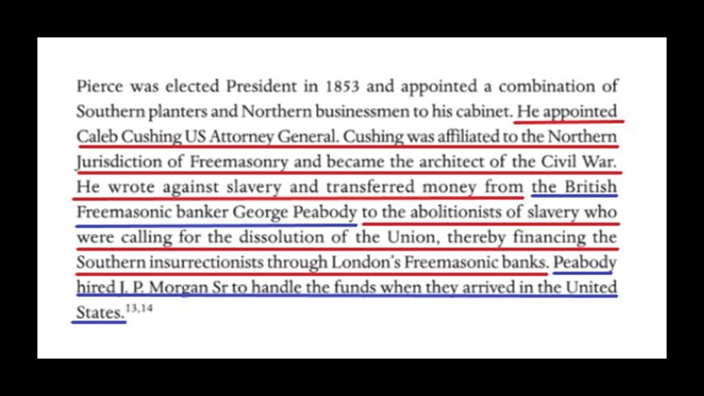
Banker George Peabody established the Peabody Institute in Baltimore in 1857 with a bequest of at least $800,000, and it is the oldest conservatory in the United States.
By the time it was completed and opened in 1866, one year after the official end of American Civil War, it was dedicated by George Peabody himself,and included a music academy, library and art gallery.
George Peabody was also called the “Father of Modern Philanthropy.”
That entrance at the east wing of the George Peabody Library sure looks proportionally like its made for much bigger people than we are today!
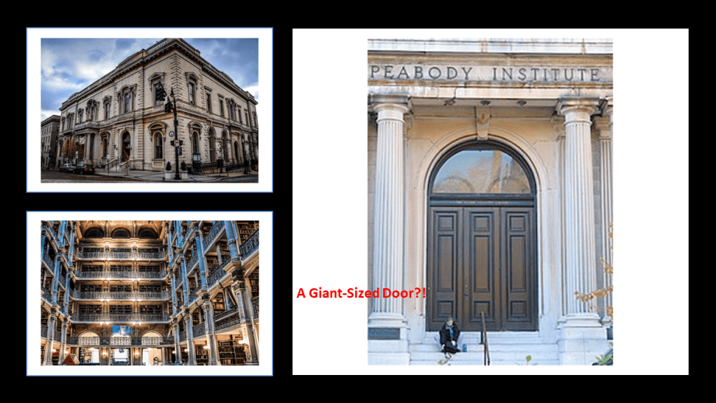
So, exactly how do you go about hiding giants and their advanced civilization?
Based on the evidence I have provided throughout this post and past research, I think the American Civil War was one of many ways to do this, and not what we are told it was about.
Frederick Law Olmsted, who later became a revered landscape architect credited with such grand landscapes as that of the Biltmore Estate as seen previously, started out his career as a journalist.
Among other things, during the pre-Civil War time period, Olmsted was commissioned by the New York Daily Times to start on an extensive research journey in the American South and Texas between 1852 and 1857.
He published three books from this time into one book, called “Journeys and Explorations in the Cotton Kingdom,” in 1861 during the first six months of the American Civil War at the suggestion of his English publisher.
All of these books by Frederick Law Olmsted raise red flags for me, as I have come to believe from my research that publications like these are indicative of some kind of setting the stage in seeding the new historical narrative into our consciousness by those responsible for the hijack of the original positive civilization that built all of Earth’s infrastructure.
Frederick Law Olmsted was also the first executive secretary of the United States Sanitary Commission as well as an organizer of the Union League.
First, the United States Sanitary Commission.
What we are told about the United States Sanitary Commission is that it organized “Sanitary Fairs” during the American Civil War as a fundraiser for the many needs of Union Soldiers, including health.
“Sanitary Fairs” had everything, including majestic “temporary” buildings said to have been built for the fairs, to be torn down after, and while not as elaborate as the big expositions such as in Chicago, they were still something in and of themselves.

Frederick Law Olmsted was on the standing committee for the United States Sanitary Commission that was formed in New York, with its main members throughout the Civil War also consisting of: Henry Whitney Bellows; George Templeton Strong; and surgeons Dr. William H. Van Buren, Dr. Cornelius R. Agnew, and Dr. Wolcott Gibbs.

Did the U. S. Sanitary Commission and its volunteers really have the wherewithal to both construct the buildings for and pull off these extraordinarily lavish and festive undertakings against the backdrop of national war and suffering?
Or was it a private front comprised of the very same people who organized and were prominent members of the private membership clubs of the day, like the Union League and the Century Association.
The Union League was a private social club for wealthy men that opened in New York City in 1863 for pro-Union men could come together “to cultivate a profound national devotion” and “strengthen a love and respect for the Union.”
It became the most exclusive mens’ club in Manhattan, and perhaps in the nation.
This location for the Union League Club was said to have been built on the northeast corner of 5th Avenue and 39th Street between 1879 and 1881.
Along with Frederick Law Olmsted, oganizers of the Union League Club were Henry Whitney Bellows, George Templeton Strong, and Wolcott Gibbs, same names as the United States Sanitary Commission.

Henry Whitney Bellows was also involved in the organizing of the Century Association in New York City, founded in 1847 and incorporated in 1857.
The Century Association was a private social, arts and dining club, and named after the first 100 people proposed as members.
The Century Association Building at 42 E. 15th Street was in-use by the association starting in 1857, and which served as one of the headquarters of the United States Sanitary Commission.

Members of the Century Association have included artists and writers like: poet and journalist William Cullen Bryant; landscape painter Frederick Edwin Church; landscape painter Winslow Homer; and best-known for stained-glass-work, Louis Comfort Tiffany.
Architect members have included: landscape-architects Calvert Vaux and Frederick Law Olmsted; Beaux-Arts architects Carrere and Hastings, as well as York and Sawyer; and architects McKim, Meade and White, who were said to have defined the ideals of the American Renaissance in end-of-the-century New York.
Other members were said to have included: Eight U. S. Presidents; ten U. S. Supreme Court Justices; forty-three Members of the Presidential Cabinet; twenty-nine Nobel Prize Laureates; members of the Rockefeller, Vanderbilt, Roosevelt, and Astor families; as well as financier J. P. Morgan and morse code inventor Samuel P. Morse.

Ever hear the George Carlin quote “It’s one big club, and you ain’t in it?” and wonder where that idea might have come from?
Seems like all of these private clubs we are seeing in this post were private and exclusive for a reason, and that was to secretly plan their activities and next moves that no one supposed to know about!

The so-called elites have continued doing the same thing to this day in their secretive meetings to plan their agendas for what they want the future to look like for Humanity and the World, and what they want doesn’t look good for us!

The United States Sanitary Commission and the Sanitary Fairs and the exclusive private clubs associated with the very same people leads to the larger question, of what was really going on during the American Civil War, historically described as a civil war between northern states, or “Union,” and the southern states, or “Confederacy,” over the status of slavery and its expansion into newly acquired land after the Mexican-American War.

We are told there were three theaters of war during years of American Civil War, between 1861 and 1865: Eastern, Western, and Trans-Mississippi.
I have often thought that theater, defined as a collaborative form of performing art that uses live performers, usually actors or actresses, to present the experience of a real or imagined event before a live audience in a specific place, like a stage, is a thought-provoking word choice for an area or place in which important military events occur or are progressing.
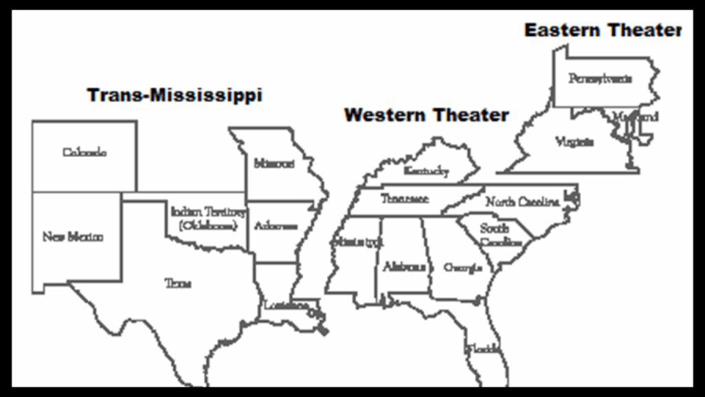
I have come to view the American Civil War as Freemasonic Theater, which I think applies to all the wars and armed conflicts of our modern era.
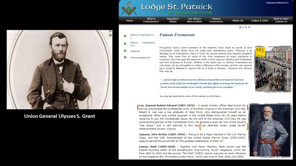
Orphan trains started in 1854, under the auspices of Frederick Law Olmsted’s good friend, Charles Loring Brace, and the Children’s Aid Society, which Brace established in 1853.
A new experimental program of his called “placing-out” became known to us as “Orphan Trains,” and for the next 75-years, over 200,000 children were sent across the continent, to uncertain destinations and uncertain futures with strangers.
A movement going in this direction was widely supported by wealthy New York families, like Charlotte Augusta Gibbes, the wife of John Jacob Astor III, grandson of John Jacob Astor, and who was the wealthiest Astor family member of his generation.
Right around the same time as the beginning of the Orphan Train Movement, and the alleged completion of the Horseshoe Curve by the Pennsylvania Railroad near Altoona, both taking place in 1854, we are told that the federal government operated a land-grant system between 1855 and 1871, where new railway companies in what we are told was the uninhabited west were given millions of acres they could sell or pledge to bondholders.
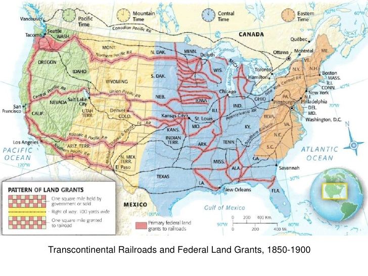
The establishment of a land-grant system at this time is a good place to insert once again the story of the Ames Brothers of Easton, Massachusetts, co-owners of the Ames Shovel Shop, nationally known for providing the shovels for the Union Pacific Railroad, which we are told opened the West.
It was said to have been the world’s largest supplier of shovels in the 19th-century.
Why were shovels so important to the opening of the West and the expansion of infrastructure?
What if…the tracks were already there and just needed to be dug out?

Not only that, one brother, Oliver Ames, Jr, (b. 1807 – d. 1877) was the President of the Union Pacific Railroad from when it met the Central Pacific Railroad in Utah for the completion of the first Transcontinental Railroad in North America.
The other brother, Oakes Ames, was a member of the U. S. Congress House of Representatives from Massachusetts 2nd District from 1863-1873. He was credited by many as being the most important influence in building the Union Pacific portion of the first Transcontinental Railroad.

Oakes Ames was also noted for his involvement in the Credit-Mobilier Scandal of 1867, regarding the improper sale of stock of the railroad’s construction company.
He was formally censured by Congress in 1873 for this involvement, and he died in the same year.
Ten-years later, he was posthumously exonerated by the Massachusetts State Legislature on May 10th, 1883.
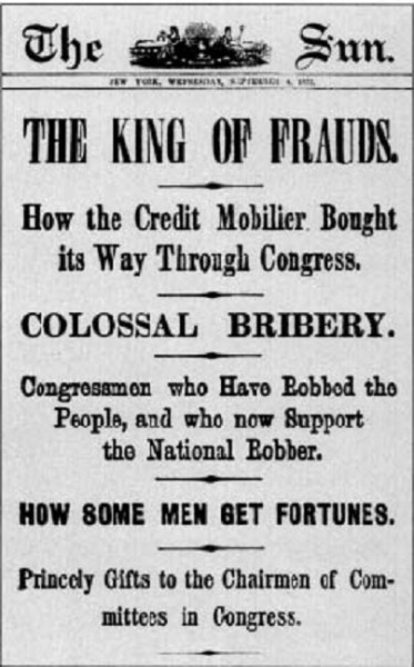
Has nothing ever changed?
Have we always had the same corruption in our government?

Then, there was the Kirkbride Plan coming in around the same time in the mid-1800s as all these other things I just mentioned.
Thomas Kirkbride was a Pennsylvanian who was said to have designed a system of mental asylums starting in the mid-19th-century that were constructed according to the Kirkbride Plan across the U. S. and while numerous Kirkbride structures still exist, many have been demolished, partially-demolished, or repurposed.
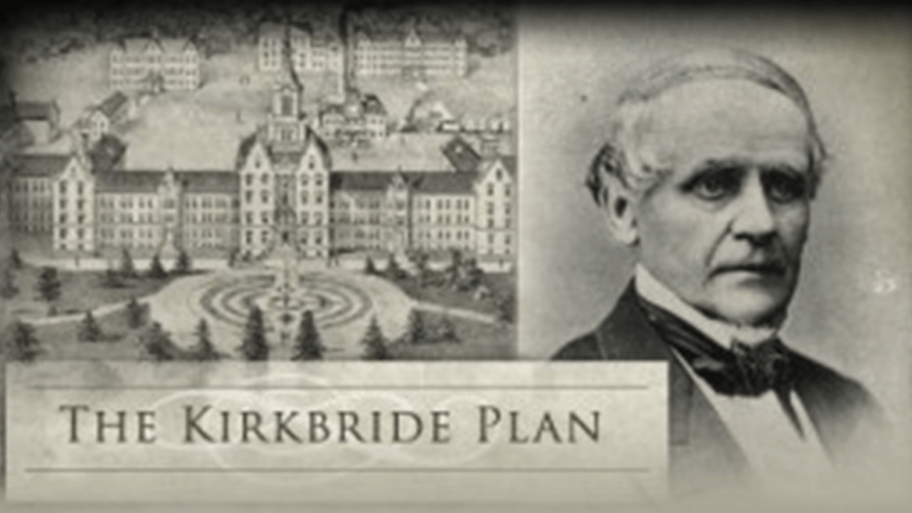
The first building said to have been constructed with Kirkbride’s design was the New Jersey State Lunatic Asylum in Trenton, New Jersey, in 1848, also known as the Trenton State Hospital.
Aaron uncovered what I am going to share next when he was prompted to look into the relationship between the locations on Google Earth of Kirkbride buildings (marked by white), key masonic lodges (green), and state capitals (red).
You will see in the following screenshots of what he found, there is a high correlation of these buildings being on or near these alignments.
Gettysburg in Pennsylvania turned out to be a hub, circled in red, with many alignments between all three of these types of locations going out in all directions.
He found the same thing happening with the New River Gorge in West Virginia as a hub, with many alignments between all three of these types of locations going out in all directions.

He also looked up these three types of location alignments from the address of the previously mentioned Biltmore Masonic Lodge, which is marked in orange and circled in red, and found some interesting linear patterns emerging from North America.
Here is a more localized view of alignments of Kirkbrides, masonic lodges and state capitals to the northeast of the Biltmore Lodge, and upon which the earlier Kirkbride example I gave of the Trenton State Hospital falls directly, circled at the top of the screenshot.
The Earth’s original free-energy grid system was based on exact and precise geometric alignments of cities and places, which is actually what we are seeing in high-definition with Aaron’s Kirkbride alignments, and it was reverse-engineered into an energy-harvesting and control system.
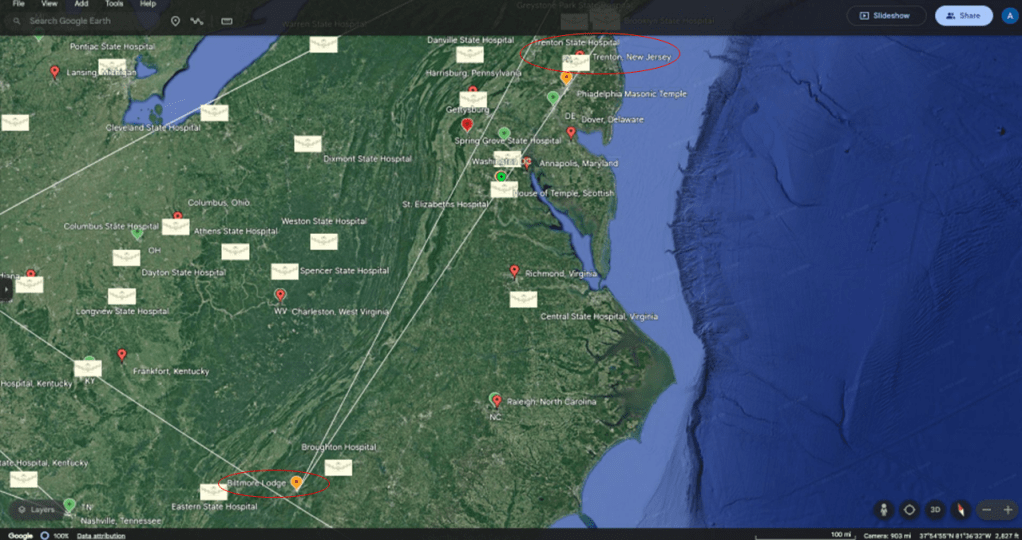
And how did they manage to do that?
I have come to believe after years of extensive research in tracking cities and places in alignment on the Earth’s grid system and delving deeply into reset historical narrative that there was a deliberately caused cataclysm relatively recently by directed energy into the grid system, which devastated the surface of the Earth.
I have put forward the idea that the Philadelphia Experiment was connected to what has taken place here, which I discuss in-depth in “Recovering Lost History from Estuaries, Pine Barrens & Elite Enclaves Off the Atlantic Northeast Coast of the United States,” but however it happened, I believe this cataclysm was a deliberately-caused attack on the Earth’s grid system and was not caused naturally.
A sudden cataclysmic event, creating swamps, deserts, and even submerging entire landmasses around the Earth, would account for how a highly advanced worldwide civilization of giants could be wiped from the face of the Earth and erased from our collective memory.

Secondly, I believe the beings behind the cataclysm were shovel-ready to dig enough of the original infrastructure out of the ruined Earth so they could be used and civilization restarted, which I think started in earnest in the mid-to-late 1700s and early 1800s.
There’s extensive underground infrastructure where people could have survived until the surface of the Earth was habitable.
Then they only used the pre-existing infrastructure until they found replacement fuel sources that could be monetized and controlled by them for what had originally been a free-energy power grid and transportation system worldwide, and when what remained of the original infrastructure was no longer useful to them, or inconvenient to their agenda, they had it destroyed, discontinued, or abandoned, typically in a very short time after it was said to have been constructed, as we have seen here in all these examples from Pennsylvania and West Virginia.
Oh yes, and they claimed the very best of everything for themselves, including but not limited to, what became the Greenbrier Resort.
While the new elite class lived in the lap of luxury, and helped themselves to the best of everything, they had little care for anyone or anything else – not at all.
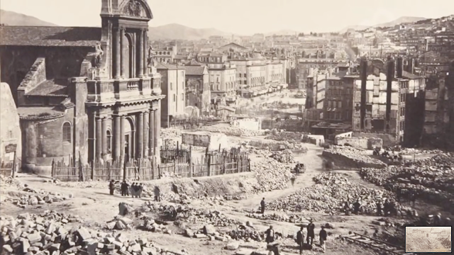
Quite the opposite.

They have actively facilitated the demise of all the rest of us, who they call “useless eaters,” into the present-day.

The same story repeats all over the country with the Robber Barons coming in and setting up shop, and the Resetters staging a new history.
Like Lumber Baron William Carson, who arrived in San Francisco, California in 1849, from New Brunswick in Canada, with a group of other woodsmen.
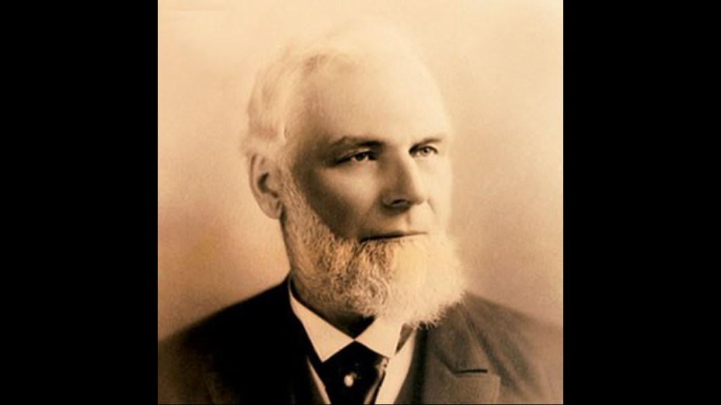
In 1850, he and Jerry Whitmore were said to have felled a tree, the first for commercial purposes on Humboldt Bay, and in 1854, he was said to have shipped the first loads of Redwood timber to San Francisco.
In 1863, he and John Dolbeer formed the Dolbeer and Carson Lumber Company.
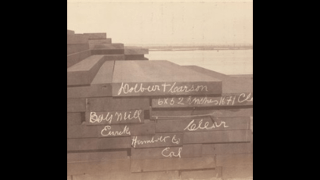
William Carson was also said to have been involved with the founding of the Eel River and Eureka Railroad in November of 1882.
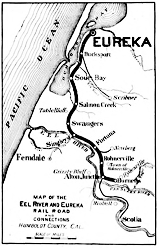
Its service was said to have been stopped for safety reasons between 1996 and 1997, and it’s been abandoned ever since.
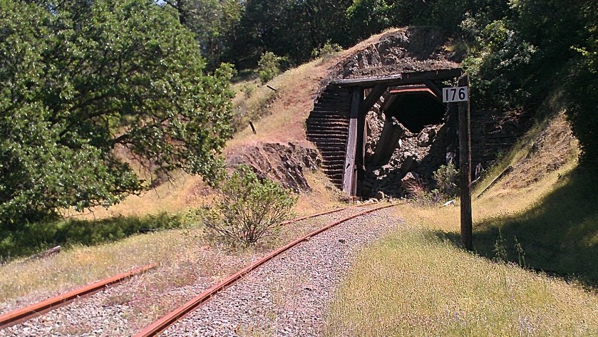
But the new history of the “Robber Barons and the Resetters” seems to have gotten its start in Pennsylvania, where there were a lot of firsts happening.
The nickname of Pennsylvania is “The Keystone State,” and in its anecdotal history, was said to have come from it’s location in the keystone of the arch, depicted here, in the center of the original thirteen colonies.
But another reason comes to mind in the definition of “keystone,” in its figurative sense as opposed to its literal meaning as the stone in the middle of the arch which holds up the others.”
The idea of “that which holds together other parts…locking together the whole structure.”
Pennsylvania certainly seems to have played an instrumental role in doing just that in our historical narrative and new economic system.
Additionally, the story of the Masonic Keystone is well-worth looking at. which has the letters “HTWSSTKS” engraved on it, said to mean “Hiram The Widows Son Sent To King Solomon,” referring to Hiram Abiff.
Hiram Abiff is the main character in an allegory presented to all 3rd-degree Freemasonry candidates as the main architect of Solomon’s Temple.
Hiram Abiff was murdered inside the temple with a mason’s tool by three fellow-craft masons from the workforce, or “ruffians,” after he wouldn’t give them his Master Mason secrets, which were lost with his death.
I found an article on the masonicworld.com website awhile back when I was looking for information on Hiram Abiff.
In it, the writer talks about “Operative Masonry” and the beginning of “Speculative Masonry” in 1717, with the founding of the Premier Grand Lodge of England.”
The writer indicates in the article that while some believed that operative masons were also in position of the tragic story of Hiram Abiff, there was no mention ot Hiram Abiff in the existing records of Operative Masonry from before that time; that there was no third, or Master Mason Degree as a rite until the Premier Grand Lodge was established in 1717; and that it was likely that the legend of Hiram Abiff was introduced at the time of Freemasonry became a speculative organization.
To me this provides supporting evidence that the ritual of the recital of the death of Hiram Abiff is actually an allegory for what happened to the Moors themselves and their advanced civilization by the unworthy craftsman that has been enshrined in one of their main initiation rites.
It is my understanding that only those initiated into the highest degree of western Freemasonry know directly about the Moors.
And it is no secret within Modern Freemasonry that it is “speculative,” meaning based on conjecture rather than knowledge, as opposed to “operative,” meaning those who actually worked with stone.
The New World’s Controllers stole the identity and legacy of the operative masons, and took us from the “Moorish Divine Movement of the World,” from Antiquity, with the eye on top of the pyramid signifying our pineal gland and our connection to the Creator, to it symbolizing “Big Brother,” and the control of the 13 Bloodline families.
There’s a lot more to our lost history, but this gives you some idea of what has taken place here, and not for our benefit.

In these shorter, themed-segments, as I have done in this one, I am going to bring forward additional information that was not included in the original post.
As much as possible, I am going to change-up the information in each of these different segments so you are not seeing the same information continually repeating, as all the information presented in “On the Trail of Giants – In Appalachia and Beyond” was closely interconnected.
The next post will be “On the Trail of Giants – In Appalachia and Beyond – Theme 2: Giants.”

One thought on “On the Trail of Giants, in Appalachia and Beyond – Theme 1: Robber Barons and Resetters”