
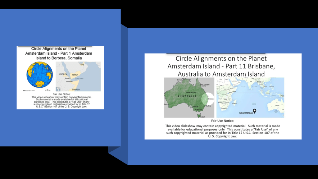
This post involves a circle alignment that I found beginning and ending on Amsterdam Island, a small island in the French Subantarctic Islands.
I am updating the original series from November of 2018 through January of 2019, and have added a considerable amount of new material to what I had in the original eleven-part series called “Circle Alignments on the Planet Amsterdam Island.”
I have removed “Planet” from the title and replaced it with “Earth” because I do believe as a result of what I have encountered in my research over the last five-years-plus, that we have been lied to about the shape of the realm, along with all the other things we have been lied to about.
This series was one of my earliest efforts in tracking cities and places in alignment over a very long distance, and consistently seeing the same characteristics and hand of design across oceans and continents.
The process of doing the research along this alignment and other alignments has provided extensive evidence for a worldwide, advanced civilization, which has been deliberately suppressed, misattributed and removed from our collective awareness so that we wouldn’t know about its existence.
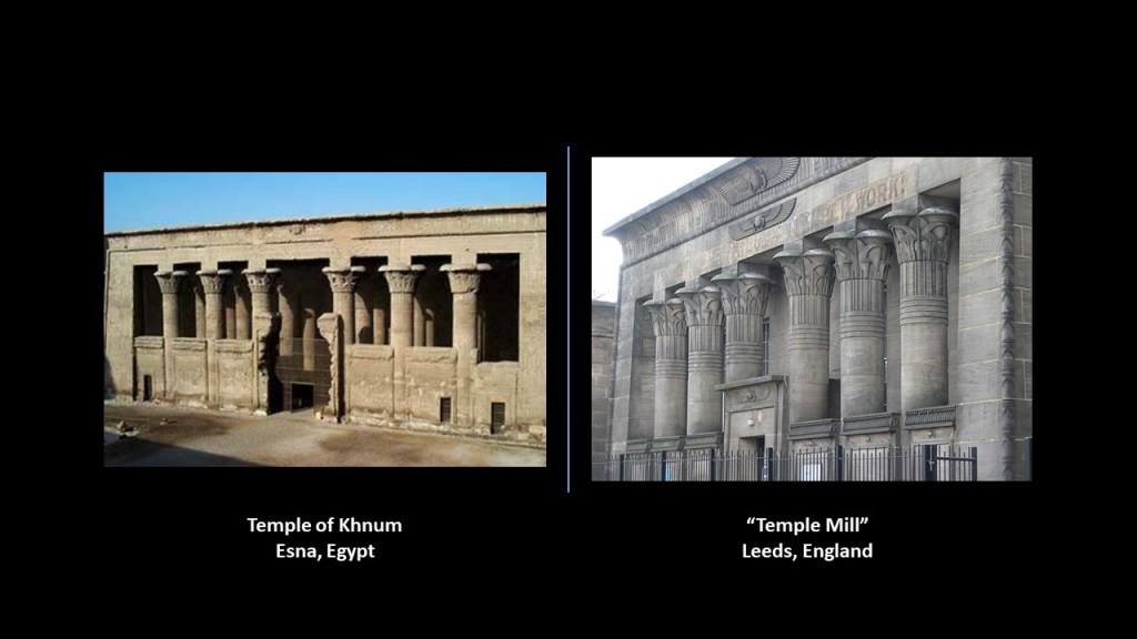
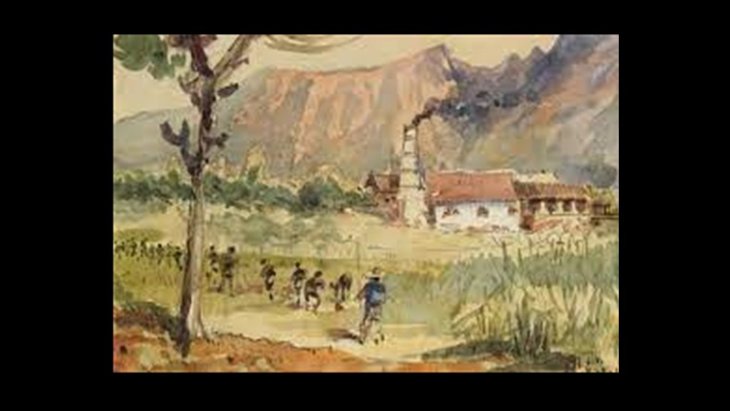
For comparison of similarity of appearance is the Temple of Khnum in Esna , Egypt, pictured on the left, and the Victoria-era “Temple Mill,” in Leeds, England, on the right.
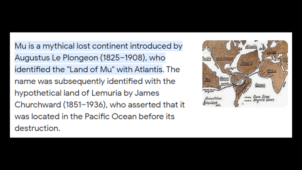
This advanced civilization that developed on Earth originated in the far distant past in ancient Mu, also known as LeMuria; and that this was the same civilization known as “Atlantis,” which I believe existed up until relatively recent times and represents the missing positive timeline of Humanity.
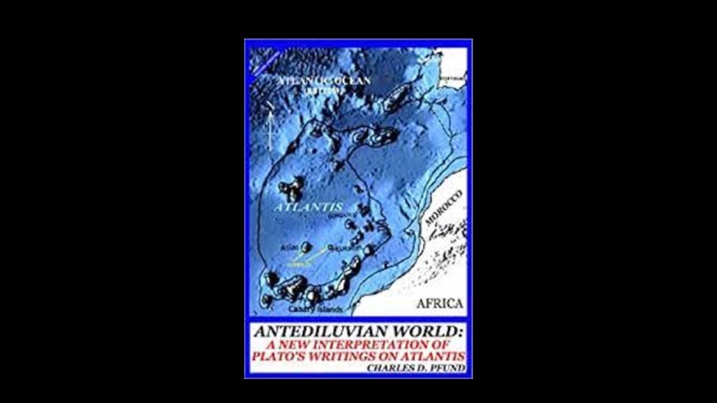
While this map may not represent the actual extent of the Earth’s landmass at the time of the “Fall of Atlantis,” which I have come to believe took place relatively recently in time as opposed to many-thousands of years ago, it is the closest representation on a map that I could find to a depiction of the continental landmasses being much more connected than what we have been taught to believe in our historical narrative, which doesn’t even officially confirm the actual existence of LeMuria and Atlantis.
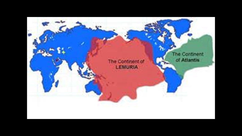
Mu and Atlantis are treated more like historical “maybes” – maybe they once-existed, and maybe they didn’t – and typically placed in the elusive “mythical” category by Academia.
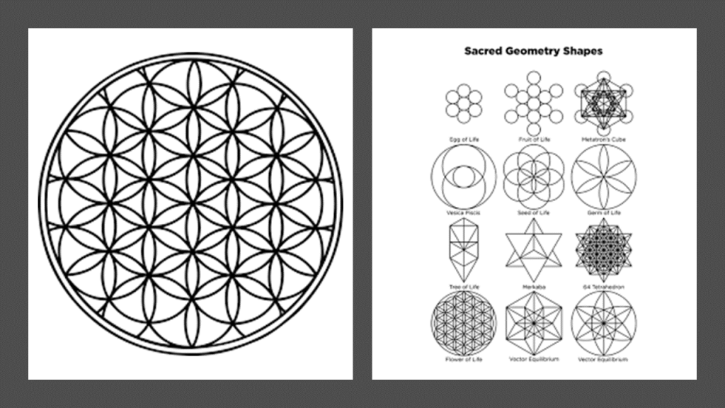
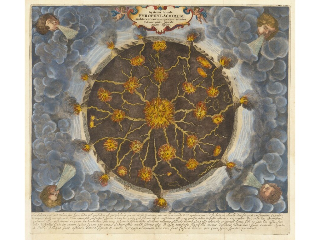
From the extensive research I have done thus far, I have reason to believe this ancient global civilization was aligned on Earth and Heaven in a Flower of Life pattern, within which all sacred geometric shapes are contained, and built out on the surface of the Earth according to the principles of Sacred Geometry.
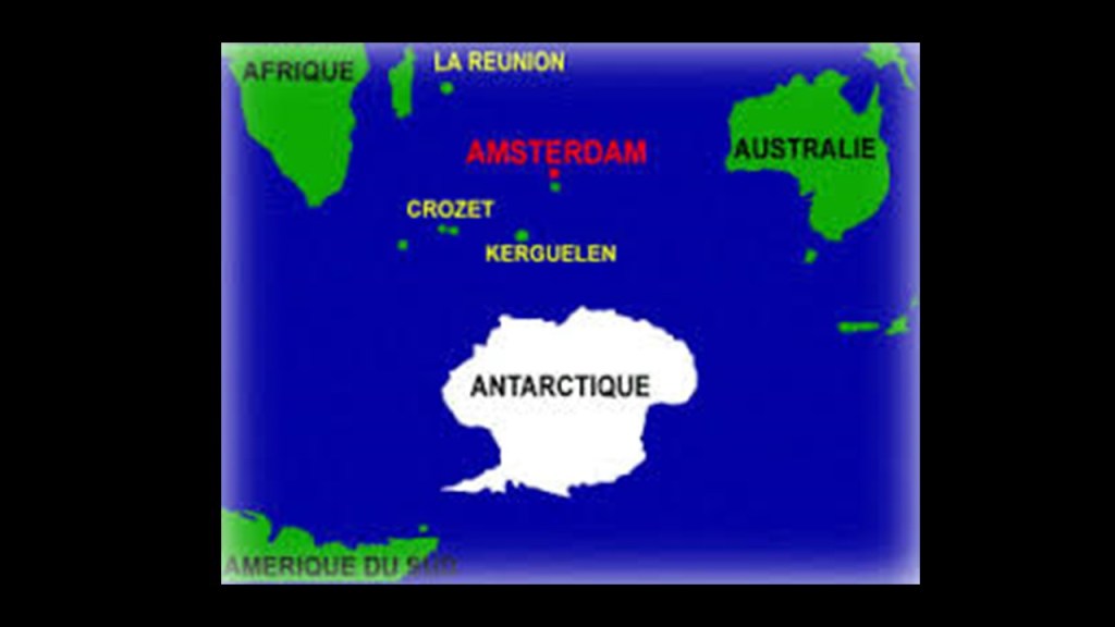
The start- and end-point of this next circle alignment. that I found and am about to share with you in this post, is a tiny dot in the South Indian Ocean.
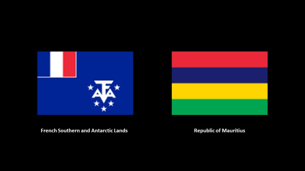
The dot is Amsterdam Island, one of the French Subantarctic Islands, officially claimed by France in 1892, and known as the territory of the “French Southern and Antarctic Lands,” since 1955, along with “Adelie Land,” the French claim on the Antarctic continent which has been applied to the “Antarctic Treaty System” rules since 1961.
We are told that Amsterdam Island got its name in 1633 from a Dutch sea captain who named it after his ship, Nieuw Amsterdam, which was named after the Dutch settlement of Nieuw Amsterdam (which later became New York City).
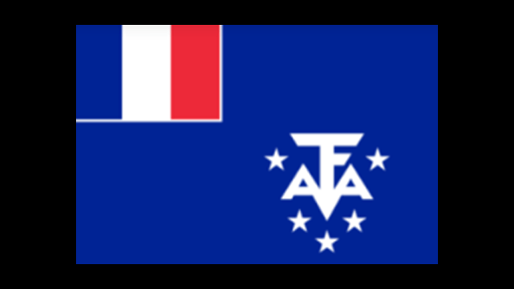
This tiny speck of real estate, for which the only settlement is a seasonal research station, even has its own flag.
The research station studies biology, meteorology, and geomagnetics.
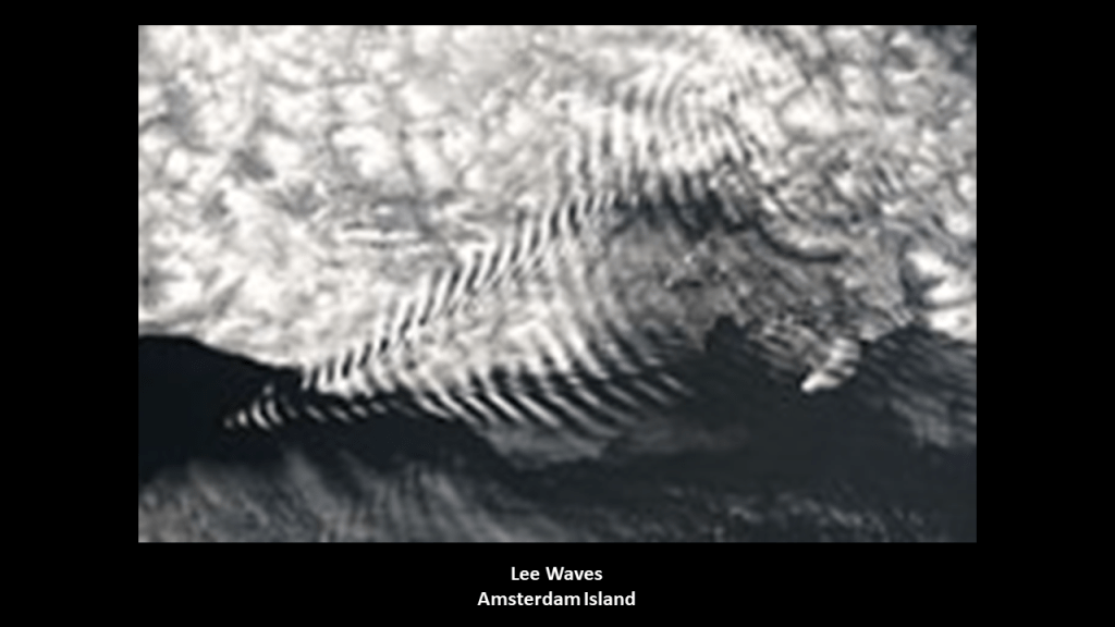
Here is a photograph of Lee Waves taken on Amsterdam Island. Lee Waves are atmospheric stationary waves, and are a form of internal gravity waves. Must be a reason as to why the geomagnetics of this island are studied.
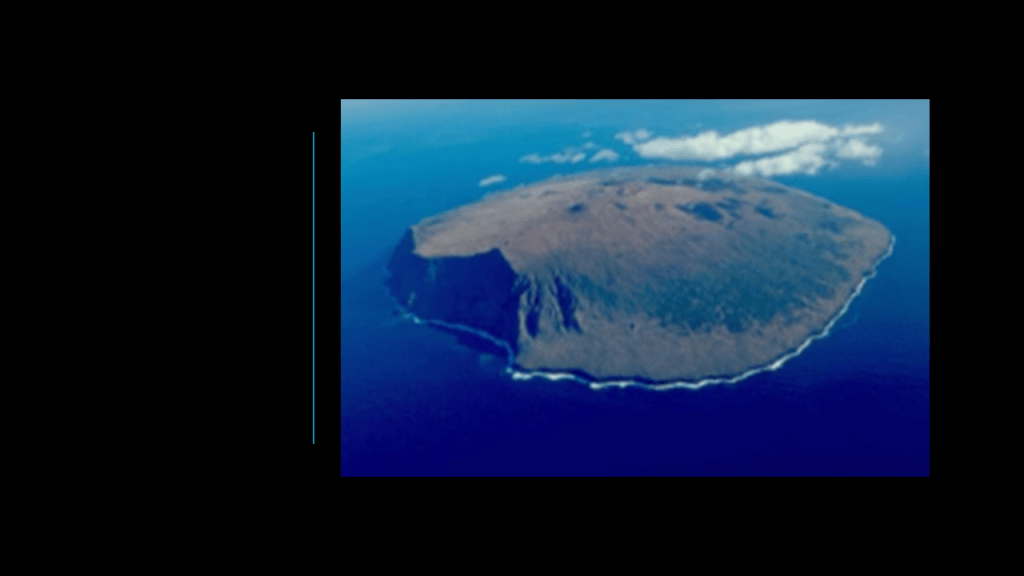
Amsterdam Island is considered the northernmost volcano above the water-line on the Antarctic Plate.
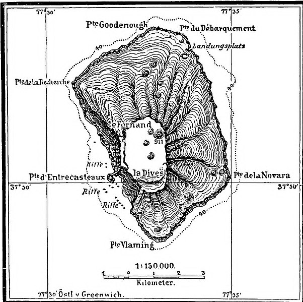
Here is a map of the island circa 1901, showing the island looking rather like a tree stump, with the Cliffs of Entrecasteaux right below what is described as two volcanic calderas.
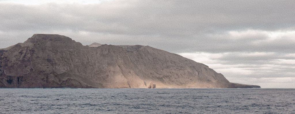
Here is a photo of the Cliffs of Entrecasteaux below the caldera on the west side of the island.
Chad Williams and and I had a recent conversation for his YouTube Channel “Deeper Conversations with Chad,” and it was called “Giant Trees, the Earth’s Grid, and the New World Order,” where we discussed, among many other things, the apparent volcanic nature of these giant trees and their integral relationship to the Earth’s Grid System, and how this might in turn connect to what might have taken place to render the giant trees as unrecognizable as such.
Our conversation started off with this intriguing illustration that Chad found in his research and had sent along to me at take a look at.
It seems to be showing trees on a grid exploding simultaneously, which would account for why we don’t recognize them as trees any more.
In the course of this same conversation with Chad, we also talked about the consistent pattern of western countries claiming these small islands and island groups in remote locations as their colonies or territories. and upon closer examination, it appears they were making a concerted effort to claim for their own purposes what was left of these giant trees.
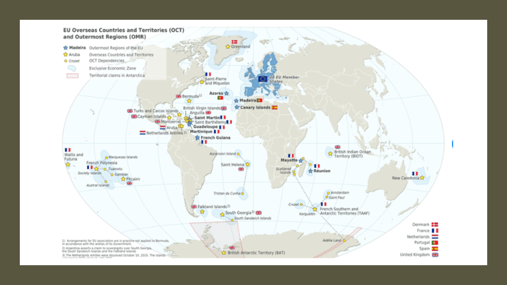
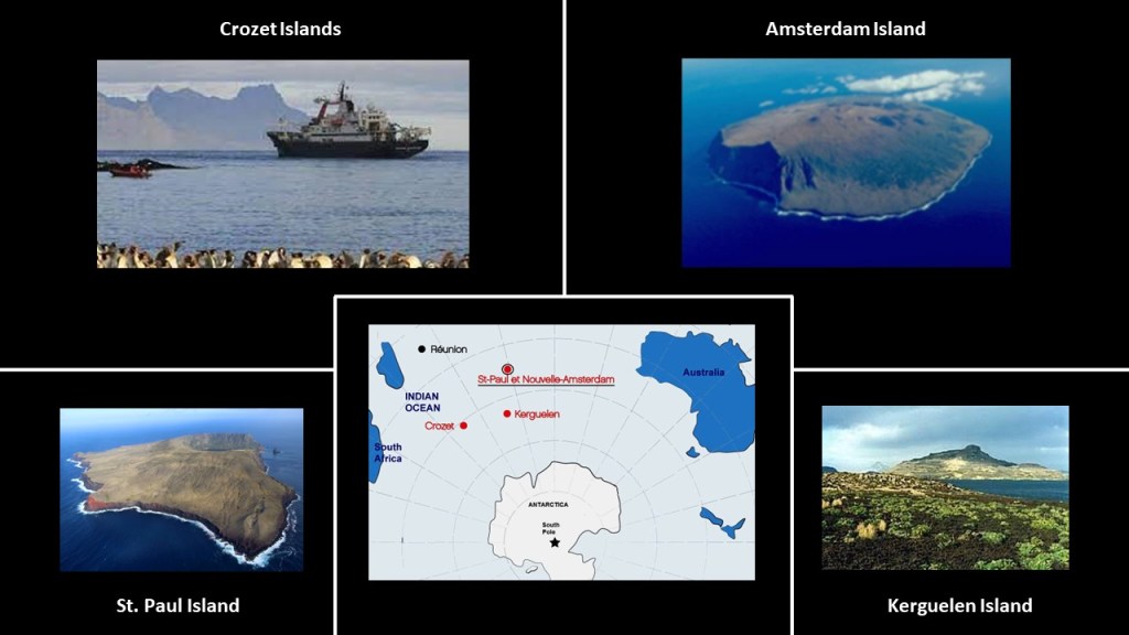
Besides the four islands claimed by France in the “French Southern and Antarctic Lands,” of Amsterdam, St. Paul, Kerguelen, and Crozet in this region…
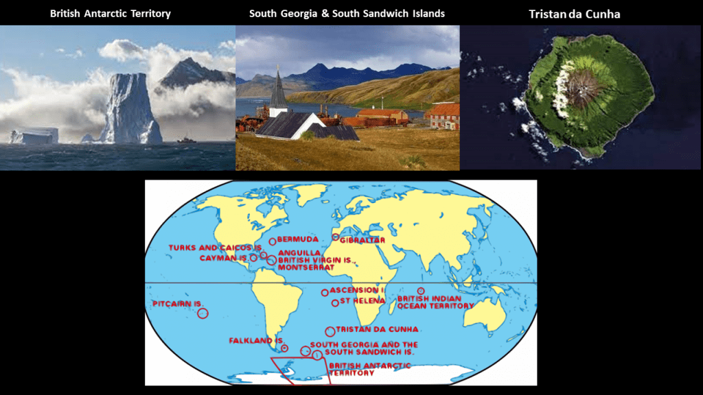
…we find the British in the same region claiming for its empire places like the British Antarctic Territory on the top left; South Georgia and the South Sandwich Islands on the top middle, and Tristan da Cunha, the home of the world’s most isolated settlement, which takes 6-days, each-way, by boat to get to-and-from.
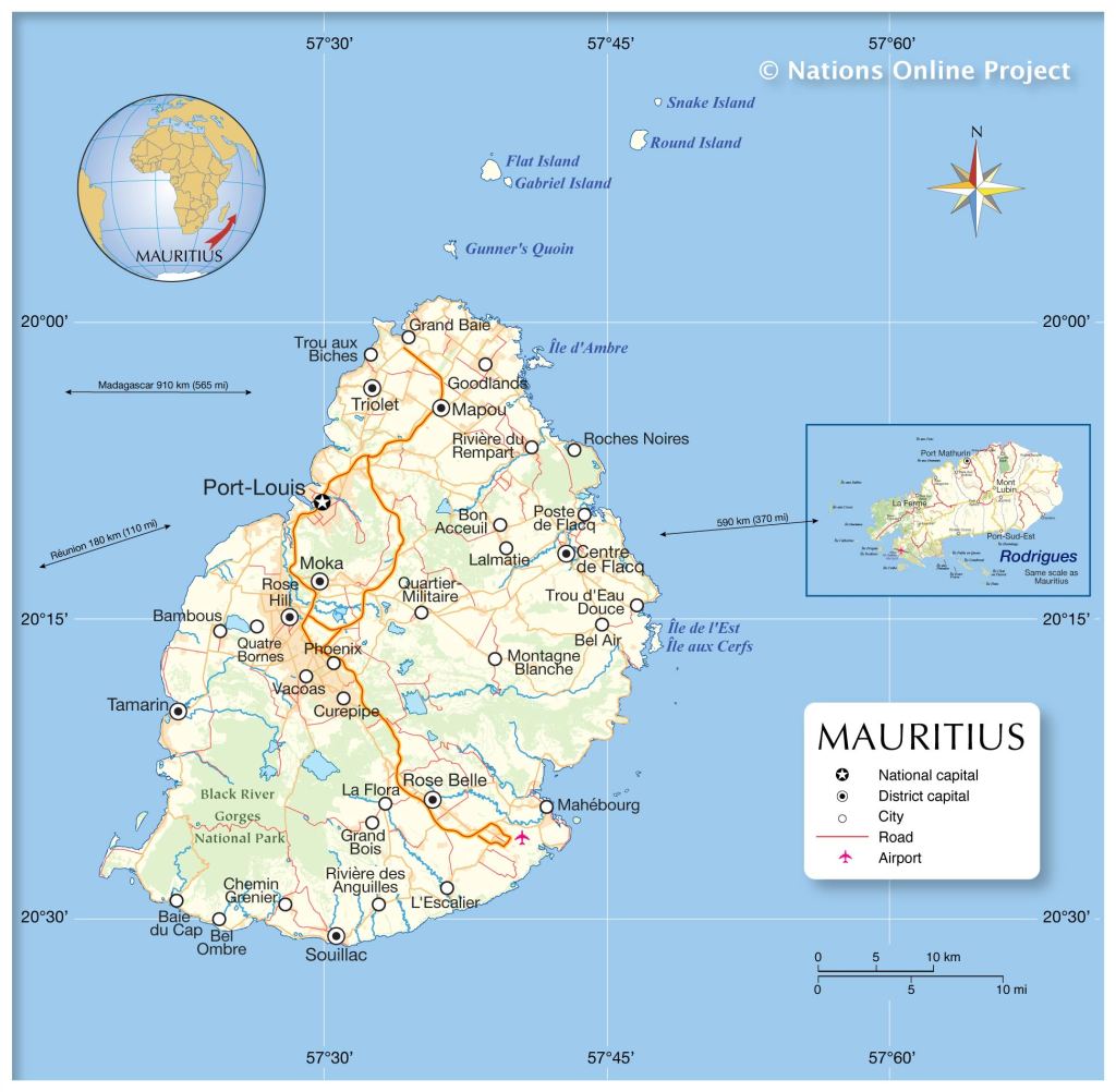
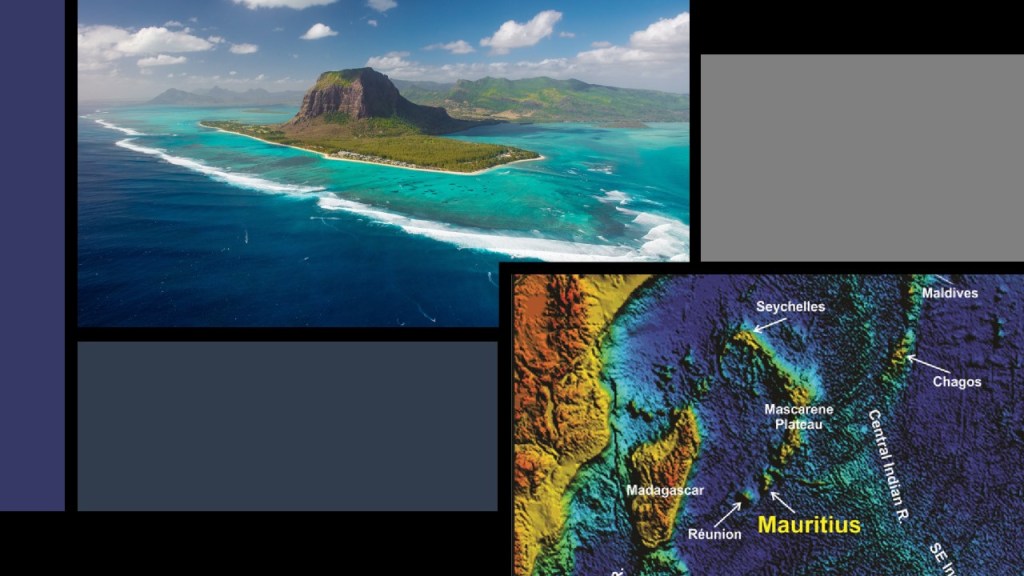
Leaving Amsterdam Island, the next place we come to on the alignment is Port Louis, the capital of Mauritius.
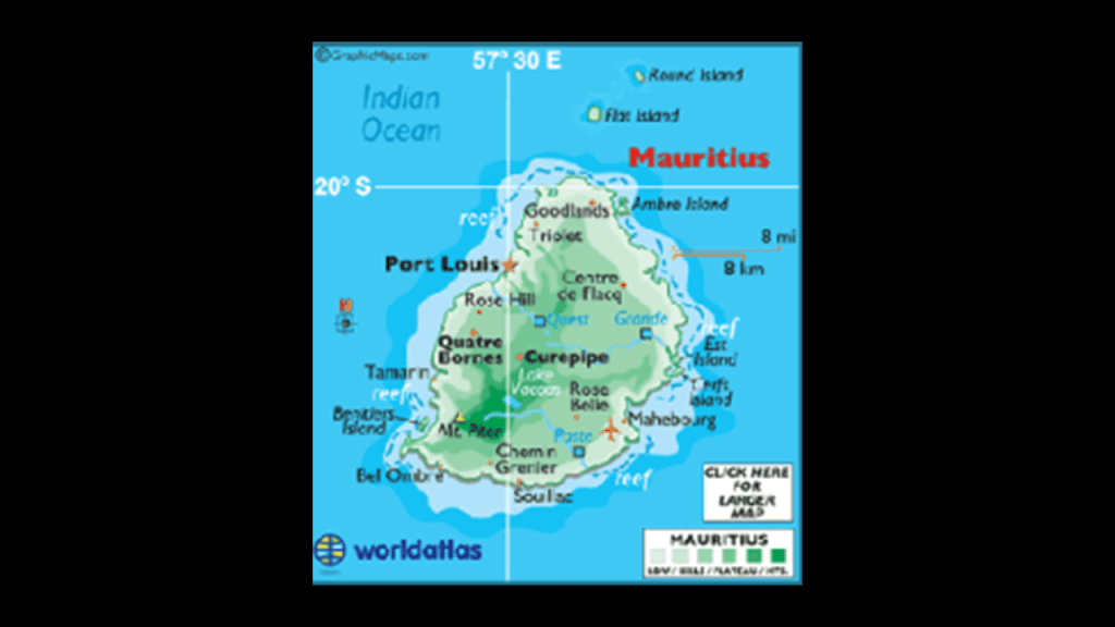
Mauritius is officially the Republic of Mauritius, and in addition to the main island, consists of the islands of Rodrigues, Agalega, and St. Brandon. These islands are 1,200 miles (2,000 km) southeast of the African continent.
Mauritius was initially colonized by France in 1715, who in turn ceded it to the British in the 1814 Treaty of Paris.
It gained its independence from Britain in 1968, and became a Republic in 1992.
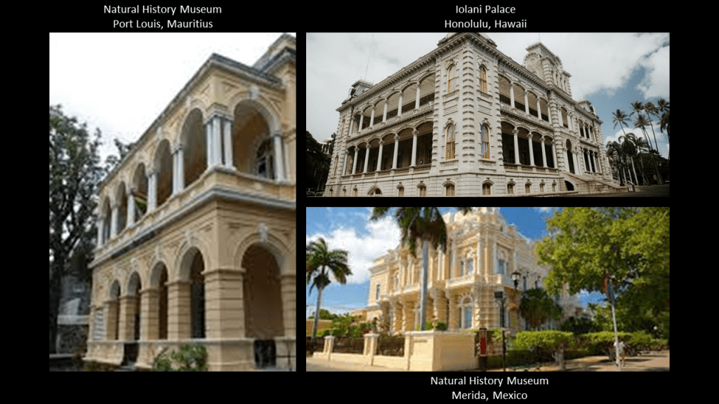
In a comparison of what seems to be the same style of architecture in very different places, this is the Port Louis Natural History Museum on the top left, said to have been constructed in 1880; on the top left is the Iolani Palace in Honolulu, Hawaii, said to have been built in 1879, and was the royal residence of the Kingdom of Hawaii until the monarchy was over thrown under Queen Lili’oukalani in 1893; and the Natural History Museum in Merida, Mexico, on the bottom right, said to have been built between 1909 and 1911.
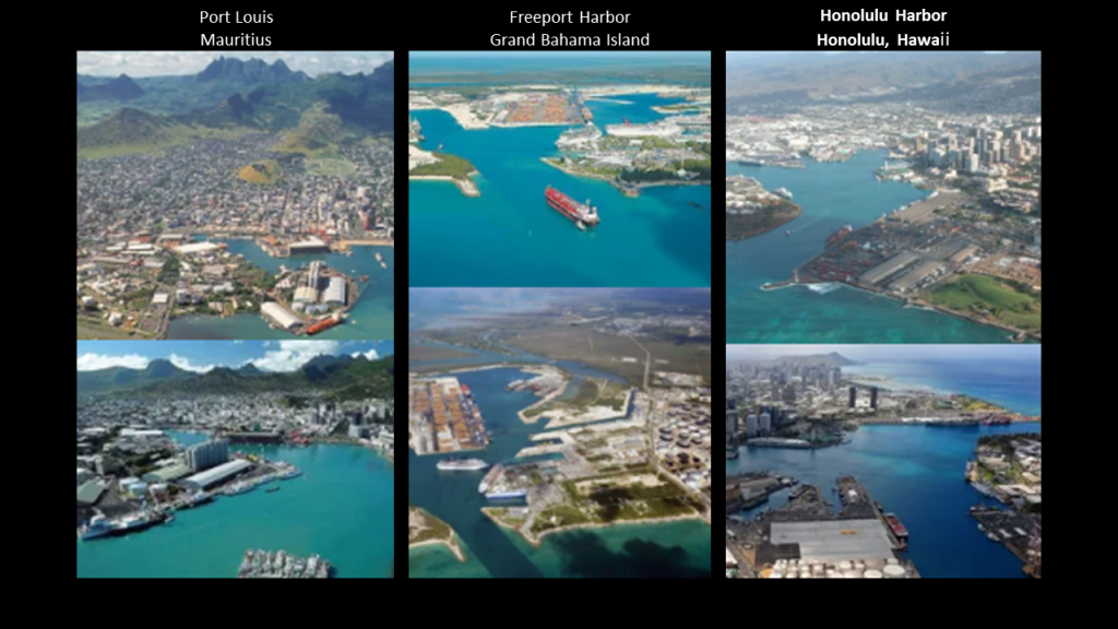
And for further comparison for similarity of appearance, here are photos of the harbor at Port Louis on Mauritius in the Indian Ocean on the left; Freeport Harbor on Grand Bahama Island in the Atlantic Ocean in the middle; and Honolulu Harbor in Hawaii in the Pacific Ocean on the right.
These are just a few of countless examples of harbors from around the world with man-made shorelines and docks.
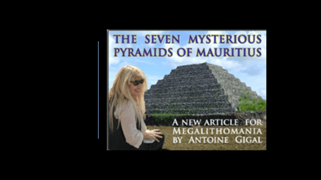
I first learned about Mauritius from an amazing French archaeologist named Antoine Gigal, and its massive walls, hydraulic systems and road systems that are all connected with the pyramid complexes there.
Much of her work is in Egypt, but she has ventured to other places in her quest for knowledge and understanding, and she has documented much evidence of the sophisticated technology of the ancient civilization.
To learn more about her work on Mauritius, check out this link where she talks about the discovery of
http://gigalresearch.com/uk/complexe-ile-maurice.php
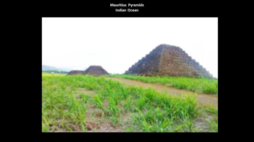
I first learned about the seven pyramids of Mauritius several years ago in a 2011 Megalithomania presentation by her.
They are terraced structures made of black volcanic stone.
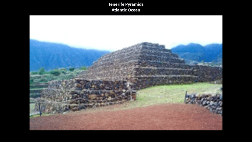
Interestingly, there are six terraced pyramids, also made of black volcanic stone, in Guimar on the island of Tenerife in the Canary Islands.
In both places they are in perfect astrological alignment with the winter and summer solstice.
Besides the same-style of terraced pyramids, Mauritius and Tenerife in the Canary Islands also share a volcanic history as well.
First, Mauritius.
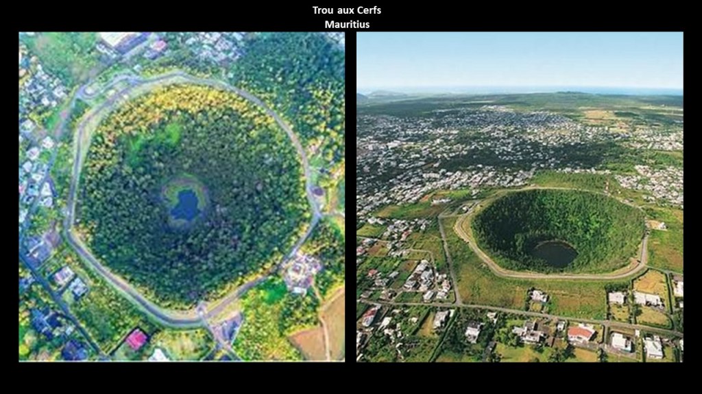
Mauritius itself is called a massive shield volcano, a broadly domed volcano with gently sloping sides formed from fluid, basaltic lava flows, and has a line of craters bisecting the main island as diagrammed here.
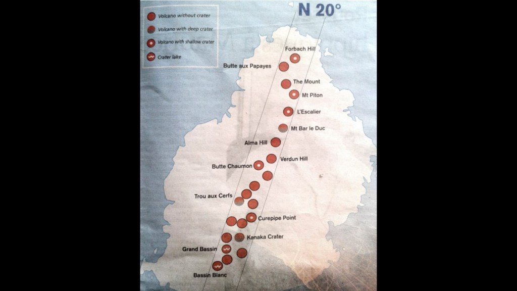
One of the craters, Trou aux Cerfs, which interestingly translates from the French to “Deer Hole,” is described as a dormant volcano with a well-defined cone and crater, on the outskirts of Curepipe, the second-largest city of Mauritius.
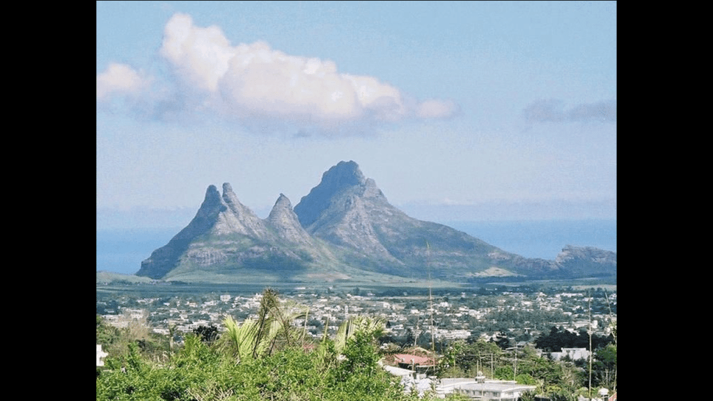
This is a view from Curepipe of what are called the “Trois Mamelles” and Mount Rempart.
“Trois Mamelles” translates from the French as “Three Breasts.”
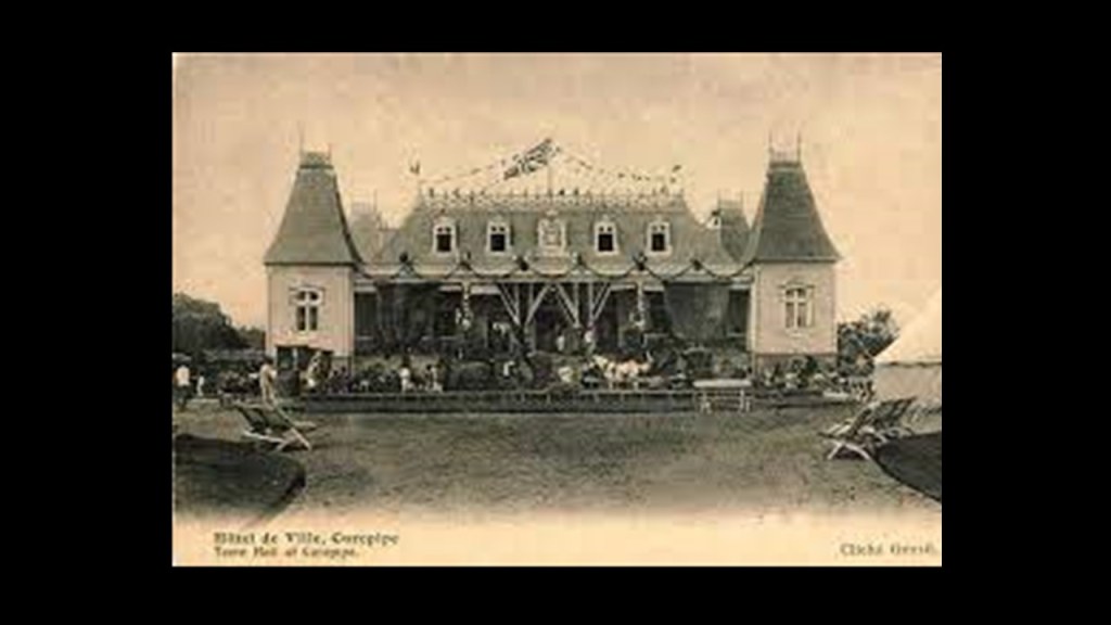
Curepipe is the location of some interesting, what is called “colonial,” architecture, like the Saint Therese Church in the background, said to have been built in 1868…
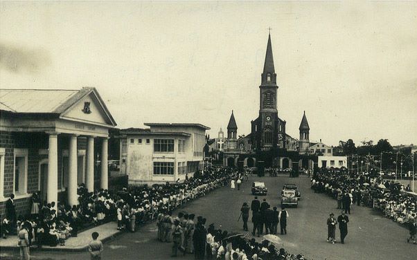
…and the Town Hall which is nearby, said to have been built starting in 1902.
There is what is called a “Step Mountain” on the Le Morne Brabant, a peninsula on the extreme southwestern tip of Mauritius.
This location is a UNESCO World Heritage Site.
The “Le Morne” in the peninula’s name could well-refer to the original people of this land.
The “Maroons”of the Indian Ocean, like the “Maroons” of the Americas, they were described as the descendents of Africans who escaped from slavery, and not as the Moorish original people of these lands which is nowhere to be found in our historical narrative.
Only in the place-names, like “Le Mor-ne” and “Maur-itius.”
The “Brabant” in the name of the peninsula “Le Morne Brabant” came from the Dutch East India ship “Brabant” that ran a-ground here at the end of December of 1783.
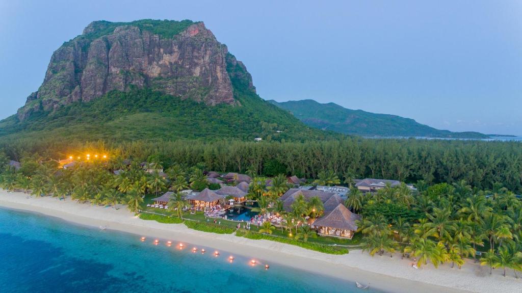
Interesting to note, there appears to be an underwater waterfall next to it, though it is described as an optical illusion and not actually a waterfall.
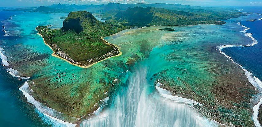
Though Mauritius is being researched possibly as the remnants of a lost continent, and for its strong gravitational pull.
Next, Tenerife.
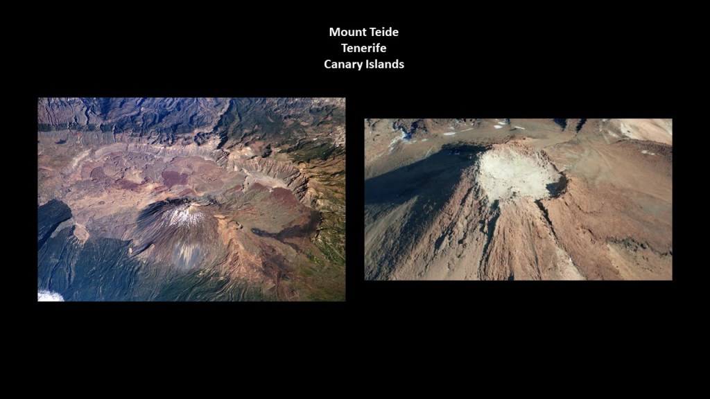
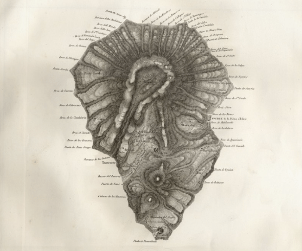
Mount Teide is a volcano on the island of Tenerife in the Canary Islands, and is the highest point in the islands of the Atlantic Ocean, as well as in Spain.
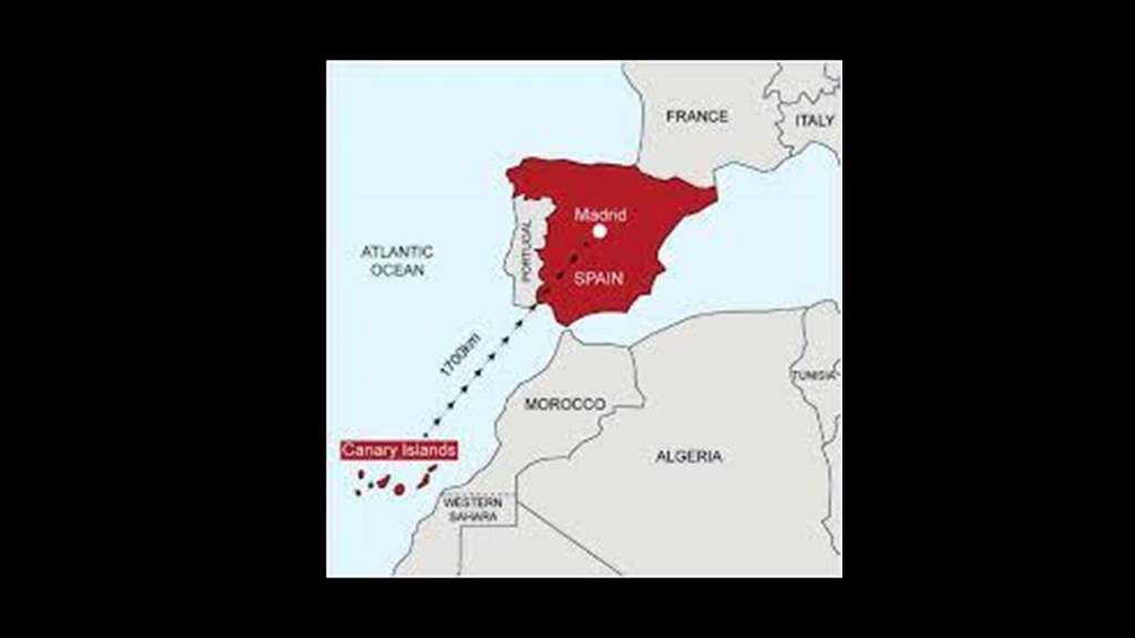
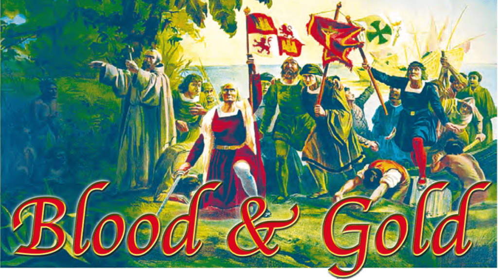
Now an autonomous community of Spain, the Canary Islands, located off the coast of Western Africa in the vicinity of Morocco and Western Sahara, have been claimed completely by Spain since 1496, after European colonization efforts were said to have started there by France in 1402.
This conquest of the Canary Islands was considered the basic model of European attack on the New World: violent colonization that involved enslavement of the local population; genocide; and the mining of the land’s resources that radically changed the landscape.
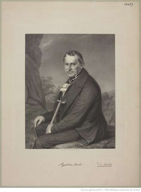
The Canary Islands are also said to be of volcanic origin, and have been visited by researchers from the very beginning of the 19th-century, including Alexander von Humboldt in 1799, a Prussian naturalist, mining engineer and explorer, who was said to have climbed the Teide volcano, before heading off to study Venezuela, which has the 2nd-highest gold reserves in the world, as well as Cuba, the Andes, Mexico, and the United States.
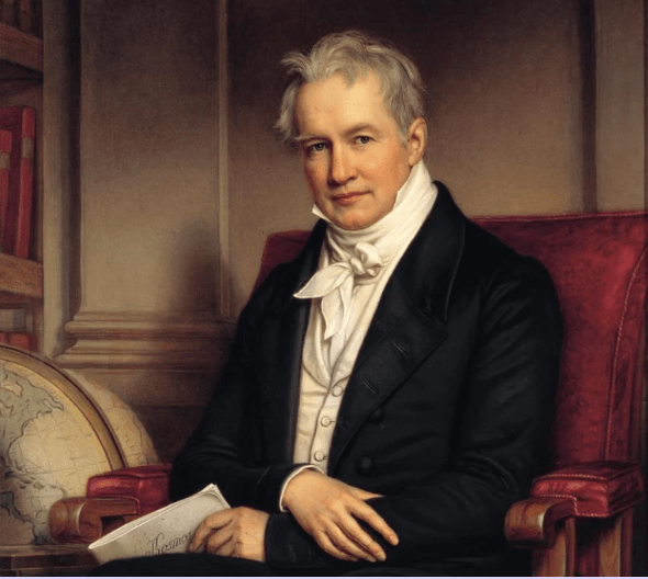
Then, in 1815, the same year as the Congress of Vienna which reoragnized Europe after the Napoleonic Wars ended, the German geologist and paleontologist Leopold von Buch visited the Canary Islands, where he primarily studied the production and activities of volcanoes.
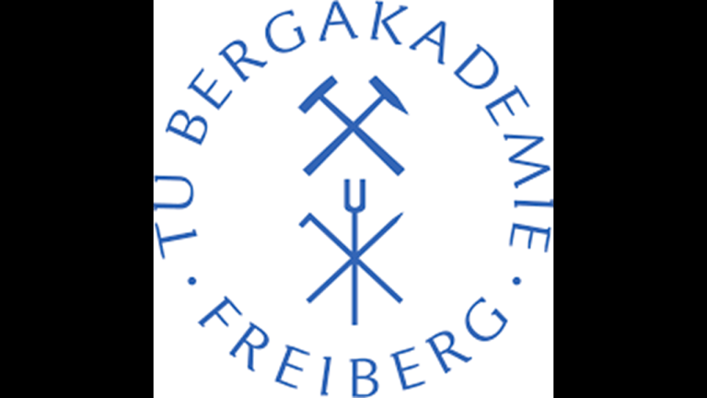
Von Buch studied with Alexander von Humboldt at the Freiburg University of Mining and Technology, and was considered a founder of modern geology.
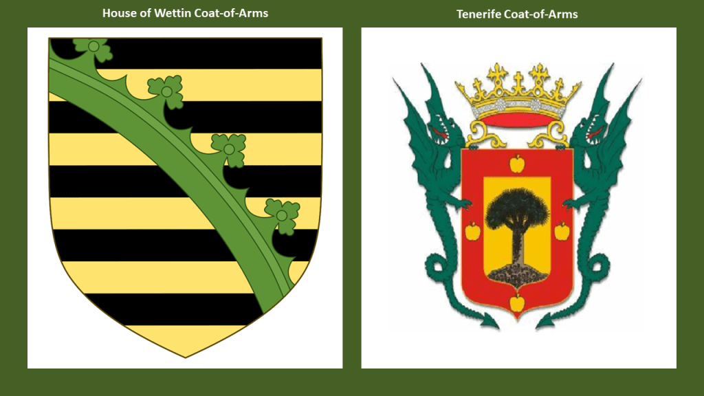
The Freiburg University of Mining and Technology is the oldest school of mining and metallurgy in the world, having been established in 1765 by Francis Xavier of Saxony of the House of Wettin.
Its main purpose was the education of highly skilled miners and scientist in fields connected to mining and metallurgy.
It is interesting that the coat of arms of the German noble House of Wettin has a wyvern tail in the middle of it, and I found this coat of arms of Tenerife, showing a large tree in the center, and wyvern supporters on either side.
I do think these heraldic devices are telling us Truths that have been well-hidden from us.
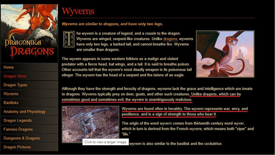
Wyverns are two-legged, winged creatures that are similar to dragons, but unlike dragons, which can be good or evil, they are unambiguously malicious predators.
Wyverns in heraldry signify war, envy and pestilence.
Primarily through Queen Victoria and Prince Albert, first-cousins and members of the House of Saxe-Coburg and Gotha of the Ernestine branch of the House of Wettin, the original royal houses of Europe were completely replaced by this obscure German Ducal lineage.
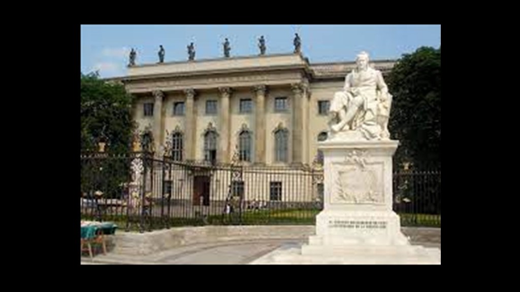
Humboldt University in Berlin was named after Alexander von Humboldt and his brother Wilhelm.
It was first opened in 1810, and was regarded as one of the world’s pre-eminent universities in the study of Natural Sciences in the 1800s and 1900s.
Famous faculty and alumni included such luminaries in our current historical narrative as: theoretical physicist Albert Einstein; Karl Marx and Friedrich Engels, c0-collaborators on “The Communist Manifesto; Otto von Bismarck, first Chancellor of the German Empire and the mover behind the 1884 Berlin Conference,which carved up the African Continent between the European powers; Georg Hegel, whose philosophy gave us the “Hegelian Dialectic” of Problem-Reaction-Solution; and the Brothers Grimm, best-known for their fairy tales which has such story-lines as eating people, as in “Little Red Riding Hood and “Hansel and Gretel.”
For one of many examples, the German Benedictines were said to have been quite active in establishing institutions for German immigrants to America during the 1840s and 1850s, like in Atchison, Kansas.
When I saw the view of Atchison, Kansas in the top left photo, I was immediately reminded of the view of the city of Santa Cruz de Tenerife on the island of Tenerife in the Canary islands, on the bottom left, with a shared building-style, directional orientation of the buildings, and placement of the windows in twos, threes, and fours.
Then on the right is a picture of the ancient city of Ouarzazate, Morocco, which I had encountered in my research, and its appearance reminded me exactly of Santa Cruz de Tenerife and Atchison.

And like with Mauritius in the Indian Ocean, it is important to note that the Canary Islands have long been rumored to be the remnants of a lost continent as well.
In the case of the Canary Islands , they have been rumored to the the lost continent of Atlantis.
I first heard that particular rumor many years ago.
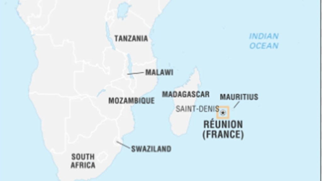
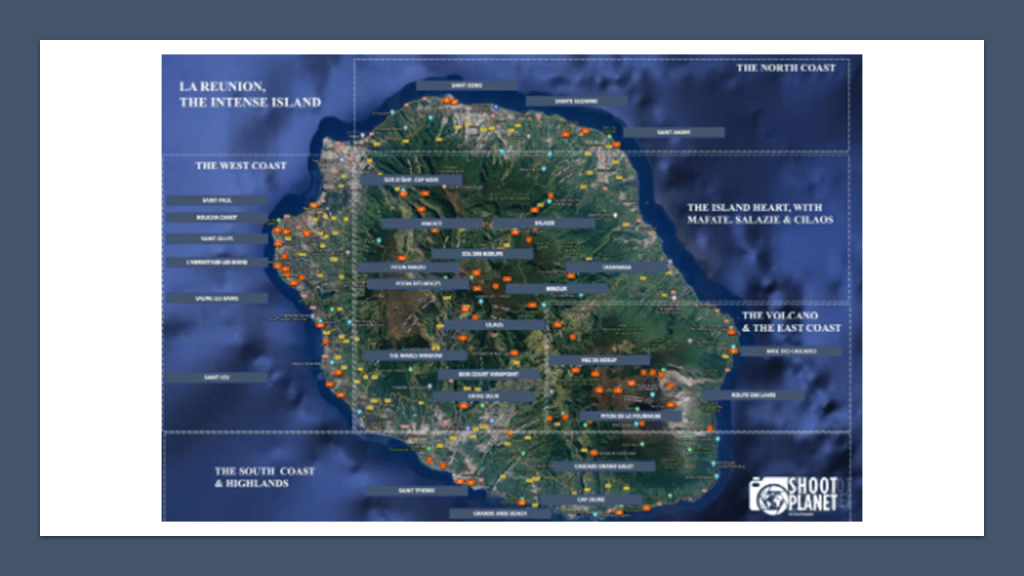
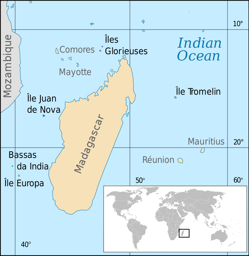
Before I leave this part of the Indian Ocean in which we find Mauritius on the alignment, I want to bring to your attention to the nearby inhabited French island of Reunion, home to nearly 1,000,000.
It has been governed as a French region since 1946, and is the outermost region of the European Union.
This is what we are told about the history of Reunion Island.
Reunion Island was uninhabited until French settlers from the French East India Company arrived in the 17th-century, and subsequently established a plantation economy based on sugar and instituted a slavery system with slaves and indentured laborers brought in primarily from Africa and Asia.
St. Denis is the administrative capital of French Overseas Department and Region of Reunion, which the island has been known as since 1793, when it was changed from “Bourbon Island” to erase the name of the Bourbon Dynasty after the “Insurrection of 1792,” a defining event in the French Revolution that led to the abolishing of the French Monarchy and the establishment of the French Republic.
Who were the Bourbons?
I think the actual truth the French Royal House of Bourbon has also been obscured to hide the True History, but what we are told is that it originated in the Kingdom of France as a Royal House in 1272.
Like I mentioned earlier with the clues found in place-names, a clue to the cover-up of the True History is found in the name given to the French Monarchy, attributed from the Middle Ages to 1789, the year that marked the beginning of the French Revolution in our historical narrative.
It was called the “Ancien Regime,” which has been translated to mean the “Old Regime.”
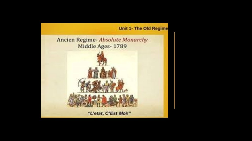
The typical understanding of the meaning of the word “Ancien” or “Ancient” is shown here, belonging to a period of history that is “thousands’ of years in the past, not “hundreds” of years.
The word “old” just doesn’t have the same association with the far distant past that “ancient” does when referring to historical time periods.
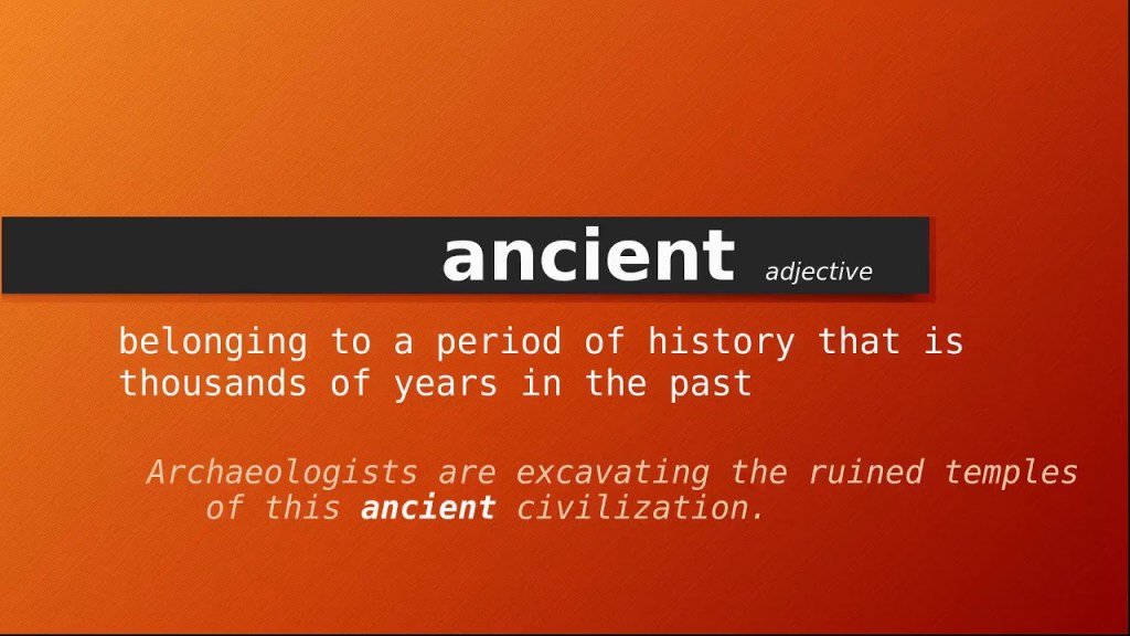
The word “old” is even used to refer to yesterday!
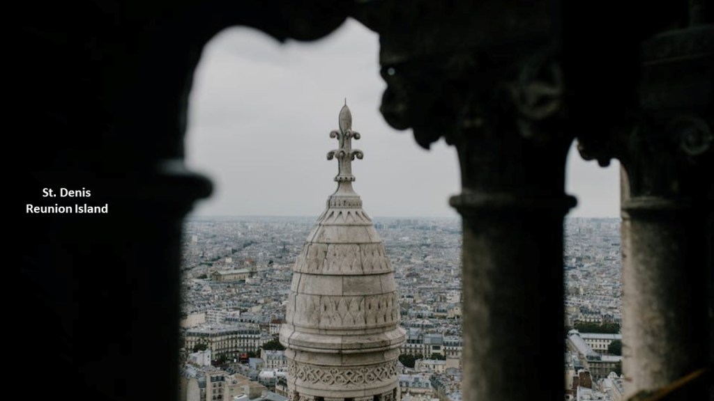
At any rate, St. Denis was said to have been founded in 1669 by the first governor of the Island, Etienne Regnault, who named it after the ship of one of his friends which had landed the year prior.
St. Denis eventually became the only colonial capital in 1738, and all the architecture found in St. Denis, and on Reunion Island, has been attributed to the French colonial era.
There are two main volcanoes on Reunion Island.
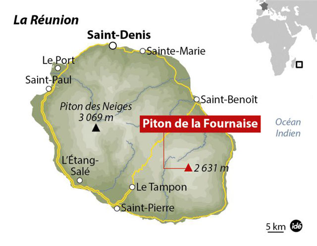
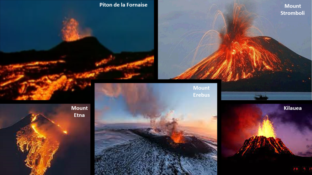
Piton de la Fornaise, or Piton “of the Furnace,” is described as a very active shield volcano on the southeastern end of the island, one of the most active in the world, along with Kilauea in the Hawaiian Islands; Mount Etna in Sicily and Mount Stromboli on an island off the coast of Sicily; and Mount Erebus in Antarctica.
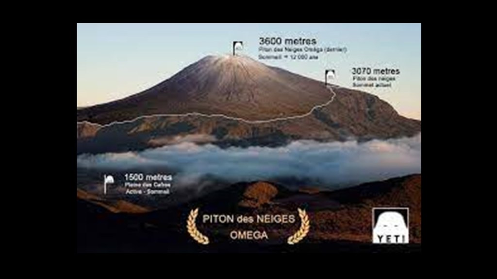
Piton des Neiges, or Snow Peak, on the northwestern end of Reunion Island is the highest point on the island, as well as considered to be the highest point in the Indian Ocean.
According to what we have been told, unlike its neighbor volcano on the island to the southeast of it, it has not been active for 20,000-years.
I have a long way yet to go on the alignment, but there’s a lot more to find out on Reunion Island just from a cursory look at its history.
I may revisit this location again in future research….Lots going on here for such a remote, out-0f-the-way location, and the French are still holding on tight to it to this day.
France never gave this place away to another country, unlike its neighbor Mauritius!
Next we come to Tromelin Island, located 310-miles north, or 500-kilometers, north of Reunion Island, and 280-miles, or 450-kilometers, east of Madagascar.
Tromelin Island is a small, low, flat island.
Besides being a seabird and sea tortoise sanctuary, the only structure here is a meteorological station used to gather data in order to forecast hurricanes and cyclones.
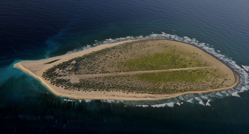
It is administered as part of the French Southern and Antarctic Lands as a French overseas territory, however, the island nation of Mauritius claims sovereignty over the island.
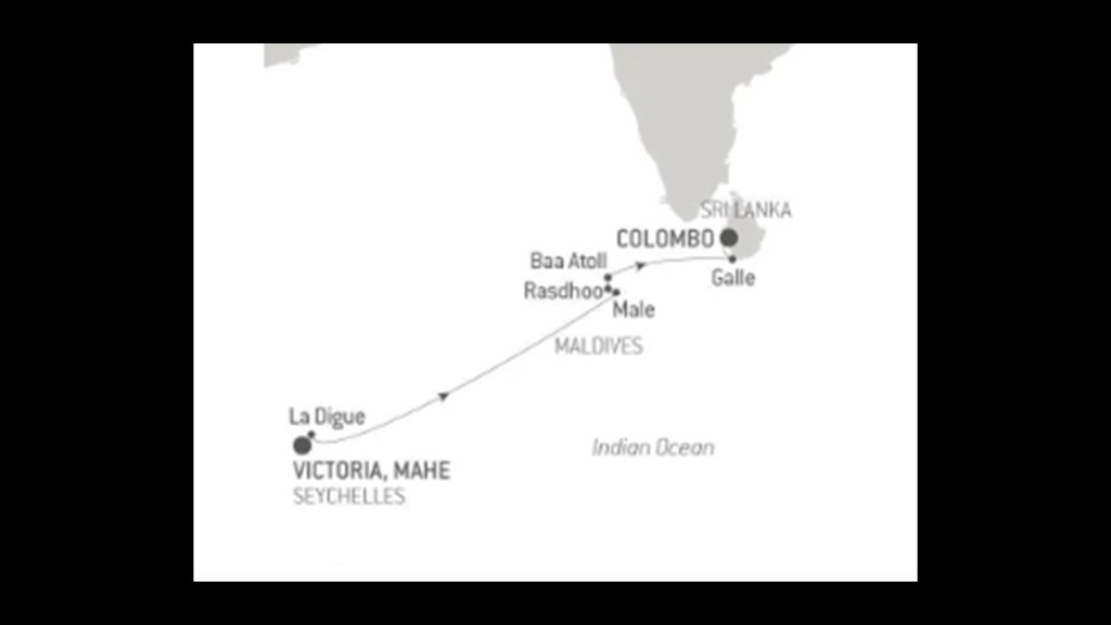
Next the alignment goes through the Republic of the Seychelles, an archipelago country consisting of 115 islands in the Indian Ocean.
It is almost 1,000-mles, or 1,609-kilometers, off the coast of East Africa, and is a member of the African Union.
Independence from the United Kingdom was established in 1976.
It’s Africa’s smallest country, and least populated sovereign country.
Like Reunion Island, we are told that they Seychelles were uninhabited prior to the arrival of Europeans, that there was no indigenous population to the islands when they arrived.
The British East India Company first landed here in 1609.
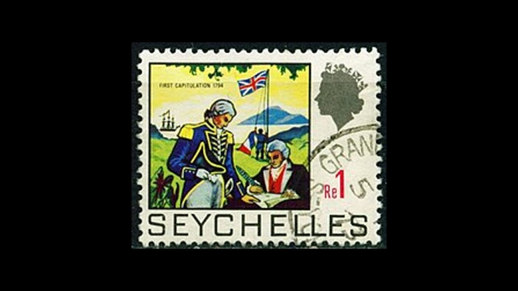
The French arrived here in 1770 and claimed the Seychelles as theirs and the British arrived to settle the Seychelles in 1794.
The British and the French had competing interests here until the Seychelles came under full British control in the 18th-century.
______________________________________________
The capital of the Seychelles, Victoria, is on the main island of Mahe.
What became known as Victoria in 1841 after Queen Victoria, was settled by the French in 1778.
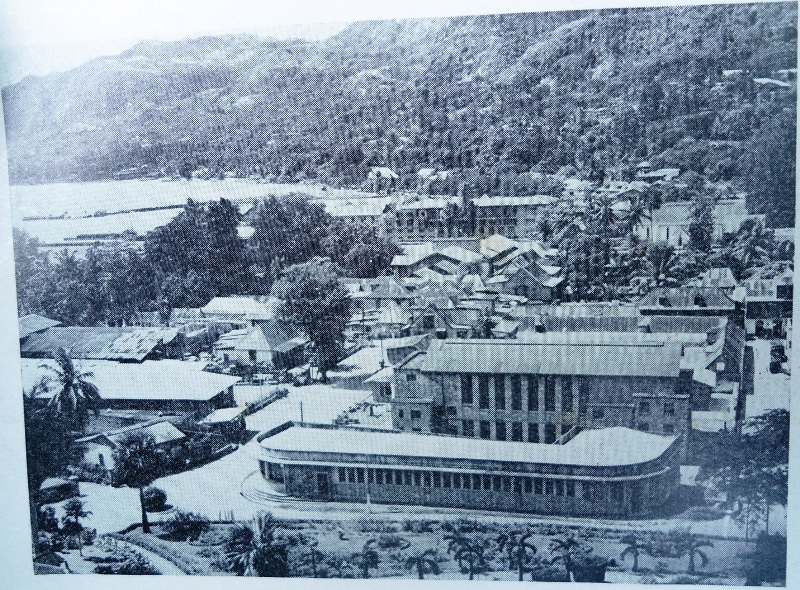
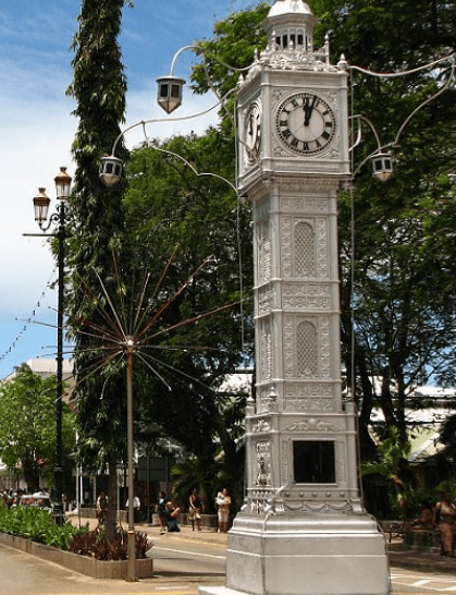
The Victoria Clock Tower in the city-center is called the oldest historical landmark in Victoria, and is a replica of, in one reference, a clock that was erected in 1897 near Victoria Station in London, and in another reference it was a replica of Big Ben.
Whatever it was said to be a replica of, it was inaugurated in 1903 by the British administrator of the Seychelles.
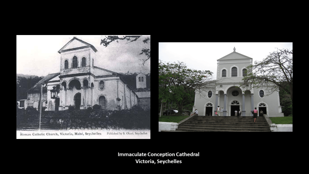
The Immaculate Conception Cathedral in Victoria was said to have been built in 1874 in the French Colonial-style of architecture.
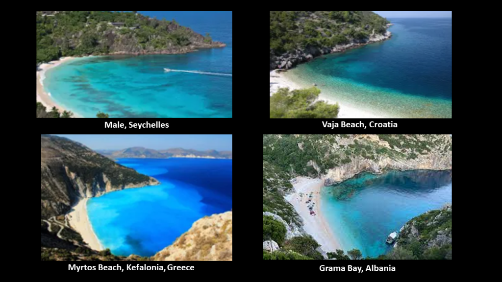
This is a beach-head on Mahe in the Seychelles on the top left, compared with Vaja Beach in Korcula, Croatia, on the top right; Myrtos Beach on the Greek island of Kefalonia, on the bottom left; and Grama Bay in Albania on the Bottom right.
These are just a few of countless examples of the same style of beach-head found around the world that I find interesting to note.
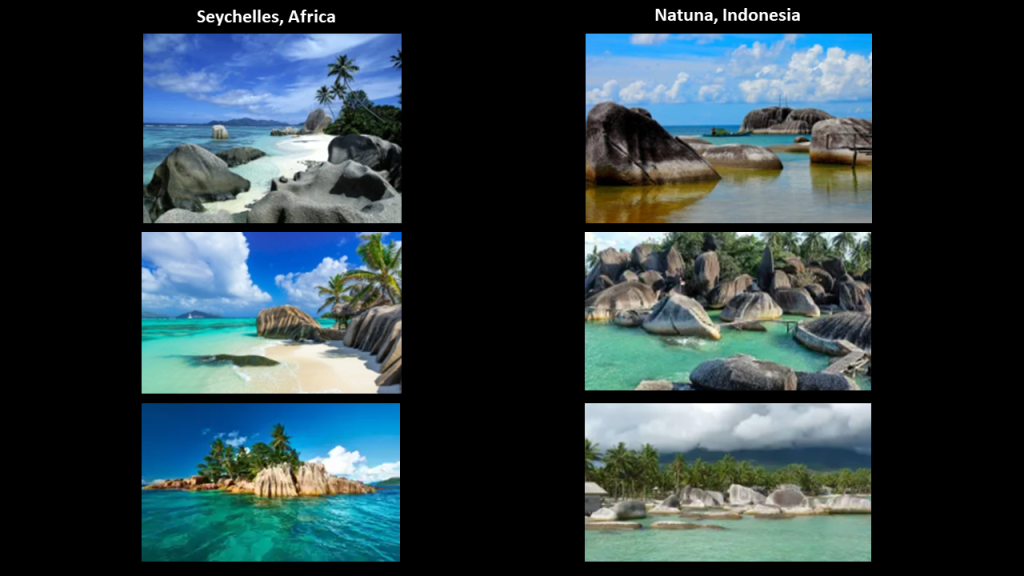
These islands are also known as the Granitic Seychelles.
Here is an assemblage of photos of the interesting-looking rock formations on the coasts of these islands on the left, and on the right are photos of similar-looking rock formations on the Natuna Islands, part of Indonesia, and located in the South China Sea, off the northwest coast of Borneo. I found the Natuna Islands on a different alignment which is how I even knew about them.
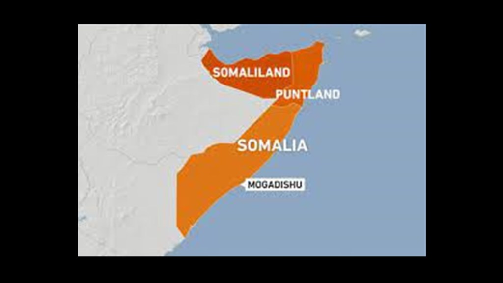
Next on the alignment is Mogadishu, the capital and largest city of Somalia. It is located on the coastal Banadir region on the Indian Ocean, and has been an important port city for thousands of years.
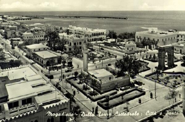
This is a historic photo of Mogadishu.
It was the capital of Italian Somaliland from 1889 to 1936.
When the Somali Republic became independent from Italy in 1960, it was known as the “White Pearl of the Indian Ocean.”
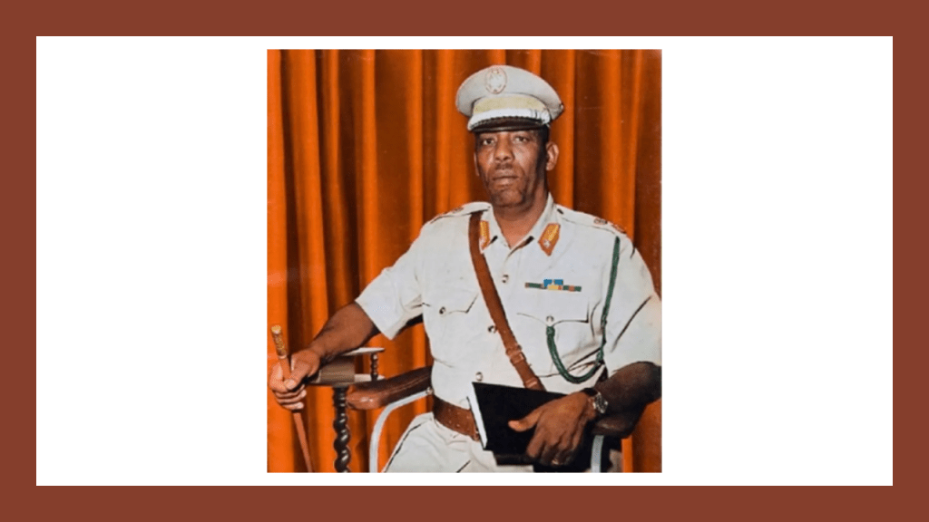
The Somali Civil War started in the early 1990s, after the ousting of Siad Barre in 1991, who had been serving as President of the Somali Republic since 1969.
The Somali Civil War has been on-going for years.
The situation started to stabilize in 2011, and in 2012 a new government was formed with a passing of a constitution and election of a president, but it has never ended.
It is estimated that at least 500,000 people have been killed as a result of it.

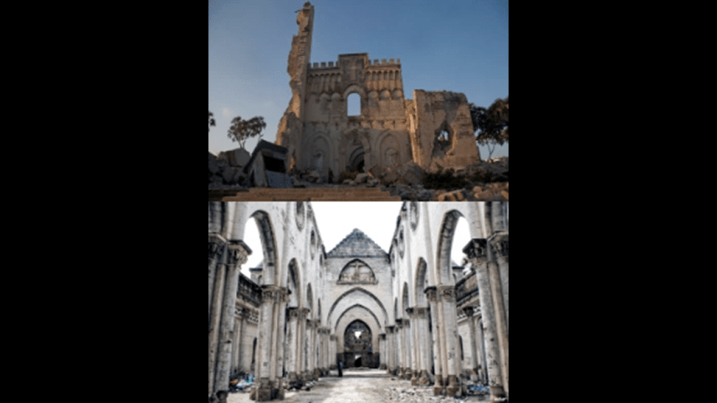
The following photos will show you what happened to the historic buildings of Mogadishu as a result of years of conflict.
This is the Villa Somalia, the presidential residence, before the president was ousted and after as the result of civil warfare.

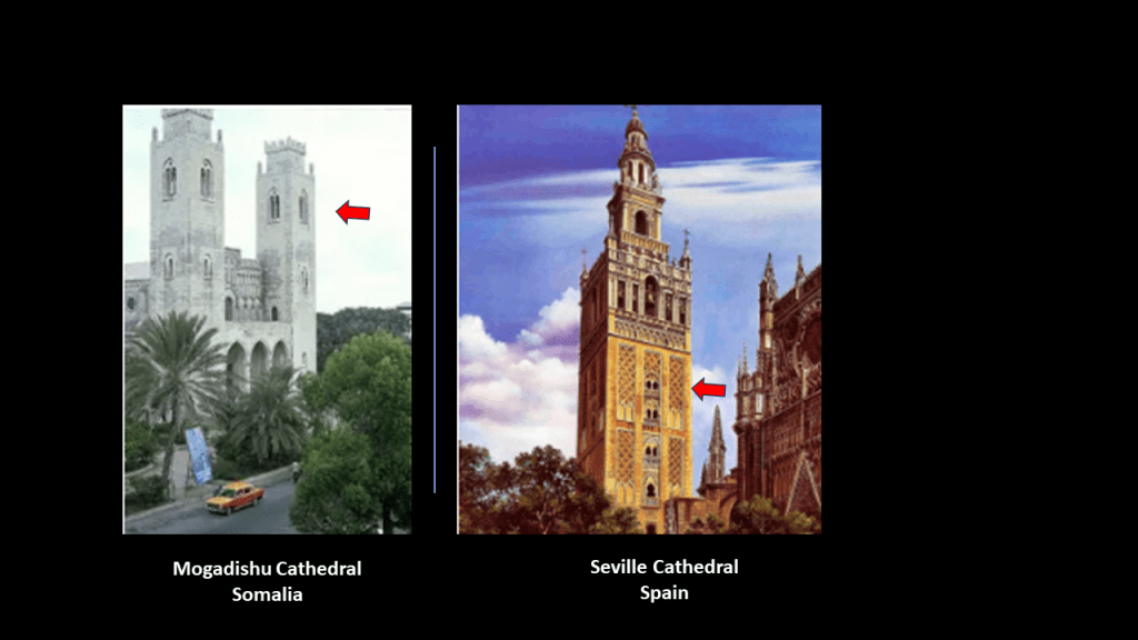
This is an historic picture of Mogadishu Cathedral on the left and Seville Cathedral on the right.
Seville was the capital of Moorish Spain.
In particular, note the same double-window design component of both of the cathedrals’ towers.
This is what remains of Mogadishu Cathedral today.
Gotta wonder if these Civil Wars were/are created to destroy the infrastructure of the original civilization.
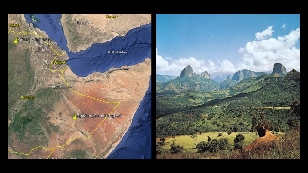
Leaving Mogadishu, we head across the eastern region of Ethiopia known as Ogaden, part of the Somali region of Ethiopia.
The majority of its inhabitants are Somali clans.
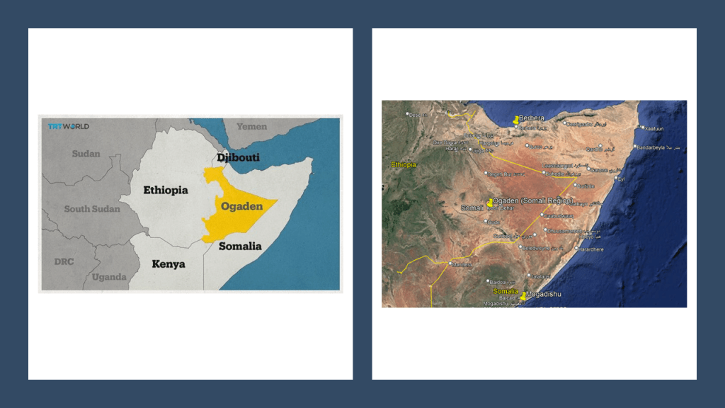
It is described as a semi-arid to hot desert climate that is part of the “Somali Acacia-Commiphora Bushlands and Thickets Ecoregion” in the Horn of Africa.
It extends along the floor of the East African Rift, where the African Plate is splitting into two plates – the Somali Plate and the Nubian Plate.
The red triangles are showing the location of historically active volcanoes.
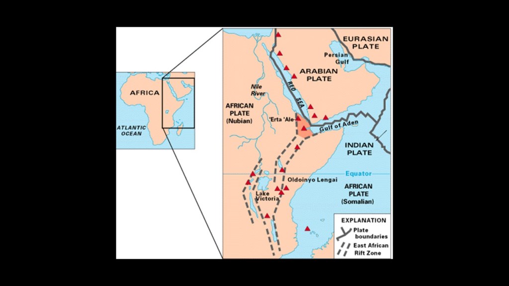
The Simien Mountains northwest of this region were said to have formed prior to the Great Rift Valley.
The Ogaden War took place between Ethiopia and Somalia between July of 1977 and March of 1978.
The administration of the British Protectorate of Somaliland had given Ethiopia this land in 1948 as the result of an 1897 Treaty.
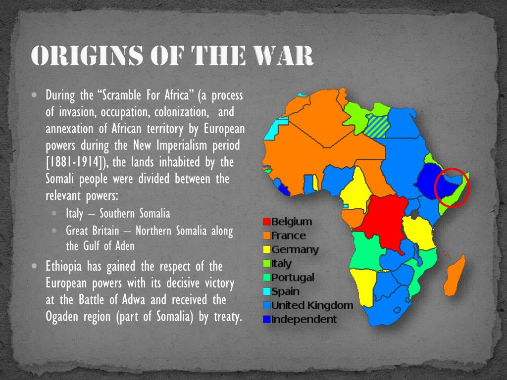
The Soviet Union supported Ethiopia after Somalia invaded the region.

Ethiopia won the war with the support of Cuban armed forces, Soviet advisors, and over $1-billion worth of military supplies airlifted by the Soviet Union.
The origins of the Somali Civl War resulted from the demoralization in the Somali Armed Forces and the people of Somalia caused by the loss, eventually leading to the overthrow of President Siad Barre in 1991, who had been a Marxist-Leninist Military Dictator of Somalia since 1969 after the assassination of the President of the Somali Republic, the name given to the Newly independent state of Somalia after its independence from Great Britain.

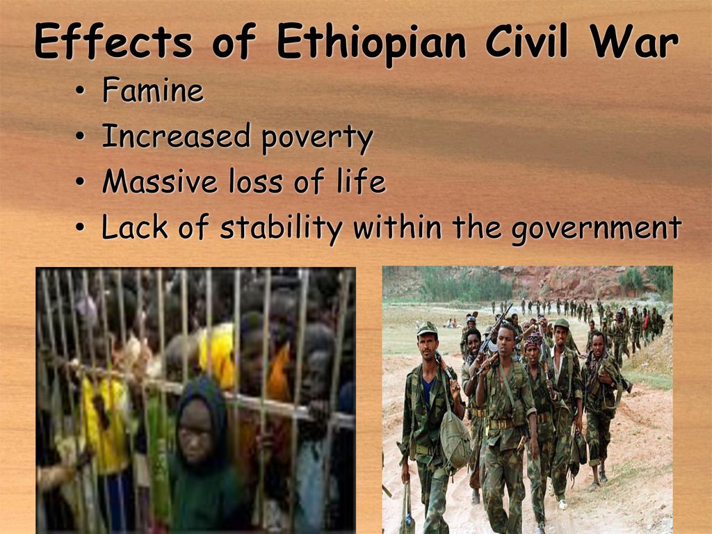
It is important to note that the overthrow of the Ethiopian Emperor Haile Selassie took place three-years earlier on September 12th of 1974, in a coup also initiated by a Marxist-Leninist faction in the Ethiopian military, and marked the beginning of a 17-year-long Ethiopian Civil War, leaving 1.4 million dead.
The Ethiopian Civil War formally ended in 1991, the same year Siad Barre was overthrown and the Somali Civil War started.
The Solomonic dynasty, also known as the House of Solomon, was the former ruling dynasty of the Ethiopian Empire.
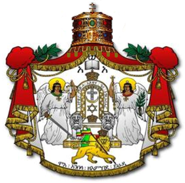
Its members were lineal descendants of King Solomon and the Queen of Sheba through their son Menelik I, the first Emperor of Ethiopia.
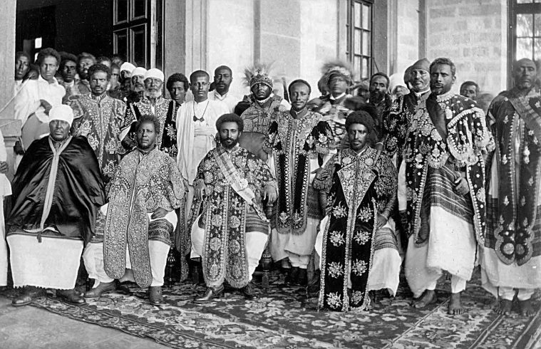
Haile Selassie was the last Emperor of Ethiopia from 1930 to 1974.
The full title traditionally of the Emperors of Ethiopia was: “Elect of God, Conquering Lion of the Tribe of Judah and King of Kings of Ethiopia.”

There seems to be a pattern emerging in this part of the world.
Either upon Independence from a European Colonial power, a Marxist-Leninist faction within the military seized power from the Republican form of government that replaced the colonial government; or a dynastic ruler was replaced by a Marxist-Leninist Faction in the military.
The result was the same: dividing countries and people; civil war; territorial war; and some form of Marxist government implemented.
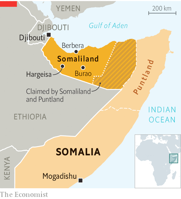
We are heading to Berbera in the region of northern Somalia known as Somaliland today.
Somaliland declared independence from Somalia in 1991 following the ouster of Siad Barre, after a decade of state repression and civil war in the region.
It is a self-governing region, though not recognized as a sovereign state internationally.
As mentioned previously, this region had been a former British Protectorate, from the 1880s and 1960.
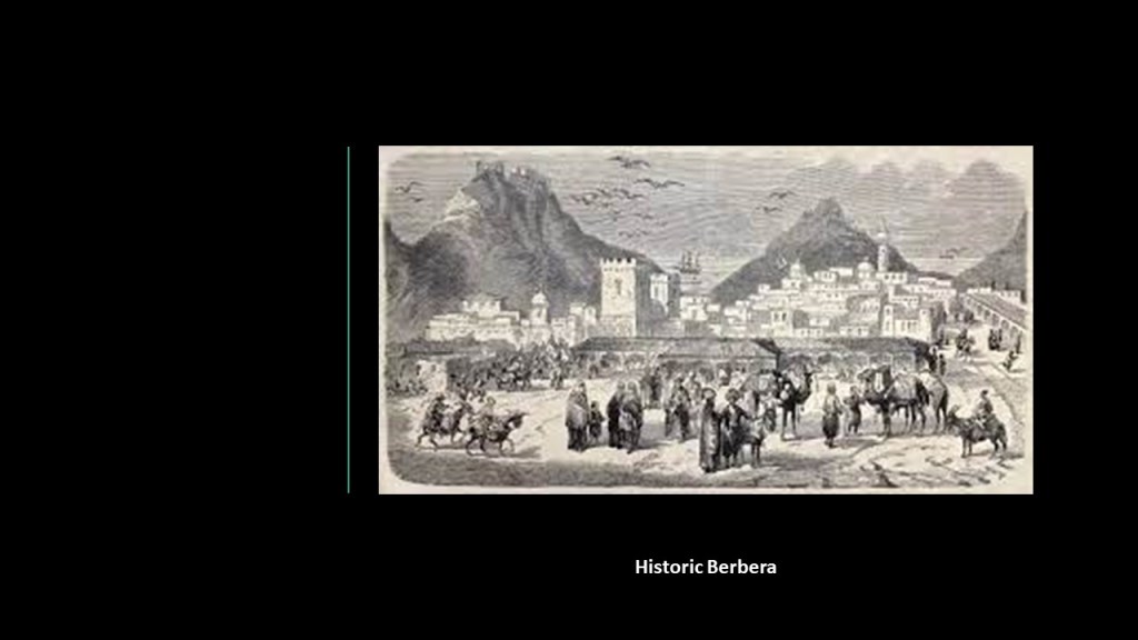
Berbera is located on the Gulf of Aden, and was the capital of British Somaliland Protectorate from 1884- 1941.
It is still the capital of the Sahil Region of Somaliland.
Berbera is strategically on an oil route.
It has a deep harbor, and it it is situated near entrance to the Red Sea.
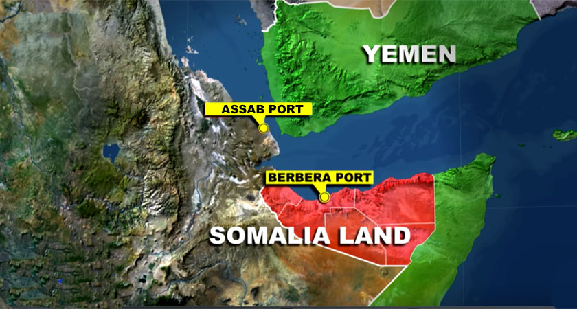
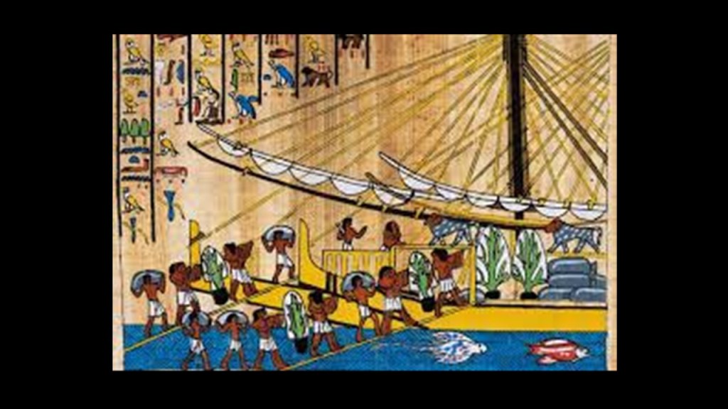
From antiquity, Somalia been an important commercial center, and likely the location of the ancient land of Punt.
Punt was a trading partner with Egypt, and was a wealthy country that was rich in resources and exotic goods.
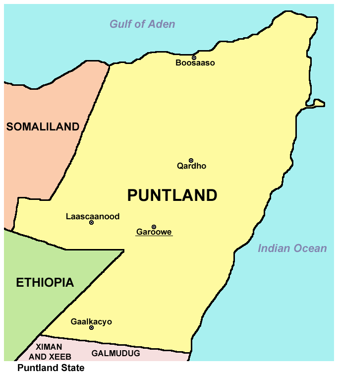
There is still a region of Somalia today known as “Puntland,” adjacent to Somaliland.
Berbera was once a powerful and well-built city that has served as a major commercial center and port since antiquity, and has a glorious past in terms of importance to the region.
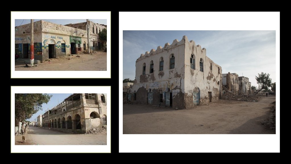
Berbera is looking quite rough these days.
These photos are of crumbling historic buildings in Berbera’s Old Town.
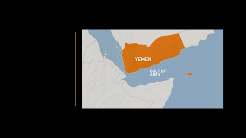
I am going to end this post here and pick up the alignment in the Gulf of Aden on the way into Yemen in the next post.

Great stuff. To me this information will bring truth to our very existence. Purposely twisted for the controllers to obtain control over humanity. Thanks for all you do: bill
LikeLike
Thank you – you are welcome!
LikeLike
I enjoy your work, glad to see you’re questioning the flying ball earth story
<
div>Best Wishes, Dave Gionfriddo
Sent from my iPhone
<
div dir=”ltr”>
<
blockquote type=”cite”>
LikeLike
Please look into the following subjects Internet of Bodies
https://www.weforum.org/publications/the-internet-of-bodies-is-here-tackling-new-challenges-of-technology-governance/
they arent hiding it anymore and the term they use to describe the people they now control
Data Subjects
https://www.privasee.io/post/who-is-a-data-subject
https://resourcehub.bakermckenzie.com/en/resources/data-privacy-security/north-america/united-states/topics/legal-bases-for–processing-of-personal-data
their entire narrative is protecting the peoples rights who they say they now own and control
Transhumanism the fourth Industrial Revolution ,its here
I think the answer to getting rid of this out of a persons body is micro current . Micro current therapy charges a person like a battery and your body then heals itself because of the 500 percent increase in ATP that is released. It also detoxifies body of anything that is not natural to it. This therapy has no harmful side effects because its the same current our bodies naturally have . They have muddied the water about this technology and its called twenty differnet names, its low frequecny electrical stimulation The FDA has it approved under incorrect category, prob on purpose. Not all micro current machines are equal there is only one that is smart and is patentened it reads and sends to your body its the electro acuscope and myopulse system I dont have a platform just knowledge , please look into this and if you find what I found , share it on your platforms as no one is talking about this yet, not these specifics anyway
LikeLike