
In the course of my research, I have had occasion to look into three State Capitol complexes – that of Harrisburg, Pennsylvania; Des Moines, Iowa; and Sacramento, California.
As we shall see, the locations chosen for modern seats of government would have been very special locations in the original advanced civilization of the Old World.
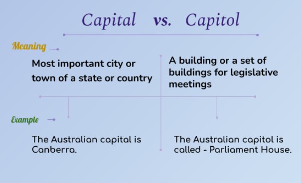
Before I begin, “Capitol,” spelled with an “o” is the building in which a legislature operates., and “Capital,” spelled with an “a” is the seat of government, of states, provinces, or countries.
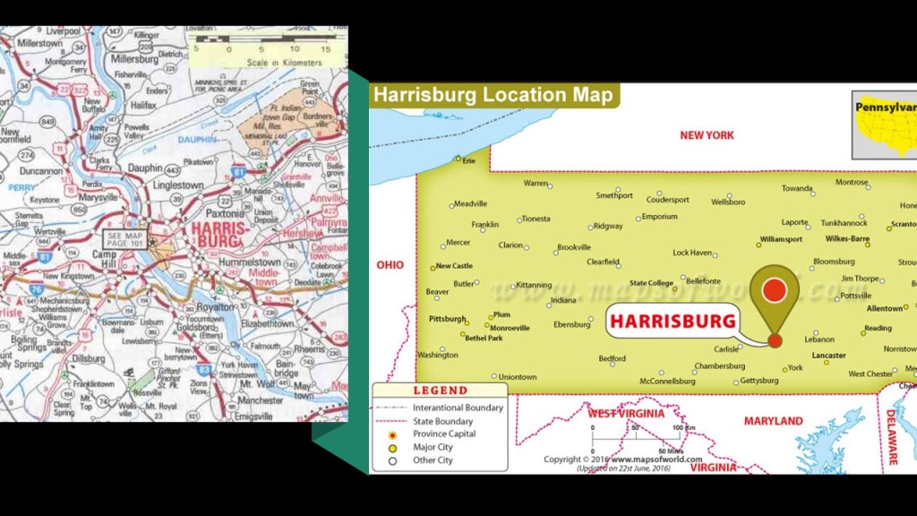
First, Harrisburg, the State Capital of Pennsylvania.
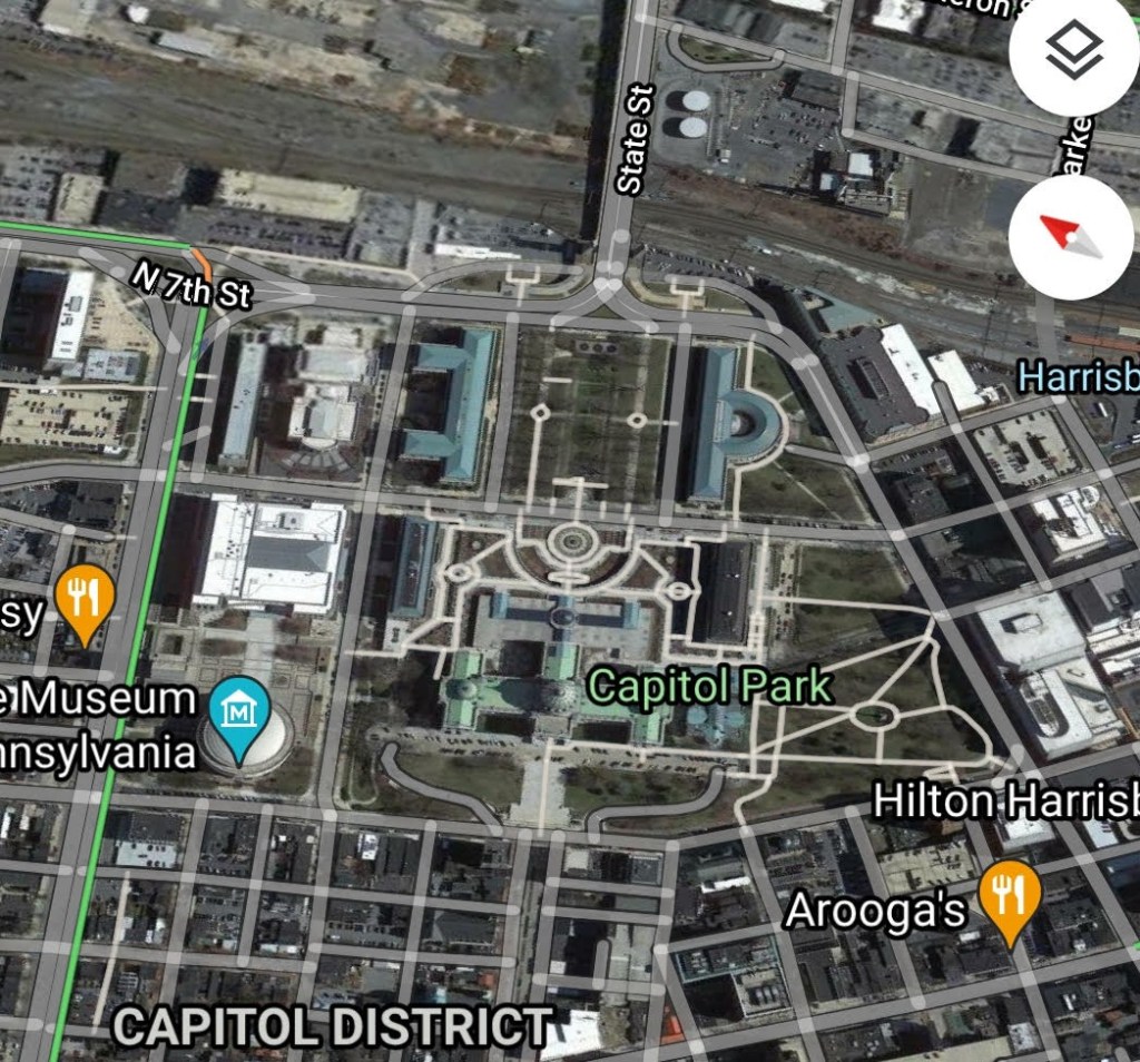
CZ had sent me screenshots of the Capitol District in Harrisburg aawhile back that was the basis for the research I did there.
What we are told is the land that became Harrisburg had been purchased by an English trader named John Harris Sr. in 1719; John Harris Jr. made plans to lay-out a town on his father’s land; and the land was surveyed by William Maclay, John Harris Sr’s son-in-law.
The city of Harrisburg became incorporated in 1791; and named the Pennsylvania State Capital in October of 1812.
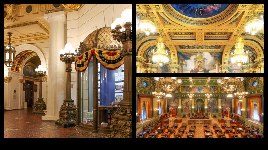
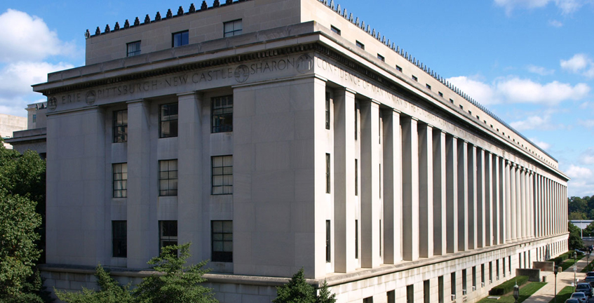
The current State Capitol Building was said to have been designed by architect Joel Miller Huston, and built between 1902 and 1906 in the Beaux-Arts style of architecture.
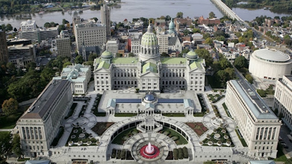
The interior of the Pennsylvania State Capitol is described as having decorative Renaissance themes throughout the building.
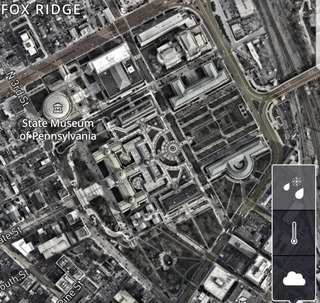
It is part of what is called the Pennsylvania State Capitol Complex.
On the East side of the Capitol building is what is referred to as the East Wing, described as a 1987 extension of the Capitol building.
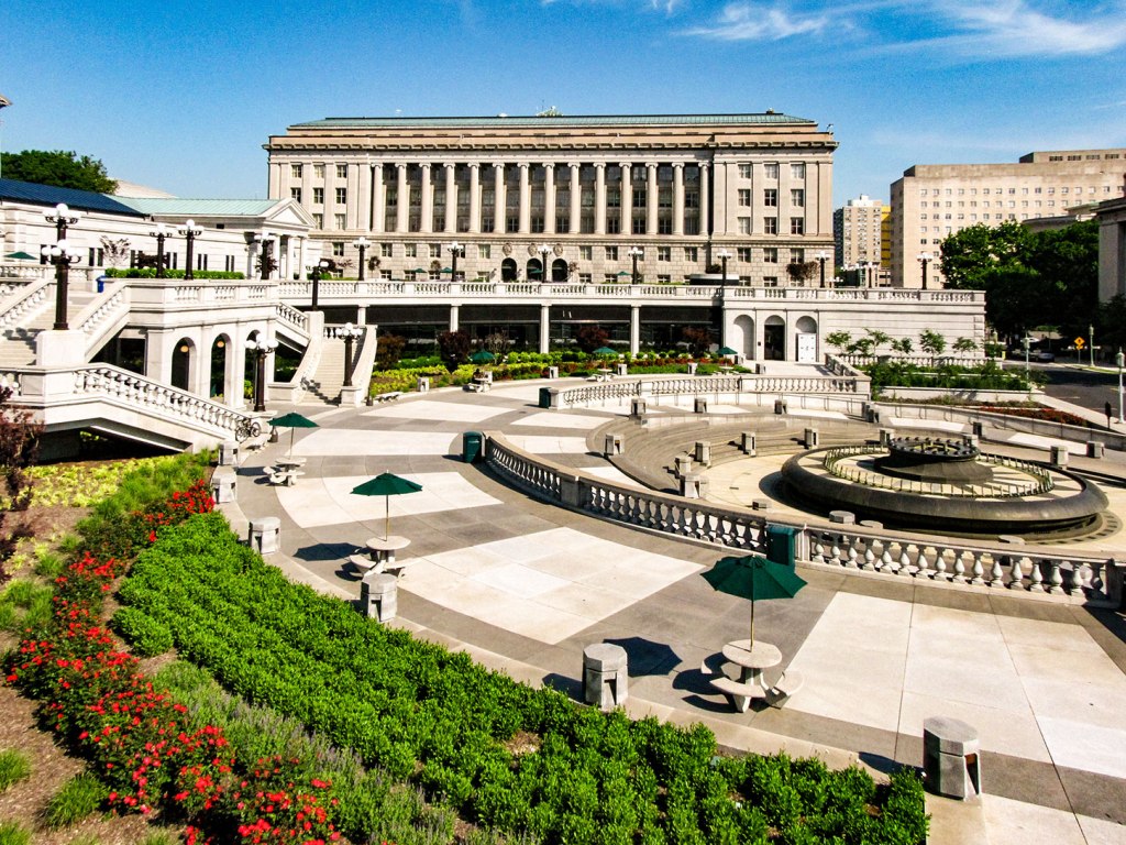
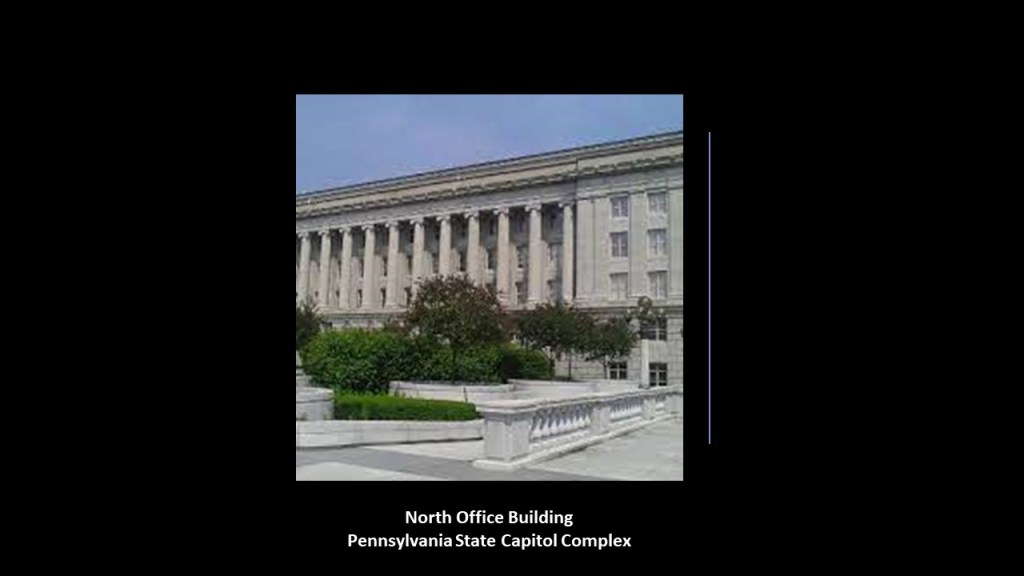
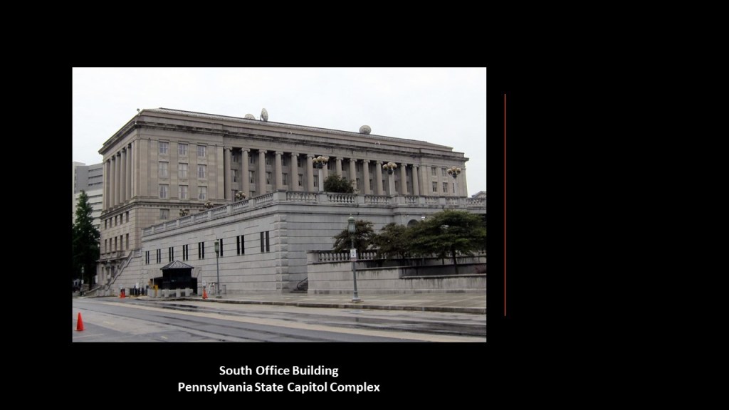
Flanking the East Wing are the North and South Office buildings,
The North Office building was said to have been built in Indiana limestone starting in 1927…
…and the South Office building in Indiana limestone starting in 1919.
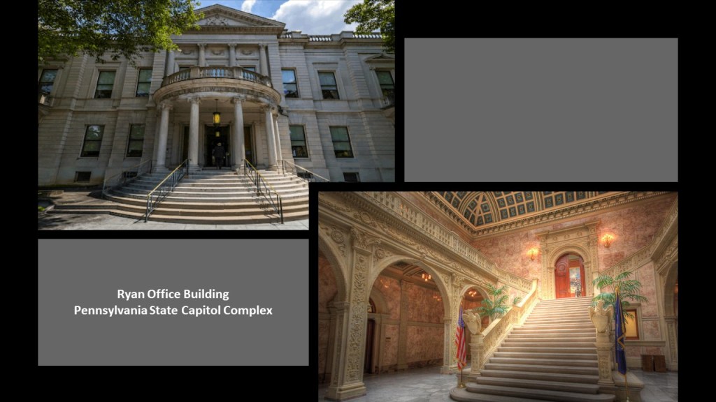
We are told the oldest building of the complex is the Ryan Office building, with a construction completion date of 1894.
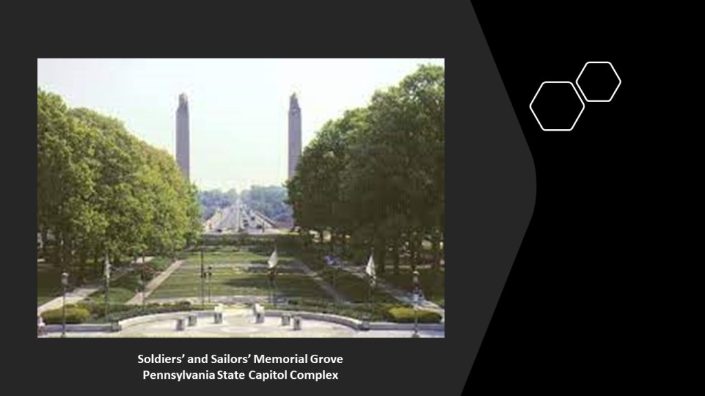
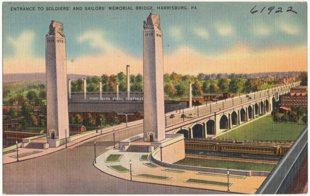
East of the North and South Office buildings, across Commonwealth Avenue, there are a pair of buildings situated across from each other at either end of the “Soldiers’ and Sailors’ Memorial Grove.”
I will be touching more on the Soldiers’ and Sailors’ Memorial Bridge that you can see the pylons of in the background momentarily.
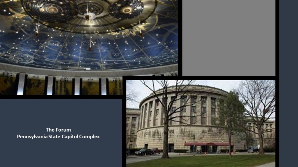
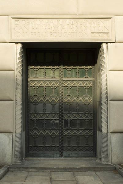
The Forum building is on the south-side of the Memorial Grove, was said to have been built out of grey limestone, and featuring 22 bronze doors, between 1929 and 1931 in the style of an open-air Greek amphitheater, complete with a star map of the night sky depicting the zodiac and other constellations with over 1,000 stars on the ceiling…
…and on the north-side of the Memorial Grove is the Pennsylvania Treasury Building, said to have been a project of the New Deal Era Public Works Administration during the Great Depression built between 1937 and 1940.
The eastern-most portion of the Pennsylvania State Capitol Complex is the “Soldiers’ and Sailors’ Memorial Bridge,”or the “State Street Bridge,” which connects the complex to neighborhoods across the railroad tracks that run east of North 7th Street.
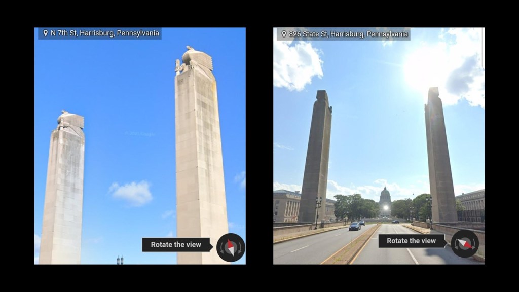
It is a 1,312-foot, or 400-meter, deck-arch bridge said to have been constructed between 1925 and 1930.
The State Museum of Pennyslvania is directly adjacent to the Pennsylvania State Capitol Complex…
…run by the state through the Pennsylvania Historical and Museum Commission to “preserve and interpret the region’s history and culture,” and includes a multi-media planetarium, and four-floors of exhibits covering Pennsylvania history from prehistoric times through today.
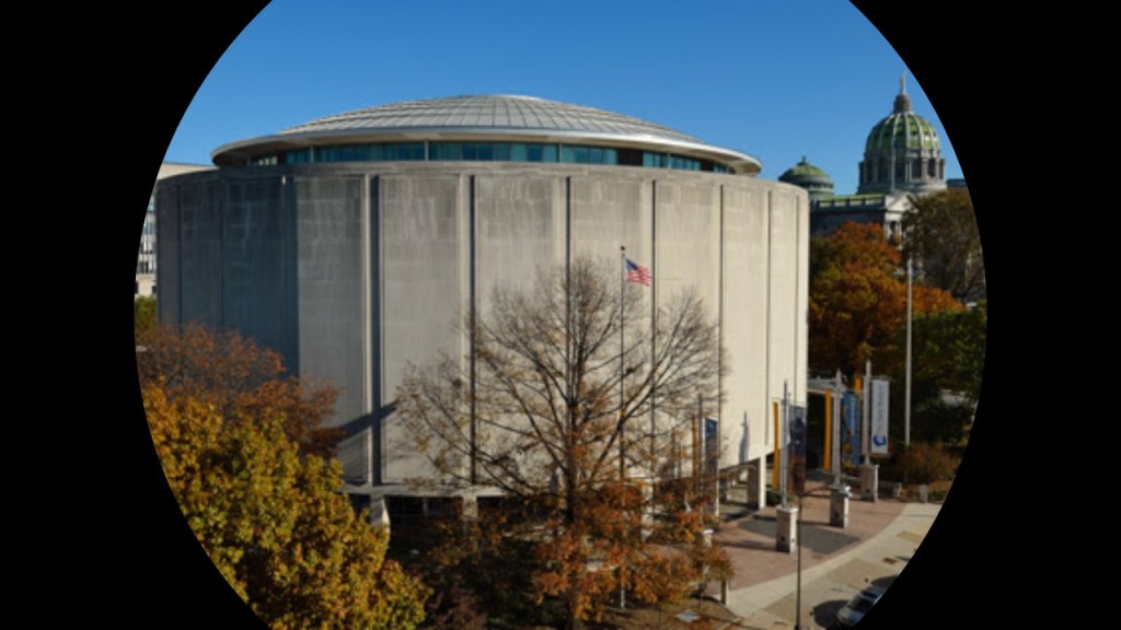
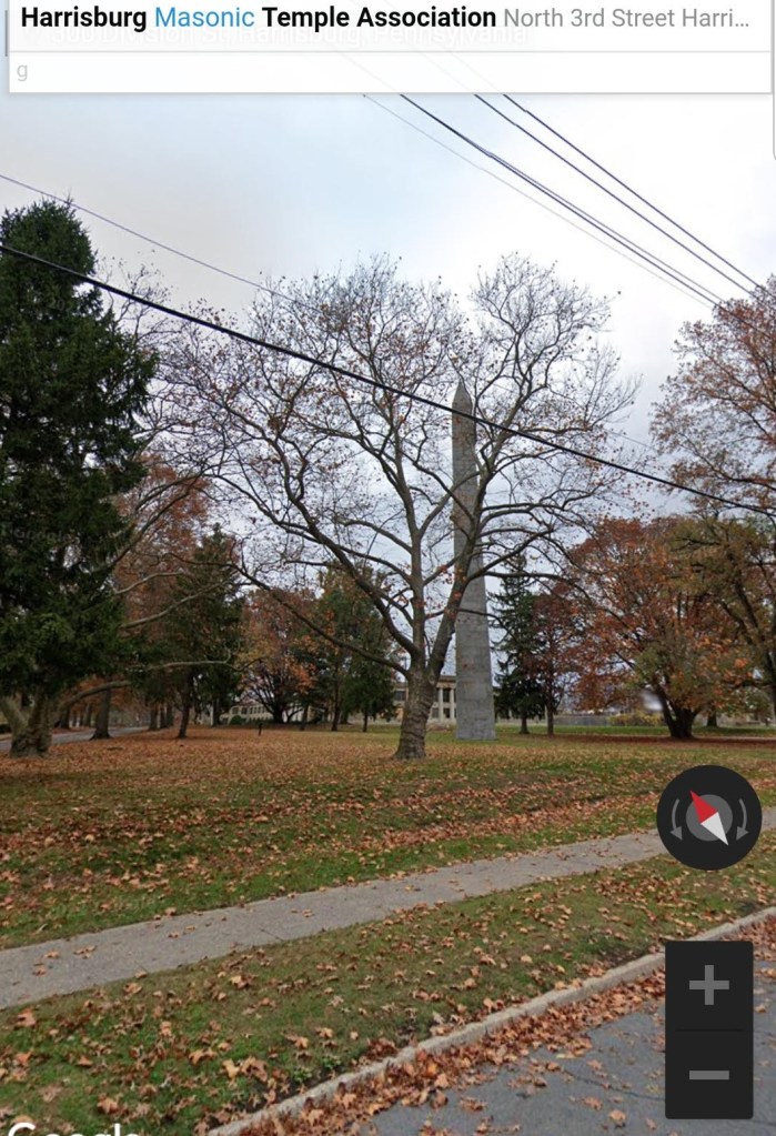
CZ also sent me screenshots of the Scottish Rite Cathedral and Masonic Temple of Harrisburg…
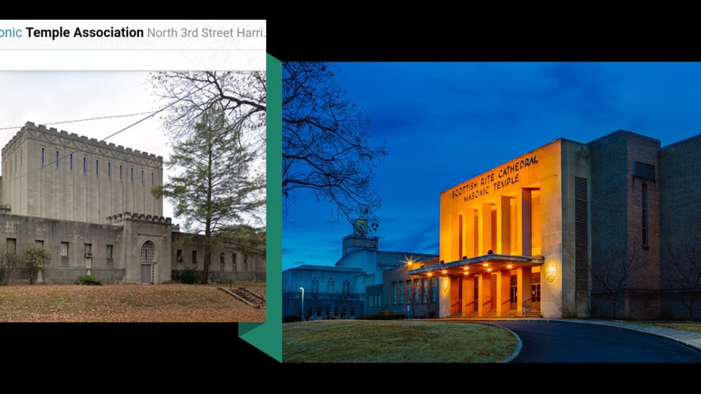
…with a tall obelisk on its grounds.
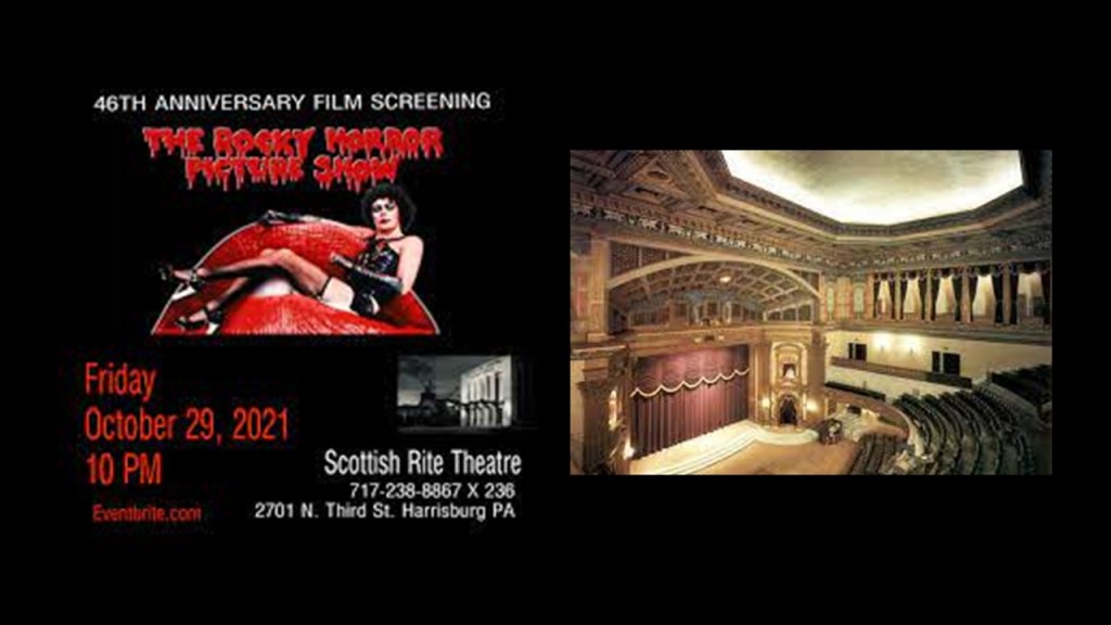
The 1,192-seat Theater and Ballroom at the Scottish Rite Cathedral is a popular community event venue.
And this seems to be the extent of what I am able to find out about it!
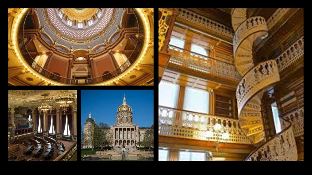
Next, I am going to take a look at the State Capitol Complext at Des Moines, the capital city of Iowa.
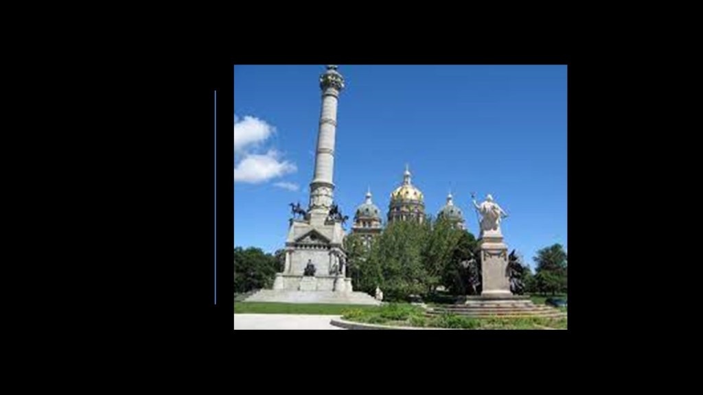
The Iowa State Capitol Building was said to have been built between 1871 and 1886, and the only 5-domed capitol building in the United States.
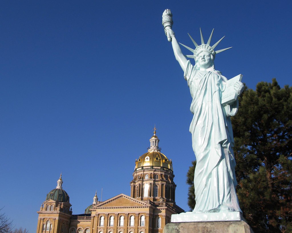
The Iowa Statue of Liberty is located on the capitol grounds.
It is described as a replica of the Statue of Liberty that was a gift in 1950 from the Boy Scouts of America as part of their efforts to “strengthen the arm of liberty.”
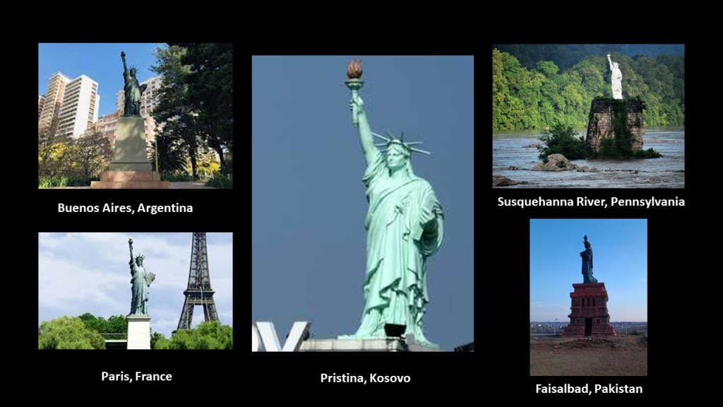
Interesting thing is, there are hundreds of replicas of the Statue of Liberty, said to be a figure of Libertas, a Roman goddess and the personification of liberty, all over the Earth.
Are they replicas…or do they represent something else entirely?
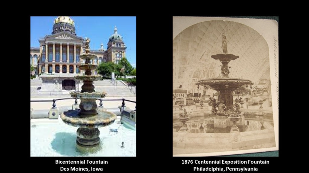
The Bicentennial Fountain is on the west-side of the State Capitol Complex.
What we are told about the Bicentennial Fountain is that it was originally a replica of a fountain that was displayed at the 1876 Centennial Exposition in Philadelphia, and that after years of vandalism and disrepair, it was replaced by a new fountain in 1982.
So there’s another “replica of” to explain something’s existence.
Also in the Iowa State Capitol Complex, to the rear of the State Capitol Building, we find the Soldiers and Sailors Monument, an obelisk-looking monument, in direct alignment with the dome of the Capitol building, which we are told was erected to commemorate Iowans who fought during the Civil War.
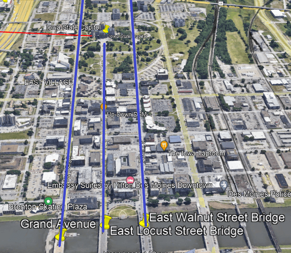
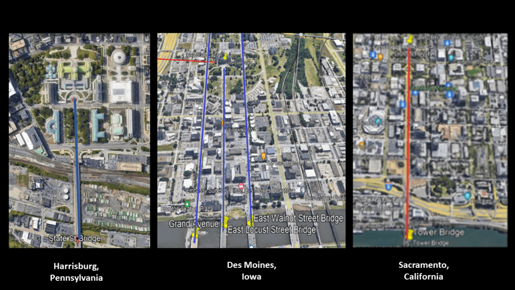
The last place I want to look at in the Iowa State Capitol are the bridges over the Des Moines River on the west-side of the complex.
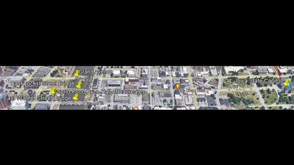
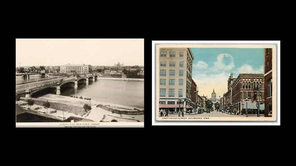
The East Locust Street Bridge is situated between the East Walnut Street Bridge and the Grand Avenue Bridge, and East Locust Street is in direct alignment with the Iowa State Capitol Building.
The other two bridges and streets go on either side of the complex.
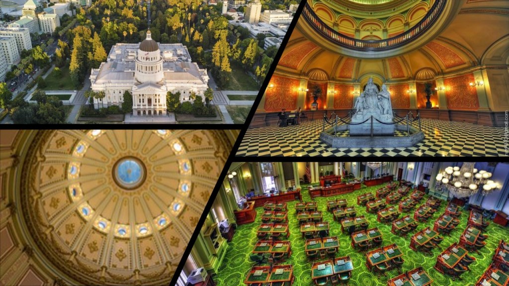
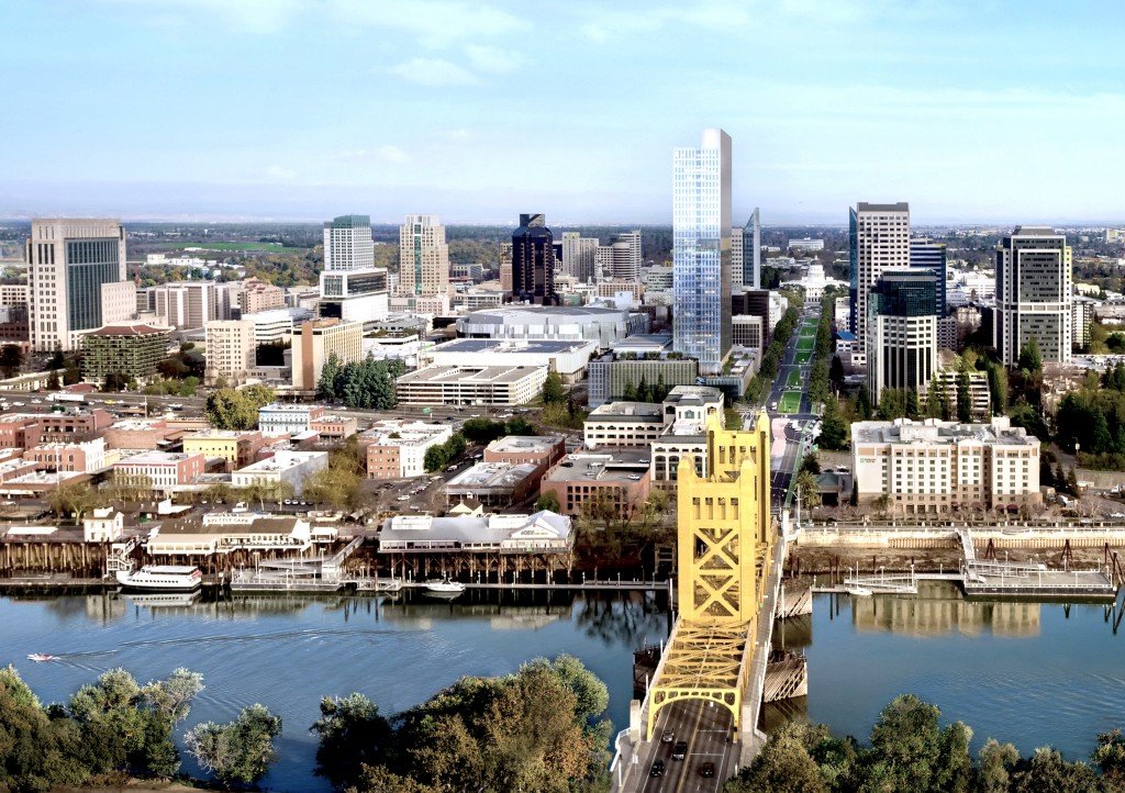
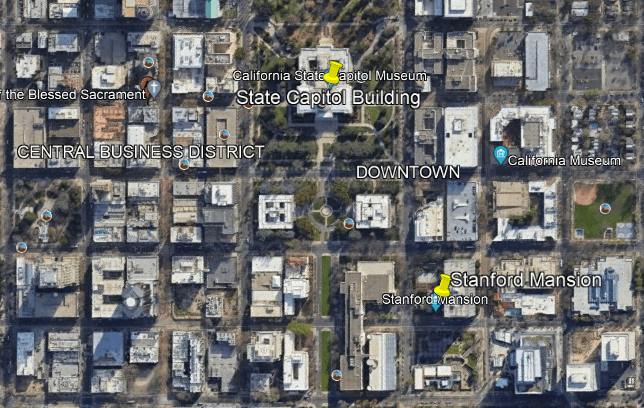
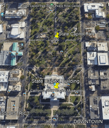
Lastly, the California State Capitol complex in Sacramento.
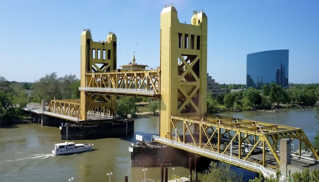
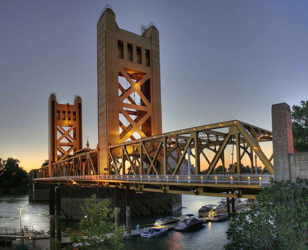
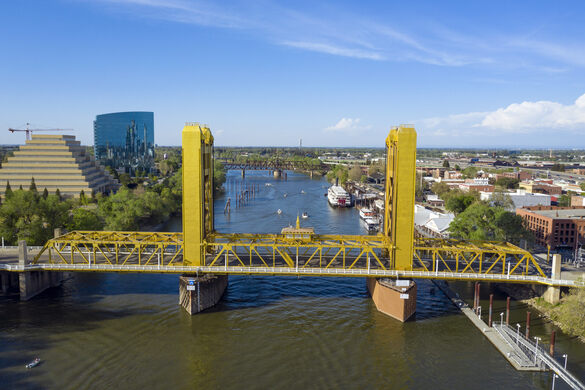
The Tower Bridge crosses the Sacramento River, and leads right in to the Capitol Mall in front of the California State Capitol Building, in the same manner as the precisely laid-out bridges and streets connect to the State Capitol complexes in Harrisburg and Des Moines.
The California State Capital building was said to have been designed in the Neoclassical-style by Reuben S. Clark, and constructed between 1861 and 1874, which would have been completed three-years after the start date of the Iowa State Capitol building’s construction in 1871 according to the historical narrative we have been given.
The Tower Bridge is also a vertical-lift bridge, and connects Sacramento and West Sacramento across the Sacramento River.
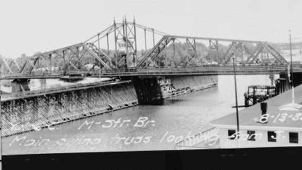
We are told the construction of the Tower Bridge as a replacement bridge for the 1911 M Street bridge was said to have started in 1934 and first opened in 1935.
This would have been around the time of the Great Depression and the beginning of World War II.
The original 1911 bridge was described as a “swing-through truss railroad bridge” that was determined to be inadequate as the result of Sacramento’s population growth doubling between 1910 and 1935, and the city’s concern for needing a better crossing over the Sacramento River in case of war.
Alfred Eichler was credited as the architect of the Tower Bridge, and its architectural-style described as a rare use of “Streamline Moderne,” a style of “Art Deco” that emerged in the 1930s.
The two towers of the bridge alone are 160-feet, or 49-meters, -high.
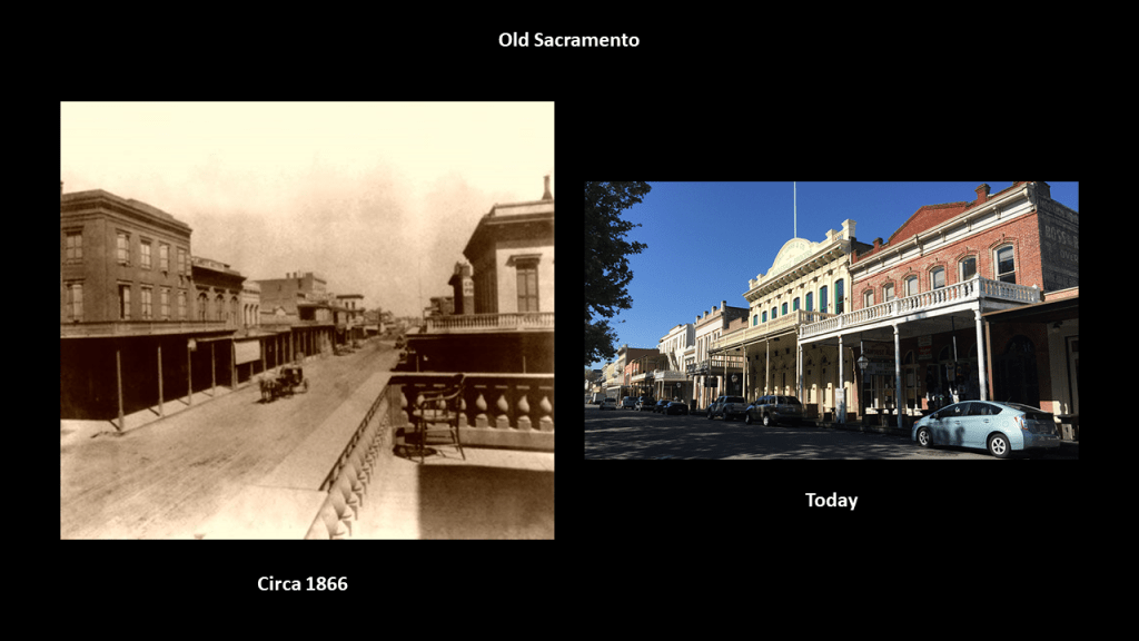
It is located in “Old Sacramento,” the riverfront historic district, with Gold Rush-era buildings attributed to Victorian-era gold miners.
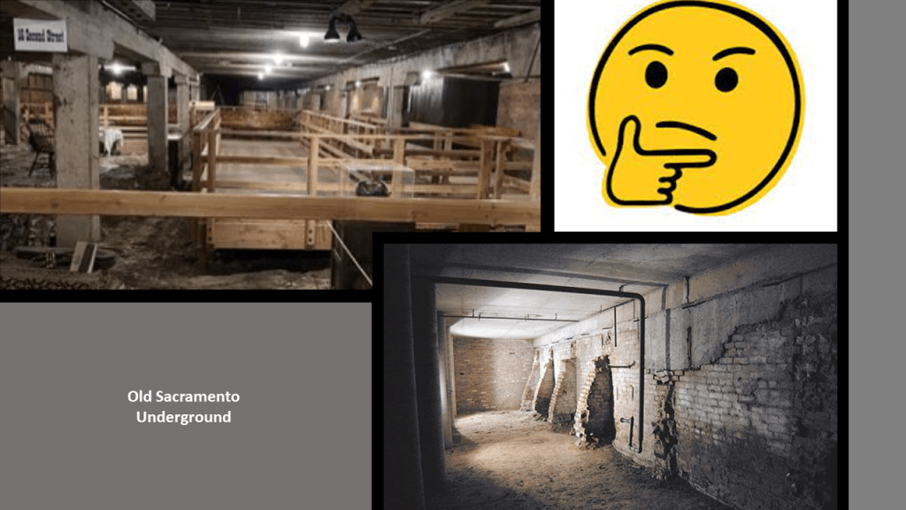
You can go on an “Underground Sacramento” Tour any day of the week, where you will learn how Sacramento lifted itself up out of floodwaters in the 1860s and 1870s by the “jacking” up of buildings to avoid further flooding.
The Tower Bridge is part of State Route 275 which connects West Capitol Avenue and the Tower Bridge Gateway with the Capitol Mall in Sacramento.
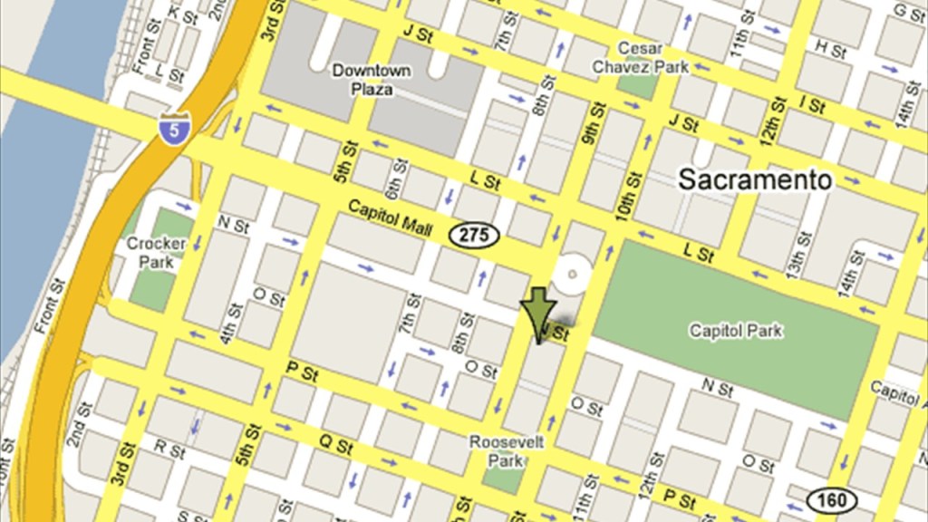
The Capitol Mall in Sacramento is described as a major street and landscaped parkway.
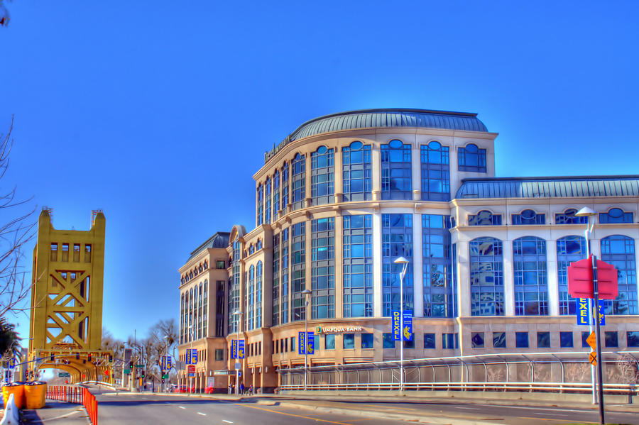
The former Drexel University Sacramento Center for Graduate Studies was in a building situated right next to the Tower Bridge at the address of 1 Capital Mall.
It opened in 2009, and started closing in 2015 to allow currently enrolled students to complete their studies.
It was then permanently closed.
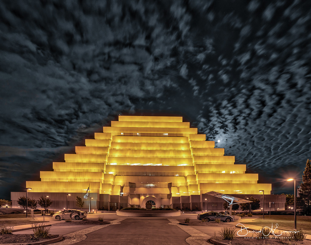
There is a California State Government building called “The Ziggurat” in West Sacramento right next to the Tower Bridge.
The Ziggurat was said to have been designed to resemble ancient Mesopotamian ziggurats and built by The Money Store in 1997.
Since 2001, it has been leased to the state as the headquarters of the California Department of General Services.
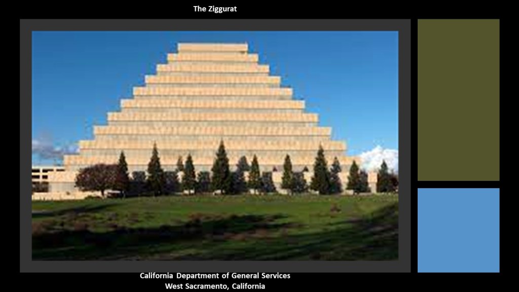
The Ziggurat is illuminated at night on special occasions.
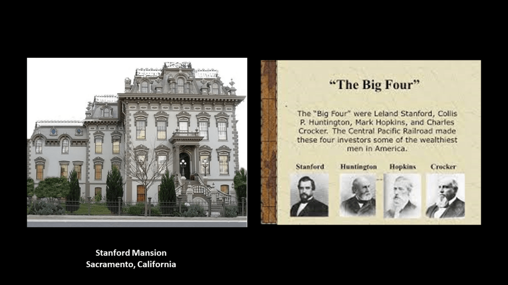
The Stanford Mansion is in the neighborhood of the Capital Mall, a couple of blocks south of the State Capitol Building and serves as the official reception center for the California government.
It was said to have been built in 1856 as a residence for Leland Stanford, a Railroad Baron who was a former California governor, and founder of Stanford University in 1885.
It was donated to the Roman Catholic Diocese of Sacramento in 1900, who operated a children’s home there until 1978.
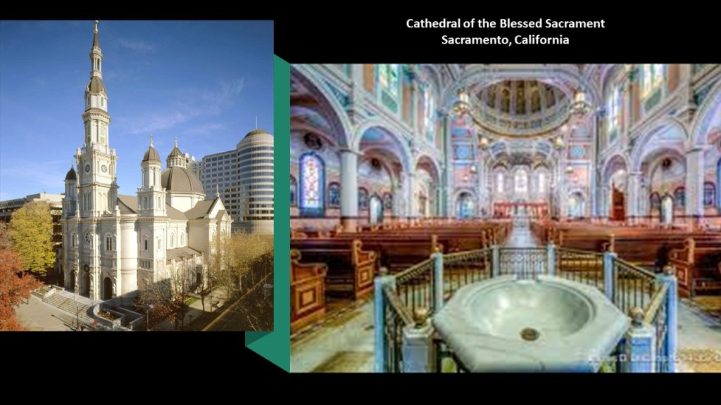
The Cathedral of the Blessed Sacrament, the seat of the Roman Catholic Diocese of Sacramento, and is one of the largest cathedrals west of the Mississippi River.
It was said to have been built between 1887 and 1889 in the Italian Renaissance architectural-style on the outside, and the Victorian architectural-style on the inside.
The cathedral’s designer was said to be Patrick Manogue, a former gold-miner who came to Sacramento through the California Gold Rush, who became a Catholic priest in 1861 after studying in Paris, and then the Bishop of Sacramento in 1886.
He was said to have based the design of his cathedral on a church he was inspired by in Paris, and that it was built on land donated by the State’s first elected governor, Peter Burnett.
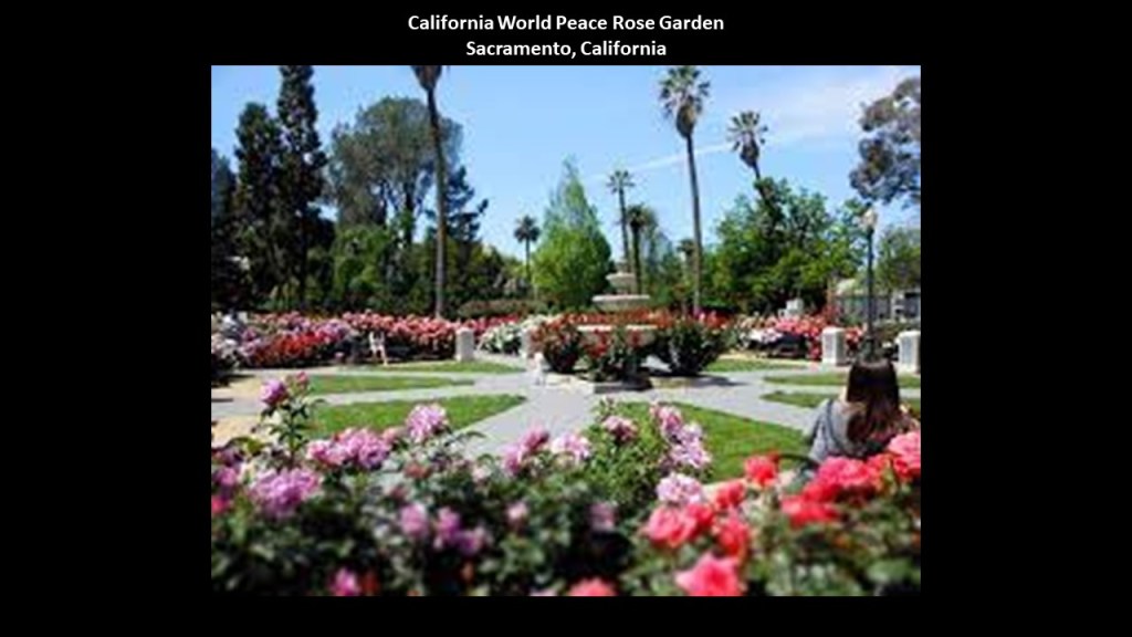
The Capitol Park in Sacramento covers 40-acres, or 16-hectares, and I will cover a few examples of what is found on the grounds.
The California State World Peace Rose Garden occupies roughly 5-acres, or 2-hectares of the area it covers, featuring 650 roses with different colors and fragrances.
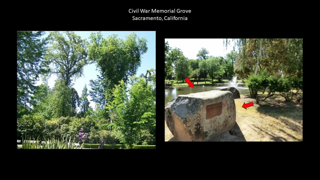
The Civil War Memorial Grove on the Capitol State Park Grounds was said to have been planted in 1897 with saplings from famous Civil War battlefields, like Manassas, Virginia; Harper’s Ferry, West Virginia; and Vicksburg, Mississippi.
You know, it’s interesting, that we don’t even notice the straight-edges of megalithic stone blocks all around us that get used, like in this case, as a place to put signage.
Instead, a label like “boulder” is put on huge cut-and-shaped stones like this and which covers it up nicely as not being something out-of-the-ordinary that we should be paying attention to.
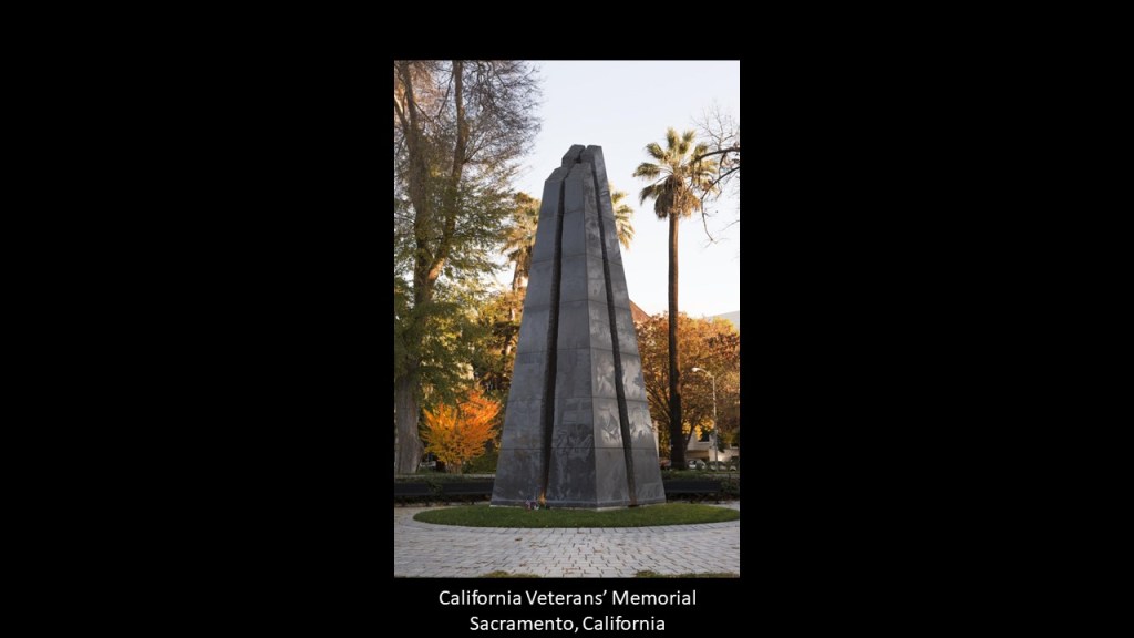
And the California Veterans’ Memorial on the Capitol State Park grounds is an 30-foot, or 9-meter tall, black-granite obelisk that was dedicated in 1998 to California’s veterans who had served in the Armed Forces since statehood in 1850.
These are just a few of the memorials and monuments to be found on the grounds of the park.
This is just a sample of countless examples of the shared characteristics of Capitol building complexes, and a few other locations nearby as well.
A sample is all that is needed to illustrate that they are all have similar characteristics of mind-blowing examples of monumental architecture and precise civil-engineering feats that do not match what we are supposed to have been capable of in our historical narrative, which would have been very low technology in the 19th-century and early 20th-century according to what we have been taught to believe.
The stories we are told don’t match the grandeur of the architecture and the incredible feats of engineering that we see in these places, and I would surmise the same is true of capitals the world over.
Things to consider in regards to how this ancient, advanced worldwide Moorish civilization has been hidden right in front in front of our eyes by those who have sought to keep our True History from our Awareness.

i apologize if this is a duplicate. I had a hell of a time trying to leave this comment. I don’t think the enemy wants us connecting.
Hi Michelle, my name is Ray Baughman and I am an artist/writer from Ohio. First of all Thank you for all you do your an amazing researcher and the world will benefit from what you have done. Secondly I came across some giant rocks near where I live in Richland County, Mansfield, Ohio. Malabar Farm specifically. The place was made famous by Louis Bromfield and his connections to Humphrey Bogart etc. The opening scene in Shawshank Redemption takes place at one of the cabins on the property of Malabar Farm. They rent the cabin out for special events and we had my daughters graduation party there. While stepping aside for an emotional release I found myself standing in the midst of what I see as an ancient ceremonial gathering spot that has collapsed and the rocks spread out over a 100 yards. on a second trip I found in a separate spot on a hill top about half mile away seems to be another one. There is also in the nearby area a place called mount jeez that i have a suspicion is either an indian mound or a full pyramid. So I would like to connect and send you some photos. But on a bigger scale I am trying to put together a boots on the ground trip from East palestine where the train derailed. taking samples along the ohio river to the mississippi river while also hitting the serpent mound and some other key spots .then follow the mississippi to new orleans highlighting canals ,old buidlings and i want to find the great wall of America said to be on the mississippi. I have big dreams and goals but they all center around helping humanity love each other unconditionally while creating art and sharing truth where i can. I am starting a podcast that i would love to have you on. The Quantum Stew. Thequantumstew.com theartofray.com baughman91269@gmail.com 419 684 2418. Ray Baughman on facebook, instagram artofray Thank you,
Ray
WordPress.com / Gravatar.com credentials can be used.
LikeLike