
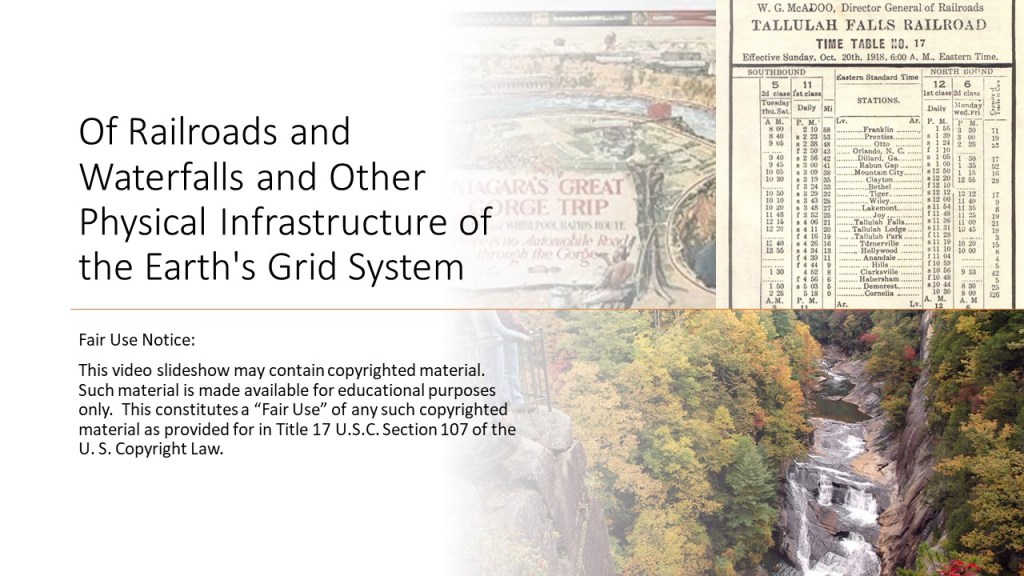
In the course of doing research over the last couple of years based on viewers’ suggestions, I encountered some interesting places either with “Hel-” as a part of the name like the small archipelago off the coast of Germany known as both Heligoland and Helgoland, or actually named Hel, like Poland’s town of Hel, located on the Hel Peninsula separating the Bay of Puck from the Baltic Sea, and among other things both of the places were battle locations from the outset of and during World Wars I and II.
Based on my findings from this research, my curiousity was piqued about places named Hel on Earth and I decided to dive deeper into this subject.
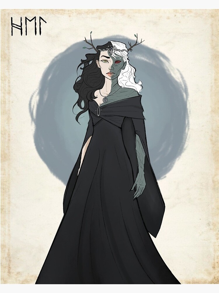
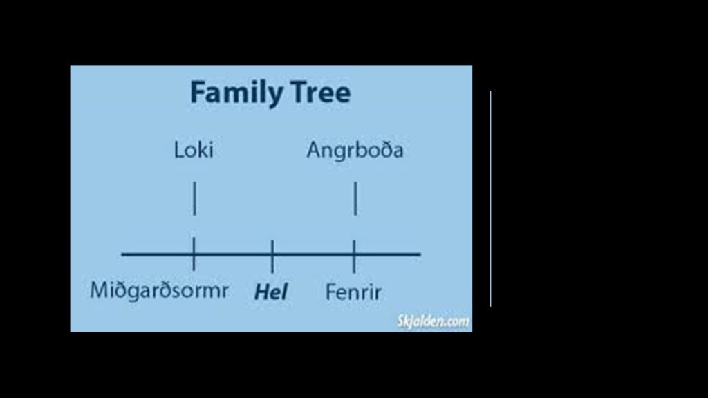
My starting point for this post is Hel, the Norse goddess of the Underworld.
Hel was the daughter of the trickster god Loki and the giantess Angrboda.
Her brother Fenrir was a giant wolf, and her brother Midgardsormr, also known as Jormungand, a giant serpent.
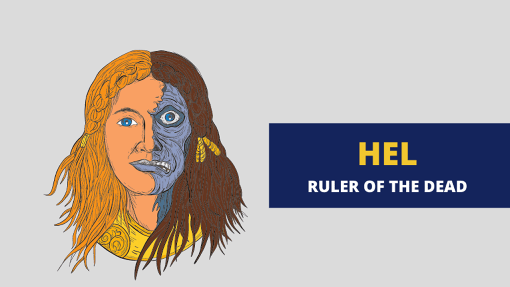
Depicted with half-human and half-skeletal features, Hel is often referred to as the Goddess of Death…
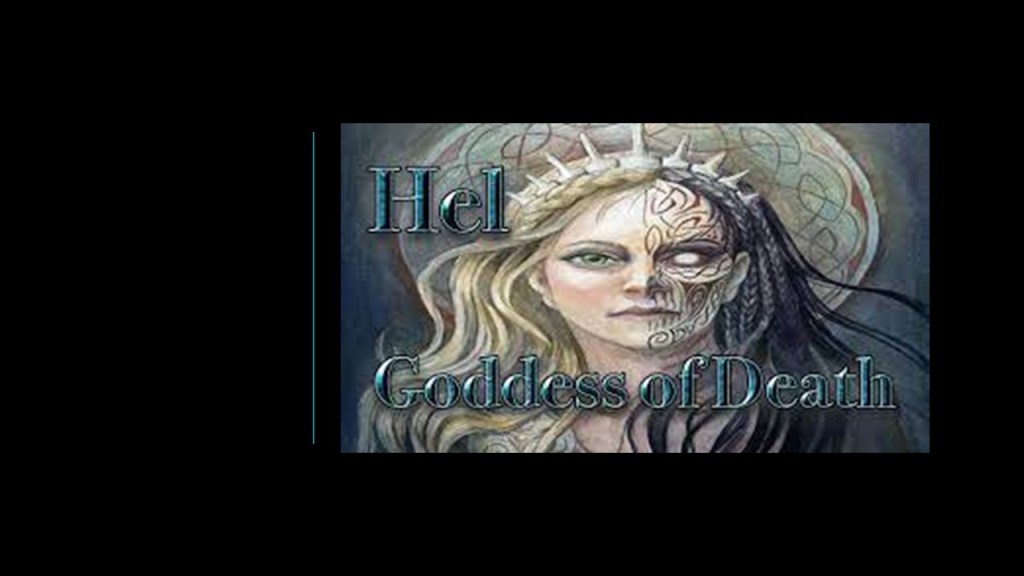
…and the Ruler of the Dead.
Yet the goddess Hel was also considered by some in the positive light of being a “soul transformer,” helping us in our transition between life and death.
Hel’s name was the root of the English word “hell,” a place regarded as a spiritual realm of evil and suffering and perpetual fire where the wicked are punished after death.
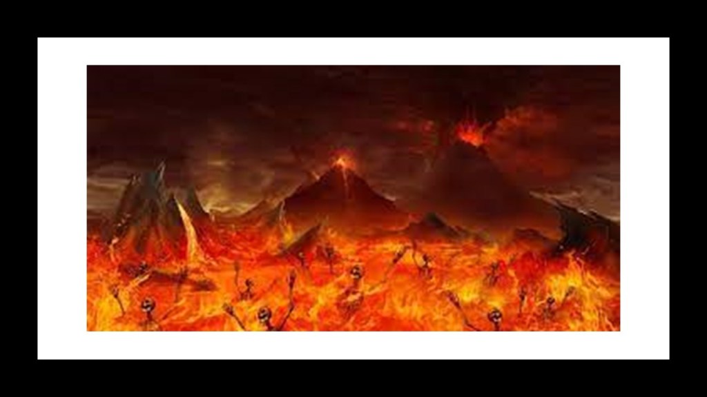
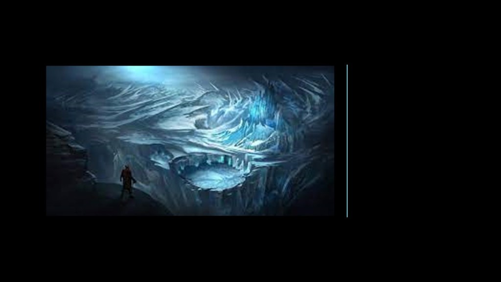
What we are told about the goddess Hel is that she ruled over the underworld realm of the dead called Helheim, one of the nine worlds in Norse Cosmology, where we are told those who die a dishonorable death go to a land of ice without fire.
A “dishonorable” death was considered any death in which the person did not die in battle, including death from old age and illness.
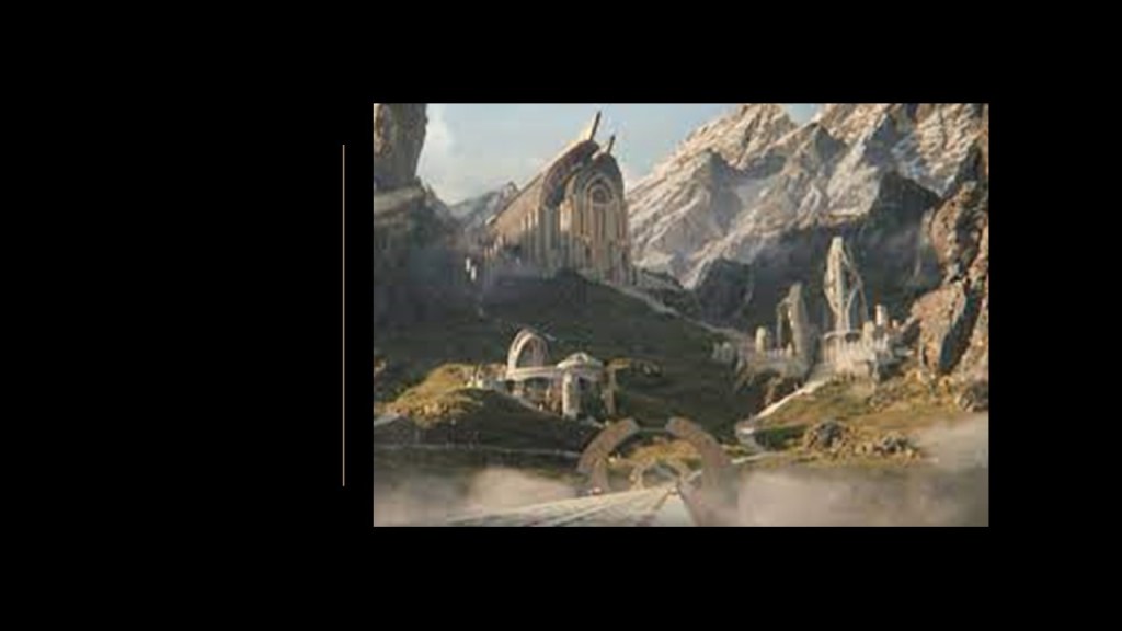
We are told that “Valhalla,” said to translate from Old Norse as the “Hall of the Slain,” was a majestic hall in Asgard, a location associated with the gods and presided over by Odin.
Interesting that an immense tree named “Yggdrasil” serves as the connection between the nine worlds in Norse Cosmology.
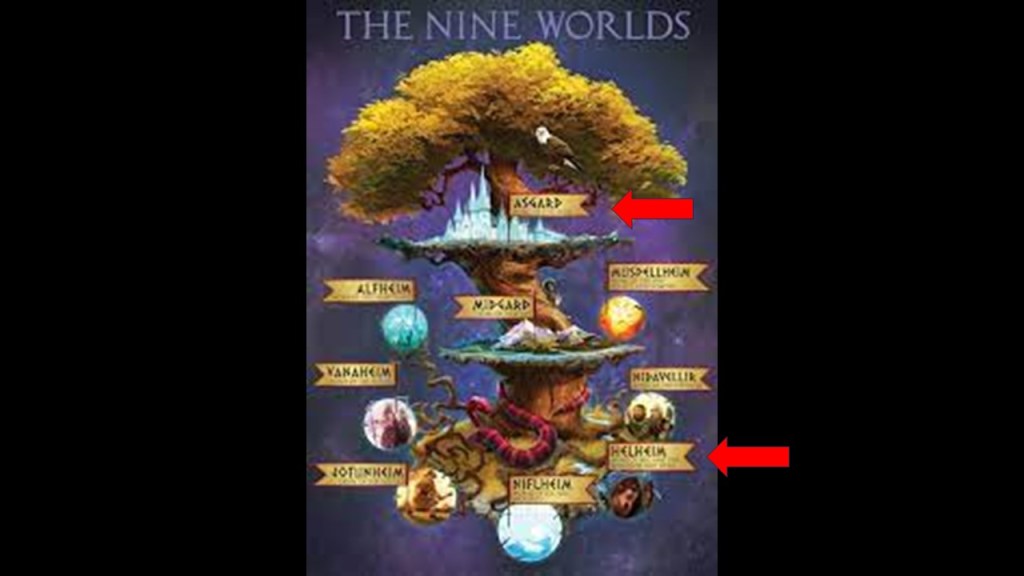
The sacred and holy Yggdrasil, the World Tree, was said to be located at the very center of the Universe, with three roots extending far away into varying places.
One translation of the term “Askr Yggdrasil” refers to the World Tree, with “askr” meaning Ash Tree in Old Norse.
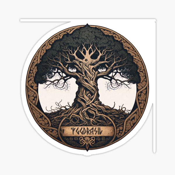
It is important to note that other translations have negative assocations.
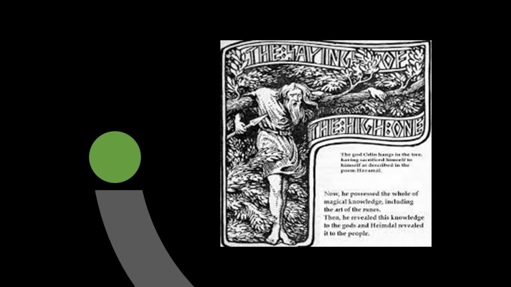
One is that Yggdrasil means “gallows,” after “Odin’s Horse,” from which the Norse God Odin hung himself from the tree as a sacrifice.
Others have translated “Yggdrasil” from the Old Norse word “Yggr,” meaning “terror.” So then Yggdrasil becomes the “Tree of Terror” as opposed to the “Tree of Life.”
All of this information tucked away in our memory banks as myth needs to be taken into consideration when determining the true nature of this realm and the Universe, and all the ways truth has been inverted to emphasize death over life, and to demonize and cloak the actual nature of where we live and our place in the Universe.
One more thing before I move on from the goddess Hel and Norse Mythology and Cosmology.
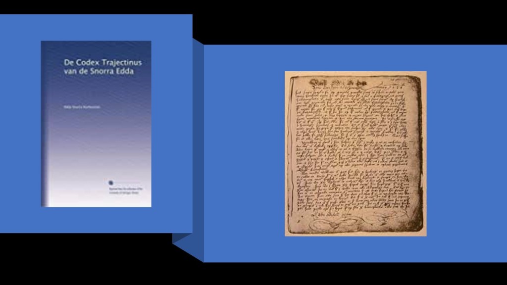
A primary source of all of this information is said to come from the “Prose Edda,” also known as “Snorri’s Edda,” said to be an Old Norse textbook written in Iceland sometime around 1220 AD in the early 12th- century by the Icelandic scholar and historian Snorri Sturluson, and considered the fullest and most detailed source of knowledge about Norse mythology and body of myths of the northern Germanic people.
So here we have the fullest and most detailed source of knowledge of Norse mythology including a goddess named Hel who was the” Goddess of Death” and “Ruler of the Dead” from whom we get the name of hell for the place of fire and eternal suffering that the wicked go to when they die first appearing in the early 1200s.
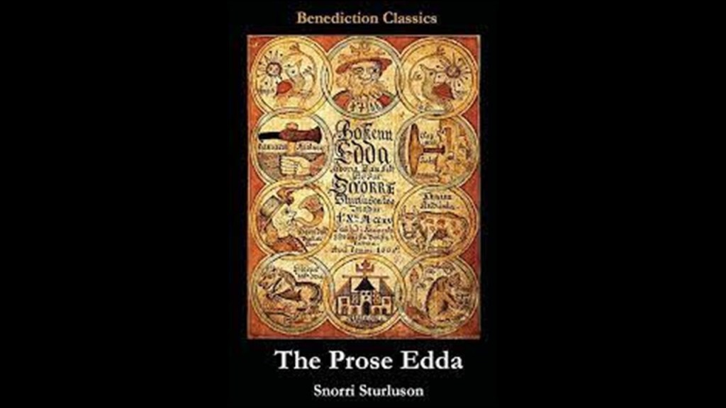
We are told that seven manuscripts and or fragments of the “Prose Edda” survive today – six from the medieval period during the 1300s, and one is a copy of the Manuscript from the early 1600s called the “Codex Trajectinus,” housed at the University of Utrecht in The Netherlands.
We are also told that Snorri Sturluson’s works provided information on persons and events in northern Europe during times when such information was scarce and hard to find.
This information factored into establishing a Norwegian national identity during the Norwegian Romantic Nationalism period in the mid-19th-Century, a movement between 1847 and 1867 in art, literature, and popular culture.
Romantic Nationalism was the form of nationalism in which the state claims its political legitimacy as a consequence of the unity of those it governs, including such factors as language, race, ethnicity, culture, religion, and customs.
This was in opposition to dynastic or imperial rule.
More to come shortly on the background in our historical narrative of what was taking place in the same time period as the emergence of Romantic Nationalism around the mid- 19th-century.
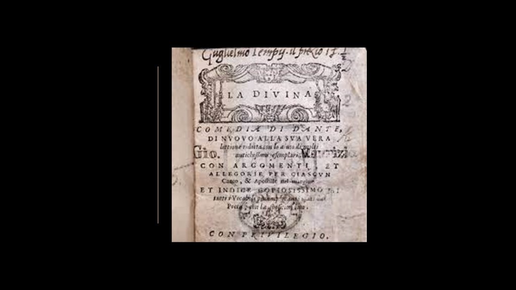
Modern Italian, considered the closest of the Romance languages to Vulgar Latin, or the spoken form of Latin from the Late Roman Republic onwards in our historical narrative, was said to have developed in Tuscany in Central Italy, and was first formalized in the early 14th-century through the work of Florentine poet, writer and philosopher Dante Alighieri, considered the “Father of the Italian Language.”
The exact year of Dante’s birth was unknown, and much about his early life and education is not known.
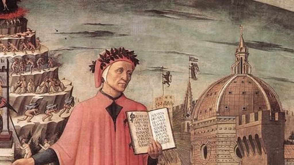
Dante Alighieri’s best-known work was the “Divine Comedy,” also considered the pre-eminent work in Italian literature and one of the greatest works of world literature.
The “Divine Comedy” was a narrative poem believed to have been composed by Dante between 1308 and 1321, completed shortly before his death in September of 1321.
The poem has three parts – Inferno, Purgatorio, and Paradiso – to which Dante journeys with a different guide for each, and the subject of the poem was the state of the soul after death, with Divine Justice being meted out as either due punishment or reward.
So within 100-years of the publication of Snorri Sturluson’s “Prose Edda” in Iceland bringing us concepts of a goddess named Hel meting out a mythological form of Divine Justice as punishment (Helheim) or reward (Valhalla), we have Dante Aligheri bringing us the same information albeit in the form we have come to know today as what happens to us after we die based on the state of our soul, and the modern Italian language as well.
With regards to the question in the title of this post “Where is Hel on Earth,” I am going to start with research I have done in the past which was based on viewers’ suggestions that led me to some places with “Hel” in the name.
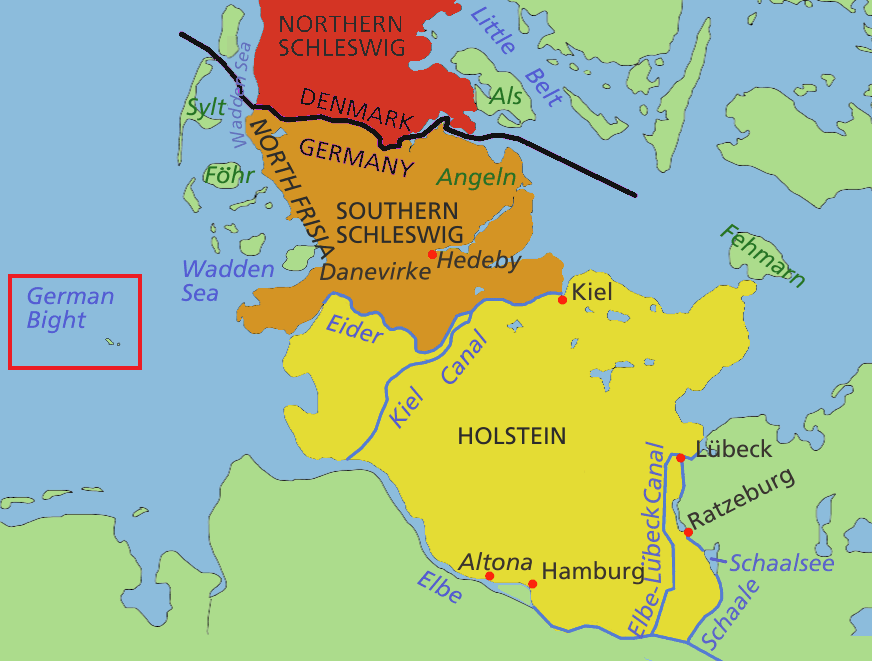
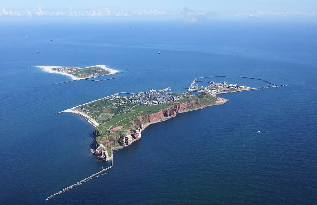
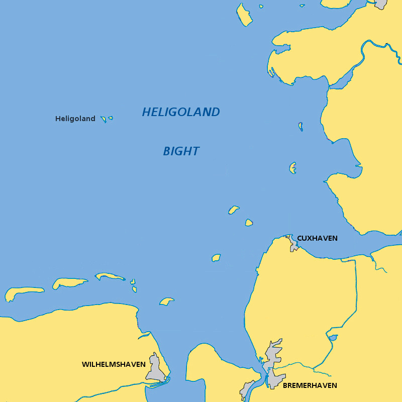
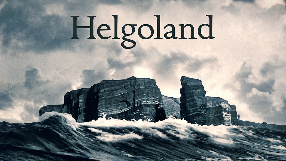
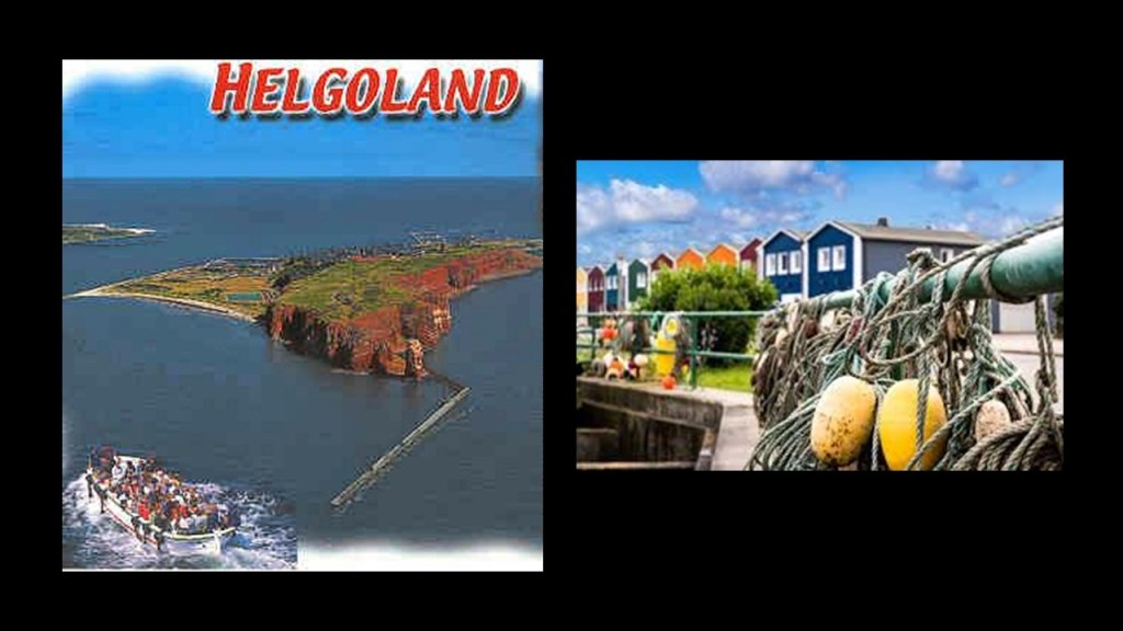
One place that embodies this same dual nature of the word “Hel” in our world is a small archipelago of two islands in the North Sea that is known both as Heligoland and Helgoland – meaning either “Holy Land” or “Hell Land.”
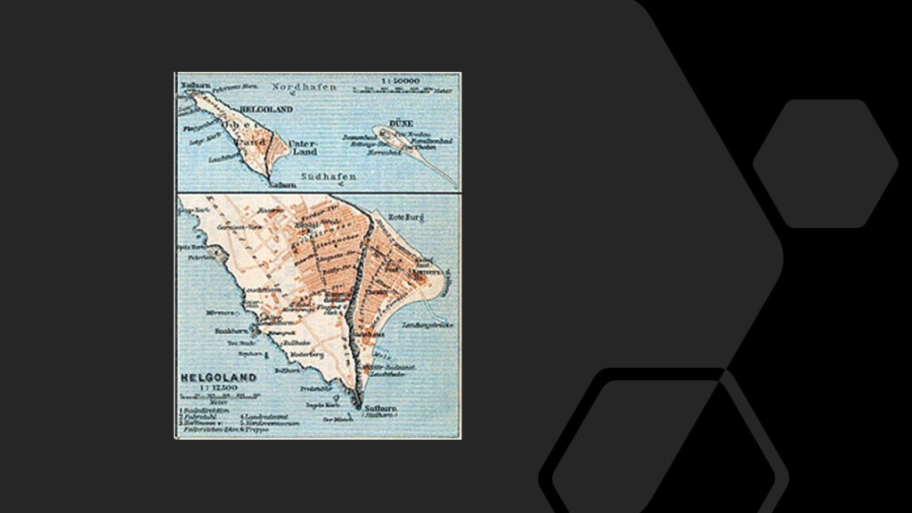
These small two islands are located in what is called the Heligoland, or German, Bight in the southeastern corner of the North Sea, and has been part of the German state of Schleswig-Holstein since 1890.
The larger of the two islands has a permanent population of somewhere around 1,000 people.
The smaller of the islands is called Dune, which is not permanently inhabited, but is the location of Heligoland’s airport.
Heligoland was historically part of Denmark.
Great Britain had attacked Copenhagen in August of 1807 in what was called the “Siege of Copenhagen” during the Napoleonic Wars, using the pretext of the fear that Napoleon was going to attempt to attack the Danish-Norwegian Fleet.
Britain then proceeded to seize the Danish-Norwegian Fleet in September of 1807, assuring the use of the sea lanes in the North Sea and Baltic Sea for the British merchant fleet.
The “fleet robbery” drew Denmark-Norway into the war on the side of Napoleon.
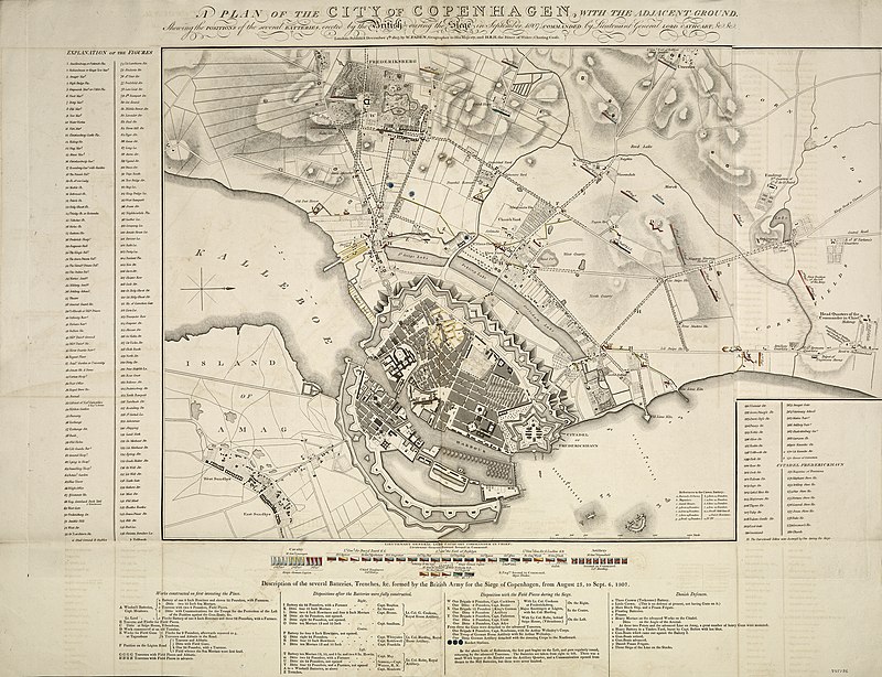
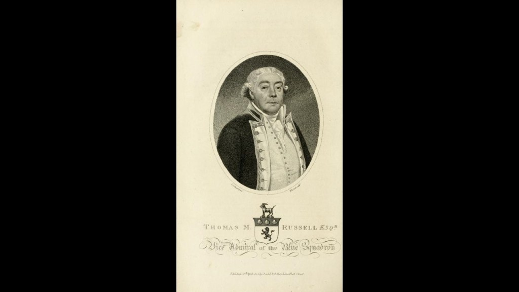
On September 11th of 1807, Heligoland surrendered to the British Navy’s Admiral Thomas McNamara Russell, it became a center of intrigue and resistance against Napoleon.
Then, Heligoland was ceded by Denmark to Great Britain as part of the terms of the 1814, Treaty of Kiel between the United Kingdom and Sweden on the anti-French-side, and Norway and Denmark on the French-side.
The reason given for the Treaty of Kiel was to end the hostilities between the parties in the on-going Napoleonic Wars, which didn’t officially end until November of the following year, but the Treaty also officially ended the ruling Oldenburg Monarchy of Denmark-Norway when Norway was transferred to the King of Sweden.
Interesting to note the word “Hyperboreus” in this map relating to the Treaty of Kiel.
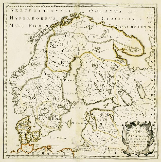
The memory of Hyperborea has come down to us as a lost ancient land considered to have been in the general vicinity of Greenland.
It was a fabulous world of eternal spring located in the far north, beyond the home of the north wind. Its people were giants, with blessed and long lives untouched by war, hard work, old age and disease.
It is called a myth, but was it mythical or did it actually exist?
We are told that the main reason the British retained the small Heligoland Archipelago was to inhibit any future French naval aggression against the Scandanavian or German states, though nothing was really done to fortify it during this time.
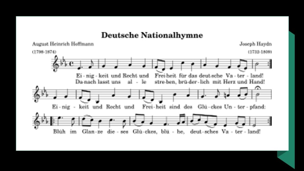
What it did become in 1826 was a seaside spa and popular tourist destination for Europe’s upper class, and attracted artists and writers like August Heinrich Hoffman, a German poet best-known for writing “Das Lied der Deutschen” in 1841, the third verse of which became the national anthem of Germany in 1922.
It is interesting to note that August Heinrich Hoffman was also a member of the Young Germany movement, a group of German writers which existed from 1830 to 1850, a youth revolutionary progressive ideology that included socialism which was sweeping Italy, Poland, France, Ireland, and the United States during this time as well.
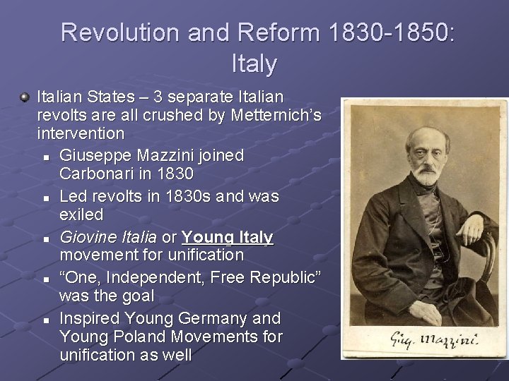
Giuseppe Mazzini was the Italian politician, journalist, and activist, who founded the political movement for Italian youth (under age 40) in 1831, the forerunner of these other political movements for youth.
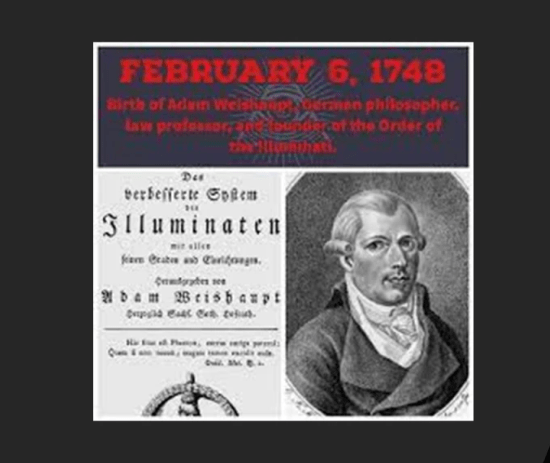
Mazzini also became the leader of the Bavarian Order of the Illuminati in 1834.
The Order’s founder, Adam Weishaupt, died in 1830 in Saxe-Coburg and Gotha, under the protection of Duke Ernest II, the brother of Prince Albert and cousin of Queen Victoria, who was also a cousin of Prince Albert.
The House of Saxe-Coburg-Saalfeld became the House of Saxe-Coburg and Gotha in 1826, which became known to us as the House of Windsor in July 17th of 1917.
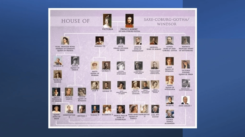
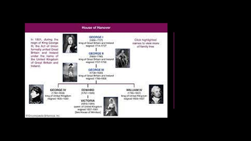
The name of the ruling Royal House of Great Britain changed from Saxe-Coburg and Gotha to Windsor exactly 200 years after the premier of Handel’s “Water Music” took place for King George I on a barge on the Thames on July 17th of 1717.
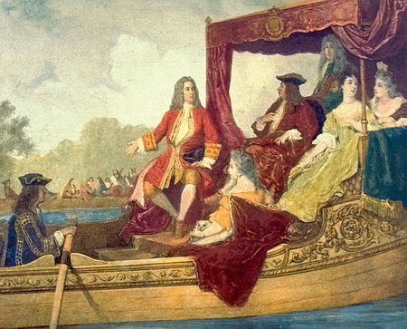
King George I became the first British Monarch of the German House of Hanover on August 1st of 1714, the German composer Handel had become a British citizen in 1727.
Queen Victoria was the last British monarch of the House of Hanover.
I do find the find the performance of “Water Music” for King George I on July 17th of 1717 and the changing of the name of the ruling house of Great Britain to Windsor from Saxe-Coburg and Gotha exactly 200-years later as a significant finding because there is no doubt in my mind that we are living on an occulted timeline with numerology being part of how it was occulted.
Numerology is the study of mystical relationships between numbers, letters and patterns, and can be use with both for good and evil intentions.
Back to Heligoland/Helgoland.
Heligoland became a refuge for the revolutions of 1830 and 1848 that were responsible for taking down the old ruling houses of Europe.
The Revolutions of 1830 and 1848 had the aim of removing the old monarchical structures and creating independent nation-states, and was the most widespread revolutionary wave in Europe’s history, with 50 countries being affected.
The goal was to remove the original ruling families, and ultimately replace them with a new form of government, which was ultimately controllable.

Great Britain ceded these two small islands in the southeastern part of the North Sea to the German Empire in the signing on June 1st of 1890 of the Heligoland-Zanzibar Treaty, also known as the Anglo-German Agreement of 1890.
The accord between the two countries, in addition to the Heligoland Archipelago, gave Germany control of the Caprivi Strip, a ribbon of land in the southeastern corner of Namibia, surrounded by Botswana to the South; and Angola and Zambia to the North…
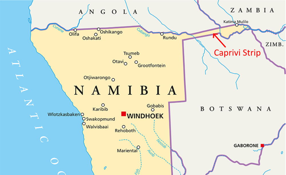
…and gave access to the Zambezi River to German south-west Africa, and giving Germany control of the heartland of German East Africa.
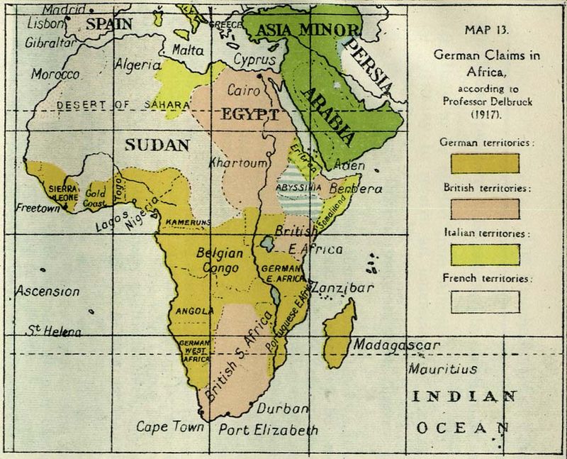
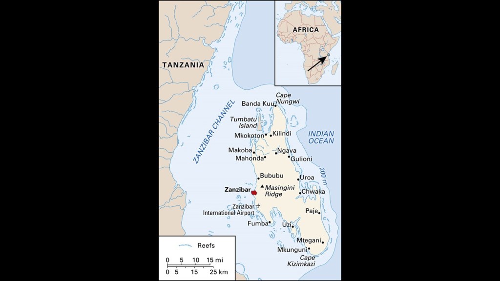
In return for Heligoland in the North Sea and the Caprivi Strip in Africa, Germany recognized British Authority in Zanzibar, an island archipelago in the Indian Ocean off the coast of Tanzania in southern East Africa, which was a key link in British control of East Africa.
The Germans turned the islands into a major naval base, and the civilian population was evacuated during World War I.
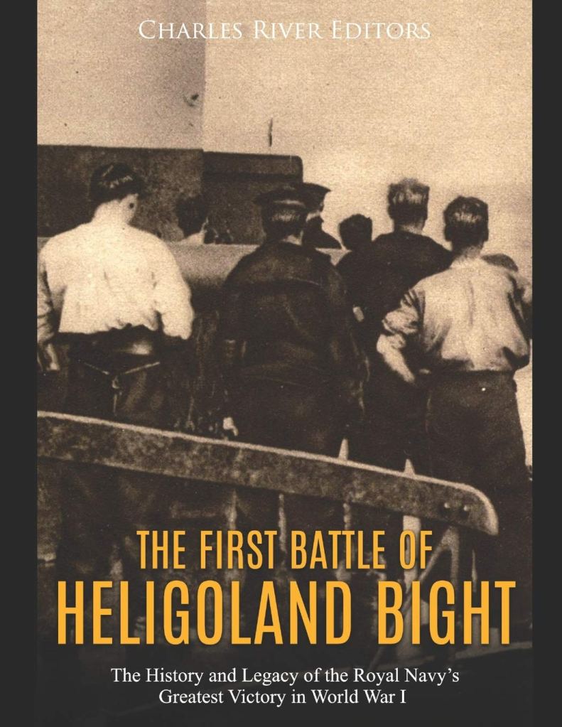
The first naval battle of World War I, the Battle of Heligoland Bight, was fought on August 28th of 1914 between British ships and German ships.
By the end of the day, the Germans had lost three light cruisers and a torpedo boat, with three more light cruisers and torpedo boats each damaged, and 712 men killed in battle; and the British only had 35 killed, and four ships damaged – one light cruiser and three destroyers.
The battle was regarded as a great victory in Britain.
A “bight” is defined as a bay that is broad, open and shallow, or as a concave bend or curvature in a coastline, river or other geographical feature like a cliff.
Like maybe it was once land above-water once-upon-a-time?
More on this possibility shortly.
In between World Wars I and II, physicist Werner Heisenberg first came up with the equation underlying his picture of quantum mechanics while on Heligoland in the 1920s.

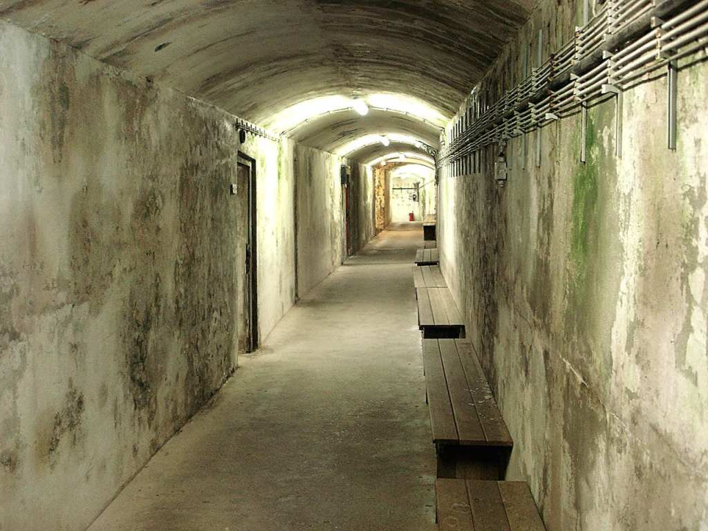
The Germans were also said to have fortified Heligoland, remember also known as Helgoland…
…as a sea fortress, with fortifications above-ground…
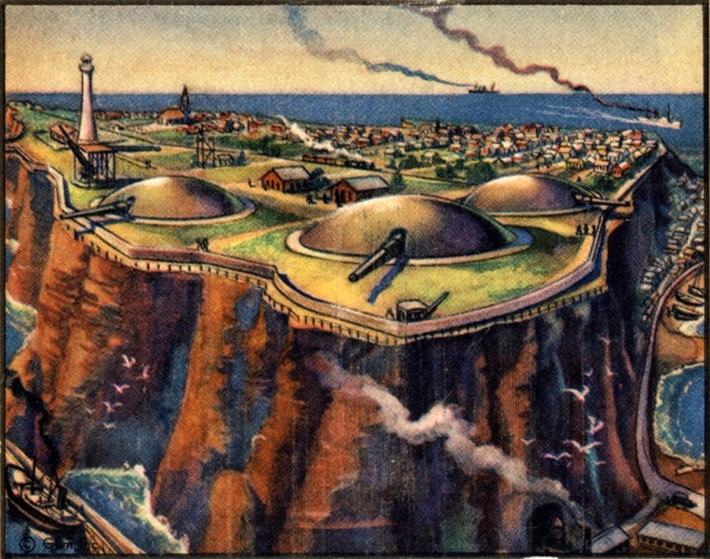
…and extensive bunker tunnels below ground, as there are 6-miles, or 10-kilometers, of tunnels, that go down five-stories, and are parallel to, and above, each other.
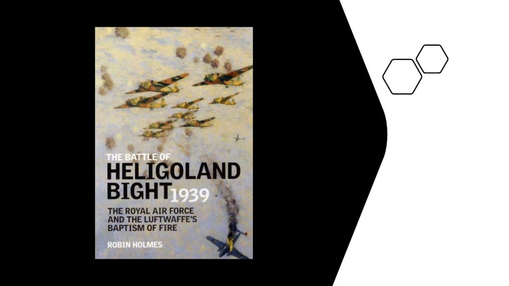
The second Battle of Heligoland Bight took place on December 18th of 1939, and was the first named air battle of World War II, with the Royal Air Force bombing German Navy ships, but this time the victory at the end of the day was called for the Germans, and the biggest loss for the RAF Bomber Command up to that point in World War II, with regards to which Great Britain had declared war on Germany on September 3rd of 1939, right after Germany had invaded Poland, on September 1st.
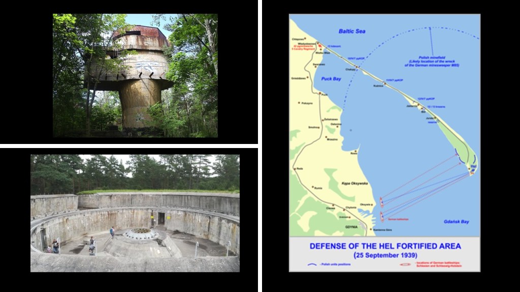
It is very interesting to note that the very first battle of the German invasion of Poland was the Battle of Hel, which took place from September 1st to October 2nd of 1939 between the invading German forces and the defending Polish forces on Poland’s Hel Peninsula, taking place primarily around the Hel Fortified Area, said to be a system of Polish fortifications constructed between World War I and World War II in the 1930s near Poland’s border with Germany.
More on the Hel Peninsula in a moment.
Between 1945 and 1952, Heligoland/Helgoland was used as a bombing range.
On April 18th of 1947, the Royal Navy detonated 6,700 metric tonnes, or almost 7,400 tons, of explosives in an attempt to destroy the island completely and remove it as a fleet base for the Germans, resulting in one of the biggest, non-nuclear explosions in history, shaking the main island down to its base and creating what is called the “Mittelland.”
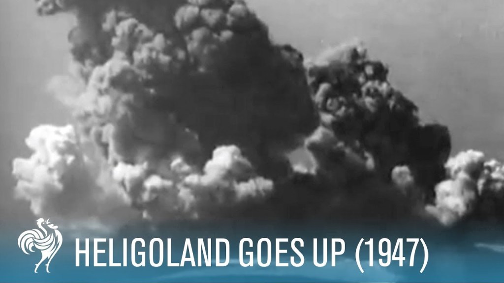
On March 1st of 1952, Heligoland was returned to German control, and its former inhabitants were allowed to return after the German authorities cleared a significant quantity of undetonated ammunition and rebuilt the houses.
Today, it is once-again a holiday resort like it was back in the 19th-century, and enjoys a tax-exempt status.
What in the holy hell is really going on here??!!
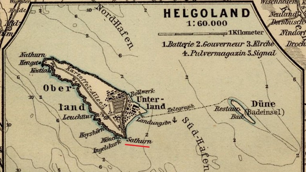
One more thing before I move on. The viewer who pointed me in the direction of this place brought to my attention that the name of the southern point of Helgoland, which was “Sathurn” as seen in the 1900 map.
With regards to the subject of Heligoland/Helgoland, another viewer commented that Heligoland was indeed a sacred and holy place, and is the only place in the world that a certain type of blood red silex, or flint, can be found.
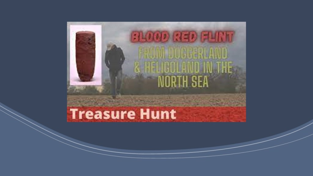
Also that Heligoland is a remnant of Doggerland, believed by some to be part of Atlantis, and that it once connected Great Britain to Continental Europe.
Perhaps now the remaining remnants of which are beneath the North Sea and part of the Heligoland Bight?
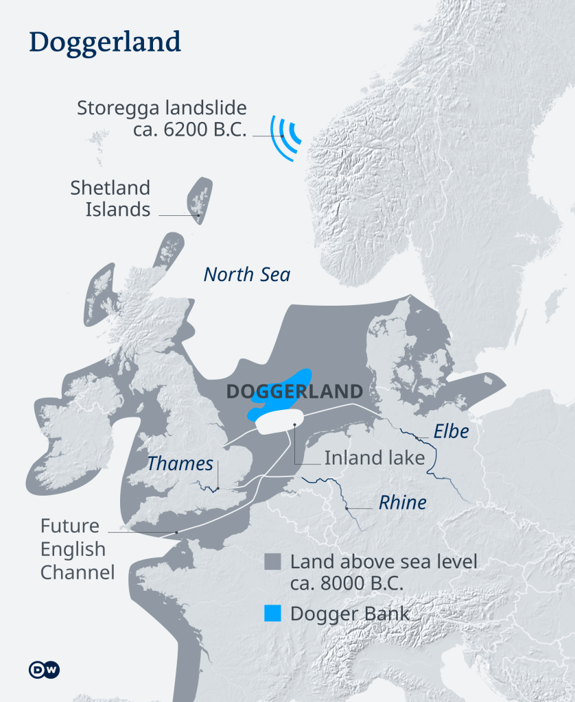
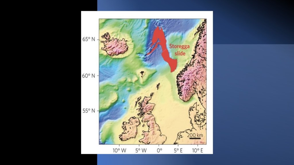
We are told that Doggerland was said to have been submerged beneath the southern North Sea 8,000 years ago after the Storegga landslide, which took place off the coast of Norway between Bergen and Trondheim, and generated a tsunami strong- enough, and high-enough, to take out what was called the “True Heart of Europe.”
But could this event have taken place much more recently than thousands of years ago by a deliberately-caused cataclysm?
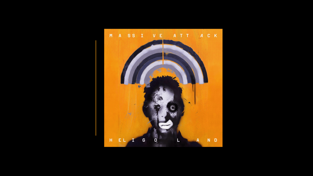
Another viewer left a comment with lyrics from a song by Massive Attack in their 2010 Album, “Heligoland.”
These lyrics were from the song “Saturday Come Slow”:
In the limestone caves
In the south west lands
What towns in the kingdom
Beneath us understand?
Is Humanity under Massive Attack by dark forces antithetical to organic life and goodness intent on taking over the Earth and everything on it?
I definitely think so.
Next I am going to take a look at Poland’s Hel Peninsula.
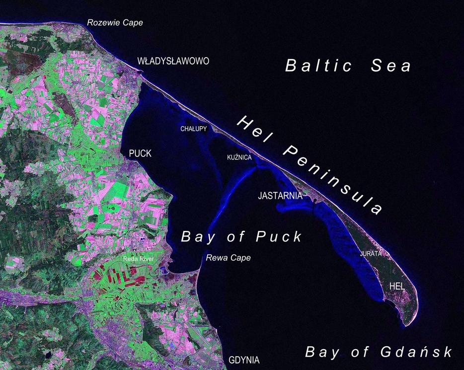
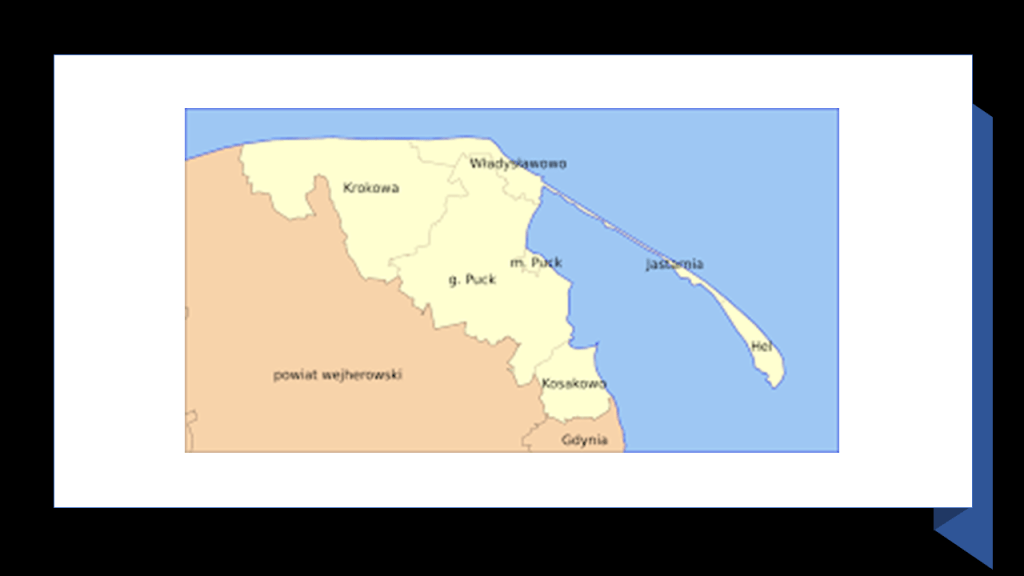
The Hel Peninsula is a 22-mile, or 35-kilometer, -long sandbar peninsula in the northern part of Poland separating the Bay of Puck from the Baltic Sea.

The Bay of Puck is described as a shallow western branch of the Bay of Gdansk with an average depth of 7-feet, or 2-meters, to 20-feet, or 6-meters.
It is only available for the use of small fishing boats and yachts.
Perhaps yet another place where land is submerged?
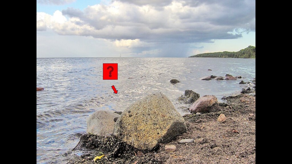
There is an abandoned and derelict “torpedo test facility” in the Bay of Puck that the Germans used for their torpedo tests.
Known locally as “Torpedownia…”
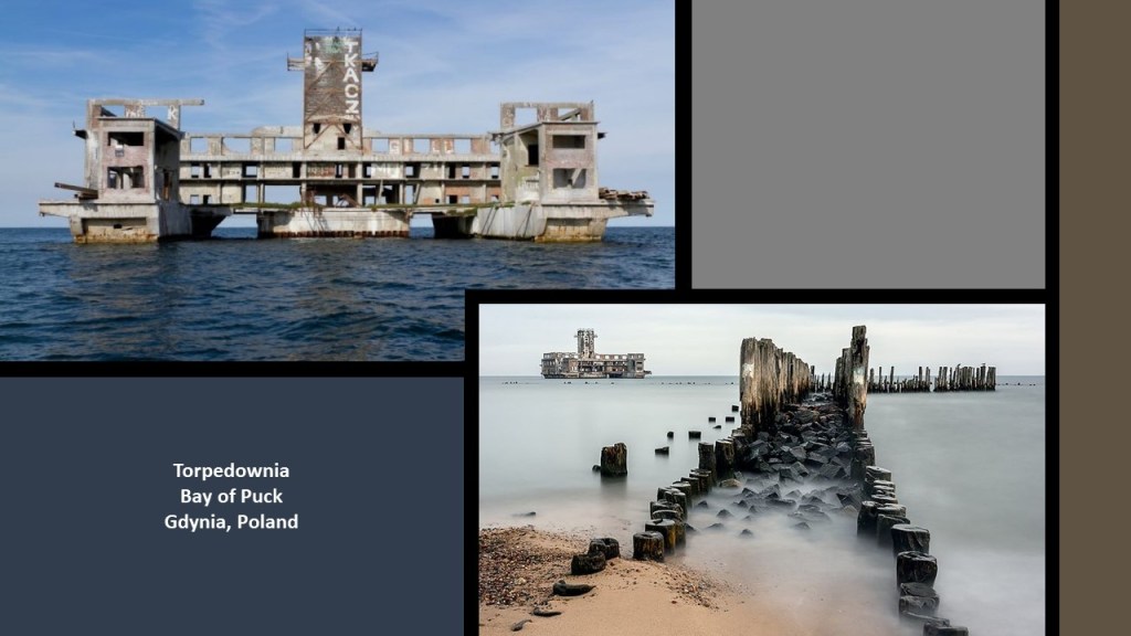
…the Germans fired their “test torpedoes” at Jastarnia and Jurata on the Polish Hel Peninsula between 1942 and 1945.
The Polish Hel Peninsula is a popular tourist destination in the present-day, with a road and railroad, and one-busline, until recently designated by the number “666,” running along the peninsula from the mainland to to the town of Hel at the furthest point.
Since June 24th of 2023, a little over a week ago from the time I am doing the research for this post, the number of the busline has been changed to “669” after public outcry.

So here we have a great example of numerology and negative and positive meanings.
The number sequence of “666” is most strongly associated with its negative occult meaning used to signify the devil, the antichrist, and evil in general.
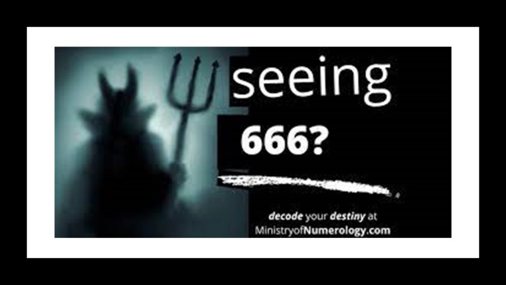
What is less well known is that the number sequence “666” has positive meanings when you see it pop-up somewhere in your life, like the one listed here among others: Reflect – It’s time to wake-up to your higher spiritual truth.

But since we are talking about places actually named “Hel,” one more thing before I move on from here.
The Hel Peninsula and Bay of Puck are part of Poland’s Puck County.
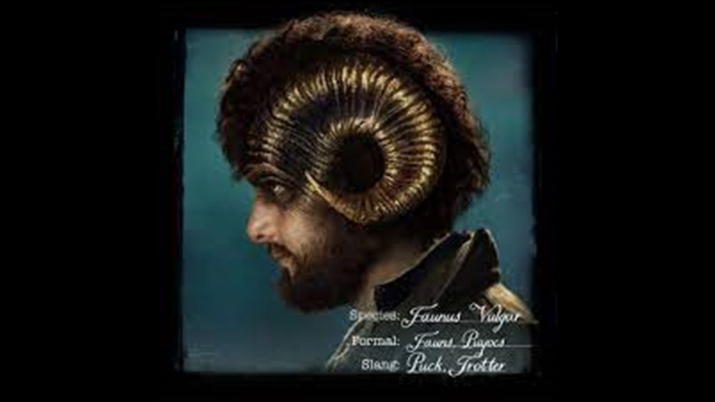
What intrigues about the name of this place is that a “Puck” was a creature in European folklore that presented as a domestic and nature sprite, demon, or fairy.
Pucks started showing up in Shakespeare and other literature of the Early Modern Era in Europe starting in the 1500s in our historical narrative.
They were spirits that were both helpful and mischievous at the same time. For example, they would assist with chores in a household, and if something displeased them, they would undo the work they had done.
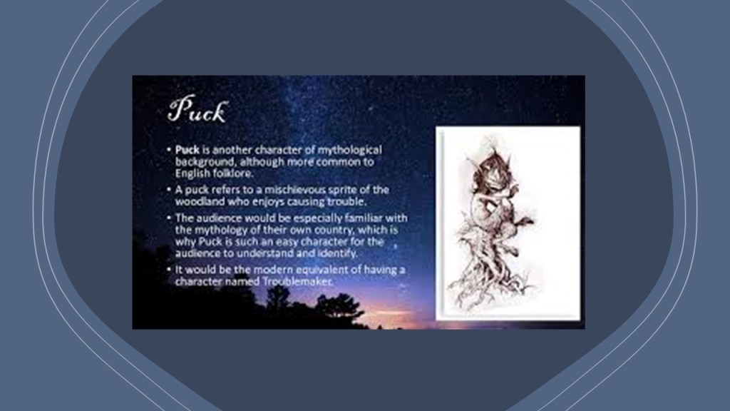
Interestingly, they still show up as characters in literature or other media to this day, like in the 2109 Amazon series “Carnival Row.”
I don’t know. Nothing would surprise me, so this just might be another connection to the subject matter of this post.
These are some other places named Hel or Hell on Earth.
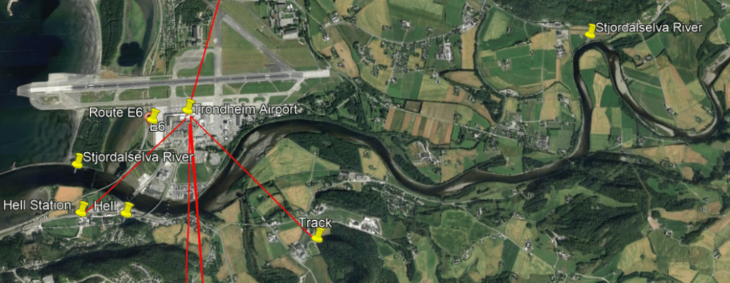
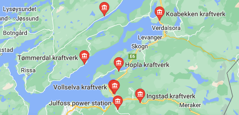
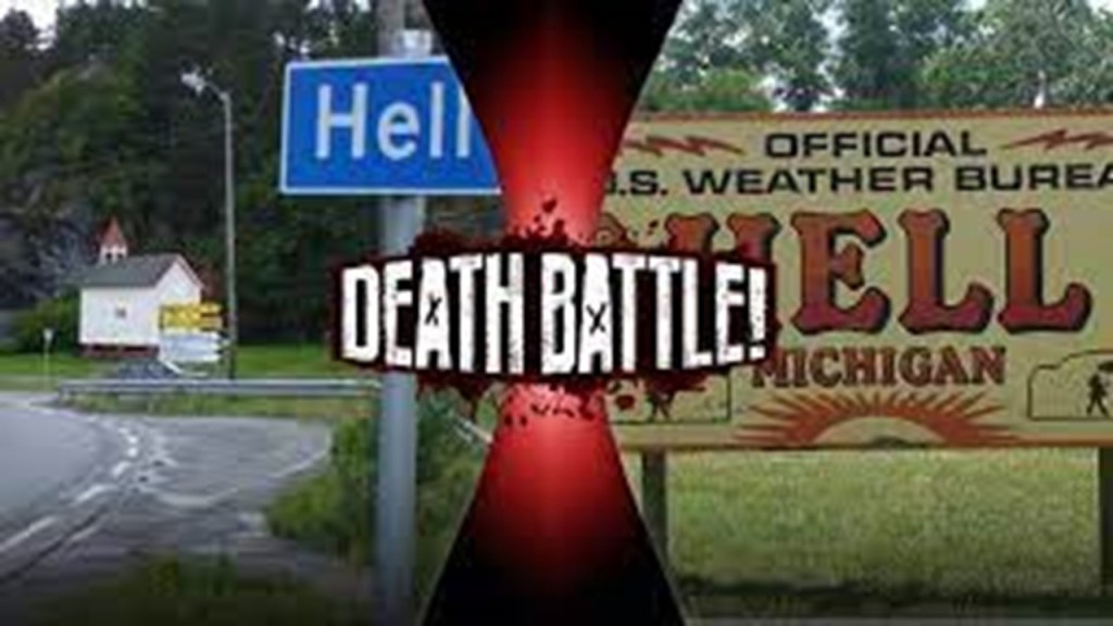
There is a Hell in the Nord-Trondelag county of Norway.
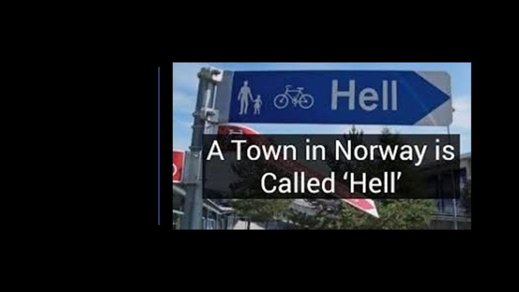
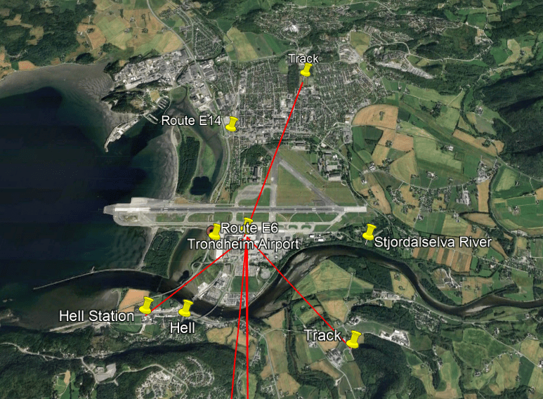
Hell is located the short-distance of 16-miles, or 25-kilometers, due east of Trondheim, Norway’s third-largest city.
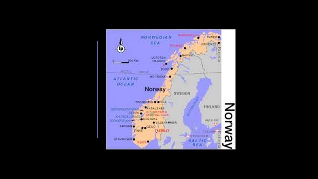
Hell is situated on a railway junction where the longest railroad line in Norway, the Nordland Line, running between Trondheim and Bodo for a distance of 453-miles, or 729-kilometers, branches off from the Merakerbanen between Trondheim and Strolien, Sweden.
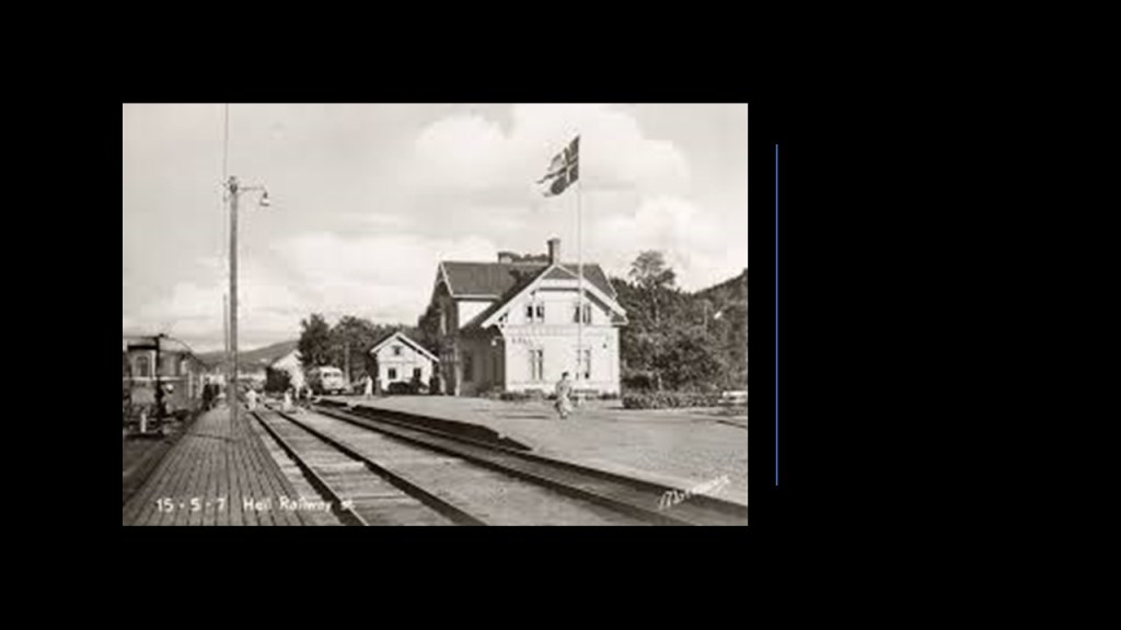
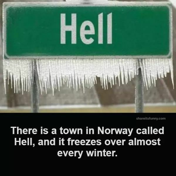
Otherwise, at a superficial glance, there is not much in Hell, Norway, the town where Hell freezes over, with the town’s name being the main tourist attraction.
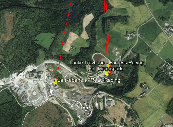
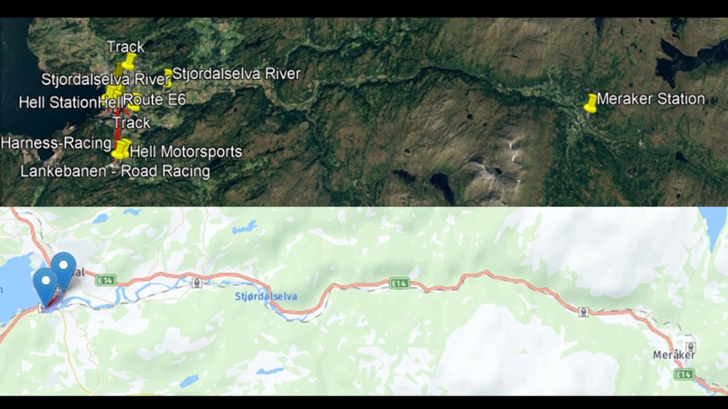
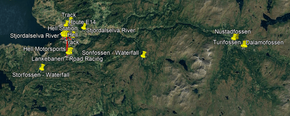
But on closer examination, I found a number of interesting things, starting with the.road-racing circuit in Hell, the Lankebanen, which is used for a variety of motorsports.
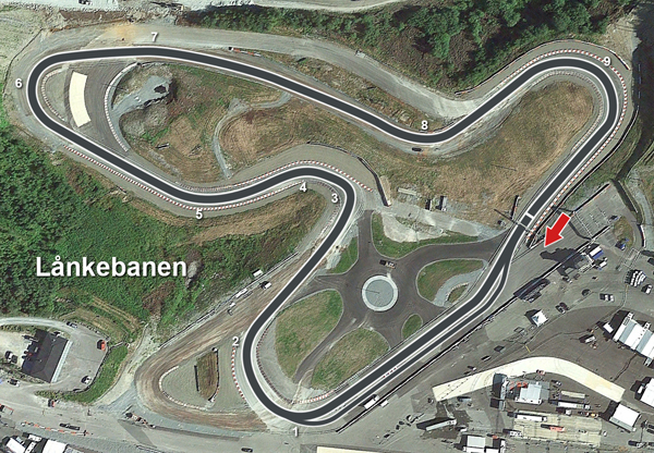
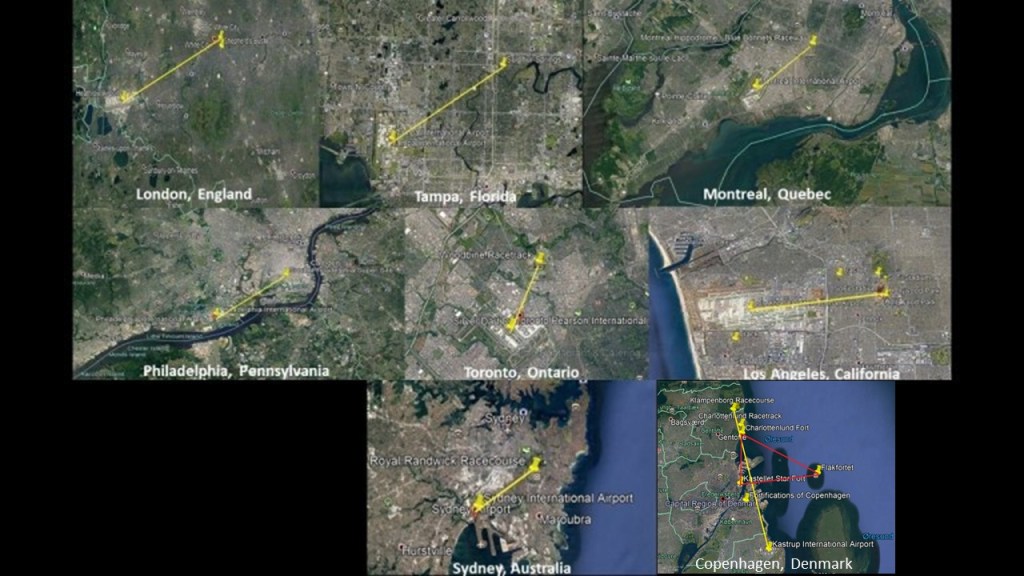
The finding of the road-racing track, also called a “road-racing circuit,” led me to take a closer look at what else is in the vicinity of Hell, Norway, because I have consistently found race-tracks in close proximity to, and in geometric relationship with, airports all over the world, and one of the components I have looked at in compiling evidence for all of the infrastructure of the Earth functioning as part of a circuit board designed by the original advanced world wide civilization as a free-energy-generating grid system.
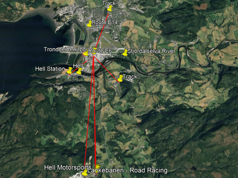
Trondheim Airport is located 1.7-miles, or 1.72-kilometers from the Hell Railroad Station, with two elliptical tracks nearby a short-distance in linear alignment to the airport, one to the northeast, and one to the southeast.
The Airport is located 3.4-miles, or 5.4-kilometers, from the Lankebanen road-racing circuit, which is slightly to the southwest of the airport.
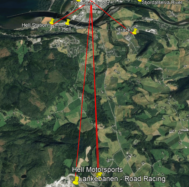
Just to the east of the Lankebanen are two more racing circuits – one is Hell Motorsports and the other is the Lanke Travbane for horse-racing.
To put this into context, I have found the same things in cities all over the Earth, finding the exact same configuration across countries and continents.
The mouth of the snaky, S-shaped Stjordalselva River is located between Hell and Stjordalshausen.
Along with finding the same s-shaped river bends all over the world…
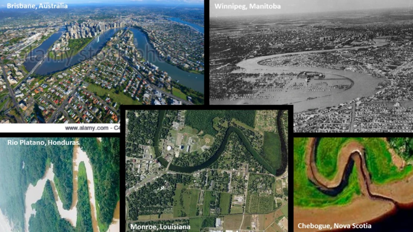
…I am also finding that railroads and roads typically run along these s-shaped river-bends, like the Meraker Line Railway and European Route E14 in this part of the world…
…a subject which I explored in-depth in North America not long ago, finding the co-location of railroads, rivers, canals, waterfalls, historic highways, and powerplants all across the continent in all directions.
Waterfalls on the Stjordalselva River include the Nustadfossen; Turifossen; and Dalamofossen situated around the train destination of Meraker.
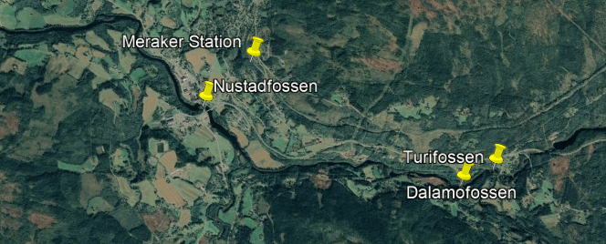
Waterfalls on tributaries of the Stjordalselva River include the Storfossen and the Sonfossen.
Interesting to note there are powerplants all throughout this region…
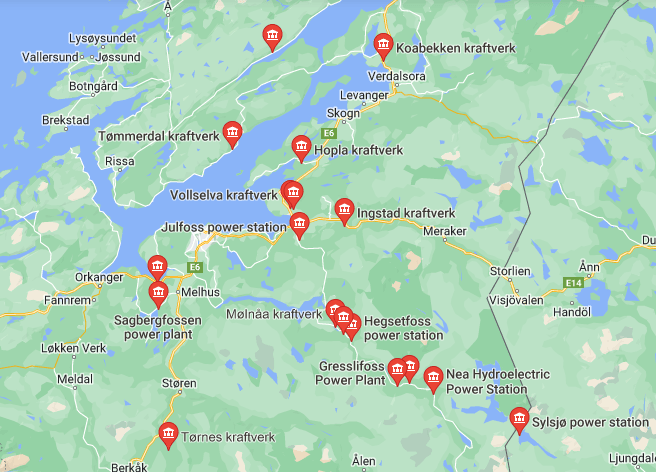
…including the Julfoss Power Station in Hell itself.
I first encountered Trondheim doing research on a major long-distance alignment of cities and places going eastwards across Europe from Cape Farewell at the southern tip of Greenland which can be found in ” Bonanza! Correlation of Mines & Minerals to the Earth’s Grid System – Pt 2 Cape Farewell to the Maldives.”
A couple of points I wish to bring forward from this research are as follows.
The first thing is that Hell was directly on this alignment as it is a short-distance due east of Trondheim, though I was not aware of that information until I did the research for this post.
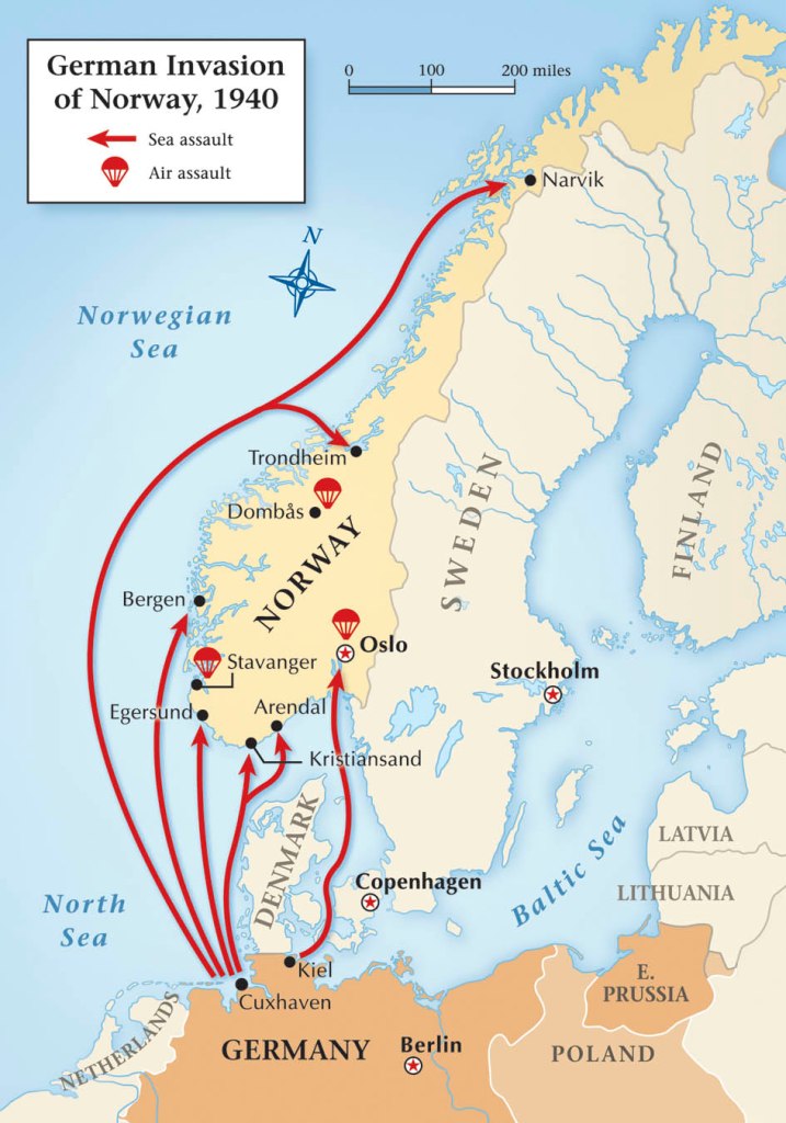
Another thing is that during World War II, Trondheim was occupied by Nazi Germany from the day that the Germans invaded neutral Norway on April 9th of 1940 on the pretext that Norway needed protection from British and French interference, and like Denmark and the Channel Islands, the Nazis occupied Norway for 5-years, until the end of the war in Europe, in May of 1945.
The last thing I want to mention is that Trondheim was originally known as Nidaros.
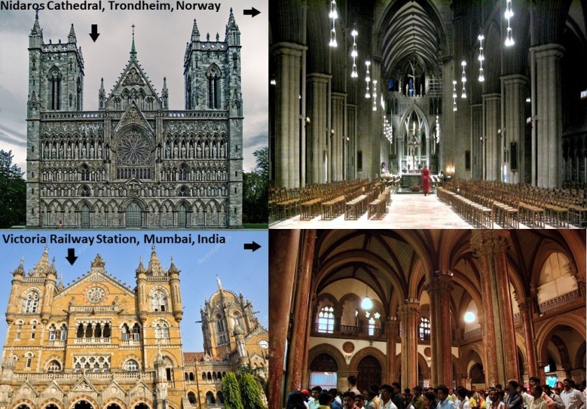
Trondheim is the seat of the Lutheran Diocese of Nidaros, and the Nidaros Cathedral is the national sanctuary of Norway and is the traditional location of the consecration of new kings of Norway, and is considered the northernmost medieval cathedral in the world.
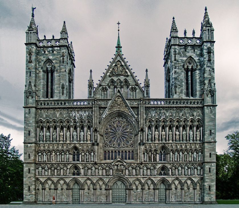
It was said to have been built in the years between 1070 and 1300.
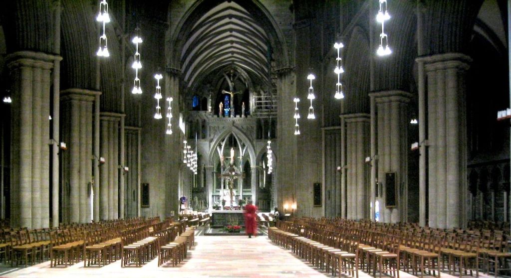
For similarity of appearance, here is a comparison of the Nidaros Cathedral in Trondheim in the top pictures, and the Victoria Terminus Railway Station in Mumbai, which used to be Bombay, India, pictured in the bottom photos, and said to have been built by the British in India between 1878 and 1888.
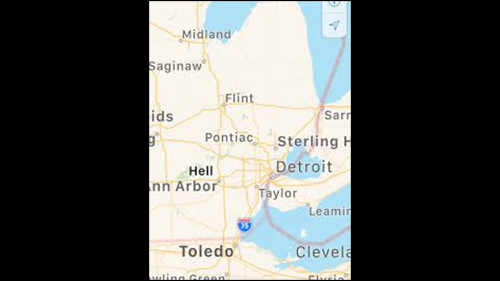
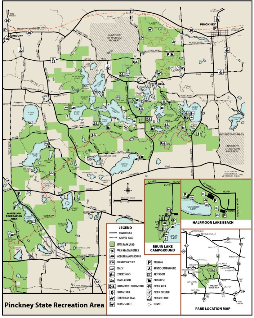
When I started doing the research for Hell in Norway, I came across the Hell in Michigan, another place where Hell freezes over.
The Hell in Michigan is an unincorporated community on Lake Patterson Road, located 15-miles, or 24-kilometers, northwest of Ann Arbor, and 3-miles, or 4.8-kilometers, southwest of Pinckney.
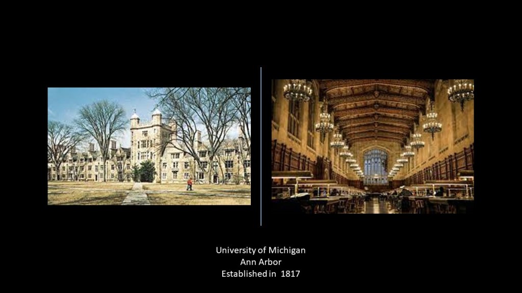
Ann Arbor is the location of the University of Michigan, which was first established in 1817 as the “Catholepistemiad,” said to translate roughly to the “School of Universal Knowledge,” under an Act of the Michigan Territory.
The name changed to the University of Michigan by another Act of the Michigan Territory in 1821.
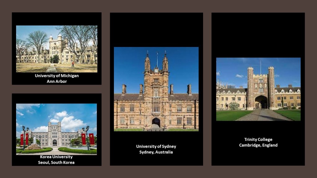
For comparison of similarity of appearance of college architecture around the world, along with the University of Michigan on the top left, here is Korea University in Seoul on the bottom left, which was established in 1905; the University of Sydney in Australia, established in 1850; and the Trinity College of Cambridge University in England, said to have been founded in 1546 by King Henry VIII.
These are a few of many examples of the same style of architecture found all over the world for colleges and universities.
What makes more sense.
There was a universal building template used for building colleges and universities all over the world over the course of centuries.
Or…
This architecture was built by one and the same worldwide civilization.
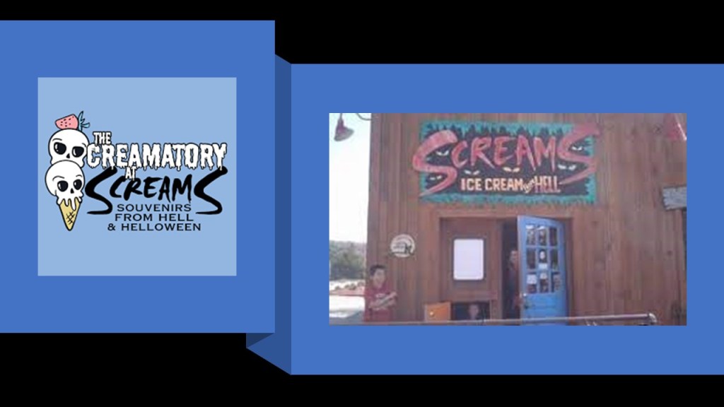
So, just a short-distance from the world-renowned research university in Ann Arbor, the little community of Hell definitely has its own vibe going on.
You can stop at “Screams Ice Cream from Hell” for a treat if you go to the visit there.
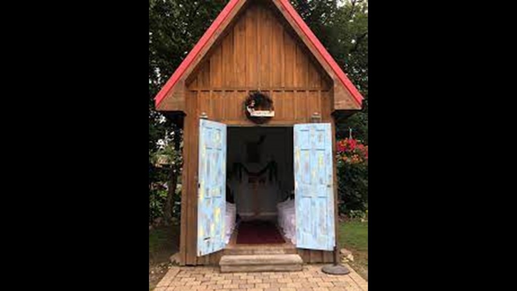
You can even get married in Hell, if you dare, at Hell’s “Chapel of Love.”
So, what else is here besides hell-themed tourist attractions?
Well, there’s the Pinckney State Recreation Area, an 11,000-acre, or 4,452-hectare park consisting of a chain of lakes, rolling hills, and numerous outdoor recreational opportunities.
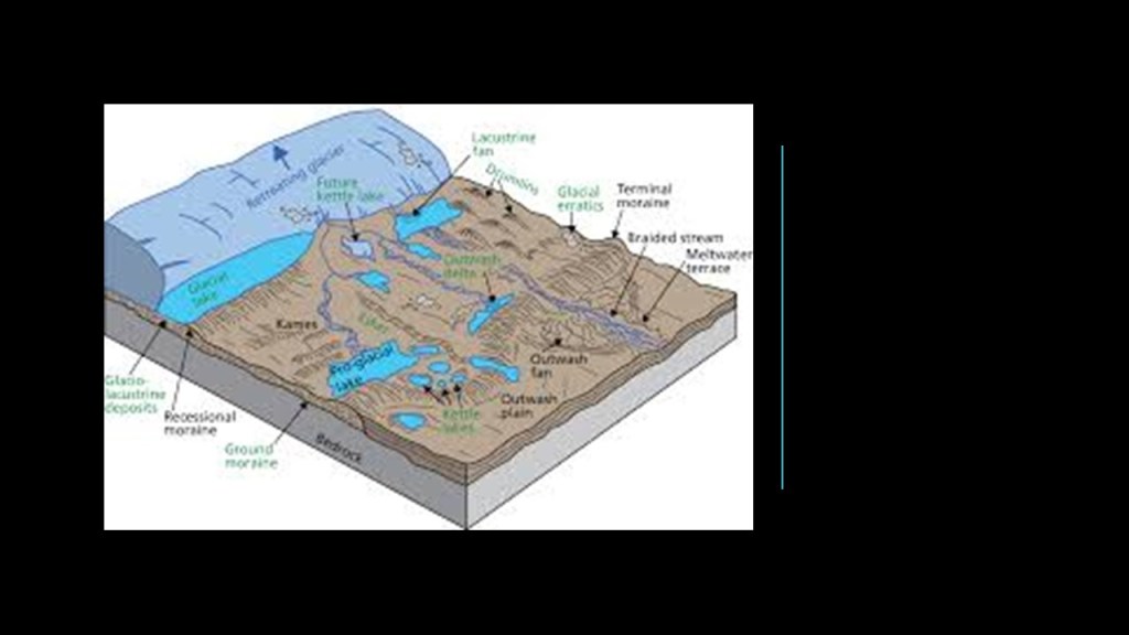
The landscape is described as a “terminal moraine area formed during the last glaciation period.”
First of all, moraine is defined as “a mass of rocks and sediments carried down and deposited by a glacier,” and terminal moraine is defined as “a moraine deposited at the point of furthest advance of a glacier or ice sheet.”
But I don’t buy what they are selling us with the glaciation and ice age explanation for places like this.
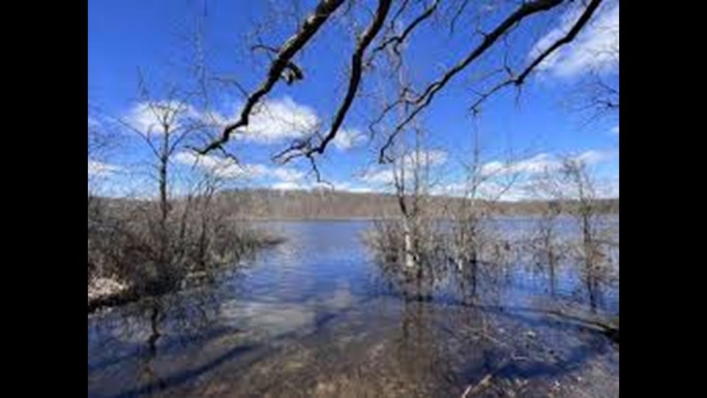
It’s hard to find a good picture looking on-line, but this view of a place on one of the hiking trails there looks like it might have something rock-solid just underneath the surface of the water.
This is where field research is so important, because when you go to a place in person and know what to look for, it can yield a treasure trove of information just waiting to be found.
Sir Charles Lyell was a Scottish geologist who was said to have demonstrated the power of known natural causes in explaining Earth’s history.

In his books, “The Principles of Geology,” published in three volumes between 1830 and 1833, he presented the idea that the Earth was shaped by the same natural processes that are still operating today at similar intensities, and a s such a proponent of “Uniformitarianism,” a gradualistic view of natural laws and processes occuring at the same rate now as they have always done.

This theory was in contrast to “catastrophism,” or theory that Earth has been shaped by sudden, short-lived violent events of a worldwide nature.
At any rate, as a result of Lyell’s work, the glacial theory gained acceptance between 1839 and 1846, and we are told during that time, scientists started to recognize the existence of ice ages.
The concept of “glacial erratic” has come to be the explanation for large masses of rock that have been moved by glacier ice and lodged in glacier valleys or scattered over hills.
Examples include the rectangular Madison Boulder in New Hampshire, which is considered to be one of the largest glacial erratics in the world, at 83-feet, or 25-meters, long, and 23-feet, or 7-meters, high, and upwards of 5,000 tons, with one part of it said to be buried to a depth of up to 12-feet, or 4-meters.

It is interesting to note the number of glacial erratics that end up either perfectly balanced by themselves…
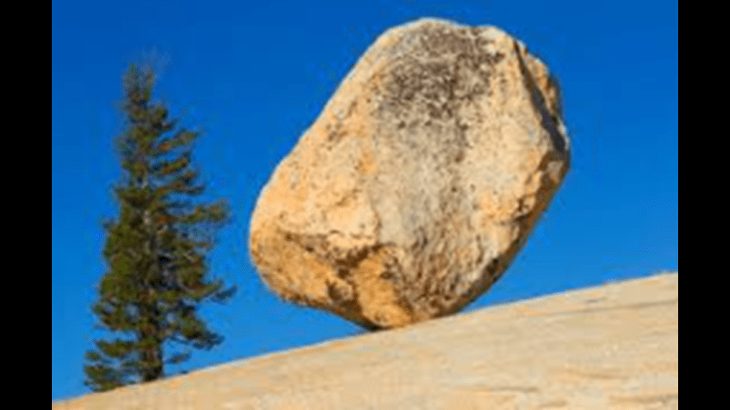
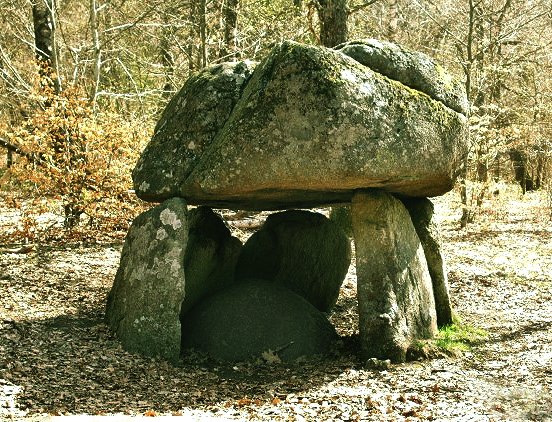
…or as a large block of stone balanced on top of smaller stones.

The same idea is called a dolmen in other parts of the world, and is considered the most common megalithic structure in Europe, believed to be a tomb or burial space.
Next, a few more places that I found that have a “Hel.”
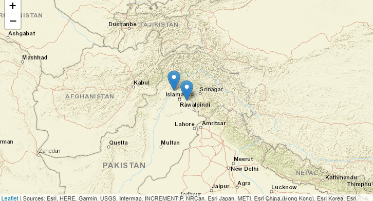
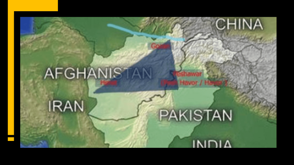
First, there are two places in Pakistan named Hel, one in the Northwest Frontier, and the other in Kashmir.
Since it is hard to find specific information about these “Hels,” I will look at the places where they are found.
First, the North West Frontier in Pakistan, known as Waziristan.
I first encountered Waziristan several years ago tracking cities and places in alignment starting at San Francisco in California.
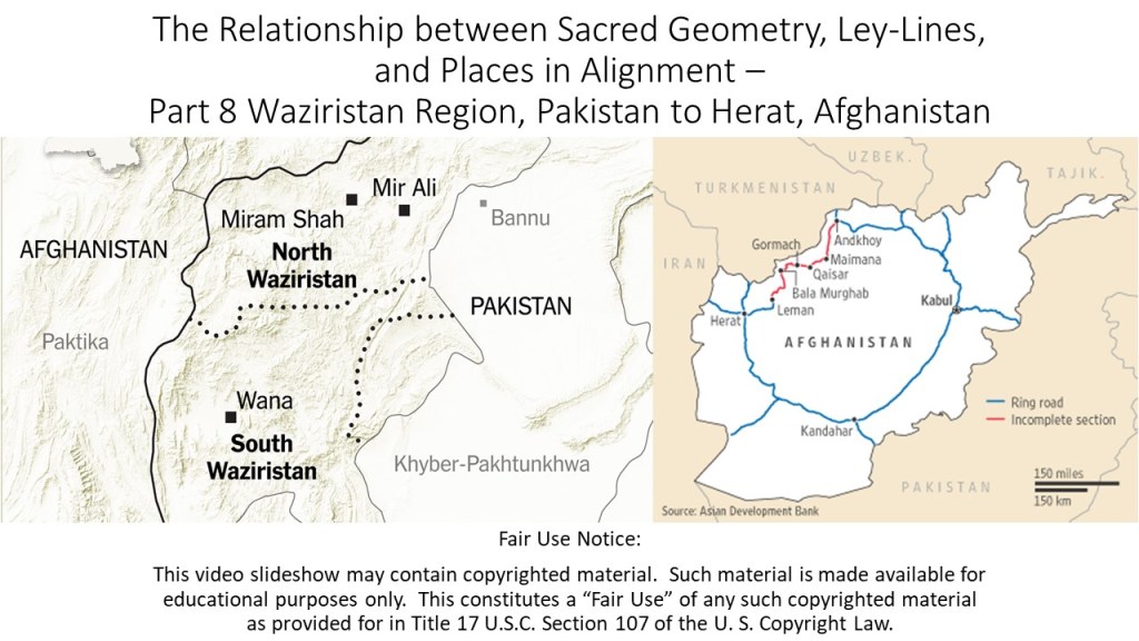
North and South Waziristan comprise a mountainous region of Pakistan on the country’s border with Afghanistan, and are districts of the Khyber-Pakhtunkwha Province, formerly known as the Northwest Frontier Province.
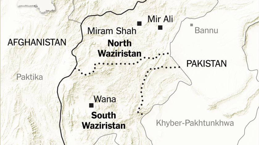
Historically, the tribal people of this region were considered very tough fighters, having defeated Alexander the Great’s efforts to conquer them, and more recently in history, British efforts to take them over were not as successful as the British would have liked in the Waziristan Campaign of 1936 to 1939 as well, earning the area the nickname of “Hell’s Door-Knocker.”
The Khyber-Pakhtunkwha Province is the location of the Khyber Pass, a mountain pass in the northwest of Pakistan, and an integral part of the ancient Silk Road. A translation is “On the Khyber side of the Land of the Pashtuns.”
This is the Bab-e-Khyber, a gate that stands at the entrance to the Khyber Pass…
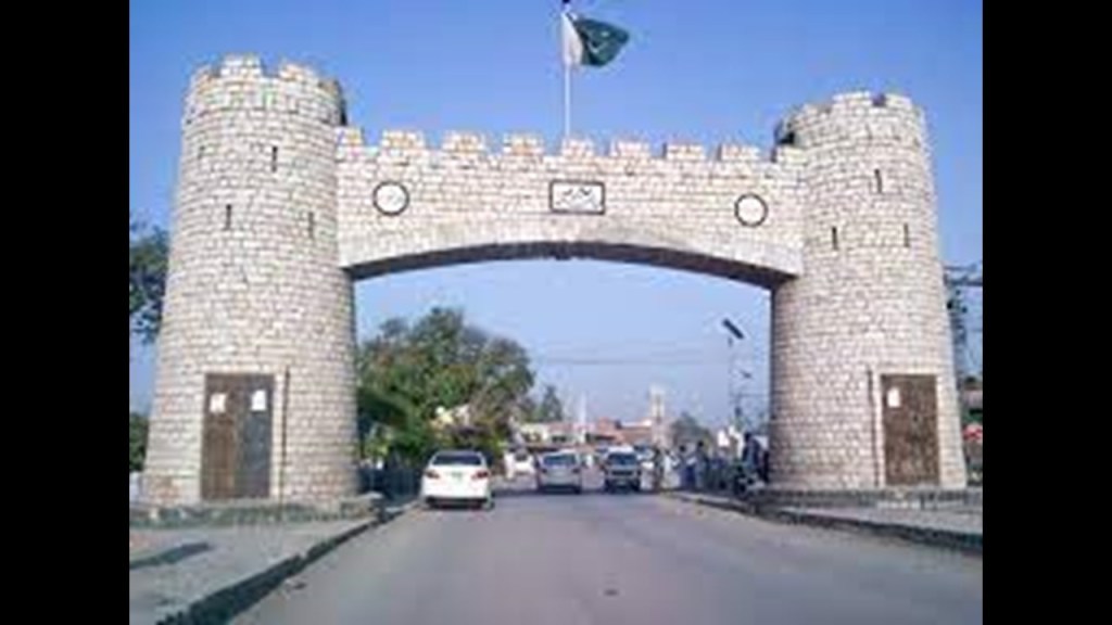
…said to have been constructed in 1965.
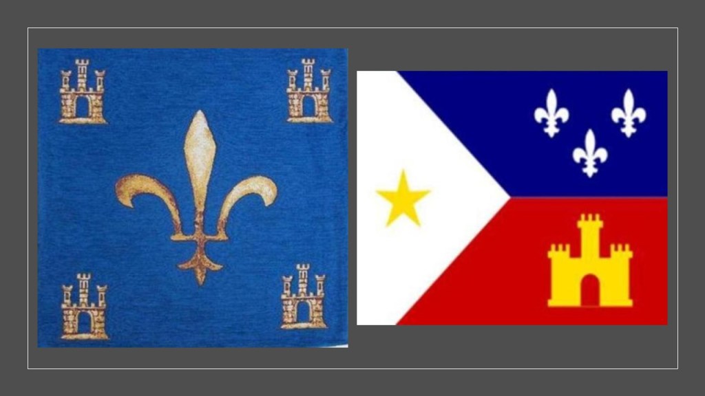
The turreted and crenellated appearance of the Bab-e-Khyber Gate brought to mind the style of architecture seen on this old Merovingian textile from France on the left, and the Cajun flag of Louisiana on the right.
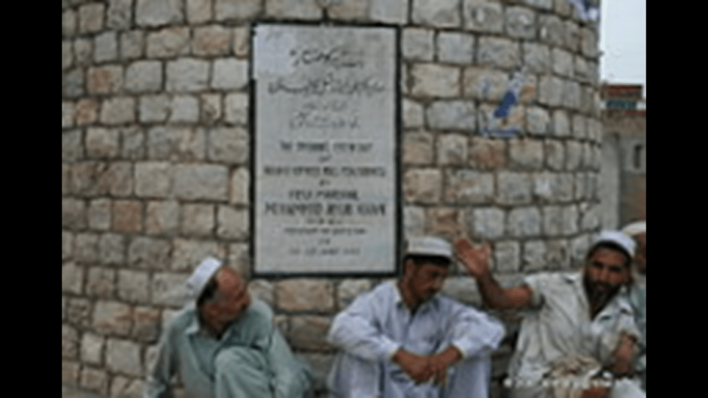
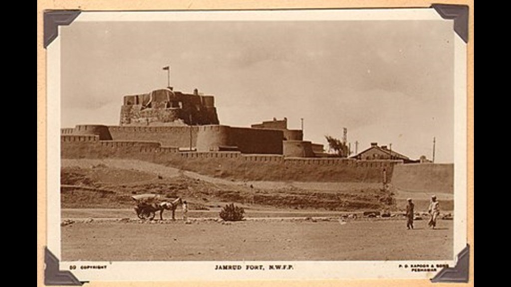
The Jamrud Fort is adjacent to the Bab-e-Khyber. We are told that the foundation of the fort was laid out by the Sikh General Hari Singh Nalwa on the 18th of December in 1836, and that the fort was completed in 54-days, after Jamrud was lost to the Afghan Durrani Empire and conquered by the Sikh Empire.
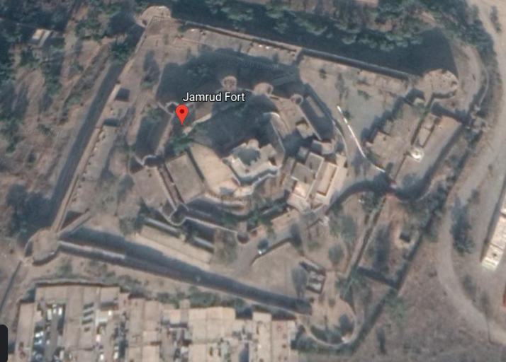
This is a screenshot of the Jamrud Fort on Google Earth.
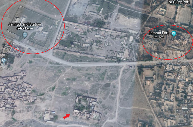
The Jamrud Electrical Grid Station is located very close to Jamrud Fort, and there is at least one other structure with the arrow pointing towards it, and possibly more, that looks like it could be connected to this grid system.
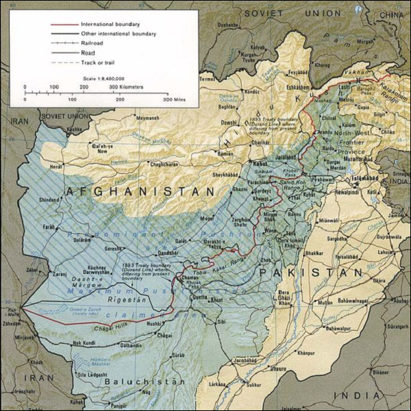
The Pashtun tribal peoples are the primary inhabitants of a region including North and South Waziristan, the Khyber-Pakhtunkwha and Balochistan Provinces of Pakistan, and the Pashtun are also found in Afghanistan, in a region regarded as Pashtunistan, split between two countries since the Durand Line border between the two countries was formed in 1893 after the second Anglo-Afghan War.
The namesake of the line, Sir Henry Mortimer Durand, was a British Diplomat and Civil Servant of the British Raj.
We are told that together with the Afghan Emir, Abdur Rahman Khan, it was established to “fix the limit of their respective spheres of influence and improve diplomatic relations and trade.
Well, that certainly sounds good…but what was really going on here?
The Durand Line cuts through the Pashtunistan and Balochistan regions, politically dividing ethnic Pashtuns and Baloch, who live on both sides of the border.
But, really, why divide a people in this fashion?
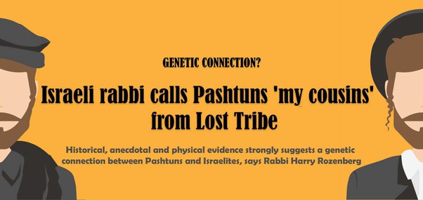
The Pashtun are a tribal nation of millions of Afghani and Pakistani Muslims who also have a strong oral tradition that they are descended from a Tribe of Israel, and they refer to themselves as Bani Israel.
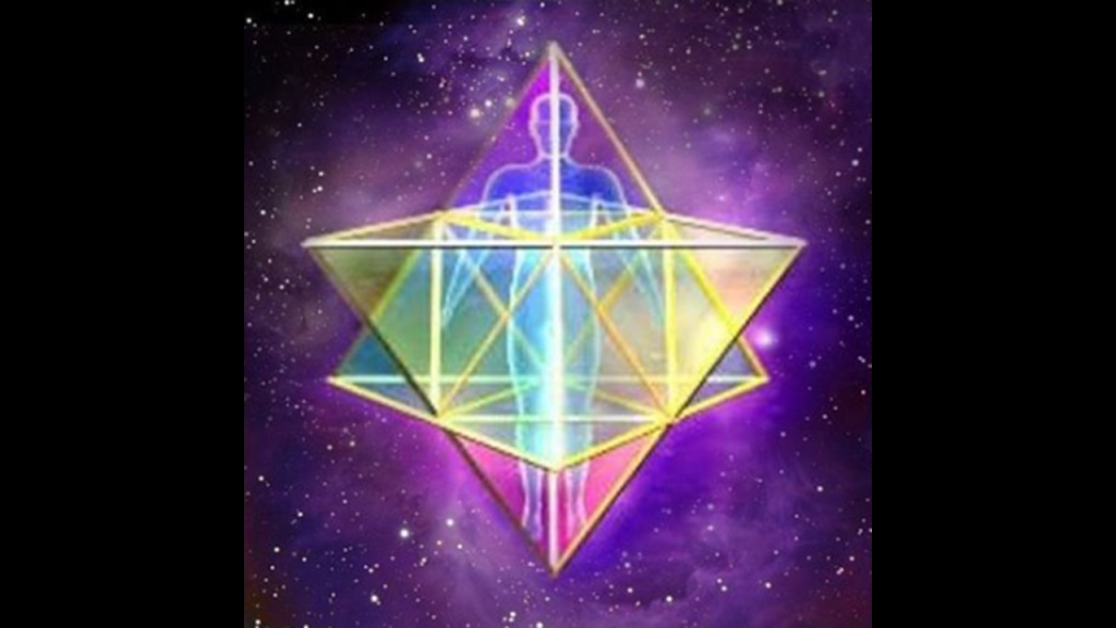
Here is an example of a Pashtun textile piece showing the sacred geometric shape of a star tetrahedron in the center, also known as the Star of David…
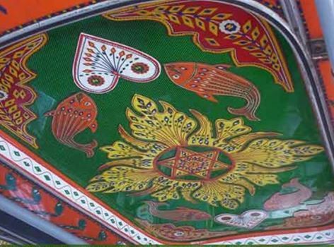
…and Pashtun lockets with what is best known as the Star of David engraved on them.
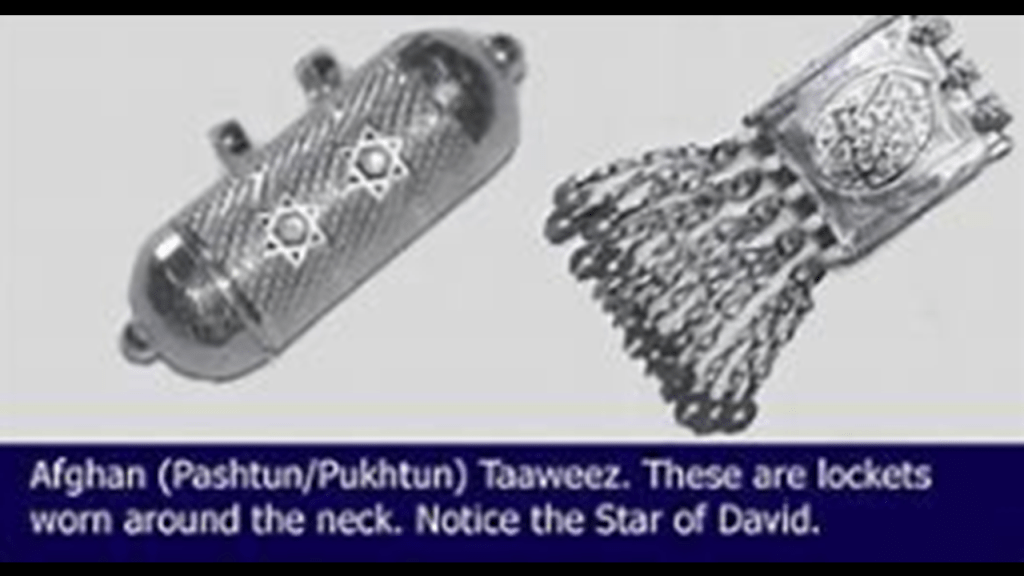
But the Star of David is a 2-D representation of the sacred geometric shape of the Human Lightbody, known as the Merkaba.
The Earth’s controllers really did not want to us to know who and what we are, and where we come from, and among other things, hijacked the template of the Children of Israel for themselves.
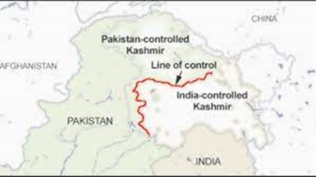
The other place in Pakistan with a place named Hel is in Azad Kashmir, also known as Azad Jammu and Kashmir, a region administered as a self-governing entity, and the western portion of the larger Kashmir region, which has been disputed between Pakistan and India since 1947.
Azad Kashmir is separated from the Indian Union Territory of Jammu and Kashmir by what is called the Line of Control (LoC).
Azad Kashmir has a Parliamentary form of government modelled after that of Great Britain, with a President as its Constitutional Head-of-State, while the Pakistani Prime Minister is its Chief Executive.
And are those three pyramids represented in the bottom third of the government seal?
Hmmm, I wonder.

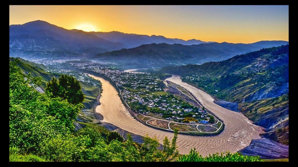
The capital city of Azad Kashmir is Muzaffarabad, which happens to be located right in-between one of those ubiquitous s-shaped river bends that I mentioned previously.
Major earthquakes occur in Azad Kashmir from time-to-time as it is in a region where the Indian tectonic plate and the Eurasian tectonic plate meet.
One in early October of 2005 near Muzaffarabad devastated the region’s infrastructure and economy, which is still recovering, and killing 100,000 people and displacing 3-million.

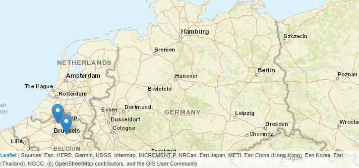
The last two locations I am going to look at where the place-name of Hel comes up are both in Belgium, one in the Brabant Province, and the other in the Antwerp Province.
As was the case in Pakistan, I am having difficulty finding specific information about these two “Hels,” so I wil focus on their respective provinces instead.
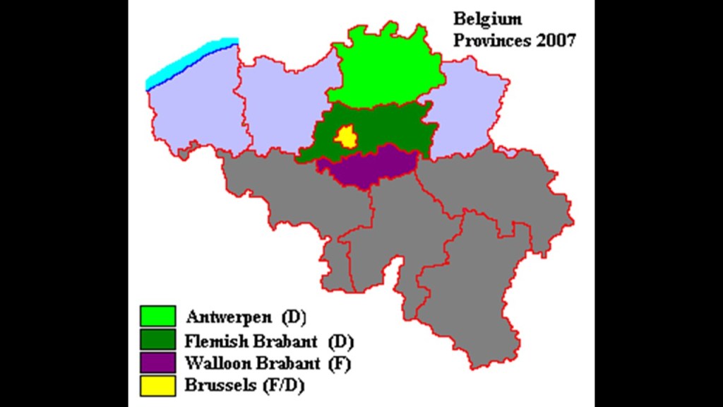
Brabant was a province of Belgium from 1830 to 1995.
In 1995, it was split into the French-speaking “Walloon Brabant” and the Dutch-speaking “Flemish Brabant.”
The United Kingdom of the Netherlands was created in 1815 as a result of the Congress of Vienna, and different sections of Brabant were shared between modern-day Belgium and The Netherlands.
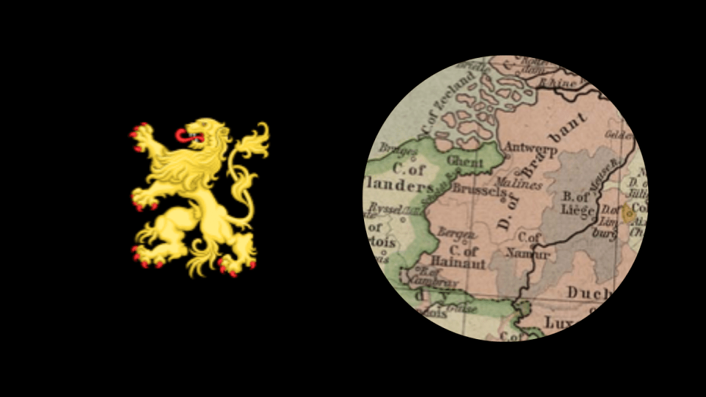
Brabant was named after the Duchy of Brabant which was part of the Holy Roman Empire.
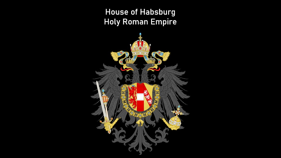
The Holy Roman Empire ceased to exist after Napoleon defeated Austrian and Imperial forces in the Battle of Austerliz on December 2nd of 1805, and the Holy Roman Empire was dissolved on August 6th of 1806.
Prior to the dissolution of the Holy Roman Empire, the imperial throne of the Holy Roman Empire was occupied by the House of Habsburg.
Also called the House of Austria, the House of Habsburg was one of the most distinguished and influential royal houses of Europe.
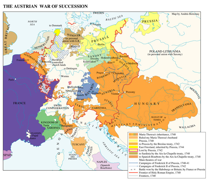
The Habsburg male line died out in 1740 with the death of Emperor Charles VI, and as a result of the War of Austrian Succession that took place between 1740 and 1748, the Empress Maria-Theresa had to concede Habsburg lands in Austria, Spain, and Italy to other powers as part of the terms of the 1748 Treaty of Aix-La-Chappelle, which also confirmed the right of succession of the German House of Hanover to the British throne.
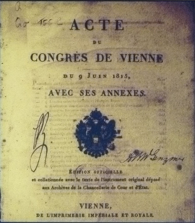
The Congress of Vienna was said to be one of the most important international conferences in European history.
It was a meeting of ambassadors of European states held in Vienna in Austria between 1814 and 1815 in order to remake Europe after the downfall of Napoleon.
The stated goal was to resize the main powers so they could balance each other and in this way remain at peace, and not simply to restore old boundaries.
As a result of the Congress of Vienna, France lost all of its recent conquests, while Prussia, Austria, and Russia made major territorial gains.
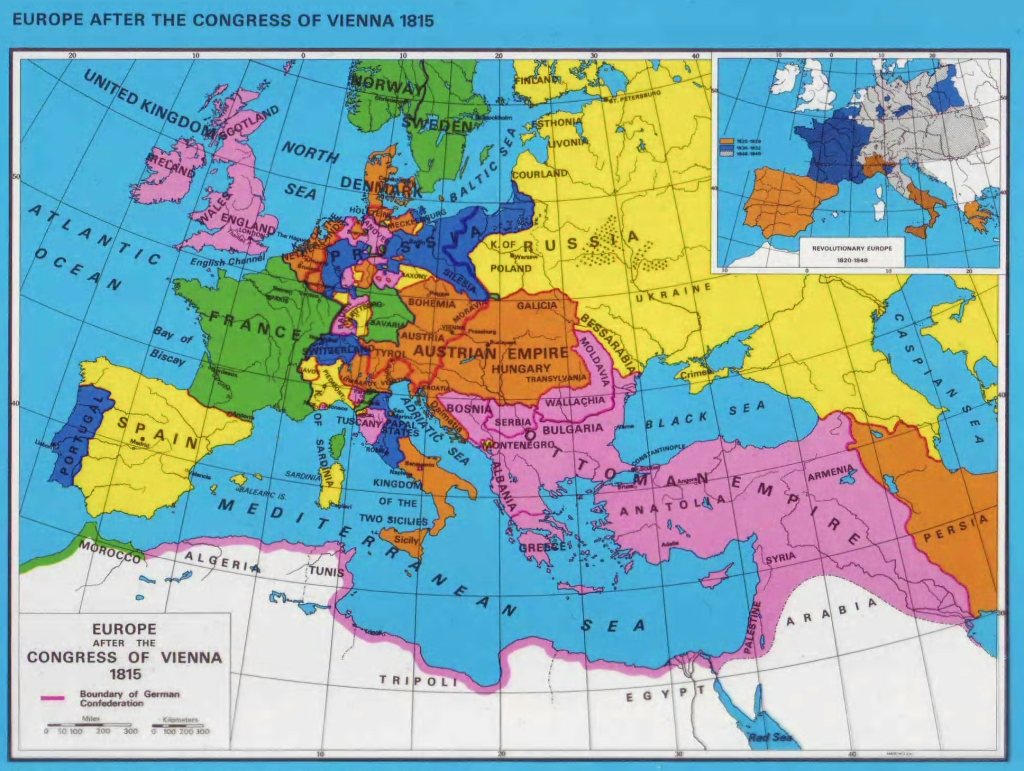
Most of the discussions took place in informal, face-to-face sessions among the ambassadors of Austria, Britain, France, Russia, and sometimes Prussia, with limited or no participation by other delegates.
As such, the so-called Congress of Vienna never met in plenary session, which means a session in which all members of all parties are able to attend.
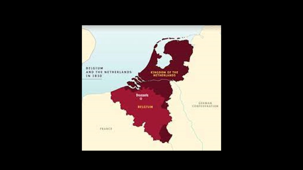
After the Belgian Revolution of 1830, the southern Netherlands of Central and South Brabant became part of Belgium, and Brabant became the central province of Belgium with Brussels as its capital.
The Revolutions of 1830 took place in France, Belgium, Italy, Brazil, Poland & Switzerland, which was the same year that Bavarian Order of the Illuminati founder Adam Weishaupt died in Gotha, in November.
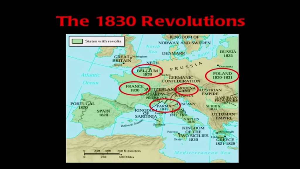
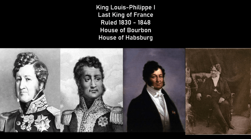
These 1830 revolutions led to the establishment of Constitutional Monarchies, and the substitution of the concept of popular sovereignty for hereditary right. In France, King Louis-Philippe I of the Habsburg House of Bourbon’s cadet branch of the House of Orleans, was the last King of France, until he was removed as Head-of -State in February of 1848, and marked the foundation of the French Second Republic, and subsequently sparked the Revolutions of 1848.
The 1830 revolutions in Europe also led to Leopold, the son of Duke Francis of Saxe-Coburg-Saalfeld, becoming Leopold I, the first King of the Belgians, in 1831.
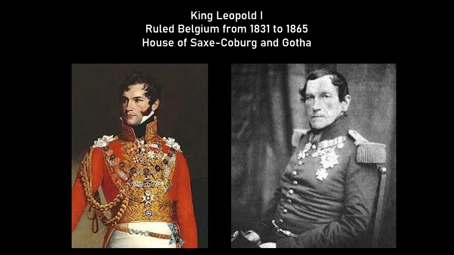
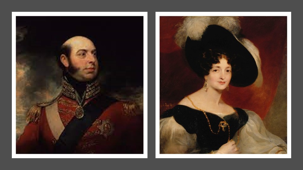
He had strong ties to Great Britain as he had moved there and married Princess Charlotte of Wales in 1816, second-in-line to the British throne after her father the Prince-Regent, who became King George IV.
She is recorded as having died after delivering a stillborn child a year after they were married, leaving King George IV without any legitimate grandchildren.
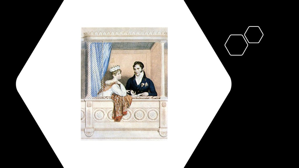
King George III’s son, the Prince-Regent George’s brother, Prince Edward, ended-up proposing to Leopold’s older sister Victoria, of Saxe-Coburg-Saalfeld, who were the parents of the future Queen Victoria.
King Leopold I was said to play an important role in the creation of Belgium’s first railroad in 1835 and subsequent industrialization.
We are told that Belgium was the second country in Europe to open a railway and produce locomotives, after a private rail-line opened between Stockton and Darlington in north-east England on September 27th of 1825.
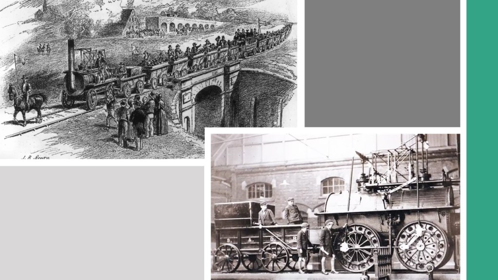
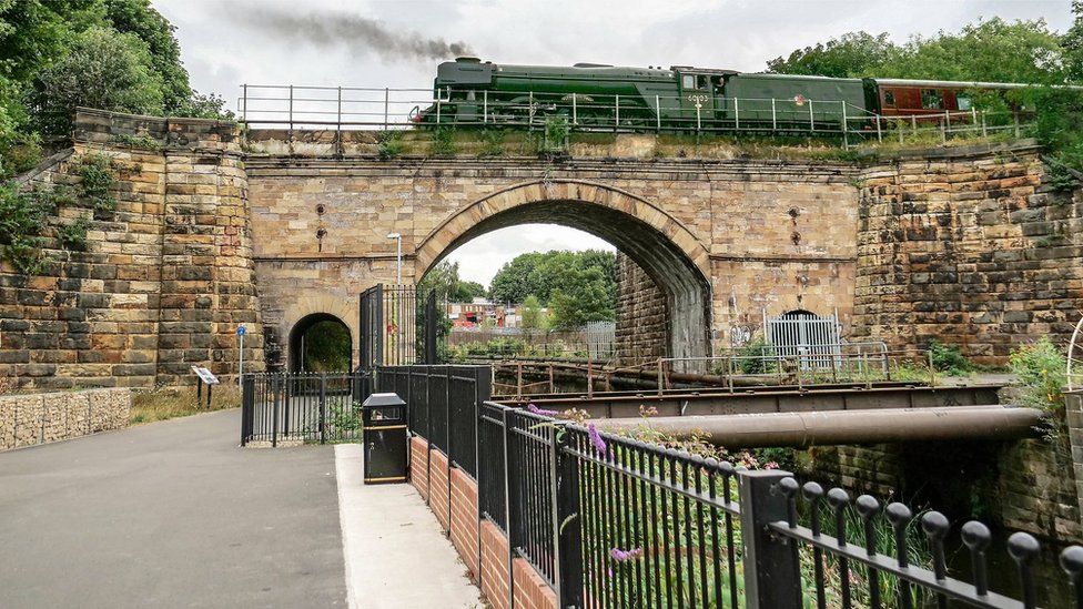
The very old-looking Skerne Bridge was said to have been built in 1825 for the Stockton and Darlington Railroad, and carried the first train on opening day.
It is considered to be the oldest railway bridge in continuous use in the world.
The first stretch of the Belgian Railway network was said to have been completed between northern Brussels and Mechelen in 1835, and was the first steam passenger railway in continental Europe.
By 1836, the line to Antwerp had been completed, and by 1843, four main-lines had been added to the Belgian rail network.
There are 6,893-miles, or 11,903-kilometers, of railroad track in Belgium, which has the greatest mileage of rail per square mile in the world.
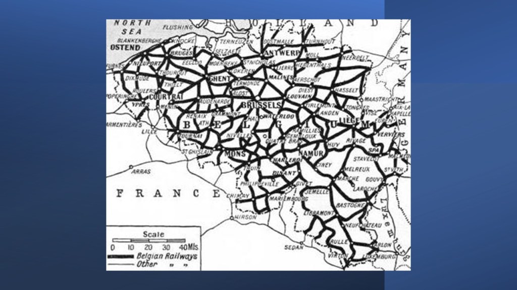
So I will end this tour of where there are locations mentioned of a ‘Hel,’ with either one “l” or two, on Earth in the Antwerp Province of Belgium and the city of Antwerp, its capital.
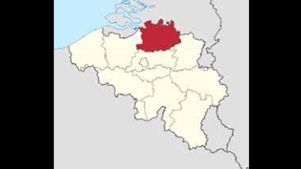
Antwerp Province is the northernmost province of Belgium, and borders on the North Brabant Province of the Netherlands.
Originally named the “Central Brabant Province,” after the Congress of Vienna, it was re-named “Antwerp” in 1830 after the city of Antwerp.
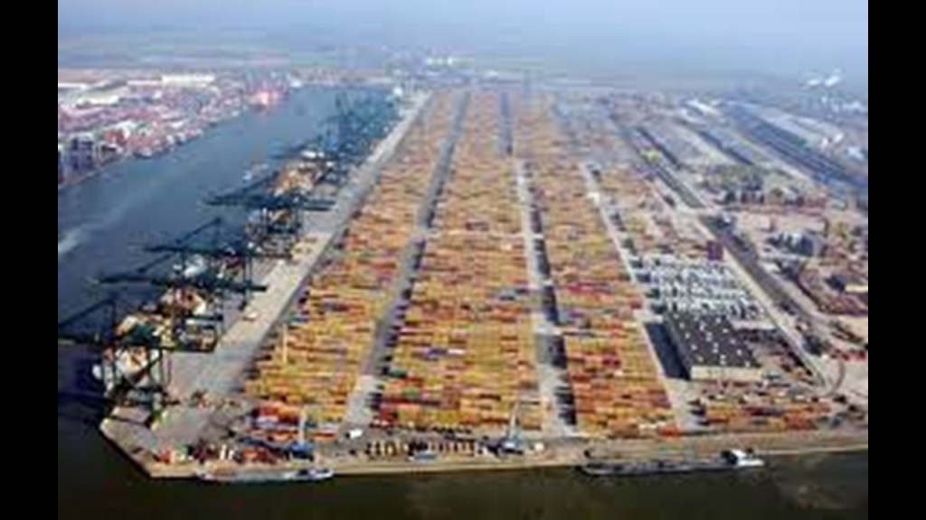
The Province has a transportation network of infrastructure of roads, railroads, canals and rivers, as well as the Port of Antwerp, the economic heart of the province.
The Port of Antwerp is the second-largest port in Europe, after Rotterdam in The Netherlands, and where chemical factories, like those of Bayer and BASF, and Monsanto, which was acquired by Bayer Pharmaceutics and Life Sciences Company in after gaining United States and EU regulatory approvals on June 7th of 2018 for, you guessed it – $66-billion in cash – and Monsanto’s name is no longer used…

…and the Port of Antwerp comprises the second largest Petrochemical industry cluster in the world, after Houston, Texas.
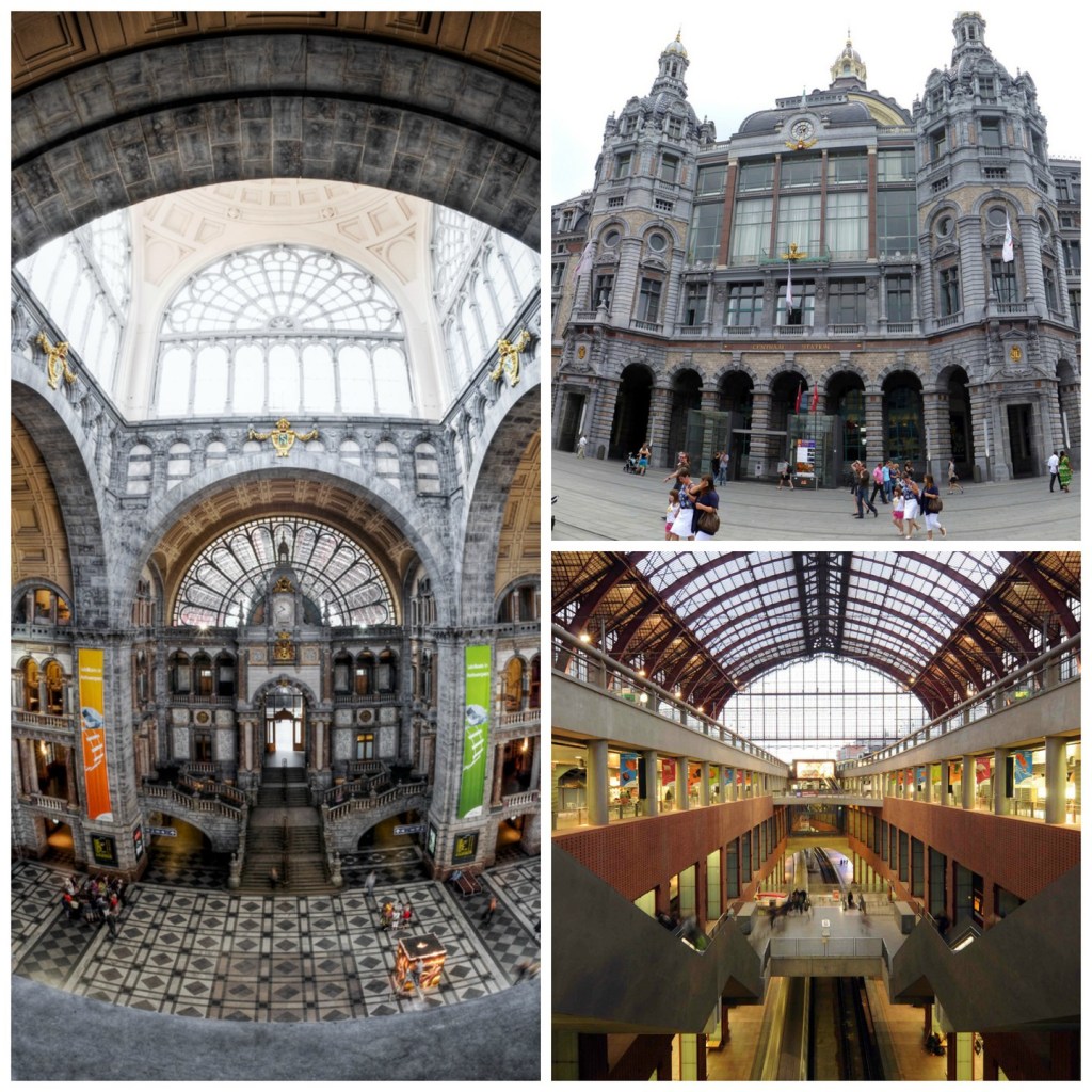
This is the Antwerp Central Rail Station, said to have been built between 1895 and 1905 to replace the original wooden station from 1836.
It was severely damaged by V-2 rockets during World War II.
During World War II, on September 4th of 1944, the British Armored 11th-Division captured the port city of Antwerp intact except for the bridges across the Albert Canal.
Apparently, the retreating Germans blew up these bridges on their way out of town.

Then on October 12th of 1944, Hitler and the German High Command exclusively focused their V-weapon missile attacks on the cities of Antwerp and London, and for a period of 175-days-and-nights, German missile-launching crews fired more than 4,000 V-1s and more than 1,000 V-2s at Greater Antwerp, and Antwerp had become known as the “City of Sudden Death.”

I am sure there is much more to find, as there always is, but I am going to end this post here.
The geographical location of “Heligoland/Helgoland” where I started this journey brought in the Napoleonic Wars; the role of the Revolutions of 1830 and 1848 with the goal of removing the original Royal Houses of Europe; the role of Prgressive youth movements; the origins and interconnections to all of this of the Bavarian Order of the Illuminati and to the House of Saxe Saxe-Coburg and Gotha AKA Windsor.
The geographic locations of two more “Hels” in Belgium brought in more of the story about what happened after the defeat of Napoleon; how one obscure German ducal line managed to replace the original Royal Houses of Europe, and how both of these places were hammered during Europe’s World Wars of the 20th-century, along with Poland’s Hel Peninsula.
The Nazi Germans occupied Norway for almost the entirety of World War II, and the Hell there would have been centrally located and on important transportation routes.
Hell in Michigan doesn’t seem to have quite those connections, but this hell-based tourist attraction it is located quite close to a world-renowned research University and a large recreational area that I have a lot questions about what’s actually there.
Then the wars and conflicts that have taken place after dividing Pakistan and Afghanistan, the connections of the Lost Tribes of Israel found there, and the creation of conflict by dividing the Kashmir region between Pakistan and India, where places named “Hel” are found as well.
In seeking answers to the question “Where is Hel on Earth,” there certainly seem to be correlations between places with “Hel” in the name, and the hellish events of our modern history.

Hi Michelle I commented on the u tube video, but on investigation it appears the st Helens I knew of old is a housing estate. Funny that!
I’ve been on the road since 2004 and places have changed dramatically in nearly 20 years where I am now well that wasn’t like that before. So I find st helens in Middlesex so I guess my st Helens would have been red Ruth in Cornwall.
I have an account of current megaliths, as they are called of all variety just the fugho that has been opened up, so no more crawling in or climbing down. Looks like a tourist attraction now.
Thank you for your in depth research it is refreshing blessings ❤️
LikeLike