
I am going to share the evidence that I have found in my research ways of the ways that our perception of plane vs. planet has been manipulated, and other findings of interest, in this post.
One viewer suggested I do this for a “Short & Sweet,” and another wanted to know my views specifically about this subject.
I have already done most of the research that follows, and does not take me long to put together when that is the case, so I can get it out more quickly compared to brand new research, which takes a lot more time to produce.
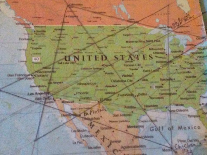
A lot of what I have discovered about this subject was primarily in my research of cities and places in long-distance alignments, based on and emanating from my finding of the North American Star Tetrahedron in 2016, which is where my original research on this subject began almost six years ago.
My own journey into researching the whole of this started with the data points I have on spreadsheets in the form of cities and places in alignment with each other, and for which I have come to believe Earth’s original ancient civilization was laid out according to Sacred Geometry, also aligning Heaven and Earth.
It is helpful to define some terms used to described how the Earth has been measured and mapped in the present-day, and in the past.
The study of geodesy is defined as the science of accurately measuring and understanding the Earth’s shape, orientation in space, and gravitational field.
A geodetic system is a coordinate system, and a set of reference points, used for locating places on the Earth.
A geographic coordinate system enables every location on Earth to be specified by a set of numbers, letters and symbols.
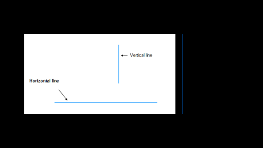
The coordinates are such that one of the numbers represents a vertical position, which would derive from the North-South lines of latitude, and the horizontal position, from the East-West lines of longitude.
Longitude fixes the location of a place on Earth east or west of a North-South zero-line of longitude called the Prime Meridian, given as an angular measurement that ranges from 0-degrees at the Prime Meridian to +180-degrees westward and -180-degrees eastward.
Sir George Biddell Airy, an English mathematician and astronomer, was the seventh Astronomer Royal from 1835 to 1881.
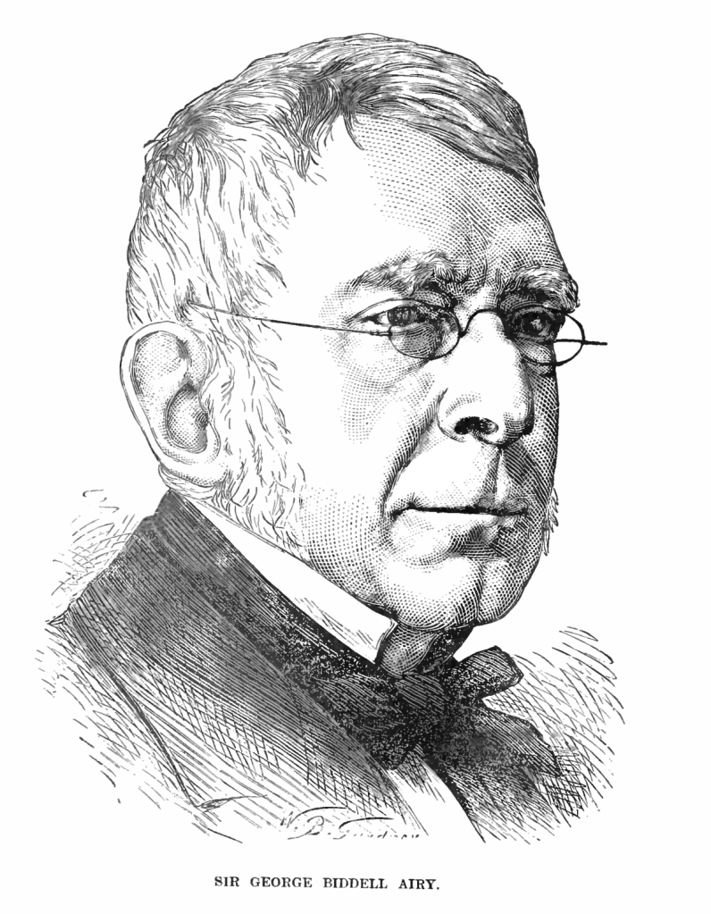
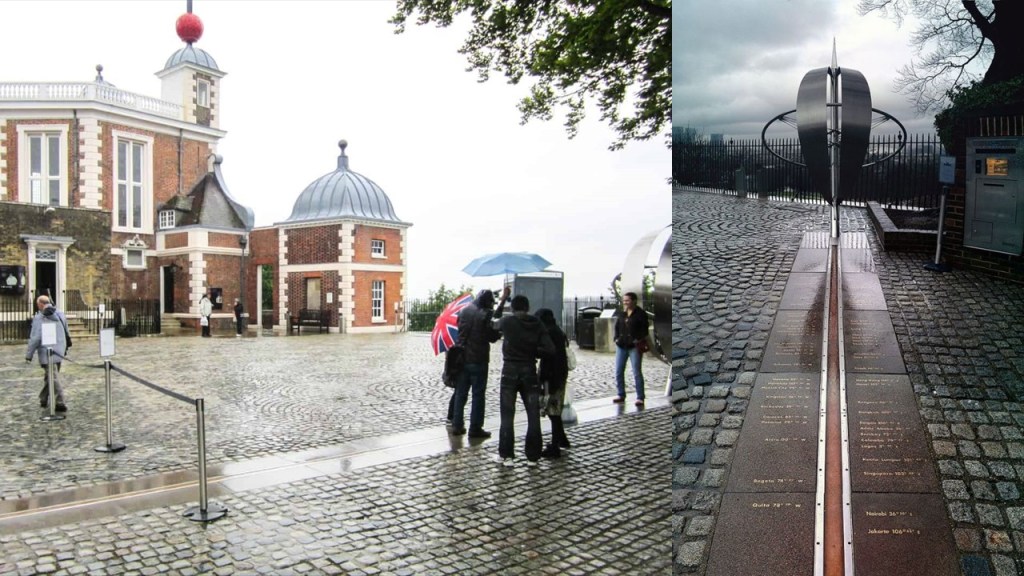
He established the new prime meridian of the Earth in 1851, a geographical reference line, at the Royal Observatory of Greenwich in London, and by 1884, over two-thirds of all ships and tonnage used it as the reference meridian on their charts and maps.
In October of 1884, the United States hosted the International Meridian Conference, attended by twenty-five countries, in order to determine the Prime Meridian for international use after worldwide pressure had been applied to establish a prime meridian for worldwide navigation purposes and to unify local times for railway time-tables, with Sir George Airy’s Greenwich Meridian already being the favored one for use.
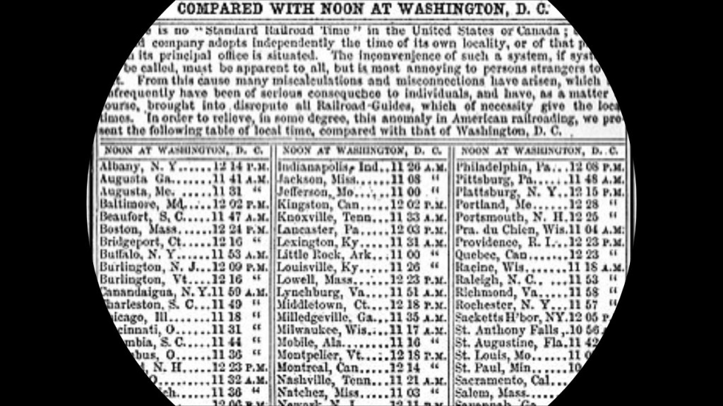
Twenty-two of the twenty-five countries in attendance voted to adopt the longitude of the Royal Observatory in Greenwich as the zero-reference line.
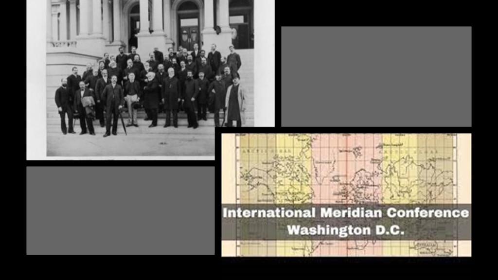
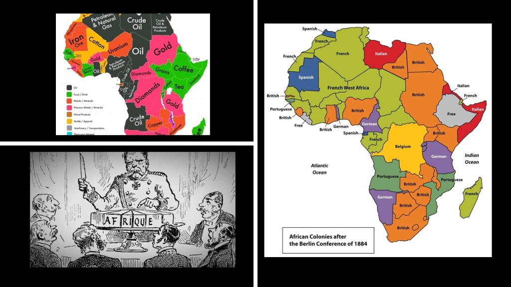
Interesting to note, the International Meridian Conference was held right before the German chancellor Otto von Bismarck-organized Berlin Conference, which was convened in November of 1884 and lasted until February of 1885, during which almost all of Africa was carved up between the European powers.
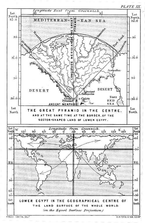
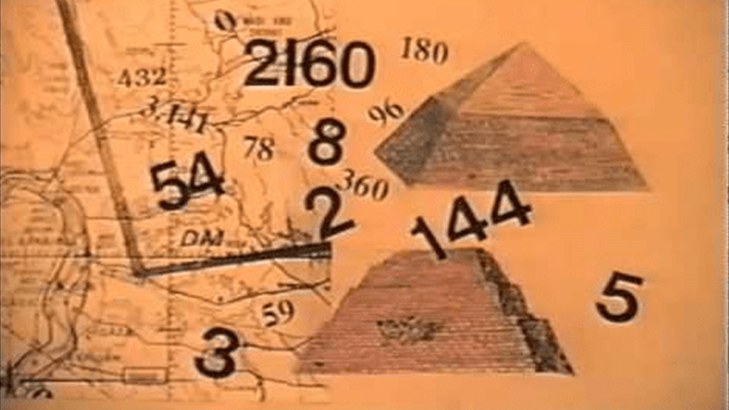
The Prime Meridian of the Earth previous to the Royal Observatory of Greenwich was the great pyramid of Giza, located at the exact center of the Earth’s landmass.
Carl Munck deciphers a shared mathematical code in his book “The Code,” related to the Great Pyramid, in the dimensions of the architecture of sacred sites all over the Earth, one which encodes longitude & latitude of each that cross-reference other sites.
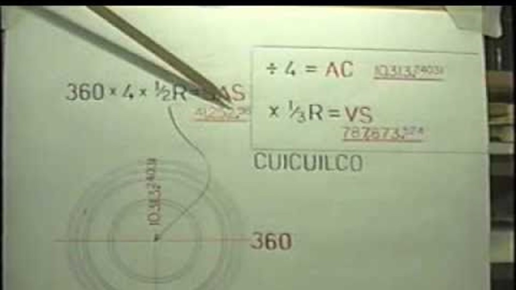
He shows that this pyramid code is clearly sophisticated and intentional, and perfectly aligned over long-distances.
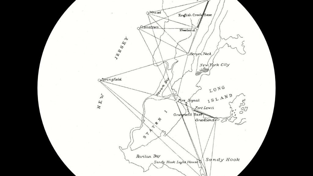
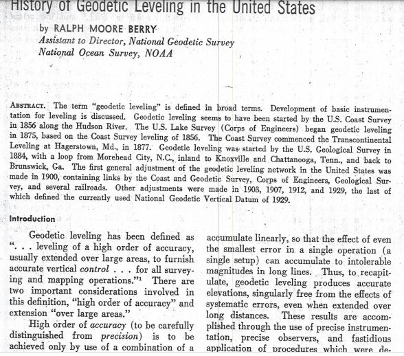
I just recently learned about the National Geodetic Survey (NGS) and its Transcontinental Levelling program that started in 1887, in the research for my last “Short & Sweet” post.
The National Geodetic Survey was the first civilian scientific agency, established in 1807 by President Thomas Jefferson as the “Survey of the Coast,” with a stated mission to survey the U. S. Coastline and create a survey network, establish coastal water depths, and nautical charts to help increase maritime safety.
This was a sketch of the New York Harbor showing the first field work of the “Survey of the Coast” in 1816 and 1817.
Today the survey network first established in the early 19th-century is called the National Spatial Reference System (NSRS) for surveying and engineering projects requiring precise spatial information and has been administered by the National Oceanic and Atmospheric Administration of the U. S. Department of Commerce since 1970.
The National Geodetic Survey started a trans-continental levelling program in 1887, with levelling defined as “…a high order of accuracy usually extended over large areas to furnish accurate vertical control…for all surveying and mapping operations.”
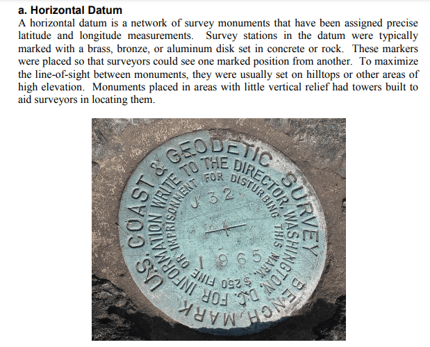
They utilized “horizontal datum,” benchmarks made typical of brass, bronze, or an aluminum disk set in concrete or rock assigned precise latitude and longitude measurements within the survey network.
I know there is a lot more to unpack here, but I find this very interesting in light of what horizontal and vertical mean and the implications in relationship to the shape of the Earth’s surface.
Daylight Savings Time apparently was first proposed by George Hudson, an astronomer and entomologist (studier of insects) from New Zealand.
In 1895 he presented a paper to the Wellington Philosophical Society proposing a 2-hour daylight-saving shift because he wanted more daylight hours in the summer to pursue his collecting of insects.

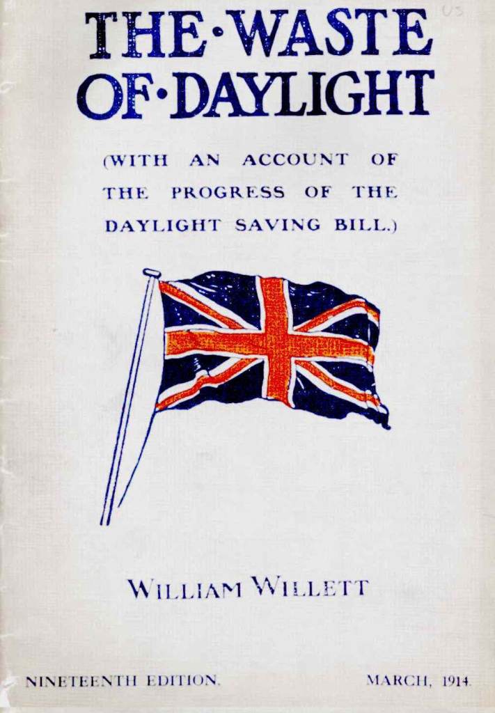
The other person who was credited with independently coming up with the Daylight Savings Time concept was English builder and outdoorsman William Willett, who apparently wanted things like more daylight in which to play golf, proposed the idea to Parliament in 1908, though the bill failed to pass after multiple attempts until 1916.
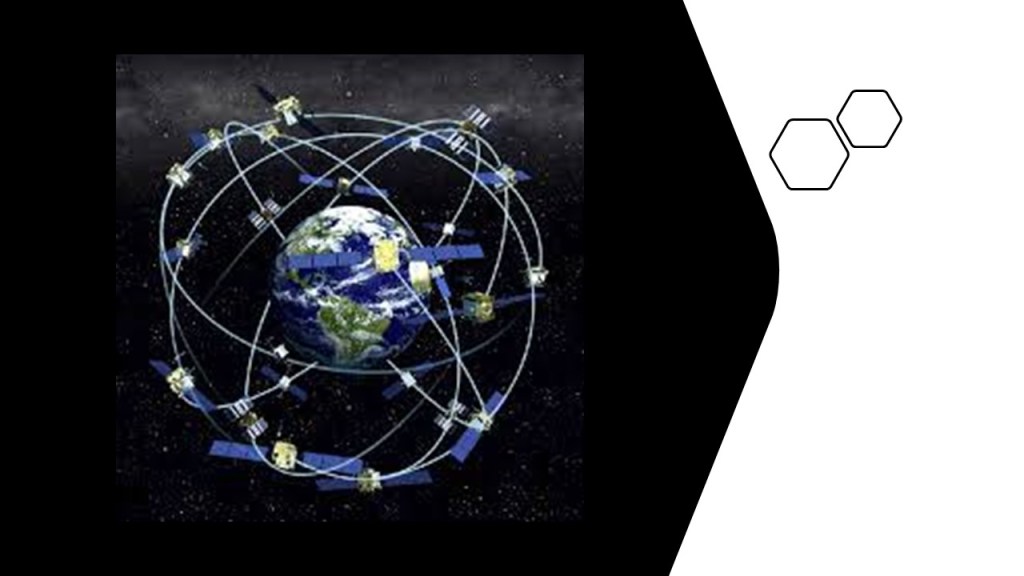
Also of interest to note, the Global Positioning System (GPS) was developed by the United States Department of Defense and launched for military use in 1973 and became fully operational in 1995.
Civilian use was allowed starting in the 1980s.

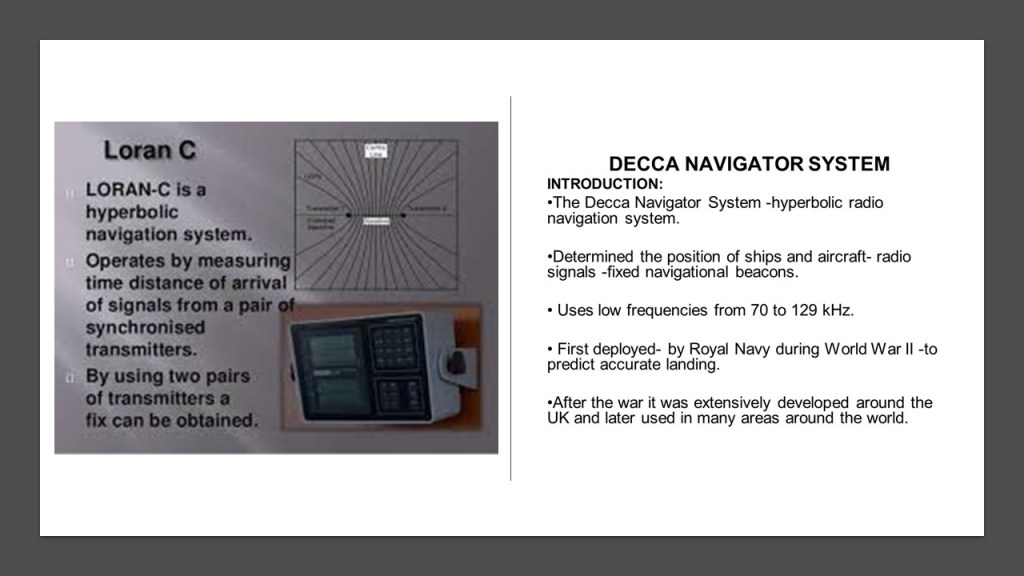
It was based on ground-based radio-navigation systems that were developed in the early 1940s, like LORAN and Decca Navigator.
For point of information, this is the image found on the NASA Space Place – Science for Kids – about “How does GPS work?” and typical of the visual imagery that is available to us on this subject.
Now onto the subject of early maps and globes.
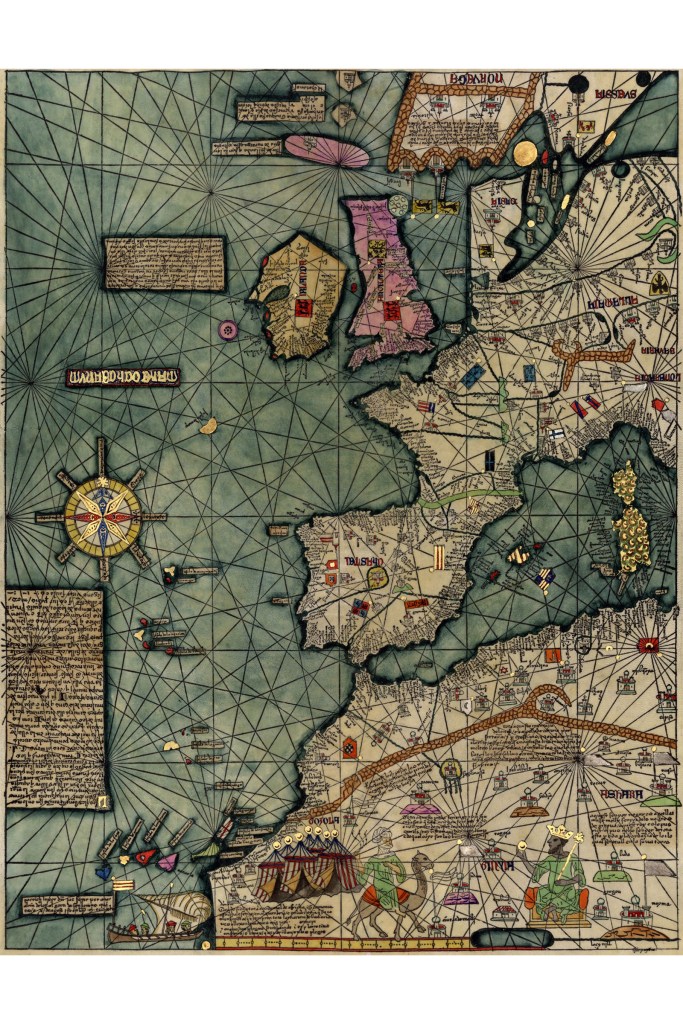
in earlier maps, ley-lines were depicted on land and sea, a like on the Catalan Atlas of the Majorcan Cartographic School, considered the most important map of the Medieval period in the Catalan language, dated to 1375.
Here’s a map of Africa’s Gold Coast showing ley-lines as well…
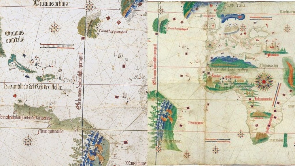
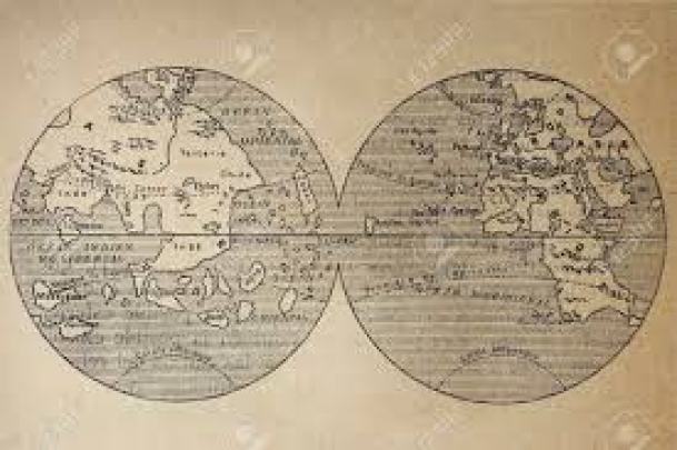
…and another early map was the Cantino Planisphere, said to have been completed by an anonymous Portuguese cartographer some time before 1502.
A planisphere is defined as a map formed by the projection of a sphere or part of a sphere on a plane.
What we are told is that in cartography, the science of map-making, a map projection is the way of flattening the globe’s surface into a plane in order to make it into a map, which requires a systematic transformation of the latitudes and longitudes of locations from the surface of the globe into locations on a plane.
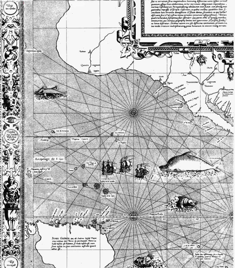
It would seem that the Earth’s ley-lines started to disappear from maps in the 1500s, when Gerardus Mercator, a Flemish geographer, cartographer and cosmographer, published a world map in 1569 that is considered to be the first where sailing courses on the sphere were mapped to the plane map, allowing for a “correction of the chart to be more useful for sailors.”
His 1569 map showed the depiction of straight ley-lines in the seas, but not on land and sea as were present on the flat projections of the Cantino Planisphere and the Catalan Atlas.
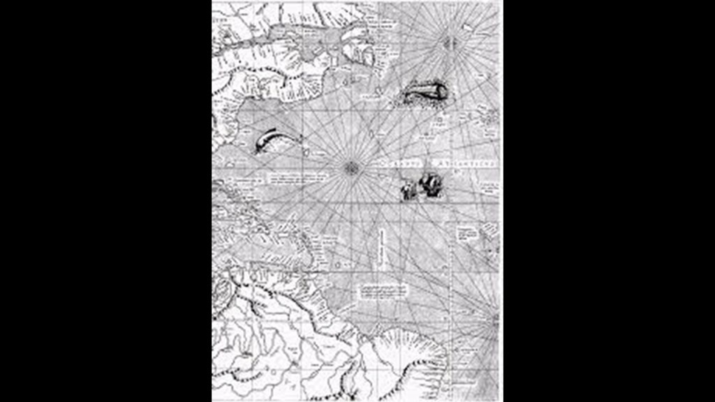
Here is a close-up section of the 1569 map showing the depiction of straight ley-lines in the seas but not on land and sea as were present on the flat projections of the Cantino Planisphere, the Catalan Atlas, and the African Gold Coast map.
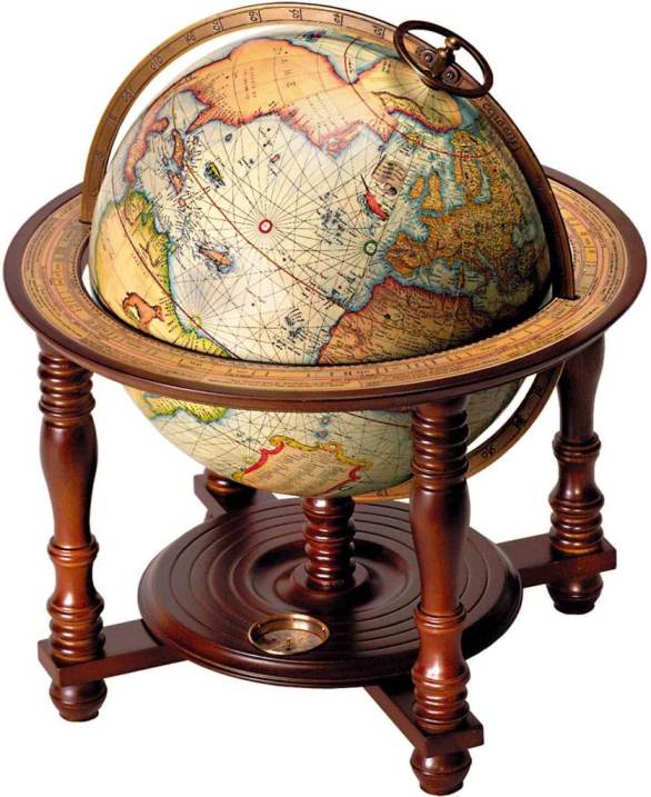
Not only that, Mercator was also a globe-maker, like this one from 1541.
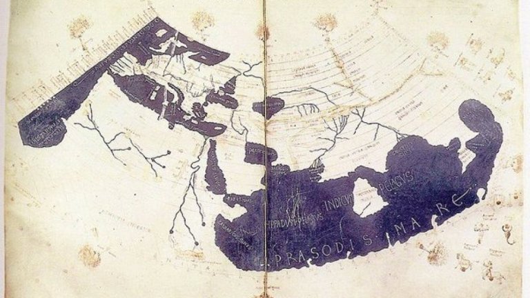
Ptolemy’s “Geography” was an atlas and treatise of geography from 150 AD said to compile the geographical knowledge of the 2nd-century Roman Empire, and a revision of the now-lost atlas of Marinus of Tyre, a Phoenician cartographer and mathematician who was said to have founded mathematical geography, and who introduced improvements to the construction of maps and developed a system of nautical charts.
This is the cover of Mercator’s 1578 publication of “Tabulae Geographicae,” along with the globe, and Ptolemy said to depicted on the left, and Marinus of Tyre on the right.
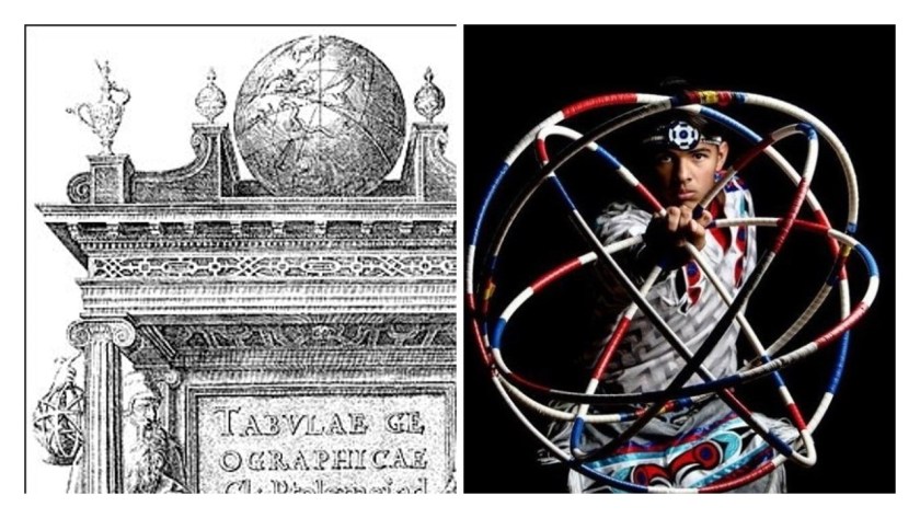
Notice the difference between the lines on the globe at the top of the engraving, and the globe at the bottom, and while Ptolemy is pointing down to the globe at the bottom…
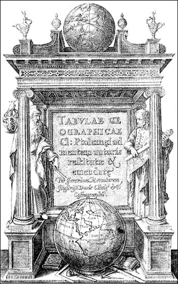
…he is holding up a geometric shape in his right hand that looks like the lines on the globe at the top on the left, which looks remarkably like the shape the sacred hoops formed in the Native American Hoop Dance on the right.
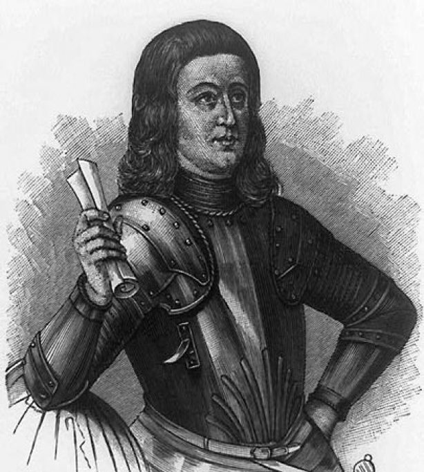
We are told the first globe in existence was called the Erdapfel, which translates from the German as “potato,” a terrestrial globe said to have been produced by Martin Behaim, a German textile merchant and cartographer, between 1490 and 1492.
This engraving of him was said to have been done in 1886.
It was a laminated linen ball, constructed in two-halves, reinforced with wood…
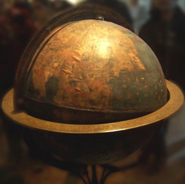
…and overlaid by a map painted by Georg Glockendon, pasted on a layer of parchment around the globe.
The German-English geographer and cartographer, Ernst Georg Ravenstein, who was born in Germany in 1834 but spent most of his adult life in England, wrote a book about Martin Behaim and his Erdapfel in 1908.
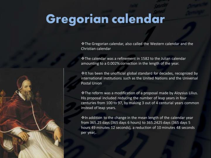
Only 13-years after Mercator was said to have published his world map in 1569, the Gregorian Calendar was introduced by Pope Gregory XIII in October of 1582, for the given reason of correcting the Julian calendar on stopping the drift of the calendar with respect to the equinoxes, and included the addition of leap years.
It took 300 years to implement the calendar in the west, and nowadays used in non-western countries for civil purposes.
The Mayan calendar was involved with the harmonization and synchronization of Human Beings and the development of Human Consciousness with natural cycles of time.
The Mayan calendar consisted of several cycles, or counts, of different lengths.
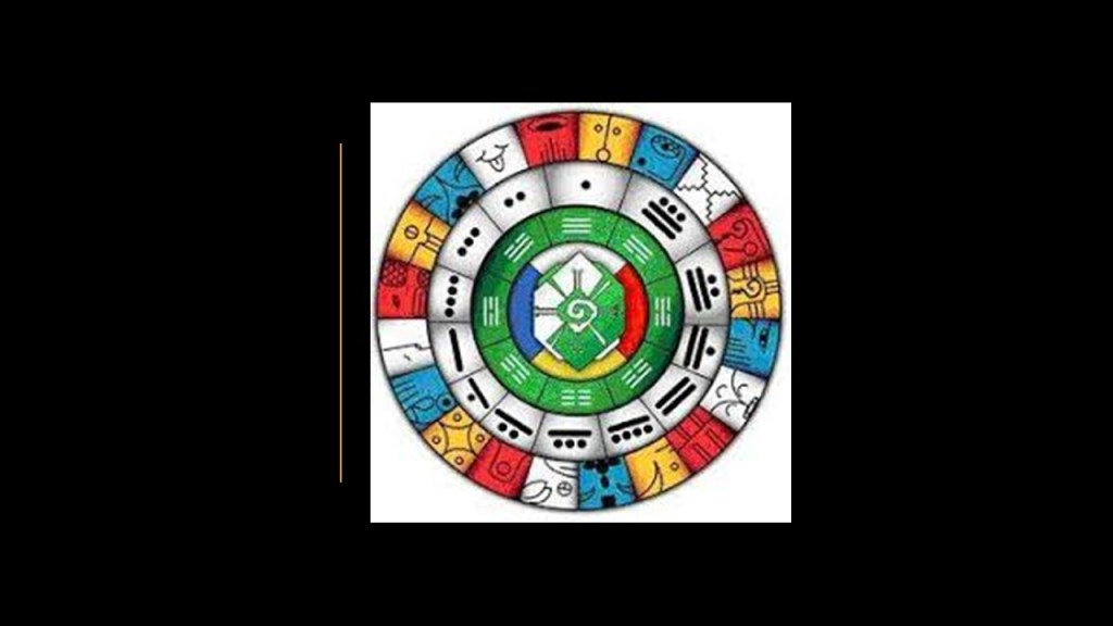
The 260-day count, or Tzolkin, was combined with a 365-day solar year known as the Haab’, to form a synchronized cycle lasting for 52 Haab’, called the Calendar Round, still in use today by many Mayan groups in the highlands of Guatemala.
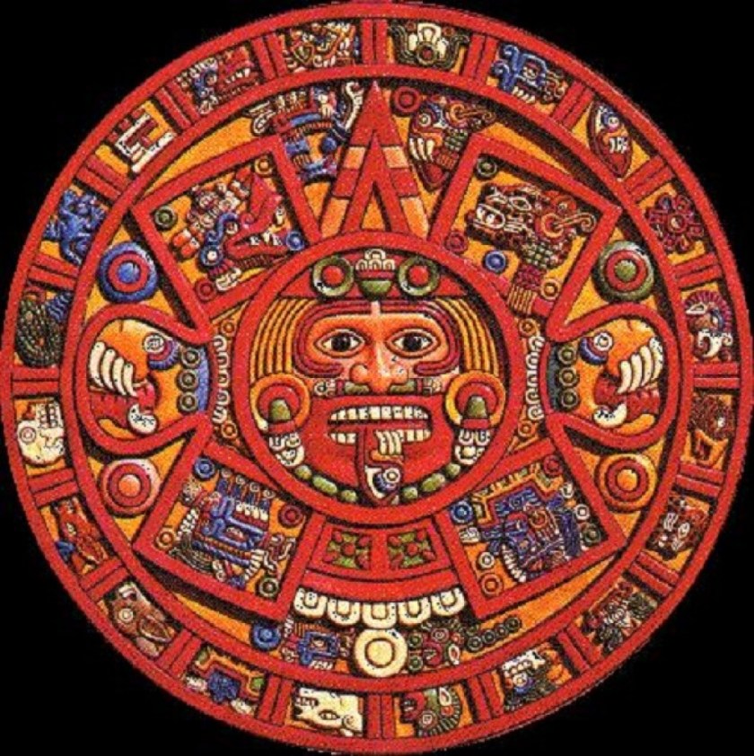
The Tzolkin calendar combines twenty day-names and symbols, with thirteen day numbers, which represent different-sounding tones, to produce 260 unique days.
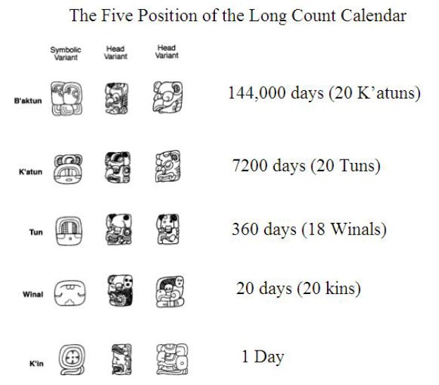
The Mayan Long Count calendar was used to track longer periods of time.
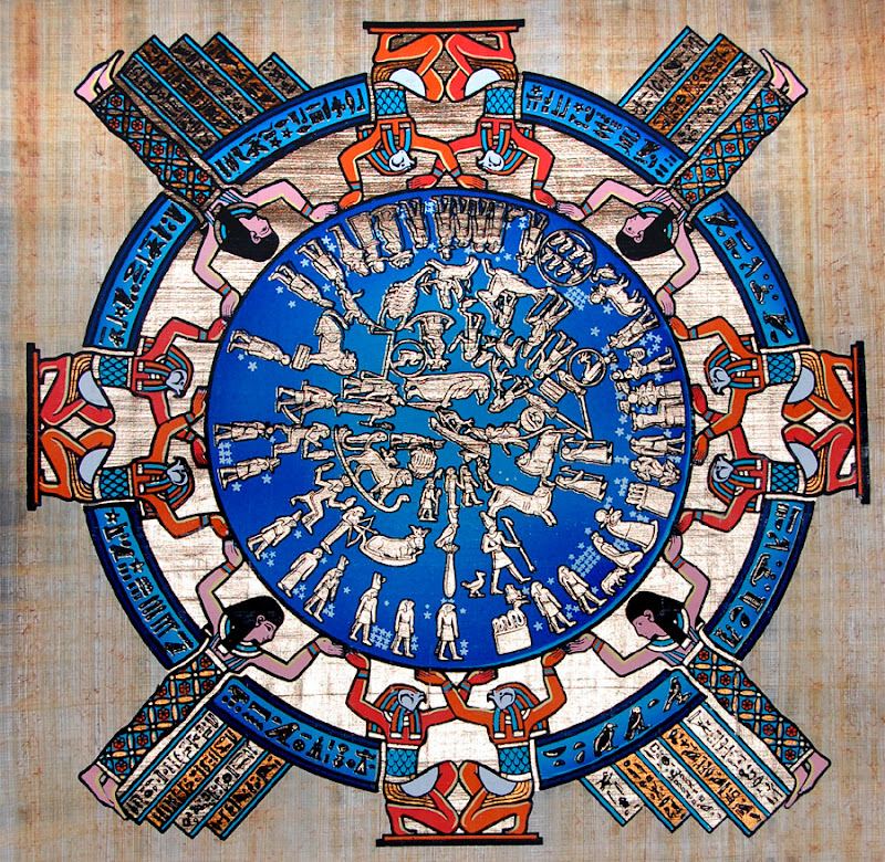
The ancient Egyptian calendar was a solar calendar with a 365-day-year, with three seasons of 120-days each, and 5-6 epagomenal days, also known as an intercalary month, transitional days that were treated as outside of the year proper to make the calendar follow the seasons or moon phases in common years and leap years.
Chronology is the next subject I would like to address.
Chronology is defined as: 1) the arrangement of events or dates in the order of their occurrence; 2) a document displaying an arrangement of events in order of their occurrence; 3) the study of historical records to establish the dates of past events.
In 1583, just one year after the introduction of the Gregorian calendar, Joseph Justus Scaliger published the “Opus de Emendatione Temporum” or “Work on the Amendment of Time.”
Scaliger was said to revolutionize perceived ideas of ancient chronology to show that ancient history was not confined to that of the Greeks and Romans, but also comprises that of the Persians, the Babylonians, the Egyptians, and the Jews.
In this work, we are told Scaliger investigated ancient systems of determining epochs, calendars and computations of time.
We are told the publication of his “Work on the Amendment of Time” placed him at the head of all the living representatives of ancient learning.
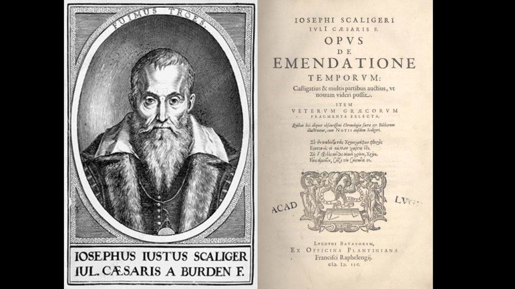
Scaliger synchronized all of ancient history in his two major works, De Emendatione Temporum (1583) and Thesaurus Temporum (1606). Much of modern historical datings and chronology of the ancient world ultimately derived from these two works.
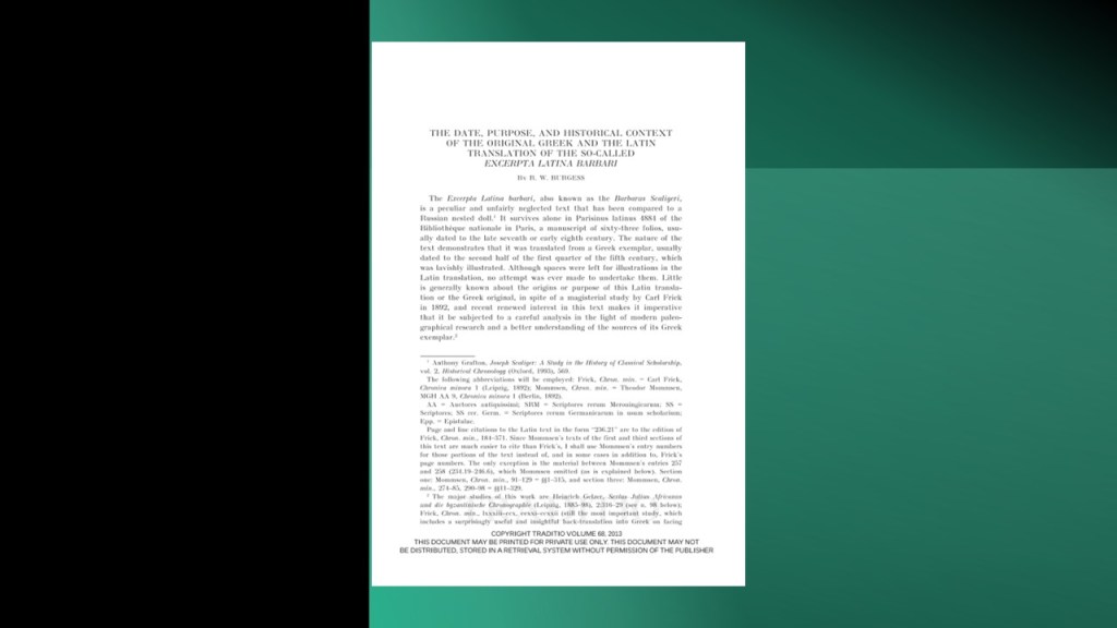
Interestingly, when I was looking for information on Scaliger’s Thesaurus Temporum, I found the “Excerpta Latini Barbari,” a Latin translation of a 5th- or early 6th-century Greek chronicle composed in Alexandria, Egypt.
The “Excerpta Latini Barbari,” was said to be a variation of the Alexandrian World Chronicle, an anonymous Greek Chronicle compiled in Alexandria, said to have covered recorded history from Creation until the year 392 AD.
We are told “Excerpta Latini Barbari,” translates to “Excerpts in Bad Latin.”
Scaliger was said to have taken the first scholarly interest in the “Excerpta Latini Barbari,” and first named the chronicle “Barbarus Scaligeri.”
The chronicle contains two main sections: (a) the history of the world from the creation to Cleopatra and (b) a list of kings or rulers from Assyria to the consuls of Rome, including the Ptolemaic dynasty, a list entitled “high priests and kings of the Jews” and an entry for Macedonian kings.
Here is the problem I have with this translation of “Excerpta Latini Barbari.”
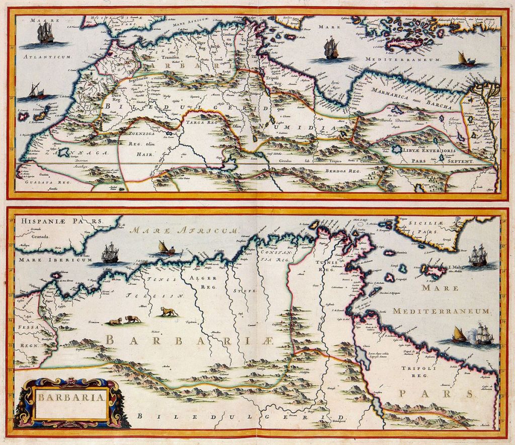
Barbaria, or Barbary, was the name given to a vast region stretching from the Nile River Delta, across Northern Africa, which would have included Alexandria, Egypt, and the location of ancient Carthage in present-day Tunis, Tunisia, to the Canary Islands.
The coast of North Africa is still called the Barbary Coast to this day.
What if “Excerpta Latini Barbari” translates to something along the lines of Excerpts from Barbarian Latin?”
Yet we are taught that “barbarian” means a person from an alien land, culture, or group believed to be inferior, uncivilized, or violent.
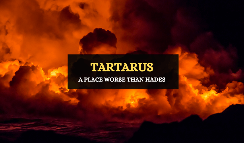
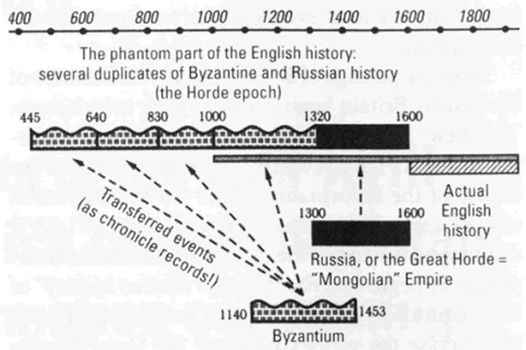
I believe that Barbaria was one of the many empires of the original Moorish civilization, with its origins in ancient Mu, also known as Lemuria, as was Tartaria, or Tartary, in Asia, the name of much of which was changed to Manchuria in the mid-1850s.
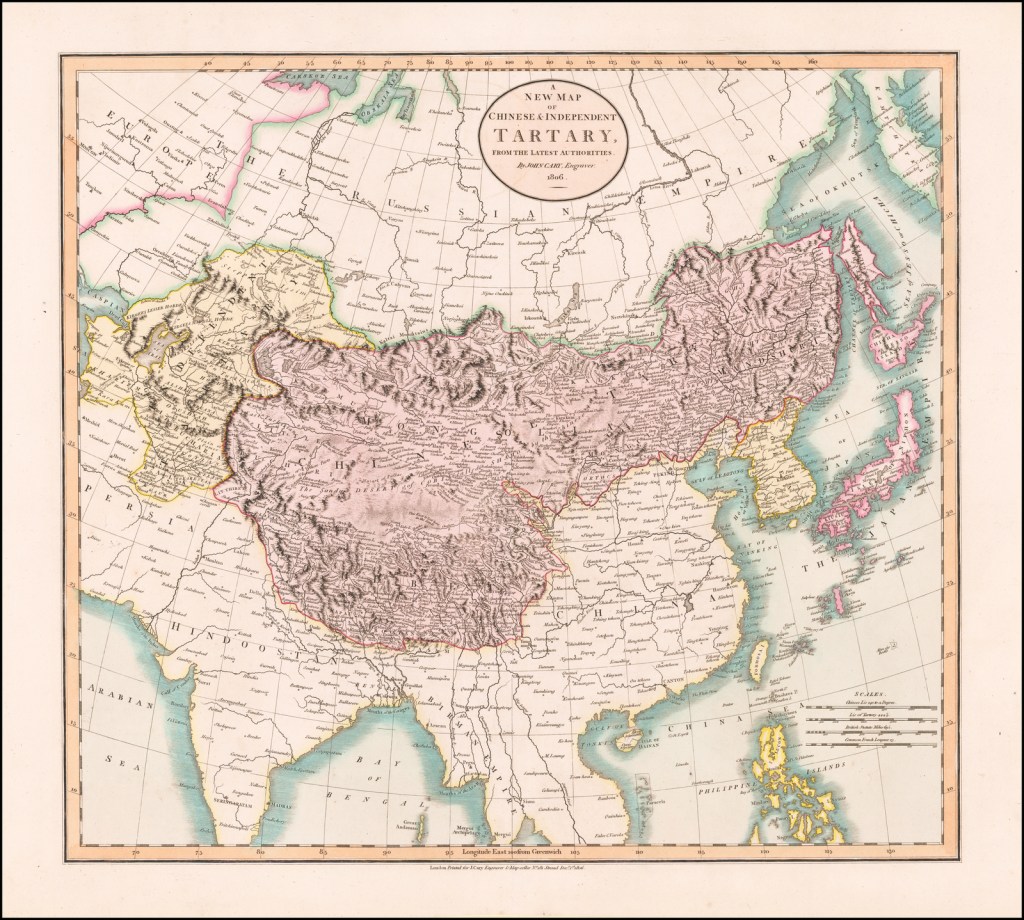
In a similar fashion to “barbarian,” the word “tartarus” or “tartary” has come down to us meaning a deep abyss in hades that is used as a dungeon of torment and suffering for the wicked.
Anatoly Fomenko is a Russian mathematician who has proposed a new chronology, along with Russian mathematician Gleb Novosky and Bulgarian mathematician Yordan Tabov, in which they argue that events of antiquity generally attributed to the civilizations of the Roman Empire, Ancient Greece and Ancient Egypt, actually occurred during the Middle Ages, more than a thousand years later.
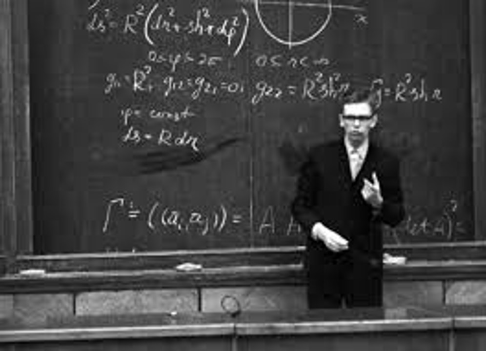
The concept is most fully explained in “History: Fiction or Science?” originally published in Russian.
The theory further proposes that world history prior to 1600 AD has been widely falsified to suit the interests of a number of different conspirators including the Vatican, the Holy Roman Empire, and the Russian House of Romanov.
Academic interest in the theory stems mainly from its popularity which has compelled historians and other scientists to argue against its methods and proposed world history.

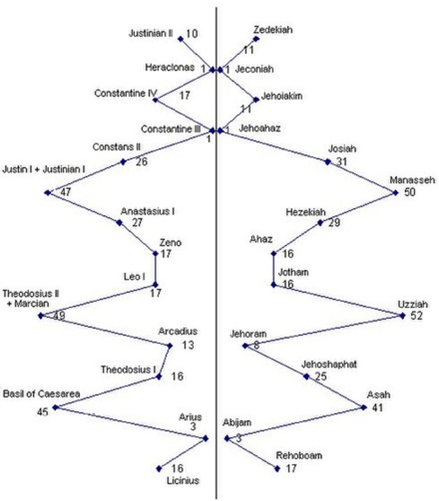
Some of the central concepts of new chronology asserted by Fomenko and colleagues are:
Up to the 17th-century, historians and translators often “assigned” different dates and locations to different accounts of the same historical events, creating multiple “phantom copies” of these events.
This chronology was largely manufactured by Joseph Justus Scaliger in Opus Novum de emendatione temporum (1583) and Thesaurum temporum (1606), and represents a vast array of dates produced without any justification whatsoever, containing the repeating sequences of dates with shifts equal to multiples of the major cabbalistic numbers 333 and 360.
Fomenko’s methods included the statistical correlation of texts, dynasties, and astronomical evidence.
The Jesuit Dionysius Petavius completed this chronology in De Doctrina Temporum, 1627 (v.1) and 1632 (v.2).
Also known as Denis Petau, I can’t find any information about the contents of his chronology in an internet search.
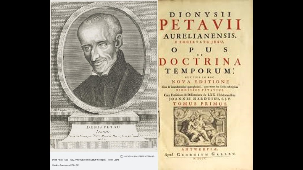
I can only find copies of it on-line, not a summary of what is in it.

There are many, many reasons I am skeptical of the truthfulness of the historical narrative we have been taught.
And how did the new historical narrative get inside our heads, anyway?
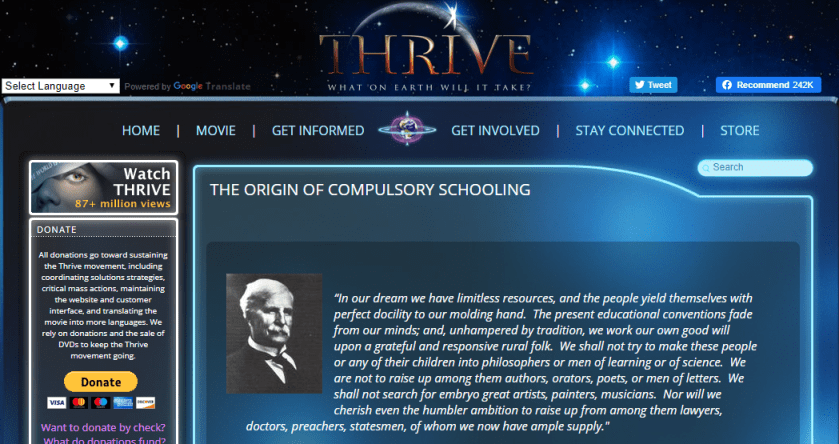
The following screenshots are from a page entitled “The Origin of Compulsory Education” on Foster Gamble’s Thrive website. As I recall, it was from his movie “Thrive” that I first learned that the Rockefellers were the originators of the American Educational System.
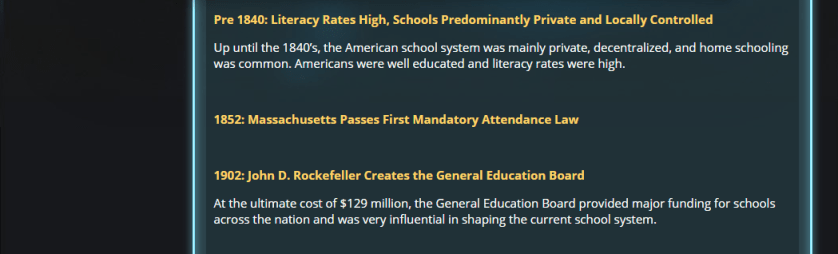
When John D. Rockefeller established the General Education Board, it says the interest was in organizing children, and creating reliable, predictable, and obedient citizens, and not in producing critical thinkers.

Massachussetts passed the First Mandatory Attendance Law in 1852, which lines up with what I believe was the official kick-off of the new historical timeline, which I believe was the 1851 Crystal Palace Exhibition in London.
What I have shared in this post reflects what I have found so far in the course of several years of research that provides evidence supporting that we live on a plane versus planet, and many other ways in which our perception of place, time, and space has been manipulated.
I am very happy to share my findings and evidence with you for what sure appears to have happened here with regards to shifting our whole perception of everything about the world we live in.
My primary motivation and passion in doing this work is to bring back awareness of the Earth’s lost advanced worldwide civilization (the Old World Order) and to bring forth awareness that the New World Order is a real thing, how it came to be that way, and how we got to the point where we are today facing down the very grave threat to our existence that has been carefully and methodically planned for quite some time.
What is our future?
Sure looks uncertain right now, but I am putting my energy into the Great Awakening and into the belief that good triumphes over evil, and that they will not get away with what they have done to Humanity, the Creator, the Earth, and the Universe.


thank you this is most interesting as all your posts are ! As a healer who uses meridians, for over 40 + years , to listen to human body’s needs , this perfectly connects to our Mother earth’s body . So much is upside down now , I cannot heal cyborgs this way .. the new black-goo grafine oxide human , all seems lost . BE WELL !
Blessings ~ Heather Bostian, LMT Holistic Bodywork DesignVOTED BEST MASSAGE FOR YEARS !928 522-6004 / Flagstaff WEB : Heatherheals.com
LikeLiked by 1 person
Excellent.
LikeLike
I have enjoyed your posts and agree with your thought process. My view is pretty much summed up by your closing paragraph above. I have faith that we are being exposed to the worst of the worst just to wake up as many people as possible.
Thank you for your hard work.
LikeLike
Delighted I have access to your site again! You have provided erudite info and insight from the 7 sacred directions. I’ve tried to do something similar in my fiction/non-fiction. Your revised site with search feature is marvelous! You’ve given me so much curious anomalies to consider and puzzles to solve. Thank you Michelle.
LikeLike