This map was given to me in 2015 by one of my travel buddies when I lived in Oklahoma between 2012 and 2016, and when I was starting to see that ancient megalithic masonry lays all around us and upon which we live.
The map, affixed to a bulletin board, just sat there on my dining room table. I studied it for quite some time while eating, and soon I started noticing major cities lining up in lines in North America, Then in the spring of 2016, I found a familiar figure of sacred geometry when I literally started connecting them. I believe it is the terminus/key of a worldwide grid. This discovery has provided me with a tremendous amount of information about the physical lay-out of the planetary grid, which I believe is also our consciousness grid.
Once I found the star tetrahedron, I extended the lines out, and eventually switched to a globe in order to better visualize the earth’s curvature. I used a magnifying glass and wrote down the cities that lined up primarily in circles and lines. And I got an amazing tour of the world of places I had never heard of with remarkable similarities across countries.
So 2016 was the year it all really came together for me, and I made some connections, literally by connecting cities in North America that I noticed lining up, and by discovering a code of sorts of key words that cover up ancient infrastructure, by calling them natural features, and by seeing architectural similarity worldwide by following these lines. It has been, and still is, a remarkable journey.
The global alignment that I am going to focus on in this post emanates from all of the places that you see pictured below, and all of which line up directly one side of this Star Tetrahedron:
Merida, Mexico (where Chichen Itza is located):
The Mississippi River Delta:
Mobile, Alabama:
Moundville, Alabama:
Memphis, Tennessee:
Nashville, Tennessee:
Western Kentucky:
Indianapolis, Indiana:
Grand Rapids, Michigan:
Sault Sainte Marie, Ontario:
Isle Royale, Lake Superior – which is also the location of ancient high-grade copper mines:
Chapleau, Ontario:
Moosonee, Ontario:
Fort Albany, Ontario:
and James Bay, Hudson Bay:
From here, I extended this line out, and connected consecutive cities (dots) around the world. All of the places I am about to introduce you to are in a long-distance alignment with each other around the world.
The next place on this alignment is the Belcher Islands. These abstract-art-looking islands, from the air, are situated on this alignment.
It also appears that the Belcher Islands are in an alignment with other important cities and places on the grid in North America. This alignment passes very close to Ottawa, Ontario – the Capital of Canada, and a location which sits at the intersection of two sides of one of the tetrahedrons, and looks like it is tracking through Philadephia, Pennsylvania – another significant location:
The next place we come to is Inukjuak. It is located on the Hudson Bay, at the mouth of the Innuksuak River, in Northern Quebec, Canada.
I chose to show this picture of Inukjuak because of the block-shaped rocks in the foreground. This is hugely significant for masonry that we are not told is masonry. Those who teach us want us to believe all rock formations are the result of natural forces. I beg to differ. I firmly believe they don’t want us to know about the Advanced Civilization of the Ancient Ones.
Next, we come to the Foxe Basin, Hudson Bay. The alignment is specifically with the Foxe Channel, while not pictured here, it is in the lower part of the Foxe Basin:
Aerial of Foxe Basin, Hudson Bay
The next stop on the alignment is Baffin Island, which is the largest island in Canada, and the fifth largest in the world.
Whether or not you think all of this can be attributed to natural forces (I believe there is another real possibility), can we agree that Baffin Island has some really interesting land forms?
And here are comparison photos of the Palisades of the Hudson River in New Jersey and New York, on the top and in the center; and on the bottom, a photo taken of Baffin Island.
The Palisades, Hudson RiverThe Palisades, Hudson RiverBaffin Island
This alignment then crosses over the Clyde River on Baffin Island, where there is a small Inuit Community. Again, note the presence of blocky-rock shapes by and in the water.
On to the alignment crossing over to Thule, Greenland. Thule Air Base is the United States Air Force’s northernmost base, and is home to the 21st Space Wing’s worldwide network of sensors for space surveillance among other things for the North American Aerospace and Defense Command (NORAD) and the Air Force Space Command (AFSPC). I see some interesting features in the landscape here as well.
Next on the alignment is Nuussuaq, Greenland. Again, very interesting land features….
From Greenland, the alignment crosses over the Arctic Ocean to the Svalbard Islands, which are located half-way between Norway and the North Pole, and are claimed by Norway.
They are dominated by the island of Spitsbergen. Here are some interesting things about the Svalbards:
1) A community named Pyramiden is a Russian Settlement and Coal-mining community;
2) The Svalbard Global Seed Vault is located here, near Longyearbyen, which according to Wikipedia is described as a secure seed vault to preserve a wide variety of plant seeds that are duplicate samples in the event of a large-scale crisis. Primary funders include the Bill and Melinda Gates Foundation and various governments worldwide.
The next place on this alignment is Novaya Zemlya, which is a boomerang-shaped island(s) off of the northern coast of Russia.
The indigenous population, the Nenets, subsistence hunters, were resettled to the mainland in the 1950s. Since then, Novaya Zemlya has been a nuclear weapons testing site, amongst other things.
More to come on this same alignment to come in my next post….
I found many salt lakes and bodies of water by following the planetary grid-lines that emanate from the North American Star Tetrahedron. Most of which I had never heard of before.
I think the salt lakes have some kind of energy generative function. Salt captures the sun’s energy and stores it. Battery-like power sources for the Planetary and Consciousness Grid system.
In Australia, I found Lake Mackay on at least one long-distance grid-line. It is a salt lake, and is the largest lake in Western Australia, west of Alice Springs, located in the Great Sandy Desert:
Just a little side-track. Below, the top left photo was taken near Lake Mackay, Australia; the top right photo, near Sedona, Arizona; and the bottom photo is of Cutimbo, in Peru near Lake Titicaca. Just wanted you to see the similarity. Well, you can say it’s all natural because that is what we have been taught, but that is exactly what they want you to believe. As a matter of fact, they have a couple of natural names for you to choose from – mesa, butte, plateau, tableland. Take your pick. If you have been reading my blog, you will know that I believe they are intentionally engineered by the ancient civilization. These are just a few examples, of many, of this style of land feature.
I also found other salt lakes in Australia – Lake Eyre (on two alignments), and Lake Torrens (on an alignment).
Lake Eyre, also known as Kati Thanda by the aboriginal people, contains the lowest natural point in Australia, and is a salt lake in Northern South Australia
Lake Torrens is a salt lake in central south Australia, north of the city of Adelaide.
Moving on to Central Asia, the Caspian Sea in Kazahkstan and the South Aral Sea in Uzbekistan are on a global alignment. Both are on the same long-distance planetary alignment that emanates from one side of the North American Star Tetrahedron and re-connects with the other end of the same side. As a matter fact, this same alignment becomes the Silk Road going through this part of Central Asia and China. It is a genuine Great Earth Circle, and it diagonally crosses North America on the other side of the world.
The Caspian Sea (Bordered by Kazakhstan, Russia, Azerbaijan, Iran, and Turkmenistan) is the world’s largest inland body of water, and has salt-content in its water.
The Aral Sea straddles Uzbekistan and Kazakhstan, with the South Aral Sea being in Uzbekistan, and is close to the Silk Road.
The shrinking of the Aral Sea, diverted by irrigation projects, has been called one of the planet’s worse environmental disasters, and the region is heavily polluted.
Aral Sea – 1985Aral Sea – 1997
Kazakhstan completed a dam project in 2005 to save and replenish the North Aral Sea. By 2008, the water level in this lake had risen 39 ft. Salinity dropped, and fishing became viable again.
Aral Sea 2009
Aral Sea 2017
I found Issyk Kul in Kyrgyzstan by way of following the Silk Road alignment. This lake is in the Northern Tian Shan mountains, and is the 10th largest lake in the world by volume. It is the second largest saline lake after the Caspian Sea. It is considered to be a sacred place by the Kyrgyz people.
Lop Nur is another ancient salt lake that I found out about by following the grid-lines. It is in the Takla Maklan Desert in the Southeastern portion of the Uighur Autonomous Region of Xinjiang in China.
Lop Nur, Uighur Autonomous District of Xinjiang
It is also significant to note that the Chinese Nuclear Weapons Test Base had four nuclear testing zones at Lop Nur, starting in 1959 – with H-Bomb detonation in 1967 – until 1996, with 45 nuclear tests conducted.
Pik-Pobedy in Kyrgyztan, on the Chinese border in the Central Tian Shan Mountains, is nearby, and while on a different planetary alignment from Lop Nur is also part of the Uighur Autonomous Region in China. Another pyramid, or pyramids? What if the Ancients were actually terraforming the earth into pyramidal shapes for the purpose of generating vortexual energy for the grid systems? James Churchward says the Ancient Uighur Empire was very powerful and sophisticated in his books about Mu.
As I was following the alignment across China, I also found the Qaidam Basin, which is located in the Haixi Mongol and the Tibetan Autonomous Region, in the Qinghai Province, in Western China. At current count, there are 27 salt lakes here, and approximately 1/3rd of the Basin is desert.
Vegetation barriers to stabilize migration of longitudinal (seif) sand dunes in the Qaidam Basin, a high altitude desert, in Qinghai Province, China.
This particular alignment goes on through the Kunlun Shan, Lhasa, Bhutan, and, pictured below, the Brahmaputra River….
…Bangladesh, Myanmar ( formerly known as Burma), the Gulf of Martaban, and from there goes right through Banda Aceh in Indonesia, which was destroyed in the 2004 Tsunami. Thus, Banda Aceh is on a major global alignment.
Please check out my recent Onion Dome post on this blog, which explains more about what I see as a Universal style of architecture of the ancient civilization, and that Islam in its original form is about applied Sacred Geometry and Universal Law, and not what we see playing out today with a radical form of Islam. Race and religion have been used very effectively to divide Humanity. The organized religions have been used to advance an agenda that is not in Humanity’s best interest because Universal Truths, Love, and Inherent Divinity in all of us have been distorted and suppressed by beings that don’t care about us.
Next touching base on the Dead Sea, which is actually a huge salt lake, is considered the lowest point on earth. The Dead Sea is renowned for it health and healing properties, and as a result of its high saline content, people can float on it without effort.
Devil’s Lake is in northeastern North Dakota, which would place it approximately directly on one of the lines of the North American Star Tetrahedron. It is a closed lake, of a drainage basin that is 3,800 square miles. The lake collects most of the basin’s water runoff, and the lake itself is shallow and saline.
Lake Van, the largest lake in Turkey, is a saline soda lake, and lies directly on a long-distance alignment. It has an ancient history of civilization, and for much of history was part of the Kingdom of Greater Armenia.
Lake Urmia, a salt lake in Iran, is on the same alignment, and is geographically close to Lake Van. As a matter of fact, Lake Urmia, along with Lake Van in Turkey, and Lake Sevan in Armenia, were at one time all part of the Kingdom of Greater Armenia, and together were called the Seas of Armenia.
There is more. There is always more where the Ancient Civilization is concerned. But I will stop here for now, or this post will go on and on ;).
First and foremost I would like to state my firm belief that Islam in its original form is about applied Sacred Geometry and Universal Laws.
It was nothing like the weaponized form of radical Islam we see today that is playing a divisive and destructive role in the world today that is not in accordance with Humanity’s best interests.
Marko Rodin, inventor of the torus-shaped Rodin Coil, unlocked the key to Vortex-based mathematics, the template for the Universe, from studying Baha’i scriptures. From this, he came up with the number 9, which Baha’i scriptures and other ancient texts spoke of as the most omnipotent number. He drew a circle as depicted in the top left picture, with the numbers 1 – 9 drawn around it.
From that he discovered an intriguing number system contained therein. This led to awareness that this number system – – based on the relationship between the numbers 3 – 6 – 9 – -was the mathematical fingerprint of God.
Selimiye Mosque Dome in Edirne, Turkey is considered to be one of the highest achievements of Islamic Architecture, said to have been built between 1569 – 1575. Its beautiful construction and art were based on sacred geometry. Are we even capable of coming even remotely close to building something like this with today’s technology? I don’t think so.
Selimiye Mosque Dome in Edirne, Turkey
Instead of the historical narrative we have been taught, I am seeing that there was an ancient global unified civilization, the Moorish Empire, and that all of these are examples of architecture built by the Moors. Since this is not in our historical narrative, we don’t even question what we are told about it being built by other cultures or civilizations. Moorish Masons of the Ancient Ones were the Master Builders of Civilization, and their handiwork is all over the planet, from ancient to modern.
All of their Moorish Science symbolism was taken over by other groups claiming to be them, falsely claiming their works, or piggy-backing on their legacy. Or given a darker meaning by association with certain things that were not the original meaning.
For example, this is the Great Seal of the Moors:
Compare it to this symbol on the back of the U. S. one dollar bill:
.
You can see on it that certain symbols were co-opted from the original, and have come to have certain negative associations, like associating the pyramid with the eye on top of it with Big Brother, the New World Order, and the Illuminati.
The Moors are Friends of Humanity, with Five Principles: Love, Truth, Peace, Freedom, and Justice. They are all about teachings to activate the pineal gland and about the human potential to re-connect to our Divine Natures in this lifetime.
So, with all of this preface, what caught my attention about onion domes?
First, I believe what I have been studying in images from the past 2 years, that ancient phallic symbols in the landscape morphed later into Onion domes. They probably serve a function of the Divine Masculine as something like an energy conductor in the grid’s universal energy flow system.
Drumheller Badlands, Alberta (note the ancient steps as well):
Cappadocia, Turkey:
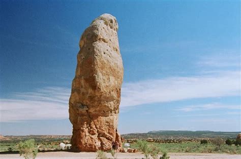
City of Rocks, New Mexico:
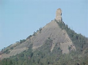
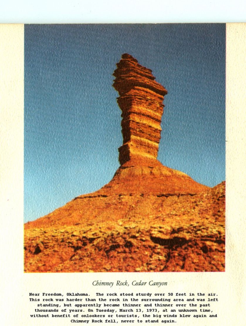
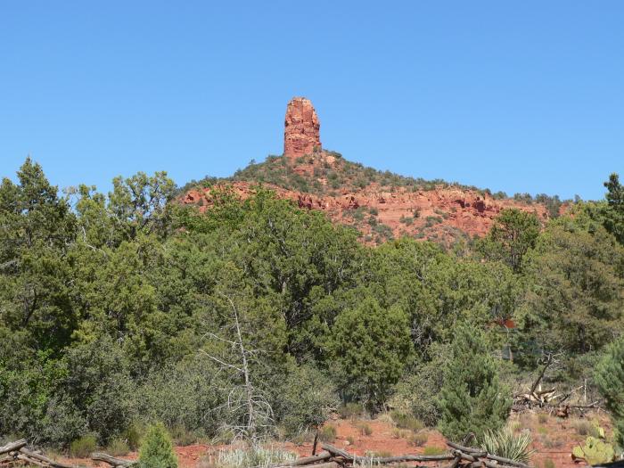
Chimney Rock, NC:
Grand Escalante Staircase in Utah:
Secondly, I strongly retain the impression from what I was taught in school that onion domes are only associated with Orthodox Churches, right? That is what I remember anyway. So when I started on this journey around the world, I couldn’t help but notice that they are everywhere.
So here are comparison photos, from top to bottom, between the Taj Mahal in India; the Hui Mosque, China: the Royal Pavilion in Brighton, England; Hazrat Sultan Mosque in Kazakhstan; and the Sultan Qaboos Grand Mosque in Oman. All of these countries figure prominently on the planetary gridlines.
Taj Mahal in Agra, IndiaHui Mosque, ChinaRoyal Pavilion in Brighton, EnglandHazrat Sultan Mosque in KazakhstanSultan Qaboos Grand Mosque in Oman
Next, series of comparisons involving the Alhambra in Grenada, Spain. The Moors are actually given credit for this one:
Alhambra Theater in Bradford, England (and the Moors are not given credit for this one):
You can see architectural similarities between top left: Piazza Della Signoria, Florence, Italy; Middle left – the Alhambra in Spain; bottom left: The Jama Masyid mosque in Delhi, India; and on the right, the Pena Palace, in Sintra, Portugal.
The bright colors of St. Basil’s Russian Orthodox Church in Moscow and this mosque in Singapore remind me of each other:
and these whimsical, yet flamboyant designs, reminds me of this one in Sri Lanka in a different kind of way:
Jami Ul Alfar Mosque, Sri Lanka
I am frequently seeing twin towers: Looked it up and found this explanation: The entrance of sacred and mysterious places have been guarded by two pillars. Whether in art or architecture, twin pillars are archetypal symbols representing an important gateway or passage towards the unknown.
So check out the twin towers in these monumental works of architecture:
The Townhall in Augsburg, Germany:
The Frauenkirche in Munich, Germany:
The Central Synagogue of New York:
View from Central Park in New York City:
Central Park
The Mormon Temple at Palisades State Park in Utah:
and a Mosque with twin towers in Iran.
Now I am going to share comparisons of similarity in styles I found from different places around the world.
This first set of four is a direct comparison of the similarities, starting from top to bottom, between this mosque in Amman, Jordan; the University of Otago in New Zealand; the Seoul Central Mosque in Korea; and the Tokyo Mosque in Japan.
Mosque in Amman, JordanUniversity of Otago, Dunedin, New Zealand, Est. 1869Seoul Central Mosque, Korea
Tokyo:
Tokyo Mosque, Japan
Here is a comparison, from top to bottom, between the Crystal Mosque in Malaysia; the mosque in Grozny, Chechnya; the Alhambra in Spain; and the Coricancha in Peru:
Crystal Mosque in MalaysiaGrozny, Chechyna MosqueThe Alhambra, Grenada, SpainThe Coricancha, Cusco, Peru
Here is a comparison between the domes of the two towers of the Crystal Mosque in Malaysia on the left, and the Central Synagogue of New York on the right:
Next is a comparison of the Central window of the Central Synagogue of New York on the left, with an example of Alhambra Art in Grenada, Spain in middle; and a carved wooden relief in the Coricancha in Cusco, Peru on the right:
And finally, a comparison of a mosque in Afghanistan on the left, with a mosque in Yerevan, Armenia:
I hope I have given you enough information and evidence to give what I am saying serious consideration.
I believe there was an ancient advanced global civilization that was unified. I believe we have been given a false historical narrative that removed this civilization from our awareness. I don’t buy that the similarities are random and coincidental, nor do I believe the phallic shapes were created from natural processes.
Stay tuned, because I have a lot more to share in future posts.
If you are new to my blog, my premise is there was an advanced ancient civilization that was unified around the world up until relatively recent times. This positive timeline was scrubbed from our collective memory and we were given a false timeline, starting from our understanding of history in 1492. This blog is dedicated to providing compelling evidence as to why I believe that.
I started putting puzzle pieces together when I found the North American Star Tetrahedron pictured below by connecting major cities in North America that fell on straight lines. Then I extended the lines out on a globe, wrote down the cities, and followed-up by looking at images and watching drone videos of these places.
This post is about an interesting series of alignments that connects to two-sides of the North American Star Tetrahedron.
Starting out by heading southwest on the alignment from Merida, Mexico – where the Chichen Itza temple complex is…
…you find these islands:
The Galapagos Islands, which are part of Ecuador, and were made famous by the studies of Charles Darwin, who was a naturalist and biologist on-board the HMS Beagle on its famous world surveying tour back in the 1830s. While a small human population lives there, it is a national park.
Next, the alignment crosses over Easter Island, which is nodal point on the planetary grid. A nodal point is where numerous leylines and planetary alignments connect. It is considered part of Chile, and its original name is Rapa Nui.
Easter Island is most famous for its Mo’ai, or giant heads.
More recent finds show that the famous gigantic heads of Easter Island are substantially much more than heads:
Next, this alignment crosses over the Antipodes Islands, which are considered part, and lie to the south, of New Zealand.
There is no public access to the these islands, and they are on the UNESCO World Heritage List.
Antipodes means “the opposite side of” and was thought for a long time to be the opposite side of London, though it appears to be opposite of a location in France.
The alignment crosses over the city of Invercargill, New Zealand, a city which sits at the southernmost tip of New Zealand. I see the same building architecture all over the world, with onion domes and they same style of building facade ornamentation:
The Snares Islands/Tini Heke, is a small island group south of New Zealand, which administers it but they are not inhabited. These islands are also designated as a UNESCO World Heritage Site.
Flinders Island is the largest island in the Furneaux Group, and these islands lie northeast, and is a state, of Tasmania:
This same alignment continues on up through the middle of the continent of Australia, through Uluru, also known as Ayer’s Rock, which is also a nodal point on the planetary grid, and is the earth’s third chakra.
The alignment leaves Australia at Cape Talbot:
which is also known for one of two Horizontal waterfalls in the world:
It then goes through Kupang, West Timor, which is also on at least one other alignment:
Next it passes through Flores Island, Indonesia. It is the tenth largest island of Indonesia. Flores Island is also known for the discovery of dwarf human skeletons in a cave – homo floresiensis. It is also known for the discovery of large skeletons like giant rats, and is also another home for Komodo dragons. The current inhabitants of Flores are primarily Roman Catholic in a predominantly Moslem Indonesia.
Then the alignment goes on to cross through Posu, and the capital of Central Sulawesi, Palu. Sulawesi is a province of Indonesia.
There are over 400 granite megaliths on Sulaweski, in the area of the Lore Lindu National Park, of which around 30 represent human forms.:
Lore Lindu National Park, Sulaweski, Indonesia
While we are here, and I am basing this next section on the top picture below that I found at the Lore Lindu National Park in Sulawesi, as this is a good opportunity to bring in comparison photos of very similar animal relief carvings in other places, in this instance in Peru and Turkey.
Animal carvings at Lore Lindu National Park, Sulawesi
Animal relief carvings at Gobekli Tepe, near Sanliurfa Turkey
Not only are there similar animal relief carvings in these three places, you find this similarity in humanoid figures in Sulawesi, Indonesia; Easter Island; and Gobekli Tepi in Turkey. In particular, note the identical placement of the hands on the belly on each of the statues.
Lore Lindu National Park, SulawesiEaster Island Mo’aiRelief carving at Gobekli Tepi, near Sanliurfa Turkey
Leaving Sulawesi, the alignment goes into Malaysia, and through Tawau, which is the capital of the Tawau District, in Sabah, Malaysia. In 1898, the British set up a settlement there as part of the British North Borneo Chartered Company. In 1944, Tawau was bombed and razed to the ground. It was rebuilt after the war.
It passes over Balabec Strait, which connects the South China Sea with the Sulu Sea:
The alignment then passes across Palawan, which is a province of the Phillippines consisting of islands:
Banca on the beach at El Nido
So then I come to the Spratley Islands in the South China Sea, which, like most of the places I am telling you about in this post, I had never heard of before. Come to find out, the Spratley Islands are highly prized for some reason, hotly contested, and claimed by multiple countries including China.
I believe that there is a powerful energy component–whether placement, production, or something else–related to these planetary grid lines, and that since this area falls directly on a major planetary alignment, it falls into this category.
Similarly, the next place the alignment crosses, traversing the length of this province of China, is the island of Hainan, which is being militarized by China along with the Spratleys.
This is Rongtang Village, a historic lava rock village on Hainan, near the city of Haikou. It is said to have been built 900 years ago. It is largely uninhabited. I think it is an interesting place to make note of, given the stone work there.
After leaving the island of Hainan, this alignment goes on into Mainland China, and goes through the Gobi Desert in Mongolia up through Siberia, and leaves Siberia at the Lyakhovsky Islands.
They are the southernmost group of islands in the New Siberian Islands in the Arctic Sea.
Right before you come to this point, lies Tabor Siberia. Tabor is on at least one other alignment as well.
This is a good place to put comparison photos of a Main Street in the United States on top; Kresy, Siberia on the middle, and Guthrie, Oklahoma on the bottom. Why? This picture I found of this Siberian town reminded me both of Main Street USA, and this picture I had seen of Guthrie, Oklahoma:
Main Street, USAKresy, SiberiaGuthrie, Oklahoma
Next, the alignment enters into North America at Cape Bathurst in the Northwest Territories of Canada (NWT), where I found more waterfalls (see the “Expanding on Waterfalls” post in this blog), and it travels through to Alberta, and then connects with the apex of the Star Tetrahedron at Edmonton, Alberta, and the side the emanates in a Southwest direction once again, only further North.
This side continues on the Alberta, including the Banff/Lake Louise area, down through the Columbia River Gorge area in Washington State, and on down through Nevada, the Sierra Nevada Range, Death Valley, CA (how many of you know that there are waterfalls there as well – called “Darwin Falls”); and then back out into the Pacific after it passes through Los Angeles.
The alignment goes across the following islands:
The Tuamotu Archipelago is the largest chain of atolls in world, and is formed of almost 80 islands and atolls:
Rangiroa, Tuamotu Archipelago
It also crosses the Society Islands, which includes Tahiti, Moorea, and Bora Bora:
TahitiMooreaBora Bora
And then the alignment crosses the Kermadec Islands, which are uninhabited but administered by New Zealand, and which show up on other alignments:
Autosave-File vom d-lab2/3 der AgfaPhoto GmbH
Next it crosses over Macauley Island, which is considered part of the Kermadec Islands, and is half-way between the North Island of New Zealand, and Tonga.
Macauley Island
It crosses over Curtis Island, which is also considered part of the Kermadec Islands.
Then it crossed over the northern tip of New Zealand, which is called Three Kings/North Cape, New Zealand. Remember earlier in this post, I showed where the southern alignment of this particular planetary grid configuration crosses right over the southern tip of New Zealand.
It then enters Australia at Sydney/Wollengong, travels through Australia for a bit before it exits at LaGrange. Then it heads to Surakarta, Indonesia, which is close to Borobudur, one of the nodal points of this grid:
Borobudur
From there, it goes up through the Java Sea, crossing…:
…Belitung. an island on the east coast of Sumatra:
And I will have a post exclusively on lighthouses at some point on this blog because they are relevant to this subject.
The alignment crosses the city of Kota Bahru, Malaysia:
Then it crosses over the Natuna Islands, which are a group of 272 islands located between Malaysia and Borneo.
Then the alignment goes on into Cambodia, through Phnom Penh, Angkor Wat, Eastern Thailand, Central Laos,and on into China. And so on and so forth. Lots of dots connect through here. I am going to stop here, but this is a lengthier post because this information very much belongs together.
I mentioned Cape Farewell, Greenland, showing a waterfall there, in my last post – “Expanding on Waterfalls.”
It sits on an alignment that globally connects with two sides of the North American Star Tetrahedron. Please bear with me on this as I try to explain this in words, and how it relates to the topic at hand.
Cape Farewell is connected with the global alignment that emanates off of the Edmonton, Alberta; Saskatoon, Saskatchewan; Winnipeg, Manitoba; Thunder Bay, Ontario; Sault Ste. Marie, Ontario; and Ottawa, Ontario, side of the Star Tetrahedron.
On the other side of Cape Farewell, this same alignment goes through Saglek Bay, Labrador; Kuujjuaq, Quebec; and the Belcher Islands in the Hudson Bay, before it connects with the side of the Tetrahedron that goes through through James Bay, Hudson Bay; Red Lake Ontario; Lake of the Woods, ONT/MN; Winnipeg, Manitoba; Minot, ND; Miles City, MT; Billings, MT; Yellowstone Park, WY; Pocatello, ID; Elko, NV; Reno, NV; Sierra Nevada Mountains, CA; San Francisco, CA; and Yosemite Falls, CA, and so on as it leaves North America and starts going over the Pacific Island groups.
This is a global alignment, and since I have a long list of places it goes through, in this post I am going to specifically focus on the islands that fall on it around the world.
First, starting with the Faeroe Islands, the first place the alignment comes to when it leaves Cape Farewell, and before it crosses over points starting in Trondheim, Norway, through Sweden, Finland, Russia, and Siberia, before it crosses over the Bering Sea and enters into North America at Nome, Alaska, and then head down through Alaska, and eventually through all of the capital cities of the Canadian provinces which are just north of the U.S. border, and on down the line.
The Faeroes lay north of Scotland between the Shetland Islands and Iceland. They belong to an administrative division of Denmark, and are home to approximately 50,000 people. If you look up the history of these islands, it is quite vague, with references to St. Brendan, a seafaring monk in the 6th century who described and island of sheep and a paradise of birds.
Let’s take a look at them:
All this for some sheep and some birds…
As I mentioned above, from the Faeroes, the alignment passes through all of those countries in Europe, and after entering in Alaska, goes on down the line in North America.
So moving on down this alignment, next is Isle Royale, which is located in Lake Superior. An alignment directly on the Star Tetrahedron goes right through here.
Isle Royale, Lake Superior
Isle Royale is known for its ancient copper mines. As a matter of fact, the copper from Isle Royale was being mined extensively in the Bronze Age, around 3,000 BC, and was considered the purest copper in the world. And nobody can really explain who was responsible for the mining, and how it got to Europe.
The best they can come up with is also how they explain the people who built the mounds. And they definitely can’t explain how it got to Europe. This a conundrum that confounds the construct that guides our knowledge of history.
Western Archeologists tell us that somehow Indians in loincloths figured out how to mine copper 5,000 years ago, and that somehow, we really don’t know how, it got to Bronze-Age Europe before there was transoceanic trade:
Copper Miners
And you will see this at every acknowledged mound site in North America: The mounds were built by Indians in loincloths, one basketful of dirt at a time….
Mound Builders
Yea, right. I don’t think so.
Moving along, the next islands on the alignment are the Canary Islands. While the Canary Islands are an autonomous community of Spain, they are actually physically located within a 1,000 miles of the coast of Morocco, and as a matter of fact the alignment crosses from there into Morocco at Laayoune (which means Springs, which is another frequent feature on these gridlines).
I have read from many different sources that there was a major connection between the Canary Islands and Atlantis. Things like they are parts of Atlantis that remained above water. Whatever the case may be, there are some really interesting things on the Canaries.
This includes the Guimar Pyramids, which are on the alignment, and are comprised of six rectangular terraced structures built from lava stone without the use of mortar:
This is a good spot to put in a comparison photo of the pyramids on the island of Mauritius, which is on the other side of Africa, and which are aligned to the sun. I learned about the similarities in style between Guimar and Mauritius from a Megalithomania presentation by Antoine Gigal, a multi-talented Frenchwomen who is an Egyptologist and Archeologist. Her work contains some very interesting finds about the Ancients.
Other photos from the Canary Islands:
On the other side of the alignment going through Africa, you come to the Maldives, a sovereign state in the Indian Ocean, situated in the Arabian Sea, and southwest of Sri Lanka and India. It crosses over in the area of Male, the capital city of this island country.
The top photo is the capital, Male, and the bottom is a nearby resort. Of particular interest are the nicely engineered protected harbors on both islands, and the straight street alignment in the top photo bisecting the island.
The next island the alignment touches is Timor, part of the Malay Archipelago, at Kupang in West Timor:
The next island stop is New Caledonia. This island grouping is called a French “Collectivity.” The alignment goes through the capital of Noumea, on the west side of the southern end of the big main island:
Also in Noumea, notice in the left-side picture, the nicely shaped protected harbor, and the massive stones on the pictures on the right-hand side.
From here, the alignment goes on to cross the Kermadec Islands. These islands are considered part of New Zealand, and are 600 miles Northeast of there. They are a Nature and Marine Reserve, and the only human presence is a permanently manned station at Raoul Island.
Kermadec Islands
Photos of the islands include:
Autosave-File vom d-lab2/3 der AgfaPhoto GmbH
Next, the alignment goes through the South Sandwich Islands. This is interesting – Britain calls it an overseas Territory, and it is also claimed by Argentina. Not unlike the Falklands dispute (which are also on a gridline).
More images from the South Sandwich Islands:
Kind of makes me wonder what European colonialism was really all about….
I just went through islands of one of two sides of the global alignment emanating from the Star Tetrahedron of North America that passes through Cape Farewell, Greenland.
Going in the other direction, after leaving Cape Farewell, Greenland, you come to the obscure and interesting-looking Belcher Islands in the Hudson Bay:
Belcher Islands
These abstract-art-looking islands, from the air, sit directly on this alignment.
It also appears that the Belcher Islands are in an alignment with other important cities and places on the grid in North America. This alignment passes very close to Ottawa, Ontario – the Capital of Canada, and a location which sits at the intersection of two sides of one of the tetrahedrons, and looks like it is tracking through Philadephia, PA – another significant location:
There are no islands on this alignment until after you leave North America and go into the Pacific, the alignment passes over the volcanoes Kilauea & Mauna Loa on the big island of Hawaii. Kilauea is one of the world’s most active volcanos:
Kilauea in 1969 eruption
And its neighbor, Mauna Loa, is the world’s largest volcano, and is active as well:
I will note here that the lay-out of the Planetary Grid System seems to correspond to the planetary tectonic plates, like there is a symbiotic relationship between the two.
The next islands on this alignment in the Pacific Ocean are the Kiribati Islands – The Republic of Kiribati is a sovereign state in the central Pacific Ocean. Howland Island is in this general area, which is famous as where Amelia Earhardt’s plane is believed to have disappeared. Kiribati is also the location of the International Date Line, since 1995.
In the Solomon Islands, the alignment runs through several of the islands, including Honiara, the capital. The Solomon Islands contain major battlefields from World War II, including Guadalcanal (which is on another alignment), and the form of government is constitutional monarchy, with Queen Elizabeth II as its head. Now that’s interesting….
Aerial of Beach Along St. John Island St. John, Virgin Islands
The last island I am going to share with you in this post is Willis Island. It is the only permanently inhabited island in the Coral Sea Islands Territory, which is an external Territory of Australia. There is a weather monitoring station there.
It doesn’t look like much, does it? It’s directly on the alignment, so it must have some significance in the overall scheme of things.
I am now complete with this post, but have more islands on the grid to tell you about in future posts.
Considering that water covers approximately 70% of the Earth’s surface, I found a surprising number of individual small islands, or island groups/chains, that are prominent on the grid lines emanating off of the North American Star Tetrahedron.
I found them connecting cities and places around a globe that are aligned in circles and lines over long distances. And I had never heard of most of them. This is actually a very big subject, so I will more than likely bring a substantial amount of information into form in more than one post. There are a lot of islands to cover, and tie-ins to what has been happening on the planet for some time. I will be re-visiting the subject in-depth in a future post called “History Reads Like a Book on Planetary Gridlines.” Some of that topic most definitely will come up in this post as well.
I will show you exactly what I discovered about the planet’s obscure islands in these posts.
A gridline on the Star Tetrahedron emanating from Merida, Mexico – which is the location of Chichen Itza – passes directly through better-known islands such as Grand Cayman Island (claimed by the UK, and off-shore banking haven); Kingston, Jamaica; and Grenada (U.S. Invasion 1984).
On its way around the globe, this same alignment also passes directly over some less well-known islands.
Fernando de Noronha, which is claimed by Brazil, is an archipelago of 21 islands, with only one of the islands being inhabited. Please note the solar alignment between the two off-shore peaks showing this photograph. This is a hallmark of the Ancient civilization, which was always aligning heaven and earth in every possible way.
Fernando de Noronha, Brazil
The only land between Fernando de Noronha and Sesfontein, Namibia is Ascension Island, a speck in the Atlantic Ocean over which the alignment directly passes.
What is interesting about Ascension Island, besides the name? Well, for one thing, it is a British colonial outpost. There is an U.S. military airbase, satellite and submarine tracking stations, a BBC transmitter, and a listening post run by GCHQ’s Composite Signals Organization. They have been squeezing the residents out for over 100 years.
Moving on to the Pacific Ocean on the other side of the alignment through Africa, the alignment passes over the southern tip of Madagascar at Cape Sainte Marie. Keep in mind, with what I am saying about the True Children of Israel, that in my video I said there has been a re-emergence of Judaism in Madagascar, which they say was the original faith of the island. Catholicism arrived in 1841. The island was colonized by the French in 1896. It regained independence in 1960.
From there, the alignment proceeds to cross over the French Sub-Antarctic Islands of St. Paul, and Amsterdam, and they are among the most isolated places on earth.
St. Paul (Ile de St. Paul), of which I included a picture of in the video for its shaped shoreline, as you can see in the foreground in the photo on the left, there are block-shaped rocks – another characteristic of the Ancient Civilization. Now, the only human presence is temporary on occasion as there is a scientific research cabin located there. France claimed the island in 1843.
The other island is Amsterdam Island, and is 53 miles from St. Paul. It also has a seasonal scientific presence.
Moving along the alignment, you come to Macquarie Island, upon which the Australian Government has a base for the Australian Antarctic Division, which includes 20 – 40 scientists, and a weather station and heliport
Macquarie is also designated as a UNESCO World Heritage site as the only place in the Pacific Ocean where rocks from the mantle are actively exposed at sea level. Let’s see what that looks like, shall we?
Well, well, well… What do you think? Actively exposed rocks from the earth’s exposed at sea level…or pyramids? This is how they hide it. Before the internet, who would even know?
After this particular alignment goes through Borobodur, one of the nodal points of the consciousness grid located in Yogyakarta, Indonesia, it continues on over Banjarmasi and Balikpapan, Indonesia.
Borobudur – Yogyakarta, Indonesia
Then it goes through Davao in the Phillippines, until it comes to the Northern Marianas and the Mariana Islands – Ascuncion, Pagan, Tinian, Saipan, and Guam. The Northern Marianas are a self-governing Commonwealth in association with the U. S. and Guam in the Marianas is a Territory of the U.S.
Saipan
This whole area, including Balikpapan in Indonesia (there was a battle there in 1945) , was part of the Southwest and South Pacific Theater. Now that I think of it, Theater is a funny word choice for an area or place in which important military events occur or are progressing. A theater can include the entirety of the air space, land and sea area that is or that may potentially become involved in war operations. Hmmm. There are no coincidences. The dark forces have to tell us what they are doing so it can be our free will choice to be controlled, but they do it in a very twisted and devious manner where no one knows they are being told. Not Legit, and We Do Not Consent!!!!
Here is a photo of Midway Island, site of a major World War II Battle:
That’s Midway, Folks!
And the U. S. Government still has a claim there as well. Midway is an unorganized, unincorporated Territory of the United States, and continues to be the only island in the Hawaiian Island chain that is not part of the state of Hawaii.
Makes me wonder what World War II was really about….
I think I am going to stop here. What I have shared here is one alignment only, and I have much more on other alignments. I will share this information in a series of posts.
On a recent trip to Peru, I took the photo above of the beautiful painting of the Ceque System that hanging in the Coricancha in Cusco, Peru. Cusco is called the Navel of the World, and the Coricancha, a breathtakingly beautiful megalithic masterpiece, is the navel of the Navel.
Coricancha is said to mean in English something like “Golden Enclosure.” Indeed, it was at one time covered in gold, and reputed to be the home of the one of the Golden Sun Disks of Mu (which was said to be hidden at the time of the Spanish Conquest). The fabulous gold of the Coricancha is long gone, stolen along with so, so much else by the Conquistadors and Catholic Missionaries.
The Seqe, or Ceque, system, of which the Coricancha was the center, was a huge scheme of sacred geometry, and involved at least 42 ley-lines radiating out from this center.
Literature available on this topic suggests that it referred to the Inca empire, which was partitioned into four divisions, and the empire called itself Tahuantinsuyu (“four parts”), and the boundary lines separating the four also radiated out from the Coricancha itself.
A chronicler of the time, Bernabe Cobe, wrote that the ceques were conceived as straight lines diverging radially from the Coricancha, the symbolic center of the world, and extending out into the cosmos.
Sounds like more than the Inca Empire to me….
Then there is the issue of the original Jerusalem being in Peru. It was called Heru-salem, or Hierosolym, and is said to be built by the Egyptians as their capital, and is where they “laid the cord” (the Ceque System?). The Temple of Heru in Egyptian (the language is Medu Neter) was Pr-Heru. Peru. Here is the link where I found this information: Hierosolyma
Waitress: How do you like your history?
Me: I’ll take my history scrambled, ma’am!
I believe that the advanced Ancient Civilization was the Muur AKA Moor Empire, the ancient Imperial Seat of which is now Monroe, Louisiana (for more on this, see “The Moors were in Unity Consciousness – The Positive Timeline of Humanity was Scrubbed” post on this blog), all of this was connected to one and the same civilization, and not separate civilizations as we have been taught.
Given that I am all about using this blog to provide compelling evidence for what I am saying, I am going to do just that.
The first thing that struck me as I was travelling in Cusco and the surrounding areas was the incredible similarities between Peru and where I live in Arizona. So I started taking pictures with an eye to capture these similarities.
When I arrived home, just a little over a month ago, I immediately put together a powerpoint showing not only the comparisons between Peru and Arizona, but also of other ancient sites that I have visited in Oklahoma and Arkansas. I was astonished to find undeniable similarities in those places as well, similarities that I was not aware of when I took the pictures. I will say that when I took the photos of the places in Oklahoma and Arkansas, I was taking them with an eye to capture them as ancient sites. So there was an intention set that came back as significant information when they were compared with photos of places in Peru.
What follows are groupings of all these photos into categories to highlight similar characteristics and features that occur in different places over long distances.
Red Rocks
This particular type of red sandstone masonry is found everywhere in these places – in Peru at Amaru Muru, near Lake Titicaca; in Arizona in the Red Rock country of Sedona and the Verde Valley, of which Cornville is a part; and at many different locations in Oklahoma – I have photos of locations in Bethel, OK; Woodward, OK; and Edmond, OK.
Amaru Muru, near Lake Titicaca in PeruJust off Cornville Road, Cornville, AZNear Twin Lakes Reservoir, Bethel, OKBoiling Springs State Park near, Woodward, OKLake Arcadia, Edmond, OK
Springs
The first photo is the view from the top of Montezuma’s Well in Rimrock, AZ. It is a very sacred, ancient, and special place. It is an artesian well, from 1,500,000 gallons of water emerge from an underground spring, of which the source is unknown. The whole Verde Valley sits on top of an artesian aquifer, so the name given to what is called the pre-Colombian culture – the Sinagua, or Without Water – in this part of Arizona is a huge misnomer. There is plenty of water underground, and there is a sophisticated hydrological system in place to convey it, and I will be getting to that shortly.
The story-tellers want to show you the stone structure seen inside the well, and say that it was built by cliff-dwellers; and they don’t want you to realize that the whole structure is intentional ancient masonry, and that the stone structure was built as a shelter by later occupiers .
Montezuma’s Well, Rimrock, AZ
The next photo is of the beautiful, peaceful spring at Roman Nose State Park in Watonga, Oklahoma (see the “Connecting the Dots, Cracking the Code, and What this Reveals” post in this blog to learn more about Roman Nose). You can see ancient masonry around the edges of the spring, and I was told by a friend that it is an interdimensional portal. So are the Antelope and Buffalo Springs in Sulphur, OK, which are reputedly interdimensional portals to the Pyramids of Giza. Knowing what I know now, that doesn’t surprise me. At the time, I knew it was meaningful, but I didn’t have the whole picture.
Roman Nose State Park, Watonga, OK
The next photo was taken at Boiling Springs State Park near Woodward, Oklahoma. This is just one section of a fairly large area containing masonry like this. Note the similarity to the masonry at the Roman Nose Spring. These locations are roughly 70 miles apart, and are geometrically aligned on the diagonal of the North American Star Tetrahedron as it goes through Oklahoma. The Ancients were all about Sacred Geometry, peace, beauty, balance, and harmony. These are healing places with very good energy.
Boiling Springs State Park near Woodward, OK
Next is a photo of Magnetic Springs, Arkansas. This location is very close to the location of the famous Passion Play of Eureka Springs. I made a trip there because, according to James Tyberron of earth-keeper.com, Magnetic Mountain, of which this spring is a part, is where the Atlantean Platinum Master Crystal of Communication is said to be located. And in addition to what you see here, there is ancient masonry all through this area. More on that later in this post.
Magnetic Springs at Eureka Springs, AR
Canal & Hydrological Systems
The Ancient Ones of the Advanced Civilization were Master Hydrologists. In the next photos, I have provided you with evidence of this in Peru, Arizona, Oklahoma, and Arkansas.
The first three photos are in Peru – at Quillarumiyoc (Temple of the Moon); Macchu Picchu; and Tambo Machay. At all three locations, there were canals like those pictured and other styles, throughout the sites. Also, I noticed canals with water on either side of the highways on which we travelled outside of Cusco. I tried to take photos as the bus was travelling, but I didn’t get a good picture depicting this.
At Quillarumiyoc (the Temple of the Moon), PeruMacchu Picchu, PeruTambay Machay, Peru
In Arizona, you find operating canals, such as the one you see here at the bottom of the outside of Montezuma’s Well. This is a beautiful location, with many clues of the skill of the stonemasons and hydrologists that built it, and in different styles. It is like a microcosm of styles that I saw in other places as you will see throughout this post.
Montezuma’s Well, Rimrock, AZ
The picture on the left below is part of a sophisticated hydrology system in Page Springs, Arizona, in the Verde Valley, and just up the road from Montezuma’s Well. It is at a B & B, and I saw it this spring visiting people staying there. It is private, so this was the best photo I could get to show you at least a part of what I saw that day because I didn’t take a photo at the time (was not in that mode).
I took the photo on the right was taken at an archeological site called Racqui on the Peruvian Altiplano.
When I returned from Peru, I took all of the Arizona photos that you see in this post because Peru reminded me so much of Arizona. So in the process of putting together a powerpoint, I found similarities like this, and others, as you will see.
Off Page Springs Rd, Cornville, AZ
Racqui, Altiplano, Peru
Here is another part of the hydrological system in Page Springs, at one of the many wineries there:
Page Springs Winery, Cornville, AZ
Lastly, I wanted to leave you with some images of dry systems, which turn into rivers when it rains hard. The one of the top left is outside my front door; the one on the top left is at the beginning of the Cathedral Rock trailhead; and the bottom photo is beside a Sedona, Arizona, neighborhood’s street. We call them culverts, or something along those lines, and just assume they were built by nature or the road construction crew. I beg to differ, as there is an explanation we are simply not told about.
Sedona, AZ Neighborhood Street
Like this clear canal bed running alongside the road in downtown Eureka Springs, Arkansas. One of the many examples which I saw there.
Eureka Springs, AR
I have two examples from Oklahoma. The top photo, again from Boiling Springs State Park, of a waterway there. The bottom photo was taken at Twin Lakes Reservoir in Bethel, Oklahoma. With its straight lines, and the appearance of the stone, I see a canal built by the Ancients.
Boiling Springs State Park near Woodward, OKTwin Lakes, Bethel, OK
Similar Features in Different Places
When I was in the process of comparing photos from different places, I noticed all of these previously unrealized similarities:
The photo on the left was taken at Roman Nose State Park in Oklahoma, and the one on the right was taken at Montezuma’s Well in Arizona.
Roman Nose State Park, Watonga, OK
Montezuma’s Well, Rimrock, AZ
The picture on the left was taken at Lake Thunderbird in Norman, OK, and on the right, at Turkey Mountain Urban Wilderness Area in Tulsa, OK.
The next three photos are a grouping of similar design shapes and angles. The top photo was taken at Heavener Runestone State Park, inside the area where the Runestone (which is now in a building) is located.
The middle photo is a feature of the so-called Cameron’s Bluff on Mt. Magazine in Arkansas.
The bottom photo is what you can see of what looks like masonry, angled in much the same way as the other two photos, just above the waters of Lake Thunderbird in Oklahoma.
The next two sets of photographs show a comparison of Amaru Muru in Peru, the top two photos; and Sedona, Arizona, the bottom two.
The next sets of photographs show you the beautiful shaped and fitted Ancient masonry, made from what appears to be white, pink, and gray granite.
The two top photos depict stonework from Quillarumiyoc in Peru. We had some individual meditation time at this location in our tour. I sat for quite some time in one of the stone wall’s alcoves. When I got up, I examined the stone work closely. As you can clearly see, the stones are beautifully textured, fitted, and no two stones are the same. Each stands alone as an individual, but is perfectly connected with the other stones.
Quillirumiyoc, Peru
I saw the same thing at Qenko, just outside of Cusco;
Qenko, Peru
and at the Coricancha in Cusco. Albeit a different style of masonry, the stone material is the same.
Coricancha, Cusco, Peru
Then when I trotted out the photos of other places I had visited several years ago, I found these that I took at Boiling Springs State Park, near Woodward, OK. I was surprised to see the same white, pink, and gray granite stone material, and masonry similar to what I saw in Peru.
The next photos are of evidence of lost ancient high technology in the form of energy waves and drill holes in stone at the Coricancha in Peru;
Drills holes in stone at the very ancient site of Qenko outside of Cusco;
and what appears to be drill holes and evidence of masonry at Cameron’s Bluff on Mt. Magazine in Arkansas.
And also very recently, some friends of mine were visiting the Grand Canyon in Arizona, and,when trekking through a wooded area, came upon these stones with precision drill holes:
Next is a photo of a similar looking material and structure at: Eureka Springs, Arkansas on the left; and Montezuma’s Well in Arizona on the right.
Next are comparison photos of an interesting and massive stand-alone stone at Macchu Picchu;
and something that looks actually quite similar in size and shape in the water, very close to the lower part of Montezuma’s Well where the sophisticated hydrological system I showed you earlier runs through.
Next are photos of similarly shaped large masonry blocks in Oklahoma and Peru.
Boiling Springs State Park, near Woodward, OK
Martin Nature Park is just north of Lake Hefner off of Memorial Drive in Oklahoma City. Lake Hefner is a man-made lake and one of the reservoirs for OKC. Please see the “On Chimney Rocks and Man-Made Lakes” post on this blog for more information on this subject.
Martin Nature Park, Northwest Oklahoma City
It is important to note that the Turkey Mountain Urban Wilderness Area in Tulsa is really hard to find if you are not from there. It is marked on a map, but there is no signage anywhere telling you how to get there. Once you find it, and there is barely signage there, you can find it by the presence of the huge masonry blocks the size of a VW that surround the parking area.
Turkey Mountain Urban Wilderness Area, Tulsa, OKTambo Machay, PeruQuillarumiyoc, Peru
Next is what appears to be ancient concrete or cement at Turkey Mountain in Tulsa, and Tambo Machay in Peru;
at Macchu Picchu in Peru, and the Heavener Runestone State Park in Oklahoma;
and at Lake Thunderbird in Norman, Oklahoma.
The next is a series of pictures depicting several similarities. In the top row, from left to right are: Cathedral Rock in Sedona, Arizona; Red Rock Canyon in Hinton, Oklahoma; and Macchu Picchu in Peru. In addition to the similar coloration of the stonework that you see in all three photos, there is an additional phallic symbolism in the first two photos, and what looks like the form of a uterus at the Temple of the Condor in Macchu Picchu.
In this next series, you see from left to right – Quillarumiyoc in Peru; a formation near the trailhead parking lot for Cathedral Rock; and a stone wall beside the road going through Eureka Springs, Arkansas. The similarities here are, first, the coloration of the stone work.
Then in the first two photos, there is a distinct similarity in shape and style between what you see in Peru, and what you see in Arizona, with of course the difference being that in Arizona, it is called natural – its megalithic origin unacknowledged. However, you can see masonry cuts in the red rock in the foreground.
Next, the photo on the left was taken at Heavener Runestone State Park in Oklahoma, and on the right at Amaru Muru in Peru. Amaru Muru is famous as an interdimensional doorway.
The Heavener feature, which looks very similar to Amaru Muru, is completely unacknowledged. As a matter of fact, it is located on the outskirts of the state park, which has no attention drawn to it whatsoever as it is not part of the main site. In order to take this picture, I had to go to the edge of what I was seeing as an ancient wall, and lean over a bit when I saw what looked like a window or door carved into the side.
These noteworthy similarities came out in the process of comparing photographs. The top & bottom photos on the left were taken at Eureka Springs in Arkansas, and the ones on the right at Macchu Picchu.
The next series of four photos are to show similarities in the landscapes that include pyramidal shapes. The top photo was taken just outside of the Village of Oak Creek, part of Sedona, Arizona. The second photo near Quillarumiyoc in Peru. Below that, on the left, was taken near Amaru Muru, and on the right was taken of a view from a water taxi on Lake Titicaca.
With regards to the Lake Titicaca photo, I was reminded, when I saw the beautiful reflection in the waters of the Lake (which is an extremely powerful place on the planet), of these other photographs which show perfect reflections.
I really believe this was an intentional effect of the Master Builders of the Earth. They strove to align Heaven and Earth in all things and at all times. That is what I see when I look at these photos. Beauty, Harmony, Balance in Stillness. They were very capable of creating of this effect.
Here, in the top photo, is a picture of the rock formations that you see on the way to Cutimbo in Peru. I took the bottom photo of a similar-looking rock formation from the shuttle on my way home from the Phoenix Airport.
In the next series of photos, on top of the first set there is a photo of Cutimbo in Peru – which is famous for its stone towers called Chullpas; and on the bottom, a photo I took on Beaverhead Flats Road outside of the Village of Oak Creek in Arizona.
In this second set, the top photo was taken from the bus on the Peruvian Altiplano, and the bottom was taken on State Road 179, right before you enter the Village of Oak Creek.
And finally the last sets of pictures. When I travelled on the Peruvian Altiplano, I really felt like I was in Arizona. The top two photos were taken on the Peruvian Altiplano, and the bottom two of the Sonoran Desert outside of Phoenix, Arizona, on my way home from the airport.
Evidence like this, and I have much more than this, is why I believe there was an advanced Ancient Civilization that was global and unified.
What we have been taught about history does not explain in any way the consistencies and similarities of form and structure that I am seeing in what I have shared in this post, and worldwide.
We are surrounded by, and living on top of, the infrastructure of an Advanced Ancient Civilization.
When I moved to Oklahoma from Fairbanks, Alaska, in 2012, I looked up information on nearby sacred sites on Oklahoma to go visit, and at that time really thought they were places I had to drive far to see. I have learned, in my life’s journey of uncovering this evidence, it is hidden in plain sight, in that it is literally just outside our front doors, in our back yards, in our neighborhoods, especially in our parks, and on our highway and road systems.
On our highway and road systems? Yes, most definitely!
But, but, but – Department of Transportation Civil Engineers!
I am going to show you why I think the DOT Civil Engineers laid out the road system directly on top of what were ancient transportation systems – whether canals or land-roads – and built bridges on-top of temples/earthworks.
I have selected the best pictures I can find to illustrate these points:
First, bridges on top of temples. This computer generated image shows a very geometric-looking earthwork. In real life, I saw the same perfect geometry countless upon countless times where bridges cross highways. More on this observation as I go.
This would be an example of a bridge crossing a highway on top of two symmetric, same height earthworks. So, Michelle, the highway department built that, right?
Well, here’s the problem I have with that.
The same beautiful embankments/earthworks occur everywhere,where the sides of the highways are symmetrical and sometimes quite high for very long distances. Why would any road construction project, which would be on a budget, take more time to make everything perfect and geometric, and sometimes quite high, over a long distance, than less?
Here’s another example to show you beautifully rounded curvatures and shapes beside a highway. Road construction costs and plus the cost of building earth embankments, and stay on budget? This is not an isolated example by any means.
There are so many examples where you see places where cuts had to be blasted stone through to get the road through. Pay really close attention to these places the next time you drive on a highway, because they have blasted through ancient infrastructure. In many cases, blocks of masonry are clearly visible if you understand what it really is.
They also built roads around ancient infrastructure.
This is a picture that was taken on Highway 123, on what is called the Pig Trail which goes through the Ozark National Forest in Arkansas. I had a first-hand experience of this. I travelled on this road in 2016. I took a week-end trip to Eureka Springs, Arkansas, from Oklahoma City. I saw a lot of evidence of the Ancient Civilization, from the time I left OKC, on my drive there, as well as in Eureka Springs. Then, I decided to take Highway 123 to Interstate 40 to get home. It is the road less travelled, and I am glad that I took it because of what I saw and experienced. The Pig Trail is notorious for it’s extreme switchback turns. The reason for the extreme angles of these sections is the road is this:
Pig Trail,Highway 123, Ozark National Forest, Arkansas
For long distances along this route, there are sheer walls like in this picture, so they had to build the road to circumvent long distances of massive stone walls.
Now, since we are in Arkansas, this is a nice segue into the cover-up code word of Pinnacles. I am showing you more examples of the many ways they have hidden this vast ancient civilization right in front of our eyes. This has taken place, not just in North America, but all over the world.
Here is my first “Pinnacle” experience. Just a little bit west of Little Rock, near Natural Steps, is Pinnacle Mountain State Park. Alert: Code words, code words – Natural Steps, located right near there, is a give-away too!
Do you see what I see in this picture? I hope so, because that is what it looks like.
And there are two more pyramids, that are not part of the state park, and to which access is completely cut-off – there is no way you can get to them, and to see them, you would have to do it by boat from the Yacht club near by on the Arkansas River, or climb to the top of this Pinnacle Mountain. Otherwise, the only other way to see them is to view them from the Visitors’ Center Observation Deck on a relatively clear day, like this photo I managed to take here.
Get the picture?
This is where you have to piece the truth together in other ways, because there is no way you are going to be able to find a reference to pyramids in Arkansas, anywhere! Ever!!
If you are interested in delving further, here is a link to a Wikipedia article on Natural Steps, Arkansas, and please read between the lines as you read it. Further down the article is a section called “Masonic Stone” that is particularly significant. This clue and others are contained in this link: Natural Steps, Arkansas – Wikipedia.
Next, in Arizona, this is a picture of Pinnacle Peak, in the Fountain Hills area just outside of Phoenix. Note the masonry blocks, and as well how the different features of this ancient site are given cutesy names. Nothing intentional to see here. All natural. Yea, Right.
Next is a picture of Pinnacle Mountain in South Carolina:
Pinnacles National Park, which is near Hollister, California:
And, while there are more Pinnacles to show you, I will leave you with an images from The Pinnacles of Victoria, Australia on the left which bear a resemblance to the more well-known standing stones of Carnac in Brittany, France, on the right.
On to Palisades.
The Code: A Palisade is defined as a line of lofty steep cliffs, usually along a river.
So, for example, here are the famous Palisades of New Jersey and New York, along the Hudson River:
Looks pretty uniform in height, and flat on top, doesn’t it?
Next, these are The Cove Palisades in Oregon. Really flat top there as well.
These are pictures taken at the Mississippi Palisades State Park in Illinois.
And a photo taken at Palisades State Park in South Dakota:
Also at Palisade State Park in Utah. The top photo was taken at the golf course there, showing the ancient stone-work, and the flat top.
The bottom is the oldest operating Mor-mon Temple in Utah. Please note the earthwork that it is built upon, and the Moorish-style architecture of the building, including the towers, onion domes, and ornate-stylings.
Lastly, here are the Pinnacles at Mt. Rainier National Park in Washington State. You can certainly still see there are ancient shaped stones at this site.
Boulders, you say? Nope. Boulders are a cover-up code word.
Now, on to Pillars.
These are the Lena River Pillars. I found these following the alignment that left Alaska, crossed over between Nome, Alaska, and Uelen, Siberia, and then as it crossed Siberia on its way across the world. These Pillars are accessible by river cruise near Tiksi in Siberia, before you get to Tabor in Siberia.
Here are the Pillars of Hercules in the island of Antigua in the West Indies:
And then there are the really famous Pillars of Hercules. The Rock of Gibraltar on the Island of Gibraltar is often referred to at the Pillars of Hercules, however, there may be one other pillar in North Africa, the identity of which is disputed between about 3 locations. This is what the Rock of Gibraltar looks like:
Rock of Gibraltar
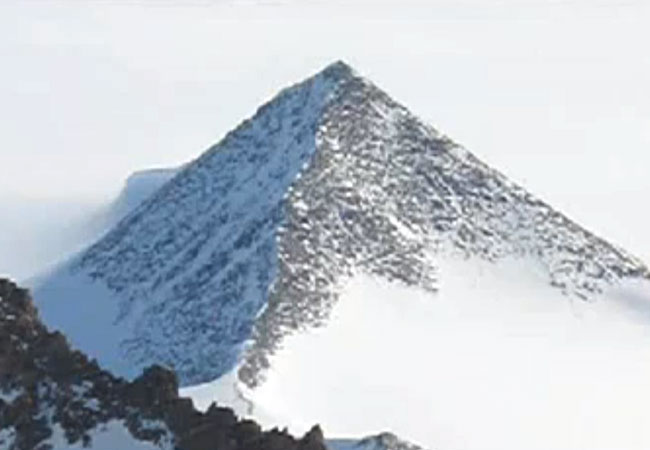
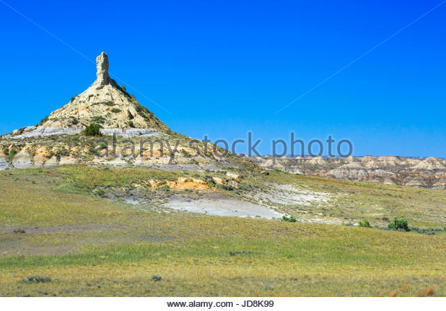
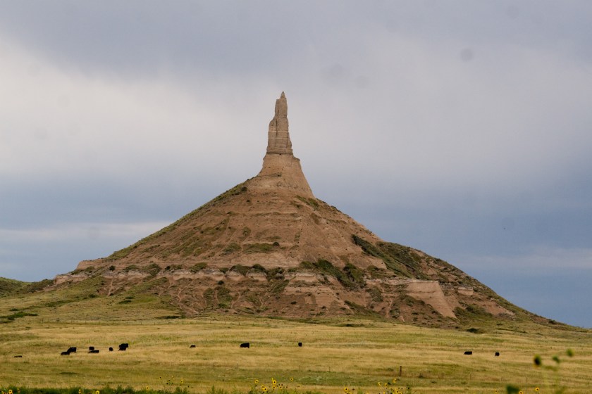
Lastly, in this particular post, what does Pyramid refer to? Besides the ones I have already showed you masquerading as something else, here are of few of the Pyramid Mountains that are out there:
Black Pyramid Mountain in Montana
Pyramid Rock in Gallup, NM
There are two Pyramid Mountains in New Jersey. Tripod Rock is at the Pyramid Mountain in Kinnelon, New Jersey. It is called a “glacial erratic,” the product of retreating glaciers during the Ice Age. It consists of one huge rock, on top of three small rocks.
Meanwhile, the same thing in New York State – called Balanced Rock, and also considered a Glacial Erratic, a product of the Ice Age’s retreating glaciers:
Meanwhile in Great Britain, and other places around the world, this same stone configuration considered a dolmen. A dolmen is defined as: a prehistoric monument of two or more upright stones supporting a horizontal stone slab found especially in Britain and France:
\
This seems rather inconsistent to put it mildly….
Pyramid in Antarctica.
Wait a minute, what?
Well, stuff’s been burbling up about Antarctica on the Internet these days. You might want to check it out to get caught up.
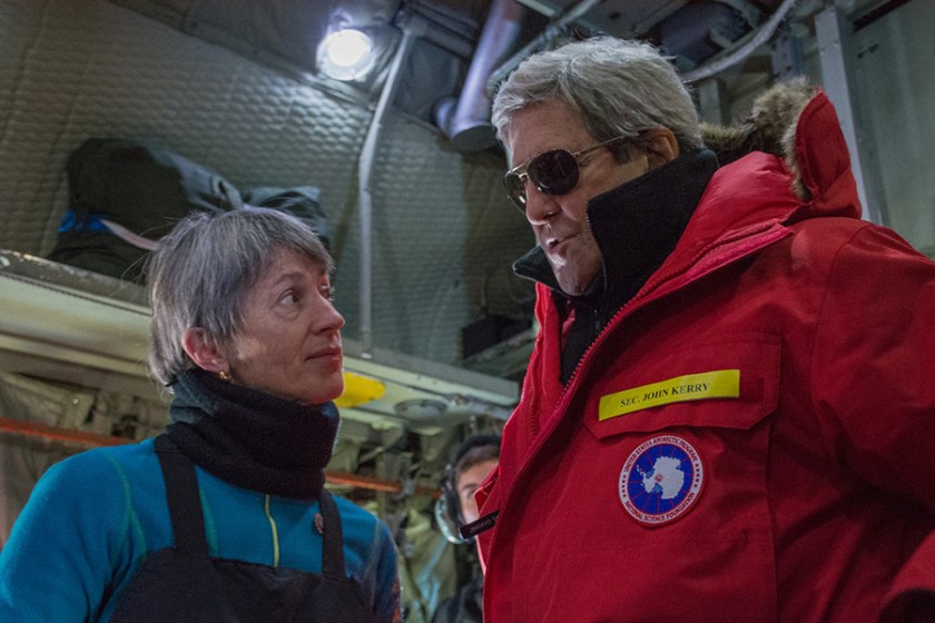
In the meantime, Kiril, the Patriarch of the Russian Orthodox church, has visited Antarctica in recent years, apparently to minister to penguins;
and former Secretary of State John Kerry visits there as well (his jacket patch depicts the continent of Antarctica in this photo).
I am going to leave you with these unacknowledged pyramids. The following photos, and graphic depiction, are taken of Jerome, site of an ancient copper mine, not too far from Sedona, and are part of what are called the Black Hills in Arizona:
This post is dedicated to providing answers as to who is responsible for what happened to the advanced Ancient Civilization, what happened directly as a result of the destruction of this civilization, and why this information is very relevant in the present time.
Ever since I came into awareness of this information, I have felt an urgency to get this information back into the collective awareness.
When I first uncovered the physical lay-out of the planetary (and consciousness) grid, my first reaction was concern about what would happen if the dark forces ever got a-hold of this information. Then I realized the dark forces already had the information, and have been negatively manipulating the grid, and thereby our consciousness, by inflicting maximum pain and suffering at locations on the grid. I saw where modern history reads like a book on the planetary grid, and that not only did the grid need to be healed, I understood that this information about the existence of it needed to get it back out in to the Light of day, and back into collective awareness.
My awareness continued to expand to include the details about the Moors, Washitaw Muurs, and Hebrew Israelites, their global presence, and my belief formed that Humanity was in Unity Consciousness up until 1492 (if there is any accuracy to our historic timelines). I will have a separate blog about the Unity Consciousness piece because I have very specific reasons for believing that because of what has come up in my research.
The world history we have been given is filled with war and violence, death and destruction, and I have good reason to believe that Humanity was actually on a positive evolutionary path until this timeline was hijacked by forces with a very negative agenda. I really think the Catholic Church did not exist before 500 or so years ago.
Why do I believe that? Because the advanced Ancient Civilization built everything on the planet, including the Vatican. When the timeline called Rome was superimposed on the existing timeline, and in particular the history of western civilization re-written, the buildings of the ancient civilization were re-attributed to the “Romans” and “Greeks” and so on and so forth, and not to their actual builders. The false timeline was grafted onto the infrastructure built by the ancient civilization.
This is a comparison of the Roman Colosseum, and a better preserved Colosseum in Pula, Croatia:
We are told that the Romans built the colosseum in Croatia. There is a major line that emanates from the North American Star Tetrahedron that goes through Croatia on its way across Romania, the Crimea, Georgia, Chechnya, Ukraine, and so forth. This is a fascinating global alignment that I will be discussing on a separate post.
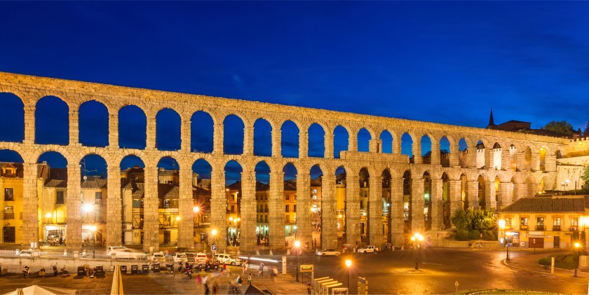
The so-called Roman Aqueduct of Segovia in Spain…
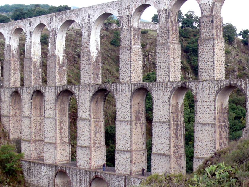
…and the Xalpa Aqueduct in Tepotzatlan, Mexico.
Funny, I didn’t know anything about the Roman Empire being in Mexico. Did you?
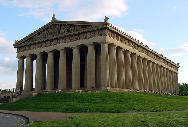
This is the Nashville Parthenon. They want us to believe that it took only 2 years to build for the 1897 Tennessee Centennial Expo. Seriously?
One more thing before I move on to the main point on this post.
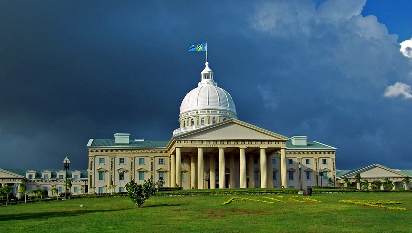
I found this picture of the capitol of Melekeok, Palau, in the South Pacific, when I was following a long-distance alignment I found starting from San Francisco that went right through Melekeok.
This entire complex is huge. Is this overkill for an island nation with a small population (in 2018 it is 22,000)? Or does it represent something else entirely. I also want to put this out as a beautiful example domed architecture. I definitely have an opinion as to who really built the world’s domed buildings. And I do mean all of them….
I have recently come to realize that the suppressed story of the civilization of the Moors/Muurs/Hebrew Israelites is a template for the globalist elite for their plans to control Humanity and destroy western civilization in the present day. I am also going to say that while unfortunately the globalists are far along in the implementation of their plans because they have been working at it for a very long time, I believe that conditions are in place for a new positive timeline for humanity. The globalist plans have been interrupted.
I would not know relevant current events except for Twitter. I was never on Twitter until February of this year, and I got a Twitter account to become a Twitter Activist and help red-pill people by tweeting/re-tweeting truth bombs. I am following Truther/Awake people, and I see current events that are happening in real-time on my twitter feed that I would not otherwise be aware of because it is not something that would be covered by mainstream news (which I don’t follow anyway).
So before I go off on too many more tangents, let me go back to who I believe is responsible for what happened to the advanced Ancient Civilization.
I mentioned Peter Moon and Rick Smith in my last post. The work of both men contain important clues and information about the Moors. I am cautious in my approach to accepting information as valid, but if it resonates with me over time, and ultimately makes sense as an explanation, I am more comfortable with it. I bring this up because I tend to accept what they are saying as good information.
First, Peter Moon. I have read of number of his books. I think it was in either the “Montauk Book of the Dead” or “Synchronicity and the Seventh Seal” (thinking probably the former), he writes about the scrying activities of John Dee and Edward Kelly bringing in fallen angels and other lower vibrational entities.
The Russians actually corroborated this information in a press release in February of 2015:
Rick Smith, also known as the UFO Teacher, has an interesting personal story in that there has been multi-generational ET contact with the women in his family, except this generation where he is the contactee through which information is received. He is a professional artist and writer.
This first video is 23-minutes long, I watched it before I put all this information together in 2016, so I would say that in a way it served as a marker or guide along the way. He brings out what happened to the Moors was the result of an ancient vendetta against the Family of Man and the Temple of Solomon by what he called the Shettu Regime.
In the second video, which is 2-hours long, he goes into depth about where that ancient vendetta against the Moors and the Family of Man came from, as well as providing information about the Moors. He also brings in the Reptilian, Annunaki, and Archon (who he calls the Greys) involvement in what has taken place.
I have come to see the Fallen Angels, Reptilians, and Archons as being primarily responsible for what happened to the advanced ancient civilization, and what has been going on up to the present day. Not as sure about the Annunaki’s direct involvement in what has been taking place on this planet, but I don’t discount the possibility.
I think that what happened directly as a result of the destruction of this ancient civilization was a human and social engineering process in which race and religion were weaponized, and that somehow racial phenotypes were engineered and categorized by continents: Europe – white; Africa – black; and so on.
Christopher Columbus, the Jesuits, the Spanish Conquistadors, and the British East India Company were the agents which by which the take-down of the ancient global civilization ensued under the guise of exploration & discovery; to find gold, religious converts, and land; religious administration and education; and trade ventures. Actual results were the exploitation and destruction of indigenous populations; theft of land, considerable wealth and resources; forced religious conversion; destruction of culture and genocide; and more of the same through the so-called trading company.
Christianity was weaponized as missionary zeal, with no compunction about abuse and torture to convert, or murder if refusal to convert.
Race was weaponized and used to create division, separation, and fear.
It was never about the upliftment of white people over others. It was about taking out the higher consciousness of the planet, and lowering the collective consciousness to the lowest common denominator (or as I also say, to the level of Beavis and Butthead) for the purposes of control and domination, and I believe this is the result of an interdimensional war against the Creator and Creation through Humanity.
The identity of the true Israelites, the 12 tribes of the Great Central Sun, the Children of Is-ra-el – Mother – Father God – was replaced with a false identity and hidden away, and many were relegated to an existence of slavery, degradation and marginalization, if they weren’t killed.
This subjugation allowed for the identity of the Israelites to be co-opted up the Khazarian Jew/Zionist crowd. The Rothschilds purchased Jerusalem in 1829, and subsequently acquired considerable land in Palestine in the 1800s and early 1900s.
Many of you may know this already – there are four city-states which serve as the foundations for the creation of a New World Order:
The Vatican = Spiritual Control
City of London = Financial Control (House of Rothschild)
Washington, D. C. = Military Control
The United Nations = World Government
They have done innumerable things to prevent the awakening of Humanity, which is their biggest fear. Once we wake up, claim our power, and know about their severe crimes against Humanity, they are toast. They covertly use methods like chemtrails, fluoridated water, tainted food supply, EMFs, TV, movies , a controlled-media in an effort to control the population just to name a few.
They tell us in the Georgia Guidestones about their plans for depopulating the planet, and like everything else they do, they use positive-sounding verbiage to disguise a negative agenda towards Humanity:
Just as Christianity was weaponized against the ancient civilization, radical Islam (along the lines of ISIS) & Sharia Law is what is they have in place to take down Western Civilization.
Like the destruction of the Ancient Civilization, this is another human and social engineering process that has nothing to do with benefiting Humanity. Problem – Reaction – Solution: The destabilization of Western Civilization by radical Islam is going to be restored to order by the New World Order. Or so they planned.
In the U.S. some places have more issues with this than others, There has been massive corruption in our government surrounding complicity with the globalist agenda.
Their activities are being more and more exposed in the alternative media and the Internet. They do death and deception well, and will say and do anything that serves their purposes, but it is getting harder and harder for them to keep their activities hidden because their high crimes within government and crimes against humanity are being exposed.
I think very soon we will be seeing high-level criminals being held accountable for their crimes.
In Europe, the social problems occurring with Islamization is much worse than it is here, though it is happening here in different parts of the country. In Europe, the influx of refugees from countries which have been intentionally de-stabilized to create this problem (the Cabal/Deep State really exists for those who may not believe it), is causing major issues for the citizens of those countries.
Throughout Europe, women are afraid to go out for fear of being raped because of on-going attacks, including coordinated ones.
If you have not yet heard, in England, an outspoken journalist named Tommy Robinson was doing a live-stream interview outside of a courthouse where there was a trial going on involving Muslim members of what they are calling a grooming gang. The police arrested Tommy for doing the live-steam, and within a short period of time on the same day was tried, sentenced to a 13-month jail sentence, immediately taken to jail, and a gag order was placed on the press.
Read about it here: Tommy Robinson
You need to know this stuff is happening, and I wish it wasn’t so. If it stays hidden, it keeps happening, and we are unconsciously manipulated by forces which desire to harm us.
I came across the Clock of Destiny website several years ago, and the impression that it made on me is that Islam in its pure and original form is about applied sacred geometry and universal laws:
Marko Rodin, inventor of the Rodin Coil, intuited a key that deciphered vortex-based mathematics, and I believe this is all part of the advanced applied knowledge of the ancient civilization:
In conclusion, I presented answers to which I have given much thought to explain how what happened to the Ancient Civilization is relevant in the present-day. No, I am not a conspiracy theorist. I am wide Awake.
My work is about bringing out what has been hidden, and my intention is to bring this information to the light for awareness, healing and transmutation for the highest good and the greatest need.
I have had to process through getting angry and upset at what has been done, but I know that the only way out is to go into higher consciousness and the heart, and to align with what we want, not with what we don’t want.
Those who are awake and aware must endeavor to hold the neutral space for the integration of light and darkness as we move through these pivotal times. It is so important to unite in love as One Humanity, and no longer allow the strategy of divide and conquer to work.
Ancient Ones,
I am So Sorry
Please Forgive Me
I Love You
Thank You
This process of unlocking this hidden information has been very experiential for me. I participated and acted on my intuition in various ways, and in so doing, received more and more information. This is the co-creative participatory process that I talked about in my video. As this happened, my awareness grew exponentially.
One example is that when I started to crack the code early in 2016 that covers everything up, I realized that rock in a place or attraction name was a code word. So I started looking up anything with the word “rock” in it. Any rock. Take your pick. All rocks are connected to the Ancient Civilization: Chimney Rock, Balanced Rock, Point of Rocks, Rock of Gibraltar, Little Rock, Rock Hill, and so on and so forth.
There are lots of Chimney Rocks. In this first type of Chimney Rock, you have a pyramidal shape with a phallic antenna. Pictured on top is a Chimney Rock in the Terry Badlands (another code word) of Eastern Montana; Chimney Rock in Nebraska; and the bottom photo is the Chimney Rock in Colorado.
And this is an old photo of what was Chimney Rock in Freedom, Oklahoma, which is also the location of Alabaster Caverns (more code) and is also not far from Mooreland in Woodward County, Oklahoma. Now, they want us to believe, as captioned below the photo, this 50-feet high, sturdy rock was worn away so much over thousands of years, that one day in 1973, big winds caused it to fall without anyone seeing it happen.
My BS meter is pegged out on this one!!!
Moving on to another style of Chimney Rock, here are three examples where the shape is more phallic in nature overall: first, Chimney Rock in North Carolina; the second is Chimney Rock in Kodachrome Basin, Utah; and the third is the Chimney Rock in Sedona, Arizona.
I have come to believe that the phallic symbols represent a uniting of the energies of heaven and earth, and that they morphed into onion domes over time, representing the same shape for the same reason.
Next is the subject of Man-Made lakes.
I was aware of two man-made lakes when I was growing up in Montgomery County and I related the experience of playing on big rocks as a child in the area of “Rock Creek” in Rockville, Maryland, and that this location was close to Lake Needwood and Lake Frank, and knew that both were man-made lakes. Lake Needwood has great recreational facilities, and I went there often in my childhood with family and groups.
I have come to understand that man-made lakes serve at least two purposes: 1) creating a water supply; and 2) covering up ancient infrastructure.
I realized early on in cracking the cover-up code that Federal, State, and local parks are part of it. So I started looking at pictures of parks on the Internet, which included a lot of man-made lakes.
In Oklahoma alone, there are more than 200 lakes created by dams, which is the largest number in any state in the U. S.
The first list of Oklahoma lakes are ones I looked at images on the internet. I primarily used the bing.com search engine, which was useful because in addition to your search item, they have section of “People interested in __________ also search for __________” and I got a whole lot more information about other similar places out of that process!
Keep in mind that rocks are key features of the Ancient Civilization….
Lake Altus
Lake Murray
Lake Texhoma
The next sets of pictures are lakes that I went to see in person.
The first place I went to test my idea that man-made lakes covered up ancient infrastructure was Lake Thunderbird outside of Norman. I knew what to look for, and was not surprised when I found it:
Found the same thing at Lake Arcadia, outside of Edmond:
Digital Camera
Digital Camera
Digital Camera
Digital Camera
Digital Camera
By the way, Lake Arcadia reminded me of what I saw in pictures of the Gulf of Bothnia, which is between Sweden and Norway, on an alignment I was following on my globe:
I found the same kind of evidence at other lakes outside of Oklahoma City, including Twin Lakes in Bethel, Oklahoma:
Digital Camera
Digital Camera
Digital Camera
Digital Camera
Digital Camera
The last thing I want to touch upon is what I found when I visited the man-made lakes in Oklahoma City. Lake Hefner is on the northwest side of OKC, and Lake Overholser is in the west side. Both of these lakes have huge slabs of concrete covering the lake shores!!!
At Lake Overholser, this is the only evidence of the ancient civilization I found: the ancient red rocks used to make the sign, and these big cut blocks of red rock behind the park office:
Digital Camera
Digital Camera
Lake Hefner itself didn’t really have anything to offer, but Martin Nature Park on the north-side of the lake sure did!
Digital Camera
Digital Camera
I have just shared a few examples of how the creation of man-made lakes covered up ancient infrastructure. It has been done everywhere. Not random or isolated occurrences. And the process created reservoirs for local water supplies.

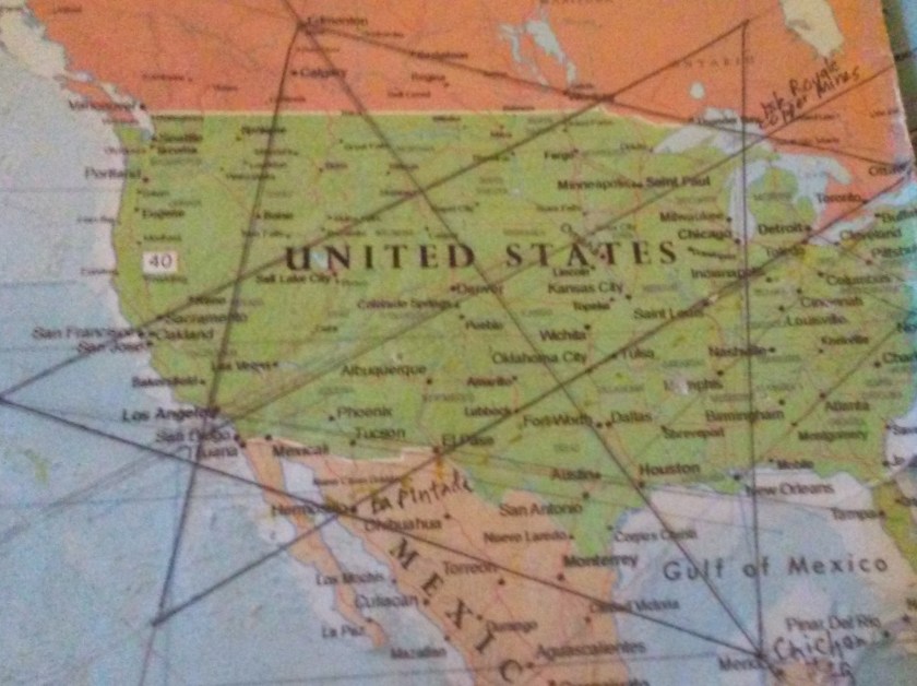
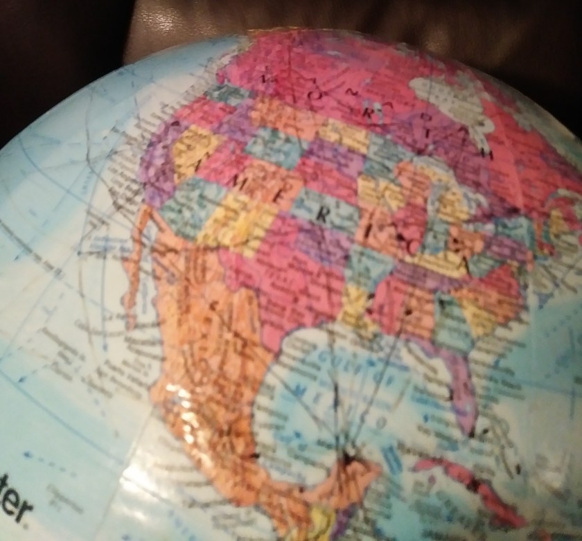

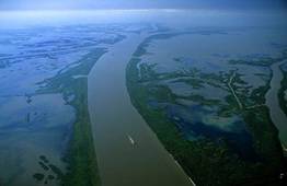

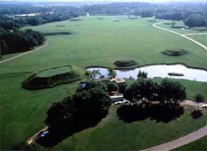
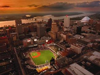


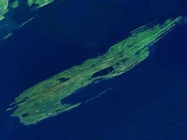
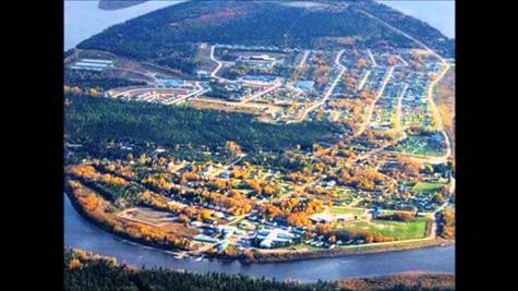

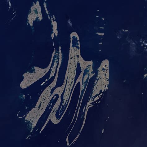
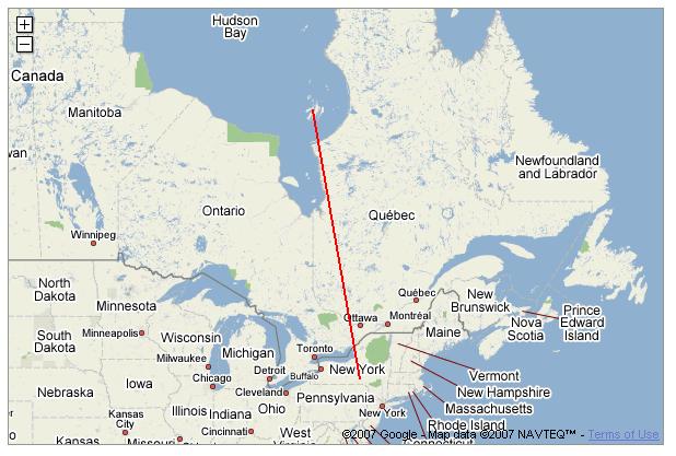
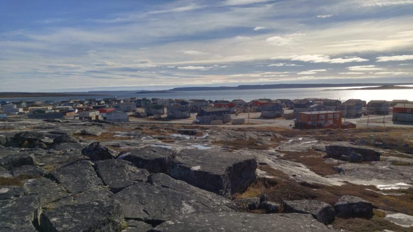
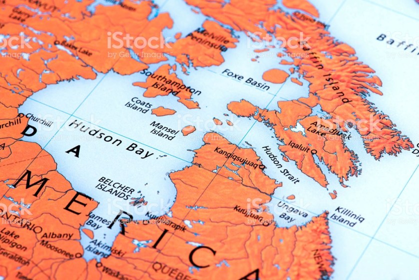
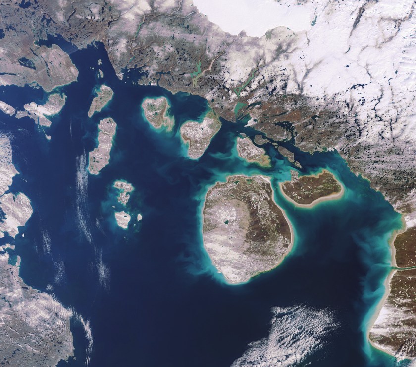
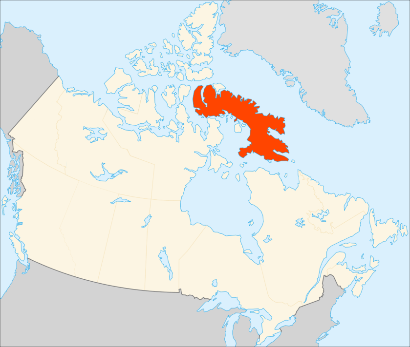


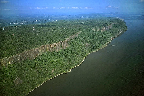
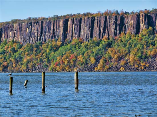
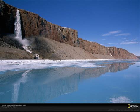
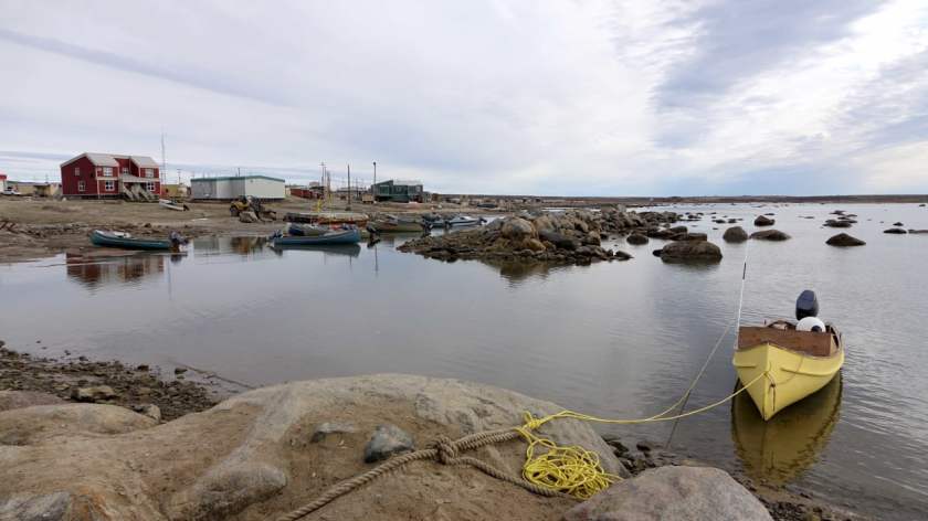
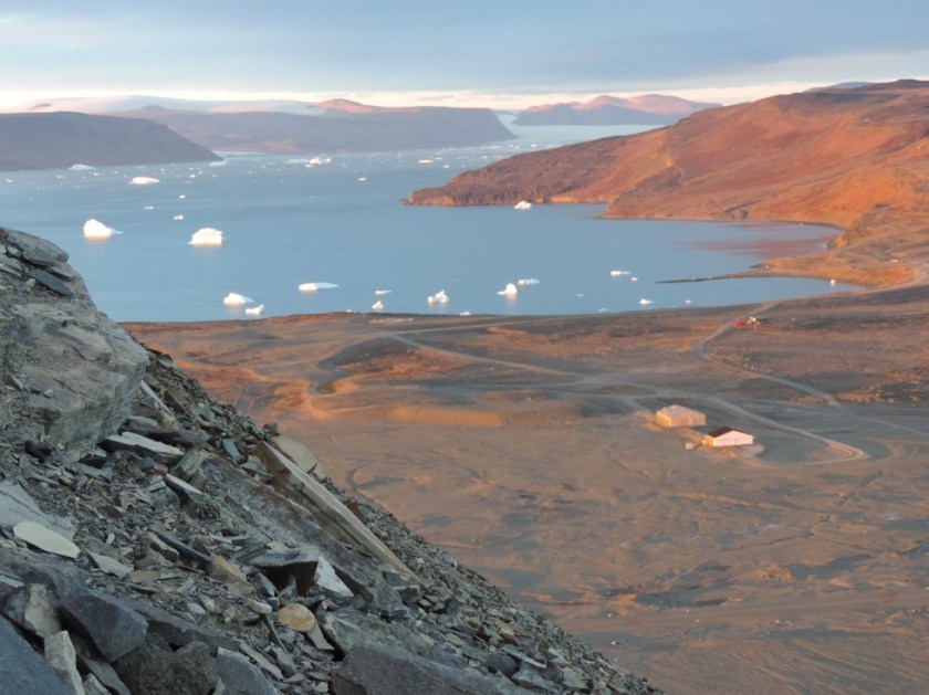
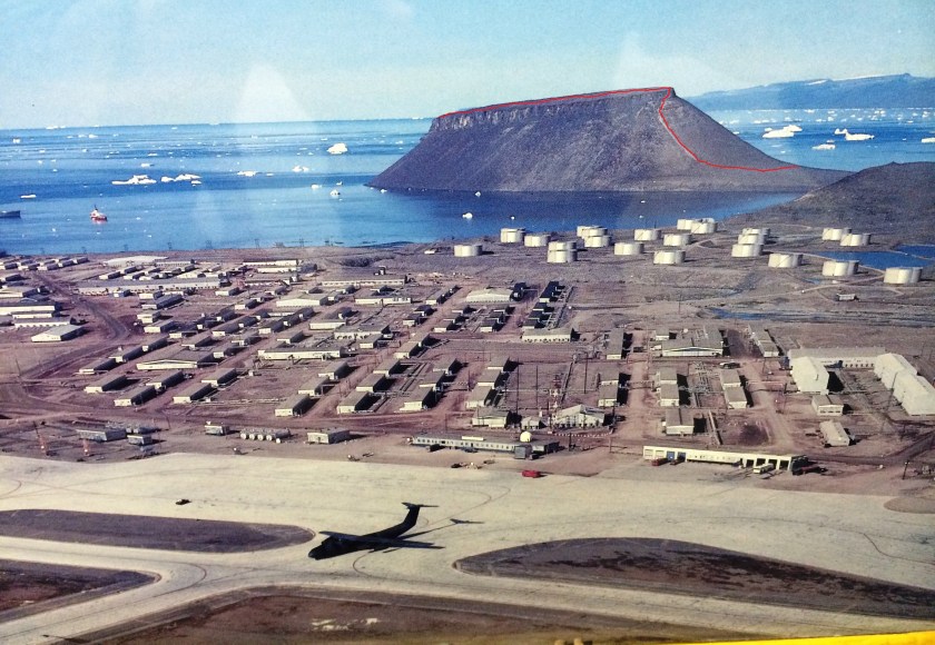
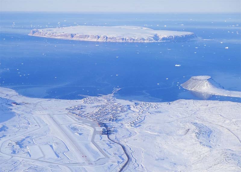
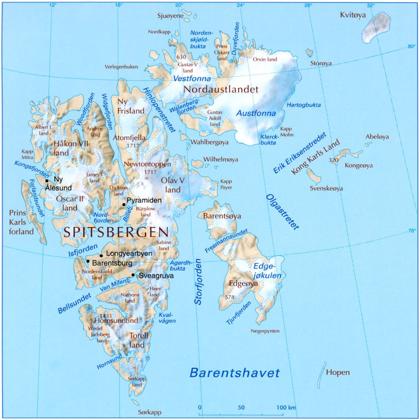
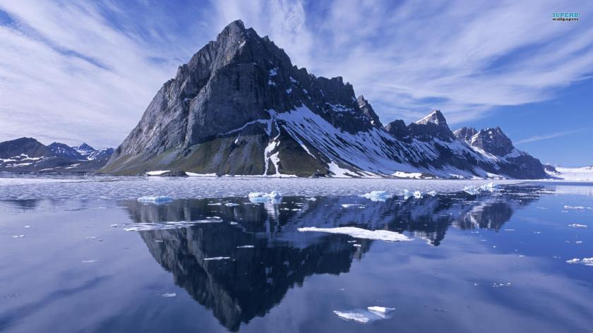


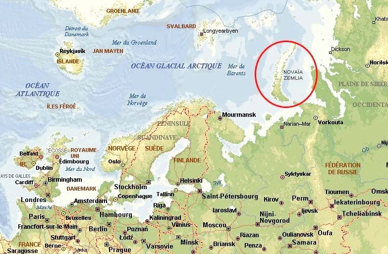
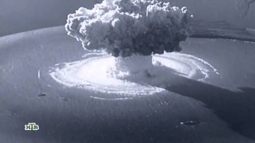
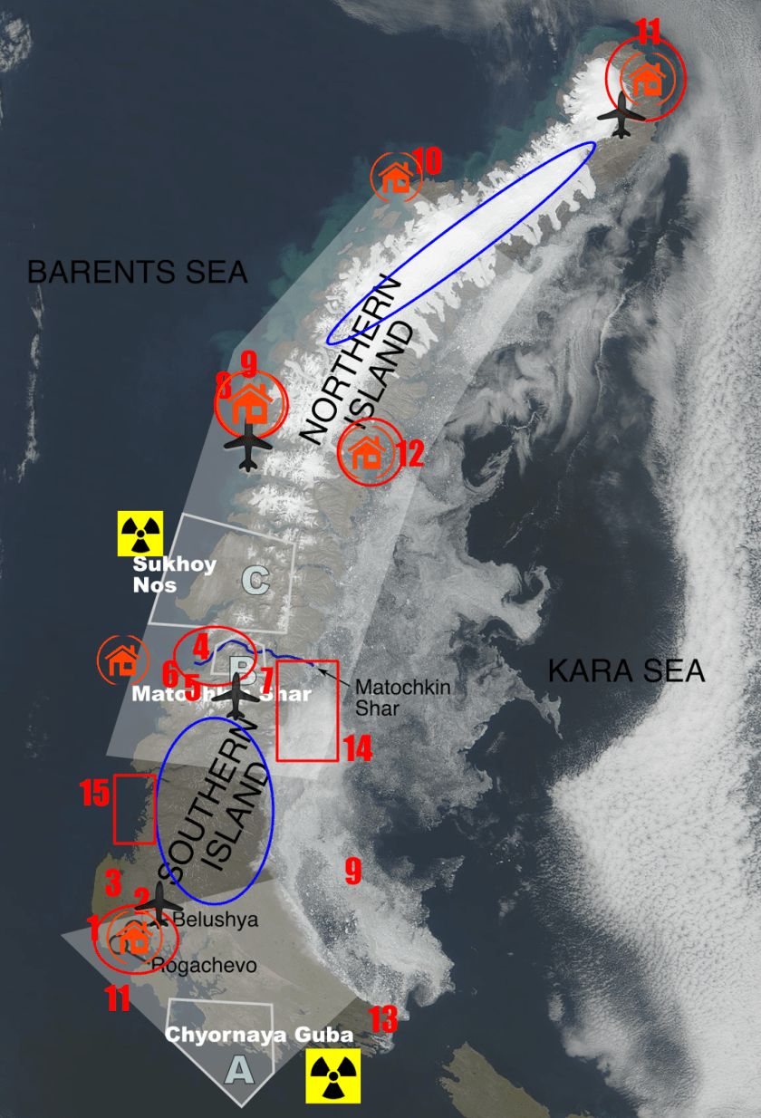
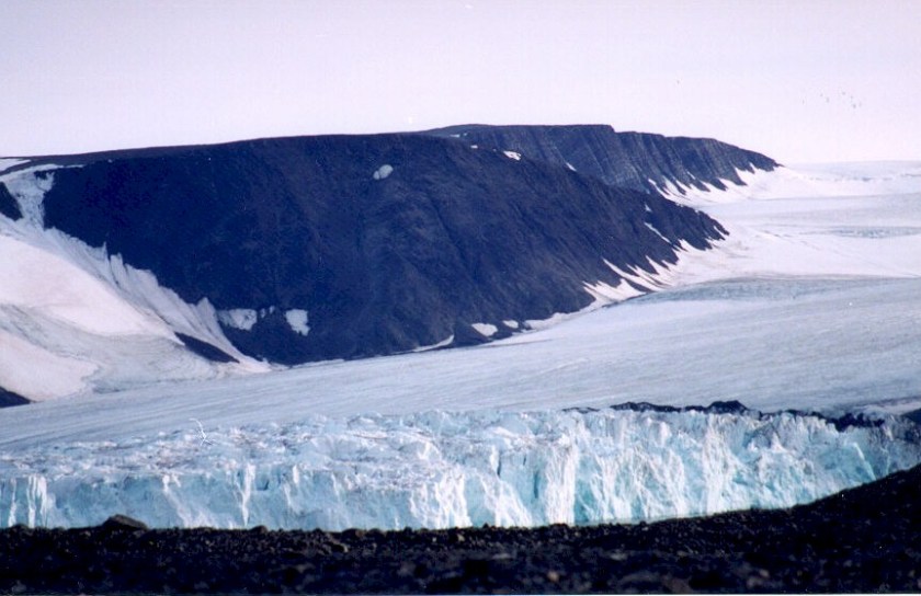

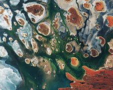


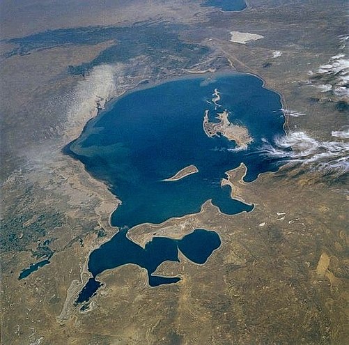
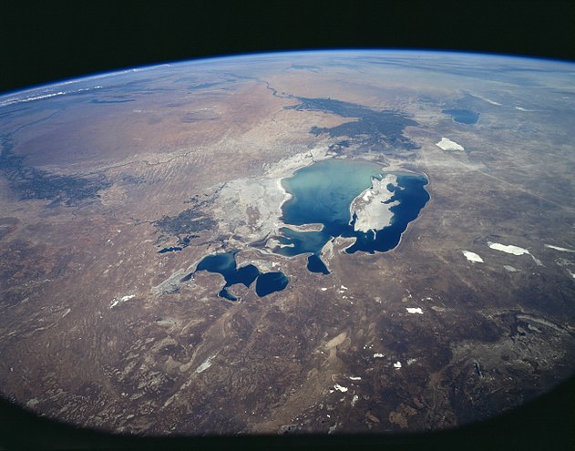
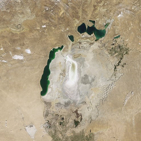
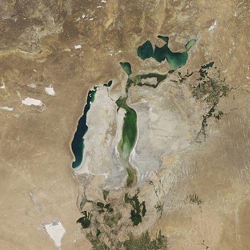
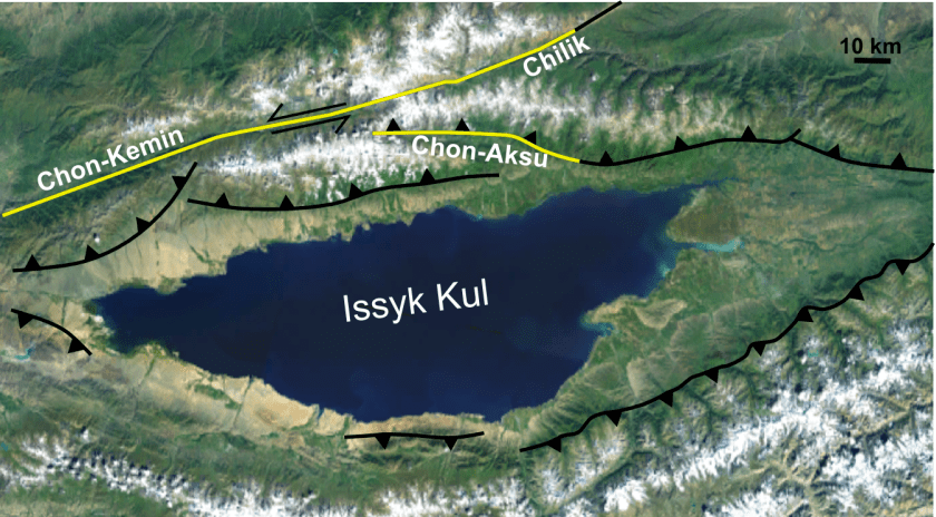
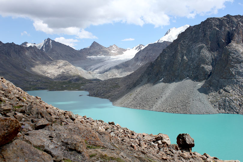
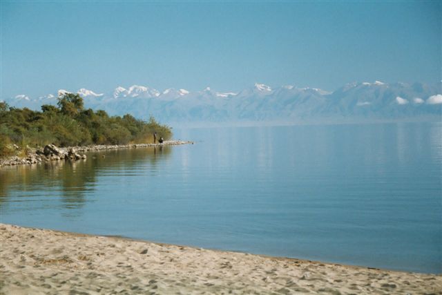
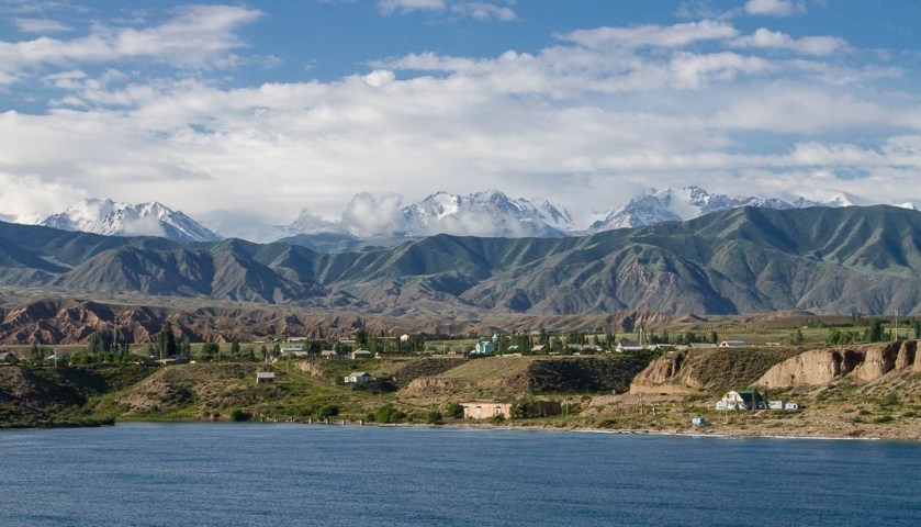
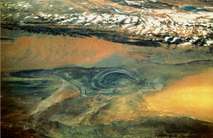
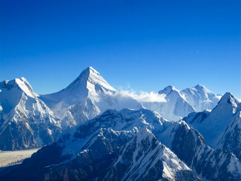


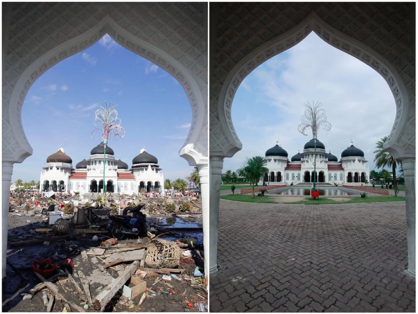


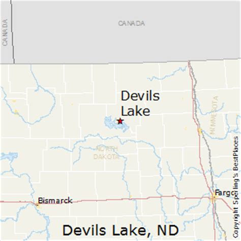
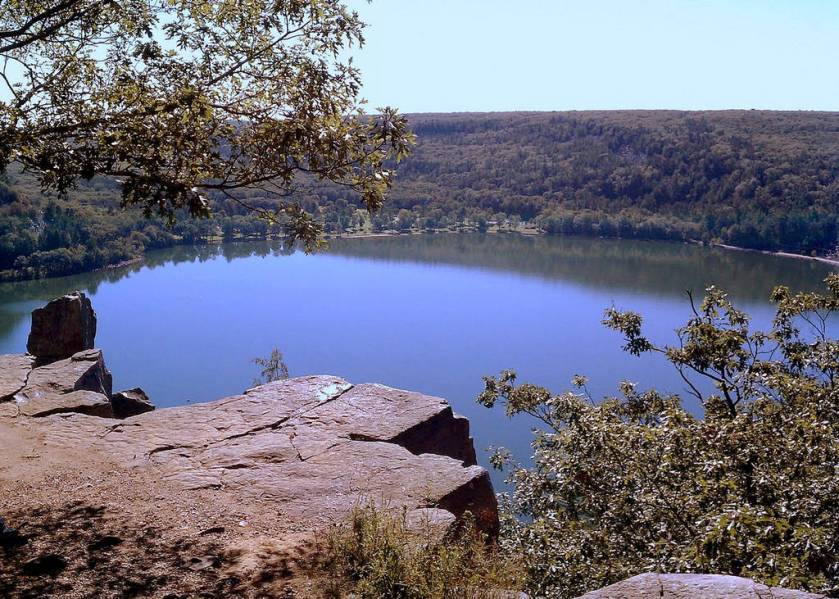
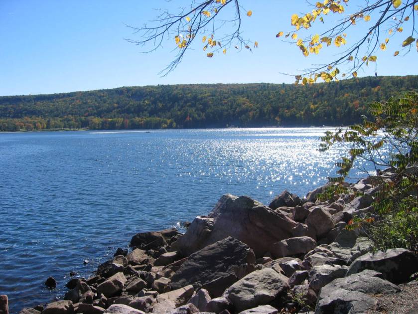


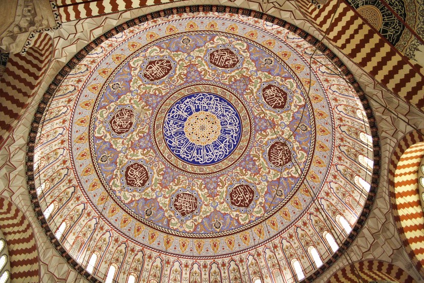

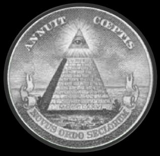 .
.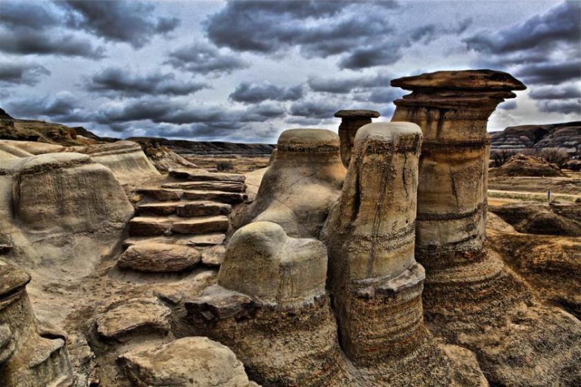


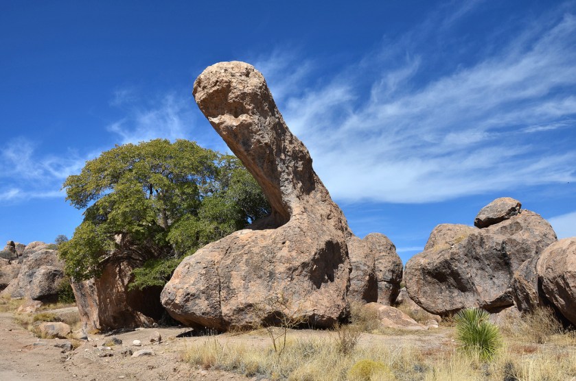
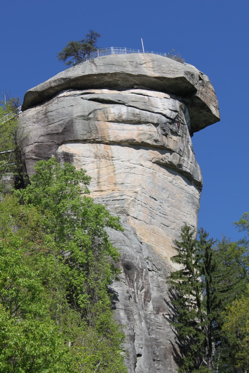
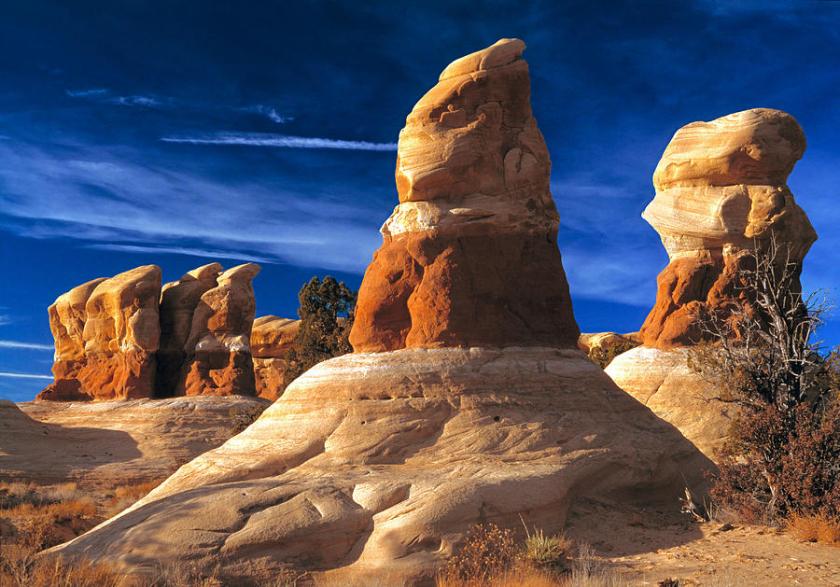
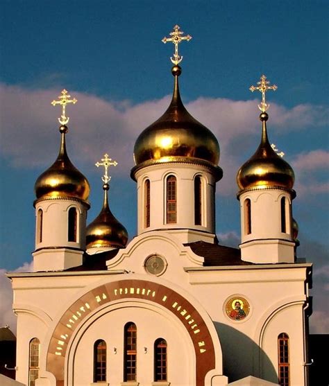
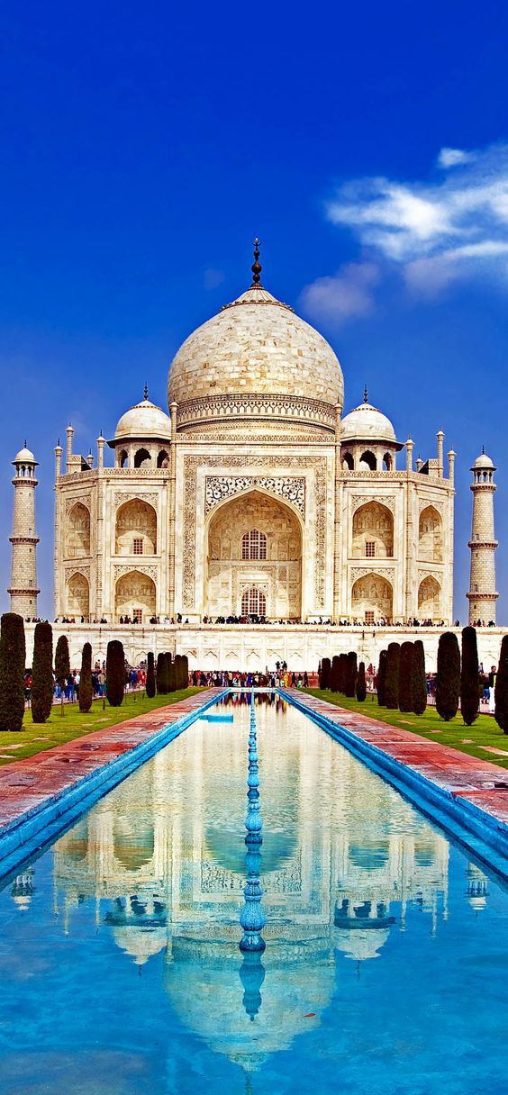
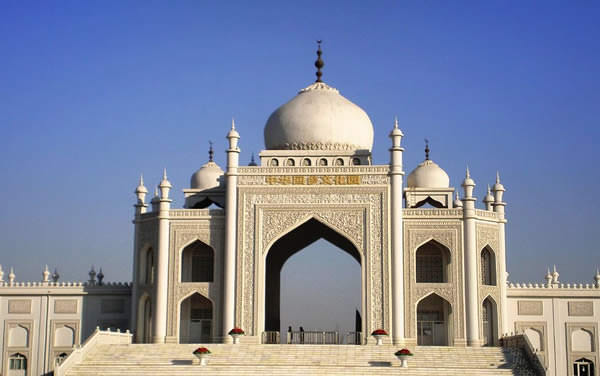
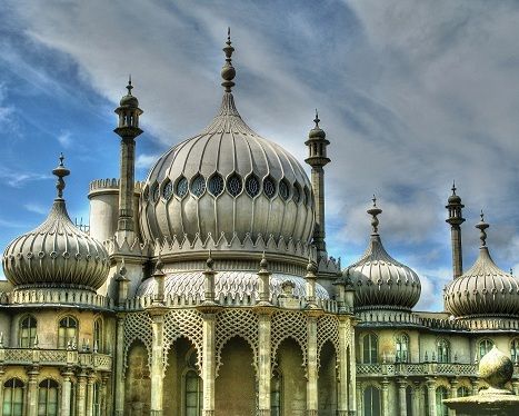
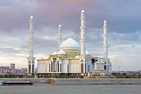
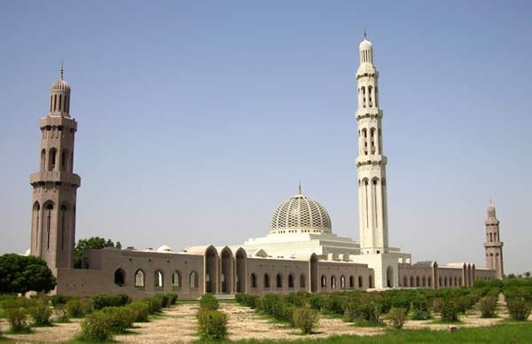


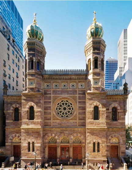
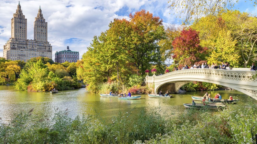
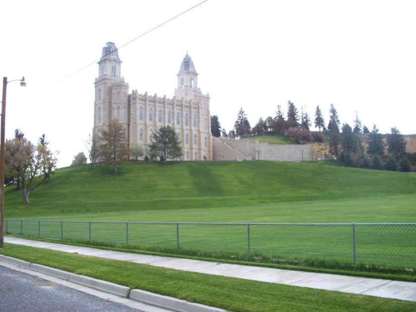
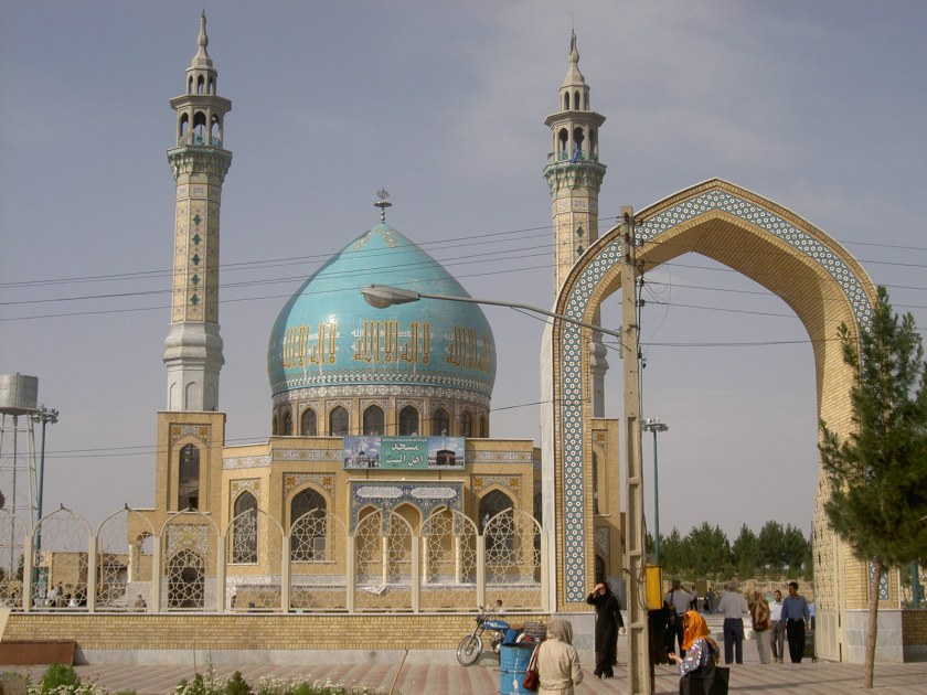
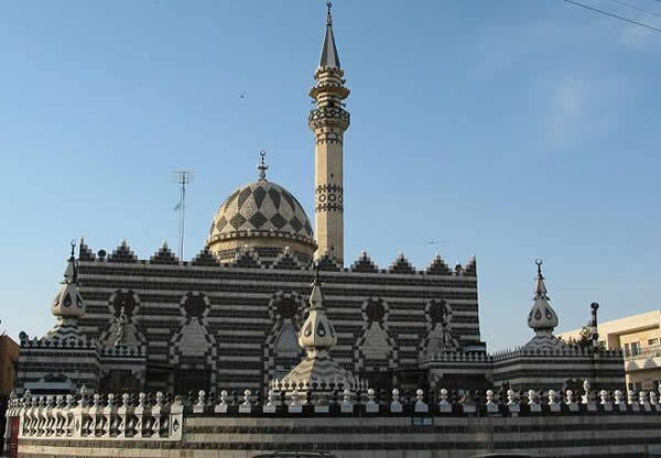
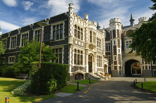
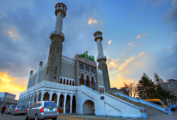
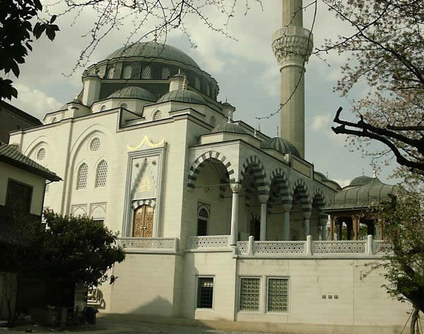
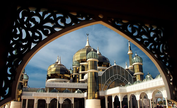
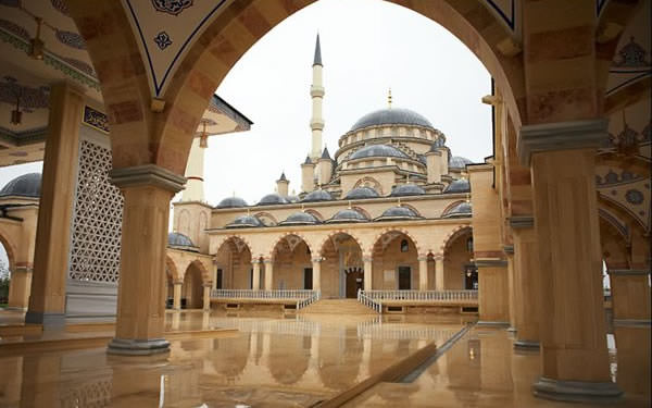
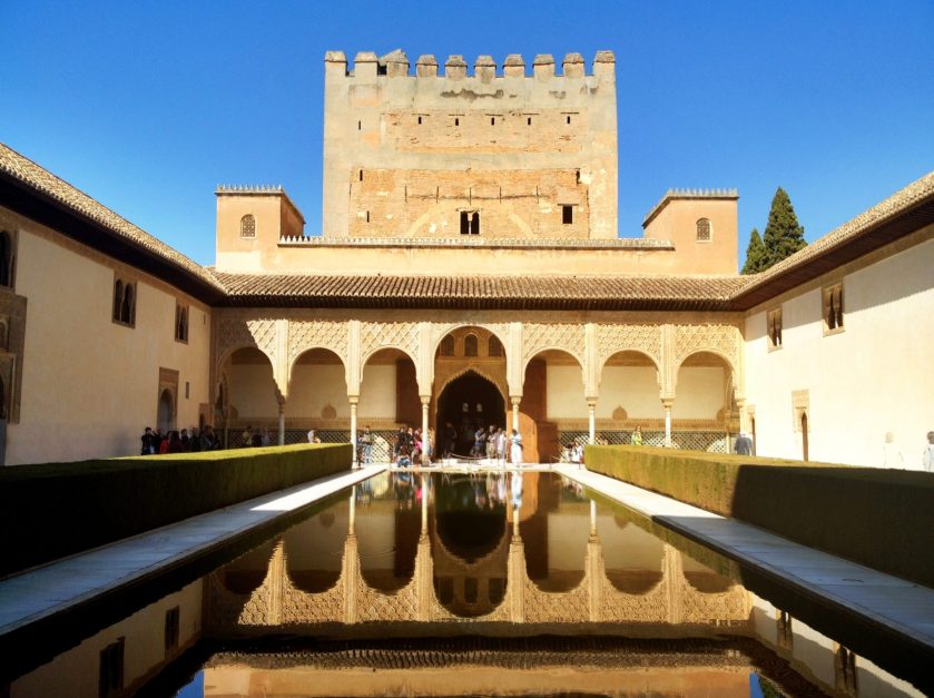
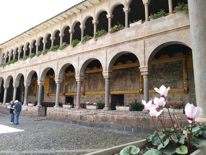


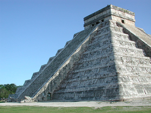
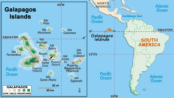


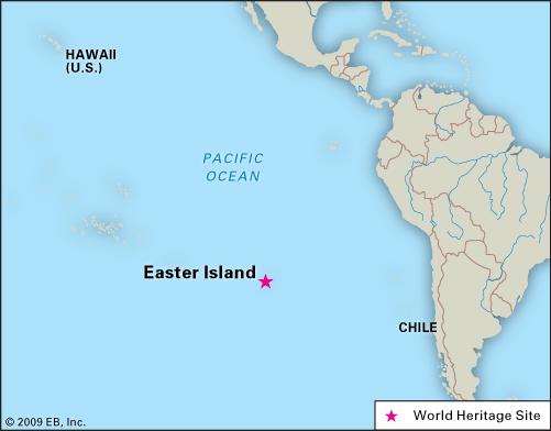
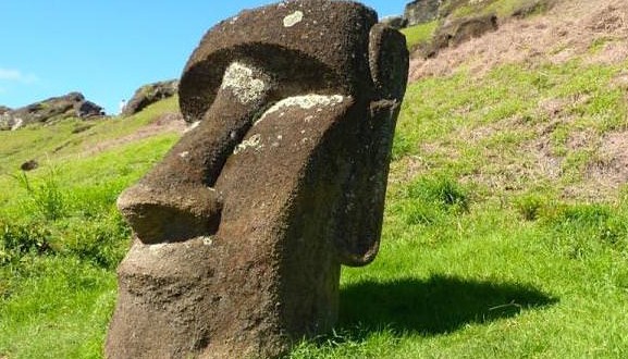
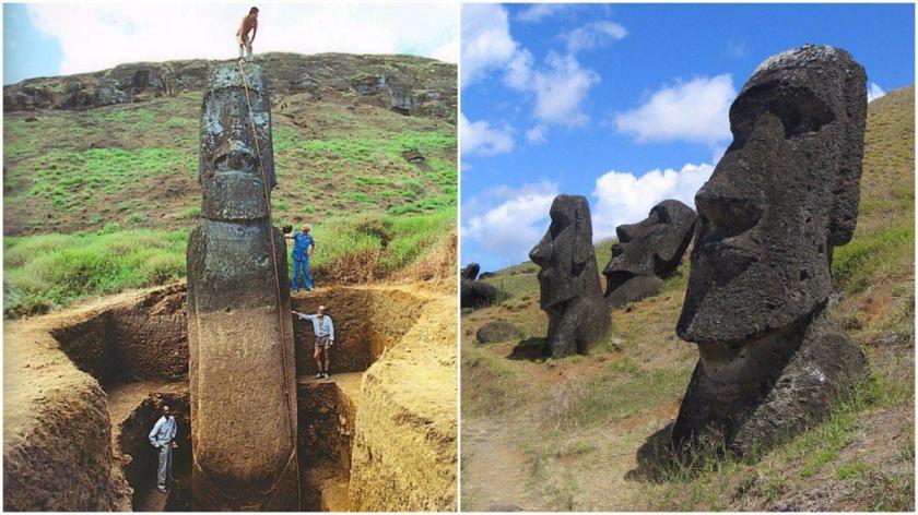
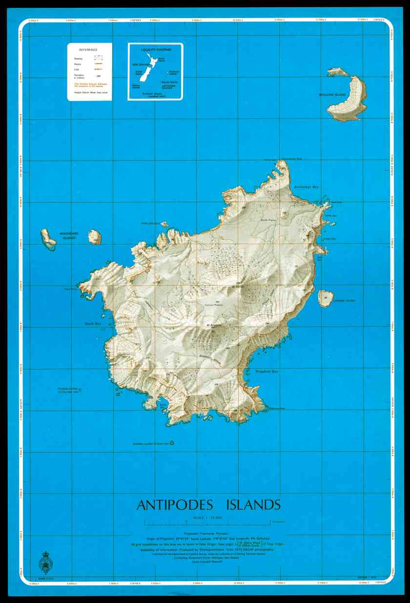


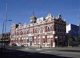


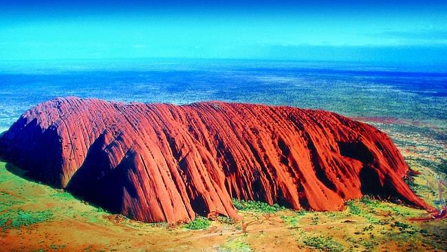


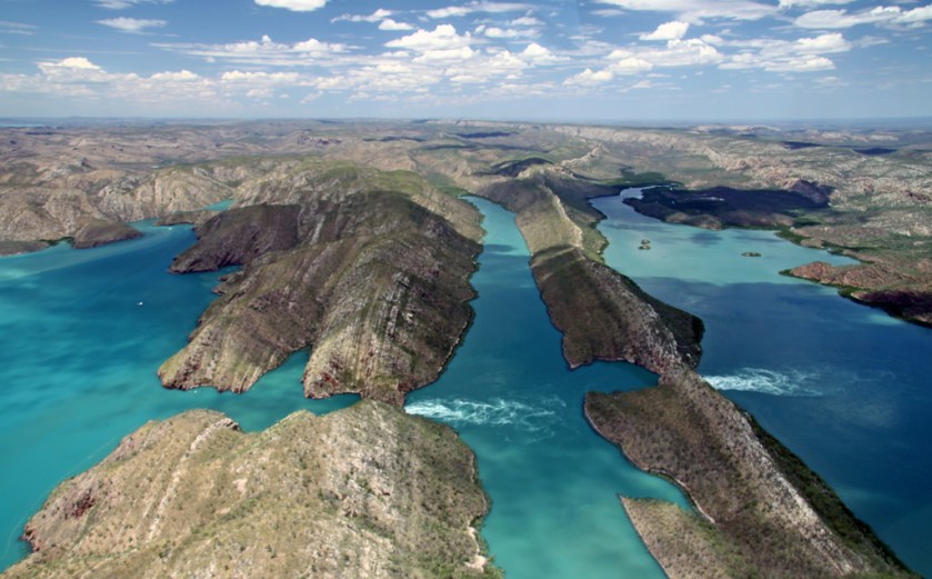


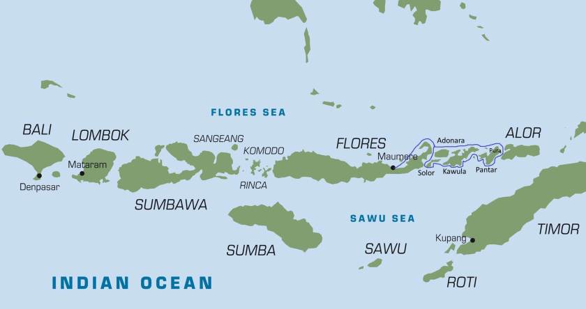


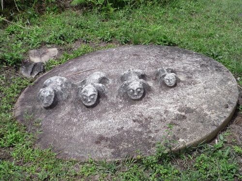
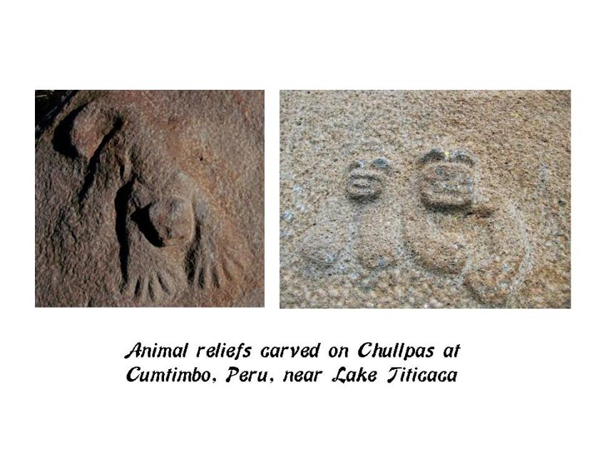
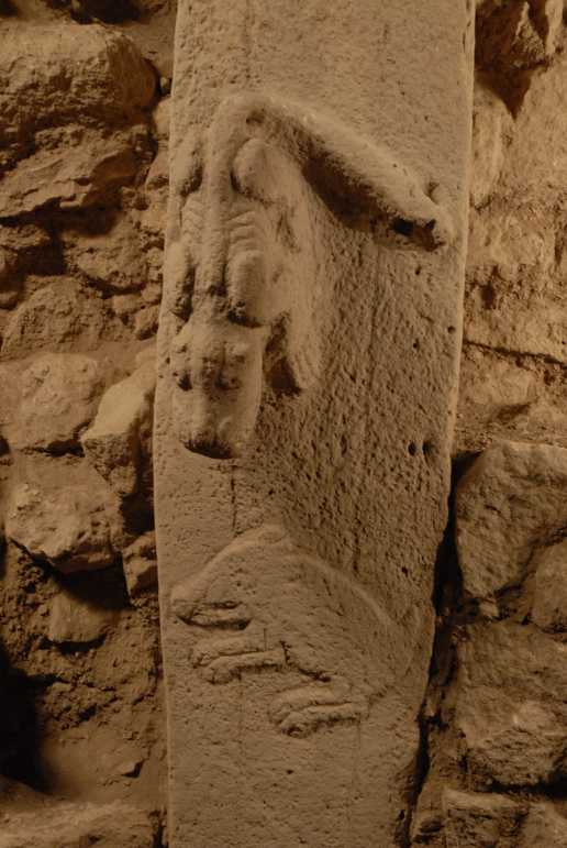
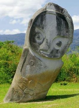
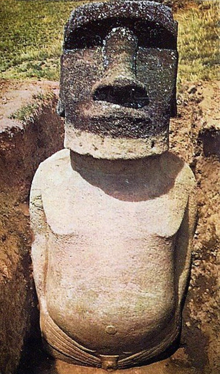
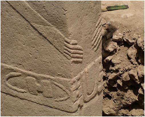
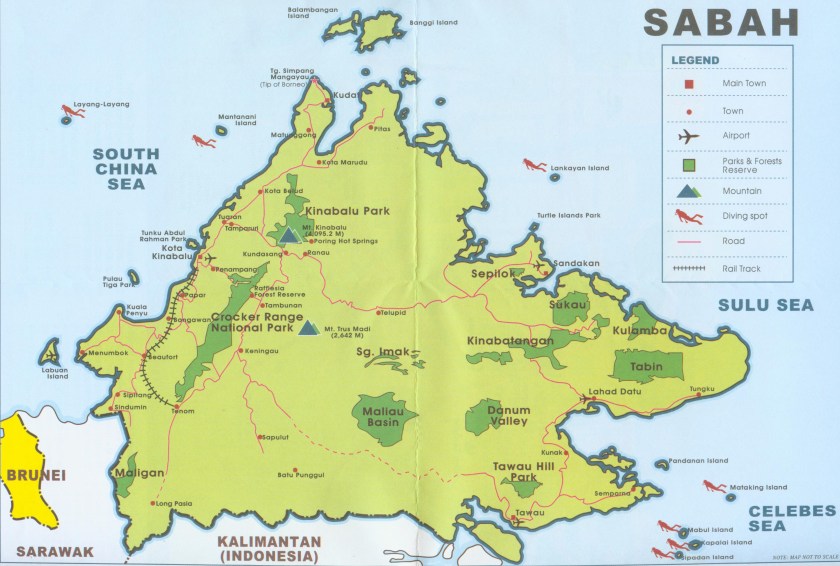


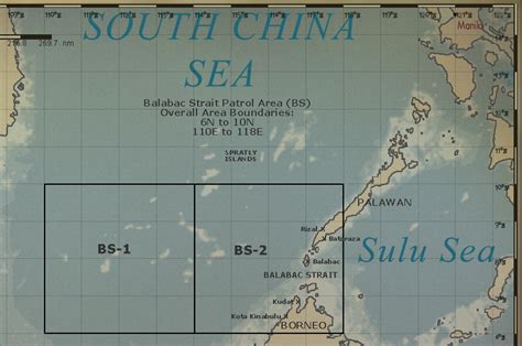
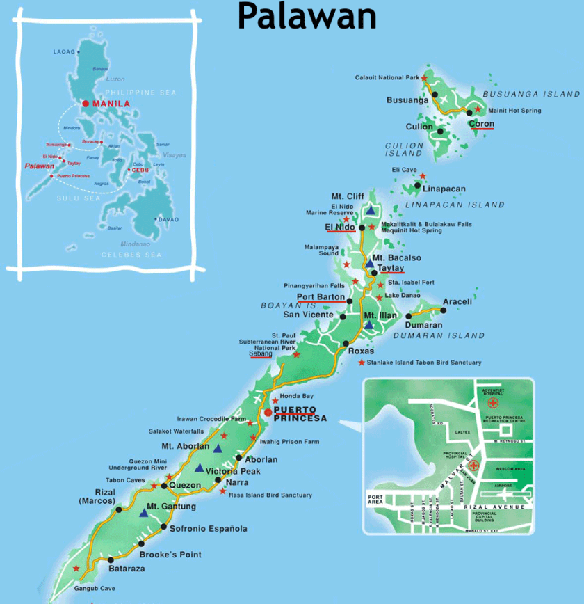


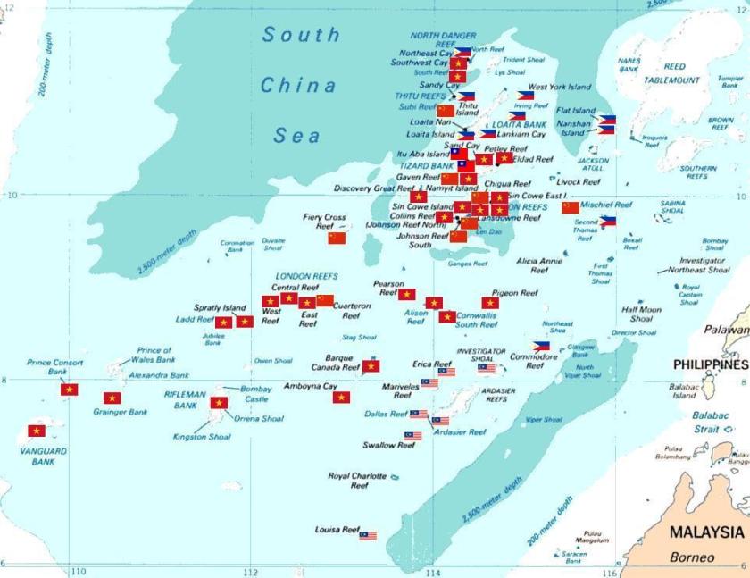
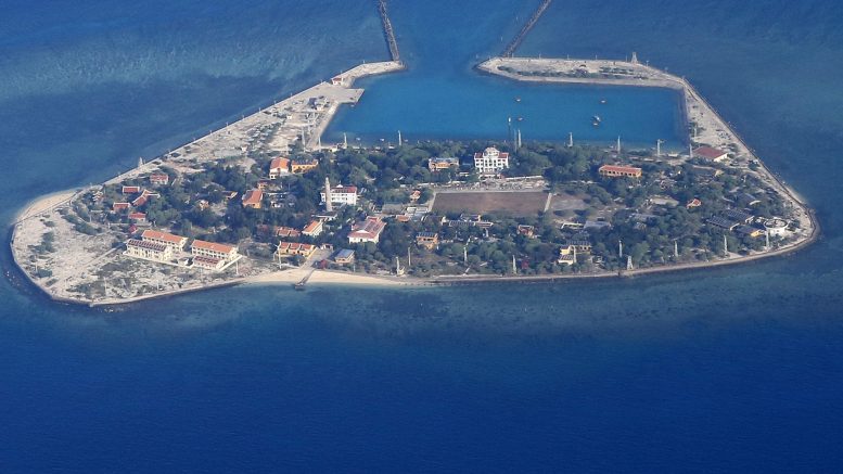
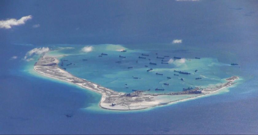
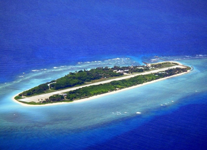
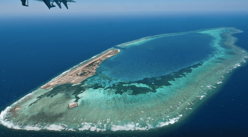
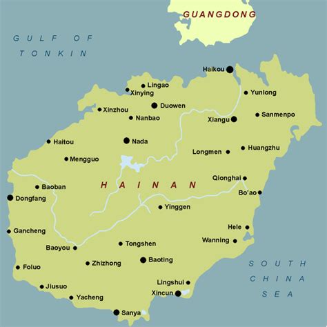


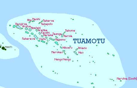


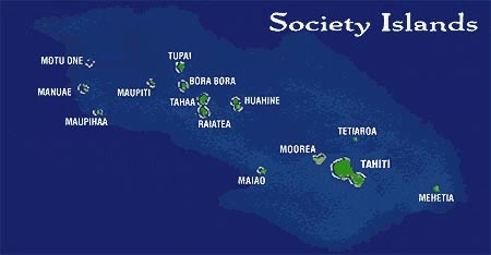
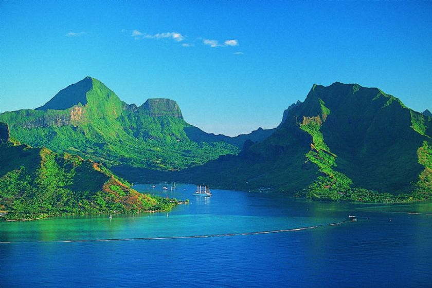
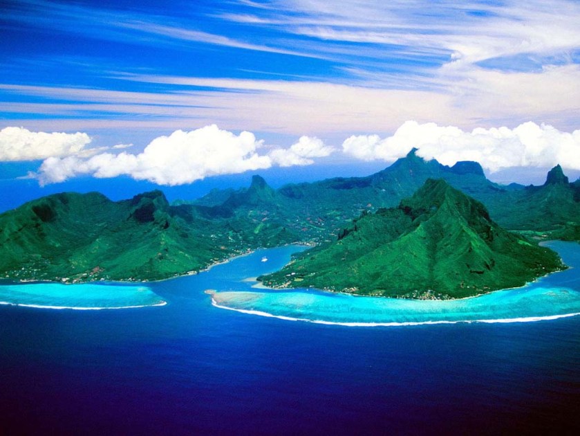
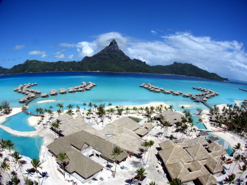


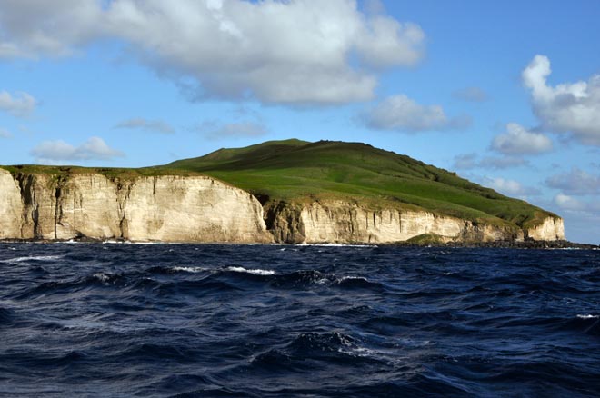


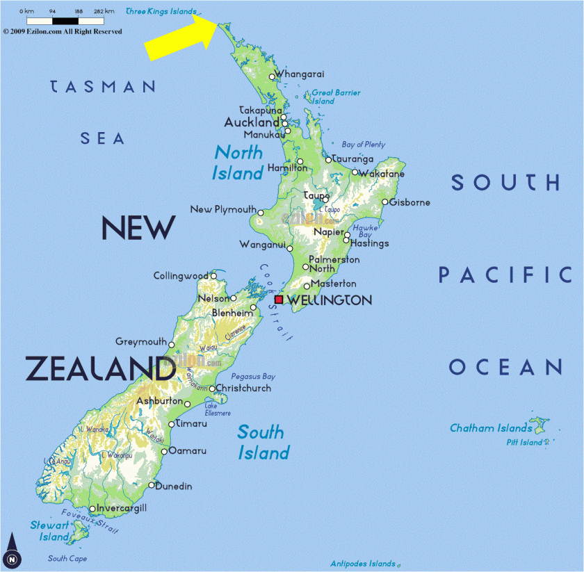
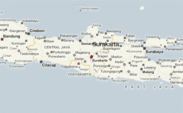


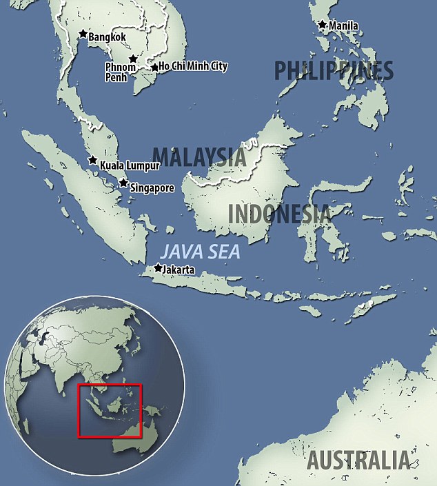


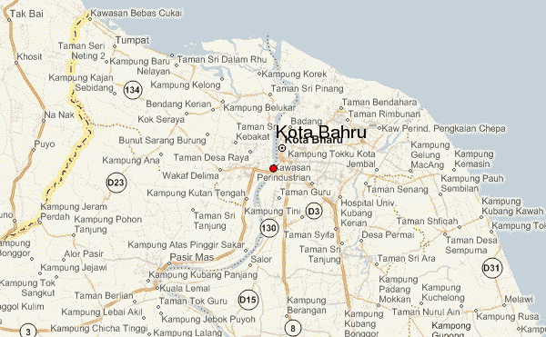
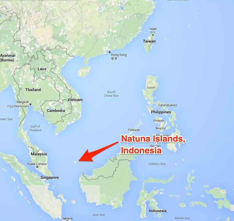


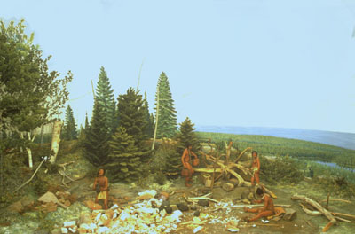

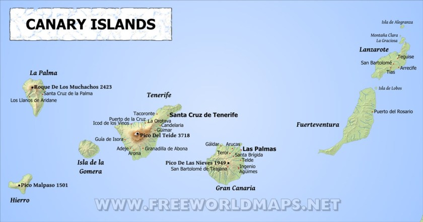


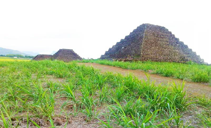
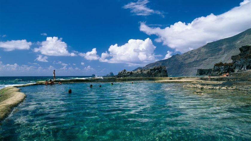
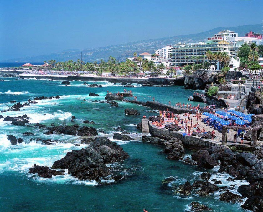
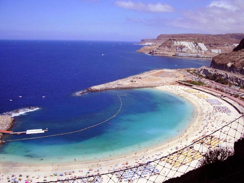
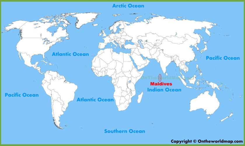
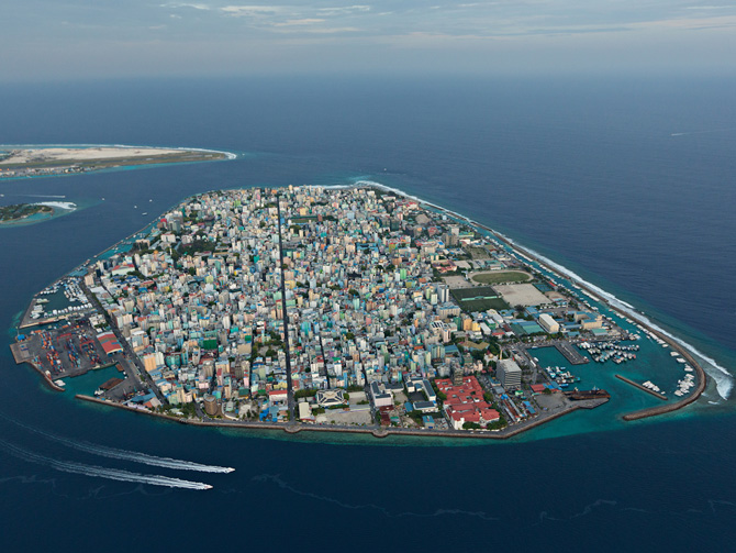
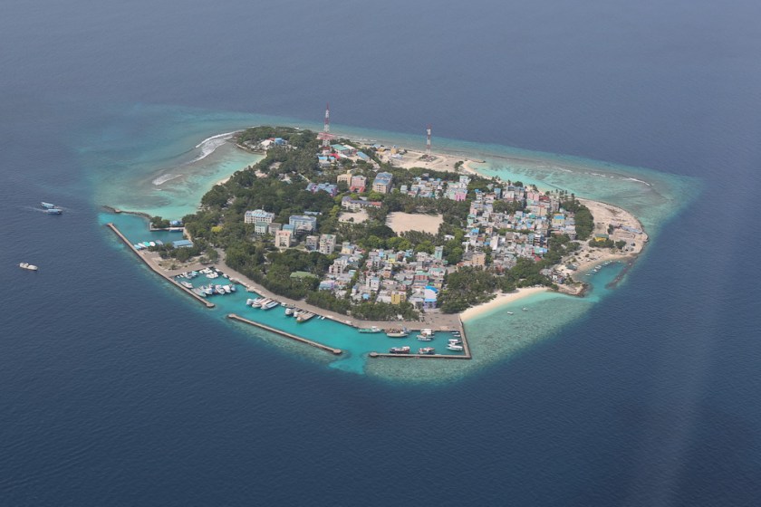


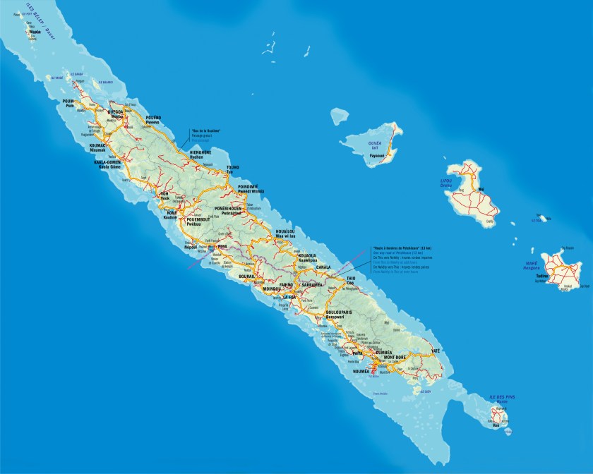


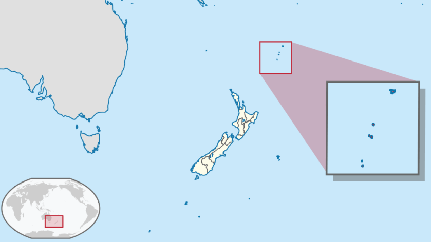


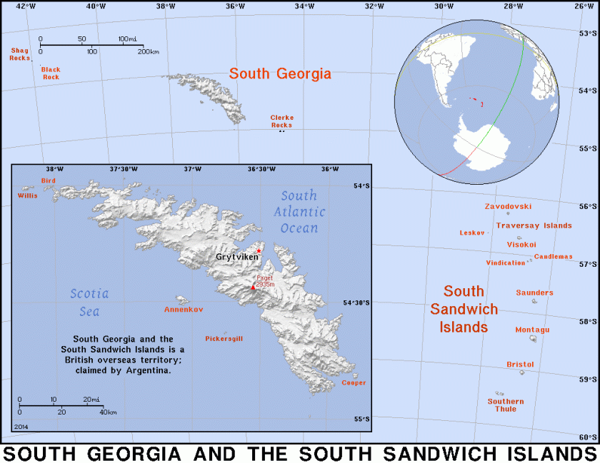
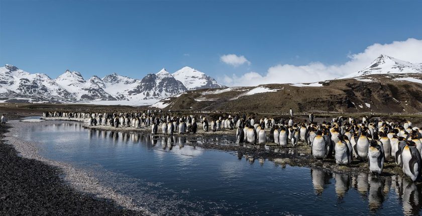
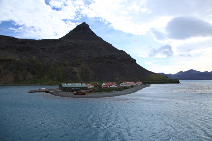


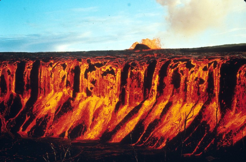
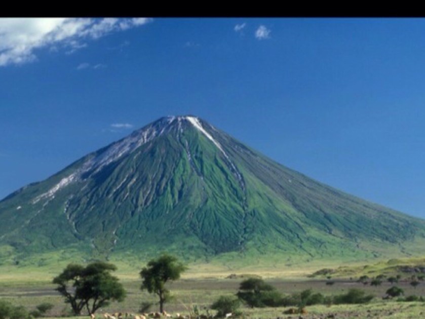
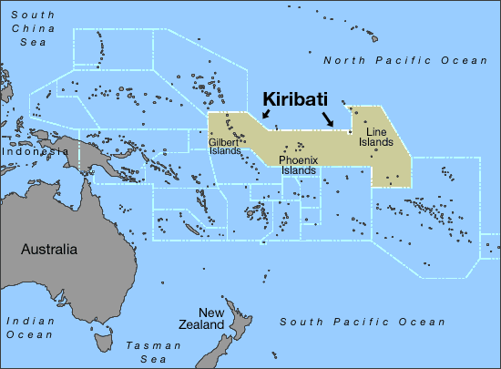


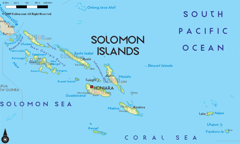


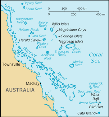
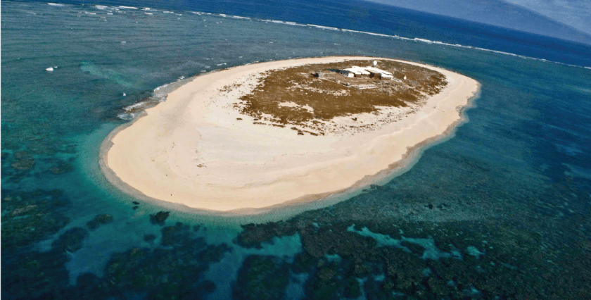


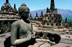
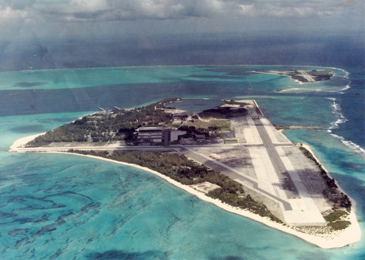


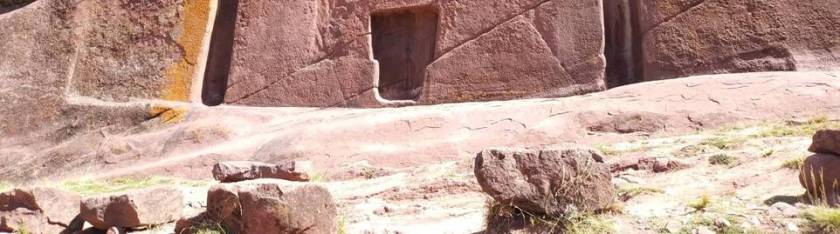
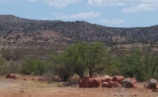

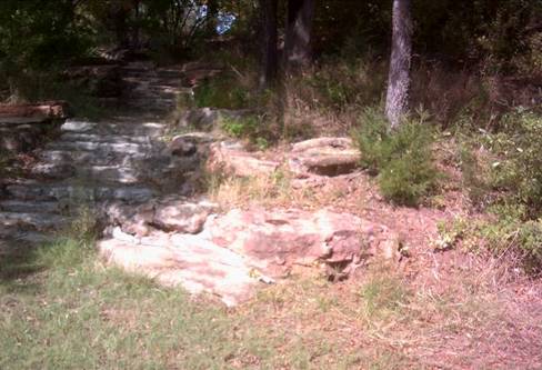


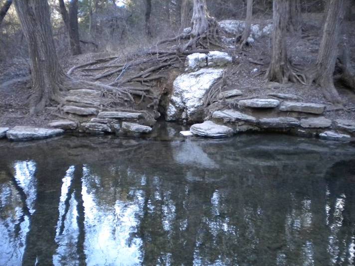
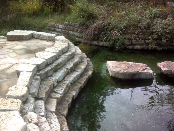
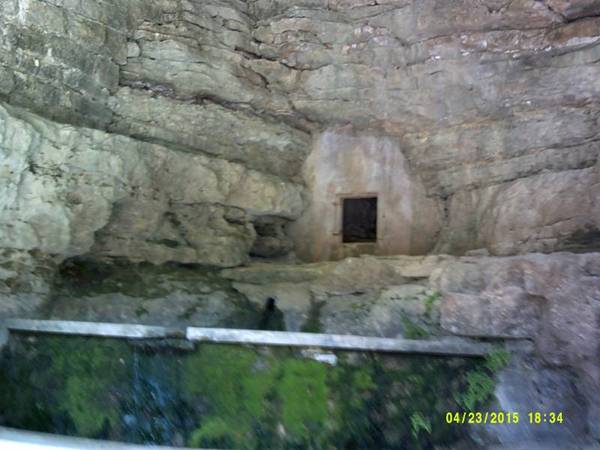
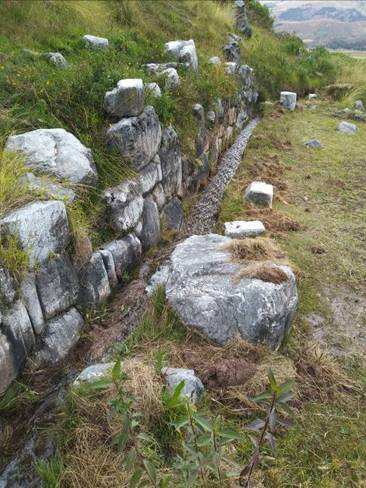
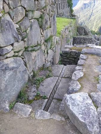
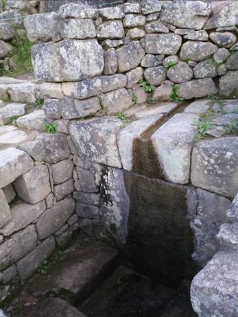
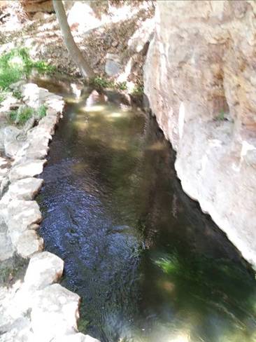


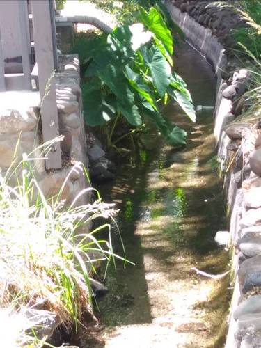


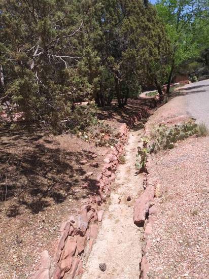
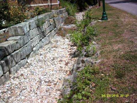
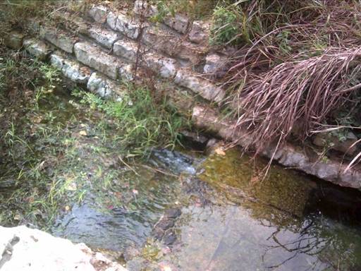
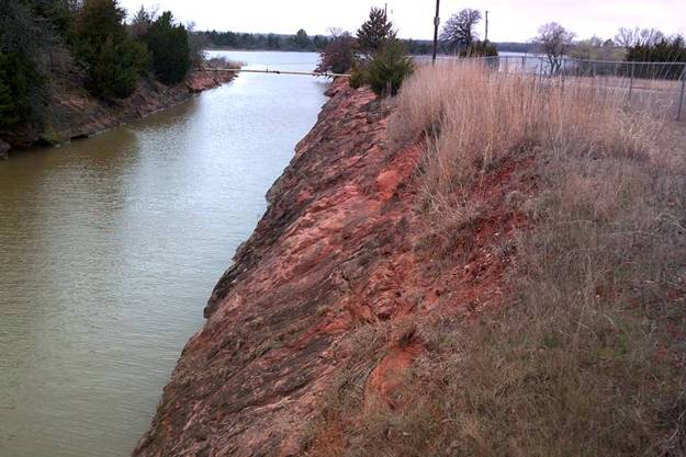


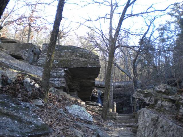
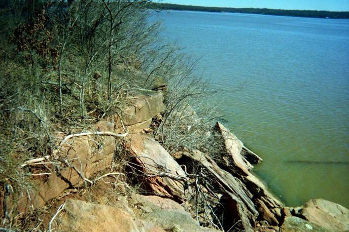


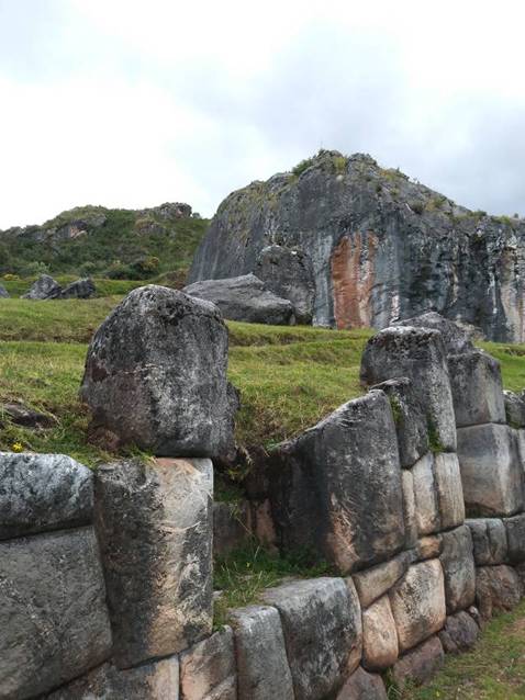
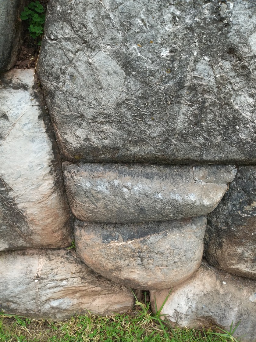
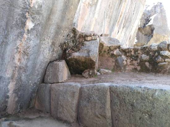
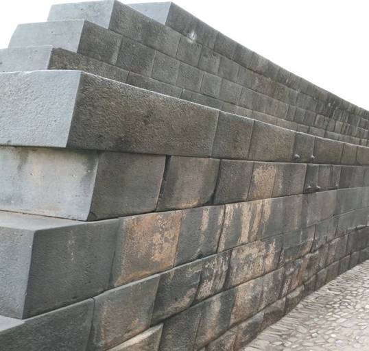


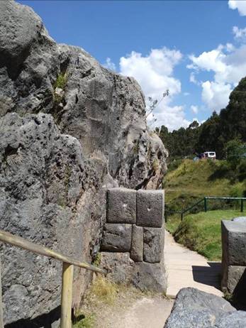


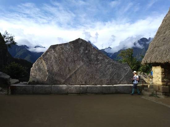
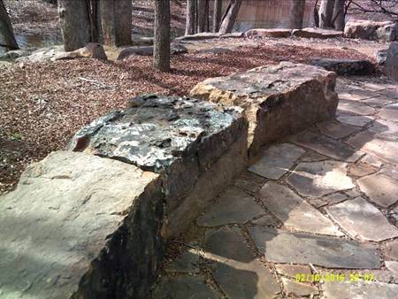
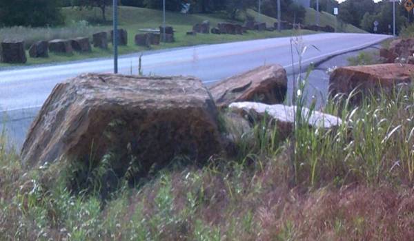


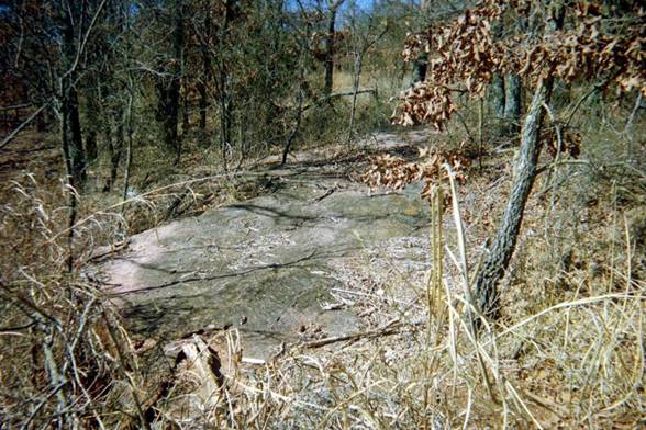


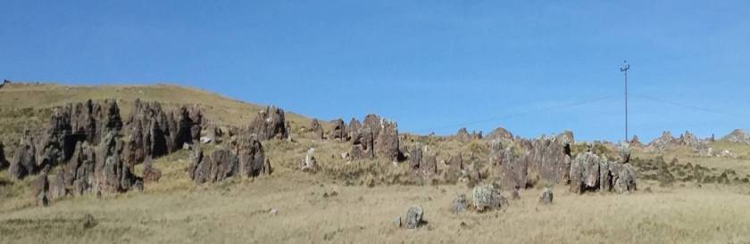
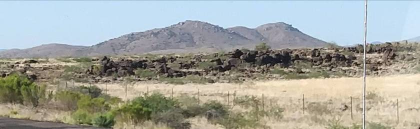
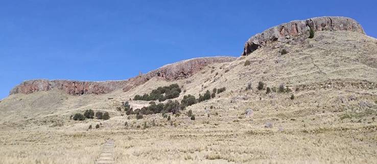
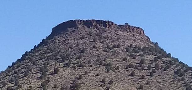
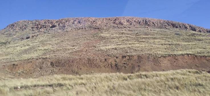
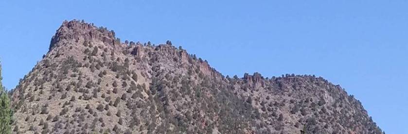
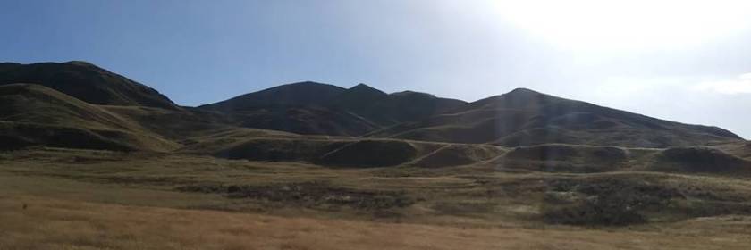
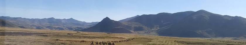
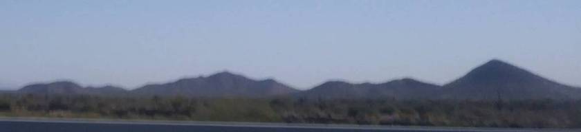
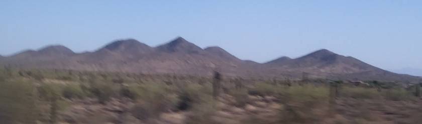
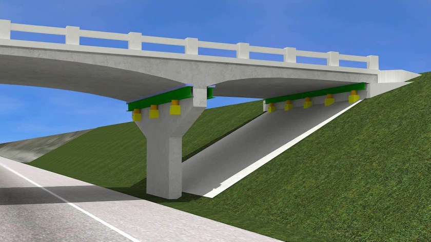


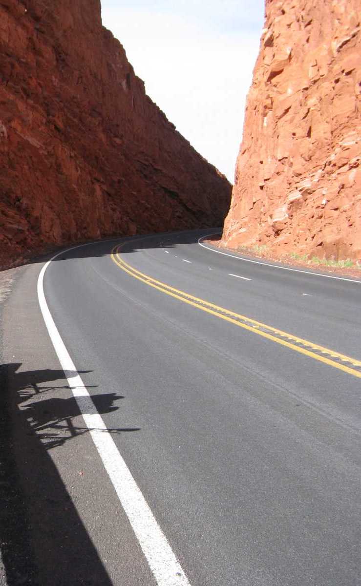
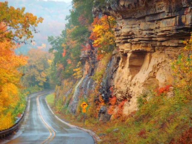
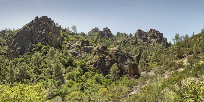
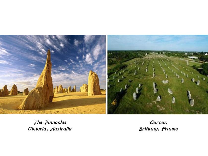


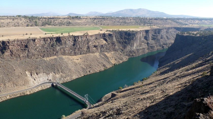


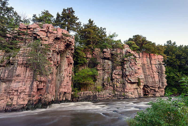
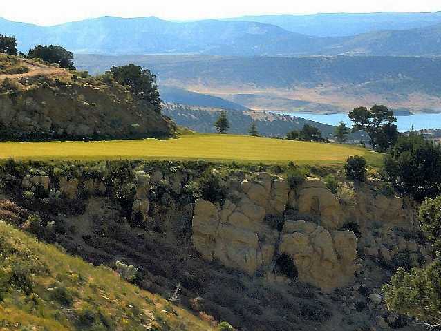
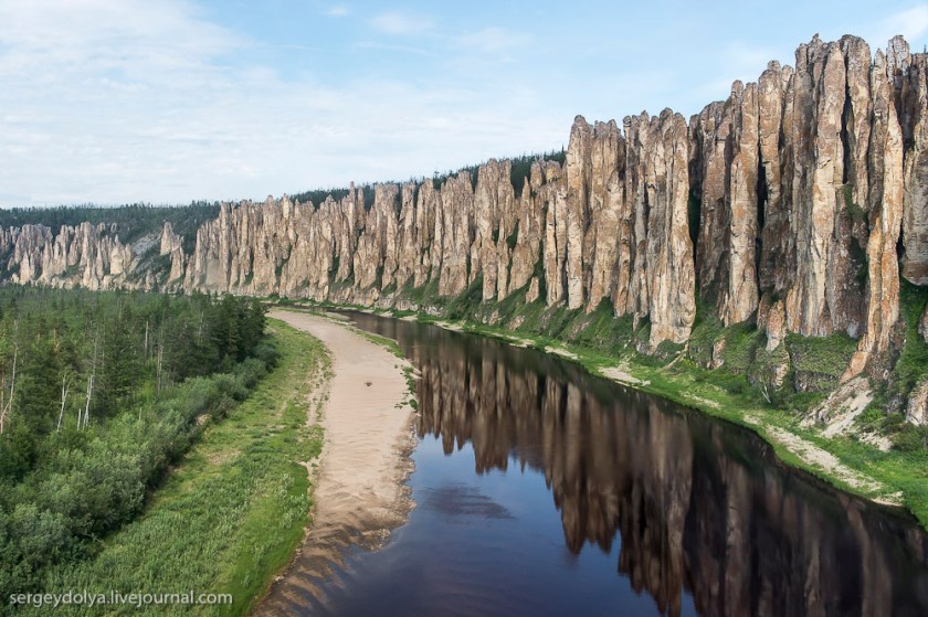
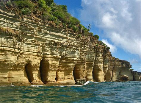
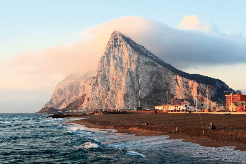
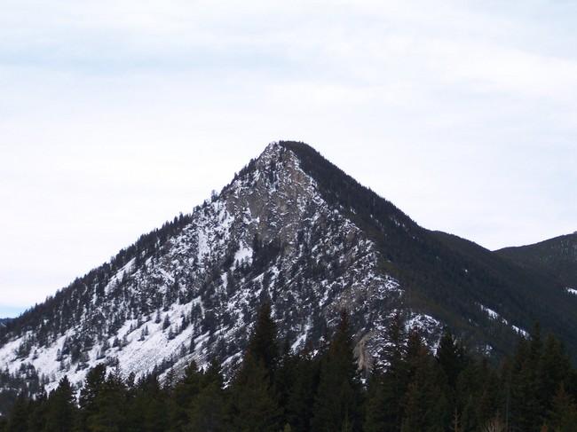
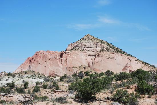
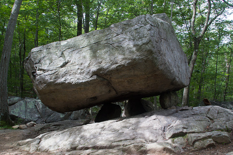
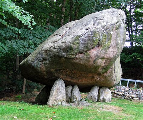
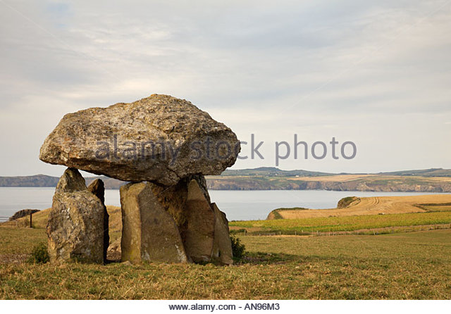 \
\