Circle Alignments on the Planet Algiers – Part 16 Calais, France to the Cevennes National Park, France

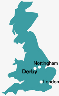
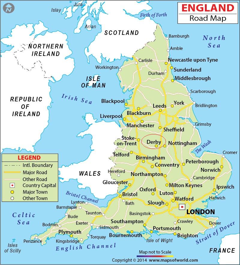
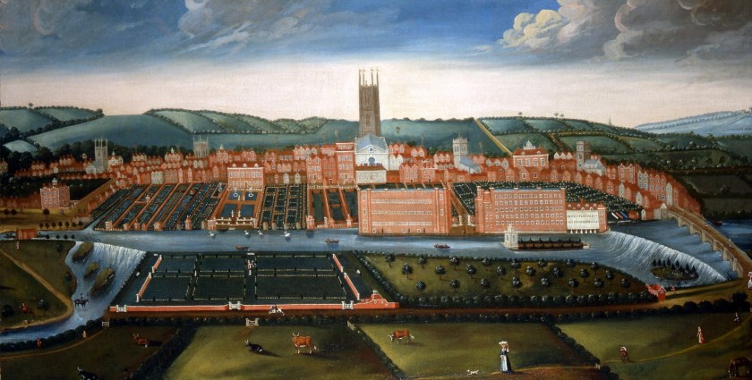
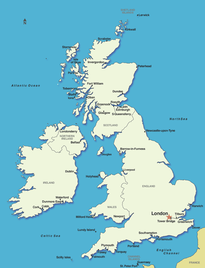
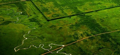
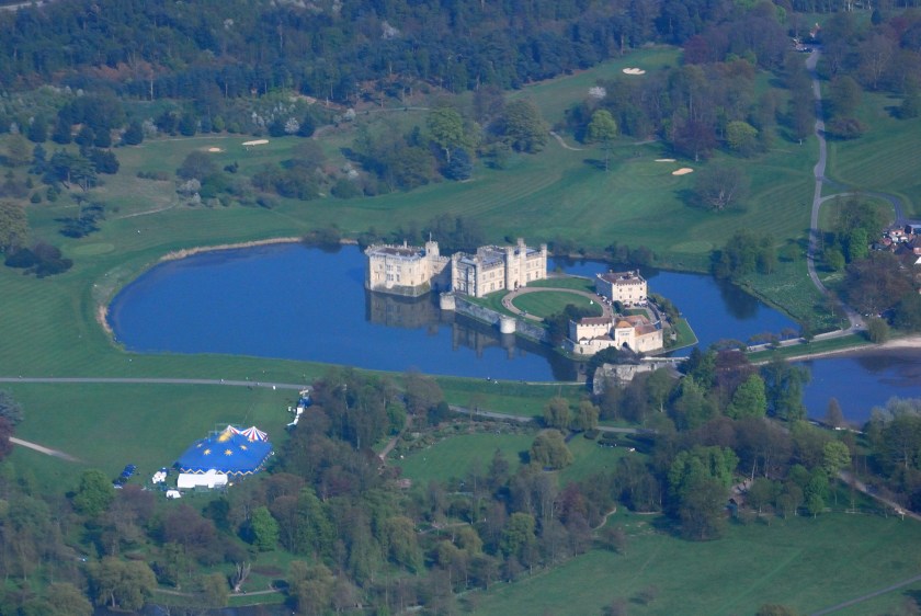
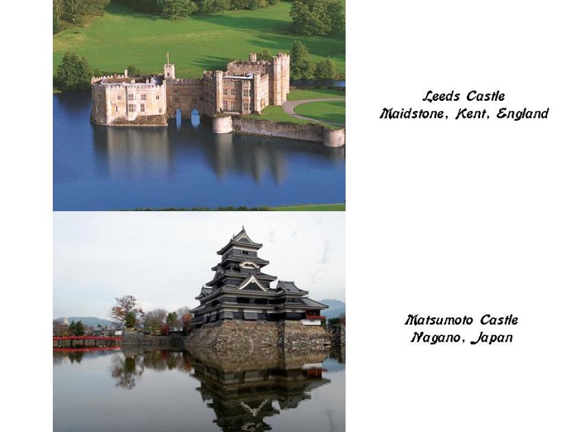
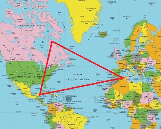
The last post started in Derby, located in the center of England in the River Derwent Valley, the birthplace of the factory system and the core of the Industrial Revolution, and the circle alignment was tracked through London; Leeds Castle in Maidstone and Dover in Kent; to the English Channel.

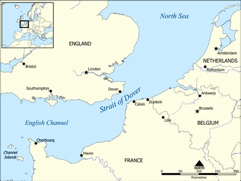
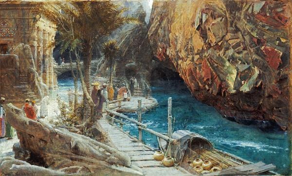
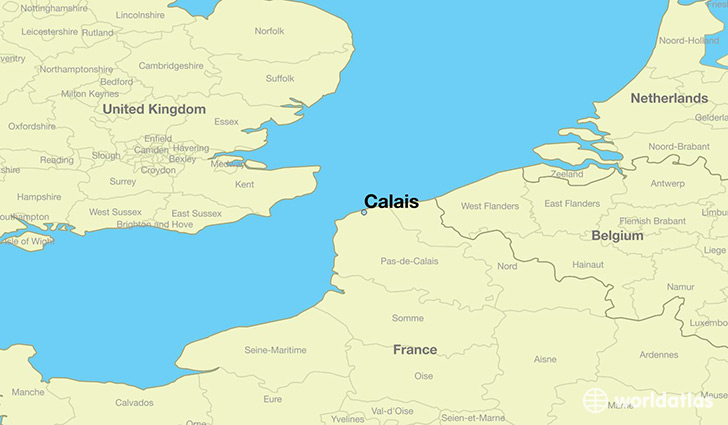
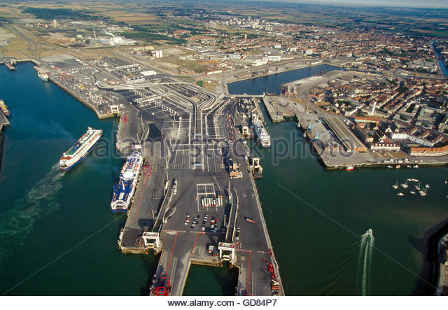
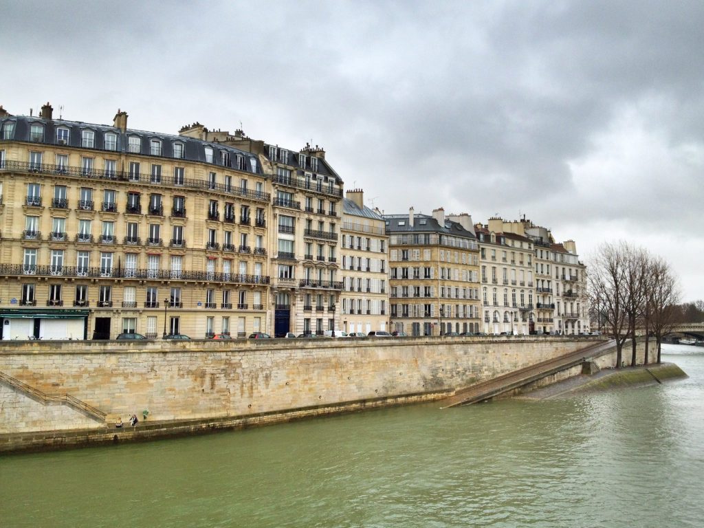
Calais is a city and major ferry port in northern France, and situated on the Strait of Dover, the narrowest point in the English Channel across from Dover in England.

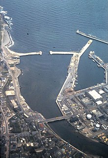
The old part of the town is called Calais-Nord, and is located on what is called an artificial island, on which this antique map shows that it was a star fort…

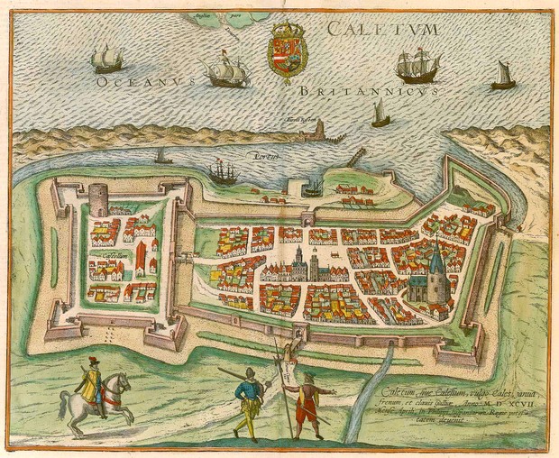
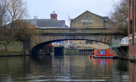
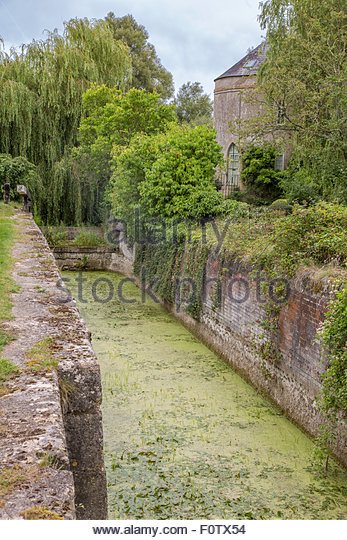
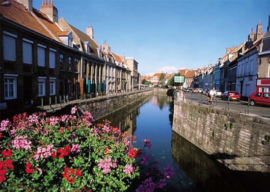
…surrounded by canals, like the Bergues Canal pictured here…
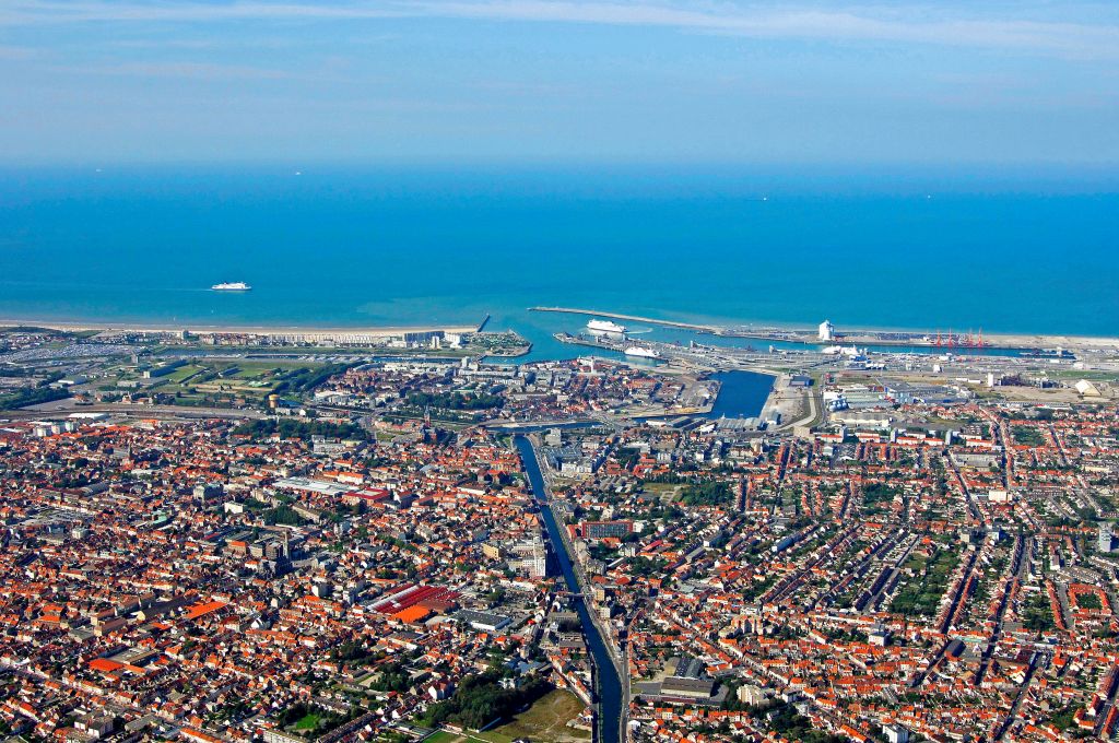
…and harbors.

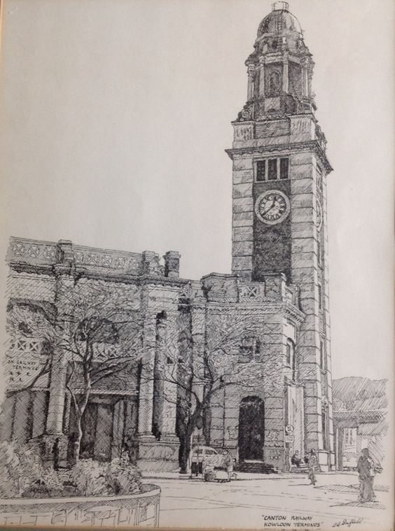
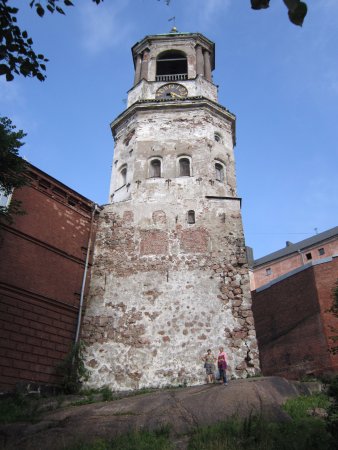
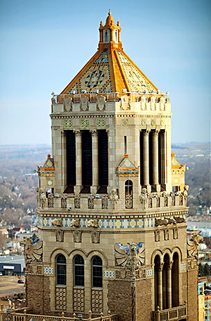
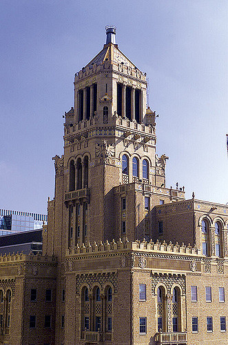
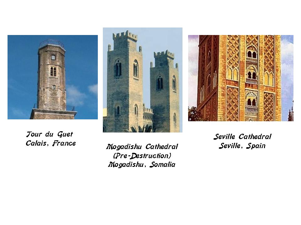
In the center of Calais-Nord is La Place d’Armes, where the massive Tour du Guet is located.

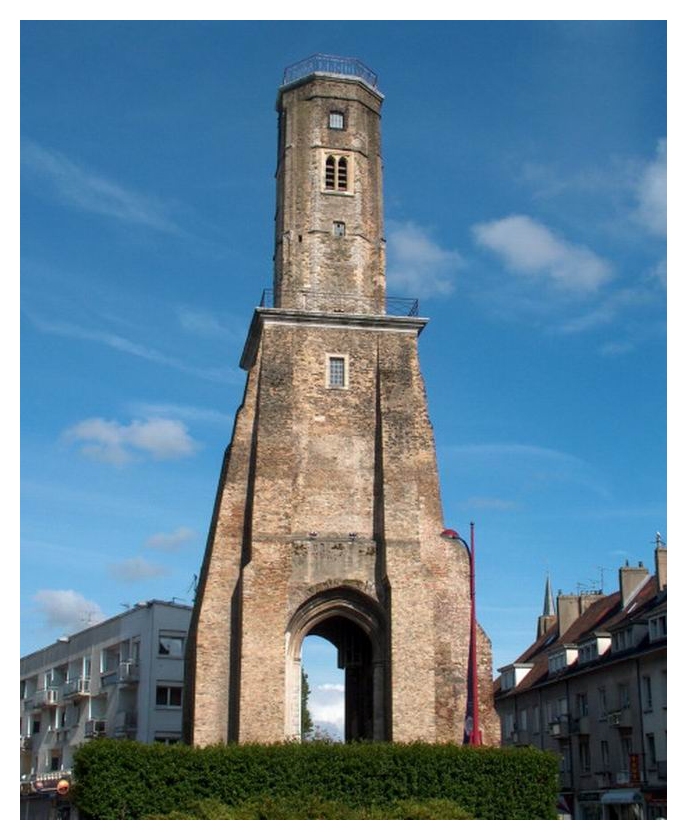
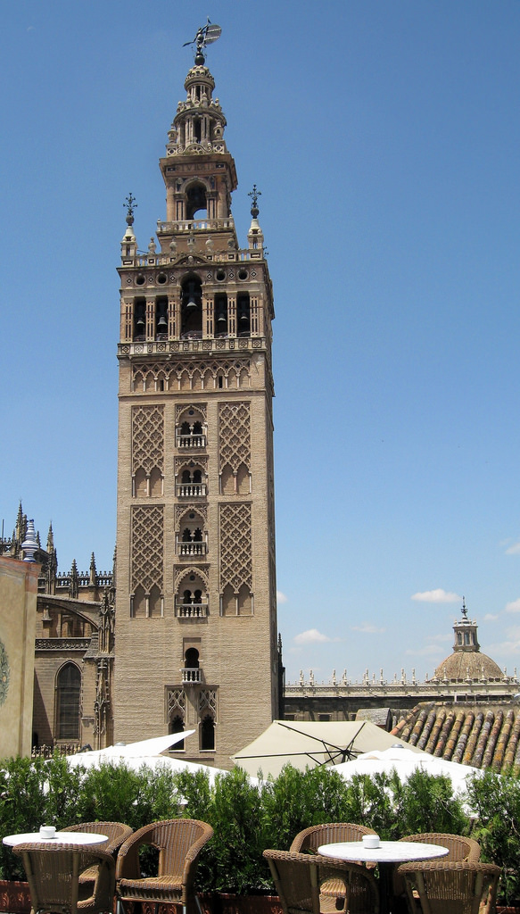
The windows at the top of La Tour du Guet have a familiar look to me. So, for comparison, this is what the Mogadishu Cathedral in Somalia in the middle looked like before it was destroyed, with those double-windows, as well as this tower at the Seville Cathedral in Seville, Spain, which was the capital of Moorish Spain, on the right.

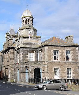
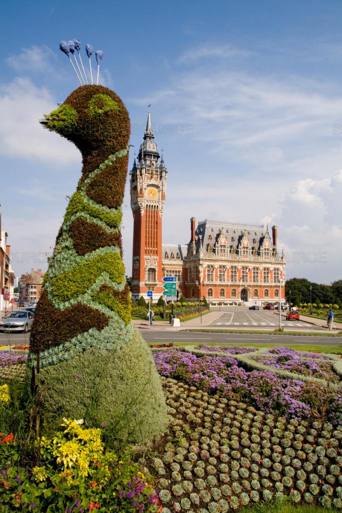
La Place D’Armes and La Tour du Guet are located behind L’Hotel de Ville, or the the Town Hall of Calais, with it’s distinctive architecture and peacock topiary gardens.

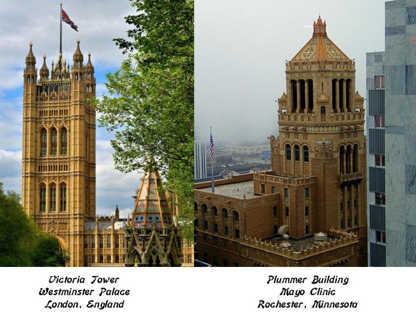
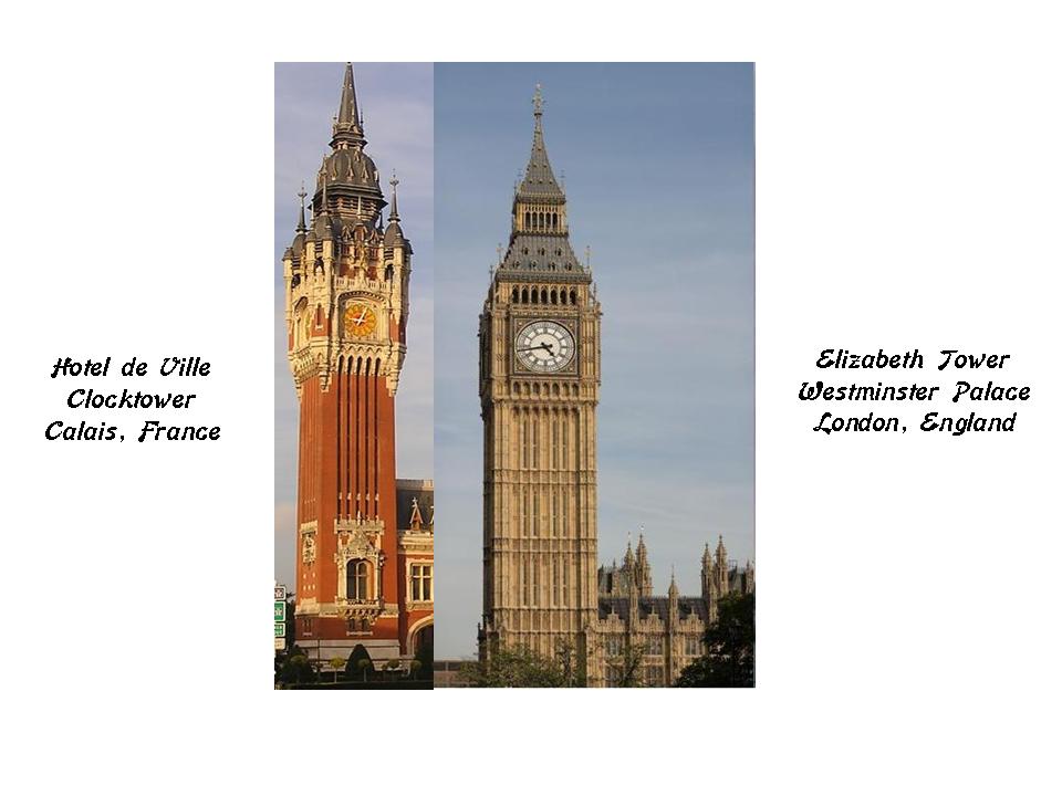
This is a comparison of the clock tower of L’Hotel de Ville in Calais on the left, with the Elizabeth Tower at the Westminster Palace. Big Ben is actually the name of one its bells, and not the clock tower itself.

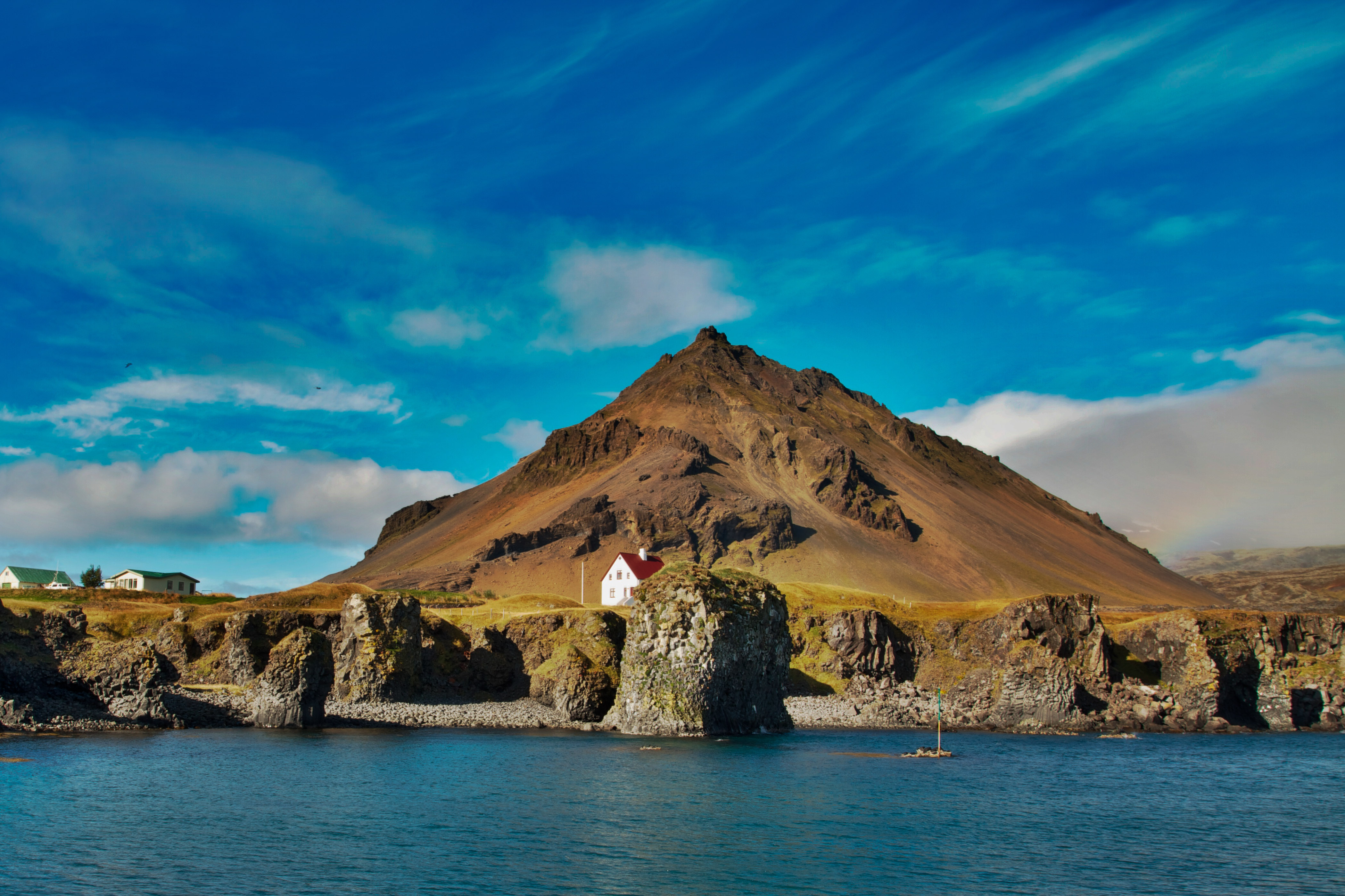
This is the lighthouse of Old Calais on the left, compared with the Amedee Lighthouse in Noumea, New Caledonia, on the right.

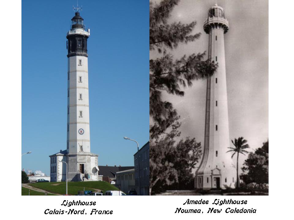
I believe that the advanced ancient maritime civilization built all of the world’s lighthouses. While these two examples are not identical in design, they have similar design features.

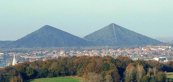
Calais is located in France’s Pas-de-Calais Department. The Terrils pictured in the background are in Loos-en-Gohelle in the same region as Calais. They are called slag heaps, and said to have been formed from 130-years worth of coal-mining. These two happen to be on the UNESCO World Heritage Site list. I see unacknowledged pyramids in the landscape, not slag heaps.

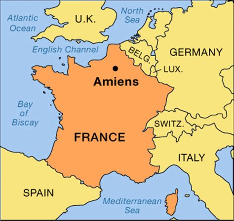
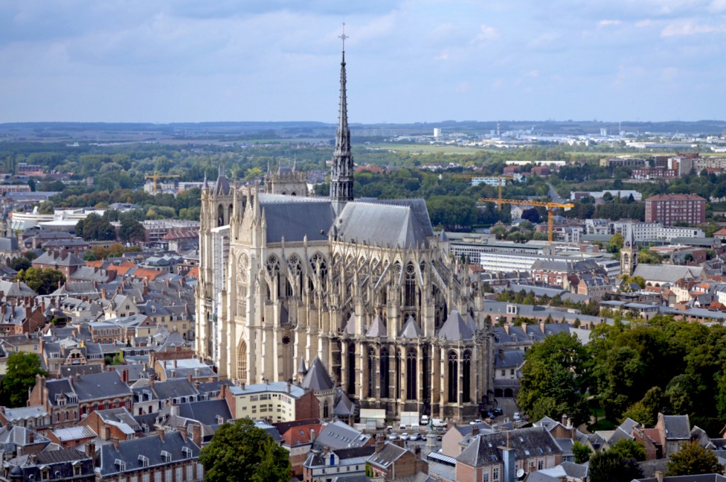
Amiens is next on the alignment, a city and Commune in northern France, 75 miles, or 120 kilometers, north of Paris. It is the capital of the Somme Department of Hauts-de-France, or Upper France.

Amiens Cathedral is called the tallest of the large classic Gothic churches of the 13th-century, and the largest in France of its kind. It is a UNESCO World Heritage Site.

This is a comparison of the entrance of Amiens Cathedral on the left with the St. Wenceslaus Church in Baltimore.

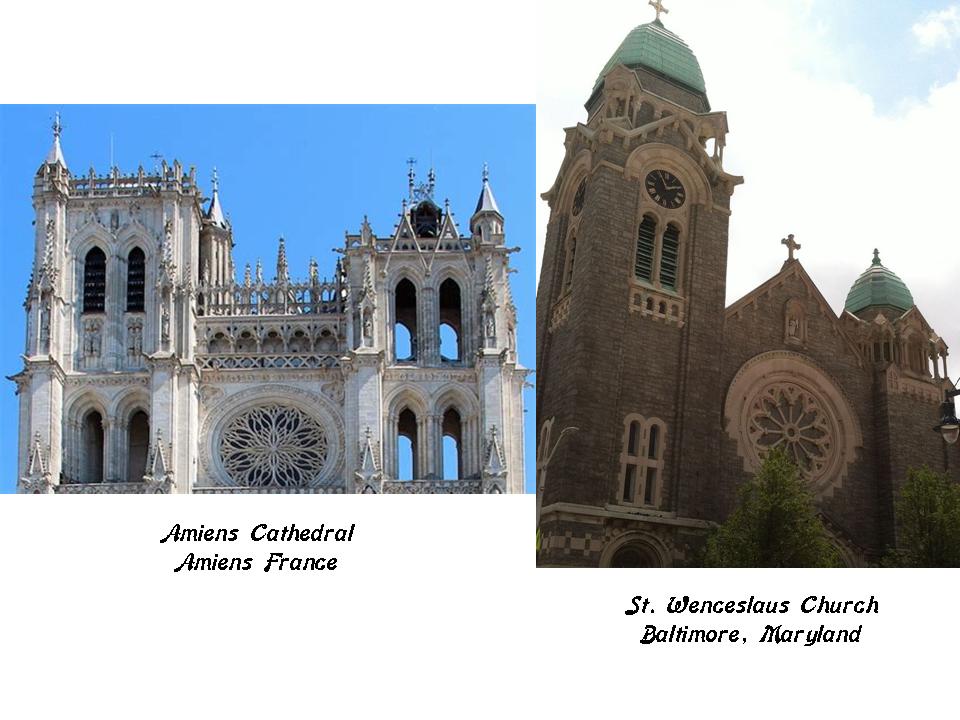
I would like to take a moment and acknowledge the great work of Baltimore Fats on his YouTube Channel of the same name. I learned about St. Wenceslaus Church only last night in his video “Hopkinslaus,” which he and his friend Mary D stumbled across after they went to Johns Hopkins University to do field research on buildings there for mud flood evidence. They are digging deeply, and finding great information about Baltimore’s hidden history. In our own ways, we are uncovering a story that really wants to be told, one that should never have gone missing in the first place. Mary’s Facebook Page is Baltimore Mudflood History. I highly recommend that you check them out.

This is the Tour Perret in Amiens. Look at the size of that thing compared to the surrounding buildings. Apparently it is a residential skyscraper, that we are told was built between 1949 – 1954.

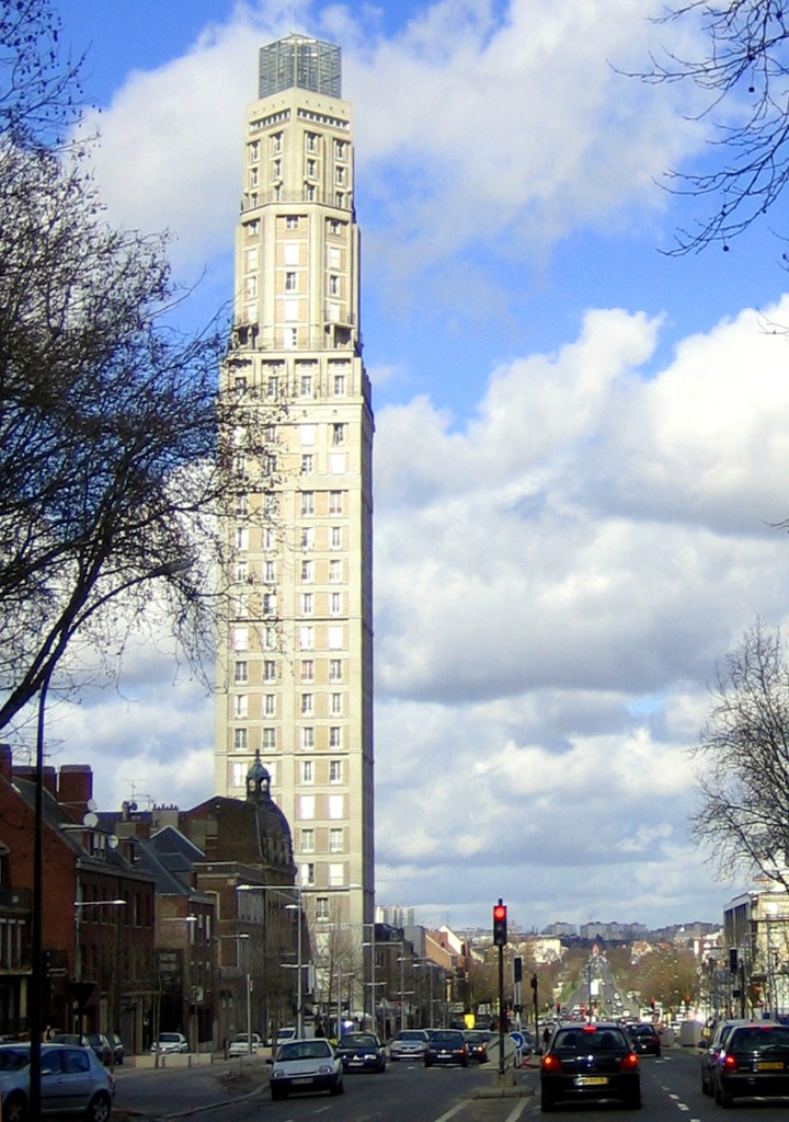
So only four years after the devastation of war and the end of World War II, after France having been occupied by Germany from 1940-1944, they were capable of building something like this? Really?

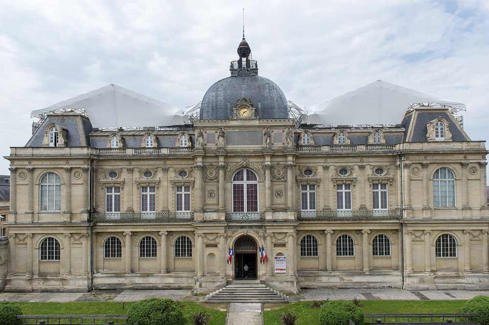
This is the Picardie Museum, the main museum in Amiens. It was said to have been built between 1855 – 1867.

This is the Natural History Museum in Merida, Mexico…

…and this is the Art History Museum in Vienna, Austria. All three of these museums have shared characteristics, in different times and places. How is this even possible according to the history we have been taught?

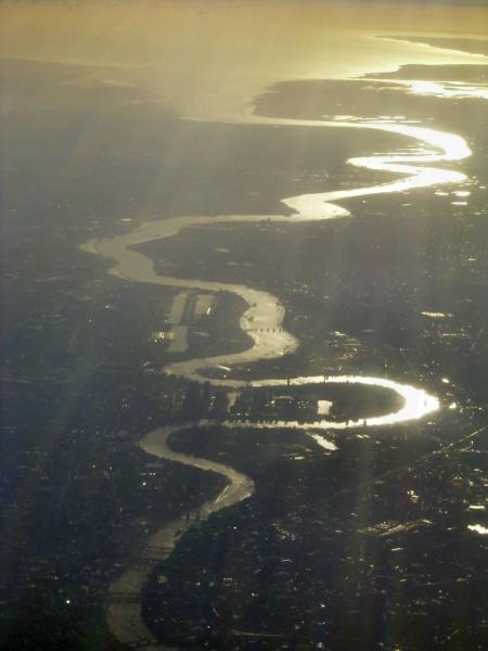
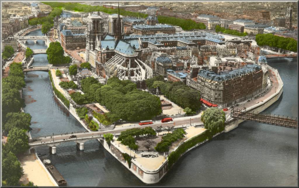
Next on the alignment, we come to Paris, the capital and most populous city of France. It has been a major European center of finance, commerce, fashion, science and the Arts for hundreds of years.

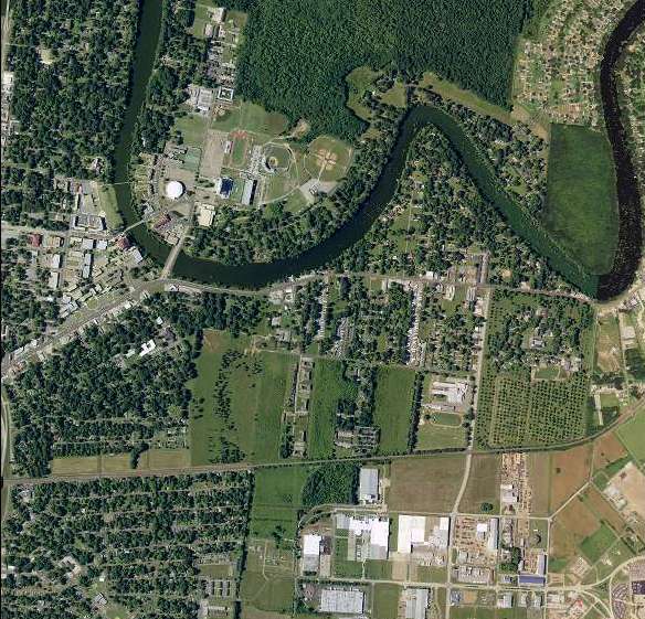
The Ile de la Cite is the center of Paris, and is called one of two remaining natural islands in the Seine River. That does not look like a natural island to me!

This is a diagram of the Place Dauphin, a public square on the western end of the Ile de la Cite. It is said to have been initiated in 1607 by King Henry IV in honor of his son, the Dauphin of France, and the future King Louis XIII. Dauphin means dolphin in French.

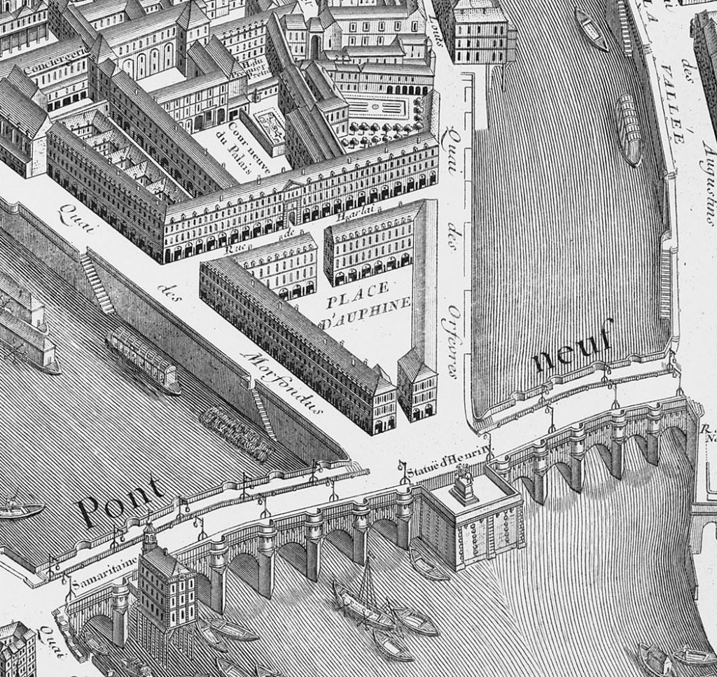
I wonder why the heir-apparent of the French throne was called dolphin….

The other remaining natural island is the Ile Saint-Louis. I am definitely calling that not natural! !  I mean, they are called artificial in Calais, but not in Paris.  What is up with that?

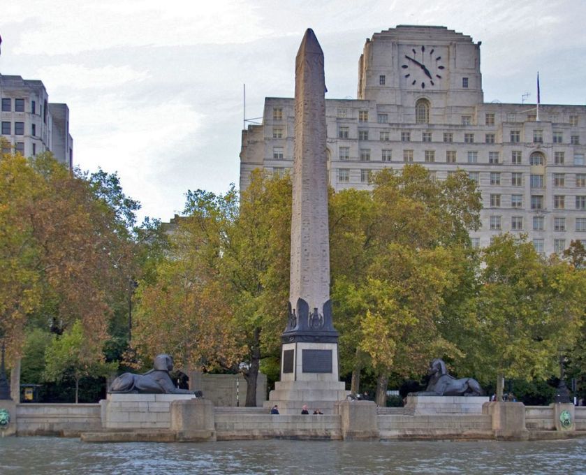
This is the Place de la Concorde in Paris, with its centerpiece obelisk, the Parisian Cleopatra’s needle. It was said to have marked the entrance of the Luxor Temple, and gifted to France by Muhammad Ali, the ruler of Egypt and Sudan, in 1828.

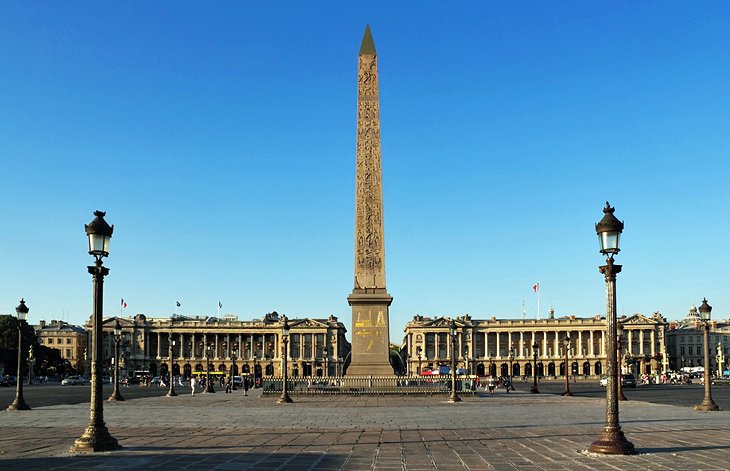
It was said to have been transported to the Place de la Concorde 1833, and placed near where spot where King Louis XVI and Marie Antoinette were guillotined in 1793. We are told on the pedestal are diagrams explaining the machinery used for its transportation. Keep in mind, we are told the obelisk weighs over 250 tons. There are two more said to have been re-located from Egypt – one in London, and one in New York.

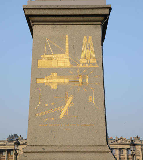
I have serious doubts about their physical re-locations, and believe they were already there. The lost positive timeline of Humanity is being deliberately covered-up.

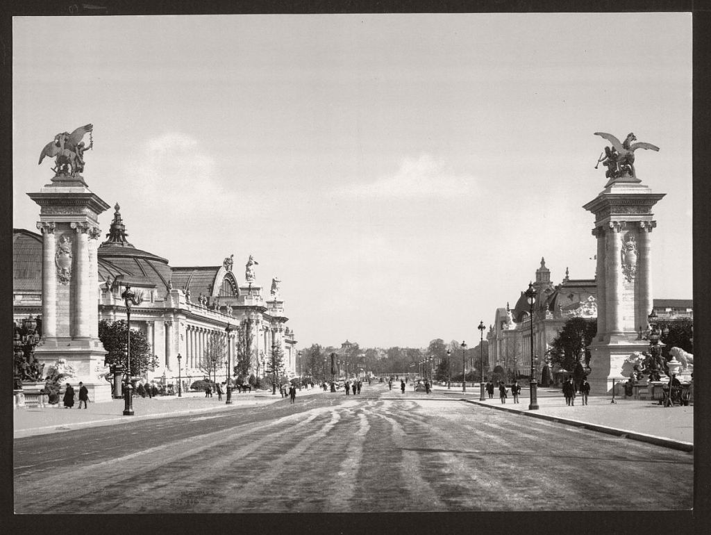
I am going to put an historic photo of Paris here, and make the following points:

Why aren’t there more people in the capital and largest city of France?

Look at the size of that architecture relative to the people that are in it!

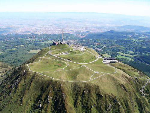
Next on the alignment, we come to Clermont-Ferrand, a city in central France, and capital of the Auvergne Region. Clermont-Ferrand ranks as one of the oldest cities of France.

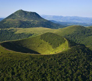
It is famous for a chain of extinct volcanoes that ring the city, including the highest, Puy de Dome, 13 kilometers, or 8 miles, from the center of the city. I have found evidence of volcanoes and volcanism all along these alignments, which approximate the earth’s tectonic plates.

I believe the Ancient Ones knew how to harness the energies of the earth, and use them for creative purposes. One of the many secrets of our past that we have lost.

The Cathedral of Clermont-Ferrand dominates the city.

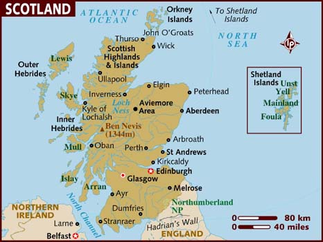
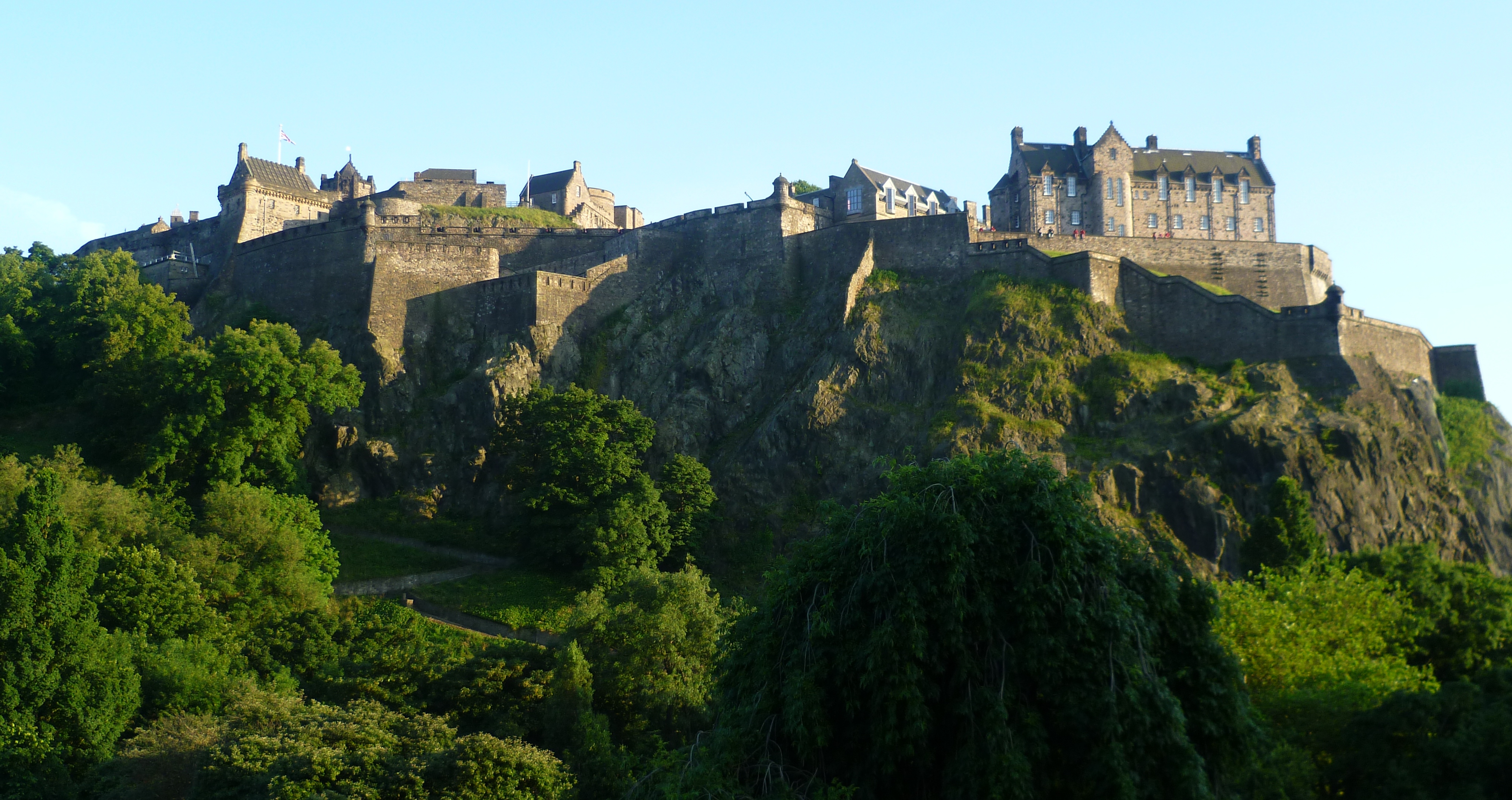
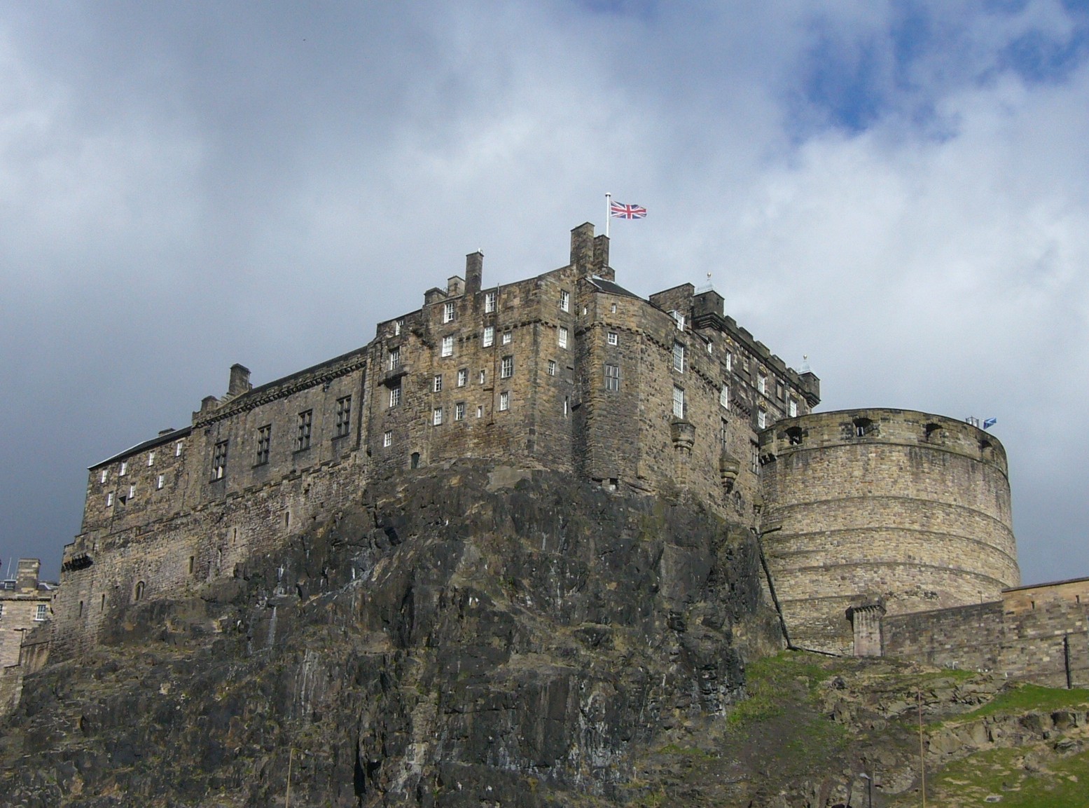
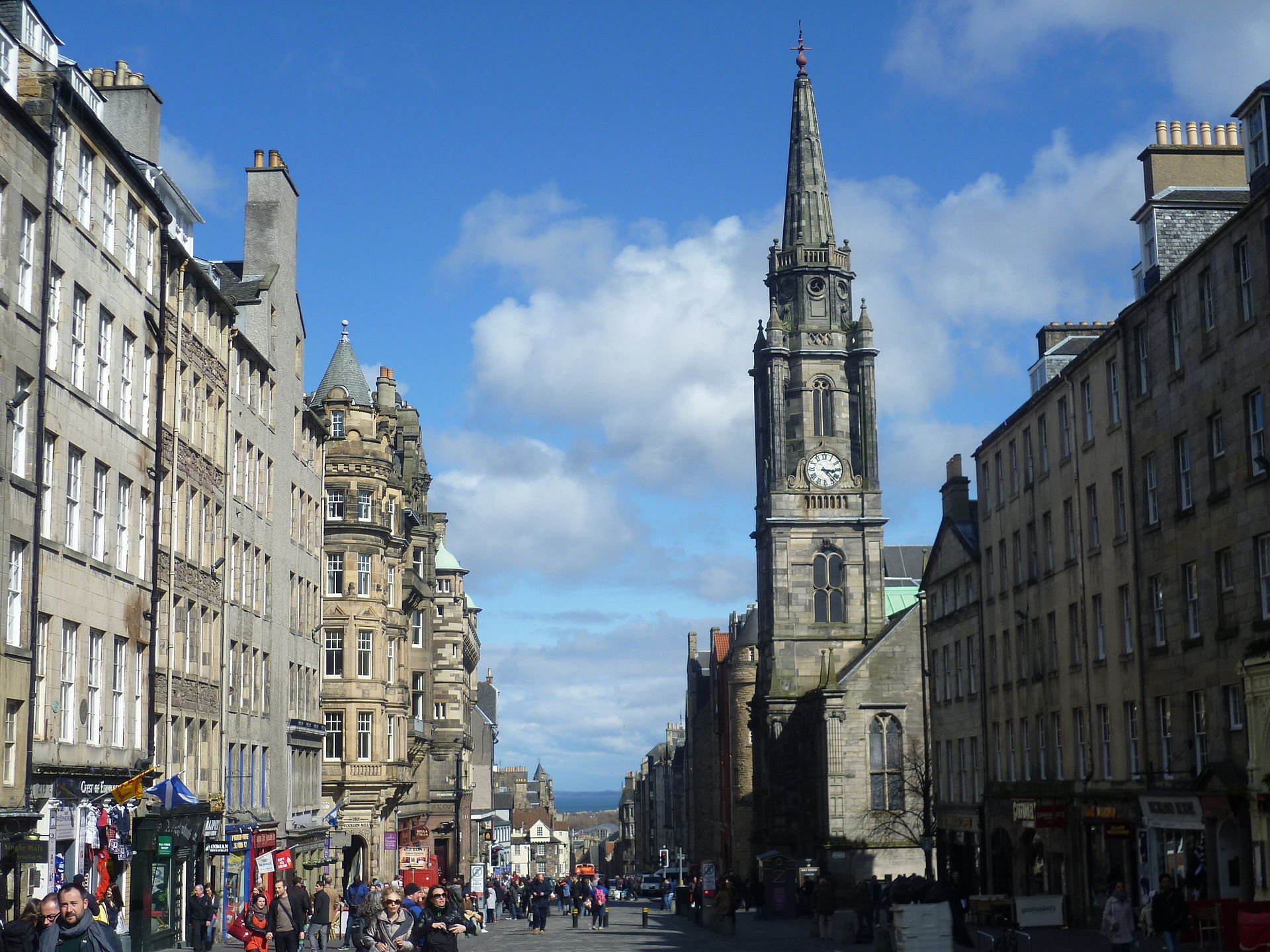
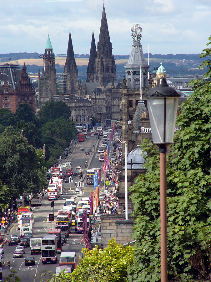
When I saw the cathedral, its color reminded me of Edinburgh, Scotland. So I looked up pictures of Edinburgh, and found a structural similarity in this photo in Edinburgh.

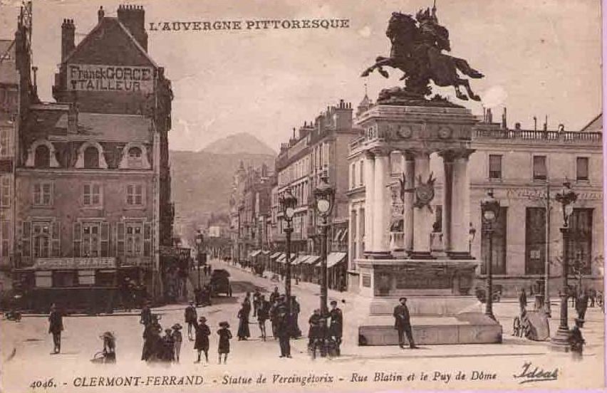
Clermont-Ferrand was called the metropolis of the Arveni, of whom Vercingetorix, was a leader, and who we are taught was killed by the Romans during Julius Caesar’s Gallic Wars.

There is a statue of him on top of the columned structure in the foreground in the Place de Jaude in Clermont-Ferrand, depicted in this antique postcard.

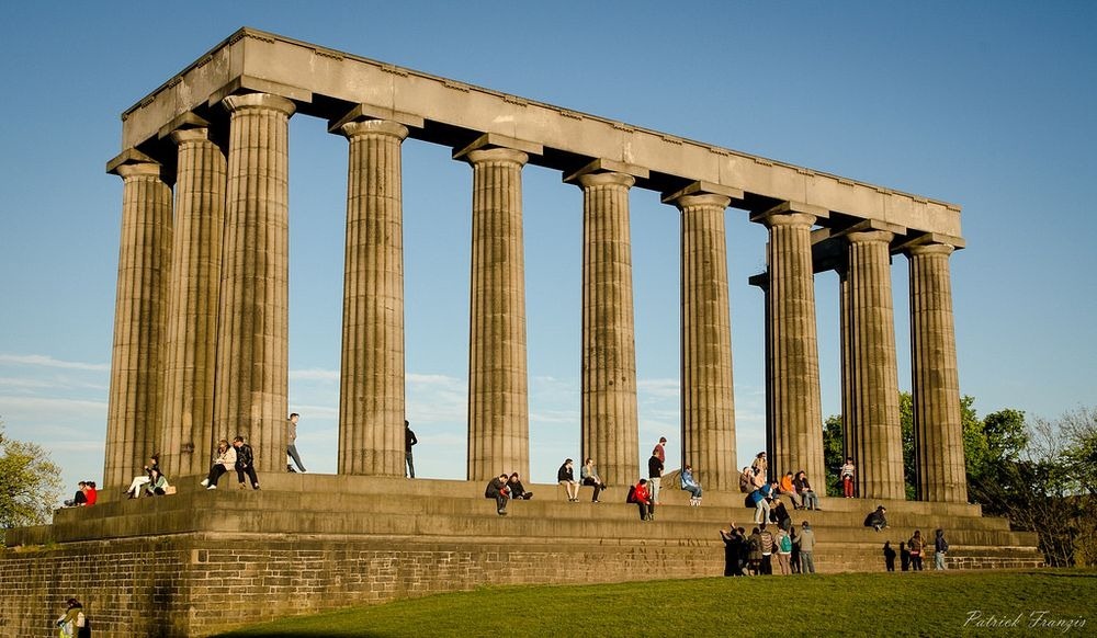
This is the National Monument of Scotland in Edinburgh…

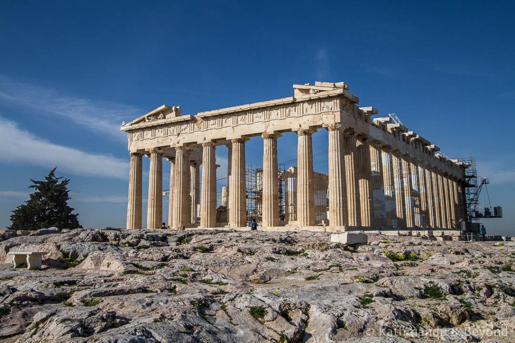
…which looks a lot like me to the Parthenon in Athens, Greece…

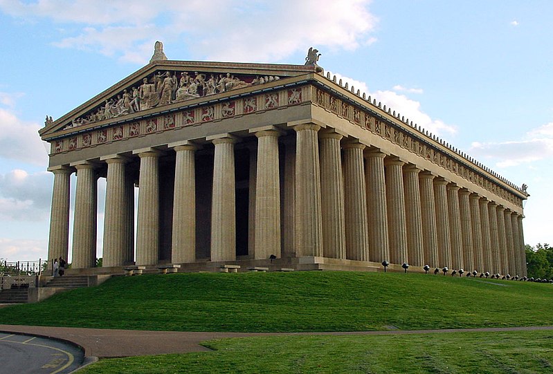
…and the Nashville Parthenon in Tennessee in the United States, which was said to have been built in two years for the Tennessee Centennial Exhibition in 1897. Not buying that one either.

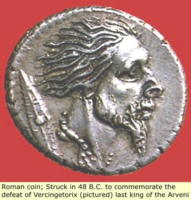
This is a Roman coin depicting Vercingetorix after his defeat at the hands of the Romans.

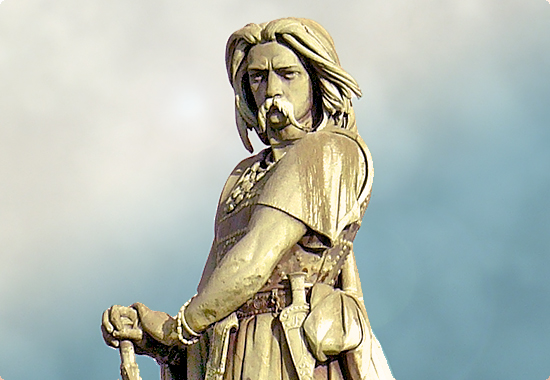
But he is usually portrayed looking like this instead:

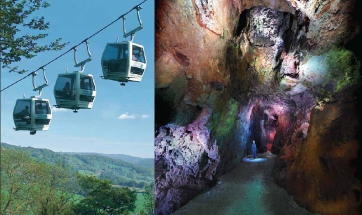
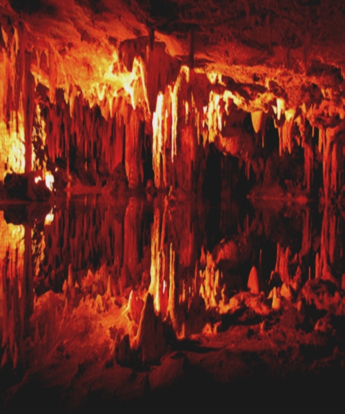
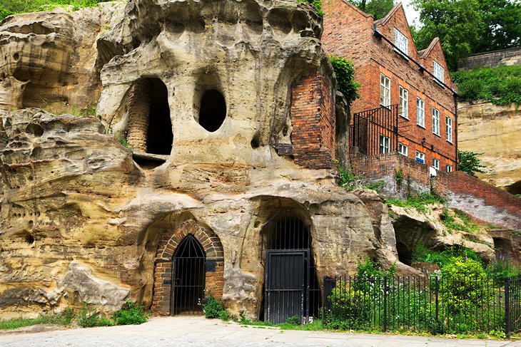
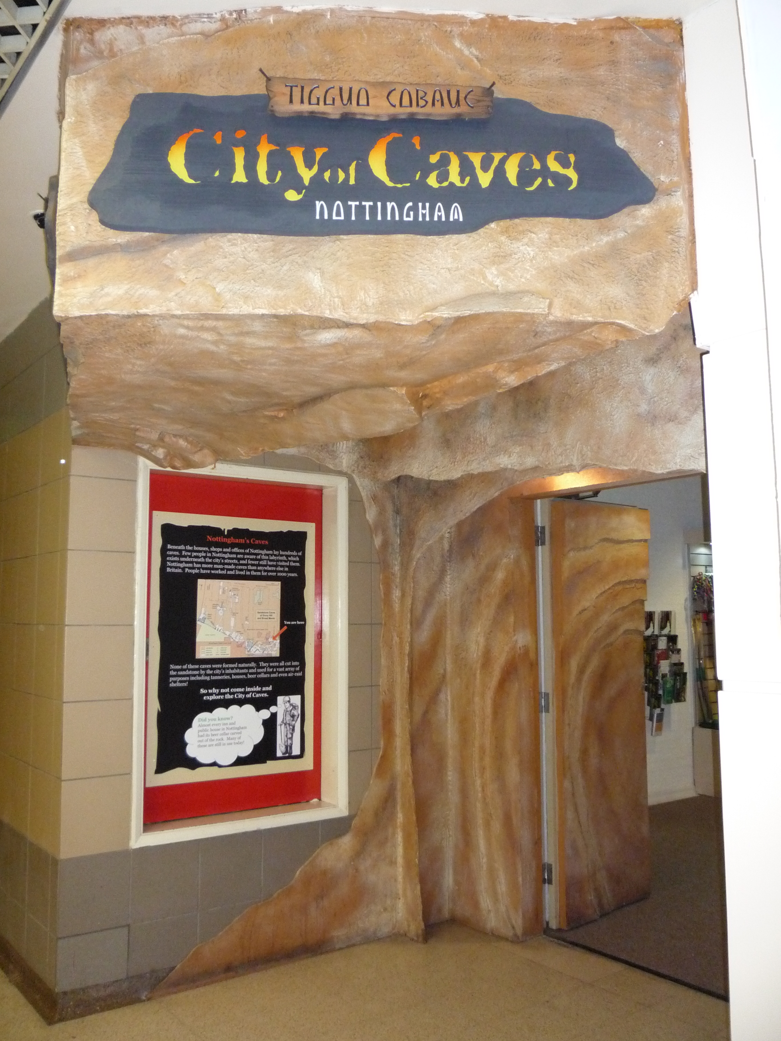
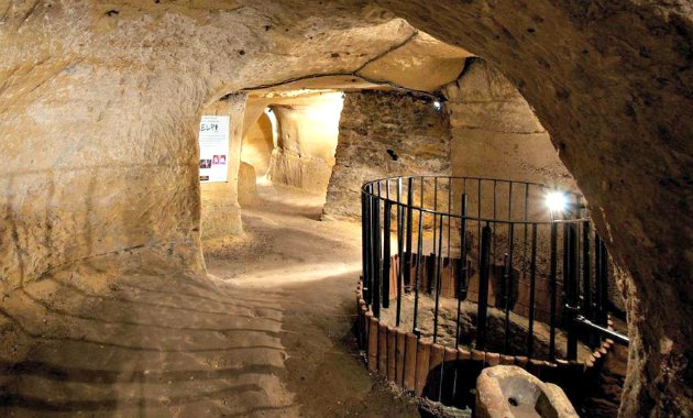
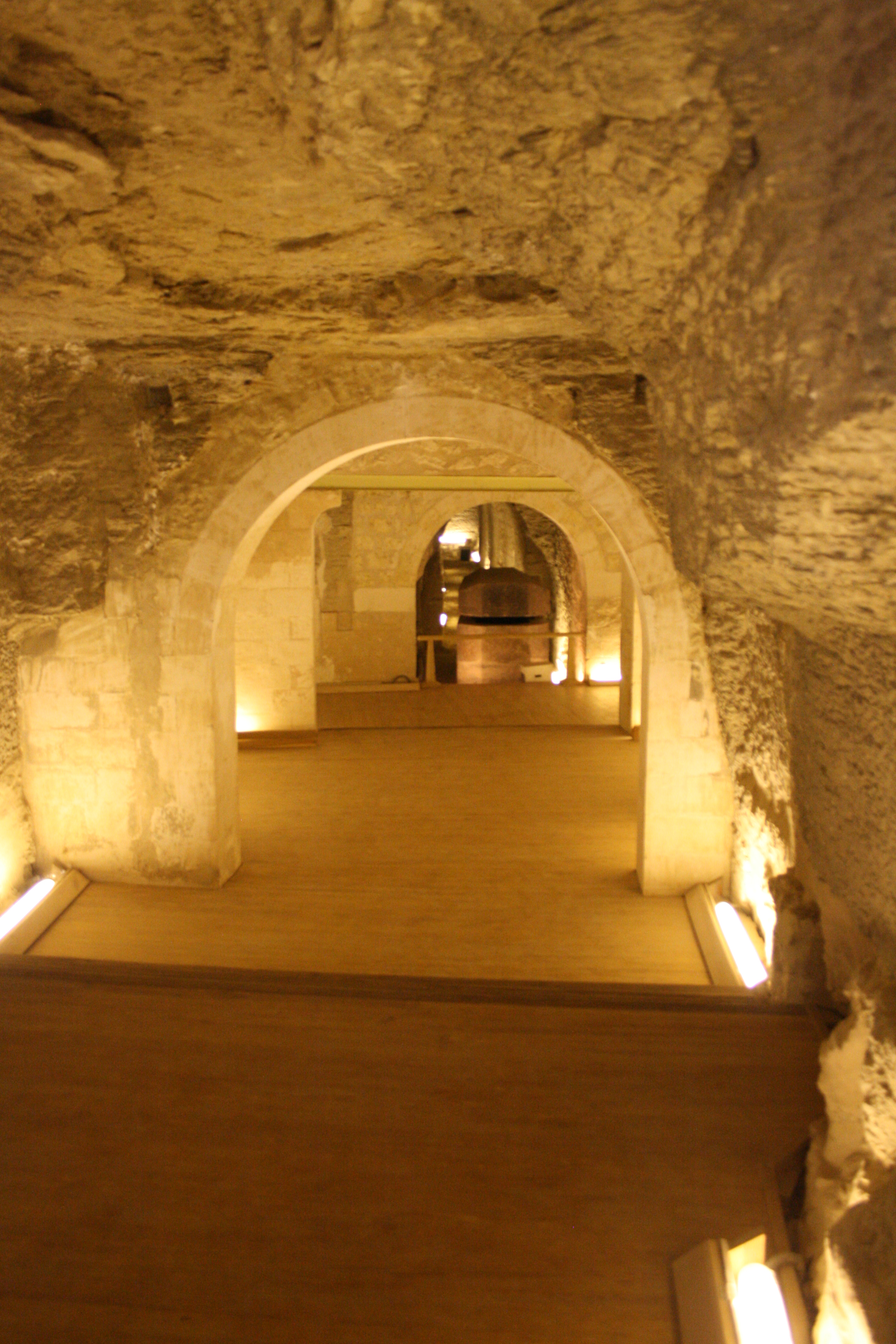
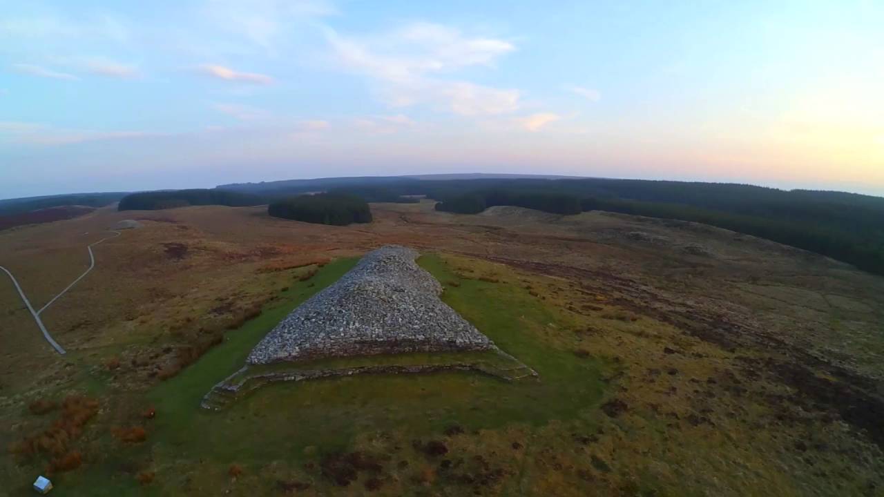
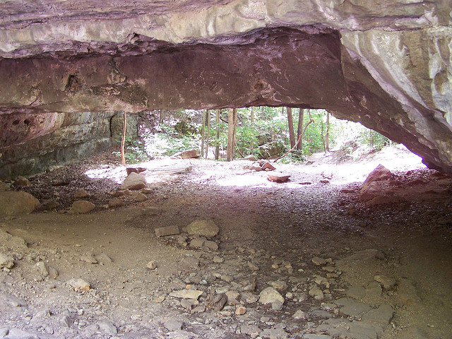
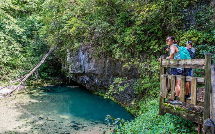
Clermont-Ferrand is said to have more than 1,400 caves in the surrounding area.

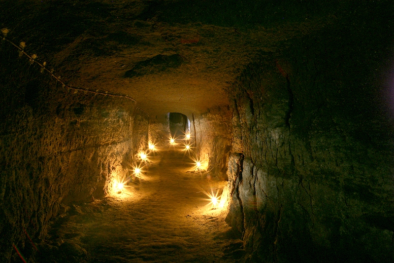
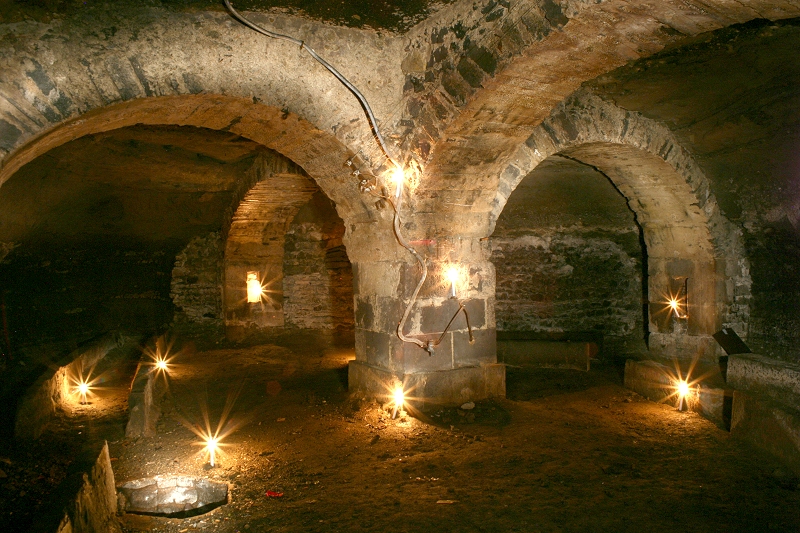
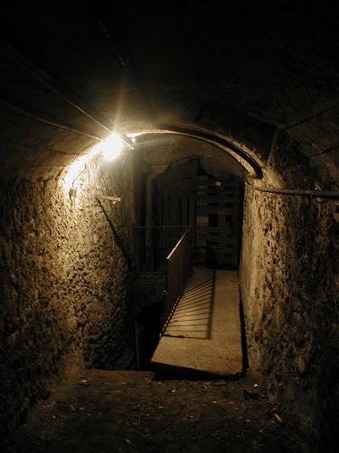
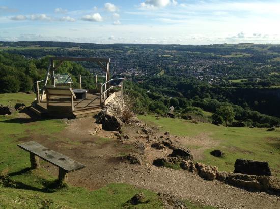
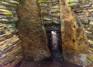
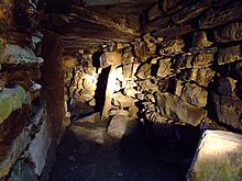
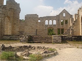
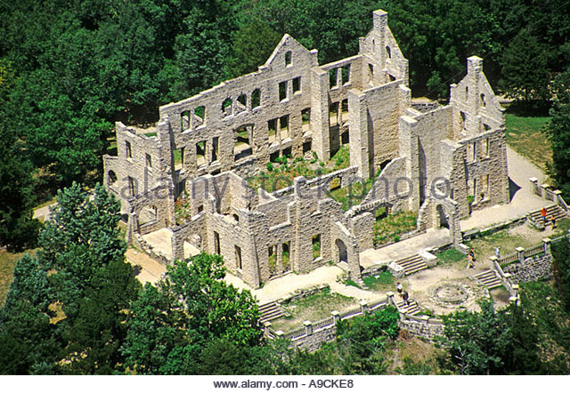
Just like Nottingham, England, earlier on this alignment, with its cave system. These don’t look natural either!

Next on the alignment is the Massif Central, shown in purple on this map.

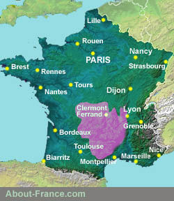
The Massif Central is described as an elevated region in the middle of southern France, consisting of mountains and plateaus, covering about fifteen-percent of mainland France.

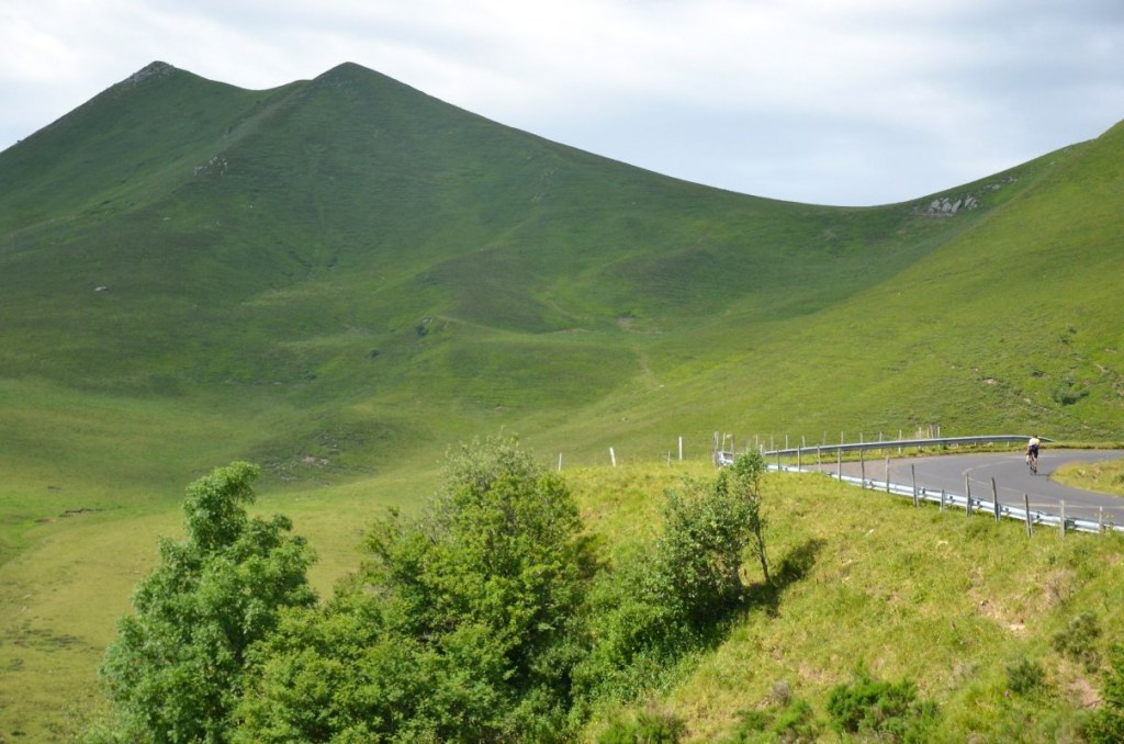
Subject to volcanism in the distant past…

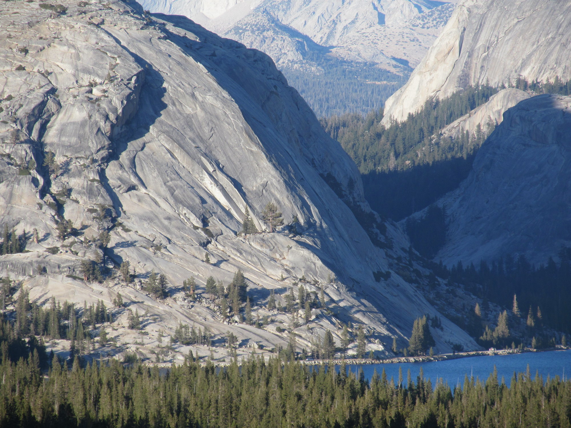
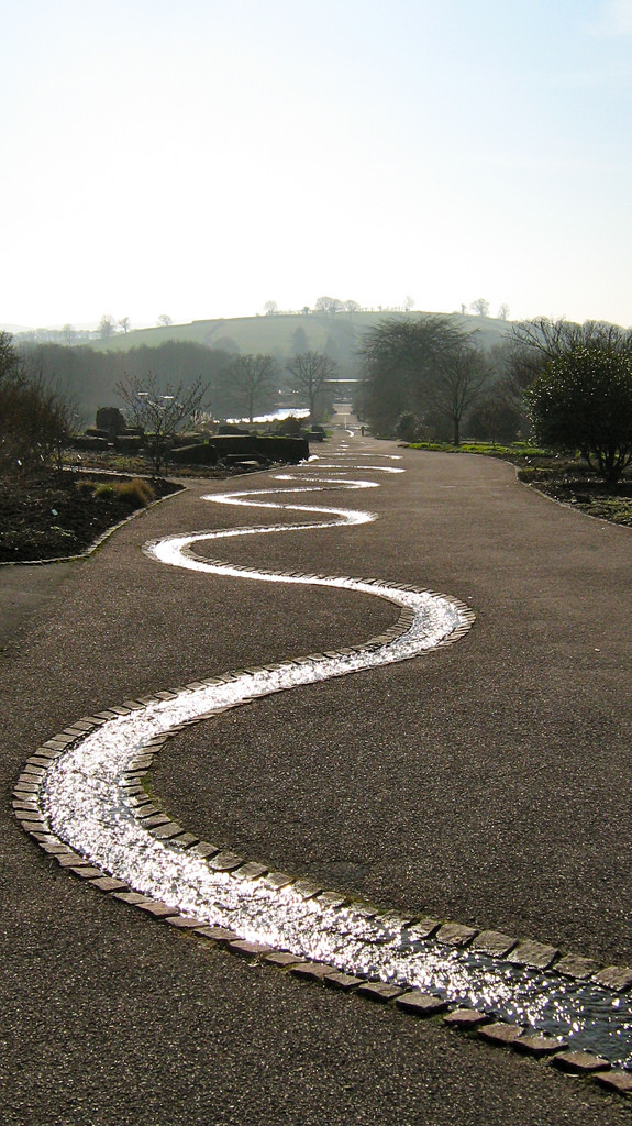
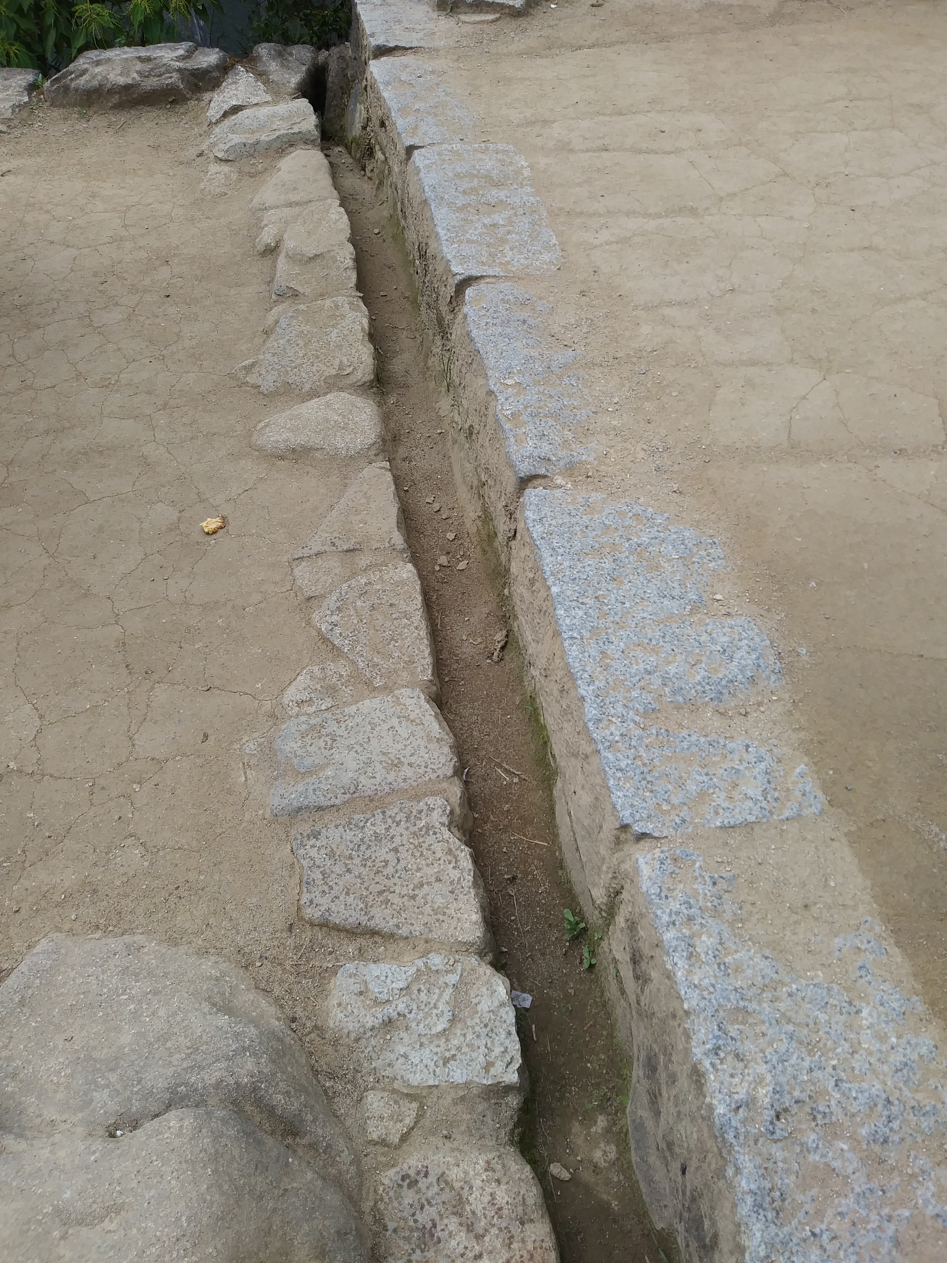
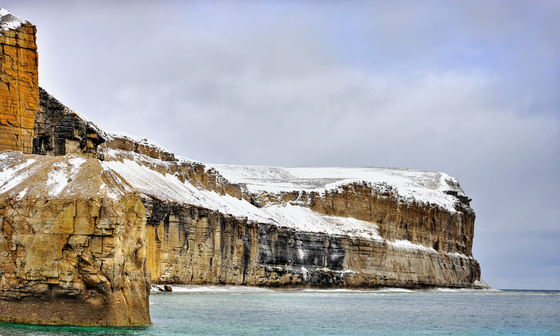
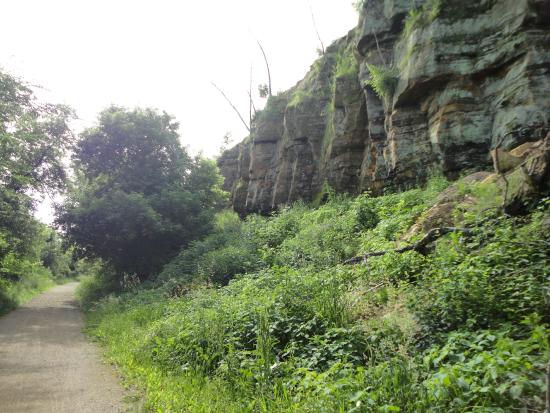
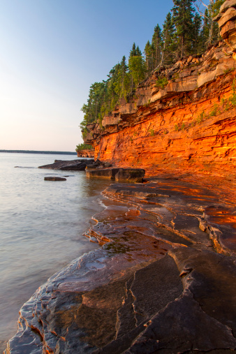
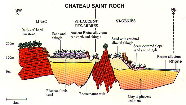
…the Massif Central is separated from the Alps by the Rhone Furrow, with its hard limestone banks that look like masonry in this depiction here.

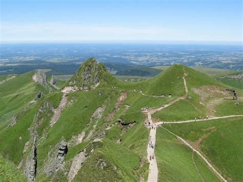
The alignment goes right across the Puy De Sancy, called the highest mountain in the Massif Central. It is called “Mount of the Cross” in the language of the region, Occitan, and said to be an ancient stratovolcano.

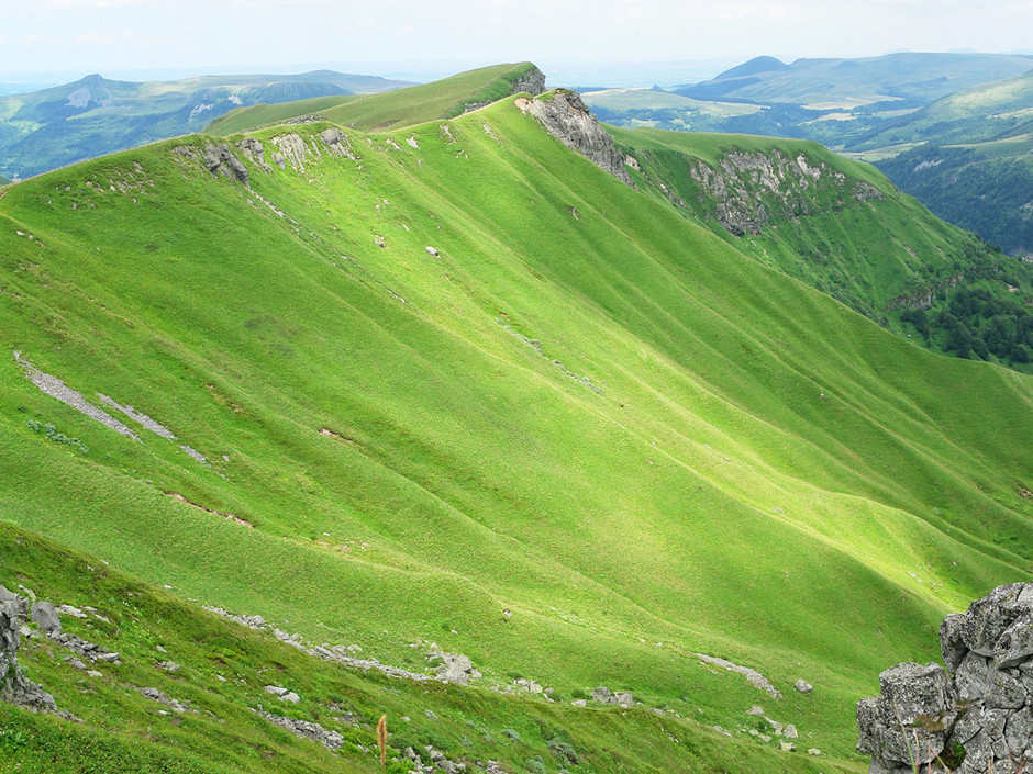
It reminded me in appearance of Arthur’s Seat, which is just outside of Edinburgh, Scotland. It is also said to be an ancient volcano.

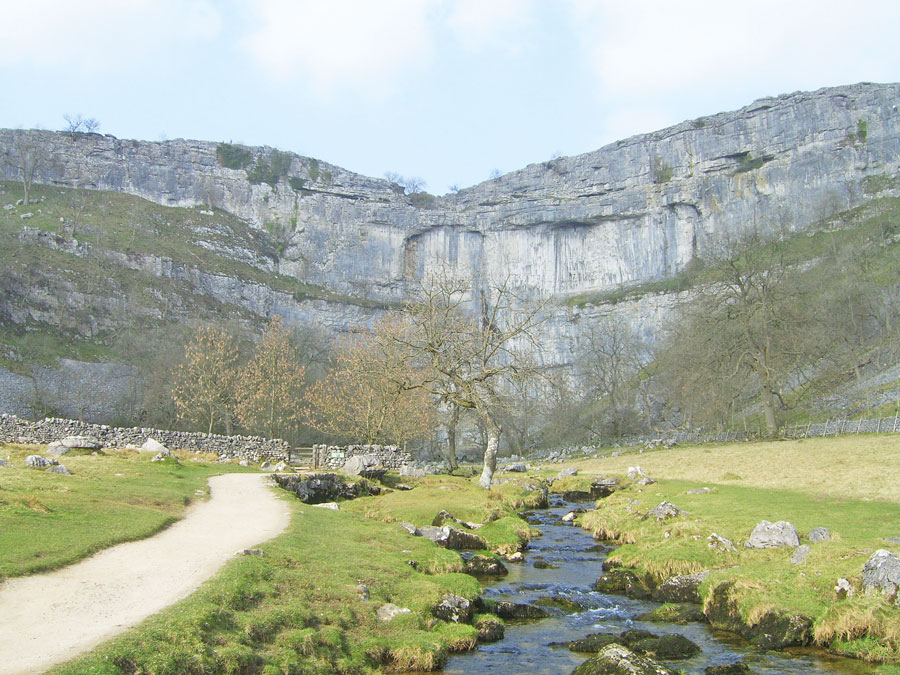
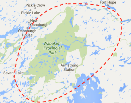
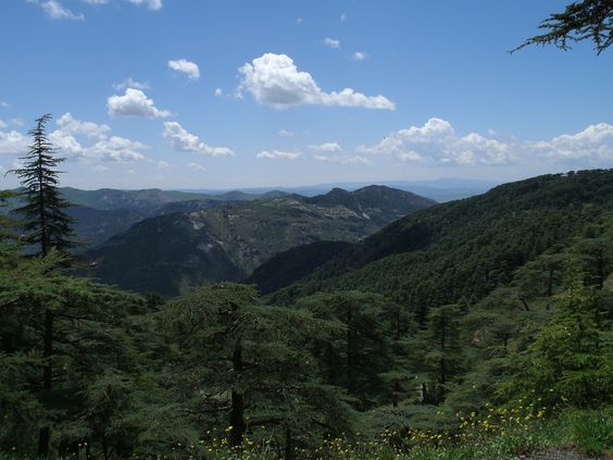
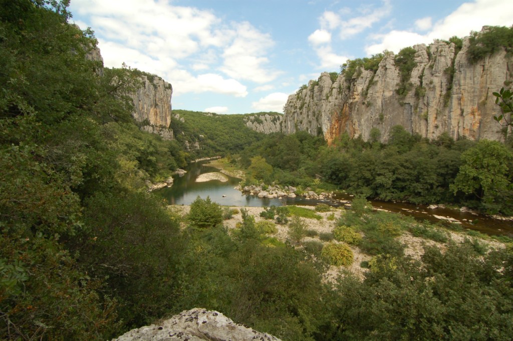
Next, the alignment goes through Cevennes National Park in the Lozere State of the Languedoc Roussillon region of France.

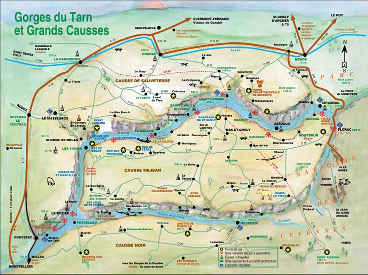
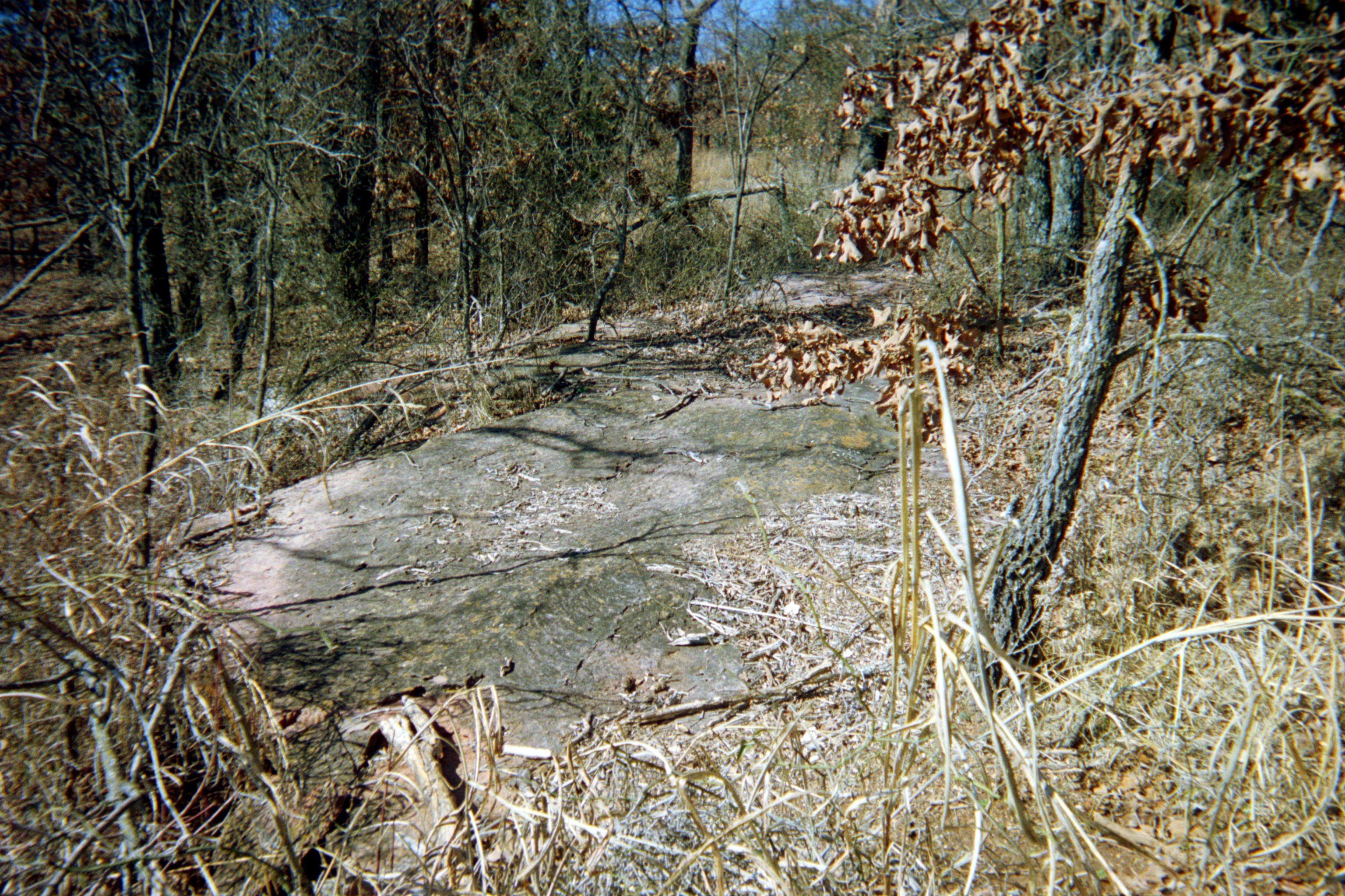
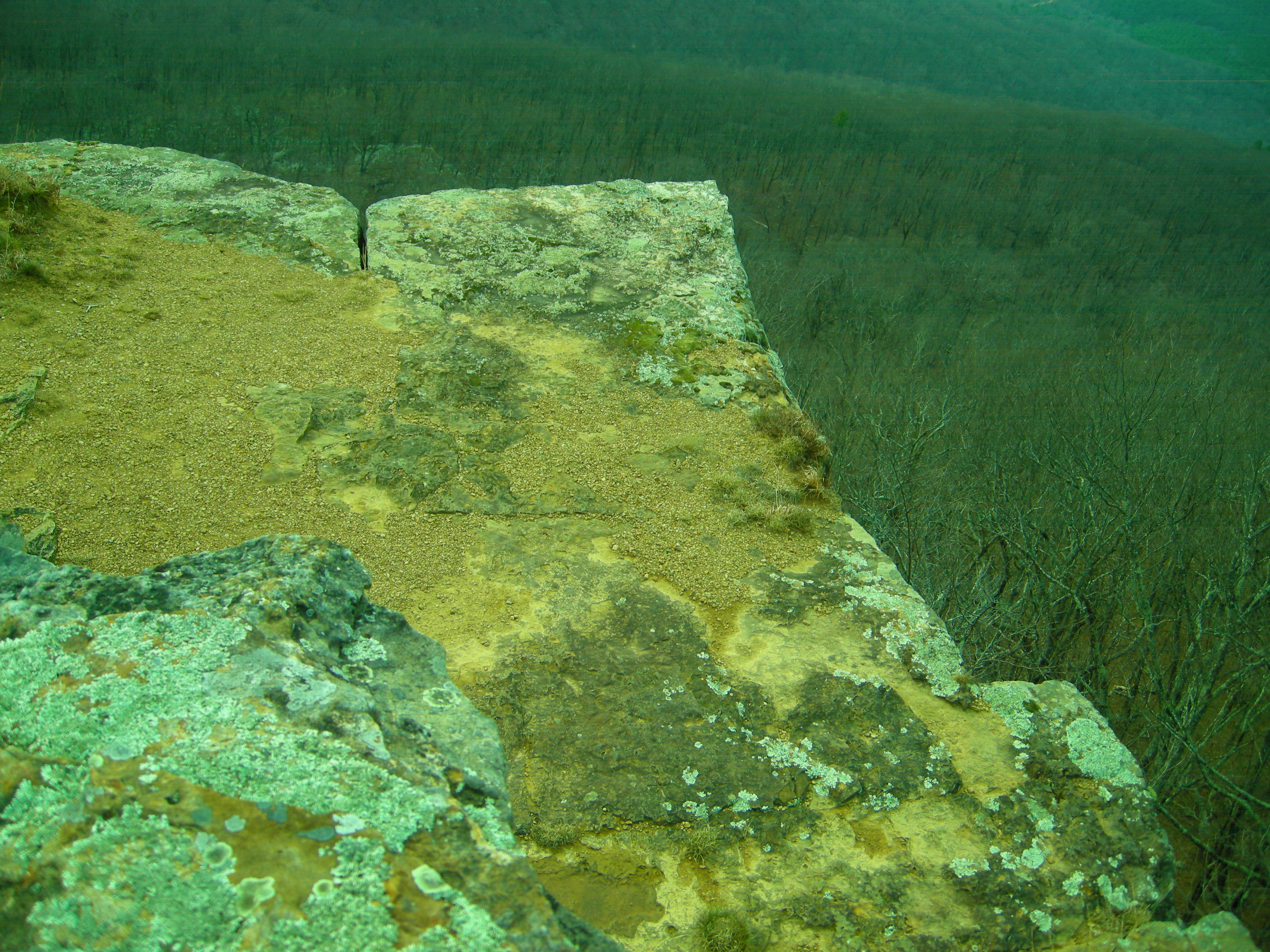
It is called the land of shale and granite. I consistently find the ancient advanced civilization in National Parks, and parks of all kinds for that matter. Let’s see what we find in this part in southern France.

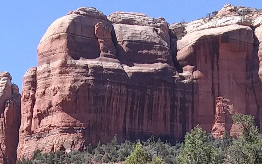
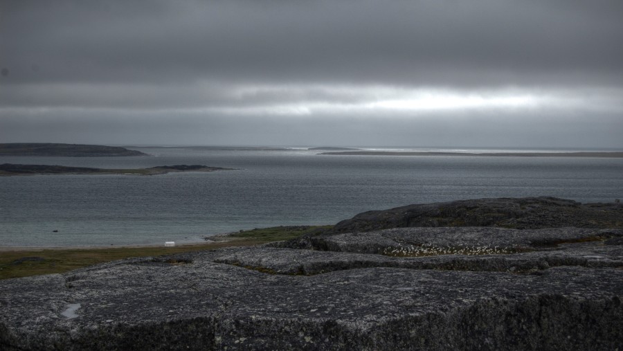
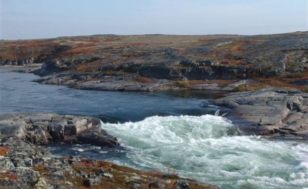
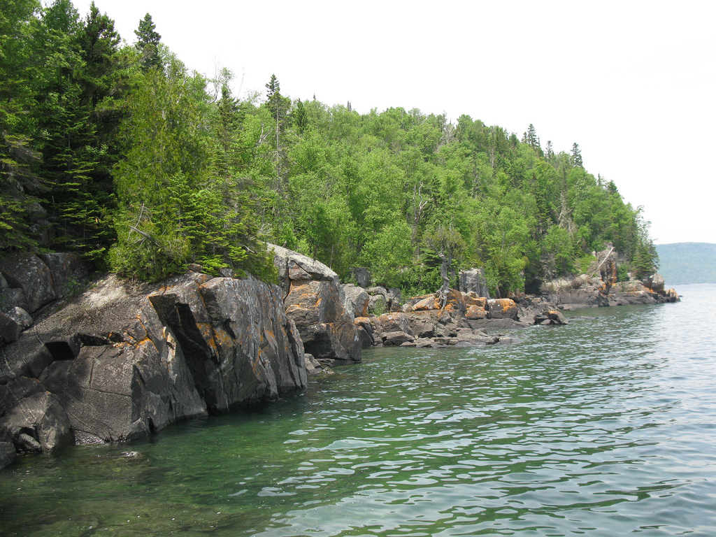
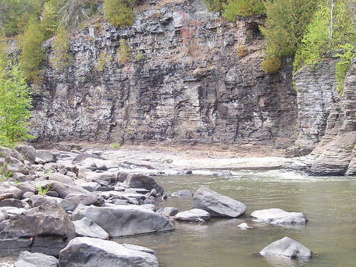
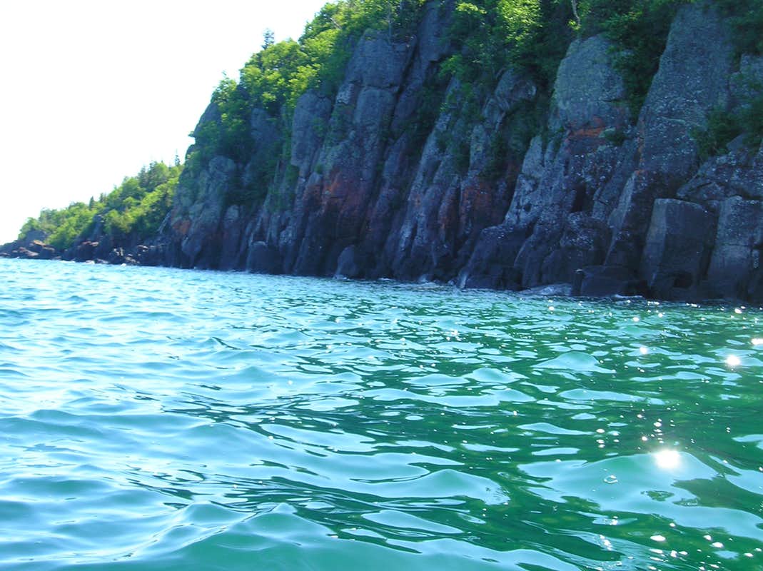
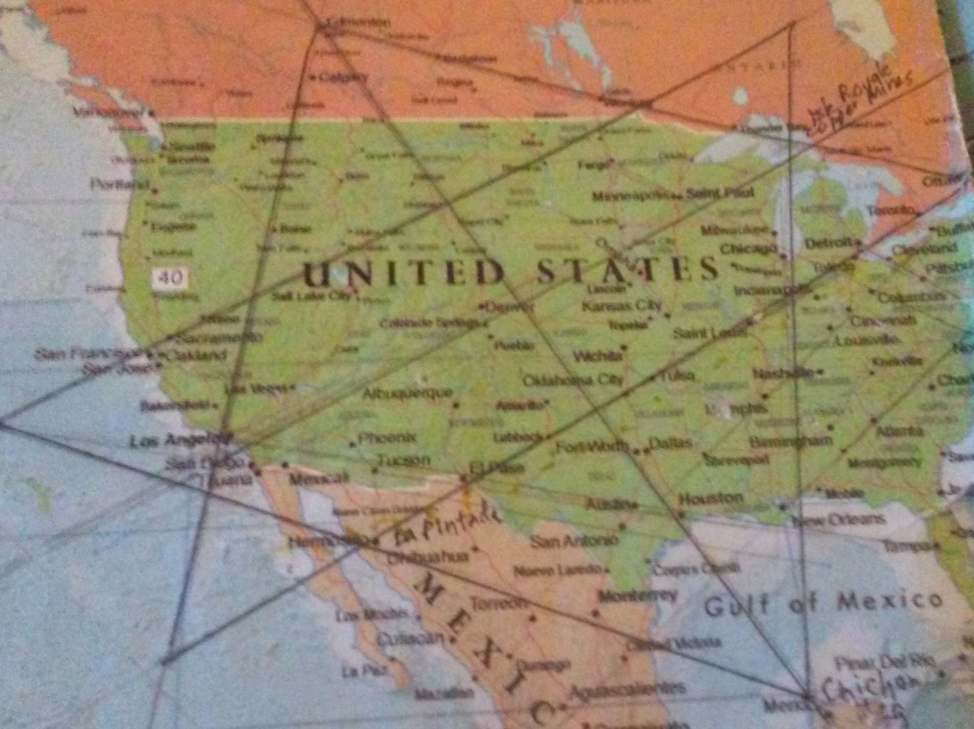
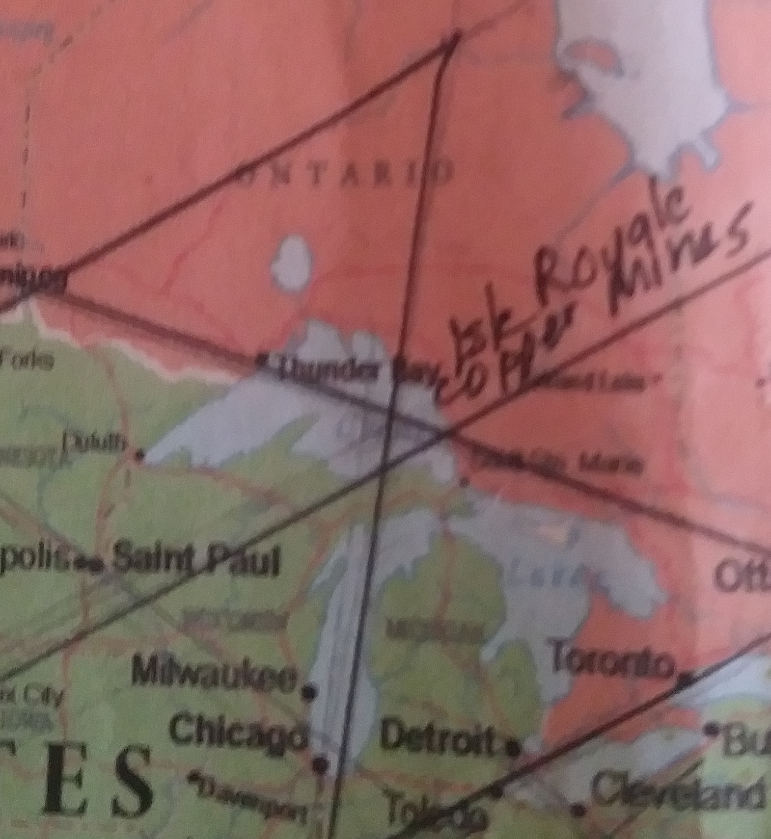
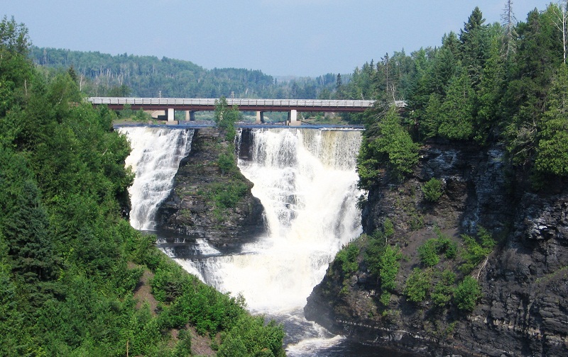
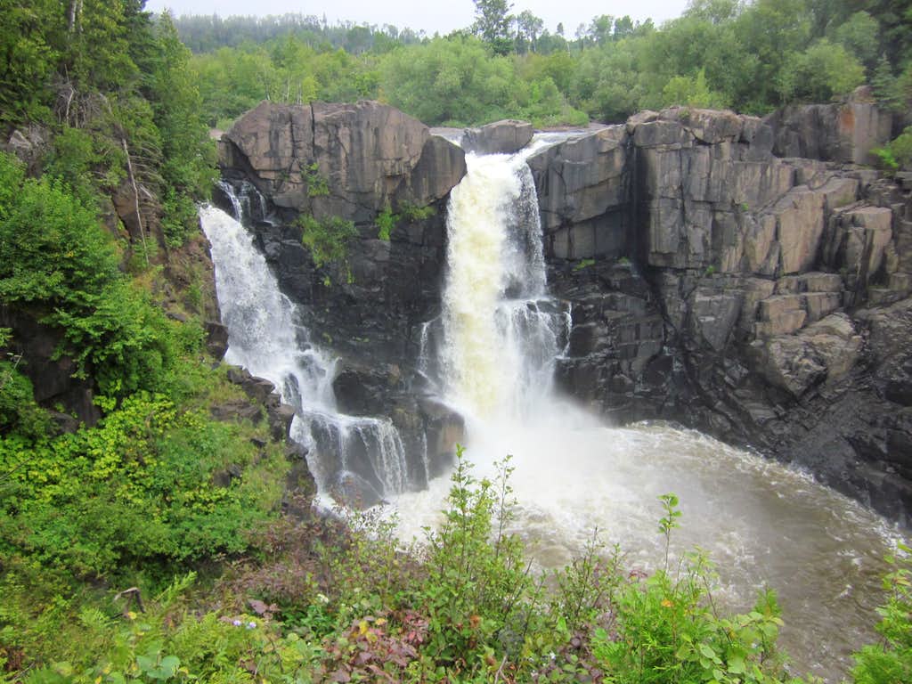
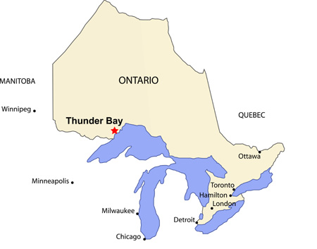
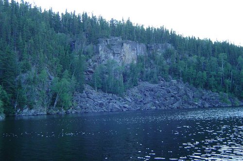
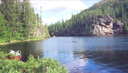
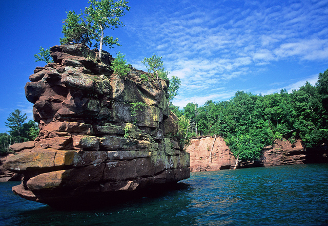
Reminds me of what it looks like on the Pigeon River where it forms the Canada – United States border between Ontario and Minnesota.

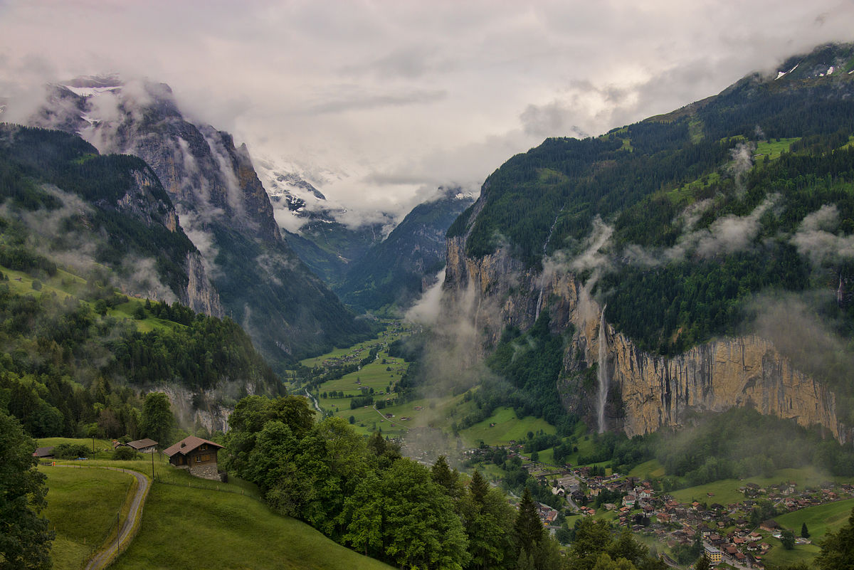
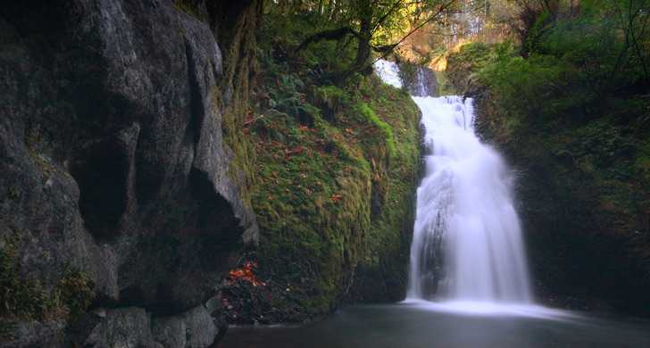
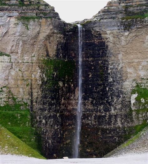
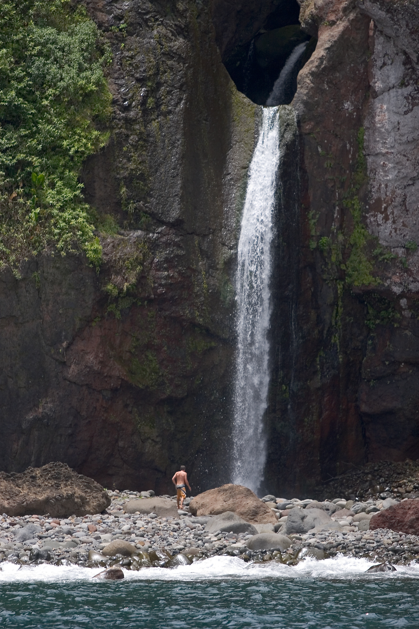
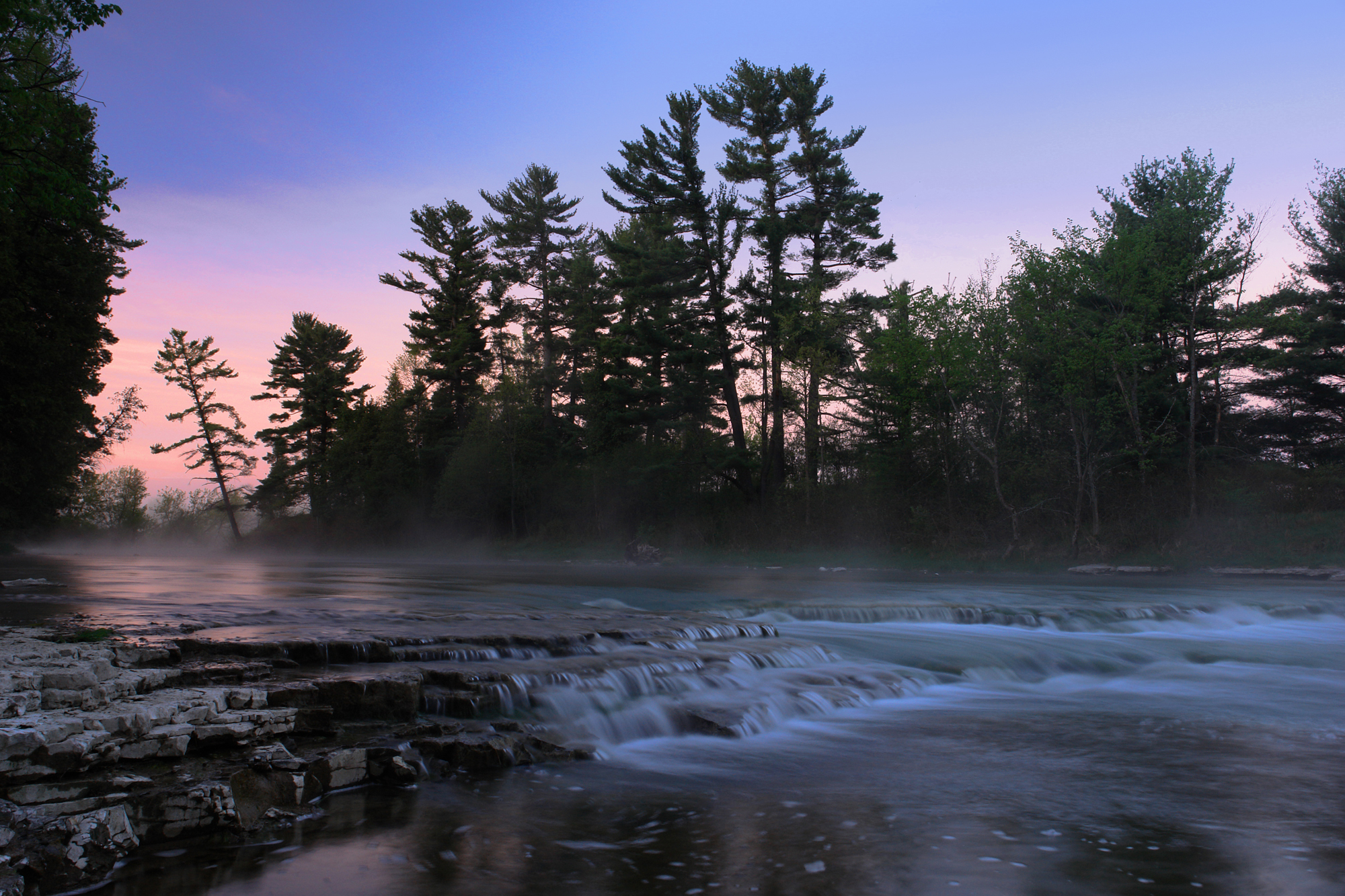
These are The Runes Waterfall on the southern slope of Mont Lozere.

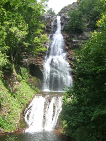
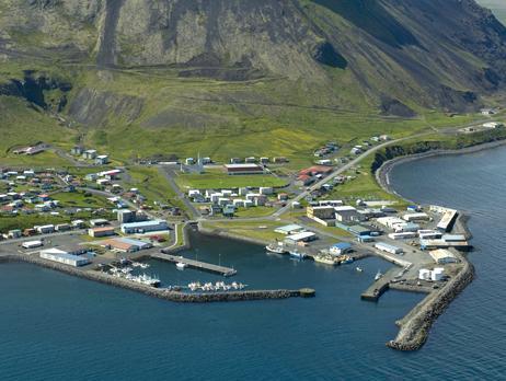
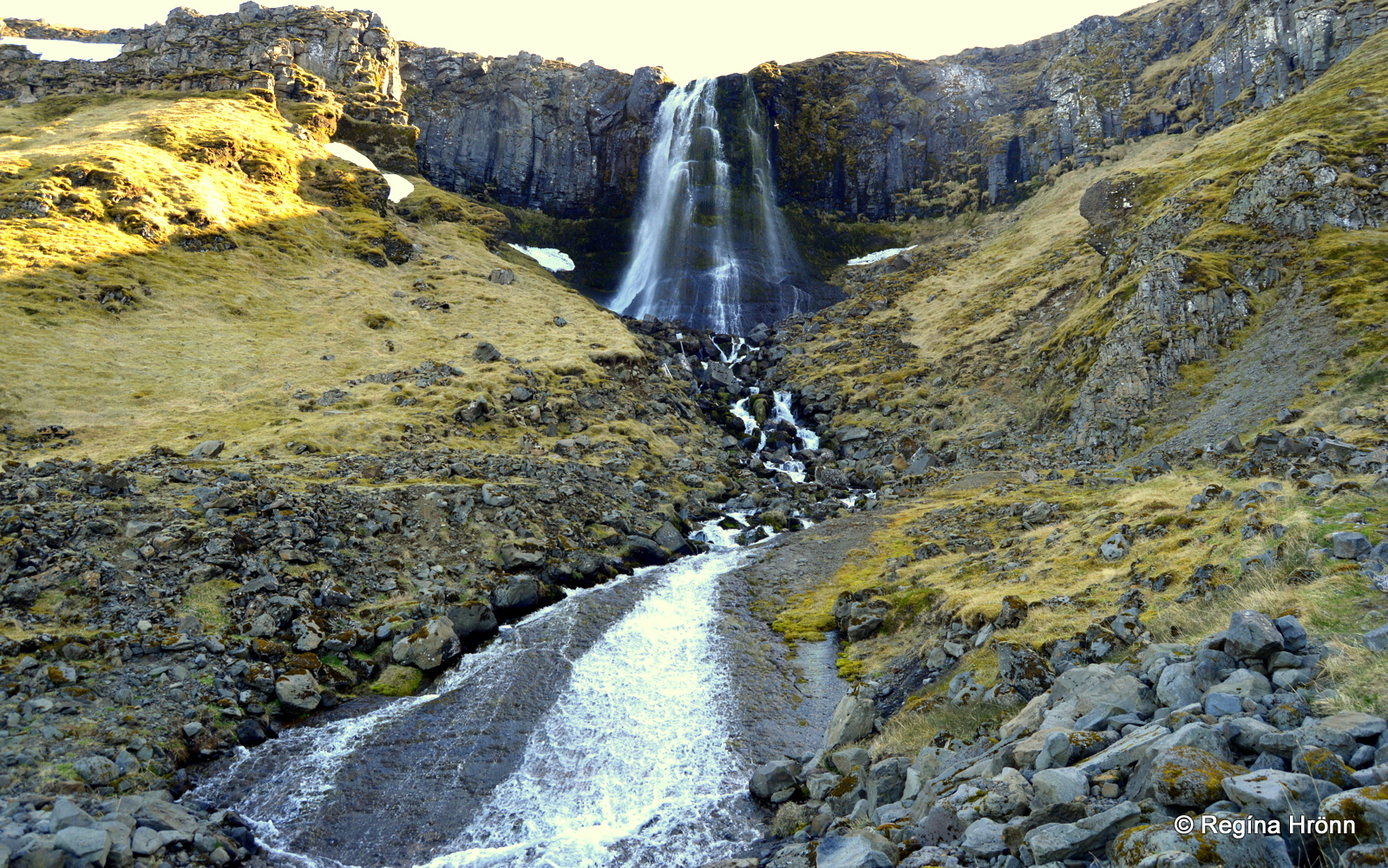
This waterfall reminds me of the Baejarfoss, or Bridal Veil Falls, that are near Olafsvik, Iceland, on this same alignment.

Mont Lozere is called the highest peak in the Cevennes, a subrange of the Massif Central. Love this description of it: a large mountain dotted with granite blocks.

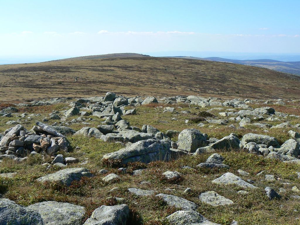
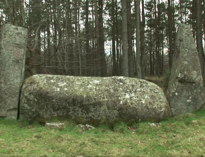
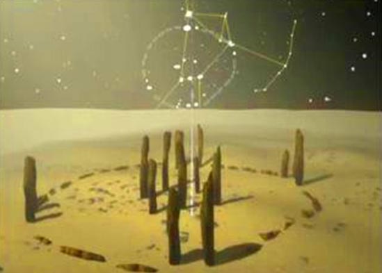
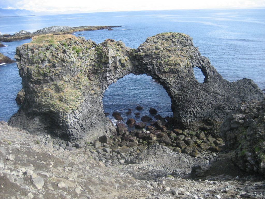
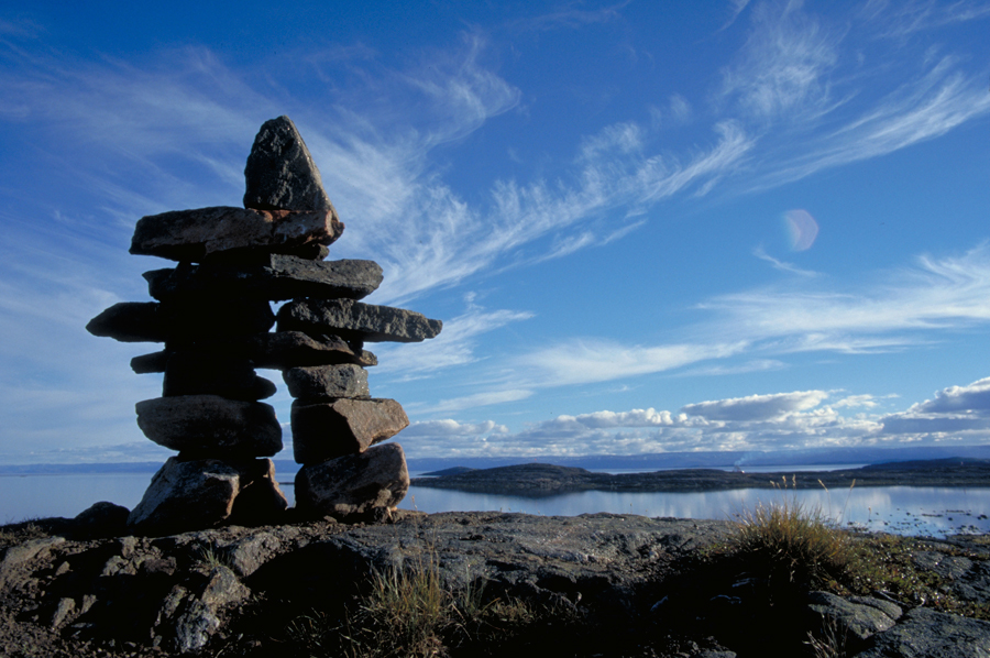
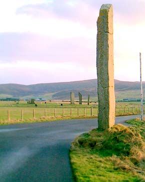
There are even standing stones on Mont Lozere in southern France…

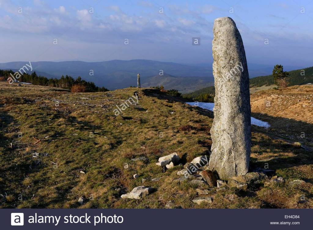
…just like what is found on the British Isles. The Watchstone in the Orkney Islands off the northern coast of Scotland is pictured here.

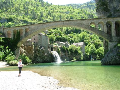
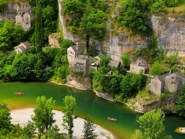
This is St-Chely-du-Tarn, a village of stone in the center of the Gorges du Tarn just to the northwest of Cevennes National Park.

The stone village of Cantobre is situated in the Cevennes National Park.

I find it noteworthy that this vacation rental in Cantobre is called the Egyptian, even though the promotional information says that it is named after a local vulture. Hmmm. Maybe. Maybe not.

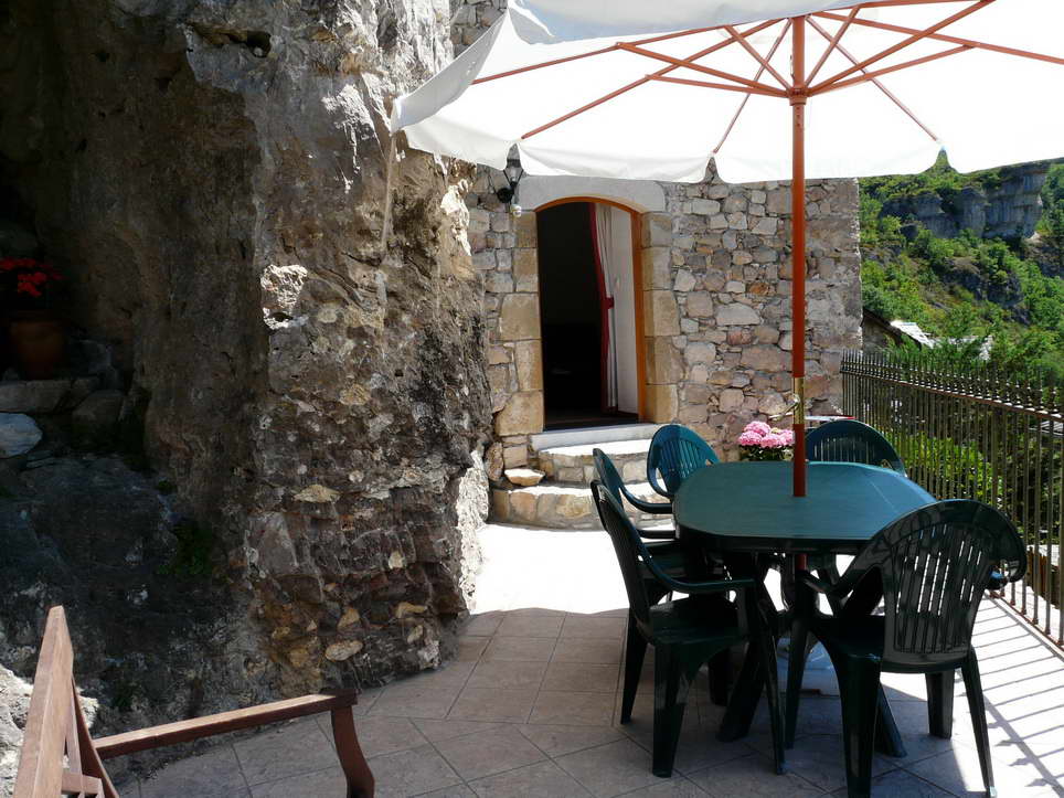
The people who lived here were mighty comfortable with stone….

I will end this post here, and pick up the alignment in Perpignan, France in the next post.

Circle Alignments on the Planet Algiers – Part 15 Derby, England to the English Channel

In the last post, I tracked the circle alignment originating in Algiers, Algeria, through the Yorkshire Dales National Park; Leeds, a large urban area in West Yorkshire; Sheffield, in South Yorkshire; and Nottingham, a city in the East Midlands of England.

I am starting this post in Derby – pronounced Dar-bee – also in the East Midlands, and situated on the River Derwent. While not directly on the alignment, it is close to it.

One of the reasons I want to include it here is that it is in the center of England.

The Derwent Valley Mills, a UNESCO World Heritage Site considered the birthplace of the factory system and the core of the Industrial Revolution, runs along the River Derwent…

…from the Masson Mill, a cotton-spinning mill at Matlock Bath…

…not far from Matlock Bath is Cromford Mill, the home of the world’s first water-powered cotton spinning mill – check out that nice waterfall and ancient masonry in the foreground…

…to Lombe’s Mill in the City Center of Derby, considered to be the world’s first fully-mechanized mill. A silk-throwing mill, it was said to have been built in 1717 on an isiand in the River Derwent…

…and looks similar to the Thwaite Mill further north on this alignment in Leeds, England, also said to be on an island. Are they on artificial islands, with all that masonry underneath the mills? More architecture on some artificial islands later in this post.

I am going to head back to Matlock Bath for just a moment as something interesting caught my eye, a place there called the Heights of Abraham on top of Masson Hill. It is said to be named that for a resemblance to…

…the Plains, or Heights, of Abraham in Quebec, where the Battle of Quebec, early in the American Revolutionary War, was fought between British and American forces in 1775. Interesting connection. Could be related to something completely different.

The Heights of Abraham in Matlock Bath are accessed by a steep hiking trail, or cable car, and has two caverns – the Great Masson Cavern pictured here, and the Great Rutland Cavern. They were both mined for lead ore and fluorspar up through the 1700s.

While there is much more to find just in Matlock Bath, I will stay on track and return to Derby.

The Railway Technical Center is in Derby, the technical headquarters of British Rail, and is considered the largest railway research complex in the world.

Derby is a center for advanced transport manufacturing, and is home to the world’s second largest manufacturer of engines for airplanes. Rolls-Royce is a global aerospace, defense, energy, and marine company, with its civil aerospace and nuclear divisions in Derby.

This is a map of Rolls-Royce facilities in Derby, and includes a Moor Lane. The memory of the people is retained in the name.

Bombardier Transportation in Derby, the rail equipment division of the Canadian company Bombadier, was for many years the United Kingdom’s only train manufacturer.


Talk about being in the center of things! Derby sure seems to be a major transportation center!

This is an aerial view of the Bolsovar Castle in Derbyshire…

It is said to have been built in the early 17th-century by the Cavendish family on the site of a medieval castle founded in the 12th-century by the Peverel family…

…compared with the San Lorenzo de El Escorial near Madrid in Spain.

Next on the alignment we come to London, the capital and largest city of England.

…situated on the snaky, S-shaped River Thames at the head of the 50-mile Thames Estuary leading to the North Sea.

…like the snaky, S-shaped Ouachita River in Monroe, Louisiana…

…and the snaky, S-shaped river at the historical location of Xanadu in Inner Mongolia.

St. Paul’s Cathedral dominates the London skyline.

St. Paul’s is an Anglican Cathedral, and the Mother Church of the Diocese of London, said to have been built by Sir Christopher Wren, starting after the Great Fire of London in 1666, and completed in 1697.

The size of the dome prompted me to look at the U.S. Capitol building, said to have been completed in 1800, in Washington, DC, for comparison.

This is Cleopatra’s Needle in London. It is one of three of the same name that we are told were transported from Egypt – the others are in Paris and New York City. It is said to weigh 240 tons, or 480,000 lbs. In metric terms that would be 218 metric tons, or 218,000, kilograms.

It was said to have been given to the government of the United Kingdom in 1819 by the ruler of Egypt and Sudan, Muhammad Ali, to commemorate the British victories in the Battle of the Nile (1798) and the Battle of Alexandria (1801). The gift was initially declined because expense of shipping it to England.

In 1877, one version of the story about how it got here says that Sir William James Erasmus Wilson …a distinguished anatomist, who paid 10,000 pounds for the shipping of it…

…a distinguished anatomist, who paid 10,000 pounds for the shipping of it…

…and I found another version of the story saying the British public raised 15,000 pounds to have it shipped in 1877.

At any rate, It was said to have been dug out of the sand where it had been buried for 2,000 years, and a shipping container was made for it specifically – a 92-foot (28-meter) long and 16-foot wide (4.9-meter) iron cylinder which was pulled by tugboat.

It eventually made its way to London where it was re-erected on the banks of the River Thames.

What is harder to believe – obelisks weighing over 200 tons could be shipped via ocean transport to other countries, or, that they were already there?

On the left is the Victoria Tower in the Westminster Palace complex in London, the building of which is said to have been completed in 1860, and on the right is the Plummer Building of the Mayo Clinic in Rochester, Minnesota, said to have opened in 1928.

In the Victoria Tower Gardens, we find the Buxton Memorial Fountain on the left, compared with the top of the Plummer Building.

Leaving London, and still on the circle alignment, we come to the city of Maidstone in Kent, the home of Leeds Castle, with a construction start date of 1119. It is described as being built on islands in a lake.

For a comparison study of similarities, here is an aerial of Matsumoto Castle in Nagano, Japan, found on a different planetary alignment, construction of which is said to date back to the early 1500s.

While obviously the design of Leeds Castle is European and Matsumoto Castle is Asian, I am struck by the similarity of the lay-out of the castles on artificial islands in a lake…

…and by the construction similarities in both places illustrated here.

So, these shared characteristics happened randomly in time and space across the world from each other…or an western and eastern version of the same civilization of Master Builders utilizing shared templates.

Next on the alignment we come to Dover, a town and major ferry port in Kent in the south east England, on the English Channel’s Strait of Dover, with Calais, France on the other side of the Strait of Dover.

Dover is famous for its chalk, streaked with black flint, cliffs…

When you look up close, there are some interesting finds, like what looks like masonry with all those linear shapes in this photo…

…and structures built into the cliffs like this one here.

The Port of Dover, in the Strait of Dover, is in the busiest shipping lanes in the world…

…with features similar to harbors around the world, like what you see on Male in the Maldives in the Indian Ocean…

..at Chichi-Jima in the Bonin Islands of Japan…

…and the harbor at Funchal on the island of Madeira in the north Atlantic Ocean, southwest of Portugal.

Next on the alignment, we cross the English Channel, a narrow arm of the Atlantic Ocean which separates England and France. It joins the North Sea at the Strait of Dover.

The world’s largest off-share wind farm is in the English Channel, off the coast of Kent, with 100 turbines covering an area of 13.5 square miles, or 35 square kilometers.

I have found so-called wind turbines all over these planetary alignments, and do not believe they are powered by wind. The ones I have personally observed in the States go at the same speed regardless of whether or not the wind is blowing. I believe they are harvesting ancient energy technology, unbeknownst to the general public.

The Channel Tunnel is close enough to be considered on the alignment.

The Channel Tunnel, nicknamed the Chunnel, is a rail tunnel linking Folkstone, near Dover, in Kent, with Coquelles, near Calais, in France. Construction was started in 1988…was the tunnel already there perhaps?

…and opened in 1994.

…and opened in 1994.

In summary, what I am seeing and saying is that there is a remarkable similarity of architecture and infrastructure world-wide in very different places, and we have been given no other explanation for how this came into existence other than what we are taught.

I see another explanation – an ancient, advanced Moorish (which also would have been Kemetic civilization) that was completely geometrically aligned on a Flower of LIfe Pattern with itself, the earth, and the stars, that has been removed from our awareness. Khem was an ancient name for Egypt, but not at all limited to what we know as Egypt or Egyptian.

I will end this post here, and pick up the alignment in Calais, France.

A Different Take on Samuel Taylor Coleridge’s “Kubla Khan”

Since I am still in England on the alignment, I am going to take a quick break from the Algiers’ circle alignment to examine “Kubla Khan” by the English poet Samuel Taylor Coleridge in detail. 

I was guided to look here when I realized it might contain information about what happened to the Advanced Ancient Civilization. 

This was after I realized a couple of months ago that the art and literature we are taught about in school provide the main vehicle for teaching us the history we believe to be true, which I believe is actually a false historical narrative presented as truth.

This is a typical portrait of Samuel Taylor Coleridge, the poet who wrote the poem “Kubla Khan.”

Said to have been born in 1775, and died in 1827, he was a founder of the Romantic Movement in England, which is said to have emphasized emotions and individualism; glorification of the past and nature; and preferring the medieval rather than the classical.

He wrote the poem in 1797, and published it in 1816.  He prefaced “Kubla Khan” when it was published by saying it was the result of an opium-influenced dream after he read a work describing Xanadu.

The poem is written as follows:

In Xanadu did Kubla Khan…

Historically Xanadu is an actual the place, the ruins of which are in what was called the Xilin Gol League in Inner Mongolia.

It was the Capital of Kubla Khan’s Yuan Dynasty in China from 1271 until he moved it to Dadu, or today’s Beijing.  It remained his summer palace.  This is an aerial view of where Xanadu was located in Inner Mongolia.

Note the geometric shapes in the landscape, and the snaky, S-shaped river–signatures of the advanced ancient civilization.

…A stately pleasure-dome decree.

By the way, there is a so-called granite dome named Stately Pleasure Dome in Yosemite National Park in California. 

Presumably its name came from this poem, and while I am not saying this is actually Xanadu, I do believe this is infrastructure of the advanced ancient civilization.

For rock-climbing enthusiasts, it is said to have over twenty multi-pitch slab climbs, or slabs that are at different angles, less steep than vertical, and ascended by one or more stops involving anchoring climbers. This is what one looks like.

Where Alph, the sacred river, ran through caverns measureless to man…

The River Alph may be an allusion to the Greek River Alpheus, which in Greek mythology was what the Greek God Alpheus became when he turned himself into a river going underground to chase a nymph who turned herself into a well. 

down to a sunless sea.

The theme of the “underground river” that was equated with the River Alpheus could be representing a subculture of western esotericism.

So twice five miles of fertile ground with walls and towers were girdled round…

So, wherever it was, it was a big, big place.

And there were gardens bright with sinuous rills

A sinuous rill is defined as a long-winding channel.

…where blossomed many an incense-bearing tree.

Incense is made from resin grains that burn and produce a fragrant odor. 

This is a picture of an Incense Cedar from Yosemite in California.

Frankincense is another well known incense-bearing tree found primarily on the Horn of Africa and the Arabian Peninsula.

And here were forests ancient as the hills, enfolding sunny spots of greenery.

But oh! That deep romantic chasm which slanted down the green hill athwart a cedarn cover!  A savage place! As holy and enchanted As e’er beneath a waning moon was haunted by woman wailing for her demon-lover!

And from this chasm, with ceaseless turmoil seething, As if this earth in fast thick pants were breathing.

A mighty fountain momently was forced:  Amid whose swift half-intermitted burst huge fragments vaulted like rebounding hail…

A huge sudden explosion, of water, and ice?

or chaffy grain beneath the thresher’s flail.

And he also likened it to how it looks like when a farmer threshes grain, separating the seeds from the plant.

And mid these dancing rocks at once and ever it flung up momently the sacred river.

Five miles meandering with a mazy motion through wood and dale the sacred river ran, then reached caverns measureless to man…

…And sank in tumult to a lifeless ocean; And mid this tumult Kubla heard from far Ancestral voices prophesying war!

There were many prophecies from ancient times that speak of Times of Trouble before the redemption of Humanity.

The shadow of the dome of pleasure floated midway on the waves, where was heard the mingled measure from the fountains and the caves.  It was a miracle of rare device, a sunny pleasure dome with caves of ice!

Caves of Ice!  What caused all that ice?

A damsel with a dulcimer in a vision once I saw:  It was an Abyssinian maid and on her dulcimer she played, singing of Mount Abora, could I revive within me her symphony and song, to such a deep delight ‘twould win me…

Abyssinia is the ancient name for the Ethiopian Empire in northeastern Africa, on what is called the Horn of Africa.

In an earlier version of the poem, called the Crewe Manuscript, Mount Abora was called Mount Amara.

In Ethiopia, Mount Amara is called Amba Geshen, and is in the Amhara Region of what was the Abyssinian Empire. It was the Mountain of Kings, where all royal princes except the direct heir of the Solomonic Kings were kept isolated from the outside world.

…that with music loud and long, I would build that building in air, that sunny dome! Those caves of ice!

Did the Ancient Ones use the power of sound to build? From my research over the years, I am sure that was one of the technologies they had at their disposal.

And all who heard should see them there, and all should cry, Beware!  Beware!  His flashing eyes, his floating hair!   Weave a circle round him thrice, and close your eyes with holy dread for he on honey-dew hath fed, And drunk the milk of paradise.

So, I found this particular image, which had the ending lines to the poem. Seems fitting for what I understand to be the Truth. Most of Humanity has no idea about Who They Really Are, as We have been made to forget!

Have Humans been unknowing pawns in an interdimensional war against the Creator and Creation? I think so.

So I didn’t take you through this because I believe this poem is the result of a drug-induced dream.  Whoever Mr. Coleridge was is giving us information about a very important civilization missing from our history books.

Why do I say whoever who he was?

For one thing, I found this man today when I did an internet search for Samuel Taylor Coleridge, as if to say, tell my story too.  Meet Samuel Coleridge-Taylor, an English composer and conductor.

He was a professional musician that received an appointment as a professor to teach at the Crystal Palace School of Music. He died young, however, at the age of 37.

I had mentioned the Crystal Palace in the Scotland segment of this series because I find it impossible to believe that this plate-glass and cast iron structure, said to be three times the size of St. Paul’s Cathedral in London, was built to house the Great Exhibition in London’s Hyde Park in 1851, and then was somehow moved to another location in London afterwards. I think was already built by the advanced ancient civilization. I mean, look at the size of that thing!

While he was said to be named for Samuel Taylor Coleridge, here is a comparison of Samuel Taylor Coleridge and Samuel Coleridge-Taylor. Even though living in different time periods, there is a similarity in facial features…

…which reminded me of the similarities between these two portraits of James Francis Edward Stuart.

In my post “An Explanation for What Happened to the Positive Timeline of Humanity and Associated Historical Events & Anomalies,” I shared an extreme cold weather event in the historical record in Ireland between 1740 – 1741. Irish Historian David Dickson talks about this little-known event in his book “Arctic Ireland.” I explored the idea that this event was related to the hijack of the original timeline, and that this was the point where the new timeline was pinned.

The Irish population endured 21-months of bizarre weather without known precedent that defied conventional explanation. The cause is not known.

Shortly after I learned about the cold-weather event in Ireland, I was connected to the mud flood community.

I learned about the fantastic research that is being done by people looking at their own communities and other places, around the world, at strong evidence that there was a cataclysmic event involving a massive flood of mud, as recently as 200 – 300 years ago.

It is being called a reset event, and that the infrastructure was dug out by those who somehow caused it afterwards.

Over the years as I have filled my head with information about megaliths, long before I became aware of what I am sharing, I learned about such places as the Sphinx in Egypt having been dug out…

…as well as the famous heads of Easter Island…

…that were found to have bodies too!

The explanation of a mud flood makes a lot of sense to me based on what I am finding and seeing.

A sudden cataclysmic event accounts for how a highly advanced worldwide civilization of giants…

…could be wiped out and erased from our collective memory.

This is an historic photo of St. Petersburg, Russia of vastly smaller, and hardly any, people relative to the size of the city in the background and the foot in the foreground.

I will end this post with a picture of the same place in St. Petersburg today.

Circle Alignments on the Planet Algiers – Part 14 Yorkshire Dales, England to Nottingham, England

In the last post, the circle alignment was tracked through Scotland, to its far distant past, through its largest city Glasgow, and its seat of government in Edinburgh.

In this post, I am picking up the alignment in northern England in the Yorkshire Dales, a region which became a National Park in 1954.

It is described as being full of stone built houses and stunning landscapes.

Let’s see what we find upon closer examination.

This location is found in Malham, a small village in what is called Malhamdale. Note the stone and earthen terraces; the canal on the right side, and the rock fields on the left…

…and similar to the stone and earthen terraces at Macchu Picchu in Peru…

…as well, Macchu Picchu has lots of canals like these.

This is called Malham Cove. It is described as a huge, curving cliff formation of limestone, with a vertical cliff face of 260 feet, or 79 meters, high. It is said to have been formed by a waterfall carrying glacial melt-water over 12,000 years ago.

This is a picture taken at Cathedral Rock in Sedona, Arizona…

…and this is the Lauterbrennan Valley in Switzerland. In all three places, there are striations that are black in color mixed into the stone of the massive wall-like topography. We simply have not been given any other explanation as to how they came to be except that they were formed like this naturally.

Another feature found at Malham Cove is called Malham Ash, which is actually called a limestone pavement. The definition of the word pavement is this: 1) a hard, smooth surface, especially of a public area or thoroughfare, that will bear travel; and 2) the material with which such a surface is made.

Other sites of the Yorkshire Dales include “The Buttertubs”…

…the Gordale Scar…

…and the Ribblehead Viaduct, said to have been built between 1869 and 1874 for the railroad. It is on what is called moorland, which is described as uncultivated hill land.

I believe the use of the word moor to describe uncultivated hill land is in reality telling us who lived here, and that the memory of these people is retained in the name.

So, for example, as seen on this map showing boundaries of the Yorkshire Dales National Park, there is a place marked as Threshfield Moor within in the park, and at least four places marked as moors outside of the park’s boundaries.

So I looked up pictures of Threshfield Moor, and found the following.

This mound there is described as the workings of an old mine.

This is the top of Moor Lane on Threshfield Moor…

…and these are described as boulders on Threshfield Moor…

…which look a lot like the kind of things you see at Macchu Picchu.

One of the first realizations that I had in uncovering all of this information is that remnants of the advanced ancient civilization are preserved in national parks, and other kinds of parks, but are called natural features.

Next on the alignment is the city of Leeds is in West Yorkshire Urban area in England, and has a population of 2.6 million.

It has been a center of industry since the Industrial Revolution, which is said to have taken place from about 1760 to about 1840 in Great Britain. It is said that during this relatively short 80-year period of time the foundations were laid in the transition to an industrialized society from an agricultural society.

This is an historic photo of Leeds in England…

…compared with an historic photo of New Orleans in Louisiana. Now that was quite an accomplishment to go from farming to this capability so quickly, and on different continents no less! And look at how big those buildings are compared to the people in the streets!

This is the River Aire that flows through Leeds. Just like the River Clyde in Glasgow, it has masonry banks and looks like a canal, but is called a river like it’s natural.

And just like Glasgow, there is a canal here as well – the Leeds and Liverpool Canal that links the two cities, construction of which was said to have started around 1770…

…complete with the gigantic Bingley 5 Rise Locks, said to have opened in 1774. All of this was taking place at the beginning of the Industrial Revolution?

This is the historic Corn Exchange in Leeds. It is called a Victorian building that was said to be constructed in 1864…

…and said to be designed by this guy here, an architect named Cuthbert Brodrick…

…who was also given credit for designing this building – the Leeds Town Hall – after winning a design competition for it in 1852. It was said to have been completed in 1858.

This is the interior of the Corn Exchange in Leeds…

…compared with the inside of the San Francisco Emporium…

…which was called, at the time it opened in 1896, the grandest mercantile in the world. Its original structure survived the 1906 earthquake, but not urban developers after it closed in 1995. Since that time, most of the building was demolished with the exception of the dome and facade to be used in a new building.

This is the Thwaite Water Mill in Leeds, one of the last remaining water-powered mills in Great Britain, which became a museum in 1975. It is said to have been built between 1823 and 1825…

… on an island between the River Aire…

…and what is called the Aire and Calder Navigation, what is referred to as a canalized section of the Rivers Aire and Calder.

…which doesn’t look much different in terms of masonry river banks of the River Calder itself, shown here. What are being called rivers, and natural, I am seeing are canals that were man-made.

One more thing is a comparison of the water-wheel at the Thwaite Mill…

…with some of the ancient waterwheels of Fayoum in Egypt. In this Oasis town southwest of Cairo, there are said to be as many as 200 waterwheels that have been used as part of an irrigation system since as far back as the 3rd-century BC

The River Aire has many beautiful bridges crossing it. When I saw this bridge in Leeds…

…it reminded me of this bridge in Central Park in New York City.

And when I started looking at photos of bridges in both places, I noticed that this one in Leeds…

…looks similar to this one in Central Park.

This is an example of what I am calling street-corner architecture in Leeds…

…that I am seeing diverse places like this one in the Centro Historic District of Merida, Mexico…


…in Summerside, the second largest city in the Canadian Province of Prince Edward Island…

….and this historic bank building in Toledo, Ohio.

Next on the alignment is Sheffield, a city and metropolitan borough in South Yorkshire.

Sixty-one percent of Sheffield’s entire area is green space, and one-third of the city lies in the Peak District National Park, becoming the first national park in the United KIngdom in 1951.

With the majority of it being outside the city boundaries of Sheffield, its land is described as largely open moorland.

The is the Derwent Dam and Reservoir, located in the Upper Derwent Valley. It is 10 miles, or 16 kilometers, from Sheffield.

It was said to have been built between 1902 and 1914, and filled with water between 1914 – 1916. Keep in mind that World War I started during this time, in July of 1914, so this would have been a big public works project during wartime.

This another perspective of the size and masonry of the dam from its base.

This is a picture of the Peace Gardens, an open town hall square in the heart of Sheffield…

…and form the main part of the spectacular walk that visitors take after they leave the huge Sheffield Station for train and tram passengers.

Next on the alignment is Nottingham, a city in the East Midlands of England.

It is perhaps best known for the legend of Robin Hood and its Sheriff.

This is the Nottingham Council House, said to have been built between 1927 and 1929. It presides over the Old Market Square which is also the center of the city.

The waterworks in the Old Market Square…

… remind me of the Water Mirror on La Place de la Bourse in Bordeaux, France, and on a different planetary alignment Both of these places have examples of very sophisticated hydrological engineering.

Nottingham is known as the City of Caves, This is called Mortimer’s Hole…

…and lies directly beneath Nottingham Castle.

There are more than 450 sandstone caves beneath the city, and the largest known grouping of caves in the country.

The caves are accessed by way of the of the Broadmarsh Shopping Center in Nottingham.

This is a view of what you see when you go down into the City of Caves…

…which reminded me of the underground tunnels of the Serapeum at the Saqqara complex in Egypt, a burial place for sacred Apis bulls.

The Serapeum contains a mystery of enormous granite sarcophagi weighing between 60 – 80 tons cut from a single piece of stone, with 20 ton lids. While it is believed these sarcophagi were the intended resting places for the Apis bulls, but there is actually no evidence for this.

I will end this post here, and pick up the alignment in the next post in Derby, England.

Circle Alignments on the Planet Algiers – Part 13 Wick, Scotland to Edinburgh, Scotland

In the last post, the circle alignment was tracked from its entry point into western Iceland in the town of Olafsvik on the Snaefellsnes Peninsula, across the Faroe Islands lying between the North Sea and the Norwegian Sea, and on over the Hebrides Islands off the Northwest coast of Scotland in the North Atlantic Ocean.

In this post, I am beginning in Wick, Scotland, a town and royal burgh located in Caithness along the River Wick and Wick Bay in the far north of Scotland.

Wick is slightly northeast of the actual circle alignment as it tracks through Scotland, however, this region of Scotland is significant, and has noteworthy things to include on this journey.

I am going to start this journey through Scotland in the far distant past, at a place called the Grey Cairns of Camster.

This site has two of Scotland’s oldest, and best-preserved, Neolithic chambered cairns, dating to have been built over 5,000 years ago, in addition to this big mound.

This is Camster Round, said to have been discovered in 1850, and excavated in 1865. It is unique as a chambered cairn in Caithness because its main chamber roofing was found intact.

This is a photo of the interior of Camster Round.

The other chambered cairn is called Camster Long.

This is the inside of Camster Long, with sunlight shining on the stone at the end of the Chamber.

These two cairns are described as burial chambers. I believe Neolithic constructions like these chambered cairns have predominantly astronomical functions, and not burial ones. Like, among other things, being markers of the heavens on earth at the solstices or equinoxes, providing a perfectly aligned avenue in the enclosure for the light to stream into at those times.

Another example of this is found in the Neolithic Complex of Avebury in Southern England…

…at the West Kennet Long Barrow. While also called a tomb, it is known to be a solar marker at the equinoxes, as depicted in this photograph of the sun aligned at the entrance of this long barrow. It is also over 5,000 years old, like the Grey Cairns of Camster near Wick.

Both the Grey Cairns of Camster and the West Kennet Long Barrow are contemporaries in time with the Watson Brake Mounds, in Richwood, Louisiana, near Monroe and Poverty Point.

Watson Brake is dated to 5,400 years ago, and is considered the oldest earthwork mound complex in North America. Note the summer and winter solstice alignments depicted here in this diagram of Watson Brake.

There are two ancient mounds at Louisiana State University in Baton Rouge, believed to be more than 5,000 years old, and considered to be part of the oldest mound system in North America, and also an acknowledged part of the Louisiana mound system. They are on the U. S. National Register of Historic Places.

This is Stonehenge, located not far from the neolithic complex at Avebury in Southern England, believed to date to about 5,100 years ago, which has a similar earthwork to what is seen at Watson Brake in Louisiana encircling the big stones,

The Octagon and Great Circle Earthworks in Newark, Ohio, is located on a Golden Ratio Longitude, along with Poverty Point in Louisiana.

This diagram shows the lunar alignments marked by these earthworks in Ohio.

How is this even possible according to the history we have been taught?

My answer is the Ancient Advanced Civilization, that we have not been told about, aligned Heaven and Earth in everything they did, all over the Earth.

By the way, the Octagon and Great Circle of Newark…

… are now part of the golf course of the Moundbuilders Country Club.

Another striking example of this practice by the Ancient Ones, of the consummate aligning of heaven and earth, is found near Forres, which is located southwest of Wick, across the North Sea and Moray Firth from Wick.

Forres is in the Grampian Mountains, which are said to have the highest concentration of stone circles found anywhere, and include what are called Recumbent Stone Circles, found only in this part of Scotland and in the far southwest of Ireland.

This is the Recumbent Stone Circle of Crowthie Muir near Forres. The center stone, weighing upwards of 50-tons, is perfectly placed in the landscape…

for lunar events like this one, as the moon is seen rolling along the top of the recumbent stone on the same night.

While the stone circles of Great Britain and Ireland are the best-known, there stone circles in many places, including in Africa, like the Bagnold Stone Circle in the Libyan Desert…

…the Mzora Stone Circle in Morocco…

…and Nabta Playa, depicted with astronomical alignments, in southern Egypt, situated on the Tropic of Cancer.

There are a few more things I would like to highlight in Wick.

The first is this clock tower in Wick…

…compared with this historical depiction of one in Hong Kong…

…and this one in Vyborg, Russia. Not identical, but similar constructions of heavy masonry with with the same function of time-keeping in different countries.

Here is the Wick River, also known as the River Wick, where it flows into Wick Bay…

…compared with what Olafsvik back in Iceland looks like again.

And is the Wick River actually a canal?

Here is a canal called a canal in Wick. Where there is one, there are others….

Lots more to see up here in northern Scotland, but now back to the circle alignment.  It passes through Ben Nevis…

…the highest mountain in the British Isles. at the western end of the Grampian Mountains.

This is what the Climbing hiking trail up Ben Nevis looks like…

…and this is a view from the summit of Ben Nevis.

Leaving from Ben Nevis, the alignment passes close to Glasgow, the largest city in Scotland.

This is a view of what is called the River Clyde in Glasgow, with its canal-like appearance, and masonry river-banks…

…just like the Forth and Clyde Canal…

…construction of which is said to have been started in 1768, and opened in 1790. It runs between the Firth of Forth on Scotland’s central-east coast, through Glasgow to the River Firth of Clyde.

Bear in mind, Scotland was said to be rural and agricultural until the Industrial Revolution in Scotland, which is said to have started after 1790.

How could they have built something like this when they said they did?

This is an historic building in Glasgow…

…compared with the Wako Department Store in the Ginza Shopping District of Tokyo…

…the historic post office in Dushanbe, Tajikistan, circa 1937…

…and the Burundi Palace Hotel in East Africa.

At some point along the way, I learned about the Crystal Palace in London’s Hyde Park, said to have been built of cast-iron and plate-glass solely for the Great Exhibition of 1851 in which to display the technology developed in the Industrial Revolution…

..after which time it was said to have been moved to South London in 1854, and destroyed by fire in 1936.

What! A building of plate-glass and cast-iron, said to be three times larger than St. Paul’s Cathedral in London, shown here…

…just up and moved?

The same kind of story is told about the Moorish Kiosk in Mexico City, which is still standing.

The person who gets the credit for it was a Mexican engineer named Jose Ramon Ibarrola.   He  is said to have designed it to represent Mexico in the New Orleans International Expo in 1884 – 1885.  We are told it was transported there, as well as to the St. Louis Missouri Fair in 1904, and then subsequently came back to Mexico. 

By what means could they have transported this huge, highly ornate structure, twice, in the late 1800s and early 1900s?

The reason I bring all of this up about the Crystal Palace in London, and the Moorish Kiosk in Mexico City, is because of what I found in Glasgow.

This is inside the Kibble Palace of the Glasgow Botanic Garden.

This is an outside view of the Kibble Palace, a wrought-iron, framed, glass-house, said to have been by John Kibble for his home on Loch Long in 1865. It was said to be taken down in 1871, and re-erected here. It opened to the public in 1873.

This is an odd depiction of John Kibble, and showing the Kibble Palace in the background too! Monty Python, anyone?

The next place the alignment passes through is Edinburgh, the capital city of Scotland.

The fortress of Edinburgh Castle dominates the city at the head of Old Town…

….from its position on Castle Rock, called a crag of basalt formed from an extinct volcano that has a tail that became…

…the gently sloping Royal Mile of Edinburgh, the main thoroughfare of Old Town and seat of government of Scotland…

…on its way to the Palace of Holyroodhouse, the official residence of the monarch in Scotland.

St. Andrews, Scotland, is 30 miles, or 50 kilometers, northeast of Edinburgh. It is referred to as the home of golf, with the founding in 1754 of the “Royal and Ancient Golf Club of St. Andrews,” the world’s oldest and most prestigious golf club.

To be clear, I believe that golf courses are ancient mound sites, and are used as a means to not only cover them up, but to secretly show dominance over the ancient civilization.

I believe that Humanity was deliberately knocked off its advanced and positive evolutionary timeline of Unity Consciousness relatively recently, and that the planetary grid was hijacked by malevolent forces with a negative agenda that has had disastrous consequences for Humanity.

This is not who we were or who we are. We have been manipulated by race and religion to cause fear and division by parasitic beings who feed on negativity and human energy.

Please read my post “An Explanation for What Happened to the Positive Timeline of Humanity, and Associated Historical Events & Anomalies” for an in-depth exploration of this subject.

A false historical narrative, that we have been completely educated in, was superimposed on top of the already existing infrastructure of the highly advanced and unified civilization, which included free energy powered by the worldwide planetary grid.

Much of this infrastructure has been torn down, like the Exhibition Hall and Market Square Tower in Geelong, Australia pictured here. This is one of countless examples.

In order to get the level of power and control over Humanity that we have seen in our lifetimes, the higher consciousness of the planet had to be taken down.

I bring all of this up to illustrate this process of manufacturing a new culture and inventing a new history, as already evidenced by the flimsy stories I have covered in this post. We don’t have to look any further than the Scottish House of Stuart.

First, here are two portraits of Henry Lord Darnley Stuart. He was the King-Consort of Scotland from 1565 to 1567 as the husband of Mary, Queen of Scots. He was murdered in Edinburgh in 1567. The murder was never solved, however, it appeared to be related to some kind of court intrigue.

Henry Lord Darnley was the father of King James VI, who became King of Scotland in 1567. In addition to the Scottish throne, he became King James I of England and Ireland, the King James Version of the Bible King James, when Queen Elizabeth I died in 1603.

This is James Francis Edward Stuart. Known to history as the “Pretender,” he was first exiled to France, and then to Rome, where he died in 1766. He would have been heir to the three thrones, but was forcibly prevented from claiming them when he tried to do so.

The interesting thing about this specific period of time when James Francis Edward Stuart is forced into exile in France in 1710, was right before George I, of the German House of Hanover, became the British Monarch in 1714. I think Scotland, England and Germany were key places in how the timeline was hijacked.

Here are more examples of manufacturing a new culture, and inventing a new history.

This is an Egyptian kilt. It was called a Shendyt.

It was worn about the waist by men, usually extending to above the knees.

They were depicted on pharaohs…

…commoners…

…and soldiers in Egyptian art.

This is a Scottish kilt, the traditional dress of Gaelic men and boys in the Scottish Highlands, worn formally or informally above the knees in the present day…

…and is part of the uniform for Scottish regiments.

Other Celtic countries and regions have kilts as traditional wear for men. This is an Irish kilt.

So, who were the Celts, really?

Vercingetorix was a famous Celtic king and chieftain of the Averni in Gaul, now France, who bravely fought Julius Caesar’s Roman troops, but was eventually captured and killed.

This is a typical depiction of Vercingetorix…

…compared with this profile of his head on a Roman coin commemorating his defeat.

I think our history has been white-washed based on real people, and that the truth about historical places and events has been fragmented and falsified. I don’t think the True History of Humanity bears any resemblance to what we have been taught.

It is time to awaken and return to Who We Were and Who We Are. We Are All One. There is No Separation.

In the next post, I will be continuing along the alignment to Leeds, England.

Circle Alignments on the Planet Algiers – Part 12 Olafsvik, Iceland to the Hebrides Islands, Scotland

In the last post, the circle alignment originating in Algiers, was tracked from Inukjuak on the Hudson Bay, over the Ungava Peninsula of Northern Quebec, across the Hudson Strait to Baffin Island in the Canadian Territory of Nunavut, and from there across the Davis Strait of the Labrador Sea into Greenland, on through to Tasiiluq in Greenland’s east coast.

In this post, I am picking up the alignment in Olafsvik, a township in western Iceland on the Snaefellsnes Peninsula, located northeast of the Snaefellsjokull National Park, the first national park established in Iceland…

…and named for its famous ice-covered stratovolcano and glacier, said to be one of seven great energy centers of the Earth…

…and which was an entrance to Inner Earth in Jules Verne’s classic 1864 novel, “Journey to the Center of the Earth.” In the novel, the German adventurers came to the surface of the earth again at the Stromboli volcano of the north coast of Sicily. I wonder how Verne came up with that unusual story line!

Back to Olafsvik, a small township with a population around 1,000 people, is described as a fishing village. It’s shaped harbor, on Iceland’s west coast in the North Atlantic Ocean, is exactly like shaped harbors found around the world…

…like Pearl Harbor, on Oahu in the Hawaiian Islands in the Pacific Ocean…

…at Funchal, the largest city of the Portuguese Madeira Islands, located in the Atlantic Ocean southwest of Portugal, and west of Morocco…

…Port Louis in the island nation of Mauritius in the Indian Ocean…

…and the harbor at Chichi-Jima in Japan’s Bonin Islands in the Pacific Ocean south of Japan’s main islands.

Interesting to note the presence of these massive stones on the Olafsvik waterfront…

…and what looks to be a canal, lined on either side with large stones. All of these stones shown have the angles and edges of having been worked and shaped in some fashion.

These are the Baejarfoss, or Bridal Veil, Falls, near Olafsvik…

…compared with the Bridal Veil Falls in Provo Canyon in Utah…

…and Bridal Veil Falls in the Columbia River Gorge in Oregon, to show a few of many examples with the same name and a similar-looking appearance.

Before leaving the Snaefellsnes Peninsula, there are two places in Arnarstapi on the southern coast of the peninsula that I would like to show you.

The first is this pyramidal mountain in the background, with the large rock formations on the shore in the foreground…

…which are similar in appearance to the Twelve Apostles, located off the shore of Port Campbell in the Victoria State of Australia.

The other place in Arnarstapi is Gatklettur, or Arch Rock…

…which is similar to the Hollow Rock at Grand Portage Island off the coast of northern Minnesota in Lake Superior.

Next on the alignment, we come to a place called Kirkjufell Mountain in Grundarfjorour, Iceland.

Kirkjufell, or Church, Mountain is considered to be the most photographed mountain in Iceland…

…and was a filming location for the Game of Thrones in Seasons 6 & 7.

I found this diagram of the geologic strata of Mt. Kirkjufell. It is noteworthy to me that the pink layers of the Quarternary Warm Period Lave look just like brick and block masonry.

It reminded me of this Phillips County Kansas geologic survey that I found when I was first figuring things out by looking at rock formations state-by-state, where the Upper Cretaceous Period especially in this diagram looks like masonry.

Let me introduce you to the Monument Rocks, also called Chalk Pyramids, in Oakley, Kansas, if you didn’t know about them.

I have come to the conclusion that modern geologists are actually studying ancient masonry.

Next the alignment passes over the Hekla Volcano. Hekla sits on at least one other planetary alignment. It is also on the Merida Circle Alignment.

Hekla is what is called a stratovolcano, like Snaefellsjokull, and is one of the most active in Iceland. The definition of a stratovolcano is a conical volcano built up by many layers of hardened lava, tephra, pumice and ash.

This is an example if tephra, which is called a fragmental material produced by a volcanic eruption regardless of fragment size or composition. I wonder what that is telling, or not telling, us.

Hekla is a legendary gate of hell in medieval literature.  I have found that these alignments approximate the edges of tectonic plates, as evidenced by volcanic and earthquake activity.

Over 20 eruptions have occurred since 840 AD.  It was last active from February 26th to March 8th, 2000.

One more subject before I continue on the alignment. Iceland is well known hot-spot as it is on the boundary between the North American Plate and the Eurasian Plate…

…and as such it is well-known for its hot springs.

Here is an example of an Icelandic Hot Spring that has several of the signature features of the Advanced Ancient Civilization all in one spot: 1) Hot Springs, and springs of all kinds, are found all over the planetary alignments; 2) stone-workmanship; 3) the perfect circle where the springs are located; and 4) earthworks.

Leaving Iceland, the alignment crosses between the North Atlantic Ocean and the Norwegian Sea to the Faroe Islands. Like Greenland, these islands are an Autonomous Country of the Kingdom of Denmark, and home to approximately 50,000 people.

Like the Hekla volcano, the Faroe Islands are situated on more than one planetary alignment.

If you look up the history of these islands, it is quite vague, with references to St. Brendan, a seafaring monk in the 6th century who described and island of sheep and a paradise of birds.

All this for some sheep and some birds…

…and Faroe sounds phonetically like what word?

The alignment next comes to the Hebrides Islands of Scotland, which consist of the Outer Hebrides, depicted in orange on this map, and the Inner Hebrides, in pink.

The Callanish Standing Stones, on the west side of the Isle of Lewis in the Outer Hebrides, are ancient, and said to have been erected as far back as 3,400 years ago, in the Neolithic era between 4,000 and 2,500 years B.C.

The Callanish Stones have a circle of thirteen stones, with a monolith near the middle of the circle, oriented to the north and south…

…and five rows of connecting stones connecting to the stone circle.

It is believed to have had an astronomical function associated with lunar cycles, as well as a sacred temple function.

The Isle of Skye is the largest and northernmost of the major islands in the Inner Hebrides, dominated from its center by the Cuillin Mountains.

This is Fingal’s Cave, on the Island of Staffa in the Inner Hebrides…

…which is known for its natural acoustics. It is formed by hexagonally jointed basalt columns.

As a matter of fact, the German composer Felix, Mendelssohn, is said to have visited in 1826, and afterwards composed his Opus Number 26, called ‘The Hebrides” also known as the “Fingal’s Cave Overture.”

The French author Jules Verne was also a visitor to Fingal’s Cave. Verne made an appearance at the beginning of this post, at the Icelandic volcano Snaefellsjokull, the entrance to Inner Earth in his classic novel “Journey to the Center of the Earth. Apparently he also mentions Fingal’s Cave in this novel…

…as well as in two other books: “The Mysterious Island…

… and “The Green Ray.” I am still not sure what he was actually trying to tell us.

There is a lot more to explore here, but I will leave you with photos of these bridges. first on the Island of Skye in the Inner Hebrides…

…then the Burnside Bridge in Antietam, Maryland…

…and this old bridge in Ethiopia.

There is much more here…there is always more everywhere…but I will end this post here, and pick up the alignment in Wicka, Scotland in the next post.

Circle Alignments on the Planet Algiers – Part 11 Inukjuak, Quebec to Tasiilaq, Greenland

The last post ended in the Belcher Islands of the Hudson Bay. I am picking up the alignment on the east-central shore of the Hudson Bay at Inukjuak.

Inukjuak is in the Nord-du-Quebec region of Northern Quebec, on the western side of what is called the Ungava Peninsula, in the Nunavik Administrative District of Quebec.

According to its Mayor, Inukjuak means “Big Person” or “Giant Person” in the Inuktitut language.

Two things stand out for me with this information.

The first is that the written form of Inuktitut is a pictographic script.

Pictographic script is one where a picture or symbol stands for a word or group of words.

Egyptian hieroglyphs are an example of a pictographic script.

The second thing is that Inukjuak’s meaning is interesting to me.

There is plenty of documentation in newspapers and photographs from the 1800s of the discovery of giant skeletons. The information about these discoveries was then subsequently removed from our conventional history, including giants’ bones in displays that went missing.

Inukjuak is situated on the Hudson Bay. Note the flat stone surface on the shore in the foreground…

…compared with this one at Lake Thunderbird, outside of Norman, Oklahoma. Could this represent some form of concrete, perhaps?

Concrete is defined as a hard building material made by mixing a cementing material and a mineral aggregate with enough water to cause the cement to set and bind the entire mass.

I took this photo last year of what looks like concrete at Tambo Machay, an ancient site located just outside of Cusco, Peru.

Back to Inukjuak, which is located at the mouth of the Innuksuak River.

The Inuktitut word Inuksuk refers to a human-made stone landmark or cairn. So here is an example of a cairn typical of northern Quebec.

Cairns similar to this Inuksuk are found in other places, like Amaru Muru, near Lake Titicaca in Peru…

…and this one is in Sedona, Arizona.

Are people just randomly stacking rocks geographically diverse places because they feel like it, or do these serve a purpose unknown to us in the present-day?

Another example of an inuksuk is on the Arnaud River of the Ungava Peninsula in northern Quebec, called the Hammer of Thor.

To give a visual perspective on its size, here is a side-by-side comparison of proportionally with a person.

One more thing to think about before I move on is this – could people of our relative stature today have realistically built all the monumental architecture around the world?

This is Beardshear Hall back on the University of Iowa campus back on this alignment in Ames, Iowa, one of countless examples about which I speak.

Another example with regards to the massive size of the structure is the Temple of Karnak in Luxor, Egypt.

From Inukjuak, the alignment crosses the Ungava Peninsula to the Hudson Strait. It passes in the general vicinity of Pingualuit National Park…

…where the Pingualuit crater is found. It is being a called a young impact crater of a meteorite. A meteorite impact formed a perfect circle in the landscape?

Pingualuit is one of the deepest lakes in North America, said to be 876 feet, or 267 meters, deep, and holds some of the purest fresh water in the world.

Compare Pingualuit with the Bacalar Cenote Azul on this same circle alignment back on the Yucatan Peninsula, not far from Chetumal, Mexico, said to be 295-feet, or 90-meters, deep.

My understanding about the planetary grid system is that it was intentionally created in accordance with sacred geometry, and that everything on it has meaning. When I just now realized that both of these deep circular wells are on peninsulas, I was guided to connect them with Algiers on the world map.

While Algiers may not be the third point of what could be an equilateral triangle relationship in the middle of the Atlantic Ocean, there does appear to be an isosceles triangle relationship, one where two sides are of equal length, between these three points.

Next on the alignment we come to the uninhabited Eider Islands in the Hudson Strait. The red triangles indicate the presence of what are called stone beacons, and the blue circles indicate stone longhouses.

This is an example of one of the stone longhouses just south of the Eider Islands, found on Pamiok Island.

Akpatok Island is close by in the Ungava Bay of the Hudson Strait. It is also uninhabited.

It is described as rising out of the water as sheer cliffs.

This is a waterfall on Aktapok Island…

…compared with this waterfall on the Hawaiian Island of Molokai.

The alignment crosses the Hudson strait at the southern end of Baffin Island, across Resolution Island and Frobisher Bay. Baffin Island is part of Nunavut, the newest, largest, and most northerly territory of Canada. Nunavut was separated from the Northwest Territories in 1999.

Resolution Island became the site of an American military base starting in 1954. In 1974 it was turned over to the Canadian Government, and is still in operation as a short-range radar site.

Frobisher Bay was named after the English Navigator Martin Frobisher, who is said to have been the first European to come to it in 1576…

…when he was exploring for the Northwest Passage, a sea route believed to exist at that time from the Atlantic Ocean to the Pacific Ocean via the Arctic Ocean.

Before I follow the alignment across the North Atlantic Ocean to Greenland, I want to show you Mt. Thor, in the Auyuittuq National Park, north of Frobisher Bay on the eastern coast of Baffin Island.

Mount Thor is described as the tallest and steepest cliff in the world.

For comparison, this is the Matterhorn in the Alps, straddling Switzerland and Italy in Europe.

The alignment enters Greenland at Nuuk, the world’s northernmost capital city, and largest city of Greenland.

Greenland is called the world’s largest island, and is an autonomous constituent country of the Kingdom of Denmark.

It’s population is predominantly Inuit. They are said to be descended from the Thule people of Greenland.

Nuuk is situated at the mouth of the Nuup Kangerlua Fjord, on what is described as a mountainous peninsula. This is a photo of Old Nuuk, with a rocky promontory in the background…

…and this is a photo of what is called Sermitsiaq, or Saddle Mountain, in Nuup Kangerlua Fjord.

Next on the alignment is Tasiilaq, Greenland.

With a population of a little over 2,000, it is the most populous city on the east coast of Greenland.

Compare this rocky shoreline is in Tasiilaq…

…with the Gold Rock Beach of Lucayan National Park on the southern shore of Grand Bahama Island near Freetown…

…with the rocky beach of Pevek, on Russia’s far northern coast on the East Siberian Sea…

…and the rocky coast of Jipsam, in North Korea, near the port city of Chongjin.

I am going to end this post here, and pick up the alignment in Olafsvik, Iceland in the next post.

Circle Alignments on the Planet Algiers – Part 10 Grand Portage, Minnesota to the Belcher Islands, Hudson Bay

So far on the Circle Alignment beginning on Algeria’s Mediterranean Sea coast at its capital of Algiers, this journey has taken us through Algeria; Mali; Guinea; across the Atlantic Ocean at the Equatorial Counter Current to Brazil; Colombia; Panama; Nicaragua; Honduras; Belize; Mexico; across the Gulf of Mexico into Louisiana; Arkansas; Missouri; Iowa; and Wisconsin.

Leaving the Apostle Islands in northern Wisconsin, on the southwest shore of Lake Superior, where the last post ended….

…the next place on the Circle Alignment beginning, and ending, in Algiers is Grand Portage, an unorganized territory Cook County, Minnesota on the northwest shore of Lake Superior.

The British Northwest Company, a fur-trading business based out of Montreal in Quebec from 1779 to 1821, was really interested in this location, as they built its inland headquarters at Grand Portage in 1785, and was active there until 1802.

Grand Portage, along with Fort Niagara, Fort Detroit, and Michilimackinac in the Straits of Mackinac in Michigan, were the four main fur-trading centers of the British Empire in North America.

This is the reconstructed Great Hall of the British Northwest Company on the grounds of the Grand Portage National Monument.

Grand Portage Island is just a short distance off-shore from Grand Portage. This is what its shoreline looks like…

…compared with the shoreline of Flinders Island, the largest island in the Furneaux Group, located in the Bass Strait of the Tasman Sea which separates Tasmania and Australia.

This is a picture of Hollow Rock Beach on Grand Portage Island in Lake Superior…

The Grand Portage State Forest is just a short distance southwest of Grand Portage.

Visitor attractions include the High Falls of the Pigeon River, the highest falls in Minnesota…

…which are said to be the reason for the Grand Portage, a nine-mile ancient trail to Lake Superior that circumvents this unnavigable stretch of the Pigeon River. i have found the presence of waterfalls all along planetary alignments.

The historical site of Fort Charlotte is on the other end of the Grand Portage, and is also in the Grand Portage State Forest.

It is said to have been established by the British Northwest Company as an outpost of the Grand Portage for the fur trade.

The Pigeon River flows between Minnesota and Ontario.

This photo was taken of the Pigeon River in the international border region between the United States and Canada.

Before moving along the alignment into Ontario, I would be remiss if I did not take you to see Isle Royale.

While geographically it is very close to Grand Portage, it is part of the State of Michigan. it is the only national park in Michigan, and the only island national park in the United States.

Slide 17:  I had read several years ago about the ancient mines found on Isle Royale, and of the high-grade copper that was mined here.

Here is a view along the coast of Isle Royale.

The Isle Royale has a lighthouse on the rocky shore of Menagerie Island, just offshore…

…compared with the lighthouse on the rocky shore of Portland Maine…

…and the lighthouse on the rocky shore of Peggy’s Cove in Halifax, Nova Scotia.

What I also find of great interest here is that on the North American Star Tetrahedron…

…Isle Royale, and this whole region, features prominently.

The Kakabeka Falls on the Kamanistiquia River, in a Provincial Park located 19 miles west of Thunder Bay, are the second-highest waterfalls in Ontario…

…and look quite similar to the High Falls back on the Pigeon River in the Grand Portage State Forest.

We come now to Thunder Bay, Ontario, on this circle alignment.

Thunder Bay is the seat of the Thunder Bay District in Ontario and is located at the head of Lake Superior.  It was previously known by Fort William and Port Arthur.

Here is an aerial view of Thunder Bay, with its narrow jetties…

…compared with the long narrow jetties of the harbor of Conakry, Guinea off the West Coast of Africa…

…and the jetty of Hilo Bay on the Big Island of Hawaii.

The Hudson Bay Company merged with the original trading post located at Fort William pictured here.  So they want us to believe these buildings were the original structures of the area…

…instead of these buildings.

This picture was taken Sleeping Giant Provincial Park near Thunder Bay.

Following the alignment out of the city of Thunder Bay to Lake Nipigon, Ontario, several places of interest in the vicinity of the alignment are on the way.

One is Ouimet Canyon is thirty-seven miles, or sixty kilometers, northeast of the city of Thunder Bay.

The other is Red Rock Township…

…located under the cliffs of How Mountain.

There are also Amethyst Mines close to the alignment as it goes through the Thunder Bay District.

These are Thunder Bay amethysts, with hematite inclusions showing up as the red colorations in the amethyst points.

Next the alignment skirts the western edge of Lake Nipigon, the largest lake inside the Province of Ontario, and part of the drainage basin of the Great Lakes.

Lake Nipigon has a total area of 1,872 square miles, or 4,848 square kilometers, including numerous islands.

One of the largest islands of Lake Nipigon is called Shakespeare Island, on the left side of this satellite image.

Here are some photos of what Shakespeare Island looks like up close.

Next on the alignment, we come to Fort Hope, on Eabamet Lake, in Northern Ontario.

It is an Ojibway First Nation community, accessible only by airplane, water, or winter ice roads.

It is the home of the Eabametoong First Nation.

Wabakimi Provincial Park lies perpendicular to Lake Nipigon and Fort Hope in northwestern Ontario.

It is in the traditional areas of the Eabametoong, Aroland, and Martens Falls First Nations.

It contains a vast network of interconnected lakes and rivers.

After Fort Hope, Ontario, the alignment crosses into the Hudson Bay, and comes to the Belcher Islands.

These abstract-art-looking islands, from the air, sit directly on this alignment, as they do on several other alignments…

…including this one, where it appears that the Belcher Islands are in an alignment with other important cities and places on the grid in North America, as it passes very close to Ottawa, Ontario, the Capital of Canada…

… and, as shown by this map, the Belcher Islands/ Ottawa alignment tracks on through Philadephia, Pennsylvania.

I will end this post here, and pick up the alignment in Inukjuak in Northern Quebec.

Circle Alignments on the Planet Algiers – Part 9 Des Moines, Iowa to the Apostle Islands, Wisconsin

The circle alignment emanating from Algiers, Algeria enters North America in Louisiana, after it crosses over the Gulf of Mexico from Merida, Mexico. It continues through the Heart of the Empire Washitaw – also known as the Ancient Ones, and the Mound Builders – in Louisiana and Arkansas, and the on through the State of Missouri, passing directly through Springfield.

Next the alignment passes through Des Moines, the capital and largest city of Iowa.

It was incorporated in 1851 as Fort Des Moines. The story we are told about the fort itself is that it was built by the Army in 1843.

Check out the magnetism pattern showing up in the bricks!

The stated reason for having a fort in Des Moines was to control the Sauk, an Algonquin language-speaking people of the Green Bay, Wisconsin area and the Meskwaki. closely related to the Sauk, known as the Fox, and also Algonquin language speakers. Their homelands were in the Great Lakes region. Both the Sauk and Meskwaki had been relocated from the homelands to eastern Iowa.

The Fort was said to have been built where the Raccoon River and Des Moines River meet…

…which has the same appearance as where the Mississippi River and Missouri river meet near St. Louis in Missouri…

…and where the Blue Nile and White Nile meet at Khartoum in the Sudan.

With striking similarities such as these, I am thinking all of these river systems, and a high likelihood all river systems, are actually man-made canal systems.

I did a search for Des Moines canal system to see what popped up, and I found the Des Moines Rapids Canal in Keokuk, Iowa, southeast of Des Moines. This canal is located on the Mississippi River, which serves as Iowa’s shared border with Illinois.

The construction of the 12-mile-long Des Moines Rapids Canal was said to have started in 1866, one year after the end of the American Civil War, and completed in 1877. Then it is said to have been in use for only 36 years, closing in 1913. Does any of this make sense with the amount of effort and expertise that would be needed to construct a massive engineering project like what is pictured here? And right after the Civil War?

Fort Madison, Iowa is just a short-distance up the Mississippi River from Keokuk. Here is a historic bank building in Fort Madison…

…compared with a historic building in Kherson, a city in the Ukraine.

And a wall of the Iowa State Penitentiary at Fort Madison…

…compared with this wall of the Cardiff Castle in Wales.

This is said to be the original fortification on the grounds of Cardiff Castle, which is said to have been built in the late 11th Century, after the Norman Conquest by William the Conqueror in 1066. It is what is called a motte-and-bailey castle, but looks suspiciously like a mound to me.

For comparison, this is Silbury Hill, called a prehistoric artificial chalk hill in Wiltshire. It is part of a complex of Neolithic monuments, and located a short driving distance from the Avebury Stone Circle. It is considered the largest man-made structure in Europe, believed to date back to 2,400 BC…

…and a popular place for crop circles…

…and other geometric shapes to appear.

Back to Des Moines. This is a historic photo of the Des Moines Post Office, circa 1850.

A mere 21 years later, in 1871 according to what we are told, this U.S. Circuit Court Building was already in operation. So how did we go from a relatively crude wooden structure like the post office, to this gigantic building? And only six years after the end of the American Civil War?

Same thing with the amazingly ornate and huge Iowa State Capitol Building, said to have been built between 1871 and 1886, in stark contrast to the much smaller wooden structures in the foreground. How did we go from Point A to Point Z in less than 40 years, according to the history we have been taught?

Immediately upon leaving Des Moines, the alignment passes through Ames, the flagship campus of Iowa State University.

This is the massive Beardshear Hall, a massive administrative building on the campus, said to have been built in 1906. Again, we are taught by historical omission not to question what it would have taken to build something like this during the time we are told it was, and to just trust that the information is factual and correct. Nothing to see here, right?

The next major city on the alignment is Rochester, founded in 1854, and the county seat of Olmstead County. It is the third-largest city in Minnesota…

…and situated on the Zumbro River, on another snaky, S-shaped riverbend.

The prestigious Mayo Clinic is in Rochester. This is a close-up of the tower of the Mayo Clinic’s Plummer Building, said to have opened in 1928 and is a National Historic Landmark.

Here’s a view of the Plummer Building from a different angle…

…compared with the Giralda Bell Tower in Seville, one of the capitals of Moorish Spain, said to have been completed in 1198…

…and the Moorish Tower in San Martin Teruel, Spain, said to have been built in 1316.

From Rochester, the alignment crosses through Menomonie, the county seat of Dunn County in the western part of Wisconsin.

The Menominee Nation of Wisconsin, an Algonquin-speaking people, is the only one in Wisconsin whose origin-story says they have always lived in Wisconsin. Their ancestral lands also include the Upper Peninsula of Michigan.

The Menominee Nation lost federal recognition in the 1960s, we are told due to a policy of assimilation, but they had federal recognition restored by an Act of Congress in 1972.

We are taught that the indigenous people of this land were uncivilized tribes of hunter-gatherers.

This is painting by an artist named Paul Kane, who died in 1871, called “Fishing by Torchlight,” of the Menominee spearfishing at night by torchlight and canoe on the Fox River.

So let’s take a look at the architecture of this city with the name of Menominee.

Who were they, really? 

This is the Mabel Tainter Memorial Theater in Menomonie, Wisconsin, said to have been built in 1889 by Andrew and Bertha Tainter as a memorial for their daughter Mabel who passed away from a ruptured appendix in 1886.

This is what the Mabel Tainter Theater looks like inside…

…compared with the Alhambra in Granada, Spain.

This a tower in the city of Menominie, Wisconsin…

…compared with tower of the Signoria in Florence, Italy…

…and the tower of the Great Mosque of El Obeid in Sudan. For being on completely different continents, these three towers are remarkably similar in design.

I noticed there were cedar trees on Lake Menomin…

…just like there were back in Algeria on this circle alignment, like these in Chrea National Park in the Atlas Mountains.

So I looked up cedars in Wisconsin, and found the Red Cedar State Trail is in Menominie. It is described as a 15-mile long trail with a crushed limestone that is smoother than some paved surfaces When I looked up images, I found this photo with an ancient wall parallel to the trail. We have only been taught to believe what are called rock formations are natural.

More evidence that this is the case is found at the next place in Wisconsin that we come to on the alignment, the Apostle Islands.

The Apostle Island National Lakeshore on Lake Superior is comprised of twelve-miles of mainland shore and twenty-one islands. It is described as having spectacular nature-carved rock formations…

…and eight lighthouses. Here is one example of the lighthouses found here…

…and another example of one of them.

For comparison, there a place of the shore of Port Campbell in the Victoria State of Australia called “The Twelve Apostles.”

They are described as a collection of limestone stacks from the Miocene Age, which was between 23 and 2.5 million years ago.

This is the Cape Otway Lighthouse on the Victoria coast near the Twelve Apostles. It is said to be the oldest remaining lighthouse in Australia.

The Ancient Advanced Civilization that has been removed from our collective memory was a Maritime Civilization of Master Builders, as comfortable on the water as on land.

I am going to end this post here, and pick up the circle alignment in Grand Portage, in Minnesota on Lake Superior near the Canadian border in northwestern Ontario.

Circle Alignments on the Planet Algiers – Part 8 Baton Rouge, Louisiana to Springfield, Missouri

So far I have tracked this circle alignment from its starting point in North Africa in Algiers, Algeria, through Mali, Guinea, Brazil, Colombia, Panama, Nicaragua, Honduras, Belize and Mexico.

Now the alignment enters the United States in Louisiana.

As I said at the end of the last post, the alignment is moving into the Heart of the Empire Washitaw of the Washitaw Mu’urs, also known as the Ancient Ones, and the Mound Builders.

The Ancient Ones don’t refer to a people that existed a long time ago.  It refers to an Ancient People that are living in the present day.

The United Nations recognized the Washitaw Mu’urs as the Oldest Indigenous Civilization on Earth in 1993.

The Washitaw existed far, far back in time, way far, at least as far back as the time of Mu, hence their identification as Mu’urs. Empresses are the ancestral rulers of the Washitaw Empire.

The Washitaw were also called the Ouachita, Wichita, Choctaw, Etowah, Eutaw, Waseti, Waxhaw, Hatchita, Washoe, Uaxactun, to name a few variations of the name. There are many, many other Native American tribes that are also Washitaw, but are considered to be separate from them because of the historical hatchet job that was done to remove the Ancient Ones from the historical record, and to misdirect and misinform.

The Mississippi River Delta is nearby, southeast of Baton Rouge – close to the alignment, as is New Orleans – but not directly on it, like Baton Rouge.

Throughout this post, I will provide reasons why I believe there is an inverse, and intentionally-mirrored relationship between the Mississippi River region and the Nile River region in Africa.

To begin with, I have drawn a red line on this world map to demonstrate that there is a straight, west-to-east, linear relationship between the location of the Mississippi River Delta, and that of the Nile River Delta.

The Mississippi River, also known as the “Father of Waters,” flows southward 2,320 miles, or 3,730 kilometers…

… from its source at Lake Itasca in Minnesota, not far from Lake Superior, and the Great Lakes Region of North America…

…to the Mississippi Delta in southeastern Louisiana.

The Nile River, also known as the “Father of African Rivers,” and along with its major tributary, the White Nile, is 4,130 miles, or 6,650 kilometers, long.

The source of the White Nile is Lake Victoria, in what is called the Great Lakes Region of Central Africa.

The source of the Blue Nile is Lake Tana, a sacred lake in Ethiopia, and it joins the White Nile to become the Nile at Khartoum, the capital of Sudan.

From Khartoum, the Nile flows northward to the Nile Delta.

Here is a side-by-side comparison of the Mississippi River and the Nile River…

…as well as what the Mississippi River Delta and the Nile River Delta look like together in person.

This is an aerial view of the Mississippi Delta, which is on the southeastern coast of Louisiana, showing many geometric and straight channels…

….and the same type of straight, geometric channel is also found in the Nile Delta.

Now to the actual alignment, the first major city we come to being Baton Rouge, Louisiana. Baton Rouge is the State Capital of Louisiana, and its second-largest city.

There are two particular places in Baton Rouge that I would like to highlight.

The first are acknowledged ancient mounds at Louisiana State University in Baton Rouge. There are two mounds there, believed to be more than 5,000 years old, and considered to be part of the oldest mound system in North America, and part of an acknowledged Louisiana mound system. They are on the U. S. National Register of Historic Places.

But, mounds are actually everywhere, and typically not acknowledged as such.

Like at the old Louisiana State Capital Building in Baton Rouge. Besides the fact that it looks like a castle, I want to draw your attention to what the earthworks, also known as mounds, that it sits on top of…

…which look identical to the earthworks upon which the Akureyrikirkja, or Akureyri Church, sits on top of in Akureyri, Iceland…

…and to the earthworks upon which Mount Clare sits on top of in Baltimore, Maryland…

…and like what is seen at Cahokia Mounds, directly across the Mississippi River from St. Louis in Missouri…

…which looks very similar to what is seen at the locks of the Panama Canal, said to have been completed in 1914…

…the Caledonian Canal in Northern Scotland, said to have been completed in 1822…

…and the Bingley Five Rise Locks on the Leeds and Liverpool Canal in Bingley, England, said to have been completed in 1774. The Algiers Circle Alignment I am currently following will pass directly through Leeds, England, in the latter part of it.

The circle alignment passes through the town of Richwood, on its way to Monroe, Louisiana, the ancient Imperial Seat of the Washitaw Empire, in an area known as Washitaw Proper.

The recently deceased Empress of the Washitaw, Verdiacee Washitaw Turner Goston El Bey signifies many things, but for this example she was the mayor of Richwood, Louisiana, from 1975 – 1976.

Empress Verdiacee passed away in 2014, and her granddaughter Wendy Farica Washitaw succeeded her as the Washitaw Empress.

It is important to note that the Watson Brake Lunar Mounds are in the vicinity of Richwood, Watson Brake is an archeological site in Ouachita Parish, Louisiana, dated to 5,400 years ago, and is the oldest earthwork mound complex in North America, acknowledged to be older than the Egyptian Pyramids and Stonehenge in England. It is located on private land, so is not available for public viewing.

Stonehenge, which has an earthwork very similar to Watson Brake around its perimeter, according to what we are told, dates from starting at 3,100 BC, about 5,100 years ago.

Monroe is the parish seat of the Ouachita (pronounced Washitaw) Parish.

Monroe and West Monroe, which together are called the Twin Cities of northeast Louisiana, are situated on either side of the snaky, S-shaped Ouachita River.

Just like the snaky, s-shaped riverbends of the Mississippi River at Vicksburg, Mississippi…

…and Cape Girardeau, Missouri.

The Nile River has snaky, S-shaped riverbends as well, like at Juba in South Sudan…

…and here is a photo of the Nile in the Asyut Valley of Upper Egypt.

And here is a comparison of where the Missouri and Mississippi Rivers meet near St. Louis, MIssouri…

…with the place where the White Nile and Blue Nile meet at Khartoum, the capital of Sudan.

Back to Monroe, Louisiana. Monroe is the Imperial Seat of the Ancient Washitaw Empire, and this part of Louisiana is called Washitaw Proper. This is the Washitaw flag.

Thirty-eight miles northeast of Monroe, near the town of Epps, Louisiana, is Poverty Point.

It is said to have become known as Poverty Point because the farming was terrible here.

Its name is actually Awulmeka, and was an ancient sacred city of the Washitaw Mu’urs.

The story that we are told about all the mound sites is that indians wearing loincloths were responsible for building the perfectly geometrically- and astronomically-aligned mounds and earthworks, one basketful of dirt at a time. This is not the truth, and does not hold up with any scrutiny whatsoever.

These are the kinds of artifacts on display at Poverty Point as being representative of what was found here. While perhaps they were found here, I don’t think they were representative of the highly advanced and sophisticated ancient civilization that lived here.

The artifacts on display at Spiro Mounds in Oklahoma, like this one here, would be more representative of what was found at Poverty Point.

Muurish-American Master Adepts and Teachers in the present day are wisdom-keepers of ancient sacred Kemetic Mysteries and Knowledge about all Creation. They are living practitioners of Egyptian Yoga and Medu Neter, the language of the Egyptian Hieroglyphs.

In this spirit, I am going to the next place on the alignment in an area west of Little Rock, Arkansas, which has special sites that aren’t brought forward into public awareness, and represent how sacred ancient sites are deliberately covered-up.

The first place is Pinnacle Mountain, which is an Arkansas State Park.

I had first heard of Pinnacle Mountain when I learned there was an Earthkeeper Conference there in 2012.

I didn’t think much of the name Pinnacle Mountain until several years later, in 2015, when finding this image on-line.  This was the beginning of my “looking” and then “finding” out more and more.  It really got my attention!!!    

So I had to go there! It was about a 3 – 4 hour drive from where I was living at the time, and I went twice with friends. There is only place you can get this clear view of Pinnacle Mountain as a pyramid, which is from the Education Pond at the park.

And this next view of Pinnacle Mountain and two more pyramids is only obtainable from the Visitor Center Observation Deck on a relatively clear day.

Otherwise, access to all other views is completely cut off by private property and fences, and these are certainly not advertised as pyramids.

The alignment is also close to Mount Magazine, located outside of Paris, Arkansas. Mount Magazine is in the Ouachita Mountains of western Arkansas and eastern Oklahoma. The memory of the people is in the name. This is called Cameron’s Bluff at Mount Magazine.

I visited Mount Magazine several times, and this is where I started waking up to seeing what was really in the environment around me. As soon as I took to the turn-off for the road that skirts the bluff, I started seeing a wall.

It is such an ancient wall that there is some element of doubt. 

But there are some places you can really tell it is a built structure. 

The next place on the circle alignment is Springfield, the third largest city in Missouri, and the seat of Greene County.

This is the Pythian Castle in Springfield, said to have been built in 1913 as an orphanage, and similar in appearance to the Old Louisiana State House in Baton Rouge. It was said to have been built by the Knights of Pythias, a secret society founded in Washington, D.C in February of 1864, and was the first fraternal order to receive a charter by an Act of Congress. It is interesting to note that the Civil War didn’t end until 1865. For what purpose would Congress charter a fraternal secret society in wartime?

This is the Abou Ben Adhem Shrine Mosque in Springfield, said to have been built in 1923. Again, we just assume the people who said they built these places did so because we have no other information to go by.

Another example of this practice is at Ha Ha Tonka State Park in Camdenton, Missouri, north of Springfield on the alignment. The castle here was said to have been started by a Kansas businessman in 1905, finished by his sons in the 1920s before the stock market crash, and destroyed by fire in 1942.

Like the Yucatan Peninsula, Ha Ha Tonka has sinkholes, and caves, and even a huge so-called “natural” bridge…

…and Missouri’s twelfth largest spring.

I am going to pick up the alignment in the next post in Des Moines, Iowa.