If you would like to have a more in-depth video, here is a link to the New Earth Video referenced by the narrator in the previous link (about 55 minutes long):
I watched the “Star Forts or Ancient Power Stations” video by the New Earth Youtube channel in 2015. This was my first introduction to the subject. She really does a great job in bringing great information forth on this obscure topic.
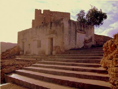
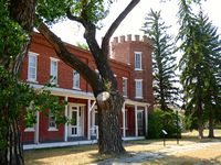
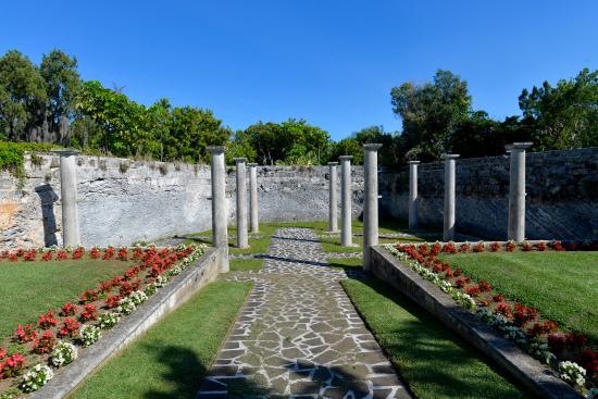
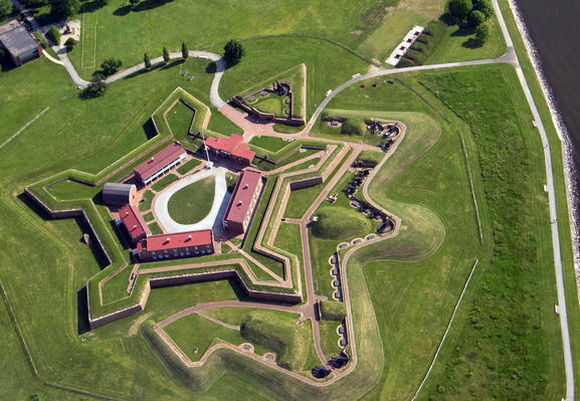
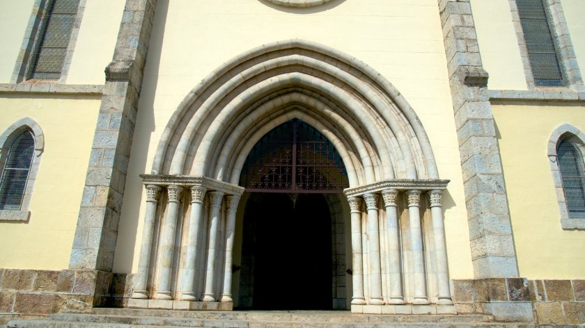
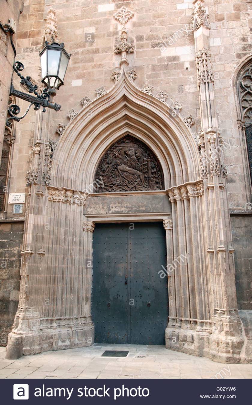
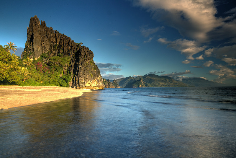
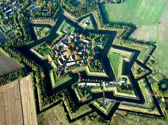
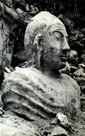
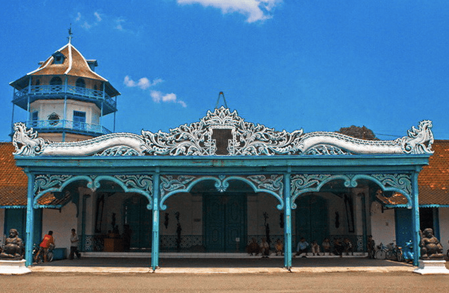
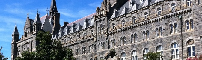
This is Ft. Monroe in Virginia.
While Star Forts can be construed to be or look defensive in nature, this explanation does not fit when one really looks closely at the their configuration. There is speculation from on-site evidence at different locations that there is a connection to energy generation in some way. And star forts around the world have been covered up, utilized, or destroyed.
Here are some examples in the United States:
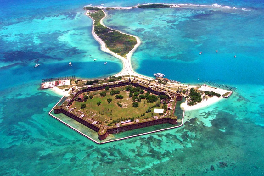
Ft. McHenry, Baltimore, MD pictured on the top; Dry Tortugas National Park, Florida Keys on the bottom left; and Castillo San Angelo, St. Augustine, Florida, on the bottom right.
Hey, and looky what’s underneath the pedestal of the Statue of Liberty
on the Battery of Manhattan in NYC:
This information on Star Forts is relevant to my intuitive journey of un-covery. I first saw the New Earth Star Fort video on Youtube at the end of 2015.
On January 1, 2016, I travelled to Heavener Runestone State Park, in Heavener, OK, with my travel friends. I went there looking for ancient walls because I had seen a revealing video on Youtube, from someone who lives in that area. He did a video on the Runestone State Park, and went to a place in the park where I saw the walls I showed you in an earlier post and in my video. I wanted to see them for myself.
When I was there, I noted a recurring triangular shaped pattern in the stone-work around the edges of the site in the pictures below. I thought at the time that it looked like it might be a star fort after having just seen that video. I can’t confirm, but it could be. Also, this location is approximately 20 – 25 miles from Queen Wilhelmina State Park in Arkansas, which is on the Talimena Ridge near Mena, Arkansas, where the Atlantean Blue Master Crystal of Knowledge is reputed to be, and is only 90 miles from Mt. Magazine where the Atlantean Emerald Master Crystal of Healing is reputed to be.
What this awareness led me to directly, within a short period of time, like maybe a week, was an intuitive hit that I received when listening to a youtube video of a song by Will Ackerman called : “Climbing in Geometry.” The gigantic land feature pictured here throughout the music video reminded me in shape of the triangular points of the star forts that I had recently become acquainted with, and those at Heavener.
So I googled “climbing in geometry” and this marks the very beginning of my cracking the code of how the ancient civilization is covered up by calling man-made structures natural features. This link article is one of the first places I looked at:
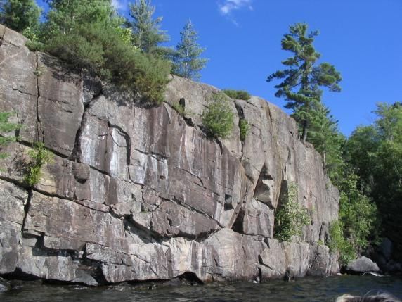
What really got my attention in this blog post was his description of “…thoughtful moves on polished slabs….” I might add that Carderock is near Great Falls in Maryland, and is the home of the Naval Sea Systems Command. Power agencies are built on top of power sites, so this is a good indication of its importance on the planetary grid. This is Jungle Cliff at Carderock.
Anyway, I started googling rock-climbing sites, then rock formations by state and province, then state and national parks, and then more and more as I was getting good information back in return about the ancient civilization.
My research activities became more focused when I found the North American Star Tetrahedron, which would have been in February or March of 2016, and then I started looking specifically at the places on the alignments, and getting even more information about the similarities of everything, around the world.
There are so many things that went into all of the information that I am sharing with you now. One insight led to another, and another. I also had the ability to visit many places in person, and I did so. This helped me to understand what I was seeing.
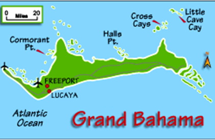
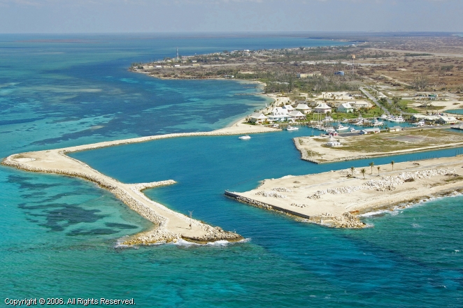
Part 1 of this series following the Merida Circle alignment ended in Miami, Florida. This part will begin on the Grand Bahama Island.
Grand Bahama is the northernmost of the Bahama Islands, 52 miles (84 kilometers) off the coast from Palm Beach, Florida.
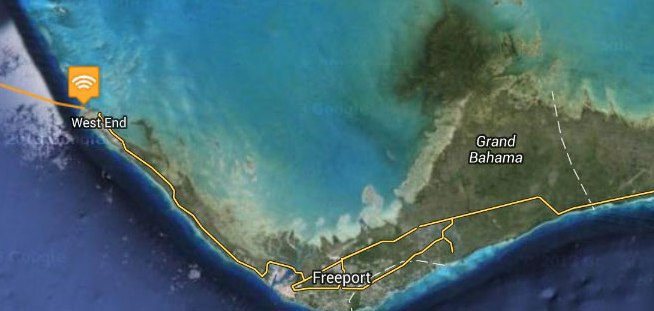
West End is the capital of Grand Bahama.
This is now part of the Marina here, but my belief is that this is an artificially shaped harbor of the advanced ancient civilization. I have seen countless examples of this around the world. It was a maritime civilization. We have not been taught about it, so collectively we just assume harbors like this were constructed in recent times. I am saying not so!
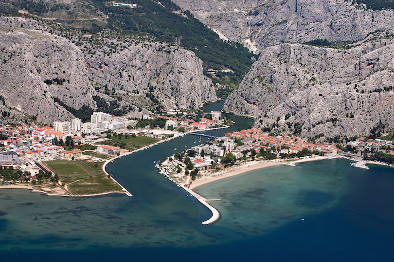
This is a picture of the shaped harbor, and what looks to be a canal, at Omis Beach in Croatia.
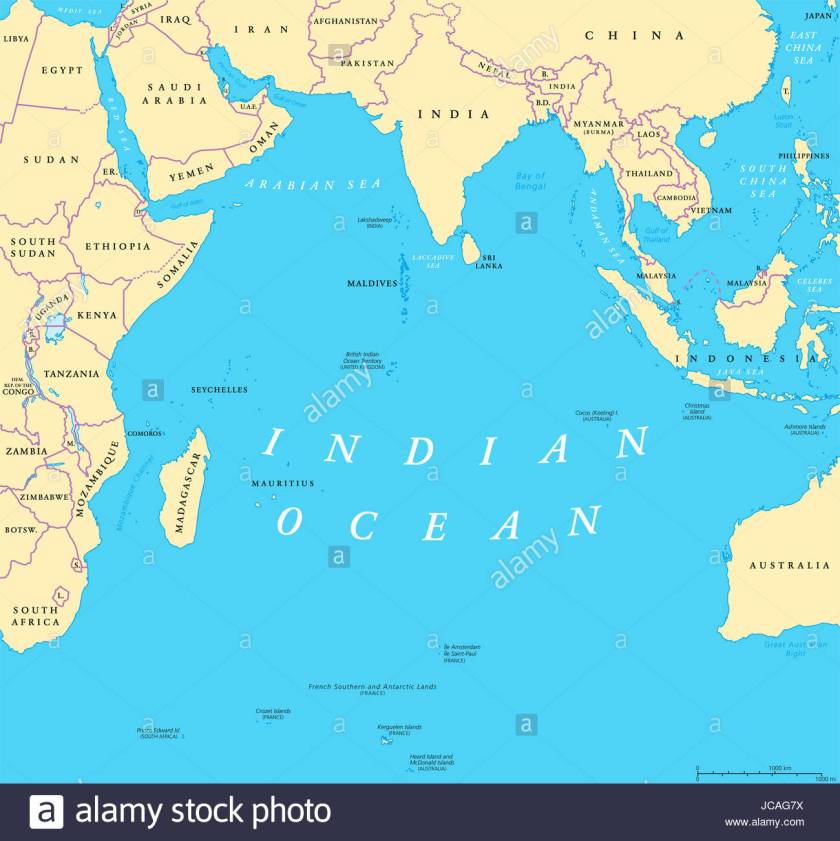
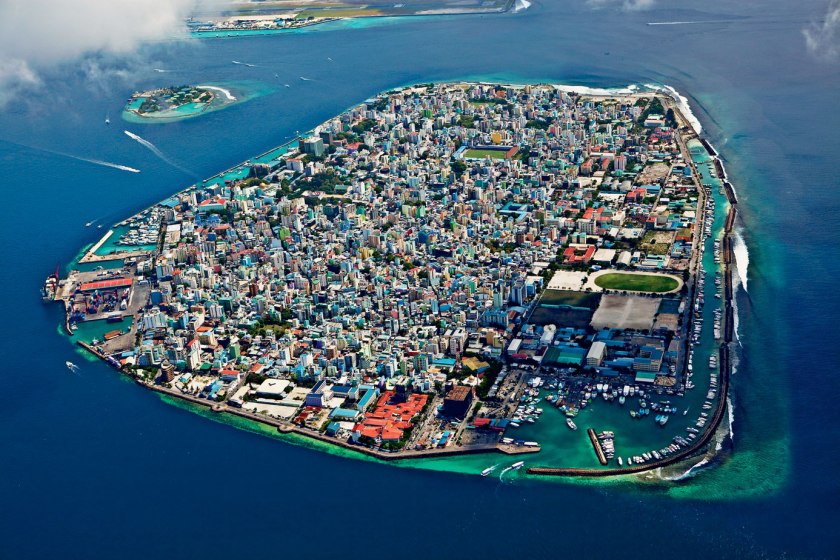
And this is Male, the capital of the Maldives, located in the Arabian Sea of the Indian Ocean. It sits on a major planetary alignment. As you can see, there are protected, shaped harbors all around the island.
Before I move on to Freeport on the Grand Bahama Island, this is a picture of Deadman’s Reef on Bahama Beach at West End. I take particular notice of the presence of the block-shaped rocks here, which I believe are ancient masonry.
Same thing here at the Gold Rock Beach of Lucayan National Park, a 40-acre park on the southern shore of Grand Bahama Island near Freetown.
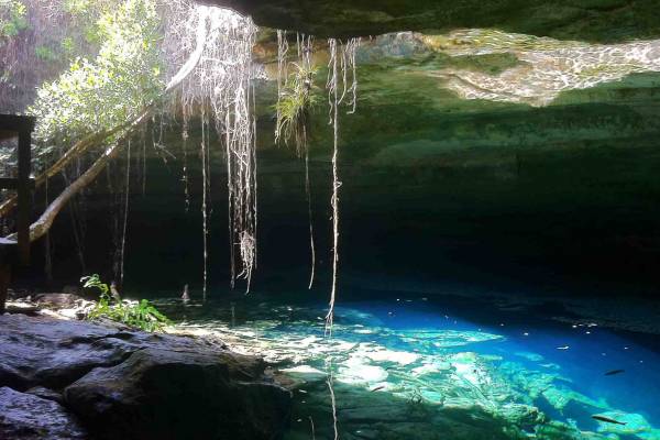
Lucayan National Park has one of the longest charted underwater cave systems in the world.
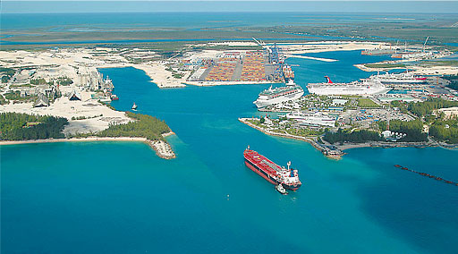
Freeport is the main city of Grand Bahama, which besides and airport, has a commercial ship harbor.
I believe the same thing about this harbor that I believe about the one at West End – that it was artificially created by the Ancient Advanced Civilization, and not in modern times:
Here are more pictures of the coast and beaches on the Grand Bahama Island near Freetown to give you a feel for exactly how rocky it is:
We are taught to believe sights like this are of natural rock formations. Compare with these photos from the previous post, with this one with big block-y rocks on the beach from Key West…
…and this one from Tulum on the Yucatan Peninsula Coast also with block-y rocks with a lot of straight edges.
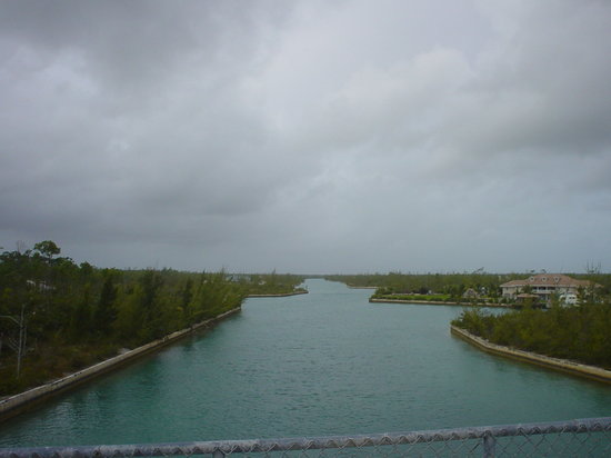
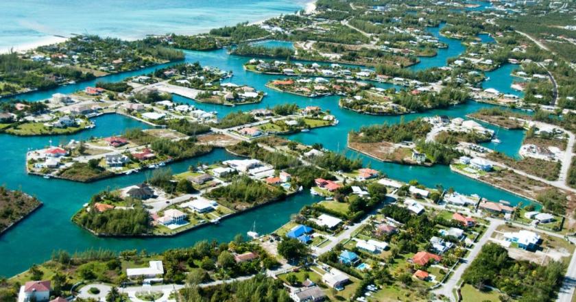
Grand Bahama Island also has a canal system.
Here is the view from Casuarina Bridge of the Grand Lucayan Waterway.
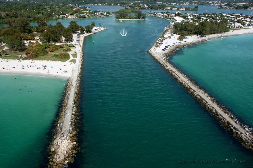
This is a picture of the south inlet of the Grand Lucayan Waterway on the coast at Lucaya, near Freetown…
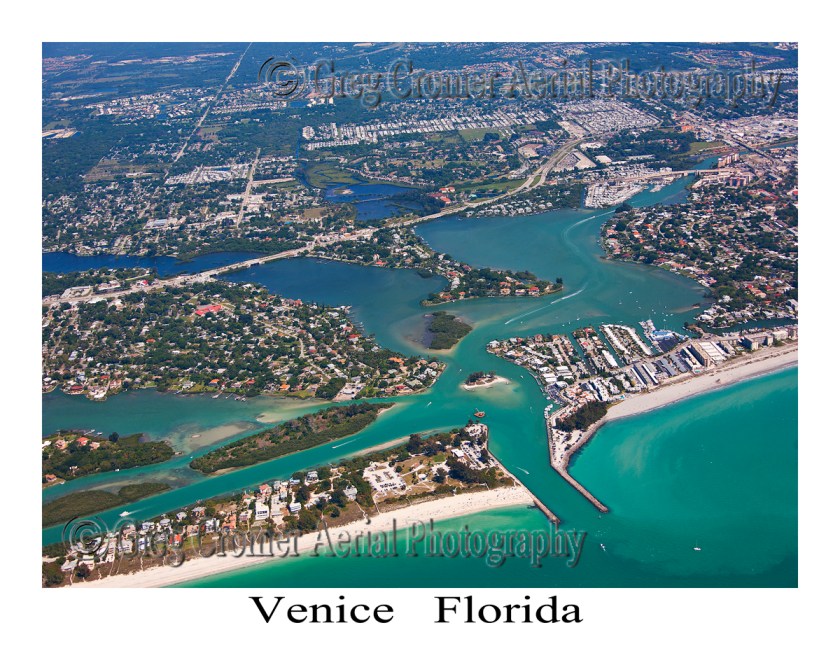
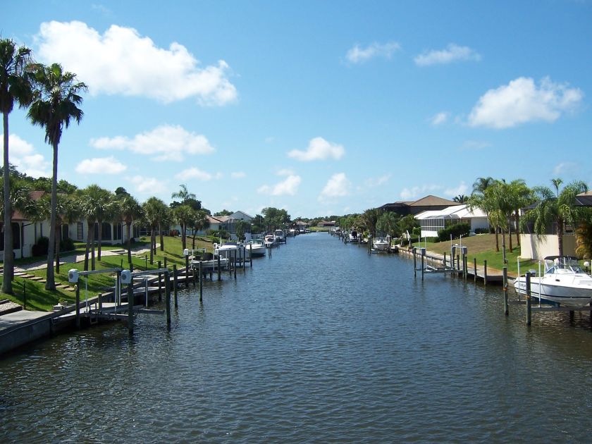
…and for comparison this is Venice, Florida, on the opposite side of Florida on the Gulf of Mexico.
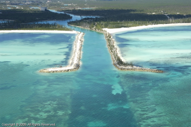
Also for comparison, an aerial view of the canal system on Grand Bahama Island…
…compared with views of Venice, Florida.
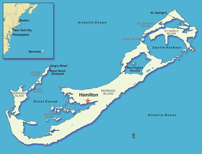
On to Bermuda, where the alignment crosses through the capital of the British Overseas Territory, Hamilton:
This is a picture of the Bermuda Parliament building on the left, and a view taken of Santa Cruz de Tenerife, showing a similarity of tower construction, arches and window design in both locations on different sides of the Atlantic Ocean.
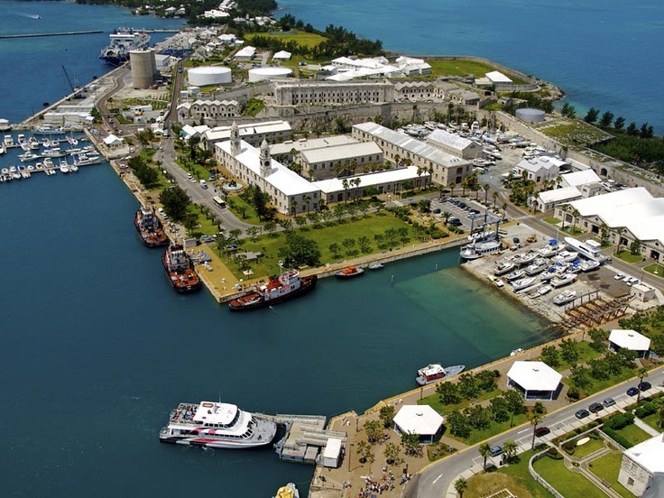
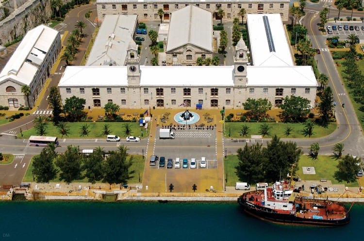
This map shows the location of the Royal Navy dockyards in Bermuda.
We are told it was built by the British Royal Navy in 1795. It was once home to Britain’s largest naval base outside of the United Kingdom until it closed permanently as a naval base in 1995.
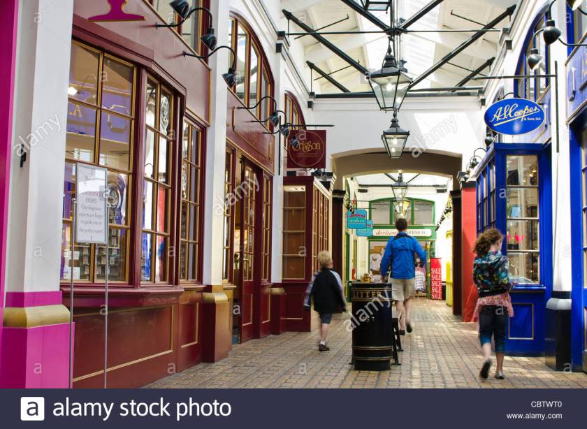
Now it is the home of the Clocktower Mall, hosting a variety of shops, boutiques and restaurants. So these 200-plus-year-old buildings must be in extraordinarily good condition to still be in use today!
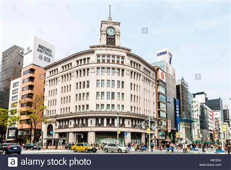
Modern-use department stores with clock towers is not unique in the world. The Wako Department Store building in the Ginza Shopping District of Tokyo has a clock tower and heavy masonry…
…and a version of that street-corner lay-out design I keep seeing, like the original Miami Herald Building on the left, and the historic Alberta Hotel in Edmonton, Alberta.
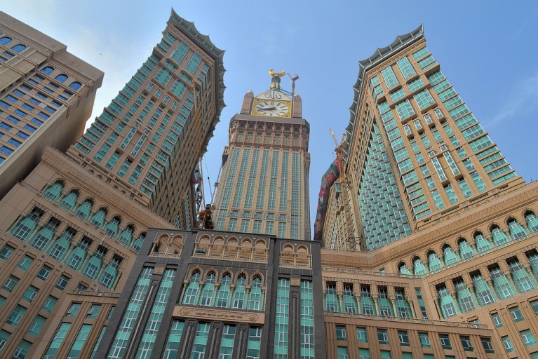
Another notable clock-tower mall is in Mecca, Saudi Arabia. This complex is called the Makkah Royal Clock Tower Hotel, and includes a 5-story shopping mall in addition to hotel and residential rooms, and has many other uses as well.
Compare the overall look of the Makkah Royal Clock Tower Hotel with this historic hotel, the Mincks-Adams Building in Tulsa, Oklahoma, you know the – “Oklahoma! Where the wind comes sweeping down the plain, and the wavin’ wheat can sure smell sweet when the wind comes right behind the rain” Oklahoma has historic, beautifully ornate architecture like this.
Just digressing for a moment. It is interesting what you find when you start looking at this stuff. I think very telling also, as I believe one in the same civilization were the original builders, and now all of these are falsely attributed to other builders. All of these places are on the planetary grid lines. For more about Oklahoma, see the “How I Found the Silk Road – Part 6 Santa Rosalia to Montreal” post, and Saudi Arabia will be in the next Circle Alignment series involving Amsterdam Island.
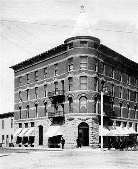
This is the Hotel Hamilton, said to have been built in 1851, and destroyed by fire in 1955. Notice anything unusual about the size, and design features, for example of this hotel building that said to have been built as a hotel in the 1850s? To me, it looks more palatial than hotel-like. And how did they build something like this in the 1850s without modern equipment (that goes for whole lot of other buildings as well) in the timeline we have been given?
Hamilton Hotel Front View
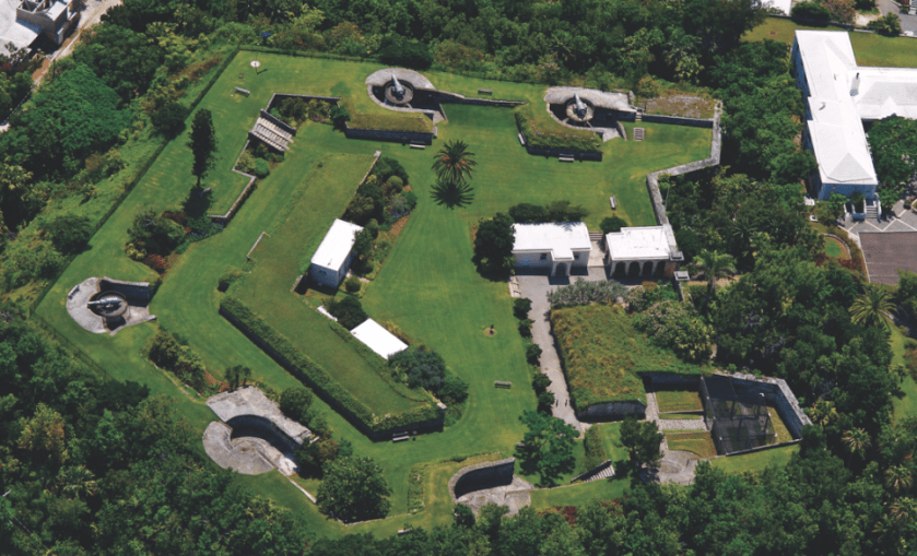
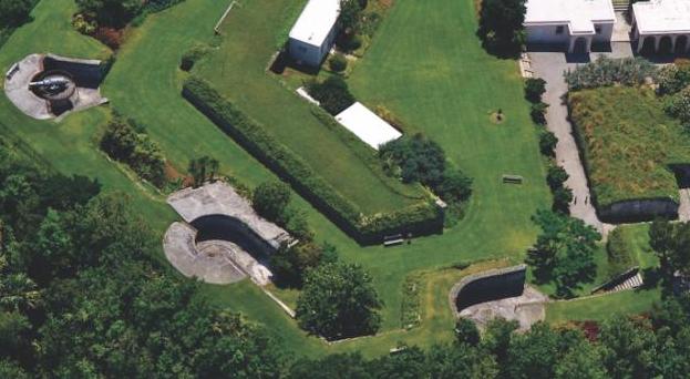
Before leaving Bermuda, let’s take a look at Fort Hamilton in Hamilton. It is situated above the city of Bermuda, and is said to have been built in 1870. It looks to be in the shape of a pentagram. Quite possibly a star fort.
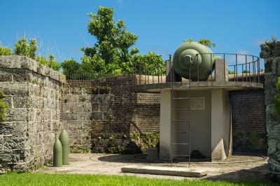
Interestingly they have cannon on platforms at only three of the 5 main points of the fort’s pentagram shape…
…resting upon what looks to be a more recent concrete platform…
…and nothing in two of the five points.
The fort has beautiful colonnades, seemingly holding up air, and a nice wall in the background about the same height. Don’t know if the area used to be enclosed or not, but sure looks like it could have been!
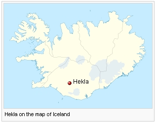
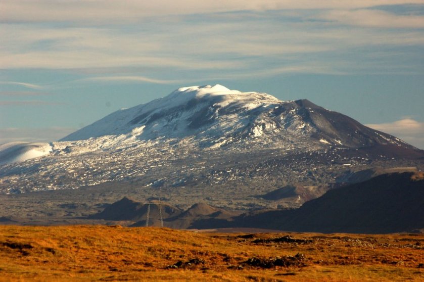
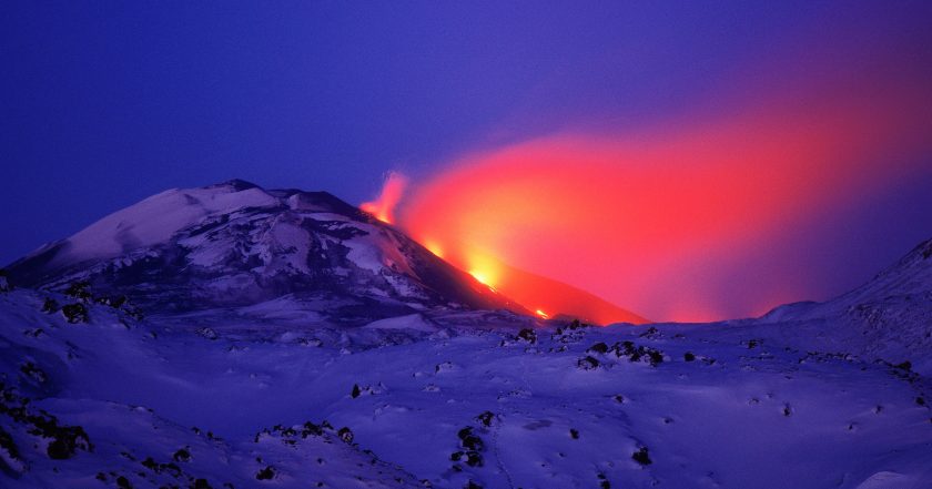
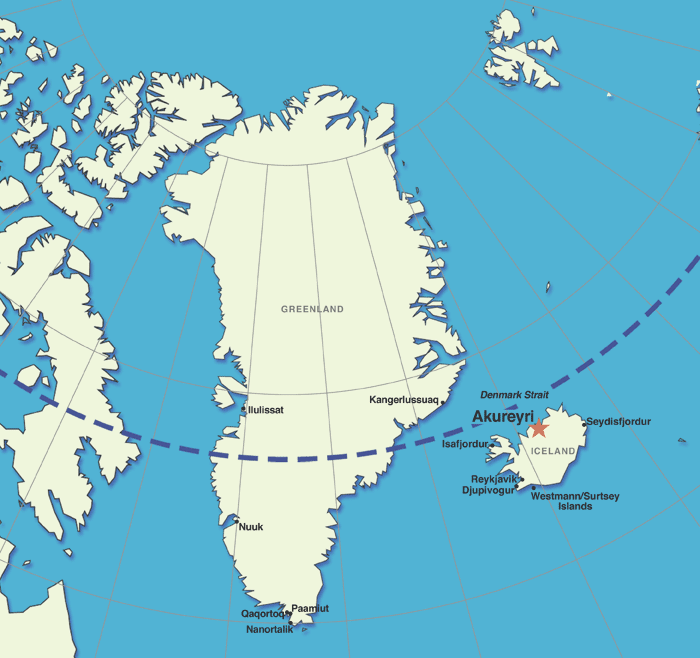
From Bermuda, the alignment goes through Hekla Volcano in Iceland.
Hekla is a stratovolcano that is one of the most active in Iceland. It is a legendary gate of hell in medieval literature. This alignment will go through other volcanoes and volcanic regions as we follow it. I have found that these alignments approximate the edges of tectonic plates, as evidenced by volcanic and earthquake activity. I frequently recognize place names when I hear of such activity now.
Over 20 eruptions have occurred since 840 AD. It was last active from February 26th to March 8th, 2000.
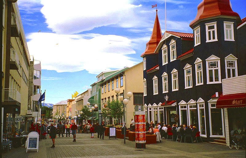
Next the alignment goes through Akureyri, Iceland.
Akureyri is in northern Iceland, and Iceland’s second largest urban area. These days, it is an important port and fishing area. It has an ice-free harbor, and relatively mild climate. This is the historic city center of Akureyri.
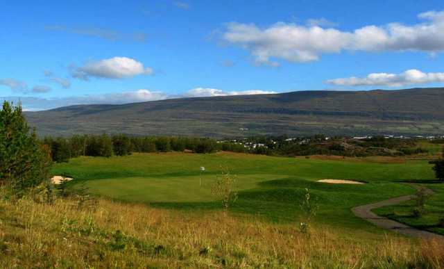
The world’s most northerly 18th-hole golf course is located in Akureyri. I believe golf courses are involved in the cover-up mound sites. See my post “A Word about Golf Courses” for how and why I came to this conclusion.
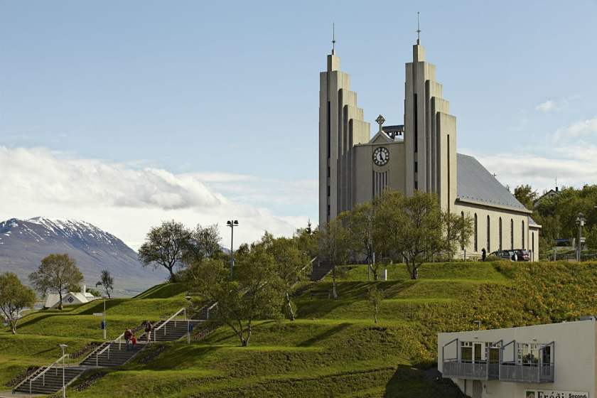
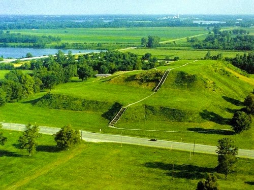
This is the Lutheran Church of Akureyri. What I find most of interest, besides the twin towers, is the stair-stepped, mound shape it sits on.
For comparison of similarity somewhat in appearance, this is an aerial photo of Cahokia mounds outside of St. Louis, Missouri.
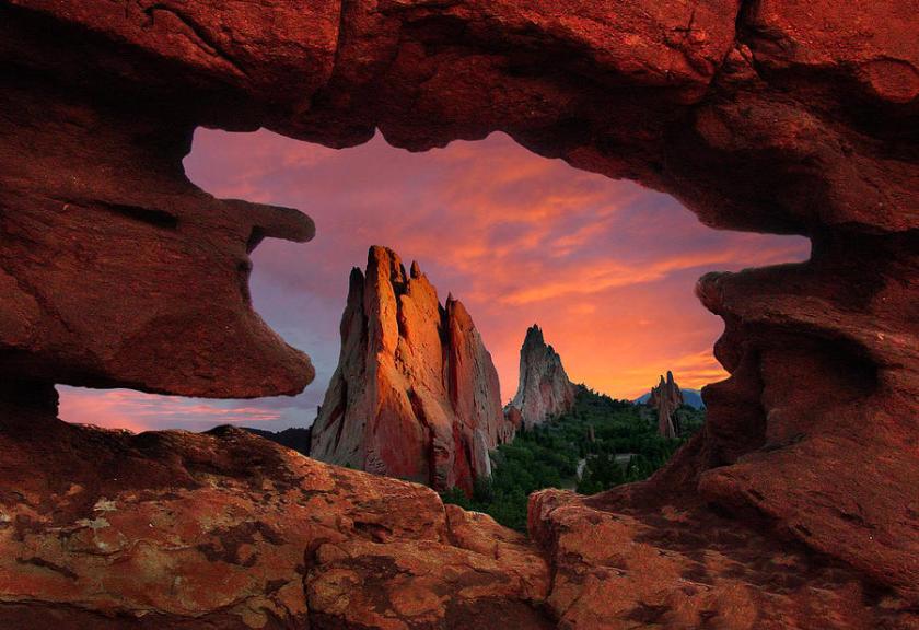
This spot in the region of Akureyri is called Dimmuborgir. It is described as various rock formations and volcanic caves reminiscent of an ancient collapsed citadel. Hmmm.
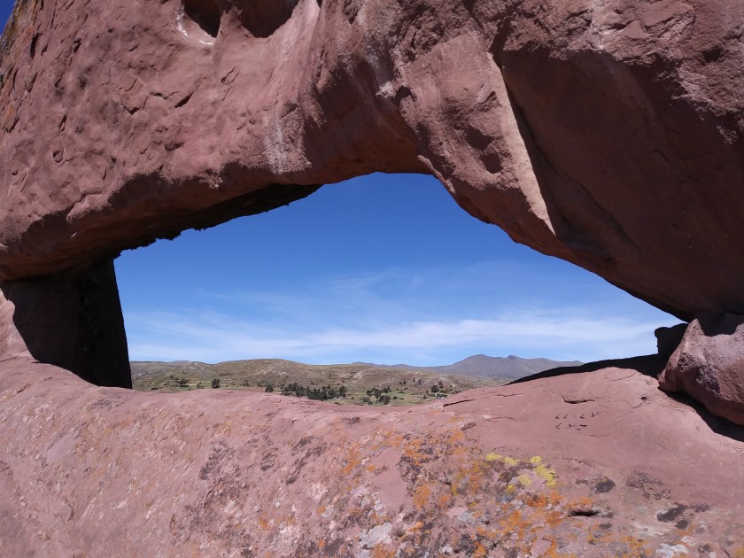
At any rate, what this particular picture reminded me of is this picture from the Garden of the Gods in Colorado…
…and this one from Amaru Muru near Lake Titicaca in Peru.
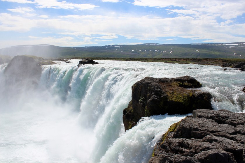
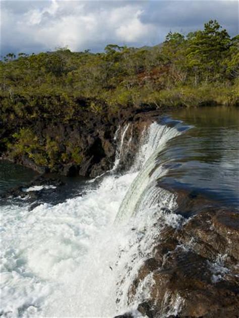
The last photo I would like to share with you is of the Godafoss waterfalls near Akureyri. It is considered one of the most spectacular waterfalls in Iceland. It is also a reminder that I have found waterfalls all along the way of, and I believe important constructions of, the planetary grid system.
Akureyri, Iceland
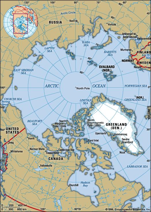
In the next part of this series, we will be picking up this circle alignment going across the far northeast tip of Greenland, over the north pole region, and following it into Siberia, as we work our way back around to Merida.
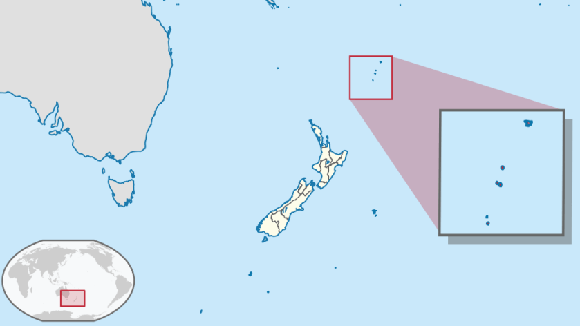
I am going to share with you several series of circle alignments that I found. This is the first series involving Merida, Mexico. The next complete series will be a circle alignment involving Amsterdam Island, in the French Subantarctic Islands; and the last series will involve Algiers, Algeria.
This is somewhat different from the global planetary alignments I have previously shared in “How I Found the Silk Road” and “History Reads Like a Book on the Planetary Grid.”
From the work I have done thus far, I have reason to believe this global civilization was aligned with itself on a Flower of Life pattern, with the same characteristics that appear to be bringing the heavens to earth, and aligning earth with the heavens.
The process of doing this work has opened up for me an awareness of a suppressed advanced ancient global maritime civilization which existed up until relatively recent times and the missing positive timeline of Humanity.
Throughout my blog, I go into depth regarding what I believe about this civilization – what I am calling the Muurish/Moorish/Israelite Empire; what happened to it; and provide compelling evidence as to why I believe this.
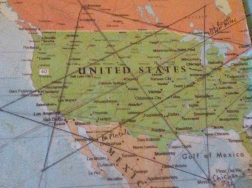
I found this star tetrahedron in early 2016 on a map that had been given to me. I had started to notice that major cities lined up in lines in North America. I found a familiar figure of sacred geometry when I literally started connecting them. I believe it is the terminus of a worldwide grid.
I extended the lines out, and eventually switched to a globe. I used a magnifying glass and wrote down the cities that lined up. I found them lining up primarily in linear or circular fashion.
I have gotten an amazing tour of the world of places I had never heard of with remarkable similarities across countries.
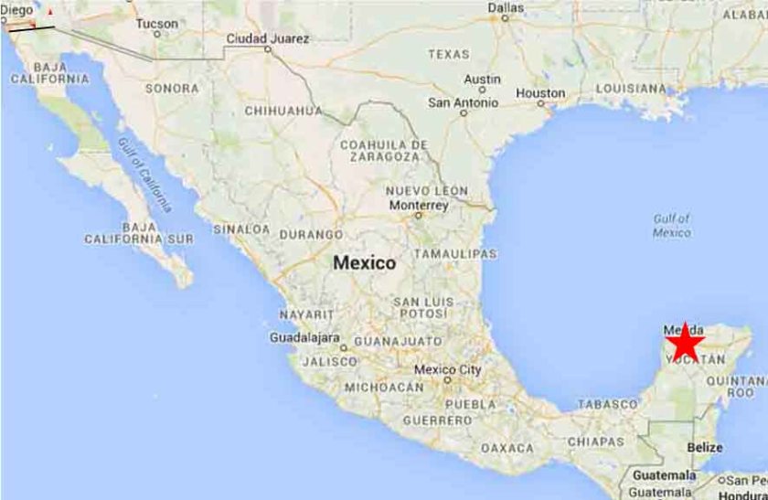
In this series I am going to share with circular alignments I found while tracking alignments emanating from the North American Star Tetrahedron. The first series concerns a circle alignment involving Merida, Mexico which is the southern apex of this star tetrahedron:
Merida is the capital and largest city in the Mexican state of Yucatan.
Some historians consider Merida to be the oldest, continuously occupied city in the Americas.
It has one of the largest historic center districts in the Americas, after Mexico City and Havana, Cuba.
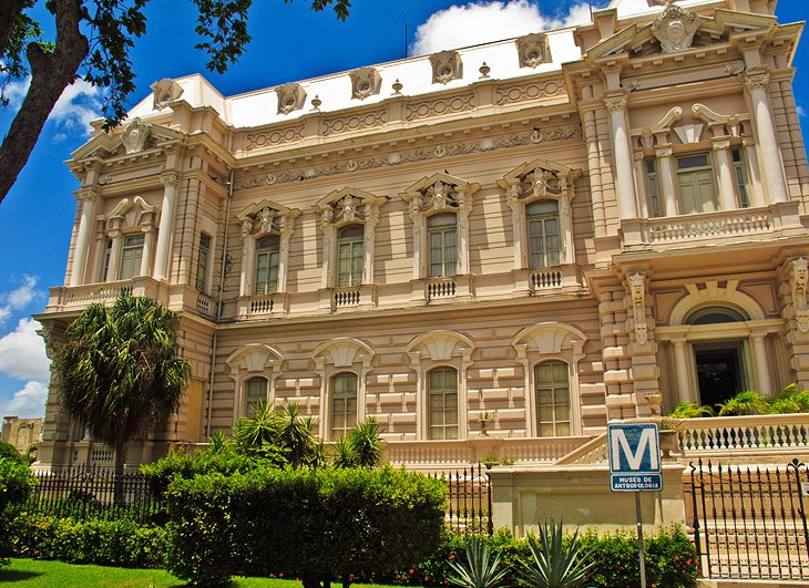
The top photo shown here is the Merida Natural History Museum. For comparison of the similar use of columns and heavy masonry in particular in the architectural style in different places…
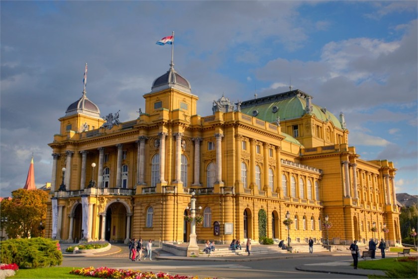
…Like that of the Prigorje Museum in Zagreb, Croatia with its second floor double columns and similar style roof in the background to the museum in Merida…
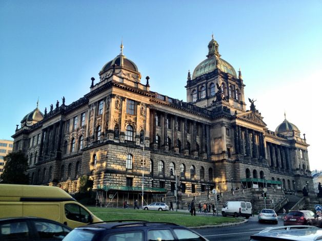
…and this museum in Prague in the Czech Republic with its ornate columns and heavy masonry, and the same style of domes in the foreground to the museum in Zagreb.
While not identical architecture, I find it very compelling in support of an advanced ancient worldwide civilization to have so many statistically significant similarities on different continents in different countries. More examples to come!
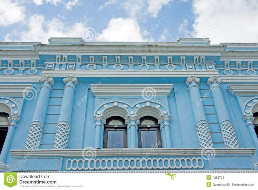
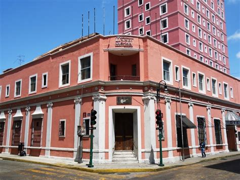
Here’s a historic blue building in Merida’s Centro Historic District. Except for the pastel blue, and creative designs of the building, the columns we see here and in the previous pictures remind me of what could be termed in our present reality classical Greco-Roman architecture.
Here is a comparison of the same street corner style architecture – that I have seen all over the world – of hotels. This one is in Merida, Mexico;
The Plaza Hotel in Roswell, NM;
and the Alberta Hotel in Edmonton, Alberta.
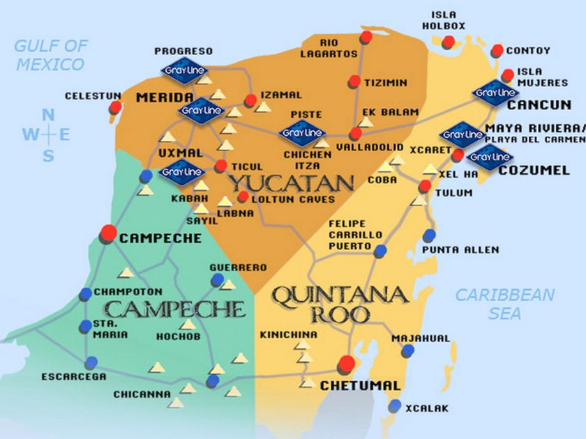
This whole area in the Yucatan Peninsula is filled with major Mayan sites, including Chichen Itza, Coba, Tulum, Uxmal, to name just a few. I counted 29 ruin sites on this map of the Yucatan, and I have found Merida connected to many planetary alignments. To my knowledge, it is not considered a primary nodal point of the planetary grid, but it certainly appears to be a place of great significance on the grid.
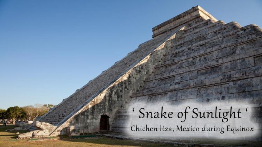
The Chichen Itza temple complex is the best known.
This is the Kukulkan Pyramid, elected as one of the Seven New Wonders of the World in 2007.
Every year, at the time of the Spring and Fall Equinox, on both sides of the north stairway of what is also called the Castle of Chichen Itza, there is a solar projection of a Serpent of Light, consisting of seven inverted triangles of light. There are two serpent heads carved into the bottom of the stairway, completing the serpent imagery.
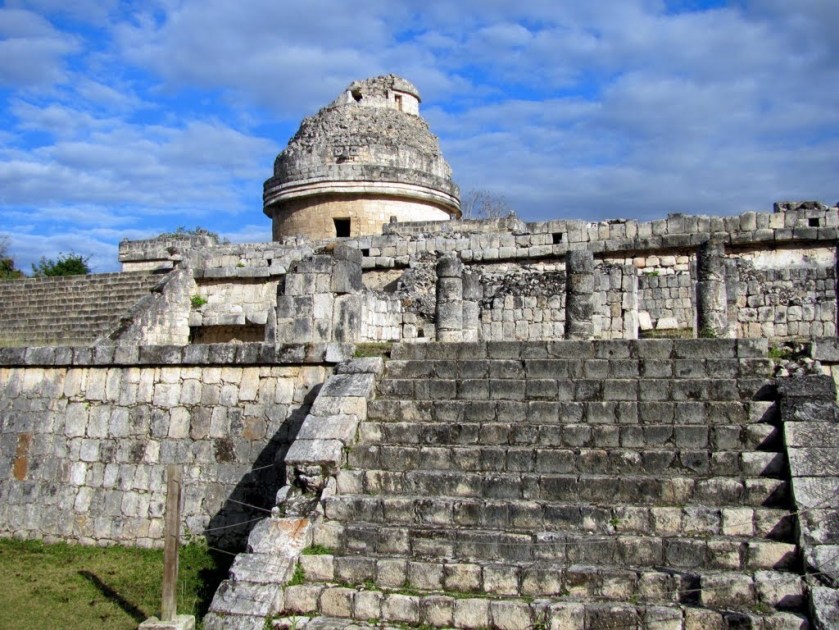
The Caracol Observatory is part of this temple complex. Twenty sight lines of 29 astronomical events (equinoxes, solstices, eclipses, etc) can be found here, and that is what is known about since a portion of the observatory is missing.
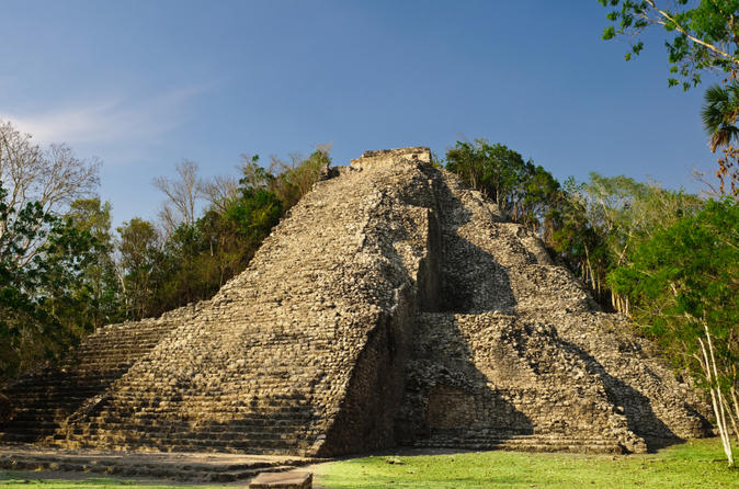
Next shown are of the ruins at Coba. Archeologists believe that Coba is one of the most important ruin sites on the Yucatan Peninsula. This is the main pyramid, called Nohoch Mul. This site is believed to have a different design and purpose from other Mayan sites.
It is surrounded by two lagoons. The Coba site remains largely unexcavated.
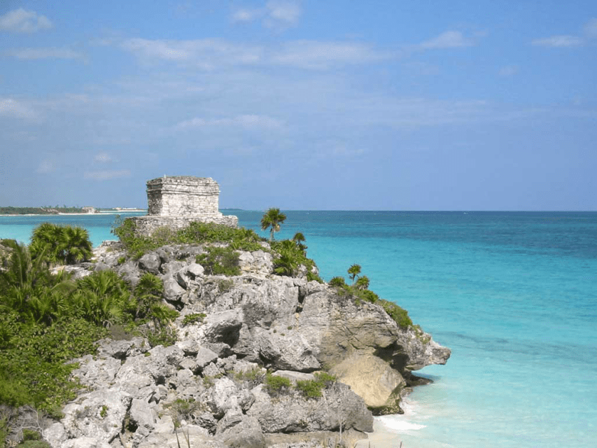
Tulum is called a Pre-Columbian walled city that served as a port for Coba.
Tulum is built on a bluff (which is a cover-up code word for the handiwork of the Ancient Civilization) facing the rising sun, and is the only Mayan temple complex built on a Caribbean beach, and is surrounded by on three sides by a wall. It was the primary location for the Maya’s extensive trade network, both on land and sea. It was also thought to be religious center.
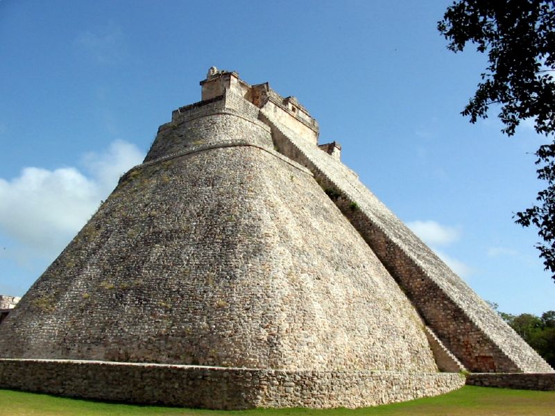
Uxmal is also considered one of the most important and beautiful Mayan sites. This is called the Temple of the Magicians. It is the tallest structure in the complex.
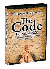
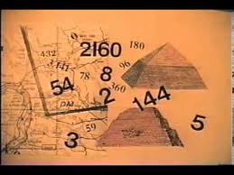
Through the work of Drunvalo Melchizedek, I became aware of Carl Munck’s work in 2010. He wrote a book entitled “The Code” and published a series of videos based on the book.
I watched the videos, and learned about his work introducing an ancient pyramid matrix in which monuments around the world encode their exact positions with respect to longitude, latitude, and each other. Uxmal was one of several of the pyramids he decoded with respect to this pyramid matrix.
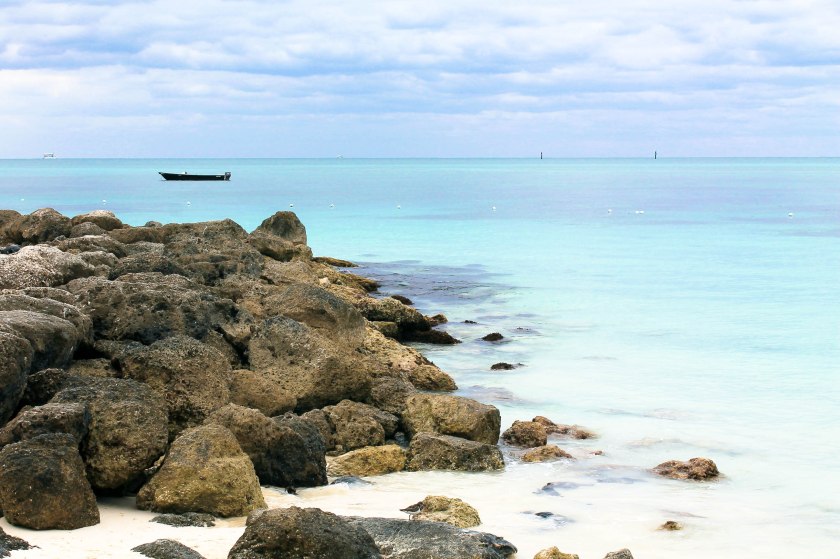
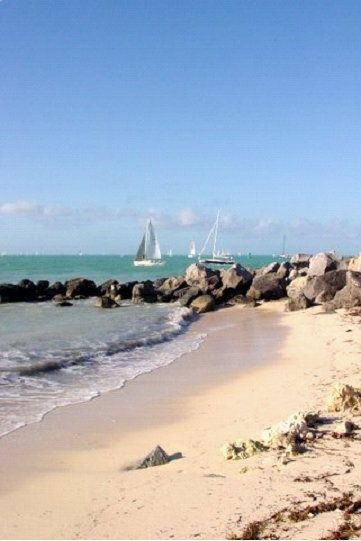
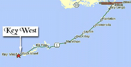
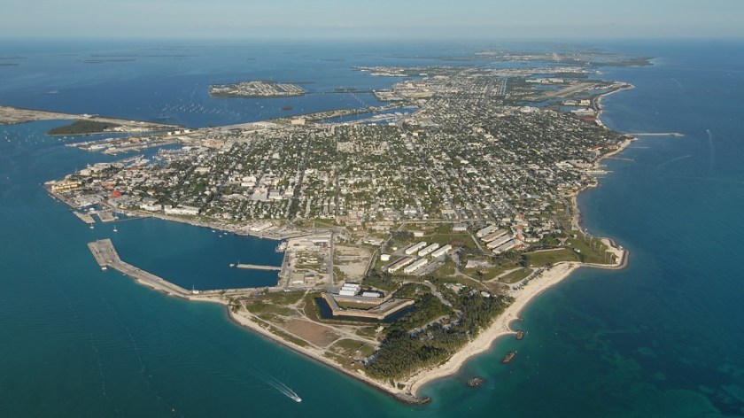
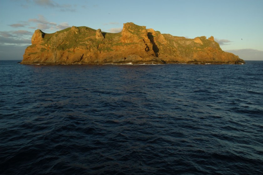
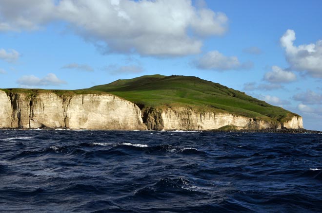
Next the alignment crosses Key West, Florida.
Key West is the southernmost city in the contiguous United States, and the westernmost island connected by highway in the Florida Keys. Note the shaped and protected harbor, which is just like what is seen at other islands world-wide.
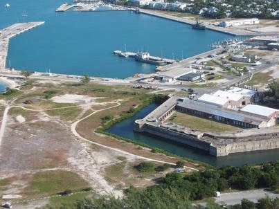
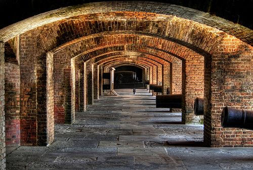
Dry Tortugas National Park, a star fort on an island called Ft. Jefferson, lies further west of Key West, and is only accessible by ferry or boat.
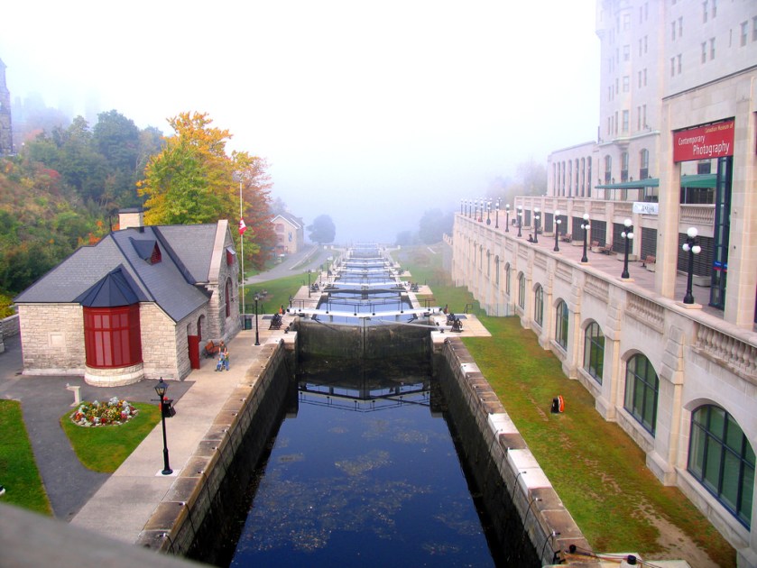
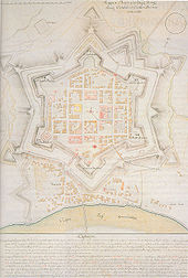
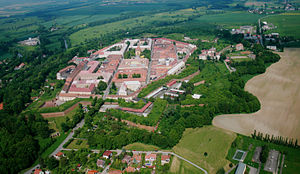
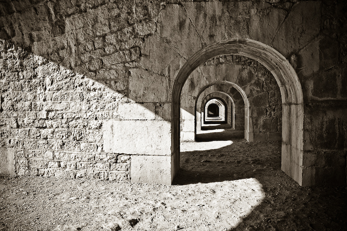
I have talked about Star Forts in previous posts. They are found around the world, and I want to give you more examples of how they are everywhere. While in many cases they have been turned into military/defensive structures, there are many indications that the original intent of these beautiful structures was not for military use or defensive in nature, and had perhaps instead some kind of energy function. These represent a sample of many, many examples.
This is Karlovac in Croatia;
The Josefov Fortress in the Czech Republic;
Fort McHenry in Baltimore, Maryland;
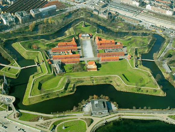
Kastellet in Copenhagen, Denmark.
Fort Carre, France;
And the Castle of Kuressaare, Estonia.
Does this similarity in design features of these structures, in places traditionally not associated with each other, make sense in the historical narrative we have been given?
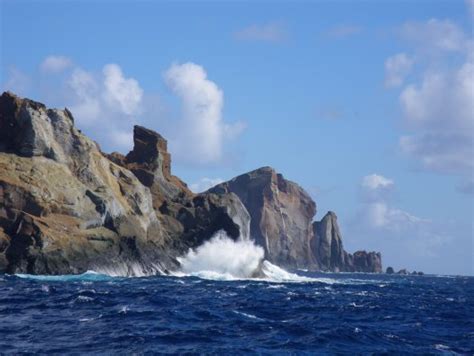
This next set of photos compare the rocky shoreline of Key West on the left with the rocky shoreline of Tulum on the Yucatan coast on the right:
This is Fort Zachary Taylor, and it is near the southern tip of Key West. It is also has star fort design features:
Here is a comparison of a construction feature at Fort Zachary Taylor at Key West, Florida…
…and at the Fort de la Bastille in Grenoble, France. Certainly not identical, but there is a geometric effect that looks the same to me with the perfect symmetry of the arches.
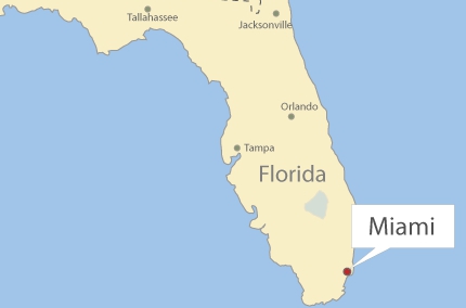
Next onto Miami, Florida on this circle alignment.
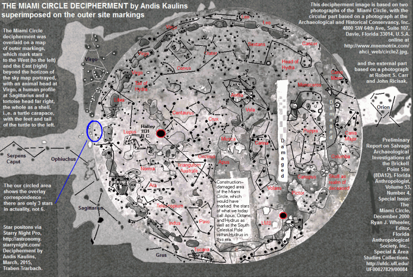
Several years before I put all of this information together, I saw a video on youtube about the discovery of what became known as the Miami Circle. It was discovered in 1998 in downtown Miami, when the building complex sitting on top of it was torn down. in 2002, it was listed on the National Register of Historic Places, and in 2009 it was declared a National Historic Landmark. Radiocarbon dating of burnt wood specimens found at the site are said to have yielded an age of 1,800 – 2,000 years old.
Here is very interesting decipherment of the Miami Circle by the stars, done by Andis Kaulins.
In this set of photos, on the left is the old post office and consulate in Miami, and on the right is the bank in El Paso State National Bank in El Paso, Texas. The heavy masonry of both buildings really strikes me, as well as the buildings being situated at the same angles on their respective street corners.
This next set is a comparison of the original Miami Herald building, which was demolished in 2015, on the left, and a mansion in Merida, Mexico on the right. Many historic buildings have suffered a similar fate as the Miami Herald building. I find most of the similarities I am seeking in historic photos of places because many of the older buildings are simply not there anymore. The Miami Herald building that was torn down was described as “built to be nearly indestructible,” in the article I read about its demolition, so these places are not being torn down because of inherent structural issues.
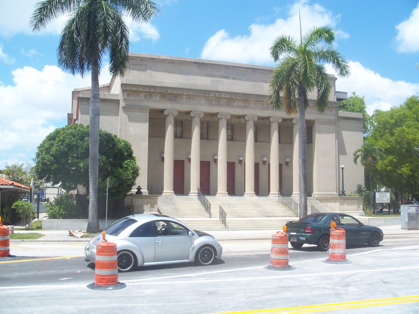
This was the First Church of Christ Scientist in Miami, which was sold to a commercial developer in 2013, with plans approved in 2015 to add a garage structure to the top and a 38-story residential tower next to it. It was listed on the National Register of Historic Places in 1989. Quite a monumental building! It looks more like the classical Greco-Roman architecture we learned about in history class than a modern church building.
I am going to end Merida Part 1 here, and pick up the circle alignment again in the Bahamas, and follow it around through Bermuda, Iceland, Greenland, Siberia, the Aleutian Islands, the Hawaiian Islands, the Revillagigedo Islands off the coast of Mexico, and along the Mexican mainland back to Merida.
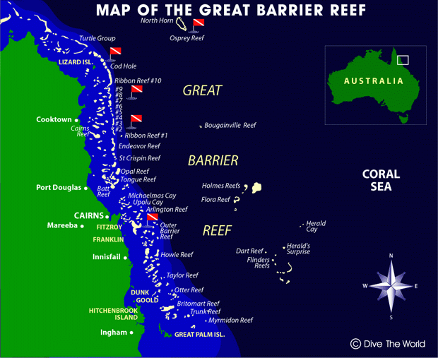
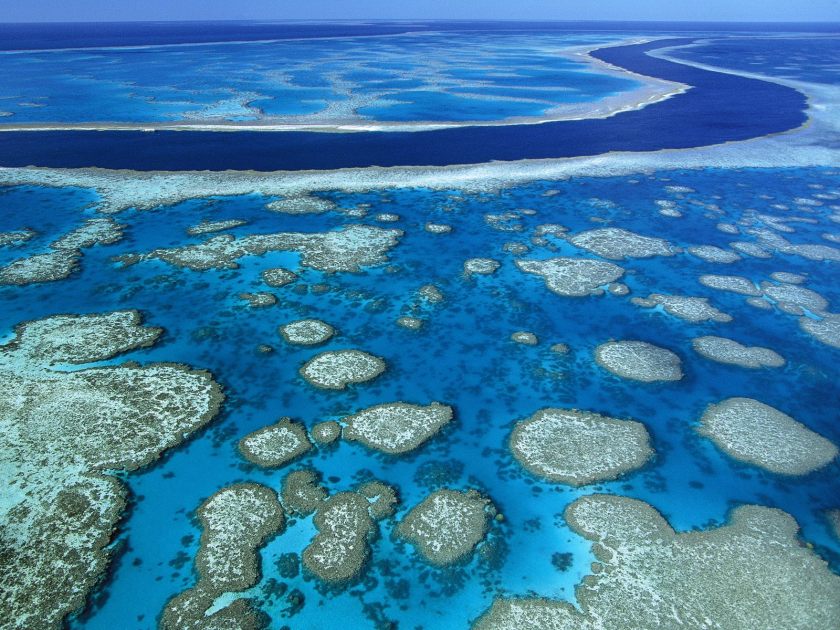
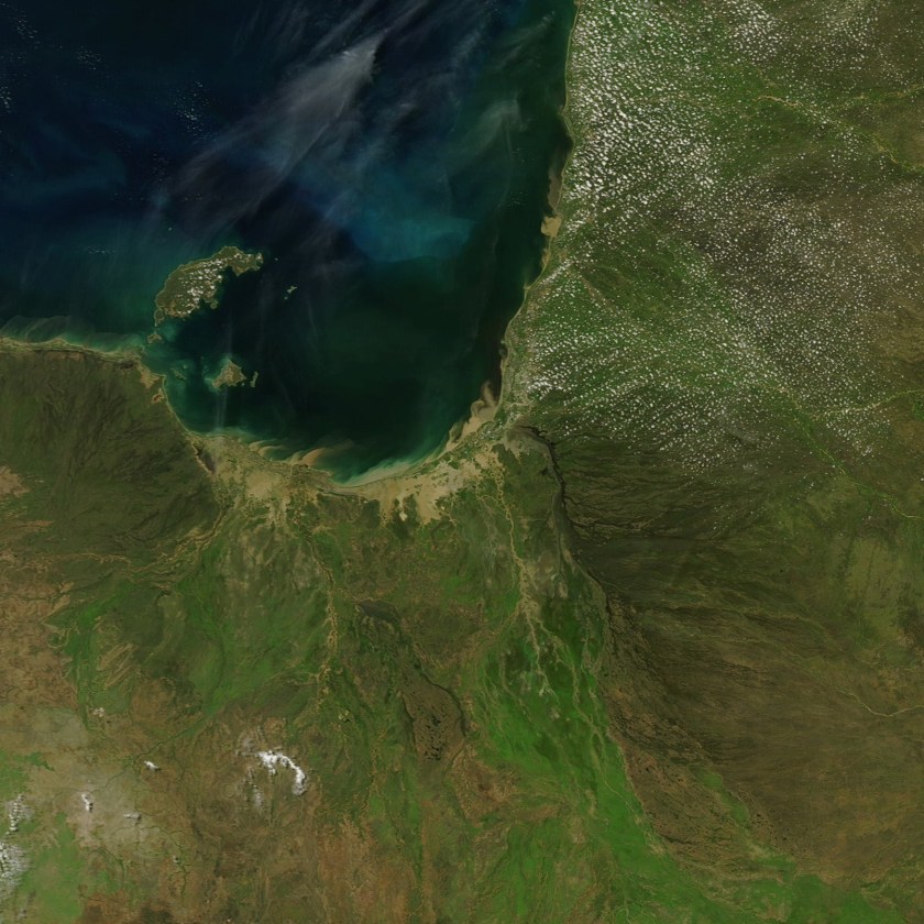
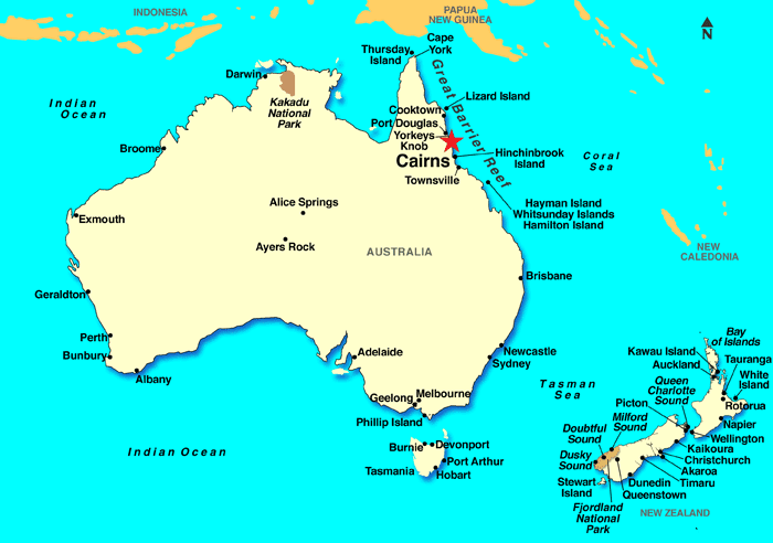
I am including the Great Barrier Reef off of Australia’s coast in this post because it is directly on the alignment I am following. Let’s see what we find out about it.
First of all, the place we where we left off in the last post, Cairns, is considered the gateway to the Great Barrier Reef.
It spans 1,400 miles (2,300 kilometers) off the Queensland coast.
It is the world’s largest coral reef system, with 2,900 individual reefs and 900 islands.
It is visible from space, and has been named a UNESCO World Heritage Site.
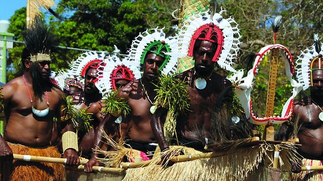
It has long been known and used by Aboriginal Australian and Torres Strait Islanders, and is part of their culture and spirituality.
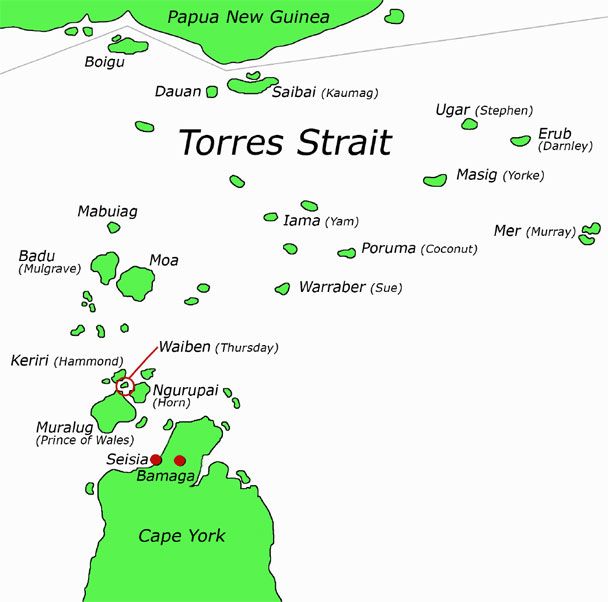
The Torres Strait Islands are a group of at least 274 small islands between Australia’s Cape York and New Guinea.
The Torres Strait Islanders are considered distinct from Australian Aboriginal peoples.
The Torres Strait is between the northernmost island, and the south coast of Papua New Guinea in the north,
to an unnamed passage between Lady Elliott Island and Fraser Island in the South.
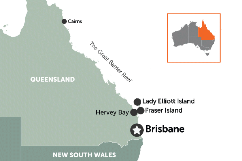
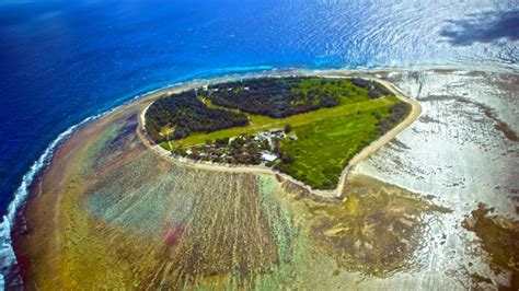
Lady Elliott Island is called a coral cay, has an eco-resort on it, and is a sanctuary for 1,200 species of marine life in the waters surrounding it, including manta rays and turtles…
…and an old lighthouse. From what I know, the Ancient Advanced Civilization was a maritime civilization, and lighthouses around the world are remnants of it. I will do a future post on lighthouses to delve into this subject more fully.
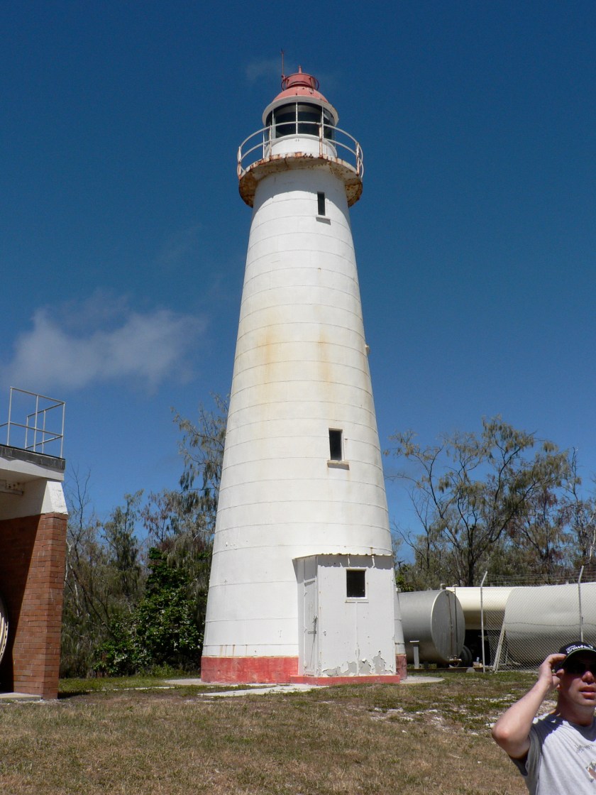
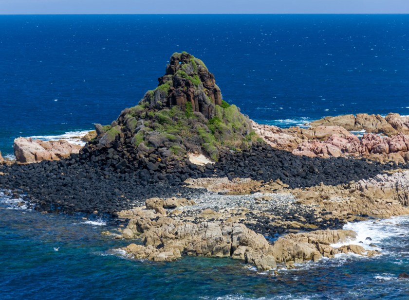
And this is Fraser Island, with its shaped shoreline (a subject for another post as well)….
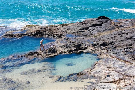
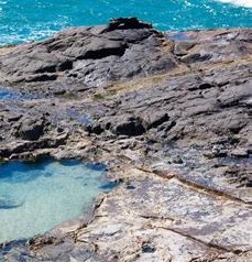
…and rocky coast and a place called the Champagne Pools. I have seen an abundance of rocky places that look similar to this on my journey on the gridlines around the world
…and I question the narrative that it is all the product of natural forces. So for an example in the above picture, this highlights the presence of straight lines and edges in the stone at this location. Why is it said that straight lines don’t occur in nature when there are clearly straight lines in places like this that we are taught are natural? Food for thought.
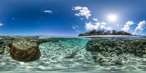
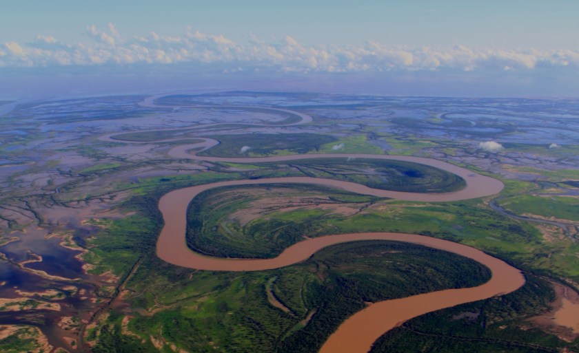
Here are two photos of the Great Barrier Reef
The first looks very much like a river in the water.
The second is an example of a point that I would like to make with the stone in the foreground. What if the coral and marine life formed on top of sunken ancient infrastructure?
Coral reefs form on sunken ships, like this one….
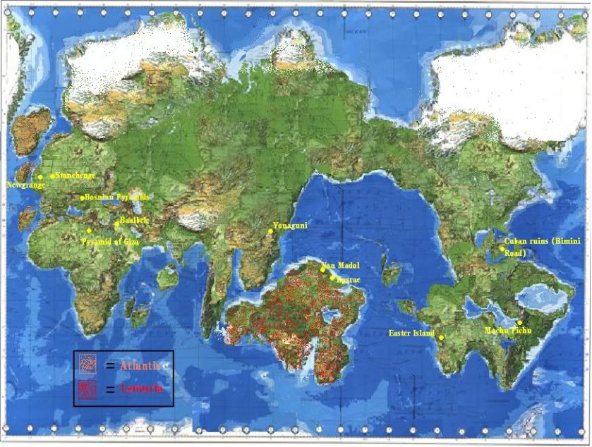
We are heading into what would be considered the historical location of Mu, also known as Lemuria.
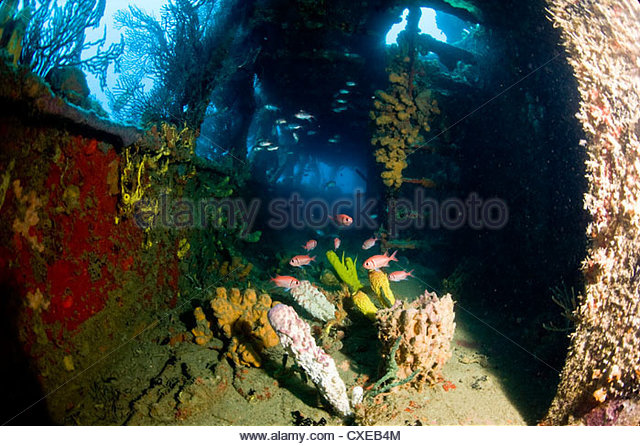
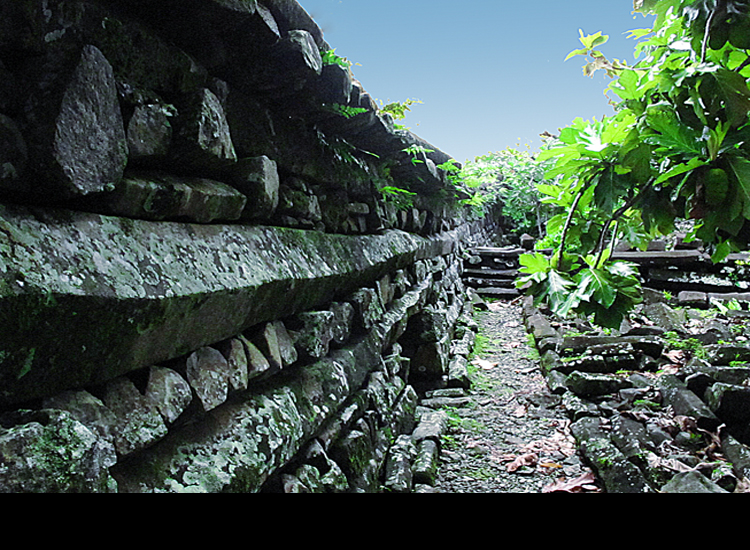
There are some pretty amazing stone remains on the islands of this area, like these here at Nan Madol, shown on the map above as part of a continent. Nan Madol consists of 100 stone and coral platforms built on top of artificial islands, involving 150 million tons of basalt of unknown origin. The structure in this photo is constructed of basalt columns:
As well as these ruins in the water near Yonaguni, now one of the Yaeyama Islands in the Okinawa Prefecture of Japan, is shown on the above map as part of a continent but are now underwater:
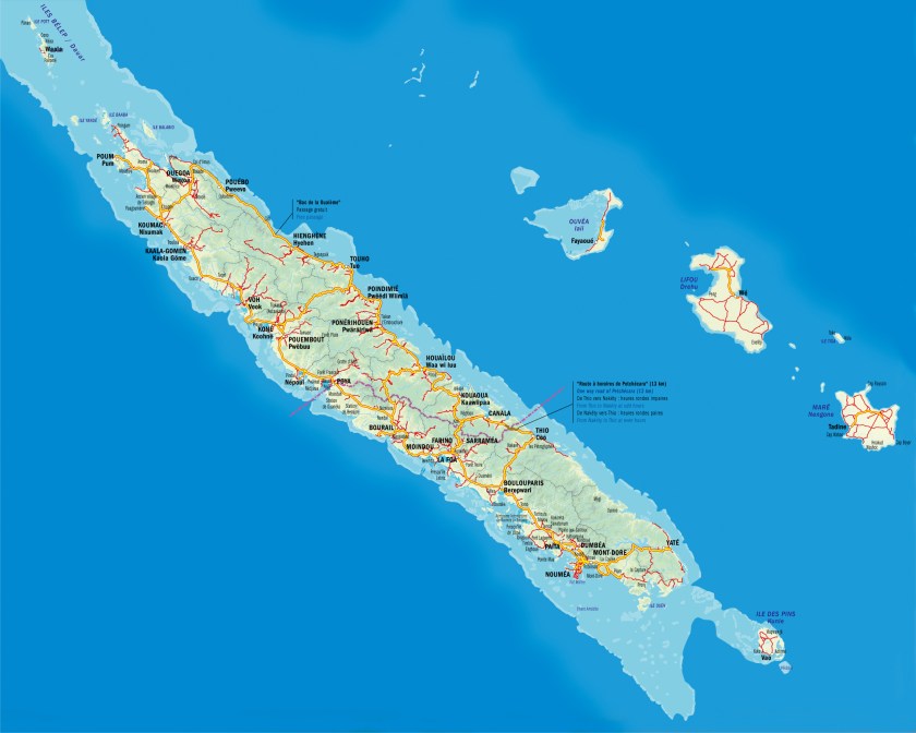
So. moving along the alignment of cities and places that I started following in Edmonton, Albert, the next island stop is New Caledonia.
This island grouping is called a Special Collectivity of France, and the President of France to this day is its Head-of-State. It includes the main island of Grande Terre, the Loyalty Islands, the Chesterfield Islands, the Belep Archipelago, and the Isle of Pines.
The alignment goes through the capital of Noumea, on the west side of the southern end of Grande Terre:
Also in Noumea, notice in the left-side picture, the nicely shaped protected harbor, and the massive stones on the pictures on the right-hand side.
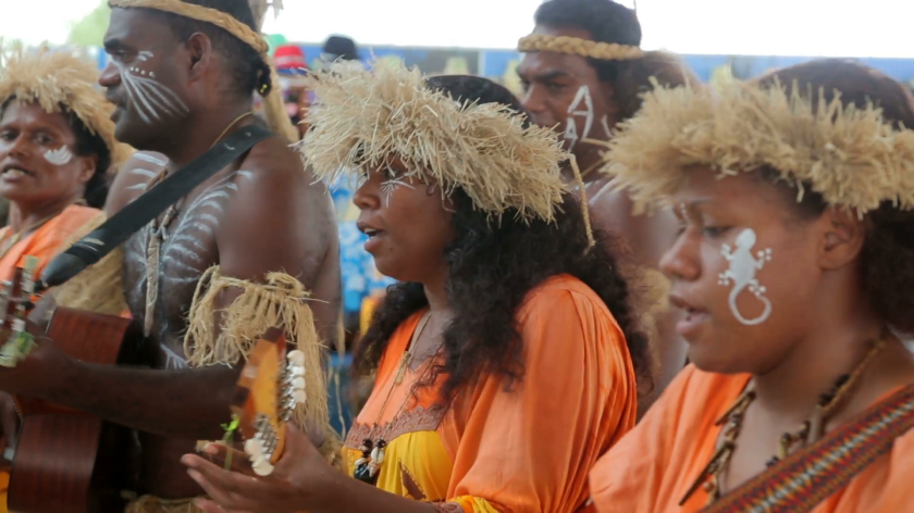
The Kanak people are the original people of New Caledonia, and they currently comprise less than half of the population.
So somewhere in our historical narrative, I believe the real story of the native people of all of these colonized lands/islands by European countries got altered somehow. I say that because how could these people, according to what we have been told, build these?
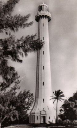
This is the Amedee Lighthouse in Noumea…
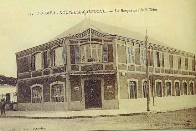
…A historic picture of the Bank of Indo-China in Noumea…
…which has the same street-corner lay-out as buildings literally all over the world, like the one on the left in Juarez, Mexico; the Ohio State Savings and Trust Bank in Toledo Ohio; and the one on the right in Kherson, Ukraine.
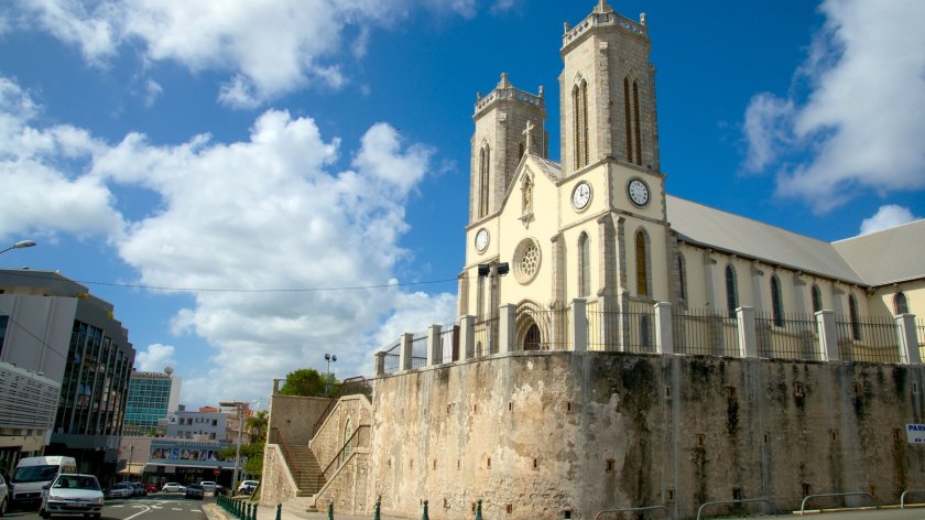
…and this is the Noumea Cathedral, said to have been built between 1887 and 1897, with all of its fancy stonework, and what looks to be older stonework on which the cathedral sits…
…and entrance-way with arches and columns.
I am saying that I believe these buildings existed before the French colonization, and the existing history we have been taught about was grafted on to the ancient advanced worldwide civilization. I see the same design features everywhere, in places I would not expect to find them, spanning centuries, continents,and oceans. Supposedly during times when communication and mobility between countries weren’t supposed to be there. It doesn’t fit in the narrative we have been taught.
Just like these entrance-ways with similar arches and columns, at St. Nicholas of Myra Russian Orthodox Church in Manhattan, New York, said to have been built in 1883…
…Church of St. George in Norwich, England, said to have been built in the 1100s…
…Turku Cathedral in Turku, Finland, said to have been consecrated in 1300…
…and this cathedral in Barcelona, Spain, said to have been consecrated in 1339.
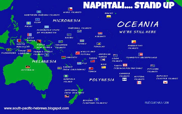
Also, this information is available if you look for it on the Internet- the inhabitants of this region, also known as Oceania, identify as the Hebrew Tribe of Naphtali.
Here are some other sights around the Grande Terre of New Caledonia:
Moving on from here, the alignment goes on to cross the Kermadec Islands. These islands are considered part of New Zealand, and are 600 miles Northeast of there. They are a Nature and Marine Reserve, and the only human presence is a permanently manned station at Raoul Island. This area is notable for earthquake activity.
Kermadec Islands
Photos of the Kermadec Islands include these of:
Raoul Island, where the permanently manned station is located…
…Cheeseman Island, with nice big blocky rocks…
…Macauley Island, the second largest of the Kermadec Islands, and located halfway between Tonga and the North Island of New Zealand…
…and Curtis Island, on at least one other alignment, and the Kermadec Islands as a whole are on other planetary grid alignments as well.
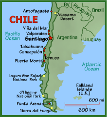
Next we come to Punta Arenas, Chile. It is the capital of Chile’s southernmost province – Magallanes and Antarctica Chilena. It is the largest city south of the 46th Parallel South. It is situated on the Magellan Strait, and is just north of Tierra del Fuego at the tip of South America.
The photos on the left and in the middle are buildings in Punta Arenas, and on the right is in the city of Kresy in Siberia.
And in this set is a comparison of a building in Punta Arenas, the Palacio Sara Braun on the left, and the Town Hall in Kherson, Ukraine on the right:
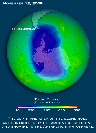
The first time I remember hearing the name Punta Arenas was when the news stories started coming out about the Ozone Hole over the South Pole, which started coming out in the 1980s, because Punta Arenas was the largest city affected by it.
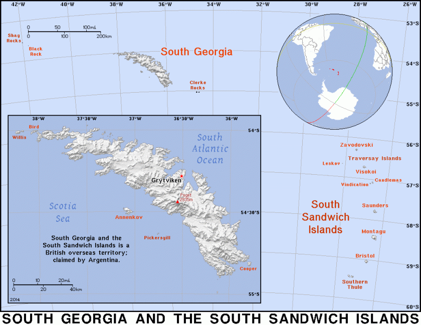
Next, the alignment goes through the South Sandwich Islands. This is interesting – Britain calls it a British Overseas Territory, and these islands are also claimed by Argentina. Not unlike the Falklands dispute (which are also on a gridline).
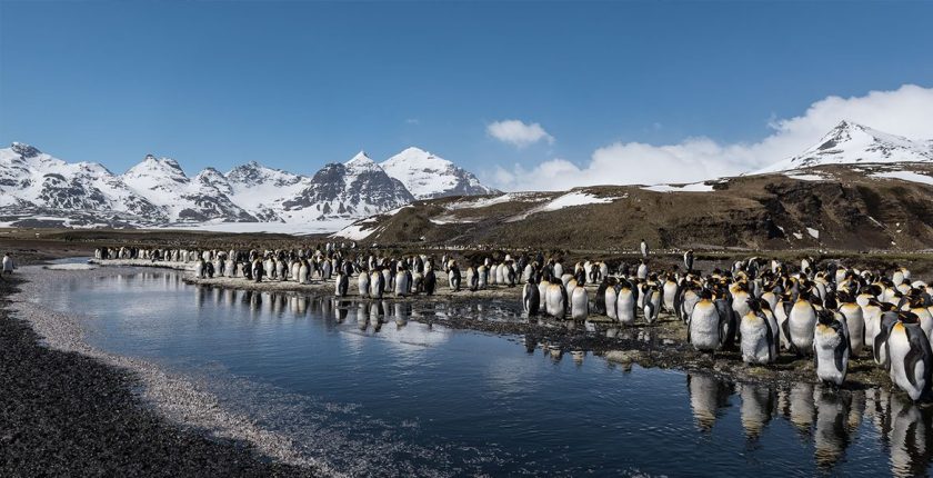
More images from the South Sandwich Islands:
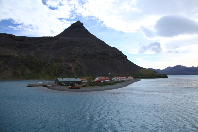
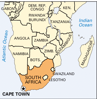
Next we come to Cape Town, South Africa. Cape Town is on at least two global alignments that I have found.
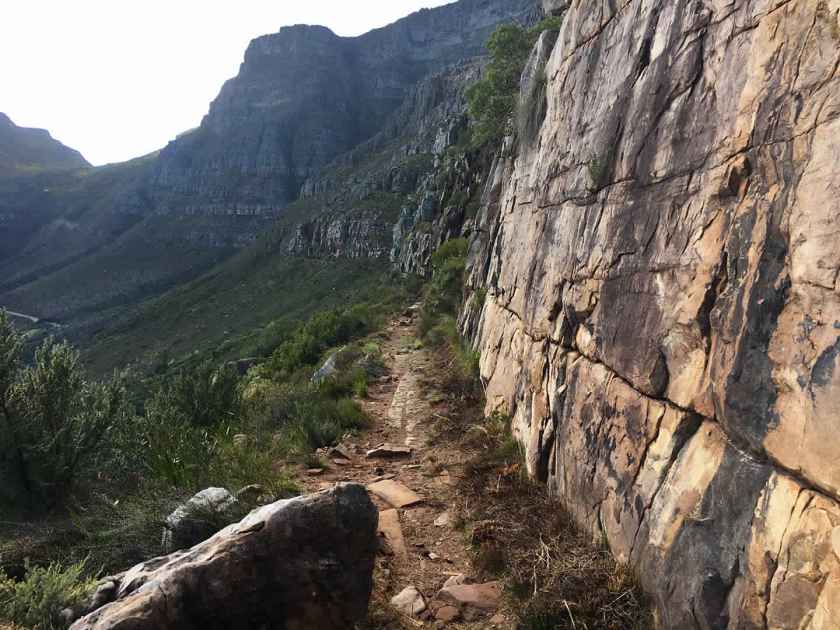
In the interest of organizing this information, I am going to focus on the most famous landscape feature of Cape Town, Table Mountain, as well as historic architecture and canals. While the history of this region is important, including what is happening today, I want to focus my attention primarily on worldwide similarities in infrastructure.
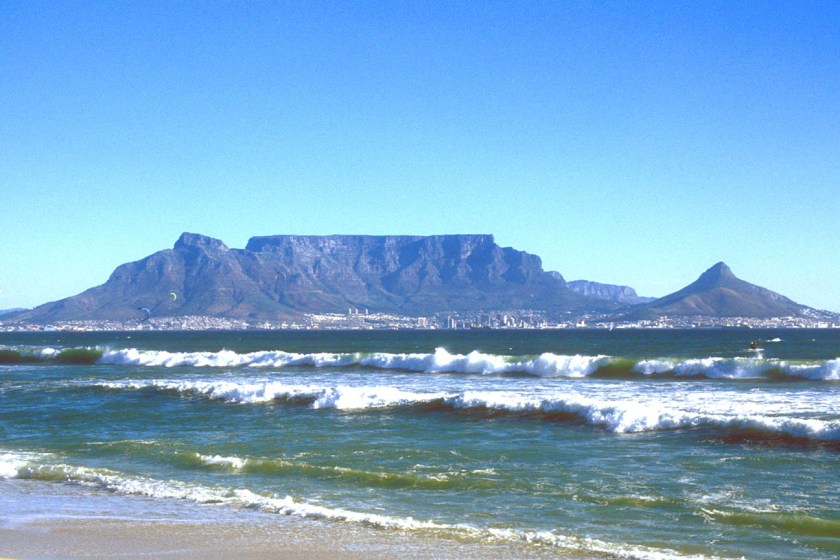
This is Table Mountain, a sandstone formation, and now part of Table Mountain National Park, with a pyramidal shape that is called Devil’s Peak on one side, and on the other a formation that has been dubbed Lion’s Head.
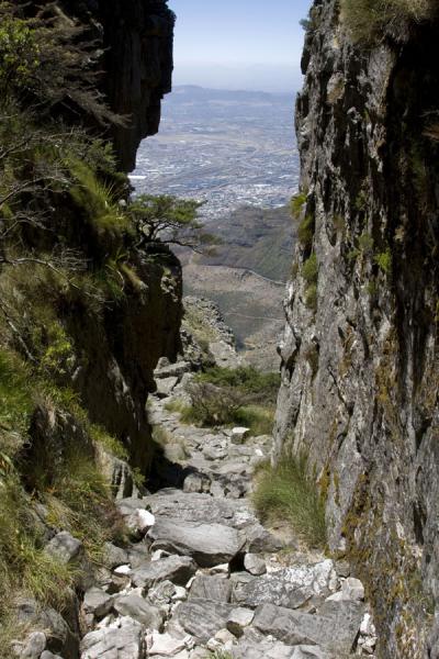
The easiest hiking route to get to the top of Table Mountain is through Platteklip Gorge…
…where we find upon closer examination what looks like a relatively flat surface with straight lines indicative of cut blocks of stone. We just haven’t been taught that is what it is, so that is not how we see it.
Moving on to more modern infrastructure, here is a comparison of the National Library in Cape Town on the left, and the National Archives in Washington, D. C. on the right:
Who is coordinating the architectural styles of all of these places, I wonder? Here are some more examples.
On the left is a building with fancy wrought iron work on Long Street in Cape Town, and on the right is a similar building in the French Quarter in New Orleans, Louisiana.
south africa cape town, Long street, colonial architecture, backpacker,
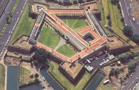
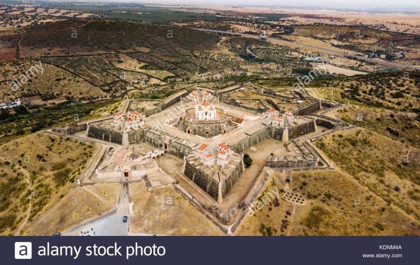
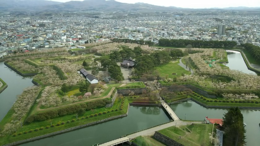
Here is a Star Fort in Cape Town…
…compared with one in Portugal…
…Fort Ticonderoga in northern New York State…
…and this star fort is in Hakodate, on the island of Hokkaido, in Japan.
Star Forts are found all over the world, with the same basic star pattern, but differing somewhat in design complexity. In many cases, like with the example of Fort Ticonderoga, they have put to military use. There has been considerable research showing that this was not the original use of these beautiful structures, like perhaps as a component of some kind of energy system.
And like with so many things, up until recently, they have been ignored by conventional history. Again, because their existence doesn’t fit with the historical narrative we have been given. This is Fort Bourtange in The Netherlands.
One last comparison. There are sophisticated canal systems around the world in places you would not expect to find them. Here is a canal in Cape Town on the left, compared with one in St. Petersburg, Russia, in the middle; and the Ankhor Canal in Tashkent, Uzbekhistan on the right.
So I am going to go end the series on this particular alignment here. It goes on to reconnect with Edmonton on its way through Africa, India, Tibet, China, Mongolia,Russia, Siberia, Alaska, the Yukon Territory, and British Columbia.
In the next series, I will continue showing you how “History Reads Like a Book on the Planetary Grids” on a different alignment.
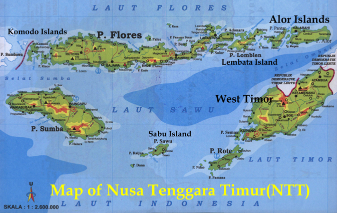
The next island the alignment touches is Sumba in the East Tenggara Nusa Islands, the southernmost province of Indonesia, and the eastern part of the Lesser Sunda Islands.
Sumba Island has a population of over 750,000 people. The Portuguese were the first Europeans to arrive in 1522; then became part of the Dutch East Indies in 1866; and the Jesuits established a mission on Sumba also in 1866.
Sumba was known for its Sandalwood exports, and is still known for being one of the places in the world where megalithic burials still take place.
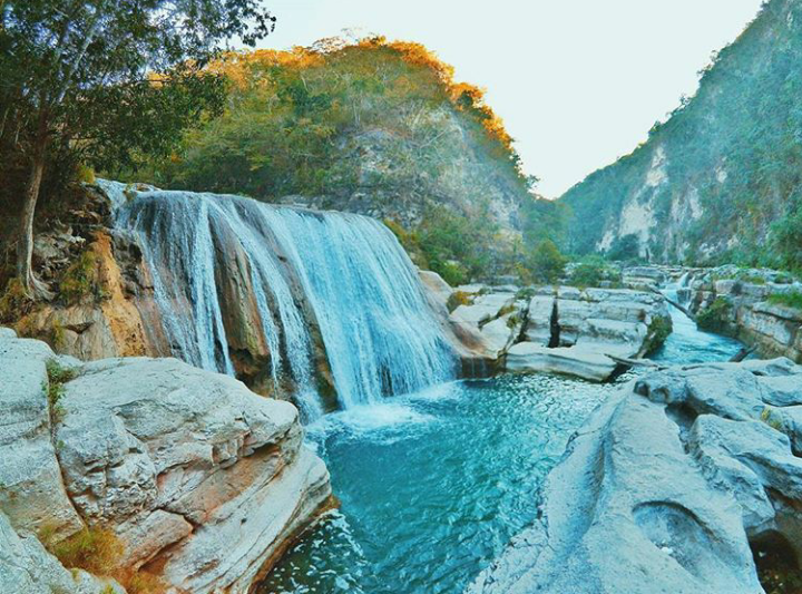
This is Tanggedu Waterfall on Sumba Island. Based on my work and research, I firmly believe waterfalls were constructed by the ancient Advanced Civilization and are part of the planetary grid system, as power generators, and/or representation of Universal Energy flows. I will show you more examples as we go along this alignment.
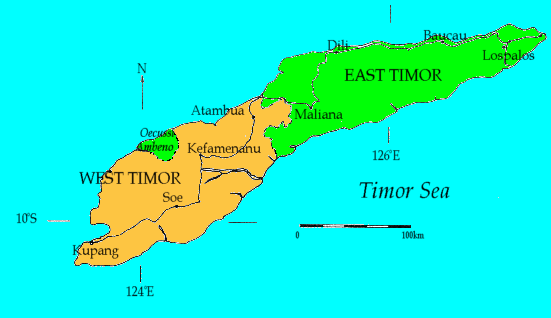
East Nusa Tenggara Province consists of more than 500 islands, with the largest being West Timor.
Kupang in West Timor is the provincial capital of the East Nusa Tenggara Islands.
The Portuguese claimed the whole island of Timor in 1520. Then in 1640, the Dutch East India Company came in and settled West Timor, and then later the Dutch government took over rule.
The Portuguese ended up in East Timor, also known as Timor-Leste, including a small enclave in West Timor called Oecussi-Ambeno, which were two original kingdoms of Timor. More on East Timor shortly.
In 1945, after the end of World War II, West Timor became part of Indonesia when its Independence from Dutch rule was proclaimed.
For about 1,400 years, from the 100s AD to 1500, Indonesia was comprised of Hindu and Buddhist Kingdoms. The rise of Muslim States started in the 1200s.
East Nusa Tenggara, however, is the only province in Indonesia that is predominantly Roman Catholic with its early colonization by the Portuguese.
This province includes Komodo Island in the Lesser Sunda Islands, which is a national park, and home of the largest lizard on earth, the Komodo dragon.
Flores Island is also in this province. Flores is the tenth largest island of Indonesia. Flores Island is also known for the discovery of dwarf human skeletons in a cave – homo floresiensis. It is also known for the discovery of large skeletons like giant rats, and is also another home for Komodo dragons.
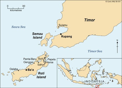
Just off the coast of West Timor are the islands of Roti and Semau.
There is a ferry between Kupang and Roti every day. There are seven languages spoken on the island, and it has living ancient arts and traditions. Also, archeological artifacts from here include Chinese porcelain.
Semau lies 3 kilometers from West Timor, near Kupang. The inhabitants of the island of Semau are the Helong people, considered to be the original inhabitants of the Kupang area. The Helong language has two dialects.
These are two Helong weavers with examples of the textiles produced in West Timor and Semau.
I bring all of this up about East Nusa Tenggara Province for several reasons.
One, Kupang, West Timor is on at least two planetary alignments that I know of.
Another is that there are little islands around the world on all the alignments I have found, that are very much a part of the planetary grid system.
Also, there has been quite a bit of interest in this region historically by European countries looking to expand their colonial empires, and the Roman Catholic Church. These are engines by which the Ancient Advanced Civilization was taken down, and its land and people claimed.
One more thing I want to touch on before following the alignment to Australia is the subject of East Timor. East Timor, also known as Timor-Leste, since 2002 has been considered an independent country in Maritime Southeast Asia. It is also predominantly Roman Catholic.
Portuguese colonization began in 1769. Their influence was interrupted during World War II, when Japan occupied East Timor. After the war, Portuguese control was reinstated.
Then in 1974, Portugal abandoned its colony because of unrest at home, and the vacuum was filled for a brief time by the Revolutionary Front for an Independent East Timor. This was countered by an invasion from Indonesia, with Australian, British, and American support, in December of 1975, due to fears of a communist state in Indonesia.
What followed was a brutal and violent occupation of East Timor by Indonesia. Between 1974 and 1999, approximately 102,000 conflict-related deaths were reported, and there were over 200,000 refugees.
Ultimately, on May 20, 2002, a new constitution for the Democratic Republic of East Timor came into force, and a parliamentary government with a Prime Minister, and President as Head of State, came into being.
Again, more examples of my underlying premise, which is that history reads like a book on the planetary gridlines.
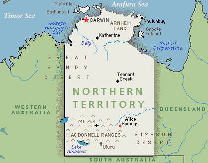
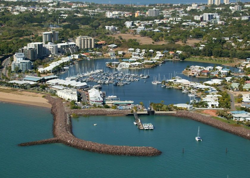
From here the alignment passes between the Timor Sea and the Arafura Sea, to hit land again at Darwin, Australia, which is the capital and largest city of the Northern Territory of Australia, which is sparsely populated. It is also called the Outback Capital of the Northern Territory
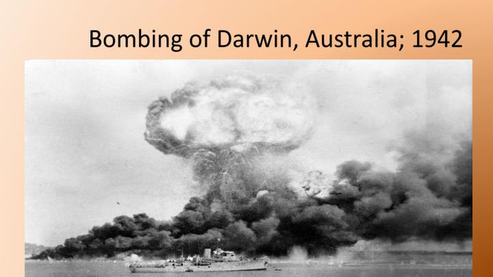
Notably, Darwin was the location of the first bombing in Australia, which occurred in February of 1942, after Australia had officially declared war on Japan on December 9, 1942. Japanese forces bombed military bases in Darwin in one day. One of the first hits, and explosions, was a ship loaded with TNT and ammunition.
Here is a picture of Darwin today. Of particular note is the shaped harbor in the foreground, which is a signature of places along these planetary alignments.
Leaving Darwin, and just on the outskirts, we find Howard Springs Nature Park.
I see exactly the same kind of thing everywhere. We are taught that there was nothing special going on in these places, nothing to see, so we fail to recognize the ancient megalithic masonry laying all around us.
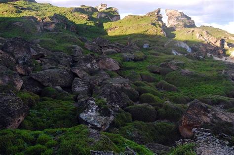
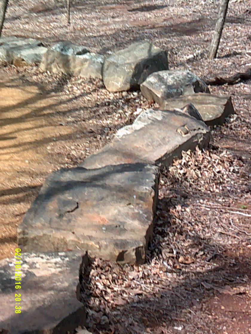
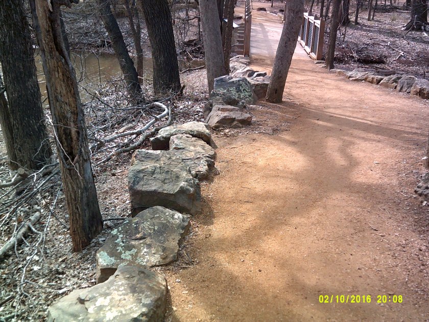
These are cut and shaped stones. These are not natural occurrences, contrary to what we have taught to believe by historical omission. These in Australia…
…are like these two photos at Martin Nature Park in North Oklahoma City. Lying around everywhere with no special attention drawn to them – just there. Taunting us but not telling us.
And only when you start realizing they are there. Because until you notice them, they just blend in to the landscape.
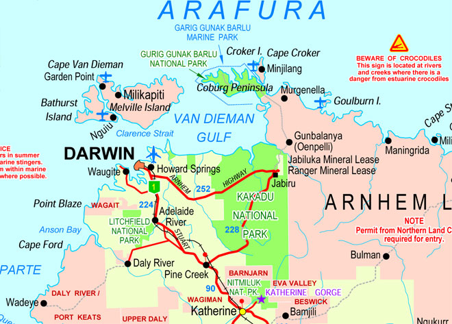
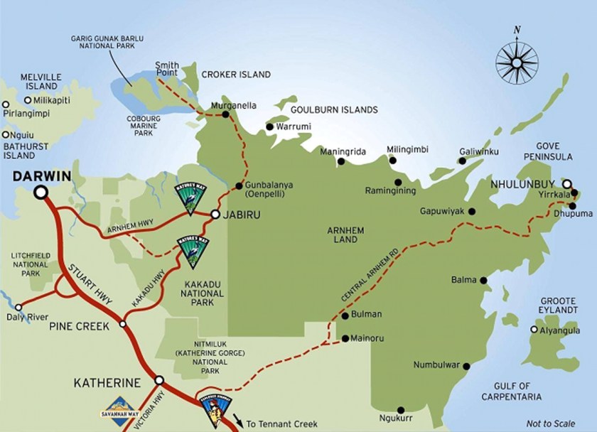
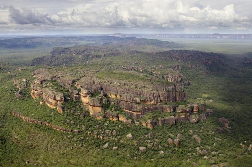
The alignment goes through Kakadu National Park, and then through Arnhem Land.
First Kakadu National Park, which is a UNESCO World Heritage Site. Kakadu covers an area that is 7,646 square miles (or 19,804 kilometers). Besides its incredible biodiversity, land-forms, and river systems, one of the most productive uranium mines in the world is surrounded by the park, shown in the map as the Ranger Mineral Lease.
Aboriginal people have occupied this land continuously for 40,000 years, and approximately half of the land of Kakadu is aboriginal.
And this is as good as any place to leave this photo here for your consideration. I personally think there is something to it, that the Australian Aborigines are of the Tribe of Reuben. I have expressed my thoughts about this subject in the “The So-Called Lost Tribes of Israel” blog post. This kind of information is well-hidden, so some digging is required to find it. But it is out there on the internet if you start looking for it.
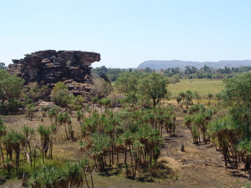
Anyway, back to Kakadu National Park. Here are some landscape pictures of it.
Kakadu National Park is part of Arnhem Land, one of the five regions of the Northern Territory, and which the alignment crosses over. While the land is named for the ship of the Dutch East India Company Captain who sailed it into the Gulf of Carpenteria, which I will be covering soon, the population of this region is actually mostly aboriginal, estimated to be around 16,000.
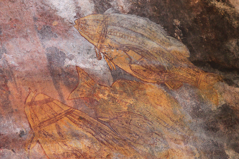
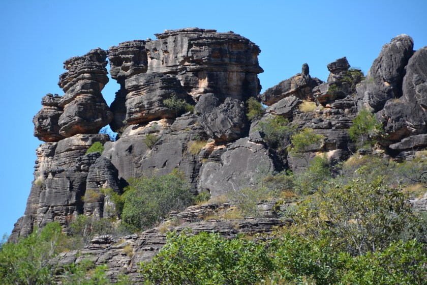
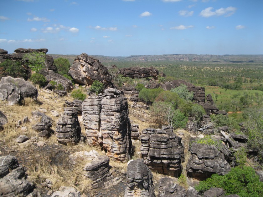
The following photos are of Arnhem Land. I have no difficulty seeing all of this as ancient infrastructure. I had a perceptual shift when I realized there is a code of key words that covers up the ancient civilization. But for most, since we haven’t been taught about this ancient civilization, and have only been taught to believe that it is the result of natural processes, that is how it is perceived.
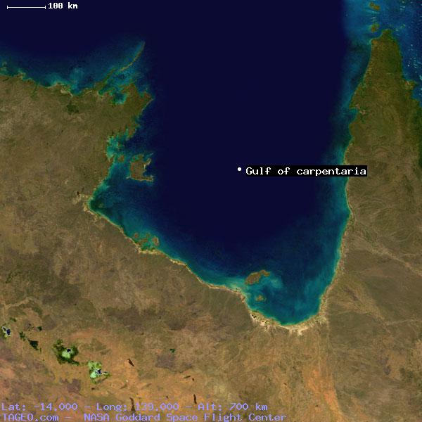
The Alignment crosses the Gulf of Carpenteria in Queensland, Australia. The Gulf of Carpenteria is described as a shallow sea enclosed on three sides, and bounded on the north by the Arafura Sea (which lies between Australia and New Guinea) –
Here is an aerial view of the Gulf of Carpenteria:
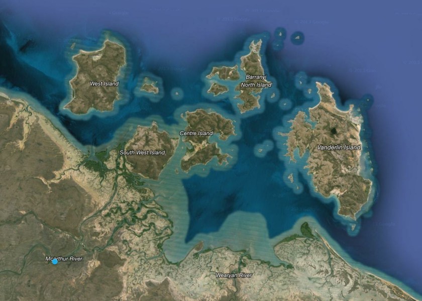
The alignment passes through some islands in the Gulf – through Pellew Islands and the Wellesley Islands.
The Pellew Islands are in the southwest corner of the Gulf of Carpentaria.
They are a group of five islands with a total area of 2,100 square kilometers, named in 1802 by Matthew Flinders in honor of a fellow naval officer.
The Wellesley Islands are here, also named by Matthew Flinders, this time for the 1st Marquess of Wellesley:
The largest island in the group is Mornington Island.
On its way to Cairns, the alignment crosses along the way from Karumba to Normanton, and I will have a future blog post document world-wide S-Shaped riverbends that look like what is pictured here, because they are all over the world. Looking just like this.
The city of Cairns, Australia is next on the alignment.
Cairns is the 5th largest city in Queensland, and the 14th largest city in Australia. It is said to have formed…
…to serve miners going to the Hodgkinson River goldfield.
I will end this post here, to pick it up leaving Australia and crossing the Great Barrier Reef on its way around the world.
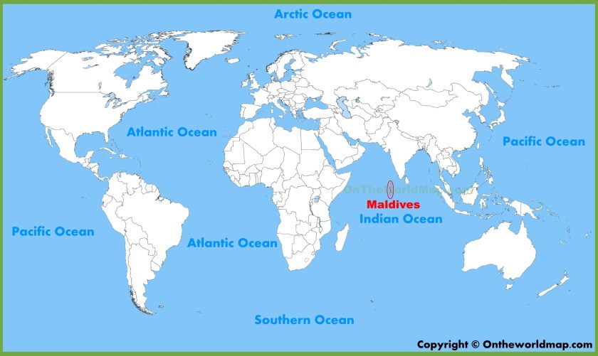
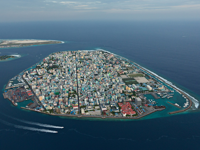
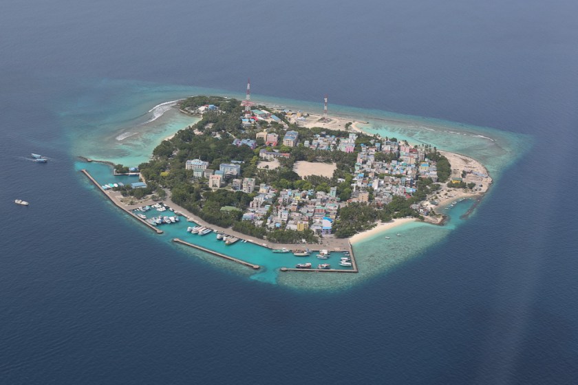
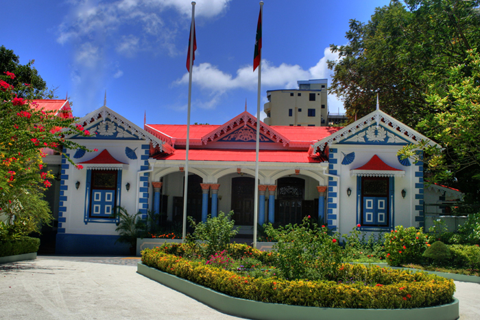
On the other side of the alignment going through Africa, you come to the Maldives, a sovereign state in the Indian Ocean, situated in the Arabian Sea, and southwest of Sri Lanka and India. It crosses over in the area of Male, the capital city of this island country.
The top photo is the capital, Male, and the bottom is a nearby resort. Of particular interest are the nicely engineered protected harbors on both islands, and the straight street alignment in the top photo bisecting the island.
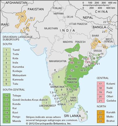
The Maldives have a strong cultural and linguistic connection to the Tamil Dravidian culture of India and Sri Lanka. While not pictured here, the Maldives lie a relatively short distance southwest of the Dravidian map pictured here.
The Maldives became a sultanate in 1153 when the King converted to from Buddhism to Islam. Before that the Maldives were Buddhist, prior to that Hindu, and originally was a matriarchal society with each atoll ruled by a chief queen.
In the following historical photos, this is a Buddhist Statue from the Maldives, and the Maldives are said to have had a 1,400 year history of Buddhism, until the year 1153 AD:
as well as this Buddhist Stupa pictured here:
Islam is the mandatory religion in the Maldives. This is the old Friday Mosque in Male:
It is made from coral stone, and has unique coral stonework and woodwork, as well as lacquerwork, on the inside.
The formal title of the Sultan of the Maldives was: “Sultan of Land and Sea, Lord of the twelve-thousand islands and Sultan of the Maldives.”
In 1796, the British included the Maldives as a British Protected area, and it officially became a British Protectorate in 1887, with an understanding that they were involved in external affairs like military defense, and the Sultan was responsible for Home Rule.
Eventually the Sultan’s ruling powers were taken over by his Ministers, and a Constitutional Monarchy was proclaimed in 1932, with the Sultan remaining as nominal head.
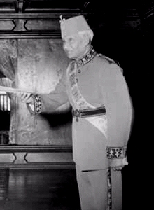
In 1965, the Sultan became a King with independence from Britain. Then in 1968 the 853-year-old monarchy ended with the establishment of a Republic in a national referendum. This is a photo of the last monarch of the Maldives – King Muhammad Fareed Didi.
The Sultan’s Palace was demolished and the grounds became Sultan Park, and what was left of the palace was converted into the Maldives National Museum, which houses a complete collection of royal artifacts, as well as archeological finds throughout the islands, many of which speak to its Buddhist and Hindu past.
This is the Mulee’aage, now the Presidential residence, but is said to have been completed in 1919 as a residence for the heir of the Sultan at the time.
Regardless of the cause of it, in the decades since the establishment of the Republic, the political history of the Maldives has been rather tumultuous, punctuated with many episodes of civil unrest and political instability.
From the Maldives, the alignment crosses the Indian Ocean and enters the Island of Java through the Sunda Strait as it goes across Indonesia.
The Sunda Strait, which is located between the islands of Java and Sumatra, and connects the Java Sea to the Indian Ocean.
????????????????????????????????????
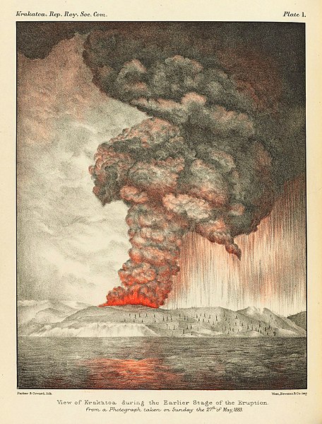
There are a couple of noteworthy tidbits about this location. One is that the island of Krakatoa is located here. Krakatoa is a volcanic island that exploded in a major eruption in 1883 with global effects. It was one of the deadliest and most destructive volcanic events in recorded history. It destroyed most of the island, affected the region with pyroclastic flows and volcanic ash. Global after-effects included tsunamis and climactic changes involving a cooling of temperatures over the next few years.
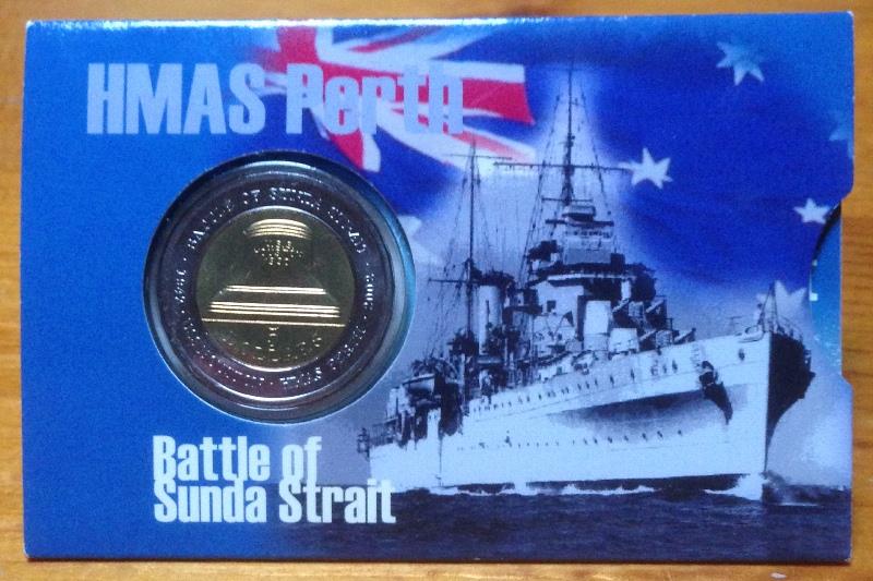
The other is that there was a World War II naval battle that took place here in 1942. This was not the only battle that took place on a grid-line during the second World War. There were actually many of them that did, not only in World War II, but other wars/conflicts as well.
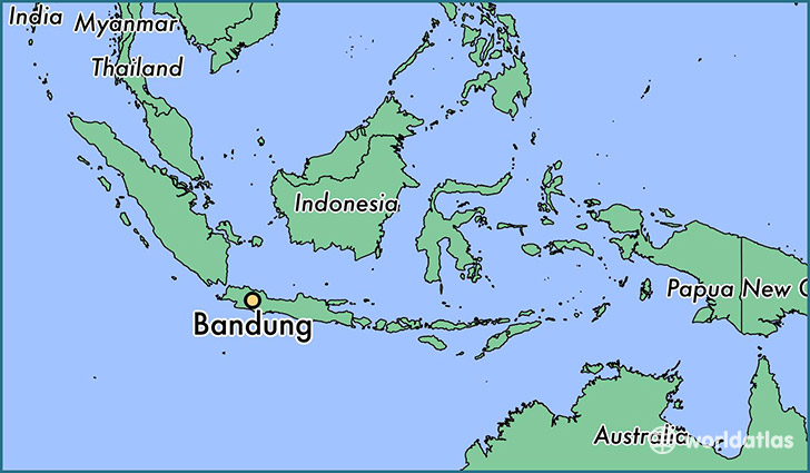
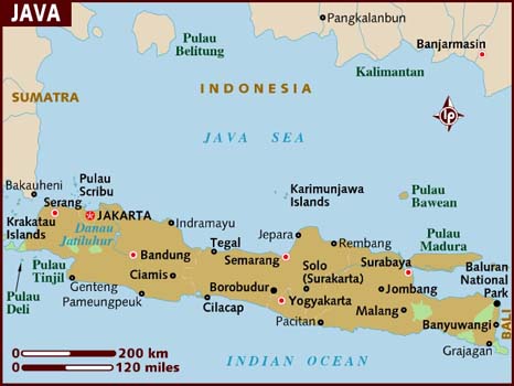
The alignment goes through Bandung, the capital of West Java.
Bandung was called the Paris of Indonesia by its Dutch Colonizers, who started colonizing here in the 1700s as the Dutch East India Company, and is known today for a certain European feel.
Here are some historic pictures of Bandung:
And these are some pictures of the landscape in which Bandung is located.
Tebing Keraton also known as the Instagram Hill among netizen in Indonesia. The landscape is so extremely danger and beauty. Pine forest under the cliff across the Juanda Park makes the visitors dare to take selfie at cliff. Tebing Keraton is located at Bandung City, West Java, Indonesia.
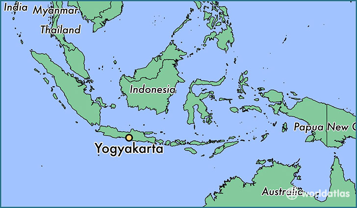
The alignment goes through Yogyakarta in Central Java.
Yogyakarta was the capital of the Mataram Sultanate from 1587 to 1613. Even today it is considered a center of education, classical Javanese Fine Art and cultural activities of all kinds.
This is also where Borobudur is located, another nodal point of the planetary grid, like Axum in Ethiopia, which was featured in Part 2 of this series. A nodal point is a place where numerous leylines and planetary alignments connect.
Borobudur, located 26 miles northwest of Yogyakarta, is the world’s largest Buddhist Temple, and a UNESCO World Heritage Site. A structural mandala Built in three tiers, it has a pyramidal base with five concentric square terraces, the trunk of a cone with three circular platforms, and a monumental stupa at the top.
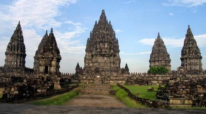
Also close to Yogyakarta is Candi Prambanan, which is a Hindu Temple complex, said to have been established in the 8th century with the formation of a Hindu kingdom in Java.
Surakarta is in the same vicinity, and lies just to the northeast of Yogyakarta. It is also known the Royal City of Solo. It is considered one of the least westernized cities on Java. We saw another royal city on this alignment at Gondar in Ethiopia in Part 2 of this series.
This is the Keraton Surakarta, also known as the Kasunanan. It is a royal palace that was built in 1745.
Mangkunegaran Place is also in Solo, said to have been built in 1757 by the nephew of King Pakubuwono II.
I have reason to believe there is a much greater historical significance to this place than is realized, connected ultimately to King Solomon, but it falls into the category of the secret (society) history of the world. If you are interested in learning more about this, here is a link to a PDF that can explain it much better than I can, and is where I first learned of this unknown history and this place.
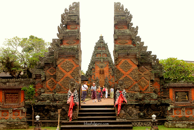
Bali has a large Hindu population, at over 80% of the population in the largely Muslim nation of Indonesia. This is one of many Hindu temples on the island of Bali.
Among many other things, Bali is noteworthy for its Subak Irrigation System. The Ancient Ones of the advanced Ancient Civilization were Master Hydrologists. This irrigation system is a complex, pulsed artificial ecosystem for the paddy fields of Bali, said to be in use since the 9th century. It is owned by the farmers, and was said to have been developed to facilitate fair distribution of water resources during the dry season. There are five terraces, and a water temple associated with each one. This has been designated UNESCO World Heritage Cultural Landscape.
Bali
According to Robert Coon, who has done extensive research on the two Great Earth Serpents and the Earth’s Chakra System, Bali is the World Purification Center, and is one of two places where the Feminine Rainbow Serpent and the Masculine Plumed Serpent cross – the other is Lake Titicaca, which straddles the border of Peru and Bolivia. He says on a flat map, these two dragon circles form an infinity symbol, or a figure 8 tipped on its side. Here is the link to his website and this information: The Two Great Dragon Circles.
I am going to end this post here, and pick up the alignment in Kupang, at the tip of the island of West Timor.
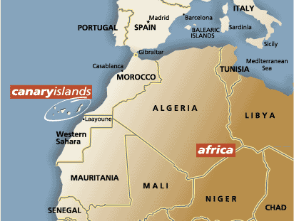
I ended part 1 of this series in Portland, Maine, where this alignment emanating off the North American Star Tetrahedron leaves North America and crosses over the Atlantic Ocean and heads towards North Africa. I will be starting this post on the island of Tenerife in the Canary Islands.
For me personally, this journey started here in 2016, when I started noticing major cities lining up in lines in North America on a map beside my dining room table. Then I found a familiar figure of sacred geometry when I literally started connecting them. After that, I extended the lines out on a map, then a globe. I am sharing with you what I have found along the way.
This blog is dedicated to providing compelling evidence for a highly advanced lost global civilization that existed up until relatively recent times. It was geometrically aligned with itself, the planet, and the stars, and in this spirit in addition to what I have found in the specific locations on this alignment, I will be including comparison pictures of other places with astonishing similarities in places you would not expect to find them.
For the purposes of simplification, in these posts I am going to focus on striking similarities in building styles and design features, and landscape features. I will say this whole region is rich in unknown and unacknowledged history, but it is beyond the scope of this blog and my expertise to delve much into it. Suffice it to say I will be scratching the surface of it with what I am about to share with you.
Tenerife is largest and most populated island of the Canary Islands, and its capital is Santa Cruz de Tenerife. The Canary Islands are an Autonomous Community Province of Spain, and are located off the coast of Morocco.
Here are photos comparing a building configuration – that I have found throughout these alignments – in Tenerife on the left; Burlington, Vermont in the middle; and Summerside, Prince Edward Island on the right.
In this comparison of roof styles, on the left is the Circulo de Amistad XII de Enero Building in Tenerife; the building on the top right is in Montpelier, Vermont; and the one on the bottom right is in Yalta, Crimea (the Crimea is a peninsula on the Black Sea).
Here are those triple and double windows yet again – on the left is a view of Santa Cruz de Tenerife; and on the right is the Victoria and Albert Museum in London.
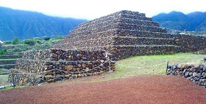
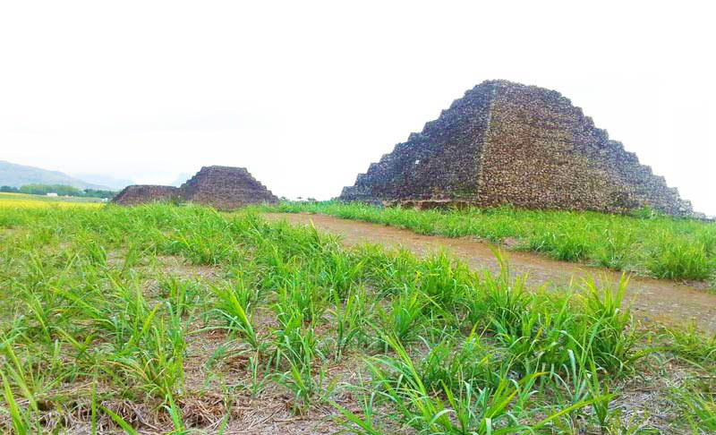
The Pyramids of Guimar are located in the town of Guimar on the island of Tenerife. Terraced structures that were built from lava stone without the use of mortar.
Compared with the Pyramids of Mauritius in the Indian Ocean, also terraced structures made of lava stone. There are seven terrace pyramids in Mauritius and six in Guimar. In both places they are in perfect astrological alignment with the winter and summer solstice.
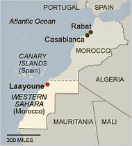
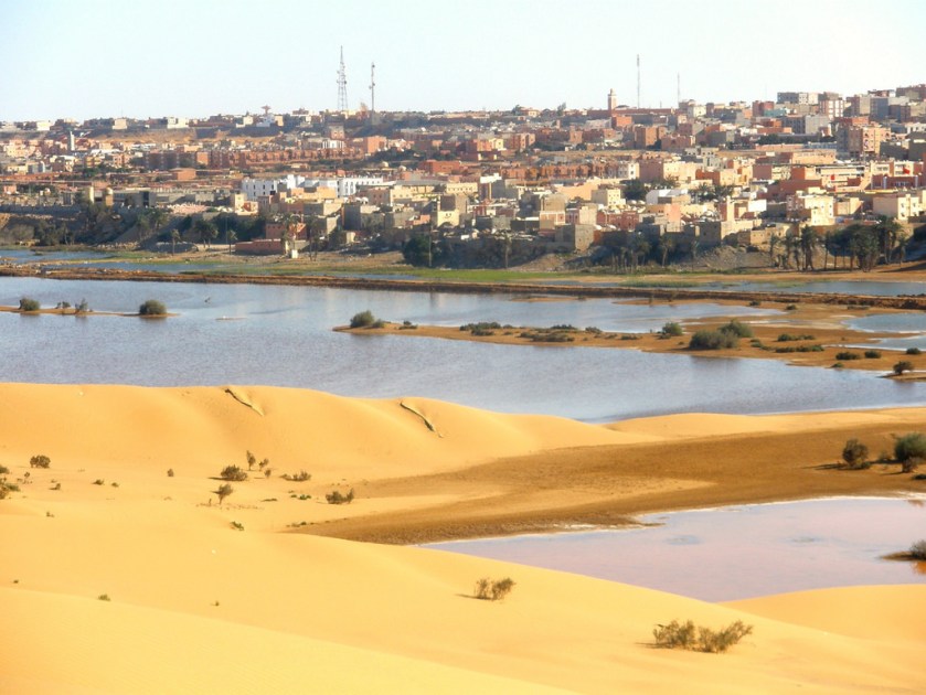
From the Canary Islands, the alignment enters the continent of Africa at Laayoune, Morocco, or El Aaiun, the meaning of which refers to water springs.
Here I would like to interject that I have found springs of all kinds, including hot springs, located in places on the alignments I have found in my work.
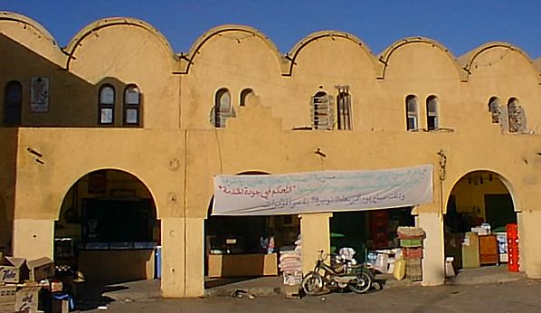
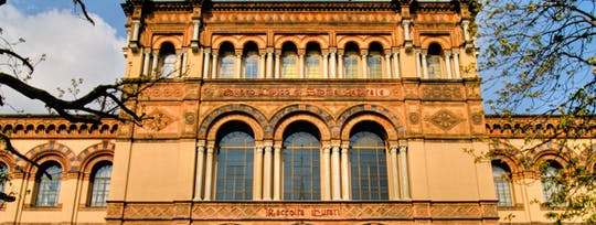
Top two photos are buildings in Laayoune. Next, in order is: the Milan Natural History museum in Italy; Georgetown University in Washington, DC; and the photo on the bottom is the Moscow State Historical Museum in Russia.
The alignment crosses into the Tamanrasset Province, the largest in Algeria.
There are two two national parks in Tamanrasset Province – the Ahaggar (also known as Hoggar) Mountains; and Tassili n’ajjer.
First, photos of the Ahaggar Mountains. These are considered a highland region of the Central Sahara in Southern Algeria that cover 212,000 square miles (550,000 square kilometers) along the Tropic of Cancer:
Second, here are some photos from the other national park – Tassili n’ajjer, which means “Plateau of the Rivers.” It is a UNESCO World Heritage Site.
It is known for its distinctive rock artwork, some of which is pretty much recognizable from our reality as we know it: bull – charioteer – giraffe…
…and some of it not of this world as we know it – ? – ?? – ???.
And here a photos of the landscape of Tassili n’ajjer.
Let me be clear that I believe all of the landforms I am showing you in this post are ruins of ancient infrastructure, and not natural features.
Whether or not you are able to believe this, throughout this post I intend to provide compelling evidence as to why I believe it.
For example, the landform on the left is in Tamanrasset Province, and the one pictured on the right is Chimney Rock in Sedona, Arizona.
Also this image on the left taken in Tamanrasset Province is very much like what is pictured on the right in Heavener Runestone State Park in Heavener, Oklahoma.
A few more things before I leave Algeria.
The first is that I would like to point out a few things in Constantine, Algeria – which is in northeastern Algeria, close to the Mediterranean Sea. Whoever built this place is comfortable with stone and heights ~ this is what a City on the Rocks looks like!
For a direct comparison to illustrate one of the points I want make, here is a series of three pictures. The photo on the left is called in English “Natural Arch” in Constantine; the middle one is what is called the “Arch Bridge” in Constantine; and on the right is taken of a building in Grozny way over in Chechen Republic in Russia, not close to here by any stretch of the imagination, but which is located on another planetary alignment.
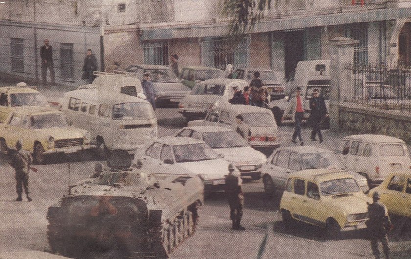
The other point that I would like to make is about the Algerian Civil War, the duration of which was between 1991 and 2002. It involved an armed conflict between the Algerian government and various Islamic rebel groups. It began after a coup negating an Islamist electoral victory in which the government was trying to crush the Islamist movement, but armed groups emerged to fight against the government, and many Algerians were killed.
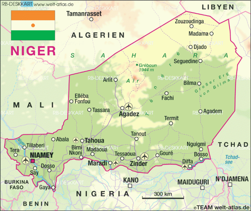
From Algeria, the alignment crosses into the country of Niger, where it goes through the Air and Tenere National Nature Reserves. Pictured top and bottom to the right of the map shows a good example for me what are actually under sand dunes, but that is a future post in and of itself….
The Air and Tenere National Nature Reserve is a UNESCO World Heritage Site, and covers 29,870 square miles (77,360 square kilometers), and is the eastern half of the Air Mountains, and the western half of the Tenere Desert.
From there, the alignment crosses through Bilma, Niger.
Bilma is an oasis town, and used to be a key stop in the Trans-Saharan caravan route. It is protected from sand from the desert dunes by the Kaouar escarpment. Escarpment is another key code word that covers-up ancient infrastructure.
To this day, it produces salt in salt pans, sold for livestock use throughout West Africa.
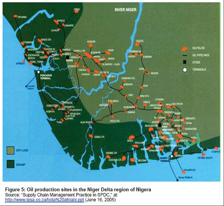
Lastly, I would like to point out the Niger Delta Civil War and Boko Haram.
There has been conflict in the Niger Delta since the early 1990s as well, mostly between foreign oil companies and minority ethnic groups, and has been on-going in one form or another since that time.
The Islamic State in West Africa has been active in Niger, Nigeria, Chad, and Northern Cameroon since 2002, and has been known as Boko Haram since 2015. It is a militant jihadist group that advocates for Sharia Law, and has been particularly noteworthy for militant insurgency and child kidnappings, among many other things.
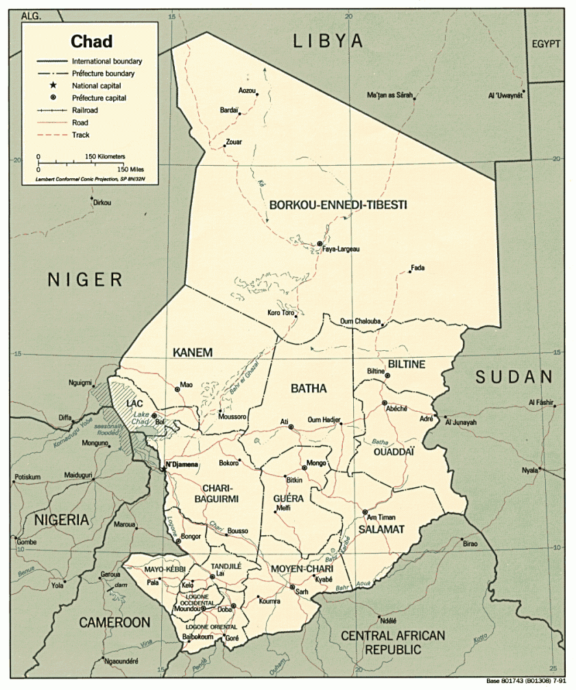
Moving on into Chad, a land-locked country in Central Africa.
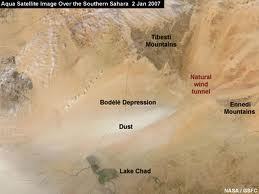
The Bodele Depression and Koro Toro are both on the alignment in the Borkou-Ennedi-Tibesti Region of Chad.
The Bodele Depression is the lowest point in Chad, and is best known for its dust storms which deliver fertile dust, said to be essential for places like the Amazon rainforest.
The Bodele Depression lies between Lake Chad to the south of it (note the pyramidal shapes in the background)…
Here are Tibesti Mountains on the left and in the middle, Bell Rock in Sedona, Arizona on the right:
Here are more photos taken of the Tibesti Mountains:
Here is a photo comparing a rock formation in this region of Chad on the left, and one in the Tamanrasset Province in Algeria on the right that called “No Arch.” They both look like a lot like elephants to me.
Koro Toro is also on the alignment and is an archeological and anthropological site in Chad, best known for the discovery of an Australopithecus fragment in 1995, which is described asone of the first Hominid in the ancestry of human evolution.
There have been roughly four Civil Wars in Chad since independence from France in 1960. The last one started in 2005 between Muslims in the North and Christians in the South, and is continuing on some form or another to the present day.
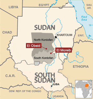
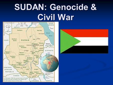
From Chad, the alignment crosses through El Obeid, Sudan, which is the capital of North Kurdafan.
Here is a comparison of a mosque in El Obeid, Sudan on the left, and the Signoria, was was the government building of medieval and renaissance Florence, Italy:
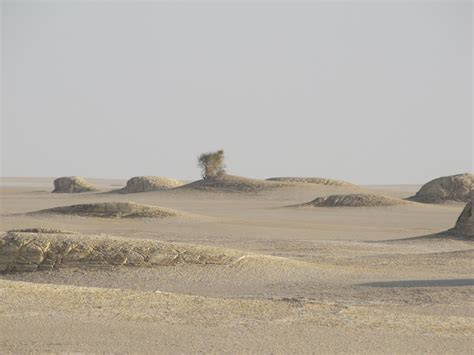
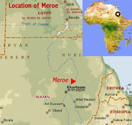
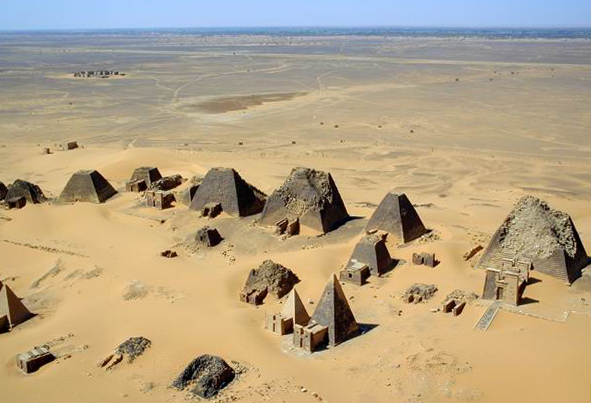
Also, there are Pyramids in Sudan – located in Meroe which is northeast of the country’s capital of Khartoum. As the map shows, Sudan is due south of Egypt. Meroe is an ancient city that sits on the east bank of the Nile River as well. This region is considered part of the Kingdom of Kush.
Here is an aeriel view of the Meroe Pyramids…
…and a comparison of the Meroe Pyramids on the left, and similar-looking pyramids in Tamanrasset Province back in Algeria on the right:
The first Sudanese Civil War started in 1955 between North and South Sudan, (Sudan Civil Wars start in 1962), with a state of civil war existing in Sudan to the present-day.
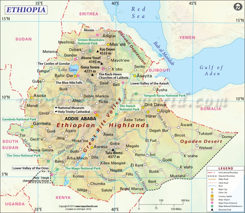
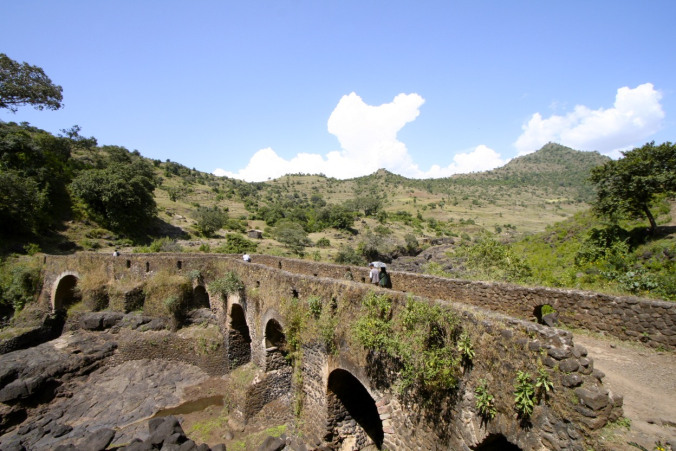
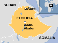
From here the alignment goes on into Ethiopia, on which we find Lake Tana, Gondar, and Lalibela, Ethiopia.
Lake Tana is the source of the Blue Nile, and the largest lake in Ethiopia. It is a sacred lake.
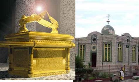
Among other things, the heart-shaped Lake Tana has living traditions about being a place where Joseph, Mary, and Jesus stayed on their way back to Israel after fleeing Herod, and also as a place where the Ark of the Covenant was kept for 800 years before going to Axum, where it is said to currently be (more on this shortly).
This first set of two photos is a comparison of a bridge near Lake Tana on the top, with the old bridge near Loch Sligachan on the Isle of Skye, off the coast of Scotland on the bottom:
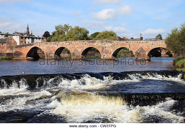
This next set of two bridges is a comparison of the River Nith Old Bridge in Dumfries, Scotland on the left, with the Burnside Bridge at Antietam in Maryland, the site of a major battle of the American Civil War:
Gondar is a royal and historic city of Ethiopia, and the Imperial Seat from the 1200s to the 1900s. It is a city of castles and palaces.
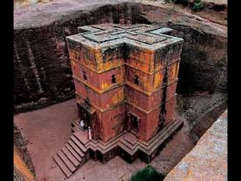
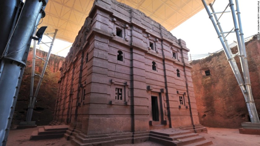
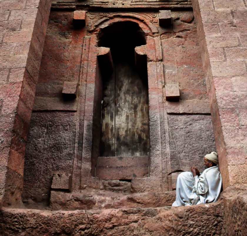
Lalibela is the second holiest of Ethiopia’s cities, after Axum. It is famous for its monolithic churches, meaning cut out of one rock. The population of Lalibela is almost completely Ethiopian Orthodox Christian.
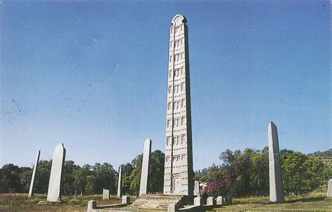
Axum, Ethiopia is one of the twelve primary nodal points of the Planetary Grid. A nodal point is a place where numerous leylines and planetary alignments connect.
It is believed to be the home of the Ark of the Covenant at the Saint Mary of Zion Church.
Though there is more than one obelisk here, this is the granite Obelisk of Axum. It is 24 meters high, and weighs 160 tons. Like the churches of Lalibela, it is also monolithic in that it was crafted from a single piece of stone.
Civil War started in Ethiopia in 1974, with a coup initiated by a Marxist-Leninist faction leading to the overthrow of the Imperial Government in 1975, and formally ending in 1991. The war left at least 1.4 million dead.
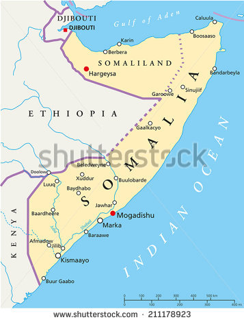
From Ethiopia this alignment goes through Hargeysa, Somalia. Hargeysa is the largest city and capital of the self-declared province of Somaliland (it is not recognized internationally).
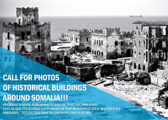
So, as is typical of so many places, this is the fate of the much of the beautiful historic architecture of Somalia…
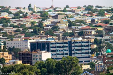
…to be replaced by what you see now in 21st-century Hargeysa…
…Contrasted with the building in the background in this historic photo of Hargeysa.
Here are some historic photos and locations around Somalia that may or may not still be standing:
Lastly, the alignment leaves Somalia at the city of Eyl. This region of Somalia is known as Puntland, which was established in 1998.
Somalia itself is more than likely the ancient Land of Punt, which was a trading partner with Egypt.
This is the Dervish Castle at Eyl…
…as well as the building in this historic picture.
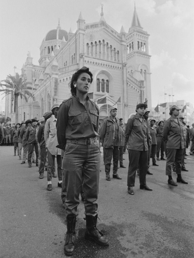
The Somali Civil War started in the 1980s, and is on-going. It is estimated that at least 500,000 people have been killed as a result of it.
I will be ending this post here at the Horn of Africa and next stop will be following the alignment on to the Maldive Islands in the Indian Ocean.
I will leave you here these thoughts.
It sure looks like to me that a rich, vibrant & unacknowledged history of Humanity has been plundered and destroyed through this region, only to be replaced with violence, death and destruction.
I bring these things up because of these are types of things that have been happening on planetary gridlines, or the proximity thereof, which is also happens to be our consciousness grid.
Finding out things like this is why I believe the planetary grid has been deliberately manipulated to lower our collective consciousness since so many, many horrific atrocities and crimes against Humanity have been committed at significant places on the grid, not only here in Africa, but all over the world.
Knowledge of the planetary system was deliberately removed from our collective awareness by beings who definitely do not have humanity’s best interest at heart, our history was revised, and the truth became shattered and fragmented.
It is time to return this knowledge to the collective awareness and together choose to create a new reality for our planet that is based on love, kindness and cooperation.
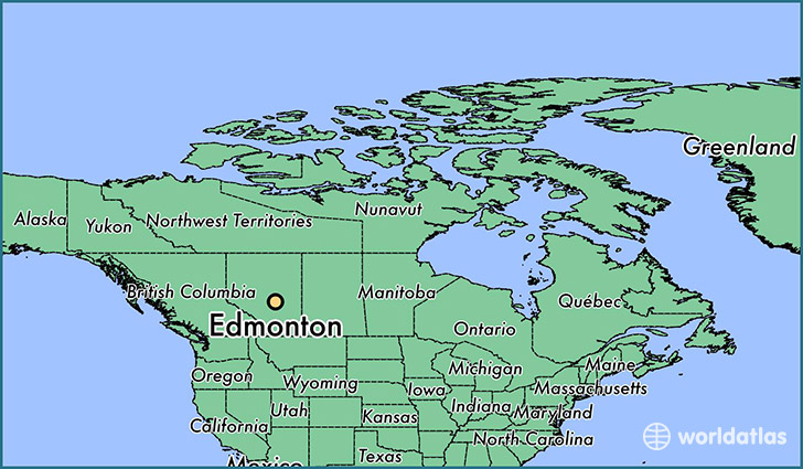
This post will take a closer look at the side of the North American Star Tetrahedron that extends from Edmonton, Alberta, Canada, and will extend the alignment out starting from Ottawa in Canada, across oceans and continents, all the way to Capetown, South Africa. In this process, I will be highlighting some ancient sacred sites and infrastructure, as well as hot spots in our modern history as I start this new series.
The northern apex of the star tetrahedron is Edmonton, Alberta.
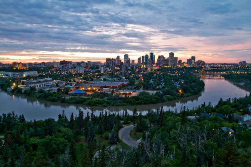
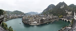
Edmonton is the capital of the Province of Alberta. It sits on the North Saskatchewan River.
Compare the appearance of Edmonton’s location on the bend of this river with this city in Guizhou Province in China:
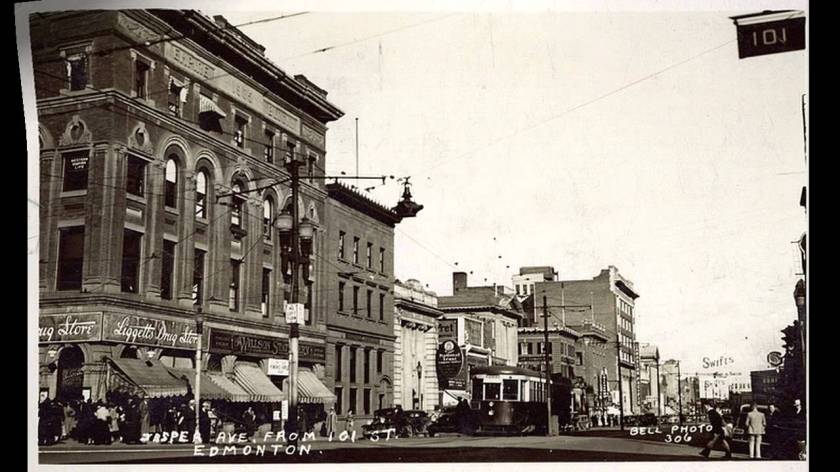
This is a historic view of Jasper Avenue in Edmonton, with building in the foreground on the left with its heavy masonry and arched windows.
And here on the left is the Alberta Hotel, compared with the Detroit Savings Bank on the Top right; the Plaza Hotel in Roswell, NM in the middle; and a building on Kherson, Ukraine on the bottom right.
The is Ft. Assiniboine, a small hamlet in Alberta not far from Edmonton and was founded as a trading post by the Hudson Bay Company in 1824.
The Assiniboine are said to be Plains Cree, and were a major part of an alliance known as the Iron Confederacy, or Nehiyaw Pwat.
And the Ft. Assiniboine, south of Edmonton in Montana, was a U.S. Army post established in 1879, and was abandoned in 1911. It is said to have been established to prevent Sioux chief Sitting Bull from returning to the United States from Canada and to control the local indian population.
This is what the Bachelor Officers Quarters looked like with its turreted tower:
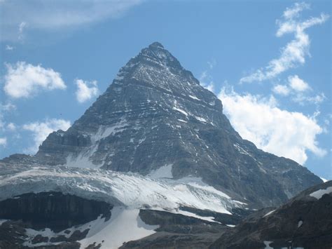
And this is the pyramidal-shaped Mt. Assiniboine, on the British Columbia border with Alberta in what are called the Canadian Rockies.
From Edmonton, this alignment passes through all of the capitals of the Canadian provinces, as well as Ottawa, the national capital of Canada.
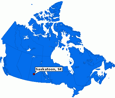
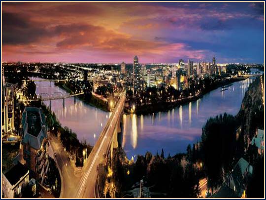
Next is Saskatoon, the largest city in the Province of Saskatchewan.
It straddles a bend in the South Saskatchewan River, and is the largest city in Saskatchewan.
The palatial Delta Bessborough Hotel, said to have been built for the Canadian Pacific Railway from 1928 – 1932.
And more of the same corner architecture and layout in Saskatoon that is seen worldwide:
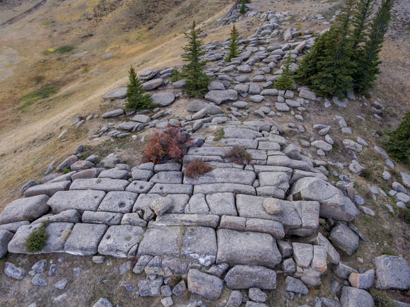
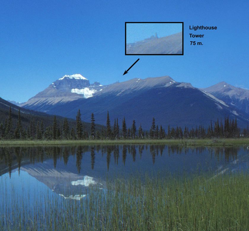
And these are the Cypress Hills megalith, where there was a massacre in in 1873, where a group of American bison hunters, American wolf hunters, American and Canadian Whiskey traders supposedly banded together over allegations of horse theft, and murdered a number of people in an Assiniboine camp. This at least is what the historical record tells us for the reason.
These megaliths are found on Mount Saskatchewan. The lighthouse tower was the name given to a 75 meter pinnacle on the eastern ridge of the mountain. I can’t find a close-up picture of the lighthouse because that would be interesting to see.
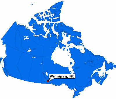
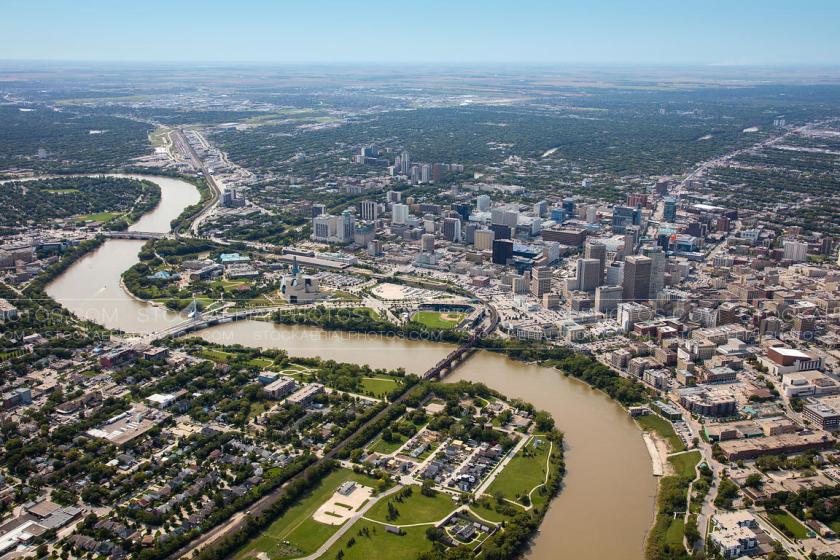
Next is Winnipeg, Manitoba, the capital city of Manitoba…
…and is centered on the Red and Assiniboine Rivers.
Here are some historic buildings in Winnipeg, with the Hudson Bay Company Building pictured on the top, and the Manitoba Legislative building on the bottom left; the Law Courts in the middle; and the Ashdown Building on the bottom right.
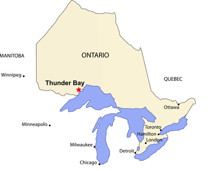
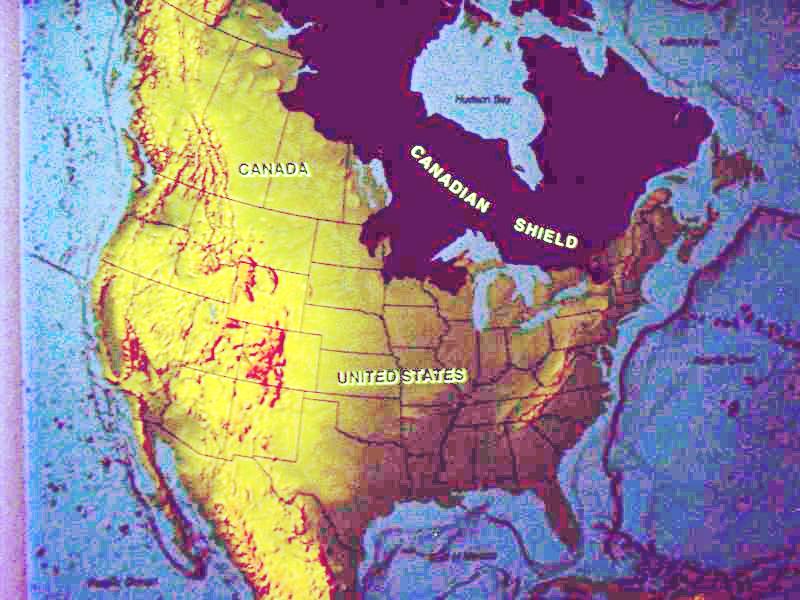
We come now to Thunder Bay, Ontario, on the alignment, and we have crossed into the southern edge of the Canadian Shield, also known as the Laurentian Plateau.
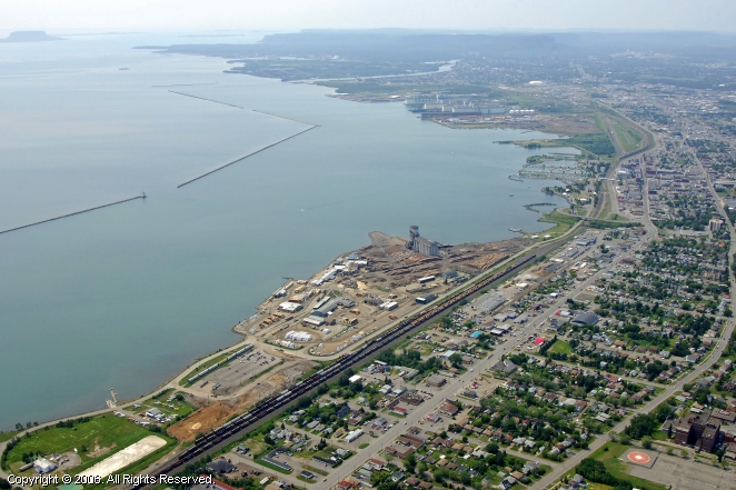
Thunder Bay is the seat of the Thunder Bay District in Ontario and is located at the head of Lake Superior. It was previously known by Fort William and Port Arthur.
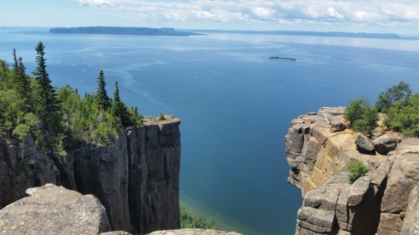
This is known as the Sleeping Giant in at a Provincial Park in Thunder Bay:
The Hudson Bay Company merged with the original trading post located there at Fort William pictured here. So they want us to believe these buildings were the original structures of the area…
…instead of actually these buildings here:
We have also crossed into the southern part of the Canadian Shield, also known as the Laurentian Plateau.
It is called one of the world’s largest geologic continental shelves, of exposed precambrian igneous and high-grade metamorphic rock that forms the ancient geological core of North America. So I want to share some photos with you of what it looks like with all those nice straight edges and angles:
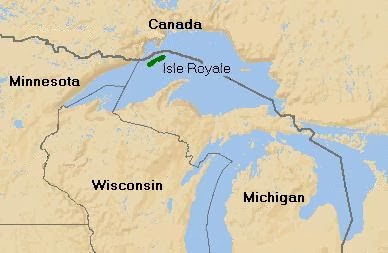
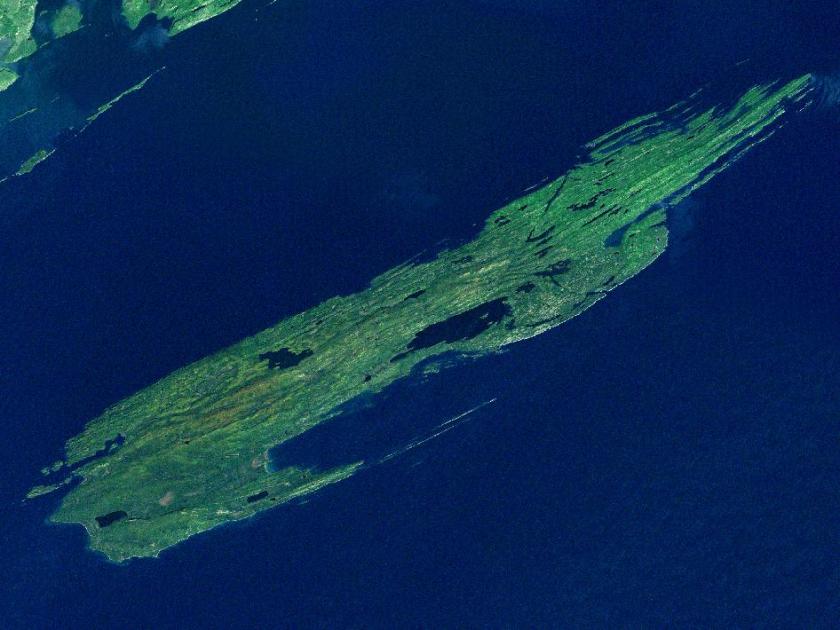
So moving on down this alignment, next is Isle Royale, which is located in Lake Superior. An alignment directly on the Star Tetrahedron goes right through here.
Isle Royale is known for its ancient copper mines. As a matter of fact, the copper from Isle Royale was being mined extensively in the Bronze Age, around 3,000 BC, and was considered the purest copper in the world. And nobody can really explain who was responsible for the mining, and how it got to Europe.
The best they can come up with is also how they explain the people who built the mounds. And they definitely can’t explain how it got to Europe. This a conundrum that confounds the construct that guides our knowledge of history.
Western Archeologists tell us that somehow Indians in loincloths figured out how to mine copper 5,000 years ago, and that somehow, we really don’t know how, it got to Bronze-Age Europe before there was transoceanic trade.
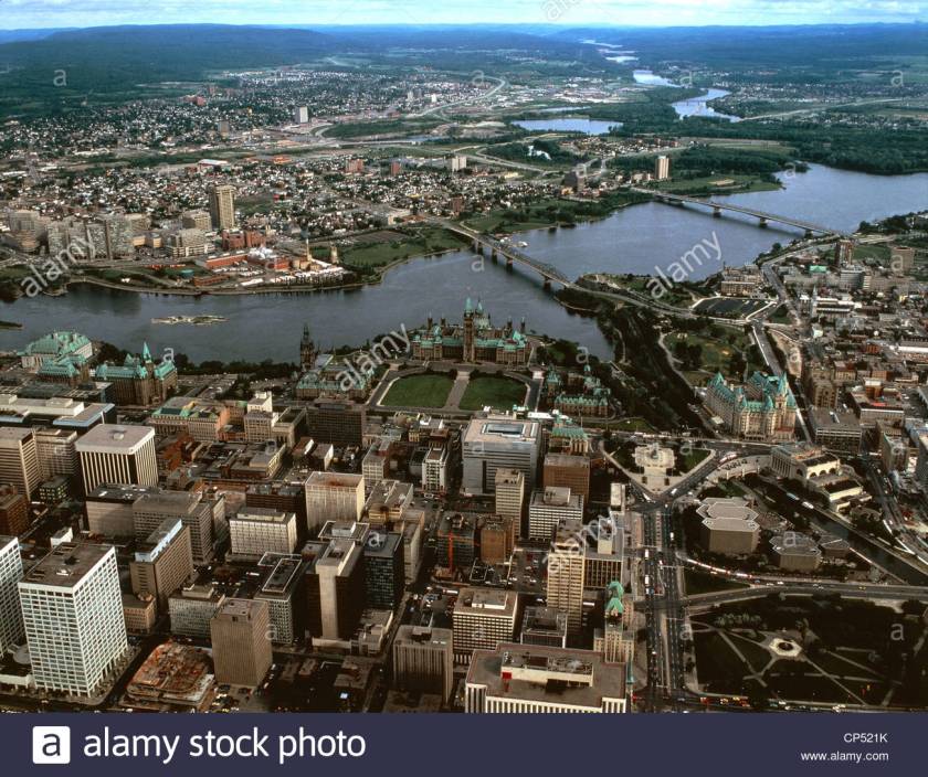
The next stop is Ottawa, Ontario, the national seat of government of Canada.
It stands on the south bank of the Ottawa River in the eastern portion of southern Ontario.
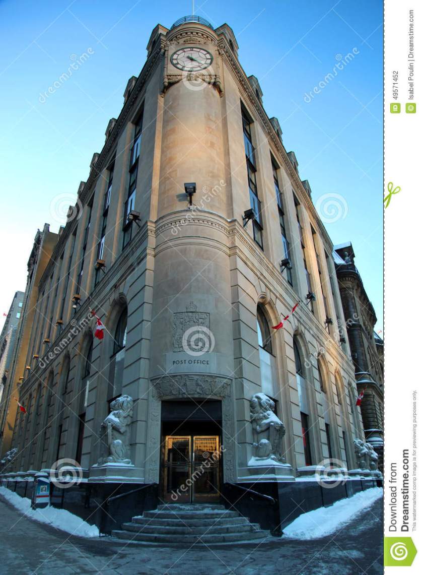
This is a historic post office in Ottawa…
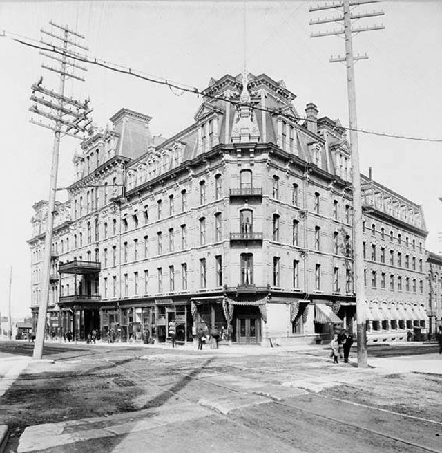
…a historic picture of Ottawa taken in the 1800s…
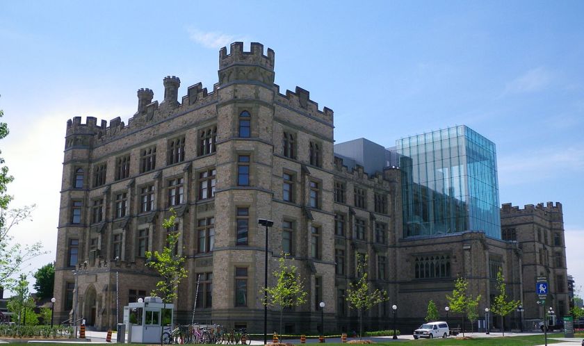
…the Ottawa Museum of Nature…
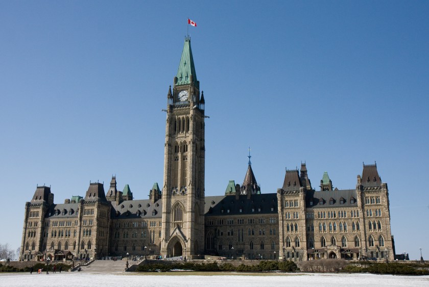
…and the Parliament buildings.
Here is the Rideau Canal in Ottawa, which is a UNESCO World Heritage Site, and connects Ottawa with Lake Ontario and the St. Lawrence Seaway. It is said to have been built in 1832.
I ask the same question that I have raised in previous blog posts about canals, much less all of these buildings with heavy masonry – what technology, based on what we are taught about our history, could have existed at that time, 1832 in the case of Rideau Canal, to build a sophisticated waterway like this? According to our historical narrative, it would have been completed before the Industrial Revolution, which didn’t come to Canada until the 1860s. It quite simply does not match up with what we are taught.
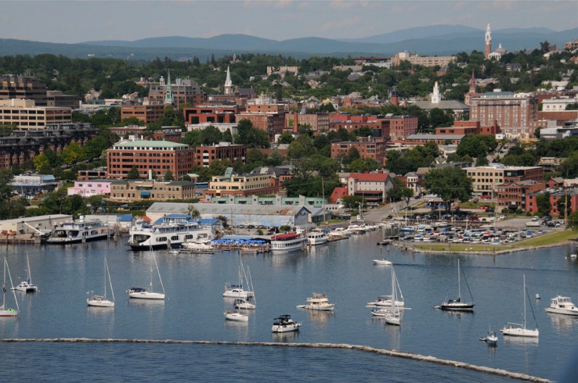
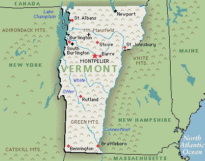
On across the U. S. Border to Burlington, Vermont.
Burlington is the county seat of Chittenden County, and with its population of 50,000 is still the largest city in the State of Vermont. It is located on the eastern shoreline of Lake Champlain.
Here are historic pictures of Burlington:
This is Taconic State Park near Burlington, which has mounds and enormous block-shaped rocks.
I first started cracking the code covering up the Advanced Ancient Civilization in early 2016.
My process was that after I wrote down the places on a particular route by connecting the dots on a globe, I would follow up by looking up images and videos of these places.
One of the first things I realized is that for as much of the ancient civilization as is destroyed, neglected, or incorporated in unprotected places, much is preserved intact in federal, state, and local parks. I must say that to this day, I am never disappointed. I can’t emphasize enough that this Ancient Civilization is everywhere – there is not place in the world that it is not.
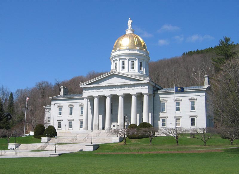
Next the alignment goes through Montpelier, Vermont.
Montpelier is the State Capital…
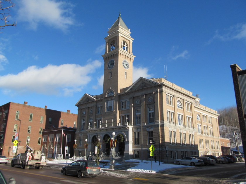
…here is the Montpelier City Hall
…and a building in Montpelier, Vermont, compared with one in Summerside, Prince Edward Island. Not identical architecture, but similar.
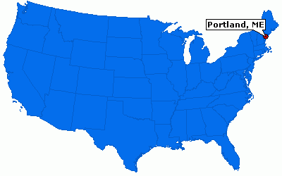
Next we come to Portland, Maine, which is the largest city in Maine, and located on Maine’s Atlantic coast.
This is a comparision of the lighthouse at Portland, Maine on the left, and Peggy’s Cove in Nova Scotia on the right. Lighthouses will most likely be the subject of a future blog post, because guess what….
Completed in 1791, Portland Head Light is the oldest lighthouse in Maine and is located in Cape Elizabeth, at the entrance to the primary shipping channel into Portland Harbor. It was added to the the National Register of Historic Places in 1973.
Also, here is a street view of Portland on top, compared with a very familiar look to me from other cities in very different places – bottom left is Edinburgh, Scotland; middle is from Zagreb, Croatia; and on the bottom right is Ellicott City, Maryland.
This is the end of this first post, where we leave Maine to cross over to the Canary Islands in the Atlantic Ocean.
The Ancient Ones don’t refer to a people that existed a long time ago. It refers to an ancient people that are alive and living in the present day, who were the Moorish Master Builders of the planet.
This is a video montage, with music but no narrative, acknowledging them and their remarkable legacy, put together with pictures in previous blog posts.
Music: At the Shores of Remembering Artist: Angel Sananda


")