Circle Alignments on the Planet Algiers – Part 3 Conakry, Guinea to Manaus, Brazil

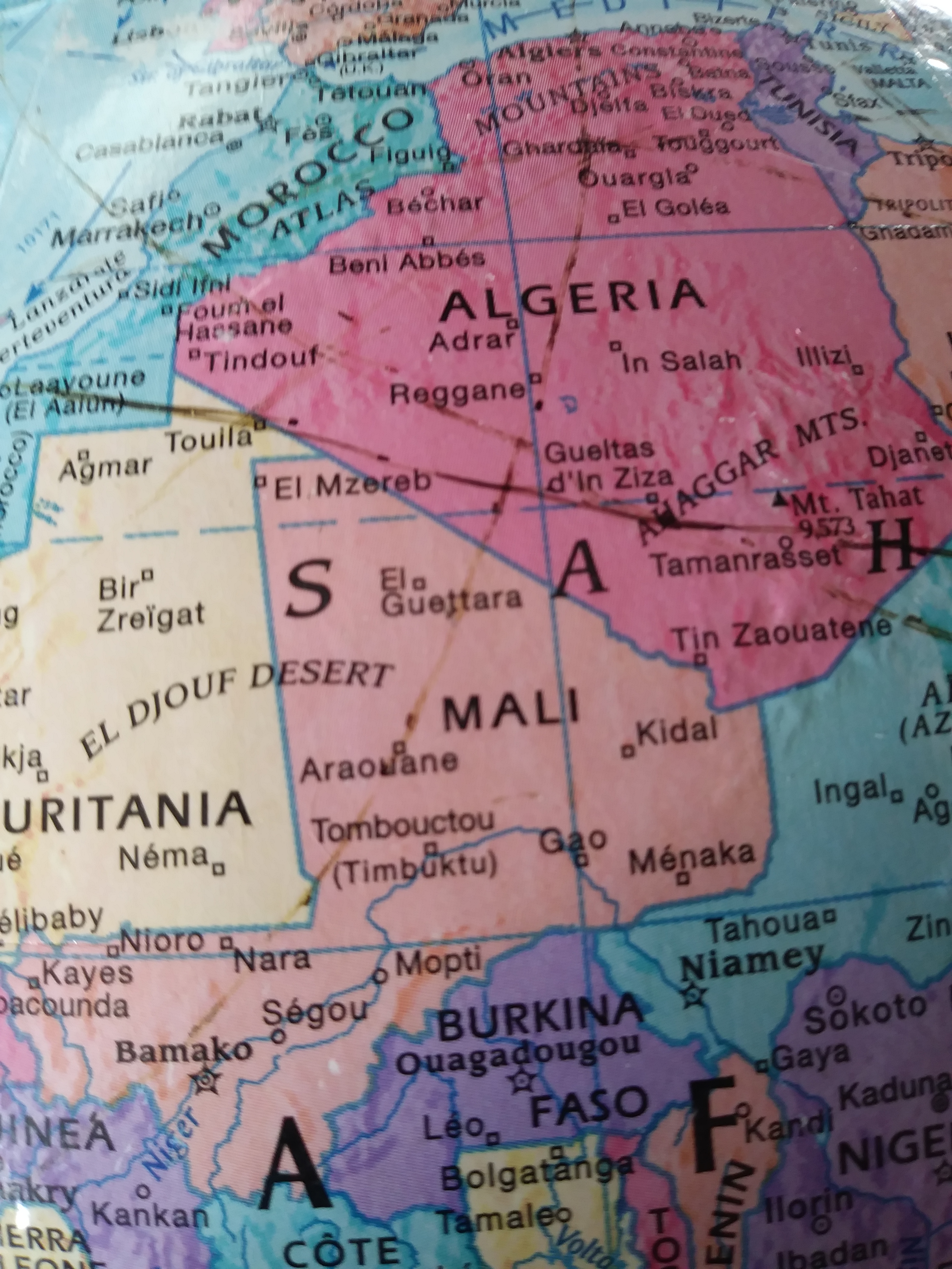
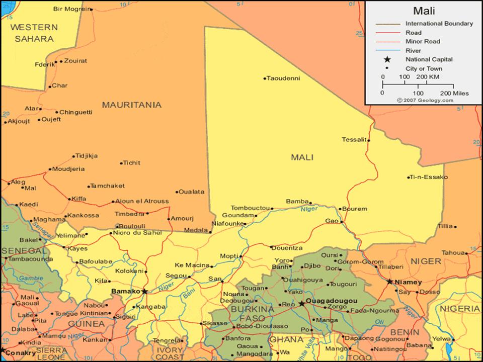
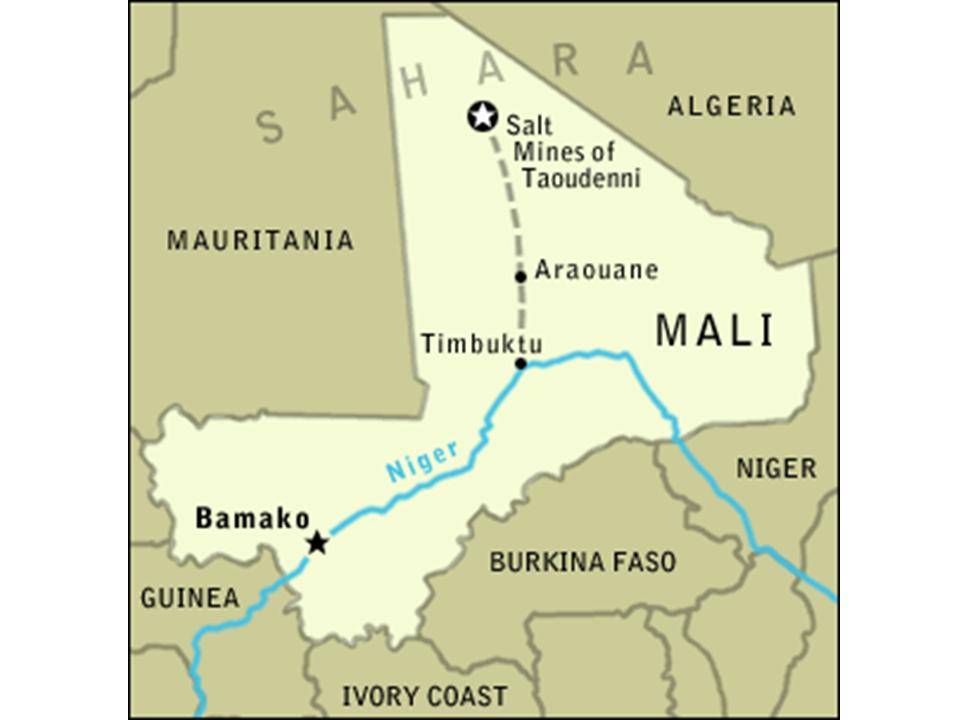
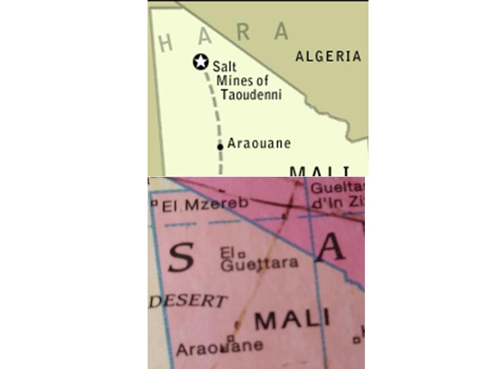
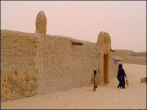
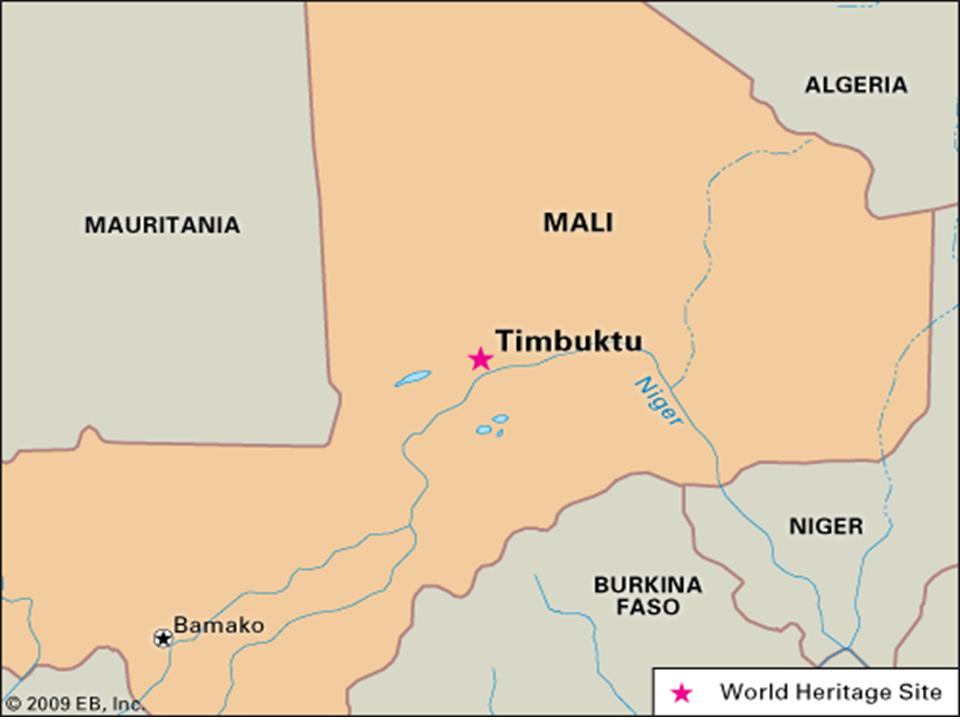
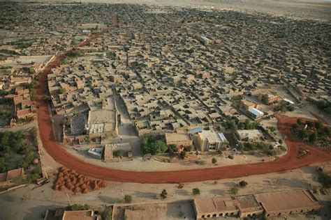
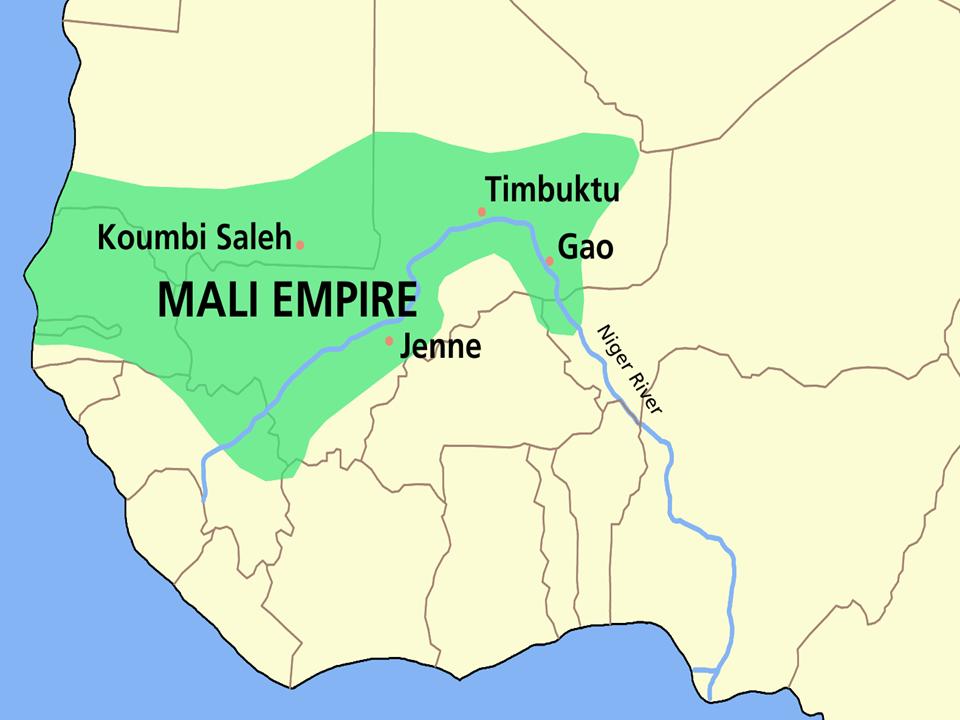
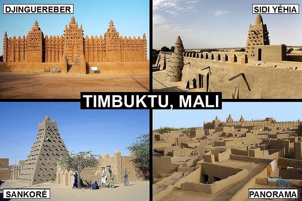
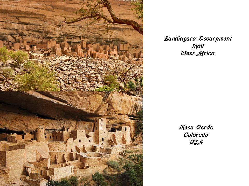
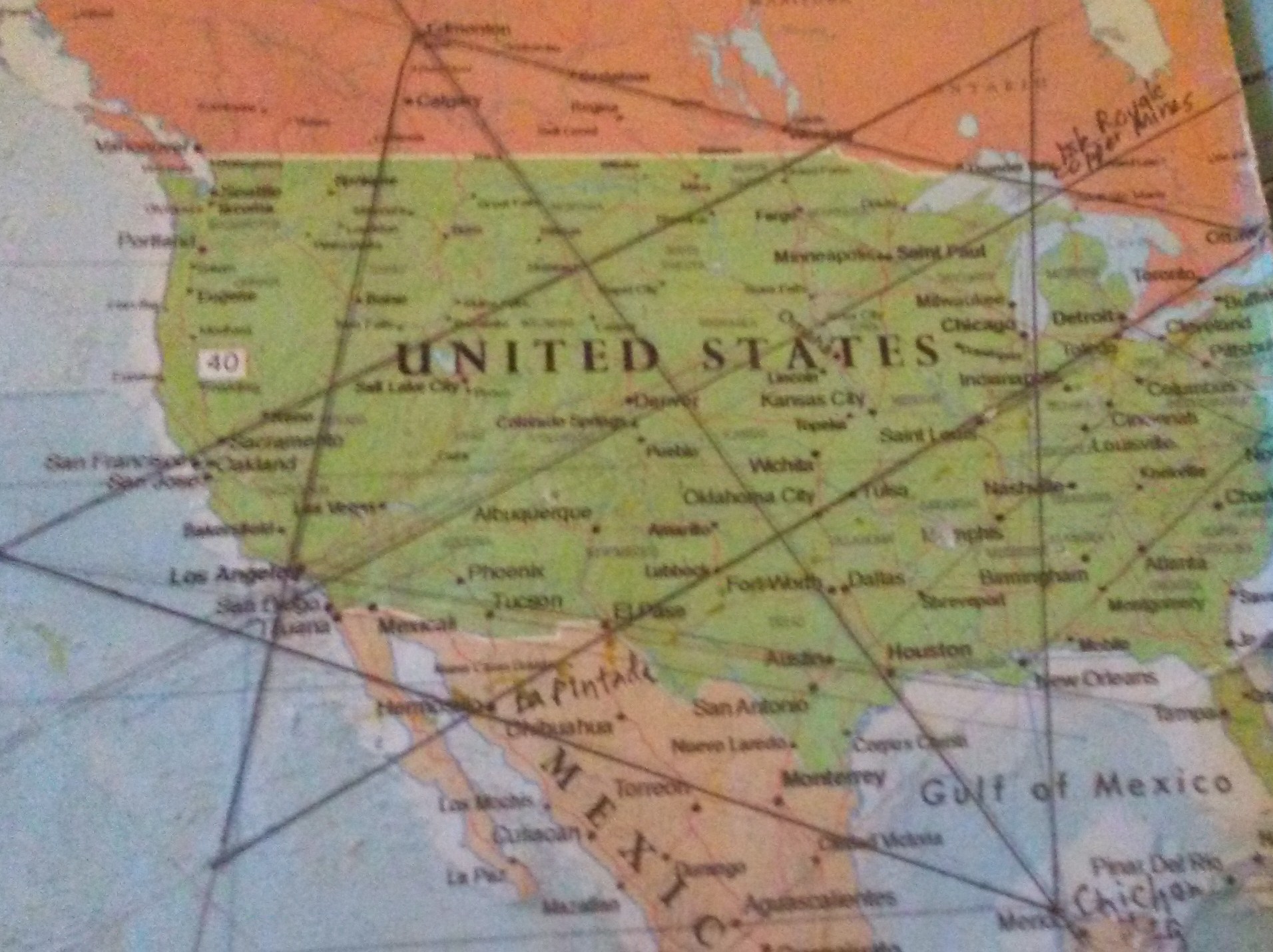
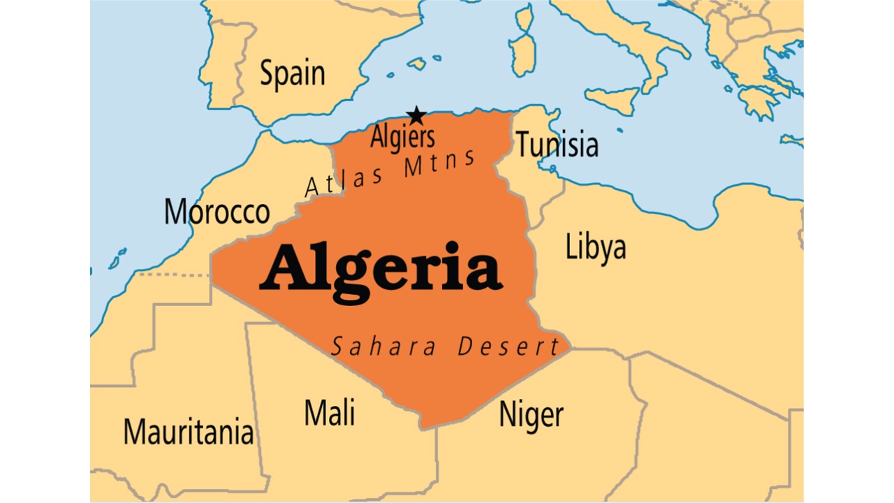
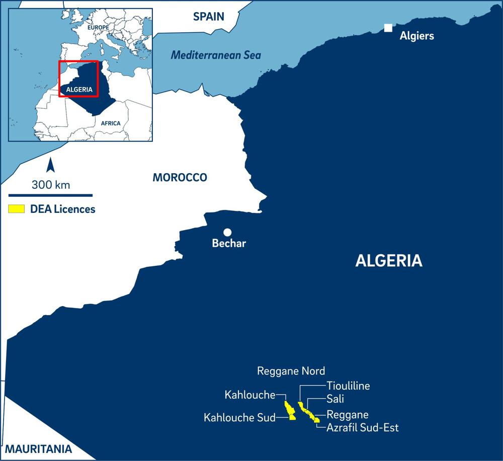
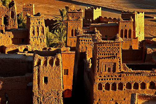
So far in this series originating in Algiers, Algeria, we have tracked this circle alignment across the Atlas Mountains and Reggane in Algeria, and delved into the illustrious past of Mali as we passed through or near its ancient cities, including Araouane, Timbuktu, Djenne, and ending up in the capital city of Mali ~ Bamako.

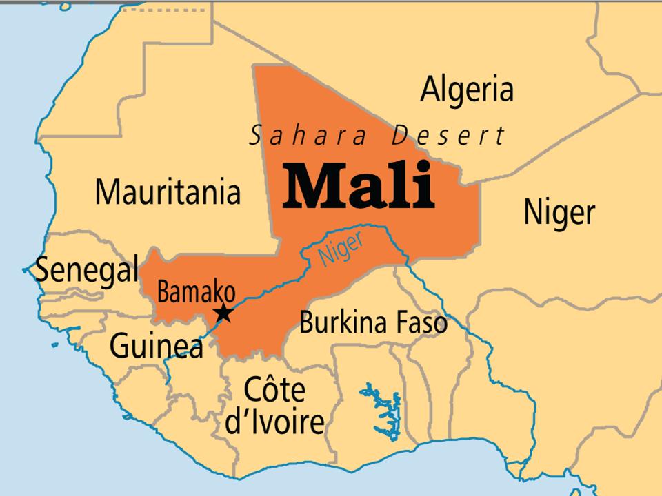
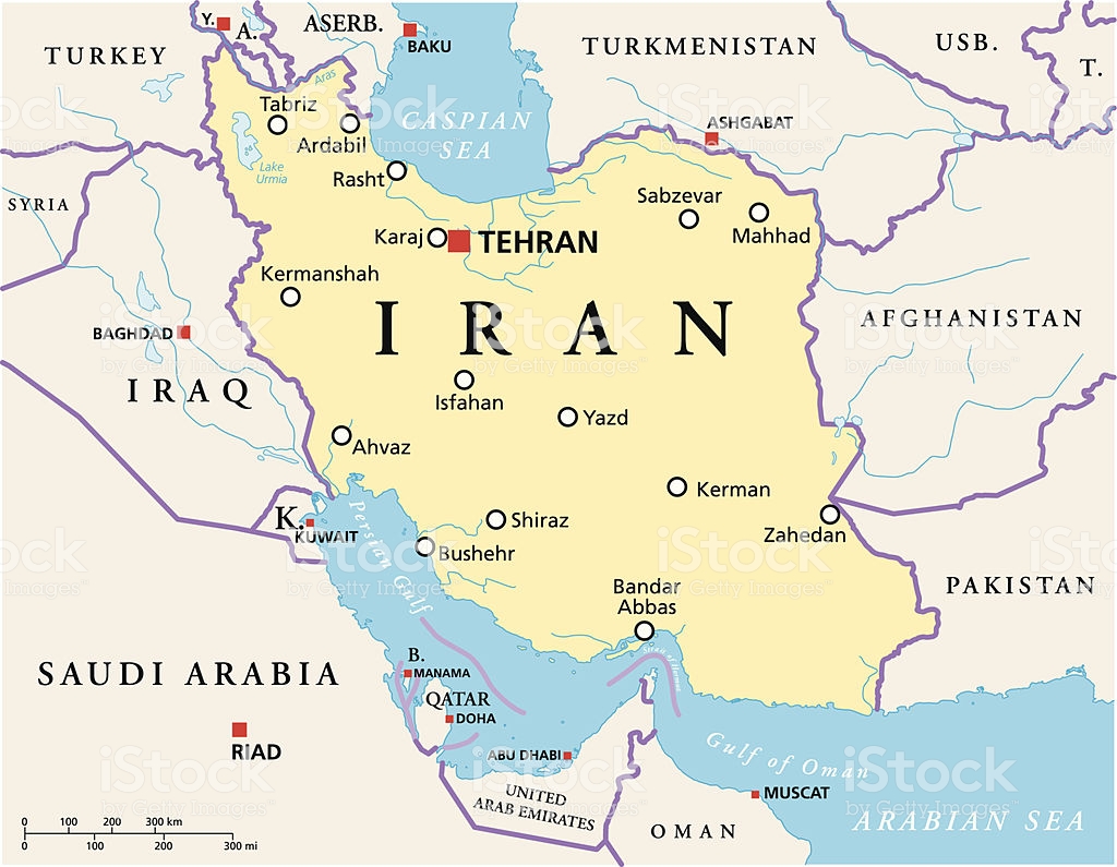
In this post, I am picking up the alignment in Guinea, initially in Conakry, Guinea.

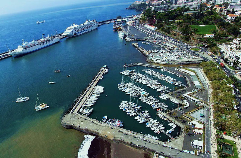
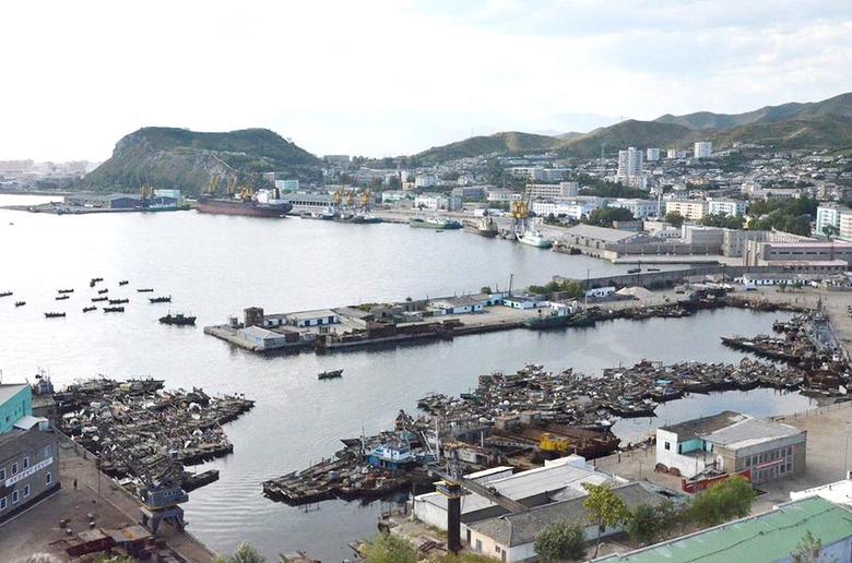
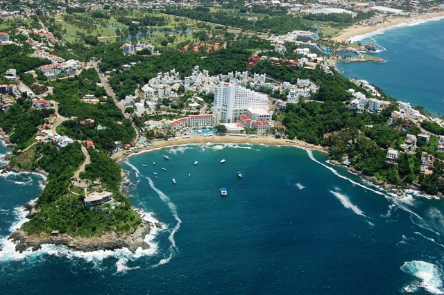
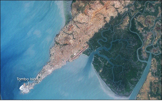
Conakry is a port city, and the capital and largest city of the country of Guinea.

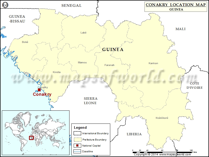
Conakry was originally situated on Tombo Island, and it has spread up the Kaloum Peninsula over time.

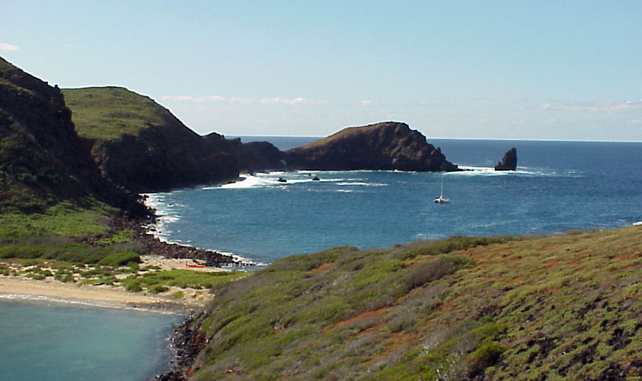
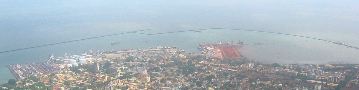
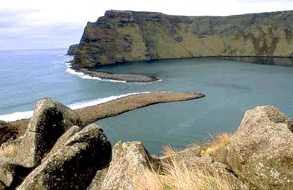
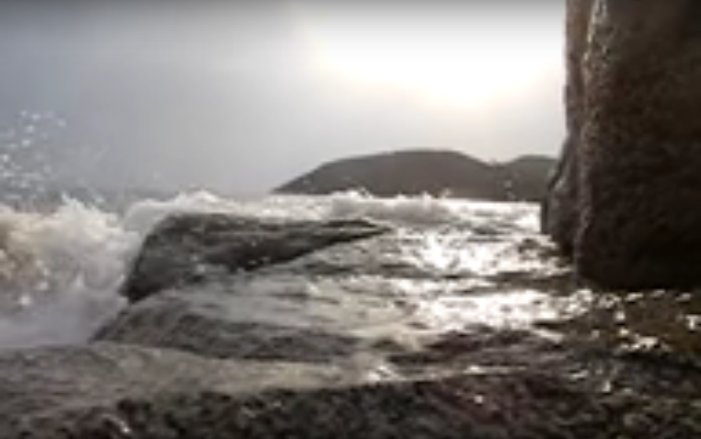
This is a view of the harbor of Conakry, with its long, narrow jetties, like what is found in other places found around the world. Again, we have no other information to go by, so we assume the jetties were built in recent times because that is what we are told. Conakry was said to have been founded in 1887 after the British ceded the city to the French, but I don’t believe that. What we know as modern history appears to be grafted on top of an advanced civilization that we know nothing about. My blog is dedicated to providing compelling evidence for why I say this.

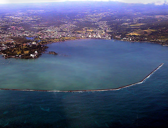
This is the jetty at Hilo Bay on the Big Island of Hawaii…

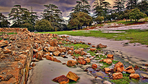
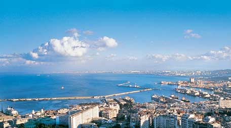
…and this is the one in Algiers, Algeria.

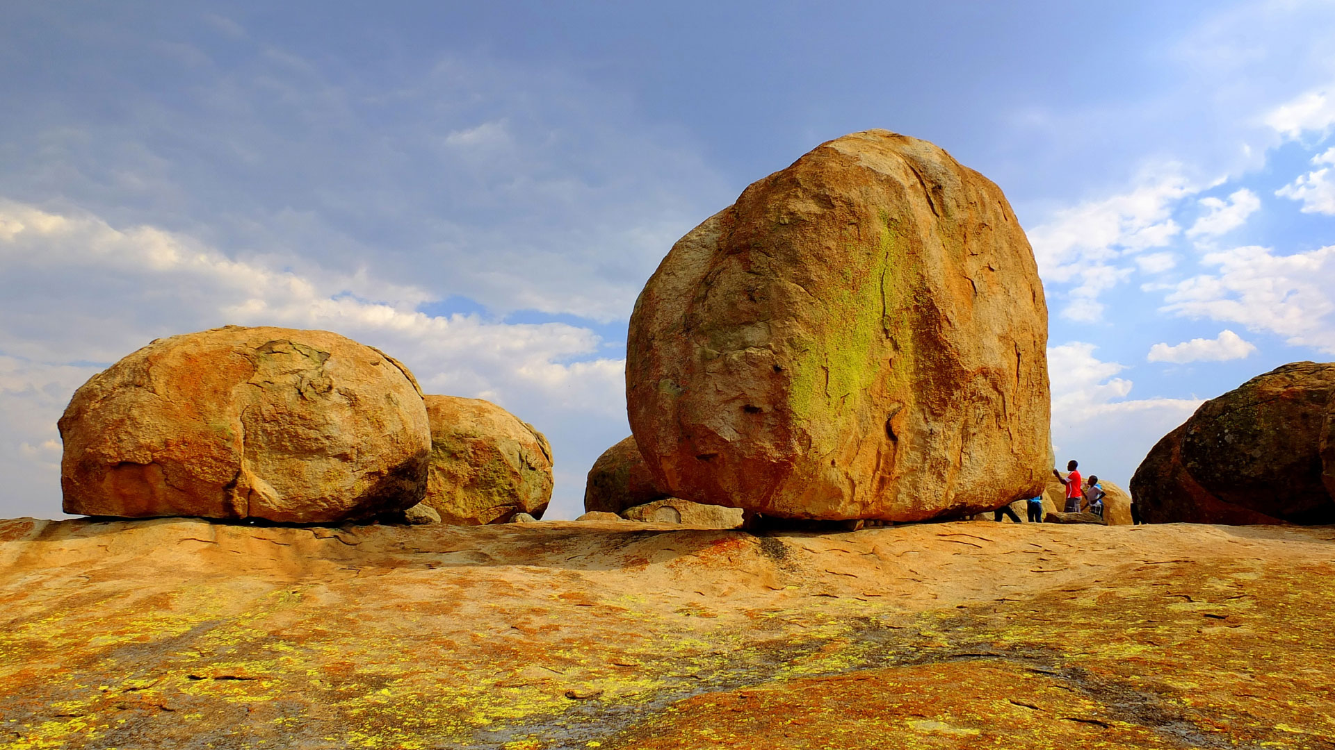
The Ancient Advanced Civilization was a Maritime Civilization of Master Builders.

To underscore what I am saying about this, here are other examples at very different places. This type of jetty is at St. Paul Island, in the French Subantarctic Islands in the South Indian Ocean, in the vast expanse of ocean between Amsterdam Island and Antarctica…

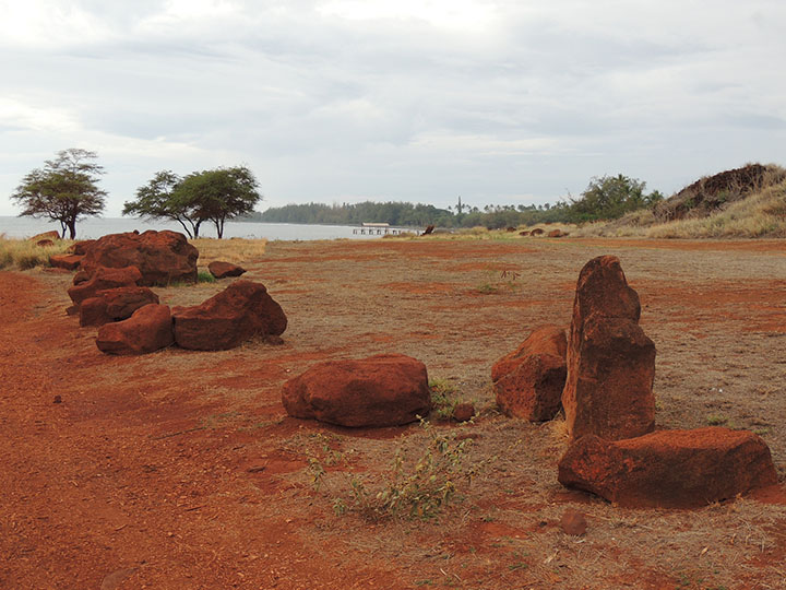
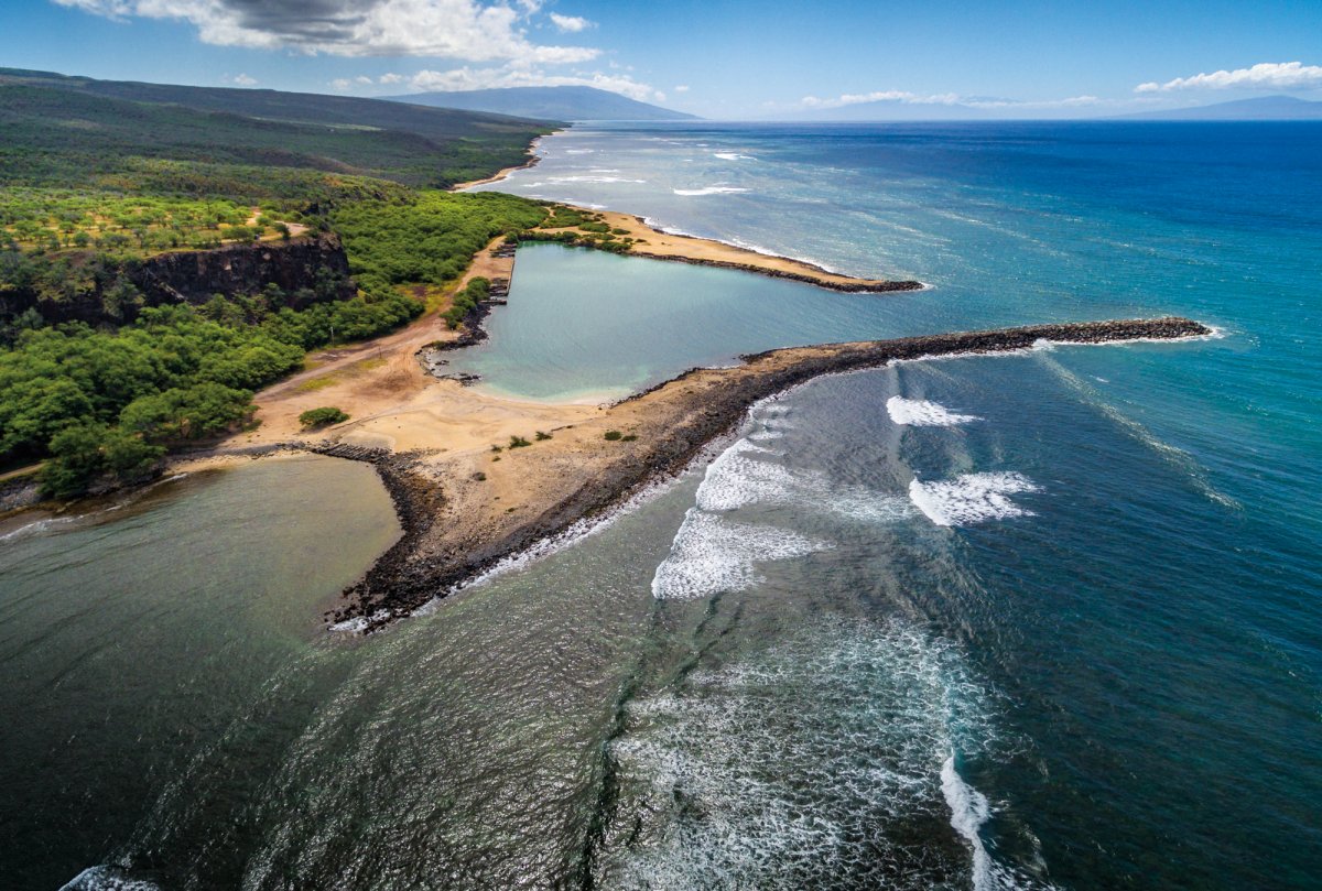
…which is similar to this one found on the island of Molokai in the Hawaiian Islands.

All of these small and large harbors with jetties I have just shared are found on planetary alignments.

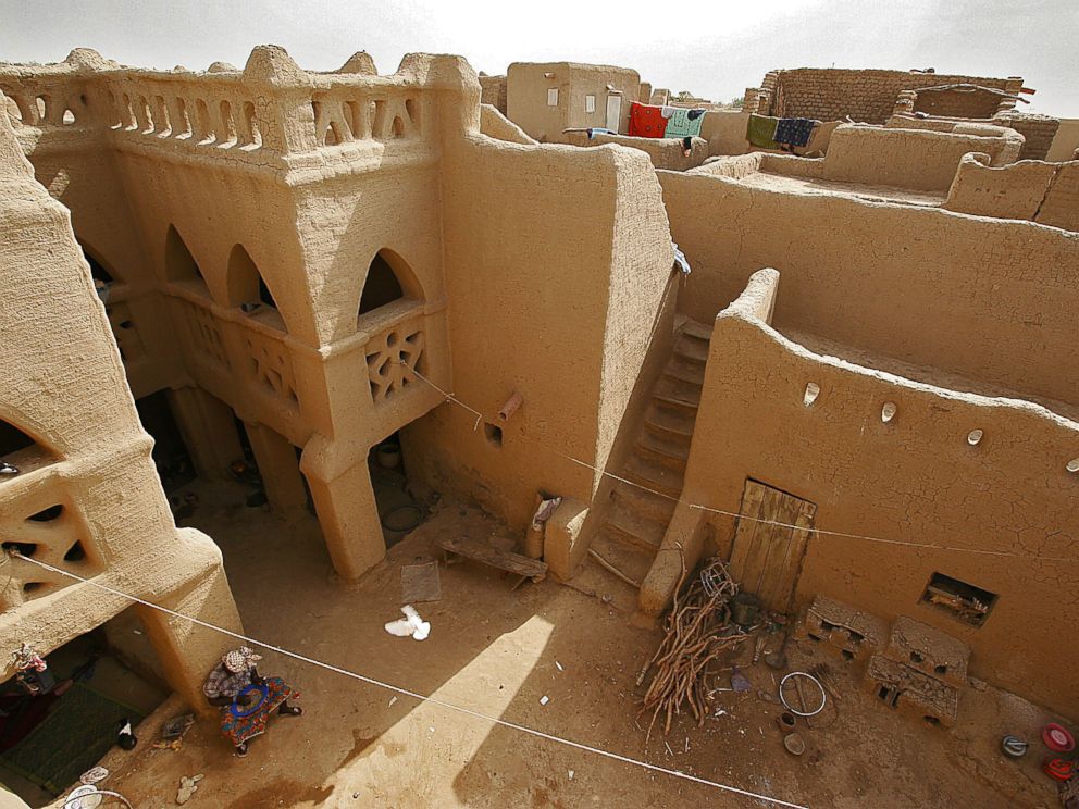
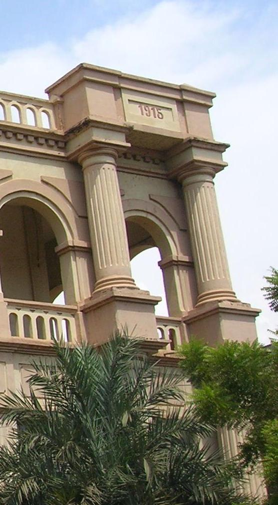
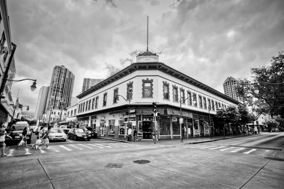
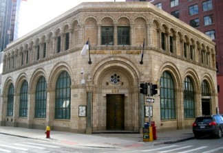
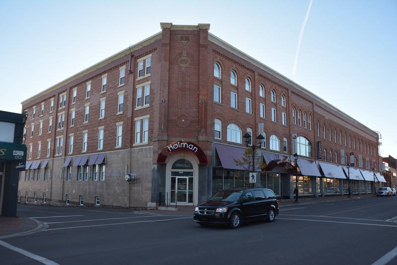
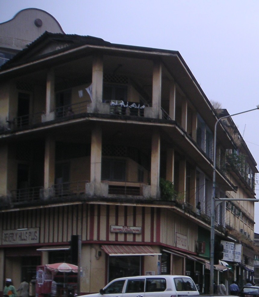
I have also found the same street-corner-style architecture all along the alignments around the world, right down to the angle of lay-out.

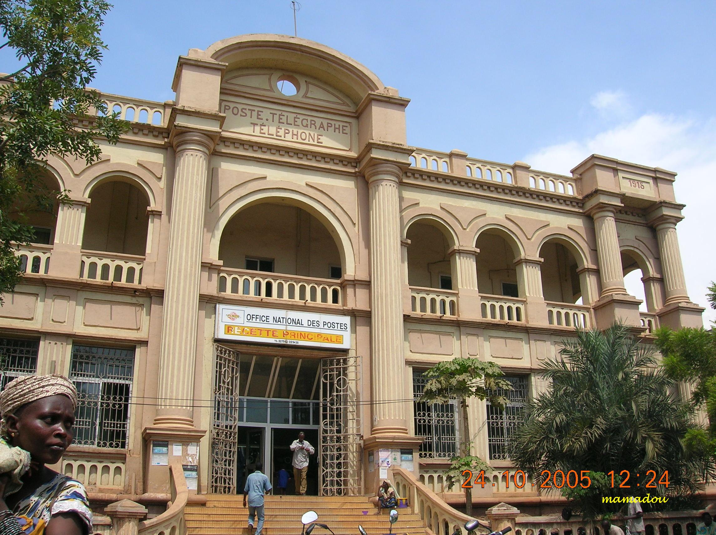
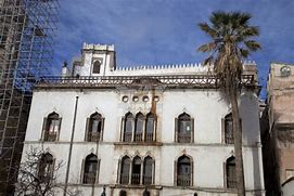
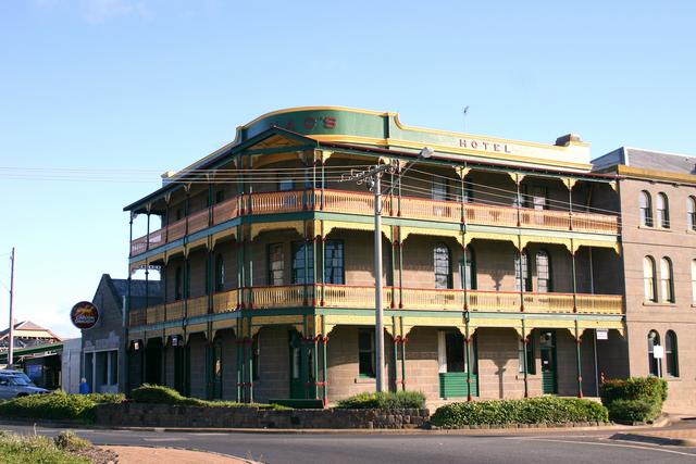
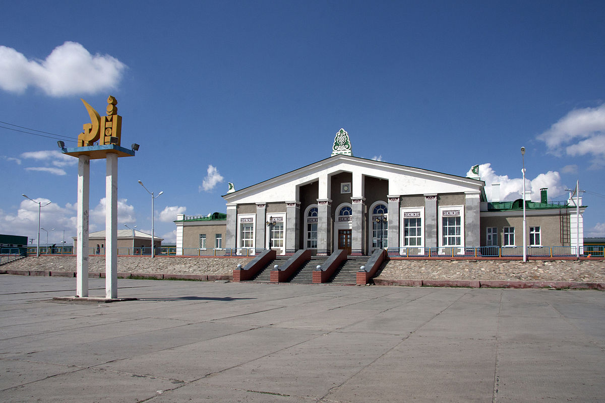
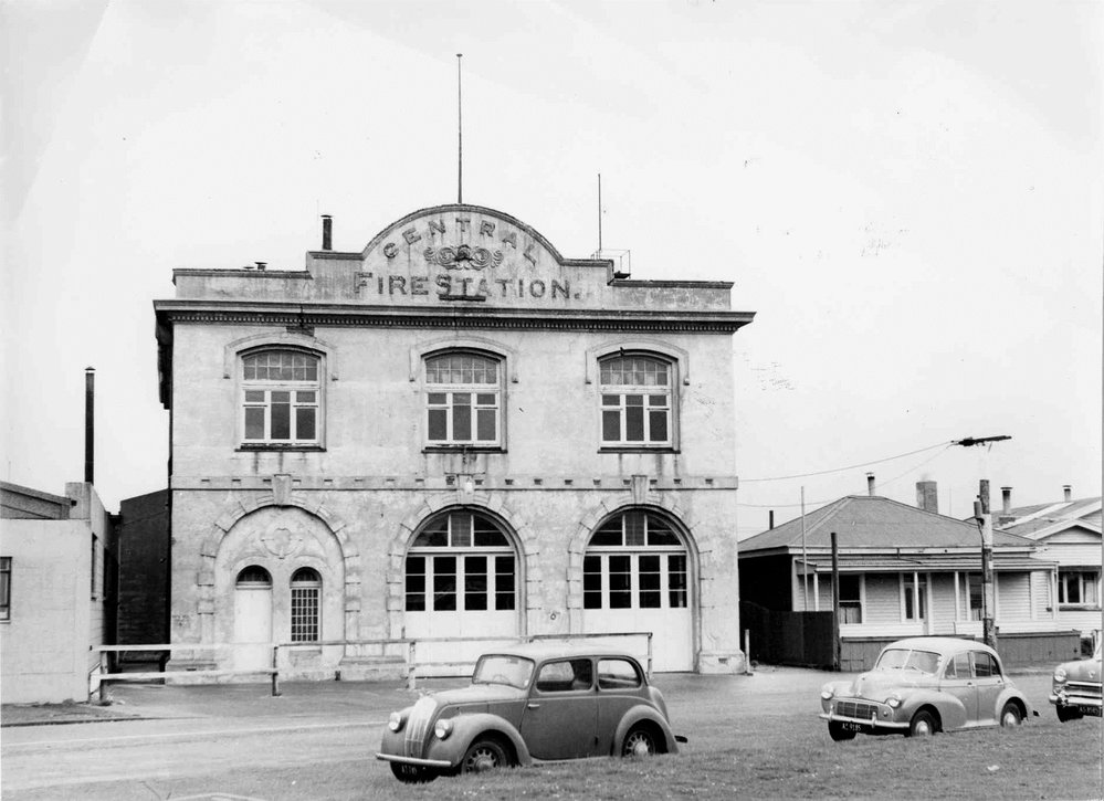
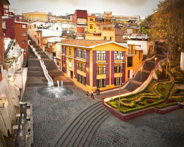
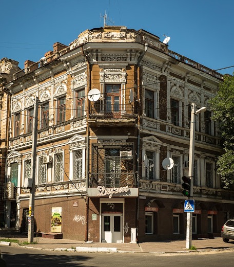
This building is in Conakry, Guinea…

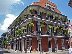
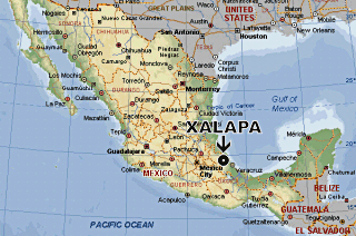
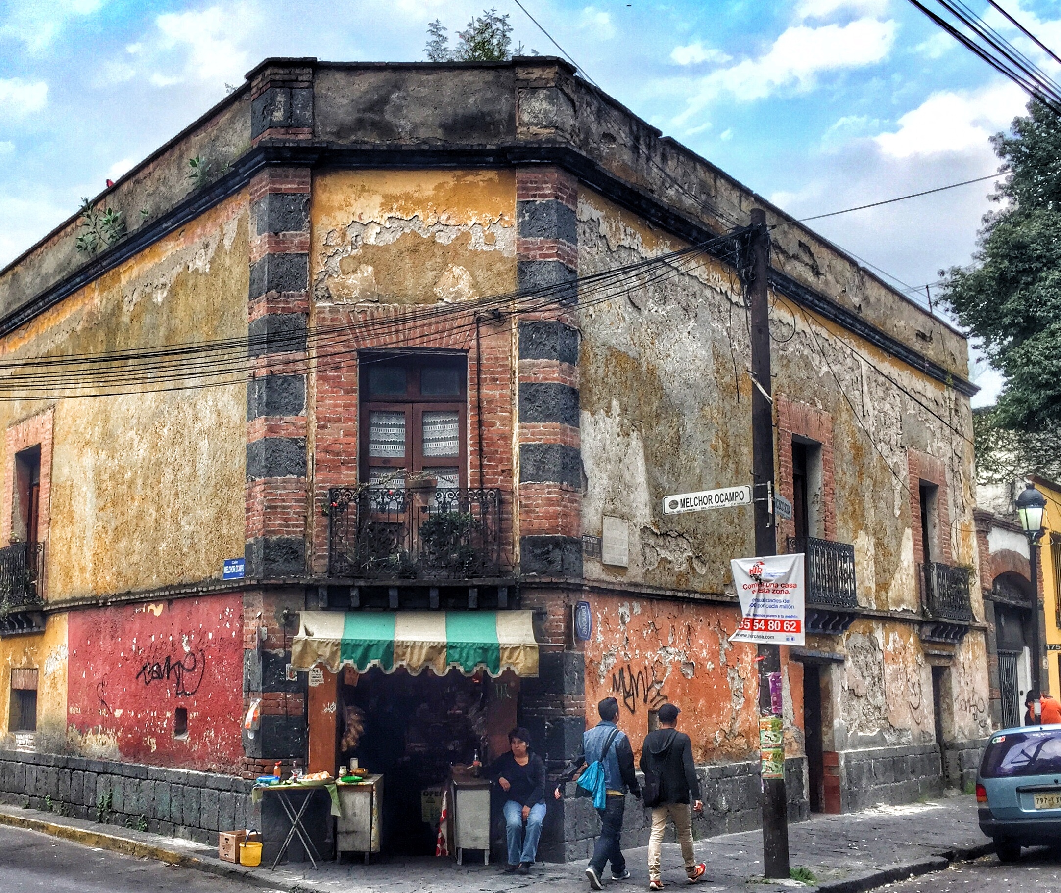
…compared with this one in Juarez, Mexico…

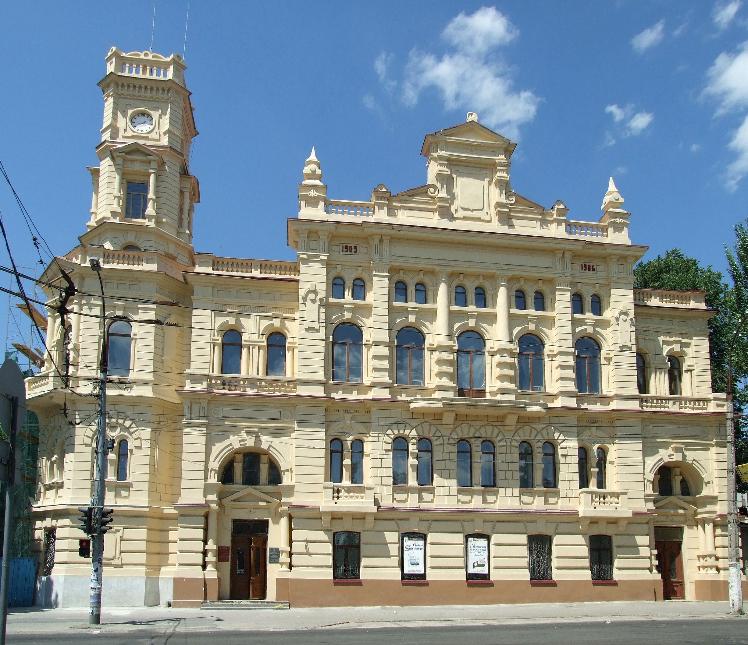
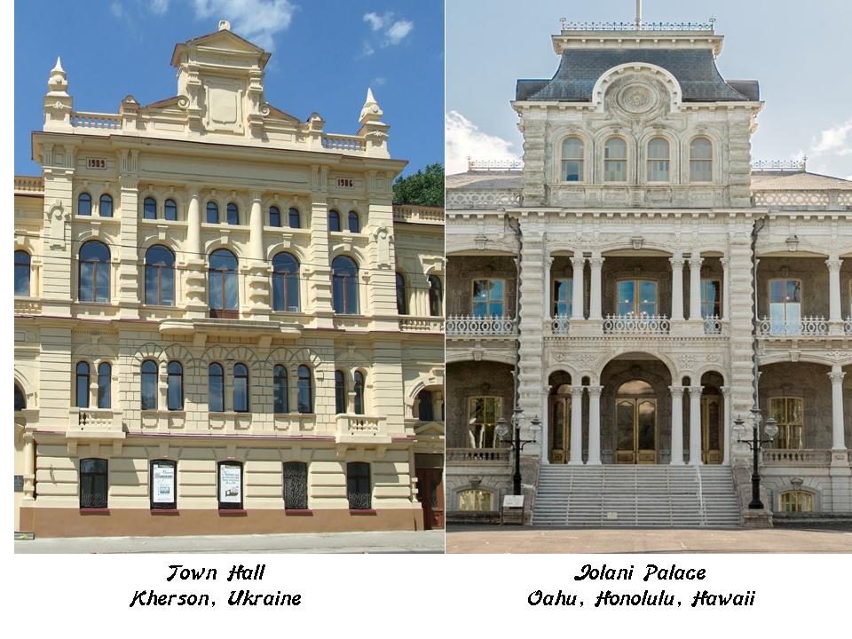
…this one in Kherson, Ukraine…

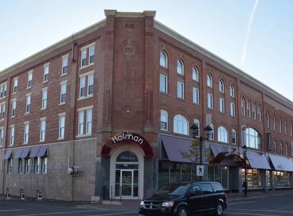
…and this one in Summerside, Prince Edward Island, one of the Canadian Maritime Provinces, along with Nova Scotia and New Brunswick.

And these are just a few examples. I have, and can find, many more of the exact same building lay-out at the same angle all over the world.

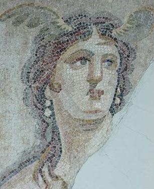
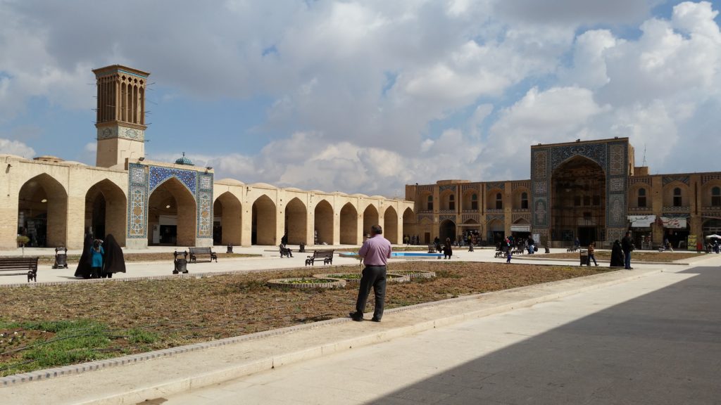
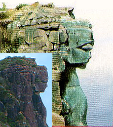
There is an example of simulcra in Guinea. Simulcra is a representation or imitation of a person or thing. Places well-known for simulcra are Markawesi in Peru, and the Bucegi Mountains in Romania.

Guinea is home to the “Lady of Mali,” found on Mount Loura, close to the country’s border with Mali, north of Conakry. Some say natural feature, some say carved sculpture. Either way, she has attracted the attention of researchers into this type of thing, and the type of stone is granite.

I also want to bring your attention to a small village in Guinea near the border with Mali, and also on this circle alignment.

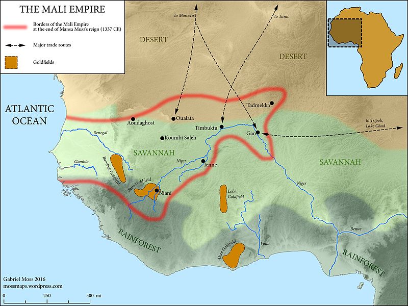
Niani was the birthplace of Sundiata Keita, the founder of the Mali Empire in 1230 A.D.

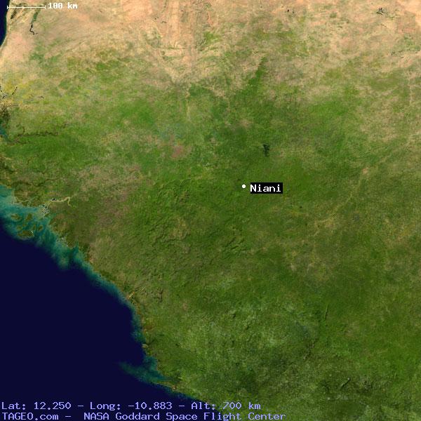
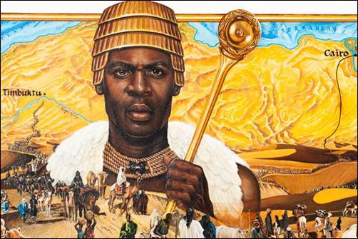
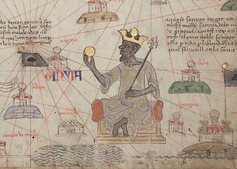
Its former glory long-gone, Niani became the capital of the Mali Empire. It sits in the Bure Goldfield, and along with the Bambuk gold field, which was part of the vast wealth of the Mali Empire. Mansa Musa, believed by some to have been the wealthiest man in the history of the world, was its ruler from 1312 – 1337.

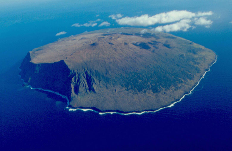
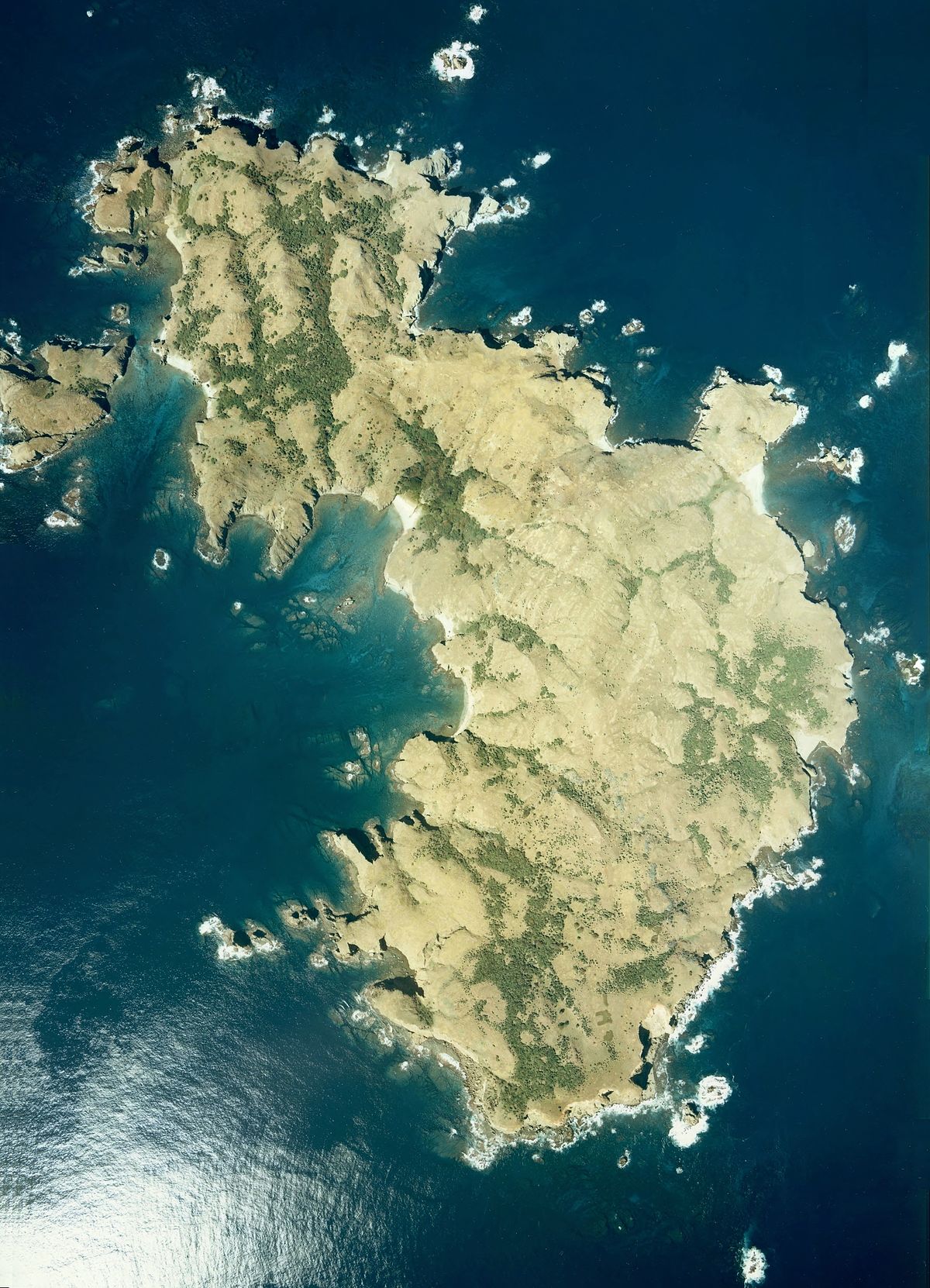
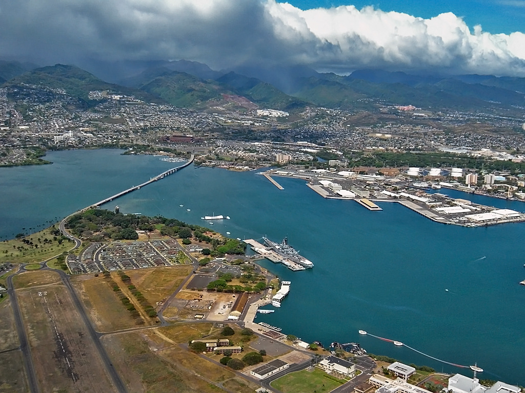
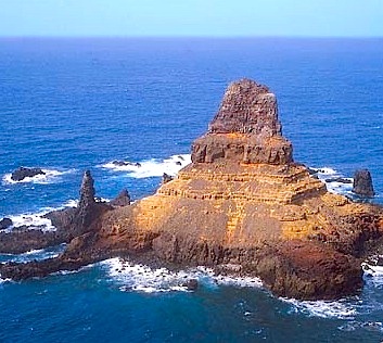
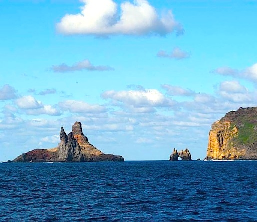
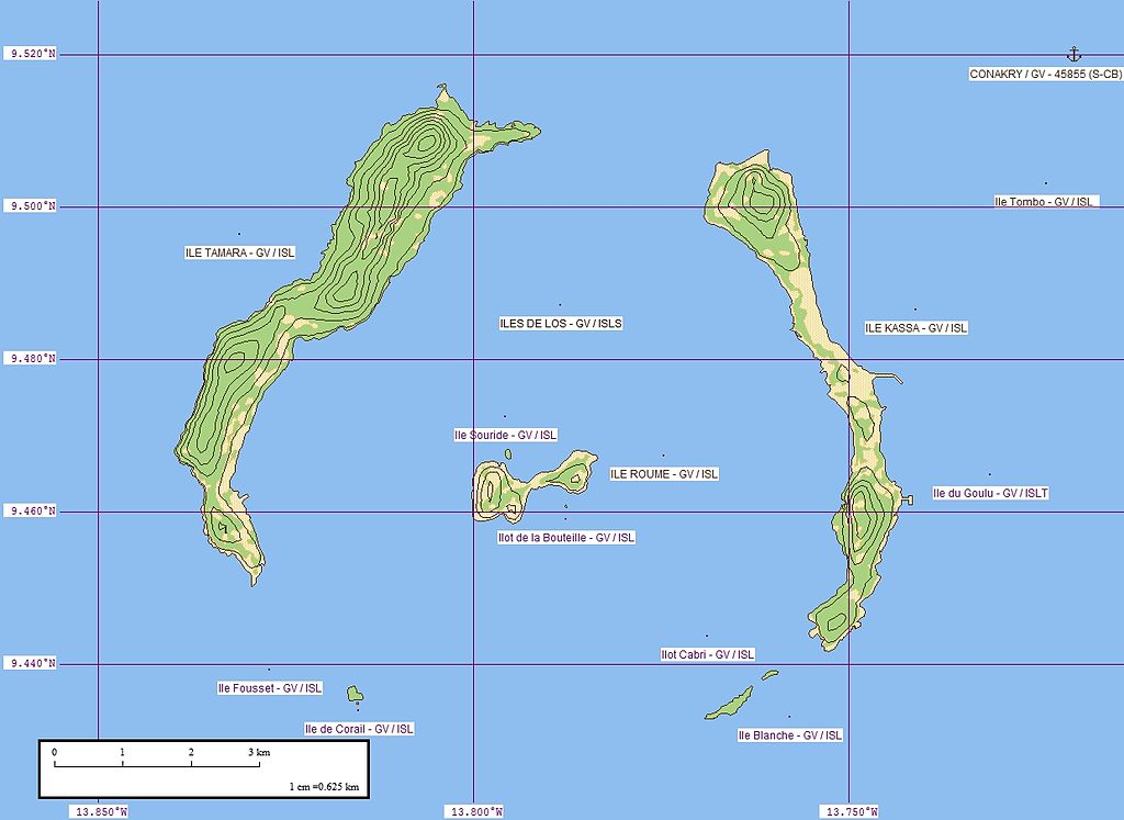
Just off the coast of Guinea at Conakry, we find the Loos Islands of which is closer to shore, the original site of Conakry. I always find interesting things on the islands of earth’s planetary alignments. Let’s see what we find here.

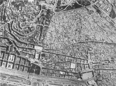
There are three main islands, as shown on this map: Tamara on the left; Roume in the middle, and Kassa on the right.

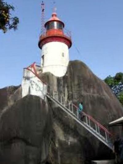
Tamara is known for its lighthouse. Interestingly, it sure looks like it is encased in solid rock!

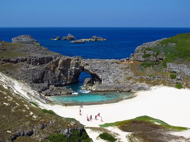
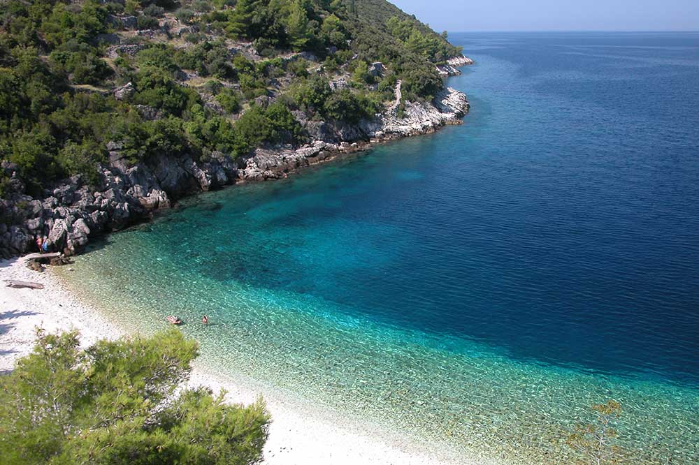
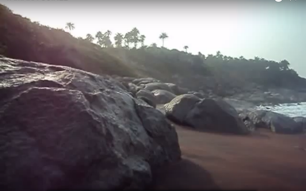
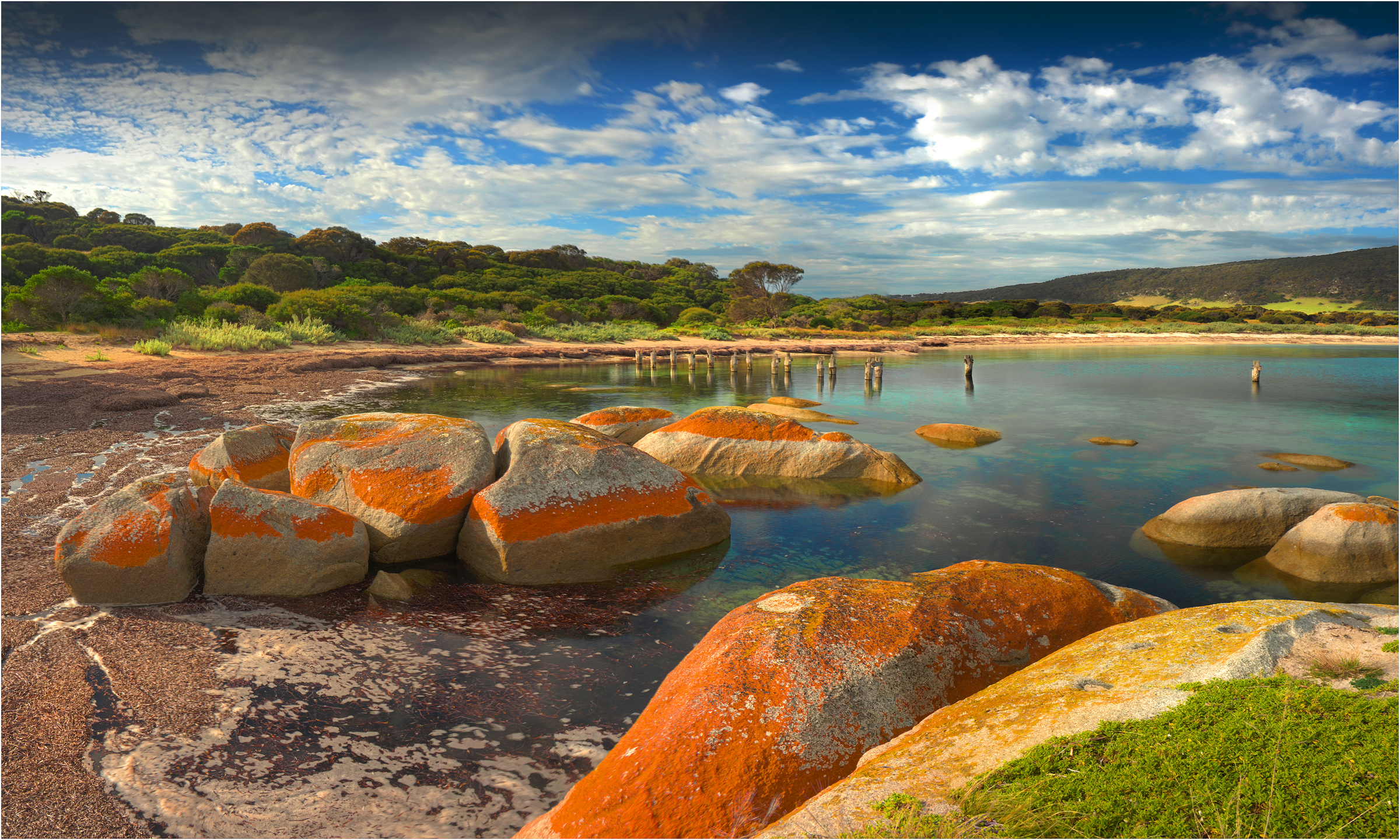
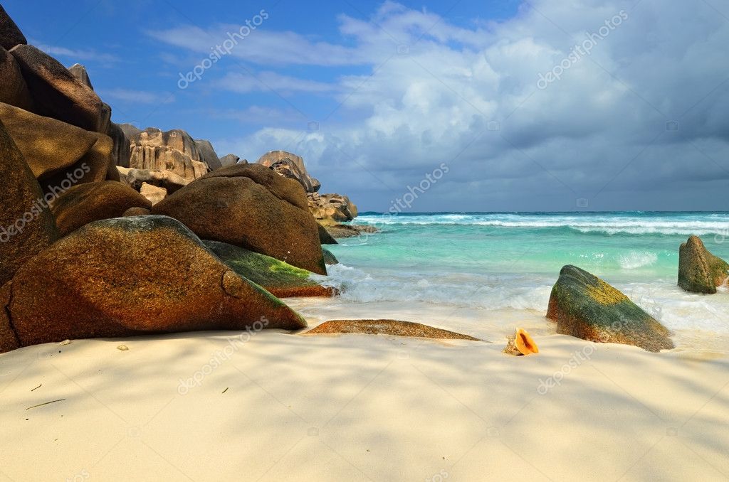
Here is a photo of one of Tamara’s beaches…

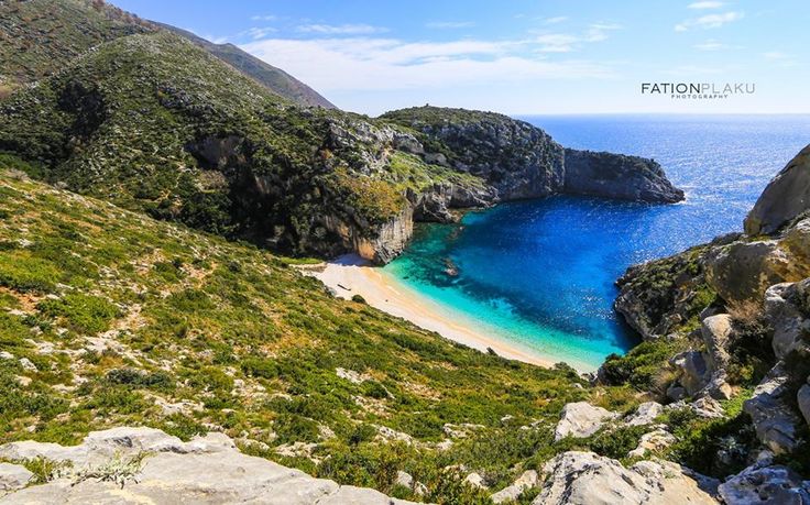
…compared with this beach on Flinders Island in the Flinders-Furneaux Group off the coast of Tasmania, on a different alignment…

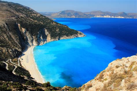
…and this beach in the island Republic of Seychelles, located off the coast of East Africa in the Indian Ocean, on a completely different alignment from the first two.

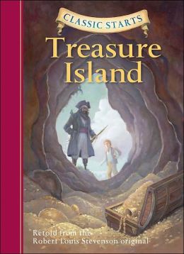
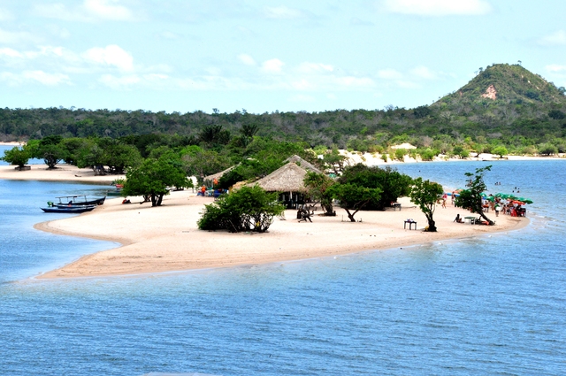
Roume, the small island between Tamara and Kassa…

…is said to have inspired the novel “Treasure Island,” published in 1883 by Robert Louis Stevenson, a classic story about buccaneers looking for gold treasure.

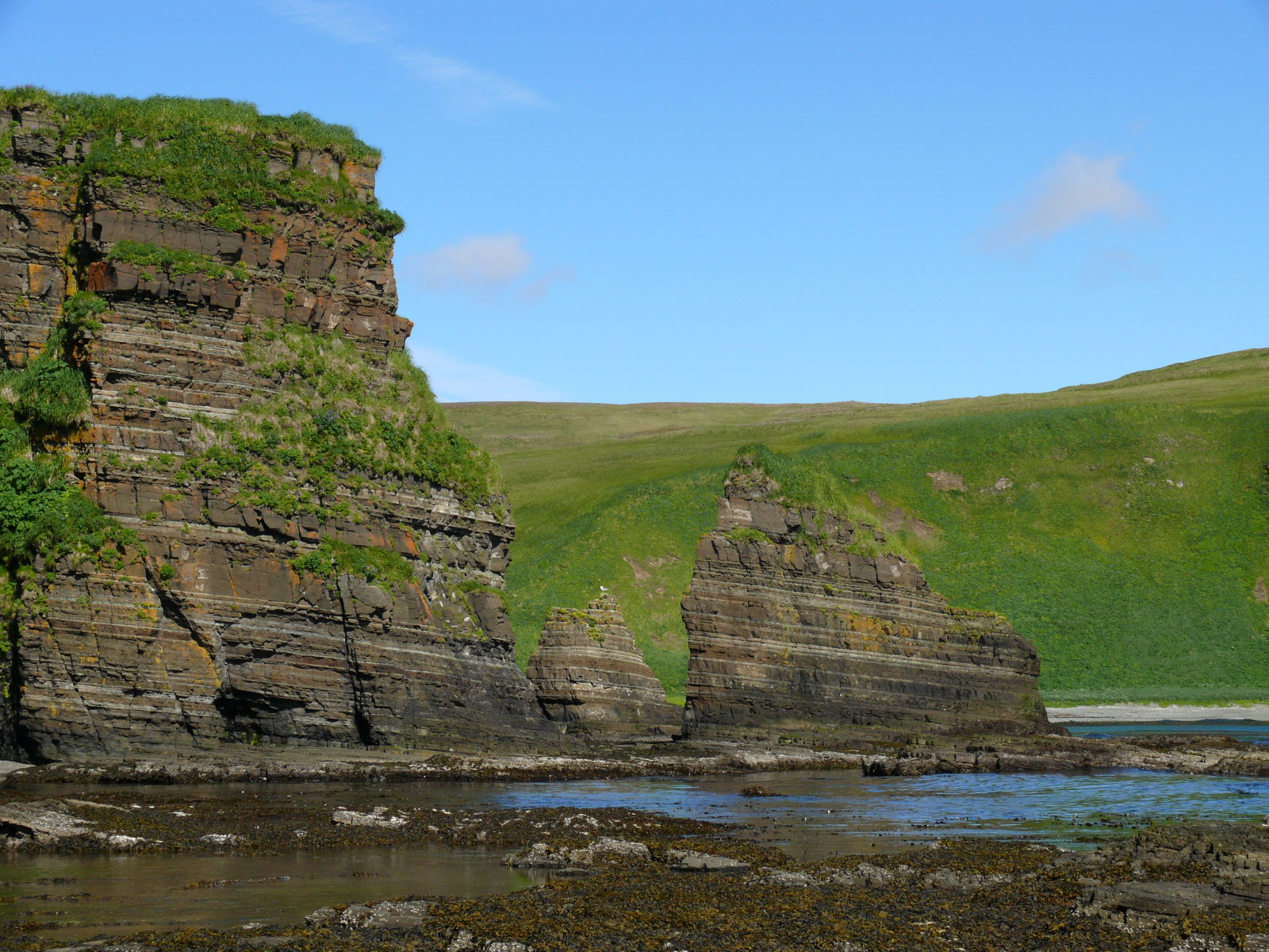
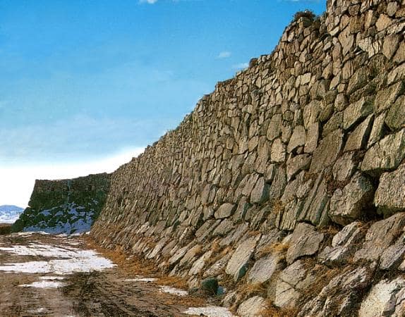
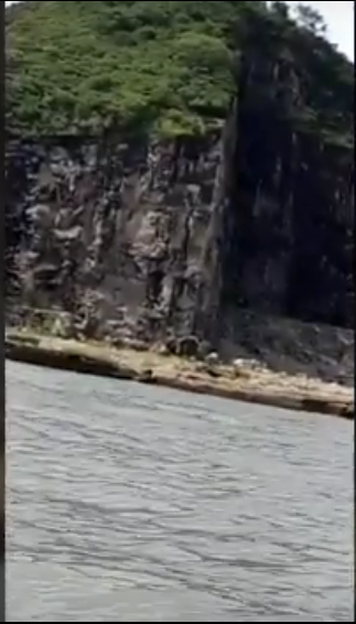
This rock-wall-like place is also found on Roume Island.

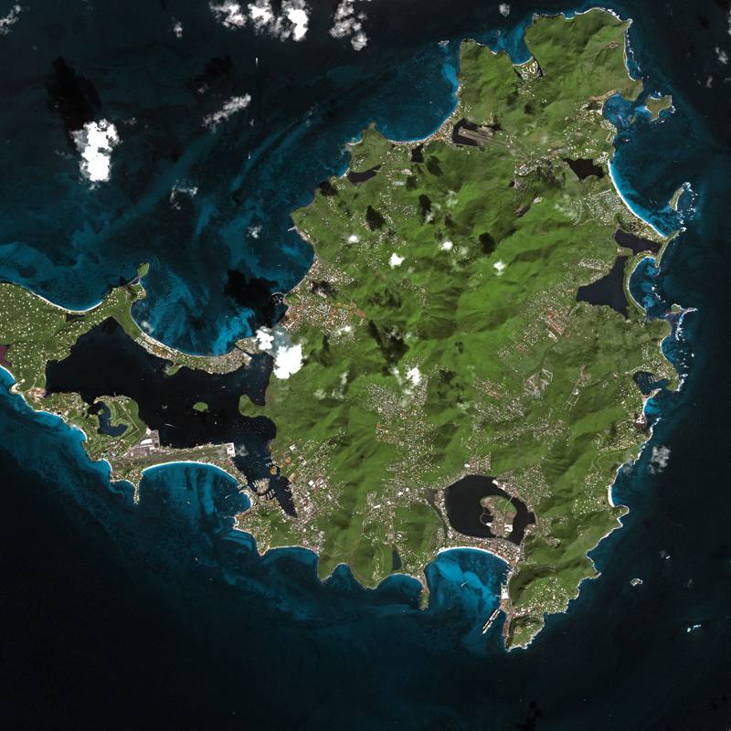
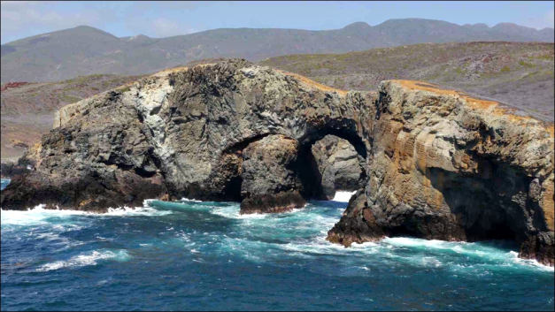
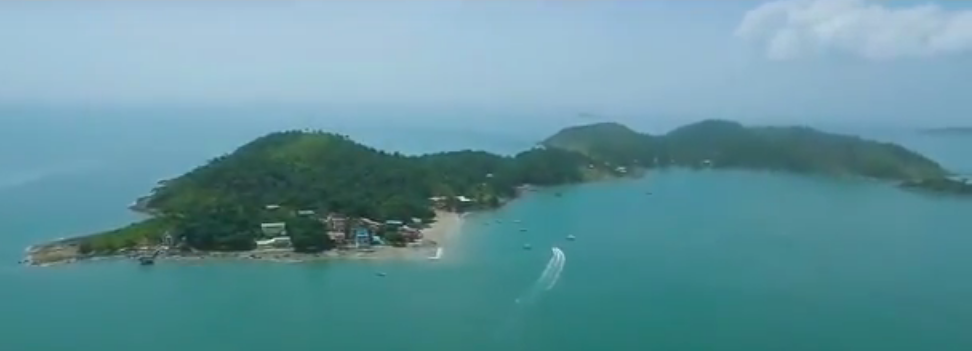
Then there is Kassa Island here in the Loos Island group, with its angular wall-like features.

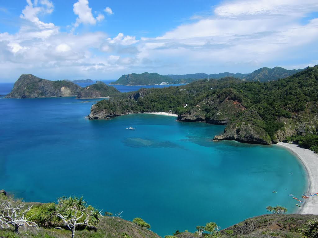
This is an aerial view of Kassa with its beautiful blue water, beaches, and many fun outdoor things to do.

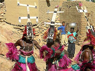
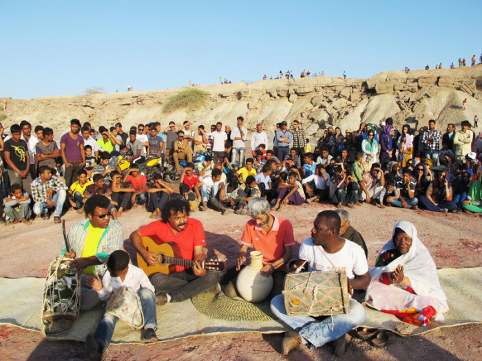
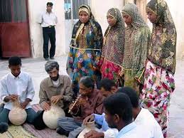
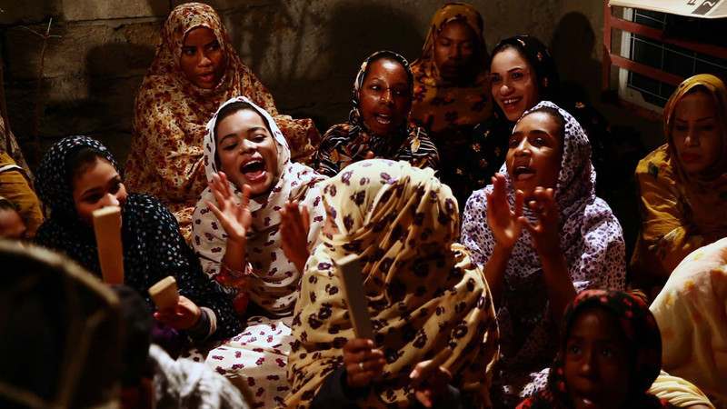
Music and dance is especially popular with the people who live on these islands.

Ever heard of these islands before? Me neither. Just found out about them doing the research for this post.

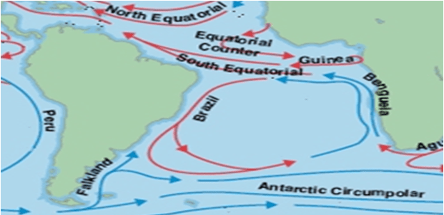
From here, the alignment leaves Africa, and goes across the Equatorial Counter Current and the top part of the South Equatorial Current.

The Equatorial Counter Current flows from west to east in between the strong North and South Equatorial Currents, and has a higher temperature than the other two equatorial currents. It is more developed in the East, where it is known as the Guinea Stream.

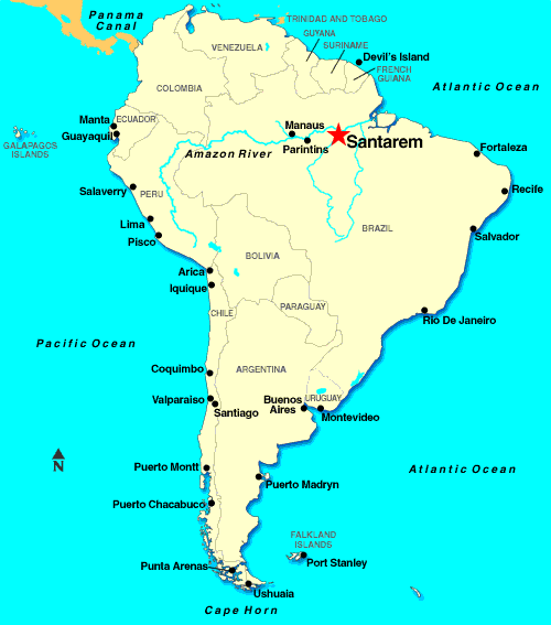
The alignment enters South America at the island city of Sao Luis.

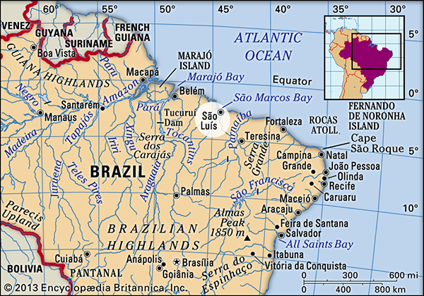
It is the capital and largest city of the Brazilian State of Maranhao, one of three state capitals in Brazil located on an island.

I noticed that the Brazilian island of Fernando de Noronha is just off the coast from Sao Luis. While it is not directly on this alignment, it is directly on a different alignment which I have tracked. It appears to have a solar alignment between two peaks just off-shore there, as shown in this photo. The Ancients were all about creating the alignment of Heaven and Earth, and I do not believe this is a random natural occurrence. The Ancient Master Builders had the knowledge, skills, and abilities to terraform the earth, and that is what they were doing when they were creating the planetary grid system.

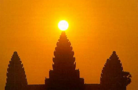
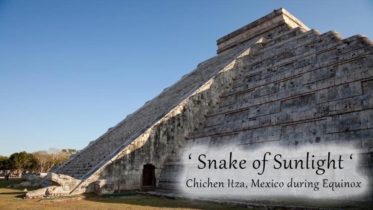
Here are three famous examples of the Ancients skills and abilities to create infrastructure alignments with heavenly phenomena. This is Angkor Wat in Cambodia at the Solstice…

…Glastonbury Tor in Somerset County in England at the Solstice…

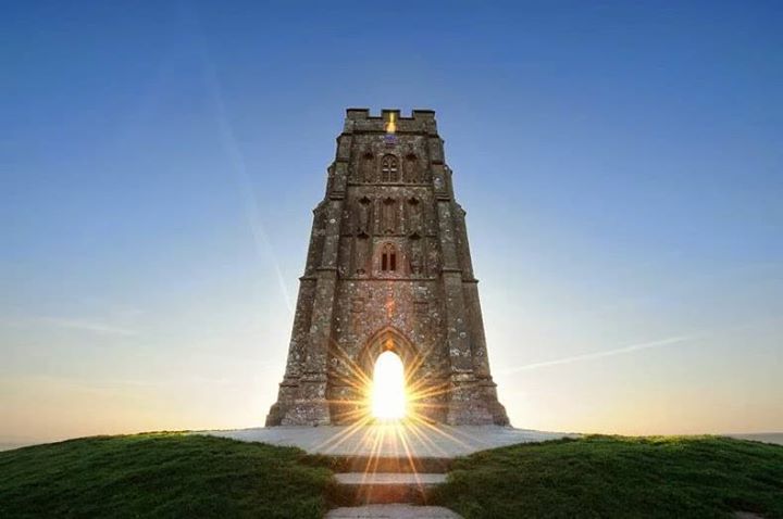
…and Chichen Itza near Merida, Mexico in the Yucatan Peninsula at the Equinox. We are mystified and amazed, and wonder at these accomplishments. If we had been taught the True History of the Earth, we would not be mystified and amazed because we would know who the Human Beings responsible for these accomplishments were, what they doing, and they were not separate peoples as we have been taught, or randomly doing their own things in their own part of the world.

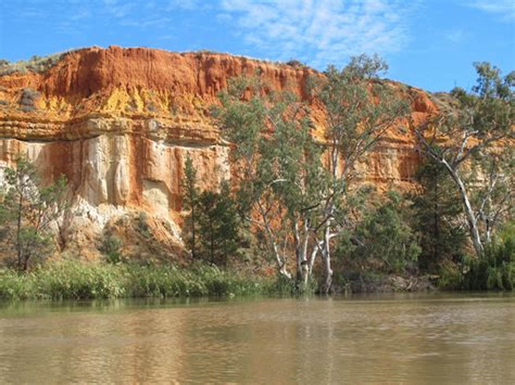
Maranhao State is home to the Lencois Maranhenses on the coast near Sao Luis, and is called the biggest desert in Brazil, sometimes called the “Brazilian Sahara” with sand dunes and everything. Here’s the thing – this place sees 300 times more rain than the Sahara, and between January and June, giant lagoons form between the sand dunes.

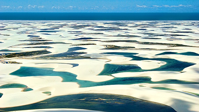
I have expressed my opinion in previous posts that sand dunes cover up ancient infrastructure. What do you think about a desert in a region where there is plenty of rain?

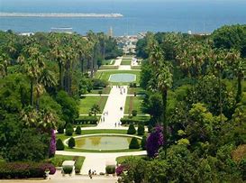
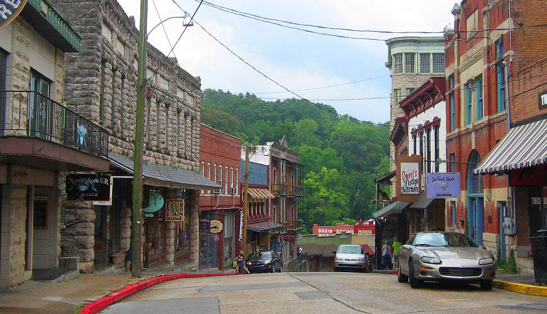
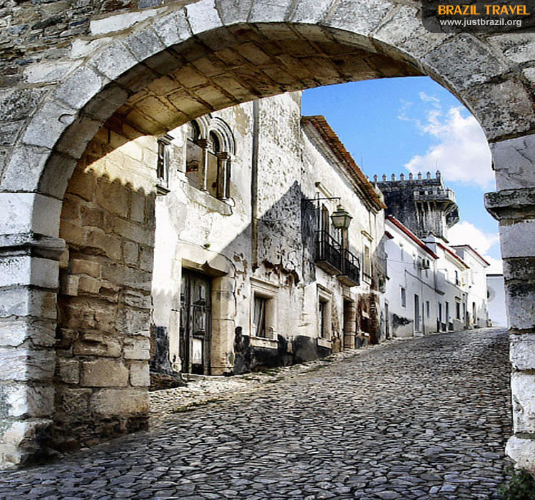
The historic center of Sao Luis, a UNESCO World Heritage Site, is located on the promontory formed by the Anil and Bacanga Rivers, northwest of Sao Luis Island. It is characterized by streets lined with residential buildings, archways, tiled roofs, bright colors. and balconies with cast-iron railings as seen in these two photos.

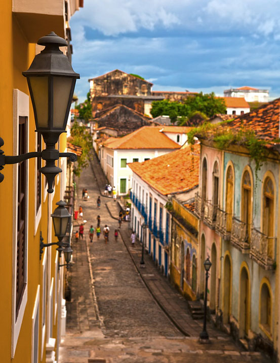
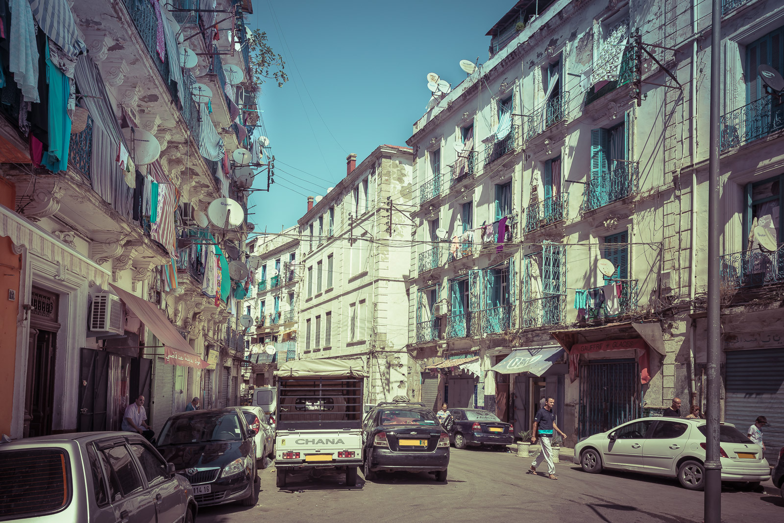
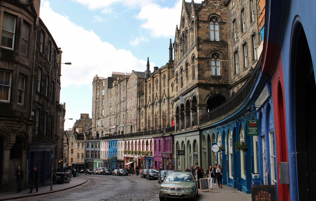
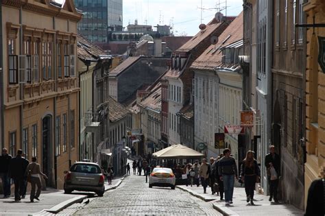
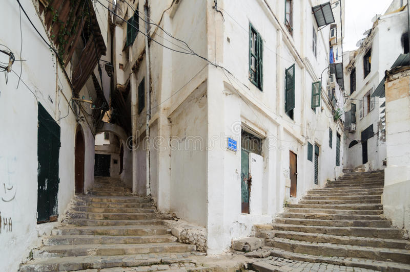
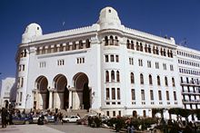
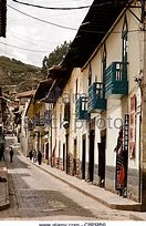
Very much reminds me of other places with steep streets and similar architecture, like the Casbah in Old Algiers…
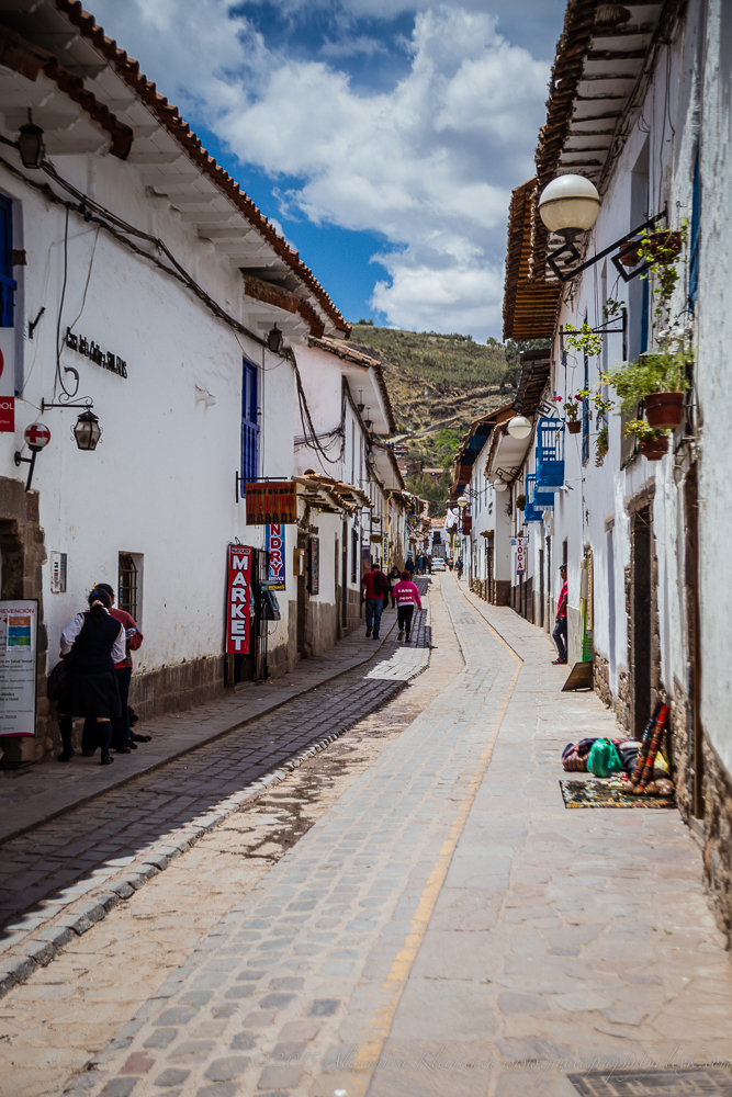
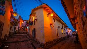
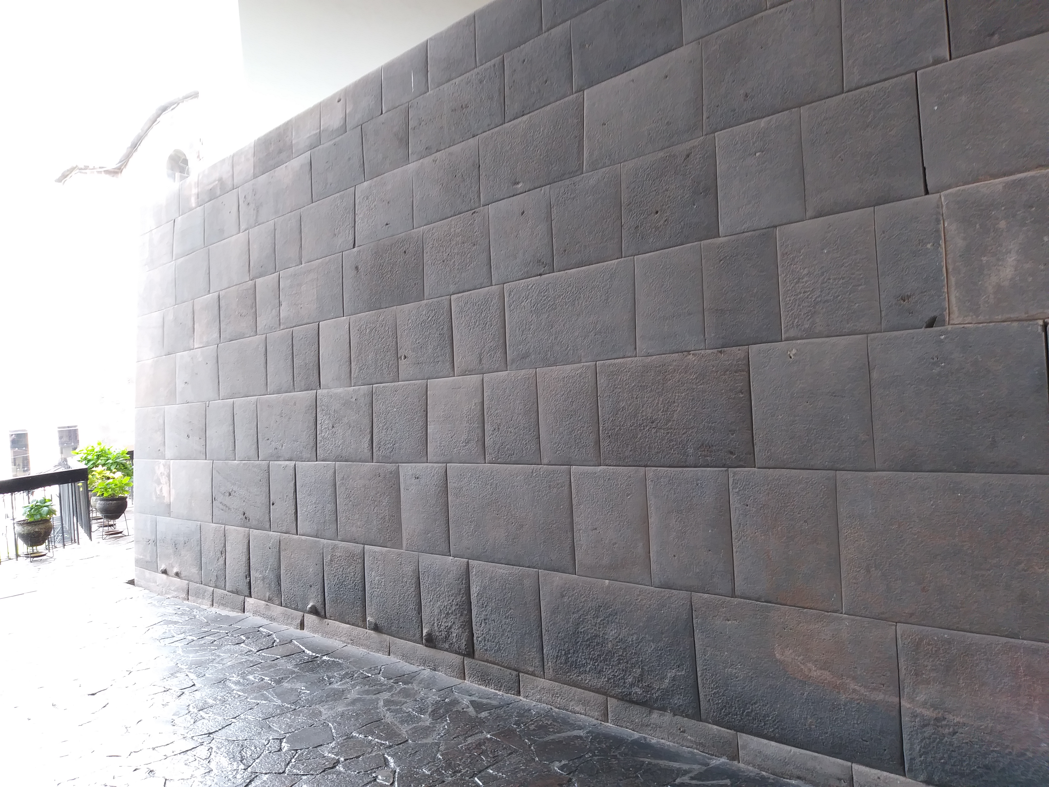
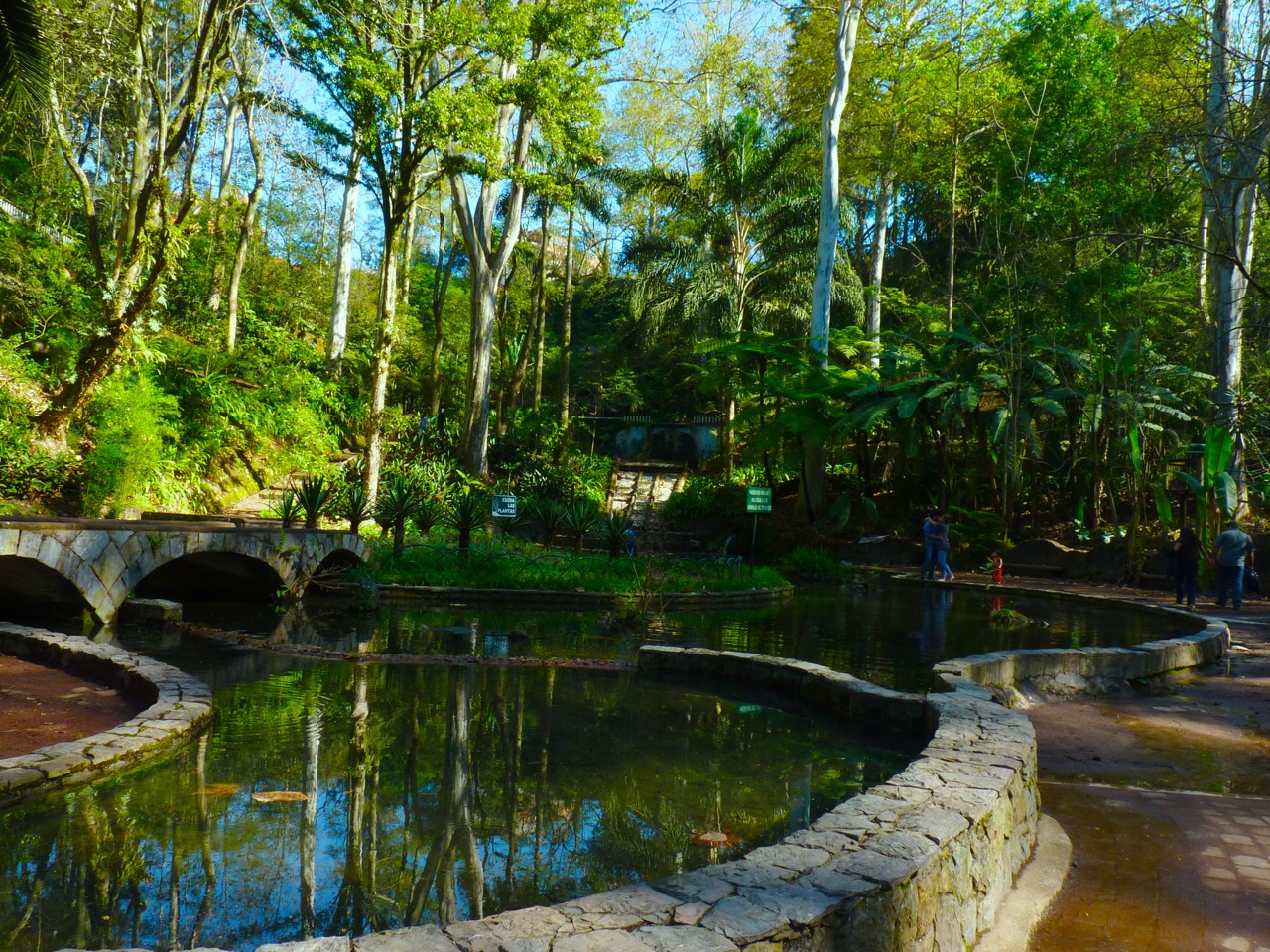
…Cusco in Peru…

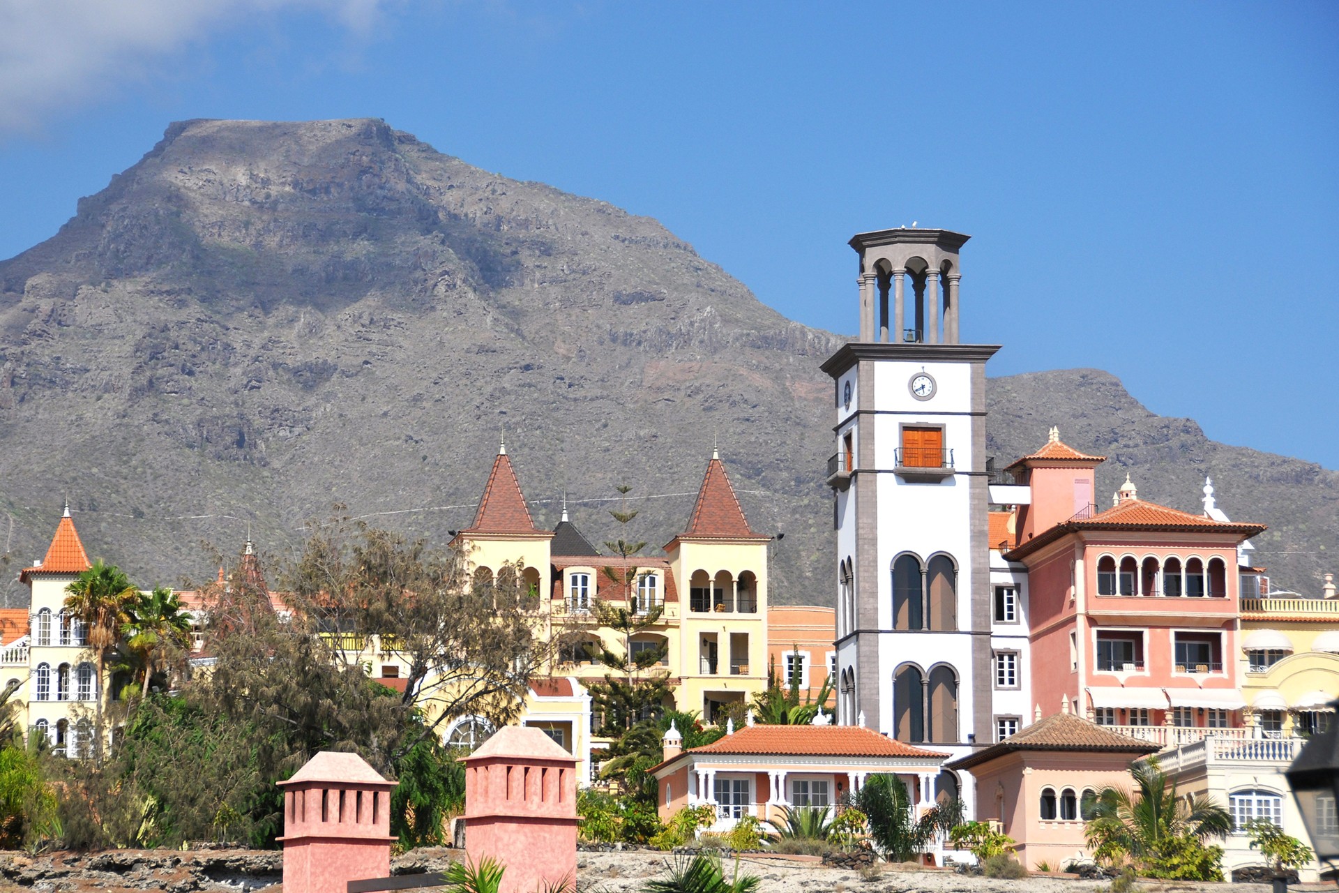
…Santa Cruz de Tenerife, on the island of Tenerife in the Canary Islands…

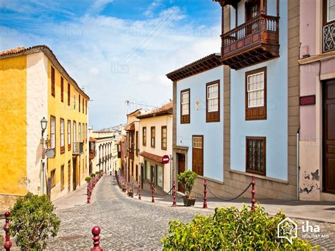
…the City of Bradford, West Yorkshire, England near Leeds (and this circle alignment crosses through Leeds down the road aways)…

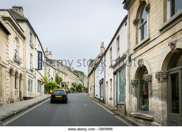
…and Eureka Springs in the Ozark Mountains of Northern Arkansas.

Next on the alignment, we come to Santarem, the financial and economic center of the western part of the Para State of Brazil. It is located at the confluence of the Tapajos and Amazon Rivers.

Santarem has 62 miles, or 100 kilometers, of natural beaches, and with the crystalline water of the Tapajos River, is known as the “Caribbean of Brazil.”

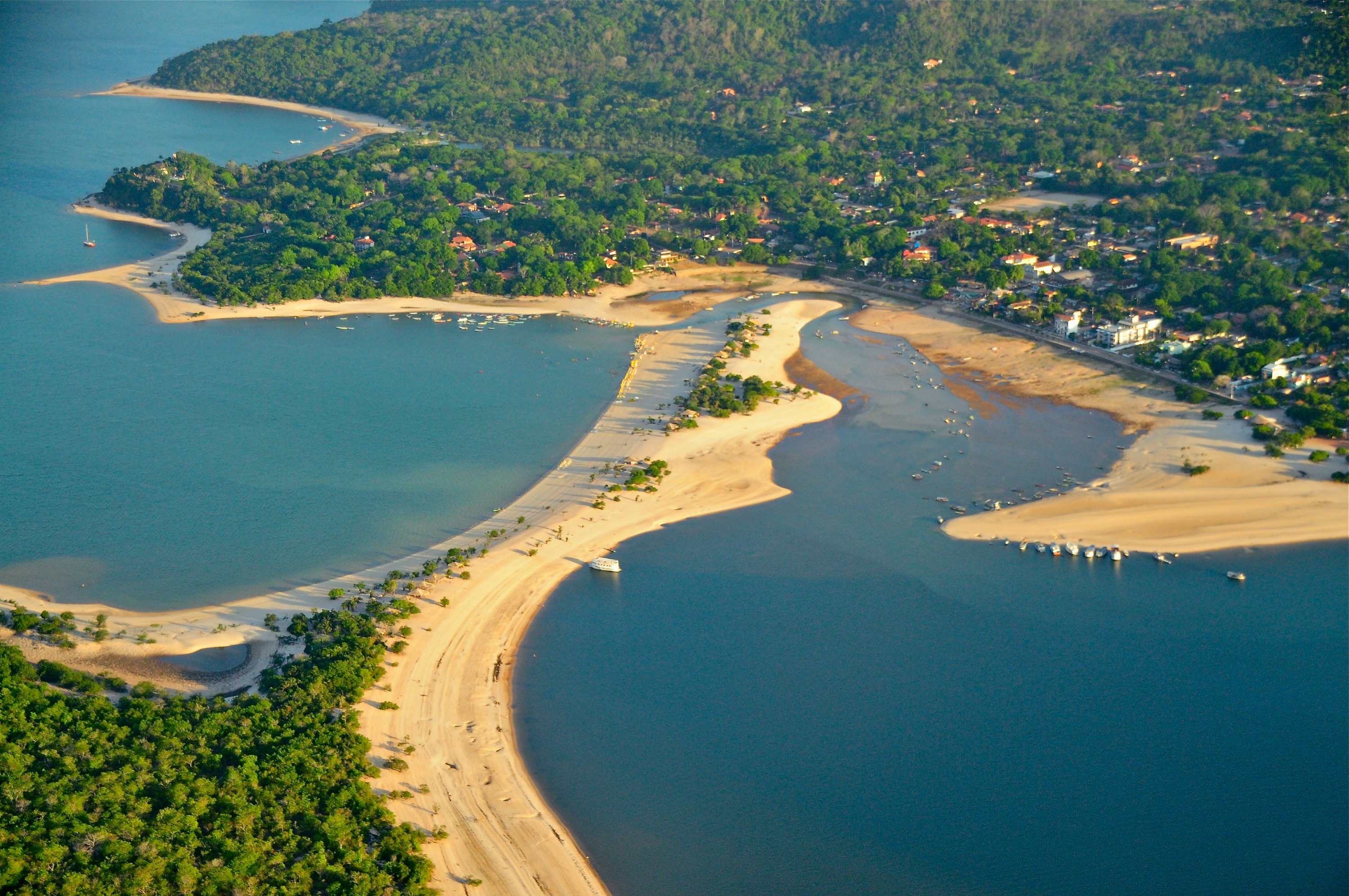
One of Santarem’s most popular beaches is called Alter do Chao, pictured here…

…and it is compared with a beach on Attu, and island at the far western end of the Aleutian Island chain. Attu, along with the islands of Agattu and Shemya, separates the Bering Sea from the Pacific Ocean.

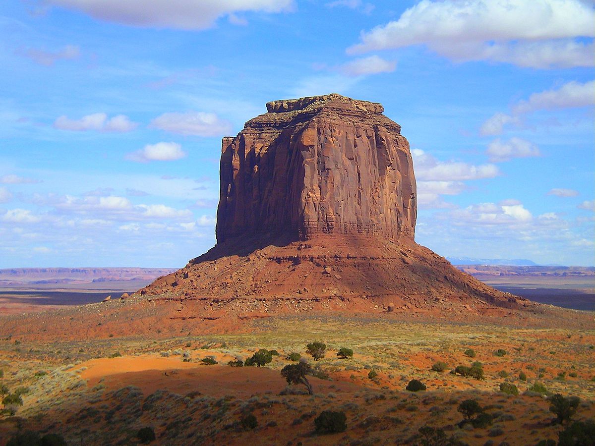
Here is Alter do Chao from another angle, where there is a lone pyramidal shape seen a short distance from the beach.

Again, Santarem is located on the Trapajos River where it meets with the Amazon River.

The Trapajos, also called the Santarem Culture, were an indigenous Brazilian people, referred to as extinct now, and who lived here when Europeans in the form of the Portuguese arrived in the 16th-century. They are described as a tribe of Indians who were the leaders of a large, flourishing agricultural chiefdom.

This is called the “A Perola do Trapajos” in Portuguese. It roughly translates from Portuguese in English to “The Pearl, or Gem, of the Trapajos.” I have searched for, and for some reason unable to find, information in English to tell me more about it, so I am piecing together what I can. We are told the Portuguese started building a fortress here starting in 1693, and completed it in 1697, and that Santarem was built around it.

Or, it was already built, and the Portuguese just claimed credit for it….

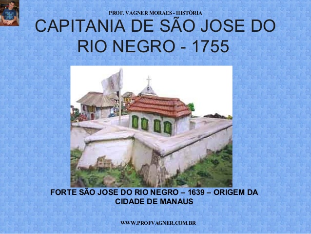
From Santarem, the next place on this alignment is Manaus, the capital city of the State of Amazonas in the North Region of Brazil, near the confluence of the Amazon and Negro Rivers, and the largest city of the Amazon Rainforest.

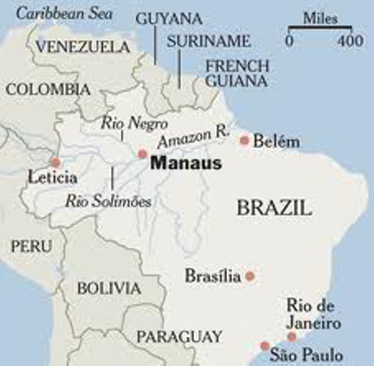
We are told the city was founded in 1669 by the Portuguese as the “Fort of São José do Rio Negro,” and was renamed Manaus, after the indigenous Manaos people, in 1848 when it was established legally as a city. This is a depiction of the fort the city was originally named for. It looks like a star fort to me, of which variations of this shape are found in worldwide locations, and showing up frequently on planetary alignments.

Rubber made Manaus the wealthiest city in South America in the late 1800s, and wealthy European families are said to have settled in Manaus, bringing their European art, architecture, and culture with them. It was a city at that time with electric streetcars and streetlights.

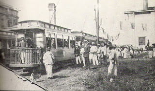
Keep in mind that this is a city that is located in the middle of the Amazon rainforest, and access today to the city is primarily by boat and airplane. In the late 1800s, transport to Manaus would have been by boat as the only way in or out. No road connection until 1973, with the completion of the BR-319, connecting Manaus to Porto Velho, Brazil. It is 540 miles long, or 870 kilometers, going through the rainforest, and is impassable when it rains.

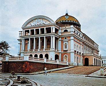
That being said, this is an old photo of the Theater of the Amazons in Manaus, with a first performance date of 1896.

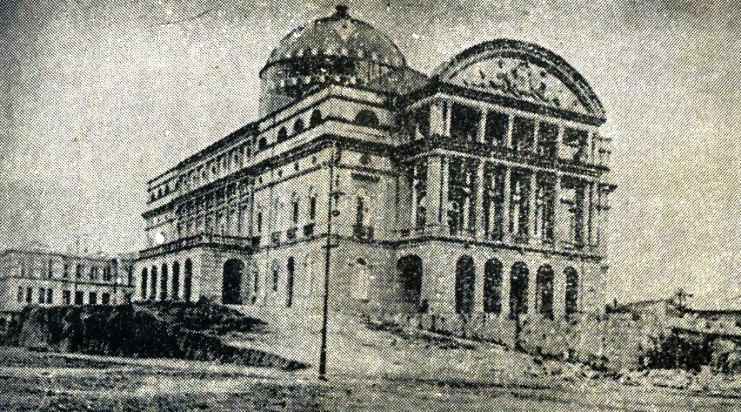
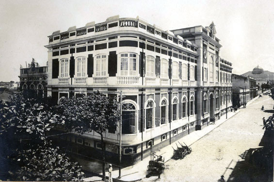
This is the Theater of the Amazons today.

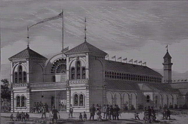
This is the Public Market in Manaus, circa 1906…

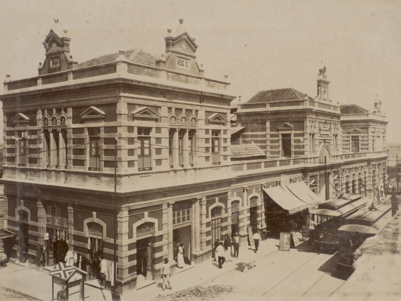
…and this is the Public Library of the Amazon from somewhere around the same time frame – late 1800s, early 1900s.

What is more believable…that these buildings and advanced technology were already here and built by an advanced civilization that thrived here for a very along time, and just taken over by Europeans, or that they were built in the late 1800s by wealthy Europeans in a very challenging logistical environment for construction of this magnitude?

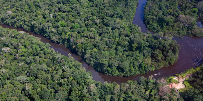
The history we have been taught does not provide an adequate explanation for what was really going on here. This is a photo of undeveloped Amazon rainforest near Manaus.

I will end this post here in Manaus and pick up the alignment in the next post in Concordia, Colombia.

Circle Alignments on the Planet Algiers – Part 2 Araouane, Mali to Bamako, Mali

In my last post, this new series started in the ancient city of Algiers in Algeria, and tracked what is found on the alignment across the Atlas Mountains of Algeria, ending in the Tuareg city of Reggane in Algeria.

I indicated that I would be picking up the alignment at El Guettara in Mali because it was on my globe when I did the initial work of finding the alignment in 2016…

When I started to do the research, however, very, very little pops up about it.

I can’t find a map on the internet of Mali now that even shows El Guettara. So I don’t know what happened to it.

El Guettara is referenced in some internet articles. One said that it is one of the hottest places in the world, as is this whole region of Mali and Algeria in West Africa. Reggane in Algeria is included in that designation as well.

So I will start at the next place I have on my list, and which is directly on this alignment.

It is called Araouane, or El Arawan, in the Taoudenit Region of Mali.

It is located 150 miles north, or 234 kilometers, of Timbuktu.

In the present day, it only services caravan trade between Timbuktu and the Salt Mines of Taoudenni in Northern Mali.

Comparing the globe and map, it looks like the salt mines could be located at or near where El Guettara was, but I am still not finding confirmation. Curious as to why this information is not available.

We are told in earlier centuries, Araoune was an important entrepot on the Trans-Saharan Caravan routes pictured here, meaning it served as an import and export trading post.

Today it is a small village of about 45 families.

It has definitely had better days, and moving further along this alignment I will bring forward Mali’s glorious past.

Timbuktu, almost directly south of Araouane, is not directly on the alignment.

It is situated on the Niger River. It is the capital of the Timbuktu Region of Mali.

“Timbuktu” is used in several languages to represent a faraway place.

If you ever wondered where Timbuktu was, or even if it was a real place, it is an ancient city here in Mali.

In the 14th-Century it became a part of the Mali Empire.

At its height, the Mali Empire encompassed almost all of what is now Senegal; the northeastern part of Guinea; the northwest corner of the Ivory Coast; the eastern tip of Niger; most of present day Mali; and Southern Mauretania.

It was founded by Sundiata Keita in 1230 AD, and became renowned for the wealth of its rulers.

He died in 1255 AD.

His great-nephew, Mansa Musa, who ruled the Mali Empire from1312 – 1337.

Mansa Musa was one of the richest men in World history, if not the richest. One of his titles was “Lord of the Mines of Wangara.”

During his reign, Mali may have been the largest producer in the world of gold.

On a legendary pilgrimage to Mecca in 1324-1325, its lavish opulence apparently well-documented by contemporary eyewitnesses, Mansa Musa gave so much gold away along the way there that the sudden influx of gold caused its devaluation through the regions he travelled.

He is then said to have taken steps to mitigate the unintended effects of his generosity on his way back by borrowing all the gold he could carry from money-lenders at high interest.

Has the general population ever heard of him?

Does this immense wealth fit the historical narrative we have been given about this part of the world?

The time period of Timbuktu’s Golden Age is said to be between 1464 and 1591, during the years of the Songhai Empire, which replaced the Mali Empire in the region, and was one of the largest African states in history.

In Timbuktu’s Golden Age, its prominence in the trade networks made a book trade possible, and along with the towns numerous scholars, it became an important scholarly center in Africa.

The Sankore Madrassah, Djinguereber Mosque, and Sidi Yehia compose the University of Timbuktu.

As a center of learning and trade over centuries, hundreds of thousands of manuscripts were collected here.

Called the Timbuktu Manuscripts, approximately 700,000 manuscripts are now in the collections of several libraries in Timbuktu for safekeeping.

I would also like to talk about Djenne, and while near, is also not directly on the alignment. It is quite noteworthy for several reasons.

It is considered the oldest known town in sub-Saharan Africa. It sits on a flood-plain between the Niger and Bani Rivers…

…and during the rainy season from June to September becomes an island that is accessed by causeways.

It is also notable for its adobe (mud-brick) architecture.

Djenne’s masons use a technique called Djennefere using cylindrical, instead of rectangular, bricks as building materials.

This is the Great Mosque of Djenne, one of the world’s largest mud-brick buildings.

For comparison, this is the Bam Citadel, located near Kerman in Central Iran on a different circle alignment.  It is the world’s largest mud-brick building. The mud buildings in Djenne certainly share similar characteristics with the mud-brick Bam Citadel in Iran.

The area around Djenne is also known for a mud-cloth material called bogolan.

It is a traditional Malian fabric dyed with fermented mud.

Djenne is also located close to Dogon Country.

This is the Bandiagara Escarpment, one of the homes of the Dogon in Dogon Country.

The Dogon have a very sophisticated spiritual, astronomical and calendrical system, as well as extensive anatomical and physiological knowledge. They also have a systematic pharmacopeia, which means directions for compound medications.

Perhaps they are best known for the accurate knowledge they possess about the Sirius star system.

Yet it is mainly an agricultural society.

They say they were visited in the distant past by amphibious beings from Sirius called the Nommo, who were their teachers.

Who is to say they weren’t?

I’m a believer.

The Dogon have such incredibly advanced and sophisticated knowledge that there is no good explanation for it except that they are telling the truth!

The Dogon perform elaborate ceremonies with masks, headdresses, and dance.

Compare the Dogon headdresses in this ceremony…

…with the flag of the Tuareg people, who also live in this part of West Africa…

…and with this image on the left, which is a well-documented laboratory electric discharge form of plasma next to a form called the “stickman” that is found in rock art worldwide.

Think the ancient peoples of the earth might know something we don’t?

One more thing before leaving Dogon Country.

I have made the comparison of the similarity between Bandiagara Escarpment and Mesa Verde in Colorado in the past.

Not only because of this similarity, but other information I have encountered over the years as well, I think that it is highly likely the Dogon played a much more significant role in world history than is presently realized, understood, and acknowledged.

For one thing, this is what the world looked like before whatever caused continental drift, when it was called Pangea, when the west coast of Africa was right next to the east coast of North America, and the northern coast of what is now part of South America, and it is not hard to envision that there were much closer ties between the continents.

Regardless of anything, there are huge chunks of information missing from the historical record that we no longer have access to by conventional means. We just have mind-boggling mysteries that we can’t explain by conventional means.

Next on the alignment we come to Bamako, the current capital of Mali, and its largest city with over 2,000,000 people.

Mali was annexed into French West Africa from 1895, and French rule ended in 1959 when the Republic of Mali was established.

This is the National Post Office in Bamako.

We are given a date of 1915 for its completion at the top of the building on the right-hand side of the photograph.

What was going on in 1915?

World War I.

So while the French Government in France was fighting the deadliest war up to that time in world history, the French government in Mali was building a post office in Mali that looks like this? Does this make sense?

Bamako is situated on the Niger River, near the rapids that divide the upper and middle Niger valleys.

Now, without any other information, we just see these as natural rock formations. Why wouldn’t they be?

This is a photo of the rapids called the First Cataract of the Nile River going through Aswan in Egypt.

Why would an area of rapids be called a “cataract,” I wonder?

The most well-known definition of a cataract is a clouding of the lens of the eye which leads to a decrease in vision.

Don’t think it couldn’t be that obvious. This cover-up has been inserted right into our language. When I realized this several years ago, I was able to crack the cover of key words that were used to cover-up the ancient civilization by calling them natural features.

In case you think these big, blocky, shaped rocks could just be coincidental, here is a picture of the Blakeney Rapids on the Mississippi River in Ontario.

They are recurring features of the world’s river systems.

I could go on and find more in Bamako, but I think this is a good stopping place for this post.

I will pick up the alignment in Conakry, Guinea, in the next post.

Circle Alignments on the Planet Algiers – Part 1 Algiers, Algeria to Reggane, Algeria

Thus far I have shared with you two complete circle alignments that I found – one emanating from Merida, Mexico, and another from Amsterdam Island, one of the French Subantarctic Islands in the South Indian Ocean.

This new series is about a circle alignment that begins and ends in Algiers, Algeria.

I found a star tetrahedron early in 2016 on a map that had been given to me when I started noticing that major cities lined up in lines in North America, and connected them.

I extended the lines out, and eventually switched to a globe. I used a magnifying glass, and wrote down the cities and lined up in linear or circular fashion.

I have gotten an amazing tour of the world of places I have never heard of with remarkable similarities across countries and continents.

I believe there was an ancient advanced civilization that existed up until relatively recently that was totally aligned with itself, the earth, and the Heavens, and we have not been told about it, and on top of which a false narrative has been grafted. These star maps were done by Wayne Herschel, a South African researcher.

My work is about providing compelling evidence for why I believe this.

This is a photo of Manhattanhenge, an annual event during which the setting sun or the rising sun is aligned with the East-West street grid of Manhattan on dates evenly spaced around the summer solstice and winter solstice.  There similar alignments with the sun and street plan that occur in other major cities, like Toronto, Baltimore, Chicago, and Montreal. 

My primary focus is on looking features in each place that are similar to features found very different places around the world. Keep in mind there are many more examples than the ones I am providing.

At the very least, I hope to provide a thought-provoking experience regarding reasons to question the historical narrative we have been given.

Algiers is the capital, and largest city of the Northern African country of Algeria, and is situated on the west side of a bay of the Mediterranean Sea.

It was ruled by the Deys of the Regency of Algiers until 1830, at which time the last Dey, Hussein Dey surrendered to invading French forces.

The old part of Algiers is located on a steep hill, topped by a citadel called the Casbah, and is known as the Ancient City of the Deys.

The five noble titles of the Moors are: El, Bey, Dey, Al, and Ali.

Ancient means something belonging to the very distant past.

Yet we are told that the title of Dey in Algiers (as well as the Deys of Tunis and Tripoli) was given to these rulers under the Ottomon Empire, starting in 1671.

Yet the Casbah is known as the Ancient City of the Deys???!!!

These next photos are comparing the very similar lay-outs and angles of street of, first, the area known as the Casbah in Algiers …

..with Cusco, Peru…

…Old Edinburgh, Scotland…

…and Old Zagreb in Croatia.

And here is another street lay-out found in Old Algiers…

…compared with this one in Cusco, Peru

I find the curvature, steep slopes, and angles of the street lay-outs to be remarkably similar considering they are across countries and continents.

This photo was taken of a building at the Casbah in Algeria…

Here is a closer look at the windows of this building in Algiers…

…compared with a detail of windows in Venice, Italy.

The Botanical Gardens of Hamma are in Algiers.

They are also known as the Test Gardens of Hamma because when they were said to have been established in 1832, under the auspices of the interim French government after the surrender of the Dey of Algiers in 1830, it was started as a test farm and model garden.

This photo of the grounds of the Botanical Gardens…

…reminded me of the National Mall in Washington, D. C.

This is Algiers Harbor today. Of note in the middle of the photo is a very long jetty.

Jetties are very common features in the world’s harbors. Like this one in Hilo Bay on the Big Island of Hawaii.

Algiers was known historically as “Algiers the White” for the color of its buildings.

This is the Grand Post Office in Algiers, a huge white building featuring heavy masonry and is called a construction of Neo-Moorish type, said to have been built in 1910…

…and the white El Jedid Mosque in Algiers.

I find it very interesting the port city of Mogadishu in Somalia, located on the horn of Africa was called the “White Pearl of the Indian Ocean” before civil war there started in 1991. Sadly, the beautiful architecture of this once grand city has been badly damaged, if not completely destroyed, since 1991.

Both places had similar architectural features, yet these two African countries are not located close to each other. Algiers is in North Africa on the Mediterranean Coast, and Somalia is in East Africa on the Indian Ocean, situated next to Ethiopia and Kenya.

Leaving the city of Algiers, next on the alignment we come to the Atlas Mountains, a mountain range in the Maghreb. The Maghreb is another name for North Africa, as is the Barbary Coast, and consists of the countries of Algeria, Morocco, Mauretania, Tunisia, and Libya.

It is also known as the Land of Atlas for the Atlas Mountains, which separate the Mediterranean and Atlantic coasts from the Sahara Desert. The Atlas Mountains in Algeria are primarily inhabited by the Chaoui Berber people. The Berbers are an ancient people of North Africa.

The Saharan Atlas of Algeria is the eastern portion of the Atlas Mountains…

…and mark the northern edge of the Sahara Desert.

The Atlas Mountains is the location on earth where, according to Greek mythology, the Titan Atlas was condemned to support the heavens. This was his special punishment for his participation in a 10-year Battle of the Titans, in which there was a series of battles involving the younger generation of Titans against the older Gods of Mount Olympus, and the younger Titans lost. The other Titans were put in a place called Tartarus, described by Homer as a deep and sunless place.

There are a number of national parks in the Atlas mountains.

In Algeria, I would like to touch base on two that are situated on or near this particular alignment after leaving Algiers.

The first is Chrea National Park. It is located in the Blida Province, and is part of the Blidean Atlas Mountains.

There is a colony of Barbary Macaques here. Also known as the Barbary Ape, it is an endangered species.

It also has a forest of ancient Atlas Cedar. This is a cedar native to the Atlas Mountains.

Waterfalls are found all along these alignments, and Algeria is no exception, as these are found in Chrea National Park.

The other Algerian National Park I want to highlight is Theniet El Had National Park.

It has one has one of the greatest protected forests of Atlas Cedars in Algeria.

It is located at the Southern limited of the great massif of Ouarsenis. I found a description of Ouarsenis that called it the eastern part of the Maghrebian Tethys former margin, which is apparently referring to the tectonic plate upon which this part of the world sits.

Tethys was also the name of a Titan-Goddess in Greek Mythology, and she was the primal font of fresh water which nourishes the earth.

This is a picture taken of Theniet El-Had National Park, showing the presence of red rocks there that are found in other places around the world…

…like Fort Elisabeth State Park on the Hawaiian Island of Kauai…

…Sedona, Arizona…

…and Twin Lakes Reservoir in Bethel, Oklahoma.

Next on the alignment, we come to the city of Reggane in the Sahara Desert. It is the capital of the Reggane District in the Adrar Province of Algeria.

France began its nuclear testing program in Reggane in 1960 – 1961, before Algeria’s independence. They conducted four atmospheric nuclear tests, which contaminated the Sahara Desert with plutonium, negatively impacting those who live here to this day – not only Reggane, but far beyond.

Between 1960 and 1966, a total of 17 nuclear tests were conducted in the Reggane District of Algeria. It is called Africa’s Hiroshima.

The Tuareg live here, an ancient Berber people.

Women have a high status in the matriachal Tuareg society. Among other things, primarily women own livestock, and other movable property, while personal property can be inherited by both women and men.

This is a rendition of the legendary Tuareg Queen of the Hoggar, Tin Hinan. She is believed to have lived between the 4th and 5th centuries A.D.

Her tomb was believed to have been found, by western archeologists in the 1920s, in Abalessa…

… in the Ahaggar, also known as Hoggar, Mountains of Southern Algeria.

I am going to end this post here, and pick up the alignment in El Guettara, Mali, in the next video.

Circle Alignments on the Planet Amsterdam Island – Part 11 Brisbane, Australia to Amsterdam Island

This will be the last part of this series tracking the circle alignment that starts, and ends, on Amsterdam Island in the South Indian Ocean.

So far on this alignment, we have journeyed through Mauritius and the Seychelles, Somalia, the Gulf of Aden, Yemen, the United Arab Emirates, the Strait of Hormuz, Iran, Afghanistan, Tajikistan, Uzbekistan, Kyrgyzstan, Kazakhstan, China, Mongolia, back through China again, North Korea, Japan, the Bonin Islands, the Northern Marianas Islands, the island of Pohnpei in the Caroline Islands, and the Solomon Islands.

Brisbane is the capital of Queensland in Australia, and its largest city.

The metropolitan area of Brisbane is in the Brisbane River Valley, and goes from Moreton Bay on the coast…

…to the Great Dividing Range, called the third largest mountain range in the world. I will be coming back to take a closer look at the Great Dividing Range because it is on this alignment as well.

Brisbane is situated on the Brisbane River…

…compared with a historic photo of the Red River in the city of Winnipeg in the Canadian Province of Manitoba, on a different alignment. I am seeing and saying that snaky, s-shaped rivers are a signature feature of the ancient advanced civilization.

Here’s another one of Brisbane on a bend of the Brisbane River…

…compared with this river bend of the Yangtze River in China.

Brisbane Central Business District is said to have been built on the location of a historic European settlement, located inside a peninsula of the Brisbane River, nine miles from the mouth of Moreton Bay. Brisbane is said to be one of the oldest cities in Australia, and founded on ancient indigenous lands in 1825. Here are some historic photos of Brisbane, 100 years later circa 1925 and 1926:

The Great Fire of Brisbane took place in 1864, thirty-nine years after what we are told was the year of the founding of the city. It burned out of control in the city’s Central Business District for several hours, destroying several blocks of businesses and homes.

The Great Flood of Brisbane took place in 1893, sixty-eight years after the city was established. As a result of eight days and twenty inches of rain, the Brisbane River rose almost 24 feet. In addition to the floodwaters sweeping away two bridges, the city itself was severely flooded. Most importantly to note, the grand architecture with heavy masonry, cupolas, huge arches and huge columns in these historic flood photos is said to have been built in less than 70 years, according to the historical, narrative we have been given.

While not really known to the general public, there are ten registered pyramids in the Australian State of Queensland, of which Brisbane is capital.

I would like to point out two of the best known ones.

The first is the Gympie Pyramid, in Gympie, Australia, which is just a short distance north of Brisbane.

The Gympie Pyramid is described as a terraced sandstone hill. It is on private land and not open to the public.

The other one is called the Ballandean Pyramid, on private property but viewable from the road, in the village of Ballandean in Queensland. This one is openly acknowledged to be man-made, however, it is said to have been in modern times when the land-owner paid someone to do something with the surplus granite rocks that had been excavated for the land’s agricultural use.

Then we are told not to confuse the above pyramid with what are called natural granite rock formations called “The Pyramids” in nearby Girraween National Park…

…in which there are examples of balanced rocks like these in
Girraween…

…likenesses of which are found all over the world, at places like Elephant Rocks State Park in Southeast Missouri…

…and Matopos Hills National Park in the African country of Zimbabwe.

One more thing to point out before I leaving Brisbane. Something tells me I could stay here for the whole post and come up with a lot more to share.

Brisbane is the gateway to Australia’s Gold Coast. It is a popular vacation resort, and has a lot of theme parks. It also has approximately 400 km, or 249 miles, of canals, about which I did not know until I looked just now….

…compared with an aerial photo of Las Olas Isles in Fort Lauderdale, Florida. Now, by not being given any other explanation, we just assume all these canals were built relatively recently.

What I am finding, as I follow the planetary alignments, are canal systems of similar sophisticated engineering all over the world in places that I would not expect to find them!

For example, in places like Quorgonteppa, Tajikistan, which is close to Tajikistan’s border with Afghanistan.

So continuing on the alignment, back to the Great Dividing Range, also known as the Great Divide, or the Eastern Highlands, pretty much parallels the east coast of Australia for about 2,300 miles (or 3,700 kilometers.

It is described as a series of plateaus and low mountain ranges.

This feature of the Blue Mountains in the Great Dividing Range called the Three Sisters.

…which immediately brought to mind this feature, which is found at Agattu Island, at the far western end of the Aleutian Island chain.

The Wentworth Falls are in the Blue Mountains of the Great Dividing Range as well…

…and brought to mind Slap Sopot, a waterfall in Istria, which is the largest peninsula in the Adriatic Sea, and shared by Italy, Slovenia, and Croatia.

Next on the alignment we come to Dubbo, the largest city in the Orana region in the Australian State of New South Wales. It is located on the Macquarie River, and is the crossroads where three highways intersect.

This is the Old Dubbo Post Office, said to have been built in 1887…

…compared with the Moorish Clocktower, or Torre Morisca, in Guayaquil, Ecuador…

This is the courthouse in Dubbo, said to have been commissioned in 1884 and completed in 1887. It looks like courthouses and government buildings from all over the world said to have been built in this time period.

This is the Band Rotunda in Dubbo…

…compared with what is called the Moorish Kiosk in Hermosillo, Mexico, which is on a different alignment.

Next, the alignment crosses over the Murray River, Australia’s longest river, and forms the border between the Australian states of New South Wales, and Victoria.

It is another example of the many S-shaped rivers that I have found all over the world…

Here is one of the land-forms on the river’s edge…

…compared for similar attributes with Merrick Butte in Northern Arizona’s Monument Valley near the Utah State Line.

So the alignment crosses the Murray River and passes through Geelong in the State of Victoria, a port city on the Corio Bay, which is a bay off of the larger Port Phillip Bay.

This historic building was called the Geelong Exhibit Building and Market Square Clock Tower. The Clock Tower was demolished in 1923, and the remaining buildings were demolished in the early 1980s to make room for a new shopping center.

Here is a historic photo of the Old Geelong Post Office said to have been built between 1890 and 1891…

…which has actually survived to the present day. The building is intact, but I wonder what those interesting looking towers were for, in front of the older picture of the building, that are no longer there.

Next on the alignment we come to Portland, the oldest European settlement in New South Wales, and is the main city in the Shire of Glenelg on Portland Bay. It is the only deep seaport between Adelaide and Melbourne.

There is also a belt of active volcanoes in Victoria State that runs between Portland and Geelong, with one close to Portland itself. I have found a high correlation between these planetary alignments and the occurrence of volcanoes.

Here is a picture of a historic hotel in Portland in Victoria State…

…compared with what is called a colorful colonial building on Long Street in Cape Town, South Africa…

…and with this building in the historic French Quarter of the city of New Orleans in Louisiana.

So from Portland, we enter the South Indian Ocean and, travelling 8,044 miles or 12,946 kilometers, over open ocean, we return to the place where this circle alignment started – Amsterdam Island…

…a tiny speck of land in the South Indian Ocean, where the French government of Amsterdam Island mans only a seasonal research station…

…that studies the geomagnetism of the earth, as well as biology and weather. This is a photograph taken at Amsterdam Island of a phenomenon called Lee Waves, which are atmospheric stationary waves.

The next series will be about a circle alignment that starts and ends in Algiers, Algeria.

Circle Alignments on the Planet Amsterdam Island – Part 9 Bonin Islands, Japan to Pohnpei Island, Caroline Islands

The last post travelled along the alignment from Chongjin, a North Korean port, to Yokohama, the most important port in Japan and a major commercial hub for Tokyo. The next place on the alignment is considered part of the Tokyo Metropolitan area for administrative purposes.

I am talking about the Bonin Islands, also known as Ogasawara Islands, are comprised of over 30 tropical and subtropical islands located south of Tokyo. These are volcanic islands are in the Pacific Rim of Fire.

The northern most island group is called Muko-Jima. It is not inhabited. From this aerial view, numerous coves and bays are seen.

Compared with the appearance of the coastline of this island in the Caribbean – the northern 60% of which is governed as a Collectivity of France called St. Martin, and the southern 40% is governed by the Netherlands and called St. Maarten.

The main island group is called Chichi-Jima. It is inhabited, and home to about 2,000 people.

Commodore Perry stopped here on his way to Tokyo Bay to open it up for trade with the west, laid claim to the island for the United States, calling it the U. S. Colony of Peel Island. He appointed a governor for the colony, Nathaniel Savory, whom he purchased land from on Peel Island, for a steamship coaling location in 1853.

But it, along with the other islands, was re-claimed for Japan by the Tokugawa Shogunate in 1862, and named the Ogasawara Islands.

The Tokugawa Shogunate is called the last feudal Japanese Military Government, ruling from 1600 to 1868 from Edo Castle in Tokyo.

Here is a photo of one of the polygonal megalithic walls found on the grounds of Edo Castle…

…compared with this exquisite example of polygonal masonry at the Coricancha in Cusco, Peru. Polygonal masonry is defined as a technique where the visible surfaces of the stone are dressed with straight edges or joints, giving the stone the appearance of a polygon, with minimal clearance between stones, and no mortar.

After World War II, the United States Navy controlled these islands. Almost all of the islanders were expelled. Control was returned to Japan in 1968, at which time islanders were allowed to return.

There is a nicely shaped and protected harbor here at Futami on Chichi-Jima.

Very similar to other harbors around the world, including but not limited to, Funchal Harbor and Marina on the island of Madeira, which is in the Atlantic Ocean southwest of Portugal, and northwest of Morocco…

…Vernazza Harbor on the Italian Riviera in the province of Liguria on Italy’s northwest coast…

…the harbor of Nice, France, which is located in the French Riviera on the southeast coast of France on the Mediterranean Sea…

…and there is even a shaped harbor at Ushuaia, the capital of Tierra del Fuego at the very tip of South America, and which is part of Argentina. Ushuaia is considered the southernmost city in the world. I didn’t know there was even anything down there ~ did you?

Here is a scene showing what I believe to be ancient masonry from Minami-jima, a small island off the southwest coast of Chichi-jima…

…and Kominato Beach on Minami-jima…

…looks like Grama Bay in Albania…

…Myrtos Beach on the Greek island of Kefalonia…

…and Vaja Beach on the island of Korcula in Croatia.

Marine areas within the Bonin Islands are home to significant populations of whales, dolphins, and sea turtles…

…and abundant underwater landscapes of coral reefs filled with tropical fish.

Next on the alignment we come to the Northern Marianas islands, which consists of fourteen islands in the northwestern Pacific Ocean, and is a Commonwealth of the United States. They are one of four major island groups of Micronesia, the name given to a sub-region of Oceania, and which contains four major island groups: the Mariana islands; the Caroline Islands; the Gilbert Islands; and the Marshall Islands.

Guam is the southernmost island of the chain, but a separate U. S. Territory.

Since I am here, I will first take a look at Guam. It is the westernmost point and territory of the U. S. and the largest island of Micronesia.

This is Tumon Bay on Guam, which looks a lot like the beaches and bays shown previously in this post.

This feature at Tumon is called Two Lovers Cliff. There is a legend about it that two forbidden lovers jumped to their deaths so they could be together. Cliff is a cover-up code word for the advanced ancient civilization, and another way they hide things is by creating a distraction to noticing what is actually there.

Of the other Northern Mariana Islands, the vast majority reside on Saipan, Tinian, and Rota. Guam, Saipan and Tinian were sites of major battles in World War II.

This is Mount Marpi on the island of Saipan. It is said to have received its nickname – “Suicide Cliff” – from mass suicides in 1944 of Japanese civilians and soldiers occurred capture by the United States. Again, as with the cliffs at Tumon on Guam, those look like stone walls to me.

These are the House of Taga Latte Stones, an archeological site found on the island of Tinian, said to be the pillars for a house erected by Taga, called a mythological chief who lived in prehistoric times. Reconcile this idea based on what we have been taught about history that stone pillars like this could have been built in prehistoric times. Prehistoric, like Fred Flintstone prehistoric? I don’t think so. This is advanced masonry.

Next on the alignment, we come to Palikir, the capital of the Federated States of Micronesia, and located on the island of Pohnpei, or Ponape. It is described as a high volcanic island with a fringing coral reef. Pohnpei is one of the Caroline Islands.

This is what the city of Palakir looks like. We are told it was a tiny village of little consequence until the Federated States of Micronesia decided to convert it into their capital city which it is said to have officially become in 1989. Nothing suspicious here, right?

I will leave this picture of Cesky Krumlov in the Czech Republic for comparison with the above photo. It is described as one of the Czech Republic’s finest medieval towns, and is a UNESCO World Heritage site.

Before I move on to the premier feature of Pohnpei, which is Nan Madol, let’s take a look at the three waterfalls on the island. Waterfalls are a signature feature of the worldwide grid.

First, here is a photo of the Liduduhnlap Falls, considered a twin falls which is located outside of the city of Kolonia on the island in a lush, jungle-like setting…

…compared with one of my favorite waterfalls, the Gacnik Waterfalls in the Julian Alps of Slovenia, in particular for its similarity of the upper portion of both waterfalls.

Next, this is Sahwartik Falls, considered the highest falls on the island.

…compared with the Faipi Waterfall in Bangladesh.

And here is a picture of the Keprohi Falls on Pohnpei…

…compared with the Purakaunui Falls in New Zealand.

We can’t visit the island of Pohnpei without looking at Nan Madol, which is located adjacent to the eastern shored of Pohnpei.

There are massive buildings here, built on small rectangular artificial islands, situated on top of a coral reef and linked by canals. It is estimated that 250 million tons of prismatic basalt went into the lincoln-log-like construction of Nan Madol, spread over 170 acres.

There are similar style basalt column constructions on the neighboring island of Kosrae, to the East of Pohnpei…

…like these on Lelu Island on Kosrae.

I am going to end the post here, and pick up the alignment in the next part of the series in Ong Tang Java the Solomon Islands.

Circle Alignments on the Planet Amsterdam Island – Part 8 Chongjin, North Korea to Yokohama, Japan

So far in this circle alignment, starting at Amsterdam Island in the South Indian Ocean, I have tracked the alignment through Mauritius and the Seychelles, Somalia, the Gulf of Aden, Yemen, the United Arab Emirates, the Strait of Hormuz, Iran, Afghanistan, Tajikistan, Uzbekistan, Kyrgyzstan, Kazakhstan, China, Mongolia and back through China again. I am picking up the alignment for this post in Chongjin, North Korea.

Chongjin is the capital of North Korea’s North Hamgyong Province and North Korea’s third largest city.


Japanese forces landed in Chongjin at the start of the Russo-Japanese War of 1904 – 1905 and established a supply base here because of its proximity to Manchuria. Both sides in the war had imperial designs in taking control of Manchuria and Korea.

The name of Manchuria is said to have come into use in Europe the 1800s. Prior to that time, the vast region depicted on this map in purple was called Chinese Tartary. The regions in yellow were considered independent Tartary.

After Japan emerged as the victor of the war, it annexed Korea, and in 1908, opened Chongjin as a trading port between Korea and China.

These were early steps in the eventual establishment by the Japanese of the puppet state of Manchukuo in 1933.

The Last Emperor of China, Puyi, was first installed by the Japanese as the Chief Executive of Manchukuo, and he became its emperor in 1934, a position he held until 1945, when he abdicated as a result of the end of World War II. His life story is very sad, and is told in the movie “The Last Emperor” directed by Bernardo Bertolucci.

Passing along an interesting aside that my research on Chongjin led me to.

Back to Chongjin. As referenced earlier, Chongjin is a port city. It is an important component of international shipping trade with neighboring parts of Northeast and Southeast Asia, and serves as a base of North Korean trade to Russia and Japan.

Here are photos of the Port of Chongjin:

For comparison, here is a photo of the Port of Townsville in Australia…

…and Port Louis on the island of Mauritius, that I talked about in the first part of this Circle Alignment series. I just want to show you that ports around the world have shared features of engineering that are not readily explained, involving precisely shaped edges and channels that look man-made. It really looks like the ports were constructed first, and the infrastructure was built-out around the port, not the other way around.

Just a short distance south of Chongjin, on the coast, is the city of Kyongsong.

It features the Kyongsong Town Fort, which includes the only intact city wall in North Korea…

…and the South Gate. These are said to have been built in 1107 AD, during the Koryo Dynasty, which was founded in 918 AD, and from which the modern name of the country evolved.

Compare it with the megalithic construction style of this stone wall at Gozo on the island Republic of Malta in the Mediterranean Sea.

Another side note that I found when I looked up the Koryo Dynasty. There is a strong history of Buddhism in Korea too, as I have found in so many places along this alignment. During the Koryo Dynasty, the Tripitaka Koreana – the Buddhist Canon – was carved into 80,000 wood blocks, without error, in the 13th Century, and still exists where it is stored in Haeinsa, Korea, a Buddhist Temple in South Korea. It has been a UNESCO World Heritage Site since 2007.

Also near Chongjin are these two places. First, Yombun Revolutionary Site.

And this is Jipsam Revolutionary Site. I have found gigantic stonework that looks just like this next to the water all over the world.

Next on the alignment is the Sea of Japan, also known as the East Sea in South Korea, the East Sea of Korea in North Korea, and was known at one time in China as the Whale Sea.

From my initial look at this place, I can already tell it is interesting.

It is what is referred to as a marginal sea, which is a sea adjacent to a continent, and partly enclosed by peninsulas or islands. It lies between the islands of Japan, Sakhalin Island, the Korean peninsula, and Russia.

It has almost no tides due to its almost complete enclosure from the Pacific Ocean. It is also one of the deepest seas in the world.

The Sea of Japan

The Sea of Japan meets the weather conditions occasionally for the formation of von Karman vortices, which is a repeating pattern of swirling vortices.

There are several straits here.

The Korea Strait between Japan and Korea, of which the Tshushima Strait is the Eastern Channel, connects of the Sea of Japan with the East China Sea.

This is where the decisive naval battle took place during the Russo-Japanese War in 1905, where Japan destroyed Russia’s naval fleet.

There is the Tsugaru Strait, which is between the Japanese islands of Honshu and Hokkaido, connecting the Sea of Japan with the Pacific Ocean.

The Seikan Tunnel, a dual-gauge railway tunnel running underneath the Tsugaru Strait, connects the two islands.

Just want to point out that the city of Hakodate in Hokkaido is right there on the coast of the Tsugaru Strait where it is close to the island of Honshu, and the star fort Goryokaku is located there.

Next is the La Perouse Strait, which divides the southern part of Sakhalin Island from the northern part of Hokkaido, connecting the Sea of Japan with the Sea of Okhotsk.

Another naval battle of the Russo-Japanese War took place here, the Battle of Korsakov, in 1904, with the Japanese preventing a Russian cruiser from rejoining the Russian Fleet in Vladivostok.

The Pacific Ring of Fire passes through the Kuril Islands, which are in the vicinity. This island chain has around 100 volcanoes, with 40 being active. This is yet another example of the correlation that I have found between these alignments and the occurrence of volcanoes, and by extension, tectonic plates since most volcanoes and earthquakes occur along the boundaries of tectonic plates.

All of the islands are under Russian jurisdiction, however, Japan claims the two southernmost large islands.

Lastly is the Strait of Tartary, dividing Sakhalin Island from southeast Russia, and connecting the Sea of Japan with the Sea of Okhotsk.

The 51st parallel north passes right through here, a circle of latitude that is 51-degrees north of the equatorial plane. The capital cities of London, England, and Astana, Kazakhstan, are at the same latitude as the Strait of Tartary.

Another interesting aside, the 51-degree pyramid, which is the angle of each of the sides of the Great Pyramid, is a temple whose proportions relate both to the human form and the geomancy of the earth.

Next on the alignment is Nagano, the capital city of the Nagano Prefecture in Japan.

The city is said to have been built in 1897 around this Buddhist Temple, Zenko-ji, said to have been built in the 7th-century AD.

The temple enshrines images of Amida, or Amitabha, the Buddha of Comprehensive Love. There is a hidden Buddha statue there, said to be the first in Japan, that absolutely no one is permitted to see. However, there is a replica of the statue called the Maedachi Honzon that is brought out for public display once every six years.

Kusatsu Hot Springs are close to Nagano. It is the largest natural flow of hot spring water in Japan.

I have found hot springs, and actually springs of all kinds, following the planetary alignments as well. This picture illustrates the presence of large, cut stonework in Kusatsu.

Next on the alignment, we come to Tokyo, the capital of Japan since 1869, and the world’s most populous metropolitan area.

This is the Wako Department Store in the Ginza Shopping District of Tokyo…

…compared with the building style of this one in Chongjin, North Korea…

…and this hotel in Burundi in East Africa.

This is a historic photo of the Marunouchi Train Station, said to have been built in 1914. Check out the size of that thing!

This image is of a 1922 post card, featuring the Nihonbashi, or Japan Bridge, in the foreground, with more gigantic onion-domed buildings in the background. This bridge survived the Great Kanto Earthquake of 1923, but didn’t survive urban development when it was buried underneath a massive expressway that was built in the 1960s.

I showed the bridge at Beishan in Jilin City in the last post. Looks a lot like the Japan Bridge in Tokyo.

Yokohama, the capital of Kanagawa Prefecture and the largest city in Japan by population, is the next stop on the alignment. It is Japan’s most prominent port city, and is a major commercial hub for Tokyo.

This is the Kanagawa Prefectural Museum of Cultural History in Yokohama, which prior to being a museum was a bank, and is said to have been built a short time after the fall of the Tokugawa Shogunate in 1867…

…compared with this building near Brussels, Belgium, called the Abbey Helecine, or the Opheylissem Castle, said to have been built in 1870 on the remains of the Opheylissem Abbey, of a Premonstratensian Order of the Catholic Church that was started there in 1129.

And this is Jack’s Tower, for which the official name is The Historic Port Opening Memorial Hall, in downtown Yokohama, and said to have been completed in 1917…

…compared with the City Hall and Court House in Minneapolis, Minnesota, said to have been built around 1900.

I am going to end this post here, and pick up the alignment in Japan’s Bonin Islands.

Circle Alignments on the Planet Amsterdam Island – Part 6 Urumqi, China to Shainsand, Mongolia

In this post, we are crossing the Tien Shan Mountains of Central Asia in to mainland China.  I am tracking an alignment of cities and places forming a big circle which starts and ends at Amsterdam Island in the South Indian Ocean.

Next on the alignment is Urumqi, the capital and largest city of China’s Uighur Autonomous Region in the Xinjiang Region.

It was a major hub on one spur route of the ancient Silk Roads, the world’s most significant trade routes that linked East and West for thousands of years, and is a location on a modern project linking the ancient trade routes.

As I mentioned in the last post, we are in the historical region of the Ancient Uighur Empire. I read several of James Churchward’s books about what he discovered about Mu (also known as Lemuria) several years before I came into awareness of what I am sharing with you in this blog.

He describes the vast Uighur Empire as wealthy, advanced and powerful. This is a picture of one of his maps.

Most of the Uighur people are Muslim, and their language is related to Turkish. I also want to point out the very large, colonnaded building in the background …

…and culturally they are more aligned with the other countries of Central Asia than China.

Ancient ruins are all around Urumqi.

In particular I want to focus on some noteworthy sites found between Urumqi and Turpan, connected by a modern rail-line.

The ruins of the Jiaohe Ancient City are found near Urumqi. These are considered what’s left of the world’s oldest, largest, and best-preserved city of raw earth buildings.


It is interesting to note that the northern part of the site was reserved for Buddhist Temples and Stupas. This is said to be a Buddhist Stupa at the Jiaohe site.

Nearby, we find the Karez water system in Bidar in the Turpan Basin. It is made up of a horizontal system of vertically-dug wells, linked to water canals that collect run-off from the nearby mountains.

The canals channel water to the surface, taking advantage of gravity through a downward slope. The system has underground canals, dams and wells, and is said to date back to 500 years ago. A centuries-old tunnel cut out of solid rock is nothing out-of-the ordinary, right?

In Turpan, the tombs of Astana are ancient, and considered a significant and protected national cultural relic. While the tombs are considered a communal cemetery for the region…

…this mummy is found there. Mummy???!!! Aren’t we only taught about mummies strictly being an Egyptian thing? Well, they are here too!

Many mummies have been found in the Tarim Basin, west of here in the Xinjiang Region, that date back thousands of years. This one is known as the “Beauty of Loulan.”

Besides mummies, the Bezeklik Thousand Buddha Caves are also found in Turpan, a complex of 77 rock-cut cave grottoes dating from between the 5th and 14th centuries…

…located in the Flaming Mountains of China.

I will just leave this picture here of the Grand Canyon in Northern Arizona for comparison.

The Emin Minaret is here, said to have been built in 1777 in honor of the heroic general from Turpan, Emin Khoja. It is the largest existing old tower in Xinjiang.

Compare similarity with the Islam Khoja Complex in Khiva Uzbekistan, said to have been built in the early 1900s (hmmm), and named after Islam Khoja, Prime Minister of Isfandiar Khan. Not an exact architectural match, but the shape of the tower is similar, as well as the arch of the entryway. There is a distance of 2,375 miles, or 3,822 kilometers between the two places. And, what about that shared name?

So, as in previous posts, we find Buddhism here, as well as Islam. To be clear, I believe all of this is connected to the advanced ancient worldwide civilization, and not separate as we have been taught to believe. I see Islam in its original form being about Sacred Geometry and Natural Law, and very much a part of this original ancient civilization.

Next we come to the Altai Mountains, a mountain range in Central and East Asia where Russia, China, Mongolia, and Kazakhstan come together.

I have chosen this photo of the Ukok Quiet Zone Nature Park in the Altai Mountains because of what looks to be earthworks in the middle of the picture, and the S-shaped river bend in the foreground, both of which are signature features of the ancient advanced civilization. It is sacred to the indigenous people of the region, and part of a UNESCO World Heritage Site called the “Golden Mountains of Altai”…


…which includes, in the Katun Nature Reserve in South Siberia, both Lake Kucherla…

…and Mt. Belukha…

…and Lake Teletskoye in the Altai Mountains in the Altai Republic of Russia. Notice the connecting Heaven with Earth effect displayed in some of the pictures here? Intentional or not, it is there and beautiful!

This is a region with high plant diversity, and is also the home of endangered species like the Altai Mountains Snow Leopard…

…and the Altai Argali, the largest wild mountain sheep in the world, with the largest horns. Unfortunately for them, this magnificent feature makes them the crown jewel of sheep hunters’ trophy rooms.

Next on the alignment, we come to the Gobi Desert in Mongolia, covering parts of northern and northwestern China, and southern Mongolia. It runs 500 miles (800 kilometers) north to south, and is 1,000 miles (1600 kilometers) southwest to northeast.

It was part of the Great Mongol Empire that we are taught about in our history books, said to have formed when Mongol tribes were unified under Genghis Khan in 1206. I am believing at this time this is not True History, but let us see what else we find on the alignment. This is a National Hero after all! No disrespect intended, but some things just don’t add up….

Genghis Khan Monument, Sukhbaatar Square, Ulaanbaatar, Mongolia

Where the desert is widest, Bosten Lake, the largest freshwater lake in the Bayin’gholin Mongol Autonomous Region of Xinjiang…

…joins in a line with Lop Nur in the Uighur Autonomous Region of Xinjiang, a former salt lake that is mostly dried up, and was a site of the Chinese Nuclear Weapons Test Base, with four nuclear testing zones at Lop Nur, starting in 1959 – with H-Bomb detonation in 1967 – until 1996, with 45 nuclear tests conducted.

Before I leave this region, I would like to include mentioning that the Gobi Desert extends from the foot of the Pamir Mountains. They are mostly in Tajikistan, and are at the junction of the Himalayas with the Tien Shan, Karakorum, Kunlun, Hindu Kush, Suleman, and Hindu Raj Mountain Ranges. The Pamir Mountains are among the highest in the world, and since Victorian times have been known as the “Roof of the World.” Please note what looks like masonry in the left foreground of this photograph taken in the Pamirs.

Next on the alignment, we come to Shainsand, the capital of the Dornogovi province of Mongolia, in the eastern Gobi Desert Steppe, said to have been founded in 1931…

… and is a stop on the Trans-Mongolian Railway. This is the railway station of Sainshand. Yes, it is a railway station, but this is substantial building, size-wise, with the architectural flavor of …

…other grand railway stations around the world, including, Grand Central Station in New York City…

…Antwerp Station in Belgium…

Helsinki Station in Finland ~ aren’t those strange statues in middle the forefront, for the historical times we have been taught?…

…and Madrid Station in Spain.

Here is a restored Tibetan Buddhist Monastery in Sainshand, called Khamar. Originally said to be founded in 1820 as a Red Hat Lineage (Nyimgma) Center of Buddhist Monasticism, Culture and Education in Mongolia, because of the spiritual energy fostered by the Gobi Desert, and it grew to have 80 temples and 5,000 monks. It was destroyed in 1937 as part of Stalinist purges in Mongolia, and was restored after 1990 Democratic Revolution in Mongolia….

…compared with this picture of the Boudhanath Stupa in Kathmandu, Nepal prior to the 2015 earthquake. It has since been renovated, but this is a very holy site for Tibeten Buddhism. Explain it in whatever way resonates with you, there is a 1,810 mile, or 2912 kilometer distance, between these two places. And, from what I understand, Boudhanath is associated with the Red Hat Lineage as well, since Dilgo Khyentse Rinpoche, head of the red hat lineage from 1987 to 1991, founded a Nyingma lineage monastery in Kathmandu at Shechen Monastery in 1980.

These are among my head-scratching moments as I have been on this journey. I have much more clarity now, but if you are seeing this for the first time, Tibetan Buddhism, and perhaps more accurately the ancient practices of Bonpo, is all over this part of the world

I will stop here, and in the next post, pick up the alignment in the Inner Mongolia Autonomous Region of China.

Circle Alignments on the Planet Amsterdam Island – Part 4 Bandar-e-Abbas, Iran to Mazar-e-Sharif, Afghanistan

In the last post, we took a close look at some of the interesting islands of the Strait of Hormuz – specifically, the islands of Abu Musa, Qeshm, and Hormuz.  In this post, I am picking up the alignment in Bandar-e-Abbas, Iran and following it to the city of Mazar-e-Sharif in Afghanistan.

I am following an alignment that originates from, and ends on, Amsterdam Island, one of the French Subantarctic Islands. 

In this series, I am sharing what I found, by connecting the cities and places that form a circle.  Amsterdam Island is a tiny dot in the South Indian Ocean. 


Bandar-e-Abbas is a port city, and the capital of Hormozgan Province.  It is modern Iran’s most important port, with 75% of Iran’s sea-trade passing through here.  It’s previous name, with different pronounciations and spellings in different languages,  was Gombroon.

The most important port in Ancient Iran was the nearby Hormuz City.

In 1497, five years after the new false historical timeline was superimposed onto the original positive timeline  in 1492 (for what I am talking about, see my post “An Explanation for What Happened to the Positive Timeline of Humanity & Associated Historical Events & Anomalies”), Europeans landed in the region for the first time, in the form of the Portuguese explorer Vasco de Gama. 

Nine years later, in 1508, the European invasion began, with the Portuguese sending seven warships to protect their interests there.  This is an etching showing what Hormuz City looked like in 1522.

Old Hormuz, or Ormus, was located where the city of Minab is today.

I remember reading somewhere that there is occult or esoteric significance to the name of Ormus, but it is not the scope of this post to delve into it.  It is yet another point of information in the piecing together of this puzzle that has many missing pieces.

.

Here are some photos of ancient infrastructure in and around Minab. 

Contrary to what we have been taught by historical omission, these are not natural features.  My blog is filled with examples of why I say this, however, I would recommend reading my post “Natural Features…or Intelligently Designed Ancient Infrastructure?” – my dedicated post for why I say this.

Hormozgan Province, of which Bandar-e-Abbas is a part, has 13 major cities, and 13 counties.

The people of this region are called Bandari.  This province is also known as Iran’s Black South.    The flavor of the traditional ceremonies and music in this part of Iran is considered African, but the people are called descendants of African slaves and merchants. 

I would like to point out the other explanation, which is that these people are indigenous to this land.   There are a lot of really big secrets out there that have not been told to Humanity.  I think this is the biggest because everything  happening in our world today is related to this Truth being withheld and distorted.

There is a Hindu Temple in Bandar-e-Abbas, that was said to have been built in 1892.  Notice anything unusual in this picture?

At the very least, the dome of this building, and perhaps more, has monolithic characteristics – that is, it looks like it was carved from a single block of stone.   I see cracks in the foreground, but not sections.  Even if it is made from another building material, how did they do it, according to the history we have been taught?  What technology did they have to accomplish that in 1892? 

There is so much we haven’t been told about the True History of the planet, including how Hinduism, and Buddhism for that matter, connects back into the Advanced Ancient Civilization, and that all of this is not mutually exclusive as we have been taught to believe.  More on this later in the post.

Moving along the circle alignment from Bandar-e-Abbas, we find the city of Kerman, the capital of Iran’s Kerman Province.  It is one of Iran’s oldest cities.

This is the Arg-e-bam Castle, or Bam Citadel, in Kerman Province.  It is called the largest adobe building in the world, and is a UNESCO World Heritage site believed to go back to the 6th-century BC.  An earthquake in 2003 destroyed much of it.

Compare it in style to the Grand Mosque of Djenne, in Mali, also an example of adobe architecture.

Djenne is not far from the home of the Dogon, Bandiagara Escarpment, with its adobe dwellings…

…which just happens to look a lot like Mesa Verde in Colorado.

This is Itchan Kala, the inner walled town of Khiva in Uzbekistan.  It has been a World Heritage Site since 1990.

And before I move on from adobe structures, I just want to share the astonishing similarity in appearance between the adobe buildings of Ait Ben Haddou in Morocco’s Ouarzazate province…

…and this view of what would be considered more modern constructions in the  city of Santa Cruz de Tenerife in the Canary Islands.

This is the Bazaar-e-Sartasari in the city of Kerman, one of the oldest trading centers in Iran…

…compared with Fort Pulaski in the U.S. State of Georgia, on Tybee Island near Savannah, Georgia…

…and Fort Jefferson on Dry Tortuga State Park, west of Key West, Florida, and not accessible by land. 

I think these so-called civil war era forts in the United States were re-purposed from their original uses.  In other words, they were pre-existing buildings that were converted for military use.

Next in Kerman is the Hammam-e-Ganjali, an historic bathhouse said to have been built in 1631.  It is now a museum.  Note the monolithic stone columns, and the stylized vaulting in the roof design.

Same idea with the Hammam-e-Vakil, a bath in the same complex, that has been converted into a teahouse.

Leaving Kerman, next on the alignment we come to the Lakes of Hamun (Helmand), which is on the border of Iran and Afghanistan.  Hamun is a group of reservoirs.  In my post “On Chimney Rocks and Man-Made Lakes” I give a detailed opinion on what that is all about – creating reservoirs is how ancient infrastructure is covered up.

In Iran, Lake Hamun is a UNESCO-protected biopshere reserve.

Mount Khajen is described as a flat-topped basalt mountain (like it’s natural) that turns into a seasonal island during the rainy season in the middle of Lake Hamun in Iran.

Rostam Castle is located on Mount Khajen, the ruins of a citadel complex.  It is an important archeological site.  This area was also part of a southern branch of the Great Silk Road, part of a ancient network of trade routes that connected East and West.

Within the remains of the complex, there is a Zoroastrian fire temple.  Not only that, in legend Lake Hamun is considered to be the “Keeper of Zoroaster’s seed.”  This means Zoroastrians believe that when the final renovation of the world is near, maidens will enter the lake, and give birth to the Saoshyans, the saviors of mankind.

Next on the alignment we come to Farah in Afghanistan.  It is part of the sparsely populated Farah Province, which is mostly comprised of rural tribal groups.  This region is heavily affected by the on-going hot conflicts in Afghanistan.  I will be focusing mostly on past history, not present, for the purposes of this blog post.

This is the Citadel at Farah, said to have been built as part of a network of fortresses by Alexander the Great when the history books tell us he took possession of the land in 330 B.C. 

To be clear, I am not saying that I believe this is when it was actually built.

The city of Farah is believed to be over 3,000 years old, and one of the ancient places of the Persian Kings.

This is called the Farah Mubarak – Mahdavia on the outskirts of Farah City.  It is a major pilgrimage site for Muslims.

The population of Farah province is predominantly Pashtun, also known as Pathan.  The Pashtun are a tribal nation of millions of Afghani and Pakistani Muslims who have a strong oral tradition that they are descendants of lost Tribes of Israel, and they refer to themselves as Bani Israel. 

Here is an example of a Pashtun textile piece.

Here are examples of traditional Afghani clothing for men and women:

Farah also belongs culturally and historically to Sistan Province in Iran, and the Greater Khorasan, which is a region lying in the northeast part of the historical Persian Empire.

Next on the alignment is Mazar-e-Sharif, Afghanistan.  It is the third largest city in Afghanistan, and the capital of the Balkh Province.  This region is also part of the Greater Khorasan of the historical Persian Empire.

The city has been spared the devastation of war that has occurred in other parts of Afghanistan, and is considered one of the safest cities in the country.  This is the Blue Mosque in the center of the city.

The Blue Mosque is also notable for the white pigeons that congregate in its courtyard….

This is the Citadel in the ancient city of Balkh.  Balkh was a center of Zoroastrianism in northern Afghanistan.  It is a short distance northwest of Mazar-e-Sharif.  It was known as Bactra, the capital of ancient Bactria.  Our history books convey to us that Alexander the Great captured the city in 330 BC, and the hordes of Genghis Khan completely destroyed it in 1220 AD.  Hmmmm.  Something about this particular place attracts major attention!

The Hindu Kush is just south of Balkh.  There are many who believe that there is a connection between Balkh, the Hindu Kush, and Shambhala.  Zoroastrians, for example, identified the Hindu Kush as the High Hara, or the geographic center of the universe around which the stars and the planets revolve, and the home of the “Masters of the Heart.”

There is a strong history of Buddhism in this part of the world as well.  In Balkh, there are stupas over the remains of the first lay disciples of the Buddha – Trapusa and Bahalika.  The city is said to have derived its name from Bahalika. 

This  Buddhist stupa near Balkh sits on top of the Takht-e-Rustam, the throne of the hero of the world.

 I am going to end this post in the Bamiyan Valley of Afghanistan, which is not directly on this alignment – it is south of Mazar-e-Sharif in Central Afghanistan, not far from Kabul, the country’s capital.

There were two colossal statues of Buddha there, carved into the sandstone there.  Both statues were destroyed by the Taliban in 2001.  

I firmly believe there would be no mysteries in history if we had been taught the true history, about an ancient advanced civilization that was all about Harmony, Balance, Beauty, Sacred Geometry and Unity with each other and the Universe, and connecting with One’s Higher Self.  This is a poignant example of how dark forces are hell-bent on physically destroying this civilization, and its memory and legacy.  Actually, they have been hell-bent on destroying all civilization, but this particular one was the fullest expression of human potential that there ever was on earth.

I will pick up the alignment in Dushanbe, Tajikistan in my next post.


An Explanation for What Happened to the Positive Timeline of Humanity & Associated Historical Events & Anomalies – With Video of Post at the End

My conclusions are the result of information from many different sources, plus what I am seeing with my own eyes in following the planetary alignments – that the infrastructure of the world was built by the same advanced civilization up until relatively recently, and that the very positive timeline of Humanity is missing from the collective memory.

I can’t definitively prove what I am going to say in that you can’t go to a book and look it up.   However, awareness of this information has come up for me synchronistically and intuitively, and I can definitely give you the evidence for why I believe this to be true.

All of my life I have been collecting puzzle pieces related to this subject, and the Universe made sure I had every thing I needed to be able to put this puzzle together.

This is the star tetrahedron I found in 2016 that led me to uncovering all of the information I am sharing with you in this blog.

NorthAmericaMap

Drunvalo Melchizedek’s video “Birth of a New Humanity” in 2010  gave me my first clue that a planetary grid  even existed.  In the video, he introduces the work of Carl Munck.

Birth of a New Humanity

Carl deciphered a shared mathematical code, related to the pyramids of Giza, in the dimensions of the architecture of sacred sites all over the planet, one which encodes longitude & latitude of each that cross-reference other sites.

He shows that this pyramid code is clearly sophisticated and intentional, and perfectly aligned over long-distances.

The Code 2

At the time this got my interest, and I thought “Wow, that sounds great!  But who could have built it?”

Drunvalo didn’t really answer that question in the video, but he planted a seed in my consciousness.

So, from what I have come to understand from these sources and others, this positive timeline started after the Fall of Atlantis…

Fall of Atlantis
…at which time the physical infrastructure of the planetary grid started to be built according to sacred geometry and along the lines of the Flower of Life pattern…
Flower of Life

…and I think this ancient civilization lasted until 1942 on what would have been a different timeline, or something comparable to that year in this timeline.

In this post I will explain exactly why I believe this.

1942

During the ensuing millenia after the Fall of Atlantis, this advanced ancient civilization – which I believe was in Unity Consciousness – terraformed the earth, used geomancy to groom the leylines and create balance and harmony between heaven and earth, and built all of the infrastructure of the planet, including – besides buildings – rivers, lakes, waterfalls, canals, etc.

The ancient civilization created infrastructure that would be considered ancient.

This is Bell Rock in Sedona, Arizona.  People think of red rocks all over the world as natural, but I see them as ancient infrastructure.  These could be extremely ancient, pre-dating the Fall of Atlantis, and go back to Lemuria – also known as Mu – but there would be a direct connection between these two civilizations.

Sedona - Bell Rock
The Washitaw Mu’urs, Also known as the Ancient Ones, still exist to this day, and have been recognized by the UN as the oldest indigenous civilization on earth.  But for some reason the general public has never heard of them.  Washitaw Proper, the ancient Imperial seat, is in Northern Louisiana, in and around Monroe.
UN Charter
They created infrastructure that would be considered medieval. The Cloisters of Mont Saint Michel in Normandy, France, come up as an example of Medieval architecture, and this is a UNESCO World Heritage Site.
Medieval - Cloisters of Mont Saint-Michel Normandy, France
And for comparison, here is a colonnade with similar features at the Alhambra in Grenada, Spain – architecture that the Moors are given credit for.
Alhambra cloisters
What would be considered Renaissance.  This is the Duomo in Florence, Italy.
Duomo - Florence Italy

Compared with the Seville Cathedral in Spain, with the ornate facade design features, and the double windows and the extensive use of arches.  Seville was the capital of Moorish Spain.

Seville Cathedral

And architecture that would be considered modern and still in use.

This is a view from Central Park in New York City, with the lovely stone bridge in the foreground, and the building with the twin towers and onion domes in the background.

Central Park, NY

Manhattenhenge is quite interesting and noteworthy.

This is an annual event during which the setting sun or the rising sun is aligned with the East-West street grid of Manhattan on dates evenly spaced around the summer solstice and winter solstice.  There similar alignments with the sun and street plan that occur in other major cities, like Toronto, Baltimore, Chicago, and Montreal.  So, how did that happen?

We certainly don’t learn about that level of precise astronomical city planning in North America in our history classes.

Manhattanhenge in New York City

I have come to the conclusion that beings with a negative agenda for Humanity  knocked Humanity off the positive Moorish Timeline in order to control Humanity, using Humans in wars against each other, the Creator and Creation.  I think there is more than one group of negative beings involved in this.  Fallen Angels, Archons, and Reptilians, and probably others, are involved in what has taken place.

I see “Paradise Lost,” the epic poem by John Milton, as historical non-fiction.

Paradise Lost
This poem was published in 1667.
As related in the poem, newly banished Fallen Angels organize, and Satan volunteers to corrupt the newly created Earth and God’s new and most favored creation, Mankind.He goes to the Garden of Eden, and basically convinces Eve, by duplicity, to eat of the fruit of the tree of knowledge of good and evil, and making it their fault they were kicked out of the Garden of Eden.Whether you know it or not, this is completely relevant to what is playing out in the world today.
Paradise Lost 2
So how did the negative beings hijack the timeline?
I think they did it by manipulating the great dragon lines of the Plumed Serpent and the Rainbow Serpent of the Planetary  grid, and creating a 3D Time loop that somehow mirrors or involves the Figure 8 on its side of the great dragon lines, which cross each other in two places – Bali in Indonesia, and Lake Titicaca in South America, which is located in Peru and Bolivia.
Earth Chakras - Infinity Ley

I think this 3D time loop called Rome somehow got pinned on to the two Great Dragon Lines  between years 1492 – the year of the Fall of Grenada in Spain and the year of Columbus’ first voyage…

Columbus First Voyage

…and 1942 – midway through World War II, and the year of the Philadelphia Experiment  in 1942.    Also, the year 1942 is a numeric anagram to 1492.  More on this later in this post.

Philadephia Experiment 4

The new timeline was somehow inserted, and everything was grafted on to the existing infrastructure on the planet, and falsely attributed in the new historical narrative.  The world history we have been taught is filled with war and violence, death and destruction, which was not our original evolutionary path.

For another thing, I do not believe the Catholic Church existed before 1492.

This is a star map of the Vatican (courtesy of Wayne Herschel’s work), and how it mirrors the heavens.  There is that precise astronomical city planning again!  It is important to note that the Moors were the Master Astronomers and Builders.

Vatican STAR_MAP

There are 450 years in between 1492 and 1942, and halfway, at 225 years is 1717.

I am going to show you a timeline I have been able to put together through internet research centering around these three years, and show you some noteworthy anomalies and occurrences that I was able to find.

First, I am going to point out some things leading up to the 1492 to 1942 time period.

I remember first learning about black-figure Greek pottery in 6th-grade (1974 for me) when we studied Ancient Greece, where we are taught that the white Greeks had a style called black-figure in their pottery art, said to be reminiscent of silhouettes.

So here’s what this style looks like.

Greece - Ancient Pottery 5

Could this possibly mean something else quite different from an artistic style?

Like, the Ancient Greeks were actually black, and not white as we have been taught?

Greece - Ancient Pottery 2

How about an acknowledged Black Roman Emperor?

In our current historical narrative, Septimus Severus was born in Libya in 145 AD.  He ended up in government service in Rome, and really rose through the ranks, becoming Emperor from 193 to 211.

Septimus Severus Black Roman Emperor

The defacing of ancient statues and monuments is quite common, with many examples of missing noses, heads and badly damaged bodies of statues.

Like these statues at Petra.  There are statues of people in the alcoves, but they have been rendered unrecognizable.

Petra Statues

The Sphinx in Egypt is another well-known example of this practice.

Legend has it that the troops of Napoleon used it for target practice in 1798.  Whatever the reason, the Sphinx nose is missing.  Why?

sphinx

A papal bull is an official papal letter or document, named after the leaden seal used to authenticate it.

They figure prominently in the historical narrative we have been given.

In 1302, the Unam Sanctum papal bull was issued by Pope Boniface VIII.

At the end of it, he writes “Furthermore, we declare, we proclaim, we define that it is absolutely necessary for salvation that every human creature be subject to the Roman Pontiff.”

unam sanctam

On December 22, 1216, the Dominican Order was founded by Pope Honorious III via his papal bull called the Religiosam Vitam and gave universal recognition to the order.

This occurred during the Albigensian or Cathar Crusade in Southern France, and the Cathars were called a heretical sect. The Dominicans were founded to preach the gospel and oppose heresy.

Papal Bull Religiosam Vitam.jpg

The peaceful gnostic Cathars were brutally massacred in the Albigensian Crusade that lasted from 1209 to 1229.

Albigensian Crusade 1

The Spanish Inquisition was established by King Ferdinand and Queen Isabella in 1478 to maintain Catholic orthodoxy.Called the Tribunal of the Holy Office of the Inquisition, it is particularly known in history for its brutality and torture.

Spanish Inquisition

Now we are arriving at the beginning of the 1492 to 1942 time period.

The city of Grenada fell on January 2nd, 1492, effectively ending Moorish rule in Spain when Muhammad XII surrendered the Emirate of Grenada to King Ferdinand and Isabella.

1492 - Moors Expulsion from Spain

Shortly thereafter, via the Alhambra decree, issued on March 31, 1492, Spanish Jews were given the choice of converting to Catholicism, or leaving  the Kingdoms of Castile and Aragon.

This decree may have originally applied to the Moors as well. It is out there in the field of information that the next day, April 1st, became known as April Fools Day because while the Moors were told they had the same option, their ships and homes were burned, and many were killed.  While this may or may not be true, it would not surprise me, and I have read from different sources that this was the case.

Alhambra_Decree

Columbus left Spain on his first voyage on August 3rd, 1492, ostensibly to find a westward route to Asia.  There’s a lot of hidden history that I have encountered around this subject.  For the purpose of the post, I just want to point out the date.

Columbus Voyage

On May 4th, 1493, the Inter Cetera papal bull was issued by Pope Alexander VI.

This bull became a major document in the development of subsequent legal doctrines regarding claims of empire in the “New World.”  The bull assigned to Castile the exclusive right to acquire territory, to trade in, or even approach the lands laying west of the meridian situated one hundred leagues west of the Azores and Cape Verde Islands, except for any lands actually possessed by any other Christian prince beyond this meridian prior to Christmas, 1492.

Inter Cetera Bull

In 1540, Pope Paul III issued a papal bull forming the Jesuit Order, under the leadership of Ignatius Loyola, Basque nobleman from the Pyrenees in Northern Spain.

The Jesuit Order included a special vow of obedience to the Pope in matters of mission direction and assignment.

Jesuits

In October of 1582, the Gregorian Calendar was introduced by Pope Gregory XIII for the given reason of correcting the Julian calendar on stopping the drift of the calendar with respect to the equinoxes, and included the addition of leap years.  It took 300 years to implement the calendar in the west, and nowadays used in non-western countries for civil purposes.

Could there be another reason why this calendar was imposed, like perhaps to manipulate our perception of time?

Gregorian Calendar
Indigenous calendrical systems like the Mayan calendar were involved with the harmonization and synchronization of human beings with natural cycles of time.
Mayan Calendar

During the 1582 – 1589 time period,  in England John Dee and Edward Kelly were involved in skrying activities that ended up bringing Fallen Angels and other negative beings into this dimensional plane.

John Dee was considered the most learned man of his time in England and had an extensive library.  He also had in his possession a collection of mirrors and other skrying devices.  He was an advisor to Queen Elizabeth I.

Edward Kelly was an occultist and spirit medium.

Dee - Kelly

Again, my main focus is on dates here, but there is much more to this subject in terms of an occultist element associated with dark arts that came directly into England at that time that is very problematic to this day.

In 1588,  the Spanish Armada was mostly defeated by severe weather when it was on its way to invade England.

Spanish Armada defeat
On December 31st, 1600, the British East India Company was chartered.  It was formed to trade with the East Indies – primarily Indonesia and the Phillippines – but ended up trading mostly with Qing China, and it seized control of large parts of India.  This is the flag of the British East India Company.
British East India Company Flag
On March 20, 1602, Dutch East India Company was chartered to trade with India and Southeast Asian countries when the Dutch government granted it a 21-year monopoly for the Dutch spice trade.  It was an early  multinational corporation that existed from 1602 to 1799.
Dutch East India Company flag
In August of 1642, the first voyage of Abel Tasman took place, starting out from Batavia, the capital of the Dutch East Indies – which corresponds to present-day Jakarta – for the purpose of exploring Mauritius, Tasmania and New Zealand for the Dutch East India Company.
Abel Tasman
Then on January 30th, 1644, Abel Tasman started out on his second voyage for the Dutch East India Company to  find a passage to the eastern side of New Holland, which is Australia.  He missed the Torres Strait, and mapped the north coast of Australia.
Voyages of Abel Tasman
The years of 1665 – 1666, were when the Great Plague of London took place.  This was the last major epidemic of bubonic plague to take place in England.  It killed 100,000 people in 18 months.
Great Plague of London
Between September 2nd and September 6th of the year 1666, the Great Fire of London took place.  It swept through central parts of London, and gutted the medieval city of London.  The homes of 70,000 inhabitant, out of the 80,000 inhabitants that lived there, were destroyed.  Quite interestingly, it did not reach the aristocratic district of Westminster and Whitehall.
Great Fire of London
In 1667, as I mentioned previously, John Milton’s epic poem “Paradise Lost” was first published.  By Universal Law, all beings are required to inform beings of what they are doing to establish consent for what is taking place.  I think that is what the negative beings were doing with what was available for communication at that time, even though that is not how it was or is advertised.  To this day, their intentions are falsely advertised in whatever media they use.  It is not informed consent if people don’t know they are being informed.  Their techniques are inherently deceptive.
Paradise Lost 3

On May 2nd, 1670, the Hudson Bay Company was granted a permanent charter by King Charles II of England.  It conferred two things on a group of French explorers:  1)  A trading monopoly with London merchants over the lucrative North American fur trade; and 2)  Gave them effective control over the vast region surrounding the Hudson Bay in Canada.

Still in operation today as a Canadian retail business group operating department stores in several countries, it is the oldest corporation in the world.

Hudson Bay Company

From 1712 – 1784, the Ascended Master St. Germain is widely believed to have been on earth as the Count of St. Germain.  He achieved prominence in European high society  of the mid-1700s for his amazing alchemical abilities and apparent non-aging during those those 72 years.

Why was he on earth during this time period?

I think he could have been on the earth plane because of the timeline hijack that had taken place, but I have more anomalous historical occurrences to share in support of this belief as we go along.

Count_of_St_Germain

The year 1717 is the centerpoint between 1492 and 1942.

This is what I found happening between 1714 – 1742:

1714 – King George I of the German House of Hanover becomes King of Great Britain and Ireland.

King George I

This marked the end of the rule of the House of Stuart, which originated in Scotland.

King James I

On January 4th, 1717, Great Britain, France, and the Dutch Republic sign the Triple Alliance in an attempt to maintain the Treaty of Utrecht, which was signed in April of 1713, in which in order to become King  of Spain, Philip had to  renounce his concurrent claim to the French throne.

This prevented the thrones of Spain and France from merging together, and ultimately paved the way for the maritime, commercial, and financial supremacy of Great Britain.

War of Spanish Succession

In February of 1717, James Francis Edward Stuart of the House of Stuart, called the Pretender, who at one time was claimant to the throne, left where he was living in France, after the Triple Alliance was signed in January, to seek exile with Pope Clement XI in Rome – why he went specifically there, I don’t know, but he died in Rome in 1766.

While most portraits on-line are of a white person, this is believed to be a portrait of James Francis Edward Stuart that was painted when he lived in France.

James Francis Edward Stuart

On June 24th, 1717, the Premier Grand Lodge of England – the first Free-Mason Grand Lodge – was founded in London.  I understand the Truth about Masonry and the Moors, so I find it highly significant that this event shows up at the exact mid-point year between 1492 and 1942.

Grand Lodge of London

And then on 7/17/1717 – an interesting date from a numerological perspective – the premier of Georg Friedrich Handel’s “Water Music” took place for King George I on a barge on the Thames.  Eyes are now on Handel.

Handel's Water Music Premier

In 1727, Georg Frideric Handel, the German, becomes George Frederick Handel, a British citizen.
Then I was guided through a psychic friend to look at Ireland in 1742.

So I searched for it on the internet, and only two things came up.

The first was that Dublin, Ireland, was the location for the premier of Georg Friedrich Handel’s Messiah on April 13th, 1742.

Handel's Messiah

The second is that between 1740 – 1741, there was an extraordinary weather event in Ireland involving extreme cold.

There is a book out about it entitled “Arctic Ireland.”

Arctic Ireland

During this time in Ireland,  there was an almost two-year period of extremely cold, enduring weather in Ireland.  The cause is not known and this information is the historical record, but kept pretty much out of sight.

  • Hundreds of thousand of people died in the cold snap, about 1/5th of the population at the time.  To this day, it is the longest period of extreme cold in modern European history, and it led to food riots, famine, epidemics, and death. And then Handel’s Messiah premiers in Dublin the following spring, like nothing had just happened???
  • What if the explanation involves a disruption in the fabric of space-time?
  • What if the brand-new Rome timeline was pinned over Ireland?
  • If you look on a globe, Ireland is definitely in a curved alignment with Bali and Lake Titicaca, the two crossing points of the Great Earth Dragons – The Plumed Serpent and the Rainbow Serpent.
  • The Irish population endured 21-months of bizarre weather without known precedent that defied conventional explanation.  The cause is not known.
  • What might this event allow to happen?
  • So far, during this time period around 1717, we find the new British monarch coming from Germany; the Stuart heir in exiled in Rome; and Handel shows up on the scene from Germany premiering on a numerological date and after an extremely severe anomalous weather event in Ireland.

So, who else shows up during this time period?

  • Well, in 1744 Mayer Rothschild was born in Frankfurt, Germany.  He established his banking business there in the 1760s, which became the start of an international banking family.
  • Then on February 6, 1748, Illuminati-founder Adam Weishaupt was born in Ingolstadt, Bavaria, Germany.  He went to a Jesuit school at the age  of 7.   He was initiated into Freemasonry in 1777.
  • So fast forward to the time period of November 20th to November 30th, 1910.  A meeting took place at Jekyll Island of the coast of the State of Georgia to lay the foundations of the Federal Reserve.
Creature from Jekyll Island
On April 15th, 1912, the Titanic sank.  Another space-time event occurred as all the bankers opposed to the creation of the Federal Reserve were on board, including John Jacob Astor IV, one of the richest people in the world at the time.
Titanic
Then on December 23rd, 1913, the Federal Reserve Act Passed Congress, signed into law by Woodrow Wilson.  It created and established the Federal Reserve System, and created the authority to issue Federal Reserve Notes (commonly known as the US dollar) as legal tender.
Federal Reserve Act
World War I started on July 28th, 1914, and ended on November 11th, 1918.  It was one of the largest wars in history, with 70 million military personnel mobilized, and of that number, 60 million were Europeans.  An estimated 9 million combatants died as a direct result of the war, and 7 million civilians.  And many more died as an indirect consequence of this war.
World War 1
Now, here’s that 17 showing up again.  On July 17, 1917, the reigning royal house of the United Kingdom and its Commonwealth, the House of Windsor is founded after the death of Queen Victoria.  It is also of German paternal descent.
House of Windsor
World War II started on September 1st in 1939, and ended on September 2nd in 1945 – exactly six years later.  It is considered the deadliest conflict in human history.
world-war-ii
Almost halfway through World War II, on July 22nd, 1942, the strange Philadelphia experiment took place at the Philadelphia Naval Shipyard.  These next slides give an overview of the experiment.
Philadephia Experiment 6Philadephia Experiment 1Philadephia Experiment 7

Did the USS Eldridge just become invisible?  Or did it go somewhere else?  And if it went somewhere else, where might it have gone?

The timeline and examples I have given provide a framework.  There is still much to be accounted for because of all of the fabrication and white-washing that has taken place.

So exactly what they did and when they did it to accomplish all of the white-wash and historical re-write,  I really don’t know.

However, there are patterns going on in what I have said here that if you can see and understand them, you will understand and recognize more about what has actually been taking place on earth without our knowledge and consent.

I bring this information to light for awareness, healing and transmutation for the highest good and the greatest need of all.

Victory of the Light!  And so it is.  It is done.

new beginning

Circle Alignments on the Planet Merida – Part 5 Oahu to Merida, Mexico – With Video of Post at the End

This is the last part of a series of five posts examining places that are found along  a circle alignment originating and ending in Merida, Mexico.

The journey so far has given us a close look at what is found on location in Merida; Key West and Miami, Florida; the western end of Grand Bahama Island; Hamilton, Bermuda; Hekla Volcano and Akureyri, Iceland; Greenland’s Far Northeast tip; the North Pole; the East Siberian Sea and Wrangel Island; in Siberia, the northernmost city of Pevek, the Koryak Range, and Apuka; the Near Islands of Shemya, Agattu, and Attu; the Northwestern Hawaiian Islands of Kure, Midway, and Necker; and we ended up in the last post on the Island of Kauai.

In this last post of the series, the first location is a close look at the island of Oahu, and goes all the way back to Merida, Mexico.

Oahu, known as “The Gathering Place” because the most people live here, is the third largest Hawaiian Island.

Oahu Map

Honolulu is the state’s capital  and largest city.

Honolulu map

Honolulu is the largest city we have been to on this alignment since we left Miami in Part 1.

Let’s take a look at the historic architecture of the city, which is where I am always able to find what I am looking for, like this street-corner architecture in Honolulu in the Merchant Street Historic District.

Oahu - Honolulu Merchant Street Historic District

And this one in Honolulu’s China Town.

Oahu - Honolulu China Town

Compare the street-corner architecture in Honolulu, with these pictured from around the world:

The Bankers Trust Building in Detroit, Michigan…

Detroit, MI - Bankers Trust

…this historic photo of a building in Saskatoon, Saskatchewan…

Saskatoon - Folk's Finer Furs

…this building in Juarez, Mexico, adjacent to the Mexico-Texas border…

Juarez 1

…this one in Kherson, Ukraine, near the Black Sea…

Kherson 6

…another one in Summerside, Prince Edward Island, Atlantic Canada…

Summerside PEI - Historic Building

…and this one Punta Arenas, Chile, near Tierra del Fuego at the tip of South America.

Puntas Arenas, Chile - Historic Building 2

Here is a comparison of the monumental architecture of the Central Intermediate School on Oahu…

Oahu - Honolulu - Central Intermediate School

…with the similar, and even more monumental architecture of El Paso High School in El Paso, Texas.  Why build buildings like these for the express purpose of teaching school-aged kids?  They both look like their original purpose was for something quite different.

El Paso High School 3

This is the historic Palama Fire Station in Honolulu, compared with historic fire stations with similar architectural features in wide and varied places like….

Oahu - Honolulu Historic Palama Fire Station

…this fire station in Jerome, Arizona, which the photo of the one in Hawaii reminded me of because I have seen the one in Jerome in-person before…

Jerome Fire Station

…and that led me to look at Fire Stations for the first time.  Like this one in New Zealand…

The Old Fire Station  https://westcoast.recollect.co.nz/nodes/view/28#idx35

…another one in Birmingham, England…

Historic Fire Stations - Birmingham, England

…and Los Angeles, California, to name just a few to give you a sample of many examples.  There is clearly an architectural similarity going on with regards to fire stations across oceans and countries.

Historic Fire Stations - LA

Next is Pearl Harbor, site of the historic Japanese bombing on December 7, 1942.  Check out the geometrically shaped harbor here…

Oahu - Pearl Harbor

 …and here as well in these two photos of Honolulu Harbor…

Oahu - Honolulu Harbor

Oahu - Honolulu Harbor 2

…and compare the above harbors on the island of Oahu, where we see the same geometric shapes at Freeport Harbor on Grand Bahama Island.

Oahu - Freeport Harbor comparison 1

The Kualoa Sugar Mill Ruins are found on Oahu.

Oahu - Kualoa Sugar Mill Ruins 1

Sugar mill ruins?  What the heck?  I dialed into the phrase “sugar mill ruins’ when I first started cracking the code of key words as to how the ancient civilization was covered up.

I started searching for ruins, for example in different states and state parks, and sugar mill ruins kept coming kept coming up, like these in the states at New Smyrna Beach, Florida…

Sugar Mill Ruins - New Smyrna Beach FL

…and the McIntosh Sugar Mill, St. Mary’s, Georgia.

Sugar Mill Ruins - McIntosh St. Mary's Georgia

And I extended the search for “Sugar Mill Ruins,” and found these at Vieques Playa Grande in Puerto Rico…

Sugar-Mill Vieques PR-Playa-Grande

…and the top photo of what is called a sugar mill in Belize, with this tree growing out of it.  How long does it take a tree to grow like that out of a building?  It immediately reminded me very much of pictures I have seen of  Angkor Wat in Cambodia, with tree and roots and all firmly rooted in ancient temples, like the one shown in the bottom photo.

Belize - Cambodia

The alignment crosses the island of Molokai, also known as “The Friendly Island” because the aloha spirit is said to flourish here.

molokai-map

I saw this particular map of Molokai that drew my attention to the resemblance of the shape of the island to an upside-down fish.

Molokai fish map

In looking at images on Molokai, I found this shaped shoreline on the coast where the Molokai Ranch is on the top.  On the bottom, I have provided for comparison, a photo of St. Paul Island, one of the French Subantarctic Islands in the Southern Indian Ocean.

Molokai - St. Paul Island

Next is a comparison of the double curves of Halawa Bay on Molokai on the top, and in the bottom photo of the double curves of Casco Cove on the island of Attu, the westernmost of the Aleutian Islands in the Northern Pacific Ocean.

Molokai - Attu

This particular photo shows a high waterfall on Molokai, and in the left foreground there is a noteworthy geometric-looking triangle with sharp edges.

Molokai 2

Another high waterfall on Molokai flows from what appears to be a shaped and smoothed watercourse.  And what about that rocky beach, with small to large stones?  We accept these things as natural because we have been given no other explanation for their existence.

Marius Keckeisen at waterfall

Maui is next.  The second largest Hawaiian Island is Maui, known as “The Valley Island” because of the great valley that lies between its two major volcanoes – Pu’u Kukui and Haleakala.

Maui Map

These are views of Haleakala National Park.  It was established in 1961, with the said purpose of preserving the outstanding features of the Haleakala crater.

Haleakala National Park, Maui island, Hawaii, USAOLYMPUS DIGITAL CAMERA

Compare the similar-looking appearances between the Oheo Gulch Waterfalls & Bridge in Haleakala National Park on Maui…

Maui - Oheo Gulch waterfalls Haleakala National Park

…with the Multnomah Falls in Oregon and the bridge…

Maui - Multnomah Falls comparison

…and the Gooseberry Falls and bridge in Minnesota.

Maui - Gooseberry Falls Minnesota comparison to Oheo Gulch

Now compare the above style of the bridges at the waterfalls with the style of the bridge seen here in the city of Constantine in Northeastern Algeria near the Mediterranean Sea.

Constantine, Algeria 1

Here are some similar-looking waterfalls in different places, starting with Nemo Falls, located in the Ko’olau Forest Reserve on Maui;

Maui - Nemo Falls

Natural Falls State Park in West Siloam Springs, Oklahoma near the border with Arkansas;

Natural Falls OK 2

These waterfalls in the Plitvice National Park in Croatia;

Plitvice 3

And these in Garajonay National Park on La Gomera, one of the Canary Islands.

Maui - Garajonay National Park Canary Islands

This is Iao State Park on Maui.  There we find an interesting stone formation called the Iao Needle, next to what looks like a sheer stone wall.

Maui - I'ao Valley State Park

Next on the alignment is the Big Island of Hawaii, considered the youngest, and is the largest, island in the Hawaiian Island chain.

Hawaii Big Island map

This is Green Sand Beach on the Island of Hawaii adjacent to the southernmost tip of the United States compared with…

Hawaii - Green Sand Beach

…Vaja Beach in Korcula, Croatia.

Hawaii - comparison of Vaja Beach - Korcula

I have spent a lot of time looking at drone video footage of Croatia’s beaches, so it is the first place I looked for a comparison to Green Sand Beach.  These photos demonstrate similar shapes and angles of beach and rocky coastline in very different places.

Not a random coincidence, either, as I can find many more.  Here are additional examples of basically the same configuration:

Myrtos Beach in Kefalonia, Greece…

Hilo - Myrtos-Beach-Kefalonia

…and Grama Bay in Albania.

Hilo - Grama Bay, Albania

Next is a comparison of a view of Hilo, the largest settlement on the island of Hawaii, and Hilo Bay, with the canal feature in the foreground…

Hilo, Hawaii 1

…and a better view of the long and narrow jetty in Hilo Bay…

Hilo Bay Jetty

…that looks similar to the long narrow jetty found at Playa de las Teresitas on the Island of Tenerife in the Canary Islands.

Hilo, Hawaii - comparison with Playa de Las Teresitas, Tenerife

The Hawaii Volcanoes National Park, on the Big Island of Hawaii, is on the alignment, and is inscribed on the UNESCO World Heritage site list.

Hawaii volcanoes map

Mauna Loa is found here, historically considered to be the largest volcano on earth.  Eruptions here are typically fluid and non-explosive.

Mauna Loa

Its neighbor Kilauea volcano, however, is one of the world’s most active volcanoes…

Kilauea 2

…and well-known for its violent eruptions.

Kilauea 3

From the Hawaiian Islands, the alignment crosses over the Pacific Ocean to the Revillagigedo Islands, a group of four volcanic islands known for their unique ecosystem.  They lie southwest of the southern tip of Baja California.  They were declared a UNESCO World Heritage Site in 2016, and in 2017 Mexico declared them a national park and marine reserve.

Revillagigedo Islands map

Here are some interesting photos of sights you see in the Revillagigedo Islands:

Revillagigedo Islands 2

Revillagigedo Islands 3

Isla Clarion is the westernmost and most remote of these islands, and the second-largest.  It is the location of a small, 9-man military garrison, and home to a large bird population, some rabbits and feral sheep, and a few reptile species.

Revillagigedo - Isla Clarion

This is an arch off the coast of Clarion.  Nothing to see here, though, right?

Revillagigedo Islands - Arch rock off of Isla Clarion

Isla Socorro is the largest island   It is considered a shield volcano, with a recent eruption in 1993.

Revillagigedo - Isla Socorro 1

This island has a small naval station, including families,  near the southernmost point of the island.

Revillagigedo - Isla Socorro Naval Base

There are some interesting stone features here on Isla Socorro, like the arch at Cabo Pearce…

Revillagigedo - Isla Socorro Arch Cabo Pearce

…and the Grand Arch at the entrance to the Blue Lagoon on Isla Socorro.

Revillagigedo - Isla Socorro 3 Grand Arch Blue lagoon

San Benedicto is the third largest of the Revillagigedo Islands.  This island with its very interesting shape is not inhabited by people.  The Barcena volcano on the island most recently erupted in 1952.  While at the time of the eruption, the existing flora and fauna of the island was wiped out, it became once again the home of a large number of seabirds.

Revillagigedo Islands - San Benedicto

This is Isla Roca Partida, the smallest of the four Revillagigedo Islands…

Revillagigedo Islands - Roca Partida

…and a favorite of divers.

Revillagigedo Islands 1 UNESCO World Heritage List

Also, what looks to be a version of the same land feature in the Revillagigedo Islands…

Revillagigedo - like Galapagos & Yalta

…that is also found near Yalta on the Crimean Peninsula in the Black Sea…

Yalta 1

…and in the Galapagos Islands off the coast of Ecuador on the northwestern side of South America.

Galapagos 1

Next on the alignment, we come to the Mexican mainland at Manzanillo, located on the Pacific Ocean in the Mexican State of Colima, which includes the Revillagigedo Islands.  It is Mexico’s busiest port that handles cargo for the Mexico City area.

Colima, Mexico map

It is  interesting to note that Manzanillo has a squared off beach head like the ones shown previously.

Colima manzanillo colima mexico

Moving on from here to Colima, the capital city of the Mexican State of Colima.

This is the Basilica Menor Cathedral in Colima, and its construction is said have been started in 1527.  The appearance of the twin towers and onion domes reminded me of…

Colima - Basilica Menor 2

…the twin towers and onion domes of the Frauenkirche in  Munich in Bavaria in Germany, with its construction said to have been started in 1468.  Looks very sophisticated to me.  How did they build these monumental and ornate places?  With ladders and pulleys?  The building technology they would have needed to accomplish this did not exist in the historical narrative we have been given.

Frauenkirche in Munich, Germany

This building has very distinctive arches  in the Colima Centro.

Colima Mexico Centro

The arches are an example of a five-lobed Moorish Arch.

Colima - Moorish Arch 5-lobed

Here is a comparison with another type of Moorish Arch in Alcazar, Seville, Spain.

Colima - Moorish arches Alcazar, Seville

This is Lake Chapala on the alignment, Mexico’s largest freshwater lake. Note the square ends on both ends of the lake in this aerial photo of it…

Colima - Lake Chapala - Aerial

…and the block-shaped rocks at the edge of the lake…

Colima - Lake Chapala 2

…and the round hill at the edge of the lake.  Could there be something interesting underneath the trees and soil?  There could be.  Stay tuned!

Colima - Lake Chapala

Also, the alignment crosses Colima Volcano, one of the most active volcanoes in North America.  In recent years there have been frequent temporary evacuations due to threatening volcanic activity.

Colima, Mexico volcano

From here, the alignment goes through Mexico City, another World Heritage Site, the capital city of Mexico, and North America’s largest city.

Mexico City Map

I couldn’t help but notice a similarity in design features in the central part of the buildings between the Palacio de Bellas Artes in Mexico City…

Mexico City Palacio de Bellas Artes

… and the CEC Bank in Bucharest, Romania.

Bucharest 1

This structure in Mexico City is called the Moorish Kiosk.

Mexico City Moorish Kiosk 2

The person who gets the credit for it was a Mexican engineer named Jose Ramon Ibarrola.   He  is said to have designed it to represent Mexico in the New Orleans International Expo in 1884 -1885.  We are told it was transported there, as well as to the St. Louis Missouri Fair in 1904, and then subsequently came back to Mexico.  By what means could they have transported this huge, highly ornate structure, twice, in the late 1800s and early 1900s?

Mexico City Moorish Kiosk 3

Now here’s the thing.  The Moors do not even get credit for their own architecture because they weren’t supposed to be there.  They were removed from our collective memory.  They get credit for 700 years in Spain in the historical narrative we have been given, and that is it.  Their amazing accomplishments are falsely attributed all over the world.

Mexico City Moorish Kiosk 1

This is a photo of a tree- and soil-covered mound at Teotihuacan, outside of Mexico City, that was taken in 1832.

Mexico City - Teotihuacan 1832

These next two photos were taken in 1905, a few years prior to the beginning of the first major excavations of the site.

Mexico City - teotihuacan-1905 2Mexico City - teotihuacan-1905

This is what Teotihuacan looks like with the ground cover removed.  It is known as the place “Where Men Became Gods.”

It is designated a UNESCO World Heritage Site.  The complex of temples and pyramids cover an area of 8 square miles.  The city had running water and a sewer system, and was said to be home to well over 100,000 people.

Mexico City - Teotihuacan

The alignment crosses over Mt. Popocapepetl.  Located near Mexico City, it is one of Mexico’s most active volcanoes.

Mt. Popocapepetl

Now we arrive on the alignment in Xalapa, Mexico.  Xalapa is the capital of Mexican state of Veracruz.

Xalapa, Mexico map

Olmecs are the indigenous civilization of Xalapa.

This is a colossal Olmec Head.  There are approximately 17 existing colossal heads made from a single block of basalt that range in weight somewhere between 20 and 40 tons.  So, who were they, and how’d they do it?  I don’t think a hammer and chisel would do the trick.

Olmec head

Here is a colorful and ornately designed building in Xalapa…

Xalapa 2

…compared with the similar features of the Town Hall in Kherson, Ukraine…

Kherson 1 - Town Hall

…and those of the Town Hall in Augsburg in Bavaria, Germany.

augsburg rathaus

And just a quick comparison of the similar alternating off-set masonry blocks, the use of columns in the building design, and the shape of the windows of the Kherson, Ukraine Town Hall on the left, and the Iolani Palace in Honolulu on the right.

Kherson - Honolulu

 This is the Parque de los Tecajetes in Xalapa, with its stunning hydrology and design features.

Xalapa - Parque de los Tecajetes 1Xalapa - Parque de los Tecajetes 2Xalapa - Parque de los Tecajetes 3

And the same concept of the stair-step water flow into the fountain in the park pictured in the last photo above is found within the city of Xalapa itself, as well as the elegant steps pictured here.

Xalapa 1

Moving on the alignment from Xalapa, we return to where we started in Merida, Mexico, on the tip of the Yucatan Peninsula.  This whole circle alignment also appears to be on a ring of fire, with major volcanoes found all along the way.

Merida, Mexico map 2

Merida is the southern apex of the North American Star Tetrahedron, and ultimately how I found this circle alignment.

NorthAmericaMap

Are the similarities in architecture, and the similarity of features we are taught to call natural, simply random and coincidental?

Or that somehow building design plans were available and accessible worldwide during a time that was not supposed to have technology and mobility according to what we have been taught in our world history books?

World History

Or was there a very beautiful and sophisticated ancient advanced global civilization living on earth in higher consciousness – with Master Masons who built ornate infrastructure, and were Master hydrologists, astronomers, and mathematicians – who worked with the elements of earth, air, water, fire, and ether;  and harnessed earth energies to terraform the earth and create our planetary and our consciousness grid that existed up until relatively recent times that we have not been told about…?

Moors & Masonry

I firmly believe there would be no mysteries in history if we were taught the true history of earth.   Why would there be such a massive effort to hide it from us if they truly wanted us to know about it?  All involved in the hiding of it simply don’t want us to know the Truth.

Black Mason light