
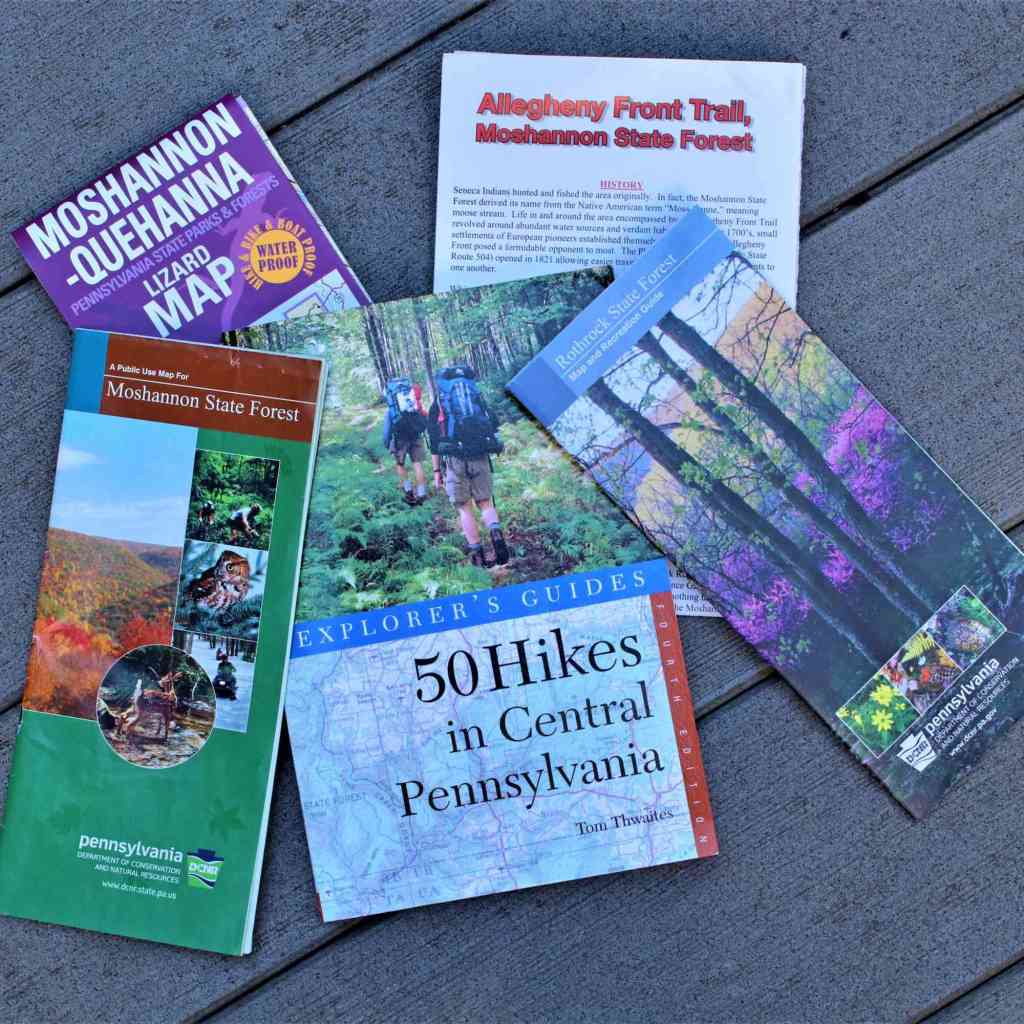
I am in the process of organizing my recent blot post “On the Trail of Giants – In Appalachia and Beyond,” into the four main themes that are interwoven throughout the original post that I want to bring forward separately for your consideration.
This is the second themed segment that is done, with the featured theme of “Giants.”
The first themed segment was “Robber Barons and Resetters.”
The other two segments will feature the following main themes of the original video: ”The Energy Grid;” and “The Cataclysm.”
This particular post on “Giants” will be focusing on topics including, but not limited to, how the finding of giant human remains was well-documented in the 19th-century, and yet these days, the very existence of giants seems to be vigorously denied, and/or fact-checked as a hoax, when their remains turn-up somewhere.
This topic of where giant remains were found also ties into the location of infrastructure, like s-shaped river bends, rail and canal among other things, and there are also intriguing correlations between the locations of where some of these these giant remains were found and Civil War battles and events.
Yes, they were reported to be found at mounds, but they were also randomly uncovered when people were digging.
There are also conflicting beliefs expressed in existing documentation about whether or not these giants were advanced or primitive brutes.
Either way, the existence of giants are pushed way back in time, with what happened to them being a mystery, though frequently with the conclusion that they were warring with each other and killed each other off.}
There are clues to be found in the past and present about something huge that was and is being hidden from us which will be explored in this video.
I have been researching aspects of what I am presenting in this post for years, but this subject came about as an in-depth research topic for me through a viewer, Aaron, who sent me places he had identified to look at in places ilike Pennsylvania and West Virginia; different articles he found on giants skeletons; and some place alignments he discovered from his own inner prompting that are very revealing in terms of what has actually been going on here
Aaron is deeply connected to Appalachia, having been born and raised in Marion County, West Virginia, and currently resides in Western Pennsylvania.
I grew up in suburban Maryland in a location very close to a lot of the places mentioned in this post, so I have been to, or near, many of the places mentioned here – church youth retreats, school trips, sightseeing trips, and many other occasions.
Growing up, we accepted as true what we are told about our history, but I know from my own experience of them that these places have a feeling of being much older beneath the surface of our awareness, just like the giants themselves.

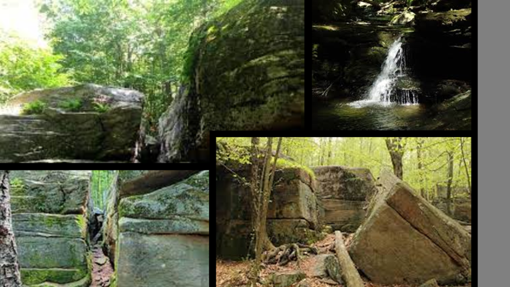
Aaron sent me places to look at that look like megalithic-looking stone structures that are tucked away in the state park and public land system, and explained to us as being natural rock formations, for example, created by the sediments deposited in streams and rivers more than 300-million-years ago the Paleozoic era.
He brought my attention to places like Boxcar Rocks in Lebanon County on Pennsylvania State Game Lands 211, described as a long line of stack boulders that are a natural geologic formation a little over a half-mile, or .8-kilometers, long, and 60-feet, or 18-meters, high.

Yet here are images that Aaron sent me where the stone blocks of Boxcar Rocks look like they have been cut-and-shaped!
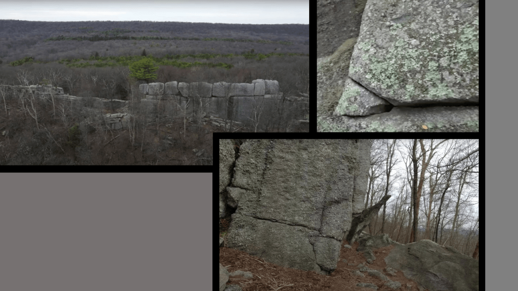
The Appalachian Trail runs through “Pennsylvania State Game Lands #211” in Swatara State Park.
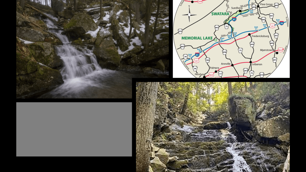
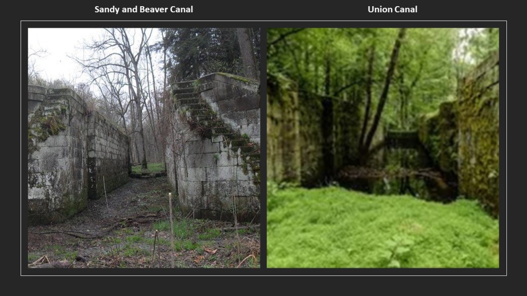
This is Lock #5 of the old Union Canal on the “Bear Hole Trail” of Swatara State Park.
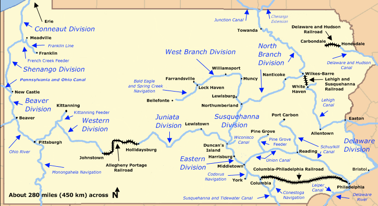
The Union Canal in southeastern Pennsylvania between Middletown, Pennsylvania to Reading, Pennsylvania, a distance of 82-miles, or 132-kilometers and said to have been built between 1792 and 1828, until it closed in 1885.

We are told the American Canal Age was between 1790 and 1855, and started in Pennsylvania, where the first legislation surveying canals was passed in 1762.
The construction of the Union Canal was said to have started under the administration of President George Washington in 1792, and was touted as the “Golden Link” in providing an early transportation route for shipping anthracite coal and lumber to Philadelphia.
This would have been less than ten years after the end of the American Revolutionary War in 1783, supposedly during a time in our history when society was based on agriculture and not technologically advanced.
Keep in mind they were said to have been doing all of this heavy construction work before the start of the Industrial Revolution in America, which would have been in the 1870s according to our historical narrative.
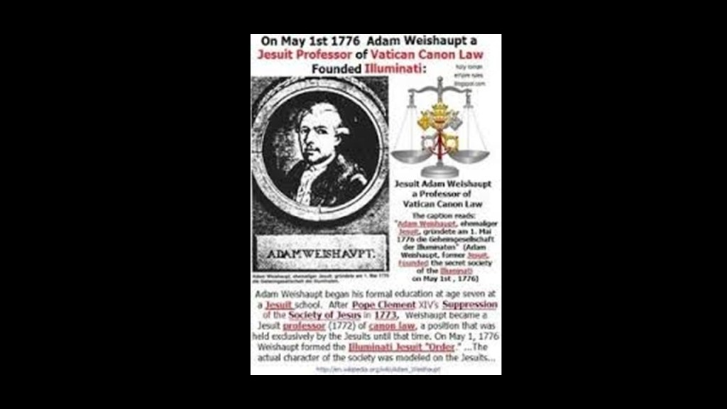
It’s been speculated on alternative media for quite awhile that George Washington and Adam Weishaupt were the same person.
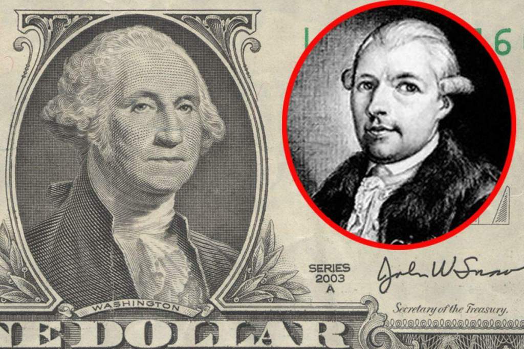
Adam Weishaupt was trained by Jesuits, and was the founder of the Bavarian Order of the Illuminati on May 1st of 1776.
So at the very least they were contemporaries, since the Declaration of Independence was signed only two-months later, on July 4th of 1776.
Nah, that’s probably just another conspiracy theory!
Yet the label of conspiracy theory or theorist has been used to disparage and shut down anyone who dares to question the narrative.

At any rate, the “Main Line of Public Works,” of which the Union Canal was a part of, was passed by the Pennsylvania Legislature in 1826 to fund various transportation systems, including canal, road, and railroad.
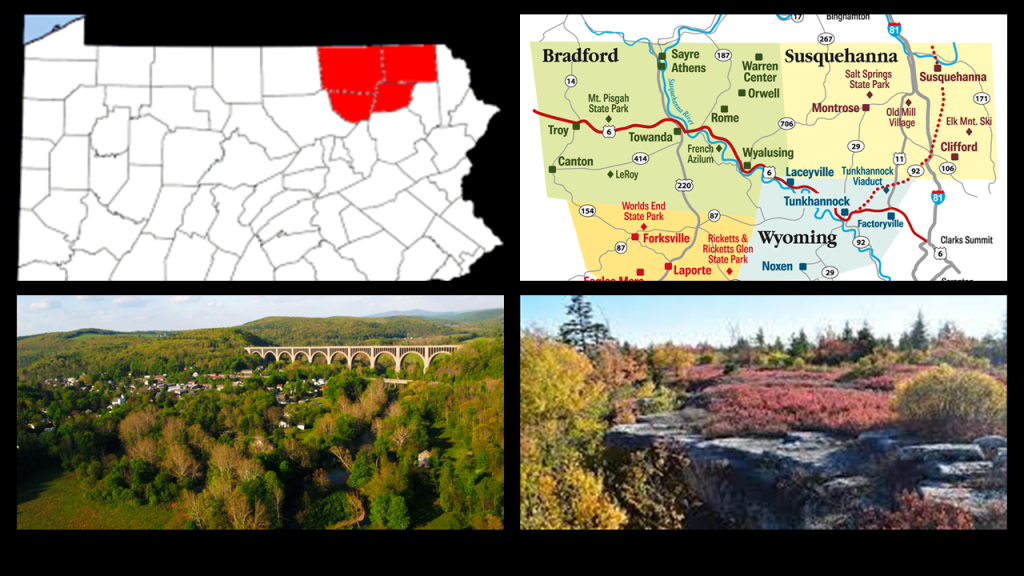
Next, Aaron drew my attention to the World’s End State Park in the Loyalsock State Forest, and is situated around the s-shaped bends of Loyalsock Creek.
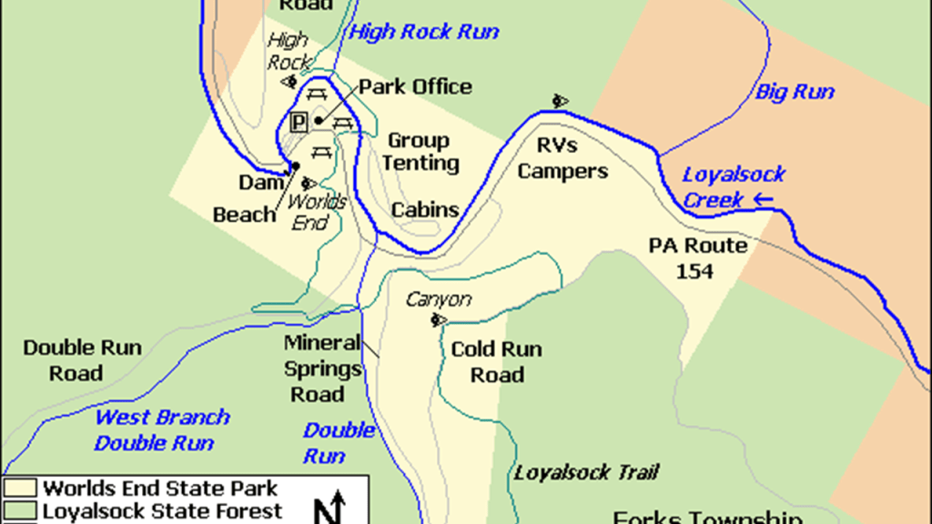
Here are some photos from the “World’s End State Park,” in the “Endless Mountains.” with what appears to be shaped and cut, block-shaped stone-work.
World’s End State Park is located in Pennsylvania’s “Endless Mountains,” a region of northeastern Pennsylvania that are not considered true mountains, but a dissected plateau on the Allegheny Plateau, and what we are told is that they were comprised of sedimentary rocks of sandstone and shale that were part of a lowland that collected sediments from mountains to the southeast that eroded millions upon millions of years ago.
This region was historically inhabited by the Susquehannock, Iroquois, and Munsee-Lenape peoples.
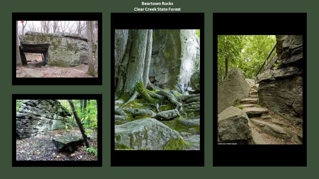
Another place Aaron sent me to look at was Beartown Rocks can be found in Clear Creek State Forest near Sigel, Pennsylvania, in Jefferson County.
The land that became the Clear Creek State Forest was purchased in 1919, at the end of the “lumber-era” that had swept through the Pennsylvania Mountains, by the end of which, Pennsylvania was stripped of its old-growth forests.
The entire park was established on three tracts of land in five Pennsylvania counties – Jefferson, Venango, Forest, Mercer, and Clarion.
Beartown Rocks in the part of the park in Jefferson County near Sigel are described as a beautiful rock formation consisting of “house-sized” boulders, that are spread out far enough they have road-like spaces in-between them, making it feel like a “rock city.”

In the section of the park in Venango County, I found references to an historic railroad that ran along-side the curvy Allegheny River in the Kennerdale Tract of the Clear Creek State Park that is now part of the hiking trail system here.
The Clear Creek State Park is very close to West Hickory, Pennsylvania.
As a matter of fact, these other places I am looking at are close to West Hickory too!
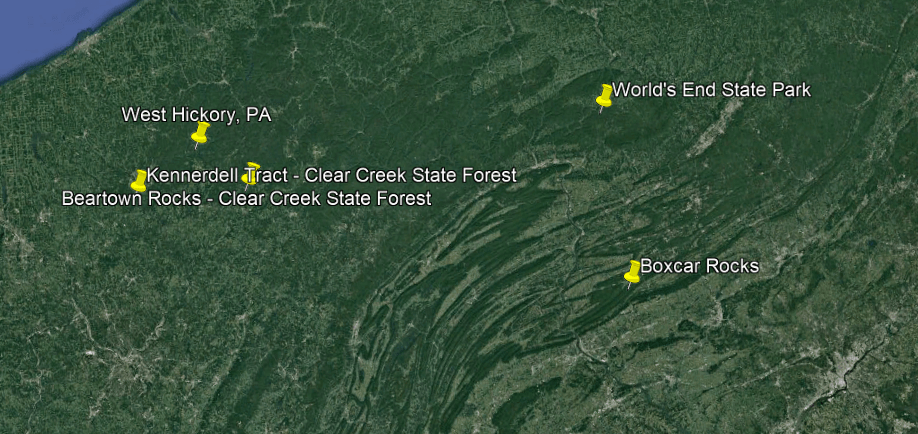
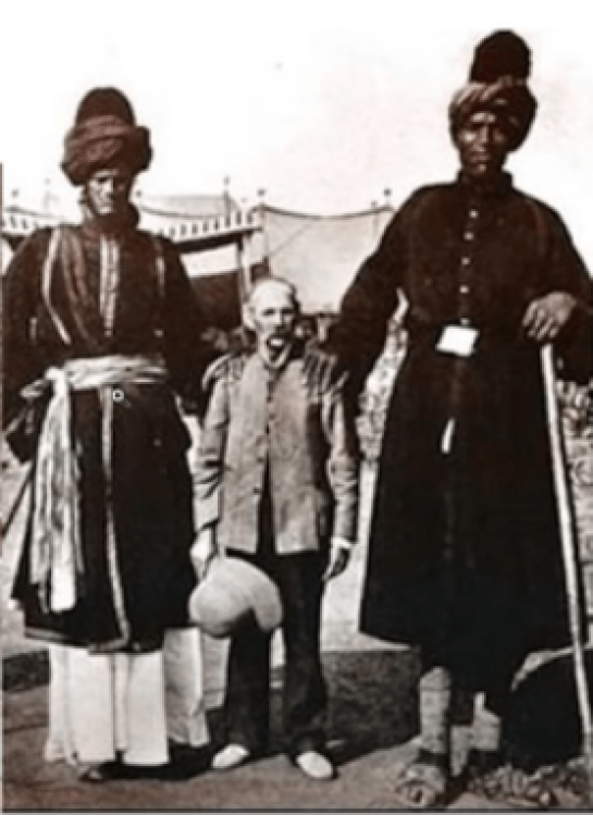
West Hickory is where the tallest recorded skeleton in North America was found, at 18-feet, 5.5-meters.
More on the West Hickory giant skeleton later in this post.

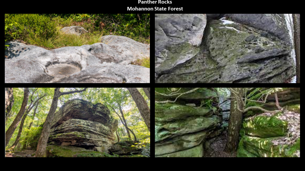
Next, Aaron directed me to Panther Rocks in Moshannon State Forest.
The Moshannon State Forest is in five counties – Centre, Elk, Cameron, Clinton and Clearfield – with its main offices in Penfield, Pennsylvania in Clearfield County.
At one time in Penfield’s history, and one of many exmaples throughout the region, it was a company town for the logging and coal mining industries in what was a local resource extraction economy, and the railroad came through here at one time.
Immigrants from Europe settled in the area to work the deep mines scattered through the Benzette Valley here.
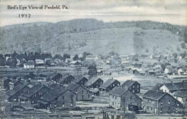
There’s not much left to speak of in Penfield, but there are recreational activities nearby at Moshannon State Forest, Bilger’s Rocks Park, Parker Dam State Park and Black Moshannon State Park.
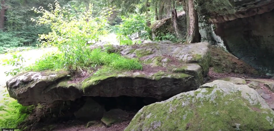
Panther Rocks at Moshannon State Forest are described as a small rock city made of several large sandstone blocks, complete with streets, overhangs, channels, crevices and a short tunnel, also said to have been naturally formed more than 300-million-years ago.
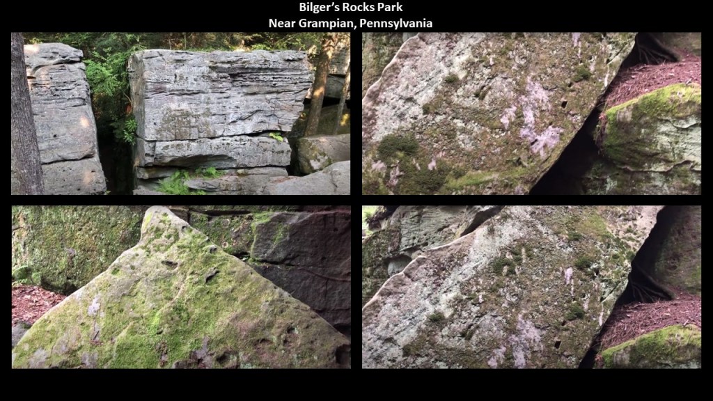
The nearby Bilger’s Rocks in Clearfield County’s Bloom Township near the town of Grampian, and is described as a larger, naturally-formed stone-city than what is found at Panther Rocks, with the same story as to how they were said to have been formed.
It is important to note that Bilger’s Rocks has many examples of what appear to be toolmarks, and linear patterns that look like they were carved or molded, and has the same rock-city-like qualities of these other places we have been looking at tucked away in the Pennsylvania Park system.
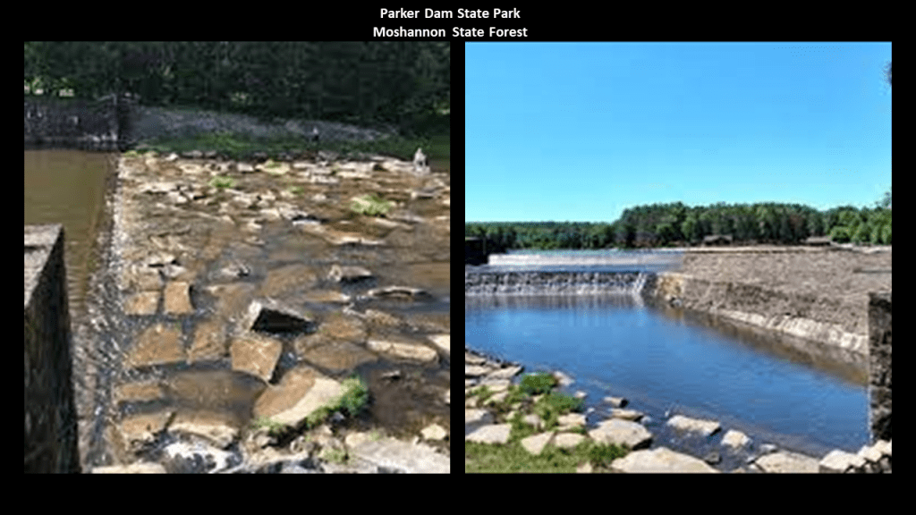
Parker Dam State Park is surrounded by the Moshannon State Forest.
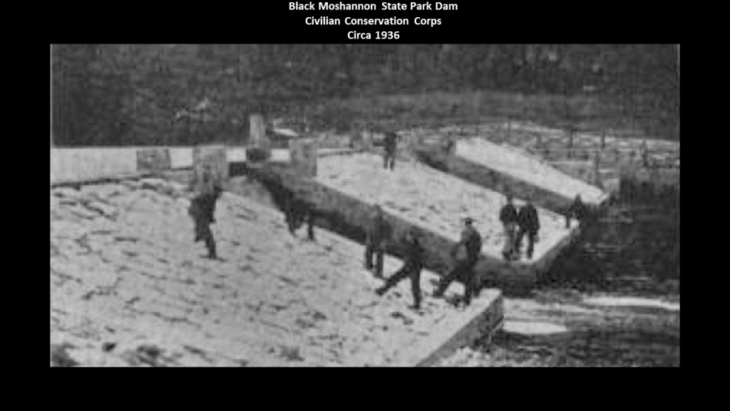
The Park was said to have been constructed by the Civilian Conservation Corps during the Great Depression.
The original dam here was said to have been constructed as a splash dam for the movement of lumber after he leased lumbering rights at some point after lumber harvesting began here in 1794, and the CCC was said to have built the current dam there to replace it as part of the improvements the otherwise unemployed, unskilled young men made when they came to work on the park.
The Civilian Conservation Corps, or CCC, operated from 1933 to 1942 in the U.S. for unemployed, unmarried men to do manual labor related to the conservation and development of natural resources in rural lands owned by federal, state, and local governments.
In the nine-years of its operation, the CCC employed 3,000,000 young men.
There is no doubt in my mind that the CCC, and the other alphabet programs of FDR’s New Deal during the Great Depression, like the WPA and TVA, were being used to cover-up the ancient advanced civilization.

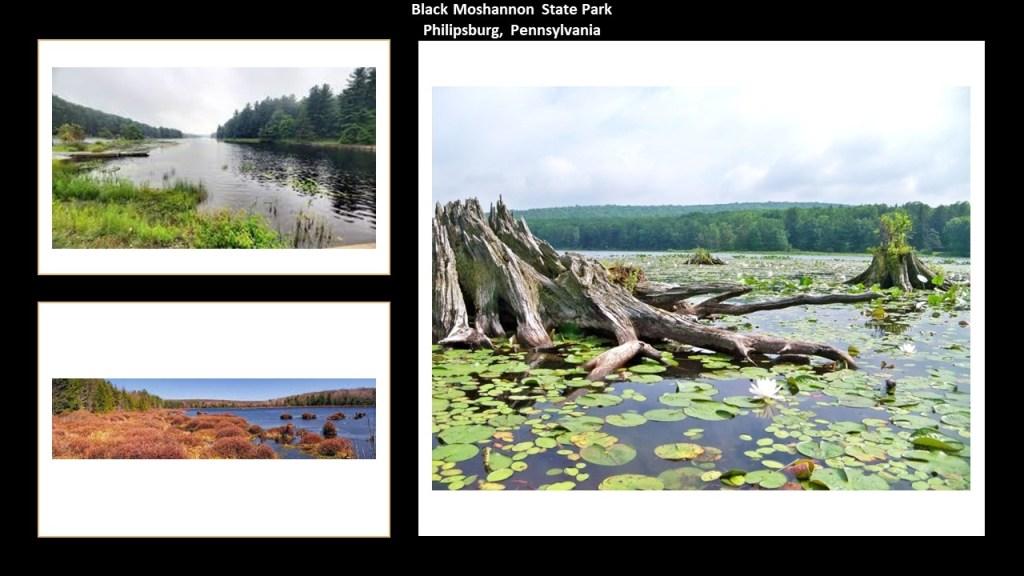
Black Moshannon State Park is largely surrounded by the Moshannon State Forest.
It is located in Rush Township in Centre County, and surrounds a lake formed by another dam, also said to have been constructed by the CCC, on Black Moshannon Creek at the site of a former mill-pond dam.
Black Moshannon State Park is the home to the largest reconstituted bog in Pennsylvania, a wetland that accumulates peat as a deposit of dead plant materials, which contains carnivorous plants, orchids, and species typically found further north.
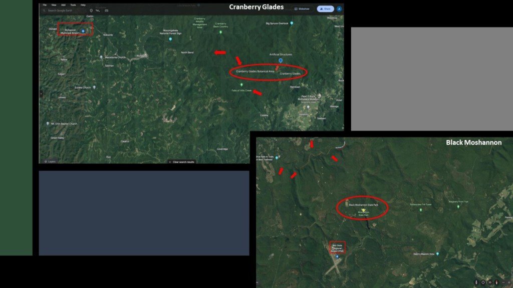
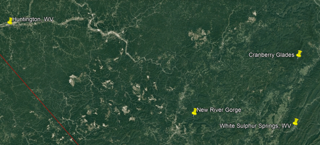
The boggy Black Moshannon State Park in Pennsylvania has a similar story as Cranberry Glades in West Virginia,
At this point I am going to bring in similarities between Black Moshannon in Pennsylvania and Cranberry Glades in West Virginia.
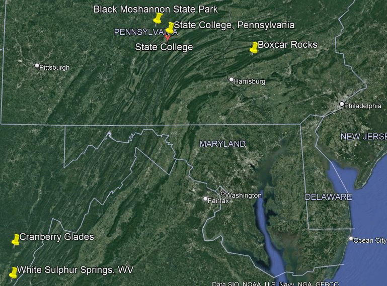
Cranberry Glades, protected in the “Cranberry Glades Botanical Area” area, are a cluster of five, separate boreal-type bogs in southwestern Pocahontas County in West Virginia, and like Black Moshannon State Park, species are found at both these locations that are typically further north.
These species include cranberries, sphagnum moss, skunk cabbage, and carnivorous plants, and the Cranberry Glades are the southernmost home of many of the plant species found here.
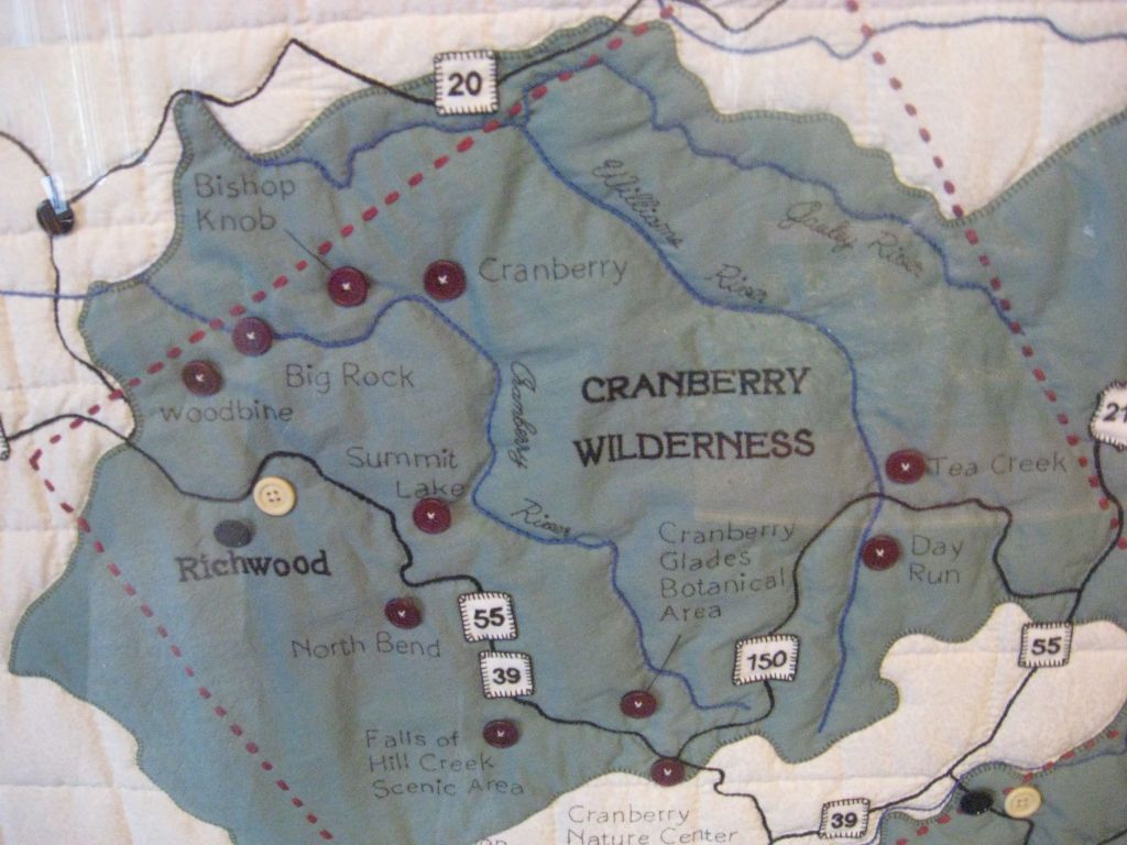
Interestingly, among other things, both locations have s-shaped river bends and airports nearby, with the name of the parks notated by an oval; the airports by a box; and the river bends are pointed at by arrows.
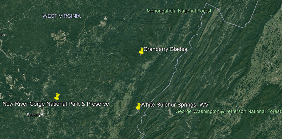
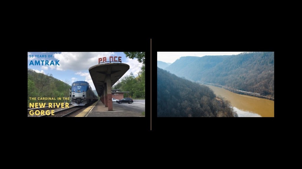
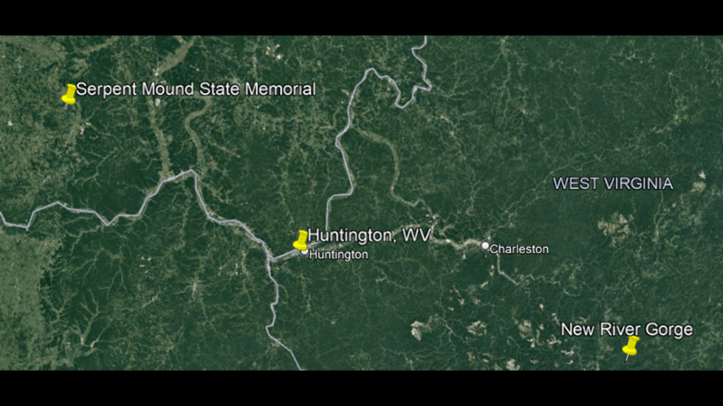
Cranberry Glades is located close to both the New River Gorge National Park and Preserve, and White Sulphur Springs, the location of the luxury Greenbrier Resort.
The New River Gorge is one of the few places that I know of that still has a railroad operating right along beside the s-shaped New River.
The Amtrak Cardinal still runs through the New River Gorge 3 days/week.
The Amtrak Cardinal Line was once a part of the Chesapeake and Ohio Railway, formed from smaller Virginia Railroads starting in 1869 under the guidance of Collis P. Huntington, and first opened in 1873, providing a rail link between the East Coast ports and Midwest cities.
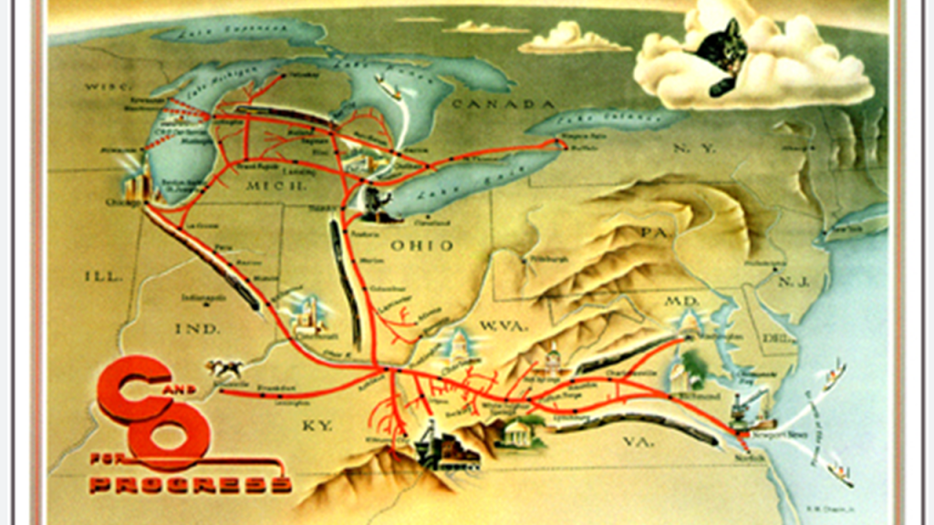
The city of Huntington in West Virginia was named for him.
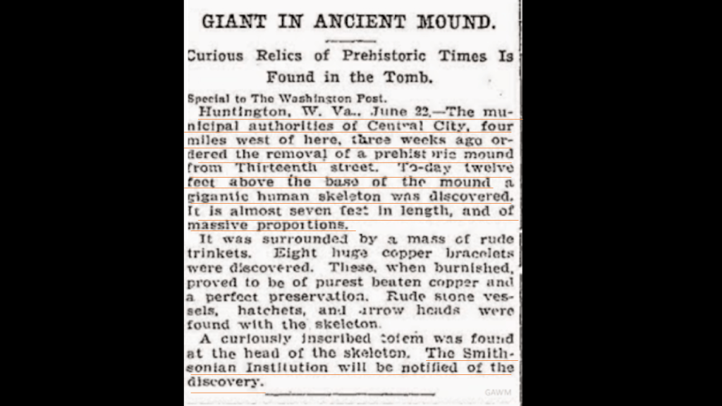
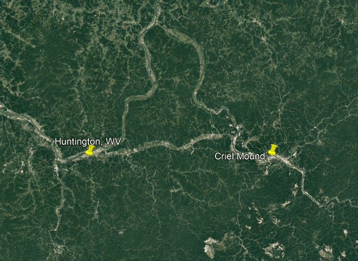
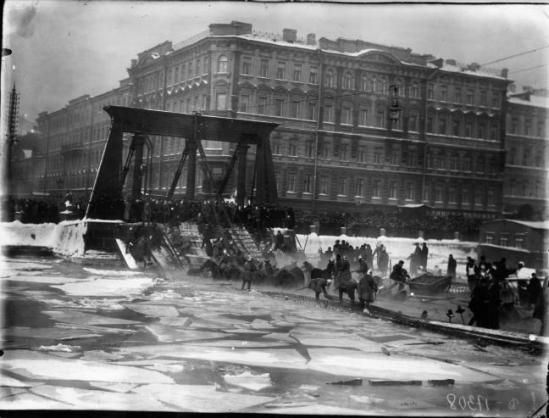
Aaron sent me this newspaper clip about an almost 7-foot-, or 2-meter-, long skeleton, of massive proportions, that was found 12-feet, or almost 4-meters, above a prehistoric mound that was ordered to be removed, in a town just four-miles, or 6-kilometers, west of Huntington.
The article states at the end that “the Smithsonian Institution will be notified of the discovery.”
The Smithsonian Institution was established in August of 1846, and was created by the United States government for the stated purpose of the “increase and diffusion of knowledge.”
Nicknamed the “Nation’s Attic,” it has an estimated 154-million items in its holdings, across numerous facilities, and is the largest such complex in the world.
The Smithsonian Castle was the first building of the Smithsonian Institution, and said to have been built on the National Mall in Washington, DC, between 1849 and 1855.

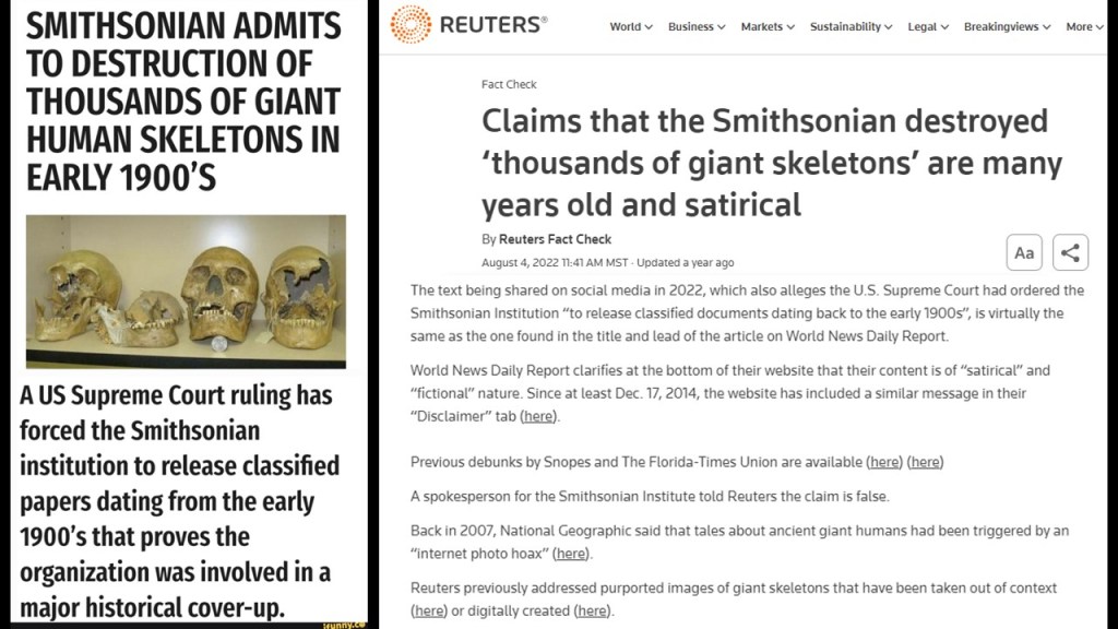
It is interesting to note that researchers have long suspected the Smithsonian to have played a role in the cover-up of giants.
Back in the day, giant skeletons were displayed in public places and mentioned in newspaper articles, but all that went away.

On the one-hand, there are reports that the Smithsonian admitted to the destruction of thousands of giant human skeletons in the early 1900 as the result of a U. S. Supreme Court ruling, and on the other hand, there are fact-checkers vigorously debunking this as a satirical claim and false.
Why is there such a contradiction of information, and vehement denial on the subject of giant skeletons, when there were historical records of their existence?
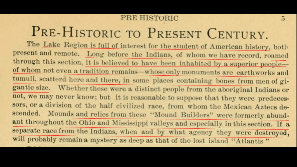
Here is another publication clipping sent to me by Aaron on the subject of giants.
Talking about the Great Lake Region, it says “Long Before the Indians…it is believed to have been inhabited by a superior people – of whom not even a tradition remans – whose only monuments are earthworks and tumuli, scattered here and there, in some places containing bones from men of gigantic size.”
It goes on to say further “Mounds and relics from these “Mound Builders” were formerly abundant throughout the Ohio and Mississippi Valleys, especially in this section. If a separate race from the Indians, when and by what agency they were destroyed will probably remain a mystery as deep as that of the lost island “Atlantis.”
So this acknowledges the presence of giants here who were Mound Builders, but shrouds what happened to them in mystery, just like the lost Atlantis, saying we don’t know who they were, or really anything about them, except that they were a superior people.
Criel Mound in South Charleston West Virginia, a short distance as the crow flies of of 41-miles, or 66-kilometers, from Huntington.
It was said to have been levelled in 1840 to create a judge’s stand for horse-races that were run around the base of the mound at the time.
We are told it was excavated between 1883 and 1884, and that thirteen-skeletons were found all together, with one of them being documented as having had a height of almost 7-feet, or 2-meters.

The Criel Mound is one of the few surviving mounds of the Kanawha Valley Mounds.
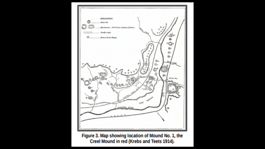
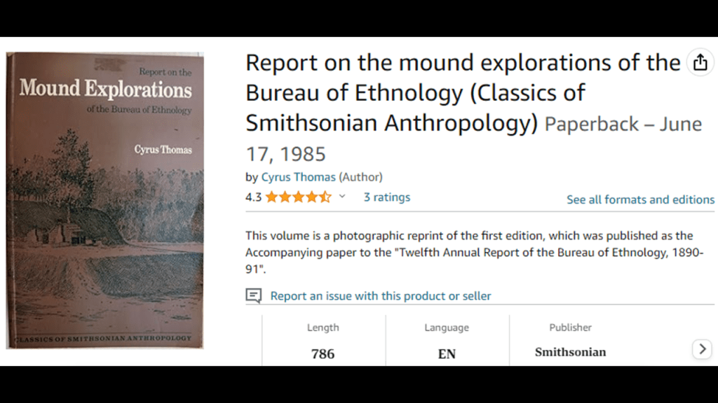
The area extended along the upper terraces of the Kanawha River floodplain for 8-miles, or 13-kilometers, and consisted of 50 mounds and 8 – 10 circular earthworks, as reported by Cyrus Thomas, a prominent ethnologist of the late 19th-century employed by the Smithsonian Institution’s “Bureau of Ethnology,” best known for his work on American mounds.
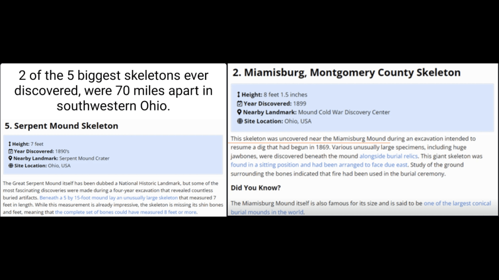
Along with the tallest skeleton by far being 18-feet, or 5.5 meters, -tall at West Hickory in Pennsylvania, seen earlier in this post, of the ten featured on this graphic, three are in the vicinity of where we have been looking at around Huntington, West, Virginia.
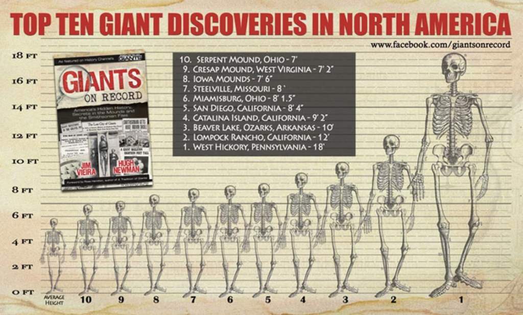
Number 10 on the list was found at the Great Serpent Mound, at 7-feet, or a little over 2-meters, -tall; #9 at Cresap Mound in West Virginia at 7-feet, 2-inches, still a little over 2 -meters, – tall; and #6 at Miamisburg, Ohio at a little over 8-feet, or 2.5-meters, -tall.
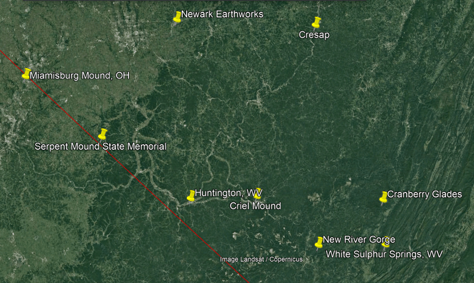
The Great Serpent Mound is only a distance of 63-miles, or 102-kilometers, northwest of Huntington.
Numerous historical giants’ skeletons have been found in the area around Serpent Mound.
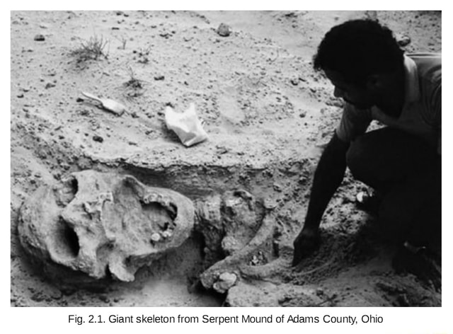
The Great Serpent Mound in Peebles, Ohio, is described as an effigy mound that is 1,348-feet-, or 411-meters-, long, and 3-feet-, or almost one-meter-, high.
An effigy mound is defined as a raised pile of earth built in the shape of a stylized animal, symbol, religious figure, person, or some other figure.

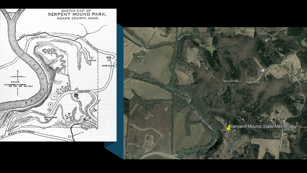
Here is a detailed sketch of the area from an 1883 archeological expedition on the left that was in an article from the Volume 39 of the 1889 – 1890 “Century Illustrated Monthly Magazine,” authored by F. W. Putnam.
It shows the proximity of the Great Serpent Mound to the s-shaped bends of Brush Creek, and its nearby confluences/junctions with other watercourses, compared with the Google Earth Screenshot of the location on the right.
Now I am starting to look for railroad history every time beside all these s-shaped rivers, but it was elusive here for some reason.
The only thing I was really able to find was this one photograph of railroad tracks at the Scioto Brush Creek State Nature Preserve in Adams County, Ohio.

I mentioned to Aaron that I was having difficulty finding information on historic railroad in this area next to the Great Serpent Mound.
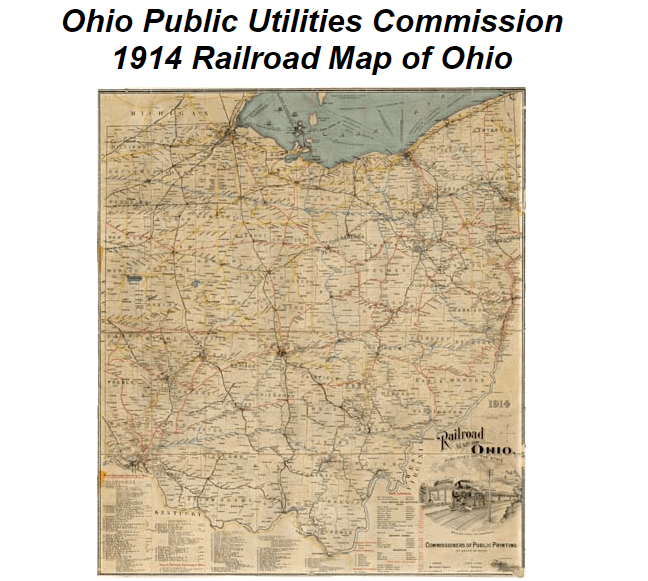
So he sent me a link he found when he looked as well of a 1914 Railroad Map of Ohio from the Ohio Public Utilities Commission showing all the railroads in Ohio.
It is hard to see in this form, but if you click on the quadrants of the map, it shows a close-up of each.
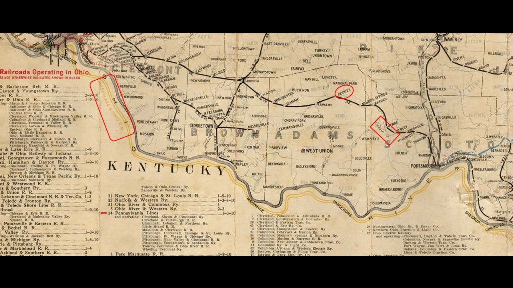
Here is a close-up of the railroads in the southwestern part of Ohio where Peebles and Adams & Scioto County is located near the state’s border with Kentucky, which is formed by the s-shaped bends of the Ohio River.
The Chesapeake and Ohio Railroad is marked in the yellow on the map, where it parallels the Ohio River.
Peebles in circled in red on the rail-line passing through, and there is a red box around “Brush Creek” showing an historic railroad line there.
Astronomical alignments have been found in the shape of the Great Serpent Mound.

The official narrative loves to describe the Mound Builders as “indians in loin cloths building the mounds one basketful of dirt at a time…” that “…achieved something extraordinary with their profound understanding of geometry and astronomy.”
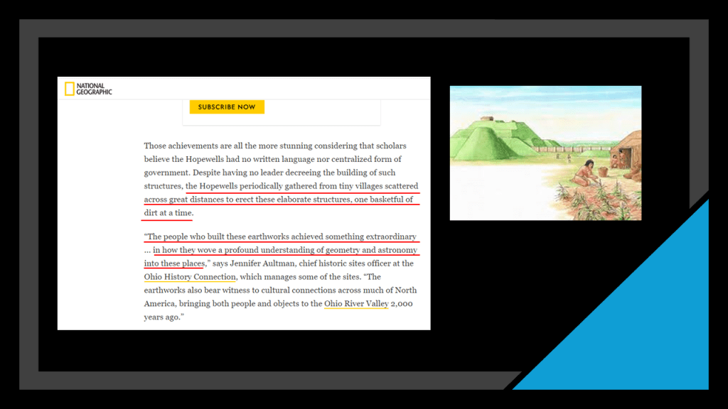
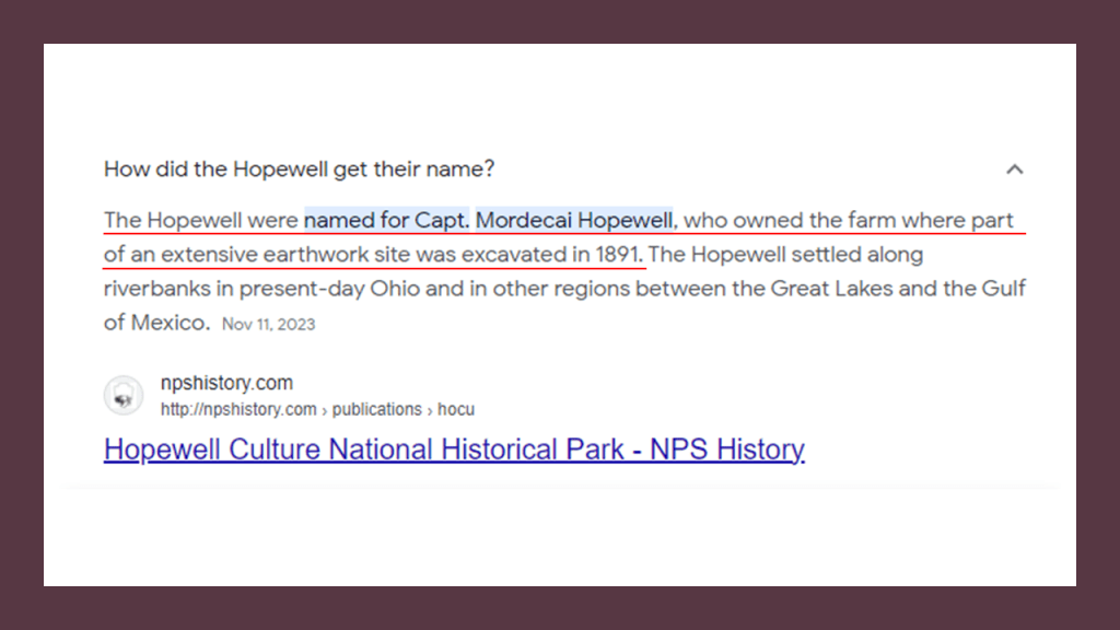
Even the name of “Hopewell” given to the civilization of the Mound Builders was after the owner of the farm where an extensive earthwork site was excavated in 1891.
Interesting to note the alignments Aaron uncovered when he was prompted to look into the relationship between the Serpent Mound as a hub and the locations on Google Earth of Kirkbride Facilities (marked by white), key masonic lodges (green), and state capitals (red).
I believe that the Earth’s original free energy grid system, which was originally designed to benefit all life everywhere, was reverse-engineered into a control system used against Humanity by those responsible for what has taken place here for the benefit of a very few.
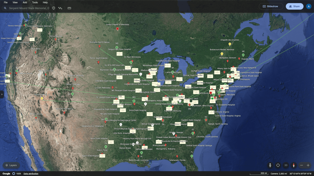
And what are Kirkbride Facilities?
Thomas Kirkbride was a Pennsylvanian who was said to have designed a system of insane asylums starting in the mid-19th-century that were constructed according to the Kirkbride Plan across the U. S. and while numerous Kirkbride structures still exist, many have been demolished, partially-demolished, or repurposed.
I will be talking more about Aaron’s findings along these lines in the third themed segment of this series, which is on “The Energy Grid.”

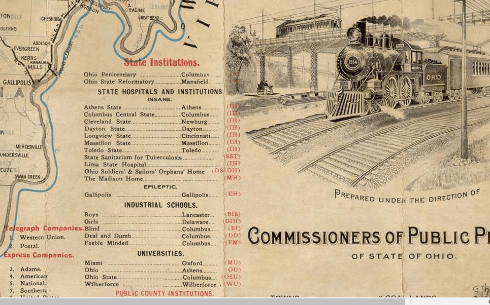
It is interesting to note that in the lower right quadrant of the 1914 Ohio Railroad map that insane asylums, and other state institutions, were actually highlighted on it.
It certainly seems like the institutionalization of people for one reason or another was quite common during this time period in our history.
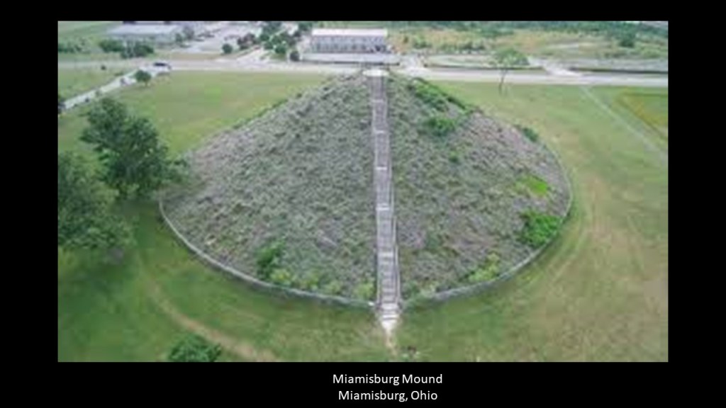
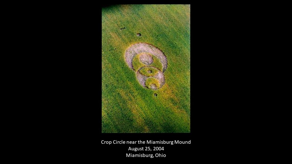
Next, number 6 of the “Top Ten Giant Discoveries in North America” was found in Miamisburg, Ohio, near the Miamisburg Mound, which is 70-miles, or 113-kilometers, from the Great Serpent Mound in Peebles, Ohio.
The Miamisburg Mound is located next to the s-shaped Great Miami River.
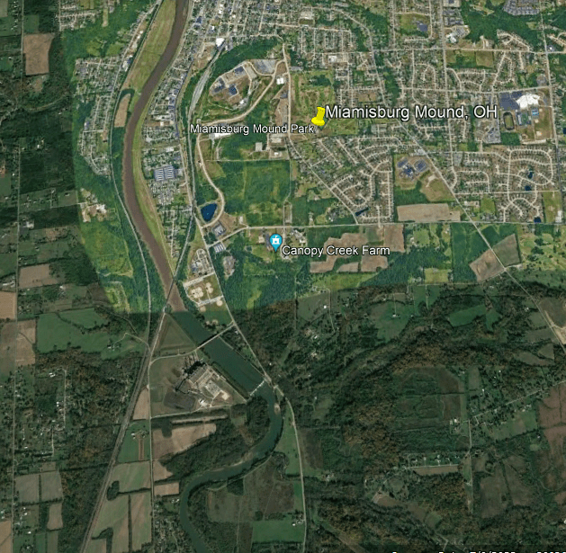
The Miamisburg Mound is the largest conical-shaped earthwork of its kind in the United States.
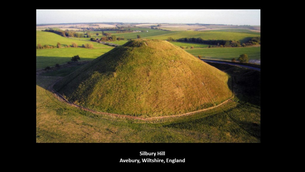
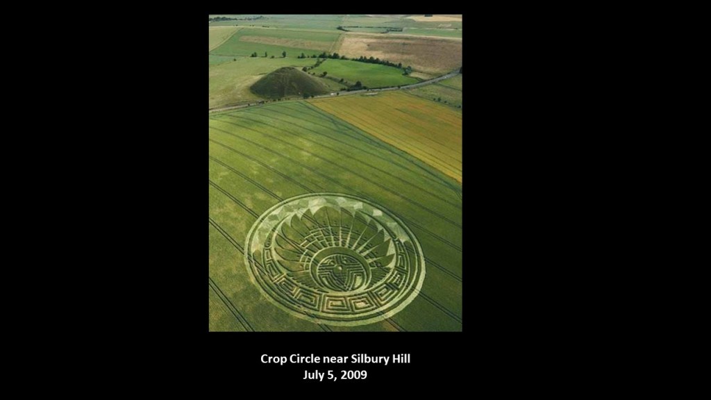
Silbury Hill, located near the Avebury megalithic complex in Wiltshire in England, is similar in appearance to the Miamisburg Mound, and is the largest mound of its kind in Europe
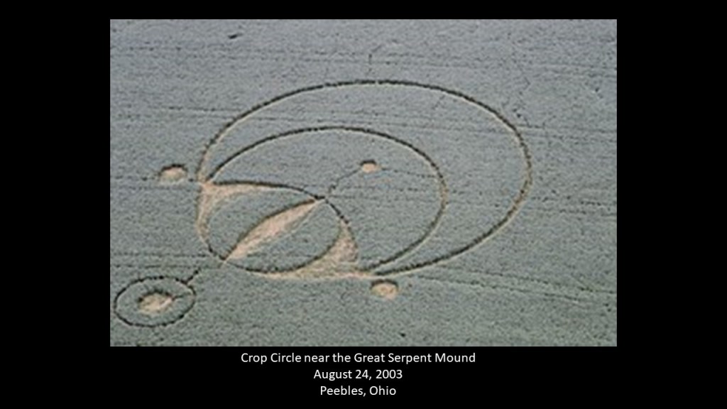
It is interesting to note that crop circles have appeared in proximity to these three places in Ohio and England.
This one appeared near the Great Serpent Mound in a soybean field in August of 2003.
Another one appeared in a cornfield in Miamisburg near the Miamisburg Mound, almost exactly a year later, on August 25th of 2004.
And crop circles show up near Silbury Hill quite frequently, like this one on July 5th of 2009, called a “Mayan Mask” design.
Crop Circles are another subject that makes the Establishment want to classify them as a hoax.

But the complexity and intricacy of crop circles that have manifested certainly make it challenging to explain them away as hoaxes.

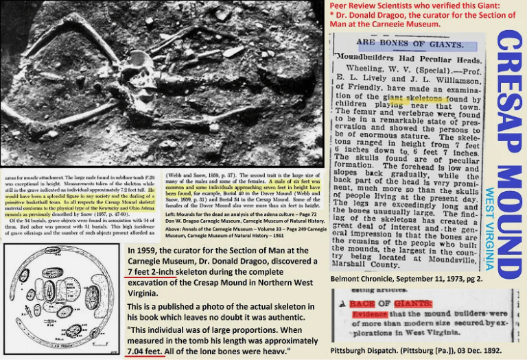
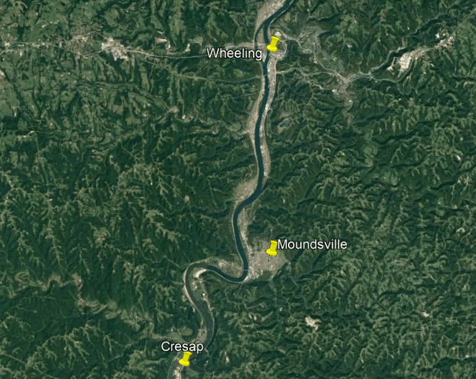
Number 9 on the Top 10 list in North America was found documented to have been found in 1959 by Dr. Donald Dragoo, the Curator for the Section of Man at the Carnegie Museum of Pittsburgh, at Cresap Mound in West Virginia at 7-feet, 2-inches, still a little over 2 -meters, – tall.
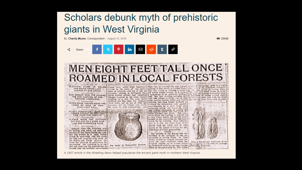
Yet Academia still persists in the debunking of presence of giant humans here.
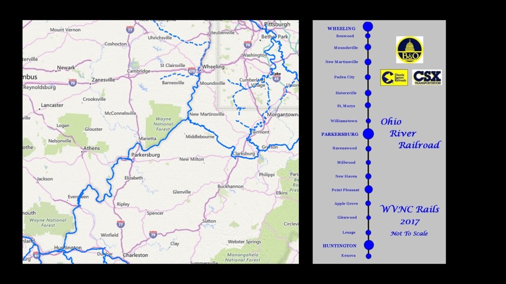
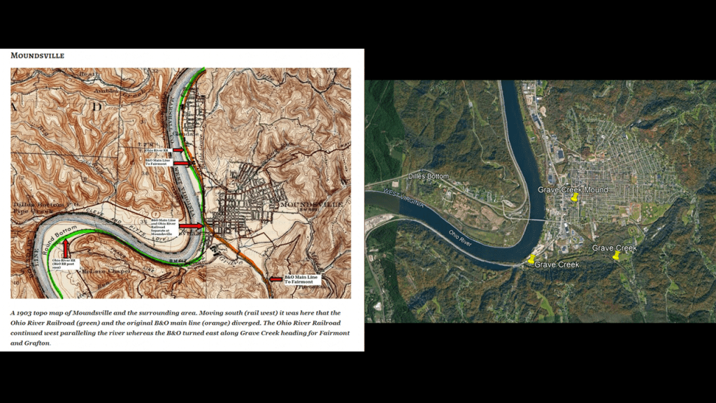
Grave Creek Mound in Moundsville, West Virginia, is just the short distance of 9-miles, or 15-kilometers, north of Cresap on the Energy Highway which parallels the Ohio River…
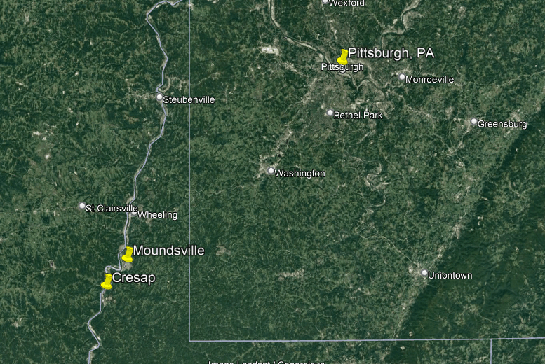
…and also the route of the Ohio River Railroad, most of which survives today for use by CSX for freight transportation. unlike so many other places where it is completely gone.
https://www.csx.com/index.cfm/customers/maps/csx-system-map/
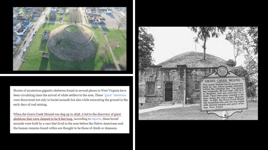
The Grave Creek Mound is considered to be one of the largest conical mounds in the United States, and first excavated by amateurs in 1838, at which time giant skeletons reported to be as long as 8-feet were uncovered, but not listed on the top ten giant discovered in North America for some reason. I guess because it was done by amateurs.
The Grave Creek Mound just so happens to be smack dab across the street from the West Virginia Penitentiary!
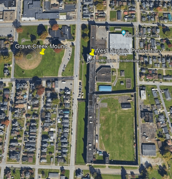
If you are interested in going for a visit, the West Virginia Penitentiary was said to have been built in 1866, one year after the end of the American Civil War, and was decommisioned in 1995.
The location offers prison tours from April to November every year, and paranormal investigations take place here because of its haunted reputation.

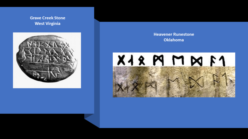
The Grave Creek Stone is called West Virginia’s most controversial archeological relic.
It was discovered when the Grave Creek Mound was first excavated in 1838.
Initially it was believed to be some kind of “Indian Hieroglyphs,” but different scholars of the day concluded the characters on the stone resembled a variety of ancient alphabets, including but not limited to that of Celtic, Tunisian, Egyptian and Etruscan.
Other scholars dismissed the Grave Creek Stone as a fraud.
The Smithsonian has four casts of the stone, but the location of the original is said to be unknown.
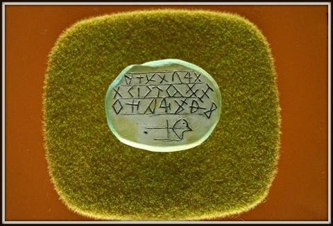
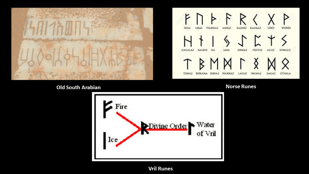
The characters of the Grave Creek Stone bring to mind those on the Heavener Runestone in east-central Oklahoma, which have been mostly attributed to being the Norse Runes of Vikings that found their way there long ago.
Same thing for the appearance of Old South Arabian, like the inscription found in southern Yemen on the left, compared with Norse Runes on the right.
What if these runes were actually the runes of Vril, or “Life Force,” pictured on the bottom middle, that was connected to the Ancient Humans and their mastery of how to harness natural energy to create amazing things.
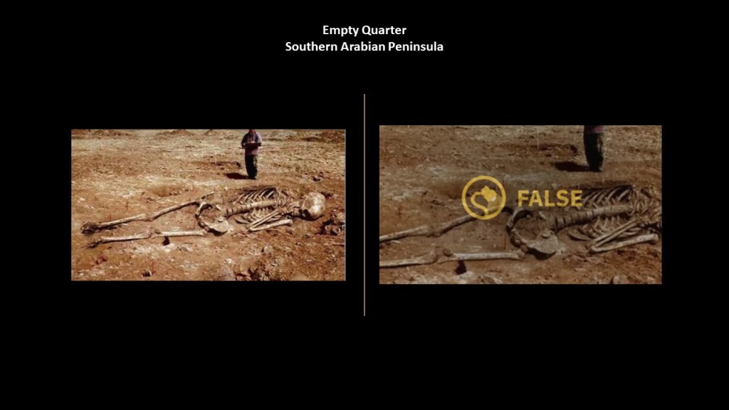
Giant skeletons have also been uncovered in the desert sands of southern Arabia in the process of looking for gas and oil, but like everywhere else these days, discoveries like this have been labelled as hoaxes.
Back in West Virginia, in 1857, the almost 11-foot skeleton of a giant was found in the vineyard of the sheriff in East Wheeling, and was on-display there for an unknown period of time.
Looks like the giant skeleton was parked outside of a store in Wheeling displaying an array of skulls and bones!
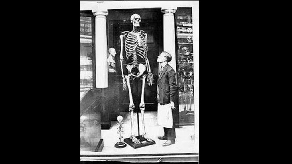
Hmmm – wonder what that was all about!

Wheeling is just up the Ohio River a short-distance from Moundsville.
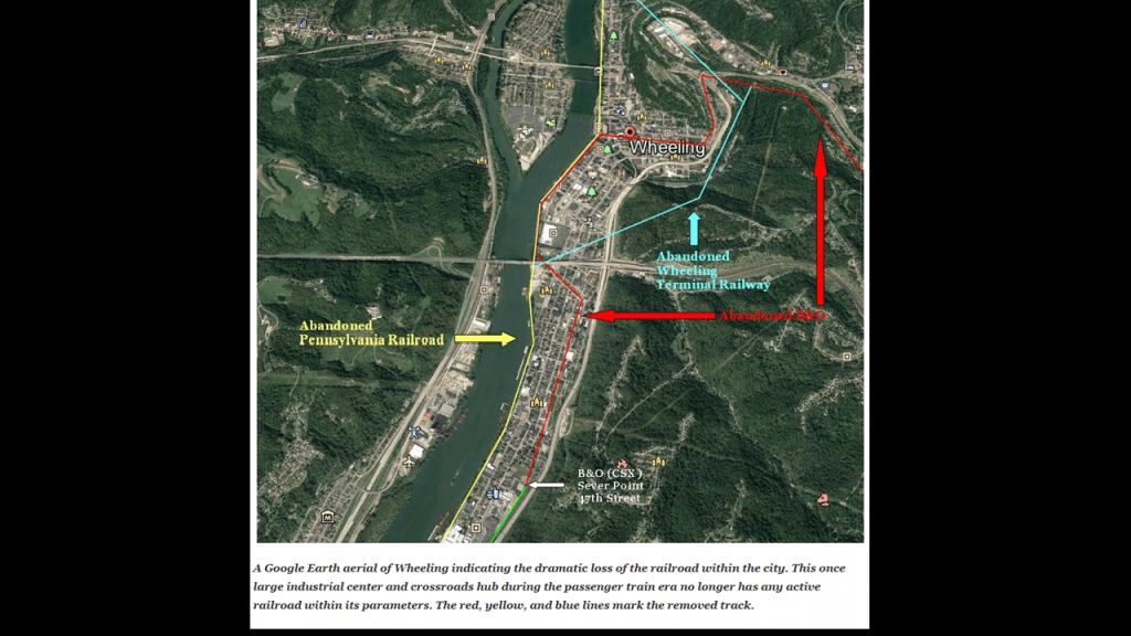
Wheeling became an important railroad hub, political power, and manufacturing center for cigars, matches, and nails, from the completion of the B & O Railroad from Baltimore to Wheeling in 1852, and the beginning Ohio River Railroad in 1882.
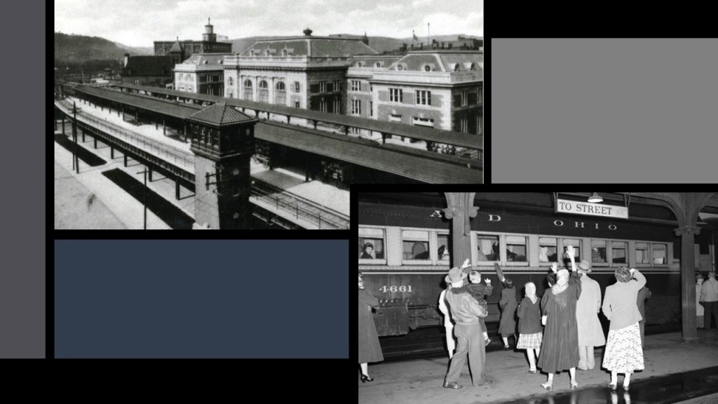
By June of 1961, passenger service had ended, and in the years that followed, the industrial base of the area declined for reasons ranging from strict regulations to foreign competition, and the railroad infrastructure was no longer needed.
Moundsville had been incorporated in 1830, and the B & O Railroad came here in 1852
The B & O Railroad Main Line diverged from the Ohio River Railroad at Grave Creek in Moundsville, and linked to Fairmont in Marion County, West Virginia.
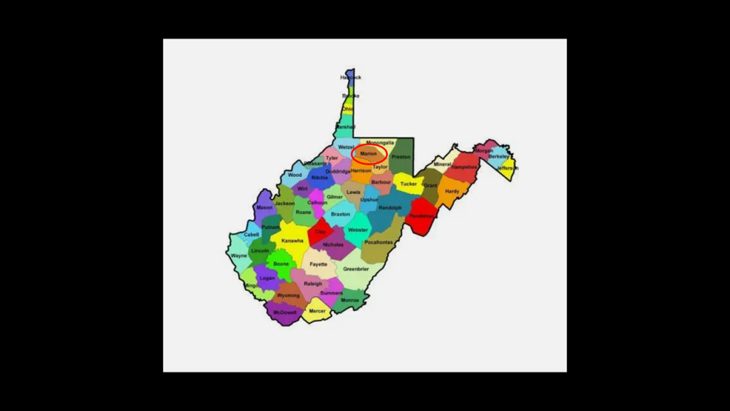
Aaron also provided me with recorded references to giant skeletons that were found in in Marion County, that is tucked in-between West Virginia’s borders with Ohio to the West; Pennsylvania to the North; and Maryland to the East.
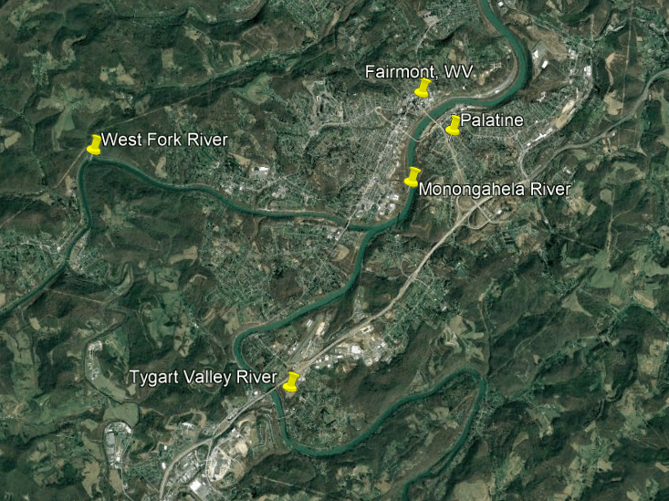
Here is an oral account that was recorded of giant bones found on the Monongahela River in Marion County.
A local woman reported that a schoolmaster had found four human skeletons near the river, presumably washed from their graves, where Palatine is now, and before reburying them, measured them and found that they were 8-feet, or almost 2.5-meters, -long.
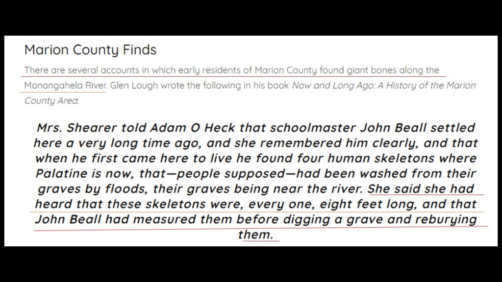
Today, Palatine is part of Fairmont on the Monongahela River.
Fairmont is the seat of Marion County.

Aaron also sent me this information on p. 10 in “The History of Marion County.”
The information on this page referred to:
–Workmen preparing to build a bridge unearthed three giant skeletons, measuring over 7-feet, or 2-meters, in length, in the village of Rivesville at Paw Paw Creek;
–Other skeletons having been found in the area, like around Boothsville.
The excerpt also references traces of an “aboriginal fort having been found 2-miles, or a little over 3-kilomers, north of Fairmont.
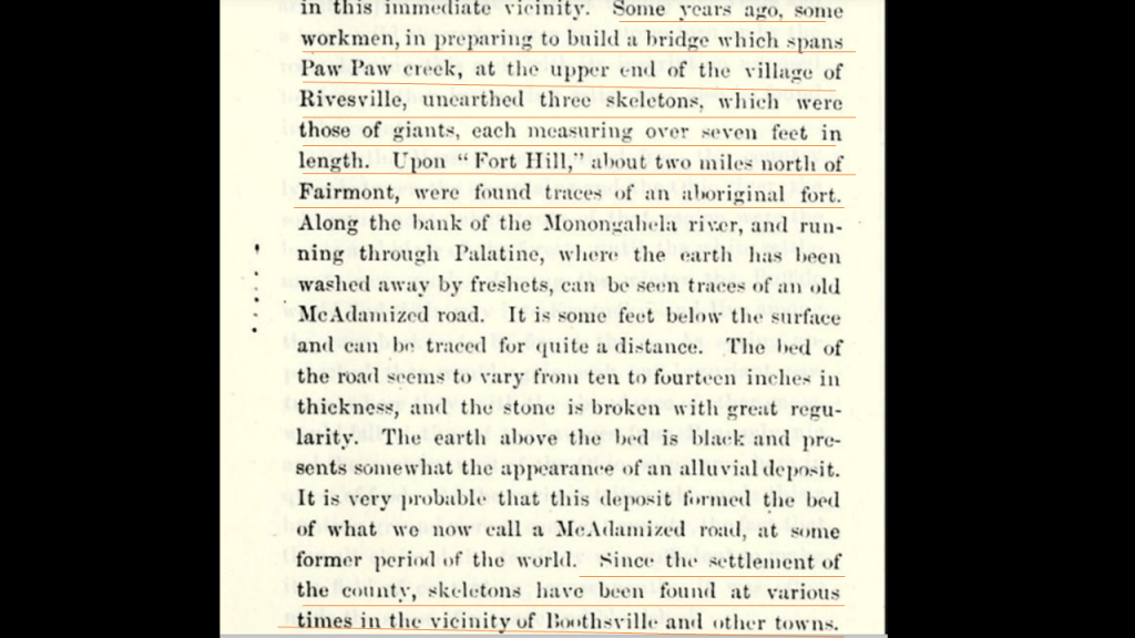
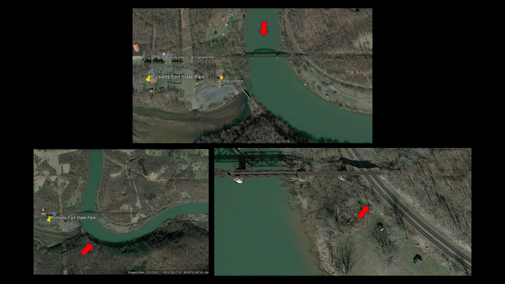
The only fort I can find any information on to speak of near Fairmont is “Pricketts Fort,” which just happens to be the same distance north of Fairmont that is referenced on the “History of Marion County” page.

Pricketts Fort State Park is at the confluence of the Monongahela and Pricketts Creek, and we are told that it is was a reconstructed “refuge fort to defend local settlers from hostile indian raids.
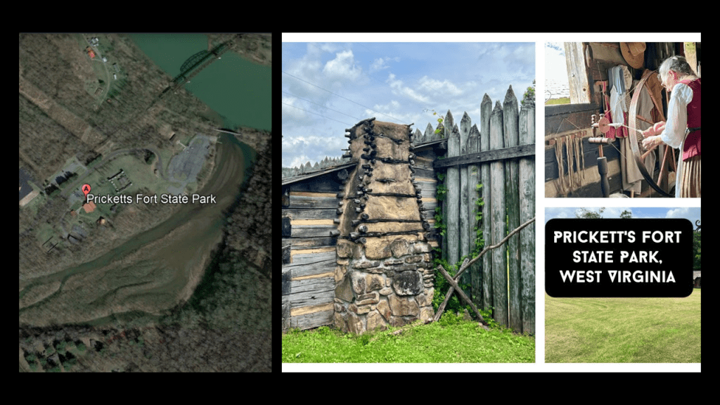
A couple of interesting things to note about the Picketts Fort location.
First is that the site of the fort is located on a river-bend, right next to an old railroad bridge that is now part of the Marion County Rail-Trail, and there are railroad tracks right next to the Monongahela River, still in use by the Fairmont Subdivision, a railroad from Grafton to Rivesville that is owned and operated by CSX Transportation on what used to be part of the B & O Railroad Mainline.
Fairmont is located just above the confluence of where the West Fork and Tygart Valley Rivers meet to form the Monongahela River.
I searched for more information on Fairmont’s railroad history and this is what I found.
First, the Fairmont & Clarksburg Electric Railroad was an inter-urban electric streetcar system that served the Fairmont and Clarksburg areas, linked by a main-line, and connected the communities of Bridgeport, Fairview, Mannington and Weston.
It offered both passenger and freight services, and connected communities and coal camps.
It became operational in 1901.
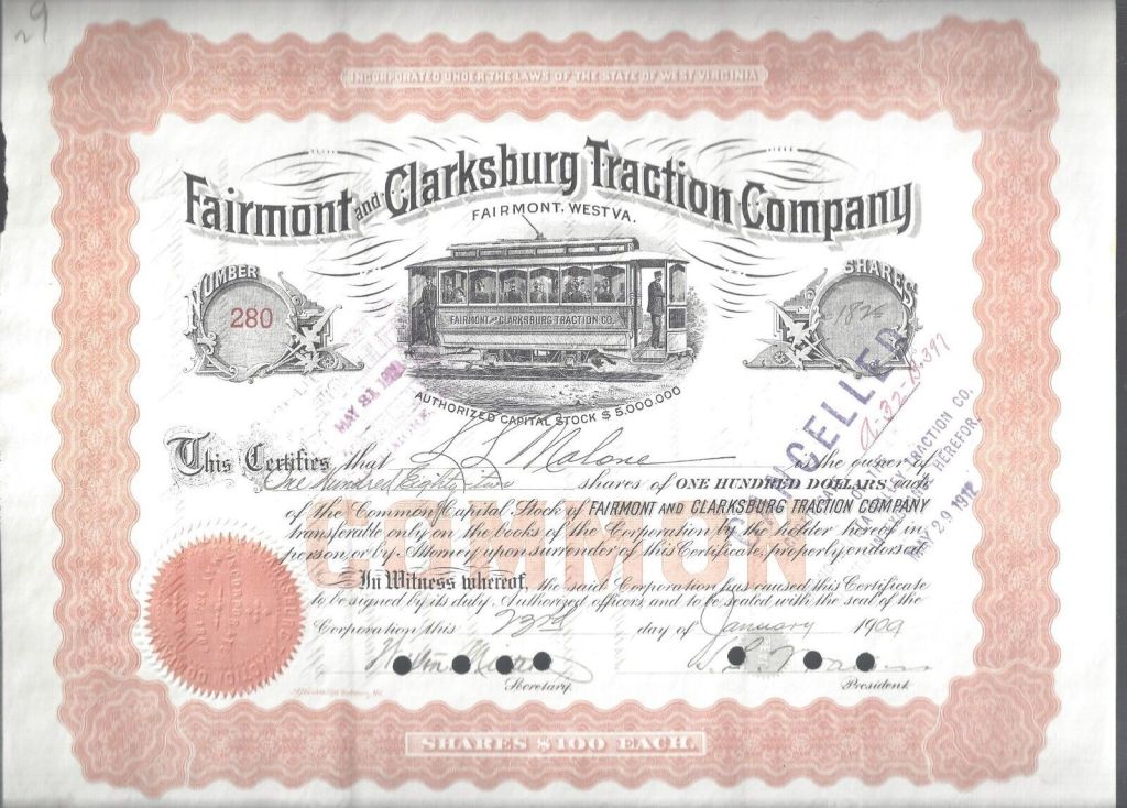
This interurban streetcar system was abandoned entirely by 1947, when the system had transitioned entirely to bus services.
This was the crossing of this interurban line at Hawkinberry Run near Rivesville, where aforementioned giant skeletons were found in Marion County.
Besides the historic main-line between Fairmont and Wheeling in West Virginia Next, the Fairmont, Morgantown & Pittsburgh Railroad once connected Fairmont to Uniontown in Pennsylvania, a distance of 56-miles, or 17-kilometers, from 1894, until 1953 when passenger service ended after the importance of the line wanted as coal mines closed along the route.
By 1991, most of the line between Fairmont and Uniontown was abandoned, with the exception of two short stretches that are still in use today by CSX Transportation.

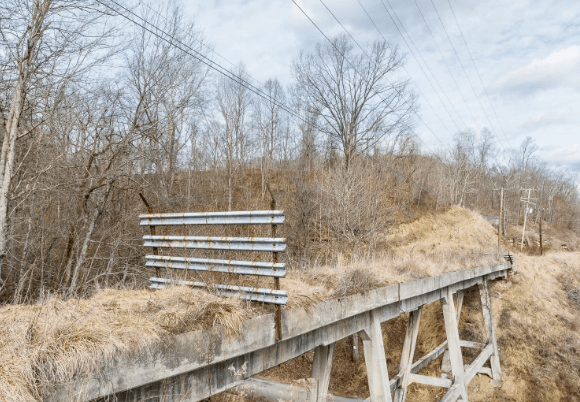
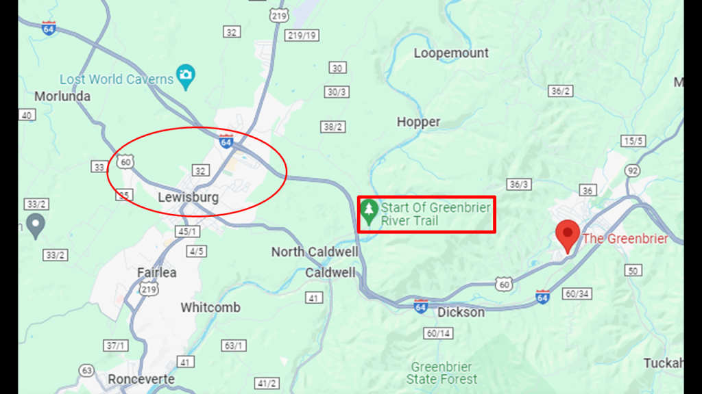
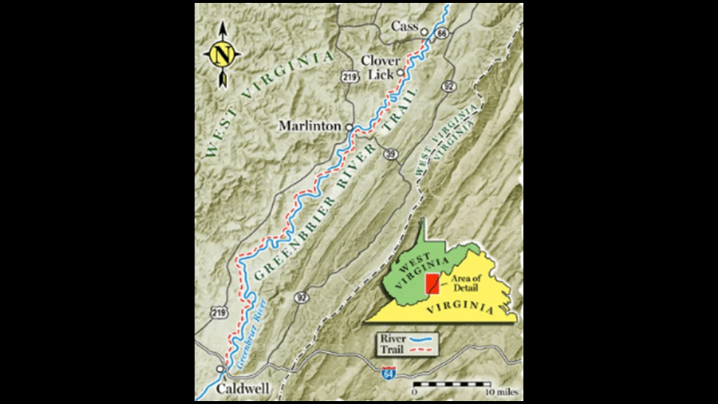
Other places of interest in West Virginia include places like the Greenbrier River Trail, which is located between the Greenbrier Resort in White Sulphur Springs and Lewisburg on Interstate 64, also near the bogs at Cranberry Glades.
It was also a former railroad bed and right-of-way.
What is now the Greenbrier River Trail was gifted to the State of West Virginia in the late 1970s and opened as a recreational, multi-use trail in 1980.
It runs between North Caldwell and Cass in Eastern West Virginia.
Cass was the location of the Virginia Pulp and Paper Company, and named for Joseph Kerr Cass, the Vice-President and co-founder of the pulp and paper company.
Most of the town named for Joseph K. Cass, and its buildings, were bought by the State of West Virginia in 1961 after the pulp and paper mill closed in 1960, and it became the Cass Scenic Railroad State Park.
The Cass Scenic Railroad State Park continues to offer trips to Whittaker Station; the ghost town of Spruce; and Bald Knob, the highest point of the Back Allegheny Mountain in Pocahontas County.

The logs for the pulp mill in Cass came from the nearby Cheat Mountain, which were brought by rail to the mill for processing until the mills closure.
Cheat Mountain, which is next to the Back Allegheny Mountain, was once the home of the largest red spruce forest south of Maine.
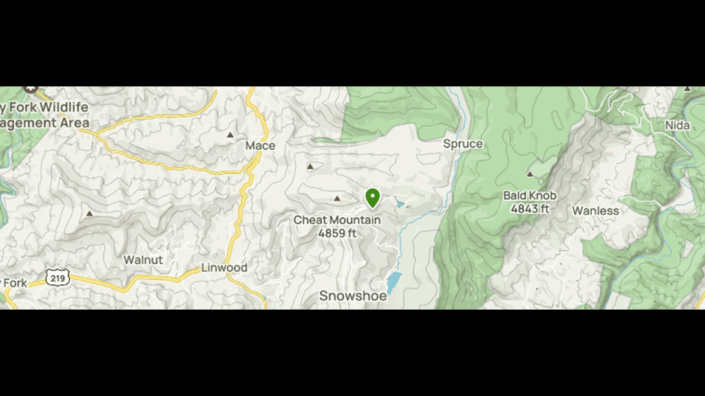
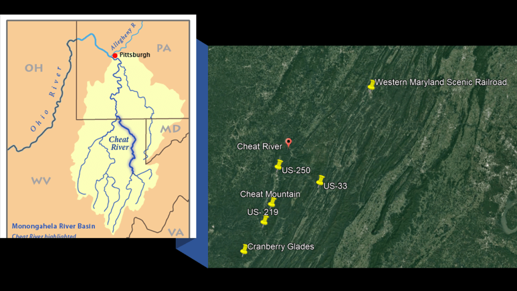
Cheat Mountain is flanked on the western side by U.S. Route 219 and on the eastern side by the Western Maryland Scenic Railroad.
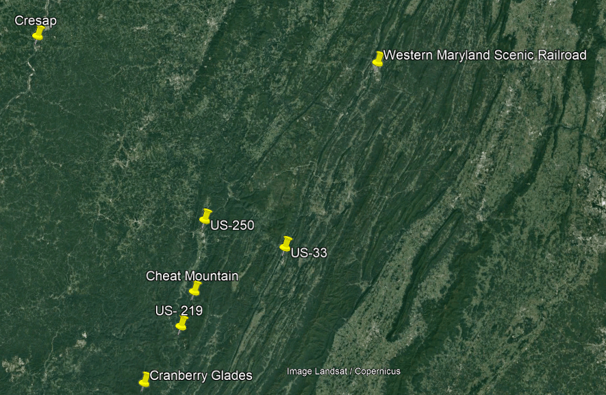
The Cheat River runs along this section of West Virginia between the state’s border with both Pennsylvania and Maryland.
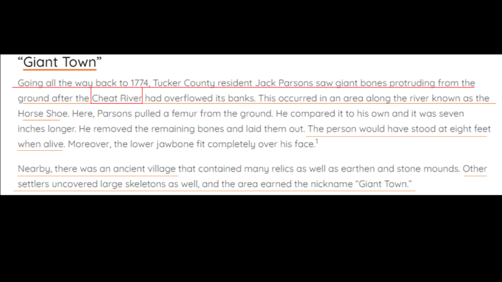
Aaron sent me this reference to giant skeletons having been uncovered in the location of the Cheat River.
The first reference was a Tucker County resident finding giant bones protruding from the ground in the area on the Cheat River known as “Horse Shoe” in 1774, that he estimated would have been from someone 8-feet, or almost 2.5-meters, -tall when he laid them out.
Also, other settlers found large-size bones nearby in what is described as an “ancient village” that had earthen and stone mounds, earning the area the nickname “Giant Town.”
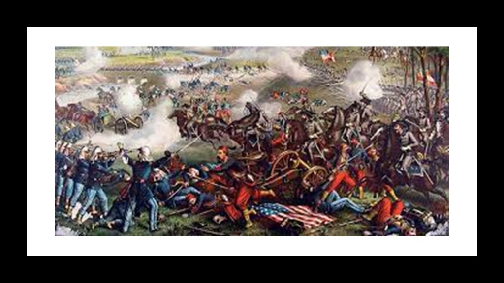
This brings us to one of several Civil War correlations between the subject of historical giants and Civil War activity in the course of doing present and past research.
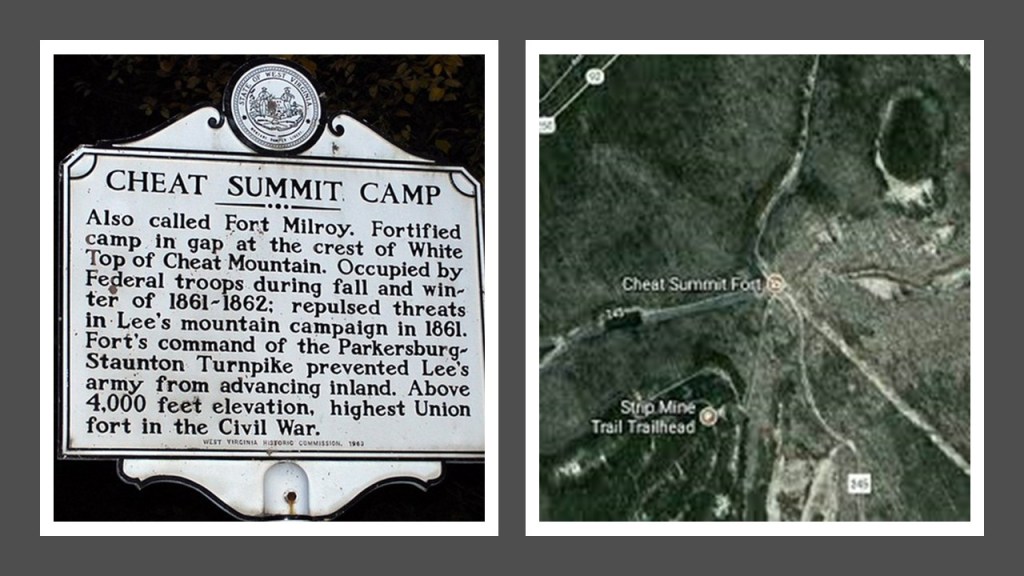
We are told that during the American Civil War, Cheat Mountain was of strategic importance during the early part of the Operations in West Virginia Campaign.
The Battle of Cheat Mountain, also known as the Battle of Cheat Summit Fort, took place between September 12th to 15th of 1861, and was the first battle that General Robert E. Lee led troops into combat.
Still a part of Virginia at the time, since what became the state of West Virginia was not formed until after the Civil War, troops under Lee sought to regain confederate territory that had been gained by the Union after Union troops had advanced into the western region of Virginia from Ohio.
The Battle of Cheat Mountain was a Confederate attempt to regain the Union occupied Fort Milroy on top of Cheat Mountain, but they were unsuccessful and “lost” the battle.
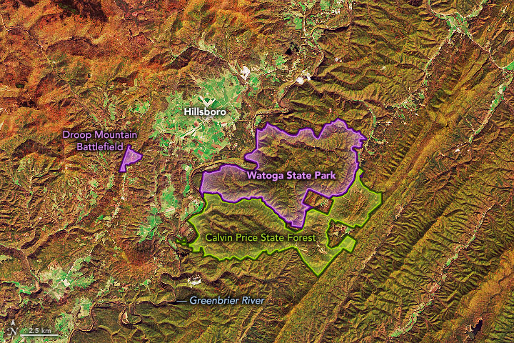
Also, West Virginia’s Beartown State Park. is close to Hillsboro, the town closest to Cranberry Glades and not far from Lewisburg, all of which are adjacent to the Greenbrier River Trail that ends in Cass near Cheat Mountain and the Cheat River.
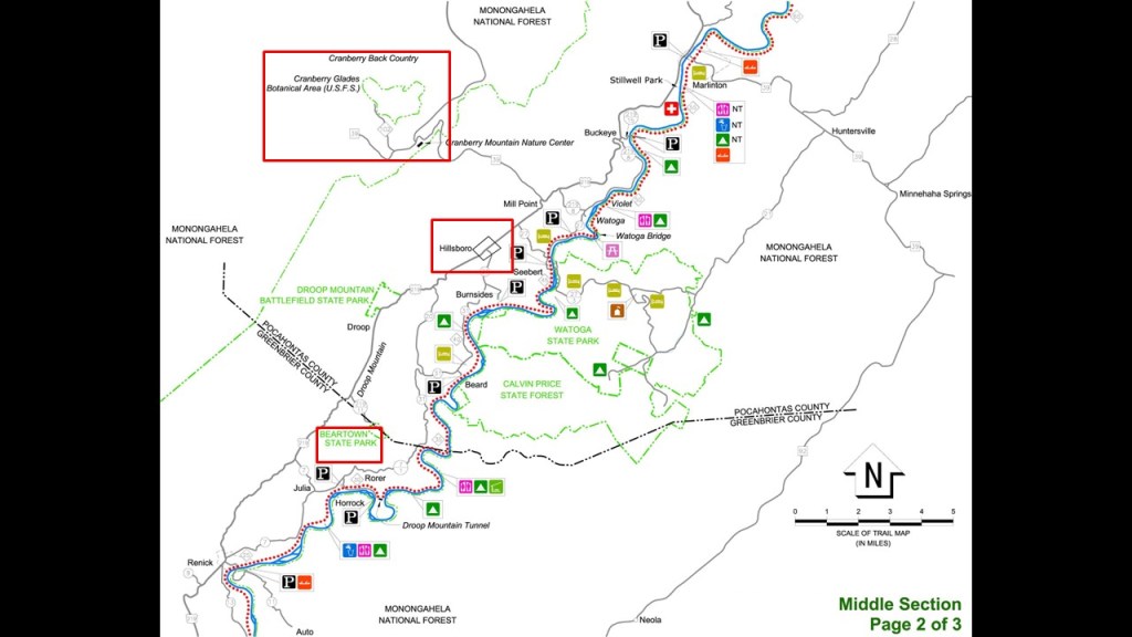
We already saw Beartown Rocks earlier in Clear Creek State Forest near Sigel in Pennsylvania, which is also close to the place where the 18-foot, or 5.5-meter,-tall skeleton was found in West Hickory, and where there is another rail-trail found at the Kennerdell Tract of the Clear Creek State Forest, as mentioned previously in this post.

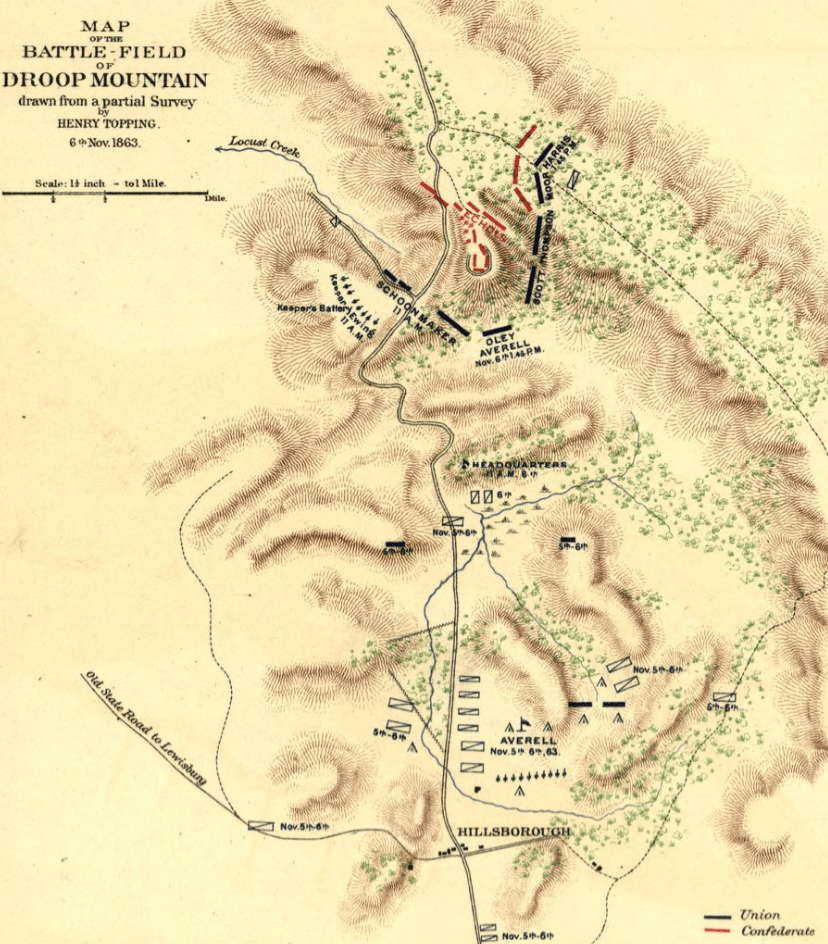
Beartown State Park in West Virginia is located 7-miles, or 11-kilometers, southwest of Hillsboro, on the Eastern Summit of Droop Mountain, and right in the middle between Cranberry Glades and White Sulphur Springs.

There’s a couple of things to unpack here – one is Beartown State Park, and the other is the Civil War Battle of Droop Mountain.
First the rock formations at Beartown State Park in West Virginia are described as having “unusual rocky formations, massive boulders, overhanging cliffs, and deep crevices,” with the deep crevices having a regular criss-crossed pattern making them appear like the streets of a town.
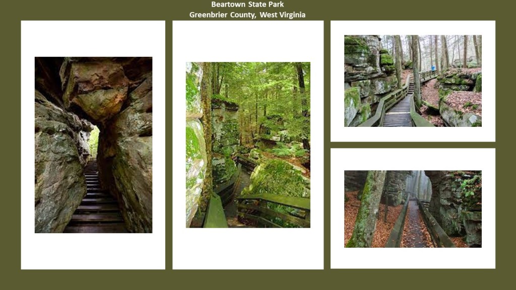
This is very similar to how the Beartown Rocks back in Pennsylvania, were described, which was as ” a beautiful rock formation consisting of “house-sized” boulders, that are spread out far enough they have road-like spaces in-between them, making it feel like a “rock city.”
The other thing is that the Battle of Droop Mountain was said to be the largest battle, and last major battle, of the Civil War to take place in what was to become West Virginia.
It took place on November 6th of 1863.
This is what we are told.
Troops under Union Brigadier General William Averill defeated a smaller Confederate force under Brigadier General John Echols and Colonel William “Mudwall” Jackson.
While the Union succeeded driving Confederate forces from their locations on Droop Mountain.
Though Lewisburg was captured, the Confederate forces returned later, and the Union did not succeed in it objective of damaging the Virginia and Tennessee Railroad that played a strategic role in supplying the Confederate Army.
So it was actually considered a tactical victory for the two Confederate Commanders, since the Confederate Army was not eliminated in Lewisburg, and the railroad was not disturbed.
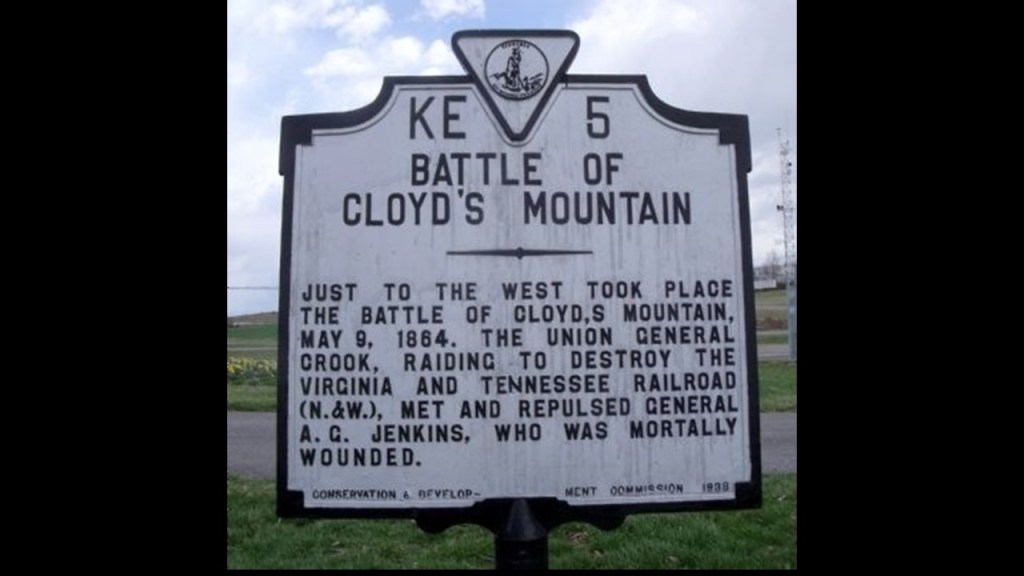
Interesting to note that the following year, on May 9th of 1864, Union troops under Brigadier General George Crook, successfully destroyed a large bridge across the New River on the Virginia and Tennessee Railroad during the Battle of Cloyd’s Mountain in southwestern Virginia, several more bridges along the railroad line and the depot at Dublin, Virginia.
This “victory” was said to sever one of the Confederacy’s last vital lifelines and only rail connection to Tennessee.
Makes me wonder what was really going on during the Civil War!
More to come on this subject.
A few more things to take a look at back in Ohio.
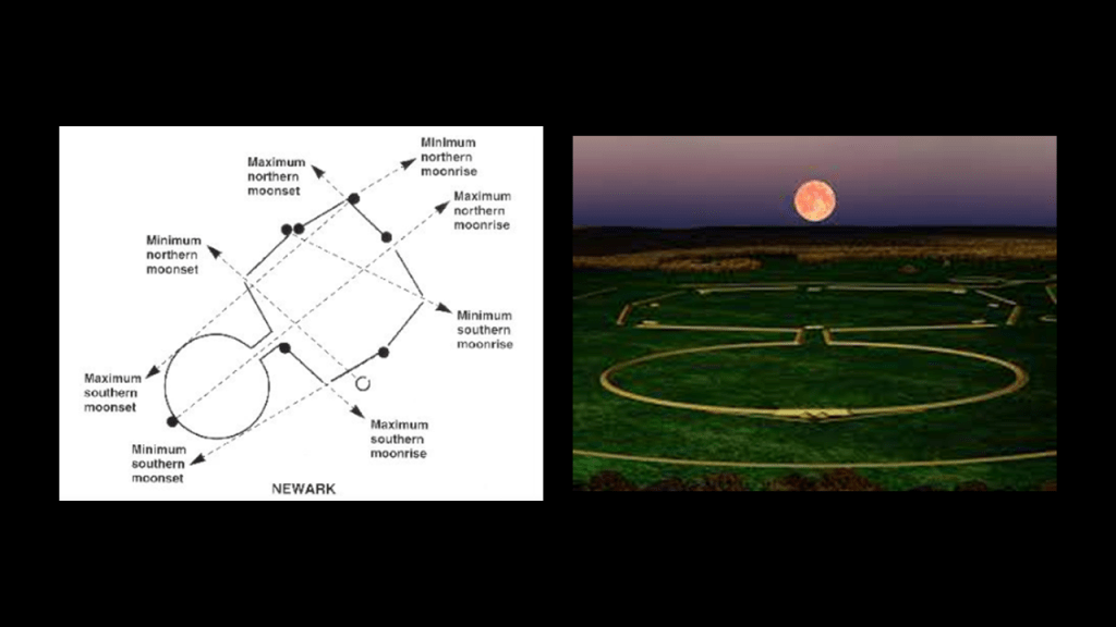
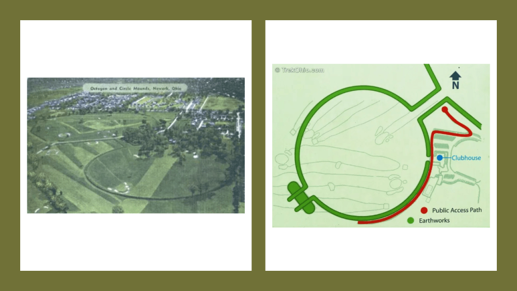
Like the Newark Earthworks.
The Newark Earthworks in Ohio are roughly mid-way between Miamisburg, Ohio, and Cresap, West Virginia.
Consisting of three sections of earthworks – the Great Circle Earthworks; the Octagon and Circle Earthworks; and the Wright Earthworks – this complex contains the largest earthen enclosures in the world at about 3,000-acres, or 1,214-hectares.
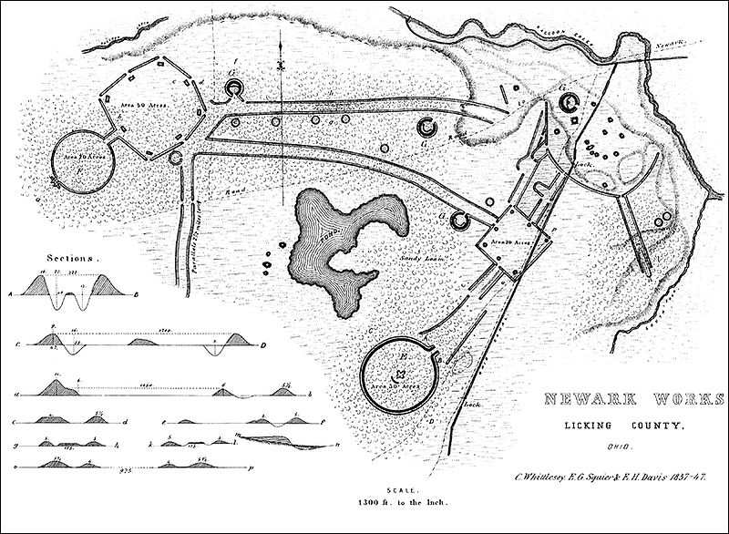
Like we saw at the Great Serpent Mound, we see the same precise geometry and archeoastronomy in these earthworks in North America that we see in other countries, like Great Britain.
Yet, this fact didn’t stop the development of a golf course on the Octagon & Circle Earthworks in the early 20th-century.
These earthworks come into play on eleven of the holes of the Moundbuilders Country Club.
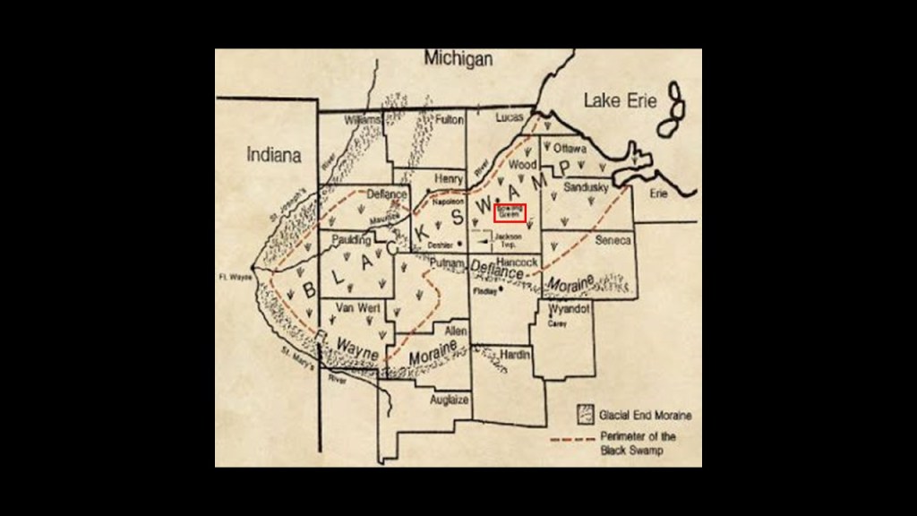
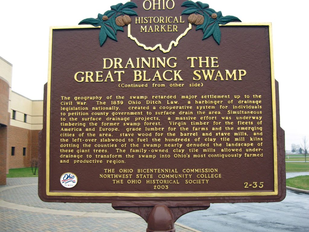
I found this newspaper clipping from the Newark Advocate in 1902 in my past research describing a giant skeleton that was found in Bowling Green in northwestern Ohio that was over 8-feet, or 2.5-meters, -tall.
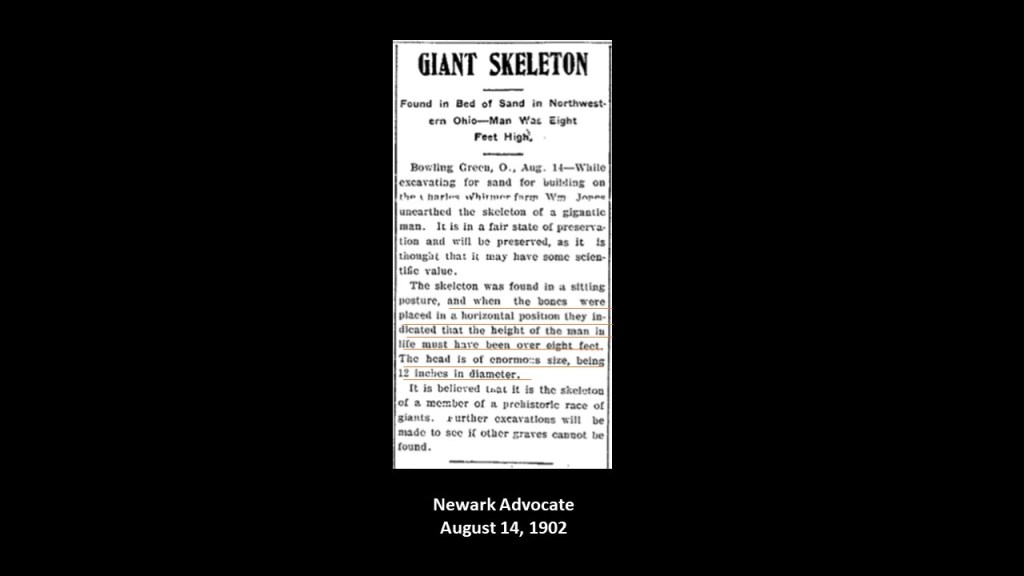
Bowling Green in Ohio is in what is called the “Great Black Swamp,” which is located between Fort Wayne in Indiana and the southern shore of Lake Erie in northwest Ohio.
Interesting to note all the historic rail-lines that go through the same area as the Great Black Swamp in Northwest Ohio, circa that 1914 Ohio Public Utilities Commission Railroad map of Ohio, with Bowling Green where the giant skeleton was found circled in red.
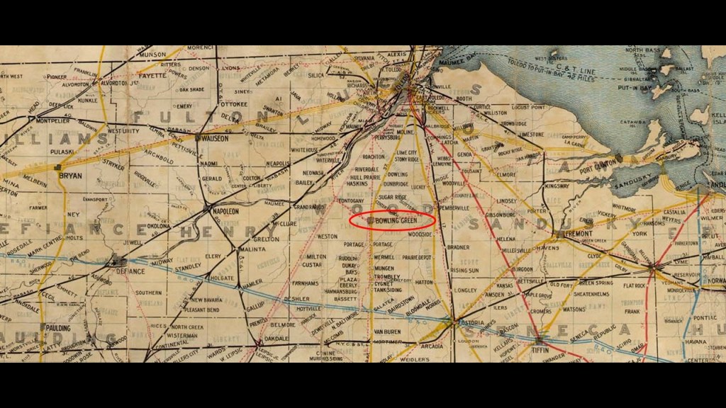
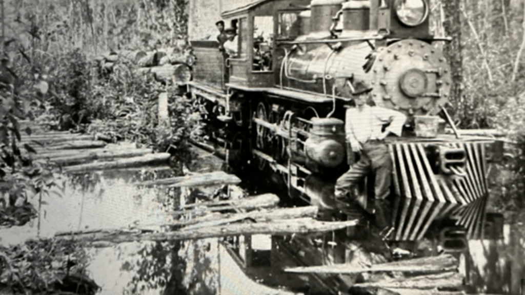
The story that accompanies the existence of the railroads is that they were all constructed after the swamp land was drained.
…and that made the construction of the railroads possible.
But I continue to have serious doubts that railroads were constructed by the people who said they built them when they were said to have been built.
My belief falls along the line that they were already there and being made serviceable once again after the swampland was drained and/or reclaimed.
One more place I want to bring up in Ohio.
A viewer emailed me information that he wanted to bring to public awareness.
He owns property in Columbiana County in Ohio where there was a huge valley of the dead that was intentionally destroyed and covered-up in the 1950s to hide the ancient city.
He said they brought in ceramics to cover-up the real artifacts, but that some burials survived, and he finally figured out the corruption going on here!
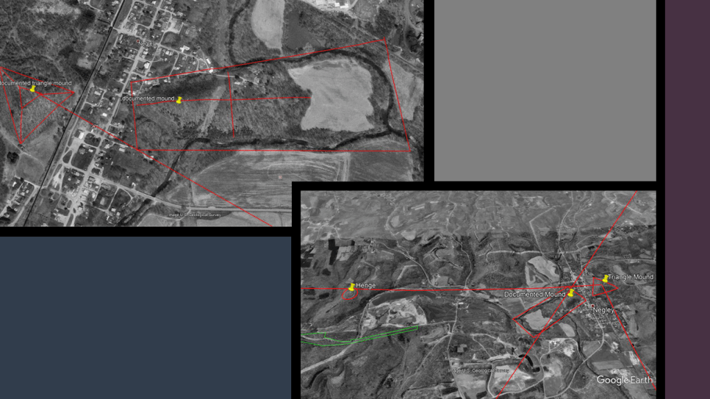
He also indicated that the Ohio government is permitting in Negley, Ohio, the destruction, and covering up with garbage, of an Advanced Ancient Sand Stone Slab City Site that is on top of a Glacial End Moraine with a Triangle Pyramid Mound carved from and attached to the End Moraine, with burials.
He said the Glacial End Moraine was mined for coal and clay by the Ancients and the sand stone slabs were used to build the ancient city on top, and that the government in the past 4 years has permitted the two World Heritage Mounds defaced for garbage and graveltipping fees and are permitting the destruction of the entire ancient city site!
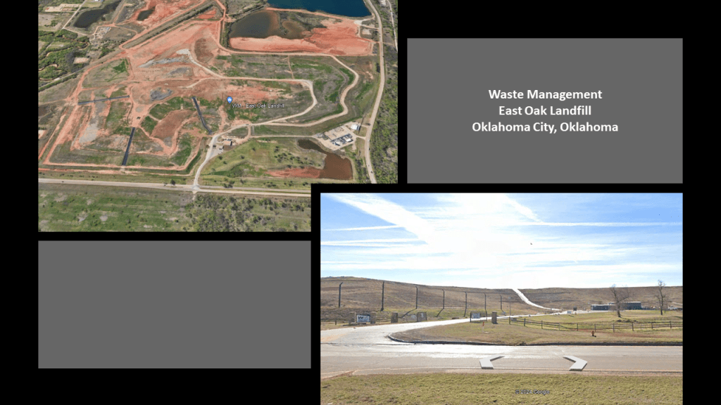
I found the same thing taking place in Oklahoma City when I first started waking up to all of this.
There are three humongous mounds in Oklahoma City that serve as landfill sites, like this one in East Oklahoma City.
There are a couple more things I would like to point out about Columbiana County in Ohio before I move on from here.
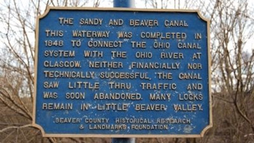
One thing is it was the historical location of the Sandy and Beaver Canal.
This is what they tell us.
It was a 73-mile, or 117-kilometer, -long canal with ninety locks between the Ohio and Erie Canal in Bolivar, Ohio, to the Ohio River at Glasgow, Pennsylvania.
It was chartered in 1828, completed and 1848, and ceased operations only four-years after it was completed, in 1852.
Make sense?
Here are some of the ruins of Sandy and Beaver Canal.
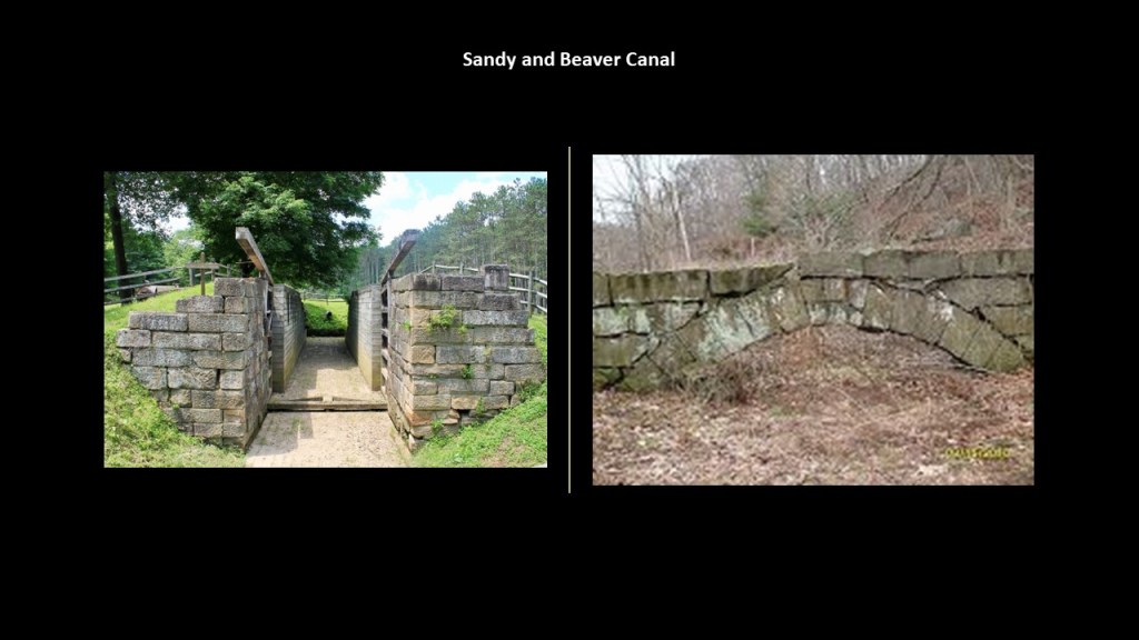
And here’s a lock on the Sandy and Beaver Canal on the left compared to the lock of the Union Canal on the right that we saw back in Swatara State Park in Pennsylvania near Boxcar Rocks.
The other thing I want to mention is that East Palestine is in Columbiana County, the location where just a year ago, a train derailed and released hazardous chemicals, including vinyl chloride, a toxic chemical used in making plastics. into the environment.
The viewer wondered why here?
He asked could it have been to make sure the site does not meet World Heritage standards, or if the train was derailed at the best place to contaminate the Wild & Scenic river system and ancient site here?
All of this adds a lot of questions to the list of wondering what’s really going on here, and why.

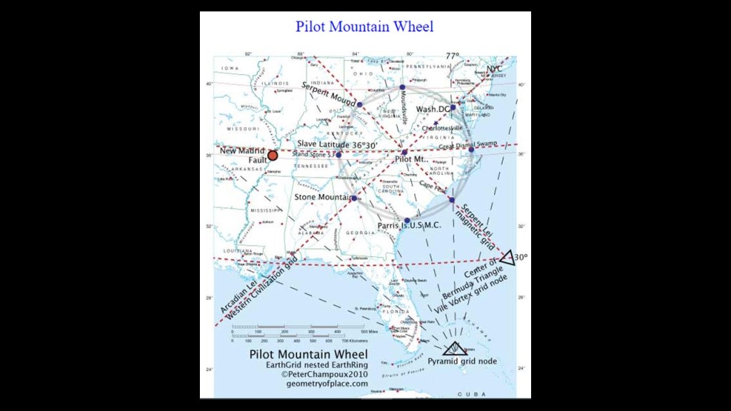
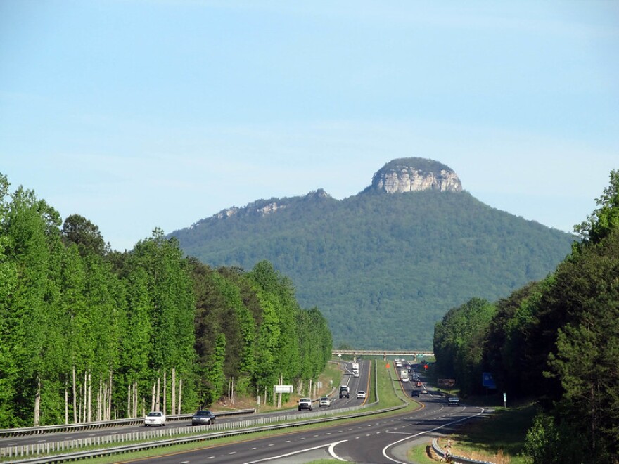
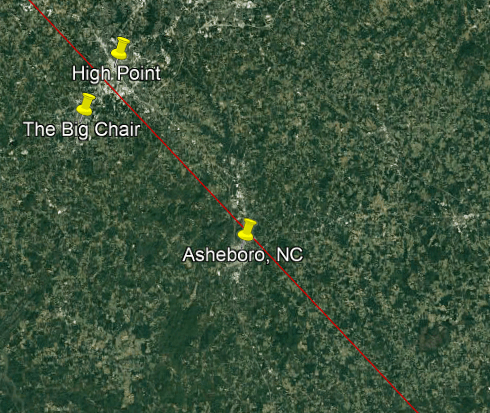
I am going to take a peak for a moment at the area around Pilot Mountain in North Carolina, which is southeast of here.
I looked through this same region a couple of months ago when I was doing the research for “Trekking the Serpent Ley.”
I started at the Bermuda Triangle, and ended at Lake Itasca in Minnesota, the headwaters of the Mississippi River, and went right through all these places.
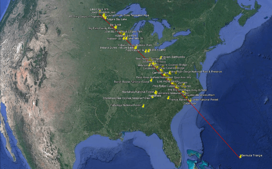
This research was based on a ley-line identified by Peter Champoux, who has done incredible work on specific ley-lines in North America, and other continents as well, as seen on his website geometryofplace.com.

Peter identified Pilot Mountain as a central hub of leylines.
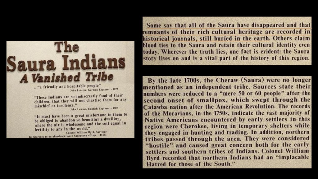
Pilot Mountain State Park is on the western end of what are called the “Sauratown Mountains,” named after the Saura, or Cheraw People, the Siouan-speaking indigenous people who lived here before the arrival of Europeans.

Pilot Mountain is described as one of the most distinctive natural features in the State of North Carolina.
It is seen here centered on U. S.. Route 52.
When I was looking up information about the Saura/Cheraw people, I found historical records at the Museum of Regional History in nearby Mount Airy mentioning a vanished tribe, and “remnants of their rich cultural heritage recorded in historical journals, still buried in the earth.”
Hmmm. Interesting description. Still buried in the Earth?
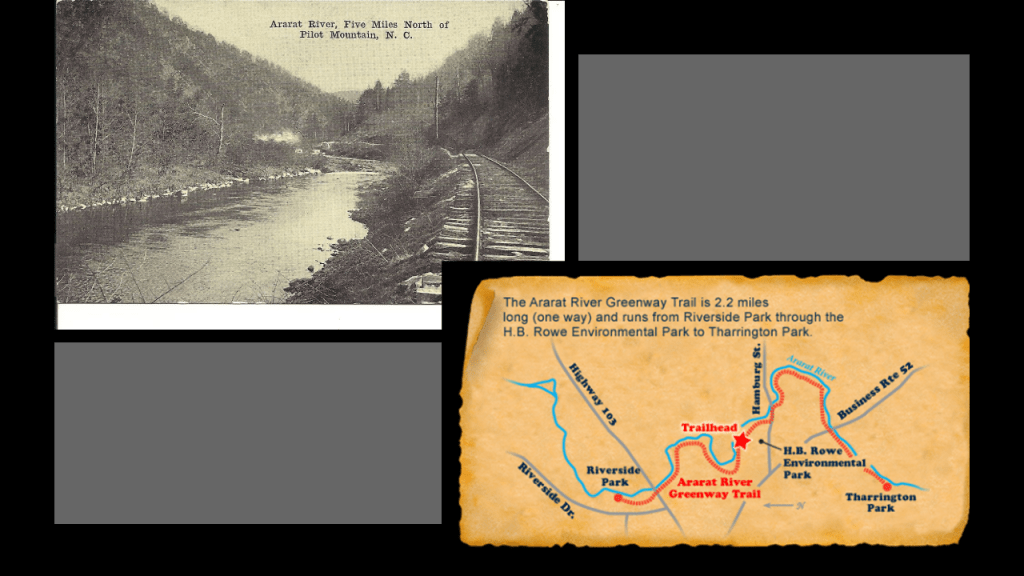
Interesting to note that a viewer left me a comment that before it was called Pilot Mountain, it was known as Mount Ararat.
I looked into it and found the historic Ararat River with rail infrastructure running beside it on the top left, and today’s Ararat River Greenway Trail where the railroad used to be on the bottom right.
The Ararat River Greenway Trail is at the eastern edge of the city of Mount Airy.
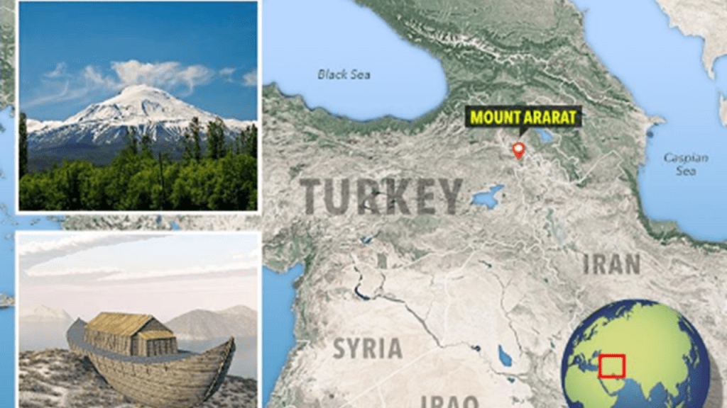
The only Mount Ararat I have ever heard of is in modern Turkey today, and historic Armenia in the past, the legendary landing place of Noah’s Ark.
What’s Mount Ararat doing in North Carolina?
And why was the name changed to Pilot Mountain?
Way back when I believed the narrative I probably would have accepted it as a being “named after” situation, but not anymore!
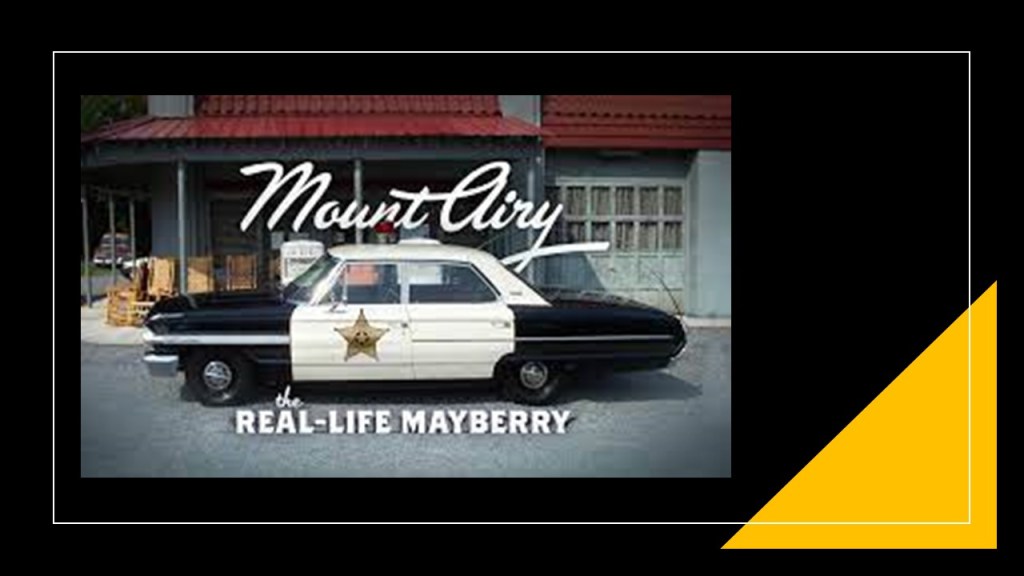
Mount “Airy” North Carolina was Andy Griffith’s home town, and the place Mayberry was based on in “The Andy Griffith Show.”
I am going back to this part of North Carolina because when I was looking here previously, I found several examples of giant furniture on display.
First, in Thomasville, North Carolina, which is between Pilot Mountain and Asheboro on the Serpent Lei alignment, is the location of what is called “The Big Chair.
“The Big Chair” is said to be a large-scale replica of a Duncan Phyfe armchair that was built in 1950 at the Thomasville Furniture Industries.
The original “Big Chair” here was said to have been constructed from pine in 1922, but was torn down in 1936, we are told, because the pine had worn down over time.
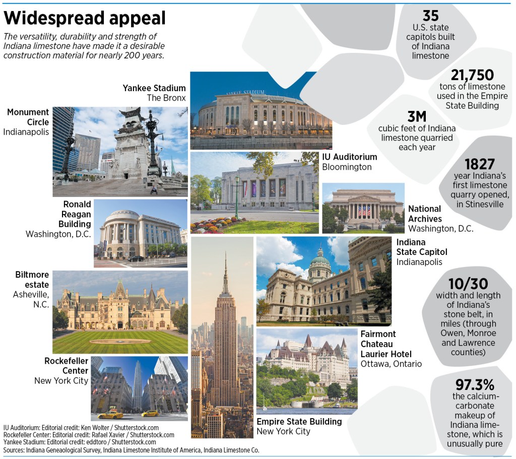
The base the chair sits upon is made from Indiana Limestone.
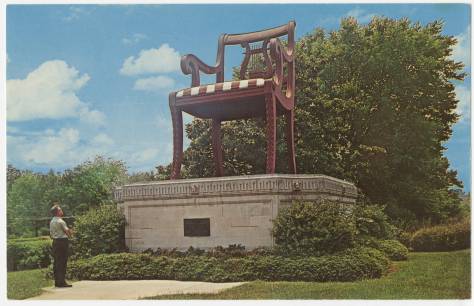
We are told that Indiana Limestone was the limestone used in the construction of much of the nation’s monumental architecturect of the late 19th- and early 20th-centuries.
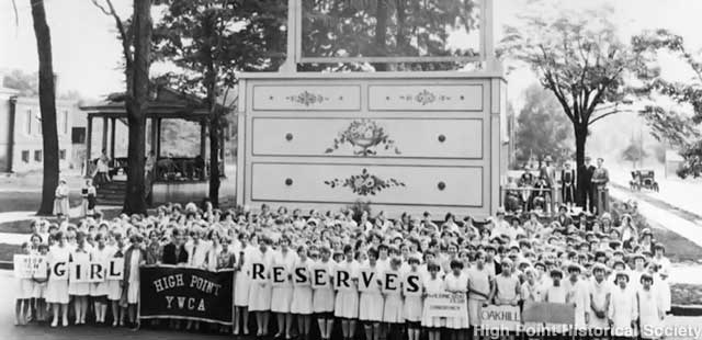
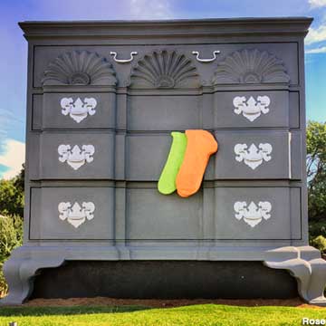
When I was looking for information on “The Big Chair,” I found “The Big Bureau” tourist attraction in neighboring High Point, the world’s largest chest- of-drawers.
It was said to have been built in 1926 as a “civic counter-punch” to Thomasville’s “Big Chair.”
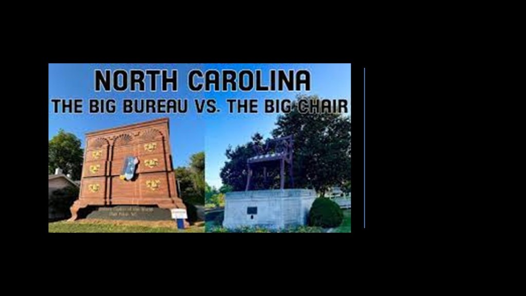
The original “Big Bureau” was said to have been built here in 1926 as a building to serve as a Welcome Center for the High Point furniture industry.
But, alas, it was also the worse for wear over 70-years, so in 1996, a local designer and craftsman oversaw a complete makeover of it on top of the original bureau.
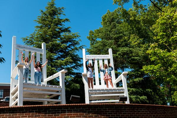
There are also a couple of giant chairs on display there at High Point College.
Another giant chair in my past research was in Anacostia, an historic neighborhood in Washington, DC, at the corner of Martin Luther King Jr. Avenue and V Street SE.
We are told it was built by the Bassett Furniture Company, and installed there by the Curtis Brothers Furniture Company in 1957.
But could these have been the furniture of actual giants, and not gimmicks as we have been led to believe?

Next, I am going to turn my attention to West Hickory in Pennsylvania, where the tallest recorded skeleton in North America was found, at 18-feet, 5.5-meters.
Aaron sent me this article from the “Oil City Times” from the “Marysville Tribune” of Marysville, Ohio, dated January 26th of 1870.
At the top of the article, it referenced the “Cardiff Giant Outdone” and the alleged discovery of the skeleton of a giant in the oil regions.
So, I looked up the “Cardiff Giant” to find out more about it.
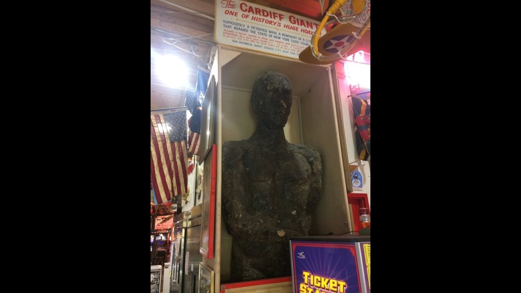
What has come down to us in our historical narrative about the “Cardiff Giant” was that it was one of the most famous archaeological “hoaxes” of all time.
In October of 1869 in Cardiff, New York, workers digging a well behind the barn of William “Stub” Newell, uncovered a 10-foot, or almost 3-meter, -tall, 3,000-pound, or 1,371-kilogram, petrified giant man.
Subsequently, Newell covered the giant with a tent and turned it into a local attraction, drawing a lot of attention from visitors.
This is the story we have been told to explain the Cardiff Giant’s existence.
The hoax was said to have been perpetrated by a New York tobacconist named George Hull, who wanted to fool people as to how easy it would be to create a giant.
The narrative says that in 1868, only three-years after the end of the American Civil War, Hull hired men to quarry a ginormous block of gypsum from Fort Dodge, Iowa, and had it shipped to Chicago to have it sculpted into a giant.
Then Hull had it shipped to the farm of his cousin William Newell in New York in November of 1868, where it was buried in a hole. Then, after almost a year had passed, Newell hired to men to dig the “well” where they found the giant.

The “Cardiff Giant” in short-time was sold to a syndicate, who moved it to Syracuse, New York, for exhibition.
The “Cardiff Giant” garnered a lot of attention, including that of “experts” as well as of P. T. Barnum, who was said to have hired a man covertly to model the giant’s shape in wax in order to make a plaster replica of it after his offer to buy the giant was refused.
P. T. Barnum was a showman, businessman, and politician, who got his start in the “Dime Museum” business in 1841.
Dime museums were most popular in the United States at the end of the 19th-century and beginning of the 20th-century as institutions which provided cheap entertainment for working-class people, and reached their peak in popularity in the time-period between 1890 and 1920, declining in popularity with the rise of Vaudeville and the film industry.
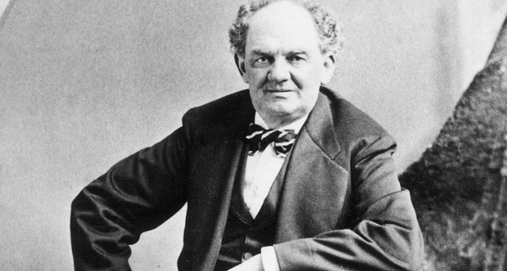
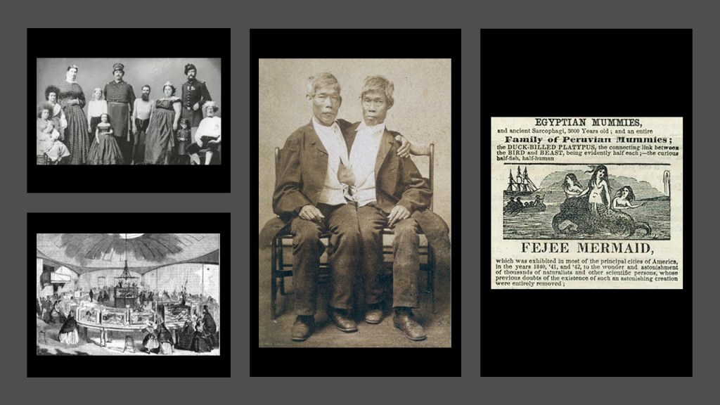
Barnum’s American Museum in Manhattan’s Financial District was known for its strange attractions and performances.
The attractions were a combination of zoo, museum, lecture hall, wax museum, theater, and freak show.
Barnum’s American Museum became a central location in the development of American popular culture.
Barnum’s American Museum was filled with things like dioramas; scientific instruments; modern appliances; a flea circus; the “feejee” mermaid; Siamese twins, and other human curiosities.
At any rate, P. T. Barnum was said to have exhibited his plaster giant as the real giant and the Cardiff giant as the fake.

Then, by December of 1869, the “Cardiff Giant” was said to have been exposed as a fraud, and Hull confessed everything to the press, and that by February of 1870, both the Cardiff Giant and Barnum’s giant had been revealed as fakes in court.
The Cardiff Giant, and what we are told was the unauthorized copy of it made by P. T. Barnum, are on display at “Marvin’s Marvelous Mechanical Museum” in Farmington Hills, Michigan.
But what if both the Cardiff giant and Barnum’s giant were actually real giants, and not hoaxes as we are told, after all?
Wouldn’t that be something!
The tobacconist George Hull as a hoaxer story gets even stranger!
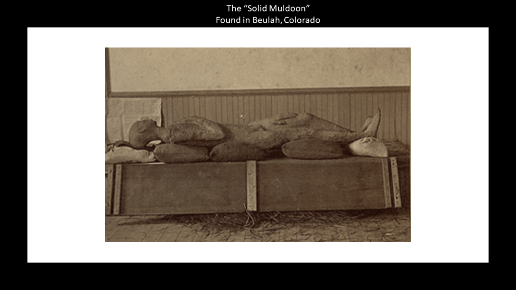
The “Solid Muldoon” was another petrified giant human body that was unearthed in Beulah, Colorado, and later called a hoax perpetrated by the same guy, George Hull.
The “Solid Muldoon,” at over 7-feet, or 2-meters, -long was said to have been discovered near Mace’s Hole in Beulah, Colorado, in 1877, 3-months after Hull “created” it, this time from “mortar, rock dust, clay, plaster, ground bones, blood and meat” and kiln-fired before it was buried in the location it was “discovered” three-months later.
The “Solid Muldoon” went on display in Colorado and New York before before revealed as a hoax to the New York Times.
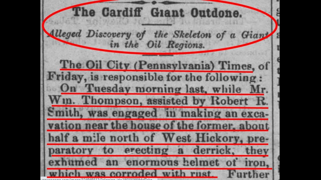
So, now let’s see what the 1870 newspaper article has to say with regards to the giant that was found at West Hickory.
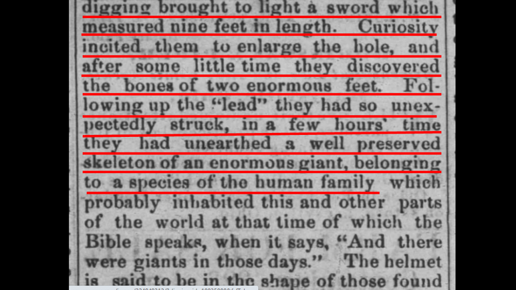
Two men excavating near West Hickory in preparation for erecting a derrick first exhumed an enormous rusty helmet of iron…

…and then they unearthed a 9-foot, or almost 3-meter, – long sword.
So they made the hole bigger, and soon came upon the bones of two enormous feet.
After a few hours, they unearthed the well-preserved skeleton of an enormous human.
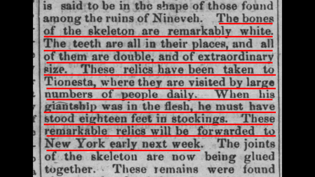
The bones of the skeleton were described as “remarkably white;” the double- teeth all in place, of extraordinary-size; and that when the giant was alive, he must have stood 18-feet, or 5.5-meters, in stockings.
And lastly, the bones were found about 12-feet, or 3.5-meters, below the surface of a mound, and the mound was not more than 3-feet, or less than a meter, above the level of the ground around it.

To put that into perspective, this garage has 12-foot walls, so the giant’s bones were found that far below the surface of a mound, which was another 3-feet higher than the ground.

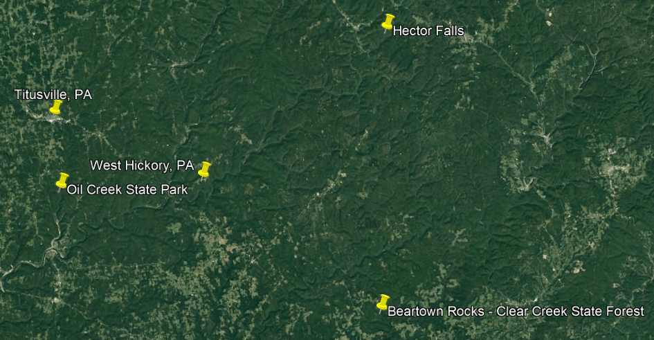
West Hickory just happens to be located geographically only 14-miles, or 23-kilometers southeast of Titusville, and only 25-miles, or 41-kilometers, northwest of the previously discussed Beartown Rocks in the Clear Creek State Forest in Sigel.
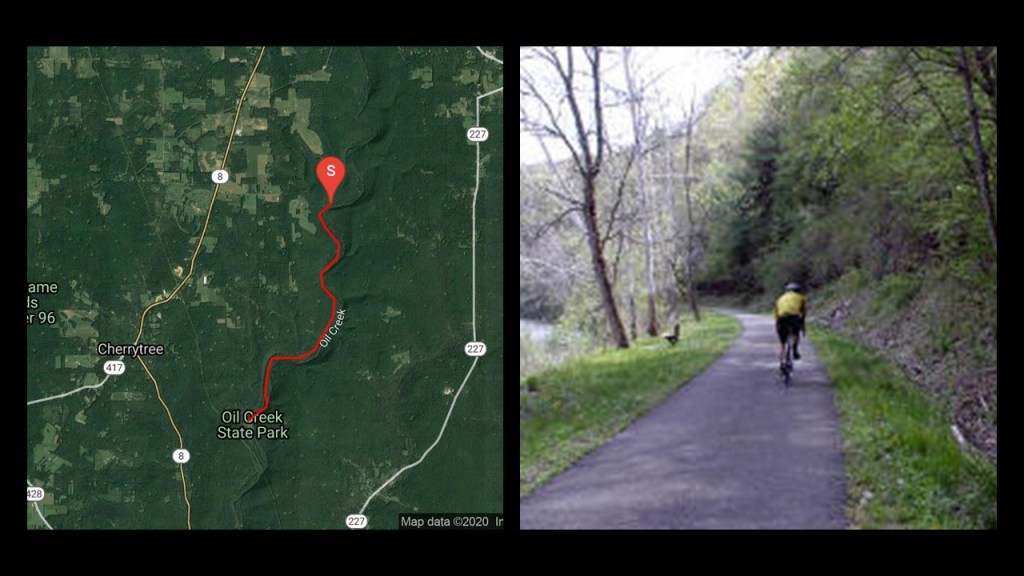
Titusville is noteworthy because it was where the petroleum industry in the United States began in earnest in 1859 when Edwin Drake found oil on a piece of leased-land near Titusville, Pennsylvania, in what is now called Oil Creek State Park.
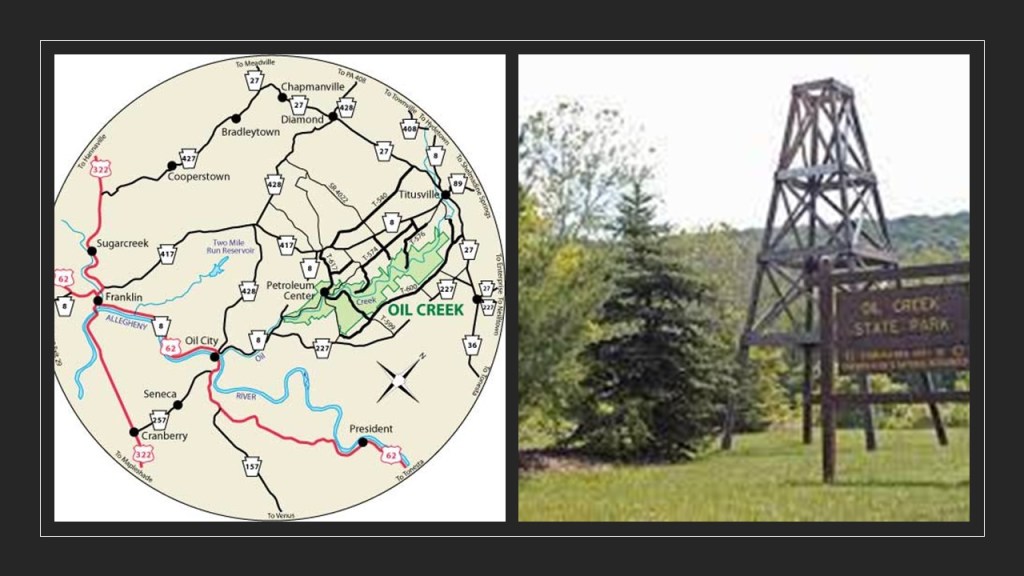
For this reason, Titusville is called the Birthplace of the Oil Industry, and for a number of years this part of Pennsylvania was the leading oil-producing region in the world.
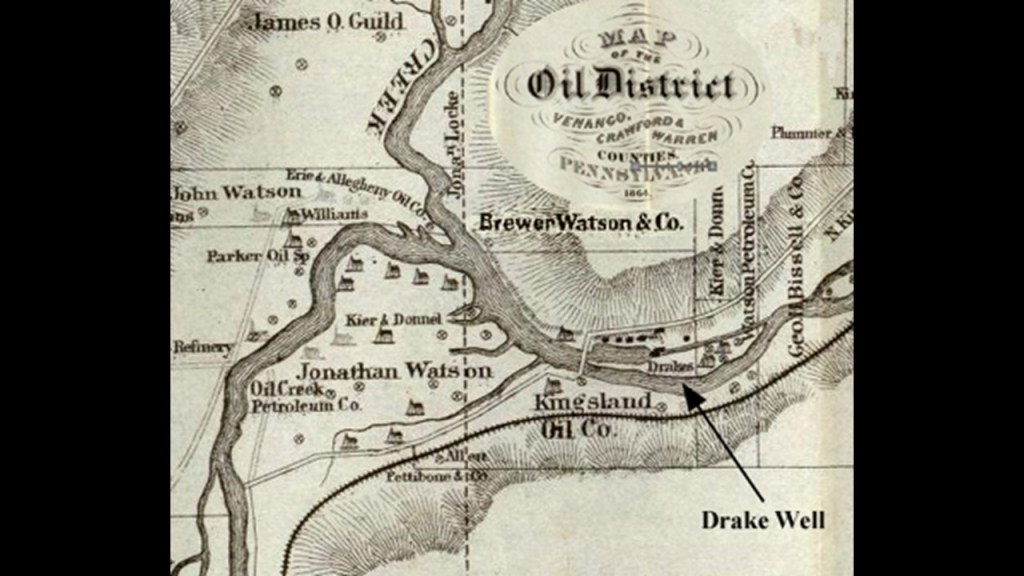
Today, not surprisingly at this point, the Oil Creek State Park Trail runs on the bed of the first railroad line to reach Titusville, the Oil Creek Railroad.
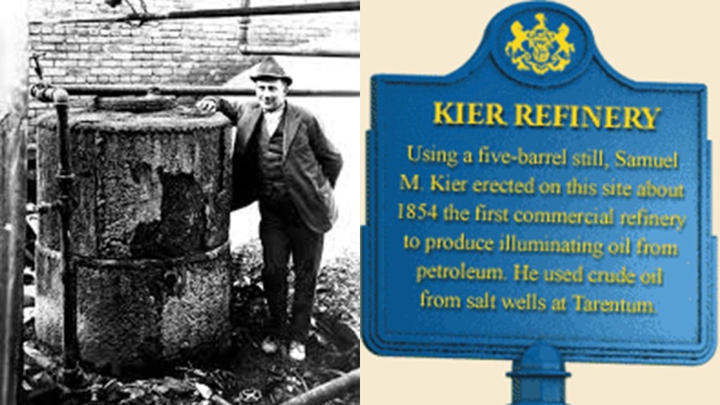
Samuel Kier had established America’s first oil refinery in Pittsburgh in 1854 for making lamp oil, just five-years before oil was “found” in Titusville.
So. it certainly appears like the petroleum industry was developed in the 1850s in order to provide a replacement energy technology for the free energy technology of the original civilization.
Roughly a decade after the birth of the oil Industry at Titusville, in 1870 by , John D. Rockefeller, along with Henry Flagler, an American Industrialist and major developer in the state of Florida, founded the Standard Oil Company, an American oil producing, transporting, refining, marketing company.

Oil was used in the form of kerosene was used throughout the country as a light source and heat source until the introduction of electricity, and as a fuel source for the automobile, with the first gas-powered automobile having been patented by Karl Benz in 1886.

John D. Rockefeller, Sr, was the progenitor of the wealthy Rockefeller family.
He was considered to be the wealthiest American of all time, as seen in this ranking by CNN Business.
Rockefeller’s wealth soared as kerosene and gasoline grew in importance.
At his peak, he controlled 90% of all oil.
It certainly looks like as quickly as possible, a way was found to replace what remained of the free-energy system with their own coal- and oil-based system, and in the process make money hand over fist from the total control of the new system.

There is no doubt in my mind that there was an energy-generating connection for the original civilization between the railroad, s-shaped river bends, hydro-electricity generation, waterfalls and gorges.
I researched these finding extensively in my blog post “Of Railroads and Waterfalls and Other Physical Infrastructure of the Earth’s Grid System.”
Other documented finds of the skeletal remains of giants included Erie and Aliquippa in the same region of Pennsylvania.
Aaron sent me this except from a book on the “History of Erie County.”
It makes reference to the following finds in “Chapter 5:”
“When the link of the Erie & Pittsburgh Railroad from the dock at Erie was in the process of construction, the laborers dug into a great mass of bones at the cross of the public road which runs by the rolling mill. From the promiscuous way in which they were thrown together, it is surmised that a terrible battle must of have taken place in the vicinity on some day so far distant that not even a tradition of the event has been preserved…” and that “…at a later date, when the roadway of the Philadelphia & Erie Road…was being widened, another deposit of bones was dug up and summarily disposed of as before. Among the skeletons was one of a giant….”

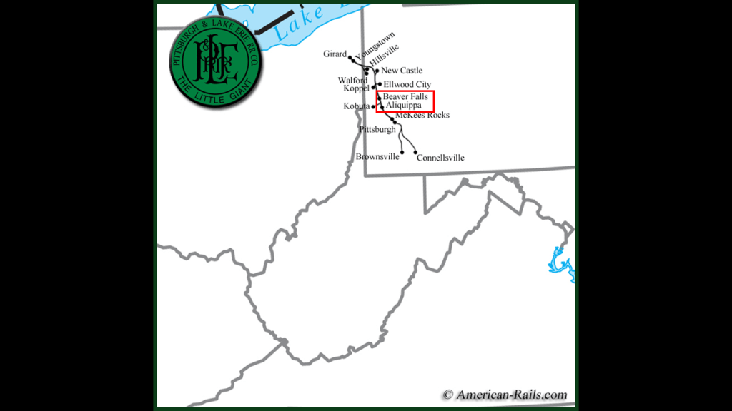
Aaron also sent me this article referencing Beaver Falls at the beginning about two skeletons of gigantic size that were found while workmen were “digging a ditch from the new shovel works to the river at Aliquippa.”
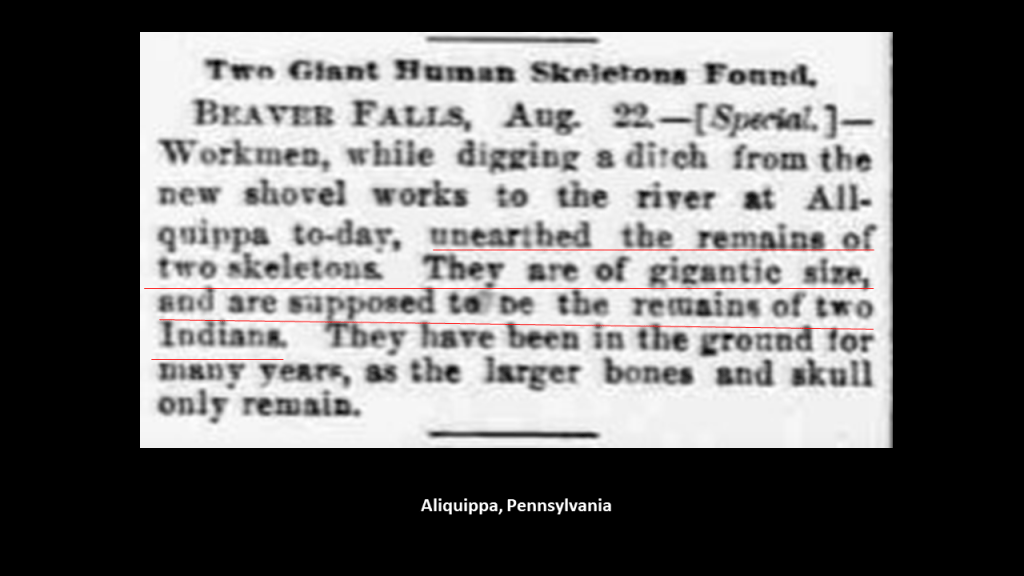
The area around Beaver Falls and Aliquippa were on the Pittsburgh & Lake Erie Railroad line.
While we are here in this part of Pennsylvania, this is a good place to mention that this is the historical land of the Susquehannock People.
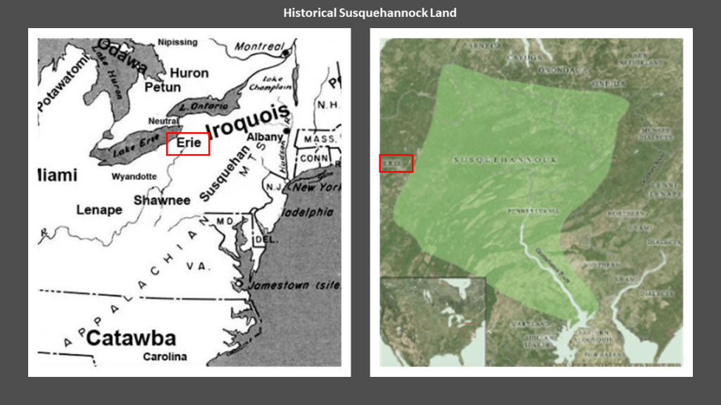
The Susquehannock People were known for their height.
This was not a secret.
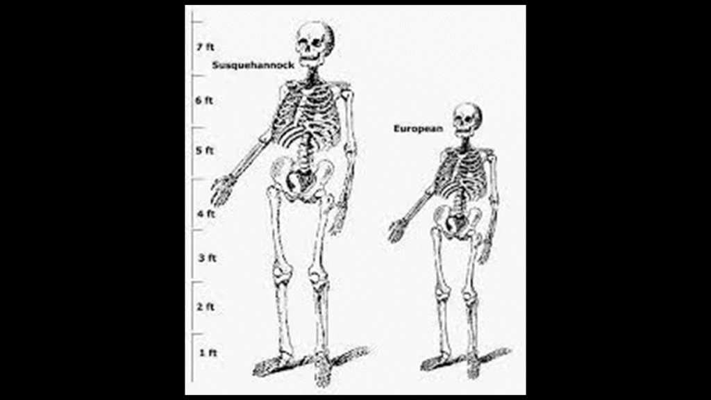
On the left is a size comparison between a Susquehannock skeleton compared with a European-sized skeleton.
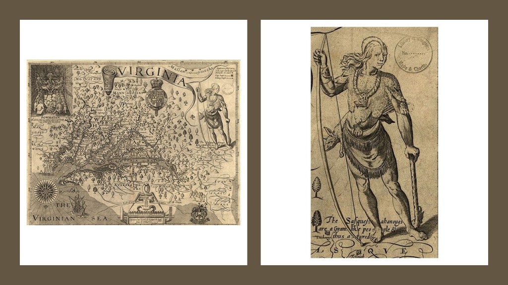
Captain John Smith, who played an important role in the establishment of the first permanent English settlement in the Americas at Jamestown in May of 1607, published a map of the Colony of Virginia within a few years, which includes Susquehannock lands in what is Pennsylvania today, on which there is an illustration of a Susquehannock man and the caption at his feet reads “Sasquesahanougs are a gyant-like people, and thus atired.”
The Susquehannock People were said to have had a sharp population decline from disease and war by the 1670s.
Their population continued to decline, and that by 1763 its remaining members in Lancaster County, Pennsylvania, were massacred by a vigilante group known as the Paxton Boys, at which time they became extinct as a distinct cultural entity.
The Paxton Boys were said to have been formed for the protection of Pennsylvania colonists during Pontiac’s War, a Native American Rebellion in the Great Lakes Region against English Rule that lasted from 1763 to 1766, but as such the Paxton Boys in effect had carte blanche to massacre members of all the Native American tribes of the region, including the Lenape and the Mohican.

Now I’d like to take a look at other places that look like “rock cities” that are outside of Pennsylvania.
First up, Giant City State Park in Makanda, Illinois.
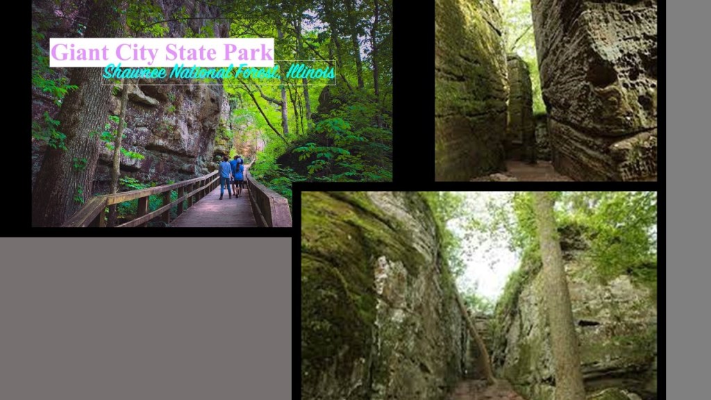
Giant City State Park in the Shawnee National Forest, in Makanda, Illinois, is just south of Carbondale in Southern Illinois.

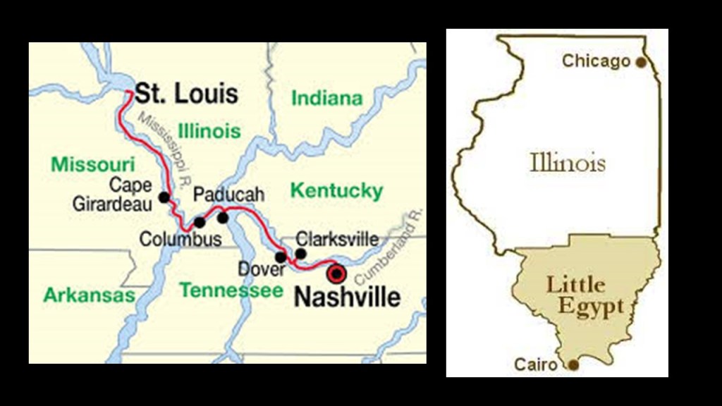
Carbondale is the crossing point of the “Paths of Totality” for both the 2017 & 2024 solar eclipses, locations where the moon’s shadow completely covers the sun, and this part of southern Illinois was and is the “point of greatest eclipse duration,” where the shadow of the moon from the eclipse of the sun lasts the longest.
So it looks like whoever built this ancient advanced civilization new exactly where they were in time and place, both astronomically and terrestrially.

During the American Civil War, the Confederate Army was said to have constructed a fort in Columbus, Kentucky,at the confluence of the Mississippi and Ohio Rivers, very close to Cairo, Illinois, and Carbondale, in a part of Illinois nicknamed “Little Egypt.”
Today, Cairo in Illinois is empty and deserted, and considered a ghost town.
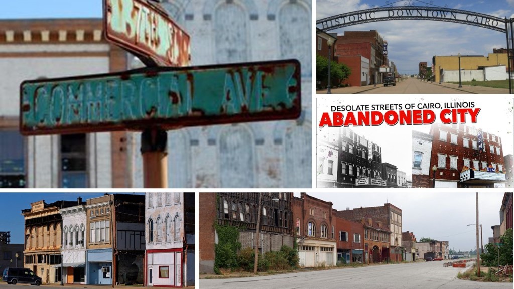
In its heyday, Cairo, located right at the confluence of these two great rivers, was an important city along the steamboat routes and railway lines.
Back in 1861, the Confederacy lost the State of Kentucky, which had wanted to remain neutral until a Confederate Army occupied Columbus, Kentucky, which was supported by President Davis, and Kentucky requested aid from the Union.
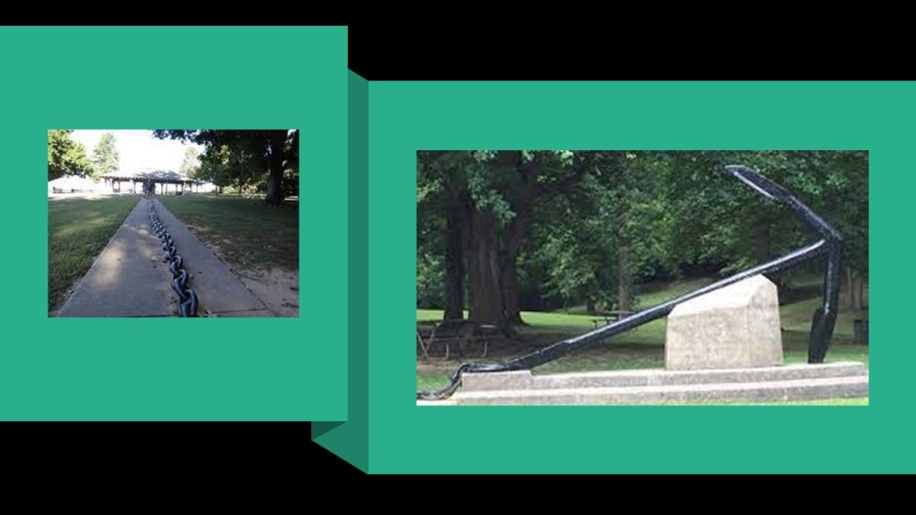
A primary attraction at the Columbus-Belmont State Park, the historical location of that fort, are the remains of a mile-long giant chain, and its anchor estimated to weigh between 4- to- 6-tons.
The giant chain was said to have been constructed under the direction of Confederate General Leonidas Polk, who in 1861 had it stretched across the Mississippi River between the fortification in Columbus, and Camp Johnson in Belmont, Missouri.
But apparently this defensive strategy didn’t work too well, as Union troops under then Brigadier-General Ulysses S. Grant occupied the area and took down most of the chain.
Just as an interesting side-note.
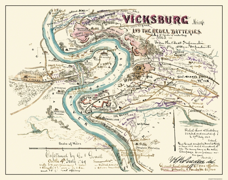
Located on an S-shaped bend in the Mississippi River, Vicksburg is roughly 400-miles, or 600-kilometers, south of this location at the confluence of the Mississippi and Ohio Rivers.
Vicksburg is perhaps best-known for the Vicksburg Campaign and Siege during the American Civil War, which took place between 1862 and 1863, and at the end of which the Union forces under General Ulysses S. Grant captured the Confederate stronghold of the port of Vicksburg on July 4th of 1863 and divided the Confederacy.
This is a wartime picture of the Shirley House in Vicksburg, circa 1863, with what is described as the camp of the 45th Illinois Infantry behind it.
But there are things going on in this photo that don’t make sense to me.
Why all the digging and entrances?

What we are told is that during the Siege of Vicksburg, the people of the city dug caves into the sides of hills to get out of harm’s way from the hail of iron that was coming their way from Union forces.
A possible explanation…but is it plausible?

The photo on the left was notated as Union soldiers on the lawn of the Warren County Courthouse in Vicksburg after the siege.
It was said to have been constructed between 1858 and 1860.
Interesting to note the contrast between the size of the soldiers and that of the courthouse.
Considered to be Vicksburg’s most historic structure, a museum is operated within the old courthouse today, pictured on the right.

The next place I am going to look at is the Heavener Runestone State Park, the best known tourist attraction in Heavener, located in east-central Oklahoma.
I mentioned the characters on the Heavener Runestone earlier in comparison with the Grave Creek Stone and Old South Arabian characters in southern Yemen.

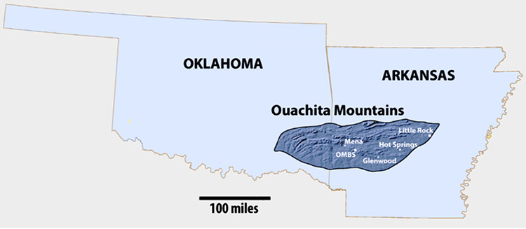
The Heavener Runestone State Park is very close to the Arkansas State line, on the edge of the Ouachita Mountains in Oklahoma.
The idea that Vikings came through here once-upon-a-time, and carved the runes on the surface of a huge stone is actively promoted, and there is a Viking festival held here twice a year, once in the spring and once in the fall.
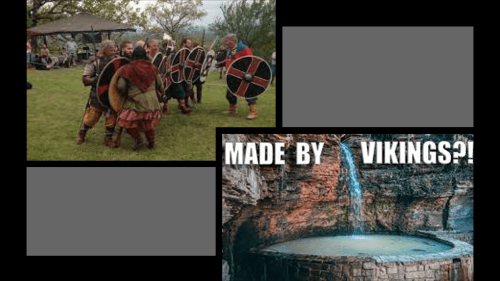
Heavener Runestone State Park was one of the places that I first started waking up to this ancient civilization in 2015 when I was living in Oklahoma City between 2013 and 2016, and I visited there several times during that time.
The first time I did not take note of my surroundings at the Runestone, and just saw the Runestone.
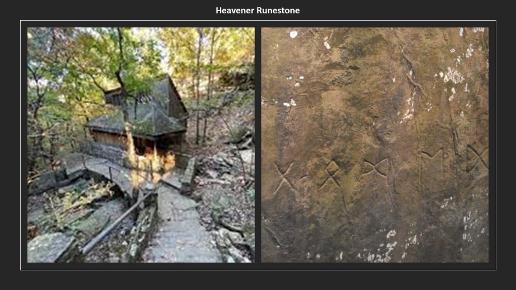
The second time I went there, I noticed that the Runestone was surrounded by an actual wall (which is referred to as a canyon there).

The third time I went to Heavener, I took these photos further up from the Runestone in a different location on the state park grounds, that have absolutely no attention drawn to them whatsoever.
The part of the park where you see these walls on the perimeter is more like an afterthought for a place to put picnic tables.

The Ouachita Mountains of southeastern Oklahoma and western Arkansas are named after the Washitaw Mu’urs of North America, one of the many empires of the worldwide ancient advanced Moorish Civilization.
But…who are the Washitaw?
The Washitaw Mu’urs, also known as the Ancient Ones and the Mound-Builders, with a history that goes back to Ancient Mu, also known as LeMuria, still exist to this day, and have been recognized by the UN as the oldest indigenous civilization on Earth.
Matriarchal and matrilineal, the Washitaw Mu’urs are ruled by an Empress to this day.
Empress Verdiacee pictured here passed away in April of 2014, and the reigning Empress of the Washitaw Nation is her granddaughter, Wendy Farica Washitaw.
But for some reason the general public has never heard of the Washitaw.

Washitaw Proper, the ancient Imperial seat, is in Northern Louisiana, in and around Monroe.
How come we’ve never heard anything about the Washitaw?
Quite simply, they don’t want us to know.
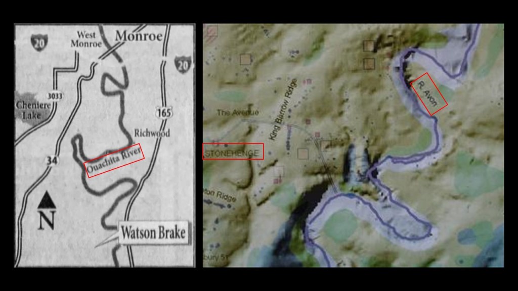
The Watson Brake Mounds are a short distance south of Monroe.
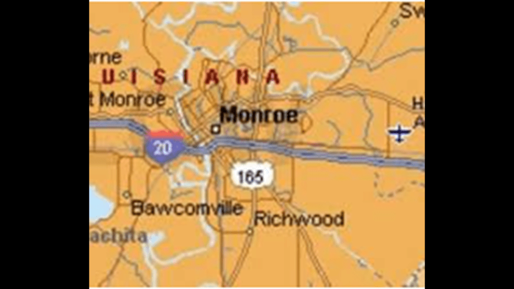
Watson Brake is an inaccessible archeological site to public view on private property in Ouachita Parish near Monroe in Richwood, Louisiana, and dated to 5,400-years ago.
It is considered the oldest earthwork mound complex in North America.
Note the summer and winter solstice alignments depicted here in this diagram of Watson Brake
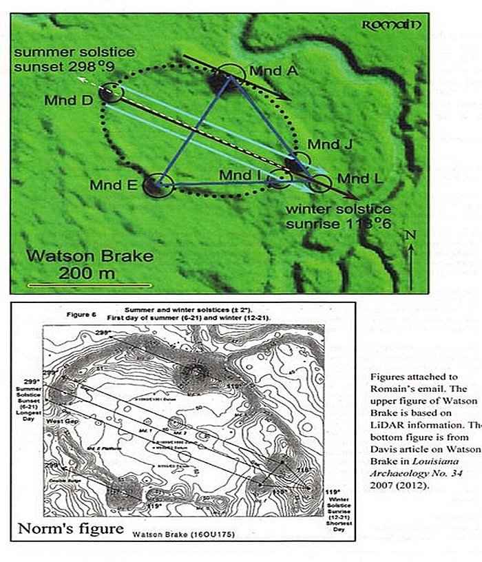
Stonehenge in Southern England on the right, believed to date similarly to about 5,100 years ago, has a similar earthwork enclosure to what is seen at Watson Brake in Louisiana encircling the big stones.
How is this even possible with the history we are taught?
Oh yes, and the illustration of Watson Brake on the left shows s-shaped river bends right next to it.
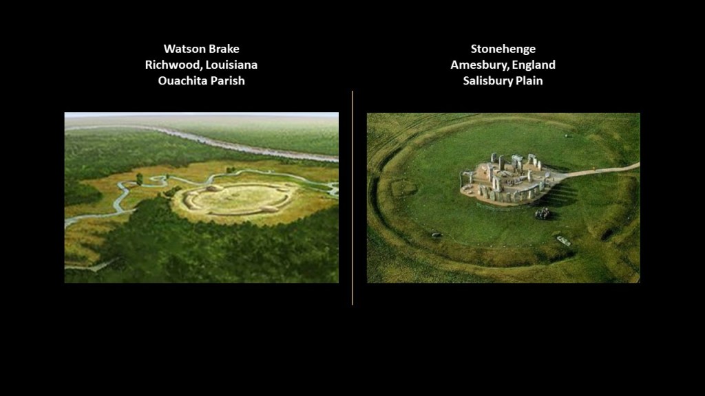
Another landscape feature it shares with Stonehenge, which has the s-shaped Salisbury Avon right next to it as well.
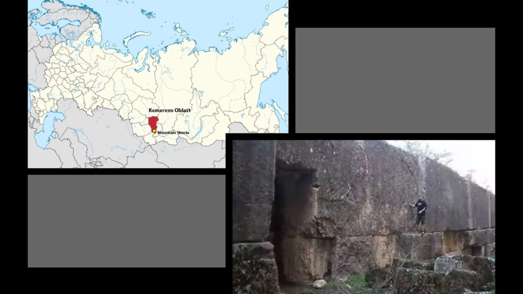
Another place I want to look at is Gornaya Shoria, on a different continent in Siberia.
Aaron sent me photos of Gornaya Shoria to bring it to my attention regarding its similarity to these rock formations we keep seeing in State Parks in North America.
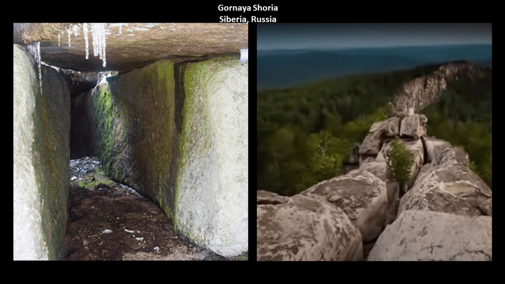
Here is Boxcar Rocks in Pennsylvania on the left compared with Gornaya Shoria on the right.
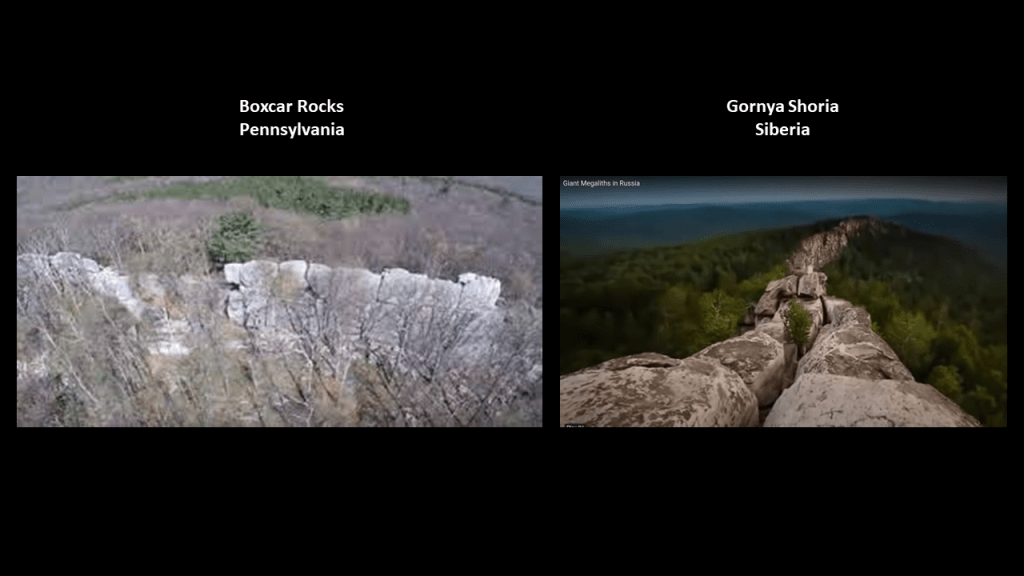
Gornaya Shoria is found in Russia in southern Siberia, east of the Altay Mountains, and is known for its gigantic megalithic stone structures.
There are other similarities to share between Siberia and what we find in North America in Appalachia.
One is that Gornaya Shoria is that it is rich in ores, and in one of the largest coal-mining areas in Russia with one of the largest coal deposits in the world.
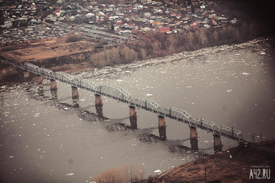
Another shared feature from what we have seen thus far in different places are the s-shaped river bends and confluences, like what we see in Kemerovo, the administrative center of the Kemerevo Oblast and the coal-mining capital of Russia.
It is located at the confluence of the Iskitimka and Tom Rivers, and is situated in an S-shaped bend of the Tom River.
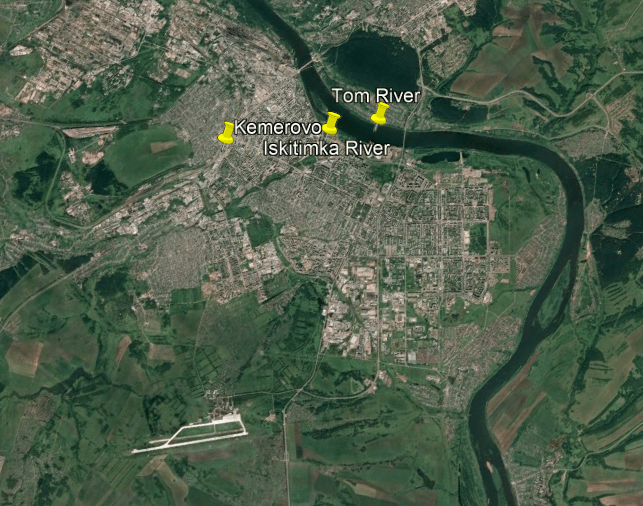
The Kuznetsk Railroad Bridge crosses the Tom River at Kemerovo.
The Western Siberia Railway branch of the Great Trans-Siberian Railroad passes through Kemerovo, which has two railroad stations.

There is even what we think of as classical Roman architecture here in Siberia, like the Kemerovo Regional Lunacharsky Drama Theater.

You know, Siberia, the land of freezing cold!

Like what you see in North America and other places, the indigenous Shor people of the Kemerevo Oblast are portrayed as hunter-gatherers and farmers…but who knew how to smelt-iron and make iron objects.
Hence their name from the Russians who encountered them in 1607, the Kuznetsk Tatars, or “Blacksmith Tatars.”
So the indigenous Shors, where the massive megalithic site of Gornaya Shoria is located, were “Tatars,” or Tartars, of the historic Tartarian Empire, one of many ancient empires around the world that were in harmony and balance with each other, and not at war with each other as we have been taught to believe in our historical narrative.
So you have the indigenous peoples of Russia, like the Shor…

…and the Itelmen People of the Kamchatka Peninsula in the Russian Far East looking very much like Native American Tribal people.

Well, that similarity is accounted for in the official narrative with the migration story that the first humans to enter North America came from Siberia across the Bering Land Bridge at the end of the last Ice Age.
Right?
The story we learn about in school anyway.
So, what exactly happened to get us to our present belief systems?

How about we’ve been indoctrinated in to our present belief systems…

… which has been reinforced through programming in things like movies, television and music.

And Hollywood and the entertainment industry in general has been dominated by Freemasons.
Through such celebrities as John Wayne and Roy Rogers, who were Shriners, an organization comprised of 32nd- and 33rd-degree freemasons, the highest degrees of western freemasonry.

The name “Shriners” is derived from the “Ancient Arabic Order of the Nobles of the Mystic Shrine.”
Also known as “Shriners International,” it is an American Freemasonic society that was established in 1870 and headquartered in Tampa, Florida.
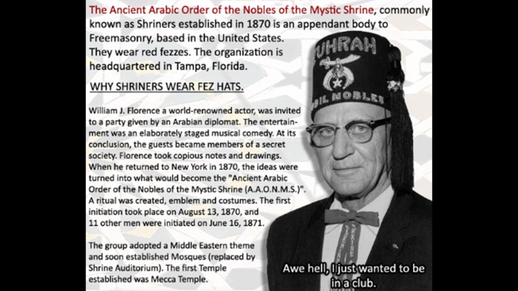
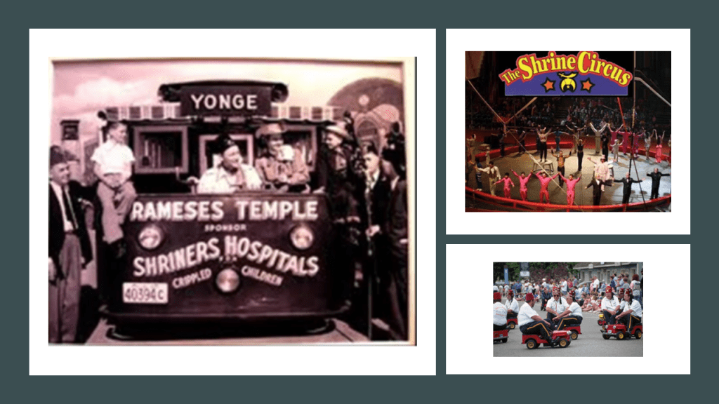
I think it is accurate to say that the freemasonic Shriners are best known to the general public for their hospitals, circuses and parade antics in little cars.
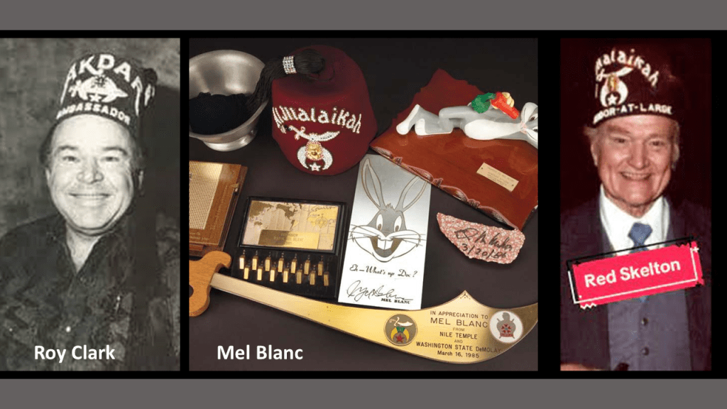
Even comedian Red Skelton, musician Roy Clark and Mel Blanc, the voice of Bugs Bunny, were Shriners!
These are Prince Hall Shriners of the Ancient Egyptian Arabic Order of the Nobles of the Mystic Shrine.

Ancient Moorish Masonry has 360-degrees of initiation…327 more than western freemasonry.

Until Prince Hall found a way back in, Moorish Masons were denied admittance into Freemasonry.
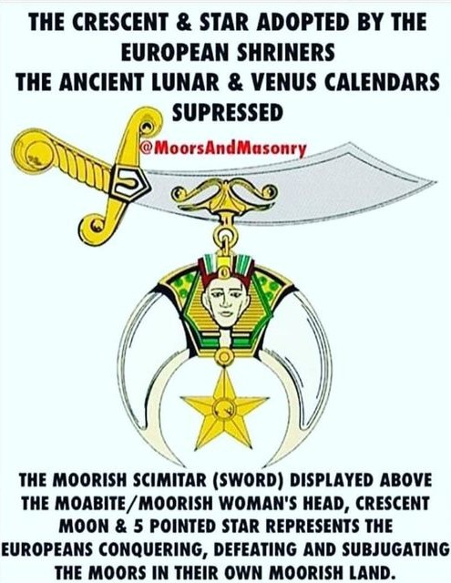
Moorish Masonry is based on Moorish Science, which also includes the study of natural and spiritual laws, natal and judicial astrology, and zodiac masonry.
This is where the perfect alignments of infrastructure on earth with the sky comes from – the consummate alignment of earth with heaven that is seen around the world – like the lunar roll along the top of this recumbant stone in Crowthie Muir near Forres, Scotland.
Muir is pronounced “Moor.” Like in the Ouachita Mountains in North America, the memory of the people is retained.
Even though the spelling is different, the pronunciation is the same.
Like in the Ouachita Mountains in North America, the memory of the people is returned in the name.

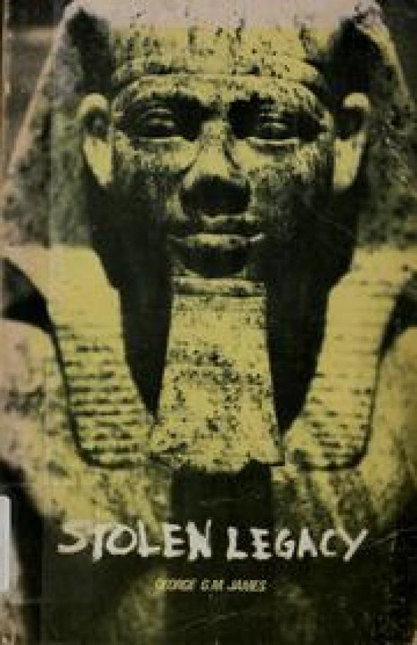
According to George G. M. James in his 1954 book “Stolen Legacy,” the European Freemasons stole the legacy for themselves of the original Moorish Masons, the custodians of the Egyptian mysteries.
The Tartarian Empire in Asia was part of the worldwide ancient advanced Moorish Civilization, with its roots in Ancient Mu.

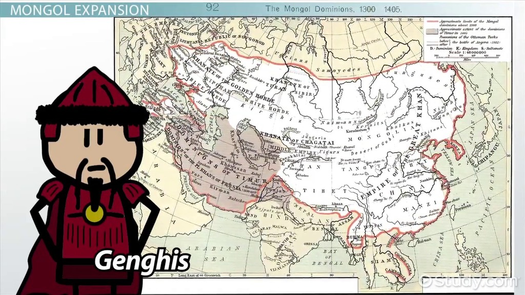
The history we have been given about the “Tatars” in Russia is that they were steppe nomads who were assimilated into the Mongol hordes that swept in on horseback under the leadership of the Mongolian Chieftain Genghis Khan, the founder and first Khan of the Mongol Empire, which he ruled from 1206 until his death in 1226.
Tartary was also hidden in name changes throughout the whole region.
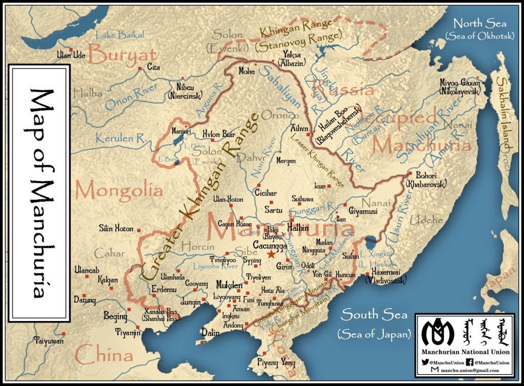
Like the name of Manchuria, a region located in northeast China and part of the Russian Far East, came into use in the 1800s, instead of Tartary.
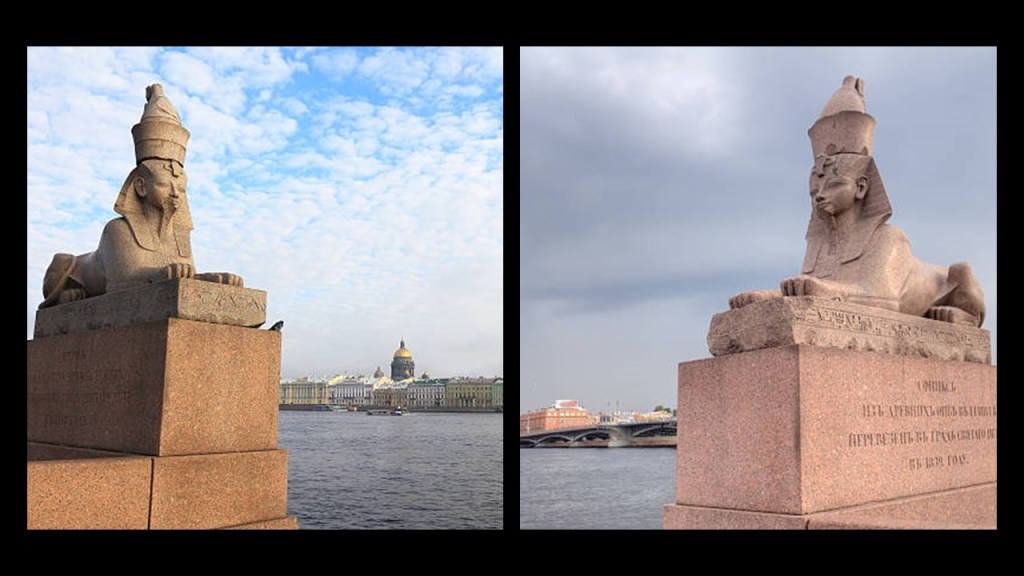
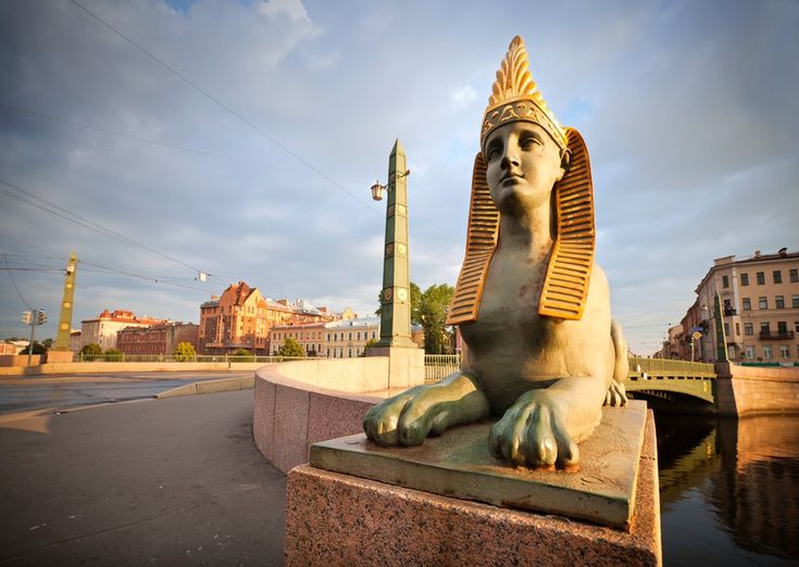
In the beautiful canal city of St. Petersburg on the Baltic Sea, which was said to have been founded by Czar Peter the Great in 1703, it is important to note the sphinxes there.
First, there are two sphinxes at either end of a quay on the Neva River in front of the Imperial Academy of Arts.

Here is what we are told about these two.
They were brought from Egypt to Russia during the height of Egyptomania in 1832.
The story goes that a Russian named Andrei Muravyov, about whom there is no information available to find, went on a pilgrimage to holy places in 1830.
He saw these two 3,500-year-old sphinxes for sale in Alexandria, Egypt.
This guy was so impressed, he contacted the Russian Ambassador with a proposal to buy them.
They ended up being acquired, and eventually made their way to St. Petersburg in 1834 and their present location the quay on in front of the Imperial Academy of Arts.
There are also sphinxes on St. Petersburg’s Egyptian Bridge on the Fontanka River.
The Egyptian Bridge was said to have been originally constructed between 1825 and 1826 by two civil engineers, also as a tribute to early 19th-century Egyptomania.
Besides sphinxes, it had Egyptian -style ornaments, obelisks and hieroglyphics, and the iron-work was elaborately gilded.
There’s a whole story about the Egyptian Bridge collapsing in 1905 when a cavalry squadron marched across it, and that the present bridge was rebuilt by 1955, incorporating features from the original bridge, but as I have already indicated, I have serious doubts about the veracity of what we are told about historical events and how things in our world came to be what we see.
I’d also like to bring the Atlantes of the Winter Hermitage in St. Petersburg to your attention.
The Winter Hermitage was the official palace of the House of Romanov from 1732 to 1917, and is a museum complex today.
The Palace pictured here, what we are told was the fourth “Winter Palace” since Peter the Great’s time, was said to have been constructed between 1754 and 1762.
What the historical narrative tells us that the Emperors constructed their palaces on a monumental scale to reflect the might and power of Imperial Russia.
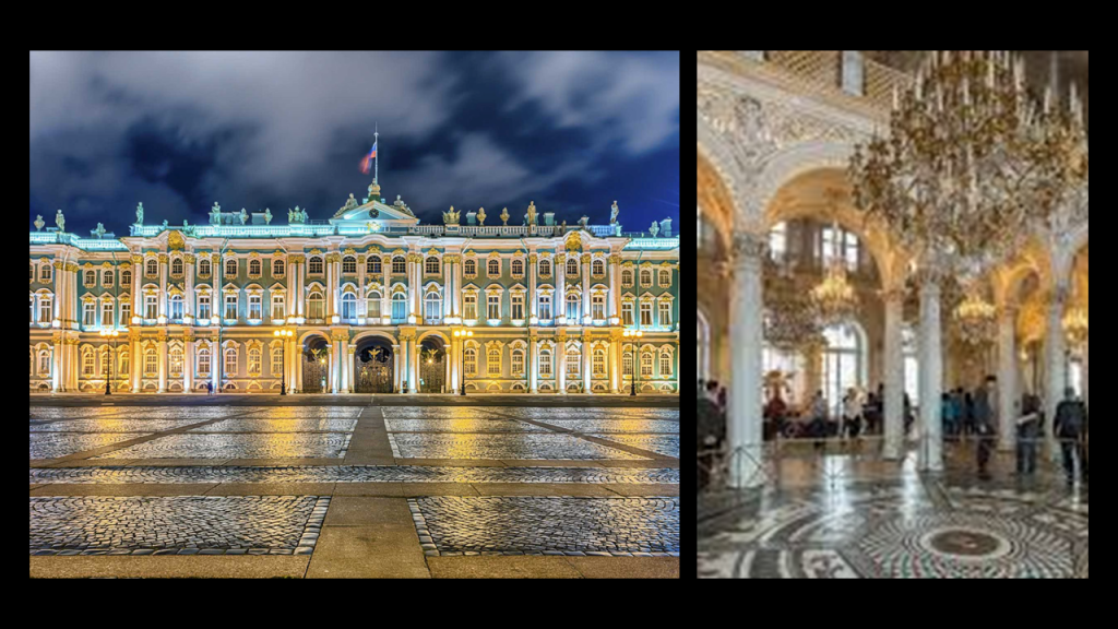
The giant-sized statues of the Atlantes are located at a portico entrance of the Winter Hermitage.

The ten Atlantes statues that hold up the Hermitage portico were said to have been sculpted from granite, and polished, by Alexander Terebeniev, and completed in 1852.
Old photos are all that remain of the living giants of the past, like those of Tartary…
…with the possible exception of seeing the giant gene of Humanity expressed in the basketball players of today.

So, exactly how do you go about hiding giants and their advanced civilization?
Based on the information I have provided throughout this post and past research, I think the American Civil War was another one of the many ways this was done, and was not what we are told it was about.
For another example of finding correlations between giants and civil war battles, Aaron sent me this article he found on the bones of giant indians near Antietam Creek on the Library of Congress website.
Titled “Bones Of Giant Indians,” about giant skeletons found in Antietam, Maryland, it was originally published on February 9th of 1898 in the “Juniata Sentinal and Republican” newspaper in Mifflintown in Juniata County, Pennsylvania.
This article implies that the tall “Indian” skeletons that were found of seven-feet in height, roamed over the State of Maryland in their wildness, armed with instruments that either nature gave them, or in their limited skill to make.
It further goes on to say that the locality from where these skeletons came near Antietam Creek in Frederick County was supposed to have been the battleground of two tribes of Indians, the Catawabas and the Delawares.
According to this claim, some Catawbas overtook a band of Delawares living at the mouth of the Antietam and annihilated them, but the President of the Maryland Academy of Sciences and Provost of the Peabody Institute, after a careful review of the locality, found that there was no evidence to support this claim of a battle other than some spears and arrowheads found there.

This location of Antietam Creek and the alleged battleground between the two Indian tribes would not have been far in distance from the location of the Battle of Antietam the deadliest one-day battle in American Military History, on September 17th of 1862, with 22,727 dead, wounded, or missing.
We are told that after a long bloody day of fighting and death, the Union Army succeeded in turning back the Confederate invasion of Maryland, and was considered a major turning point in the war in the Union’s favor.
So exactly how was the President of the Peabody Institute supposed to find evidence of an historical battle between giant Indians in a place with an even more recent battle, and of this magnitude?
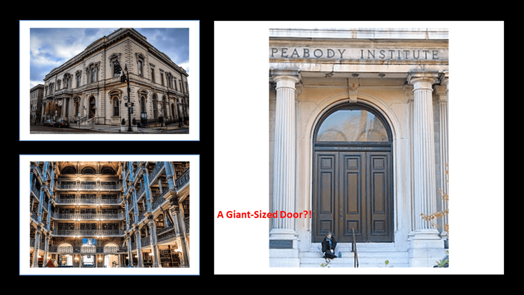
The Peabody Institute mentioned in this article immediately caught my attention.
In 1857, banker, and also called the “Father of Modern Philanthropy,” George Peabody established the Peabody Institute in Baltimore with a bequest of at least $800,000, and it is the oldest conservatory in the United States.
By the time it was completed and opened in 1866, one year after the official end of American Civil War, it was dedicated by George Peabody himself,and included a music academy, library and art gallery.
That entrance at the east wing of the George Peabody Library sure looks proportionally like its made for much bigger people than we are today!
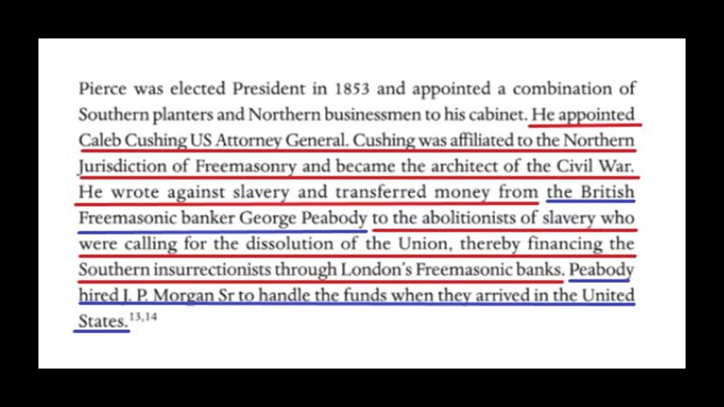
George Peabody’s bank became the premier American banking house in London after he took up residence from Baltimore to London permanently in 1837, and went from being a wholesale dry-goods and cotton merchant, to a merchant-banker offering securities in American railroad and canal enterprises to British and European investors.
He started a banking business trading on his own account a year after he moved to London, and by 1851, he established the banking firm of “George Peabody & Company” to meet the increasing demand for securities issued by American railroads, and his company specialized in financing governments and large companies.

According to “The Secret Founding of America” book by Nicholas Hagger…

…George Peabody was the Freemasonic banker from whom money was transferred to the “southern insurrectionists,” and he hired the father of J. P. Morgan to handle the funds when they arrived in the United States.
It’s also important to note that the just mentioned Antietam Battlefield is quite close to Harper’s Ferry in West Virginia, also known for its Civil War history, as well as numerous historic forts, rivers, canals, railroads, and hydroelectric plants.
The original rail-lines and canals would have been providing power for the free-energy system, and the original architecture would have provided the antiquitech to process and utilize the free energy throughout the worldwide system.
The Earth’s original free-energy grid system was based on exact and precise geometric alignments of cities and places.

This is what I have come to believe has taken place here over the course of my research.
Firstly, I believe that those behind the reset of Earth’s history and the New World Order deliberately caused a cataclysm via directed energy into the grid system relatively recently, which devastated the surface of the Earth, simultaneously causing the land to undulate and buckle, causing among other things, swamps, bogs, deserts, dunes, and whole land masses to shear-off and submerge under seas and oceans, and that the European colonizers we learn about in our history were exploring and claiming the land of a post-cataclysmic world.
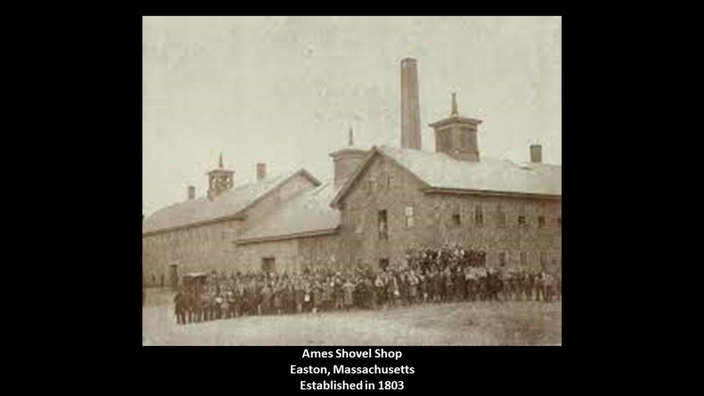
Secondly, I believe the beings behind the cataclysm were shovel-ready to dig enough of the original infrastructure out of the ruined Earth so they could be used and civilization restarted, which I think started in earnest in the mid-to-late 1700s and early 1800s.
The Ames Shovel Shop was established in Easton, Massachusetts, in 1803.
It became nationally known for providing the shovels for the Union Pacific Railroad, which we are told opened the West.
It was said to have been the world’s largest supplier of shovels in the 19th-century.
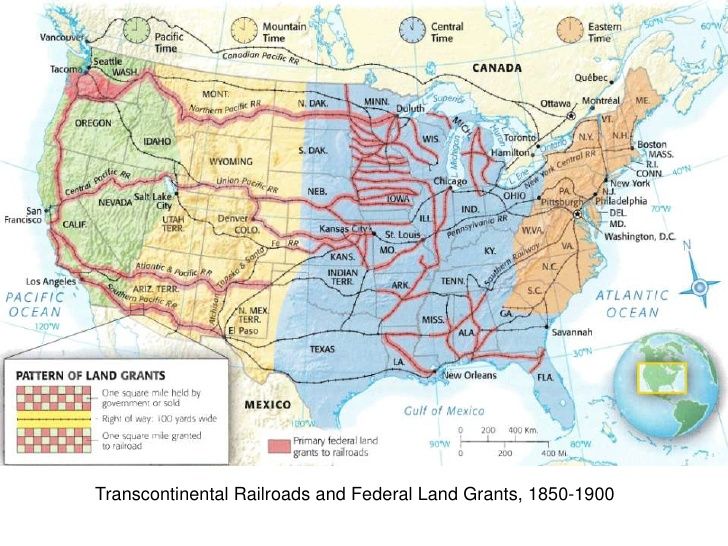
We are told that the federal government operated a land-grant system between 1855 and 1871, where new railway companies in what we are told was the uninhabited west were given millions of acres they could sell or pledge to bondholders.
The co-owners of the Ames Shovel Shop at the time the land grant system was being operated by the Federal government were Ames Brothers.
Oliver Ames, Jr, (b. 1807 – d. 1877) was the President of the Union Pacific Railroad from when it met the Central Pacific Railroad in Utah for the completion of the first Transcontinental Railroad in North America in 1869.
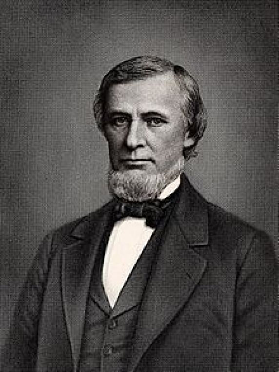
The other brother, Oakes Ames, was a member of the U. S. Congress House of Representatives from Massachusetts 2nd District from 1863-1873.
He was credited by many as being the most important influence in building the Union Pacific portion of the first Transcontinental Railroad.

Why were shovels so important to the opening of the West and the expansion of infrastructure?
Again…what if…the tracks were already there and just needed to be dug out?

Oakes Ames was also noted for his involvement in the Credit-Mobilier Scandal of 1867, regarding the improper sale of stock of the railroad’s construction company.
He was formally censured by Congress in 1873 for this involvement, and he died in the same year.
Ten-years later, he was posthumously exonerated by the Massachusetts State Legislature on May 10th, 1883.
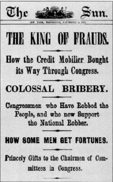
Then they only used the pre-existing infrastructure until they found replacement fuel sources that could be monetized and controlled by them for what had originally been a free-energy power grid and transportation system worldwide, and when what remained of the original infrastructure was no longer useful to them, or inconvenient to their agenda, they had it destroyed, discontinued, or abandoned, typically in a very short time after it was said to have been constructed.
So, I think there was a hostile take-over of the Earth and it’s grid system, which was reverse-engineered as a mind-control and energy-harvesting system for human energy.
A sudden cataclysmic event, creating swamps, deserts, and even submerging entire landmasses around the Earth, would account for how a highly advanced worldwide civilization of giant could be wiped from the face of the Earth and erased from our collective memory…

…and vanished like the Saura people in North Carolina, from around where Pilot Mountain is located as we saw earlier in this post, with, as we are told, their rich cultural heritage recorded in historical journals still buried in the Earth.

I believe that these beings with a negative agenda devised a complicated plan to knock Humanity off the positive Moorish Timeline of Higher Consciousness…

…in an interdimensional war in order to control Humanity, using Humans as their tools against the Creator and Creation.

I bring all this up is because it is important to know this is what has been going on here.
Humans are inherently sovereign beings.
They have gone to all of this trouble because, by Universal Law, they can’t lay a finger on us.
They have tricked us into accepting their sovereignty over our own.

But they have to tell us what they are doing so they have our consent.
So they choose avenues like movies, literature, art, and music to tell us without telling us they are telling us, and if we don’t get it and object collectively, then they technicially have our tacit consent even if we don’t know we are being told something, and that is what they are counting on.
So let’s look at a few examples from art and music.
First, from public art.
There are two identical sculptures entitled “The Awakening.”
They are of a 72-foot, or 22-meter, statue that depicts a giant embedded in the Earth, struggling to free himself.
One is at National Harbor in Oxon Hill, Maryland.
They consist of 5 aluminum pieces buried in the ground in such a way that it gives the impression of a distressed giant attempting to free himself from the ground…
…with mouth in mid-scream as the giant struggles to emerge from the Earth.
There is an identical sculpture in Chesterfield, Missouri.
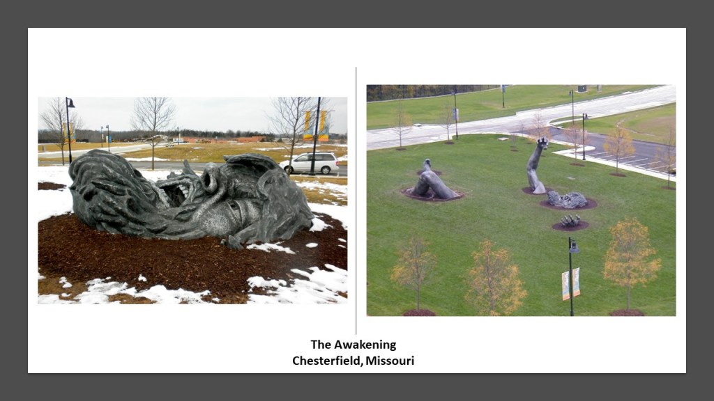
I find it interesting to note that the head of the giant in these “Awakening” Sculptures, with the mouth in mid-scream, on the left, looks very much like the mouth in the head of this giant skeleton that was uncovered in Adam’s County, Ohio, near the Great Serpent Mound, on the right.
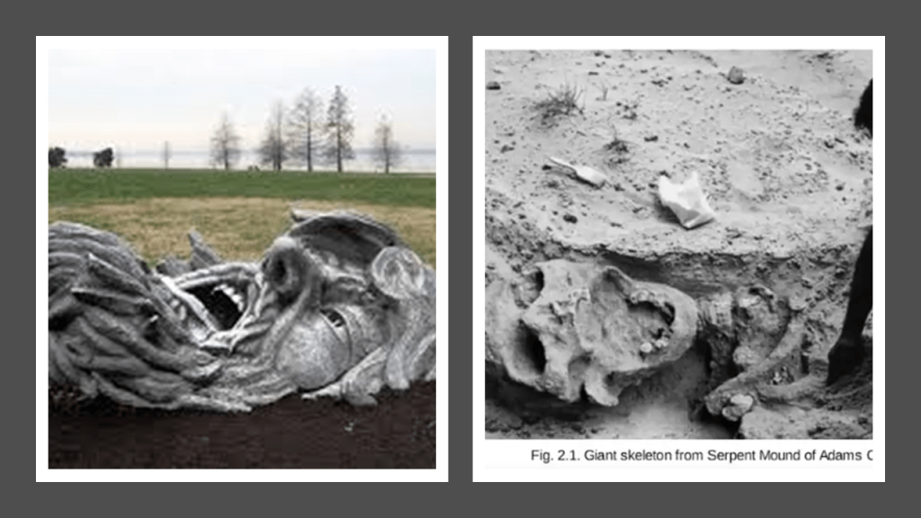
Here are some examples of sculptures around London, also very reminiscent of the two “Awakening” sculptures, of buried giants, or giants attempting to free themselves from the ground.
They are putting these sculptures in public places where people can interact with them and accept the as “Art,” without realizing that they might be communicating to us something that has been very well-hidden about the world we are living in.
Then there is the “Crowned Head” in the labyrinth underneath Buda Castle in Budapest, Hungary, the historical castle and palace complex of the Hungarian Kings.
Buda Castle has one of the world’s remaining incline railways, also known as funiculars, still in operation.
The Buda Castle labyrinth under Buda Castle Hill is part of a huge underground system, complete with caves, thermal springs, basements and cellars.
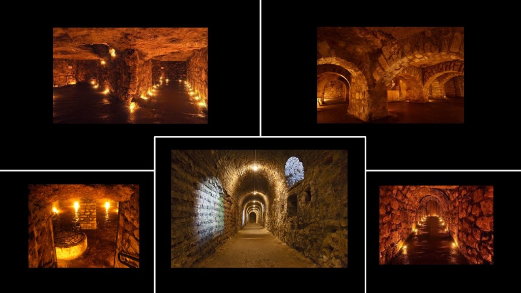
Among other features, there are five separate labyrinths encompassing nine halls.
What is called the Crowned Head is in the Ottoman Alley of the labyrinth.
I find this to be extremely odd.
To me, this giant head looks more like a petrified head with long-gone eyes, that is covered up to the nose and ears by mud, than an intentional work of art.
Now an example from music.
These are the lyrics from Rasputina’s song “Holocaust of Giants,” from their 2010 “Sister Kinderhook” album.
I found this when I was looking up general info under the search term “holocaust of giants.”
The lyrics of this song echo what we saw in the 19th-century accounts, when the existence of giants was acknowledged, but we don’t know what happened to them, but it was long ago, they were primitive, and they must have killed each other off.
The message is yes there were giants, but something unknown happened to them, and that’s really all we know, and that’s all you need to know.
The lyrics to a “Holocaust of Giants” can be summarized thus:
First verse of the song.
When I was a child in Ohio, a worker was digging a well on my dad’s land, and he found a massive bone.
Ever since I’ve known there was a race of giants in the northern hemisphere, that lived here 10,000-years ago.
It’s seems incredible, but its true, that a primeval brute was turned to stone but he wasn’t alone, there were hundreds of them.
Even giants think they’ll live forever.

Second verse of the song.
Everything turned to stone where a stream once flowed into the Ohio.
The Bible speaks of giants in our midst, but they killed each other in a meaningless war.
Thank goodness we don’t do that anymore!
The gravel-encrusted skull was found in a shoal, with double rows of sharp teeth and the jaw measured 25-feet, or almost-8-meters, but it had turned to stone.

The last verse of the song recaps the first two.

Just a few more things in closing.
Why do I think this happened relatively recently?
The simplest answer is that we are still using giant-sized infrastructure and architecture, every day all over the world.
How many generations of school-children have attended school in buildings like the still in use El Paso High School in Texas, that is extremely large and ornate, and looking like a Roman temple…

…or in schools that have been long torn-down, like the former Butcher Elementary School in Fairmont, West Virginia, in Marion County, with this photo of the school-kids and teacher taken in front of a giant door circa 1911.
Aaron attended grades 1 – 12 at Mannington High School in Mannington West Virginia, in Marion County, and he has shared vivid memories of incredibly tall windows in the building from his school years.

Another viewer sent me these photographs he took of a 6-toed large footprint that he came across in the Lime Peak Quarry near Eureka, Utah.
He estimated the length to be about 12″ to 14,” or 305-mm to 356-mm, long.
Echoes and imprints of giants in our midst, right beneath the surface of our awareness.
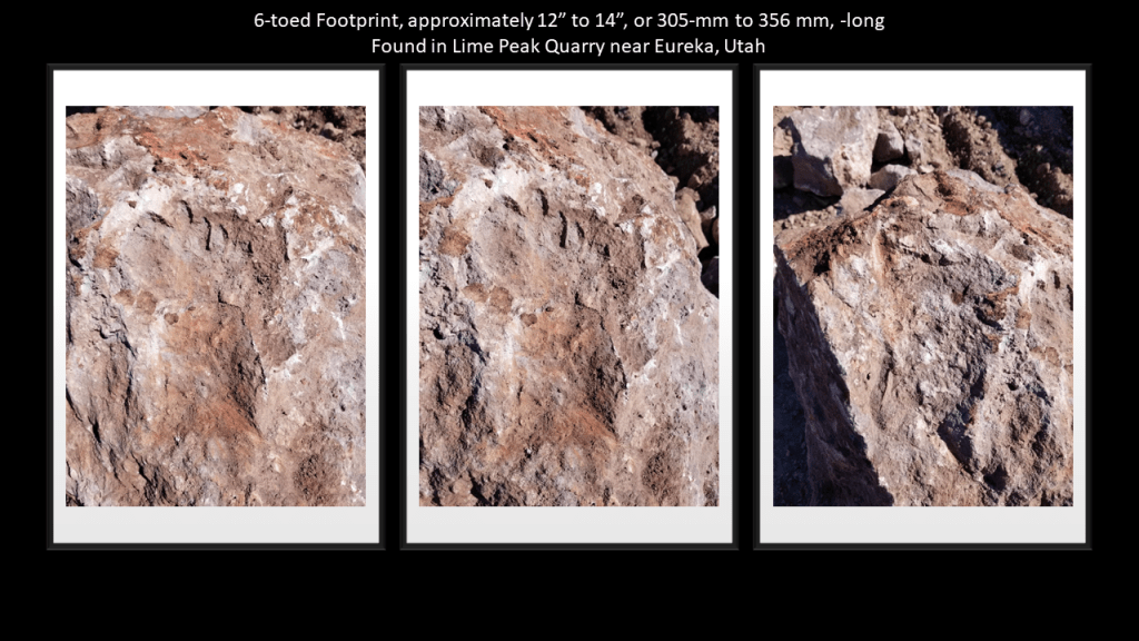
The Controllers have always feared the Great Awakening of Humanity, and thus threw everything they could at us to prevent it from happening and keep us asleep so we would never know what hit us.
But no matter what they do, they can’t keep it from happening. Among many other things, they lost control of the narrative no matter how hard they try to get it back.

I don’t believe the giants were hoaxes.
I believe the hoax is on us to hide their very existence from us, especially from not that long ago.

One thought on “On the Trail of Giants, in Appalachia and Beyond – Theme 2: Giants”