
This particular subject recently took front-and-center stage in my mind after doing research on the earliest Non-Governmental Organization (NGO) in our historical narrative, an organization that eventually became known as “Anti-Slavery International.”
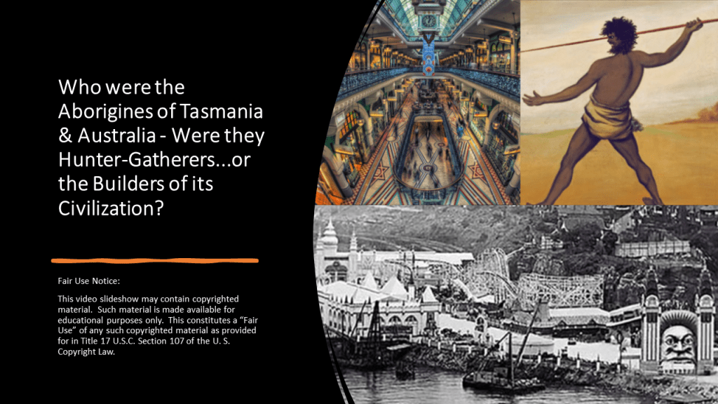
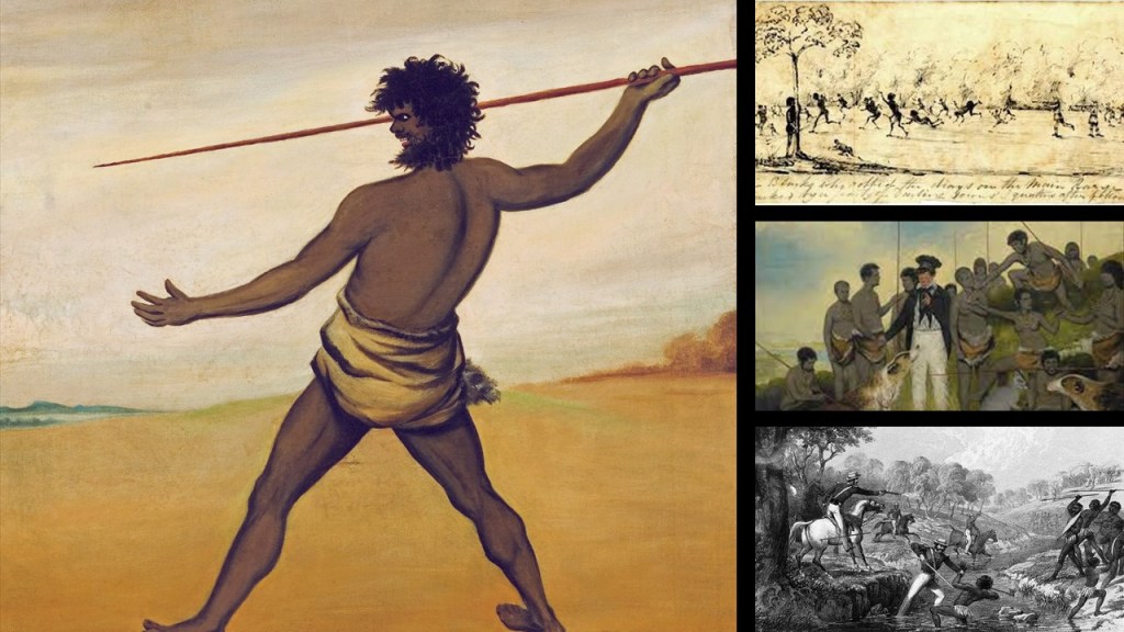
In an effort to at the very least question the narrative about what we are told is the answer to this question, that the Aborigines were hunter-gatherers, I decided to bring together past and present information I have accumulated around the subject to demonstrate that a good case can be made that they were in fact actually the builders of its Civilization, and that they were part of a worldwide civilization that was identical in design from ancient times to relatively modern times.
First, I will start with the origins of “Anti-Slavery International.”
The origins of today’s “Anti-Slavery International” included the “Aborigines Protection Society,” which was formed in 1837, and we are told it was to ensure the “health and well-being, as well as the sovereign, legal, and religious rights of the indigenous peoples while promoting the civilization of the indigenous people who were subjected under colonial powers.”
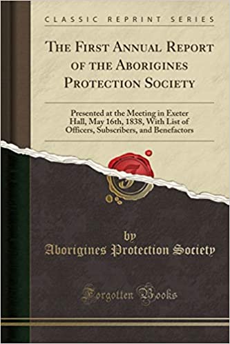
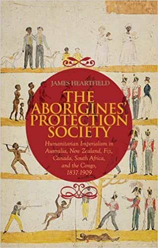
This book by David Heartsfield looks at the “Aborigines Protection Society” from the perspective of “Humanitarian Imperialism in Australia, New Zealand, Fiji, Canada, South Africa, and the Congo between 1836 and 1909,” and mentioned things like how the policy of native protection turned out to be a reason for the growth of imperial rule, particularly that of the British Empire.
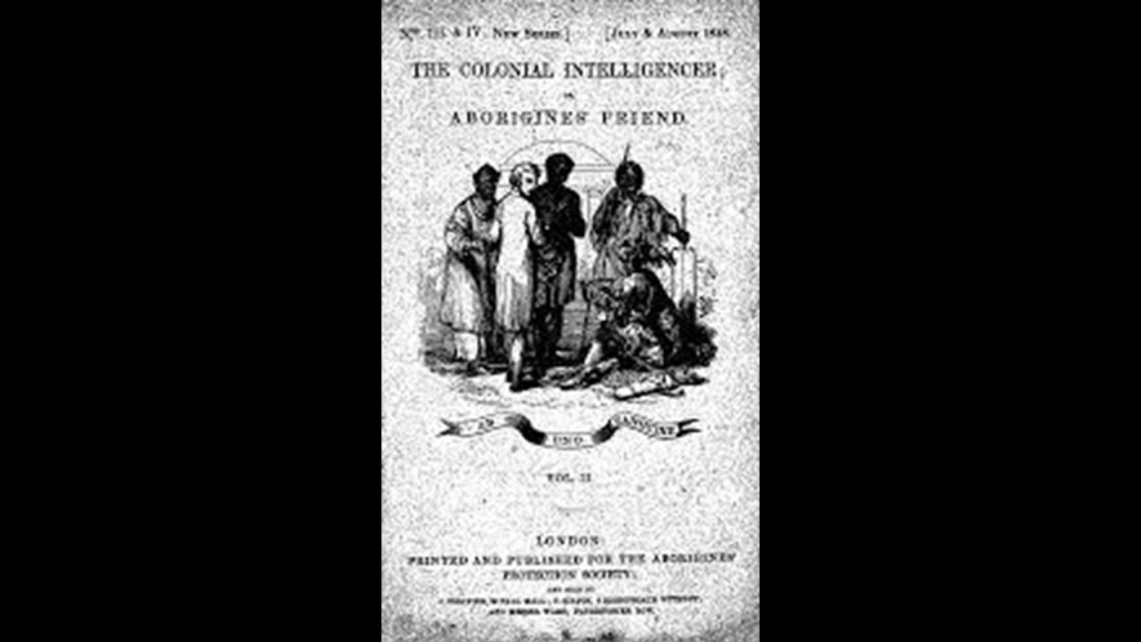
The Aborigines Protection Society published a journal called the “Colonial Intelligencer and Aborigines Friend,” which was comprised of “…interesting intelligence concerning the Aborigines of Various Climes and Articles Upon Colonial Affairs, with Comments Upon the Proceedings of Government and of Colonists toward Native Tribes.”
“Aborigines Friend”….or foe.
The “Aborigines Protection Society” and the “British and Foreign Anti-Slavery Society” merged in 1909, and together they became known as the “Anti-Slavery and Aborigines Protection Society.”
What had become the “British and Foreign Anti-Slavery Society” in 1909 went through several other name-changes over the years, and with the last name-change became “Anti-Slavery International” in 1995.
Here are this organization’s slavery statistics worldwide from 2020.
According to their own statistics, an organization that supposedly exists to working against slavery and other abuses, as recently as 2020, only three-years ago, there were 40.3 million people in slavery total, with at least 10-million of those people being identified directly as children.
Those numbers seem incredibly high for something that isn’t talked about openly in our day and age, and raises the question of what is really going on here.

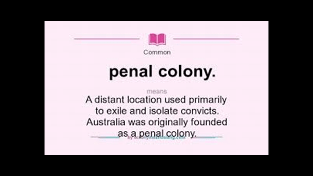
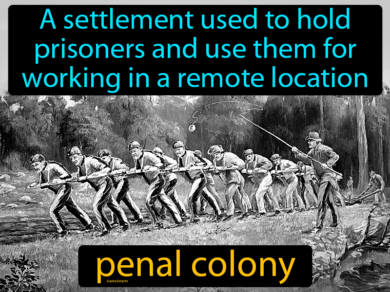
It also brings up the question of how many different forms of human slavery have existed in the past and present-day, including Australia’s history as a penal colony.
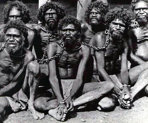
Not only this, but also what could have possibly happened to its original people to kick them back into the Stone Age from a high-state of civilization, and this didn’t just happen in Australia, it happened all over the world when the European colonizers moved in and took everything over.
How could this even have happened to begin with?
No doubt brutal subjugation of the original people is part of the explanation, but there would have been many factors contributing what has taken place here.
By the end of this video, I will have provided a substantial amount of information and examples to demonstrate that there is something seriously amiss with the narrative, which has gaping holes in it from the information missing from it, that has been inadequately explained by those who don’t want us to know our True History and what has taken place here
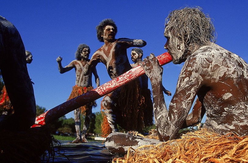
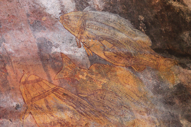
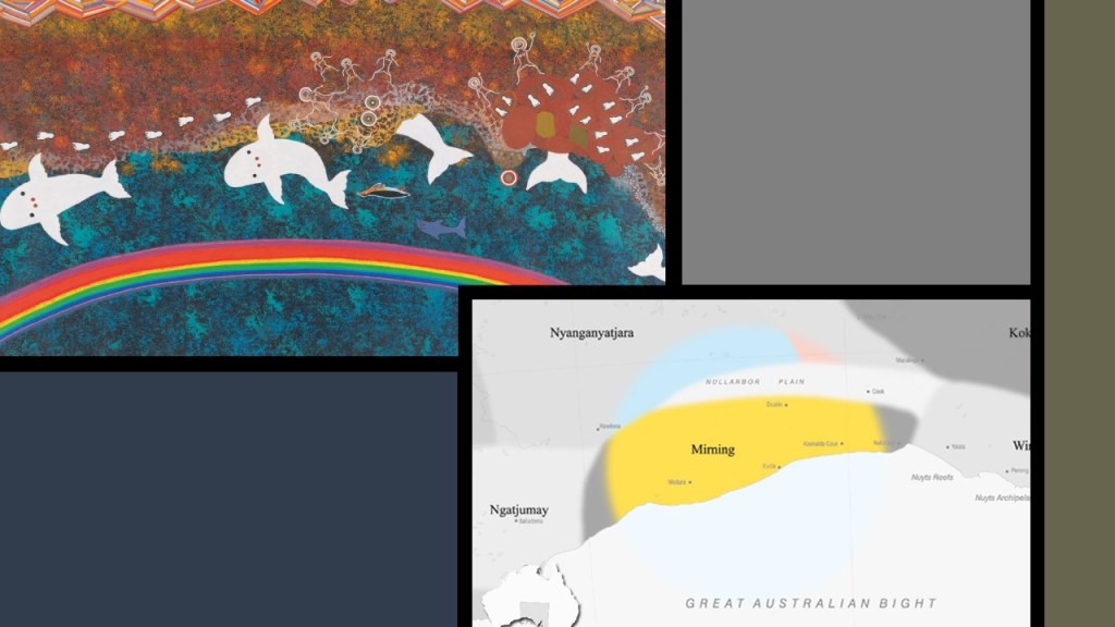
These are typical of the kinds of paintings of the Australian Aborigines that have come down to us in our historical narrative.
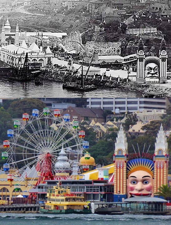
But every once in awhile you can find an aboriginal face in an unexpected place, like this historical photo at the entrance of Luna Park in Sydney, with the huge face and Moorish-looking buildings.
Though still in operation today, Sydney’s Luna Park entrance had a face-lift for some reason.
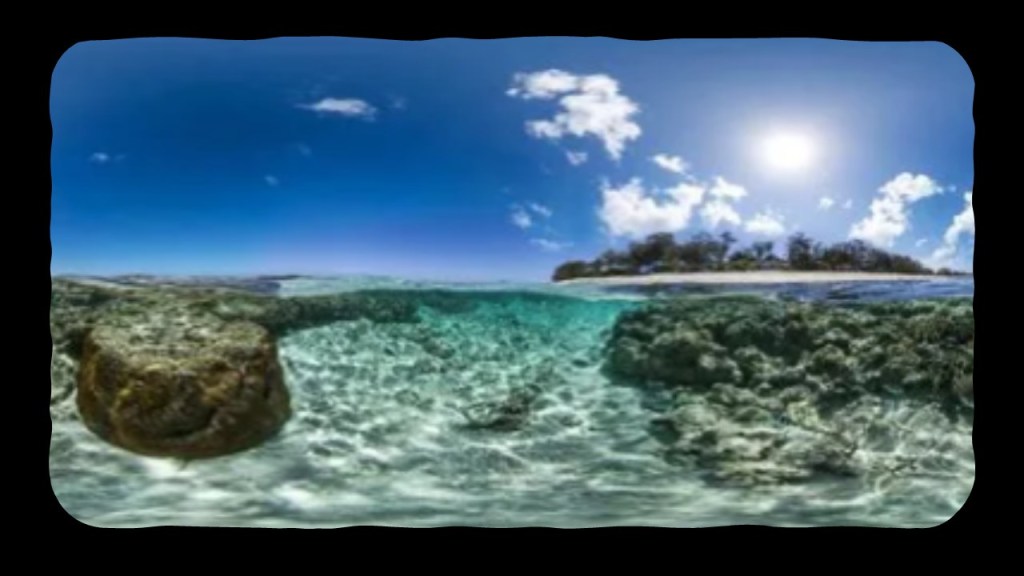
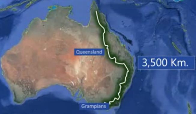
So let’s take a walkabout Australia and Tasmania and see what we can find out.
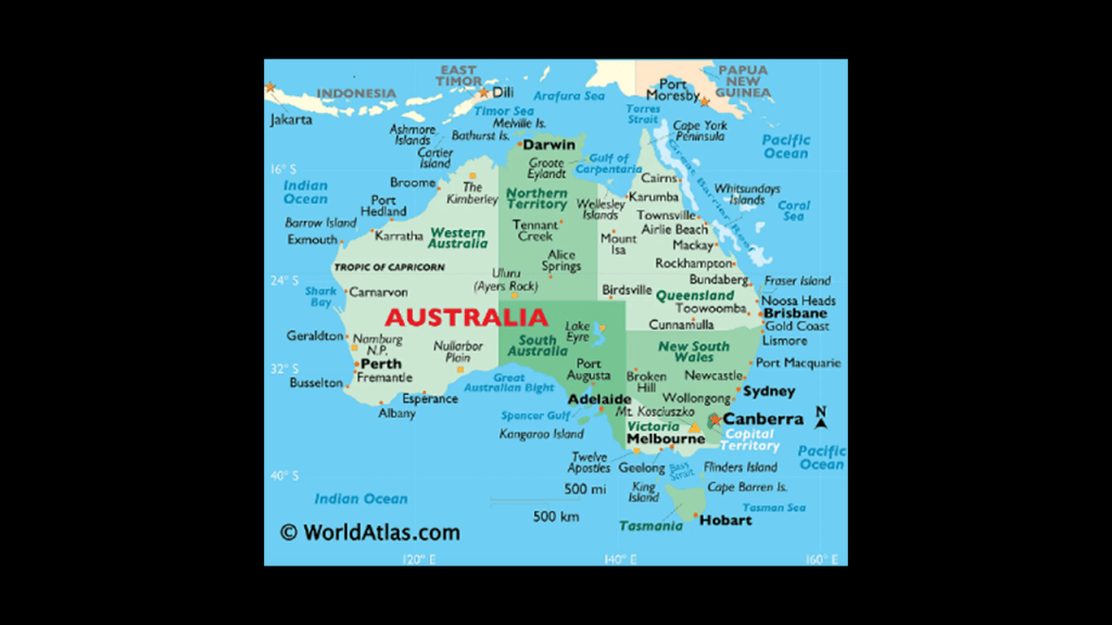
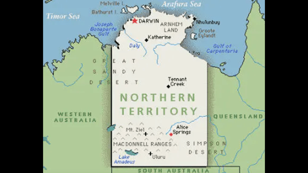
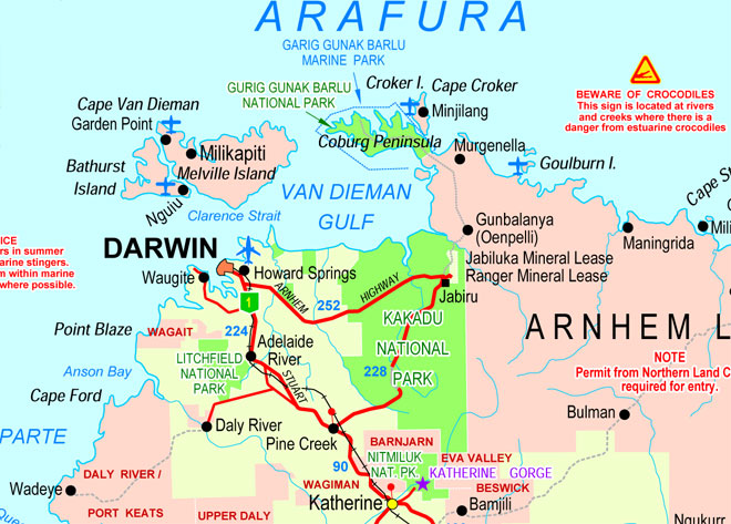
The starting point for our walkabout is Darwin.
Darwin is the capital and largest city of the Northern Territory of Australia, which is sparsely populated.
It is also called the Outback Capital of the Northern Territory.
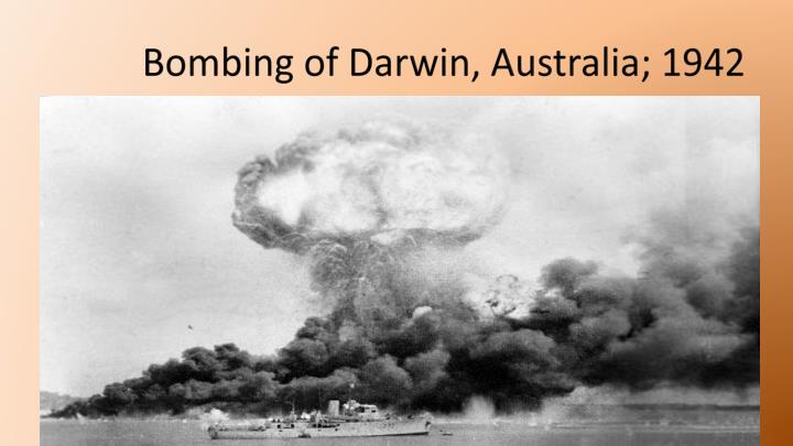
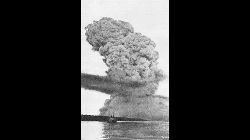
Notably, Darwin was the location of the first bombing in Australia, which occurred in February of 1942, after Australia had officially declared war on Japan on December 9, 1942.
Japanese forces bombed military bases in Darwin in one day.
One of the first hits, and explosions, was a ship loaded with TNT and ammunition.
There were a number of civilian casualties as a result of the bombings, and as a result of the attacks, more than half of the civilian population left permanently.
Interestingly, something very similar happened during World War I in December of 1917 in Halifax Harbor in Nova Scotia, when the high-explosive TNT-laden French cargo ship, the SS Mont-Blanc, collided with the Norwegian ship, the SS Imo, causing the largest, human-made explosion at the time.
Nearly all structures within an 800-meter, or half-mile radius, were obliterated, and the tsunami it caused wiped out the Mi’kmaq First Nation that had lived in the Tufts Cove area for generations.
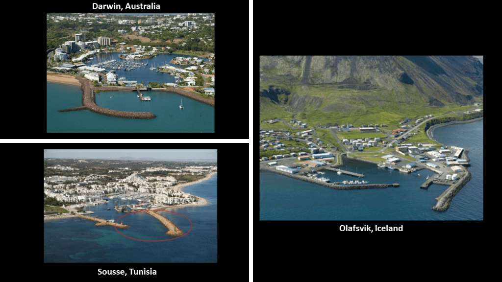
Here is a picture of Darwin today, on the top left.
Of particular note is the shaped harbor in the foreground, which is a signature of places I have found tracking long-distance alignments of cities and places all over the Earth, like that of Sousse, Tunisia on the bottom left, and Olafsvik, Iceland, on the right.
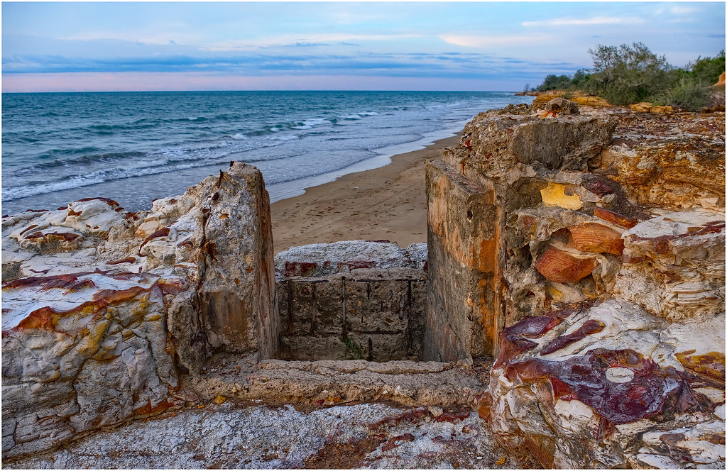
This is described as a World War II gun emplacement in the Dripstone Cliffs of Darwin Harbor.
And this is a photograph circa 1890 in Darwin of Knight’s Folly in the middle; Fort Hill to the left and Government House to the right.
Fort Hill was said to have been the location of a George Goyder’s surveying camp in 1869; used for storing oil during World War II; and removed in 1945 to make room for an iron-ore loading wharf.
“Knight’s Folly” was another name given to an historic building called “Mud Hut, said to have been constructed in 1883 by John George Knight and built from “Egyptian Bricks.”
It burned down on December 31st of 1933.
And the Government House was said to have been built between 1870 and 1871…
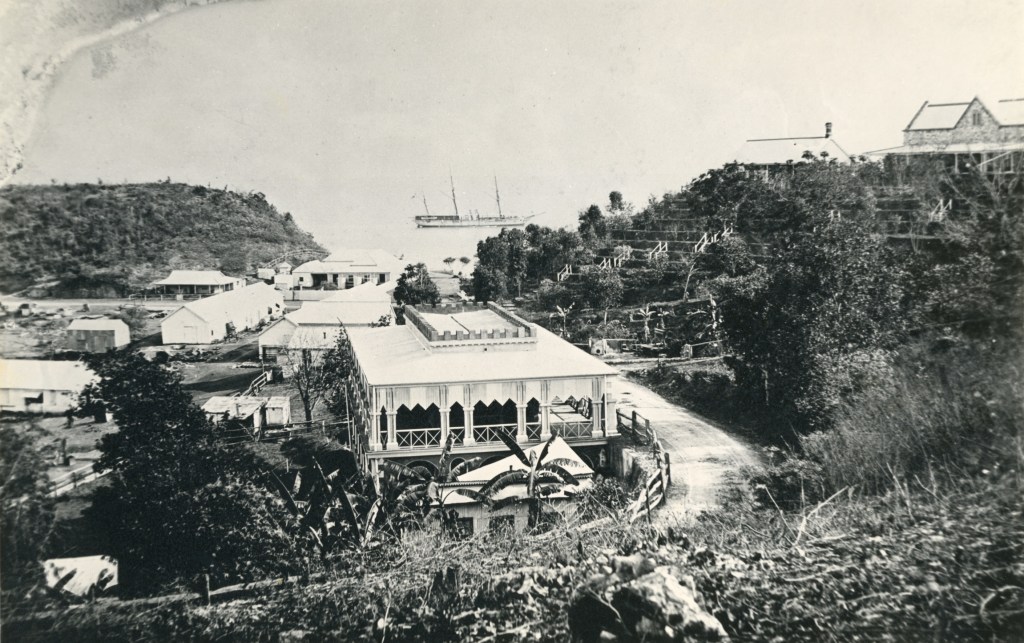
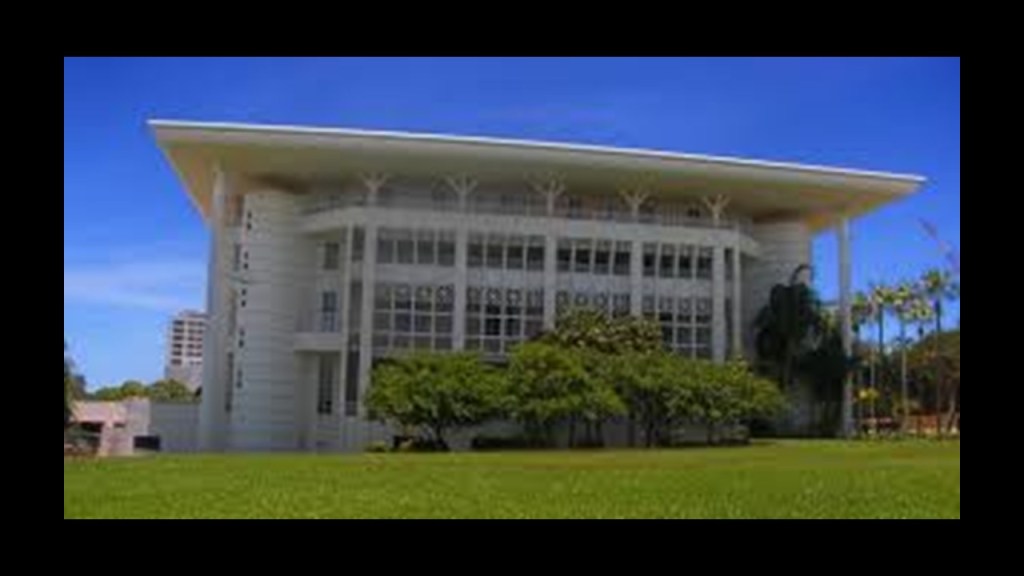
…and to be the oldest European building in the Northern Territory, still in use today as the office and official residence of the Administrator of the Northern Territory.
I don’t know. Maybe it’s just me, but that building looks lop-sided to me!
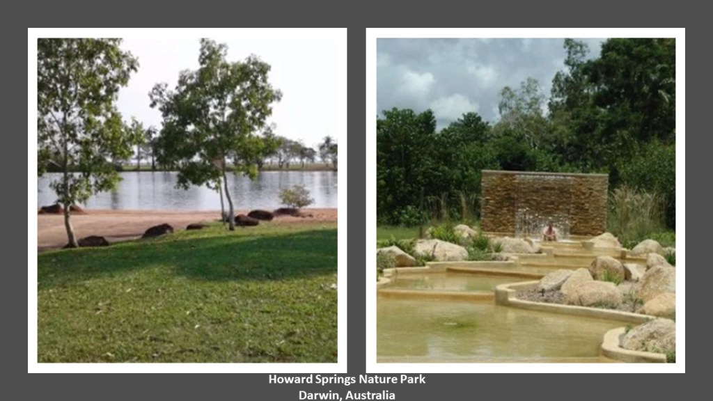
Howard Springs Nature Park is on the outskirts of Darwin.
We are taught that there was nothing special going on in these places, nothing to see, so we fail to recognize the ancient megalithic masonry laying all around us.
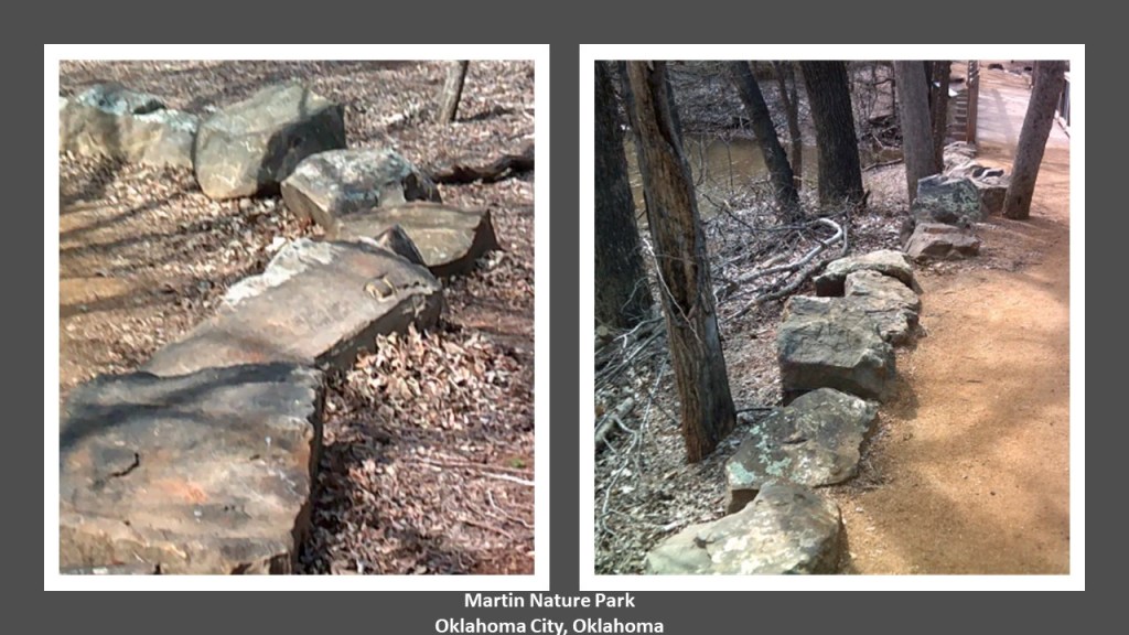
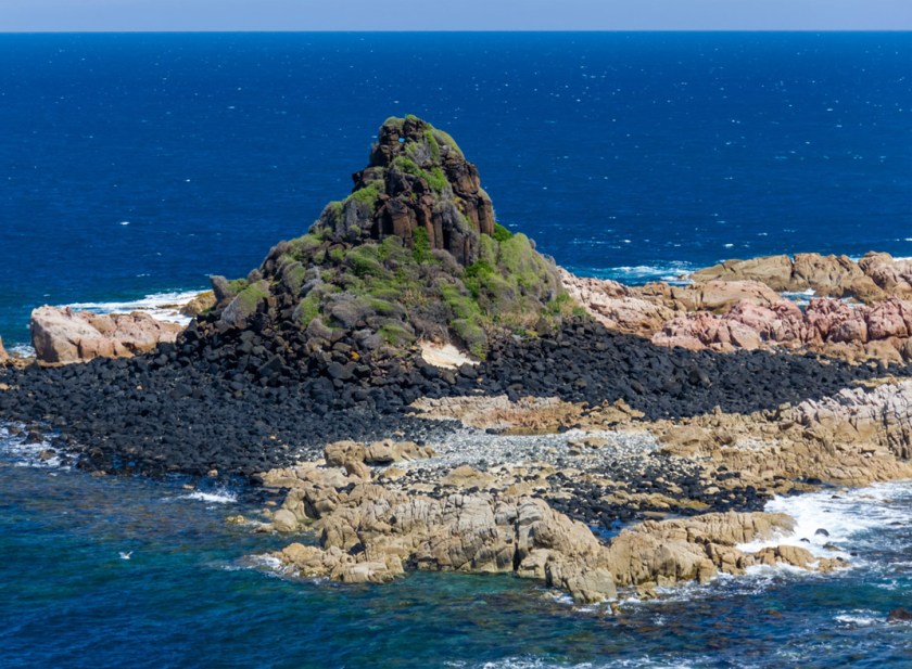
These are cut-and shaped-stones. These are not natural occurrences, contrary to what we have taught to believe by historical omission. These in Australia…
…are like these two photos at Martin Nature Park in North Oklahoma City.
Lying around everywhere with no special attention drawn to them – just there. Taunting us but not telling us.
And only when you start realizing they are there. Because until you notice them, they just blend in to the landscape.
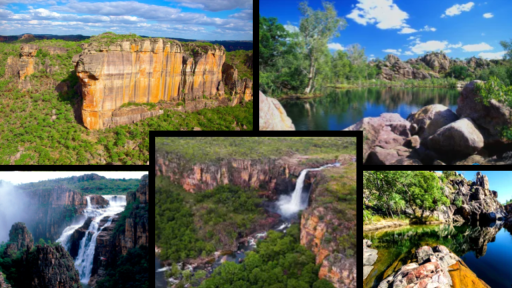
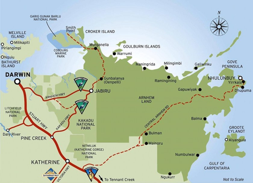
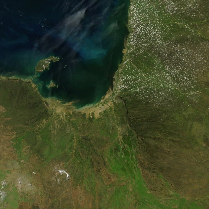
Next from Darwin going clock-wise around the coast, we come to Kakadu National Park, and Arnhem Land.
First Kakadu National Park, which is a UNESCO World Heritage Site.
Kakadu covers an area that is 7,646 square miles (or 19,804 kilometers). Besides its incredible biodiversity, land-forms, and river systems, one of the most productive uranium mines in the world is surrounded by the park, shown in the map as the Ranger Mineral Lease.
According to the narrative, Aboriginal people have occupied this land continuously for 40,000 years, and approximately half of the land of Kakadu is aboriginal.
And this is as good as any place to leave this photo here for your consideration. I personally think there is something to it, that the Australian Aborigines are of the Tribe of Reuben.
This kind of information is well-hidden, so some digging is required to find it. But it is out there on the internet if you start looking for it.

Back to Kakadu National Park.
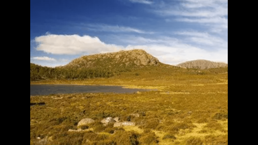
Here are some pictures of the landscape there.
Kakadu National Park is part of Arnhem Land, one of the five regions of the Northern Territory, and which the alignment crosses over.
While the land is named for the ship of the Dutch East India Company Captain who sailed it into the Gulf of Carpenteria, the population of this region is actually mostly aboriginal, estimated to be around 16,000.
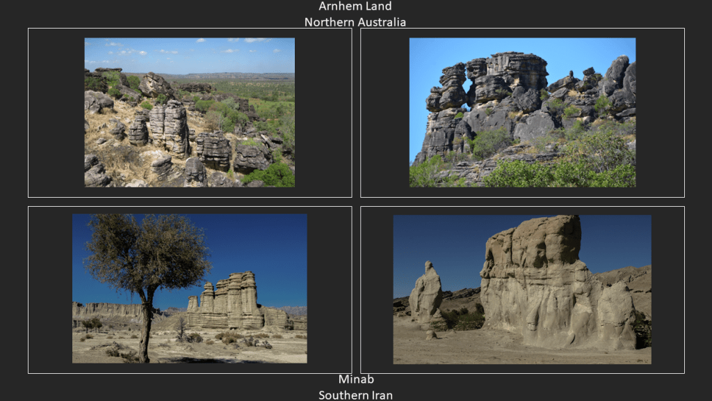
The following photos are of Arnhem Land on the top, and Minab in southern Iran near Old Hormuz on the Strait of Hormuz.
I have no difficulty seeing all of this as ancient infrastructure, as I had a perceptual shift when I realized there is a code of key words that covers up the ancient civilization.
But for most, since we haven’t been taught about this ancient civilization, and have only been taught to believe that it is the result of natural processes, that is how it is perceived.
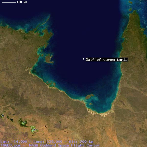
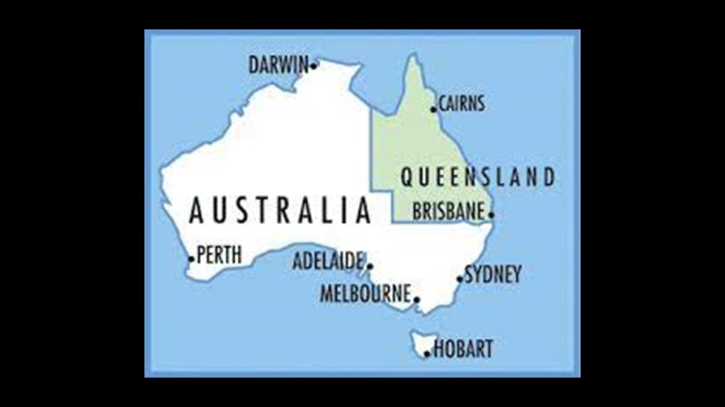
Continuing around the coast, the Gulf of Carpenteria is in Queensland, Australia.
The Gulf of Carpenteria is described as a shallow sea enclosed on three sides, and bounded on the north by the Arafura Sea (which lies between Australia and New Guinea) .
Here is an aerial view of the Gulf of Carpenteria.
The Pellew Islands are in the southwest corner of the Gulf of Carpentaria.
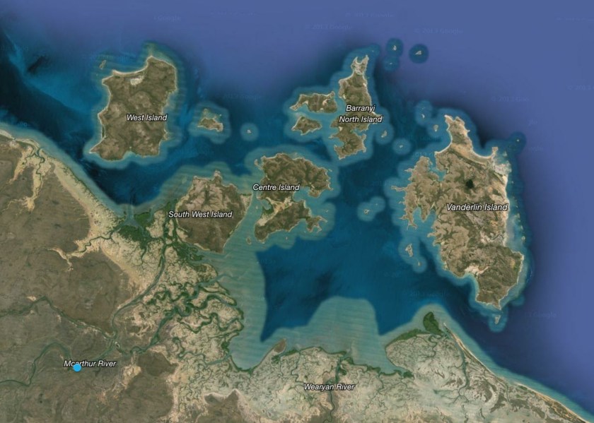
They are a group of five islands with a total area of 2,100 square kilometers, named in 1802 by Matthew Flinders in honor of a fellow naval officer.
The Wellesley Islands are here, also named by Matthew Flinders, this time for the 1st Marquess of Wellesley, Richard Wellesley, the older brother of Arthur Wellesley, the 1st Duke of Wellington.
The largest island in the group is the interesting-looking Mornington Island, which was also named after Richard Wellesley, who was also the Earl of Mornington.
All traditional aboriginal lands.
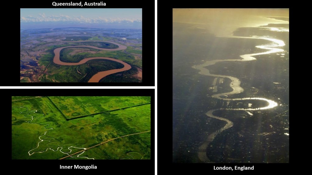
On our way to Cairns, from Karumba to Normanton, there are the same world-wide S-Shaped riverbends, seen on the top left, compared with a photo of the river in Inner Mongolia, near Shangdu,the historical location of Xanadu, on the bottom left, and the River Thames in London, England, on the right.
Next we come to the city of Cairns.
Cairns is the 5th largest city in Queensland, and the 14th largest city in Australia.
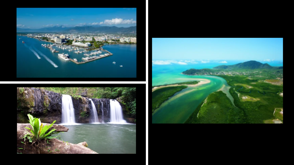
It was said to have formed in order to serve miners going to the Hodgkinson River goldfield.
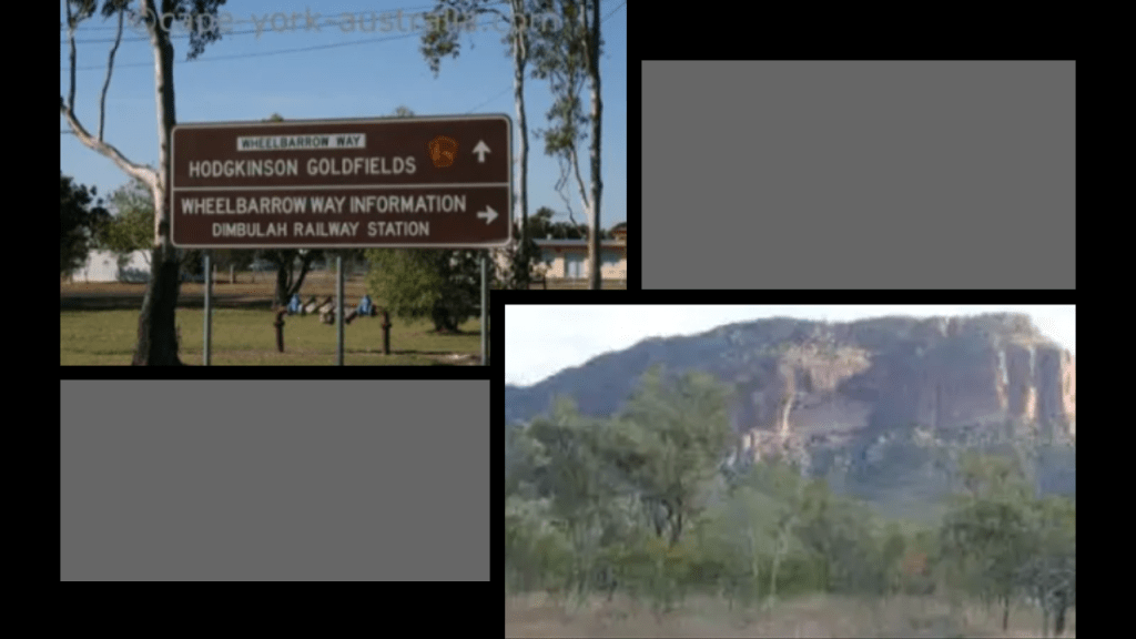
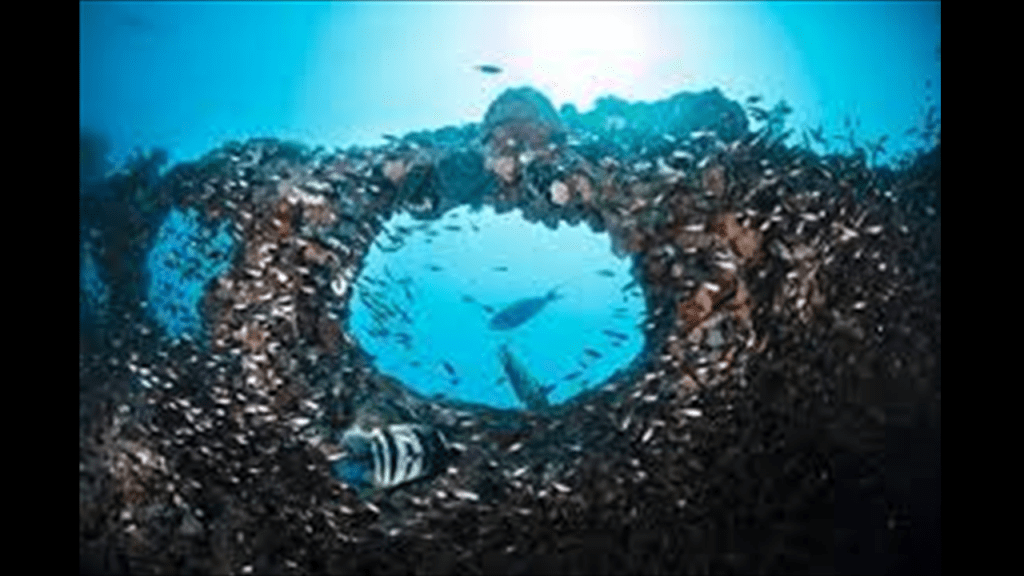
Cairns is also considered the gateway to the Great Barrier Reef.
It spans 1,400 miles (2,300 kilometers) off the Queensland coast.
It is the world’s largest coral reef system, with 2,900 individual reefs and 900 islands.
It is visible from space, and has been named a UNESCO World Heritage Site.
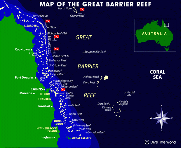
It has long been known and used by Aboriginal Australian and Torres Strait Islanders, and is part of their culture and spirituality.
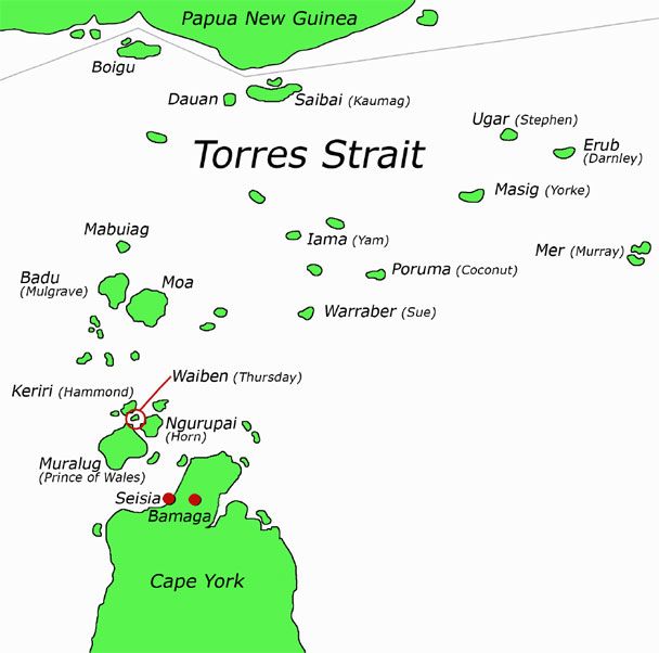
The Torres Strait Islands are a group of at least 274 small islands between Australia’s Cape York and New Guinea.
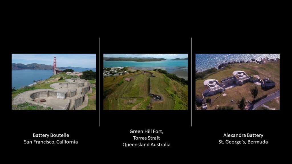
Green Hill Fort was located on Thursday Island in the Torres Strait near Cairns.
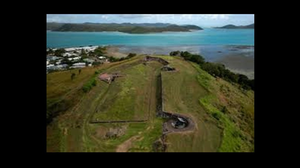
Its complex was said to have been constructed between 1891 and 1893 as part of the Imperial and Colonial whole-of defense of Australia in response to the Russian Scare of 1885 that grew out of Anglo-Russian Rivalry in Afghanistan, also known to history as the “Great Game”and the European colonial expansion into New Guinea and the South Pacific.

Compare the Green Hill Fort for similarity of appearance with the Battery Boutelle on the left, on the north end of the Golden Gate Bridge in San Francisco, said to have been built in 1900 to defend the off-shore minefields against mine sweepers and fast torpedo boats; and the Alexandra Battery, said to have been built in St. George’s Bermuda to protect the north shore and ship’s channel.
I have long-believed that they are telling us the actually function of this infrastructure in the name battery, and that was the energy-related original function these “batteries” and “fortifications” played on the Earth’s grid system and that they were repurposed into having a military function and attribution.
Back to the Torres Strait and Great Barrier Reef.
The Torres Strait Islanders are considered distinct from Australian Aboriginal peoples.
The Great Barrier Reef stretches from the Torres Strait to the North…
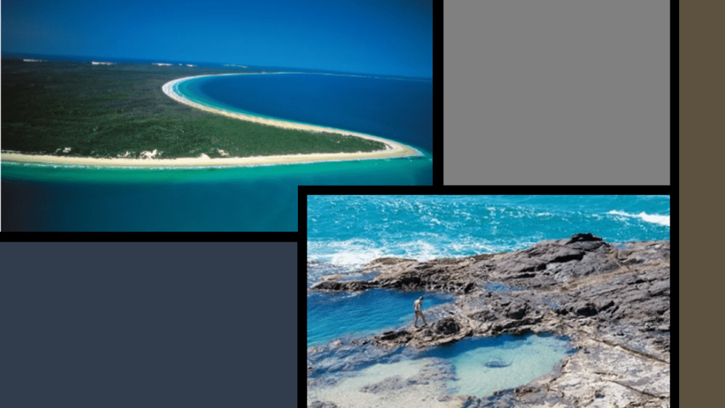
…to an unnamed passage between Lady Elliott Island and Fraser Island in the South.
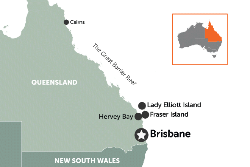
Lady Elliott Island is called a coral cay, has an eco-resort on it, and is a sanctuary for 1,200 species of marine life in the waters surrounding it, including manta rays and turtles and an old lighthouse is there as well.
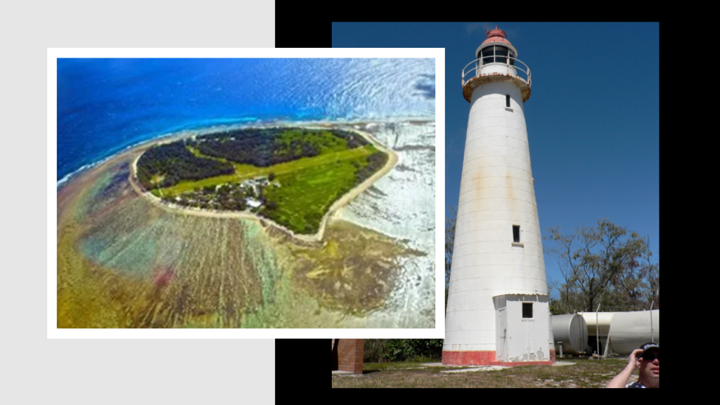
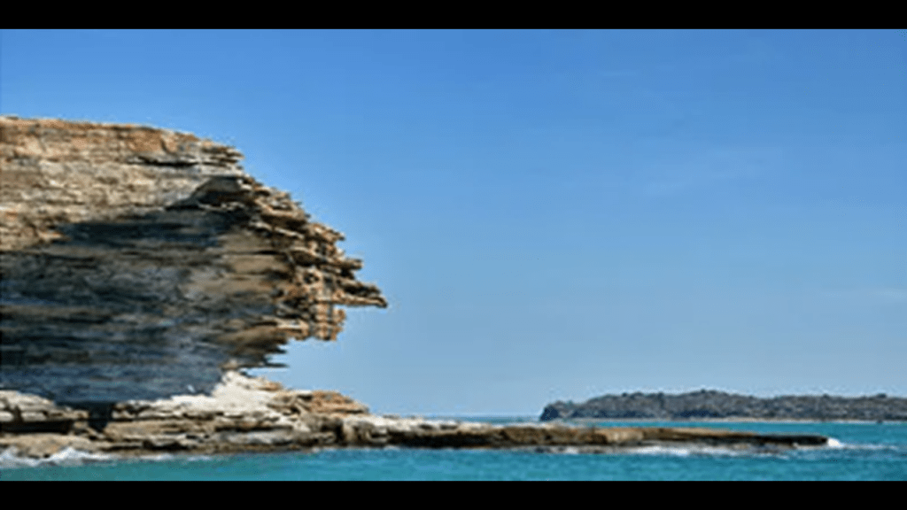
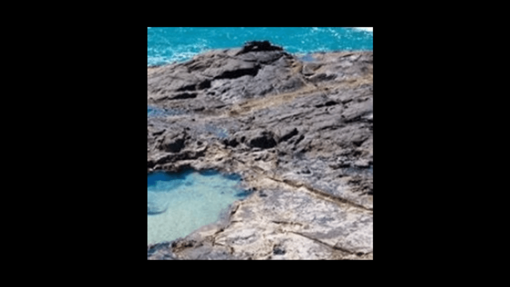
And this is Fraser Island with its nicely-shaped shoreline, and rocky coast and a place called the Champagne Pools.
So for an example from the Champagne Pools, this highlights the presence of straight lines and edges in the stone at this location.
Why is it said that straight lines don’t occur in nature when there are clearly straight lines in places like this that we are taught are natural?
Food for thought.
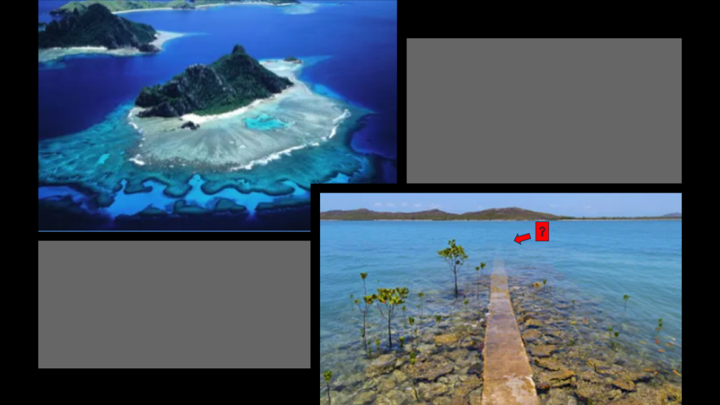
Here are two photos of the Great Barrier Reef.
The first looks very much like a river in the water.
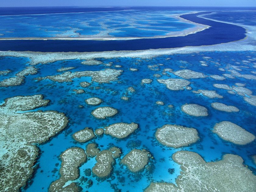
The second is an example of a point that I would like to make with the stone in the foreground.
What if the coral and marine life formed on top of sunken ancient infrastructure?
I mean like, coral reefs form on sunken ships, like this one. That’s no secret!
The next place we come to along the coast is Brisbane.
Brisbane is the capital of Queensland in Australia, and its largest city.
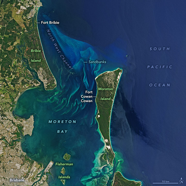
The metropolitan area of Brisbane is in the Brisbane River Valley, and goes from Moreton Bay on the coast…
…to the Great Dividing Range, called the third largest mountain range in the world.
Brisbane is situated on the Brisbane River, which has the same S-shaped river-bends seen all over the world as mentioned previously.
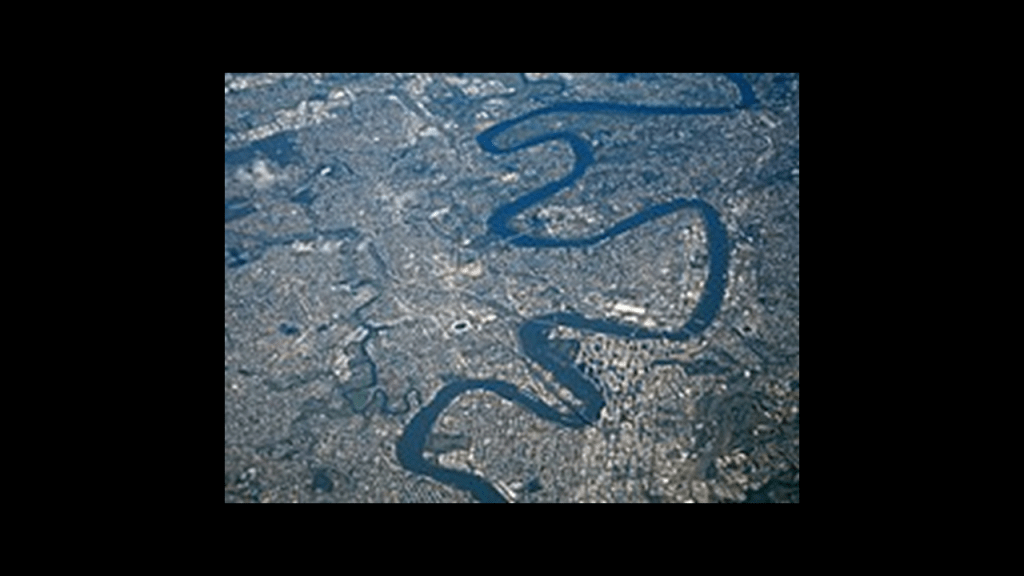
The Brisbane Central Business District was said to have been built on the location of a historic European settlement, located inside a peninsula of the Brisbane River, nine miles, or 14-kilometers, from the mouth of Moreton Bay.
Brisbane was said to be one of the oldest cities in Australia, and founded on ancient indigenous lands in 1825.
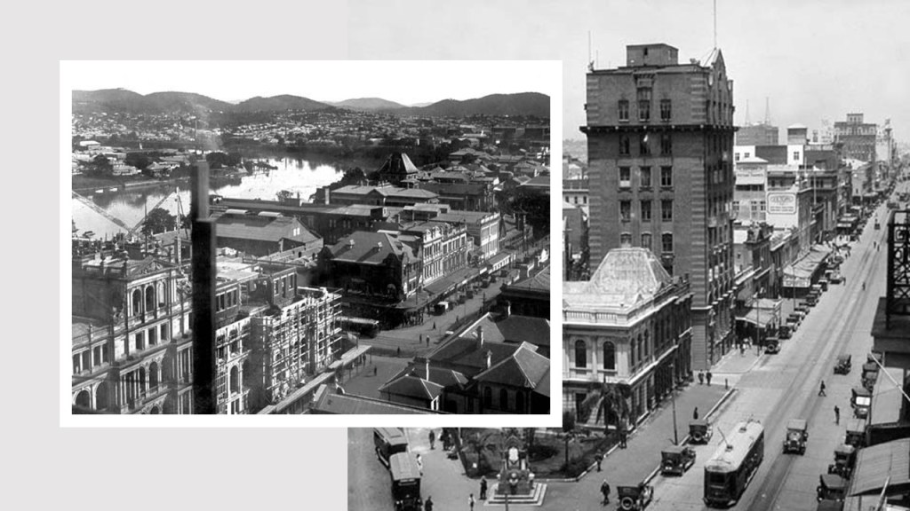
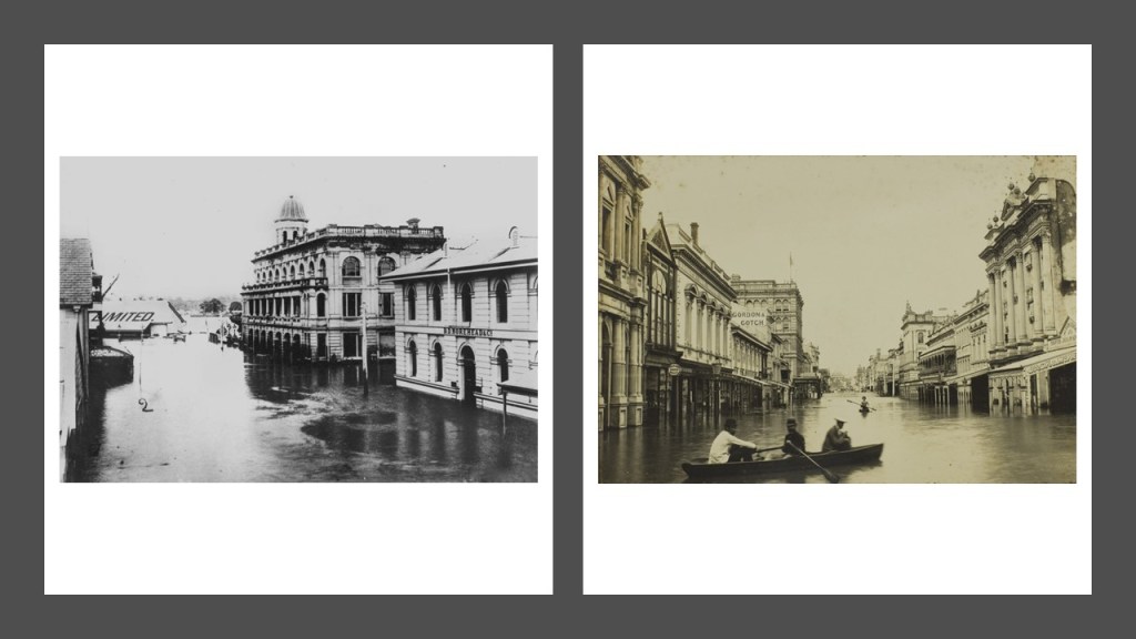
Here are some historic photos of Brisbane, 100 years later circa 1925 and 1926.
The Great Fire of Brisbane took place in 1864, thirty-nine years after what we are told was the year of the founding of the city. It burned out of control in the city’s Central Business District for several hours, destroying several blocks of businesses and homes.
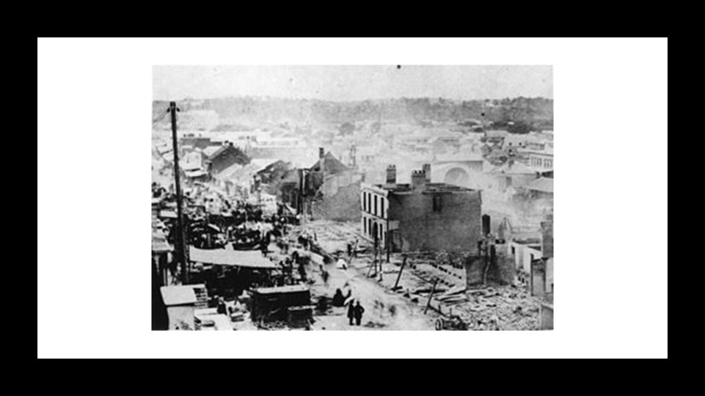
The Great Flood of Brisbane took place in 1893, sixty-eight years after the city was established.
As a result of eight days and twenty inches, or 508-millimeters of rain, the Brisbane River rose almost 24 feet, or 7-meters.
In addition to the floodwaters sweeping away two bridges, the city itself was severely flooded.
Most importantly to note, the grand architecture with heavy masonry, cupolas, huge arches and huge columns in these historic flood photos was all said to have been built in less than 70 years, according to the historical narrative we have been given.
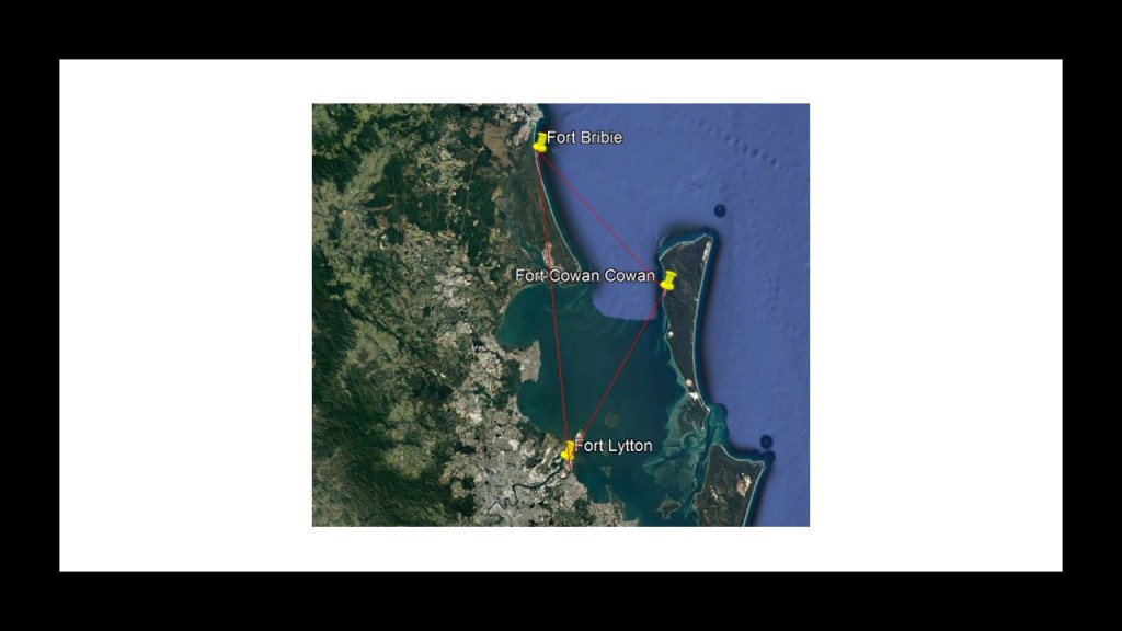
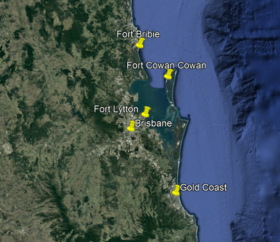
Fort Bribie on Bribie Island in Moreton Bay was said to have been built from 1939 to 1943 during the World War II time-period, for the defense of southeast Queensland, and to provide artillery training for Australian soldiers heading overseas.
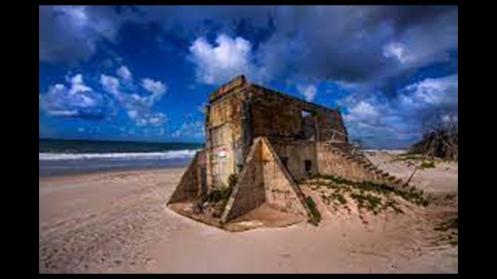
There is an underground complex at the site that was purported to have been a hospital, but then nobody really knows much about it except that a large complex has been determined to lie beneath the sand here.

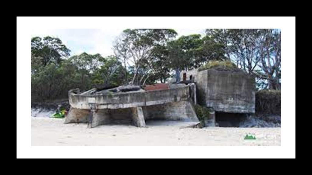
There’s also Fort Cowan Cowan on Moreton Island, also listed as a World War II fortification, said to have been constructed as a defensive installation in 1937 and operational until 1945, and closed down completely in 1960.
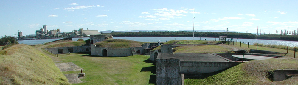
Fort Lytton at the mouth of the Brisbane River was said to have been built between 1880 and 1882 in response to fear that a foreign colonial power such as Russia or France might launch an attack on Brisbane or its port.
It is interesting to note that these three fort locations around Brisbane are in a triangle configuration, something which I have consistently found in different places around the world.
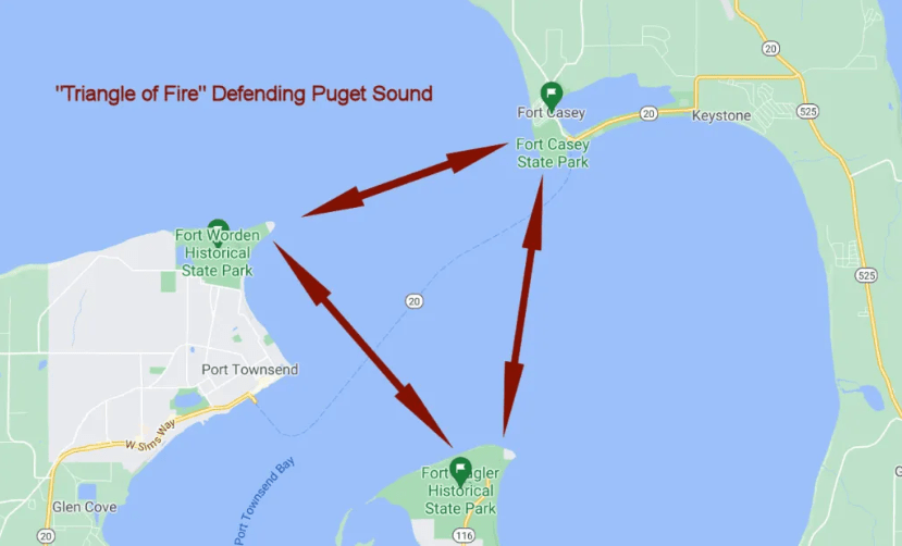
I found this configuration at the entrance to Puget Sound in Washington State, where Fort Worden, Fort Casey and Fort Flagler were said to have been constructed starting in the 1890s to be a “Triangle of Fire” against invasion from the sea…
…on Alderney, one of the Channel Islands, with a view of Fort Houmet Herbe in the foreground in a triangular relationship with Fort Quesnard on the top left, and the ruins of Fort Les Hommeaux Florains on the top right…

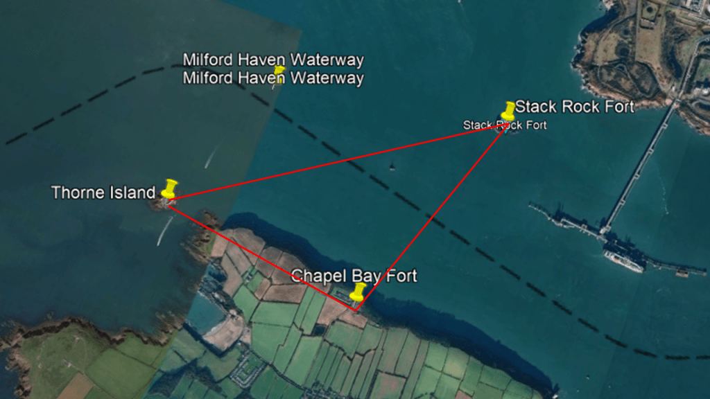
… and in the Milford Haven Waterway in Wales, between Stack Rock Fort, the fort on Thorne Island, and the Chapel Bay Fort.
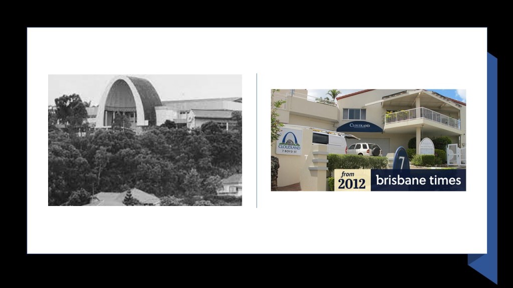
In the Bowen Hills suburb of Brisbane, the Cloudland Funicular ran from the Main Road straight up to the Cloudland Dance Hall.
Funiculars, also known as incline-railways, were two cars are paired at opposite-ends and act as each other’s counterweight.
As such, there is not a need for traction between the wheels and rails, and thereby allowing them to scale steep slopes, unlike traditional rail-cars.
Thing is, there used to be a lot more of them than there are now, and funiculars were once a worldwide thing.
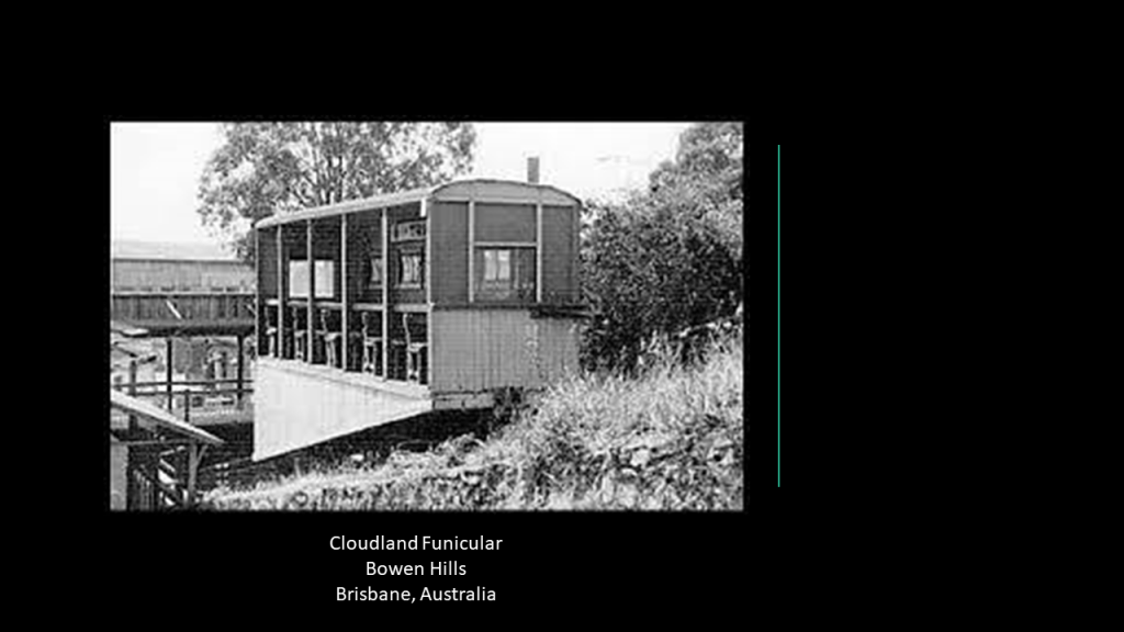
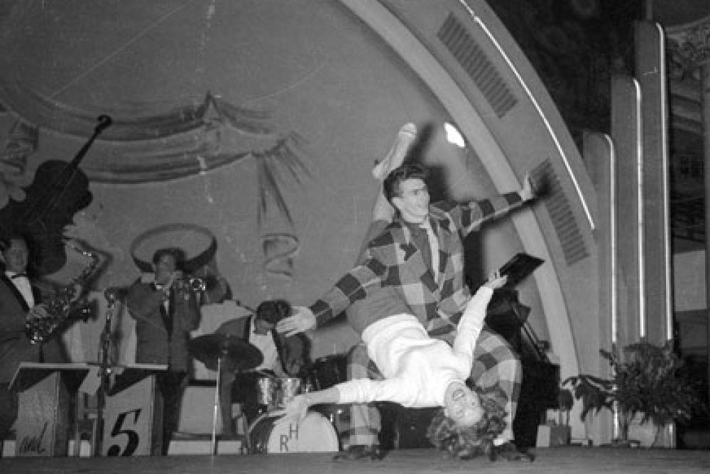
The Cloudland Dance Hall, also known as Luna Park, was a huge thing during the 40’s when the US troops were stationed there.

Cloudland had a great dance floor, where the wood even had a spring to it!
The funicular was demolished in 1967, and the Cloudhall Dance Hall was demolished in the 1980s, and the Cloudland Apartments occupy the former location of this iconic landmark.
Why were these funiculars and spectacular Dance Halls, demolished in the first place?
The same story is found all over the world!
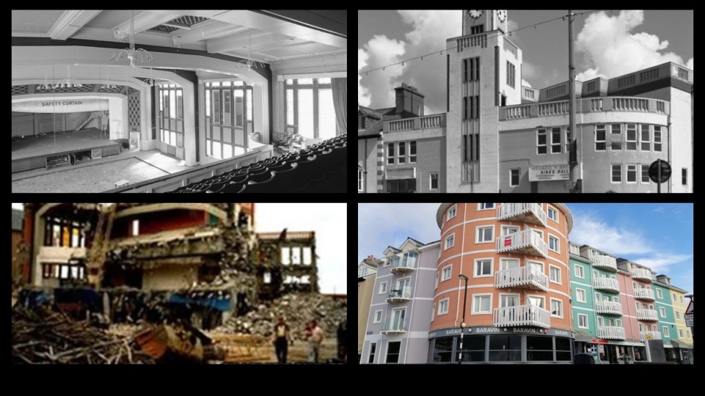
At least Aberwystyth in Wales still has its funicular, the longest electric funicular in the British Isles…
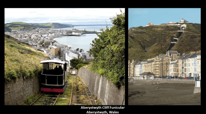
…but the King’s Hall Dance Hall there is long gone, demolished for the given reasons of structural weakness and disrepair, and also replaced by apartment residences like in Brisbane.
They are constantly replacing buildings everywhere that were meant to last forever with buildings of vastly inferior quality!
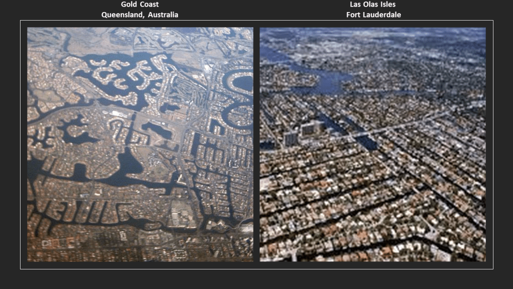
Australia’s Gold Coast is just south of Brisbane.
The urban area of the Gold Coast sprawls almost 37-miles, or 60-kilometers, joining Brisbane to the north, and the Queensland state border with New South Wales to the South.
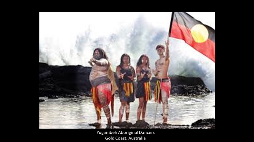
This area is the traditional home of the Yugambeh people of what is today southwest Queensland and northern New South Wales, with aboriginal people occupying the area for tens of thousands of years.
The Gold Coast on the left is a popular vacation resort on the south Pacific Ocean, and has approximately 400 km, or 249 miles, of canals. On the right is a south Florida canal system, Las Olas Isles in Fort Lauderdale on the Atlantic Ocean, for comparison of appearance to the Gold Coast canal system.
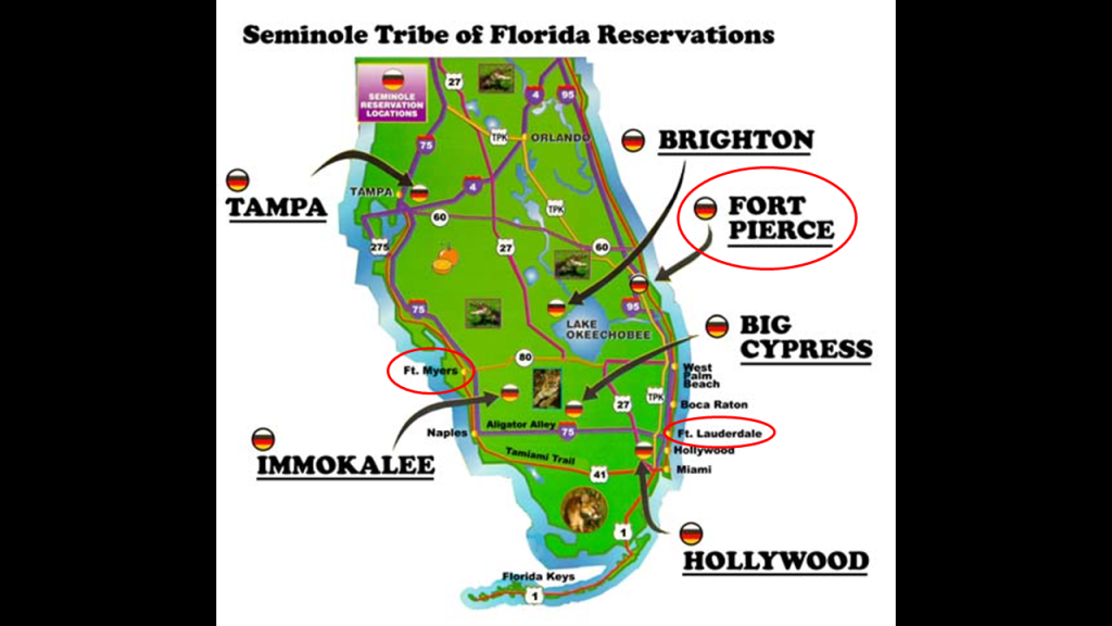
And Fort Lauderdale is located in what was the traditional lands of the Seminole.
So, where are the chances that both the Australian Aborgines and the Seminoles of Florida – one of what was called the Five Civilized Tribes of what became the United States – identify as the Tribe of Reuben; share the same colors of red, black and yellow for their emblem; and both historically inhabited a part of the world known for its canals; happened randomly?
Or is there a connection between these peoples that has been lost in the re-writing of history, including who they really were?
Oh yeah, and there were historic forts all around the Florida coast, many more than are shown here, just like what we are seeing around the coast of Australia so far.
One more thing.
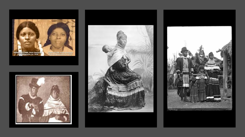
These are historic photos of Seminole people you can find on an internet search.
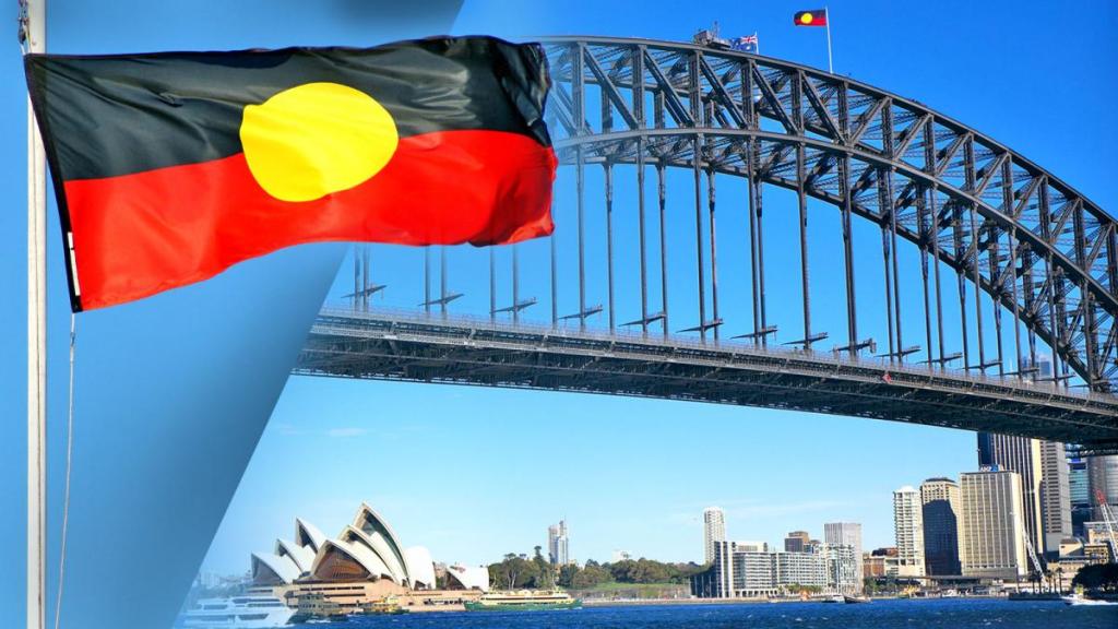
Sydney comes next moving down along the east coast of Australia from Brisbane and the Gold Coast.
Sydney is the capital of the New South Wales State and the largest city in Australia.
The Eora, Dharawal, and Darug Aboriginal peoples are the traditional custodians of the land of Sydney.
In 1770, Captain James Cook first charted the eastern coast of Australia, and made landfall at Sydney’s Botany Bay, which interestingly has a shaped shoreline and the location of the Sydney International Airport is there.
Jamaica Bay in New York City has a similar appearance on the right, and JFK International Airport right next to it too.
Jamaica Bay is called a partially man-made and partially natural estuary on the western tip of Long Island, and containing numerous marshy islands.
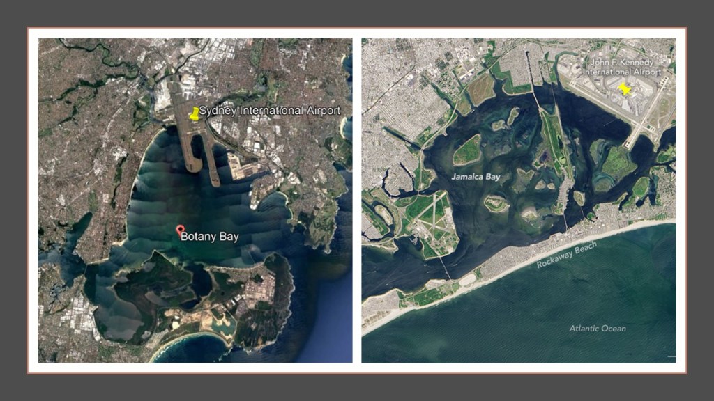
Interestingly, there is a rapid transit line of the New York subway system that operates through the middle of Jamaica Bay, the IND Rockaway Line that runs between the Aqueduct Racetrack Station terminal, just 3.6-miles, or 5.78-kilometers, to the northwest of the JFK International Airport, to the Rockaway Park-Beach 116th Street Station terminal.
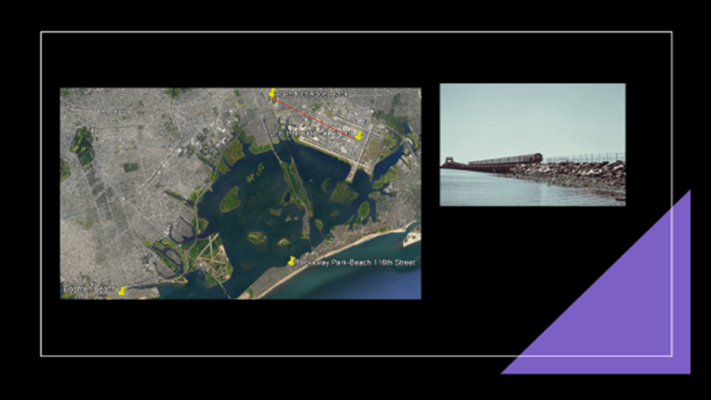
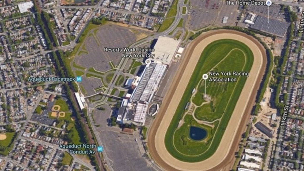
The Aqueduct Racetrack is a Thorough-bred horse-racing track in the Ozone Park and Jamaica neighborhood of Queens, and the only racetrack located within the city-limits of New York City.
The “Resorts World New York City” is co-located with the Aqueduct Racetrack.
In one of the series that I did on researching places viewers made in comments, I discovered airports all over the world having racing tracks in angular relationships short distances away.
One of the places a commenter suggested was the Sydney International Airport and the Royal Randwick Racecourse, which is the short-distance for 4-miles, 6.6-kilometers, northeast of the airport, roughly the same distance that is between the Aqueduct Racetrack and the JFK Airport in New York City.
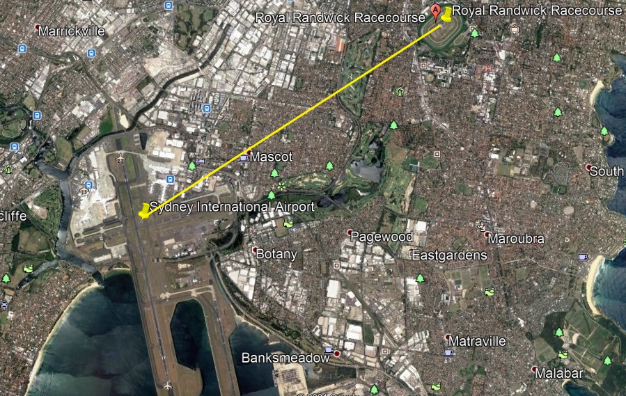
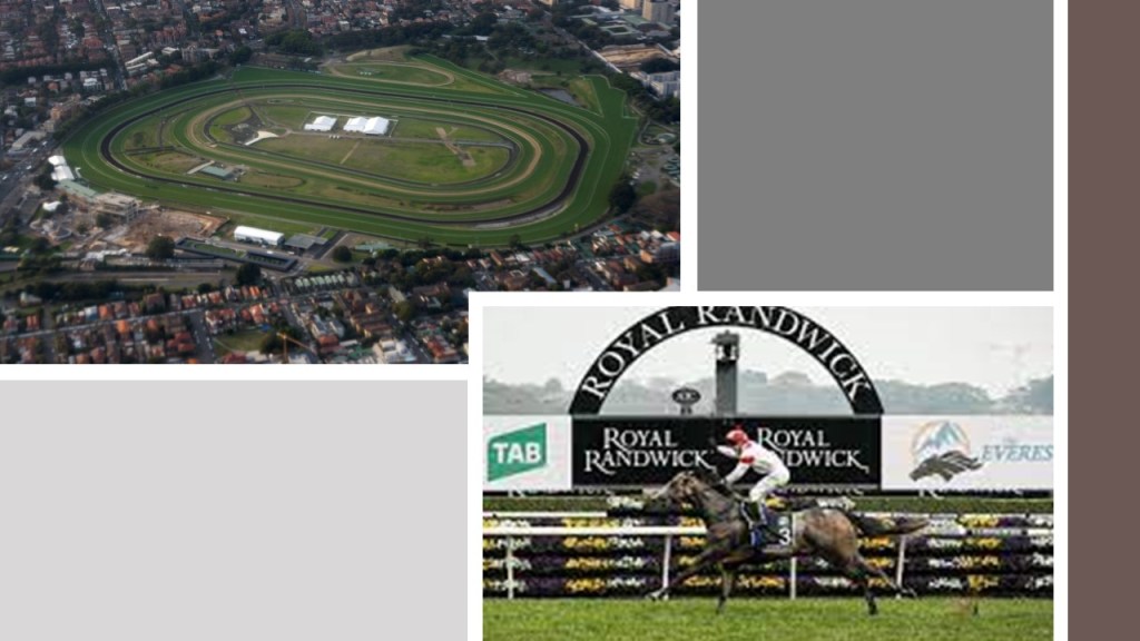
The Royal Randwick Racecourse is a horse-racing track on Crown Land, a territorial area belonging to the British monarch, that is leased to the Australian Turf Club.
The first race at Randwick was held in 1833, and in the present-day is the host of racing championships with millions of dollars in prize-money.
There are approximately 30 casinos close to the Royal Randwick Racecourse.
I first noticed this relationship between airports and racetracks when I was doing research on the Shepherd’s Bush District of West London based on a commenter’s suggestion.
In the process of doing that, I realized I had seen the same angular relationship between London’s Heathrow Airport, and Shepherd’s Bush on the top left, where there had been a huge track at one time in White City, that had been used for Greyhound racing; and in my own research of the Tampa, Florida, neighborhood of Sulphur Springs a few years ago, when I had noticed that the Tampa International Airport, and the Sulphur Springs neighborhood in Tampa, Florida, where there was a greyhound racing track, had the same angular relationship.
After I made that initial connection, commenters left other examples of the same kind of relationship between airports and racing tracks, past and present, including, but not limited to, places like Montreal, Quebec, Canada, on the top right; Philadelphia, Pennsylvania on the middle left; Toronto, Ontario, Canada, in the middle ; Los Angeles, California on the middle right; and as I mentioned Sydney, Australia, on the bottom.
What are the odds of these similar relationship happening randomly is in diverse places across the world over long periods of time, as we are led to believe?

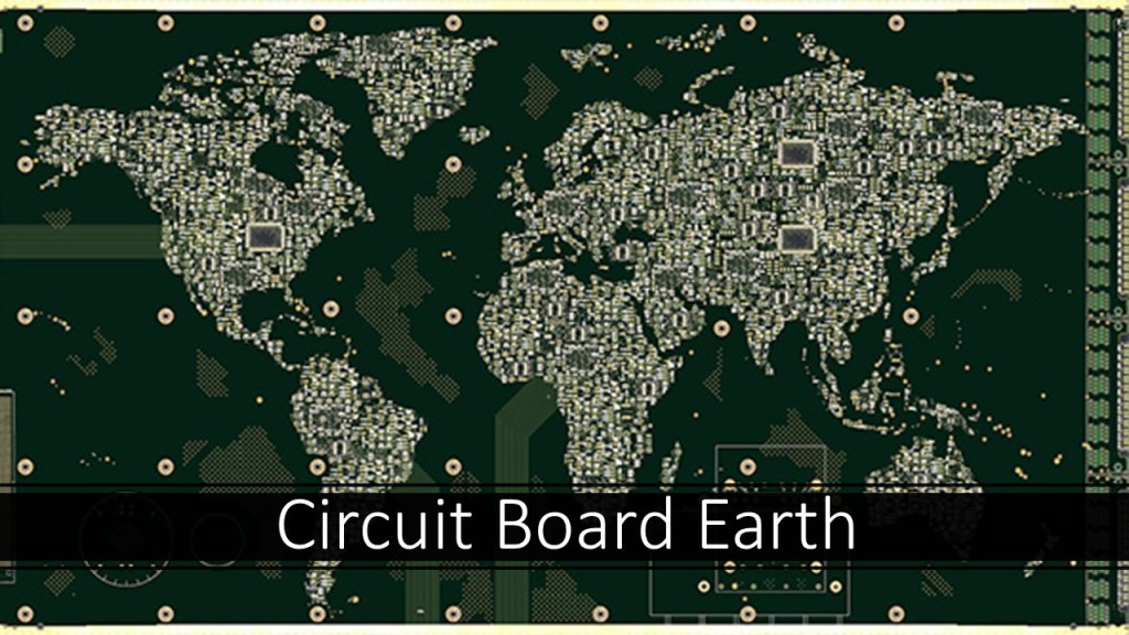
I have provided the evidence I have found that all the Earth’s infrastructure was precisely placed for a specific purpose and function as circuitry on the Earth’s Energy grid in my “Circuit Board Earth” blog post in June of 2021.
And wouldn’t it stand to reason that those behind the reset when setting up the New World would take advantage of the super science of the different types of circuits in the Earth’s grid system in order to harness their inherent power to enhance performance at sporting events, to make lots of money at highly-charged, prestigious gaming and betting venues?

We are told that in 1788, Arthur Phillip founded Sydney as a Penal Colony and the first European settlement in Australia.
So, what were they going to do with all these convicts?
Did they just ship them out to get them out of British society, or did they have some specific purposes in mind when they brought them here?
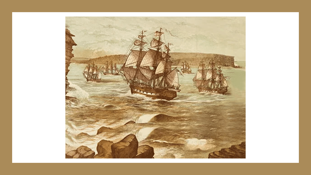
Phillip was the leader of the “First Fleet of Convicts,” a fleet of eleven ships consisting of two Royal Navy vessels, three store ships, and six convict transports, that brought the first colonists and convicts to Australia to Botany Bay in January of 1788.
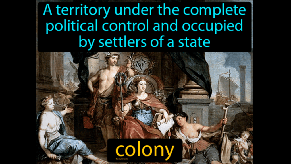
Australia was formally proclaimed a British Colony by now-Governor Arthur Phillip on February 7th of 1788.
Governor Phillip was formally vested with complete control over the inhabitants of the Colony, and the British basically moved in and started the process of taking over absolutely everything, from land to credit for the infrastructure they found there.
The Queen Victoria building is described as a 5-story, late 19th-century building in Sydney’s Central Business District, said to have been designed on the “Scale of a Cathedral” by the architect George McRae, and constructed between 1893 and 1898.

…with its over 20 domes…
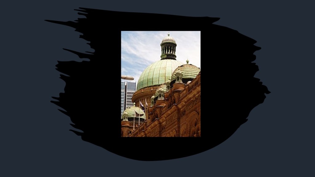
…and cathedral-style windows.
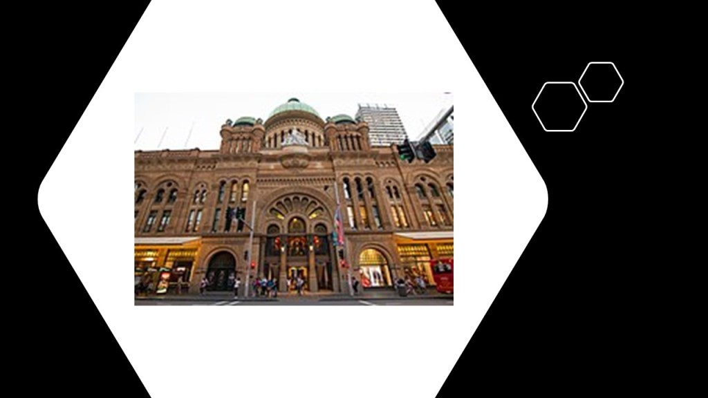
During its history, it has had some different uses, but primarily as retail space, which it is today…

…though the Queen Victoria building has been threatened with demolition at various time over the years, starting as early as 1959.
Makes sense, right?
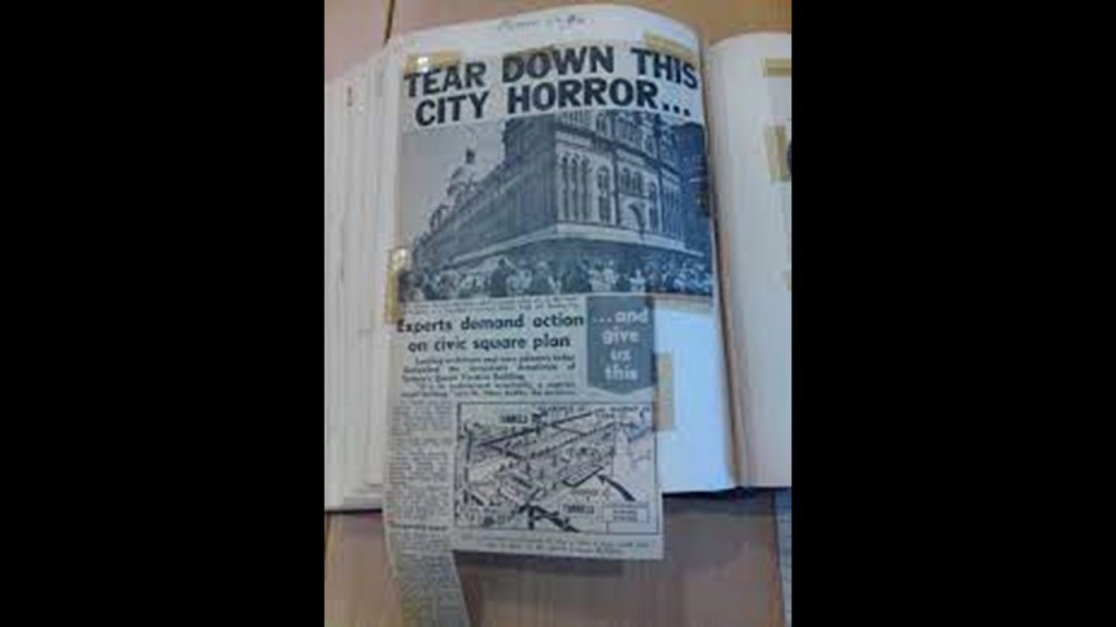
More like make it make sense!

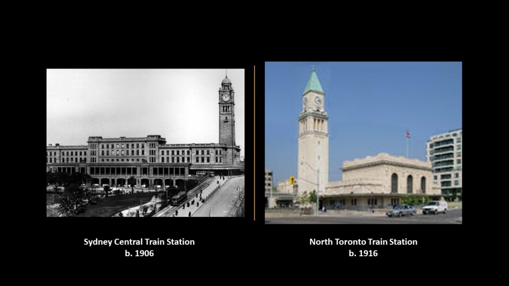
The Sydney Central Railway Station pictured on the left was said to have opened in 1906, and the third terminal railway station in Sydney, with the original station in Sydney having opened in September of 1855, with the railway having initially arrived in New South Wales starting in 1831, and making its way to Sydney in the late 1840s.
The similar-looking North Toronto Canadian Pacific Railroad Station on the right was said to have first opened as the main passenger station for Toronto in 1916.
Historical Forts around Sydney included: The Middle Head Batteries; the Georges Head Battery; and the Bradleys Head Battery.
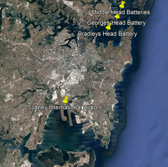
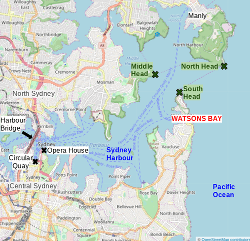
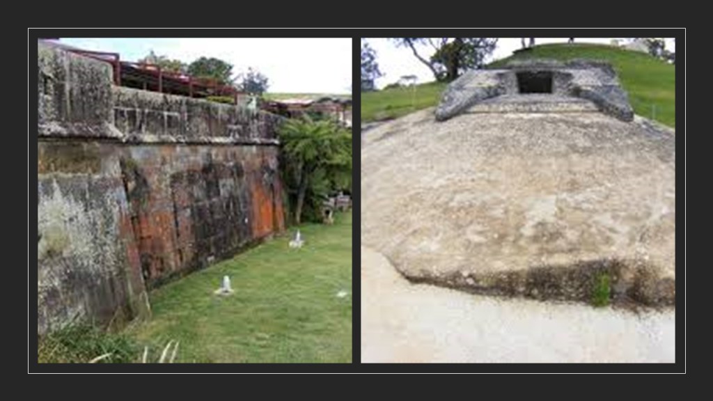
The Middle Head Military Fortifications, also known as “the Old Fort” are located in the Sydney suburb of Mosman on what is known as the Middle Head of the “Sydney Heads.”
They were said to have been built between 1801 and 1942, with most said to have been constructed between 1871 and 1910 as part of Sydney’s Harbor Defenses.
The “Sydney Heads” is a series of headlands that form the entrance to Sydney harbor.
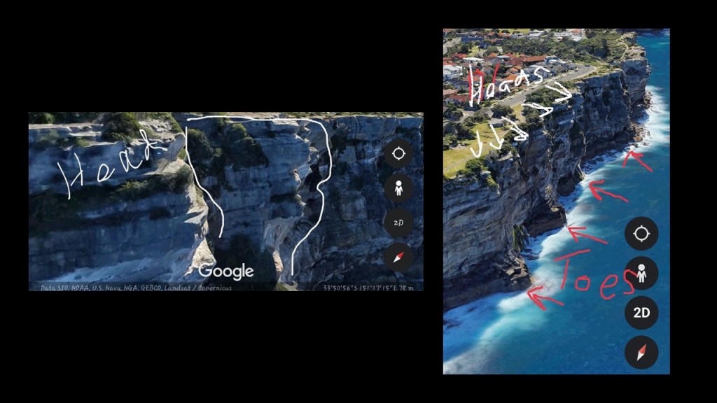
So something to consider when you look at the origins of a place-name like “Head” or “headland,” is whether or not the origin of the name was an actual “head” at one time.
My friend Wendy Sky from South Australia made some interesting finds in her research on Google Earth, raising the intriguing possibility that there might indeed have not only been actual “heads, but whole colossal statues, through this area at one time.
Other known features located on the “Sydney Heads” include:
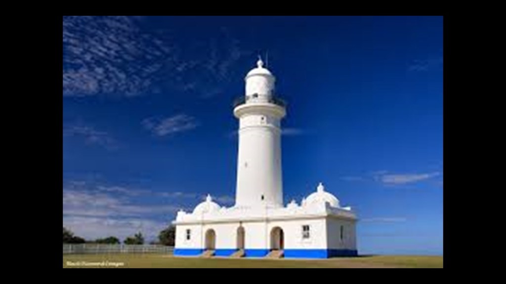
The current Macquarie Lighthouse was said to have been designed by the colonial architect for New South Wales, James Barnet, and constructed between 1881 and 1883.
The first actual lighthouse at this location was said to have been constructed in 1818.
At any rate, the Macquarie lighthouse is said to be Australia’s first and longest-serving lighthouse.
Another intriguing find of Wendy’s in the locale of the Sydney Heads below the Macquarie Lighthouse on Google Earth is what appears to a tunnel entrance in the rock, possibly to a tomb, with a pair of carved giraffes’ heads supporting the entrance, and something else carved off to the side.
Whatever Wendy’s findings represent is definitely not to be found in our historical narrative!
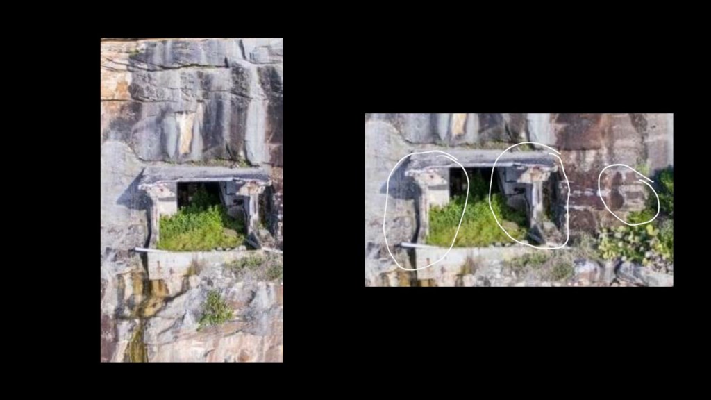
Wendy and I talk about these and other of her findings in the video on my channel called “Australian Anomalies with Wendy Sky.”
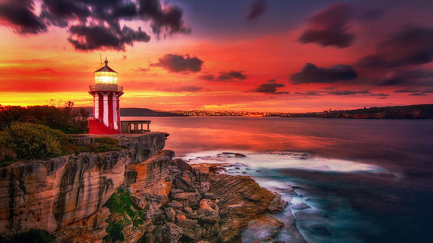
The Hornby Lighthouse is located on the South Head, and said to have been designed by colonial architect Mortimer Lewis in the 1840s, and construction said to have been completed in 1858.
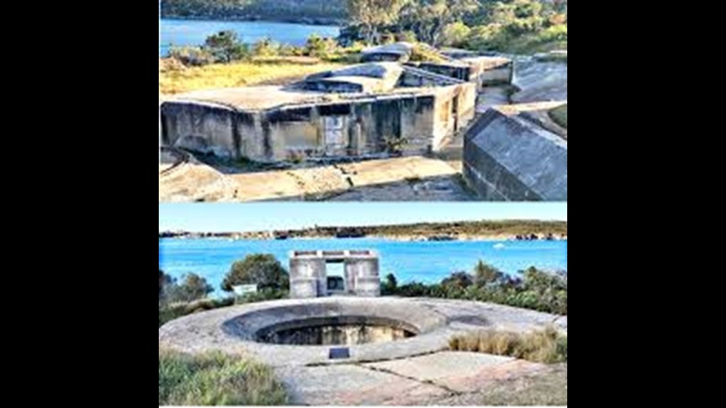
The Georges Head Battery, like the Macquarie Lighthouse, was said to have been designed by colonial architect James Barnet, and that it was built on what is known as Obelisk Point to defend the entrance to Sydney Harbor during the Napoleonic Wars starting in 1801 by a work gang of 44 convicts hewing it by hand out of solid rock.
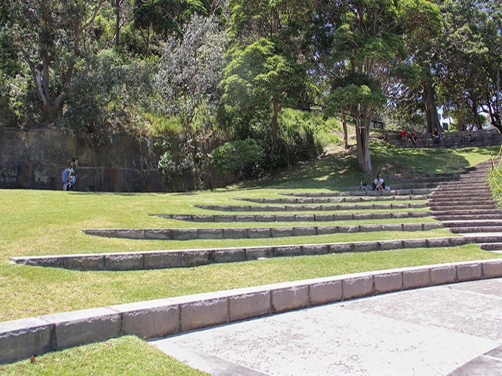
The Bradleys Head Fortification complex was said to have been designed by government engineers built between 1840 and 1934 as part of the Sydney Harbor Defenses.
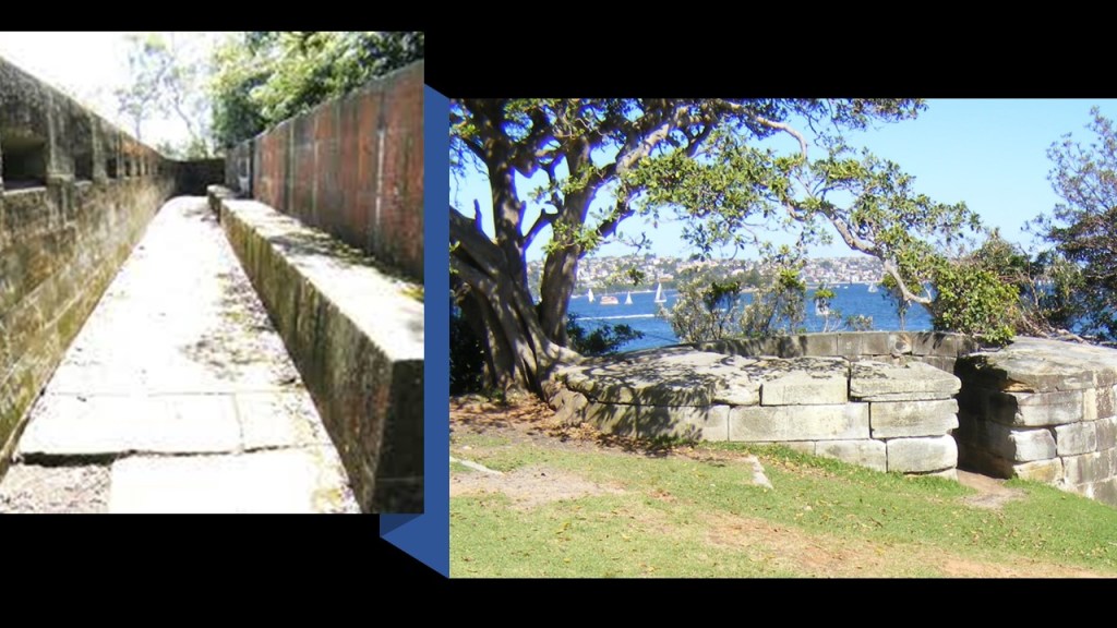
Among other things to find here, there is an amphitheater at this location, available these days for hire for private events…
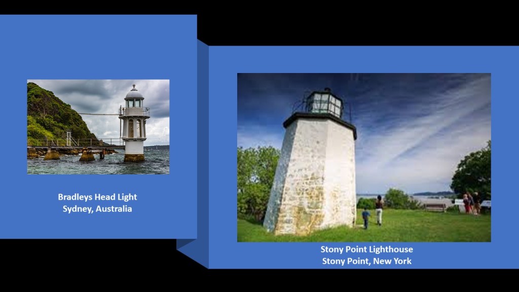
…and the Bradleys Head Light, said to have been constructed in 1905.
It sits so low on the water that it looks like there might be more of the Bradleys Head Light underneath the surface of it.
It brought to mind the Stony Point Lighthouse on the Hudson River near New York City on the right, called the oldest lighthouse on the Hudson River.
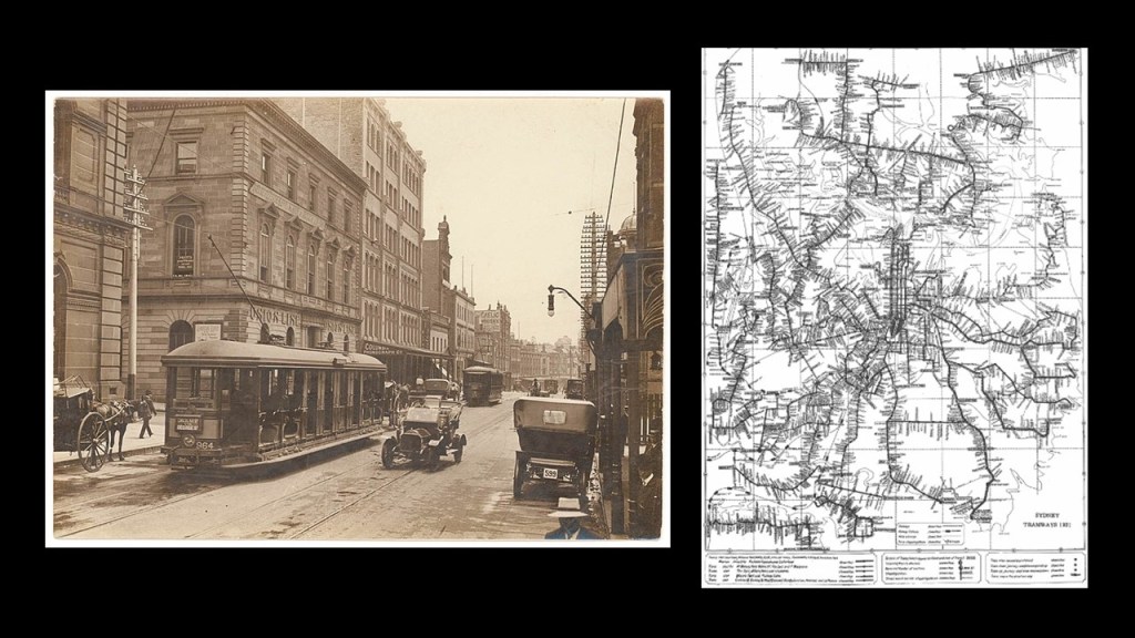
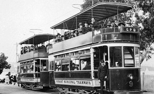
Like everywhere else in the world it seems, trams, also known as streetcars, used to be all over Australia.
Today, Sydney is one of four population centers that has an operating streetcar system -also in Adelaide, the Gold Coast, and Melbourne.
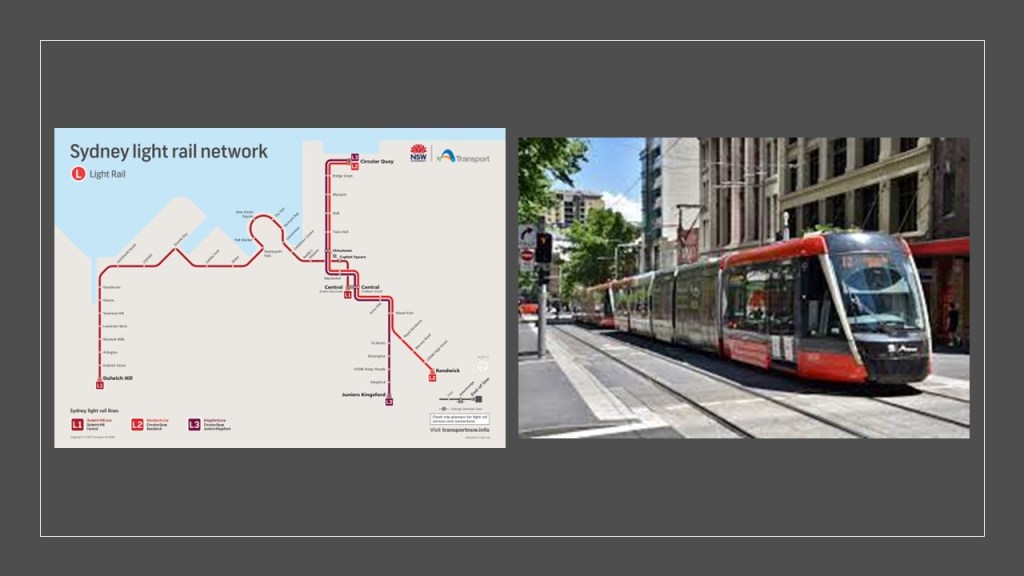
Though, for example Sydney’s once-extensive system, from 1879 to its closure in its entirely in 1961, when it had 181-miles, or 290-kilometers of street mileage in 1923 at its height, making it the second-largest in the world in the British Empire after London…
…a portion of it was revived as a light rail system serving part of Sydney starting in 1997, including Randwick where the thorough-bred horse-racing track is located.
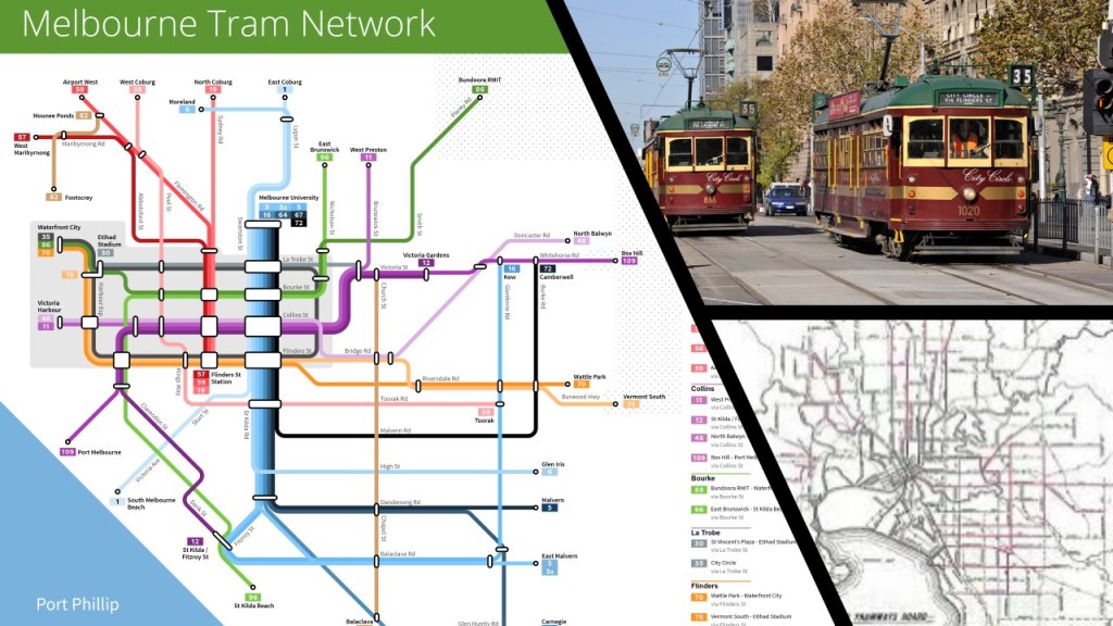
Melbourne is the capital city of Victoria State, and arguably the second-most populous city in Australia, because its population statistics are quite close to those of Sydney.
Melbourne still has its network of 24 tram routes, covering approximately 155-miles, or 250-kilometers, which is the largest in the world, having operated continuously in Melbourne since 1885.
So not sure why Melbourne is one of the few places in the world never to completely lose its tram service, and as a matter of fact, retain much of it, but there you go.
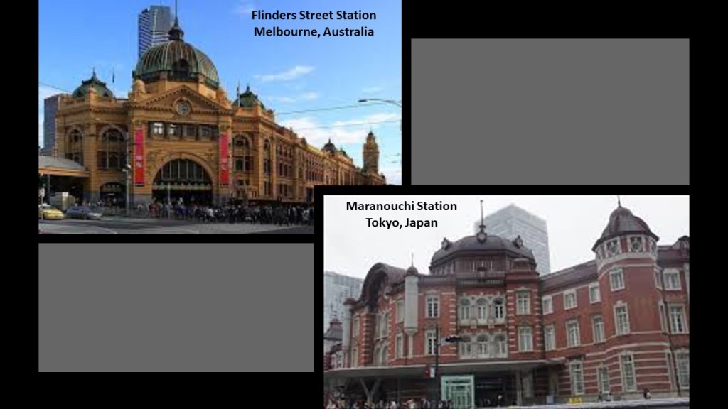
Also, comparing for similarity of appearance, the Flinders Street Station in Melbourne on the top left, said to have been designed in French Renaissance-style architecture by architects James Fawcett and H. P. C. Ashworth, and built between 1905 and 1910; and the Maranouchi Station in Tokyo, Japan on the bottom right, and built between 1908 and 1914.
It was said to have been designed by Japanese architect Tatsuno Kingo as a restrained celebration of Japan’s victory in the 1904 -1905 Russo-Japanese War, and possibly modelled after the Amsterdam Central Station in the Netherlands according to some guidebooks, but obviously it resembles other train stations as well, as in this example.
Before I head over to Tasmania across the Bass Strait from this location, I would like to take a moment longer to show you some things I found in Geelong an Port Campbell several years ago.
First, Geelong is located 40-miles, or 65-kilometers from Melbourne, and is Victoria State’s second-largest city after Melbourne.
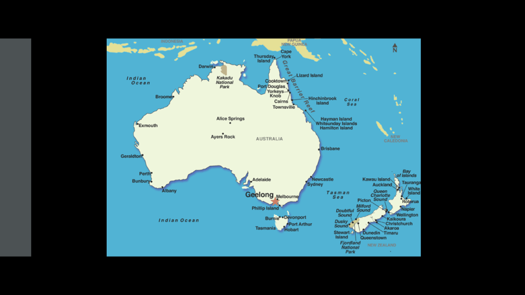
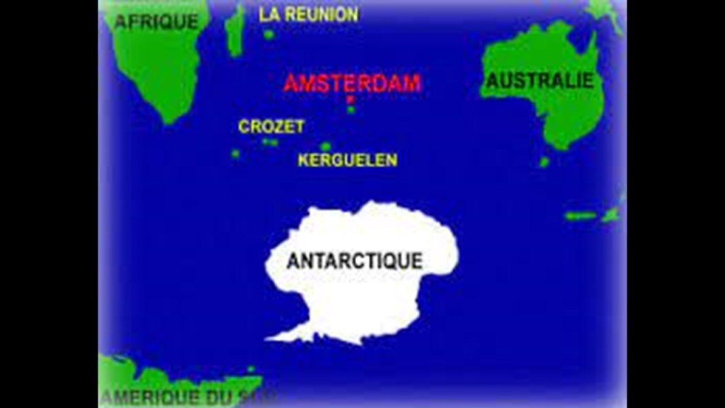
I found Geelong initially by tracking a long-distance alignment that started and ended on Amsterdam Island, a tiny island that is part of the “French Southern and Antarctic Lands” in the South Indian Ocean.
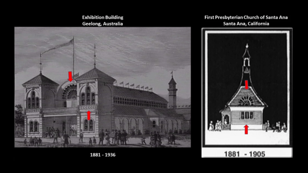
This historic building was called the Geelong Exhibit Building and Market Square Clock Tower. The Clock Tower was demolished in 1923, and the remaining buildings were demolished in the early 1980s to make room for a new shopping center.
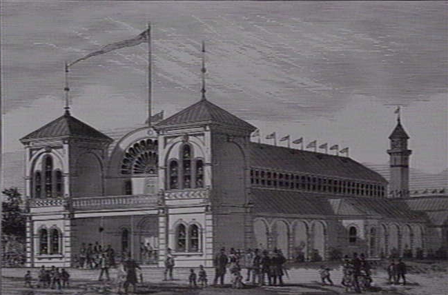
The Geelong Exhibition Building was said to have been built in 1881, the same year that the the First Presbyterian Church of Santa Ana was first established.
The semi-circular and triple windows of the first church building on the right reminded me of those of the Geelong Exhibition Building.
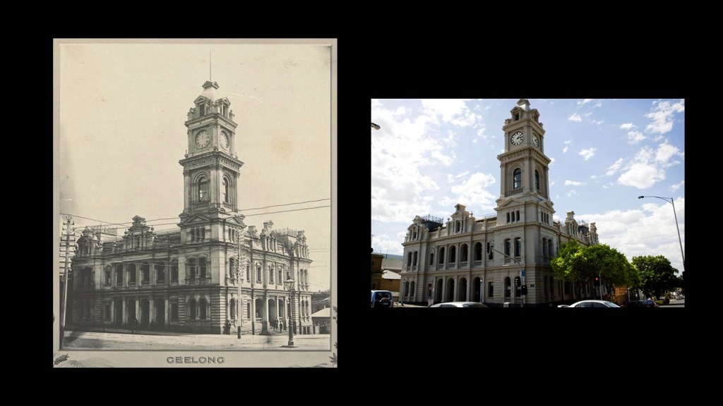
Here is a historic photo of the Old Geelong Post Office said to have been built between 1890 and 1891, which has actually survived to the present day.
The building is intact, but I wonder what those interesting looking towers were for, in front of the older picture of the building, that are no longer there.
Secondly I want to mention Port Campbell, which is only 142-miles, or 229-kilometers from Melbourne.
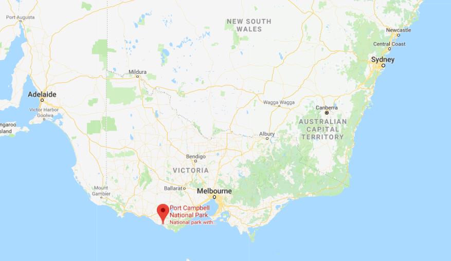
It is the location of “The Twelve Apostles.”
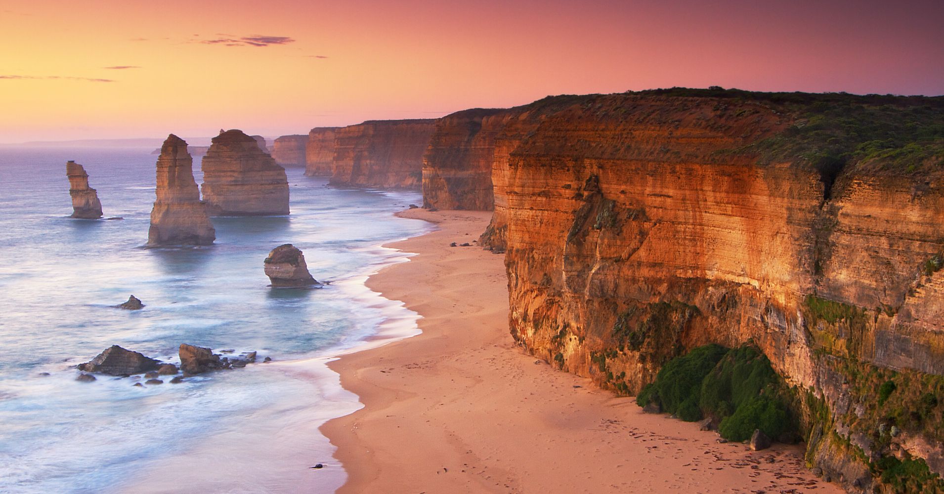
They are described as a collection of limestone stacks referred to as “Port Campbell Limestone,” deposited there in the Miocene Age 15- to- 5-million years ago, and that the stacks were formed by erosion from waves and harsh weather conditions over time.
So clearly that is what they want to us to believe about their origins – all the result of natural geologic processes over time.
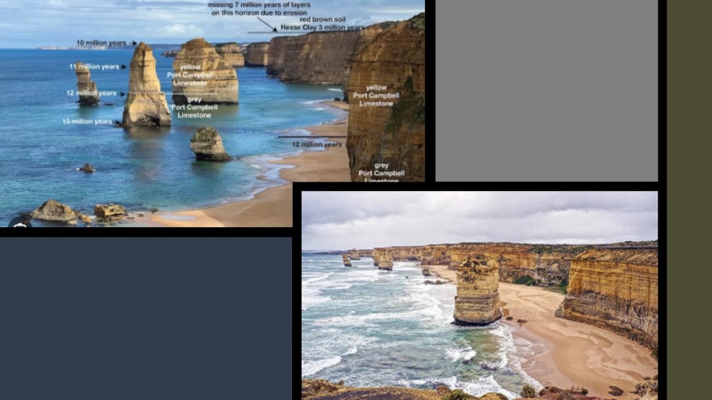
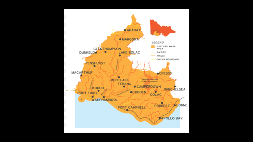
“The Twelve Apostles” are located in the traditional lands in south-western Victoria State of the Eastern Maar Peoples, a name adopted by a number of Victorian Aboriginal groups that identify as “Maar.”
A word looking and sounding very close to the word “Moor.”
The Twelve Apostles are the main attraction found on the Great Ocean Road between Torquay and Port Fairy along the southern coast of Australia in Victoria State.
There are five lighthouses found all along the Great Ocean Road through here as well.
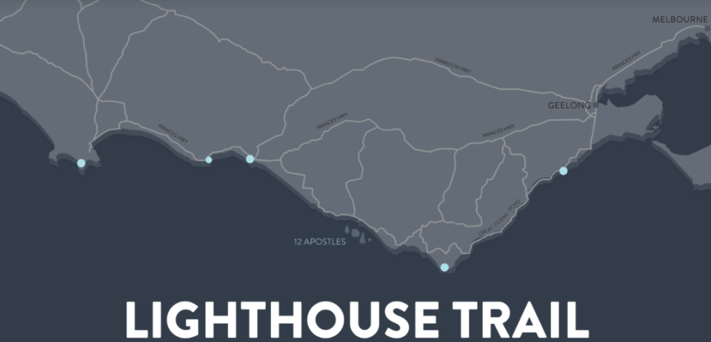
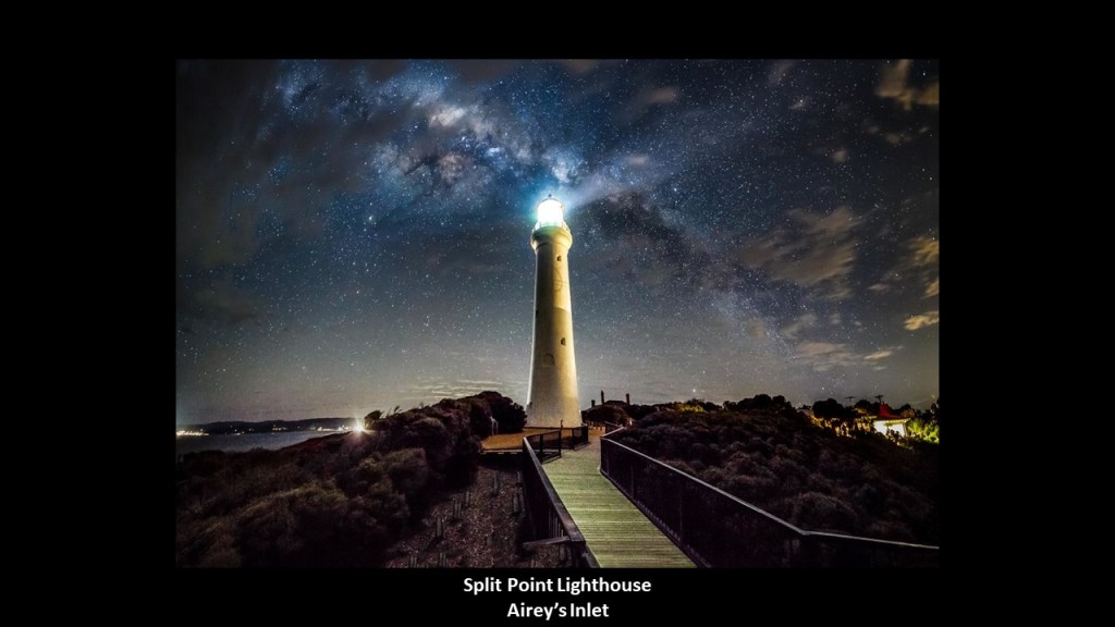
The Split Point Lighthouse at Airey’s Inlet was said to have been constructed in 1891, and which apparently aligns with the Milky Way.
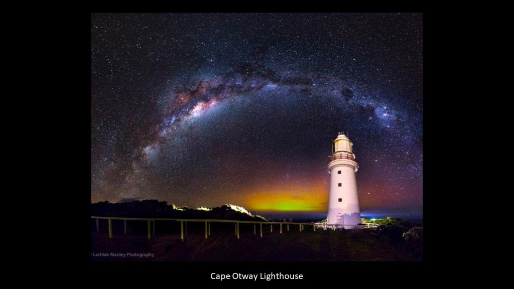
The Cape Otway Lighthouse on the Victoria coast near the Twelve Apostles, and is said to be the oldest surviving lighthouse in Australia, said to have been built in 1848 also with a nice alignment to the Milky Way.
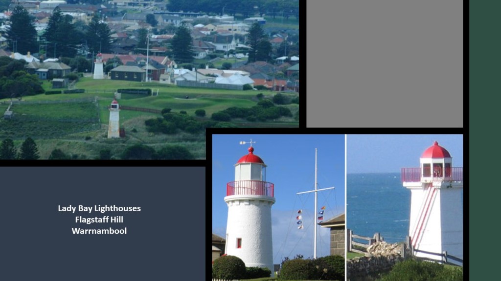
The two lighthouses at Lady Bay come next, located in the Flagstaff Hill Maritime Museum in Warrnambool, and the Lady Bay Complex was originally built between 1858 and 1859, with something of a convoluted history of being moved from original locations and so forth.
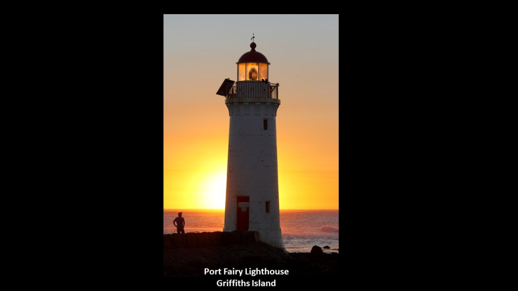
Lastly on the Great Ocean Road, the Port Fairy Lighthouse on Griffiths Island was said to have been built in 1859, shown here with the sun coming up behind it in alignment.
“The Twelve Apostles” in Victoria State came up when I was tracking an alignment that started and ended in Algiers, Algeria, that crossed over “The Apostle Islands” in Wisconsin on the shore of Lake Superior.
The Apostle Island National Lakeshore on Lake Superior is comprised of twelve-miles of mainland shore and twenty-one islands.
It is described as having spectacular nature-carved rock formations…
…and eight lighthouses.
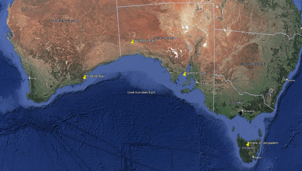
Now, heading on over to Tasmania.
Tasmania is an island state of Australia, located 150-miles, or 240-kilometers, to the south of the Australian mainland, separated from it by the Bass Strait.
This is what we are told about Tasmania.
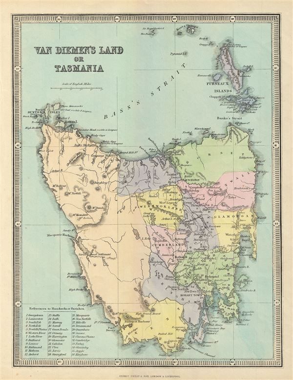
Tasmania got its present name from the Dutch explorer Abel Tasman, who first sighted the island on November 24th of 1642, when he was exploring in the service of the Dutch East India Company.
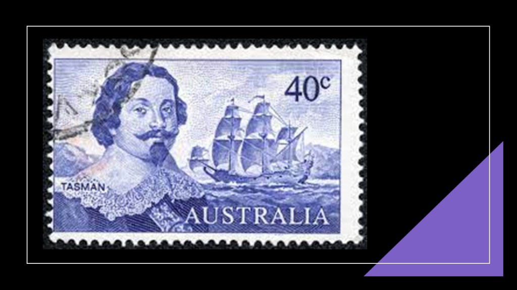
Its European first name, however, became Van Diemen’s Land, when Tasman honored his patron Anthony van Diemen, the Governor-General of the Dutch East Indies at that time.
The island was inhabited by aborigines from at least 40,000 years prior to the arrival of Europeans, when they settled the island starting in 1803 as a penal settlement of the British Empire, allegedly to prevent claims to the land by the First French Empire during the Napoleonic Wars.

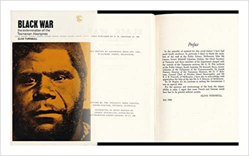
The aboriginal population of the island was almost completely wiped out within 30-years from the time of European settlement, during a period of conflict in Tasmania between the 1820s and 1832 known as the “Black War,” as well as the spread of infectious diseases.
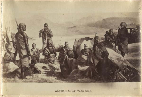
But what kinds of things do we find in, let’s say, the capital city of Hobart, that the Europeans happily take credit for, and leave us instead with these hunter-gatherer images of the indigenous people of Tasmania, and Australia for that matter.
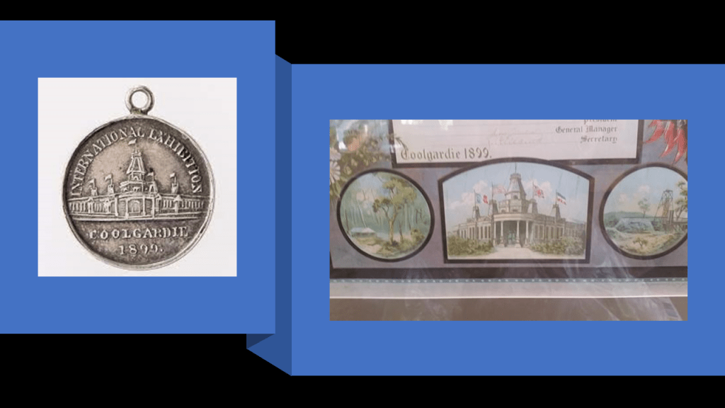
First, I have known for awhile that there was an International Exhibition held in Hobart, which took place in 1894.
It was said to have been built on 11-acres starting in 1893, for a cost of not more than 10,000 pounds because that was all the money that was available, for the International Exhibition that was held there between 1894 and 1895, and that the builders of it never meant to last, having been built of hardwood…and plaster and concrete to make it look more elegant, and it is long gone!

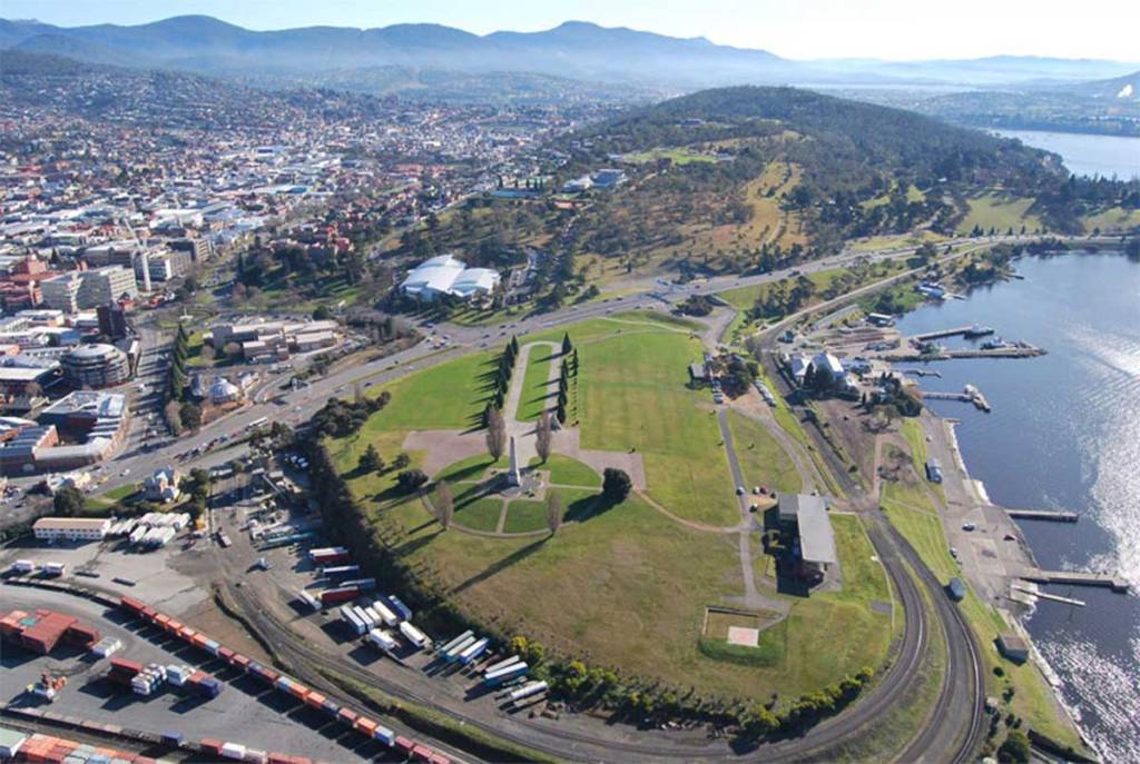
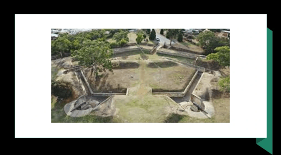
The Hobart Cenotaph is located on the Queen’s Domain, a hilly-area northeast of the Central Business District.
The Cenotaph is on what was at one time called the Queen’s Battery.
More on Hobart’s historical Batteries in just a moment.

The Hobart Cenotaph today is the main commemorative military monument for Tasmania, and is described as an Art Deco reinterpretation of a traditional Egyptian obelisk.
It was said to have been designed by Hobart architects Hutchison and Walker after the firm won a design competition for it in 1923.
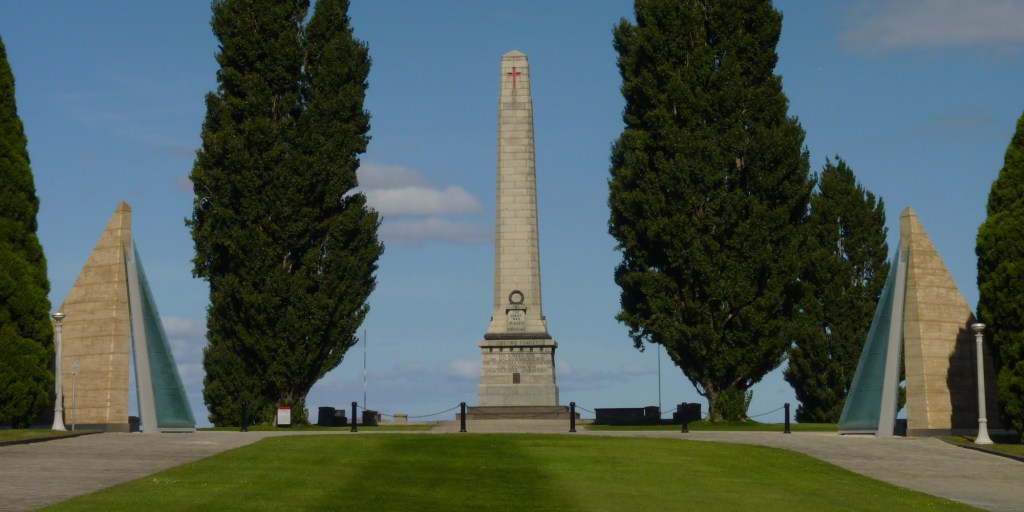
While we are told it was originally designed to memorialize Tasmanians who died during World War I, it was later modified to honor those who died in all military conflicts.

Here is a Google Earth Screenshot showing the location of the Hobart Cenotaph and Queen’s Domain, in relationship to other nearby places.
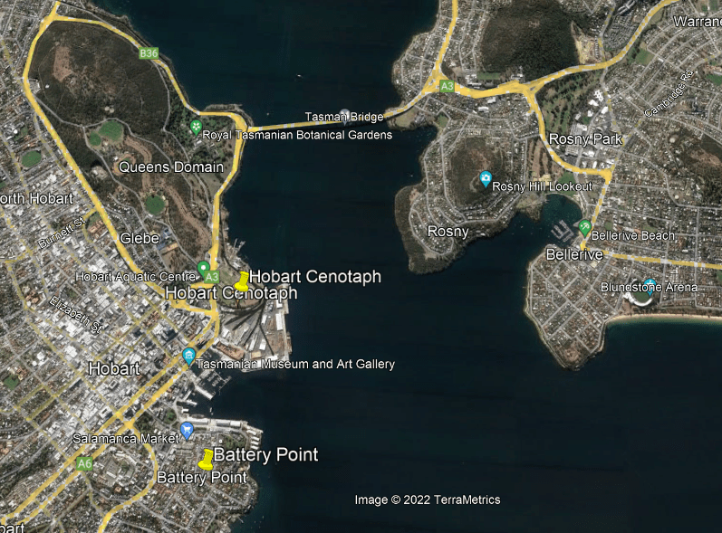
Battery Point is just across a small harbor from where the Hobart Cenotaph is located, and south of the Central Business District.
It was said to have been named after three batteries of guns established there in 1818 as part of the Hobart Coastal defenses.
These guns were subsequently decommissioned, we are told, after an 1878 review of Hobart’s defenses found its location would draw enemy fire on the surrounding residential neighborhood, so the location was turned over to the Hobart City Council for recreation and amusement.

They were located in what is called “Prince’s Park” today, where there are a few above-ground remnants…
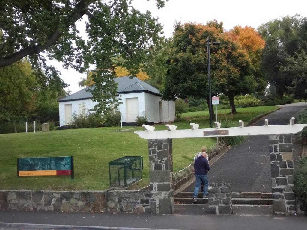
…but mostly underground.
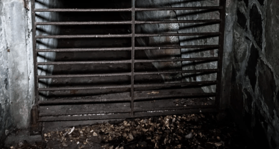
…and reputed to be haunted.
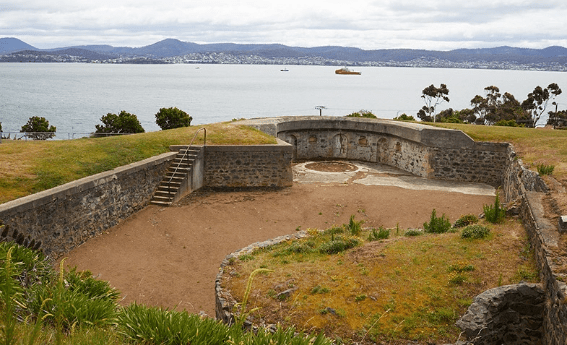
The Alexandra Battery, on a point of land further down from Battery Point and also said to have been built as part of the Hobart Coastal Defenses, still has much of its original structure intact, and is still accessible to visit by the public.
The Kangaroo Bluff Battery was directly across the Derwent River from Battery Point in Hobart.
The first railroad lines on the island were established starting in 1871.

Streetcars were in operation in Tasmania from 1893 to 1960.
Today, there is only freight railroad transport in Tasmania, with the main cargo being cement, and no passenger services in operation.
Again, same story all over the world.
Why would this be the case?
Today, in much of Tasmania, including Hobart, you can only experience the old rail trails by biking or hiking.
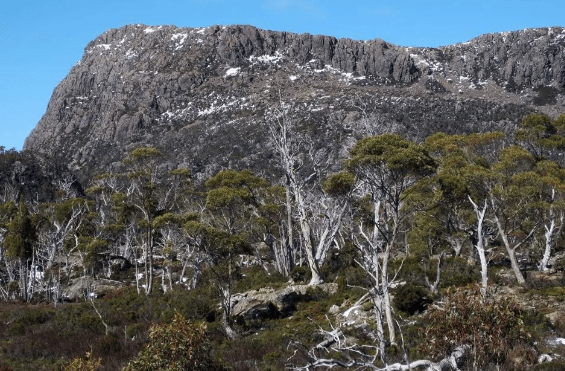
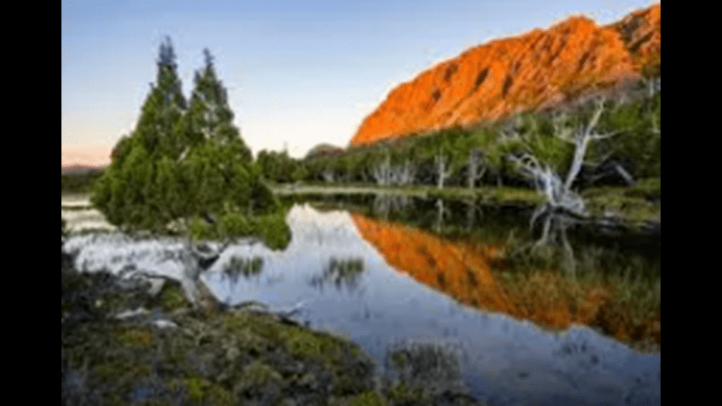
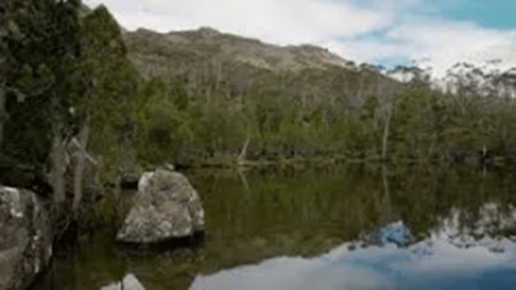
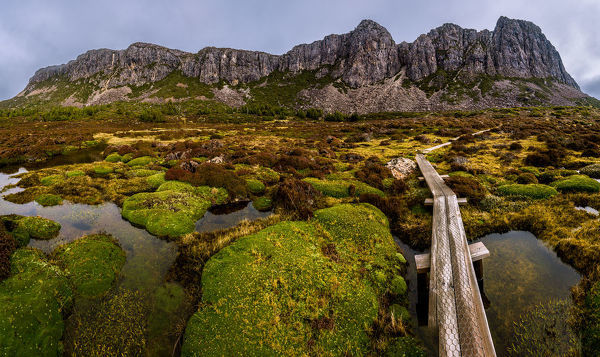
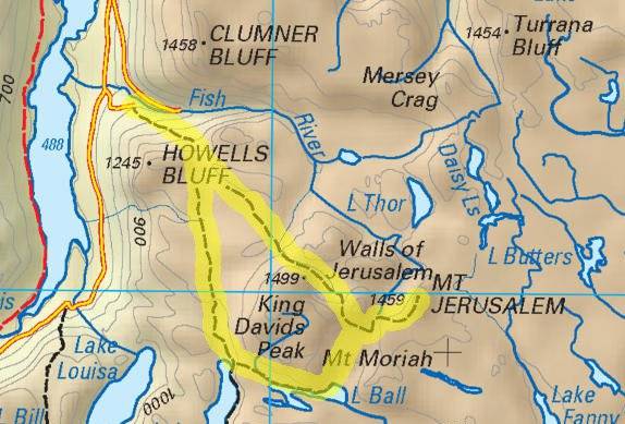
There’s a “Walls of Jerusalem National Park” in Tasmania.
“Walls of Jerusalem” In Tasmania?!
We are told the park got its name from geological features resembling the walls of Jerusalem.
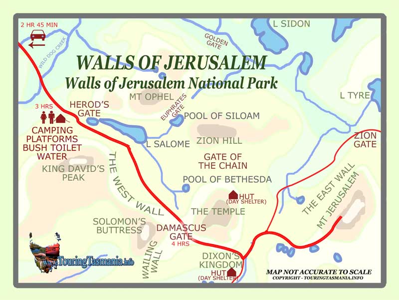
Let’s take a tour, starting at Herod’s Gate.
Lake Salome is adjacent to Herod’s Gate.
The Pool of Bethesda is southeast of Lake Salome, between the lake…
…and what is called “The Temple” and “Mount Jerusalem.”
King David’s Peak…
…what is known as Solomon’s Buttress or Throne…
…are on the other side of the West Wall, across from Mount Herod and Lake Salome.
The East Wall runs between Mount Jerusalem and “The Temple,” to mention a few of the features of the Walls of Jerusalem National Park.
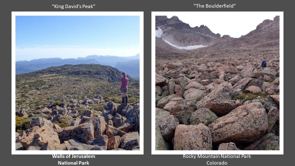
For comparison of similarity of appearance, there is a boulderfield on King David’s Peak in the Walls of Jerusalem National Park Tasmania on the left, and a feature actually called “The Boulderfield” in Long’s Peak in Colorado’s Rocky Mountain National Park on the right.
Was there a Jerusalem in more than one place?
It is interesting to note that the Rothschilds purchased Jerusalem, in what became Israel, in 1829, and subsequently acquired considerable land in Palestine in the 1800s and early 1900s.
Just a few things to think about what really might be going on here as opposed to what we have been told.
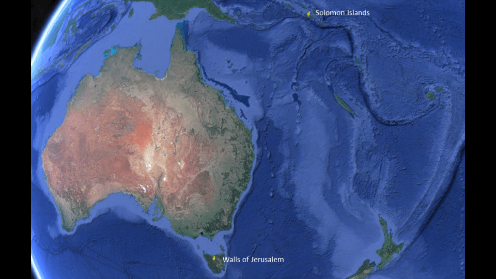
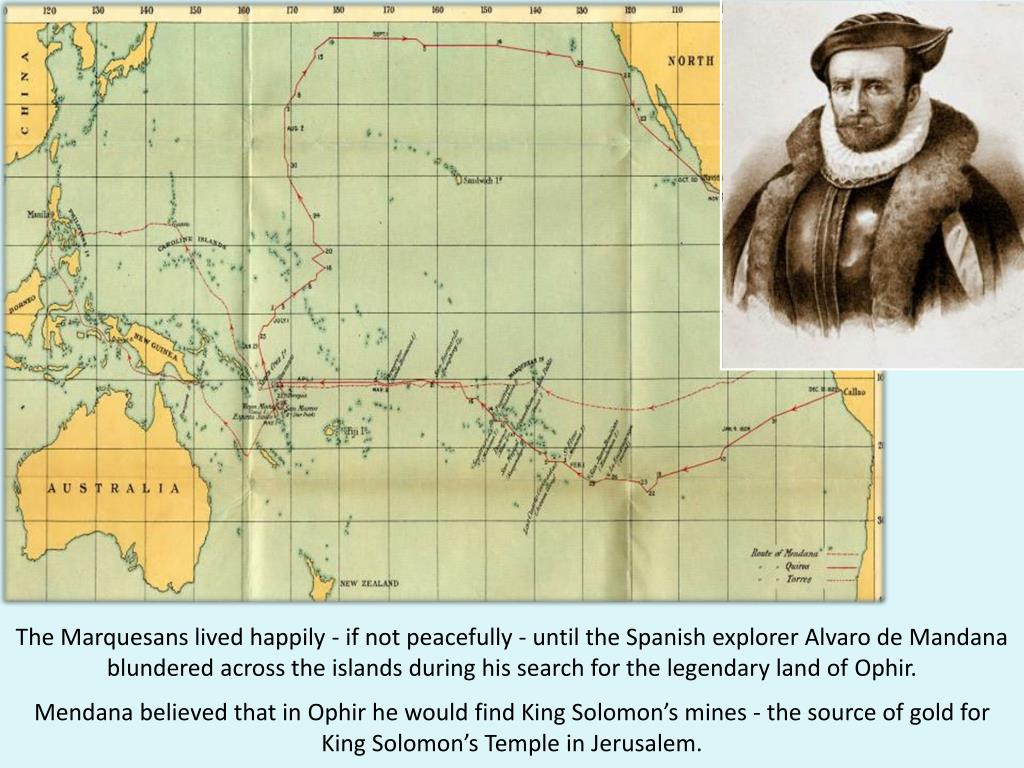
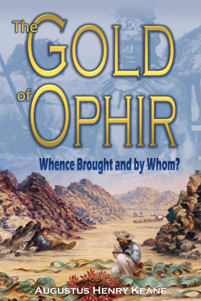
It is interesting that we find these physical references to Jerusalem in this part of the world, considering one of the reputed locations of the fabled Kingdom of Ophir and the Mines of Solomon is actually the Solomon Islands just up the way so to speak.
The Solomon Islands were a British-protectorate until independence in 1978, yet to this day it is a unitary parliamentary constitutional monarchy, with the British monarch as head-of-state.
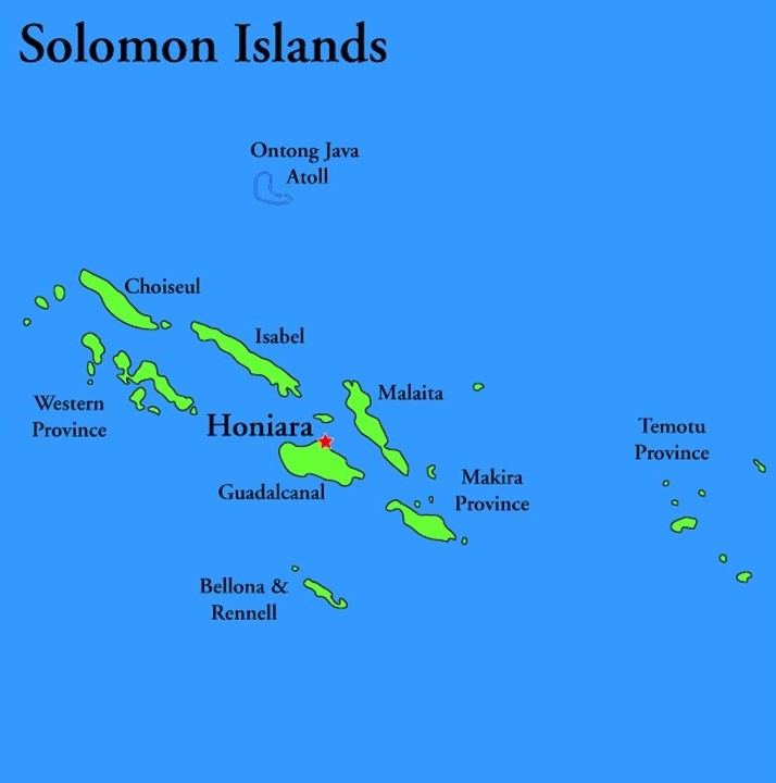
We are told the islands were named after the wealthy King Solomon by the Spanish navigator Alvaro de Mendana, who in 1568 came to the islands of the South Pacific looking for the source of King Solomon’s wealth, and also that they were the biblically-mentioned land of Ophir, famous for its wealth and fine gold.
Wonder why he thought that?!
I am just sharing some interesting correlations between the history related in the Bible and this part of world because that’s what I have to go by since the True History has been completely removed from our awareness, and all we have been left are fragments with which to make sense of everything.
Other candidates for Ophir have included the Philippines; India; Sri Lanka; Africa; and Arabia; but to this day its actual physical whereabouts remain shrouded in mystery, with many claimants.
A mystery right up there for us with what happened to the Lost Tribes of Israel!

Deliberate historical obfuscations and smoke-and mirrors kinds of deception, perhaps?
Hard to take in but something to consider given everything else we have been lied to about.

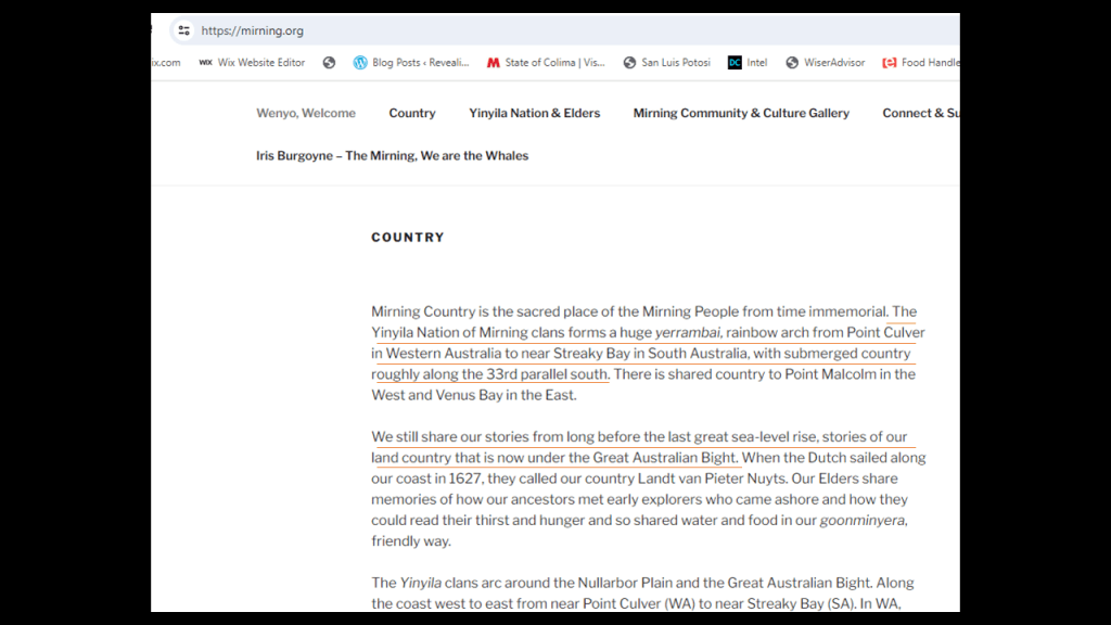
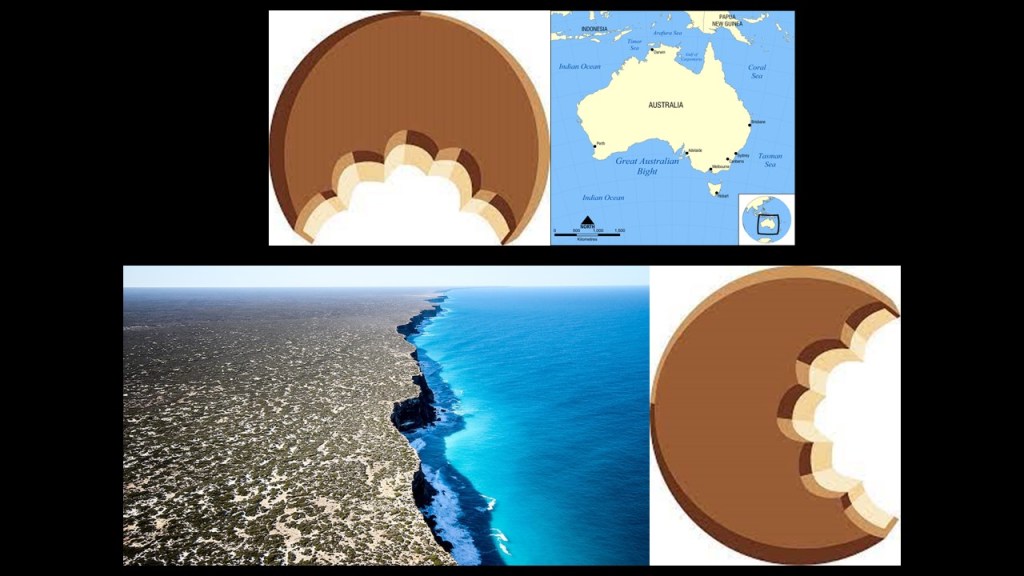
Going back over to the southern coast of Australia, generally considered to be along the Indian Ocean, but also considered part of the Southern, or Antarctic, Ocean, we find the Great Australian Bight.
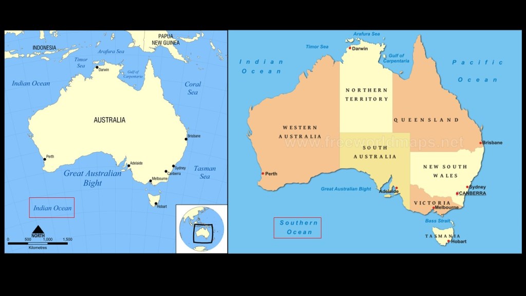
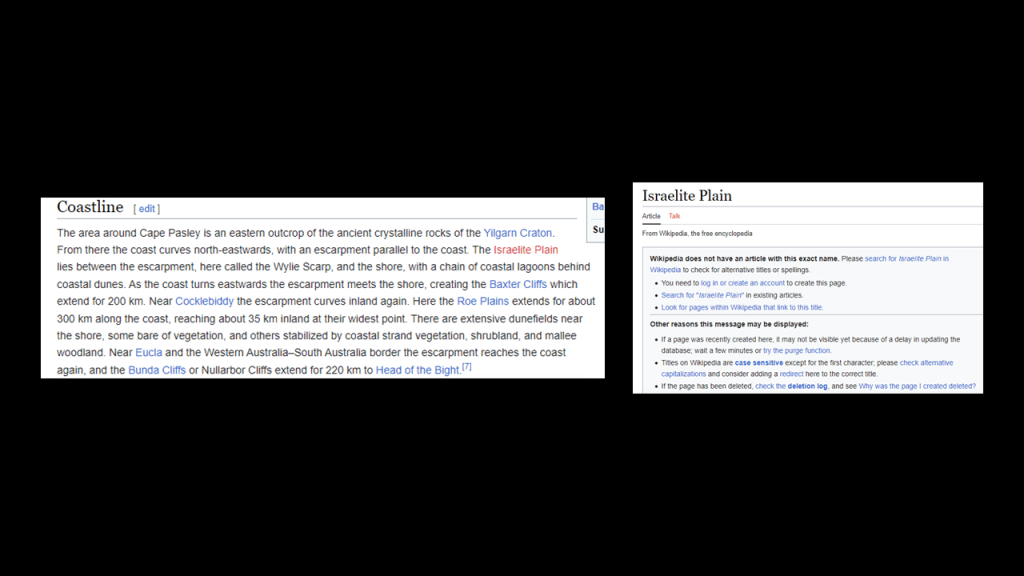
On the western end of the Great Australian Bight we find the Israelite Bay.
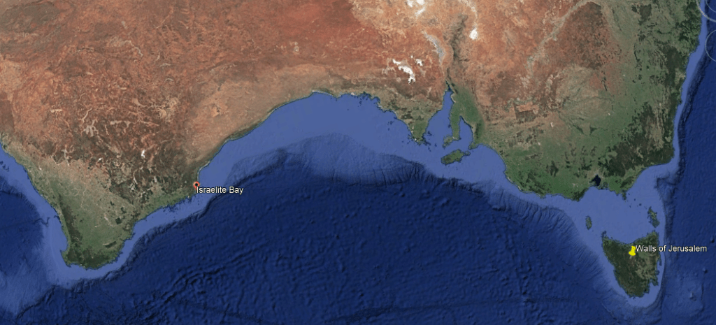
There used to be an “Israelite Plain” around here somewhere, but not anymore.
Might have been re-named the “Nullarbor Plain” seen here.
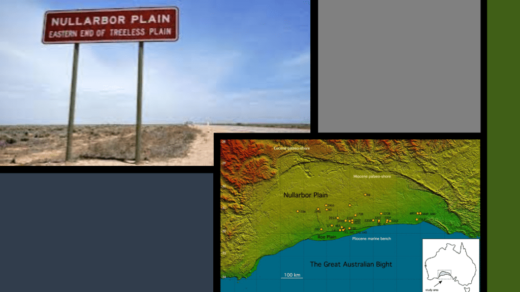
The Nullarbor Plain roughtly stretches between Israelite Bay on the western end of the Great Australian Bight, and Spencer Gulf on the eastern side of the Bight.
Some interesting things aout the Nullarbor Plain include:
It is the world’s largest single exposure of limestone bedrock…
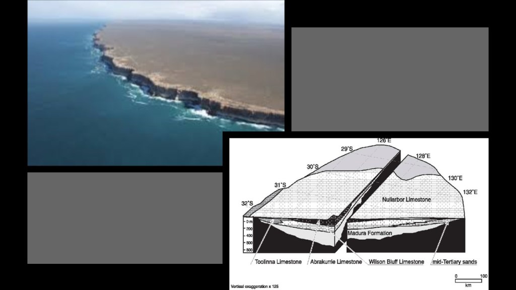
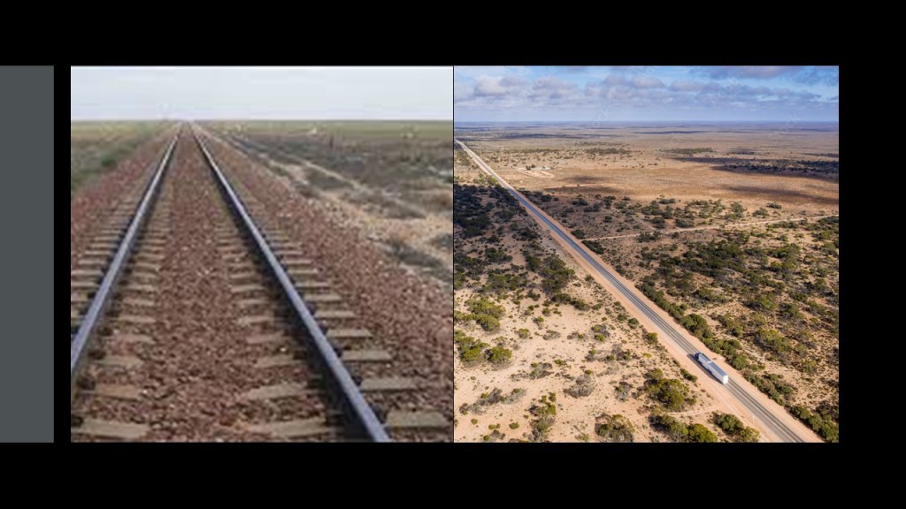
…it has the longest section of both straight railroad and straight highway in Australia…
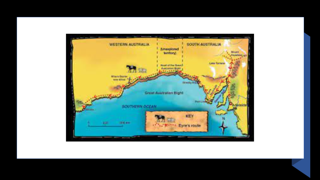
…and it was first crossed by European explorer Edward John Eyre in 1840- 1841.
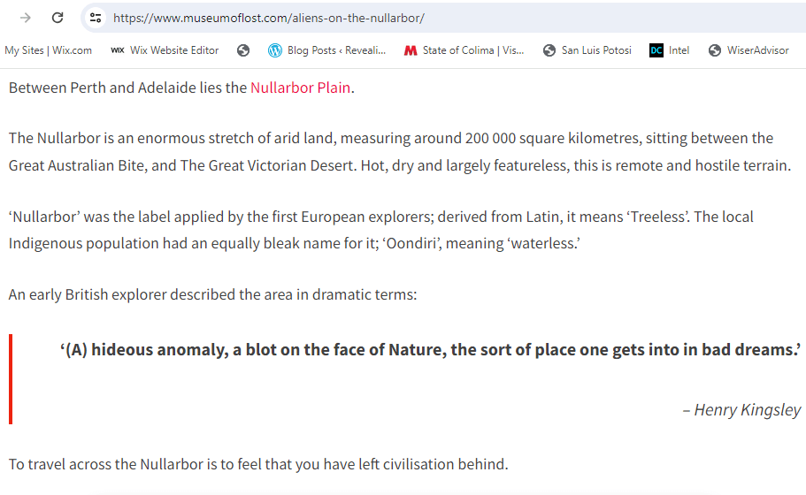
Interestingly, a man named Henry Kingsley was said to have been writing about Eyre’s travels in 1865 when he wrote that the Nullarbor and Great Australian Bight”…was a hideous anomaly, a blot on the face of nature, the sort of place one gets into in bad dreams.”
What today is the Nullarbor Plain is the traditional land of the Yinyila Nation of Mirning Clans, who have strong connections to the whales.
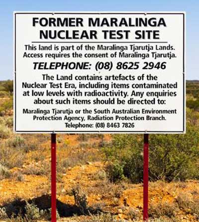
Between 1956 and 1963, the British conducted nuclear tests at nearby Maralinga, the traditional land of the Maralinga Tjarutja People.
They, and other Aboriginal Tribes of the region, were removed from their homeland prior to testing.
The site was left contaminated with nuclear waste, with no clean-up attempted until 4-years later, in 1967.
In 2014, after two clean-up efforts costing millions of dollars, as well as compensation payments to the traditional owners, the last part of land remaining in the prohibited area was opened back up to free access.
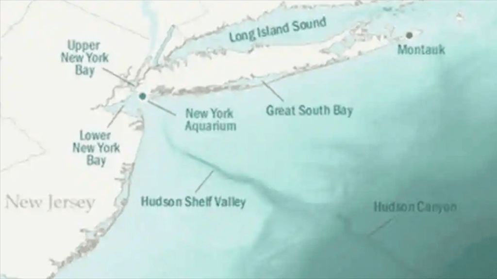
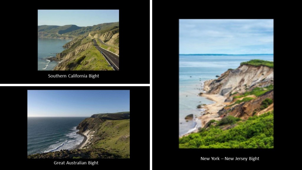
Along with the Great Australian Bight, I have found the Southern California Bight on the Pacific Coast and the New York – New Jersey Bight on the northeast Atlantic Coast.
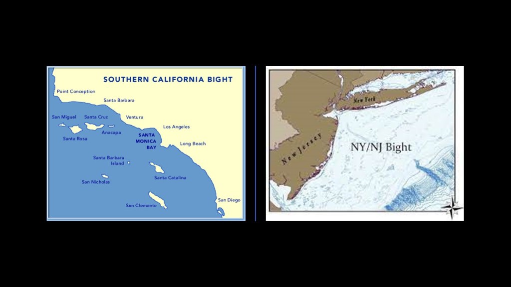
There are underwater canyons and shelves adjacent to the bights in all three places –and numerous canyons off the coast of the Southern California Bight.
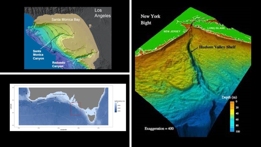
The Hudson Canyon on the east coast off the New York – New Jersey Bight is one of the largest underwater canyons in the world, and is comparable to the Grand Canyon in Arizona in size.
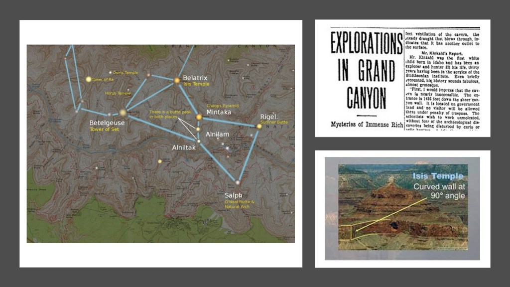
Bear in mind, the Grand Canyon in Arizona has formations with Egyptian names, like the Isis Temple, the Osiris Temple, and the Temple of Set, and that these formations and others correlate with stars in the Orion Constellation.
An article appeared in the Arizona Gazette in 1909 that an explorer in the Grand Canyon had stumbled upon Egyptian artifacts, but news about the discovery disappeared from public view shortly after it was published, and it has been called a hoax ever since.
We are actually told is that the four northernmost Channel Islands in the southern California Bight are the remnants of an ancient landmass called Santarosae off the coast of present-day southern California.
We are told that at the end of the last ice age, Santarosae lost 70% of its landmass because the sea rose from melting glaciers, leaving a huge submerged landscape that is currently being explored.
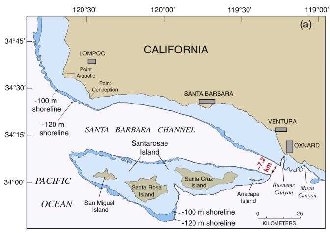
Santarosae is called “California’s Atlantis” by some.
The Mirning speak of their ancestral country being submerged in the Great Australian Bight roughly along the 33rd-degree parallel South, with what they call the “last great sea-level rise.”
The burning question that I have is: Did the last great sea-level rise happen in the distant past as we have been told in our historical narrative…or did it take place relatively recently, which is what I have come to believe as a result of my research.
Let’s drill down into this latter idea!
The English word “bight” even sounds like the English world “bite,” meaning to “grip, cut-off, or tear with, or as if with, the teeth or jaws.

Gotta wonder if they are telling us something without telling us they are telling us!
There is unstable-eroded-looking landscape, as if the land just sheared-off into the ocean like what is shown here at all three bights!
I am not saying the following without having done a great deal of research on places with lighthouses and similar terrain and water features all over the Earth, based on what I am finding and seeing.
The original purpose of lighthouses is not what we are told.
I think “lighthouses” were quite literally referring to “a house for light” for the purposes of precisely distributing the energy generated by this gigantic integrated system that existed all over the Earth that was in perfect alignment with everything on Earth and in heaven.
Even the colossal “Statue of Liberty” was a lighthouse in Upper New York Bay, and utilized as such from November 1st of 1886 until March 1st of 1902 in our historical record.
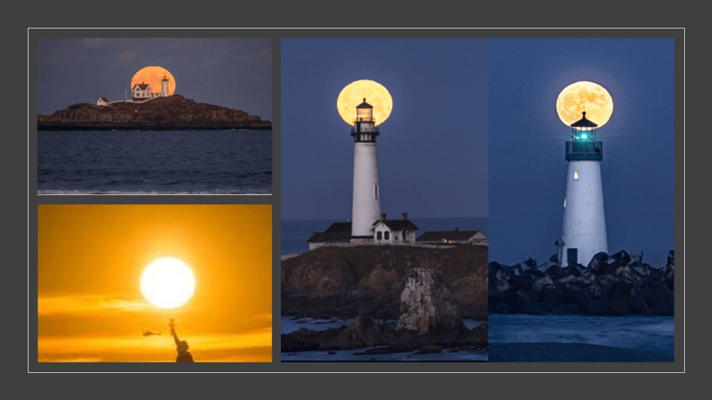
They certainly ended up at the edge of cliffs and became utilized as navigational aids, but I think that was because the land sheared off and sank right beside where they were located, creating the rocky and dangerous reefs and shallow areas in the waters that the lighthouses became needed for.
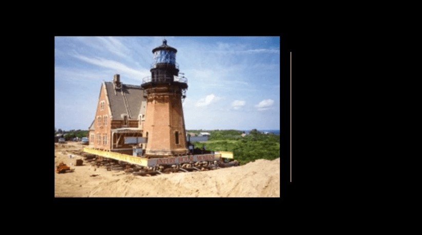
We are told that in some places, lighthouses like this one on top of Mohegna Bluff’s on Rhode Island’s Block Island, had to be moved because the ground it was on originally was so eroded and unstable.
The Southeast Lighthouse pictured here, said to have been built in 1874 in the Gothic-Revival architectural-style, was considered one of the most architecturally sophisticated lighthouses built in the United States in the 19th-century, and the tallest lighthouse in New England.
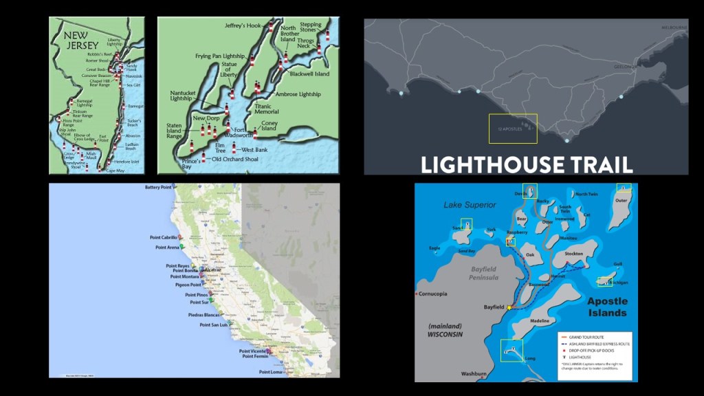
Here is a comparison of lighthouse locations between New Jersey and New York on the top left; southern California on the bottom left; the Lighthouse Trail mentioned previously on the Great Ocean Road along the coastline of southern Australia, where the “12 Apostles” are located just off-shore; and the lighthouses of the similarly-named Apostle Islands on the southern shore of Lake Superior in Wisconsin.
I believe there was a worldwide sinking of land-masses, and the simultaneous creation of estuaries, swamps, deserts, and dunes happened relatively recently as the result of a deliberately-caused cataclysm in a targeting of the Earth’s grid-system by the self-styled global elite class behind the New World Order, with ambitions of world domination and control driving their agenda, and that they occulted the timeline we are currently living on.
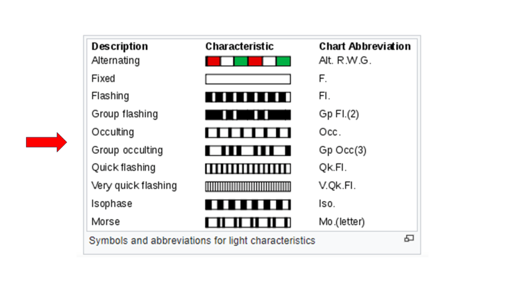
Coincidentally (or not), the word “occulting” is used to describe a type of lighthouse light-characteristic pattern.
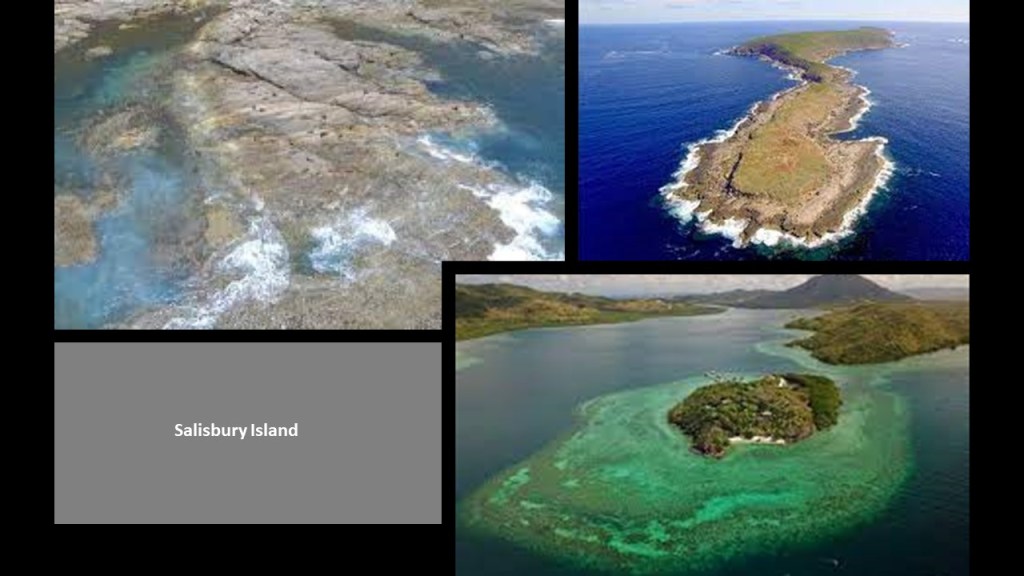
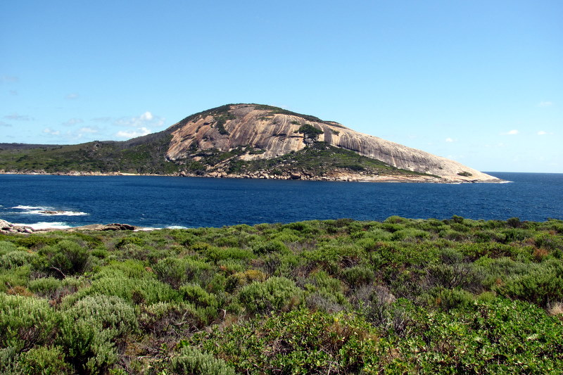
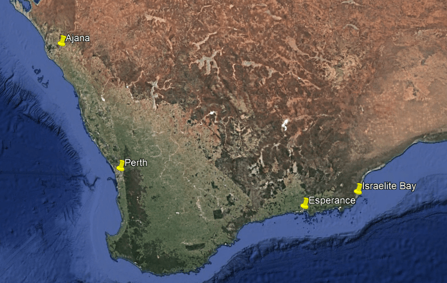
Let’s take a look at the “Archipelago of the Recherche.”
“The Archipelago of the Recherche” is a group of 105 islands, and over 1,200 obstacles to shipping, that stretch 140-miles, or 230-kilometers, west-to-east from Esperance to Israelite Bay in coastal waters designated as the “Recherche Archipelago Nature Reserve.”
“Recherche” translates to “Research” from the French.
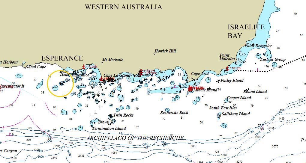
Salisbury Island is one of the southernmost islands in the archipelago, and described as a massive limestone scarp that sits on top of a granite dome located near the edge of the continental shelf.
There are caves above and below water, and numerous man-made artifacts found around the island.
A “continental shelf” is defined as a portion of a continent that is submerged under an area of relatively shallow water.
We are told that in Australia, a long time ago, like in the Pleistocene Ice Age around 18,000 BC, places along the continental shelf were connected by dry land.
I think they are hiding sunken infrastructure in their use of the word “shelf” to describe these shallow underwater land features.

As of 2012, the only place allowed visitor access here is “Middle Island,” via a licensed tour operator.
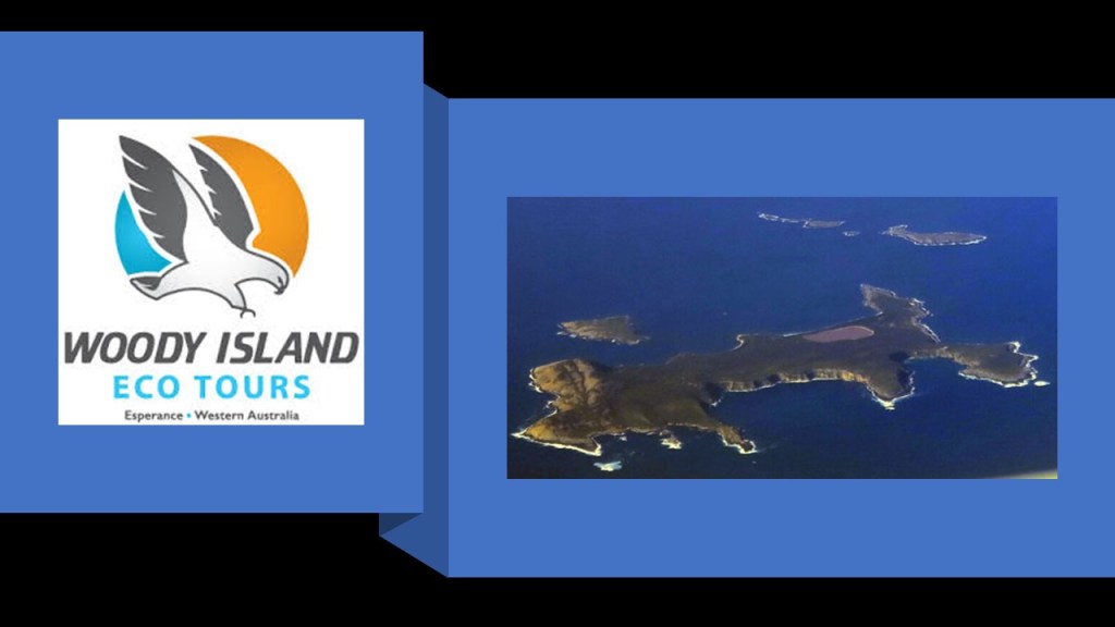
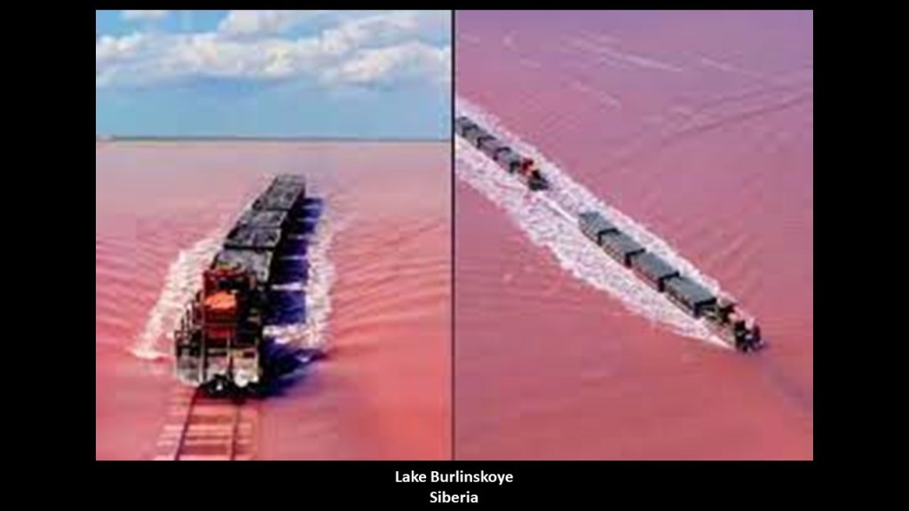
Lake Hillier on Middle Island is a popular attraction, a saline lake with a distinctive pink color.
I found this reference on the Woody Island Eco Tours website about train tracks being visible next to the lake.
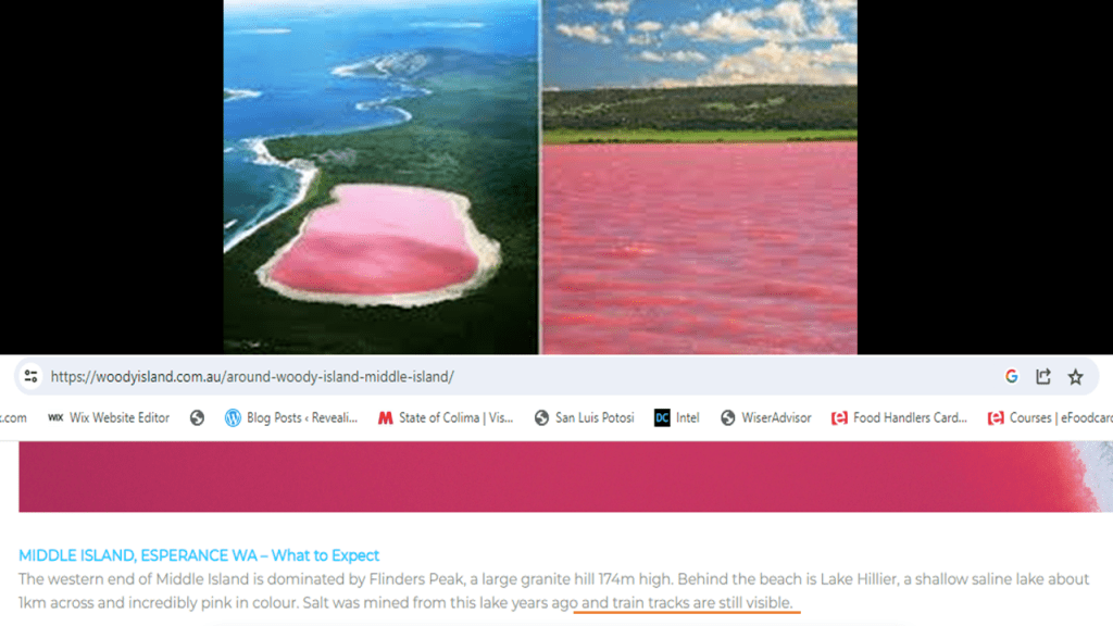
It is interesting to note that not along ago a pink lake in Siberia, Lake Burlinskoye, showed up on my YouTube feed that not only has railroad tracks in the lake, it still has an operating railroad that runs right through the water!
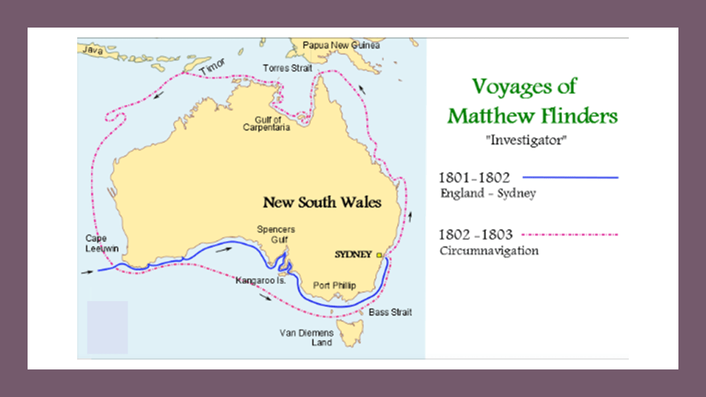
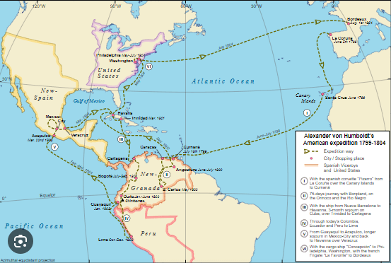
Matthew Flinders, a navigator and mapmaker who was the same explorer of the gulf of Carpenteria in Northeast Australia mentioned at the beginning of this post, was said to have explored the Recherche Archipelago in January of 1802 with botanist Robert Brown to collect flora material.
Flinders Peak on Middle Island, described as a large granite hill was named for him.
Capt. Matthew Flinders led the first in-shore complete navigations around mainland Australia all together between 1801 and 1803, for which he was identified as “Investigator.”
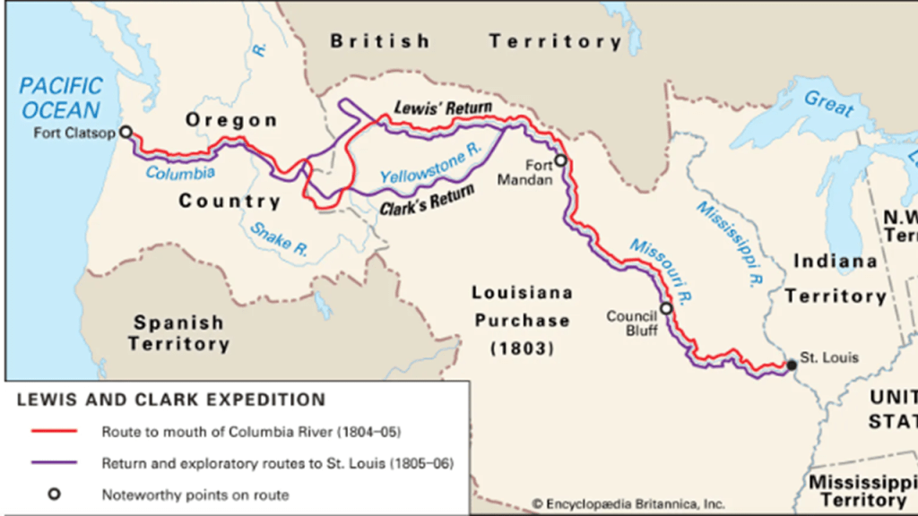
The time period of 1801 to 1803 in which Matthew Flinders was sailing around and exploring Australia was around the time of the Louisiana Purchase in 1803 and the Lewis and Clark Expedition thereof between 1804 – 1806…
…and Alexander von Humboldt, a Prussian naturalist, pioneer of the fields of biogeography and geophysical measurements, was an explorer of the Americas between and 1799 and 1804.
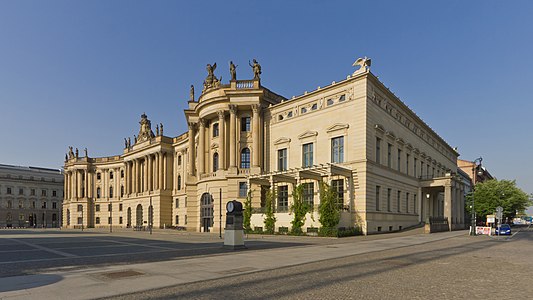
Berlin’s Humboldt University was so-named in his and his brother Wilhelm’s honor.
Humboldt University first opened in 1810, and was regarded as one of the world’s pre-eminent universities in the study of Natural Sciences in the 1800s and 1900s.
Famous faculty and alumni included names like: Einstein; Marx; Engels; Bismarck; Hegel; and the Brothers Grimm.
Humboldt University boasts 57 Nobel laureates, quite a bit more than any other German University.
I think these voyages of exploration, as well as ones that came before like Abel Tasman’s, and ones that came after, like the voyages of the HMS Beagle as well as those of other countries, were post-cataclysm, and among other things the explorers were coming to see and document what they would find, and at that time, or later, claim new lands for their respective European countries.
There is plenty of underground infrastructure worldwide for not only the those that desired a global takeover, but for the original people to live in as well, where places on the Earth’s surface would otherwise have been uninhabitable.
So as an example of what I am talking about, I mentioned the exploratory voyages of the HMS Beagle, of which there were three in total.
The HMS Beagle’s first voyage was between 1826 and 1830, accompanying the larger ship, HMS Adventure, on a hydrologic survey of Patagonia and Tierra del Fuego, under the overall command of the Australian Navy Captain, Phillip Parker King.
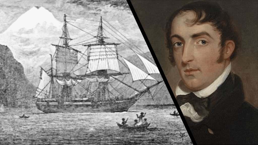
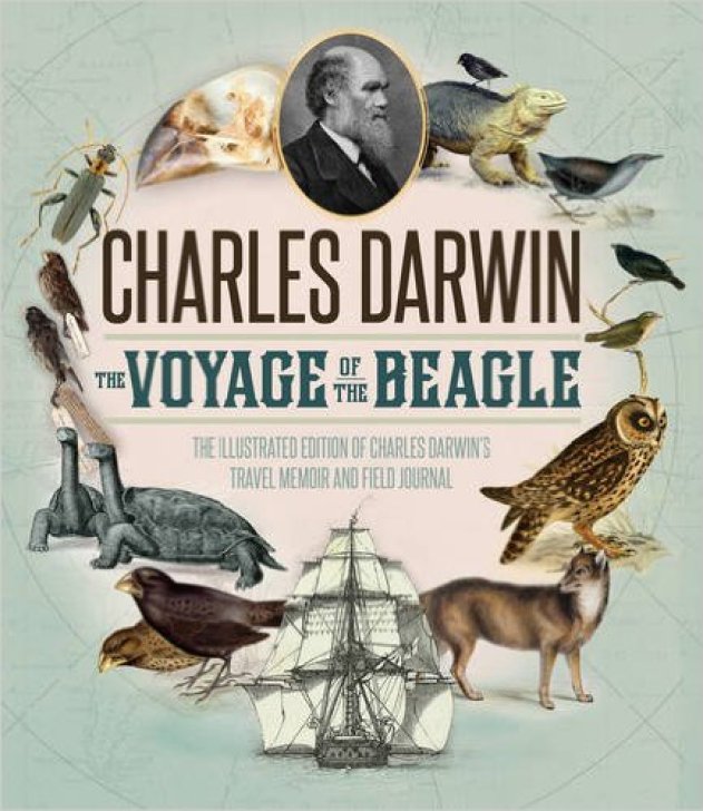
The second voyage of the HMS Beagle, between 1831 and 1832, was joined by naturalist Charles Darwin, on a second trip to South America, and then around the world.
Charles Darwin kept a diary of his experiences, and rewrote this as a book titled “Journal and Remarks,” becoming published in 1839 as “The Voyage of the Beagle.”
It was in “The Voyage of the Beagle” that Darwin developed his theories of evolution through common descent and natural selection.
The third voyage of the HMS Beagle took place between 1837 and 1843, and was a third surveying voyage to Australia, stopping on the way at Tenerife in the Canary Islands; Salvador on the coast of Brazil in Bahia State; and Cape Town in South Africa.
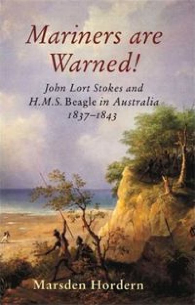
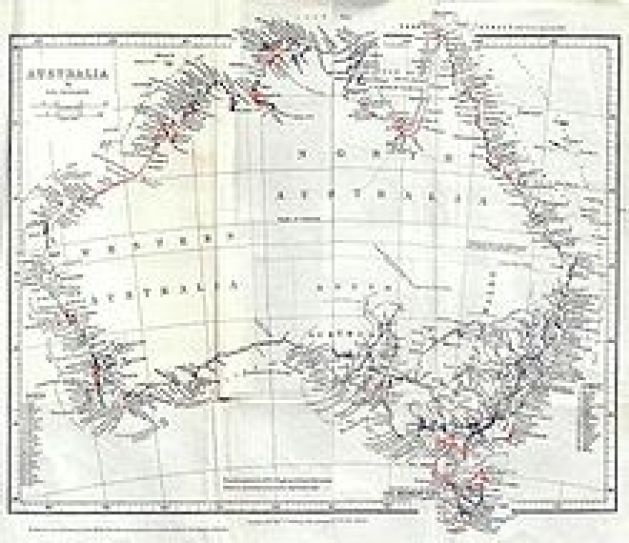
In Australia, the crew surveyed Western Australia, starting in what is now Perth, to the Fitzroy River; then both shores of the Bass Strait in Australia’s southeast corner; then north to the shores of the Arafura Sea, across from Timor.
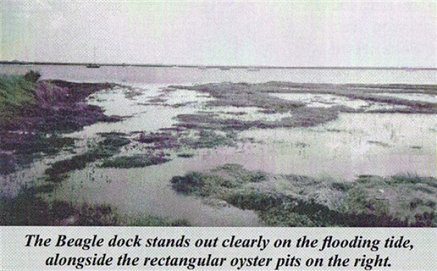
In 1845, the HMS Beagle was refitted as a Coast Guard watch vessel in Essex, in the navigable waters beyond the Thames Estuary, moored in the middle of the River Roach, until oyster companies and traders petitioned to have it removed in 1851, citing the vessel was obstructing the river and its oyster beds.
The Navy List shows that on May 25th of 1851, the once-famed HMS Beagle was renamed “Southend ‘W.V. No. 7′” at Paglesham, and later sold in to be broken-up.
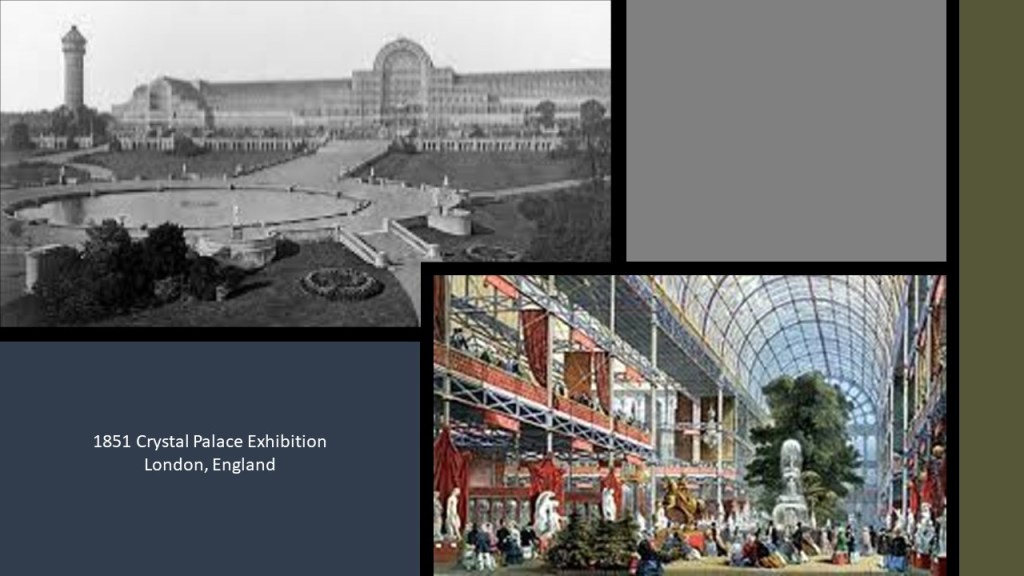
The Crystal Palace Exhibition started on May 1st of 1851 less than a month before..
I believe the Crystal Palace Exhibition was the official kick-off of the New World Order reset timeline.
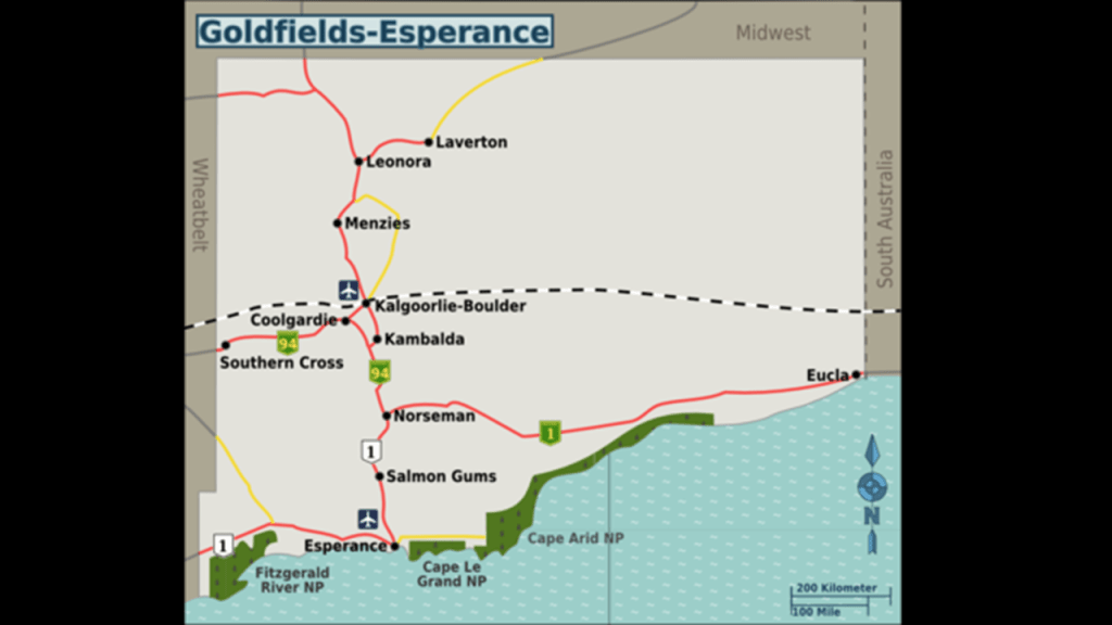
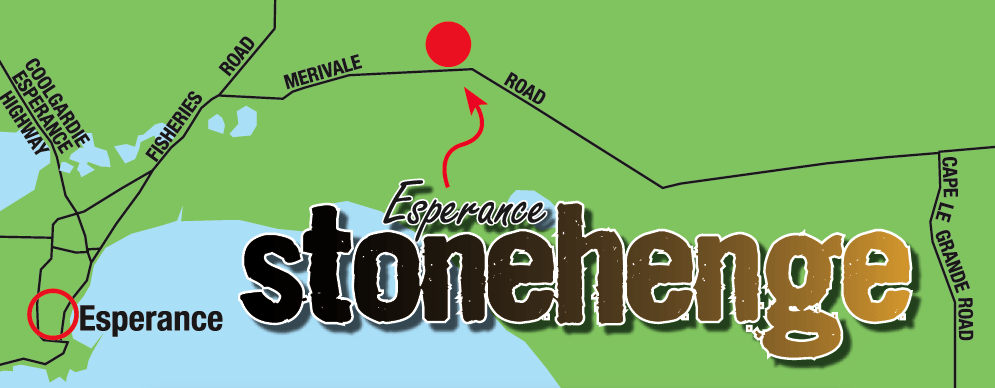
Now I am going to take a look at first the town of Esperance, and then the Goldfields-Esperance region of Western Australia.
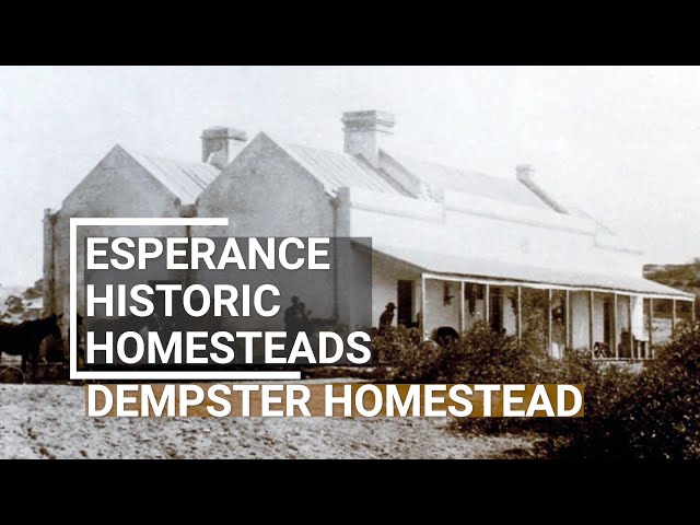
Esperance was first settled in the 1864 by the Dempsters, a rancher family of Scottish descent, when they initially brought in sheep, cattle and horses overland, built a landing, and then started shipping them in.
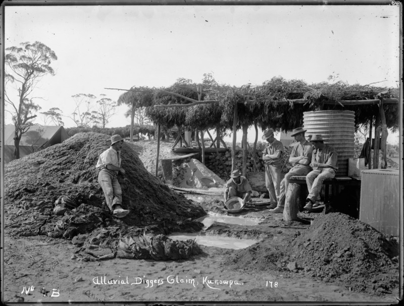
A telegraph station opened there in 1876, and Esperance became the “Gateway to the Goldfields” in the 1890s with the discovery of significant deposits of alluvial gold in Coolgardie in 1892, and Kalgoorlie in 1893.
More on the Goldfields in this region in a moment.
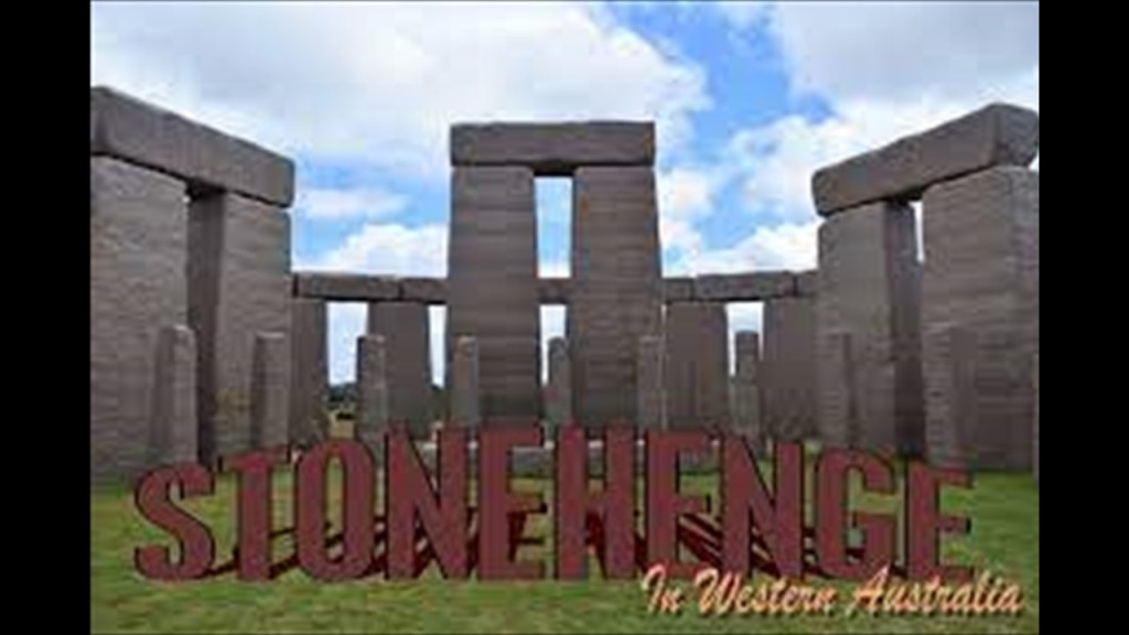
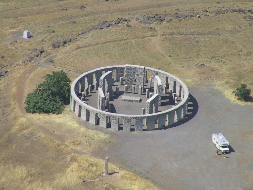
The Esperance Stonehenge was the first photo icon I clicked on Google Earth when I started to look around Esperance.
Esperance Stonehenge? New one on me!
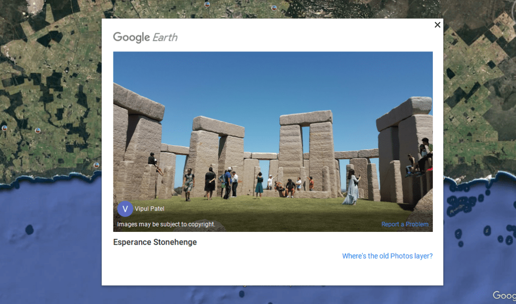
The Esperance Stonehenge is located on Merivale Road, northeast of the town of Esperance.
So this is what we are told about it.
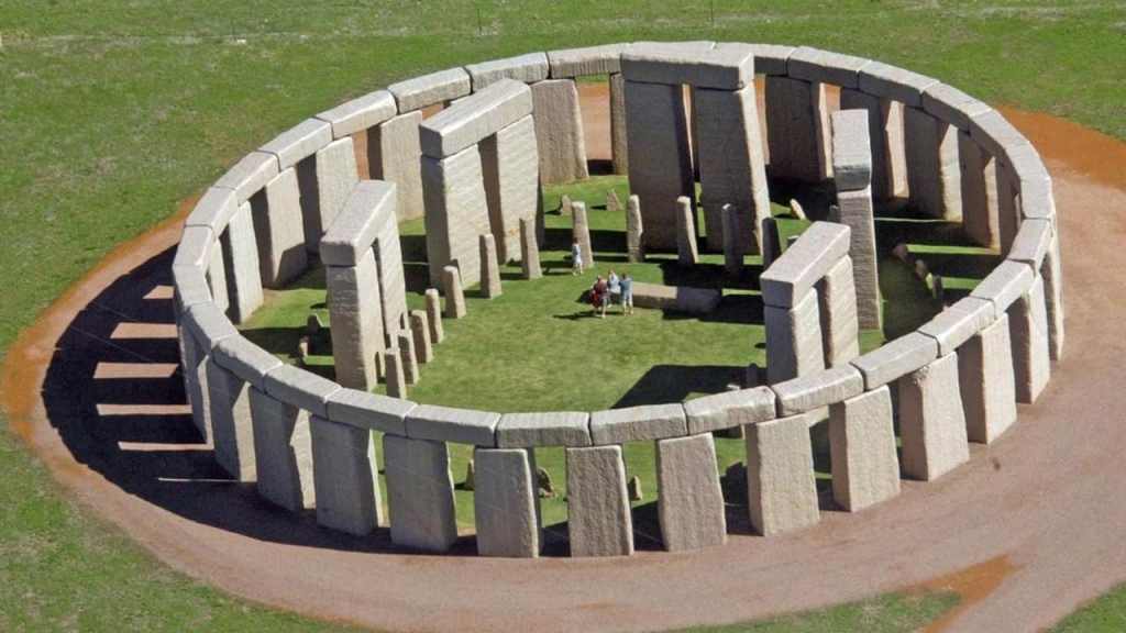
It is the only full-size replica of the original Stonehenge on the Salisbury Plain in England, appearing as the original would have looked in 1950 BC.
It consists of 137 stones of locally-quarried Esperance Pink Granite.
The ten inner trilithon stones forming a horseshoe-shape weigh 28-50-metric-tonnes, or 31 -55-tons, each.
There is an 18-metric-tonne, or 20-ton, lintel over each pair, reaching a height of 8-meters, or 26-feet.
The altar stone lying at the base of the tallest trilithon stone weighs 9-metric-tonnes, or 10-tons.
There’s a circle of 40 smaller stones called the “Bluestone Circle” outside the Trilithon Horseshoe.
There are thirty Sarsen Stones weighing 28-metric tonnes, or 31-tons, around the perimeter, with only 8-metric-tonne, or 9-ton, lintels lining the top.
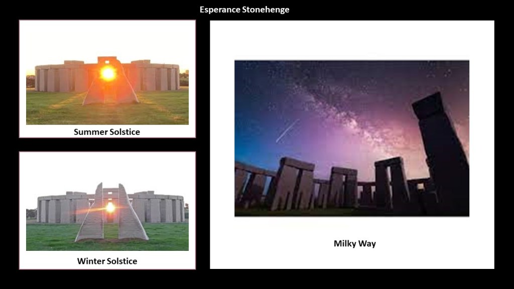
The astronomical alignments of the Esperance Stonehenge include: the Summer Solstice; Winter Solstice; and Milky Way.
This is what we are told about the origins of the Esperance Stonehenge.
The stones were quarried and cut for a stonehenge project in Margaret River in 2008 that was funded by a millionaire.
The project fell-through a year later, and here they had all these stones ready for the project, and the Rotary Club of Esperance took an interest in building a stonehenge replica locally.
The owners of a hobby farm across from the quarry decided to take on the project on their own dime, starting in 2011, and it was designed by a local architect.
It opened as a paying tourist attraction in 2017.
Similarly in North America, Lewis and Clark would have passed right by the physical location of the Maryhill Stonehenge, on a bluff on the Washington-side of the Columbia River…
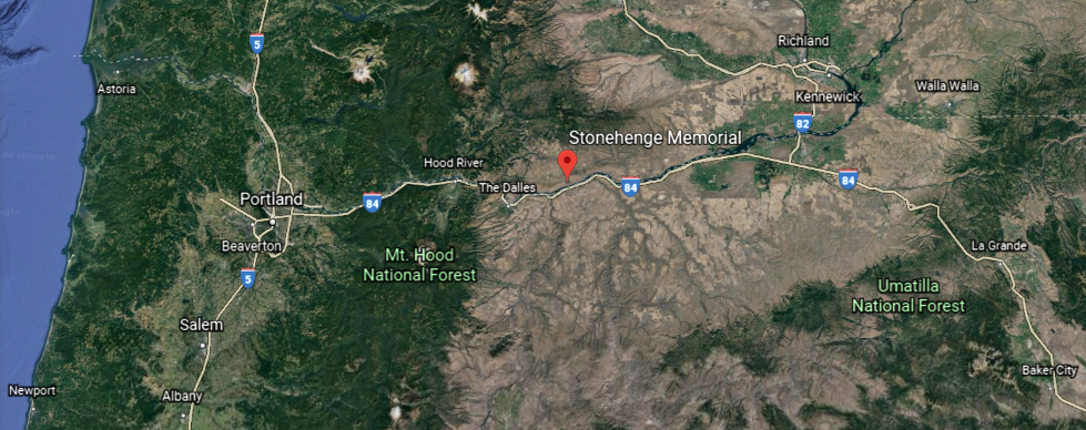
…on their journey to what would become Astoria, Oregon, on the Columbia River near the Pacific Ocean, named after John Jacob Astor, the first American millionaire.
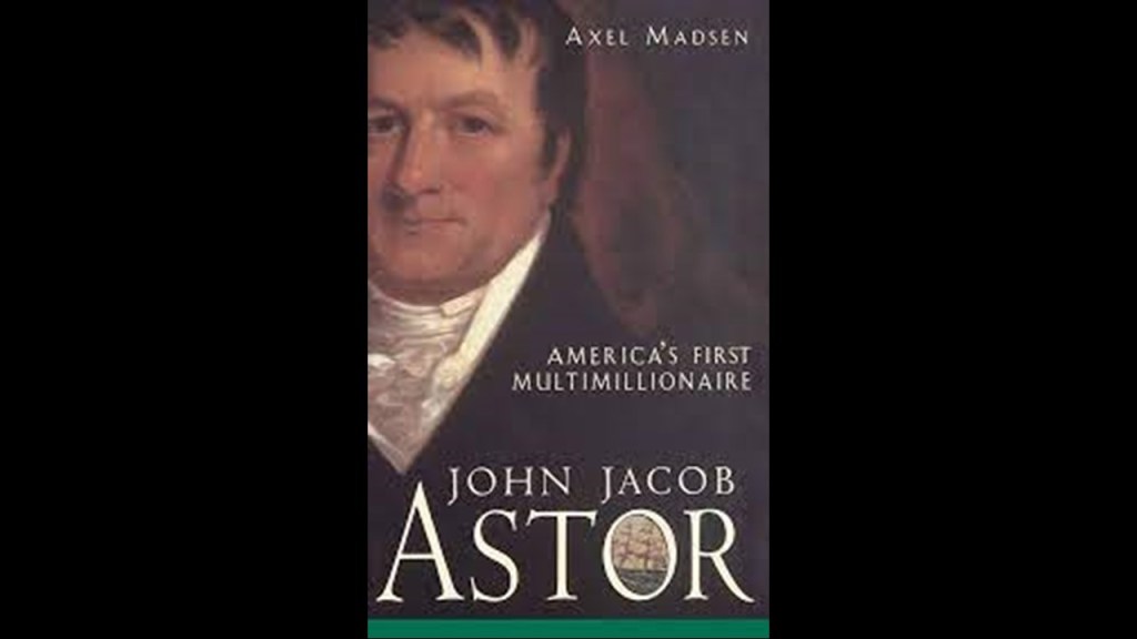
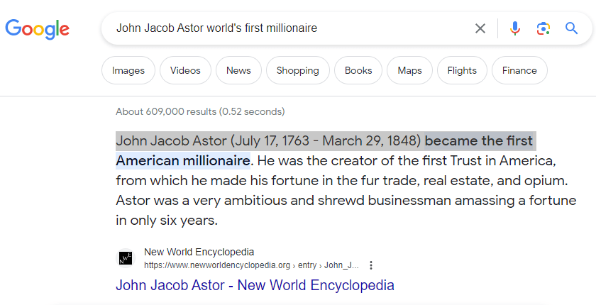
How he made his fortune is not hidden.
As a matter of fact, it is the first thing that comes up in a search.
Astor made his fortune in the fur trade, real estate, and opium.
The Maryhill Stonehenge was not said to have existed until after it had been commissioned in the early 20th-century by the wealthy entrepreneur Sam Hill, and dedicated on July 4th, 1918, as a memorial to the people who died in World War I.
The Maryhill Stonehenge also has solstice alignments…

…and with the Milky Way.

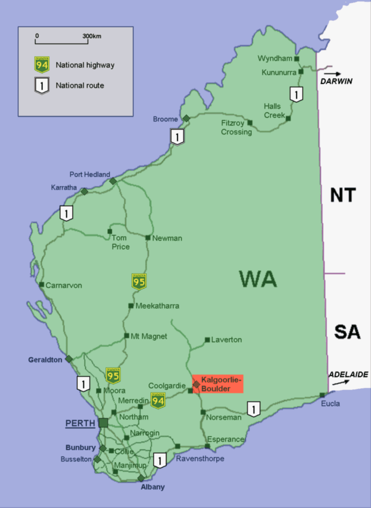
Next, I am going to look at Coolgardie and Kalgoorlie, just up the road so-to-speak from Esperance.
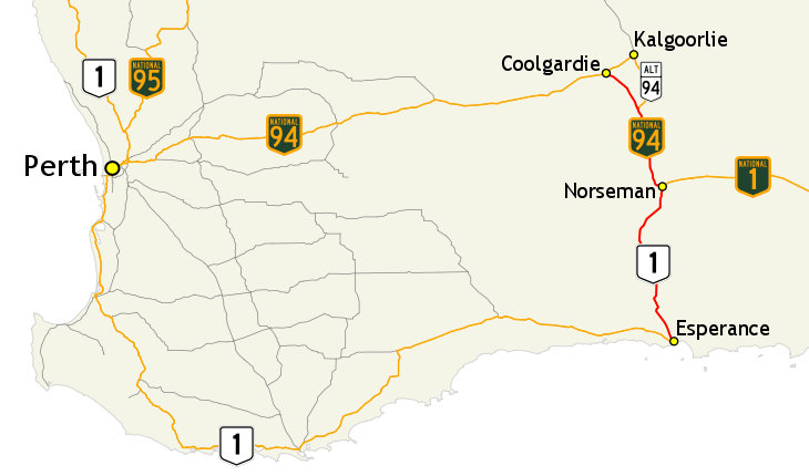
We are now in the heart of the Goldfields-Esperance region of Western Australia.
First Coolgardie.
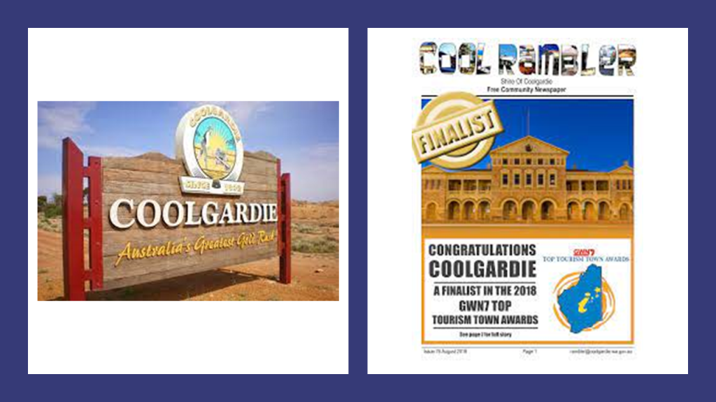
Today Coolgardie is a tourist town and a mining ghost town.
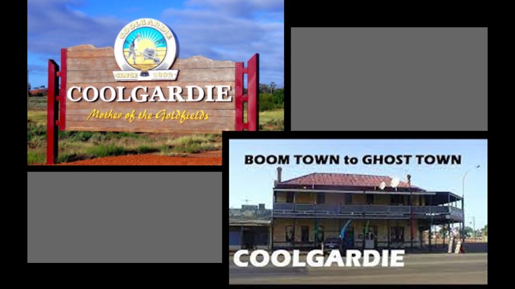
Coolgardie was established in 1892 after the discovery of gold in what was known as the “Fly Flat” by prospectors Arthur Wellesley Bayley and William Ford
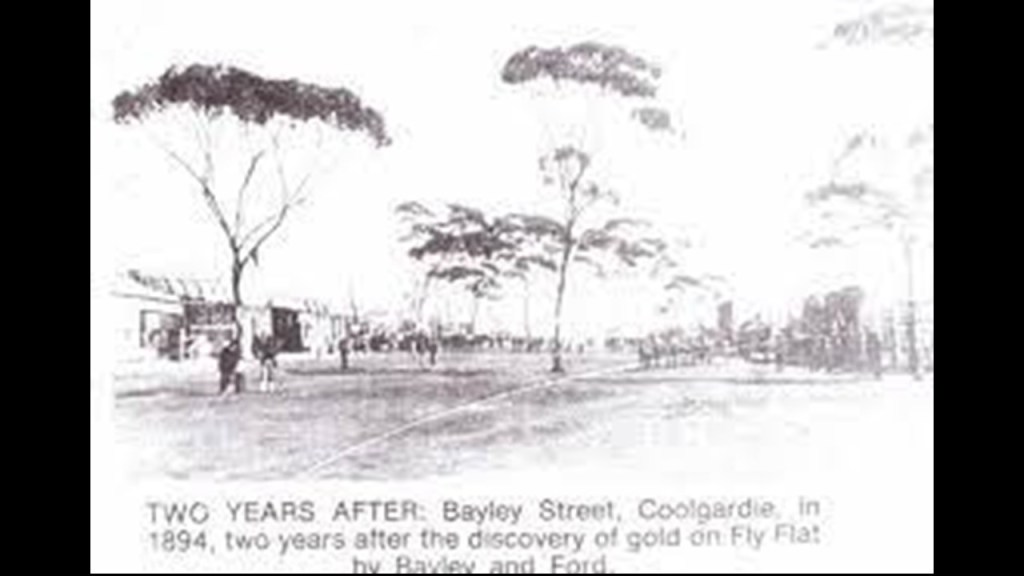
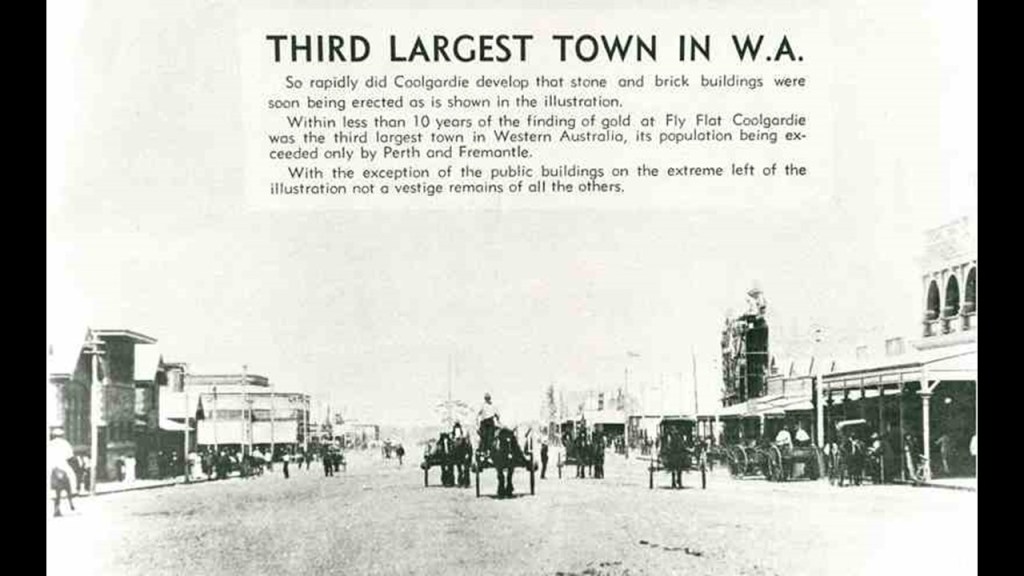
Then, within only ten years of its establishment, Coolgardie was the third-largest town in Western Australia, growing so fast that stone and brick b;uildings were already being built.
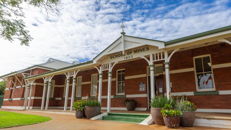
The Western Australian School of Mines was first established in Coolgardie in a building that was said to have been erected for the International Mining and Industrial Exhibition of 1899.
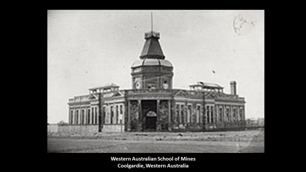
By the year of 1903, the Western Australian mining school had moved to Kalgoorlie.
The International Mining and Industrial Exhibition, also known as the “World’s Fair in the Desert,” opened on March 21st of 1899 and closed on July 1st of the same year.
It was a celebration of the goldfields and prosperity they brought to the Colony of Western Australia, and we are told sought to emulate the 1851 Crystal Palace Exhibition in London.
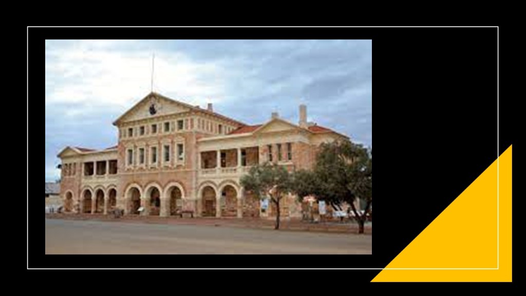
The Coolgardie Wardens Court was said to have been erected in 1898, and today houses the “Goldfields Exhibition Museum.”
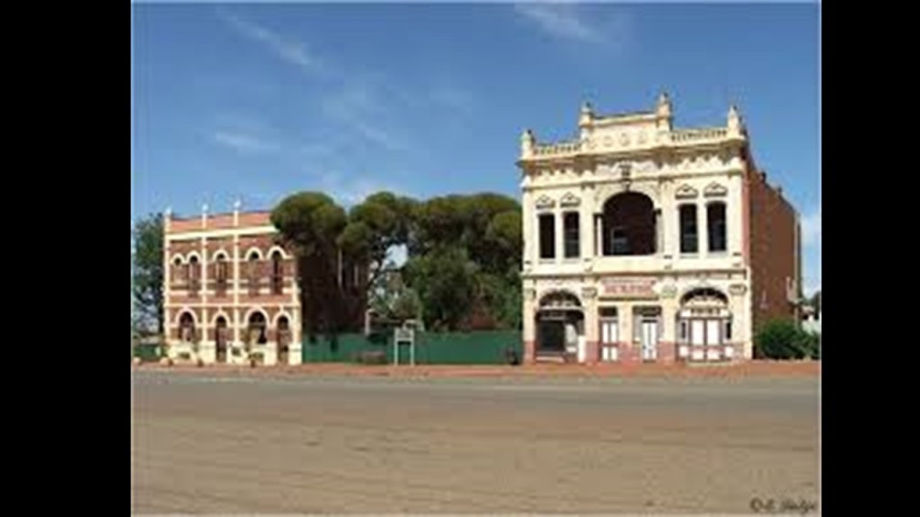
The Coolgardie “Marvel Bar Hotel” was also first established in 1898, and operated as a hotel until 1927.
It continues to be in use as the Location of the “Coolgardie RSL,” the Returned and Services League of Australia for people who have served and are serving in the Australian Defense Force.
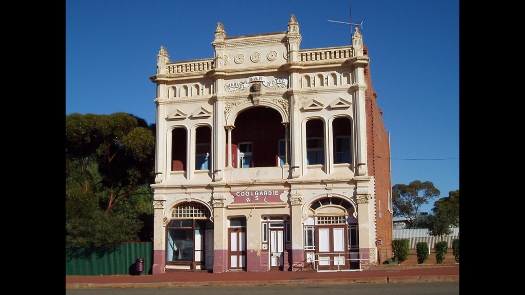
The Cremorne Hotel is shown in this picture next to the “Marvel Bar Hotel/RSL” Building.
The Cremorne Hotel was said to have come into existence circa 1896.
Today it is an Arts’ Center for the Community.
These are just two examples of Coolgardie’s many historic hotel buildings.
Coolgardie’s population decline started with the decrease of gold in the early 1900s, even prior to World War I, when it went into even more serious decline, at one time with a population that went from thousands to 200.
Today it has a population of approximately 850 people, surviving as a community through tourism.
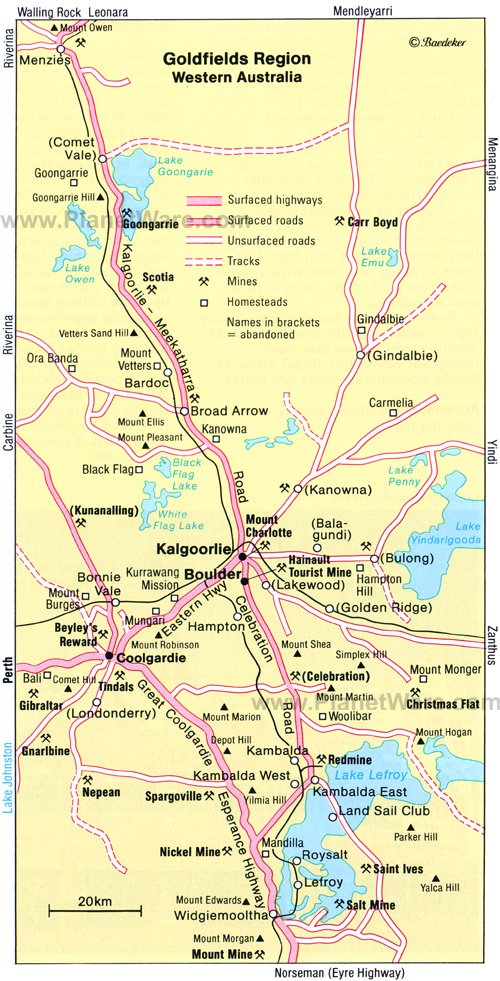
Next, I am going to look at the urban area of Kalgoorlie-Boulder, which is located just slightly to the northeast of Coolgardie.
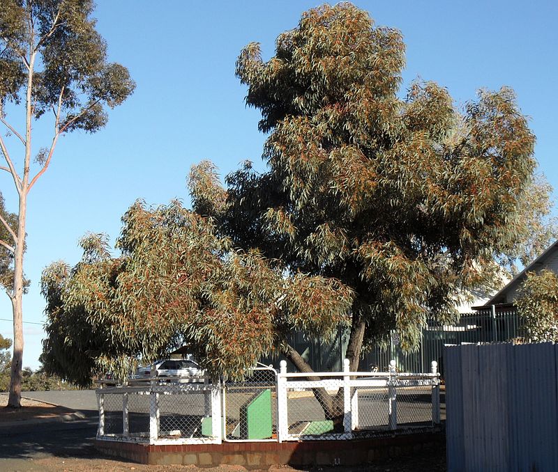
Kalgoorlie was first established in 1893, a year after Coolgardie, after a prospector named Patrick “Paddy” Hannan and his two partners found gold here at the foot of Mount Charlotte.
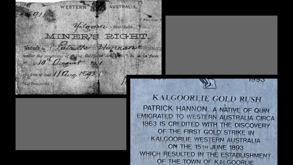
Since 1897, what is known as “Hannan’s Tree” has marked the spot where he first found gold in 1893.
Kalgoorlie quickly became the largest settlement of the “Eastern Goldfields” of the “Western Australia Goldfields,” and even today the mining of gold and other metals remains a major industry.
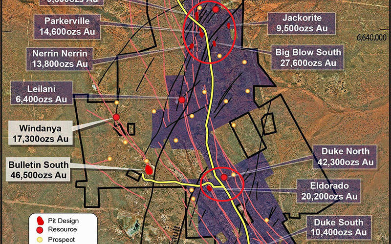
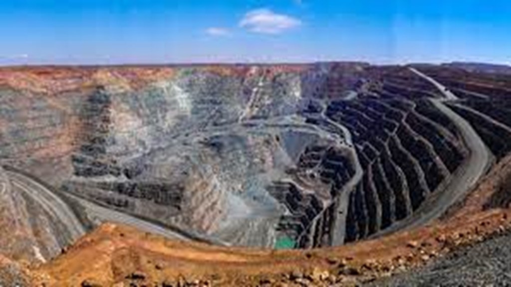
The Super Pit Gold Mine in Kalgoorlie was Australia’s largest open-cut gold mine for many years until it was surpassed in 2016 by another one in Western Australia in the Newmont-Boddington gold mine.
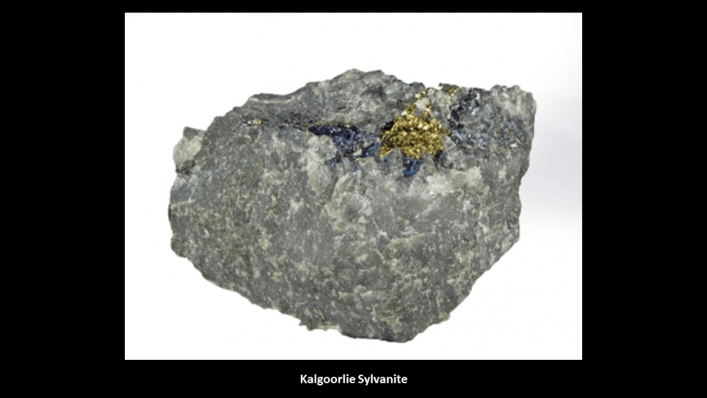
Kalgoorlie is one of the four main locations in the world where Sylvanite is found, along with Transylvania in Romania; Cripple Creek in Colorado, and Kirkland Lake in Ontario, and identified as the “Sylvanite Triangle” by Stephanie McPeak Petersen in her excellent video on this subject, “The Chymical Wedding of Sylvanite,” in which Stephanie makes interesting connections like this one, and many others as well.

Sylvanite is a compound of gold, silver and tellurium, which makes it a telluride, which is a chemical compound of tellurium with one or more electropositive elements like gold and silver.
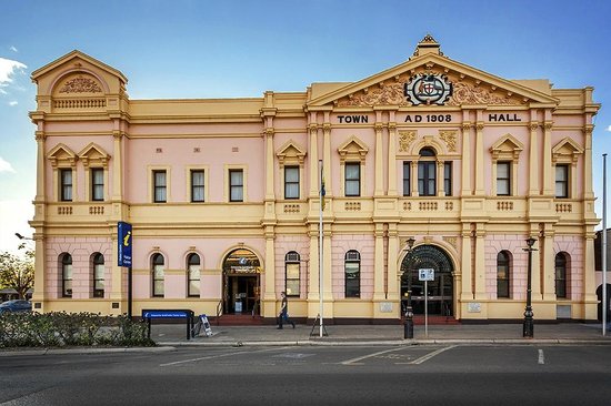
The Kalgoorlie Courthouse and Post Office was said to have been completed in 1897, in local pink stone, and designed by the local Public Works Department under the supervision of architect John Harry Grainger.
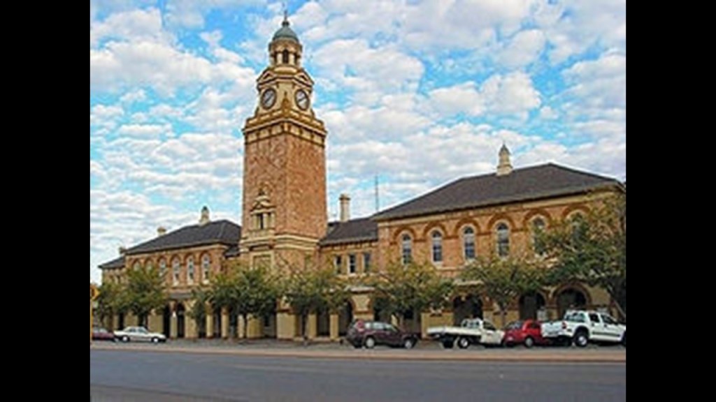
Kalgoorlie’s Town Hall was said to have been completed in 1908, and that its grand facade and rich interior decoration reflected the immense wealth of Kalgoorlie during the gold boom.
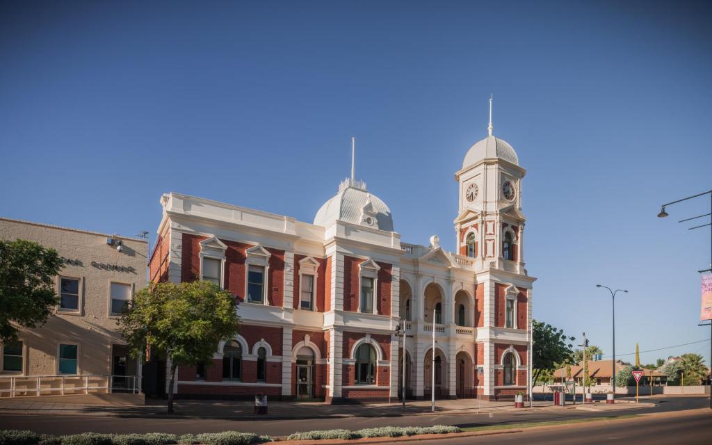
Boulder is a suburb of Kalgoorlie.
Its town hall was also said to have been built in 1908, and demonstrates the architectural style of the gold rush days.
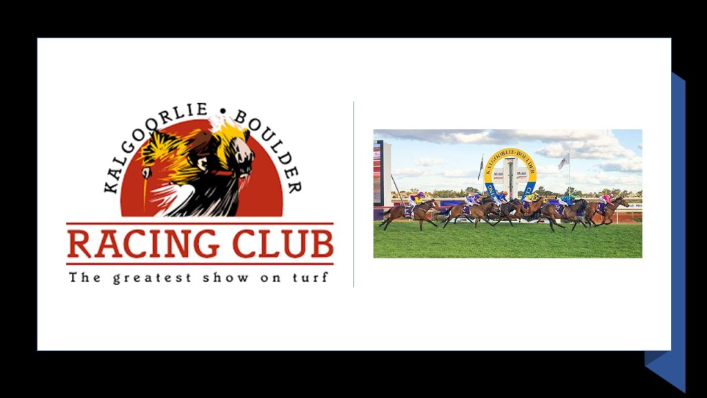
The first meeting of the Kalgoorlie-Boulder Racing Club was in 1896, and it is one of the oldest registered horseracing associations in Western Australia as it is still in operation.
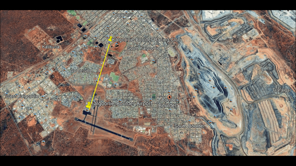
The Kalgoorlie-Boulder Racing Club track is located only a short-distance northeast of the Kalgoorlie-Boulder Airport, just like what we saw with the earlier examples of airports and racetracks in close proximity in this post.
The original people of this region are the Wangkatha, the collective identity and lanaguage group of eight aboriginal groups of people.
Initially, the Wangkatha people of the region were friendly to the European explorers of their country, even showing Paddy Hannan where to find his first gold nugget.
As more settlers came to the area, they became more belligerent to the incursions, and by the early 1900s, they were considered the most “fierce, wild, and untameable” of all the aboriginal peoples of Western Australia.
So what was the solution for the European settlers?
Missionaries were dispatched from New South Wales, who established the Mount Margaret Aboriginal Community in 1921.
It was here that original people of the region were given a western education and learned about Christianity.
Perth is close-by here, so that is the next place I will head over to take a look at.
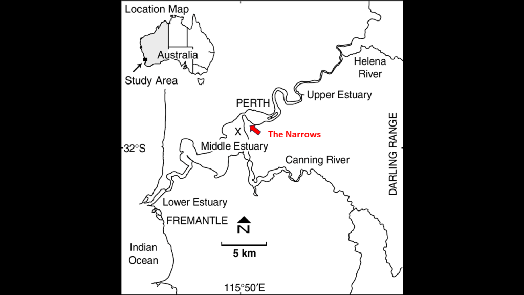
Perth is the capital and largest city of Western Australia.

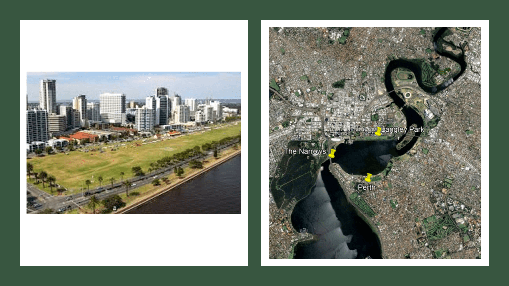
Most of Perth is located on the “Swan Coastal Plain,” which holds the Swan River that runs through metropolitan Perth.
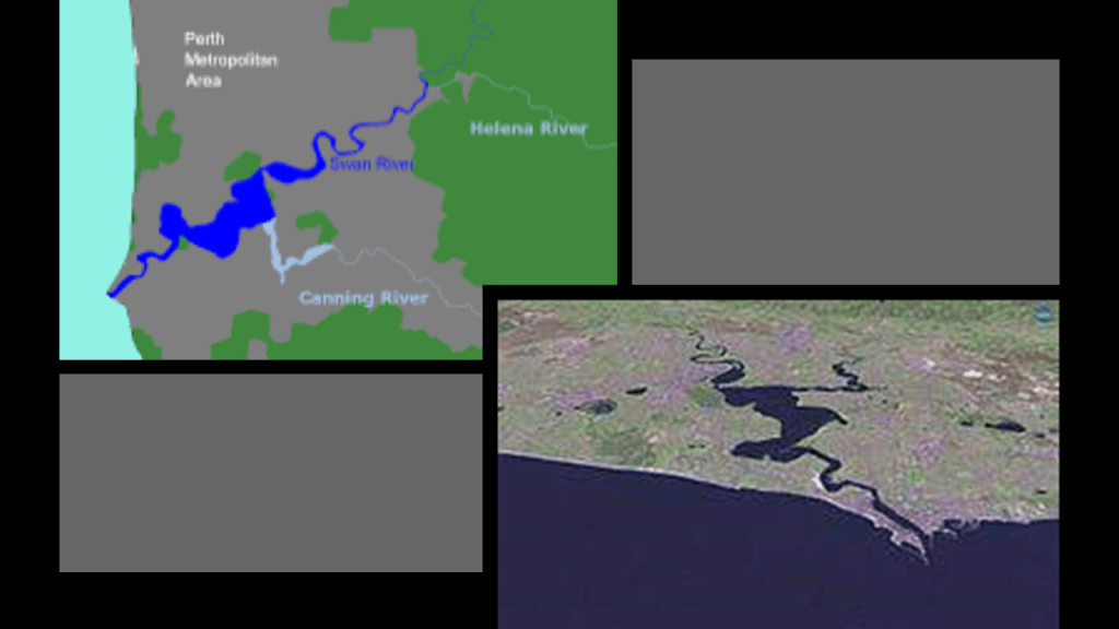
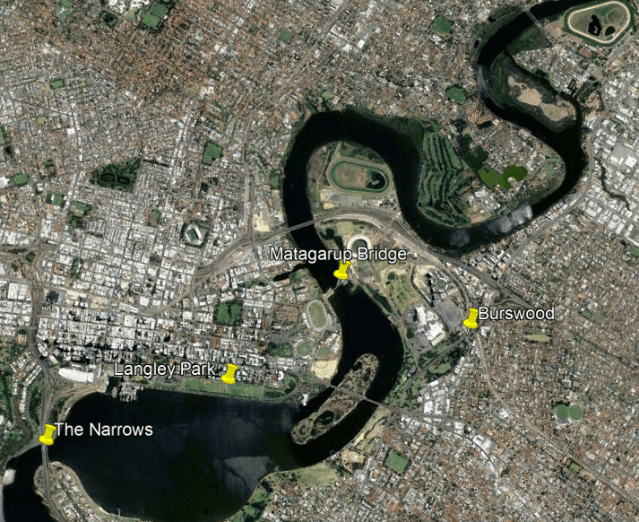
The Swan River Estuary is divided into upper and lower regions delineated by the Narrows, where the Narrows Bridge, a dual road and railway bridge. links the city’s northern and southern suburbs.
An “estuary” is defined as a partially-enclosed, coastal body of brackish water, which is water that is salty, dirty & unpleasant, with one or more rivers flowing into it, and a connection to the open sea.
Like the bights of the world, I believe the world’s estuaries also represent sunken land.
And why is this what I believe?

This is a good place to do a comparison of the Swan River Estuary and the previously-mentioned River Thames Estuary in England, where the HMS Beagle ended its last years as a watch vessel in the mid-19th-century before it was sold for scrap.
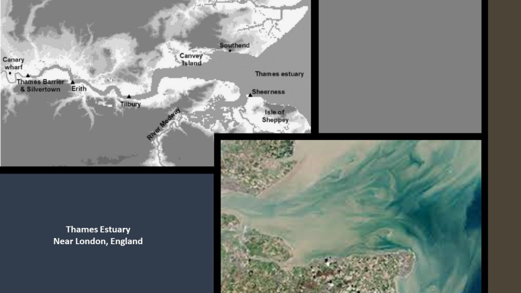
First the Thames Estuary.
The Thames Estuary is where the River Thames meets the North Sea, and the Greater Thames Estuary refers to the low-lying mud flats and marshlands that border the estuary.
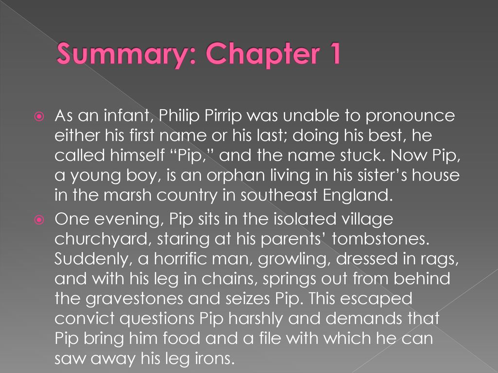
These marshlands were the setting in the first chapter of Charles Dickens’ novel “Great Expectations,” where a young orphan named Pip was living with his sister, and was grabbed in a graveyard by a convict in leg-irons.
A book that was required reading in 9th-Grade English class where I went to high school.
Had to read it, and we analyzed it in class for meanings.
Yet perhaps there were hidden meanings being conveyed in this book about marshlands, orphans and convicts that we have not been consciously aware of about the prevalent conditions of the day.
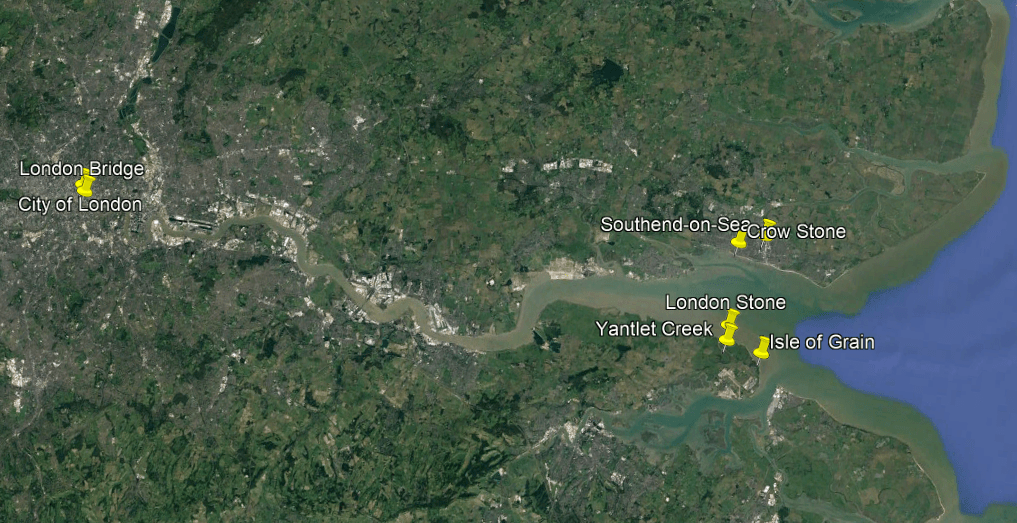
The eastern end of the Thames Estuary is delineated by the Yantlet Line, which is a line across the estuary that is marked by the London Stone at Yantlet Creek on Grain Island…
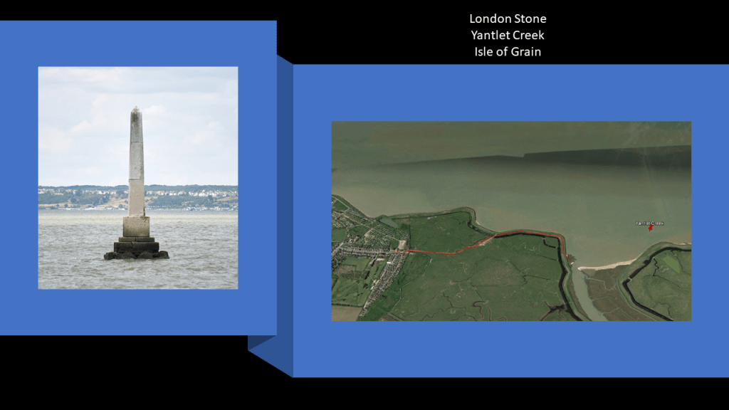
…and the Crow Stone at Southend-on-Sea.
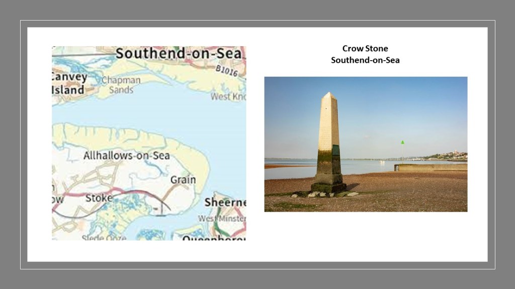
Together these two obelisks formed the boundaries which marked the seaward limit of the jurisdiction of the City of London, about 33.5-miles, or 54-kilometers from London Bridge, and were said to have been erected in 1837.
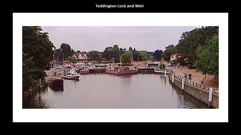
The western end of what is considered the Thames’ Estuary Tideway starts in southwest London at Teddington Lock and Weir, a complex of locks and a low-lying dam called a weir, was said to have been first constructed in timber circa 1810, and later strengthened with stone in 1859.
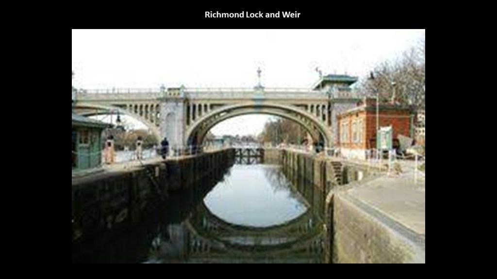
The Richmond Lock and Weir in southwest London on the Tideway was said to have been built between 1891 and 1894.
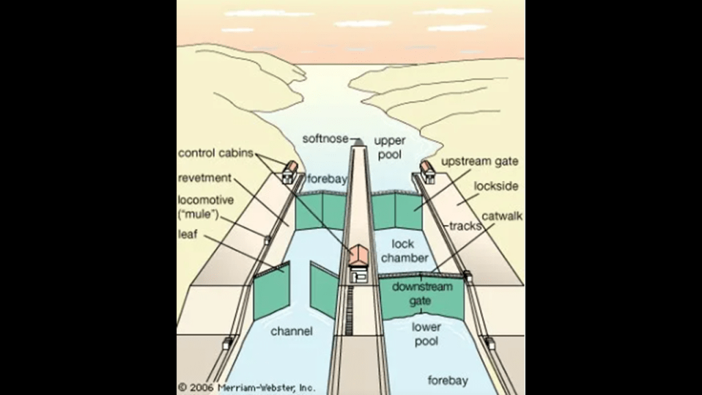
There are all together forty-five locks on the River Thames.
Locks are features of canals, which raise or lower the water for boats to travel through the canal.
So how far of a stretch is it to see these so-called river systems as man-made canal systems…
…try as they might to convince us of their origins in nature.
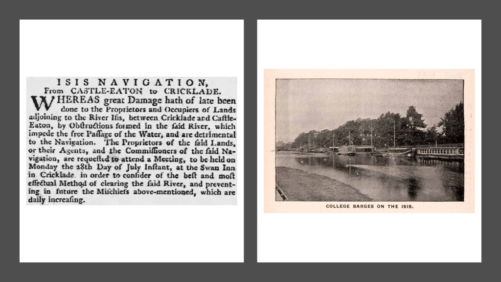
With respect to the obelisk markers at the eastern entrance of the Thames Estuary, it is noteworthy that another name for the River Thames is the River Isis, as mentioned in clipping from a 1777 Oxford newspaper on the left and a 1900 print on the right, also from Oxford.
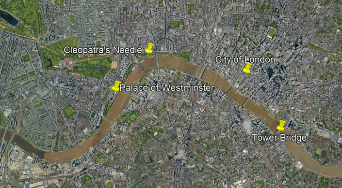
Come to think of it, there’s another obelisk in London on the River Thames/Isis.
Cleopatra’s Needle is between the Parliament buildings at the Palace of Westminster and the Tower Bridge.
This is what we are told about Cleopatra’s Needle in London.
It is one of three obelisks of the same name that we are told were transported from Egypt – the others are in Paris and New York City.
It is said to weigh 240 tons, or 480,000 lbs, or 218 metric tons, or 218,000, kilograms.
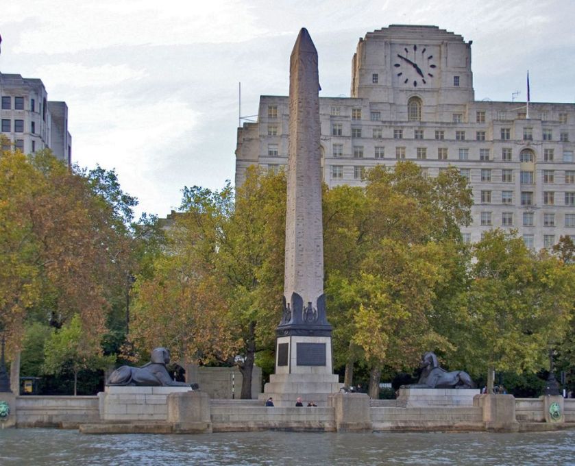
It was said to have been given to the government of the United Kingdom in 1819 by the ruler of Egypt and Sudan, Muhammad Ali, to commemorate the British victories in the Battle of the Nile (1798) and the Battle of Alexandria (1801).
The gift was initially declined because expense of shipping it to England.
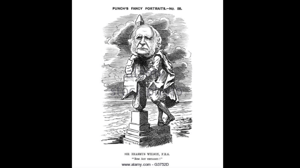
In 1877, one version of the story about how it got here says that Sir William James Erasmus Wilson, a distinguished anatomist, paid 10,000 pounds for the shipping of it.
Another version of the story saying the British public raised 15,000 pounds to have it shipped that year.
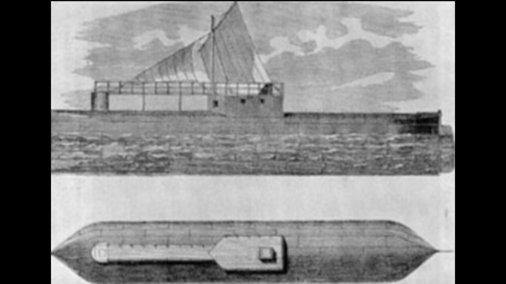
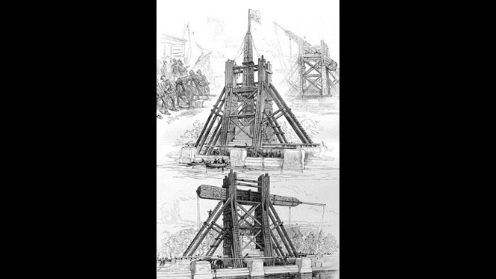
At any rate, It was said to have been dug out of the sand where it had been buried for 2,000 years, and a shipping container was made for it specifically – a 92-foot (28-meter) long and 16-foot wide (4.9-meter) iron cylinder which was pulled by tugboat.
It eventually made its way across the sea to London where it was re-erected on the banks of the River Thames.
What is harder to believe – obelisks weighing over 200 tons could be shipped via ocean transport to other countries, or, that they were already there?
One more thing in the River Thames Estuary before I go back to look at the Swan River Estuary in Western Australia, and that has to do with oyster beds.
I previously mentioned that the HMS Beagle was refitted as a Coast Guard watch vessel in Essex in 1845 in the navigable waters beyond the Thames Estuary, moored in the middle of the River Roach, until oyster companies and traders petitioned to have it removed in 1851, citing the vessel was obstructing the river and its oyster beds.
I am bringing this up because oyster beds, or reefs, are like coral reefs, and like I mentioned earlier in the Great Barrier Reef off the eastern coast of Australia, they attach themselves to a hard surface in the water to form a bed or reef, giving rise to the possibility there is indeed something hard underneath the surface of the water, like sunken infrastructure.
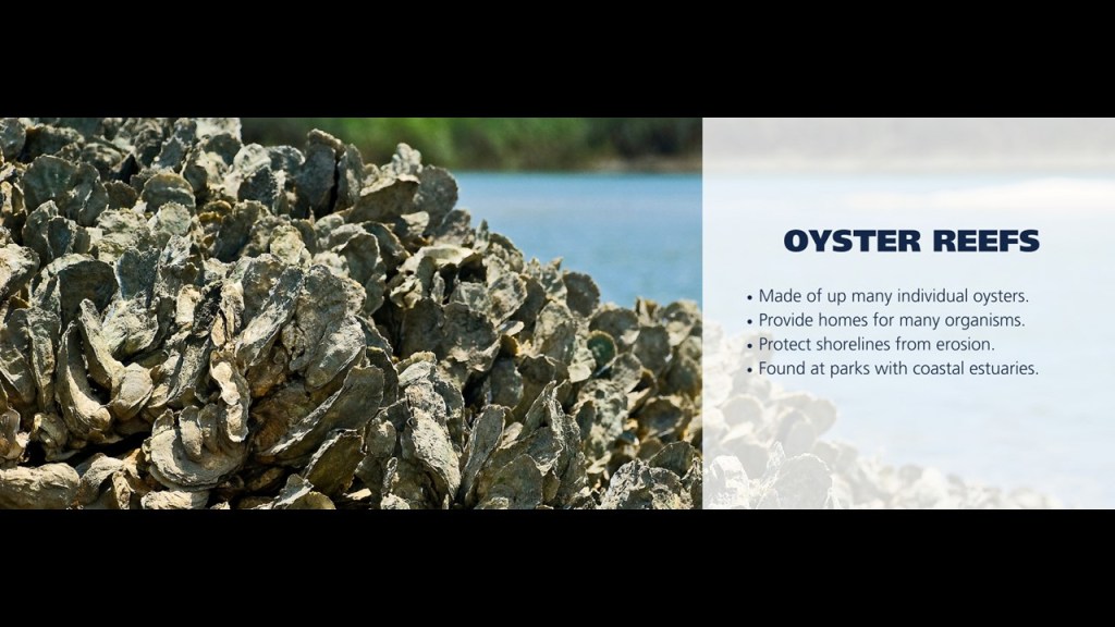
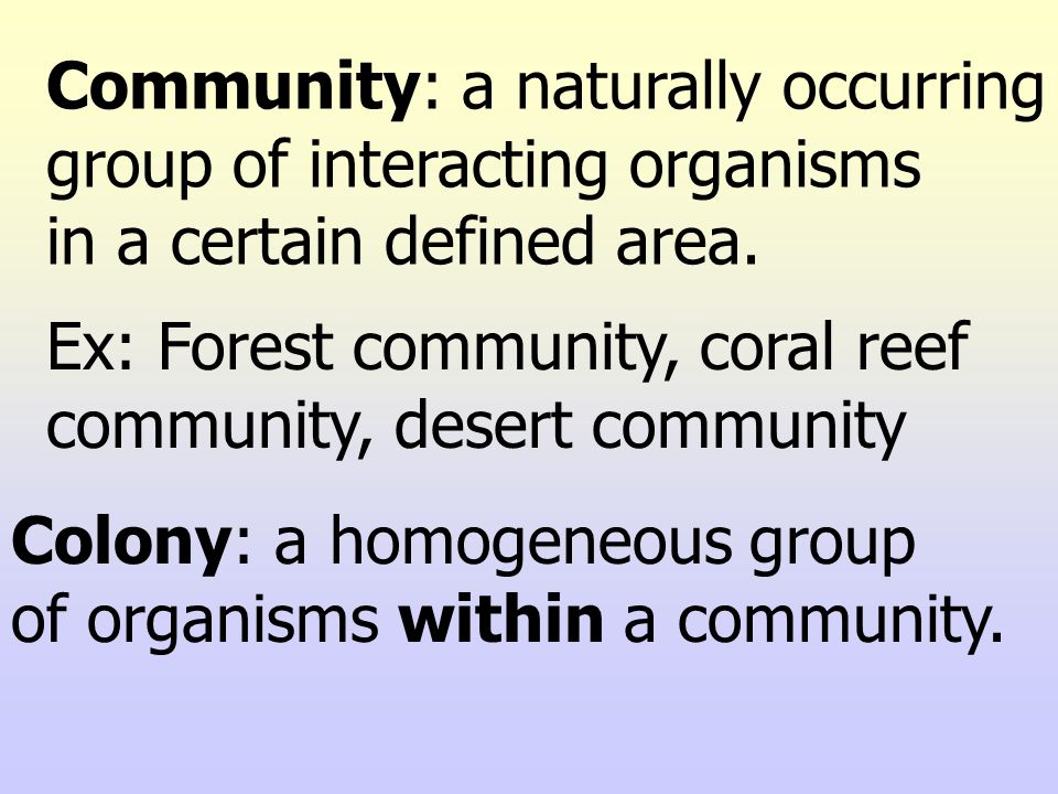
An oyster reef would be an example of anothe definition of a colony.
In biology, a colony is a homogeneous group of organisms in a community, which is a naturally-occuring group of interacting organisms in a defined area, like a reef community.
Now back to Western Australia and the Swan River Estuary.
The Swan River and its estuary enters this part of Western Australia from the Indian Ocean at Fremantle, where Fremantle Harbor serves as the the port for Perth.
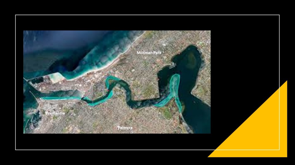
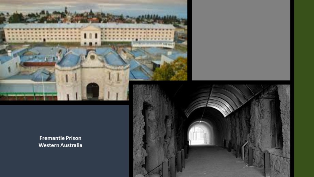
Interesting side-note that Fremantle became the primary destination for convicts, and that the solid masonry Fremantle Prison, said to have been built by convict labor in the 1850s, today is Western Australia’s only World Heritage Site.
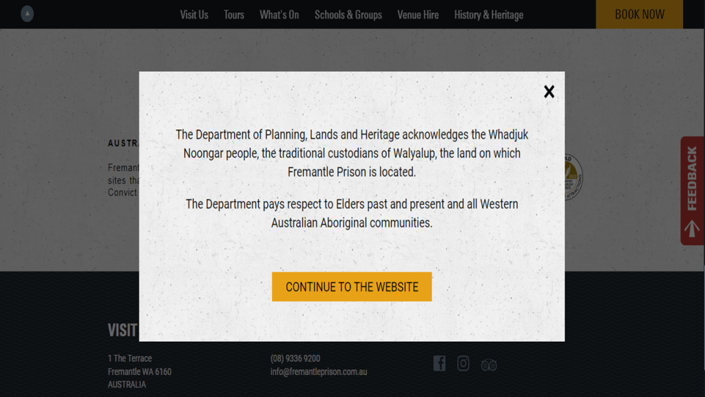
If you go to the main website of what is now a tourist destination, this message is the first thing that comes up, in which the Department of Planning, Lands and Heritage acknowledges that the Fremantle Prison is located on the traditional land of the Whadjuk Noongar, the people who have lived in this part of Western Australia for at least 45,000 years.
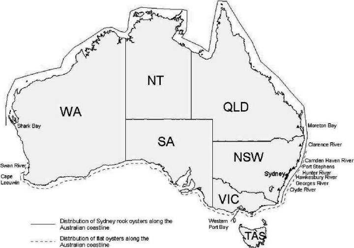
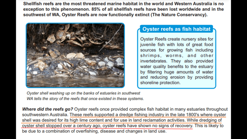
I will start with the subject of oysters, since that’s the subject upon which I left the Thames Estuary, and sure enough, I found this diagram showing the distribution of different kinds of oysters not only in the location of Swan River, but all around the entire coastline of Australia.
And yes, there were once abundant shellfish reefs here in the Swan-Canning Estuary, and they were systematically dredged for the use of the shells in mortar.
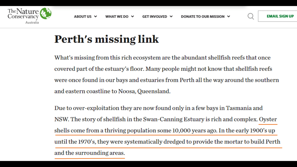
Oyster shells are high in lime content and they were also used in land-reclamation activities.
While this type of large-scale dredging has not taken place for over a century, these particular oyster reefs never recovered from it.
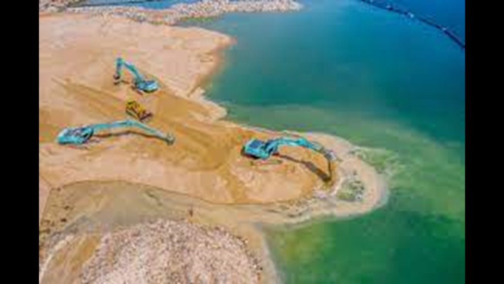
So let’s take a look at land reclamation.
What’s that?
Land reclamation is defined as the process of creating new land from oceans, seas, riverbeds or lakebeds.
Another way of putting this is creating new land by raising the elevation of a watershed or by pumping water out of muddy areas.
Land reclamation is also associated with resource extraction, and the process of restoring damaged land to its original state.
So since we have been talking about all of this marshy land, what about Perth?
Well, come to find out, much of the land between the Perth Business District and the Swan River shoreline was reclaimed from the 1870s until the 1960s.
This is from the “Explore Parks Western Australia” website about the “Swan Canning Riverpark.”
Like what we saw on the website of the “Department of Planning, Lands and Heritage” regarding Fremantle Prison, there is a statement here as well acknowledging the Whadjuk people as the traditional owners of the Riverpark.
So these offical statements are telling us that these original people of Western Australia are recognized by the government as owners of this land, and no one else.
This same web-page goes on to mention the reclamation that took place in Perth between 1870 and 1960.
It mentions that Perth was part of the “Mooro” family lands, a family group that was one of several families known collectively as the “Whadjuk.”
We even see the word “Moor” spelled out in the family name.
Also that Langley Park was on land reclaimed between 1921 and 1935, in the years between World Wars I and II, because of the need for more public open space near the city.
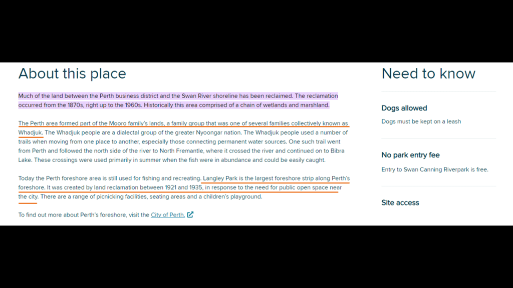
Langley Park is one of the biggest open spaces in Perth, running along Riverside Drive, and has even been used as an airstrip from time to time.
It is in the upper estuary of the Swan river, close to where the Narrows section delineates it from the lower, broader estuaries.
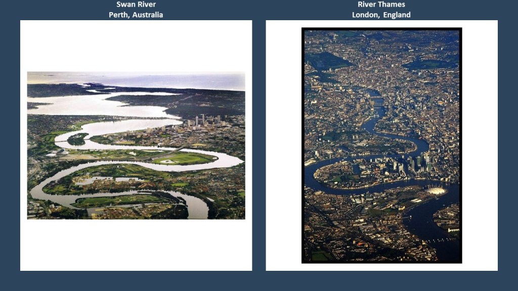
And here is a side-by-side comparison of the looping, narrow upper estuary of the Swan River going through Perth on the left, with the exact same looping of the River Thames going through London on the right.
What about the Swan River as a canal?
Here at the Matagarup Pedestrian Bridge, not far from Langley Park, which connects Burswood and East Perth, there are masonry banks visible.
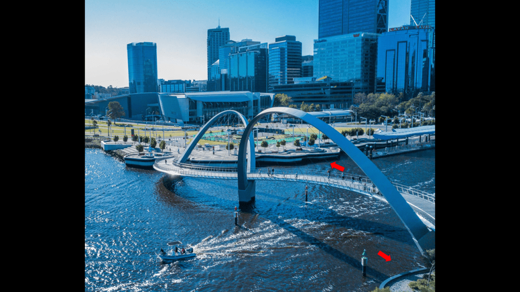
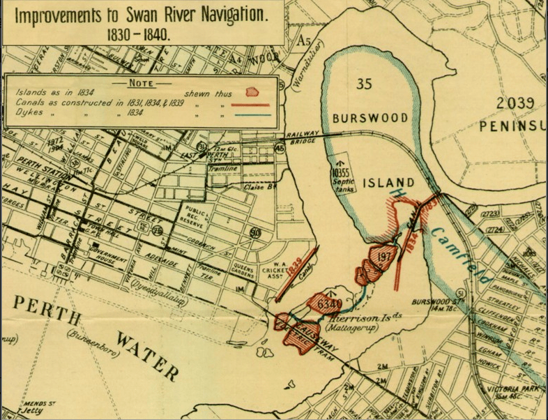
The only historic canal I can find a reference to on the Swan River was the historic Burswood Canal, which would have been in the vicinity of the Matagarup Bridge.
The Burswood Canal was said to have been one of the earliest public works projects in the 1830s in the Swan River Colony.
The map showing “Improvements to the Swan River Navigation, 1830 to 1840,” says it is showing us canals in red; dykes in blue; islands in 1834 are the red circles; and is also showing an electric tram causeway and railroad bridge.
I did find at least two dams near Perth.
One is the Mundaring Weir and Reservoir, a concrete gravity dam 24-miles or 39-kilometers from Perth.
Called one of the world’s greatest engineering projects, it was said to have been completed in 1903, and impounds the Helena River, a tributary of the Swan.
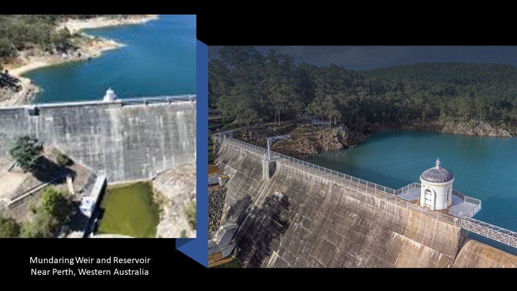
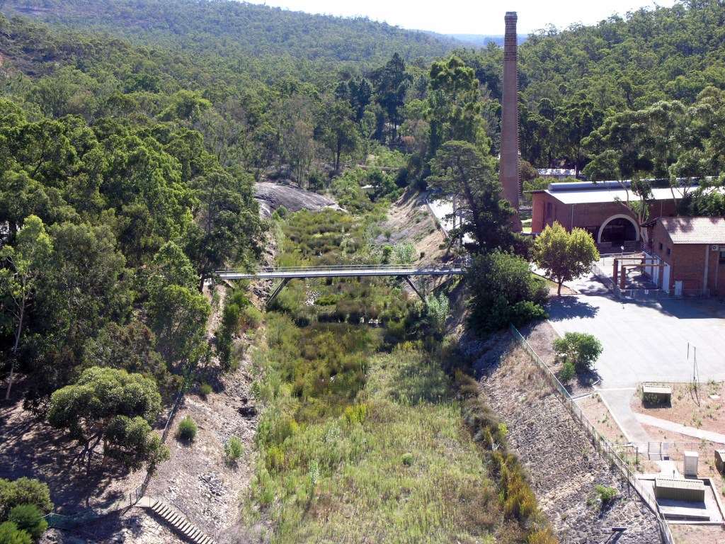
Here’s a photo of the Helena River at the Mundaring Weir, looking very canal-like wth it masonry banks.
Another is the Canning Dam and Reservoir, and a major source of freshwater for Perth.
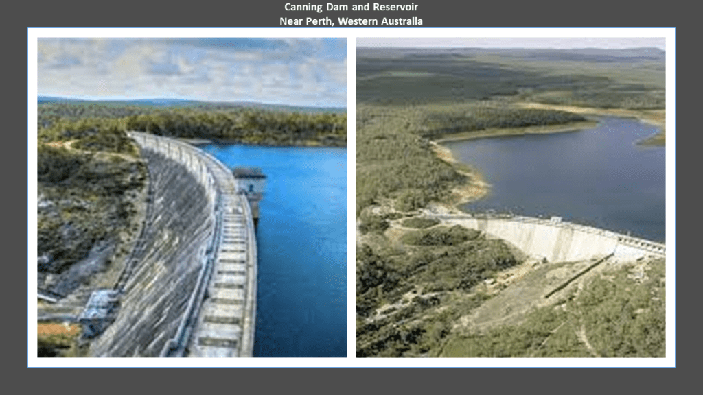
It was said to have been constructed between 1933 and 1940, so that would have been in the time-frame of the Great Depression, which had world-wide impacts, and the early years of World War II, which started in September of 1939, and when Australia entered the war.
What about obelisks in Perth?
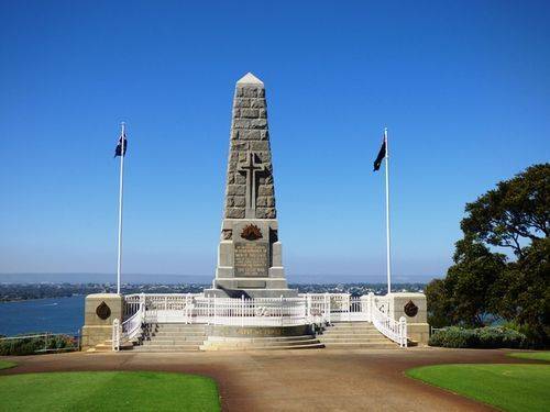
Well, like what we saw at the obelisk in Hobart in Tasmania, Perth’s State War Memorial is also an obelisk, and located in King’s Park.
It was said to have been unveiled in 1929 to commemorate those who died in World War I, and later wars were added.
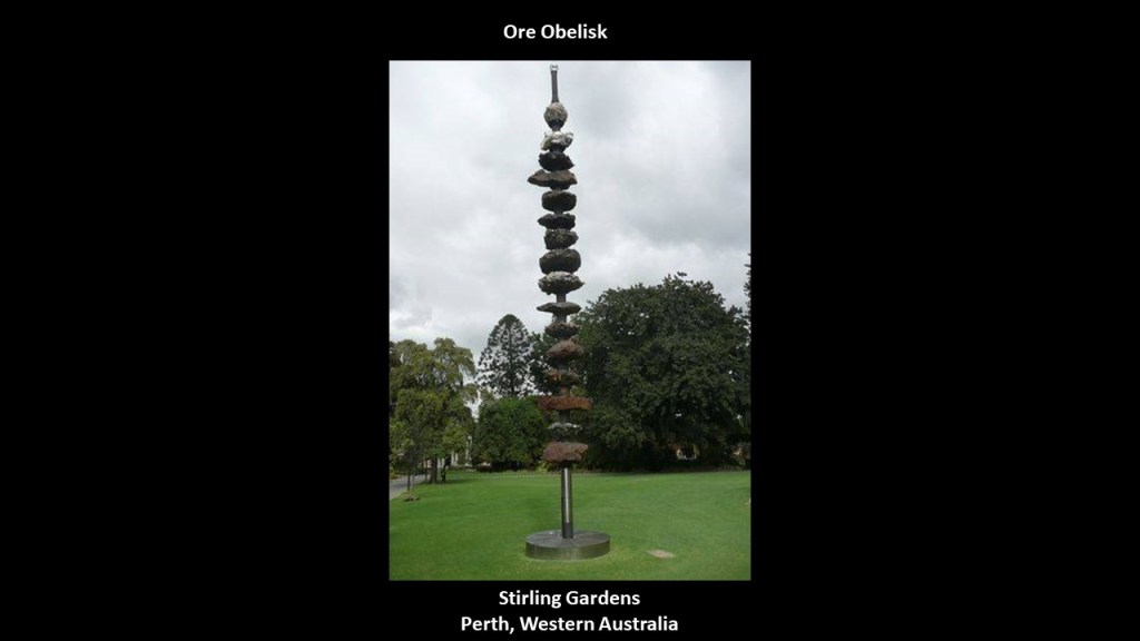
Perth also has an unusual obelisk called the “Ore Obelisk.”
Also known as the “Harmony of Minerals,” it was erected in 1971 in Stirling Gardens.
Not only, we are told, was it meant to be a symbol of the State’s progress, and a symbol of mineral expansion between 1960 and 1970 and the harmony of mining and the environment, it was also a celebration of the “millionth citizen” of Western Australia.
At the end of the day, I really think everything that has taken place in the New World Order has been all about “Mining,” and other resource extraction and exploitation for the maximization of profits and other uses, and the enslavement of humanity, whether physically, or economically, went hand-in-hand with this whole new system.
A cruel and barbaric system was put in place by the colonizers over the top of the original infrastructure, for things like resource extraction.
Examples of these practices abound, but another one is a relatively short-distance up the coast of Western Australia from Perth, in Ajana and the Ajana Mining District.
Forty-eight lead and copper mines once operated in the Ajana District.
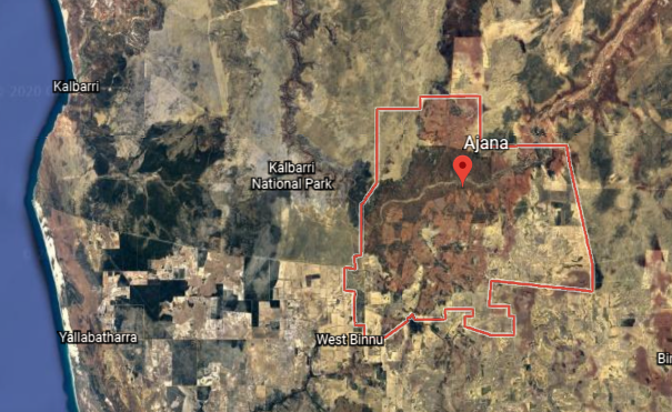
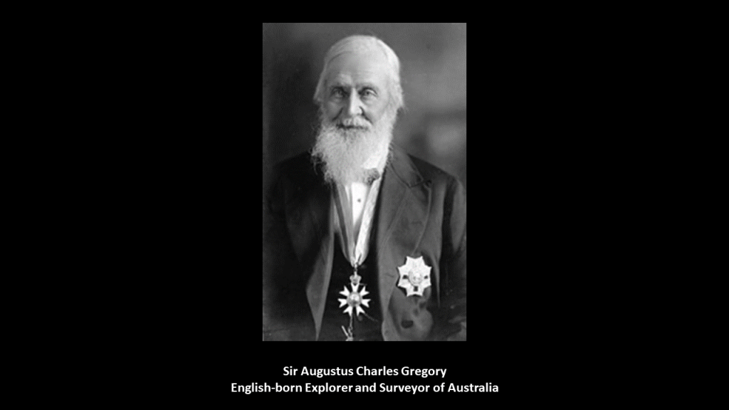
Sir Augustus Charles Gregory discovered the location of the lead outcroppings of what became the first mine there, the Geraldine Mine, in 1848.
Sir Augustus was an English-born explorer and surveyor of Australia.
The Geraldine mine was in operation by 1849.
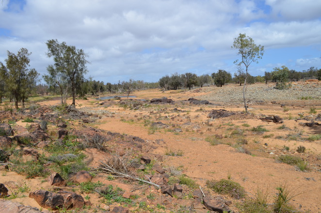
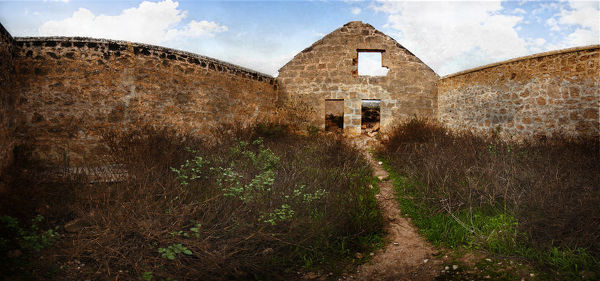
These are the ruins of what was called the “Lynton Convict Hiring Depot,” which provided the convict labor used to work the mine…
The buildings here were said to include a store, bakery, depot, well, lock-up, hospital, lime kiln and administration block that were said to have begun in 1853, and that no sooner were they finished in 1856 than the depot closed because of the harsh living conditions and transportation problems.
This is a cobblestone floor found at the Geraldine mine, said to have been where the convict miners broke up the ore…
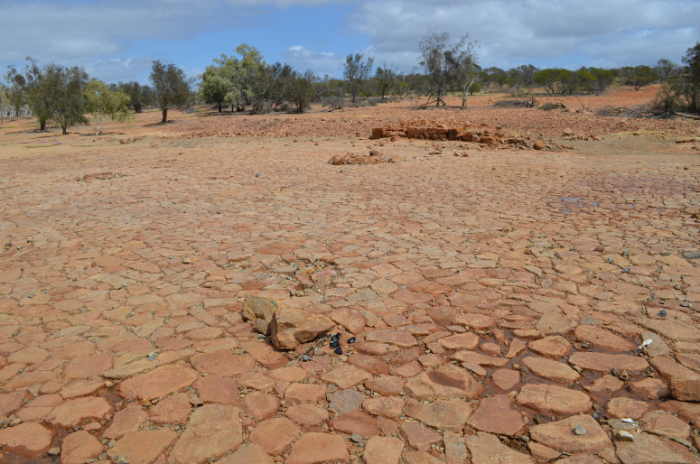
…to pick out the highest-grade galena, which is the primary ore of lead, and contains silver as well.
There’s one last place in The Kimberley that I want to take a look at before I end this post, in the northern part of Western Australia.
I have long been aware of the King George Falls in the Kimberley and Dry Falls in the “Channeled Scablands” Washington State.
I found them early in my research, probably in 2016 or 2017.
I was struck by how similar they look, with the double-fall configuration and flat landscape at the higher elevation.
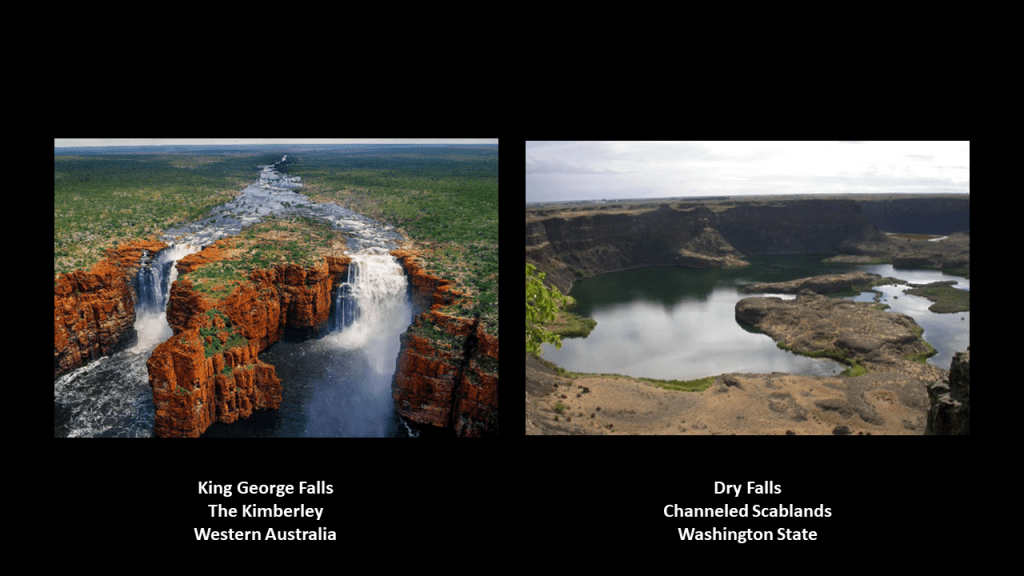
In the years since then, I have tracked many cities and places in alignment all over the Earth, and I have consistently found waterfalls all along these alignments.
Not only that, I have seen the same style of waterfall in different places around the world, and it looks like they had a selection of models of waterfalls to choose from, from small to large, and believe them to have a significant function on the Earth’s Grid system.
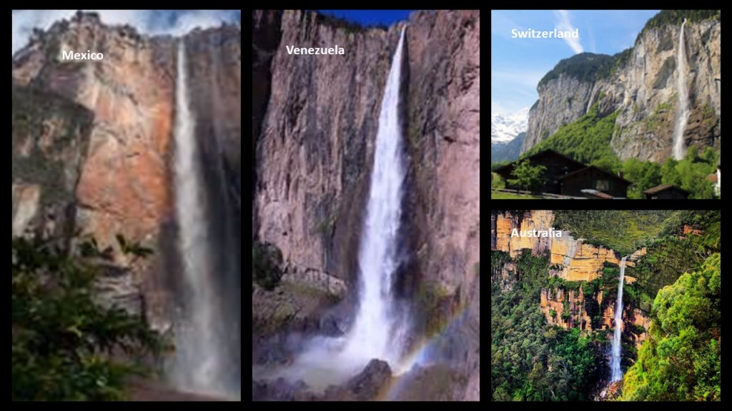
I am going to say in conclusion, after presenting a great deal of comparative information from a variety of places all over the Earth, that I firmly believe Australia’s ancient people were in fact the builders of Australia’s high civilization, and that they were one and the same as the original, ancient people the world over who were the builders of the same high civilization that existed all over the Earth, that goes by many names – Moorish, Atlantean, Aryan, Egyptian, Israelite, Islamic, Tartarian, to name a few.
All names for the same civilization that existed on Earth from ancient times to relatively modern, and their Moorish Science symbolism was taken over and given different meanings that were not the original meaning.

Then, after what I believe was a relatively recent cataclsym that was deliberately caused by an energy manipulation of the Earth’s grid system, causing worldwide devastation and the formation of swamps, marshes, and deserts, and the sinking of entire landmasses, the elitist European colonizers behind all that has taken place here came into this post-cataclysmic world, and imposed a completely new system and control matrix designed to only benefit the few and not the many.
All of this has directly brought us to the strange world we live in today, where everything is turned upside-down and inverted, and what we are told to believe by the Establishment nowadays makes no sense because they don’t care about Humanity in the slightest except for what they can take from us.

One thought on “Who were the Aborigines of Tasmania & Australia – Were they Hunter-Gatherers…or the Builders of its Civilization?”