
In the last post, the circle alignment starting in Merida was shown going across Northeast Greenland, the North Pole, and Siberia, which is the Russian Far East. In this post, I will take you on a journey in this post following the alignment over Pacific Island groups.
The alignment enters the Bering Sea from Apuka in the Russian Far East and crosses the Near Islands (Attu, Agattu & Shemya). The Near Islands are the westernmost of the Aleutian Islands, located close to the International Date Line, and closer to Russia than mainland Alaska.
Shemya Island is the home of Eareckson Air Force Base, and is currently the only inhabited Near Island. Attu had a U. S. Coast Guard Base until 2010.
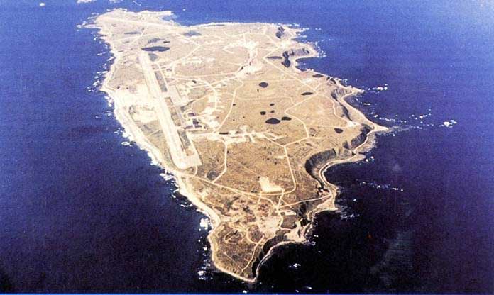
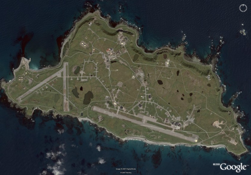
Here are some views from around Shemya:
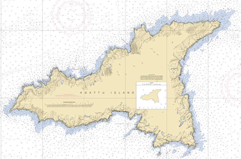
An aerial view from a different angle showing the interesting outlines and shape of the whole island from directly above…
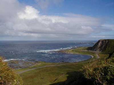
A nice shaped shoreline…
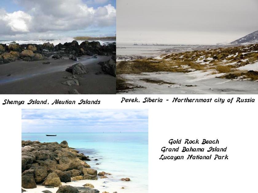
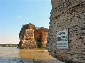
…how about these blocky rocks on the beach of Shemya, compared with those on the beach of the East Siberian Sea at Pevek on the northern coast of Siberia, and those on Gold Rock Beach on Grand Bahama Island…
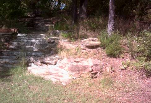
…and what looks curiously like ancient masonry in the lower right foreground of this nicely flat-topped cliff-edge right up next to the coast of Shemya. Also what looks like green turf coming down over the edge looks kind of strange, almost carpet- or blanket-like.
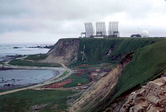
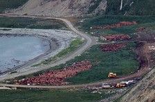
And those rocks on the ground below near the water look like red rocks to me, but I can’t get a close-up of them that clearly shows this.
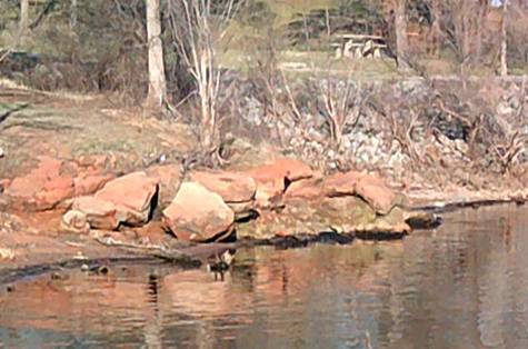
Red sandstone is another building material of the advanced ancient civilization. Here a just a few of many, many examples. It’s just not called masonry. People assume it’s natural because they haven’t been taught anything else.
Red sandstone like you see here at Lake Arcadia in Edmond, Oklahoma;
at Boiling Springs State Park outside of Woodward, Oklahoma;
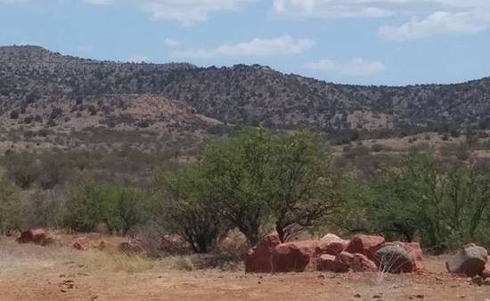
In Cornville, Arizona, near Sedona;
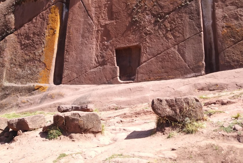
Here at Amaru Muru near Lake Titicaca in Peru;
And the red rocks you see here that are part of this roadway bridge at Twin Lakes in Bethel, Oklahoma.
This is a photo of Agattu Island taken from Shemya.
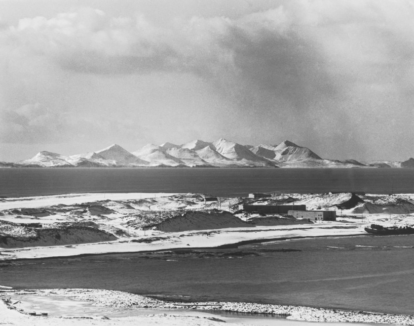
Agattu is one of the largest uninhabited islands in the Aleutians. It has a land area of 85,558 square miles (or 221.9 kilometers squared).
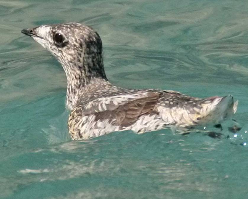
There is not a lot written about this uninhabited island in the Bering Sea. You can find written information from the Audubon Society about its seven large seabird colonies of different kinds of birds, numbering in total population an estimated 66,000 birds.
This is a Kittzlitz Murrelet, a rare species found on Agattu.
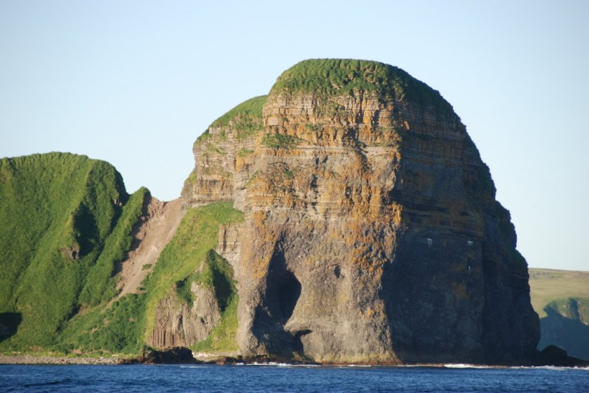
It is also described as a volcanic island, with rugged fjords and high cliffs on the coast.
So, let’s take a closer look at the rugged cliffs and high fjords of the coast of Agattu Island, and see what we find.
Well, here’s a feature that looks like the ruins of an ancient wall. It reminds me of…
…Hell’s Gate at Possum Kingdom State Park, a little ways west of Ft. Worth, Texas. Shown here is the are huge-wall-like structures surrounded by the waters of the lake that exists there now, compared with how it looked before the lake was created. I know for a fact the creation of artificial lakes is one of the ways they used to hide ancient infrastructure, as there are many examples of this once you know what the deal is – hiding an ancient advanced civilization that was global in plain sight, and creating a water supply at the same time. Two birds with one stone.
 Here is Hell’s Gate from another angle, showing more evidence that this is a built structure.
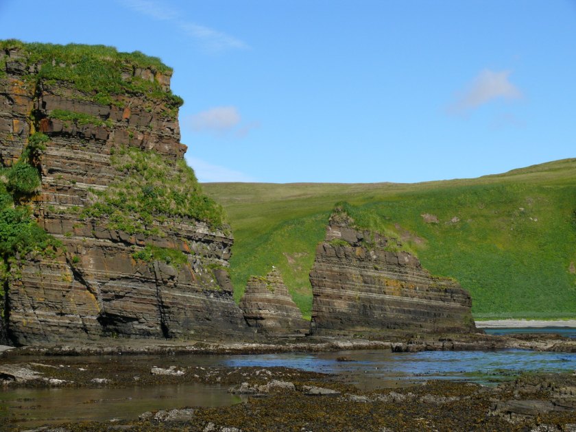
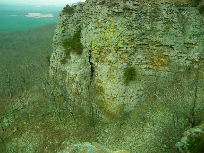
This is another feature found on Agattu’s coast. It immediately brought to mind…
…this feature at Mount Magazine State Park in Paris, Arkansas. This is part of Cameron’s Bluff, and going to this place in person in the fall of 2015 marked the beginning of my putting all of this together by cracking the cover-up code words of how language was used to hide things by leading us to believe things like this are natural features. A bluff, meaning a high cliff, is a bluff, meaning a false display in order to deceive someone.
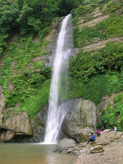
Lastly, this waterfall on Agattu, one of the westernmost of the Aleutian Islands in the Bering Sea, reminds me of…
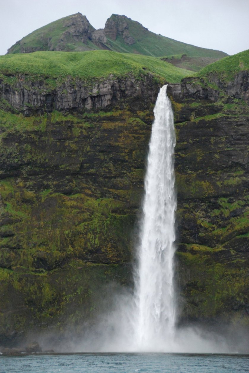
…the MadhabKunda waterfall, one of the highest waterfalls in Bangladesh.
Attu Island is the largest of the Near Island group, and so far west it is in the eastern hemisphere, and the westernmost point of land relative to Alaska. The island is protected as one of the National Parks Trust Territories, and has few visitors as it is restricted.
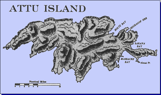
Attu Island is the site of the only land battle in North America during World War II.
The Japanese Army bombed and occupied Attu Island, as well as Agattu and Kiska Islands, in June of 1942. It was a strategic location for both Japanese and the American forces.
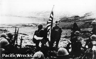
American forces retook the islands during the Aleutian campaign starting on May 11th, 1943, and lasted several weeks.
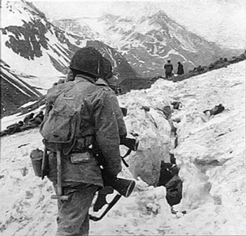
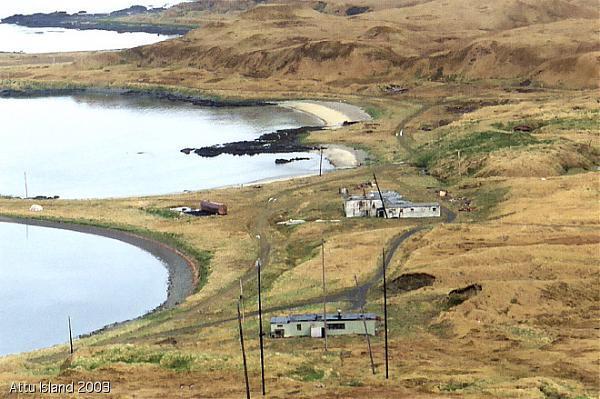
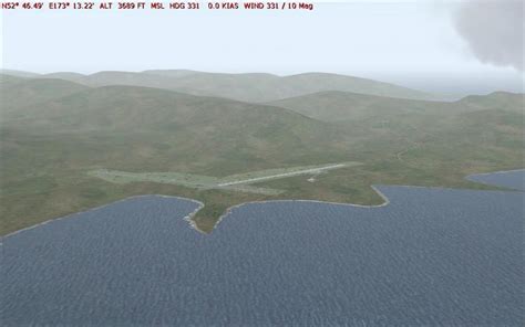
There was an operational U. S. Naval Station, then Coast Guard Station at Casco Cove on Attu from June of 1943 until August of 2010. The airfield located there can still be used for emergency landings.
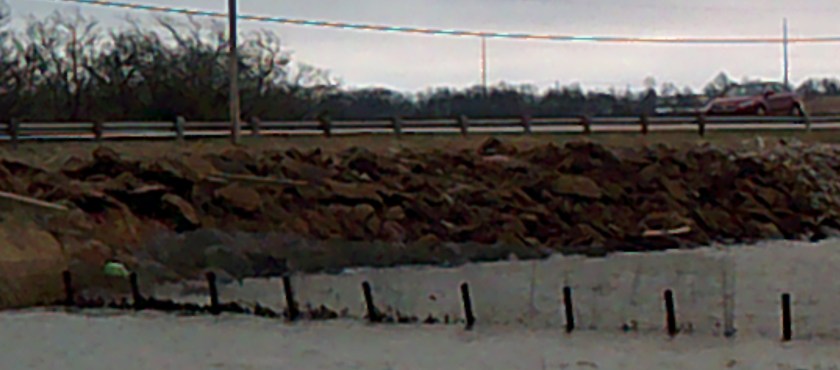
These are the original buildings of the- station, with its blocky rocks in the foreground:
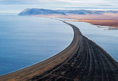
And this is the Coast Guard Station that was closed 8 years ago, beside a shaped shoreline:
Here’s another view of the same shoreline…
…and here is another shaped shoreline on Attu, reminiscent of the shape and appearance of…
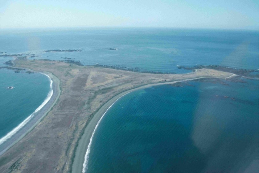
…Cape Blossom on Wrangel Island off the northern coast of Russia.
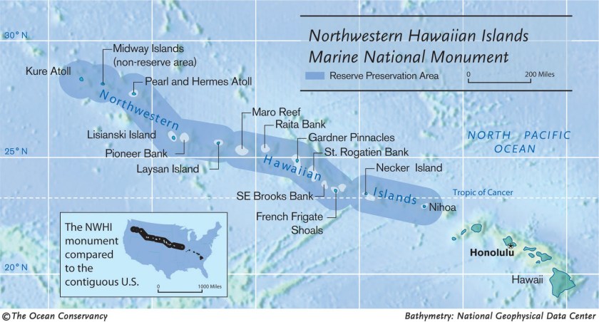
Moving along on the alignment in a southerly direction in the Pacific Ocean from the Near Islands, I am going to make mention of what are actually considered the Northwestern Hawaiian Islands – Midway and Kure Atolls, the most northerly coral atolls in the world. While not directly on the alignment, these places are definitely in the general vicinity, and on other planetary alignments as well. Actually, I have found World War II battle sites all over these planetary gridlines.
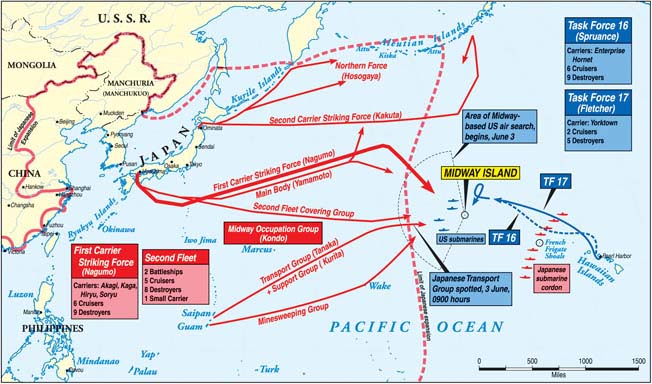
In the same coordinated campaign in June of 1942 that led to the Japanese occupation of Attu and Agattu for almost a year, the Battle of Midway brought about the sinking of four Japanese warships, and downing of hundreds of Japanese planes in the Battle of Midway. It was a turning point for the Allied Forces of the war in the Pacific.
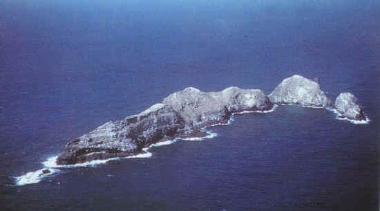
The alignment did cross Necker Island, also part of the Northwestern Hawaiian Islands.
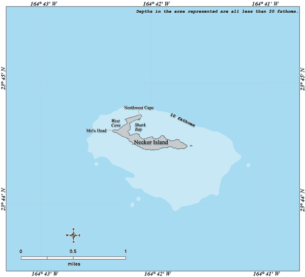
Necker Island is a relatively small island with over 30 stone temples and shrines. These have been studied by archeoastronomy experts for astronomical alignments. This is a shrine on Necker Island…
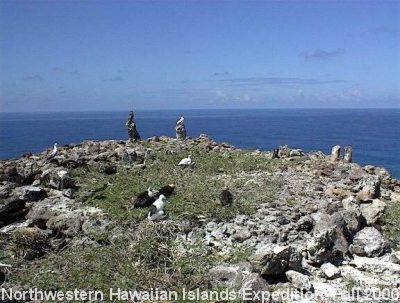
…and a sketch of a temple platform there.
The center of the island is located at almost exactly the latitude of the Tropic of Cancer in the year 1000.
From Necker, the alignment crosses the Hawaiian island of Kauai.
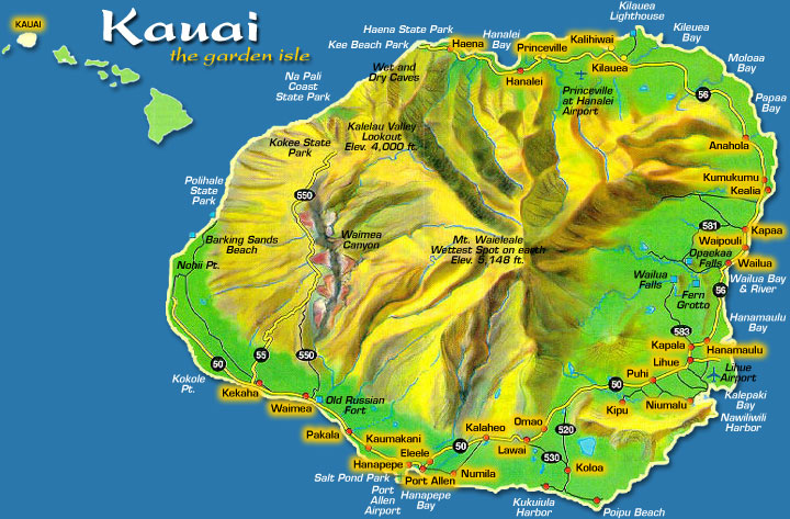
It is called the “Garden Isle,” and is considered the oldest of the main Hawaiian Islands.
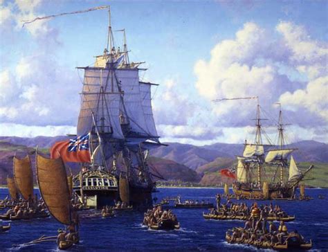
British explorer, Captain James Cook, is said have been the first European to arrive at Waimea Bay on Kauau in 1778.
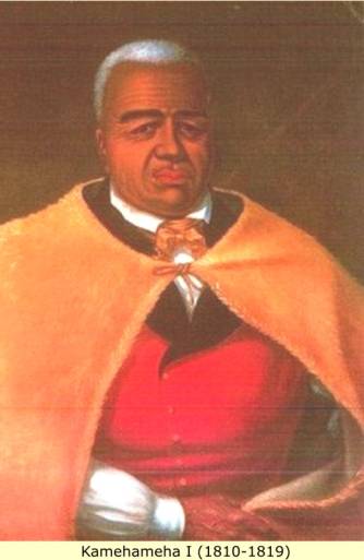
This is a painting of Hawaiian King Kamehameha I. He was the founder and first ruler of the Kingdom of Hawaii, which originated in 1795, but became official when the whole Hawaiian Archipelago became unified in 1810.
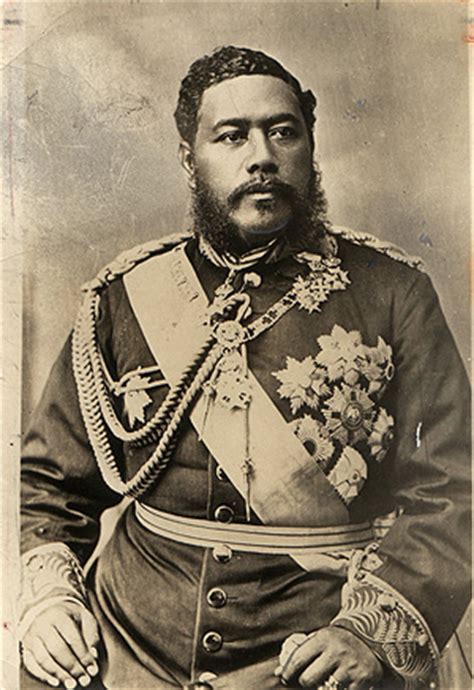
And this is King Kalakaua, the last elected Monarch of the Kingdom of Hawaii. He lost his absolute power in 1887 when he was forced by Hawaiian elites to accept a constitution that provided for a constitutional government.
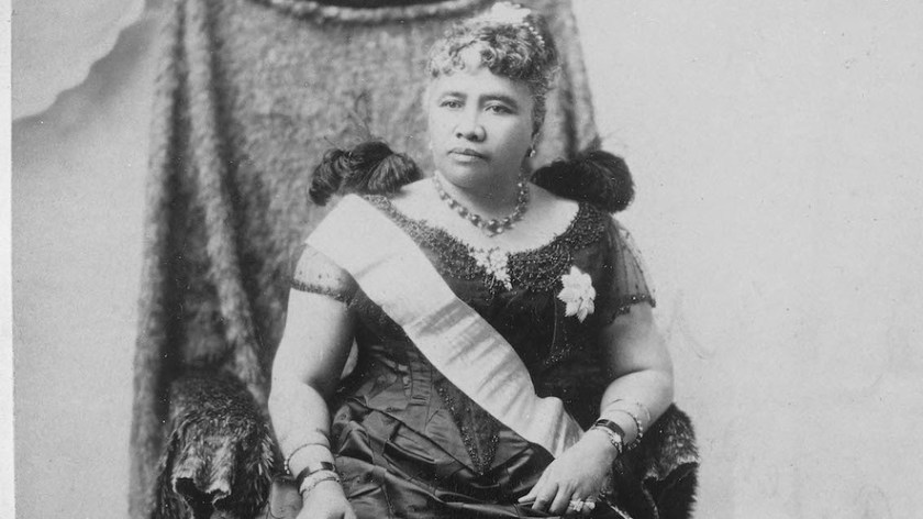
The Kingdom was overthrown in 1893 under Queen Lili’uokalani, and the Republic of Hawaii was annexed at a Territory by the United States in 1898.
Let’s do a quick tour of some interesting places on Kauai.
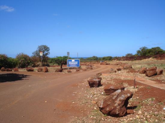
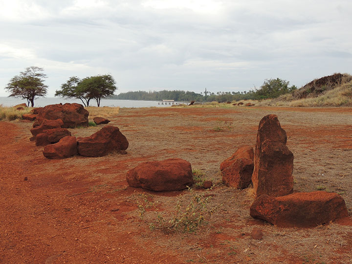
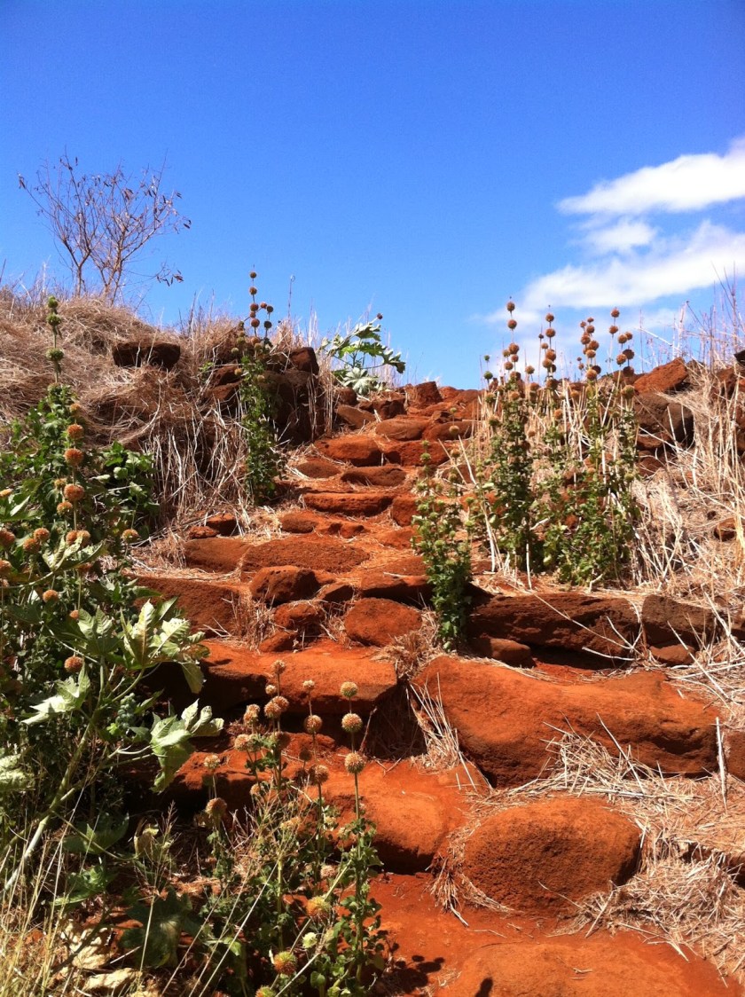
I noticed on the above map a place called the Old Russian Fort. Sounded kind of suspicious to me, so I looked it up, and this is what I found. All of these are on the grounds of the Russian Fort Elizabeth State Historical Park. It is on the coast of Kauai, southeast of the city of Waimea. Remember the red rocks I showed you earlier? Well here are some more….
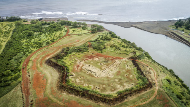
And this is the Old Russian Fort itself. It looks very much like a star fort to me. Star configurations similar to this are found all over the world.
This is Waimea Canyon, called the Grand Canyon of the Pacific. The canyon has red soil, and notice the shaped red rock in the foreground. I have found that canyon is cover-up code word also, just like bluff.
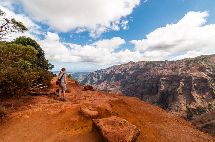
Here’s another view of the canyon. It is 10 miles long, and up to 3,000 feet deep. And yet another waterfall, similar to the one we saw earlier…
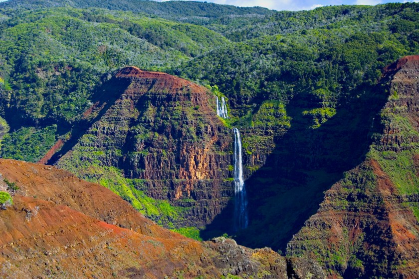
…on Agattu Island.
Before leaving Kauai, just wanted to show you some pictures of Na Pali Coast on the northwestern shore of Kauai. Interesting pointed peaks, and a stone formation in the foreground there on the coast…
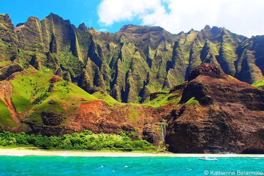
…that kind of looks like what we saw on the coast of Agattu Island.
I am going to end this post here, and in the last post of the series, will pick up the alignment on the island of Oahu and complete the circle in Merida, Mexico.
