
I am going to share with you several series of circle alignments that I found. This is the first series involving Merida, Mexico. The next complete series will be a circle alignment involving Amsterdam Island, in the French Subantarctic Islands; and the last series will involve Algiers, Algeria.
This is somewhat different from the global planetary alignments I have previously shared in “How I Found the Silk Road” and “History Reads Like a Book on the Planetary Grid.”
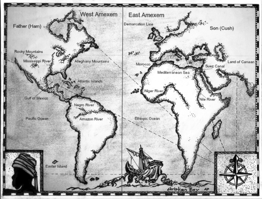
From the work I have done thus far, I have reason to believe this global civilization was aligned with itself on a Flower of Life pattern, with the same characteristics that appear to be bringing the heavens to earth, and aligning earth with the heavens.

The process of doing this work has opened up for me an awareness of a suppressed advanced ancient global maritime civilization which existed up until relatively recent times and the missing positive timeline of Humanity.
Throughout my blog, I go into depth regarding what I believe about this civilization – what I am calling the Muurish/Moorish/Israelite Empire; what happened to it; and provide compelling evidence as to why I believe this.
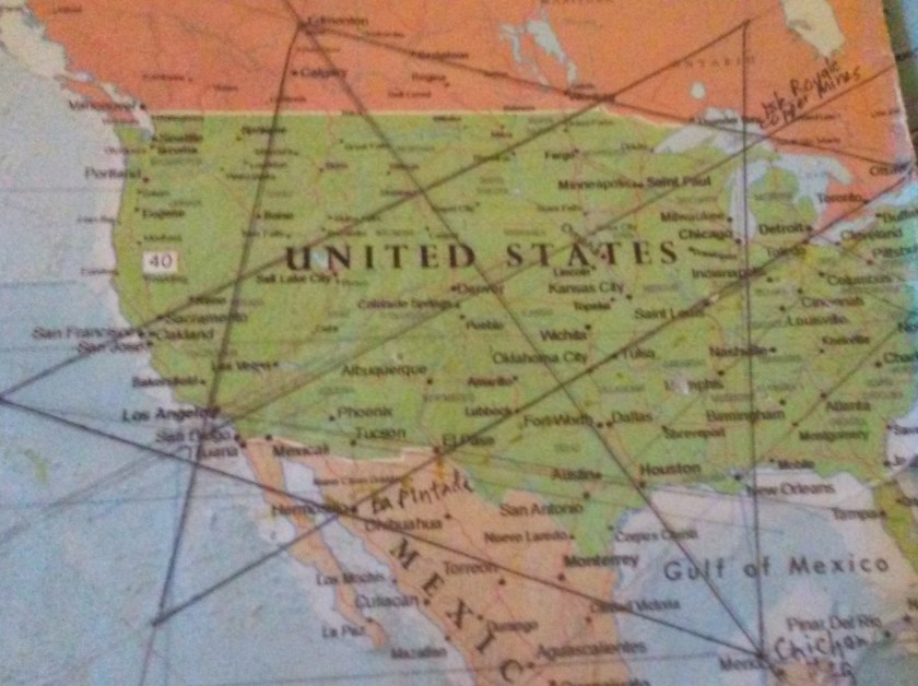
I found this star tetrahedron in early 2016 on a map that had been given to me. I had started to notice that major cities lined up in lines in North America. I found a familiar figure of sacred geometry when I literally started connecting them. I believe it is the terminus of a worldwide grid.
I extended the lines out, and eventually switched to a globe. I used a magnifying glass and wrote down the cities that lined up. I found them lining up primarily in linear or circular fashion.
I have gotten an amazing tour of the world of places I had never heard of with remarkable similarities across countries.
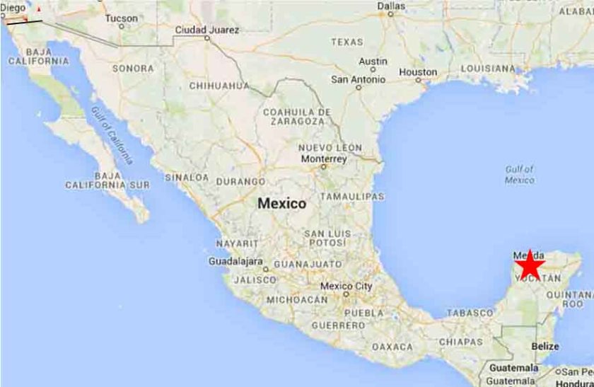
In this series I am going to share with circular alignments I found while tracking alignments emanating from the North American Star Tetrahedron. The first series concerns a circle alignment involving Merida, Mexico which is the southern apex of this star tetrahedron:
Merida is the capital and largest city in the Mexican state of Yucatan.
Some historians consider Merida to be the oldest, continuously occupied city in the Americas.
It has one of the largest historic center districts in the Americas, after Mexico City and Havana, Cuba.
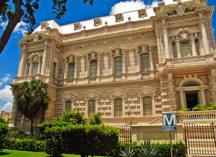
The top photo shown here is the Merida Natural History Museum. For comparison of the similar use of columns and heavy masonry in particular in the architectural style in different places…
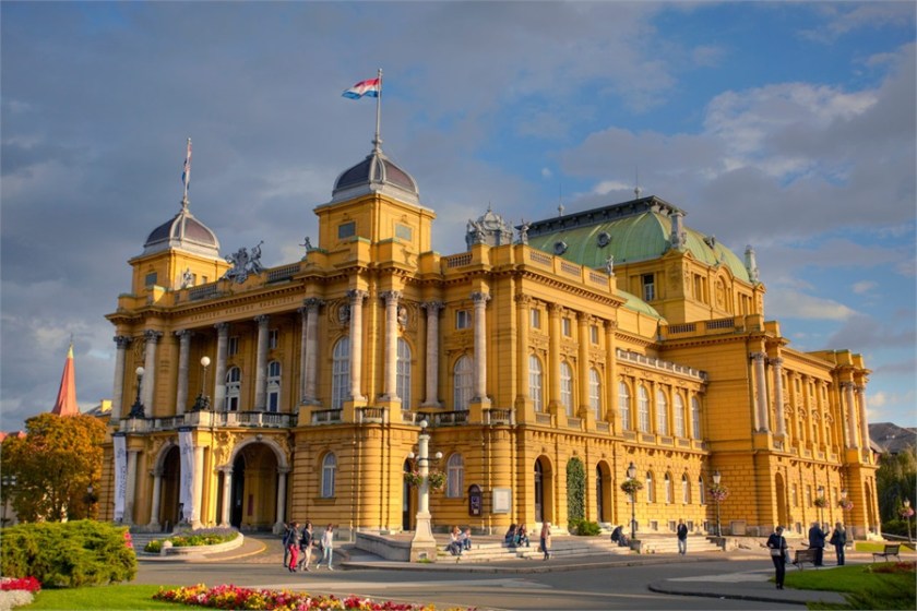
…Like that of the Prigorje Museum in Zagreb, Croatia with its second floor double columns and similar style roof in the background to the museum in Merida…
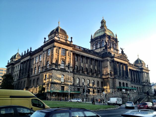
…and this museum in Prague in the Czech Republic with its ornate columns and heavy masonry, and the same style of domes in the foreground to the museum in Zagreb.
While not identical architecture, I find it very compelling in support of an advanced ancient worldwide civilization to have so many statistically significant similarities on different continents in different countries. More examples to come!
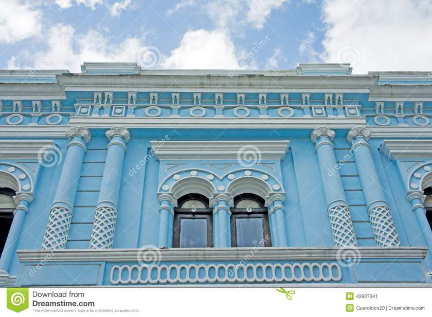
Here’s a historic blue building in Merida’s Centro Historic District. Except for the pastel blue, and creative designs of the building, the columns we see here and in the previous pictures remind me of what could be termed in our present reality classical Greco-Roman architecture.
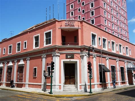
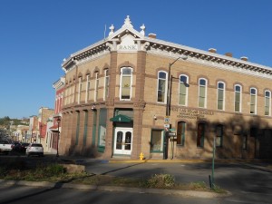
Here is a comparison of the same street corner style architecture – that I have seen all over the world – of hotels. This one is in Merida, Mexico;
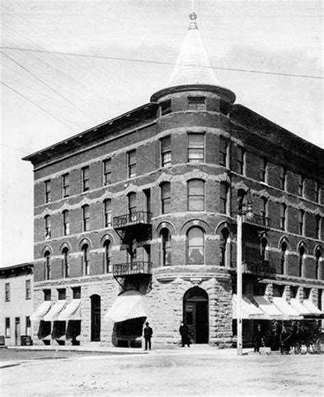
The Plaza Hotel in Roswell, NM;
and the Alberta Hotel in Edmonton, Alberta.
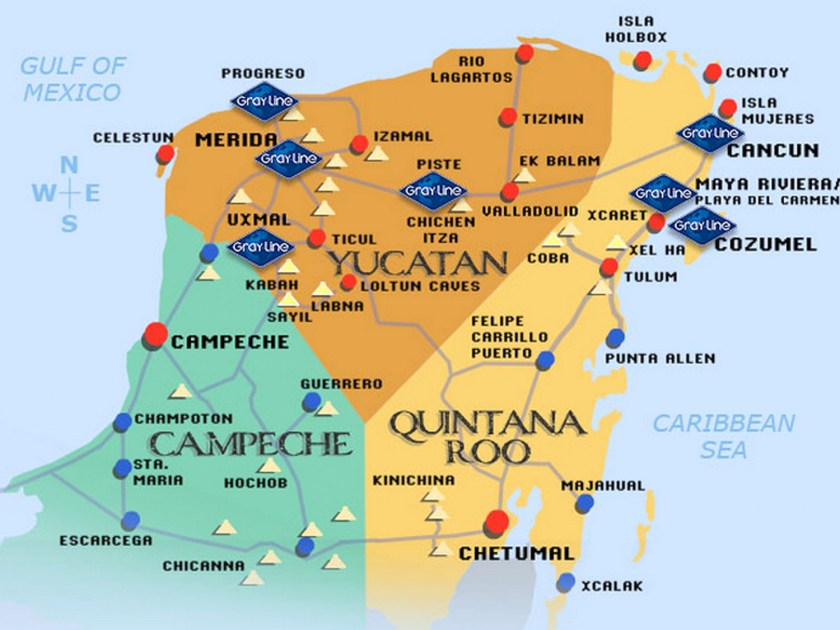
This whole area in the Yucatan Peninsula is filled with major Mayan sites, including Chichen Itza, Coba, Tulum, Uxmal, to name just a few. I counted 29 ruin sites on this map of the Yucatan, and I have found Merida connected to many planetary alignments. To my knowledge, it is not considered a primary nodal point of the planetary grid, but it certainly appears to be a place of great significance on the grid.
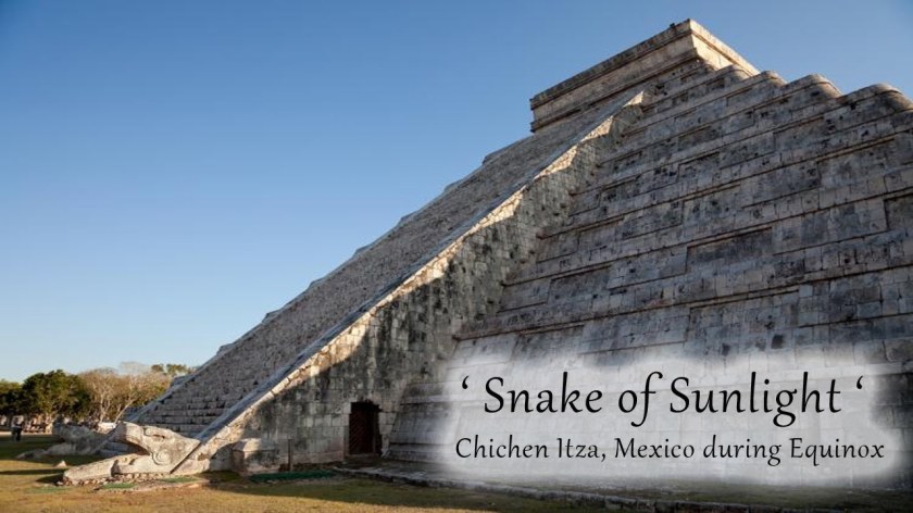
The Chichen Itza temple complex is the best known.
This is the Kukulkan Pyramid, elected as one of the Seven New Wonders of the World in 2007.
Every year, at the time of the Spring and Fall Equinox, on both sides of the north stairway of what is also called the Castle of Chichen Itza, there is a solar projection of a Serpent of Light, consisting of seven inverted triangles of light. There are two serpent heads carved into the bottom of the stairway, completing the serpent imagery.
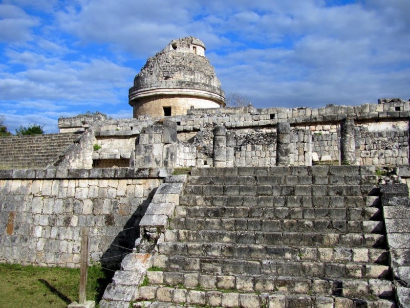
The Caracol Observatory is part of this temple complex. Twenty sight lines of 29 astronomical events (equinoxes, solstices, eclipses, etc) can be found here, and that is what is known about since a portion of the observatory is missing.
Next shown are of the ruins at Coba. Archeologists believe that Coba is one of the most important ruin sites on the Yucatan Peninsula. This is the main pyramid, called Nohoch Mul. This site is believed to have a different design and purpose from other Mayan sites.
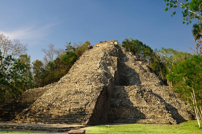
It is surrounded by two lagoons. The Coba site remains largely unexcavated.
Tulum is called a Pre-Columbian walled city that served as a port for Coba.


Tulum is built on a bluff (which is a cover-up code word for the handiwork of the Ancient Civilization) facing the rising sun, and is the only Mayan temple complex built on a Caribbean beach, and is surrounded by on three sides by a wall. It was the primary location for the Maya’s extensive trade network, both on land and sea. It was also thought to be religious center.
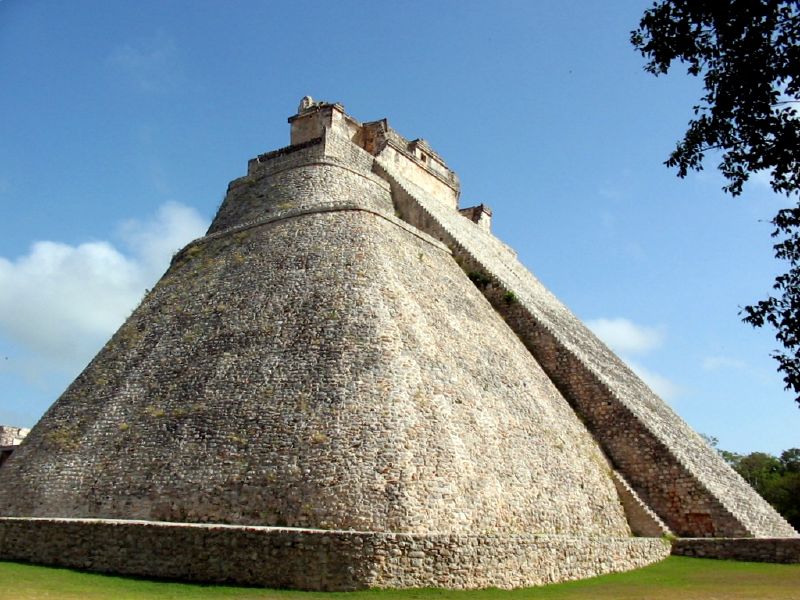
Uxmal is also considered one of the most important and beautiful Mayan sites. This is called the Temple of the Magicians. It is the tallest structure in the complex.
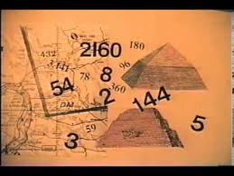
Through the work of Drunvalo Melchizedek, I became aware of Carl Munck’s work in 2010. He wrote a book entitled “The Code” and published a series of videos based on the book.
I watched the videos, and learned about his work introducing an ancient pyramid matrix in which monuments around the world encode their exact positions with respect to longitude, latitude, and each other. Uxmal was one of several of the pyramids he decoded with respect to this pyramid matrix.
Next the alignment crosses Key West, Florida.
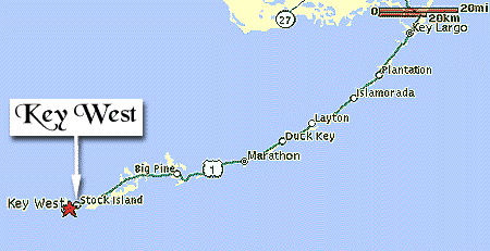
Key West is the southernmost city in the contiguous United States, and the westernmost island connected by highway in the Florida Keys. Note the shaped and protected harbor, which is just like what is seen at other islands world-wide.
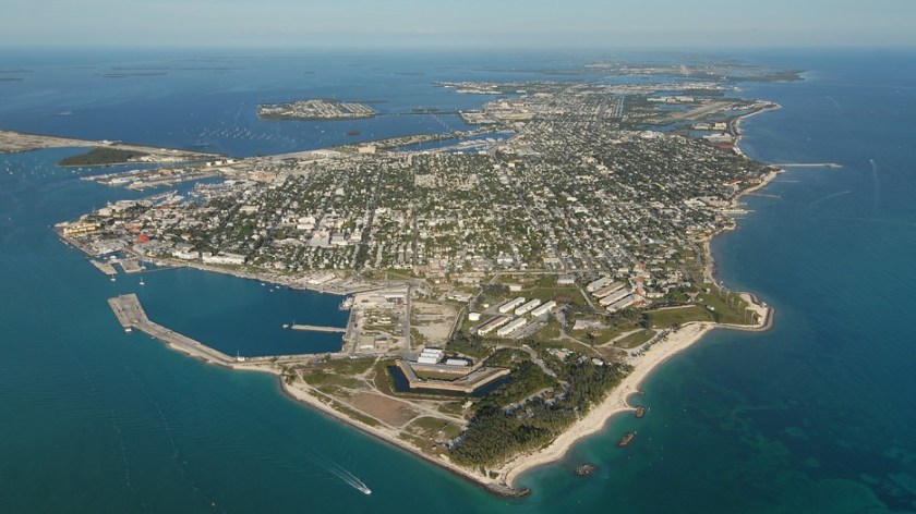
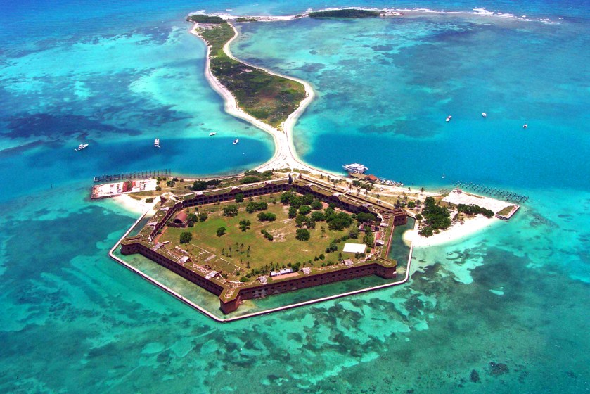
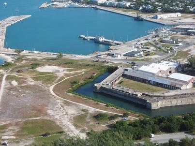
Dry Tortugas National Park, a star fort on an island called Ft. Jefferson, lies further west of Key West, and is only accessible by ferry or boat.
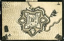
I have talked about Star Forts in previous posts. They are found around the world, and I want to give you more examples of how they are everywhere. While in many cases they have been turned into military/defensive structures, there are many indications that the original intent of these beautiful structures was not for military use or defensive in nature, and had perhaps instead some kind of energy function. These represent a sample of many, many examples.
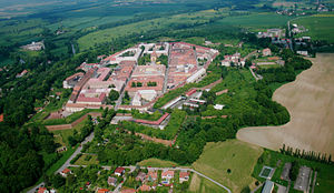
This is Karlovac in Croatia;
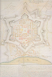
The Josefov Fortress in the Czech Republic;
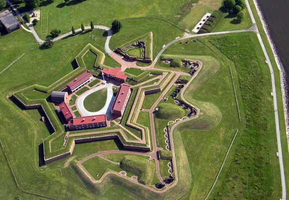
Fort McHenry in Baltimore, Maryland;
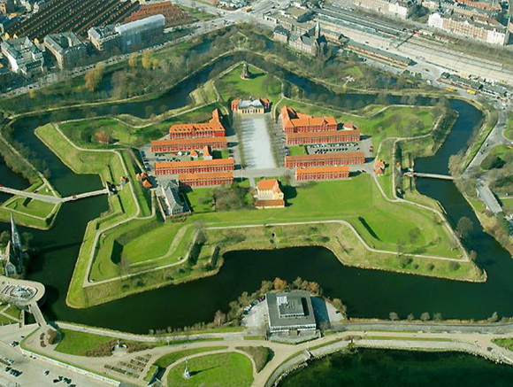
Kastellet in Copenhagen, Denmark.
Fort Carre, France;

And the Castle of Kuressaare, Estonia.
Does this similarity in design features of these structures, in places traditionally not associated with each other, make sense in the historical narrative we have been given?
This next set of photos compare the rocky shoreline of Key West on the left with the rocky shoreline of Tulum on the Yucatan coast on the right:


This is Fort Zachary Taylor, and it is near the southern tip of Key West. It is also has star fort design features:
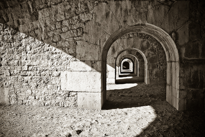
Here is a comparison of a construction feature at Fort Zachary Taylor at Key West, Florida…
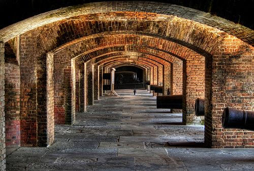
…and at the Fort de la Bastille in Grenoble, France. Certainly not identical, but there is a geometric effect that looks the same to me with the perfect symmetry of the arches.
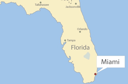
Next onto Miami, Florida on this circle alignment.
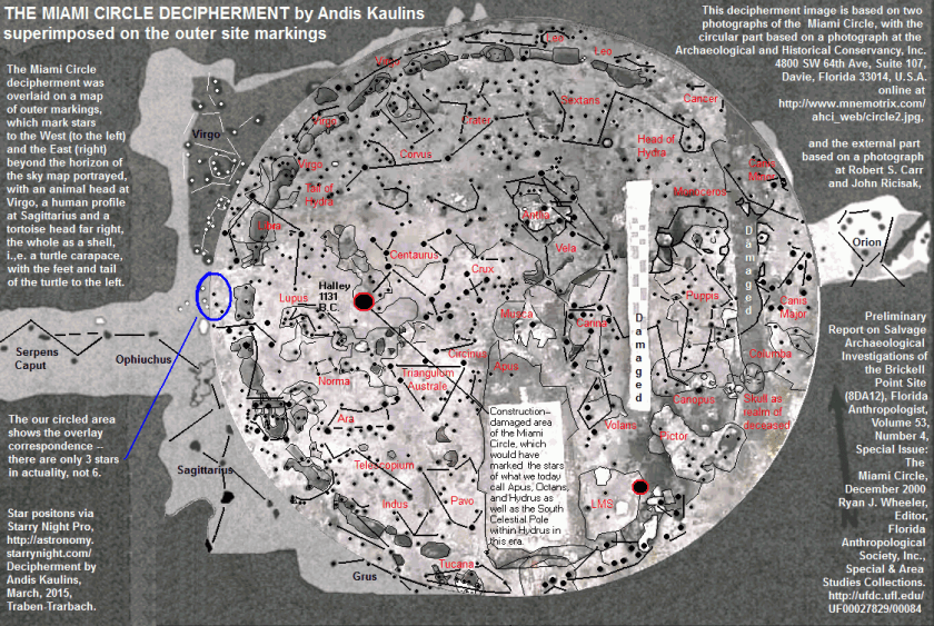
Several years before I put all of this information together, I saw a video on youtube about the discovery of what became known as the Miami Circle. It was discovered in 1998 in downtown Miami, when the building complex sitting on top of it was torn down. in 2002, it was listed on the National Register of Historic Places, and in 2009 it was declared a National Historic Landmark. Radiocarbon dating of burnt wood specimens found at the site are said to have yielded an age of 1,800 – 2,000 years old.


Here is very interesting decipherment of the Miami Circle by the stars, done by Andis Kaulins.
In this set of photos, on the left is the old post office and consulate in Miami, and on the right is the bank in El Paso State National Bank in El Paso, Texas. The heavy masonry of both buildings really strikes me, as well as the buildings being situated at the same angles on their respective street corners.


This next set is a comparison of the original Miami Herald building, which was demolished in 2015, on the left, and a mansion in Merida, Mexico on the right. Many historic buildings have suffered a similar fate as the Miami Herald building. I find most of the similarities I am seeking in historic photos of places because many of the older buildings are simply not there anymore. The Miami Herald building that was torn down was described as “built to be nearly indestructible,” in the article I read about its demolition, so these places are not being torn down because of inherent structural issues.


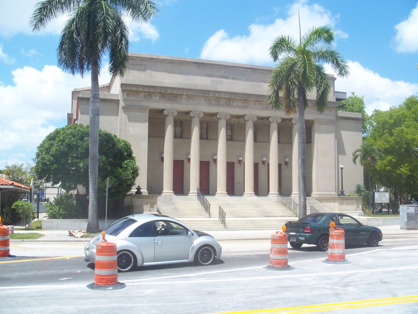
This was the First Church of Christ Scientist in Miami, which was sold to a commercial developer in 2013, with plans approved in 2015 to add a garage structure to the top and a 38-story residential tower next to it. It was listed on the National Register of Historic Places in 1989. Quite a monumental building! It looks more like the classical Greco-Roman architecture we learned about in history class than a modern church building.
I am going to end Merida Part 1 here, and pick up the circle alignment again in the Bahamas, and follow it around through Bermuda, Iceland, Greenland, Siberia, the Aleutian Islands, the Hawaiian Islands, the Revillagigedo Islands off the coast of Mexico, and along the Mexican mainland back to Merida.
