
I am including the Great Barrier Reef off of Australia’s coast in this post because it is directly on the alignment I am following. Let’s see what we find out about it.
First of all, the place we where we left off in the last post, Cairns, is considered the gateway to the Great Barrier Reef.
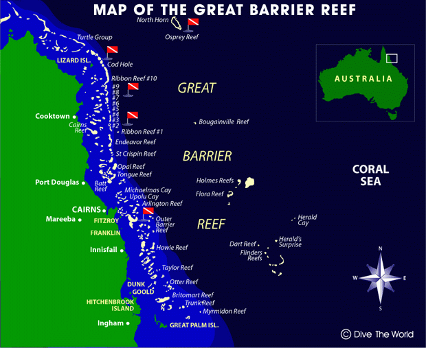
It spans 1,400 miles (2,300 kilometers) off the Queensland coast.
It is the world’s largest coral reef system, with 2,900 individual reefs and 900 islands.
It is visible from space, and has been named a UNESCO World Heritage Site.
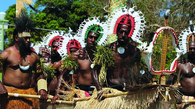
It has long been known and used by Aboriginal Australian and Torres Strait Islanders, and is part of their culture and spirituality.
The Torres Strait Islands are a group of at least 274 small islands between Australia’s Cape York and New Guinea.


The Torres Strait Islanders are considered distinct from Australian Aboriginal peoples.
The Torres Strait is between the northernmost island, and the south coast of Papua New Guinea in the north,
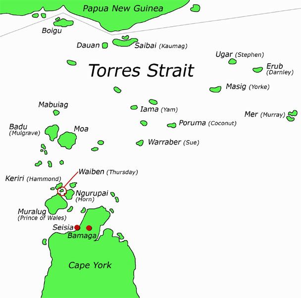
to an unnamed passage between Lady Elliott Island and Fraser Island in the South.
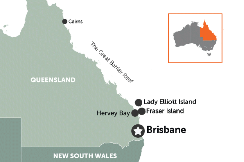
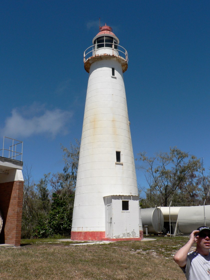
Lady Elliott Island is called a coral cay, has an eco-resort on it, and is a sanctuary for 1,200 species of marine life in the waters surrounding it, including manta rays and turtles…
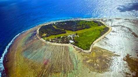
…and an old lighthouse. From what I know, the Ancient Advanced Civilization was a maritime civilization, and lighthouses around the world are remnants of it. I will do a future post on lighthouses to delve into this subject more fully.
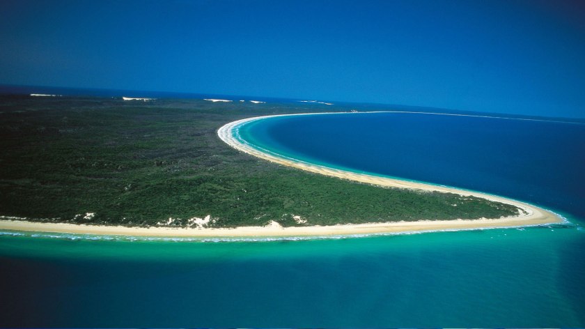
And this is Fraser Island, with its shaped shoreline (a subject for another post as well)….
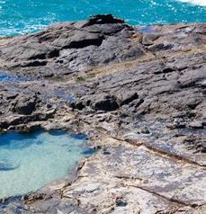
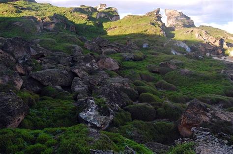
…and rocky coast and a place called the Champagne Pools. I have seen an abundance of rocky places that look similar to this on my journey on the gridlines around the world
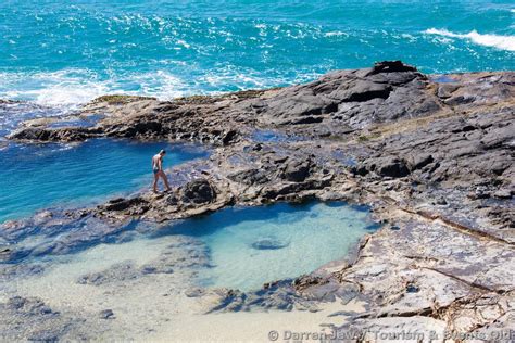
…and I question the narrative that it is all the product of natural forces. So for an example in the above picture, this highlights the presence of straight lines and edges in the stone at this location. Why is it said that straight lines don’t occur in nature when there are clearly straight lines in places like this that we are taught are natural? Food for thought.
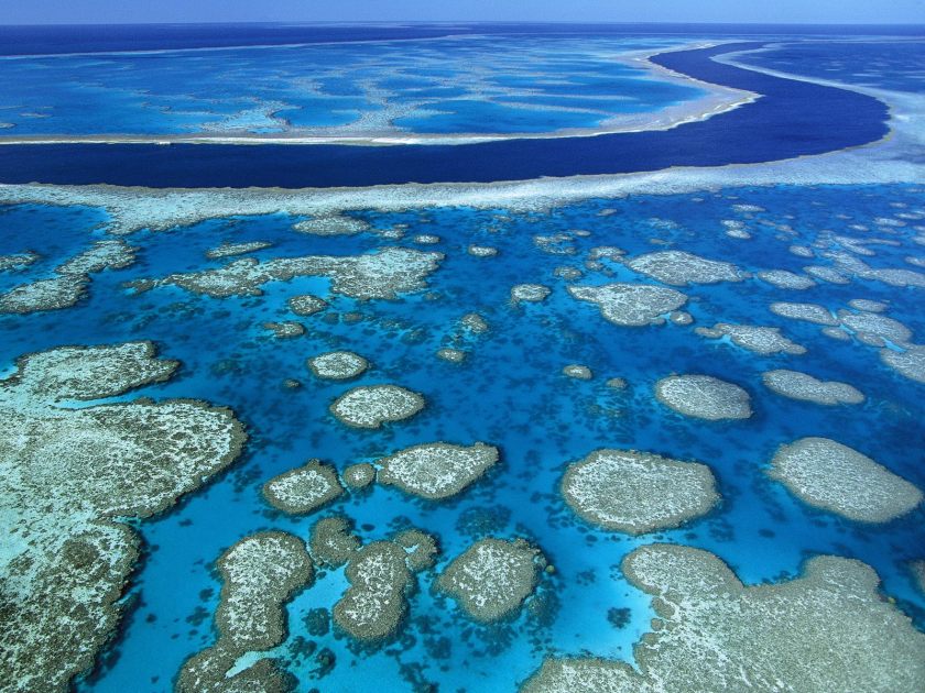
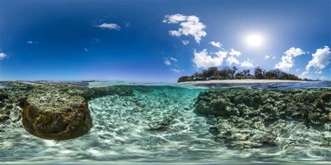
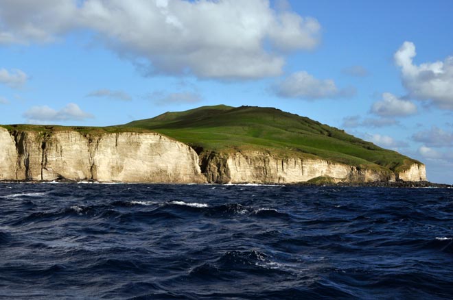
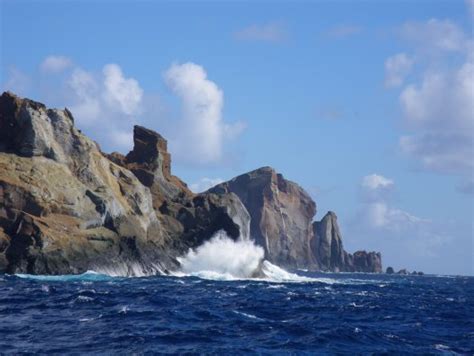
Here are two photos of the Great Barrier Reef
The first looks very much like a river in the water.
The second is an example of a point that I would like to make with the stone in the foreground. What if the coral and marine life formed on top of sunken ancient infrastructure?
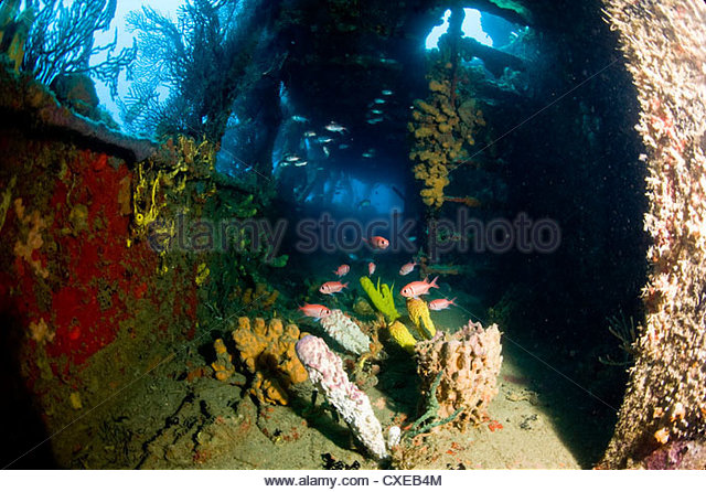
Coral reefs form on sunken ships, like this one….
We are heading into what would be considered the historical location of Mu, also known as Lemuria.
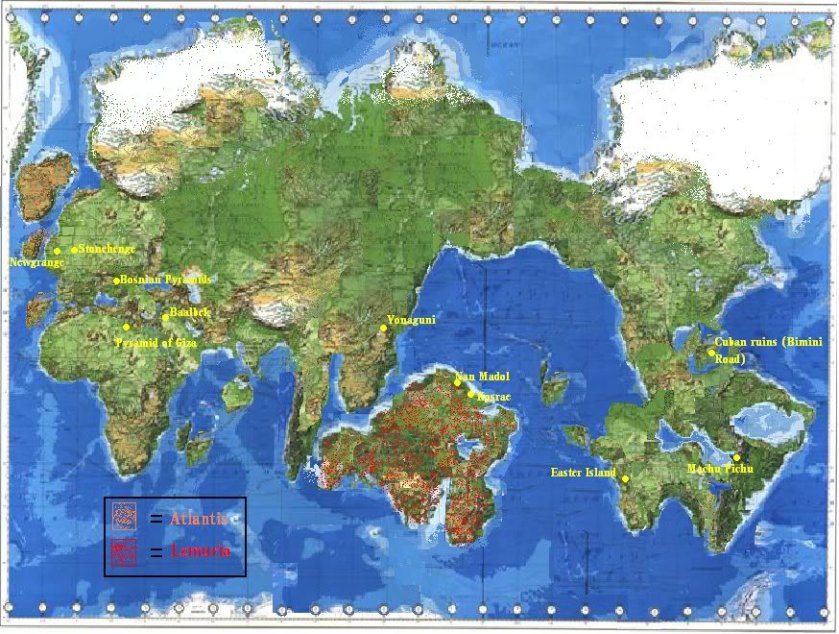
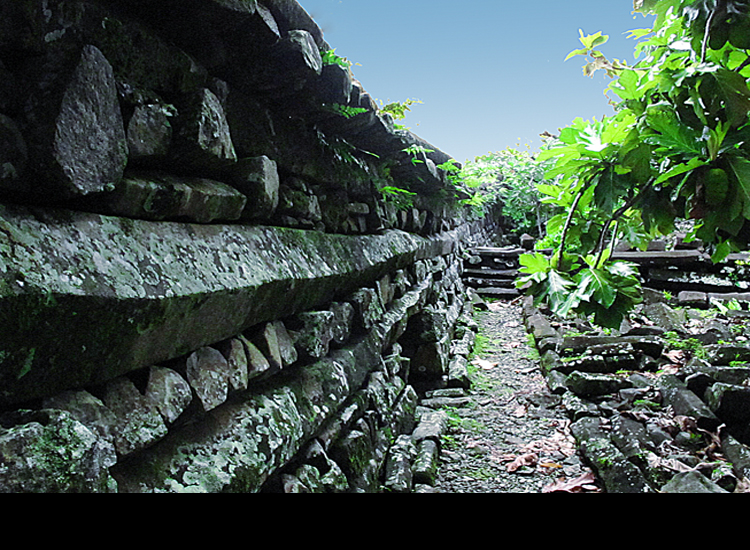
There are some pretty amazing stone remains on the islands of this area, like these here at Nan Madol, shown on the map above as part of a continent. Nan Madol consists of 100 stone and coral platforms built on top of artificial islands, involving 150 million tons of basalt of unknown origin. The structure in this photo is constructed of basalt columns:
As well as these ruins in the water near Yonaguni, now one of the Yaeyama Islands in the Okinawa Prefecture of Japan, is shown on the above map as part of a continent but are now underwater:


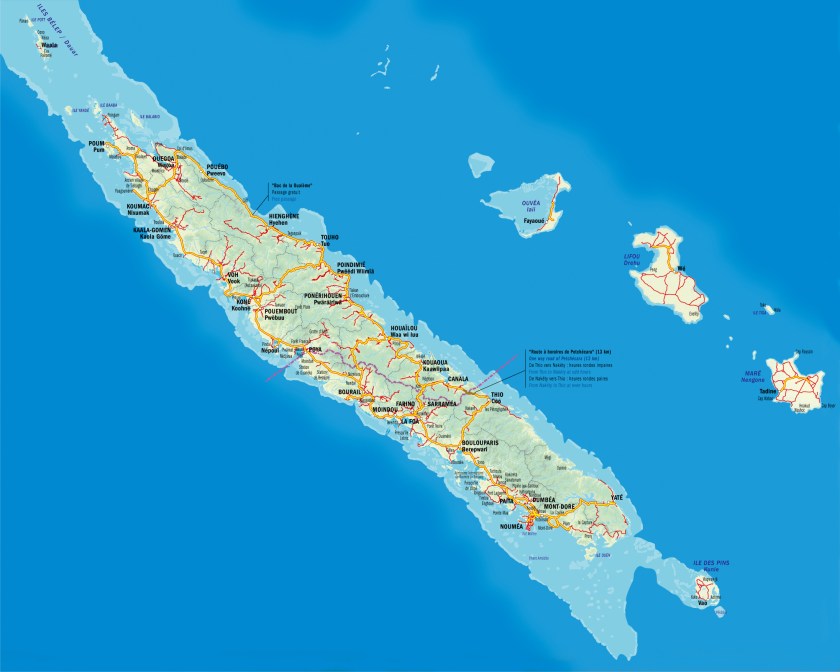
So. moving along the alignment of cities and places that I started following in Edmonton, Albert, the next island stop is New Caledonia.
This island grouping is called a Special Collectivity of France, and the President of France to this day is its Head-of-State. It includes the main island of Grande Terre, the Loyalty Islands, the Chesterfield Islands, the Belep Archipelago, and the Isle of Pines.
The alignment goes through the capital of Noumea, on the west side of the southern end of Grande Terre:
Also in Noumea, notice in the left-side picture, the nicely shaped protected harbor, and the massive stones on the pictures on the right-hand side.


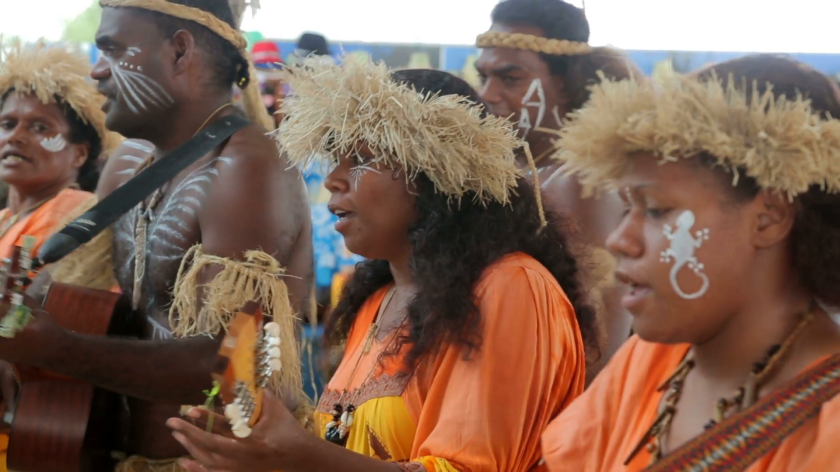
The Kanak people are the original people of New Caledonia, and they currently comprise less than half of the population.
So somewhere in our historical narrative, I believe the real story of the native people of all of these colonized lands/islands by European countries got altered somehow. I say that because how could these people, according to what we have been told, build these?
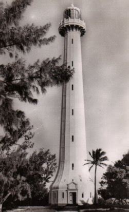
This is the Amedee Lighthouse in Noumea…
…A historic picture of the Bank of Indo-China in Noumea…
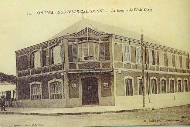
…which has the same street-corner lay-out as buildings literally all over the world, like the one on the left in Juarez, Mexico; the Ohio State Savings and Trust Bank in Toledo Ohio; and the one on the right in Kherson, Ukraine.


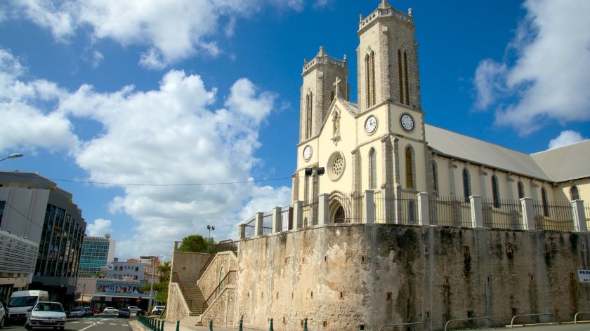
…and this is the Noumea Cathedral, said to have been built between 1887 and 1897, with all of its fancy stonework, and what looks to be older stonework on which the cathedral sits…
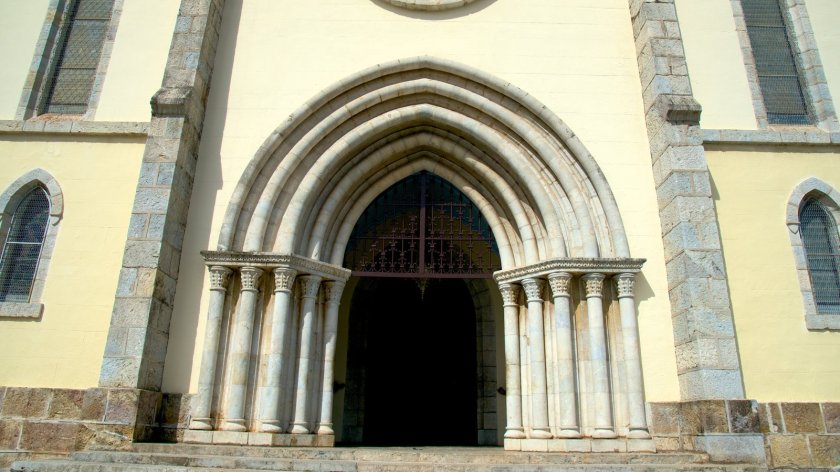
…and entrance-way with arches and columns.
I am saying that I believe these buildings existed before the French colonization, and the existing history we have been taught about was grafted on to the ancient advanced worldwide civilization. I see the same design features everywhere, in places I would not expect to find them, spanning centuries, continents,and oceans. Supposedly during times when communication and mobility between countries weren’t supposed to be there. It doesn’t fit in the narrative we have been taught.
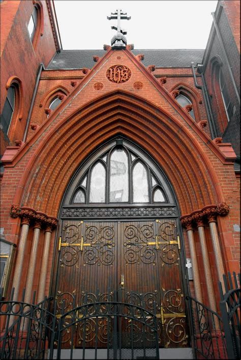
Just like these entrance-ways with similar arches and columns, at St. Nicholas of Myra Russian Orthodox Church in Manhattan, New York, said to have been built in 1883…
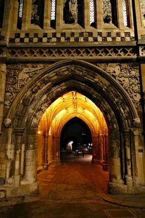
…Church of St. George in Norwich, England, said to have been built in the 1100s…
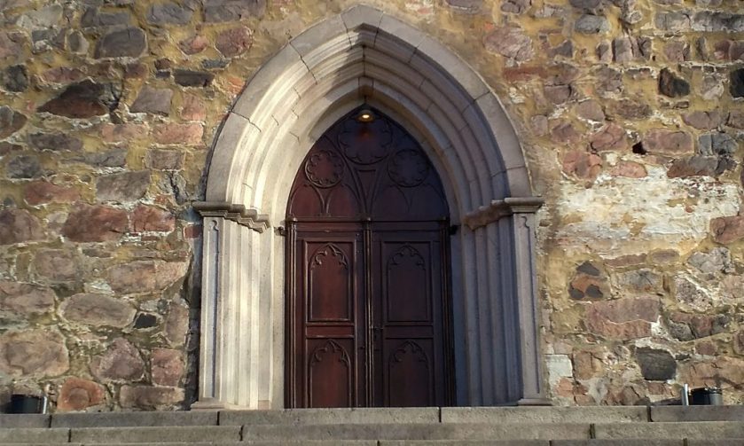
…Turku Cathedral in Turku, Finland, said to have been consecrated in 1300…
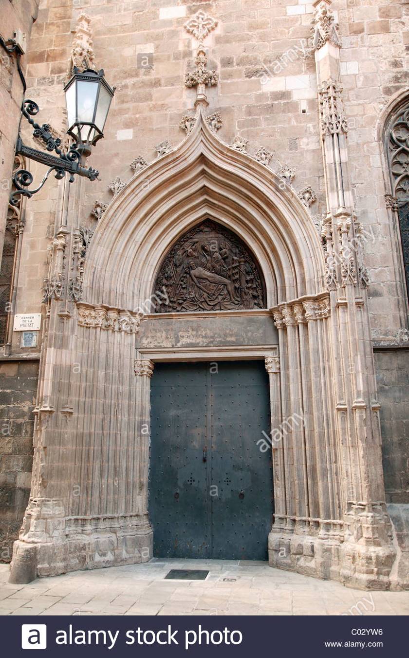
…and this cathedral in Barcelona, Spain, said to have been consecrated in 1339.
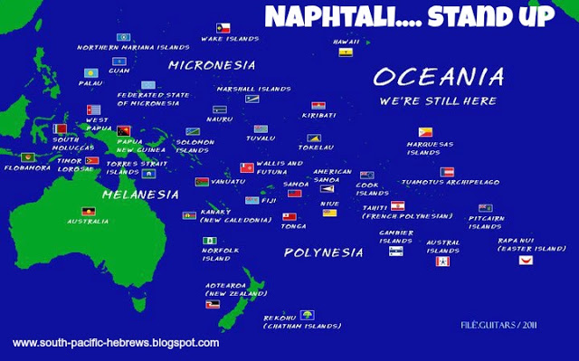
Also, this information is available if you look for it on the Internet- the inhabitants of this region, also known as Oceania, identify as the Hebrew Tribe of Naphtali.
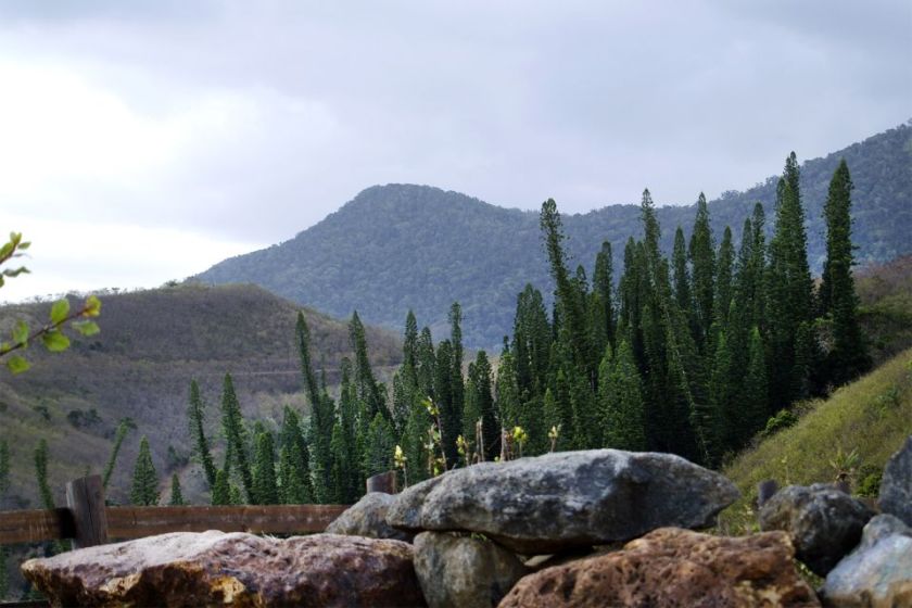
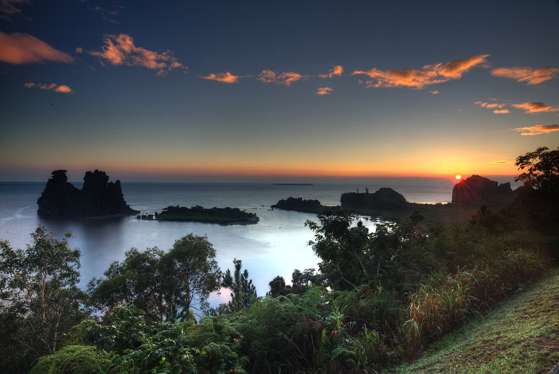
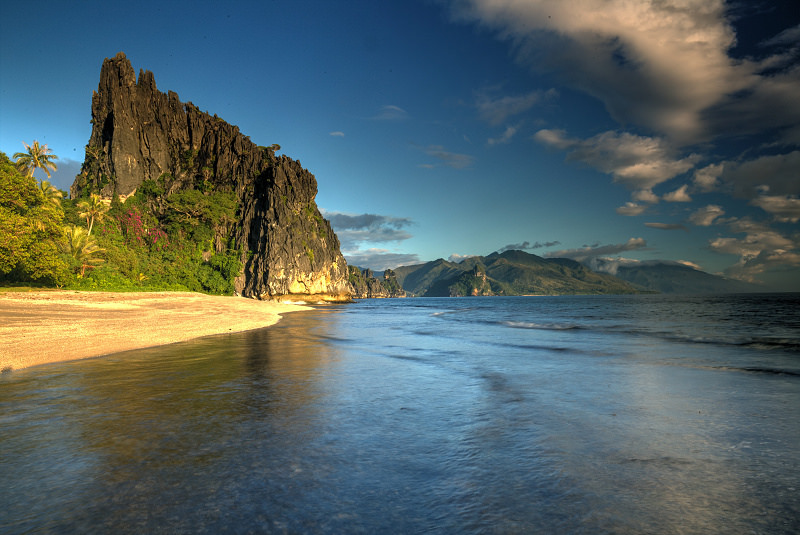
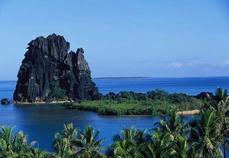
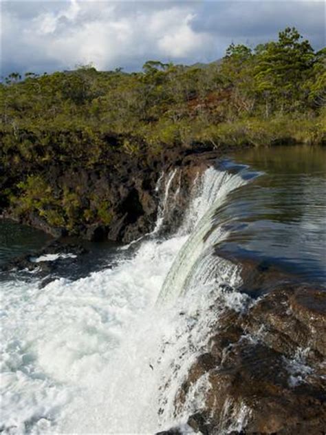
Here are some other sights around the Grande Terre of New Caledonia:
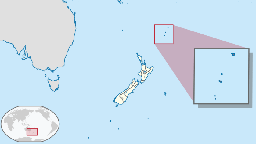
Moving on from here, the alignment goes on to cross the Kermadec Islands. These islands are considered part of New Zealand, and are 600 miles Northeast of there. They are a Nature and Marine Reserve, and the only human presence is a permanently manned station at Raoul Island. This area is notable for earthquake activity.
Photos of the Kermadec Islands include these of:
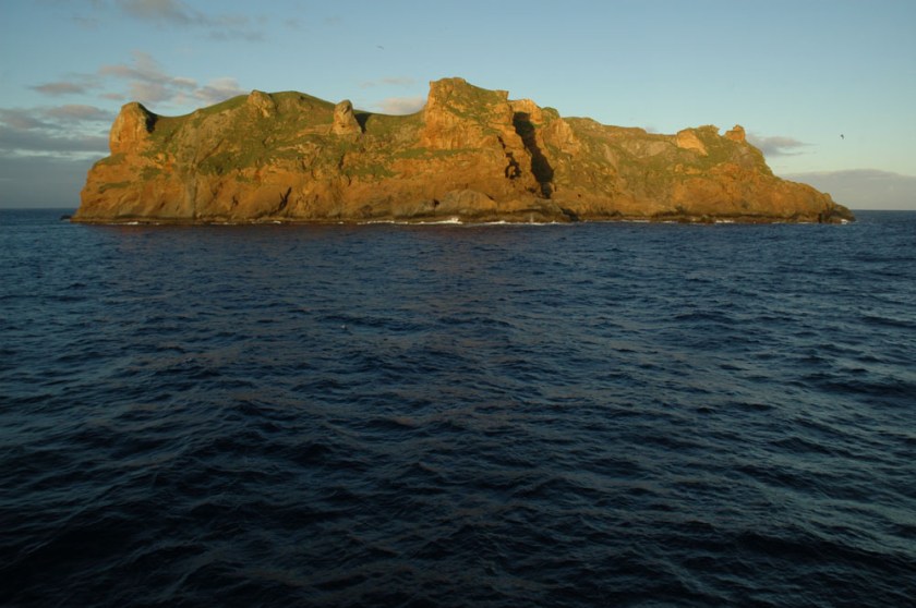
Raoul Island, where the permanently manned station is located…
…Cheeseman Island, with nice big blocky rocks…
…Macauley Island, the second largest of the Kermadec Islands, and located halfway between Tonga and the North Island of New Zealand…
…and Curtis Island, on at least one other alignment, and the Kermadec Islands as a whole are on other planetary grid alignments as well.
Next we come to Punta Arenas, Chile. It is the capital of Chile’s southernmost province – Magallanes and Antarctica Chilena. It is the largest city south of the 46th Parallel South. It is situated on the Magellan Strait, and is just north of Tierra del Fuego at the tip of South America.
The photos on the left and in the middle are buildings in Punta Arenas, and on the right is in the city of Kresy in Siberia.


And in this set is a comparison of a building in Punta Arenas, the Palacio Sara Braun on the left, and the Town Hall in Kherson, Ukraine on the right:


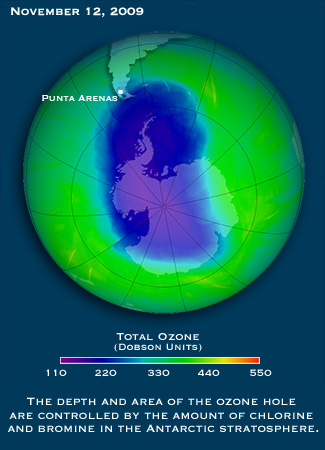
The first time I remember hearing the name Punta Arenas was when the news stories started coming out about the Ozone Hole over the South Pole, which started coming out in the 1980s, because Punta Arenas was the largest city affected by it.
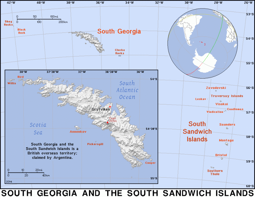
Next, the alignment goes through the South Sandwich Islands. This is interesting – Britain calls it a British Overseas Territory, and these islands are also claimed by Argentina. Not unlike the Falklands dispute (which are also on a gridline).
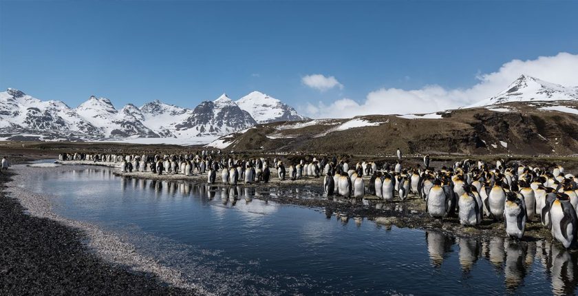
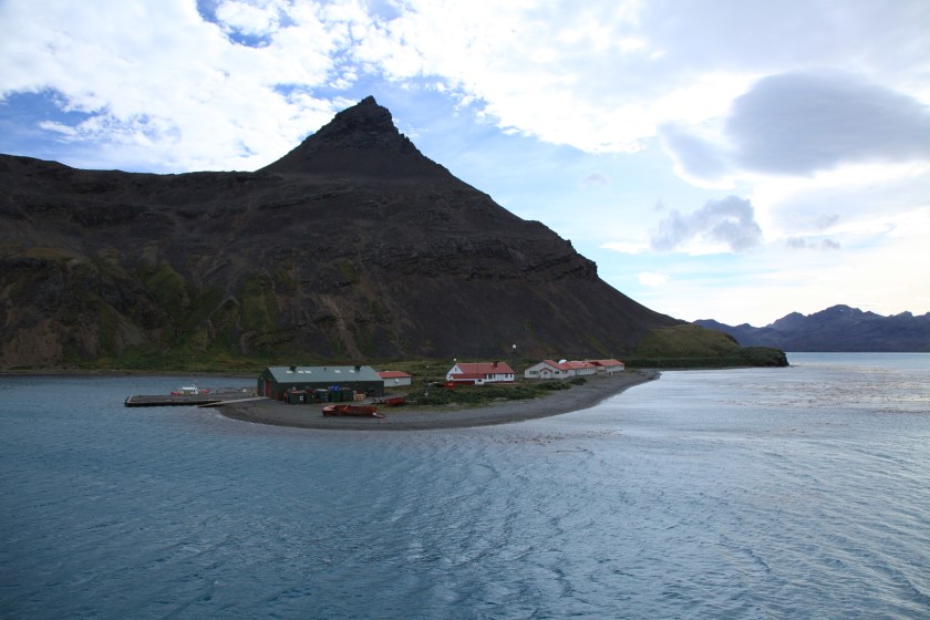
More images from the South Sandwich Islands:
Next we come to Cape Town, South Africa. Cape Town is on at least two global alignments that I have found.
In the interest of organizing this information, I am going to focus on the most famous landscape feature of Cape Town, Table Mountain, as well as historic architecture and canals. While the history of this region is important, including what is happening today, I want to focus my attention primarily on worldwide similarities in infrastructure.
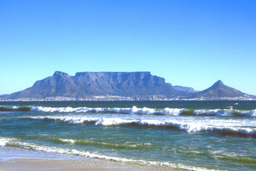
This is Table Mountain, a sandstone formation, and now part of Table Mountain National Park, with a pyramidal shape that is called Devil’s Peak on one side, and on the other a formation that has been dubbed Lion’s Head.
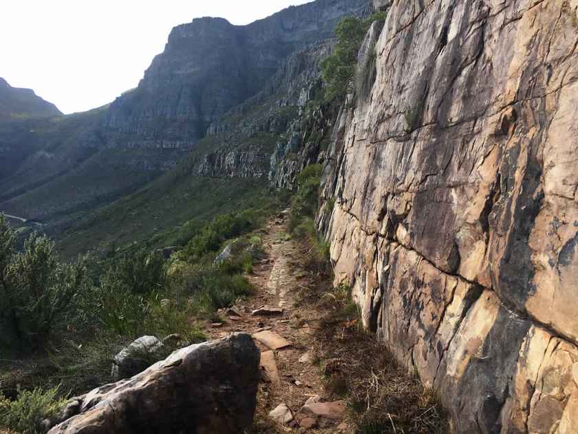
The easiest hiking route to get to the top of Table Mountain is through Platteklip Gorge…
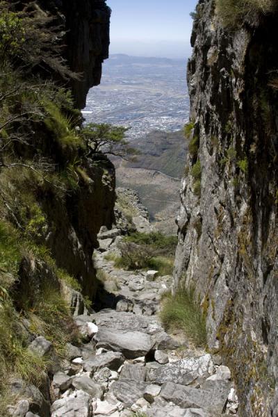
…where we find upon closer examination what looks like a relatively flat surface with straight lines indicative of cut blocks of stone. We just haven’t been taught that is what it is, so that is not how we see it.
Moving on to more modern infrastructure, here is a comparison of the National Library in Cape Town on the left, and the National Archives in Washington, D. C. on the right:


Who is coordinating the architectural styles of all of these places, I wonder? Here are some more examples.
On the left is a building with fancy wrought iron work on Long Street in Cape Town, and on the right is a similar building in the French Quarter in New Orleans, Louisiana.


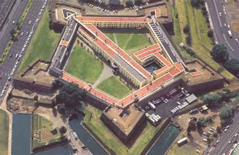
Here is a Star Fort in Cape Town…
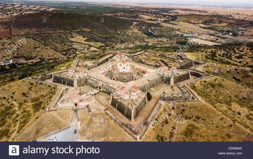
…compared with one in Portugal…
…Fort Ticonderoga in northern New York State…

…and this star fort is in Hakodate, on the island of Hokkaido, in Japan.
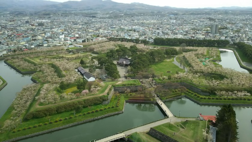
Star Forts are found all over the world, with the same basic star pattern, but differing somewhat in design complexity. In many cases, like with the example of Fort Ticonderoga, they have put to military use. There has been considerable research showing that this was not the original use of these beautiful structures, like perhaps as a component of some kind of energy system.
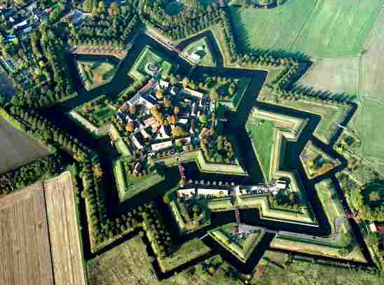
And like with so many things, up until recently, they have been ignored by conventional history. Again, because their existence doesn’t fit with the historical narrative we have been given. This is Fort Bourtange in The Netherlands.
One last comparison. There are sophisticated canal systems around the world in places you would not expect to find them. Here is a canal in Cape Town on the left, compared with one in St. Petersburg, Russia, in the middle; and the Ankhor Canal in Tashkent, Uzbekhistan on the right.


So I am going to go end the series on this particular alignment here. It goes on to reconnect with Edmonton on its way through Africa, India, Tibet, China, Mongolia,Russia, Siberia, Alaska, the Yukon Territory, and British Columbia.
In the next series, I will continue showing you how “History Reads Like a Book on the Planetary Grids” on a different alignment.

Dear Michelle, this is the most compelling presentation you have made. The examples and connections are excellent. The star structures are just to similar not to have a connected past. The buildings on corners throughout the world are so similar they must be connected. The more you post, the more I am drawn into the narrative. Thank you for all your work and dedication in this exploration of our collective truth. Sheri
LikeLiked by 1 person
Have you ever looked at photos of Shuri Castle on Okinawa? The outer walls are all very large closely fitted stone blocks. Thank you so much for sharing all this!
LikeLike