Perceptions, Pinnacles, Palisades, Pillars, and Pyramids – With Video of Post at the End

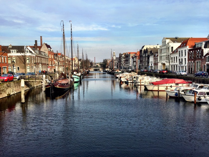
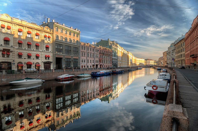
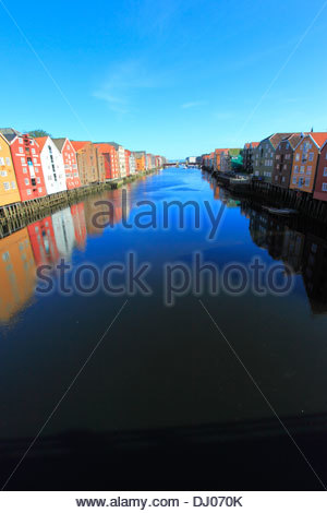
We are surrounded by, and living on top of, the infrastructure of an Advanced Ancient Civilization.

When I moved to Oklahoma from Fairbanks, Alaska, in 2012, I looked up information on nearby sacred sites on Oklahoma to go visit, and at that time really thought they were places I had to drive far to see.  I have learned, in my life’s journey of uncovering this evidence, it is hidden in plain sight, in that it is literally just outside our front doors, in our back yards, in our neighborhoods, especially in our parks, and on our highway and road systems.

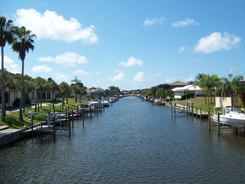
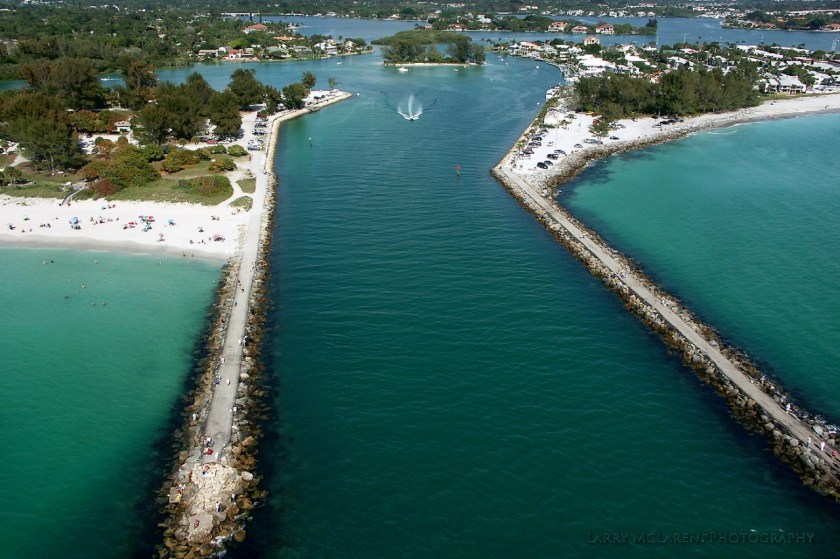
On our highway and road systems?  Yes, most definitely!

But, but, but – Department of Transportation Civil Engineers!

I am going to show you why I think the DOT Civil Engineers laid out the road system directly on top of what were ancient transportation systems – whether canals or land-roads – and built bridges on-top of temples/earthworks.

I have selected the best pictures I can find to illustrate these points:

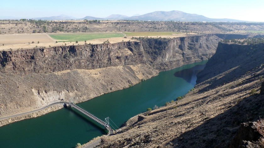
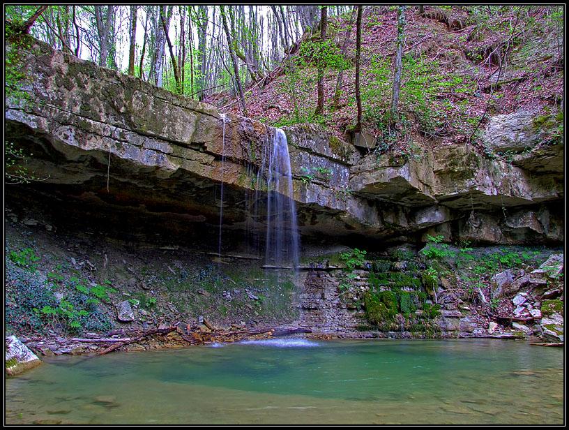
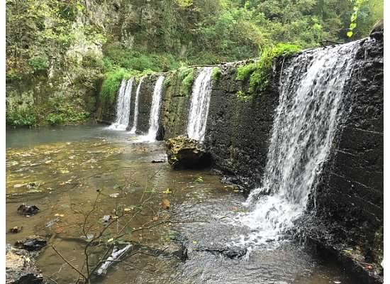
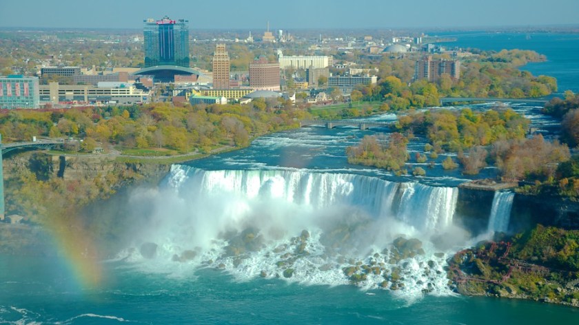
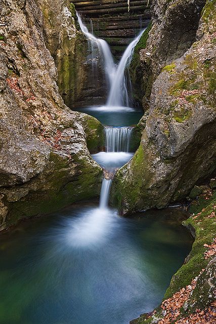
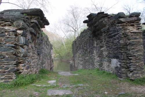
First, bridges on top of temples.  This computer generated image shows a very geometric-looking earthwork.  In real life, I saw the same perfect geometry countless upon countless times where bridges cross highways.  More on this observation as I go.

OK Highway 2

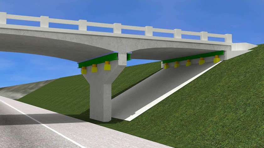
This would be an example of a bridge crossing a highway on top of  two symmetric, same height earthworks.  So, Michelle, the highway department built that, right?

Highway Bridge 1

Well, here’s the problem I have with that.

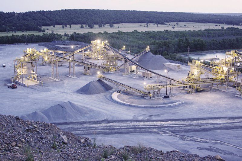
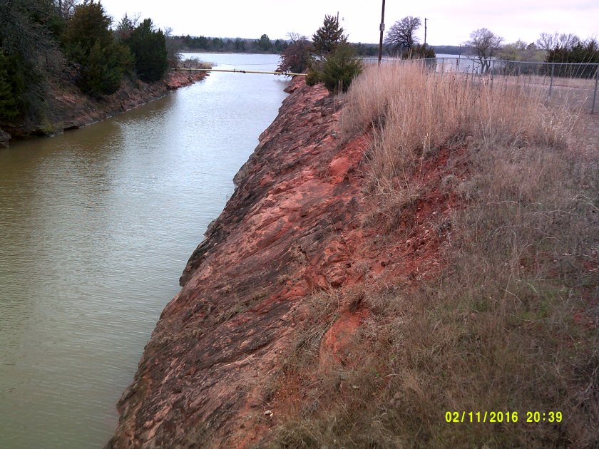
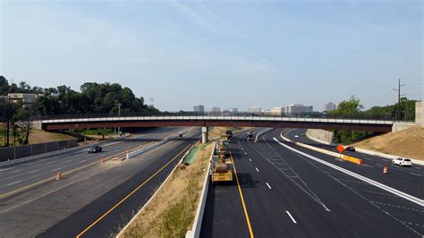
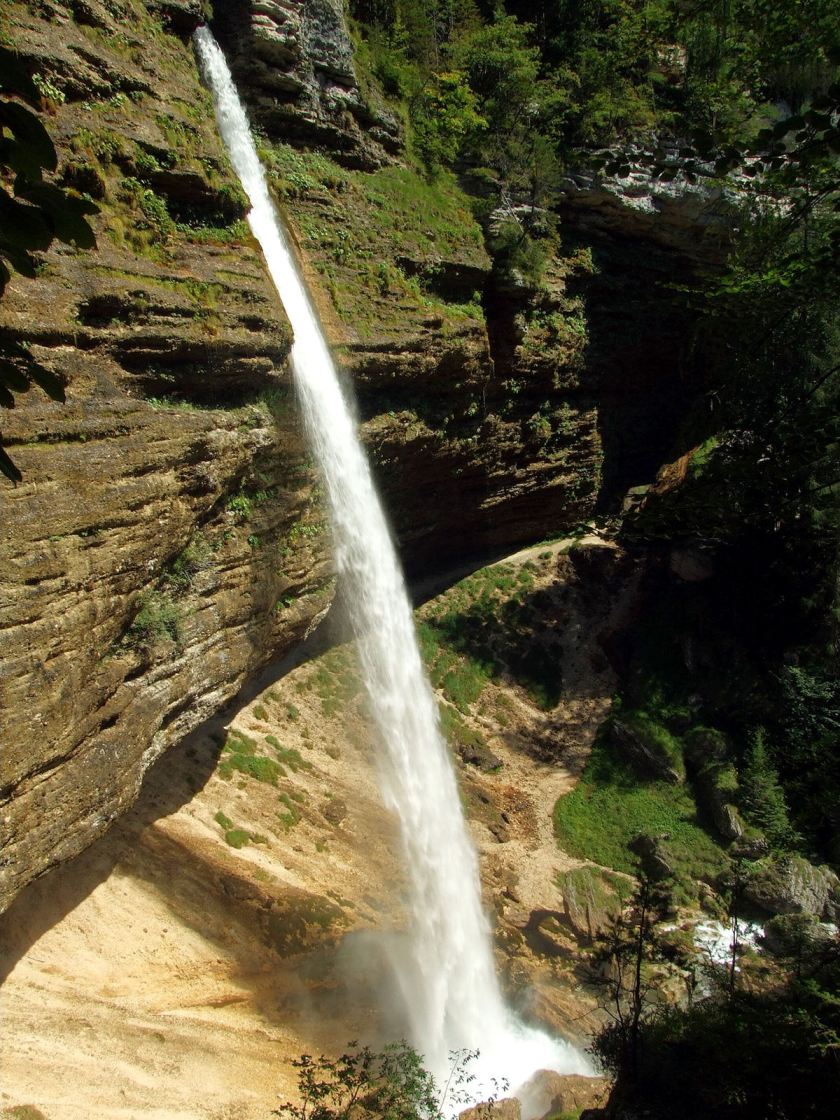
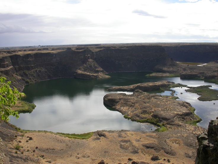
The same beautiful embankments/earthworks  occur everywhere,where the sides of the highways are symmetrical and sometimes quite high for very long distances.  Why would any road construction project, which would be on a budget,  take more time to make everything perfect and geometric, and sometimes quite high,  over a long distance, than less?

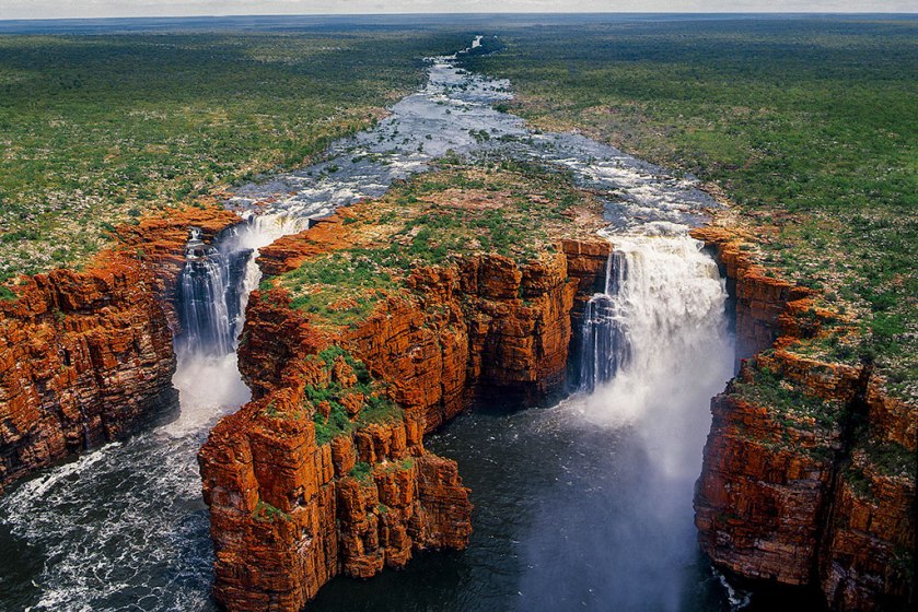
Here’s another example to show you beautifully rounded curvatures and shapes beside a highway.  Road construction costs and plus the cost of building earth embankments, and stay on budget?  This is not an isolated example by any means.

Ok highway 4

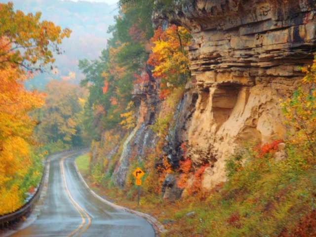
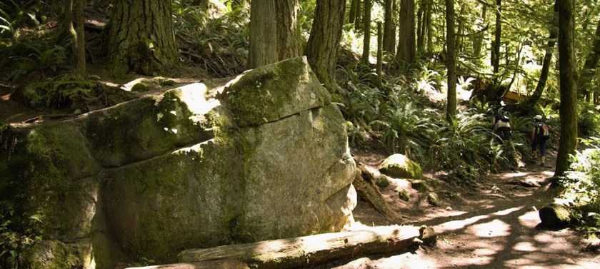
There are so many examples where you see places where cuts had to be blasted stone through to get the road through.  Pay really close attention to these places the next time you drive on a highway, because they have blasted  through ancient infrastructure.  In many cases, blocks of masonry are clearly visible if you understand what it really is.

Stone Cuts

They also built roads around ancient infrastructure.

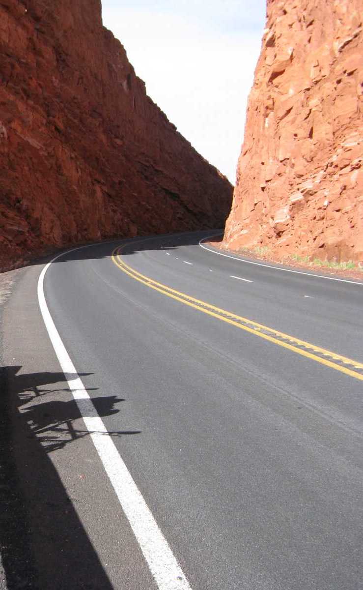
This is a picture that was taken on Highway 123, on what is called the Pig Trail which goes through the Ozark National Forest in Arkansas.  I had a first-hand experience of this.  I travelled on this road  in 2016.  I took a week-end trip to Eureka Springs, Arkansas, from Oklahoma City.  I saw a lot of evidence of the Ancient Civilization, from the time I left OKC, on my drive there, as well as in Eureka Springs.  Then, I decided to take Highway 123 to Interstate 40 to get home.  It is the road less travelled, and I am glad that I took it because of what I saw and experienced.  The Pig Trail is notorious for it’s extreme switchback turns.  The reason for the extreme angles of these sections is the road is this:

Pig Trail Ozarks Hwy 123 (1)
Pig Trail,Highway 123, Ozark National Forest, Arkansas

For long distances along this route, there are sheer walls like in this picture, so they had to build the road to circumvent long distances of massive stone walls.

Now, since we are  in Arkansas, this is a nice segue into the cover-up code word of Pinnacles.  I am showing you more examples of the many ways they have hidden this vast ancient civilization right in front of our eyes.  This has taken place, not just in North America, but all over the world.

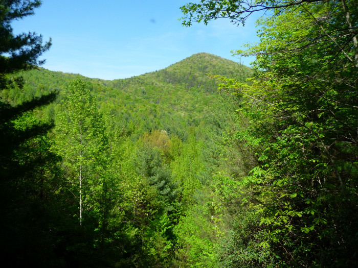
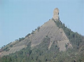
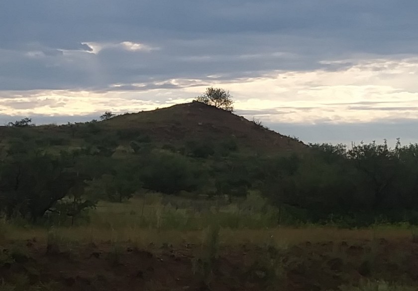
Here is my first “Pinnacle” experience.  Just a little bit west of Little Rock, near Natural Steps, is Pinnacle Mountain State Park.  Alert:  Code words, code words –  Natural Steps, located right near there, is a give-away too!

Do you see what I see in this picture?  I hope so, because that is what it looks like.

Pinnacle mountain

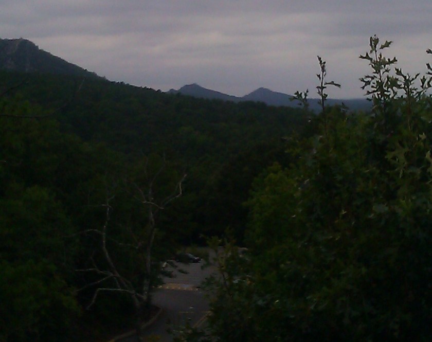
And there are two more pyramids, that are not part of the state park, and to which access is completely cut-off – there is no way you can get to them, and to see them, you would have to do it by boat from the Yacht club near by on the Arkansas River, or climb to the top of this Pinnacle Mountain.  Otherwise, the only other way to see them is to view them from the Visitors’ Center Observation Deck on a relatively clear day, like this photo I managed to take here.

Pinnacle Mtn. et al.jpg

Get the picture?

This is where you have to piece the truth together in other ways, because there is no way you are going to be able to find a reference to pyramids in Arkansas, anywhere!  Ever!!

If you are interested in delving further, here is a link to a Wikipedia article on Natural Steps, Arkansas, and please read between the lines  as you read it.  Further down the article is a section called “Masonic Stone” that is particularly significant.  This clue and others are contained in this link:  Natural Steps, Arkansas – Wikipedia.

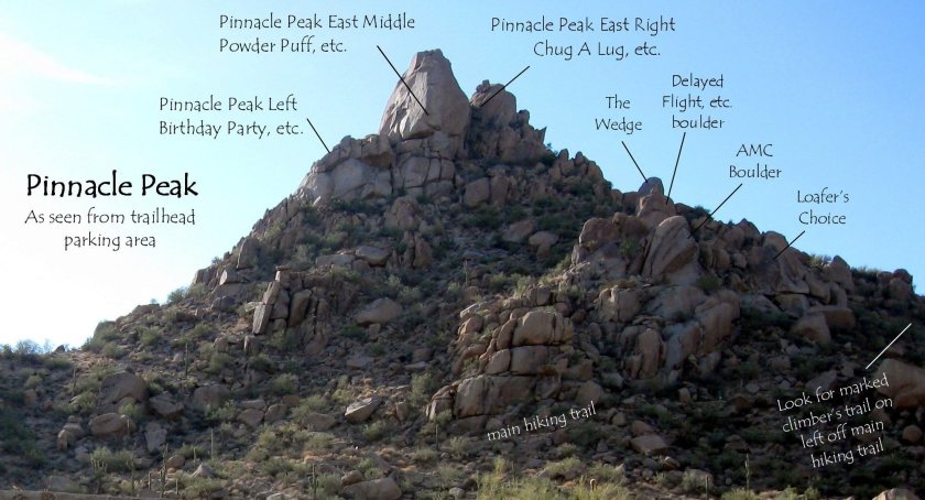
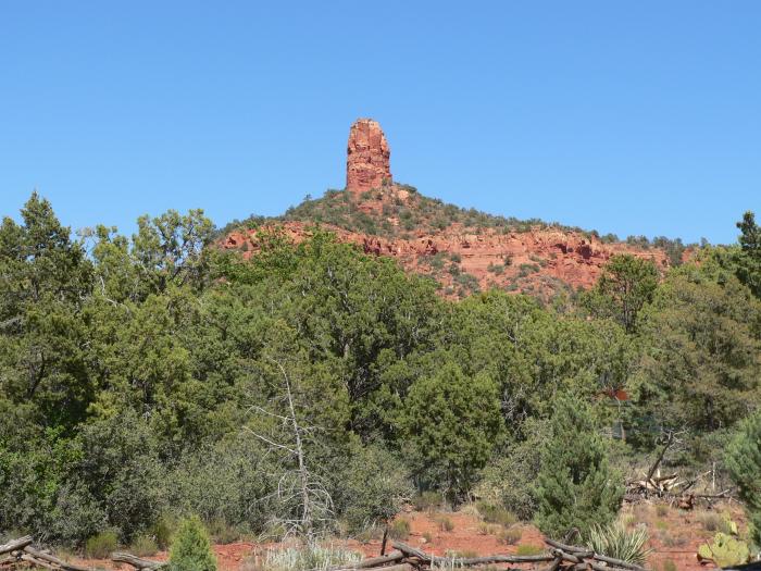
Next, in Arizona, this is a picture of Pinnacle Peak, in the Fountain Hills area just outside of Phoenix.  Note the masonry blocks, and as well how the different features of this ancient site are given cutesy names.  Nothing intentional to see here.   All natural.  Yea, Right.

Pinnacle Peak

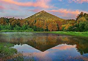
Next is a picture of Pinnacle Mountain in South Carolina:

Pinnacle Mt SC

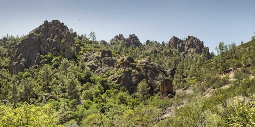
Pinnacles National Park, which is near Hollister, California:

Pinnacle CA

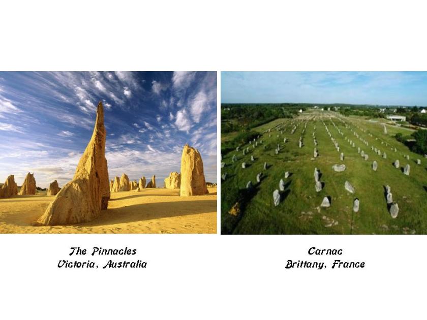
And, while there are more Pinnacles to show you, I will leave you with an images from The Pinnacles of Victoria, Australia on the left which bear a resemblance to the more well-known standing stones of Carnac in Brittany, France, on the right.
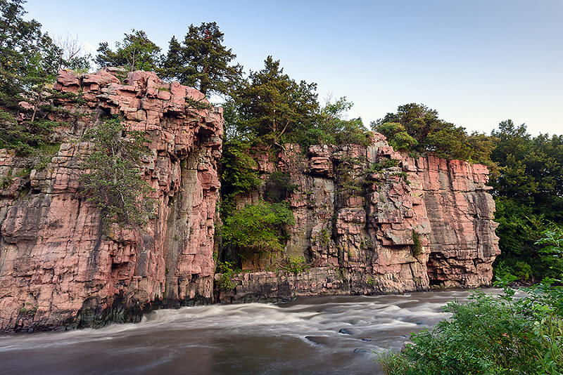
The Pinnacles - Carnac


On to Palisades.

The Code:  A Palisade is defined as a line of lofty steep cliffs, usually along a river.

So, for example, here are the famous Palisades of New Jersey and New York, along the Hudson River:

Palisades - Hudson River, NY & NJPalisades - Hudson River 2

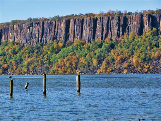
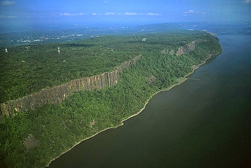
Looks pretty uniform in height, and flat on top, doesn’t it?

Next,  these are The Cove Palisades in Oregon.   Really flat top there as well.

Cove Palisades, OR

These are pictures taken at the Mississippi Palisades State Park in Illinois.


And a photo taken at Palisades State Park in South Dakota:

Palisades State Park, SD

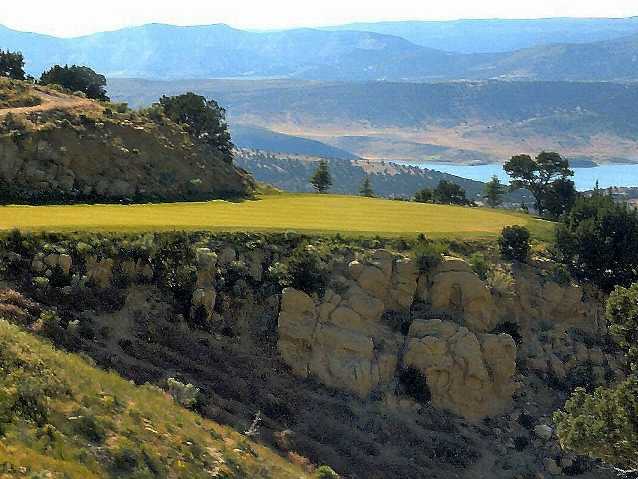
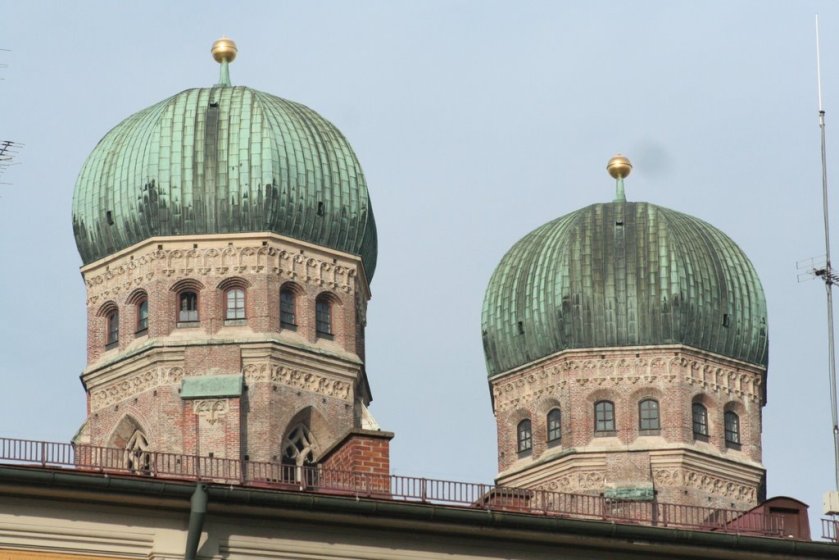
Also at Palisade State Park in Utah.  The top photo was taken at the golf course there, showing the ancient stone-work, and the flat top.

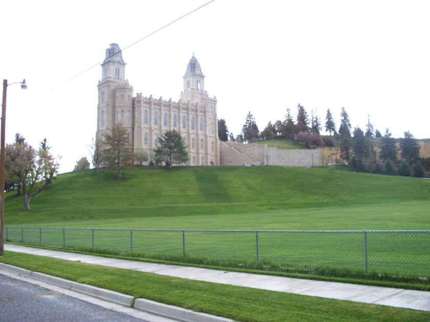
The bottom is the oldest operating Mor-mon Temple in Utah.  Please note the earthwork that it is built upon, and the Moorish-style architecture of the building, including the towers, onion domes, and ornate-stylings.

Toshiba Digital CameraPalisades State Park, UT - Oldest Operating LDS Temple

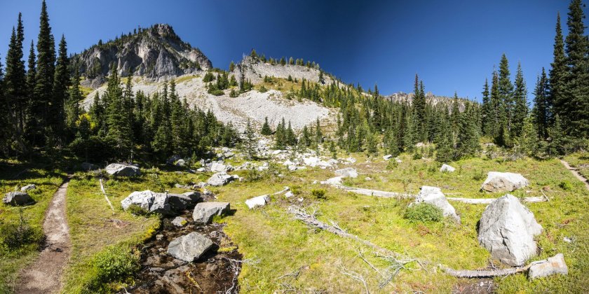
Lastly, here are the Pinnacles at Mt. Rainier National Park in Washington State.  You can certainly still see there are ancient shaped stones at this site.

Boulders, you say?  Nope.  Boulders are a cover-up code word.
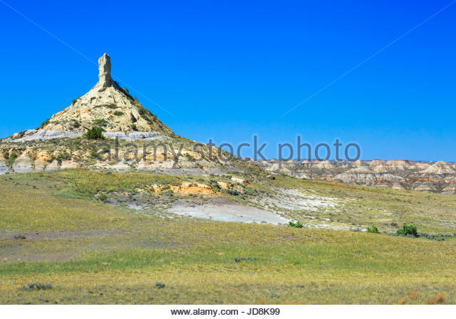
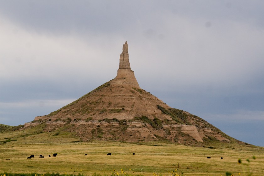
Palisades, Mt. Rainier

Now, on to Pillars.

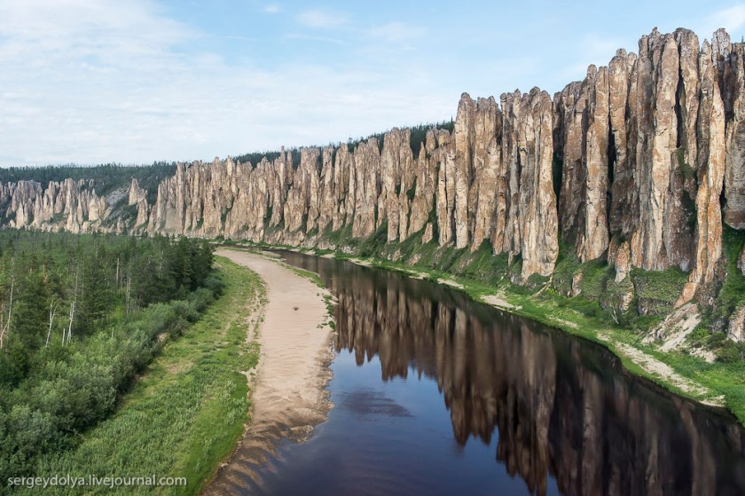
These are the Lena River Pillars.  I found these following the alignment that left Alaska, crossed over between Nome, Alaska, and Uelen, Siberia, and then as it crossed Siberia on its way across the world.  These Pillars are accessible by river cruise near Tiksi in Siberia, before you get to Tabor in Siberia.

Lena River Pillars, Siberia

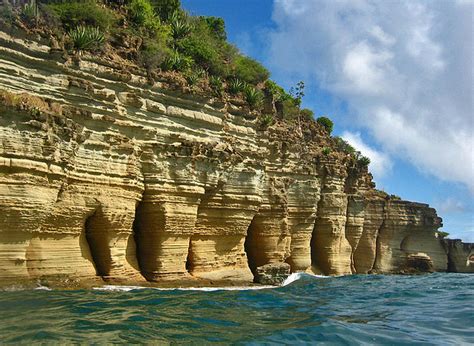
Here are the Pillars of Hercules in the island of Antigua in the West Indies:

Pillars of Hercules, Antigua

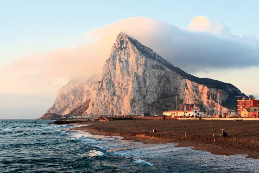
And then there are the really famous Pillars of Hercules.  The Rock of Gibraltar on the Island of Gibraltar is often referred to at the Pillars of Hercules, however, there may be one other pillar in North Africa, the identity of which is disputed between about 3 locations.  This is what the Rock of Gibraltar looks like:

Rock of Gibraltar

Rock of Gibraltar

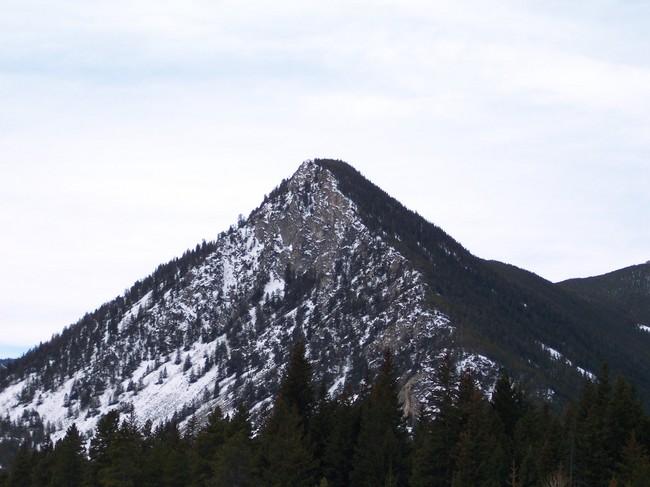
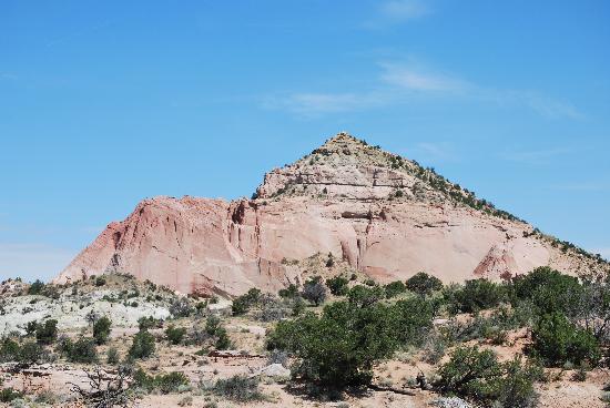
Lastly, in this particular post, what does Pyramid refer to?  Besides the ones I have already showed you masquerading as something else, here are of few of the Pyramid Mountains that are out there:

Black Pyramid Mountain in Montana

Black Pyramid Mountain, MT

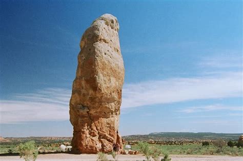
Pyramid Rock in Gallup, NM

Pyramid Rock, Gallup, NM

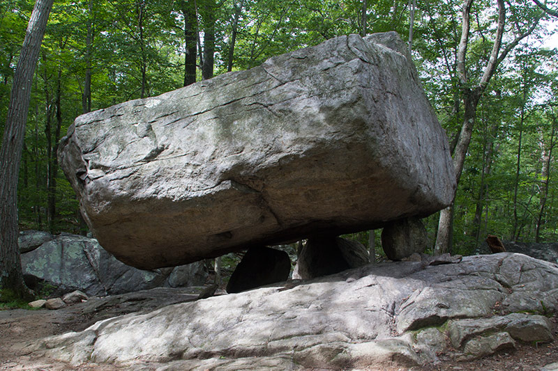
There are two Pyramid Mountains in New Jersey.  Tripod Rock is at the Pyramid Mountain in Kinnelon, New Jersey.  It is called a “glacial erratic,” the product of retreating glaciers during the Ice Age.  It consists of one huge rock, on top of three small rocks.

Pyramid Mt. NJ Tripod rock

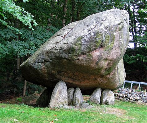
Meanwhile, the same thing in New York State – called Balanced Rock, and also considered a Glacial Erratic, a product of the Ice Age’s retreating glaciers:

Balanced Rock, NY

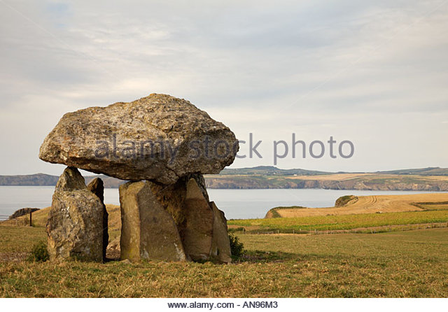
Meanwhile in Great Britain, and other places around the world, this same stone configuration considered a dolmen.  A dolmen is defined as:  a prehistoric monument of two or more upright stones supporting a horizontal stone slab found especially in Britain and France:

Dolmen in Britain\

This seems rather inconsistent to put it mildly….

 Pyramid in Antarctica.

Wait a minute, what?

Pyramid Mountains in Antarctica

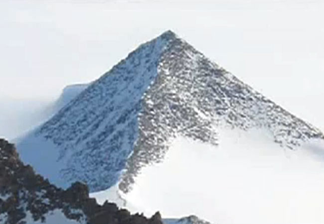
Well, stuff’s been burbling up about Antarctica on the Internet these days.  You might want to check it out to get caught up.

In the meantime, Kiril, the Patriarch of the Russian Orthodox church, has visited Antarctica in recent years, apparently to minister to penguins;

Pyramids - Kiril in Antarctica

and former Secretary of State John Kerry visits there as well (his jacket patch depicts the continent of Antarctica in this photo).

Pyramids of Ant - world leaders

I am going to leave you with these unacknowledged pyramids.  The following photos, and graphic depiction, are taken of Jerome, site of an ancient copper mine,  not too far from Sedona, and are part of what are called the Black Hills in Arizona:


Why is This Relevant Today? – With Video of Post at the End

This post is dedicated to providing answers as to who is responsible for what happened to the advanced Ancient Civilization, what happened directly as a result of the destruction of this civilization, and why this information is very relevant in the present time.

Ever since I came into awareness of this information, I have felt an urgency to get this information back into the collective awareness.

When I first uncovered the physical lay-out of the planetary (and consciousness) grid, my first reaction was concern about what would happen if the dark forces ever got a-hold of this information.  Then I realized the dark forces already had the information, and have been negatively manipulating the grid, and thereby our consciousness, by inflicting maximum pain and suffering at locations on the grid.   I saw where modern history reads like a book on the planetary grid, and that not only did the grid need to be healed, I understood that this information about the existence of it needed to get it back out in to the Light of day, and back into collective awareness.

My awareness continued to expand to include the details about the Moors, Washitaw Muurs, and Hebrew Israelites, their global presence, and my belief  formed that Humanity was in Unity Consciousness up until 1492 (if there is any accuracy to our historic timelines).  I will have a separate blog about the Unity Consciousness piece because I have very specific reasons for believing that because of what has come up in my research.

The world history we have been given is filled with war and violence, death and destruction, and I have good reason to believe that Humanity was actually on a positive evolutionary path until this timeline was hijacked by forces with a very negative agenda.  I really think the Catholic Church did not exist before 500 or so years ago.

Why do I believe that?  Because the advanced Ancient Civilization built everything on the planet, including the Vatican.  When the timeline called Rome was superimposed on the existing timeline, and in particular the history of western civilization re-written, the buildings of the ancient civilization were re-attributed to the “Romans” and “Greeks” and so on and so forth, and not to their actual builders.  The false timeline was grafted onto the infrastructure built by the ancient civilization.

This is a comparison of the Roman Colosseum, and a better preserved Colosseum in Pula, Croatia:

We are told that the Romans built the colosseum in Croatia.  There is a major line that emanates from the North American Star Tetrahedron that goes through Croatia on its way across Romania, the Crimea, Georgia, Chechnya, Ukraine, and so forth.  This is a fascinating global alignment that I will be discussing on a separate post.

The so-called Roman Aqueduct of Segovia in Spain…

SONY DSC

…and the Xalpa Aqueduct in Tepotzatlan, Mexico.

Xalpa Aqueduct, Tepotzotlan, Mexico

Funny, I didn’t know anything about the Roman Empire being in Mexico.  Did you?

This is the Nashville Parthenon.  They want us to believe that it took only 2 years to build for the 1897 Tennessee Centennial Expo.  Seriously?

Nashville Parthenon

One more thing before I move on to the main point on this post.

I found this picture of the capitol of Melekeok, Palau, in the South Pacific, when I was following a long-distance alignment I found starting from San Francisco that went right through Melekeok.

Melekeok

This entire complex is huge.  Is this overkill for an island nation with a small population (in 2018 it is 22,000)?  Or does it represent something else entirely.  I also want to put this out as a beautiful example domed architecture.  I definitely have an opinion as to who really built the world’s domed buildings.  And I do mean all of them….

I have recently come to realize that the suppressed story of the civilization of the Moors/Muurs/Hebrew Israelites is a template for the globalist elite for their plans to control Humanity and destroy western civilization in the present day.  I am also going to say that while unfortunately the globalists are far along in the implementation of their plans because they have been working at it for a very long time, I believe that conditions are in place for a new positive timeline for humanity.  The globalist plans have been interrupted.

I would not know relevant current events except for Twitter.   I was never on Twitter until February of this year, and I got a Twitter account to become a Twitter Activist and help red-pill people by tweeting/re-tweeting truth bombs.  I am following Truther/Awake people, and I see current events that are happening in real-time on my twitter feed that I would not otherwise be aware of because it is not something that would be covered by mainstream news (which I don’t follow anyway).

So before I go off on too many more tangents, let me go back to who I believe is responsible for what happened to the advanced Ancient Civilization.

I mentioned Peter Moon and Rick Smith in my last post.  The work of both men contain important clues and information about the Moors.  I am cautious in my approach to accepting information as valid, but if it resonates with me over time, and ultimately makes sense as an explanation, I am more comfortable with it.  I bring this up because I tend to accept what they are saying as good information.

First, Peter Moon.  I have read of number of his books.  I think it was in either the “Montauk Book of the Dead” or “Synchronicity and the Seventh Seal” (thinking probably the former), he writes about the scrying activities of  John Dee and Edward Kelly bringing in fallen angels and other lower vibrational entities.

The Russians actually corroborated this information in a press release in February of 2015:

Russia Issues Grave Warning

Rick Smith, also known as the UFO Teacher, has an interesting personal story in that there has been multi-generational ET contact with the women in his family, except this generation where he is the contactee through which information is received.  He is a professional artist and writer.

This first video is 23-minutes long,  I watched it before I put all this information together in 2016, so I would say that in a way it served as a marker or guide along the way.  He brings out what happened to the Moors was the result of an ancient vendetta against the Family of Man and the Temple of Solomon by what he called the Shettu Regime.

The Ancient Relationship Between Moors, Masons, and Aliens

In the second video, which is 2-hours long, he goes into depth about where that ancient vendetta against the Moors and the Family of Man came from, as well as providing information about the Moors.  He also brings in the Reptilian, Annunaki, and Archon (who he calls the Greys) involvement in what has taken place.

European Confessions of a Moorish Legacy

I have come to see the Fallen Angels, Reptilians, and Archons as being primarily responsible for what happened to the advanced ancient civilization, and what has been going on up to the present day.  Not as sure about the Annunaki’s direct involvement in what has been taking place on this planet, but I don’t discount the possibility.

I think that what happened directly as a result of the destruction of this ancient civilization was a human and social engineering process in which race and religion were weaponized, and that somehow racial phenotypes were engineered and categorized by continents:  Europe – white;  Africa – black; and so on.

Christopher Columbus, the Jesuits, the Spanish Conquistadors, and the British East India Company were the agents which by which the take-down of the ancient global civilization ensued under the guise of exploration & discovery; to find gold, religious converts, and land; religious administration and education; and trade ventures.  Actual results were the exploitation and destruction of indigenous populations; theft of land, considerable wealth and resources; forced religious conversion; destruction of culture and genocide; and more of the same through the so-called trading company.

Christianity was weaponized as missionary zeal, with no compunction about abuse and torture to convert, or murder if refusal to convert.

Race was weaponized and used to create division, separation, and fear.

It was never about the upliftment of white people over others.  It was about taking out the higher consciousness of the planet, and lowering the collective consciousness to the lowest common denominator (or as I also say, to the level of Beavis and Butthead) for the purposes of control and domination, and I believe this is the result of an interdimensional war against the Creator and Creation through Humanity.

The identity of the true Israelites, the 12 tribes of the Great Central Sun, the Children of Is-ra-el –  Mother – Father God – was replaced with a false identity and hidden away, and many were relegated to an existence of slavery, degradation and marginalization, if they weren’t killed.

This subjugation allowed for the identity of the Israelites to be co-opted up the Khazarian Jew/Zionist crowd.  The Rothschilds purchased Jerusalem in 1829, and subsequently acquired considerable land in Palestine in the 1800s and early 1900s.

Many of you may know this already – there are four city-states which serve as the foundations for the creation of a New World Order:

The Vatican = Spiritual Control
City of London = Financial Control (House of Rothschild)
Washington, D. C. = Military Control
The United Nations = World Government

They have done innumerable things to prevent the awakening of Humanity, which is their biggest fear.  Once we wake up, claim our power, and know about their severe crimes against Humanity, they are toast.  They covertly use methods like chemtrails, fluoridated water, tainted food supply, EMFs, TV, movies , a controlled-media in an effort to control the population just to name a few.

They tell us in the Georgia Guidestones about their plans for depopulating the planet, and like everything else they do, they use positive-sounding verbiage to disguise a negative agenda towards Humanity:

Georgia Guidestones

Just as Christianity was weaponized against the ancient civilization, radical Islam (along the lines of ISIS) & Sharia Law is what is they have in place to take down Western Civilization.

Like the destruction of the Ancient Civilization, this is another human and social engineering process that has nothing to do with benefiting Humanity.   Problem – Reaction – Solution:  The destabilization of Western Civilization by radical Islam is going to be restored to order by the New World Order.  Or so they planned.

In the U.S. some places have more issues with this than others,  There has been massive corruption in our government surrounding complicity with the globalist agenda.

Their activities are being more and more exposed in the alternative media and the Internet.  They do death and deception well, and will say and do anything that serves their purposes, but it is getting harder and harder for them to keep their activities hidden because their high crimes within government and crimes against humanity are being exposed.

I think very soon we will be seeing high-level criminals being held accountable for their crimes.

In Europe, the social problems occurring with Islamization is much worse than it is here, though it is happening here in different parts of the country.  In Europe, the influx of refugees from countries which have been intentionally de-stabilized to create this problem (the Cabal/Deep State really exists for those who may not believe it), is causing major issues for the citizens of those countries.

Throughout Europe, women are afraid to go out for fear of being raped because of on-going attacks, including coordinated ones.

Migrant Rape Fears Spread Across Europe

If you have not yet heard, in England, an outspoken journalist named Tommy Robinson was doing a live-stream interview outside of a courthouse where there was a trial going on involving Muslim members of what they are calling a grooming gang.  The police arrested Tommy for doing the live-steam, and within a short period of time on the same day was tried, sentenced to a 13-month jail sentence, immediately taken to jail, and a gag order was placed on the press.
Read about it here:  Tommy Robinson

You need to know this stuff is happening, and I wish it wasn’t so.  If it stays hidden, it keeps happening, and we are unconsciously manipulated by forces which desire to harm us.

I came across the Clock of Destiny website several years ago, and the impression that it made on me is that Islam in its pure and original form is about applied sacred geometry and universal laws:

Clock of Destiny

Marko Rodin, inventor of the Rodin Coil, intuited a key that deciphered vortex-based mathematics, and I believe this is all part of the advanced applied knowledge of the ancient civilization:

An Introduction to the Rodin Coil and Vortex Based Mathematics

In conclusion, I presented answers to which I have given much thought to explain  how what happened to the Ancient Civilization is relevant in the present-day.  No, I am not a conspiracy theorist.  I am wide Awake.

My work is about bringing out what has been hidden,  and my intention is to bring this information to the light for awareness, healing and transmutation for the highest good and the greatest need.

I have had to process through getting angry and upset at what has been done, but I know that the only way out is to go into higher consciousness and the heart, and to align with what we want, not with what we don’t want.

Those who are awake and aware must endeavor to hold the neutral space for the integration of light and darkness as we move through these pivotal times.  It is so important to unite in love as One Humanity, and no longer allow the strategy of divide and conquer to work.

Ancient Ones,
I am So Sorry
Please Forgive Me
I Love You
Thank You

On Chimney Rocks & Man-Made Lakes – with Video of Post at the End

This process of unlocking this hidden information has been very experiential for me.  I  participated and acted on my intuition in various ways, and in so doing, received more and more information.  This is the co-creative participatory process that I talked about in my video.  As this happened, my awareness grew exponentially.

One example is that when I started to crack the code early in 2016 that covers everything up, I realized that rock in a place or attraction name was a code word.  So I started looking up anything with the word “rock” in it.  Any rock. Take your pick. All rocks are connected to the Ancient Civilization:   Chimney Rock, Balanced Rock, Point of Rocks, Rock of Gibraltar, Little Rock, Rock Hill, and so on and so forth.

There are lots of Chimney Rocks.  In this first type of Chimney Rock, you have a pyramidal shape with a phallic antenna.  Pictured on top is a Chimney Rock in the Terry Badlands (another code word) of Eastern Montana; Chimney Rock in Nebraska; and the bottom photo is the Chimney Rock in Colorado.

Chimney Rock, MontanaChimney Rock, NebraskaChimney Rock, Colorado


And this is an old photo of what was Chimney Rock in Freedom, Oklahoma, which is also the location of Alabaster Caverns (more code) and is also not far from Mooreland in Woodward County, Oklahoma.  Now, they want us to believe, as captioned below the photo, this 50-feet high, sturdy rock was worn away so much over thousands of years, that one day in 1973, big winds caused it to fall without anyone seeing it happen.

My BS meter is pegged out on this one!!!

Chimney Rock in Freedom, OK

Moving on to another style of Chimney Rock, here are three examples where the shape is more phallic in nature overall:  first, Chimney Rock in North Carolina; the second is Chimney Rock in Kodachrome Basin, Utah; and the third is the Chimney Rock in Sedona, Arizona.

Chimney Rock, NC 2Chimney Rock in Kodachrome Basin, UTChimney Rock, Sedona

I have come to believe that the phallic symbols represent a uniting of the energies of heaven and earth, and that they morphed into onion domes over time, representing the same shape for the same reason.

Onion domes

Next is the subject of Man-Made lakes.

I was aware of two man-made lakes when I was growing up in Montgomery County and I related the experience of playing on big rocks as a child in the area of “Rock Creek” in Rockville, Maryland, and that this location was close to Lake Needwood and Lake Frank, and knew that both were man-made lakes.  Lake Needwood has great recreational facilities, and I went there often in my childhood with family and groups.

I have come to understand that man-made lakes serve at least two purposes:  1)  creating a water supply; and 2) covering up ancient infrastructure.

I realized early on in cracking the cover-up code that Federal, State, and local parks are part of it.  So I started looking at pictures of parks on the Internet, which included a lot of man-made lakes.

In Oklahoma alone, there are more than 200 lakes created by dams, which is the largest number in any state in the U. S.

The first list of Oklahoma lakes are ones I looked at images on the internet.  I primarily used the bing.com search engine, which was useful because in addition to your search item, they have section of “People interested in __________ also search for __________” and I got a whole lot more  information about other similar places out of that process!

Keep in mind that rocks are key features of the Ancient Civilization….

Lake Altus

Lake Altus, OK

Lake Murray

Lake Murray 1Lake Murray 2

Lake Texhoma

Lake Texhoma.JPG

The next sets of pictures are lakes that I went to see in person.

The first place I went to test my idea that man-made lakes covered up ancient infrastructure was Lake Thunderbird outside of Norman.  I knew what to look for, and was not surprised when I found it:


Found the same thing at Lake Arcadia, outside of Edmond:


By the way, Lake Arcadia reminded me of what I saw in pictures of the Gulf of Bothnia, which is between Sweden and Norway, on an alignment I was following on my globe:

Gulf of Bothnia

I found the same kind of evidence at other lakes outside of Oklahoma City, including Twin Lakes in Bethel, Oklahoma:


The last thing I want to touch upon is what I found when I visited the man-made lakes in Oklahoma City.  Lake Hefner is on the northwest side of OKC, and Lake Overholser is in the west side.  Both of these lakes have huge slabs of concrete covering the lake shores!!!

At Lake Overholser, this is the only evidence of the ancient civilization I found:  the ancient red rocks used to make the sign, and these big cut blocks of red rock behind the park office:


Lake Hefner itself didn’t really have anything to offer, but Martin Nature Park on the north-side of the lake sure did!


I have just shared a few examples of how the creation of man-made lakes covered up ancient infrastructure.  It has been done everywhere.  Not random or isolated occurrences.  And the process created reservoirs for local water supplies.


Expanding on Waterfalls – With Video of Post at the End

Waterfalls are a great example of what I am talking about when I say that from my studies of images and videos on the Internet, and some places I have visited, it appears to me that all of the infrastructure of the planet carries the same signature, the same hand of design.

Following the alignments that emanate from the North American Star Tetrahedron is what brought me to this place of understanding and these conclusions.  I did not have these beliefs before I went on this journey.  I was impulsed to go on the journey, and the more I got into it, the more information I received.

These examples just scratch the surface because there are so many waterfalls on the planet, and I know I can find many more examples of each kind.

I have put together pictures of waterfalls from different places with similar characteristics for the purpose of making a direct comparison so at least you can see what I am seeing and why I am saying it.

I believe that rivers and waterfalls signify something like Universal Energy Flows on the Planetary Grid system.

I made the claim fully prepared to support it with more examples – of the same style of waterfall in different places around the world.  It looked like they had a selection of models of waterfalls to choose from, from small to large.

Like these:

I was already aware of the unusual appearance of Havasupai Falls in the Grand Canyon, not from visiting, but from some other exposures, including a music video by a musician called Gandalf, called the “Ancient Secret Path.”  Here is the link to the instrumental music video – I believe it to be relevant: Gandalf – The Ancient Secret Path.

Havasupai-waterfalls1
Havasupai Falls, Grand Canyon, Arizona

Then when I was travelling along the alignments from the Star Tetrahedron, I found this waterfall in Luang Prabang;

Luang Prabang, Laos
Luang Prabang, Laos

This one in Jamaica;

Dunn's River Falls, Jamaica 1
Dunn’s River Falls, Jamaica

Another one in Thailand;

Erawan Falls the one that I want
Erawan Falls, Thailand

And this one in Port Vila, Vanuatu.

vanuatu-attractions-mele-cascades-1527-thumb
Cascade Falls, Port Vila, Vanuatu

In the next series of waterfalls, in China, Croatia, Idaho, and Oklahoma, there is some massive engineering going on.  Just look closely at the similarities in these pictures.  There are very similar design features across continents.  This actually includes the water color – a very beautiful blue (which goes for the the waterfalls pictured above as well).  I also found Guizhou, China, and Croatia, by following grid-lines.  I had no foreknowledge of this.

Huangguoshu Waterfall China 6
Huangguoshu Waterfall, Guizhou, China
Huangguoshu-Waterfall-2
Huangguoshu Waterfall, Guizhou, China
Krka Waterfalls, Croatia
Twin Falls, Idaho
Twin Falls, Idaho
Plitvice Lakes
Plitvice Lakes, Croatia
Turner Falls 3
Turner Falls, Davis, OK

Pictured in this series of three, the first is in Guizhou, China; the second is at Plitvice Lakes in Croatia; and the third is in the Chickasaw National Recreation Area in Davis, OK, near Antelope and Buffalo Springs.  Not identical, but similar.  In all three pictures, the surface of the water before it hits the edge of the waterfall, appears to be very still.

In the next series of waterfalls – in Oregon, Switzerland, Australia, Istria (Croatia/Slovenia), the Phillipines, Greenland,  Mexico, Venezuala, British Columbia, and Bangladesh – you will see similaries in the flow of water from the top of what looks like a wall, and similar coloration.

These are the Multnomah Falls, located in the Columbia River Gorge in Oregon:

Multnomah Falls, OR
Multnomah Falls, OR

The Staubbach Falls in the Lauterbrennan Valley in the Bernese Alps.  Note the mound-looking shape in the foreground.

Staubbach Falls
Staubbach Falls, Switzerland

And the mound-looking shape in the foreground reminds me of this one in my drive into work in Arizona:

Cornville Road

The Blue Mountains are known as part of the Great Dividing Range in New South Wales, and is near Sydney.  I found the Great Dividing Range on a planetary grid line.

Blue Mountains, Australia

Slap Sopot is the second highest waterfall in Istria, which is a region shared between Croatia, Slovenia and Italy, and has a lot of waterfalls.

Slap Sopot, Istria, Croatia

Including this one, which has a lot of straight edges….

Istria Waterfalls, Croatia, Slovenia
Istria Waterfalls, Croatia/ Slovenia

Croatia and Slovenia have a heck of a lot of waterfalls.  Here’s another example of the same idea from this region.  I believe we see ancient stone-masonry, not natural rock formations.

Slovenia Waterfall 4
Slovenia Waterfall

Davao in the Phillippines is known as the City of Waterfalls, and has a lot as well.

Davao, Phillippines
Davao, Phillippines

I would like to make a comment about Cape Farewell, Greenland in a future post – it sits on a major alignment involving two aspects of the North American Star Tetrahedron.

Cape Farewell, Greenland

Basaseachic Falls also falls directly on a major alignments  in the Sierra Madre Occidental Mountains, and Copper Canyon, in Mexico – the home of the Tarahumara.  The Tarahumara are known for endurance running, and made this area their permanent home at the time of the Spanish Invasion.

Basaseachic Falls, Mexico

Angel Falls has the distinction of being the highest uninterrupted falls in the world.

Angel Falls, Venezuala

I found Takkakaw Falls in British Columbia by following a major planetary grid alignment.  Not only do the falls look similar to those pictured above it, you have massive block-shaped rocks in the water-course in the foreground.

Takkakaw Falls, BC
Takkakaw Falls, BC

Here are two waterfalls in Bangladesh:

Bangladesh madhob kundo waterfall
Madhob Kundo Waterfall, Bangladesh
Bangladesh faipi-waterfall
Faipi Waterfall, Bangladesh

I don’t know about you, but before finding out all of this that I am sharing with you, I had no idea that there were such beautiful waterfalls in China, in Croatia & Slovenia (countries of the former Yugoslavia and part of the Balkans).  In my head, growing up in the 60’s and 70s, the pictures in my head of these countries were like black & white movies because what we learned about Communist Eastern Europe & China – definitely un-beautiful images.

In the next set of slides, I chose this particular style to highlight because of Natural Falls State Park, OK.  I visited there in the spring of 2016, on my way to visit Eureka Springs in Arkansas.  By that time I had realized that the word “Natural” was one of the cover-up code words for the ancient civilization, and that parks are places that it is preserved, so basically, I had to go see it for myself.  So I physically saw the ancient stone structures surrounding me as I took the path to the falls, like this:

Digital Camera
Natural Falls State Park, OK
Natural Falls, OK

Somewhere around this time, I was looking up waterfalls on the internet, and knew there was a similar looking one in Slovenia, which was in the former Yugoslavia.  So I looked again to find it for this post and found one similar quite easily:

Slovenia Waterfall
Slovenia Waterfall

As a matter of fact, I found another waterfall in Slovenia with a similar appearance:

Slovenia Waterfall 5
Slovenia Waterfall

This next one is one of many waterfalls in Plitvice Lakes National Park in Croatia, which was also part of the former Yugoslavia:

Plitvice
Plitvice Lakes National Park, Croatia

In this side-by-side comparison, on the left is a waterfall in Slovenia; and on the right is Twin Falls on the Hawaiian Island of Maui.  Leaving here for comparison:

Moving on to a different style of waterfall, check these out.  Hang with me on this. Note the recurring similarities.

The first is Victoria Falls on the Zambezi River in Africa, considered the largest waterfall in the world by combined height and width:

Victoria Falls

Next, you see Tahquamenon Falls in Michigan;

tahquamenon-falls, MI
Tahquamenon Falls, MI

Mackinac Falls in Michigan;

Mackinac Falls, MI
Mackinac Falls, MI

Another part of Natural Springs State Park in Oklahoma called Dripping Springs;

natural-falls-state-park - Dripping Springs
Natural Falls State Park, OK – Dripping Springs

Iguazu Falls straddles the border of Argentina and Brazil. The picture below is from the Argentina side;

Iguazu Falls Argentina

I included this picture of the map of Iguazu Falls between the two countries to show its lay-out.  Of particular note is the configuration on the Brazil side that has a very round geometric-looking shape.

Iguazu-National-Park-Map
Map of Iguazu Falls between Brazil and Argentina

I have included this map of the Niagara Escarpment to show another long-distance configuration that is remarkably geometric when you consider the distance it covers – straight line in Western New York and into Ontario, and from there a nice and neat half-circle shape across the top of Lake Huron and Lake Michigan, and then down into Wisconsin.

Niagara Escarpment Map
Niagara Escarpment

Here are some photographs of waterfalls that flow off of the Niagara Escarpment.  The first is of a waterfall in Ontario;

Niagara Escarpment photo
View of Falls on the Niagara Escarpment in Ontario, Canada

and the second is the American-side of Niagara Falls just outside of Buffalo, New York:

Niagara Falls, NY
Niagara Falls, Buffalo, NY

Lastly, a comparison photo to show the similarity of a view of the Niagara Escarpment on the left, and view of the Endless Wall at the New River Gorge State Park in West Virginia.

In my video “Physical Evidence for a Planetary Grid System…and a Suppressed Global Civilization,” I included photos of Dry Falls in Washington State, and the Falls pictured here in the Kimberley.  I found the Kimberley Falls by following the alignments I found.  I heard about Dry Falls in a lecture I was listening to on Youtube.  Note the double fall configuration and the flat landscape.

Dry falls 3
Dry Falls, Washington State
the-kimberly-king-george-falls@2x
King George Falls, the Kimberly, Australia

Twin Falls, Idaho again;

Twin Falls, Idaho
Twin Falls, Idaho

The next two pictures were from Twin Falls State Park in Washington State.  In particular, there is a really wispy quality to this waterfall that is reminiscent of many others;

Twin Falls State Park, Washington 2
Twin Falls, Washington State

and in the park itself is this block of stone that looks like masonry to me.  Note the shaped angles, and the straight cut in the stone towards the top.

Twin Falls State Park, Washington

The next two are of Twin Falls in Austin, TX:

Twin-Falls Austin
Twin Falls, Austin, TX
Twin Falls Austin 2
Twin Falls, Austin, TX

Two pictures of Twin Falls in Seneca, New York;

Twin Falls Seneca NY
Twin Falls, Seneca, NY
Twin Falls Seneca NY 2
Twin Falls, Seneca, NY

Twin Falls in Richland Creek, Arkansas;

Twin Falls, Richland Creek, AR
Twin Falls, Ozarks, AR

And Twin Falls State Park, in Mullens, West Virginia.

Twin Falls WV
Twin Falls, WV

To be clear, I see beautiful stonework and stone masonry in these waterfall photos, made with intention and not randomly, and similar design features in places far from each other.

The Ancients worked wonders with stone.  Their true legacy is kept from us, and is all around us, hidden right in front of our eyes.  The fullest expression of Human Potential that there has ever been on Earth.

I will leave you with this picture of a beautiful waterfall in Slovenia to emphasize what I am saying.  Sure, you can say this last picture, and all waterfalls, can only be the result of natural geological forces.  Examine this picture closely.  Could there possibly be another explanation for its existence, and many others, that we have not been told about?  Are you absolutely sure after what I have shown you that all of  this can be explained by a random process of natural forces?

Slovenia Waterfall 7
Slovenia Waterfall

Castles & Ruins in North America – with Video of Post at the End

I promised to talk about castles in North America in the blog post “The White-Wash of Europe.”

Again, according to our historical narrative, there was nothing like that in North America, no castles, no nothing  – an empty land, free for the taking.  It’s not supposed to be here, so we assume that whatever we are told about different places is true.  So if we are told a structure like a castle was built in the 1800s, or early 1900s, we believe it.  Why shouldn’t we?  What we are taught about history must be true.  But this is if the premise of what we are told is true.  That is not what I have come to believe, which is that there is a cover-up about the advanced Ancient Civilization.

Please compare these two sets of photos.

First, in North America, three of Canada’s Grand Railway Hotels: the Place Viger Hotel in Montreal circa 1898, on top, and the Fairmont, Chateau in Ottawa, said to have been built between 1909 – 1912 (please note the nice canal-looking Ottawa River in the foreground – for more on this, please check-out the “Master Mason & Canal” post); and the Chateau Frontenac in Ottawa.

The Canada Railway built these, right? That’s we are told…:

Here’s the second set in Europe for comparison:

First, the Ksiaz Castle in Poland, built between  1288-1292; and middle – Chateau de Chambord in France in the Loire Valley, built between 1519 and 1597; and the  Schloss Drachenberg on the Rhine River near Bonn, Germany, said to have been built between 1882 and 1884:

Moving on, these next ruins are called The Castle at Ha Ha Tonka State Park in Missouri.  It is said to have been started in 1905 by a Kansas City businessman, and finished by his sons in the 1920s before the stock market crash.  We are then told, after being used first as a seasonal home, and then as a hotel, it was destroyed by a fire in 1942.

A home?  Really? Okay, a hotel, yeah.  Right, a stone building destroyed by fire.

Ha Tonka Castle

It reminds me more of Glastonbury Abbey ruins in England:

Glastonbury Abbey

Glastonbury Abbey  was taken literally apart by mobs during the reign of King Henry VIII during the Dissolution of the Monasteries in 1539.

Speaking of ruins, here are some more interesting  examples in the U. S.:

This ruin known as the Bannerman Castle, and is located in New York State, on the Hudson River:

Bannerman-Castle-NY-Hudson River

Then, there is Boldt Castle, in the New York portion of the Thousand Islands , named after a turn-of-the-century businessman.  As the story goes, construction was started in 1900 and stopped in 1904 due to the death of his wife.  You can believe that if you want to, but saying so doesn’t make it so.   Just saying.  Our historical narrative just left out any other possibility.  Compare to the pictures of North American and European castles above.  Same design features.

Boldt Castle

But, Michelle, we were smart enough to figure out how they designed it!  Easy peasy, even in 1900!

Don’t know if you have ever heard of Flower Pot Island in the Bruce Peninsula National Park in Georgian Bay, Ontario, but check this out:

I see advanced the advanced Ancient Civilization all over Canada from connecting the global dots.

Could these so-called flower-pots, and stone-environs, just happened naturally?  Just because we don’t want to admit that something is amiss in our reality?

The next photos are of the Castles at Turner Falls State Park in Davis, Oklahoma.  The first is a good view of the relatively intact castle; the second is signage saying that the castle was built in the early 1930s; and the third photo is of another stone structure on the grounds of the state park with a lot of missing stones.

Turner Falls Castles 1Turner Falls Castles 3Turner Falls Castles 2

On to:

Castles of Louisiana (the Heart of the Washitaw)

Baton Rouge (check out the nice earthworks underneath the castle…)

Castles in Louisiana - Baton Rouge

and presenting Beauregard Castle in Louisiana,

Castles in Louisiana - Beauregard

and Mementau Castle in Louisiana,

Castles in Louisiana - Mermentau

Louisiana is an integral part of the Washitaw Empire….

Lastly, I leave you with images from Harper’s Ferry, West Virginia.   So we are told, a major engagement in the Civil War, and John Brown’s last stand. But what if, the stones tell a different story of history?

The top picture is supposed to be of St. John’s Episcopal Church (built on top of an earthwork).

Harper's Ferry Ruins 2

The photo on the left was taken at Virginius Island, Harper’s Ferry; and on the right, the Ancient Waterwheels at Faiyum, Egypt.

This photo was also taken at Virginius Island.  I know what I see…and it isn’t farmers. Or indians.

Harper's Ferry Ruins - Virginius Island

Namaste.

Master Masons & Canals – with Video of Post at the End

Master Masons – who were Master Astronomers & Astrologists, Master Engineers, and Master Hydrologists – were central to the Ancient Civilization.  They left us an incredible legacy, leaving us many Mind-Boggling Wonders that western “experts” try to explain, but really can’t.  Those “experts” devise ridiculous explanations to try to illustrate how slaves, ropes, and pulleys could have been used to move multi-ton blocks that are shaped and fitted perfectly.  They really don’t have a clue.

Pyramid building

As I like to say, there would be no mysteries in history if we had been taught the True History – that there was an Advanced Ancient Global Maritime Civilization that existed up until relatively modern times  that was deliberately removed from our collective memory.  To learn more about this legacy, click on:  Clock of Destiny – Moorish International College of the Great Seal

black shriners 2

We know many of their accomplishments in the known Megalithic Sites, including along the lines of UNESCO World Heritage Sites, but they are certainly not given credit for them.  Aliens are more likely to get credit than Moorish Masons.  I have long believed if History Channel had called their popular program “Ancient Humans” instead of “Ancient Aliens,” it would have been pulled from the air a long time ago.  I am grateful, though that the show brings forth related-topics to the mainstream that would not otherwise receive coverage.  In my work of revealing what has been hidden, I am going to share many examples throughout this blog of how the ubiquitous handiwork of these Master Builders has gone unrecognized, unacknowledged, and unprotected.  Their legacy has been suppressed, falsely claimed, and exploited.

Before I move on to the main subject of this blog, here examples of the exquisite masonry of Quillirumiyoc, a very ancient site, and the Coricancha in Peru, from a recent trip to Peru.

Quillarumiyoc, outside of Cusco, Peru


The Coricancha, in Cusco, Peru, and the Navel of the Earth


First, let me start off by saying that there are known canal systems, and many, many more unknown canal systems.

Let’s start with known canal systems.  First, actual Venices, from top to bottom:  Venice, Italy; Venice, California; and the last two photos are of Venice, Florida.

Venice, ItalyVenice, CAVenice, FL2Venice, FL 1

Then, places known as Little Venices – pictured on top is Colmar, France, in Alsace-Lorraine; and Port Grimaud, in the French Riviera:

ColmarFrancePort Grimaud

Then, some lesser known places in Europe with a canal system, top to bottom –  Rotterdam, in the Netherlands; St. Petersburg, Russia; and Trondheim, Norway:

Rotterdam CanalsSt. Petersburg, RussiaTrondheim Canals

Did you know anything about this?  Are similarities of canal lay-out and design in these photos consistent with what we have been taught about world history?

Notice the beautiful reflections of the sky and buildings in the still water of the canals depicted in several photos.  The Moors were all about bringing heaven to earth and earth to heaven, harmony and balance,  in everything they did.  Their genius represents the highest potentials of Humanity on earth in action.

There is also a sophisticated canal system throughout Great Britain, including elevated sections.  Here is a photo of the Pontcysylite Aqueduct in Wales, about which we are told the construction began in 1795, and was completed in 1805.  That’s better than the 2 years in which we are told the Nashville Parthenon (referenced in my “Why is this Relevant Today” blog post), but still…what do you think, given the technology we are taught to believe existed at the time? Maybe it coincides with the  Industrial Revolution that started in Great Britain around 1760, but construction of this sophisticated engineering feat started only 12 years after the end of the American Revolutionary War in 1783?  And is said to have finished in 10 years?  Okkaayy….


Moving on to North America’s known and unknown canal systems.  I would like to start off by introducing you to John Jensen’s work on Ancient Canal Builders.  He has done excellent work on researching this subject.

John Jensen on Ancient Canal Builders

I touched on the subject of the C & O, and other canal systems in North America, in my post called “Family Background & the Beginning of Awareness.” In that post, I expressed my belief, based on the evidence I shared in that post about the C & O canal, that these systems were built by the advanced ancient civilization that was long-established here when the Europeans first arrived.

The next photos are of the Erie Canal, and one of an Erie Canal Aqueduct.  I am calling this sophisticated engineering and masonry.  We are told that the construction of the Erie Canal itself started in 1817 (again, well before the beginning of the Industrial Revolution in America in the mid-1800s).  And this Erie Canal Aqueduct is reminiscent in style, though not scale, to the Pontcysylite Aqueduct in Wales, shown previously.


Next, here are photos take of St. Lawrence Seaway, which is described by Wikipedia as a system of locks, canals, and channels, in Canada & the U.S. that permits ocean-going vessels to travel from the Atlantic Ocean to the Great Lakes.  The first is through Montreal; and the second is St. Lawrence Seaway, but it is not specified where.  Remember what I keep saying about block-shaped rocks…they are shaped and cut, and are not natural!!!!:


Next on to unknown canal systems.  I am going to focus on Oklahoma, because this is where I have studied it the most, but I believe the canal system was very important to the Ancient Civilization as a transportation system, in addition to a land-based road system,  because it was in fact a Maritime Civilization.  They were as comfortable on the waters as on land.

I am going to start with these photos taken at the same location at 36th Avenue & Shartel Avenue in Northwest Oklahoma City:

Digital CameraDigital CameraDigital Camera

The first photo on the left is very reminiscent of what the river beds look like in Oklahoma –  red clay gashes.   In the middle photo you will see what look to be the remains of stonework still in place.  In the last photo, you see where the root system appears to be growing out over air?

This is as good a place as any to assert my belief that the cement industry is built upon pulverizing ancient masonry.  It’s not supposed to be there in our historical narrative, so we don’t even conceive of it, so certain industries can do whatever they want because it doesn’t exist.  The following pictures are all connected with the Dolese Quarry, based in Oklahoma, which is a major company providing aggregates, concrete, and products used for building.  They are not the only example, but the first that I became aware of.

Dolese QuarryDolese Quarry 2Dolese Quarry 3

This is a photo taken of a roundabout, with ancient masonry blocks in the foreground; the road sign saying Cement Plant Road in the middle of the picture; and in the distance you are seing the Cement Plant in Clarkdale, Arizona.  And there’s plenty of ancient masonry everywhere in this area, so they will never, ever run out of raw material.  That is how massive this Ancient Civilization was, that there is an inexhaustible supply of unrecognized masonry for the cement industry all over the world.

014

As with all of this information, I can dig up more examples.  Suffice it it to say, there’s a whole lot of this going on.

Lastly, the subject of totally unknown canal systems.  I have a picture here of the Oklahoma River.   Very straight.  It…looks like a canal:

Oklahoma River

As a result of what I seen throughout Oklahoma, I believe the remains of a canal system are obscured, or the water flow cut-off to the point of former canals what are called ravines.  Here is a photo at Twin Lakes, which is also a man-made lake and water supply,  in Bethel, Oklahoma, near Shawnee, OK.  How big of a stretch is it to see this as an ancient canal?

Digital Camera

I may add later to this post as I think of more things.  This is a good start.


The Relationship between the Planetary Grid, the Technology of the Ancient Civilization & the Modern Energy Industry – with Video of Post at the End

After I became aware of the existence of the North American Star Tetrahedron, and as I started to become aware of the symmetrical, geometrically-shaped features of the landscape when I was living in Central Oklahoma, I started to see how the layout of the grid and ancient infrastructure were being utilized by the energy industry unbeknownst to the general population.  This is one of many things which remains hidden because no one knows about, and we are encouraged to think that everything is “random” and “natural”.  I believe the terms “fossil fuel” and “natural gas” are misnomers, and that our modern energy industry is actually based on ancient energy technologies.

For example, we are told that these are wind turbines.  Pictured in this photo, west of Oklahoma City in Okarche, there is a massive wind-farm spread across the landscape.  However, these turbines not just placed anywhere – they are placed in a relatively linear fashion within a defined space.  So their placement appears to be intentional, and not random.  Also, all of the wind turbines that are running go at the same speed, regardless of whether the wind is blowing.  I really question whether they are actually being powered by wind, or by some other technology.  Wind turbine farms have popped up in different places in Western Oklahoma, and the Texas Panhandle.  From what I could see, turbines are typically associated with cities with an energy industry connection, like Woodward, OK, and Enid, OK, where I would see a line of them.   More on these two places shortly.

Oklahoma windfarm

I came to realize that the wind turbine line-up in Okarche approximates with the lines in the star tetrahedron, and as you can see, Oklahoma is located where two major lines cross.

NorthAmericaMap A

Burns Flat, Oklahoma, in Washita County, sits approximately where the two lines cross, and is where the Oklahoma Air and Space Port is located (Oklahoma Space Industry Development Authority).

Burns Flat, OK

Please note on the map show that Houston, TX, location of NASA’s Johnson Space Center, is further down on the same alignment.

Johnson Space Center, Houston

And the Denver Airport is approximately located at the center of the star tetrahedron, is further up the alignment.

Denver Airport

Cushing, Oklahoma, located between Stillwater, OK, and Tulsa, OK, is called the “Pipeline Crossroads of the World” hosts the world’s largest tank farm.

Cushing, OK

Speaking of tank farms, I came to realize that they are typically situated on top of what appears to be earthworks.  Here are two examples, but very typical of the types of things I started to notice as I was becoming more aware.

Tank farmCromlet Tank farm

Thus, as I became more aware of what was actually in the landscape around me, I started to actively investigate what I saw by actually going to unusual  features in the landscape.  As a result of the work, I had a shift my perception, in which an environment that blended together and seemed ordinary, became the infrastructure of an ancient civilization.

I soon noticed from I-40 a really unusual looking structure that is located right next to the Oklahoma River, at the corner of I-40 and MLK Boulevard on the south side.  Again, until I tuned into it, I didn’t see it.  I’m like – what the heck is that thing?

American Indian Culture Center

So, I tried to find out more information.  I drove the short way up to the entrance.  Right next to the entrance, there was a billboard that said something to the effect of “Your American Indian Cultural Center and Museum.”  The entrance, however, had several no unauthorized entry signs.

American Indian Culture Center 2

Well, apparently this project has been in the works for many years, and now they are saying will be completed in 3 years, but that looks like a very, very sophisticated and very geometric earthwork to me.  And you can’t get close to it unless you are on an Oklahoma River Cruise ship or are a rowing crew member.  I drove around the block, and it is all locked up with businesses and an industrial park.  Then you get on I-35, and zip on past the backside.  Not the only rabbit hole I encountered when I went looking for information at places around Oklahoma City.

American Indian Culture Center 3

At some point in 2016, I noticed that Woodward, OK, fell on the alignment with:  Houston, Dallas, Woodward, Denver, and Edmonton, Alberta. This observation got me wondering about what was in Woodward.  It is off the beaten track as far as the National Highway System goes.

Woodward, OK

I decided to drive up there to check things out – probably about a 2-hour drive from where I lived (on a road which pretty much goes up the alignment – the Northwest Expressway).  I saw many ancient features in the landscape on the way, and surrounding Woodward.

Wikipedia indicates that Woodward  lies in an oil and natural-gas area on the shelf of Oklahoma’s Anadarko Basin. In 1956, natural gas was discovered in Woodward County. Thereafter, Woodward enjoyed significant growth due to the opening and location of oil field service and drilling companies in Woodward.

After checking out Woodward, I stopped by Boiling Springs State Park, which is definitely an ancient site, and then after leaving the park, came to Highway 412, and went east towards Enid.

Boiling Springs State Park near Woodward, OK

Almost immediately, I came to Mooreland, and saw a facility that looked something like this:

Natural Gas Plant

Turns out Mooreland is a hub of the energy industry, including natural gas resources, and connecting energy resources to end-use markets.

I continued driving east on Highway 412 towards Enid, Oklahoma.  I am telling you, this was a major thoroughfare of the Ancient Ones.  It goes all the way across the top of Oklahoma, and then on into Arkansas.  Lots of ancient infrastructure all through there.

All along the way, I saw features in the landscape that looked like these at Gloss Mountains State Park near Enid:

At many places in this drive, I saw what looked like fracking wells in the distance next to these features, like those in other places that are pictured below showing evidence that this is occurring at ancient sites (if it looks like an earthwork, it is an earthwork; the Mound Builders built all earthworks – which is an ancient technology being utilized in the present day):

Natural Gas Well South AfricaEnergy Sitefracking 1

So, this leads me to the subject of landfills.  Pictured here on top is the landfill just south of Enid, OK; the bottom two are of the landfill in Stittsville, CA.  While I have not been to the one in Stittsville, it is very much like what I saw in Oklahoma.

Please note the ancient stonework displayed around the Waste Management sign for proof this is an ancient site.  I have been to the one in Enid, and there are several more in the Oklahoma City area.  I did not go there to go to the landfills.  I was drawn there because I saw massive ancient infrastructure in the landscape. And they are not just big because of only being comprised of buried trash! In these locations there is typically a Waste Management Facility, and as well as some kind of energy-production related site also on the grounds of these huge structures.

Enid LandfillStittsville LandfillStittsville Landfill 2

I also saw many, many examples of utility poles being placed on  mounds/earthworks.  Here is one example, but there many examples once you tune into what is really going on the landscape, i.e. everything is built on top of ancient infrastructure, which the energy industry is all over.

27726846 - utility poles standing in the desert

So, in summary, I am quite convinced based on the examples like these that I have shared with you in this post, and many others that I have seen, there is most definitely a connection between the planetary grid, ancient technology, and our modern energy industry.

The White-Wash of Europe ~ Video of Post at the End

I am going to address the issue of the use of the word European to describe white people because there is a lot of evidence out there that this is not a given historically.

KIng James

or is King James white?

the fake King James

The pictures of King James (King James Version of the Bible King James) are shown as an example of a white-wash.

Several years ago, before I started connecting dots, I read a book by Gary Biltcliffe called the “Spine of Albion.”  I was first introduced to his work in this Megalithomania presentation:

The Belinus Line: The Spine of Albion

He and his partner Carolyn uncovered a North-South line that connected seats of power, that contained 33 nodal points, and they dowsed the male and female dragons of energy that criss-crossed these nodal points, which they named Belinus and Elen.  They found out a lot of interesting things as they followed the energy lines.

He is an Intuitive, and dowser, and his journey brought him to uncovering  a Cygnus alignment in the British Isles that runs  from the Isle of Wight (which is shaped like a coccyx) at the bottom of England to Faraid Head at the tip of Scotland.

I purchased the book several years after seeing the video, and it contains tremendous information.  Highly recommend it if you are interested in learning more.  One of the things that he mentioned is that they found out (through their dowsing) the Battle of Culloden in 1745 (in which the Jacobite forces of Charles Stuart were defeated by English Loyalists, and after which, following up on the military success won by their forces, the British Government enacted laws further to integrate Scotland – specifically the Scottish Highlands – with the rest of Britain) took place on one of the 33 nodal points.

This is a picture of Rannoch Moor in Scotland.  Note the block-shaped rocks in the foreground, and the pyramidal shape in the background.

Autumn dusk at Rannoch Moor

The Moors, as they are called Great Britain are defined as:  “An expanse of open, rolling infertile land.”

Here is a picture of Scales Moor in Yorkshire:

Scales Moor

So what if they are telling you about the actual human Moors…without actually telling you.  The geographical Moors I have seen pictures of are covered with massive stones and stone-work.

Same thing with the Ouachita Mountains in Eastern Oklahoma and Western Arkansas.  The places are named after the people who lived there.

This picture of King George III of England is out there – you know, the American Revolution King George:

King George III

And his wife, Queen Charlotte (who is acknowledged to be a Moor):

Queen Charlotte

There is also this picture of Holy Roman Emperor Charles V out there in cyberspace:

Holy Roman Emperor Charles V

Okay, so hold on a minute.  Say what????

In case you think I am really off-base with this, these links show evidence for a different European history from what we have been taught:

Black Royal Families of Medieval Europe

The Holy (Black) Roman Empire

Here is a comparison photo of Ksiaz Castle in Poland (completed in 1292) shown in the second video, with Chateau Frontenac in Quebec City, said to be built for the Canadian Pacific Railway and opened in 1893:

Not an exact match, but I see enough similarity to scratch my head and make me wonder, especially since I have been studying this subject for awhile.  Once I really understood who built all the castles, and other buildings,  I see the same architectural features in very different places and building types, from castles to private homes.

And if you don’t think there are castles in the United States, think again!!!  Will do a separate blog on this, but here is a nice example:

Belvedere Castle
Belvedere Castle in Central Park

In the foreground you have ancient stone work; in the middle Belvedere Castle; and in the background you have a building that looks like a Moorish architectural style.  But you may say someone built the castle in 1869!  I think the castle was there long before 1869, and they just make up stories and put plaques on these castles, and all manner of structures built by the master builders of this land that no one knows were here because they were removed from the historical narrative.  I think our history books are completely worthless and in the false narrative, timelines have been shifted from what they actually should be, which would account for Moorish buildings  in more modern times.

Back to European Royalty.  I learned a lot from Peter Moon, who I learned about from UFO teacher Rick Smith.  Both men bring in a lot of information about the Moors, and I will be referring to them occasionally.  Probably will give them a blog post.  Peter’s work let me to understand the very many rabbit holes associated with the Moors, and I found my own rabbit holes along the way in my own journey to find the Moors.

I bring this up because I learned from him that King Roger II of Sicily was a Moor.   His royal mantle was used in the coronation ceremonies of the Holy Roman Emperors.  It is in the Imperial Treasury in Vienna, Austria.

Here is a video about the Royal Mantle of King Roger II, and of course the commentators refer to King Roger as a Christian king as they describe the power of the Islamic imagery and symbolism of the mantle.

Coronation Mantle

Now let’s take a comparative look at architecture in Palermo, Sicily and architecture in Morocco:

Not exactly the same, but can we agree on similar?

I would also like to point out that there is an alignment that passes through Sicily – through Messina, Mt. Etna, and Catania.  The alignment starts in San Francisco, and passes through the Gilbert Islands, the Caroline Islands, the Phillipines, the Gulf of Tonkin, Myanmar, India, Pakistan, Afghanistan, Iran, Turkey, Greece, the Aegean Sea, Sicily, Malta, Tunisia, Algeria, Mauretania, the Cape Verde Islands, and more countries.  See spreadsheet 9 in the grid link above for the full details.

I was in the U. S. Army stationed in Augsburg, Germany, from 1983 – 1985.  I was pleased to have an European duty station as I loved European history, and when I was there sought to learn as much as I could about where I was.  I had purchased a big picture book about Augsburg with the most famous historical places of interest.  So I knew then that the Augsburg Cathedral had the oldest stained glass windows in the world, and that they had been taken into safe-keeping during World War II.

It wasn’t until couple of months ago when I was watching a video that it was brought to my attention that the figures depicted on the stained glass windows of a Christian Cathedral were black….

Augsburg Stained Glass

There are Black Madonnas in Monasteries throughout Europe – Here are a couple of examples:

Montserrat, Spain

The monastery sits on Montserrat, near Barcelona, and the stones surrounding it are typical of an Ancient infrastructure site.  this location also sits on a long-distance alignment, but I know from Gary Biltcliffe’s work that the same Belinus line that goes through Spain and France before it enters England.

Benedictine Abbey & Church, Einsiedeln, Switzerland

The architecture of this monastery in Switzerland has characteristic Moorish signatures of onion domes, massive size and building facade ornamentation.

This is St. Maurice (Moritz), Patron Saint of Germany

St. Moritz

The story goes he was an Egyptian and Commander of the Theban Legion in the Roman Army that came to clear the St. Bernard Pass in Switzerland around 287 A.D. where he took a stand against  the Emperor Maximian and refused an order to attack fellow Christians, and he and his legion were ultimately killed.  He became patron saint of the Holy Roman Emperors in 926.  Just leaving this here for consideration in light of everything else I am saying in this post.