
This is a post where I could go a lot of directions. It combines the cover-up of ancient infrastructure by using key code-words, like Red Rocks, with many cases, though not all, of this infrastructure being protected in national, state, and local parks worldwide. I am sure I will be revisiting elements of this in future posts because it is a vast topic with many interconnections.
Mostly, I want to continue providing more evidence for why I say this by comparing similarities in different places around the world.
I will start with a comparison photo of a feature of Antelope Canyon in Arizona, on the left, and the feature on the right is found at Petra in Jordan.


The visual that goes with the Petra, Jordan, location is this:
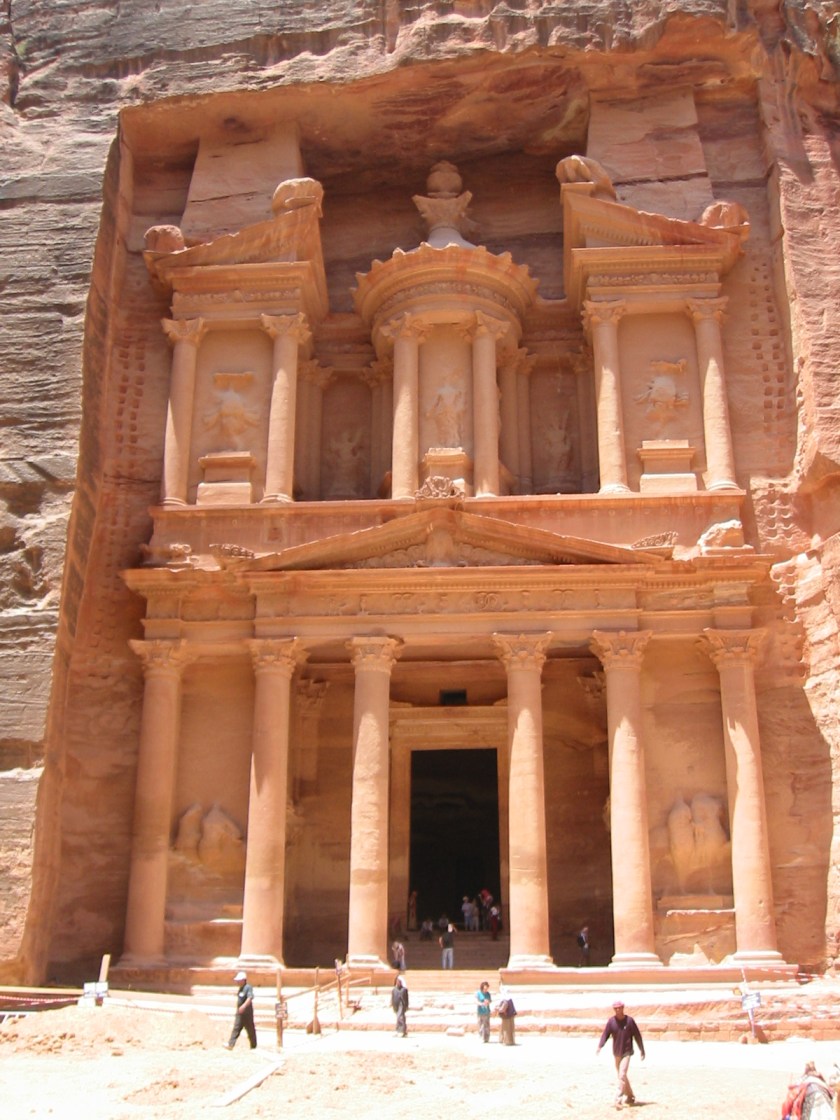
My friends, the famous, gigantic facade of Petra in Jordan was literally carved out of the sandstone rock by a people called Nabateans in the history books. Carved out of, not built on top of. Let that sink in a minute. And actually, all of the statues in the alcoves that you see have been defaced, or heads are no longer there. Imagine that!
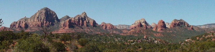
Next, is a comparison of Thunder Mountain and its companions in Sedona, Arizona in the top photo, with the bottom photo, which is of Red Rocks State Park in Nevada:
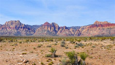
Here are photos comparing Bryce Canyon in Utah:


with the Red Rocks State Park in California


I don’t know folks – either pre-flood civilization, or nuclear blast with the way these places are so eroded, and almost look melted.
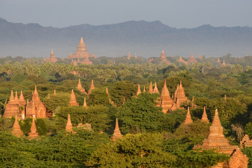
Here is a photo of a landscape full of temples in Myanmar (formerly known as Burma) – these particularly remind me of the badly eroded, spire-looking rock formations in Bryce Canyon:
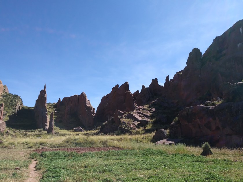
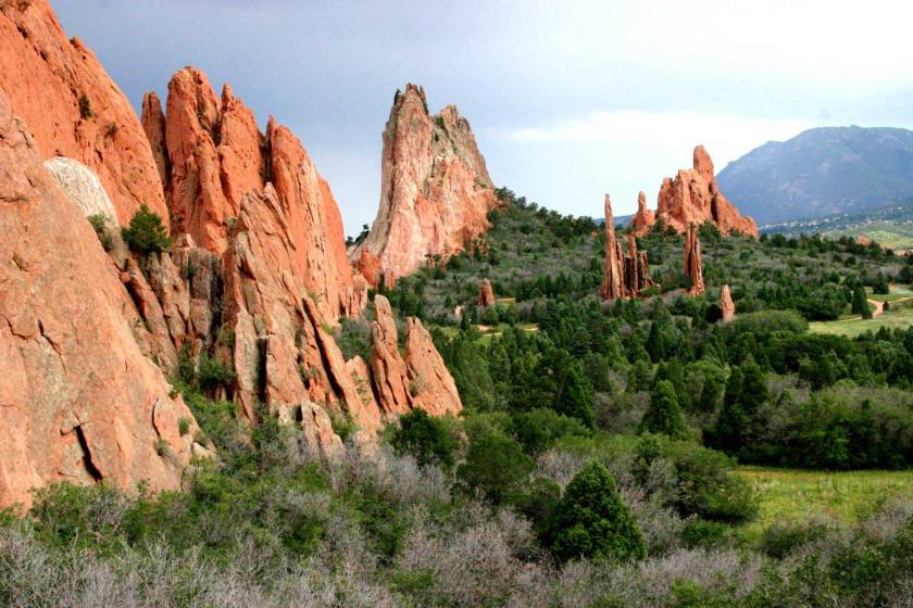
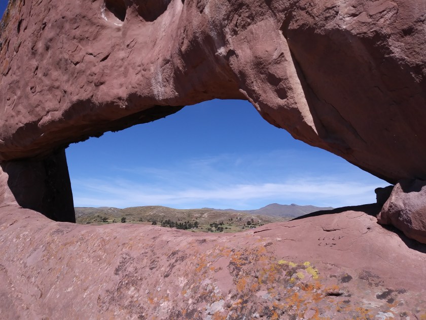
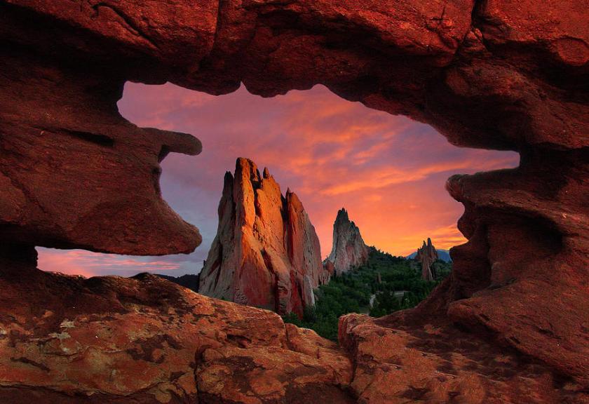
Next up are two sets of comparison photos of Amaru Muru in Peru, and the Garden of the Gods in Colorado Springs, Colorado:
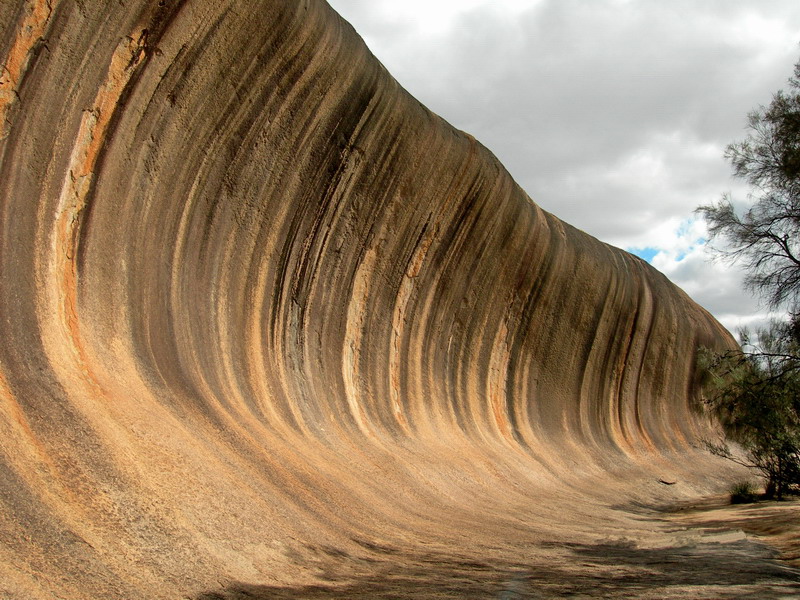
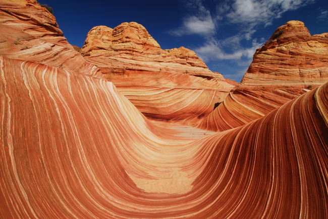
Next is a comparison of the features of The Wave in Hyden, Western Australia, and The Wave in the Vermilion Cliffs National Monument in Northern Arizona:
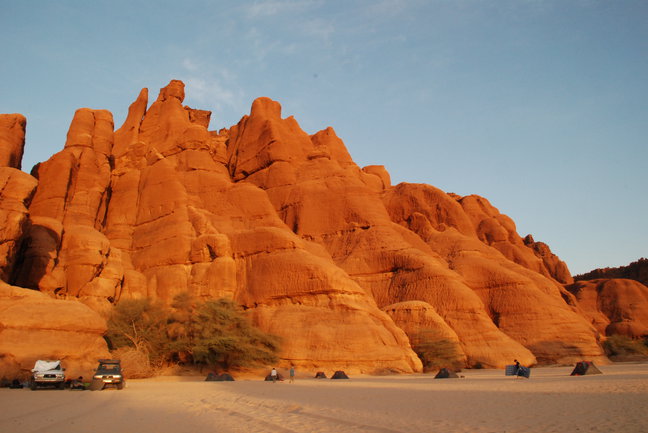
Continuing on is a comparison of what’s in Sedona, Arizona, with one of the Tibesti Mountains in Chad (which I found on more than one global long-distance alignment):


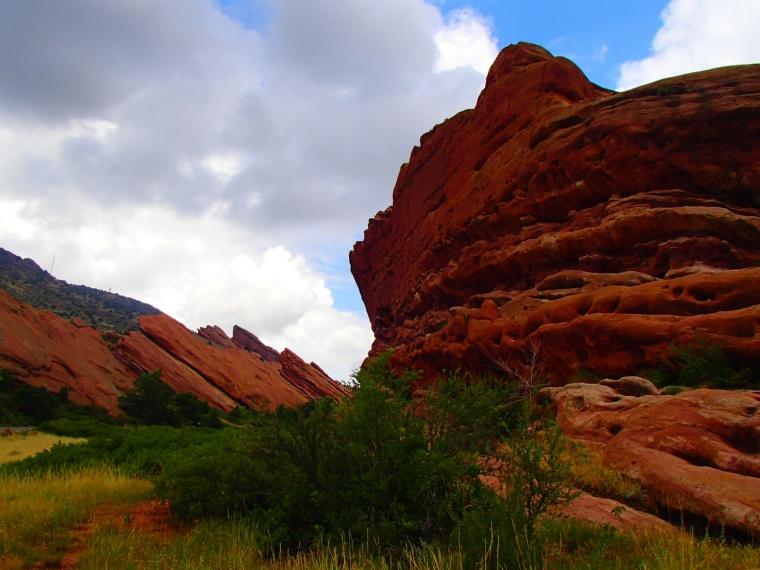
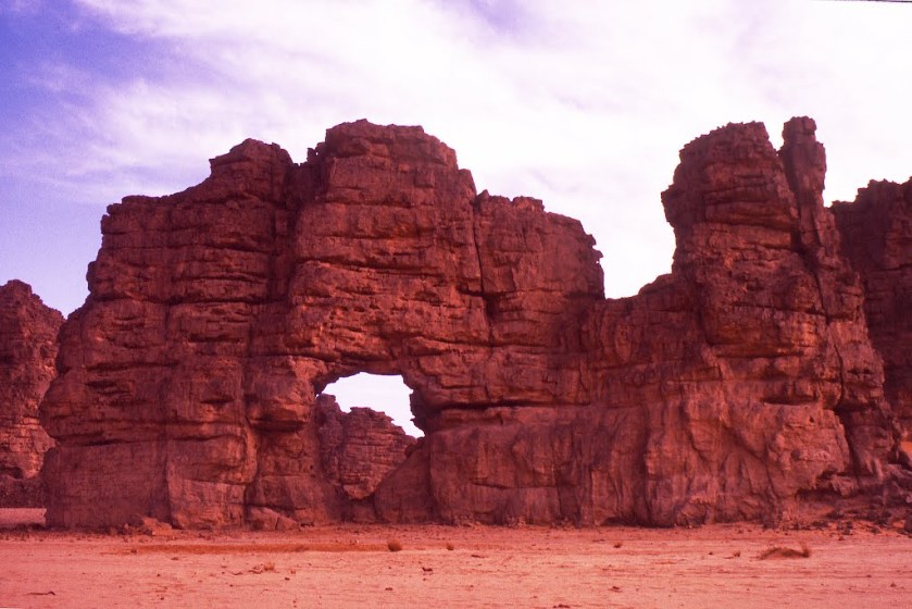
For comparison, the next three photos are of Red Rock Canyon, Wyoming; Red Rocks Park in Colorado; and Tassili n’Ajjer in Algeria:
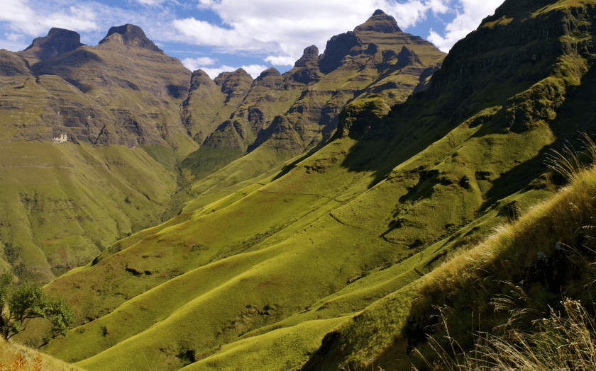
Then, a comparison of the India Deccan Plateau (which a long distance alignment transverses, and upon which there are a lot of interesting ancient civilizations archeological sites, like Hampi):


With the Drakensberg in South Africa. The Drakensberg is the name given to the eastern part of the Great Escarpment (which is another code word) enclosing the central South African Plateau:
Lastly, Sodom and Gomorrah. What happened here? Could something similar have happened elsewhere on the planet to whatever happened here?


There are more similar comparisons to be made, but this is a good stopping place for this post.

I posted this yesterday 2.15.2025 on You Tu but it was removed. I was looking at the Old Capital Building in Bismarck, North Dakota. It made no sense that there would have been a building like this when the population of the area was only less than 1,800 people at the time. https://commons.wikimedia.org/wiki/File:Old_State_Capitol_1883.png?uselang=en#Licensing
I had been looking at your Onion dome piece and look at those!
https://en.wikipedia.org/wiki/North_Dakota_State_Capitol#
The first capitol building was constructed between 1883 and 1884 (in one year when less than 2,000 people lived there!!) to house the territorial government, and after statehood, two additions were erected: the Senate wing (1894, south side), and the House wing (ca. 1903, north side). On the morning of December 28, 1930, smoke was spotted coming from the northeast part of the original building, and despite the fire department being summoned within minutes, it was too late to save the structure.
LikeLike
Thanks for posting and what you are finding is typical of what the narrative tells us, and it doesn’t make any sense!
LikeLike